FORTH & CLYDE AND UNION CANALS - Scottish Canals
FORTH & CLYDE AND UNION CANALS - Scottish Canals
FORTH & CLYDE AND UNION CANALS - Scottish Canals

You also want an ePaper? Increase the reach of your titles
YUMPU automatically turns print PDFs into web optimized ePapers that Google loves.
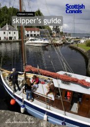
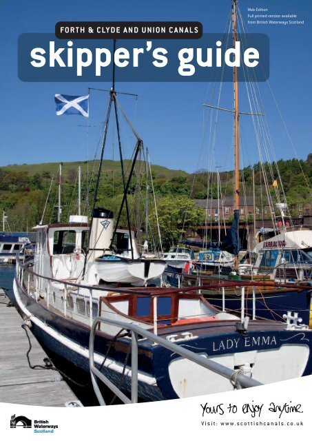
FOR TH & CLY D E <strong>AND</strong> <strong>UNION</strong> C A N A L S<br />
skipper’s guide<br />
Web Edition<br />
Full printed version available<br />
from British Waterways Scotland<br />
V isi t : www . s c o t t ish c a n als . c o .uk
GENERAL INFORMATION<br />
BOATERS H<strong>AND</strong>BOOK<br />
All licence holders are entitled to a free copy of our Boaters Handbook. Keep<br />
it on board the boat and encourage all crew members to follow it. Please ask<br />
for a copy at the sea lock or at the waterway office. The handbook contains<br />
information common to inland waterways generally, not locally specific<br />
information.<br />
OPERATING TIMES<br />
Opening times can vary throughout the season. For all the latest operating<br />
times go to www.scottishcanals.co.uk or call 0141 332 6936. Last lockings are<br />
half an hour before closing; late locking can be arranged for a fee.<br />
MAXIMUM CHANNEL DIMENSIONS<br />
All measured from the water surface. Add 10cm (4inches) to your sea water<br />
draught to compensate for reduced buoyancy in fresh water, and allow for the<br />
weight of extra equipment, fuel and water which may increase your draught.<br />
Leave a safety margin for underkeel clearance and for fluctuating water levels,<br />
which may effect channel depth and headroom. The headroom at the railway<br />
bridge below Lock 9, and at Merer’s Bridge between Locks 7 & 8, may be<br />
reduced due to increases in water flows from locks in operation upstream.<br />
Forth & Clyde:<br />
Max. Boat Length: 19.20m (63ft)<br />
Width / Beam: 6.00m (19ft 8in)<br />
Channel Depth: 1.83m (6ft)<br />
Maximum Headroom 3.00m (9ft 10in)<br />
* Slightly longer vessels, depending on their hull shape, may be accommodated.<br />
Contact 0845 676 6000 when planning passage.<br />
Forth & Clyde Canal, Glasgow Branch:<br />
Max. Boat Length: 24.2m (79ft)<br />
Width / Beam: 5.02m (16ft 6in)<br />
Channel Depth: 1.4m (4ft 6in)<br />
Maximum Headroom: 3.00m (9ft 10in)<br />
Union Canal & The Falkirk Wheel:<br />
Lock Length: 21.3m (70ft)<br />
Width: 3.5m (11ft 6in)<br />
Channel Depth: 1.07m (3ft 6in)<br />
Maximum Headroom: 2.7m (8ft 11in)<br />
The Falkirk Wheel Locks<br />
Channel Depth 1.5m (5ft)<br />
Maximum Headroom: 2.74m (8ft 10in)<br />
Golden Jubilee Lock: (Lock 3: F&C into basin)<br />
Length: 21.30m (70ft)<br />
Width / Beam: 3.83m (12ft 6in)<br />
Channel Depth: 1.50m (5ft)<br />
Max headroom: 2.74m (9ft)<br />
SHOWERS, TOILETS, WATER, REFUSE POINTS & SHORE POWER<br />
Available at locations throughout the waterway. Please refer to canal facilities<br />
grids. Access is via a British Waterways passkey, which is available from the<br />
Waterway Office or the sea locks. A refundable deposit is required.<br />
PUMP OUT FACILITIES<br />
The use of sea toilets within the waterway is prohibited. Vessels with holding<br />
tanks can use the pump-out facilities (chargeable) located throughout the<br />
waterway. Please refer to canal facilities information.<br />
FUEL<br />
Marine diesel is available at Bowling, Auchinstarry, Lock 2, the Falkirk Wheel (on<br />
F&C) and at Manse Road Basin, Linlithgow and Edinburgh Quay.<br />
Petrol & Derv can be obtained from local garages.<br />
We would remind owners to exercise care during refuelling to avoid risk of fire or<br />
pollution.<br />
CANAL LICENCES<br />
All craft using the canals must have an up to date licence on display at all times.<br />
For more information please contact the BWS office 0141 332 6936.<br />
PASSAGE TIMES – A GUIDE<br />
The Forth & Clyde Canal is 56km (31 nautical miles, 34.5 statute miles) from<br />
the River Carron Sea Lock on the Firth of Forth, to Bowling on the Firth of Clyde,<br />
and there are 39 locks to negotiate.<br />
Skippers should allow a minimum of 21 hours underway, divided approximately<br />
as follows (east to west):<br />
Carron Sea Lock (no 2) to Lock 16 6 hours<br />
Lock 16 to Auchinstarry Basin 3 hours<br />
Auchinstarry Basin to Lock 27 6 hours<br />
Lock 27 to Bowling Sea lock 6 hours<br />
Sufficient time should be allowed for passage from Port Edgar and negotiation of<br />
the River Carron to the Sea Lock.<br />
The Union Canal<br />
This canal is 51km long (31.5 nautical miles, 35 statute miles) from Lochrin<br />
Basin in Edinburgh to just above The Falkirk Wheel. It is a contour canal with<br />
only one moving structure – Leamington Lift Bridge in Edinburgh. This can be<br />
negotiated by prior arrangement with the Waterway Office.<br />
Skippers should allow a minimum of 12 hours under way,<br />
divided as follows:<br />
Lochrin Basin to Ratho Br (15) 2 hours<br />
Ratho Br to Almond Aqueduct (18) 1/2 hour<br />
Almond Aqueduct to Craigton Br (35) 2 hours<br />
Craigton Br to Linlithgow 2 hours<br />
Linlithgow to Brightons Br (54) 2 hours<br />
Brightons Br to Falkirk Wheel 2 hours<br />
CREWING REQUIREMENTS<br />
British Waterways staff will be on hand to assist at all locks and bridges on the<br />
Forth & Clyde Canal, but craft must have sufficient crew to assist staff with<br />
lockings. Faster progress will be made if each craft has more than one spare<br />
person available to work ashore. No singlehanded sailing through the locks.<br />
If you require further information on the working and manning of locks,<br />
please contact the Waterway Office. See the Bowling and River Carron sailing<br />
Instructions for further information on assistance in the approaches to the<br />
canal and in the Sea Locks.<br />
DALMUIR DROP LOCK<br />
This lock is situated near the western end of the canal at Dalmuir, and provides<br />
passage below Dumbarton Road. The lock is situated on a sharp bend on the<br />
canal and care should be taken whilst approaching from either direction. Moor<br />
outside the lock to await instructions from British Waterways staff. Minimum<br />
locking time is 40 minutes.<br />
FALKIRK TUNNEL<br />
The tunnel is narrow with room for one way traffic only. Please comply with the<br />
safety information displayed on the signs located at the tunnel entrances, and<br />
with the light signals.<br />
You must not stop in the tunnel, and unpowered craft may not navigate the<br />
tunnel.<br />
Please consult the diagram and notes in this Guide.<br />
ROUGHCASTLE TUNNEL<br />
As above, but as BW staff are on hand at this location, please accept their verbal<br />
instructions.<br />
SKIPPER’S GUIDE - NOTE<br />
This document is for the general guidance of waterway users, and should not be<br />
treated as Navigation Rules or Bye-laws. General or local instructions published<br />
by BW, and directions given by BW staff, should be followed.<br />
Publication date: January 2011
SAFETY INFORMATION<br />
GENERAL CREW SAFETY<br />
<strong>Canals</strong> are potentially hazardous environments, care should be exercised at<br />
all times. Skippers should maintain safety awareness in the canal, just as they<br />
would at sea. The ideal procedure is for life jackets to be worn at all times by all<br />
persons. No solo sailing through the locks is permitted at any time.<br />
BOAT SAFETY SCHEME<br />
All long term users of the waterway must have an up to date Boat Safety<br />
Certificate and provide evidence of insurance for £1,000,000 (one million<br />
Pounds Sterling) Third Party Liability.<br />
An information pack is available from the Waterway Office, Sea Locks or from the<br />
Boat Safety Scheme web site: www.boatsafetyscheme.com<br />
Craft entering the system by sea and berthing for no more than 28 consecutive<br />
days do not require a Boat Safety Certificate. Instead, they may be subject to a<br />
Dangerous Boat Check of gas and fuel systems, and will be required to complete<br />
a boat condition declaration.<br />
SWIMMING<br />
Although the canal may look inviting, please do not swim in it, as there may be<br />
underwater obstructions, and the banks can be steep.<br />
VHF<br />
Sea Locks: VHF Channel 16 / 74.<br />
Call signs “Bowling Basin” and “Carron Sea Lock”.<br />
VHF coverage on inland reaches is not consistent.<br />
RADAR<br />
Skippers must ensure that radar scanners are switched off while craft are in the<br />
canal, and when entering sea locks.<br />
SPEED LIMIT<br />
All craft must observe the 4mph speed limit on the waterway to avoid bank<br />
erosion by excessive wash.<br />
Please minimise disturbance to others by passing moored craft at DEAD SLOW<br />
speed.<br />
CAUTION – MAST PROJECTION<br />
Skippers of sailing craft are reminded that most masts will project beyond bow<br />
and stern. Care should be taken to leave side decks as clear of spreaders and<br />
shrouds as possible to facilitate handling warps. Please take extra care at bends<br />
whilst on passage.<br />
LOCKS and BRIDGES<br />
<strong>FORTH</strong> & <strong>CLYDE</strong> CANAL<br />
All inland locks are operated by British Waterways staff, and/or licensed users.<br />
Sufficient boat crew is required to provide assistance.<br />
MAIN OPENING BRIDGES<br />
Erskine Ferry, Sylvannia Way footbridge, Old Basin Bascule Bridge, Hillhead,<br />
Twechar and Bonnybridge bridges are hydraulically actuated, and operated by<br />
British Waterways staff. Bridge openings will not take place during peak road<br />
traffic times on week days. Automated road bridge operation is expected to take<br />
in the region of 5 to 10 minutes, depending on the number of vessels.<br />
<strong>UNION</strong> CANAL LOCKS <strong>AND</strong> BRIDGES<br />
British Waterways staff will operate the two locks above The Falkirk Wheel.<br />
Contact number 01324 676912. Mooring ropes must be used in both locks.<br />
Leamington Lift Bridge near Lochrin Basin, Edinburgh. British Waterways staff<br />
will operate this bridge by prior arrangement – see diagram.<br />
USE OF LOCKS BY PORTABLE CRAFT<br />
When unpowered and portable craft are considered too large to portage round<br />
locks they may transit through the locks. They must be warped through on<br />
ropes with no-one on board. Whenever possible such craft will be encouraged to<br />
portage round locks for safety and water economy reasons.<br />
THE ENVIRONMENT<br />
British Waterways operates a Port Waste Management Plan, agreed with the<br />
Maritime Coastguard Agency and SEPA.<br />
Please help us to keep the Lowland <strong>Canals</strong> tidy by disposing of rubbish in a<br />
thoughtful manner. In particular, plastic bags thrown overboard could block<br />
water intakes, or foul propellers.<br />
It is an offence to discharge oil, or oily bilge water, into the canal, or its adjacent<br />
waters. Any contravention of this rule will be reported to the Marine Coastguard<br />
Agency. If you require to empty bilges please contact British Waterways, who<br />
may be able to arrange for specialist contractors (at additional cost).<br />
EMERGENCIES<br />
In the event of an emergency summon assistance by whatever means is<br />
available – such as mobile ‘phone, public telephone, or by enlisting the help of<br />
others.<br />
EMERGENCY <strong>AND</strong> ACCESS NUMBERS<br />
Emergency Number (inc Coastguard) 999<br />
BW Emerg. (non office hours) 0800 47 999 47<br />
Other Useful Numbers:<br />
Lowland <strong>Canals</strong> Waterway Office 0141 332 6936<br />
Falkirk Wheel Basin Controller 01324 676912<br />
Falkirk Wheel Visitor Centre 01324 619888<br />
DO NOT PHONE THESE NUMBERS FOR ASSISTED PASSAGE<br />
ROWING<br />
Rowing clubs use the section of Union Canal from Slateford (Prince Charlie)<br />
Aqueduct to Harrison Park (between Ashley Terrace Bridge and Harrison Park<br />
Bridge). Signs cautioning boaters have been erected 500 metres E & W of this<br />
section. Please refer to the diagram and procedure detailed overleaf.<br />
SAFETY AT GRANGEMOUTH<br />
The River Carron comes within the safety zone for the Grangemouth Petroleum<br />
and Chemical Complex.<br />
In the event of a major escape of toxic gas public warning sirens will be<br />
sounded, as follows:<br />
The Alert Siren will have a two-tone sound operating continuously for 5 minutes,<br />
followed by 1 minute off. This alert cycle will be repeated for as long as it is<br />
considered necessary.<br />
The All Clear will be a Single Tone Sound and will last for 5 minutes.<br />
Anyone hearing the sirens, or without warning is affected to the point of<br />
discomfort by any gas, should immediately extinguish all naked lights and go<br />
inside shutting all doors, windows and vents.<br />
If you are under way on the River Carron, proceed to the nearest mooring point<br />
(see sailing instructions) and then follow the above procedure.<br />
The Skipper has sole responsibility for the safe navigation of the<br />
vessel in his or her charge through the canal. Specifically, the skipper<br />
is responsible for the safe passage of the vessel under bridges, and<br />
through tunnels and locks. No warranty, assurance, undertaking or<br />
representation is given or made by or on behalf of the Board regarding<br />
the safe passage of a vessel through the canal. This does not affect<br />
your statutory or common law rights.<br />
A large print version of this Guide is available<br />
for visually impaired users on application to the<br />
Lowland <strong>Canals</strong> Office.
<strong>FORTH</strong> <strong>AND</strong> <strong>CLYDE</strong> CANAL<br />
BOWLING HARBOUR NAVIGATION<br />
Sea Lock Tel: 01369 877969<br />
Fl G 2s<br />
No 45<br />
KEEP OUT!<br />
NUMEROUS HAZARDOUS<br />
OBSTRUCTIONS WEST OF THIS LINE<br />
LEADING LINE - POSTS <strong>AND</strong> WHITE TOPMARKS<br />
Training dyke (partially covers)<br />
Mud<br />
Fl R 2s<br />
No 78<br />
LEADING LINE - POSTS <strong>AND</strong> WHITE TOPMARKS<br />
Mud<br />
RUINED BREAKWATER (PARTIALLY COVERS)<br />
Fl G 2s<br />
Longhaugh<br />
CAR PARKING<br />
Mud<br />
Mud<br />
Mast<br />
crane<br />
Toilets and Showers<br />
Unused<br />
Lock<br />
Dunglass<br />
Fl R 2s<br />
Fl G 5s<br />
No 43<br />
BOWLING INFORMATION<br />
• Radio: VHF Ch 16/74 “Bowling Basin” during sealock opening hours 2h–HW–2h only. Otherwise<br />
telephone: 01389 877969. Locking should be booked in advance.<br />
• The western part of Bowling harbour is hazardous due to a large number of unmarked wrecks.<br />
The eastern part has been cleared (see diagram).<br />
• Follow lock keepers instructions when entering lock, normally mooring on the port side. Two long<br />
warps and 3–4 fenders will be needed. A canvas sheet between the fenders and the hull will<br />
help reduce scuffing. BW staff will operate the lock.<br />
• BW operated mast crane available at Bowling. Boat crew must carry out all mast work.<br />
• Boat Safety Checks will be carried out at the Sea Lock prior to entry.<br />
• Canal Licences can be purchased at the Sea Lock.<br />
• For further details see General Information Card.<br />
Office<br />
Disused Rail Bridge<br />
Former<br />
Shipyard<br />
Bascule Bridge<br />
(3.0m+ when closed)<br />
ESTUARY INFORMATION<br />
• Vessels intending to proceed to or from Bowling Harbour via the River Clyde are required to<br />
contact Estuary Control (VHF Ch 12 or 01475 726221).<br />
• Clydeport’s Marine Leisure Guide (free from marinas etc) contains comprehensive<br />
information.<br />
Arriving from seaward: Contact Estuary Control (EC) prior to arrival at No 1 River Buoy off<br />
Greenock Container Terminal.<br />
Arriving from any other location on the River Clyde east of No 1 buoy (ie between Greenock<br />
and Glasgow): Contact EC before leaving your berth or before entering the River Clyde<br />
Channel.<br />
Departing Bowling Harbour: Contact EC prior to departure.<br />
• Keep to the buoyed Clyde navigation channel, and maintain a look-out for shipping.<br />
• Monitor VHF Ch12.<br />
• Charts: Admiralty Chart 2007 and/or Imray Chart C63. Pilots: CCC Firth of Clyde Sailing<br />
Directions; Imray Yachtsman’s Pilot - Clyde to Colonsay.<br />
Bowling Breakwater Fl R 4s<br />
CAUTION: These chartlets are for guidance - do not scale or use for navigation.<br />
Fl G 2s<br />
No 45<br />
Toilets and Showers<br />
Spring 2004
High level o/h<br />
power lines<br />
Manoeuvering Area<br />
Depth/air gauge (for<br />
Kerse Bridge)<br />
SEA LOCK (2)<br />
LOCK 4 (approx 1 km)<br />
<strong>FORTH</strong> <strong>AND</strong> <strong>CLYDE</strong> CANAL<br />
RIVER CARRON NAVIGATION<br />
LOCK 3<br />
Sea Lock Tel: 01324 483034<br />
New<br />
canal<br />
section<br />
Pontoons<br />
outside<br />
sealock<br />
MOTORWAY BRIDGE<br />
PIPE BRIDGE<br />
Original canal line<br />
Depth/air gauge<br />
for Kerse Bridge<br />
KERSE ROAD BRIDGE<br />
NO CHANNEL<br />
Shallows<br />
Depth/air gauge<br />
for Kerse Bridge<br />
= Coloured Piles<br />
NO CHANNEL<br />
PILOTAGE NOTES<br />
• Passage must be booked in advance.<br />
• Sea Lock - 4 hrs before to 1h30 after HW, 0800-2000 and daylight hours.<br />
• Craft on passage can call the Sea Lock on VHF Ch 74, callsign “Carron Sea Lock”.<br />
• Consult the Carron Tidal Information page before planning your passage up or downstream.<br />
• Masts should be unstepped before navigating upstream of Jarvie’s Quay.<br />
• The Kerse Road Bridge has approx 5.0 metres (16.5ft) from river bed to bridge underside, and the<br />
highest point of the river bed is at +2.3CD. It is the critical point in the navigation.<br />
• Tide and headroom gauges in the R Carron refer to the Kerse Road Bridge. Their tops are level with the<br />
underside of the Kerse Road Bridge.<br />
• The Carron dries at LW. The bed is flat gravel, the banks are steep, soft mud.<br />
• Temporary berthing at Grangemouth YC (only by arrangement), or at the refuge posts nearby.<br />
• BW staff will be available to assist and direct craft on passage.<br />
• Boat Safety Checks will be carried out at the Sea Lock pontoon prior to entry.<br />
• Canal Licences can be purchased at the Sea Lock.<br />
• For further details see General Information (below).<br />
PIPE BRIDGE<br />
NO CHANNEL<br />
Upstream course<br />
(avoiding shallows)<br />
NO CHANNEL<br />
N<br />
Depth/air gauge<br />
for Kerse Bridge<br />
MUD FLATS<br />
JARVIE’S<br />
QUAY<br />
KERSE BRIDGE<br />
CHANNEL MARKINGS<br />
Depth/air gauge<br />
for Kerse Bridge<br />
SLOW<br />
Grangemouth<br />
YC<br />
MAST CRANE PONTOON<br />
• The de-masting pontoon in the River<br />
Carron is privately operated and<br />
must be booked in advance; before<br />
1600 on Friday for weekends. Tel:<br />
07833 953288.<br />
• If you cannot keep your<br />
appointment, please ’phone to<br />
advise.<br />
• Skippers are responsible for all<br />
rigging operations on their vessel.<br />
• The crane must not be used by any<br />
unauthorised person.<br />
• If mooring alongside check that the<br />
pontoon will not be required by other<br />
vessels.<br />
• The pontoon is not suitable for an<br />
overnight stay.<br />
BREAKWATER / TRAINING BANK WITH BOLLARDS <strong>AND</strong> BEACONS<br />
CAUTION: These chartlets are for guidance - do not scale or use for navigation.<br />
GRANGEMOUTH DOCKS<br />
Refuge mooring piles<br />
MUD FLATS<br />
SLOW<br />
Waiting anchorages<br />
(dependant on depth)<br />
Carron Beacon<br />
Fl G 5s<br />
Pass all Port and<br />
Starboard buoys close<br />
on proper hand<br />
GRANGEMOUTH<br />
DOCKS<br />
Carron<br />
Approach<br />
Fl(4)R 12s
PILOTAGE NOTES<br />
• Passage from the River Carron entrance to the Forth & Clyde Canal Sea Lock is<br />
restricted by depth and overhead obstructions. Consult the Tides and Currents<br />
Information below, and the Tidal Predictions for Carron Sea Lock.<br />
• Once the Carron access time window has been established, allow sufficient<br />
time for the passage (10 miles from Forth Road Bridge/ Port Edgar) to the river<br />
mouth, and then to the Sea Lock (a further 2.5 miles).<br />
• Passage from Port Edgar/ Forth Bridges to the Torry Beacon may be made either<br />
on the north or south side of the main shipping channel.<br />
• West of the Hen & Chickens the N side must be used.<br />
• Vessels should monitor Grangemouth Docks on VHF Ch 14, but do not need to<br />
report, except in case of emergency or difficulty.<br />
• Ships may cross the mouth of the River Carron on their approach to the Western<br />
Jetty.<br />
• If tugs are waitng in the fairway, a large vessel may be due. Keep well clear and<br />
beware of wash.<br />
• Small craft may anchor in the positions shown, or in the mouth of the River<br />
Carron as depth permits, to await the tide.<br />
• Charts: Admiralty Chart 737 and/or Imray Chart C27. Pilot: Forth Yacht Clubs’<br />
Association Pilot Handbook.<br />
RIVER CARRON TIDES<br />
At spring tides the mid-tide level is rising at around 1.6m per hour and on the ebb will<br />
fall at up to 2.0m per hour. The combination of rapidly changing levels and strong<br />
currents makes accurate timing of your passage, especially during spring tides,<br />
important. At neap tides the pattern is similar, but the range is less and one will be<br />
navigating near High Water (HW) rather than at half tide, the problem is much less<br />
acute. In general this is the easiest and safest time to make the passage.<br />
The current in the river may be up to 2 knots on a spring flood and more, depending<br />
on river conditions, on the ebb.<br />
HEIGHT <strong>AND</strong> DEPTH LIMITS<br />
Navigation is constrained by the headroom under the 4 fixed bridges over the River<br />
Carron, and by the depth at shallow points between the sea and the sea lock.<br />
There is approximately 1.8m depth and 3.0m air draft (headroom) under the Kerse<br />
Road bridge - these being the canal dimensions - when the rise of tide Chimney is 4.15m<br />
above Chart Datum (CD), but to simplify matters depth and air draft gauges (185m) have<br />
been installed at various points on the river.<br />
GOING UPSTREAM<br />
NEAP TIDES (less than 5.0m, HW around 0900/2100 UT)<br />
The optimum tide level will probably occur between 1.5 and 2.5 hours before HW,<br />
and again approximately 1.0 hour after HW. Tidal current will be slight. As a general<br />
L Fl G 10s<br />
rule skippers should begin the up river passage on a flood tide as soon as they<br />
consider that there is sufficient depth.<br />
SPRING TIDES (more than 5.0m, HW occurring around 0300/1500 UT)<br />
The optimum tide level will probably occur between 3.0 and 3.5 hours before HW,<br />
and again approximately 2.0 hours after HW. Tidal current will be strong.<br />
For more information consult the LOWL<strong>AND</strong> <strong>CANALS</strong> TIDE TABLES (£1), available from<br />
Lowland <strong>Canals</strong> office and sea-locks.<br />
Carron Beacon<br />
Fl G 5s<br />
RIVER<br />
CARRON<br />
Diffusers<br />
Carron Approach<br />
Fl(4)R 12s<br />
Western<br />
Jetty<br />
Longannet<br />
Power<br />
Station<br />
Longannet<br />
Power Station<br />
Grangemouth<br />
Docks<br />
SMALL CRAFT ANCHORAGE<br />
Culross<br />
Hen &<br />
Chickens<br />
<strong>FORTH</strong> <strong>AND</strong> <strong>CLYDE</strong> CANAL<br />
APPROACHES TO GRANGEMOUTH<br />
<strong>AND</strong> THE RIVER CARRON<br />
Grangemouth W<br />
QG<br />
Grangemouth SW<br />
Fl(2)R 5s<br />
SHIP MANOEUVERING AREA – KEEP OUT<br />
Bo’ness<br />
Grangemouth NW<br />
Fl Y 2s<br />
No 4<br />
Fl G 2s<br />
No 5<br />
Fl R 2s<br />
Torry<br />
SMALL CRAFT RECOMMENDED TRACKS<br />
Grangemouth NE<br />
Fl Y 5s<br />
No 3<br />
Fl R 5s<br />
Carriden<br />
Beacon<br />
No 2<br />
Fl G 5s<br />
Crombie<br />
Pier<br />
CAUTION: These chartlets are for guidance - do not scale or use for navigation.<br />
FIRTH OF <strong>FORTH</strong><br />
Charlestown<br />
Blackness<br />
Castle<br />
SHIP MANOEUVERING AREA – KEEP OUT<br />
Limekilns<br />
Keep close when<br />
passing to N<br />
No 1<br />
Fl(3)R 20s<br />
Rosyth<br />
SMALL CRAFT<br />
SUGGESTED TRACKS<br />
Port Edgar<br />
Hen & Chickens<br />
Hen & Chickens<br />
Fl(3)G 20s<br />
CAUTION:<br />
SHIP COURSES ARE<br />
CONSTRAINED BY DEPTH
<strong>FORTH</strong> & <strong>CLYDE</strong> CANAL<br />
<strong>FORTH</strong> & <strong>CLYDE</strong> CANAL<br />
FACILITIES <strong>AND</strong><br />
DISTANCES<br />
[Dis tances are<br />
approximate,<br />
to neare s t mile]<br />
Visitor Mooring<br />
Water<br />
Shorepower<br />
Refuse disposal<br />
Parking<br />
Toilets<br />
Shower<br />
Elsan Disposal<br />
Pump-out<br />
Slipway<br />
Fuel (diesel)<br />
Information<br />
Pub (nearby)<br />
Restaurant<br />
Boat hire<br />
Places of Interest<br />
Miles to<br />
Grangemouth<br />
Bowling<br />
Dalmuir<br />
Clydebank<br />
<strong>FORTH</strong> & <strong>CLYDE</strong> CANAL INFORMATION<br />
CASH POINTS, POST OFFICES, SHOPS<br />
Within 10 minutes walk:Drop Lock - east on<br />
Dumbarton RoadArgyle Road Bridge, Clydebank<br />
(shopping complex)Lock 32 - <strong>Canals</strong>ide shopBard<br />
Ave Bascule Br - <strong>Canals</strong>ide shopLock 27 - S along<br />
Crow Rd to Morrisons and other shopsApplecross<br />
St - 15 mins walk to Glasgow centreKirkintilloch - all<br />
main street shops adjacent to canal<br />
Auchinstarry Basin - in Kilsyth (20 min walk)<br />
Bonnybridge - N on A803<br />
Lock 16 - Nearby, and N on Camelon Main Street<br />
Lock 5 - S into Falkirk town centre<br />
Lock 2 - service station shop at M9 junction 6<br />
FUEL ADJACENT TO CANAL<br />
Service stations near Dalmuir Lock and Lock 27<br />
Bonnybridge - N on A803 - 01324 813708<strong>Canals</strong>ide<br />
Diesel - Bowling; Auchinstarry; F&C at Falkirk Wheel;<br />
Grangemouth<br />
Temple Locks<br />
Stockinfield Junct<br />
Applecross St<br />
Spiers Wharf<br />
Glasgow Rd Br<br />
Southbank Marina *<br />
Kirkintilloch<br />
35 32 30 27 25 27 28 21 20 19 14 13 10 8 6 4 3 2 0<br />
0 3 5 8 10 12 13 14 15 16 21 22 25 27 29 31 32 33 35<br />
*not operated by BW<br />
<strong>CANALS</strong>IDE PUB RESTAURANTS<br />
Clydebank: McMonagle’s Sail Thru’ Fish & Chips<br />
(advance orders 0141 951 2444). Pizza Hut /<br />
MacDonalds within Clydebank Retail Park.Temple:<br />
Lock 27Glasgow Road Bridge: The Stables<br />
Auchinstarry Marina: The Boathouse<br />
Lock 20: Glenskirlie House HotelLock 17 - Bar 17 &<br />
Underwood Lock HouseBonnybridge: Cornhill Inn;<br />
Royal Hotel (5mins N of bridge)The Falkirk Wheel:<br />
Visitor Centre Café & Wheelhouse<br />
Lock 16: The Union InnLock 15: The Canal InnLock<br />
11: The Rosebank BeefeaterLock 5: Bar &<br />
RestaurantNote: Please ask BW staff for advice on<br />
all local facilities.<br />
PUBS WITHIN A FEW MINUTES WALK<br />
Bowling: The Railway Inn & The Littlemill<br />
InnApplecross St: 15 mins walk to Glasgow<br />
centreKirkintilloch: Bar Bliss; The Kirky Puffer<br />
Auchinstarry<br />
Craigmarloch<br />
Wyndford (L20)<br />
Underwood (L17)<br />
Bonnybridge<br />
Falkirk Wheel<br />
Camelon (L16)<br />
Bainsford (L5)<br />
Grangemouth (L2)<br />
BOAT REPAIRS <strong>AND</strong> SERVICES<br />
CH<strong>AND</strong>LERS<br />
Hulley Marine, Dumbarton 01389 742438<br />
Duncan Yacht Chandlers, Glasgow 0141 429 6044.<br />
Side Hatch, Auchinstarry. 01236 826080ENGINE<br />
REPAIRS<br />
J N Macdonald & Co. 0141 810 3400<br />
Forth Yacht Marina, Grangemouth. 01324<br />
665071Kelvin Marine, Grangemouth. 01324 471535<br />
& 07833 953288<br />
Douglas & Thorburn, Larbert. 01324 551166 & 0784<br />
0 969120<br />
VISITOR MOORINGS<br />
See facilities grid and chart
M8<br />
KEY<br />
N<br />
BW operated opening bridge<br />
Fixed footbridge<br />
Rail Station<br />
Visitor Mooring<br />
Winding Hole with length<br />
Pub / Restaurant<br />
Slipway<br />
Bowling Old Railway Bridge<br />
Bowling<br />
Basin &<br />
Sealock<br />
Ferrydyke<br />
Bascule<br />
Bridge<br />
Bowling<br />
Bascule<br />
Bridge Lock 38<br />
Ferry<br />
Erskine<br />
Bridge<br />
Lock 37<br />
Road<br />
Bridge<br />
Dalmuir<br />
Drop Lock<br />
40<br />
Bowling<br />
Farm Road<br />
Bascule Bridge<br />
<strong>FORTH</strong> & <strong>CLYDE</strong> CANAL<br />
ASSISTANCE<br />
Assistance through locks and bridges<br />
0845 676 6000<br />
Old Kilpatrick<br />
Dalmuir<br />
Trafalgar Street<br />
Pedestrian Bridge<br />
Kilbowie<br />
Road<br />
Bridge<br />
Sylvania<br />
Way Footbridges<br />
(2)<br />
Argyll<br />
Road<br />
Bridge<br />
Clydebank<br />
Duntreath<br />
Avenue<br />
Bridge<br />
Linnvale<br />
Bascule<br />
Bridge<br />
Lock 32<br />
Footbridge<br />
A82<br />
Boghouse<br />
Locks 33-36<br />
Footbridges<br />
Boghouse<br />
Locks 33-36<br />
& Footbridges<br />
Cloberhill<br />
Locks<br />
28-32<br />
Bard<br />
Avenue<br />
Bridge<br />
A814<br />
Bearsden<br />
Great Western<br />
Rd Bridge<br />
Anniesland<br />
Netherton<br />
Swingbridge<br />
Westerton<br />
Footbridge<br />
Spencer<br />
Street<br />
Bridge<br />
Temple<br />
Rd Br<br />
Lock 27<br />
Footbridge<br />
Temple<br />
Locks<br />
26-27
KEY<br />
Cleveden<br />
Road Bridge<br />
Maryhill<br />
Maryhill<br />
Locks<br />
21-25<br />
Kelvin<br />
Aqueduct<br />
A879<br />
(Glasgow Branch:<br />
depth 1.4m)<br />
N<br />
BW operated opening bridge<br />
Fixed footbridge<br />
Rail Station<br />
Visitor Mooring<br />
Winding Hole with length<br />
Pub / Restaurant<br />
Slipway<br />
Stockingfield<br />
Junction<br />
Lambhill<br />
Bridge<br />
GLASGOW<br />
Ruchill<br />
40<br />
Lambhill<br />
Balmuildy<br />
Bridge<br />
Bishopbriggs<br />
<strong>FORTH</strong> & <strong>CLYDE</strong> CANAL<br />
Cadder<br />
Bridge<br />
Ruchill<br />
Street<br />
Bridge<br />
Torrance<br />
Murano Street<br />
Footbridge<br />
Firhill Road<br />
(Nolly) Bridge<br />
Townhead<br />
Bridge<br />
Hungryside<br />
Bridge<br />
Old Basin Bascule Bridge<br />
and BW Scotland HQ<br />
CAUTION<br />
Southbank Marina.<br />
DEAD SLOW<br />
Nicholson<br />
Bridge<br />
A803<br />
Glasgow<br />
Road<br />
Bridge<br />
Hillhead<br />
Bridge<br />
Southbank Marina<br />
Kirkintilloch<br />
Pipe bridge<br />
Seagull<br />
Trust<br />
Base
A803<br />
R Kel v i n<br />
Tintock<br />
(white cottages)<br />
Twechar<br />
Twechar<br />
Bridge<br />
Shirva Stables<br />
(derelict)<br />
<strong>FORTH</strong> & <strong>CLYDE</strong> CANAL<br />
CAUTION<br />
DEAD SLOW when passing<br />
Auchinstarry Marina<br />
Kilsyth<br />
Auchinstarry<br />
Bridge<br />
Auchinstarry<br />
Marina<br />
Strone Point<br />
Croy<br />
KEY<br />
N<br />
BW operated opening bridge<br />
Fixed footbridge<br />
Rail Station<br />
Visitor Mooring<br />
Winding Hole with length<br />
Pub / Restaurant<br />
Slipway<br />
Craigmarloch<br />
Bridge<br />
Kel vinhead<br />
Dullatur Marsh - SSSI<br />
King’s Seat<br />
40<br />
CAUTION<br />
DEAD SLOW when crossing<br />
Red Burn aqueduct<br />
Possible Underwater<br />
Obstruction<br />
A80<br />
Bridge<br />
Wyndford<br />
Bridge Banknock<br />
A80<br />
Wyndford<br />
Lock 20<br />
Castlecary<br />
Bridge<br />
Castlecary<br />
Locks 18-19
M80<br />
Castlecary<br />
Locks 18-19<br />
Bonnybridge<br />
Lifting<br />
Bridge<br />
Bonny Water<br />
Underwood<br />
Lock 17<br />
& Footbridge<br />
CAUTION<br />
DEAD SLOW when passing<br />
Falkirk Wheel<br />
Bonnybridge<br />
R Carron<br />
The<br />
Falkirk<br />
Wheel<br />
Lock 3 to<br />
Union Canal<br />
Depth 1.5m<br />
Footbridge<br />
ASSISTANCE<br />
Assistance through locks and bridges<br />
0845 676 6000<br />
Falkirk Flight<br />
Locks 6–16<br />
Camelon<br />
Lock 16<br />
Roadbridge<br />
Larbert<br />
16<br />
14<br />
15<br />
Lock 14<br />
Footbridge<br />
<strong>FORTH</strong> & <strong>CLYDE</strong> CANAL<br />
Bainsford<br />
Bridge &<br />
Lock 5<br />
8<br />
9<br />
10<br />
11<br />
13<br />
12<br />
Camelon<br />
Bridge<br />
KEY<br />
7<br />
Railway<br />
Bridge<br />
6<br />
Sea Lock 2<br />
Carron Cut<br />
Lock 3<br />
Abbotshaugh<br />
Lock 4 &<br />
Footbridge<br />
Merers<br />
Bridge<br />
Falkirk<br />
N<br />
BW operated opening bridge<br />
Fixed footbridge<br />
Rail Station<br />
Visitor Mooring<br />
Winding Hole with length<br />
Pub / Restaurant<br />
Slipway<br />
Orchardhall<br />
Bridge<br />
40<br />
M90
VOYAGING THROUGH THE FALKIRK WHEEL<br />
1] There is no extra charge for BW licence holders who wish<br />
to take their craft through the Wheel.<br />
2] You should contact the Basin Controller on 01324 676912<br />
up to 24 hours in advance to book your time. Giving us<br />
notice will speed your transit.<br />
3] Skippers approaching on the Union Canal should ‘phone<br />
01324 676912 to re-confirm when exiting the Falkirk Tunnel,<br />
and indicate if continuing E or W on the F&C Canal. This will<br />
enable Locks 1 & 2 to be prepared.<br />
4] Skippers approaching from the F&C Canal should ‘phone<br />
to re-confirm when leaving Lock 16 (westbound) or<br />
Bonnybridge (eastbound).<br />
5] Pre booked transits of the Falkirk Wheel are available.<br />
Please check opening times as these vary throughout the<br />
year.<br />
ROUTE OPTIONS FOR LICENCE HOLDERS<br />
These are from one canal to the other either direction.<br />
Basin Control Office<br />
Toilets & Showers<br />
New Port Downie<br />
01324 671217<br />
Forth &<br />
Clyde<br />
Canal<br />
Lock 3<br />
The Golden Jubilee Lock<br />
(Fixed 2.74m (9ft) footbridge at N end)<br />
VISITOR CENTRE<br />
(01324 619888)<br />
Tourist Information Office<br />
Information Desk<br />
Exhibition Area<br />
Shop<br />
Café<br />
Ticket Office<br />
Toilets<br />
Slipway<br />
Slip Jetty<br />
Gondola in<br />
upper<br />
position<br />
Gondola entry<br />
when ascending<br />
MAXIMUM DIMENSIONS<br />
GOLDEN JUBILEE LOCK 3<br />
(From Forth & Clyde Canal to Basin)<br />
Length: 22.05m (73ft)<br />
Width: 3.8m (12ft 2ins)<br />
Depth: 1.28m (4ft 1in) Headroom: 2.74m (9ft)<br />
Water levels fluctuate – allow adequate draft tolerance.<br />
FALKIRK WHEEL BASIN<br />
Overnight moorings subject to availability.<br />
Gondola in<br />
lower<br />
position<br />
Falkirk Wheel<br />
Aqueduct<br />
Finger Jetty<br />
MAXIMUM DIMENSIONS<br />
<strong>UNION</strong> CANAL <strong>AND</strong> FALKIRK WHEEL<br />
Length: 21.3m (70ft)<br />
Width: 3.5m (11ft 6ins)<br />
Union Canal Depth: 1.0m (3ft)<br />
Wheel & Roughcastle Tunnel Depth: 1.5m (5ft)<br />
Water levels fluctuate – allow adequate draft tolerance.<br />
Roughcastle Tunnel (150m) leading to:<br />
Locks 1 & 2; South Basin<br />
Waiting berths<br />
North Basin<br />
OPERATIONS <strong>AND</strong> SAFETY<br />
For your own safety you must obey the instructions given by<br />
the BW staff who manage the site equipped with CCTV, traffic<br />
lights, radio and PA systems to help them.<br />
The locks and swing bridge are normally operated by BW staff<br />
and will be locked when unattended. Staff will guide users into<br />
the Gondolas and during the 15-minute rotation you must not<br />
leave the vessel.<br />
Assistance may be available from BW staff.<br />
POINTS TO NOTE<br />
• Each Gondola is controlled by an operator, whose instructions<br />
must be followed.<br />
• The operator will select vessels to make optimum use of<br />
Gondola capacity.<br />
• Have your stern and bow lines ready to control the vessel in<br />
the Gondola.<br />
• Do not allow anyone near the bow or stern when these are<br />
adjacent to the north end of the Gondola.<br />
• Do not leave the vessel except if directed, or in an emergency.
<strong>UNION</strong> CANAL<br />
<strong>UNION</strong> CANAL<br />
FACILITIES <strong>AND</strong><br />
<strong>UNION</strong> CANAL<br />
DISTANCES<br />
FACILITIES <strong>AND</strong><br />
[Dis tances are<br />
Wheel<br />
DISTANCES<br />
approximate,<br />
to [Dis neare tances s t mile] are<br />
Falkirk Wheel<br />
approximate,<br />
Visitor to neare Mooring s t mile] Falkirk<br />
Water Visitor Mooring<br />
Shorepower<br />
Water<br />
Refuse Shorepower disposal<br />
Parking Refuse disposal<br />
Toilets Parking<br />
Shower<br />
Toilets<br />
Shower<br />
Elsan Disposal<br />
Elsan Disposal<br />
Pump-out<br />
Pump-out<br />
Slipway<br />
Slipway<br />
Fuel (diesel)<br />
Fuel (diesel)<br />
Information<br />
Information<br />
Pub (nearby)<br />
Pub (nearby)<br />
Restaurant<br />
Restaurant<br />
Boat Boat hire hire<br />
Places Places of of Interest Interest<br />
Miles Miles to to Edinburgh<br />
Miles Miles to to Falkirk<br />
Greenbank Greenbank<br />
<strong>UNION</strong> CANAL INFORMATION<br />
CASH POINTS, POST OFFICES, SHOPS Within 10 minutes walk.Falkirk Town Centre<br />
- 1.2km from Walkers Bridge (62), or bus from Falkirk Wheel<br />
Tesco: E of Bridge 55<br />
Brightons - S of Bridge 54<br />
Linlithgow - N of Manse Rd BasinWinchburgh High St (N of Br 32)<br />
Port Buchan (S of Br)<br />
RathoWester Hailes Shell Garage S of Br 7<br />
N of Ashley Terrace Bridge<br />
CANAL SIDE SHOPLinlithgow Union Canal Society (LUCS): Tearoom, Gift Shop and<br />
Museum at Manse Road Basin. (open 7 days July & August; otherwise 2–5pm<br />
Sats & Suns). 01506 842559<br />
VISITOR MOORINGS<br />
See facilities grid and chart<br />
PUBS/RESTAURANTS WITHIN 10 MINS WALKFalkirk: Many pubs, cafés and<br />
restaurants in town centre<br />
Linlithgow Linlithgow Basin Basin<br />
LUCS LUCS * *<br />
Park Park Farm Farm<br />
Winchburgh Winchburgh<br />
Port Buchan Port Buchan<br />
Drumshoreland<br />
Drumshoreland<br />
Ratho Basin<br />
Ratho Basin<br />
Harrison Park<br />
Harrison Park<br />
Edinburgh Quay<br />
Edinburgh Quay<br />
34 33 22 22 16 15 15 13 13 12 12 88 1 1 0 0<br />
0 1 12 12 18 19<br />
21 21 22 22 26 26 33 33 34 34<br />
*not operated by by BW BW<br />
Polmont & Brightons: Cadgers Brae; The Black BullLinlithgow: The Star & Garter<br />
Hotel; The Auld Hole I’ The Wa’; The Four Marys; other cafés & restaurants<br />
nearbyWinchburgh: Tally Ho Inn<br />
Port Buchan: The Grenadier Bar.<br />
Ratho: The Bridge Inn<br />
Edinburgh Quay: short walk or bus trip to city centre<br />
BOAT REPAIRS <strong>AND</strong> SERVICESForth Yacht Marina, Grangemouth. 01324<br />
665071Kelvin Marine, Grangemouth. 01324 471535 & 07833 953288<br />
Douglas & Thorburn, Larbert. 01324 551166 & 0784 0 969120LUCS, Linlithgow.<br />
See above<br />
The Bosun’s Locker, Port Edgar 0131 331 4496<br />
Sea Span, Granton 0131 552 2224
Falkirk<br />
Interchange<br />
Lock and<br />
Footbridges<br />
KEY<br />
The<br />
Falkirk<br />
Wheel<br />
Falkirk<br />
Wheel<br />
Top Locks<br />
1 & 2<br />
Station<br />
House<br />
Bridge<br />
Greenbank<br />
Aqueduct<br />
Camelon<br />
18<br />
Larbert<br />
Seagull<br />
Trust<br />
Base<br />
62 Walkers<br />
Bridge<br />
Falkirk<br />
Tunnel<br />
61 Glen High<br />
(Laughin’/Greetin’)<br />
Bridge<br />
River Carron<br />
40<br />
Falkirk<br />
60 Glen Low<br />
B8028<br />
Bridge<br />
59 Huts<br />
Bridge<br />
Callendar<br />
Park<br />
58 & 57<br />
Easter & Wester<br />
Purliehill Bridges<br />
56 Redding<br />
Bridge<br />
(perm open)<br />
Grangemouth<br />
M9<br />
A803<br />
54 Brightons<br />
Bridge<br />
55 Blairlodge<br />
Bridge<br />
This map is based upon Ordnance Survey material with the permission of Ordnance Survey on behalf of the Controller of Her Majesty's Stationery<br />
Office © Crown copyright. Unauthorised reproduction infringes Crown copyright and may lead to prosecution or civil proceedings. British Waterways,<br />
100019843, 2006.<br />
N<br />
BW operated opening bridge<br />
Fixed footbridge<br />
Rail Station<br />
Visitor Mooring<br />
Winding Hole with length<br />
Pub / Restaurant<br />
Slipway<br />
40<br />
27<br />
22<br />
28<br />
46<br />
<strong>UNION</strong> CANAL<br />
19<br />
Polmont<br />
22<br />
53 Battock<br />
Bridge<br />
Brightons<br />
WINDING HOLES<br />
Turning places on the Union Canal are<br />
shown by a white circle with the<br />
available length indicated in metres: 17
The Falkirk Tunnel is a narrow tunnel with room for one<br />
way traffic only.<br />
Please comply with the safety information signs and the<br />
light signals displayed at each end of the tunnel.<br />
PREPARATION<br />
Switch on your headlight, navigation lights and some<br />
interior lights.<br />
Whoever is steering should have a waterproof torch, and<br />
put on some waterproof clothing.<br />
TRAFFIC LIGHTS<br />
FIXED RED = Tunnel clear of traffic. Proceed towards the<br />
entrance with caution.<br />
The light will change to FIXED GREEN as you pass the<br />
sensor, confirming that you are clear to proceed.<br />
FLASHING RED = Boat, or several boats, approaching in the<br />
tunnel. Wait, (moored) clear of the entrance. The light will<br />
turn to FIXED GREEN when the opposing traffic has<br />
cleared the tunnel.<br />
When entering the tunnel always check that it is clear,<br />
and that no other vessels, particularly small craft, have<br />
come through against the signals.<br />
APPROACH<br />
Approach slowly on the towpath side.<br />
If you have to wait your turn, stay well clear of the<br />
entrance.<br />
As you go in, sound one long blast on your horn.<br />
IN TRANSIT<br />
Steer by looking at one side of the tunnel only and keep to<br />
a moderate speed. Move the tiller or wheel as little as<br />
possible – it’s a common illusion to feel that the boat is<br />
being pulled to the side.<br />
Keep at least 2 minutes (at normal cruising speed), or<br />
about 160m, behind any boat in front of you.<br />
You must not stop in the tunnel.<br />
B 803<br />
Princes Park<br />
DEAD SLOW<br />
SOUND HORN!<br />
FALKIRK TUNNEL<br />
Falkirk Tunnel – 633 metres<br />
Sports<br />
Ground<br />
DEAD SLOW<br />
SOUND HORN!<br />
Falkirk High<br />
Station & Car Park<br />
Recreation<br />
Ground
52a Lathallan<br />
(A801) Bridge<br />
51 Vellore<br />
Road Bridge<br />
50 Crownerland<br />
Bridge<br />
KEY<br />
N<br />
BW operated opening bridge<br />
Fixed footbridge<br />
Rail Station<br />
Visitor Mooring<br />
Winding Hole with length<br />
Pub / Restaurant<br />
Slipway<br />
Kirk<br />
Bridge<br />
49 Causewayend<br />
Bridge<br />
Avon<br />
Aqueduct<br />
18<br />
48 Woodcockdale<br />
(A706) Bridge<br />
CAUTION:<br />
Causewayend Basin Entrance<br />
DEAD SLOW<br />
47 Kettilstoun<br />
Bridge<br />
40<br />
Linlithgow<br />
46<br />
Holemill<br />
Bridge<br />
Manse Road Basin<br />
(Linlithgow Canal Centre)<br />
R AvonM9<br />
16<br />
16<br />
45<br />
Preston<br />
Road<br />
Bridge<br />
17<br />
43 Manse<br />
Road<br />
Bridge<br />
44 Friars Brae<br />
Bridge<br />
42 Wilcoxsholm<br />
Bridge<br />
17<br />
41 Park Farm<br />
Bridge<br />
<strong>UNION</strong> CANAL<br />
Philpstoun<br />
40 Queensferry<br />
Road<br />
Bridge<br />
WINDING HOLES<br />
Turning places on the Union Canal are<br />
shown by a white circle with the<br />
available length indicated in metres: 17<br />
17<br />
39 Fairniehill<br />
Bridge
16<br />
N<br />
38 Fawns Park Bridge<br />
37 Wester Cockmuir Bridge<br />
16<br />
27 Greendykes<br />
Road Bridge<br />
Port Buchan<br />
Basin<br />
26 Broxburn<br />
Bridge<br />
Broxburn Rd Br<br />
36 Easter Cockmuir Bridge<br />
35 Craigton Bridge<br />
33 Myre Bridge<br />
34 Auldcathie Br<br />
32 Winchburgh Bridge<br />
31 Bells Mill Bridge<br />
Broxburn<br />
21a 21 Kilpunt Bridge<br />
M8 Bridge<br />
Bathgate Railway Bridge<br />
20 Muirend Bridge<br />
24<br />
24 Ryal Bridge<br />
27<br />
22 Learielaw Bridge<br />
16<br />
A904<br />
Shale<br />
Bings<br />
30 Niddrie Bridge<br />
29 Eastermains Bridge<br />
28 Widewater Bridge<br />
25 Miss Margaret’s Bridge<br />
19 Broomflats Bridge<br />
23 Drumshoreland Bridge<br />
28<br />
Winchburgh<br />
21<br />
15<br />
Jet Garage<br />
(visible from<br />
Canal)<br />
22<br />
Almond<br />
Aqueduct<br />
16 Nelfield<br />
Bridge<br />
Bonnington<br />
Aqueduct<br />
36<br />
17 Clifton Bridge<br />
18 Clifton Hall Bridge<br />
KEY<br />
BW operated opening bridge<br />
Fixed footbridge<br />
Rail Station<br />
Visitor Mooring<br />
Winding Hole with length<br />
Pub / Restaurant<br />
Slipway<br />
<strong>UNION</strong> CANAL<br />
WINDING HOLES<br />
Turning places on the Union Canal are<br />
shown by a white circle with the<br />
available length indicated in metres: 17<br />
R Almond<br />
Wilkies<br />
Basin:<br />
(obey<br />
signage)<br />
Edinburgh<br />
Canal Centre<br />
Ratho<br />
25<br />
National Rock Climbing Centre<br />
accessible from tow-path<br />
Edinburgh<br />
Airport<br />
15 Ratho<br />
Bridge<br />
Seagull<br />
Trust<br />
Base<br />
40<br />
14 Gogar<br />
Moor<br />
Bridge<br />
13 Jaw<br />
Bridge<br />
Hermis
ton<br />
25<br />
10A Gogar<br />
Station<br />
Road<br />
Bridge<br />
23<br />
South<br />
Gyle<br />
A720<br />
25<br />
N<br />
Scott<br />
Russell<br />
Aqueduct<br />
8a Ford<br />
Bridge<br />
Shell Garage<br />
(visible from<br />
Canal)<br />
26<br />
Murrayburn Footbridge<br />
23<br />
Slateford<br />
Aqueduct<br />
Prince<br />
Charlie<br />
Aqueduct<br />
Greenways Footbridge<br />
Walkers Footbridge<br />
5a Hailes Bridge<br />
Longstone<br />
Esso Garage<br />
(visible from<br />
Canal)<br />
Harrison<br />
Park<br />
Slateford<br />
Lochrin<br />
Basin<br />
KEY<br />
BW operated opening bridge<br />
Fixed footbridge<br />
Rail Station<br />
Visitor Mooring<br />
Winding Hole with length<br />
Pub / Restaurant<br />
Slipway<br />
<strong>UNION</strong> CANAL<br />
WINDING HOLES<br />
Turning places on the Union Canal are<br />
shown by a white circle with the<br />
available length indicated in metres: 17<br />
Water<br />
of Leith<br />
Edinburgh<br />
Quay<br />
Leamington Lift Bridge<br />
40<br />
4 Meggetland Old Bridge<br />
Allanpark Footbridge<br />
Redhall Footbridge<br />
12 West<br />
Hermiston<br />
Bridge<br />
11 Long<br />
Hermiston Bridge<br />
Wester Hailes<br />
7 Westerhailes Road Bridge<br />
6c Murrayburn Road Bridge<br />
Kingsknowe Rail Bridge<br />
5 Kingsknowe Road Bridge<br />
5aa Dumbryden Road Bridge<br />
6 Hailesland Park Bridge<br />
6a Walkers Access Road Bridge<br />
10 Hermiston<br />
Bridge<br />
9 Easter<br />
Hermiston<br />
Bridge<br />
6b Clovenstone Road Bridge<br />
Westburn Footbridge<br />
A71 Road Bridge<br />
8 Old Glasgow Road Bridge<br />
23<br />
23<br />
EDINBURGH<br />
3 Ashley Terrace Bridge<br />
Viewforth Bridge<br />
1 Yeaman Place Bridge<br />
2 Harrison Park Bridge<br />
4A Meggetland New Bridge
EDINBURGH QUAY<br />
Leamington Lift Bridge is BW operated by prior<br />
arrangement. Call 0845 676 6000.<br />
Leamington Lift Bridge<br />
Winding Hole<br />
Note: Not to Scale<br />
Slateford (Bonnie Prince Charlie)<br />
Aqueduct<br />
Rowing Section limit<br />
Allan Park<br />
Foot Bridge<br />
Facilities & Fuel<br />
EDINBURGH ROWING SECTION<br />
From Slateford Aqueduct to Harrison Park<br />
Meggetland<br />
Playing<br />
Fields<br />
Meggetland<br />
Bridge No 4<br />
Ashley Terrace Bridge No 3<br />
Meggetland<br />
New Bridge<br />
Rowing Section limit<br />
Harrison<br />
Park<br />
Rowing clubs use the canal between Slateford (Prince Charlie) Aqueduct and Harrison Park Bridge. There are caution signs 500m E & W of this section.<br />
Craft can transit this section of the canal except between 3.15pm and 5.15pm, September to June, Monday to Friday. No restrictions during July and August.<br />
Commercial craft, or pleasure craft whose passage is urgent, can arrange to transit the rowing section during rowing times, but must telephone 0845 676 6000 in<br />
advance.<br />
Winding<br />
Hole
FOR TH & CLY D E <strong>AND</strong> <strong>UNION</strong> C A N A L S<br />
B r i t ish Wa t e r w ays S c otl and<br />
C a n al H ouse ,<br />
A p plecr o s s St reet<br />
G l asgow G4 9SP<br />
Tel: 0141 3 32 6 936 Fa x: 0141 3 31 16 8 8<br />
E - m ail: enquirie s.sc otl and@bri t ish w a t e r w ays.c o .uk<br />
Top 5 tips when using the<br />
C all 0845 676 6000 for assisted passage<br />
A lways know how long your planned journey will take<br />
N eed for sufficient crew to transit<br />
A lways stick to the centre of the channel where possible<br />
L ast locking or bridge movement half hour before closing<br />
V isi t : www . s c o t t ish c a n als . c o .uk