ILTER 2000 optimized and ocr.pdf - LTER Intranet
ILTER 2000 optimized and ocr.pdf - LTER Intranet
ILTER 2000 optimized and ocr.pdf - LTER Intranet
- No tags were found...

Create successful ePaper yourself
Turn your PDF publications into a flip-book with our unique Google optimized e-Paper software.
TheInternationalLong Term Ecological ResearchNetwork<strong>2000</strong>Perspectivesfrom Participating NetworksJames R. GoszChair, IL TER NetworkChristine FrenchInternational Coordinator•Patricia SprottEditor•Marshall WhiteGraphic DesignU.S. <strong>LTER</strong> Network OfficeUniversity of New MexicoDepartment of BiologyAlbuquerque New MexicoU.S.A<strong>LTER</strong>~http://www.ilternet.eduCopyright <strong>2000</strong> The U.S. Long Term Ecological Research Network OfficeAll Rights ReservedPrinted at Academy Printers, Albuquerque New Mexico1
ContentsMap-Current Status of the <strong>I<strong>LTER</strong></strong> Network 3Introduction 4Overview of the East Asia Regional Network 6Chapters from <strong>LTER</strong> NetworksAustralia 8China 14}Corea 26Mongolia 28Taiwan 31Overview of the Central Europe Regional Network 32Chapters from <strong>LTER</strong> Networks in EuropeCzech Republic 34Hungary 38Pol<strong>and</strong> 41Slovakia 48Ukraine 50Switzerl<strong>and</strong> 56United }Cingdom 60Chapters from the Latin American Regional NetworkBrazil 72Costa Rica 76Venezuela 79lli~~ ~Overview of the North American Regional Network 84Chapters from <strong>LTER</strong> Networks in North AmericaCanada 85MexicoUnited States8689Chapters from <strong>LTER</strong> Networks in the Middle East <strong>and</strong> AfricaIsrael 104Namibia 107
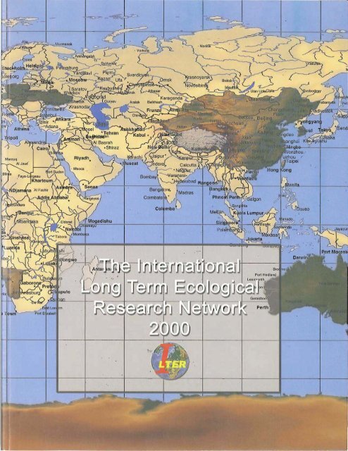
Current Status of theInternational LT R NetworkMembers of theIL TER Network[jJj]LJJ[jJj]AustraliaBrazilCanadaChinaChina-TaipeiCosta RicaColombiaCzech RepublicHungaryIsraelI2'l MongoliaNamibiaPol<strong>and</strong>SlovakiaIN! South KoreaSwitzerl<strong>and</strong>UkraineUnited Kingdom['ill United StatesUruguayVenezuelaCountries in the process of developing national<strong>LTER</strong> Networks, awaiting formal recognitionfrom thier governmentsCountries expressing interest in developing aArgentinanational L TER Network sitesFranceIrel<strong>and</strong>JapanII Austria11\1 BoliviaChile11\111\1ItalyKenyaNorwayIII MexicoIII MoroccoParaguayRomaniaIII South AfricaTanzaniaII CroatiaEcuadorIndiaIII IndonesiaII PortugalII SpainII SwedenZambia3
Toward a Global Underst<strong>and</strong>ingAn Introduction to theInternational Long Term Ecological Research NetworkJames R. GoszChair. IL TER NetworkPrincipal Investigator, Sevl1ieta <strong>LTER</strong>. U.S.University of New MexicoLong-term data are now recognized as crucial to our underst<strong>and</strong>ingof environmental change <strong>and</strong> management. Histoncally, these studies have been difficult to maintain because of the dominance ofshort term funding programs, a misconception that long-term studies aremerely monitoring, <strong>and</strong> emphasis on short-term experimentation or hypothesistesting of specific interactions or processes under the assumptionof equilibrium conditions. The complexity of the environment <strong>and</strong>the dynamic nature of environmental conditions require additional researchefforts that are not only long term, but address questions of scaledependency, complex assemblages of species <strong>and</strong> their interactions, <strong>and</strong>the role of humans in the environment. Long Term Ecological Research(<strong>LTER</strong>) sites offer this important complement to the more traditionaltypes of ecological research, These sites also provide opportunities, contacts<strong>and</strong> infrastructure for multi· <strong>and</strong> in terdisciplinary research as well asresearch across multiple sites (between networks), which is fundamentalto underst<strong>and</strong>ing the environment. Such collaborations are essential forthe development of sustainable management of our natural resources.The need for collaborations among the numerous scientists <strong>and</strong> highqualityprograms that are involved in underst<strong>and</strong>ing the vatious areas ofour globe is an even stronger argument for the development of a worldwidenetwork of <strong>LTER</strong> sites <strong>and</strong> programs. As a result of an internationalmeeting in 1993 to focus exclusively on networking of long-tenn ecologicalresearch, an International <strong>LTER</strong> (l<strong>LTER</strong>) Network was formed with aruission to facilitate intemational cooperation among scientists engaged inlong-term ecological research.TIUrty-nine scientists <strong>and</strong> administrators representing 16 countries participated<strong>and</strong> developed the initial recommendations for the network.These are repeated here to document the legacy of this acti-vit)' as well as toevaluate progress for the <strong>I<strong>LTER</strong></strong>Network.1. Communication & Information Access for <strong>LTER</strong> Researchers \\1orldwide+ Determine the general connectivity status of I.:IER sites <strong>and</strong> saentistsby country or region+ After completing a connectivity assessment, organize a clearinghousesystem to facilitate technology <strong>and</strong> skills transfer between sites+Create an information server on the global Internet to provide worldwideaccess to information <strong>and</strong> data relevant to international long-termecological research+Establish an international <strong>LTER</strong> (II.:fER) server access mechanism(or mechanisms) for researchers in regions presendy \vithout access to theinternational Intemeting for the creation of an <strong>I<strong>LTER</strong></strong> directory3. Developing <strong>LTER</strong> Programs Worldwide+ Encourage the pairing of mature <strong>and</strong> developing sites, which sharesimilar ecological settings, <strong>and</strong> encourage cooperation between pairs ofestablished sites within or between countries+ Produce an inventory of sources of financial support for <strong>I<strong>LTER</strong></strong> activities<strong>and</strong> infrastructure at participating sites4, Scaling, Sampling <strong>and</strong> St<strong>and</strong>ardization: Some Design Issues<strong>LTER</strong> sites should address the follO\ving questions:+\1(lill phenomena that occur over long time scales be adequately sampledover appropriate splltial scales?+\\1hat is the spatial <strong>and</strong> temporal range over which site data can belegitimately extrapolated, <strong>and</strong> what methods(s) will be used?+ How much effort will be required for synthesis <strong>and</strong> intersite comparison,<strong>and</strong> has flexibility for subsequent adjustment of observations beenincorporated into the design?+ Have the selected measurements been adequately tested, <strong>and</strong> have therequired precision <strong>and</strong> frequency of observations been specified?+Does the range of variables selected adequately reflect the full range ofdriving, state <strong>and</strong> response variables for the system under investigation?5. Education, Public Relations <strong>and</strong> Relationships with Decision makers+<strong>I<strong>LTER</strong></strong> sites should be used as sources of information for formalhigher education <strong>and</strong> interdisciplinary curricula development+ <strong>I<strong>LTER</strong></strong> sites should be used as sources of information for elementary<strong>and</strong> secondary school curricula development+ <strong>I<strong>LTER</strong></strong> sites <strong>and</strong> networks should provide clear <strong>and</strong> accurate'information on <strong>LTER</strong> research to the general public <strong>and</strong> decision makersThe <strong>I<strong>LTER</strong></strong> Network Committee has continued <strong>and</strong> broadened itsactivities through annual meetings. Follo\ving the initial conference in theUnited States in 1993, meetings have been held in the UK. (1994), Hungary(1995), Panama/Costa Rica (1996), Taiwan (1997), Italy (1998), SouthAfrica (1999) <strong>and</strong> the United States (<strong>2000</strong>). Plans are being made for meetingsin the United Kingdom (2001) <strong>and</strong> Canada (2002). The committeehas established the following mission statements, based primarily on the1993 conference:1. Promote <strong>and</strong> enhance the underst<strong>and</strong>ing of long-term ecologicalphenomena across national <strong>and</strong> regional boundaries;2. Promote comparative analysis <strong>and</strong> synthesis across sites;3, Facilitate interaction among participating scientists across disciplines<strong>and</strong> sites;4. Promote comparability of observations <strong>and</strong> experiments, integrationof research <strong>and</strong> monitoring, <strong>and</strong> encourage data exchange;5. Enhance training <strong>and</strong> education in comparative long-term ecologicalresearch <strong>and</strong> its relevant technologies;2, Developing a Global Directory of <strong>LTER</strong> Research Sites 6. Contribute to the scien tific basis for ecosystem management;+ Develop minimum site capabilities or st<strong>and</strong>ards for inclusion in an 7. Facilitate international collaboration among comprehensive, site-based,<strong>I<strong>LTER</strong></strong> directorylong-term, ecological research programs; <strong>and</strong>+ Identify existing <strong>and</strong> potential <strong>LTER</strong> sites worldwide 8, Facilitate development of such programs in regions where they cur-+Create both electronic <strong>and</strong> hard copy versions of an <strong>I<strong>LTER</strong></strong> directory rently do not exist.to be updated regularlyThe <strong>I<strong>LTER</strong></strong>Network Committee identified a number of target regions+Form a directory working group to help define tasks <strong>and</strong> secure fund- 4 to focus on during the first decade. Substantial progress has been made as
demonstrated in the current map of countries that have <strong>LTER</strong>Networks,those near to receiving formal recognition <strong>and</strong> establishment of theirNetworks <strong>and</strong> countries that have expressed an interest <strong>and</strong> are pursuingthe development of a <strong>LTER</strong> Network (fig. 2). This list is very dynamic <strong>and</strong>is continually updated. It is presented here to demonstrate the remarkableprogress made from the initial 3 countries in 1993 to the status of theNetwork by August <strong>2000</strong>.Each country must assess its own needs <strong>and</strong> resources if it wishes toinvolve itself in an <strong>I<strong>LTER</strong></strong> program. Each will have a unique set of opportunities<strong>and</strong> limitations that are best evaluated by the scientists <strong>and</strong> policymakers of that country. The typical procedure for a country is for thescientists of that country, along with the funding agencies, to decide whetherto endorse the premise that ecology <strong>and</strong> environmental management aresignificantly benefited by studies in long-term <strong>and</strong> broad spatial scales. Aplan is then developed that establishes the context <strong>and</strong> mission for suchstudies, sites <strong>and</strong> programs identified that will contribute to this mission,<strong>and</strong> support is obtained from within tha t country or interna tional organizationsfor implementation <strong>and</strong> continued maintenance. It is anticipatedthat each country's program ,ViIl be part of a global network of scientists<strong>and</strong> of scientific information that ,viII advance our underst<strong>and</strong>ing of notonly local <strong>and</strong> regional, but also global issues <strong>and</strong> provide solutions toenvironmental problems at these scales. The map show in figure 2 demonstratesthat many countries believe this an important undertaking.A more recent development among a number of countries is the formationof Regional <strong>LTER</strong> Networks. Neighboring countries often havesimilar issues <strong>and</strong> have demonstrated increased opportunities for collaboration<strong>and</strong> increased support to other countries in the region that areattempting to develop their own <strong>LTER</strong> Network. To date, there are regional<strong>LTER</strong> Network efforts in the East Asian-Pacific Region, LatinAmerica, Central <strong>and</strong> Eastern Europe, i\Iiddle East <strong>and</strong> North J\merica.<strong>LTER</strong> sites in the countries of the <strong>I<strong>LTER</strong></strong> Network now can provideunparalleled opportunities for cross-site <strong>and</strong> comparative research effortson many of the world's ecosystems at levels from genes to l<strong>and</strong>scapes.These global <strong>LTER</strong> sites function as "research platforms" that led tointerdisciplinary research, extrapolation to larger areas or regions, providethe scientific basis for management <strong>and</strong> policy decisions that incorporatesocial <strong>and</strong> economic issues, <strong>and</strong> attract scientists from other sites <strong>and</strong>networks, exp<strong>and</strong>ing the effective "network" of sites. The <strong>I<strong>LTER</strong></strong> Networkis now well positioned to interact \vith other international activitiessuch as the International Geosphere Biosphere Program (IGBP) <strong>and</strong> theGlobal Terrestrial Observing System (GTOS). A major effort in GTOS isthe participation of ILIER in the Global Terrestrial Network (GT Net) ofsites. The i\Iission of GTOS is:+To build databases <strong>and</strong> information systems that assist countries toaddress issues related to global <strong>and</strong> regional environmental change.+To ensure that biophysical <strong>and</strong> socio-economic dimensions are addressedin an integrated manner.+To present scientific information related to terrestrial ecosystems inways that are relevant to policymakers <strong>and</strong> resonant ,vith national priorities.The challenges are to:+Improve the flow of information between terrestrial scientists <strong>and</strong>policymakers.+ Present scientific information in ways that assist in policymaking (e.g.biodiversity, climate change, desertification, hazardous chemicals).+Promote systematic, long-term observations in order to underst<strong>and</strong>global <strong>and</strong> regional changes <strong>and</strong> provide countries \vith policy relevantinformation.The priority issues for GTOS are:+ Changes in l<strong>and</strong> quality;+ Availability of freshwater resources;+ Loss of biological diversity;5+Climate change; <strong>and</strong>+ Impact of pollutants <strong>and</strong> toxic chemicals.A variety of GTOS demonstration projects will be undertaken to demonstratethe value of linking the current terrestrial observation networks.The first is a project on global net primary productivity (NPP), which is akey variable in climate change modeling. Global NPP values are obtainedfrom the new MODIS sensor on the TERRI\. satellite. GTOS <strong>and</strong> <strong>I<strong>LTER</strong></strong>sites contribute to validation of the imagery through site measurementsof rainfall, temperature, soil water holding capacity <strong>and</strong> nitrogen content,l<strong>and</strong> cover, <strong>and</strong> leaf area index. A second related project is the TerrestrialCarbon Observation (TCO) initiative. Sites will be involved in validating.the carbon flows <strong>and</strong> biomass for satellite estimates. A third related projectis the Global Observation of Forest Cover (GOFC) that will be exp<strong>and</strong>edto all l<strong>and</strong> cover observations. Projects such as these are dependent on theinformation from <strong>I<strong>LTER</strong></strong> sites <strong>and</strong> will demonstrate the value of all <strong>I<strong>LTER</strong></strong>research <strong>and</strong>information for global assessments.During the past two years the GTOS project has made notable progressin improving our collective capacity to make global observa tions of changesin the Earth's natural systems. Recent progress toward developing a GlobalSystem of Terrestrial Observation Networks (GT-Net) addresses importantissues related to global <strong>and</strong> regional environmental change. Atpresent more than 15 national <strong>and</strong> international networks are membersof GT-Net, addressing topics ranging from glaciers <strong>and</strong> permafrost todryl<strong>and</strong>s <strong>and</strong> mountaintops.However, even if we continue at the present rate, at the end of thisdecade we will still be far from havingin place the systems for collecting theminimum information required for this ambitious project. We will still befar from underst<strong>and</strong>ing how key changes in the Earth's systems may affectthe well-being of all humans. IN some cases, uncertainty abou thowcertain global processes work call for more scientific research. But in manyinstances we simply are not collecting even the most basic terresttial information.Tbe situation in many developing countries is extremely poor<strong>and</strong> yet many global studies require data <strong>and</strong> information from theseregions.The Global Terrestrial Observing System is just a small part of effortsto make systematic global observations. But it is one of only a few forwhich the m<strong>and</strong>ate is global ill scope, specifically built around operationalinternational partnerships such as the <strong>I<strong>LTER</strong></strong> Network, <strong>and</strong> is aimed ataddressing issues related to sustainable development.It is not a simple task to convince countries to shift away from ad hocapproaches to terrestrial observations toward systematic investment inbuilding capacity to generate data, information <strong>and</strong> knowledge as is requiredfor a global system such as GTOS. However, I do see gradualimprovements in some cases. We will count on your support <strong>and</strong> collaborativeefforts over the coming years to keep up the momentum of theseimportant programs. Thank you, Jim Gosz
Region: East Asia-Pm:ificAn Overview of the East Asia-PacificRegional <strong>LTER</strong> NetworkHen-biau King(Jhair The East Asia-Pacific Regional <strong>LTER</strong> Coordinating CommitteeTaiwan Forestry Research InstituteIn 1993 an All Scientists Meeting was held at veloped. L<strong>and</strong> cover changes are being studied. In 200Q the MongoliaEstes Park, Colorado in the United States <strong>and</strong> <strong>LTER</strong> hopes to begin a forest <strong>and</strong> lake monitoring program that willwas hosted by the U.S. Long Term Ecological Research (<strong>LTER</strong>) study the impacts of deforestation, grazing, <strong>and</strong> climate changes on theNetwork. The meeting focused on establishing linkages with existing biodiversity of the watershed <strong>and</strong> lake.<strong>and</strong> developing long term research programs around the world .. An International<strong>LTER</strong> (<strong>I<strong>LTER</strong></strong>) network was then proposed. An Internaworkshops <strong>and</strong> hosting international <strong>and</strong> regional <strong>LTER</strong> meetings, theAfter several yearS of discussing, reviewing <strong>and</strong> conducting <strong>LTER</strong>tional <strong>LTER</strong> Coordinating Committee was also established to achieve Korea <strong>LTER</strong> (K<strong>LTER</strong>) Network was established with 3 <strong>LTER</strong> sites inwider regional representation. The First <strong>I<strong>LTER</strong></strong> Annual meeting was 1999. These sites include an old growth forest that is over 500 years old.held in Rothamstad, United Kingdom in August 1994 <strong>and</strong> an <strong>I<strong>LTER</strong></strong> One of the many contributions K<strong>LTER</strong> made to regional <strong>LTER</strong> Networkdevelopment was to host the Third East Asia-Pacific Regional <strong>LTER</strong>Coordinating Committee was concurrently formed. 1\ series of followupaction plans has occurred ever since..Meeting in 1999.In realizing the importance, necessity <strong>and</strong> benefits of a multi-disciplinary,integrated <strong>and</strong> long term research network in ecology at the reKitanglad Range National Park) which was established in 1997. The proThe Philippines has one c<strong>and</strong>idate c<strong>and</strong>idate <strong>LTER</strong> site (Mt.gional scale, an East Asia-Pacific Regional <strong>LTER</strong> Coordinating Committee gram focuses on inventory of flora <strong>and</strong> fauna for biodiversity, monitoringwas established in 1995. The committee currently consists of 12 members,each representing one to several <strong>LTER</strong> sites across the region with three sites, namely Irawan, Bicol, <strong>and</strong> Manila Bay, to be evaluated for<strong>and</strong> managing watersheds, <strong>and</strong> conserving upl<strong>and</strong> resources. There arewide ranges of climatic regimes <strong>and</strong> geographic features, vegetation types, possible future <strong>LTER</strong> sites.<strong>and</strong> others such as cultures, etc. There are six formal <strong>LTER</strong> Networks with The Taiwan Ecological Research Network (I"ERN) was established42<strong>LTER</strong> sites in the East Asia-Pacific region.in 1992 with one <strong>LTER</strong> site. I t has grown into 5 <strong>LTER</strong> sites. These sitesThe Australia <strong>LTER</strong> Network has four <strong>LTER</strong> sites that have wide were new sites <strong>and</strong> were specifically established for the <strong>LTER</strong>. The NationalPark Division of Taiwan is current developing six additional <strong>LTER</strong>ranges of climatic regimes <strong>and</strong> diverse biomes. They range from rainforestwith 3600mm annual rainfall to open forest with 700mm of annual rainfall.Meeting in 1995 <strong>and</strong> the 1997 international <strong>LTER</strong> meeting. The TERNsites, one for each national park. TERl'1 hosted the First Regional <strong>LTER</strong>The Chinese Ecosystem Research Network (CERN) was launched scientists have actively conducted collaborative research projects within 1988. I t serves as a base for the <strong>LTER</strong> <strong>and</strong> monitoring activities. US <strong>LTER</strong> scientists <strong>and</strong> the sites have hosted overseas students for theirTwenty-nine stations were selected with 16 agriculture, 7 forestry, 2 grass- ecological studies.l<strong>and</strong>, 1 lake <strong>and</strong> 1 estuarine ecosystems. The CERN was designed to Others countries, namely Indonesia, Malaysia, Singapore <strong>and</strong> Thaiintegratethe stations by adopting common core research areas, st<strong>and</strong>ard- l<strong>and</strong>, have expressed intense interest in developing national networks ofizing methods, data management, <strong>and</strong> monitoring, etc. Its major pro- <strong>LTER</strong> sites. These countries have not yet formally established <strong>LTER</strong>grams are "Mechanisms of Formation <strong>and</strong> Sustainability of Ecosystem networks, but they do conduct ecological research at permanent plotsProductivity", "\'Vater Cycle <strong>and</strong> Geographic Pattern Studies of .Agricul- <strong>and</strong> have established new plots for long term research. For example,tural Ecosystems in Northern China" <strong>and</strong> "Interaction between Agro- Indonesian ecologists have continuously carried out periodical invenecosystems<strong>and</strong> Global Change."tory of trees <strong>and</strong> undergrowth species in existing permanent plots. TheyA \'Vorking Group on <strong>LTER</strong> in the Ecological Society of Japan also established new permanent plots at 1997 forest flre burn sites towas established in 1998. Discussions were held to promote Japanese study the effects of fires on long term ecological processes. These fourITER <strong>and</strong> international correspondence. The i\1inistry of Education, countries have representatives actively participating in the InternationalScience, Sports <strong>and</strong> Culture (MESSC) of Japan has planned to establish <strong>and</strong> the EastAsia-Paciflc regional <strong>LTER</strong> activities.an institute for global environmental studies, which includes field sta- The major <strong>and</strong> regular activities of the East Asia-Pacific Regionaltions for <strong>LTER</strong> <strong>and</strong> networking. Japanese ecologists are actively partici- <strong>LTER</strong> Coordinating committee include calling for biannual committeepating in regional as well as international <strong>LTER</strong> Network activities. They meetings; holding scientific conferences, symposia, workshops, <strong>and</strong> conhostedthe Second East Asia-Pacific Regional <strong>LTER</strong> Meeting in 1997. ducting reciprocal visiting programs <strong>and</strong> most importantly, coordinatJunior scientists from Japan, Korea <strong>and</strong> Taiwan have joined the US-East ing collaborative <strong>LTER</strong> research projects across the region. A total ofAsian Reciprocal Visiting Programs.three biannual regional <strong>LTER</strong> meetings were held since the establish-In June 1998, the :Mongolian Academy of Sciences <strong>and</strong> the Na- ment of the regional <strong>LTER</strong> committee in 1995. They were in Taipeitiona I University of Mongolia sponsored an<strong>LTER</strong> workshop. 'The Mon- (1995), Tsukuba (1997) <strong>and</strong> Seoul (1999) <strong>and</strong> the fourth will be held ingolian <strong>LTER</strong> program was then formally established. Lake Hovsgol in Mongolia in 2001. Many other relevant <strong>LTER</strong> symposia were held inHovsgol National Park was selected as the first <strong>LTER</strong> site in the sum- this region including International <strong>LTER</strong> Meetings (at Taipei in 1997),mer of 1999 . .A water quality monitoring program <strong>and</strong> a database man- international workshops (for example, Information Management atagement system for data were established. Russian l<strong>and</strong>-cover resource Beijing in 1995, Networking at Taipei in 1995, <strong>LTER</strong> <strong>and</strong> Biodiversitymaps (1947) were digitized. A GIS for Hovsgol National Park was de- Conservation at Seoul in 1998, <strong>and</strong> the<strong>LTER</strong> Conference at Ulaanbataar6
in 1998 etc.). Numerous domestic <strong>LTER</strong> meetings also have been heldin most countries in the region since 1995.A regional collaborative research project, Comparison of LitterDecomposition among <strong>LTER</strong> Sites across the Region, was proposed<strong>and</strong> endorsed during the Third East Asia-Pacific Regional Meeting,Seoul during October 1999 <strong>and</strong> the detailed proposal <strong>and</strong> protocol areunder preparation by the Regional Coordinating Committee. Theproject is scheduled to commence in the summer of ZOOl.Future activities that have been recommended by the East AsiaPacific Regional <strong>LTER</strong> committee are:1. Co-organizing biannual <strong>LTER</strong> Coordinating CommitteeMeetings;Z. Promoting <strong>LTER</strong> program in countries that have no formal<strong>LTER</strong> sites yet but are interested in developing such programs;3. Initiating <strong>and</strong> conducting more collaborative research projectsacross the regional <strong>LTER</strong> sites;4. Producing a regional directory of long term ecological researchsites;5. Sharing the values <strong>and</strong> results of long term ecological researchwith resource managers <strong>and</strong> policy makers;6. Incorporating results <strong>and</strong> findings from long term ecologicalresearch into curricula at all levels of educational organizations; <strong>and</strong>7. Adopting programs <strong>and</strong> action plans made by the International<strong>LTER</strong> Coordinating Committee, particularly important plansfor participating in the NPP demonstration project of the Global TerrestrialObserving System (GTOS).Reviewing the progress that the regionall:rER networks havemade, it is reassuring that the Long Term Ecological Research programshave been accepted by science communities <strong>and</strong> funding agencieswithin the East Asia-Pacific region.The East Asia-Pacific Region already has <strong>and</strong> will have impactson global scale processes. For example, a few decades ago, the contributionof this region to global nutrient fluxes was small relative toother areas of the world. Now they have become, in some cases, majorcomponents of the global cycle. The East Asia-Pacific Regional<strong>LTER</strong> networks should thus establish linkages with other regional<strong>LTER</strong>networks <strong>and</strong> global programs that focus on ecological research<strong>and</strong> monitoring. The East Asia-Pacific region is a "big player" in globalmodeling of any large-scale issues. The need for data, particularlylong term data, is critical. The knowledge of the patterns of population,development, biodiversity, etc. in Asia is very important in dealingwith global effects of pollution, climate change, deforestation, l<strong>and</strong>use <strong>and</strong> many other issues.7
Region: EaJ1 Asia-PatifitAustralia'sLong Term Ecological Research Forest SitesJ. Bradley!, C. Howeffl, M. Brown' <strong>and</strong> P. Normarr!National Forest Inventory2Forestry Tasmania .4Queens/<strong>and</strong> Dept of Natural ResourcesAustralia has a history of long-term ecosystem research <strong>and</strong>monitoring. Whilst the concept of a co-ordinated nationalnetwork of long-term ecological research sites has been discussedfor some time it has only recently made tangible progress.Australia's National Forest Inventory (NFl) in the Bureau of Rural Sciences,Canberra, has been the catalyst by taking up the role of coordinatingthe collation of information on Australia's Long Term EcologicalResearch sites <strong>and</strong> hosting the Australian <strong>LTER</strong> website.At this stage, the Australian network is largely restricted to forest sites,although it is expected that this \vill diversify as Australian interest inLIER sites continues to grow as a consequence of increasing irlterest inthe development <strong>and</strong> testing of sustainability indicators.Interest in sustainability indicators has, in part, emerged as a result ofthe August 1998 release of an Australian framework of regional levelGovernments. The Commonwealth Government is responsible for coordinatingnational approaches to both environmental <strong>and</strong> industry developmentissues. Forested l<strong>and</strong> tenure in Australia can be broadly classifiedinto five tenure classes: conservation reserves (11 per cent of totalforest); multiple-use (9 per cent); leasehold l<strong>and</strong> (43 per cent); othercrown l<strong>and</strong> (10 per cent); <strong>and</strong> private forests (27 per cent).Site Level InformationInformation on one site in Tasmania (\X!arra), <strong>and</strong> three sites inQueensl<strong>and</strong> (Barakula, St ~lary <strong>and</strong> the Canopy Crane Research Site)have been included on the A<strong>LTER</strong>s website to date.Another 12 siteshave been identified for inclusion as Australian LIER sites when informationbecomes available. Information on existing sites has been provided by Forest Management agencies of the respective States using acriteria <strong>and</strong> indicators of sus- Austmlian L TER Forest Sites st<strong>and</strong>ard set of data, the format oftainable forest management.which was developed, in consultationThis framework was developed\vith them, <strong>and</strong> based largely<strong>and</strong> based on the internationallyon that used by the <strong>LTER</strong> networksagreed national levelof other countries.Montreal Process criteria <strong>and</strong>indicators.Australia's ForestsAustralia is located southeastof Asia <strong>and</strong> is the only countryin the world to occupy a singlecontinent. The Australian continentcovers 7,682,300 sq km<strong>and</strong> has a diverse <strong>and</strong> uniqueecology. It is populated by 19million people making Australiathe mo~t sparsely populatedcontinent after Antartica.Australia has 155.8 million hectares of forest, covering almost 20 percent of the total l<strong>and</strong> area. Australia's native forests account for approximately154 million hectares of the total forest area, <strong>and</strong> plantations 1.3million hectares. The native forests cover a \vide range of topoclimaticzones, ranging from dry arid to wet tropical to cool temperate, <strong>and</strong> coastalto alpine environments. The geographic extent of Australia's native forestsis controlled largely by rainfall <strong>and</strong> temperature, with fire playing amajor role in their ecology. Many forest species are dependent on fire t<strong>ocr</strong>eate conditions for regeneration. .Of the 910 plant communities recognised in Australia, 457 are consideredas forest communities <strong>and</strong> are grouped into the follmving broadnative forest types: eucalypt; acacia; melaleuca; rainforest; casuarina; mangrove;callitris; <strong>and</strong> 'other'. The biodiversity of these forests is known tobe high, even'though many areas are yet to be documented. There areover 1200 vertebrate fauna species <strong>and</strong> 13 600 higher plant species knownfrom forest areas of the continent.Under Australia's federal system of government, primary constitutionalresponsibility for l<strong>and</strong> management rests with State <strong>and</strong> Territory9Warra, TasmaniaThe Warra site, located in Tasmania,has been established to facilitatethe underst<strong>and</strong>ing of ecological processesof 'Tasmania's wet (E.obliqua) forests. These forests arepart of the southern cool temperatewet forest biome. Programs atthe Warra site fostermulti-disciplinaryresearch within a long-termframework. The site contains bothworking forests <strong>and</strong> conservationreserves. Appropriate management prescriptions <strong>and</strong> practices prevail indifferent parts of the site.The main objectives of the site are:-To underst<strong>and</strong> fundamental ecological processes in E. obliqua wetforests.To assess <strong>and</strong> monitor biodiversity <strong>and</strong> geodiversity.-To determine the long term effects of different forest managementregimes on natural diversity <strong>and</strong> ecological processes <strong>and</strong> thus assesstheir sustainability.-Where necessary, to develop alternative management regimes.-To provide an integrated multidisciplinary focus which complementsresearch programs elsewhere in Tasmania.-To link Tasmanian forest re~earch \vith national <strong>and</strong> internationalprograms having a long term ecological focus.Batakula, Queensl<strong>and</strong>This site is a working forest, managed for logging (mainly cypresspine at present but also for hardwood), <strong>and</strong> grazing. There are six Scien~tiflC Areas (or proposed areas) \vithin the site managed for the conserva··8
Mosses <strong>and</strong> rainforest species understories developin wet eucalypt forest in southern Tasmania when notsubjected to lire, Photo: Leigh Edwards, Forestry Tasmania,tion of examples ofrare ecosystems. Alarge number ofpermanent forestgrowth plots <strong>and</strong>research experimentsexist in thearea,Current researchactivities inthe Barakula <strong>LTER</strong>are aimed at:.. underst<strong>and</strong>ingfundamentalecological processesin Callitris<strong>and</strong> dry mixed eucalyptopen-forests<strong>and</strong> woodl<strong>and</strong>s;developing tools<strong>and</strong> techniques toassess <strong>and</strong> monitorbiodiversity, productivity,<strong>and</strong> otherforest values;.. determining thelong term effectsof different forestmanagement regimes (including fire <strong>and</strong> grazing) on ecological processes,biodiversity, <strong>and</strong> forest productivity <strong>and</strong> thus assess the sustainability ofsuch regimes;* providing base-line information on trends in forest condition as a contributionto Queensl<strong>and</strong>'s commitment to report on 1.fontreal Processcriteria <strong>and</strong> indicators ofsustainable forest management;·r providing a focus forintegrated multi-disciplinaryresearch whichcomplements researchprograms elsewhere inthe state;'" linking Queensl<strong>and</strong> forestresearch with national<strong>and</strong> international programshaving a long termecological focus.St Mary, Queensl<strong>and</strong>The St Mary's site ishrgely multiple-use forestincluding a number ofpermanent forest growthplots <strong>and</strong> long-term researchexperiments.Current research actili1-ties at the St 1hry L1T:i,Rare aimed at:Workers at the Canopy Crane ResearchFacilily site in Queensl<strong>and</strong>underst<strong>and</strong>ing fundamental ecological processes in dry mi.xed eucalyptopen-forests <strong>and</strong> woodl<strong>and</strong>s;developing tools <strong>and</strong> techniques to assess <strong>and</strong> monitor biodiversity,productivity, <strong>and</strong> other forest values;determining the long term effects of different forest managementregimes (including fire <strong>and</strong> grazing) on ecological processes, biodiversity,<strong>and</strong> forest productivity <strong>and</strong> thus assess the sustainability of such regtmes;* providing base-line information on trends in forest condition as a contributionoQue=l<strong>and</strong>'.~commitment toreport on]\Ion trealProcess criteria<strong>and</strong>indicatorsof sustainableforestmanage,ment;Woodl<strong>and</strong> at St Mary's Site, QLD. Photo: Department 01 Natu-* provid- ral Resource, Queensl<strong>and</strong>inga focusfor integrated multi-disciplinary research which complements research programselsewhere in the state;linking Queensl<strong>and</strong> forest research with national <strong>and</strong> international programshaving a long term ecological focus,The Canopy Crane Research Facility, Queensl<strong>and</strong>This site was established in 1998 as a rainforest research facility basedaround a 50 m tower crane placed in the rainforest. The crane providesenhanced access to the rainforest canopy for researchers.The central aim in establishing the site was to facilitate rainforestcanopy research.Network web site URL: htlp:llwww.brs.gov.aulnfilforestinfolltrsites/index.htmlNational Network Chairperson<strong>and</strong> e-mail address:Mic/( BrownMick.brown@forestrylas.com.auYear Networ/( joined <strong>I<strong>LTER</strong></strong> network: <strong>2000</strong>
Australia: Table of Site InformationSite name Date Principal biomes Research themes Type <strong>and</strong> lengths of data setsWarra, 1998 Temperate broad leaf forest (mainly Aquatic, Biodiversity, Soils, I.Spatial Data Sets:Tasmania Eucalyptus obliqua forest) with some areas Hydrology, Modelling <strong>and</strong> Remote The following GIS layers have been collected at aof moorl<strong>and</strong>, alpine, temperate rainforest, Sensing I :25,000 scale:riparian conifer forest <strong>and</strong> scrubs.Forest type maps (vegetation structure) derivedfrom aerial photography.* Geology* Vegetation fire history* Modelled climate surfaces (ESOCLlM)* Satellite images* Aerial videography* Environmental stratifications2. Non-Spatial Data Sets:* Hydrology <strong>and</strong> climateThere are weirs constructed (or modified) <strong>and</strong>instrumented on Warra Creek, Swanson Creek <strong>and</strong>King Creek. Sampling commenced in 1998.There is an operational weather station on ManukaRoad <strong>and</strong> 17 fortnightly river sampling sites onManuka, Warra <strong>and</strong> South Weld Roads.A second weather station is to be established at thetop of the catchment.* Forest producti vityContinuous forest inventory plots (CFl) have beenestablished in the area since the late 1960s - early1970s. These are measured at establishment, at 5years, 10 years <strong>and</strong> then 10 yearly.* BiodiversitySpecies lists (<strong>and</strong> locations) are available forvascular plants, vertebrate fauna <strong>and</strong> some nonvascularplants <strong>and</strong> invertebrate groups.A strati fied system of baseline long term vegetationmonitoring plots is being established at Warra tocomplement the CFI plots.Barakula, 1936 Mixed eucalyptus open-forest <strong>and</strong> woodl<strong>and</strong> Biodiversity, Silviculture, Forest I. Spatial Data Sets:Queensl<strong>and</strong> <strong>and</strong> cypress pine open-forest <strong>and</strong> woodl<strong>and</strong>. Growth & Yield The following GIS layers have been collected:The principal overs tory species include* Regional Ecosystem types (pre-European <strong>and</strong>Callilris glallcophylla. Corymhia cilriodora, present) at I: 100000;EllcaJypllls crehra, A Ilocasllarina* Vegetation overstorey floristic composition atluehmannii. Angophora 1:50000;leiocarpa, Ellcalypllls jihrosa subsp nuhila, * Geology at I: I 000 000;E. lenllipes. Corymhia hJoxsomei <strong>and</strong> C. * Soils at 1:2 000 000;polycarpa.* L<strong>and</strong>sat imagery at 25m grid cell;* Modelled climate surfaces (ESOCLIM) at 250mgrid cell;* Logging history (virginllogged) at 1 :25 000 to1:100000;* Recent fire history at 1 :50 000;* Environmental stratification at 250m grid cell.2. Non-Spatial Data Sets:* Growth <strong>and</strong> YieldDetailed yield plots (permanent);Southern Brigalow Bioregion (SBB) forestcondition <strong>and</strong> inventory project non-permanentplots;DPIF non-permanent plots.* BiodiversitySBB forest condition non-permanent plots;Species lists for vascular plants <strong>and</strong> vertebratefauna;Some invertebrate information.* OtherEcosystem health (grazing) sites;European cultural heritage sites (incomplete).10
Affiliation/ownership Site address Area extent in Location Travel distancemanager hectares <strong>and</strong> direction tonearest townForestry Tasmania Mick Forestry Tasmania 15,900 ha 146°40'E, 1 .5 hours driveBrown 79 Melville Street 40 0 04'S from HobanHoban Tasmania 7000Phone: +61 362338202Fax: +61 362338292Email: Mick.brown@forestrytas.com.auhttp://www.warra.comr-=-.........Queensl<strong>and</strong> Department of Phil FERA, Queensl<strong>and</strong> Dept of Natural Resources . 28S,I45ha 150.65, The edge of t~eNatural Resources <strong>and</strong> Norman 80 Meiers Road 26.34 site is a half hourQueensl<strong>and</strong> Depanment of Indooroopilly Qld 4068 drive fromPrimary Industries Telephone: +61 738969830 ChinchillaFax: +61 738969858EMail: Phil.Norman@dnr.qld.gov.au11
Australia: Table of Site InformationSite name Date Principal biomes Research themes Type <strong>and</strong> lengths of data setsSt Mary, 1951 Mixed eucalypt open-forest <strong>and</strong> woodl<strong>and</strong>. Biodiversity. Forest growth <strong>and</strong> I Spatial Data Sets:Queensl<strong>and</strong> The principal species include Corymbia yield. Silviculture. Other The The following GIS layers have been collected:citriodora. Eucalyptus acmenoides. Development <strong>and</strong> Implementation of ,. API polygons assessed for old growth charactersCorymbia intermedia. Eucalyptus fibrosa L<strong>and</strong>scape Metrics; Production of (crown cover projection, proportion of senescing.subsp'fibrosa, E. siderophloia <strong>and</strong> Corymbia Forest type <strong>and</strong> structure maps from mature <strong>and</strong> regrowth trees <strong>and</strong> disturbance) at 1 :25trachyphloia high resolution digital imagery <strong>and</strong> 000;comparison with API maps <strong>and</strong> field ,. Vegetation type <strong>and</strong> regional ecosystems atdata for monitoring sites in eastern 1:100000;Australia. * Geology at I: 100 000;* Soils at 1:2 000 000;* Recent fire history at 1:25 000;* Logging history (virgin/logged) at 1:25 000;* Modelled climate surface (ESOCLlM) at 100mgrid cell;* Digital Elevation Model at 50m grid cell;* Environmental stratification;* L<strong>and</strong>sat imagery at 25m grid cell;* Digital video. laser profiling <strong>and</strong> high resolutiondigital imagery over some areas.2. Non-Spatial Data Sets;* BiodiversityArboreal marsupial habitat quality <strong>and</strong> populationdensityEpiphagic ant population monitoringDiurnal bird populationsSpecies lists for vascular plants <strong>and</strong> vertebratefauna* Forest productivityDetailed yield plots (permanent)DPIF non-permanent plotsAustralian 1998 Tropical Lowl<strong>and</strong> Rainforest Hydrology <strong>and</strong> climate I. Spatial DataCanopy Crane Forest Productivity ,. Mapping of the site (point coverage at I :5000 isResearch Biodiversity in progress)Facility.Queensl<strong>and</strong>2. Non-Spatial Data Sets:,. Hydrology <strong>and</strong> climateNo hydrological data has been collected to date;Meteorological instruments have been installed onthe crane tower <strong>and</strong> in a clearing adjacent to therainforest. Vertical micro-meteorologicalinstrumentation is attached to the crane tower atheights of SOm, 30m <strong>and</strong> 10m. This instrumentationtakes half-hourly readings of the followingmeteorological parameters at the 3 height~:-photosynthetically active radiation;-air temperature; <strong>and</strong>- relative humidity.- Wind velocity <strong>and</strong> direction will also be measuredat a height of 50m.The automatic weather stationlocated in the clearing measures wind velocity <strong>and</strong>direction. rainfall, air temperature, soil temperatureat IOcm. soil moisture at iOcm, relative humidity.solar radiation, <strong>and</strong> leaf wetness.,. Forest productivityForest producti vity is not measured at present.,. BiodiversityAll trees greater than 10cm DBH within the arc ofthe crane have been tagged <strong>and</strong> identified;Li verworts <strong>and</strong> mosses have been sampled <strong>and</strong> areal present being identified; <strong>and</strong>Arthropods on the site are being collected <strong>and</strong>identified on an ongoing basis.12
Affi liation/ownership Site address Area extent in Location Travel distancemanager hectares <strong>and</strong> direction tonearest townQueensl<strong>and</strong> Depanment of Phil FERA, Queensl<strong>and</strong> Dept of Natural 1I,I61ha I 52°46E, The site is a halfNatural Resources <strong>and</strong> Norman Resources -25°68S hour drive fromQueensl<strong>and</strong> Depanment of 80 Meiers Road MaryboroughPrimary Industries Indooroopilly Qld 4068(Queensl<strong>and</strong> Forest Telephone: +61 738969830Research Institute). Fax: +61 738969858E-Mail: Phil,Norman@dnr.qld,gov.auhtlp:llwww.forests.qld.gov.au/forest~/feraIFMPMaryborough.htmThe Australian Canopy Crane Nigel Australian Canopy Crane Company Rainforest CRC I Hectare 145"27,£, The journeyCompany Pty Ltd. Stork James Cook University (within arc of 16°06'S from Cairns toSmithfield Qld 4878 canopy crane) + the site takesPhone: +61740421243 20 ha of approximatelyMobile: 0419 774 784 surrounding 2.5 hours,Fax: +61740421246tropical lowl<strong>and</strong>Nigel.Stork@jcu.edu.aurainforesthttp://www.tsd.jcu.edu.au/netsharelrainforestCRClcrane.htmI!iI13
Region: Em! Asia-Pacific"ImE )Zhao Shidong <strong>and</strong> Wang QunliChinese Academy of SciencesetliJol'k hiJ101YUnder the support of the Chinese 1\eadem)' of Sciences<strong>and</strong> the World Bank, the Chinese Ecosystem Research Network(CERN) was established in 1988.Since the founding of the Chinese Academy of Sciences in the early1950's over a hundred field stations has been gradually set up across thecountry, covering various ecological zones. The initiatives of these stationswere to improve productivity of agriculture, forestry, animal husb<strong>and</strong>!,),<strong>and</strong> fishery, <strong>and</strong> to observe <strong>and</strong> study specific natural phenomena,such as glaciology, frozen earth, mud- rock flows, l<strong>and</strong>slides,etc. Overforty years, thesestations haveThe observation tower of Changhaishan ForestEcosystem Research Station (Photo: ZHAOShidong).played significantroles in helpingwith the reasonableutilization of localna tural resources<strong>and</strong> solving localenvironmen talproblems, as wellas in terms of theadvancement ofecological research.Since the 1980's,due to the origination<strong>and</strong> development of Earth System Science, particularly the implementationof the IGBP <strong>and</strong> the increased pressure caused by the growingshortage of resources <strong>and</strong> environmental degradation, the Chinese Academy of Sciences has taken several steps to establish <strong>and</strong> strengthen theChinese Ecosystem Research Network. First it chose 29 from the all fieldstations, covering the important ecosystems in China of agriculture, forest,grassl<strong>and</strong>, lake <strong>and</strong> bay. Among these stations, there are 16 for agriculture,7for forest, 2 for grassl<strong>and</strong>, 2 for lake <strong>and</strong> 2 for bay ecosystems. Inorder to improve data management <strong>and</strong> synthetic research, the five disciplinarySub-Centers (hydrolog)', soil, atmosphere, biology <strong>and</strong> aquaticecosystem) <strong>and</strong> one Synthesis Center were established too. :More than1000 scientists <strong>and</strong> technicians from 21 institutes of CAS have been in~volved in the activities of CERL"f. Through the developments in the pastten years, CERN has become a ve!')' important basis for ecological researchin China <strong>and</strong> an element of the global ecological networks.In the beginning of this project, the essential task was to complete anoverall design. During the five years from 1988 to 1992, detailed investigationswere made of the newest developments <strong>and</strong> trends of ecosystemresearch in the world. In particular, scientific personnel from the concernedinstitutes of CAS examined the various dem<strong>and</strong>s that modernecosystem research sets forward for the networking of ecosystem research.Efforts were made to learn about the design <strong>and</strong> operation of bothexisting networks <strong>and</strong> those being established around the world for ecologicalobservation <strong>and</strong> research, such as the program of the Long-TermEcological Research (iTER) Network in the United States.Based on detailed investigations <strong>and</strong> extensive discussions, <strong>and</strong> withconsideration of the specific features of the Chinese situation, the overalldesign of the project was finally worked out in 1992. This design is fullyreflected in the project proposal submitted to the World Bank in thebeginning of 1993.Compared with other networks in the world, the design of CERNcontains the following features:1) As a general principal of the design, the "Top-down" approach wastaken, which means that all of the units of the network should followun.ified principles, <strong>and</strong> the major activities, including research <strong>and</strong> moni-China: Table <strong>LTER</strong> InformationSite Name Dale Principal biomesResearch themesTypes <strong>and</strong> lengths of data setsYinglan Red Soil 1985 SUbtropical evergreen forest ecosystems mainly consist Red Soil ecological studies; Data sets on the soil <strong>and</strong>Resea reh S ta Ii on of Pinus massoniana , Castanopsis sclerophylla, Comprehensi ve experimentation vegetation monitoring <strong>and</strong>Schimll superba, Rhododendron simsii, Quercus fabri, on structure, function <strong>and</strong> research, since 1985.Gardenia jasminoides, Imperata cylindrica, <strong>and</strong> dynamics of the ecosystems inagricultural ecosystems like rice <strong>and</strong> other subtropical the region.crops.Yucheng Comprehensive May 1979 Winter Wheal, Corn, Cotton, <strong>and</strong> Soybean. Water circulation, water <strong>and</strong> Meteorological data 1979-nowExperimental Station energy balance, mass transfer, Ground water level data 1984-nowagricultural ecosystemWater surface evaporation datamanagement, <strong>and</strong> regional 1.984-nowagricultural sustainable! Data of evapotranspiration fromdevelopment.farml<strong>and</strong> (by large weighingIysimeter) 1987-nowSoil nutrients mainly NPKIcontents on soils 1990-nowSoil moisture data 1984-now14
tonng, would be supportedby centralizedThe Chinese Ecosystem Research Networkfunds.2) As a whole, the networkemphasizes networkAgro-ecological Stationintegrity, core objectives, Grass-ecological Station<strong>and</strong> direct service to thesustainable utilization ofnatural resources <strong>and</strong> toenvironmental protection.3) In terms of monitoring<strong>and</strong> observation, itenforces the unification<strong>and</strong> st<strong>and</strong>ardization ofmethodologies <strong>and</strong> eveninstruments.4) \'(1hen consideringdata collection, it focuseson the st<strong>and</strong>ardization ofthe data formats, dataquality control, data sharing,data synthesis <strong>and</strong>analysis.5) Regarding researchmethodology, it encouragescross-site <strong>and</strong> multidisciplinaryapproaches toresearch, including the involvementof social sciences,<strong>and</strong> the networkingof research, based on theunlfied objectives <strong>and</strong>methodology.6) Considering the seriousproblem <strong>and</strong> challengeof ecosystem managementin China,ecosystem managementare one of the highest priority tasks for all of the stations.In the past several years, through several evaluations carried out byexperts, this design was proved to be both advanced <strong>and</strong> feasible. It haslaid a solid scientific foundation <strong>and</strong> structure for the realization of theoverall objectives of CERN <strong>and</strong> of the various tasks concerned.Hydro-ecological Station@ Forest-ecological StationThe long term goal of the network is to underst<strong>and</strong> the status of thevarious major ecosystems <strong>and</strong> environment by largely relYlng on theground network monitoring <strong>and</strong> observation with modern methodologies,such as remote sensing, Geographic Information System (GIS) <strong>and</strong>mathematical models, thus contributing to the improvement of ourlivlng environment, the sustainable utilization of natural resources <strong>and</strong>Affiliation/ownership Site manager Address Areal extent in Location Travel distance <strong>and</strong>hectaresdirectionInstitute of Soil Science, Prof. He Yuanqiu He Liujiazhan, Yujiang County liangxi I km L • 116' 5' 30"E, 28' 5' 13 km away fromChines Academy of Province 30"N Yintan City.Sciences.P.R.CHINA,335211Or:Institute of Soil Science, ChineseAcademy of Sciences.71 East beijing Street P.O. Box 821,Nanjing, 210008 P.R.CHINATel: 86-0701-5321051 or 86-025-3369284Fax: 86-0701-5321051 or 86-025-3353590E-mail: yqhe@ns.issas.ac.cn orbsun@issas.ac.cnInstitute of Geography, Prof. Ouyang Zhu (director of Institute of Geography, CAS 15 ha 36°57'N, 116°38'E 6km south-west ofChinese Academy of the station) Building 917 No.3 Datun Rd. Anwai Yucheng CitySciences. Prof. Xie Xianqun (deputy Beijing 100101director of the station)PRCProf. Yu Qiang (deputy director E-mail address: Yes@dls.iog.ac.cnof the station)15
China: Table of <strong>LTER</strong> Site InformationSileName Date Principal biomes Research themes lengths of data setsAnsai Research Station 1973 Principal biomes are millct, maize, broom com millet, The structure, function <strong>and</strong> Social <strong>and</strong> economic data, sinceof Soil <strong>and</strong> Water soybean, buckwheat, potato controlling technologies of 1973;Conservation, Chinese system in small watershed; Meteorological data, since 1973;Academy of Sciences Regulation of soil erosion; Long-term fertilization(CAS) Water <strong>and</strong> nutrient balance <strong>and</strong> experiment, since 1983;management;Experiments of soil moistureVegetation rehabilitation theory dynamics <strong>and</strong> water productivity<strong>and</strong> practice;in grassl<strong>and</strong> <strong>and</strong> woodl<strong>and</strong>, sinceWatershed management <strong>and</strong> 1973;ecosystem restoration in theLoess Plateau.Experiment~ of soil erosion ondifferent slope gradient, length<strong>and</strong> sharpness, since 1978;Experiments of deposition of soil& water conservation measure,since 1987;Short-term experiments onagriculture, forest <strong>and</strong> orchardecosystems in various years since1973;L<strong>and</strong> use <strong>and</strong> ecosystem change insmall watershed undermanagement practices, since1936.Beijing Forest 1990 Warm temperate deciduous broad-leaved forest. Structure, function <strong>and</strong> Microclimate in deciduous broad-Ecosystem Research dynamics of forest ecosystem; lea ved forest, since 1992;Station, Chinese conservation, restoration <strong>and</strong> General climate data of station,Academy of Sciences sustainable utilization of since 1992;biodi versity in destroyed Plant list in the studied area in theforesl~; Global change. station, between 1991-1995;Solar radiation observing data indeciduous broad-leaved forest,between 1991-1993;Nutrient elemental contents of keyplants, hetween 1992-1995.Beijing Forest 1990. Warm temperate deciduous broad-leaved forest. Structure, function <strong>and</strong> Microclimate in deciduous hroad-Ecosystem Research dynamics of forest ecosystem; leaved forest, since 1992;Station, Chinese conservation, restoration <strong>and</strong> General climate data of station,Academy of Sciences sustainable utilization of since 1992;biodiversity in destroyed Plant list in the studied area in theforests; station, between 1991-1995;Global change.Solar radiation observing data indeciduous broad-leaved forest,between 1991-1993;Nutrient elemental contents of keyI plants, between 1992-1995.Changshu Agricultural 1987 Rice, wheat, rape <strong>and</strong> cotton. Sustainable agriculture Spatial data on soils of the studiedEcological Experimental Eco-environmental Science area in 1985;Station Greenhouse agriculture. Socio-economic data of thestudied area since 1970;Meteorological data since 1949.Changwu Agro- 1984 Winter Wheat\Com Establishing a ecosystem with Social <strong>and</strong> economic data, sinceeCOlogical Experiment higher profits in both 1984;Station on Loess Plateau agricultural ecology <strong>and</strong> Meteorological data, since 1984;economy.Research data:Potential crop yield in dryl<strong>and</strong>experiments in 1985-1995;Long-term rotation <strong>and</strong>fertilization experiment, since1984;Long-term fertilizer fixedexperiments, since 1984.Many short-term experiments onagriculture, forestry, orchard <strong>and</strong>soil erosion were conducted invarious years since 1984.the general advancement of ecosystem research.ods for sustainable utilization of these systems.Its concrete objectives are as follows:3). To provide the optimal managerial models to the people of local1) To conduct long-term monitoring programs on the country's ecosys- communities for the sustainable utilization of the local natural resourcesterns in agriculture, forestry, grassl<strong>and</strong>, lake <strong>and</strong> bay, <strong>and</strong> the environmen- <strong>and</strong> the improvement of the local living environment.tal factors, like water, soil <strong>and</strong> air.4). To provide the scientific foundations needed by the decision-makers2). To conduct thorough <strong>and</strong> in-depth investigations of the structure, at various administrative levels concerned with the utilization of naturalfunction <strong>and</strong> dynamics of the ecosystems, <strong>and</strong> the approaches <strong>and</strong> meth- 16 resources <strong>and</strong> environment
Affiliation/ownership Site manager Address Areal extent in Location Travel distance <strong>and</strong>hectaresdirectionInstitute of Soil <strong>and</strong> Dr. Guobin Liu No. 26 Xinong Road The long-term Located in the typical The station wasWater Conservation, Yangling, Shaanxi Province field loess hill-gullied region located in AnsaiCAS <strong>and</strong> Ministry of P. R. China, 712100 experimental of Loess Plateau county, 350km farWater Resources Fax: +86 29-7011210 installations are (E 109° 19' 23", away from Xi'an CityTel: + 86 29-7012907 built in 75ha. N36°51' 30")E-mail: gbliu@ms.iswc.ac.cn The station alsohas anexperiment <strong>and</strong>demonstrationwatershed witharea of 827ha.Institute of Botany, CAS Prof. Ma Keping Nanxincun 20 166ooha. 39" 58'N, 115" 26'E 114.5 km west fromXiangshanBeijing.Haidian Distr. 100093, Email:angwg@public2.east.cn.netInstitute of Botany, CAS Prof. Ma Keping Nanxincun 20 16600ha. 39" 58'N, 115"26'E 114.5 km west fromXiangshanBeijing.Haidian Distr. 100093Email:sangwg@public2.east.cn.netInstitute of Soil Science, Dr. Wang Dejian Wang, Institute of Soil Science, Chinese 3 hectares 123" 38'E,31"33'N 45 km North fromCAS Academy of Sciences. Suzhou City71 East Beijing StreetP.O.Box 821, Nanjing 210008P.R.ChinaEmail: Djwang@issas.ac.cnIWWW.CS.CERN.AC.CNIInsti tute of Soil <strong>and</strong> Prof. Hao Mingde No. 26 Xinong Road, Yangling, 8.3 km' 107"40'30' 'E, 200km north ofWater Conservation, Shaanxi712100,PRC 35°12'N. Xi'an.Chinese Academy ofSciences, <strong>and</strong> Ministry ofWater Resource5) To contribute to the solution of global ecological <strong>and</strong> environmentaliSsues through active participation in international ecological researchprojects.Among the tasks mentioned above the essential one is to study theecosystem.2. Network managementThe leading organization <strong>and</strong> the principal financial sponsor of CERNis the Chinese Academy of Sciences (CAS). 21 institutes of CAS dealingwith geo-science <strong>and</strong> bio-science are involved in CERN.The Leading Group, the Scientific Committee <strong>and</strong> the Scientific AdvisoryCommittee take the responsibilities for CERN management.Ibe Chairperson of the Leading Group <strong>and</strong> the Scientific Committeeis the Vice-President of CAS, Academician Chen Yiyu. The Chairperson170f the Scientific Advisory Committee is Academician Sun Honglie.
China: Table of <strong>LTER</strong> Site InformationSite NameDatePrincipal biomesResearch themesTypes <strong>and</strong> lengths of data setsDaya Bay MarineBiology ResearchStation1984SUbtropical marine ecosystemsMarine ecology of Daya Bayecosystems Structures <strong>and</strong>functions of marine cosystemImpacts of human activities onenvironmentEnergy now <strong>and</strong> nutrientscyclingExperimental biology <strong>and</strong>! pathology of economicallyimportant speciesGenetics of fishery speciesTechniques for shellfish• hatchi ng-breeding Harmfulalgae bloomEcological capacityto prevent the pollution.Routine survey data, includingphysico-chemical parameters ofthe seawater <strong>and</strong> the composition<strong>and</strong> biomass of the biota(phytoplankton, zooplankton,. pisces, benthos) at twelve stations• within Daya Bay since 1982.Meteorological data since 1997Dinghushan EcosystemI . Research StationDonghu ExperimentalStation of LakeEcosystems•1978(nnt asnetworkmember)1956Lower SUbtropical Evergreen Broad-leaved ForestLake Donghu is a shallow freshwater lake in themiddle reaches of the Yangtze River. It has a totalsurface area of 27.8 km 2 m, a mean water depth of 2.2m, <strong>and</strong> a drainage basin covering an area of 187 km'.The station is situated on the southwestern bank of thelake.The Yangtze River is the longest river in Asia,ranking the fourth in the world after the Amazon River,Congo River <strong>and</strong> the Ganges in terms of flowingcapacity. It totals about 1000 billion cubic meters inannual run-off volume, accounting for 42% of thenational freshwater volume emptied into the sea eachyear. The Yangtze valley lies between 25-35 NorthLatitude. Its mainstream <strong>and</strong> low-lying tributaries in itsmiddle <strong>and</strong> lower reaches house a complicated <strong>and</strong>labyrinthine fluvio-Iocustrine ecosystem, criss-crossedby countless streamlet, inlets, marshl<strong>and</strong>s, shallowlakes <strong>and</strong> ponds, known as one of five lake groups onthe Asian continent. The food-inundated alluvialdeposi ts <strong>and</strong> plains are a treasurehouse of aquaticresources including a priceless waterlife trove. Itsaquatic produet accounts for two thirds of the nationalfreshwater fishery output, being a main contributor tothe national economy. In addition. the world-renownedThree Gorges Program now in construction is locatedin the area.The Hubei Province itself is a vast locustrine systempopularly known as a "l<strong>and</strong> of one thous<strong>and</strong> lakes"sinee time immemorial. The system has a nearly roundshape, about 10000 square kilometers in total area,with the Donghu Station roughly st<strong>and</strong>ing at the centerof the circle. Only in the outskirts of Wuhan City, thereare more than 100 lakes each larger than I km 2 in watersurface. The local climate is dominated by subtropicalmonsoon, noted for it humidity <strong>and</strong> warmth. During the19605, the Donghu Lake was divided into fivesubsystems varied in the degree of eutrophication,native fish species, plankton taxa as well as theirbiomass or other ecological parameters. All theseprovide good conditions for probing the structure,functioning, material-<strong>and</strong>-energy equilibrium,evolution <strong>and</strong> sustainable development of the limneticfacies .Prof. Zhao Shidong is one of the Vice-Chairpersons of the ScientificCommittee as well as the Secretary General of CERL"\J, with responsibilityfor the routine work of managing CERN.3. Special activitiesAll of the Stations, Sub-centers <strong>and</strong> the Synthesis Research Center of18Biomass <strong>and</strong> ProductivityNutrient Cycling HydrologicalCycling EcophysiologicalProcessConservation Strategiesa). The cycling <strong>and</strong> dynamics ofmajor nutrients such as N, P, C,including their input, output <strong>and</strong>circulatory patterns in the lake.b). The structure of the foodweb in the lake <strong>and</strong> the impactsof filer-feeding fishes <strong>and</strong>eutrophication on the lakeecosystem.c). The functioning of aquaticvegetation in the lake ecosystem<strong>and</strong> the ecological method torestore macrophyte community.d). Long-term impacts of humanencroachment on changes of awaterbody, generativemechanism of eutrophication<strong>and</strong> its control.IMeteorological data, since 1975.Data seta on structure, function<strong>and</strong> dynamics of vegetation <strong>and</strong>environment obtained from themonitoring <strong>and</strong> research projectsoperated in different years since1978.TDN 1978 -1997NH4 N,N0 3 - N.N0 2 -N -1978,1997TDP, P0 4-P 1962, 1965,1978, 1997Si02 -1962,1965,1978,1997Species composition ofphytoplankton -1956, 1958,1962,1965,1978Density <strong>and</strong> biomass ofphytoplankton - 1962, 1965,1978,Species composition ofzooplankton 1956, 1958,1965, 1965, 1978Production of zooplankton -1979,1982Production of phytoplankton -1962,1965,1978Biomass of zoobenthos -1978Macrophytes 1962,1963,1972-1982, 1988Fish production 1951CERN have developed strong links with universities, local people <strong>and</strong> th(public media. They have played important roles in education <strong>and</strong> outreachdirected at improving the living environment <strong>and</strong> sustainabk management of ecosystems, by means of offering training courses, distributinlpapers <strong>and</strong> showing the managerial demonstration sites.
Affiliation/ownership Site manager Address Areal extent in Location Travel distance <strong>and</strong>hectaresdirectionSouth China Sea Institute Prof. Wang Zhao-Ding Daya Bay Marine Biology Research 38,000 square 22° 33' 17" N, 114 0 31' About 60km east toof Oceanology, CAS Email: wangzd@2Icn.com Station meters of 12"E the Shenzhen CityDongshan, Nanao, Longgang District, terrestrial areaShenzhen. P.R. China 518121 <strong>and</strong> 6,000 squareEmail: szmbrs@pubtic.szptl.net.cn meters of a waterURL: http://www.mbrs.ac.cn or area.http://www.dyw.cern.ac.cniSouth China Institute of Prof. Huang Zhongliang gyzhou@scib.ac.cn Dinghushan 23°09'21"-23°11'30"N 80km west toBotany, Chinese Biosphere • I 12°30'39"- ! GuangzhouAcademy of Sciences Reserve 112°3'41"E metropolitan city, <strong>and</strong>15 km east toZhaoqing cityInstitute of Donghu Experimental Station of Lake 27800 hm2 114 "23' E 30"33' N Donghu Lake isHydrobiology, CAS Ecosystems, located in theInstitute of Hydrobiology, CASeastern suburb of theWuhan 430072, P.R.Chinametropolitan city ofE-mail: Xieping@ihb.ac.cn Wuhan, capital of\Xicpi ng@public. who hb.cnHubei Province incentral China.I19
China: Table of <strong>LTER</strong> Site InformationSite Name Date Principal biomes Research themes Types <strong>and</strong> lengths of data setsFengqiu Agro-ecological June, 1987 The cultivated crops of the area include wheat, corn, Farml<strong>and</strong> ecological subsystem; Data sets on observation, survey,Experiment Station peanut, rape <strong>and</strong> cotton. Subsystem of soil water, analysis <strong>and</strong> statistics (climate,nutrients <strong>and</strong> salt regulation, <strong>and</strong> water, soil <strong>and</strong> vegetation), sincecirculation; 1965.Multi-layered farmingsubsystem;Agro-forestry subsystem;Biotic matter cyclingsubsystem;Aquatic ecology subsystem;Agro-ecological environmentinformation system;Fukang Desert March Alpine glaciers, mountain forests, sub-alpine mcadow, Structure, function <strong>and</strong> Meteorological data set, sinceEcosystem Observation 1987 low elevation steppe, desert, arid wildness <strong>and</strong> oases. dynamics of the natural <strong>and</strong> 1987;<strong>and</strong> Experimental cultivated ecosystems. Long-term nutrition cycling dataStation set, since 1987;Grass-field rotation experimentdata set, since 1994.Gongga Alpine Dec.l987 Mountainous ecosystems from the subtropical Forest ecology Data on meteorology, hydrology,Ecosystem Observation evergreen forest at the lower elevation to the alpine <strong>and</strong> Forest hydrology biomass of trees. glacier <strong>and</strong><strong>and</strong> Experiment Station glacier at the higher elevation. The forest populations Glacial dynamics chemical analysis for water <strong>and</strong>mainly consists of Abies (A. Jabris). Picea (P. Mountain en vironment change. soil, since 1988.ba/fourianll), Pine (P. densala). Betula (8. uti/is),Rhododendron <strong>and</strong> so on.Haibei Research Station April 1976 Alpine meadow <strong>and</strong> alpine shrub Structure. function. dynamics Climate data, since 1976;of Alpine Meadow <strong>and</strong> management of the Alpine Pedological data, since 1976.F..cosystemMeadow ecosystem.Impacts of global warming onvegetationHailun Agricultural June, 1978 Com, soybean <strong>and</strong> sorghum Moisture <strong>and</strong> nutrient in arable Monitoring <strong>and</strong> research data sets.Ecological Experimental black soil since 1978.StationEcological system productivity.Heshan Hilly L<strong>and</strong> 1994 Artificial pure forests <strong>and</strong> artificial mixed forest (major Restoration Ecology Data sets on plant. animal. soil,Interdisciplinary species are Acacia <strong>and</strong> Pine trees, <strong>and</strong> the native tree Agroforestry soil microbe. hydrology,Experimental Station species) Ecosystem Management, Long- geography. meteorology, ecotermEcological Research physiology, forest st<strong>and</strong>.productivity etc. The lengths ofdata sets are quite different amongthe types.Hitong Experimental October Sub-tropical ever-green broad-leaved forests Structure. function, dynamics Data sets on structure, function.Station for Forest 1960. <strong>and</strong> sustainable management of dynamics <strong>and</strong> sustainableEcology Chinese fir (Cunninghamia management of Chinese firlanceolata (Lamb.) Hook.) (Cunninghamia lanceolalaplantation <strong>and</strong> evergreen broad- (Lamb.) Hook.) plantation forests.leaved forests. since 1960.Inner Mongolia March Temperate typical steppe. Structure <strong>and</strong> function of Meteorological data set. sinceGrassl<strong>and</strong> Ecosystem 1979. ecosystem. 1982;Research Station sustainable development of Typical steppe monitoring dataanimal husb<strong>and</strong>ry. set. since 1980,20
Affiliation/ownershipInstitute of Soil Science,CASI Site managerJ iabao ZhangAddressInstitute of Soil Science, CAS71 East Beijing Road, p, O. Box 821,Nanjing 210008, P.R.ChinaE-mail: jhzhang@ns.issas.ac,cnURL: http://www'[q.cern.ac.cnI Areal extent in I Location : Travel distance <strong>and</strong>, hectares directionI7ha 114°24'E,35°00'N 50 km South fromKaifeng City acrossKaifeng Bridgerrhestation is located inFengqiu County,north bank ofHuanghe River.Xinjiang Institute forEcology <strong>and</strong> GeographyResearch, CASInstitute of MountainHazards <strong>and</strong>Environment, CASNorthwest PlateauInstitute of Biology,CAS.I Ji Fang,:Dr. Cheng GenweiiI Prof. Xinquan ZhaoNo 40-3 of southern Beijing roadUrumqi 830011,Xinjiang, China.E-mail: FKS@MS,XJB.AC.CNTel: 86-0991-3824292, 3837396,3837357,0994-3241210,3241659.: Fax:86-099 1-3835459, 0994-3241658.Institute of Mountain Hazards & Env.,Huaxiba, Chengdu, Sichuan,P.R.China,610041Fax: 086-28-5222258E-mail: ggs@mail.sc.cninfo.net59 Xiguan Dajie, XiningQinghai 810008P.R.China70 ha I 44° 17 '44/1N, 40 krn from Ulumuqi87°55'67"E.8,5 km' 10Io59'55"E, About 56 km in the29°34'34"Nsouthwest of Ludingcounty, Sichuanprovince.I38800 ha 3729'-3745'N,101 160 km northwestJ2'-10123'Efrom Xining.Heilongjiang Institute ofAgriculturalModernization, CASiXiaozeng Hanxzhan@mail.hrb,h1.cnin.fo.netS, China Institute of Prof. Dr. Peng ShaolinBotany, CAS <strong>and</strong> Localgovernment of HeshanCityShenyang Institute ofApplied Ecology, CASInstitute of Botany, CASDr. Liping liaoE-mail: Ipliao@iae.syb.ac,cnDr. Bai Y ongfei138 Haping RoadHarbin, 150040P,R.ChinaHiamcas@mail.hrb.hl.cninfo,netURL: 202.118.251.251Heshan StationSouth China Institute of BotanyChinese Academy of SciencesGuangzhou 510650, P.R.ChinaTel: 0086 20 87639381• Fax: 0086 20 8770 1031E- mail: he shan station @scib.ac,cnhttp://www.cern.ac,cn.members.#Field StationsInstitute of Applied EcologyChinese Academy of SciencesShenyang 110015P.O. Box 417P.R.ChinaEmail: Ipliao@iae.syb,ac.cn~ttp:llwww,ht.cern.ac.cnXiangshan Nanxincun 20Beijing 100093P.R.ChinaTel:(Fax:(hltp:/lwww.nmf1.cern.ac.cn23 ha 47°26'N,126 c 38'E 7km from Hailun city.140ha. 112°53'15"- The Heshan Station isI 12°54'OO"E,located in I OOkm22°40'0T'-22°4I'07"N southeast ofGuangzhou, thecapital city ofProvince Guangdong,or 14 km southeast ofHeshan City,100 ha 2647' 23"N, 10935' 16 km to the town of25"E lIuitong County1160 ha 43 38'N, 116 42'E 700km north ofBeijing.IThe experimental plots of Inner MongoliaGrassl<strong>and</strong> Ecosystem Research Station(Photo.' ZHAO Shidong).21
China: Table ofSite InformationSite Name I Dllte Pdncipal biomesResearch themesTypes <strong>and</strong> lengths of data setsJiaozhou Bay Marine 1978. Temperate marine bay ecosystem in the west coast ofEcosystem Researchthe Northern Pad tic Ocean.Station,I Luancheng Agro- 1981 Wheat, corn, fruit tree, vegetablei ecosystem experimentalstation, CAS(I )Long term monitering the Types <strong>and</strong> lengths of data setsstate of liaozhou Bay Salinity data set: J 962-1963,Ecosystem 1981-1986, 1991-1999(2)Study on basic ecological Meteorological <strong>and</strong> radiation data,Processes, Nutrient dynamics, since 1978Formation mechanism of Data on physical properties ofproductivity, Sustainable water, since 1962development of marine Data on chemical substances ofecosystem. water, since 1962(3) Study on ecology of Data on primary production formicrobial living organisms in phytoplankton, between1991-1995the sea(4) Study on the dynamics ofDMS in the sea(5) Ecological study on archaea,extracellular enzyme in the seawater(6) Ecological modeling(7) Ecological effects <strong>and</strong>optimum managerialexperiments of mariculture inthe China Sea.Nutrient cycles Meteorological data, since 1981SPAC Research data, since 1981Crop breedsSustainable agricultureNaiman Research ' 1985 Grassl<strong>and</strong> (Leymus) with opening forest (Ulmus).Station of DesertificationRestoration <strong>and</strong> rehabilitation of Research <strong>and</strong> monitoring data,degrading semi-arid. ecosystem since 1985Qianyanzhou Oct. 1983 Artificial forest, paddy Iield.Experimental Station forComprehensiveDevelopment of NaturalRe.~ources in Red EarthHilly Area.Sanjiang Ecological 1989. Mire-wetl<strong>and</strong> consists of Carex pseudocuraica,Experiment Station of C.lasiocarpa, Glyceria spicilosa, Salix brachypoda, S.Mire·Wetl<strong>and</strong>myrtilloides, Deyeuxia anguslifo1ia <strong>and</strong> Betulafruicosa, Quercus monglica etc.Modes of integratedEnvironmental effects in thedevelopment <strong>and</strong> theirprocess of development <strong>and</strong>technological system in red utilization in red earth hilly area.earth hilly area.Ecosystem restoration <strong>and</strong>agricultural sustainabledevelopment in the subtropicalregion.Management of agriculturalresources <strong>and</strong> rural economicaldevelopment.Study on theory <strong>and</strong> method ofresources science. Spatial data <strong>and</strong>attribute data on structure,function, dynamics <strong>and</strong> socialeconomics.since 1983Mire-Wetl<strong>and</strong> <strong>and</strong> fannl<strong>and</strong> Meteorological data, since 1989ecosystem derived from Mire- Hydrological data, since 1990Wetl<strong>and</strong> reclamation.IiThe experimental plots of YuchengComprehensive Experimental Station.Photo: ZHAO Shidong.22
Affiliation/ownership Site manager Address Areal extent in Location Travel distance <strong>and</strong>hectaresdirectionInstitute of Oceanology, Dr, Prof. Jiao Nianzhi. 7 Nanhai Road 39 000 ha (390 The station is located The station is set upCAS Qingdao, 266071 km\ on the bank Jlaozhou in the City ofP.R,China Bay (36°03'12"N, Qingdao <strong>and</strong> at theE-mail: Jiao@ms.qdio.ac,cn 120020'10''E). southern bank of thehttp: IIwww.jzw.cern.ac.cn The place of Jiaozhou mouth of JiaozhouBay isBay.35°58'48"N:.36 Q J 1'42"N,120 0 09'24"E;, I 20°20'3O"EShijiazhuang Institute of Dr. Hu Chunsheng Shijiazhuang Huaizhong Road 286, 28 ha 37°50'N, 114°40'E 28 km east-southernAgriculture Shijiazhuang institute of agriculture far from ShijiazhuangModernization, CAS modernization, CAS cityShijiazhuang 050021, P.R.ChinaE-mail: cshu@public.sj.he.cncernJca@public.sj.he,cnURL: http://www.sjziarn.ac.cn~ ...Cold <strong>and</strong> Arid Regions Prof. Zhao Halin 260 Donggang west road 8 ha 42 55'35"N, 120 The station located inEnvironmental <strong>and</strong> Lanzhou 730000 42'55"E 675 km in northeastEngineering Research P.R.China of BeijingInstitute, CAS Tel: (0931) 9975129Fax: (0931 )8821894Email: resdiv@ns.lzb.ac.cnCommission for Prof. LI Jiayong Qianyanzhou Experimental Station 204ha 26"44'N, I 15"04'E 48km south-east ofIntegrated Survey of P.O. Box 9717, Beijing 100101 Taihe CountyNatural Resources, CASP.R.ChinaFax: (8610)64914230E-mail:jyli@cianar.ac.cnORQianyanzhou ExperimentalStationTaihe County, 343725Jiangxi Province, ChinaFax: (8610)0796 5572260e-mail: qyzes@publicl.japtt.jx.cnChangchun Insitute of Prof. Wang Ruishan 16 Gongnong Road 67000 ha 133 30'34"E, 47 30km easl (0 QianjinGeography, CAS Changchun 130021 35'II"N townP.R.ChinaTel: (0431 )5674704Fax: (0431 )5652931Email:ggi'ang@mail.ccig.ac.cn23
China: Table of <strong>LTER</strong> Site InformationI Site Name I Date I Principal biomes Research themes Types <strong>and</strong> lengths of data setsShapotou Desert 1956 The transitional vegetation between desert <strong>and</strong> steppe, Water requirement of s<strong>and</strong>- Meteorological data, since 1956Experiment <strong>and</strong> dominated by the semi-shrubs, shrubs <strong>and</strong> herbs fixing plant species <strong>and</strong> water Various data sets on vegetationResearch Station balance of s<strong>and</strong>y l<strong>and</strong> <strong>and</strong> environment accumulated byvegetation;research activities conducted inDrought resistance <strong>and</strong> water different years since 1956.relationship of desert plants;Vegetation dynamics on s<strong>and</strong>dunes;Soil nutrition dynamics on s<strong>and</strong><strong>and</strong> nutrient cycles on oasisfarml<strong>and</strong>;Micro-geomorphology, aeoliansedimentation <strong>and</strong> mechanismof s<strong>and</strong> current;Micro-meteorology <strong>and</strong>turbulence in the interface layerbetween atmosphere <strong>and</strong>vegetation <strong>and</strong> s<strong>and</strong> dunesurface;Transformation <strong>and</strong> utilizationof s<strong>and</strong>y l<strong>and</strong>.Theories <strong>and</strong> techniques of s<strong>and</strong>blocking <strong>and</strong> stabilizing.Shenyang Ecological 1987 Com, Rice <strong>and</strong> Soybean Agro-ecology Several research <strong>and</strong> monitoringExperimental Station, Pollution ecology data sets, since 1987.Chinese Academy ofMicrobial ecologySciences.Environmental changesTaihu Laboratory for 1989 Lake water ecosystem bi, Water quality <strong>and</strong> water Data on water quality, water levelLake Ecosystem ecosystem structure <strong>and</strong> water current, since 1989.Research Lake ecosystem energy Meteorological <strong>and</strong> radiation data,conversion, nutrient cycling since 1989.Interface actions between water<strong>and</strong> air, water <strong>and</strong> sedimenL~Lake eutrophication <strong>and</strong>ecological experiments withdifferent organisms: Lake ecosystem management<strong>and</strong> modellingPhysico-biological engineeringTaoyuan Station of June 1979 The original vegetation is subtropical evergreen forest Structure, function, succession Meteorological <strong>and</strong> microclimaticAgro·ecosystem consisting of the following forms <strong>and</strong> species: <strong>and</strong> management of agro- data, since 1979Research Form. Castanopsis Farsesii; Form. Castanopsis ecosystem in subtropical red Biological data on rice, since 1979Tibetana; Form. Cyclobalanopsis Siauca; Fonn. earth hilly area. L<strong>and</strong> cover dynamic data, sinceCyclobalanopsis Gracilis; Form. Castanopsis eyrei; Principle <strong>and</strong> technology for 1978Form. Lithocarpus Glabros & Castanopsissustainable utilization of natural Agro-economic data of the studiedSclerophylla; Form. Quercus gl<strong>and</strong>ulifera VaT. resources. area, since 1978Breviretiolata & Cycloblanopsis Mnltinervia; Form. Comprehensi ve development Soil fertility data, since 1978Castanea Henryi; Form. Pinus Massoniana; Compl of agriculture, forestry, L<strong>and</strong> productivity data, 1978form frutex & herb-Pinus massoniana; Form. livestock, fishery in red earth Solar radiation data, since 1998Cunninghamia Lanceolata; Form. Plyllostachys hilly area.Pabescens; Form. Phyllostachys Nidularia; Form. Maller <strong>and</strong> energy cyclingCorylus sinensis & Weigelajaponica VaT. Sinica; <strong>and</strong> utilizing characteristics inForm. Miscanthus Sinensis; Form. Camellia Oleosa; farming systems.Form. Sapium Selbiferum;The current vegetation is cultivated one consisting ofthe following crops in many places: rice, com, colton,ramie, tea <strong>and</strong> orange.Xishuangbanna Tropical July 18. Tropical rainforest Structure, function <strong>and</strong> 64 data sets on meteorology,Rainforest Ecosystem 1959 , dynamics of tropical rainforest hydrology, pedology <strong>and</strong> biology,Research Station i Restoration of tropical rain since 1959. But some of the dataforest: sets are not complete <strong>and</strong>Man-made tropical ecosystem continuous.iYanting Agro·Ecological May, 1973 Rice, maize, wheat, colton <strong>and</strong> sweet potato Purple soil (Regosols); soil Climate I 980-nowStation of Purple Soil formation; soil ferti lity; soil Soil I 984-nowecology; structure, function <strong>and</strong> Water I 984-nowsuccession of agro-ecosystem; Biology I 984-nowsoil <strong>and</strong> water conservation; ! L<strong>and</strong> use 1983--nowagro- forestry; l<strong>and</strong>scapeecology; ecological r"~t()rnti()nI24
Affiliation/ownership Site manager Address Areal extent in Location Travel distance <strong>and</strong>hectaresdirectionInstitute of Desert Prof. Li Xinrong (Ph.D.) Address of the Station: 133.3 ha 104°57'£, 37°27'N 20km away from theResearch (lOR) <strong>and</strong> Cold Shapotou Experiment Station of west cif Zhongwei& Arid Regions Desert Research, Zhongwei County County, Ningxia HuiEnvironment <strong>and</strong> 751700, Ningxia Hui Autonomous Autonomous Region.Engineering ResearchRegion, P. R. ChinaInstitute (CAREERI), Tel: 0086-953-7982072Chinese Academy ofE-mail: Ibz@public.yc.nx.cnSciences (CAS)Address of the InstituteThe Instituteo f Desert Research(lOR), Cold <strong>and</strong> Arid RegionsEnvironment <strong>and</strong> EngineeringResearch Institute (CAREERI),Chinese Academy of Sciences, CAS260 Donggang West Road, Lanzhou730000, P.R.ChinaTel: 0086-931·8847614Fax: 0086-931-8883209/8889950Shenyang Institute of Director: Yu Wantai 172 Wen Hua Road 15ha 41°32'N,123°23'E . 35km south ofApplied Ecology, CAS , Shenhe District ' Shenyang City., Institute of Applied Ecologyi Chinese Academy of Sciences'P.O. Box417Shenyang, I 10015P.R. ChinaE-mail: syz@iae.syb.ac.cnWeb URL: hltp:llwww.sy,cern.ac.cnNanjing Institute of Prof. Wei min Chen Taihu Laboratory for Lake Ecosystem 2338 km2 31,25'12",120, 20 km in the south ofGeography & Research 13',02"E Wuxi or 100 km inLimnology, CAS 73 East Beijing Road, Nanjing the west of Shanghai210008, Chinae-mail: Chenwm@niglas,ac.cnWeb URL: www.@th.cem.ac.cn..... ~~.~Changsha Institute of Taoyuan Station, 12.2 hm" 28 Q 55'N,lll o 30'E The station is locatedAgricultural Changsha Institute of Agricultural Elevation: 89 m to 124 in the capital town ofModernization, CAS Modenization, CAS, m. Taoyuan countyChangsha city, Hunan province,which lies to the410125 north-west part ofChina, PR.Hunan province, <strong>and</strong>E-mail: krwang@ms.csiam.ac.cnis about 200 kmURL: http://www.csiam,ac.cn/faway fromChangsha, the capitalcity of HunanprovinceXishuangbanna Tropical Prof. Tang Jianwei Menglun town 30800 ha 101°16'53" E, 21 °54' I Southeast 70 km fromBotanical Garden, CAS Mengla county 41"N • Jinghong cityYunnan Province, P.R. China666303E-mail:stznet@public.km.vn.cnhttp:/ www.XTBG.ac.cnChengdu Mountain Prof. Zhu Bo P,O.Box 417, Chengdu institute of 1 18 km' 31 QI6'29"N, It is located in theHazards Research mountain hazards <strong>and</strong> environment, 105I27'26"E middle of SichuanInstitute, Chi nesc CAS. basin,fromY':J250 km Academy of Sciences The 9 th section of Renmin Nan road, Chengdu, <strong>and</strong> I3km iChengdu, Sichuan 610041P.R.ChinaOfficial e-mail:ylg@maiLsc.cninfo.neti25
Region: Ea.!'! Axia-PtltijicLongot"eaEcological Research/!/IJ/-JMk KimPeptlt/meN! {!/ I ;l)rt'JI /{I',Wllht'YKrmK.miJJ l 'Ifj-l't'r.d(yNellilork 1;/,,/01)'vel' the last 40 years, Korea's l<strong>and</strong>scapes have been dramaticallychanged by in tensive efforts toward afforestation while peopleconvert from firewood to fossil fuel sources. L<strong>and</strong> area has beenlargely revegetated <strong>and</strong> the condition of vegetation is improving overtime. i\Ieanwhilc, Korea has experienced degradation of the nanlral environmentcaused by intensive developmental activities <strong>and</strong> subsequentpollution. These activities incudeindustrialization, urbanizatioll,the construction ofroads <strong>and</strong> golf courses, fossilfuel consumption, dischargeof wastes to water systelns,mineral extractioll, l<strong>and</strong>-clearing,<strong>and</strong> water controLAs evidence of environmentaldegradation emergesslowly over decades, most ofthe people do not sense thesymptoms with any precision.Hence extensive collection <strong>and</strong>careful analyses of relevantdata over long time periodsarc required for better underst<strong>and</strong>ing<strong>and</strong> managementof biotic compollents <strong>and</strong> theenvironment of Korea. Althoughsome scientists haverealized the importance ofThe Korea L TER Networkstudying long-term phenomenain ecology, major advancementin long-term ecologicalA Kwangnung Experimental ForestB. Mt Kyebangsan Forestresearch has not yet beenmade in Korea.C. Mt Keumsan ForestRecently the Korea ForestResearch Institute included Long Term Ecological Research (ITER)as a major ptoject in forestry research, <strong>and</strong> three sites were officially desig-Korea: TableSite InformationSite name Date Principal biomes Research themesnated for long-term ecological research <strong>and</strong> biodiversity conservation <strong>and</strong>monitoring. The first <strong>LTER</strong> site in Koren is Kwangnung ExperimentalForest, which represents the oldest nanlral forest in Korea. Some partsof the forest have been protected for more than 500 years. TIle other twoare the forests of i\ft. Kyebangsan <strong>and</strong> i\It Keumsan. Although <strong>LTER</strong> isin its early stages in Korea, promotion <strong>and</strong> encouragement of ecologistsactivities will help to ensure the sound development of the Korean <strong>LTER</strong>program in the future. The objective of most of the research is to investigatethe dynamics of struchlre <strong>and</strong> function of ecosystems related to thechanges of environment, which is ultimately related to monitoringbiodiversity <strong>and</strong> global change."'I.s the three official sites (Kwangnung ExperimentalForest, i\It. Kyebangsan <strong>and</strong> i\It.Keumsan Forest) are managed by the same membersof research team of the Korea Forest ResearchInstitute, the cross-site research is guaranteed. Allthe sites have common themes or core research topics,which must be investigated <strong>and</strong> compared toeach other. TIle core areas include primary production,population dynamics, nutrient cycling, impactsof environmental stress <strong>and</strong> disturbances, <strong>and</strong> environmentalchanges. ,'I.s the National Arhoretutn<strong>and</strong> the Forest ]\fuseum are located at theKwangnung Experimental Forest, it became apopular place for public education on nature <strong>and</strong>ecology in Korea.In addition to the three official eight othersites are proposed as potential sites, whose namesare Lake Soyangho, .\It. Jumbongsan, J\It. Hallasan,J\It. Chirisan, Mt. Soraksan, Mt. Namsan,N akdonggang River <strong>and</strong> Demilitarized Zone(DMZ) in Korea. Outcomes of <strong>LTER</strong> activity becomeuseful tools for detecting environmentalchanges such as regional pollution <strong>and</strong> global warming<strong>and</strong> managing natural resources such as forests,lakes, <strong>and</strong> rivers.l\felJllork lIJal/agement, dJalrpenol1 (or co-chain) alld PrillcipalfillallcialpOI/JonAs the Korea <strong>LTER</strong> program is in early stage of development, mucheffort has been made to establish the <strong>LTER</strong> program <strong>and</strong> coordinateTypes <strong>and</strong> lengths of data sel~Kwangnung 1913 temperate mixed forest st<strong>and</strong> dynamics; water cycling; nutrient cycling; change of Hydrological data for twenty years;Experimental Forest hardwood forest biodiversity; microclimate; flux of energy, water vapour <strong>and</strong> CO 2 ; air ground survey on biodiversity from 1994pollutionMI. Kyebangsan 1991 temperate mixed forest st<strong>and</strong> dynamics; air pollution; decomposition of litter; water ; Ground survey on biodi versity in 1995Forest hardwood forest quality monitoring; change of biodi versity; climate change <strong>and</strong>monitoringf--......Mt. Keumsan Forest 1983 temperate mixed forest sl<strong>and</strong> dynamics; air pollution; decomposition of litter; water Ground survey on biodiversity in 1994hardwood forest quality monitoring; change of biodiversity26
esearch in official <strong>and</strong> potential sites in Korea. i'lleanwhile, in order tofacilitate communication, coordination, <strong>and</strong> cooperation among the scientistsin ecology <strong>and</strong> related disciplines, the Korea <strong>LTER</strong> Committee(KLC) was established in 1997.The Korea L TER Committee plays a major role in improving <strong>LTER</strong>program <strong>and</strong> activities in Korea. The committee consists of five members<strong>and</strong> meets quarterly to discuss major activities of research <strong>and</strong> implement.The chairperson of the Committee is Eun-Shik Kim, Departmentof Forest Resources, Kookmin University, Korea. ,\.t tills moment,the Korea Science <strong>and</strong> Engineering Foundation (KOSEF) playsan important role as a sponsoring agency for hosting international conferences<strong>and</strong> supporting joint research, exchange programs, <strong>and</strong> domestic<strong>LTER</strong> activities in Korea. In addition, the Forest Research Instituteof Korea continues to set the basic framework for the development of<strong>LTER</strong> activities in Korea. The Committee found it needed to inviteseveral financial sponsors to activate the ITER program in Korea, however.Partllmbips (111- ..I't itlitlollS, orgalIizatiolls)'nle Korea<strong>LTER</strong> Comnlitteeactivelypursues cooperativepartnershipswith theKorea ForestResearch Institute<strong>and</strong> the Monitoring tower construction in Kwangnung ExperimentalKorea Science Forest<strong>and</strong> Engineefing Foundation along with the National Park "\.uthority(NPA), local governments, <strong>and</strong>universities. These partnershipsfacilitate corrununication <strong>and</strong> cooperationamong the scientists,managers, <strong>and</strong> policy makers inecology <strong>and</strong> related disciplines.The Korea<strong>LTER</strong> Committeehostedan In tern ational Workshop onI:rER in theEast Asia-Pa~cific Region in1998 <strong>and</strong> the3rd InternationalConferenceon <strong>LTER</strong>. I. E Stemflow collection at a st<strong>and</strong> of fir forest in the Kwangnung111 t 1 e as t Experimental ForestAsia-PacificRegion, jointly with the Ecological Society of Korea, in 1999. Theseevents were orgaIllzed by Kooknlin Univ~rsity <strong>and</strong> the Korea ForestResearch Institute. Before the Conference, a bilateral Korea-US. JointSeminar to identify <strong>and</strong> address key questions on up~to-date <strong>LTER</strong> issuesin regional as well as global scale was held as a satellite meeting supportedby both the Korea Science <strong>and</strong> Engineering Foundation <strong>and</strong> the US.National Science Foundation NSF), which will facilitate future cooperativeresearch among the scientists of the countries <strong>and</strong> provide a firmstepping stone for the development of the national ITER network inKorea.Three Korean sites are included in the GTNET--"TPP Demo Project ofthe Global Terrestrial Observing System (GTOS), coordinated by the~etwork Office of US Long Term Ecological Research Network.Spel'lci/ adil!itic.r (educatioll, pll!J/iColltreacb)Collaboration with nationalnetworks in the region is madethrough a biennial RegionalConference. Collaborationamong the global networks isfacilitated via the intemet, whoseaddress is http:/ /klter.Kookmin.ac.kr.Participants in 3rd International <strong>LTER</strong> Conference in the East Asia-PacificRegion in Seoul, Korea, 1999Allflliationlownership Site manager Address Area extent Location Travel distance toin hectal'csnearest towni-TIle Korea Forest Research Dr. Jeong Soo Oh. Director General. 500 na 3n45'N, 35km northeast ofInstitute/national forest Department of Forest Environment. 12nll'E central Seou I. KoreaKorea Forest Research InstituteTIle Korea Forest Research Dr. Jeong Soo Oh, Director General. The Korea Forest Researcn Institute. 207, 440 ha 37?44'N. 75km northeast ofInstitute/national forest Department of Forest Environment, , Chongnyangni 2-dong. Tongdaemun-gu, i 128?29'E Wonju City, KangwonKorea Forest Research Institute ' Seoul 130-012, Korea;Do Province. Korea• JHS033@foa.go.krIThe Korea Forest Research Dr. Jeong Soo Oh, Director General. I The Korea Forest Research Institute. 207. 300 ha I 34'?45'N, 75km south of ChinjuInstitute/national forest Department of Forest Environment. Chongnyangni 2-dong, Tongdaemun-gu, 127,?59'E ! City. Kyongsang NamdoKorea Forest Research Institute• Province. Korear-::-"~. .i 7~~63~~-f~;~~::rrea;!27
Region: Em! Asia-Pacifi(MongoliaLong Term Ecological ResearchJ. Tsogtbaatar' <strong>and</strong> C. E. Goulderi'Mongolian Academy of Sciences21nstitute for Mongolian Biodiversity &Ecological Studies, Academy of Natural SciencesNetwork History: The Government of ~Iongolia approvedestablishment of the ~Iongolian Long TermEcological Research (i\<strong>I<strong>LTER</strong></strong>) Network in December 1997.Managemel1t: The Mongolian <strong>LTER</strong> Steering Committee, was organizedin 1998, Dr. J. Tsogtbaatar of the Mongolian Academy of Sciences(geoeco@magicnet.mn) is the Director of M<strong>LTER</strong>. Dr. C. Goulden(goulden@acnatsci.org) is the International Coordinator.Partnerships: ~<strong>I<strong>LTER</strong></strong> is under the direction of the Mongolian Academyof Sciences with institutional support from the National Universityof Mongolia, The ~Iinistry of Nature <strong>and</strong> the Environment of Mongolia,<strong>and</strong> The 1-\cademy ofN atural Sciences of Philadelphia (US1-\).Hovsgol National Park in northern Mongolia was designated the first~<strong>I<strong>LTER</strong></strong> network site in 1998, <strong>and</strong> was accepted as an East Asian <strong>I<strong>LTER</strong></strong>site in 1998. Other potential sites are presently being considered <strong>and</strong> willinclude steppe grassl<strong>and</strong> <strong>and</strong> desert sites. Monitoring <strong>and</strong> research programshave already started at Lake Hovsgol <strong>and</strong> are in the process ofbeing designed at the other locations.Goals: The primary goals of the ~Iongolian <strong>LTER</strong> Network are tostudy human impacts on ~Iongolia's environment with a focus on shorttermimpacts of nomadic pasture use <strong>and</strong> forest loss due to cutting orfires on terrestrial <strong>and</strong> aquatic ecosystems. Climate change impacts arealso a major component of the ~IL TER program.Some conclusions <strong>and</strong> observations resulting from these studies todate include:1. The Siberian larch (Lari.'{ siberica) dominates the forest, composingmore than 90% of the trees.2. The lake is surrounded by continuous permafrost.3. HNP has many rare <strong>and</strong> endemic taxa. The level of endemism in theLake is ca. 10% of the taxa of several phyla, but most taxonomic groupsare poorly studied.4. Endemic taxa compose most of the animal biomass of the LakeS. Based upon phytoplankton biomass <strong>and</strong> primary production measurements,Hovsgol is an ultra-oligotrophic lake.6. Because of the very low productivity, larch leaf detritus may be a pri-mary source of food for aquatic invertebrates. Detritus can be carried deepinto the lake by thermal density currents that mix the water in the springfrom the shoreline areas.7. The tributary streams have many endemic species of insects <strong>and</strong> areimportant spawning sites for the lake's fishes.Long-term monitoring programs at the Hovsgol L TER siteMeteorological <strong>and</strong> hydrological data are collected daily at the south <strong>and</strong>north ends of the Lake. The National Park has a chemistry laboratory <strong>and</strong>has monitored water chemistry of the Lake. In 1999 new equipment waspurchased for analysis of water samples, <strong>and</strong> an improved water qualitymonitoring program was developed, which included study of the majortributary streams entering the Lake. Several long-term data sets will soonbe available or are being obtained for the region <strong>and</strong> the Lake. L<strong>and</strong> covermaps from L<strong>and</strong>Sat 4 satellite imagery are available, <strong>and</strong> new L<strong>and</strong>Sat 7imagery is now being used to develop more detailed l<strong>and</strong>-cover maps forthe region.I!I1pads: Short-Term Impat'fS ~lGra~j/lg <strong>and</strong> FiresGrazing. The Hovsgol watershed primarily consists of taiga forest, butthere are steppe grassl<strong>and</strong>s bordering high alpine tundra in the west, <strong>and</strong>steppe on south-facing slopes of mountains. These areas have beengrazed for centuries. Stream valleys are generally a combination of steppevegetation <strong>and</strong> wetl<strong>and</strong>s. Recently, the number of livestock in the valleyshas increased because the loss of trade with Russia has limited the abilityof the herdsman to sell their animals. This indirectly affects tributarystreams of the Lake due to increased herd sizes. \'(1hen grazing livestockmove into grassl<strong>and</strong>s they dramatically alter stream conditions. The erosionof stream banks is beginning to occur as grazing sheep, yaks, cows<strong>and</strong> goats move across streams more intensively.Forest Fires. Natural fires now cause only an estimated 10% of the firesin Mongolia <strong>and</strong> Siberia; 90% of fires are due to carelessness or are deliberatelyset. Frequent forest fires change the course of plant succession indifferent ways, depending on topography, soil texture <strong>and</strong> moisture. SmallrM ongo la: Ti a bl e 0 f S· Ite I n ~ ormationSite name Date Principal biomesResearch themesTypes <strong>and</strong> lengths ofdata setsHovsgol National Monitoring <strong>and</strong> research Taiga. Steppe, Streams. Lake Plant <strong>and</strong> animal biodi versity, l<strong>and</strong>scape, MeteorologicalPark<strong>LTER</strong> began in 1970. <strong>and</strong> wetl<strong>and</strong>s. ecosystem, pasture use, limnology. Continuous 1963-PresentHydrologicalContinuous 1967 -PresentPermafrostDiscontinuous 1980-90sL<strong>and</strong> coverDiscontinuous 1940s/90s28Biological (Lake)Discontinuous I 970-90s
N10 0 10 20KilometersFigure 1. Locator <strong>and</strong>watershed map ofLake Hovsgol,Mongolia.Figure 2. Lake shore <strong>and</strong> larch forest of Hovsgol <strong>LTER</strong> (Photo by C,E Goulden).teees less than 10 em diameter <strong>and</strong> trees with high resin content arekilled by even moderate fires.Impacts: Long-Term Climate Change, Forest <strong>and</strong> PermafrostHovsgol <strong>LTER</strong> is strategically located for monitoring climate change.It lies just north of the transition between steppe forest zone <strong>and</strong> thetaiga or boreal forest. ~Average annual air temperatures at the south~ern end of the Lake have increased by 1.44 0C since 1963, as esti~mated by time-series analysis. Forest loss in northern 1\Iongolia is \vide~spread, The taiga forest as a whole is under similar threat; this is a,erious global issue, the Siberian forest represents 20% of the forestryresources of the \\lorld, I t is a major carbon "sink" for the wholeNorthern Hemisphere, Managing this phenomenon is crucial becausethe forest grows on permafrost soils that are being degraded by climatewarming. Permafrost soils are high in humus content; loss ofpermafrost <strong>and</strong> warming of soils increases the rate of decompositionof humus, increasing the rate of release of carbon dioxide <strong>and</strong> methane, further increasing greenhouse gas levels in the atmosphere.At Hatgal, preliminary studies indicate that the active zone depthhas increased by 0.2-0.3 m, <strong>and</strong> permafrost temperature has increasedby 0.1 to 0.2" C in the last 20 )rears (Tumurbaatar 1999).The 1\longolian Academy is planning to begin monitoring forest<strong>and</strong> steppe habitats, permafrost, soil conditions, <strong>and</strong> vegetation at theLake beginning in <strong>2000</strong>~2001. Nine watersheds with different humanimpacts will be selected as study sites in the summer of <strong>2000</strong>-01, <strong>and</strong>monitoring <strong>and</strong> experimental studies \vill begin in 2001.Figure 3. Embayment <strong>and</strong> tributary stream showing larch forest on north· facingslope <strong>and</strong> steppe grassl<strong>and</strong> in valley. Borsog Gol, Lake Hovsgol, Mongolia(Photo by C. E. Goulden).AffiliationJownersnip Site manager AddressArea extent Location Travel distance <strong>and</strong> directionin hectaresto nearest townHovsgol National Park is under the Clyde E. Goulden Hovsgol National Park, 900,000 (50''26'N, Located threehoUl's by jeepMinistry of Nature <strong>and</strong> the Environment Academy of Natural Hatgal, Hovsgol Aimag, hectares 100"09'E) north of Moron, HovsgolSciences Philadelphia, P A Mongolia Aimag. Mongolia.19103I•I29•
Region: BaxtAJia-PCldjicERNTai n Lon -term col gical Re hN rkYue-joe Hsia' <strong>and</strong> Hen-biau King21. Institute of Nature Resources, National Dong-hwa University, Hualien,Taiwan2. Taiwan Forestry Research Institute, Taipei, Taiwanlogical phenomena <strong>and</strong> processes within Taiwan's dominant ecosystems.TERN's major concern is to gather baseline data on the productivity,diversity, structnre, <strong>and</strong> function/process of Taiwan's major ecologicalsystems. The program focuses on the long-term impacts of major dishe Taiwan Long-term Ecological Research Network(TERN) was established in 1992 with main sponsorfrom the Taiwan National Science Council (NSC) <strong>and</strong> cooperationwith universities <strong>and</strong> the Taiwan Forestry Research Institnte(TFRI). The network waslaunched with just one site,the Fu-shan long-term ecologicalstudy sites. Initially,the TFRI proposed to openits experimental site to all scientistsinterested in ecosystemstudies when the FushanExperimental Forestwas established in 1990. Theprogram was promoted as aITER site widl support fromscientists from several universities<strong>and</strong> the NSC fundedthe Fu-shan <strong>LTER</strong> site in1992. i\S the program metwith great enthusiasm fromecologists in Taiwan, the~SC subsequently extendedthe TERN program to itscurrent four sites (Fu-shanForest, Guan-dau-shi Forest,Nan-jen-shan Forest/Lake,<strong>and</strong> Ta-ta-chia Forest). In additionalto those NSC fundedsites, the Yuan-yang Lake site has been funded by the lnstitnte of Botany,Academia Sinica 1992.'fhe TERN sites were chosen based on representative forest ecosystem,facilities, <strong>and</strong> compliance of l<strong>and</strong> management agencies. The principalobjective of the TERN program is to lUlderst<strong>and</strong> long-term eco-RNResearchSitesFu-shanYuan-yang LakeGuan-dau-shiTa-ta-chia!\Jan-jen-shanturbances (such as natnral erosion, typhoon,monsoon, pollution <strong>and</strong> l<strong>and</strong> use, etc.) at theresearch sites. The results of the long-termstudies aid in underst<strong>and</strong>ing Taiwan's ecosystems,<strong>and</strong> the subsequent construction ofecological models may eventnally be used topredict <strong>and</strong> ameliorate environmental distnrbancesat local, regional, <strong>and</strong> globallevels.This information willalso provide the insight necessaryfor sustainable ecosystem management<strong>and</strong> sound policy development.More objectives that arespecific include:" Underst<strong>and</strong>ing processes <strong>and</strong>mechanisms of ecosystem dynamics;Stndying the major natnral <strong>and</strong> human disturbances which affect ecosystemdynamics <strong>and</strong> ecosystem responses;* Identifying ecological processes to address environmental changes;* Providing science-based information to decision makers in formulatingenvironmental policy;* Training young scientists in ecology <strong>and</strong> using the long-term sites asresources for education;* Incorporating research results into ecology curriculums at all levels ofeducation, particularly in the field of subtropical forest ecology;"' Sharing research ideas <strong>and</strong> base-line data with scientists from otherecological sites through meetings <strong>and</strong> internationalne1:working; <strong>and</strong>Promoting collaborative research projects \vith scientists from other! Site name Date Principal biomes Reseal'eh Themes Types <strong>and</strong> lengths of data setsI Fn-shan Forest site 1990 Subtropical mixed.. ...Nutrient budget, hydrological processes, plant- Climate record (8 years), rainfall <strong>and</strong> stream discharge (6: (FSF evergreen hardwood animal interaction, forest regeneration years), phenology (4 years), rainfall, throughfall, <strong>and</strong>forest mechanisms stream water chemistry data (6 years), vegetationcomponents (2 permanent olots), fauna! Guan-dall-shi 1949 SUbtropical mixed Nutrient budget, hydrological processes, plant- Rainfall <strong>and</strong> stream di~charge (4 years), phenologyForest TERN site evergreen hardwood animal interaction, forest regeneration (3years), rainfall, lhroughfall, <strong>and</strong> stream water chemistry(GDS) forest <strong>and</strong> China fir mechanisms, fire ecology data (4 years), faunaplantationI Nan-jen-shan 1992 Subtropical monsoon Vegetation dynamics, nutrient cycling, plant- Climatic data (4 years), vegetation components (4, ForestlLake TERN forest animal interaction, chronic wind disturbance, permanent plots), fauna, soil chemistrySite (NJS)freshwaterwetl<strong>and</strong> trophic structureI Ta-ta-chia Forest 1995 Alpine <strong>and</strong> sub-alpine Ecosystem phenomena <strong>and</strong> processes; dynamics ' Climatic records (4 years), phonological data (4 years),TERN Site (TCC) evergreen coni ferous of animal communities; soil nutrient movement; basic soil data, vegetatioll inventory data, fauna inventoryforests human impacts (recreational activities); st<strong>and</strong> datadynamics modeling[Yuan-Yang Lake 1993 Montane evergreen Nutrient cycling, productivity estimation, Climatic data ( 4 years), rainfall, through fall, <strong>and</strong> lakeSite (YYL) coni ferous forests vegetation dynamics, lake acidification, soil water chemistry (4 years), primary productivity (5 years),structure.vegetation structure <strong>and</strong> inventory data, basic soil data.30
Montane evergreen coniferous forest (Ta-Ia-chia forestsite)ecologicalsites, particularlysites withsimilar ecologicalsettings.Inidally, theTERN waslooselyformedfunding ofindividual research projects at each site, The research projects were mainlyinventory type research in the first phase of TERN. Consensus on coreresearch areas is gradually being built through discussion among multidisciplinaryscientists, i\fajor effort has been put in establishment ofdata sharing <strong>and</strong> networking among the five sites. ,\fter a discussion inParticipation in International <strong>LTER</strong> research activities is one of theobjectives of TEfu'\!. For example, a small group of TERN scientistsvisited four forest CERN sites (Dinghushan, Heshan, Huitong <strong>and</strong>Xishuangbana) in May 1997, A tentative agreement was made to conthefirst all-scientists' meetingof TERN held in January of<strong>2000</strong>, research focused on nutrientbudgets, plant-animal interactions,<strong>and</strong> net primary productionwill be emphasized onall five sites. To facilitate st<strong>and</strong>ardizedexperimental methodology,research projects on crosssitescomparison of ecosystemprocesses <strong>and</strong> functions will beencouraged.The promotion of the <strong>LTER</strong>concept to some governmentalorganizations, media, <strong>and</strong>public through various meanshas been very successful. Forinstance, the TERl'-: programwas introduced to the publicthrough many news mediaSubtropical mixed evergreen hardwoodforest (Guan-dau-shi forest site)(such as magazines, newspapers,television <strong>and</strong> radiobroadcasting programs). Withthe adoption of the concept of establishing long-term baseline databasesfor management decision-makings, by the National Park Departmentof the Construction <strong>and</strong> Planning Administration, the Ministry ofInterior, additional<strong>LTER</strong>sites will beestablished inthe NationalPark system,Currently, acoastal coralreef site atKeng-tingNational Park<strong>and</strong> a riverthrough gorge site at Nan-jen-shan forest/lake sitethe TarokoNational Park are being planned,Monsoon impacted forest (Nan-jenshanforest/lake site)duct further collaborative researchprojects <strong>and</strong> hold workshops,In :.\fay 1998, the USNational Science Foundationhosted a group of Taiwan's administrators<strong>and</strong> scientists visiting the H.]. Andrews forest<strong>LTER</strong> sites, In J nne 1998,fourteenscientists <strong>and</strong> studentsfrom US <strong>LTER</strong> sites had theopportunity to visit two TEfu'\!sites (Fu-shan sub-tropical <strong>and</strong>Nan-jen-shan tropical forests)<strong>and</strong> related research facilities,This trip reciprocated a visit in1997 when eight students <strong>and</strong>junior scientists from TERNsites visited H.J. Andrews<strong>LTER</strong> site in the US, Anothergroup of TEfu"! studentsvisited the H.J. Andrews <strong>LTER</strong>site in the spring of the <strong>2000</strong>.A workshop on the "Typhoon<strong>and</strong> Hurricane disturbances on forest Dynamics" was held in September1999 between representatives of US Luquillo <strong>LTER</strong> site <strong>and</strong> TERNsites.AffiliatiOn/ownership Site Address Area extent Location Travel Distancemanager in hectares <strong>and</strong> Directeion to~ ....Nearest TownTaiwan Forestry Research Institute Dr. Kuo- ! kuolin@serv.lfri,gov.tw 1100 ha 24" 46'N, 60 km SE of TaipeiChuan Lin ! http://wagner.zo,ntu.edu.tw/fushan121"43'ENational Chung-hsing UniversityfExperimental Dr. Bor- bhsheu@mail.nchu,edu,tw http://l40, 120.93, 10llter 220 ha 24"04' N, 80 km E ofForest, National Chung-hsing University Hung Sheu 121"01'E TaichungKClig-ting National Park Dr. Ping- pchou@mail,ncku.edu,tw 5587 ha with 22"03'N, 80 km S ofChun Ho h ttp:1II ler, npust. cd u, twl core area ca. 120"SI'E Kaoshung430 haNational Taiwan Universityl Experimental Dr. BUng, btguan@ccms,ntu,edu,tw 6000 ha 23"28' N, 90 km SWofForest, National Taiwan University T. Guan hltp:l/WH'W.ff/S, cC,IIII1.edli. I w/-exfo/{alachhllindex, htlll 120"S2'E Taichung~ute of Botany, Academia Sinica fForest Dr. 1.-T. jtwu@gate,sinica.edu,tw 400ha 23"28' N, 90 km SWofDevelopment Administration, Vocatiollal Wu hllp:l/i/)as,/)olony. sill ica, edll.IH'/lem 120"S2'E TaipeiAssistance Commission for Retired Seryicemen31I
Region; Eastern EllropeAn Overview of the Central <strong>and</strong> Eastern EuropeanRegional <strong>LTER</strong> NetworkEdit Kovacs LangChair The Eastern European Regional <strong>LTER</strong> Coordinating CommitteeInstitute of Ecology <strong>and</strong> BotanyHungarian Academy of SciencesIn this region Long Term Ecological Research is a highly wel- such as IBP <strong>and</strong> 1L\B gave a big impetus to site~based integrated researchcomed <strong>and</strong> supported idea among ecologists for three rea~ <strong>and</strong> monitoring mainly on biological productivity, ecosystem functioningsons:<strong>and</strong> human impacts.+ for existing traditions <strong>and</strong> results mainly in long term biodiversity The <strong>LTER</strong> sites, their main characteristics can be seen in table 1. <strong>and</strong>studies; map 1.+ for the necessity of joint efforts in averting <strong>and</strong> preventing re~ The research themes:gional environmental damages; <strong>and</strong>+in aquatic systems: hydrobiology (plankton, macrophytes, benthos,+for the recognition of the importance of ecosystem <strong>and</strong> l<strong>and</strong>~ fish stock, microbial loop), biodiversity, water <strong>and</strong> sediment quality, nuscapedynamics which take place on longer rime scales <strong>and</strong> help in con~ trient loading from the catchment, functioning <strong>and</strong> sustainable managenectingthe past, present <strong>and</strong> future states of the systems, making pre~ ment of estuarine, wetl<strong>and</strong>, fish pond <strong>and</strong> reservoir ecosystems, eutrophidictionpossible.cation <strong>and</strong> acidification impact <strong>and</strong> recovery;The countries with established <strong>and</strong> recognized national r:IER net- +in the terrestrial systems: biodiversity, primary <strong>and</strong> secondary proworksare the Czech Republic (1996), Hungary (1995), Pol<strong>and</strong> (1998), ductivity, nutrient cycling, responses of populations <strong>and</strong> communitiesUkraine (1999), <strong>and</strong> Slovakia (<strong>2000</strong>) while in Romania the development to disturbances (pollution, grazing, climate change, acid rain, l<strong>and</strong> useof such a network is in progress.changes), ecosystem management <strong>and</strong> restoration; vegetation dynamicsThese countries represent the temperate zone of Europe between 43- (succession, re-establishment); bird migration.55°N latitude <strong>and</strong> 12-40 o E longitude, with highly variable l<strong>and</strong>scape <strong>and</strong> Research activity is organized <strong>and</strong> done under extremely bad financialclimate of transitional character. The main constituent geographicall<strong>and</strong>- conditions by the enthusiastic <strong>and</strong> optimistic members of scientific inscapeunits are the Polish Lowl<strong>and</strong>, the East European Lowl<strong>and</strong>, the stitutions: institutes of national academies, universities; ministerial orBohemian <strong>and</strong> Moravian Basins surrounded by mountain massifs, the state institutes <strong>and</strong> services such as natural history museums, state forCarpathian 1Tountain Range System with the Carpathian Basin, the Ro- estry institutes, services <strong>and</strong> directorates; national meteorological <strong>and</strong>manian Lowl<strong>and</strong> <strong>and</strong> the Northern Coastal Region of the Black Sea. hydrological services, <strong>and</strong> directorates of national parks.The geomorphology of the territory shows considerable variability The participation of universities creates possibilities for involvementwith changing altitutes from 0 to 2655 m above sea level (Tatry). Most of students in the research. In most sites undergraduate <strong>and</strong> graduateof the major rivers such as the Danube, Dnieper, Tisza, Dniester, Vah, students work on their diplomas <strong>and</strong> PhD theses.Olt <strong>and</strong> Mures belong to the Black Sea catchment region, while the Vistula There is a great amount of data accumulated, in most cases not COffi<strong>and</strong>Odra flow to the Eastern Sea <strong>and</strong> the Elbe with the Vltava belong to puterized <strong>and</strong> properly managed, therefore hardly accessible. The retheNorthern Sea catchment area.gion needs training <strong>and</strong> development in information technology.Central Europe is situated in the cool temperate zone, but the climate r:lER scientists <strong>and</strong> sites of the region participate in regional, EUID
+1998 Madralin near Warsavl, Pol<strong>and</strong>, <strong>I<strong>LTER</strong></strong> Regional Workshop "LongTerm Ecological Research: Examples, Methods, Perspectives for CentralEurope"+ 1999 Budapest, Hungary, <strong>I<strong>LTER</strong></strong> Regional \'\lorkshop "CooperationirtLong Term Ecological Research in Central <strong>and</strong> Eastern Europe"+<strong>2000</strong> Nitta, Slovakia, <strong>I<strong>LTER</strong></strong> Regional Workshop "Long Term EcologicalResearch: Current state <strong>and</strong> Perspectives in Central <strong>and</strong> EasternEurope".The proceedings of the 1998 <strong>and</strong> 1999 Regional workshops containresults of the first collaborative efforts, <strong>and</strong> are available on the International<strong>LTER</strong> Web site (\vvlw:ilternet.edu).<strong>LTER</strong> Sites in Central <strong>and</strong> Eastern EuropePOL\ND (PL)1. Bialowieza Primeval Forest2. Great Masurian Lakes3. Jorka River Catchment4. Zegrzynski Dam Reservoir5. Kampinos National Park6. Tatra ]\lountains7. Bieszczady MountainsCZECH REPUBLIC (CZ)8. Krkonose National Park9. VItava River Reservoirs10. Krivoklatsko Biosphere Reserve11. Sumava National Park12. Trebon Basin Protected L<strong>and</strong>scapeArea <strong>and</strong> Biosphere Reserve13. Palava Protected L<strong>and</strong>scape Area <strong>and</strong>Biosphere Reserve14. Bile Karpaty Protected L<strong>and</strong>scapeArea <strong>and</strong> Biosphere ReserveSLOVAK REPUBLIC (SK)15. Bab forest16. Polana Biosphere Reserve17. Kovacova forest18. Biely \Tah forestHUNG1\RY (H)19. Lake Balaton20. KISKUN s<strong>and</strong> forest steppe21. Sikfokut oak forestROMANIA (RO)(calldidate sites)22. Pietrosu Mare mountain systemBiosphere Reserve23. Retezat mountain system BiosphereReserve24. Small Isl<strong>and</strong> of Braila wetl<strong>and</strong>s25. Danube Delta Biosphere Re ..serveUKR/\INE (UA)26. Beskidy IvIountain System27. Chornohora Mountain System33
RegioN: Cm/ral aNd Eastern Em'opengin tnlogihEva Jelinkova', Viera Straskrabova"'National MAB Committee CR, 2Hydrobiologicallnstilute CASNetwork fhrtoD'cological research as well as nature protection have along-st<strong>and</strong>ing tradition in the CR.data onbiotic <strong>and</strong> abiotic parameters were gathered both by researchinstitutions <strong>and</strong> universities dealing with specific topics, <strong>and</strong> by governmental<strong>and</strong> regional organizations during their routineHowever,most of tl1ese data were neither freely available nor computerized.These data were in scattered locations <strong>and</strong>, especially the informationfrom routine monitoring, had notbeen fully utilized in ecosystemsevaluation.Scientists from the US LlER program (led by Dr. R. Gosz)together with the Czech NationalCommittee for r...fan <strong>and</strong> the BiosphereProgram Oed by Prof.]. Jenik) promoted the establishmentof a Czech iTER, organizinga network based on existing siteswith a long-st<strong>and</strong>ing history of research,<strong>and</strong> with institutions capableof continuing the investigations.The CZ-<strong>LTER</strong> Committee <strong>and</strong> networkof siles was established by ilieCzech N ationai :vL-\B Committee in1996. It consists of7 sites (6 of iliemare UNESCO Biosphere Reserves(ER)).NefllJork J\lJallagellleJl/The Czech network is managedby the CZ-LIER Committee <strong>and</strong>the Czech National MAB Committee.Chair of the CZ-<strong>LTER</strong>: Vieraof L<strong>and</strong>scape Ecology <strong>and</strong> Institute of Soil Biology, <strong>and</strong> also with theuniversities, primarily wiili ilie faculties 0 f sciences of Charles University,Prague, the University ofSouili Bohemia, Ceske Budejovice, ilie MasarykUniversity, Brno, <strong>and</strong> the ;\IendeiAgricultural University, Brno, <strong>and</strong> withoilier institutions such as Czech Geological Survey, Czech of NatureConservation.S pedal adillitiesJ\ll CZ-<strong>LTER</strong> sites areimportant as teaching groundsfor university students in ecologicaldisciplines. 11an)' scientistsengaged in LlER are universityprofessors, <strong>and</strong> studentsparticipate in inventories, mOllltoring, surveys <strong>and</strong> in solvingspecific research problems (oftenalso supported by shorttermgran ts 0 f Minis try ofEducation CR) elaborating ilieitBC, r..·fS <strong>and</strong> PhD theses.In all ilie Biosphere Reserves,dissemination of ecologicalknowledge <strong>and</strong> education ofthe public in environmental issuesconnected \viili nature protection<strong>and</strong> long-term changesof ecosystems is one of theobligatory activities.Site-Iewl il/formatioll 011 research,t1Tlss-site alld illtemaliollal collaboratiollCI/Id illjraJtmdllreThe CZ-LlER sites include:Straskrabova, HydmbiologicaJ Instl- Water in the Sumava National Par/( <strong>and</strong> Biosphere Reserve, Czech 1) Reservoir selles in the upper[ute, Czech i\cademy of Sciences Republic (Photo S. I
(meadows <strong>and</strong> fields) are recent factors causing ecosystem changes.TIle present effort at CZ-<strong>LTER</strong> sites focuses on: 1) inventorying, computerizing<strong>and</strong> evaluating existing data at individual sites, 2) monitoringexisting experimental plots, 3) identifying research problems specific toeach site <strong>and</strong> 4) mutual cooperation. It is recognized that public relationsefforts are important to demonstrate the usefulness of <strong>LTER</strong> to policy<strong>and</strong> decision-makers in the CR <strong>and</strong> to ensure continued funding. A jointproject - "Evaluation <strong>and</strong> prognosis of ecosystem changes based onanalysis of long-term data series" - for all the sites for a period of threeyears (1998 - <strong>2000</strong>) was funded by the GranLAgency of CR (reg. No. 206/[998/0727) <strong>and</strong> is on- going. In meeting the goals of the project, availablelong-term data series have been used to: a) assess the extent <strong>and</strong>causes of deterioration of the ecosystem functions, b) identify any impactingof recent environmental changes connected with the political <strong>and</strong>economic transition in Central Europe <strong>and</strong> (c) establish a prognosis ofthe future development of these ecosystems. J\lethods include: assessmentof the present status, elaboration of historical <strong>and</strong> contemporarydata <strong>and</strong> their incorporation into the electronic network. Biomes evaluatedacross the sites are as follows: aquatic ecosystems (reservoirs, lakes,streams, brooks), at three sites -REV, KRI, SUJ\I; wetl<strong>and</strong>s (ponds,mires, peat bogs), at four sites-KRK, SUJ\l, TRE, PAL; grassl<strong>and</strong>s(mountain <strong>and</strong> alluvial meadows, steppes), at five sites-KRK:, KRI,SUM, PAL, BIK); <strong>and</strong> forests (mountain, flood plain, dry), at five sitesKRK, SUJ\l, KRI, PAL, BIK. J\lain human impacts to be consideredinclude nutrient loading (fertilization, emissions, eutrophication), S<strong>and</strong>N oxide emissions (trans-boundary pollution <strong>and</strong> acidification), l<strong>and</strong>use,Uld management changes, resultant micro- <strong>and</strong> meso-climate changes,<strong>and</strong> biodiversi tychanges.Each site has internationalconnections<strong>and</strong> non-formalizedcollaboration. Collaborationon environmentalproblemscommon for middle<strong>and</strong> Eastern Europeanpostcommunistcountries is coordinatedwith the <strong>LTER</strong>networks <strong>and</strong> individualinstitutions ofSlovakia, Pol<strong>and</strong>,Hungary <strong>and</strong> Romaniain the CEE-<strong>LTER</strong> regionalgroup. In the5th framework ofEuropeanCommissionResearch <strong>and</strong> DevelopmentProgram, Czech,Slovak, Polish, Slovenian,Romanian <strong>and</strong> Bulgarianresearchers cooperate in aproject on long termchanges in oligotrophic <strong>and</strong>acidified mountain lakes(EJ\1ERGE No. EVK1-CT-1999-00032). Twoother proposals were prepared<strong>and</strong> submitted to theEC 5th framework RIDProgram: one on terrestrialNPP with the participationof Hungarian <strong>and</strong> Czech<strong>LTER</strong> sites, <strong>and</strong> one on reservoirswith the participationof Czech, Polish <strong>and</strong>Romanian sites.The BR sites of the CZ<strong>LTER</strong> are connected withtlle Worldwide Network ofBiosphere Reserves. TheCZ-<strong>LTER</strong> network alsolong Term Ecological Research Sites in theA KrkonoseB KrivoklatskoCZ-lTER NetworkC Reservoirs in the Vltava River WatershedvD SumavaE Trebon BasinF PcilavaG Bile Karpaty35The Javorinskz Primeval Forest in theBile Karpatz PLA <strong>and</strong> BR, CzechRepublic (Photo B. Prokupek)joined No_limits network <strong>and</strong> GTOS network.All sites are connected to the Internet <strong>and</strong> have World \Vide Web sites.Series of various long-term data (several decades) are available at all thesites. Each site elaborates its databases separately. The state of databasesvaries, dependingon tlle topics<strong>and</strong> historyof the particularresearch, <strong>and</strong>has been improving.Eachinstitution responsiblefor aparticular si tehas laboratoryfacilities fortheir basicmo ni toring<strong>and</strong> has one ormore field facilities(stations)<strong>and</strong> a limitedcapacity oflodging.
Czech: Table of <strong>LTER</strong> Site InformationSite Name Date Principal Biomes Research themes Types <strong>and</strong> lengths of data setsKrkonose National 1960 Complex mountain system; Anemo-orographic systems; response of First scientific expedition 1786; intensivePark (NP) <strong>and</strong> arctic-alpine tundra, subarctic biota to air pollution; tundra habitats; inventories, monitoring, research sinceBiosphere Reserve mires, alpine meadows, snow <strong>and</strong> avalanche activity; 1960s; Ramsar Site - subarctic mires,(BR) (part of the glacial comes (cirques), palynology; ecological classification of CORINE Biotope - arctic-alpine tundra; GEFbilateral Czech- mountain spruce forests, plant <strong>and</strong> animal communities; Biodiversity Project 1994-97. PermanentPolish BR) IGiant ' mixed beech-spruce forests, restoration <strong>and</strong> management of forests plots: vascular plants since 1967,Mountains, NE peathogs, spruce plantations. <strong>and</strong> montane meadows. nonvascular plants since 1981; invertebratesBohemia, KRK flower -rich secondary since 1982, vcrtehrates since 1983, hydrologymountain meadows. since 1904, soil. geology. climate since 1932.Geographic Information System (ARCIINFOI - more than 300 layers).Reservoirs in Vltava 1958 Upper <strong>and</strong> middle reaches of Eutrophication <strong>and</strong> nutrient loading; Large reservoirs in cascade (Slapy. Lipno <strong>and</strong>River watershed, river. main-stem reservoirs. internal loading hy phosphorus from Orlik) dammed in 1954, 1959 <strong>and</strong> 1960;central <strong>and</strong> mostly canyon-shaped <strong>and</strong> sediments; hiotic interactions in pelagic smaller drinking water reservoir Rimov inS Bohemia, REV elongated, with steep banks, assemblages; bio-manipulation!control 1979. Regular monitoring: Slapy Reservoirwith longitudinal of fish-stock; seasonal <strong>and</strong> inter-annual since 1958 (field station since 1960), Rimovheterogeneity: Lacustrine part dynamics of plankton; effect of flushing Reservoir since 1979 (field station since<strong>and</strong> transition zone hetween rate variations on limnology <strong>and</strong> water 1997); chemistry. hacteria. phytoplankton,ri ver <strong>and</strong> reservoir. quality. fish, zooplankton, temperature, oxygen. pH;precipitation chemistry.Krivoklatsko (PLA 1974. BR since Temperate broad-leaf forest! Synecological monitoring; climax forest Long-term records on forestry <strong>and</strong> game;<strong>and</strong> BR), central 1977. PLA highly diversified pattern of ecosystems; impact of grazing; flora zoological <strong>and</strong> botanical inventories since theBohemia, KRI since 1978. forest communities; hroad- mapping; limnology of reservoir <strong>and</strong> heginning of the 20th century (mosses.leaf <strong>and</strong> mixed coniferous small streams; conservation of Lepidoptera); microclimate <strong>and</strong> fauna offorests. riparian st<strong>and</strong>s. rock biodiversity; anthropogenic impact on stone debris since 1993; permanentformations, top balds, ecosystem change. monitoring plots for meteorological variablesmeadows, agricultural l<strong>and</strong>. since 1974; soil. flora <strong>and</strong> fauna since 1993;spruce monocultures.hydrology. hydrobiology <strong>and</strong> chemistry since1990. air quality; Important Bird Area since1993; geological map; map of potentialnatural vegetation.Trebon Basin (PLA 1945. BRsince Temperate hroad-Ieaf forests, Climatology <strong>and</strong> wetl<strong>and</strong> ecology; 2 Ramsar Sites (1990,1993); BirdLife<strong>and</strong> BR), southern 1977. PLA fir-oak <strong>and</strong> pine woods, hydrohiology (fishponds, ri vcrs); International Area; temperatures since 1876,Bohemia, TRE since 1979. wetl<strong>and</strong>s! fishpond littoral nutrient cycling; emission damages. hydrology since 1945. bird census sincezones, peat bogs. marshes. ecosystem conservation; ornithology; 1%0, microclimatology, water chemistry,floodplain forests, old man- effect of fish-farming on waterfowl fishponds over 20 years. soil mapping.made fishponds, s<strong>and</strong>banks. opulation fluctuations. geological maps; mammals, insects; forestrys<strong>and</strong> dunes.I plots since-1938; air emission.Sumava (BR, PLA Bouhinsky Complex mountain systems! Transhoundary flora of the Bohemian The primeval mountain mixed forest of<strong>and</strong> NP)I Bohemian prales as nature heech forests, mixed mountain Forest; acidified lakes hydrohiology Bouhinsky prales (primeval forest)_ Forest, southern reserve since forests, mountain spruce taiga <strong>and</strong> hydrochemistry. stratigraphy of estahlished as a Nature Reserve in 1858; GEF: Bohemia, SUM 1858. PLA forests, grassl<strong>and</strong>s, wetl<strong>and</strong>s, sedi ments; hioindication of mire Biodiversity Project 1994-%; scientificsince 1963. BR peatl<strong>and</strong>s, glacial ci rques <strong>and</strong> disturbance; forest decline <strong>and</strong> re- studies since 1920s. intensified researchsince 1990, NP lakes estahlishment; gene conservation of since 1990; monitoring plots of vascularsince 1991. endangered popUlations of forest tree plants, vertehrate <strong>and</strong> invertebrate fauna,species; reintroduction of vertehrates hydrology. climate; GIS <strong>and</strong> specialized(lynx, Ural owl <strong>and</strong> capercaillie). databases.Palava (BR <strong>and</strong> 1950, PLA Temperate broad-leaf forests, Terrestrial invertebrates; floodplain Ramsar site; GEF Biodiversity Project 1994-PLA)I southern since 1978. BR Pannonian vegetation forest ecology <strong>and</strong> management; 96; extensi ve prodromus on terrestrialMoravia, PAL since 1986. harbouring species of sub- ecological optimization of l<strong>and</strong>scape invertebrates; databases on monitoringMediterranean <strong>and</strong> Pontic- management; biological control of pests vegetation since 1985. vertehrate (sincesouth Siberian origin! forest, in vineyards; halophilous plant 1950) <strong>and</strong> invertebrate fauna, hydrology, soilsteppe-forest. steppe-rock ecosystems. <strong>and</strong> climate.communities. flood-plainforests, inundated meadows,halophilous vegetation.agricultural l<strong>and</strong>, viticultureBile Karpaty (BR 1978. PLA Temperate broad-leaf forest! Grassl<strong>and</strong> ecosystems dynamics; Meteorological data; grassl<strong>and</strong> vegetation<strong>and</strong> PLA)I eastern since 1980, BR oak <strong>and</strong> heechwoods, orchid impact of grazing; conservation of monitored since 1989 biomass <strong>and</strong> primaryMoravia, BIK since 1996. meadows with solitary oaks, hiological diversity; restoration of production, phytocoenological data;springs. brooks, orchards, species-rich meadows; invertebrate permanent plots ina virgin forest, changes inarahle l<strong>and</strong>, vineyards inventories; identification of local fruit- the tree layer <strong>and</strong> undergrowth monitoredtree varieties.since 1978, data on local fruit-tree varieties.36
Affiliation/ownership Site manager Address Area extent in Location Travel distancehectares<strong>and</strong> direction toP!agueKrkonose National Park Jiri Flousek Krkonose National Park Administration, 54800 ha 50"40'N, 15"38'E, 100 km south-Administration Vrchlabi, CZ 54311 elevation 480-1602m westTel +420-438-456111Fax +420-438-422095Email posta@kmap.cas.czhUp:llwww.kmap.czHydrobiologicallnstitute, Viera Hydrobiologicallnstitute CAS, Na sadkach 150 km of river 49"30'N, 14"30'E, 40 - 160 km northCzech Academy of Sciences Straskrabova 7 impounded elevation 270-500mCeske Budejovice, CZ 37005tel. +420 38 7775819fax +42038 5300248,verastr@hbu.cas.cz, http://www.hbu.czKrivokhitsko Protected PetrHula Krivoklatsko PLA Administration 62792 ha 50 0 00'N, 13"52'E, 30 km eastL<strong>and</strong>scape Area Administration Zbecno 5, CZ 27024 elevation 223-61610.tel +420 313 554834fax +420313 554810,chko-kri@orfinet.cz kri voklatsko@chko.czhUp:llwww.krivoklatsko.chko.czTrebon Basin Protected Miroslav Trebon Basin PLA Administration. 70000 ha 49"00'N, 14°50'E, 160 km northL<strong>and</strong>scape Area Administration Hatle Valy 121 elevation 407-61310Trebon, CZ 37901Tel +420333721248fax +420 333721400, chkot@envi.clhltp:llwww.butbn.cas.czJIterhttp://chkol.envi..czSumava National Park Jiri Manek Sumava NP Administration 167000 ha 49"01'N, 175 km northAdministration maje 260 longitudel3"45'E,Vimperk, CZ 38501 elevation 470-137810Tel +420 339 450 IIIfax +420 339413 019manekj@npsumavahup:/lwww.npsumava.czPalava Protected L<strong>and</strong>scape Josef Chytil Palava PLA Administration Namesti 32 8330 ha 48"50'N, 220 km north-Area Administration Mikulov, CZ 69201 longitudel6 D 40'E, westTel/fax +420 625 511130 jchytil@palava.cz elevation 163-55010hup:llwww.ihost.czlchkoBile Karpaty Protected Jan W. I Bile Karpaty PLA Administration 71500ha 49"00'N, 320 km north-L<strong>and</strong>scape Area Administration Jongepier Bartolomejske n. 47 longitude 17°52'E • west.Veseli n. Moravou. CZ 69801, Tel/fax elevation 180-970 m.I +420631 3225I csop@es-scrvis.cz hltp:llwww.lter.cz!37
Region: Central <strong>and</strong> Eastern EuropeLong Term Ecological Researchin HungaryEdit Kovacs-Uing', S<strong>and</strong>or HerodeJf! <strong>and</strong> Janos A T6th 3'Institute of Ecology <strong>and</strong> Botany of HAS2Balaton Limnological Research Institute of HAS3Ec%gy Department of KLTE Universityng-term ecological research motivated either by environmentalproblems or by scientific purposes has traditions in Hungary.]jutrophication of Lake Balaton, the maintenance of proper waterquality of the River Danube, the need for insect pest prediction inagriculture <strong>and</strong> forestry have initiated mainly long-term biodiversity studies.The international scientific programmes such as IBP <strong>and</strong> i\1AB stimulatedthe productivity <strong>and</strong> ecosystem studies since the 19705.The dem<strong>and</strong> for developing a nation-wide network to integrate theresults of formerly separated long-term studies arose in the 19905. Themajor impetus came from the cooperation with US ITER scientists afterparticipating the US All Scientists Meeting in 1993 <strong>and</strong> later in thecontext of the project supported by NSF <strong>and</strong> HAS (Hungarian Academyof Sciences), "Development of Hungarian-American collaborativeresearch efforts: Biodiversity <strong>and</strong> Long-Term Ecosystem Research"(1994). In 1995 Hungary officially joined the <strong>I<strong>LTER</strong></strong> Network, whichheld its business meeting in Budapest that year.In Hungary there are three research sites which are representative forthe zonal biomes of the country, <strong>and</strong> that have significant scientific backgroundfrom previous research activity. The scientists at these sites wantto fulfil the requirements of the st<strong>and</strong>ards for Long Term EcologicalResearch sites, <strong>and</strong> to take part in regional <strong>and</strong> global networking activites.The three sites are: Lake Balaton <strong>LTER</strong>; the Slkfokut oak forest <strong>LTER</strong>site; <strong>and</strong> the Kiskunsag forest-steppe <strong>LTER</strong> site. The scientific programsat these site are focused on learning the lorg-term dynamics of the space<strong>and</strong> time patterns of the vegetation, following the effects of global changeon structure <strong>and</strong> dynamics of ecosystems, <strong>and</strong> discovering the regulatorymechanisms <strong>and</strong> the role of biodiversity in ecosystem functions.Lake Balatoll <strong>LTER</strong> siteLake Balaton was formed mainly by tectonic forces about 10,000 yearsago. Prior to the opening of Si6-canal in 1863, its water level was 3 mhigher <strong>and</strong> its surface was about one <strong>and</strong> half times larger than that ofthe present. With its surface area of 593 krn2, Lake Balaton is the largestlake in Central Europe, but its mean depth is only 3.2 m.The main inflow, the Zala River, empties into the southwestern endof the lake, while the Sio-canal drains the water from the eastern basininto the River Danube.The lake is covered by ice in winter. In summer the average watertemperature is 23° C. The strong waves swirl up much sediments, renderingthe transparency Imv.The major ions of the water are Ca 2 +, Mi+ <strong>and</strong> HC0 3 -. The pH is8.4, rising to higher values during intensive primary production. Oxygendeficiency is formed only temporarily in the western part of the lake incalm summer periods with algal blooms.The distribution of macrophytes is restricted by strong waves to arelatively narrow belt. Only 3 percent of the lake surface is covered byreeds, <strong>and</strong> even less by submerged macrophytes. The major primary producersare phytoplankton. Zooplankton is not abundant. Zoobenthosrepresents an important food for the fish. The annual commercial fishHungary: Table of Site InformationSite Date Principal biome Research themesNameiLocationMain communitiesTypes <strong>and</strong> length of datasetsLake Balaton Established as Temperate shallow Phyto- <strong>and</strong> zooplankton dynamics, aquatic meteorological <strong>and</strong> hydrological data since 1900.<strong>LTER</strong> site research site lake invertebrates pollution <strong>and</strong> eutrophication water chemistry at 12 stations since 1975.in 1927 processes. fishstock dynamics. biological effects phytoplankton <strong>and</strong> zooplankton since 1965 for theof heavy metals <strong>and</strong> organic pollutantswhole lake. fish yields since 1905. benthic <strong>and</strong> littoralinvertebrates since 1975,macrophytes since 1975Kiskun <strong>LTER</strong> 1994 S<strong>and</strong> forest steppe. L<strong>and</strong>scape <strong>and</strong> l<strong>and</strong> use history. biodiversity, meteorological <strong>and</strong> groundwater data since 1950site, Orgovliny s<strong>and</strong> grassl<strong>and</strong>s. oak spatial pattern of vegetation. plant-animal historical vegetation maps from 1783-84, (I: 100000);woodl<strong>and</strong>, Juniper- interactions, plant biomass <strong>and</strong> productivity, 1883-84. (I:25000); J 980-90 years. (I :25 000)poplar woodl<strong>and</strong>, ecophysiology, secondary succession, effects of FLORA Database for the vascular flora of 2400 taxa.agricultural l<strong>and</strong> disturbances. restoration experiments, insect 1995; CoenoDAT Database of phytosociological data,population dynamics, agroecosystems. 230000 records, 1996 phylomass production ofgrassl<strong>and</strong>s since 1969, (not continuous)ecophysiological characteristics of s<strong>and</strong> grassl<strong>and</strong>species since 1985; data on insect dynamics from lighttraps since 1962; data on insect dynamics in appleorchards since 1985; data on plant-herbivoreIinteractions since 1991Stkfk6.t <strong>LTER</strong> 1972 Temperate deciduous Phylo- <strong>and</strong> zoostructure, primary production, Continuous data since 1972 for tree, shrub <strong>and</strong> herbsite oak forest, dominated dendrochronology, soil bacteria <strong>and</strong> fungi, litter layer dynamics, meteorological observations (airby Quercus petraea I decomposition, nutrient cycling, effects of temperature, precipitation, etc.) Non-continuous data<strong>and</strong> Quercus cerris : tropospheric ozone, UV -8, drought, causes of for primary production. heterotrophic organisms,the sessile oak decline, change of forest climate. zoostructure, zoomass, secondary production, litterproduction <strong>and</strong> decomposition, number of soil bacteria<strong>and</strong> fungi.38
catch is 1200 tons.The southern shore of the lllke consists of sllndy beach, while on thenorthern shore there are mountains of volcanic origin with old ruins ontheir tops <strong>and</strong> vineyards on their slopes. The picturesque l<strong>and</strong>scape <strong>and</strong>the water ideal for swimming <strong>and</strong> other water sports attract 2 milliontourists annually.The sewage discharge from rapidly developing towns in the watershed,the growing use of fertilizers in agriculture <strong>and</strong> large animal farmsthe nutrient loading to the lake in the last few decades. A rapideutrophication became apparent by increased production <strong>and</strong> biomassof phytoplankton. Blooms of blue-green algae are frequent in the mostpolluted western part of the lake.A eutrophication control program has been formulated, based on intensivescientific research. Most of the municipal sewage is now divertedfrom recreational areas. Phosphorus removal was introduced at othersewage trea tment plants. "\ reservoir was constructed to retain the nutrientscarried by the Zala River. Pollution due to liquid manure was reduced.A soil protection program is in progress.Research history: The first large scale research program (1891-1918)resulted in a series of monographs on the geology, geography, meteorology,hydrology, zoology <strong>and</strong> botany of Lake Balaton'<strong>and</strong> its surroundings.In 1927 the Balaton Limnological Research Institute of the HungarianAcademy of Sciences was established on the shore of the Lake.TIle present staff consists of 28 scientists.The main fields of research are: eutrophication processes of LakeBalaton; feeding, population dynamics <strong>and</strong> production of aquatic invertebrates;biological role <strong>and</strong> dynamics of fish populations; monitoringlake pollution; <strong>and</strong> mechanisms of the biological effects of heavy metals<strong>and</strong> organic pollutants.Research facilities: research vessel, motor boats, collecting devices,aquaria, chemical laboratory, isotope laboratory, mass spectrometer laboratOfY,morphological laboratory with electron microscope, algologicallaborator),with culturing devices, zoologicallaboratoty with physiological equipments,ichthyological laboratory, library.The Institute has \vide international links established with institutionsof Germany, Japan, USA etc.Open <strong>and</strong> dry steppe-forest with hairy oak treesSikrl/klil <strong>LTER</strong> SileThe "Sikfokut Project" was established in 1972. It is a model area forthe climazonal typical forest community of sessile oak <strong>and</strong> turkey oak.Now 64 hectares of the area is under protection <strong>and</strong> is part of the BUld,National ParleThe long-term research here can be divided into three main phases:In the first period (1972-1979) the research connected to the lBP <strong>and</strong>j\L\B international programs <strong>and</strong> focused on the structure, production<strong>and</strong> function of the ecosystem. 'fhe results were summarized in thebook "Ecology of an oak forest in Hungary. Results of Sikf61ult Project"edited by Pal Jakucs (Akademiai Kiad6, Budapest, 1985).In the second phase of the research (1979-90) a new type of forestdecay received great attention. Beginning in 1979-80, a large-scale declineof petraea appeared, which had serious consequences forthe structure of the shrub <strong>and</strong> herb layer as well. Research involvedstudies on the potential causes of the sessile oak decline.The third of research involves both the continuous monitoringof the background environmental factors, as well as intensive studies on---Arl1liation/Ownership Site Manager or Ofllcial postal <strong>and</strong> e-mail address Area Latitude, Travelkey scientific contllct extend longitude, distance toelevation, nearesttownHungarian State, the Balaton S<strong>and</strong>or Herodek, Balaton Limnological Research Institute of the Areal 46"42'AT04'N 140 km fromLimllological Research Institute director Hungarian Academy of Sciences, H-8237 Tihany, extent of latitude,ITIS'- Budapest tobelongs to the Hungarian PO.Box 35. the lake: 18' I 0' E longitude, the SW.Academy of Sciences. -mail: intezet@tres.blki.hu 593 km? 104.8 m above seaWeb URL: hltp:/lww\V.botanika.hu/<strong>LTER</strong>/BALATONleveLttp:llwww.blki.huKiskunsag National Park, Edit Kovacs-Lang Institute of Ecology <strong>and</strong> Botany of the Hungarian 3700 ha 46'48' N, 19'28' E, 110 km frommanaged hy Institute of Ecology Academy of Sciences 120 m above sea Budapest to<strong>and</strong> Botany, HAS H-2163 Vacrat6t, level the SE,e-mail: lange @ botanika.hu22 km fromhttp://www.botanika.hu/<strong>LTER</strong>/KISKUNKecskemet tothe SW.Biikk National Park Program director: Dr. Ecological Institute, 64 ha 47"90' N, 20" 6 km fromPal JAKUCS University of Debrecen 46'E, 320-340 m Eger city toProgram mana~er: Dr. H -40 I 0 Debrecen Pf. 71. above sea level theEJanos Attila TOTH E/mail: tja@tigris.kltehuURL for Website: http://micro2.ecol.klte.huhttp://www.botanika.hu/<strong>LTER</strong>/SIKFOKUT39
the ecological state <strong>and</strong> functlOn ot the declining forest. The main emphasisis on the dynamics <strong>and</strong> structure of understory, the ecophysiology ofdeclining oak trees, the ecophysiological behavior of dominant plant speciesin canopy gaps <strong>and</strong> ecotone, the dominance pattern <strong>and</strong> role of phytophagousinsects, litter decomposition, <strong>and</strong> the role of soil microbialcommtUlities. There are efforts to collect information on the changes infloristic <strong>and</strong> faunistic diversity as well.Research topics are: long-term monitoring of environmental variables;description of the changes in forest structure, tree-, shrub- <strong>and</strong> herblayerdynamics; determinacion of the biomass <strong>and</strong> production of trophiclevels; analysis of the efficiency of energy flow through the food chains;study of element circulation among the compartments of the ecosystem;revealing the animal <strong>and</strong> plant interactions; determination the causesof recent oak decline; study of the effect of climatic change on theforest decline; structure <strong>and</strong> role of forestecotone; mechanism of water transport intrees.International research co-operation is con·tinues with: Nancy I. University, Nancy,France; INRi\., National Institute for Researchin Agronomy (France); Institute ofEnvironmental Analysis <strong>and</strong> Remote Sensingfor Agriculture, Horence, Italy; RadiologicalCentrum of Philipps University,Marburg, Germany.lillJolve!!le!lt oj studmfs at siteKISKUN <strong>LTER</strong> Site, OrgovdllJHoristic <strong>and</strong> faunistic surveys in the K.iskunsag Region were begun inthe last century <strong>and</strong> resulted in publication of the Fauna (1986) <strong>and</strong>Flora (1993) of Kiskunsag.Phytosociological studies conducted since the 1950s served the characterization<strong>and</strong> classification of the vegetation types. Turnover of organicmatter <strong>and</strong> mineralelements have come intoforegrotmd since the late1960s, motivated by IBPthe studies on primary <strong>and</strong>secondary productivity.The need for researchon fine scale pattern detection,population interactions,ecophysiology ofplant species, herbivoresactivity, population dynamics0 f insects, resultedin the establishment oftwo small research housesby the Budapest <strong>and</strong>Szeged Universities in collaborationwith theKiskunsag National Park.The research topics carried out at the site Mycorrhiza sampling at KISKUN Site in open s<strong>and</strong>y grassare related the ecologist graduate training l<strong>and</strong>program at the Debrecen University; it is also a permanent site for theTerrestrial Ecology Ph.D program.of the region. In cooperation with the national park <strong>and</strong> the institutesconcerned, the security of the long-term studies hopefully \vill be ensured.The establishment of the site infrastructure is under developmentaccording to the requirements of the <strong>LTER</strong> st<strong>and</strong>ard installations.Resean'b topic's: monitoring of climatic variables; analysis of the hierarchicalmosaic structure of the semi natural l<strong>and</strong>scape at different scales;l<strong>and</strong>scape <strong>and</strong> l<strong>and</strong>use history; analysis of biodiversity; pattern of <strong>and</strong>control on pl1mary production; effects of <strong>and</strong> interaction among climatechange, l<strong>and</strong> use change, <strong>and</strong> the decrease of the water table; mechanismsof competition, patterns <strong>and</strong> effects of disturbances (fire, herbivory,invasion), the role of population interactions in structuring ecologicalcommunities; comparative analysis of host-parasitoid systems inorchard types under various pest management; long-term fluctuationpatterns of various insect groups based on ligh trap collections; <strong>and</strong>restoration studies <strong>and</strong> experiments.International research cooperationat the KISKUN site is rather intensive. InGTOS/NPP project Czech Republic,Slovakia, Romania, Ukraine, UK <strong>and</strong> tbeUS are the <strong>I<strong>LTER</strong></strong> partners. TheKiskunsag National Park organizes the cooperationwith Austria <strong>and</strong> Serbia.In the Hungarian <strong>LTER</strong> networkinformation management is most centralizedat Lake Balaton LIER site <strong>and</strong> is stillnot centralized at the KISKUN <strong>and</strong>SIKFOKIJT sites.CrO.fJ-site researcb: inside the countrythere are established links between SIKFOKlrr <strong>LTER</strong> site <strong>and</strong> theREJTEK Forest Research Project.The I
Regio,,: Central <strong>and</strong> Bmlern Bllrope9 Te..II"IIdTadeusz Prus, Pawel Bijok <strong>and</strong> Miroslawa PrusInternational Centre of EcologyDziekanow Lesny, 05-092 LomiankiTel. (4822) 7513046, Fax (4822) 7514116E-mail mce-pan@mail.unicom.plol<strong>and</strong> has been invited to join <strong>I<strong>LTER</strong></strong> in 1996. After recognizingthe tasks <strong>and</strong> rules of this organization it has beenaccepted as member on the basis of a bilateral decision of the<strong>I<strong>LTER</strong></strong> Chairperson <strong>and</strong> the President of Polish Academy of Sciencesin 1998.Both the Division of Biological Sciences, PAS <strong>and</strong> the Committeeof Ecology PAS have appointed Prof. Tadeusz Prus as National Representativeto IL TER <strong>and</strong> Doc. Kajetan Perzanowski co-chair. Itobliged the International Centre of Ecology PAS to develop the nationalnetwork of <strong>LTER</strong> in Pol<strong>and</strong>.In 1998 the first Regional IL TER Workshop for Central Europewas organized in Pol<strong>and</strong> (M'tdralin, 16-18 September) to outline theresearch achievements <strong>and</strong> discuss the condition of cross-site <strong>and</strong>international cooperation. The workshop resulted in selection of majortopics for the region:1. Carpathians as integrating factor for trans boundary cooperation;II. Effects of air pollution <strong>and</strong> other factors on the condition offorestsin the Carpathians;III. Processes linking an aquatic ecosystem with its watershed;IV. Lowl<strong>and</strong> forest under an anthropogenic stress. The two first topicsare performed in cooperation with Slovakian, Ukrainian <strong>and</strong> Romanianscientists.There is no separate sponsorship of thenetwork. All costs are covered by the budgetofInternational Centre of Ecology, PAS.Partnerships: National Parks, Universities,<strong>and</strong> institutions of Polish Academy of Sciences.Masurian Lakel<strong>and</strong>A. River Jorka catchment (AnnaHillbricht-Ilkowska)The catchment of river 10rka (65 km2) isthe typical fragment of postglacialQuartenary l<strong>and</strong>scape. Two types of reliefcan be distinguished: a hilly-morainic coveringabout 60% of the catchment area <strong>and</strong>outwash-plain (40%). Terminal morainehills, kames <strong>and</strong> eskers attain considerableabsolute heights (160-206 m. a.s.l.) <strong>and</strong> aslope gradient 5--20.About 28% of the areaof river 10rka system ranged between 0.1-- 1.5 m 3 S·l, the highestbeing in spring. Meteorological conditions are those typical for continentaltype of weather: mean annual air temperature -6.8 to 23
heavy industry in the region, but the complex is affected by intensivetourism, recreation <strong>and</strong> by agriculture. Lakes are also exploited bycommercial fishery. That is why eutrophication is the main topicaddressed in numerous research performed in the lake system.The Great Masurian Lakes have been the object of limnologicalstudies for many years. Based on data from this region more than 600scientific papers covering various aspects of lake functioning (hydrology,hydrobiology, ornithology, fishery etc.) were publishedthrough the 19908. Since 1985 the team of Hydrobiological Stationof the Institute of Ecology, PAS has executed the program calledEcological Monitoring a/the Great Maslirian Lakes. The program isgenerally intended to follow the long-telm changes in lakes trophicstatus <strong>and</strong> covers such aspects as: water chemistry (nutrients), phytoplankton,zooplankton <strong>and</strong> littoral higher vegetation. Other studiesdealing with l<strong>and</strong> impact on lakes, nutrient turnover, successionin small water bodies, biological diversity in freshwaters etc. are alsocarried out.Hydrobiological Station, Institute of Ecology PAS (established in1951) is the largest <strong>and</strong> the oldest scientific station in the region. TheStation runs training courses for students <strong>and</strong> environmental servicestaffoflocal <strong>and</strong> state administration, as well as seminars <strong>and</strong> conferences.Except laboratories, library, road <strong>and</strong> water transportation,technical services, the Station provides convenient lodging facilities,lecture halls etc., which enable to host up to 40 visitors at a time.Primeval Deciduous Forest (Bialowieza)A: Plant communities (Janusz B. Falinski)Bialowieza Primeval Forest today covers some 1300 km 2 on thePol<strong>and</strong>-Belarus border. It represents types of forest appropriate to theboreo-nemoral zone growing on formations from the time of the Rissglaciation. The ShOlt vegetation period (mean 185 days according tosynphenological criteria) together with the long duration of snowcover (mean 92 days a year) favors the occurrence of boreal elementsin the plant cover <strong>and</strong> fauna. However, a high degree of annual climaticvariability allows the co-occurrence of elements of more variedbiogeographical character resulting in transitory biogeographical natureof the forest. It is manifestedin the dominance ofgeophyte-rich, essentiallycentral European, mUlti-speciesdeciduous forests (TilioCarpilletum of the Cat'pinionhefliU alliance), along withsome mixed <strong>and</strong> coniferousforests (of the Dicrano-Pinion<strong>and</strong> Vaccinio-Piceion al-Iiances). The unique regionalA. Mazurian Lakel<strong>and</strong>B. ForestC. Zegryznskl ReservoirD. KampinosD. Bieszczady MtnsE. Taira Mnts(mainly in Bialowieza Forest) are supplemented with the comparativestudies in southern Italy (Promontorio del Gargano) <strong>and</strong> in Russia(southern-western Siberia). The studies include seasonality offorestcommunities (since 1952); ecotone between forest communities;the role of tree windfall in forest dynamics; geophyteslhemicryptophytes relation under the influence of wild boar rooting(1975-1982; since 1991); modification of plant population in forest<strong>and</strong> meadow communities; plant demography in vegetation succession(since 1972); vegetation fluctuation, regeneration <strong>and</strong> succession;phenomena related to secondary succession on ab<strong>and</strong>oned fannl<strong>and</strong>(since 1971); species turn-over; the role of dioecious species;return of native species; differentiation <strong>and</strong> integration of communitystructure; course of succession; fire impact, stochastic processesduring succession; the role of cryptogamous species in the stlUcture<strong>and</strong> function of forest communities; invasion of foreign species uponnative plant communities (neophytism);<strong>and</strong> the formation of anthropogeniccommunities <strong>and</strong> synanthropic flora inthe com pac t forest complex(synanthropisation of plant cover).B: Animal communities (ZdzistawPucek)Since 1959, three times per year(in spring, summer, autumn) small 1'0-dents <strong>and</strong> shrews have been trapped oncharacteristics of the a small grid <strong>and</strong> two transects located inBialowieza forests are empha-an oak-lime-hornbeam forest of the strictsized by the CO-OCCUlTence inreserve ofBialowieza National Park. Thethe l<strong>and</strong>scape of thermophil-results show a dependence of rodentous oak forests (Potelltillopopulation dynamics on the fruitingalhae-Quercetum of the order Bottom sampling at Salina Dam Reservoir (Photo Pawel Bijok)pattern of the main deciduous trees: oak,Quercetalia puhescentis) <strong>and</strong>hornbeam, <strong>and</strong> maple. Outbreaks of rosprucebog forests (Sphagno girgensohnii-Piceetum of the Vaccinio- dents (followed by deep crashes) occur regularly every 6 to 9 years.Piceioll alliance). The universal presence of spruce in almost all for- Other years are characterized by moderate densities <strong>and</strong> strongly seaestcommunities, the ease with which it dominates in favorable cir- sonal popUlation dynamics of rodents. Since 1985, a community ofcumstances in all habitats <strong>and</strong> the influence it has on the most impor- carnivores <strong>and</strong> raptors that exploit forest rodents has been studiedtant ecological processes is of a great significance. The best pre- <strong>and</strong> their predatory impact estimated.served forest communities with tree st<strong>and</strong>s of primary origin have Data on numbers of five species of ungulates (in the forn1 of gamebeen protected in Bialowieza National Park since 1921 (47 km 2 ) inventories <strong>and</strong> hunting statistics) are available since the 19th cenaugmentedin 1996 (to 105 km 2 ).tury. Since 1969, The Mammal Researches Institute, Polish AcademyLong-term studies on permanent plots in northern-eastern Pol<strong>and</strong>42
of Sciences has participated sporadically in the inventories <strong>and</strong> since1991 it has been conducting annual censuses of ungulates <strong>and</strong> largepredators. Predatory impact of wolf <strong>and</strong> lynx on ungulates as well asroles of other factors on their population dynamics have been estimated.In co-operation with Bialowieza National Park, numbers offree-living European bison have been censused annually.psammophilae-Koelerietlllll g lallcae, Arctostaphy/lo-Ca/llllletllm,Gerallio-Tr~folietllm alpestris, Cirsio-Brachypodioll pil1l1ati,Arrhel1atheretum medioeul'Opaellnl, Scirpo-Phragnitetllm. CariciAgrostetlllll callinae.The Park, being situated at the boundary of the capital - Warsaw,has a potential to become one of the major centers of specializedtourism in Pol<strong>and</strong>. Since January <strong>2000</strong> it has become a BiosphereZegrzynski dam-reservoir (Zdzislaw Kajak, Pawcl Prus)The Zegrzynski dam-reservoir is a typical lowl<strong>and</strong> reservoir. It wascreated in 1961-64 about 30 km northfrom Warsaw for a drinking water source,recreation, angling, <strong>and</strong> industrial fishingpurposes. The reservoir is about 70km long, has the surface area of 33 km 2 ,the average depth 3.5 m <strong>and</strong> the maximumdepth 9 m. The potential capacityof the reservoir is 100 mIn m 3 , water leveltluctuations come to 0.5 m. The reservoirReserve called Puszcza Kampil10ska MaB.The Kampinos Forest plays the key role, as a ventilation tract forthe city <strong>and</strong> supplying oxygen-richair. A plan for protectionof the KampinosNational Park was elaboratedin 1995 <strong>and</strong> establishedin 1997. The essenceof the protection plan for theKampinos National Park<strong>and</strong> its buffer zone is to estrientsis highly eutrophic; the load of nutablishprotective,from the catchment (exceeding100 thous<strong>and</strong>s km 2 ) is extremely high.The Zegrzynski reservoir can be consideredas a good subject for long termstudies of environmental <strong>and</strong> biocenoticsituation as depending on hydrologicalrecultivating, restituting<strong>and</strong> renaturalizing actionsfor particular types of ecotones<strong>and</strong> natural l<strong>and</strong>scapes.The plan has beenprepared for 20 years.<strong>and</strong> trophic changes. The reservoir has Great Masurian Lakes (Photo Andrei Karabin) One of the priorities inbeen a subject of ecological research forKampinos National Park isalmost 40 years. Some initial studies were done even before its construction.A number of studies on different aspects of ecology of thereservoir were carried out by the Institute of Ecology PAS <strong>and</strong> otherinstitutions, such as the Academy of Podlasie, Institute of Meteorology<strong>and</strong> Water Management (IMGW). Those studies considered waterquality <strong>and</strong> its indicators, phytoplankton, zooplankton,meiobenthos, macrobenthos, fish <strong>and</strong> birds. Some synthetic characteristicsof the Zegrzynski reservoir ecosystem have also been done.Several projects, especially on the ecology of benthic invel1ebrates,are currently being conducted at the Zegrzynski reservoir. Problemsofthe ChirOIlOtllllS plufIlosus L. popUlation dynamics have been studiedsince the 1980s, based mainly on the field-experiment techniques.research on ground <strong>and</strong> surface water circulation <strong>and</strong> long termchanges. Cooperation with American National Park Service the researchproject on water balance began in 1999. The main goal of theproject is to develop a model for hydrological <strong>and</strong> hydrogeologicalbalances. The project is financed by US-Pol<strong>and</strong> Maria SklodowskaCurie Joint Fund II.The Kampinos forest, <strong>and</strong> especially the Kampinos National Park,have served as a site for ecological studies carried out for the past 50years by various scientific institutions, including the Institute of EcologyPAS, Warsaw University, L6dz University, Institute of ForestResearch, Catholic University of Lublin <strong>and</strong> others. It provides excellentconditions for educational purp~ses for high schools <strong>and</strong> collegeslocated in Warsaw.Kampinos FOI'est (Jerzy Misiak, Anna Andrzejewska)The Kampinos Forest site encompass the area of Kampinos Na- Bieszczady Mountains, Carpathianstional Park. It is situated in the largest water junction created by A. Terrestrial communities (Kajetan Perzanowski)valleys of the Vistula, Bug <strong>and</strong> Narew rivers. It is connected by a Bieszczady Mountains (i.e. the mountain range in the southeasternsystem of ecological corridors with natural areas significant for con- comer of Pol<strong>and</strong>, bordering with Slovakia <strong>and</strong> Ukraine), cover aboutservation <strong>and</strong> restoration of rare species of plants <strong>and</strong> animals in <strong>2000</strong> km 2 , with elevations of 500- 1346 m a.s.l. Its soils (mostlyPol<strong>and</strong>.Cambisols) <strong>and</strong> geology (Flysch formations) are typical for theThe Park <strong>and</strong> the valley of the unregulated Vistula river are ex- Carpathians. Rapidly <strong>and</strong> frequently changing weather is stronglytremely important biotopes: old river-beds, s<strong>and</strong> dunes, isles, marsh influenced by a continental climate of Ukraine <strong>and</strong> western Russia.meadows <strong>and</strong> shrub areas. About 1,250 vascular plant species, 115 Bieszczad yare forested in over 60% with dominating natural beechspeciesof moss, 150 lichens, 10 Iiverw0I1hs <strong>and</strong> many species of fir forest association (Fagetum Carpaficum). Forest st<strong>and</strong>s are comfungihave been identified. The species diversity of fauna was esti- posed of 60 - 75% of beech Fagus silvatica <strong>and</strong> fir Abies alba, withmated as at least 50% of Pol<strong>and</strong> fauna species, i.e. 16,500 species an admixture of alder, spruce, sycamore, pine, larch, aspen, <strong>and</strong> wilwithonly 3,000 identified.lows. The majority of agricultural l<strong>and</strong>, formerly cultivated by stateThe park with its mosaic of different habitats e.g. inl<strong>and</strong> dunes (up farms remains ab<strong>and</strong>oned under various stages of secondary succesto30 m high, unique in Europe), gives to the area undulated configu- sion. The number of vascular plants is estimated for about 700 sperationwith variegated l<strong>and</strong>scape.cies. There were 284 vertebrate species tecorded there, including allForest covers about 80% of total surface area of the site. The most large European predators (wolf, brown bear, lynx, wildcat), <strong>and</strong> alimp0I1antforest-making species include common pine (72%), black most all herbivorous species, such as European bison, red <strong>and</strong> roealder (13%), oak (8%), verrucose birch (6% of the total area). Domi- deer, moose, <strong>and</strong> wild boar. The density of local human population,nant habitats are fresh forest followed by fresh mixed coniferous for- among the lowest in the country, ranges between 5 10 people perest, fresh mixed forest, humid forest <strong>and</strong> ash swamp. The most com- krn 2 •mon non-forest association: Spergulo-CorYllephorefufIl, Festuco43 The most spectacular <strong>and</strong> least affected by an' anthropogenic influ-
tainable development based onearly warning system (3) Predatorpreyrelationships among largemammals inhabiting the area (4)Present status <strong>and</strong> perspectives forre-establishing the bison (Bisonbonasus) over its former naturalrange in the Carpathians <strong>and</strong>Ukraine. Research topics (1), (3),<strong>and</strong> (4) are transboundary projects,carried out in the collaborationwith Ukrainian Academy of Sciences(Institute of the Ecology ofCarpathians in Lvov), <strong>and</strong> the Instituteof Forest Research in Zvolen,Slovakia. The partner in the project(3) is also the Department ofEcoregion Science, Tokyo NokoUniversity, Japan. In the project (I)involved are scientists from theTechnical University Cottbus, Germany.B. Aquatic communities - Solina<strong>and</strong> Myczkowce Dam Reservoirs(Tadeusz Prus)ence part of Bieszczady (over 29 thous<strong>and</strong> hectares) remains protectedby the Bieszczadzki National Park. In 1992 a Biosphere Reservecalled Eastern Carpathians, which encompasses the nationalpark <strong>and</strong> two l<strong>and</strong>scape parks, has been established over the area of108 thous<strong>and</strong> hectares. An international agreement to create an InternationalBiosphere Reserve, covering over 160 thous<strong>and</strong> hectaresincluding Slovak <strong>and</strong> Ukrainian protected areas, has been successfullynegotiated.Research topics:(I) Influence of historic changes in l<strong>and</strong> use patterns on biodiversity,the structure <strong>and</strong> composition ofvegetation, <strong>and</strong> trends in natural<strong>and</strong> secondary succession (2) Sus-2500-In the Bieszczady Mountains region, the aquatic site consists oftwo dam reservoirs, Solina <strong>and</strong> Myczkowce, situated one after anotherforming a two-threshold cascade. The whole system holds almost20% of total water storage in Pol<strong>and</strong> <strong>and</strong> the aims of constructingthe cascade in 1968 were power generation, flood control <strong>and</strong>toulism <strong>and</strong> recreational functions. The reservoirs differ in size, Solinaca 2100 ha being over ten times larger than Myczkowce. It is thelargest dam reservoir in Pol<strong>and</strong>. Water volume tumover is twice ayear in the larger water body <strong>and</strong> 12 times a month in the smaller one.As the outflow of water from upper reservoir follows from the level ofhypolimnion, the water in lower reservoir is by about 10C: coolerthan in the upper during the vegetation season.The littoral zone is affected by a large range of water level changes(up to 10 m) weekly or monthly in Solina, <strong>and</strong> 1-2 m daily inMyczkowce reservoir. One part of Solina lake is strongly affected bytourist activity, the other is rather natural.Research topics:(1) The long -term recording of water transparency, nitrogen <strong>and</strong> phosphorusforms, composition of bottom deposits, <strong>and</strong> the analysis offauna in the vegetation season.(2) The long-term effects of human impact on biodiversity of fauna inlittoral <strong>and</strong> profundal zones <strong>and</strong> also in main rivers Solinka <strong>and</strong> San.Infrastructure: Research facilities: Basic laboratory allowing for preliminaryprocessing of biological samples, st<strong>and</strong>ard computer equipmentare available at the Carpathian Branch of the International Centreof Ecology PAS at Ustrzyki Dolne. Library <strong>and</strong> biological referencecollections are available at National Park Museum situated within100 m distance. Housing: the building of ICE PAS at Ustrzyki Dolnecan accommodate up to 30 people. The same capacity is designed forlectures/conferences.Fig. 2. Natural vegetation belts (after Mirek & Piekos-Mirkowa 1992. slightlymodified).Hower montane belt, 2-upper montane belt, 3-dwarf pine belt (=subalpinebelt), 4-alpine belt, 5-subnival belt, 6-Larix decidua, 1-Pinus cembra; belts ofCUltivated vegetation: A-oats <strong>and</strong> potato, B-manured meadows <strong>and</strong>pastures, C-non-utilized areas. SW - the Siwy Wierch massif, WT theWestern Tatras, HT - the High Tatras, BT - the Bielskie TalrasTatra Mountains,Carpathians (KrystynaGrodzinska)The Tatra Mts. (785km2) form the highest chainin the Carpathians. They arelocated on the PolishSlovakian border. Due to differentiationof climatic conditionson the latitudinal gradient,rich relief, various geologicalsubstrata <strong>and</strong> soilscontribute to a great diversityof habitats, resulting in awealth, diversity <strong>and</strong> distinctionof the flora <strong>and</strong> plantcommunities in the Tatra Mts.The Tatras have been dividedinto 4 geobotanical subdistricts:the Siwy Wierch, theWestern Tatras, the HighTatras <strong>and</strong> the Bielskie Tatras(only the Western <strong>and</strong> HighTatras in Pol<strong>and</strong>). In thewhole Polish Tatras (175 km2)a Tatra National Park (TPN)was proclaimed in 1954 In1993 TPN in Pol<strong>and</strong>, <strong>and</strong> Slovakian Tatra NP (TANAP) were nominatedas a Transboundary Biosphere Reserve.Western Tatras are composed of Jurassic <strong>and</strong> Triassic limestone<strong>and</strong> dolomites while the High Tatra of granite. Some parts of the TatmMts. were glaciated. The climate is characterized by polar influences,high precipitation, strong foehn winds (halny) <strong>and</strong> a long winterseason. The number of days with snow cover ranges from 135 to 230.In the Tatra Mts. five vegetation belts corresponding with climaticzonation are distinguished: lower montane belt, upper montane belt,dwarf pine (subalpine) belt, alpine belt <strong>and</strong> subnival belt (Fig. 2).The flora of the Polish Tatras comprises over 1000 vascular plants,about 450 mosses <strong>and</strong> 200 liverworts, 700 lichens, 300 fungi, 700myxomycetes <strong>and</strong> 1000 algae species. The flora <strong>and</strong> vegetation ofthe Tatras were strongly influenced during the Pleistocene <strong>and</strong> werechanged during the Holocene. For this reason the Tatra Mts. being acenter of West Carpathian endemism <strong>and</strong> refuge for relict species.A rich wildlife is represented by rare <strong>and</strong> endangered animal species.The best known are bear (Ursus arctos), wolf (Callis lupus), lynx(Vulpes vulpes), eagle (Aquila pomarina), chamois (Rupicaprarupicapra), <strong>and</strong> marmot (Marmota marmota).As a result of historically intensive exploitation of the natural forestfor industrial purposes, actual forest st<strong>and</strong>s possess lowered resistancesto pest, diseases, wind damage <strong>and</strong> pollution including bothlong distance <strong>and</strong> local pollution. Another important threat to theThe Carpathian Branch of ICE PAS offers also summer training pro- Tatras nature comes from mass toulism (over 3 million visitors yearly).grams, lectures <strong>and</strong> courses on wildlife ecology for foreign students.~dditio/lal information all projects
Key ReferencesSite: Masurian Lakel<strong>and</strong>A: River Jorka CatchmentHilibricht-Ilkowska A., Goszczynska W. <strong>and</strong> Planter M. 1981. Non-pointsources of nutrients to the lakes watershed of river Jorka, Masurian Lakel<strong>and</strong>,pol<strong>and</strong>. In: Impact of non-point sources on water quality in watershed <strong>and</strong>lakes. In: J. H. Steenvoorden <strong>and</strong> W.Rast (eds) Proc.int.Symp.Amsterdam,The Netherl<strong>and</strong>, 152-183HilJbricht-likowska A. (Ed.). Biotic structure <strong>and</strong> processes in the lake systemof r.1orka watershed (Masurian Lakel<strong>and</strong>, Pol<strong>and</strong>). Ekol.pol. 31: 535-834Hilibricht-Ilkowska A., Goszczynska W. <strong>and</strong> Lawacz W. 1983. Seasonalpattern of the input of phosphorus from various sources <strong>and</strong> its retention inthe lakes of r. Jorka watershed, Masurian Lakel<strong>and</strong>, Pol<strong>and</strong>. In: G. lolankai(Ed.) L<strong>and</strong> use impact of the quality of waters in the watershed <strong>and</strong> lakes.MAB/UNESCO Int. Symp. Budapest, 115-130Hillbricht-Ilkowska A. <strong>and</strong> Lawacz W. (Eds) 1985. Factors affecting nutrientbudget in lakes of the r.10rka watershed (Masurian Lakel<strong>and</strong>, Pol<strong>and</strong>).Ekol.poi. 33: 171-380.Traczyk T. (Ed.) 1985. Matter flow through agricultural l<strong>and</strong>scape. Part I.Environmental characteristics <strong>and</strong> primary production of the Jorka riverwatershed (Masurian Lakel<strong>and</strong>). Po!.ecoI.Stud., II: 171-336Traczyk T. (Ed.). 1985. Matter flow through agricultural l<strong>and</strong>scape. Part II.Chemical estimation of l<strong>and</strong>scape subsystems of the Jorka iver watershed(Masurian Lakel<strong>and</strong>). Pol.ecoI.Stud., 11:339-466B: Great Masurian LakesPieczynski ,E. <strong>and</strong> Rybak 1.1, (eds)l\ 1990. Great Masurian Lakes. Bibliography<strong>and</strong> indexes. SGGW-ARWarszawa No 28Gliwicz Z.M. et al. 1980. Evaluation of eutrophisation degree of Great MasurianLakes. Warszawa 1980.Hillbricht-Ilkowska A. (ed.) Lakes of the Masurian L<strong>and</strong>scape protectedarea, state of eutrophication <strong>and</strong> measures of protection. Zesz.Nauk. PAN,No.1,: 1-166 (Eng!. summ). Hydrobiological Station, Institute of Ecology,PAS, Progress Report 1988-1989, 1990-1991,1992-1993.1994-1995. OficynaWyd. IE PAN, Dziekan6w Leiiny.Site: Primeval Deciduous Forest (Bialowieza)A: Plant communitiesFalinski J. B. 1986. Vegetation dynamics in temperate lowl<strong>and</strong> primevalforests. Ecological studies in Bialowieza Forest. Geobotany 8: 1-537. DrW.Junk Publishers, Dortrecht-Boston-LancasterFalinski J. B. 1997. Declines in populations of Salix caprea L. during forestregeneration after strong herbovore pressure. Acta Soc.Bot.Pol.. 66: 87-109Falinski J.B. <strong>and</strong> Mulenko W. (eds) 1992-1997. Cryptogamous plants in theforest communities of Bialowieza National Park: Check list of cryptogamous<strong>and</strong> seminal plant species recorded during the period 1987-1991 (Crypto I).Phytocenosis 4 (N.S.) Archiv.GeoboL, 3: 1-48; General problems <strong>and</strong> taxomicgroup analysis (Crypto 2). Phytocenosis 7 (N.S.) Archiv.GeoboL, 4: 1-176;Functional groups analysys <strong>and</strong> general synthesis (Crypto 3). Phytocenosis 8(N.S.) Archlv. GeoboL,6: 1-224: Ecological Atlas (Crypto 4). Phytocenosis 9(N.S.) Supp. Cartogr.GeoboL, 7: 1-524Falinska K. 1973. Flowering rhytms in forest communities in the BialowiezaNational Park in relation to seasonal changes. Ekol. pol. , 21:828-867Fallinska K. 1991. Plant demography in vegetation succession. Task forVegetation Science 26: 1-2 to Kluwer Academic Publishers, DordrechtFalinska K. 1995. Genet des integration in Filipendula ulmaria: consequencesfor popUlation dynamics <strong>and</strong> vegetation succession. J, Ecol., 83: 9-21Adamowski W. 1995. Phenotypic variation of Epipactis helleborine x E.atrorubens hybrids in anthropogenic systems. Acta Soc. Bot. Pol., 64:303-312B: Animal communitiesPucek Z., J~drzejewski W., J~drzejewska B. <strong>and</strong> Pucek M. 1993. Rodentpopulation dynamics in a primeval deciduous forest (Bialowieza NationalPark) in relation to weather, seed crop, <strong>and</strong> predation. Acta Theriologica38: 199-232J~drzejewska B., J~drzejewski W .. Bunevich A. N., Milkowski L. <strong>and</strong> KrasinskiZ. A .. 1997. Factors shaping popUlation densities <strong>and</strong> increase rales of ungulatesIn Bialowieza Primeval Forest (Pol<strong>and</strong> <strong>and</strong> Belarus) in the 19th <strong>and</strong> 20thcenturies .. Acta Theriologica 42: 399-451J~drzejewski W., J~drzejewska B., Okarma H .• Schmidt K., Bunevich A. N.<strong>and</strong> Milkowski L. 1996. Population dynamics (1869-1994), demography,<strong>and</strong> home ranges of the lynx in Bialowieza Primeval Forest (Pol<strong>and</strong> <strong>and</strong>Belarus), Ecography 19: 122-138J
Basing on the two previous projects on evaluation of ozone airpollution <strong>and</strong> ozone monitoring (Pol<strong>and</strong> Czech Republic, Slovakia,Ukraine <strong>and</strong> the United States), a new project: "Long-term effects ofair pollution on selected forest ecosystems in the Tatra Mts. (Polish &Slovakian parks)" which started in the year <strong>2000</strong> includes 20 permanentplots (1 ha each) located in natural <strong>and</strong> managed spruce forests,at the altitude 900-1700 m a.s.1. Air pollution (0 , SO /NO ), foresthealth, biodiversity, bark beetle population, geJetic aiver"sity, arestudied. (USDA Forest Service, Dr. A. Bytnerowicz, Institute of BotanyPAS, Doc. Dr. B. Godzik, Prof. Dr. K. Grodzinska - principal investigators).Pol<strong>and</strong>: Table of Site InformationSite Date Principal biomeNameILocation established as Main communitiesa researchsite:MASURIANLAKELANDA. River Jorka 1976 Temperate deciduous <strong>and</strong> mixed forest,catchmenttemperate cold lakes, lowl<strong>and</strong> stream, arablefields. pastures, meadows, wetl<strong>and</strong>s.B. Great Masurian 1951 System of about 25 lakes surrounded withLakespine forest meadows, arable l<strong>and</strong>s.PRIMEVALDECIDUOUSFOREST(BIALOWIEZA)A. Plant communities 1951 Multi-species temperate deciduous forestB.Animal 1959 Multi-species temperate deciduous forestcommunitiesZegrzynski Dam 1962 lowl<strong>and</strong> euthrophic reservoirReservoirKampinos Forest 1985 Forest <strong>and</strong> bush ozier hope, marshy alderTerrestrialcarr, river side alder carr, willow - poplarcommunitiesalder carr, dry - ground forest, bright oakResearch themesTypes <strong>and</strong> length of datasetsL<strong>and</strong>scape structure. catchment nutrient export (16 subcatchments) <strong>and</strong>management, nutrient export, lake retention in lakes (5 lakes) - 25 years,eutrophication, wetl<strong>and</strong>s, lake wetl<strong>and</strong> patch (vegetation functioning) -ecosystem, plankton, benthos, 20 years, lake eutrophication rate - 20sediments.years, plankton <strong>and</strong> benthoscomposition <strong>and</strong> abundance - for 1970's<strong>and</strong> 1990'snutrients cycling, lakeRegular monitoring of nutrients,eutrophication, l<strong>and</strong> impact, chlorophyll, phytoplankton,littoral functioning, long term zooplankton, littoral vegetation - sincechanges, biological diversity. 1985, avian fauna, benthos - since 1925Dynamics of vegetation <strong>and</strong> plant Seasonality of forest communitiespopulation in the natural 1952-1958.l<strong>and</strong>scape, geobotanical Influence of wild boar rooting 1975-cartography <strong>and</strong> vegetation remote 1982.sensing.Plant demography in vegetationsuccession since 1972.Secondary succession of ab<strong>and</strong>onedfarml<strong>and</strong> since 1971, seasonality in 10forest communities since - 1951, forestcanopy <strong>and</strong> ground vegetation,phenology of tree populations - since1972.small mammal population Small rodents <strong>and</strong> shrews populationdynamics in primeval temperate data since 1959, carnivores <strong>and</strong> raptorsforest, popUlation dynamics of communities since 1985, ungulates,ungulates <strong>and</strong> their large predators wolf <strong>and</strong> lynx populations dynamics(wolf <strong>and</strong> lynx) since 1969.basic hydrochemical analysis, Phosphorus, Nitrogen, chlorophyll,phytoplankton. zooplankton, seston concentrations, benthos <strong>and</strong>benthos composition <strong>and</strong> plankton abundance, fish <strong>and</strong> birds - 10-abundance, Chironomus plumosus 20 year series of records, water flowspopulation, fishery management, <strong>and</strong> temperature 50 years databirdshydrology, water balance, Water balance research since 1985.ecological succession, flora, plant Gas <strong>and</strong> dust air pollution since 1986.communities, reintroduction of Succession on meadows since 1991.wood" mixed coniferous forest, pine bilberry flora <strong>and</strong> fauna species, integrated Restitution of elk since 1951, larchconiferous forest, cup - moss coniferous monitoring since 1965, beech 1977, yew sinceforest, marshy coniferous forest 1964.BIESZCZADYMOUNTAINS,CARP A THIANSA. Terrestrial late 1950ties Carpathian beech-fir forest (Fagetum Change in l<strong>and</strong> use patterns, history of l<strong>and</strong> use - 1850, populationscommunities carpaticum), mountain alderwood (Alnetum succesional trends, biodiversity, of rodents - mid 1950ties, largeincanae), alpine medows, ab<strong>and</strong>oned sustainable development, predator mammals - 1980, climate, hydrology,agricultural area -prey relationships. population forest structure since 1960,ecology of large mammals invertebrates 1960B. Aquatic late 1980ties Cascade dam reservoirs Biodiversity, sustainable Hydrochemistry since 1973, benthiccommunities (largest in Pol<strong>and</strong>) development. macrobenthic fauna, fauna since 1989.Solina - Myczkowcein-shore zone fauna withaffluents' impact.Tatra Mountains, XIX Century Spruce forest, mixed beech - fir <strong>and</strong> dwarf floristical, faunistical, ecological floristical, faunistical, ecological -Carpathians pine forest, alpine grassl<strong>and</strong>s, rocks <strong>and</strong> <strong>and</strong> environmental studies, almost 200 years, environmental - 40lakes. biodiversity, ozone air pollution, yearslong - term effects of air pollution ozone studies - 3 yearson forest ecosystems46
Affiliation/Ownership Site Manager Official postal <strong>and</strong> e-mail address Areal Latitude, Travelor key scientific extend longitude, distance <strong>and</strong>contact elevation, direction tonearest townInstitute of Ecology Polish Academy of Prof. Dr. Anna. Institute of Ecology Polish Academy of 6500 ha 53°50'N,21°23'E, 60kmE fromSciences Hillbricht- Sciences, Dziekanow Lesny, 05-092 116-206 m a.s.1. OlsztynIlkowskai Lomanki, Pol<strong>and</strong>e-mail: ahillbricht@posl.plHydrobiological Station, Institute of Dr Jolanta. Hydrobiological Station, Institute of Ecology, 310 km' 54° II' -53°35'N, 90 kmE fromEcology, Polish Academy of Sciences Ejsmont- Karabin Polish Academy of Sciences, Ldna 13, 11-730 21°33'-21°42'E OlsztynDr Leeh Kufel Mikolajki, Pol<strong>and</strong>, e-mail 116-119 m a.s.!.panmikol@priv2.onet.plBialowieza National Park, Prof. Dr Janusz. BialowieZa Geobotanical Station 1300 23"50'E,52°42'N 70 km SE fromBialowieza Geobotanical Station, Warsaw B. Falinski Warsaw University km 2 160 m a.s.!. BialystokUniversity Sportowa 19, 17-230BialowieZa, Pol<strong>and</strong>fax (48 85) 6802479BialowieZa National Park, Prof. Dr hab. Mammal Research Institute 600 km 23°50'E,52°42'N 70 km SE fromMammal Research Institute, Polish Zdzislaw. Pucek Polish Academy of Sciences 160 m a.s.1. BialystokAcademy of Sciences 17 -230 Bialowieza, Pol<strong>and</strong>, 1300 k~2e-mail: mripas@bison.zbs.bialowieza.plState ownership Prof. Dr. Zdzislaw Institute of Ecology Polish Academy of Sciences 33 km' 52°30' N, 21 °0' E 30 km N formInstitute of Ecology Polish Academy of Kajak Dziekanow Lesny, 05-092 WarsawSciences M.Sc. Pawel Prus Lomanki, Pol<strong>and</strong>,e-mail: ekolog@warman.com.plKampinos National Park M. Sc. Jerzy. Kampinos National Park 38544 52°25'- 10km W fromMisiak Tetmajera 38, 05-080 ha 52"15'30"N, WarsawM. Sc. Anna lzabelin, Pol<strong>and</strong>. 20° 17' -20 0 53'E, Andrzejewska e-mail: kampn@medianet.pl 104.8 m a.s.l.Bieszczady National Park Dr Kajetan. Carpathian Branch, International Centre of <strong>2000</strong> 49°00' 49°50' N, 75 km SE fromi Directorate of State Forest at Krosno, Perzanowski, Ecology km 2 22°23' E KrosnoInstitute of Meteorology <strong>and</strong> Water Polish Academy of Sciences 500-1346 m a.s.1.Management. International Centre ofBelzka 24, 38-700 Ustrzyki Dolne, Pol<strong>and</strong>.Ecology, Polish Academy of Sciencese-mai I :icepas@mikrotech.com.plHydro-powerstations Solina-Myczkowce, Prof. Dr Tadeusz. International Centre of Ecology, Polish 2130 ha 49°30'N,22°23'E 75 km SE fromInternational Centre of Eco!ogy, Polish Prus Academy of Sciences. 600m a.s.l. KrosnoAcademy of SciencesDziekanow Lesny, 05-092 Lomianki, Pol<strong>and</strong>,e-mail: mce-pan@mail.unicom.plTatra National Park Prof. Drhab. Institute of Botany, Polish Academy of Sciences. 20 49° 14' 49° 16' 100 km S fromInstitute of Botany, Polish Academy of Krystyna Lubicz 46, 31-512 hectars N, 19° 46' 20° KrakowSciences Grodzinska Krakow, Pol<strong>and</strong>, OS' E 900 - 2240,e-mail: grodzin@ib-pan.krakow.plm.a.s.l.47
R£gion: e'entral <strong>and</strong> Eastern EuropeLong Term Ecological Researchin SlovakiaPavol EliasDept. of Ecology, Slovak Agricultural University, Marianska 10, SK-949 76Mtra, e-mail: elias@afnet.uniag.skJulius OszlanyiInstitute of L<strong>and</strong>scape Ecology of the Slovak Academy of Sciences, Stefanikova3, P.O.Box 254, SK-814 99 Bratislava, SlovakiaSlovakia was first made aware of the <strong>LTER</strong>Network in the USA <strong>and</strong>the effort to establish an international network of Ir;rER sites during the 7th European Ecological Congress in 1995 in Budapest,Hungary. Slovakia was invited to participate in the Programme by <strong>LTER</strong>officers <strong>and</strong> colleagues in Hungary, Pol<strong>and</strong> <strong>and</strong> Czech Republic. We startedwith examining the possibility of revitalising some formerly active ecologicalresearch sites <strong>and</strong> we continued by selecting a few sites for our<strong>LTER</strong> network based on relevant criteria. During this process Slovakiaparticipated in the regional <strong>I<strong>LTER</strong></strong> workshop in Budapest, Hungary, in1999. It was accepted as a member of the <strong>I<strong>LTER</strong></strong>Networkin March, <strong>2000</strong>.And from May 23-26, <strong>2000</strong>, Slovakia organized <strong>and</strong> hosted the thirdregional lITER workshop in Central <strong>and</strong> Eastern Europe.Long-term ec%gim/ researdJ ill S /o/lakiaSlovakian ecological research on permanents plots <strong>and</strong> long-term ecologicalresearch has a long tradition (ELIAs 1994, 1999,<strong>2000</strong>). The firstpermanent plots were established at the end of the 19th century <strong>and</strong> thebeginning 0 f 20 th century in Central <strong>and</strong> Easten Slovakia in forest ecosystems.A register of permanent research plots was prepared by the SlovakEcological Society (SEKOS) in 1992 <strong>and</strong> the first version was published inSlovakia: Table of Site Informationi Site Name Date Principal biomes Researcb tbemes1994 (ELIAs, 1994). The scheme of the register was based on that usedfor the British Isles <strong>and</strong> the USA This register includes data on more than800 permanent research plots established in different periods <strong>and</strong> usedfor different types of research. The second version of the register is underpreparation.<strong>I<strong>LTER</strong></strong> sites Calldidatc.r from S IO/lakiaDuring the <strong>I<strong>LTER</strong></strong> regional workshop in Budapest, Slovakia presentedthe following site-c<strong>and</strong>idates for its <strong>I<strong>LTER</strong></strong> network (ELIAS, OSZL-\NYJ,1999):1. Former I.B.P. forest site at Bab (SW Slovakia) with an oak-hornbeamdeciduous forest ecosystem.2. Former MaB Research Sites at Biely Kriz, r.fale Karpaty r.lts., WesternSlovakia, \vith a serie of different types of deciduous (oak, oak-hornbeam,beech, alder <strong>and</strong> ash Fraxinus) <strong>and</strong> evergreen (spruce) forest ecosystems3. Former Forest Research Plots of Prof. Zlatnik, Vysoke Tatry (HighTatras), with several evergreen mountaneous forests4. The Polana Biosphere Research Site, Hukavsky grun Forest Plot, CentralSlovakia, with beech <strong>and</strong> spruce forest,5. Vychodne Karpaty Biosphere Research Site, Eastern Slovakia, with grassl<strong>and</strong>secosystems;History/types of data collectedDab Forest 1967 Temperate deciduous forest, Biodiversity, primary (<strong>and</strong> secondary) productivity, General characteristics of the Research Site <strong>and</strong> firstResearcb oak-hornbeam forest eco-physiological processes (photosynthesis, water results of field research (biodiversity. ecosystem) wereSite, SW. (Carpinus betu/us, Quercus relations, stomatal conductance etc.), energy flow, published in Research Project Bab (IBP) Progress ReportSlovakia petraea, Quercus cerris. nutrient (<strong>and</strong> hydrological) cycles, microclimate I. (Jurko, Duda, eds., 1970). List of specialistsAcer campeslre) (atmosphere) <strong>and</strong> soil properties, horizontal <strong>and</strong> participated in the field research (more than 60vertical structure of the ecosystem (plantcommunity). population dynamics.researchers) as well as first list of publications (papers,reports) was published in 1975 in Progress Report II(Biskupsky, cd., 1975).Diely Vab 1948 Coni ferous forests {Picea Species diversity development in relationship with At that time it was founded it was fenced (preventionResearcb abies with admixture of the st<strong>and</strong> age Production, productivity of biomass from browsing). Studies on natural regeneration ofSite,Nortb Abies alba <strong>and</strong> Fagus Needles loss spruce <strong>and</strong> fir after various types of regeneration fellingSlovakia sylva/ica) Leaf area index of old trees. Studies on structure changes.Ozone <strong>and</strong> its influence on health state of treesLillerfall (structure <strong>and</strong> biomass)Soil charactersPrecipitationGrowth intensity after different kinds of thinningHerbaceous layer, its species diversity <strong>and</strong> biomassI production.Pol'ana Approx. Natural mixed Species diversity development Founded as a demonstration project for UniversityResearcb to years mountaineous forest (Fagus Production <strong>and</strong> productivity of biomass students for studying the ecological data in natural forestSite, Central ago sylva/ica, Picea abies, Acer Leaf area index ecosystem.Slovakia pseudoplalanus) LitterfallSoil charactersPrecipitation <strong>and</strong> its distributionClimatic factors within the above ground part of theproduction space <strong>and</strong> their distributionllIumination of canopiesLight factor <strong>and</strong> its distribution in the productionspaceHerbaceous layer (production studies)Precipitation <strong>and</strong> its distribution48
Research site can be considered a parallel activity which canhelp to revitalise research at this former LB.I>. research site.COfldusiofiSSlovakia selected three permanent plots for long-termecological research <strong>and</strong> is now part of a regional <strong>I<strong>LTER</strong></strong>group in Central <strong>and</strong> Eastern Europe <strong>and</strong> the global <strong>LTER</strong>network. Slovak ecologists are invited to participate in ecologicalresearch to revitalise the formerly productive researchefforts carried out on natural <strong>and</strong> man-made ecosystems inSlovakia.Long Term Ecological Research Sites1 Bab Forest in Slovakia2 BielyVah3 Polana6. Other .Monitoring sites subject to intensive forest ecosystems morutorozoneeffects monitoring, etc.At the <strong>I<strong>LTER</strong></strong> regional workshop in l'vlay <strong>2000</strong> in Nitta, Slovakia, wepresented data <strong>and</strong> information collected <strong>and</strong> obtained at the sites in thepast (OSZLA..N'r'I,<strong>2000</strong>, <strong>2000</strong>, KUBICEK, <strong>2000</strong>).Resean'b Agenda ott pallen IS afld protems for <strong>I<strong>LTER</strong></strong> sites if! S IO/Jakia include:monographical synthetized studies in English; biodiversity research;biotope/community type mapping; environmental factors, includingatmosphere <strong>and</strong> soil characteristics; primary production <strong>and</strong> productivitystudies, <strong>and</strong>; ecophysiological measurements.Parallel adivitiesParticipating in the NPP demonstration project of GTOS at the BahSlovakia ReferencesBISKUPSKY, (ed.), 1975: Research Project Bab (I.B.P.). Progress Report II.VEDA, Bratislava, 520 pp.BISKUPSKY, V., OSZLANYI, J., 1979: Biomass of woody plants in an oakhornbeamlorest (In Slovak). Acta ecologica, 8, 20, s. 7·58.ELIAs, P., 1978: Water deficit 01 plants in an oak-hornbeam forest. Preslia,50, 173-188.ELIAs, P., 1979: Leaf diffusion resistance pattern in an oak-hornbeam forest. BioI. Plant., 21, p. 1-8ELIAs, P., 1983: Water relations pattern of understorey species influencedby sun/lecks. BioI. Plant., 25, p. 68-74.ELIAs, P., 1984: Adaptations of understorey species to exist in temperatedeciduous forests. In: MARGARIS, N.S., ARIANOUTSOU-FARRAGITAKI,M., OECHEL, W.C. (eds), Being alive on l<strong>and</strong>. Tasks for Vegetation Science,13, p. 157-165. Dr. W. Junk Publ., The Hague.ELIAs, P., 1984: Horizontal structure of the Quercus-species coenopopulationsin an oak-hornbeam forest. Ekol6gia (CSSR). 3, 4, 400-412.ELIAs, P., 1997: Functional groups of plants in plant communities. Ekologickestddie 1/97, SEKOS, Bratislava, 154 sELIAS, P .• <strong>2000</strong>: Permanent research plots <strong>and</strong> long-term ecological researchin Slovakia. In: Long-term ecological research: current state <strong>and</strong> perspec-Affiliation/ownership Site AddressArea extent in· Location, Travel distance lindmanager/principalcontacthectares elevation direction to nearesttownInstitute of Botany, Slovak Dr. Pavol Elias, Dept. Slovak Agricultural University 100 ha, in 60- 48° 10' N, 17° 70km NW fromAcademy of Sciences, of Ecology Marianska 10, SK-949 76 Nitra, ties only 66,38 53' E, 210 m Bratislava at the villageSlovak National Council e-mail: elias@afnet.uniag.sk ha Bab, county of NitraInstitute of L<strong>and</strong>scape ecology of Dr. Julius Dszlanyi. Institute of L<strong>and</strong>scape ecology of the 49"02' 53",the Slovak Academy of Sciences Slovak Academy of Sciences 19"54'19"Stefanikova 3P.O.Box 254, SK-814 99Bratislava, SlovakiaPol'ana Biosphere Administration Pol'ana Biosphere Reserve 48°38'17" ,Hurbanova 20 SK-960 0119°32'28"Zvolen, Slovakia49
Region: Central <strong>and</strong> Eastern EuropeSlovakia References cont.lives in the Central <strong>and</strong> Eastern Europe. Abstracts. Nitra, p. 10-11.ELIAS, P., <strong>2000</strong>: Eco-physiological <strong>and</strong>/or functional-ecological studies ofplants in an oak-hornbeam forest at Bab (I.B.P. Forest Research Site). In:Long-term ecological research: current state <strong>and</strong> perspectives in the Central <strong>and</strong> Eastern Europe. Abstracts. Nitra, p. 17.ELIAs, P., KRATOCHViLOVA, I., JANOUS, D., MAREK, M., MASAROVICOVA,E., 1989: St<strong>and</strong> microclimate <strong>and</strong> physiological activity of tree leaves in anoak-hornbeam forest. I. St<strong>and</strong> microclimate. Trees, 4, p. 227-233.ELIAs, P., MASAROVICOvA, E., 1980: Chlorophyll content in leaves of plantsin an oak-hornbeam forest. 3. Tree species. Photosynthetica, 14, 604-610HUZULAK, J., ELIAs, P., 1975: Within-crown pattern of ecophysiologicalfeatures in leaves of Acer campestre <strong>and</strong> Carpinus betulus. Folia Geobol.Phytotax., 10, 337-350.HuzULAK, J., ELIAs, P., 1976: The intensity of the transpiration flow in thetrunk of Quercus cerris. Biologia, 31, p. 537-543.JURKO, A., DUDA, M. (eds.), 1970: Research Project Bab (I.B.P.). ProgressReport I. Institute of Botany, Slovak Academy of Sciences, Bratislava.KUBIcEK, F., 1974: Leaf number, leaf area index <strong>and</strong> leaf production of hornbeam (Carpinus betulus L.). Biologia, Bratislava, 29, 39-49.KUBicEK, F., <strong>2000</strong>: Long-term production-ecological research of forest ecosystems in the Male Karpaty Mountains within the frame of MAB-UNESCOProgramme. In: Long-term ecological research: current state <strong>and</strong> perspectives in Central <strong>and</strong> Eastern Europe. Abstracts. Nitra, p. 17.KUBicEK, F., HINDAK, F. (eds.), 1977: Primary productivity of oaklhormbeamecosystem (In Slovak). Synthesis of Dept. of Production of Ecosystems.Institute of Exerimental Biology <strong>and</strong> Ecology, Slovak Academy of Sciences,Bratislava 131 p. .KUBicEK, F., SIMONOVIC, V., 1975: Dynamics <strong>and</strong> phenology 01 the totalbiomass of the herbaceous layer in two forest communities. Biologia(Bratislava), 30, 7, 505-522.MAREK, M., MASAROVICOV A, E., KRATOCHVfLOvA, I.,ELIAS, P., JANOUS,D., 1989: St<strong>and</strong> microclimate <strong>and</strong> physiological activity of tree leaves in anoak-hornbeam forest. II. Leaf photosynthetic activity. Trees, 4, p. 234-240.MASAROVICOvA, E., ELIAs, P., 1980: Chlorophyll content in leaves of plantsin an oak-hornbeam forest. 1. Herbaceous species. Photosynthetica, 14,580-588.MASAROVICOVA, E., ELIAs, P., 1981: Chlorophyll content in leaves ofplants in an oak-hornbeam forest. 2. Shrub species. Photosynthetica, 15,16-20.OSZLANYI, J., 1976: Distribution 01 leaves in the canopy of the oak-hornbeam st<strong>and</strong> at Bab (I.B.P.). Oecologia Plantarum, 11, s. 277-289.OSZLANYI, J., 1979: Wood, bark <strong>and</strong> leaves energy values of Carpinusbetulus L., Acer campestre L., Quercus cerris L. <strong>and</strong> Q. petraea Liebl.Biologla (Bratislava), 34, s. 775-784.OSZLANYI, J., 1980: Analysis 01 the surface area of the above-ground parts01 tree species in the oak-hornbeam forest at Bab. Biologicke prace, 26, 5,163 s.OSZLANYI, J., 1982: Wood, bark, needles, leaves <strong>and</strong> roots energy values ofPinus silvestris L., Picea excelsa Link. <strong>and</strong> Fagus silvatica L. EkologiaCSSR 1, s. 289-296.OSzLANYI, J., 1983: Structure of tree species biomass in forest st<strong>and</strong>s.Ekologia CSSR, 2, s. 431-447.OszLANYI, J., 1983: The utilization of solar radiation by different types offorest ecosystems. Ekologia CSSR 2, s. 313-317.OSZLANYI, J., 1983: The vertical distribution of tree biomass energy valuesin the production space of the oak-hornbeam st<strong>and</strong> at Bab (IBP). EkologiaCSSR, 2, s. 25-36.OSZLANYI, J., 1986: Illumination of canopies in two deciduous forest ecosystems. Ekologia CSSR, 5, s. 337-344.OSZLANYI, J., 1994: Leaf area indices of shrub layer in two floodplain forestecosystems. Ekologia (Bratislava) 13, s. 361-368.OSZLANYI, J., ELIAs, P., 1989: Temporal changes in horizontal structure ofan oak -hornbeam forest at Bab, SW. Slovakia. In: Intern. Sem. "Spatialprocesses in vegetation processes", Ublice, Abstract., s. 42-48.OSZLANYI, J., <strong>2000</strong>: Tree <strong>and</strong> shrub layer studies in the Bab Research Site.In: Long-term ecological research: current state <strong>and</strong> perspectives in Central <strong>and</strong> Eastern Europe. Abstracts. Nitra, p. 16.REICHLE, D.E. (ed.), 1981: Dynamic properties of forest ecosystern. I.B.P. 23.Cambridge Univ. Press, Cambridge, 683 p.SIMONOVIC, V., 1978: A quantitative study of roots in the forest ecosystem.Biologia (Bratislava), 33, 543-550.TU'INSKY, L., 1976: Dynamics of soil moisture <strong>and</strong> its hydrolimits in a forest<strong>and</strong> an agricultural ecosystem in Nitrianska Lowl<strong>and</strong> (In. Slovak). Vodohosp.cas., 24,2, p. 165-18750UkraineLong Term EcologicalResearchIgor Akimov', Ihor Kozalf?lShmalhausen Institute of ZoologyNational Academy of Sciences of UkraineKyiv-30, Khmelnitskogo, 15Tel (044)2242365, Fax (0442241569)E-mail akimov@iz.freenet.kiev.ua21nstitute of Ecology of the CarpathiansNational Academy of Sciences of Ukraine<strong>and</strong> International Centre of EcologyPolish Academy of SciencesDziekaow Lesny 15-092 LomiankiTel/Fax (4822) 7514116E-mail mce-pan@mail.unicom.plUkraine has been invited to join <strong>I<strong>LTER</strong></strong> in 1999 on the basis ofdecision of <strong>I<strong>LTER</strong></strong> Chairperson <strong>and</strong> Vice -President of UkrainianAcademy of Sciences. The National Academy of Sciences has appointedProf. Igor Akimov as National Representative to <strong>I<strong>LTER</strong></strong> <strong>and</strong>Doc. Igor Kozak as co-chair.In 1998 Prof. I. Akimov <strong>and</strong> Doc. I. Kozak presented perspectivesites for <strong>I<strong>LTER</strong></strong> in Ukraine at the first Regional <strong>I<strong>LTER</strong></strong> Workshop forCentral Europe (Madralin,Pol<strong>and</strong> 16-18 September 1998).Long term ecological research motivated either by environmen·tal problems or by scientific purposes has a long tradition in Ukraine.The National Academy of Sciences of Ukraine initiated the developmentof a national ecological research network to increase the effectivenessof the research work. At the beginning five Biosphere Reserves(Askania Nova, Chomomorskij, Dunajskij, Carpathians <strong>and</strong>Beskidy as Ukrainian Part of East Carpathians Biosphere Reserve)representing various ecosystems, <strong>and</strong> with a solid scientific backgroundfrom earlier research activity, will serve as <strong>I<strong>LTER</strong></strong> sites <strong>and</strong>take part in regional <strong>and</strong> global networking activities.The main goals of the programme include studying the long termdynamics in space <strong>and</strong> time on vegetation <strong>and</strong> animal communities,the role of biodiversity in ecosystem functions, the change on structureof biomass <strong>and</strong> productivity of ecosystems <strong>and</strong> so on.The sites are also the subjects of scientific investigations by anumber of scientific institutions of National Academy of Sciences<strong>and</strong> universities. For example, there are many data on monitoring ofplants <strong>and</strong> animals in Chomomorskij, Dunajskij <strong>and</strong> Askania Novasites stored at the Institute of Botany, Institute of Hydrobiology <strong>and</strong>the Schmalhausen Institute of Zoology of National Academy of Sci·ences of Ukraine, or in Carpathian <strong>and</strong> Beskidy sites at the Instituteof Ecology of the Carpathians National Academy of Sciences ofUkraine. Partnerships include Biosphere Reserves, National Parks,<strong>and</strong> Institutions of National Academy of Sciences of Ukraine <strong>and</strong>Universities.Sites descriptionAscania -Nova Biosphere Reserve ( Dr Gavrylenko V. S.)"Askania-Nova" site is the oldest one in Ukraine, situated inChaplinsky district of Kherson region. The reserve is recognized asa pioneer in nature conservation in Ukraine. The history of the creationof the reserve dates back to the late 19th century when F.E.FalzFein declared the protection of certain pasture areas of his economy.
The reserve covers an area of 33 397 ha <strong>and</strong> consists of the follow,-ingsections: the virgin steppe <strong>and</strong> fallow l<strong>and</strong>, the arboretum <strong>and</strong> theZOcl. The Institute of Animal Husb<strong>and</strong>ry, farms <strong>and</strong> settlements occupythe rest of the area. The area of reserve is flat (elevations in-between 19 <strong>and</strong> 34 m above sea level). The climate here is temperatecontinental,summer hot <strong>and</strong> dry, winter mild <strong>and</strong> unstable. The averageannual air temperature consists 9.5 C; (absolute temperatures f1ucwatefrom 32° below to 40.3 0 above zero). Average precipitationreaches almost 400 mm (minimum 164 mm in 1943 <strong>and</strong> maximum703 mm in 1997). Short-lived streams appear only in early springduring the melting of the snow cover as well as during heavy rains.The groundwater table lays deep (the first hori-zon is at 18-30 m).Harsh climatic conditions, seasonal development of vegetation onloess, peculiar impact of the steppe fauna have all togetherinto being the southernchernozems <strong>and</strong> darkchesnut soils.The most significantpart of the reserve is, ofcourse, the plot of virginsteppe. This is the sole inEurope intact piece of afescue-feathergrass steppeecosystem. Here are preserved<strong>and</strong> studied thewhole complex of living<strong>and</strong> non-living nature.Four types present thevegetation cover: genuine,meadow <strong>and</strong> bushyPotential SitesA. Askania Novasteppe vegetation, <strong>and</strong>marsh vegetation (in selectedplaces of theB. ChornomorskijC. DunajskijVelyki Chapelski Pod).Florists have recorded D. Carpathianhere 478 flowering plant E. Beskidyspecies, many of them beingof fodder, medicinal, meliferous, decorative importance. A fairlylarge portion is consisted of rare, endemic <strong>and</strong> declining species - 85,out of which 33 are listed in the Ukrainian Red Data Book, 12 - insimilar international records. The native fauna numbers 28 mammalspecies, a third of them are rodents. Common species are the fox,brown hare, red deer, <strong>and</strong> marmot.Grassl<strong>and</strong>s are inhabited by a great numberof invertebrates (above<strong>2000</strong> species), snakes (grass snake, viper etc.) Up to 20 bird speciesnest in the open steppe, together with those nesting in the park area<strong>and</strong> visiting the place during migrations the bird fauna totals 272species. 19 species of insects, birds <strong>and</strong> mammals of the native faunaare listed in the national Red Data Book. From the surroundings birdsCome to the reserve <strong>and</strong> concentrate here during migrations in bignumbers: cranes (9-15 thous<strong>and</strong>), grey lag (5-10 thous<strong>and</strong>) <strong>and</strong> whitefrontedgeese (20-500 thous<strong>and</strong>). Mallard is met in numbers reachingtens of thous<strong>and</strong>s, other species are abundant as well.The arboretum consists of two parts: the older one <strong>and</strong> the newone where trees have been planted 20-30 years ago. The collectionembraces 984 species <strong>and</strong> varieties of trees <strong>and</strong> bushes from variouscontinents. About 90 rare, relic <strong>and</strong>/or declining species ·are cultivatedhere. 68 of them are listed in the Red Data Book of Ukraine, 3are under international protection. It is impossible for trees <strong>and</strong> bushesto grow here without irrigating the place as far as naturally only twospecies (Amygdalus nana <strong>and</strong> Caragana scythia), now rare <strong>and</strong> protected,can survive in the steppe.51The zoo is one of the biggest in the fornler Soviet Union <strong>and</strong> oneof the leading zoos in the World. It has specialized in breeding <strong>and</strong>studying the biology of hoofed animals of the steppe, savannas, deserts<strong>and</strong> mountainous regions, waterfowl <strong>and</strong> rare bird species of theSteppe Zone. The zoo maintains 72 both exotic <strong>and</strong> native bird species.15 of them listed in the Red Data Book of Ukraine breed in thezoo (tawny eagle, crane, demoiselle crane, ruddy shelduck etc.) 36mammal species have been introduced, totalling together 900 heads.Rare species are: Przewalski's wild horse, onager, Grevy's zebra,makhor, barbary sheep, saiga, Siberian ibex (together they number370 heads).Since 1985 "Askania-Nova" has been included to the UNESCOworld network of Biosphere Reserves. Today this is a scientific institutionof national <strong>and</strong> international importance. The Biosphere Re-;"'C.·ii'l'-;.>·.!;'·;. serve "Askania-Nova" is a recognizedcentre for ecologicaleducation in the.i;.i'C;{;tc,tiiNI south of Ukraine. Thescientific work in the"Askania-Nova" isdirected to the developmentof protectionconditions for thenatural steppe complex,study of patternsof the evolutionof the stipa steppe, the';;'I;"""ii;J.,,,.i.I:;"". dynam ics of thechange of ecosystemsaffected by the anthropogenicfactor<strong>and</strong> problems of introductionof the plant life <strong>and</strong> acclimatization of animals.Chol'llomorskij Biosphere Reserve (Dr Majatskyi G. B.)Chornomorskij site is located in Kherson <strong>and</strong> Mikolajiv regionson the north-western coast of the Black Sea. In 1933 the reservebecome independent nature-protected <strong>and</strong> researches object. The statusbiosphere the reserve has received only in 1983. In 1998 accordingto the Decree of the President of Ukraine was organized in modemborders of an area of more than 100 000 hectares from which77900 hectares are areas of the Tendrivs'ka <strong>and</strong> Yagorlyts'ka Bays<strong>and</strong> open sea zone 1 kilometre length.Dry l<strong>and</strong> is only 14 148 hectares. It is the biggest reserve of Ukraine<strong>and</strong> includes some parts which represent diversity of seaside southUkrainian l<strong>and</strong>scapes: azonal forest-steppe, azonal s<strong>and</strong>-steppe, zonaldesert-steppe <strong>and</strong> seaside saline l<strong>and</strong>s.Relief of the reserve is mainly plain with numerous depressionsalong sea. The elevations resemble small hills. The littoral bank formedby s<strong>and</strong> <strong>and</strong> shells is typical for the seaside. S<strong>and</strong> l<strong>and</strong>s are dutyhollows <strong>and</strong> hills 3-5 meters height. S<strong>and</strong>s are spread beneath limestone.L<strong>and</strong>'s <strong>and</strong> coastal s<strong>and</strong>s are relatively young <strong>and</strong> very dy.namic structure.Climate of the reserve is temperate continental. The summer is hot<strong>and</strong> dry but winter is mild with thaws <strong>and</strong> unstable snow covering.Strong winds blow in winter <strong>and</strong> especially in early spring. Averagetemperature is -2 "C for January <strong>and</strong> +24 C for July, precipitation -about 320 mm for year.The reserve is a inseparable system which combine nol seen elsewheredifferent (marine, river, l<strong>and</strong> <strong>and</strong> others) na.ture associations offorest, meadow, marsh, wetl<strong>and</strong>, steppe <strong>and</strong> halophyte vegetation,
diversity of animal associations in accordance with plant complexes.It seems a real paradise for wildlife in the South.The main objective of the reserve is protecting birds which nest,hibernate or situated here while in flight <strong>and</strong> also protecting uniquecomplexes of s<strong>and</strong> l<strong>and</strong>s <strong>and</strong> desert-steppes of Nyzhniodniprovya.The rare nature associations of Nyzhniodniprovs'ky s<strong>and</strong>s are protectedon the partially-wooden steppe. They are represented by mosaicof s<strong>and</strong> steppes, meadows, <strong>and</strong> little groves consist of oak, endemicspecies - Betula borysthenica, pear-tree, steppe shrubs <strong>and</strong>also marsh <strong>and</strong> salt-marsh plant around lakes <strong>and</strong> bays.Relic groves is remains of the legendary Gileya forest country inthe lower reaches of the Dnipro River - glorified by Herodotus in Vcentury Before Christ.Tendrivs'ka Spit is a real pearl of the reserve. It is a narrow s<strong>and</strong>zone extending for 80 kilometres. Ancient Greeks called it Achilles'sWay. The temple was dedicated to Achilles tower above the Spit inancient times. There are many endemic species with narrow range onthe Spit. All of them are absolutely unique therefore they includeinto the Red Date Book of Ukraine <strong>and</strong> to the European Red List ofspecies are disappearing in whole world. It is Medicago tendrivska,Medicago marina, Melica chrysolepis, etc.Bays of the reserve with their isl<strong>and</strong>s are a real kingdom of birds.They are included into the list of wetl<strong>and</strong>s of international importance.The store of algae, for example Phyllophora, <strong>and</strong> water-plants likeeel-grass Zostera in the marine ecosystems <strong>and</strong> bays is relatively big.It is main source of oxygen, substance cycle in water here, in one ofthe most important region of spawning 49% species of fishes. Unfortunatelythis reservate of genetic <strong>and</strong> coenotic diversity of coastalwater associations is going to poor in connection with worseningecological situation. The main cause of it is pollution by raw sewage<strong>and</strong> irrigation water.Territory of reserve presents whole diversity of living organismsof steppe south of Ukraine. The number of plants included into theEuropean Red List gets fourth place in Ukraine. Black Sea BiosphereReserve now is practically main centre with the richest nature associationsof southern flora which before human beings were reachingfrom eastern to western border of Ukraine.There are more then 700 species of vascular plants, 90 lichens,61 mosses, 87 - fungi <strong>and</strong> 84 - fungi-parasitic. It is only beginning,because algae <strong>and</strong> myxomycetes take not into account. In all approximately20 Red Book plant species are found in this territory,Augustyn, M. <strong>and</strong> I. Kozak. 1997. The trends of anthropogenicpressure in Polish <strong>and</strong> Ukrainian Carpathians. In: Selectedecological problems of Polish-UkrainianCarpathians. Eds. K. Perzanowski <strong>and</strong> M. Augustyn.Bieszczady, Pol<strong>and</strong>. pp. 15-23.Biodiversity of Carpathians Biosphere Reserve. 1997. Kyiv,Interekocentr. 713 p. (In Ukrainian)Biodiversity of Dunaiskij Biosphere Reserve. 1999. Kyiv.Naukova dumka, 702 p. (In Ukrainian)Denisiuk. Z. <strong>and</strong> S. Stojko. 1993. International Polish-SlovakUkrainian BiosphereReserve Eastern Carpathians. Ukrainian botanical Journal.vol. 50, no. 3. pp. 96-113.Hamor F. 1998 (Ed.) Issue of sustainable development in theCarpathian Region. Proceedings of the International Scientific-Practical Conference, dedicated to the 30th-anniversaryof the Carpathians Biosphere Reserve. Vol 1-378p, Vol 2-346pGolubets. M. A.(ed.). 1975. Biological productivity of spruceforest of the Ukrainian Carpathians. Kyiv. Naukova Dumkafrom them 17 species include in European Red List that underlinesits world importance.The geographical position, high diversity of l<strong>and</strong>scapes causedthe formation rich animal world of reserve. It has connections withnature associations of s<strong>and</strong>-forest-steppe, marine, desert-steppe <strong>and</strong>coastal-isl<strong>and</strong>. There are more than 4000 species of insects, more 250species macro-zoobenthos, 10 - sponges, 64 crustacean in the reservenow. Fauna is presented: 452 - animals from them 68% - birds.Reptiles have 9 species. The fauna is one of the most rich in theUkrainian reserves. The 74 species of fishes are found in the sea waterduring time existents the reserve. It is 49% of all species of Black Sea:Mammal fauna has 48 l<strong>and</strong>'s <strong>and</strong> 3 marine species.The reserve is real bird kingdom. There are 305 species. Amongthem, 110 species nesting, others are wintering or situated here whilethe flight.All number of birds which hibernate on the bays is 1<strong>2000</strong>0. Thecoastal-isl<strong>and</strong> complex is the most important for birds where registered125 wetl<strong>and</strong> species. Isl<strong>and</strong>s ornithocomplex is the most valuable.It is 60-70% of whole number sea birds of the south of Ukraine.The reserve is base place nesting of black-headed gull in Europe.Ornithocomplex of steppe-forest areas has 100-120 species. Amongthem,40 species are nesting, for 60 species these areas are fodder <strong>and</strong>resting places. The species of Caprimulgus europaeus, Strix strix,Streptopelia tur-tur live in pine forests. In seaside steppes 180 speciesare found. Among them Melanocoripha cal<strong>and</strong>ra, Galerida cristata,Alauda arvensis, on the lakes Cygnus olor, Podiceps cristatus numerousduck's <strong>and</strong> heron's flocks, in summer season flocks ofCalidris,Passeriformes <strong>and</strong> birds of prey fly in here.The reserve plays special role in protection of rare bird species,forming about 18,7% of its species. It is centre of nesting such rarespecies us Haematopus ostralegus, Charadrius alex<strong>and</strong>rinus, Somateriamollissima, Himantopus himantopus, Mergus serratur, Larusichthyaetus. Otis tarda, Haliaeetus albicilla, Pelecanus on<strong>ocr</strong>otalusare few numerous. Phalacrocorax carbo, White little heron (Egrettagarzetta), have began to nesting.This very short number illustrate that territory of B lack Sea BiosphereReserve is unique nature complex of pan-European st<strong>and</strong>ards.And the main objective for people working in the reserve is savingthis pearl of Black Sea for future generations.Press. 239 p. ( In Russian)Golubets, M. A. 1978. Spruce Forests of the UkrainianCarpathians. Kyiv. Naukova DumkaPress. 261 p. ( In Russian)Golubets M.A. ( ed.), 1982. Biogeocoenotic cover of Beskids<strong>and</strong> his anthropogenic changes. Kyiv. Naukova DumkaPress. 247 p. ( In Russian)Kozak. L I. 1990. Anthropogenic forest transformation in themountain basin of the river Prut(Ukrainian Carpathians). Lesovedenie, 3, pp. 3-10. ( InRussian)Malinovskij, K. A. ( ed.), 1973. Biological productivity of Pinusmugo communities in theUkrainian Carpathians. Kyiv. Naukova Dumka Press. 170 p.(In Ukrainian)Malinovskij. K. A. (ed.), 1974. Biological productivity of meadowcommunity of UkrainianCarpathians. Kyiv. Naukova Dumka Press. 236 p. ( InRussian)Malinovskij. K. A. 1980. Vegetation of subalpine belt of theUkrainian Carpathians. Kyiv. Naukova Dumka Press. 278 pp.52
DlInaiskij Biosphere Reserve (Dr Voloschkevich A. N. )Dunajskij site is situated in Kiliv district of Odessa region. Itslocation is in the low districts of the Kiliy river-bed of the Danube,including some isl<strong>and</strong>s <strong>and</strong> waters of the black sea. The naturalcomplexes of the reserve are typical of the Danube delta <strong>and</strong> representdifferent in sizes alveolar isl<strong>and</strong>s separated with deep river-beds <strong>and</strong>shallow channels, flowing into the black sea or the shoal-water gulfs.According to the Ramsar Convention all the area of the reserve isconsidered to be a wetl<strong>and</strong> of international importance, particularlyas a habitat for waterfowl <strong>and</strong> waterbirds, numerous fish species. Herein the reserve we find the youngest in continental Europe created bynatural forces mainl<strong>and</strong>. The delta, especially in its maritime portion,is a highly dynamic system <strong>and</strong>, particularly of importance to wildlife,highly mozaic in its spacial stucture. This is the reason why the reserveharbours tremendous biodiversity, greater than elsewhere in thesurroundings. The l<strong>and</strong>scape presents a diverse pattern of lakes,channels, backwaters, marshes, isl<strong>and</strong>s <strong>and</strong> is a paradise for birdlife, aunique natural formation located in the middle of Europe.The Dunaiski Biosphere Reserve was declared by PresidentialDecree in 1998 <strong>and</strong> was built upon the formernature reserve "DunaiskiPlavni". Far before that the area was a branch of the Chornomorski(Black Sea) Reserve, occupying an area of 7758 ha. Nowadays thereserve covers an area of 46 403 ha, 6 890 of which are open water.The protected delta is a flat area, the sole elevated areas beingcoastal s<strong>and</strong> ridges, river levees <strong>and</strong> the nowadays inl<strong>and</strong> s<strong>and</strong>y ridgeZhebrianske Pasmo. The area of the delta is considerably partitionedby river arms, channels, canals, numerous big <strong>and</strong> small lakes. Thereserve includes as well a number of isl<strong>and</strong>s, the largest ones beingEnnakiv, Kubanu, Kubanski, Ankudyniv, Poludenni, Stambulski.Much of the delta consists of alluvial deposits of s<strong>and</strong> alternated bylayers of silt. Most of the area is inundated at least by 30-50 cm ofwater.Habitat diversity is most significant in the Zhebrianske Pasmo,littoral portions of reedbeds (locally "plavni") <strong>and</strong> reservoirs. Soils inthe plavnis are of boggy type, less common are meadow boggy soilsor saline soils. Coastal ridges are characterised by s<strong>and</strong>y soils withpoorly developed turf. The climate is temperate continental, wintersmild <strong>and</strong> summer hot. Average temperature of January consists - 1
ellied toad, common spadefoot, common newt etc. Only 5 reptilespecies have been found in the reserve: the grass snake, Europeanpond turtle, the lizard species.The waters of the reserve are of special importance to fish whichtotal here 91 species. All fishes listed in the European Red List aremet here. Among them; Acipenser nudiventris, A.sturio, Saimo truttalabrax. Hucho hucho, Umbra krameri. Out of 32 species listed in thenational Red Data Book 15 are met in the reserve: Gymnocephalusschraetser, Zinger streber streber, Saimo trutta labrax etc.Mammals are presented by 40 species. Offshore are permanentlyvisited by the 3 species of Black Sea dolphins. Of special interest isthe monk seal, listed in the European Red List. Records have beenmade recently of the species within the reserve. Among other raremammal species the reserve gives shelter to the otter, ermine, Europeanmink. Fairly rare is the wild cat.This, of course, is only a short account of the value <strong>and</strong> beauty ofthe Danube Delta. One should see it in reality <strong>and</strong> get the unforgettableimpression of the largest reedbed area in Europe, its wildlife<strong>and</strong> originality of cultural life in the delta.<strong>and</strong> the two botanical sanctuaries are located in the lowl<strong>and</strong>s.The climate varies from temperate warm in the "Daffodil Valley"(January - 1,7 C,June + 19 "C, precipitation totalling 650 mm annually)to cold on mountain tops (January -7-8,5 C, June + II 15 C,precipitation totalling 980-1500 mm annually).The area of the reserve is covered mainly (up to 90%) by forestvegetation. Meadow habitats occupy only about 5% of the area <strong>and</strong>are located down in "Daffodil Valley", on the mountain tops <strong>and</strong> inforest clearings.The virgin forest consisting of 25 tree species of which 8 formforests composes an important portion of forest vegetation. Mostlydeveloped in the lowl<strong>and</strong>s are oak, hornbeam-oak, oak-beech, beechoakforests. They are well presented in the botanical sanctuaries "ChomaHora" <strong>and</strong> "Yulivska Hora". Besides these sites, they occupy sporadicallythe warmest places in the massifs located in the mountains.Moving uphill numbers of beech increase. Under optimal conditionsthese species forms monodominant communities. Pure beechst<strong>and</strong>s are presented in all of the protected massifs. Only in the coldest<strong>and</strong> most elevated massif "Chornohirski" they are found in selectedplaces.In the reserve these are presented by spruce-fir-beech, fir-sprucebeech,beech-fir-spruce forests. Natural spruce forests occupy the highest elevations. Climax forests of such kind are met in Chornohora,Svydovets <strong>and</strong> Marmarosh range.Above the treeline are located subalpine <strong>and</strong> alpine meadowswith fragments of elfin woodl<strong>and</strong>. Chornohora <strong>and</strong> Marmaroshyharbour climax communities of pine (Pinus mugo), alder, juniper.Rare plant communities are met here such as ones formed by rose bay(Rhododendron kotschyi), willow (Salix herbacea <strong>and</strong> S. retusa) <strong>and</strong>tall grasses (Adenostyles aIliari-ae, Cirsium waldsteinii). Grass communities consisting of tussock-grass (Deschampia caespitosa), woodreed(Calamagrostis villosa), less by wire-bent (Nardus stricta) oc-Carpathian Biosphere Reserve (Prof Hamor F. D. )Carpathian site is situated in Tyachiv, Rakhiv <strong>and</strong> Khust districtsof the Transcarpathian region. Protection in the area started in theearly XXth century. More vigorously protection activities developedafter World WarII which resulted in creating the basis for establishinga representative biosphere reserve in the Ukrainian Carpathians.The Government of Ukraine in 1968, occupying at that time declaredsuch a reserve (the Carpathian Reserve) an area of 12.6 thous<strong>and</strong>ha. Since then the area of the reserve has been extended <strong>and</strong>almost 2.5% ofthe region is by the reserve. In 1992 it was included tothe UNESCO world network of biosphere reserves.The Carpathian Biosphere Reserve now occupies an area of 57880 ha <strong>and</strong> consists of 6 separate massifs, including as well botanical cupy large spaces. Most abundant are sweet vernal-grasssanctuaries (zakaznyks) "Choma Hora" <strong>and</strong> "Yulivska Hora". The (Anthoxathum odoratum), bent-grass (Agrostis tenuis), fescue (Festucaprotected massifs are located at 180 to 2061 m above sea level in the rubra) , <strong>and</strong> species of meadow-grass, in particular, Poa alpina <strong>and</strong>western, central <strong>and</strong> eastern sectors of the Ukrainian Carpathians. P.pratensis. In the Svydovets above the treeline is developed elfinSuch territorial structure of the reserve provides the presentation of woodl<strong>and</strong> consisting of Duschekia viridis <strong>and</strong> juniper.most of the l<strong>and</strong>scape <strong>and</strong> biological diversity of the region. Well Amongst habitats noteworthy is to mention caves (both naturalpresented are mostly intact oak forests at the foothills of the moun- <strong>and</strong> man-made). There are about 50 of them in the reserve. Theytains, mountain beech forest, mixed <strong>and</strong> coniferous forests, subalpine house a unique cave community <strong>and</strong> as well accommodate bats in themeadows with elfin woodl<strong>and</strong>, rocky l<strong>and</strong>scape <strong>and</strong> lichen cover of wintertime.the mountain tops.The flora of vascular plant totals 1962 species (50% of the flora ofWithin the reserve are protected more than a thous<strong>and</strong> plant spe- the Ukrainian Carpathians) 64 of which are listed in the national Redcies, 65 mammal species, 179 bird species, 9 reptile species, 13 am- Data Book.phibian species, 23 fish species, more than 15000 invertebrate spe- Within the massif "Daffodil Valley" 400 vascular plant speciescies. The flora houses 40 endemic <strong>and</strong> 74 rare species listed in the have been recorded, among them such rare ones as orchidsRed Data Book of Ukraine. The fauna numbers above 100 endemic (Dactylorhiza fuch-sii <strong>and</strong> D.majalis, Orchis coriophora), adder'sspecies, 2 of which are found solely in the reserve. In general 73 tongue (Erythronium dens-canis), Gentiana pneumonanthe, swordanimalspecies listed in the Red Data Book of Ukraine are protected flag (Iris sibirica), cinquefoil (Potentilla alba) etc. The uniqueness ofhere.this site is explained by the presence of one of the biggest lowl<strong>and</strong>The status of a biosphere reserve has set new objectives, such as popUlations of the highl<strong>and</strong> daffodil species, Narcissus angustifolius.sustainable development of the region <strong>and</strong> preservation of its cul- The core of the flora of the forest belt is composed of nemoral,tural <strong>and</strong> historical heritage. Of special interest is the preservation of boreal <strong>and</strong> montane species, such as scopolia, snowdrops, hellebore,the natural environment of Ukrainian highl<strong>and</strong>ers - hutsuls, boikya, turk's-cap lily, stonecrop (Sedum hispanicum), helleborine<strong>and</strong> lemky. L<strong>and</strong>use practices, for instance, sheep-breeding, h<strong>and</strong>i- (Cephalantera rubra), twayblade (Listera cordata) etc. Richest flora iscrafts <strong>and</strong> traditions are of unique character in present-day Europe. found in calcareous habitats, particularly in the Uholsko-The Ukrainian Carpathians are mountains of moderate hight <strong>and</strong> Shyrokoluzhanski Massif are found Cotoneaster integerrimus,do not reach the snow line. The most elevated parts are Chomohora Juniperus sabina, purging buckthorn, linden (Tilia platyphyllos), yew(2061 m), Marmaroshski Massif (1946 m), Svydovets (1883 m), (about 1.5 thous<strong>and</strong> trees), petrophilous <strong>and</strong> alpine herb species ofHorhan (1836 m).notice are the helleborine (Cephalanthera longifo-lia), crown vetchThe Carpathian Biosphere Reserve occupies the southern (Coronilla elegans), bear's-ear sanicle (Cortus matthi-oli), sword-flagmacroslope of the Ukrainian segment of the Eastern Carpathians. (Iris pseudocyperus), Jovibarba preissiana, Saxifraga pan-iculata.Only the massif "Dolyna Nartsysiv" (or, otherwise, "Daffodil Valley")S4Nemoral <strong>and</strong> arid species are presneted by arum, Corallorhiza trifi-da.
Epigonium aphyllum, Ophioglossum vulgatum, Viola dacica etc.The alpine <strong>and</strong> subalpine belts house such rare species as Anemonenar-cissiflora, Aconitum firmum, Anthem is carpatica, Chrysospleniumalpinum, Gentiana acualis, G.lutea, G.punctata, G.verna, Melampyrumsaxosum, Narcissus angustifolius, Pedicularis verticillata, Pulsatillaalba, Rhodiola rosea.Of special interest is the area of the summits of Mala Biyznytsia(1778 m) <strong>and</strong> Velyka Biyznytsia (1883 m) which have been added tothe reserve in 1997. Here are found such rare plants as Aster alpin us,Bartsia alpina, Dryas octopetala, Lloydia serotina, Salix hastata. Onlyin the Ukrainian Carpathians are found Draba aizoides, Euphrasiasalisburgensis, Saxifraga <strong>and</strong>rosacea, etc. Extremely rare are the edelweiss,Aquilegia nigricans, Swertia alpestris.The number of animal species recorded in the Carpathian BiosphereReserve totals 2423. Of this number 2135 are invertebrates.The number of endemic Carpathian species protected in the reservereaches 100.The core of the highl<strong>and</strong> fauna is composed of alpine <strong>and</strong> northernconiferous forest (taiga) elements. In the highest places (above 1700m above sea level) are found the snow vole <strong>and</strong> alpine accentor, bothlisted in the Ukrainian Red Data Book. The elf woodl<strong>and</strong> is populatedby a particular race of blackcock which has become rare. Commonreptiles are the viper <strong>and</strong> viviparous lizard. Small stagnantwaterbodies are used by newts (Triturus mont<strong>and</strong>oni <strong>and</strong> T.alpestris)for spawning. Fairly common as well are Bombina variegata <strong>and</strong> thetoad (Bufo bufo).Highl<strong>and</strong>s of Marmaroshski <strong>and</strong> Chornohirski massifs have preservedthe conditions for the dwelling here of the alpine marmot <strong>and</strong>chamois which disappeared from the place in the early XXth century.The reintroduction of these species should stabilize the fragile highl<strong>and</strong>ecosystems.Usual inhabitants of the coniferous <strong>and</strong> mixed forests are the threetoedwoodpecker, Regulus regulus, Turdus torquatus, Loxia curvirostra,the Carpathian subspecies of the capercally, lynx, brown bear etc. TheTatra pine vole has been found here as well. It is natural to meet here thered-deer, wild boar, roe-deer, the wolf, CincJus cincJus etc.The rocky l<strong>and</strong>scape of Marmaroshski Massif house the pereginefalcon. More numerous are smaller falcons (Hypotriorchis subbuteo<strong>and</strong> Cerchneis tinnunculus).The fauna of virgin forests has its peculiarities. Here are met speciescommon to the taiga lynx, black woodpecker, bullfinch, <strong>and</strong>species met usually in broad-leaved forests - blackbird, several woodpeckerspecies, flycatcher, the hazel dormouse, wild cat, wild boar,salam<strong>and</strong>er. Common inhabitants here are red-deer, common marten,bank vole, buzzard, tree creeper, the brown frog (Rana terrestris).Rare species are the lesser water shrew, ermine, otter, eagle owl, blackstork etc. Rare insect species are presented by Lucanus cervus,Osmoderma eritima, Rosalia alpina, Parnassius mnemosyne etc. Verydiverse is the fauna of bats which numbers 21 species.Cold waters of the mountain streams are inhabited by a variety bffish species, Hucho hucho <strong>and</strong> Thymallus thymallus migrate to areacoming upstream from the Tisza River.The Carpathian Biosphere Reserve is one of the biggest scientific<strong>and</strong> educational centres in the region. The reserve has become a laboratoryfor scientists in Ukraine <strong>and</strong> from abroad. The reserve staff hasestablished several nature trails for visitors, built a visitors centrewith a museum devoted to the ecology of mountains <strong>and</strong> l<strong>and</strong>use.The reserve issues a scientific <strong>and</strong> popular magazine "Zeleni Karpaty"(i.e. "The Green Carpathians").Recently the reserve has been awarded the European Diploma of theCoE, recognizing in this way the achievements of the CarpathianBiosphere Reserve <strong>and</strong> its staff.55Beskidy (Doc. Kozak 1., Kopach V)Beskidy site is represented the Ukrainian part of the EasternCarpathians Trilateral Biosphere Reserve. The area of Biosphere Reserveis 58587 ha <strong>and</strong> includes the Uzhanski National Park <strong>and</strong> NadsanskiRegional L<strong>and</strong>scape Park.Those reserves directly borders Slovakia Poloniny <strong>and</strong> PolishBieszczady National Park <strong>and</strong> Polish "San Valley L<strong>and</strong>scape Park <strong>and</strong>form a unified protected natural complex in Carpathians. Thegeographical location <strong>and</strong> natural features of Uzhanski National Park<strong>and</strong> Nadsanski Regional L<strong>and</strong>scape Park increase the area's ecologicalimportance <strong>and</strong> provide the diversity <strong>and</strong> representatives of l<strong>and</strong>scape.The history of nature protection in Uzhanski region began since1908 year when was created the Stuzica Reserve (331 ha) to protectvirgin beech <strong>and</strong> fir forests. The area of Reserve increased to 560 hain 1932 year, 2542 ha in 1974, 14665n ha in 1995 <strong>and</strong> to 39159 haas a total area of the Uzhanski National Park in 1997 year. NadsanskiRegional L<strong>and</strong>scape Park was created in 1998 on the area 19428 ha.His organization has ecological <strong>and</strong> socio-economic motives.The geological base was formed by flysch deposits. The highestmountains in Uzhanski National Park are Stinka (1066 m), Kremenets(1221 m), KinczykDukovski (125Im), Rozsypanets (1273 m) <strong>and</strong> inthe Nadsanski Regional L<strong>and</strong>scape Park are Kicherka (769 m),Sankovska Kichera (870 m), Vershok (815 m), Sanski (884 m) <strong>and</strong>Buchok (950 m). According to the data from Stavne MeterologicalStation (379 m a.s.l.) the average temperature in the Uzhanski NationalPark was -5.2°C in the January <strong>and</strong> 17.4°C in the July. Theaverage temperature for the year was 8.6°C <strong>and</strong> the yearly precipitationwas 770 mm. Within Nadsanski Regional L<strong>and</strong>scape Park at themeteorological station in Turka (594 m) the average January temperaturewas -6.1 0 C, July 16°C, average annual temperature was 5.6°C. The average sum of precipitation was 841 mm. The brown soilsdominated on those two areas. The flora of Uzhanski National Parkincludes about 900 vascular plants. More than 30 of them wasincluded in the Red Data Book of Ukraine. Within Nadsanski RegionalL<strong>and</strong>scape Park the flora numbers around 700 vascular plantspecies. There are 119 vertebrate species, 7 reptilian, 8 amphibian, 82of bird <strong>and</strong> 22 of mammal.Within the vertical profile of the Nat·ional Park was possible todefine four vegetation belts: the beechforest belt (Fagetum sylvaticae), fir-beech forest (Abieto-Fagetum),dwarf forest of green alder (Alnetum viridis) <strong>and</strong> the subalpinemeadow belt (Prata subalpina). On the territory of Nadsanski RegionalL<strong>and</strong>scape Park two vegetation belts occur: beech forest <strong>and</strong>beech-fir forest belts. Natural spruce forests have had limited distribution<strong>and</strong> grew only in cold glens <strong>and</strong> on stony northern slopes.Man-made spruce tree st<strong>and</strong>s now dominate in the Nadsanski RegionalL<strong>and</strong>scape Park. They have turned out to be biologically unstable<strong>and</strong> require reconstruction. As a results of the agricultural impact,a significant forestarea has been transformedinto post-forest meadows <strong>and</strong> pastures. The density of local humanpopulation ranges between 40-50 people res km 2 • The changes in thenatural l<strong>and</strong>scape caused that the faunal species composition is poor.The main goals of the programme include studying the long term. dynamics in space <strong>and</strong> time on vegetation <strong>and</strong> animal communities,the role of biodiversity in ecosystem functions, the change on structureof biomass <strong>and</strong> productivity of ecosystems. The comparative studiesin Nadsanski Regional L<strong>and</strong>scape Park <strong>and</strong> in the Polish part ofEastern Carpathians Trilateral Biosphere Reserve are perspective.
Region: Western EuropeSwitzerl<strong>and</strong>:The Swiss Long-term Forest Ecosystem Research ProgrammePaolo Cherubini 1 <strong>and</strong> John L. Innetf1Forest Ecosystems <strong>and</strong> Ecological Risks Section, Swiss Federal Institutefor Forest, Snow <strong>and</strong> L"<strong>and</strong>scape Research (WSLlFNP), CH-8903Birmensdorf, Switzerl<strong>and</strong>2 University of British Columbia, Vancouver, CanadaToday, forests in Switzerl<strong>and</strong> must fulfil many different functions.In mountainous regions, their role in providing protection fromnatural hazards such as avalanches <strong>and</strong> rockfalls is especially important.Elsewhere, other functions may be more important, ranging fromthe provision of wildlife habitat, through the provision of recreationalopportunities to the provision of employment for more than 90,000people. The diversity of functions means that many different factors canimpact on the value of a forest, necessitating monitoring <strong>and</strong> research ofthe pressures affecting forests <strong>and</strong> their responses to their pressures. Thechemical composition of the earth's atmosphere is changing because ofhuman activities <strong>and</strong>, as a result, European forests <strong>and</strong> woodl<strong>and</strong>s facenew environmental conditions. Several environmental changes pose a realrisk for the forest. These include changes in the abiotic environment(e.g;climate <strong>and</strong> air pollution) <strong>and</strong> changes in the biotic environment (browsingpressure, changes in the ways in which forests are perceived <strong>and</strong> valued).Consequendy, the monitoring of the processes <strong>and</strong> phenomenawhich occur in forest ecosystems is a prerequisite to ensure that the benefitsprovided by forests are maintained for future generations.Description 0/ programme, oijectives, <strong>and</strong> t'ore areasThe Swiss Long-term Forest Ecosystem Research (LWF) was establishedin 1994 under the Forest Observations Programme (now calledForest Monitoring in Switzerl<strong>and</strong>). It is one of four programmes designedto provide basic information about forest dynamics in Switzerl<strong>and</strong>,primarily in relation to the sustainable management of the forest resource.The mission of the LWF is to improve the underst<strong>and</strong>ing of forest ecosystemprocesses through the long-term study of 15 to 20 selected forestplots in Switzerl<strong>and</strong>. A particular emphasis is the possible effects of airpollution <strong>and</strong> climate change on forest ecosystem processes. The S\vissL WF aims to obtain a deeper underst<strong>and</strong>ing of the processes that takeplace in the forest ecosystem <strong>and</strong> the cause-effect relationships involved.Detailed investigations should yield information about how the influencesof modern society, e.g. changed patterns of forest use, pollution <strong>and</strong>anticipated climate change, affect the forest. It should become apparentwhich processes harm the forest in both the short- <strong>and</strong> the long-term. TheSwiss LWF is divided into two main components: long-term continuousmonitoring of ecosystem processes, <strong>and</strong> short-term (1-4 years) researchprojects. The main aims of the programme are:1. To monitor the state of ecosystems <strong>and</strong> provide an explanation ofchanges in terms of causal environmental factors in order to provide ascientific basis for emission controls <strong>and</strong> other environmental policies.2. To develop <strong>and</strong> validate models for the simulation of ecosystemresponses <strong>and</strong> to use these (a) in concert with survey,data to make regionalassessments, (b) to undertake ecological risk analyses in relation to actualor predicted changes in environmental stresses.Site selectionStudy areas were selected using a number of criteria, including:+ the areas must be homogeneous with respect to their ground conditions<strong>and</strong> st<strong>and</strong> structure Qocal relief, vegetation);+must belong to a forest community type that is important in Switzerl<strong>and</strong>;+must be located in a region sensitive to environmental change; <strong>and</strong>+<strong>and</strong> should have, if possible, already been the subject of past orongoing environmental studies.Information managementAt each plot, all data collected automatically by continuous measurementsystems are on a single data logger. All the data of all the plots (boththe data automatically recorded as well as those periodically achieved throughsurveys) are stored to an integrated Project Database (Relational Oracle(r)Database). Information about the system is avaiJable on the Internet.Switzerl<strong>and</strong>- Table of Site InformationSite name Date Principal biomesResearch themesType of datasetsOthmarsingen The plot was Woodl<strong>and</strong> association (Ellenberg <strong>and</strong> Kl1ltzli, 1972): Galio odorati-Fagetum typicum. Soil types (FAO, 1988): Data relatedinstalled in Temperate forest I Former coppice with st<strong>and</strong>ards Stagnic Luvisols, Haplic Luvisols Humus forms (Green et to researchSeptember beechwood aI., 1993): Vermimull, Mullmoder topics are1994. : 7) St<strong>and</strong> history <strong>and</strong> st<strong>and</strong> dynamics, biogeochemical collected.cycling <strong>and</strong> ground vegetation. meteorological monitoring,i airborne halocarbons, soil physics, soil water (tensiometers<strong>and</strong> Iysimeters), crown condition, forest pathology.Visp The plot was Woodl<strong>and</strong> association (Ellenberg <strong>and</strong> KlOtzli, 1972): St<strong>and</strong> history <strong>and</strong> st<strong>and</strong> dynamics. biogeochemical cycling Data relatedinstalled in Temperate forest I Scots pine forest - 38: Arabidi <strong>and</strong> ground vegetation, meteorological monitoring. airborne to researchMarch 1996. turritae-Quercetum pubescentis. Soil types (FAO, halocarbons, soil chemistry <strong>and</strong> physics, soil water topics are1988): not yet determined. Humus forms (Green et aI., (tensiometers), crown condition, forest pathology, needle collected.1993): not vet determined. retention-growth-c1imate relationshios.Vordernwald I The plot was Woodl<strong>and</strong> association (Ellenberg <strong>and</strong> KHitzli, 1972): St<strong>and</strong> history <strong>and</strong> st<strong>and</strong> dynamics, biogeochemical cycling Data relatedinstalled in Temperate forest I Mixed oak-silver fir high forest - 46: <strong>and</strong> ground vegetation, meteorological monitoring, airborne to researchAugust 1995. Bazzanio-Abietetum. Soil types (FAO. 1988): Distric halocarbons. soil chemistry <strong>and</strong> physics, soil water topics areGleysols (tensiometers <strong>and</strong> Iysimeters), crown condition, forest collected.Humus forms (Green et aI., 1993): Vermimull, i pathology, phenology, heavy metals in mycorrhizas.IHemimor, diameter growth monitoring (dendrometers).56
Swiss Long-term Forest Ecosystem Research SitesA OthmarsingenB VispC Vordemwald0 AlptalE BeatenbertFGHIJBettlachstockCelerinaChironicoIsoneJussyK LausanneLLensM National ParkN Neunkirch0 NovaggioInformation is shared with several international programmes includingthe "International Cooperative Programme for the Assessment <strong>and</strong> Monitoringof Air Pollution Effects in Forests" <strong>and</strong> the "International CooperativeProgramme for the Integrated j\,Ionitoring of Air Pollution Effectson Ecosystems". In future, all the major data sets will be available throughInternet.Nellvork mallagementThe Swiss L\W network is managed by the staff ofthe LWF groupbased at the Swiss Federal Institute for Forest, Snow <strong>and</strong> L<strong>and</strong>scape Researchin Birmensdorf, near Zurich.1be group consists of more than 20scientists <strong>and</strong> technicians, together with a number of research students.Day to day site maintenance is undertaken by someone from the localcommunity, usually the village forester.l\Iore detailed information aboutthe activities of the Swiss L\W (plots, people, research projects, publications)is available at the uri: http://www:wsl.ch/wsidb/wsidhhtmlApplication of ITER Researdl (im/lIt/jng edl/catioll)Conferences, excursions <strong>and</strong> other information activities are regularlyorganized by the Swiss L \W research group to inform the public (mainlylocal foresters, environmentalists, scientists <strong>and</strong> students).Parlllm-hips1be Swiss Long-term Forest Ecosystem Research is a joint research <strong>and</strong>monitoring activity between the Swiss Federal Institute for Forest, Snow<strong>and</strong> L<strong>and</strong>scape Research <strong>and</strong> the Federal 0 ffice of Environment, Forests<strong>and</strong> L<strong>and</strong>scape. Active collaboration with research institutes <strong>and</strong> universitiesin Switzerl<strong>and</strong> <strong>and</strong> abroad is encouraged. The aims of the Swiss LWFare in agreement with the aims of two international programmes: the"International Co-operative Programme on Integrated Monitoring ofAir Pollution Effects" (ICP-1M) <strong>and</strong> the "International Co-operativeprogramme on assessment <strong>and</strong> monitoring of air pollution effects onforests" (ICP-Forests).Collaboration amollg nelivorksThe L\XIF is one of the research groups participating in the Center forTerrestrial Ecosystem .:Yfanagement <strong>and</strong> Protection, based at the FederalInstitute of Technology, Zurich .Site managerNorbert Krovachi(see above)I AddressLWF, Swiss Federal Institute for ForestSnow <strong>and</strong> L<strong>and</strong>scape Research(WSUFNP) CH-8903Birmensdorf, Switzerl<strong>and</strong>phone ++41 1 739 22 16fax ++41 I 7392215(see above)Area extent in hectares . ' Location, latitude, longitude, .! elevation, orientation, mean slope,area2.0016 ha Central Plateau (Aargau) 47° 24' 03",08 0 13' 40",467-500 m a.s.!., S, 27%1.9994 ha WestemAlps (Canton Valais) 46 0 17'53",07° 51' 34", 657·733 m a.s.l., N,80%(see above)(see above)2.0035 ha Central Plateau (Aargau) 47° 16' 32",or 53' \6",473-487 m a.s.l., NW, 14%51
Switzerl<strong>and</strong>: Table of Site InformationSite name Date Principal biomes Research themes Type of data Isets :Alptal The plot was Woodl<strong>and</strong> association (Ellenberg <strong>and</strong> Klotzli, 1972): St<strong>and</strong> history <strong>and</strong> st<strong>and</strong> dynamics, biogeochemical cycling Data relatedinstalled in Temperate forest I Norway spruce mountain forest - <strong>and</strong> ground vegetation, meteorological monitoring, airborne to researchMay 1995 49:Equiseto-Abietetum. Soil types (FAO, 1988): halocarbons, soil physics, soil water (tensiometers), crown topics areMollie Gleysols, Gleyic Cambisols Humus forms condition, forest pathology, plant nutrition collected(Green et aI., 1993): Hydromoder, Mullmoder,HemimorBeatenberg The plot was Woodl<strong>and</strong> association (Ellenberg <strong>and</strong> Klotzli, 1972): St<strong>and</strong> history <strong>and</strong> st<strong>and</strong> dynamics, biogeochemical cycling Data relatedinstalled in Temperate forest I Norway spruce high mountain forest <strong>and</strong> ground vegetation, meteorological monitoring, airborne to researchSeptember - 57: Sphagno-Piceetum calamagrostielOsum villosae. topics are1996 Soil types (FAO, 1988): not yet determined. Humus collected.forms (Green et aI., 1993): not yet determined.Halocarbons, soil chemistry <strong>and</strong> physics, soil water(tensiometers), crown condition, forest pathology, plantnutrition, heavy metals in rnycorrhizas.Bettlachstock The plot was Woodl<strong>and</strong> association (Ellenberg <strong>and</strong> KJOtzli, 1972): St<strong>and</strong> history <strong>and</strong> st<strong>and</strong> dynamics, biogeochemical cycling Data relatedinstalled in Temperate forest I Mixed (broad-leaved) mountain <strong>and</strong> ground vegetation, meteorological monitoring, airborne to researchJune 1995. beechwood - 13 h: Cardamino-Fagetum tilietosum. halocarbons, soil physics, soil water (tensiometers), crown topics areSoil types (FAO, 1988): Rendzie Leptosols; Calcaric condition, forest pathology, heavy metals in mycorrhizas. collectedCambisolsHumus forms (Green et aI., 1993): Vermimull,MullmoderCelerina The plot was Woodl<strong>and</strong> association (Ellenberg <strong>and</strong> Klotzli, 1972): St<strong>and</strong> history <strong>and</strong> st<strong>and</strong> dynamics, biogeochemical cycling Data relatedinstalled in Temperate forest I Subalpine stone pine forest with <strong>and</strong> ground vegetation, meteorological monitoring, airborne to researchJuly 1996. larch 59: Larici-Pinetum cembrae. Soil types (FAO, halocarbons, soil chemistry <strong>and</strong> physics, crown condition, topics are1988): not yet determined. Humus forms (Green et aI., forest pathology. collected.1993): not yet determined.Chironico The plot was Woodl<strong>and</strong> association (Ellenberg <strong>and</strong> Klotzli, 1972): St<strong>and</strong> history <strong>and</strong> st<strong>and</strong> dynamics, biogeochemical cycling Data relatedinstalled in Temperate forest I Mixed coniferous (Norway spruce- <strong>and</strong> ground vegetation, meteorological monitoring, airborne to researchAugust 1995. silver fir) mountain forest 47: Calamagrostio villosae- halocarbons, soil chemistry <strong>and</strong> physics, crown condition, topics areAbietetum. Soil types (FAO, 1988): not yet determined. forest pathology, morphology of line roots, plant nutrition. collected.Humus forms (Green et al., 1993): not yet determined.Isone The plot was Woodl<strong>and</strong> association (Ellenberg <strong>and</strong> KlOtzli, 1972): St<strong>and</strong> history <strong>and</strong> st<strong>and</strong> dynamics, biogeochemical cycling Data relatedinstalled in Temperate forest I Coppiced beechwood - 4: Luzulo <strong>and</strong> ground vegetation, meteorological monitoring, airborne to researchSeptember niveae-Fagetum dryopteridetosum. Soil types (FAO, halocarbons, forest pathology, soil physics. topics are1995. 1988): not yet determined. Humus forms (Green et aI., collected.1993): not yet determined.Jussy The plot was Woodl<strong>and</strong> association (Ellenberg <strong>and</strong> KlotzJi, 1972): St<strong>and</strong> history <strong>and</strong> st<strong>and</strong> dynamics, biogeochemical cycling Data relatedinstalled in Temperate forest I Mixed (broad-leaved) oakwood <strong>and</strong> ground vegetation, meteorological monitoring, airborne to researchMay 1995 (former coppice) 35: Galio silvatici-Carpinetum. Soil halocarbons, soil chemistry <strong>and</strong> physics, soil water topics aretypes (FAO, 1988): Stagnic Luvisols Humus forms (tensiometers), crown condition. forest pathology. collected.(green et aI., 1993): Vermimull. MullmoderLausanne The plot was Woodl<strong>and</strong> association (Ellenberg <strong>and</strong> Klotzli, 1972): St<strong>and</strong> history <strong>and</strong> st<strong>and</strong> dynamics, biogeochemical cycling Data relatedinstalled in Temperate forest I Mixed (broad-leaved-coniferous) <strong>and</strong> ground vegetation, meteorological monitoring, airborne to researchSeptember high forest 8: Milio-Fagetum. Soil types (FAO, 1988): halocarbons, soil chemistry <strong>and</strong> physics, soil water topics are1994. Distric Cambisols Humus forms (Green et aI., 1993): (tensiometers), crown condition, forest pathology, heavy collected.Vermimull, Mullmodermetals in mycorrhizas.: Lens The plot was Woodl<strong>and</strong> association (Ellenberg <strong>and</strong> KlOtzli, 1972): St<strong>and</strong> history <strong>and</strong> st<strong>and</strong> dynamics, biogeochemical cycling Data relatedinstalled in Temperate forest I Scol
Site manager Address Area extent in hectares Location, Latitude, longitude,elevation, orientation, mean slope,area~ ..Norbert Krovachi LWF, Swiss Federal Institute for Forest 0.5966 ha Lower Alps (Canton Schwyz 47" 02'Snow <strong>and</strong> L<strong>and</strong>scape Research60",08 0 42' 49", 1149-1170 m a.s.L.(WSUFNP) CH-8903NW,23%Birmensdorf, Switzerl<strong>and</strong>phone ++41 I 739 22 16fax ++41 17392215(see above) (see above) 2.0011 ha Lower Alps (Canton Berne) 46° 42' 06",07° 45' 48", 1490-1532 m a.s.!., SW,33%(see above) (see above) 1.2785 ha Jura (Canton Solothurn) 47° 13' 35", 07°25' 03",1101-1196 m a.s.I., S, 66%(see above) (see above) 2.0003 ha I Central Alps (Canton GraubUnden) 46 029' 37", 09 0 53' 23", 1846-1896 m a,s.!.,NO, 34%(see above) (see above) 2,0010 ha .. So~the~ A~ps ~,Canton Ticino) 46° 26' I53 ,08 48 48 , 1342-1387 m a.s,I., N, 135%(see above) (see above 2.0004 ha Southern Alps (Canton Ticino) 46° 01'34",09° 00' 33",1181-1259 m a.s.!.,NO, 58%(see above) (see above) 1.9946 ha 1 Central Plateau (canton Geneve) 46° 13'52",06° IT 30", 496-506 m a,s.l., plane,3%r-:--- ....(see above) (see above) 2.0000 ha Central Plateau (Canton Vaud) 46° 35'06",06° 39' 32", 800-814 m a.s.l., NO,7%(see above) (see above) 2.0036 ha Western Alps (Canton Valais) 46° 16'11",07° 26' 13",1033-1093 m a.s.L. SO,(see above) (see above 1.9999 ha Central Alps (Canton GraubUnden) 46° :39' 50", 100 ]3' 52", 1890-1907 m a.s.l.,IS.II%175 %(see above) (see above) 2.0000 ha Jura (Canton Schaffhausen) 47 0 41' 06",08 0 32' 13", 554-609 m a.s.l., N, 58%(see above) : (see above) 1.5037 ha I Southern Lower Alps (Canton Ticino)46° or 26", 08° 50' 08",902-997 mi.1 .. d, S, 68%i59
Region: Europe, JJ:7eJternUniIII gdiIT W Parr & A M LaneCo-ordinator of the UK Environmental Change Network, NERC, Centre forEcology <strong>and</strong> Hydrology, Merlewood Research Slation, Windermere Road,Grange-aver-S<strong>and</strong>s, Cumbria, UK LA 11 6JU.he UK Environmental Change Network (ECN) is a longtermintegrated monitoring network which collects data forthe detection <strong>and</strong> interpretation 0 f environmental change. It isdesigned, in conj
Site managers deal with the day to day monitoring at ECN sites <strong>and</strong>meet annually to discuss operational matters <strong>and</strong> research opportunities.Finally, the network is co-ordinated by the Centre for Ecology <strong>and</strong>Hydrology on behalf of the Natural Environment Research Council(NERC), where the Central Co-ordination Unit is also responsible forthe management of ECN's central database.The initial contact point for all general enquiries is:Dr Terry Parr, Co-ordinator of the UK Environmental Change Network,NERC Centre for Ecology <strong>and</strong> Hydrology, Merlewood ResearchStation, \Vindermere Road, Grange-over-S<strong>and</strong>s, Cumbria, UK rAll6JU. (Tel: 015395 32264) (E.mail twp@ceh.ac.uk) 0-VWW: http:/ /www.nmw.ac.uk/ecn)PartnershipsECN is a broad ranging partnership between Government Departments,Government Agencies, Research Councils, Research Institutes<strong>and</strong> Universities. The main research organisations contributing data tothe programme are: Agricultural Development Advisory Service (AnAS)at Drayton; Chemical <strong>and</strong> Biological Defence, Porton; Centre for Ecology<strong>and</strong> Hydrology; Department of Agriculture for Northern Irel<strong>and</strong>;Forest Research, Alice Holt; Freshwater Fisheries Laboratory, Pitlochry;Institute of Grassl<strong>and</strong> <strong>and</strong> Environmental Research (lGER) at NorthWyke; Institute of Arable Crops Research (lACR) Rothamsted; MacaulayL<strong>and</strong> Use Research Institute (MLURI); <strong>and</strong> the Environmental ChangeResearch Centre, University College London.ECN also collaborates closely\vith research scientists in Universities<strong>and</strong> Government Research Institutes in the UK <strong>and</strong> with scientistsworld-wide on projects related to the detection <strong>and</strong> interpretation ofenvironmental change.Special Activities - applicationsIn the long-term, ECN's data will be used in a range of applicationsincluding policy development, policy implementation, environmentalreporting, <strong>and</strong> fundamental research programmes. In the meantime,ECN sites <strong>and</strong> data are already being used in fields of policy, planning,commerce, education <strong>and</strong> the public appreciation of science. For exampleECN is:· providing instant access to regularly updated data over the Interneton a broad range of environmental attributes of public interest toinform on the ongoing consequences of such events as global climatechange;· developing indicators <strong>and</strong> information for use in national "State ofthe Environment" reports;· developing data interpretation methods to enable the key features(e.g. long-term trends, seasonal patterns) of the time series data collectedto be highlighted (parr & Hirst 1999);· providing real-time climate data from an Automatic \Veather Stationin the Pennines on the Internet;· developing educational links to promote the use of its data in schools<strong>and</strong> colleges.Table 1. ECN core measurementsTerrestrial sitesMeteorologyAtmosphericchemistryPrecipitationchemistrySurface waterdischarge, chemistry& qualitySoil solutionchemistrySoil propertiesVegetationVertebratesInvertebratesSoil organismsSite managementFreshwater sitesSurface waterSurface water flowChlorophyll aInvertebratesMacrophytesZooplanktonPhytoplanktonEpilithic diatomsResearchAutomatic weather station: 12 variablessummarised hourly, manual back-upNO passive diffusion tubes (Two-weeklyana'lyses) ammonia (DETR network)UK precipitation composition networkprotocol Weekly analysesContinuous discharge measurementsWeekly dip samples for major ions;continuous pH, turbidity, temperature,conductivityReplicated suction Iysimeters at base ofa & b horizons, Two-weekly samples formajor IonsSurvey at 1:10000 or 1 :25 000, five-yearlycores for major ions; 20-yearly pits forheavy metals <strong>and</strong> physical propertiesWhole site survey with up to 500systematic quadrats, related to the NationalVegetation Classification (NVC). 50r<strong>and</strong>om grid plots every nine years; plotsin each NVC type every three years. Inaddition: linear features, permanent grass,cereals, woodl<strong>and</strong> plots. Annual monitoring of sub-sample of plots.. Annual census of birds, rabbits, deer, bats,frogsMoths daily; butterflies two-weekly; spittlebug nymph density<strong>and</strong> adult colour morphs; ground predators two-weeklyTipulid larvae extracted April <strong>and</strong>SeptemberRecords of management activitiesat the siteDip samples analysed for major ions -monthly for rivers, four times per year forlakes. Continuous pH, temperature, conductivity, turbidity recording.Temperature & dissolved oxygen. profiles for lakes.Stage <strong>and</strong> discharge at river sitesMonthly for rivers, four times per year forlakesTwice-yearly at river sites, annually atlake sitesSpecies presence, abundance <strong>and</strong>deformitiesRecording annually in rivers, every twoyears in lakes. Species presence<strong>and</strong> distribution.Sampling at lake sites four times per yearSampling at lake sites four times per yearYearly at river <strong>and</strong> lake sites. Samplesarchived for future analysis.ECN undertakes monitoring <strong>and</strong> research aimed at the detection <strong>and</strong>Site level informationinterpretation of environmental change in terrestrial <strong>and</strong> freshwater ecosystems.The measurements made by ECN are particularly relevant toECN aims to provide a network which covers the main range ofenvironmental conditions present in the UK. It uses sites with known environmental issues associated with some of the key pressures on ecosystems(impacts of climate change, atmospheric pollutants <strong>and</strong> changingmanagement histories, existing data <strong>and</strong> a background of environmentalresearch. There are currently 12 terrestrial sites (ranging from l<strong>and</strong>-use <strong>and</strong> l<strong>and</strong> management) <strong>and</strong> their effects on key ecosystem responses(biodiversity, water resources (water quality <strong>and</strong> quantity) <strong>and</strong> soilsmall 2 km 2 intensively-managed lowl<strong>and</strong> agricultural establishmentsto large, 65 km 2 , semi-natural upl<strong>and</strong> areas) <strong>and</strong> 42 freshwater sites (16 quality <strong>and</strong> degradation). In recent years particular emphasis has beenlakes <strong>and</strong> 26 rivers). The distribution of sites in the UK is shown in given to work relevant to the issues of climate change <strong>and</strong> water quality.Figure 1 <strong>and</strong> some additional detail in Table 1. Full details of all sites ECN's contribution to climate change research centres on the followingare available through the ECN Web pages (http://www.nmw.ac.uk/ activities:ecn/). All ECN sites undertake the st<strong>and</strong>ard set of measurements (Table monitoring <strong>and</strong> interpreting climate change impacts - indicators of cli-2.) <strong>and</strong> contribute data to the central ECN database. 61
mate change;· climate change impacts on biodiversity - underst<strong>and</strong>ing of baselineprocesses including the impacts of extreme events <strong>and</strong> interactions withchanges in l<strong>and</strong>-use;the effects of drought on ecosystems;climate change interactions e.g. with l<strong>and</strong> use <strong>and</strong> atmospheric deposition;monitoringkey componentsof the('.arbon cycle.ECN'sstructure<strong>and</strong>programmeofThe ECNIMacaulay L<strong>and</strong> Use Research Institute site at st<strong>and</strong>ardSourhope in Scotl<strong>and</strong> This is also the main site for anmeasurementsisintensive programme of research (funded by NERC) onSoil Biodiversity. ECN work at Sourhope is sponsored bythe Scottish Executive Rural Affairs Department.specificallydesigned toencourage cross-site research. For example, ECN is:· setting st<strong>and</strong>ards for measurements (Sykes <strong>and</strong> Lane 1996, Sykes, Lane<strong>and</strong> George 1999); providing a range ofsites where there isgood instmmentation <strong>and</strong> reliable environmental information for relatedresearch projects. ECN sites ha ve been closely involved in some major UKresearch programmes mn by the Natural Environment Research Council,including TIGER (Terrestrial Initiative in Global Envitonmental Research)<strong>and</strong> the Environmental Diagnostics Programme. l\,fore recently the upl<strong>and</strong>-grassl<strong>and</strong>site at ECN Sourhope (MLURl) has been used as the focusfor a major research programme on Soil Biodiversity which aims to achievesimultaneously an underst<strong>and</strong>ing of biological diversity of the soil biota<strong>and</strong> the functional roles played by soil organisms in key ecological processes.· providing data for the development or testing of models of emrironmentalchange, particularly in relation to the development of modelsfor the early detection of change.· providing an input from three of its sites to the GTOS demonstrationproject on Net Primary Productivity.Individual sites also undertake their own research programmes whichare associated with the research priorities of the host researchorganisation. Information on these can be found on individual web pages,accessible through www:nmw:ac.uk/ecn.Information managementECN has adopted an integrated approach to data management whichaims for seamless transition from data collection to data dissemination<strong>and</strong> from data provider to data user. At the heart of ECN is a centraldatabase that integrates all data <strong>and</strong> meta-data collected under theprogramme (Lane 1997). Data from all network sites is sent to the ECNCentral Co-ordination Unit where are maintained under an Oraclerelational database management system with links to the geographicalinformation systems Arc/Info <strong>and</strong> Arc/View for spatial data h<strong>and</strong>ling.The procedures include specifications for data formats, reporting units<strong>and</strong> precisions, h<strong>and</strong>ling missing data, meta-information <strong>and</strong> data validationrules. Quality assurance procedures are built into all stages of datacollection <strong>and</strong> data management, through quality controls embedded inthe sampling protocols, data validation duting processing, quality assessmentexercises, <strong>and</strong> data quality built into the meta-database.Data Act·tis ProcedttresOne of ECN's main objectives is to make its data available for research<strong>and</strong> information purposes. The aim is to have no more than a 6-month lag between data collection <strong>and</strong> the availability of validated datain the database for measurements sampled throughout the year. Annualdata digests are published in hard-copy format but the ECN databasecan be directly accessed at three levels to meet different user requirements:. General-purpose database query <strong>and</strong> retrieval methods are providedprimarily for scientific users already familiar \vith SQL <strong>and</strong> \vith the ECNdatabase structures.. Users who require guided access to the data without prior training canexamine the ECN summary database through a 'tailored interface' onthe Web (http://www.nm\v.ac.uk/ecn/). The interface enables users tobuild their OW11 database query by selecting any combination of ECNSites, Core "'feasurement variables <strong>and</strong> date ranges for instant generationof tables <strong>and</strong> graphs. Data may also be downloaded via E-mail forimport into local software.ECN also provides access to 'real-time' data via the \Veb from anautomatic weather station (AWS) at the Moor House/Upper Teesdalesite in the north Pennines. The AWS generates a summary dataset eachhour which is transmitted via a modem link to the ECN CCU, <strong>and</strong> automaticallydisplayed as graphs <strong>and</strong> tables on ECN's Web site.Data liceNsillgSummary data are available, either from data digests or over theInternet, \vithout the need for a licence. Raw data are available underauthorisation <strong>and</strong> licence \vith charges levied according to the proposeduse.Collaboration among networksECN forms part of an observing hierarchy \vithin the UK that issimilar to that adopted by the Global Terrestrial Observing System(GTOS)/Global Hierarchical Observing Strategy (GHOST). At the mostgeneral level within the UK is the Institute of Terrestrial Ecology's L<strong>and</strong>ReferencesBarr,C,,,., SU.rlc(',!,R.G.H., Clarke, R.T.,FiJller, A,M,; Furse,IVI.T., Gillespie,NI.K,., Groom, G'!3" Hallllm, c.;"., Hornung,. M., Howa,rd, Q.c: . 8. (\less,:M.(199~).CQVn.tryside Survey 19QQ: mflinreport. London: .. Department ofthe EnYirol"llnel)t, ..... .... ..... ..BU~;T.P;(1.994).Long-term study 01 the. natural environment •• ~. percePtivescienG~.orn5indless monitoring? Progress in PI1Ysical Geogra ..phy18(4)~475>496. ... ..... . .. •. .•. .....Ls.ne,A.M.J;(1.997) The UK Environmental QhangeNetwork Data.base:Arflntegrated Information Resoprce for Long~term.MonJtoring.a:ndResearch. . .Jot}ma!.of E,nvironmenta/M£lfl8,gernent! 51(1). 87 ~ 105.Parr.T.W. 8. Hirst O.J. (1999) The UK Environmental ChangeNetwork,ilndthelntemettheir role in detecting <strong>and</strong> interpreting environmental change. In:Proceedings of the Firsflntemational Conference on Environrnentallndices,INPEX-9? StPetersburg; . .. . ......Sykes;". M. 8. I,.ane, A M .. J .. (1996) (eds.) The UK Envlronmfintai. Change N?twork: ProtoCols for st<strong>and</strong>ard measurements at terrestrial sites.62HMSQ, Lqndon.Sykes,J.M .•• laOe •. A. M. J .• & George, • D.G, (1999).( (:lds,) The· UKEnvironmt;lntal Chang€J Network: Protri(X)ls. for st<strong>and</strong>ard measurements atfreshwi3tersifes.ITE: Huntingdon.,... •.. ... ..... .•. . ...Tinker, P.B.(t994). Monitoring. Environme~tal Change through Networks:In::l..elgh, R.A. anqJohnston,AE. (Eds}.Long-term Experiments in Agricul.tural. <strong>and</strong>',?coIQgical Sclences,pp 407-421. CAB International; Wallingford~
Cover Map of GB (Barr c/ a11993) which gives 100% coverage based onsatellite imagery circa 1990. 1-\t the next level comes detailed field recording(Countryside Surveys) in a sample of 1 km squares across GB at intervalsof 6 to 10 years (Barr e/ aJ 1993). At the final level, ECN contributesdetailed <strong>and</strong> continuous data from its network of 54 terrestrial <strong>and</strong> freshwatersites across the UK. ECN is also linked to thematic networks withinthe UK. 'These include: the Acid Waters Monitoring Network, DETR AirQuality ]\fonitoring networks, DETR Ammonia 110nitoring Network,Biological River Quality Surveys, Butterfly Monitoring Scheme, ChemicalRiver Quality surveys, British Trust for Ornithology's Common BirdsCensus/Breeding Bird Survey, DETR Countryside Survey 1990/<strong>2000</strong>,Forest Health Surveys, GB Harmonized Water Monitoring Scheme, MeteorologicalOffice Weather Stations, National Vegetation Classification,River Habitat Survey)IACRRothamsted In-ECN is also a UK focal point for international links connected withlong-term integrated monitoring <strong>and</strong> is becoming increasingly invnlved ininternational wi.der-scale monitoring initiatives such as the Global TerrestrialObserving S;'stem (GrOS). At a European level, ECN is involved ina project in the ENRICH programme (European Networking of Researchin Global Change) on "Networking of Long-term Integrated1fonitoring in Terrestrial Systems" (NoLL\IITS). NoLI1UTS is preparatoryaction aimed at developing an implementation plan for improvednetworking integrated site monitoring programmes in Europe (http://nolimits.nmw.ac.uk/). It is headed by a consortium of researchorganisations including ECN, the Finnish Environment Institute (whichadministers the Integrated Monitoring Programme) <strong>and</strong> the HungarianAcademy of <strong>and</strong> is working with the European EnvironmentAgency, the Centrefor Earth Obser-vation project <strong>and</strong>GTOS to ensurethat plans are targetedtowards therequirements ofthe main userconanaunitiesforacontinental scalenetwork.sect Surveys <strong>and</strong>national soil surveys(Soil Survey<strong>and</strong> L<strong>and</strong> ResearchCentre(SSLRC),il:1LURI, DAN I).Figure 1. Distribution map of ECN sites. The new terrestrial site in the Cairngorms is highlighted.Freshwater sitesA Ri'lefSilesF.den (Cumbrla)EskcoquetEx"VINelaillkillClin9le BockFromoBradgate BrookSureOld LodgeStincllarLoner Clyde KAlit a'Mnarcaldll tS Fo'habern) Mlafoot) Nfe) 0FaughanG
United Kingdom: Table of Site InformationSite name Date Principal biomes Research themes Types <strong>and</strong> lengths of data AffiliationsetsDrayton (Site Site occupied by the Arable farml<strong>and</strong> Climate change, l<strong>and</strong> (St<strong>and</strong>ard ECN measurements AgriculturalCode: TOl) Ministry of Agriculture, use change, water - see table) Development <strong>and</strong>Fisheries.<strong>and</strong> Foods in quality, biodiversity, Advisory Service!1940 in order to establish soils Ministry of Agriculture,it as a Grassl<strong>and</strong> ResearchFisheries <strong>and</strong> FoodInstitute site.Glensaugh (Site 1954 Moorl<strong>and</strong>, upl<strong>and</strong> Climate change, l<strong>and</strong> (St<strong>and</strong>ard ECN measurements - Macaulay L<strong>and</strong> UseCode: T02) agriculture use change, water see table) Research Institute!quality, biodiversity,soilsScottish ExecutiveR ural AffairsDepartmentHillsborough Agiculture <strong>and</strong> woodl<strong>and</strong>. Climate change, l<strong>and</strong> (St<strong>and</strong>ard ECN measurements Department of(Site Code: T03) use ehange, water see table) Agricu Iture forquality, biodiversity,Northern Irel<strong>and</strong>soilsMoor House- 1952 Upl<strong>and</strong> - blanket peatl<strong>and</strong>, Climate change, l<strong>and</strong> St<strong>and</strong>ard ECN measurements Centre for Ecology <strong>and</strong>Upper Teesdale acid grassl<strong>and</strong>, meadows use change, water (see table) plus vegetation Hydrology, Natural(Site Code: T04) <strong>and</strong> deciduous woodl<strong>and</strong>. quality, biodiversity, (since 1952), climate <strong>and</strong> Environment Researchsoils, freshwater stream discharge (since 1960s). Council! Englishecology.NatureNorth Wyke Lowl<strong>and</strong> agricultural Climate change, l<strong>and</strong> (St<strong>and</strong>ard ECN measurements Institute of Grassl<strong>and</strong>(Site Code: TOS) grassl<strong>and</strong>. use change, water - see table) <strong>and</strong> Environmentalquality, biodiversity,Research,soilsBiotechnology <strong>and</strong>Biological SciencesResearch CouncilRothamsted Lowl<strong>and</strong> arable! woodl<strong>and</strong> Climate change, l<strong>and</strong> (St<strong>and</strong>ard ECN measurements Institute of Arable(Site Code: T06) use change, water - see table) Crops Research,quality, biodiversity,Biotechnology <strong>and</strong>soilsBiological SciencesResearch CouncilSourhope (Site 1954 Moorl<strong>and</strong>/ upl<strong>and</strong> Climate change, l<strong>and</strong> (St<strong>and</strong>ard ECN measurements Macaulay L<strong>and</strong> UseCode: T07) agriculture. use change, water see table) Research Institute!quality, biodiversity,Scottish ExecutivesoilsRural AffairsDepartmentWytham (Site Woodl<strong>and</strong>/arable Climate change, l<strong>and</strong> (St<strong>and</strong>ard ECN measurements Centre for Ecology <strong>and</strong>Code: T08) use change, water see table) Hydrology, Naturalquality, biodiversity,Environment ResearchsoilsCouncilAlice Holt (Site 1947 Woodl<strong>and</strong> Climate change, l<strong>and</strong> St<strong>and</strong>ard ECN measurements Forestry CommissionCode: T09) use change, water (see table) plus meteorologicalquality, biodiversity, data since 1949.soils <strong>and</strong> forestry.Porton (Site Chalk grassl<strong>and</strong>/woodl<strong>and</strong> Climate change, l<strong>and</strong> (St<strong>and</strong>ard ECN measurements Defence Evaluation <strong>and</strong>Code: TlO) use change, water - see table) Research Agency!quality, biodiversity,Ministry of DefencesoilsSnowdon (Site Upl<strong>and</strong> grassl<strong>and</strong> Climate change, l<strong>and</strong> (St<strong>and</strong>ard ECN measurements (Cyngor Cefn GwladCode: Tll) use change, water see table) Cymru - Countrysidequality, biodiversity,Council for Wales &Cynulliad CenedlaetholCymru The NalionalAssembly for WalesII64
Scientific Address Area (ha) Location Neareast town thatcontactwould appear on a largescale map~Corbetl ADAS Drayton Alcester Road STRATFORD UPON AVON c.2km- I045W Stratford-upon-Avon.Warwickshire CV37 9RQ Tel: 01789 293057 52°12 N WarwickshireFax: 01789414393Email: Stuart_ Corbeu@adas.co.ukhltp:/Iwww,nmw,ac,uk/ecnDr John Milne Macaulay L<strong>and</strong> Use Research Institute c, 10 krn- 2"30W 14) Aberdeen/30 milesCraigiebuckler 56°51 N NEABERDEEN AB9 2QJTel: 01224 318611Fax: 01224 311556 Email: lMilne@mluri.sari,ac.ukhtlp:/Iwww,nmw,ac.1-::'lI l
United Kingdom: Table of Site InformationI Site name Date Principal biomes Research themes Types <strong>and</strong> lengths of data Affiliationsets, - .... I"l: f"', r::1'''woodl<strong>and</strong>.use change, water - see table) Heritage <strong>and</strong> the Naturalquality, biodiversity,Environment ResearchsoilsCouncil(SiteC~de: Tl2)-,,-,IEden, Cumbria River Climate change, l<strong>and</strong> (St<strong>and</strong>ard ECN measurements Environment Agency,(Site Code: ROI) use change, water - see table) North West Regionquality, biodiversity,freshwater ecologyEsk (Site Code: River Climate change, l<strong>and</strong> (St<strong>and</strong>ard ECN measurements Environment Agency,R02) use change, water see table) North East Regioniquality, biodiversity,freshwater ecology.Coquet (Site River Climate change, l<strong>and</strong> (St<strong>and</strong>ard ECN measurements Environment Agency,Code: R03) use change, water - see table) North East Regionquality, biodiversity,freshwater ecologyExe (Site Code: River Climate change, l<strong>and</strong> (St<strong>and</strong>ard ECN measurements Environment Agency,R04) use change, water see table) South West Regionquality, biodiversity,freshwater ecologyWye (Site Code: River Climate change, l<strong>and</strong> (St<strong>and</strong>ard ECN measurements Environment Agency,ROS) use change, water - see table) Welsh Regionquality, biodiversity,freshwater ecologyLathkill (Site River Climate change, l<strong>and</strong> (St<strong>and</strong>ard ECN measurements Environment Agency,Code: R06) use change, water see table) Midl<strong>and</strong>s Regionquality, biodiversity,freshwater ecologj'Cringle (Site River Climate change, l<strong>and</strong> (St<strong>and</strong>ard ECN measurements Environment Agency,Code: R07) use change, water - see table) Midl<strong>and</strong>s Regionquality, biodiversity,Ifreshwater ecologyBradgate BrookRiver Climate change, l<strong>and</strong> (St<strong>and</strong>ard ECN measurements Environment Agency,(Site Code: RO'»)Iuse change, water - sce table) Midl<strong>and</strong>s Regionl quality, biodiversity,freshwater ecologyBure (Site Code: RiverII Climate change,l<strong>and</strong> (St<strong>and</strong>ard ECN measurements Environment Agency,RIO) : use change, water - sec table) Anglian Regionquality, biodiversity,freshwater ecologyOld Lodge (Site 1988 River Climate change, l<strong>and</strong> (St<strong>and</strong>ard ECN measurements Acid Waters MonitoringCode: RIl) use change, water - see table) Networkquality, biodiversity,freshwater ecology-=-.!'siinchar (Site River Climate change, l<strong>and</strong> (St<strong>and</strong>ard EeN measurements Scottish EnvironmentCode: Rl2) use change, water - see table} Protection Agency,quality, biodiversity,West Regionfreshwater eeologyIILower Clyde River Climate change, l<strong>and</strong> I (St<strong>and</strong>ard ECN measurements Scottish Environment(Site Code: R13) use change, water - see table) Protection Agency,quality, biodiversity,West Regionfreshwater ecologyAllt a' 1983 River Climate change, l<strong>and</strong> (St<strong>and</strong>ard ECN measurements Scottish EnvironmentMharcaidh (Site use change, water - see table) Protection Agency,Code: R14) quality, biodiversity, North Regionfreshwater ecologyII66
Scientific Address Area (ha) Location Neareast town thatcontactwould appear on a largeBayfield Banchory Rese-;:;~h StationHill of BrathensGlasselBANCHORYKincardineshire AB31 4BYTel: 01330 826300Fax: 01330 823303Email: nb@ceh.ac.ukhttp://www.nmw.ac.uk/ecnMr Dave Environment Agency 54"39N Penrith, CumbriaJowettRivers House Waterside Drive Aztec WestAlmondsbury BRISTOL BS 12 4UD2"37 WTel: 01454 624400Fax: 01454 624409Email: davejowett@environment-agency.gov.ukhttp://www.nmw.ac.uk/ecnMr Dave (See above) 54"28NJowett 0"38W-~oJ ··0· -0Mr Dave (See above) 55"2 INJowett 1"38WMr Dave (See above) 50"48N Exeter, DevonJowett 3"31WMr Dave (See above) 51"47NJowett 2°40WMr Dave (See above) 53"IINJowett I "40WMr Dave (See above) 52"50NJowett 0"38WMr Dave (See above) 52"41NJowett 1"14WMr Dave (See above) 52"43NJowett 1"21EDon Monteith ENSIS Environmental Change Research Centre University catchment = 240 ha, 51"3N 10 km south of East GrinsteadCollege Londonwater course length26, Bedford Way above sampling point 0"5ELondon WC I H OAPapprox 2 kmTel: 0171 436 9248Fax: 0171 3807565Email:dmonteit@geography.uci.ac.ukhttp://www.nmw.ac.uk/ecnDr David Pirie Scottish Environment Protection Agency, West Region 5, Redwood 55"6NCrescent, Peel Park, East Kilbride G74 5PP5"OWTel: 01355 574200Fax: 01355 574688Email: Fiona.Reming@sepa.org.ukhttp://www.nmw.ac.uk/ecnDr David Pirie (see above) 55"5 IN4°14WDr Roger Scottish Environment Protection Agency, North Region Greyhope House 57'7NOwenGreyhope RoadABERDEEN AB II 9RD 3"51WTel: 01224 248338Fax: 01224 248591Email: roger.owen@sepa.org.ukhttp://www.nmw.ac.uk/ecn67
United Kingdom: Table of Site InformationSite name Date Principal biomes Research themes Types <strong>and</strong> lengths of data AffiliationsetsISpey tlSlte L:oue: 1~1SU Klver Ulmate cnange, lano (:Slanaara hL:N measurements :scoulsn cnvlfonmentRIS) use change, water - see table) Protection Agency,quality, biodiversity,North Regionfreshwater ecologyTweed (Site 1994 River Climate change, l<strong>and</strong> (St<strong>and</strong>ard ECN measurements Scottish EnvironmentCode: R16) use change, water see table) Protection Agency, Eastquality, biodiversity,Regionfreshwater ecologyEden, Fife (Sile 1994 River Climate change, l<strong>and</strong> (St<strong>and</strong>ard ECN measurements Scottish EnvironmentCode: RI7) use change, water - sec table) Protection Agency, Eastquality, biodiversity,Regionfreshwater ecologyCree (Sile Code: 1995 River Climate change, l<strong>and</strong> (St<strong>and</strong>ard ECN measurements Scottish EnvironmentRI8) use change, water - sec table) Protection Agency,quality, biodi versi ty,West Regionfreshwater ecologyFaughan (Site River Climate change, l<strong>and</strong> (St<strong>and</strong>ard ECN measurements Department of theCode: RI9) use change, water see table) Environment, Northernquality, biodiversity,Irel<strong>and</strong>freshwater ecologyGarvary (Site River Climate change, l<strong>and</strong> (St<strong>and</strong>ard ECN measurements Department of theCode: R20) use change, water - see table) Environment, Northernquality, biodiversity,Irel<strong>and</strong>freshwater ecologyBush (Site Code: River Climate change, l<strong>and</strong> (St<strong>and</strong>ard ECN measurements Department ofR2t) use change, water - sec table) Agriculture <strong>and</strong> Ruralquality, biodiversity,Developmentfreshwater ecologyTrout Beck (Site Climate change, l<strong>and</strong> (St<strong>and</strong>ard ECN measurements Centre for Ecology <strong>and</strong>Code: R2Z) usc change, water see table) Hydrology, Naturalquality, biodiversity,Environment Researchfreshwater ecologyCouncilCoin (Site Code: River Climate change, l<strong>and</strong> (St<strong>and</strong>ard ECN measurements Environment Agency,R23) use change, water see table) Thames Regionquality, biodiversity,freshwater ecologyLambourn (Site River Climate change, l<strong>and</strong> (St<strong>and</strong>ard ECN measurements Environment Agency,Code: R24) use change, water - see table) Thames Regionquality, biodiversity,freshwater ecolo~yEden, Kent (Site River Climate change, l<strong>and</strong> (St<strong>and</strong>ard ECN measurements Environment Agency,Code: R2S) use change, water sec table) Southern Regionquality, biodiversity,freshwater ecolo~yEwe (Site Code: 1999 River Climate change, l<strong>and</strong> (St<strong>and</strong>ard ECN measurements Scottish EnvironmentRZ6) use change, water· - sec table) Protection Agency,quality, biodiversity,North Regionfreshwater ecologyUpton Broad lake Climate change, l<strong>and</strong> (St<strong>and</strong>ard ECN measurements Environment Agency,(Sile Code: LOI) use change, water - see table) Anglian Regionquality, biodiversity,freshwater ecologyHickling Broad lake Climate ehange, l<strong>and</strong> (St<strong>and</strong>ard ECN measurements Environment Agency,(Site Code: LOZ) use change, water - see table) Anglian Regionquality, biodiversity,freshwater ecology68
Scientific Address Area (ha) Location Neareast town thatcontactwould appear on a largeDr Roger (see above) ST37NOwen 3·6WMr Brian Scottish Environment Protection Agency, East Regionl South Street 160km S5"36N Edinburgh, 45 km north west.Clell<strong>and</strong> PERTH PH2 8NJ Tel: 01738 627989 Fax: 01738 630997 Email: 2°46WBrian.Clell<strong>and</strong>@sepa.Jrg.ukhttp://www.nmw.ac.ukMr Brian (see above) 49km 56"20N St Andrews, 10 km to the east.Clell<strong>and</strong> 2°56WDr David Scottish Environment Protection Agency, West Region Rivers House 54°S7NRendall Irongray Road Dumfries DG2 OJE 4"28WTel: 01387 720502Fax: 01387721154Email: David.Rendall@sepa.org.ukhttp://\\,\\,\\,.nmw.ae.ukMsCarol Department of the Environment, Northern Irel<strong>and</strong> Environment <strong>and</strong> SS·01N Derry, County LondonderryMajury Heritage Service 7°ISWCalvert House 23 Castle Place BELFAST BTl I FYTel: 01232254824Fax: 01232 254761Email: caroJ.majury@doeni.gov.ukhtlp:llwww.nmw.ac.ukMsCarol (see above) 54"3IN Enniskillen, CountyMajury 7"59W FermanaghDr Bob Foy Agricultural <strong>and</strong> Environmental Science Divison Department of SS6l2NAgriculture <strong>and</strong> Rural Development Newforge Lane BELFAST BT9 5PX6"3IWTel: 44 (0) 2890 255512Fax: 44 (0) 2890 382244Email:Bob.Foy@dardni.gov.uk htlp:llwww.nmw.ac.ukMrJohn Institute of Terrestrial Ecology Merle wood Research Station Windermere 54 6 42NAdamson Road Grange-over-S<strong>and</strong>s Cumbria LAI 1 6JU 2"22WTel: 01539532264Fax: 015395 34705Email: jka@ite,ac.ukhttp://www.nmw,ac.ukJecnMrDave Environment Agency SI o 41NJowett Rivers HouseWaterside Drive Aztec West I042WAlmondsburyBRISTOL BSI2 4UDTel: 01454 624400Fax: 01454 624409Email: dave.jowett@environment-agency.gov.ukhttp://www.nmw.ac.ukJecnMrDave (see above) SI"2SNJowett1"2IWMrDave (see above) SI·IONJowettOOIOEDr Roger Scottish Environment Protection Agency, North Region Greyhope House S7 6 45NOwen Greyhope Road 5"36WABERDEEN AB I I 9RDTel: 01224248338Fax: 01224 248591Email: roger.owen@sepa.org.ukhttp://www.nmw.ac.ukJecnMr Dave Environment Agency S2°40NJowettRivers House Waterside Drive Aztec WestA1mondsbury BRISTOL BSI2 4UD 1"32ETel: 01454 624400Fax: 01454 624409Email: dave.jowett@environment-agency.gov.ukhttp://www.nmw.ac.ukJecnMrDave (see above) 52 6 44NJowellI"3SE..."
United Kingdom: Table of Site InformationSite name Date Principal biomes Research themes Types <strong>and</strong> lengths of data AffiliationsetsWroxham Broad Lake Climate change, l<strong>and</strong> (St<strong>and</strong>ard ECN measurements Environment Agency,(Site Code: L03) use change, water - see table) Anglian Regionquality, biodiversity,freshwater ecologyWindermere 1929 Lake Climate change, l<strong>and</strong> St<strong>and</strong>ard ECN measurements Centre for Ecology <strong>and</strong>(Site Code: L04) use change, water (see table) plus temperature Hydrology, Naturalquality, biodiversity, (since 1947), oxygen (\ 968), Environment Researchfreshwater ecology chlorophyll a (\ 964), algae Council(\ 945), pH (\ 984), lake level(1952)Esthwaite (Site 1929 Lake Climate change, l<strong>and</strong> St<strong>and</strong>ard ECN measurements Centre for Ecology <strong>and</strong>Code: LOS) use change, water (see table) plus temperature Hydrology, Naturalquality, biodiversity, (from 1947), oxygen (1967), Environment Researchfreshwater ecology chlorophyll a (1964), algae Council(1945), pH (\ 984)Loch Leven (Site Lake Climate change, l<strong>and</strong> (St<strong>and</strong>ard ECN measurements Centre for Ecology <strong>and</strong>Code: L06) use change, water - see table) Hydrology, Naturalquality, biodiversity,Environment Researchfreshwater ecologyCouncilScoatTarn (Site 1988 Lake Climate change, l<strong>and</strong> (St<strong>and</strong>ard ECN measurements Acid Waters MonitoringCode: L07) use change. water - see table) Networkquality, biodiversity,freshwater ecologyLlyn L1agi (Site 1988 Lake Climate change, l<strong>and</strong> (St<strong>and</strong>ard ECN measurements Acid Waters MonitoringCode: LOS) use change, water - see table) Networkquality, biodiversity,freshwater ecologyLochnagar (Site 1988 Lake Climate change, l<strong>and</strong> (St<strong>and</strong>ard ECN measurements Acid Waters MonitoringCode: L09) use change, water - see table) Networkquality, biodiversity,freshwater ecologyLoch Lomond Lake Climate change, l<strong>and</strong> (St<strong>and</strong>ard ECN measurements Scottish Environment(Site Code: LlO) use change, water - see table) Protection Agency,quality, biodiversity,West Regionfreshwater ecologyLoch Katrine 1994 Lake Climate change, l<strong>and</strong> (St<strong>and</strong>ard ECN measurements Scottish Environment(Site Code: Ll2) use change, water - see table) Protection Agency,quality, biodiversity,West Regionfreshwater ecologyLoch Davan 1980 Lake Climate change, l<strong>and</strong> (St<strong>and</strong>ard ECN measurements Scottish Environment(Site Code: L13) use change, water - see table) Protection Agency,quality, biodiversity,North Regionfreshwater ecologyLoch Kinord 1980 Lake Climate change, l<strong>and</strong> (St<strong>and</strong>ard ECN measurements Scottish Environment(Site Code: L14) use change, water - see table) Protection Agency,quality, biodiversity,North Regionfreshwater ecologyLoch Dee (Site 1980 Lake Climate change, l<strong>and</strong> (St<strong>and</strong>ard ECN measurements Scottish EnvironmentCode: LlS) use change, water - see table) Protection Agency,quality, biodiversity,West Regionfreshwater ecologyLough Neagh Lake Climate change, l<strong>and</strong> (St<strong>and</strong>ard ECN measurements Department of(Site Code: L16) use change, water - see table) Agriculture <strong>and</strong> Ruralquality, biodiversity,Developmentfreshwater ecologyLough Erne (Site Lake Climate change, l<strong>and</strong> (St<strong>and</strong>ard ECN measurements Department ofCude: Ll7) use change, water - see table) Agriculture <strong>and</strong> Ruralquality, biodiversity,Developmentfreshwater ecology70
Scientific Address Area (ha) Location Neareast town thatcontactwould appear on a largescale mapMrDave (see above) 52°41NJowett1"25EDr Glen Centre for Ecology <strong>and</strong> Hydrology The Ferry House f
Region: Latin AmentaThe BrazilianLong Term Ecological Research Program:present status <strong>and</strong> perspectives for the new decadeF.A. R. Barbosa', G. A. B. da Fonseca,,2, R. B. CavalcantP<strong>and</strong> M. T. da Fonsecaf'Federal University of Minas Gerais-P.O. Box 486 - 30161-970 Belo HorizonteMG-Brazil2Conservation International-Brazil-Av. Antonio Abrfio Caram, 8201302 - 31275-000 Belo Horizonte-MG-Brazil ;3 University of Brasilia-Department of Zoo/ogy-Asa Norte - 70910-919 Brasilia,DF, Brazilresearch programs, including national <strong>and</strong> international collaborative workinglinks, ideally the network should build a representation component inits general design, meaning a large enough scope of sites to deal withregional <strong>and</strong> local ecosystem diversity. Unfortunately, this latter criterion isthe most difficult to comply with, since the research capacity of the COlllltryis heavily concentrated on a limited number of regions, particularly in thesoutheast. Therefore, it was felt that this has to be seen as a longer-termgoal, <strong>and</strong> the budding <strong>LTER</strong> should take a more conservative approach toits early phase, focusing on a small number of well-developed sites. Moreover,it was decided that a "bonus point" would be given to sites that werepart of the Brazilian protected areas system, meaning they would providea good level of security for the hosting oElong-term research activities.After an elaborate process of consultation with the scientific commu-nity, through several meetings of the committee, together with four largerworkshops that took place in Puerto Rico, Panama <strong>and</strong> Costa Rica, culmi-nating with a [mal event in Foz do Igua
DI"lERSITAS, LBA, <strong>and</strong> others.The Brazilian program focuses on a common research agenda: (a) Conservationof ,biodiversity, (b) Pattern <strong>and</strong> control of primary <strong>and</strong> secondaryproductivity, (c) Population dynamics <strong>and</strong> organization of communities<strong>and</strong> ecosystems, (d) Nutrient dynamics; <strong>and</strong> (e) Effects of natural <strong>and</strong>human disturbance.PartnershipsNotwithst<strong>and</strong>ing th
Site 4.2. Caratinga Biologiml StationResearch topics: ecology <strong>and</strong> behavior of Brachyteles arachnoideshypoxanthus the biggest primate of South America; studies of othermammals (Felis geoffroyi, F. yaguaoundi) have also initiated.Infrastructure: lodging <strong>and</strong> tracks.Site 5. National Park Restinga de JumbatibaResearch topics: Plankton ecology; Phytosociology <strong>and</strong> eco-physiologyof restinga vegetation; insect population dynamics; fish ecology; environmentaleduca tion program involving local schools <strong>and</strong> industries.International collaborations: Institut fur Gewaesserroekologie undBinnenfischerei (Germany); University of Lund (Sweden), University of:i\Iinnesota.Infrastructure: lodging, classroom, small library, laboratory, internet facilities,<strong>and</strong> kitchen.Site 6. Flooded areas of the upper Parana rillerResearch topics: ecology of flooded areas <strong>and</strong> ecology of reservoirs,considering mainly: heavy metals; aquatic macrophytes; plankton, fishes,biodiversity assessments (birds, small mammals) <strong>and</strong> socioeconomic aspectsof the occupation of the floodplains.International cooperation: University of Glasgow, Texas A & l\I University,l\fississipi State University <strong>and</strong> University of Lodz (pol<strong>and</strong>).Infrastructure: lodging well equipped laboratories, boats including aboat-laboratory, kitchen, permanent supporting staff (pilot, fishermen,mechanics).Site 7 Taim Hydrologit'al System (subtropical JPctl<strong>and</strong>s)1be system is located in between the Atlantic ocean <strong>and</strong> l\Iirim lagoon,in the south of the State of Rio Gr<strong>and</strong>e do Sul (32(20'-33(00' S; 52(20'-52(45'\V), with an area of 2254 km2.Furthermore, this system includes the Taim Ecological Station with anarea of 33,935 ha containing wetl<strong>and</strong>s/ swamps, s<strong>and</strong> beaches, nunes,lakes <strong>and</strong> forest fragments.Research topics: hydrology/hydrodynamics; plankton, benthon <strong>and</strong>aquatic macrophytes; environmental education.Infrastructure: lodging, boatsSite 8. Patos Lagoon Estuary <strong>and</strong> Adjacent CoastResearch topics: Circulation of estuarine <strong>and</strong> coastal waters; remotesensing <strong>and</strong> GIS methods in coastal environments; suspended matterdynamics; meteorological <strong>and</strong> physico-chemical factors <strong>and</strong> phytoplanktoncomposition <strong>and</strong> biomass to monitor eutrophication; effect ofUVradiation on selection <strong>and</strong> production of phytoplankton <strong>and</strong> on microbialdegradation ofPOM <strong>and</strong> detritus production; population dynamicsof coastal plants; effect of biological interactions <strong>and</strong> environmentalstress on structure <strong>and</strong> function of intertidal plant communities; ecologyof fish eggs <strong>and</strong> larvae; ecology of benthic invertebrates; structure <strong>and</strong>vegetation ecology of southern Brazilian coastal foredune; experimentalrestoration of coastal foredune vegetation.International cooperation: University of Maryl<strong>and</strong>, Scripps Institutionof Oceanography, Brow University, University of South Carolina,NASA, South Atlantic Climate Change Consortium (lAI-NSF /CRN),Canadian Center of Remote Sensing, University of East Anglia, UK,University of Copenhagen, Universitat Kiel, Germany, IntergovernmentalOceanographic Commission COl, France, Lund University, Sweden,University of Kalmahr, Sweden, Universidad de la Republica, Uruguay,Instituto Nacional da Pesca, Uruguay, Universidad Nacional de Mar delPlata, ArgentinaSite 9. Ecosilllibras (Sustainable Management <strong>and</strong> Conservation of forest ecorystems.The ECOSILVIBRAS research site is composed of seven EcologicalResearch Plots, as follow: Sao Joao do Triunfo Experimental Station(25041 'S; 500 9'\V), Reata Farm (20 0 20'S; 46 0 40'W), Sao Francisco dePaula National Forest (29 0 23'S; 50 0 23'W), Experimental area atJariproject (000 55'S; 520 20'W), Gralha Azul Farm (25 0 43'S; 49 0 12'W),1\raucaria State Park (26 0 17'S; 51 0 20'W), <strong>and</strong> Sao Francisco Farm (25 045'S; 49 0 05'\'\1).The seven experimental plots comprise various forest ecosystems (alluvialAraucaria subtropical forest, mountain Araucaria subtropical forest,hill dense tropical rain forest, plateau dense tropical rain forest, seasonalsubtropical semi-deciduous forest, <strong>and</strong> transitional ecosystems(mixed forest plantations).• Research topics: forest photo-interpretation, remote sensing <strong>and</strong> pho-Brazil: Table of Site InformationSite NameDate Principal biomesResearch themes1.1. Manaus (lNPA's forest reserves 1962with 3 core areas1.2. Areas of the project Biological 1979Dynamics of Forest Fra ments2.1. Base de Estudos doPantanal 1992Wetl<strong>and</strong>s:1985 Cerrados/Wetl<strong>and</strong>s3. IBGE Ecological Reserve 1986 Ccrrados (savannas)Management/monitoring of wildlife popUlations; impact ofasturel<strong>and</strong>;Biological diversity of grassl<strong>and</strong>s; fire impacts4.1. State Park of Rio Doce 1977 Atlantic forest; lakes/swamps;Biodiversity assessment (genetic, population <strong>and</strong> community levels);rivers/streams; Eucal tus lantations socio·economic as ects; environmental education4.2. Caratinga Biological Station 1983 Atlantic forest Ecologylbehaviour of Primates, mainly MuriquiBrach e1is arachnoides; h tosociolo assessments5. National Park Restlnga deJurubatlba1995 Coastal Atlantic Forest; restingas;mangrovesPhytosociology; plant popUlation; dynamics of insects; planktonecology; fish communities;6. Flooded areas of the upper Paranariver7.Talm Hydrological System.n stream;19% Wetl<strong>and</strong>s/swamps; dunes. s<strong>and</strong> beaches,lakes, grassl<strong>and</strong>, forest1973 Estuary; coastal watersPlankton, benthon, fish <strong>and</strong> macrophytesHydrologylhydrodynamics plankton, benthon <strong>and</strong> macrophytes;environmental education1990 Subtropical forests/mixed planted forests Pollution monitoring; water availability; biodiversity assessments74
tographic mono-restitution; continuous monitoring of precipitation, temperature,humidity, wind, light condition; pollution monit011ng of S02,NH3, smog index; identification <strong>and</strong> description of rock outcrops <strong>and</strong>geological mapping; <strong>and</strong> use occupation; primary <strong>and</strong> secondaty productivity;nutrient dynamics; litter composition; logging effects; forest regeneration.Infrastructure: the project counts on the existing laboratory facilities ofthe lnstihltions involved in the project (Federal University of Parana,Federal University of Santa Mana, <strong>and</strong> Catholic State University of Parana).Dom Helv8cio lake at the Rio Doce State Park, Minas Gerais, BrazilAffiliation Scientific contact Address Area Location Travel distance(ha)lnstituto Nacional de Pesquisas da Amazonia-INPA Fl:hio Lui zao P.O. box 47869011-970 31,500 3°0S' S; 25 Km fromManaus-AM 60° OO'W Manaus-AMINPAllBAMAlSmithsonian Institution Heraldo Vasconcelos P.O. Box 47869011-970 3,500 2 0 30'S; 100 Km fromManaus-AM 60° OO'W ManausUniversidade Federal do Malo Grosso do Sui Masao Ueternabaro P.O. Box 649 25I ~9°34'S; 130 Km from70070-900 Campo Gr<strong>and</strong>e-MS 7°01'W CorumbaEmpresa Brasileira de Pesquisas Agropecuarias Guilherme Mourao P. O. Box 109 4,310 18° 59'S 150 Km from79320-900 Corumba-MS 56"39'W CorumbalBGE/Universidadede Brasilia Carlos Klink P.O. Box 04631 1350 15° 56'S; 20 Km from70919-970 Brasflia, OF. 47"53'W Brasilia, OF.State Forest Institute/Universidade Federal de Minas Francisco Barbosa P.O. Box 486 36,000 19"48'S; 35 Km fromGerais 30161-970 Belo Horizonte-MG 42°28'W Ipatinga;Funda
Region: LAtin AmericaLonJorge A. JimenezDirector, Costa RicaOrganization for Tropical StudiesrmCostalogi I~T""ille Costa Rican Network for Long Term Ecological Research wasestablished in January 1998, with the support of the .Ministry ofScience <strong>and</strong> Technology. The Network was initiated with the par·ticipacion of four academic institutions: Organization for Tropical Studies,University of Costa Rica, Tropical Science Center <strong>and</strong> National University.These institutions have selected five field sites as the founding sites. Thenetwork is administered by a Coordinating Committee '"'lith representativesof each site within the network.The Costa Rican <strong>LTER</strong> Network was originated as an inititative of theinvolved academic institutions, \vith the political support of the govern·ment. Currently in its formative stage, the network is working towardconsolidation through meetings \vith administrative authorities withineach institution <strong>and</strong> involvement of researchers associated with this effort.The network is about to establish a web server with specific informacionabout the sites.Description of ProgramThe Costa Rican Network is currently composed of five sites: a) The MarineResearch Station at Punta Morales, operated by the National University;b) The Biological Reserve Alberto i\1l. Brenes at San Ramon, operatedby the University of Costa Rica; c) The Cloud Forest Reserve Monteverde,operated by the Tropical Science Center; d) The La Selva Biological Station,operated by the Organization for Tropical Studies; <strong>and</strong> e) The Las CrucesBiological Station, also operated by the Organization for Tropical Studies.The network has taken advantage of the experience of the Organizationfor Tropical Studies in the area of data management at field stations. Arecently developed system for making datasets <strong>and</strong> metadata available onthe web is being incorporated at each site. This highly flexible system has asearch engine that browses through unstructured <strong>and</strong> structured text, numerictabular datasets <strong>and</strong> relational datasets.The network is also well along in the establishment of minimum stan-.leasreh Programdards for metadata generated at each site.\'lfhi1e continuing work on the definition of core areas, the sites arereaching a common ground on climatic data, site specific collections <strong>and</strong>permanent plot data.The EC~fAR-CNA is a scientific <strong>and</strong> technological station that, due tothe quality of its infrastructure,allows the execution of research, teaching,extension, <strong>and</strong> productive activities related to the scientific, technological,social <strong>and</strong> economic development of the coastal, marine zone, <strong>and</strong> adja.cent terrestrial areas.The ECiYfAR-UNA is located at Punta Morales in Costa Rica, CentralAmerica. I t can be accessed by the Interamerican Highway. The EC~L\RUNA .. is 135 km from the country's capital city of San Jose, <strong>and</strong> it is located120 km to the northwest of the Santamaria Interuational Airport. It canalso be reached by a small boat in a 40 minutes trip from the portPuntarenas.ECMAR-CNA is located in the Gulf of Nicoya, the Costa Rican mostimportant estuarine zone, it is surrounded by mangroves, <strong>and</strong> suffers theeffects of dense human population. Close to the Station are the fishingtowns ofChomes, Costa de Pajaros, Chira, <strong>and</strong> Puntarenas. About 5,000fishermen live there, <strong>and</strong> 15,000 people are dependant to the naturalresources utilization.Thematics that could be developed in the ecmar-una include: ~iodiversitystudies, marine, coastal <strong>and</strong> continental; Management of marine, coastal<strong>and</strong> continental resources; Ecotourism; Social <strong>and</strong> economic impact, includinganthropology, economy of the coastal zone, <strong>and</strong> food availability;Distribution of physical <strong>and</strong> human resources; <strong>and</strong> rural, adult, environmental<strong>and</strong> ecological education.THE ECNfAR-UNA Objectives are to: (1) Provide infrastructure forexecution of projects <strong>and</strong> activities in the field of Coastal, Marine Sciences<strong>and</strong> Tropical Ecology, which have been approved by national <strong>and</strong> internationalinstitutions, <strong>and</strong>; Facilitate the vinculacion between institutions<strong>and</strong> organized groups which are interested on the integral developmentof the coastal, marine zone <strong>and</strong> adjacent areas.Pacheco, 0. 1998. Integracion de los acto res e integralidad de las accionesen las politicas de desarrollo para la Region del Golfo de Nicoya.UNICIENCIA 15-16 (1) 119 -129.76..IA. Punta MoralITRB: ren Biological ReserveC. Reserve MonteverdeD. La SelvaE. rucesIII
Costa Rica: Table of Site InformationSite nameDateesablishedPrincipal biomesResearch themesTypes <strong>and</strong> Lengths of data setsNatmnaJMa rin 1982<strong>and</strong>
Costa Rica: Table of Site InformationAffiliation/ownershipUniversity of Costa RicaSitemanagerlkeycontactDora IngridRiveraAddressEstacion NacionaI de Ciencias Marino Costeras(ECMAR-UNA) Carretera Muelle de la Liga de laCaliaPunta Morales,Puntarenas, Costa Rica, ACTeIlFax: (506) 661-2394dri vera@una.ac.crArea extentin hectares327 haLocationIO"N, 85°W, 2 mTravel distance <strong>and</strong>direction to nearesttownUniversity of Costa RicaRodolfo OrtizFacultad de Ciencias Exactas y NaturalesApartado 86 - 3000,Heredia, Costa Rica, America CentralTel: (506) 277-3313. Fax: (506) 277-3485ecmar@una.ac.crUniversidad de Costa RicaSede de Occidente, rortizv@cariari.ucr.ac.cr, phoneTel: (506) 445-55337,800 ha10 0 13'N,85 0 37'W,850,1500 m50 km NE of San Ramoncity on the ContinentalDivide.Tropical Science CenterRobert CarlsonP.O. Box 55-5655 Monteverde, Punta ArenasPhone: (506) 645-5122Fax 645 5034 montever@cct.or.cr10,500 ha10 0 18'N,84°47'W,700-1800 mAbout 40km west of theInter-AmericanHighway.Organization for Tropical Dr. RobertStudiesMatlockLa Selva Biological Station, Organization for TropicalStudies, Puerto Viejo de Sarapiqui, CentroamericaCosta RicaUS: Interlink 341, P.O. Box 02-5635, Miami, FL33152, USA, Costa Rica: Apartado 676-2050, SanPedro, Costa Rica,Tel.: (506) 766-6565 Fax: (506) 766-6535rmatlock@sloth.ots.ac.cr1600 ha37-130 mOrganization for Tropical Luis DiegoStudiesGomezEstacion Las Cruces & Wilson Botanic GardenOrganization for Tropical Studies, Inc.P.O.Box 73-8257Coto Brus, Costa RicaIdgomez@hortus.ots.ac.crFax: (506) 773-3665 Tel: (506) 773-4004235 ha8 0 47' 28" N, 82 0 6 km south of San Vito57' 26" W; 1,120- de Java1,385m;camar6n blanco Penaeus spp en el Golfo de Nicoya, Costa Rica.UNICIENCIA 15-16 (1) 131-138.Perry, D. 1988. Effects of associated fauna on growth <strong>and</strong> productivityin the red mangrove. Ecology 69(4):1064-1075.Phillips, P.C. 1893. Diel <strong>and</strong> monthly variation in abundance, diversity<strong>and</strong> composition of littoral fish populations in the Gulf of Nic()ya,Costa Rica. Rev. BioI. Trop. 31 (2)297-306.Rodriguez, J. A. Y K. Ruiz. 1998. Aspectos relevantes en la biologia deCetengraulis mysticetus (Gunther) (Pisces: Engraulidaes) en elGolfo de Nicoya, Costa Rica. UNICIENCIA 14-16 (1) 57-60.S. Valverde y J. Boza. 1998. Inducci6n al desove en hembras del pargomancha Lutjanus guttatus (Steindachner, 1869). UNICIENCIA 15-16 (1)65-69. 7ASoto, R.L. Y JA Rodriguez. 1998. Dinamica poblacional de Opisthonemamedirastre (Pisces: Clupeidae) en la Costa Pacifica de Costa Rica.UNICIENCIA. 15-16 (1) 61-64.Vargas, J. 1987. The benthic community of an intertidal mud flat in theGulf of Nicoya, Costa Rica, description of the community. Rev. BioI.Trop. 35(2)299-316.Vargas, M. 1998. Estimaci6n de parametros biol6gico-pesqueros para elpargo mancha Lutjanus guttatus en el Golfo de Nicoya, Costa Rica.UNICIENCIA 15-16 (1) 79-84.Wehrtumann, I. <strong>and</strong> A.1. Dittel. 1990. Utilization of floating mangroveleaves as a transport mechanism of estuarin'e organisms, withemphasiS' on decapod. Crustacea. Mar, Ecol. Prog. Ser. 60:67-73.
Region: L£ltin AJJJelicaTh VenezuelanLon rm logical Research NetworkWilfreda FrancoChair of the Venezuelan L TER Network Coordinating CommitteeArm<strong>and</strong>o Torres-LezamaResearch Institute for Forest Development (INDEFOR), Facullad deCiencias Forestales y Ambientales, Universidad de Los Andes, Merida,Venezuela. Email:lorres@ing.ula.ve. Tel:+58.74.401507.Venezuela is divided in three quite different regions: a) the coastal <strong>and</strong>mountain region which comprises one third of the surface but supports90% of the population; b) the very flat alluvial region of the OrinocoLlanos which comprises about 20% of the country; <strong>and</strong> c) the GuayanaAmazonas region which is the southern half of the country <strong>and</strong> is stillvery sparsely populated. This territorial <strong>and</strong> economical distribution determinesa \vide dem<strong>and</strong> for long tenn ecological research, which variesfrom the study of the environmental impact of the industrial <strong>and</strong> urb<strong>and</strong>evelopment in the j\,'orth to the inventory of the still quite unknownbiological diversity in the southern half of the country.The Venezuelan government, through the ;\jational Council for Scientific<strong>and</strong> Technological Research (CONICl}) <strong>and</strong> encouraged by the success ofthe US <strong>LTER</strong> Network, decided in 1996 to establish <strong>and</strong> support theVenezuelan Long-Term Ecological Research (ITER) Network in cooperationwith scientific institutions throughout the country.In December 1996, CONICIT created the Commission for the <strong>LTER</strong>Network, which carried on a review process of14 potential sites, of whichten were selected using the following criteria: 1)scientific background <strong>and</strong> commitment to long tenn ecological research<strong>and</strong> cooperation; 2)existing capabilities in facilities <strong>and</strong> personal; 3)biogeographicalsetting; <strong>and</strong> 4) current <strong>and</strong> potential long term ecologicalresearch.The Venezuelan <strong>LTER</strong> Network was established 29 September 1997.The representatives from each Venezuela <strong>LTER</strong> Network site met atCONI CIT on 30 September to initiate its collaborative activities. A secondworkshop was conducted in March 1998 in tvlerida wi th the support ofCONICIT,Fundacite1Ifrida(Regional ScienceFoundation)<strong>and</strong>the Universidad deLos Andes. It addressedimportantdecisions regardingnetwork organization,including proposalsto develop aNetwork Office <strong>and</strong>a project for the I.strengthening of allthe stations <strong>and</strong>their connectivity. J.The current Networkorganization has a Coordinating Committee cprised of two scientists from each station <strong>and</strong> heaby a chair, an Executive Committtee comprised ojChair <strong>and</strong> three regional Coordinators, <strong>and</strong> an Asory Council of independent scientists.VenezuelalTERIn June 1998, Venezuela hosted the 4th Latin American <strong>LTER</strong> Conference,with the objective of discussing the concepts, structure <strong>and</strong> function,of the national <strong>LTER</strong> networks in accordance \vith regional <strong>and</strong> countriesparticularities. Additionally, we meeting initiated the development ofa Latin American <strong>LTER</strong> Pilot Project. The included extensivediscussions of data management needs <strong>and</strong> resources in the region. ThisConference was an integrated effort of CONICIT, the National ScienceFoundation <strong>and</strong> the US-<strong>LTER</strong> Network Office, the CNPq (Brazil), theHumboldt Institute for Biodiversity (Colombia) <strong>and</strong> other Latin AmericanInstitutions.As a follow- up activity of the 4th Latin American LruR Conference <strong>and</strong>the 2nd National workshop, a third national workshop was held in February<strong>2000</strong> at EI Merey Center for Research with the support ofCVG-Proforca, CONICIT, Universidad de Los Andes, Universidad Centralde Venezuela <strong>and</strong> Fundaci6n La Salle. Dr. Arm<strong>and</strong>o Torres l.ezamawas elected as director of the CONICIT project for the strengthening ofthe network. Similarly, Dr. Magdiel Ablan was elected as the director of theCONICIT connectivity project.At the current level of the network development, each station is stillcarrying on its own research program. Efforts must be made to promotea common research program <strong>and</strong> to initiate interactions among stations.At the second national workshop in March 1998, the main objective of theNetwork were defined as: 1) to study long tenn ecological changes in somekey biomes of the country; 2) to underst<strong>and</strong> ecological processes in selectedecosystems; 3) to provide ecological information relevant to sustainabledevelopment; <strong>and</strong> 4) to contribute to ecological regional <strong>and</strong>;' ..:-;.'..... 7:-~:7-_;O~: .._-.-..... --._.-:.:~- global monitoring initiatives.Similarly, thefollowing commoncore areaswere established:a) primaryproductivity <strong>and</strong>biogechemicalcycles;b) evaluation ofbiological diversity;c) populationdynam.ics;d) environmentalimpact ofhuman activities;e) alternativesto improveproductivitythrough79
Venezuela: Table of Site Information[S;" __ I Date I Principal biomes Research themes Types <strong>and</strong> lengths of data setsesta bUshed as: a researchi siteiI Center for Highl<strong>and</strong> 1988 i Cloud montane Highl<strong>and</strong> watershed evaluation <strong>and</strong> management, The researchers collect data mainly on speciesI SI"di~ (CETA) : forcst. Andean national parks management, biodiversity composition, climate, <strong>and</strong> soils of differentconservation <strong>and</strong> management, agroecology, types of vegetation, <strong>and</strong> additionally on theI Boeono Center forsocioeconomics <strong>and</strong> cultural aspects, l<strong>and</strong>-use results of experimentation in order to improvepattern, environmental impact.agricultural productivity.1980 Riparian forest, dry Highl<strong>and</strong> watershed management soil <strong>and</strong> water Hydrological parameters, climate, soil,, Ecological Studies woodl<strong>and</strong>s. resources, l<strong>and</strong>-use patterns, hydrological models, ' vegetation <strong>and</strong> l<strong>and</strong> use in the Bocono riversoil fertility, cultural aspects, Bocono river region.sustainable development.iCaparo Experimental 1970 Seasonal evergreen Biodiversity conservation <strong>and</strong> management, natural Species composition, tree growth <strong>and</strong>Station forest. forest management, tropical forest dynamics, forest phenology in natural forest <strong>and</strong> forestry,ecological features, sustainable development, wildlife, plantation, plant-animal relationships,agroforestry <strong>and</strong> forestry plantation.agroforestry experimentation, soil-water-plantrelationships, remote sensing. More than 30i years of continuous research activities.La Iguana 1979 Seasonal savanna. Tropical grassl<strong>and</strong> ecology, dry savannaAgroecologicalproductivity, cattlc ranching, bovine nutritionResearch Stationexperimentation.EI Merey Center for 1988 Dry savanna, riparian Caribbean pine plantation management, Caribbean pine genetics, tree growth, plantForestry Research forest. silvicultural management, pine genetics phenology, pine pathology, silviculturalimprovement, agroforestry. Savanna conservation, treatments, management, climate, soils, waterriparian forest ecology, environmental impact, quality, natural vegetation, wildlife.sustainable development.EDIMAR Margarita's 1957 Mangroves, sea-grass Fisheries resources evaluation, marine ecology, Fish population, water environmentMarine Research beds, coral reefs. environmental impact, marine geology, parameters.Station - La Sallesedimentology, aquaculture, food quality control,Foundationfisheries product processing, oceanography. fishbiology.Parupa Scientific 1993 Treeless savannas, Atmosphere-biosphere interactions (contributes to Climate, soils <strong>and</strong> vegetation, <strong>and</strong> humanStation (ECP) riparian forest, LBA project), global change, fire ecology, impactmontane forest, community dynamics, environmental impact,shrubl<strong>and</strong>s <strong>and</strong> broad Indigenous uses of l<strong>and</strong> <strong>and</strong> changes due to humanleaf meadows. activities, reproductive biology, biodiversity,agricultural sustainable systems, restoration!ecologyF·~Tropical rain forest. I Amazonian biological diversity, agricultural The station has one of the largest collections ofExperimental Station sustainable development, agrobiodiversity, fish river fishes in the country.ecology, fish biodiversity, forest biodiversity,i indigenous technologies.Arboretum IBE 1975 Premontane Plant ecophysiology, taxonomy, reproductiveExperimental Station deciduous secondary biology, animal-plant interactions, birds hehavior,forest.urban ecology.Arboretum- 1966 Tropical mountains Ecosystems dynamics, vegetation evolution, natural Vegetation, soils, fauna. More than 30 years of"Dr.Alberto ecosystems, cloud resources inventory, agriCUlture monitoring, waste continuous research activities.Fern<strong>and</strong>ez-Yepez" , forest. management, protected areas management.Rancho Gr<strong>and</strong>eBiological Station.Cariaco project (NSF-CONICIT), which is interested in examining theecosystem management; <strong>and</strong> f)global changes. All the sta tions have educational<strong>and</strong> public outreach activities.budget of total C02 upwelled with deep, nutrient rich water relative toannual export of organic carbon from surface waters. It has also participatedinthe CARICOMP project (COMARjUNESCO) since 1980, whichStations infrastructure varies greatly. Here we refer to EDINL\R, theoldest one. This is a well equipped research station, which carries onattempts to determine the variation in the productivity of coastal marineadvanced oceanographic projects in cooperation with national, Unitedecosystems. The station has an important museum dedicated to marineStates <strong>and</strong> European institutions. The station is the coordinator of theecology.80
Affiliation/ownership Site Address Area extent Location, Travel distancemanager/keycontact in hectares elevation <strong>and</strong> direction tonearest townNon-government organization (NGO), Norberto Rebolledo CETA 8'03'N,72"02'W, 40 km northeast ofsupported by the local government, the Calle Bolivar entre Carrera 4 y 5 <strong>2000</strong>m San Cristobal City.Regional Council for Research, <strong>and</strong>EI Cobre, Estado Tachira Venezuela.eight other organizations.norberto@funtha.gov. ve.Telefax: +58-77-97069Universidad de Los Andes, CONICIT Jose Arturo Bastidas Centro de Ecologia Bocono. 9"15'N; 70" ISOW, 80 km southeast of<strong>and</strong> the local government. : Bocono-Estado Trujillo 1500m Trujillo City.Venezuela. cebocono@cantv.net..Tel. +58-72-521531.!Fax:+58-72-52 1142Faculty of Forest <strong>and</strong> Environmental Luis E. Rodriguez P. INDEFOR 7,000 ha 7° 25'N; 71° 01' 200 km southwestSciences of the Universidad de Los Facultad de Ciencias Forestales y W,I00m of Barinas City.Andes in cooperation with the MinistryAmbienta1es Universidad de Losfor Environment <strong>and</strong> Natural ResourcesAndes, Merida-Venezuela(MARN).torres@ing.ula.ve: Telefax : +58-74·401580 Tel. +58-74-401581Universidad Sim6n Rodriguez Pablo Herrera Estacion La Iguana 3000 ha 8° 25'N; 65' 25' 172 km southeast ofUniversidad Simon Rodriguez W,I00m Valle de La Pascua.Apdo. Postal 47-925. Caracas C .0.1041-A. VenezuelaGovernment Forestry Company CVG- Gerente de Centro Empresarial Ferrocasa, torre A, 560,000 ha 8° 35' N; 62° 50' 60 km south ofPROFORCA Investigaci6n, CVG- piso6 W,50m Temblador.PROFORCAcalle Caicaracruce con carrera El MiamoPuerto Ordaz Estado Bol[var. Apartadopostal 071, proforca@telcel.net.ve TeI:+58-87-: 91694/86-237508/86-238387 .• Fax:+58-86-613403123397ILa Salle Foundation, an outst<strong>and</strong>ing Ram6n Valera EDIMAR 10'54'N;NGO dedicated to education <strong>and</strong> Fundaci6n La Salle 64"OTW, sea levelresearch Apartado 144Porlamar 6301 A. NuevaEsparta, Venezuela.edimacbiomarina@interc Tel. +58-95-98051/98236 Fax:+58-95-98061Autoridad Gran Sabana of the Gabriel Pic6n Nava CVG-Autoridad Gran Sabana Much of 5°40' 30"N; 150 km south of EICorporaci6n Venezolana de Guayana Estacion Cientifica Parupa Canaima 61°32'35"W, Dorado <strong>and</strong> 500 km(CVG); cooperative agreements with Centro Comercial Altavista, Torre A national park 1,200 m south of PuertoINPARQUES, FUNDACITE-Guayana Ciudad Guayana, Puerto Ordaz, (3,000,000 hal Ordaz.<strong>and</strong> UNEG (local university)Estado Bolivar-Venezuela.gpicon@canaima.uneg.edu.veTel: 58-86-661636, 661879,603829• Fax: 58-86-612574.Governmental Fund for Agricultural Frank Torres Estaci6n Experimental Arnazonas- 5" 40'N; 67" 31' Puerto AyachuchoResearch (FONAIAP) FONAIAP W,2oomvia SamariapoPuerto Ayacuchoestado amazonasVenezuelaTel. +58-48-833311, 833155, 833996Instituto de Biologia Experimental Dr. Luis Levin I Apartado 47106 4 ha This urban station I Caracas(!BE) of the Universidad Central de : Caracas, 104I-A is located in: Venezuela Venezuela.llevin@reaeciun.ve Caracas, the• Tel. +58.2.7510111capi tal of theFax: +58.2.7535897countryFaculty of Agronomy of the Alfonso Cardozo Estaci6n Rancho Gr<strong>and</strong>e Facultad de 107.000 ha ID"2I'08"N; Approximately 15Universidad Central de Venezuela in Agronomfa 67°41 '02"W, krn from Maracayassociation with the Ministry forUniversidad Central de VenezuelaI City.Environment <strong>and</strong> Natural ResourcesI Maracay, Estado Araguaj"oom(MARN)VenezuelaI(orres@age.ucv. veITHE NEXT STEPSThe recently initiated Venezuelan <strong>LTER</strong> Network is still working on thefollowing initiatives: 1. Reinforcement plan for each station: to improvethe capabilities of the stations through the cooperation between CONfCIT<strong>and</strong> the station holder institutions; 2. Connection program between thestations. All the stations should be interconnected via internet for access toinfottnation <strong>and</strong> data; 3. Creation of databases for each station, including81a directory of researchers <strong>and</strong> projects. 4. Discussion on the concepts,structure <strong>and</strong> functioning of the <strong>LTER</strong> Network according to the needsof the country; <strong>and</strong> 5. Creation of the Network Office.Nelwork W!!b .file li RLbttp://
Ur9RrCarlos M. Martfnez <strong>and</strong> Daniel CondeFacultad de Clencias, University of the RepublicIgu84225, 11400 Montevideo, UruguayThe participation of Uruguay in the <strong>I<strong>LTER</strong></strong> Program is recent. After afirst planning meeting held at ::\fontevideo in December 1997, two workinggroups were established: the Information 1Ianagement Group <strong>and</strong>the Research Group, both composed of representatives of different institutionsinvolved in long-term ecological research, This report summarizesthe status of the program, the description of the proposed sites,<strong>and</strong> updated information conceming the activities.Demiptioll if program, objectives, alld core areasThe IELDU (Investigaciones Ecologicas de Larga Duracion Uruguay)has defined the following general objectives <strong>and</strong> core areas.The core areas for research across sites are:- Pattern <strong>and</strong> control of primary production,- Spatial <strong>and</strong> temporal distribution of populations selected to repre~sent trophic structure,Pattern <strong>and</strong> control of organic matter accumulation in surface layers<strong>and</strong> sediments,- Patterns of inorganic inputs <strong>and</strong> movements of nutrients throughsoils, groundwater <strong>and</strong> surface waters,- Patterns <strong>and</strong> frequency of site disturbance, <strong>and</strong>- BiodiversityThe criteria for site selection were:biome representation~ inter-institutional relationships- ecosystem services- ecosys tern monitoring valueAdditionally, the existence of protected areas, the possibility to includecoastal areas, <strong>and</strong> the presence of research teams were also considered.Site ,'haractcriJticsThe IELDU Program in Uruguay has defined a site (Coastal LagoonsSystem) constituted by the Atlantic coastal lagoons, <strong>and</strong> the associatedcoastal areas <strong>and</strong> isl<strong>and</strong>s. As the specific research activities are regulated bydifferent institutions, the IELDU Program focuses its activities in thepromotion of monitoring work, helping in the establishment of databases,<strong>and</strong> the implementation of appropriatetechnology for information conservation <strong>and</strong> exchange.Three main sub-sites were proposed:Sub site 1 (name/location/infrastructure): JoseIgnacio, Garzon <strong>and</strong> Rocha \lifetl<strong>and</strong>s.PROBIDES Regional Station (2 laboratories, accommodation,computer facilities); Puerto de losBotes Station, (Faculty of Sciences) 1 laboratory,sampling equipment to measure limnological variables,a permanent meteorological station.Sub site 2 (name/location/infrastructure): LagunaNegra. PROBIDES Regional Station, BiologicalStation of Potrerillo, San :tvfiguel <strong>and</strong> Santa TeresaNational ParksSub-site 3 (name/location/infrastructure): Lagunade Castillos. Laguna de Castillos Natural Refuge,Forestry Reserve, <strong>and</strong> two Base Station (lYIinistryof Livestock, Agriculture <strong>and</strong> Fisheries).* Principal contact/Institution: Dr. Carlos;\1. Martinez, :vlarine <strong>and</strong> AtmosphericsSciences Program, Faculty of Sciences, University of the Republic.E-mail: carmar@glaucus.fcien.edu.uy.* Latitude, longitude, elevation, size: 33(30' 38(00' S<strong>and</strong> 53(28'-54(52'W; 10 - 200m, approximately 400000 ha* General description/ principal biome <strong>and</strong> main communities: Oceaniccoast <strong>and</strong> isl<strong>and</strong>s, S<strong>and</strong> dunes, Coastal Lagoons, Wetl<strong>and</strong>s, Thorn shrubs,Coastal forest, HiUy forest, Flooding forest, Ombu forest, Deciduousforest, Grassl<strong>and</strong>, Palm brake, Plantation (forestry <strong>and</strong> rice), Range management.* Legal situation: Biosphere Reserve "Baiiados del Este"; including LagoonsNational Park, PotreriUo Biological Station, Reserve <strong>and</strong> ProtectedAreas of San Miguel <strong>and</strong> Santa Teresa, Islas Costeras National Park, NaturalMonument of Dunas <strong>and</strong> Atlantic Coast, Cabo Polonio <strong>and</strong> AguasDulces Forest Reserves, Fauna Refuge of Laguna de Castillos.Research topics: Definition of ecosystems \vith value for ecological monitoring;L<strong>and</strong>-stream interactions; Long-term monitoring of main ecosystems;Biodiversity <strong>and</strong> ecosystem function; Patterns ofl<strong>and</strong> cover changes;Bird migration monitoring; Lagoon biogeochemistry; Long-term monitoringof interface natural-productive systems; Forest hydrology <strong>and</strong> management;Distribution of animal population.History of site/type of data: Ombu forest dynamic; Other naturalforests, litterfall production, entomological fauna, fungi; Forestry systems,mycorrhizal associations; Forestry management; Fauna monitoring;Sea lion population dynamics ~finistry of Livestock, Agriculture <strong>and</strong>Fisheries, since 1942 <strong>and</strong> Faculty of Sciences); Fish population dynamics<strong>and</strong> fishing management (National Institute of Fisheries - PROBIDES,1985); Vegetation composition (Botanical Garden of ::\fontevideo, 1986);Primary production in Coastal Lagoons (Faculty of Sciences, 1988); Organicpollution in Laguna de Rocha (Faculty of Sciences, 1991); Productivityofflooding forest (Faculty of Sciences, 1992); Maps of geology, geomorphology,soils, vegetation, aerial photography (pROBIDES, 1993);Structure <strong>and</strong> function of Coastal Forest, Vegetation cover changes, above<strong>and</strong> belowground biomass, nutrient cycling (Faculty of SciencesPROBIDES,1997).* Infrastructure: PROBIDES RegionalStation (2 laboratories, accommodation,computer facilities); Puerto de los BotesStation, (Faculty of Sciences) 1 laboratory,sampling equipment to measure limnologicalvariables.Laguna de Rocha (Rocha Lagoon) aerial view, <strong>and</strong>Atlantic Ocean.82* Interlntitutional relationships:PROBIDES, University of tile Republic,Governmental Environmental Secretary,National Institute of Fisheries, MaBUnesco Program, Municipal Government;}Yfinistry of Livestock, Agriculture<strong>and</strong> Fisheries, Botanical Garden ofMontevideo; i\Iinistry of Transport <strong>and</strong>Public Works.
Ili/om/alioll mallagemelll. A. Working Group on Information Management<strong>and</strong> Interconnectivity is in charge of thecommlUlications between research teams, thepreparation of databases <strong>and</strong> the technical assistance.A web site is under operation (http:// glaucus. fcien.edu. uy / pcmya/ieldu). AIELDU Information Node was established,related with a general Information Node(Glaucus Program: http:/ /glaucus. fcien.edu. uy / pcm ya/ glaucus /). A presentationwas made at a \'\!orkshop held in thePROBIDES station, focusing the main aspectsof ecological monitoring, The Section of Limnologyof the Faculty of Sciences maintains ameteorological station in the area, <strong>and</strong> the datawill be accessed through the IELD Informationnode. A first version of a database ofdocuments (scientific papers, reports <strong>and</strong> publications) was completed,<strong>and</strong> a search engine is being implemented in the web page,Atlantic coastal lagoons of Uruguay (L<strong>and</strong>satimage)CroJs-sile Resear(/J'Ine proposed sites are establishing common research plans for somespecific objectives. As an example, vegetation cover change, biogeochemistry<strong>and</strong> ecosystem response to climatic fluctuations, including cllmatechange. Particular interest is devoted to primary productivity, <strong>and</strong> theassessment of ecosystem health based on biogeochemical indicators, usingthe LOICZ methodology.Appl;.·ation of <strong>LTER</strong> Resean'bThe IELDU Program objectives are devoted to the establishment ofthe scientific basis for Natural Resources Management. From this, thestructure of the initiative privilegiate the inter-institutional work, in orderto integrate scientists, technicians <strong>and</strong> decisions makers. A second importantapplication is to promote <strong>and</strong> develop educational activities at differentlevels, particularly the Master Degree Program in Environmental Sciencesof the Faculty of Sciences. A recent proposal for integrated management 0 f the areaUcovered by PROBIDES is under consideration,<strong>and</strong> the impact of scientific research is one of thekey factors for a better underst<strong>and</strong>ing of the time<strong>and</strong> space scales involved. In this direction, a moreenvironmental, rather than exclusively ecological,approach is being developed, in order to includethe socioeconomic system. The database underdevelopment is also dedicated to facilitate the accessto data <strong>and</strong> infoffilation products relevant tospecific management issues, <strong>and</strong> taking into con·sideration participatory methodologies for theevaluation of decision scenarios.Pat1!1ers/JJpsUp to date, several institutions participate in theplanning process: Faculty of Sciences, throughdifferent laboratories; Secretary of Environment;PROBIDES; National Institute of Fisheries;j\faB,·UNESCO Program; i\funicipal Governments; lvfinistry of Livestock,Agriculture <strong>and</strong> Fisheries; Botanical Garden of Montevideo; fvfinistry ofTransport <strong>and</strong> Publlc \\lorks; .Antarctic Institute of Uruguay.Collaboratiofl amoflg tlelillorksIt has been decided the development of a special collaborative effort withthe Latin-American <strong>I<strong>LTER</strong></strong> network, <strong>and</strong> the established research networksrelated with Global Change <strong>and</strong> ecological research. Actually, inter,·site research between Brazil <strong>and</strong> Uruguay is under consideration. Thiscoordination effort is based on the current relationships between the participantinstitutions, especially from the University, \vith colleagues ofBrazil <strong>and</strong> Argentina. From this, <strong>and</strong> the existing framework of cooperationbetween the universities of the region, the University of the Republicis playing a relevan t role,guRA. Wetl<strong>and</strong>sB. LagunaNegraC. Lagunade CastillosPrincipal contactsContact: Carlos M. MartinezPrograma de Ciencias del Mar y de la Atmosfera,Seccion Oceanologia,Facultad de CienciasIgua 4225, 11400 Montevideo, Uruguay.E·mail: carmar@glaucus.fcien.edu.uyFax: (+5982) 5258617the same contact is for the Working Group IInformation Management <strong>and</strong> Interconnectivity.Working Group II - Research.Contact: Alice AitesorSeccion Ecologia Terrestre, Facultad de CienciasIgua 4225,11400 Montevideo, Uruguay.E-mail: aaltesor@fcien.edu.uyFax: (+5982) 5258617URL: http://glaucus.fcien.edu.uy/pcmyalielduNetwork ManagementThe Steering Committee of the IELDU Program islocated at the Faculty of Sciences. The addressesfor each Working Group are:Comite IELDU - Research Working GroupContact: Alice AltesorSeccien de Ecologia Terrestre, Facultad deCienciasIgua 4225, 11400 Montevideo, Uruguay.E-mail: aaltesor@fcien.edu.uyFax: (+5982) 525861783Comite IELDU - Information Management GroupContact: Carlos M. MartinezPrograma de Ciencias del Mar y de la Atmosfera,Secclon Oceanologia,Facultad de CienciasIgua 4225, 11400, Montevideo, Uruguay.E-mail: carmar@glaucus.fcien.edu.uyFax: (+5982) 5258617
Region: North AmericaNorth American L TER RegionJames R GoszChair, U.S. <strong>LTER</strong> NetworkPrincipal Investigator, Sevifleta <strong>LTER</strong>Afurther development in <strong>I<strong>LTER</strong></strong> has been the formation of Regional <strong>LTER</strong> Networ~s that ca~ focus ~n environmental is~uescommon to neighbonng cOlUltnes, facilitate exchanges of saentists/students,<strong>and</strong> study scales of research appropriate to the region. 'TheNorth American Region consists of Canada, ~[exico, <strong>and</strong> the United States,three countries accounting for a very large l<strong>and</strong> mass <strong>and</strong> a tremendousrange of environmental conditions. Some of the most pristine habitatsin the world exist on this continent as well as some of the most significantlyaltered environments through human occupation <strong>and</strong> use. Thehabitats cover most of the biomes of the world ranging from extremedesert to tropical forest, sea level to mountain environments over 4000 m,<strong>and</strong> many levels of human occupation, l<strong>and</strong> use, resource management<strong>and</strong> anthropogenic effects. Fortunately there are current <strong>and</strong> potentiallong-term research sites in Canada, Mexico <strong>and</strong> the United States that arelocated in many of these situations <strong>and</strong> can provide the important studiesneeded to evaluate the complexity <strong>and</strong> dynamic nature of these ecosystems.The <strong>LTER</strong> Network in the United States started in 1980 <strong>and</strong> the Networkfor Canada was formed in 1994 through the involvement of theEcological Monitoring <strong>and</strong> Assessment Network (E~L-\N). Mexico isactively pursuing the development of a formal <strong>LTER</strong> Network(lvffiX<strong>LTER</strong>) by developing an agreement with the National Council ofScience <strong>and</strong> Technology. EMAN is a network of people working at longterm,multidisciplinary research <strong>and</strong> monitoring sites located over all ofCanada with the objective of underst<strong>and</strong>ing which changes are occurringin the ecosystems <strong>and</strong> why. The fundamental philosophy of MEX<strong>LTER</strong>is to address ecological research at large temporal <strong>and</strong> spatial scales in afashion that has not been generally practiced in Mexico <strong>and</strong> create a legacyof well-designed <strong>and</strong> documented experiments <strong>and</strong> observations for futuregenerations. The US. Network also has the philosophy of underst<strong>and</strong>inggeneral ecological phenomena at longer temporal <strong>and</strong> larger spatialscales, creating a legacy of experiments <strong>and</strong> observations, conductingmajor syn thetic <strong>and</strong> theoretical efforts, <strong>and</strong> providing infonnation for theidentification <strong>and</strong> solution of societal problems.In November 1998, at a meeting in Guadalajara, Mexico, the principalsfrom the <strong>LTER</strong> efforts in the three countries agreed to form the NorthAmerican <strong>LTER</strong> Regional Network.lne first formal meeting of the NorthAmerican Region occurred in August 1999 as a Special Session during theannual meeting of the Ecological Society of America. This Special Sessionat ESA was designed to identify research programs in the countries, char··acteristics of sites involved in the networks, <strong>and</strong>, most importantly, theregional scale questions that could be addressed through this network.Holding this meeting in conjunction "vith the annual ESA meeting wasintended to open the process to discussion by the broader ecological communityas well as identifying the research opportunities present in thesesites <strong>and</strong> countries.The Special Session program is recorded here for future reference.James Gosz, "Introduction, <strong>I<strong>LTER</strong></strong> overview <strong>and</strong> Regional <strong>LTER</strong> Networkactivities"Gerardo Ceballos, "The Mexican Long-term ecological reserve networkproposal"Hague Vaughan, "The Canadian Ecological Monitoring <strong>and</strong> Assessment84Network (E~L\N): Its Evolution, Design <strong>and</strong> Policy Linkages"Mark Harmon, "Crossing Borders: Continental-Scale Patterns of Decomposition"David Lightfoot, ''A Cross-site Experiment on faunal community controlof vegetation at US. <strong>LTER</strong> sites (Sevilleta, Jornada) <strong>and</strong> MapimiBiosphere Reserve (lvlexico) "K.E. Webster, P.A Soranno, S.B. Baines, C.]. Bowser, T.K. Kratz,]J.Magnuson, P.J. Dillon, P. Campbell, E.J. Fee, <strong>and</strong> R.E. Hecky, "StructuringFeatures of Lake Districts in Wisconsin <strong>and</strong> Ontario: Geomorphic<strong>and</strong> L<strong>and</strong>scape Controls on Lake Responses to Drought"Jim Vose, "Comparative 1\nalyses of Hydrologic Processes in Watershedsin Western Mexico <strong>and</strong> the Southeastern United States"David Foster, Diego Perez Salicrup, <strong>and</strong> Deborah Lawrence, "RegionalAnalysis of Forest Ecosystem Response to Disturbance: Comparing Temperate<strong>and</strong> Tropical L<strong>and</strong>scapes".Manuel Maass, "Long-term nutrient cycling in a dry forest of westemMexico"Enrique Jardel, "Long tenn research on human impacts in subtropicalmontane forests"Rodrigo Medellin, "Long-term ecological research in the tropical rain forestof the Chajul Biological station, Chiapas"Lucina Hern<strong>and</strong>ez <strong>and</strong> l'vIiguel Equihua, "Long-tenn ecological studies indesert habitats of the l'vIapimi biosphere reserve, Durango"Cliff Drysdale, "Kejimkujik National Park, Nova Scotia: An El'vL\N casestudy site"Adam Fenech, "Linking E}'IAN case study sites <strong>and</strong> dispersed networksto provide an early warning capability"Brian Craig, "Public Participation in EIVLill: Using volunteers <strong>and</strong> linkingwith associated programs such as the UNESCO IVL\B"A second session, limited to efER scientists from the three countries,was held to propose future actions. Key discussions centered on developinga strategy for implementing cross-site research in North America <strong>and</strong>the relative roles of case study sites <strong>and</strong> dispersed networks to develop acoordinated approach to environmental monitoring <strong>and</strong> assessment. Therewas agreement to participate in a number of "demonstration projects"initiated by the Global Terrestrial Observation System (GTOS) <strong>and</strong>DIVERSITAS. Primary interest was expressed for involvement in theNet Primary Productivity project involving validation of MODIS imagery,a North American decomposition <strong>and</strong> soil biodiversity experiment, validationof imagery for forest <strong>and</strong> other l<strong>and</strong> cover in the Global Observationof Forest Cover (GOFC), <strong>and</strong> the Terrestrial Carbon Observation(TCO) initiative. There also was special interest in "Developing the InternationalAspects of a North American Graduate Training Program" <strong>and</strong>areas of special need for collaboration <strong>and</strong> training in Mexico. Thoseefforts were developed further during <strong>2000</strong>.The second meeting of the North American Regional <strong>LTER</strong> Netwo~kwas to be held in conjunction with the annual <strong>I<strong>LTER</strong></strong> Network meeting IIIUtah, US. in <strong>2000</strong>. In 2002, the <strong>I<strong>LTER</strong></strong> Network meeting is planned ~rWhitehorse, Canada, which will provide an excellent opportunity for MeXIcan<strong>and</strong> American scientists to visit Canadian sites.
Region: North AmenilJCanada's Ecological Monitoring<strong>and</strong> Assessment Network (EMAN)From coast to coast to coast, the Canadian environment isbeing subjected to a variety of stresses <strong>and</strong> continuous changein the physical <strong>and</strong> chemical characteristics of our atmosphere. Howthese changes will alter the biological components of ecosystems is amajor concern to Canadians, because large parts of our economy are basedon the sustainable use of our fisheries, forestry <strong>and</strong> agricultural resources.\Vhile some of the stressors <strong>and</strong> changes are due to natural processes,many are the result of collective human behaviour. The effects ofhuman~induced changes can be reduced or eliminated by appropriate pollutioncontrol <strong>and</strong> resource management policies. Environmental issues havebecome more scientifically complex <strong>and</strong> the appropriate control programscan be costly <strong>and</strong> socially disruptive, so it is necessary to provide all Cana~dians with more comprehensive <strong>and</strong> reliable scientific information thanhas been needed when dealing with less complicated problems in the past.'Ibis requires long~term, multi~disciplinary studies at individual sites plusthe ability to compose data from sites in different locations.The Canadian Environmental Protection Act, 1997, gives the authorityfor Environment Canada to "establish, operate, <strong>and</strong> maintain a systemfor monitoring environmental quality". In addition, the Act allows forEnvironment Canada to conduct a wide range of research <strong>and</strong> study onpollution prevention <strong>and</strong> ecological effects of contaminants, leading tothe formulation of plans for pollution prevention <strong>and</strong>/or pollution aba tement.These studies may be carried out in cooperation with a wide rangeof partners including other Governmental organizations within Canada,foreign Governments <strong>and</strong> Aboriginal people. The information gatheredfrom monitoring may be published in a number of forms includingperiodic reports on the state of the Canadian environment.Further to the .Act, many of the international conventions <strong>and</strong> protocols,to which Canada is a party, also call for the conduct of monitoring<strong>and</strong> periodic assessments of environmental condition.Underst<strong>and</strong>ing how ecosystems are changing <strong>and</strong> developing the scientificinformation required by decision-makers, are beyond the resources<strong>and</strong> abilities of any single Department or agency. Consequently, it isnecessary to develop partnerships within all components of the Canadian<strong>and</strong> International environmental science community. This is necessary tomaximize the quality of the science <strong>and</strong> the efficiency of conducting thework at a time of economic restraint.It is against this backdrop of meeting the environmental challenges thatEnvironment Canada has enhanced its coordinating capabilities to promote<strong>and</strong> assist in mobilizing a collective Canadian scientific effort. Thisprogram has four overall objectives:1. To provide a national perspective on how the health of Canadian eco·systems are being affected by the multitude of stresses on the environment;2. an early waming system that identifies new ecosystem changes asthey emerge; 3. To provide consistent nation-wide, scientifically defensiblerationales <strong>and</strong> information related to the success of, or need for, controls<strong>and</strong> other resource management initiatives; 4. To evaluate <strong>and</strong> report toCanadians on the effectiveness of these policies.The following list illustrates some of the ecological stresses that areoccurring.* The atmospheric concentration of carbon dioxide has been increasingexponentially for the last hundred years <strong>and</strong> this seems certain to continueinto the foreseeable future.* Ultra-violet B radiation is increasing as a result of stratospheric ozonedepletion, <strong>and</strong> even under the most optimistic international control sce~narios, it is believed that ozone depletion will increase for the next fiveyears <strong>and</strong> the ozone layer will not be back to normal conditions until sometime after the year 2020.* Large areas of Canada are subjected to increased deposition of nitrogenfrom burning of fossil fuels <strong>and</strong> agricultural activities.* Parts of eastern Canada also receive high levels of sulphate deposition,<strong>and</strong> the combination of sulphate <strong>and</strong> nitrogen results in acid rain fallingon acid sensitive soils from Ontario eastward to Newfoundl<strong>and</strong>.* Increasing l<strong>and</strong>-use changes by humans in resource extraction <strong>and</strong> hu~man settlement* the elevated levels of methylmercury (MeHg) in fish <strong>and</strong> the subsequentrisks these concentrations pose to human <strong>and</strong> environmental health.EMAN is a network of people from a multitude of agencies <strong>and</strong> communities working at long~term, multidisciplinary environmental research<strong>and</strong> monitoring sites located across Canada, with the objective of underst<strong>and</strong>ingwhat changes are occurring in the ecosystems <strong>and</strong> why. It iscoupled strongly to the work of other environmental monitoring networks<strong>and</strong> to the Ei'vL\N Observation Programs which are communitymonitoring initiatives designed for the public to monitor their local environment.The Network is building on existing sites which have beenestablished over the years for a number of reasons. For example, the LastMountain Lake site was established in 1887 as a National Wildlife Area.The Experimental Lakes Area in Ontario was set up in the 19605 to conductwhole lake manipulation experiments on the causes oflake eutrophication.Studies at Kejimkujik National Park, also began in the 60s, lookingat nutrient processes in surface waters <strong>and</strong> in the mid 19708, the Ontario~Iinistry of Housing established the Research Centre at Dorset to studythe effects of cottage development on lakes. '!\,fany other new sites havebeen established across the country to look at a variety of research questions<strong>and</strong> environmen tal factors. As new issues have emerged, other sites,for example, Turkey Lakes in Ontario <strong>and</strong> Duschenay in Quebec, wereestablished in response to the need for more information on acid rain.As of the end of 1999, about 100 case study sites are included in theE]\..:/AN Network. Each site is characterized by long-term studies, althoughnot all sites have a full suite of multidisciplinary activities. E1vL\N's productsare based on interjurisdictional <strong>and</strong> interdisciplinary collaborations toproduce integrated informa tion about ecosystems. Study sites within thesame ecozone are grouped into Ecological Science Cooperatives so that allwork undertaken can contribute to underst<strong>and</strong>ing what is changing in theecozone <strong>and</strong> why. Environment Canada is the coordinating partner forthe network.Details if the site locations <strong>and</strong> other relevant information can be found on theWebsite at http://www.cdw.ca/eman/ or by .vntacting the EMAN CoordinatingOffice at (905) 3364414.85
Region: North AnteficaThe MexicanLong-term Ecological Research NetworkGerardo Ceballos, Manuel Maass, Miguel Equihua, Arm<strong>and</strong>o Equihua,Rodrigo Medellin, Lucina Hern<strong>and</strong>ez, Enrique Jardel, <strong>and</strong> Ricardo Ayala.The participation by l"fexico in the International LongtermEcological Research Network is very important for several reasons. Mexico supports high levels of species<strong>and</strong> ecosystem diversity, representing a major fraction of the earth's biota0\fcNeely et aI., 1989). It is imperative that the country underst<strong>and</strong>s <strong>and</strong>protects this heritage, because the combination of extended rural poverty,low technical support, distorted development patterns, socioeconomicdisparity, <strong>and</strong> high population growth, have led to accelerated processes ofenvironmental degradation <strong>and</strong> resource depletion (Challenger, 1998; INE,1995). Additionally, Mexico is affected by ecological processes that operateat continental scales, such as the El Nino Southern Oscillation, that occurinfrequently <strong>and</strong> can only be understood through large-scale collaborativeefforts. Finally, the proximity of Mexico to a well-established network oflong-term studies creates the opportunity for scientific cooperation <strong>and</strong>development of human resources.In order to implement the proposed Mexican <strong>LTER</strong> (1-fEX<strong>LTER</strong>) wehave organized a committee to structure the network (Ceballos et aI.,1998). Presently, the committee has finished the proposal <strong>and</strong> is workingwith the government to define long-term funding mechanisms.The objectives of the ~fEX<strong>LTER</strong> are the following ones:1. Establishment of a network of sites to allow Mexican scientists toaddress in an interdisciplinary way ecological issues on broad spatial <strong>and</strong>temporal scales. A corollary is to underst<strong>and</strong> the role of biological diversityin ecosystem processes <strong>and</strong> in the provision of services to the biosphere,including humans.2. The creation of a legacy of well-designed <strong>and</strong> documented experi-Site nameDate Principal biomesResearch themesTypes <strong>and</strong> lengths of data setsChamela-CuixmalaBiosphere Reserve, Jaliscocoast, Western Mexico1971 Tropical dry deciduousforests, mangroves, <strong>and</strong>wetl<strong>and</strong>sEcosystems (forest structure,hidrology, biogeochemistry,productivity), vertebrates,invertebrates, resourcesmanagement, conservation -biology, ecological monitoringBasic climatic data (25 y), micro meteorologic data (6 y),runoff (17 y), throughfal/ (10 y),litterfall (20 y), st<strong>and</strong>ing litter(17 y), stem diameter increment (lOy), l<strong>and</strong> use change (20 y),LAI (3 y), nutrient budgets (6 y), sediment yield (8 y). Smallmammal populations (12 y).Chajul Tropical BiologyStation, Montes AzulesBiosphere Reserve,ChiapasSite name: Mapimibios(Jhere reserve, locatedin the Mapimi Bolson area,in the vertex formed by theMexican states ofChihuahua, Coahuila <strong>and</strong>DuraneoZoquiapan ExperimentalStation, located in the stateof Mexico, in centralMexico.Sierra de MananthinBiosphere Reserve, locatedin the states of Jalisco <strong>and</strong>Colima, in western Mexico1986 Rainforest, riparian forest,riverine <strong>and</strong> lake ecosystems1978 Chihuahuan desert, desertscrubl<strong>and</strong>, desert, saltshrubl<strong>and</strong>s.1972 Temperate coniferous forest1986 SUbtropical mountain forests(pine-oak forests, cloudforests, tropical dry <strong>and</strong>subhumid forests), riverecosystems, <strong>and</strong> traditionalagroecosystemsSuccessional processes,ecosystem productivity, nutrientcycles, human activities,mammal community <strong>and</strong>population ecology, seeddispersal, plant-animalinteractions.Inventories, monitoring,weather, hydrology, vegetation,endangered species, populations,human systems, rangel<strong>and</strong>sInventories, monitoring, Weather data set (from 1976). flora <strong>and</strong> fauna (1974). Seedweather, hydrology, vegetation, orchard (1987). Tree productivity (1976). Forest pests (1980).endangered species, pests <strong>and</strong>forest diseases, fire, popUlations,productivityBiodiversity, inventories, forest Inventories Lists of vascular plants <strong>and</strong> vertebrates, withecology, restoration, l<strong>and</strong>scape distribution <strong>and</strong> habitat data (1977). Meteorological monitoringecology, watershed(1986). Geographical Information System at regionalmanagement, wildlife ecology. (I :250,000), reserve (I: I 00,000), <strong>and</strong> parcel (I: I 0,000 toagrarian dynamics, resources I :50,000) scales with information from 1971 to date. Permanentmanagementvegetation plots (succession <strong>and</strong> st<strong>and</strong> dynamics). Biodiversitystudies in Las Joyas Research Station with data ranges from 5to 10 years. Hidrology <strong>and</strong> water quality monitoring of theAyuquila River (4 years). Biological, geographical <strong>and</strong>socioeconomic databases are integrated in the Sierra deManant!;!n Regional Information ~tem86
ments <strong>and</strong> observations for future generations of society.At present we are in the process of formally establishing the MEX<strong>LTER</strong>working in an agreement with the National Council of Science <strong>and</strong> Tech·nology to obtain the funding for setting the network office <strong>and</strong> the initialnetwork sites.Network ManagementThe implementation of the <strong>LTER</strong> program in Mexico will require a coordinatingmechanism that provides support for the establishment <strong>and</strong>funding of the research site&. The achievement of the common goals ofthe network will require centralization of certain processes such as training,network communication, <strong>and</strong> planning of meetings. In addition, bycentralizing other elements such as acquisition of equipment <strong>and</strong> software,we anticipate improving efficiency <strong>and</strong> reducing cost. The basicstructure for the coordination <strong>and</strong> operation of the Network consists ofan Executive Committee, an Advisory Board, a Network Coordinator <strong>and</strong>a Coordinator for each Site. Managemen t of the <strong>LTER</strong> Network will be byan Executive Group with representatives of each of the participating sites.To insure the success of development <strong>and</strong> implementation of theMEX<strong>LTER</strong> network several st<strong>and</strong>ards will be followed. The complexityof present-day environmental processes <strong>and</strong> problems, <strong>and</strong> the philosophyof the ~fEX<strong>LTER</strong> network to conduct ecological research on theseissues, requires that all participating sites must use similar state of the artconceptual <strong>and</strong> technical tools, such as networking, data base management,geographic information systems, <strong>and</strong> modeling.PartnershipsI\ffiX<strong>LTER</strong> will work cooperatively with the National Council of Science<strong>and</strong> Technology (CONACy1), the National Commission onBiodiversity (CONABIO), <strong>and</strong> the Secretary of the Environment, NaturalResources <strong>and</strong> Fisheries (SEI\LlliNAP). Other partnerships will be developedwith other government, academic institutions, <strong>and</strong> NGO's.Collaboration of ;VffiX<strong>LTER</strong> with the regional networks will be accomplishedthrough regular regional conferences. Presently, the I\fEX<strong>LTER</strong> isactively involved with both the North American <strong>and</strong> Latin American regionalnetworks. Collaboration with the global network will be throughInternet <strong>and</strong> specific meetings.ResearchSeven core subjects, that address the most relevant functional <strong>and</strong> structuralfeatures of ecosystems, <strong>and</strong> the most pressing environmental issuesfor human welfare, will define the basic theoretical framework for theresearch carried out at the ;VfEX<strong>LTER</strong> sites. The core areas are: 1) Patterns<strong>and</strong> control of ecosystem primary productivity; (2) Patterns <strong>and</strong> controlof water, carbon <strong>and</strong> nutrients dynamics in ecosystems; (3) The role ofbiodiversity in the structure <strong>and</strong> functioning of ecosystem; (4) Patterns<strong>and</strong> frequency of ecosystem disturbance; (5) Effect of climate change onthe structure <strong>and</strong> functioning of ecosystems; (6) Interactions at the interfacelevel between managed <strong>and</strong> natural ecosystems; (7) Defining criteriafor ecosystem management <strong>and</strong> conservation.The 1fEX<strong>LTER</strong> program has been designed to encompass terrestrial<strong>and</strong> aquatic ecosystems, including managed ones. At a national level shouldallow comparisons within <strong>and</strong> across biomes. At an international level, itshould make possible comparison within <strong>and</strong> across biomes in differentgeographical areas. Therefore, the network should have representation ofthe major biomes within the country.All sites will be subject to continuous performance evaluation carriedAffiliation!ownershipSite managerlkey contactArea Location! Travel distance toextent in elevation nearest townhectaresUniversidad Nacional Aut6noma de Mexico Ricardo Ayala, Site Manager, Estaci6n de . Area: I 9 Q 22'4"-1 9 Q 35'29"N , Manzanillo (Colima) is(UNAM). Fundaci6n Ecol6gica de Cuixmala Biologia Chamela, UNAM. 13,141 104°56'23"- one <strong>and</strong> a half hour to theA.C. (chameia@mail.ibiologia.unam.mx) hectares. 105°3'36"W,0"350 m south. Puerto VallattaGerardo Ceballos, Research Scientist, Instituto de(Jalisco) is 2 hours to the!Ecologia, UNAM.north.(gceballo@mir<strong>and</strong>a.ecologia.unam.mx)Manuel Maass, Research Scientist, Instituto deEcoiogia, UNAM.(maass@oikos.unam.mx), Efren Campos, Site Manager, Fundaci6ni Ecoi6,gica de Cuixmala AC.Ministry of the En vironment. Universidad Rodrigo A Medell!n, Research Scientist, Instituto 331,200 16007" N, 900 56" W; ChajuI is about 80 kmNacional Aut6noma de Mexico. de Ecologfa, UNAM hectares 120 m asl. (2.5 hours) east of the(medellin@mir<strong>and</strong>a.ecologia.unam.mx)city of Comitlin, ChiapasRodolfo Dirzo, Research Scientist, Institute deEcologia, UNAM(urania@mir<strong>and</strong>a.ecologia.unam.mx).Ilnstituto de Ecologia AC., Xalapa. Miguel Equihua, Research Scientist, Instituto de 172,OOOha 26"1 I '-27"00'N,Ecologia AC., XalapaI 03°23' I 04 Q 07 'W,(equihuam@ecologia.edu.mx) ! 1100-1680 m.Lucina Hern<strong>and</strong>ez Research Scientist, CentroRegional Durango, Instituto de Ecologia AC.,Xalapa~iversidad Aut6noma Chapingo(Iucina@sequia.edu.mx)Arm<strong>and</strong>o Equihua, Research scientist, Colegio de 1626 ha 19012' 30"·190. 56 Ian from Mexico CityPosgraduados, Chapingo 20'OO"N, 980 42'30"- (Mexico- Puebla(equihuaa@colpos.colpos.mx). 980 30' OO"W, Highway).3300"3700m.Universidad de Guadalajara (lnstituto Sergio H. Graf, Site Manager, SEMARNAP. Luis 139,500 19°25' - 19° 45' N. 56 km from Mexico CityManantliin de Ecologfa y Conservaci6n de la E. Rivera·Cervantes, hectares. 103°45' - 104°30' W. (Mexico- PueblaBiodiversidad, lMECBIO) <strong>and</strong> Secretary of Enrique J. Jardel (ejardel@fisher.autlan.udg.mx) 350 - 2860 m HighwayEnvironment, Natural Resources <strong>and</strong> Fisheries(SEMARNAP).Luis I. Iniguez(Iiniguez@cucsur.udg.mx)Eduardo Santana C, lMECBlO.87
independently by peer reviewing. The minimum criteria for a site to beeligible for the Mexican <strong>LTER</strong> are: 1) critical scientific mass, 2) commitmentto sharing of the resulting data <strong>and</strong> its long-term management, 3)participation of a Higher Level Institution, <strong>and</strong> evidence of its commitment,4) institutional longevity or security of site for the future, 6) adequateinfrastructure <strong>and</strong> logistics, <strong>and</strong> 7) existing knowledge base (availabilityof long-tenn databases).The sites currently included in the MEXLIER network are protectedareas where academic institutions have worked \vith a long-term commit-ment for research <strong>and</strong> conservation. These sites include tropical rain <strong>and</strong>dry forests, subtropical mountain forests, desert scrub l<strong>and</strong>s, <strong>and</strong> coast~lecosystems (Blanco et aI., 1982; Ceballos et aI., 1999; Halffter, 1981;Jardelet aI., 1996).AcknowledgementsWe would like to acknowledge our friends Rodolfo Dino, Andres Garcia,~Iarco Lazcano, Felipe Noguera,Jesus Pacheco, <strong>and</strong> Heliot Zarza for theinput to the ,\lEX<strong>LTER</strong> project.References-Me)(icoBlanco, S., G. Ceballos, C. Galindo, M. Maass, A. Pescador, A. Suarez y R.Patr6n. 1982.Ecologfa de la Estaci6n E)(perimental Zoquiapan: Descripci6n General, Faunay Flora. Serie Cuadernos Universitarios # 2, Universidad Aut6noma deChapingo, Me)(ico.Ceballos, G., M. Maass, R. Medellin, M. Equihua, R. Dirzo, A. Equihua, A.Garcia, M. Lazcano, L. Hern<strong>and</strong>ez <strong>and</strong> F. Noguera. 1998. The Me)(icanlong-terrn ecological research network. Pp 52-57 in The International longterrnecological research network (R. Waide, ed). U.S. <strong>LTER</strong> Network,University of New Me)(ico, Albuquerque, New Me)(ico.Ceballos, G. et al. 1999. Programa de Manejo de la Reserva de la BiosferaCharnela -Cui)(rnala. Instituto Nacional de Ecologla, SEMARNAP, Me)(ico D.F.Challenger, A. 1999. Utilizaci6n y conservaci6n de los ecosisternas terrestresde Me)(ico. CONABIO Instituto de Biologla de la UNAM - SierraMadre.Me)(icoDF.Halffter, G. 1981. The Mapirnf Biosphere: local participation in conservation<strong>and</strong> development. Ambio 10 (2-3): 93-96.INE (lnstituto Nacional de Ecologla). 1995. Programa Nacional de Medio Ambiente1995 - <strong>2000</strong>. Secretaria de Medio Ambiente, Recursos Naturales y Pesca.Me)(icoD.F.Jardel, E.J., E. Santana C. y S. Graf. 1996. The Sierra de Manantlan BiosphereReserve: conservation <strong>and</strong> regional sustainable development. Parks 6 (1):14-22McNelly, J. A., K. R. Miller, W. V. Reid, R. A. Mittermeier, <strong>and</strong> T. B. Werner. 1990.Conserving the world's biological diversity. International Union for Conservation01 Nature <strong>and</strong> Natural Resources, Gl<strong>and</strong>, Switzerl<strong>and</strong>, 193 pp.A. Chamela - CuixmalaB. ChajulC. MapimiD. Zoquipan (possible)Manantlan (possible)83
Region: North AmencaThe U.S.Long Term Ecological Research NetworkStatus of the U.S. Long TermEcological Research NetworkRobert B. Waide, Executive Director <strong>LTER</strong> Network Officehe network of sites dedicated to long-term ecological researchin the United States has grown steadily since it was formed in 1980. Inaddition to adding individual sites, the focus of the network has shiftedfrom a concentration on individual site research to a broader syntheticviewpoint. As funding for the program has increased, expectations ofresults have shifted to include not only individual researcher, single-siteproducts but also cross-site, network-wide, <strong>and</strong> international collaborativestudies. The goal of these latter studies is to search out generalecological principles that apply to many ecosystems at many differentscales. Comparative <strong>and</strong> synthetic approaches have become the norm inthe U.S. <strong>LTER</strong> Network.History of the NetworkThe concept of long-term ecological research sites dedicated to collaborativeresearch was developed during a series of three workshopssponsored by the National Science Foundation (NSF) from 1977 to 1979.At these workshops, the philosophy of collaborative research was developed<strong>and</strong> a centralized working hypothesis approach to collaborationproposed. Five core areas of research were defined to orient long-termecological research projects toward question/hypothesis formulation <strong>and</strong>resolution. The five core research areas common to all<strong>LTER</strong> sites are:• Pattern <strong>and</strong> control of primary production• Spatial <strong>and</strong> temporal distribution of populations selected to representtrophic structure• Pattern <strong>and</strong> control of organic matter accumulation in surface layers <strong>and</strong>sediments• Patterns of inorganic inputs <strong>and</strong> movements of nutrients throughsoils, groundwater <strong>and</strong> surface waters• Patterns <strong>and</strong> frequency of site disturbancesIn 1979, NSF announced a call for proposals for pilot projects inlong-term ecological research with goals of 1) initiating the collectionof comparative data at a network of sites representing major biotic regionsof North America, <strong>and</strong> 2) evaluating the scientific, technical <strong>and</strong>managerial problems associated with such long-term comparative research.The first request for <strong>LTER</strong> proposals resulted in the selection<strong>and</strong> funding of an initial set of six sites:H.J. Andrews Experimental Forest, OregonCoweeta Hydrologic Laboratory, North CarolinaKonza Prairie Research Natural Area, KansasNiwot Ridge/Green Lakes Valley, ColoradoNorth Inlet Marsh, South CarolinaNorth Temperate Lakes, WisconsinCompetitions in 1980 <strong>and</strong> 1987 added 10 additional sites:Arctic Tundra, northern slope of AlaskaBonanza Creek Experimental Forest, AlaskaCedar Creek Natural History Area, IvlinnesotaCentral Plains Experimental Range (now called Shortgrass Steppe),ColoradoHubbard Brook Experimental Forest, New Hampshire89Illinois Rivers, IllinoisJornada Basin, New MexicoWK. Kellogg Biological Station, :MichiganOkefenokee, GeorgiaVirginia Coast Reserve, VirginiaIn 1988, two sites withdrew (Illinois Rivers <strong>and</strong> Okefenokee) <strong>and</strong> threenew sites were added:Harvard Forest, MassachusettsLuquillo Experimental Forest, Puerto RicoSevilleta National Wildlife Refuge, New MexicoPalmer Station <strong>and</strong> McMurdo Dry Valleys, two sites in Antartica, wereselected through competitions in 1990 <strong>and</strong> 1992 by the NSF Divisionsof Polar Programs <strong>and</strong> Environmental Biology.The North Inlet site "vithdrew from the program in 1993 TIhe selectionof two new sites in 1997(Baltimore <strong>and</strong> Central Arizona-Phoenix)marked the first extension of the <strong>LTER</strong> program into urban ecosystems.In 1998, the NSF made the decision to incorporate the L<strong>and</strong>-'MarginEcosystem Research program into the <strong>LTER</strong> Network. Four new sitesrepresenting coastal ecosystems were added to the Network, bringingthe total number of sites to 24:Plum Isl<strong>and</strong> Estuary, MassachusettsGeorgia Coastal Ecosystems, GeorgiaSanta Barbara Coastal Ecosystem, CaliforniaFlorida Coastal Everglades, Florida.At the same time that the Network was exp<strong>and</strong>ing its scope, the NationalScience Foundation initiated efforts to broaden participation in<strong>LTER</strong> research. The purpose of these efforts included a desire to involveadditional investigators at satellite research sites, an interest in attractingscientists working at l<strong>and</strong>scape <strong>and</strong> regional scales, <strong>and</strong> a needto apply results from <strong>LTER</strong> research to the solution of societal problems.Trial efforts to exp<strong>and</strong> the studies conducted at individual siteswere implemented at the Coweeta <strong>and</strong> North Temperate Lake sites byinviting the participation of social scientists <strong>and</strong> by exp<strong>and</strong>ing the geographicalscale of the research. More recently, this trend has been carriedfurther by the inclusion of the two new urban sites in the <strong>LTER</strong>Network.Description of program <strong>and</strong> objectivesThe U.S. <strong>LTER</strong> Network comprises sites chosen competitively on thebasis of research excellence, quality <strong>and</strong> duration of existing data sets,<strong>and</strong> strength of the commitment to long-term research <strong>and</strong> site security.The 24 sites that constitute the network at present represent a widevariety of research emphases <strong>and</strong> approaches. Over 1000 scientists <strong>and</strong>students are involved in long-term research projects throughout the networkof sites. As part of their commitment to the <strong>LTER</strong> program, eachsite conducts a series of measurements <strong>and</strong> experiments directed towardsthe underst<strong>and</strong>ing of the five core areas as well as studies addressingecological issues specific to the site. The most common scientificapproaches include observation, experimentation, comparative analysis,retrospective study, <strong>and</strong> modeling, although emphases differ amongsites.The mission of the <strong>LTER</strong> Network as it is now formulated is to conduct<strong>and</strong> nurture ecological research by:
• Underst<strong>and</strong>ing general ecological phenomena that occur over longertemporal <strong>and</strong> spatial scales;• Creating a legacy of well-designed <strong>and</strong> documented long-term experiments<strong>and</strong> observations for the use of future generations;• Conducting major synthetic <strong>and</strong> theoretical efforts; <strong>and</strong>• Providing information for the identification <strong>and</strong> solution of societalproblems.The <strong>LTER</strong> Network comprises a broad array of ecosystems rangingfrom tropical rain forest in Puerto Rico to polar desert oases at ""IcMurdoStation, Antarctica (see table[RW1]). Collectively, the sites in the <strong>LTER</strong>Network provide opportunities to contrast marine, coastal, <strong>and</strong> continentalregions, the full range of climatic gradients existing in NorthAmerica, <strong>and</strong> aquatic <strong>and</strong> terrestrial habitats in a range of ecosystemtypes .. All sites are sufficiendy large to incorporate moderate to largel<strong>and</strong>scape mosaics, <strong>and</strong> most sites include human-manipulated as well asnatural ecosystems. The majority of sites embody considerable \vithinsitevariability in habitats <strong>and</strong> ecosystem processes <strong>and</strong> attempt to characterizethis variability in the context of broad regional gradients coveringhundreds of kilometers.Information ManagementThe development of comparable data sets within the <strong>LTER</strong> Networkhas been facilitated by an active group of information management professionalsrepresenting the sites. Approaches have ranged from st<strong>and</strong>ardizationof equipment <strong>and</strong> methodology for commonly collecteddata (such as climate measurements) to efforts to develop tools to access<strong>and</strong> analyze joindy data sets existing in a distributed environment.The <strong>LTER</strong> Network Information System (NIS) sets st<strong>and</strong>ards in informationmanagement sufficient to achieve network-wIde data integration.The goal of the NIS is to facilitate seamless data exchange <strong>and</strong>synthesis within the <strong>LTER</strong> Network <strong>and</strong> to make data collected at <strong>LTER</strong>sites available to scientists worldwide. This goal is accomplished throughthe use of the latest advance in World Wide Web database interfaces,which provide access to network-wide data sets through a single point ofentry. [RW2]The development of several interactive database prototypes demonstratesthe capabilities of the Network Information System. These prototypesinclude network-wide databases containing information on climate,personnel, publications, <strong>and</strong> site characteristics as well as a catalogue ofdata being collected at LIER sites. Development of these prototypes willfacilitate the interoperability of site databases <strong>and</strong> provide techniques toextend the information system as future data modules <strong>and</strong> sites are added.In addition, information management staff from the <strong>LTER</strong> NetworkOffice is actively cooperating with several national agency linteragency effortsto assure interoperability between the<strong>LTER</strong> Network <strong>and</strong> the greaterscien tific community.Cross-site InitiativesIn 1994, NSF announced a special competition for cross-site comparisons<strong>and</strong> synthesis at <strong>LTER</strong> <strong>and</strong> non-<strong>LTER</strong> sites in response to the 10-year review of the <strong>LTER</strong> Program. Nine awards ranging from $109,353 to$200,000 were given for comparative research within the U.S. L TER Network,between <strong>LTER</strong> <strong>and</strong> non-<strong>LTER</strong> sites in the U.S., <strong>and</strong> with sites inIrel<strong>and</strong>, Scod<strong>and</strong>, Costa Rica, Argentina <strong>and</strong> Russia. In 1995, a secondspecial competition for cross-site comparisons <strong>and</strong> synthesis was conducted,with thirteen awards ranging from $150,000 to $200,000 given. Athird competition was conducted in <strong>2000</strong>. These competitions have stimulatedcross-site interactions both \vithin the <strong>LTER</strong> Network <strong>and</strong> betweenthe Network <strong>and</strong> other sites. At present, eleven differen t cross~site studies,ranging from a study of the relationship between net primary productivity<strong>and</strong> biodiversity to the develop men t of st<strong>and</strong>ard soil methodologies foruse at <strong>LTER</strong> sites, have involved the majority of sites in the Network. Inaddition, each individual site has developed its own collaborative studies\\cith other research programs \vithin <strong>and</strong> outside of the <strong>LTER</strong> Network.Management of the NetworkThe US. <strong>LTER</strong> Network is lead by a Coordinating Committee comprisingrepresentatives of a1124 sites. This group meets nvice a year to planThe U.S. TER NetworkAND Andrews Experimental ForestARC Arctic TundraBESBNZCAPCDRCWT CoweetaFCE Florida CoastalGCEHFRHBR.IRNKBSKNZLUQMCMNTLNWTPALPLMsecSEVSGSVCRNET
<strong>LTER</strong> activities under the guidance of a chairman (presently Dr. James R.Gosz), who is selected by a vote of the Coordinating Committee. TheExecutive Committee, with six members selected by the CoordinatingCommittee, meets four rimes a year <strong>and</strong> is empowered to act on behalf ofthe <strong>LTER</strong> Network in routine matters. Representatives of the NationalScience Foundation are invited to these meetings to discuss <strong>LTER</strong> programdevelopment <strong>and</strong> direction.Seven st<strong>and</strong>ing committees help to coordinate specific <strong>LTER</strong> activities:collection <strong>and</strong> synthesis of climate data, education, publications, informationmanagement, graduate student participation, scientific initiatives,<strong>and</strong> technology development. The members of these committeesare drawn from the <strong>LTER</strong> community at large. The activities of the st<strong>and</strong>ingcommittees include the development of network-wide policies <strong>and</strong>initiatives, preparation of proposals for funding to support these initiatives,<strong>and</strong> interactions with private <strong>and</strong> public institutions as well as othersegments of the U.S. scientific community.In 1983, NSF established the<strong>LTER</strong> Network Office at Oregon StateUniversity under the direction of the I~IER Coordinating CommitteeChair <strong>and</strong> the <strong>LTER</strong> Coordinating <strong>and</strong> Executive Committees. The goalsof the Network Office are: .• to facilitate communication among the <strong>LTER</strong> sites <strong>and</strong> between the<strong>LTER</strong> Program <strong>and</strong> other scientific communities• to support the planning <strong>and</strong> conduct of collaborative research efforts,including provision of some technical support services• to facilitate intersite scientific activities• to provide a focal point <strong>and</strong> collective representation of the <strong>LTER</strong>Network in its external relationships• to develop linkages with other relevant long-term research programs,site netwol{:k:s, <strong>and</strong> science <strong>and</strong> technology centers.In 1989, the coordination grant was moved to the University of Washington,in the College of Forest Resources. In 1996, NSF announced anopen competition for the <strong>LTER</strong> Network Office cooperative agreement.The University of New Mexico was awarded the cooperative agreement,<strong>and</strong> the Network Office moved there in 1997. Current staff includes anExecutive Director, two Associate Directors for Information Management<strong>and</strong> Technology Development, <strong>and</strong> specialists in the fields of publishing,network management, computer programming, <strong>and</strong> databasemanagement. Responsibilities of the Network Office include facilitatingcross site research synthesis, coordinating the acquisition of satelliteimagery for all sites, developing <strong>and</strong> maintaining network-wide databases,preparing publications describing site <strong>and</strong> network accomplishments,maintaining the <strong>LTER</strong> site on the World Wide Web, organizingAll-Scientists, Coordinating Committee, <strong>and</strong> Executive Committee meetings,<strong>and</strong> leading in the development of the International <strong>LTER</strong> program.at<strong>LTER</strong> sites, development of data collection <strong>and</strong> experimentation siteson or near school grounds, development of educational materials forexperiential learning, facilitation of the use of the Internet to input <strong>and</strong>share data at schools, <strong>and</strong> development of funding for participation ofstudents <strong>and</strong> educators in <strong>LTER</strong> programs.ResearchThe <strong>LTER</strong> program has demonstrated high scientific productivity duringthe 18 years of its existence (Risser 1993[RW3]). Specific examplesof exemplary early findings are described by Franklin et al. (1990[RW4]).A complete bibliography of <strong>LTER</strong> research publications is available athttp://www.lternet.edu. The <strong>LTER</strong> Network has initiated publicationof two series of books, one synthesizing research results at individualsites <strong>and</strong> the other describing cross-site comparisons of ecological processes.The <strong>LTER</strong> Network has made important contributions to the applicationof ecological research to the resolution of important societal problems.For example, research on forest <strong>and</strong> stream ecosystems at three<strong>LTER</strong> sites H.J. Andrews Experimental Forest in Oregon, HubbardBrook Experimental Forest in New Hampshire, <strong>and</strong> Coweeta HydrologicLaboratory in North Carolina - has been used extensively in theformulation of emerging forest research management policies in theUnited States (Franklin 1992). Experiments conducted at the Cedar CreekNatural History Area have contributed to a better underst<strong>and</strong>ing of theimportance of biodiversity in maintaining ecosystem processes. Theavailability of long-term records of rodent population dynamics at theSevilleta National Wildlife Refuge allowed a rapid identification of thevector of hantavirus during a recent outbreak in the Southwest. Archivedtissue specimens associated with the field records allowed a retrospectiveanalysis of the distribution of virus in rodent populations. A predictivemodel associates viral outbreaks with specific weather conditionsincluding EI Nino-Southern Oscillation phenomena.PartnershipsA strong relationship has developed between the <strong>LTER</strong> Program <strong>and</strong>the USDA Forest Service. Five L'IER sites are located on l<strong>and</strong> managedby the Forest Service, <strong>and</strong> several other sites benefit from cooperationwith Forest Service units. The Forest Service contributes the use offacilities <strong>and</strong> the participation of scientists in research programs at many<strong>LTER</strong> sites. In addition, <strong>LTER</strong> programs on Forest Service l<strong>and</strong> are thebeneficiaries of funds allocated directly to cooperating USDA scientists.The <strong>LTER</strong> Network continues to develop interactions with associatedprograms such as NASA's Mission to Planet Earth. These interactionshave included continued support for state-of-the-art instrumentationincluding sun photometer deployment <strong>and</strong> data processing for sixLIER sites as well as acting as a contact point for <strong>LTER</strong> sites with NASA'sassociated ''AERONET'' program. Both of these projects have beenintegrated with planned <strong>LTER</strong> modeling activities. Interaction with theNASA Oak Ridge Distributed Active Archive Center has enhanced other<strong>LTER</strong>/NASA collaboration, in particular the <strong>LTER</strong> Information Management groupThe <strong>LTER</strong> program has benefited from studies of soil properties atseveral sites in cooperation with the Soil Conservation Service (SCS).Soil scientists associated with SCS have worked with <strong>LTER</strong> scientists todevelop soil maps <strong>and</strong> descriptions at several <strong>LTER</strong> sites.Personnel from the <strong>LTER</strong> Network Office are actively cooperatingwith several national agency /interagency efforts to assure iriteroperabilitybetween the <strong>LTER</strong> Network <strong>and</strong> the greater scientific community. Twoimportant effort~ this year were the advancement of the NBII metamakerproject <strong>and</strong> the U.S. National Committee for CODATA.Through a collaboration with the San Diego Supercomputer Center(University of California-San Diego) <strong>and</strong> the National Center for EcoApplication of <strong>LTER</strong> ResearchEducationA primary goal of the <strong>LTER</strong> Network is to provide a wide range ofeducational opportunities for students at participating institutions. Manyundergraduate <strong>and</strong> graduate students are supported directly from <strong>LTER</strong>awards each year <strong>and</strong> others use <strong>LTER</strong> facilities <strong>and</strong> equipment in supportof their research programs. Most <strong>LTER</strong> sites participate in NSF'sResearch Experience for Undergraduates program, which provides opportunitiesfor students at both LlER <strong>and</strong> non-<strong>LTER</strong> institutions towork with LIER scientists. In addition, the <strong>LTER</strong> Network, through itsassociation with other networks worldwide, provides opportunities forthe international interchange of students <strong>and</strong> faculty. Prime examplesof this kind of opportunity are the interchanges of students from Asian<strong>and</strong> U.S <strong>LTER</strong> sites organized in 1997 <strong>and</strong> 1998.The Committee on Education has initiated an intensive effort to integratescience <strong>and</strong> education using the <strong>LTER</strong> Network. The goals of theSchoolyard <strong>LTER</strong> Program include K-12 teacher enhancement programs91 logical Analysis <strong>and</strong> Synthesis (University of California-Santa Barbara),
United States: Table of Site InformationSilename Date Principal biomes Reseaerch themes Types <strong>and</strong> lengths of data setsH.J. Andrews Site established Temperate coni rerous forest. Successional changes in ecosystems; Watershed data collection began 1952;Experimental 1980; Forest Douglas-fir/western forest-stream interactions; population meteorlogical data colletion began 1958.Forest (AND) established 1948 hemlock/western red cedar; true dynamics of forest st<strong>and</strong>s; patterns <strong>and</strong>fir <strong>and</strong> mountain hemlock; rates of decomposition; disturbancestreams.regimes in forest l<strong>and</strong>scapes.Arctic Tundra, Site established Arctic tundra. lakes, streams. Movement of nutrients from l<strong>and</strong> to stream Data since 1975.ToolikLake 1987 Tussock tundra; heath tundra; to lake; changes due to anthropogenic<strong>LTER</strong>(ARC) riverine willows; oligotrophic influences; controls of ecologicallakes; headwater streams. processes by nutrients <strong>and</strong> by predation.Bonanza Creek Site established Taiga. Areas of boreal forest Successional processes associated with Tree-ring data since 1900; litterfall since mid-Experimental 1987 including permafrost-free wildfire <strong>and</strong> floodplains; facilitative <strong>and</strong> 1960s; climate data since 1917.Forest (BNZ) upl<strong>and</strong>s <strong>and</strong> permafrost- competiti ve interactions among plantspecies throughout succession; plant-mediated changes in resource <strong>and</strong> energyavailability for decomposers; herbivorouscontrol of plant species composition;hydrologic regime <strong>and</strong> stream ecology.dominated north slopes <strong>and</strong>lowl<strong>and</strong>s; floodplain seres.iBaltimore Eastern deciduous forestl Patch dynamics of built. social. biological.Ecosystem Suburban Agriculture fringe. <strong>and</strong> hydrological components of theStudy (BES) urban parks. residential <strong>and</strong> metropolitan area; feedback's betweencommercial patches, riparian <strong>and</strong> social. economic, <strong>and</strong> ecologicalstream habitats.components of an urban ecosystem; effectof infrastructure <strong>and</strong> development onfluxes of nutrients, energy. <strong>and</strong> water inupl<strong>and</strong>, stream, <strong>and</strong> coastal regions ofmetropolitan Baltimore.the L1ER Network is developing a knowledge network to link differentsources of ecological information. This knowledge network will beused by ecologists to discover, retrieve, integrate, interpret, <strong>and</strong> analyzeheterogeneous information from distributed sources.Collaboration among NetworksSince the first exploratory discussions associated with the 1993 All 92Eastem, African) networks.Scientists' meeting in Colorado, efforts by US. L1ER scientists have led tothe adoption or consideration of the US. L1ER network model in manyother countries. NSF funding has enabled US. scientists to visit countrieswhere there is demonstrated interest in L1ER <strong>and</strong> has facilitated the developmentof national (see chapters in this volume) <strong>and</strong> r~gional (NorthAmerican, Latin American, East Asia/Pacific, Central European, middle
I Affiliation/Ownership Principal investigator/ address I Area Location Nearest townextent inhectaresOregon State University; USDA Forest Service, Pacific Mark E. Harmon 6,400 ha N 44.2. Blue River. OregonNorthwest Research Station Department of Forest Science W 122.2Oregon State UniversityCorvallis. OR 97331-750 I5031750-7333mHarmon@<strong>LTER</strong>net.eduArthur McKeeDepartment afForest ScienceOregon State UniversityCorvallis. OR 97331-75015031750·7350aMcKee@<strong>LTER</strong>net.eduFrederick J. SwansonUSDA Forest ServicePacific Northwest Station3200 SW Jefferson WayCorvallis. OR 97331503/750-7355ifSwanson@<strong>LTER</strong>net.eduIThe Ecosystem Center. Marine Biological Laboratory; John E. Hobbie 150 ha N 68.6. Brooks Range, AlaskaUniversities of Alaska. Massachusetts. Minnesota. Marine Biological Laboratory W 149.6Cincinnati, <strong>and</strong> Kansas; Clarkson UniversityThe Ecosystems CenterWoods Hole. MA 02543508/548-3705. ext. 473jHobbie@L1ERnet.eduGaius R. ShaverMarine Biological LaboratoryThe Ecosystems CenterWoods Hole. MA 02543508/548-3705. ext. 492I gShaver@<strong>LTER</strong>net.eduUniversity of Alaska; Institute of Northern Forestry, USDA Stuart Chapin 10600ha N 64.8, Fairbanks, AlaskaForest Service, Pacific Northwest Research Station University of California-Berkeley W 148.0Department of Integrative BiologyBerkeley, CA 94720510/642-6000. 510/642-1003fchapin@<strong>LTER</strong>net.eduiMark W. OswoodInstitute of Arctic BiologyDepartment of Biology & WildlifeUniversity of Alaska FairbanksFairbanks. AK 99775907/474-7972mOswood@<strong>LTER</strong>net.eduJohn YarieForest Soils LaboratorySchool of Agriculture <strong>and</strong> L<strong>and</strong> ResourceManagement\ University of Alaska FairbanksFairbanks, AK 99775-0740907/474-5650I jY arie@<strong>LTER</strong>net.eduInstitute of Ecosystem Studies; USDA Forest Service, Johns Steward Pickett Approx. N39.1, Baltimore. Maryl<strong>and</strong>Hopkins University; University of Maryl<strong>and</strong>; Baltimore Institute of Ecosystem Studies 17.150 ha W -76.3County <strong>and</strong> College Park; University of North Carolina; BoxABParks <strong>and</strong> People Foundation; US Geological Survey; Yale Millbrook, NY 12545-0129University Phone: (914) 677-5343FAX: (914)677-5976. PicketlS@ecostudies.orgiIIAs a result of the international meeting in 1993, an International <strong>LTER</strong> disciplines;(<strong>I<strong>LTER</strong></strong>) Network was formed with a mission to facilitate international + Promote comparability of observations <strong>and</strong> experiments, the integracooperationamong scientists engaged in long-tenn ecological research. tion of research <strong>and</strong> monitoring <strong>and</strong> encourage data exchange;The main objectives are to:+ Enhance training <strong>and</strong> education;+ Promote <strong>and</strong> enhance underst<strong>and</strong>ing of long tenn ecological phe- +Contribute to the scientific basis for ecosystem management <strong>and</strong> imnomena across national <strong>and</strong> regional boundaries;prove predictive modeling at larger spatial <strong>and</strong> temporal scales.+Facilitate interaction among participating scientists across sites <strong>and</strong> 93continued on page 94
United States: Table of Site InformationSite name Date Principal biomes Reseaerch themes Types <strong>and</strong> lengths of data setst.:entral :sonoran Vesert scrull. Urban InteractIOns ot ecological <strong>and</strong> SOCIO-Arizona parks. residential. interior economic systems in an urbanPhoenix <strong>LTER</strong> remnant desert patches. : environment; influence of l<strong>and</strong> use change(CAP) commercial <strong>and</strong> industrial on ecological patterns <strong>and</strong> processes;patches, urban fringe, regulated movement of nutrients through highly:: river <strong>and</strong> floodplain (dry). manipulated, urban flow paths; interactions, effluent-dominated river. of introduced <strong>and</strong> native species in urbanenvironment; millenium- <strong>and</strong> century-scalegeomorphic change in l<strong>and</strong>forms <strong>and</strong>interaction with engineered l<strong>and</strong>scapes.Cedar Creek Site established Eastern deciduous forest <strong>and</strong> Successional dynamics; primaryNatural 1982; Natural tallgrass prairie. Old fields; oak productivity <strong>and</strong> disturbance patterns;History Area History Area est. savanna <strong>and</strong> forest. conifer bog; nutrient budget.~ <strong>and</strong> cycles; climatic(CDR) 1940 lakes; pine forest; wetl<strong>and</strong> marsh variation <strong>and</strong> the wetl<strong>and</strong>/upl<strong>and</strong><strong>and</strong> carr.boundary; plant-herbivore dynamics.Coweeta Site established Eastern deciduous forest. Long-term dynamics of forest ecosystems Streamflow gauging since 1939; chemistry dataHydrologic 1980; hydrology Hardwood forests <strong>and</strong> white pine including forest disturbance <strong>and</strong> stress since 1968.Laboratory research plantations. along an environmental gradient; stream(CWT) established 1933 ecosystems along an environmentalgradient; <strong>and</strong> the riparian zone as aregulator of terrestrial-aquatic linkages.Florida Coastal Site established Freshwater Everglades marsh. How regional controls (climate change. Estuarine water quality data span over 10Everglades <strong>2000</strong> estuarine mangrove. seagrass changing freshwater inflow) control years; canal nutrient data available for the last(,,'CE) estuary population <strong>and</strong> ecosystem level dynamics 20-30 years; fresh water marsh <strong>and</strong> mangrovein wetl<strong>and</strong>-dominated coastal l<strong>and</strong>scapes, wetl<strong>and</strong> nutrient concentration flux data sorwith an emphasis on the oligohaline zone some si tes that go back to 1996; primary<strong>and</strong> taking advantage of the oligotrophic productivity data for many fresh water <strong>and</strong>status of the entire coastal Everglades mangrove wetl<strong>and</strong> sites back to 1997; soilssystem. data for most sites back to 1997-98;meteorology <strong>and</strong> hydrology for the studyl<strong>and</strong>scape for the last 20 -30 years; aquatic fish<strong>and</strong> in vertebrate population density data forsome sites for the last 20 years <strong>and</strong> for manysites the last 5-7 years.Georgia Site established Coastal barrier isl<strong>and</strong>/marsh Influence of river flow <strong>and</strong> groundwater Published research from the Marine InstituteCoastal <strong>2000</strong>; The complex; salt marsh, estuary. discharge variability on: transport <strong>and</strong> dates back to 1955. The Marine Institute hasEcosystem University of intertidal sediments. surficial exchange processes in saIt-marshes, tidal climatological dating back to 1957 <strong>and</strong> water(GCE) Georgia's Marine aquifer. oceanic sounds. oyster creeks, <strong>and</strong> the surficial aquifer; quality data dating back to circa.Institute was reefs. sedimentlground water nutrient dynamics; 1985-1990 (first five years are of lowerestablished on salt marsh productivity <strong>and</strong> trophic quality). Various Pis associated with theSapelo Isl<strong>and</strong> in ! structure; bacterial <strong>and</strong> fungal diversity L TER have data sets on a variety of topics1953 <strong>and</strong> productivity; invertebrate population dating back several years. We have yet toIdynamics.begin copying any of these data to the <strong>LTER</strong>database.Harvard Forest Site established Eastern deciduous forest. Long-term climate change, disturbance Data collected since 1907.(HFR) 1988 Hardwood-white-pine-hemlock history <strong>and</strong> vegetation dynamics;forest; spruce swamp forest; comparison of community, population. <strong>and</strong>,conifer plantations. plant architectural responses to human <strong>and</strong> !natural disturbance; forest-atmospheretrace gas fluxes; organic matteraccumulation, decomposition <strong>and</strong>mineralization; element cycling, fine rootdynamics <strong>and</strong> forest microbiology.94
Affiliation/Ownership Principal investigatorl address Area Location Nearest townextent inhectaresArizona State University (Main <strong>and</strong> West) Nancy Grimm N33.5. PhoenixArizonaArizona State U ni versi ty W -11.2Department of ZoologyBox 871501 Tempel AZ 85287-1501602/965-4735ngrimm@L1ERneLeduCharles L. RedmanArizona State Uni versityCenter for Environmental StudiesTempe, AZ 85287-3211602/965-2975charles.redman@L1ERnel.eduUniversity of Minnesota Peter Reich 2,200 ha N45A, Minneapolis, MinnesotaUniversity of Minnesota W93.2Forest Resources115 Green HallSI. Paul, MN 55108612/624-4270pReich@L1ERneLeduIG. David TilmanUniversity of MinnesotaDepartment of Ecology.Evolution <strong>and</strong> Behavior100 Ecology Buildi ng,1987 Upper Buford CircleSt. Paul, MN 55108·6097612/625-5743dTilman@L1ERnel.eduUniversity of Georgia; USDA Forest Service, Southeastern David C. Coleman 2.185 ha N 35.0, Otto, North CarolinaForest Experiment Station Research Professor W83.SInstitute of EcologyEcology AnnexUni versity of GeorgiaAthens, GA 30602-2360Phone: (706) 542-2309FAX: (706) 542-2423DCoieman@<strong>LTER</strong>nel.eduFlorida International University Daniel L. Childers 606,688 ha 25 N, Miami. FloridaAddress Southeast Environmental80WResearch Center, Florida InternationalUniversity, Miami, fL33199;http://www.fiu.edu/-serc/childers@fiu.edu/University of Georgia, University of Georgia Marine Timothy Hollibaugh 7264ha 31AN, Darien, GA (small town withinInstitute. Skidaway Institute of Oceanography, Georgia aquadoc@uga.edu -81.3 W study region), Brunswick, GAInstitute of Technology, Indiana University Bloomington(medium town just south of studySteven C Pennings, region) <strong>and</strong> Savannah, GAUniversity of Georgia: (medium-large town 30 milesMarine Science Institutenorth of study region).Sapelo Isl<strong>and</strong>. GA 313279124852293sepenn@peachnet.campuscwix.netHarvard University; Uni versities of New David R. Foster 1,200ha N 42.5. Petersham, MassachusettsHampshire <strong>and</strong> Massachusetts; The Ecosystem Center, Harvard University W 72.2Marine Biological LaboratoryHarvard ForestPetersham, MA 01366508/724-3302dFoster@L1ERnetedu;95
United States: Table of Site InformationI Site name . I Date I Principal biomes Reseaerch themes Types <strong>and</strong> lengths of data sets IHubbard Site established Eastern deciduous forest. Vegetation structure <strong>and</strong> production; Hydrology data since latc 19505;Brook 1987; Northern hardwood forests in dynamics of detritus in terrestrial <strong>and</strong> biogeochemistry since 1963.Experimental Experimental various developmental stages, aquatic ecosystems; atmosphere-terrestrial-Forest (HBR) Forest est. 1955. spruce-fir forests; streams <strong>and</strong> aquatic ecosystem linkages; heterotrophlakes.popUlation dynamics; effects of humanactivities on ecosystems.IJornada Basin Site established Hot desert. Playa, piedmont, <strong>and</strong> Desertification; primary production;(JRN) 1981 swale; bajada, basin, mountain animal-induced soil disturbances; direct<strong>and</strong> swale shrubl<strong>and</strong>; mesquite <strong>and</strong> indirect consumer effects; vertebratedunes.<strong>and</strong> invertebrate population dynamics;effects of grazing; biodiversity <strong>and</strong>ecosystem function; small mammal effectson soil <strong>and</strong> vegetation heterogeneity; soilmicrobial processes; surface hydrology;trace gas emissions from soils; eolianprocesses.Kellogg Site established Row-crop agriculture. Ecological interactions underlying the S~veral decades of weather data available.Biological 1987 Conventional <strong>and</strong> organic-based productivity <strong>and</strong> environmental impact ofStation (KBS) corn-soybean-wheat cultivation; production-level cropping systems;perennial biomass cultivation; patterns, causes, <strong>and</strong> consequences ofnati ve successional communities. microbial, plant, <strong>and</strong> insect diversity inagricultural l<strong>and</strong>scapes; gene transfer,community dynamics, biogeochemicalfluxes.Konza Prairie Sile established Tallgrass prairie. Gallery forest; Effects of fire, grazing <strong>and</strong> climatic Weather data since 1895; bird census dataResearch 1980 prairie stream. variability on ecological patterns <strong>and</strong> since 1971; aboveground NPP since 1975.(KNZ)processes in tallgrass prairie ecosystems,use of remotely sensed data <strong>and</strong>geographic information systems toevaluate grassl<strong>and</strong> structure <strong>and</strong>-aynamics.!iI1 IBased on the recommendations of the summit's working groups, directivesfor the US. <strong>LTER</strong> participation in an International <strong>LTER</strong> (<strong>I<strong>LTER</strong></strong>) training/leadership required for electronic communication, networkingdisciplinary <strong>and</strong> integrative needs to underst<strong>and</strong> complex systems, <strong>and</strong> theprogram include the following:activities <strong>and</strong> information management. The maturation of the <strong>I<strong>LTER</strong></strong>+ Assisting in the establishment of networks for long-term ecological Network has exp<strong>and</strong>ed <strong>and</strong> progressed to the stage where it is now importantfor the broader <strong>LTER</strong> <strong>and</strong> environmental science community toresearch in other countries;+Creating programs <strong>and</strong> scientist exchanges between US. <strong>and</strong> foreign become actively engaged in developing research efforts that promote scientistto scientist, site to site, <strong>and</strong> network to network interactions. The<strong>LTER</strong> sites <strong>and</strong> networks;+ Developing <strong>and</strong> operating a communication <strong>and</strong> data sharing system Network Office remains the primary mechanism to stimulate these follow-upactivities.among an international network of sites.The US. <strong>LTER</strong> Network Office has played an important role in theAmong the primary strengths of the US. <strong>LTER</strong>Network ate the qualitydevelopment <strong>and</strong> activities of the<strong>I<strong>LTER</strong></strong> Network. From the 1993 InternationalSummit to the present, the Network Office has provided the<strong>and</strong> diversity of the research done at its individual sites. The 24 sites thatmake up the Network represent an enormous range of biological diversitycatalytic efforts to encourage the development of long term research in<strong>and</strong> institutional affiliations.developed <strong>and</strong> developing countries, the stimulus to focus on researchintensive(research platform) sites as a fundamental way to address inter-96I
Affiliation/Ownership I Principal investigatorl address Area Location Nearest townextent inhectaresYale. Cornell. <strong>and</strong> Syracuse Universities; Institute of Charles T. Driscoll 3,160 ha N 43.9. West Thornton. New HampshireEcosystem Studies; USDA Forest Service, Northeastern Department ofCiviI <strong>and</strong> W7L8Forest Experiment StationEnvironmental Engineering220 Hinds HallSyracuse UniversitySyracuse. NY 12344315/443-3434cDriscoll@<strong>LTER</strong>nel.eduTimothy J. FaheyCornell UniversityDepartment of Natural ResourcesFernow HallIthaca. NY 14853607/255-5470tFahey@<strong>LTER</strong>neLeduNew Mexico State University; USDA ARS Jornada Laura F. Huenneke 78.266 ha N 32.5, Las Cruces. New MexicoExperimental Range; Duke University, NC; NOAA. New Mexico State University +25,900 ha W 106.8Research Triangle Park, NC; University of New Mexico; Department of BiologyDartmouth College. NH; Oregon Graduate Center; Texas Box 30001. Department 3AFTechnological University; SUNY Buffalo, NY: University Las Cruces. NM 88003of Leicester, UK; Kings College, London, UK; EPA-EMAP, 505/646-3933Las Vegas, NVIHuenneke@<strong>LTER</strong>neLeduWilliam SchlesingerDuke UniversityDepartment of BotanyPhytotron BuildingBox 90340Durham, NC 27708-0340919/660·7406wSchlesi l1 ger@<strong>LTER</strong>net.eduMichigan State University, Michigan Agricultural G. Philip Robertson 800 ha N 42.4, Hickory Corners. MichiganExperiment Station Michigan State University W 85.4W.K. Kellogg Biological StationHickory Comers, MI 49060-9516616/671-2267pRobertson@<strong>LTER</strong>net.eduKansas State Unl versity John M. Briggs 3,487 ha N 39.1, Manhattan. KansasKansas State University W94.6Division of BiologyAckert HallManhattan, KS 66506-4901913/532-6629jBriggs@<strong>LTER</strong>net.eduDavid C. HartnettKansas State UniversityDivision of BiologyAckert HallManhattan, KS 66506-4901913/532-5925dHartnett@<strong>LTER</strong>nel.edu97
United States: Table of Site InformationSite name Date Principal biomes Reseaerch themes Types <strong>and</strong> lengths of data setsLuqUIIIo ~lle eSlanllsneo I roplcal ramlOreSI. I anonueo ! t'anems or ecosyslem response 10 omerem ImennHlem CllmalC oarn since eany l'OUSExperimental 1988 forest; palo Colorado forest; patterns of disturbance; l<strong>and</strong>-stream (continuous since 1975); temperature <strong>and</strong>Forest (LUQ) palm brake; dwarf forest <strong>and</strong> interactions; effect of management on precipitation data since 1931.montane streams,ecosystem properties; integration ofecosystem models <strong>and</strong> geographicinfonnation systems,McMurdo Dry Site established Polar desert oases. Glacial ponds. Microbial ecosystem dynamicS in aridValleys (MCM) 1993 ice-covered lakes, seasonal soils, ephemeral streams, <strong>and</strong> closed basinstreams, <strong>and</strong> arid soils.lakes; resource <strong>and</strong> environmental controlson terrestrial, stream <strong>and</strong> lake ecosystems;material transport between aquatic <strong>and</strong>terrestrial ecosystems; ecosystem responseto greater hydrologic flux driven bywarming climate.Niwot Site established Alpine tundra. Fellfield; Patterns <strong>and</strong> controls of nutrient cycling; Longest datasets go back to 1952; areaRidge/Green 1980 meadow; herbaceous <strong>and</strong> shrub trace gas dynamics, plant primary associated with the University since 1914.Lakes Valley tundras; cliff.~ <strong>and</strong> talus; glacial productivity <strong>and</strong> species composition;(NWT) lakes; streams <strong>and</strong> wetl<strong>and</strong>s. geomorphology, <strong>and</strong> paleoecology.North Site established Northern temperate lakes in Physical, chemical <strong>and</strong> biological Some historic data sets (e.g., lake freeze <strong>and</strong>Temperate 1981 glacial l<strong>and</strong>scapes in urban. limnology; hydrology <strong>and</strong> geochemistry; ice break-up dates) since 1852; birge <strong>and</strong> judayLakes (NTL) agricultural <strong>and</strong> forested climate forcing; producer <strong>and</strong> consumer limnology data 1925-41; other data available.watersheds. Oligotrophic, ecology; ecology of invasions; ecosystemdystrophic <strong>and</strong> eutrophic lakes; variability; lakescape <strong>and</strong> l<strong>and</strong>scapetemporary forest ponds; wann ecology.<strong>and</strong> cold streams; sphagnumleatherleafbog; conifer swamp;mixed deciduous <strong>and</strong> coniferousforests.Palmer Station Site established Polar marine. Coastal <strong>and</strong> open Oceanic-ice circulation <strong>and</strong> models; sea-(PAL) 1990 ocean pelagic communities; ice dynamics; biological/physicalseabird nesting areas.interactions; effect of sea ice on primaryproduction, consumer populations <strong>and</strong>apex predators; bio-optical models ofprimary production; spatial distribution<strong>and</strong> recruitment in consumer populations;seabird population dynamics <strong>and</strong>reproductive ecology.98
-=----::~ ~~~~~Affiliation/Ownership Principal investigator/ address Area Location Nearest townextent inhectaresCenter for~Energy <strong>and</strong> Environment Research. Ariel E. Lugo 11.231 ha N 18.3, Near San Juan, Puerto RicoUniversity of Puerto Rico; Institute of Tropical Forestry, International Institute of Tropical Forestry W65.8USDA Forest Service, Southern Experiment Station USDA Forest ServicePO Box 25000Rio Piedras, PR 00928(787)766-5335 X26a_lugo@uprl.upr.chi.eduFrederick 'Fred' N. ScatenaUSDA Forest ServiceInstitute of Tropical ForestryPO Box 25000Rio Piedras, PR 00928-2500(787) 766-5335fscatena@fs.fed.usJess Konrad ZimmermanNatural Science Faculty U.P.R. RioPiedrasInstitute for Tropical Ecosystem StudiesPO Box 363682San Juan, PR 00936-3682(787) 767-0350I jzimmer@sunites.upr.clu.eduInstitute of Arctic <strong>and</strong> Alpine Rescarch. University of B. W. 'Berry' Berry Lyons 1,500,000 S 77.0. McMurdo Station, AntarcticaColorado. Boulder, Colorado; University of Alabama; Byrd Polar Research Center ha E 162.9Colorado State University; Texas Tech University; Montana Ohio State UniversityState University; Desert Research Institute; Dartmouth 1090 Carmack Rd, Scott HallCollege; U.S. Geological Survey, Water Resources Division. Columbus, OH 43210-1002Portl<strong>and</strong> State University; <strong>and</strong> University of Illinois at 614-688-3241• Chicagolyons.142@osu.eduInstitute of Arctic <strong>and</strong> Alpine Research; University of Nel Caine 80 ha N 40.1, Near Boulder, ColoradoColorado University of Colorado W 105.6lNSTAARCampus Box 450Boulder. CO 80309-0450(303) 492-5053cainen@culter.colorado.eduTimothy R. SeastedtUniversity of ColoradoINSTAARCampus Box 450Boulder, CO 80309-0450(303) 492-3302tims@culter.colorado.eduCarol A. WessmanUniversity of ColoradoCIRESCampus Box 216Boulder, CO 80309-0216(303) 492-1139wessman@cses.colorado.eduCenter for Limnology, University of Wisconsin-Madison, Timothy Tim' K. Kratz 1000000 ha N 46.0, Trout Lake Region near BoulderWisconsin University of Wisconsin W89.7 Junction & Madison LakesTrout Lake StationRegion near Madison. Wisconsin10810 County Highway NBoulder Junction, WI 54512-9733(715) 356-9494. tkkratz@facstaff.wisc.eduUniversity of California at Santa Barbara; University of Raymond C. Smith 240000ha S 64.7, Antarctic PeninsulaCalifornia at San Diego; University of Hawaii; Montana University of California-Santa Barbara W64.0State University; Old Dominion UniversityInstitute for Computational Earth SystemScienceICESS/6th Floor Ellison Hall,Santa Barbara, CA 93106(805) 893-4709ray@icess.ucsb.eduI99II
United States: Table of Site InformationSite name Date Principal biomes Reseaerch themes Types <strong>and</strong> lengths of data setsPlum Isl<strong>and</strong>Ecosystem(PIE)Coastal estuary.JLinkages between l<strong>and</strong> <strong>and</strong> coastal watersinvolving organic carbon <strong>and</strong> organicnitrogen inputs to estuarine ecosystemsfrom watersheds with various l<strong>and</strong> covers<strong>and</strong> uses.Santa Barbara Site established Semi-arid coastal zone/giant kelp Effects of l<strong>and</strong> use on the processing <strong>and</strong> Quarterly abundance data on phytoplankton.Coastal <strong>LTER</strong> <strong>2000</strong>; Government fon;sts, coastal mountians, transport of nutrients <strong>and</strong> carbon to the zooplankton, fish <strong>and</strong> birds in the Channel(SBE) <strong>and</strong> university coastal oceans. salt marsh, coastal ocean. Role of runoff <strong>and</strong> oceanic since 1949; annual abundance data on kelpscientists have streams, chaparral. forcing in structuring kelp forest forest plants <strong>and</strong> animals since 1980; quarterlybeen doing communities. Controls on reef food webs abundance data on intertidal plants <strong>and</strong> animalsresearch in the by nutrients <strong>and</strong> predation. since 1990; monthly / bimonthly estimates ofSanta Barbaragiant kelp biomass since 1957; annual rainfallChannel since thedata since early 19OO's; data on ocean1940's. Channeltemperature, waves, ocean color since midIsl<strong>and</strong>s National 1980'5Park wasestablished in 1980.Sevilleta Site established Intersection of subalpine mixed- L<strong>and</strong>scape <strong>and</strong> organism population1988; Wildlife conifer forest/meadow, riparian dynamics in a biome tension zone;refuge est. 1973; cot- tonwood forest, dry semiarid watershed ecology; climateBosque del Apache mountainl<strong>and</strong>, grassl<strong>and</strong>. cold change; biosphericl atmosphericest. 1939. desert, hot desert. Coni fer interactions; paleobotany/ archaeology;savanna; creosote bush; desert microbial role in gas flux; l<strong>and</strong>scapegrassl<strong>and</strong>; mesquite <strong>and</strong> s<strong>and</strong> heterogeneity; scale effects on spatial <strong>and</strong>dunes; Great Basin shrub <strong>and</strong> temporal variability.shortgrass steppes; tall grassswales.Shortgrass Site established Shortgrass steppe. Aoodplain; So.il water; above- <strong>and</strong> belowground net Grassl<strong>and</strong> Biome Project began late 19605.Steppe<strong>LTER</strong> 1981 shrubJ<strong>and</strong>; saltmeadow. primary production; plant population <strong>and</strong>(SGS)community dynamics; effects of livestockgrazing; soil organic matter accumulation<strong>and</strong> losses, soil nutrient dynamics; <strong>and</strong>ecosystem recovery from cultivation.Virginia Coast Site established Coastal barrier isl<strong>and</strong>s. S<strong>and</strong>y Holocene barrier isl<strong>and</strong> geology; salt Some data since I 970s; aerial photos sinceReserve <strong>LTER</strong> 1987 intertidal; open beach; shrub marsh ecology, geology, <strong>and</strong> hydrology; 19405; weather data since late 1800s; repeated(VCR) thicket; mature pine forest; salt ecology/evolution of insular vertebrates; l<strong>and</strong> surveys since 1852.marsh; estuary.primary/secondary succession; life-formmodeling of succession.100
Affiliation/Ownership Principal investigatorl address I Area Location Nearest town: extent in, hectaresWoods Hole Marine Biological Laboratory Charles 'Chuck'S. Hopkinson 60000 ha N42.4, Plu m Isl<strong>and</strong>, MassachusettsMarine Biological Laboratory W -70.5Ecosystems CenterWoods Hole, MA 02543(508) 289-7688chopkins@mbl.eduMarine Science Institute. UC Santa Barbara; Institute for Dan Reed 34 N, Santa Barbara. CaliforniaComputational Earth System Science. UC Santa Barbara; Marine Science Institute 119WDonald School of Environmental Science <strong>and</strong> Management. University of California Santa BarbaraUC Santa Barbara; Department of Ecology. Evolution <strong>and</strong> Santa Barbara, CA 93\06-6150Marine Biology. UC Santa Barbara; Depallment of (805) 893-8363Geography, UC Santa Barbarareed@lifesci.ucsb.eduiUniversity of New Mexico; U.S. Fish <strong>and</strong> Wildlife Service James 'Jim' R. Gosz I 68,690ha N 34.3, Near Albuquerque, New MexicoSevilleta <strong>LTER</strong> W 106.8167 Castetter HallUniversity of New MexicoAlbuquerque, NM 87131-1091(505) 277-2265jgosz@sevilleta.unm.eduiColorado State University; USDA Forest Service; USDA Ingrid 'Indy' C. Burke 84,380 ha N40.8, Nunn, ColoradoAgricultural Research Service Colorado State University W 104.8Department of Forest ScienceFOil Collins, CO 80523(970) 491-1620indy@cnr.colostatc.eduEugene 'Gene' F. KellyColorado State UniversityDepallment of Soil <strong>and</strong> Crop SciencesPlant Sciences Building, Room C22Fort Collins, CO 80523(970) 491-6881pedoiso@lamar.colostate.eduJack MorganRangel<strong>and</strong> Resources UnitAgricultural Research SErviceFtCollins. COmorgan@lamar.colostate.eduUniversity of Virginia Linda K. Blum 14,000 ha N 40.8, Near Oyster, VirginiaUniversity of Virginia W74.8Department of Environmental ScienceClark HallCharlottesville. V A 22903(804) 924-0560Ikb2e@virginia.eduIJohn H. PorterDepartment of Environmental SciencesClark HallUniversity of VirginiaCharlottesville, V A 22903 I(804) 924-8999I jhp7e@virginia.eduiiI101
United States: Table of Site InformationSite name Date Principal biomes Reseaerch themes Types <strong>and</strong> lengths of data setsLl"'''' ;)1lI: • cuu,l>lllllg, .... u .... auu.. ,Network Office 1987research technology, meeting coordination,(NET)satellite imagery.I102
A.fflllationlOwnersbip Principal investigatorl address Area Location Nearest townextent inhectaresUniversity of New Mexico James W. Brunt N 37.5. Albuquerque. New MexicoL TER Network Office W 107.4Department of BiologyUniversity of New MexicoAlbuquerque. NM 87131-1091(505) 272-7085jbrunt@!ternet.eduJohn R. V<strong>and</strong>e Castle505272-7315jvc@lternet.eduRobert 'Bob' B. Waide505272 7311• w.uu
Region: Middle East <strong>and</strong> AfricaISRAEL:Dryl<strong>and</strong> Ecosystem-managementNetwork (DEN)The Jewish National Fund aNF), in cooperation with scientists fromthe Jacob Blaustein Institute for Desert Research of the Ben-GurionUniversity, from the 1\gricultural Research Organization - Volcani Centerin Bet Dagan, <strong>and</strong> from the Soil Research Station - Ruppin Institute,Israel, initia ted an ecos);stem management program in 1990. The aim ofthe program was to develop ecosystem management of dryl<strong>and</strong>s thatwere under long-term human exploitation, based on integration of ecologicalunderst<strong>and</strong>ing <strong>and</strong> application. The program concentrates on fosteringdevelopment of ecological l<strong>and</strong>scape management for increasingbiotic productivity <strong>and</strong> diversity.The program focuses on five questions:1. What are the processes that control the input, retention <strong>and</strong> leakage ofresources from natural <strong>and</strong> desertified arid <strong>and</strong> semi arid ecosystems?2. What are the effects of the processes of resource flows, in natural <strong>and</strong>desertified ecosystems, on bioproductivity <strong>and</strong> biodiversity?3. What are the consequences of biological interactions on flows of organisms<strong>and</strong> resources <strong>and</strong> l<strong>and</strong>scape dynamics?4. What are the potential management benefits in tenns ofbioproductivity<strong>and</strong> biodiversity of manipulations of resource flows <strong>and</strong> l<strong>and</strong>scape structure?5. \'Vhat are the most efficient approaches for sustainable range managementin dry l<strong>and</strong>s?In 1997, it was decided that this would be a long tenn program, so thesites <strong>and</strong> their program joined the international <strong>I<strong>LTER</strong></strong> network. Thechairperson of the Israeli network is Prof. Moshe Shachak (email:shachak@bgumail.bgu.ac.il). The co-chairperson is Dr. Avi Perevolotsky(avi@ias.agri.gov.il ) <strong>and</strong> the site manager is Dr. Eli Zaady(zaady@bgumail. bgu. ac.il).The program deals with three avenues; research, management <strong>and</strong> education.Ibe research program focuses on:1) ecosystem composition, structure, function <strong>and</strong> processes;2) ecosystem history <strong>and</strong> current state;3) ecological consequences 0 f ecosystem management;4) biodiversity - the relationships among species, ecosystem <strong>and</strong> l<strong>and</strong>scapediversity.The core topics in the DEN program are the effects of natural processes<strong>and</strong> management on:1) the spatial pattern <strong>and</strong> temporal variation of primary production.2) the spatial <strong>and</strong> temporal distribution of populations selected to representtrophic structure <strong>and</strong> ecosystem engineering function.3) the spatial pattern <strong>and</strong> temporal variation of organic matter.4) water <strong>and</strong> nutrient flows.5) patterns <strong>and</strong> frequency of disturbances.6) spatial <strong>and</strong> temporal dynamics of functional <strong>and</strong> taxonomic diversity.Management emphasizes restoration of areas that have undergonedesertification. This had been caused by uncontrolled grazing <strong>and</strong> clearcutting of woody vegetation. The program utilizes two methods forecosystem management of desertified areas: 1) controlled grazing <strong>and</strong> 2)fonnation of water enriched patches that can support relatively high biologicalproductivity <strong>and</strong> diversity. The program studies the effects <strong>and</strong>effectiveness of both methods.The education program is composed of a number of aspects: 1) demonstrationsites where students can observe <strong>and</strong> track ongoing scientificresearch, 2) a number of educational plots for student projects, 3) aninteractive Internet website where students can be kept up-to date on the<strong>LTER</strong> activities <strong>and</strong> ask questions on issues that ~ay be unclear to them.Israel: Table of Site InformationSite Name Date Principal biomes Research themesTypes <strong>and</strong> lengths of data setsSayeret Established Semiarid desert; Animals <strong>and</strong> ecosystem functions; Biodiversity Changes in l<strong>and</strong>scape mosaic (since 1991); Density, biomass <strong>and</strong>Shaked 1987 shrub <strong>and</strong> grass <strong>and</strong> ecosystem function; Desertification; species diversity of annual plants in natural, disturbed <strong>and</strong>Park steppes, rocky <strong>and</strong> Disturbances; Ecosystem management; Effect of managed areas (since 1992); Dust a nd organic matter depositionloessial watersheds, livestock grazing; L<strong>and</strong>scape dynamics; Nutrient (since 1993); Litter deposition (sinc e 1993); Nitrogen flux (1994-dry riverbed~, cycling; Organic mailer dynamics; Organisms as 97); Organic mailer flow by surface runoff across the l<strong>and</strong>scapeloessial plains. ecosystem engineers; Plant community dynamics;Remote sensing; Watershed ecology.(since 1991); Rainfall (since 1991); Recovery of crusted <strong>and</strong>shrub patches (since 199 t); Runoff water generation <strong>and</strong> erosionfrom disturbed <strong>and</strong> undisturbed area s (since 1991); Seed bankdynamics (since 1995); Snail, ant an d termite populationdynamics (since 1995); Spectral refl ectance (since 1994); <strong>and</strong>Variations in annual plant species c omposition due to grazing(since 1994).Lehavim, Established Semi arid desert; Animals <strong>and</strong> ecosystem functions; Biodiversity Changes in l<strong>and</strong>scape mosaic; Densi ty, biomass <strong>and</strong> speciesnorthern 1980 shrub <strong>and</strong> grass <strong>and</strong> ecosystem function; Desertification; di versity of annual plants in grazed <strong>and</strong> ungrazed areas (sincesteppes, rocky <strong>and</strong> Disturbances; Ecosystem management; Effect of \987); Effects of different stocking rates on plant communi ticsloessial watersheds, grazing; L<strong>and</strong>scape dynamics; Nutrient cycling; (since 1987); Soil fertilization (1993-96); Herd movementsdry riverbeds, Plant community dynamics; Primary production : (since 1999); Organic matter <strong>and</strong> soi I flows by surface runoffrangel<strong>and</strong>.dynamics; Remote sensing; Spatial <strong>and</strong> temporaldistribution of grazing; Watershed ecology: across the l<strong>and</strong>scape (since 1999); Primary production dynamics(since 1987); Rainfall <strong>and</strong> soil moi sture dynamics (since 1994);Runoff water generation <strong>and</strong> erosion (since 1999); Seed bankI dynamics (since J 994); Spectral re flectance; Variations inannual plant species composition du e to grazing (since 1999);shrub dynamics (since 1998).104
Automated weather station at the Lahavim site, installed by the CooperativeMontoring Center (CMC) of S<strong>and</strong>ia National Laboratory to facilitateclimate monitoring <strong>and</strong> data exchange between Israel <strong>and</strong> Palestine.similar sites were set up in Palestine. Photo: Jim GoszREGIONAL COOPERATIONIn cooperation with Hebron <strong>and</strong> the Environmental ProtectionAuthority of the Palestinian Authority <strong>and</strong> S<strong>and</strong>ia National Laboratories(SNL), two Palestinian <strong>LTER</strong> sites were established. The Palestiniansites are at Samoa, about 20 km south of Hebron <strong>and</strong> Zeef, about 10 kmsoutheast of Hebron. The Palestinian chairperson is Dr. Akrum Tamimi,email: akrum@paINET.com . At this point, at each of the four (Israeli <strong>and</strong>Palestinian) sites, fully automated meteorological stations have been setup by SNL. The stations transmit data in real time to all <strong>I<strong>LTER</strong></strong> sites. Twolong-term research projects are in the process of being set up with thecooperation of Palestinian <strong>and</strong> Israeli scientists. One project is on the effectof effluent water <strong>and</strong> treated water on plant communities, <strong>and</strong> the otherproject is on the effects of grazing on productivity <strong>and</strong> diversity.SITE CI-L\Rc\.CTERISTICSIn the Israeli network there are at present two sites on a rainfall gradient,Sayeret Shaked Park at 200 mm average annual rainfall <strong>and</strong> Lehavim at 300mm average annual rainfall. \"'Ve plan on a third station at Sede Boqer undera rainfall regime of 100 mm average annual rainfall. For more details aboutthe research sites, refer to the site information table.IN FOR1L\ TION ~·IANAGEl\fENTAll data are stored on hard disks <strong>and</strong> on zip diskettes, accessible througha local network with several Mac <strong>and</strong> PC computers.Affiliation/ownership Site Addressmanager/keycontactMitrani Center for Desert Ecology, The Moshe Center for Desert Ecology, The Blaustein InstituteBlaustein Institute Por Desert Research, Shachak Por Desert Research, Ben Gurion Uni versity of theBen Gurion University of the Negev :--Iegev, Serle Boqer Campus 84990Israelshachak@bgumail.bgu.ac.ilArea extent Locationin hectares300 ha 31°17' N,34 °3 7' E, 200mLehavimSayeretShaked ParkTravel distance <strong>and</strong>direction to nearesttownNorthern Negev,Israel 15 km westof Beer ShevaDepartment of Natural Resources, Avi Department of Natural Resources, AgriculturalAgricultural Resource Organization- Perevolotsky Resource Organization-Volcani CenterVolcani CenterPOB 6. Bet Dagan 50250 Israelavi@ias.agri.gov.il800ha 31°25' N.34°48' E, 300- 400 mLehavim, northernNegev, Israel 15km north of BeerSheva105
NET\X'ORK j\IANAGEI\ffiNTCommittee of six members, four researchers <strong>and</strong> two managers, meetsbimonthly to discuss the research <strong>and</strong> its implementation.APPLICATION OFDEN RESEARCHThe Network serves students, scientists <strong>and</strong> managers by demonstratingecosystem structure <strong>and</strong> function <strong>and</strong> practical methods for sustainableecosystem management for conservation <strong>and</strong> restoration.Abbreviations: Dryl<strong>and</strong> Ecosystem-management Network (DEN); InternationalArid L<strong>and</strong>s Consortium (IALC);Jewish National Fund ONF)37-50.1995.Shachak, M., S. T. A. Pickett, B. Boeken <strong>and</strong> E. Zaady. Managingpatchiness, ecological flows, productivity <strong>and</strong> diversity in theNegev. In: Arid L<strong>and</strong>s Management - Toward EcologicalSustainability. Hoekstra, T. W. <strong>and</strong> M.Shachak (eds). IllinoisUniversity Press. In press.Shachak,M., <strong>and</strong> G.M. Lovett. Particulate deposition to a patchydesert ecosystem <strong>and</strong> its implication for conservation <strong>and</strong> management.Ecological Applications. In press.Zaady, E., Groffman, P. <strong>and</strong> Shachak, M. Litteras a regulator of nitrogen <strong>and</strong> carbon dynamicsin macrophytic patches in Negevdesert soils. Soil Biology & Biochemistry 28: .39-46. 1996.Zaady, E., Groffman, P. <strong>and</strong> Shachak, M.Release <strong>and</strong> consumption of snail feces inNegev desert soils. Biology & Fertility of Soils23: 399-404, 1996.2)LEHAVIMGinguld, M., Perevolotsky, A. <strong>and</strong> Ungar, E.D.(1995). Managing herds <strong>and</strong> households: Managementspractices <strong>and</strong> livelihood strategiesof sheep-owning Bedouin households in theNegev region og Israel. Proc. ofThe 5th InternationalRangel<strong>and</strong> Congress, Salt Lake City,Utah, USA, August 23-28, 1995.Ginguld, M., Perevolotsky, A. <strong>and</strong> Ungar, E.D.(in press). Living on the margins: livelihoodstrategies of Bedouin herd-owners in North-Surface runoff plots to evaluate the Influence of microbiotic crusts on waler redistribution <strong>and</strong> ern Negev, Israel. Human Ecology.shrub isl<strong>and</strong>s as water collectors al the Sayerel Shaked <strong>LTER</strong> site in Israel. Photo: Jim Gosz L<strong>and</strong>au, S., Kababya, D., Perevolotsky, A.,Gilboa, N., Silanikove, N. <strong>and</strong> Nitsan, Z.(1995). Supplementation de chevres laitieres sur parcours.Deuxiemes Rencontres authour des Recherches sur les Rumi-1) SAYERET SHAKED nants. 1995.Pickett, S. T. A., M. Shachak, B. Boeken <strong>and</strong> J. J. Armesto. Lavee, H., Pariente, Sara <strong>and</strong> Perevolotsky, A. The effect of tra-Management of ecological systems. In: Arid L<strong>and</strong>s Management ditional grazing on eco-geomorphic properties in semi-arid ar-Toward Ecological Sustainability. Hoekstra, T. W. <strong>and</strong> M. eas in Israel. The Fourth International Conference on Geomor-Shachak (eds).llIinois University Press. In press. phology, Bologna, Italy. 1997.Boeken, B. <strong>and</strong> M. Shachak. Desert plant communities in hu- Perevolotsky, A. Conservation, reclamation <strong>and</strong> grazing in theman made patches implications for management. Ecological northern Negev: contradictory or complementary concepts? Pas-Applications 4: 702-716. 1994. toral Development Network, Network Paper 38a. 1995.Boeken, B., & M. Shachak. 1998. The dynamics of abundance Perevolotsky, A. (in press). Natural conservation, reclamation<strong>and</strong> incidence of annual plant species during colonization in a <strong>and</strong> livestock grazing in the northern Negev: Contradictory ordesert. Ecography 21: 63-73. complementary concepts? In: Hoekstra, T.W. <strong>and</strong> Shachak, M.Boeken, B. <strong>and</strong> M. Shachak. (in press). Colonisation by annual (eds.) Arid L<strong>and</strong>s Management -Toward Ecological Sustainability.plants of an experimentally altered desert l<strong>and</strong>scape: source- Champaign: University of Illinois Press.sink relationships. Journal of Ecology.Perevolotsl
Region: Middle East <strong>and</strong> Afn'caNamibian Long Term Ecological Resesarch NetworkTe Namibian Long-Term Ecological Research Network (Na-<strong>LTER</strong>)was formed in August 1999 as the first national L1ER network inAfrica. This followed planning since 1993 in consultation with theInternational Long-Term Ecological Research Network (<strong>I<strong>LTER</strong></strong> - http:/ /www.ilternet.edu/).Na-<strong>LTER</strong> became the nineteenth member of <strong>I<strong>LTER</strong></strong>.This document describes the characteristics of Na-<strong>LTER</strong>, as accepted at aworkshop attended by 29 representatives of 16 environmental institutionson the 24th February <strong>2000</strong> in Windhoek.Namibian Environment"Namibia is one of the world's driest countries, skirted by the Namib<strong>and</strong> Kalahari Deserts <strong>and</strong> desiccated by the interplay of winds off the coldAtlantic <strong>and</strong> the hot southern African basin. It is therefore a nation withunusual <strong>and</strong> impressive habitats <strong>and</strong> species, many of them unique to thecountry or to the southernmost African arid zone. ( ... ) Namibia facessignificant fundamental environmental constraints which it cannot ignore.Its annual rainfall is modest <strong>and</strong> highly variable, the more so thefurther west one travels. This has not only shaped a range of extraordinaryarid-adapted ecological communities, but has also powerfully shapedthe human development options of the modern Namibia". p.4 In:Phoebe Barnard (1998) Biological diversity in Namibia: a country study.Namibian National Biodiversity Task Force.The population of Namibia is 1.6 million in a l<strong>and</strong> area of 824000 km2covering desert biomes, savanna, <strong>and</strong> broadleaf woodl<strong>and</strong>. Annual rainfallranges from 0 mm along the west coast of the Namib to over 700 mmin the eastern extremes of the Caprivi Strip. A relatively small researchcommunity working in government institutions, the University <strong>and</strong> Polytechnic,as well as non-government organisations, is supplemented byvisiting scientists from abroad. Environmental research is dominated byimplications of aridity in terms of hydrology (e.g. variability <strong>and</strong> prediction),biodiversity (e.g. endemism), tolerance of extreme conditions (e.g.hyperthermia, water balance) <strong>and</strong> socio-economics (e.g. desertification,sustainable natural resource management, knowledge transfer). Extraordinaryfeatures include one of the richest oceans of the world, strongclimatic gradients from west to east <strong>and</strong> south to north, high concentrationsof endemic species along the western escarpment <strong>and</strong> nearbyInselbergs, as well as high species richness of tenebrionid beetles <strong>and</strong>lichens (>200 species each) in the most arid parts of the country. Due totheir scarcity, wetl<strong>and</strong>s form focal points for resources in this dry country.No<strong>LTER</strong> Goals <strong>and</strong> ObjectivesNa-<strong>LTER</strong> endeavours to facilitate enlightened environmental managementin Namibia. All N a-<strong>LTER</strong> partners have increased capacity to provide,access, underst<strong>and</strong> <strong>and</strong> use long-term ecological data <strong>and</strong> informationin Namibia.The Na-<strong>LTER</strong> endeavours to: 1. Establish <strong>and</strong> have a functional NaI.:IER network; 2. Identify, promote <strong>and</strong> facilitate the appropriate operationof Na-<strong>LTER</strong> sites; 3. Facilitate environmental monitoring <strong>and</strong> analysesoflong-term <strong>and</strong> large-scale processes; 4. Establish, operate <strong>and</strong> maintaina comprehensive MetaDatabase; 5. Connect N a-<strong>LTER</strong> with partnernetworks; 6. Facilitate the transfer of <strong>LTER</strong> knowledge to resource managers,students <strong>and</strong> decision-makers; 7. Formulate funding strategies <strong>and</strong>secure funding for Na-<strong>LTER</strong>, <strong>and</strong> facilitate funding of <strong>LTER</strong>in Namibia.The NetworkThe Na-<strong>LTER</strong>network comprises Namibian research institutions <strong>and</strong>107individuals willing to contribute to the network's goal, purpose <strong>and</strong> objectives.The network is co-ordinated by the N a-<strong>LTER</strong> committee, a workinggroup of the Namibian National Biodiversity Task Force (BDTF).The BDTF, housed at Directorate of Environmental Affairs, Ministry ofEnvironment <strong>and</strong> Tourism, is a forum of government institutions,NGOs <strong>and</strong> individualshttp://www.dea.met.gov.na/Programmes/Biodiversity /Biodiversity /WorkingGroups.html.The BDTF is co-ordinated by Dr. Phoebe Barnard (pb@dea.met.gov.na)at the Directorate of Environmen tal Affairs.SecretariatN a-<strong>LTER</strong> <strong>and</strong> Gobabeb <strong>LTER</strong>: Dr. Joh Henschel, Desert Research Foundationof Namibia, POBox 20232, Windhoek, Namibia. Tel: +264-61-229855; Fax: +264-61-230172; Email: jhenschel@drfn.org.na.Na-<strong>LTER</strong> CommitteeThe committee comprises Na-<strong>LTER</strong> network members willing to <strong>and</strong>capable of driving the <strong>LTER</strong> process forward in Namibia. Responsibilitiesof the committee include planning, drafting recommendations, developingnetwork guidelines, organising meetings, representation <strong>and</strong>promotion nationally <strong>and</strong> internationally, identifying partners <strong>and</strong> solicitingcollaboration, managing network activities (e.g. MetaDatabase), <strong>and</strong>drafting proposals for funding of such. The six current members joinedthe committee on a consultative basis. Committee members are:memberposition & institutionrelation to <strong>LTER</strong>own fieldDr. J oh Henschel (chair)research co-ordinator of Desert Research Foundation of Namibia (DRFN)jhenschel@drfn.org.naproject manager of Gobabeb <strong>LTER</strong>; management of long-term data sets;MetaDatabase co-ordination; <strong>I<strong>LTER</strong></strong> contactarthropods, climate, natural resource useDr. Chris Browndirector of Namibia Nature Foundation (NNF)chrisbrown@nnEorg.naadministrative strategies, extension to Community Based Natural ResourceManagemnt Programme (CBNR.t\1)ornithology, environmental & sustainable development planning & managementin arid systemsMr. Bertus Krugerprogramme deputy-director ofDRFNbertusk@drfn.org.naextensive experience with agricultural <strong>and</strong> forestry research stations, groupfacilitationrangel<strong>and</strong> use, ungulates, productivityDr. Rob Simmonsresearcher at Ministry of Environment <strong>and</strong> Tourism (MEl)harrier@iafrica.com.na
project manager of wetl<strong>and</strong>s study sites, represents i\IET which administersEtosha Ecological Institute, data sharing policyornithology, wetl<strong>and</strong>sMr. Ben Strohbachresearcher at Namibian National Botanical Research Institute (NBRI)bens@mweb.com.naProject manager at several field sites, agro-ecological mappingbotanyi\fs. J uliane Zeidlercommunity programmes co-ordinator ofDRFNjulianez@drfn.org.naDRFN project manager of Namibian Programme to CombatDesertification (Napcod)bio-indicators, arthropods, socio-economics, soilsWebSiteThe web site http://www.netwise.drfn.org.na/Na<strong>LTER</strong>.html containsinformation on the Na-<strong>LTER</strong> network, member institutions, <strong>and</strong> fieldsites, as well as the Na-<strong>LTER</strong> MetaDatabase.MembershipSharing of environmental data with long-term perspectives (existing orpotential) is the fundamental criterion of a Na-LrER member institution.Most environmental data with rime <strong>and</strong> place coordinates havepotential for <strong>LTER</strong>. Representation of information on (potentially) longtermdata by an institution in the MetaDatabase serves as evidence ofsharing.contains information on data relating to long-term ecological research byNa-LIER member institutions in Namibia. This enables institutions<strong>and</strong> researchers to obtain information on existing data including how itcan be accessed.Data Sharing PolicyThe Na-<strong>LTER</strong> data sharing policy is that:1. Information on data must be made available to the Metadatabase assoon as possible;2. Assure long-term maintenance of the MetaDatabase;3. Unrestricted data are made directly available via the internet in aMegaDatabase;4. Other data listed in the MetaDatabase are conditionally available tousers;5. Completely restricted data are exceptional, reasons for restriction mustbe given, <strong>and</strong> information on the data should still be listed in theMetaDatabase;6. Data are free of charge besides cost recovery for providing data;7. Documentation <strong>and</strong> format of data, including method of collection<strong>and</strong> considerations for interpretation, should be user-friendly <strong>and</strong> enableothers to use the data;8. Institutions must ensure that data are available even if the investigatoris transferred or dies;9. Data is not distributed further by the recipient, except with substantialvalue addition+;10. Investigators have first opportunity to publish data within a "reasonable"period of time*;11. Data sources are adequately acknowledged;12. Data source institutions receive copies of resulting publications.Field SitesThe multi-tier scale approach of GTOS (Global Terrestrial ObservingSystem) serves as guideline to identify the type of field site. The Na-<strong>LTER</strong>network includes sites with:1. A primary ecosystem-based research <strong>and</strong> training programme (tier 2) atthe Gobabeb Training <strong>and</strong> Research Centre, where <strong>LTER</strong> is conductedacross the Namib Desert by the Desert Research Foundation of Namibia(Gobabeb is a designated national <strong>LTER</strong> site; http://www.iwwn.com.na/drfn/Gobabeb.html)2. Long-term monitoring programmes (tier 3) at national park (EtoshaEcological Institute), agricultural, forestry <strong>and</strong> university research stations(Na-<strong>LTER</strong> sites to be identified by network member institutions)3. Research projects <strong>and</strong> monitoring activities with long-term perspectivesnot directly affiliated to an on-site research station (tier 4), such as parks,reserves, <strong>and</strong> conservancies, weather stations, hydrological monitoringpoints, coastal <strong>and</strong> other wetl<strong>and</strong>s, river catchments, the Eastern NationalWater Carrier, Inselbergs, N apcod desertifica tion study sites, Sardep agriculturalstudy sites, Rehoboth Acacia Forest, <strong>and</strong> Polytechnic field sites(Na-<strong>LTER</strong> sites to be identified by network member institutions)4. Other regional or site-specific data shared through the Na-<strong>LTER</strong> network,such as socio-economic monitoring by Nepru (Namibian EconomicPolicy Research Unit), livestock censuses by Veterinary Services, wildlifecensuses by Division of Specialist Support Services, runoff <strong>and</strong> groundwatermonitoring by Department of Water Affairs (Na-<strong>LTER</strong> sites to beidentified by network member institutions)MetaDatabaseThe MetaDatabase http://www.netwise.drfn.org.na/N a<strong>LTER</strong>/MetaDatabase.html is a core facility of the Na-<strong>LTER</strong> network. TheMetaDatabase is managed by Netwise, a project of the Desert ResearchFoundation of Namibia. Netwise integrates information on environmentalinstitutions throughout the SADC region. The MetaDatabase108* for post-graduate university students this encompasses the project period;for researchers, the period will be agreed upon+ extent of value addition to constitute a difference needs to be agreedupon with the original data providerLog-FrameOBJECTIVEACTIVITIESINDICATORS1.Establish <strong>and</strong> have a functional Na-<strong>LTER</strong> network* defme purpose of <strong>LTER</strong> in Namibia* define membership criteria* identify partners & solicit membership* develop common vision among members* formulate Na-<strong>LTER</strong> drivers <strong>and</strong> response variables* define role of committee* develop guidelines for <strong>LTER</strong>in Namibia* workshop proceedings documented* partners & committee meet as needed/ agreed* annual conference of network members2.Identify, promote <strong>and</strong> facilitate the appropriate operation of Na-<strong>LTER</strong>sites* determine site selection crit~ria to guide to projects & institutions* Namibian institutions & projects establish own long-term research sites,in synergy where possible* the Na-<strong>LTER</strong>network serves as a source of technical expertise to assistinstitutions <strong>and</strong> individuals to design long-term monitoring systems <strong>and</strong>procedures as part of new prograqlmes* Na-<strong>LTER</strong> facilitates capacity-building at institutional <strong>LTER</strong> sites
* long-term study sites in Namibia organised along Na-<strong>LTER</strong> guidelines* sites used by collaborators3.Facilitate environmental monitoring <strong>and</strong> analyses oflong-term <strong>and</strong> largescaleprocesses* obtain baseline data by monitoring along l>la-<strong>LTER</strong> guidelines* conduct experiments so as to continue monitoring (by-product)* Na-I:fER members assist other members with data collection, analysis<strong>and</strong> interpretation where required, feasible <strong>and</strong> practical* identify <strong>and</strong> gain knowledge of long-term phenomena* elucidate how short-term studies reflect long-term processes* examine the role of episodic events* provide data for modelling at large spatial <strong>and</strong> temporal scales* recognise changes caused by human activities* elucidate environmental factors that affect humans* continuous data available* scientific publications* extent of collaboration between members4.Establish, operate <strong>and</strong> maintain a comprehensive .:\IetaDatabase* establish data sharing policy among network members* design <strong>and</strong> manage an effective .:\Ietadatabase with detailed descriptionsof environmental data in Namibia, how to obtain data <strong>and</strong> conditionsof use* i'.fetadatabase with details <strong>and</strong> data from several Namibian institutionsaccessible on internet5.Connect Na-<strong>LTER</strong> with partner networks* establish information exchange with <strong>I<strong>LTER</strong></strong>, GTOS, SA-<strong>LTER</strong> <strong>and</strong>other developing national networks in Southern Africa* publish Na-<strong>LTER</strong> details in media of international partners* contribute to the establishment of a functional Southern African regional<strong>LTER</strong>network* website describes Na-<strong>LTER</strong> network, participants <strong>and</strong> linkages* Na-<strong>LTER</strong> sites have descriptions of projects <strong>and</strong> data on websites* request assistance from <strong>I<strong>LTER</strong></strong>, GTOS <strong>and</strong> S1\-<strong>LTER</strong> as required* Na-<strong>LTER</strong> publication by <strong>I<strong>LTER</strong></strong>* attend <strong>I<strong>LTER</strong></strong>AGM* Namibia features in SAnC-ITER network* partner collaborate <strong>and</strong> visit Na-<strong>LTER</strong> websites & physical sites6.Facilitate the transfer of I.:fER knowledge to resource managers, students<strong>and</strong> decision-makers* foster mechanisms of information flow out of the network* Na-<strong>LTER</strong> assumes an advocacy role, promoting the role <strong>and</strong> importanceof <strong>LTER</strong> by disseminating information on the relevance <strong>and</strong> essentialusefuIness of monitoring* use <strong>LTER</strong> as training tool for Namibian students: incorporate into fieldcourses <strong>and</strong> capacity building* use <strong>LTER</strong> projects as demonstration tools to further underst<strong>and</strong>ing ofthe Namibian environment* publish in scientific, popular <strong>and</strong> policy media* Poly tech & Unam students are involved in ITER at each site (constellation)* timely publications7.Formulate funding strategies <strong>and</strong> secure funding for Na-<strong>LTER</strong>, <strong>and</strong> facilitatefunding of <strong>LTER</strong> in Namibia* identify potential funding sources from development <strong>and</strong> research fundingbodies or endowments* garner support from <strong>I<strong>LTER</strong></strong>, GTOS <strong>and</strong> collaborating internationalinstitutions <strong>and</strong> researchers for (collaborative) funding proposals109* Na-<strong>LTER</strong> network to engage in collaborative programmes where possible* establish core funding for network functions (communications, websitemaintenance, meetings, promotion)* continuous maintenance of MetaDatabase is funded* core functions are funded* where essential, non-institutional funding is available at I.:IER sites
Trondhe