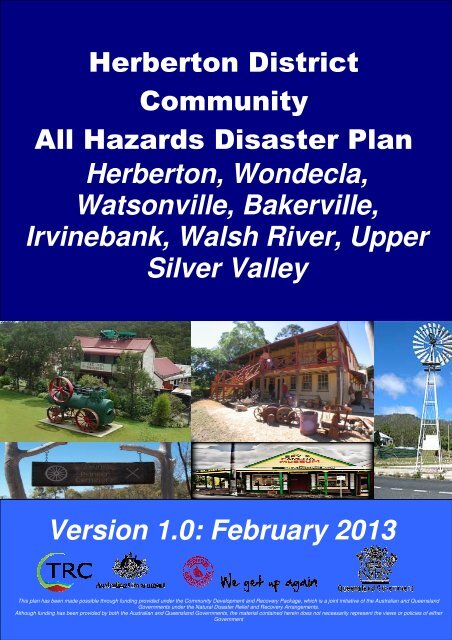
Herberton & District All Hazards Disaster Plan - Tablelands ...
Herberton & District All Hazards Disaster Plan - Tablelands ...
Herberton & District All Hazards Disaster Plan - Tablelands ...
- No tags were found...

Create successful ePaper yourself
Turn your PDF publications into a flip-book with our unique Google optimized e-Paper software.
HERBERTON & DISTRICT COMMUNITY ALL HAZARDS DISASTER PLANVERSION CONTROL & RECORD OF AMENDMENTSThe following plan updates have been issued and recorded:Date Version Outline of Revisions19 February2013V1.0 First and working draft.ApprovedbySignatureV1.0 (February 2013) Page 2 of 54Under no circumstance should you put yourself or others at risk to fulfil the tasks within this plan.
HERBERTON & DISTRICT COMMUNITY ALL HAZARDS DISASTER PLANTABLE OF CONTENTSGENERAL INFORMATION .................................................................................................................6DISASTER DEFINITION ......................................................................................................................8PLAN OWNERSHIP & REVISION .....................................................................................................8AIM OF PLAN ........................................................................................................................................8OBJECTIVES OF PLAN ......................................................................................................................8ACTIVATION TRIGGERS & PROCEDURES...................................................................................8MEDIA POLICY .....................................................................................................................................9PREVENTION, PREPAREDNESS, RESPONSE AND RECOVERY (PPRR).............................9SECTION B: OVERVIEW OF HERBERTON & DISTRICT COMMUNITY ....11LOCATION ...........................................................................................................................................11Travel distances by road from <strong>Herberton</strong> ..........................................................................................11TOPOGRAPHY....................................................................................................................................12CLIMATE ..............................................................................................................................................12POPULATION......................................................................................................................................12<strong>Herberton</strong> has a population of approximately 934 persons while Wondecla district hasapproximately 580 persons. 214 identify as Aboriginal and Torres Strait Islander descent.12INDUSTRY / EMPLOYMENT ............................................................................................................12LEISURE / TOURIST ACTIVITIES / ANNUAL EVENTS..............................................................12PUBLIC TRANSPORTATION...........................................................................................................13COMMUNICATIONS...........................................................................................................................13Telephone ..........................................................................................................................................13Internet Services ................................................................................................................................14CB Radio ...........................................................................................................................................14Radio Stations....................................................................................................................................14Television Stations.............................................................................................................................14UTILITIES .............................................................................................................................................15Electricity Supply ..............................................................................................................................15Water Quality & Supply ....................................................................................................................15Sewerage............................................................................................................................................15HAZARDS ............................................................................................................................................15Cyclones ............................................................................................................................................15Bushfires............................................................................................................................................16Flooding.............................................................................................................................................16Dams..................................................................................................................................................16Landslides..........................................................................................................................................17Chemicals ..........................................................................................................................................17NB: The use of petrol generators MUST be restricted to outdoor use ONLY due to the very high riskof Carbon Monoxide poisioning ........................................................................................................17V1.0 (February 2013) Page 3 of 54Under no circumstance should you put yourself or others at risk to fulfil the tasks within this plan.
HERBERTON & DISTRICT COMMUNITY ALL HAZARDS DISASTER PLANRoad Closures....................................................................................................................................17Other ..................................................................................................................................................17SECTION C: COMMUNITY DISASTER TEAM.............................................19COMMUNITY DISASTER TEAM COORDINATOR & DEPUTY..................................................19COMMUNITY DISASTER TEAM MEMBERS ................................................................................19OTHER STAKEHOLDERS ................................................................................................................20SECTION D: DISASTER RESPONSE & RECOVERY..................................22COMMUNITY DISASTER TEAM MEETING LOCATION.............................................................22PUBLIC INFORMATION POINT.......................................................................................................22PLACE OF REFUGE ..........................................................................................................................24EVACUATION CENTRES..................................................................................................................24RECOVERY CENTRE ........................................................................................................................25CRITICAL INFRASTRUCTURE........................................................................................................25Roads .................................................................................................................................................25Helipad Locations..............................................................................................................................26VULNERABLE GROUPS IN THE COMMUNITY...........................................................................28COMMUNICATIONS...........................................................................................................................29SECTION E: PLANNED COMMUNITY EDUCATION & AWARENESSRAISING 2013/2014......................................................................................30APPENDIX 1: ROLES AND RESPONSIBILITIES ........................................32APPENDIX 2: OPERATIONS LOG...............................................................38APPENDIX 3: INITIAL NOTIFICATION FORM.............................................39APPENDIX 4: RAPID DAMAGE ASSESSMENT..........................................40APPENDIX 5: SITUATION REPORT ............................................................45APPENDIX 6: REQUEST FOR ASSISTANCE..............................................49APPENDIX 7:MEETING ATTENDANCE REGISTER ...................................50APPENDIX 8: DEALING WITH THE MEDIA.................................................51V1.0 (February 2013) Page 4 of 54Under no circumstance should you put yourself or others at risk to fulfil the tasks within this plan.
HERBERTON & DISTRICT COMMUNITY ALL HAZARDS DISASTER PLANAPPENDIX 9: DISASTER MANAGEMENT ACRONYMS ............................52APPENDIX 10: DISTRIBUTION REGISTER.................................................53V1.0 (February 2013) Page 5 of 54Under no circumstance should you put yourself or others at risk to fulfil the tasks within this plan.
HERBERTON & DISTRICT COMMUNITY ALL HAZARDS DISASTER PLANSECTION A: OVERVIEW OF COMMUNITY DISASTER PLANGENERAL INFORMATION1. A disaster can occur with little or no warning and can be caused by a number of differenthazards. This plan is based on an 'all-hazards' approach, meaning it can beimplemented for any type of disaster event e.g. cyclones, storms, floods, wildfires,earthquakes, major transport accidents, etc.2. The <strong>Tablelands</strong> is a diverse region covering a large area of 64,768 km2. This plan isbased on the concept of community resilience. It recognises and promotes the need foreffective communication and coordination and seeks to ensure communities thatpotentially may become isolated following a disaster event, have the capacity to cope inthe short term, until external resources can arrive.3. Nobody should place themselves in danger or ask others to undertake any act that willplace them in jeopardy. The Emergency Services, even in the most difficult conditions,are the best agency to undertake tasks relating to life threatening situations and MUSTbe called.4. The <strong>Tablelands</strong> Local <strong>Disaster</strong> Management Group (LDMG) through its Local <strong>Disaster</strong>Coordinator has legislated responsibility under the <strong>Disaster</strong> Management Act 2003 forcoordinating disaster operations in the region. The Local <strong>Disaster</strong> Coordinator of theLDMG must be kept regularly updated by the Community <strong>Disaster</strong> Team Coordinator.5. Throughout the disaster, the Community <strong>Disaster</strong> Team Coordinator will attempt, withinthe constraints of the situation, to provide information to the <strong>Tablelands</strong> LDMG Local<strong>Disaster</strong> Coordinator acting as the Coordinator for the multi-agency response, andwhere appropriate to the community of <strong>Herberton</strong> & <strong>District</strong>.6. <strong>Tablelands</strong> Regional Council has teams of trained officers who will endeavour to meetthe requirements of the Local Authority response to any disaster. However they mayneed to call upon local knowledge to ensure the best deployment of resources.7. Communication with the Local <strong>Disaster</strong> Coordinator is necessary to authorise thedeployment of local resources. Permission must always be sought as there is nofinancial delegation provided to the Community <strong>Disaster</strong> Coordinator by the LDMG /<strong>Tablelands</strong> Regional Council.8. If communication with the Local <strong>Disaster</strong> Coordinator proves impossible by ALL means,then local resources can be deployed in accordance with what is documented in thisplan in order to sustain life and protect property only. Examples of measures that<strong>Tablelands</strong> Regional Council would regard as essential to sustain life and protectproperty include, but are not limited to:-ooooproviding sufficient food to feed evacuees located in evacuation centres;providing fuel for generators necessary to operate essential communityservices, businesses or infrastructure (e.g. fuel to run hospital generators,evacuation centre generators, sewerage treatment plant generators etc);arranging for the clearing of roads necessary to enable emergency servicevehicles to access the location of an emergency or to enable the safeevacuation of residents whose lives are at risk;arranging for the provision of essential medical services to sick or injuredpersons.9. Where local resources are deployed without the prior authorisation of the Local <strong>Disaster</strong>Coordinator, the Community <strong>Disaster</strong> Team Coordinator must ensure that theexpenditure incurred does not exceed what is essential to sustain life and protectproperty. For example, if there is more than one option available to sustain life orprotect property and each would be effective, then the Community <strong>Disaster</strong> TeamCoordinator should choose the option which incurs the least expenditure.V1.0 (February 2013) Page 6 of 54Under no circumstance should you put yourself or others at risk to fulfil the tasks within this plan.
HERBERTON & DISTRICT COMMUNITY ALL HAZARDS DISASTER PLAN10. If these rules are followed, <strong>Tablelands</strong> Regional Council agrees to reimburse reasonableexpenditure. However, at no time should an individual item of expenditure exceed $500nor total expenditure exceed $2000. Receipts and a reasonable explanation ofexpenditure will need to be provided prior to any money being reimbursed.11. In the event of the <strong>Herberton</strong> & <strong>District</strong> Community being isolated as a consequence ofthe disaster, local residents may have to maintain and protect their own communitiesuntil such time as external support can reach the community and normality can berestored.12. This plan does not remove the requirement for community members to ensure they haveadequate insurance in place and have taken appropriate precautions to protectthemselves from disaster events. The responsibility to remain alert to warnings andinformation still rests with the individual.Further advice and guidance about <strong>Disaster</strong> Management can be found at:http://www.trc.qld.gov.au/disaster-managementWhere you will find; <strong>Tablelands</strong> Regional Council’s <strong>Disaster</strong> Management <strong>Plan</strong> Information and links to leaflets on preparing for disasters Plus other advice and useful contacts ……..Please contact the <strong>Tablelands</strong> Local <strong>Disaster</strong> Management Group if you have any queries.ASK TO SPEAK TO LOCAL DISASTER COORDINATORTRC Switchboard: Tel: 1300 362 242<strong>Disaster</strong> Coordination Centre: Tel: 1300 362 242V1.0 (February 2013) Page 7 of 54Under no circumstance should you put yourself or others at risk to fulfil the tasks within this plan.
HERBERTON & DISTRICT COMMUNITY ALL HAZARDS DISASTER PLANDISASTER DEFINITION'A disaster is a serious disruption in a community, caused by the impact of an event, thatrequires a significant coordinated response by the State and other entities to help thecommunity recover from the disruption'.PLAN OWNERSHIP & REVISIONThis plan is owned by the <strong>Herberton</strong> & <strong>District</strong> Community <strong>Disaster</strong> Team on behalf of thecommunity of <strong>Herberton</strong> & <strong>District</strong>. The Community <strong>Disaster</strong> Coordinator is to ensure that theplan is reviewed on at least an annual basis. This review should be completed by Septembereach year.AIM OF PLANThis plan covers the procedural arrangements for responding to a known disaster affecting, orwith the potential to affect the population of the <strong>Herberton</strong> & <strong>District</strong>. The overall aim of thisplan is to:‘Enhance the resilience of the <strong>Herberton</strong> & <strong>District</strong> community in planning and preparing for,responding to and recovering from disaster events and to improve communication betweenthe <strong>Herberton</strong> & <strong>District</strong> and the <strong>Tablelands</strong> LDMG’.OBJECTIVES OF PLAN1. Enhance linkages and communication between the <strong>Herberton</strong> & <strong>District</strong> community andthe <strong>Tablelands</strong> Local <strong>Disaster</strong> Coordination Centre.2. Determine and communicate the priorities of <strong>Herberton</strong> & <strong>District</strong> in the event of adisaster.3. Identify resources in the <strong>Herberton</strong> & <strong>District</strong> community that could be utilised in theevent of a disaster.4. Identify vulnerable people in the <strong>Herberton</strong> & <strong>District</strong> community that may require specialassistance.ACTIVATION TRIGGERS & PROCEDURESThe <strong>Herberton</strong> & <strong>District</strong> Community <strong>Disaster</strong> <strong>Plan</strong> can be activated in response to a disasterevent by:1. The <strong>Tablelands</strong> LDMG Local <strong>Disaster</strong> Coordinator:o Who will contact the Community <strong>Disaster</strong> Team Coordinator, or if unavailable,their deputy to: Give as much information as possible on the event; Advise on a course of action within the Community; Request advice on the overall situationOr,2. If the Community <strong>Disaster</strong> Team Coordinator becomes aware of a disaster eventthreatening or impacting the community of <strong>Herberton</strong> & <strong>District</strong> they should:o Notify the relevant Emergency Services of the event (if appropriate)o Contact the <strong>Tablelands</strong> LDMG Local <strong>Disaster</strong> Coordinator to requestactivation of this plan.Please note: The Local <strong>Disaster</strong> Coordinator is to determine whether the event triggers theactivation of the plan. If the situation does not meet the criteria of a disaster, then the LDCwill not activate the plan and will instead request that Emergency Services agencies deal withthe situation using normal operational procedures.V1.0 (February 2013) Page 8 of 54Under no circumstance should you put yourself or others at risk to fulfil the tasks within this plan.
HERBERTON & DISTRICT COMMUNITY ALL HAZARDS DISASTER PLANMEDIA POLICYIt is critical in any disaster situation for authorities to control information being relayed to themedia. This is important so that people receive consistent messages and to avoid confusionin the community. Misinformation can lead to panic and chaos.In times of disaster, the Mayor of <strong>Tablelands</strong> Regional Council, in their capacity asChairperson of the LDMG, is to authorise ALL information disseminated to the public or themedia from the LDMG prior to its dissemination.Great care should be taken to ensure that no information about casualties or fatalities isreleased – this is a matter for the Police.If approached by the media, please refer them to the LDMG Media and CommunicationsOfficer on 1300 362 242. Please refer to private contact list for alternative contact details.PREVENTION, PREPAREDNESS, RESPONSE AND RECOVERY (PPRR)<strong>Disaster</strong>s have a cyclic four stage lifecycle. Understanding this lifecycle helps us to beprepared for disasters, respond safely and recover quickly and effectively.At each stage there are different things to know, different actions we should take and differentways we connect with people. The key messages for each stage will be provided by theLDMG Local <strong>Disaster</strong> Coordinator. These stages can change rapidly and often overlap. Thefour stages are:Prevention involves activities that reduce the impact of natural disasters through theidentification of hazards. <strong>Hazards</strong> are risks that that could affect households or evacuationplans, such as having power lines near trees, living in a street with only one access point, orhaving a creek behind a house. At a macro level, it also involves legislation, land-useplanning and technical solutions.In this stage, key messages to the community are:1. We are working together to minimise the potential impact of disasters;2. Natural disasters are unavoidable but everyone in the community has a part to play;3. A particular action may be necessary to help prevent a disaster.Preparedness is an ongoing set of activities in which people plan, prepare/organise and trainfor emergency situations. This includes tasks such as having a stay/go kit, making anevacuation plan, simulating disaster situations and appropriate responses, and discussingemergency preparedness with your neighbours.In this stage, the key messages to the community are:1. We are preparing together for the anticipated event;2. Individuals need to acknowledge they have a role to play in the event of a disaster;3. They must be prepared to survive on their own for at least seven days.Response is responding to the immediate needs of the emergency situation. A wellrehearsed emergency plan developed during the preparedness stage enables more effectiveresponses at all levels.In this stage, the key messages to the community are:1. Activate your personal / household emergency plan.2. Listen for warnings and follow all instructions promptly from the authorities, e.g. when anevacuation order is given;3. Check on neighbours and people, animals (pets) who may need your assistance;4. Don’t enter flood waters (roads, causeways etc). Remember, if it's flooded, forget it!5. Local Governments are the lead agenciesRecovery involves activities and decision making necessary to restore the affected area to itsprevious state, often taking the opportunity to improve the built environment by reducing predisasterrisks inherent in the community and its infrastructure. This stage often involvesrebuilding, reemployment and repair of essential infrastructure.In this stage, the key messages to the community are:V1.0 (February 2013) Page 9 of 54Under no circumstance should you put yourself or others at risk to fulfil the tasks within this plan.
HERBERTON & DISTRICT COMMUNITY ALL HAZARDS DISASTER PLAN1. Council is working with the community and partners to recover from this disaster asquickly as possible;2. We will learn from this disaster and with your help, rebuild; and3. We will emerge from this event stronger and with more capacity to cope in the future.4. Council is the lead agency in the recovery phase.V1.0 (February 2013) Page 10 of 54Under no circumstance should you put yourself or others at risk to fulfil the tasks within this plan.
HERBERTON & DISTRICT COMMUNITY ALL HAZARDS DISASTER PLANSECTION B: OVERVIEW OF HERBERTON & DISTRICT COMMUNITYLOCATIONThe <strong>Herberton</strong> <strong>District</strong> covers <strong>Herberton</strong>, Moomin, Wondecla, Watsonville, Bakerville, WalshRiver, Irvinebank, Mont Albion, Emuford and the northern section of Silver Valley. <strong>Herberton</strong>is situated 17 kilometres south of Atherton in the Southern Atherton <strong>Tablelands</strong>. Wondecla is10 kilometres south of <strong>Herberton</strong> and covers a region of 70km 2 . Irvinebank is situated 28kilometres west of <strong>Herberton</strong> and is accessed via Watsonville by a gravel road. It can be alsoaccessed from the north via Petford.This plan covers the entire <strong>Herberton</strong> & <strong>District</strong> Police division as depicted in the map below:Travel distances by road from <strong>Herberton</strong>TO DISTANCE (KM) APPROX. TRAVEL TIME (MINS)Cairns 96 95Innisfail 98 80Mareeba 51 47Atherton 17 18Wondecla 7 8Watsonville 11 12Petford 75 90Irvinebank 27 >28 (unsealed sections)Ravenshoe 39 35Bakerville 19 20Emuford 52 65V1.0 (February 2013) Page 11 of 54Under no circumstance should you put yourself or others at risk to fulfil the tasks within this plan.
HERBERTON & DISTRICT COMMUNITY ALL HAZARDS DISASTER PLANMont Albion 26 30TOPOGRAPHY<strong>Herberton</strong> <strong>District</strong> is situated in the southern region of the Atherton <strong>Tablelands</strong> and has anaverage altitude of 980mts. The area is mountainous and vegetation varies from dry openforest to dense rainforest. There are numerous watercourses ranging from creeks to majorriver systems.Watsonville is situated to the west of <strong>Herberton</strong> at an elevation of approximately 800m. Thearea is hilly and rocky with open eucalyptus woodland and porous soils.Irvinebank is located to the west of <strong>Herberton</strong>, behind Petford, in a valley of the Great DividingRange. The area is extremely hilly and lightly wooded with some areas cleared for grazingproperties.CLIMATEThe <strong>Herberton</strong> district has a typical northern climate with low humidity and an average annualrainfall of approximately 800mls. In summer, the monsoon season, the area oftenexperiences very high rainfall, hot temperatures, up to 40 degrees, and occasional cyclones.Winter dries the area, increasing risk of fire while simultaneously dropping temperatures tominus 2 degrees, often creating frost. The district is subject to heavy fog at anytime of theyear.POPULATION<strong>Herberton</strong> has a population of approximately 934 persons while Wondecla district hasapproximately 580 persons. 214 identify as Aboriginal and Torres Strait Islander descent.The population of the Watsonville, Walsh River, Upper Silver Valley and Irvinebank area is344. Residents of these areas are predominantly retirees and unemployed adults however theWalsh does have a higher proportion of children and younger adults. The itinerant indigenousBarburam group frequent the area. (2011 Census QuickStats).INDUSTRY / EMPLOYMENTThe main industries / employment in the district include beef cattle and other farming, smallbusinesses including hospitality and civil, local government, education and health care andsome mining/quarries with potential to expand operations in Bakerville and Arbourne Road.The majority of residents work outside of the district within the <strong>Tablelands</strong> or fly-in / fly-out.LEISURE / TOURIST ACTIVITIES / ANNUAL EVENTS<strong>Herberton</strong> Township was founded in 1880 with the discovery of tin and other metals in the<strong>District</strong>. Thriving communities abounded and then as the minerals ran out or dropped in valuesome of these communities were abandoned leaving only ruins and the occasional cemeteryto prove they once existed eg: Mount Ablion. Other communities have survived includingWatsonville (with a restored windmill situated in the middle of the road), Bakerville, WalshRiver & Silver Valley, although generally speaking there are no shops or services within theseTowns.<strong>Herberton</strong> was the first town established on the Atherton <strong>Tablelands</strong>. Many of the pioneersfaced insurmountable odds to develop industry and communities within the district. Theoriginal <strong>Herberton</strong> mine was the Great Northern Mine, situated in Jack St (although therewere numerous other mines in and around <strong>Herberton</strong>). This site has been conserved andwalking tracks have been developed of differing distances in and around the mining area. The<strong>Herberton</strong> Mining Museum was established on this site and is an Archive / Family HistoryResearch Centre & Tourist Information Centre. Within <strong>Herberton</strong> there is also a RailwayMuseum and the Spy & Camera Museum. Additionally, the <strong>Herberton</strong> Historical Village is aV1.0 (February 2013) Page 12 of 54Under no circumstance should you put yourself or others at risk to fulfil the tasks within this plan.
HERBERTON & DISTRICT COMMUNITY ALL HAZARDS DISASTER PLANmajor tourist attraction in the town and showcases original pioneer buildings gathered over alifetime in and around the Far North, including a Hotel, Bank, Music Shop, Dress Shop,General Store, Newspaper, Draper, Blacksmiths and Butcher. The buildings have been fullystocked and arranged as a village which visitors can walk through.<strong>Herberton</strong> has a variety of accomodation ranging from a Caravan Park, Hotels and bed &breakfasts. Most services are available within the township including a Supermarket, PostOffice, Library, Cafes, Newsagency, Hospital, Doctor, Fire Brigade, Council Office, PoliceStation, Government Agent, Chemist, and a variety of other stores.Petrol / Diesel and LPG cylinders are available from Wondecla Roadhouse. <strong>Herberton</strong>Hardware Store supplies LPG.Educational requirements are fulfilled by the 100 year old <strong>Herberton</strong> State School (Primary toYear 10) and Mt. Saint Bernard College (provides both Day & Boarding facilities).Wondecla is rich in World War II history. This area was the staging & training area for the 6thDivision. Thousands of servicemen & women were camped in this area during the Pacific WarVery few structures are left except for some stone fireplaces and the Entertainment Igloo.Some of the buildings in <strong>Herberton</strong> were used by the Army during WWII.Irvinebank is one of the towns that has survived and has some amazing buildings dating backto the mining era including the School of Arts Building, The Log Weir, The Vulcan Mine site,NSW Bank building, numerous original miners cottages and other buildings such as the oldPost Office and the 100 year old school, which continues to be in use. Irvinebank also has thewonderful John Moffat Museum situated at the original mine administration site. There is aHotel with a Motel / Caravan & Camping Sites available.Outdoor activities are popular in the <strong>Herberton</strong> and district area, including bushwalking, horseriding, motorcycle riding, camping, mountain bike riding, fishing, swimming and camping.There are also organised events run intermittently which relate to these activities includinghorse and bike endurance rides, horse sports at Tepon, stock cars and speedway and theannual “Croc Trophy” cycle race held in October. There are a variety of other annual events,including Anzac Day, Ghost Walks, Pioneer Day (May), John Moffett Festival (August),Flower and Tin Festivals (September), drag races (October) and Christmas Street Party(December). Markets are also held in Wondecla on the 3rd Sunday of each month and theWalsh River typically every 3-4 months.PUBLIC TRANSPORTATION• Taxi: Closest service is in Atherton. It will come to <strong>Herberton</strong> area but is costly.• Bus: Kerry's Bus Service – Ravenshoe to Atherton & return 3 times dailyECHO bus and Atherton HACC frequent the areaTrans North runs <strong>Herberton</strong> to Karumba return, 3 times a week• Air: Grass airstrips - light aircraft only at Wondecla, & AthertonLarger airstrip (sealed) at Mareeba Aerodrome.Several locations are potentially suitable for a helicopter -see page 20• Rail: There are no rail services to the <strong>Herberton</strong> <strong>District</strong> but the Mareeba toForsayth Tourist Railway does pass to the west of Irvinebank through theLappa Junction. There a numerous unused railway tracks in the <strong>District</strong>.Please note that there are no public transport services available in Watsonville or Irvinebank.COMMUNICATIONSTelephoneMost residents have Landlines however they can be intermittent, especially in wet weatherand electrical storms. Some residents have Satellite phones, however these can also beunreliable in overcast or wet weather. Other residents use Skype.V1.0 (February 2013) Page 13 of 54Under no circumstance should you put yourself or others at risk to fulfil the tasks within this plan.
HERBERTON & DISTRICT COMMUNITY ALL HAZARDS DISASTER PLANTelstra Next G and 3G mobile services are the most widely utilised by locals as Optus andVodaphone service is not available within the area. There are areas in which Telstra mobilephone coverage can be intermittent or non-existent, include:• Wondecla,• Watsonville,• Bakerville,• Irvinebank (some unreliable coverage with car kit),• Upper Silver Valley, and• other isolated areas.Please refer to http://www.telstra.com.au/mobile/networks/coverage/maps.cfm as thiswill give some indication of these areas.Residents are encouraged to have a telephone that doesn't require electricity to work, ie notcordless, as power may be unreliable post-disaster event. Residents are also advised to havea mobile phone car charger to enable recharge if the power supply is interrupted.Alternative emergency number for mobile phones is 112 if 000 unavailable. You should onlydial 112 as an alternative to 000 if you have a GSM digital mobile phone and you are outsideyour own providers GSM network coverage area. You may not be able to access 112 if youare outside all network coverage areas.Internet ServicesA variety of internet connections are available including wireless and satellite. There is ADSLavailable approximately 8km from the <strong>Herberton</strong> exchange, including the township and partsof Wondecla. Residents often have trouble with intermittent coverage. Only half of Watsonvillehas internet access and most Irvinebank residents rely on satellite internet.CB RadioMost cattle properties have both CB & RFDS Radio. Many trucks, caravans and work vehiclesand some private vehicles are equipped with CB Radio, with most using Channel 40 or 18.There are radio enthusiasts in the district with private communication equipment & aerials.Irvinebank have VHF radio in the Rural Fire Brigade. They are able to communicate withCairns with 85% reliability.The Emergency Channel for community members to use is CB Channel 10.Radio StationsRADIO STATIONABC Far North4CA4AM4KZHot FMFREQUENCY106.7FM, 95.5FM, 720AM, 801AM846AM558AM531AM97.9FMKick FM88.7FMPlease note, Irvinebank does not receive all of the stations.Television Stations• ABC• WINV1.0 (February 2013) Page 14 of 54Under no circumstance should you put yourself or others at risk to fulfil the tasks within this plan.
HERBERTON & DISTRICT COMMUNITY ALL HAZARDS DISASTER PLAN• TEN• SEVEN (unreliable in Irvinebank)• SBS• Imparja (in some areas)UTILITIESElectricity SupplyErgon provides power to most residents via above ground lines. Interruption to supply can becaused by electrical storms, trees falling across power lines, high winds, vehicle crashes, firesor floods. Residents are warned to NOT get any closer then 10 mts (approx 10 big footsteps)if power lines are broken or damaged.Many residents, mostly those on acreage and farms, have backup generators and some havesolar power. Residents should be aware that some solar power units store electricity and cancause electrocution even if there is no mains power.Upper Silver valley and areas of the Walsh River (up to Surveyors Creek and to the end ofBischoff Mill Road) do not have electricity supplied. Most residents of these areas are on solaror generator power.Water Quality & SupplyThere is a water treatment plant to supply water to the <strong>Herberton</strong> & Wondecla Township. Thissystem is gravity fed and therefore resilience to power failure. <strong>All</strong> other properties have eitherbores, rainwater tanks or access to a watercourse. If there is no power many properties havedifficulty pumping water to their buildings unless they have a generator or gravity feed.Watsonville has no treated water or reticulated supplies however there are a water tanks atthe Watsonville Progress Shed and the Walsh Community Centre. Residents rely primarily onrain water and bore water tanks for drinking. Water quality from local watercourses can bedubious.Irvinebank has access to water from the Dam however it is not potable. Residents rely on rainand bore water tanks.SewerageThere is no sewerage in the <strong>Herberton</strong> <strong>District</strong>. <strong>All</strong> buildings have their own septic, bio cycles,composting or pit toilets. Mt St Bernards have their own sewerage plant with backupgenerator power. In major floods this system has the potential to overflow, however mitigationmeasures have been implenmented.HAZARDSCyclonesThis area is generally susceptible to cyclonic conditions from November to April annually.Cyclones can pose a serious threat to life and property. Conditions can vary from mild tosevere wind, heavy to torrential rain, flooding in localised areas, across roads, creeks andprivate properties, often deteriorating roads, isolating residents and typically leading tocommunication and electricity failure. Environmental damage and debris and flooding caninhibit movement on roads, access to and within private properties.The <strong>Herberton</strong> <strong>District</strong> has experienced moderate to severe damage due to Cyclones in thepast, most recently Cyclone Larry & Cyclone Yasi. These cyclones caused serious disruptionto all services and day to day living. These events may can cause significant damage tovegetation, fencing which may lead t isues with animal control.V1.0 (February 2013) Page 15 of 54Under no circumstance should you put yourself or others at risk to fulfil the tasks within this plan.
HERBERTON & DISTRICT COMMUNITY ALL HAZARDS DISASTER PLANBushfiresDue to the natural vegetation in this area there is a very high likelihood of bushfires during thedry season, commencing April. Water shortages during the dry season, at both propertiesand watercourses, may cause difficulties in fighting fires throughout the region. Access towater supply and fires can be hindered by overhanging vegetation, closely gatheredstructures and rugged landscape, impeding the fire service.A Queensland Fire Service Station is located in the Main Street of <strong>Herberton</strong>. There arenumerous Rural Fire Brigades in the area including Wondecla, Bakerville, Watsonville, WalshRiver, Upper Silver Valley and Irvinebank. The Rural Fire Brigades run a consistent remindercampaign, detailing where to obtain permits, when burn-offs are permitted, along withcommunity education. Property owners are encouraged to be as self sufficient as possibleand to adhere to bushfire warnings. The level of community preparation ranges howeverapproximately 60% would have some level of preparedness.Please be aware of the potential for gas cylinders to explode if overheated in fires.Flooding<strong>All</strong> watercourses are prone to short term flooding following 50ml of rain per hour. Somewaterways are subject to flash flooding due to water coming down from upstream, even ifthere is no rain in the local area. Flooding at the following watercourses/roads are known tooccur regularly and isolate residents.Wild River: This is a major watercourse throughout the <strong>District</strong> which can cause brief floodinganywhere along its length, especially between <strong>Herberton</strong> & Wondecla. It can also flood theWondecla oval, western properties of Wondecla and the James Road bridge and causeway.Wondecla residents can utilise alternate paths into town if this area is flooded. The Wild Rivercan also cause flooding in the Moomin area, restricting access to the <strong>Herberton</strong> township’swater supply. In addition, it can isolate properties on the Silver Valley Road.Wondecla Creek: Can flood the bridge near the Wondecla oval, the causeway near WayneBishop Road (end of Elms Road) and at various locations along Rolley Rd.Walsh River Area: The area can be isolated by Twenty Five Pounder Creek, Toy Creek,Surveyor Creek, Gorge Creek, Jamie Creek, Chinaman Creek and Corduroy Creek for up to aweek, isolating residents. There are also a number of short term high-speed water eventswhich are extremely dangerous given the high flow of water. Such floods have the potential tosweep vehicles off crossings.<strong>Herberton</strong> – Petford Road: This access road into Irvinebak has 13 causeways which floodeasily and regularly. The road also floods at Jamie Creek and Watsonville. This road isunsealed for much of it length.Irvinebank: There is a river which flows through the township which can cause isolatedflooding, especially of the three causeways within the township. The Gibbs, Mc Donalds andTarget Gully creeks are also prone to flooding.Motorists should be aware of the serious danger to themselves and Emergency Servicepersonnel if they drive/swim through flooded creeks etc.DamsReferable Dams: A referable dam is one that would, in the event of failure, put peopleslives at risk. Failure could be from excessive rainfall or sunny day failure.Wild River Dam <strong>Herberton</strong> is a referable dam.Ibis Dam, Irvinebank is a referable dam.V1.0 (February 2013) Page 16 of 54Under no circumstance should you put yourself or others at risk to fulfil the tasks within this plan.
HERBERTON & DISTRICT COMMUNITY ALL HAZARDS DISASTER PLANEmergency Action <strong>Plan</strong>s (EAP) have been developed for these dams and are held by<strong>Tablelands</strong> Regional Council <strong>Disaster</strong> Management, OIC <strong>Herberton</strong> Police and the EAPOfficer in Irvinebank.Jumna Dam: If this dam was to burst it will close the <strong>Herberton</strong>-Petford Road.LandslidesLandslides on the <strong>Herberton</strong> Range, <strong>Herberton</strong> – Petford Rd, Kennedy H'way, WatsonvilleRange and Irvinebank Range may cause Road Closures. Heavy Rainfall during our WetSeason (November to April) can produce substantial falls in very short periods of time. Thearea can become isolated from Cairns if the Kuranda Range, Gillies or the Palmerston H'waybecome cut.ChemicalsGas: Can be held at Mt. St Bernard College, <strong>Herberton</strong> Hardware, Wondecla Roadhouse,Irvinebank Tavern and other hotels in the district.Fuel: is stored at Wondecla Roadhouse and diesel at the <strong>Herberton</strong> Hospital (for theHospital’s generator). Irvinebank Tavern has both petrol and diesel. Communities in areaswhere there is no fuel supply need to ensure adequate arrangements are in place.Hazardous goods: could be located at <strong>Herberton</strong> Hardware and the Council Depot.In addition, there is the potential for leakage from the Baal Gaamon Mine which could impactwater quality.There is also a potential risk posed to people digging around in old treatment plants ormullock heaps that could have been treated with poisonous chemicals e.g. cyanide / lead /mercury. This could also cause leaching into waterways making it unsafe to drink or swim in.e.g. the causeway on Morris Rd in <strong>Herberton</strong>.Members are Be aware of HAZCHEM signage on buildings and vehicles.NB: The use of petrol generators MUST be restricted to outdoor use ONLY due to thevery high risk of Carbon Monoxide poisioningThere are some heavy vehicles which service the area including fuel tankers to Irvinebank,Phorpery stone cartage, cement trucks and water trucks. Due to the nature of some goodscarried, these vehicles pose a potential risk to the community. The main areas of concern arethe gravel roads which not always known to those from outside the area, roll overs on theranges and the narrow Gibbs Creek Bridge.Road ClosuresRoad closures in the <strong>Herberton</strong> <strong>District</strong> are often caused by fallen vegetation, smoke andflooding (see flooding section above), inhibiting general traffic and the transportation ofsupplies and services. In the past, Hales Siding Road has been closed throughout the wetseason.OtherUXOs/Explosives: During WWII the areas around Wondecla, Silver Valley and Bakervillewere used as an army training area. This training included the use of a variety of weapons.There is a danger of unexploded ammunition including bullets, grenades, & mortars. If foundthe Police should be notified, the items should not be touched – they have been there for over60 years and are therefore unstable and could explode. The Army will generally send a teamof men to deal with any munitions deemed dangerous. Some areas have signage pertainingto this.Mine Shafts: Due to extensive mining activity, both past and present, mine shafts –especially those covered over with leaves and debris – can be difficult to see and can pose aV1.0 (February 2013) Page 17 of 54Under no circumstance should you put yourself or others at risk to fulfil the tasks within this plan.
HERBERTON & DISTRICT COMMUNITY ALL HAZARDS DISASTER PLANserious threat to life if someone falls into one. Many visitors and locals are often unaware ofthis hazard.V1.0 (February 2013) Page 18 of 54Under no circumstance should you put yourself or others at risk to fulfil the tasks within this plan.
HERBERTON & DISTRICT COMMUNITY ALL HAZARDS DISASTER PLANSECTION C: COMMUNITY DISASTER TEAMCOMMUNITY DISASTER TEAM COORDINATOR & DEPUTYThe Community <strong>Disaster</strong> Team Coordinator is a person living locally who provides the vitallink between the community and other organisations in planning, responding and recoveringfrom a disaster.Their role is to:• Have a good understanding of the community, the surrounding area and its residents• Provide strong leadership, effective communication and cooperation• Maintain responsibility for the content and operation of the Community <strong>Disaster</strong> <strong>Plan</strong>• Undertake or delegate the completion and maintenance of the Community <strong>Disaster</strong> <strong>Plan</strong>• Communicate effectively with the <strong>Tablelands</strong> Local <strong>Disaster</strong> Coordination Centre andwith the community to maintain two-way flow of information• Call and chair meetings of the Community <strong>Disaster</strong> Team on a regular basis• Provide the focal point for the community response to a disaster, be able to representtheir views and activate their support• Ensure that the vulnerable are treated as a priority• Ensure that confidentiality is maintained and privacy is respected• Promote self-help and resilience• Ensure the safety of self and othersNAME ROLE PHONECraig RobertsAndrew LynchPeter BrownRod FinchKevin MellonRod BowtellCommunity <strong>Disaster</strong> Team Coordinator /Queensland Police Service<strong>Herberton</strong> Deputy Community <strong>Disaster</strong> TeamCoordinator / QFRSIrvinebank Deputy Community <strong>Disaster</strong> TeamCoordinator / Rural Fire BrigadeWatsonville Deputy Community <strong>Disaster</strong> TeamCoordinator / Rural Fire BrigadeWalsh River Deputy Community <strong>Disaster</strong> TeamCoordinator / Rural Fire BrigadeUpper Silver Valley Deputy Community <strong>Disaster</strong>Team Coordinator / Rural Fire Brigade4096 25684096 24094096 40014096 21084096 20084096 3297Scott RobinsonWondecla Deputy Community <strong>Disaster</strong> TeamCoordinator*For additional contacts refer to the private contact list40962 399COMMUNITY DISASTER TEAM MEMBERSIn the event of a disaster, the following individuals and organisations will work together toachieve the aim and objectives of this plan in order to provide support and care to the localcommunity. To achieve this goal, members may have to call upon additional support fromlocal residents and resources. These contacts are recorded in the restricted contact list whichis maintained and held by the Community <strong>Disaster</strong> Team Coordinator.V1.0 (February 2013) Page 19 of 54Under no circumstance should you put yourself or others at risk to fulfil the tasks within this plan.
HERBERTON & DISTRICT COMMUNITY ALL HAZARDS DISASTER PLANORGANISATIONRural Fire Brigade – Upper Silver ValleyRural Fire Brigade – WondeclaRural Fire Brigade – Walsh RiverRural Fire Brigade – Walsh RiverRural Fire Brigade - IrvinebankS.E.S.<strong>Herberton</strong> Hospital<strong>Herberton</strong> State SchoolMt. St. Bernard CollegeMt. St. Bernard CollegeAustralian Red CrossAustralian Red CrossAustralian Red Cross / Meals on Wheels –<strong>Herberton</strong> HospitalQCWA - <strong>Herberton</strong>Watsonville Progress AssociationIrvinebank Progress AssociationRobinson Civil ConstructionIrvinebank Community MemberIrvinebank Community MemberRadio CommunicationsNAMELance ChapmanDave StewartTrish RichardsonStephen BondJeanette HodgkinsonGraeme GriffithsKate GleaveAndrew HurstBrother Bill TynanPeter NightingaleJan WyattIrene DayElaine BruceTrudy Lamberton (Pres)Jane ChapmanRoz BorehamScott RobinsonSandy MoulangRicky JonesBill Jessop<strong>Herberton</strong> Assembly of GodPastor Gordon WilliamsPlease refer to the detailed list of roles and responsibilities (see Appendix).*Refer to restricted contact list for additional detailsOTHER STAKEHOLDERSThere are numerous agencies involved in disaster response and recovery. The following liststhe public numbers of some of the government, non-government and emergency servicesagencies involved. To obtain 'official' support from these stakeholders, the Community<strong>Disaster</strong> Coordinator should contact the Local <strong>Disaster</strong> Coordination Centre.*Note, this list is not exhaustive. Refer to restricted contact list for additional details.V1.0 (February 2013) Page 20 of 54Under no circumstance should you put yourself or others at risk to fulfil the tasks within this plan.
HERBERTON & DISTRICT COMMUNITY ALL HAZARDS DISASTER PLANGOVERNMENT & NON GOVERNMENT FACILITIES & AGENCIESORGANISATION ADDRESS PHONEBureau of MeteorologyDept Transport & MainRoadsDept Environment &Heritage ProtectionErgon Energy<strong>Tablelands</strong> RegionalCouncilBrisbane Regional Officewww.bom.gov.au3239 8700http://131940.qld.gov.au/ 13 19 40http://www.ehp.qld.gov.au/ 13 74 68http://www.ergon.com.au/65 Rankin St, Mareebawww.trc.qld.gov.au13 22 96 (fault)000 or 13 16 70(emergency)1300 362 242Optus www.optus.com.au 1800 780 219Telstra<strong>Herberton</strong> MiningInformation Centrehttp://www.telstra.com.au/help/index.htm13 22 031 Jacks Rd, <strong>Herberton</strong> 4096 3474EMERGENCY SERVICESORGANISATION ADDRESS PHONELocal <strong>Disaster</strong> CoordinationCentreQueensland AmbulanceServiceQueensland Fire ServiceQueensland Police ServiceWondecla RFB65 Rankin St, Mareeba 1300 362 242Atherton or RavenshoeGrace St, <strong>Herberton</strong>William St, <strong>Herberton</strong>CNR Longlands Gap Rd & Flaggy CkRd Wondecla000 - Urgent orlife threatening /Non urgent:131 233000 - Urgent orlife threatening or4096 1505 ifattended000 - Urgent orlife threatening4096 2568 ifattended000Irvinebank RFB 12 Jessie St Irvniebank 000Upper Silver Valley RFB 000Watsonville / BakervilleRFB000Walsh River RFB Lot 1 Walsh River Rd Walsh River 000SES 40 Grace St, <strong>Herberton</strong> 132 500V1.0 (February 2013) Page 21 of 54Under no circumstance should you put yourself or others at risk to fulfil the tasks within this plan.
HERBERTON & DISTRICT COMMUNITY ALL HAZARDS DISASTER PLANFacilityDetailsNameAddressKey Holder/sSECTION D: DISASTER RESPONSE & RECOVERYCOMMUNITY DISASTER TEAM MEETING LOCATIONIn most circumstances, Community <strong>Disaster</strong> Team meetings will be held at the Police Stationand will be chaired by the QPS Community <strong>Disaster</strong> Team Coordinator. If the Police Officeris not available, due to operational policing priorities, meetings will have to be held at analternative location as the Police Station will not be available. Where the QPS Community<strong>Disaster</strong> Team Coordinator is unavailable, meetings will be chaired by the Deputy.The Community <strong>Disaster</strong> Team Meeting will not normally be accessible to the public givenconfidentiality and other requirements of operations. Public enquiries should be directed to adifferent location where assistance and information can be provided. This may be the sameas the alternative meeting point or a different location (see Public Information Point below).Primary Alternative Alternative Alternative Alternative<strong>Herberton</strong> PoliceCourt House15 William Street,<strong>Herberton</strong>QPS - Craig Robertsor Jeremy YoungWondeclaRural FireBrigade ShedCnr LonglandsGap andFlaggy CreekRd, WondeclaDavid StewartJohn LangeIrvinebank RuralFire BrigadeStation12 JessieStreet,IrvinebankPeter Brown,JeanetteHodgkinsonWatsonvilleCommunityShedLot 112 JamesStreet,WatsonvilleRay Pedersenand JaneChapmanComputer No, but easily set up No No No No4096 2999Phone points, easilyPhone (#)(Fire Brigade 40964078 Noset upShed numberFax (#)Generator(size)OtherPhone points,easily set upYes-sufficient to runentire buildingSome accessibilityissues, minimalparking.Kitchen and toiletson site No No NoNoPUBLIC INFORMATION POINTToilets,kitchenetteNoToilets/showers/drinkingwater/kitchenCB RadioEasilyobtained, butnot storedonsiteToilets,drinking water,kitchenetteWalsh RiverCommunityCentre401 WalshRiver Road,Walsh RiverKevin Mellon,Lyn Fraser,Steven Bond4096 3000(not alwaysmanned)5kvGas fridge,toilets, coldshowersThe Community <strong>Disaster</strong> Team Meeting location should not be accessible to the public givenconfidentiality and other requirements of operations. Public enquiries should be directed to adifferent location where assistance and information can be provided. In the longer term, thisfacility may become the Recovery Centre and be managed by the Department ofCommunities.Facility DetailsPublic Information Point - <strong>Herberton</strong>Name<strong>Herberton</strong> Shire hallAddress40 Grace St, <strong>Herberton</strong>Key Holder/sCr Shaaron LinwoodComputerYesPhone (#) 1300 362 242Fax (#) 4096 2689Generator (size)28 Kva (however may be relocated to Mt Garnet waterV1.0 (February 2013) Page 22 of 54Under no circumstance should you put yourself or others at risk to fulfil the tasks within this plan.
HERBERTON & DISTRICT COMMUNITY ALL HAZARDS DISASTER PLANOtherFacility DetailsNameAddressKey Holder/sComputerPhone (#)Fax (#)Generator (size)OtherFacility DetailsNameAddressKey Holder/sComputerPhone (#)Fax (#)Generator (size)Othertreatment plant if necessary)Toilets, kitchenettePublic Information Point - WatsonvilleWatsonville Community ShedLot 112 James Street WatsonvilleRay Pedersen and Jane ChapmanNoNoNoEasily obtained, but not stored onsiteToilets, kitchenettePublic Information Point - Walsh RiverWalsh River Community CentreRN 401, Walsh River RdKevin Mellon, Lyn Fraser, Steven BondNo4096 3000 (not always manned)No5kvGas fridge, toilets, cold showersFacility DetailsPublic Information Point - WondeclaNameWondecla Road HouseAddressLonglands Gap Rd, WondeclaKey Holder/sJulie and Steven BasagliaComputerYesPhone (#) 4096 2159Fax (#) 4096 2159Generator (size)YesOtherFuel & GasFacility DetailsPublic Information Point - WondeclaNameWondecla Rural Fire ShedAddressLonglands Gap RdKey Holder/sDavid StewartJohn LangeComputerNoPhone (#) 4096 2999Fax (#)As aboveGenerator (size)NoOtherToilets, kitchenetteFacility DetailsPublic Information Point - IrvinebankNameIrvinebank Rural Fire Brigade ShedAddressJessie StreetKey Holder/sPeter Brown, Jeanette HodgkinsonComputerYesPhone (#) 40964078Fax (#)NoGenerator (size)NoOtherToilets/showers/ drinking water/kitchenCB RadioV1.0 (February 2013) Page 23 of 54Under no circumstance should you put yourself or others at risk to fulfil the tasks within this plan.
HERBERTON & DISTRICT COMMUNITY ALL HAZARDS DISASTER PLANPLACE OF REFUGEA Place of Refuge will only be established prior to the impact of a cyclone and only whereABSOLUTELY NECESSARY. Advice should be sought from the <strong>Tablelands</strong> Local <strong>Disaster</strong>Coordinator at the earliest possible time.A Place of Refuge is NOT a cyclone shelter. There are no cycloneshelters in the TRC region.EVACUATION CENTRESAn Evacuation Centre is a building designated by Council for emergency accommodationfollowing a disaster event e.g. flood, bushfire, etc. An Evacuation Centre aims to meet thebasic needs of people who require its services.Evacuation Centres will be activated by the LDMG Local <strong>Disaster</strong> Coordinator only when it isappropriate to do so. The Local <strong>Disaster</strong> Management Group has an agreement with theAustralian Red Cross to manage Evacuation Centres. Evacuation Centres should beconsidered as a last resort for people unable to make alternative arrangements. Beforeopening any form of Evacuation Centre facility, assistance from the LDMG Local <strong>Disaster</strong>Coordinator must be sought.It is vital that the public do not attend any Evacuation Centre unlessofficially advised. It will not be functioning.FacilityDetailsNameAddress<strong>Herberton</strong> Shire hallEvacuation Centres - <strong>Herberton</strong><strong>Herberton</strong> Primary School HallPermission from Education Qldprior to being used.40 Grace St, <strong>Herberton</strong> Elwyn Phillips Memorial Dr,<strong>Herberton</strong>Key Holders Cr Shaaron Linwood Andrew HurstComputer Yes YesPhone 1300 362 242 4096 1333Fax 4096 2689Generator28 Kva (however may be relocated toMt Garnet water treatment plant ifnecessary)Water Yes YesShelter Yes YesToilets Yes YesShowers No YesKitchen Kitchenette CanteenOther Ramp access Some access difficultiesNoFacility DetailsNameAddressKey HoldersComputerPhoneFaxGeneratorWaterShelterToiletsShowersKitchenEvacuation Centre - Watsonville & Walsh RiverWalsh River Community CentreRN 401, Walsh River RdKevin Mellon, Lyn Fraser, Steven BondNo4096 3000 (not always manned)No5kvYesYesYesCold showerCommercial kitchenV1.0 (February 2013) Page 24 of 54Under no circumstance should you put yourself or others at risk to fulfil the tasks within this plan.
HERBERTON & DISTRICT COMMUNITY ALL HAZARDS DISASTER PLANOtherFirst Aid Kit. Water tanksFacilityEvacuation Centres - IrvinebankDetailsName Irvinebank State School No Irvinebank Rural Fire Brigade ShedAddress High Street Jessie StreetKey Holders Tamara Wemyss Peter Brown, Jeanette HodgkinsonComputer Yes YesPhone 409641874096 40964078Fax No NoGenerator No NoWater Non-Potable & tank Non-PotableShelter Irvinebank State School Irvinebank Rural Fire Brigade ShedToilets Yes Jessie StreetShowers Yes YesKitchen Yes YesOther A?ddressRECOVERY CENTRESupport and information for the public will be disseminated from this location following anevent. Management of this centre may become the responsibility of Department ofCommunities if deemed necessary. Liaise with the LDMG Local <strong>Disaster</strong> Coordinator at theearliest opportunity if a Recovery Centre is identified as a need.Facility DetailsNameAddressKey Holder/sComputerPhone (#)Fax (#)Generator (size)OtherRecovery Centre – <strong>Herberton</strong>QCWA Hall14 William St <strong>Herberton</strong>Trudy LambertonNoNoNoNoToilets, kitchenetteCRITICAL INFRASTRUCTURERoadsRoads identified as priority 1 (high) are considered critical routes by the Department ofTransport & Main Roads and / or <strong>Tablelands</strong> Regional Council. These routes are considereda priority and will be cleared by the appropriate organisations at the earliest possible time.Other roads will be cleared by <strong>Tablelands</strong> Regional Council as priorities and resourcespermit. These roads are less critical to the region as a whole, but considered essential tokeep communities safe and trafficable. The criticality of roads listed below by the communitywill inform Tic's prioritisation. Comments must be provided to support decision making.In the unlikely event, that ALL communications have failed with the LDMG Local <strong>Disaster</strong>Coordinator, the Community <strong>Disaster</strong> Coordinator may need to authorise these lower priorityroads to be cleared to enable access for emergency services vehicles.RoadSectionCriticality (1 =high, 5 = low)Comments<strong>Herberton</strong> - Atherton <strong>All</strong> 1 Main access road<strong>Herberton</strong> - <strong>All</strong>Ravenshoe1 Main access road<strong>Herberton</strong> - <strong>All</strong>Irvinebank1 Main access roadKennedy Highway Atherton – 1 Access toV1.0 (February 2013) Page 25 of 54Under no circumstance should you put yourself or others at risk to fulfil the tasks within this plan.
HERBERTON & DISTRICT COMMUNITY ALL HAZARDS DISASTER PLANRavenshoe,communicationsespecially access toforestry track toLonglands Gaptelephone towers.<strong>All</strong> of it, access toMoomin Rd1waterChester Rd,<strong>All</strong> (no through road) 2 Many residencesWondeclaElms Rd – WayneMany residences<strong>All</strong> (no through road) 2Bishop Rd, WondeclaWalsh River, To Community2To evacuation centreWatsonvilleCentreSandridge Road,2 Vulnerable residents at<strong>All</strong> of itWatsonvilleendArbouin Mine Rd,Vulnerable residents at<strong>All</strong> of it 2WatsonvilleendRolley Rd., Wondecla <strong>All</strong> (no through road) 2 Many residencesIrvinebank - Petford <strong>All</strong> 2 Alternative route<strong>Herberton</strong> – KennedySilver Valley Rd2 Main access roadHighway<strong>All</strong> of it, access toOld Kaban Rd2 Alternate RouteRavenshoeCemetery Road,4IrvinebankHales Siding Road,4IrvinebankBischoff Mill Rd,4To RiverWatsonvilleHelipad LocationsA number of potential helipad locations should be identified in case of medical emergenciesor for other reasons e.g. resupply. In the event that one of the helipads is destroyed,PRIORITY needs to be made to have one of the other areas CLEARED of debris for ahelicopter to safely land.HelipadLocationMt StBernard'sTop OvalWondeclaOvalWondeclaAirstripIrvinebankSchool Oval<strong>Herberton</strong>PrimarySchool OvalAdditionalInfoPreferredoptionClosest toHospitalSubject tofloodingSubject tofloodingGPSCoordinatesDegreesMinutesS 17° 22.67'E 145°22.879'S 17°24.656'E 145°23.465'S 17° 25.74'E 145° 23.8'S 17°25.816'E 145°11.873'S 17° 22.46'E 145°22.73'LatitudeDecimalDegrees-17.37776885-17.41077375-1742898410-17.43026009-17.37436464LongitudeDecimalDegrees145.3813161145.3910807145.3965942145.1978812145.3788471EastingZone55SNorthingZone55S328032 8077927329100 8074284329703 8072273308594 8071945327766 8078302V1.0 (February 2013) Page 26 of 54Under no circumstance should you put yourself or others at risk to fulfil the tasks within this plan.
HERBERTON & DISTRICT COMMUNITY ALL HAZARDS DISASTER PLANCnrSandridgeRd and<strong>Herberton</strong>-Petford RdBakervilleHomesteadGravel PitareaS 17°22.673'E 145°18.394'S 17° 22.91'E145°16.028'-17.37788108-17.38179796145.306564145.2671251320089 8077847315902 8077376Water, Sewerage, Communications & Other InfrastructureInfrastructure Location Contact DetailsPriority forPower(1 = high,5 = low)Phone exchange Off Grace street 1Longlands gapPhone Towers tower behind1MSBPerkins Street. 9B Perkins St<strong>Herberton</strong>Radio TowersLonglands GapWater Chlorination Smith Ave,Unit<strong>Herberton</strong>1300 362 242 2Sewerage <strong>Plan</strong>t MSB 3Wild River DamIntakeMoomin Rd1300 362 2421<strong>Herberton</strong>Chlorinator & C-1300 362 2421ValveSmith AveJane St Resevoir Jane St 1300 362 242 1White St Resevoir White St 1300 362 242 1Pump& White StWhite St Booster Cnr Denbeigh Rd 1300 362 2421Mowbray Rd Cnr Mowbray RdBooster Pump & Macleod St1300 362 2421Magazine StResevoirMagazine St1300 362 2421Behind 3 PetterRuby St Resevoir St1300 362 2421ResevoirCresMazlin Cres Behind 6A Mazlin 1300 362 2421ResevoirWondeclaHigh Country Est Elms Road, 1300 362 2421Booster Pump WondeclaHigh Country Est Elms Road, 1300 362 2421High Country Est Elms Road,BoreWondecla1300 362 24211CommentsCall sign:VK4FETOutpostRadio3QVRV1.0 (February 2013) Page 27 of 54Under no circumstance should you put yourself or others at risk to fulfil the tasks within this plan.
HERBERTON & DISTRICT COMMUNITY ALL HAZARDS DISASTER PLANVULNERABLE GROUPS IN THE COMMUNITYVulnerable people are those who are less able to look after themselves in an emergencysituation. Vulnerable groups include young children, the aged, disabled, tourists, foreignlanguage speakers, those with learning difficulties, people caring for very young children etc.These people should be considered as a priority for support and deployment of resources.The following groups maintain their own vulnerable group registers.Name of Group Address Special needs serviced<strong>Herberton</strong> HospitalCnr Bertha & Grace St,<strong>Herberton</strong>Patients & Nursing Home ResidentsMt. St. BernardCollege<strong>Herberton</strong> StateHigh School<strong>Herberton</strong> PrimarySchool<strong>Herberton</strong> KindyIrvinebank StateSchool Prep - 7Wild River CaravanParkTourists / VisitorsAnglican churchAssembly of godLionessesMoffat St West, <strong>Herberton</strong>Lyall St, <strong>Herberton</strong>Boarding StudentsNursing Home for NunsCatholic Church membersStudents isolated from their homeElwyn Phillips MemorialStudent isolated from their homeDrive, <strong>Herberton</strong>William St, <strong>Herberton</strong> Small Children, sole parentsHigh Street, IrvinebankHoldcroft DriveVarious locationsBroadway, <strong>Herberton</strong>William St, <strong>Herberton</strong><strong>Herberton</strong>School age childrenPeople living in caravans may needbetter shelter / informationVisitors Centre Car ParkWild River Lions ParkWondecla OvalAlong Moomin RoadIrvinebank Town and SurroundsDuress alert system and member’slocal knowledgeLions <strong>Herberton</strong> Member’s local knowledgeMeals on Wheels <strong>Herberton</strong> Hospital ClientsCWAWilliam St, <strong>Herberton</strong> Member’s local knowledgeSalvation Army Grace St, <strong>Herberton</strong>Red Cross William St, <strong>Herberton</strong> ClientsRADCARE Ravenshoe ClientsBLUECARE Atherton/Mareeba ClientsECHO Malanda ClientsHACC Atherton ClientsNOTE: Not all of the vulnerable people within the <strong>Herberton</strong> <strong>District</strong> are attached to the abovegroups. Please see Appendix: Roles and Responsibilities.V1.0 (February 2013) Page 28 of 54Under no circumstance should you put yourself or others at risk to fulfil the tasks within this plan.
HERBERTON & DISTRICT COMMUNITY ALL HAZARDS DISASTER PLANCOMMUNICATIONSBefore information is communicated to the public in regards to the LDMG's response and / orrecovery processes it must be approved by the TRC Mayor as stipulated in Section A 'MediaPolicy' of this plan. Other agencies are able to communicate with the media under their ownorganisations policies in regards to their own operational duties. However, great care shouldbe taken to ensure that no conflicting messages or misinformation is disseminated as this willlead to panic and disorder.Communication System Contact / Responsibility CommentsEmergency Group MeetingVolunteer Groups / WardensSchool Information BoardCommunity Notice BoardsCommunity Facilities e.g.Supermarket, Post Office, etc.UHF / VHF / CB RadioTelephone Cascade System -landline / mobile<strong>Herberton</strong> Police tocoordinate meetingsSESQFRSQFRS Rural OperationsMt St Bernard College,<strong>Herberton</strong> State Primary andSecondary Schools<strong>Herberton</strong> Library, PostOffice, TRC office, RoyalHotelMost business will allownotices to be displayedPoliceSESTableland Regional CouncilQFRSRural fire and AmbulanceQPWS<strong>Disaster</strong> Team MembersPolice to coordinatePhysical locations, radioand scheduled meetingsContact Principal to utiliseboard. Police tocoordinate. Police to coordinateUtilise Channel 10 in a<strong>Disaster</strong> Event andQPWS RepeatersBroadcast Radio Refer to radio networks LDMG to coordinateCommunity Magazine / NewsletterEmail / Website / FacebookFace to face<strong>Herberton</strong> State SchoolMount St Bernard CollegeTRC <strong>Disaster</strong> ManagementFacebookQPS FacebookQFRS FacebookQFRS Rural OperationFacebook<strong>Disaster</strong> Team MembersPolice to liaise withschoolsSarah DeanPolice MediaQFRS MediaIt is vital this iscoordinated otherwiseconflicting messages willappear on differentFacebook sitesV1.0 (February 2013) Page 29 of 54Under no circumstance should you put yourself or others at risk to fulfil the tasks within this plan.
HERBERTON & DISTRICT COMMUNITY ALL HAZARDS DISASTER PLANSECTION E: PLANNED COMMUNITY EDUCATION & AWARENESSRAISING 2013/2014SubjectCommunity <strong>Disaster</strong><strong>Plan</strong><strong>Disaster</strong> CoordinationCyclone Awareness &PreparednessEducationBushfire AwarenessEvacuation AwarenessTarget GroupsStrategyCommunity <strong>Disaster</strong> <strong>Plan</strong>LaunchPractise exercise of thisplanLeaflets in key communitylocations – Schools,Service Clubs, SportingClubs, Businesses.Community engagement-Schools, service clubs,sporting clubs, informationstalls, Presentations tocommunity GroupsLeaflets in key communitylocations.Information StallsPresentations toCommunity GroupsInformation Stalls,Community presentationsAbove items aimed atvulnerable, indigenous,youth, elderly, businesses,disabledAgenciesInvolvedTRCQPSQFRSQFRS RuralSESTBCDate<strong>All</strong> members YearlyTRCQPSSESTRCQFRSQFRS RuralTRCQPSQFRSJuly –DecemberAnnuallyJune -Annually<strong>All</strong> members OngoingCommentsCommunityto organiseTRC tocoordinateNOTE: This list is not exhaustiveIn the event of an emergency, the <strong>Tablelands</strong> Regional Council, Emergency Services andother professionals may well be overwhelmed and unable to provide immediate support. Evenafter some time, the support from agencies may be limited due to resource issues and otherpriorities. It would help the emergency services and those living and working in yourcommunity, particularly the vulnerable, if all members could promote self-help and resiliencewithin the community. Some examples include:• Considering the potential hazards and what action individuals and families can take tominimise danger to life and property• Being aware of the information in the Local Community <strong>Disaster</strong> <strong>Plan</strong> and the Local<strong>Disaster</strong> Management <strong>Plan</strong> for the <strong>Tablelands</strong> Region• Preparing an emergency plan for your own home either to evacuate to a safer placeor to be secure in your own home. Take into consideration your pets• Making an Emergency Contact List - phone numbers of family, friends, emergencyservices etc.• Preparing an emergency kit• Preparing emergency food and water supplies for up to one week (one month inremote areas)• Being aware of neighbours needs - especially if they are elderly or vulnerable• Ensuring each family member knows where and how to turn off water, gas andelectricity supplies in your home.V1.0 (February 2013) Page 30 of 54Under no circumstance should you put yourself or others at risk to fulfil the tasks within this plan.
HERBERTON & DISTRICT COMMUNITY ALL HAZARDS DISASTER PLAN• Checking that your insurance cover is adequate for your family, your home and yourcontents. Keep brief details of your insurance company with your contact list.• Listening to your local radio station for advice and updates.V1.0 (February 2013) Page 31 of 54Under no circumstance should you put yourself or others at risk to fulfil the tasks within this plan.
HERBERTON & DISTRICT COMMUNITY ALL HAZARDS DISASTER PLANAPPENDIX 1: ROLES AND RESPONSIBILITIESIf you become aware of a disaster situation in your community, ensure the relevant emergency services have been alerted and are aware. Ensure the<strong>Tablelands</strong> LDMG Local <strong>Disaster</strong> Coordinator is kept fully informed of the response and recovery operations at the community level and requests forassistance or resources.Depending on resources and the situation, all or some of the following actions, or alternate/additional actions, may be undertaken. Due to operational dutiesof the QPS, the Community <strong>Disaster</strong> Team Coordinator role may need to be carried out by the Deputy Community <strong>Disaster</strong> Team Coordinator and / or<strong>Disaster</strong> Team Members as deemed necessary.Note: This list is not exhaustivePRIOR TO ANY DISASTER# TaskReview <strong>Herberton</strong> & <strong>District</strong> Community <strong>Disaster</strong> <strong>Plan</strong> and Contact List on a regular basis to ensure it1.remains up to date and current.2. Test plan on a regular basis to ensure availability of equipment, communications etc.Call regular meetings of the Community <strong>Disaster</strong> Team to ensure regular communication and3. relationship building. Minute these meetings and forward to the <strong>Tablelands</strong> Local <strong>Disaster</strong>Coordinator.Undertake regular initiatives to educate community members on disaster preparedness and4.resilience issues.Comments(task allocation, updates, info)InitialsCompletedALERT STAGE:ALERT requires a heightened level of vigilance due to the possibility of an event in <strong>Herberton</strong> & <strong>District</strong> Community. Example: The Community <strong>Disaster</strong>Team would move to ALERT stage on receipt of a cyclone watch threatening the area.Community <strong>Disaster</strong> Team Coordinator (O.I.C. <strong>Herberton</strong> & <strong>District</strong> Police)# TaskEstablish communications with the <strong>Tablelands</strong> Local <strong>Disaster</strong> Coordinator and comply with all advice/ requests.Print sufficient copies of required forms including Operation Logs, Situation Reports, Requests forAssistance & contact detailsCheck all communication systems are in working order.Determine from LDMG whether a disaster situation has been declared and whether the Community<strong>Disaster</strong> Team Coordinator has been declared a disaster officer under s75(1) <strong>Disaster</strong> ManagementAct, or alternatively required to give help under s77(1)(q), 107(2)(h) pr 112(3)(g), in order to ensureComments(task allocation, updates, info)InitialsCompletedV1.0 (February 2013) Page 32 of 54Under no circumstance should you put yourself or others at risk to fulfil the tasks within this plan.
HERBERTON & DISTRICT COMMUNITY ALL HAZARDS DISASTER PLANFuel and gas providers: determine availability of supplies, trading hours (extended) and preparethem for reality.Supermarkets: determine availability of supplies, determine trading hours, advise they testgenerator/sSchools: determine intention for students to leave/stayIdentify following to be cleared/opened/prepared:Keys roads; including access to key infrastructureHelicopter landing pads within/near townshipIdentify available earthmoving equipment and consider pre-positioning in priority locations, refuellingetc where it is safe and practical to do so in liaison with <strong>Tablelands</strong> LDCC for authorisation.Identify public notice boards or locations. Delegate member to erect 'WARNING-PREPARE NOW forDISASTER NAME' on this board and any BOM/DMR updates, tracking maps, warnings, alerts andother official advice from the LDCC. Abide by Media Policy in Section A of this plan.Determine time of next meetingDelegate QPS Officer to locate and notify itinerants and campers of pending threat atWild River Caravan Park <strong>Herberton</strong>Irvinebank, Watsonville, Walsh River and Tepon Equestrian CentreLiaise with Telstra through the LDMG to determine if assistance is requiredObtain Satellite Phone if required for recovery phase.Deputy Co-ordinator# TaskRemain contactable via phone, email, radio and/or in person.Attend all <strong>Herberton</strong> & <strong>District</strong> <strong>Disaster</strong> Team meetingsProvide support to coordinator, team members and emergency services, as requiredFollow the direction and support the Community <strong>Disaster</strong> Team Coordinator, as necessaryUnderstand role of coordinator and be ready and prepared to fill the position as requiredComments(task allocation, updates, info)InitialsCompletedTeam Members# TaskRemain contactable via phone, email, radio and/or in person.Attend all <strong>Herberton</strong> & <strong>District</strong> <strong>Disaster</strong> Team meetings as far as practicableProvide support to coordinator, team members and emergency services, as requiredFollow directions of the Community <strong>Disaster</strong> Team CoordinatorEncourage and represent preparedness, resiliency and calm within community i.e. contactComments(task allocation, updates, info)InitialsCompletedV1.0 (February 2013) Page 34 of 54Under no circumstance should you put yourself or others at risk to fulfil the tasks within this plan.
HERBERTON & DISTRICT COMMUNITY ALL HAZARDS DISASTER PLANneighbours and friends; prepare emergency and evacuation kits; etcAdhere to emergency advice and implement your household emergency planProvide relevant feedback/updates to clients i.e. information on resources and supportBrief Community <strong>Disaster</strong> Team Coordinator on activities as requiredSTAND UP:Community <strong>Disaster</strong> Team members are not expected to action any items or move to STAND UP phase until the event has passed. Example: In the case ofa cyclone, the team will not move to STAND UP until the all clear has been given. If <strong>Herberton</strong> & <strong>District</strong> Community members have been affected,coordinate local information on impacts and as best able, pass that information to the <strong>Tablelands</strong> Local <strong>Disaster</strong> Coordination Centre and / or local residents.Under no circumstances should you put yourself or others at risk in order to fulfil these tasks.In the event that the community is isolated and all communications have been lost, undertake the coordination of the response to sustain the local communityuntil such time as additional support arrives. The <strong>Tablelands</strong> LDMG will endeavour to access and provide resources to all communities at the earliestpossible time but may be restrained by other urgent priorities, resources, topography, hazards, etc.LIFE THREATENING EMERGENCIESIf coordinator or team members are made aware of a life threatening emergency they must advise the person to phone '000’ immediately. If theyare unable to phone ‘000’ the coordinator or team members should only then endeavour to do so on their behalf. This instruction is a directivefrom Queensland Ambulance Service.Community <strong>Disaster</strong> Team Coordinator (O.I.C. <strong>Herberton</strong> & <strong>District</strong> Police)# TaskWhen safe, QPS staff (or delegated emergency service) to perform Rapid Damage Assessment toinspect and identify:Persons deceased/injured/homeless/in serious need of assistance (report to 000, Community<strong>Disaster</strong> coordinator and LDCC)Major <strong>Hazards</strong> i.e. fallen power lines (report to 000, Ergon 13 16 70 and LDCC)Helicopter landing pads: ensure at least one is accessibleRoad networks (identified as critical)Access to critical infrastructure (communications, sewerage etc)Access to potable waterInfrastructure: homes, other buildings, businessesCommunications (telephones, mobiles, broadcast media, 2 way radio) and power faultsFollowing inspection immediately complete damage reports and operations log (with photographs).Report to LDCC and request advice on further action to be takenComplete SITREPS as requiredWhere safe, hold Community <strong>Disaster</strong> Team Meeting. Record minutes. Items to raise include:Comments(task allocation, updates, info)InitialsCompletedV1.0 (February 2013) Page 35 of 54Under no circumstance should you put yourself or others at risk to fulfil the tasks within this plan.
HERBERTON & DISTRICT COMMUNITY ALL HAZARDS DISASTER PLANUpdate of situation and communication with LDCCUpdate from members of action taken/priority items.Delegate members to determine vulnerable person's safety/welfare needs. Ensure all areaccounted for. Send completed Requests for Assistance to the LDCC to prioritise and actionDetermine if/where contractors and machinery is available/dispatched - Liaise with LDCC.Prepare community to clean up private residential areas in a safe mannerDelegate member to update authorised information on Notice Boards, shop fronts etc on aregular basisMaintain ongoing, timely and relevant communication (phone, email, fax, through controller, radio, inperson etc) direct to LDCC, as requested and to determine/report on situation and priorities, requestsand vulnerable persons.QPS to patrol areas, especially those without powerTeam MembersNote: Members will NOT BE REQUESTED to action items during the event# TaskContact and document (on Request for Assistance) details on client's safety, health and wellbeing,urgent needs etc. If life threatening, get client to contact 000 immediately. Obtain consent to sharedetails with service agencies.Attend all Community <strong>Disaster</strong> Team meetings.Take completed Request for Assistance forms to <strong>Disaster</strong> Committee Meeting to send to LDCC.Identify/record known risks and advise Community <strong>Disaster</strong> Team Coordinator, or if life threatening,000Continue to support the community. Emphasise calm and resilience and provide up-to-date andrelevant information on progressContinue to educate the community on potential risks i.e. live wires, generatorsEnsure the community are kept up to date on the progress of the response and recovery effort usinga variety of methods to distribute authorised informationComments(task allocation, updates, info)InitialsCompletedSpecific member roles# TaskComments(task allocation, updates, info)InitialsCompletedV1.0 (February 2013) Page 36 of 54Under no circumstance should you put yourself or others at risk to fulfil the tasks within this plan.
HERBERTON & DISTRICT COMMUNITY ALL HAZARDS DISASTER PLANSTAND DOWN STAGE:Transition to normalcy. No longer a requirement to respond to the event as threat no longer present.Community <strong>Disaster</strong> Team Coordinator (O.I.C. <strong>Herberton</strong> & <strong>District</strong> Police)# TaskConduct and record debrief with Community <strong>Disaster</strong> Team to determine what worked well and whatrequires improvement. Advise LDMG Local <strong>Disaster</strong> Coordinator.Review Community <strong>Disaster</strong> <strong>Plan</strong>s and update with lessons identified from debrief. Resend to thoseon distribution registerContinue to communicate on-going requirements and provide support to members of the communityduring recovery and rehabilitation phases ensuring information on appropriate support services isavailable.Comments(task allocation, updates, info)InitialsCompletedV1.0 (February 2013) Page 37 of 54Under no circumstance should you put yourself or others at risk to fulfil the tasks within this plan.
HERBERTON & DISTRICT COMMUNITY ALL HAZARDS DISASTER PLANAPPENDIX 2: OPERATIONS LOGFOR __________________ COMMUNITY FOR __________________EVENTDATE:TimeT-R-SV-N-D-ESHEET NO:From To Incident or Occurrence Action TakenPRINT NAME:SIGNED:Key: T = Telephone R = Radio S = SMS V = Verbal N = Notes D = Decision E = EmailV1.0 (February 2013) Page 38 of 54Under no circumstance should you put yourself or others at risk to fulfil the tasks within this plan.
HERBERTON & DISTRICT COMMUNITY ALL HAZARDS DISASTER PLANAPPENDIX 3: INITIAL NOTIFICATION FORM________________ COMMUNITY ALL HAZARDDISASTER TEAMDatabase Ref: ____________Finalised Date: ___________Finalised By: ____________Request for Assistance/ActionDate: / / Time: Telephone Operator’s Name:Information OnlyLIFE THREATENING EMERGENCIES: Advise caller to contact 000PRIORITY: LOW NORMAL URGENTCALLER INFORMATIONFull Name:Phone No:Alternate Phone Numbers:PROPERTY DESCRIPTION Owner Occupant Neighbour OtherLanguage Spoken: (other than English) Residential School Hospital Bridge Road Business OtherAddress:Business/Property Name: (if applicable)Nearest cross street / Landmark: (optional)Access to Property: (optional)BUILDING DAMAGE TYPE & DESCRIPTIONBuilding Damage Type: External Walls Internal Walls Roof Window Vegetation FencingRoof Type:Height of building: Low set / high set / multi storey Floor /Level: _____________ Unit No: _________Job Type (please tick - and also provide a full description below) Communications Electricity/Flammables Fire Flooding Land (slip etc) Structural Damage Roads Roof Damage Sewerage Vegetation Water Supply OtherDESCRIPTIONHAZARDS HAZARDS PRESENTSPECIAL NEEDS Animals Electricity Flooding Gas / Flammables / Chemicals Fire Land (slip etc) Structural Damage Vegetation OtherDescription:Name: (if available) Age: (optional) Gender: M / FCategory: Minor Medical Physical Age Language EvacuationNo of People Affected: Description:*** REMEMBER ***Confirm the PHONE NUMBER and INCIDENT ADDRESSLogger’s Name:___________________________________________Logger’s signature: ___________________________________________(to be signed once data is entered into the database)V1.0 (February 2013) Page 39 of 54Under no circumstance should you put yourself or others at risk to fulfil the tasks within this plan.
APPENDIX 4: RAPID DAMAGE ASSESSMENT__________________ COMMUNITY DISASTER TEAMEVENT: TYPE:HERBERTON & DISTRICT COMMUNITY ALL HAZARDS DISASTER PLANCURRENTLOCATION:WEATHERCONDITIONS:PREPARED FROM: TOFOR PERIOD: / /20 : hrs / /20 : hrsPEOPLE: APPROXIMATE NUMBER OFCommunity / AreaPopulationTourists stuckhereDisplaced /Evacuated fromhomesMinor injury(first aid)Serious injury(Ambulance orHospital)MissingFatalitiesCOMMENTS:DWELLINGS: APPROXIMATE NUMBER OF HOUSES OR PERCENTAGE OF TOTAL HOUSESCommunity / Area Water on property Water in house Minor damage Major damage Destroyed CollapsedCOMMENTS:V1.0 (February 2013) Page 40 of 54Under no circumstance should you put yourself or others at risk to fulfil the tasks within this plan.
HERBERTON & DISTRICT COMMUNITY ALL HAZARDS DISASTER PLANBUSINESSES / COMMERCIAL / AGRICULTURAL PROPERTIES: APPROX. NUMBER OF PROPERTIES OR PERCENTAGE OF TOTAL PROPERTIESCommunity / Area /Agricultural SectorWater on property Water in building Minor damage Major damage Destroyed CollapsedCOMMENTS:COMMUNITY INFRASTRUCTURE / FACILITIES:TYPE / AREAMAINS POWER (LIST AREAS)WORKING /USABLEPARTIALLYWORKING /USABLENOT WORKING/UNUSABLECOMMENTS(i.e. impact, reopening progress/timeframe)TOWN WATER (LIST AREAS)V1.0 (February 2013) Page 41 of 54Under no circumstance should you put yourself or others at risk to fulfil the tasks within this plan.
HERBERTON & DISTRICT COMMUNITY ALL HAZARDS DISASTER PLANTYPE / AREASEWERAGE (LIST AREAS)WORKING /USABLEPARTIALLYWORKING /USABLENOT WORKING /UNUSABLECOMMENTS(i.e. impact, reopening progress/timeframe)LANDLINE PHONES (LIST AREAS)MOBILE PHONES (LIST AREAS)INTERNET (LIST AREAS)2-WAY RADIO (LIST AREAS)V1.0 (February 2013) Page 42 of 54Under no circumstance should you put yourself or others at risk to fulfil the tasks within this plan.
HERBERTON & DISTRICT COMMUNITY ALL HAZARDS DISASTER PLANTYPE / AREABROADCAST TV (LIST AREAS)WORKING /USABLEPARTIALLYWORKING /USABLENOT WORKING /UNUSABLECOMMENTS(i.e. impact, reopening progress/timeframe)BROADCAST RADIO (LIST AREAS)SCHOOLS (LIST SCHOOLS)COMMUNITY FACILITIES (LIST HALLS, AMENITIES, COMMUNITY RECOVERY CENTRES ETC)HELIPADS (LIST LOCATIONS)V1.0 (February 2013) Page 43 of 54Under no circumstance should you put yourself or others at risk to fulfil the tasks within this plan.
HERBERTON & DISTRICT COMMUNITY ALL HAZARDS DISASTER PLANTYPE / AREAROADS (LIST ROADS)WORKING /USABLEPARTIALLYWORKING /USABLENOT WORKING /UNUSABLECOMMENTS(i.e. impact, reopening progress/timeframe)OTHERAuthor: Contact Details: Signature: Date: Time:Coordinator: Contact Details: Signature: Date: Time:LDC-received/read: Contact Details: Signature: Date: Time:Please return this form to the LDC by:Email: disastermanagement@trc.qld.gov.au; orFax: 4092 3323; orTel: 1300 362 242If these communications methods have failed, consider communicating with the LDC by:• Utilising Resilient Communications Network (QPWS Repeaters).V1.0 (February 2013) Page 44 of 54Under no circumstance should you put yourself or others at risk to fulfil the tasks within this plan.
HERBERTON & DISTRICT COMMUNITY ALL HAZARDS DISASTER PLANAPPENDIX 5: SITUATION REPORT__________________ COMMUNITY DISASTER TEAMThis form should be completed by the Community <strong>Disaster</strong> Team Coordinator on a regular basis (14:00hrs daily unlessotherwise requested) and returned to the <strong>Tablelands</strong> <strong>Disaster</strong> Coordination Centre by the most appropriate means.EVENT:DETAILSDATE: / /20 TIME: : hrsACTIVATIONSTATUS:SITREP No:UHF ChannelCurrently used:Circle: Alert or Lean Forward or Stand up or Stand DownWeather (Local observations)The weather is…SITUATION OVERVIEWDamage Assessment Overview (Include brief summary of effects/losses/damage)Media (Include brief details of any media related issues/actions)Safety ConcernsSummary of Past 24 Hours by <strong>Disaster</strong> Team (Include brief details of operations, visits, etc.)Projected Operations for Next 24 to 48 Hours (Major problems and priorities of the next 24 to 48 hours.Anticipated resource requirements, including food etc)V1.0 (February 2013) Page 45 of 54Under no circumstance should you put yourself or others at risk to fulfil the tasks within this plan.
HERBERTON & DISTRICT COMMUNITY ALL HAZARDS DISASTER PLANPEOPLENumber injured (deceased,missing, homeless)Approximate number whoevacuated to another area(include where)EVACUATION CENTRESActivated EvacuationCentre Location/s &Commencement Date/sAccumulated total numberregistered at EvacuationCentresIssues (i.e. with public safety,support services, resourcesrequired etc)Community RecoveryCentre Location/s, OpeningHours, CommencementDate/sNumber utilising RecoveryCentresNumber currently staying inEvacuation CentresRECOVERY CENTRESIssues (i.e. with public safety,support services, resourcesrequired etc)NOTE: If you are isolated & require resupply, you must submit a completed Request For Assistance Form to the LDC.Health Impact (consider physical and mental health, i.e. contagion outbreaks, food/water concerns, people'semotional state)TRANSPORTRoads/Streets (closures,isolated areas)AviationRailMarineOtherV1.0 (February 2013) Page 46 of 54Under no circumstance should you put yourself or others at risk to fulfil the tasks within this plan.
HERBERTON & DISTRICT COMMUNITY ALL HAZARDS DISASTER PLANSTRUCTURESAPPROXIMATE NUMBER WITH:STRUCTURE TYPEWater onpropertyWater inbuildingMinordamage(no effect tohabitability/business)Roofdamage(requirestarping)Significantdamage (uninhabitable/cessation ofbusiness)DestroyedResidencesBusinessesBUILDING TYPEIMPACT DETAILS (i.e. impact, operational, reopening progress/timeframes)CouncilGovernment OfficesSchoolsHospitalsDamsOtherSERVICE TYPESERVICESDETAILS(i.e. impact, operational, capacity, reconnectionprogress/timeframes, numbers using alternate methods)APPROX.NUMBERSWITHOUTTelephone NetworkMobile TelephoneNetworkInternet NetworkRadio (2-way)V1.0 (February 2013) Page 47 of 54Under no circumstance should you put yourself or others at risk to fulfil the tasks within this plan.
HERBERTON & DISTRICT COMMUNITY ALL HAZARDS DISASTER PLANSERVICES CONTINUEDDETAILS(i.e. impact, operational, capacity, reconnection progress/timeframes,numbers using alternate methods)APPROX.NUMBERSWITHOUTBroadcast Radio/TVMains PowerWaterSewerageOtherWIDER IMPACTECONOMY: consider short/long term operational/financial effects on industry, agriculture, tourism, commerce, etcENVIRONMENT: consider impact on/of weed spread, debris in creeks/other, cattle in national parks/ revegetated areas,erosion, forestry damage, landslides, stagnant surface water, fire fuel load, contamination/hazardous spills, etcAny Changes toLocal Contacts?Author: Contact Details: Signature: Date: Time:Coordinator: Contact Details: Signature: Date: Time:LDC-received/read: Contact Details: Signature: Date: Time:Please return this form to the LDC by:Email: disastermanagement@trc.qld.gov.au; orFax: 4092 3323;orTel: 1300 362 242If these methods have failed, consider communicating with the LDC by utilisng theResilient Communication Network (QPWS Repeaters):V1.0 (February 2013) Page 48 of 54Under no circumstance should you put yourself or others at risk to fulfil the tasks within this plan.
HERBERTON & DISTRICT COMMUNITY ALL HAZARDS DISASTER PLANAPPENDIX 6: REQUEST FOR ASSISTANCERequesting Community:Person placing request:How urgent is this request?Material/Items Requested (be specific- give numbers, sizes, etc):Need it within (circle)4 hours 8 hours 12 hours Next day 2 daysExact location for delivery:Required time for delivery:Critical Issues (safety, warnings, road closures, how do we unload items):Received time/date:Where did it come from?Who do we contact for return?PREPARED BY:POSITION:AUTHORISED BY:POSITION:TIME: DATE: TIME: DATE:V1.0 (February 2013) Page 49 of 54Under no circumstance should you put yourself or others at risk to fulfil the tasks within this plan.
APPENDIX 7:MEETING ATTENDANCE REGISTERon / /20 at : hoursHERBERTON & DISTRICT COMMUNITY ALL HAZARDS DISASTER PLANName Agency Address Phone Mobile Email SignatureV1.0 (February 2013) Page 50 of 54Under no circumstance should you put yourself or others at risk to fulfil the tasks within this plan.
HERBERTON & DISTRICT COMMUNITY ALL HAZARDS DISASTER PLANAPPENDIX 8: DEALING WITH THE MEDIAThis document is intended to provide guidance for dealing with any media request, at any time.In the first instance, refer any and all media requests to the LDCC Media and Communications Officer.Their contact details are:Norman BeckPh: 1300 362 242Mobile: 0408 451 104Email: normbk@trc.qld.gov.auPolicy is clear. <strong>All</strong> requests from the media need to come to the Media Officer. This is to ensuremessages getting to the public are accurate, consistent and timely, taking into account the fullest possibleunderstanding of the event.It is however appropriate to meet requests with a reasonable response. For example, you may wish torespond to media requests by stating:"I'm sorry, we are focussed on preparing the local community for the impending event and you need tocontact the LDCC's media officer."Or"We have just had "<strong>Disaster</strong> Event Name" and we are very busy assisting our community. Pleasecontact the LDCC media officer as they are in a position to help you with your enquiry."In exceptional circumstances only (for example, there is no traditional or alternative ways to communicatewith the LDCC and you urgently need to advise your community of something), the Community <strong>Disaster</strong>Coordinator can make a media statement. The statements should be accurate, relate to the specificissue at hand and be as brief as possible. Ensure that media are directed to the LDCC media contact asthe appropriate person for further information and advise the LDCC media officer of your statement andits contents as soon as possible.On no account should the media be told untruths, or treated with less than respect. Please remember,that they are the avenue by which messages can reach the public.It should be noted that other agencies are able to communicate with the media under their ownorganisations policies in regards to their own operational duties. However, great care should be taken toensure that no conflicting messages or misinformation is disseminated as this will lead to panic anddisorder. Under no circumstances, should comment be made regarding TRC or the LDMG.V1.0 (February 2013) Page 51 of 54Under no circumstance should you put yourself or others at risk to fulfil the tasks within this plan.
HERBERTON & DISTRICT COMMUNITY ALL HAZARDS DISASTER PLANAPPENDIX 9: DISASTER MANAGEMENT ACRONYMSADFAEMIBoMDDCDDCCDDMGDEEDIDESDoC / DOCSDTMREMAEMQGISGuidelinesLDCLDCCLDMGLDMPNDRRANPRSRPPRRQASQFRSQPSQ-RailSDCCSDMGSESSEWSSOPsTPHUTRCAustralian Defence ForceAustralian Emergency Management InstituteBureau of Meteorology<strong>District</strong> <strong>Disaster</strong> Coordinator<strong>District</strong> <strong>Disaster</strong> Coordination Centre<strong>District</strong> <strong>Disaster</strong> Management GroupDept of Employment, Economic Development & InnovationDepartment of Emergency ServicesDepartment of CommunitiesDepartment of Transport & Main RoadsEmergency Management AustraliaEmergency Management QueenslandGeographic Information System<strong>Disaster</strong> Management <strong>Plan</strong>ning GuidelinesLocal <strong>Disaster</strong> CoordinatorLocal <strong>Disaster</strong> Coordination CentreLocal <strong>Disaster</strong> Management GroupLocal <strong>Disaster</strong> Management <strong>Plan</strong>Natural <strong>Disaster</strong> Relief & Recovery ArrangementsDepartment of National Parks, Recreation, Sport & RacingPrevention, Preparedness, Response, RecoveryQueensland Ambulance ServiceQueensland Fire and Rescue ServiceQueensland Police ServiceQueensland RailState <strong>Disaster</strong> Coordination CentreState <strong>Disaster</strong> Management GroupState Emergency ServiceStandard Emergency Warning SystemStandard Operating ProceduresTropical Population Health Unit (Queensland Health)<strong>Tablelands</strong> Regional CouncilV1.0 (February 2013) Page 52 of 54Under no circumstance should you put yourself or others at risk to fulfil the tasks within this plan.
<strong>Plan</strong>NumberHERBERTON & DISTRICT COMMUNITY ALL HAZARDS DISASTER PLANAPPENDIX 10: DISTRIBUTION REGISTERName Role Organisation1 Craig Roberts2 Andrew Lynch3 Peter Brown4 Rod Finch5 Kevin Mellon6 Rod Bowtell7 Scott RobinsonCommunity <strong>Disaster</strong> TeamCoordinator<strong>Herberton</strong> DeputyCommunity <strong>Disaster</strong> TeamCoordinatorIrvinebank DeputyCommunity <strong>Disaster</strong> TeamCoordinatorWatsonville DeputyCommunity <strong>Disaster</strong> TeamCoordinatorWalsh River DeputyCommunity <strong>Disaster</strong> TeamCoordinatorUpper Silver Valley DeputyCommunity <strong>Disaster</strong> TeamCoordinatorWondecla DeputyCommunity <strong>Disaster</strong> TeamCoordinator8 Sarah Dean Local <strong>Disaster</strong> Coordinator9 Various10 Rosa Lee Long Mayor11 Various Councillors12 Rolf Straatemeier13 Community Members14 TRC WebsiteCommunity <strong>Disaster</strong> TeamMembersInspector of Police / <strong>District</strong><strong>Disaster</strong> CoordinatorOIC <strong>Herberton</strong> PoliceQFRSIrvinebank Rural Fire BrigadeWatsonville Rural Fire BrigadeWalsh River Rural Fire BrigadeUpper Silver Valley Rural FireBrigade<strong>Tablelands</strong> Local <strong>Disaster</strong>Management Group (LDMG).Ravenshoe & <strong>District</strong> <strong>Disaster</strong>Group<strong>Tablelands</strong> RegionalCouncil<strong>Tablelands</strong> RegionalCouncilQueensland Police Service151617181920212223V1.0 (February 2013) Page 53 of 54Under no circumstance should you put yourself or others at risk to fulfil the tasks within this plan.
HERBERTON & DISTRICT COMMUNITY ALL HAZARDS DISASTER PLANThis Community <strong>All</strong> <strong>Hazards</strong> <strong>Disaster</strong> <strong>Plan</strong> Template has been developed by<strong>Tablelands</strong> Regional Council <strong>Disaster</strong> ManagementThe Local <strong>Disaster</strong> Management Group wishes to officiallyrecognise the enthusiastic efforts made by members of theCommunity in the development and implementation of thisCommunity <strong>Disaster</strong> <strong>Plan</strong>. We wish to acknowledge theirwillingness to work with Council to assist their communityprepare for, respond to and recover from disaster events thatmay affect them.V1.0 (February 2013) Page 54 of 54Under no circumstance should you put yourself or others at risk to fulfil the tasks within this plan.