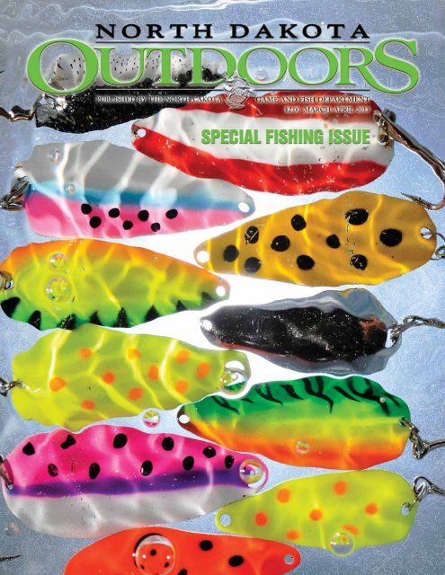
March_April 2013.pdf - North Dakota Game and Fish
March_April 2013.pdf - North Dakota Game and Fish
March_April 2013.pdf - North Dakota Game and Fish
- No tags were found...

Create successful ePaper yourself
Turn your PDF publications into a flip-book with our unique Google optimized e-Paper software.
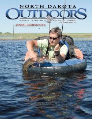
Greg Power, <strong>North</strong><strong>Dakota</strong> <strong>Game</strong> <strong>and</strong> <strong>Fish</strong>Department fisherieschief, predicts a favorableoutlook for <strong>North</strong> <strong>Dakota</strong>anglers in 2013.When YesterdayBECOMES TODAYBy Greg PowerPHOTO COURTESY OF GREG POWER2NND OutdoorsMarcrch-A<strong>April</strong> 2013
Typically, the view through a crystal ball isnot obvious when making long-term predictions.However, in the case of forecasting fishing opportunitiesin <strong>North</strong> <strong>Dakota</strong> for 2013, the view ispretty clear, with a favorable outlook for anglers.Although a few water bodies may have slowerfishing than what many have experienced in recentyears, most anglers should have another good toexcellent year in 2013.Why such optimism? Well, we need to first lookback to underst<strong>and</strong> what to expect in the future.For so many events in life, there’s usually a lagbetween actions <strong>and</strong> consequences. Parents heavilyinvest their time into their children in hopes thatas young adults they make mature decisions. Societyparticipates in educating our youth, anticipatingsomeday they will become civic leaders, entrepreneurs<strong>and</strong> so on. This cause <strong>and</strong> effect dynamicis also true for today’s fishing opportunities.<strong>Fish</strong>ing-related events <strong>and</strong> actions that occurredin the past are often observed today in both opportunity<strong>and</strong> success. To that end, I’d like to share ashort list of management decisions/actions madeby the <strong>North</strong> <strong>Dakota</strong> <strong>Game</strong> <strong>and</strong> <strong>Fish</strong> Departmentthat are contributing to today’s good fishing.However, before sharing these dozen or sosuccess stories, it is imperative to recognize thatMother Nature has been extremely kind to bothfish <strong>and</strong> angler in the past 20 years. Most notably,the unprecedented wet conditions between 1993<strong>and</strong> 2011 that resulted in today’s record numberof 400 or so managed water bodies. That’s morethan double the number of managed waters <strong>North</strong><strong>Dakota</strong> had in the late 1980s. Runoff has filledsloughs <strong>and</strong> meadows, creating phenomenal newfisheries through much of central <strong>and</strong> eastern<strong>North</strong> <strong>Dakota</strong>.Regardless of all the new water on the l<strong>and</strong>scape,anglers fishing <strong>North</strong> <strong>Dakota</strong>’s waters alsobenefit from past management decisions, actions,<strong>and</strong> in some cases, nonaction. Whether someonecaught a 10-pound walleye from Lake Sakakaweain the mid-1980s, a 2-pound yellow perch fromDevils Lake in 2012, a rainbow trout anywhere in<strong>North</strong> <strong>Dakota</strong>, a chinook salmon from GarrisonDam Tailrace, a walleye from any of the state’snearly 150 walleye lakes, or simply went fishing intheir boat on one of 265 lakes with public ramps,a number of past l<strong>and</strong>mark events helped shapethese opportunities. Looking through the rearviewmirror, these activities, some dating back 40-plusyears, are briefly highlighted:• Despite being the largest water body inthe state, forage was sorely lacking in LakeSakakawea after it filled in the 1960s. Theintroduction of rainbow smelt in 1972 ultimatelyprovided a strong forage base <strong>and</strong> is/was responsible for the large predator fish(walleye, northern pike <strong>and</strong> chinook salmon)in the Missouri River System.• In 1986, a new coldwater production facilitywas completed at the Garrison Dam National<strong>Fish</strong> Hatchery, enabling the <strong>Game</strong> <strong>and</strong> <strong>Fish</strong>Department to annually stock quality-sizedchinook salmon into Lake Sakakawea <strong>and</strong>Garrison Tailrace. Further, the coldwaterbuilding annually produces up to 80,000catchable-sized trout, mainly rainbows, thatare stocked annually into approximately 50waters statewide, including the Tailrace.• During the early to mid-1980s, the Departmentevaluated a walleye fingerling stockingapproach that proved successful for LakeSakakawea. This information helped supportthe need for additional rearing ponds, <strong>and</strong>eventually walleye stocking strategies wereapplied successfully for all of the state’s waterbodies, including Sakakawea <strong>and</strong> Devils Lake.• With an obvious need to supplement LakeSakakawea’s walleye population, <strong>and</strong> anongoing call to stock more fingerlings intodistrict lakes, the number of rearing ponds atGarrison Dam National <strong>Fish</strong> Hatchery wasexp<strong>and</strong>ed from 24 to 64 in 1989. Since then,<strong>North</strong> <strong>Dakota</strong> has led the nation most yearsin stocking walleye <strong>and</strong> northern pike fingerlings.Both pond expansion <strong>and</strong> the coldwaterfacility would not have been possible withoutthe unique <strong>and</strong> strong partnership betweenthe Department <strong>and</strong> the U.S. <strong>Fish</strong> <strong>and</strong> WildlifeService.• In 1986, with an influx of more Sport <strong>Fish</strong>Restoration funds, the Department costsharedfor the first poured concrete boat rampin the state <strong>and</strong> subsequently has been able toadequately fund a development program thatmeets the state’s public boating infrastructureneeds. Ramps, docks, toilets, roads <strong>and</strong> fishcleaning stations are now part of the normalroutine.• An unglamorous, but critically importantinitiative was tackled beginning in the early1990s, addressing bait bucket transfer ofunwanted fish throughout the state. An<strong>March</strong>-<strong>April</strong> 2013 ND Outdoors 3
information/education campaign highlighteda pressing need to eliminate possession <strong>and</strong>transfer of illegal baits, <strong>and</strong> involved anglers aswell as wholesale <strong>and</strong> retail bait vendors. Parallelingthis increase in public awareness of illegalbaits, rough fish were eliminated from dozensof <strong>North</strong> <strong>Dakota</strong> waters, which were thenrestocked with game fish. More than 20 yearslater, most of these water bodies remain clean ofrough fish <strong>and</strong> provide good recreational fishingopportunities.• Today, Devils Lake <strong>and</strong> yellow perch fishingare synonymous, but it wasn’t always that way.The introduction of adult yellow perch in DevilsLake in the early 1970s has provided countlesshours of fishing recreation. In addition, anaggressive statewide adult yellow perch trap<strong>and</strong> transport program spearheaded by Departmentfisheries biologists, especially from thelate 1990s to now, have produced dozens of icefishing destinations that were once void of fish.In 2010, for example, Department staff stockedapproximately 50 perchless lakes with 400,000adult perch that spawned <strong>and</strong> produced young.• An intense introduction effort, peaking in the1990s, established smallmouth bass populationsin many water bodies throughout the state. Afterinitial stockings, most of these smallmouthpopulations are now self-sustaining <strong>and</strong> provideexcellent, alternative fishing prospects.• Recreational fishing opportunities haveincreased substantially since the mid-1970s,when some traditional fishing regulations wererelaxed. For instance, year-round fishing was firstallowed on the Missouri River System in 1975,<strong>and</strong> then statewide in 1993. Another example isthe allowance of up to four lines for ice fishing,which became legal in 1996. And most recently,the northern pike limit was increased fromthree to five daily. This attentive liberalizationincreased fishing interest <strong>and</strong> opportunity, whilethe needed measures to protect the respectivefisheries were not compromised.• Another regulation matter involves the <strong>Game</strong><strong>and</strong> <strong>Fish</strong> Department’s ability to maintain “biology”as the basic foundation in the formulationof regulations. The Department uses the bestavailable science for establishing fishing regulations,<strong>and</strong> has not overreacted to public dem<strong>and</strong>for further regulations when/where they wouldultimately prove ineffective.• Lastly, the Department’s fisheries division is oneof the smallest in the nation, but a new generationof staff biologists <strong>and</strong> technicians continueSince the numberof rearing pondsat Garrison DamNational <strong>Fish</strong>Hatchery wasexp<strong>and</strong>ed in thelate 1980s, <strong>North</strong><strong>Dakota</strong> has led thenation most yearsin stocking northernpike <strong>and</strong> walleyefingerlings.GAME AND FISH DEPARTMENT PHOTO4 ND Outdoors <strong>March</strong>-<strong>April</strong> 2013
a longst<strong>and</strong>ing work ethic, strong commitment<strong>and</strong> unyielding perseverance.The job of a field biologist is often noteasy, but collective knowledge groundedon real-life work experiences leads todecision-making that truly best serves<strong>North</strong> <strong>Dakota</strong> anglers.<strong>Fish</strong>eries biologists, especially on theprairies, need to be humble as Mother Natureplays the largest role – often giving (wetperiods) <strong>and</strong> often taking away (droughts).Also, because our fishing lakes are generally atthe bottom of watersheds, managers must alsodeal with challenging chemical <strong>and</strong> biologicalcomplexities within the water bodies due tonutrient loading <strong>and</strong> sedimentation.Yet, despite often having our h<strong>and</strong>s tied,management decisions <strong>and</strong> practices over thelong run have influenced today’s great fishingon <strong>North</strong> <strong>Dakota</strong>’s prairie.GREG POWER is the <strong>Game</strong> <strong>and</strong> <strong>Fish</strong>Department’s fisheries chief.In 1986, with an influx of more Sport <strong>Fish</strong> Restoration funds, the <strong>Game</strong> <strong>and</strong> <strong>Fish</strong>Department cost-shared for the first poured concrete boat ramp in the state <strong>and</strong>subsequently has been able to adequately fund a development program that meets thestate’s public boating infrastructure needs.MIKE ANDERSONMembers of the <strong>Game</strong> <strong>and</strong> <strong>Fish</strong> Department’s fisheries division, which is one of thesmallest in the nation, net an urban creek in Bismarck for chinook salmon in 2011.RON WILSON<strong>March</strong>-<strong>April</strong> 2013 ND Outdoors 5
2013NORTH DAKOTAFISHING WATERS REPORTThe <strong>North</strong> <strong>Dakota</strong> <strong>Game</strong> <strong>and</strong> <strong>Fish</strong>Department has for years provided drivingdirections <strong>and</strong> infrastructure informationon actively managed lakes, while also notingthe primary fish species present in eachfishery.In addition, <strong>North</strong> <strong>Dakota</strong> OUTDOORShas periodically highlighted a number ofthese lakes in a fishing outlook.This year, we’re combining those effortsinto an enhanced fishing waters review, byincluding fish population comments formost of the respective fisheries, in additionto other lake information.The fishery outlooks, provided byDepartment district fisheries supervisors,are not necessarily comprehensive fishingreports, but glimpses into the fisheries tohelp frame angler expectations. To learnwhere the fish are biting, check with fishingfriends or at your local bait <strong>and</strong> tackle shop.With 400-plus managed fishing watersin <strong>North</strong> <strong>Dakota</strong> today, compared to about170 two decades ago, there are manyunknowns. For instance, with a recordnumber of waters on the l<strong>and</strong>scape, fisheriesbiologists have yet to conduct thoroughpopulation assessments on many lakes.While the information on <strong>North</strong> <strong>Dakota</strong>waters in this publication is static, anychanges <strong>and</strong> updates will appear on the<strong>Game</strong> <strong>and</strong> <strong>Fish</strong> Department’s website atgf.nd.gov.What follows are public fishing watersin <strong>North</strong> <strong>Dakota</strong> listed by county in the sixdistricts managed by Department biologists.The number in parenthesis that followseach fishery is simply a code used bybiologists to help identify those waters. Thecodes are also found on the maps to helpreaders locate the waters in which they areinterested.Most state public fishing waters haveboat ramps. Lakes or rivers where no rampexists are listed as “no ramp.” Check signsat each area for further restrictions.An angler tries his luckon the Red River nearGr<strong>and</strong> Forks.CRAIG BIHRLE6 ND Outdoors <strong>March</strong>-<strong>April</strong> 2013
NORTHWEST FISHERIES DISTRICTFred Ryckman, district fisheries supervisor,RiverdaleBURKE COUNTY<strong>North</strong>gate Dam (097) – 6 miles north,1 mile west, 2 miles north, .5 miles westof Bowbells. Contains good populationsof walleye, rainbow trout <strong>and</strong> bluegill.Also fair numbers of black crappie. Fairlyintense recreational use. (<strong>Fish</strong>ing pier).Powers Lake (093) – Southeast side ofPowers Lake. Consists entirely of northernpike, with most ranging from 2-5 pounds.Periodic winterkills greatly impact thisfishery, with the most recent occurring in2010-11. (<strong>Fish</strong>ing pier).Short Creek Dam (094) – 5.5 miles northof Columbus. Still rebounding from anear-total fish kill in July 2010. Containsfair populations of small pike <strong>and</strong> walleye,with exp<strong>and</strong>ing numbers of adult yellowperch <strong>and</strong> bluegill. (<strong>Fish</strong>ing pier).Smishek Lake (095) – 4 miles northwestof Powers Lake. Contains good numbersof yellow perch <strong>and</strong> bluegill. Also fairnumbers of walleye <strong>and</strong> northern pike,with a few big fish of both species. Fairlyintense recreational use. (<strong>Fish</strong>ing pier).DIVIDE COUNTYBaukol-Noonan Dam (475) – 2 mileseast, .5 miles south of Noonan. Primarilyrainbow trout, although fair numbers oflargemouth bass present. Also containsfair numbers of small yellow perch <strong>and</strong>bluegill. (<strong>Fish</strong>ing pier).Baukol-Noonan East Mine Pond (508) –2 miles east, .5 miles south of Noonan.Primarily rainbow trout, although containsa few largemouth bass. Also holds fairnumbers of small yellow perch <strong>and</strong> bluegill.Black bullheads abundant.Skjermo Lake (126) – 3 miles west, 4miles northwest of Fortuna. Consistsentirely of a strong population of northernpike. Apparently all yellow perch were lostto summerkill in 2012, but plans are torestock with adult perch in spring 2013.(<strong>Fish</strong>ing pier).MCKENZIE COUNTYArnegard Dam (216) – .5 miles west, 3miles north, 1.5 miles southwest of Arnegard.Primarily northern pike, with somelarger pike present. Also holds some adultyellow perch, <strong>and</strong> an abundance of blackbullheads. (<strong>Fish</strong>ing pier).Lel<strong>and</strong> Dam (469) – 11 miles south,8 miles west, 8 miles south, 2 milessoutheast, 1.5 miles east, 1 mile north ofAlex<strong>and</strong>er. Contains good populationsof bluegill <strong>and</strong> largemouth bass. Lack ofpublic use facilities <strong>and</strong> poor access attimes limit use.Sather Dam (217) – 11 miles south, 8miles west of Alex<strong>and</strong>er. Apparently experienceda near-total fish kill during winter2010-11. Contains good numbers of smallbluegill, but largemouth bass populationnot yet reestablished. (<strong>Fish</strong>ing pier).Watford City Park Pond (640) – Southeastside of Watford City. <strong>Fish</strong>ing opportunitiesreliant on annual stocking dueto annual winterkills. Plans to stock withrainbow trout <strong>and</strong> adult channel catfish inspring 2013. (No ramp, fishing pier).BRIAN HOSEK018014019126373217MOUNTRAIL COUNTYStanley Pond (245) – <strong>North</strong>east side ofStanley. <strong>Fish</strong>ing opportunities limited byfrequent winterkills. Plans to stock withrainbow trout <strong>and</strong> adult channel catfish inspring 2013. (<strong>Fish</strong>ing pier).Stanley Reservoir (251) – 1 mile southof Stanley. <strong>Fish</strong>ing opportunities limited469033Divide099393381Williams374377378379475380 375216McKenzie640376508664094095249093131by frequent winterkills, the most recentduring winter 2010-11. Contains goodnumbers of small northern pike.White Earth Dam (249) – 6 miles northof White Earth. Consists primarily ofnorthern pike, but also contains fair numbersof walleye <strong>and</strong> yellow perch. A fewblack crappie present, <strong>and</strong> also an exp<strong>and</strong>ingbluegill population. (<strong>Fish</strong>ing pier).Burke245097251Mountrail020RENVILLE COUNTYLake Darling (285) – 16 miles north,13 miles west of Minot. Contains strongpopulations of northern pike, walleye <strong>and</strong>yellow perch. (<strong>Fish</strong>ing pier).WILLIAMS COUNTYBlacktail Dam (373) – 5 miles north, 5miles west, 1 mile north of the junction ofU.S. highways 2 <strong>and</strong> 85. Contains a strongnorthern pike population. Also holds fairnumbers of walleye, yellow perch <strong>and</strong>bluegill. Fairly intense recreational use.(<strong>Fish</strong>ing pier).Cottonwood Lake (381) – 1 mile east, .5miles north of Alamo. Consists entirelyof good numbers of small northern pike.Although yellow perch were heavilystocked in 2012, apparently few survived.(<strong>Fish</strong>ing pier).Renville365443285Ward56036236054636122422229NORTHWEST FISHERIES DISTRICT<strong>March</strong>-<strong>April</strong> 2013 ND Outdoors 7
East Spring Lake Pond (380) – <strong>North</strong>side of Williston. <strong>Fish</strong>ing opportunitiesalmost totally reliant on annual stockingdue to frequent winterkills. Plans to stockwith northern pike <strong>and</strong> adult channelcatfish in spring 2013. (No ramp, fishingpier).Epping-Springbrook Dam (374) – 1.5miles east of Springbrook. Contains fairpopulations of northern pike, walleye <strong>and</strong>yellow perch. Also holds an overabundanceof black bullheads. (<strong>Fish</strong>ing pier).Kettle Lake (099) – 3 miles east, 2.5 milesnorth of Zahl. Consists primarily of rainbowtrout, brown trout <strong>and</strong> largemouthbass. Yellow perch also present, but thepopulation is overabundant <strong>and</strong> stunted.(<strong>Fish</strong>ing pier).Kota-Ray Dam (376) – 5 miles south, .5miles east, 2 miles south of Ray. Containsa wide variety of fish species, includingwalleye, rainbow trout <strong>and</strong> yellow perch,with strongest populations of largemouthbass <strong>and</strong> bluegill. Fairly intense recreationaluse. (<strong>Fish</strong>ing pier).BRIAN HOSEK151217469SOUTHWEST FISHERIES DISTRICT150657GoldenValley410088323519410087Bowman640BillingsSlope332085322086330331132171Little Muddy River (393) – East edgeof Williston. Highly dependent on highwater levels <strong>and</strong> fish movement fromupper Missouri River. Contains fairpopulations of northern pike <strong>and</strong> channelcatfish, with many other species present.(<strong>Fish</strong>ing pier).McGregor Dam (378) – 1 mile south ofMcGregor. Contains good numbers ofwalleye, yellow perch <strong>and</strong> rainbow trout.(<strong>Fish</strong>ing pier).McLeod (Ray) Reservoir (377) – Southwestside of Ray. Contains a strong populationof young walleye. Also a few adultbluegill, yellow perch <strong>and</strong> northern pike.(<strong>Fish</strong>ing pier).Tioga Dam (379) – <strong>North</strong> side of Tioga.Consists mainly of young pike, although afew older <strong>and</strong> larger pike present. Apparentlylimited survival of recent stockingsof adult yellow perch. A few adult bluegillpresent. (<strong>Fish</strong>ing pier).Trenton Lake (018) – South side ofTrenton. Contains a strong population ofnorthern pike, with most ranging from 2-5131DunnStark328173174020HettingerAdams175390176503040 042065714705388172160164090443235560Morton243546025Grant163222222922662pounds. Also a good crappie population.Many other species also present. (<strong>Fish</strong>ingpier).West Spring Lake Pond (033) – <strong>North</strong>edge of Williston. <strong>Fish</strong>ing opportunitieslimited by frequent winterkills. <strong>Fish</strong>eryconsists of rainbow trout stocked annually.(No ramp).RIVERS AND LAKESUpper Missouri River (014) – MissouriRiver from Williston to Montana stateline. Primarily a spring <strong>and</strong> fall fishery forsauger <strong>and</strong> walleye, but increasing anglingeffort targeting abundant channel catfish<strong>and</strong> northern pike populations. Manyother species also present.Yellowstone River (019) – Near towns ofBuford, Cartwright <strong>and</strong> Fairview. Primarilya spring <strong>and</strong> fall fishery for sauger<strong>and</strong> walleye, but increasing angling efforttargeting abundant channel catfish <strong>and</strong>northern pike populations. Many otherspecies also present. (<strong>Fish</strong>ing pier).SOUTHWEST FISHERIES DISTRICTJeff Hendrickson, district fisheries supervisor,DickinsonADAMS COUNTYBolke Dam (065) – 5 miles east, .5 milesnorth, .5 miles west, .5 miles north ofLemmon, South <strong>Dakota</strong>. Rainbow troutstocked annually. (No ramp).Mirror Lake (040) – South side of Hettinger.<strong>North</strong>ern pike up to 5 pounds, <strong>and</strong>an abundance of small bullheads. Catfishup to 5 pounds stocked most years. (<strong>Fish</strong>ingpier).<strong>North</strong> Lemmon (042) – 5 miles north ofLemmon, South <strong>Dakota</strong>. Rainbow troutstocked annually. Brown trout up to 5pounds present. Bluegill <strong>and</strong> yellow perchare abundant <strong>and</strong> small. Largemouth bassup to 2 pounds are common. Walleye up to10 pounds present. (<strong>Fish</strong>ing pier).BOWMAN COUNTYBowman-Haley Dam (085) – 11 milessouth, 8 miles east, 2 miles south of Bowman.Dominated by walleye, some up to6 pounds, northern pike up to 10 pounds<strong>and</strong> smallmouth bass up to 3 pounds.Some yellow perch up to 2 pounds <strong>and</strong>small white bass. Many large carp present,good for bowfishing. (<strong>Fish</strong>ing pier).8 ND Outdoors <strong>March</strong>-<strong>April</strong> 2013
Gascoyne Lake (086) – 1.5 miles northwestof Gascoyne. <strong>North</strong>ern pike stockedannually <strong>and</strong> pike up to 5 pounds present.Small carp, bullhead <strong>and</strong> green sunfishabundant at times.Kalina Dam (087) – 2 miles west, 1mile south, 1 mile west, 1 mile south ofBowman. Abundant northern pike up to10 pounds, yellow perch <strong>and</strong> bluegill aremostly small, but some large fish caughton occasion. Make sure to access lake fromsouth shore. (No ramp).Lutz Dam (519) – 2.5 miles south, 2 mileswest of Griffin. Rainbow trout stockedannually. Winterkilled recently. Abundantbluegill up to a half pound, <strong>and</strong> smallcrappie. Small adult largemouth bassstocked in 2012. (No ramp).Spring Lake (088) – 1 mile south, 4 mileswest of Rhame. Recent winterkills havedrastically reduced pike population. Yellowperch up to 1 pound are abundant.DUNN COUNTYDvorak Dam (132) – 3.5 miles south, 5miles east, .5 miles north of Manning. Yellowperch stocked in 2009. (No ramp).Lake Ilo (131) – 1 mile west, 1 mile southof Dunn Center. Abundant northern pikeup to 10 pounds, some perch up to a halfpound. (<strong>Fish</strong>ing pier).GOLDEN VALLEY COUNTYBeach City Pond (657) – Southwest sideof Beach. Rainbow trout stocked annually.(No ramp, fishing pier).Camels Hump Dam (150) – <strong>North</strong>eastof Sentinel Butte I-94 Exit 18. Rainbowtrout stocked annually, with some up to2 pounds. Abundant largemouth bass aremostly small, some up to 2 pounds. Somebluegill up to 1 pound. Some brown trout<strong>and</strong> smallmouth bass present.Odl<strong>and</strong> Dam (151) – 7 miles north ofBeach. Winterkills often. Perch <strong>and</strong> bluegillrestocked recently. (<strong>Fish</strong>ing pier).GRANT COUNTYHeart Butte Reservoir (Lake Tschida)(160) – 15 miles south of Glen Ullin.Dominated by small walleye, with someup to 10 pounds, 2- to 5-pound northernpike, white bass up to 2 pounds, catfishup to 10 pounds <strong>and</strong> smallmouth bass upto 2 pounds. Some perch up to 1 pound,crappie up to 2 pounds <strong>and</strong> small bluegill.Brown trout are stocked in anumber of <strong>North</strong> <strong>Dakota</strong> waters.The biggest browns, however, arefound in the Garrison Tailrace.Many large buffalo present. (<strong>Fish</strong>ing pier).Raleigh Reservoir (163) – 3.5 miles west,.25 miles south of Raleigh. Rainbow troutstocked annually. Abundant small northernpike, with some up to 15 pounds <strong>and</strong>bluegill up to 1 pound. Some largemouthbass up to 5 pounds, perch up to a halfpound <strong>and</strong> small crappie. (<strong>Fish</strong>ing pier).Sheep Creek Dam (164) – 4 milessouth, .5 miles west of Elgin. Rainbowtrout stocked annually, with some up to3 pounds. Abundant largemouth bass,with some up to 5 pounds, bluegill up to1 pound <strong>and</strong> crappie up to a half pound.Some walleye up to 1 pound, brown troutup to 2 pounds <strong>and</strong> smallmouth bass up to1 pound. (<strong>Fish</strong>ing pier).HETTINGER COUNTYBlickensderfer Dam (176) – 4 milessouth, 1 mile east, .5 miles south of Mott.Abundant small bluegill, with some up to1 pound. Some walleye up to 2 pounds,northern pike up to 8 pounds <strong>and</strong> smallperch. (No ramp).Castle Rock Dam (174) – 2 miles west,1.5 miles south, 1.5 miles west of Mott.Rainbow trout stocked annually. Bluegillstocked in 2009.Indian Creek Dam (171) – 1.5 miles west,2 miles south, 2 miles west, 3 miles southof Regent. Abundant walleye up to 10pounds, small yellow perch, with some upto a half pound <strong>and</strong> mostly small bluegill,with some up to 1 pound. Some smallmouthbass up to a half pound. (<strong>Fish</strong>ingpier).Kilzer Dam (172) – 4.5 miles south, 1mile east of Bentley. Bluegill stocked in2011 <strong>and</strong> largemouth bass stocked in2012. (No ramp).Larson Lake (173) – .5 miles north <strong>and</strong> 2miles east of Regent. Abundant northernpike up to 2 pounds. Some perch up to ahalf pound.Mott Watershed Dam (175) – <strong>North</strong> sideof Mott. Rainbow trout stocked annually,with some up to 3 pounds. Abundantsmall largemouth bass, with some up to2 pounds. Some bluegill up to about 1pound. (<strong>Fish</strong>ing pier).MORTON COUNTYDanzig Dam (243) – 2 miles north, 1.4miles west, .2 miles north of I-94 Exit 120.Drawn down for dredging <strong>and</strong> chemicalrenovation to remove undesirable fish in2013. Likely not fishable.Gaebe Pond (025) – 1.5 miles west ofNew Salem. Rainbow trout stocked annually.Adult catfish up to 5 pounds stockedmost years. Some small perch <strong>and</strong> bluegill.(No ramp, fishing pier).Krieg’s Pond (705) – .5 miles east ofHebron. Rainbow trout stocked annually.Adult yellow perch stocked in 2011. (Noramp).RYAN GARDEN<strong>March</strong>-<strong>April</strong> 2013 ND Outdoors 9
Long Lake (078) – 8 miles north, 7 mileseast, 1 mile south, 1 mile east, .5 milessouth, .3 miles east of Bottineau. Decentpike population, with a wide range of sizes.Lots of small perch.Loon Lake (674) – 9 miles north, 4 mileseast, 2 miles south, 2 miles east, .5 milesnorth of Bottineau. Fairly new perch fishery,with high numbers <strong>and</strong> some largerfish. (No ramp).Pelican Lake (079) – 9 miles north, 8miles east, .5 miles southwest of Bottineau.Decent numbers of northern pike.Strawberry Lake (081) – 4 miles north,2.5 miles east, .5 miles south of Carbury.Stocked annually with rainbow trout.(<strong>Fish</strong>ing pier).BURLEIGH COUNTYNew Johns Lake (750) – 11.8 miles south,3 miles east of Mercer. Decent walleyenumbers, with some larger fish. Lots ofsmall- to medium-sized yellow perch.Bluegill numbers have increased in recentyears. (<strong>Fish</strong>ing pier).MCHENRY COUNTYBentley Lake (129) – 3 miles west ofDrake. Fair numbers of small pike <strong>and</strong>some perch. (No ramp).Buffalo Lodge Lake (205) – 1 mile east,3 miles north, 2 miles east of Granville.Excellent pike numbers. Increased lakelevels in recent years produced a goodenvironment for pike. Walleye populationsomewhat reduced, with increase in pikenumbers. Mostly small perch. (<strong>Fish</strong>ingpier).Cottonwood Lake (202) – 2.5 miles northof Butte. Pike <strong>and</strong> perch rebounding nicelyafter significant winterkill in 2009. (<strong>Fish</strong>ingpier).It’s hard to beat a nice day fishingfrom shore on one of <strong>North</strong> <strong>Dakota</strong>’s400-plus waters.George Lake (203) – 13 miles north, 1mile east, 1.3 miles north, .5 miles east ofthe junction of U.S. Highway 52 <strong>and</strong> NDHighway 14. Good numbers of pike, withsome large fish. (<strong>Fish</strong>ing pier).Round Lake (204) – 6 miles north, 4.5miles east of Drake. Good numbers of14- to 16-inch walleye. Decent numbers ofpike. (No ramp).MCLEAN COUNTYBrush Lake (221) – 3 miles north ofMercer. Lots of 6- to 8-inch perch. Fairnumbers of walleye. Good pike population,with some larger fish. (<strong>Fish</strong>ing pier).Camp Lake (479) – 17.5 miles north, 2miles east of Turtle Lake. Decent numbersof pike <strong>and</strong> lots of small perch. (No ramp).Camp Loop Pond (546) – 3 miles southwestof Riverdale on U.S. Army Corps ofEngineers’ downstream campground. Pondrenovation planned in 2013. (No ramp).Crooked Lake (223) – 10 miles north, .2miles east, .1 mile south of Turtle Lake.Decent numbers of smaller pike, perch<strong>and</strong> walleye. Winterkill in 2009 resulted inmajor fish loss, so mostly young fish in thelake. (<strong>Fish</strong>ing pier).Custer Mine (224) – 4 miles east, 2 milessouth of Garrison. A good put-<strong>and</strong>-takerainbow trout fishery in a small, easy-tofishpond. Abundant small bluegill.East Park Lake (752) – 9 miles south ofMercer. Decent walleye numbers, withsome larger fish. Fair numbers of smalltomedium-sized yellow perch. Bluegillnumbers have increased in recent years.(<strong>Fish</strong>ing pier).Lake Audubon (225) – <strong>North</strong> of Coleharbor.Good numbers of walleye <strong>and</strong> anexcellent smallmouth bass fishery. Anglersshould see good numbers of 14- toCRAIG BIHRLE16-inch walleye in the next few seasons.Some large pike. (<strong>Fish</strong>ing pier).Lake Brekken (232) – 1.5 miles north ofTurtle Lake. Good numbers of small- <strong>and</strong>quality-sized walleye. Decent numbers ofperch, some larger fish. (<strong>Fish</strong>ing pier).Lake Holmes (455) – 1 mile northeast ofTurtle Lake. Connected to Lake Brekkenby a large culvert. Decent numbersof small- to medium-sized walleye. Goodnumbers of quality-sized perch.Lightning Lake (233) – .5 miles east ofTurtle Lake. A quality trout fishery, withsome large trout. Bluegill numbers haveincreased in recent years, with some nicesizedfish. (<strong>Fish</strong>ing pier).Long Lake (228) – 13 miles north, 4miles east, 2 miles north, 1.5 miles westof Turtle Lake. Pike population bouncingback nicely after winterkill. Holds mostlysmaller pike.Painted Woods Creek (418) – 5 milessoutheast of Washburn. Fair numbers ofnorthern pike. (No ramp).Pelican Lake (757) – 7 miles north, 3miles east, .4 miles north of Mercer.Abundant perch <strong>and</strong> some smaller pike.(No ramp).Riverdale City Pond (220) – <strong>North</strong> sideof Riverdale. Popular pond for kids <strong>and</strong>family outings. Lots of small bluegill.Stocked annually with rainbow trout. (Noramp, fishing pier).Strawberry Lake (226) – 17.5 miles north,2 miles east of Turtle Lake. Good pikepopulation. Lots of small perch <strong>and</strong> bluegill.(<strong>Fish</strong>ing pier).Triangle Y Pond (463) – 4 miles west,1.5 miles south, 1 mile west, 1 mile south,1 mile west, .5 miles south of Garrison.Small pond stocked with perch, usedmostly by Triangle Y kids. (No ramp, fishingpier).Turtle Lake (697) – 4.5 miles west, 1 milenorth of Turtle Lake. Decent numbers ofnorthern pike, some larger fish. (No ramp).Weishaar WPA (488) – 8 miles north, 8miles west, 1 mile north of Turtle Lake.Winter perch fishery. (No ramp).West Park Lake (753) – 9 miles south,2 miles west of Mercer. Fair numbers ofwalleye <strong>and</strong> perch. Most perch are small.Good numbers of pike, with some largerfish available. (No ramp).<strong>March</strong>-<strong>April</strong> 2013 ND Outdoors 11
At the right time of year, northern pike areeager biters <strong>and</strong> fighters, <strong>and</strong> can be foundin many of the state’s waters.MERCER COUNTYBeulah Mine Pond (235) – 2 miles north,2.5 miles east, .5 miles north of Beulah.Contains some pike. (No ramp).Harmony Lake (560) – 6 miles north,1 mile west of Hazen. Good numbersof bluegill, with some quality-sized fish.Stocked annually with rainbow trout.(<strong>Fish</strong>ing pier).OLIVER COUNTYEast Arroda Dam (262) – 1 mile east ofFort Clark – ND Highway 200A. Goodcrappie numbers, with some quality fish.Pike numbers have increased in recentyears, with mostly smaller pike. Earthenfishing piers constructed to improve shorefishingaccess.Nelson Lake (258) – 5 miles east, 3 milessouth of Center. The best largemouth basslake in the state. Open water year-roundallows fish to grow better than in otherlakes. State record largemouth – 8 pounds,7 ½ ounces – caught here in 1983. Abundantquality-sized bluegill <strong>and</strong> crappie.(<strong>Fish</strong>ing pier).Oliver County Sportsmen’s Pond (266) –4 miles south, .5 miles west of Center.Stocked annually with about 200 rainbowtrout. (No ramp).West Arroda Dam (264) – 1 mile east ofFort Clark – ND Highway 200A. Goodcrappie numbers, with some quality fish.Pike numbers have increased in recentyears, with mostly smaller pike. Earthenfishing piers constructed to improve shorefishingaccess.PIERCE COUNTYAntelope Lake (617) – 9 miles east, 3miles north, 1 mile west, 2 miles north ofAnamoose. Abundant nice-sized perch.Many 12- to 16-inch walleye, with somelarger fish available. (No ramp).Balta Dam (269) – .5 miles south of Balta.Good numbers of smaller pike.Clear Lake (654) – 6 miles east, .7 milessouth of Anamoose. Newly stocked lake,with good numbers of walleye <strong>and</strong> qualitysizedperch. (No ramp).Davis Lake (024) – 2 miles west, 1.5 milessouth of Balta. Lots of pike, with somelarger fish.Lesmeister Lake (692) – 3.5 miles west,2 miles south of the intersection of NDhighways 3 <strong>and</strong> 19. Good numbers ofsmaller walleye. (No ramp).RENVILLE COUNTYGlenburn Pond (466) – <strong>North</strong> side ofGlenburn. Small pond stocked annuallywith trout. Yellow perch <strong>and</strong> bluegillstocked periodically. (No ramp).CRAIG BIHRLEROLETTE COUNTYLake Udall (741) – Through the InternationalPeace Garden, 13 miles north ofDunseith. Small pond stocked with rainbowtrout <strong>and</strong> bluegill for the first time in2012. (No ramp).SHERIDAN COUNTYBender Lake (715) – .5 miles south, 4miles west, .5 miles south of Martin.Stocked with perch for the first time in2011. (No ramp).Cherry Lake (698) – 7 miles north, 3miles east, 2 miles north, 1 mile west ofMercer. Some quality-sized perch. (Noramp).Coal Mine Lake (482) – 14 miles south, 5miles east of Anamoose. Abundant northernpike, mostly smaller. Winterkilled in2009. (<strong>Fish</strong>ing pier).Davis WPA (598) – 8 miles south, 1 mileeast of Denhoff. Abundant perch, withsome quality-sized fish. Walleye populationexp<strong>and</strong>ing in recent years, with somenice fish. (No ramp).Heckers Lake (751) – 9 miles south,2.4 miles east of Mercer. Fair numbersof perch, with some quality-sized fish.Decent numbers of pike <strong>and</strong> smallmouthbass. (No ramp).Kaibel Lake (756) – 10.2 miles south ofDrake. Lots of perch, many smaller-sized.(No ramp).Lake Richard (653) – 4.5 miles south ofDrake. Abundant yellow perch, with somequality-sized fish. (No ramp).Mud Lake (716) – 4.5 miles south ofAnamoose. Stocked with perch for thefirst time in 2011. (No ramp).<strong>North</strong> (Hoffer) McClusky (461) – 2 milesnorth, 1 mile west of McClusky. Abundantsmaller pike. (No ramp).Sheyenne Lake (314) – 10 miles south,1 mile east, 1 mile south of Anamoose.Stocked biannually with northern pike.(No ramp).South (Hoffer) McClusky (316) – 2 milesnorth, 1 mile west of McClusky. Decentnumbers of perch, walleye <strong>and</strong> northernpike. Some bluegill <strong>and</strong> crappie. (<strong>Fish</strong>ingpier).Stober Lake (562) – 4 miles west, 1 milenorth of Goodrich. Good numbers ofperch, many smaller, but some larger fish.(No ramp).12 ND Outdoors <strong>March</strong>-<strong>April</strong> 2013
Vollrath Lake (699) – 5.5 miles north, 1mile east, 1 mile south of Goodrich. Somequality-sized perch. (No ramp).Wolf Lake (558) – .5 miles south, 1.5miles west of Martin. Winterkilled in2009, so mostly small pike <strong>and</strong> perch. (Noramp).WARD COUNTYHiddenwood Lake (443) – 8 miles southof Makoti. Fair numbers of yellow perch<strong>and</strong> northern pike. (<strong>Fish</strong>ing pier).Makoti Lake (365) – 6 miles south ofMakoti. Winterkilled in 2010. Pike <strong>and</strong>perch fishery recovering. Currently hasmostly smaller fish.<strong>North</strong> Carlson Lake (360) – 10 mileseast of Ryder. Good numbers of smallerpike, making it a good place to take a kidfishing.Rice Lake (362) – 4 miles north, 7 mileseast, 2 miles north of Ryder. Winterkilledin 2011, but pike <strong>and</strong> perch fisheries comingback nicely.South Carlson Lake (361) – 10 miles eastof Ryder. Good fishing in recent years formostly smaller pike. (<strong>Fish</strong>ing pier).State Fair Pond (027) – <strong>North</strong> end ofstate fair grounds. Small pond stockedannually with trout <strong>and</strong> panfish. (No ramp,fishing pier).Velva Sportsmen’s Pond (364) – 7 milessouth, 1.5 miles west, 1 mile south, .5miles west of Velva. Consistently a qualityfishery for nice-sized browns <strong>and</strong> rainbows.WELLS COUNTYHurd Lake (718) – 2 miles west, 3 milessouth of Hurdsfield. Holds smaller perch.(No ramp).RIVERS AND LAKESKnife River (392) – In Dunn <strong>and</strong> Mercercounties. Connected to Missouri River, soa variety of fish species can be caught. (Noramp).Lake Sakakawea (020) – Near the citiesof Williston, New Town, Garrison <strong>and</strong>Riverdale. See separate Missouri RiverSystem report. (<strong>Fish</strong>ing pier).McClusky Canal (464) – Central partof state in McLean, Burleigh <strong>and</strong> Sheridancounties. Excellent smallmouth bassfishery, with abundant fish up to 18 inches.(No ramp).Missouri River (004) – Missouri Riverfrom near Riverdale to south of Bismarck.(<strong>Fish</strong>ing pier). See separate Missouri RiverSystem report.Souris River (Mouse River) (396) –<strong>North</strong> central part of state. Good numbersof northern pike <strong>and</strong> walleye, especiallyafter Lake Darling flooded in 2011. (<strong>Fish</strong>ingpier).SOUTH CENTRAL FISHERIES DISTRICTPaul Bailey, district fisheries supervisor,BismarckBURLEIGH COUNTYApple Creek (398) – South central partof state in Burleigh County. Good fornorthern pike, walleye, crappie <strong>and</strong> catfish.(No ramp).Cottonwood Park Pond (635) – On westside of Cottonwood soccer complex inSOUTH CENTRAL FISHERIES DISTRICT660240675237 026BRIAN HOSEK239635Morton242318SiouxBurleigh101398001676677472 645 474604678702629 735601 573712 688 182186181180594 593610500 684177439Kidder476646Emmons529140142666526527104501650183590549588453502 632533710201 701 Logan 706613 589 530197711 061 609 620199 749717595 708738215 570210707696315214McIntosh691 514642 231580690213 628211<strong>March</strong>-<strong>April</strong> 2013 ND Outdoors 13
Fly-fishing for northern pike on Horsehead Lake in Kidder County.south Bismarck. Trout (<strong>and</strong> other species)may be stocked in spring. (<strong>Fish</strong>ing pier, noramp).Lake Harriet (Arena Lake) (610) – 8miles west, 1 mile south of Tuttle. <strong>North</strong>ernpike abundant <strong>and</strong> perch present. (Noramp).Long Lake (104) – 1 mile south, 2.5 mileseast of Moffit. <strong>North</strong>ern pike abundant.Contact refuge headquarters for specificangling regulations. (<strong>Fish</strong>ing pier, noramp).McDowell Dam (101) – 4 miles east, 1mile north of Bismarck on ND Highway10. Bluegill <strong>and</strong> largemouth bassCRAIG BIHRLEabundant. Trout stocked in spring. (<strong>Fish</strong>ingpier).OWLS Pond (026) – Just west of Bismarck<strong>Game</strong> <strong>and</strong> <strong>Fish</strong> office. Troutstocked in spring <strong>and</strong> fall. Other species(bluegill, perch, catfish <strong>and</strong> white bass)may be stocked. (<strong>Fish</strong>ing pier, no ramp).EMMONS COUNTYBaumgartner Lake (529) – 6 miles southof Linton. <strong>North</strong>ern pike abundant. (Noramp).Braddock Dam (140) – 2 miles southwestof Braddock. Fair numbers of northernpike, walleye <strong>and</strong> yellow perch. Bluegillpresent.Goose Lake (501) – 3 miles east of Braddock.<strong>North</strong>ern pike <strong>and</strong> perch abundant.(No ramp).Jake’s Lake (527) – 13 miles south, 1 mileeast of Strasburg. <strong>North</strong>ern pike abundant.(No ramp).Rice Lake (142) – 8 miles south of Strasburg.An outst<strong>and</strong>ing walleye, northernpike <strong>and</strong> perch fishery.Senger Lake (526) – 1 mile north, 6 mileseast of Strasburg. Multiple year-classes ofperch present. (No ramp).KIDDER COUNTYAlkaline Lake (590) – 15 miles south,7 miles east, 1 mile south of Dawson.Walleye first stocked in 2003 <strong>and</strong> remainabundant. Excellent numbers of pike alsopresent, with fish occasionally surpassing10 pounds. (<strong>Fish</strong>ing pier).Bond Lake (500) – 2 miles west, 2 milessouth, 1 mile west of Pettibone. Adultperch stocked in 2010 <strong>and</strong> multiple yearclassespresent. (No ramp).Cherry Lake (177) – 15 miles north, 3miles east of Steele. <strong>North</strong>ern pike from2-5 pounds abundant.Des Moines Lake (593) – 5.5 miles eastof Robinson. Good numbers of northernpike. (No ramp).Etta-Alkaline Complex (650) – 1 milesouth, 2.5 miles west, 3 miles south ofDawson. <strong>North</strong>ern pike abundant. (Noramp).Fresh Lake (549) – 6 miles north, 7 mileseast, 2 miles north, 1 mile east, 2 milesnorth of Napoleon. Primarily a northernpike fishery, but fair numbers of walleyepresent. (No ramp).14 ND Outdoors <strong>March</strong>-<strong>April</strong> 2013
Frettim Lake (180) – 2 miles east, 1 milenorth of Robinson. Contains good numbersof walleye, northern pike, perch <strong>and</strong>bluegill.Helen Lake (601) – 2.5 miles west, 6 milesnorth of Tuttle. An excellent northern pikefishery, with fish occasionally topping 8pounds. Perch also present. (No ramp).Horsehead Lake (594) – 2 miles west, 6miles south of Robinson. Pike populationrecovering <strong>and</strong> this lake once again offersgood angling opportunities. (No ramp).Jasper Lake (573) – 7 miles north, .5 mileseast of Robinson. Walleye are abundant.Good numbers of perch.Koenig <strong>North</strong> (676) – 12.25 miles north,1.5 miles east of Robinson. Multipleyear-classes of perch present (winter accessonly). (No ramp).Koenig South (677) – 12.25 miles north,1.5 miles east of Robinson. Multipleyear-classes of perch present (winter accessonly). (No ramp).Kunkel Lake (439) – 5 miles east, 7 milessouth, 1 mile east of Robinson. Strongyear-class of smaller perch present. (Noramp).Lake Geneva (666) – 2 miles south, .5miles east of I-94 Exit 195. Small perchabundant. (No ramp).Lake Isabel (183) – 2 miles south, .5 mileseast, .75 miles south of Dawson. Fairnumbers of 2- to 5-pound northern pike.(<strong>Fish</strong>ing pier).Lake Josephine (186) – 2 miles north ofTuttle. Small walleye abundant, but largerfish present. <strong>North</strong>ern pike, perch <strong>and</strong>crappie present in lower numbers. (<strong>Fish</strong>ingpier).Lake No. 5 (476) – .5 miles west, 2 milesnorth, 3 miles west, 4 miles north ofDawson. Pike currently abundant, but thelake experiences frequent winterkills. (Noramp).Lake Williams (182) – Just south of thetown of Lake Williams. Fair walleye <strong>and</strong>northern pike numbers.Leno Lake (604) – 1 mile east, 7 milesnorth of Tuttle. Pike abundant. (No ramp).Long Alkaline Lake (629) – 3 miles west,7 miles north of Robinson. Pike common.Perch also present. (No ramp).Neustel Lake (712) – 2 miles north ofRobinson. Strong year-class of youngerperch present. (No ramp).<strong>North</strong> Des Moines Lake (688) – 5.5 mileseast of Robinson. Fair numbers of northernpike. (No ramp).Pelican Lake (474) – 3 miles east, 11 milesnorth, 1 mile east of Robinson. Perchcommon. (No ramp).Plowe Lake (735) – 6 miles east, 5 milesnorth, 1 mile east of Robinson. Fair numbersof perch. (No ramp).Ranch Lake (684) – 1 mile west of Pettibone.Good numbers of northern pike <strong>and</strong>perch. (No ramp).Round Lake (181) – 1 mile north, 1.5miles east of Pettibone. Excellent walleyefishery, <strong>and</strong> fair numbers of perch <strong>and</strong>northern pike. (No ramp).Schumacher Lake (702) – 7 miles north,1 mile east, .25 miles south of Robinson.Yellow perch abundant <strong>and</strong> walleye present.(No ramp).Sibley Lake (646) – 7 miles north, 2 mileseast, 1 mile south of Dawson. Walleyeabundant. (No ramp).Swan Lake (678) – 10.5 miles north ofRobinson. Abundant perch. (No ramp).Willow Lake (645) – 9 miles north, 3miles west of Robinson. Abundant smallerperch. (No ramp).Woodhouse Lake (472) – 12 miles north,12 miles east of Wing. Good numbers ofwalleye <strong>and</strong> perch. (No ramp).LOGAN COUNTYBeaver Lake (197) – 8 miles south, 8 mileseast of Napoleon. <strong>North</strong>ern pike abundant,with fish occasionally surpassing 10pounds.Braun Lake (588) – 18 miles south, 1 mileeast of Steele. Primarily a perch fishery,but tiger muskies also present. (No ramp).Buchholz WPA (738) – 4 miles east, .75miles north of Lehr. Abundant youngperch. (No ramp).Dewald Lake (530) – 8 miles north, 2miles east, 1 mile north, 1 mile east ofLehr. Perch common. (No ramp).Doyles Lake (711) – 2.5 miles north, 2miles east, 4 miles north, 1 mile east, .5miles north of Wishek. Abundant youngerperch. (No ramp).Hauff Lake (589) – 7 miles north of Lehr.Perch common. (No ramp).Kautz Lake (061) – 5 miles north, 6 mileswest of Lehr. Perch common. (No ramp).Kleingartner Lake (710) – 10 miles south,5 miles west of Gackle. Fair numbers ofnorthern pike <strong>and</strong> yellow perch, with somepike topping 8 pounds. (No ramp).Lepp Lake (717) – 1 mile east, 1 milenorth of Lehr. Strong young perch numbers.(No ramp).Logan (Mueller) WMA (613) – 8 milesnorth, 5 miles west, 1 mile south of Lehr.Young walleye abundant. Low numbers ofperch. (No ramp).Logan Lake (453) – 1 mile west of Gackle.Good perch numbers. (No ramp).Marvin Miller Lake (533) – 6.5 milessouth, 8 miles west, .5 miles north ofGackle. Excellent walleye fishery. Lownumbers of perch <strong>and</strong> northern pike.Mundt Lake (199) – 3 miles east, 4 milesnorth, 1 mile east, .5 miles south of Lehr.Walleye remain abundant. Quality perchpopulation. (<strong>Fish</strong>ing pier).<strong>North</strong> Napoleon Lake (502) – 4.5 mileswest, 1 mile north, 1 mile east of Napoleon.<strong>North</strong>ern pike <strong>and</strong> perch abundant.(No ramp).Ost Lake (749) – 7 miles east, 1 milenorth, 1 mile west, .5 miles north of Lehr.Perch abundant. (No ramp).Railroad Lake (708) – 5.5 miles east ofLehr. Good perch numbers. (No ramp).Roesler Lake (706) – 8 miles north, 1 mileeast of Lehr. Perch common to abundant.(No ramp).Ruff Lake (609) – 5 miles north, 3 mileswest, 1 mile north, .5 miles east of Lehr.Strong young perch population. (Noramp).Thurn Lake (620) – 5 miles north of Lehr,.5 miles east. Good walleye <strong>and</strong> perchnumbers. (No ramp).Weigel Lake (701) – 5 miles south, 3 mileseast of Napoleon. Small pike abundant.(No ramp).Wentz WPA (632) – 12 miles east ofNapoleon. Young walleye abundant. Lownumbers of perch. (No ramp).West Lake Napoleon (201) – 1 mile westof Napoleon. <strong>North</strong>ern pike reintroducedin 2009 <strong>and</strong> fish up to 7 pounds abundant.MCINTOSH COUNTYBecker-Schlepp Lake (628) – 3 milesnorth, 1 mile east, 1 mile north, .5 mileseast of Ashley. Perch abundant. (No ramp).Clear Lake (215) – 6 miles east, 2 milessouth of Wishek. <strong>North</strong>ern pike up to 6pounds abundant. (No ramp).<strong>March</strong>-<strong>April</strong> 2013 ND Outdoors 15
PIERCE COUNTYBuffalo Lake (271) – 4 miles west, 1 milesouth of Esmond. Winterkills often <strong>and</strong>pike fishing opportunities occur whenwinters are mild. (<strong>Fish</strong>ing pier).S<strong>and</strong> Lake (270) – 4 miles north of PleasantLake. Good pike <strong>and</strong> perch fishery.Average size for perch has increased. Pikeare common up to 5 pounds. (<strong>Fish</strong>ing pier).RAMSEY COUNTYCavanaugh Lake (276) – 9 miles north, 1mile west, .5 miles north of Devils Lake.Winterkill has been a problem. Oxygenlevels were very low again this winter. (Noramp).Devils Lake (275) – Near the city of DevilsLake. See separate Devils Lake Basinreport. (<strong>Fish</strong>ing pier).Fenster Lake (621) – 3 miles north, 4miles east of Crary. Good pike population,with most fish under 5 pounds. (No ramp).Lake Irvine (551) – 1 mile north ofChurchs Ferry. See separate Devils LakeBasin report.Morrison Lake (509) – 3 miles east, 2miles south of Webster. Typically has goodwinter pike fishing until oxygen levels droptoo low. Most fish are less than 5 pounds.(No ramp).Sweetwater Lake (277) – 7 miles north,.25 miles east of Devils Lake. Low winteroxygen levels may have caused a fish kill inpart of lake. (No ramp).ROLETTE COUNTYBelcourt Lake (300) – 2 miles north ofBelcourt. No recent information.Cain Lake (450) – 2 miles south, 9 mileswest, .5 miles north of St. John. No recentinformation. (No ramp).Carpenter Lake (291) – 12 miles west ofSt. John. Supports a good pike population,even during tough winters. Most fish lessthan 5 pounds.Dion Lake (293) – 10 miles west, 2 milesnorth, 1 mile east of St. John. Managedfor walleye. High densities of fish up to20 inches. Perch numbers exp<strong>and</strong>ing fromillegal stocking, most are small. (<strong>Fish</strong>ingpier).Gordon Lake (299) – 4.5 miles north, 1mile west, .25 miles northwest of Belcourt.No recent information.Gravel Lake (294) – 6 miles west, .5 milesnorth of St. John. Pike <strong>and</strong> perch fishery.Pike average about 25 inches <strong>and</strong> mostperch are under 10 inches. (<strong>Fish</strong>ing pier).Hooker Lake (295) – 8 miles west of St.John. One of few rainbow trout lakes inthe district. Trout are stocked annually <strong>and</strong>attain maximum size in the fall. (<strong>Fish</strong>ingpier).Isl<strong>and</strong> Lake (634) – 3 miles west, 2 milessouth of Mylo. Supports high numbers ofpike, with most fish less than 5 pounds.Jarvis Lake (301) – .75 miles southwest, 6miles west of St. John. No recent information.(No ramp).Jensen Lake (290) – 9 miles west, 3 milesnorth of St. John. Overpopulation ofstunted perch.School Section Lake (296) – 9 milesnorth, 2.5 miles east of Dunseith. Historyof winterkill. Pike <strong>and</strong> perch available.Pike are young <strong>and</strong> most fish are less than5 pounds. Perch mostly less than 9 inches.Shutte Lake (298) – .5 miles east ofDunseith. Pike <strong>and</strong> perch fishery. Pikeare numerous, with most fish less than5 pounds. Perch are too abundant <strong>and</strong>mostly too small to keep. (No ramp).Upsilon Lake (297) – 6 miles west, 1 milenorth of St. John. Perch fishing good inrecent years, although larger fish less common.Pike common, with some large fish.Walleye in low numbers. (<strong>Fish</strong>ing pier).Wheaton Lake (292) – 4.5 miles north, 2miles west of Belcourt. No recent information.STEELE COUNTYFinley Dam (Lynch Lake) (335) – 1 milesouth of Finley. Stocked regularly withpike. (No ramp).<strong>North</strong> Golden Lake (339) – 10 mileseast, 4 miles north, .5 miles west of Finley.High numbers of perch, with most lessthan 10 inches. Fair to good numbers ofkeeper pike <strong>and</strong> walleye available.South Golden Lake (337) – 10 miles east,3 miles north, .5 miles west of Finley.Primarily a walleye <strong>and</strong> perch fishery, withsome pike <strong>and</strong> bluegill. Walleye do getlarge, with fish up to 8 pounds, however,the average length is about 16 inches.Some 10-inch perch. (<strong>Fish</strong>ing pier).TOWNER COUNTYArmourdale Dam (349) – 9 miles east,1.5 miles north of Rolla. Pike <strong>and</strong> walleyefishery comprised of mostly smaller fish.Perch numbers low. (<strong>Fish</strong>ing pier).Bisbee Dam-Big Coulee (350) – 1 mileeast of Bisbee. Pike, walleye, perch, bluegill<strong>and</strong> crappie present. Some walleye <strong>and</strong>pike up to about 6 pounds. A few moreperch are showing up, as well as the occasionallarge bluegill <strong>and</strong> crappie. (<strong>Fish</strong>ingpier).WALSH COUNTYBylin Dam (355) – 3 miles east, 3 milessouth of Adams. Nice population ofsmaller pike to keep youngsters entertained.(<strong>Fish</strong>ing pier).Dougherty Dam (032) – 1 mile west ofBylin Dam. Holds some pike. (No ramp).Homme Dam (356) – 2 miles west of ParkRiver. Lots of smaller perch <strong>and</strong> crappie,with some nice pike <strong>and</strong> walleye. Whitesuckers <strong>and</strong> bullheads are abundant <strong>and</strong>problematic. (<strong>Fish</strong>ing pier).Matejcek Dam (354) – 6 miles south ofLankin. Smaller walleye in decent numbers.Perch numbers appear lower, asdo pike. Crappie numbers seem to haverebounded. White suckers abundant.WELLS COUNTYGoose Lake (608) – 3 miles north, 3 mileseast, 1 mile north of Harvey. Pike haveincreased significantly. Walleye size isgood, but numbers decreasing. Perch common.(No ramp).Harvey Dam (368) – Southeast sideof Harvey. Good pike fishery, with theoccasional walleye <strong>and</strong> perch. Bullheadsabundant <strong>and</strong> continue to be a problem.(<strong>Fish</strong>ing pier).Hurdsfield-Tuffy Lake (616) – 3.5 mileseast of Hurdsfield. Relatively new fisherythat has produced some good walleye <strong>and</strong>perch fishing. Most walleye are eater-size,with the occasional big fish. Perch present,but in low numbers, fish to 12 inches. (Noramp).Sykeston Dam (369) – <strong>North</strong>west sideof Sykeston. Winterkill <strong>and</strong> summerkillin recent years has decimated the fishery.Bullheads also a major problem. Pike <strong>and</strong>perch reintroduced <strong>and</strong> provide someopportunity. (<strong>Fish</strong>ing pier).RIVERS AND LAKESTurtle River (404) – In Gr<strong>and</strong> ForksCounty. Rainbow trout stocked twice inspring <strong>and</strong> once in fall to provide a unique18 ND Outdoors <strong>March</strong>-<strong>April</strong> 2013
Lindemann Lake (703) – 2 miles east,2 miles north, .5 miles west of Enderlin.Some perch up to 12 inches <strong>and</strong> smallwalleye. (No ramp).<strong>North</strong> Woodhaven Pond (656) – 2.25miles south, .25 miles east of I-94 Exit348. Annual introductions of troutenhance this fishery. Bluegill present.(<strong>Fish</strong>ing pier, no ramp).South Woodhaven Pond (673) – 3.5miles south, .25 miles east of I-94 Exit348. Self-sustaining perch fishery. Despitesmall size of fish, an excellent spot to takea kid fishing. (<strong>Fish</strong>ing pier, no ramp).DICKEY COUNTYHeinrich Lake (611) – 18.5 miles east, 1mile south of Ashley. No recent information.(No ramp).Moores Lake (119) – 18.5 miles west, 1mile north of Ellendale. No recent information.(No ramp).Pheasant Lake (120) – 6 miles west ofEllendale. Recovering from recent winterkill.(<strong>Fish</strong>ing pier).Wilson Dam (121) – 7 miles west ofMonango. Pike up to 10 pounds, walleyeup to 3 pounds. Neither are abundant.(<strong>Fish</strong>ing pier).LAMOURE COUNTYAlfred Lake (574) – 7 miles east, 1.5 milessouth of Gackle. Pike from 18-32 inches<strong>and</strong> perch up to 11 inches. (No ramp).Boom Lake (Marion Lake) (561) – .5miles west of Marion. Strong populationof 2- to 5-pound pike, walleye up to 21inches <strong>and</strong> 6- to 10-inch perch.Diamond Lake (553) – 5 miles north ofKulm. Most consistent walleye <strong>and</strong> perchproducer the last several seasons. Perchaverage 8 inches, walleye average 16 inches<strong>and</strong> 2- to 5-pound pike common.Flood Lake (511) – 3.5 miles north ofKulm. Pike over 34 inches <strong>and</strong> perch average9 inches.Heinrich-Martin Dam (189) – 1 milesoutheast of Adrian. Excellent largemouthbass population including fish up to 18inches. Bluegill <strong>and</strong> crappie present.Kalmbach Lake (194) – 1 mile south, 4.5miles west, .5 miles south of Jud. Smallpike up to 3 pounds.Kulm-Edgeley Dam (191) – 4 mileswest, 2 miles south of Edgeley. No recentinformation.Lake LaMoure (196) – 1 mile south, 1mile east, 2.5 miles south, 1 mile west,.5 miles south of LaMoure. Excellentdestination with full-service recreationoptions other than fishing. Pike more than8 pounds, <strong>and</strong> walleye averaging 1 poundcommon. Bluegill <strong>and</strong> crappie present.(<strong>Fish</strong>ing pier).LaMoure Dam (190) – West end ofLaMoure. Excellent shore-fishing opportunitieswhen fish congregate belowlowhead dam. (No ramp).Limes<strong>and</strong>-Seefeldt Dam (193) – 8 milessouth, 3 miles west of Marion. Smallpopulation of pike. 8-inch crappie fairlyabundant.Schlecht-Thom Dam (195) – 5 mileswest, .5 miles north of Edgeley. No recentinformation.Schlecht-Weixel Dam (188) – 4 milessouth of Jud. No recent information.Schlenker Dam (Lehr Dam) (422) – 11miles west, .5 miles south of the junctionof US Highway 281 <strong>and</strong> ND Highway46. Pike average 4 pounds, 7-inch bluegillcommon.Twin Lakes (552) – 4 miles north ofLaMoure. Strong populations of walleyeaveraging 1.5 pounds, 10-inch perch <strong>and</strong>2- to 5-pound pike. Some trophy pikepresent.LOGAN COUNTYArnies Lake (623) – 1.5 miles south ofGackle, 2 miles east, 1 mile south. Goodpopulation of 2- to 5-pound pike, perchup to 8 inches. Difficult access. (No ramp).Erickson Lake (722) – 8.5 miles north, 3miles west, 1 mile north, 1.5 miles west ofKulm. Perch up to 9 inches. (No ramp).MCINTOSH COUNTYBlumhardt Dam (208) – 10 miles east,7 miles north, 1.5 miles east of Ashley.Brown <strong>and</strong> rainbow trout. Carryover hasproduced trout over 4.5 pounds. Gooddestination for early season fishing.Coldwater Lake (209) – 16 miles east, 1mile south, 1 mile west of Ashley. Goodpopulations of perch averaging a quarterpound, pike averaging 4.5 pounds <strong>and</strong>walleye averaging 3 pounds. (<strong>Fish</strong>ing pier).RANSOM COUNTYDead Colt Creek (284) – 5 miles south,1 mile east, .5 miles north, .5 miles eastof Lisbon. Good year-round choice forcrappie <strong>and</strong> bluegill. Excellent largemouthbass population, with fish up to 21 inches.(<strong>Fish</strong>ing pier).RICHLAND COUNTYBisek Slough (682) – 2 miles north, .5miles west of Lidgerwood. Small pikewhen Wild Rice River overflows <strong>and</strong>allows fish access.Elm Lake (693) – .5 miles east, 3.5 milessouth of Ligerwood. Good population ofpike averaging 5 pounds. (No ramp).Grass Lake (272) – 2 miles west, 1 mileThe Missouri River, be it in early spring, summer or fall, is a quality fishery that attractsanglers from across the state <strong>and</strong> beyond.CRAIG BIHRLE20 ND Outdoors <strong>March</strong>-<strong>April</strong> 2013
north, 1 mile west, 1 mile north, 1.5 mileswest of Lidgerwood. <strong>Game</strong> fish densitieslow, but some quality walleye <strong>and</strong> crappiepresent. (<strong>Fish</strong>ing pier).Gullys Slough (572) – 4 miles east, 1 milesouth of Lidgerwood. Pike average morethan 6 pounds. (No ramp).Heley Lake (725) – 5 miles north, 1 mileeast, .5 miles south of Ligerwood. Mixtureof small perch <strong>and</strong> walleye. (No ramp).Horseshoe Lake (287) – 4 miles west, 1mile south of Hankinson. Abundant smallperch, with a young crappie population.(No ramp).Kreiser Slough (680) – 4 miles north, 3miles west of Lidgerwood. Small pikewhen Wild Rice River overflows. (Noramp).Lake Elsie (289) – 1 mile south, 1.5 mileswest of Hankinson. Improved walleyepopulation averaging 2.5 pounds, alongwith crappie up to a half pound. Smallmouthbass are a bonus. (<strong>Fish</strong>ing pier).Lueck Lake (622) – 4 miles east, 2 milessouth, 1 mile east, .5 miles south of Lidgerwood.Mixed size structure of perch upto 10 inches. Walleye up to 22 inches. (Noramp).Mooreton Pond (288) – 2 miles east ofMooreton. 6-inch bluegill common. Troutstocked annually. Trout harvest is encouragedprior to midsummer. (<strong>Fish</strong>ing pier).Reil<strong>and</strong> Lake (729) – 3 miles north, .5miles east of Lidgerwood. No recent information.(No ramp).Shriner Lake (754) – 4.5 miles south,.25 miles east of Lidgerwood. No recentinformation. (No ramp).Silver Lake (681) – 2 miles north, 2 mileswest of Lidgerwood. Small pike whenWild Rice River overflows. (No ramp).Strege Lake (727) – 3.5 miles east, 1.5miles south, .5 miles west of Lidgerwood.No recent information. (No ramp).Vislisel Lake (728) – 1 mile north, 2 mileseast, 1 mile north, .5 miles west of Lidgerwood.9-inch perch <strong>and</strong> small walleye. (Noramp).Wahl Lake (523) – 2 miles south of Lidgerwood.Produces bluegill, perch <strong>and</strong> theoccasional pike. (No ramp).West Moran Lake (669) – 2 miles east<strong>and</strong> .5 miles south of Lidgerwood. Youngwalleye population, along with crappie upto 10 inches <strong>and</strong> perch up to 12 inches.(No ramp).Willard Lake (648) – 1 mile south, 2 mileswest of Hankinson. Excellent pikepopulation. (No ramp).SARGENT COUNTYAlkali Lake (302) – 3 miles south ofCayuga. Walleye stressed from forage deficiency.Developing crappie population.Bergh Slough (647) – 1.5 miles south, 2.5miles east of Forman. No recent information.(No ramp).Buffalo Lake (307) – 6 miles north, 1 mileeast of Rutl<strong>and</strong>. Good walleye <strong>and</strong> crappiepopulations.Consolidated Lake (651) – 2.5 milessouth, 3 miles east of Forman. Mixedpopulation of larger pike <strong>and</strong> walleye. Afew trophy crappie up to 17 inches. (Noramp).Fiala Lake (571) – 1 mile west, 2 milessouth of Forman. No recent information.(No ramp).Kraft Slough (643) – 1 mile south, 9 mileseast, 1 mile north, .5 miles west of Oakes.Young walleye population, although somefish up to 4 pounds. Abundant 6- to11-inch perch. (No ramp).Lake Tewaukon (305) – 5 miles south ofCayuga. Good walleye <strong>and</strong> northern pikepopulations, with a few Whopper crappie.(<strong>Fish</strong>ing pier).Lake Walstead (667) – 2.5 miles south, 1mile east, .5 miles south of Forman. Norecent information. (No ramp).Ole Breum Lake (744) – 5 miles north, 2miles east of Rutl<strong>and</strong>. Abundant small- tomedium-sized perch. (No ramp).Silver Lake (303) – 3 miles west, 2 milessouth of Rutl<strong>and</strong>. No recent information.(<strong>Fish</strong>ing pier).Sprague Lake (309) – 6 miles west, 4 milessouth, 1.5 miles west of Cayuga. Abundantnorthern pike <strong>and</strong> some fair-sized walleye.Tosse Slough (679) – 7.5 miles south,1 mile east, 2 miles south, 1 mile eastof Geneseo. Developing walleye fishery.Small walleye in poor condition. Walleyeup to 22 inches, perch less than 1 pound.Developing crappie population.STUTSMAN COUNTYAlkali Lake (539) – 11 miles north, 5miles east, 1 mile south of Jamestown. Fairpopulations of 5-pound pike, perch <strong>and</strong> afew walleye. (No ramp).Arrowwood Lake (344) – 3 miles south, 5miles west of Kensal. No recent information.(No ramp).Bader Lake (427) – 4 miles south, 1 mileeast of I-94 Exit 228. Small walleye.Barnes Lake (346) – 1 mile east, 6 milesnorth of Woodworth. Pike <strong>and</strong> walleyefishery recovering from recent winterkill.24-inch pike <strong>and</strong> 15-inch walleye present.Big Mallard Marsh (599) – 9 miles north,1 mile east of Woodworth. Excellentpopulations of walleye <strong>and</strong> pike, both upto 28 inches.Clark Lake (340) – 5 miles west, 2 milesnorth of Woodworth. 28-inch pike,17-inch walleye <strong>and</strong> 10-inch perch present.Clevel<strong>and</strong> Slough (665) – .5 miles southof Clevel<strong>and</strong> along County Road 67. Perchup to 12 inches, occasional 30-inch pike.(No ramp).Crystal Springs (179) – 1 mile east ofCrystal Springs. 6- to 9-inch perch <strong>and</strong> afew 25-inch pike.Hehn-Schaffer Lake (459) – 4 milesnorth of Gackle. Half-pound perch, 1.5-pound walleye <strong>and</strong> 4-pound pike. (<strong>Fish</strong>ingpier).Hoggarth Dam (576) – 3 miles west, 3miles south of Courtenay. Population of 6-to 10-inch perch. (No ramp).Jamestown Reservoir (341) – 2 milesnorth of Jamestown. Walleye average 1pound, pike average 5 pounds, crappieaverage a half pound. Small walleye <strong>and</strong>pike in poor condition. (<strong>Fish</strong>ing pier).Jim Lake (342) – 6 miles east of Pingree.No recent information. (No ramp).Little Britches Pond (492) – Next toJamestown Reservoir marina. Annual troutintroductions provide good action foryouth. (No ramp).Mud <strong>and</strong> Pearl Lakes (730) – 8 milesnorth, 3 miles west, 2 miles north, .3miles east of Medina. 6- to 15-inch perchpotentially available. (No ramp).Pipestem Reservoir (348) – 5 milesnorthwest, .8 miles west, 1 mile south ofJamestown. Pike <strong>and</strong> walleye numbersimproving, but condition of small walleyeis poor. Crappie fishery (11-inch average)likely the best in <strong>North</strong> <strong>Dakota</strong>. (<strong>Fish</strong>ingpier).R <strong>and</strong> M Lake (579) – 4 miles east, 5 milesnorth of Buchanan. Walleye fishery, withfish up to 15 inches. (No ramp).Reule Lake (607) – 5 miles west, .5 miles<strong>March</strong>-<strong>April</strong> 2013 ND Outdoors 21
north of Medina. Good numbers of 6- to10-inch perch, fewer walleye, but fish upto 21 inches. (No ramp).Schock Lake (592) – 11.5 miles north, 3.5miles east, 1 mile north, .5 miles west ofJamestown. Perch fishery, with average sizea half pound or better. (No ramp).Spiritwood Lake (343) – 10 miles north, 4miles east of Jamestown. Walleye average1.2 pounds <strong>and</strong> pike average almost3 pounds. Perch numbers are depressed.Good destination for trophy smallmouthbass. Catch-<strong>and</strong>-release recommended.(<strong>Fish</strong>ing pier).Streeter Lake (460) – South side ofStreeter. No recent information.Sunday Lake (649) – 1.5 miles west <strong>and</strong>3 miles north of Woodworth. No recentinformation. (No ramp).RIVERS AND LAKESBois de Sioux River (412) – Southeastcorner of state in Richl<strong>and</strong> County. Goodcatfish <strong>and</strong> walleye populations. (Noramp).James River (400) – Southeastern part ofthe state. Excellent shore-fishing opportunitieswhere lowhead dams <strong>and</strong> bridgecrossings congregate pike <strong>and</strong> walleye.Red River (411) – Eastern edge of state.Excellent catfish, along with walleye <strong>and</strong>pike. Bigger catfish tend to be farthernorth. (<strong>Fish</strong>ing pier).Sheyenne River (397) – Southeastern partof state. Excellent fishing all along riverwhere access permits. (<strong>Fish</strong>ing pier).Wild Rice River (409) – Southeastern partof state. Excellent fishing for walleye atcrossings downstream from Lake Tewaukon.(No ramp).MISSOURI RIVER SYSTEMDave Fryda, Missouri River System supervisor,RiverdaleLooking back, winter of 2008-09 setthe stage for one of the more dramaticrecoveries of Missouri River Systemfisheries since Garrison Dam closed morethan a half-century ago.Three consecutive harsh winters, <strong>and</strong> anextremely wet spring in 2011, culminatedin record runoff in the Missouri Riverbasin. Reservoirs filled to capacity <strong>and</strong>releases from Garrison Dam were morethan twice the previous record for much ofthe summer. Flooding causedThe Red River <strong>and</strong> its big channelcatfish are often overlooked by <strong>North</strong><strong>Dakota</strong>’s walleye-crazed anglers.considerable damage to access sitesthroughout the Garrison Reach <strong>and</strong> accessto the river was largely nonexistent duringmost of the summer.Yet, once access was restored, fishingwas excellent in late summer <strong>and</strong> fall.Great fishing continued into 2012, but theeffects of the flood on forage <strong>and</strong> sport fishbegan to become evident over the last year.The Garrison Reach <strong>and</strong> Lake Oahe saw adramatic decline in forage abundance <strong>and</strong>a corresponding drop in sport fish qualitywhile Lake Sakakawea continued toprosper.Overall, anglers will again find excellentopportunities to pursue a variety of speciesthroughout the Missouri River System in2013.NORTHERN PIKELake Sakakawea/Lake Oahe – Sakakawea<strong>and</strong> Oahe’s pike populations exp<strong>and</strong>ed inthe 1990s as a result of excellent spawningsuccess, <strong>and</strong> then declined throughoutthe drought. This classic boom/bust cyclehas again come full circle as the numberof young pike produced in 2009 was thehighest in more than 30 years. Pike abundancetoday is higher than ever in bothreservoirs.The population, however, is dominatedby young fish <strong>and</strong> anglers looking for trophypike will need to be patient for a fewmore years. In 2013, anglers will find largenumbers of pike in the 6- to 8-poundrange, with a few large fish in the mix.WALLEYELake Sakakawea – Lake Sakakawea’swalleye fishery was very good in 2012 <strong>and</strong>could be even better in 2013. Improvedforage conditions <strong>and</strong> a more balancedpredator/prey ratio have allowed Sakakaweawalleye to improve dramatically inbody condition <strong>and</strong> growth rates.During the mid-2000s, poor forageled to slow growth <strong>and</strong> the populationwas dominated by small fish. Fortunately,conditions improved greatly <strong>and</strong> thosesmall fish are now growing to sizes desiredby anglers.Today, the population contains thethird highest percentage of fish exceeding20 inches. Additionally, the 2010year-class was exceptional <strong>and</strong> has grownwell. In 2013, anglers will begin catchingthis abundant group of fish in the 14- to16-inch range.Missouri River/Lake Oahe – The fisherydownstream of Garrison Dam to theSouth <strong>Dakota</strong> border has been exceptionalthe last several years, but anglers will find adifferent fishery in 2013 than they have thelast several years.<strong>Fish</strong>ing will likely be good in the comingyear due to depressed forage conditions.However, anglers should expect to encounterfar fewer large walleye <strong>and</strong> the catch willlikely be dominated by small fish.CATFISHUpper Lake Sakakawea, Missouri River(above the reservoir) <strong>and</strong> Yellowstone22 ND Outdoors <strong>March</strong>-<strong>April</strong> 2013NANCY BOLDT
River – A strong catfish population, withsome fish exceeding 10 pounds. This iswhere anglers will find the best chanceto catch a big cat in the Missouri RiverSystem. Anglers who target the area fromWilliston to the Missouri River <strong>and</strong> YellowstoneRiver confluence are generallyquite successful during the open water season,<strong>and</strong> fair numbers of catfish are caughtthrough the ice.Lake Sakakawea – Good population ofcats throughout the reservoir, but the bestnumbers <strong>and</strong> fishing success are in theupper end. Catfish abundance in LakeSakakawea generally increased during thelast drought <strong>and</strong> likewise began to increaseagain in 2012 due to declining lake elevations.Garrison Dam Tailrace – Provides somegood fishing for smaller catfish, especiallyin summer. Cats from this area are greattable fare thanks to relatively cold waterthroughout summer.Missouri River, south of GarrisonDam – Catfish are abundant in this reach,<strong>and</strong> good fishing often occurs around themouths of tributaries <strong>and</strong> well upstreamduring good flow conditions.SALMONMissouri River System – The MissouriRiver salmon fishery was greatly affectedby high water in 2011, but recovereddramatically in 2012. Salmon fishing onLake Sakakawea was exceptional last year,with an abundance of quality-sized fishharvested by anglers.While habitat conditions <strong>and</strong> forageabundance remain good, the quality of theLake Sakakawea salmon fishery in 2013is unknown. Salmon stocked during the2011 flood will be the dominant portionof salmon available to anglers in 2013.However, it is unknown to what extentthose young salmon were flushed throughGarrison Dam. High entrainment of adultsalmon was experienced in 2011, but fishingstill proved good in 2012. Hopefully,that trend continues this year.WHITE BASSMissouri River System – Lake Oahetypically has a much better white bassfishery than Lake Sakakawea. White bass,however, experienced a severe die-off inOahe a few years ago <strong>and</strong> have not fullyrecovered. Natural reproduction wasexceptional in 2009, but a large die-offof young bass was also reported. Overall,white bass abundance remains well belowpast levels.SMALLMOUTH BASSLake Sakakawea – Similar to northernpike, smallmouth bass abundance declineddue to low water <strong>and</strong> poor spawning habitat.However, reproduction was exceptionalbeginning in 2008, <strong>and</strong> anglers have beenencountering good numbers of fish in thelast couple of years.In 2012, anglers caught a high numberof Whopper-sized smallmouth bass fromLake Sakakawea. Abundance <strong>and</strong> size ofsmallmouth should remain exceptional in2013.TROUTGarrison Dam Tailrace continues toproduce trophy brown, rainbow <strong>and</strong> cutthroattrout. Rainbow trout have doneespecially well, with good numbers of 5- to10-pound fish caught by anglers.The Tailrace brown trout fishery hasslowed in recent years, but still containsworld-class-sized fish. A 20-pound brownis always a possibility.Cutthroat trout have not done quite sowell in recent years. Following their initialboom in the early 2000s, the populationhas declined in numbers <strong>and</strong> qualitydespite continued stocking.DEVILS LAKE BASINR<strong>and</strong>y Hiltner, district fisheries supervisor,<strong>and</strong> Todd Caspers, fisheries biologist, bothDevils LakeWALLEYEDevils Lake – Continues to support alarge walleye population. Most of the fishare less than 16 inches. The past severalyears of excellent reproduction have producedmany fish that are now 8-16 inches.Larger fish are available, but at lowerdensities than several years ago, partiallybecause of low walleye reproduction from2003-05.Devils Lake’s walleye population continuesto thrive, with significant naturalreproduction <strong>and</strong> periodic small stockings.<strong>Fish</strong>ing opportunities will extend into thefuture as good densities of young fish arebeing recruited into the fishery.Stump Lake – A good population of walleye,most are less than 18 inches.Lake Irvine – Good numbers of walleye,with most under 20 inches.NORTHERN PIKEDevils Lake – As water levels rise, theupper regions of the lake have exp<strong>and</strong>ed<strong>and</strong> provided excellent spawning habitat.As a result, pike natural reproduction hasbeen high the past several years.There will be great pike fishing opportunitiesin 2013. Pike can save a slow dayof fishing as they are willing biters, especiallyin spring. <strong>Fish</strong> can be found lakewide<strong>and</strong> most are between 20-30 inches,but there are some larger pike as well.Stump Lake – Pike are common. Goodnumbers of medium- to larger-sized fishas well.Lake Irvine – High numbers of mediumsizedpike. While most fish are under 5pounds, there are some larger pike as well.YELLOW PERCHDevils Lake – Perch densities have slowlyincreased as a result of two strong hatchesin 2006-07 <strong>and</strong> 2011. Population sizestructure is somewhat top heavy withbigger fish because of limited hatchingsuccess in recent years.However, the 2011 hatch looked strong<strong>and</strong> these fish did show up in the 2012survey as 5-6 inchers, so future recruits arepresent. Perch fishing should be good thiscoming winter, but not as good as the lastboom of the late 1990s <strong>and</strong> early 2000s.Stump Lake – Perch population is increasing,with good numbers of medium-sizedfish, with some big fish, too.Lake Irvine – Yellow perch numbers arelow, but the few perch in the lake aregood-sized.WHITE BASSDevils Lake – White bass densities havedecreased from a recent high in 2008.However, bass are still common <strong>and</strong> manyare 14 inches or longer.Stump Lake – White bass are currently atlow densities.Lake Irvine – Numbers are low, but likeperch, the few white bass in the lake aregood-sized.<strong>March</strong>-<strong>April</strong> 2013 ND Outdoors 23
MISSOURIRIVERSYSTEMCRAIG BIHRLEFollowing is a list of boating access siteson the Missouri River System in <strong>North</strong><strong>Dakota</strong>. All sites have a boat ramp, courtesydock <strong>and</strong> restrooms unless otherwisenoted. Due to damage from flooding in2011, access at some of these sites may notbe available. For updated access information,check the <strong>North</strong> <strong>Dakota</strong> <strong>Game</strong> <strong>and</strong><strong>Fish</strong> Department’s website (gf.nd.gov) orcontact the appropriate managing authoritynoted at the end of each listing.1. SUNDHEIM PARK – 2 miles west ofCartwright on ND Highway 200, on westside of Yellowstone River <strong>and</strong> south sideof ND Highway 200. Paved access road,no courtesy docks, primitive camping,security lights, picnic shelter, trash receptacles– Williams County Park Board.2. CONFLUENCE AREA – 1.5 milessouth of Buford on ND Highway 1804.Paved access road, developed <strong>and</strong> primitivecamping, security lights, picnic shelter,trash receptacles – Williams CountyWRD.3. LEWIS AND CLARK BRIDGE – 4miles west of Williston on U.S. Highway2, 3 miles south on U.S. Highway 85, onsouth side of Missouri River, <strong>and</strong> east sideof U.S. Highway 85. Paved access road,no courtesy docks, security lights, picnicshelter – <strong>North</strong> <strong>Dakota</strong> <strong>Game</strong> <strong>and</strong> <strong>Fish</strong>Department.4. AMERICAN LEGION PARK(RAUMS) – 4 miles west of Willistonon U.S. Highway 2, 6 miles south on U.S.Highway 85, then 4 miles east. Ramp isonly usable when elevation is 1,848 feetabove mean sea level or higher. Not usablein 2013. Gravel access road, no courtesydocks, developed <strong>and</strong> primitive camping,security lights, picnic shelter, trashreceptacles – American Legion Post 37.5. LEWIS AND CLARK STATEPARK – 16 miles east of Williston onND Highway 1804, then 3 miles south.Paved access road, fish cleaning facility,developed <strong>and</strong> primitive camping, securitylights, picnic shelter, trash receptacles,concession, lodging, access fee, telephone,RV dump station – <strong>North</strong> <strong>Dakota</strong> Parks<strong>and</strong> Recreation.6. WHITETAIL BAY (LUND’S LAND-ING) – 22 miles east of Williston onND Highway 1804. Paved access road,fish cleaning facility, developed camping,security lights, picnic shelter, trash receptacles,concession, lodging, boat rental –Williams County Park Board.7. TOBACCO GARDEN CREEK BAY –2 miles east of Watford City on NDHighway 23, then 25 miles north <strong>and</strong>east on ND Highway 1806. Paved accessroad, fish cleaning facility, developed <strong>and</strong>primitive camping, security lights, picnicshelter, trash receptacles, concession,lodging, RV dump station – McKenzieCounty Park Board.8. LITTLE BEAVER BAY – 32 milesnorthwest of New Town on ND Highway1804, then 3 miles south. Gravel accessroad, fish cleaning facility, developed <strong>and</strong>primitive camping, security lights, picnicshelter, trash receptacles – WilliamsCounty Park Board.9. WHITE EARTH BAY – 28 milesnorthwest of New Town on ND Highway1804, then 2 miles south, 1 mile east, 3miles south, 3 miles east. Gravel accessroad, fish cleaning facility, developed <strong>and</strong>primitive camping, security lights, picnicshelter, trash receptacles, concession,telephone, RV dump station – MountrailCounty Park Board.10. SANISH BAY (AFTEM) – 1 milenorth, 2 miles west of New Town. Gravelaccess road, no restrooms – New TownPark Board/Aftem Development.11. NEW TOWN MARINA – 2 mileswest of New Town on ND Highway 23.Paved access road, fish cleaning facility,developed <strong>and</strong> primitive camping, securitylights, picnic shelter, trash receptacles,concession, telephone, RV dump station –New Town Marina Association.12. FOUR BEARS – 4 miles west of NewTown on ND Highway 23. Paved accessroad, fish cleaning facility, developed <strong>and</strong>primitive camping, security lights, picnicshelter, trash receptacles, concession,24 ND Outdoors <strong>March</strong>-<strong>April</strong> 2013
BRIAN HOSEKlodging, telephone, RV dump station –Three Affiliated Tribes.13. POUCH POINT – 7 miles south, 2miles east, 2 miles south, 1 mile east, 3miles south of New Town. Paved accessroad, developed <strong>and</strong> primitive camping,security lights, picnic shelter, trashreceptacles, concession – Three AffiliatedTribes.14. LITTLEFIELD BAY – 5 miles south,2 miles east of New Town. Gravel accessroad, no restrooms, no courtesy docks –<strong>North</strong> <strong>Dakota</strong> <strong>Game</strong> <strong>and</strong> <strong>Fish</strong> Department.15. VAN HOOK – 5 miles east of NewTown on ND Highway 23, then 2 milessouth. Paved access road, fish cleaningfacility, developed <strong>and</strong> primitive camping,security lights, picnic shelter, trash receptacles,concession, telephone, RV dumpstation – Mountrail County Park Board.16. PARSHALL BAY – 3 miles west, 1 milesouth, 3 miles west, 1 mile south, 2 mileswest of Parshall. Paved access road, fishcleaning facility, developed <strong>and</strong> primitivecamping, security lights, picnic shelter,trash receptacles, concession, boat rental,telephone, RV dump station – MountrailCounty Park Board.17. SKUNK BAY – 14 miles northeast ofM<strong>and</strong>aree. Gravel access road, developed<strong>and</strong> primitive camping, concession,lodging – Three Affiliated Tribes/RoadsMaker, Inc.18. DEEP WATER CREEK BAY – 14miles south of Parshall on ND Highway37, then either 1 mile south to corps rampor 2.5 miles west <strong>and</strong> .5 miles south tocounty ramp. Gravel access road, primitivecamping, security lights, picnic shelter,trash receptacles – U.S. Army Corps ofEngineers/McLean County Park Board.19. HALE MARINA – 18 miles southeastof M<strong>and</strong>aree. Gravel access road, norestrooms, no courtesy docks – ThreeAffiliated Tribes.20. MCKENZIE BAY – 22 miles southeastof M<strong>and</strong>aree. Gravel access road, fishcleaning facility, developed <strong>and</strong> primitivecamping, security lights, picnic shelter,trash receptacles, concession, lodging,telephone, RV dump station – WatfordCity Park Board.21. LITTLE MISSOURI BAY – 16 milesnortheast of Dunn Center. Gravel accessroad, security lights – Dunn County.22. CHARGING EAGLE BAY – 12 milesnorth of Halliday on ND Highway 8,then 10 miles west on BIA No. 22. Gravelaccess road, no restrooms, fish cleaningfacility, primitive camping, trash receptacles– Three Affiliated Tribes.23. INDIAN HILLS RESORT – 11 mileswest of White Shield on ND Highway1804, then 3 miles south. Gravel accessroad, fish cleaning facility, developed<strong>and</strong> primitive camping, security lights,picnic shelter, trash receptacles, concession,lodging, boat rental, telephone, RVdump station – <strong>North</strong> <strong>Dakota</strong> Parks <strong>and</strong>Recreation/Three Affiliated Tribes.24. BEAVER CREEK BAY – 12 milesnorth of Zap. Paved access road, primitivecamping, picnic shelter, trash receptacles –Zap City Park Board.25. DAKOTA WATERS RESORT – 15miles north of Beulah. Paved accessroad, fish cleaning facility, developed <strong>and</strong>primitive camping, security lights, picnicshelter, trash receptacles, concession,lodging, boat rental, telephone, RV dumpstation – <strong>Dakota</strong> Waters Resort.26. BEULAH BAY – 17 miles north ofBeulah. Paved access road, fish cleaningfacility, developed <strong>and</strong> primitive camping,security lights, picnic shelter, trashreceptacles, lodging, telephone, RV dumpstation – Beulah City Park Board.27. DOUGLAS CREEK BAY – 5 milessouth, 4 miles east of Emmet to corpsramp or 2 miles south, 1 mile east, 1mile south of Emmet to county ramp.Gravel access road, primitive camping,trash receptacles – U.S. Army Corps ofEngineers/McLean County Park Board.28. CAMP OF THE CROSS – 4 mileswest, 1.5 miles south, 1 mile west, 1 milesouth, 1 mile west, .5 miles south of Garrison.Gravel access road, no restrooms –Camp of the Cross.29. HAZEN BAY – 14 miles north ofHazen. Paved access road, fish cleaningfacility, developed <strong>and</strong> primitive camping,security lights, picnic shelter, trash receptacles,concession, lodging, telephone, RVdump station – Hazen City Park Board.BRIAN HOSEK<strong>March</strong>-<strong>April</strong> 2013 ND Outdoors 25
30. LAKE SAKAKAWEA STATEPARK – Just east <strong>and</strong> north of Pick City.Paved access road, fish cleaning facility,developed <strong>and</strong> primitive camping, securitylights, picnic shelter, trash receptacles,concession, lodging, boat rental, accessfee, telephone, RV dump station – <strong>North</strong><strong>Dakota</strong> Parks <strong>and</strong> Recreation.31. GARRISON CREEK – 2 miles westof Garrison on ND Highway 37, 3 milessouth, 1 mile east. Gravel access road, norestrooms – Garrison Cabin Association.32. FORT STEVENSON STATE PARK –3 miles south of Garrison. Paved accessroad, fish cleaning facility, developed <strong>and</strong>primitive camping, security lights, picnicshelter, trash receptacles, concession,lodging, boat rental, access fee, telephone,RV dump station – <strong>North</strong> <strong>Dakota</strong> Parks<strong>and</strong> Recreation.33. STEINKE BAY – 3 miles west of thejunction of ND Highway 37 <strong>and</strong> U.S.Highway 83, then 2 miles south. Gravelaccess road, primitive camping – <strong>North</strong><strong>Dakota</strong> <strong>Game</strong> <strong>and</strong> <strong>Fish</strong> Department.34. SPORTSMENS CENTENNIALPARK – 1 mile west of the junction ofND Highway 37 <strong>and</strong> U.S. Highway 83,then 2 miles south, 1 mile west. Gravelaccess road, fish cleaning facility, developed<strong>and</strong> primitive camping, securitylights, picnic shelter, trash receptacles,concession, telephone – McLean CountyPark Board.35. WEST TOTTEN TRAIL – 7 milesnorth of Coleharbor on U.S. Highway83, then .5 miles west, or 2 miles south ofthe junction of U.S. Highway 83 <strong>and</strong> NDHighway 37, then .5 miles west. Gravelaccess road – McLean County ParkBoard.36. WOLF CREEK – 1 mile east of Riverdaleon ND Highway 200, then 2 milesnorth, 1 mile east, 1 mile north, .5 mileseast. Gravel access road, fish cleaningfacility, primitive camping, security lights,picnic shelter, trash receptacles, RV dumpstation – U.S. Army Corps of Engineers.37. GOVERNMENT BAY – Just north ofRiverdale. Paved access road, fish cleaningfacility, developed <strong>and</strong> primitive camping,security lights, trash receptacles – U.S.Army Corps of Engineers.38. GARRISON DAM TAILRACE –Directly below Garrison Dam with thecampground located south of the fishhatchery. Paved access road, fish cleaningfacility, developed camping, securitylights, trash receptacles – U.S. ArmyCorps of Engineers.39. UPA SITE (STANTON) – Just west ofUPA Power Plant on ND Highway 200Anear Stanton. Paved access road, securitylights, trash receptacles – City of Stanton.40. WASHBURN – On east side of theMissouri River near Washburn, northof ND Highway 200A bridge. Pavedaccess road, fish cleaning facility, primitivecamping, security lights, trash receptacles,RV dump station – Washburn City ParkBoard.41. SANGER (CROSS RANCH) – Justeast of Sanger townsite on west sideof Missouri River. Gravel access road,primitive camping, picnic shelter, trashreceptacles – <strong>North</strong> <strong>Dakota</strong> Parks <strong>and</strong>Recreation.42. STECKEL BOAT LANDING (WIL-TON) – 22 miles north of Bismarck onND Highway 1804, or 5.5 miles west, 1mile south, <strong>and</strong> 1.5 miles west of junctionof U.S. Highway 83 <strong>and</strong> ND Highway36. Paved access road, primitive camping,picnic shelter, trash receptacles – BurleighCounty Park Board.43. HOGE LANDING – On east side ofMissouri River near Bismarck, 6.4 milesnorth of I-94 bridge on River Road,then .7 miles west <strong>and</strong> 1.5 miles south/southwest. Gravel access road, no courtesydocks, picnic shelter, trash receptacles –Bismarck Parks <strong>and</strong> Recreation.44. KNIEFEL LANDING – On east side ofthe Missouri River near Bismarck, 3 milesnorth of I-94 bridge on River Road, then1 mile west. Paved access road, securitylights, picnic shelter, trash receptacles,concession – Burleigh County ParkBoard.45. GRANT MARSH BRIDGE – On eastside of Missouri River near Bismarck,south side of the I-94 bridge on RiverRoad. Paved access road, security lights,trash receptacles – Bismarck Parks <strong>and</strong>Recreation.46. FOX ISLAND PARK – From WashingtonStreet, .75 miles west on RiverwoodDrive (1 block south of Expressway),1.5 miles south <strong>and</strong> .5 miles west. Pavedaccess road, fish cleaning facility, securitylights, trash receptacles – Bismarck Parks<strong>and</strong> Recreation.47. LITTLE HEART BOTTOMS(SCHMIDT) – 11 miles south of M<strong>and</strong>anon ND Highway 1806, then 1 milenorth. Paved access road, trash receptacles– Morton County Park Board.48. KIMBALL BOTTOMS (DES-ERT) – 8 miles south of Bismarck onND Highway 1804, then 2 miles south.Paved access road, primitive camping,picnic shelter, trash receptacles – BurleighCounty Park Board.49. GRANER BOTTOMS (SUGARLOAF) – 19 miles south of M<strong>and</strong>an onND Highway 1806, then 1 mile east, orabout 3 miles north of Huff. Paved accessroad, fish cleaning facility, developed <strong>and</strong>primitive camping, security lights, picnicshelter, trash receptacles, RV dump station– Morton County Park Board.50. MACLEAN BOTTOMS (GUNRANGE) – 14 miles south of Bismarckon ND Highway 1804, then 2 milessouth. Paved access road, picnic shelter,trash receptacles – Burleigh County ParkBoard.51. HAZELTON – 31 miles southeast ofBismarck on ND Highway 1804 or 13miles west <strong>and</strong> 2 miles north of Hazelton.Campground located just south of boatramp. Paved access road, developed <strong>and</strong>primitive camping, security lights, picnicshelter, trash receptacles – U.S. ArmyCorps of Engineers.52. FORT RICE – 28 miles south ofM<strong>and</strong>an on ND Highway 1806, then .5miles east. Paved access road, fish cleaningfacility, primitive camping, security lights,picnic shelter, trash receptacles – MortonCounty Park Board.53. PRAIRIE KNIGHTS MARINA – 10miles south of the Cannonball River onND Highway 1806, then 3.5 miles east.Gravel access road, fish cleaning facility,developed <strong>and</strong> primitive camping, securitylights, picnic shelter, trash receptacles,lodging, telephone, RV dump station –Prairie Knights Casino.54. BEAVER BAY – 13 miles west of Lintonon ND Highway 13, then 2 miles southon ND Highway 1804. Paved accessroad, fish cleaning facility, developed <strong>and</strong>primitive camping, security lights, picnicshelter, trash receptacles, concession,telephone, RV dump station – U.S. ArmyCorps of Engineers.55. JENNERVILLE (RIVERY) – 13 mileswest of Linton on ND Highway 13, then6.5 miles south on ND Highway 1804,<strong>and</strong> 3.5 miles west at Rivery turnoff.Gravel access road, no restrooms, nocourtesy docks – U.S. Army Corps ofEngineers.56. CATTAIL BAY (WINONA) – 10 mileswest of Strasburg, 1 mile south, 7 mileswest, then 1 mile north on ND Highway1804, 2 miles west, 2 miles south, 1 milewest. Gravel access road, primitive camping,trash receptacles, concession – U.S.Army Corps of Engineers.57. FORT YATES – <strong>North</strong> edge of FortYates. Paved access road, primitive camping,picnic shelter, trash receptacles –St<strong>and</strong>ing Rock Sioux Tribe.58. LANGELIERS BAY – 10 miles west ofStrasburg, 1 mile south, 7 miles west, then11 miles south on ND Highway 1804,<strong>and</strong> .75 miles west. Paved access road, fishcleaning facility, primitive camping, securitylights, trash receptacles – EmmonsCounty Park Board.26 ND Outdoors <strong>March</strong>-<strong>April</strong> 2013
DEVILSLAKEBASINRON WILSON£¤281!( 17Following is a list of boating accesssites in the Devils Lake Basin (LakeIrvine, Devils Lake <strong>and</strong> Stump Lake) in<strong>North</strong> <strong>Dakota</strong>. All sites have a boat ramp,courtesy dock <strong>and</strong> restrooms unlessotherwise noted. For updated access information,check the <strong>North</strong> <strong>Dakota</strong> <strong>Game</strong><strong>and</strong> <strong>Fish</strong> Department’s website (gf.nd.gov)or contact the appropriate managingauthority noted at the end of each listing.1. PELICAN LAKE BAY – 15 miles westof Devils Lake on ND Highway 19.Paved access road, trash receptacles –<strong>North</strong> <strong>Dakota</strong> <strong>Game</strong> <strong>and</strong> <strong>Fish</strong> Department.2. MINNEWAUKAN CITY – East side ofthe city of Minnewaukan. Gravel accessroad, no restrooms, no courtesy docks, fishcleaning facility – Minnewaukan CommunityClub.3. ROUND LAKE BAY – 3 miles southof Minnewaukan on U.S. Highway 281.Paved access road, trash receptacles –Minnewaukan Community Club.4. GRAHAMS ISLAND STATEPARK – 10 miles west of Devils Lakeon ND Highway 19, then 6 miles south.Paved access road, fish cleaning facility,developed <strong>and</strong> primitive camping, securitylights, picnic shelter, trash receptacles,concession, lodging, access fee, telephone,RV dump station – <strong>North</strong> <strong>Dakota</strong> Parks<strong>and</strong> Recreation.5. SCHWAB LANDING – 7 miles westof Devils Lake on ND Highway 19.Paved access road, fish cleaning facility,developed <strong>and</strong> primitive camping, securitylights, picnic shelter, trash receptacles,concession, telephone,RV dumpstation – <strong>North</strong><strong>Dakota</strong> <strong>Game</strong> <strong>and</strong><strong>Fish</strong> Department.6. HENEGARLANDING – 1mile west of DevilsLake on NDHighway 19, then.75 miles south.Paved access road,fish cleaning facility,security lights,trash receptacles –Ramsey CountyPark Board.PelicanLake!7. CREEL BAY –3 miles southof Devils Lake on ND Highway 20,then 2 miles west <strong>and</strong> .25 miles north.Paved access road, fish cleaning facility,developed <strong>and</strong> primitive camping, securitylights, picnic shelter, trash receptacles –Ramsey County Park Board.8. SPIRIT LAKE CASINO – 6 milessouth of Devils Lake on ND Highway20/57. Paved access road, fish cleaningfacility, developed <strong>and</strong> primitive camping,security lights, trash receptacles, concession,lodging, boat rental, telephone, RVdump station – Spirit Lake Casino.9. EAST BAY – 3 miles south of DevilsLake on ND Highway 20. Paved accessroad, security lights, trash receptacles –<strong>North</strong> <strong>Dakota</strong> <strong>Game</strong> <strong>and</strong> <strong>Fish</strong> Department.10. ESTENSON LANDING – 15 milessouth of Devils Lake on ND Highway!!1WestBay3MinnewaukanFlats£¤2!(19!SixMile!5£¤ !( 57281 4Creel!BayMainBay!!8!( 206!109EastBay!BlackTiger!!(20£¤220. Paved access road, no restrooms, trashreceptacles – <strong>North</strong> <strong>Dakota</strong> <strong>Game</strong> <strong>and</strong><strong>Fish</strong> Department.11. BLACK TIGER BAY – 7.5 miles eastof Devils Lake on U.S. Highway 2, then6 miles south, 3 miles west. Gravel accessroad, no restrooms, no courtesy docks,concession – <strong>North</strong> <strong>Dakota</strong> Parks <strong>and</strong>Recreation.12. TOLNA LANDING (STUMPLAKE) – 3 miles north of Tolna. Gravelaccess road, fish cleaning facility, securitylights, picnic shelter, trash receptacles –Tolna Community Club.13. STUMP LAKE PARK – 11 miles south,1 mile west of Lakota. Paved accessroad, fish cleaning facility, developed <strong>and</strong>primitive camping, security lights, picnicshelter, trash receptacles, concession, lodging,RV dump station – Nelson CountyPark Board.<strong>March</strong>-<strong>April</strong> 2013 ND Outdoors 272711EastDevilsLake12StumpLake!!( 1!(15!!(113BRIAN HOSEK
FISH2012STOCKINGREPORTAll numbers more than 1,000 are rounded to the nearest 1,000. Stocked fish are fingerlings unless otherwise noted.GAME AND FISH DEPARTMENT PHOTOBLACK CRAPPIEGeorge Lake, McHenry County (adult) ..............28Crown Butte Dam, Morton County ............10,000Harmon Lake, Morton County ....................19,000Horseshoe Lake, Richl<strong>and</strong> County (adult) ........280Tosse Slough, Sargent County (adult) ...............289Wolf Lake, Sheridan County (adult) ...................28Makoti Lake, Ward County (adult) .....................28BLUEGILLSather Dam, McKenzie County (adult) ............261Lake Holmes, McLean County (adult) .............221Mirror Pool, Ransom County (adult) ..................44State Fair Pond, Ward County (adult) ............2,000BROWN TROUTMoon Lake, Barnes County ..............................700Baukol-Noonan East Mine Pond, DivideCounty............................................................350Camels Hump Dam, Golden Valley County .....350Raleigh Reservoir, Grant County ......................200Sheep Creek Dam, Grant County .....................200Blumhardt Dam, McIntosh County ..................350Lightning Lake, McLean County .....................700Crown Butte Dam, Morton County .................760<strong>Fish</strong> Creek Dam, Morton County .....................500Harmon Lake, Morton County .........................500Nygren Dam, Morton County ..........................700Missouri River ..............................................19,000Velva Sportsmen’s Pond, Ward County .............350Kettle Lake, Williams County ...........................200BROOK STICKLEBACKCottonwood Park Pond, Burleigh County(adult) ...............................................................40OWLS Pond, Burleigh County (adult) ...............14Twin Lakes, Burleigh County (adult) ..................19Miller Lake, Emmons County (adult) .................33Deer Lake, Kidder County (adult) ......................15<strong>North</strong> Jasper, Kidder County (adult) ...................15Martin Slough, Kidder County (adult) ................15South Lake, Kidder County (adult) .....................15Ruff Lake, Logan County (adult) ........................18Lehr WMA, McIntosh County (adult) ...............33Porsborg Dam, Morton County (adult) ...............14CHANNEL CATFISHWatford City Park Pond, McKenzie County(adult) .............................................................102Gaebe Pond, Morton County (adult) ..................84Stanley Pond, Mountrail County (adult) ...........210Belfield Pond, Stark County (adult) ....................87Dickinson Dike, Stark County (adult).................82CUTTHROAT TROUTMissouri River ..............................................18,000CHINOOK SALMONLake Sakakawea (smolt) .............................224,000FATHEAD MINNOWCottonwood Park Pond, Burleigh County(adult) .............................................................400OWLS Pond, Burleigh County (adult) .............140Twin Lakes, Burleigh County (adult) ................186Miller Lake, Emmons County (adult) ...............330Deer Lake, Kidder County (adult) ....................150<strong>North</strong> Jasper, Kidder County (adult) .................150Martin Slough, Kidder County (adult) ..............150South Lake, Kidder County (adult) ...................150Ruff Lake, Logan County (adult) ......................180Lehr WMA, McIntosh County (adult) .............330Porsborg Dam, Morton County (adult) .............140Mooreton Pond, Richl<strong>and</strong> County (adult)....60,000GIZZARD SHADLake Oahe (adult) .............................................225GREEN SUNFISHHeart River (adult) .........................................2,000LARGEMOUTH BASSLutz Dam, Bowman County (adult) .................100<strong>North</strong> Woodhaven Pond, Cass County (adult) ....25Kilzer Dam, Hettinger County (adult) ..............100Schlecht-Thom Dam, LaMoure County ...........833Schlecht-Weixel Dam, LaMoure County ..........833Schlenker Dam (Lehr Dam), LaMoureCounty............................................................834Sather Dam, McKenzie County (adult) ..............96State Fair Pond, Ward County (adult) ...............600TIGER MUSKELLUNGELake Audubon, McLean County ...................6,000NORTHERN PIKEMirror Lake, Adams County ..........................7,000Lake Ashtabula, Barnes County .................520,000Carbury Dam, Bottineau County .................11,000Pelican Lake, Bottineau County ...................11,000Powers Lake, Burke County .......................111,000Cottonwood Park Pond, Burleigh County(adult) ...............................................................92Lake Harriet (Arena Lake), BurleighCounty.......................................................52,000Mitchell Lake, Burleigh County ..................22,000Lake Ilo, Dunn County (adult) .........................432Lake Ilo, Dunn County ................................52,000New Rockford Reservoir, Eddy County .........1,000Baumgartner Lake, Emmons County ...........25,000Braddock Dam, Emmons County ................10,000Jake’s Lake, Emmons County .......................30,000Juanita Lake, Foster County .........................20,000Kolding Dam, Gr<strong>and</strong> Forks County ...............1,000Larimore Dam, Gr<strong>and</strong> Forks County ...........10,000Niagara Dam, Gr<strong>and</strong> Forks County ...............1,000Carlson-T<strong>and</strong>e Dam, Griggs County .............1,000Lake Jessie, Griggs County ..........................22,000Larson Lake, Hettinger County ...................10,000Cherry Lake, Kidder County ........................26,000Des Moines Lake, Kidder County ................53,000Frettim Lake, Kidder County .......................10,000Helen Lake, Kidder County .........................50,000Horsehead Lake, Kidder County ................303,000Horsehead Lake, Kidder County (fry) .....1,200,000Lake Isabel, Kidder County ..........................26,000Lake No. 5, Kidder County (adult) ....................120Lake No. 5, Kidder County ............................5,000Leno Lake, Kidder County ..........................30,000Long Alkaline Lake, Kidder County ............40,000Ranch Lake, Kidder County .........................20,000Alfred Lake, LaMoure County .....................25,000Flood Lake, LaMoure County .....................30,000Kalmbach Lake, LaMoure County .................8,000Beaver Lake, Logan County .........................51,000West Lake Napoleon, Logan County ...........48,000Clear Lake, McIntosh County .....................20,000Homestead Lake, McIntosh County ............29,000Venturia Lake, McIntosh County.................50,000Arnegard Dam, McKenzie County ................4,000Long Lake, McLean County ........................31,000Painted Woods Creek, McLean County ......11,000Danzig Dam, Morton County ......................13,000Clearwater Lake, Mountrail County ............10,000Stanley Reservoir, Mountrail County ...........27,000White Earth Dam, Mountrail County .........17,000Silver Creek Dam, Nelson County .................2,000Renwick Dam, Pembina County ..................10,000Balta Dam, Pierce County ..............................9,000Buffalo Lake, Pierce County ...........................7,000Davis Lake, Pierce County ...........................18,000Carpenter Lake, Rolette County ..................20,000School Section Lake, Rolette County...........10,000Wheaton Lake, Rolette County .....................5,000Buffalo Lake, Sargent County ......................19,000Coal Mine Lake, Sheridan County ..............65,000<strong>North</strong> (Hoffer) McClusky, SheridanCounty.......................................................11,000Sheyenne Lake, Sheridan County ................55,000Wolf Lake, Sheridan County ........................18,000Cedar Lake, Slope County (adult) .......................74Cedar Lake, Slope County ...........................30,000Dickinson Reservoir (Patterson Lake), StarkCounty (adult) ..................................................90Finley Dam (Lynch Lake), Steele County ......1,000Big Mallard Marsh, Stutsman County .........26,000Crystal Springs, Stutsman County ...............14,000Streeter Lake, Stutsman County ....................4,000Sunday Lake, Stutsman County ...................10,000Makoti Lake, Ward County .........................25,000Rice Lake, Ward County ..............................27,000Sykeston Dam, Wells County (adult) ................18028 ND Outdoors <strong>March</strong>-<strong>April</strong> 2013
Sykeston Dam, Wells County .......................10,000Tioga Dam, Williams County ........................7,000RAINBOW TROUTBolke Dam, Adams County ..............................350<strong>North</strong> Lemmon, Adams County ....................3,000Blumers Pond, Barnes County...........................350Hatchery Kids Pond, Barnes County ................350Moon Lake, Barnes County ...........................3,000Strawberry Lake, Bottineau County ..................693Lutz Dam, Bowman County .............................350<strong>North</strong>gate Dam, Burke County ......................5,000Cottonwood Park Pond, Burleigh County ........700McDowell Dam, Burleigh County ....................700OWLS Pond, Burleigh County .........................911<strong>North</strong> Woodhaven Pond, Cass County .............900Langdon City Pond, Cavalier County ...............350Baukol-Noonan Dam, Divide County ...........4,000Baukol-Noonan East Mine Pond, DivideCounty............................................................350Beach City Pond, Golden Valley County ..........350Camels Hump Dam, Golden ValleyCounty.........................................................3,000Ryan Park Pond, Gr<strong>and</strong> Forks County ..............700Raleigh Reservoir, Grant County ...................3,000Sheep Creek Dam, Grant County ..................4,000Castle Rock Dam, Hettinger County ................700Mott Watershed Dam, Hettinger County .........700Blumhardt Dam, McIntosh County ..................700Watford City Park Pond, McKenzie County.....350Custer Mine, McLean County ..........................700Lightning Lake, McLean County ..................1,000Riverdale City Pond, McLean County ..............900Harmony Lake, Mercer County .....................1,000Crown Butte Dam, Morton County .................345<strong>Fish</strong> Creek Dam, Morton County ..................4,000Gaebe Pond, Morton County ............................695Harmon Lake, Morton County ......................6,000Porsborg Dam, Morton County ........................700Stanley Pond, Mountrail County .......................700Turtle River ....................................................2,000Oliver County Sportsmen’s Pond, OliverCounty............................................................200Glenburn Pond, Renville County ......................326Mooreton Pond, Richl<strong>and</strong> County .................2,000Hooker Lake, Rolette County ........................1,000Davis Dam, Slope County ..............................1,000Belfield Pond, Stark County ..............................700Dickinson Dike, Stark County .......................3,000Little Britches Pond, Stutsman County ............276Velva Sportsmen’s Pond, Ward County .............700East Spring Lake Pond, Williams County .....1,000Kettle Lake, Williams County ...........................700Kota-Ray Dam, Williams County ..................2,000McGregor Dam, Williams County ................2,000West Spring Lake Pond, Williams County .......350WALLEYELake Ashtabula, Barnes County .................262,000Fox Lake, Barnes County .............................65,000Isl<strong>and</strong> Lake, Barnes County .........................10,000Kee Lake, Barnes County .............................10,000Moon Lake, Barnes County ...........................5,000Wood Lake, Benson County ........................15,000Long Lake, Bottineau County ......................25,000Lake Metigoshe, Bottineau County (adult) ....2,000Lake Metigoshe, Bottineau County ...........140,000Bowman-Haley Dam, Bowman County ....181,000Short Creek Dam, Burke County .................17,000Smishek Lake, Burke County .......................26,000Brewer Lake, Cass County .............................6,000Mount Carmel Dam, Cavalier County .........40,000Pheasant Lake, Dickey County ....................26,000Wilson Dam, Dickey County .........................5,000Lake Coe, Eddy County ...............................40,000Warsing Dam, Eddy County ........................10,000Dry Lake, Foster County ..............................41,000Fordville Dam, Gr<strong>and</strong> Forks County............25,000Larimore Dam, Gr<strong>and</strong> Forks County ...........10,000Heart Butte Reservoir (Lake Tschida),Grant County ..........................................325,000Lake Addie, Griggs County .........................25,000Red Willow Lake, Griggs County ................20,000Alkaline Lake, Kidder County......................91,000Jasper Lake, Kidder County .........................46,000Round Lake, Kidder County ........................21,000Sibley Lake, Kidder County .......................101,000Lake Williams, Kidder County ....................16,000Boom Lake (Marion Lake), LaMoureCounty.......................................................19,000Diamond Lake, LaMoure County ................21,000Kulm-Edgeley Dam, LaMoure County .........5,000Lake LaMoure, LaMoure County ................20,000Twin Lakes, LaMoure County .....................37,000Logan (Mueller) WMA, Logan County (fry) ....200,000Marvin Miller Lake, Logan County .............99,000Mundt Lake, Logan County ........................35,000Thurn Lake, Logan County ..........................10,000Wentz WPA, Logan County (fry) ..............200,000Buffalo Lodge Lake, McHenry County .......97,000Cottonwood Lake, McHenry County ..........25,000Round Lake, McHenry County ...................75,000Coldwater Lake, McIntosh County .............22,000Green Lake, McIntosh County ....................38,000Lake Hoskins, McIntosh County .................32,000Lehr WMA, McIntosh County ...................52,000Lake Audubon, McLean County ...............213,000Lake Brekken, McLean County ...................22,000Brush Lake, McLean County .......................26,000Crooked Lake, McLean County ..................99,000Lake Holmes, McLean County ....................30,000Strawberry Lake, McLean County ...............21,000White Earth Dam, Mountrail County .........20,000McVille Dam, Nelson County .......................7,000Stump Lake, Nelson County ......................577,000Tolna Dam, Nelson County .........................20,000Whitman Dam, Nelson County ...................22,000Devils Lake.................................................367,000Lake Sakakawea ......................................4,000,000Renwick Dam, Pembina County ..................20,000Clear Lake, Pierce County ...........................48,000Cavanaugh Lake, Ramsey County ................10,000Dead Colt Creek, Ransom County ..............14,000Lake Darling, Renville County ...................450,000Elm Lake, Richl<strong>and</strong> County .........................27,000Lake Elsie, Richl<strong>and</strong> County ........................27,000Grass Lake, Richl<strong>and</strong> County ......................52,000Gullys Slough, Richl<strong>and</strong> County ..................32,000Horseshoe Lake, Richl<strong>and</strong> County ...............19,000Lueck Lake, Richl<strong>and</strong> County ......................11,000Wahl Lake, Richl<strong>and</strong> County .........................5,000West Moran Lake, Richl<strong>and</strong> County ...........11,000Dion Lake, Rolette County ..........................11,000Isl<strong>and</strong> Lake, Rolette County .........................41,000Upsilon Lake, Rolette County ......................33,000Alkali Lake, Sargent County ........................17,000Buffalo Lake, Sargent County ......................28,000Consolidated Lake, Sargent County .............12,000Kraft Slough, Sargent County ......................82,000Sprague Lake, Sargent County .....................27,000Lake Tewaukon, Sargent County ...............164,000Tosse Slough, Sargent County ......................19,000South (Hoffer) McClusky, SheridanCounty.......................................................20,000Stober Lake, Sheridan County .....................48,000Froelich Dam, Sioux County ........................16,000Dickinson Reservoir (Patterson Lake),Stark County ...........................................150,000<strong>North</strong> Golden Lake, Steele County..............30,000South Golden Lake, Steele County ..............40,000Bader Lake, Stutsman County .......................8,000Barnes Lake, Stutsman County ....................26,000Big Mallard Marsh, Stutsman County .........52,000Clark Lake, Stutsman County ......................14,000Crystal Springs, Stutsman County .................8,000Hehn Schaffer Lake, Stutsman County ........11,000Reule Lake, Stutsman County ......................46,000Armourdale Dam, Towner County ...............15,000Bisbee Dam-Big Coulee, Towner County ....31,000Bylin Dam, Walsh County ...........................10,000Homme Dam, Walsh County ......................25,000Matejcek Dam, Walsh County .....................10,000Hiddenwood Lake, Ward County ................20,000Harvey Dam, Wells County .........................25,000Hurdsfield-Tuffy Lake, Wells County ..........26,000Blacktail Dam, Williams County .................22,000Epping-Springbrook Dam, WilliamsCounty.......................................................20,000Kota-Ray Dam, Williams County ..................3,000McLeod (Ray) Reservoir, Williams County ...6,000WHITE CRAPPIEGeorge Lake, McHenry County (adult) ............250Wolf Lake, Sheridan County (adult) .................250Makoti Lake, Ward County (adult) ...................250State Fair Pond, Ward County (adult) .................37YELLOW PERCHIsl<strong>and</strong> Lake, Barnes County (adult) ................3,000Koebernick Pond, Barnes County (adult) .......3,000Boundary Lake, Bottineau County (adult) ........800Carbury Dam, Bottineau County (adult) ..........600Thompson Lake, Bottineau County (adult) .......400Short Creek Dam, Burke County (adult) .......9,000Cottonwood Park Pond, Burleigh County(adult) ..........................................................6,000OWLS Pond, Burleigh County (adult) ..........2,000Twin Lakes, Burleigh County (adult) .............3,000Tanberg Dam, Divide County (adult) ............2,000Lake Coe, Eddy County (adult) ...................24,000Miller Lake, Emmons County (adult) ............5,000Odl<strong>and</strong> Dam, Golden Valley County (adult) ....680Deer Lake, Kidder County (adult) .................2,000<strong>North</strong> Jasper, Kidder County (adult) ..............2,000Martin Slough, Kidder County (adult) ...........2,300South Lake, Kidder County (adult) ................2,000Ruff Lake, Logan County (adult) ...................3,000Lehr WMA, McIntosh County (adult) ..........5,000Coal Lake, McLean County (adult) ..................412Lake Holmes, McLean County (adult) ........25,000Triangle Y Pond, McLean County (adult).........400Porsborg Dam, Morton County (adult) ..........2,000Heart River (adult) .........................................7,000Glenburn Pond, Renville County (adult) ...........200Wolf Lake, Sheridan County (adult) .................600Belfield Pond, Stark County (adult) ...............2,000Dickinson Reservoir (Patterson Lake), StarkCounty (adult) ..............................................2,000State Fair Pond, Ward County (adult) ............1,000Cottonwood Lake, Williams County(adult) ........................................................25,000McLeod (Ray) Reservoir, Williams County(adult) ..........................................................5,000Tioga Dam, Williams County (adult) ............5,000<strong>March</strong>-<strong>April</strong> 2013 ND Outdoors 29
Anglers jockey for positionduring a hot bite on theMissouri River System.<strong>Fish</strong>ingQuestions,Angling AnswersMIKE ANDERSONRecently, Greg Power, <strong>North</strong> <strong>Dakota</strong><strong>Game</strong> <strong>and</strong> <strong>Fish</strong> Department fisheries divisionchief, responded to a series of questionsposed by <strong>Dakota</strong> Country magazinein regards to fishing in <strong>North</strong> <strong>Dakota</strong>.The questions <strong>and</strong> answers are certainlyrelevant to <strong>North</strong> <strong>Dakota</strong> anglers <strong>and</strong><strong>North</strong> <strong>Dakota</strong> OUTDOORS readers, providingsome perspective on the open waterseason <strong>and</strong> beyond.Q: Any regulations changes for 2013 <strong>and</strong>beyond?A: This is the off year of our two-yearproclamation period <strong>and</strong> thus thereare no changes. Other than buying anew fishing license for the new seasonbeginning <strong>April</strong> 1, all rules <strong>and</strong> regulationsare the same as in the past.Between now <strong>and</strong> October, however,our field staff will review data fromtheir respective water bodies across thestate <strong>and</strong> determine if there’s an obviousneed for some type of regulationchange. Collectively, we’ll discuss anylake specific proclamation issues <strong>and</strong>decide if a regulatory change is needed.We’re riding a real high right nowin terms of fishing in <strong>North</strong> <strong>Dakota</strong><strong>and</strong> there aren’t any identified regulationchanges in the hopper, with theexception of paddlefish. However,water conditions can change rapidly in<strong>North</strong> <strong>Dakota</strong> <strong>and</strong> we will make anyfinal recommendations in fall.Q: <strong>North</strong> <strong>Dakota</strong>’s paddlefish snaggingseason, which opens May 1, remainspopular. What is the status of thepaddlefish population?A: For the past couple of decades theSakakawea-Yellowstone population ofpaddlefish has generally held its own.In recent years, however, it has becomeevident there will be fewer fish inyears to come due to poor recruitment.Underst<strong>and</strong>ing this, the Department isseriously considering implementing alottery system for obtaining a paddlefishtag in 2014.Not only are paddlefish numbersprojected to decline, interest/effort/participation in paddlefish snaggingis slowly increasing. Existing publicaccess sites <strong>and</strong> areas are becomingfar more crowded. Congestion <strong>and</strong>reduced quality of the experience aregrowing concerns. In the past, theDepartment has limited effort <strong>and</strong>harvest with an in-season closureoption when the harvest approached1,000 paddlefish.However, given current conditions<strong>and</strong> expectations that the harvest capwill likely be reduced, the Department’scurrent regulation options areincreasingly limited. A lottery systemis the best remaining regulatory alternativeto continue the fishery, whilemaintaining control of harvest at asustainable level.Q: What is the outlook for the MissouriRiver System this year?A: Dave Fryda, <strong>North</strong> <strong>Dakota</strong> <strong>Game</strong> <strong>and</strong><strong>Fish</strong> Department Missouri River Systemsupervisor, indicates the outlookwill again be a mixed bag. Lake Oahe<strong>and</strong> the Garrison Reach will continueto have challenges while the LakeSakakawea fishery should remain goodfor the coming year.Just five short years ago <strong>North</strong><strong>Dakota</strong> OUTDOORS published “ATale of Two Reservoirs,” contrastingthe booming Lake Oahe fishery withthe struggling Lake Sakakawea fishery.Today, those roles are again reversed.The one constant when it comes to theMRS fisheries in <strong>North</strong> <strong>Dakota</strong> is thatchange is inevitable <strong>and</strong> often rapid.Most critical for both these fisheriesis prudent water management in 2013<strong>and</strong> beyond. Just 18 months ago thesystem was taxed with record releases<strong>and</strong> high reservoir levels. However, as30 ND Outdoors <strong>March</strong>-<strong>April</strong> 2013
Dave pointed out, 2012 proved onceagain that the Missouri River basinis a basin of drought far more frequentlythan floods. During the pastyear, drought intensified throughoutthe basin <strong>and</strong> large amounts of waterwere flushed downstream to support aminiscule navigation industry. Consequently,the reservoirs look far differentthan they did just a year ago <strong>and</strong>forecasts aren’t that encouraging.Maintaining a rising water levelduring the spawning season (generallymid-<strong>April</strong> to mid-May) is critical foradequate forage <strong>and</strong> game fish productionin both fisheries. Unfortunately, inyears with minimal plains snowpack,that proves challenging <strong>and</strong> often oneor both reservoirs drop during thiscritical period. Given the more immediateneed for forage production inLake Oahe, it has priority for a risingpool this spring if adequate runoff doesnot occur. If drought conditions persist,2013 will see reservoirs decline tolevels that hamper the recovery of theLake Oahe fishery <strong>and</strong> begin to impactthe Lake Sakakawea fishery. Furtherwater level declines will also beginto negatively impact angler accessas some locations on both reservoirsagain become unusable.Q: Are there plans to stock cisco or gizzardshad in Lake Oahe this year?A: There is no doubt that the currentwalleye fishery between Garrison Dam<strong>and</strong> the state border is much differentthan what anglers experienced inrecent years. Lack of forage followingthe 2011 flood led to decreases inwalleye condition <strong>and</strong> growth rates,as well as a corresponding increasein mortality rate. According to PaulBailey, Department district fisheriessupervisor, most of the walleye fromthe exceptionally strong 2009 yearclasshave now reached 13-15 inchesin length <strong>and</strong> will dominate anglercatches in the upcoming year.Over the past 40-plus years, thisfishery has demonstrated a remarkableability to recover if water levelmanagement <strong>and</strong> springtime weatherconditions are favorable for foragefish reproduction. However, recoverywill be delayed if the dry conditions of<strong>Fish</strong>eries biologists tag the rostrum of a young paddlefish. In recent years, fisheries managers saypaddlefish have suffered from poor recruitment into the population.FRED RYCKMAN2012 were just the start of a longertermdrought.Last year, the Department workedwith the South <strong>Dakota</strong> <strong>Game</strong>, <strong>Fish</strong><strong>and</strong> Parks to stock adult gizzard shadin Lake Oahe in an effort to provideadditional forage for predatory fish.Paul indicated that it appears that thisshad reintroduction was a moderatesuccess. However, it will likely takeseveral consecutive mild winters forshad numbers to increase to the levelsseen in the mid-2000s. It is likely thatwe will stock additional adult gizzardshad again this year.Cisco are a coldwater forage species<strong>and</strong> thus we have never stocked norintend to stock them into our portionof Lake Oahe. They already exist <strong>and</strong>reproduce in the colder waters of lowerOahe in South <strong>Dakota</strong>.Q: Lake Sakakawea made a nice comebacklast year. Can you provideupdates on: 1) stocking plans for2013; 2) the status of salmon; 3) howsmallmouth bass increased so dramaticallylast year; 4) are you worriedabout oil development eventuallyimpacting Lake Sakakawea?1. Again, according to Dave Fryda, theLake Sakakawea fishery was generallyvery good in 2012 <strong>and</strong> shouldremain so in 2013. Smelt <strong>and</strong> otherforage species remain adequatedespite high entrainment ratesexperienced during the flood eventof 2011. Declining habitat conditionsdue to dropping water levelsmay begin to impact the fishery asthis year progresses.Currently, the proportion of thewalleye population exceeding 20inches is the third highest sincesurveys began in 1968. Additionally,anglers will see lots of 14- to16-inch fish recruited to the fisheryin 2013 due to a strong 2010 yearclassthat has grown exceptionallywell.<strong>North</strong>ern pike abundance isoff the charts at levels double theprevious record. Good opportunitiesfor pike exist throughout the<strong>March</strong>-<strong>April</strong> 2013 ND Outdoors 31
eservoir, but most pike are still lessthan 10 pounds. As the strong 2009year-class continues to grow, LakeSakakawea will again be a primelocation for trophy pike.Currently, stocking plans forLake Sakakawea include 2 millionwalleye <strong>and</strong> 200,000 chinooksalmon.2. Predicting how the salmon run <strong>and</strong>angling success will be is one of themore difficult tasks we encounter.We don’t have a lot of ability tomonitor salmon abundance <strong>and</strong> sizefrom the time they are stocked untilthey return in the fall run as adults.A couple indicators of the salmonrun potential are smelt abundance<strong>and</strong> the number of young maturingmale salmon (jacks) seen inthe previous year’s spawning run.Smelt abundance declined followingthe flood of 2011, but remainsadequate. Jack salmon abundancein 2012 wasn’t overly impressive,suggesting perhaps a smaller run in2013.3. Like virtually all species, smallmouthbass suffered greatly duringthe last drought. However, theyhad an advantage in recoveringquickly due to their later spawningtimes. In 2008, water levels beganto rebound in midsummer froma prolonged drought. We noted astrong year-class of smallies in ourfall reproduction surveys <strong>and</strong> havenoted other strong year-classes insubsequent surveys. The populationcurrently has lots of nice-sized bass,with a high abundance of larger fishas reflected in the record number(53) of “Whopper” smallmouthreported in 2012. This fisheryshould remain strong in 2013.4. Regarding energy development, thelarge number of wells <strong>and</strong> pipelinesclose to the reservoir <strong>and</strong> withinthe flood plain certainly has a riskassociated with them that will onlyincrease as the industry furtherdevelops. Fortunately, we haven’tdocumented any biological impactsto date. On the other h<strong>and</strong>, manyMost of <strong>North</strong> <strong>Dakota</strong>’s “new” perch lakes were started by fisheries biologists netting adultperch <strong>and</strong> transporting them to other waters.popular recreational areas alongLake Sakakawea are in the heartof the oil development region. Weroutinely hear from anglers whoare avoiding certain, once-popularaccess sites due to not wanting torisk damage to boats <strong>and</strong> otherequipment on rough roads.Q: Did the small- <strong>and</strong> medium-sizedlakes lose enough water because ofdry conditions last summer to raiseconcerns? Are you worried aboutanother impending drought?A: Yes, there was/is a concern, but thenagain every fisheries biologist in the<strong>Dakota</strong>s, from day one on the job untilretirement, is aware of weather patterns<strong>and</strong> is concerned about drought.A very dry winter <strong>and</strong> summer thispast year resulted in a 2- to 4-footreduction in lake levels pretty muchthroughout all of <strong>North</strong> <strong>Dakota</strong>. Normally,this rate of loss would be absolutelyalarming. But with record floodsin 2011 <strong>and</strong> many lakes at record-highlake levels, if there ever was a time wecould afford to lose that much water,it was last year. One thing for certain,we won’t be able to absorb another 2-to 4-foot loss in water levels again in2013 without the risk of summer <strong>and</strong>winterkills increasing dramatically.Q: We heard of fishing waters in winterthat we’ve never heard of before withhealthy populations of yellow perch.Does <strong>Game</strong> <strong>and</strong> <strong>Fish</strong> know howmany of these such lakes are actuallyout there?A: An exact number, no. Although, mostof these “new” perch lakes were startedby the efforts of our field biologists,some did not. When a lake can startproducing good numbers of 10-inch<strong>and</strong> larger perch, the word spreadsquickly. That certainly was the caseagain this past winter.I should note that in 2012 we hitthe 400-lake mark that we’re activelymanaging. Just 20 years ago we hadfewer than 180, so we now have arecord number of lakes. And in manycases, these waters are supporting arecord number of fish, not just perch,but pike, walleye, bass <strong>and</strong> so on. LikeI’ve said for the past couple years, thegood old days for fishing are now.Q: What are <strong>Game</strong> <strong>and</strong> <strong>Fish</strong>’s plans forperch stocking?A: With dry conditions over the pastyear-plus, the number of new lakesthat can overwinter perch is greatlyreduced. Also, we need to obtainl<strong>and</strong>owner access easements on manyof these lakes before we stock them.However, I’m sure there will be somenew lakes fisheries biologists have inmind that will be stocked this springwith spawning perch.MIKE ANDERSON32 ND Outdoors <strong>March</strong>-<strong>April</strong> 2013
Q: What’s the <strong>Game</strong> <strong>and</strong> <strong>Fish</strong> Department’scriteria for a healthy perchstockinglake?A: First, it has to be of some size. Andmore importantly, the maximum depthhas to be 12 feet, although 15 feet ormore is much better. Then, if it’s withoutpike or other predators, the betterchance it has to become establishedas a perch fishery. Lastly, we need toensure there is public access.Q: Do fisheries biologists get a chanceto test-net all these perch lakes eachyear?A: Not even close. There are just too manylakes to get to them all. But usuallywithin two years after the initial stocking,we’re able to get in <strong>and</strong> do a quickassessment.Q: Largemouth bass <strong>and</strong> trout typicallyare at the bottom of the popularitylist in <strong>North</strong> <strong>Dakota</strong>. Has thatchanged at all? Is the trout stockingprogram in limited lakes still ongoing?A: I don’t think their popularity haschanged much, but we’re conducting amail survey right now <strong>and</strong> that is oneof the questions. I don’t think it’s adislike for trout or bass, but rather that<strong>North</strong> <strong>Dakota</strong>ns are crazy for walleyeyear-round, plus pike <strong>and</strong> perch inthe winter. We still have lakes that aremore suitable for trout <strong>and</strong>/or bass<strong>and</strong> we’ll continue to manage them forthese species, <strong>and</strong> encourage families<strong>and</strong> youth to get after them as they canbe relatively easy to catch <strong>and</strong> providegreat entertainment. We continue tostock as many trout as we did 10 yearsago.Q: Any concerns with hatchery fundingthis year?A: This has become an ongoing concern<strong>and</strong>, unfortunately, talk at the nationallevel hasn’t been overly encouraging.Again on a local level, the U.S. <strong>Fish</strong><strong>and</strong> Wildlife Service hatchery employeesdo a great job trying to keep the“recreational fish” stocking portionof their m<strong>and</strong>ates solvent. But recreationalfish stocking continues to bede-emphasized within the USFWSso the state will likely be asked to doTalk on the federal level about hatchery funding hasn’t been encouraging, state fisheriesofficials say.more, <strong>and</strong> we will.Q: Devils Lake is on a roll. What is thestatus this year?A: The lake level has not stabilized. Thecombination of limited inflows lastspring, a dry summer, <strong>and</strong> the operationof the emergency outlets, contributedto a decrease in lake level of about3 feet in 2012.Even if the outlets didn’t exist, DevilsLake would naturally experiencewater level changes. The lake level justdoes not remain steady for very long.A fluctuating water level is actuallybeneficial for fish reproduction <strong>and</strong>survival.At high lake levels this past decadeplus,walleye <strong>and</strong> northern pike havegenerally reached higher populationlevels relative to perch <strong>and</strong> white bassthan when the lake was at lower levels.According to Todd Caspers, Departmentfisheries biologist in Devils Lake,<strong>Game</strong> <strong>and</strong> <strong>Fish</strong> conducts creel surveys on <strong>North</strong> <strong>Dakota</strong> waters occasionally to determine angleruse <strong>and</strong> harvest.<strong>March</strong>-<strong>April</strong> 2013 ND Outdoors 33ALLISON HESFORD CRAIG BIHRLE
surveys continue to show that walleye<strong>and</strong> northern pike are very abundant,with about 75 percent of the adultwalleye between 10-15 inches long,<strong>and</strong> about 20 percent are between15-20 inches long. About one in 20walleye are 20 inches or longer. Thecurrent walleye size structure is on thesmall side, but should improve in thenext few years as the abundant youngerfish age <strong>and</strong> grow.<strong>North</strong>ern pike are running larger,with about 75 percent between 21-28inches <strong>and</strong> about 15 percent arebetween 28-34 inches.South <strong>Dakota</strong> State Universityis just completing a bioenergeticsstudy on Devils Lake. R<strong>and</strong>y Hiltner,Department fisheries supervisor inDevils Lake, has helped guide thisstudy to determine not only food habits,but also growth <strong>and</strong> mortality rates.Nothing too earth shattering in termsof what the predator fish eat. Scuds(freshwater shrimp), various otheraquatic insects, leeches <strong>and</strong> small fish,such as fathead minnows, are commontable fare. One finding of interest fromthe study showed that adult white bassdo not eat many small yellow perch.Regarding walleye reproduction, ithas been good for some time. Highlake levels provide good spawninghabitat as “new” shoreline is scouredby wave action <strong>and</strong> exposes clean rock<strong>and</strong> gravel.Q: Any thoughts on where the next, ifany, state record walleye might comefrom?A: Obviously the big three – Sakakawea,Oahe/Missouri River <strong>and</strong> DevilsLake – come quickly to mind. DevilsLake put out some very large walleyelast year, some of the largest ever outof that lake. However, sleepers for apossible state record include many ofour midsize reservoirs such as Darling,Audubon, Heart Butte <strong>and</strong> Ashtabula.And believe it or not, the Red Riverhas the ability to produce large walleye.Q: You work with fish all the time. Whatis your personal favorite type of fishing?Surveys on Devils Lake continueto show that about 75 percent ofthe adult walleye are between10-15 inches, <strong>and</strong> about one in20 are 20 inches or longer.A: Perch in the winter <strong>and</strong> walleye duringthe open-water season leads my list,but with a caveat. The only fishing Iwill do is where the crowds are not, soI pass up some hot bites. There’s nothingbetter than casting cranks fromshore at night or working the electricmotor on the Missouri pursuingwalleye in peace <strong>and</strong> quiet. It’s not justabout catching fish, but all the neatthings you see or hear while fishing inthe back 40. You may have to get upearly or stay out late, but thankfully<strong>North</strong> <strong>Dakota</strong> still offers quality fishingwithout the crowds.Q: Any creel surveys coming up thisyear?A: If all goes according to plan, there willbe a creel survey on Devils Lake thissummer <strong>and</strong> again next winter.Q: <strong>Game</strong> <strong>and</strong> <strong>Fish</strong> conducts populationsurveys on most of the perchlakes each year. Is there a place whereanglers can find out the results ofthose tests to eliminate wasted time<strong>and</strong> zero in on big perch lakes <strong>and</strong>avoid lakes with stunted perch?A: Though this may be a simple question,trying to answer it is anythingbut. However, the Department has notbeen, nor plans to be a repository of“where are the fish biting.” We continueto direct the public to the localbait shops, as they often have the latestfirst-h<strong>and</strong> fishing reports. In terms ofavailable information, we do currentlyprovide, <strong>and</strong> periodically update, directionsto a given lake, what species arecommon, <strong>and</strong> if available, a contourmap. This information is included inthe <strong>North</strong> <strong>Dakota</strong> OUTDOORS magazine<strong>and</strong> online at http://gf.nd.gov/fishing/fishing-waters.However, we haven’t provided catchrecord information. This matter hasbeen both a practical <strong>and</strong> philosophicaldebate for years with pros <strong>and</strong> conson both sides. The reality is that of thecurrent 400 water bodies in the statethat we’re actively managing, we areonly able to get to slightly more thanhalf of them during the course of theyear to assess the adult fish population.And for the water bodies we doget to, the catches can vary based on anumber of factors <strong>and</strong> so interpretationof catch records often require a broaderworking knowledge.For example, a high catch rate froma given lake does not necessarily translateinto angler success. Saying all that,we are providing additional informationabout our lakes in this magazine.(See Page 6). This is not catch recorddata, but summaries from the respectivefisheries supervisors for anglers touse <strong>and</strong> frame realistic expectations.This information will be updatedperiodically online at http://gf.nd.gov/fishing/fishing-waters.34 ND Outdoors <strong>March</strong>-<strong>April</strong> 2013SANDRA JOHNSON
BUFFALOBERRYPATCHBy Greg Freeman, Department News EditorCRAPPIE TIES RECORDChris Rick’s catch in January tied a staterecord for crappie that’s been on the booksfor nearly 15 years.The Jamestown angler reeled in a 3-pound,4-ounce crappie from Jamestown Reservoir.The record was established in 1998 by DonNewcomb, a M<strong>and</strong>an angler who was fishingLake Oahe.2012 DEER GUN SEASON SUMMARIZED<strong>North</strong> <strong>Dakota</strong> deer hunters took approximately34,500 deer during the 2012 deer gunhunting season.The State <strong>Game</strong> <strong>and</strong> <strong>Fish</strong> Departmentmade available 65,150 deer gun licenses in2012, <strong>and</strong> more than 95 percent were issued.Overall hunter success was 63 percent, <strong>and</strong>each hunter spent an average of 4.4 days inthe field.R<strong>and</strong>y Kreil, Department wildlife chief,said this past season’s hunter success ratebounced back from an all-time low of 51percent in 2011. “The 63 percent clip is fairlygood, but still below the long-term average ofaround 70 percent,” he said. “In addition, thenumber of days spent hunting is still higherASHLEY SALWEYthan usual, which is expected with lower deerpopulations.”Hunter success for antlered white-taileddeer was 76 percent, <strong>and</strong> antlerless whitetailwas 62 percent.Mule deer buck success was 81 percent.No mule deer doe licenses were issued in2012.Hunters with any-antlered or any-antlerlesslicenses almost exclusively harvest whitetaileddeer. These buck <strong>and</strong> doe hunters eachhad a success rate of 64 percent.The Department is in the process of determiningrecommendations for licenses in the2013 deer proclamation, which will go to thegovernor’s office for approval in late <strong>April</strong>.RON WILSON SUBMITTED PHOTOMore LakeContourMaps Added<strong>North</strong> <strong>Dakota</strong> <strong>Game</strong> <strong>and</strong> <strong>Fish</strong> Departmentfisheries personnel continue toupdate or add new fishing waters to thelist of available contour maps on theDepartment’s website.Jerry Weigel, Department fisheriesproduction <strong>and</strong> development sectionleader, said each year data is collected ona few new waters, or existing waters thathave experienced significant change. Contourfishing maps are developed from thisdata to show the layout of the lake, publicaccess <strong>and</strong> local facilities.Contour maps recently added to thewebsite are Battle Lake, Eddie County;Buffalo Lake, Pierce County; Coe Lake,Eddy County; Consolidated Lake, SargentCounty; Dry Lake, Foster County;Horseshoe Lake, Richl<strong>and</strong> County;Hurdsfield-Tuffy Lake, Wells County;Lueck Lake, Richl<strong>and</strong> County; MarvinMiller, Logan County; New RockfordReservoir, Eddy County; Ryan Pond,Gr<strong>and</strong> Forks County; Shutte Lake,Rolette County; Silver Creek Dam,Nelson County; <strong>and</strong> Wahl Lake, Richl<strong>and</strong>County.All contour maps available to date canbe found by accessing the fishing link atgf.nd.gov/fishing, then clicking on “fishingwaters <strong>and</strong> access.”<strong>March</strong>-<strong>April</strong> 2013 ND Outdoors 35
2012 BIGHORN, MOOSEAND ELK HARVESTSPaddlefish SnaggingSeason Opener<strong>North</strong> <strong>Dakota</strong>’s paddlefishsnagging season opensMay 1 <strong>and</strong> is scheduled tocontinue through the endof the month. However,depending on the overallharvest, an early in-seasonclosure may occur with a36-hour notice issued bythe state <strong>Game</strong> <strong>and</strong> <strong>Fish</strong>Department.Snag-<strong>and</strong>-release of all paddlefishis required on Sundays, Mondays <strong>and</strong>Tuesdays. Those planning to participateduring snag-<strong>and</strong>-release-only days needto have in their possession a currentseason, unused paddlefish snagging tag.Use or possession of gaffs is prohibitedon snag-<strong>and</strong>-release-only days, <strong>and</strong>, ifit occurs, during the snag-<strong>and</strong>-releaseextension period.M<strong>and</strong>atory harvest of all snaggedpaddlefish is required on Wednesdays,Thursdays, Fridays <strong>and</strong> Saturdays. Onthese days, all paddlefish caught must betagged immediately. The use or possessionof a gaff hook within one-half milein either direction of the Highway 200bridge on the Yellowstone River is illegalat any time during the snagging season.Legal snagging hours are from 8 a.m.to 10 p.m. daily. One tag per snagger willbe issued. Snagging is legal in all areas ofthe Yellowstone River in <strong>North</strong> <strong>Dakota</strong>,<strong>and</strong> in the area of the Missouri Riverlying west of the U.S. Highway 85 bridgeto the Montana border, excluding thatportion from the pipeline crossing (rivermile 1,577) downstream to the upperend of the Lewis <strong>and</strong> Clark WildlifeManagement Area (river mile 1,565).If the season closes early because theharvest quota is reached, an extendedsnag-<strong>and</strong>-release-only period will beallowed for up to seven days immediatelyfollowing the early closure, but not toextend beyond May 31. Only snaggerswith a current season, unused paddlefishsnagging tag are eligible to participate.Only a limited area at the confluence ofthe Missouri <strong>and</strong> Yellowstone rivers isopen to this extended season snaggingopportunity.All paddlefish snaggers must possessa paddlefish tag in addition to a validfishing license <strong>and</strong> certificate that may berequired.PHOTO COURTESY OF GREG GULLICKSONHarvest statistics released by the <strong>North</strong><strong>Dakota</strong> <strong>Game</strong> <strong>and</strong> <strong>Fish</strong> Department showoverall hunter success during the 2012 season forbighorn sheep was 100 percent, 93 percent formoose <strong>and</strong> 62 percent for elk.The Department issued three bighornsheep lottery licenses <strong>and</strong> one auctionlicense. All four hunters harvested abighorn ram.The Department issued 143 moose licenseslast year. Of that total, 139 hunters harvested129 animals – 80 bulls <strong>and</strong> 49 cows/calves. Harvestfor each unit follows:2012 MOOSE HARVESTUNIT HUNTERS BULLSCOW/CALFSUCCESSRATEM4 6 0 2 33M5 5 4 1 100M6 14 5 8 93M8 15 15 0 100M9 30 15 13 93M10 69 41 25 96The Department issued 315 elk licenses lastyear. Of that total, 302 hunters harvested 188elk – 101 bulls <strong>and</strong> 85 cows/calves. Harvest foreach unit follows:2012 ELK HARVESTUNIT HUNTERS BULLSCOW/CALFSUCCESSRATEE1 67 14 31 69E2 123 34 44 63E3 73 37 3 56E4 38 16 7 61CRAIG BIHRLE36 ND Outdoors <strong>March</strong>-<strong>April</strong> 2013
<strong>Fish</strong>ing <strong>and</strong> HuntingExpenditure Report Finalized<strong>Fish</strong>ing <strong>and</strong> hunting in <strong>North</strong> <strong>Dakota</strong>contributed an estimated $1.4 billion inannual input to the state’s economy, accordingto a report by the Department of Agribusiness<strong>and</strong> Applied Economics at <strong>North</strong><strong>Dakota</strong> State University.The report, commissioned by the <strong>North</strong><strong>Dakota</strong> <strong>Game</strong> <strong>and</strong> <strong>Fish</strong> Department, trackedhunter <strong>and</strong> angler expenditures for the 2011-12 hunting <strong>and</strong> fishing seasons, <strong>and</strong> is similarto other studies conducted periodically sincethe late 1970s.“The last time we commissioned an economicimpact study was about 10 years ago,”said <strong>Game</strong> <strong>and</strong> <strong>Fish</strong> Department DirectorTerry Steinw<strong>and</strong>. “These studies help alertus to any major shifts in hunter <strong>and</strong> angleractivities or participation.”Overall, anglers <strong>and</strong> huntersin <strong>North</strong> <strong>Dakota</strong> spentnearly $643 million on equipment,vehicles, boats, travel,lodging, food <strong>and</strong> many otheritems. In addition, theseexpenditures generated nearly$727 million in secondaryeconomic benefits, grossbusiness volume, secondaryemployment <strong>and</strong> state-leveltax collections, according toNDSU researchers.According to the report, resident hunters<strong>and</strong> anglers accounted for nearly $556 millionof total expenditures, while nonresidentscontributed about $79 million. Anglers spent$425 million <strong>and</strong> hunters $217 million.These direct <strong>and</strong> indirect expendituresfrom resident hunters <strong>and</strong> anglers generatedapproximately $35 million in state-level taxcollection. Nonresidents generated another$5 million.“We know that hunting, fishing <strong>and</strong> otheroutdoor recreation are an important qualityof life factor for many <strong>North</strong> <strong>Dakota</strong>ns,”Steinw<strong>and</strong> said. “This report reinforces thenotion that economic activity associated withour outdoors is significant as well.”Compared to spending in the 2001-02season, total direct expenditures by residenthunters <strong>and</strong> anglers increased by about $44million, <strong>and</strong> by $4 million for nonresidents.Complete or executive summaries of thereport are available from the Departmentof Agribusiness <strong>and</strong> Applied Economics atNDSU, by contacting Edie Nelson at (701)231-7441 or edie.nelson@ndsu.edu. In addition,these publications can be found onlineat http://agecon.lib.umn.edu/.RON WILSON<strong>March</strong>-<strong>April</strong> 2013 ND Outdoors 37
YOUTH GRANT PROGRAM APPLICATION DEADLINEWildlife, shooting, civic <strong>and</strong>fraternal organizations are urgedto submit an application for theEncouraging Tomorrow’s Huntersprogram, a State <strong>Game</strong> <strong>and</strong><strong>Fish</strong> Department grant programdeveloped to assist in recruitment ofthe next generation of hunters <strong>and</strong>shooters.Grant funds will help cover eventexpenses, including promotionalprinting; event memorabilia such asshirts, caps or vests; ammunition <strong>and</strong>targets, <strong>and</strong> eye <strong>and</strong> ear protection.Past funding has enabled severalgroups to conduct youth pheasant<strong>and</strong> waterfowl hunts, while othershave sponsored trap <strong>and</strong> othershooting events, including archery<strong>and</strong> rifle shooting.Any club or organization interestedin conducting a youth huntingor shooting event can get moreinformation, including a grant application,from the <strong>Game</strong> <strong>and</strong> <strong>Fish</strong>Department website, gf.nd.gov, orby contacting outreach biologist PatLothspeich at (701) 328-6332.The deadline to apply for a 2013grant is <strong>April</strong> 19.GREG GULLICKSONReportBald EagleNest SightingsEven though bald eagle nests in <strong>North</strong> <strong>Dakota</strong>are more common today than in the past, theState <strong>Game</strong> <strong>and</strong> <strong>Fish</strong> Department is asking forhelp in documenting locations.S<strong>and</strong>ra Johnson, <strong>Game</strong> <strong>and</strong> <strong>Fish</strong> Departmentconservation biologist, emphasizes the Departmentis looking for locations of nests with eaglespresent, not individual eagle sightings. “<strong>March</strong><strong>and</strong> <strong>April</strong> is the best time to see an eagle nest, aseagles are actively incubating eggs,” Johnson said.“It may become difficult later in spring to seethe nest because of leaves beginning to grow ontrees.”Johnson said it is easy to distinguishan eagle nest because ofits enormous size. “They st<strong>and</strong>out because of the large tree <strong>and</strong>the size of the nest,” she said.Historically, Johnson said eagle nests werefound along the Missouri River. “Now they havebeen observed in more than half of the countiesin the state, mostly near streams <strong>and</strong> mid- tolarge-sized lakes, but also in unique areas such asshelterbelts surrounded by cropl<strong>and</strong> or pasture,”she said.Johnson estimates the state has around 100active bald eagle nests, possibly more.Nest observations should be reported toJohnson at (701) 328-6382, or by email at ndgf@nd.gov. Johnson asks observers not to disturb thenest, <strong>and</strong> to stay away at a safe distance. “It isimportant not to approach the nest as foot trafficmay disturb the bird, likely causing the eagle toleave her eggs unattended,” she said.ASHLEY SALWEY38 ND Outdoors <strong>March</strong>-<strong>April</strong> 2013
DEER SAMPLES NEGATIVE FOR CWDSamples taken from <strong>North</strong> <strong>Dakota</strong> deerduring the 2012 hunting season have alltested negative for chronic wasting disease.Last fall, samples for CWD testing weretaken from more than 1,300 deer harvestedby hunters in the western third of the state.“As always, the success of our surveillanceprogram could not be accomplishedwithout the cooperative efforts of hunters,meat processors <strong>and</strong> taxidermists,” said Dr.Dan Grove, <strong>North</strong> <strong>Dakota</strong> <strong>Game</strong> <strong>and</strong> <strong>Fish</strong>Department wildlife veterinarian.Since the <strong>Game</strong> <strong>and</strong> <strong>Fish</strong> Department’ssampling efforts began in 2002, more than23,000 deer, elk <strong>and</strong> moose have testednegative for CWD. Three mule deer, oneeach in 2009, 2010 <strong>and</strong> 2011, all taken fromunit 3F2 in southwestern <strong>North</strong> <strong>Dakota</strong>,tested positive. All three were within 15miles of each other.The hunter-harvested surveillanceprogram annually collects samples takenfrom hunter-harvested deer in specificregions of the state. The <strong>Game</strong> <strong>and</strong> <strong>Fish</strong>Department also has a targeted surveillanceprogram that is an ongoing, year-roundeffort to test animals found dead or sick.CWD affects the nervous system ofmembers of the deer family <strong>and</strong> is alwaysfatal. Scientists have found no evidencethat CWD can be transmitted naturally tohumans or livestock.SPECIESSTATERECORDWEIGHTNORTH DAKOTA RECORD FISHWATER YEAR NAME CITYGAME FISHMINIMUMWHOPPERWEIGHTMINIMUMCATCHANDRELEASECLUBTiger Muskellunge 40 lbs. Gravel Lake 1975 Marvin Lee Rolette ND 25 lbs. 40 InchesPure Muskellunge 46 lbs. 8 oz. New Johns Lake 2007 Cory Bosch M<strong>and</strong>an ND 25 lbs. 40 Inches<strong>North</strong>ern Pike 37 lbs. 8 oz. Lake Sakakawea 1968 Melvin Slind Roseglen ND 20 lbs. 32 InchesChannel Catfish 42 lbs. 1 oz. Moon Lake 2009 Tina Willis West Fargo ND 12 lbs. 30 InchesBurbot (Ling) 18 lbs. 4 oz. Knife River 1984 Orl<strong>and</strong> Kruckenberg Hazen ND 8 lbs. 28 InchesWalleye 15 lbs. 12 oz. Wood Lake 1959 Blair Chapman Minnewaukan ND 8 lbs. 25 InchesSaugeye 11 lbs. 12 oz. Lake Sakakawea 1984 David Groth Williston ND 8 lbs. 25 InchesLake Trout 16 lbs. 6 oz. Missouri River-Garrison Dam Tailrace 2012 Royce (Pete) Johnston New Town ND 5 lbs. 24 InchesRainbow Trout 21 lbs. 4 oz. Missouri River-Garrison Dam Tailrace 1998 Wade Weltz Anamoose ND 5 lbs. 21 InchesBrown Trout 31 lbs. 11 oz. Missouri River-Garrison Dam Tailrace 2005 Timmy Johansen Beulah ND 5 lbs. 21 InchesCutthroat Trout 10 lbs. 1 oz. Missouri River-Garrison Dam Tailrace 2003 Chris Vernon Bismarck ND 5 lbs. 21 InchesSauger 8 lbs. 12 oz. Lake Sakakawea 1971 Mike Fischer Chaseley ND 4 lbs. 20 InchesLargemouth Bass 8 lbs. 8 oz. Nelson Lake 1983 Leon Rixen Minot ND 5 lbs. 18 InchesWhite Bass 4 lbs. 10 oz. Devils Lake 2012 Charlie Vang Brooklyn Park MN 3 lbs. 16 InchesSmallmouth Bass 6 lbs. 13 oz. Lake Darling 2007 Bruce Elberg Burlington ND 3 lbs. 16 InchesYellow Perch 2 lbs. 15 oz. Devils Lake 1982 Kyle Smith Carrington ND 1 lb. 12 oz. 13 InchesCrappie (tie) 3 lbs. 4 oz. Lake Oahe 1998 Don Newcomb M<strong>and</strong>an ND 1 lb. 8 oz. 13 InchesCrappie (tie) 3 lbs. 4 oz. Jamestown Reservoir 2013 Chris Rick Jamestown ND 1 lb. 8 oz. 13 InchesBluegill 2 lbs. 12 oz. Strawberry Lake 1963 Budd Hystad Velva ND 1 lb. 8 oz. 11 InchesPaddlefish 130 lbs. Upper Missouri River-Confluence Area 2010 Alex Mergen Black Hawk SD 70 lbs.Chinook Salmon 31 lbs. 2 oz. Missouri River-Garrison Dam Tailrace 1986 Thomas Schwartz Beulah ND 12 lbs.NONGAME FISHCommon Carp 31 lbs. Sheyenne River 2003 Austin Loberg Thompson ND 15 lbs.Bigmouth Buffalo 54 lbs. Heart Butte Tailrace 2011 Keith Huschka Dickinson ND 15 lbs.Freshwater Drum 26 lbs. 2 oz. Lake Sakakawea-Bear Den Bay 1988 Larry Harris Sidney MT 6 lbs.Lake Whitefish 8 lbs. 11 oz. Missouri River-Garrison Dam Tailrace 1984 Bill Mitzel Bismarck ND 4 lbs.Goldeye 3 lbs. 13 oz. New Johns Lake 1998 Craig Unser M<strong>and</strong>an ND 2 lbs.Black Bullhead 4 lbs. 1 oz. Devils Lake 1988 Riley Zavada Wolford ND 2 lbs.Cisco 2 lbs. 8 oz. Missouri River-Garrison Dam Tailrace 2000 Tylor\Scott Jr Borup Pick City ND 1 lb. 12 oz.<strong>North</strong> <strong>Dakota</strong> State Record Requirements:• All recognized fish must be harvested by legal methods for recreationalfishing <strong>and</strong> come from <strong>North</strong> <strong>Dakota</strong> waters that are open for public fishing.• All new state record fish must be weighed on a scale used commercially<strong>and</strong> certified by the <strong>North</strong> <strong>Dakota</strong> Public Service Commission or an equivalentauthoritative agency in other states or Canadian provinces.• All weights must be rounded to the nearest ounce.• In the presence of an employee of the <strong>North</strong> <strong>Dakota</strong> <strong>Game</strong> <strong>and</strong> <strong>Fish</strong>Department, the actual fish (not pictures) must be visually verified within 90days of the catch.• Angler must thoroughly complete <strong>and</strong> submit to the Department a Whoppercard application (Whopper Club Application) or a h<strong>and</strong>-written or typednote with all similar information.• A recognizable photo of the fish must be furnished to the Department.• A fin sample may be required/collected for some species for geneticanalysis.<strong>March</strong>-<strong>April</strong> 2013 ND Outdoors 39
TOP WHOPPER CLUB APPLICATIONS FOR 2012BUFFALO – 34 pounds, Heart Butte Tailrace;28 pounds, 9 ounces, James River; 27-8,Missouri River; 25-11, Missouri River;25-4, Lake Sakakawea.BULLHEAD – 2-13, Jamestown Reservoir;2-11, Jamestown Reservoir; 2-8, JamestownReservoir; 2-8, Jamestown Reservoir;2-6, Jamestown Reservoir.BROWN TROUT – 9-15, Missouri River; 8-15,Missouri River; 8-12, Missouri River.BURBOT – 9-0, Lake Sakakawea; 8-3, MissouriRiver.CHANNEL CATFISH – 27-8, Red River; 20-0,Red River; 19-8, Red River;19-3, Red River; 18-0, Red River.CHINOOK SALMON – 14-8, Missouri River;12-8. Lake Sakakawea;12-1, Lake Sakakawea.COMMON CARP – 30-2, Jamestown Reservoir;30-1, Lake Sakakawea; 28-8, JamestownReservoir; 28-0, Jamestown Reservoir;24-4, Jamestown Reservoir.CRAPPIE – 2-12, Sheyenne River; 1-15, JamestownReservoir; 1-14, Lake Tewaukon; 1-12, PipestemReservoir; 1-12, Missouri River; 1-12, Jarvis Lake.CUTTHROAT TROUT – 6-8, Missouri River;6-8, Missouri River.DRUM – 10-13, Missouri River. GOLDEYE – 2-5, Missouri River. LAKE TROUT – 16-6, Missouri River;7-3, Missouri River.LARGEMOUTH BASS – 7-2, Baukol Noonan Dam;5-8, Heckers Lake; 5-6, Dead Colt Creek;5-4, Long Lake; 5-0, Dead Colt Creek.NORTHERN PIKE – 24-14, Lake Sakakawea; 24-9,Lake Sakakawea; 24-6, Missouri River; 24-6,Lake Sakakawea; 23-12, Lake Oahe.PADDLEFISH – 101-0, Yellowstone River;95-0, Missouri River; 92-0, Missouri River;92-0, Missouri River; 92-0, Missouri River.RAINBOW TROUT – 14-12, Missouri River. SAUGER – 4-7, Yellowstone River. SMALLMOUTH BASS – 5-14, Tolna Dam;5-3, Lake Ashtabula.WALLEYE – 13-15, Devils Lake; 13-9, MissouriRiver; 12-10, Missouri River; 12-9, Lake Oahe;12-9, Lake Oahe.WHITE BASS – 3-14, Devils Lake; 3-12, LakeSakakawea; 3-12, Devils Lake;3-9, Devils LakeYELLOW PERCH – 2-9, Devils Lake;2-8, Devils Lake; 2-4, Devils Lake;2-3, Devils Lake.40 ND Outdoors <strong>March</strong>-<strong>April</strong> 2013
By Ron Wilson<strong>North</strong> <strong>Dakota</strong> OUTDOORS’ spring fishing issue has alwaysbeen sort of a yardstick for me, marking the number of yearsI’ve spent behind an industrial green metal desk that you’d crawlunder during a bomb threat.When I do the math, I know that this is my 11 th fishing issue,the first coming in 2003, which means I’ve been at the <strong>Game</strong><strong>and</strong> <strong>Fish</strong> Department for 10 years.A decade ago, when the <strong>Game</strong> <strong>and</strong> <strong>Fish</strong> Department managednearly 100 fewer waters across the state as compared totoday’s all-time high of 400 or so, I wrote on this same pagethat “As a reader, outdoor writer … this is one of the issues ofOUTDOORS I always hurried to my mailbox to retrieve. Tuckedsomewhere in the magazine,be it in a story orlist of the state’s fishingspots, I knew I woulddiscover new waters,small jewels that Iimagined received littlefishing pressure.”Today, consideringI read every word inthis magazine over <strong>and</strong>over before it ever hitsthe press, that senseof anticipation of thefishing issue’s arrivalhas been lost. But thesense of discovery duringthe editing process,stumbling upon a new,must-try water, especiallynow that we haveso many, remains. Thesewaters, some I’ve mostcertainly heard of, buthaven’t considered fishingbefore for whateverreason, are written onyellow sticky notes <strong>and</strong>scraps of paper <strong>and</strong>stashed here <strong>and</strong> thereas reminders.No matter the year, whether we’re writing about droughtor the threat of high water across the countryside, the OUT-DOORS fishing issue signals, depending on Mother Nature,naturally, the start of the open water fishing season, or at leastthereabouts.That doesn’t mean we haven’t thought about it a time or twoprior to this magazine’s release. It’s just that consideration aboutthe open water season in <strong>North</strong> <strong>Dakota</strong>, which attracted 146,000resident <strong>and</strong> nonresident anglers in 2012, have been, out ofacceptance to winter, dormant for months, quietly sulking undertwo-plus feet of ice, below orange-flagged tip-ups, ice fishingshacks <strong>and</strong> harvested fish tossed atop the snow, some seeminglyfrozen in mid-flop.Anglers around here,devotees of the MissouriRiver <strong>and</strong> its walleye fishing,are some of the mosteager, hitting the riverbecause the calendar says itsspring, even though it oftendoesn’t feel much like it formore than a couple of daysstraight.They look cold, bundledin basically the same gearthey wore ice fishing, as wewheel by on the interstateat 60 miles per hour in aheated vehicle with thewindows rolled tight. Whileit’s hard not to wonder ifthey’ve excitedly jumpedthe gun a bit, it’s hard notto be a little envious, not tomention feel like a bit of awimp, because they’re fishing<strong>and</strong> we’re not.If we haven’t already, wewill join them soon enough.RON WILSON is editor of<strong>North</strong> <strong>Dakota</strong> OUTDOORS.<strong>March</strong>-<strong>April</strong> 2013 ND Outdoors 41
GAME AND FISH DEPARTMENT PHOTOA Look BackBy Ron WilsonFor many years the back cover of<strong>North</strong> <strong>Dakota</strong> OUTDOORS has takenA Closer Look at mostly plants <strong>and</strong>animals found in the state. Beginningwith this issue, we’re taking A LookBack.A lot has changed in the outdoorsover the years.In the fishing geardepartment alone, for example, hugeadvances havebeen made in theequipment anglers employ to catchfish. There are a dizzying number ofartificial baits to choose from today,many sinking, diving <strong>and</strong> swimmingat varying depths <strong>and</strong> speeds, rodsmade of Space Age materials <strong>and</strong> acomplicated array of electronics thatbeep <strong>and</strong> chirp in their quest to helpanglers “find” fish.While boats <strong>and</strong> motors used by<strong>Game</strong> <strong>and</strong> <strong>Fish</strong> Department fisheriesbiologists today are differentthan those from, say, 1969 whenthis black <strong>and</strong> white photographwas taken, some things have stayedbasically the same. For instance,the techniques, nets <strong>and</strong> other gearfisheries biologists use to spawnnorthern pike <strong>and</strong> walleye haveremained relatively unchanged in thelast half-century, said Greg Power,Department fisheries chief.The same could be said, too,for the unpredictable early springweather that often accompaniesthese spawning efforts. Nets are justas likely to freeze in place today asthey did 44 years ago.The above photo was taken in<strong>April</strong> at Beaver Bay on Lake Oaheduring the northern pike spawn.During this particular event, wherefisheries biologists milk eggs <strong>and</strong>milt from adult pike, the wind blewhoneycombed ice over the nets <strong>and</strong>tipped them, making it impossible forfish to enter the trap. District gamewarden Gerald Geisen, left, <strong>and</strong>district fisheries manager Alven Kreilare pictured in their attempt to freethe net.Back then, there were about 125managed lakes in the state, comparedto 400 or so today.RON WILSON is editor of <strong>North</strong><strong>Dakota</strong> OUTDOORS.