North African Coastal Cities - ICCIP the International Climate ...
North African Coastal Cities - ICCIP the International Climate ...
North African Coastal Cities - ICCIP the International Climate ...

Create successful ePaper yourself
Turn your PDF publications into a flip-book with our unique Google optimized e-Paper software.
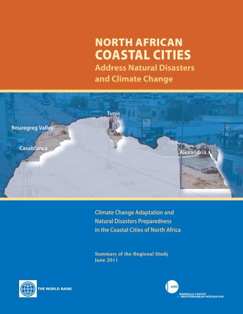
NORTH AFRICANCOASTAL CITIESAddress Natural Disastersand <strong>Climate</strong> ChangeTunisBouregreg ValleyCasablancaAlexandria<strong>Climate</strong> Change Adaptation andNatural Disasters Preparednessin <strong>the</strong> <strong>Coastal</strong> <strong>Cities</strong> of <strong>North</strong> AfricaSummary of <strong>the</strong> Regional StudyJune 2011
A STUDY BUILT ON BROAD BACKING, PARTICIPATIONThe study has been directed by Anthony G. Bigio,Senior Urban Specialist and Lead Author for <strong>the</strong>Intergovernmental Panel on <strong>Climate</strong> Change, with aWorld Bank team comprising Stephane Hallegatte,Lead <strong>Climate</strong> Change Specialist, Salim Rouhana,Junior Professional Officer, Asmita Tiwari andOsama Hamad, Disaster Risk Management Specialists,and Tim Carrington, communications adviser.The study is one of <strong>the</strong> foundational programs of <strong>the</strong>Marseille Center for Mediterranean Integration(CMI). Created in 2009, <strong>the</strong> CMI is a regional knowledgeand learning platform supporting evidencebasedpublic policy choice. Its urban programs supportdialogue, new knowledge and its use among <strong>the</strong>public and decision-makers. The study will provide<strong>the</strong> basis for future work under <strong>the</strong> programs.The study benefitted from peer-reviews by <strong>the</strong> followingspecialists from <strong>the</strong> World Bank and <strong>the</strong> GlobalFacility for Disaster Risk Reduction and Recovery(GFDRR): Alex Bakalian, Henrike Brecht, IsabelleForge, Jaafar Friaa, Francis Ghesquière, Philippe Huc,Alex Kremer, Michel Matera, and Edward Tschan.Overall guidance was provided by Anna Bjerde, Urbanand Social Development Sector Manager in <strong>the</strong> MiddleEast and <strong>North</strong> Africa region of <strong>the</strong> World Bank.The study was carried out by a consortium of Frenchconsulting companies headed by Egis-BCEOM<strong>International</strong>, directed by Denis Carra, and includingIAU-RIF and BRGM. Its project team was led by YvesEnnesser, and comprised Michel Abientz, FrançoisBeauchain, François Bertone, Ion Besteliu, DominiqueCataliotti, Jean-Michel Cathala, GuillaumeDulac, Fabrizio Ferrucci, Eric Huybrechts, AzzedineMotia, Mirelle Raymond, Victor Said, Monique Terrier,Mohsen Tounsi, Nadra Tounsi, Terry WinterandFranck Zangelmi. Méteo-Maroc, <strong>the</strong> nationalmeteorological agency, carried out <strong>the</strong> detailed climatedown-scaling models, in consultation with <strong>the</strong>Tunisian and Egyptian meteorological agencies.Co-financing partners include <strong>the</strong> Global Facility forDisaster Risk Reduction and Recovery (GFDRR),<strong>the</strong> Norwegian Trust Fund Private Sector andInfrastructure (NTF-PSI) and <strong>the</strong> Trust Fund forEnvironmentally and Socially Sustainable Development(TFESSD), administered by <strong>the</strong> World Bank.Partners generously providing specific supportinclude <strong>the</strong> European Space Agency, which providedearth observation via <strong>the</strong> service companiesAltamira and TRE, and <strong>the</strong> Arab Academy of Science,Technology and Maritime Transportation,which has collaborated in <strong>the</strong> Alexandria urban riskassessment.Within <strong>the</strong> three participating countries, institutionalsupport and technical contributions of <strong>the</strong> relevantagencies was critical to carrying out <strong>the</strong> research anddefining <strong>the</strong> policy responses.In Egypt <strong>the</strong> Environmental Affairs Agency (<strong>Coastal</strong>Zone Management Department), alongside <strong>the</strong> AlexandriaGovernorate, has provided support for <strong>the</strong>study.In Morocco, <strong>the</strong> State Secretary for Water and <strong>the</strong>Environment, <strong>the</strong> Wilaya of Greater Casablanca, and<strong>the</strong> Agency for <strong>the</strong> Development of <strong>the</strong> BouregregValley played an equivalent role.In Tunisia, such support came from <strong>the</strong> Ministry ofEnvironment and Sustainable Development (Environmentand Quality-of-Life Department), <strong>the</strong> Ministry ofDevelopment and <strong>International</strong> Cooperation (InfrastructuresDepartment), and <strong>the</strong> Municipality of Tunis.
OVERVIEW: URBAN COASTAL RISKS ON THE RISE<strong>North</strong> Africa’s coastal cities, long benefitting from<strong>the</strong>ir ready access to commerce and culture, also facedistinct vulnerabilities due to <strong>the</strong>ir location. Naturalhazards and extreme wea<strong>the</strong>r patterns impose riskson coastal areas that inland areas seldom encounter.<strong>North</strong> Africa’s increasingly populous cities facetangible risks today, but <strong>the</strong>se will be amplified as<strong>the</strong> impacts of global climate change fur<strong>the</strong>r manifest<strong>the</strong>mselves over <strong>the</strong> decades to come.To better understand both <strong>the</strong> risks that <strong>the</strong>se citiesface by <strong>the</strong> 2030 time horizon, and to help prepare<strong>the</strong> required adaptive responses, <strong>the</strong> World Bank hasconducted a regional study focused on three citiescritical to <strong>the</strong> region’s economic, social and politicallife: Alexandria, Casablanca and Tunis. The study alsoexamined <strong>the</strong> Bouregreg Valley between Rabat andSalé in Morocco, an area which is undergoing largescaleurban development and is slated for fur<strong>the</strong>rgrowth in <strong>the</strong> next decade.The study, “<strong>Climate</strong> Change Adaptation and NaturalDisasters Preparedness in <strong>the</strong> <strong>Coastal</strong> <strong>Cities</strong> of<strong>North</strong> Africa,” analyzed <strong>the</strong> exposure of all four locationsto natural disasters, such as floods and stormsurges, earthquakes and tsunamis, as well as to <strong>the</strong>increasingly frequent wea<strong>the</strong>r extremes associatedwith climate change. The project, which has takenplace from June 2009 to June 2011, has provided toolsfor evaluating <strong>the</strong> risks, costing out potential losses,and moving toward specific reforms and investmentsdesigned to adapt <strong>the</strong> cities to a changing climate andincrease <strong>the</strong>ir resilience to natural hazards.Rise in Natural Disasters Already inEvidenceAlready, <strong>the</strong> sou<strong>the</strong>rn Mediterranean and MiddleEast have seen a measurable rise in natural disasters.From an average of three natural disasters a year in1980, <strong>the</strong> region experienced a steady increase to anaverage of more than 15 in 2006. All told, <strong>the</strong> regionwas been hit by 276 disasters in this 25-year timeperiod, of which 120 occurred in <strong>the</strong> last five years. Byany measure, <strong>the</strong> risks associated with natural catastrophesare on <strong>the</strong> rise, also on account of increasingpopulation and assets exposure.Urban Risks Increase Over Time in All Urban Locations under <strong>the</strong> StudyUrban Risks Alexandria Tunis Casablanca Bouregreg ValleyHorizon Current 2030 Current 2030 Current 2030 Current 2030Seismicity/ground instabilityTsunami/Marine submersion<strong>Coastal</strong> ErosionFloodingWater ScarcityVery High High Medium Low Very LowNORTH AFRICAN COASTAL CITIES ADDRESS NATURAL DISASTERS AND CLIMATE CHANGE | 1
2 | OVERVIEW: URBAN COASTAL RISKS ON THE RISEIn <strong>North</strong> Africa’s coastal cities, urban managers, businessesand households have had to cope with numerouscostly and destructive episodes of extreme wea<strong>the</strong>r.Recent extreme wea<strong>the</strong>r eventsOn November 30, 2010, Casablanca was deluged bya record 18 centimeters of rain overnight— equal toabout six months of rainfall under normal patterns.The resulting floods forced <strong>the</strong> shutdown of variousfacilities, including <strong>the</strong> international airport, businessesand schools throughout <strong>the</strong> city. Companieslost inventories. Streets became swirling rivers,with cars mostly submerged, and citizens strugglingthrough waist-high water to reach places of security.More than 2,500 families had to be accommodatedin various public structures. After <strong>the</strong> disaster, citycouncilors called for an urgent review of infrastructures,services, and institutional systems implicatedin emergency response.3025On December 10–12, 2010, heavy rains, storm surgesand strong winds hit Alexandria, causing <strong>the</strong> partialcollapse of 28 buildings, with 18 people dying in <strong>the</strong>catastrophe and dozens more injured. Streets wereinundated, harbor activities suspended. A factory collapsedon a group of workers after <strong>the</strong> rains damaged<strong>the</strong> structure.For Tunis, <strong>the</strong> scope of natural disaster risks hit homein September, 2003, when a particularly severe stormswept <strong>the</strong> coastal city. In a 24-hour period, Tunis tookin about five times <strong>the</strong> volume of rain as typically fellin <strong>the</strong> entire month of September. The catastrophedamaged buildings, cost lives, and overwhelmed <strong>the</strong>limited drainage systems of <strong>the</strong> city. Following <strong>the</strong>disaster, <strong>the</strong> Tunis authorities analyzed weak pointsin urban structures and initiated studies and investmentsto help <strong>the</strong> city withstand similar catastrophesin <strong>the</strong> future.Risks Likely to Increase Over TimeTwo trends confirm that <strong>the</strong> cities will be increasinglyvulnerable to flooding and o<strong>the</strong>r natural disastersover <strong>the</strong> next two decades:<strong>Climate</strong> change, whose future magnitude andimpacts necessarily remain somewhat uncertain,adds to <strong>the</strong> frequency and intensity of extremewea<strong>the</strong>r events, so that historical patterns nolonger function as indicators of future wea<strong>the</strong>rrelatedrisks. According to <strong>the</strong> <strong>International</strong>Panel on <strong>Climate</strong> Change, <strong>North</strong> Africa is <strong>the</strong>second most vulnerable area in <strong>the</strong> world toemerging climate-related risks.201510501980198219841986198819901992Year1994199619982000200220042006Number of disasters 3 per. Mov. Avg.Natural disasters affecting Middle Eastern (number and <strong>North</strong> of disasters) <strong>African</strong> countrieshave increased significantly since 1980. (Source: EMDAT)Rapid urban population growth throughout<strong>the</strong> Middle East and <strong>North</strong> Africa raises <strong>the</strong>stakes by increasing <strong>the</strong> potential losses fromnatural disasters and climate-related damages.Some 60 million people inhabited <strong>the</strong> region’scoastal cities in 2010, but <strong>the</strong> number is expectedto swell to 100 million in 2030, placing morepeople, livelihoods and structures at risk. Alexandria,Casablanca and Tunis—home to about tenmillion people in 2010—can expect a combinedpopulation of around 15 million in 2030. TheBouregreg Valley anticipates an influx of up to140,000 people in an area that has remainedvirtually uninhabited for centuries.
NORTH AFRICAN COASTAL CITIES ADDRESS NATURAL DISASTERS AND CLIMATE CHANGE | 3Sea level change (mm)5004003002001000–100–200Estimates of<strong>the</strong> pastInstrumental record1800 1850 1900 1950 2000 2050 2100YearUrban Risk AssessmentsProjections of<strong>the</strong> futureProjections for <strong>the</strong> 21st century carry uncertainty, but even at <strong>the</strong> lowend of <strong>the</strong> range, sea level rise will compound current risks for <strong>North</strong><strong>African</strong> coastal cities. (Source: WRI)The study took into account climate change projections,urbanization and demographic shifts, andexamined coastlines, structures, and neighborhoodsthat will face increasing risks. Looking at specificthreats, such as flooding or coastal erosion, <strong>the</strong> studyteam found that most risks increase over <strong>the</strong> 2010–2030 period. Sea level rise—a critical climate-changerisk for coastal cities—is an important unknown butis assumed in <strong>the</strong> study to be 20 cm by <strong>the</strong> year 2030.The higher seas would compound storm surges,increasing <strong>the</strong> risks for marine inundation and coastalerosion.The report has identified specific risks within each of<strong>the</strong> four urban areas, and proposed adaptive actionsthat would mitigate potential damages and losses.Risks have been quantified, along with <strong>the</strong> costs ofadaptive and climate-resilient actions, so that plannerscan calculate <strong>the</strong> costs and benefits associatedwith <strong>the</strong> particular courses of action recommended.Although <strong>the</strong> study focuses on four specific locationsonly, <strong>the</strong> analytical processes it employs are relevantto many o<strong>the</strong>r coastal cities in <strong>the</strong> region.Economic valuationsThe study found that over <strong>the</strong> 2010–2030 period, <strong>the</strong>three cities each face potential cumulative lossesof well over $1 billion from <strong>the</strong> risks, which includefloods, earthquakes, coastal erosion, ground instability,marine inundation, tsunamis and water scarcity.Meanwhile, <strong>the</strong> planned development of Morocco’sBouregreg Valley could place communities, housesand industries at risk—unless <strong>the</strong> project follows apath of climate-smart development.The bulk of <strong>the</strong> risks are related to natural disastersto which <strong>the</strong> coastal cities are already vulnerable,Days92847667595042342517860 hours64 hours86 hours1950 1954 1958 1962 1966 1970 1974 1978 1982 1986 1990 1994 1998 2002 2006Heat waves are becoming longer lasting, with higher peak temperatures, as this record for Tunis shows, increasing impacts on public health, includingmore respiratory diseases.
4 | OVERVIEW: URBAN COASTAL RISKS ON THE RISEbut by 2030, about 20% of <strong>the</strong> potential losseswould be attributable to various impacts of climatechange. Given that by all scientific accounts climatechange manifestations are going to increase significantlyby mid-century and fur<strong>the</strong>r, it is very likelythat a much greater percentage of losses will beattributed to climate change for <strong>the</strong> 2050 or 2070scenarios.Lessening <strong>the</strong> Risk: Overlapping Spheres of ActionInfrastructureUrbanPlanningInstitutionalActing to Make <strong>Cities</strong> Resilient,Adapted to <strong>Climate</strong> ChangeThe study’s first phase focused on future climate projections,probabilistic risk assessments, and hazardand exposure measurements, leading to <strong>the</strong> formulationof current and future urban risk assessments. Thesecond phase has generated Adaptation and ResilienceAction Plans that would make all three cities,and <strong>the</strong> Bouregreg Valley, more resilient to naturaldisasters and better adapted climate change impacts.Lessening <strong>the</strong> risks requires actions in three overlappingspheres: urban planning initiatives; institutionalreforms and capacity building; and streng<strong>the</strong>ninginfrastructure.Urban design plans will have to take intoaccount <strong>the</strong> risks of placing communities orenterprises in low-lying and risk-prone areas, andprovide climate-appropriate solutions for futureurban expansions.Institutions will need to function at higherlevels of efficiency and coordination to preventand lessen damages, with improved early warningsystems, effective communications, and clearlines of responsibility.Urban infrastructure such as coastal defensesand drainage systems will require upgrading andreinforcement.These three areas of adaptation and resilience are oftenoverlapping and mutually reinforcing, and have to9214133210Lutte contre les submersionsmarines (TM3) –zone de Mohammedia192 MDHSystème d’alerte et de prévention3,132 MDHInondations: mesures à la parcelle1,399 MDHLute contre lessubmersions marines (TM3):zones hors Mohammedia229 MDHInondations: mesurescollectives5,435 MDH Mesures anti-érosion:TM1/S1283 MDH Mesures anti-érosion:TM1/S1261 MDHAdaptation cost curves, like this one for Casablanca, allow cities to weigh <strong>the</strong> benefits of measures proposed within <strong>the</strong> action plans. The verticalcolumn shows <strong>the</strong> ratio of benefits-to-costs for investments in specific processes, institutions, and infrastructures. The horizontal red line shows <strong>the</strong>break-even point, above which benefits, under current conditions, outweigh costs.
NORTH AFRICAN COASTAL CITIES ADDRESS NATURAL DISASTERS AND CLIMATE CHANGE | 5be managed and implementedsimultaneously.Action plans drawn up inpartnership with local officialsin <strong>the</strong> three countries haveset <strong>the</strong> foundation for policyresponses and investments tolimit current and future urbanvulnerability. Economic evaluationscan assist decisionmakersin weighing <strong>the</strong> costsand benefits of particularpreventive actions, after factoringin <strong>the</strong> potential lossesin taking no actions.Tools for ReducingUncertaintiesOn this basis <strong>the</strong> study hasgenerated “adaptation costcurves” which rank <strong>the</strong> costeffectiveness of each remedialmeasure proposed. Many of such measures pass <strong>the</strong>cost-benefit test and are confirmed to be economicallyeffective and promise to deliver high returnsin terms of risk reduction. In particular, all “soft”measures, such as urban planning and streng<strong>the</strong>ning<strong>the</strong> institutional preparedness, offer a high returnon investment. Some of <strong>the</strong> infrastructure measuresproposed turn out to be more costly than <strong>the</strong> damagesthat would be off-set, but can still be justified interms of <strong>the</strong> intangible values of some urban locations,for instance on heritage grounds.The study reduces <strong>the</strong> scope of uncertainty facing decision-makerswith regard to future climate and urbanrisks, but it cannot eliminate it entirely, given that <strong>the</strong>local impacts of climate change will be greatly affectedby <strong>the</strong> scope of <strong>the</strong> worldwide mitigation measuresImproved early warning systems help coastal cities lower potential damages from sea surges, stormsand tsunamis. Systems of “smart buoys” linked to satellites, such as this one proposed for Alexandria,offer real-time surveillance and greater preparedness.Les installations peuvent être fixes ou mobiles, déployées dans les lieux sensibles ou transportables etinstallées sur des zones variables lors des alertes.reducing greenhouse gas emissions over <strong>the</strong> next twodecades. The most effective responses, <strong>the</strong>refore, take<strong>the</strong> form of so-called “no-regret” actions, which aresensible and cost-effective under a variety of futureclimate scenarios. Of course, Adaptation and ResilienceAction Plans should be updated periodically torespond to fur<strong>the</strong>r findings and evolving scenarios.Moving Towards ImplementationWith <strong>the</strong> study completed, <strong>the</strong> tasks ahead involvecreating political consensus and mobilizing financialresources for <strong>the</strong> most critical planning and policyinitiatives and investments, so that <strong>the</strong>se cities, whichhave historically contributed so profoundly to <strong>the</strong>identity of <strong>the</strong> region, may be better prepared to face<strong>the</strong> challenges of <strong>the</strong> future.
ALEXANDRIASTEERING URBAN GROWTH AWAY FROM AREAS AT RISKThe ancient city of Alexandria is home to a populationof 4.1 million, with an expectation of 6.8 millioninhabitants by <strong>the</strong> year 2030, a surge of 65%. Theoriginal city, built by Alexander <strong>the</strong> Great in 331 BC,has grown enormously over <strong>the</strong> centuries with steadyexpansions along its water front. From <strong>the</strong> coastalvillage of Abu Quir in <strong>the</strong> nor<strong>the</strong>ast to <strong>the</strong> village ofEl-Deir in <strong>the</strong> southwest, <strong>the</strong> Alexandria agglomerationconsists mainly of high-density settlementsalong a partially elevated ridge facing <strong>the</strong> sea, backedby low-lying rural areas containing a number of lakesand wetlands. Many of <strong>the</strong>se areas fall below sea leveland are also highly vulnerable to flooding, which iscontrolled by pumping stations ejecting water into<strong>the</strong> Mediterranean Sea.Urban Risks Increase Over Time in All Urban Locationsunder <strong>the</strong> StudyUrban RisksAlexandriaHorizon Current 2030Seismicity/ground instability/Tsunami/Marine submersion<strong>Coastal</strong> ErosionFloodingWater ScarcityHigh Medium LowPatterns of Urban GrowthIt is expected that Alexandria’s expansion will tendto take place westward, along <strong>the</strong> Al-Bouhayra Lake,with fur<strong>the</strong>r urban sprawl towards <strong>the</strong> south. Poorercommunities are likely to increase along certainshoreline areas, in <strong>the</strong> Abu Quir depression and near<strong>the</strong> Maryut Lake. O<strong>the</strong>r areas likely to house futurepopulation growth are in low-lying spaces subject toground subsidence and increasing climate-relatedrisks. Expansion south of <strong>the</strong> Al Montaza and Sharqareas is likely to increase <strong>the</strong> number of people andvalue of structures exposed to seismic and floodingrisks.The city’s recent reconstruction of its sea-front roadwayin <strong>the</strong> form of a ten-lane coastal highway hasintensified already evident patterns of coastal erosionand storm surges, by steepening of <strong>the</strong> slope of<strong>the</strong> seabed. As a result of future sea-level rise, suchevents are likely to have fur<strong>the</strong>r impact into <strong>the</strong> city’sbuilt front, exposing new areas to risk.Key RisksOne element of Alexandria’s critical exposure to risksare its informal settlements, which currently houseone third of <strong>the</strong> city’s total population, and whichare likely to increase with population growth. More
8 | ALEXANDRIA: STEERING URBAN GROWTH AWAY FROM AREAS AT RISKThis multi-risk map of Alexandriahighlights critical vulnerabilities.The large shaded area indicateslow-lying, flood-prone lands;red represents high-densityresidential areas; yellow showsslums and informal settlements;blue shows areas most subject tomarine submersion. The diagonalline off <strong>the</strong> coast representsdifferent degrees of coastalerosion risk.Flooding: Vulnerabilities are evident in recentlyurbanized areas that are below sea level, includingan area between <strong>the</strong> hydro-dome and AbuQuir, at <strong>the</strong> edge of <strong>the</strong> former Abu Quir lagoon,and in <strong>the</strong> Sharq and Al Montaza districts. Withoutcareful planning for <strong>the</strong> use of areas belowsea-level, informal settlements will multiply, andwith more frequent and more intense extremerainfalls, flooding will escalate to a medium riskin 2030 from a low risk in 2010.Seismic threats and ground instability:<strong>North</strong>ern Egypt faces moderate earthquake andseismic risks. However, subsidence combinedwith increasing informal settlements raise <strong>the</strong>potential losses from structural damage, increasing<strong>the</strong> rating to a medium risk in 2030 from alow risk in 2010.Tsunami and marine submersion: Seafrontbuildings along <strong>the</strong> densely urbanized coastlineare exposed to structural damages, while low-lyingareas risk marine submersion. <strong>Coastal</strong> areasnear Abu Quir are directly threatened by marinesubmersion, with specific worries that <strong>the</strong> 18thcentury Mohammed Ali sea wall could rupture incase of a major earthquake or tsunami, puttingareas below sea-level at risk of inundation. Withincreased settlement of <strong>the</strong> shoreline, along witha likely expansion of residential developmentsover current natural areas, such threats rise to<strong>the</strong> high-risk category by 2030, up from a mediumrisk in 2010.<strong>Coastal</strong> erosion: Over time, Alexandria’sbeaches have been receding, with increasingrisk of structural damage to shoreline buildings.There are significant erosion risks betweenEl Dekhiela Harbor and <strong>the</strong> western harbor of
NORTH AFRICAN COASTAL CITIES ADDRESS NATURAL DISASTERS AND CLIMATE CHANGE | 9Alexandria, and at Abu Quir. With <strong>the</strong> higher sealevels associated with climate change, coastalerosion and <strong>the</strong> beaches retreat are likely to accelerate.As a result, erosion rises to a high-riskcategory in 2030, from a medium-risk in 2010.Water resources scarcity: With Egypt’sgrowing population and a constantly increasingindustrial demand for limited Nile water, waterscarcity problems are likely to occur. Waterdemand surged by 50% over <strong>the</strong> past decade,and with nearly half of Egypt’s industrial activitycentered in Alexandria, urban demand for limitedwater resources is certain to grow. Meanwhile,local aquifers are becoming exhausted and aresubject to salinization. Unmediated competitionfor Nile resources with upstream countries couldexacerbate shortages, so that by 2030, <strong>the</strong> city’scurrent supply from <strong>the</strong> Nile could become insufficient,and water resources scarcity is rated as ahigh risk in <strong>the</strong> future from a low risk today.For Alexandria, <strong>the</strong> cumulative potential damagefrom natural disasters and climate change impactsis estimated to be $1.72 billion in Net PresentValue for <strong>the</strong> period 2010–2030. An estimated18% of that total is attributable to climate changeimpacts alone.Adaptation and Resilience ResponsesThere is much that decision-makers can do to protect<strong>the</strong> well-being of <strong>the</strong> city’s population and lessen <strong>the</strong>potential harms to <strong>the</strong> economy of natural disastersand climate change. Broadly, <strong>the</strong> study encouragesEgyptian policymakers to shift from mainly respondingto natural disasters and wea<strong>the</strong>r events after <strong>the</strong>yoccur to focusing on preventive actions to limit <strong>the</strong>damage natural disaster might cause and to prepar-Alexandria’s building stock mostlyconsists of older and low-qualitystructures vulnerable to naturaldisasters, represented by red andmagenta in <strong>the</strong> map. Patterns ofhigh-density occupancy in <strong>the</strong>seareas multiply <strong>the</strong> vulnerabilities.(Source: GOPP)
10 | ALEXANDRIA: STEERING URBAN GROWTH AWAY FROM AREAS AT RISKing for <strong>the</strong> progressive impacts of climate change. Thestudy also provides tools for pricing <strong>the</strong> costs of variousactions, comparing <strong>the</strong>se costs to damages thatmight occur if no adaptive actions are taken.Urban PlanningAdequate urban planning and land-use policies willbe critical to limiting <strong>the</strong> Alexandria’s exposure torisks, damages and losses. The 2030 Greater AlexandriaMaster Plan, currently being prepared, is anexcellent opportunity to incorporate <strong>the</strong> results of <strong>the</strong>study’s urban risk assessment, and to re-orient <strong>the</strong>city’s future expansion away from <strong>the</strong> areas identifiedas most at risk. The Master Plan should also directfuture urban growth, define city limits, and establisha land-use program with rules for densities, buildingheights and open space ratios taking into accountfuture climate scenarios.Institutional PreparednessUpgrading early warning systems covering all typesof disasters emerges as a particularly sound investment.Improved management of coastal areas alsoemerges as critical. For example, a system of “smartbuoys” along <strong>the</strong> coastline could help generate timelydata that could help protect people and propertyfrom coastal storm surges. Improved communicationamong agencies involved in disaster prevention andresponse could streng<strong>the</strong>n timeliness and coordination,leading to more robust responses.Infrastructure InvestmentsInvestments in making existing structures more resilientwould benefit coastal marine defenses. Some keyurban infrastructures and buildings, along with watersupply and drainage systems, could be made morerobust and better able to withstand <strong>the</strong> damages thatcan occur in storms such as <strong>the</strong> one that hit Alexandriain 2010. Like o<strong>the</strong>r cities, Alexandria can lowerflood-related risks by taking steps to improve controlof runoff and discharge sources, and routine maintenanceof <strong>the</strong> sewage system all would lower risksduring flooding periods. In addition, areas slated fordevelopment can be sited and prepared to minimize<strong>the</strong> vulnerability. Investment in special equipment—such as mobile water pumps—can help with drainageproblems during flooding.
CASABLANCACONFRONTING FLOODING, COASTAL EROSION ANDMARINE SUBMERSIONCasablanca is home to 3.3 million people, withano<strong>the</strong>r 300,000 in nearby rural areas. In <strong>the</strong> period1994–2004, <strong>the</strong> population surged by more than halfa million. According to estimates based on historicalpatterns, <strong>the</strong> population of Greater Casablanca willswell by 55% to 5.1 million by 2030.Patterns of Urban GrowthEconomic expansion and population growth willcontinue to fuel a sharp rise in <strong>the</strong> number of households.As a result, <strong>the</strong> urban area is expected to expandby as much as 1,000 hectares a year. Significanturban development is also expected to occur along<strong>the</strong> Casablanca waterfront and in low-lying areas thatare vulnerable to sea storm surges and flooding.Key RisksCasablanca is particularly vulnerable to flooding,coastal erosion and marine inundation, and is experiencingsignificant pressures linked to rapid urbangrowth. The city also houses many precarious structures,some older and poorly maintained, some newerand poorly constructed. A number of <strong>the</strong> slums anddensely populated neighborhoods are located in lowlyingneighborhoods, and have encroached on areaslegally protected for water catchment.Morocco has experienced climatic shifts in recentyears, including warmer average temperatures andoverall decreased yearly rainfall. Projections for 2030envision warming for Casablanca of up to 1.3 degreescentigrade, with annual rainfall accumulation decreasingby 6% to 20%. However, it is also expected that <strong>the</strong>warmer temperatures and lower levels of annual rainfallwill be accompanied by more frequent and moreintense episodes of extreme precipitation, fur<strong>the</strong>roverwhelming <strong>the</strong> already stressed urban drainagesystems.The town of Mohammedia, subject to devastatingfloods in 2002, requires special attention. An analysisUrban Risks Increase Over Time in All Urban Locationsunder <strong>the</strong> StudyUrban RisksCasablancaHorizon Current 2030Seismicity/ground instability/Tsunami/Marine submersion<strong>Coastal</strong> ErosionFloodingWater ScarcityHigh Medium Low Very Low
12 | CASABLANCA: CONFRONTING FLOODING, COASTAL EROSION AND MARINE SUBMERSIONof <strong>the</strong> vulnerabilities and structural fragilities underscored<strong>the</strong> need for improved drainage facilities andgreater physical protection against sea surges.Morocco’s Disaster Risk Management has becomesignificantly more effective as a result of changescarried out since early 2009. A restructured GeneralDirectorate of Civil Defense and a new Supervision& Coordination Committee have generated positivereviews from a mix of stakeholders. Improved disasterpreparedness and more accurate warnings from<strong>the</strong> Department of Meteorology, Morocco enableda much improved response to torrential rains andflooding between December 2009 and March 2010.Urban Risk AssessmentFollowing are <strong>the</strong> key results of <strong>the</strong> risk assessmentsfor Casablanca, as measured in 2010 and forecasted for2030:Flooding: Casablanca has been regularly disruptedby floods, given its current level of protection,limited to a level of rainfall recurring everyfive years. This is due to insufficient city-widedrainage systems and <strong>the</strong> informal urbanizationof catchment areas. The study has identified specificareas of Greater Casablanca that are particularlyvulnerable to periodic flooding: slums andstructures built with cheap or inferior materialsare of particular concern. Flooding is considereda high risk in 2010, and will remain high for <strong>the</strong>2030 scenario.Tsunamis and marine submersion: ForCasablanca, <strong>the</strong> risks posed by tsunamis andmarine submersion are considered medium,given <strong>the</strong> historical record of relatively recenttsunamic events, and are expected to remain soby 2030. Marine submersion risk is significant forspecific segments of <strong>the</strong> coastline, in particularfor Mohammedia, where storm surges can causeAreas of substandard dwellings,indicated by red, constitute 28%of all housing stock, with 11%categorized as slums. Theseextend across Greater Casablanca,but are concentrated in <strong>the</strong>nor<strong>the</strong>ast outskirts. Black squares(not drawn to scale) indicate <strong>the</strong>size of slum areas.
NORTH AFRICAN COASTAL CITIES ADDRESS NATURAL DISASTERS AND CLIMATE CHANGE | 13Flood-prone areas, indicatedby <strong>the</strong> dark blue, are sprinkledthroughout residential,industrial and mixed-used partsof Greater Casablanca. The mostcritical areas are <strong>the</strong> town ofMohammedia and <strong>the</strong> courseof <strong>the</strong> Oued Bouskoura cuttingacross <strong>the</strong> city to <strong>the</strong> harbor.Already planned infrastructureimprovements are expected toreduce exposure to flooding.<strong>the</strong> inflow of sea-water inland with severe consequencesfor <strong>the</strong> productive and administrativecenter of <strong>the</strong> city. Storms, intensified by highersea levels, will be likely to damage <strong>the</strong> city’ssea-front and put more areas at risk of marinesubmersion. The low-lying areas near <strong>the</strong> outletsof <strong>the</strong> main ephemeral streams of Mehla andNfifich face distinct risks.<strong>Coastal</strong> erosion: A ten-kilometer coastal segmentstretching between <strong>the</strong> eastern endof Casablanca and <strong>the</strong> Mohammedia powerstation now faces a strong risk of erosion, withano<strong>the</strong>r thirty to forty kilometers of coastlinesegments also considered at risk. Expectedsea level rise intensifies such vulnerabilitiesin <strong>the</strong> future. The risks of coastal erosion willincrease, with sand beaches expected to retreatby as much as 15 meters by 2030. Erosion risk isranked as high risk today as well as for <strong>the</strong> 2030scenario.Water resources scarcity: Water insecurity,ranked as a low risk in 2010, would become a mediumrisk by 2030, assuming current estimatesof population and industrial growth. This is inrelation to <strong>the</strong> overall decrease in rainfall which<strong>the</strong> country is expecting, with <strong>the</strong> consequentdecrease in resource and additional pressureover <strong>the</strong> apportioning of water for urban andrural usages.The potential aggregate economic losses for <strong>the</strong>2010–2030 period due to natural disasters andimpacts of climate change in Casablanca wouldhave a Net Present Value of $1.39 billion, <strong>the</strong> bulkof which is associated to flooding. Such losseswould be commensurate to losing 7% of <strong>the</strong> grossdomestic product of Greater Casablanca. Potentialeconomic losses attributable to climate changeimpacts would represent an estimated 18% of <strong>the</strong>total.
14 | CASABLANCA: CONFRONTING FLOODING, COASTAL EROSION AND MARINE SUBMERSIONAll along <strong>the</strong> Casablancaseaboard, low-lying areas suchas <strong>the</strong> town of Mohammedia,are subject to high marinesubmersion risks. Blue areasindicate present risks, red areas,additional exposures coming onby 2030.Adaptation and Resilience ResponsesThe study calls for an integrated approach for <strong>the</strong> detailedland use planning and urban design of Casablanca’sneighborhoods, reconciling <strong>the</strong> expected growthof population and economic activities with environmentalconsiderations. This approach has already beenembraced by <strong>the</strong> 2030 Master Plan which was recentlyapproved, and now needs to be applied in greater detailas <strong>the</strong> zoning plans are being designed. <strong>Climate</strong>-relatedvulnerabilities and natural risks have to be factored inwhen <strong>the</strong> city considers potential uses of vacant land oridentifies areas for new housing construction. Floodproneareas should be carefully screened to avoidworsening inundation and drainage problems.Urban PlanningThe study also suggests <strong>the</strong> creation of eco-neighborhoodsto demonstrate approaches to environmentallysustainable, climate-resilient design and construction,which could serve as models for new development inCasablanca and beyond. Meanwhile, areas subjectedto repeated flooding would undergo detailed plansto protect key structures and buildings. It is expectedthat slums would eventually be redeveloped under<strong>the</strong> national slum up-grading program, and that o<strong>the</strong>rovercrowded areas would undergo rehabilitation.Institutional PreparednessMoroccan institutions can take specific actions tobecome more effective in responding to naturaldisasters. Risk factors are already incorporated in<strong>the</strong> organizational and regulatory framework, but <strong>the</strong>country would benefit from fur<strong>the</strong>r steps to removeoverlapping ministerial functions, to simplify operations,and to separate civil defense and <strong>the</strong> roles ofstate and local institutions.Casablanca also needs new information systems,including improved strategies to alert citizens and enterprisesof rapidly changing wea<strong>the</strong>r conditions, alongwith plans for protecting lives and property. The studyhas strongly recommended upgraded systems for surveillanceand early warning, with greater use of satellite
NORTH AFRICAN COASTAL CITIES ADDRESS NATURAL DISASTERS AND CLIMATE CHANGE | 15imagery and regular measurement of land subsidence,temperature changes and shifts in water levels.Infrastructure InvestmentsThe studies attach special urgency to addressingphysical vulnerabilities along <strong>the</strong> coastline, particularly<strong>the</strong> stretch of about 40 kilometers that is alreadysubject to erosion and sea storm surges. A vulnerablecoastal span between Mohammedia, and Casablanca,where protective dunes are considered particularlyfragile, could benefit from steps to reinforce <strong>the</strong>natural barriers, coupled with <strong>the</strong> managed retreat ofsome illegal coastal housing.Casablanca would also benefit from improvementsin <strong>the</strong> drainage system to ensure its viability duringflooding crises, along with expanded infrastructurefor accommodating runoff and drainage. A criticalflood prevention project is <strong>the</strong> construction of<strong>the</strong> drainage canal dubbed “Super Collector West”,which has already been designed and quantified, andwhich would increase <strong>the</strong> flood protection of <strong>the</strong> cityto a 20-year level. This infrastructure would drain anumber of basins that tend to overflow during heavyrainfall and potential floods in <strong>the</strong> western part of<strong>the</strong> city.New dam structures would be necessary to assurelong-term protection of communities and propertyagainst <strong>the</strong> sea. Casablanca should also extend <strong>the</strong>current programs aimed at reducing water leakages,favor water conservation, and link water storage facilitiesinto an integrated system that would include enable<strong>the</strong> use of harvested rainwater for watering greenareas.
TUNISADDRESSING MULTIPLE RISKS, ONSET OF CLIMATE CHANGEResidents of Tunis expect hot, dry summers followedby mild, wet winters. But <strong>the</strong>y also have cometo anticipate wea<strong>the</strong>r extremes. Following a series adamaging storms over thirty years, Tunis encountereda devastating storm in 2003, with major floodingacross <strong>the</strong> city, and losses amounting to hundreds ofmillions of dollars. That same year, <strong>the</strong> city experienceone of <strong>the</strong> most intense heat-waves on record. Thecity drew up new disaster response plans and initiatedinfrastructure improvements. But with climatechange, extreme episodes as occurred in 2003 areexpected to become more frequent, requiring a freshlook at <strong>the</strong> city’s level of preparedness.Patterns of Urban GrowthPopulation growth in Tunis is more modest than ino<strong>the</strong>r cities in <strong>the</strong> region, but still a significant factor inassessing future risks. The urban population of 2.25 millionis expected to increase 33% to about 3 million by2030. However, <strong>the</strong> tectonics and soils of <strong>the</strong> city itselfpresent profound challenges. In downtown Tunis, landsubsidence leaves some buildings tilting visibly to oneside, and seismic risks are considerable. The coastlineis seriously threatened by erosion, requiring reinforcedbeach defenses. The coastline itself is continuouslyshifting despite sea defenses and beach nourishmentwhich have been built and implemented regularly.Key RisksUrban Risks Increase Over Time in All Urban Locationsunder <strong>the</strong> StudyUrban RisksTunisHorizon Current 2030Seismicity/ground instability/Tsunami/Marine submersion<strong>Coastal</strong> ErosionFloodingWater ScarcityVery High High Medium LowTopographical data shows that urbanized and industrialareas in <strong>the</strong> lower downtown, Rades, Ezzahra andHammam Lif Ouest are vulnerable to marine submersionunder certain storm conditions. Extreme rainfallevents could increase by 25% under widely acceptedscenarios for climate change by 2030. Tunis couldbe facing <strong>the</strong> occurrence of 50- year wea<strong>the</strong>r eventsthat formerly occurred once every one hundred years.Similarly, intense rains that might once have comeevery fifty years could arrive once every twenty in <strong>the</strong>near future. The return period for less violent wea<strong>the</strong>repisodes would be telescoped in <strong>the</strong> same way.
NORTH AFRICAN COASTAL CITIES ADDRESS NATURAL DISASTERS AND CLIMATE CHANGE | 17Institutional streng<strong>the</strong>ning can help better manage<strong>the</strong> risks. The National Office for Civil Protection leadsvarious agencies in <strong>the</strong> prevention and managementof disasters, but <strong>the</strong> structure of this arm of governmenthas barely changed over <strong>the</strong> decades. Pastepisodes of natural disasters haven’t been followed byassessments and regulatory or operational improvements.Cartographic information and geographicaldata bases remain largely absent, along with textscovering specific risks.Urban Risk AssessmentFollowing are <strong>the</strong> key results of <strong>the</strong> risk assessmentsfor Tunis, as measured in 2010 and forecasted for2030:Flooding: Floods, a recent and major problemfor <strong>the</strong> city, would likely intensify, rising froma current high risk to a very high risk by 2030,despite <strong>the</strong> full implementation of <strong>the</strong> trunkdrainage system upgrades under way, on accountof <strong>the</strong> likely 25 percent increase in extremeprecipitation events, which can generate floodlevels of more than one meter in certain areas of<strong>the</strong> city Certain drainage basins will face a severerisk of flooding, exacerbated by inadequate localdrainage and rapid urbanization. Meanwhile, as<strong>the</strong> city expands, new construction on hillsidesand in flood-prone areas could be adding torunoff volumes and consequent damages, unlessplanned in a climate-appropriate way.<strong>Coastal</strong> erosion: Erosion, already a high riskalong <strong>the</strong> Tunis shoreline in 2010, is ranked asa very high risk by 2030. The coastline of <strong>the</strong>Gulf of Tunis has been receding for half a century,despite offshore protections mitigating <strong>the</strong>trend. In some stretches of <strong>the</strong> coastline it canrecede by as much as 10 meters a year. By 2030,27 kilometers of <strong>the</strong> urbanized seafront wouldbe considered at a high risk of erosion, up from16 kilometers in 2010. Sea level rises projectedunder climate change would accelerate coastalerosion, with beaches receding by as much asIn economically important central Tunis, subsidence indicatedin red combines with flooding risks indicated in blue to multiplypotential impacts. Major storms overwhelm <strong>the</strong> center-city drainage,inundating streets and buildings.15 meters by 2030. The coastline between KalaatLandalous and Raoued Beach could be severelyeroded by 2030.Tsunamis and marine submersion: Thestudy assumes a global sea level rise of 20 centimetersby 2030, which could intensify <strong>the</strong> damageto sea barriers, raising <strong>the</strong> risk of submersionsfor <strong>the</strong> city. By 2030, <strong>the</strong> study estimatesthat an expanded stretch of <strong>the</strong> urban seafrontwould be at a high risk of submersion. Taken toge<strong>the</strong>r,<strong>the</strong> risks rise from a medium-risk categoryto high-risk by 2030.
18 | TUNIS: ADDRESSING MULTIPLE RISKS, ONSET OF CLIMATE CHANGEEarthquake and ground instability: Tunisfaces in general a moderate earthquake risk, buton account of <strong>the</strong> poor geotechnical quality ofTunis’ soils, <strong>the</strong> damage risks would be considerablyhigher. Subsidence in <strong>the</strong> downtown areapresents distinct challenges to <strong>the</strong> neighborhoodsbuilt on land reclaimed from <strong>the</strong> Lake ofTunis during <strong>the</strong> French colonial period, rich witharchitecture which is part of <strong>the</strong> cultural patrimonyof <strong>the</strong> city According to <strong>the</strong> study, <strong>the</strong> relatedrisks increase from medium to high between nowand 2030.Water scarcity: Water demand will increase inTunis, on account of a bigger, wealthier populationby 2030, simultaneously with an expectedconsiderable drop in average rainfall at <strong>the</strong>national scale. Despite excellent water resourcemanagement at <strong>the</strong> national level, urban usagewill place more strains on <strong>the</strong> resource, with <strong>the</strong>result that water scarcity rises to a medium riskin 2030, from a low risk in 2010.The likely aggregate economic losses from all<strong>the</strong> risks amount to a Net Present Value of $1.05billion, or 8% of <strong>the</strong> urban economy of <strong>the</strong> capitalcity. About 59% of <strong>the</strong> potential losses relateto submersion risks, with 26% reflecting seismicrisks and 14% from storm surges. An estimated25% of <strong>the</strong> potential losses by 2030 would be attributableto climate change, with most involvingflooding.Adaptation and Resilience ResponsesOverall, climate-resilient urban planning will be crucialfor Tunis to manage <strong>the</strong> risks caused by naturalhazards and climate change. Areas of <strong>the</strong> city that arelow-lying and subject to flooding will require fur<strong>the</strong>rupgrading of drainage systems before fur<strong>the</strong>r developmentis allowed. Illegal housing development at <strong>the</strong>By 2030, factoring in climate change and sea level rise, significantstretches of <strong>the</strong> Greater Tunis seaboard, indicated in darker shading,could be submerged during mega-storms likely to occur every hundredyears.periphery will need to be contained, in line with <strong>the</strong>recommendations of <strong>the</strong> Master Plan. Careful zoning,with allowance for green spaces, along with rigorousenforcement of standards, will be critical.
Figure 23 : Zone 2 - Lac de Tunis et partie Nord-Est de la Sebkha Sejoumi (Source : TRE2010)NORTH AFRICAN COASTAL CITIES ADDRESS NATURAL DISASTERS AND CLIMATE CHANGE | 19Urban PlanningZoning decisions would also factor in <strong>the</strong> city’s significantsubsidence problems, which undermine its resilienceto storms, seismic risks and extreme wea<strong>the</strong>r.Future developments will have to be designed so asto minimize additional loads to runoff, by providingfor on-site absorption of rain-water via green roofs,rainwater storage and o<strong>the</strong>r environmental devices.Institutional PreparednessBecause of <strong>the</strong> potential damage from earthquakes,sea surges and tsunamis, <strong>the</strong> study recommends thata system of monitoring and early warning, coupledwith communications plans for alerting citizens andenterprises, be installed. For <strong>the</strong> most exposed areas,sirens and o<strong>the</strong>r emergency systems would be necessary.Concurrently, <strong>the</strong> city should begin to assess indetail <strong>the</strong> vulnerability of existing buildings to <strong>the</strong>various risks so that specific actions may be carriedout to increase <strong>the</strong>ir resilience. Some areas will likelyrequire an urban requalification strategy.Tunis also needs monitoring systems to track <strong>the</strong>retreat of beaches and threats to its coastal barriers.Modern air-based surveillance can provide valuablecontributions in such systems. The city will need aspecific plan for reversing already observed erosionin <strong>the</strong> vicinity of Rades, and in certain o<strong>the</strong>r areas.The study advanced a series of specific recommendationsfor o<strong>the</strong>r stretches of coastline that havebeen degraded over time, by storms and changes in<strong>the</strong> coastal profile. Overall, Tunis would also benefitfrom a better legal framework for <strong>the</strong> management ofcoastal zones.Infrastructure InvestmentsInfrastructure streng<strong>the</strong>ning will be critical in certainareas. Sewerage and drainage structures in Tuniswill require upgrading, within an overarching masterplan. Better equipment to manage water levels at <strong>the</strong>lake and harbor will be necessary and in some areas,dikes will be <strong>the</strong> required part of <strong>the</strong> solution. Tuniswill also need to invest in reinforcing existing drainageand sewage systems so that <strong>the</strong>y can manage <strong>the</strong>more frequent extreme wea<strong>the</strong>r events. To addressincreasing pressures on limited water resources, asystem for optimizing water uses and better managingconsumption will be needed, including revised pricingpolicies.Central Tunis, former and presentindustrial areas on <strong>the</strong> sou<strong>the</strong>rnshore of <strong>the</strong> lake and <strong>the</strong> portof Rades have experiencedsignificant subsidenceas measured via satelliteobservation, raising risk levels.Source: ESA.
THE BOUREGREG VALLEYINCORPORATING RISK REDUCTION IN THE PLANNING<strong>Climate</strong>-smart planning is particularly relevant in <strong>the</strong>case of <strong>the</strong> Bouregreg Valley, since it is possible tomitigate many of <strong>the</strong> risks affecting <strong>the</strong> site beforeinfrastructures are built and buildings erected. Broadly,<strong>the</strong> project is a high-end development of a quasi-virginsite, and <strong>the</strong>refore it is entirely possible to expect thata high level of protection be built into its plans from<strong>the</strong> start. The planned development envisions about140,000 inhabitants and 90,000 new jobs—all to belocated in an area vulnerable to natural disasters andclimate-related risks. The project site is located at<strong>the</strong> estuary of <strong>the</strong> Bouregreg River, with a major dambehind it, <strong>the</strong> open sea in front, and two steep slopeson ei<strong>the</strong>r side.With some settlements planned for <strong>the</strong> mouth of <strong>the</strong>river, and o<strong>the</strong>r areas slated for construction currentlyvulnerable to flooding and landslides, <strong>the</strong> developmentcould end up putting more people and assets atrisk. However, <strong>the</strong> opportunity to adopt climate-resilientland-use policies and building designs creates <strong>the</strong>prospect of mitigating <strong>the</strong> risks significantly as part of<strong>the</strong> planning process.Urban Risk AssessmentFollowing are <strong>the</strong> risk assessments for <strong>the</strong> BouregregValley for <strong>the</strong> current, pre-project scenario, as well asfor <strong>the</strong> 2030 scenario:Urban Risks Increase Over Time in All Urban Locationsunder <strong>the</strong> StudyUrban RisksBouregreg ValleyHorizon Current 2030Seismicity/ground instability/Tsunami/Marine submersion<strong>Coastal</strong> ErosionFloodingWater ScarcityVery High High Medium LowFlooding: The Bouregreg Valley has been aflood-prone valley since time immemorial, andconsequently has remained practically undeveloped.Since <strong>the</strong> construction of <strong>the</strong> Sidi MoulayBen Abdellah dam, water flows are regulatedand controlled, including at times when <strong>the</strong> damcapacity is attained and large volumes of waterhave to be released downstream. This currentlyhappens with little hindrance to people or assets,but could become a major problem given on oneside <strong>the</strong> expected increase in <strong>the</strong> frequency andintensity of extreme wea<strong>the</strong>r events, and on <strong>the</strong>o<strong>the</strong>r <strong>the</strong> land-use and construction plans for <strong>the</strong>Valley. The related risk rating would jump from<strong>the</strong> current low to very high for <strong>the</strong> 2030 scenario.
NORTH AFRICAN COASTAL CITIES ADDRESS NATURAL DISASTERS AND CLIMATE CHANGE | 21The Bouregreg Valley project,as envisioned in this map,represents one of <strong>the</strong> mostsubstantial developments in<strong>North</strong> Africa, with 140,000 newinhabitants and 90,000 jobsexpected in a site with highnatural risks.Tsunamis and marine submersion: Tsunamicepisodes have hit <strong>the</strong> Moroccan coastline inrelatively recent times, however this risk is consideredcurrently as medium on account of <strong>the</strong>low level of population and assets in <strong>the</strong> Valley.The same applies to marine submersion relatedto storm surges. Such risks become high by 2030on account of <strong>the</strong> implementation of <strong>the</strong> projectitself.<strong>Coastal</strong> erosion: Current risks, rated medium,would be lessened to low by 2030, on account of<strong>the</strong> measures which have already been integratedinto <strong>the</strong> development plan, and which include<strong>the</strong> construction of sea defences against beachand coastal erosion.Seismic risk and ground instability: Twoissues affect <strong>the</strong> Bouregreg Valley: on one hand
22 | THE BOUREGREG VALLEY: INCORPORATING RISK REDUCTION IN THE PLANNING<strong>the</strong> low geological quality of <strong>the</strong> soils, whichrisk liquefaction and that thus amplify a relativelylow seismic risk; on <strong>the</strong> o<strong>the</strong>r, <strong>the</strong> risk oflandslides from <strong>the</strong> steep slopes surrounding<strong>the</strong> valley. Such risks are considered low onaccount of <strong>the</strong> current level of population andassets exposure, but are rated as medium for<strong>the</strong> 2030 scenario.ds:X XXXX XXXX XXXXX XXXX XXXX XXXXX XXXX XXXX XXXXWater resources scarcity: Water supply issubject to few pressures today, but water scarcitywould be considered a medium risk by 2030,assuming current estimates of population andindustrial growth. The development of <strong>the</strong> BouregregValley could in itself contribute significantlyto pressures on limited water sources for coastalMorocco.The valley is hemmed in by steep slopes, which are subject tolandslides and rock slides. These would threaten buildings within <strong>the</strong>planned development. Risks could increase with climate change andmore frequent torrential storms.Adaptation and Resilience ResponsesData on low lying areas can help planners avoidlocating populations and properties in parcels of landlikely to be inundated during episodes of torrentialBy 2030, marine submersionrisks related to an exceptional100-year storm would extendbeyond <strong>the</strong> presently vulnerableareas indicated in blue to includeadditional areas indicated in red.
NORTH AFRICAN COASTAL CITIES ADDRESS NATURAL DISASTERS AND CLIMATE CHANGE | 23rains or floods. For o<strong>the</strong>r areas, structures can be designedto withstand <strong>the</strong> expected stresses. Buildingscan be sited, adapted and reinforced in ways thatwould lessen <strong>the</strong> damage from natural disasters andextreme wea<strong>the</strong>r.<strong>Climate</strong>-smart PlanningThe assessments necessarily reflect <strong>the</strong> dynamicnature of <strong>the</strong> various risks. For example, downstreamfrom <strong>the</strong> Moulay Hassan bridge, <strong>the</strong>re are significantflooding risks from wea<strong>the</strong>r events historicallyconsidered likely only once every century. Althoughprecise adjustments do not exit, <strong>the</strong>re is a broadunderstanding that under most climate changescenarios, episodes of extreme wea<strong>the</strong>r will happenmore frequently, so that a 100-year event soonmay be likely to occur as often as once every fiftyyears. Planning new infrastructures and buildings in<strong>the</strong> Bouregreg Valley should take into account suchchanges, as well as <strong>the</strong> expectation that <strong>the</strong> sealevel will rise by as much as 20 cm by 2030 andcontinue to rise.Development plans will have to take into accountwater flows, ground absorption and drainagechallenges in <strong>the</strong> areas most subject to flooding.Aspects of <strong>the</strong> current development planraise concerns. For example, plans for <strong>the</strong> KasbatAbu Raqraq area envision housing constructionon part of a flood plain, with as many as 50,000people potentially exposed to flood risks.Overall, an audit and review of zoning, buildingand infrastructure plans for <strong>the</strong> Bouregreg Valleycould lead to a series of project adjustments thatcould render <strong>the</strong> development far less vulnerable.Investing in climate-smart planning at thisstage, before structures are in place, would surelygenerate significant savings over time.
To learn more about <strong>the</strong> study, download <strong>the</strong> full reportsand view related materials on <strong>the</strong> following web-sites:www.cmimarseille.orgThe Marseille Center for Mediterranean Integration (CMI)aims to enhance <strong>the</strong> convergence of sustainable development policiesby providing a platform for knowledge sharing and joint learning.http://arabworld.worldbank.orgThe Arab World Initiative (AWI) is a World Bank Group partnershipwith <strong>the</strong> countries of <strong>the</strong> Arab world designed to fostereffective cooperation and collaboration in <strong>the</strong> interests ofeconomic integration and knowledge sharing.