mestiatchala 2 hpp project identification study - Hydropower ...
mestiatchala 2 hpp project identification study - Hydropower ...
mestiatchala 2 hpp project identification study - Hydropower ...

You also want an ePaper? Increase the reach of your titles
YUMPU automatically turns print PDFs into web optimized ePapers that Google loves.
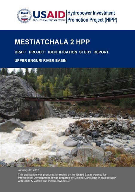
<strong>Hydropower</strong> InvestmentPromotion Project (HIPP)MESTIATCHALA 2 HPPDRAFT PROJECT IDENTIFICATION STUDY REPORTUPPER ENGURI RIVER BASINJanuary 30, 2012This publication was produced for review by the United States Agency forInternational Development. It was prepared by Deloitte Consulting in collaborationwith Black & Veatch and Pierce Atwood LLP
MESTIATCHALA 2 HPPDRAFT PROJECT IDENTIFICATION STUDY REPORTUPPER ENGURI RIVER BASINUSAID HYDROPOWER INVESTMENT PROMOTIONPROJECT (HIPP)CONTRACT NUMBER: EEM-I-00-07-00005-0DELOITTE CONSULTING LLPIN COLLABORATION WITH BLACK & VEATCH ANDPIERCE ATWOOD LLP.USAID/CAUCASUS OFFICE OF ENERGY ANDENVIRONMENTJANUARY 30, 2012
Date of Draft PublicationJanuary 30, 2012Date of Final PublicationTo Be DeterminedThis document was prepared by:Author Organization Contact DetailsDennis H. McCandless Black & Veatch Special Projects Corp. McCandlessDH@bv.comRoland Sikharulidze Deloitte Consulting phone : +995-595-60-3256Keti Skhireli Deloitte Consulting kskhireli@dcop-hipp.geGigla Sikharulidze Deloitte Consulting Gsikharulidze@dcop-hipp.geVasil Sulkhanishvili Deloitte Consulting phone: +995-599-13-0129Note to Reader: This document is based largely on existing information, and information gatheredduring field visits by a small group of professionals from Deloitte Consulting in collaboration with Black& Veatch, as part of USAID HIPP contract # EEM-I-00-07-00005-0.DISCLAIMER REGARDING THIS PROJECT IDENTIFICATION STUDYThis Project Identification Study has been sponsored by USAID and prepared for theuse of the Georgian Ministry of Energy and Natural Resources and the GeorgianEnergy Development Fund and is distributed for information purposes only. ThisProject Identification Study does not constitute an offer or invitation for the sale ofany assets or shares, or recommendation to form a basis for investment. ThisProject Identification Study and the data contained herein shall not form the basis ofor in any way constitute any contract or binding offer or agreement.While the information contained in this Project Identification Study has beenprepared in good faith, it is not and does not purport to be comprehensive or to havebeen independently verified, and neither the Ministry of Energy and NaturalResources, Georgian Energy Development Fund or any of their officers, employees,advisers or consultants accept any liability or responsibility for the accuracy,reasonableness or completeness of or for any errors, omissions or misstatements,negligent or otherwise, relating to or makes any representation or warranty, expressor implied, with respect to the information contained in the Project IdentificationStudy or on which it is based or with respect to any written or oral information made,or to be made available to any of the recipients or their professional advisers and, sofar as permitted by law and except in the case of fraudulent misrepresentation by theparty concerned, any liability therefore is hereby expressly disclaimed.While considering the Project Identification Study, each recipient/interested partyshould make its own independent assessment and seek its own professional,financial, legal and tax advice.The authors’ views expressed in this publication do not necessarily reflect the viewsof the United States Agency for International Development or the United StatesGovernment.HYDROPOWER INVESTMENT PROMOTION PROJECT (HIPP) 1
UPPER ENGURI RIVER, AREA LOCATION MAPHYDROPOWER INVESTMENT PROMOTION PROJECT (HIPP) 2
PROJECT IDENTIFICATION STUDYMESTIATCHALA 2 HYDROPOWER PROJECTUPPER ENGURI RIVER BASINMestiatchala River on October 13, 2011, during a day of steady rain. The pipelineunder the bridge is the main water supply for Mestia, taken from an unspoiledtributary and glacier. The bridge is heavily used by hikers.PROJECT AREAPROJECT AREA SOCIAL CHARACTERISTICSThe Mestiatchala 2 Project area is located in Mestia Municipality, which is part of theSamegrelo-Upper Svaneti Region Administrative Unit. The Mestia Municipalityoccupies the upper part of the Enguri River watershed and is located between theelevations of 800 m and 3,600 m above sea level. Mestia Municipality occupies atotal area of 3,044.5 km 2 . The population for the whole district is about 14,248, givinga population density of 4.7 people/km 2 . Of the residents, 99.4% are Georgians. Thearea is mainly populated by ethnic Svans.The economy mainly is based on subsistence agriculture. Animal husbandry, grainand hay crop production, vegetable (mainly potatos) production, and forestry aredeveloped in the region. The Mestia District is well-known for its mineral resources.HYDROPOWER INVESTMENT PROMOTION PROJECT (HIPP) 3
Mestia is one of the most popular tourist spots in the country, due to rich natural,cultural and historical assets. The Upper Svaneti area is listed among the UNESCOWorld Heritage Sites. Planned Protected Areas within the Mestia Municipalityoccupy 46,122 ha. Extensive tourist developments are under construction orplanned for the area. These include a world-class skiing and winter sportsdestination resort.The Mestiatchala 2 Project area is just north of Mestia, the administrative center ofUpper Svaneti. Its population is 2,575 people (population census, 2002). Thesurroundings of Mestia are abundant in mineral springs. The town is known for itsmedieval cultural and historic monuments, including the distinctive Svan defensivetowers. The town is experiencing extensive development. The town centre andcommunal infrastructure (water, sewage, energy) are rehabilitated, and manyprivately owned properties are being rehabilitated.The Mestiatchala 2 HPP lies mostly within an area being considered for protectedstatus.PROJECT AREA ENVIRONMENTAL CHARACTERISTICSFlora: The Enguri River watershed in the Upper Svaneti is rich in biologicalresources. Plants are distributed according to the vertical zoning here. Mixedmountain forests and alpine meadows are common to the area. Sub-nival and nivalbelts (snow-influenced vegetation belts) range between 3200 m and 3800 metersabove sea level (masl). The Enguri River watershed is rich in relict and endemicspecies. Svaneti flora counts for 1100 species of vascular plants, 264 of which areendemic.Mountain forests (1200-1900 masl) distributed on the Southern Caucasus andSvaneti ranges along Nenskra, Nakra, Mestiatchala, Mulkhura and other riversusually have broad-leaf species dominating at the lower altitudes and conifersleading at the upper elevations. Mixed mountain forests are distributed within the<strong>project</strong> area along the Mestiatchala River. High mountain oak, beech, hornbeam,alder, and lime-tree are prominent in deciduous forests; while pine and fir trees withan irregular distribution of spruce are dominant among conifers.Fauna: The Enguri River watershed area shelters up to 55 species of mammals,152 of birds, 7 reptile, 3 amphibian and 35 fish species. Brown bear, wolf, jackal, fox,European wild cat, pine marten, roe deer, common otter, and mink are found inmountain forests; while Caucasian shrew, long-clawed vole, and West and EastCaucasian tur (goat-antelopes) inhabit subalpine and alpine zones of Svaneti. Adiverse population of falcons, eagles, hawks, woodpeckers, owls, pigeons,passerines, and near-passerines is distributed within the Enguri watershed. Commontrout, Crimea barbel, Colchic nase, chub, minnow, and gudgeon are among fishesdwelling in the Enguri river and its tributaries.HYDROPOWER INVESTMENT PROMOTION PROJECT (HIPP) 4
30.0Monthly Flow Distribution, Upper EnguriGauging StationsPercentage of Mean Annual Flow25.020.015.010.0Data from Surface Water Resourcesof the USSR, Volume 9, Transcaucasiaand Dagestan, Edition 1, West Caucasia,1969 (in Russian)MestiaMulkhuraDolraKhumpreriEnguri at Latali5.00.0Sediment loads in the Mestiatchala River will vary from day to day, but will be quitehigh, on average. Control measures will be required.The diversion point for Mestiatchala 2 is just below the Mestiatchala HPP, andbetween the tributary that provides water for Mestia and the suspension bridge thatcarries the Mestia pipeline across the river.The preliminary <strong>project</strong> layout, based on information available at this time, includes alow diversion dam with sluice, a de-silting facility, a tunnel water conductor,penstock, and a surface powerhouse, as shown on the Arrangement Drawing,Figure 1. Two Francis turbines will probably be used at this site.Local officials from Mestia discussed their public water supply situation with HIPPduring the reconnaissance visit. Needed improvements are currently under <strong>study</strong>.The existing source, on a tributary of the Mestiatchala, may not be adequate toaccommodate Mestia’s rapid growth, and the pipeline is undersized and in poorrepair. One of the improvement options under consideration is drawing water fromthe Mestiatchala itself, and building a treatment plant next to the populated area.HYDROPOWER INVESTMENT PROMOTION PROJECT (HIPP) 6
RiverStream Gauges in the Upper Enguri WatershedLocationDrainageArea, km 2Period ofRecordGauge OwnerCommentsEnguri Ipari 362 1967-1980 + ?? have monthlyEnguri Latali 9751935-1938; 1955-1965++have monthlyEnguri Lakhamula 1,410 1933-1942 short recordEnguriTobari Dam1933-1978 HydroProject1462SiteInstituteno informationEnguriDizi1932-1942; 1956-have daily 1980-1,760????; Khudoni FS HydroMet 1989. Different1,620??got 1980-1989areas reported.Mulkhura Cholashi 186 1931-1932 very short recordMulkhuraat mineralspring (Mestia)197 1962-1980++ have monthlyMulkhura Latali 4201932-1938 or1933-1937?very short recordMestiatchala Mestia 144Dolra Becho 1461939, 1940,1942, 1943;1946-1980++1930-1933; 1956-1965++Khumpreri near mouth 160 1956-1965++Note: data from the highlighted stations are being used in studies.HydroMetHydroProjectInstituteHydroProjectInstitutehave daily flowsto 1975, monthlyto 1980very limited dailydata receivedvery limited dailydata receivedDrainage areas for the sub-basins have been computed using a digital terrain modelof the upper Enguri River basin, developed from Soviet topography. These areasare shown on Figure 5, and are summarized in the spreadsheet file that followsFigure 5.ACCESS TO THE AREAA new airport recently opened in Mestia, and daily prop-jet flights are available fromTbilisi.Highway access to the Upper Enguri Basin is much improved over the situation onlya year ago. The road from Zugdidi (the Regional Capital) to Mestia has beencompletely rebuilt and repaved, with new drainage, short tunnels to bypass somedangerous curves, guide rails along steep drop-offs, etc. It is now possible to drivefrom Tbilisi to Mestia in less than 7 hours. This road is expected to be kept openthroughout the winter to accommodate winter sports enthusiasts as well as localresidents.The roads beyond Mestia are unpaved, without exception. They are in fairly goodcondition and are regularly maintained, but are often passable only by trucks, buses,and 4-wheel-drive vehicles with adequate ground clearance. Some are closedduring the winter and all are subject to temporary closure due to snow, avalanches,rockfalls, landslides, floods, etc. Not all minor stream crossings have bridges.HYDROPOWER INVESTMENT PROMOTION PROJECT (HIPP) 8
Some of the high-elevation intake areas (Khumpreri, Dolra 1 and Mestiatchala 1, forexample) are accessible only on foot or horseback at this time. Access will have tobe improved or developed for construction and <strong>project</strong> operation in those areas.Access to the proposed diversion structure and the power plant area forMestiatchala 2 is very good. Both sites are located close to good gravel roads.About 500 m of the existing trail will have to be redeveloped as a road to reach thediversion site. This road will continue up the valley to the Mestiatchala 1 HPPdiversion site.The existing road from Mestia to theMestiatchala 1 HPP site crosses extensivealluvial depositsLooking up the river toward theMestiatchala 1 Diversion site.TRANSMISSIONThe existing transmission system includes a 35 kV line from a substation at theKhudoni Dam construction site to Mestia, and lower-voltage lines radiating out fromthere. The system has been very unreliable and there are low voltage and systemstability problems.A program to remedy these problems has been planned and construction isunderway. The line from Khudoni to Mestia is being upgraded to 110 kV, and a new110 kV line is being built up along the Mulkhura and Enguri Rivers to Kala, then overthe Svaneti Range to the Tskhenistskali River valley, where it will connect to anexisting 110 kV line from the Lajanuri HPP substation. The existing system, togetherwith the improvements now under construction, may be adequate to evacuate powerfrom a few of the proposed <strong>project</strong>s. Any significant level of development, however,will require new connections to substations constructed for the Khudoni and NenskraHPPs (assuming they are built) or in other locations. These new lines andsubstations will probably be 220 kV. This situation is being considered in theGeorgian State Electrosystem’s (GSE’s) initial planning for future transmissiondevelopment in the area.A new 35 kV transmission line, about six kilometers long, will have to be built to carrythe power from Mestiatchala 1 to the Mestiatchala 2 HPP. From there, a doublecircuit35 kV line may carry power to the existing, or a future, Mestia area substation.HYDROPOWER INVESTMENT PROMOTION PROJECT (HIPP) 9
POWER AND ENERGY PRODUCTIONThe estimated mean annual power and energy production has been calculated on amonth-by-month and annual basis using a spreadsheet-based model. The resultsfor the Mestiatchala 2 HPP are shown in the following table:Mestiachala 2 HPP<strong>Hydropower</strong> Calculations for Average Monthly FlowsQ HPP =3m 20 /secMonthsMean Monthly River flow Qriv, m 3 /secBypassed Flow Q, m 3 /secHPP Flow QHPP, m 3 /secDiversion water level elevation∇upstream mTailwater elevation, ∇downstream mGross head Hgross, mTotal head loss Sh, mNet head, Hnet, mTurbine efficiency ht, %Turbine total capacity Nt, kW.Generator efficiency hg, %Unit capacity Nu, kW.Number of hours per monthT h.Generated Energy, GWh.I 2.10 _ 2.10 1637.00 1455.00 182.00 13.79 168.21 0.90 3121 0.96 2,996 744 2.229II 2.19 _ 2.19 1637.00 1455.00 182.00 13.79 168.21 0.90 3253 0.96 3,122 672 2.098III 2.29 _ 2.29 1637.00 1455.00 182.00 13.79 168.21 0.90 3397 0.96 3,261 744 2.426IV 5.00 _ 5.00 1637.00 1455.00 182.00 13.83 168.17 0.90 7415 0.96 7,118 720 5.125V 11.33 _ 11.33 1637.00 1455.00 182.00 14.08 167.92 0.90 16774 0.96 16,103 744 11.980VI 20.30 0.30 20.00 1637.00 1455.00 182.00 14.72 167.28 0.90 29508 0.96 28,328 720 20.396VII 29.45 9.446 20.00 1637.00 1455.00 182.00 14.72 167.28 0.90 29508 0.96 28,328 744 21.076VIII 22.81 2.812 20.00 1637.00 1455.00 182.00 14.72 167.28 0.90 29508 0.96 28,328 744 21.076IX 20.30 0.305 20.00 1637.00 1455.00 182.00 14.72 167.28 0.90 29508 0.96 28,328 720 20.396X 8.82 _ 8.82 1637.00 1455.00 182.00 13.96 168.04 0.90 13069 0.96 12,546 744 9.334XI 5.80 _ 5.80 1637.00 1455.00 182.00 13.85 168.15 0.90 8602 0.96 8,258 720 5.946XII 4.25 _ 4.25 1637.00 1455.00 182.00 13.82 168.18 0.90 6300 0.96 6,048 744 4.500Gross avearge annual generation excluding losses126.581 GWhEstamated energy losses from outages, substation losses 5%6.329 GWhAverage annual energy for sale120.252 GWhHPP operation duration per year4468 hCapacity usage ratio/efficiency (plant factor)0.51HYDROPOWER INVESTMENT PROMOTION PROJECT (HIPP) 10
List of FiguresFigureTitleNumber1 Mestiatchala 2 HPP Arrangement2 Mestiatchala River Profile3 Mestiatchala Valley Area Geology4 Svaneti Protected Areas5 Upper Enguri Drainage Basin Area MapHYDROPOWER INVESTMENT PROMOTION PROJECT (HIPP) 11
Elevation, meters above sea level1900, 11.81784, 10.5confluence withcity water supply source1627, 8.81514, 5.21470, 3.11420, 1.61400, 1.0Confluence with Mulkhura River1395, 0.0Figure 221002000190018001700Elevation 1470Profile distance 3.11600Mestiatchala 11500Mestiatchala 214001300built-up areaof Mestia120011001000601270011 10 9 8 7 6 5 4 3 2 1distance, kilometers0Upper Enguri River BasinRun-of-River Hydro SitesMestiatchala River ProfileSeptember 2011
Figure 31627
Figure 4
Upper Enguri Basin Drainage AreasUsing sub-areas from the GIS-Lab 1:265,000 drainage basin map, except as notedDescription Area, km 2 km 2Partial Areas,CommentsEnguri Above UshguliShavtskala-Kvishara Above Ushguli38.05 38.05 Diversion point, Enguri 120.98 59.0311.078.19 19.26 Diversion point, Enguri 113.18 32.44 check ds boundarySubtotal, Shavtskala-Kvishara 32.44 57.31 Total DA, Enguri 1Subtotal, Below Confluence at Ushguli 91.47 Enguri part of Drainage Area for Enguri 2Intervening22.067.495.2410.291.10Subtotal, Enguri Above Khaldechala River 137.65very small missing area?Khaldechala River43.76 Khaldechala part of Enguri 2 DA11.90Subtotal, Khaldechala 55.66 135.23 Total Enguri 2 Drainage AreaSubtotal Below Confluence 193.31 Total Enguri 3 Drainage AreaIntervening9.3611.813.453.789.2814.6814.38Subtotal for Enguri 4 Diversion 260.05 Total Enguri 4 Drainage AreaIntervening 21.89Subtotal above Adishchala 281.94Adishchala48.09 48.09 D.A. for high-head alternative13.46 61.55 D. A. for original layout18.78 80.33Subtotal, Adishchala 80.33Subtotal below confluence 362.27 Enguri is 362 in Ipari recordsBlack Veatch, Dennis McCandless Page 1 11/14/2011
Upper Enguri Basin Drainage AreasUsing sub-areas from the GIS-Lab 1:265,000 drainage basin map, except as notedDescription Area, km 2 Partial Areas,km 2Intervening2.31Lasili River 38.09CommentsSubtotal for Enguri 5 Intake 402.67 Total Enguri 5 Drainage AreaIntervening 8.775.233.789.665.365.4914.52 need breakdown to get exact number for Enguri 1 IntakeSubtotal for Enguri 6 Intake 455.48 Total Enguri 6 Drainage AreaArshira, Southern Trib20.398.8814.329.8915.56Subtotal, Arshira 69.04Intervening4.5211.718.005.812.47Subtotal, Enguri above Mulkhura 557.03Mulkhura BasinTviberi River, Upper North69.16 DA for Tviberi Diversion17.88Subtotal, Tviberi 87.04Tsaneri River, Upper South57.22 DA for Tsaneri Diversion27.61126.38 Total Drainage Area for Mulakhi HPPSubtotal, Tsaneri 84.83Intervening20.486.8521.12Black Veatch, Dennis McCandless Page 2 11/14/2011
Upper Enguri Basin Drainage AreasUsing sub-areas from the GIS-Lab 1:265,000 drainage basin map, except as notedDescription Area, km 2 km 2Partial Areas,Subtotal Mulkhura above Mestiachala 220.32CommentsGauge records say 197 at mineral spring, this may bewhere the 20 km 2 difference appearsMestiachala40.78 40.7843.95 84.73 Total Mestiatchala 1 Drainage Area (AutoCAD)→58.44 143.17 Total Mestiatchala 2 Drainage Area (AutoCAD)→9.81 152.988.36 161.34 sub-basins do not match diversion locationsSubtotal Mestiachala 161.34Subtotal, Mulkhura below Mestiachala 381.66 Mulkhura Project Drainage AreaIntervening5.8116.054.344.8010.295.586.380.003.68Subtotal. Mulkhura at Enguri 438.59 Mulkhura is 420 km 2 in gauging records, at Latali↓↑ We have about 20 km 2 more area at these pointsSubtotal, Enguri below MulkhuraConfluence995.62 At Latali gauging station ±. Records say 975 km 2Intervening8.35Lailchala 38.42Lailchala 10.36Lailchala 9.84 58.62 Lailchala DA13.12Subtotal, Enguri above Dolra 1,075.71Dolra River71.76 71.76 71.34 from AutoCAD, Dolra 1 Drainage Area53.66 125.42 104.0 from AutoCAD, Dolra 2 Drainage Area17.29 142.7120.42 163.13 168.2 from AutoCAD, Dolra 3 Drainage Area26.37 189.50Subtotal Dolra 189.50Dolra is 146 km 2 in gauging records, but gauge is not nearmouthSubtotal, Enguri below Dolra Confluence 1,265.21Intervening3.965.77Black Veatch, Dennis McCandless Page 3 11/14/2011