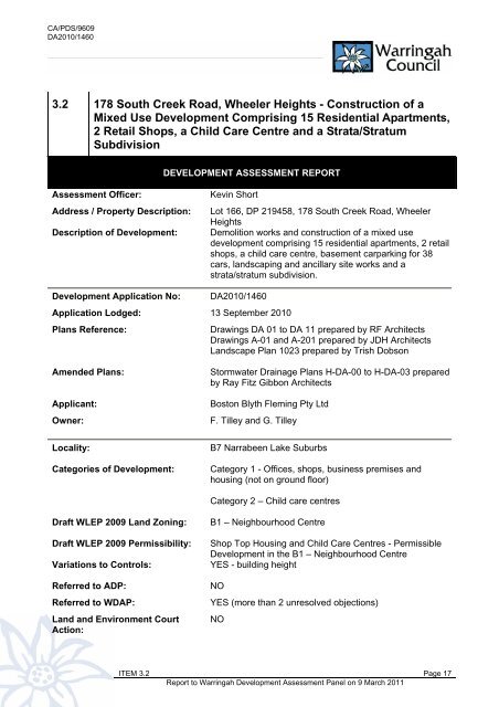
3.2 178 South Creek Road, Wheeler Heights - Warringah Council
3.2 178 South Creek Road, Wheeler Heights - Warringah Council
3.2 178 South Creek Road, Wheeler Heights - Warringah Council

Create successful ePaper yourself
Turn your PDF publications into a flip-book with our unique Google optimized e-Paper software.
CA/PDS/9609DA2010/1460REFERRALSi) ExternalEnergy AustraliaEnergy Australia has reviewed the application and raises no objection to the proposeddevelopment.NSW Office of WaterThe proposal was identified as being integrated development in accordance with Section 91 of theEnvironmental Planning and Assessment Act 1979 as the Geotechnical Report submitted with theapplication indicated that a temporary dewatering license may be required during construction ofthe development pursuant to the Water Act 1912.Accordingly, the application was referred to the NSW Office of Water and no objections wereraised in relation to the proposed development subject to General Terms of Approval and suitableconditions of consent, including the requirement for watertable monitoring for adverse groundwaterimpacts following the demolition of the existing structures on site.Comment: The General Terms of Approval and conditions of consent are discussed in more detailunder Clause 48 Potentially Contaminated Land.ii) InternalDevelopment Engineering<strong>Council</strong>’s Development Engineering section has reviewed the proposal and raises no objection tothe proposed development subject to conditions which have been included in the consent.Landscape Officer<strong>Council</strong>’s Landscape Officer has reviewed the proposal and raise no objections to the proposeddevelopment subject to conditions which have been included in the consent.Traffic Engineering<strong>Council</strong>’s Traffic Engineering section has reviewed the proposal and raises no objections to theproposed development subject to conditions which have been included in the consent.Comment: Traffic and parking issues are discussed in more detail under Clause 74 – Provision ofCarparking and Schedule 17 – Carparking sections of this report.Waste Officer<strong>Council</strong>’s Waste Officer has reviewed the proposal and raises no objections to the proposeddevelopment subject to conditions which have been included in the consent.Environmental Health and Protection<strong>Council</strong>’s Environmental Health and Protection section has reviewed the proposal and raise noobjections to the proposed development subject to conditions which have been included in theconsent.ITEM <strong>3.2</strong> Page 21Report to <strong>Warringah</strong> Development Assessment Panel on 9 March 2011
CA/PDS/9609DA2010/1460Comment: The conditions of consent include the requirement for a Remedial Action Plan to beprepared by a suitably qualified Environmental Consultant in accordance with State EnvironmentalPlanning Policy No. 55 - Remediation of Land and with any contaminated land planning guidelinesunder the Contaminated Land Management Act 1997. This is discussed in more detail underClause 48 Potentially Contaminated Land.Building Assessment and ComplianceBuilding Assessment and Compliance has reviewed the proposal and raises no objections to theproposed development subject to suitable conditions which have been included in the consent.Parks, Reserves, Beaches and ForeshoresParks, Reserves, Beaches, Foreshores have reviewed the proposal and raise no objections to theproposed development.PUBLIC EXHIBITIONAs a result of the public exhibition and notification processes, <strong>Council</strong> received a total of four (4)submissions from the following:NameAddressB. Byford 4 Crummock Street, <strong>Wheeler</strong> <strong>Heights</strong>P. and A. Mossel 3 Penrith Avenue, <strong>Wheeler</strong> <strong>Heights</strong>L. and J. Haraldson 203 <strong>South</strong> <strong>Creek</strong> <strong>Road</strong>, <strong>Wheeler</strong> <strong>Heights</strong>R. and S. Kabir 195 <strong>South</strong> <strong>Creek</strong> <strong>Road</strong>, <strong>Wheeler</strong> <strong>Heights</strong>B. Thorton 26 Penrith Avenue, <strong>Wheeler</strong> <strong>Heights</strong>The issues raised in the submissions are addressed as follows:(a)Excessive/Non-complying Building HeightThe concern is that the proposed height of the development is excessive and exceeds theminimum 8.5m building height control applying to this site under the B7 Narrabeen Lake SuburbsLocality Statement. In this regard, the respondents are concerned that the height of thedevelopment will result in a “grossly over scale” building with associated overshadowing impactsand adverse streetscape and traffic and parking impacts.Comment: The overall height of the proposed building varies from 7.2m to 9.2m which does notcomply with the minimum 8.5m building height control. Notwithstanding, the non-compliance issupported under a Clause 20 Variation of WLEP 2000 as the proposed development has beenfound to be consistent with the Desired Future Character of the locality, the General Principles ofDevelopment Control and relevant State Environmental Planning Policies. In addition, the buildingheight non-compliance does not result in the built form to be “bulky” or out of scale with adjoiningproperties and does not translate into detrimental external impacts to adjoining and surroundingneighbours, including visual impacts, overshadowing and traffic and parking impacts.Based on the above, the concerns raised in relation to the building height non-non-compliance donot carry determining weight and do not warrant the refusal of the application.ITEM <strong>3.2</strong> Page 22Report to <strong>Warringah</strong> Development Assessment Panel on 9 March 2011
CA/PDS/9609DA2010/1460(b)Adverse Parking ImpactsThe concern is that the proposed development is not provided with sufficient parking as requiredunder WLEP 2000 and the proposal will result in an increase in the demand foron-street carparking spaces, particularly given that “residents, their visitors and parents droppingoff and collecting their children” will not all be able to access the basement carpark area.Comment: As detailed in Clause 74 – Provision of Carparking under the General Principles ofDevelopment Control table in the report, this proposal provides thirty-eight (38) car parking spaceswithin the two (2) basement levels and it is concluded that this is satisfactory in terms of theprovision of on-site carparking spaces for the proposed development. In addition, the Traffic andParking Impact Assessment Report submitted with the application (prepared by Ray DowsettTraffic and Transport Planning Pty Ltd, dated 24 August 2010) also concludes that the requirementfor carparking spaces generated by the proposed mixed use development can readily be absorbedinto the two (2) basement parking areas.Further, the application was reviewed by <strong>Council</strong>’s Traffic Engineering Section and no concernswere raised with the proposal subject to appropriate conditions of consent requiring the basementcar parking area to remain accessible to visitors, customers and staff of the retail and childcarecomponent of the building during operating hours.As such, the concerns raised in the submissions in relation to carparking issues do not warrantrefusal or redesign of the application.(c)Adverse Traffic ImpactsThe concerns are that the proposed development will result in adverse traffic impacts on <strong>South</strong><strong>Creek</strong> <strong>Road</strong> and Penrith Avenue given the location of the basement car parking entry and exitpoints and the proposed parent “pick up and drop off” parking zone to be created on the kerbspace adjacent to the <strong>South</strong> <strong>Creek</strong> <strong>Road</strong> frontage.Comment: The proposed parent “pick up and drop off” parking zone is not supported by <strong>Council</strong>’sTraffic Management section and accordingly suitable conditions have been imposed on theconsent to delete this facility as part of the approved development including the erection of “NoStanding” and “One Hour” parking signs on the kerb space adjacent to the <strong>South</strong> <strong>Creek</strong> <strong>Road</strong>frontage. Further conditions have been included in the consent for a legible sign to be erected atthe entrance to the basement carpark to indicate that the parent “pick up and drop off” parkingzone and customer parking for the shops and retail premises is located within the site (i.e.basement car parking levels).In addition, <strong>Council</strong>’s Traffic Management and the traffic consultant who prepared the Traffic andParking Impact Assessment Report submitted with the application (prepared by Ray DowsettTraffic and Transport Planning Pty Ltd, dated 24 August 2010) also conclude that the proposedbasement car parking layout, service arrangements, sight lines, turning circle and vehicular crossovercomply In <strong>South</strong> <strong>Creek</strong> <strong>Road</strong> with all relevant Australian standards and <strong>Council</strong> Policies.This is discussed in more detail under Clause 72 - Traffic Access & Safety in the GeneralPrinciples of Development Control table in tis report.Subject to the inclusion of conditions of consent described above, the concerns raised in relation tothe adverse traffic impacts do not carry determining weight and do not warrant the refusal of theapplication.ITEM <strong>3.2</strong> Page 23Report to <strong>Warringah</strong> Development Assessment Panel on 9 March 2011
CA/PDS/9609DA2010/1460Section 79C 'Matters for ConsiderationSection 79C (1) (b) – The likely impacts of thedevelopment, including environmental impactson the natural and built environment and socialand economic impacts in the localitySection 79C (1) (c) – The suitability of the sitefor the developmentSection 79C (1) (d) – Any submissions made inaccordance with the EPA Act or EPA RegsSection 79C (1) (e) – The public interestComments(i) The environmental impacts of the proposed development on thenatural and built environment are addressed in detail under theGeneral Principles of Development Control section in this reportand subject to conditions are found to be acceptable andreasonable.(ii) The proposed development will not have a detrimental socialimpact in the locality considering the mixed residential/commercialcharacter of the proposal.(iii) The proposed development will not have a detrimentaleconomic impact on the locality considering the mixedresidential/commercial/childcare nature of the proposed land usewithin a zoned local retail centre.The site is currently occupied by a vehicle repair shop; however,the site is also identified as being within a Local Retail Centreunder WLEP 2000. Currently, there is no architectural style of amixed use development in the local retail centre as the remainderof the centre consists of single storey shops and the nearestmixed-use development of this type is in Dee Why CommercialCentre.Having regard to the above, the site is considered suitable for theproposed development and has been designed to provide anappropriate built form that responds to the planning controls andopportunities and constraints of the site. Specifically, the site hasgood levels of vehicular access (dual road frontage), good levelsof casual surveillance, provides a satisfactory amount of carparking, can be adequately drained, is highly usable due to itsrelatively flat topography and close proximity to public transport (in<strong>South</strong> <strong>Creek</strong> <strong>Road</strong>) and public open space opposite the site (StMatthews Farm Reserve)The existing use of the site as a petrol station/workshop andassociated contamination has been addressed through suitableconditions of consent, including a requirement for furthergroundwater testing to ensure that all necessary remediationworks is carried out and validated by an appropriately qualifiedperson. In this regard, the site can be made suitable for a mix ofcommercial, residential and child care uses.Notwithstanding the above, the site does not contain anysignificant constraints in terms environmental issue and subject tothe remediation of the site, the site is considered to be suitable forthe type of use and size and scale of development proposed.All submissions have been adequately addressed under the‘Notification and Submissions’ section of this report. In summary,the submissions have partly been addressed by conditions ofconsent or are not concurred with or do not warrant the refusal orredesign of the proposed development.The wider public interest is served by the provision of newretail/commercial/community land uses within the Narrabeen LakeSuburbs locality and the provision of apartment style housing inaccordance with the planning controls applying under WLEP 2000.The provision of apartment style housing will contribute to thediversity of housing within the locality thus ensuring the housingstock caters for a broad cross section of the community.The proposed development is also considered to be consistentwith the narrower public interest as the proposal will protect andmaintain the amenity of neighbouring residential properties andwill provide a satisfactory level of amenity for future occupants.Given the above, the proposal will result in an overall net publicbenefit; therefore it is consistent with protecting/maintaining thepublic interest.ITEM <strong>3.2</strong> Page 27Report to <strong>Warringah</strong> Development Assessment Panel on 9 March 2011
CA/PDS/9609DA2010/1460DRAFT ENVIRONMENTAL PLANNING INSTRUMENTS:Draft <strong>Warringah</strong> Local Environmental Plan 2009 (Draft WLEP 2009)Definition: Shop Top HousingLand Use Zone: B1 Neighbourhood CentrePermissible or Prohibited: Shop top housing (permissible)Childcare Centre (permissible)Additional Permitted used for particular land – Refer to Schedule 1:Principal Development Standards:Development Standard Required Proposed Complies Clause 4.6Exception toDevelopmentStandardMinimum Subdivision Lot Size: N/A N/A N/A N/ARural Subdivision: N/A N/A N/A N/ANo Strata Plan or Community TitleSubdivisions in certain rural andenvironmental zones:N/A N/A N/A N/AHeight of Buildings: 8.5m Varying heightsfrom 7.2m to9.2mB1 Neighbourhood CentreNOYES (refer toClause 4.6assessmenthereunder)Under the draft WLEP 2009, “Shop top housing and childcare centre” are permissible land uses inthe B1 Neighbourhood Centre. The following provides an assessment of the proposeddevelopment against the objectives of the B1 Zone.Objectives of the B1 Neighbourhood CentreThe objectives of the B1 Zone are as follows:1. To provide a range of small-scale retail, business and community uses that serve theneeds of people who live or work in the surrounding neighbourhood.2. To ensure that neighbourhood centres provide a village like atmosphere that providessafety and comfort for pedestrians.3. To minimise conflict between land uses in the zone and adjoining zones and ensure theamenity of any adjoining or nearby residential land uses.The subject site adjoins both low density residential and general industrial zones. The proposeddevelopment involves the construction of a three storey mixed use development comprising 15residential apartments, 2 retail shops and a child care centre, which will adequately service theneeds of the localised workforce and surrounding residential communities.ITEM <strong>3.2</strong> Page 28Report to <strong>Warringah</strong> Development Assessment Panel on 9 March 2011
CA/PDS/9609DA2010/1460As detailed throughout the report, the proposal is satisfactory in terms of the provision ofcarparking spaces and access. Importantly, conditions have been included in the recommendationto delete the parent “drop off and pick up” parking area from the <strong>South</strong> <strong>Creek</strong> <strong>Road</strong> frontage and toreplace the paved pathways within the road reserve of <strong>South</strong> <strong>Creek</strong> <strong>Road</strong> with concrete toenhance pedestrian safety and reduce conflict on the road to the north-east.The proposal also provides a satisfactory transition between the adjoining residential zone to thenorth-east and light industrial zone to the south-east of the site. This is achieved through the heightand scale of the building which is compatible with the adjoining light industrial building to the southeastand residential properties to the north-east. In addition, the proposed development has beenassessed as providing a satisfactory level of amenity for adjoining and surrounding propertyowners in terms of privacy, visual outlook, noise and solar access. This has been achieved througha combination of acoustic treatments (i.e. north-eastern boundary fence), building design (i.e.privacy screens and planter boxes), adequate spatial separation (i.e. 4.45m setback to northeasternboundary) and conditions of consent (i.e. provision of planter boxes and privacy screens).Having regard to the above, the proposed development is consistent with the objectives of the B1Neighbourhood Centre.Clause 4.6 Exception to Development StandardHeight of BuildingsThe proposed development has varying maximum heights from 7.2m to 9.2m which exceeds the8.5m maximum building height standard for the B1 Neighbourhood Centre zone.The following is an assessment of the non-compliance against the objectives of the building heightdevelopment standard:Clause 4.6 Assessmenta) To ensure that buildings are compatible with the height, bulk and scale of the desiredfuture character of the locality that may be identified in any development control planmade by the <strong>Council</strong>.Comment: The draft <strong>Warringah</strong> Development Control Plan has not been gazetted, andtherefore, has no status. Notwithstanding, the locality and adjoining sites are characterised bylight industrial development to the south-east and residential housing to the north and northwest.The non-compliance is minor (0.7m) and contained within the southern half of the site.On this basis, the proposed height is neither excessive nor inconsistent with the predominantheight of surrounding development.b) To minimise visual impact, disruption or views, loss of privacy and loss of solaraccess.Comment: As detailed elsewhere in the report, the non-compliance with the height standardwill not result in unacceptable amenity impacts to adjoining and surrounding residentialdevelopment including visual impact, view loss, privacy and overshadowing.c) To minimise adverse impact of development on the scenic quality of <strong>Warringah</strong>’scoastal and bush environments.Comment: The non-compliance with the height standard will not result in inconsistencieswith this objective under the Draft LEP as the building does not sit within an immediatebushland or coastal environment. Rather, the site is cleared of all remanent bushland and isremote from any beach or lake.ITEM <strong>3.2</strong> Page 29Report to <strong>Warringah</strong> Development Assessment Panel on 9 March 2011
CA/PDS/9609DA2010/1460d) To manage the visual impact of development when viewed from public places such asparks and reserves, roads and community facilities.Comment: The built form is articulated with recessive building elements, including openbalcony structures, varying front and side setbacks and a mix of external materials andfinishes which combine to minimise the bulk of the overall building when viewed fromadjoining properties, Penrith Avenue and <strong>South</strong> <strong>Creek</strong> <strong>Road</strong>.In conclusion, a variation to the building height standard under Clause 4.6 of Draft WLEP 2009 issupported as the proposed development is consistent with the objectives of the standard asdiscussed above.ENVIRONMENTAL PLANNING INSTRUMENTS (EPI’s)State Environmental Planning Policies (SEPPs)Consideration has been given to the following State Policies:SEPP (Infrastructure) 2007The application was referred to Energy Australia to determine if the subject site was within orimmediately adjacent to any electricity infrastructure. Energy Australia by letter dated 20September 2010 stated that the subject site was not affected by any of the above electricityinfrastructure. In this regard, the subject application is considered to satisfy the provisions ofClause 45 of SEPP Infrastructure.SEPP (Building Sustainability Index: BASIX) 2004State Environmental Planning Policy (Building Sustainability Index: BASIX) 2004 (SEPP BASIX)applies to the development.A BASIX Certificate has been submitted with the application. The certificate confirms that theproposed development meets the NSW government’s requirements for sustainability. Thedevelopment meets the water and energy performance targets and achieves a pass for thermalcomfort. Conditions have been included on the draft consent to ensure compliance with thecommitments listed in the BASIX certificate.SEPP No. 55 Remediation of LandClause 7(1) (a) of State Environmental Planning Policy No.55 – Remediation of Land (SEPP 55)and Clause 48 of WLEP 2000 state that a consent authority must not consent to the carrying out ofany development on land unless;It has considered whether the land is contaminated, andIt the land is contaminated, it is satisfied that the land is suitable in its contaminated state forthe purpose for which the development is proposed to be carried out,If the land requires remediation to be made suitable for the development proposed to becarried out, it is satisfied that the land will be remediated before the development is carriedout.The application was accompanied by a Phase 1 and Phase 2 Contamination and GeotechnicalAssessment report prepared by SMEC Australia Pty Ltd, dated 25 August 2010. The report hasbeen produced in accordance with the guidelines endorsed by the NSW Department ofEnvironment, Climate Change and Water (DECCW). The report concludes that “there could be asource of contamination that has migrated through the subsurface soils into the groundwater of theshallow unconfined aquifer”.ITEM <strong>3.2</strong> Page 30Report to <strong>Warringah</strong> Development Assessment Panel on 9 March 2011
CA/PDS/9609DA2010/1460The report concludes that a Remediation Action Plan is to be prepared following additionalgroundwater monitoring and sampling. In addition, the report notes the presence of asbestos in theremaining soils. <strong>Council</strong>’s Environmental Health Officer has reviewed the report prepared bySMEC Australia Pty Ltd and raises no objections to the proposed development subject toconditions being included in the consent to ensure that all required remediation is carried out andvalidated by an appropriately qualified person.As the land will be suitable for the proposed development following remediation works, therequirements of SEPP 55 have been addressed.It should also be noted that traces of asbestos were also found in analysed soil samples and thatthis contaminant is required to be removed from the site in accordance with the NSW WorkcoverAuthority.SEPP No. 65 – Design Quality of Residential Flat DevelopmentSEPP 65 applies to new residential flat buildings, substantial redevelopment/refurbishment ofexisting residential flat buildings and conversion of an existing building to a residential flat building.Clause 3 of SEPP 65 defines a residential flat building as follows:“Residential flat building means a building that comprises or includes:(a) 3 or more storeys (not including levels below ground level provided for carparking or storage, or both, that protrude less than 1.2 metres above groundlevel), and(b)4 or more self-contained dwellings (whether or not the building includes uses forother purposes, such as shops), but does not include a Class 1a building or aClass 1b building under the Building Code of Australia.”The proposed development relates to a residential flat development as defined by SEPP 65 as thebuilding is three (3) storeys in height and contains 15 dwellings. Therefore, the provisions of SEPP65 are applicable in the assessment of this application.Clause 50(1A) of the EPA Regulations 2000 requires the submission of a design verificationcertificate from the building designer, which has been submitted from Ray Fitz-Gibbon Architects.SEPP 65 requires an assessment of the DA against 10 Design Principles contained in Clauses 9-18 and consideration of the matters contained in the publication “Residential Flat Design Code”,which is provided as follows:Principle 1: Context“Good design responds and contributes to its context. Context can be defined as the keynatural and built features of an area. Responding to context involves identifying thedesirable elements of a location’s current character or, in the case of precinctsundergoing a transition, the Desired Future Character as stated in planning and designpolicies. New buildings will thereby contribute to the quality and identity of the area”.Comment: The site is currently occupied by a vehicle repair shop and sits within a Local RetailCentre under WLEP 2000. Other development within the Local Retail Centre is characterised bysingle storey strip or row shops which are setback with carparking and landscaping in front.Surrounding developments are detached style housing and industrial development.ITEM <strong>3.2</strong> Page 31Report to <strong>Warringah</strong> Development Assessment Panel on 9 March 2011
CA/PDS/9609DA2010/1460However, it is considered that the development has satisfactorily addressed the design objectivesof this principle, in that;The proposed development is consistent with the DFC statement of the B7 Narrabeen LakeSuburbs (refer to discussion under the DFC of this report);The bulk and scale of the proposed development is consistent with Clause 66 – BuildingBulk;The scale and height of the proposed development is generally in accordance with theplanning control for the B7 Locality, including the industrial development to the south of thesite.Given the above, the proposed development is an appropriate response to “Context” in relation tothe scale and form of the existing and desired development in the locality. Accordingly, theproposal satisfactorily addresses the design objectives of the principle.Principle 2: Scale“Good design provides an appropriate scale in terms of the bulk and height that suitsthe scale of the street and the surrounding buildings. Establishing an appropriate scalerequires a considered response to the scale of existing development. In precinctsundergoing a transition, proposed bulk and height needs to achieve the scale identifiedfor the Desired Future Character of the area”.Comment: The scale of the new building is three (3) storeys which is permitted under the B7Locality statement and is what is envisaged by the desired future character.The height of the development is compatible with the scale of the light industrial developments onthe south-eastern side of <strong>South</strong> <strong>Creek</strong> <strong>Road</strong> and the adjoining and nearby residential developmentin Penrith Avenue. With the exception of the far southern portion of the building (Level 5), theheight of the development complies with the maximum 8.5m height limit, which applies to alldevelopment within the locality. In addition, the north-east elevation of the dwelling is articulatedwith open balcony structures and varying setbacks and includes a variety of building materialswhich will be suitable for its residential interface.For these reasons, it is considered that the proposal is consistent with this principle.Principle 3: Built Form“Good design achieves an appropriate Built Form for a site and the building’s purpose,in terms of building alignments, proportions, building type and the manipulation ofbuilding elements.Appropriate Built Form defines the public domain, contributes to the character ofstreetscapes and parks, including their views and vistas, and provides internal amenityand outlook.”Comment: As detailed elsewhere in this report, the overall architectural and urban designresponse to the site is considered satisfactory as the street frontage elevations include recessivebuilt forms, open balcony structures, landscaping elements, entry foyers and a variety in the use ofexternal finishes. These components of the development combine to define the public and privatedomain and contribute in a positive way to the character of the existing and adjoining streetscapes.The built form of the residential component of the development have been designed to allow for theinternal amenity of the units to be optimised, and therefore, each unit receives a satisfactory levelof amenity in terms of privacy, solar access, visual outlook and acoustic privacy.ITEM <strong>3.2</strong> Page 32Report to <strong>Warringah</strong> Development Assessment Panel on 9 March 2011
CA/PDS/9609DA2010/1460In addition to the above, conditions have been imposed on the consent to improve the interfacingof the critical corners of the building as viewed from the street and adjoining properties byincreasing transparency and reducing bulk and openness of the built form. In this regard, it will bea requirement to create openings in the blade wall in the north-eastern corner (forming the easternwall of the balconies/void on both Level 4 and 5) and the blade wall in the south-eastern corner(forming the southern wall of the balconies on Level 4 and 5). These amendments will reduce theimpact of these walls on the streetscape and enhance the outlook from adjoining and nearbyresidential properties.Accordingly, the proposal is considered to be consistent with the intent of this principle.Principle 4: Density“Good design has a density appropriate for a site and its context; in terms of floorspace yields (or number of units or residents).Appropriate densities are sustainable and consistent with the existing density in anarea or, in precincts undergoing a transition, are consistent with the stated desiredfuture density. Sustainable densities respond to the regional context, availability ofinfrastructure, public transport, community facilities and environmental quality”.Comment: No specific housing or commercial density controls apply to the development thereforethe appropriateness of the density proposed is determined by the proposal’s compliance withrelevant planning controls such as height, carparking, SEPP 65 (RFDC), private open space andaccess and service requirements.The proposal has been assessed against the provisions of SEPP 65 and the Residential FlatDesign Code and WLEP 2000 and found to satisfy the provisions of SEPP 65 in terms of solaraccess, privacy, building separation, ceiling heights, natural ventilation and the like. Further, theproposal has been found to be generally consistent with the Built form Controls and the desiredfuture character statement for the locality.Accordingly, the proposal is considered to be consistent with the intent of this principle.Principle 5 – Resource, energy and water efficiency.“Good design makes efficient use of natural resources, energy and water throughout its fulllife cycle, including construction.Sustainability is integral to the design process. Aspects include demolition of existingstructures, recycling of materials, selection of appropriate and sustainable materials,adaptability and reuse of buildings, layouts and Built Form, passive solar design principles,efficient appliances and mechanical and mechanical services, soil zones for vegetation andreuse of water”.Comment: The application has addressed the recycling of demolition and excavation materialsand the ongoing waste management for the completed development through a WasteManagement Plan. Also, the application was accompanied by BASIX Certificate and ABSAcertificate that certifies that all units within the proposed building achieve a complying energy ratingof 3.5 or more for the 15 Units and the proposal has incorporated materials and design that goes topassive solar, insulation and sun protection in its design.Accordingly, the proposal is considered to be consistent with the intent of this principle.ITEM <strong>3.2</strong> Page 33Report to <strong>Warringah</strong> Development Assessment Panel on 9 March 2011
CA/PDS/9609DA2010/1460Design Quality Principle 6: Landscape“Good design recognises that together landscape and buildings operate as an integrated andsustainable system, resulting in greater aesthetic quality and amenity for both occupants and theadjoining public domain.Landscape design builds on the existing site’s natural and cultural features in responsible andcreative ways. It enhances the development’s natural environmental performance by co-ordinatingwater and soil management, solar access, micro-climate, tree canopy and habitat values. Itcontributes to the positive image and contextual fit of development through respect for streetscapeand neighbourhood character, or desired future character.Landscape design should optimise useability, privacy and social opportunity, equitable access andrespect for neighbours’ amenity, and provide for practical establishment and long termmanagement.”Comment: A landscape plan has been submitted with the application that demonstrates that thedevelopment will provide a limited, but quality landscape setting for the proposed development.Specifically, the proposal incorporates landscaping within the road reserve (street trees and grasslawn areas), a landscaped (deep soil) side setback to the dwelling at No.3 Penrith Avenue and theincorporation of planter boxes on the street fronting elevations (Level 3, 4 and 5).Whist the level of landscaping is not significant, it will assist to provide a reasonable level ofamenity for the occupants of the proposed development and adjoining residential property (No.3Penrith Avenue) and assist in softening the visual impact of the development as viewed from <strong>South</strong><strong>Creek</strong> <strong>Road</strong> and Penrith Avenue.<strong>Council</strong>’s Landscape Officer has reviewed the proposal and specifically the likely success of theproposed canopy/screen planting within the sunken eastern setback area and raises no objectionsto the proposed landscape design.For these reasons it is considered that the proposal is consistent with this design quality principle.Design Quality Principle 7: Amenity“Good design provides amenity through the physical, spatial and environmental quality of adevelopment.Optimising amenity requires appropriate room dimensions and shapes, access to sunlight, naturalventilation, visual and acoustic privacy, storage, indoor and outdoor space, efficient layouts andservice areas, outlook and ease of access for all age groups and degrees of mobility.”Comment: As detailed within the Residential Flat Design Code table, the building layout providesfor an adequate level of amenity for future occupants in terms of the room dimensions and shapes,natural ventilation, visual and acoustic privacy, visual outlook, solar access, storage and indoorand outdoor space.Units 1, 5, 7, 8, 11, 13 and 14) have dual aspect and all units achieve cross-ventilation. WhilstUnits 5, 6, 12 and 13 have a southerly aspect (south-east and south-west), the balconies of theremaining 11 units would receive a minimum of 3 hours of effective sunlight between the hours of9am and 3pm, 21 June.Private recreation areas are provided in the form of balconies off the living areas of eachapartment. Acoustic privacy, particularly from the noise generated from <strong>South</strong> <strong>Creek</strong> <strong>Road</strong> isprevented by the incorporation of aluminium glass doors and windows and solid walls.ITEM <strong>3.2</strong> Page 34Report to <strong>Warringah</strong> Development Assessment Panel on 9 March 2011
CA/PDS/9609DA2010/1460Residential Flat Design CodePursuant to Clause 30(2) of SEPP 65, in determining a development application for a residentialflat building, the consent authority is to take into consideration the Residential Flat Design Code(RFDC). The following table is an assessment of the proposal against the guidelines provided inthe RFDC.SEPP 65 - Residential Design Code ChecklistPart Guideline Consistency with guidelinesPART 01LOCAL CONTEXTPrimary DevelopmentControlsBuildingHeightWhere there is an existing floor spaceratio (FSR), test height controlsagainst it to ensure a good fit.N/ANo FSR applies under WLEP 2000.Building DepthTest heights against the number ofstorey’s and the minimum ceilingheights required for the desiredbuilding use.Note: The height controls under SEPP65 are based on controlling thenumber of storeys using height planes.Under WLEP 2000, the B7 localitycontains no height plane controls.In general, an apartment buildingdepth of 10-18 metres is appropriate.Developments that propose wider than18 metres must demonstrate howsatisfactory day lighting and naturalventilation are to be achieved.YESThe overall height of the proposed building variesfrom 7.2m to 9.2m which does not comply with theminimum 8.5m building height control within theB7 locality.Notwithstanding, the non-compliance is supportedunder a Clause 20 Variation of WLEP (this isdetailed under the Built Form Controls section ofthe report).YESAll units have building depths less than 18.0m andachieve effective natural ventilation.BuildingSeparationFor buildings up to four storeys/ 12metres, the following distances ofseparation are suggested;-12 metres between habitablerooms/balconies- 9 metres betweenhabitable/balconies and non-habitablerooms- 6 metres are provided between nonhabitablerooms.A habitable room is any room or areaused for normal domestic activities,including living, dining, family, lounge,bedrooms, study, kitchen, sun roomand play room.A non-habitable room is a space of aspecialised nature not occupiedfrequently or for extended periods,including bathrooms, toilets, pantries,YESThe control envisages two (2) residential flatbuildings (RFB’s) side by side, not the prevailingsituation with a RFB adjacent to a dwelling house.Nevertheless, the provision of a 4.45m setback tothe common boundary is provided.With the exception of Units 1, 10 and 15, theremaining Units along the north-eastern elevationare located greater than 12.0m from the habitableand non-habitable rooms at No.3 Penrith Avenue.Unit 1 does not include any external openingstowards No.3 Penrith Avenue.Unit 10 and 15 are located a minimum of 7.5mfrom the dwelling at No.3 Penrith Avenue. Thisspatial separation is considered satisfactory as theentire north-east elevation is articulated with openbalcony structures and varying setbacks which willassist to minimise the visual impact of the builtform on No.3 Penrith Avenue. In addition, asdetailed under the General Principles ofDevelopment Control section of the report, theITEM <strong>3.2</strong> Page 36Report to <strong>Warringah</strong> Development Assessment Panel on 9 March 2011
CA/PDS/9609DA2010/1460SEPP 65 - Residential Design Code ChecklistPart Guideline Consistency with guidelinesStreet SetbacksSide and RearSetbacksFloor SpaceRatiowalk in wardrobes, corridors, lobbies,photographic darkrooms and clothesdrying rooms.A zero building separation may beappropriate in contexts such as inurban areas between street wallbuilding types (party walls).Identify the desired streetscapecharacter, the common setback ofbuildings in the street, theaccommodation of street tree plantingand the height of buildings anddaylight access controls.Identify the quality, type and use ofgardens and landscaped areas facingthe street.Test street setbacks with buildingenvelopes and street sections.Relate side setbacks to existingstreetscape patterns.Test the desired built form outcomeagainst proposed floor space ratio toensure consistency with buildingheight- building footprint the threedimensional building envelope openspace requirements.proposal has been found to maintain a satisfactorylevel of amenity to adjoining properties (includingNo.3 Penrith Avenue) in terms of solar access,privacy and acoustic impacts.Given the above, the proposal is supported interms of building separation.YESThe subject site is identified as a being within aLocal Retail Centre and the B7 locality underWLEP 2000. In this regard, the proposeddevelopment must be consistent with the streetsetback considerations specified under Clause 39- Local retail centres of WLEP 2000.As detailed under the General Principles ofDevelopment Control table (Clause 39 Local retailcentres), the proposed development provides foran adequate transition to the adjacent residentialand light industrial development, particularly withthe condition to delete the south-eastern andnorth-western side elevation balcony walls.In addition, the Landscape plan submitted with theapplication indicates trees planting along bothstreet frontages to Penrith Avenue and <strong>South</strong><strong>Creek</strong> <strong>Road</strong> and within the side setback areaadjoining the residential property at No.3 PenrithAvenue.Given the above, the proposal is supported interms of the street setbacks.YESNo Landscape Open Space control applies to theproposed development under WLEP 2000.Notwithstanding the above, a detailed LandscapePlan has been submitted with the applicationwhich provides a satisfactory landscaped settingfor the building and will assist in providing amenityfor future occupants and adjoining properties.N/ANo building envelope control applies to theproposed development under WLEP 2000.N/ANo side and rear setback control applies to theproposed development under WLEP 2000.However, Clause 39 states that a “transition toadjacent residential development” is required.The setback provided is assessed as beingacceptable (see discussion under Clause 39 in thisreport).N/ANo FSR applies to the subject site under WLEP2000.ITEM <strong>3.2</strong> Page 37Report to <strong>Warringah</strong> Development Assessment Panel on 9 March 2011
CA/PDS/9609DA2010/1460SEPP 65 - Residential Design Code ChecklistPart Guideline Consistency with guidelinesPART 02SITE DESIGNSiteConfigurationDeep SoilZonesOpen SpacePlanting onStructuresSafetyA minimum of 25 percent of the openspace area of a site should be a deepsoil zone; more is desirable.Exceptions may be made in urbanareas where sites are built out andthere is no capacity for waterinfiltration. In these instances, stormwater treatment measures must beintegrated with the design of theresidential flat building.The area of communal open spacerequired should generally be at leastbetween 25 and 30 percent of the sitearea. Larger sites and brownfield sitesmay have potential for more than 30percent.Where developments are unable toachieve the recommended communalopen space, such as those in denseurban areas, they must demonstratethat residential amenity is provided inthe form of increased private openspace and/or in a contribution to publicopen space.The minimum recommended area ofprivate open space for each apartmentat ground level or similar space on astructure, such as on a podium or carpark, is 25m2; the minimum preferreddimension in one direction is 4 metres.(See “Balconies” for other private openspace requirements).In terms of soil provision there is nominimum standard that can be appliedto all situations as the requirementsvary with the size of plants and treesat maturity.Carry out a formal crime riskassessment for all residentialdevelopments of more than 20 newdwellings.N/ANo minimum landscaped open space standardsapply to the proposed development under WLEP2000. However, some deep soil landscaping isprovided within the north-east setback area.N/ANo communal landscaped area controls apply tothe B7 locality under WLEP 2000.No areas of communal space are provided by theproposed development. Notwithstanding, it isconsidered that the provision of private openspace for each unit is satisfactory, having regardto the commercial nature of the locality and thetype of development proposed.It is also noted that the site is opposite StMatthews Farm Reserve.N/AThere are no ground floor level residential units.YESThe submitted Landscape Plan and architecturaldrawings detail that the proposed planter boxlandscaping on the front and side elevations of thebuilding are sufficient in depth to support theproposed landscaping elements (low lying shrubs).In addition, a condition has been imposed on theconsent requiring the “new street trees” to becontained within appropriate planter boxes of asatisfactory depth to support small to mediumsized trees.Subject to the above, the proposal will support theproposed landscaping.YESThe proposed development includes 15 residentialunits and therefore a formal crime risk assessmentis not required.Refer to ‘Clause 50 Safety and Security’ under theGeneral Principles of Development Control table ofthis report for a detailed assessment of the safetyand security of the development against therequirements of Clause 50 and the CrimePrevention Through Environmental DesignPrinciples.ITEM <strong>3.2</strong> Page 38Report to <strong>Warringah</strong> Development Assessment Panel on 9 March 2011
CA/PDS/9609DA2010/1460SEPP 65 - Residential Design Code ChecklistPart Guideline Consistency with guidelinesVisual PrivacyRefer to Building Separation minimumstandards.YESAs discussed under the ‘Building Separation’section of this report, the spatial separationbetween buildings is satisfactory and visualprivacy between neighbours will be protected(subject to conditions of consent).Building EntryIdentify the access requirements fromthe street or car parking area to theapartment entrance.Follow the accessibility standard setout in AS 1428 (parts 1 and 2), as aminimum.Provide barrier free access to at least20 percent of dwellings in thedevelopment.YESAll residential units are accessed via an entrylobby on <strong>South</strong> <strong>Creek</strong> <strong>Road</strong> and an associatedpedestrian passageway to the lift lobby. Access isalso provided from the basement carparking levelsand stairs to the ground floor lift lobby and to eachresidential floor above.The pedestrian entry is separated from the retailshops and child care entry doors in order toreduce potential conflict.Vehicle AccessPedestrian AccessPART 03BUILDING DESIGNBuildingConfigurationApartmentLayoutGenerally limit the width of drivewaysto a maximum of six metres.Locate vehicle entries away from mainpedestrian entries and on secondaryfrontages.Single-aspect apartments should belimited in depth to 8 metres from awindow.The back of a kitchen should be nomore than 8 metres from a window.The width of cross-over or crossthroughapartments over 15 metresdeep should be 4 metres or greater toavoid deep narrow apartment layouts.YESVehicular access to the site is by a 6.0m widedriveway from <strong>South</strong> <strong>Creek</strong> <strong>Road</strong> which iscompliant with AS2890.1-2004 and is consistentwith the type and scale of development proposed.<strong>Council</strong>’ Traffic Engineer has reviewed theproposal and has raised no objections to the widthof the driveway.YESThe vehicular entry to the basement is separatedfrom the pedestrian entry by 12.5m.YESEight (8) units (No.2, 3, 4, 6, 9, 10, 12, and 15) aresingle aspect only and the habitable rooms ofthese units are limited in varying depths from 6.5mto 9m from the balcony glass openings.The overall outcome is considered satisfactory.YESThe back of all kitchens within the developmentare within 8 metres of a window.N/AThe proposal does not comprise of any cross-overor cross through apartments.If <strong>Council</strong> chooses to standardiseapartment sizes, a range of sizes thatdo not exclude affordable housingshould be used. As a guide, theAffordable Housing Service suggestYES<strong>Council</strong>’s LEP does not provide ‘standards’ forapartment sizes. Notwithstanding, all one (1)bedroom units exceed 50m2 and all two (2)ITEM <strong>3.2</strong> Page 39Report to <strong>Warringah</strong> Development Assessment Panel on 9 March 2011
CA/PDS/9609DA2010/1460SEPP 65 - Residential Design Code ChecklistPart Guideline Consistency with guidelinesBalconiesCeiling<strong>Heights</strong>Ground FloorApartmentsInternalCirculationStoragethe following minimum apartmentsizes, which can contribute to housingaffordability: (apartment size is onlyone factor influencing affordability)- 1 bedroom apartment 50m2- 2 bedroom apartment 70m2- 3 bedroom apartment 95m2Provide primary balconies for allapartments with a minimum depth of 2metres.Developments which seek to vary fromthe minimum standards mustdemonstrate that negative impactsfrom the context-noise, wind – can besatisfactorily mitigated with designsolutions.The following recommendeddimensions are measured fromfinished floor level (FFL) to finishedceiling level (FCL). These areminimums only and do not precludehigher ceilings, if desired.In general, 2.7 metres minimum for allhabitable rooms on all floors, 2.4metres is the preferred minimum for allnon-habitable rooms, however 2.25mis permitted.Optimise the number of ground floorapartments with separate entries andconsider requiring an appropriatepercentage of accessible units. Thisrelates to the desired streetscape andtopography of the site.In general, where units are arrangedoff a double-loaded corridor, thenumber of units accessible from asingle core/corridor should be limitedto eight. Exceptions may be allowed:for adaptive reuse buildingswhere developments can demonstratethe achievement of the desiredstreetscape character and entryresponsewhere developments can demonstratea high level of amenity for commonlobbies, corridors and units, (crossover, dual aspect apartments).In addition to kitchen cupboards andbedroom wardrobes, provideaccessible storage facilities at thefollowing rates:two-bedroom apartments 8m3bedroom and exceed 70.0m² in area. As such, theapartment sizes are considered to be satisfactory.YESThe primary areas of all balconies are 10m² orgreater with minimum dimensions of 2.5m whichcomplies with the controls under WLEP 2000.YESAll habitable and non-habitable rooms have a floorto ceiling height of 2.7m.N/A.This is a mixed-use development that has noresidential units on the ground floor level.YESLevel 4 has nine (9) units located off the corridor.However, the corridor is L-shaped and containstwo (2) joined corridors.Level 5 has five (5) units located off the corridor.Accordingly, the proposed development providesadequate amenity and safety of internalcirculation.YESA sufficient storage space has been provided forthe residential component of the development andthe basement carparking levels.Acoustic PrivacyYESMasonry walls separate each unit and willsatisfactorily mitigate the acoustic impact betweeneach unit to a reasonable level.ITEM <strong>3.2</strong> Page 40Report to <strong>Warringah</strong> Development Assessment Panel on 9 March 2011
CA/PDS/9609DA2010/1460SEPP 65 - Residential Design Code ChecklistPart Guideline Consistency with guidelinesBuildingAmenityDaylightAccessNaturalVentilationBuilding FormBuildingPerformanceWaste ManagementLiving rooms and private open spacesfor at least 70 percent of apartments ina development should receive aminimum of three hours direct sunlightbetween 9am and 3pm in mid winter.In dense urban areas a minimum oftwo hours may be acceptable.Limit the number of single-aspectapartments with a southerly aspect(SW/SE) to a maximum of 10% of thetotal units proposed.Building depths, which support naturalventilation typically range from 10 to18 metres.Sixty percent (60%) of residential unitsshould be naturally cross-ventilated.Supply waste management plans aspart of the development applicationsubmission as per the NSW WasteBoard.YESA total of four (4) units (No.6, 7, 12 and 13) do notreceive a minimum of three hours direct sunlightbetween 9am and 3pm in mid winter.Notwithstanding, the private open spaces of theremaining 13 units (73.3%) comply with the aboveprovisions.It should be noted that the external balconies ofUnits No.6, 7, 12 and 13 have south-east andsouth-west frontage, and therefore, would receivesome direct and ambient sunlight.In addition, a condition has been included in theconsent for a privacy screen to be affixed to thenorth-western end of the balcony at Unit No.9. Thecondition specifies that the privacy screen is tohave 50% openings (facing north) to enable solaraccess to penetrate the balcony area of the unit.An additional condition has been included in theconsent to ensure the proposed privacy screensaffixed to the balconies of Unit No.10 and 15 alsohave 50% openings (facing north) to facilitate solaraccess.It should also be noted that an additional conditionhas been included in the consent requiring thenorth-western end of the external wall betweenUnit No.9 and 10 (level 4) is to have 50% openings(facing north) to enable effective sunlight topenetrate the balcony area of Unit No.9.For the reasons given above, the proposal, onbalance, is satisfactory in regard to daylightaccess.YESTwo (2) of the fifteen (15) units are single aspect((No.6 and 12) with a southerly aspect. Therefore,the proposed development is satisfactory in thisregard.YESAll units have building depths less than 18.0m andsupport natural ventilation in accordance with therequirements of the RFDC.YESAs discussed previously in this report, all unitshave been designed to facilitate natural ventilationin accordance with the requirements of the RFDC.YESA Waste Management Plan has been submittedwith the applicationITEM <strong>3.2</strong> Page 41Report to <strong>Warringah</strong> Development Assessment Panel on 9 March 2011
CA/PDS/9609DA2010/1460SEPP 65 - Residential Design Code ChecklistPart Guideline Consistency with guidelinesWaterConservationRainwater is not to be collected fromroofs coated with lead- or bitumenbasedpaints, or from asbestoscementroofs. Normal guttering issufficient for water collections providedthat it is kept clear of leaves anddebris.YESThe proposed development is satisfactory in thisregard.Regional Environmental PlansThere are no Regional Environmental Plans which are relevant to this application.<strong>Warringah</strong> Local Environmental Plan 2000Desired Future CharacterSTATUTORY CONTROLS<strong>Warringah</strong> Local Environmental Plan 2000Desired Future Character – B7 Narrabeen Lake Suburbs LocalityThe subject site is located in the B7 Narrabeen Lake Suburbs Locality under <strong>Warringah</strong> LocalEnvironmental Plan 2000. The Desired Future Character Statement for this locality is as follows:The Narrabeen Lake Suburbs will remain characterised by detached style housing inlandscaped settings interspersed by a range of complementary and compatible uses whichare compatible with the residential nature of the locality. The land occupied by the CromerGolf Club will continue to be used only as a recreation facility.Future development will maintain the visual pattern and predominant scale of existingdetached style housing in the locality. The streets will be characterised by landscaped frontgardens and consistent front building setbacks. Unless exemptions are made to the housingdensity standard in this locality statement, any subdivision of land is to be consistent with thepredominant pattern, size and configuration of existing allotments in the locality.The spread of indigenous tree canopy will be enhanced where possible and the naturallandscape, such as rock outcrops, remnant bushland and natural watercourses will bepreserved. The use of materials that blend with the colours and textures of the naturallandscape will be encouraged. Development on hillsides, or in the vicinity of ridgetops, mustintegrate with the landscape and topography. The locality will continue to be served by theexisting local retail centres in the areas shown on the map. Future development in thesecentres will be in accordance with the general principles of development control listed inclause 39.The subject site is identified as being in the Local Retail Centre. Under the B7 Narrabeen LakeSuburbs locality, shops and offices and housing not on the ground floor constitute Category 1development and a child care centre constitutes Category 2 development.Clause 12(3)(a) provides that the consent authority must consider Category 1 development againstthe localities Desired Future Character, whilst Clause 12(3)(b) provides that Category 2development must be consistent with the Desired Future Character Statement.An assessment of the related components of the Desired Future Character has been undertakenas follows:ITEM <strong>3.2</strong> Page 42Report to <strong>Warringah</strong> Development Assessment Panel on 9 March 2011
CA/PDS/9609DA2010/1460The Narrabeen Lake Suburbs will remain characterised by detached style housing inlandscaped settings interspersed by a range of complementary and compatible uses whichare compatible with the residential nature of the locality.Comment: The subject site is identified as being in a Local Retail Centre and the proposeddevelopment involves the construction of a shop top housing development which will provide retailand childcare services on the ground floor level with two levels of residential apartments above.These land uses are considered complementary to the detached style housing character of thelocality and the height and scale of the building is compatible with the adjoining residentialproperties to the north-east and light industrial development to the south-east.In addition, the landscape plan submitted with the application details that a limited, but amount oflandscaping will be provided on site, including several trees within the road reserves of <strong>South</strong><strong>Creek</strong> <strong>Road</strong> and Penrith Avenue and the side setback area to the north-eastern boundary.Based on the above, the proposal is consistent with this element of the Desired Future Character.Future development will maintain the visual pattern and predominant scale of existingdetached style housing in the locality. The streets will be characterised by landscaped frontgardens and consistent front building setbacks.Comment: The proposed development is three (3) storeys in scale and which is consistent withthe envisaged scale of the site as a local retail centre. The street frontage elevations arecontemporary in design and provide for an attractive streetscape, particularly given the recessiveand stepped down built forms, open balcony structures and use of various external finishes andmaterials, including large expanses of glass on the ground floor retail shops and child care centre.In addition, the proposed planting of several street trees within the road reserves of <strong>South</strong> <strong>Creek</strong><strong>Road</strong> and Penrith Avenue and the side setback area to the north-eastern boundary will assist inproviding a satisfactory transition to adjoining residential and light industrial development.Based on the above, the proposal is satisfactory in regard to this element of the Desired FutureCharacter.The spread of indigenous tree canopy will be enhanced where possible and the naturallandscape, such as rock outcrops, remnant bushland and natural watercourses will bepreserved. The use of materials that blend with the colours and textures of the naturallandscape will be encouraged. Development on hillsides, or in the vicinity of ridgetops,must integrate with the landscape and topography.Comment: The proposed development is not in the vicinity of any bushland and there are nosignificant indigenous trees located on the site which require protection. The site does not containany unique landscape elements such as rock outcrops, bushland or natural watercourses.The schedule of external colours and finishes submitted with the application details that theexternal materials and finishes will blend with the colours and textures of the natural landscape.Based on the above, the proposal is satisfactory in regard to this element of the Desired FutureCharacter.The locality will continue to be served by the existing local retail centres in the areas shownon the map. Future development in these centres will be in accordance with the generalprinciples of development control listed in clause 39.The proposed development is located within an existing Local Retail Centre under the WLEP 2000Map.ITEM <strong>3.2</strong> Page 43Report to <strong>Warringah</strong> Development Assessment Panel on 9 March 2011
CA/PDS/9609DA2010/1460An assessment of Clause 39 has been provided in full details under Clause 39 of the GeneralPrinciples of Development Control in this report. In summary, the proposed development satisfieswith the requirements of Clause 39, and therefore, the proposed development is considered to beconsistent with this component of the DFC.Built Form Controls for Locality B7 Narrabeen Lake SuburbsThe following table outlines compliance with the Built Form Control’s of the above localitystatement:Built Form Standard Required Proposed ComplianceBuilding Height Metres/Storeys8.5m ground – roofVarying heights from 7.2m to 9.2mNO(*)7.2m ground - ceilingVarying heights from 6.5m to 8.5mNO(*)(*) The non-compliance with building height is addressed below.As detailed in the above table, the proposed development does not comply with the Built FormControl which applies to the local retail centres, namely building height.The above non-compliance is addressed below.CLAUSE 20 VARIATIONClause 20 Variation (Building Height)Consent may be granted to proposed development even if the development does not complywith one or more development standards, providing the resulting development is consistentwith the general principles of development control, the desired future character of the localityand any relevant State Environmental Planning Policy.(i)Desired Future Character of the LocalityThe development was assessed as being consistent with the Desired Future Character of theLocality.(ii)General Principles of Development ControlThe development was assessed as being consistent with the General Principles ofDevelopment control. The development does not alter its consistency with the GeneralPrinciples of Development control.(iii)Relevant State Environmental Planning PoliciesThe development was assessed as being consistent with SEPP (BASIX), SEPP(Infrastructure) 2007, SEPP 55 - Remediation of Land and SEPP 65 - Design Quality ofResidential Flat Development.Based on the above assessment, the proposed development can be considered for avariation to the building height.ITEM <strong>3.2</strong> Page 44Report to <strong>Warringah</strong> Development Assessment Panel on 9 March 2011
CA/PDS/9609DA2010/1460Building Height (including overall and ceiling height)The Building Height control in this locality states that the maximum height of a building is not toexceed 8.5m. In addition, the control states that the underside of the ceiling of the uppermost floorof the building is not to exceed 7.2m.As described in the compliance table for the locality, the height of the proposed developmentvaries from 7.2m to 9.2m and the ceiling height varies from 6.5m to 8.5m which does not complywith the maximum overall height and ceiling height controls for the locality.The following considerations have been applied in the assessment of the Building Height control;(a)The development is to be not visually dominant by virtue of its height and bulk.Comment: The non-compliance is relatively minor (0.7m) and is localised within thesouthern half of the site which is located furthest away from adjoining residentialdevelopment. Whilst the shop top housing building is three storeys in scale, the heightof the building is not excessive when compared to adjoining and surroundingdevelopment. In addition, the street frontage elevations are contemporary in design andprovide for an attractive streetscape within a local retail centre whilst the side setbackarea to the north-eastern boundary will provide for a satisfactory transition to adjoiningresidential.Given the above, the non-complying elements will not result in the proposeddevelopment to be visually dominant by virtue of its height and(b)The development shall preserve the amenity of the surrounding land.Comment: The building and ceiling height non-compliances do not translate intounreasonable or significant amenity impacts in terms of overshadowing, privacy, visualoutlook and view loss for the occupants of adjoining and surrounding residentialproperties in Penrith Avenue or <strong>South</strong> <strong>Creek</strong> <strong>Road</strong>.(c) The development must respond to site topography and minimise excavation ofthe natural landform.Comment: The land is relatively flat with a gentle slope downwards from the northerncorner of the site to the southern corner of the site by approximately 2.0m. Whilst theproposed development involves excavation works to a depth of 7.0m to construct thebasement carparking areas, the excavation will not significantly impact on the site orany natural features. Furthermore, the building will maintain the appearance of a twoand three storey building when viewed from Penrith Avenue and <strong>South</strong> <strong>Creek</strong> <strong>Road</strong>respectively.Given the above, the non-complying elements of the building do not affect the level ofexcavation required to construct the building or its external appearance Therefore, thedevelopment is considered an acceptable design response to the site topography.(d) The development is to provide sufficient area for roof pitch and variation in roofdesign rather than a flat roof.The design of the roof is generally flat and incorporates pergola structures over thebalconies along the street fronting elevations. In this regard, the perimeter of the roofform is visually broken up with the façade of the building when viewed from PenrithAvenue and <strong>South</strong> <strong>Creek</strong> <strong>Road</strong>.ITEM <strong>3.2</strong> Page 45Report to <strong>Warringah</strong> Development Assessment Panel on 9 March 2011
CA/PDS/9609DA2010/1460The selected roof form is reflective of modern and contemporary shop top housingdevelopments. It is noted that the remainder of the local retail centre and adjoiningindustrial development are flat roofed.Based on the above, the roof design is considered satisfactory and fits in within theroofscape of adjoining and surrounding development of the locality.Clause 20 Variation – SupportedNotwithstanding the numerical variation to the building height control for the locality, the proposal isconsistent with DFC statement for B7 Narrabeen Lake Suburbs locality for the reasons givenabove. Therefore, the non-compliance is supported.GENERAL PRINCIPLES OF DEVELOPMENT CONTROLThe following General Principles of Development Control as contained in Part 4 of <strong>Warringah</strong> LocalEnvironmental Plan, 2000 are considered relevant to the assessment of the proposeddevelopment;Principal Applies Comments CompliantCL38 Glare & reflection YES The applicant has submitted a schedule of externalcolours with the application. The proposed colours,materials and finishes are considered to besatisfactory.YES – subjectto conditionsCL39 Local retailcentresYESThe proposal requires the use of various buildingelements that have reflective qualities such as glassand metal. Accordingly, it is recommended thatcondition be included in the consent to ensure nounreasonable reflection occurs.The subject site is identified as a Local Retail Centre.An assessment under Clause 39 is as follows:“Local retail centres are to incorporate a range ofsmall scale business uses at street level withoffices or low-rise shop top housing (beinghousing not on the ground floor) above to createplaces with a village like atmosphere that providesa safe and comfortable environment forpedestrians and a range of business andcommunity uses meeting the needs of thesurrounding area.”The proposal involves retail shops and a childcarecentre fronting <strong>South</strong> <strong>Creek</strong> <strong>Road</strong> at the ground floorlevel with residential units above, which is consistentwith the character outcome envisaged by thisrequirement. However, due to the slope and crossfallof the site at the Penrith Avenue frontage, the proposalinvolves only a portion of that frontage being frontedby retail shops at the ground floor level.Notwithstanding this, the site adjoins residentialdevelopment to the east in Penrith Avenue, hencesuch a relationship is improved through the placementof only residential units at this interface. The outcomein terms of streetscape and amenity is considered tobe favourable and hence satisfactory.“Development is to integrate with the establishedpattern of the centre and the continuity of theexisting streetscapes is to be maintained.”ITEM <strong>3.2</strong> Page 46Report to <strong>Warringah</strong> Development Assessment Panel on 9 March 2011
CA/PDS/9609DA2010/1460Principal Applies Comments CompliantThe site forms part of a Local Retail Centre (<strong>Wheeler</strong><strong>Heights</strong> Shopping Centre), being the southernmostproperty in the Centre and detached from theremainder of the Centre. Currently, the majority of thelocal retail centre is characterised by a row of olderstyle single storey flat roof shops.In this sense, the proposal involves the part renewaland redevelopment of the local retail centre in amanner envisaged by the planning controls underWLEP 2000 and not the current situation.As described throughout the report, the proposalinvolves a modern and contemporary architecturaldesign and will provide for an attractive streetscape,particularly given the open balcony structures, varieduse of external finishes and colours, new landscapingand improvement of the public domain surrounding thesite. In addition, conditions have been included in theconsent to soften the impact of the building on thestreetscape (by creating openings in the N-E and S-Wcorner blade walls), which will assist in providing asatisfactory transition to adjoining residentialdevelopment in Penrith Avenue and when viewedalong <strong>South</strong> <strong>Creek</strong> <strong>Road</strong>.For the reasons stated above, the design of thebuilding satisfactorily integrates within the existingstreetscape as required by this component of Clause39 of WLEP 2000.“The building height in local retail centres is toaccord with the height limit for the applicablelocality, unless the locality statement providesotherwise.”The proposal partly complies with the 8.5m height limitapplying to the B7 locality. Due to the slope of thesite, the development does not comply with the heightcontrol over the southern half of the site which adjoinsindustrial development in <strong>South</strong> <strong>Creek</strong> <strong>Road</strong>. Thenon-compliance is justified in the application and doesnot translate into unacceptable impacts. For thesereasons, the variation to the building height control issupported under Clause 20 of WLEP 2000 asdiscussed elsewhere in this report.Therefore, the proposal is consistent with thiscomponent of Clause 39 of WLEP 2000.“Development that adjoins residential land is notto reduce the amenity enjoyed by adjoiningoccupants. In this regard, the built form ofdevelopment in the local retail centre is to providea transition to adjacent residential development,including reasonable setbacks from side and rearboundaries, particularly at the first floor level.”The proposed building incorporates a substantial sidesetback to the adjoining residential property (No. 3Penrith Avenue) of 4.45m for the entire height andlength of the building. The setback area will affordadequate spatial separation for the adjoining propertyand the occupants of the development and is to bepredominantly landscaped with canopy trees andunderstorey at the ground floor level to provide avisual buffer and privacy screening at this interface.ITEM <strong>3.2</strong> Page 47Report to <strong>Warringah</strong> Development Assessment Panel on 9 March 2011
CA/PDS/9609DA2010/1460Principal Applies Comments CompliantAs discussed throughout the report, the proposedeastern side setback area will enable the amenity ofthe adjoining residential development (No.3 PenrithAvenue) to be maintained and importantly notreduced, particularly in terms of privacy (subject tospecial conditions of consent), overshadowing andvisual amenity.It is noted that the proposed 4.45m side setback isconsistent with what extent of side setback is requiredfor a 3 storey residential flat building in a mediumdensity area under WLEP 2000. Therefore, the spatialseparation and provision of balconies on the easternelevation is considered reasonable and appropriate.CL40 Housing for OlderPeople and People withDisabilitiesIt is considered that the proposed development willprovide adequate transitionary design, in the form ofthe side setback and proposed screen landscaping tosatisfy this requirement of Clause 39.NO Not applicable. N/ACL41 Brothels NO Not applicable. N/ACL42 ConstructionSitesYESConstruction and excavation is proposed for the site.Appropriate conditions have been included in theconsent to reduce the impacts of construction workson the adjoining properties or the locality generallysuch as restricted construction hours, requirements forsediment and erosion control and constructionmanagement.YES –subject toconditionsCL43 Noise YES The residential component of the building has beendesigned to successfully mitigate adverse acousticimpacts through the use of masonry walls (given nounit cross-faces each other) between residentialapartments. Accordingly, the noise generated from theresidential use of the building is not expected to bebeyond the reasonable expectations of its occupants.YES –subjectconditionsThe noise impacts of the development, largely revolvearound the proposed childcare centre, which is locatedat the ground floor level and adjoins the residentialproperty (No.3 Penrith Avenue) to the north-east.The parent “pick up and drop off” area is located withinthe basement parking levels of the site and therefore itis expected that the noise associated from vehiclesarriving and departing, car doors and the starting ofengines, will not cause an unacceptable impact on theoccupants of the residential levels above or adjoiningproperties. As mentioned throughout the report,suitable conditions have been included in the consentrequiring the childcare children’s “drop off’ and ‘pickup’ parking area to be located within the basementparking levels of the building and prohibited on the<strong>South</strong> <strong>Creek</strong> <strong>Road</strong> frontage.Having regard to the above, the proposed childcareuse of the site will result in noise associated withchildren’s play, babies and toddlers crying, airconditioner use and additional traffic noise fromvehicles associated with the child care centre.Notwithstanding, the children are fully supervised at alltimes and generally confined within the indoorITEM <strong>3.2</strong> Page 48Report to <strong>Warringah</strong> Development Assessment Panel on 9 March 2011
CA/PDS/9609DA2010/1460Principal Applies Comments Compliantcomponent of the child care centre during its hours ofoperation (7am to 6.30pm, Monday to Friday) with theexception of lunch and break times where the childrenare permitted to use the outdoor “play area”. Lunchand break times are expected to last between 15min to30min and during these periods the children aresupervised. In addition, a condition has been imposedon the consent to restrict the daily amount of outdoorplay activity for the children.In relation to the above noise sources, an acousticreport prepared by Wood and Grieve Engineers (13August 2010) was submitted with the application toassess the impacts of the proposal against relevantcriteria including the Interim Construction NoiseGuideline produced by the NSW Department ofEnvironment, Climate Change and Water.The acoustic report concludes that the operation of thechildcare centre (and A/C units) comply with therelevant criteria and will not generate an unreasonablelevel of noise emission on adjoining and surroundingresidential properties, including No.3 Penrith Avenueand No.195 <strong>South</strong> <strong>Creek</strong> <strong>Road</strong>, subject to therecommendations contained within the report,including a 1.8m high acoustic treated fence andrestriction on outdoor activity time for the children.The specific recommendations contained within thereport to mitigate and manage noise generated fromthe use of the child centre, has been incorporated asconditions of consent.For the reasons given above, on balance, the site iscapable of accommodating the proposed use withoutunreasonably diminishing the acoustic amenity of thearea, including the adjoining residential property No.3Penrith Avenue.CL44 Pollutants YES The normal operation of the development will notresult in the emission of atmospheric or otherpollutants which would unreasonably diminish theamenity of adjacent properties.CL45 Hazardous Uses NO Not Applicable N/ACL46 RadiationEmission LevelsCL47 Flood AffectedLandCL48 PotentiallyContaminated LandNO Not Applicable N/ANO The site is not identified as flood affected N/AYESThese issues have been addressed in detail under‘State Environmental Planning Policy No.55 -Remediation of Land’ in this report. In summary, theapplication was accompanied by a Phase 1 and Phase2 Contamination and Geotechnical Assessment reportprepared by SMEC Australia Pty Ltd, dated 25 August2010. The report concludes that a Remediation ActionPlan is to be prepared following additionalgroundwater monitoring and sampling.<strong>Council</strong>’s Environmental Health Officer has reviewedthe Contamination and Geotechnical Assessmentreport and raises no objections to the proposeddevelopment subject to conditions being included inthe consent to ensure that all required remediation iscarried out and validated by an appropriately qualifiedperson.YESYES – subjectto conditionsITEM <strong>3.2</strong> Page 49Report to <strong>Warringah</strong> Development Assessment Panel on 9 March 2011
CA/PDS/9609DA2010/1460Principal Applies Comments CompliantCL63 Landscaped OpenSpaceYESLandscaping is provided within the north-western sidesetback, adjacent to No.3 Penrith Avenue to addressthe requirements of the DFC and Clause 39 and isprovided to protect the amenity of the adjoiningproperty. The proposed landscaping will serve toprotect the visual privacy and screen and soften thebuilding when viewed from No.3 Penrith Avenue.YESCL63A Rear BuildingSetbackNO Not Applicable N/ACL65 Privacy YES The proposal is located on a corner site with two (2)street frontages. Significantly, the north-east elevationof the residential units on Levels 4 and 5 arepositioned such that they face onto to the dwellinghouse and rear yard area of the property at No.3Penrith Avenue. This creates a potential privacy losssituation which must be addressed carefully.With the exception of Units 9 (lower level), 10 and 15,direct and close overlooking of the private openspaces and habitable rooms of No.3 Penrith Avenueare prevented by sufficient spatial separation (4.445mside setback), building design (including the limitednumber of effective location and orientation of livingroom windows), privacy screens and planter boxesand the proposed screen planting within the sidesetback area to the north-east boundary.In relation to Unit No. 9 (lower level), 10 and 15, it isnoted that ancillary building treatments (i.e. privacyscreens, planter boxes) and landscaping, has beenused to prevent direct and close overlooking of theadjoining property. This is not considered adequate interms of maintaining privacy for the residents at No.3Penrith Avenue. Furthermore, it is noted that theproposed landscaping would take approximately 5years to grow to a height to enable it to provideeffective visual screening between the properties.The units in question are assessed for effectiveness inmaintaining adequate privacy and additional measuresare recommended where deemed necessary:a) Unit 15This unit incorporates a privacy screen and planterbox on the balcony and these structures willprevent direct and close overlooking of the rearyard at No.3 Penrith Avenue. The height (1.0mabove the balcony floor level) and width (1.5m) ofthe planter box will effectively ‘block’ directoverlooking of the rear yard at No.3 PenrithAvenue. No additional treatment is required.b) Unit 9A condition has been included in the consent toraise the height of the north-eastern edge of planterbox (affixed to the balcony of Unit 9 (lower level))by 0.2m, from 1.0m (RL 16.29) to 1.2m (RL 16.49).This amendment to the height of the planter boxwill effectively ‘block’ direct overlooking of the rearyard at No.3 Penrith Avenue.c) Unit 9 (lower level)A condition has been included in the consentrequiring a 2.0m wide privacy screen (affixed tothe north-western end of the balcony) and a 2.5mwide planter box (affixed to the south-easternelevation of the balcony) to be affixed to theYESITEM <strong>3.2</strong> Page 51Report to <strong>Warringah</strong> Development Assessment Panel on 9 March 2011
CA/PDS/9609DA2010/1460Principal Applies Comments Compliantbalcony. The height of the north-eastern edge ofthe planter box shall be 1.2m above the floor levelof the balcony (i.e. RL 16.49).As discussed in this report, a draft condition isrecommended to delete sections of the blade walls inthe north-eastern corner of the building to minimise thevisual impact of the building on the outlook from No. 3Penrith Avenue and the streetscape generally. Acondition has also been included requiring a 1.5mwide privacy screen (vertical louvre blades) to beaffixed to the south-western end of the balcony toprevent overlooking of the front yard of No.3 PenrithAvenue.Importantly, whilst the applicant had not adequatelyattended to the privacy protection of the adjoiningresidential property in the application as submitted, it isconsidered that these matters can be suitablyconditioned to provide a satisfactory outcome and notwarrant the refusal of the application.It is acknowledged that these changes are numerousand will need to be incorporated into the design at theConstruction Certificate stage; however they are withinthe scope of conditioning. The applicant will berequested to provide a set of plans showing thesechanges prior to the WDAP meeting so theimplications of the changes can be fully appreciatedprior to determination.Overall, subject to the above additional privacytreatments, the proposed development is consideredto be consistent with the provisions of Clause 65.CL66 Building bulk YES The bulk and scale of the proposed development isconsidered to be generally acceptable for the followingreasons;YESThe bulk and scale of the proposal is consistentwith that which is to be expected within a localitywith built form controls permitting buildings to aheight of 8.5m and with no controls for setbacks,side boundary envelopes and landscaped openspace.The setback to the north-eastern boundary isadequate in that it will maintain (in associationwith landscaping and piracy devices) the amenityof the adjoining residential development in PenrithAvenue, including No.3 Penrith Avenue.The building has been satisfactorily designed toprotect the adjoining residential development inPenrith Avenue with the exception of the solidblade wall at the front of the building (adjoiningUnit No.1) and facing No.3 Penrith Avenue. In thisregard, a condition has been imposed on theconsent requiring the opening up of this walladjacent to Unit 1, including the balcony (level 5)and void area below (level 4). A glass balustradewill replace the external wall on the balcony ofUnit 1 and a fixed privacy screen for part of theopening will also be required. This condition willminimise the bulk and improve the outlook fromNo.3 Penrith Avenue and improve the streetscapegenerally.ITEM <strong>3.2</strong> Page 52Report to <strong>Warringah</strong> Development Assessment Panel on 9 March 2011
CA/PDS/9609DA2010/1460Principal Applies Comments CompliantA variety of architectural elements have beenincorporated into the design to provide visualinterest such as recessive balconies and variedmaterials.The bulk and scale of the development isconsistent with the bulk and scale of other shoptop housing developments recently approvedunder WLEP 2000 within in local retail centres inthe <strong>Warringah</strong> area.For the above reasons, the proposed development isconsidered to be consistent with Clause 66.CL67 Roofs YES The proposed flat and parapet style roof form willcomplement the local skyline and complements thedesign of the building.YESCL68 Conservation ofEnergy and WaterYESA BASIX Certificate (Certificate number 330141M) hasbeen submitted with the application. The developmentachieves the target for water, thermal comfort andenergy use. If the application is approved, conditionsof consent will be required to ensure compliance withthe BASIX commitments specified on the certificate.Conditions have been included on the draft consent toensure the commitments identified on the BASIXcertificate are implemented.YES - subject toconditionsCL69 Accessibility –Public and Semi-PublicBuildingsYESAn Access Report, (prepared by AccessibilitySolutions Pty Ltd, dated 18 December 2008) has beensubmitted with the application.YES – subjectto conditionsThe report concludes that:“the development will provide appropriate access fromthe adjoining street to the various ground floorretail/commercial areas while the lift will facilitateaccess to all upper levels and accessible basementlevels of the development in a manner that complieswith Parts D<strong>3.2</strong> and D3.3 of the BCA.”Based on the advice of the Access Report, theproposal is considered to comply with therequirements of Clause 69. Conditions have beenimposed in the consent to ensure the building satisfiesthe requirements of AS 1428.2.CL70 Site facilities YES The site contains adequate space for general wasteand recycling storage and is therefore consideredacceptable in this regard.YESCL71 Parking facilities(visual impact)YESClause 71 requires that car-parking facilities are to besited and designed so as not to dominate the streetfrontage or other public spaces.YESThe development incorporates a basement parkinglevel and therefore, the visual impact of the parkingfacility is minimised when viewed from the street.CL72 Traffic access &safetyYESA Traffic and Parking Report, (prepared by RayDowsett Traffic and Transport Planning Pty Ltd, dated24 August 2008) has been submitted with theapplicationYESITEM <strong>3.2</strong> Page 53Report to <strong>Warringah</strong> Development Assessment Panel on 9 March 2011
CA/PDS/9609DA2010/1460Principal Applies Comments CompliantThe traffic consultants commissioned to assess thetraffic and parking implications of the proposeddevelopment have assessed the impact of theadditional traffic generation on <strong>South</strong> <strong>Creek</strong> <strong>Road</strong> andPenrith Avenue and concluded that the proposal willhave “no adverse impact on the surrounding roadnetwork and nearby intersections and junctions”.<strong>Council</strong>’s Traffic Engineer has reviewed the proposaland raised no objection to the proposal on trafficgrounds and also in relation to the location of thedriveway.CL73 On-site Loadingand UnloadingYESLoading facilities have been provided within thebasement carpark. The proposed loading bay locationand arrangement are considered to be satisfactory andwill enable service vehicles to manoeuvre onsite andto enter and leave the basement carparking in aforward direction.YESCL74 Provision of CarparkingYESClause 74 requires that adequate off-street car parkingis to be provided to serve a development and that theapplication must be assessed against the provisions ofSchedule 17.YESAssessment under the provisions of Schedule 17Schedule 17 provides that car parking for theproposed development shall be calculated at a rate of:Apartment Units1 space per 1 bedroom unit(11 units = 11 spaces required)1.2 spaces per 2 bedroom unit(4 units = 5 spaces required)1 visitor space per 5 units or part of the units15 units total = 3 spaces required)Retail Space1 space per 16.4m² of Gross Floor Area (GFA).153 m² = 10 spaces requiredChild Care Centre1 space per 4 children48 Children = 12 spaces requiredGiven the above, a total of 41 spaces are required forthe proposed development. The development providesfor a total of 38 car parking spaces (excluding theloading bay and including 2 spaces for persons with adisability) which does not satisfy the requirements ofthe schedule.Having regard to the above, the proposal exhibits thefollowing characteristics in relation to the provision ofparking:1) The basement level parking area includes a loadingzone (Level 2) which can also accommodate a ‘smallcar’ space which satisfies relevant AustralianStandards, thus, providing an additional car parkingspace at all times. In addition, the loading zone canalso used for parking outside the business hours of thechild care centre and retail premises.ITEM <strong>3.2</strong> Page 54Report to <strong>Warringah</strong> Development Assessment Panel on 9 March 2011
CA/PDS/9609DA2010/1460Principal Applies Comments Compliant2) With the exception of staff, the spaces allocated foruse by the childcare centre will be utilised in themorning and afternoon periods only. Given thisoperational behaviour and that a maximum of 8 to 9staff are expected to be working at any one time in thechildcare centre, additional spaces will be available inbetween and after these time periods;3) On-street parking for the use of customers visitingthe retail and residential component of the building isprovided in <strong>South</strong> <strong>Creek</strong> <strong>Road</strong>; and4) The application was referred to <strong>Council</strong>’s TrafficManagement Section and no concerns were raised inrelation to the provision of parking.5) The site is well serviced by public transport,including Sydney Buses Routes 153, 179 and E79,which will assist to lessen the demand for on-streetparking and the basement carparking levels generatedby the development.For the reasons given above, the proposed parkingprovision for the development will satisfactorilyaccommodate the parking demand generated by theproposed land uses.CL75 Design of Carparking AreasYESThe design of carparking areas is assessed in theapplicant’s Traffic and Parking report prepared by RayDowsett Traffic and Transport Planning Pty Ltd whichconcludes that the “parking supply, layout andservicing arrangements “meet or exceed the relevantrequirements in <strong>Council</strong>’s WLEP 2000 and AS/NZS2890.1:2004 and AS/NZS 2890.2 – 2002”.YESIt is further considered that the proposal will provide forsafe pedestrian movement and therefore satisfies therequirements of this General Principle.CL76 Management ofStormwaterYES<strong>Council</strong>’s Development Engineers have reviewed theproposal and amended plans and raised no objectionssubject to a number of conditions being included onthe consent. All recommended conditions have beenincluded on the attached draft consent (with theexception of dewatering conditions which have beenprovided by the Department of Water and Energy).YES – subjectto conditions.CL77 Landfill NO Not applicable N/ACL78 Erosion &SedimentationYESThe development is to be sited and designed andrelated construction work carried out, so as tominimise the potential for soil erosion. Appropriateconditions associated with management of erosionand sedimentation for the duration of works on thesite.YES-subject toconditionsCL79 Heritage Control NO The site is not identified as a heritage item nor is itlocated within a conservation area.N/ACL80 Notice toMetropolitan AboriginalLand <strong>Council</strong> and theNational Parks andWildlife ServiceNO Not applicable N/AITEM <strong>3.2</strong> Page 55Report to <strong>Warringah</strong> Development Assessment Panel on 9 March 2011
CA/PDS/9609DA2010/1460Principal Applies Comments CompliantCL81 Notice to Heritage<strong>Council</strong>CL82 Development inthe Vicinity of HeritageItemsCL83 Development ofKnown or PotentialArchaeological SitesNO Not applicable N/ANO Not applicable N/ANOThe subject site is not located within the vicinity of anyknown or potential archaeological sites.N/ASCHEDULESSchedule 8 - Site AnalysisAdequate site analysis documentation has been provided with this application.Schedule 17 – Carparking ProvisionFor further details please refer to ‘Clause 74 Provision of Car Parking’ in the General Principles ofDevelopment Control table in this report. In summary, an adequate number of carparking spaceshave been provided.POLICY CONTROLS<strong>Warringah</strong> Section 94A Development Contributions PlanThe proposed development is subject to the provisions of Section 94A of the EP&A Act and theprovisions of the <strong>Warringah</strong> Section 94A Development Contribution Plan. The applicablecontributions are outlined within the table below. If the application is approved a condition shouldbe included on the consent to ensure the required contributions are paid prior to the issue of theConstruction Certificate.<strong>Warringah</strong> Section 94A Development Contributions PlanContribution based on total development cost of $3,100,00.00Contribution - all parts <strong>Warringah</strong>LevyRateContributionPayableTotal S94A Levy 0.95% $29,450.00S94A Planning and Administration 0.05% $1,500.00Total 1.0% $31,000.00MEDIATIONMediation was not requested for this development application.ITEM <strong>3.2</strong> Page 56Report to <strong>Warringah</strong> Development Assessment Panel on 9 March 2011
CA/PDS/9609DA2010/1460CONCLUSIONThe site has been inspected and the application assessed having regard to the provisions ofSection 79C of the Environmental Planning and Assessment Act 1979, SEPP No. 65 – DesignQuality of Residential Flat Development, SEPP 55 – Remediation of Land, SEPP BASIX, SEPP(Infrastructure) 2007, <strong>Warringah</strong> Local Environmental Plan 2000, <strong>Warringah</strong> Development ControlPlan, Draft <strong>Warringah</strong> Local Environmental Plan 2009, Disability Discrimination Act 1992 (andassociated Regulations)1993 and the relevant codes and policies of <strong>Council</strong>.The proposed development has been found to be consistent with the design quality principles ofState Environmental Planning Policy No. 65 and the ‘Rules of Thumb’ in the Residential FlatDesign Code, subject to conditions of consent, including the provision of privacy screens andplanter boxes for various units on the north-eastern elevation and new openings in the blade wallsin the N-E and S-W corners of the building.The resultant modern and contemporary built form will present as a significant change to theexisting streetscape and the present character of the small scale local retail centre, however thedesign is anticipated by the planning controls under WLEP 2000 and will complement theimmediate streetscape and surrounding locality, subject to minor changes to the design andadherence to the quality of the architectural presentation of the development in this application. Inaddition, the proposed development is satisfactory in terms of its aesthetic quality (external finishesand colours) and transitionary design to protect the amenity of adjoining residential properties.The development has also been found to be consistent with the desired future character statementfor the B7 Narrabeen Lake Suburbs as it provides housing and business premises consistent witha local retail centre, again subject to certain minor design changes.In relation to the built form controls under WLEP 2000, the proposal fails to achieve strictcompliance with the Building Height (overall and ceiling height) control, however, it is consideredthat the variation is relatively minor and will have not have a significant impact on adjoining andnearby residential developments or the streetscape. In addition, the proposed development isassessed as being consistent with the General Principles of Development Control, subject to thecertain privacy treatments (planter boxes and screens) detailed in this report and additionalopenings in the two blade walls adjacent to No.3 Penrith Avenue and the industrial development in<strong>South</strong> <strong>Creek</strong> <strong>Road</strong> to improve the streetscape, reduce the visual bulk and improve the visualoutlook from No.3 Penrith Avenue.Five (5) submissions were received in response to the advertising and notification of the proposalwhich raised concerns in regard to the height of the building, adverse traffic, pedestrian andparking impacts, overshadowing, noise and soil contamination.These issues were found not to carry a determining weight as to warrant the refusal of theapplication or have been resolved by suitable conditions of consent.Having regard to the above, the application is supported in its current form as it satisfies theplanning controls under WLEP 2000 and SEPP 65, and accordingly, the proposal is recommendedfor approval subject to conditions of consent.RECOMMENDATION (APPROVAL)That Development Application No. DA2010/1460 for demolition works and construction of a mixedusedevelopment comprising 15 residential apartments, 2 retail shops, a child care centre,basement carparking for 38 cars, landscaping and ancillary site works and strata/stratumsubdivision at Lot 166, DP 219458, No.8 <strong>South</strong> <strong>Creek</strong> <strong>Road</strong>, <strong>Wheeler</strong> <strong>Heights</strong> be approved subjectto the following conditions:ITEM <strong>3.2</strong> Page 57Report to <strong>Warringah</strong> Development Assessment Panel on 9 March 2011
CA/PDS/9609DA2010/1460CONDITIONS THAT IDENTIFY APPROVED PLANSCONDITIONS THAT IDENTIFY APPROVED PLANS1. Approved Plans and Supporting DocumentationThe development must be carried out in compliance (except as amended by any othercondition of consent) with the following:Architectural Plans - Endorsed with <strong>Council</strong>’s stampDrawing No. Dated Prepared ByDA 01 August 2010 Ray Fitzgibbon ArchitectsDA 02 A December 2010 Ray Fitzgibbon ArchitectsDA 03 B August 2010 Ray Fitzgibbon ArchitectsDA 04 August 2010 Ray Fitzgibbon ArchitectsDA 05 August 2010 Ray Fitzgibbon ArchitectsDA 06 August 2010 Ray Fitzgibbon ArchitectsDA 07 August 2010 Ray Fitzgibbon ArchitectsDA 08 August 2010 Ray Fitzgibbon ArchitectsA-101_A (Rev A) 26/08/2010 JDH ArchitectsA-201_A (Rev A) 24/08/2010 JDH ArchitectsSchedule of Finishes Undated UnnamedEngineering Plans - Endorsed with <strong>Council</strong>’s stampDrawing No. Dated Prepared ByH – DA – 03 (Rev D) 21/01/2011 ITM Designs Pty LtdH – DA – 00 (Rev C) 21/01/2011 ITM Designs Pty LtdLandscape Plans - Endorsed with <strong>Council</strong>’s stampDrawing No. Dated Prepared By1023/ 3/08/2010 Trish DobsonReports / DocumentationReport and Page Number Dated Prepared ByAcoustic Report – page 13 13 August 2010 Wood and GrieveEngineersPhase 1 and Phase 2Contamination and GeotechnicalAssessment Report – page 43and 4425 August 2010 SMEC Australia Pty LtdNo construction works (including excavation) shall be undertaken prior to the release of theConstruction Certificate.The development is to be undertaken generally in accordance with the following:Reason: To ensure the work is carried out in accordance with the determination of <strong>Council</strong>and approved plans. (DACPLB01)ITEM <strong>3.2</strong> Page 58Report to <strong>Warringah</strong> Development Assessment Panel on 9 March 2011
CA/PDS/9609DA2010/14602. Compliance with External Department, Authority or Service Requirements and ExpertReportsThe development must be carried out in compliance with the following:External Department,Authority or ServiceEnergy AustraliaNSW Office of WaterE-Services ReferenceResponse Energy AustraliaReferralResponse NSW Office of WaterReferralDated20 September201025 February2011(NOTE: For a copy of the above referenced document/s, please see <strong>Council</strong>’s ‘E-Services’ system atwww.warringah.nsw.gov.au )Reason: To ensure the work is carried out in accordance with the determination and thestatutory requirements of External Department, Authority or Bodies. (DACPLB02)3. Prescribed Conditions(a)(b)(c)(d)All building works must be carried out in accordance with the requirements of theBuilding Code of Australia (BCA).BASIX affected development must comply with the schedule of BASIX commitmentsspecified within the submitted BASIX Certificate (demonstrated compliance uponplans/specifications is required prior to the issue of the Construction Certificate);A sign must be erected in a prominent position on any site on which building work,subdivision work or demolition work is being carried out:(i) showing the name, address and telephone number of the Principal CertifyingAuthority for the work, and(ii) showing the name of the principal contractor (if any) for any building work and atelephone number on which that person may be contacted outside working hours,and(iii) stating that unauthorised entry to the work site is prohibited.Any such sign is to be maintained while the building work, subdivision work ordemolition work is being carried out, but must be removed when the work has beencompleted.Residential building work within the meaning of the Home Building Act 1989 must notbe carried out unless the Principal Certifying Authority for the development to which thework relates (not being the <strong>Council</strong>) has given the <strong>Council</strong> written notice of the followinginformation:(i) in the case of work for which a principal contractor is required to be appointed:A. the name and licence number of the principal contractor, andB. the name of the insurer by which the work is insured under Part 6 of thatAct,(ii) in the case of work to be done by an owner-builder:A. the name of the owner-builder, andB. if the owner-builder is required to hold an owner-builder permit under thatAct, the number of the owner-builder permit.If arrangements for doing the residential building work are changed while the work is inprogress so that the information notified under becomes out of date, further work must not becarried out unless the Principal Certifying Authority for the development to which the workrelates (not being the <strong>Council</strong>) has given the <strong>Council</strong> written notice of the updatedinformation.ITEM <strong>3.2</strong> Page 59Report to <strong>Warringah</strong> Development Assessment Panel on 9 March 2011
CA/PDS/9609DA2010/1460(e)Development that involves an excavation that extends below the level of the base of thefootings of a building on adjoining land, the person having the benefit of thedevelopment consent must, at the person’s own expense:(i) protect and support the adjoining premises from possible damage from theexcavation, and(ii)(iii)(iv)where necessary, underpin the adjoining premises to prevent any such damage.must, at least 7 days before excavating below the level of the base of the footingsof a building on an adjoining allotment of land, give notice of intention to do so tothe owner of the adjoining allotment of land and furnish particulars of theexcavation to the owner of the building being erected or demolished.the owner of the adjoining allotment of land is not liable for any part of the cost ofwork carried out for the purposes of this clause, whether carried out on theallotment of land being excavated or on the adjoining allotment of land.In this clause, allotment of land includes a public road and any other public place.Reason: Legislative Requirement. (DACPLB09)4. General Requirements(a)Unless authorised by <strong>Council</strong>:Building construction and delivery of material hours are restricted to:7.00 am to 5.00 pm inclusive Monday to Friday8.00 am to 1.00 pm inclusive on Saturday,No work on Sundays and Public Holidays.Demolition and excavation works are restricted to:8.00 am to 5.00 pm Monday to Friday only.(Excavation work includes the use of any excavation machinery and the use ofjackhammers, rock breakers, excavators, loaders and the like, regardless of whetherthe activities disturb or alter the natural state of the existing ground stratum or arebreaking up/removing materials from the site).(b)(c)(d)(e)At all times after the submission the Notice of Commencement to <strong>Council</strong>, a copy of theDevelopment Consent and Construction Certificate is to remain onsite at all times untilthe issue of a final Occupation Certificate. The consent shall be available for perusal ofany Authorised Officer.Where demolition works have been completed and new construction works have notcommenced within 4 weeks of the completion of the demolition works that area affectedby the demolition works shall be fully stabilised and the site must be maintained in asafe and clean state until such time as new construction works commence.Onsite toilet facilities (being either connected to the sewer or an accredited sewermanagement facility) for workers are to be provided for construction sites at a rate of 1per 20 persons.Prior to the release of the Construction Certificate payment of the Long Service Levy isrequired. This payment can be made at <strong>Council</strong> or to the Long Services PaymentsCorporation. Payment is not required where the value of the works is less than$25,000. The Long Service Levy is calculated on 0.35% of the building andconstruction work. The levy rate and level in which it applies is subject to legislativechange. The applicable fee at the time of payment of the Long Service Levy will apply.ITEM <strong>3.2</strong> Page 60Report to <strong>Warringah</strong> Development Assessment Panel on 9 March 2011
CA/PDS/9609DA2010/1460(f)(g)(h)(i)(j)Smoke alarms are to be installed throughout all new and existing portions of any Class1a building in accordance with the Building Code of Australia prior to the occupation ofthe new works.The applicant shall bear the cost of all works associated with the development thatoccurs on <strong>Council</strong>’s property.No building, demolition, excavation or material of any nature shall be placed on<strong>Council</strong>’s footpaths, roadways, parks or grass verges without <strong>Council</strong> Approval.All sound producing plant, equipment, machinery or fittings will not exceed more than5dB(A) above the background level when measured from any property boundary andwill comply with the Environment Protection Authority’s NSW Industrial Noise Policy. )No trees or native shrubs or understorey vegetation on public property (footpaths,roads, reserves, etc.) shall be removed or damaged during construction unlessspecifically approved in this consent including for the erection of any fences, hoardingsor other temporary works.Reason: To ensure that works do not interfere with reasonable amenity expectations ofresidents and the community. (DACPLB10)CONDITIONS TO BE SATISFIED PRIOR TO THE ISSUE OF THE CONSTRUCTIONCERTIFICATE5. Amendment to Garbage Bin Storage RoomsThe approved Floor Plan (A- 101_A (Rev A) prepared by JDH Architects, dated 26/08/2010)is to be amended to incorporate a commercial garbage bin storage room.The commercial garbage bin storage room is to be provided adjacent to the north-eastelevation of the Residential Garbage Enclosure, as shown on approved plan the a DA 03 Bprepared by Ray Fitzgibbon Architects (August 2010).The commercial and residential garbage bin storage rooms must be separated by an internalwall.The entry/exit doors to the garbage rooms must be inward swinging so as not to obstruct fireegress. The door to the commercial garbage bin storage room must be located on theground floor entry lobby.Details demonstrating compliance are to be submitted to the Certifying Authority prior to theissue of the Construction Certificate.Reason: To prevent pollution of the environment and protect the amenity of the area.6. Amendment to Planter Box (Unit 10)The height of the edge of the planter box attached to the balcony of Unit 10 (Level 4), asshown on approved plans, is to be raised by 200mm, from RL 16.29 to RL 16.49.Details demonstrating compliance are to be submitted to the Certifying Authority prior to theissue of the Construction Certificate.Reason: In order to maintain privacy to the adjoining residential property.ITEM <strong>3.2</strong> Page 61Report to <strong>Warringah</strong> Development Assessment Panel on 9 March 2011
CA/PDS/9609DA2010/14607. Addition of a Privacy Screen and Planter Box (Unit 9)(1) A fixed privacy screen is to be attached to the outer edge of the balcony of Unit 9.The privacy screen shall be designed and constructed as follows:(a) a minimum of 2.0m in length;(b) fixed to the north-eastern side of the balcony;(c) a minimum 1.6m in height;(d) have vertical angled openings (orientated in a north-south direction); and(e) be constructed of materials that complement and match the colour tone andmaterials of the building.(2) A planter box is to be attached to the south-eastern corner of the balcony of Unit 9 andis to be designed and constructed as follows:(a) a minimum of 2.5m in length;(b) fixed to the outer edge of the balcony;(c) a minimum height of 1.2m (RL 16.49), minimum width of 1.5m and minimumdepth of 1.0m.Details demonstrating compliance are to be submitted to the Certifying Authority prior to theissue of the Construction Certificate.Reason: In order to maintain privacy to the adjoining residential property.8. Paved Area within the Forecourt (<strong>South</strong> <strong>Creek</strong> <strong>Road</strong>)The proposed pavers within the <strong>South</strong> <strong>Creek</strong> <strong>Road</strong> reserve area, as shown on the approvedplans, must be replaced with concrete.Details demonstrating compliance are to be submitted to the Certifying Authority prior to theissue of the Construction Certificate.Reason: In order to achieve compliance with <strong>Council</strong> policies.9. Modification to the Projecting Blade Wall Design (between Units No.9 and 10)The projecting solid blade wall separating the balconies of Units 9 and 10 on Level 4 is toincorporate vertical angled openings, with a north-south orientation, from the uppermostheight of the planter box to the ceiling height of Level 4.Details demonstrating compliance are to be submitted to the Certifying Authority prior to theissue of the Construction Certificate.Reason: In order to maintain solar access.10. Modification to the External Blade Wall Design (Unit No. 1, 7 and 13)Unit 1 - Level 4 and 5The north-eastern balcony blade wall adjacent to Unit No.1 (Levels 4 and 5) is to be modifiedto incorporate openings and privacy screens. In this regard, the wall is to be opened up forthe width of the balcony and for the full height. A glass balustrade is to be inserted and a1.0m wide vertical louvre privacy screen is to be installed on the southern edge.ITEM <strong>3.2</strong> Page 62Report to <strong>Warringah</strong> Development Assessment Panel on 9 March 2011
CA/PDS/9609DA2010/1460Unit 7 and 13 - Level 4 and 5The south-eastern balcony blade wall adjacent to Unit No.7 and Unit No.13 is to be modifiedto incorporate openings and privacy screens.In this regard, the wall is to be opened up for the width of the balcony and for the full height.A glass balustrade is to be inserted.Details demonstrating compliance are to be submitted to the Certifying Authority prior to theissue of the Construction Certificate.Reason: To improve the impact of the development on the streetscape and maintain privacyto the adjoining residential property.11. Section 94A Contributions$31,000 in Section 94A Contributions are required to be paid for this development. Thisamount has been calculated using the <strong>Warringah</strong> Section 94A Development ContributionsPlan. The amount will be adjusted at the time of payment according to the quarterly CPI(Sydney - All Groups Index).The basis for the contributions is as follows:<strong>Warringah</strong> Section 94A Development Contributions PlanContribution based on total development cost of $3,100,00.00Contribution - all parts <strong>Warringah</strong>LevyRateContributionPayableTotal S94A Levy 0.95% $29,450.00S94A Planning and Administration 0.05% $1,500.00Total 1.0% $31,000.00Details demonstrating payment are to be submitted to the Certifying Authority prior to theissue of the Construction Certificate.Reason: To retain a level of service for the existing population and to provide the same levelof service for the population resulting from new development. (DACPLC01)12. Compliance with StandardsThe development is required to be carried out in accordance with all relevant AustralianStandards.Details demonstrating compliance with the relevant Australian Standard are tobe submitted to the Certifying Authority prior to the issue of the ConstructionCertificate.Advice to Applicants: At the time of determination in the opinion of <strong>Council</strong>, thefollowing (but not limited to) Australian Standards are considered to be appropriate:(a) AS2601.2001 - Demolition of Structures**(b) AS4361.2 - Guide to lead paint management - Residential and commercialbuildings**ITEM <strong>3.2</strong> Page 63Report to <strong>Warringah</strong> Development Assessment Panel on 9 March 2011
CA/PDS/9609DA2010/1460(c) AS4282:1997 Control of the Obtrusive Effects of Outdoor Lighting**(d) AS 4373 - 2007 'Pruning of amenity trees' (Note: if approval is granted) **(e) AS 4970 - 2009 'Protection of trees on development sites'**(f) AS/NZS 2890.1:2004 Parking facilities - Off-street car parking**(g) AS 2890.2 - 2002 Parking facilities - Off-street commercial vehicle facilities**(h) AS 2890.3 - 1993 Parking facilities - Bicycle parking facilities**(i) AS 2890.5 - 1993 Parking facilities - On-street parking**(j) AS/NZS 2890.6 - 2009 Parking facilities - Off-street parking for people withdisabilities**(k) AS 1742 Set - 2010 Manual of uniform traffic control devices Set**(l) AS 1428.1 - 2009* Design for access and mobility - General requirements foraccess - New building work**(m) AS 1428.2 - 1992*, Design for access and mobility - Enhanced and additionalrequirements - Buildings and facilities***Note: The Australian Human Rights Commission provides useful information and aguide relating to building accessibility entitled "the good the bad and the ugly: Designand construction for access". This information is available on the Australian HumanRights Commission websitehttp://www.humanrights.gov.au/disability_rights/buildings/good.htm**Note: the listed Australian Standards is not exhaustive and it is the responsibility ofthe applicant and the Certifying Authority to ensure compliance with this condition andthat the relevant Australian Standards are adhered to.Reason: To ensure the development is constructed in accordance with appropriatestandards. (DACPLC02)13. External Colours and Materials (Shop Top Housing)(a)External GlazingThe reflectivity index of external glazing for windows, walls or roof finishes of theproposed development is to be no greater than 20% (expressed as a per centum of thereflected light falling upon any surface).(b)External RoofingThe external finish to the roof shall have a medium to dark range in order to minimisesolar reflections to neighbouring properties. Light colours such as off white, cream,silver or light grey colours are not permitted.(c)Anti Graffiti CoatingThe finishes of the walls adjoining Penrith Avenue must be finished in heavy duty longlife, ultra violet resistant coating with a high resistance to solvents and chemicals as ananti-graffiti coating easily cleaned by solvent wipe.Details demonstrating compliance are to be submitted to the Certifying Authority priorto the issue of the Construction Certificate.Reason: To ensure that excessive glare or reflectivity nuisance from glazing does not occuras a result of the development. (DACPLC04)ITEM <strong>3.2</strong> Page 64Report to <strong>Warringah</strong> Development Assessment Panel on 9 March 2011
CA/PDS/9609DA2010/146014. Sewer / Water QuickcheckThe approved plans must be submitted to a Sydney Water Quick Check agent or CustomerCentre prior to works commencing to determine whether the development will affect anySydney Water asset’s sewer and water mains, stormwater drains and/or easement, and iffurther requirements need to be met. Plans will be appropriately stamped.Please refer to the website www.sydneywater.com.au for:- Quick Check agents details - see Building Developing and Plumbing then Quick Check;and- Guidelines for Building Over/Adjacent to Sydney Water Assets - see BuildingDeveloping and Plumbing then Building and Renovating.- Or telephone 13 20 92.Reason: To ensure compliance with the statutory requirements of Sydney Water.(DACPLC12)15. Construction Management ProgramA Construction Management Program shall be prepared which includes the following:(a)(b)(c)The proposed method of access to and egress from the site for demolition, excavationand construction vehicles, including access routes through the <strong>Council</strong> area and thelocation and type of temporary vehicular crossing for the purpose of minimising trafficcongestion and noise in the area, with no access across public parks or reserves beingallowed;The proposed method of loading and unloading, demolition, excavation andconstruction machinery, excavation and building materials, formwork and the erection ofany part of the structure within the site. Wherever possible mobile cranes should belocated wholly within the site;The location and operation of any on site crane; andDetails demonstrating compliance are to be submitted to the Certifying Authority prior to theissue of the Construction Certificate.Reason: To ensure appropriate measures have been considered for site access, storageand the operation of the site during all phases of the construction process in a manner thatrespects adjoining owner’s property rights and protects amenity in the locality, withoutunreasonable inconvenience to the community. (DACPLC13)16. Bonds(a)Security BondA bond (determined from cost of works) of $10,000 and an inspection fee inaccordance with <strong>Council</strong>'s Fees and Charges paid as security to ensure the rectificationof any damage that may occur to the <strong>Council</strong> infrastructure contained within the roadreserve adjoining the site as a result of construction or the transportation of materialsand equipment to and from the development site.ITEM <strong>3.2</strong> Page 65Report to <strong>Warringah</strong> Development Assessment Panel on 9 March 2011
CA/PDS/9609DA2010/1460(b)Construction, Excavation and Associated Works Bond (Drainage)A Bond of $8,000 as security against any damage or failure to complete theconstruction of stormwater drainage works as part of this consent.(c)Construction, Excavation and Associated Works Bond (Pollution)A Bond of $5,000 as security to ensure that there is no transmission of material, soil etcoff the site and onto the public road and/or drainage systems.(d)Construction, Excavation and Associated Works Bond (Failure to Remove Waste)A bond of $10,000 as security against damage to <strong>Council</strong>’s road(s) fronting the sitecaused by the transport and disposal of materials and equipment to and from the site.(d)Construction, Excavation and Associated Works Bond (Maintenance for civilworks)The developer/applicant must lodge with <strong>Council</strong> a Maintenance Bond of $2,000 for theconstruction of drainage pipeline in <strong>South</strong> <strong>Creek</strong> <strong>Road</strong>. The Maintenance Bond will onlybe refunded on completion of the Maintenance Period, if work has been completed inaccordance with the approved plans and to the satisfaction of <strong>Council</strong>.(NOTE: This bond may be refunded and replaced by the Maintenance Bond upon submission to <strong>Council</strong> of thefinal Compliance Certificate or Subdivision Certificate.)An inspection fee in accordance with <strong>Council</strong> adopted fees and charges (at the time ofpayment) is payable for each kerb inspection as determined by <strong>Council</strong> (minimum (1) oneinspection)All bonds and fees shall be deposited with <strong>Council</strong> prior to Construction Certificate ordemolition work commencing, details demonstrating payment are to be submitted to theCertifying Authority prior to the issue of the Construction Certificate.Reason: To ensure adequate protection of <strong>Council</strong> infrastructure. (DACENC01)17. On-site Stormwater Detention Compliance CertificationDrainage plans detailing the provision of On-site Stormwater Detention in accordance with<strong>Warringah</strong> <strong>Council</strong>’s “On-site Stormwater Detention Technical Specification” and the conceptdrawing by ITM Design, drawing number H - DA - 00 Revision C, 01 Revision B, 02 RevisionB, 03 Revision D dated 21 January 2011. Drainage plans are to be amended to comply withthe following:(a)Minimum air gap of 150mm must be provided between the roof of the OSD tank andstructural floor slab of the residential apartment above the OSD tank.Details demonstrating compliance are to be submitted to the Certifying Authority prior to theissue of the Construction Certificate.Reason: To ensure appropriate provision for the disposal of stormwater and stormwatermanagement arising from the development. (DACENC03)ITEM <strong>3.2</strong> Page 66Report to <strong>Warringah</strong> Development Assessment Panel on 9 March 2011
CA/PDS/9609DA2010/146018. Pump-Out System Design for Stormwater DisposalThe design of the pump-out system for stormwater disposal will be permitted for drainage ofbasement areas only, and must be designed in accordance with <strong>Council</strong>’s StormwaterDrainage Policy. Engineering details demonstrating compliance with this requirement andcertified by an appropriately qualified and practising hydraulic engineer.Details demonstrating compliance are to be submitted to the Certifying Authority prior to theissue of the Construction Certificate.Reason: To ensure adequate provision is made for the discharge of stormwater from theexcavated parts of the site. (DACENC04)19. Shoring of Adjoining PropertyShould the proposal require shoring to support an adjoining property or <strong>Council</strong> land, owner’sconsent for the encroachment onto the affected property owner shall be provided with theengineering drawings. <strong>Council</strong> approval is required if temporary rock anchors are to be usedwithin <strong>Council</strong> land.Details demonstrating compliance are to be submitted to the Certifying Authority prior to theissue of the Construction Certificate.Reason: To ensure that owners consent is obtained for ancillary works, and to ensure theprotection of adjoining properties and <strong>Council</strong> land. (DACENCO5)20. Structures Located Adjacent to <strong>Council</strong> Pipeline or <strong>Council</strong> EasementAll structures are to be located clear of any <strong>Warringah</strong> <strong>Council</strong> pipeline or easement.Footings of any structure adjacent to an easement or pipeline are to be designed inaccordance with <strong>Council</strong>’s Policy Building Over or Adjacent to Constructed <strong>Council</strong> DrainageSystems and Easements. Structural details prepared by a suitably qualified Civil Engineerdemonstrating compliance are to be submitted to the Certifying Authority for approval prior tothe issue of the Construction Certificate.Reason: Protection of <strong>Council</strong>’s Infrastructure. (DACENC09)21. Vehicle Crossings Application Formwork InspectionAn application for street levels shall be made with <strong>Council</strong> subject to the payment of feeapplicable at the time of payment. The fee includes all <strong>Council</strong> inspections relating to thedriveway construction and must be paid.Details demonstrating compliance are to be submitted to the Certifying Authority prior to theissue of the Construction Certificate.Reason: To facilitate suitable vehicular access to private property.(DACENC12)22. Vehicle Driveway GradientsDriveway gradients within the private property are not to exceed a gradient of 1 in 4 (25%)with a transition gradient of 1 in 10 (10%) for 1.5 metres prior to a level parking facility.Access levels across the road reserve are to comply with the allocated vehicle profiledetailed in <strong>Council</strong>’s Minor Works Policy.ITEM <strong>3.2</strong> Page 67Report to <strong>Warringah</strong> Development Assessment Panel on 9 March 2011
CA/PDS/9609DA2010/1460Details demonstrating compliance are to be submitted to the Certifying Authority prior to theissue of the Construction Certificate.Reason: To ensure suitable vehicular access to private property. (DACENC13)23. Waterproofing/Tanking of Basement LevelThe basement area is to be permanently tanked or waterproofed. Details of thewaterproofing/ tanking are to be prepared by a suitably qualified Engineer.Where dewatering works are required on the development site during construction, thedeveloper/applicant must apply for and obtain a bore license from the Department of Waterand Energy. The bore license must be obtained prior to commencement of dewateringworks. All requirements of the Department of Water and Energy are to be complied with anda copy of the approval must be submitted to the Certifying Authority.Details demonstrating compliance are to be submitted to the Certifying Authority prior to theissue of the Construction Certificate.Reason: To prevent ingress of sub-surface flows into the basement area and to comply withState Government Requirements. (DACENC14)24. Submission of Engineering Plans for Civil Works in the Public <strong>Road</strong> ReserveEngineering plans are to be submitted to <strong>Council</strong> for approval under the provisions of Section138 of the <strong>Road</strong>s Act 1993. The submission is to include four (4) copies of Civil Engineeringplans for the design of stormwater drainage pipeline in <strong>South</strong> <strong>Creek</strong> <strong>Road</strong> which are to begenerally in accordance with the Development Application and Counci’s specification forengineering works - AUS-SPEC #1 and or <strong>Council</strong>’s Minor Works Specification.The Fee Associated with the assessment and approval of the plans is to be in accordancewith <strong>Council</strong>’s Fees and Charges.Details demonstrating compliance are to be submitted to the Certifying Authority prior to theissue of the Construction Certificate.Reason: Ensure engineering works are constructed in accordance with relevant standards.(DACENC17)25. Structural Adequacy and Excavation WorkExcavation work is to ensure the stability of the soil material of adjoining properties, theprotection of adjoining buildings, services, structures and / or public infrastructure fromdamage using underpinning, shoring, retaining walls and support where required.All retaining walls are to be structurally adequate for the intended purpose, designed andcertified by a Structural Engineer, except where site conditions permit the following:(a)(b)maximum height of 900mm above or below ground level and at least 900mm from anyproperty boundary, andcomply with AS3700, AS3600 and AS1170 and timber walls with AS1720 and AS1170.Details demonstrating compliance are to be submitted to the Certifying Authority prior to theissue of the Construction Certificate.Reason: Safety. (DACENC19)ITEM <strong>3.2</strong> Page 68Report to <strong>Warringah</strong> Development Assessment Panel on 9 March 2011
CA/PDS/9609DA2010/146026. Remediation Action Plan (RAP)A Remediation Action Plan is to be prepared by a suitably qualified EnvironmentalConsultant in accordance with State Environmental Planning Policy No. 55 - Remediation ofLand, and with the Contaminated Land Planning Guidelines under the Contaminated LandManagement Act 1997.Details demonstrating compliance are to be submitted to the Certifying Authority prior to theissue of the Construction Certificate.Reason: Protection of the environment and SEPP 55 compliance. (DACHPC01)CONDITIONS THAT MUST BE ADDRESSED PRIOR TO ANY COMMENCEMENT27. Public Liability Insurance - Works on Public LandAny person or contractor undertaking works on public land must take out Public RiskInsurance with a minimum cover of $10 million in relation to the occupation of, and approvedworks within <strong>Council</strong>’s road reserve or public land, as approved in this consent. The Policy isto note, and provide protection for <strong>Warringah</strong> <strong>Council</strong>, as an interested party and a copy ofthe Policy must be submitted to <strong>Council</strong> prior to commencement of the works. The Policymust be valid for the entire period that the works are being undertaken on public land.Reason: To ensure the community is protected from the cost of any claim for damagesarising from works on public land. (DACEND01)28. Work ZoneThe applicant is to submit an application for a work zone adjacent to the site frontage inPenrith Avenue and/or <strong>South</strong> <strong>Creek</strong> <strong>Road</strong> for <strong>Council</strong>’s consideration via the <strong>Warringah</strong>Traffic Committee. (The provision of a work zone will require approval from <strong>Warringah</strong> TrafficCommittee. Applications for work zones are available form Customer Service or <strong>Council</strong>’sWeb Site and should be lodged at least 4 weeks prior to work commencing).Reason: To minimise and manage the traffic impacts of the proposed development on thecommunity.29. Gutter CrossingsAll redundant gutter crossings are to be replaced with standard kerb and gutter.Reason: Compliance with the requirements of the <strong>Warringah</strong> Traffic Committee.CONDITIONS THAT MUST BE COMPLIED WITH DURING DEMOLITION AND BUILDINGWORK30. Installation and Maintenance of Sediment ControlMeasures used for erosion and sediment control on building sites are to be adequatelymaintained at all times and must be installed in accordance with <strong>Warringah</strong> <strong>Council</strong>Specifications for Erosion and Sediment Control. All measures shall remain in properoperation until all development activities have been completed and the site fully stabilised.ITEM <strong>3.2</strong> Page 69Report to <strong>Warringah</strong> Development Assessment Panel on 9 March 2011
CA/PDS/9609DA2010/1460Details demonstrating compliance are to be submitted to the Principal Certifying Authority.Reason: To protect the environment from the effects of sedimentation and erosion fromdevelopment sites. (DACPLE02)31. Property Boundary LevelsThe property boundary levels shall match the existing levels except where modified for thevehicular crossing. The applicant shall design and construct having regard for the existinglevels. No approval is granted for any change to existing property alignment levels toaccommodate the development.Details demonstrating compliance are to be submitted to the Principal Certifying Authority.Reason: To maintain the existing profile of the nature strip/road reserve. (DACENE01)32. Stormwater Pipeline ConstructionWhere connection to <strong>Council</strong>’s nearest stormwater drainage system is required, being in<strong>South</strong> <strong>Creek</strong> <strong>Road</strong>, the applicant shall construct the pipeline in accordance with <strong>Council</strong>’sspecification for engineering works(see www.waringah.nsw.gov.au) and shall reconstruct all affected kerb and gutter, bitumenreinstatements, adjust all vehicular crossings for paths, grass verges and householdstormwater connections to suit the kerb and gutter levels. All works shall be undertaken atthe applicant’s cost, and upon completion certified by an appropriately qualified andpracticing Civil Engineer.Details demonstrating compliance are to be submitted to the Principal Certifying Authority.Reason: To ensure compliance of drainage works with <strong>Council</strong>’s specification forengineering works. (DACENE03)33. Vehicle CrossingsThe provision of one vehicle crossing six metres wide in accordance with <strong>Warringah</strong> <strong>Council</strong>Drawing No A4-3330/ 1 N and specifications. An Authorised Vehicle Crossing Contractorshall construct the vehicle crossing and associated works within the road reserve in plainconcrete. All redundant laybacks and crossings are to be restored to footpath/grass. Prior tothe pouring of concrete, the vehicle crossing is to be inspected by <strong>Council</strong> and a satisfactory“Vehicle Crossing Inspection” card issued.Details demonstrating compliance are to be submitted to the Principal Certifying Authority.Reason: To facilitate suitable vehicular access to private property. (DACENE05)34. Civil Works SupervisionAll civil works approved in the Construction Certificate are to be supervised by anappropriately qualified and practising Civil Engineer.Details demonstrating compliance are to be submitted to the Principal Certifying Authority.Reason: To ensure compliance of civil works with <strong>Council</strong>’s specification for engineeringworks. (DACENE06)ITEM <strong>3.2</strong> Page 70Report to <strong>Warringah</strong> Development Assessment Panel on 9 March 2011
CA/PDS/9609DA2010/146035. Footpath ConstructionThe applicant shall construct 3.0 metre wide plain concrete footpath fronting <strong>South</strong> <strong>Creek</strong><strong>Road</strong>, 2.0 metre wide plan concrete footpath Penrith Avenue, with a 2.0 metre wideextension for the existing bus stop between the footpath and kerb alignment and associatedkerb access ramps. The works shall be in accordance with the following:(a)(b)All footpath works are to be constructed in accordance with <strong>Council</strong>’s minor workspolicy<strong>Council</strong> is to inspect the formwork prior to pouring of concrete to ensure the works arein accordance with <strong>Council</strong>’s specification for footpath.Details demonstrating compliance are to be submitted to the Principal Certifying Authority.Reason: To ensure compliance of footpath works with <strong>Council</strong>’s specification for engineeringworks. (DACENE07)36. Layback ConstructionA layback six metres wide (excluding the wings) is to be constructed in accordance with<strong>Warringah</strong> <strong>Council</strong> Drawing No A4-2276 and specifications.Reason: To ensure suitable vehicular access to private property. (DACENE08)37. Maintenance of <strong>Road</strong> ReserveThe public footways and roadways adjacent to the site shall be maintained in a safecondition at all times during the course of the work.Reason: Public Safety. (DACENE09)38. Notification of Inspections<strong>Council</strong>’s Development Engineer is to be given 48 hours notice when the works reach thefollowing stages:(a)(b)Prior to backfilling of pipelinesPrior to pouring of stormwater gully pitsNOTE: Any inspections carried out by <strong>Council</strong> do not imply <strong>Council</strong> approval or acceptanceof the work, and do not relieve the developer/applicant from the requirement to provide anengineer’s certification. <strong>Council</strong> approval or acceptance of any stage of the work must beobtained in writing, and will only be issued after completion of the work to the satisfaction of<strong>Council</strong> and receipt of the required certification.Reason: To ensure new <strong>Council</strong> infrastructure is constructed to <strong>Council</strong>’s requirements.(DACENE10)39. Trees ConditionDuring the construction period the applicant is responsible for ensuring all protected trees aremaintained in a healthy and vigorous condition. This is to be done by ensuring that allidentified tree protection measures are adhered to. In this regard all protected plants on thissite shall not exhibit:(a) A general decline in health and vigour.(b) Damaged, crushed or dying roots due to poor pruning techniques.ITEM <strong>3.2</strong> Page 71Report to <strong>Warringah</strong> Development Assessment Panel on 9 March 2011
CA/PDS/9609DA2010/1460(c) More than 10% loss or dieback of roots, branches and foliage.(d) Mechanical damage or bruising of bark and timber of roots, trunk and branches.(e) Yellowing of foliage or a thinning of the canopy untypical of its species.(f) An increase in the amount of deadwood not associated with normal growth.(g) An increase in kino or gum exudation.(h) Inappropriate increases in epicormic growth that may indicate that the plants are in astressed condition.(i) Branch drop, torn branches and stripped bark not associated with natural climaticconditions.Any mitigating measures and recommendations required by the Arborist are to beimplemented.The owner of the adjoining allotment of land is not liable for the cost of work carried out forthe purpose of this clause.Reason: Protection of Trees. (DACLAE03)40. Requirement to Notify about New Contamination EvidenceAny new information revealed during the demolition, excavation or construction that has thepotential to alter previous conclusions about site contamination or hazardous materials oracid sulfate soils shall be immediately notified to the <strong>Council</strong> and the Principal CertifyingAuthority.Reason: To protect human health and the environment. (DACHPE01)41. Off-site disposal of contaminated materialAll contaminated material removed from the site must be disposed of at a waste facility thatcan lawfully receive that waste and must be done in accordance with:(a)(b)Protection of the Environment Operations Act 1997 (NSW); andEnvironment Protection Authority’s Environmental Guidelines: Assessment,Classification and Management of Liquid and Non-Liquid Wastes (1999).Copies of all test results and disposal dockets must be retained for at least 3 years and bemade available to authorised <strong>Council</strong> officers on request.Reason: For protection of environment and human health and to ensure compliance with thelegislation.CONDITIONS WHICH MUST BE COMPLIED WITH PRIOR TO ISSUE OF THE OCCUPATIONCERTIFICATE42. Building NumberThe building number is to be affixed to the building to be readily visible from the publicdomain.Details demonstrating compliance are to be submitted to the Principal Certifying Authorityprior to the issue of any interim / final Occupation Certificate.Reason: Proper identification of buildings. (DACPLF04)ITEM <strong>3.2</strong> Page 72Report to <strong>Warringah</strong> Development Assessment Panel on 9 March 2011
CA/PDS/9609DA2010/146043. IntercomAn intercom system must be provided in a convenient location adjacent to the visitor parkingentry to enable easier and safe access to visitor parking.Details demonstrating compliance are to be submitted to the Principal Certifying Authorityprior to the issue of any interim / final Occupation Certificate.Reason: To ensure convenient access is available for visitors to the building.(DACPLF05)44. Undergrounding of Telecommunications ServicesArrangements are to be made for the provision of underground telecommunications servicesto the building.Details demonstrating compliance are to be submitted to the Principal Certifying Authorityprior to the issue of any interim / final Occupation Certificate.Reason: Provision of telecommunication facilities in a manner that facilitates the futureunderground provision of cable services. (DACPLF06)45. Fire Safety MattersAt the completion of all works, a Fire Safety Certificate will need to be prepared whichreferences all the Essential Fire Safety Measures applicable and the relative standards ofPerformance (as per Schedule of Fire Safety Measures). This certificate must beprominently displayed in the building and copies must be sent to <strong>Council</strong> and the NSW FireBrigade.Details demonstrating compliance are to be submitted to the Certifying Authority prior to theissue of the Interim / Final Occupation Certificate.Each year the Owners must send to the <strong>Council</strong> and the NSW Fire Brigade an annual FireSafety Statement which confirms that all the Essential Fire Safety Measures continue toperform to the original design standard.Reason: Statutory requirement under Part 9 Division 4 & 5 of the Environmental Planningand Assessment Regulation 2000.46. Authorisation of Legal Documentation Required for On-site Stormwater DetentionThe original completed request forms (Department of Lands standard forms 13PC and/or13RPA) must be submitted to <strong>Council</strong>, with a copy of the Works-as-Executed plan (detailsoverdrawn on a copy of the approved drainage plan), hydraulic engineers certification andCompliance Certificate issued by an Accredited Certifier in Civil Works.Details demonstrating compliance are to be submitted to the Principal Certifying Authorityprior to the issue of any interim / final Occupation Certificate.Reason: To create encumbrances on the land. (DACENF01)ITEM <strong>3.2</strong> Page 73Report to <strong>Warringah</strong> Development Assessment Panel on 9 March 2011
CA/PDS/9609DA2010/146047. Registration of Encumbrances for On-site Stormwater DetentionA copy of the certificate of title demonstrating the creation of the positive covenant andrestriction for on-site storm water detention as to user is to be submitted.Details demonstrating compliance are to be submitted to the Principal Certifying Authorityprior to the issue of any interim / final Occupation Certificate.Reason: To identify encumbrances on land. (DACENF02)48. Reinstatement of KerbAll redundant laybacks and vehicular crossings shall be reinstated to conventional kerb andgutter, footpath or grassed verge as appropriate with all costs borne by the applicant.Details demonstrating compliance are to be submitted to the Principal Certifying Authorityprior to the issue of any interim / final Occupation Certificate.Reason: To facilitate the preservation of on street parking spaces. (DACENF03)49. Restriction as to User for On-site Stormwater DetentionA restriction as to user shall be created on the title over the on-site stormwater detentionsystem, restricting any alteration to the levels and/or any construction on the land. The termsof such restriction are to be prepared to <strong>Council</strong>’s standard requirements, (available from<strong>Warringah</strong> <strong>Council</strong>), at the applicant’s expense and endorsed by <strong>Council</strong> prior to lodgementwith the Department of Lands. <strong>Warringah</strong> <strong>Council</strong> shall be nominated as the party to release,vary or modify such restriction.Details demonstrating compliance are to be submitted to the Principal Certifying Authorityprior to the issue of any interim / final Occupation Certificate.Reason: To ensure modification to the on-site stormwater detention structure is not carriedwithout <strong>Council</strong>’s approval. (DACENF04)50. Certification Civil WorksThe Civil Engineer responsible for the supervision of the civil works shall certify that thecompleted works have been constructed in accordance with this consent and the approvedConstruction Certificate.A “work as executed” (WAE) plan certified by a registered surveyor is required to be providedfor the development.WAE Documents are to be provided in the following manner:a) overdrawn in red on a copy of the approved civil works plans are to be provided to<strong>Council</strong>. The W.A.E. drawing shall show the alignment, depth and grade of thestormwater drainage pipelines, easement and associated structures; andb) in accordance with <strong>Council</strong>’s Guidelines “GUIDELINE for Preparing Works AsExecuted Data for <strong>Council</strong> Stormwater Assets” available atwww.warringah.nsw.gov.au Details demonstrating compliance are to be submitted to the Principal Certifying Authorityprior to the issue of any interim / final Occupation Certificate.Reason: To ensure compliance of drainage works with <strong>Council</strong>’s specification forengineering works. (DACENF06)ITEM <strong>3.2</strong> Page 74Report to <strong>Warringah</strong> Development Assessment Panel on 9 March 2011
CA/PDS/9609DA2010/146051. On-Site Stormwater Detention Compliance CertificationUpon completion of the on-site stormwater detention (OSD) system, certification from aconsulting engineer and a “work as executed” (WAE) drawing certified by a registeredsurveyor and overdrawn in red on a copy of the approved OSD system plans are to beprovided to <strong>Council</strong>. Additionally a Compliance Certificate is to be issued by an AccreditedCertifier in Civil Works registered with the Institute of Engineers Australia, stating that theworks are in accordance with the approved plans.Details demonstrating compliance are to be submitted to the Principal Certifying Authorityprior to the issue of any interim / final Occupation Certificate.Reason: To ensure stormwater disposal is constructed to <strong>Council</strong>’s satisfaction.(DACENF10)52. Positive Covenant for the Maintenance of Stormwater Pump-out FacilitiesA Positive Covenant (under the provisions of Section 88B of the Conveyancing Act 1919) isto be created on the property title to ensure the on-going maintenance of the stormwaterpump-out facilities on the property being developed.<strong>Warringah</strong> <strong>Council</strong> shall be nominated in the instrument as the only party authorised torelease, vary or modify the instrument. <strong>Warringah</strong> <strong>Council</strong>’s delegate shall sign thesedocuments prior to the submission to the Land & Property Information Department.Details demonstrating compliance are to be submitted to the Principal Certifying Authorityprior to the issue of any interim / final Occupation Certificate.Reason: To ensure adequate provision is made for the stormwater pump out system to bemaintained to an appropriate operational standard. (DACENF11)53. Positive Covenant for On-site Stormwater DetentionA positive covenant shall be created on the title of the land requiring the proprietor of the landto maintain the on-site stormwater detention structure in accordance with the standardrequirements of <strong>Council</strong>. The terms of the positive covenant are to be prepared to <strong>Council</strong>’sstandard requirements, (available from <strong>Warringah</strong> <strong>Council</strong>), at the applicant’s expense andendorsed by <strong>Warringah</strong> <strong>Council</strong>’s delegate prior to lodgement with the Department of Lands.<strong>Warringah</strong> <strong>Council</strong> shall be nominated as the party to release, vary or modify such covenant.Details demonstrating compliance are to be submitted to the Principal Certifying Authorityprior to the issue of any interim / final Occupation Certificate.Reason: To ensure ongoing maintenance of the on-site stormwater detention system.(DACENF12)54. Creation of Positive Covenant and Restriction as a UserWhere any conditions of this Consent require the creation of a positive covenant and/orrestriction as a user, the original completed request forms, (Department of Lands standardforms 13PC and/or 13RPA), shall be submitted to <strong>Warringah</strong> <strong>Council</strong> for authorisation.A certified copy of the documents shall be provided to <strong>Warringah</strong> <strong>Council</strong> after final approvaland registration has been affected by the “Department of Lands”.Details demonstrating compliance are to be submitted to the Certifying Authority prior to theissue of a Interim / Final Occupation Certificate.Reason: To identify encumbrances on land. (DACENF14)ITEM <strong>3.2</strong> Page 75Report to <strong>Warringah</strong> Development Assessment Panel on 9 March 2011
CA/PDS/9609DA2010/146055. Works as ExecutedThe Civil Engineer responsible for the supervision of the civil works shall certify that thecompleted works have been constructed in accordance with this consent and the approvedConstruction Certificate. Works as Executed Data certified by a registered surveyor preparedin accordance with <strong>Council</strong>s - Guideline for preparing works as executed data for <strong>Council</strong>stormwater assets’. Full details of the information to be submitted to <strong>Council</strong>, as part of theWorks as Executed Data, are to be obtained from <strong>Council</strong> (available on <strong>Council</strong>’s website orfrom <strong>Council</strong>’s Natural Environment Unit) and verified by the Principal Certifying Authorityprior to submission of any documentation.The Works as Executed Data is to include but not be limited to the following:(a)(b)(c)Works As Executed (WAE) plan,a Spreadsheet Schedule of all stormwater asset attributes anda CCTV Report of the completed pipelineDetails demonstrating compliance are to be submitted to the Principal Certifying Authorityprior to the issue of any interim / final Occupation Certificate.Reason: To ensure compliance of drainage works with <strong>Council</strong>’s specification forengineering works. (DACENF06)56. Environmental Reports CertificationWritten certification from a suitably qualified person(s) shall submit to the Principal CertifyingAuthority and <strong>Warringah</strong> <strong>Council</strong>, stating that all the works/methods/procedures/controlmeasures/recommendations approved by <strong>Council</strong> in the following reports have beencompleted:(a)(b)(c)Statement of Environmental Effects, dated August 2010, prepared by Boston BlythFleming.Acoustic report, dated 13 August 2010, prepared by Wood & Grieve Engineers.Acid Sulfate Soils Investigation, dated 26 November 2010, prepared by SMECAustralia; and(d) Phase 1 & Phase 2 Contamination & Geotechnical Assessment Report, dated 25August 2010, prepared by SMEC Australia.Details demonstrating compliance are to be submitted to the Certifying Authority prior to theissue of a Interim / Final Occupation Certificate.Reason: To ensure compliance with standards. (DACHPF04)57. Validation for RemediationWhere contamination is identified in the Stage 2 Detailed Investigation, a validation reportissued under the Contaminated Land Management Act 1997 must be submitted to the<strong>Council</strong> within one month from completion of the remediation work and must certify that thesite is suitable for its proposed use as commercial, residential and child care facility.Reason: To ensure environmental amenity is maintained.58. Traffic Signs (<strong>South</strong> <strong>Creek</strong> <strong>Road</strong>)The applicant is to submit a plan showing the rationalisation of the existing parking controlsigns on <strong>South</strong> <strong>Creek</strong> <strong>Road</strong> as follow. The plan shall be submitted to <strong>Council</strong> forconsideration and approval of the <strong>Warringah</strong> Traffic Committee.ITEM <strong>3.2</strong> Page 76Report to <strong>Warringah</strong> Development Assessment Panel on 9 March 2011
CA/PDS/9609DA2010/1460(a) Install a No Stoping sign R5-400 (L) on the north-east side of <strong>South</strong> <strong>Creek</strong> <strong>Road</strong> at 3msouth-east of the proposed driveway;(b) Install a No Stoping sign R5-400 (R) and 1P 8.30am-6.00pm Mon-Fri and 8.30am -12.30pm Sat (L) on the north-east side of <strong>South</strong> <strong>Creek</strong> <strong>Road</strong> at 6m north-west of theproposed driveway.(c) Install a No Stoping sign R5-400 (L) and 1P 8.30am-6.00pm Mon-Fri and 8.30am -12.30pm Sat (R) on the north-east side of <strong>South</strong> <strong>Creek</strong> <strong>Road</strong> at 10m south-east of thePenrith Avenue kerb line.The above work shall be undertaken to <strong>Council</strong>’s standards and at no cost to <strong>Council</strong>.Details demonstrating compliance are to be submitted to the Principal Certifying Authorityprior to the issue of any interim / final Occupation Certificate.Reason: To maintain traffic safety along <strong>South</strong> <strong>Creek</strong> <strong>Road</strong>.59. Allocation of SpacesCar parking spaces provided shall be provided, made accessible and maintained at all times.The spaces shall be allocated as follows:12 (Level 2) - Childcare1 (Level 2) - Loading Bay1 (Level 2) - Small Car3 (Level 2) - VisitorCar-parking provided shall be used solely in conjunction with the uses contained within thedevelopment.Twelve (12) car spaces are to be marked and signposted for use of the child care centre.A minimum of six (6) car spaces are to be signposted with 2 minute or 5 minute parking7.30am – 9.30am, 4.00pm-6.00pm Mon-Fri for pick up and set down of children.Two (2) car spaces are to be marked and signposted for a Loading Bay and small car space.Details demonstrating compliance are to be submitted to the Principal Certifying Authorityprior to the issue of any interim / final Occupation Certificate.Reason: To ensure that adequate parking facilities to service the development are providedon site. (DACPLG01)60. Visitor CarparkingVisitor car parking must be permanently available, freely accessible and clearly marked andsignposted. The visitor car parking spaces area is not to be allocated to individual units andor tenancies.Details demonstrating compliance are to be submitted to the Principal Certifying Authorityprior to the issue of any interim / final Occupation Certificate.Reason: To ensure visitor carparking is available at all times and is clearly identified.(DACPLG02)ITEM <strong>3.2</strong> Page 77Report to <strong>Warringah</strong> Development Assessment Panel on 9 March 2011
CA/PDS/9609DA2010/146061. Vehicle Egress SignsAppropriate signage shall be provided and maintained within the site at the point of vehicularegress to compel all vehicles to come to a complete stop before proceeding onto the publicway.Details demonstrating compliance are to be submitted to the Principal Certifying Authorityprior to the issue of any interim / final Occupation Certificate.Reason: To ensure pedestrian safety.62. Visitors Sign (Carparking)A sign, legible from the street, shall be permanently affixed to the glass awning above thebasement car park entry driveway (as shown of the approved south western elevation plan)to indicate that visitor, childcare and retail parking is available on the site.Details demonstrating compliance are to be submitted to the Principal Certifying Authorityprior to the issue of any interim / final Occupation Certificate.Reason: To ensure that visitors are aware that parking is available on site and to identifythose spaces to visitors. (DACPLG04)ON-GOING CONDITIONS THAT MUST BE COMPLIED WITH AT ALL TIMES63. Commercial Waste and Recycling StorageThe Commercial waste and recycling material/storage bin storage area and residential wasteand recycling bin storage area, as shown on the approved Level 3 Floor Plan, must beseparated by an internal wall. All internal walls of the commercial garbage storage area shallbe rendered to a smooth surface, coved at the floor/wall intersection, graded andappropriately drained to the sewer with a tap in close proximity to facilitate cleaning.Reason: To ensure that commercial waste and residential waste is not mixed and is properlymanaged. (DACPLG25)64. Hours of OperationThe hours of operation of the retail premises and child care centre are to be restricted from7am to 7pm Monday to Sunday.Upon expiration of the permitted hours, all service (and entertainment) shall immediatelycease, no patrons shall be permitted entry and all customers on the premises shall berequired to leave within the following 30 minutes.Reason: Information to ensure that amenity of the surrounding locality is maintained.(DACPLG08)65. Restriction on Occupancy (Child Care Centre, Retail Premises, Business Premisesand Offices)The premises shall be restricted for use as a child care centre, retail premises, businesspremises and offices only.Reason: To ensure compliance with the terms of this consent in a manner which isconsistent with the <strong>Warringah</strong> Local Environmental Plan 2000.ITEM <strong>3.2</strong> Page 78Report to <strong>Warringah</strong> Development Assessment Panel on 9 March 2011
CA/PDS/9609DA2010/146066. Outdoor Seating Permit RequiredThis approval relates strictly to the provision of seating within the confines of the shop.Footpath seating is not to be provided unless an Outdoor Eating Area License is obtainedfrom <strong>Warringah</strong> <strong>Council</strong>.Reason: To ensure compliance with <strong>Council</strong>’s Policy for the Provision of Outdoor Seating onFootpaths. (DACPLG09)67. Use of Outside Play Areas (Childcare Centres)The use of the outside play areas shall be limited to 9.00am to 5.00pm Monday to Friday.The use of the outside play areas between 11am and 3pm is to be no greater than 2 hours intotal and any one period is not to exceed 1 hour in length.Reason: To prevent loss of amenity to the area.( DACPLG16)68. Commercial Waste CollectionWaste and recyclable material, generated by this premises, must not be collected betweenthe hours of 10pm and 6am on any day.Reason: To protect the acoustic amenity of surrounding properties.( DACPLG18)69. Loading Within SiteAll loading and unloading operations shall be carried out wholly within the confines of the siteand within the approved loading areas, at all times.Reason: To ensure that deliveries can occur safely within the site and does not adverselyaffect traffic or pedestrian safety and amenity. (DACPLG20)70. Car Parking EntryThe car parking basement areas must be accessible to staff and customers of the child carecentre and retail premises during normal operation hours.Reason: To ensure the basement car park area is used efficiently. (DACPLG04)ITEM <strong>3.2</strong> Page 79Report to <strong>Warringah</strong> Development Assessment Panel on 9 March 2011
CA/PDS/9609DA2010/1460Site and Elevation PlansATTACHMENTITEM <strong>3.2</strong> Page 80Report to <strong>Warringah</strong> Development Assessment Panel on 9 March 2011
CA/PDS/9609DA2010/1460Site and Elevation PlansATTACHMENTITEM <strong>3.2</strong> Page 81Report to <strong>Warringah</strong> Development Assessment Panel on 9 March 2011
CA/PDS/9609DA2010/1460Site and Elevation PlansATTACHMENTITEM <strong>3.2</strong> Page 82Report to <strong>Warringah</strong> Development Assessment Panel on 9 March 2011