Attachments Booklet Part 6 (p372-411) - Liverpool City Council
Attachments Booklet Part 6 (p372-411) - Liverpool City Council
Attachments Booklet Part 6 (p372-411) - Liverpool City Council
- No tags were found...

You also want an ePaper? Increase the reach of your titles
YUMPU automatically turns print PDFs into web optimized ePapers that Google loves.
372
373
374Georges River EstuaryCoastal Zone ManagementPlanPrepared For:GRCCCPrepared By:BMT WBM Pty Ltd (Member of the BMT group of companies)K:\N2099_GEORGES_RIVER_EMP\DOCS\R.S1197.001.01.FINAL_PLAN.DOCX
378EXECUTIVE SUMMARYIIDetails in...ManagementAimsManagementObjectivesEnvironmental Planning Instruments and place-based Plans across thecatchment area. It is also to be taken into account in determiningdevelopment applications under Section 79C of the Environmental Planningand Assessment Act 1979 that may potentially have an impact on the estuaryor its surrounding foreshore environments.Nine (9) broad Aims have been developed covering the most pertinent issues:A. Water Quality: To optimise water quality within the Georges RiverEstuary and its tributariesB. Aquatic and Riparian Habitat: To protect, enhance and restore aquatichabitats and foreshore vegetationC. Recreation and Amenity: To protect and enhance public access to theforeshoreD. Landuse Planning and Development: To minimise the negative impacts ofdevelopment in the catchment on waterway healthE. Bank Erosion and Sedimentation: To actively manage bank erosion andsedimentationF. Foreshore Protection: To manage existing built foreshore assets whilemaximising environmental valuesG. Natural and Cultural Heritage: To identify, acknowledge and protect naturaland cultural heritageH. Climate Change and Sea Level Rise: To plan for and adapt to thepotential impacts of climate change on the natural and builtenvironments of the estuaryI. Monitoring and Evaluation: To develop and support coordinated monitoring,reporting and evaluation programs for the Georges River EstuaryThe risk of not achieving Aims A, B, D, E and H is considered ‘intolerable’(shown in bold above). The remaining Aims represent ‘tolerable’ (but stillundesirable) risks if not achieved. Tolerable and intolerable risks weredetermined using a modified risk assessment approach (see Appendix C fordetails)A total of twenty seven (27) Management Objectives have been defined, whichrelate to each of the nine broad aims. The Management Objectives wereprioritised based on the importance of each Aim and the degree to which eachObjective addresses the Aims. The top 10 ranked Management Objectives (inpriority order) are:A1. Reduce the volume & pollutant load of stormwater runoff through thecatchmentA3. Improve the performance of sewer overflowsA2. All greenfield and redevelopments should have a minimal negative impacton flow and water quality, meeting targets for water quality proposed in theBotany Bay and Catchment WQIPA5. Strive to protect undeveloped areas of the broader catchment that act asa buffer to water qualityA6. Minimise the negative impacts of new and existing commercial operationsin the catchment and estuary on flow and water qualityE1. Reduce the extent and severity of bank and foreshore erosion whileminimising the impacts on estuary healthA4. Minimise build-up of gross pollutants and illegal dumping of waste into andalong the estuary foreshore and waterwaysSection 4.1Section 4.2K:\N2099_GEORGES_RIVER_EMP\DOCS\R.S1197.001.01.FINAL_PLAN.DOCX
381EXECUTIVE SUMMARYVTable ES-1 Summary of Best Management Options (BMOs)Theme / Aim Action / Strategy Priority Option Approach CostsWater QualityAquatic andRiparian HabitatRecreation andAmenityLanduse Planningand DevelopmentBank Erosion andSedimentationForeshoreProtectionNatural andCultural HeritageClimate Changeand Sea LevelRiseMonitoring andEvaluationMA2: Update or prepare new WSUDcontrols within DCPsMA3: Retrofit new WSUD devices inexisting urban areasMA4: Maintenance of WSUDdevices, GPTs, SQIDs etcMA6: Sediment/erosion controlduring & after constructionMA8: Riverkeeper teams for cleanup& illegal dumpingMA10: Develop & adopt WSUDaction plansMA15: SWC liaison regarding sewerproblemsMB4: Rehabilitation of estuarinewetlands & riparian vegetationMB7: Support and continuebushcare/landcare groupsMB8: Riverkeeper teams for bushregeneration & weed controlMB9: Private landholder educationre: habitat & vegetationMC3: Interpretive educationmaterials on recreationMC5: Contribute to boating strategyrevisionMD3: Use Best ManagementPractices for <strong>Council</strong> worksMD4: Consistency with CZMP infuture EPI reviewsMD5: New & revised PoMs to becompatible with CZMPME2: Boat wake erosion impacts andstrategiesME3: Targeted control of ad-hocforeshore accessME4: Prioritise & remediate erosion,using vegetation, where possibleMF1: <strong>Council</strong>s to comply with ecofriendlyseawall guidelinesMF5: Educate landholders re: ecofriendlyseawallsMG4: Work with Aboriginal Groupsand others to determine options forthreatened heritage sitesMH3: Mapping of Sea Level Rise andareas for vegetation retreatMI2: Support GRCCC River HealthMonitoring ProgramMI3: Support, implement & monitorCZMP effectivenessHIGHHIGHHIGHStrategic Planning &Development ControlsEngineering Works & AssetManagementEngineering Works & AssetManagementStaff time onlyVery significantcapital costsLarge annualcostsHIGH Compliance Staff time onlyHIGHEnvironmentalRehabilitation & MonitoringContinue existingfunding + add.funding for largeor special projectsHIGH Environmental Planning Staff time onlyHIGH Environmental Planning Staff time onlyHIGHHIGHHIGH -MEDIUMHIGH -MEDIUMLOWEnvironmentalRehabilitation & MonitoringEnvironmentalRehabilitation & MonitoringEnvironmentalRehabilitation & MonitoringCommunications &EducationCommunications &EducationStaff time +Landcare grantsStaff time +Landcare grantsContinue existingfunding + add.funding for largeor special projectsStaff time +printing costsStaff time +printing costsLOW Environmental Planning Staff time onlyMEDIUMMEDIUMMEDIUMHIGHMEDIUMHIGHMEDIUMMEDIUM -LOWStrategic Planning &Development ControlsStrategic Planning &Development ControlsStrategic Planning &Development ControlsEnvironmental PlanningEngineering Works & AssetManagementEngineering Works & AssetManagementStrategic Planning &Development ControlsCommunications &EducationStaff time onlyStaff time onlyStaff time onlyStaff time +Maritime inputRelatively smallcostsVery significantcapital costsStaff time onlyStaff time +printing costsLOW Recreation & Heritage Staff time onlyMEDIUMMEDIUMLOWEnvironmental PlanningEnvironmentalRehabilitation & MonitoringEnvironmentalRehabilitation & MonitoringRelative smallcostContinue existingfunding + seeksupplementary $Staff time onlyK:\N2099_GEORGES_RIVER_EMP\DOCS\R.S1197.001.01.FINAL_PLAN.DOCX
382CONTENTSVICONTENTSExecutive SummaryContentsList of FiguresList of Tablesiviixx1 INTRODUCTION AND STRATEGIC CONTEXT 11.1 Why Develop a Coastal Zone Management Plan? 11.2 Purpose of the Plan 21.3 Who is this Plan for? 31.4 One Plan for the Whole Estuary 31.5 What Area Does the Plan Cover? 31.6 NSW Estuary Management Process 51.7 Key Legislation and other Instruments Guiding Estuary Management 71.7.1 State Environmental Planning Policies 81.7.2 Local Environmental Plans and Development Control Plans 81.7.3 State and Commonwealth Legislation and Policies 91.7.4 Sydney Metropolitan Catchment Action Plan 2009 101.7.5 Other Natural Resource Management Initiatives 112 PROCESSES, VALUES AND ISSUES OF THE GEORGES RIVER 132.1 Preamble 132.2 Estuary Processes (SMEC, 2010) 142.2.1 Geology and Estuary Type 142.2.2 Sediment Processes 162.2.2.1 Catchment Soils 162.2.2.2 Sedimentation 162.2.2.3 Sediment Quality 182.2.2.4 Dredging 182.2.2.5 Bank erosion 192.2.3 Hydrodynamic Processes 202.2.3.1 Tides 202.2.3.2 Waves 202.2.3.3 Flooding 212.2.4 Water Quality 22K:\N2099_GEORGES_RIVER_EMP\DOCS\R.S1197.001.01.FINAL_PLAN.DOCX
383CONTENTSVII2.2.4.1 Flushing and Mixing Characteristics 222.2.4.2 Factors affecting water quality 232.2.4.3 Current water quality conditions 242.2.5 Ecology 242.3 Human Usage 302.4 Estuary Values 322.5 Issues for Future Management 332.5.1 Improvement in Water Quality 332.5.2 Conservation of Ecological Values 342.5.3 Improvement of Access and Recreational Function 352.5.4 Control of Future Catchment Development 362.5.5 Control of Sedimentation, Bank Erosion and Foreshore Structures 362.5.6 Conservation of Natural and Cultural Heritage 372.5.7 Climate Change and Future Planning 372.5.8 Improved Knowledge of the Estuary through Regular Monitoring andEvaluation 383 CONSULTATION DURING DEVELOPMENT OF THE PLAN 403.1 Estuary Management Committee Meetings 403.2 Targeted on-line survey for prioritisation of Management Options 403.3 Targeted consultation with <strong>Council</strong>s and other organisations 413.4 Community forum and on-line survey 413.5 Incorporation of Consultation Input 424 AIMS AND OBJECTIVES FOR FUTURE MANAGEMENT 434.1 Management Aims 434.2 Management Objectives 444.2.1 Water Quality 444.2.2 Aquatic and Riparian Habitat 454.2.3 Recreation and Amenity 464.2.4 Land Use Planning and Development 464.2.5 Bank Erosion and Sedimentation 474.2.6 Foreshore Protection 474.2.7 Natural and Cultural Heritage 484.2.8 Climate Change and Sea Level Rise 484.2.9 Monitoring and Evaluation 494.3 Ranking of Management Objectives 505 POSSIBLE OPTIONS TO ADDRESS AIMS AND OBJECTIVES 52K:\N2099_GEORGES_RIVER_EMP\DOCS\R.S1197.001.01.FINAL_PLAN.DOCX
384CONTENTSVIII5.1 Evaluation of Possible Management Options 525.2 Prioritisation of Options 546 ACTION PLAN 646.1 Introduction and Explanation 646.2 Water Quality Sub-Plan 666.3 Aquatic and Riparian Habitat Sub-Plan 876.4 Recreation and Amenity Sub-Plan 1006.5 Landuse Planning and Development Sub-Plan 1076.6 Bank Erosion and Sedimentation Sub-Plan 1156.7 Foreshore Protection Sub-Plan 1246.8 Natural and Cultural Heritage Sub-Plan 1306.9 Climate Change and Sea Level Rise Sub-Plan 1336.10 Monitoring and Evaluation Sub-Plan 1377 ACTIONS SUMMARY FOR COUNCILS 1438 MONITORING AND REVIEW 1558.1 Georges River Estuary River Health Monitoring Program 1558.1.1 Background 1558.1.2 Indicators 1558.1.3 Sampling Period and Effort 1558.1.4 Sampling Sites 1568.1.5 Sampling Protocols 1568.1.6 Analysis of Data 1578.1.7 Evaluation and Reporting 1578.2 Monitoring of Coastal Zone Management Plan Effectiveness 1588.2.1 Primary Performance Measures 1588.2.2 Secondary Performance Measures 1598.2.3 Tertiary Performance Measures 1598.3 Factors for Success 1608.4 Plan Review 1619 REFERENCES 163APPENDIX A: RELEVANT PLAN, POLICIES AND LEGISLATION A-1APPENDIX B:COMMUNITY FORUM AND FEEDBACK FROM THE ON-LINE SURVEYB-1K:\N2099_GEORGES_RIVER_EMP\DOCS\R.S1197.001.01.FINAL_PLAN.DOCX
386LIST OF TABLESXFigure 6-6 Landuse Planning and Development Sub-Plan 108Figure 6-7 Bank Erosion and Sedimentation Sub-Plan 116Figure 6-8 Foreshore Protection Sub-Plan 125Figure 6-9 Climate Change and SLR Sub-Plan 134Figure 6-10 Monitoring and Evaluation Sub-Plan 138Figure 7-1 Actions for <strong>Liverpool</strong> <strong>City</strong> <strong>Council</strong> 144Figure 7-2 Actions for Fairfield <strong>City</strong> <strong>Council</strong> 146Figure 7-3 Actions for Bankstown <strong>City</strong> <strong>Council</strong> 147Figure 7-4 Actions for Sutherland <strong>City</strong> <strong>Council</strong> 149Figure 7-5 Actions for Hurstville <strong>City</strong> <strong>Council</strong> 152Figure 7-6 Actions for Rockdale <strong>City</strong> <strong>Council</strong> 153Figure 7-7 Actions for Kogarah <strong>City</strong> <strong>Council</strong> 154Figure 8-1 Georges River Estuary Monitoring Sites 157Figure 9-1 Risk Level Matrix C-2Figure 9-2Risk chart and categorisation of Aims based on likelihood and consequenceC-2LIST OF TABLESTable 1-1Coastal Management Principles (DECCW, 2010b) addressed by the GeorgesRiver Estuary Plan 6Table 1-2 Local Government Planning Instruments 9Table 1-3 Key CAP Management Targets relevant to Estuary Management 11Table 2-1 Reduction targets for Chlorophyll-a and Turbidity (SMCMA, 2011) 34Table 2-2 Stormwater reduction targets for urban development (SMCMA, 2011) 34Table 4-1 Aims of the Coastal Zone Management Plan 44Table 4-2 Objectives relating to the Water Quality Aim (Intolerable Risk) 45Table 4-3 Objectives relating to the Riparian Habitat Aim (Intolerable Risk) 45Table 4-4Table 4-5Table 4-6Objectives relating to the Recreation and Amenity Aim (Ttolerable Risk)46Objectives relating to the Land Use Planning and Development Aim(Intolerable Risk) 46Objectives relating to the Bank Erosion and Sedimentation Aim (IntolerableRisk) 47Table 4-7 Objectives relating to the Foreshore Protection Aim (Tolerable Risk) 48Table 4-8 Objectives relating to the Cultural Heritage Aim (Tolerable Risk) 48Table 4-9Table 4-10Table 4-11Objectives relating to the Climate Change and Sea Level Rise Aim (IntolerableRisk) 49Objectives relating to the Monitoring and Evaluation Aim (Tolerable Risk)49Results of Ranking and Prioritisation of Management Objectives (referAppendix C for further details) 50K:\N2099_GEORGES_RIVER_EMP\DOCS\R.S1197.001.01.FINAL_PLAN.DOCX
387LIST OF TABLESXITable 5-1Rapid Cost Benefit (Traffic Light) Assessment Criteria – refer Appendix E forapplication 53Table 5-2 BMOs, NBOs and Other Options (Water Quality) 56Table 5-3 BMOs, NBOs and Other Options (Aquatic & Riparian Habitat) 57Table 5-4 BMOs, NBOs and Other Options (Recreation & Amenity) 58Table 5-5 BMOs, NBOs and Other Options (Land Use Planning & Development) 59Table 5-6 BMOs, NBOs and Other Options (Bank Erosion & Sedimentation) 60Table 5-7 BMOs, NBOs and Other Options (Foreshore Protection) 61Table 5-8 BMOs, NBOs and Other Options (Natural & Cultural Heritage) 62Table 5-9 BMOs, NBOs and Other Options (Climate Change & Sea Level Rise) 62Table 5-10 BMOs, NBOs and Other Options (Monitoring & Evaluation) 63Table 6-1 Summary of Recommended Best Management Options 65Table 6-2Recommended stormwater quality reduction targets from the Botany Bay andCatchment Water Quality Improvement Plan (see SMCMA, 2011) 68Table 8-1 Trigger values for River Health Monitoring Program 158Table 8-2Framework for future review of the Georges River Estuary Coastal ZoneManagement Plan 162Table 9-1 Results of Risk Assessment and Ranking of Aims C-3Table 9-2 Results of Ranking and Prioritisation of Management Objectives C-5Table 9-3 Water Quality Potential Management Options D-2Table 9-4 Aquatic and Riparian Habitats Potential Management Options D-4Table 9-5 Recreation and Amenity Potential Management Options D-5Table 9-6 Landuse Planning and Development Potential Management Options D-6Table 9-7 Bank Erosion and Sedimentation Potential Management Options D-7Table 9-8 Foreshore Protection Potential Management Options D-8Table 9-9 Natural and Cultural Heritage Potential Management Options D-9Table 9-10 Climate Change and Sea Level Rise Potential Management Options D-9Table 9-11 Monitoring and Evaluation Potential Management Options D-10K:\N2099_GEORGES_RIVER_EMP\DOCS\R.S1197.001.01.FINAL_PLAN.DOCX
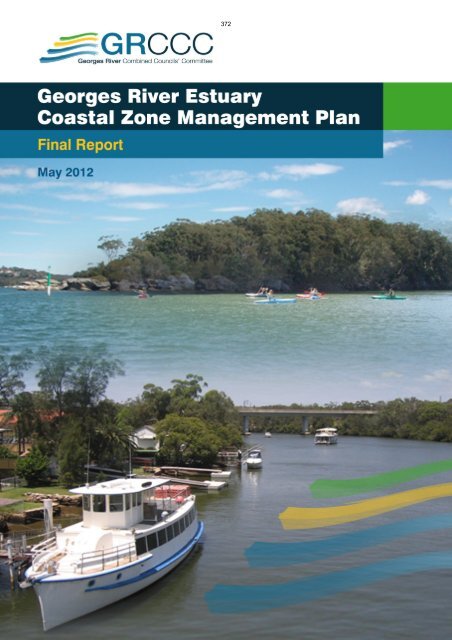
388INTRODUCTION AND STRATEGIC CONTEXT 11 INTRODUCTION AND STRATEGIC CONTEXT1.1 Why Develop a Coastal Zone Management Plan?The coastal zone of NSW represents a priceless natural resource, and is immensely valuable from anecological, social and economic perspective. In addition to the open coast beaches and headlands,the NSW coastal zone contains over 130 estuaries that vary in size from small coastal creeks andlagoons to large lakes and rivers. Estuaries contain diverse ecosystems that form the foundation ofthe coastal food chain. They provide important habitats for a variety of marine and terrestrial plantsand animals.The Georges River is a highly valued estuary withinthe Sydney Metropolitan Area. It retains significantecological value and also acts as a resource for avariety of recreational pursuits. The juxtaposition ofnatural and urban environments surrounding theGeorges River Estuary demands that specialmanagement considerations are made to ensure thelong term balance and sustainability of this preciousresource.The Georges River Estuary Coastal ZoneGeorges River (photo: OEH) Management Plan (Estuary Management Plan)(herein referred to as the Georges River CZMP) hasbeen prepared by environmental consultants BMT WBM, with assistance from isNRM, on behalf ofthe Georges River Combined <strong>Council</strong>s’ Committee (representing constituent <strong>Council</strong>s: Bankstown,Fairfield, Hurstville, <strong>Liverpool</strong>, Rockdale, Kogarah and Sutherland 1 ) and the NSW Office ofEnvironment and Heritage (OEH), formerly known as the Department of Environment, ClimateChange and Water (DECCW).The Plan builds on the comprehensive Georges River Estuary Data Compilation and ProcessesStudy (SMEC, 2010), in accordance with the State Government’s Estuary Management Process(refer Section 1.6), to satisfy the objectives of the NSW Estuary Management Policy 1992, the NSWCoastal Policy 1997 and the Coastal Protection Act 1979 (and amendments in 2010). It also helps tosatisfy the Sydney Metropolitan Catchment Management Authority’s (SMCMA) catchment targetCTECM1: Improvement in the condition of estuaries and coastal lakes, and contributes to theimplementation of target E4 of the NSW State Plan.Since the original commencement of the Estuary Management Process for the Georges River, theNSW Government has introduced various reforms to coastal management, including the Sea LevelRise Policy Statement (2010) and new Guidelines for Preparation of Coastal Zone ManagementPlans (2010) (note that for the purposes of revised legislation, including the gazettal process, this1 Wollondilly Shire and Campbelltown <strong>City</strong> <strong>Council</strong>s are included in the GRCCC, but as they have no frontage onto theestuarine reaches of the river, they were not individually included as part of this Estuary Management Plan.K:\N2099_GEORGES_RIVER_EMP\DOCS\R.S1197.001.01.FINAL_PLAN.DOCX
389INTRODUCTION AND STRATEGIC CONTEXT 2document is officially called a “Coastal Zone Management Plan” for the Georges River Estuary.These types of plans were formerly known as Estuary Management Plans).In accordance with <strong>Part</strong> 4A of the Coastal Protection Act 1979, this Coastal Zone Management Planis to be gazetted by the <strong>Council</strong>s following certification by the Minister for Environment. Oncegazetted, this document must be considered and taken into account when undertaking works ordevelopment, or when making new plans that cover areas affected by this plan. A breach of the Planwill result in an offence and associated penalties, as outlined in <strong>Part</strong> 4A, Division 2 of the CP Act.Importantly, in following the ‘Guidelines for Preparation of Coastal Zone Management Plans’,<strong>Council</strong>s are considered to have acted in good faith and thus are exempt from liability relating to landaffected by coastal hazards (including future hazards such as sea level rise and associated coastalinundation) as prescribed in Section 733 of the Local Government Act 1993.The Georges River Estuary Coastal Zone Management Plan satisfies the intent and objectives ofthese new reforms and initiatives taken by the NSW Government, as well as the fundamentalprinciples originally espoused in the Coastal Policy and the previous Estuary Management Policy.Actions in this plan may require approval under the Environmental Planning and Assessment Act1979 and other legislation and should be considered as intended actions subject to these approvals.In the event of any inconsistency between a statutory instrument or development consent issuedunder the EP&A Act and this plan, the statutory instrument or development consent applies to theextent of the inconsistency.Any actions, including project funding, noted in this plan for completion by or contribution from theNSW Government, its Departments or Agencies should be considered as requests for funding oraction. The NSW Government will consider these requests when determining its state-wide prioritiesrelating to coastal zone management. If any such actions are not completed in accordance with theplan, this is not to be considered a breach of Section 55L of the Coastal Protection Act 1979.1.2 Purpose of the PlanThe primary purpose of the Georges River Estuary Coastal Zone Management Plan is to providestrategic direction and guidance on future actions within the estuary and its catchment, which will helpto achieve long term balanced environmental sustainability. The fundamental goal of the CoastalZone Management Plan is to achieve balanced and sustainable demands on the estuary fromecological needs and recreational (human) pursuits.The Plan shall be used to inform other strategic documents that aim to manage and rationalisehuman activities and development within the catchment, such as Regional Strategies, LocalEnvironmental Plans (LEPs) and Development Control Plans (DCPs).The Plan aims to fulfil <strong>Council</strong>s’ requirement for applying the principles of Ecologically SustainableDevelopment (ESD) to the Georges River Estuary and its catchment. The Plan also provides anopportunity for future climate change to be considered in the strategic management and planning ofthe estuary and surrounding sensitive coastal lands.K:\N2099_GEORGES_RIVER_EMP\DOCS\R.S1197.001.01.FINAL_PLAN.DOCX
INTRODUCTION AND STRATEGIC CONTEXT 31.3 Who is this Plan for?390The primary audience for this Coastal Zone Management Plan is <strong>Council</strong>s within the Georges RiverEstuary catchment. Other stakeholders, including the government departments and the generalpublic, are also likely to take a keen interest in the future management of the estuary, and thereforehave been considered during preparation of this Plan.1.4 One Plan for the Whole EstuaryWhile the estuary and its catchment are partitioned into different Local Government Areas (LGAs) foradministrative convenience, the natural processes occurring within the estuary are largely crossjurisdictional.A coordinated approach has therefore been adopted to investigate and addressmanagement needs across the whole of the estuary.Issues, and associated management responses, are likely to be similar across many LGAs, meaningthat there are significant advantages to managing the estuary in a coordinated and integratedmanner. Pooled funds and resources are also likely to be more efficiently used, without the need forduplication.Importantly, a whole of estuary assessment is able to identify and prioritise issues and managementresponses at the catchment-scale, while co-ordinated and combined applications to funding bodiescan also be made to support implementation. Adopting a whole-of-estuary approach allows priorityactions to be implemented that will have the best overall outcome for the estuary.1.5 What Area Does the Plan Cover?This Plan covers the entire Georges River Estuary waterway, located in the southwest of Sydney(Figure 1-1). The upstream limit of the Georges River Estuary is at <strong>Liverpool</strong> Weir, a distance of46km from the mouth at Botany Bay. This Plan extends downstream and into Botany Bay as far asTowra Point. The Plan also covers the south and western foreshore of Botany Bay between TowraPoint and the Cooks River entrance (predominantly covering Lady Robinsons Beach) and allassociated tidal waterways that drain into the study area (including Scarborough Ponds).The estuary is divided into two regions: Upper Reaches, between <strong>Liverpool</strong> Weir and Salt Pan Creek;and Lower Reaches, from Salt Pan Creek to Botany Bay. Major tidal tributaries to the estuary includeCabramatta Creek, Prospect Creek, Salt Pan Creek, and Woronora River. As activities beyond thebanks of the estuary can have a significant impact on its health, the entire catchment of the GeorgesRiver has therefore also been considered as part of the Plan, insofar as it impacts on the condition ofthe estuary. The Georges River Estuary catchment area covers a significant portion of the GreaterSydney Metropolitan Region, with a population of more than a million people. The land surroundingthe estuary is highly urbanised and supports many land uses including: residential, Army firing range,market gardens, agriculture, mining, industrial manufacturing, landfills and nuclear research facilities.The lower reach of the Georges River Estuary has been heavily modified and residentialdevelopment extends to the foreshore in most locations. The estuary is also a popular recreationalarea for many people in the surrounding communities for fishing, waterskiing, swimming andwatersports.K:\N2099_GEORGES_RIVER_EMP\DOCS\R.S1197.001.01.FINAL_PLAN.DOCX
391INTRODUCTION AND STRATEGIC CONTEXT 4Figure 1-1Georges River Estuary Coastal Zone Management Plan Study AreaK:\N2099_GEORGES_RIVER_EMP\DOCS\R.S1197.001.01.FINAL_PLAN.DOCX
392INTRODUCTION AND STRATEGIC CONTEXT 51.6 NSW Estuary Management ProcessFor the past 20 years, the Estuary Management Process in NSW has been guided by the EstuaryManagement Policy (1992) and Estuary Management Manual (1992). Recently, the NSWGovernment released new Guidelines for Preparing Coastal Zone Management Plans (the CZMPGuidelines), which replace the Estuary Management Manual and combines the former coastal andestuary management processes. Under the new CZMP Guidelines, estuary management is requiredto focus on addressing risks to the health of estuaries through practical management actions. Focusis guided towards estuary health, because this aspect is not explicitly investigated or managedthrough any other council or state planning process.Fundamentally, the steps required to prepare a Coastal Zone Management Plan, in accordance withthe CZMP guidelines, are:1. Identify and discuss the planning framework relevant to management of the estuary;2. Prioritise management objectives based on a combination of issues that need attention, andconservation of natural and social values;3. Assess and select potential management options to achieve the objectives;4. Detail a schedule of activities for the implementation of the best management options; and5. Indicate responsibilities and sources of funding for implementing the best options.The development of the Plan has been co-ordinated by the GRCCC, and overseen by the GeorgesRiver Estuary Management Committee, which has representatives from all relevant <strong>Council</strong>s as wellas key state agencies and other stakeholders.Once the Plan has been endorsed by the community, GRCCC, member councils and partneragencies, the recommended management options can start to be implemented, in accordance withthe framework presented in the Plan.A key platform of the new CZMP Guidelines is the adoption of a risk-based approach to themanagement of estuary health. Risk-based management of estuaries has several key advantages,including:• all risks are assessed and compared equally, ensuring that management efforts are directedtowards those areas or issues that post the greatest risk to estuary health and sustainability;• better streamlining of the Plan with existing <strong>Council</strong>’s operational plans, as the risk approachinherently requires that existing management efforts are included in the assessment of risk,rather than a duplication of actions;• the risk approach identifies the highest priority risks, which are not currently being managed(sufficiently) through any other process, targeting management resources towards the highestpriority issues;• management options can be designed to reduce the likelihood of the risk (e.g. planningsetbacks) and the consequence of the risk (e.g. emergency management works); and• where there is a high level of community concern regarding an issue that presents a low risk,monitoring and trigger levels can be set without absorbing funding resources unnecessarily.K:\N2099_GEORGES_RIVER_EMP\DOCS\R.S1197.001.01.FINAL_PLAN.DOCX
393INTRODUCTION AND STRATEGIC CONTEXT 6Under Section 733 of the Local Government Act 1993, councils are taken to have acted in ‘good faith’and receive an exemption from liability where their actions were done substantially in accordancewith the “coastal management principles” given in the CZMP Guidelines (DECCW, 2010b). Further,intended changes to Section 117 of the Environmental Planning and Assessment Act 1979 willrequire the CZMP Guidelines be taken into consideration when councils prepare their localenvironment plans (LEPs).The “coastal management principles” (DECCW, 2010b) and how these principles have beenaddressed or achieved within this Georges River Estuary Management Study and Plan are given inTable 1-1.Table 1-1Coastal Management Principles (DECCW, 2010b) addressed by the GeorgesRiver Estuary PlanCoastal Management PrinciplesAddressed by Georges River EstuaryManagement Study and PlanReportSectionPrinciple 1Consider the objectives of theCoastal Protection Act 1979 and thegoals, objectives and principles of theNSW Coastal Policy 1997 and theNSW Sea Level Rise PolicyStatement (2009)The Georges River Estuary managementobjectives are aligned with the NSWCoastal Policy and NSW Sea Level RisePolicy Statement 2009.1.6Principle 2Optimise links between plans relatingto the management of the coastalzoneRelevant existing plans and initiativesbeing adopted by state agencies and thevarious <strong>Council</strong>s have been identifiedthrough the consultation workshops andhave been integrated into theimplementation of Best ManagementOptionsComprehensive consultation withcommunity and targeted stakeholders hasbeen undertaken in developing this plan,including workshops, on-line surveys, andinterviews with stakeholders andcommunity membersThis Plan has been preceded by anexhaustive assessment of EstuaryProcesses (SMEC, 2010). Managementoptions have recognised the complexinteractions between catchment andestuarine environments. The on-goingmonitoring and evaluation requirementswill ensure that management of the estuarywill be adaptive, cognisant of existing andemerging issues and treatment options.3, 6Principle 3Involve the community in decisionmakingand make coastal informationpublicly available3Principle 4Base decisions on the best availableinformation and reasonable practise;acknowledge the interrelationshipbetween catchment, estuarine andcoastal processes; adopt acontinuous improvementmanagement approach2.2, 8Principle 5The priority for public expenditure ispublic benefit; public expenditureshould cost effectively achieve thebest practical long-term outcomesAssessment of potential managementoptions has recognised the public benefitas priorityAppendixDK:\N2099_GEORGES_RIVER_EMP\DOCS\R.S1197.001.01.FINAL_PLAN.DOCX
394INTRODUCTION AND STRATEGIC CONTEXT 7Coastal Management PrinciplesAddressed by Georges River EstuaryManagement Study and PlanReportSectionPrinciple 6Adopt a risk management approachto managing risks to public safety andassets; adopt a risk managementhierarchy involving avoiding riskwhere feasible and mitigation whererisks cannot be reasonably avoided;adopt interim actions to manage highrisks while long-term options areimplementedAdopt an adaptive risk managementapproach if risks are expected toincrease over time, or toaccommodate uncertainty in riskpredictionsThis plan has been prepared givingconsideration to ISO 31000:2009International Standard Risk ManagementPrinciples and Guidelines. Risksassociated with ‘not achievingManagement Aims’ have been assessed,while assessment of options haveconsidered the potential for reducing risks.1.6, 5,AppendixDPrinciple 7The adaptability of management options tofuture circumstances was a considerationin selection of preferred options.5,AppendixDPrinciple 8Maintain the condition of high valuecoastal ecosystems; rehabilitatepriority degraded coastal ecosystemsSpecific objectives and options forprioritising rehabilitation for at risk coastaland estuarine ecosystems have beendeveloped.Appropriate public access to estuaryforeshores has been considered indeveloping objectives and options for thisPlan.This plan supports the on-going use of theGeorges River Estuary waterway andpublic foreshore areas for recreationalpursuits, which is reflected in its objectivesand management options4.2.2, 5Principle 9Maintain and improve safe publicaccess to beaches and headlandsconsistent with the goals of the NSWCoastal Policy4.2.3,4.2.5, 5Principle 10Support recreational activitiesconsistent with the goals of the NSWCoastal Policy4.2.3, 51.7 Key Legislation and other Instruments GuidingEstuary ManagementThe Georges River Estuary and its catchment are subject to a myriad of environmental planning andmanagement instruments and legislation, spanning some seven LGAs (each with its own planningframework, policies and plans). In addition to these instruments and statutory documents, there isalso a vast array of management plans and strategies that are relevant to the Georges River, rangingfrom overarching Commonwealth initiatives down to site specific Plans of Management. Strategiesand plans that relate just to natural resource management (NRM) within the Georges Rivercatchment were identified previously by Evans and Peck (2008), and are summarised in Figure 1-2.In addition to legislated Acts of Parliament, there are two main types of statutory environmentplanning instruments (EPIs): Local Environmental Plans (LEPs) and State Environmental PlanningPolicies (SEPPs). There are also other instruments that guide management of natural resources,including the Georges River.The existing environmental planning and strategic management frameworks relevant to the GeorgesRiver are summarised below, with further information provided in Appendix A.K:\N2099_GEORGES_RIVER_EMP\DOCS\R.S1197.001.01.FINAL_PLAN.DOCX
395INTRODUCTION AND STRATEGIC CONTEXT 81.7.1 State Environmental Planning PoliciesThere are a number of State Environmental Planning Policies (SEPPs) that may be relevant to theGeorges River Estuary. These include:• Greater Metropolitan Regional Environmental Plan No 2—Georges River Catchment (this is nowregarded as a SEPP);• SEPP 19 – Bushland in Urban Areas• SEPP 44 – Koala Habitat Protection• SEPP 50 – Canal Estate Development• SEPP 62 – Sustainable aquaculture• SEPP 71 – Coastal Protection• SEPP (Major Development) 2005• SEPP (Infrastructure) 2007• SEPP (Mining, petroleum production and extractive industries) 2007• SEPP (Western Sydney parklands) 2009Of particular note, Division 25 of SEPP (Infrastructure) 2007 refers to waterway and foreshoreenvironmental management activities, including riparian corridor management, bank stabilisation,weed management, revegetation activities, and the creation of foreshore accessways. In this regard,the relevant local <strong>Council</strong> is deemed to be the public authority, and as such, does not requiredevelopment consent to undertake waterway and foreshore environmental management activities.Additionally, Greater Metropolitan Regional Environmental Plan (REP) No. 2 (Georges RiverCatchment) is also deemed a SEPP (as REPs are phased out of the planning hierarchy). TheGeorges River Catchment REP aims to protect the water quality of the Georges River and itstributaries as well as the environmental quality of the whole catchment. The REP establishes theframework within which local, State and Federal agencies will consult so that there is a consistentapproach to planning and development within the Georges River catchment.Key SEPPs relevant to the Georges River Estuary are discussed further in Appendix A.1.7.2 Local Environmental Plans and Development Control PlansLocal Environmental Plans (LEPs) are planning instruments produced by local councils to direct thetype of development in local government areas. LEPs aim to conserve the natural environment, whilstcreating attractive living areas and ensuring development complies with ecologically sustainableprinciples. Through planning and development controls, they allow councils to regulate the ways inwhich land is used by defining permissibility for different types of development across an entire LGA,as a requirement of the Environmental Planning and Assessment Act 1979. LEPs are statutorydocuments, meaning it is illegal to develop land contrary to that permitted by the LEP.Development Control Plans (DCPs) are non-statutory instruments that support the LEPs, by providingspecific, more comprehensive guidelines for types of development, or specific areas within a localgovernment area. DCPs contain a specific range of conditions (including visual amenity, drainage,K:\N2099_GEORGES_RIVER_EMP\DOCS\R.S1197.001.01.FINAL_PLAN.DOCX
396INTRODUCTION AND STRATEGIC CONTEXT 9access, pollution control, vegetation etc.) aimed at optimising land use in an environmentallysustainable manner.On 31 March 2006, the Standard Instrument (LEPs) Order 2006 was gazetted. Its purpose is toreduce the number of planning documents and improve the consistency in documents across localcouncils by introducing a standard template LEP. The Standard Instrument provides for 34 standardzones for LEPs, for use by <strong>Council</strong>s when preparing their new LEPs according to the StandardInstrument. <strong>Council</strong>s are required to update existing LEPs to accord with the Standard InstrumentOrder by 2011. Within the Georges River Estuary catchment, only <strong>Liverpool</strong> has a gazetted LEP thatcomplies with the Standard Instrument, while all other <strong>Council</strong>s have draft LEPs in preparation. A listof the LEPs and DCPs relevant to the Georges River Estuary are presented in Table 1-2.Table 1-2 Local Government Planning InstrumentsLocal Environmental PlanDevelopment Control PlanSutherland Shire LEP 2006 Sutherland Shire DCP 2006Kogarah LEP 1998Hurstville LEP 1994 (and draft 2011)Various DCPs (to be consolidated)Hurstville DCP1 / DCP2Rockdale LEP 2011 Rockdale DCP 2011Bankstown LEP 2001 Bankstown DCP 2005Fairfield LEP 1994 (and draft 2010) Fairfield DCP 2006<strong>Liverpool</strong> LEP 2008 <strong>Liverpool</strong> DCP 20081.7.3 State and Commonwealth Legislation and PoliciesThere are a number of NSW and Commonwealth Parliamentary Acts that are relevant to themanagement of the Georges River Estuary and catchment. Key Acts and policies are listed below,while further details are given in Appendix A:• Environmental Planning and Assessment Act 1979;• Coastal Protection Act 1979;• Local Government Act, 1993;• Crown Lands Act 1989;• National Parks and Wildlife Act, 1974;• Fisheries Management Act, 1994;• Threatened Species Conservation Act, 1995;• Heritage Act 1977;• Protection of the Environment Operations Act, 1997;K:\N2099_GEORGES_RIVER_EMP\DOCS\R.S1197.001.01.FINAL_PLAN.DOCX
397INTRODUCTION AND STRATEGIC CONTEXT 10• Noxious Weeds Act 1993;• Water Management Act 2000;• Native Title Act 1977;• NSW Coastal Policy 1997;• NSW Sea Level Rise Policy Statement 2010;• Planning for Bushfire Protection 2006;• NSW State Plan; and• Commonwealth Environmental Protection and Biodiversity Conservation Act 1999.1.7.4 Sydney Metropolitan Catchment Action Plan 2009The Sydney Metropolitan Catchment Action Plan (CAP) 2009 has been prepared by the SydneyMetropolitan Catchment Management Authority (SMCMA). The aim of the CAP is to set out a 10year strategic framework for balanced natural resource management across the rural, coastal andurban catchments of the CMA area. The CAP defines targets and direct investment of public andprivate resources to achieve sustainable natural resource management in line with communityexpectations. While the CAP is not a regulatory plan, it serves to complement other natural resourcemanagement plans, including the Georges River Estuary Coastal Zone Management Plan. TheSMCMA is in the process of reviewing/updating the CAP, and it will be important that the new CAPsupports the aims and objectives of this CZMP.The CAP has a key role in addressing the priorities of the NSW State Plan. The NSW State PlanPriority E4 identifies targets which will guide the implementation of the CAP to ensure betteroutcomes for native vegetation, biodiversity, land, rivers and coastal waterways, such as the GeorgesRiver Estuary.Within the CAP, Catchment Target CTECM1 states that “By 2016, there is an improvement in thecondition of estuaries and coastal lakes”. This catchment target relates directly to the aims andobjectives of this Georges River Estuary Coastal Zone Management Plan, while the CZMP wouldalso contribute to Catchment Target CTW1 “By 2016 there is a net improvement in the health ofmodified waterways and riparian corridors and conservation of natural waterways”. The CAPidentifies a number of Management Targets that will contribute to improvements in the condition ofestuaries (refer Table 1-3). The key Management Target is MTECM1.5. The preparation of EstuaryManagement Plans (or Coastal Zone Management Plans) for the major estuarine waterways andintegration of these to identify regional scale management priorities will provide the framework for acoordinated and strategic approach to dealing with marine pests, in-stream and foreshorestructures and vegetation rehabilitation. The CAP states that the most important benefit of acoordinated approach to estuary management is the rationalisation of conflicting policy andoperational objectives across State and Local Government institutions, so that clear and consistentobjectives and valuing of estuary health emerge. This is particularly pertinent for the Georges RiverEstuary Coastal Zone Management Plan, which transects seven different Local Government Areas.The CAP also highlights potential benefits in reducing the potential for duplication of effort orcontradictory effort.K:\N2099_GEORGES_RIVER_EMP\DOCS\R.S1197.001.01.FINAL_PLAN.DOCX
398INTRODUCTION AND STRATEGIC CONTEXT 11The preparation and implementation of this Georges River Estuary Coastal Zone ManagementPlan is evidently a critical step towards achieving the desired outcomes of the CAP. Indeed, theCoastal Zone Management Plan will help to achieve Catchment and Management Targets acrossthe entire spectrum of Biodiversity, Water, Land and Community issues that are central to the CAP.Table 1-3Key CAP Management Targets relevant to Estuary ManagementManagement TargetMTECM1.1By 2016 the threats posed by marine pests have been reducedMTECM1.4MTECM1.5MTECM1.10By 2016, new in-stream and foreshore structures are designed and constructedin an ecologically sensitive mannerBy 2016 the condition of estuaries and coastal lake systems will be maintainedor improved through development and implementation of natural resourcemanagement plans (including estuary management plans).By 2016, the extent, condition and connectivity of estuarine vegetation ismaintained and/or improved by facilitating the protection and rehabilitation ofestuarine vegetation at high priority sites.MTW5.2MTECM2.3MTW1.1By 2012 local councils have incorporated and implemented provisions in therevised LEPs, DCPs and related codes and policies that promote WSUD andother practices that reduce the impact of stormwater on the environmentalvalues of waterwaysBy 2016 active management will protect or improve key estuarine and marinehabitat areas in partnership with relevant authorities and user groupsBy 2016 selected high priority reaches of waterways and riparian corridors areprotected and rehabilitated.MTW3.1By 2010 a Water Quality Implementation Plan for Botany Bay and its catchmenthas been developed and commenced.1.7.5 Other Natural Resource Management InitiativesIn addition to the CAP, there are a large number of other natural resource management initiatives thatare applicable to the Georges River Estuary, ranging from peak Commonwealth strategies, down toplace-based Plans of Management. An overview of existing natural resource management strategiesis provided in Figure 1-2, as derived from Evans and Peck (2008).In developing the Georges River Estuary Coastal Zone Management Plan, due consideration hasbeen given to these existing strategies, and their potential for implementation across the LGAsrelevant to the Plan.K:\N2099_GEORGES_RIVER_EMP\DOCS\R.S1197.001.01.FINAL_PLAN.DOCX
Manual on Public Disclosure Schedules15 Bank colony roads 0.9 xNeglur house to mestri 0.4 xRamaiah houseMysore lamps0.3 xVenktesh house rd16 Yellamma temple road 0.4 xMuraaraiah Aliya house 0.5 xrd17 Shamiyaana sh0.3 xjayaram house rd18 vishal school road 0.4 xVishal school to swan0.4 xsilk fctory rd19 Vijayavagar bayalu to0.2 xBeereshwara templeSK house to0.2 xBeereshwara templeShivanna Rtd Insp.0.2 xHouse to Rajannahouse20 Jayaprasad nursing0.4 xhome-govt schoolSavithramma house rd 0.6 x21 Play ground-bhovi 0.3sanga roadxShamanna house-N 0.2H 4xHosallappa house rd 0.2 xHR hally Kempanna 0.6layoutxCMAK | 29
401PROCESSES, VALUES AND ISSUES OF THE GEORGES RIVER 14catchment, while major investment has been made to try and rehabilitate degraded foreshores andestuarine areas (including clean-up of previous oyster farms). Also, the Sydney Metro CMA’s recentBotany Bay Catchment Water Quality Improvement Plan [BBWQIP] (2011) aims to reduce pollutantloads through catchment-based measures. This Coastal Zone Management Plan shouldcomplement these existing initiatives by recommending a range of measures that focus on a holisticperspective for environmental sustainability of the estuary.2.2 Estuary Processes (SMEC, 2010)A comprehensive Estuary Data Compilation andProcesses Study for the Georges River was carriedout by SMEC (2010), and forms the necessaryprerequisite stage to this Coastal Zone ManagementPlan. It documents the key physical, chemical andbiological processes occurring within the GeorgesRiver Estuary (and catchment) that have an impact onthe existing condition of the waterway and its futuremanagement needs and limitations.Presented below is a summary of this DataCompilation and Processes Study.2.2.1 Geology and Estuary TypeThe Georges River Estuary is classified as a drownedriver valley. The estuary is characterised by a deepchannel and steep rocky foreshores along the lower reaches, which opens up into extensive alluvialfloodplains towards the upper end of the estuary. The lower reaches have been carved intoHawkesbury sandstone (shown in yellow in Figure 2-1), while the upper reaches more reflectWianamatta shale geology of gentle undulating slopes draining to a low alluvial plains (shown in Redin Figure 2-1).The Georges River flows into Botany Bay, which is roughly circular (8km in diameter) and has atypical depth of 4.5m. The entrance channel to Botany Bay has been dredged to a depth of 21m toaccommodate vessel movements into and out of Port Botany.The Georges River was first surveyed by Cook in 1770, although since then there have been majormorphological changes, notably in the upper reaches of the estuary where extensive dredging andreclamation has occurred over the past 60-70 years. Typical depths along the Georges River estuaryare about 4 m.The total length of the Georges River (extending up to Appin, at an elevation of some 350m abovesea level) is around 100km, although the estuarine component is limited by <strong>Liverpool</strong> Weir, locatedapproximately 46km from the river mouth. Geological surveys of paleo river channels indicate thatduring previous glacial periods (when sea level was 100m+ lower than at present), the Georges River(as well as the Cooks River) flowed through the existing Kurnell sand dunes and across Bate Baytowards the edge of the continental shelf (Albani and Rickwood, 2010) (refer Figure 2-2).K:\N2099_GEORGES_RIVER_EMP\DOCS\R.S1197.001.01.FINAL_PLAN.DOCX
402PROCESSES, VALUES AND ISSUES OF THE GEORGES RIVER 15Figure 2-1 Underlying geology surrounding the Georges River Estuary (Source: SMEC, 2010)Figure 2-2 Paleo river channels based on bedrock profile (Source: Albani & Rickwood, 2010)(Note, land area shown in brown, seabed shown in yellow)K:\N2099_GEORGES_RIVER_EMP\DOCS\R.S1197.001.01.FINAL_PLAN.DOCX
403PROCESSES, VALUES AND ISSUES OF THE GEORGES RIVER 162.2.2 Sediment Processes2.2.2.1 Catchment SoilsThe soils across the northern portion of the study area, which are derived from the underlyingWianamatta Shale geology (refer Figure 2-1), have a high potential for erosion. The fine-grained andhighly dispersive nature of these soils also has a tendency to make receiving waters turbid, especiallyafter rainfall. Compounding this issue is the fact that the northern half of the study area has beenextensively developed, thus providing ample opportunity over the past 200 years to liberate sedimentfrom the catchment, which would then have been deposited within the estuary, or advected intoBotany Bay and onto the continental shelf during times of flood.The soils overlying the sandstone regions of the catchment (refer Figure 2-1) tend to be more porousand less dispersive, although they would still be subject to water and wind erosion, especially whenoverlying vegetation has been disturbed.2.2.2.2 SedimentationThe Georges River Estuary (excluding Botany Bay) can be split into three broad regions of bedsediments. These are:• the main channel reach above Como Bridge which is mainly sandy;• the main channel reach below Como Bridge which is predominantly composed of clay and silt;and• the large off-channel bay areas in the lower estuary where the major sediments are flocculentsilts and clays.Overall longitudinal downstream fining of sand bed sediments (i.e. the sediments become finer withdistance downstream) illustrates a fluvial dominance in the estuary, especially along the upperreaches. The sediments of the estuary roughly accord to the estuarine zonation developed by Roy etal. (2001), with the lower reaches below Como Bridge and the large off-channel bays forming acentral mud basin, transitioning to an alluvial delta upstream of Como Bridge, and then a riverinechannel from about Picnic Point upstream (refer Figure 2-3). The marine flood tide delta is essentiallylimited to Botany Bay and areas around Towra Point, although flood tide processes have clearlychanged in geological times as the previous link to the ocean became occluded through dunetransgression across the Kurnell peninsula, leading to the present day connection through the mouthof Botany Bay.The rate and location of sedimentation within the Georges River is expected to have been modifieddue to anthropogenic factors. Development of the catchment would have increased the amount ofsediment delivered to the estuary, thus accelerating sedimentation rates. This is typical of mostestuaries that have experienced catchment development. Once the development stabilises, runoffrates and hence sedimentation rates, tend to subside. Of specific relevance to the Georges River isthe significant amount of dredging that has occurred throughout the upper reaches as part ofhistorical sand extraction enterprises. The uncontrolled extraction has created several very largebasins within the river and floodplain morphology, which would act as sediment basins, attractingaccelerated rates of fine sedimentation. Similarly, but at a smaller scale, the construction of <strong>Liverpool</strong>Weir would also have promoted localised sedimentation in the upstream weir pool.K:\N2099_GEORGES_RIVER_EMP\DOCS\R.S1197.001.01.FINAL_PLAN.DOCX
404PROCESSES, VALUES AND ISSUES OF THE GEORGES RIVER 17\Figure 2-3Zonation of the Georges River based on sedimentary processes (Source: SMEC,2010) (refer to SMEC, 2010 for original high resolution mapping)K:\N2099_GEORGES_RIVER_EMP\DOCS\R.S1197.001.01.FINAL_PLAN.DOCX
405PROCESSES, VALUES AND ISSUES OF THE GEORGES RIVER 18Associated with the historical deep dredging in the upper reaches, some riverbanks have collapsedand retreated due to over-steep subsurface slopes. The continuing erosion and bank retreat wouldbe contributing to sedimentation throughout the estuary.In Botany Bay, ocean swell waves have an influence on the longshore sediment transport processesoccurring along the shoreline, and in particular, Lady Robinsons Beach. Net southerly transport ofsand along the southern half of Lady Robinsons Beach has led to accretion at Dolls Point, while thereis a net northerly sediment transport along the northern half of the beach. There is also strongwestward sediment transport along Towra Point, which is driven by the obliquity of this shoreline tothe incoming swell waves.2.2.2.3 Sediment QualityThe Georges River Estuary received runoff from an intensively urbanised and industrialisedcatchment. The estuary has also been used for a range of boating and maritime activities, and assuch has been a major repository for urban and industrial waste, including metalliferous loadings (e.g.copper, zinc, nickel, lead). Waste dumps and sewerage overflows have also contributed to highpollutant loading into the estuary. Many pollutants, including metals, attach to sediments, which canaccumulate within poorly flushed sedimentation zones across the estuary, including the upstreamends of bays and within deeper dredge holes.Birch et al. (1996) report that the majority of estuarine areas in the Georges River have pollutantconcentrations (heavy metal, PAH) in the sediments in excess of background levels, although it isconsidered that this work may have been influenced by localised external factors. Albani andRickwood (2010) have thus further explored geochemistry of the Georges River Estuary noting theparticular shortcomings of previous analytical approaches. Albani and Rickwood (2010) concludethat “the bottom sediments in Georges River are remarkably free of elevated concentrations of mostelemental contaminants, but some of the bays and tributaries have sediment that should beconsidered to be mildly contaminated. For example, Prospect Creek and Salt Pan Creek sampleshad Zn at an elevated level that should be monitored”.2.2.2.4 DredgingDredging has occurred in Botany Bay and along the Georges River since 1948 (SPCC, 1979). Themajor dredging occurring in the Georges River Catchment was at Moorebank and Chipping NortonLakes. Chipping Norton Lakes were originally the result of illegal dredging and unregulatedextraction activities between the 1950s and 1977. The average removal depth was 9.5m and 7.5mfor the north and south ponds, respectively. Construction sand was also dredged around RiverlandGolf Course upstream of Salt Pan Creek prior to the 1980s.Dredging within Botany Bay has had an impact on the foreshore of the study area, more particularlyalong Towra Point and Lady Robinsons Beach. Dredging in Botany Bay was carried out to providedeepwater navigation to Port Botany, the Australian Oil Refinery jetty and offshore of Kyeemagh.These changes in bed depth changed the wave refraction processes within the bay, increasing waveenergy along the more southern shoreline (e.g. Towra Point, Lady Robinson Beach) (SPCC, 1978).Major dredging campaigns have also been carried out in Botany Bay to provide fill material for largeforeshore reclamation projects, including the Sydney Airport, and Port Botany developments.K:\N2099_GEORGES_RIVER_EMP\DOCS\R.S1197.001.01.FINAL_PLAN.DOCX
406PROCESSES, VALUES AND ISSUES OF THE GEORGES RIVER 192.2.2.5 Bank erosionThe lower reaches of the Georges River are incised within a deep sandstone gorge (ie drowned rivervalley), and thus are not susceptible to significant bank erosion. The upper reaches on the otherhand have developed across alluvial plains of friable and erodible sediment. Changes to thehydrologic flow regime of the estuary (through increased runoff due to urbanisation of the catchment)are likely to have led to a morphological response by the river channel. Indeed, as the process ofchannel change is slow, it is possible that the upper reaches of the Georges River will continue toadjust for many decades (or even centuries) to come.A general channel widening has been observedbetween <strong>Liverpool</strong> Weir and East Hills, with some areasin the upper reaches of the river, already experiencingan increase in cross-sectional area by up to 60%.Georges River bank erosion (photo: OEH)recession.Compounding the morphological change in the upperreaches is the broadscale dredging that has occurred,which fundamentally changes the hydrodynamicprocesses that are responsible for channel adjustment.Furthermore, dredging too close to the sides of the riverhave led to over-steep subsurface slopes, causingmass failure of riverbanks and accelerated bankOther factors that are likely to have increased bank erosion along the Georges River include:• Major floods, which scour the outside of bends – made worse if these banks are eroding due toother processes as well;• Boat wash and wind waves (compounded if fetch lengths have been increased, e.g. acrossChipping Norton Lakes);• An increase in tidal prism within the upper reaches (i.e. creation of Chipping Norton Lakes), thusincreasing tidal velocities along downstream sections; and• Uncontrolled foreshore access and disturbance of riparian vegetation.Informal bank protection measures have beenemployed at various locations along theestuary in an effort to halt bank recession.Dumped concrete blocks, bricks and otherbuilding refuse has been used in somelocations, which significantly compromises thevisual and environmental values of theforeshore, and may not necessarily evenreduce erosion (in fact, poorly constructedwalls can exacerbate erosion, especially at theedges of the structure). Recent surveys of theentire Georges River foreshores are detailed Seawall at Howard Park (photo: SMEC, 2010)in the Estuary Processes Study report (SMEC,2010), and indicate that Chipping Norton Lakes and Floyd Bay have mostly been stabilised throughK:\N2099_GEORGES_RIVER_EMP\DOCS\R.S1197.001.01.FINAL_PLAN.DOCX
407PROCESSES, VALUES AND ISSUES OF THE GEORGES RIVER 20seawall construction, as well as many foreshores around the lower estuary reaches, while the riverchannel upstream of Chipping Norton continues to erode significantly. High priority erosion areashave been identified for each LGA along the Georges River, and are detailed in SMEC (2010).2.2.3 Hydrodynamic Processes2.2.3.1 Tides2.2.3.2 WavesThe tides in the Georges River area are typical of the NSW east coast, being semidiurnal with adiurnal inequality. Tidal range (vertical difference between high and low tide) is essentially constantalong the River with differences in levels of less than 0.1m between the <strong>Liverpool</strong> Weir (mean springtide 2 range of 1.31m) and Botany Bay (mean spring tide range of 1.25m). The tidal lag from BotanyBay up to <strong>Liverpool</strong> Weir is about 2.5 hours (SPCC, 1978).The tidal prism is the volume of water held between high tide and low tide. It represents the volumeof water exchanged with the estuary each time. Between 1960 and 1980, the tidal prism of theGeorges River upstream of Milperra increased from 700,000 m 3 to 1.6 million m 3 due to theconstruction of Chipping Norton Lakes.With a large tidal prism, the most downstream sections of the estuary are relatively well flushed. Thepeak tidal flow rate into the estuary is approximately 4,000 m 3 /s. In comparison, the dry weatherfreshwater inflows to the estuary are about 5 m 3 /s, while the peak 1 in 10yr flood flows are about 850m 3 /s. Despite the strong tidal dominance, there are still some ‘dead water areas’ at the heads ofmost side embayments.Tidal currents in both Botany Bay and Georges River are generally less than 1m/s. Dredging inBotany Bay and in the upper reaches of the Georges River have reduced these currents locally, andwould likely promote sedimentation, as discussed previously.Wind waves are generated where winds blow over long stretches (called fetches) of water. Largerwind waves are expected within the Chipping Norton lakes as well as Botany Bay. These waves havea characteristic period ranging from 1 to 5 seconds and contain relatively little energy, although it isdirected principally over a narrow portion of the bank profile at the waters edge.Wake generated by boats has similar wave characteristics to minor wind waves. On larger bodies ofwater, the boat wake energy is mostly dissipated before reaching shore, however, on narrowerwaterways, and in locations where boats are closer to the banks (e.g. around boat ramps), wakeinducederosion can be problematic.Ocean swell waves penetrate the entrance of Botany Bay and are refracted by the bay bathymetry(which has been modified through dredging and reclamation) onto surrounding foreshores. The usualwave period for ocean swell waves is between 8 and 15 seconds, meaning it contains much higher2 Spring tides are the larger tides that occur during the course of a month corresponding with full moon and new moon,when the gravitational pull of the moon is greater. The lesser tides, between the spring tides, are called ‘neap’ tides.K:\N2099_GEORGES_RIVER_EMP\DOCS\R.S1197.001.01.FINAL_PLAN.DOCX
408PROCESSES, VALUES AND ISSUES OF THE GEORGES RIVER 21energy than wind or boat waves. Wave heights within Botany Bay are generally less than 0.5m withonly 10% of the waves exceeding 1m, and rare occurrences of up to 2m in some locations.Swell-wave induced longshore sediment transport around the foreshores of Botany Bay has beenmanaged through the construction of shore-normal groynes. Historical changes to the bathymetry ofBotany Bay have changed the internal refraction pattern, and thus the longshore processes. Someshorelines have attempted to respond to this by natural realignment (e.g. at Towra Beach).2.2.3.3 FloodingThe major floodplain areas of the Georges River Estuary are located between <strong>Liverpool</strong> and EastHills, along Cabramatta Creek and along Prospect Creek. These areas are subject to the mostsignificant flood risk as they are urbanised and located in low-elevated landscapes. The Cabramattaand Prospect Creeks floodplains are ofparticular concern because they are fullyurbanised, with flood flows approximately190% and 60% higher than natural conditionsfor these creeks, respectively. The times toreach peak flow conditions would also havereduced significantly as a consequence ofurbanisation within the catchments, thusreducing flood response times and increasingrisks to the community. Around 30% of theflood prone area contains residential andindustrial/commercial developments, while the1986 flood in Georges River (photo: GRCCC)remaining 70% are mostly open spaces.Two significant flood events have occurred within the past 30 years - 1986 and 1988. These eventshave been determined to be about a 1 in 20 year Annual Recurrence Interval (ARI) flood (SMEC,2010). More than 1000 residential properties along the Georges River, Cabramatta Creek andProspect Creek were flooded by these events.The 1956 flood was larger than the 1986 and 1988 events, but was still relatively small compared tothe flood of record, in 1873, which attained peak water levels at <strong>Liverpool</strong> Weir of 10.5m AHD, whichis some 3m higher than the 86/88 levels, and 1m higher than the estimated 1 in 100yr ARI flood. Intotal, there are approximately 8,500 properties potentially affected by flooding up to the ProbableMaximum Flood (PMF) along the Georges River Estuary, with over 2,600 of these considered at highrisk.Development over the past 20 years or so (particularly in the Prospect and Cabramatta Creekcatchments) is expected to have potentially modified flood risks along the Georges River.Development within the floodplain has intensified, involving the filling of large tracts of flood-proneland, and has increased exposure to risks. Meanwhile, the construction of Chipping Norton Lakes,sand extraction at Moorebank and the selective removal of homes from floodways (notably in theMilperra – Moorebank and Prospect Creek floodplain areas) are expected to have reduced overallflood risk.K:\N2099_GEORGES_RIVER_EMP\DOCS\R.S1197.001.01.FINAL_PLAN.DOCX
409PROCESSES, VALUES AND ISSUES OF THE GEORGES RIVER 22Floodplain management options that have been considered and implemented to some degree withinthe Georges River Estuary include:• Voluntary purchase of affected homes;• Voluntary house raising;• Flood protection works, such as levees;• Basins, such as detention basins; and• Flood warning systems.2.2.4 Water Quality2.2.4.1 Flushing and Mixing CharacteristicsThe Georges River and its tributaries are generally considered to be vertically well-mixed, withrelatively small differences in water quality between the surface and bottom of the water columnprofile. The typical salinity gradient along the estuary is shown in Figure 2-4, highlighting near-marineconditions (i.e. 35ppt) up to Como Bridge, and then a steady decline resulting in more brackishconditions at <strong>Liverpool</strong> Weir, which has typical salinities of about 5 – 10ppt.Figure 2-4 Typical salinity profile along the Georges River Estuary (PWD, 1990)K:\N2099_GEORGES_RIVER_EMP\DOCS\R.S1197.001.01.FINAL_PLAN.DOCX
410PROCESSES, VALUES AND ISSUES OF THE GEORGES RIVER 23The salinity profile is a function of the typical freshwater inflows, and the relative tidal exchangeoccurring along the estuary. The near marine conditions downstream of Como Bridge indicate thatthis section of the estuary receives relatively good tidal exchange. Therefore, pollutants entering theestuary within this reach are comparatively well diluted and dispersed with incoming ocean waters.The degree of tidal exchange then reduces significantly with distance upstream. Even though thefreshwater inflows are relatively small, the upper reaches of the estuary remain strongly influenced bythe catchment inflows, as indicated by the suppressed salinity concentrations. Therefore, pollutantinputs to this section of the estuary are more critical as there is not as much tidal flushing anddispersion as in downstream reaches.Under high flow conditions, much of the saltwater can be advected out of the river, particularly theupper reaches, with stratification (freshwater overlying more saline water) lasting for up to two weeks.The recovery of the salt wedge into the estuary would depend on the size of the freshwater event.SPCC (1979) found that return to ‘equilibrium’ conditions was slow after a freshwater event, indicatingrelatively poor longitudinal mixing and dispersion characteristics. Deep holes within the river (e.g.Chipping Norton Lakes) would likely retain brackish/saline conditions near the bed except for underthe largest of freshwater events. It is expected that high flows would also correspond with poor waterquality conditions in the river, and particularly along the upper reaches where catchment runoff woulddominate the receiving water environment.2.2.4.2 Factors affecting water qualityIn addition to the natural flushing and dispersion characteristics of the estuary as described above,the water quality of the Georges River has been affected notably by a range of anthropogenic factors.For example, urbanisation of the catchment has contributed greatly to pollutant loadings and poorwater quality in the estuary. Also, extensive dredging activities along the river and the eventualconstruction of the Chipping Norton Lakes have altered the hydrodynamics of the river (and thusflushing and mixing characteristics), and has increased turbidity through localised bank instability.Land reclamation activities, using waste as fill material, caused the destruction of many wetlands, andhave been at least partially responsible for the collapse of the oyster, prawn and fish industry in theGeorges River. Sewage from the Glenfield, Holsworthy and <strong>Liverpool</strong> STPs, which is high innutrients, pathogens and other pollutants, was directly discharged into the river up to 1986, causingwidespread issues of eutrophication and poor water quality in the upper sections of the GeorgesRiver. While there has been some recovery from these past activities, many of the toxic chemicals,heavy metals and pollutants still remain in the Georges River bound to riverbed sediments.A number of point and diffuse sources of pollution continue to contribute to the degradation of waterquality in the Georges River. In addition to general catchment runoff from the highly urbanisedcatchment, which includes a mix of gross pollutants, heavy metals and nutrients, point sourcesewerage can overflows occur during heavy rainfall. Sydney Water’s sewerfix program aims toreduce the frequency of sewer overflows, but with aging infrastructure, the demand for remediation ishigh. Furthermore, some recreational activities like dirt biking and four wheel driving along the river’sforeshores would increase sediment runoff and contribute to water turbidity.Managing pollutant inputs to the estuary is now a major task for <strong>Council</strong>s and the SMCMA, withfunding and projects aimed specifically at stormwater pollution, including WSUD initiatives. It hasbeen estimated that 95% of the total contaminant load to the Georges River / Botany Bay estuary isK:\N2099_GEORGES_RIVER_EMP\DOCS\R.S1197.001.01.FINAL_PLAN.DOCX
<strong>411</strong>PROCESSES, VALUES AND ISSUES OF THE GEORGES RIVER 24now derived from stormwater runoff, so the recent focus on stormwater management is consideredappropriate.2.2.4.3 Current water quality conditionsAppraisal of the current ‘snap shot’ river health conditions in the Georges River using a ‘report card’format, as established by the GRCCC, is shown in Figure 2-5. Despite the long history of pollutionand elevated catchment runoff loads, it is considered that the water quality of the Georges RiverEstuary has improved in recent years. But there is still a significant range in water quality conditionsacross the estuary, from very good conditions within areas close to the National Park (e.g. Mill Creek,Woronora River), to highly degraded conditions within the heavily urbanised tributaries (e.g.Cabramatta, Prospect and Salt Pan Creeks).2.2.5 EcologyEstuarine vegetation found within and surrounding the Georges River Estuary has been mapped inFigure 2-7 to Figure 2-9. These include:• Seagrass;• Mangroves;• Saltmarsh;• Estuarine Reedland; and• Swamp Oak Forest.There is approximately 375ha of seagrass within the study area, the vast majority of which is locatedwithin and around the Towra Point Aquatic Reserve and Towra Point Nature Reserve in Botany Bay.Towra Point contains eelgrass (Zostera) and strapweed (Posidonia) species, while only eelgrass andpaddleweed (Halophila) are found within the river channel. Seagrass is considered to be inreasonable condition, with typical levels of epiphytic growth, however, some beds contain prominentswathes that have been cut by boat propellers and mooring chains.Approximately 470ha of mangroves have been mapped within the study area, with the majority ofthese again located at Towra Point. Towra Point contains some 50% of the mangroves found withinthe Sydney metropolitan region. Both theGrey Mangrove and the River Mangrove arepresent within the estuary.The area of saltmarsh in and around theestuary covers approximately 145ha, virtuallyall of which is found at Towra Point, andrepresents the only remaining substantialsaltmarsh area in Sydney. The distribution ofsaltmarsh has reduced significantly over thepast 60 years due to ingress of both swampoaks and mangroves.Foreshore mangroves & bushland (photo: OEH)K:\N2099_GEORGES_RIVER_EMP\DOCS\R.S1197.001.01.FINAL_PLAN.DOCX