masterplan_full
masterplan_full
masterplan_full
- No tags were found...

Create successful ePaper yourself
Turn your PDF publications into a flip-book with our unique Google optimized e-Paper software.
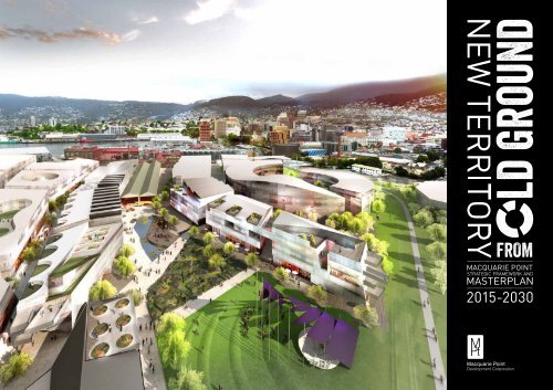
macquarie pointStrategic Framework& Masterplan2015-2030
ContentsForeword 021.0 Introduction 032.0 Masterplan 04New Territory from Old Ground3.0 Key Drivers 124.0 Mobility Network 305.0 Purpose 316.0 The Site 327.0 Regional Context 33The Southern Edge of the World8.0 People and Community 349.0 Urban Context 36Revealing the Past and Invigorating the Future10.0 Site Context 3811.0 Demographics and Market Context 44Aligning Expectations12.0 From Shared Vision to Masterplan 4613.0 Masterplan Implementation 49Bibliography and Thanks 50
Macquarie PointforewordFrom the Minister for State Growth -Hon Matthew Groom MPFrom the Chair,Macquarie Point Development Corporation -Mark RyanThere is no doubting the strategicimportance of the MacquariePoint site to both Hobart andTasmania.The Tasmanian Governmentrecognises the significantcontribution development of thesite can make from an economicand social perspective. TheGovernment has endorsed this<strong>masterplan</strong> as the next step inbringing Macquarie Point to life.Remediation and redevelopmentof the site—as articulated inthis <strong>masterplan</strong>—will stimulateHobart and Tasmania’s economyin a number of key sectors. It willalso increase job opportunities,encourage new industries andservices and—above all—becomea place where people aspire tolive, work and visit.I am pleased to present this<strong>masterplan</strong> to the public; I amexcited by the many opportunitiesMacquarie Point presents, and Ivery much look forward to seeingdevelopment at the site.Through its Shared Vision forthe Redevelopment of MacquariePoint, the Macquarie PointDevelopment Corporation hasset an overarching strategy toposition the site as a vibrant,liveable and sustainable place; aplace that optimises economic,social and environmentaloutcomes for Macquarie Point,complements its surrounds,enhances connectivity and offersa range of opportunities to live,work, invest and play.The public release of theStrategic Framework andMasterplan for Macquarie Pointbrings us one step closer tothat vision and sets us up wellto enter into the next phase ofthe project; that is, calling forexpressions of interest at theend of the 2015 calendar year.This long-term project will relyon astute planning, consideredstewardship, communityengagement and developerinterest; all of which will combineto deliver a diverse and distinctiveplace that welcomes visitors andresidents alike.Together with my fellowdirectors, I look forward withenthusiasm to the future, and Iinvite you to join us as, together,we embark upon the next stageof the Macquarie Point journeyto realise new territory from oldground.2
New Territory from Old Ground1.0 introductionIn recognition of the strategic importance of theMacquarie Point site to the future of both Hobartand Tasmania, the Tasmanian Government soughtfunding from Infrastructure Australia to remediatethe land. The Macquarie Point DevelopmentCorporation was established on 4 March 2013and was granted $45M to achieve its strategicobjectives.Following extensive consultation with stakeholdersand the community, the Macquarie PointDevelopment Corporation launched A SharedVision for the Redevelopment of Macquarie Point in2014. The Shared Vision articulates the aspirationsfor the site and gives a sense of what might beexpected in the future. This document has provideda launch pad from which the Strategic Frameworkand Masterplan (<strong>masterplan</strong>) has been developed.3
Macquarie Point2.0 MasterplanNew Territory from Old GroundThe Strategic Framework and Masterplan (<strong>masterplan</strong>)represents the first pass at translating the eight key driversinto a built form proposal (see page 12). It commits the bigmoves to paper and allows a glimpse of the possible futureform, look and feel of the development.The <strong>masterplan</strong> has been illustrated with a series of viewsthat demonstrate the main arrival and public open spaces onthe site. While these views capture the look and feel of thepublic realm and the scale, shape and form of possible futuredevelopment, they are intended to be indicative only and do notdepict actual built outcomes.The Goods Shed Plaza will become the gravitational heart ofMacquarie Point. The community will be drawn from EvansStreet into the Goods Shed, and people will pass through thisstructure into the open space beyond. The plaza is nestled atthe centre of the site, protected from the wind but open to thenorth sun.More broadly, the site will be characterised by a series ofpublic open spaces that will be arrayed across the site.4
New Territory from Old Ground1Evans StreetA convenient arrival point and alively destination across the day and night.2Red ShedA new café, bar or restaurant with an outdoor setting.Regatta Grounds3Goods ShedA new covered public space for Hobart,set within a rustic, industrial structure.4Goods Shed PlazaThe gravitational heart of Macquarie Point.56Goods Shed ParkA significant public park that can beenjoyed by all ages.Round HouseA new building with a sheltered courtyard at its centre.A celebration of a lost historic structure.9Cenotaph10Tasman Hwy7Pocket ParksSmall green spaces inserted within a networkof shared streets and lanes.11578Water to WaterPromenadeA contemporary native landscape settingat the edge of the city. A recreationalspace to be enjoyed by all ages.64891011Escarpment ParkA sinuous green spine connecting the citywith the Regatta Grounds and beyond.Memorial WalkA pathway leading from theEscarpment Park to the Cenotaph.Royal EngineersBuildingA place of community engagement.Davey StHunter St1Evans St737212Macquarie Wharf12ForecourtA space that precedes theWater to Water Promenade5
Macquarie Point2.0 MasterplanNew Territory from Old GroundView across Goods Shed Plaza and ParkThe gravitational heart of Macquarie Point6
New Territory from Old GroundView from Davey Street to intersection with Tasman HighwayAn invitation to enter the Round House7
Macquarie Point2.0 MasterplanNew Territory from Old GroundView down Evans Street toward intersection with Tasman HighwayA convenient arrival point8
New Territory from Old GroundView across Forecourt toward Red Shed and Water to Water PromenadeConnection to the river beyond9
Macquarie Point2.0 MasterplanNew Territory from Old GroundView from Evans Street into the Goods ShedAn invitation to enter10
New Territory from Old GroundUsesTo demonstrate the ground plane as a connected and active place within the site, a preliminaryarrangement of uses at ground floor level is represented in this plan.Regatta GroundsThe uses vary along the Evans Street frontage, signalling the mixed-use nature of the site. Aconcentration of retail spaces is arranged in the strand of built form that sits adjacent to theGoods Shed and extends deep into the site to enclose the Goods Shed Plaza and Park. Furtherground floor retail activation is arranged across the plan, albeit at a lower density.Commercial buildings are proposed adjacent to the boundary shared with the port, inconsideration of the possible requirement for some limited direct access into the restrictedport area. The site widths will accommodate laboratories in conjunction with offices or logisticsstorage. To some extent the size of land parcel can be adjusted within the strands of built form,offering a degree of flexibility in the plan.CenotaphTasman HwyThe residential offering is through smaller land parcels spread across the site. These areflexible enough to accommodate market demand, with a view to engaging with local developers,architects and construction contractors in their delivery. This will create a ‘neighbourhood withina neighbourhood’ feel.Given the potential for the Round House building to become a significant landmark, a hotel,tourism, residential or research and education use has been proposed.Car parking structures are located immediately behind the buildings on Evans Street, providingadequate car parking yet keeping cars to the periphery of the site as much as possible.Brooker AveThe arrangement of uses will be further informed by the ongoing site investigations anddiscussions with potential developers.Proposed ground floor activation:HotelPublicResidentialRetail (incl. Tourism & Hospitality)Commercial (incl. Office & Research)Davey StEvans StMacquarie WharfHunter St11
Macquarie Point3.0 Key Drivers123re-engaginghistoryWaterto WaterPromenadeCity toPoint andBeyondThe key drivers derived from the Shared Vision identifythe big moves that underpin the <strong>masterplan</strong>:01 Re-engaging History:Revealing the Past02 Water to Water Promenade:Reconnecting Cove to River03 City to Point and Beyond:A Civic Meander04 Shared Streets and Strands of Program:Compact Built Form and a Pedestrian Network05 A Vital City Quarter:An Array of Diverse Uses06 Silhouette:Profiling the Built Form07 Fertile Ground:New Landscapes on Old Ground08 Mobility Policy:Connectivity and Life in the StreetsThe application of each of these key drivers to the circumstancesof the site provides a clear structure upon which toconstruct a rich and layered narrative for the site.revealing the pastReconnecting Cove to RiverA Civic MeanderThe role of the Macquarie Point site has changedover time. Each successive use has marked it withevidence of occupation. Artefacts, traces andremnants of each stage of development can befound on the site. This gives us an opportunity tore-engage with this history and reveal layers fromthe past. This will enrich the collective meaningand memory of the site and firmly position the newdevelopment in the context of place.While the aspiration is to eventually be able to walkor cycle to the site on public waterfront pathwaysfrom as far away as Sandy Bay and Cornelian Bay,this chain of pedestrian pathways is broken by thesite itself. We have an opportunity to complete thisnetwork, and for the first time in decades, providea linkage between Sullivans Cove and the RegattaGrounds.Visible on approach from Davey Street, the newbuilding that will mark the footprint of the RoundHouse will act as a key portal into the site. A breakin the circular form will lead into a shelteredcourtyard, and a further break in the form willlead to a park beyond. This meandering pathwaycontinues toward the headland where it meets theWater to Water Promenade. From here the journeycontinues around the headland to the RegattaGrounds and beyond.12
New Territory from Old Ground4 5 6 7 8Shared Streetsand Strandsof ProgramA Vital CityQuarterSilhouettefertilegroundMobilityPolicyCompact Built Formand a Pedestrian NetworkA series of shared streets extends from EvansStreet toward the centre of the site. These northsouthstreets provide both a means of thoroughfareinto the site and definition to the linear strands ofbuilt form. The smaller and more intimate eastweststreets are discontinuous, and to some extentcan be adjusted to suit the preferred land parcelsize.An Array of Diverse UsesWhile the <strong>masterplan</strong> must be responsive toopportunities to accommodate different uses,some overarching strategies for the arrangementof uses across the site will assist in achievingdistinction between different parts of the site.Profiling the Built FormMacquarie Point is a low-lying site, located in acity that is understood from elevated views. Inparticular, the views afforded across the sitefrom the headland place great importance on theappearance of the roofscape. An architecturallyinteresting roofscape that pays due regard to theunobtrusive placement of mechanical plant ishighly desirable. Similarly, the spatial experienceof moving between buildings open at ground levelrequires consideration.new landscapes on old groundThe recognition of the natural shoreline willboth acknowledge and celebrate indigenousinhabitation, and inform an approach tolandscaping the site. The revegetation of thenatural ground will be approached differently tothe introduction of vegetation to the reclaimed covefloor. Pockets of parkland, both open and freeranging,and contained and constructed, will enrichthe experience of place.Connectivity and Lifein the StreetsMacquarie Point will become a place wherepedestrian movement is prioritised over otherforms of transportation. A number of pedestrianand cycle links will reconnect the site with itssurrounds. A network of shared streets and laneswill offer limited access to vehicular traffic andincorporate only a small amount of street carparking. With a view to the future, transportationcorridors will be reserved for the movement oflight rail and heavy vehicles.13
Macquarie Point3.0 Key Drivers1The role of the Macquarie Point site has changed over time. Each successive use has marked it with evidenceof occupation - artefacts, traces and remnants of each stage of development can be found on the site. Wehave an opportunity to re-engage with this history and reveal layers from the past; enriching the collectivemeaning and memory of the site and firmly positioning the new development in the context of place.Natural ShorelineThe natural shoreline, or the wider fringe that wasmodified by the action of the water, is thought tohave shifted with lower and higher tides, but isbelieved to have remained constant for severalthousand years. This edge has been lost with thesuccessive reclamation of land following Europeansettlement.This provides an opportunity to recognise thisaspect of place by tracing an approximation ofthe original shoreline across the site; therebyacknowledging and celebrating indigenousinhabitation, while also informing an approach tolandscaping the site.Round HouseThe original drawings and historic photographsthat record this largely-demolished structureindicate the ambition and sophistication of theoriginal Round House. They provide evidence of aonce-busy railyard and a substantial investmentin rail infrastructure. The footprint of this buildingtraces a large circle on the site that intersects withthe natural shoreline.By creating a new building of circular form inits place, we have an opportunity to recall thisstructure.Re-engagingHistoryRevealing the Past1 3 3 2 4 4 3 5 5 4 6 6 5 7 7 6 8 8 7 9 98 9Goods ShedThe Goods Shed sits with one end prominentlyon view in Evans Street, with its linear formextending toward the centre of the site. The fabricof the shed is robust, yet with a patina of age. Thetimber structure, hewn from imported Oregon,the corrugated iron cladding and the high windowsenclose a vast interior space.Preserving this structure provides an opportunityto open a thoroughfare from Evans Street into theheart of the site, and to create a covered publicspace that can be utilised year-round for all kindsof events. Only minor works are proposed to theexisting structure, and the rustic character will beretained. The end on the Evans Street frontage willbe modified to allow movement directly into theshed.The widening of the public open space to the westside of the Goods Shed will at once invite entry intothe site while providing a deeper view along thelength of the shed. Built form will interface withthe Goods Shed to the east side; the shed itselfbecoming a giant vestibule through which thesebuildings are entered.Red ShedThough smaller in footprint and more modest inscale and character, the Red Shed will also beretained. Located near the southernmost cornerof the site and distinguished by its red corrugatediron cladding and timber frame, the building isprominent on Evans Street. It also marks a pointof entry into the site. We have an opportunity toutilise this structure as a bar, a café, or perhapsa restaurant. A pocket park located immediatelybehind the structure will provide an open spacethat could be furnished with loose seating,umbrellas and picnic rugs.14
New Territory from Old GroundWe have an opportunity to re-engage with thishistory and reveal layers from the past.15
Macquarie Point3.0 Key Drivers2While the aspiration is to eventually be able to walk or cycle to the site on public waterfront pathways fromas far away as Sandy Bay and Cornelian Bay, this chain of pedestrian pathways is broken by the site itself.We have the opportunity to complete this network, and for the first time in decades, provide a linkagebetween Sullivans Cove and the Regatta Grounds.Waterto WaterPromenade111 222 333 444 5 6 7 8 95566778899ReconnectingCove to RiverA ForecourtThe open space that is framed by the IXL Buildingand the port tower building sits beyond the siteboundary yet performs a significant role. On theone hand it preserves an important sight linefrom Evans Street to Sullivans Cove, between theMacquarie Wharf No. 1 Shed and the MacquarieWharf No. 2 Shed from the southernmost cornerof the site. On the other hand, and looking in theother direction, it affords a wide view toward thesouthernmost corner of the site from a distantapproach. This gives prominence to the builtform located at this street edge and offers anopportunity to incorporate this space as a forecourtpreceding the Water to Water Promenade.A Pocket ParkA pocket park tucked in behind the Red Shed willcomplement the future use of this structure as anew venue by providing a public open space. Thepocket park will be animated with public seating,community gardens, pop-up events, street theatre,art installations, cinema and free wi-fi.Water to Water PromenadeThe Water to Water Promenade will be a sharedusepromenade that passes through the site,connecting Sullivans Cove to the Regatta Groundsand beyond. The promenade will be striking in itsvisual appearance and will provide a clear andlegible cycle and pedestrian connection throughthe precinct, incorporating generous pathways,public eating and public art. The Water to WaterPromenade will also tell an ecological water storythrough the integration of water-sensitive urbandesign strategies.16
New Territory from Old GroundThe chain of pedestrianpathways around theHobart waterfront isbroken by the site itself.We have the opportunityto complete this network,and for the first time indecades, provide linkagebetween Sullivans Coveand the Regatta Grounds.17
Macquarie Point3.0 Key Drivers3Visible on approach from Davey Street, the new building that will mark the footprint of the Round Housewill act as a key portal into the site. A break in the circular form will lead into a sheltered courtyard, anda further break in the form will lead to a park beyond. This meandering pathway continues toward theheadland where it meets the Water to Water Promenade. From here the journey continues around theheadland to the Regatta Grounds and beyond.A Sheltered CourtyardThe new Round House building will frame a distinctive public setting at its centre, further celebrating thehistory of the site and its important role in the development of Hobart. This space will be discovered uponapproach and is imagined as a green haven. It will be warmed by the sun and protected from the wind. Arange of features will reinforce a sense of history and provide a rich interpretive experience. The naturalshoreline will pass through the courtyard and beneath an archway on the far side. A further break in thebuilding form will provide a view toward the Cenotaph.City toPoint andBeyondAn Axial Marker along Davey StreetThe new building that will mark the footprint of the Round House will, by circumstance, terminate the viewalong Davey Street on approach to the site. The top of the building will sit below the shape of the undulatinghills that form a backdrop, retaining a visual reference to the greater landform. Set in landscape, a breakin the circular form will provide an invitation to enter into the central courtyard and allow the trace of thenatural shoreline to pass through.111 222 333 444 5 6 7 8 95566778899A Civic MeanderEscarpment ParkMacquarie Point is bounded in part by the headlandupon which the elevated formal landscape andCenotaph stand. The well-defined escarpmentthat describes the base of the headland provides abackdrop to the ground of the natural shoreline.Activated with new walks, themed gardens, playspaces and event areas, the Escarpment Park willprovide a contemporary native landscape settingon the edge of the city. It will be a recreationalspace to be enjoyed by all ages.The Escarpment Park will provide a safe,accessible and convenient cycle and pedestrian linkfrom the city to the Queen’s Domain and beyond.This link will connect with the Intercity Cycleway,which extends all the way to Claremont. It will bepossible to move from the Escarpment Park toMemorial Walk on a new pathway that leads to theCenotaph atop the headland. Taking a long-termview, a corridor will be held for future light rail.18
New Territory from Old GroundVisible on approach from DaveyStreet, the new building thatwill mark the footprint of theRound House will also mark akey portal into the site. A breakin the circular form will leadinto a sheltered courtyard, anda further break in the formwill lead to a park beyond.19
Macquarie Point3.0 Key Drivers4A series of shared streets extends from EvansStreet toward the centre of the site. These northsouthstreets provide both a means of thoroughfareinto the site and definition to the linear strands ofbuilt form. The smaller and more intimate eastweststreets are discontinuous, and to some extentcan be adjusted to suit the preferred land parcelsize.Shared Streetsand Strandsof ProgramCompact built form and apedestrian networkA New Elevation to Evans StreetEvans Street provides a well-defined edge anda convenient point of arrival at Macquarie Point.The frontage created by the built form is ofvaried setback and spacing, reminiscent of thearrangement of built form on the cove floor. Theopen space adjacent to the Goods Shed and theWater to Water Promenade also begins from thisstreet edge. The Goods Shed sits forward of allelse, marking a new threshold and inviting entryinto the site.1 2 3 4 5 6 7 8 93 4 5 6 7 8 9A Warp and Weft of Primary and Secondary StreetsThe shared streets that extend from Evans Street are scaled at a width that allows a number ofconfigurations that can be made open to one or two-way traffic, or closed to traffic altogether. Vehicularaccess will be limited to prioritise pedestrian movement. These primary streets run continuously acrossthe built area, whereas the secondary streets that run counter to these are discontinuous, and smaller andmore intimate in scale. These smaller streets might incorporate outdoor seating areas and steps to takelevel changes into account.Built Form and Street EdgesThe urban character that is envisaged forMacquarie Point is dependent upon the built formextending to the edges of each land parcel. Privateopen space might be located at the centre of aland parcel, or might take the form of a balcony orroof terrace, rather than a front yard or setback.In this scenario the product of the height of thebuilt form and the extent of site coverage gives ahigher plot ratio than allowed under the currentplanning scheme. Achieving this low-height, yetdense, development will depend upon integratingthe appropriate provisions into the planningframework.20
New Territory from Old GroundThe smaller and moreintimate east-west streets arediscontinuous, and to someextent can be adjusted to suitthe preferred land parcel size.21
Macquarie Point3.0 Key Drivers5While the <strong>masterplan</strong> must be responsive toopportunities to accommodate different uses, someoverarching strategies for the arrangement of usesacross the site will assist in achieving distinctionbetween different parts of the site.A Vital CityQuarter1 3 2 4 3 5 4 6 5 7 6 8 7 98 9An Array of Diverse Uses6 6 6 7 7 7 8 8 8 9 9 9A Cross-Section of Useson Evans StreetEvans Street will be a lively destination across theday and night. It will be a mixed-use main streetand a convenient point of arrival at MacquariePoint. Vehicular traffic will be slowed andpedestrian movement prioritised.The width of Evans Street allows a wide view of thebuilt form arranged along the street edge. There isan opportunity to curate a diverse range of uses toachieve an active frontage to the site. This activitywill be encouraged to spill out onto the footpath.Local Industry and EnterpriseThe proximity of the site to the working port andSullivans Cove positions it well to leverage thecompetitive advantages of the city and the state.Any increase in Antarctic-related research andsupply industries can be accommodated on the site,with the benefit of direct access to the port.With better connection to Sullivans Cove- a location that is already extremely wellfrequentedby visitors to Hobart - the site can bothcomplement existing uses and respond to newopportunities. In addition to a new offering of cafés,bars and shops, the site is well-located to providenew hotel and serviced apartment accommodation.Creative Industries andMaker SpacesGiven the long history of making on the MacquariePoint site, and the extensive community of artand craft practitioners in Hobart today, it seemsappropriate to provide small, loose-fit, flexibletenancies that can accommodate studios andworkshops, not just shop fronts. A changinglandscape of makers and start-up enterpriseswould bring the activity of a creative communityto Macquarie Point. This might provide furtherdistinction to Macquarie Point and yet anotherreason to visit.A Concentration of CommerceA concentration of active retail frontages willcreate heightened activity at certain places acrossthe site. In particular, the Goods Shed Plazathat will lie at the heart of the development willbe activated by cafés, bars and shops arrangedaround the perimeter of this open space. This willleave other parts of the site to be characterised byother uses; for instance a residential precinct witha spontaneous scattering of retail at the groundfloor level.This will also signal something of the nature of thedevelopment beyond the street edge. The groundplane will be care<strong>full</strong>y curated across the site toachieve clusters of activity and mixed uses withindifferent buildings. Above ground level the array ofuses presented along Evans Street might continue,more or less, in the linear strands of built form thatextend away from the street.22
While the <strong>masterplan</strong>must be flexibleand responsiveto opportunitiesto accommodatedifferent uses, someoverarching strategiesfor the arrangementof uses will assist inachieving distinctionbetween differentparts of the site.New Territory from Old Ground23
Macquarie Point3.0 Key Drivers6Macquarie Point is a low-lying site, located in a city that is understood from elevated views. In particular,the views afforded across the site from the headland place great importance on the appearance of theroofscape. An architecturally interesting roofscape that pays due regard to the unobtrusive placement ofmechanical plant is highly desirable. Similarly, the spatial experience of moving between buildings andacross open space at ground level requires consideration.SilhouetteProfiling the Built FormAn Evocative RoofscapeThe prominence of the roofscape suggests the opportunity for a vigorous silhouette across the site. Thearchitectural forms of the industrial sawtooth roof might be recalled, or the double gable form of theGoods Shed might be repeated elsewhere on the site. Light monitors or skylights, or roof terraces thatprovide private open space will further contribute to the silhouette. Unscreened mechanical plant andother services would, of course, detract.Placement of Buildings on theReclaimed Cove FloorThe buildings located on the cove floor aretypically rectangular forms that are placed withoutreference to a street grid or similar orderingdevice. Instead, the buildings are arranged by morepragmatic criteria - the requirement for access orthe alignment with the edge of the wharf. Thesebuildings are offset and unparallel, with viewsopening up and closing down depending upon theway they sit, one in relation to another.2 4 5 3 5 6 4 6 7 5 7 8 6 8 9 7 98 9Lifting the CornerRather than forming a continuous and flatsillhouette across the site, there are areas whereit will be appropriate for built form to lift a littlehigher. The southernmost corner lies in theshadow of the sight lines to and from the Cenotaph,allowing a more prominent form in this location.This corner is foregrounded by the forecourt, andthe built form on this site will be visible through thegap between the Macquarie Wharf No.1 Shed andthe Macquarie Wharf No. 2 Shed.Building FabricThe distinctive sandstone buildings that form anear continuous walled edge to the cove are incontrast to the utilitarian structures that comprisethe cove floor. The various piers, aprons and shedsare constructed from utilitarian systems andmaterials that fall within a palette of soft greys.It seems appropriate to continue this distinctionin some way in the new built form. Furtherconsideration will be paid to this in later editions ofthe <strong>masterplan</strong>.24
New Territory from Old GroundThe views afforded acrossthe site from the headlandplace great importance on theappearance of the roofscape.25
Macquarie Point3.0 Key Drivers7The recognition of the natural shoreline will both acknowledge and celebrate indigenous inhabitation, andinform an approach to landscaping the site. The revegetation of the natural ground will be approacheddifferently to the introduction of vegetation to the reclaimed cove floor. Pockets of parkland, both open andfree-ranging, and contained and constructed, will enrich the experience of place.A Native GardenThe approach to landscaping the site will take intoaccount the natural shoreline and its immediatesurrounds. The Escarpment Park will referencethe natural shoreline with a native botanicalgarden display. This sinuous green spine willprovide a range of passive recreational settings.A pedestrian and cycle link will connect the city tothe Regatta Grounds and beyond.A Constructed LandscapeA different approach to landscaping will betaken across the area of the reclaimed covefloor. Landscape elements will appear asobvious overlays to the constructed groundsurface. Beautiful features such as trees,gardens, furnishings and water elements will beexperienced as contemporary additions to theformer maritime and industrial setting.FertileGroundNew Landscapeson Old GroundGoods Shed PlazaThe Goods Shed Plaza is imagined as a new publicsetting for Hobart. It will be flanked by restaurantsand cafés with outdoor seating, complementing thepublic focus of the Goods Shed. It will be the place1 2 3 4 5 6 7 8 93 4 5 6 7 8 9to meet and be entertained. It will offer a changingprogram of events and activities as communityfestivals, markets, street theatre, live musicperformances and sculpture installations find anew home. It will become the principal destinationfor the site.Goods Shed ParkContinuing the sequence of open public spacesthat extends toward the headland, the Goods ShedPlaza will transition at its northern edge into theGoods Shed Park. A significant public park in thislocation will reinforce Macquarie Point as a placethat can be enjoyed by all ages. Families will enjoyunique regional play spaces, and young adults willbe attracted by outdoor recreational activities.These uses will be complemented by gardensand lawns with picnic and barbecue facilities. TheGoods Shed Park will also be accessible from thepedestrian and cycle paths that pass from the cityto the Regatta Grounds and beyond.26
New Territory from Old GroundThe recognition of thenatural shoreline will bothacknowledge and celebrateindigenous inhabitation,and inform an approachto landscaping the site.27
Macquarie Point3.0 Key Drivers8Macquarie Point will become a place where pedestrian movement is prioritised over other forms oftransportation. A number of pedestrian and cycle links will reconnect the site with its surrounds. Anetwork of shared streets and lanes will offer limited access to vehicular traffic and incorporate only asmall amount of street car parking. With a view to the future, transportation corridors will be reserved forthe movement of light rail and heavy vehicles.Prioritising Pedestrian and Cycle MovementThe site will be reconnected to its surrounds through the introduction of a number of pedestrian and cyclelinks. The Escarpment Park will connect the city to the Regatta Grounds and beyond, and similarly theWater to Water Promenade will connect Sullivans Cove to the Regatta Grounds. It will be possible to movefrom these pathways through the network of shared streets and lanes to the Goods Shed Plaza at theheart of the site.MobilityPolicyConnectivity and Lifein the Streets5 3 4 5 6 7 8 94 65 76 87 98 9A Street NetworkThe network of shared streets and lanes is scaledat a width that allows a number of configurations;they can be open to one or two-way traffic, orclosed to traffic altogether, over the course ofa single day. Access by emergency and servicevehicles will be possible through removablebollards. A series of public open spaces or pocketparks will sit within this pedestrian-orientednetwork.The Evans Street frontage offers a convenientarrival point. Some street car parking will beprovided along this edge, and thereafter thepenetration of vehicular traffic into the site will belimited. Cars will be held close to the periphery,with car parking structures located immediatelybehind the buildings on Evans Street. Only a smallamount of street car parking will be provided withinthe site.Access from the Tasman HighwayThe pedestrian and cycle link that connects thecity to the Regatta Grounds and beyond will bepositioned where the Tasman Highway entersDavey Street. Commuter bicycle parking andchange facilities will be provided at this location.Similarly, a metro bus stop is proposed given theclose proximity to the extensive network of routesthat pass through the city.A landscaped at-grade public car park is proposedadjacent to the escarpment, with access from theTasman Highway.A Long-term ViewConsideration has been given to a possible futurelight rail passenger service, and a corridor hasbeen reserved through the site from the headland,sweeping around the Round House building to jointhe Tasman Highway where it enters Davey Street.Similarly, and in light of the capacity of the deepwaterport and the <strong>full</strong>est potential of its role inthe economy of the city, a future corridor has beenreserved for heavy vehicle and rail access to theport from around the headland. This provides thefuture opportunity to shift port traffic away fromEvans Street should the frequency of vehicularmovement become unacceptable in this location.28
New Territory from Old GroundMacquarie Point will becomea place where pedestrianmovement is prioritised overother forms of transportation.29
Macquarie Point4.0 MOBILITY network12345BPPPPedestrian PriorityVehicular access at certain times.Pedestrian and CyclistNo vehicular access.One-Way TrafficNo Parking.One-Way TrafficWith Parking.Two-Way TrafficWith Parking.Emergency/Service LaneVehicular access at certain times.Corridors for potential mobility routesLight Rail, Port Traffic.Public Open SpacePedestrian areas.Bicycle FacilitiesStorage and Changerooms.Metro BusesTasman Highway Interchange.On-Grade Landscape ParkingEscarpment Parking (100-150 spaces).On-Grade Road ParkingEvans Street (72 spaces), Local Streets (50 spaces).Multi-storey Parking(Approx. 200-220 spaces).B22PP14P251PP111P31PCORRIDOR FORPOTENTIAL LIGHT RAILP11411P1P11P1215PP1P1P1121CORRIDOR FOR POTENTIALHEAVY VEHICLE - PORT TRAFFICAND PORT RAIL LINETOTAL PARKING SPACES: 422-492 approx.30
New Territory from Old Ground5.0 PurposeThe Strategic Framework andMasterplan outlines the conceptualapproach developed by the<strong>masterplan</strong>ning team and presentsthe <strong>masterplan</strong> in draft form. Thisdocument will be referred to the public,potential developers and investors,government agencies and other keystakeholders for feedback. This willallow for a coordinated approach to thefuture development of the site.The <strong>masterplan</strong> has been informed by a rangeof studies and investigations, including marketdemand analysis, contamination investigations,geotechnical surveys and traffic modelling.Placemaking and landscape architecture havealso played a significant role in formulating the<strong>masterplan</strong>. The <strong>masterplan</strong>ning team will beextended in the next phase to include experts insustainability, water sensitive urban design andindigenous culture.31
Macquarie Point6.0 the site‘...our settlement is formed about 16 miles from the mouth of the Derwent, one of the finest rivers I ever beheld...deep enoughand large enough to admit the whole navy of Great Britain at once. The shores rise gradually into hills covered with fine grassand noble trees - we are settled on the left hand side going up in a small cove where there is an island and an excellent run offresh water - the town is built on a gently rising plain.’Surveyor Harris, describing the camp quoted in Boyce, J. (2008) Van Diemen’s Land. (p.30)Measuring 8.6 hectares, the site liespartially on the reclaimed cove flooradjacent to the working port, andextends across what was once thenatural shoreline. The site can beoverlooked from the headland wherethe Cenotaph stands. Although just ashort distance from both Sullivans Coveand the Hobart CBD, the site is largelyabsent from the life of the city.For tens of thousands of years the site was a placeof habitation for the indigenous Muwinina people.Upon European settlement the role of the sitehas changed periodically. Beginning as a place ofcolonial endeavour, it soon gave way to a seriesof uses and infrastructure developments thatmirrored the development of the city of Hobart as ittransitioned from a colonial settlement, to a proudGeorgian town, to a city region of around 215,000people.Today the site is largely vacant, open space.Immediately adjacent to its boundary, the RoyalEngineers Building maintains its pivotal positionat the end of Macquarie Street. The site itself isoccupied by a concrete batching plant, a small,renovated office building and a scatter of sheds.Disused rail lines are splayed across the site,which is littered with steel brackets and metalparts that have loosened from the rails. Thereis little vegetation remaining. A sewer mainzigzags beneath the site to the nearby wastewatertreatment plant and a decommissioned cold storesits just outside the site’s perimeter. Movementthrough the site from Sullivans Cove around theheadland to the Regatta Grounds is prevented bytemporary fencing.32
New Territory from Old Ground7.0 Regional ContextThe Southern Edge of the WorldIn many respects, the Antarcticprovides the southern hemisphere itsdefining southern edge. The spatialjurisdiction of Tasmania extendshundreds of kilometres into theSouthern Ocean towards the Antarctic,placing the island firmly within thisexpansive oceanic context. At times, aharsh and inhospitable environment,a much-needed safe harbour canbe found in the lower reaches of theDerwent Estuary, the principal riversystem in south-east Tasmania.The Derwent Estuary offers a sequenceof protective harbours. The ‘inner’harbour, or Sullivans Cove as it haslong been known, is located at theoutflow of the mountain and nearbystreams. These freshwater courseswere originally known as HobartRivulet and Queen’s Domain Rivulet.International Gatewayto the AntarcticHobart is one of five international gateway cities tothe Antarctic. The city is also home to a range oflocal, national and international Southern Oceanrelatedorganisations.There is potential to attract other East Antarcticnations to locate their research and developmentprograms, and shipping and supply operations toMacquarie Point. In turn, this is likely to lead toincreased demand for hotel accommodation andbusiness events facilities.As noted in the Hobart City Council’sEconomic Development Strategy (2013-2018) ‘the Antarctic sector continues togrow as one of the City’s and the region’skey competitive advantages’.33
Macquarie Point8.0 place and communityPlace and community are fundamentalto sustainable economic development,and sustainable economic developmentis essential to creating liveablecommunities. In turn, liveablecommunities attract and retain highlyskilled, productive and creative peoplewho drive innovation and economicgrowth.From the earliest days following Europeansettlement, people of Tasmanian origin orassociation have had a remarkable history ofcreativity in the arts, science, law, technology andmany other fields of endeavour. Tasmanians havebeen responsible for a diverse range of inventionsand innovations, including early photographictechniques, a substantial improvement to thezinc electrolysis process, underground miningtechniques, the composite beam method for theconstruction of road bridges and a myriad more.Such creativity and innovation is evident in theintellectual and artistic output of the city today.The recent opening of MONA (Museum of Old andNew Art) at the Moorilla Estate in Berriedale hasescalated the profile of Hobart as an internationaldestination for the arts.34
New Territory from Old GroundResearch has found that creative industries willplay a great role in contributing to the economicprosperity of our nation, and this contribution isthought to be growing at a faster rate than thebroader economy. Creative industries have thepotential to contribute both in terms of output andemployment. Hobart offers the intimacy of a smallliveable city, while technology provides almostunlimited potential to connect with national andinternational networks. Macquarie Point couldprovide a distinctive and diverse neighbourhoodthat supports this kind of economic growth.Hobart offers a great diversity of cultural eventsthroughout the year, consolidating the state’sgrowing reputation as a centre for the creativearts and culture. The city as a place of researchand learning welcomes an influx of academicsand students each year, and the education sectoralone makes a significant contribution to the state’seconomy. As the capital city, Hobart offers anaccessible location from which to approach thestate’s natural assets. With an unparalleled naturalenvironment that is both remote and ‘unknown’,Tasmania is home to vast tracts of wilderness,pristine beaches and some of the purest air on theplanet.Just over one million 1 interstate andinternational visitors travel to Tasmaniaannually, with the majority visitinggreater Hobart. Currently MONAis the second most visited 2 tourismattraction (300,000) in Tasmania behindthe Salamanca markets. MacquariePoint can support this growing interestby providing further attractions andaccommodation for both short and longterm visitors.35
Macquarie Point9.0 Urban ContextThe richly-layered and fine-grained fabric of much of inner Hobart carries the collective memory of its social, cultural andeconomic past. The site at Macquarie Point will require a design response that is highly contextual and responsive to place.A Port CityThe site is located at the toe of the northernheadland that encloses Sullivans Cove. It liespartially on the reclaimed cove floor adjacent to theworking port, and extends across what was oncethe natural shoreline. The reclaimed cove floorextends around Sullivans Cove, providing a deepwaterport edge, the form and function of which aresignificant to the city.From many locations within Hobart, and in almostevery direction, the surrounding geographyprovides a means of orientation. The distantundulating landforms appear as a mountainousbackcloth to the city, and the outline of thisbackcloth can be traced to the point where itintersects with the plane of the reflective surfaceof the water. This outline, from wherever it istraced, is largely uninterrupted by built form.With the exception of Macquarie Point, thereclaimed cove floor is mostly experienced as asignificant civic space. Positioned closely to thereflective surface of the water, it emphasises thesignificance of the visual intersection of land andwater.The CBD and SurroundsThe Hobart CBD is structured by a grid of widestreets that come together with an elegantirregularity. The grid is care<strong>full</strong>y positioned in aprotected dip in the geography, with a number ofstreets leading to the reclaimed cove floor. Theelevated landform allows views down these streetstoward the water.The Queen’s Domain, Hobart’s premier urbanpark, is located to the north of the Hobart CBD.It comprises over 230 hectares of bushland andriverside setting, and offers a visual feature uponarrival in the city. It culminates in the headland thatdefines the northern side of Sullivans Cove.Sullivans Cove can be thought of as the urban andcivic focus of the city and the state. It is uniquelypreserved and well visited by locals and touristsalike.Aligned with Macquarie Street, the Cenotaphstands on this headland in a formal landscapesetting. This ceremonial ground at once affordsviews toward the mouth of the River Derwent, andacross the site below.The site is located in the space between the citygrid, Sullivans Cove and the Queen’s Domainwithout being strongly connected to any of thesesurrounding precincts. The activation of the sitewill assist in the activation of the Queen’s Domainand Regatta Grounds.36
New Territory from Old GroundNatural1891185718271897193719541970CurrentA Reclaimed EdgeModification of the natural shoreline in SullivansCove began soon after European settlement. In1821 the sand ‘spit’ linking Hunter Island to theshore was rebuilt as a causeway, now known asHunter Street. The island was soon occupied bysandstone buildings to the extent of the underlyingreef. By 1825 the Hobart Rivulet was redirectedalong Collins Street to enter the River Derwentbehind the causeway.Natural Shoreline1827185218911897193719541970Current ShorelineLand reclamation at Macquarie Point began fromas early as 1858, triggered by the constructionof new slaughter yards. This was the first of anumber of reclamations that over many yearstransformed the natural shoreline to extend thecove floor. A seawall was constructed in the 1880-90’s to enclose a basin that was later appropriatedas a refuse tip and progressively reclaimed toaccommodate growing port operations.Later, in 1915 the Hobart Rivulet was divertedagain, this time beneath the headland. The tunnelallowed the previous course of the rivulet tobe filled in, giving rise to Evans Street. Furthermassive reclamation works were undertaken from1950 to 1978, resulting in the current MacquarieWharf complex.An Opportunity to ConnectThe site is located between the CBD, Sullivans Coveand the Queen’s Domain without being stronglyconnected to any of these surrounding precincts.These precincts are, however, of such significanceto the public life of the city that their proximityalone provides enormous value. There is greatpotential to reconnect the site to these parts ofthe city and leverage off the existing cultural andrecreational facilities that exist there. In particular,the reclaimed cove floor that extends aroundSullivans Cove and the port activities that occurthere can be appreciated as an important civicsetting.The Built Fabric of the CoveDefined on one hand by the reclaimed cove floor,Sullivans Cove is also contained by the sandstonebuildings of early settlement. Both standalonebuildings, and buildings that form a nearcontinuous wall, provide a defining walled edgeto the cove. These buildings exist in contrast tothe utilitarian port structures – piers, aprons andsheds – that progressively formed the reclaimedcove floor. These characteristics of fabric, thesandstone city buildings and the utilitarian portstructures, provide distinction between the walland the floor of the cove, and the city and the port.37
Macquarie Point10.0 Site ContextRevealing the Past, and Invigorating the FutureThe location of the site between the CBD, theQueen’s Domain and Sullivans Cove, and theiterative nature of the development on the sitepresent both significant opportunities andconstraints that will need to be negotiated. Eachsuccessive development has profoundly markedthe site, leaving much and varied evidence of pastoccupation. This includes structures of heritagesignificance, traces of past built form, disusedrail lines and the possibility of sea walls and otherartefacts beneath the ground.The site extends across both the natural groundand the reclaimed cove floor, and shares aboundary with the working port. Although notlocated within the bounds of the site, Tasports’former cold store and the Royal Engineers Buildingare strategically important. Located at the toe ofthe headland beneath the Cenotaph, and behindthe row of historic buildings in Hunter Street, it willbe important to consider the impact of future builtform on the views to and from the Cenotaph, andalso the view of the sunrise from the Cenotaph onAnzac Day.OpportunitiesMuch of the inherent opportunity in the site lies in its proximity to the CBD, the Queen’s Domain andSullivans Cove, and the potential to reconnect to these significant public spaces. While not part of currentplans, there may also be an opportunity to connect to the waterfront in the future. The sheer size of thesite and the need to construct much of the necessary infrastructure and public realm anew presentsunique opportunities for the nature and type of development to come.Some of the history of the site is all but lost, and some is found in the form ofexisting structures and remnants of past infrastructure. The history of the sitemight be acknowledged through engagement with traces of lost history, thenatural shoreline and the Round House, and the integration of existing structuresand remnants, presenting the opportunity for a sensitive design response that ishighly attuned to the existing character of the site.Opportunities to connectOpportunities to reveal the past38
New Territory from Old GroundConstraintsSite investigations have revealed a range ofconstraints that have the potential to affectboth the design approach and the sequencing ofdevelopment on the site.Perhaps, most significantly, the statutory bufferaround the existing wastewater treatment plantlocated on an adjacent site prevents any sensitiveland uses within 400 metres. In view of thelimiting nature of this constraint, the <strong>masterplan</strong>presupposes that this facility be relocated. The<strong>masterplan</strong> recognises, however, that the existingsewer main that crosses the site may need to beretained in its current location.A further adjacency that requires carefulconsideration is the site boundary shared withTasports. The operation of the port cannot beconstrained by future development of the site,and nor would it be of benefit to propose noncompatibleuses or built form adjacent to the port.The ground contamination and geologicalconditions beneath the site are subject tocontinuing investigation; however, it has beenestablished that the site is founded on bedrock,albeit at depth.Constraints above groundConstraints below ground39
Macquarie Point10.0 Site ContextRevealing the Past, and Invigorating the FutureNatural ShorelineFor tens of thousands of years the site was a placeof habitation for the indigenous Muwinina people,presumably due to the ample supply of fresh waterfrom the local rivulets and the abundant shellfishthat could be found along the shores and reefs ofthe Derwent Estuary.The shoreline can be thought of as the widerfringe of land that was modified by the action ofthe water. While this line no doubt shifted withlower and higher tides, it is believed to haveremained constant for many thousands of years.In a comparatively short amount of time thenatural shoreline was lost following the successivereclamation of land that was initiated soon afterEuropean settlement in 1803.Historic Roof FormsHistoric photographs of the site and its surroundsreveal a character, which while still evident, wasonce much more strongly pronounced. A number ofsignificant early structures that have been lost inthe transition of this part of the city were industrialor utilitarian in nature and often displayed dynamicroof forms.A deep and wide warehouse building once extendedfrom the IXL Building all the way to MacquarieStreet. This building displayed an industrialsawtooth roof, the edges of which were cut tothe shape of the irregular site. This building wasdemolished to make way for the extension of DaveyStreet and the Hotel Grand Chancellor, which nowstands at 1 Davey Street.In addition, the Hobart Railway Station was asubstantial sandstone building at the front, witha large, light-weight roof behind, the shape ofwhich was derived from the configuration of therail lines it enclosed. The railway station was soldand redeveloped in the 1980s and sections of trackwere demolished for the extension of the TasmanHighway onto Davey Street and Macquarie Street.This type of built form is perhaps best evidenced bythe existing Old Woolstore building.40
New Territory from Old GroundRoyal Engineers BuildingThe Royal Engineers Building was constructed in1846 to complement the existing facilities. It is atwo-storey Tudor revival building. It was locatedwith the intent of providing a grand end to viewsdown Macquarie Street. Foregrounded by a formaldriveway, the building was approached fromMacquarie Street. It sat beside Edward Lord’sHouse (a large single-storey stone and brickresidence constructed in 1815) and the EngineersYard (a large open square flanked by buildings).The Engineers Yard was once a site of making,where a range of skilled trades was practised byconvicts. This included blacksmithing, carpentryand furniture making.Round HouseConstructed in 1914-15, the Round Houserepresented perhaps the most sophisticated of therailway infrastructure that was constructed on thesite. Designed for locomotives, the structure wasconfigured around an electrically-driven turntable,which could turn engines measuring up to 22metres long and weighing up to 120 tons. Thirty ingroundpits radiated out from the central turntableto facilitate engine maintenance. The building alsoaccommodated lecture theatres and classroomsfor staff, sleeping quarters for drivers, and diningand bath rooms.Goods ShedConstructed in 1914-15, the original section of theGoods Shed measures approximately 90 metreslong and 23 metres wide. It accommodatedrail lines and platforms for the purposes oftransporting goods to and from the railyards.Trains entered from the northern end and ranthrough the centre of the shed. Sliding doorslocated on the side of the shed provided access toloading bays; four on the eastern side and six onthe western side.The Goods Shed was constructed with importedOregon timber piers, deck and posts, although theoriginal timber piers were replaced with concreteblocks in 1945. It retains its original corrugatediron cladding. The roof is formed as two parallelgables, which are fitted with skylights andsupported by a line of king posts through the centreof the building.The shed underwent a major expansion in 1946-49,bringing the building to its current dimensions. Itwas converted in the 1980s to a transit warehousefor truck use, when six recessed loading dockswere cut into the floor on each platform to allowtrucks to back directly into the shed.The Goods Shed is in reasonable condition,although it requires maintenance work. Theconcrete and timber structure retains its structuralintegrity. While the Goods Shed is of heritagesignificance at state and local levels, there is apersuasive argument to remove the addition at thenorthern end.Red ShedThe origin of the Red Shed is unknown; however, itis believed to date from the late nineteenth centuryto the early twentieth century. The Red Shed istypical in scale to the numerous small goods shedbuildings which were once located throughoutTasmania. Not unusual for its time, it is thoughtto have been relocated from its original site andre-established at the railyards in 1953. It measuresapproximately 11 metres long and seven metreswide.The structure and timber-framed trusses of theRed Shed are in fair condition, while the building’scondition overall is poor. Depending upon itseventual use it may be that corrugated ironcladding, doors, framing and floor will need to bereplaced.Assessment concludes that this building is ofheritage significance at local level. If necessarythe Red Shed could again be relocated to a new sitewithin Macquarie Point.FabricAlthough largely vacant, there is a rustic characterto the site that recalls its industrial and maritimepast. This is evident in the splaying of the disusedrail lines across the site and the benching of thesite at different levels in relation to the rail lines.The robust timber-framed structures and theguard rails and high visibility indicators that havebeen roughly fixed to these structures are evidenceof a utilitarian past. There are many finer remnantsthat also bring great character to the site, includingpaint markings and cast iron grates.41
Macquarie Point10.0 Site ContextRevealing the Past, and Invigorating the FutureAppreciation of LandformFrom many locations within Hobart, and in almost everydirection, the surrounding geography provides a means oforientation. It is important to recognise that these views to, fromand across the site are dynamic - that is, the views vary as onemoves around the city.Of greatest importance are the view from the Cenotaph outtoward the mouth of the River Derwent, the views across thecove toward the Cenotaph and the view of the sunrise from thegrounds of the Cenotaph on Anzac Day.View from CenotaphThe view from the Cenotaph toward the mouth of the RiverDerwent allows a view of the water plane that extends tothe horizon, and the intersection of the outline of the distantlandforms with the water plane. This view is framed by DroughtyPoint and Long Point, with Betsey Island visible in the distance.The edge of the headland, the reclaimed cove floor and theexisting structures on the Tasports site define the foregroundand frame the bottom edge of the view.Views to CenotaphThe sense of enclosure within the inner harbour is providedby the headlands on either side of Sullivans Cove. This spatialreading depends upon maintaining the views across the cove toeach headland. More specifically, the views that will potentiallybe impacted by development on the Macquarie Point site willbe those available from Macquarie Street, the forecourt to thePrinces Wharf No. 1 shed, the paddock between the PrincesWharf No. 1 shed and Princes Wharf No. 2 shed, RunnymedeStreet, and the open space to the east end of the Princes WharfNo.2 shed.View of Anzac Day SunriseThe Cenotaph is the site of the traditional Anzac Day dawnservice in Hobart, which serves as a reminder of the dawnlanding on Gallipoli on 25 April 1915. The crowd that gathersaround the Cenotaph can experience a clear view of the sun as itrises over Mornington Hill and Mount Rumney in the distance.42
New Territory from Old GroundDevelopment EnvelopeCareful analysis of the views to and from the Cenotaph, and theview of the sunrise from the grounds of the Cenotaph on AnzacDay has led to the definition of a three-dimensional developmentenvelope. Development contained within this envelope will havelimited impact on the existing views.Area of site affected by views to CenotaphArea of site affected by views from CenotaphView of Anzac Day sunrise43
Macquarie Point11.0 Demographics and Market ContextAligning ExpectationsLarge-scale urban renewal is along-term undertaking and must begrounded in economic and marketrealities in order for the vision tobe realised. All modelling in the<strong>masterplan</strong> has been based onthorough research of the demographicsand market context.Demographic and Economic ObservationsPopulation GrowthPopulation growth in the greater Hobart region over the period 2001 to 2011 was 0.9 per cent per annum,or 1,870 persons per annum, which was lower than that recorded for Australia as a whole at 1.5 per centper annum.Population forecasts prepared by the Department of Treasury and Finance project that under a mediumgrowth scenario, the greater Hobart region would grow by 0.76 per cent per annum, or around 35,720persons over the 2014 to 2034 period, which is equivalent to 1,786 additional residents annually.Economic ObservationsTasmania continues to lag behind all other Australian states on economic indicators, with below-averageeconomic growth and higher than average unemployment levels.Despite generally unfavourable economic conditions, the development program taking place in the Hobartinner city area (including Parliament Square, various university projects, the Myer redevelopment and theRoyal Hobart Hospital), the rate of refurbishment is the highest in the city’s history.STRATEGIC FRAMEWORK:DEMOGRAPHIC AND MARKET CONTEXTDEMOGRAPHIC AND ECONOMIC OBSERVATIONSPopulation GrowthPopulation growth in the Greater Hobart region over the period 2001 to 2011 was 0.9% perannum or 1,870 persons per annum which was lower than that recorded for Australia as a whole(1.5% per annum).As can be seen in the figure below, population forecasts prepared by the Demographic ChangeAdvisory Council (DCAC) forecast that under a medium growth scenario (as defined by DCAC) theGreater Hobart region would grow by 0.7% per annum or around 27,180 persons over the 2013to 2031 period, equivalent to 1,510 additional residents annually.275,000Greater Hobart SD: Estimated Resident Population Scenarios265,000255,000245,000235,000225,000215,000205,0002013 2016 2021 2026 2031Low Scenario Medium Scenario High ScenarioGreater Hobart SD: Estimated Resident Population Scenarios44
New Territory from Old GroundMarket OverviewResidentialBeyond inner Hobart, market demand is stronglyin favour of detached dwellings, reflecting historicdevelopment patterns and buyer and developerpreference. Unit/townhouse prices are typicallyhigher in inner and West Hobart (see figure below),where there is greater market acceptance ofmedium-high density dwelling types, with newunits/apartments typically achieving around$5,300/m² and up to $6,300/m² for those with waterForecasts indicate that there will be demand forMarket demand analysis suggests that under aviews.approximately 14,580m² of office floor space at mooted hotels within the CBD under consideration.base case scenario, over the period 2011 floorspace to 2031 at Macquarie Point is estimated to be approximately 7,140sqm over the period toacceptance of medium-high density dwelling types, with new units / apartments typicallyMacquarie Point over the period to 2031 (under a Subject to market demand and timing, MacquarieWith forecast population growth and an ageing there could be demand for an additional 112,000m²2031, equivalent base to case 30% scenario), of Hobart equivalent CBD demand. to a 30 per centachieving around $5,300/sqm and up to $6,300/sqm for thosepopulation, demand for unit/apartment living is of retail with floor water space views.Point can capitalise on its strategic location inacross the greater Hobartmarket share of Hobart CBD office demand over attracting future accommodation uses as part of itsexpected to strengthen. Macquarie Point has the region (refer to the figure below for retail store typeWith forecast population growth and an ageing population, demand for unit / apartment living isGreater this period. Hobart SD: Total Retail Floorspace Demand (sqm) development.opportunity to capitalise on its inner city location breakdown) of which the Hobart CBD may captureexpected to strengthen. Macquarie Point has the opportunity to capitalise on its inner city700,000and proximity close to the water, which will appeal approximately 23,800m² (or 21 per cent). Under thislocation and waterfront proximity which will appeal to substantialto substantial portions of the expected unit/same scenario,portionsdemandof the expectedfor retailunitfloor/space at 600,000apartmentapartmentbuyerbuyermarket.market.Macquarie Point is estimated to be approximately 500,0007,140m² over the period to 2031, equivalent to 400,000 30It It is is estimated that that there there will will be be demand for for approximately 475 units / apartments at Macquarieper cent of Hobart CBD demand.300,000Point approximately over the 2011 475 units/apartments to 2031 period under at Macquarie a base case scenario (as defined by AEC Group),equivalent Point over to the a 6% 2011 market to 2031 share period of Greater under a Hobart base unit / apartment demand to 2031.200,000case scenario (as defined by the AEC Group),100,000equivalent to a six per cent market share of greaterHobart unit/apartment Greater demand Hobart: to Apartment 2031. / Townhouse Median Price $$600,000$500,000$450,000RetailBetween 2012 and 2013 there was little supply ofnew retail in the Hobart market; however, forecastpopulation growth and greater visitor trips willhave a positive impact on demand for retail floorspace in Hobart in the coming years. There remainsa significant opportunity to capitalise on MacquariePoint’s cove floor location in the development ofnew retail space in the longer term, particularlynew cafés and restaurants.$531,500$565,000sqm0OfficeVacancy rates have declined over the 2013 to 2014period (9.4 per cent to 7.3 per cent); however, thecompletion of Parliament Square (20,000m² ofoffice) in late 2015 should see a spike in this rate.The Tasmanian Government continues to be themain office tenant in the Hobart CBD. A-Gradeoffice rents tend to achieve between $225 and$350/m² in the Hobart CBD.2013 2016 2021 2026 2031Groceries & Specialty FoodClothing & AccessoriesFood and Liquor CateringFurniture, Houseware & AppliancesHotelThe outlook for hotel performance overall isone of demand, growing at nearly twice the paceof supply over the next three years. Hobart iscurrently one of the best performing capital citiesin terms of hotel performance, largely led by thecontinued popularity of MONA, strategic marketingby Tourism Tasmania and consistent corporateand government demand 3 . Currently there areover 300 rooms under construction (MacquarieWharf and The Icon Complex) with a number offloorspace at Macquarie Recreation & Entertainment Point is Equipment estimated to Garden be & approximately Hardware Goods 7,140sqm over the period to500002031, equivalent Other to Goods 30% & Personal of Hobart Services CBD demand.60000Based on supply and demand analysis,it is estimated that Macquarie Pointmay require in the order of 60,880m² ofresidential, retail and office floor spaceover the period to 2031 under a basecase scenario.Macquarie Point: Summary NLA Demand at 2031Median Sale Prices ($)Retail$400,000$300,000$200,000$100,000$0$295,000$252,500$210,000$335,000$194,000$255,000$238,000$288,650$292,500$319,0001br 2br 3brInner Hobart West Hobart North Hobart South Hobart East HobartBetween 2012 and 2013 there was little supply of new retail in the Hobart market, however40000Office Greater Hobart SD: Total Retail Floorspace Demand (sqm)Vacancy700,000rates have declined over the 2013 to 2014 period (9.4% to 7.3%), however the30000completion of Parliament Square (20,000sqm of office) in late 2015 should see a spike in this rate.600,000The Tasmanian 500,000 Government continues to be the main office tenant in the Hobart CBD. A Gradeoffice 400,000 rents tend to achieve between $225 - $350/sqm in the Hobart CBD.sqm300,000Forecasts indicate that there will be demand for approximately 14,580sqm of office floorspace at200,000Macquarie Point over the period to 2031 (under a base case scenario), equivalent to a 30%100,000market share of Hobart CBD office demand over this period.Hotel002013 2016 2021 2026 2031Residential Retail CommercialGroceries & Specialty FoodRecreation & Entertainment EquipmentOther Goods & Personal ServicesFood and Liquor CateringThe outlook for hotel performance overall is one of demand growing at nearly twice the pace ofClothing & AccessoriesFurniture, Houseware & AppliancesGreater Hobart: Apartment / Townhouses Median Price $ supply over Greater the next Hobart 3 years. SD: Total Hobart Retail is currently Floorspace one Demand of the best (sqm) performing capital cities in Macquarie Point: Summary NLA Demand at 2031Garden & Hardware Goodsterms of hotel performance. With little to no supply additions forecast in Hobart in the comingsqm GFA2000010000Low Base High45
New Territory from Old GroundThe guiding principles articulated in the Shared Vision capture the qualitative outcomes the communityis seeking. These have been translated into a series of spatial strategies that will be employedto develop the site. These spatial strategies in turn link to the eight key drivers that underpin the<strong>masterplan</strong> and - importantly - connect to the original Shared Vision guiding principles as shown below.1 2 3 4 5 6 7 8 9Shared Vision Spatial Strategies Key Drivers of the Spatial MasterplanInvolve a mix of usesAre people focusedPromote inner city livingAre well-connected to the broaderHobart environmentRespect the site’s historyIncorporate principlesof sustainabilityDo not prejudice port activitiesComplement, not compete withactivity in the CBD and greater HobartDeliver major socio-economicbenefits to Hobart and Tasmania1 2 3 4 5 6 7 8 91 2 3 4 5 6 7 8 91 2 3 4 5 6 7 8 91 2 3 4 5 6 7 8 91 2 3 4 5 6 7 8 91 2 3 4 5 6 7 8 91 2 3 4 5 6 7 8 91 2 3 4 5 6 7 8 9RECONNECT TOTHE WATERFRONTINVEST IN PUBLICOPEN SPACEPRESERVE BUILT, CULTURALAND NATURAL HERITAGECONSTRUCT A NEWSTREET NETWORKMAINTAIN EXISTING CONNECTIONSAND FORGE NEW ONESCREATE A DISTINCTIVENEIGHBOURHOODRESPOND TO NEEDS OF LOCALINDUSTRY AND ENTERPRISE11 22 33 44 55 66 77 88 91 2 3 4 5 6 7 8 9 91 2 3 4 5 6 7 8 90102030405060708Re Engaging History:Revealing the Past11 22 33 44 55 66 77 88 911 22 33 44 55 66 77 88 9991 2 3 4 5 6 7 8 91 2 3 4 5 6 7 8 91 2 3 4 5 6 7 8 9Water to Water Promenade:Reconnecting Cove to River11 22 33 44 55 66 77 88 911 22 33 44 55 66 77 88 9991 2 3 4 5 6 7 8 91 2 3 4 5 6 7 8 91 2 3 4 5 6 7 8 9City to Point and Beyond:A Civic Meander1 2 2 3 3 4 4 5 5 6 6 7 7 8 8 9911 22 33 44 55 66 77 88 991 1 2 3 4 5 6 7 8 91 2 3 4 5 6 7 8 9Shared Streets and Strands of Program:High Density and a Fine Network11 22 33 44 55 66 77 88 991 2 3 4 5 6 7 8 91 2 3 4 5 6 7 8 91 2 3 4 5 6 7 8 91 2 3 4 5 6 7 8 9A Vital City Quarter:An Array of Diverse Uses11 22 33 44 55 66 77 88 91 2 3 4 5 6 7 8 91 2 3 4 5 6 7 8 991 2 3 4 5 6 7 8 91 2 3 4 5 6 7 8 9Silhouette:Profiling the Built Form11 22 33 44 55 66 77 88 991 2 3 4 5 6 7 8 91 2 3 4 5 6 7 8 91 2 3 4 5 6 7 8 9Fertile Ground:New Landscapes on Old Ground1 2 2 3 3 4 4 5 5 6 6 7 7 8 8 991 2 3 4 5 6 7 8 91 1 2 3 4 5 6 7 8 9Mobility Policy:Connectivity and Life in the Streets47
Macquarie Point12.0 from Shared Vision to <strong>masterplan</strong>Macquarie PointNew Territory from Old GroundHobart is both home to, and a compelling destinationfor, a wide range of curious and creative people. Somehave chosen never to leave the island, while others havetravelled far and returned with new insights. Some passthrough, and others choose to make Hobart their home.Overall, the city enjoys a rich concentration of intellectand creative endeavour.Macquarie Point can contribute to this already compellingcity by offering a diverse and distinctive place that meetsthe expectations of those who choose to live, work, investand play here. It will also draw others to visit over the shortor long term.Macquarie Point will continue to evolve over time, andwith careful stewardship will become a place that isappropriated by all. Together we will realise new territoryfrom old ground.Macquarie Point can become:• A place that is grounded in the rich and layered history of the site and thecity, by both recalling and celebrating the original indigenous habitation andpreserving European cultural heritage.• A place that is seamlessly connected with the city by re-establishing the abilityto move continuously around the waterfront.• A place where the public realm affords pedestrian priorityover vehicular traffic.• A place that is a diverse city quarter that is chosen by a broad section of thecommunity as the preferred location in which to live, work, learn and play.• A place that supports innovation and creativity by providing accommodation foremerging businesses and other endeavours.• A place that responds to the needs of local industry and enterprise to delivermajor socio-economic benefits to Hobart and Tasmania.• A place that is realised through engagement with the local design andconstruction industry.48
New Territory from Old Ground13.0 Masterplan ImplementationStaged Delivery of theMacquarie Point DevelopmentThe development of Macquarie Pointis expected to be delivered in stagesover more than 10 years. The preciseperiod of time will be determined bythe prevailing economic conditions andmarket demand for the various landuses articulated in the <strong>masterplan</strong>.The role of the <strong>masterplan</strong> is to guidethe market-driven delivery of theproject. As illustrated in the adjacentdiagram, there are a number of stagingoptions for the project. These will belargely influenced by a combination of:• Ground conditions(environmental and geotechnical)• Infrastructure investment; and• Market demand.Given the staged, long-term nature of anticipatedon-site developments, it is important to ensurethe <strong>masterplan</strong> is designed in such way that itfacilitates the activation of Macquarie Point before,during and after delivery of the developmentoutcomes.The corporation recognises that bricksand mortar alone will not deliver avibrant, active space that attractslocals and visitors alike.Therefore, the corporation is working with the<strong>masterplan</strong>ning team’s placemaking experts toconsolidate a range of short and long-term peoplefocusedactivation projects that will effectivelysupport staged development of the MacquariePoint site and deliver a range of opportunities forthe local community to be involved and engaged.Stage OneThe Macquarie Point Development Corporationis targeting an Expression of Interest process tocommence in December 2015. It is expected thatthe opportunity for one or more developments willemerge through this process. It is imperative thatthese developments are economically sustainablein their own right. Initial interest, together withpublic feedback, will inform the further staging ofthe project.The <strong>masterplan</strong> will inform the Expression ofInterest process and enable discussions withpotential developers. It is designed to be flexibleand responsive to market demand. Land parcelscan be sized to offer opportunities for localdevelopers, architects and builders to invest in theredevelopment, while also offering the opportunityfor larger developments.While it is difficult to predict the location of thefirst development on the site, it is broadly expectedthat early development will be concentrated in andaround the Goods Shed. This strategy, in concertwith pre-construction activation strategies, willestablish the Goods Shed and the Goods ShedPlaza as the gravitational heart of Macquarie Pointfrom the outset.Indicative Development StagesStage 8Stage 7Stage 3Stage 9Stage 5Stage 4Stage 10Stage 6Stage 1Stage 249
Macquarie PointBibliographyThanksBoyce, J. (2008). Van Diemen’s Land.Hobart City Council (2007). Hobart 2025:A Strategic Framework.Hobart City Council, (2007). Sullivans CovePlanning Scheme 1997.Hobart City Council, (2013). Hobart City CouncilEconomic Development Strategy 2013-2018.Hobart City Council, (2010). Hobart 2010 PublicSpaces and Public Life - A City with People in Mind.Hobart City Council, (2013). Queen’s DomainMasterplan 2013-2033.Hobart City Council, (2014). Sullivans CovePlanning Scheme 1997.Heart Foundation, (2009-0210). Healthy by Design:A Guide to Planning & Designing.Environments for Active Living in Tasmania.Lyons Architects, (2007). UTAS Masterplan2007: Sandy Bay and Hobart City Campus. Vol. 2.University of Tasmania.Sullivans Cove Waterfront Authority, (2008).Response to Hobart Railyards Urban DesignStrategy.Tasmanian Government, (2008). Hobart RailyardsUrban Design Strategy.Tasmanian Government, (2010). Sullivans CoveMasterplan.Tasmanian Government, (2010). Hobart: A WorldClass Liveable Waterfront City.Tasmanian Government, (2011). Hobart Capital CityPlan 2011-2040.Tasmanian Government, DEDTA (2012). MacquariePoint Railyards Site Redevelopment: InfrastructureAustralia Submission.Tasmanian Government, (2014). Infill DevelopmentWithin Greater Hobart Stage 1 Final Report.Tasmanian Polar Network and Tasmania MaritimeNetwork, (2008). Tasmanian Polar Network andTasmania Maritime Network Response to HobartRailyards Urban Design Strategy.The Macquarie Point Development Corporationand the <strong>masterplan</strong>ning team acknowledgethe contribution of a range of stakeholdersand partners who have generously contributedtheir views and time to the development of the<strong>masterplan</strong>. Your combined input is grate<strong>full</strong>yacknowledged.MASTERPLANNING TEAMJohn Wardle ArchitectsLevel 2, 25 Rokeby StreetCOLLINGWOOD VIC 3066(03) 8662 04001 + 2 Architecture31 Melville StreetHOBART TAS 7000(03) 6234 8122Taylor Cullity Lethlean385 Drummond StreetCARLTON VIC 3000(03)9380 4344Inspiring Place210 Collins StreetHOBART TAS 7000(03)6231 1818Village WellLevel 1, 134 Flinders StreetMELBOURNE VIC 3000(03) 9650 0080Macquarie Point Development Corporation, (2013).Macquarie Point Historical Summary.Macquarie Point Development Corporation, (2014).A Shared Vision for the Redevelopmentof Macquarie Point.Macquarie Point Development Corporation, (2014).Corporate Plan 2014-2015.Rathjen, Prof. P., (2007). Open to Talent: StrategicPlan 2012 - Onwards. University of Tasmania.Tasmanian Ports Corporation, (2014). AnnualReport 2013-2014.Village Well, (2015). Macquarie Point Place Story.Village Well, (2015). Macquarie Point ActivationGuide.Leigh Woolley Architecture & Urban Design224 Murray StreetHOBART TAS 7000(03) 6231 1711NAVIRELevel 3, 330 Little Collins StreetMELBOURNE VIC 3000(03) 9015 4500Footnotes1 Source: Tourism Tasmania Fast Facts, December 20142 Source: Tourism Tasmania MONA Visitor Profile, September 20143 Source: CBRE Hotels – Australian Hotel Market Update February 201550
New Territory from Old Ground51
GPO Box 251, Hobart Tasmania 7001www.macquariepoint.comABN 92 657 409 841© Macquarie Point DevelopmentCorporation - June 2015IMAGE CREDITSPage 3Aerial view of the city of Hobart - Tasmanian PortsCorporation Pty LtdPage 14Goods Shed - John Wardle ArchitectsPages 26 & 27Plaza - Landscape Projects LtdSculpture - John Wardle ArchitectsPicnic - Sonsbeek National Historisch MuseumFootpath - Sophie MerkensGirl in park - logosstockDark Mofo - Sourced from Dark MofoAerial view of the city of Hobart -Tasmanian Ports Corporation Pty LtdCenotaph and War Memorial, Hobart -E Doddridge (Wikimedia Commons)Salamanca - Robyn JayMarket - Stephanie Anne BrownRed Shed - Taylor Cullity LethleanPage 15Evans Street - John Wardle ArchitectsPages 16 & 17Café - Matthew BlackburnPromenade - JaysonPhotographySculpture - Trevor MeinHobart pier - Leigh WoolleyPages 18 & 19Cyclists - cheng8Native grasses - Sophie MerkensPages 20 & 21Laneway - Brianna LaugherWooby’s Lane - 1+2 ArchitectureWooby’s Lane - Panoramio -Photo by Chris BrazzelliPages 22 & 23Ice core - Peter Rejcekand the National Science FoundationStudio - Creative Spaces TMCafé - AlphaCafé - AlphaOutdoor café - Trevor MeinPages 28 & 29Cyclists - Steven VanceLight rail - Fanch The SystemShare car - Shattuck HearstShared space - Landscape Projects LtdPages 32 & 33Aerial view of Cenotaph - Sourced fromTasmanian Archive and Heritage OfficeAerial view of Macquarie Point - Sourcedfrom the Sullivans Cove Waterfront AuthorityPainting of Macquarie Point and Pier, Henry Gritten- Tasmanian Museum and Art GalleryAerial view of Hobart docks - Sourcedfrom Tasmanian Archive and Heritage OfficeBirdseye view of Hobart, Tasmania - Sourcedfrom Allport Library and Museum of Fine Arts,Tasmanian Archive and Heritage OfficeDerwent Estuary - Leigh WoolleyAurora Australis - AustralianBroadcasting CorporationPages 34 & 35Tasman Bridge - ZetterDark Mofo - Sourced from Dark MofoPerformance - John Wardle ArchitectsTSO - Sourced fromTasmanian Symphony OrchestraPages 36 & 37Aerial view of Macquarie Point - Aerial InspectionsMacquarie Wharf - John Wardle ArchitectsRailyards - John Wardle ArchitectsTrack lock - John Wardle ArchitectsPages 38 & 39John Glover (1767-1849) Mount Wellingtonand Hobart Town from Kangaroo Point 1834 -Purchased by the Tasmanian Museum and ArtGallery and National Gallery of Australia 2001Roofscape - Michael CoghlanRoyal Engineers Building - Leigh WoolleyRailway roundhouse built in 1915 -Tasmanian Archive and Heritage OfficeGoods Shed - Austral Tasmania Pty LtdRed Shed - Leigh WoolleyTrack pieces - John Wardle ArchitectsPages 40 & 41Sketch - Leigh WoolleyPages 42 & 43Cyclists - Leigh WoolleyCity of Hobart - Nick OsbornePages 24 & 25Shed interior and Retlas - John Wardle ArchitectsRoofscape - Leigh WoolleyWhiskey barrels - gegeonlineWoodturning - Tasmanian Craft FairCollectables - Claudio Arnese