Town of Weston, CT Home Page
Town of Weston, CT Home Page
Town of Weston, CT Home Page
- No tags were found...

Create successful ePaper yourself
Turn your PDF publications into a flip-book with our unique Google optimized e-Paper software.
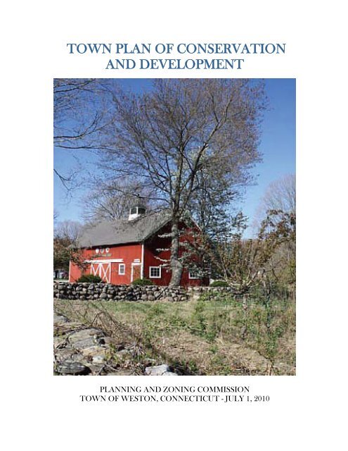
TOWN PLAN OF CONSERVATIONAND DEVELOPMENTPLANNING AND ZONING COMMISSIONTOWN OF WESTON, CONNE<strong>CT</strong>ICUT - JULY 1, 2010
<strong>Town</strong> <strong>of</strong> <strong>Weston</strong>Plan <strong>of</strong> Conservation and DevelopmentPrepared by the <strong>Weston</strong> Planning & Zoning Commission:Stephan Grozinger, ChairmanJane Connolly, Vice ChairmanDonald L. SaltzmanDavid AllenRidge YoungKatie GregoryJoe LimonePaul HeifetzDr. Dan GilbertWith the assistance <strong>of</strong>:Joan Lewis, Administrative AssistantVictoria Farr, Land Use InternTracy Kulikowski, Land Use DirectorDr. J. Thomas Failla, Conservation CommissionerJuly 1, 20102
Table <strong>of</strong> Contents<strong>Page</strong>Introduction 4Natural ResourcesTrees 5Water 6Sub-Watersheds Map 8Open Space 10Land Use Map 11Economic Development<strong>Home</strong> Occupations 12The Center <strong>of</strong> <strong>Weston</strong> 12Fromson-Strassler 17Other Economic Development Considerations 19Housing DevelopmentGenerally 20Large Houses and Accessory Uses 21Accessory Housing 22Hydrants Map 23Senior Housing 24Affordable Housing 25Community FacilitiesRecreation 25Other Facilities and Infrastructure 27TransportationPedestrian Facilities 29Bicycles 29Public Transportation 31<strong>Weston</strong>’s Roads 31Traffic Volume 33Implementation 33AppendicesAppendix I—Questionnaire 35Appendix II—Maps 373
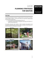
IntroductionSection 8-23 <strong>of</strong> the Connecticut General Statutes provides that:At least once every 10 years, the [Planning and Zoning] commission shall prepare oramend and shall adopt a plan <strong>of</strong> conservation and development for the municipality.Following adoption, the commission shall regularly review and maintain such plan …Such plan <strong>of</strong> conservation and development shall be a statement <strong>of</strong> policies, goals andstandards for the physical and economic development <strong>of</strong> the municipality. 1The <strong>Weston</strong> Planning and Zoning Commission, in conjunction with the <strong>Weston</strong> ConservationCommission (the “Committee”), endeavored to make the 2010 Plan, above all else, a concise,relevant, and dynamic document that would be referenced routinely over the course <strong>of</strong> the nextdecade. 2 As such, we decided to make a dramatic change from previous plans and dispensewith descriptions <strong>of</strong> <strong>Weston</strong>’s history and avoid descriptions <strong>of</strong> <strong>Weston</strong>’s current state <strong>of</strong> affairsto the extent possible. Instead, the Committee sought to focus on the future; makingrecommendations for further discussion, research and—if determined to be appropriate—implementation. All <strong>of</strong> this was done with an eye towards addressing three questions raised timeand again by <strong>Weston</strong> homeowners: How can <strong>Weston</strong> better protect its water supply, natural resources and rural character? How can economic development help <strong>Weston</strong> control property taxes? How can <strong>Weston</strong> better utilize its facilities to the benefit <strong>of</strong> all <strong>Weston</strong> residents?The Committee dedicated itself to soliciting the opinions <strong>of</strong> <strong>Weston</strong> residents concerning theissues addressed by the Plan. To this end, the Committee hosted several workshops with thepublic. The first such meeting was attended by about 200 <strong>Weston</strong> residents and was conductedby a private consulting group the Committee engaged to help discern the public’s general views.The Committee held several additional meetings with the public to discuss various more specificaspects <strong>of</strong> the Plan, such as residential development, commercial development and naturalresources. The Committee also invited numerous board and commission chairs and agencyheads to speak with the Committee, spoke with several public interest groups and encouragedresidents to correspond in writing with the Committee. Perhaps the touchstone <strong>of</strong> theCommittee’s efforts to ascertain the community’s position on issues affecting the Plan was thedistribution <strong>of</strong> a questionnaire (the “Questionnaire”) posing 14 questions via an insert in The<strong>Weston</strong> Forum. Seven hundred and thirty-seven (737) questionnaires were returned. The results<strong>of</strong> the Questionnaire are attached as Appendix 1 and are in footnotes throughout the Plan. 31 Connecticut General Statutes §8-23(a)(1) and §8-23(d)(1).2 During the development <strong>of</strong> the 2010 Plan <strong>of</strong> Conservation and Development, the Planning and ZoningCommission was comprised <strong>of</strong> Paul Heifetz, Donald Saltzman, Dr. Dan Gilbert, Stephan Grozinger, Jane Connolly,Ridge Young, Katie Gregory, Joe Limone, and Dave Allen. The Conservation Commission was represented by Dr.J. Thomas Failla. Tracy Kulikowski, <strong>Weston</strong>’s Land Use Director, and Joan Lewis, Administrative Assistant to thePlanning and Zoning and Conservation Commissions, were also instrumental in preparing the Plan.3 Due to statutory time constraints, the Committee decided to proceed to issue the Plan prior to the publication <strong>of</strong> theresults from the 2010 United States Census. It is the Committee’s intention, however, to revise the Plan, as needed,to reflect relevant data disclosed by that census.4
<strong>Weston</strong> is a unique community with extraordinary resources, but it also faces significantchallenges. While the Plan is not a legally binding document, it is the Committee’s hope that thePlan inspires ideas, provokes discussions and helps guide <strong>Weston</strong>’s development andconservation efforts in a manner that preserves and protects the things that make <strong>Weston</strong> aunique and remarkable place to live. It is also our hope that the Plan will assist <strong>Weston</strong> to meetits challenges, creatively and decisively.Natural Resources<strong>Weston</strong>’s greatest treasure is its natural resources. Itslandscape is dominated by large, mature trees and openspace that is unsurpassed in Fairfield County. Ourresidents depend on a natural environment for theirwell-being. Virtually all <strong>of</strong> us draw our household waterfrom wells that tap into natural groundwater andaquifers. All <strong>of</strong> us rely on septic systems that dependprincipally on natural processes to purify waste waterand recharge our groundwater and aquifers.Saugatuck River<strong>Weston</strong>’s character is defined by nature and its forests,open meadows, rivers, wetlands, ponds and pastoral sideroads with leaf canopies framed by stone walls. Every<strong>Weston</strong> resident deserves credit for preserving <strong>Weston</strong>’sbucolic character by making responsible decisions abouthow to develop and use his or her property. Thehallmarks <strong>of</strong> <strong>Weston</strong>’s land use are its two acreresidential zoning, based, in part, on the limited ability<strong>of</strong> natural systems to supply and filter water for eachhousehold; and restricted non-residential development,without which <strong>Weston</strong> would be a very different place.In authoring the Plan, the Committee found its attention particularly drawn to three importantfactors concerning <strong>Weston</strong>’s natural resources: trees, water and open space.A. TreesTrees play an invaluable role in the aesthetics <strong>of</strong> <strong>Weston</strong>. Large, mature, native trees line ourroadways, blanket our hills and ridgelines and define our community. They provide visualscreening and assist with noise reduction. Trees serve as ecological linkages, providing faunawith habitats and food and holding soil firmly in place, thereby preventing erosion.Trees consume carbon dioxide to produce oxygen, scrub airborne pollutants, help cool us on hotsummer days and temper winter’s chilling winds. A large tree absorbs 10 pounds <strong>of</strong> airpollutants per year. An acre <strong>of</strong> trees absorbs enough carbon dioxide annually to equal theamount produced by a car driven 26,000 miles and emits enough oxygen to sustain 18 peopleevery day. Forest vegetation diffuses the energy <strong>of</strong> falling rain, slows the velocity <strong>of</strong> run<strong>of</strong>f,keeps soil particles in place, enhances soil’s capacity to absorb and purify water and recharges5
groundwater supplies. Between rainfalls, vegetation moderates moisture and evaporation andhelps control standing and subsurface waters that breed disease carrying insects. Vegetativebuffers also absorb fertilizers and pesticides that some residents use on lawns and gardens.Land cleared <strong>of</strong> trees typically erodes at a rate <strong>of</strong> 50 tons per acre per year, which is 250 timesgreater than normal woodland erosion. Erosion hinders new plant growth and chokes the cycle<strong>of</strong> growth in wetlands, ponds, streams and rivers.Despite the fact that <strong>Weston</strong>’s land use agencies regularly receive complaints <strong>of</strong> run<strong>of</strong>f andflooding caused by the removal <strong>of</strong> trees, most respondents to the Questionnaire did not wish tohave the Planning and Zoning Commission impose regulations limiting the removal <strong>of</strong> treesfrom private property. 4 In light <strong>of</strong> that result, but recognizing the importance <strong>of</strong> trees to<strong>Weston</strong>’s health and character, the Committee makes the following recommendations:1. <strong>Weston</strong>’s Beautification Committee should continue to seek to preserve large, mature, nativetrees (to the extent consistent with public safety) and should plant trees on public property aspart <strong>of</strong> an organized and sustained effort.2. <strong>Weston</strong>’s residents are encouraged to preserve trees on their property to the extent possible,to plant additional and/or replacement trees and, when doing so, to plant large, native speciessuch as maple, oak and beech rather than small ornamental or non-native species.B. WaterWith few exceptions, <strong>Weston</strong> households, schools, government buildings and commercialestablishments rely on wells. Wells pump aquifer and groundwater supplies that are rechargedby annual rainfalls that average about 46 inches. A secondary source for wells comes from watercleansed in our septic systems and processed further by natural filtration through the sand,gravel and hard rock fissures. Depending on soil type, about one-third <strong>of</strong> rainfall infiltrates thegroundwater supply. At this rate, and allowing for recharge from recycled water, two acres <strong>of</strong>land are needed to supply an average <strong>Weston</strong> household <strong>of</strong> approximately 3.3 persons withsufficient water to meet their daily needs.4 When asked in the Questionnaire whether tree removal on private property should be regulated, 469 respondents(64 percent) opposed the idea, 188 (26 percent) favored it, and 71 (10 percent) had no opinion. See Appendix 1.6
Saugatuck ReservoirThe ecosystem that supports <strong>Weston</strong> lies well beyond the town’s borders. Approximately 97percent <strong>of</strong> <strong>Weston</strong>’s 13,000 plus acres represents more than 23 percent <strong>of</strong> the Saugatuck Riverwatershed ecosystem. The remainder, about 400 acres, falls within the Norwalk River watershedin the northwestern section <strong>of</strong> town. The Saugatuck River watershed covers approximately 90square miles in 11 Fairfield County towns, including <strong>Weston</strong>. Within that watershed, 30 percentor more than 17,000 acres are protected from development, including 15,000 acres surroundingthe Saugatuck and Aspetuck reservoirs.The Planning and Zoning Commission and the Conservation Commission are charged withprotecting <strong>Weston</strong>’s water resources. Both commissions have refined their regulations andenforcement in recent years. For example, the Planning and Zoning Commission enacted aregulation requiring an engineered groundwater recharging system for new structures. It alsoadopted Aquifer Protection Area regulations for the Coleytown well field in southwestern<strong>Weston</strong>. The Conservation Commission, pursuant to State environmental statutes, reviews andregulates activities that impact wetlands and watercourses throughout <strong>Weston</strong>. BothCommissions will consider further regulation in a measured manner to respond to threats to<strong>Weston</strong>’s water supply and aquifers.Given the crucial role that water plays in our daily lives, Low Impact Development (“LID”)methodology should be embraced in our planning, development and regulatory practices. LID isa sustainable stormwater management approach that controls both rainfall and run<strong>of</strong>f at itssource and distributes water throughout a site. Classically, water is channeled throughdrainpipes and larger conduits downstream away from the land. Simply put, an LID approach7
<strong>Weston</strong> Sub-Watersheds2010 <strong>Weston</strong> Plan <strong>of</strong> Conservation and Development£¤ 7NorwalkRiverWestSaugatuckNorwalkRiver") 57GodfreyBrook") 53North BrookComplexWestSaugatuckW CobbsMill BrookBeaverBrook") 53 DavidgeBrookKettleCreek") 53 HeldPond") 57JenningsBrookSaugatuckRiverbelow resevoirAspetuckRiverSaugatuckReservoirSaugatuckRiverbelow resevoirAspetuckRiverWestSaugatuck.Prepared April 14, 2010 byLegendDisclaimer: This map is intended for general planning purposes only.WatercourseRegulated Wetlands8Source: NRCS 2005 Soil Survey Data for Fairfield County; DEP 2005 Wetlands, Local Basisns,Aquifer Protection Area, Natural Diversity Database 2008, and Hydrography datasets.0 0.25 0.5 1 1.5 2 Miles
uses both natural devices (vegetation, native trees, etc.) and structural devices (ro<strong>of</strong>s, pavedparking lots and other surfaces) to maintain natural drainage patterns and to channel and filterwater into the ground and streams or collect it for reuse. This approach reduces pollution,recharges groundwater, streams, wetlands and aquifers and stabilizes water flow. The goal <strong>of</strong>LID is to leave an area with as little negative impact from development as possible on water,water quality, water flow and wells. 5Finally, in discussions with the Committee, poorly maintained household underground fuel oiltanks were identified by the Westport/<strong>Weston</strong> Health District as the number one threat togroundwater resources.In light <strong>of</strong> the foregoing, the Committee makes the following recommendations:1. The Conservation Commission should explore LID methodology and, together with thePlanning and Zoning Commission, promulgate regulations for <strong>Weston</strong> that embrace thatapproach, including revisiting and strengthening regulations controlling changes in ratesand direction <strong>of</strong> run<strong>of</strong>f from roadways and lots; encouraging retention <strong>of</strong> existing forests,outcrops, ridges and stone walls; urging selective rather than clear-cutting <strong>of</strong> trees; andupdating the <strong>Weston</strong> Environmental Resources Manual (1976).2. The Select Committee on Sustainability, the Conservation Commission, theWestport/<strong>Weston</strong> Health District, and the <strong>Town</strong> Engineer should monitor the potability<strong>of</strong> water throughout <strong>Weston</strong> in a comprehensive, systematic and sustained manner andreport its findings regularly to the Board <strong>of</strong> Selectmen. Of particular concern should bethe identification and remediation <strong>of</strong> poorly maintained septic systems and poorlymaintained underground fuel oil tanks, the effect <strong>of</strong> the use <strong>of</strong> chemical fertilizers andpesticides on property within watersheds and the growing potential for localizedpollution <strong>of</strong> surface water by an ever increasing waterfowl and deer population.3. Residents should be cognizant <strong>of</strong> the polluting effect <strong>of</strong> household chemicals and lawnfertilizers and seek to minimize their impact. <strong>Town</strong> Government should provideinformation regarding, and access to less polluting alternatives. For instance, <strong>Town</strong>Government should consider the feasibility <strong>of</strong> providing an area to residents fordiscarding household compostables, leaves and other lawn detritus and for retrievingcompost for gardens and lawns.4. Given that <strong>Town</strong> facilities represent a majority <strong>of</strong> the non-residential development in<strong>Weston</strong>, <strong>Town</strong> Government should actively seek opportunities to reduce pollution <strong>of</strong> theaquifer and surface groundwater from those facilities.5. The Planning and Zoning Commission should ensure that future subdivision roadsystems and parking lots include engineered systems to recharge groundwater and reducethe introduction <strong>of</strong> roadway pollutants to groundwater.5 Guillette, Anne. “Achieving Sustainable Site Design through Low Impact Development Practices.”www.wdbg.org/resources/lidsitedesign.php. See also, <strong>CT</strong> Guidelines for Soil Erosion and Sediment Control (<strong>CT</strong>DEP 2002).9
6. The Select Committee on Sustainability, the Conservation Commission, theWestport/<strong>Weston</strong> Health District, and the <strong>Town</strong> Engineer should monitor availability <strong>of</strong>water throughout <strong>Weston</strong> in a comprehensive, systematic and sustained manner to ensurewater use in <strong>Weston</strong> does not outstrip the supply.7. <strong>Town</strong> Government, together with the Conservation Commission, should act to protectand enhance significant fish and wildlife habitats, feeding areas, travel corridors and theecology <strong>of</strong> rivers and streams.C. Open Space“Open Space” is generally defined as natural and human influenced landscapes that remainrelatively undisturbed. Open space may consist <strong>of</strong> several land categories, ranging from pristinepreserves <strong>of</strong> high ecological significance to active recreational trails and playgrounds. Landreserved in <strong>Weston</strong> for watershed and conservation purposes alone totals 2,866 acres (more than20 percent <strong>of</strong> <strong>Weston</strong>).The importance <strong>of</strong> open space to a town like <strong>Weston</strong> cannot be overstated. It is integral to ourcharacter and limits density in a manner that may be critical to the sustainability <strong>of</strong> our aquifers.<strong>Weston</strong>’s open space provides many benefits to our community, direct and indirect, short- andlong‐term. Varied recreation areas, including ball fields, scenic trails, and working landscapescontribute to <strong>Weston</strong>’s character and quality <strong>of</strong> life. <strong>Weston</strong>’s open spaces range from largepreserves like Devil’s Den and Trout Brook (which protect underground water resources andallow natural habitats to remain intact and ecologically healthy) to small playgrounds and parkslike Keene Park on River Road. These provide a place for recreation, exercise, personalrevitalization and socialization. Recognizing the importance <strong>of</strong> open space to <strong>Weston</strong> as acommunity, at the public hearings and in the Questionnaire, <strong>Weston</strong> residents voiced theircommitment to acquiring more open space and maintaining that which is already ours. 6“Cluster development” is defined by Connecticut law as “a building pattern concentrating unitson a particular portion <strong>of</strong> a parcel so that at least one-third <strong>of</strong> the parcel remains as open space tobe used exclusively for recreational, conservation and agricultural purposes.” 7 Clusterdevelopment is one method <strong>of</strong> preserving open space while allowing development.In light <strong>of</strong> the foregoing, the Committee makes the following recommendations:1. <strong>Town</strong> Government should actively seek opportunities to purchase or solicit the donation<strong>of</strong> additional open space.2. <strong>Town</strong> Government should encourage private conservation <strong>of</strong> open space. For instance,the Planning and Zoning Commission may wish to explore permitting cluster6 When asked in the Questionnaire about using tax dollars to purchase land for conservation, 440 respondents (60percent) favored, 239 (32 percent) opposed, and 46 (6 percent) had no opinion. See Appendix 1.7 C.G.S. §8-1810
Land Use2010 <strong>Weston</strong> Plan <strong>of</strong> Conservation and DevelopmentGeorgetown RdState Hwy 57Kettle Creek RdOld Field RdLaurel LkGood Hill RdTwin Walls Ln11 O Clock RdRichmond Hill RdDorethy RdUpper Parish DrOld Farm RdKramer LnOld Farm RdGrey Fox LnLegendWaterMountain RdRockhouse RdDanbury RdMather StScribner Hill RdRolling Ridge RdTimber Top TrlResidential UsesUS Hwy 7Seeley RdHurlbutt StHoney Hill RdCannon RdLangner LnColey RdWampum Hill RdBlack Alder LnLee Allen LnBusiness UsesConservation & WatershedFarm & Nursery GardeningPrivate RecreationPublic UsesSemi-Public Uses<strong>Town</strong> Parks & Open SpaceVacantOrchard DrMarshall LnHart LnBrookwood LnSamuelson RdCindy LnMaureen DrWhite Oak LnCalvin RdOld Mill RdWhippoorwill Ln") 57September LnHillside Rd<strong>Weston</strong> RdAdams WayCricket LnMerry LnMountain View DrGlory RdTobacco RdNovember TrlOctober DrWaterbury StWood Hill RdHedgerow CmnScatacook TrlTimothy RdSchool RdPent RdGodfrey RdStillwater LnNorfield Woods RdOld Orchard DrLakeside DrMichaels WayOld Hyde RdNorfield RdSachem RdOld Hyde Road ExtRiver RdWalden Woods LnDillon PassWildwood LnCuriosity LnDrivewayBirch Hill RdLords HwySalem RdSlumber LnCedar HlsRogues RdgSteep Hill RdFarrell RdGlen LnLyons Plains RdGrays Farm Rd11Ladder Hill RdWhite Birch RdAlwyn LnLaurel LkButtonball LnBayberry Lane ExtBuck Hill RdHilltop LnOakwood DrSunset DrLyons Plain RdDeer Run TrlOak LnState Hwy 53Katydid LnForest RdTubbs Spring DrOctober HlGreenlea LnDeepwood LnBrier Brook RdStonecliff RdFanton Hill RdEaston RdLadder Hill RdRiverbank RdBittersweet RdWinthrop HlsCharles PathChurch LnGreenfield DrWalker LnTannery LnBanks DrLyons Plains RdEquestrian DrWalnut LnRavenwood DrBlueberry Hill RdOld Easton TpkeTreadwell LnSkylark LnCardinal DrThorp DrLedgewood DrSinging Oaks DrSaw Mill RdWestport TpkePheasant Hill RdNewtown TpkeCatbriar RdCatbrier RdLords HwyFern Valley RdPilgrim LnTreasure RdWoodland WayGilbert HwyHemlock RdgKellogg Hill RdOld Kings HwyHill Farm RdBallymossCortese DrVL Forge LnDavis Hill RdMartin RdVL Forge RdAspetuck Hill LnCodfish LnStonehenge RdState Hwy 136Old Redding RdValley Forge RdJana DrWeddington LnFresh Meadow RdTrout Brook LnWestport RdBradley RdBernhard DrFreeborn RdKellogg Hill RdMayflower LnMills Ln.Freeborn RdDisclaimer: This map is intended for general planning purposes only.Source: DEP 2005 Hydrography Datasets; Land Use MapBook, <strong>Town</strong> <strong>of</strong> <strong>Weston</strong>; South WesternRegional Planning Agency Fairfield County Roads0 0.25 0.5 1 1.5 2 MilesWells Hill RdWoodland DrWyld Wood RdPrepared April 27, 2010 by
development in exchange for dedicating an undeveloped portion <strong>of</strong> a subdivision tract toopen space 8 .3. The Planning and Zoning Commission recently enacted a regulation allowingsubdividers <strong>of</strong> large parcels to pay 10 percent <strong>of</strong> the value <strong>of</strong> the subdivision to a specialopen space fund in lieu <strong>of</strong> dedicating a portion <strong>of</strong> the subdivision to open space. Asthese funds accrue, <strong>Town</strong> Government should actively identify parcels <strong>of</strong> particularecological or aesthetic importance and purchase them outright or obtain conservationrights.A. <strong>Home</strong> OccupationsEconomic Development<strong>Weston</strong>’s current zoning regulations permit home occupations. Owners can hire a singleemployee (in addition to themselves) as <strong>of</strong> right and hire an additional employee with specialpermit approval. A certain amount <strong>of</strong> space in each home can be dedicated to business purposes.After much discussion and public input concerning these restrictions, the Committee believesthat the existing regulations are appropriate—neither too restrictive nor overly permissive—andbalance the community’s residential needs against those <strong>of</strong> a business in a residential setting.The Questionnaire indicated that <strong>Weston</strong> contains a remarkable number <strong>of</strong> home occupations:15 percent <strong>of</strong> the respondents indicated that a home occupation was active within theirhousehold. 9 The presence <strong>of</strong> a large number <strong>of</strong> home occupations is beneficial to <strong>Weston</strong>.<strong>Weston</strong> homes that are occupied during business hours support local businesses, furnish acertain amount <strong>of</strong> security for our neighborhoods and provide a pool <strong>of</strong> valuable candidates for<strong>Weston</strong>’s volunteer services including its emergency services.Furthermore, home occupations require virtually no additional infrastructure. Because <strong>of</strong> thelimitations imposed on home occupations by <strong>Weston</strong>’s Zoning Regulations, they create neithertraffic nor parking problems. They do not detract from <strong>Weston</strong>’s residential character and are,for the most part, virtually invisible to neighbors. The Committee believes that homeoccupations are to be encouraged.B. The Center <strong>of</strong> <strong>Weston</strong><strong>Weston</strong>’s commercial spaces are strictly limited by its zoning regulations. <strong>Weston</strong> is divided intotwo districts: 1) the Two-Acre Residential and Farming District and 2) the NeighborhoodShopping Center District. All <strong>of</strong> <strong>Weston</strong> is in the Residential and Farming District, except thesingle six acre parcel commonly known as “<strong>Weston</strong> Center” which comprises its NeighborhoodShopping Center District. Within the Residential and Farming District, certain non-residential8 See, From Planning to Action: Biodiversity Conservation in Connecticut <strong>Town</strong>s, WCS/MCA Technical Paper No.10. By Michael W. Klemens, Marjorie F. Shansky and Henry J. Gruner, MCA (2006)9 When asked whether the respondent conducted a business in his/her home, 108 (15 percent) responded in theaffirmative. See Appendix 1.12
uses are nonetheless permitted either by special permit (such as churches, golf clubs, museums,fire stations, etc.) or are permitted as a matter <strong>of</strong> course, but are strictly limited in scope (such ashome occupations, discussed above). A small number <strong>of</strong> commercial interests operate in <strong>Weston</strong>as a result <strong>of</strong> having existed prior to the enactment <strong>of</strong> <strong>Weston</strong>’s Zoning Regulations, such as theCobb’s Mill Inn and <strong>Weston</strong> Gardens. Governmental facilities (such as <strong>Town</strong> Hall, the library,police station, fire stations and schools) fall into their own category.Whether to permit more commercial development in<strong>Weston</strong> was arguably the most debated topic tackledduring development <strong>of</strong> this Plan. An informal poll <strong>of</strong>those attending the initial scoping meeting indicatedthat <strong>Weston</strong> residents favor additional businessdevelopment by a factor <strong>of</strong> two to one. TheQuestionnaire appeared to confirm that impressionand provided additional information as to where suchdevelopment should take place. A privately initiatedproposal calling for a “Village District,”encompassing nearly 115 acres and embracingresidential homes as well as <strong>Town</strong> facilities and<strong>Weston</strong> Center, did not garner substantial publicsupport.Support for additional commercial development bothin the public and on the Committee, stems from thedesire for additional services and places to gather as acommunity. As such, <strong>of</strong>fice use would not beappropriate. There is no support for commercialdevelopment that would be detrimental to therural/residential character <strong>of</strong> <strong>Weston</strong>.Cobb’s Mill InnThe Committee explored this issue at length. According to the Questionnaire, few residentsfavor additional commercial development except in the immediate vicinity <strong>of</strong> <strong>Weston</strong> Center.That Questionnaire also indicated that there was support for locating additional commercialdevelopment behind <strong>Weston</strong> Center. There was slightly greater support for locating additionalbusiness development across the road. The Committee interpreted this to be the area from theentrance to School Road to the intersection <strong>of</strong> Norfield and <strong>Weston</strong> Roads. 1010 In response to the question in the Questionnaire concerning new commercial development: 60 (8 percent) were infavor <strong>of</strong> development within the <strong>Weston</strong> Center; 164 (22 percent) were in favor <strong>of</strong> development within and behindthe <strong>Weston</strong> Center; 232 (31 percent) were in favor <strong>of</strong> development within, behind and across the road from the<strong>Weston</strong> Center; 54 (7 percent) were in favor <strong>of</strong> development anywhere in <strong>Weston</strong>; and 175 (24 percent) wereopposed to any further commercial development anywhere in <strong>Weston</strong>. Fifty-two (7 percent) <strong>of</strong> the surveyrespondents did not answer this question. See Appendix 1.13
<strong>Weston</strong> Center1. The Area within <strong>Weston</strong> Center.Additional development within the existing boundaries <strong>of</strong> <strong>Weston</strong> Center appears to beimpossible unless the zoning regulations are changed to permit less parking per square foot <strong>of</strong>retail space. This is not only because new foundations may displace existing parking, but alsobecause <strong>Weston</strong> Center currently has fewer parking spaces than the regulations require for thebusinesses presently operating there. It is the Committee’s recommendation that any proposedchange to those regulations should be preceded by a thorough, pr<strong>of</strong>essional traffic and parkingstudy. This study should ensure that any further development would not overburden parkingareas or create traffic hazards both on the property and on <strong>Weston</strong> Road. The Committee doesnot believe that such an expansion would have any real impact on <strong>Weston</strong>’s tax burden.2. The Area Behind <strong>Weston</strong> CenterIt is the Committee’s understanding that <strong>Weston</strong> Center and the area immediately behind it isprivately owned by the same entity (or shares commonality <strong>of</strong> ownership). The area behind theCenter is comprised <strong>of</strong> approximately seven undeveloped acres. The Committee has no opinionas to whether that area is suitable for further development and would await an application to thePlanning and Zoning Commission before making any recommendation. Nevertheless, theforegoing traffic considerations would apply as would a review and re-evaluation <strong>of</strong> other rulesset forth in Section 322 <strong>of</strong> <strong>Weston</strong>’s Zoning Regulations. Again, given the size <strong>of</strong> this area, theCommittee does not believe significant tax relief would be generated by such development.3. The Area Across the Road from <strong>Weston</strong> CenterThe area that received the greatest support for possible additional development lies between theentrance to School Road and the intersection <strong>of</strong> Norfield and <strong>Weston</strong> Roads. That land iscomprised <strong>of</strong> approximately 5.5 acres and, except for a private home on the corner <strong>of</strong> thatintersection, is owned by the <strong>Town</strong> <strong>of</strong> <strong>Weston</strong>. Although the Committee expects development14
<strong>of</strong> this area would generate a small amount <strong>of</strong> revenue, the primary goal would be to providemore services and to provide a community gathering place in the center <strong>of</strong> <strong>Weston</strong>.There are significant issues that require detailed study with regard to further development <strong>of</strong> thisarea. First, it currently contains the school bus depot and an athletic field which may need to berelocated or sacrificed if the area is developed. It also includes the Onion Barn, a historicalstructure and community facility which would need to be integrated into any development plan.Secondly, traffic is already a problem in the area as its serves as the primary north-south routethrough <strong>Weston</strong>, contains an entrance to the school campus and also contains the entrance to<strong>Weston</strong> Center. Thirdly, safety and security must be a primary concern given the proximity tothe schools; if the area was developed, there would be no geographical barrier between thatdevelopment and the schools; currently, <strong>Weston</strong> Road provides a physical barrier between theschools and <strong>Weston</strong> Center. Finally, the area is small, and water, septic and parking would needto be accommodated.There are, however, significant positive aspects to expanding business to this area. Its proximityto the school campus and to the <strong>Town</strong> Hall complex makes possible the installation <strong>of</strong> asidewalk between these areas (a proposal that had strong support both from the public andamong the Committee members). The school administration supports relocation <strong>of</strong> the busdepot, an area which the public and the Committee agree is an eyesore and a grossunderutilization <strong>of</strong> the land. Parking lots associated with the <strong>Town</strong> Hall complex and parkingbehind the Onion Barn could be used by new businesses at certain times <strong>of</strong> day. Furthermore,such development could provide the additional services and social opportunities sought by<strong>Weston</strong> residents.Perhaps the greatest advantage <strong>of</strong> this area is that the land is largely publically owned and, as aresult, the <strong>Town</strong> could derive direct non-tax revenue from its development, and the <strong>Town</strong> couldvery closely control the uses it is put to and the manner in which it is developed. For instance,the <strong>Town</strong> could ground lease the area to one or more tenants who would constructimprovements at their own cost. The rents and other benefits derived from these leases (and anyancillary parking or septic easements granted to the tenants on adjacent land) would besignificantly greater than property taxes imposed on privately held land. Furthermore, althoughthe aesthetics <strong>of</strong> privately held land can be regulated to a certain extent (for instance, prohibitingplate glass windows), some elements that would be <strong>of</strong> critical importance to retaining <strong>Weston</strong>’scharacter cannot be successfully regulated (such as signage). Land owned by <strong>Weston</strong> can becontrolled as any owner controls his or her land and <strong>Weston</strong> could virtually dictate the use andappearance <strong>of</strong> any structures.Clearly, any structure or structures built in the proposed area would have to appear entirelyresidential and should complement the Greek Revival style residential structures that alreadyexist in the area. They should be situated immediately adjacent to the street and sidewalk (ratherthan behind a parking lot) in order to accentuate and not diminish <strong>Weston</strong>’s historic and smalltowncharacter. They should be situated so as to preserve the existing athletic fields.With regard to commercial development in or around the <strong>Weston</strong> Center, the Committee makesthe following recommendations:15
1. No action is currently required to the existing regulatory scheme. If a proposal fordevelopment within, adjacent to, or across the street from <strong>Weston</strong> Center is advanced,the Planning and Zoning Commission could address the changes needed to itsregulations. Waiting until a development plan is proposed allows the Planning andZoning Commission to work with solid proposals and facts rather than hypotheticalsituations.2. The Planning and Zoning Commission, together with the Board <strong>of</strong> Education and PublicWorks, should determine if the school bus depot can be moved to another location.3. The Planning and Zoning Commission should ascertain whether the problems withpotential development <strong>of</strong> the area across the street from <strong>Weston</strong> Center can be resolved,whether such development is economically attractive and, when a plan is more fullydeveloped, the breadth <strong>of</strong> public support. Any such study must include traffic andparking studies.4. Before substantial resources are committed to the study <strong>of</strong> potential development <strong>of</strong> thearea across the street from <strong>Weston</strong> Center, the community’s views should be elicited asto what sorts <strong>of</strong> services should be provided and whether they justify the expense. Othermeans <strong>of</strong> increasing community-orientated services in the area should also be explored,such as narrowing the scope <strong>of</strong> uses permitted in the Neighborhood Shopping Center.Finally, making existing facilities more readily available to the public as describedelsewhere in this Plan, may make further development unnecessary.5. Critical to the implementation <strong>of</strong> any such development, in or around <strong>Weston</strong> Center, isthe appointment <strong>of</strong> a committee to oversee the process with pr<strong>of</strong>essional guidance.6. The purposes and efficacy <strong>of</strong> inclusion <strong>of</strong> <strong>Town</strong>-owned land in a Historic District shouldbe evaluated.<strong>Weston</strong> Historical Society16
C. Fromson-StrasslerGreat concern has been expressed regarding the tax burden shouldered by <strong>Weston</strong> homeowners.While this has been brought to the forefront by the current recession, it is a problem which willonly become more acute over time. Expenditures will inevitably rise over the course <strong>of</strong> the nextdecade and beyond. As demonstrated by recent events, we should not assume housing valuesand the Grand List will rise proportionately to meet such expenses. As illustrated by the chartbelow 11 , <strong>Weston</strong> is an overwhelmingly residential town with virtually no commercial tax base.As such, the tax burden falls squarely on <strong>Weston</strong> homeowners.<strong>Town</strong> Percent Grand ListCommercial/IndustrialPer CapitaTax<strong>Weston</strong> 0.7 $5,116Darien 6.4 $4,075New Canaan 5.1 $4,560Wilton 12.0 $4,624Easton 2.2 $4,092Westport 12.0 $4,822Ridgefield 8.8 $3,962Redding 5.2 $3,825Greenwich 10.1 $3,748Newtown 6.5 $2,929Monroe 6.5 $2,490Fairfield 8.9 $3,096Brookfield 15.0 $2,711Trumbull 13.8 $2,880Bethel 13.5 $2,329Shelton 17.2 $2,049Stratford 15.4 $2,434Stamford 25.3 $2,674Norwalk 18.6 $2,441Danbury 24.7 $1,622Bridgeport 17.0 $1,509<strong>Weston</strong> residents currently pay the highest per capita property taxes in Connecticut.Conversely, as to the percentage <strong>of</strong> commercial taxes collected to assist the resident tax base,<strong>Weston</strong> stands 168 th <strong>of</strong> the 169 towns in Connecticut. 12 As noted, permitting a few smallcommercial uses to be undertaken in the center <strong>of</strong> town will not have an appreciable long-termeffect on the tax burden. Ground leasing town land in the area discussed above would have agreater impact, but would not be a permanent fix.11 Connecticut Economic Resource Center, Inc. (www.cerc.com).12 Selectman David Muller, The <strong>Weston</strong> Forum, Feb.11, 2010, p.13A, col. 3.17
The Committee discussed at length whether the Fromson-Strassler property should beconsidered for development <strong>of</strong> a substantial <strong>of</strong>fice complex or other non-residential useemploying Nyala Farms in Westport, Boehringer Ingelheim in Ridgefield, and Meadow Ridgein Georgetown as models.The Fromson-Strassler property consists <strong>of</strong> approximately 85 acres and lies in the uppernorthwest corner <strong>of</strong> <strong>Weston</strong> on the Wilton town line. Although much <strong>of</strong> it is comprised <strong>of</strong>wetlands, steep slopes, shallow depths to bedrock and high water tables, it appears that 20 acresto 25 acres, located generally on the north-south axis along the Wilton town line, could bebuildable. Fromson-Strassler is currently accessible from Upper Parish Road but might also beaccessed at one or more points along Georgetown Road or from Wilton. It is owned by the<strong>Town</strong> and is not subject to any deed restriction. The property’s location near existing water,sewer, and gas lines and its proximity to Routes 107 and 7 make the creation <strong>of</strong> an infrastructurefor such a project appear feasible. The Committee is advised that development <strong>of</strong> the Gilbert andBennett Mill property (in the Redding section <strong>of</strong> Georgetown) into mixed commercial andresidential use will include the formation <strong>of</strong> a Transportation Oriented District along the Metro-North Danbury train line and existing north-south bus service on Route 7. Those plans maynecessitate the enlargement <strong>of</strong> adjacent roadways by the Connecticut Department <strong>of</strong>Transportation which may benefit the Fromson-Strassler property.As to the development itself, the <strong>Town</strong> <strong>of</strong> <strong>Weston</strong> could ground lease this parcel on a long-term(for example, 100 years) net basis, which means the tenant undertakes all responsibility fordevelopment costs. Because <strong>of</strong> the size and location <strong>of</strong> the Fromson-Strassler parcel, asubstantial complex could be hidden from the view <strong>of</strong> adjacent property owners and, thus, have18
a minimal impact on <strong>Weston</strong>’s current character. As a ground lessor, the <strong>Town</strong> could control thespecifications <strong>of</strong> the project, such as its size, design, height, bulk, and use. If the commercialenterprise only required a portion <strong>of</strong> the parcel, perhaps senior housing or a cemetery/memorialpark could be located on the remainder.We are proposing this idea for further discussion, debate, and study; we are not recommending itoutright at this time. Obviously, a project such as this will have an impact on its neighborhoodand although <strong>Weston</strong> can work hard to minimize that impact, significant sacrifices will have tobe made. Nonetheless, if the <strong>Town</strong> were to ground lease this parcel for development, after aperiod <strong>of</strong> little or no revenue (to compensate the ground lessee for development costs), the <strong>Town</strong><strong>of</strong> <strong>Weston</strong> would own a very significant revenue source for the foreseeable future.<strong>Weston</strong> Public LibraryWe are very cognizant <strong>of</strong> the fact thatfeelings run very high with regard tocommercial development anywhere in<strong>Weston</strong>. If we proceed, we must proceedwith utmost caution. Nonetheless, wefeel that responsible government requiresthat this issue be fully explored now sothat, if it is accepted, the long process <strong>of</strong>executing it can begin.The first step in exploring this idea further is to form a committee to lead that exploration and toreport to the Board <strong>of</strong> Selectmen and, critically, to one or more <strong>Town</strong> Meetings. It is anticipatedthat if the project is undertaken, the committee would become permanent and would manage the<strong>Town</strong>’s interest in the ground lease and any other <strong>Town</strong>-owned, income-producing property(including, for instance, the cell towers) to maximize value while protecting <strong>Weston</strong>’s character,and would do so with the assistance <strong>of</strong> a pr<strong>of</strong>essional property management firm.With regard to the Fromson-Strassler property, the Committee recommends the following:1. The Planning and Zoning Commission should explore thefeasibility <strong>of</strong> developing the Fromson-Strassler land andascertain public support.2. If such development is found feasible, the Committee, togetherwith the Board <strong>of</strong> Finance, should analyze whether an outrightsale or a long-term ground lease would be more beneficial to<strong>Weston</strong>.D. Other Economic Development ConsiderationsIn addition to exploring ways to increase revenue, <strong>Weston</strong> must findways to creatively decrease spending. Opportunities likely exist bothon the intra-town level and on the inter-town level. <strong>Town</strong>Government should continue to explore ways in which servicesprovided separately to the schools and to the general administration19<strong>Weston</strong> <strong>Town</strong> Hall
can be integrated to save money. Also, The <strong>Town</strong> <strong>of</strong> <strong>Weston</strong> should discuss with surroundingtowns ways in which to regionalize functions <strong>of</strong> government. Any opportunity should becarefully analyzed, including tax assessment, tax collection, town clerk functions, and publicworks. In addition, we should seek to engage in more pooled purchasing <strong>of</strong> material andservices with other towns, even those that are not contiguous to us. For clarity, although webelieve government functions should be regionalized to the extent practical, government unitsshould remain independent. Planning and other functions <strong>of</strong> municipal government shouldremain local to preserve home rule and accountability.A. GenerallyHousing Development<strong>Weston</strong> is comprised <strong>of</strong> approximately 13,284 acres (20.7 square miles). Approximately 58percent <strong>of</strong> that land is dedicated to residential use (the other uses being open space, roads and asliver <strong>of</strong> commercially used land). <strong>Weston</strong>’s regulations presently require residential use <strong>of</strong> theland as a single family, detached residence with a density <strong>of</strong> not more than one house per twoacres. Since the 2000 <strong>Town</strong> Plan <strong>of</strong> Conservation and Development, 17 subdivision applicationshave been approved adding 74 actual and potential home sites to <strong>Weston</strong>’s land map. With thehelp <strong>of</strong> the <strong>Town</strong> Assessor’s Office, the Committee researched the number <strong>of</strong> additional twoacre parcels that could be developed to accommodate additional houses in <strong>Weston</strong>. In doing so,the Committee included undeveloped privately held land seemingly capable <strong>of</strong> subdivision, aswell as similar land not developed to its potential (i.e., parcels exceeding two acres butcontaining a single house). The study produced 500 potential parcels. This is, <strong>of</strong> course, not aconclusive figure. Many <strong>of</strong> the parcels will remain undivided as a result <strong>of</strong> the stewardship <strong>of</strong>their owners, and many more are unsuitable for development for topographical reasons.Nonetheless, <strong>Weston</strong> is susceptible to much more residential development than has beengenerally assumed.Remaining Unimproved ParcelsParcel Size(acres)Possible two-acreParcelsNumber PotentialParcels0-1.9 1* 52* 52*2-3.9 1 150 1504-5.9 2 16 326-7.9 3 3 98-9.9 4 3 1210-11.9 5 1 512-13.9 6 3 1814-15.9 7 0 016-17.9 8 1 818+ 9+ 6 27+*With a variance20
Lots Improved by a Dwelling in Excess <strong>of</strong> Four AcresParcel Size(acres)PossibleAdditional ParcelsNumber PotentialParcels4-5.9 1 63 636-7.9 2 20 408-9.9 3 6 1810-11.9 4 3 1212-13.9 5 3 1514-15.9 6 1 616-17.9 7 1 718+ 8+ 2 16+B. Large Houses and Accessory UsesThe chart below illustrates the size <strong>of</strong> houses in <strong>Weston</strong>:Size 0-1500 1501-3000 3001-4500 4501-6000 6001-7500 7501-9000 9001+(sq ft)Number 707 1526 1112 428 157 50 21Source: Assessor, 2008According to the Questionnaire results, <strong>Weston</strong> residents do not want to further regulate the size<strong>of</strong> <strong>Weston</strong> houses nor do they favor a reduction in the percentage <strong>of</strong> each lot that can bededicated to such uses as playing courts, swimming pools and pool houses. 13 The Committeeacknowledges that <strong>Weston</strong> is an attractive, sustainable community because <strong>of</strong> the good choicesmade by individual homeowners about their own lots. Nonetheless, during the informationgathering phase <strong>of</strong> this Plan, the Committee was advised <strong>of</strong> numerous complaints about thechange in water run<strong>of</strong>f that <strong>of</strong>ten accompanies installation <strong>of</strong> pools and the like. Increases inimpervious and semi-impervious surfaces that accompany further developed lot coverage (suchas ro<strong>of</strong>s, paved areas, sports and recreational facilities and manicured lawns without appropriatecontrols) have serious implications for run<strong>of</strong>f, erosion and other conditions that can adverselyaffect neighboring properties as well as the natural environment. The Committee believes thatthe Planning and Zoning Commission, together with the Conservation Commission, shouldstudy ways to alleviate such problems, such as requiring natural buffering and the use <strong>of</strong>permeable surfaces where appropriate.13 In response to the query whether <strong>Weston</strong> lots are overdeveloped (with pools, playing courts, pool houses, etc),131 (18 percent) responded in the affirmative, 512 (69 percent) responded in the negative, and 84 (11 percent) hadno opinion. See Appendix 1.21
Very large homes present afire suppression challenge.<strong>Weston</strong> has few pressurizedhydrants. The fire departmentessentially relies on naturalwater bodies and a modestnumber <strong>of</strong> fire ponds. TheCommittee believes that thePlanning and ZoningCommission ought to verycarefully study reasonablemeasures to ensure firesuppression infrastructureproximate to large homes andHouse on Old Redding Roadsubdivisions is sufficient. Forinstance, sprinklers may berequired for large homes, swimming pools may be required to serve double-duty as fire ponds,and cisterns and fire ponds may need to be installed in close proximity to the largest homes.Also, the height <strong>of</strong> homes, businesses, and municipal structures should continue to be strictlyregulated to permit the fire department to access the highest points with its present equipment.Roads also must be designed to allow for access by fire apparatus and tanker relays by havinggenerous turn-arounds and hammerheads and deadends should be discouraged. The firedepartment’s efforts to systematically serve the entire <strong>Town</strong> with fire ponds and cisterns shouldbe supportedWith respect to residential housing, the Committee recommends the following:1. The Planning and Zoning Commission and Conservation Commission shouldinvestigate ways to limit erosion and increased or altered run<strong>of</strong>f.2. The Planning and Zoning Commission, in conjunction with the <strong>Weston</strong> Volunteer FireDepartment, should study ways to ensure that <strong>Weston</strong>’s fire suppression infrastructurecan accommodate large homes and subdivisions.3. <strong>Town</strong> Government should continue to support the efforts <strong>of</strong> the <strong>Weston</strong> Volunteer FireDepartment to systematically and strategically locate cisterns and fire ponds.C. Accessory Housing<strong>Weston</strong>’s zoning regulations permit accessory apartments that are small and located within theprimary dwelling. The Questionnaire indicated that <strong>Weston</strong>’s residents are nearly equallydivided when asked whether they would support the use <strong>of</strong> a stand-alone building as anaccessory apartment. 14 Many residents are concerned that density would increase and strain14 In response to the question whether a stand alone building should be permitted to be used as an apartment orguest house, 330 (45 percent) favored such use, 311 (42 percent) opposed it, and 86 (12 percent) had no opinion.See Appendix 1.22
Georgetown RdState Hwy 57Kettle Creek RdOld Field RdLaurel LkGood Hill RdTwin Walls Ln11 O Clock RdRichmond Hill RdHydrant LocationsÑ2010 <strong>Weston</strong> Plan <strong>of</strong> Conservation and DevelopmentDorethy RdUpper Parish DrOld Farm RdKramer LnOld Farm RdGrey Fox LnChicken StLegendMountain RdRockhouse RdDanbury RdMather StScribner Hill RdRolling Ridge RdTimber Top TrlÑ Dry HydrantÑ OtherUS Hwy 7Seeley RdHurlbutt StÑ Pressurized HydrantRoadsWatercourseHoney Hill RdCannon RdÑÑ ÑÑÑÑÑ Ñ Ñ Ñ ÑÑÑÑÑÑÑÑÑ Ñ ÑÑÑÑÑÑÑÑ ÑÑÑÑÑ Ñ ÑÑ Ñ ÑÑÑÑÑ ÑÑ ÑLangner LnColey RdWampum Hill RdBlack Alder LnLee Allen LnOrchard DrMarshall LnHart LnBrookwood LnSamuelson RdCindy LnMaureen DrWhite Oak LnCalvin RdOld Mill RdWhippoorwill LnSeptember LnHillside Rd<strong>Weston</strong> RdCricket Ln") 57Adams WayMerry LnMountain View DrGlory RdTobacco RdNovember TrlOctober DrWaterbury StWood Hill RdHedgerow CmnScatacook TrlTimothy RdSchool RdPent RdÑGodfrey RdOld Orchard DrStillwater LnNorfield Woods RdLakeside DrÑÑÑ ÑÑÑÑÑÑÑÑÑÑÑMichaels WayOld Hyde RdNorfield RdSachem RdOld Hyde Road ExtRiver RdWalden Woods LnDillon PassWildwood LnCuriosity LnDrivewayBirch Hill RdLords HwySalem RdSlumber LnCedar HlsRogues RdgSteep Hill RdFarrell RdGlen LnWhite Birch RdLyons Plains RdGrays Farm Rd23Ladder Hill RdAlwyn LnLaurel LkButtonball LnBayberry Lane ExtBuck Hill RdHilltop LnOakwood DrSunset DrLyons Plain RdDeer Run TrlOak LnState Hwy 53Katydid LnForest RdTubbs Spring DrOctober HlGreenlea LnDeepwood LnBrier Brook RdStonecliff RdFanton Hill RdEaston RdLadder Hill RdRiverbank RdBittersweet RdWinthrop HlsCharles PathChurch LnGreenfield DrWalker LnTannery LnBanks DrLyons Plains RdEquestrian DrWalnut LnRavenwood DrÑOld Easton TpkeTreadwell LnSkylark LnBlueberry Hill RdCardinal DrThorp DrLedgewood DrSinging Oaks DrSaw Mill RdWestport TpkePheasant Hill RdNewtown TpkeCatbrier RdCatbriar RdLords HwyFern Valley RdPilgrim LnTreasure RdWoodland WayGilbert HwyHemlock RdgKellogg Hill RdOld Kings HwyHill Farm RdBallymossCortese DrVL Forge LnDavis Hill RdMartin RdVL Forge RdAspetuck Hill LnCodfish LnStonehenge RdState Hwy 136Old Redding RdValley Forge RdJana DrWeddington LnFresh Meadow Rd.Trout Brook LnWestport RdBradley RdBernhard DrMills LnFreeborn RdKellogg Hill RdMayflower Ln0 0.3 0.6 1.2MilesFreeborn RdDisclaimer: This map is intended for general planning purposes only.Wells Hill RdWyld Wood RdPrepared April 15, 2010 bySource: DEP 2005 Hydrography datasets; and Hydrant Data, <strong>Weston</strong> Volunteer FireDepartment.
public and natural resources, most notably school enrollment and water and septic use. Thosewho support such use typically cite the desire among residents to have family close by, butperhaps not living within the same structure, and the attractiveness <strong>of</strong> a quintessentially NewEngland ‘compound’ made up <strong>of</strong> a primary residence with additional ancillary structures aroundit. Additionally, restricting accessory structures limits a homeowner’s ability to add value totheir property and impacts the tax base. The Committee believes the Planning and ZoningCommission should continue to study this issue.With respect to accessory housing, the Committee recommends the following:1. The Planning and Zoning Commission should continue to study the benefits andburdens <strong>of</strong> accessory housing in light <strong>of</strong> the Questionnaire results.D. Senior HousingMany <strong>of</strong> <strong>Weston</strong>’s seniors face significant challenges to their desire to continue to call <strong>Weston</strong>their home. Those with fixed incomes are particularly impacted by any increase in propertytaxes. Others confront physical limitations that <strong>of</strong>ten come with age. Given the paucity <strong>of</strong> singlelevel housing stock (which grows thinner with every tear-down) and the staggering cost <strong>of</strong>converting such houses to be handicap accessible, seniors face a quintessential Hobson’s choice.The Committee explored the possibility <strong>of</strong> providing subsidized townhouse style housing for<strong>Weston</strong> seniors, looking to The Ballard Green senior housing community in Ridgefield as onesuch model. <strong>Town</strong> sponsored (i.e. tax supported) senior housing, however, was opposed in theQuestionnaire. 15 Nonetheless, the issue remains an important one to a large, growing segment<strong>of</strong> our community. 16With respect to senior housing, the Committee recommends the following:1. The Committee encourages the exploration <strong>of</strong> senior housing solutions with privatedevelopers so as to avoid any impact on <strong>Town</strong> funds, such as securing a developer topurchase land or possibly ground lease <strong>Town</strong>-owned land.2. The possibility <strong>of</strong> changing <strong>Weston</strong>’s Zoning Regulations to provide for cluster housingfor the elderly should be investigated.3. Other ways to better house and serve our seniors, such as permitting larger houses to beutilized so as to provide housing for a few senior families, should also be explored. Inthis latter instance, rules could be promulgated, such as limiting the number <strong>of</strong>individuals permitted to inhabit such a house, limiting the number <strong>of</strong> cars on theproperty, etc. In other words, the impact could be as minimal as it is invisible.15 In response to the question concerning the development <strong>of</strong> <strong>Town</strong> sponsored senior housing, 300 (41 percent)favored it, 351 (48 percent) opposed, and 78 (11 percent) had no opinion. See Appendix 1.16 At the “<strong>Town</strong> Speak-Up” held on February 6, 2010, it was stated that 65percent <strong>of</strong> <strong>Weston</strong>’s adult population iscomprised <strong>of</strong> “empty nesters,” and that the vast majority <strong>of</strong> those residents desire to remain in <strong>Weston</strong>. The <strong>Weston</strong>Forum, Feb.11, 2010, p.13A, col.5.24
E. Affordable Housing<strong>Weston</strong> is a community <strong>of</strong> many ages and incomes. Under Section 8-2 <strong>of</strong> the ConnecticutGeneral Statutes, zoning regulations “must promote housing choice and economic diversity inhousing, including housing for both low and moderate income households.” In furtherance <strong>of</strong>this goal, <strong>Town</strong> Plans <strong>of</strong> Conservation and Development are required to provide for and promoteaffordable housing opportunities. Under current law, to be deemed an affordable housing unit,the unit must be “deed restricted” for 40 years. The law further requires that the unit be sold orleased at or below prices that will preserve it as housing for which persons or families pay 30percent or less <strong>of</strong> their annual income. Such annual income must be less than or equal to 80percent <strong>of</strong> the area’s median income (or the state median income, if it is less). 17 The statutecurrently allows developers whose proposed project includes at least 30 percent affordablehousing units, and whose application for such a development is denied, to virtually disregardlocal zoning restrictions. Such a proposed project might be defeated, however, if there is pro<strong>of</strong><strong>of</strong> inadequate water supply, inadequate sewage disposal and fire safety problems. If at least tenpercent <strong>of</strong> a town’s housing stock is affordable, that town is exempt from the statute. Accordingto the Connecticut Department <strong>of</strong> Economic and Community Development, <strong>Weston</strong> has 3,532housing units. To be exempt from the statute, <strong>Weston</strong> would need 353 affordable units in place.<strong>Weston</strong> currently has only one housing unit that meets the guidelines <strong>of</strong> the Affordable Housingstatute.In light <strong>of</strong> the foregoing, with respect to senior and affordable housing, the Committeerecommends the appointment by <strong>Town</strong> Government <strong>of</strong> an Affordable Housing Committee and aSenior Housing Committee to:1. Focus on meeting the housing needs <strong>of</strong> senior citizens, town employees, youngerresidents and others with low or moderate incomes.2. Research the availability <strong>of</strong> funding for affordable and senior housing from non-pr<strong>of</strong>itorganizations, government agencies and private sources.3. Examine ways to provide more affordable housing options given <strong>Weston</strong>’s ruggedterrain, the water carrying capacity <strong>of</strong> the land, septic and leaching requirements anderosion concerns.A. RecreationCommunity Facilities<strong>Weston</strong> enjoys 582 acres <strong>of</strong> <strong>Town</strong> land for public recreation, 130 <strong>of</strong> which comprise the schoolcampus. <strong>Weston</strong> has a variety <strong>of</strong> ball fields, numerous playgrounds, tennis courts, an indoorswimming pool, an outdoor swimming pond, a multitude <strong>of</strong> walking trails, and rivers, streamsand a reservoir for fishing. These recreational areas are supplemented by the Aspetuck Country17 According to the Connecticut Housing Finance Authority Maximum Gross Rent and Income Limits, the area’smedium income for a family <strong>of</strong> four is $122,300. To qualify for a four bedroom affordable housing unit in <strong>Weston</strong>,a family’s income cannot exceed $98,500 and the monthly rent for that unit cannot exceed $2,304. See CHFA.org.25
Club, the <strong>Weston</strong> Field Club, the <strong>Weston</strong> Gun Club, and the <strong>Weston</strong> Racquet Club, all <strong>of</strong> whichare private clubs available for use by their members.Morehouse Farm ParkAn overwhelming desire for a stronger sense <strong>of</strong> community and belonging surfaced time andagain at the public forums. The Questionnaire results indicated that residents do not favorexpenditure <strong>of</strong> town funds to construct additional facilities at this time, but instead seek creative,affordable ways <strong>of</strong> meeting this need. 18 <strong>Town</strong> Government, with the assistance <strong>of</strong> Parks andRecreation, should evaluate ways to bring the community together using available resources. 19They should also consider designating a “town green” or similar space to accommodatecommunity functions. To help build a stronger sense <strong>of</strong> community, the availability <strong>of</strong> theexisting online community calendar should be widely advertised, and opportunities to usecommunity facilities (and terms <strong>of</strong> use) should be included. A mechanism by which residentscould register to receive email notification <strong>of</strong> community events should be explored.As detailed below, <strong>Weston</strong> residents favored the addition <strong>of</strong> more bicycle paths, pedestrian pathsand picnic areas to our existing recreational areas. While there are several new covered picnicareas at Bisceglie and Morehouse Parks, their availability for public use is limited. TheCommittee believes that such facilities, as well as the fields and parks in which they sit, should bemade available to the public when scheduled events are not being held. The Committee is alsopersuaded that Parks and Recreation should evaluate the hours parks and fields are open to thepublic and increase availability and use where possible.18 For instance, in response to the question about tax based support for a concert pavilion, 518 (70 percent) opposed,141 (19 percent) were in favor and 66 (9 percent) had no opinion. Similarly, in responses to a question about taxbased support for a community center, 423 (57 percent) opposed, 241 (33 percent) favored and 59 (8 percent) hadno opinion. See Appendix 1.19 See also the School Facilities section, below26
B. Other Facilities and Infrastructure1. In GeneralThe <strong>Town</strong> <strong>of</strong> <strong>Weston</strong> takes much pride in the small town character and appearance <strong>of</strong> itsfacilities and service <strong>of</strong>ferings. One purpose <strong>of</strong> the Plan is to evaluate strategic long-termoptions for use <strong>of</strong> physical space to meet present and future community needs.<strong>Town</strong> Hall complex, located on Norfield Road near the intersection <strong>of</strong> Route 57, is comprised <strong>of</strong><strong>Town</strong> Hall, the library, police headquarters, communications center and one <strong>of</strong> <strong>Weston</strong>’s tw<strong>of</strong>ire houses, which also includes <strong>Weston</strong>’s Emergency Medical Service. A thorough analysis <strong>of</strong>the physical condition <strong>of</strong> town facilities for <strong>Weston</strong> was the subject <strong>of</strong> a report compiled in 2008by Kaestle-Boos. Given fiscal constraints, the focus <strong>of</strong> the Capital Committee and <strong>Town</strong>Government is on maintenance, repair and where necessary, replacement, rather than theconstruction <strong>of</strong> new facilities. For example, a new ro<strong>of</strong>, doors and windows are being installedin 2010 at the Middle School. Likewise, reconstruction <strong>of</strong> the Valley Forge Bridge has beenundertaken, having been necessitated by its age and poor condition. Middle School wetlandsmitigation and Revson Field projects are also under consideration and are driven by necessityand cost. In the coming years, the facility housing the <strong>Weston</strong> Police Department should bestudied to ascertain its need <strong>of</strong> repair, renovation or replacement. <strong>Town</strong> Government shouldcontinue to monitor and prioritize repairs, renovations and necessary expansions to ensure ourcurrent facilities are well maintained.2. School FacilitiesThe facilities on the school campus have recently undergone substantial expansion with theconstruction <strong>of</strong> the Intermediate School and partial renovation <strong>of</strong> and addition to the HighSchool. While the Middle School is undergoing major capital improvements, such as a new ro<strong>of</strong>,the Committee does not anticipate that further expansion will be necessary in the comingdecade. As previously noted, the Committee recommends that the bus depot be relocated: itsposition contributes to traffic problems, it is an unattractive gateway to the heart <strong>of</strong> <strong>Weston</strong>, andis a poor use <strong>of</strong> prime <strong>Town</strong>-owned real estate. <strong>Town</strong> Government, together with the Board <strong>of</strong>Education, should determine if the buses can be moved to another location in <strong>Weston</strong>, such asthe Transfer Station or the Public Works Garage, or if they can be moved entirely outside <strong>of</strong><strong>Weston</strong>.Hurlbutt Elementary School<strong>Weston</strong> Intermediate School27
The school facilities represent a tremendous resource for students in <strong>Weston</strong>. Many individualswith whom the Committee spoke while preparing the Plan suggested that those facilities shouldbe made more available to the <strong>Weston</strong>’s non-student public. Specifically, it was suggested that,to the extent space becomes available in the future, the Senior Center could be expanded toencompass a larger part <strong>of</strong> East House at Hurlbutt Elementary School. It was further suggestedthat, on weekend evenings, that space could be utilized as a Teen Center. To supplement the<strong>Weston</strong> Public Library facilities, the computer labs within the schools might also be madeavailable to the public on a limited basis. Auditoriums, gymnasiums, the workout room at theHigh School, the Middle School pool—all should be, or continue to be, made available to thegeneral public and their availability should be publicized. Efforts should be made to ensure thatthe process <strong>of</strong> reserving those spaces is streamlined and does not include unnecessary obstaclesfor <strong>Weston</strong>’s own community groups. The need for and, if needed, the cost <strong>of</strong> suchrequirements as security deposits and insurance certificates should be investigated so as toguarantee affordable access to such facilities.The Committee makes the following recommendations:1. The Facilities Subcommittee <strong>of</strong> the Board <strong>of</strong> Education, expanded for this purpose toinclude a number <strong>of</strong> other interested citizens, should explore the expanded use <strong>of</strong> schoolfacilities for the community as a whole including:(a) expanded use <strong>of</strong> parts <strong>of</strong> East House in Hurlbutt Elementary School for seniorsand teens;(b) use <strong>of</strong> the High School gym by residents a few nights a week for “pick-up”basketball games and the like;(c) use <strong>of</strong> the Middle School pool for exercise class for residents/seniors;(d) use <strong>of</strong> the High School workout room for residents and seniors;(e) use <strong>of</strong> the High School cafeteria for town wide social events; and(f) use <strong>of</strong> smaller rooms in schools for various community functions.2. The expanded Subcommittee should explore the feasibility <strong>of</strong> installing picnic benchesand barbecues on school property for use by <strong>Weston</strong> residents when schools are not insession.3. The expanded Subcommittee should investigate the possibility <strong>of</strong> leasing, for pr<strong>of</strong>it,school facilities (i.e., pool, gym, etc.) for private functions.4. The expanded Subcommittee, together with the <strong>Town</strong> Attorney, should review relevantlabor contracts to ascertain what duties attendant to the foregoing uses can be undertakenby responsible adult residents on a volunteer basis.5. Examine ways to broaden community interaction, including movie nights, progressivedinners, outdoor performances in theater, dance and music and a community fair tobenefit all four schools.28
TransportationA. Pedestrian Facilities<strong>Weston</strong> residents largely rely on their cars to get to their chosen destinations, although there aresome who prefer to bicycle or walk. <strong>Weston</strong> has no mass transit and no sidewalks. 20The public expressed a great deal <strong>of</strong> interest in developing a system <strong>of</strong> sidewalks along SchoolRoad to the <strong>Town</strong> Hall complex as well as more routes for bicycle use. The desire to connect theschools, the <strong>Town</strong> Hall complex, <strong>Weston</strong> Center, school parks and the public library appearsmotivated by the desire to enhance the small town feel <strong>of</strong> <strong>Weston</strong> and to enable travel amongthese places by foot. The Committee believes that walking in these central areas <strong>of</strong> town shouldbe encouraged.An idea that anecdotally received a great deal <strong>of</strong> support was a program to close a road tovehicular access on a small number <strong>of</strong> days during the summer to provide a safe area to walk,bicycle, and gather. The <strong>Town</strong> once closed School Road for this purpose and the Committeefeels this should be explored as a possibility, if school activities permit. Another alternative isto close Valley Forge Road between the intersection <strong>of</strong> Davis Hill Road and the end <strong>of</strong> theValley Forge Road at Newtown Turnpike. There are small parking areas at each end, there areno houses along its length, and it is one <strong>of</strong> the most attractive roads in <strong>Weston</strong>. One lane couldbe dedicated to walkers, while another could be open to bicyclists.Consequently, the Committee recommends the following:1. The Board <strong>of</strong> Selectmen should appoint a committee to study, in consultation with the<strong>Town</strong> Engineer, Police Department, Board <strong>of</strong> Education, and the Board <strong>of</strong> Finance, thefeasibility and cost <strong>of</strong> installing walking/biking paths connecting key locations in thecenter <strong>of</strong> <strong>Town</strong>.2. If that committee determines that such a project is physically and economically feasibleand enhances the quality <strong>of</strong> life in <strong>Weston</strong>, such construction should go forward.3. The Board <strong>of</strong> Selectmen should close School Road or Valley Forge Road severalSundays each summer for pedestrian and bicycle traffic.B. BicyclesMany members <strong>of</strong> the public voiced concern with the hazards <strong>of</strong> biking on certain roads in<strong>Weston</strong>. 21 It was proposed that bike lanes be added to <strong>Weston</strong>’s already narrow roads. Thissuggestion would entail widening roads and, in some instances, using the power <strong>of</strong> eminentdomain over private property to accomplish that goal. The Committee believes that the <strong>Town</strong> is20 <strong>Weston</strong> participates in the State funded program known as “Dial-A-Ride.” This service provides transportation toseniors primarily for local medical appointments.21 <strong>Weston</strong> residents consistently raised their voices about this problem at each <strong>of</strong> the public meetings held on thePlan.29
not in a position to undertake this project at this time, nor does it support the use <strong>of</strong>condemnation <strong>of</strong> private property for this purpose. The Committee believes bicycling shouldnot only be supported, but should be encouraged in <strong>Weston</strong>. In fact, as <strong>of</strong> October 1, 2010, onepercent <strong>of</strong> the transportation funds provided to a town by the State must be used for facilities forall users including bicyclists and pedestrians pursuant to Public Act 09-154.The Committee recommends as follows:A cyclist in <strong>Weston</strong>1. The Board <strong>of</strong> Selectmen should appoint a Bicycle Committee, which, in consultationwith the <strong>Town</strong> Engineer, the Police Department, the Police Commission and the FireDepartment, should:(a) Categorize <strong>Weston</strong> roads for bicycle use: (a) Beginner/family friendly; (b)Intermediate cyclist; (c) Advanced cyclist; and (d) Dangerous, all with theexplicit understanding that these are suggested categories only and are not so<strong>of</strong>ficially sanctioned by the <strong>Town</strong>.(b) Maintain a resource <strong>of</strong> bike trails, roads, and other routes for cyclists, suchinformation to be made available on the <strong>Town</strong> website.(c) Identify and propose appropriate roads, if any, for the installation <strong>of</strong> “Share theRoad” signs.(d) Identify opportunities, if any, during regular road maintenance to provide a wide,well-paved shoulder(s) without impinging on private property rights.(e) Install bicycle racks strategically.30
C. Public TransportationThe Southwest Regional Planning Association, <strong>of</strong> which <strong>Weston</strong> is a part, identified the <strong>Weston</strong>Center area as a potential “Transportation Oriented District.” While bus service to Westportshopping and train station was favored in the Questionnaire, efforts to institute such connectionshave been stymied by practical considerations. 22There is no bus service in <strong>Weston</strong>, nor does it have a taxi service to deliver people to a bus stop.There are no parking facilities to park the cars <strong>of</strong> those who would avail themselves <strong>of</strong> theseconnections. Further, <strong>Weston</strong> roads provide slow travel to <strong>Weston</strong> Center from many areas <strong>of</strong> town.<strong>Weston</strong> also has one <strong>of</strong> the lowest population densities in the region. The 2000 U.S. Census showedthat most <strong>Weston</strong> residents drive to work, while nearly half stay in <strong>Weston</strong>. The Committee has noreason to believe this will change in the 2010 Census.Plans for the mixed use development <strong>of</strong> the Gilbert and Bennett Mill factory in the Redding section<strong>of</strong> Georgetown include the formation <strong>of</strong> a Transportation Oriented District along the Metro-NorthDanbury train line and existing north-south bus service on Route 7. <strong>Weston</strong> residents in theGeorgetown area should benefit from increased availability <strong>of</strong> such services and connections.D. <strong>Weston</strong>’s Roads<strong>Weston</strong>'s road system consists <strong>of</strong> 13 miles maintained by Connecticut, 76 miles maintained the<strong>Weston</strong> Highway Department, and 30 miles <strong>of</strong> private roads maintained by abutting propertyowners. 23State Routes 57 and 53 are considered well-maintained, but certain deficiencies exist that affectsafety. Some years ago, the State straightened a dangerous curve at the intersection <strong>of</strong> White OakLane on Route 57, approximately one-half mile north <strong>of</strong> the Cobb's Mill Bridge intersection. Thisimprovement, however, has resulted in significantly increased speed along that section <strong>of</strong> road.Virtually all <strong>of</strong> <strong>Weston</strong>’s roads are paved. A small segment (1.04 miles) is either dirt or gravel.Based on a study conducted in 2009, the condition <strong>of</strong> <strong>Town</strong> roads is as follows:Good: 69.76 milesFair: 5.7 milesPoor: 0.44 miles22 In response to the question regarding daily bus service to the Westport station, 342 (46 percent) were in favor,290 (39 percent) were opposed, and 94 (13 percent) had no opinion. See Appendix 1.23 Roads are generally classified in four categories, based on function: Limited Access Highways are intended for longdistance,through traffic. There is no access to individual properties from such roads (i.e. the Merritt Parkway).Major Roads carry relatively heavy traffic between nearby population and economic centers (i.e. State Routes 53 and57). Collector Roads collect traffic from minor roads and feed it to major roads. Collector roads carry moderatetraffic, interconnect sections <strong>of</strong> town, are the principal means <strong>of</strong> circulation in residential areas and provide access toabutting properties (i.e. Steep Hill Road, Good Hill Road, and Godfrey Road). Minor Roads are all roads, public orprivate, not previously classified; they provide direct access to private properties and may serve minor trafficmovement.31
Most <strong>of</strong> <strong>Weston</strong>'s roads wereconstructed prior to 1940, when widthand alignment standards were far lessstringent than they are today. With fewexceptions, these early roads have notbeen substantially improved.Consequently, a portion <strong>of</strong> <strong>Weston</strong>'sroads is poorly suited to the demands <strong>of</strong>modern traffic. Narrow road widthsreduce traffic-carrying capacity and themargin for driver error. Lateralobstructions (retaining walls, bridgeabutments, parked cars, etc.) mayfurther narrow the roadway. There areCartbridge Road Bridgevirtually no road shoulders. Frequent curves require reductions in speed. Godfrey Road (bothEast and West) recently had the highest accident rates due, in part, to road alignment. Route 57presented the most safety problems in that it appears to invite excessive speed and presentsvisibility challenges.While a deadend road, or cul-de-sac, provides an attractive approach to residential properties,access to interior lots can prove troublesome. The ability to provide police, fire, and emergencymedical services may be impaired or foreclosed if entry is blocked. Providing an additional roadconnection allows an alternate means <strong>of</strong> access. Having generous turn-arounds andhammerheads that accommodate fire apparatus and tanker relays will also alleviate this problem.Standards are employed in <strong>Weston</strong>'s Subdivision Regulations to reduce the drawbacks <strong>of</strong> deadendroads. In light <strong>of</strong> the foregoing, the Committee recommends that <strong>Town</strong> Government, together with thePolice Department, Police Commission and the <strong>Town</strong> Engineer, should consider and, if appropriate,implement the following:1. The Committee realizes that realignment and widening projects as well as constructingbyroads for deadend roads may be necessary to increase safety. However, such projectsshould be closely monitored by <strong>Town</strong> Government to ensure they do not result in a change in<strong>Weston</strong>’s bucolic character (i.e. tree or stone wall removal) and do not encourage, no lessresult in, increased speed.2. The long-range maintenance program for <strong>Town</strong> roads should continue to mitigate roaddeterioration and heightened costs <strong>of</strong> remediation.3. Traffic impact on <strong>Weston</strong> roads resulting from regional trends should be addressed by astrong program <strong>of</strong> traffic control and enforcement.4. The Planning and Zoning Commission, together with the Fire Department, PoliceDepartment and <strong>Town</strong> Engineer, should promulgate regulations for all <strong>Weston</strong> roads toensure ease <strong>of</strong> emergency access.32
E. Traffic VolumeAlthough <strong>Weston</strong> is a small town, it is confronted with local traffic congestion at various times <strong>of</strong>the day. The morning appears to have the most acute congestion. A significant number <strong>of</strong> parentsdrive their children to school at the peak <strong>of</strong> the work commute. Additionally, <strong>Weston</strong> employs 473people, many at the schools, others at the <strong>Town</strong> Hall complex; 83 percent <strong>of</strong> those employeescommute to <strong>Weston</strong> from other towns.<strong>Weston</strong> is not a destination so much as it is a place that traffic passes through. <strong>Weston</strong> is seeingan increase in regional through-trips over roads not designed for heavy traffic volume (i.e. use <strong>of</strong>Cannondale Road to access Route 7; use <strong>of</strong> Kellogg Hill and Wells Hill Roads to cut throughfrom Easton and Redding). Increased traffic is due to the commercial buildup in communities toour north, south and west and a corresponding increase in population all around <strong>Weston</strong>. The mainroads impacted are State Routes 57 and 53, as well as Lyons Plains Road. Although most townroads appear capable <strong>of</strong> handling local traffic, an increase in through-traffic will cause excessiveroad wear and require increased maintenance.There has been concern <strong>of</strong> increased traffic along Route 57 with the development <strong>of</strong> the Gilbert andBennett property in the Redding section <strong>of</strong> Georgetown. Studies <strong>of</strong> existing and projected trafficpatterns, however, do not foretell a substantial change in traffic. In fact, prolonged construction onRoute 7 between Wilton and Danbury has already increased north-south traffic on Route 57without major complications. Weekend and evening traffic may increase as individuals seek outservices and amenities <strong>of</strong>fered by the multi-use project when and if it is completed. Presently, thecompletion date has been postponed until economic conditions warrant resumption <strong>of</strong> development.In light <strong>of</strong> the foregoing, the Committee recommends the following:1. To alleviate in-town traffic congestion and its attendant pollution, the Board <strong>of</strong> Educationshould continue to actively promote the use <strong>of</strong> school buses by students and carpoolingby employees.2. <strong>Town</strong> Government, together with the <strong>Town</strong> Engineer, Police Commission and PoliceDepartment, should monitor any plans by the State to improve Route 57 to ensure thatany changes do not encourage the growth <strong>of</strong> through-traffic and do not impair the bucoliccharacter <strong>of</strong> <strong>Weston</strong>.ImplementationImplementation <strong>of</strong> the strategies and recommendations <strong>of</strong> this Plan is essential for the planningprocess to have meaning and value.The Planning and Zoning Commission will retain primary responsibility for promoting andcoordinating implementation <strong>of</strong> the Plan’s recommendations. The Commission cannotimplement the Plan on its own, however. Many recommendations require active cooperationwith other boards, commissions and departments. Following the Plan’s adoption, the Planningand Zoning Commission will contact the boards and commissions whose cooperation we need.33
Although the Committee sought to place all its recommendations in context by including themin the narrative portion <strong>of</strong> the Plan, for ease <strong>of</strong> reference many <strong>of</strong> the key recommendations arereproduced below. In addition, the chart designates the agency whose cooperation andcommitment Planning and Zoning will endeavor to obtain.No. Recommendation ResponsibleAgency 241. Examine LID methodology for possible inclusion in CC & P&Zland use regulations.2. Institute water potability monitoring program. CC, SCS & WWHD3. Institute water volume monitoring program. CC, SCS & WWHD4. Explore municipal composting program. P&Z & CC5. Examine possible regulation requiring engineered P&Zsystems to control run<strong>of</strong>f from new subdivisionroads and parking lots.6. Explore cluster housing regulations. P&Z7. Examine whether the bus depot can be moved. P&Z, BOE & DPW8. Examine feasibility <strong>of</strong> additional development in the P&Z & BOScenter <strong>of</strong> <strong>Weston</strong>.9. Examine feasibility <strong>of</strong> development <strong>of</strong> Fromson- P&Z & BOSStrassler.10. Explore sharing <strong>of</strong> services among town agencies, BOS & BOEregionalized services and pooled purchasing.11. Examine possible regulation <strong>of</strong> erosion and run<strong>of</strong>f. P&Z & CC12. Explore further development <strong>of</strong> fire ponds and BOS, P&Z, FMcisterns.13. Explore accessory housing. P&Z14. Examine ways to increase non-student access to BOEschool facilities.15. Appoint committee to explore pedestrian/bikingtrails, including occasional closure <strong>of</strong> School Roadand Valley Forge, and study means <strong>of</strong> providinggreater bicycle access.BOS24 BOS = Board <strong>of</strong> Selectmen; CC = Conservation Commission; P&Z = Planning and Zoning Commission; BOE =Board <strong>of</strong> Education; DPW = Department <strong>of</strong> Public Works; FM = Fire Marshal; SCS = Select Comte. onSustainability; WWHD = Westport/<strong>Weston</strong> Health District34
APPENDIX IQuestionnaireThere were 14 questions on the town-wide questionnaire for the 2010 <strong>Town</strong> Plan <strong>of</strong>Conservation and Development.For the first nine questions, respondents were asked to check whether they favored,opposed, or had no opinion about the statement.1. Use <strong>of</strong> taxpayer dollars to purchase land for conservation.Favor 440. Oppose 239. No opinion 46.2. Use <strong>of</strong> taxpayer dollars to build a concert stage or pavilion on town property.Favor 141. Oppose 518. No opinion 66.3. Use <strong>of</strong> taxpayer dollars to build a community center.Favor 241. Oppose 423. No opinion 59.4. Providing daily bus service between <strong>Weston</strong> and the Westport train station.Favor 342. Oppose 290. No opinion 94.5. Dedicating town land for a cemetery or memorial garden.Favor 341. Oppose 274. No opinion 115.6. Development <strong>of</strong> town sponsored affordable housing for qualified persons.Favor 192. Oppose 457. No opinion 76.7. Development <strong>of</strong> town sponsored senior housing.Favor 300. Oppose 351. No opinion 78.8. Enacting regulations restricting tree removal from private properties.Favor 188. Oppose 469. No opinion 71.9. Permitting a stand alone building to be used as an apartment or guest house.Favor 330. Oppose 310. No opinion 86.10. In your opinion, are <strong>Weston</strong>’s residential lots overdeveloped (i.e., excessivelyinvested with pools, recreational courts, pool houses, sheds, etc?)Yes 131. No 512. No opinion 104.11. Turning to the question <strong>of</strong> further commercial development in <strong>Weston</strong>, which one <strong>of</strong>the following statements best reflects your opinion:175 agreed. There should be no more commercial development in <strong>Weston</strong>.35
60 agreed. New commercial development should only take place within theexisting <strong>Town</strong> Center.164 agreed. New commercial development should only take place within theexisting <strong>Town</strong> Center and the property behind it.232 agreed. New commercial development should only take place within theexisting <strong>Town</strong> Center and the property adjoining it and across the roadfrom it.54 agreed. New commercial development should be allowed anywhere in<strong>Weston</strong>.12. Do you favor additional resources and services at the <strong>Weston</strong> Public Library?Yes 321. No 192. No opinion 105. Don’t use 80.13. Please check which, if any, <strong>of</strong> the following equipment or facilities you would like tosee put in place at Bisceglie, Morehouse and/or Keene parks:199 In-ground outdoor pool259 Picnic tables (#2)157 Barbecue pits225 Picnic areas346 Walking trails (#1)248 Children’s biking trails (#3)207 Dog run/park124 Additional play equipment (i.e. swings, slides, climbing apparatus, etc.)140 No additional equipment or facilities69 No opinion14. Do you conduct a business in your home?Yes 108. No 615.36
APPENDIX IIMaps37
Limitations for Development2010 <strong>Weston</strong> Plan <strong>of</strong> Conservation and Development£¤ 7Legend") 57") 53") 53") 53Watercourse50 foot Waterbody SetbackAquifer Projection AreaNatural Diversity AreasRegulated Wetlands.Prepared April 14, 2010 bySteep Slopes (>10%)Source:USGS 1/3 Arc Second National Elevation Dataset; NRCS 2005 Soil Survey Data for Fairfield County; DEP 2005 Wetlands, Aquifer Protection Area, Natural Diversity Database 2008,and Hydrography datasets; FEMA Digital Flood Insurance Flood Zone Data; SWRPA 2007 Open Space Inventory; <strong>Weston</strong> Zoning Regulations; DEP Inland Wetland and WatercourseRegulations.Open SpaceFEMA Flood Zones 2010380 0.25 0.5 1 1.5 2 Miles
Zoning2010 <strong>Weston</strong> Plan <strong>of</strong> Conservation and Development£¤ 7") 57") 53") 53") 53LegendRoadsWatercourseNeighborhood Shopping Center DistrictTwo Acre Residential and Farming District39.Disclaimer: This map is intended for general planning purposes only.Prepared April 14, 2010 bySource: Source: Zoning Map, <strong>Town</strong> <strong>of</strong> <strong>Weston</strong>, Sanborn Map Company, Inc. July 1, 1965, and Data Accumulation Plan,<strong>Weston</strong> Road & Willow Drive prepared for <strong>Weston</strong> Shopping Center Associates, LLC. December, 15, 2006.0 0.25 0.5 1 1.5 2 Miles
730091989200Traffic Volume and Volume-to-Capacity Ratio2010 <strong>Weston</strong> Plan <strong>of</strong> Conservation and Developmenttu 72008 20306804540081906500") ") 5757") 5310080800013356") 53") 53") 53 ") 57 ") 13617514 1159240106005040") 53 ") 57 ") 1364000Average Daily Traffic (ADT)1390015,001 - 20,00010,001 - 15,0005,001 - 10,0001,400 - 5,000Local RoadVolume-to-Capacity Ratio18522Severe Congestion (v/c = >1.0)14700Prepared on April 15, 2010 byDisclaimer: This map is intended for general planning purposes only.Moderate Congestion (v/c = 0.8-1.0)Sources: Connecticut Department <strong>of</strong> Transportation, Highways and CongestionScreening and Monitoring Report, <strong>Town</strong> Road Maps (TRU); ConnecticutDepartment <strong>of</strong> Environmental Protection, Environmental GIS Data for Connecticut;Marginal Congestion (v/c = 0.6-0.8).0 0.25 0.5 1 1.5 2No Congestion (v/c =