

King Barrow Ridge - English Heritage
King Barrow Ridge - English Heritage
King Barrow Ridge - English Heritage

Create successful ePaper yourself
Turn your PDF publications into a flip-book with our unique Google optimized e-Paper software.
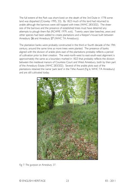
The full extent of the Park was short-lived: on the death of the 3rd Duke in 1778 someland was disparked (Crowley 1995, 33). By 1823 much of this land had returned toarable although the barrows were still topped with trees (WHC 283/202). The sheersize of the barrows and the presence of established trees must have deterred anyattempts to plough them flat (RCHME 1979, xviii). Twenty years later beeches, yews andother species had been added to create plantations and a Keeper’s house built betweenAmesbury 26 and Amesbury 27 (WHC TA Amesbury).The plantation banks were probably constructed in the third or fourth decade of the 19thcentury, around the same time as more trees were planted. The presence of banksaligned with the division of arable plots east of the plantations probably reflects a periodof cultivation prior to their creation. The west-north-west to east-south-east alignment isapproximately the same as a boundary marked in 1823 that probably reflects the divisionbetween the medieval manors of Countess Court and West Amesbury, both by then partof the Amesbury Estate (WHC 283/202). Several of the arable plots east of theplantations retained the name ‘park land’ in the Tithe Award (Fig 6; WHC TA Amesbury)and are still cultivated today.Fig 7: The gunpost on Amesbury 37.© ENGLISH HERITAGE 23 83 - 2011


