Wildlife Habitat Planning Strategies, Design ... - Sonoran Institute
Wildlife Habitat Planning Strategies, Design ... - Sonoran Institute
Wildlife Habitat Planning Strategies, Design ... - Sonoran Institute
- No tags were found...

You also want an ePaper? Increase the reach of your titles
YUMPU automatically turns print PDFs into web optimized ePapers that Google loves.
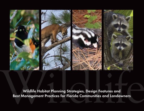
Headlinesubhead<strong>Wildlife</strong> <strong>Habitat</strong> <strong>Planning</strong> <strong>Strategies</strong>, <strong>Design</strong> Features andBest Management Practices for Florida Communities and Landowners
1 AcknowledgementsThis project was made possible by a grant from Florida’s<strong>Wildlife</strong> Legacy Initiative. The Legacy Initiative is a programof the Florida Fish and <strong>Wildlife</strong> Conservation Commission,with funding provided through State <strong>Wildlife</strong> Grants administeredby the US Fish and <strong>Wildlife</strong> Service. Additionalsupport was provided by the Florida <strong>Wildlife</strong> Federation,Jane’s Trust, The Martin Foundation, The BatchelorFoundation, the Elizabeth Ordway Dunn Foundation andthe Florida Department of Community Affairs.Special recognition is given to:Dan Pennington, 1000 Friends of Florida,research, writing and editingVivian Young, 1000 Friends of Florida,reviewJoanne Davis, 1000 Friends of Florida,photos and editing supportCharles Pattison, 1000 Friends of Florida,editing and content suggestionsKathleen Morris, 1000 Friends of Florida,reviewCatherine “Katie Anne” Donnelly,1000 Friends of Florida,research and writingKelly Duggar, 1000 Friends of Florida,research and writing,Kacy O'Sullivan, 1000 Friends of Florida,research and writing,Front Cover Photos Courtesy ofBird and Skunk: David Moynahan, FWC; Panther: Mark Lotz, FWC;Racoons: Charles Littlewood and the Florida <strong>Wildlife</strong> FederationBack Cover Photos Courtesy ofJoanne Davis, 1000 Friends of Florida1000 Friends of Florida would like to thank the following individuals for their generous contributions tothis document. This does not imply, however, that the following contributors endorse this document or itsrecommendation.Amy Knight and Jonathan Oetting, Florida Natural AreasInventory for significant input and editing of Chapter 4, “Dataand Analyses Development”Mark Easley of URS Corporation Southern and JoshuaBoan, Florida Department of Transportation, significant developmentof Chapter 8, “<strong>Planning</strong> for Transportation Facilities and<strong>Wildlife</strong>”Ronald Dodson, President and CEO, Audubon International,helping to write, edit and comment on Chapter 9, “<strong>Planning</strong><strong>Wildlife</strong>-Friendly Golf Courses in Florida”Benjamin Pennington, graphics and project web sitedevelopmentRebecca Eisman, Creative Endeavors, graphic designWill Abberger, Trust for Public Land • Dave Alden Sr., FWC • Matt Aresco, Nokuse Plantation • Ray Ashton, Ashton BiodiversityResearch & Preservation <strong>Institute</strong>, Inc. • Tom Beck, Wilson Miller, Inc. • Lisa B. Beever, PhD, AICP, Charlotte Harbor, National EstuaryProgram • Shane Belson, FWC • Anthony (Tony) Biblo, Leon County • Jeff Bielling, Alachua County • Dr. Reed Bowman,Archbold Biological Station • Tim Breault, FWC • Casey Bruni, Babcock Ranch • Mary Bryant, The Nature Conservancy • JohnBuss, City of Tallahassee • Billy Buzzett, The St. Joe Company • Gail Carmody, U S Fish and <strong>Wildlife</strong> Service • Gary Cochran,FWC • Vernon Compton, The Nature Conservancy • Courtney J. Conway, Arizona Cooperative Fish and <strong>Wildlife</strong> Research Unit •Marlene Conaway, KMC Consulting, Inc. • Ginger L. Corbin, U.S. Fish & <strong>Wildlife</strong> Service • John Cox, City of Tallahassee • SaraDavis, Florida <strong>Wildlife</strong> Federation • Richard Deadman, DCA • Craig Diamond, DCA • Eric Dodson, Audubon International •Tim Donovan, FWC • Eric Draper, Audubon of Florida • Mark Endries, FWC • Dr. James A. Farr, FDEP • Kim Fikoski,The Bonita Bay Group • Neil Fleckenstein, Tall Timbers Research Station • Charles Gauthier, DCA • Terry Gilbert, URSCorporation Southern • Greg Golgowski, The Harmony <strong>Institute</strong> • Stephen Gran, Manager, Hillsborough County • Kate Haley,FWC • Cathy Handrick, FWC • Bob Heeke, Suwannee River WMD • Rachel A. Herman, Sarasota County • Betsie Hiatt,Lee County Florida • William Timothy Hiers, The Old Collier Golf Club • Dr. Tom Hoctor, Geoplan, University of Florida • TedHoehn, FWC • Robert Hopper, South Florida WMD • David Hoppes, Glatting Jackson • Dr. Mark Hostetler, University of Florida• Greg Howe, City of Tampa • Anita L. Jenkins, Wilson Miller, Inc. • Bruce Johnson, Wilson Miller, Inc. • Rosalyn Johnson,University of Florida • Greg Kaufmann, FDEP • Debbie Keller, The Nature Conservancy • Carolyn Kindell, Florida Natural AreasInventory • Michael J. Kinnison, FDEP • Barbara Lenczewski, DCA • Kris Van Lengen, Bonita Bay Group • Douglas J. Levey,University of Florida • Katie Lewis, Florida Division of Forestry • Jay Liles, Florida <strong>Wildlife</strong> Federation • Jerrie Lindsey, FWC • BillLites, Glatting Jackson • Mark Lotz, FWC • Martin B Main, University of Florida • Laurie Macdonald, Defenders of <strong>Wildlife</strong> •Julia "Alex" Magee, Florida Chapter, American <strong>Planning</strong> Association • Jerry McPherson, Bonita Bay Group • Tricia Martin, TheNature Conservancy • Terri Mashour, St. Johns River WMD • Dr. Earl McCoy, University of South Florida • Kevin McGorty, TallTimbers Land Conservancy • Rebecca P. Meegan, Coastal Plains <strong>Institute</strong> and Land Conservancy • Julia Michalak, Defenders of<strong>Wildlife</strong> • Mary A. Mittiga, U.S. Fish and <strong>Wildlife</strong> Service • Rosi Mulholland, FDEP • Christine Mundy, St. Johns River WMD •Annette F. Nielsen, FDEP • Joe North, FDEP • Dr. Reed Noss, University of Central Florida • Cathy Olson, Lee County Florida •Matthew R. Osterhoudt, Sarasota County • John Outland, FDEP • Sarah Owen, AICP, Florida <strong>Wildlife</strong> Federation • HowardPardue, Florida Trail Association • Lorna Patrick, U.S. Fish and <strong>Wildlife</strong> Service • Nancy Payton, Florida <strong>Wildlife</strong> Federation •Jeffrey Pennington • Larry Peterson, Kitson & Partners • Paola Reason, Cresswell-Associates • Ann Redmond, BiologicalResearch Associates • Salvatore Riveccio, Florida <strong>Wildlife</strong> Federation • Preston T. Robertson, Florida <strong>Wildlife</strong> Federation •Christine Small, FWC • Scott Sanders, FWC • Keith Schue, The Nature Conservancy • Gregory Seamon, Wilson Miller Inc. •Vicki Sharpe, FDOT • Lora Silvanima, FWC • Daniel Smith, University of Central Florida • Joseph E. Smyth, FDEP, RainbowSprings State Park • Noah Standridge, Collier County • Hilary Swain, Archbold Biological Station • Kathleen Swanson, FWC •Vicki Tauxe, FDEP • Jon Thaxton, Sarasota County Commission • Walt Thomson, The Nature Conservancy • Sarah KeithValentine, City of Tallahassee • Keith Wiley, <strong>Wildlife</strong> Biologist, Hillsborough County • Michelle Willey, Kitson & Partners/Babcock Ranch• Donald Wishart, Glatting Jackson • Christopher Wrenn, Glatting Jackson • Julie Brashears Wraithmell, Audubon of Florida
Table of Contents 2List of Text Boxes by Chapter 3C HAPTER 1 — <strong>Design</strong>ing <strong>Wildlife</strong>-Friendly Communities in Florida 4• The Value of Green Infrastructure 6• A Tiered Approach to Conservation 8• The Top Tier: Toward a Statewide Green Infrastructure in Florida 8• Twenty-First Century Initiatives – Linkage Between Tiers 10• Promoting Green Infrastructure at the Middle Tier 11C HAPTER 2 — Community <strong>Wildlife</strong> and <strong>Habitat</strong> 13Conservation Framework and Principles• The North American Model of <strong>Wildlife</strong> Conservation 14• Ecological Principles for Managing Land Use 14• <strong>Design</strong>ing Functional Green Infrastructure for <strong>Wildlife</strong> 17• Merging Biology with <strong>Planning</strong> 21C HAPTER 3 — Envisioning and <strong>Planning</strong> <strong>Wildlife</strong> 22Friendly Communities• Goals for <strong>Planning</strong> <strong>Wildlife</strong>-Friendly Communities 23• The First Steps 30C HAPTER 4 — Data and Analyses Development 35• Conducting a Birds-Eye-View Analysis 36• Taking Advantage of Geographic Information Systems (GIS) 36• Performing an Ecological Inventory 41• Developing Ecological Scoring Criteria and a Scoring System 42• Choosing From a Growing List of Analysis and Mapping Tools 42• Consulting Additional State and Regional <strong>Wildlife</strong> and <strong>Habitat</strong> Data Sources 45C HAPTER 5 — The Florida <strong>Wildlife</strong>-Friendly Toolbox 48• The Local Comprehensive Plan 49• Developments of Regional Impact 51• Sector Plans 54• Rural Land Stewardship Areas 57• Special Large Property Opportunities 61C HAPTER 6 — An Implementation Toolbox for Green Infrastructure 64• Easements 65• Subdivisions and Conservation Subdivisions 69• Upland <strong>Habitat</strong> Protection Ordinances 72• <strong>Habitat</strong> Conservation Plans 75• Mitigation and Restoration Plans 77• Federal, State and WMD Mitigation Banks and Parks in Florida 81C HAPTER 7 — Management and <strong>Design</strong> Factors 83• Managing for Fire 84• <strong>Wildlife</strong>-Friendly Lighting 89• <strong>Planning</strong> Stormwater Management and Waterbody Buffers for <strong>Wildlife</strong> Value 94• Ephemeral Wetlands and Pond Landscapes 95• <strong>Planning</strong> for Supportive Long-Term Behavior in a <strong>Wildlife</strong>-Friendly Community 97C HAPTER 8 — <strong>Planning</strong> for Transportation 99Facilities and <strong>Wildlife</strong>• Guidelines for Accommodating <strong>Wildlife</strong> 100• Identifying the Need and Goals for <strong>Wildlife</strong> Linkages 101• <strong>Design</strong> Considerations for <strong>Wildlife</strong> Linkages 104• Specific <strong>Design</strong> Environmental Factors of <strong>Wildlife</strong> Linkages 109• Linkages for ETDM Projects 115• Linkages for Non-ETDM Projects 117• Road and Highway Related Stormwater Facilities 118C HAPTER 9 — <strong>Planning</strong> <strong>Wildlife</strong>-Friendly Golf Courses in Florida 120• <strong>Planning</strong> for <strong>Habitat</strong> and <strong>Wildlife</strong> Basics 121• <strong>Planning</strong> for the Birds 129• Integrate Fire Dependent Natural Communities and Golf Courses 131• Buffers for Waterbodies and Wetlands 131• Golf Course Stormwater Treatment Trains and Capturing <strong>Wildlife</strong> <strong>Habitat</strong> Value 132• Engage Golf Course Staff and Golfers 133• Summary 133C HAPTER 10 — <strong>Wildlife</strong> Conservation and Restoration in 135Agricultural and Rural Areas• Starting Points 136• Federally Funded Farm Bill Programs 138• Non-Farm Bill Federal Initiatives 142• State Funded <strong>Wildlife</strong> <strong>Habitat</strong> Cost-Share Programs 144• Agricultural Conservation Easements and Land Donations 145• Rural Land Stewardship Program 148• Conservation and Restoration Techniques 148• Agritourism Potential in Florida’s Rural and Agricultural Lands 149APPENDIX 1 — Sample Comprehensive Plan Goals, 151Objectives and PoliciesAPPENDIX II — References 164
3Informational Text Boxes by ChapterC HAPTER 1 — <strong>Design</strong>ing <strong>Wildlife</strong>-Friendly Communities in Florida• Important Ecosystem “Services” of Green Infrastructure• The Florida Fish and <strong>Wildlife</strong> Conservation CommissionC HAPTER 2 — Community <strong>Wildlife</strong> and <strong>Habitat</strong> Conservation Frameworkand Principles• What is the North American Model of <strong>Wildlife</strong> Conservation?• <strong>Wildlife</strong> Corridors Benefit Plant Biodiversity• Considerations of Corridor <strong>Design</strong>C HAPTER 3 — Envisioning and <strong>Planning</strong> <strong>Wildlife</strong> Friendly Communities• Managed Environmental Lands Add to the Quality of Life and Real Market Value• The Pattern of Land Development Relative to <strong>Habitat</strong> Spatial Problems• The Good Neighbor Approach: Oscar Scherer State Park in Sarasota County• Address All Phases of a Development• Capital Cascades Greenway, Tallahassee: Integrating “Hard” and “Green” Infrastructures• Volusia Forever ProgramC HAPTER 4 — Data and Analyses Development• Scale and Birds-Eye-View Tools• <strong>Wildlife</strong> and <strong>Habitat</strong> Information and Analyses Service Providers• Mapping and Analysis Tools• Additional State and Regional <strong>Wildlife</strong> and <strong>Habitat</strong> Data SourcesC HAPTER 5 — The Florida <strong>Wildlife</strong>-Friendly Toolbox• The West Bay Sector Plan• <strong>Wildlife</strong> Considerate BridgingC HAPTER 6 — An Implementation Toolbox for Green Infrastructure• Tall Timbers Land Conservancy• Upland Ordinances in Tampa and Martin County• Sarasota County HCP for Scrub-Jays• Lee County Capital Improvements Plan• Island Park Regional Mitigation Site at Estero Marsh PreserveC HAPTER 7 — Management and <strong>Design</strong> Factors• Fire in the Suburbs: Ecological Impacts of Prescribed Fire in Small Remnants of LongleafPine Sandhill• Lighting for Conservation of Protected Coastal Species• Desired <strong>Planning</strong>, <strong>Design</strong> and Management for Ephemeral Wetlands and PondsC HAPTER 8 — <strong>Planning</strong> for Transportation Facilities and <strong>Wildlife</strong>• <strong>Wildlife</strong> Crossings in Florida• <strong>Planning</strong> for a Eglin-Nokuse <strong>Wildlife</strong> Linkage• Intersecting Paths: Linear <strong>Habitat</strong>s and Roadways• Modeling Tools for <strong>Wildlife</strong> Crossings• Longer Bridge Spans Provide More Space for <strong>Wildlife</strong> Passage• <strong>Design</strong>, Installation, and Monitoring of Safe Crossing Points for Bats in Wales• Integrating Transportation and Stormwater Facility <strong>Planning</strong> with <strong>Wildlife</strong>-FriendlyCommunity <strong>Planning</strong>C HAPTER 9 — <strong>Planning</strong> <strong>Wildlife</strong>-Friendly Golf Courses in Florida• Sustaining Fox Squirrels, As Is True Of Many Species, May Take A Little <strong>Planning</strong>• Twin Eagles Golf Course Community and Linkage to the Corkscrew Regional Ecosystem(CREW)• Quick Basic <strong>Planning</strong> for <strong>Wildlife</strong> Features• Audubon International’s Programs to Help Golf Courses and Communities be <strong>Wildlife</strong>-Friendly• University Of Florida IFAS Study Says Golf Is for the Birds• Golf Courses and <strong>Wildlife</strong> Friendly Environmental Practices• Encouraging Burrowing Owls at Golf CoursesC HAPTER 10 — <strong>Wildlife</strong> Conservation and Restoration in Agriculturaland Rural Areas• Hillsborough County: Proactive <strong>Wildlife</strong> <strong>Habitat</strong> Protection and Agricultural Viability• Conservation Plans of Operation and <strong>Wildlife</strong> <strong>Habitat</strong> Development Plans• Florida’s Federal Trust Species• The Rural and Family Lands Protection Act: Funding for Protection of Agriculture and NaturalResources in Florida• Babcock Ranch: Ecotourism Opportunities in Conjunction with Agriculture and SmartDevelopment
Chapter 1<strong>Design</strong>ing <strong>Wildlife</strong>-Friendly Communities in Florida4Photo Courtesy of Joanne Davis, 1000 Friends of Florida
5Chapter 1<strong>Design</strong>ing <strong>Wildlife</strong>-Friendly Communities in FloridaP O P U L A T I O NF O R E C A S T17.9 Million35.8 Million2005 2060Florida 2060:A Research Project of1000 Friends of FloridaBoth geologically and biologically, Florida is a very distinctregion of the United States. Southern Florida has a subtropicalclimate which transitions through the central part of the state to amore temperate climate in North Florida. Due to its peninsulargeography and this range of climates, Florida supports in excessof 700 terrestrial animals, 200 freshwater fish, and 1,000 marinefish, as well as numerous other aquatic and marine vertebrates,and many thousands of terrestrial insects and other invertebrates.While many of these species can be found elsewhere in NorthAmerica, there are also a number that are unique to Florida.As with so many other places in the world, Florida is facingrapid growth, which is resulting in major changes in land use andrelated impacts on the state’s natural resources. Florida’s populationgrew from approximately 3 million people in 1950 to morethan 18 million in 2005. Moderate projections indicate thatFlorida’s population could increase to 36 million by the year2060. If the historic patterns of development continue over thenext 50 years, Florida could stand to convert 7 million acres ofadditional land from rural to urban uses, including 2.7 millionacres of native habitat.Adding millions of new residents to this state will only serve toheighten the competition between wildlife and humans for land,water, food and air resources. Given the ability of humans toreshape entire landscapes to meet their needs, there is no doubtthat wildlife will not fare well. In the face of this unrelenting growthand development, it is imperative that Floridians recognize theneed to serve as wise stewards of the land, water, and theintertwined ecosystems.While protecting large tracts of undisturbed landscapes isbest from a wildlife perspective, unfortunately that is increasinglyimpossible in Florida. Future efforts, then, must include strategiesto maximize habitat within and adjacent to developed, managed,or otherwise human-influenced landscapes. The goal of thismanual is to share Florida-specific wildlife conservation toolsthat can be used by community planners, landscape architects,B E F O R EA F T E RFlorida 2060: A Research Project of 1000 Friends of Florida
7Chapter 1<strong>Design</strong>ing <strong>Wildlife</strong>-Friendly Communities in FloridaMany smaller creatures —from newts to eagles — canfinds sufficient habitat tosurvive in our suburban andurban environments if werecognize their basic needsand work to integratethem into the developedlandscape.IMPORTANT ECOSYSTEM “SERVICES” OFGREEN INFRASTRUCTURE•Sustain biodiversity.•Protect areas from impacts of flooding, storm damage ordrought.•Protect stream and river channels and coastal shores fromerosion.•Provide a carbon sink. As an example, 100 acres of woodlandcan absorb emissions equivalent to 100 family cars.•Offer pollution control. Vegetation has a significant capacityto attenuate noise and filter air pollution from motor vehicles.Wetland ecosystems are also effective in filtering pollutedrun-off and sewage.•Provide natural “air conditioning.” A single large tree can beequivalent to five room air conditioners and will supply enoughoxygen for ten people.•Provide microclimate control by providing shade, hold inhumidity and blocking winds and air currents.•Protect people from the sun’s harmful ultraviolet rays.•Cycle and move nutrients and detoxify and decomposewastes.Thoughtful planning at the community level can lessen theimpacts from these stressors. Many smaller creatures- — fromnewts to eagles — can finds sufficient habitat to survive in oursuburban and urban environments if we recognize their basicneeds and work to integrate them into the developed landscape.To promote sustained biodiversity, a community first must identifylocal wildlife and habitats, and then ensure that basic necessitiesfor survival are sustained, including food, cover, water, livingand reproductive space, and limits on disturbances.•Control agricultural pests and regulate disease carryingorganisms.•Generate and preserve soils and renew their fertility.•Disperse seeds and pollinate crops and natural vegetation.•Contribute to the health and wellbeing of our citizens.Accessible green space and natural habitats createopportunities for recreation and exercise, and studies haveshown that this increases our creative play, social skills andconcentration span.•Contribute to a community’s social cohesion. The activeuse of greenspaces, including streets and communalspaces, can encourage greater social interaction andcontribute to a lively public realm. Participation in thedesign and stewardship of green space can help strengthencommunities.•Enhance economic value. Natural greenspaces canincrease property values, reduce management overheads,and reduce healthcare costs.Adapted from: Ecosystem Services, Ecological Societyof America, 2000, at www.esa.org; and, Biodiversity by<strong>Design</strong>: A Guide for Sustainable Communities, Town andCountry <strong>Planning</strong> Association (TCPA), England, 2004.At the same time, ecosystems provide many “services” withlittle or no capital costs involved. These can range from protectingareas from flooding, to providing natural “air conditioning,”to offering pollution control. The ecological services of greeninfrastructure can be conserved and enhanced through carefulplanning. Extending the green infrastructure network to adjacentcommunities and regional, state or national managed environmentallands is often very possible and can further enhance thevalue and utility of the services.
Chapter 1<strong>Design</strong>ing <strong>Wildlife</strong>-Friendly Communities in Florida8In addition to the ecosystem service values, a community cangain monetary value from carefully integrating habitat into itsjurisdiction. The 2006 total retail sales from wildlife viewing inFlorida were estimated at $3.1 billion ($2.4 billion by residentsand $653.3 million by nonresidents). Since 2001, expendituresin Florida for wildlife viewing have almost doubled ($1.6 billionin 2001). These 2006 expenditures support a total economiceffect to the Florida economy of $5.248 billion. The 2006economic impact of wildlife viewing in Florida is summarizedbelow. (Information from, The 2006 Economic Benefits of<strong>Wildlife</strong> Viewing in Florida, Southwick Associates, Inc, 2008)2006 ECONOMIC IMPACTS OF WILDLIFE VIEWING IN FLORIDAResident Nonresident TotalRetail sales $2.428 billion $653.3 million $3.081 billionSalaries & wages $1.204 billion $391.8 million $1.595 billionFull & part-time jobs 38,069 13,298 51,367Tax revenuesState sales tax $243.1 million $69.7 million $312.8 millionFederal income tax $292.5 million $92.8 million $385.3 millionTotal economic effect $4.078 billion $1.170 billion $5.248 billionA TIERED APPROAC H TO CONSERVATIONOver the past few decades, a three-tiered approach to landconservation has evolved in Florida. The top tier includes largestatewide and regional land acquisition and protection effortsintended to establish “islands” of protected and relatively intacthabitats which are linked, where possible, by ecological greenways.These efforts have laid the foundation for a statewidegreen infrastructure in Florida.The bottom tier includes programs directed at protecting habitatswithin neighborhoods and in backyards. Often grassroots innature, these include the University of Florida’s Florida Yards andNeighborhoods program and the National <strong>Wildlife</strong> Federation’sBackyard <strong>Wildlife</strong> <strong>Habitat</strong> Program, both of which are targetedat individual citizens, families, and/or neighborhoods.The middle tier focuses on creating regional and communitywidegreen infrastructure to promote conservation within largelandholdings, large developments, and neighborhoods. This tieris perhaps the least evolved of the three, but includes betterland use planning, development design, and best managementpractices by both the public and private sectors. It is the middletier at which most development approvals are issued. This tieroffers the greatest potential for better integration of human andwildlife habitat.THE TOP TIER: TOWARD A STATEWIDEGREEN INFRASTRUCTURE IN FLORIDABefore the phrase “green infrastructure” had even been coined,Florida launched an ambitious series of land acquisition and conservationplanning projects which laid the foundation for creatingFlorida’s existing green infrastructure. Building on earlier stateland acquisition programs, in 1990 Florida established thePreservation 2000 program. This 10-year program raised $3billion, and protected 1,781,489 acres of environmentallysensitive land. In 1999, the Florida Legislature created FloridaForever, also designed to dedicate $3 billion to land acquisitionover the following decade. As of December 2006, another535,643 acres of environmentally sensitive land had beenprotected through this effort.As these major land acquisition programs evolved, there wasa growing awareness of the need to be more strategic in landacquisition, and a series of efforts were launched in the 1990s.In 1994, researchers from the Florida Fish and <strong>Wildlife</strong> ConservationCommission (FWC) completed a very important report, Closingthe Gaps in Florida's <strong>Wildlife</strong> <strong>Habitat</strong> Conservation. Thiscornerstone report used a geographic information systemapproach to identify key habitat areas to conserve in orderOver the past few decades,a tiered approach to landconservation has evolvedin Florida. The top tierincludes large statewide andregional land acquisition andprotection efforts intendedto establish “islands” ofprotected and relativelyintact habitats which arelinked, where possible, byecological greenways.
9Chapter 1<strong>Design</strong>ing <strong>Wildlife</strong>-Friendly Communities in FloridaAs part of this effort, theUniversity of Florida undertookthe Florida EcologicalNetwork Project, andcompleted the first phasein 1998. It used GIS datato identify large connectedecologically significantareas of statewide significance.The goal was tocreate a system of interconnectedlands protected fortheir ecological value tonative wildlife and plants,or for their provision ofecological services suchas water quality protectionand flood prevention.THE FLORIDA FISH AND WILDLIFECONSERVATION COMMISSIONThe Florida Constitution vests the Florida Fish and <strong>Wildlife</strong>Conservation Commission with regulatory and executivepowers of the state with respect to wild animal life. Inthe area of regulating hunting and specific wild animalmanagement actions, the principle of state wildlife primacyover local regulation is well established. Courts willinvalidate local ordinances in clear conflict with stateauthority on hunting and wildlife. On the other hand,when such regulations are not in clear conflict, the courtswill often seek to interpret local regulations and state lawharmoniously.By contrast, actions affecting habitat and biodiversityare not yet an organizing concept for federal or stateregulatory programs. Local governments have considerablediscretion to define their planning, managementand regulatory niche. So, for example, a local actionprescribing gopher tortoise protection or mitigation in amanner that conflicts with state regulations, would likelybe invalidated on preemption grounds, whereas a localregulation directed more generally to gopher tortoisehabitat might survive such a challenge. A local regulationdirected even more broadly to protection of entirenatural vegetative community types or ecosystems wouldcertainly not be preempted on these grounds.The Florida Ecological Greenway NetworkPhoto Courtesy of GeoPlan Center Graphic Courtesy of Noss & Cooperrider, 1994
Chapter 1<strong>Design</strong>ing <strong>Wildlife</strong>-Friendly Communities in Florida10to maintain key components of the state’s biological diversity.These areas, known as Strategic <strong>Habitat</strong> Conservation Areas(SHCA), continue to serve as a foundation for conservationplanning in Florida.Around the same time, the seed was being planted for Florida’sgreenways network. In the early 1990s, 1000 Friends of Floridaand The Conservation Fund launched a coordinated effort toidentify and protect a linked network of natural areas to accomplishboth ecological and recreation needs. This evolved into theFlorida Statewide Greenways <strong>Planning</strong> Project, established underthe Florida Department of Environmental Protection in 1990s.As part of this effort, the University of Florida undertook theFlorida Ecological Network Project, and completed the firstphase in 1998. It used GIS data to identify large connectedecologically significant areas of statewide significance. Thegoal was to create a system of interconnected lands protectedfor their ecological value to native wildlife and plants, or for theirprovision of ecological services such as water quality protectionand flood prevention. It helped to form the basis of the FloridaGreenways and Trails System and supports ecological connectivityconservation directed at priority landscape linkages. Thenetwork has been updated several times (most recently in 2004),primarily to take advantage of new data and methods andremove lands lost to development.The result of this process was an updated Florida EcologicalGreenways Network. This network provides a linked statewidereserve system containing most of each major ecologicalcommunity and most known occurrences of rare species. Itrepresents significant progress toward a more integratedapproach to biodiversity conservation in Florida.In 2000, the Florida Natural Areas Inventory released itsFlorida Conservation Needs Assessment. Prepared on behalf ofthe Florida Forever Advisory Council, this report focused on thegeographic distribution of natural resources, or resources-basedland uses (such as sustainable forestry) to guide conservationdecision making related to Florida’s second major state landacquisition program, Florida Forever.T WENT Y-FIRST CENTURY INITIATIVES —LINKAGE BET WEEN TIERSA new round of conservation planning has now begun,building on these earlier efforts. Begun in 2004 as part of anation-wide effort, the Florida Fish and <strong>Wildlife</strong> ConservationCommission’s <strong>Wildlife</strong> Legacy Initiative is an action plan toaddress the long-term conservation of all native wildlife and theplaces they live. The stated goal is to “prevent wildlife frombecoming endangered before they become more rare and costlyto protect.” The initiative focuses on creating partnerships tobetter protect Florida’s wildlife and their habitats. As part ofthe initiative, the Commission has created Florida’s <strong>Wildlife</strong>Conservation Strategy. This updates existing conservationplans from the last 30 years into a single state wildlife actionplan, providing a platform for proactive conservation. Florida’sState <strong>Wildlife</strong> Grants Program provides funds to assist withimplementing the Strategy.One outgrowth of the <strong>Wildlife</strong> Conservation Strategy is theCooperative Conservation Blueprint. The Florida Fish and <strong>Wildlife</strong>Conservation Commission, The Century Commission for aSustainable Florida and Defenders of <strong>Wildlife</strong> are providing leadershipon this project, the goal of which is to build agreementbetween government and private interests on using commonpriorities as the basis for state-wide land use decisions. Whencompleted, it will include a fully unified set of GeographicInformation System (GIS) data layers of conservation anddevelopment lands that will be available to all Floridians, anda package of recommended landowner incentives to applythe strategies statewide.A new round of conservationplanning has now begun,building on earlier efforts.Begun in 2004 as partof a nation-wide effort, theFlorida Fish and <strong>Wildlife</strong>Conservation Commission’s<strong>Wildlife</strong> Legacy Initiative isan action plan to addressthe long-term conservationof all native wildlife and theplaces they live.
11Chapter 1<strong>Design</strong>ing <strong>Wildlife</strong>-Friendly Communities in FloridaThe challenge for Floridacommunities is to craftsituations to healthily maintainthe maximum number ofwildlife species. This isbecoming increasinglydifficult as sprawlingdevelopment has pushedmuch wildlife to the wildernessedge. Additionally,human-to-wildlife contactis escalating, includingnegative interactions.The Florida Fish and <strong>Wildlife</strong> Conservation Commissionupdated Closing the Gaps in the 2006 report, <strong>Wildlife</strong> <strong>Habitat</strong>Conservation Needs in Florida: Updated Recommendations forStrategic <strong>Habitat</strong> Conservation Areas. The report details anassessment to determine the protection afforded to focal species,including many rare and imperiled species, on existing conservationlands in Florida and to identify important habitat areasin Florida that have no conservation protection. These areas,known as Strategic <strong>Habitat</strong> Conservation Areas, serve as afoundation for conservation planning in Florida and depict theneed for species protection through habitat conservation. Thiswas further enhanced with development of The Integrated <strong>Wildlife</strong><strong>Habitat</strong> Ranking System. The Integrated <strong>Wildlife</strong> <strong>Habitat</strong>Ranking System (IWHRS) ranks the Florida landscape basedupon the habitat needs of wildlife as a way to identify ecologicallysignificant lands in the state, and to assess the potentialimpacts of land development projects. The IWHRS is providedas part of the Commission’s continuing technical assistance tovarious local, regional, state, and federal agencies, and entitiesinterested in wildlife needs and conservation in order to: (1) determineways to avoid or minimize project impacts by evaluatingalternative placements, alignments, and transportation corridorsduring early planning stages, (2) assess direct, secondary, andcumulative impacts to habitat and wildlife resources, and (3)identify appropriate parcels for public land acquisition for wetlandand upland habitat mitigation purposes.The Integrated <strong>Wildlife</strong> <strong>Habitat</strong> Ranking System, 2007.These resources and land acquisition funding sources havegone a long way toward creating a statewide green infrastructurenetwork, and can serve as valuable tools which can complementand/or leverage activities at the regional and locallevels. Building on these efforts is the Critical Lands/WatersIdentification Project (CLIP) sponsored by the Century Commissionfor a Sustainable Florida. The Century Commission was formedby the Florida Legislature in 2005 and is tasked with: envisioningFlorida’s future by looking out 25 and 50 years; making recommendationsto the Governor and Legislature regarding how theyshould address the impacts of population growth; and establishinga place where the "best community-building ideas" canbe studied and shared for the benefit of all Floridians. CLIP is aprocess to identify Florida's "must save" environmental treasuresand critical green infrastructure (see Chapter 4 for more informationon CLIP).PROMOTING GREEN INFRASTRUCTURE ATTHE MIDDLE TIERWhile much has been accomplished at the top and bottomtiers, a great deal still remains to be done at the regional andcommunity levels in Florida to conserve Florida’s wildlife andhabitats. Very little will happen at the middle tier to conserve,integrate or enhance wildlife habitat unless people plan, designand manage for this purpose. Fortunately, more and more com-Florida Fish and <strong>Wildlife</strong> Conservation Commission
Chapter 1<strong>Design</strong>ing <strong>Wildlife</strong>-Friendly Communities in Florida12munities, landowners and developers are beginning to integratewildlife features into their local landscapes.The challenge for Florida communities is to craft situations tohealthily maintain the maximum number of wildlife species. Thisis becoming increasingly difficult as sprawling development haspushed much wildlife aside. Additionally, human-to-wildlifecontact is escalating, including negative interactions. The publicsafety threat of large predators has been unintentionally marginalized(alligators, panthers and bears do kill people). Whilethere is, perhaps, a great appreciation of wildlife today, there isalso a growing “Not In My Back Yard” — or NIMBY--reactionthat wants wildlife to be put back “where it belongs.” Betterplanning, design, and use of best management practices at thelocal community level need to be used to help address theseissues.A new wildlife and habitat paradigm needs to be encouraged.It need not be a revolution, but instead, it can evolve from wherewe have been, using many of the same strategies, albeit ina new context. Keys to success will include using science toframe the issues, involving the public in making the decisions,and garnering sufficient support to fund the needed actions.Photo Courtesy David Moynahan PhotographySignage can help educatethe public regarding wildlifeconservation efforts.Photo Courtesy of Dan Pennington and JoanneDavis, 1000 Friends of Florida
13Chapter 2Community <strong>Wildlife</strong> and <strong>Habitat</strong> Conservation Framework and PrinciplesPhoto Courtesy of David Moynahan Photography
Chapter 2Community <strong>Wildlife</strong> and <strong>Habitat</strong> Conservation Framework and Principles14Numerous models, frameworks and principles have helpedto shape approaches to wildlife conservation in the UnitedStates. From the original North American Model of <strong>Wildlife</strong>Conversation to modern ecosystem management, wildlifeconservation has evolved to include the seminal works of E.O.Wilson, Michael E. Soule, Richard Forman, Larry Harris, ReedNoss and others. To meet the future challenge of sustainingwildlife, habitat and ecological systems, a wildlife and habitatconservation framework must be incorporated into land useplanning and land-management decisions.THE NORTH AMERIC AN MODEL OFWILDLIFE CONSERVATIONUnderpinning the approach to wildlife management in theUnited States and Canada is the North American Model of<strong>Wildlife</strong> Conservation. This model has evolved over the last175 years and is based on two basic principles — that our fishand wildlife belong to all citizens of North America, and thatthey should be managed in such a way that their populationswill be sustained forever.It is rooted in the Public Trust Doctrine, derived from the 1842U.S. Supreme Court case, Martin v. Wadell, where wildlifewas held in common ownership by the state for the benefit ofall. Thanks to this foundation, modern wildlife managementhas been hugely successful in restoring populations of gameanimals and their habitats. Species once generally regardedas nuisances, such as alligators, eagles and bears, are nowrevered by the public and have become icons for wild lands.ECOLOGIC AL PRINCIPLES FOR MANAGINGL AND USEThe Ecological Society of America, a scientific non-profit establishedin 1915, released a report in 2000 entitled EcologicalPrinciples for Managing Land Use. This includes a series offive ecological principles for managing land use to ensure thatthe “fundamental processes of Earth’s ecosystems are sustained.”According to the society, the responses of the land to changesin use and management by people depend on expressions ofthese fundamental principles:1. Time Principle — In order to effectively analyze the effectsof land use, it must be recognized that ecological processesoccur within a temporal setting, and change over time. Inother words, the full ecological effects of human activitiesoften are not seen for many years, and the imprint of a landuse may persist for a long time, constraining future land usefor decades or centuries even after it ceases. Also under thetime principle, given time, disturbed ecosystem componentscan often recover. This should guide a community to takea long view when striving to create and maintain habitatlinkage corridors.2. Species Principle — Individual species and networks ofinteracting species have strong and far-reaching effects onecological processes. These focal species affect ecologicalsystems in diverse ways:•Indicator species tell us about the status of other speciesand key habitats or the impacts of a stressor. Manyamphibians and bird species are often considered indicatorspecies. For example the Green Treefrog (Hyla cinerea)and Squirrel Treefrog (Hyla squirella) in Florida have servedthis function. Native indicator species are often used toassess system-wide ecological responses to land usechanges, analogous to the canary in the coal mine.Underpinning the approachto wildlife management inthe United States andCanada is the NorthAmerican Model of <strong>Wildlife</strong>Conservation. This modelhas evolved over the last175 years and is based ontwo basic principles — thatour fish and wildlife belongto all citizens of NorthAmerica, and that theyshould be managed in sucha way that their populationswill be sustained forever.
15Chapter 2Community <strong>Wildlife</strong> and <strong>Habitat</strong> Conservation Framework and PrinciplesIndividual species andnetworks of interactingspecies have strong andfar-reaching effects onecological processes.These focal species affectecological systems indiverse ways.WHAT IS THE NORTH AMERIC AN MODELOF WILDLIFE CONSERVATION?Derived from our rich national hunting heritage, the NorthAmerican Model of <strong>Wildlife</strong> Conservation includes a set ofguidelines known as the “Seven Sisters for Conservation.”These serve as a basis for the conservation of both gameand non-game wildlife. They are:1. <strong>Wildlife</strong> is a public resource. It is held in commonownership by the state for the benefit of all people.2. Markets for trade in wildlife have been eliminatedor publicly managed. Generally, it’s illegal to buyand sell meat and parts of game and non-game species.3. Allocation of wildlife by law. States allocate wildlifeuse and taking by law, not by market pressures, landownership or special privilege. The process fosters publicinvolvement in managing wildlife.4. <strong>Wildlife</strong> can only be killed for a legitimate purpose.The law prohibits killing wildlife for frivolous reasons.5. <strong>Wildlife</strong> species are considered an internationalresource. Some species, such as migratory birds,transcend boundaries and one country’s managementcan easily affect a species in another country.6. Science is the proper tool for discharge of wild--life policy. The concept of science-based, professionalwild-life management is central.7. The democracy of hunting. In the European model,wildlife was allocated by land ownership and privilege. InNorth America, anyone in good standing can participate.The enduring strategies of the North American Modelinclude collaboration, partnerships, coalition building, professionaldevelopment, science, political savvy, persistence,and open-minded approaches.Source: “The Zoo without Bars, <strong>Wildlife</strong> Management forthe New Millennium”, Tim Breault, FFWCC, 2007.Photo Courtesy of David Moynahan Photography
Chapter 2Community <strong>Wildlife</strong> and <strong>Habitat</strong> Conservation Framework and Principles16•Keystone species have greater effects on ecologicalprocesses than would be predicted from their abundanceor biomass alone. In Florida, the gopher tortoise can beconsidered a keystone species.•Ecological engineers alter the habitat and, in doing so,modify the fates and opportunities of other species. Floridaexamples include the gopher tortoise and beaver.•Umbrella species either have large area requirementsor use multiple habitats and thus overlap the habitatrequirements of many other species. These can includethe panther and black bear.•Link species are those that perform an important ecologicalfunction or provide critical links for energy transfer withinor across complex food webs. Their removal from thesystem would affect one or multiple other species (e.g.,alligators and their role in the creation and maintenanceof ponds and wet areas during times of drought).3. Place Principle — Each site or region has a unique setof organisms and aboiotic conditions influencing andconstraining ecological processes.4. Disturbance Principle — Disturbances are important andubiquitous events whose effects may strongly influence population,community, and ecosystem dynamics. Disturbances caninclude natural events such as fires, drought and inundation, aswell as man-made disturbances including building roads,drawing down water tables, adding night lighting, or clearingland for development. Land use changes that alter naturaldisturbance regimes or initiate new disturbances are likely tocause changes in species abundance and distribution, communitycomposition, and ecosystem function.5. Landscape Principle — The size, shape, and spatial relationshipsof habitat patches on the landscape affect thestructure and function of ecosystems. Settlement patterns andland use decisions fragment the landscape and alter naturalland cover patterns. <strong>Habitat</strong> fragmentation decreases in thesize or wholeness of habitat patches and can increases inthe distance between habitat patches of the same type. Thiscan greatly reduce or eliminate populations of organisms, aswell as alter local ecosystem processes.Two other commonly accepted principles can perhaps beadded to this list of ecological principles (Dr. T. Hoctor,University of Florida, Geoplan):1. Ecological Complexity Principle — Ecosystems are notonly more complex then we think, but they may be morecomplex than we can think.Link species are those thatperform an importantecological function orprovide critical links forenergy transfer within oracross complex food webs.Their removal from the systemwould affect one or multipleother species (e.g., alligatorsand their role in the creationand maintenance of pondsand wet areas during timesof drought).Photo Courtesy of: Panther in Tree: Mark Lotz,FWC; Manatee in Canel: Eric Weber; Cow-Nosed Rays: Jeffrey Pennington; Snake: MattAresco
17Chapter 2Community <strong>Wildlife</strong> and <strong>Habitat</strong> Conservation Framework and PrinciplesIn Florida, some commonplaceapplications includeavoiding sprawling developmentand minimizingthe need for new roadsand other infrastructure.Additionally, when planningnew or retrofitting olddevelopment, it is importantto maintain or restorelinkages between sizablepatches of critical areas,and minimize or compensatefor the effects of developmenton ecological processes.2. Precautionary Principle — When there is uncertainty inland planning and wildlife and habitat conservation needs(which is most always), err toward protecting too muchinstead of too little. It is difficult and, at times, impossible torestore what has been lost.The Ecological Principles for Managing Land Use report alsoincludes a series of guidelines to incorporate ecological principlesinto land use decision making. The society recommendsthat land managers should:1. Examine the impacts of local decisions in a regional context.2. Plan for long-term change and unexpected events.3. Preserve rare landscape elements and associated species.4. Avoid land uses that deplete natural resources.5. Retain large contiguous or connected areas that containcritical habitats.6. Minimize the introduction and spread of nonnative species.7. Avoid or compensate for the effects of development onecological processes.8. Implement land-use and management practices that arecompatible with the natural potential of the area.In Florida, some commonplace applications include avoidingsprawling development and minimizing the need for new roadsand other infrastructure. Additionally, when planning new or retrofittingold development, it is important to maintain or restore linkagesbetween sizable patches of critical areas, and minimize or compensatefor the effects of development on ecological processes.DESIGNING FUNCTIONAL GREENINFRASTRUCTURE FOR WILDLIFEOur understanding of how to design wildlife-sustainable greeninfrastructure has its roots in a field known as island biogeography.Scientists observed that islands and peninsulas around theworld generally hold fewer species than expected whencompared to larger land masses. In their 1967 book, TheTheory of Island Biogeography, Edward O. Wilson and R.H.MacArthur propounded that the number of species found on anisland is determined by the distance from the mainland and thesize of the island, both of which would affect the rate of extinctionon and immigration to the island. Thus, a larger island closerto the mainland would likely have a greater diversity of speciesthan a smaller island farther from the mainland. Later studieshave expanded this to include that habitat diversity may be as,or more important than, the island’s size.An “island” can include any area of habitat that is surroundedby areas unsuitable for species on the island — including forestfragments, reserves and national parks surrounded by humanalteredlandscapes. This theory has proven remarkably accurateand has become an important foundation of modern landscapeecology. It also has led to development of the habitat corridoras a conservation tool to increase the connections betweenhabitat islands. These corridors can increase the movementof species between protected lands, helping to increase thenumber of species that can be supported.As landowners and local governments work together to createwildlife-friendly communities, it is important to understand moreabout the key concepts of patches, corridors, and edge effectswhich have evolved out of the study of biogeography. In his1995 book, Land Mosaics: The Ecology of Landscapes andRegions, noted Harvard Professor of Landscape ArchitectureRichard T.T. Forman described these important concepts ingreat detail.Patches — Forman defined a patch as a relatively homogenousarea that differs from its surrounding. From a wildlife perspective,patches are discrete landscape areas which offer better survivalprospects for wildlife, and regularly meet living prerequisites,including food, cover, water, living space, and limits on disturbances.Human impacts tend to lead to smaller and smaller
Chapter 2Community <strong>Wildlife</strong> and <strong>Habitat</strong> Conservation Framework and Principles18Graphics by Benjamin PenningtonABA) A small patch of habitat, cut-off from similar habitat areas, is depleted overtimeof wildlife and the opportunities for wildlife replenishment.; B) <strong>Habitat</strong> patchshape, size and connectivity can be important to wildlife survival. A large patchwith a coherent interior environment is best for many species. Several smaller habitatpatches with reasonable cross-connections may sustain desired wildlife.Several patches in relative close proximity are often better than stretched-out orsmaller chopped-up patches that lose unique interior habitats and micro climates.patches — or islands—of living space. Patches are furtherfragmented by development impacts including roads andsubdivisions. Agricultural practices leading to increased fragmentationinclude tilling for crops, burning, over and under watering,dosing with fertilizers and pesticides, and livestock ranging.<strong>Habitat</strong> fragmentation can lead to changes in physical factors,shifts in habitat use, altered population dynamics, and changesin species composition. Patch (or island) size has been identifiedas a major feature influencing the health and sustainability of plantand animal communities (Monica Bond, Center for BiologicalDiversity, Principles of <strong>Wildlife</strong> Corridor <strong>Design</strong>, 2003). Thereare a few exceptions. For example, raccoons and mockingbirdshave adapted to human-dominated landscapes anddiscontinuous habitats.The composition and diversity of patches, as well as theirspatial relationship with one another, will determine the relativesustainability of a community’s green infrastructure. Patchesmay or may not be self evident, so it is important to haveexperienced input into the design of the community plan.Corridors — A corridor can be defined as a strip of landthat aids in the movement of species between disconnectedpatches of their natural habitat. This habitat typically includesareas that provide food, breeding ground, shelter, and otherfunctions necessary to thrive. Not only can human impactaffect the size of patches, as described earlier, but it can alsocause animals to lose the ability to move between the patches.Because they allow for long-term genetic interchange, corridorscan also reduce inbreeding, facilitate patch re-colonization,and increase the stabilities of populations and communities.Planners, landscape architects, land managers and conservationbiologists are faced with the task of reconnecting existingfragmented landscapes. Strategic conservation decisions needto be made within a larger community context. Clear financialA corridor can be definedas a strip of land that aidsin the movement of speciesbetween disconnectedpatches of their naturalhabitat. This habitat typicallyincludes areas that providefood, breedingground, shelter, and otherfunctions necessary to thrive.
19Chapter 2Community <strong>Wildlife</strong> and <strong>Habitat</strong> Conservation Framework and Principles<strong>Wildlife</strong> corridors appear tobenefit not only wildlife butalso plants. A six-year studyat the world’s largest experimentallandscape devotedto the corridors has foundthat more plant species -- andspecifically more native plantspecies — persist in areasconnected by the corridorsthan in isolated areas of thesame size. The resultssuggest that corridors arean important tool not only forpreserving wildlife but alsofor supporting and encouragingplant biodiversity.CASE STUDY<strong>Wildlife</strong> Corridors Benefit Plant Biodiversity<strong>Wildlife</strong> corridors appear to benefit not only wildlife but alsoplants. A six-year study at the world’s largest experimental landscapedevoted to the corridors has found that more plantspecies--and specifically more native plant species — persistin areas connected by the corridors than in isolated areasof the same size. The results suggest that corridors are animportant tool not only for preserving wildlife but also forsupporting and encouraging plant biodiversity.Researchers created a massive outdoor experiment at theSavannah River Site National Environmental Research Parkon the South Carolina — Georgia line. In two earlier studies,the researchers concluded that corridors encourage the movementof plants and animals across the fragmented landscapes.They also found that bluebirds transfer more berry seeds intheir droppings between connected than unconnected habitatpatches, suggesting that the corridors could help plants spread.The latest research tackled a much broader question: Docorridors increase plant biodiversity overall? The differencebetween the habitats studied was similar to the differencebetween urban and natural areas, where corridors are mostoften used. The experimental sites were created in 1999,and there was little difference between connected andunconnected patches of habitat one year later. But a differentpattern became clear in ensuing years. Not only were theremore plant species in connected than unconnected patches,there were also more native species. The difference arosebecause unconnected patches gradually lost about 10 nativeAn aerial photograph of one experimental landscape showing habitat patchconfigurations.species over the 5 years, whereas the natives persisted inconnected patches.Meanwhile, the corridors seemed to have no impact on thenumber of exotic or invasive species in the connected andunconnected patches. It seems that either exotic speciesalready were widespread, and did not rely on corridors fortheir spreading, or they remained in one place. The scientiststhink that invasive species, which by definition are good atspreading, are little affected by corridors. Native species,by contrast, are less invasive in nature and appear to beassisted more by the corridors and the linkages they provide.The researchers suggest it may be that corridors play to thestrengths of native species.Source: University of Florida News, 2006; Writer, AaronHoover, reporting on work by Douglas J. Levey, et al, Science,2005 “Effects of Landscape Corridors on Seed Dispersalby Birds.”Photo Courtesy of U.S. Forest Service
Chapter 2Community <strong>Wildlife</strong> and <strong>Habitat</strong> Conservation Framework and Principles20limitations related to land purchases, restoration options, easementsand other tools will shape the final outcome.Facilitating connections between Florida’s already protectedlands and outlying patches can be a valuable tool. Throughcareful planning and design, wildlife corridors can lessen thenegative effects of habitat fragmentation by linking patches ofremaining habitat. Corridors can be incorporated into thedesign of a development project either by conserving an existinglandscape linkage, or by restoring habitat to function as a connectionbetween protected areas onsite, off-site and through-site.There is still considerable debate over the effectiveness of corridorsand how they should be configured and sized. The answerdepends on the species under conservation consideration. Thelevel of connectivity needed to maintain a population of a particularspecies will vary, and depends on such issues as the sizeof the population, survival and birth rates, the level of inbreeding,and other demographics which can serve as baseline data todetermine whether a corridor is likely to be functional.In 1992, forestry experts Paul Beier and Steve Loe drafted,In My Experience: A Checklist for Evaluating Impacts to <strong>Wildlife</strong>Movement Corridors. They identified six steps for evaluatingcorridor practicality, including to:1. Identify and select several target species for the design of thecorridor (e.g., select "umbrella species" and the associatedbenefiting species).2. Identify the habitat patch areas the corridor is designed toconnect.3. Evaluate the relevant needs of each target and associatedspecies such as movement and dispersal patterns, includingseasonal migrations or environmental variations (e.g., somespecies depend on there being season wetlands available).4. For each potential corridor, evaluate how the area willaccommodate movement by each target species.Protected interior environment (brighter green), progressing to those that essentially become all edge environment and no interior.Graphic by Benjamin Pennington, remade from illustrations in Micheal E. Soule, Journal of the American <strong>Planning</strong> Association, “Land Use <strong>Planning</strong> and<strong>Wildlife</strong> Maintenance, Guidelines for Conserving <strong>Wildlife</strong> in an Urban Landscape,” 19915. Draw the corridor on a map and work with community toestablish a pragmatic plan to sustain or restore the connections.6. <strong>Design</strong> a monitoring program to gauge corridor viability,human community interface impacts and modification needs.When evaluating a potential corridor, it is important to considerhow likely the animal(s) will encounter the corridor’s entrance,actually enter the corridor, and follow it. Factors to evaluateinclude whether the corridor contains sufficient cover, food, andwater, or whether these features need to be created and maintained.It is also important to determine if the new developmentcontains or creates impediments to wildlife movement. Thesemay include topography, the introduction of new roads, and thetypes of road crossing, fences, outdoor lighting, domestic pets,and noise from traffic or nearby buildings, exotic plant migration,and other human or disturbance impacts.Edges — The “perimeter zone” of a patch can have a somewhatdifferent environment from the interior of the patch, due toits proximity to adjacent patches, changes in light penetration,noise, microclimate, and other factors. This “edge effect” canhave implications when planning for conservation areas. Forexample, a long, thin, habitat patch could essentially be all edge,while a circle has the minimum perimeter for a given area, andThere is still considerabledebate over the effectivenessof corridors and how theyshould be configured andsized. The answer dependson the species under conservationconsideration.
21Chapter 2Community <strong>Wildlife</strong> and <strong>Habitat</strong> Conservation Framework and PrinciplesEdge effects have implicationswhen planning themajor components of acommunity’s green infrastructuresuch as decidingwhether to work towarda single large or severalsmaller interconnectedreserves. In more developedareas, a carefully considerednetwork of varyingsized habitat patches withappropriately designedlinkage corridors may beappropriate.CONSIDERATIONS OF CORRIDOR DESIGN•The corridor should be as wide as possible. The corridorwidth may vary with habitat type or target species but arule of thumb is wider and larger areal extent is better.•The longer the corridor the wider it may have to be.•Maximize land uses adjacent to the corridor that reducehuman impacts to the corridor. Essentially, corridorssurrounded by intensive land uses should be wider thanthose surrounded by low intensity uses.•To lessen the impact of roads, maintain as much naturalopen space as possible next to any culverts and bridgeunder/overpasses to encourage their use.•Do not allow housing or other impacts to project into thecorridor or form impediments to movement and increaseharmful edge effects.•If buildings or housing are to be permitted next to thecorridor, establish a buffer and place a conservationeasement over this area.•Where the hydrology supports it, place the development’sstormwater retention/detention facilities between the managedland and conservation land as an added buffer.•Develop strict lighting restrictions for the houses adjacentto the corridor to prevent light pollution into the corridor.Lights must be directed downward and inward towardthe home. (This may involve adopting local “Dark Skies”lighting ordinances).Source: Adapted from Monica Bond, Center for BiologicalDiversity, Principles of <strong>Wildlife</strong> Corridor <strong>Design</strong>, 2003.thus the least edge. Some species, such as white-tailed deer,eastern cottontail, bobwhite, are edge-adapted and are notharmed by the edge effect. Many other common specieshave not adapted to the edge zone.Edge effects have implications when planning the major componentsof a community’s green infrastructure such as decidingwhether to work toward a single large or several smaller interconnectedreserves. In more developed areas, a carefullyconsidered network of varying sized habitat patches withappropriately designed linkage corridors may be appropriate.MERGING BIOLOGY WITH PL ANNINGIn 2003, Karen Williamson of the Heritage Conservancy producedGrowing with Green Infrastructure, which pulls togetherbiology and planning studies. She describes a network oflands that can make up green infrastructure. These lands canrange in size and shape, and require differing levels of conservationand protection from human impact, according to thetype of resources being protected.These include hubs, generally larger tracts of land which actas an ‘anchor’ for a variety of natural processes and providean origin or destination for wildlife. These can include wildlifereserves, managed native lands, working lands including farms,forests, and ranches, parks and open spaces, and recycledlands including mines, brownfields, and landfills that have beenreclaimed. Links “interconnect the hubs, facilitating the flow ofecological processes.” These may include linear conservationcorridors such as river and stream corridors and greenways, andbuffer lands such as greenbelts. Landscape linkages are “openspaces that connect wildlife reserves, parks, managed andworking lands, and provide sufficient space for native plants andanimals to flourish.” These may also include cultural resources,recreational areas and trails, scenic viewsheds, and even streetscapes.
Chapter 3Envisioning and <strong>Planning</strong> <strong>Wildlife</strong> Friendly Communities22Photo Courtesy of David Moynahan Photography
23Chapter 3Envisioning and <strong>Planning</strong> <strong>Wildlife</strong> Friendly CommunitiesOne of the best ways toensure a future for wildlife is towork toward developing anintegrated mix of connectedparcels or patches withinand near to our communitiesthat are planned, designedand managed for theirhabitat values.Reprinted by permission of the artist, Gene PackwoodA green infrastructure and wildlife friendly vision can providemany benefits to a community and its residents. One of the bestways to ensure a future for wildlife is to work toward developingan integrated mix of connected parcels or patches within andnear to our communities that are planned, designed and managedfor their habitat values. Impacts to wildlife habitat in a localcommunity occur, for the most part, as a result of developmentapprovals given incrementally over time. To sustain wildlife andbiodiversity within, or in close proximity to, “developed” land,sustained efforts must involve limiting and managing disturbanceto habitats and enhancing connectivity. Very little will happen atthe level of the community to conserve, integrate or enhancewildlife habitats unless people understand, plan, design andmanage for this purpose.GOAL S FOR PL ANNING WILDLIFE-FRIENDLYCOMMUNITIESFrom the perspective of planning a wildlife-friendly community,there are a number of goals around which an effective localeffort can be formulated, keeping in mind that each speciesrequires a particular mix of food, cover, water, living and reproductivespace and limits on disturbances.Goal 1 — Plan and maintain an overall habitat frameworkwith identified ecological corridors, linked to larger patches ofhabitat managed around systematic efforts to minimize habitatloss and its fragmentation. Supportive actions may include:•Linking (where possible) community and regional parks,mitigation areas, greenways and forests against the backboneof local watershed features (streams, bayous, wetlands, rivers,sink holes, etc.).•Integrating transportation and stormwater infrastructuredevelopment to capture wildlife supporting and enhancementopportunities.•Incorporating private green areas into the larger green infrastructurenetwork (e.g., golf courses, botanical gardens, largeparcel easements and set-asides).•<strong>Planning</strong> a hierarchy of open spaces. For example, one layermight include parks, another larger stormwater infrastructurecomponents that function as buffers to create planned separationof human and wildlife communities (this may be ofparticular importance in the planning of large new developmentsthat come up against large managed environmentalareas, especially those that support larger species such asFlorida black bear, panther, alligators, crocodiles, beaver.Such separation conversely discourages intrusion of domesticcats and dogs into the managed protected areas).Goal 2 — Preserve and enhance waterbody and riverinenative green edges (create combined upland buffer andin-water littoral edges that further link to larger habitat patches).Where possible, do not subdivide properties down to the water’sedge; instead, maintain a common community shoreline corridorwith an upland component that links to larger habitat patches.Following a tiered landscape conservation approach, acommunity can enhance or maximize buffer variety and size
Chapter 3Envisioning and <strong>Planning</strong> <strong>Wildlife</strong> Friendly Communities24Significant forested riparian edge has been left alongside this lake in Harmony inOsceola County. Even within the community, sizable tracts of forest wrap throughthe developed areas and golf course. Water quality and wildlife benefit, as dothe community residents that share the common natural land and lake resources.by leveraging connectedness to existing conservation areas.Importantly, wildlife linkage benefit is available across jurisdictionswhen upland and riparian habitats are conserved throughcorridors and buffers.Goal 3 — Carefully weigh the impacts of the pattern ofdevelopment when planning for larger areas or multiple smallerparcels (cities, counties, large landowners). Sprawl results inproportionately more fish and wildlife habitat loss and habitatfragmentation than compact patterns of development. Compactdevelopment patterns allow a linking of undeveloped parcelsthrough developed landscapes. In addition, sprawl’s disperseddevelopment pattern leads to a greater reduction of waterquality and quantity by increasing runoff volume and stormwatertreatment and facility maintenance costs, altering regular streamand/or wetland flow, lessening water height and duration, andaffecting watershed hydrology by reducing groundwaterrecharge and groundwater levels.Graphic Courtesy of Benjamin PenningtonMANAGED ENVIRONMENTAL L ANDSADD TO THE QUALIT Y OF LIFE ANDREAL MARKET VALUEIn most instances the value of land adjacent to parks, greenwaysand other environmental managed lands increases dueto the permanence and desirability of having assured naturallands as a neighbor. According to a study conducted for theTrust for Public Land in 2004, proximity to open space has asignificant effect on land values in Leon County and AlachuaCounty. In densely settled portions of Leon and AlachuaCounties, the report found buyers could expect to pay$14,400 and $8,200 more respectively for single-familyhomes if they were within 100 feet of open space. The studyalso found that proximity to open space raised the value ofvacant land. In Leon County, vacant parcels within 100 feetof open space commanded a premium of $31,800. Leonhad about 5,900 parcels close enough to open space tohave their values enhanced; Alachua had 8,100. The studyestimated that the aggregate impact on land values in LeonCounty was $159 million, and in Alachua County, $143million. At 2004 tax rates, the additional land values brought inan additional $3.5 million in property taxes for each county.In recognition of this value, local governments shouldconsider working hand-in-hand with the land managers ofmanaged environmental areas to establish buffered overlayareas (sometimes called Greenline areas or overlay zones)wherein new development or redevelopment receives an “upfront” review to addresses and resolve compatibility issues.Source: E. Moscovitch, (2004). Open Space Proximityand Land Values, Trust for Public Land study by Cape AnnEconomicsIncreased Property ValueResulting from Open Space Proximity160155150145140135130159Leon143Alachua
25Chapter 3Envisioning and <strong>Planning</strong> <strong>Wildlife</strong> Friendly Communities<strong>Habitat</strong> is impacted by aprogression of spatialdeterioration advancedby poor land developmentchoices overtime. Broadlythese include: dissection,fragmentation, perforation,shrinkage and eventualattrition.THE PATTERN OF L AND DEVELOPMENTREL ATIVE TO HABITAT SPATIAL PROBLEMLand development patterns affect existing habitat areas.As an area is being planned for development or redevelopment,actions can be taken to reduce or minimize thehabitat-damaging effects. First and foremost is to limit (orat least direct and manage) sprawling, low density patternsof development. Look for opportunities to concentratedevelopment in more compact formats while permanentlysetting aside linked habitat within common open spaceareas. This can be promoted using planning tools such asconservation subdivision, rural land stewardship areas,traditional neighborhood design patterns, sector plans andDevelopments of Regional Impact.<strong>Habitat</strong> is impacted by a progression of spatial deteriorationadvanced by poor land development choices overtime.Broadly these include: dissection, fragmentation, perforation,shrinkage and eventual attrition.Sources: 1) Soule, Michael. Land Use <strong>Planning</strong> and<strong>Wildlife</strong> Maintenance _ Guidelines for Conserving <strong>Wildlife</strong>in an Urban Landscape, 1991; 2) Forman, R. T. T. LandMosaics: The Ecology of Landscapes and Regions, 1995;and, 3) Ecological <strong>Design</strong> Manual for Lake County, 2001.<strong>Habitat</strong> dissection (a road through it), fragmentation (multiple roads), dissection with perforations (roads and development sites), habitat dissection with shrinkageand finally attrition (overall loss or reduction of habitat).Graphic Courtesy of Benjamin Pennington
Chapter 3Envisioning and <strong>Planning</strong> <strong>Wildlife</strong> Friendly Communities26Goal 4 — Where present, strive to maintain the rural characterand rural economic base. Sustain agriculture areas, infrastructureand working rural landscapes.Goal 5 — Recognize and plan for natural ecological maintenanceevents such as floods and fires. These events are a partof natural ecosystem dynamics and are important to nativehabitat health and continued existence. Plan communities toincorporate and sustain the flood prone areas as undevelopedcommon areas. Also, plan land uses around the ecologicalrealities of smokesheds incorporating “firewise” communitydesigns (see Chapter 7, “Management and <strong>Design</strong> Factors”).Goal 6 — Preserve a background matrix of predominate nativevegetation and habitat types. These features are adapted tolocal climate and soil conditions, support wildlife and likelyrequire less maintenance and water.Goal 7 — Preserve forested areas and the understory andnative soil associations. Minimize disturbance of such areas andremember that larger forested patches have a better chance ofpreserving localized micro-climate features supportive of uniqueplant and animal species (e.g., consider light and humidity).Goal 8 — Identify and avoid activities that dehydrate oralter the seasonal water flows or duration of inundation to wetlands,hammocks or waterbodies (e.g., diversions, drawdown,or damming effects from roads and berms, etc.).Goal 9 — Preserve and use natural systems (or even linkedfragments of natural systems) within a community to enhance,add value and distinction.Recognize and plan fornatural ecological maintenanceevents such as floodsand fires. These events area part of natural ecosystemdynamics and are importantto native habitat health andcontinued existence.Comparative scenario between two forested, lakeside development plans. Left shows a common Florida development pattern that removes or reduces thelakeside forest, places multiple piers into the lake and, segments the lake frontage into multiple individual lots. Right side shows a more wildlife friendlyapproach that clusters homes and roads away from the lake to preserve the forested edge, places one common community pier in the lake (accessible bya community trail) and, keeps the lake frontage un-segmented allowing linkage between aquatic and upland environments.Graphic Courtesy of Benjamin Pennington
27Chapter 3Envisioning and <strong>Planning</strong> <strong>Wildlife</strong> Friendly CommunitiesGraphic by Benjamin Pennington using a FDEP, Land Boundary Information System (LABINS) photoOscar Scherer State Park (outlined), like many managed environmental areas, is feeling the impact from neighboring developmentsC ASE STUDYThe Good Neighbor Approach: Oscar SchererState Park in Sarasota CountyAs with many other managed environmental areas,Oscar Scherer State Park in Sarasota County hasfaced development pressures from surroundingproperties that affect the sustainability of the parkitself. A comprehensive plan amendment for anincreased density development on a parcel adjacentto the park served as a catalyst for a partnershipbetween the local government, the developer andarea citizens. The resulting local Blackburn PointSector Plan was adopted by Sarasota Countythrough an ordinance.The plan provides guidance on how new developmentcan be designed to be habitat and wildlifefriendly. One of the most critical elements is the“Notice of Proximity,” which is recorded in the deedsand rental agreements on all properties within theSector Plan boundaries. It puts all property ownerson notice that the park is within close proximity andthat there are certain practices such as prescribedfire, pesticide usage, heavy machinery usage, andremoval of exotic plants and animals that take placein the park. The notice states that these propertyowners or renters shall be deemed to have knowledgeof and to have consented to these resourcemanagement practices. The State’s Division ofForestry routinely requires such notice for propertiesbordering its lands.
Chapter 3Envisioning and <strong>Planning</strong> <strong>Wildlife</strong> Friendly Communities28Further, the plan emphasizes that:•Adjacent developments use materials and colors thathelp to camouflage the appearance of buildings,fences and other structures to reduce their visualimpact on park visitors.•Stormwater ponds be designed along the parkboundary to minimize the impact of feral anddomestic cats and, conversely, discourage intrusionof wildlife into the backyards of residents.•Native vegetation buffer zones be used, and bemaintained to be free of exotic vegetation.•Consideration be given to wildlife friendly lighting,known as “Dark Skies Lighting.”Such a cooperative approach could also be usedto promote:•Clustering homes and development away andreducing the number of individual lot lines thatdirectly abut the park boundary, providing greaterbuffer between wildlife and people.•Expanded perimeter buffers of native vegetation tohelp address noise, light and other wildlife disturbanceissues.•Interconnections between the park and adjoiningdevelopment greenways and open spaces.•Development-wide use of native vegetation andlandscaping that blends with the native habitat butincludes consideration of fire and smokesheds andfirewise development.•Water conservation, use of reclaimed water, energyconservation and environmentally benign buildingmaterials.•Elimination or reduction of the use of pesticidesand fertilizers.•Homeowner involvement in park management andeducational programs.Adjacent developments use materialsand colors that help to camouflage theappearance of buildings, fences andother structures to reduce their visualimpact on park visitors.Stormwater management facilities for developments backing-up to managed environment areas can be strategically placed to create a barrierto developmental impacts such as lights, domestic cats, and children.Graphic by Benjamin Pennington using a LABIN photo
29Chapter 3Envisioning and <strong>Planning</strong> <strong>Wildlife</strong> Friendly CommunitiesADDRESS ALL PHASES OF A DEVELOPMENTOnce a site has been chosen, developers must consider three phases of developmentwhen creating a neighborhood: design, construction, and post-construction.The design phase is typically where, lot size, roads, open spaces and wildlife patchesand corridors are laid out on paper and distributed throughout the site. Duringconstruction, contractors and sub-contractors implement the design on the ground,constructing streets and homes and providing landscaped and conserved naturalareas. Post-construction is where buyers purchase the homes, move into the community,and manage their own homes, yards, neighborhoods, and common areas.The construction and post-construction phases have a huge impact on howfunctional wildlife habitat is over the long term (Hostetler and Drake 2008).During the construction phase, without trained or knowledgeable contractorsand landscapers, many things can happen that could impact the viability offuture wildlife populations. For example, even if the most important large trees andnatural areas are preserved across the subdivision and built areas are designedaround them, the placement of fill dirt, upkeep of silt fences, and management ofheavy construction vehicles routes during construction is critical tothe survival of these sensitive areas. Further, once homes are builtand people move into a neighborhood, additional problems canarise if residents are not knowledgeable about the habitat andwildlife friendly design. Imagine homeowners moving in andplanting invasive exotics in their yards and allowing their catsand dogs to run about the various conserved natural areas.It is typical for many “green” developments to leave out orde-emphasize the construction and post-construction phases,and these two phases (along with design) are critical when creatingcommunities that are meant to conserve wildlife populations.For additional information see: University of Florida, Program forResource EfficientLocal wildlife and habitat issues need tobe a part of design, construction andpost construction issues and actions.Communities at: www.buildgreen.ufl.edu and Living Green at: www.livinggreen.ifas.ufl.edu.
Chapter 3Envisioning and <strong>Planning</strong> <strong>Wildlife</strong> Friendly Communities30Goal 10 — Plan for and recognize the importance ofaddressing wildlife issues during the design, construction andpost-construction phases of development.THE FIRST STEPSGreen infrastructure and associated wildlife habitat alreadyexist in our communities but often go unrecognized and undervalued.Some portions of this infrastructure are publicly owned,other portions may be established as easements, exist throughmanagement agreements, or by thoughtful land stewardshipon private properties. Establishing a formal green infrastructureframework assigns value and a hierarchy of natural green spaceswithin a community and identifies the varieties of ecologicalservices and benefits they provide.There is no right way toward development of a formal greeninfrastructure and wildlife habitat network at the local communitylevel. Nevertheless, a variety of steps are suggested below thatmay help guide an effort.1. Begin with existing local government departmental organizationalstructure. What local government departments do,or do not do, links back to local elected officials, administrators,staff and the directives of the adopted comprehensive planand land development code. To develop a wildlife-friendlycommunity, the jurisdiction’s officials and departments needto be a part of the plan. It is very important to ensure thatsufficient cross-departmental project review occurs and tohave both staff and decision-makers understand the “BigPicture” as well as site specific linkage considerations.It is important for commissioners, planners, landowners andother local decision makers to understand the importanceof "scale" in wildlife planning. It is most helpful to think interms of at least two different scales and the particular linkagesbetween scales: (1) the landscape scale, such as acity, county or a region; and, (2) the site scale such as anindividual subdivision or development project. Differentapproaches to planning and different tools or combinationof tools may be necessary depending on the scale of theproject being considered.It is important for commissioners,planners, landownersand other local decisionmakers to understand theimportance of "scale" inwildlife planning. It is mosthelpful to think in terms ofat least two different scalesand the particular linkagesbetween scales: (1) thelandscape scale, such asa city, county or a region;and, (2) the site scale suchas an individual subdivisionor development project.Graphic by Benjamin PenningtonLocal wildlife and habitat conservation planning should strive to provide linkage. Pictured a forested habitat patch in the foreground that retains corridor linkage to distancehabitat patches.
31Chapter 3Envisioning and <strong>Planning</strong> <strong>Wildlife</strong> Friendly CommunitiesC ASE STUDYCapital Cascades Greenway, Tallahassee:Integrating “Hard” and “Green”InfrastructuresTallahassee, like many cities in Florida, has experiencedsignificant growth in recent years. Naturalwildlife habitats and waterways have been developedand converted to impervious surfaces at an alarmingrate. Over time, economic and environmental interestsbegan to clash, making it difficult for new developmentor community improvement projects to take place.To help solve this dilemma community leaders andenvironmental groups came together and formed theEconomic and Environmental Consensus Committee(EECC). Members of the EECC cooperativelydeveloped Blueprint 2000— a series of recommendationsfor balancing healthy economic growth andconservation of natural resources, habitat, and greenspace. In order to fund the critically needed BP 2000initiatives identified by the committee, voters approveda one-cent sales tax extension (for 2004 through 2019).One of the most important projects to come outof Blueprint 2000 is the Capital Cascades ParkGreenway—an urban redevelopment project linkinga major thoroughfare with a downtown revitalizationarea. This multi-use greenway will enhance transportationoptions, business redevelopment and recreationalopportunities by:•Creating a more park-like atmosphere and forminga continuous walking park around downtownTallahassee.•Providing needed flood control using a combinationof engineered and restored natural features.•Making strategic intersection improvements tofacilitate traffic flow and alleviate safety concerns.•Enhancing values of adjoining properties, thuspromoting redevelopment options and revitalizingwhat has been an economically depressed areaof the City.•Providing a continuous green-space corridor fornative wildlife habitat.•Replacing existing drainage ditches with park-likeurban wetlands for stormwater treatment and waterstorage for flood control.•Creating a series of smaller, cascading urbanwetlands for stormwater treatment and connectingthem with attractive flow-ways, moving water throughCascades Park during dry weather and smaller,more frequent rain events via the naturally restored“green” infrastructure. More highly engineeredconveyances will improve flood relief for larger,less frequent events, and protect the natural systemfrom erosion when the channel capacity is exceeded.The Capital Cascades Greenways Project promotesthe restoration of dwindling urban wildlife habitat andrevitalization priorities while at the same time addressingtwo of Tallahassee’s most serious stormwater pollutionproblem areas. The two watersheds that are the focusof the Capital Cascades Greenway project drain anarea of 4477 acres. The overall project involves thecreation of a greenway corridor with bike/pedestriantrails and includes development of a park and restorationof water features in the Cascades area adjacentto the downtown business district of Tallahassee, theconstruction of 5 new park-like areas and a total of73 acres of open space along the riparian corridor.Other work will involve stabilization of the entire4.1 miles of highly eroded stormwater channels thattraverse the Old St Augustine Branch and the CentralDrainage Ditch watersheds.These improvements, funded gradually by salestaxes, are underway. Several of the new stormwaterponds and wetland areas that have been built areregularly included in the local Audubon chapter’s “hotspots” for bird-watching activities. Once complete, theproject will be an example of an urban greenway andpark system that also provides stormwater treatment,wildlife habitat, flood control, and urban recreationopportunities. The project will also enhance economicdevelopment and property value in the area, andpromote exercise and community gatherings.Tallahassee, like many cities in Florida,has experienced significant growth inrecent years. Natural wildlife habitatsand waterways have been developed andconverted to impervious surfaces at analarming rate. Over time, economic andenvironmental interests began to clash,making it difficult for new development orcommunity improvement projects to takeplace.
Chapter 3Envisioning and <strong>Planning</strong> <strong>Wildlife</strong> Friendly Communities32The Cascades Park portion of the Blueprint 2000 riparian corridorGraphics courtesy of City of Tallahassee2. Cross-train administrators and staff regarding linkage andintegration of green infrastructure to other infrastructures.On a project-by-project basis, land development and infrastructureprovision are made through the guidance of thelocal comprehensive plan, capital budgeting processesand implementing land development regulations. Onlythrough purposeful cross-departmental integration canmoney, time and efficiencies be advanced and wastefulor duplicative actions minimized.A good example of cross-connection benefits to be gainedby having an official underlying green infrastructure frameworkis the linkages between planning transportation,stormwater and recreation facilities. Money savings, safetyand public facilities efficiencies are advanced when developmentand budgeting review processes are integrated tocapture or enhance existing green infrastructure benefitsand multi-use facility development. Each local governmentshould examine its existing development review processes(the local planning agency, planning department, city countyadministrator reviews, etc.) for opportunities to incorporateand build upon the green infrastructure network.3. Perform a wildlife and habitat assessment and context study.Know what resources you have, where they are located,their extent and their existing or potential linkage to otherresources. This involves identifying and mapping landscapeand habitat characteristics relative to existing or potentialspecies occurrence and extent (also see Chapter 4 – Dataand Analyses Development).Consider All SpeciesA basic tenet is alwaysto inventory the habitatspresent on your land andsurrounding lands, so thatyou know what you haveto work with and whatspecies you might expect tobe present. Endangered,threatened and other listedspecies represent wildlife ofparticular planning interest,nevertheless, focusing just onthose species is inadequate.The goal must be planningand managing to preventwildlife from becomingendangered, threatened orlisted and to keep existingcommon species common.•Identify and map the existing green infrastructure, notingthe historic and current use and condition. Features toinclude may encompass parks, major water/drainageways, pedestrian paths, canopy or parkway roads andhighways, street trees, existing greenways, mitigation areasand lands under conservation or stormwater easements,cultural resources, etc.
33Chapter 3Envisioning and <strong>Planning</strong> <strong>Wildlife</strong> Friendly CommunitiesUse citizen committees tohelp develop possible greeninfrastructure components.Just about every communityhas a variety of un-tappedcitizen resources that cancontribute if called upon.Neighborhood workshopscan be used to establish avision of creating a wildlifefriendly community anddevelop implementationtools and programs. Theycan also help build publicsupport and consensus foradoption of wildlife-friendlyefforts.•Identify and map distinctive and environmentally sensitivefeatures, such as ravines, sinkholes, lakes, springs, rookeries,fish nesting areas and wetlands.•Identify and map the various wildlife community landscapestypes, and both common and protected specieshabitats types.•Identify existing regional and/or neighboring wildlife areas,parks, conservation lands, potential corridors, linkageneeds, fire management needs and efforts of adjacentlocal governments and state and regional entities.•Identify and map possible wildlife and habitat integration/enhancement opportunities into transportation and stormwaterinfrastructure projects and networks. These facilitiesare often very large budget items which can incorporatemulti-use habitat and wildlife enhancements or designfeatures.4. Consider preparing a formal resolution or statement of intent.The local governing body can consider and possibly adopta resolution supporting the value of a green infrastructureapproach. Adoption of such a resolution or statement ofintent by local elected officials acknowledges the values ofthese resources to the community health, safety ecological,recreational and aesthetics services provided. The resolutionhelps frame a community’s intent to understand what greeninfrastructure ecological resources exist within the jurisdictionand nearby, and what values or ecological services theyprovide.5. Use citizen committees to help develop possible green infrastructurecomponents. Just about every community has avariety of un-tapped citizen resources that can contributeif called upon. Neighborhood workshops can be used toestablish a vision of creating a wildlife friendly communityand develop implementation tools and programs. Theycan also help build public support and consensus foradoption of wildlife-friendly efforts.6. Develop specific and integrated conservation and managementgoals, objectives and policies to integrate into the localgovernment comprehensive plan. Each city and countyin Florida adopts a legally-binding comprehensive plan todirect future growth and development. This is the logicalplace to begin incorporating wildlife-friendly provisions intoa community’s design. Please remember, however, that anyfinal action to adopt, or not adopt, is always in the handsof elected public representatives.7. Identify and incorporate other appropriate planning tools todevelop an integrated habitat network. These may includelarge-scale greenway, habitat and wildlife corridor plans,wildlife-friendly community design standards, and communitywide“Dark Skies” ordinances for wildlife-friendly lighting.Further, Florida-specific planning tools such as the rural landsstewardship areas, sector plans, or developments of regionalimpact (DRI) can be applied in a wildlife and habitat attentivefashion. Other important options include the use of buffers toprotect sensitive features, conservation subdivisions, clustering andconservation easements. Additionally, incentives for landownersand developers, and development of a local environmentallands acquisition program to fund and leverage funding forsignificant lands, can be explored. Finally, measures shouldbe incorporated into basic local government permitting anddevelopment approval review processes to keep developmentout of inappropriate areas, such as those prone to recurrentfloods, and allow for special needs such as fire to maintainnative fire dependent ecological communities.
Chapter 3Envisioning and <strong>Planning</strong> <strong>Wildlife</strong> Friendly Communities34C ASE STUDYVolusia Forever ProgramThe Volusia Forever program is a twenty-year, ad valorem tax funded program for the acquisitionand improvement of environmentally sensitive, water resource protection, and outdoorrecreation lands. The key project of this program is the Volusia Conservation Corridor. Thecorridor is a mosaic of contiguous parcels of land, approximately 55,000 acres in size, whichsits essentially in the middle of the county. The acquisition of this area is highly suitable due toits large size, relatively intact natural systems, extensive wetlands and water resources, andcritical habitat for migrating waterfowl, black bear and other important species. The area hasexcellent recreation potential, which should increase over time due to its close proximity tolarge urban areas and major transportation corridors.Volusia Forever was established in 2000. In 2005, the Volusia Smart GrowthImplementation Committee issued its final report on the vision of how the county should grow,following the principles of smart growth. It includes a map which includes the VolusiaConservation Corridor among lands that should receive the greatest degree of protection.The map has received almost unanimous support from all sixteen municipalities in the county.To date, Volusia County has acquired almost 30,000 acres of land by both fee simple andconservation easements. Of these acres, 26,000 acres has been in the Volusia ConservationCorridor. Approximately 16,000 of the 26,000 acres have been protected through conservationeasements, helping to stretch limited financial resources and keeping the property onthe tax rolls.Volusia County’s program has become a model for the region, with staff working withFlagler County and Lake County to structure their respective conservation lands acquisitionprograms. The program also participated in visioning for a regional partnership of counties innortheast Florida, similar to myregion.org, called Naturally Central Florida. The VolusiaForever program was recognized nationally in 2006, as one of six recipients of the CountyLeadership in Conservation Award, sponsored by the Trust for Public Land and the NationalAssociation of Counties. In 2008 the program received a Better Community Award from1000 Friends of Florida.Volusia Forever project, planning mapGraphic courtesy of Volusia County
35Chapter 4Data and Analyses DevelopmentPhoto Courtesy of Joanne Davis, 1000 Friends of Florida
Chapter 4Data and Analyses Development36Reprinted with permission of the Daytona Beach News-JournalIn order to sustain wildlife biodiversity, it is important to developbackground data on what wildlife and habitats exist locally(currently as well as historically), and then strive to ensure thatthe basic wildlife necessities for survival are protected or restored--food, cover, water, reasonably connected living and reproductivespace, and limits on disturbances. Successful planning of awildlife-friendly community relies heavily upon having and utilizingthe best available data. This chapter provides information ondata needs and analysis tools that can be utilized in planningwildlife-friendly communities.CONDUCTING A BIRDS-EYE-VIEW ANALYSISAs discussed throughout this manual, it is vitally important thathabitat and wildlife planning decisions be made with a greaterthan one parcel context in mind, and that viable corridors ofpassage and patches for living be provided. To identify theserelationships, an aerial perspective is important. Several veryusable tools are available online that provide aerial views of a communityfrom differing altitudes (scales) and perspectives (see below).Reprinted by permission of the artist Bruce BeattieTAKING ADVANTAGE OF GEOGRAPHICINFORMATION SYSTEMS (GIS)Data for wildlife and habitat conservation purposes has relevancewhen it has geographic linkages and relationships. From the outset,anyone pursuing habitat and wildlife conservation should make aninvestment in GIS. GIS is a collection of computer hardware, software,and geographic data for capturing, managing, analyzing,and displaying all forms of geographically referenced information.There are a variety of base GIS platforms on the market availablefor a relatively minimal investment. An industry standard, aroundwhich many other supporting products have been developed andmarketed, is the Environmental Systems Research <strong>Institute</strong>, Inc.,(ESRI) ArcGis suite of products.A GIS is most often associated with maps. A map, however, isonly one way to work with geographic data in a GIS, and only onetype of product generated by a GIS. A GIS can provide a greatdeal more problem-solving capabilities than using a simple mappingprogram or adding data to an online mapping tool. A GIS can beviewed in three ways (adapted from ESRI information): TheDatabase View: A GIS is a unique geographic database (geodatabase),also known as an "Information System forGeography." Fundamentally, a GIS is based on a structureddatabase that describes an area in geographic terms andallows each point to have multiple attributes. For example, apine tree (Attribute 1) that has an eagle nest (Attribute 2), thatis active (Attribute 3), that has successively produced young(Attribute 4), that is one of several in the area (Attribute5) can be mapped.1. The Map View — A GIS is a set of intelligent maps andother views that show features and feature relationshipson the earth's surface. Maps of the underlyinggeographic information can be constructed and usedas "windows into the database" to support queries,analysis, and editing of the information. This is calledgeovisualization. Thus, multiple maps of point, polygon(area shapes) or photographic imagery can belayered over one another, and then query and/orAs discussed throughout thismanual, it is vitally importantthat habitat and wildlifeplanning decisions be madewith a greater than oneparcel context in mind, andthat viable corridors ofpassage and patches forliving be provided. Toidentify these relationships,an aerial perspective isimportant. Several veryusable tools are availableonline that provide aerialviews of a community fromdiffering altitudes and perspectives.
37Chapter 4Data and Analyses DevelopmentA GIS is most often associatedwith maps. A map,however, is only one way towork with geographic datain a GIS, and only one typeof product generated by aGIS. A GIS can provide agreat deal more problemsolvingcapabilities thanusing a simple mappingprogram or adding data toan online mapping tool.SC ALE AND BIRDS-EYE-VIEW TOOL SGoogle Earth (www.earth.google.com) — GoogleEarth is a platform for creating, exploring, and visualizinglocation-specific information. It includes detailed 3D imagesthat can be rotated (to give side-angle perspectives), zoomed,and manipulated to suit visualization needs. Google 3D Warehouseprovides 3D images of buildings and other 3D contentcreated and shared by Google Sketchup users. Additionally,users can view points of interest and other useful informationabout localities. Advanced functionality is available for anextra cost.Microsoft’s Virtual Earth (www.microsoft.com/virtualearth/ default.mspx) — The Virtual Earth platformis an integrated set of services that combines unique bird'seye, aerial, and 3D imagery with mapping, location andsearch functionality. Advanced functionality is designed forgovernment and development users and is available for anextra cost.“mix and match” attribute data can be used to visualizeimportant features.2. The Model View — A GIS is a set of information transformationtools that derive new geographic datasets from existing datasets.These geoprocessing functions take information from existingdatasets, apply analytic functions, and write results intonew derived datasets. The newly derived data sets can bedisplayed using the GIS map and data views to improve understandingand planning functionality. In other words, by combiningdata and applying some analytic rules, the user can createa model that helps answer the question that has been posed.Together, these three parts of an intelligent GIS are used atvarying levels in all GIS applications. For a community or landmanager involved in habitat and wildlife planning, a GIS is critical.Once in place, the next logical step is to acquire various datalayers and proceed with a general landscape analysis and thenan ecological inventory to measure ecological status of remainingor restorable habitats and wildlife. Basic data layers such as landcover and land use, some species data, topographic and hydrogeologicdata, and aerial imagery are generally available.
Chapter 4Data and Analyses Development38WILDLIFE AND HABITAT INFORMATION AND ANALYSES SERVICE PROVIDERSMany available sources of data are at hand forFlorida communities.The Florida Natural Areas Inventory (FNAI)(www.fnai.org) — FNAI is associated with FloridaState University, and provides services related to ecologicalinventories, biodiversity analyses, GeographicInformation Systems analyses, and other data relatedservices. It provides these services to governments,developers, and other entities wishing to obtain thesorts of useful spatial and biological information thatwill allow for better wild-life planning. For more information,visit the website or call (850) 224-8207.•Biodiversity Matrix (www.fnai.org/biointro.cfm) —The Biodiversity Matrix Map Server is an onlinescreening tool from FNAI that provides immediate, freeaccess to rare species occurrence information statewide.This tool allows the user to zoom to a site ofinterest and create a report listing documented, likely,and potential occurrences of rare species and naturalcommunities. The FNAI Biodiversity Matrix offers builtininterpretation of the likelihood of species occurrencefor each one-square-mile Matrix Unit across the state.The report includes a site map and list of species andnatural communities by occurrence status: Documented,Documented-Historic, Likely, and Potential.•Standard Data Report — FNAI provides detailed naturalresource information for individual sites. This is asite-specific report that includes an 8.5" by 11" colormap of the site and surrounding area, and lists ofdetailed natural resource information. The reportincludes rare plant and animal species, high-qualitynatural communities, conservation lands, land acquisitionprojects, potential habitat for rare species, andPotential Natural Areas. The report is available asa paper hardcopy or an electronic PDF file. Requestsare generally processed within 5 working days.•GIS Data — FNAI maintains a variety of natural resourceGIS data, including rare species occurrences, conservationlands, land acquisition projects, naturalcommunities and other statewide natural resourcedata used to inform state conservation planningefforts such as the Florida Forever program and theFWC Cooperative Conser-vation Blueprint. Much ofthese data are available on the FNAI website; moreinformation may be available by contacting FNAI.•Ecological Surveys — FNAI performs ecological surveysto target specific inventory needs of local governments.Inventory scientists meet with local governments todiscuss their greatest inventory needs, and selectsites of highest priority based on those needs. Expertbotanists, zoologists, and ecologists on staff performfield surveys for a wide range species in Florida. Surveysrange from individual managed areas to comprehensivecounty inventories, and may include a variety ofmaps and data in paper and electronic format.Geo-Facilities <strong>Planning</strong> and InformationResearch Center (GeoPlan) (www.geoplan.ufl.edu/project.html) — Similar to FNAI, GeoPlan wasestablished in 1984 in the Department of Urban andRegional <strong>Planning</strong> at the University of Florida's Collegeof <strong>Design</strong>, Construction and <strong>Planning</strong>. The Center wasdeveloped as a GIS research and development labthat has completed contracts involving the marriage ofGIS and environmental data and research of variedsorts. In addition to contracting with national and stateagencies, GeoPlan also contracts with local andregional governments on specialized projects.GeoPlan’s Florida Geographic Data Library (FGDL)and map server (www.fgdl.org) provides a mechanismfor collecting and distributing spatial GeographicInformation Systems (GIS) data statewide. The databaseis warehoused and maintained at the University of Florida’sGeoPlan Center and is organized by county and state.There are many GIS data layers in the FGDL, includingdata on land use, hydrology, soils, transportation, politicalboundaries, environmental quality, conservation, censusdata, and more. Data is available for download free ofcharge from the FGDL Metadata Explorer or FTP site.FGDL Metadata Explorer is continuously growing and newdata layers are added as they become available. Datais also available for purchase on CD-ROM and DVD.The Florida Fish and <strong>Wildlife</strong> ConservationCommission, Cooperative ConservationBlueprint (CCB) — The CCB represents an effort tocombine existing conservation priority data from a rangeof sources into a single, agreed upon, and unified blueprint.It will unify existing terrestrial conservation modelingefforts into a single GIS application, which will be availableto the public via an online searchable application.The goal of this effort is to identify important conservationareas in Florida. The database will incorporate datafrom FNAI, GeoPlan, FWRI and others to identify importantconservation areas, working landscapes, water resources,and development areas. In addition to creating a single,unified and updated GIS database, this project seeks tomore effectively incorporate social and economic factorsin planning for conservation in Florida. The CCB is anongoing process, regularly updated by local and stategovernment, stakeholder, public, and conservationorganizations as conditions change or other conservationactivities are successfully completed. By continuallyupdating the CCB, it is intended that wildlife and habitatconservation efforts be more concentrated on high
39Chapter 4Data and Analyses DevelopmentWILDLIFE AND HABITAT INFORMATION AND ANALYSES SERVICE PROVIDERS (continued)priority areas and be flexible in adapting to Florida’schanging landscape and land use.Florida Fish and <strong>Wildlife</strong> ConservationCommission (FWC), Fish and <strong>Wildlife</strong> Research<strong>Institute</strong> (FWRI) (www.research.myfwc.com/) —The Fish and <strong>Wildlife</strong> Research <strong>Institute</strong>’s work includesassessment and restoration of ecosystems and studiesof freshwater and marine fisheries, aquatic and terrestrialwildlife, and imperiled species. Additionally, it deals withspatial analysis, biostatistics and modeling, wildlifeforensics, and socioeconomic research. Below aredescriptions of some of the relevant datasets availablefrom the FWRI, all of which are either available inraster or shapefile format. All data described can beobtained from the FWRI website or by sending awritten request. The FWC will also respond to requestsfrom the public to produce digital maps of the vegetationtype, wildlife occurrence, SHCA, and IWHRS values. Alldata described can be obtained from the FWRI website(http://research.myfwc.com/) or by sending yourrequest to gisrequests@myfwc.com.•Strategic <strong>Habitat</strong> Conservation Areas (SHCA) (Endrieset. al 2008) — SHCA are lands identified by the FWCthat need some form of conservation protection tomaintain viable populations of wildlife to preservebiodiversity. SHCA are areas of high ecologicalsignificance and a priority for conservation protection.•The Integrated <strong>Wildlife</strong> <strong>Habitat</strong> Ranking System(IWHRS) (Endries et al. 2008) — The IWHRS is anassessment tool that collects a large diversity of availablewildlife and landcover datasets and presents theinformation in an easy to interpret format. The IWHRSuses a wide variety of landcover and wildlife data(including SHCA, listed species locations and richness,Land cover and vegetation in the Lake Apopka and Wekiva areas ofCentral Florida. The orange in the upper left is the sand hill pine andscrub of the Ocala National Forest; the red and brown in the lower leftare cypress and hardwood wetlands of the Green Swamp; the brownin the central area of the figure the rich forested wetlands of theWekiva system; and, the grey and white are more developed areas.roadless patch size, habitat connectivity, and more) torank the landscape of Florida based upon the habitatneeds of wildlife. By simply overlaying a propertyboundary on the IWHRS map, one can visually identifyany lands of significance. For those with full GIS capabilities,one can obtain an average property value,query the individual layers to identify how the individualcomponents of the IWHRS rank in and around a site,and recalculate the IWHRS by adding or removinglayers the user feels should or should not be includedin the assessment.Photo Courtesy of Florida Fish and <strong>Wildlife</strong> Conservation Commission•The FWC 2003 Landcover Map (Stys et al. 2004) —The FWC 2003 landcover map can be used to identifyand estimate vegetative cover by category. The landcovermap contains 43 vegetation and land covertypes, including 26 natural and semi-natural vegetationtypes, 16 types of disturbed lands (such as agriculture,urban, and mining), and one water class.•<strong>Wildlife</strong> Potential <strong>Habitat</strong> Maps — If individual wildlifespecies are of concern, the FWC maintains individualspecies potential habitat maps that could be used toidentify if any potential habitat is associated with anarea of interest.•Biodiversity Hotspots — A measure of biodiversitycreated by overlaying all potential habitat maps overone another to create an additive calculation, alsonewly created and released in 2007.•Species Location Records — Includes panther and beartelemetry and road kill data, nuisance bear data, baldeagle nests, and others•Rare Fish Species Locations — Locations of rare andimperiled freshwater fish species populations areprovided.•Priority Wetlands — Provides identification of prioritywetlands based on the number of wetland dependentand associated species.•Quick Maps — Quick Maps are Google Earth files thatcontain FWRI data layers. They represent data layersthat are the most requested from the public.•Florida’s Imperiled Species (www.myfwc.com/imperiled species/) — Florida Fish and <strong>Wildlife</strong>Conservation Commission’s Imperiled Species pageincludes management plans, lists of imperiled species,
Chapter 4Data and Analyses Development40permitting information, etc. This source offers informationfor only a certain limited number of species thathave been identified as imperiled in the State of Florida.Florida Department of Environmental Protection(DEP) (www.dep.state.fl.us/gis/) — The DEP hasonline collections of spatial data that can be useful inthe planning process. Two of the more pertinent availabledatabases include the GeoData Directory and theGeospatial Resource Index.•GeoData (GIS) Directory (www.dep.state.fl.us/gis/ datadir.htm) — The GeoData Directory is anonline database of GIS layers available from DEP.This includes land use/ land cover layers as well asmyriad other resources including data on habitat,water bodies, mines, geology, elevation, and brownfields.More generalized GIS information is availableat: www.dep.state.fl.us/gis/•Geospatial Resource Index (www.ca.dep.state.fl.us/GRISearch/ index.jsp) — The GeospatialResource Index is the Department’s central databasefor searchable maps and spatial data. The site offersa wide selection of maps ranging from interactivescientific watershed data to identifying recreationalcanoe trails throughout the state. Searching by title,program area or keyword, the Index provides easy,hands-on access to detailed Department-related maps.•Land Boundary Information System (LABINS)(www.data.labins.org/2003/) — The LandBoundary Information System (LABINS) began in 1984as a means for distributing survey-related data that ismaintained by federal and state agencies to thegeneral surveying community. Today LABINS is astore-house for survey data and provides access toCounty level GIS data, National Wetland Inventorymaps, and Digital Orthographic Quarter-Quads(DOQQ), and allows the user to search for data bylocation. LABINS is sponsored by the Florida Departmentof Environmental Protection, Division of StateLands, Bureau of Survey and Mapping.Florida Department of Transportation (DOT)(www.dot.state.fl.us/planning/statistics/gis/default.htm) — Florida’s system of roads and highwayshas a significant impact on where and how we plan forwildlife. New roads may encourage development andperhaps sprawl in areas that were once natural. Thereforeit is important not only to know what roads exist in anarea, but also what roads are scheduled for maintenance,widening, and/or creation. The web site includessignificant amounts of transportation related data.Water Management Districts — Florida’s fiveWater Management Districts each have data of varyingdegrees of usefulness to planners and citizens interestedin wildlife-friendly communities. Below is a breakdownof some of the more pertinent data sources availableonline. Additional information can be obtained bycontacting the Districts.•Southwest Florida Water Management District(SWFWMD)◆ GIS Catalog, District maps, etc. (www.swfwmd.state.fl.us/ data/) — Check out the “PhysicalDense” option which includes land use/ land coverlayers, wetlands, soils, and topography layers.•St. Johns River Water Management District (SJRWMD)(www.sjrwmd.com/programs/plan_monitor/gis/gis.html) — Index of downloadable GIS data.•South Florida Water Management District (SFWMD)— GIS and Maps catalog www.spatial1.sfwmd.gov/sfwmdxwebdc/dataview.asp•Northwest Florida Water Management District(NWFWMD) (www.nwfwmd.state.fl.us/pubsdata.html) — For more information, contact theNWFWMD at (850) 539-5999.•Suwannee River Water Management District(SRWMD) (www.srwmd.state.fl.us/) — For specificinformation regarding available data, contact theSRWMD at (386) 362-1001.Natural Resources Conservation Service —Soil data is available from the below sites.•US General Soil Map (STATSGO) — www.ncgc.nrcs.usda.gov/products/datasets/statsgo/•Soil Survey Geographic (SSURGO) Database —www.ncgc.nrcs.usda.gov/products/datasets/ssurgo/National Wetlands Inventory(www.fws.gov/nwi/) — Provides geospatially referencedinformation on the status, extent, characteristicsand functions of wetland, riparian, deepwater andrelated aquatic habitats in priority areas to promote theunderstanding and conservation of these resources.Photo Courtesy of David Moynahan Photography
41Chapter 4Data and Analyses DevelopmentThe mission of The FloridaNatural Areas Inventory(FNAI) is to collect,interpret, and disseminateecological informationcritical to the conservationof Florida's biologicaldiversity. FNAI continuallybuilds and maintains acomprehensive databaseof the biological resourcesof Florida, which includesmore than 28,000 ElementOccurrences of rareplants and animals, andhigh-quality naturalcommunities.PERFORMING AN ECOLOGIC AL INVENTORYOne of the most important steps in planning for a wildlifefriendlycommunity is to conduct an inventory and to create abaseline data set of existing and potentially restorable habitatsand wildlife. Such a wildlife and habitat study should seek toidentify and map landscapes and habitat characteristics, speciesoccurrence and extent as well as basic topographic, drainageand general hydrogeologic characteristics. The following generalsteps may be used as a guide for conducting an ecologicalinventory.Query the databases of the Florida Natural AreaInventory — The mission of The Florida Natural Areas Inventory(FNAI) is to collect, interpret, and disseminate ecological informationcritical to the conservation of Florida's biological diversity.FNAI continually builds and maintains a comprehensive databaseof the biological resources of Florida, which includes morethan 28,000 Element Occurrences of rare plants and animals,and high-quality natural communities. For each occurrence, FNAIdocuments information on location, observation date, habitatdescription, details about the condition of the occurrence, andsource information.FNAI can develop lists, maps and assessments of species thatoccur or are likely to occur in a community. FNAI will generatea list of potential rare species occurring in a jurisdiction or on aparcel of land, and will recognize exemplary natural areas orrare species locations. FNAI can develop predictive range mapsfor various species that incorporate assumptions about possiblerestorative scenarios or different land development options. TheFlorida Natural Areas Inventory is a non-profit organizationadministered by Florida State University; it is part of The FloridaResources and Environmental Analysis Center (go to FREAC at:www.freac.fsu.edu/).Identify significant natural areas — Significant natural areasin a community can be identified and digitized using 2004Digital Ortho Quarter Quads (DOQQs) or other imagery, FNAI’sPotential Natural Area data layer, and the Water ManagementDistrict Florida Land Use Cover Class System (FLUCCS).The definition of a significant natural area may vary from communityto community. Expertise from qualified biologist/ecologistsis recommended to help define, identify and interpret significantnatural areas. The following is an example of how such areasmight be identified within a county. Using ArcGIS, delineate anddigitize any site greater than 40 acres that appears natural onthe aerial photographs. Additionally, designate smaller sites ifthey contain an Element Occurrence (EO) from the FNAI Database,and if the site appears to provide habitat for the element.Include Managed Areas (MA), according to the FNAI ConservationLands Database, as significant natural areas.Prepare a natural community map — A natural communityis defined as a distinct and reoccurring assemblage ofpopulations of plants, animals, fungi and microorganisms naturallyassociated with each other and their physical environment.For practical purposes these may be thought of as habitattypes. A guide to the natural communities of Florida may befound on the FNAI website at (www.fnai.org/PDF/Natural_Communities_Guide.pdf).A basic natural community map can be generated in GISwith minimal effort using Florida Land Use, Cover, and FormsClassification System (FLUCCS) polygons or the FWC vegetationlayer. For a more detailed and accurate assessment of naturalcommunities, additional steps requiring ecological expertise arerecommended:1. Digitize preliminary natural community polygon boundariesusing Florida Land Use, Cover, and Forms ClassificationSystem (FLUCCS) polygons overlaying 1995, 1999,and/or 2004 infra-red Digital Ortho Quarter Quads(DOQQs), high resolution aerial photography, USGS 7.5minute topographic quadrangles, and Soil ConservationService soil maps.
Chapter 4Data and Analyses Development422. Ground-truth the polygons drawn in the preliminary naturalcommunity maps and collect data within representativeareas of the polygons describing community structure, speciescomposition, threats, management concerns, and landscapecontext. Correct the preliminary natural community polygonsbased on field observations.Conduct additional field surveys for rare species andinvasive exotic species — An essential component of protectingFlorida's unique biodiversity is knowing where those species andhabitats are located. A systematic survey for rare plants andanimals will help fill in gaps, update old records, and put naturalareas in context relative to each other. Examples of data recordedat rare species occurrences are size of population, phenology,threats, condition, landscape context, and associated species. Itis also important to map and control invasive non-native plantsthat displace native plants and animals, change the structure ofnatural communities, or affect adversely the ecological functionsof our ecosystems.A comprehensive inventory is critically important for prioritizingnatural areas and managing lands appropriately. These surveysshould be performed by professional biologists with surveyexperience. The results of any species surveys should be submittedto the FNAI for entry into the statewide database.DEVELOPING ECOLOGIC AL SCORINGCRITERIA AND A SCORING SYSTEMFor most purposes, (e.g., a community working to develop itsgreen infrastructure or a landowner of a large parcel looking todevelop portions of his or her property) an ecological-basedapproach to prioritizing significant natural areas is an importantanalysis to be performed. Examples of criteria could be but arenot limited to, size of property, condition of natural communitiespresent, presence of rare species, presence of exotic invasivespecies, and landscape context. Each criterion may be prioritizedbased on importance. A scoring system (for example, veryhigh, high, medium, low or a numerical system) can be developedand vetted prior to initiation. A variety of methodologies andrelated software packages are available but professional expertiseshould be sought to help craft these ecological scoring criteriaand scoring systems.C HOOSING FROM A GROWING LIST OFANALYSIS AND MAPPING TOOL SThere are a number of software programs available to helpcommunities or land owners evaluate wildlife habitat and developa local decision support system (DSS) that integrates conservationinformation with land use patterns and policies to provideplanners and resource managers with tools to help manage theirnatural resources. These tools can help to summarize the conservationvalue of multiple elements across the planning area,allowing identification of locations that should be conserved aswell as locations that are less important for conservation. Thesetools can help generate a set of proposed conservation areasto help meet conservation goals.Programs are now available that allow local users to insert,query, update, and delete geographical features and the dataassociated with them from standard Web browsers. As a communitymoves forward to identify, map and develop its greeninfrastructure and pursue wildlife-friendly planning and designstrategies, getting professional expertise is recommended. InFlorida there are numerous consulting biological/engineeringfirms and governmental, quasi-governmental or not-for-profitorganizations that are familiar with the available data andanalyses tools that can assist (e.g., the FFWCC, FNAI, TNC,local biological and land planning firms). T includes some ofthe planning and analysis tools that have been developed.A comprehensive inventoryis critically important forprioritizing natural areasand managing landsappropriately. Thesesurveys should be performedby professional biologistswith survey experience. Theresults of any species surveysshould be submitted to theFNAI for entry into thestatewide database.
43Chapter 4Data and Analyses DevelopmentMAPPING AND ANALYSIS TOOL SEcosystem-Based Management (EBM)(www.ebmtools.org/) — The EBM Tools Network isan alliance of EBM tool developers, practitioners, andtraining providers to develop EBM tools and supporttheir use. EBM tools are software or other highly documentedmethods that can help communities implementan ecosystem services and green infrastructure planningapproach by:•Providing models of ecosystems or key ecosystemprocesses.•Generating scenarios illustrating the consequences ofdifferent management decisions on natural resourcesand the economy.•Facilitating stakeholder involvement in planningprocesses.EBM tools include data collection and managementtools; data processing tools; conceptual modeling tools;modeling and analysis tools (such as watershed models,marine ecosystem models, dispersal models, habitatmodels, socioeconomic models, and model developmenttools); scenario visualization tools; decisionsupport tools (such as coastal zone managementtools, fisheries management tools, conservation andrestoration site selection tools, land use planning tools,and hazard assessment and resilience planning tools);project management tools; stakeholder communicationand engagement tools; and monitoring and assessmenttools.Nature Serve Vista — This is a grouping of softwareproducts that integrates conservation planning withsocioeconomic factors such as current and proposedland use, management practices, and threats, allowingan evaluation of the compatibility of various land useplans or management practices with the elements thatneeding conservation. It also facilitates evaluatingwhether or not adequate policies are in place to ensurethat compatible land uses or management practicesremain compatible over time. The program will helpaccess site-level information and generate developmentplanning and mitigation plans that result in alternativeland use and management plans that better meet acommunity’s conservation goals.For example, NatureServe Vista could assist withevaluating the compatibility of various land use scenariosor management regimes for species, ecological systems,and places needing conservation. The programs helpmanage projects and planned development for an areathrough including initial analysis, planning, implementation,and monitoring. FNAI is a member of Nature-Serve and is the primary contact for NatureServeVista users in Florida.Marxan — This program provides decision supportto conservation planners and local experts identifyingefficient portfolios of planning areas that combine tosatisfy a number of ecological, social and economicgoals. It is readily available via the Internet at nocost. It is a stand-alone program that requires no othersoftware to run, although a GIS is required to preparethe data, make the input files, and view the results. It isdesigned to help automate the planning process sothat a team of planners can offer many different conservationplan scenarios. It can be used to offer planningscenarios that are alternatives to pre-conceived patternsof reserve or conservation area networks. It can alsobe used to offer alternatives and solutions where theinput of local stakeholders is highly valued and a compromisewith prospects for achievable results is sought.A pattern of priority sites that satisfy explicit quantitativebiodiversity goals can be identified that are of lowpolitical or social pressure, or where resources necessaryto implement conservation strategies or threatabatement are forecast to be lower.Conservation Land-Use Zoning software(CLUZ) — CLUZ is an ArcView GIS interface that allowsusers to design protected area networks and conservationlandscapes. It can be used for on-screen planningand also acts as a link for the Marxan conservationplanning software. It was developed at Durrell <strong>Institute</strong>of Conservation and Ecology (DICE) and is funded bythe British Government. CLUZ allows ArcView to import,analyze and display Marxan data. It also allows theuser to explore the spatial data and interactively modifythe conservation landscape plan. The three main waysthat CLUZ can be used to develop these conservationland use plans are:•Using Marxan to identify near-optimal combinationsof planning units that meet specified conservationtargets and attributes.•Using Marxan to record the number of times thateach unit is selected in each of the different runs. Thisnumber acts as an “irreplaceability” score, so that unitsthat are selected in every run could be consideredirreplaceable or of particularly high wildlife value.CLUZ can display these scores and the resultant mapsare valuable for conservation planning because theygive a value for each unit, rather than showing a unitas either being part or not part of the most efficientsolution.
Chapter 4Data and Analyses Development44•Using CLUZ to interactively create and modify existing conservationplans by interactively adding and removing units.These interactive functions automatically update informationon how the selected units meet the conservation targets.CLUZ can also be used to display the distribution of eachbiodiversity element and to identify suitable units for swappingwith selected units that are in unsuitable locations.Protected Areas Network <strong>Design</strong> Application forArcGIS (PANDA) — PANDA is a stand-alone applicationdeveloped to provide a user-friendly framework for systematicprotected areas network design for ArcGIS users. Through theuse of PANDA, different hypothetical configurations of asystem of protected areas in the planning landscape can beexplored. Conservation goals and associated costs of eachscenario are based on the available data and knowledge.The designer can edit the scenario by interactively modifyingthe status of the planning units among four managed areacategories (Included, Protected, Available and, Excluded). Atarget table is provided to see the resulting changes in conservationgoals of a particular scenario and the associatedcosts. PANDA allows interacting with the software Marxan.The user can use PANDA main interface to refine Marxansolutions. Conservation features distribution, the cost, and theMarxan irreplaceability score can be easily mapped. Auxiliarytools involved in systematic conservation network design,including a tool to generate a grid of management units ofthe desired shape and size and an easy interface to addnew conservation features and targets, can be employed.The <strong>Habitat</strong> Priority Planner (HPP) — A new tool fromthe National Oceanic and Atmospheric Administration, CoastalServices Center was designed with the local planner, coastalconservation group, and coastal manager in mind. HPP isa spatial decision support tool designed to assist users inprioritizing important areas in the landscape or seascape forconservation or restoration action. The <strong>Habitat</strong> Priority Planner(HPP) is a toolbar for the Environmental Systems Research<strong>Institute</strong>’s ArcGIS. What makes this tool unique is the easewith which the scenarios can be displayed and changed,making this a helpful companion when working with a group.In addition to the scenarios, the tool also generates pertinentreports, maps, and data tables.HPP is composed of three modules: <strong>Habitat</strong> Classification,<strong>Habitat</strong> Analysis, and Data Exploration. The tool calculatesbasic ecological statistics that are used to examine how habitatsfunction within a landscape. The tool pre-packages severaluseful ecological metrics into a user friendly interface to serveintermediate GIS users. In addition, HPP allows the user tointeractively build queries using a graphical interface todemonstrate criteria selections quickly in a visual manner that isuseful in stakeholder interactions. Possible applications include:•Screening-level assessments of habitat for habitat restoration,land conservation, and general resource planning.•Assessing and inventorying site-specific issues and conditions.•Utilizing interactive mapping and prioritization.•Providing spatial support to natural resource strategic planningefforts.•Identifying and ranking potential restoration and conservationsites.•Analyzing “what if” scenarios for proposed changes in landuse or land cover.•Creating maps, reports, and data tables.PANDA is a stand-aloneapplication developed toprovide a user-friendlyframework for systematicprotected areas networkdesign for ArcGIS users.
45Chapter 4Data and Analyses DevelopmentCLIP is sponsored by theCentury Commission for aSustainable Florida. CLIP isa cooperative effort of theFlorida Natural AreasInventory, Florida StateUniversity; GeoPlan Center,University of Florida; and,the Florida Fish and <strong>Wildlife</strong>Conservation Commissionto develop a scientificallysoundand transparentprocess to identify Florida's"must save" environmentaltreasures and critical greeninfrastructure. The goal ofCLIP is to develop, with abroad technical advisorygroup and through phases,the best available planningtool to inform thestate's decision-making inenvisioning -- and ensuring --a sustainable future.CONSULTING ADDITIONAL STATE ANDREGIONAL WILDLIFE AND HABITAT DATASOURCESIn addition to obtaining data related to habitat and wildlifein an area, there are always other sorts of information that areneeded in the planning process. In the X box are some examplesof important ancillary data sets that should be consultedto obtain a complete picture of the area being planned.Photo Courtesy of David Moynahan PhotographyADDITIONAL STATE AND REGIONALWILDLIFE AND HABITAT DATA SOURCESArchbold Biological Station (www.archboldstation.org/abs/index.htm)— This independent, nonprofitresearch facility in Lake Placid, Florida, is devotedto long-term ecological research and conservation. Thestation fosters long-term ecological research on nativeplants and animals of central Florida, especially alongthe Lake Wales Ridge.Critical Lands/Waters Identification Project (CLIP) —CLIP is sponsored by the Century Commission for aSustainable Florida. CLIP is a cooperative effort of the FloridaNatural Areas Inventory, Florida State University; GeoPlanCenter, University of Florida; and, the Florida Fish and<strong>Wildlife</strong> Conservation Commission to develop a scientificallysoundand transparent process to identify Florida's "mustsave" environmental treasures and critical green infrastructure.The goal of CLIP is to develop, with a broad technicaladvisory group and through phases, the best availableplanning tool to inform the state's decision-making in envisioning-- and ensuring -- a sustainable future. CLIP followsa combined approach of layering and assessing differingresource data in a rules-based geographic overlay environment.CLIP offers a decision support tool linked to a spatialdatabase that can help to identify important areas forconservation, biodiversity, landscapes, water, and valuableecosystem services.East Gulf of Mexico Coastal Conservation CorridorProject (www.egmccc.org) — The East Gulf of MexicoCoastal Conservation Corridor Project is a partnership oflocal, regional, state, and federal government agenciesas well as non-profit groups working together to establisha comprehensive natural resource and planning GIS data-
Chapter 4Data and Analyses Development46base. This database will be used to help identify, create,and manage a conservation corridor system of varioushabitats in peninsular Florida to maximize the effectivenessof conservation lands in the region. The U.S. Fishand <strong>Wildlife</strong> Service provided funding for the projectand The Nature Conservancy was contracted tocoordinate the project.EPA Southeastern Ecological Framework Project(www.geoplan.ufl.edu/epa/index.html) —The Southeastern Ecological Framework Project is a GISbasedanalysis project to identify ecologically significantareas and connectivity in the southeast region of the U.S.The states included in the project are Florida, Georgia,Alabama, Mississippi, South Carolina, North Carolina,Tennessee and Kentucky. The resulting product of thestudy can be utilized by state, local and private entities inaddressing regional ecological connectivity and otherenvironmental resource allocation issues.Florida Biotic Information Consortium(www.palmm.fcla.edu/ lfnh/related/fbic/FBICdatabases.html) — This is an integrated statewideenvironmental database on Florida animals, plants,habitats and ecosystems that accesses bibliographicinformation from the state university libraries, bibliographicinformation from a customized bibliography created fromcomprehensive reference sources, full text databasecomprising 200 publications, and specimen informationfrom the Florida Museum of Natural History records.Florida Coastal Everglades (FCE) Program(www.fce.lternet.edu/) — The FCE is part of the LongTerm Ecological Research (LTER) Network established bythe National Science Foundation in 1980. The FCE LTERprogram was established in May of 2000 in southFlorida, where a rapidly growing population of over6 million people live in close proximity to--and in dependenceupon — the Florida Everglades.Florida Geological Survey (FGS)(www.dep.state.fl.us/ geology/) — Established in1907, the FGS provides information and interpretive datadissemination for geology and earth science relatedinformation to governmental agencies, land-use planners,environmental and engineering consultants, mineralowners and exploration companies, industry, and thepublic. Program outreach related to earth science educationand the prehistoric development of our state isalso provided to the public and educators.Florida Museum of Natural History Collections/Databases (www.flmnh.ufl.edu/sitemap.htm) —Located at the University of Florida in Gainesville, theFlorida Museum of Natural History is Florida's statemuseum of natural history, dedicated to understanding,preserving and interpreting biological diversity andcultural heritage. A variety of biological data basesand species specimen collections are available.Forest Inventory and Analysis NationalProgram (www.fia.fs.fed.us/) — The Forest Inventoryand Analysis (FIA) Program of the U.S. Department ofAgriculture (USDA) Forest Service provides the informationneeded to assess America's forests. The ForestInventory Data Online (FIDO) and the FIA Programcollects, analyzes, and reports information on the statusand trends of America’s forests: how much forest exists,where it exists, who owns it, and how it is changing, aswell as how the trees and other forest vegetation aregrowing and how much has died or has been removedin recent years.GeoCommunicator(www.geocommunicator.gov/GeoComm/index.shtm) — GeoCommunicator is sponsored by theBureau of Land Management and the US Forest Service.As an integral part of the National Integrated LandSystem (NILS), GeoCommunicator is designed toprovide geospatial data and products from NILS to thepublic. GeoCommunicator facilitates the sharing ofgeographic data among federal, state, local, andprivate individuals and organizations interested in providingthe public with national data sets including: Landand Mineral Use Records, Federal Land Stewardshipand Land Survey Information System.<strong>Habitat</strong> Management Plans for ExistingConservation Lands — <strong>Habitat</strong> Management Plansare prepared by federal, state, regional, or local agenciesthat own or manage natural areas such as forests,parks, and conservation easements. State land managementplans are guided by Section 253.034, F.S. Thepurpose of these documents is to prescribe a plan for themanagement and stewardship of the natural resourcesassociated with that property. <strong>Habitat</strong> ManagementPlans may list what land uses are allowed (i.e. logging,agriculture, etc.); identify management mechanisms forthe land (i.e. prescribed burning, etc.); and/or prescriberestoration measures that are needed on the landamongst other considerations.<strong>Habitat</strong> Management Plans may be useful in the decision-makingprocess and typically include information onhabitats, species, approved and prohibited uses, andother various information depending on the purpose forwhich the plan was developed. As an example, plannersand affected citizens could determine if a protected area
47Chapter 4Data and Analyses DevelopmentADDITIONAL STATE AND REGIONAL WILDLIFE AND HABITAT DATA SOURCES (continued)in the vicinity is managed with prescribed fire, whichcould have a bearing on where certain sorts of infrastructure,such as airports or hospitals, are built. Below isinformation on how to locate some of these plans.•DEP-Division of State Lands — The Division of StateLands is a repository for management plans developedfor state lands that are managed by a widerange of agencies and entities. They are particularlyresponsible for Management Plans for lands managedor owned by the Board of Trustees of the InternalImprovement Trust Fund. It should be noted that alllands under State lease have to do a managementplan, but they may not all have a conservation purposein mind. Currently these plans are not available online,but copies can be requested from the Division of StateLands at (850) 245-2784.•Florida Fish and <strong>Wildlife</strong> Conservation Commission(www.myfwc.com/wma-planning/) — FWC refers totheir Plans as Conceptual Management Plans whichare created for FWC’s <strong>Wildlife</strong> Management Areas.•Department of Agriculture and Consumer Services,Division of Forestry — The Division of Forestry producesten-year Resource Management Plans for their lands.Currently these plans are not available online. Toobtain a copy one must submit a Request for Duplicationof Records to DOACS. For questions call theForest Management Bureau at (850) 488-6611.•Water Management Districts — The Districts produceLand Management Plans for their properties. Theyoften have good biological background information.Management plans may be obtained by contactingthe respective Districts.National Biological Information Infrastructure(www.nbii.gov) — The NBII links diverse, high-qualitybiological databases, information products, and analyticaltools maintained by NBII partners and other contributorsin government agencies, academic institutions, nongovernmentorganizations, and private industry.Non-indigenous Aquatic Species Data Set(www.nas.er.usgs.gov/) — This site has been establishedas a central repository for accurate and spatiallyreferenced biogeographic accounts of non-indigenousaquatic species.Ordway-Swisher Biological Station(www.flmnh.ufl.edu/herbarium/) — The station is ayear-round biological field station established for thelong-term study and conservation of unique ecosystemsthrough management, research, and education. It ismanaged for the University of Florida by the UF/IFASDepartment of <strong>Wildlife</strong> Ecology & Conservation.Statewide Endangered and Threatened PlantConservation Program (www.fl-dof.com/forest_management/plant_conservation_index.html) —The Florida Plant Conservation Program works to restoreand maintain existing populations of listed plants onpublic and private lands managed for conservation.Tall Timbers Research Station and LandConservancy (www.talltimbers.org/mandph.htm)— The mission of Tall Timbers is to foster exemplaryland stewardship through research, conservation andeducation. Its primary research focus is the ecology offire and natural resource management.UF/IFAS Center for Aquatic and InvasivePlants (www.aquat1.ifas.ufl.edu/) — This multidisciplinaryresearch, teaching and extension unit focuseson management of aquatic and natural area weedspecies and coordinating aquatic plant researchactivities within the State of Florida.University of Florida Herbarium (FLAS)(www.flmnh.ufl.edu/herbarium/) — The University ofFlorida Herbarium is a unit of the Department of NaturalHistory of the Florida Museum of Natural History. The UFHerbarium's collection databases and image galleriesprovide interactive, virtual access to fragile collections.The specimen based images are associated with labelinformation in the collection catalog with data on habitat,flowering and fruiting period, frequency, and distribution.A common name search tool provides a walkway to thescientific names used in the catalogs.U.S. Geological Survey operates the BiologicalResources Discipline (BRD) and works with others toprovide the scientific understanding and technologiesneeded to support the sound management and conservationof our Nation's biological resources. The Surveyalso offers the Florida Integrated Science Center (FISCat: http://fisc.er.usgs.gov/) which has a specialmission to provide USGS science to Florida, theSoutheastern States, the U.S. Caribbean, and elsewherein the world. Some of the resources include:•Earth Resources Observation and Science (EROS)http://edc.usgs.gov/•Earth Resources Observation and Science (EROS),Seamless Data Distribution Systemhttp://seamless.usgs.gov/
Chapter 5The Florida <strong>Wildlife</strong>-Friendly Toolbox48Photo Courtesy of Joanne Davis, 1000 Friends of Florida
49Chapter 5The Florida <strong>Wildlife</strong>-Friendly ToolboxThe comprehensive plan isthe community’s legalinstrument which provides thefoundation for developingprograms, actions andspecific land developmentregulations needed toprotect sensitive resources.The comprehensive plancontains interrelated“elements” that deal withissues such as intergovernmentalcoordination, futureland use, conservation,recreation and open space,sanitary sewer, potablewater, stormwater management,natural ground wateraquifer recharge, andcapital improvements.Many Florida-specific planning tools are available to assistwith developing green infrastructure which support wildlifefriendlycommunities. First and foremost, each municipality andcounty government in Florida is required to develop a localcomprehensive plan to guide the way the community growsand develops. There are numerous opportunities to integratewildlife-friendly concepts into this fundamental planning tool.Additionally, there are other opportunities afforded by suchFlorida planning initiatives as developments of regional impact,rural land stewardship areas, sector plans, and other programs.This chapter provides an overview of these major planningapproaches unique to Florida.THE LOC AL COMPREHENSIVE PL ANLocal governments in Florida have abundant authority toprotect and sustain wildlife habitats by virtue of home rule powersand planning authorities under Chapter 163 Part II, FloridaStatutes — the Growth Policy; County and Municipal <strong>Planning</strong>;Land Development Regulation Act. The local comprehensiveplan is intended to:…provide means to preserve, promote, protect, and improvethe public health, safety, comfort, good order, appearance,convenience, … prevent the overcrowding of land and avoidundue concentration of population; facilitate the adequate andefficient provision of transportation, water, sewer, schools, parksand recreational facilities, housing, and other requirements andservices; and conserve, develop, utilize, and protect naturalresources within their jurisdictions. (Chapter 163, Part II F.S.)The comprehensive plan is the community’s legal instrumentwhich provides the foundation for developing programs, actionsand specific land development regulations needed to protectsensitive resources. The comprehensive plan contains interrelated“elements” that deal with issues such as intergovernmentalcoordination, future land use, conservation, recreation and openspace, sanitary sewer, potable water, stormwater management,natural ground water aquifer recharge, and capital improvements.These elements include specific goals, objectives and policiesthat outline how the local government will pursue its goals. Eachlocal government must also adopt a future land use map that showsthe “proposed distribution, location and extent of the variouscategories of land” included in its local comprehensive plan.Under the law, local government land use decisions mustbe consistent with the adopted comprehensive plan and futureland use map. The comprehensive plan provides the basis fordeveloping and adopting specific land development regulations,programs, best management practices and land stewardshiparrangements.Rule 9J-5 of the Florida Administrative Code provides moredetailed interpretation of the planning requirements found inChapter 163, Florida Statutes. Both Chapter 163 and Rule 9J-5emphasize the importance of planning for natural living assets andenvironmentally sensitive features. Required plan elements such asthe Future Land Use, Conservation, Coastal and Recreation andOpen Space underscore the importance of planning towardsustaining habitat, wildlife and environmentally sensitive features.Further, Florida’s land planning agency, the Department ofCommunity Affairs, is directed to take into consideration theexistence of natural resource features of the local area whenassisting local governments and applying Rule 9J-5 in specificsituations.Following are two ways to use the local comprehensive planto better protect wildlife habitat.Minimum 9J-5 Requirements with a <strong>Wildlife</strong> Focus —Rule 9J-5 requirements related to wildlife are dispersed throughmultiple plan elements. Those elements that emphasize wildlife tothe greatest degree are the Future Land Use and ConservationElements, and also the Coastal Management Element in coastalcounties.
Chapter 5The Florida <strong>Wildlife</strong>-Friendly Toolbox50Top: Cow-Nosed Rays in St. Joseph Bay.; Bottom: Manatees in the HomosassaSprings area.Manatees Photo Courtesy of Carrie Wengert and the Florida <strong>Wildlife</strong> Federation; Cow-Nosed Rays Photo Courtesy of Jeffrey PenningtonAs an example, the Conservation Element promotes conservation,use and protection of natural resources, requiring thatthe following natural resources be identified and analyzed:•Rivers, lakes, wetlands including estuarine marshes, andground water and air including the quality of the resource.•Floodplains.•Areas known to have experienced soil erosion problems.•Areas that are the location of recreationally or commerciallyimportant fish or shellfish, wildlife, marine habitats and vegetativecommunities including forests; indicating dominant speciespresent and species listed as endangered, threatened or ofspecial concern.For each of these resources “the potential for conservation, useor protection shall also be identified.” Rule 9J-5 also requiresthat every plan include and adopt specific Goals, Objectivesand Policies (GOPs) to establish the long-term conservationprograms and activities addressing the conservation, appropriateuse and protection of native vegetative communities includingforests, fisheries, wildlife, wildlife habitat and marine habitat,describing actions to protect these resources.(Appendix I provides sample goals, objectives and policiesthat can help frame various community’s habitat and wildlifeactions.)Following the prescribed 9J-5 mapping and GOPs requirements,the community planning focus is multifold:•Identify and map existing wildlife habitats and vegetativecommunities indicating species present (or likely to present)including common as well as species listed as endangered,threatened or of special concern (look within and beyondjurisdictional bounds).Rule 9J-5 requirementsrelated to wildlife aredispersed through multipleplan elements. Thoseelements that can emphasizewildlife to the greatestdegree are the Future LandUse and ConservationElements, and also theCoastal ManagementElement in coastal counties.
51Chapter 5The Florida <strong>Wildlife</strong>-Friendly ToolboxEducate the various city/county departmentsregarding conservation andenhancement of local greeninfrastructure (includinghabitat and wildlife) andprovide cross-departmentaltraining, process linkagesand discussion opportunities.•Develop and link a plan of conservation and enhancement(essentially a jurisdictional green infrastructure plan) to themapped and identified wildlife and habitat resources.•Educate the various city/county departments regardingconservation and enhancement of local green infrastructure(including habitat and wildlife) and provide cross-departmentaltraining, process linkages and discussion opportunities (e.g.,ensure that the stormwater, roads, parks and recreation departmentsunderstand and are “on board” with the conservationand enhancement objectives for the community’s green infrastructurenetwork, and ensure that development land planningand development review processes factor in habitat issues).•Involve citizens and landowners in the community and adjacentcommunities, and tap the resources and expertise of wildlifeand resource agencies, local schools and universities.A “Green Infrastructure” Element or Sub-Element —Rather than following a minimum 9J-5 approach, a communitycan follow a more innovative approach to being wildlife friendly.A community can choose to prepare and adopt a “GreenInfrastructure” element, either as a stand-alone element or as asub-element of an existing element such as Conservation orInfrastructure. Rule 9J-5.001 recognizes and supports thedevelopment of such optional elements within, or in addition to,the required elements. This approach specifies the means toensure these natural system services and benefits are consideredin planning and development review processes and“memorialize,” a community’s green infrastructure components.Critical startup efforts involve gathering data on local habitats,the mix of species they are likely to support (see Chapter 4, Dataand Analyses Development) and the variety of ecosystemservice benefits received. Further startup work might include:establishing a citizens committee to help identify opportunitiesand develop background materials; holding local workshopsand seminars on habitats and the mix of species supported (orwhich could be supported); and, drafting preliminary sketchesregarding what comprises or could comprise a habitat network.With a little initial funding, guidance and technical supportfrom local planning staff and the volunteer efforts of a fewlocal citizens, a beginning framework for a community’s greeninfrastructure can be drafted for public consideration. The largerand more obvious components emerge from these efforts suchas anchoring local habitat areas [e.g., existing regional, localand neighborhood parks, streams, rivers, bays, sloughs, bayous,wetlands]. With these beginning actions a community can initiatea green infrastructure planning effort and then seek support fora more serious and sustained approach.DEVELOPMENTS OF REGIONAL IMPACTIn order to protect natural resources while facilitating orderlyand well planned development, the State of Florida created theDevelopment of Regional Impact (DRI) process. The DRI programestablishes criteria and procedures to ensure that local developmentdecisions address the regional impacts of proposedlarge-scale developments.A DRI is defined as a development which because of itscharacter, magnitude, or location, results in a substantial effecton the health, safety, or welfare of citizens of more than onecounty (Section 380.06, F.S.). The DRI is to:•Identify issues early in the planning process.•Provide extra-jurisdictional approach.•Allow for state and regional agency expertise and technicalassistance.•Assess and mitigates project impacts to state and regionalresources and facilities.•Result in a specific development order (DO) that runs withthe land and is considered more difficult to alter than a basiccomprehensive land amendment.
Chapter 5The Florida <strong>Wildlife</strong>-Friendly Toolbox52Pictured here are the master site plan and an aerial picture of the Harmony DRI inCentral Florida. The developers of this site worked with the natural features of theland from the start. Two large lakes with substantial surrounding vegetated buffersand the large wetlands strands that pass through the site were kept intact.Development was clustered and a variety of common public areas were put inplace to allow residents to enjoy nature without major dissecting and fragmentingthe natural areas.Photo Courtesy of Greg Golgowski, Director of the Harmony <strong>Institute</strong>.A DRI review is processed in accordance with the procedurescontained in Chapter 380, F.S., and implementing regulationsin Chapter 9J-2, F.A.C.The DRI process provides a useful tool for inclusion wildlife andhabitat conservation objectives as the development of an areaproceeds. In addition to addressing particular listed speciesconcerns, careful use of the DRI process can foster importantwildlife conservation objectives such as maintaining or enhancinghabitat connectedness, variety, shape and size.Like many large parcel planning tools, the DRI process anticipatescareful natural resource planning and the considerationof habitat and wildlife protection needs. Agreed upon habitatconservation areas, buffers, set-asides, management needs,mitigation areas and costs can be addressed through theprocess and the adopted DO and appended wildlife andhabitat conservation management plans. Once adopted, theDO governs use of the land irrespective of new or number ofowners. Substantial modifications to DO specified managementdirectives occurs through amendments to the DO involving localas well as regional and state agency review.When using the DRI process for wildlife and habitat planning,important aspects need to be followed:•Maintain or enhance the variety, connectedness and size ofvegetation and water related features (wildlife habitats) wherethe greater the variety, size and connectedness of habitatareas, the more useful and sustained they will be to wildlife.•Manage for specific wildlife by knowing the habitat requirementsof the species and its needs for cover, food, water, spaceand acceptable level of disturbance and the arrangement ofthese factors.•Plan in the “big picture,” maintaining or enhancing naturallandscape linkages by working with adjacent property owners.•Plan internally to incorporate and appropriately buffer existingThe DRI process providesa useful tool for inclusionwildlife and habitatconservation objectives asthe development of an areaproceeds. In addition toaddressing particular listedspecies concerns, carefuluse of the DRI process canfoster important wildlifeconservation objectives suchas maintaining or enhancinghabitat connectedness,variety, shape and size.
53Chapter 5The Florida <strong>Wildlife</strong>-Friendly ToolboxImportant to any DRI developmentorder implementation isthe need to provide a longtermhabitat and wildlifemanagement plan withrealistic actions, expectationsand managementresponsibilities. So often,developments are approvedwith specific habitat featuresincluded, but with little-to-nodirection on long-termmanagement actions andresponsibilities.wildlife habitat by shifting unit density and intensity within thefootprint of development, keeping sensitive habitat and topographicfeatures undeveloped.•Look for opportunities to restore and enhance degraded areasand maintain or improve natural hydrological connections.•Include long-term management actions and responsibilitiesand avoid “cookie cutter” habitat/landscape managementresponsibilities to multiple future property owners.<strong>Planning</strong> for wildlife and habitat conservation needs to occurearly in the process, during the pre-application meetings andcertainly during the first sufficiency reviews of the Applicationfor Development Approval (ADA). At the ADA stage, plans ofdevelopment have not been legally established and there areopportunities to shift proposed developmental footprints, densitiesand intensities, roads and other infrastructure locations to benefitwildlife.The affected local government(s) should sit with the applicant,resource agency experts and others to identify important landscapeand habitat features on and near the project. The planningobjective at this early stage is to look for opportunities to keepor restore natural landscape linkages and habitats within thedevelopment area, and to sustain, restore and enhance habitatlinkages to adjacent parcels. Off-site corridor linkages alongrivers, lakes, wetlands, streams or uplands can be identified,buffered and crafted into the overall plan of development.Establish Long-term Management Responsibilities —Important to any DRI development order implementation is theneed to provide a long-term habitat and wildlife managementplan with realistic actions, expectations and managementresponsibilities. So often, developments are approved withspecific habitat features included, but with little-to-no directionon long-term management actions and responsibilities. Futureland managers within the DRIs (e.g., golf course operators,Graphic by Benjamin PenningtonThrough DRI and other large parcel land development tools, restoration of disturbedhabitat areas, such as the mosquito ditched wetlands on the right side ofthis graphic, can be negotiated. <strong>Design</strong>ated conservation areas can be sized andstructured to retain both core and edge habitats benefiting multiple species.landscapers, the homeowners and their associations) are oftenunaware of specific agreements and actions in their approveddevelopment orders. The DO should address these long-termconservation management expectations. Further, through theDO, third party agreements can be set into motion with localland trusts or conservation organization to help monitor implementationof development order agreements conditions relativeto wildlife, habitat management plans and other naturalresource concerns within a DRI.The Listed Plant and <strong>Wildlife</strong> Resources UniformStandard Rule, 9J-2.041 — In addition to promoting logicallandscape level planning, the DRI process through Rule 9J-2establishes a means to address specific impacts of developmenton listed plant and wildlife species. Through the DRI develop-
Chapter 5The Florida <strong>Wildlife</strong>-Friendly Toolbox54ment review process, a development order is drafted that mustcontain the applicable preservation and mitigation actions forthe protection of listed plant and wildlife species and wildlifespecies habitats.As in most all natural resource planning, avoidance of impactsis emphasized as the most desirable option. However, at times,impacts affecting listed plant and wildlife resources will beunavoidable and will need to be addressed through appropriatemitigation. Often (though not always), onsite mitigation andmanagement is preferable to off site mitigation. Latitude isavailable so that the onsite, off-site or a combination approachcan be used that will best assure long-term species and habitatprotection. For plants and habitat areas, avoidance or mitigationof significant impact to an onsite population consists of thepreservation of species population habitat coupled with thedevelopment of a management plan that avoids the adverseimpacts of development. The DO should specifically identifythe location and size of the onsite land to be preserved,restrictions of uses or impacts applicable the preserved habitat,acceptable onsite management practices and the fiscal resourcesnecessary to preserve the habitat area.Offsite mitigation for specific species impacts must be biologicallyviable, manageable and appropriate for the listed plantand wildlife species requiring mitigation. Offsite mitigation mustminimally be type-for-type and acre-for-acre habitat acquisitionor preservation or other acquisition or preservation of habitatof comparable biological value for the listed species requiringmitigation.Linkage to the Comprehensive Plan — For the localcommunity, it is valuable that all onsite preservation land arisingfrom the development order be shown on the local government’sFuture Land Use Map series as conservation/preservation landuse. The conservation land use designation and associated sitespecific protection goals, objectives and policies should beadopted as part of the local comprehensive plan within one yearof the issuance of the DO, and prior to the commencement ofany development onsite that would significantly impact listedspecies or their habitat, (except when a subsection 380.032(3)or 380.06(8), Florida Statutes, development agreement is used).Further, within the overall context of a community’s greeninfrastructure, the landowner and the local government shoulduse the DRI planning opportunity to link (on and off site) uplandhabitat to sustain future wildlife populations that use and relyon these areas. To maximize habitat and wildlife benefits,local governments should recognize that DRIs represent largeblocks of the community wherein the coordinated use of a mixof land planning tools such as upland protection ordinances,conservation easements and acquisition can be used to lay thefoundation for an integrated green infrastructure.SECTOR PL ANSIn 1998, the Florida Legislature authorized optional sectorplanning. As a “demonstration project,” up to five local governmentswere authorized to adopt sector plans. Initially, through anagreement with the Department of Community Affairs, four localgovernments were selected: Orange County Horizons West,Clay County Brannon Field, Palm Beach County, and BayCounty West Bay Area. The applicable Regional <strong>Planning</strong>Council was involved in this initial phase of selection andconducted scoping meetings to initiate the development of thesector plan. Clay County’s effort was rescinded and Palm BeachCounty withdrew its sector plan. Since then, Escambia Countyand the City of Bartow have initiated sector planning.The sector plan process was established as an alternative tothe Development of Regional Impact (DRI) process, pursuant toSection 163.3245, F.S. Sector plans are approved throughcomprehensive plan amendments and initiated by the localgovernment in agreement with the DCA. A sector plan has twoOffsite mitigation for specificspecies impacts must bebiologically viable, manageableand appropriate forthe listed plant and wildlifespecies requiring mitigation.Offsite mitigation mustminimally be type-for-typeand acre-for-acre habitatacquisition or preservationor other acquisition orpreservation of habitat ofcomparable biologicalvalue for the listed speciesrequiring mitigation.
55Chapter 5The Florida <strong>Wildlife</strong>-Friendly ToolboxThe conceptual long-termbuild-out overlay includesa conceptual frameworkmap and identifies publicfacilities, natural resourcesand includes principlesand guidelines that addressurban form and interrelationshipsof anticipatedfuture land uses includingprocedures for intergovernmentalcoordination. Thedetailed specific area plansrepresents sub-units of thelong-term build-out overlay.levels, a conceptual long-term build-out overlay and detailedspecific area plans (DSAPs). Additionally, sector plans strive tocombine the purposes of chapters 380 and 163, Florida Statutesand require public participation throughout the process, emphasizingurban form and the protection of regional resources.A sector plan consists of:•The Agreement authorizing preparation of the optional sectorplan.•Delineated geographic area.•<strong>Planning</strong> issues that will be emphasized (e.g., wildlife corridors,significant habitat area, unique issues).•Requirements for intergovernmental coordination to addressextra-jurisdictional impacts.•Supporting data and analyses.•Procedures for public participation.The conceptual long-term build-out overlay includes a conceptualframework map and identifies public facilities, naturalresources and includes principles and guidelines that addressurban form and interrelationships of anticipated future land usesincluding procedures for intergovernmental coordination. Thedetailed specific area plans represents sub-units of the long-termbuild-out overlay. It must encompass at least 1,000 acres, identifyand analyze the distribution, extent and location of future uses,identify public facilities, including those outside of the jurisdiction,and identify public facilities necessary for the short term.Once the agreement is executed, the local government andthe landowner negotiate a conceptual long-term build out overlayfor the area. The overlay map identifies anticipated areas ofland use and includes more specific direction for developmentwithin the area regarding the protection of natural resources andthe provision of infrastructure. The specific area plans identifyobjectives and policies in the comprehensive plan to addressinfrastructure needs, natural resource protection and mitigation,and extra-jurisdictional impacts of development. Once thespecific area plan is adopted, the requirements for DRI revieware waived.From the outset of the sector planning process, wildlife andhabitat conservation, biodiversity linkages, enhancement,restoration and other natural resource protection issues are legitimateareas of focus. Each sector plan begins with a scopingmeeting conducted by the regional planning council to identifyrelevant planning issues and to establish an agreement withthe DCA to authorize development of an optional sector plan.State, regional and local agencies with jurisdiction over planningand permitting within the boundaries of the optional sector planattend the scoping meeting. Prior to execution of an agreement,the regional planning council makes a recommendation as towhether a sector plan is appropriate.At a minimum, regionally significant wildlife and habitatresources must addressed as they would under the DRI Rule9J-2 of the Florida Administrative Code. Resources to bereviewed for significant impacts under the rule include: endangered,threatened, and special concern plant and animalspecies; populations and habitats, unique or rare naturalcommunities, significant archaeological and historicalresources; floodplains, wetlands, estuaries, beaches, dunes,aquifer and recharge areas; and air and water resources.At the applicant’s option, the long-range portion of the sectorplan may address restoring key ecosystems, achieving a cleaner,healthier environment, limiting urban sprawl, protecting wildlifeand natural areas, advancing the efficient use of land and otherresources. Local governments, affected parties and citizens mustnegotiate and leverage specific wildlife and natural resourcerequirements.
Chapter 5The Florida <strong>Wildlife</strong>-Friendly Toolbox56THE WEST BAY SECTOR PL ANWest Bay is a natural bay and sub-basin of the greaterSt. Andrews ecosystem near Panama City in Bay County.Due to its long-term single ownership by The St. Joe Company,the land has remained relatively undeveloped and in goodbiological shape, with the land primarily in silviculture.When an international airport and major developmentwere proposed for the area, the Bay County Board ofCounty Commissioners, the local airport authority, andThe St. Joe Company agreed to use the sector planningprocess for this land.As a result, about 41,000 acres of the West Bay SectorPlan area’s 75,000 acres will be designated for preservationpurposes. This includes 33 miles of bay frontage and44 miles of creek and tributary frontage, or an area twicethe size of Manhattan. From an upland habitat perspective,the sector planning process helped avoid piecemeal habitatfragmentation and cumulative development impacts on thearea. It has the potential to accomplish a level of ecosystemconservation and connectivity that cannot be easily accomplishedthrough other planning techniques.On another parcel just west of the sector plan parcel, TheSt. Joe Company cooperated with the U.S. Army Corps ofEngineers in developing a Regional General Permit, andworked with the Florida Department of EnvironmentalProtection to develop an Ecosystem Management Permit forthe area extending from Highway 79 westward into WaltonCounty. These regulatory permits emphasize the ecosystemapproach and place under conservation easement anadditional 7,200 acres of connected land in southwesternBay County.West Bay Sector Plan map showing conservation areas in green and theRegional General Permit also shown in green.Graphics courtesy of the St. Joe CompanyWest Bay is a natural bayand sub-basin of the greaterSt. Andrews by ecosystemnear Panama City in BayCounty. Due to its long-termsingle ownership by TheSt. Joe Company, the landhas remained relativelyundeveloped and in goodbiological shape, with theland primarily in silviculture.When an internationalairport and major developmentwere proposed for thearea, the Bay County Boardof County Commissioners,the local airport authority,and The St. Joe Companyagreed to use the sectorplanning process for this land.
57Chapter 5The Florida <strong>Wildlife</strong>-Friendly ToolboxThe intent of the FloridaLegislature was that ruralland stewardship areas beused to further the followingbroad principles of ruralsustainability: restorationand maintenance of theeconomic value of ruralland; control of urbansprawl; identification andprotection of ecosystems,habitats, and naturalresources; promotion ofrural economic activity;maintenance of the viabilityof Florida's agriculturaleconomy; and protectionof the character of ruralareas of Florida.RURAL L AND STEWARDSHIP AREASSection 163.3177(11)(d), F.S. establishes the Rural LandStewardship Areas program, or RLSA. This is an incentive-basedlarge parcel(s) development process that encourages the voluntarypreservation and private stewardship of natural resources andretention of rural uses and agriculture that strives to accommodateeconomic growth and diversification while at the same timesustainable rural character. Participation in this program is entirelyvoluntary to landowners within a delineated overlay zone. Ruralland stewardship areas may be multi-county, must consist of anarea of at least 10,000 acres, and must "be located outside ofmunicipalities and established urban growth boundaries.” Theyare designated by plan amendment.The intent of the Florida Legislature was that rural land stewardshipareas be used to further the following broad principles ofrural sustainability: restoration and maintenance of the economicvalue of rural land; control of urban sprawl; identification andprotection of ecosystems, habitats, and natural resources; promotionof rural economic activity; maintenance of the viability ofFlorida's agricultural economy; and protection of the characterof rural areas of Florida.Graphic Courtesy of Collier CountyThe Collier County RLSA.Through incentives, the program provides landowners witha means of obtaining this value from market place transactionsin return for protecting natural or community resources. This isaccomplished by transferring certain rights to another parcelof property where development can suitably take place. Theseactions are accomplished by assigning transferable land usecredits whereby private landowners are provided commensurateequity for their natural, agricultural or community resources. Someof the public value features that could be protected as a resultinclude wetlands, wildlife habitats, recharge areas for undergroundaquifers, open space and active agricultural lands.Private landowners and affected communities work cooperativelyto develop an agreed upon plan, complete with necessaryinfrastructure and services, and developed within an overall
Chapter 5The Florida <strong>Wildlife</strong>-Friendly Toolbox58setting of private agricultural and conserved natural resourcesareas. For wildlife and habitats, the RLSA approach can promotedevelopment and conservation planning together across largelandscapes. This can allow for the wildlife corridors and decreasedfragmentation of habitats.The RLSA program is a relatively new tool. Local governmentsneed to carefully address a host of related land planning issuessuch as minimum developmental density, intensity and requiredmix of land uses, size and percentage of public open space,affordable housing, street layout, school location and transportation.For a truly rural pattern to be maintained, the use of this toolmay need to carefully control the spacing and distance betweendevelopment areas. The goal should be to achieve rural andagriculture land protection, conserve habitat, and new communitydevelopment with appropriate transportation and other infrastructureswithout inducing sprawling or leap-frogging patterns.1Data Gathering andAnalysis2RLSA ProcessStewardship Plan <strong>Design</strong>Growth ManagementPlan AmendmentSteps of the Rural Land Stewardship Area Process.34Land Development Code(LDC) AmendmentThe Mechanics of RLSAs — The tool is different from “Transferof Development Rights” (TDR) or conservation easement programs,which only give value for one land use layer — the residential layer.RLSAs set up a limited trading program within the designatedstewardship area that provides landowners within StewardshipSending Areas (SSAs). These valuable credits are for definedresources in exchange for giving up specific uses of the landand placing a perpetual conservation or agricultural easementon the land. In order to build under the RLSA, landowners mustpetition to have a given area designated as a StewardshipReceiving Area (SRA) and purchase a specific number of creditsper unit from SSA landowners. This allows multiple owners ofnatural amenities to participate in the economic development ofthe land. In fact, the more valuable the natural system resourceis, the more the owner of that land can participate in the economicbenefits of development within the buildable SSAs.Assigning Values and <strong>Design</strong>ating StewardshipSending and Receiving Areas — A stakeholder consensusbasedprocess is used to assign and apportion natural, agriculturalor identified community resource values within a RLSA. Landwithin the designated RLSP overlay zone is carefully analyzedthrough remotely-sensed imagery, field work and research. Theresultant data are then assimilated into a Geographic InformationSystem-based matrix and index system. Through a series ofanalyses, all land within the RLSA is scored (often on a per acrebasis) with a value that is based on natural, agricultural or communityresources indices representing the magnitude of resourcespresent. Then modeling is used to determine which areas scorehigher or lower in overall resource values. Based on this analysis,those areas with higher resource scores are likely more suitableareas for sending areas and those areas with lower naturalresource scores are likely more suitable for receiving areas.By design, the program relies on development market rewardsas incentives to protect sensitive lands. This is at very little or nocost to taxpayers and does not tap into public land acquisitionand management funds. In theory, property lines are erased inthe analysis phase, so that developments can be situated in theleast environmentally damaging locations, and assets frommultiple landowners can be pooled.Graphic Courtesy of Wilson Miller, Inc.The RLSA program is arelatively new tool. Localgovernments need to carefullyaddress a host ofrelated land planning issuessuch as minimum developmentaldensity, intensityand required mix of landuses, size and percentageof public open space,affordable housing, streetlayout, school locationand transportation. For atruly rural pattern to bemaintained, the use of thistool may need to carefullycontrol the spacing anddistance between developmentareas.
59Chapter 5The Florida <strong>Wildlife</strong>-Friendly ToolboxPART I – NATURAL RESOURCE INDEX (NRI) FACTORSStep 1: The parcel of land within a potential Sending Area is scored on each of the following four NRI factors.Step 2: Sum the scores and enter the cumulative total.Land Use / Land Cover Value ScoreScrub 1.0Hydric and Native 0.8Non-Hydric and Native 0.6Plantations/Ranching 0.4Cropland/Groves 0.3Exotics / Others 0.0Soils / Surface Water Value ScoreXeric (knoll) soils 1.0Everglades peat 0.9Muck depressions 0.8Sand depressions 0.7Flats soils 0.5Flatwoods soils 0.4Water, urban, made lands, or not coded 0.0Listed Species Value ScorePanther and Federal and State Listed Species 1.0Panther and Federal Listed Species 0.9Panther and State Listed Species 0.8Panther 0.6Federal Listed Species and State Listed Species 0.5Federal Listed Species 0.4State Listed Species 0.3None of the above 0.0Overlay <strong>Design</strong>ation Value ScoreFlow way stewardship area (FSA) 1.0<strong>Habitat</strong> stewardship area (HSA) 0.9Water retention area (WRA) 0.6Not otherwise designated 0.0SUBTOTAL =X.XPART II – ACREAGEStep 1: Enter the total acreage of the subject parcel of land to be designated as SSA:SUBTOTAL =X.XPART III – INCENTIVE CREDITSStep 1: Enter any additional “Incentive Credits” in accordance with County GOP policies:SUBTOTAL =X.XPART IV – STEWARDSHIP CREDIT FORMUL AStep 1: Stewardship Credits are calculated using the following formula:Stewardship Credits for the subject parcel = subtotal of Part I x subtotal of Part II + subtotal of Part III.GRAND TOTALX.XThis is a sample acreage credit scoring sheet. There are no set standards or values. Wilson Miller, Inc.
Chapter 5The Florida <strong>Wildlife</strong>-Friendly Toolbox60Environment and <strong>Wildlife</strong> — The RLSA program has thepotential to accommodate significant community developmentwhile protecting large un-fragmented natural and ruralresources. This is achieved by directing development into discreet,clustered settlement patterns away from environmentallysensitive lands, farms and open space. The program has thepotential to extend protection over entire regions, rather thanprotecting land on a piecemeal, parcel-by-parcel basis, andcould be useful in large animal protection strategies for boththe Florida panther and black bear. Under a RLSA program,environmental and regulatory liabilities (from a land developer’sperspective), such as the presence of wetlands or anendangered species, are turned into assets that actually multiplythe market value of a property. Further, RLSAs have thepotential to foster maintenance, or even restoration, of local orregional wildlife habitat patches and corridors and to sustainWILDLIFE CONSIDERATE BRIDGINGrural working landscapes without drawing significantly on fundsfrom public land acquisition or management programs.Nevertheless, if applied inappropriately the RLSA program couldalso induce sprawling, leap-frogging and strip developmentpatterns harmful to affected habitats and wildlife species.Essentially, through indiscriminate use of this tool, islands ofunbalanced development could be approved beyond existingurban service areas, producing satellite urban/suburban areaswithout sufficient internal economies and services. Such unbalanceddevelopment would result in residents driving back andforth to larger, more established urban areas for work andleisure. This could stimulate strip and suburban development inthe intervening areas. Careful planning and growth managementat the regional and inter-jurisdictional levels should be apart of RLSA use, in order to limit potential negative impacts.Prefabricated bridges that can easily be used to accommodate wildlife passage are manufactured by a number ofcompanies. They are generally inexpensive and can be set in place with minimal difficulty and used in many differingcircumstances. <strong>Wildlife</strong> considerate bridging over waterways, wetlands, ravines and sloughs can be accomplished bydevelopers of DRIs, sector plans, RLSA projects or used by local governments. They require minimal bridge design effortsand construction budgets. Versions exist for golf carts and trail bridges.Environment and <strong>Wildlife</strong>This RLSA program has thepotential to accommodatesignificant communitydevelopment while protectinglarge un-fragmented naturaland rural resources. Thisis achieved by directingdevelopment into discreet,clustered settlement patternsaway from environmentallysensitive lands, farms andopen space.Graphic Courtesy of URS Southern
61Chapter 5The Florida <strong>Wildlife</strong>-Friendly ToolboxBabcock Ranch is home tothe Florida panther, Floridablack bear and other threatenedand endangeredwildlife such as the crestedcaracara. The ranchincludes large, well managedareas of pine andscrubby flatwoods alongwith a highly functionalfreshwater swamp systemknown as TelegraphSwamp. Acquisition of theBabcock Ranch completeda massive natural land corridorfrom Lake Okeechobeeto the Gulf of Mexico.SPECIAL L ARGE PROPERT Y OPPORTUNITIESOccasionally unique opportunities occur to protect largeparcels of wildlife habitat that do not necessarily follow existingtools or patterns. These parcels are important in their own rightbut often also form pieces of larger conservation plans andopportunities. Below are a few examples to consider.Babcock Ranch — Straddling the border between Charlotteand Lee counties, the 91,000- acre Babcock Ranch was one ofthe largest remaining undeveloped tracts of privately-ownedland in Florida. As part of its continuing commitment to preservehabitats, Florida bought 74,000 acres (staged over severalyears) of land in Babcock Ranch for 3 hundred million dollarsunder an agreement that was linked to approval of new towndevelopment on the remaining 17,000 acres. Babcock Ranchis home to the Florida panther, Florida black bear and otherthreatened and endangered wildlife such as the crestedcaracara. The ranch includes large, well managed areas ofpine and scrubby flatwoods along with a highly functionalfreshwater swamp system known as Telegraph Swamp.Acquisition of the Babcock Ranch completed a massive naturalland corridor from Lake Okeechobee to the Gulf of Mexico.On the top is the proposed master plan for the Babcock Ranch community(17,000 acres) and on the bottom is the adjoining conservation lands bought bythe State (74,000 acres). Note that even within the proposed developed area,large open space corridors are being left between development pods. These canbe designed to support wildlife.Graphic Courtesy of Collier County (left) and Florida Department of Environmental Protection (right)
Chapter 5The Florida <strong>Wildlife</strong>-Friendly Toolbox62Nokuse Plantation pronounced “nō-gō-see”, this 48,000-acre, private conservation ini-tiative is in the Florida Panhandle.It is designed to be both a model and a catalyst for futurelandscape level conservation projects. The effort activelyengages the private sector in the implementation of large scaleconservation, preservation and restoration projects using bothprivate funds and federal and state grants. Nokuse is focusingon securing a vital corridor between existing federal and statelands in the Florida Panhandle that will serve as the first link ina biodiversity chain. Part of the effort has included establishmentof the E.O. Wilson Biophilia Center. Wilson used theterm “biophilia” to describe the hu-man propensity to affiliatewith other forms of life. The Center’s goal is to inspire a newgeneration of stewards by providing students an opportunity tolearn and fall in love with life.Corkscrew Swamp Sanctuary —Located northeast of Naples, Corkscrew Swamp Sanctuary isowned and operated by the National Audubon Society andwas established in 1952. The Sanctuary’s 11,000 acres arewithin the Big Cypress Swamp and the Corkscrew RegionalEcosystem Watershed (CREW) planning area. A two-mile longboardwalk passes through the sanctuary and through distinctenvironmental areas including pinelands, freshwater marshesand wet prairie, cypress swamps and hardwood hammocks. TheSanctuary is one of the largest remaining breeding ground for theendangered wood stork. Low, winter water levels in theSanctuary provides water holes laden with fish and signals thestorks to begin nesting. Unfortunately, if water management practicesdelay the winter drying season, the storks begin nesting laterand when the spring rains disperse the fish from the water holes,the storks prematurely abandon their nests and young.Nokuse Plantation lands (red) are strategic links to the larger Eglin Air ForceBase lands, the Choctawhatchee River Conservation lands of the NorthwestFlorida Water Management District, and The Nature Conservancy’s DeltaPreserve. Neighboring conservation areas of Point Washington and Pine LogState Forests offer potential for possible future corridor connections.Corkscrew Swamp Sanctuary (Orange)is located in the center of this map, forminga linkage between the east and westconservation planning area known asCorkscrew Regional EcosystemWatershed.Graphic Courtesy of Matt Aresco, Nokuse PlantationCourtesy of Matthew Paulson and the Florida <strong>Wildlife</strong> Federation
63Chapter 5The Florida <strong>Wildlife</strong>-Friendly ToolboxArchbold Biological Station — This independent, nonprofitresearch facility is devoted to long-term ecologicalresearch and conservation. The Station owns and managesa 5,200-acre, globally significant natural preserve.The Station also manages the MacArthur Agro-ecologyResearch Center (10,300 acres) at Buck Island Ranch.Archbold Expeditions also manages the Reserve (3,648acres) adjacent to the Station. The Station has been instrumentalin developing a major plan for a network of biologicalpreserves to protect the endangered habitats of theLake Wales Ridge ecosystem. This plan includes thefirst National <strong>Wildlife</strong> Refuge in the United States to bedesigned around protection of endangered plants.Eglin Air Force Base and The Gulf CoastalPlain Ecosystem Partnership (GCPEP) — The GulfCoastal Plain Ecosystem Partnership (GCPEP) is a uniquecollaboration among Eglin AFB, The Nature Conservancy(TNC), Champion International Corporation, BlackwaterRiver State Forest, Northwest Florida Water ManagementDistrict and National Forests in Alabama and Florida(Cooperation under the auspices of a 1996 multi-partyMemorandum of Understanding). The partners managemore than 840,000 acres in one of the most importantconservation landscapes in the Southeast. Eglin Air ForceBase alone spans 463,742 acres across three countiesin Northwest Florida, and over 130,000 square miles ofmilitary operating airspace in the eastern Gulf of Mexico.The base was created out of the ChoctawhatcheeNational Forest in the World War II era. Eglin’s missionacknowledges responsible stewardship of the area’snatural resources using integrated natural resourcesmanagement employing principles of ecosystemmanagement. This allows compatible, multiple use ofranges and ensures ecosystem viability while protectingand conserving biological diversity. Ecosystem management,biodiversity conservation and adaptive managementare the foundations of Eglin’s conservationprograms. Ecosystem principles and guidelines areimplemented through an adaptive managementapproach.The Eglin landscape contains almost half of the 83natural community types recognized in Florida. Thesenatural communities vary in size from hundreds to thousandsof acres. Thirty-four are the premiere remainingexamples of high-quality natural communities in the world.They provide critical habitat for rare and endangeredplants and animals. Eglin’s noteworthy community typesinclude: the largest remaining contiguous acreage ofold-growth longleaf pine forests; twenty miles of pristinebarrier islands; and the best remaining global examplesof steephead creeks.Archbold Biological Station is a 5,200 acre protected site atthe south end of Lake Wales Ridge which is a hotspot formany species endemic to Florida. The Lake Wales Ridge hasbeen heavily impacted over the years from citrus groves andsuburban development each of which also favor the welldrainedsandy soils.Graphic Courtesy of Archbold Biological StationEglin AFB and the proposed Northwest Florida Greenway would serve the dual purposes of protecting military mission capabilities of air training andtesting routes from the Gulf of Mexico and provide habitat and wildlife conservation areas linking the Apalachicola National Forest, Eglin andBlackwater State Forest. Coordinated land planning across multiple jurisdictions and properties is required.Graphic Courtesy of The NatureConservancy
Chapter 6An Implementation Toolbox for Green Infrastructure64Photo Courtesy of David Moynahan Photography
65Chapter 6An Implementation Toolbox for Green InfrastructureAn easement is a legalinstrument or agreementbetween a landowner anda qualified governmentalentity or conservationorganization which containsrestrictions on the property. Toenter into an easement: thelandowner can voluntarilyagree to place an easementover all or some portion oftheir property; the landownercan be required to placesome property undereasement through variouspermitting regulatoryprocesses; or theeasement can result froman infrastructure projectsuch as a roadway,stormwater management, orother utility passage.Building on the Florida-specific planning strategies outlined inChapter 5, there are also many other tools that can be used todevelop a wildlife — and habitat — friendly green infrastructure.Easements, conservation subdivisions, upland habitat protectionordinances, habitat conservation plans, mitigation and restorationplans and mitigation parks and banks can all assist with protectinghabitat and wildlife on natural lands. No one tool will serve as apanacea. Communities that achieve successful wildlife and nativehabitat friendly outcomes will likely use a mix of these tools.EASEMENTSAn easement is a legal instrument or agreement between alandowner and a qualified governmental entity or conservationorganization which contains restrictions on the property. Thereare three primary ways to enter into an easement: the landownercan voluntarily agree to place an easement over all or someportion of their property; the landowner can be required to placesome property under easement through various permittingregulatory processes; or the easement can result from an infrastructureproject such as a roadway, stormwater managementother utility passage. Easements are generally negotiated on acase-by-case basis and can include provisions that allow activemanagement such as timbering, grazing or other functional ormarketable actions.In planning for its green infrastructure and habitat conservation,a community would be smart to develop a general conservationeasement plan and guidance document that identities area orproject types appropriate for potential large scale voluntaryeasements, off-site conservation easements for mitigative actions,substantial infrastructure easement linkages, and other easementdevelopment and placement tips.Voluntary Easements — These are legal agreements thatpermanently restrict the use of land to protect resources such asproductive farmland or wildlife habitat. Voluntary easements areessentially custom-made to meet landowner and often regionalmanagement objectives and do not require public access (thoughthis option can be included). Most of these easements are perpetual,although some are time-limited. Landowners may receivea number of benefits such as:•Substantial federal income tax reduction. Donation of theeasement (e.g., to a local land trust) qualifies as a charitableincome tax deduction. A landowner can stage the donationover several years to overcome annual charitable deductionlimitations.•Possible reduction of property taxes and possibleprevention of forced land sales. After establishment ofthe easement, reassessment by the local tax appraiser officeincluding the reduced future development potential may lowertaxable value and thus yearly property tax.•The elimination or reduction of estate taxes. Easementsmay be gifted and transferred to a government or IRS approvednonprofit organizations (exempt from federal gift taxes). The giftedeasement value amount based on the fair market value of theeasement property reduces the estate value and taxes to bepaid.•Estate Tax Exclusion for Qualified ConservationEasements (QCE) under federal tax provisions. With aQCE, up to 40 percent of the land’s value may be excludedfrom the federal estate tax. The exclusion applies after thevalue of the easement is subtracted from the fair market valueof the land.•Permanent generational protection of valuedresources of the land.•Reduction in the potential for disagreements or misunderstandingabout the long-term conservationareas and objectives for the land.•Landowner flexibility to meet monetary and use ofthe land objectives for their private lands.
Chapter 6An Implementation Toolbox for Green Infrastructure66Photo Courtesy of Neil J. Lamb Ph.D and Edwin J. Keppner, Ph.D.Example of regulatory easements for wetlands aroundsubdivisions in Bay County.To maximize the benefits of a landowner’s voluntary easement,a qualified tax advisor counsel should be sought.(Source: Martin B. Main, Annisa Karim and Mark E. Hostetler,University of Florida. Conservation Options for Private Landownersin Florida, 2003 and 2006)Regulatory Easements — Easements are often required byvarious regulatory processes in Florida such as wetland andsurface water management permitting actions of the US ArmyCorp of Engineers, Florida Department of Environmental Protection,or the appropriate water management district. These easementscan be located, within the limitations of the permitting process,to increase their value to the local ecosystem. For example, theycan be used to expand existing areas of protected habitat, interconnectexisting patches of habitat, and maintain the diversity ofnatural biotic communities in the ecosystem.Because intergovernmental coordination requirements relating tothe establishment of regulatory easements are weak (i.e., agenciesdo not always inform or work with local governments regardingplacement of these easements), it is important to establish intergovernmentalagreements with the agencies to ensure that theappropriate local governmentdepartments receive notice of theeasements.Pragmatically, from a green infrastructuredevelopment standpoint, alocal government in coordination withthe affected regulatory agenciesshould develop a plan for guidingthe strategic placement and linkageof regulatory easements for permitmitigation actions (onsite or off-site).Compensatory mitigation actionsmay include, but are not limited to,onsite mitigation, off-site mitigation,offsite regional mitigation, and thepurchase of mitigation credits from permitted mitigation banks.The plan should guide the maximization of the ecological valueof the easements, and provide for better management, and easiermonitoring and enforcement of the easement conditions andrestrictions. Further, guidelines should strive where feasible toexpand existing protected areas of habitat, interconnect existingpatches of habitat, and to maintain the diversity of naturalbiotic communities in the ecosystem.Infrastructure Project Easements — Easements related tolarger infrastructure placement can be designed and managedfor increased habitat and wildlife value. Examples includeregional, sub-regional and neighborhood stormwater treatmentand conveyance facilities, road side edges or road bridging orculverts. These easement areas can often serve as reasonablelinkages to other protected habitat patches within and betweenother conservation areas.Conservation Easement Requirements and <strong>Planning</strong>Tips — The following activities are often prohibited on propertysubject to a conservation easement.•Construction or placing of buildings, roads, signs, billboards, orother advertising, utilities, or other structure on or above ground.“Woe unto them that joinhouse to house, that layfield to field, till there be noplace that they may beplaced alone in the midst ofthe earth.”- Bible, Isaiah 5:8
67Chapter 6An Implementation Toolbox for Green InfrastructureEach local governmentshould inventory and map theeasements in the community.First priority should be givento larger voluntary conservationeasements, as well asthose regulatory easementsheld by the water managementdistrict, Departmentof Environmental Protection,and U.S. Army Corps ofEngineers, as these areoften directed at preservinglands for their naturalcharacteristics.•Dumping or placing of soil or other substances or material asland fill, or dumping or placing of trash, waste, or unsightly oroffensive materials.•Removal or destruction of trees, shrubs, or other vegetation, withexception of nuisance and/or exotic plant species, as may berequired by regulatory agencies.•Excavation, dredging, or removal of loam, peat, gravel, soil,rock, or other material substances in such a manner as to affectthe surface.•Surface use except for purposes that permit the land or waterarea to remain predominantly in its natural condition.•Activities detrimental to drainage, flood control, water conservation,erosion control, soil conservation, or fish and wildlifehabitat preservation.•Acts or uses detrimental to such aforementioned retention andmaintenance of land or water areas.•Acts or uses detrimental to the preservation of any featuresor aspects of the property having historical, archaeologicalor cultural significance.Each local government should inventory and map the easementsin the community. First priority should be given to largervoluntary conservation easements, as well as those regulatoryeasements held by the water management district, Departmentof Environmental Protection, and U.S. Army Corps of Engineers,as these are often directed at preserving lands for their naturalcharacteristics. Infrastructure projects easements should also bemapped as they can add opportunities for wildlife habitatlinkages and strengthen the overall community green network.Substantial conservation easements may also be incorporated asconservation or preservation lands on the jurisdiction’s comprehensiveplan’s future land use map and more detailed zoningmaps.When working on larger development projects (for examplePlanned Unit Developments, DRIs and Sector Plans) added effortshould be made to interconnect on-site conservation easementsand to link the easements to off-site natural areas. Isolated patchesof conservation easements within development proposals shouldbe avoided particularly the inclusion of conservation easementsas part of multiple individual residential lots. The “hodge-podge” ofdiffering lot layouts, vegetation and ground maintenance schemes,fences, lighting and other activities make reasonable easementmanagement for habitat and wildlife difficult to impossible. Smallereasement fragments are difficult to manage and to monitor andless ecologically sustainable.Long-term Management and Monitoring — Long-termmanagement of dedicated easements and dedicated openspace will be necessary. The development review processshould require that conservation area management plans besubmitted and approved prior to final subdivision approval. Themanagement plan should spell out the special characteristics ofthe conservation area, the specific goals of the plan (i.e. reha-FFWCC biologist Robin Boughton prepares a young red-cockaded woodpeckerfor relocation to another property. Using a net, biologists capture the birds fromtheir cavities in live pines and move them to other areas to increase the likelihoodof the species’ survival.Photo Courtesy of Tim Donovan, FFWCC
Chapter 6An Implementation Toolbox for Green Infrastructure68bilitation of the red-cockaded woodpecker habitat or naturalundisturbed edges along creeks and wetlands) and list the bestmanagement practices that may be suitable. The managementplan should be included as an appendix to the conservationeasement, and also be included within the homeowner’s orproperty management association materials.The management entity is largely dependent upon who holdstitle or easement to the property. In many cases, the landowneror homeowner’s association may be in charge of management.If the area is of particular ecological concern, the local governmentor a local land trust may be willing to get involved in themanagement, especially if there is a corresponding dedicatedmaintenance funding source and if the easement links to otherprotected areas off-site. Once a management plan has beenaccepted by all parties and the land is placed under easement,it is possible to revisit and alter the management plan if needed,but usually only if circumstances have changed enough to warrantsuch changes.Other Costs — There are two particular costs that may applyto a conservation subdivision that may not be encountered witha traditional subdivision. These include initial regulatory reviewcosts, and costs associated with managing and monitoring theeasement. For communities that have antiquated ordinances, thegreatest cost associated with conservation subdivisions comparedto traditional subdivisions may be for obtaining rezoning, variancesand permits to allow for the necessary clustering. Old fashioned,inflexible zoning and restrictive design standards are typically theprincipal barriers. Proactive local governments remove theseimpediments and speed up the approval process as effectiveincentives. Increasingly, more local governments adopt landdevelopment regulations that provide for conservation subdivisionswithout having to obtain special variances and permits. Somemunicipalities are creating specific land use categories andimplementing policy while others are creating overlay zones orother mechanisms that guide use of conservation subdivisions.There are also costs associated with managing and monitoringthe easement over time.Although conservation easements typically are granted at nocost to the conservation entity, there will be administrative and,perhaps, management costs in holding and monitoring the easementproperty. Some local governments and land trusts require astewardship fee commitment from the developer and eventually thehomeowners association, others just have one time fee — percentof value of easement or per acre one time assessment to fund thelong-term management, monitoring and enforcing costs for theeasements (including periodic site visits).Sometimes an endowment can be established at the time theeasement is granted, in an amount sufficient to generate incomefor the annual land managing and monitoring expenses. If suchan endowment cannot be established by the landowner at thetime of easement creation, potential donor(s) may be identifiedto assist meeting these needs or the local government (or landtrust) may agree to assume the costs if the costs are marginalor can be captured by linking them to other public or privatelyheld conservation lands or conservation easements. As notedabove, such actions increase the size of the preserved areas,provide for more efficient monitoring and management, help todefragment the ecosystem, and provide larger areas for wildlifehabitat and passive human use. (Source: Southern AppalachianHighlands Conservancy. Conservation Easements, FrequentlyAsked Questions, www.appalachian.org/about/faq.htm)If the land is dedicated to a land trust or local governmentthey assume the legal responsibility for that land. They may strikea deal with the landowner or homeowners association or anotherparty for all or some of the long-term management actions.Sometimes an endowmentcan be established at thetime the easement is granted,in an amount sufficient togenerate income for theannual land managing andmonitoring expenses. If suchan endowment cannot beestablished by the landownerat the time of easementcreation, potential donor(s)may be identified to assistmeeting these needs or thelocal government (or landtrust) may agree to assumethe costs if the costs aremarginal or can becaptured by linking themto other public or privatelyheld conservation lands orconservation easements.
69Chapter 6An Implementation Toolbox for Green InfrastructureConservation subdivisionscan be ecologically andeconomically beneficialalternatives to traditionalsubdivisions. Generallyspeaking, a conservationsubdivision features clusteredhomes and otherdevelopment with a largeportion of the property’senvironmentally sensitiveareas legally protectedthrough an easement ashabitat and open space.Photo Courtesy of Tall Timbers Research Station and LandConservancyC ASE STUDYTall Timbers Land ConservancyAA) Healthy longleaf pine forests in the Red Hills region. This habitat type mustbe regularly burned. Developments in the region should be cognizant of thisneed.; B) The Red Hill region spreads across the Florida-Georgia border.Areas in red are under conservation easement, areas in green are publicconservation lands, and grey areas are the urban-suburban areas ofTallahassee and Thomasville.BOver the last two decades, the Tall Timbers Land Conservancyin the Red Hills region of North Florida and SouthwestGeorgia has had an impressive track record with regard tovoluntary conservation easements. Since 1990, Tall Timbershas conserved over 108,000 acres of working forests, farmsSUBDIVISIONS AND CONSERVATIONSUBDIVISIONSConservation subdivisions can be ecologically and economicallybeneficial alternatives to traditional subdivisions. Generallyspeaking, a conservation subdivision features clustered homes andother development with a large portion of the property’s environmentallysensitive areas legally protected through an easementas habitat and open space. It is a variant of a Planned UnitDevelopment (PUD), a common tool used by communities to craftfor a parcel of land a specific development plan that meets variouscommunity objectives. Common steps in the conservation subdivisionprocess include (adaptation from various works of Randall Arendt):•Identifying primary conservation areas on the property (highvalue habitat areas, hammocks, wetlands, streams, sinkholes,floodplains, etc.) followed by secondary conservation areasthat should be protected to the maximum extent possible(forested areas, and scenic, sensitive, or historically significantfeatures). Always look for opportunities to work with adjacent
Chapter 6An Implementation Toolbox for Green Infrastructure70and recreational lands, and are working toward protectinganother 100,000 acres by 2020.Tall Timbers’ primary focus is protecting lands from Tallahassee,Florida to Thomasville, Georgia and from the Aucilla River to theOchlockonee River. Recently, Tall Timbers began working toconserve high quality habitat in an area centered-around Albanyin South Georgia. These ecologically rich areas contain some ofthe last remnants of the nation’s great longleaf pine forests andmore than 60 listed species of plants and animals. The regionalso contains some of the highest recharge areas for the FloridanAquifer, the primary source of drinking water for portions of Florida,Georgia and Alabama. Easements placed on these lands protectthe region’s water quality, air quality, wildlife and distinctivescenic roads.Healthy longleaf pine forests in the Red Hills region. This habitattype must be regularly burned. Developments in the region shouldbe cognizant of this need. Tall Timbers Research Station and LandConservancyThe majority of the land in the Red Hills region has been privatelyowned as large quail hunting plantations for generations, andhas to date been largely spared from sprawling development.properties to link topographic and habitat features.•Locating clustered development and home sites in a mannerthat avoids the identified sensitive areas. Use the set-asideareas to the best advantage to add value to the clusteredhome sites.•Aligning streets, utility easements, sidewalks and trails to bestserve home sites while minimizing impacts on the landscape(e.g., use the streets and stormwater facility easements toprovide separation between conserved habitat areas andhome cluster locations).Landowners donate conservation easements because of a strongdesire to protect their land for their families and future generations.Conserving land using a conservation easement allows thelandowner to retain ownership and prescribed use of the property,while providing substantial tax benefits through the reduction offederal income and estate taxes, and possible property tax relief.Landowners retain all property rights except those specificallyrelinquished or restricted by the easement and, in many cases,are free to use their property as they have in the past.Changes to the federal tax code in 2006 raised the deductiondonors can take for donating an easement. Congress isconsidering making these changes permanent or alternatively,extending them some time period. The new rules provide asignificant benefit to landowners who previously could not deductthe full value of their gift. By taking advantage of incentivesprovided by federal tax law, understanding the needs of itslandowner base, and protecting the natural, scenic, and culturaltraditions of this working rural landscape, Tall Timbers hasdeveloped a model of conservation well suited to the Red Hillsregion. Perhaps this is a model that can be reproduced elsewhere?•Drawing in the lot lines and identified easement areas.•Drafting and recording easements and easement area managementguidelines and any directives to be part of thehomeowner’s covenants.The open space in a conservation subdivision can be protectedwith a conservation easement or other legal apparatus to ensurethat the area is left undeveloped and is appropriately managed.Such easements can allow discrete but sizeable environmentallysensitive areas on a property to be linked via dedicated openspace. This provides the opportunity to increase the functionalityConserving land using aconservation easementallows the landowner toretain ownership andprescribed use of theproperty, while providingsubstantial tax benefitsthrough the reduction offederal income and estatetaxes, and possible propertytax relief. Landowners retainall property rights exceptthose specifically relinquishedor restricted by the easementand, in many cases, arefree to use their propertyas they have in the past.
71Chapter 6An Implementation Toolbox for Green InfrastructureWhen developing a conservationsubdivision there aresome general ecologicalguidelines that should befollowed with regard tohabitat protection andconservation. The first ruleof thumb is to know thelay of the land and thepotential wildlife andhabitat types both on andadjacent to the site. It isimportant to design a sitethat does not disrupt,fragment or otherwiseisolate habitats.Photo Courtesy of Southeastern Wisconsin Regional <strong>Planning</strong> CommissionABA) The same piece of land can be subdivided to better conserve the natural system, habitat and wildlife resources (bottom) or subdivided in what is commonly calledconventional subdivision design (top).; B) Subdividing property judiciously to preserve the natural features and wildlife opportunities. The top illustration shows the traditionalsubdivision of land, while the bottom illustration has the same number of lots, but preserves the natural features and wildlife opportunities.of on-site wildlife habitat.The usefulness of a given conservation subdivision to wildlifewill largely depend on local plans and objectives, care of thelandowner, an understanding of the life needs and habitatrequirements of the species affected, and the topography ofthe land being developed. This tool is useful in suburban andsuburbanizing rural-fringe areas, but should be approachedcautiously in rural areas as it can promote premature “leap-frog”development and sprawl.Local governments should strive to differentiate between areaswith established urban service areas-urban fringe designationsand designated rural lands beyond the urban fringe where theadopted plan is attempting to conserve rural land. In countiesrelatively high unit per acre density in throughout the rural area
Chapter 6An Implementation Toolbox for Green Infrastructure72(e.g., 1 unit per acre) the use of conservation subdivisions maybe preferable to conventional practices because of the abilityto cluster the units.General Ecological Guidelines for Site Protection —When developing a conservation subdivision there are somegeneral ecological guidelines that should be followed with regardto habitat protection and conservation. The first rule of thumb isto know the lay of the land and the potential wildlife and habitattypes both on and adjacent to the site. It is important to designa site that does not disrupt, fragment or otherwise isolate habitats.Additionally, every effort should be made to retain or enhancecontiguous blocks (or swaths) of habitat and to minimize habitatbreaks or long thin corridors that limit or impede wildlife movementand exacerbate edge effects (e.g., loss of important microclimateor physical features such as the humidity provided by ahardwood hammock or dry sandy soils of regularly burned xericscrub areas). Sizing and shaping conserved areas to limit edgeeffects via wider corridors and preserved understory environmentsmaintains biodiversity in the area.When waterbodies, wetlands and karst features are involved,the easement area and management plan should limit adjacentimpacts harmful to the natural values. Including natural buffersadjacent to water and wetland features ensures that wildlife willhave continued access to water and associated food, cover andnesting benefits.Legal Tools to Protect Common Space within ConservationSubdivisions — There are several legal tools to protectthe habitat and open space of a conservation subdivision: conservationeasements; dedication of common space to a localgovernment or land trust; or covenant conditions and restrictions.There are many variables that should be considered whendeciding which tool will work best:•Conservation Easements — Easements are advantageousbecause they run with the land, can last in perpetuity, are wellaccepted by courts, and are not easily changed. Easementsspell out in detail the allowable uses and intentions as well asthose activities that are prohibited. This approach may have aneconomically beneficial aspect to developer landowners fromtax breaks. Additionally, the property sale value of homes adjacentto protected open space generally shows an increasemore than parcels that do not abut protected land.•Dedication of the Common Space — Dedication of theconservation open space involves transferring the title of theproperty to a second party (usually either a land trust or localgovernment) through a charitable donation or bargain sale.Either method can be advantageous to the landowner, whomay be eligible for federal tax deductions or may transfer theongoing maintenance costs and management duties to anotherparty. By taking title of the land, the second party also assumesthe costs associated with management of land as well asliability of owning the land. An important factor to note in dedicationof land to a local government is that it typically resultsin public access to the land. This may be undesirable to manyhome owners associations.•Covenants, Conditions and Restrictions (CCRs) — A finaloption for preserving the set-aside lands involves relying on theCovenants, Conditions and Restrictions within the declarationsthat are a part of the conservation subdivision’s communityassociation. While it is important to have such restrictions, theyare not generally enough on their own. First, CCRs are typicallydynamic in nature and can be changed by a vote of the communityassociation’s members. Second, the term of the covenantsis subject to each state’s common law. Finally, enforcement ofthe CCRs can be problematic.UPLAND HABITAT PROTECTION ORDINANCESA local government can adopt an upland habitat protectionordinance to protect upland natural plant communities and wildlifehabitat. This type of ordinance can promote air and water qualitymaintenance, erosion control, stormwater runoff reduction, waterA local government canadopt an upland habitatprotection ordinance toprotect upland naturalplant communities andwildlife habitat. This typeof ordinance can promoteair and water qualitymaintenance, erosioncontrol, stormwater runoffreduction, water resourcesconservation, aquiferrecharge area preservation,biological diversity, andnative upland habitatpreservation.
73Chapter 6An Implementation Toolbox for Green InfrastructureWhen habitat islandswhich would normallybe too small to supportdiverse populations arein close proximity to orconnected by habitatcorridors with larger areas,they have been found tobe capable of maintainingsuch populations. Virtuallyany suitable physical linkbetween habitat areas mayserve as a corridor forsome species.Photo Courtesy of Dan Pennington, 1000 Friends of FloridaA preserved upland buffer pine forest area in Tampa sits adjacent to a developmentstormwater treatment pond. The protected pine forest upland links to wetlandsand a stream to provide a variety of linked habitats.resources conservation, aquifer recharge area preservation, biologicaldiversity, and native upland habitat preservation. Theseordinances should be linked to specific goals, objectives andpolicies in the comprehensive plan to require local implementationactions to conserve significant wildlife habitat and environmentallysensitive areas (see Appendix 1 for some examples).These specific actions generally occur during local land developmentplanning processes and reviews to protect both importantupland habitats and contiguous environmentally sensitiveareas needed to sustain various terrestrial wildlife species.For example, in areas such as Tampa and Hillsborough andPasco counties, many undeveloped landscapes are being subdividedand developed under multiple large Planned UnitDevelopments (PUDs) and DRIs. These areas naturally contain amatrix of upland habitats, creeks, wetlands and river systems ofsufficient size and connectedness to sustain wildlife populations ifan integrated development-to-development approach is taken.A viable matrix of uplands and related wetlands can be maintainedand integrated through protecting areas that include:•Jurisdictional wetlands, streams and linked cypress domes toform a corridor of undeveloped lands.•Significant upland wildlife habitat layered along these corridorareas.•Stormwater facilities, trails and bike paths for adjacent developmentslocated alongside the protected wildlife areas.Then, where the opportunity presents itself, these areas arelinked to other existing environmentally sensitive areas toenlarge the wildlife sustaining effects.Determination of the minimum width(s) necessary for an areato function as an upland wildlife corridor is based on a numberof factors which can only be determined by evaluating site-specificcharacteristics. These factors may include: 1) the specieswhich would be expected to use the corridor; 2) whether thecorridor would be used by a single species, several species, oran entire assemblage of species; 3) the individual needs of thespecies expected to use the corridor; 4) the corridor length, orthe distance between larger tracts of habitat connected by thecorridor; 5) the habitat quality; 6) the habitat composition (e.g.,the amount of wetland and upland habitat); and 7) the adjacentland uses and disturbances.When habitat islands which would normally be too small tosupport diverse populations are in close proximity to or connectedby habitat corridors with larger areas, they have beenfound to be capable of maintaining such populations. Virtuallyany suitable physical link between habitat areas may serve as acorridor for some species. Hedge rows and abandoned railroadgrades are examples of very narrow corridors whichhave been shown to provide travel routes for wildlife.Nevertheless, the wider and more solid block of upland habitatthat can be preserved, the more species and individuals itwill harbor and sustain.
Chapter 6An Implementation Toolbox for Green Infrastructure74C ASE STUDYUpland Ordinances in Tampa and MartinCountyMartin County’s comprehensive plan includes policiesthat a minimum of 25 percent of the existingnative upland habitat shall be preserved per development.This may be increased to more than 25 percentfor planned unit developments or DRIs which takeadvantage of variances in lot sizes, density and clustering.Martin County also requiresthe retention, in an undisturbedstate, of all existing native treesand native vegetation not locatedin buildable areas. Increased conservationof native habitats whichare determined to be endangered,unique, or rare in Martin County,or regionally rare may also berequired. On sites where endangered,unique, or rare nativeupland habitat exists, up to 25 percentof the total upland area shallbe preserved, using cluster developmentwhere possible, in a mannerthat is consistent with a reasonableuse of the property.In Tampa and HillsboroughCounty, policy guidance to protectthe significant wildlife habitats isincluded in the comprehensiveplan along with an upland habitatprotection ordinance in the City’s land developmentcode. In the City, most of the original upland wildlifehabitat has been replaced with urban or suburbandevelopment. The remaining upland habitat is comprisedof xeric and mesic natural plant communitiesthat are either uncommon, scarce, occur in veryrestricted geographic areas, or have few high qualitysites remaining. Protection of those xeric and mesichabitats which constitute significant wildlife habitat isnecessary to retain remaining habitat diversity andwildlife corridors and to maintain healthy and diversepopulations of wildlife.The ordinance directs the protection of significantand essential wildlife habitats throughout the city withregulations to protect designated areas from the negativeimpacts of development. Implementation isassisted provision of significant wildlife habitat minimumwidth and size criteria, habitat managementguidelines and general guidelines for listed species.This ordinance further references a“Significant <strong>Wildlife</strong> <strong>Habitat</strong> Map”identifying possible locations ofhabitat to consider. The implementationof the ordinance for a particularproject is subject to specificfield verification of the presence ofsignificant wildlife habitat asdepicted on the map.The approach recognizes thatthe City has a mix of uniqueurban, suburban and natural environments.Comprehensive protectionof significant wildlife habitatsand specific site implementation ofthe ordinance must be able to takeinto account differences betweenareas such as size of habitatpatches, location and linkage withinthe developed and natural landscapeand, applicability of protectionstrategies.
75Chapter 6An Implementation Toolbox for Green InfrastructureThe Federal EndangeredSpecies Act (ESA) mandatesprotection of threatenedand endangered speciesand their habitat on federaland private land byprohibiting "take" of listedspecies through directharm to individuals orhabitat destruction.HABITAT CONSERVATION PL ANSThe Federal Endangered Species Act (ESA) mandates protectionof threatened and endangered species and their habitaton federal and private land by prohibiting "take" of listedspecies through direct harm to individuals or habitat destruction.Section 10 authorizes states, local governments, and privatelandowners to apply for an Incidental Take Permit for otherwiselawful activities that may harm listed species or their habitats. Toobtain a permit, an applicant must submit a <strong>Habitat</strong>Conservation Plan (HCP) outlining what is to be done to "minimizeand mitigate" the impact of the permitted take on the listedspecies. Under this amendment, private landowners affectingland known to be home to listed species are required to designand implement a plan that will minimize and mitigate harm tothe impacted species during the proposed project.Approved HCPs vary greatly in size, duration, and speciescovered. According to the U.S. Fish and <strong>Wildlife</strong> Service, the trendamong HCPs is towards larger, regional plans, "evolving froma process adopted primarily to address single developments toinstead, a broad-based landscape level planning tool utilizedto achieve long term biological and regulatory goals.”As a wildlife protection tool, an HCP should meet the requirementsof federal law and federal Fish and <strong>Wildlife</strong> Service policy.The adequacy of the HCP should be assessed by asking certaincritical questions such as:•What species are covered by the plan? What habitat types?•What area is covered by the plan? What area should becovered?•What are the scientific assumptions of the plan? How werethey evaluated? Are the objectives clearly stated?•Does the plan rely on adjoining land uses? Is its reliance valid?•What alternatives are considered? What impacts are analyzed?•What will the plan do for listed species over time?•What will the plan do for unlisted species?•What provision is made for funding the plan?•What activities are covered by the plan?C ASE STUDYSarasota County HCP for Scrub-JaysAA) The Florida Scrub-Jay is a very friendly and rather gregarious bird.•How long will the plan last?•How is it assured that the plan is being implemented and ifit’s working?(Source: A Citizen's Guide to <strong>Habitat</strong> Conservation Plans,National Audubon Society, Inc. at: www.audubon.org/campaign/esa/hcp-guide.html)Photo Courtesy of Jack Rogers and the Florida <strong>Wildlife</strong> Federation
Chapter 6An Implementation Toolbox for Green Infrastructure76Photo Courtesy of Sarasota CountyThe federally threatened Florida Scrub-Jay populationhas been declining across its entire range, andSarasota County is no exception. Scrub-jays live onlyin sandy scrubs, which are dominated by squat scruboaks and an occasional pine tree. The same habitatsuits several other threatened and endangered species,including gopher tortoises and indigo snakes.Between 2000 and 2005, the county’s Florida Scrub-Jay population declined by 23 percent. More than twothirds (71 percent) of the occupied scrub patches withinthe county experienced population declines during thisperiod, and several are nearly extirpated. Statewide,the greatest threats to Florida Scrub-Jay persistence areoutright habitat loss, habitat degradation owing toabsence of fire management, habitat fragmentation, andBB) Map showing 24 patches or clusters of Florida scrub-jay territories, including potential territorieson currently unoccupied habitat in Sarasota County.; C) Little Sarasota Bay area, the redpolygon showing the area that should be prioritized for protection.Cpoor reproductive success as a consequence of proximityto human habitation. The same patterns hold truefor Sarasota County: jays in unprotected habitat patchesare experiencing precipitous declines, and even the most“optimally” managed scrub preserve appears to functionas a “catching basin” for displaced and dispersing jays.In an effort to create a comprehensive approach toscrub-jay conservation and provide an improved regulatoryframework for property owners, Sarasota Countypursued a county-wide habitat conservation plan forscrub-jays. The county worked to draft a habitat conservationplan for the remaining scrub-jays to attempt toprovide a means to sustain this threatened species. Thework underscores the importance not only of protectingsuitable habitat for scrub-jays within Sarasota County,but also of aggressively managinglarge areas of potentially suitablehabitat to create optimal conditionsfor re-colonization, survival,and successful reproduction.Many of the birds live in suburbanareas that are under enormousdevelopment pressure. As the countystrives to develop a habitat conservationplan it should address wherehabitat may be lost, will establisha preserve area network, and willcreate a mitigation framework. For example, wherelong-term survivability is low in the Venice suburbs subpopulation,a scientific model suggests restoring habitat atLemon Bay Preserve and on County property. Thisapproach is designed to create viability and establisha county-wide network preserve. In a promising trend,a few scrub-jays appear to have moved into patchesthat are being aggressively managed or restored bythe County. Ideally, the plan and subsequent implementationwill result in permanent scrub-jay populationsthroughout the county on adaptively managed habitatareas. Displaced birds may potentially relocate to managedland within preserve areas.The plan must be approved by federal officials, butonce approved a property owner within identifiedscrub-jay habitat will be able to get the necessary developmentauthorization directly from the county rather thangoing through the federal process. Miti-gation will belocal under the county’s plan. The change saves propertyowners time, keeps local fees for local preserves, andsets a clear strategy for giving the animals a place tolive and breed into the future.Source: Fitzpatrick, John W. Ph.D., et al. Draft <strong>Habitat</strong>Conservation Plan and Adaptive ManagementRecommendations for Threatened Florida Scrub-Jay(Aphelocoma coerulescens) in Sarasota County.
77Chapter 6An Implementation Toolbox for Green InfrastructureGrowing communitiesnecessitate the constructionof new and expanded roadways,utilities, stormwatermanagement facilities andother public works projects.While all public worksprojects are designed toavoid negative impacts towildlife and habitat, thereare times when impactscannot be avoided. Suchimpacts, even when minimized,must be mitigatedfor, and such mitigationcannot always effectivelyoccur on the site of theproject.conservation in an area because they can: 1) Shift the conservationfocus from single-species management to multi-species andhabitat management; 2) Engage private landowners and localgovernments in conservation planning; 3) Protect unlisted species,thereby reducing the likelihood that listing will be needed; and,4) Promote long-term conservation of species and habitats throughprotection and management.Photo Courtesy of: David Moynahan PhotographyThe Pros and Cons of <strong>Habitat</strong> Conservation Plans — Ifnot properly created; HCPs can result in plans that allow for developmentthat may further threaten the species in question. HCPscan result in a net loss of habitat. Additionally, the “No SurprisesRule” which gives land owners assurance that they will not have tochange their plan if additional resources are found can constrainthe ability to improve HCPs and avoid species decline. HCPsmay be based on inadequate scientific assessment of the situation,and complaints arise that the public does not have adequateopportunity to provide input.Nevertheless HCPs often serve to benefit wildlife and habitatMITIGATION AND RESTORATION PLANSGrowing communities necessitate the construction of new andexpanded roadways, utilities, stormwater management facilitiesand other public works projects. While all public works projectsare designed to avoid negative impacts to wildlife and habitat,there are times when impacts cannot be avoided. Such impacts,even when minimized, must be mitigated for, and such mitigationcannot always effectively occur on the site of the project. A localgovernment mitigation and restoration plan is a tool designed tocompensate for the environmental impacts of infrastructure projectsin a logical, environmentally and economically sound manner. Themitigation and restoration plan has three main purposes:1. To provide a master strategy by which critical environmentalfeatures within the community continue to be preserved.2. To provide “safe harbor” approaches for mitigation projectsthat are required for the infrastructure needed to accommodategrowth, which in turn will enable the budgeting processto be reliable.3. To restore degraded natural resources important for thehealth, safety, and welfare of the public.Importantly, linking of non-green infrastructure impact mitigation togreen infrastructure restoration, management and acquisition servesto align long-term habitat mitigative and restoration efforts to localbudgetary, comprehensive planning and regulatory processes.A coordinated local mitigation and restoration plan must use thejurisdiction’s reoccurring planning and budgeting process for its
Chapter 6An Implementation Toolbox for Green Infrastructure78identified projects. Mitigation plan requirements are addressedsynergistically through local government planning, budgetingand operational efforts, capitalizing on larger landscape levelrestoration and preservation opportunities for water pollutionabatement and wildlife and natural habitats conservation.Further, a mitigation plan can provide a vehicle whereby a localgovernment can seek to ameliorate consistency and cumulativeaccountability problem inherent in incremental habitat impacts ofa continuing public works program. Once in place, a mitigationplan will allow a jurisdiction to more effectively accommodate thegrowth that is occurring, while ensuring the restoration andlong-term protection of the important natural resources thatprovide identified community benefits.A mitigation plan envisions use and modifications to theCapital Improvements Program (CIP). As capital infrastructuredevelopment projects are identified in the five-year CIP, theMitigation Plan calls for:•Including a gross quantification of impacts that will result fromeach capital project.•Listing of mitigation projects that may provide the remedy forthese impacts. These mitigation projects may stand alone, or bepart of larger restoration, remediation, or preservation efforts thatare also underway.•Funding estimates and identification of sources for mitigation.A Capital Improvement Mitigation Plan captures this informationand serves as an addendum to the overall CIP.Implementation of the Mitigation Plan may be incrementallyfacilitated through the local government’s annual work planand identifies and funds through the CIP. Mitigation Plan implementationdepends on several key elements such as:•Its adoption as a supporting document to the ComprehensivePlan.•The partnership of regulatory and related regional agencies.•A process that ensures ongoing review and updating so that itreflects changes that occur in the restoration and protectionpriorities.Mitigation Plans can be designed to be reviewed and updatedon an annual basis as a part of the capital budgeting process.They can be expected to continually evolve and be influenced bythe development of new or improved management techniques;increased coordination with other regional programs andconservation organizations; and changes in federal, state andlocal regulations.A mitigation plan canprovide a vehicle wherebya local government canseek to ameliorateconsistency and cumulativeaccountability problemsinherent in incrementalhabitat impacts of acontinuing public worksprogram.Photo Courtesy of: Bird on Beach — DavidMoynahan Photography; UndisturbedShoreline, Lake Louisa State Park — MyrnaErlen Bradshaw and the Florida <strong>Wildlife</strong>Federation; River Otter — David MoynahanPhotography; Flock of spoonbills, EvergladesNational Park — Constance Mier and theFlorida <strong>Wildlife</strong> Federation
79Chapter 6An Implementation Toolbox for Green InfrastructureMitigation Plans can bedesigned to be reviewedand updated on an annualbasis as a part of thecapital budgeting process.They can be expected tocontinually evolve and beinfluenced by the developmentof new or improvedmanagement techniques;increased coordinationwith other regionalprograms and conservationorganizations; and changesin federal, state and localregulations.C ASE STUDYLee County Capital Improvements PlanSource: Lee County Master Mitigation Plan (EnvironmentalQuality Investment and Growth Mitigation Strategic Plan),May 16, 2007.Here is an example from the Lee County experience. Project“X” is in the Five Year CIP. The project is initially assessedthrough a preliminary planning phase to have impacts onspecific resources -- wetlands, water storage, listed species,and associated water quality. Through overall plan reviewwith the appropriate regulatory agencies, the degree towhich impacts can be satisfied “off site” is ascertained. Then,using the sample calculations for mitigation, the Five YearCIP can include an estimate of some permitting costs affiliatedwith each capital project. These costs can then be aggregatedand compared to projects (or a series of projects) on a mastermitigation list that are deemed suitable. That project is thenadded to the CIP as the Capital Improvement MitigationPlan (CIMP) addendum. The CIMP will have several components.In addition to straight-up mitigation and restoration,there are sections on land acquisition, water quality/remediationand legitimate corollary expenditures by the local parksand recreation department. Below is a sample of the listedprojects. Note the involvement of multiple departments anddivisions within the Lee County government.L E E C O U N T Y G OV E R N M E N T D E PA R T M E N T S A N D D I V I S I O N SCIP Number Department/Division Project Name204083 Transportation Gladiolus Road Widening204007 Transportation Environmental Mitigation203091 Natural Resources Blind Pass Ecozone208545 Natural Resources Briarcliff Ditch Filter Marsh208546 Natural Resources Island Park Filter Marsh208547 Natural Resources Three Oaks Parkway Filter Marsh201999 Parks/Recreation Estero Community Park201873 Parks/Recreation South Fort Myers Community Park207097 Utilities Corkscrew Wellfield - Alico Road207240 Utilities Pine Island WWTP Reuse System208800 County Lands Conservation 2020 Land Acquisition Program
Chapter 6An Implementation Toolbox for Green Infrastructure80C ASE STUDYIsland Park Regional Mitigation Site at EsteroMarsh PreserveIn 2006, the Lee County reached a significant milestonewhen the first project in a cooperatively developedNatural Resources Preservation and Master MitigationPlan was completed. This first project, The Island ParkRegional Mitigation Site at Estero Marsh Preserve, linkedrestoration and enhancement mitigation actions forunavoidable impacts associated with the expansion ofthe Three Oaks Parkway Extension South to otherpublicly-owned lands. The regional mitigation site is landacquired under Lee County’s Conservation 20/20program. Conservation 20/20 lands are acquired usingproperty taxes approved by county residents in 1997 topreserve biodiversity while conserving and enhancingwater resources.The Natural Resources Preservation/Master MitigationPlan is the product of the Lee County Commission, LeeCounty Conservation Land Acquisition and StewardshipAdvisory Committee, US Army Corps of Engineers,Charlotte Harbor National Estuary Program, FloridaDepartment of Environmental Protection, South FloridaWater Management District and the Southwest FloridaRegional <strong>Planning</strong> Council, including the Estero BayAgency on Bay Management. From the beginning ofthe process, the Southwest Florida Regional <strong>Planning</strong>Council, serving as the facilitator, brought all the keyagencies and organizations to the table to discuss andplan this major environmental project. These agenciesworked cooperatively to establish a plan to efficientlyrestore wetlands on county-owned and environmentallysensitive Conservation 20/20 lands. They addressedpotential cumulative impacts to the county’s naturalresources, including water supply, water quality andwildlife habitat, due to existing and future private developmentand public works. Through this proactive andcomprehensive approach, meaningful environmentalmitigation projects and results can be obtained inexchange for impacts to lower quality wetlands andwildlife habitat from public infrastructure projects.The County Commission endorsed the developed planin May 2005, allowing mitigation of public sector projectsby improving habitat, water quality and hydrologyon Conservation 20/20 parcels. This first project is an80-acre project on the 243-acre Estero Marsh Preservein Lee County. Exotic vegetation was removed andreplaced by nativespecies and overtimeadditional native plantswill be planted. Theremainder of the preservewill be restoredand enhanced in thenext phase. Furthercooperative actionsincluded Florida Power& Light granting a rightof-wayconsent agreementto allow culverts tobe installed under thepower line easement.This is allowed meaningfulwater qualityimprovement because reestablishing historic water flowsand the creation of the filter marsh provide additionalwater quality treatment prior to discharge into HendryCreek and Estero Bay, both Outstanding FloridaWaters. Overall, through the use of regional mitigationsites and careful coordinated planning betweenlocal, regional and other agencies, area restorativeand enhancement action can improve habitat andwildlife objectives.Sources: Charlotte Harbor National Estuary Program(CHNEP), www.CHNEP.org, Partnership BetweenAgencies and the Public Produces Better Results,“Harbor Happening”, Volume II, Issue 1: 2007 andpersonal communications with Cathy Olson and BetsieHiatt from Lee County and Lisa Beever, Director, CHNEP.Pictured is a rather raw Island Park Mitigation site where wetlands are being restored. Note the line ofMelaleuca tree infestation in the background. In the foreground, mitigation efforts have removed all such exoticsand work is progressing to re-establish water flows and native wetland habitat species.Photo Courtesy of Dan Pennington, 1000 Friends of Florida
81Chapter 6An Implementation Toolbox for Green InfrastructureMitigation banking is apractice in which anenvironmental enhancement,restoration, and preservationproject is conducted by apublic agency or privateentity (“banker”) to generateand sell mitigation creditsto offset permitted wetlandimpacts within a definedregion.FEDERAL, STATE AND WMDMITIGATION BANKS AND PARKS INFLORIDAMitigation banking is a practice in which an environmentalenhancement, restoration, and preservation projectis conducted by a public agency or private entity (“banker”)to generate and sell mitigation credits to offset permittedwetland impacts within a defined region. The “mitigationservice area” is generally based on the watershed in whichthe bank lies. The Department of Environmental Protectionor water management districts issue the permits for mitigationbanks. The permits define the mitigation and long-termmanagement plans, assess the total number of potentialcredits, provide performance criteria for incremental creditrelease and success criteria for final release, and determinethe mitigation service area. The bank is the site itself, and thecurrency sold by the banker to a permittee who wants toimpact wetlands is a credit. A credit represents an increase inwetland ecological value equivalent of one acre of successfulcreation/restoration, i.e., restoring one acre with no wetlandfunction to optimal wetland function. On average it takes alittle over three acres of wetlands in a mitigation bank to createone credit.Currently, there are 48 permitted mitigation banks in Floridawith a total of about 120,000 acres. The median size of a bankis 1,300 acres. A total of about 40,000 potential credits arepermitted, of which about 16,000 have been released by theagencies for use. About 11,000 credits have been used. Althoughit is difficult to assess with the current data systems, it is estimatedthat about half of wetland impact acreage is being mitigated atmitigation banks.Mitigation banks are authorized by granting a Mitigation BankPermit, which includes the Environmental Resource Permit (ERP), bythe FDEP or water management districts. Additionally, a mitigationbank requires federal authorization in the form of a Mitigation BankInstrument (MBI) signed by several agencies, with the Corps ofEngineers as lead.As stipulated by the mitigation bank permit, credits are releasedfor sale and use by the permitting agency based on activities (i.e.recording conservation easement, removing exotic vegetation, etc.)and success criteria (i.e. having a certain coverage of appropriatenative plant species, etc). No credits may be released until themitigation bank property is placed in a conservation easementand financial assurance is obtained for the full implementation ofthe permit and for the long-term management of the bank property.The agency that permitted the bank maintains a ledger of thetotal number and type of potential credits released to the bank;an up-to-date accounting of the credits that are available for saleor use; and an accounting of the number and type of credits usedfor each impact permit. The banker determines the cost of thecredit. The FDEP and WMDs do not regulate the amount abanker can charge or are they in any way associated with moneycollection. The permitting agencies are only involved in maintainingthe ledger as noted above.Florida Department of Environmental Protection
Chapter 6An Implementation Toolbox for Green Infrastructure82Mitigation banks are established throughout the state; however,not all portions of the state are serviced by a mitigation bank.The map shows mitigation bank locations along with service areacoverage. Mitigation service areas for different banks mayoverlap; thus some areas in the state may be serviced by morethan one mitigation bank. More information Is available at:www.dep.state.fl.us/water/wetlands/mitigation/FWC Mitigation Park Program — Attempts to protect listedwildlife through land use regulations in Florida have frequentlyinvolved the "on-site" preservation of habitat within the boundariesof a development. Such efforts are often opposed by the landowneror developers whose particular project might benefit ifmitigation could occur off-site. In response to some of the problemsassociated with "on-site" mitigation, the FWC has authorizedthe development and implementation of the Mitigation ParkProgram as an alternative wildlife mitigation strategy. The goal ofthis program is to provide an off-site alternative for resolving certainwildlife resource conflicts.Thus the FWC “parks” are managed, conservation lands set upto receive individuals of an imperiled species displaced bydevelopment and manage for them (e.g., gopher tortoise andred-cockaded woodpecker).In practice, this program consolidates mitigation throughout ageographical region and directs these efforts toward the acquisitionof large and manageable Mitigation Parks. Each park ispublicly owned and ranges in size between 350 and 2,000acres. Management activities are tailored to emphasize theprotection and enhancement of habitat important to uplandlisted wildlife.In general, the program increases the biological effectivenessof mitigation and it: (1) provides an opportunity to direct wildlifehabitat protection and acquisition efforts to the most biologicallyimportant sites in a region; (2) can consolidate many otherwisesmall and isolated protection efforts into larger units which maximizesresource protection efforts; (3) allows public access anduse of mitigation lands that are managed by the state for the longtermprotection of wildlife resources; and (4) from an economicperspective provides a cheaper form of mitigation than preservingacreage within a development, and developers retain greater useof a project site for development.Most mitigation park facilities are developed in cooperation withother local, state and federal agencies, usually following the signingand execution of a Memorandum of Understanding (MOU).Developers who direct monies to the mitigation park programmake their deposits to the FWC’s Land Acquisition Trust Fund incare of the appropriate regional mitigation park account. Landsthat are eventually approved for acquisition are vested with eitherthe Board of Trustees, or another appropriate government entity.The responsibility for the management of lands acquired throughthe mitigation park program rests with the FWC. These parks aremanaged primarily to enhance listed species populations, particularlythose animals for which state and federal approvals arerequired prior to their being impacted by new land development.All mitigation parks are designated by the FWC as <strong>Wildlife</strong> andEnvironmental Areas, and are open to the public for low-intensityforms of recreation such as wildlife viewing, hiking and nature study.Funding for land management within the mitigation park programis generated through an endowment-based format which allows theprogram to be virtually self-funding. Management fees that are collectedfrom the sale of mitigation credits are deposited into separatemanagement endowment accounts, and invested with the StateBoard of Administration. Only the interest that accrues on behalfof the management endowment is used to fund managementexpenses, thus preserving the earning power of the endowmentand the availability of management funds for future years.As of 2008, land purchases in excess of 9,700 acres havebeen completed. For additional information concerning thisprogram, please call the FWC Mitigation Park Coordinator at(407) 846-5300.Most mitigation parkfacilities are developedin cooperation with otherlocal, state and federalagencies, usually followingthe signing and executionof a Memorandum ofUnderstanding (MOU).Developers who directmonies to the mitigationpark program make theirdeposits to the FWC’sLand Acquisition TrustFund in care of theappropriate regionalmitigation park account.Lands that are eventuallyapproved for acquisitionare vested with either theBoard of Trustees, oranother appropriategovernment entity.
83Chapter 7Management and <strong>Design</strong> FactorsPhoto Courtesy of David Moynahan Photography
Chapter 7Management and <strong>Design</strong> Factors84In addition to the planning tools described earlier, thereare a number of management and design factors that can beincorporated into communities and developments to make themmore wildlife friendly. For example, following “Firewise” practicessuch as establishing buffer zones and removing exotic vegetationbenefit humans and wildlife alike. Dark Skies ordinances protectwildlife from the harmful effects of ecological light pollution.Additionally, steps can be taken to plan stormwater management,buffer waterbodies and managing the long-term behavior ofresidents for wildlife value.Fire is part of the naturalregime in many Floridaecosystems including pineflatwoods, dry prairies,scrubby flatwoods, sandhills,sand pine scrub andxeric oak scrub. Even manyof Florida’s wetland areasbenefit from fires that sweepacross their expanses duringextended droughts.Photo Courtesy of Ginger L. Corbin, U.S. Fish & <strong>Wildlife</strong> ServiceControlled burns of underlying vegetation are a must for many Florida habitatsand needs to be factored into local planning and development decision.MANAGING FOR FIREIt is counter-intuitive to many, but Smokey the Bear was quitewrong--at least when it comes to fire-adapted ecosystems. Fireis a desirable and essential event for many of Florida’s naturalsystems, as well as for the safety of developed areas. Fire ispart of the natural regime in many Florida ecosystems includingpine flatwoods, dry prairies, scrubby flatwoods, sandhills, sandpine scrub and xeric oak scrub. Even many of Florida’s wetlandareas benefit from fires that sweep across their expanses duringextended droughts.Many habitat types depend on cyclic regularity of fire, plantgrowth, fuel accumulation and fire again. Fire brings benefits toecosystems, including reducing fuel, opening the landscape, killingback certain plant species, releasing nutrients, and stimulating newgrowth, as some species only go to seed after a fire. Thechanges that fire causes in plant community structure are essentialfor many species of wildlife. Without periodic fire, the type anddistribution of plant communities change. The habitats becomeincreasingly unsuitable for native wildlife adapted to these environments.Additionally without periodic fire, fuel loads accumulate.This results in extremely disastrous fires that destroy or damageboth human and wildlife habitats during drought years.
85Chapter 7Management and <strong>Design</strong> FactorsThe idea behind prescribedfire for fire-adapted ecosystemsis that regular landscapefires are not destructiveto the prevailing habitattypes and, in fact, burningacts to sustain the nativecomposition and density ofvegetation. This can serve toreduce competing invasiveplants, and control pestproblems and opens spacefor tree regeneration,wildlife feeding and travel.Reprinted with permission of the artist Douglas MacGregorIn many areas, the natural fire cycle has been disturbed. Thisis due to a developing consensus that the best way to eliminatedamaging fires was to suppress fires. In Florida and around thenation, this has led to dangerous fuel load accumulation. As aresult, there is greater potential for fires to burn out of control.This impacts rural and suburban communities. In addition toobvious property damage or destruction, these fires can resultin a temporary reduction of air quality and impacts on humanhealth, due to smoke, as well as reduced visibility and moreaccidents due to smoke encroachment on roadways. Whereprescribed burns are regularly and properly conducted, a smallerfuel load remains than under periodic wildfire conditions, causingless damage to wildlife and human settlement areas.Ecosystem Benefits of Prescribed Burning — For wildlifeand habitats there are many benefits from fire. Many speciesof plants and animals require periodic fire to maintain habitatconditions needed for their survival. For example, the Floridascrub jay and red-cockaded woodpecker, both listedendangered species, are each dependent upon fireto maintain suitable habitat conditions. In the absenceof fire, habitat conditions change and the diversityand abundance of wildlife eventually declines.The idea behind prescribed fire for fire-adaptedecosystems is that regular landscape fires are notdestructive to the prevailing habitat types and, in fact,burning acts to sustain the native composition anddensity of vegetation. This can serve to reduce competinginvasive plants, and control pest problems andopens space for tree regeneration, wildlife feeding andtravel. Surprisingly, wildlife begins to use burned areasimmediately following a fire, often literally before thesmoke clears. Observations reveal a wide variety ofspecies, including white tailed deer, tortoises, snakes,and all manner of bird life in areas immediatelyfollowing a fire.The post-fire recovery process is influenced by fire intensity,type of habitat, and patterns of rainfall. Recently burned areasactually attract many species of wildlife and seem to have littleeffect on use by others. Tender shoots from re-sprouting shrubsand herbaceous vegetation that emerge following a fire arehighly nutritious and attract wildlife such as white-tailed deer andother herbivores. Fruit production is also stimulated by fire, resultingin increased availability of seeds and berries that provide foodfor many species of wildlife. Predators too, are attracted to theseareas, presumably in response to the abundance of prey. Recentlyburned areas also are important feeding areas for chicks of groundforaging species, such as turkey and bobwhite quail. The rapidrecovery of vegetation, the apparent ability for most species ofwildlife to use recently burned areas, and the high-quality habitatprovided during post-fire recovery indicate that fire enhanceswildlife habitat in Florida’s fire-adapted habitats. Fire in Floridaoften represents renewal of wildlife habitats.
Chapter 7Management and <strong>Design</strong> Factors86In this regard, to most closely mimic the natural regime, controlledburns are generally conducted during the lighteningseason (May-June). Nevertheless, season timing of a burn issite specific and specific to particular management goals. Further,the return frequency of controlled burns for and area shouldstrive to mimic the natural fire adapted ecology regime. TheDivision of Forestry’s Basics Prescribed Fire Training Manual formaintaining natural communities and wildlife habitat providesrecommended burning frequencies for different habitat types. Itis available at www.fl-dof.com/wildfire/rx_training.html.“Firewise” <strong>Design</strong> and Management — Due to the impactsof repeated wildfires on ecosystems and developed areas, Floridahas adopted a design and management approach known as“Firewise.” This approach seeks to strike a balance betweenknown ecological benefits of regular fires across many of Florida’slandscapes, and the pragmatic realities that human developmentmust be designed to be safe and sustained within fire the dependentecosystems. Firewise development design is well coveredin the Florida Departments of Community Affairs and Agricultureand Consumer Services 2004 publication, Wildfire Mitigation inFlorida: Land Use <strong>Planning</strong> <strong>Strategies</strong> and Best DevelopmentPractices, which is available at www.firewise.org.Firewise community planning and development design actionscan incorporate the following:•Preservation of Critical Smoke Dispersal Areas (CSDAs) orimportant smoke sheds that are essential for the safe andeffective dispersal of smoke resulting from prescribed fire. Theseareas are identified through GIS mapping and delineate portionsof the landscape needed for smoke dispersal dependent uponthe spatial context of the fire use area and the ambient winddirection patterns used for prescribed fire. Proper growth designshould avoid placement of critical smoke targets such as airports,schools, hospitals and roadways within these historic dispersalareas. Uses such as agriculture, silviculture, low density residentialdevelopment, and appropriately designed and configuredroadways may be appropriate within these areas.•Creation of an overlay for developed areas adjacent orproximate to managed lands receiving ecological burns, whichnote the realities of regular burns and a “Notice of Proximity”issued. This notice is recorded in the deed or rental agreementon all properties within the overlay zoned area boundary.It makes all property owners aware that the managed areais within close proximity and that there are certain practicesregularly take place such as prescribed fire (and thus smokeand increased fire risk), pesticide usage, heavy machineryusage, removal of exotic plants and animals.•For developments within fire dependent ecosystems, not onlyshould habitat be saved, but a minimum 30 foot buffer for afire line should be saved adjacent to habitat. This, due theperiodic construction of fire lines separating developed areasand preserved habitat.•Incorporation of Firewise Practices in any subdivision built withinfire dependent ecosystems. Without these practices it will beharder to do prescribe burns or protect homes and lives fromwildfires.•Placement of stormwater ponds, trails, or other open spacealong outer edge of developed areas adjacent to managedlands to act a fire break.•Use of conservation subdivision designs wherein the commonarea set-aside is strategically placed as a fire break betweenthe managed fire-adapted area and the developed area.•Regular elimination and control of exotic plants that maycontribute to the fuel load can be programmed.•Hydrology restoration for altered, over-drained land andhabitats proximate to developed or developing areas can beinstituted. This is often possible as old agricultural areas areurbanizing or suburbanizing.Conducting Prescribed Burns — From a wildlife and habitatperspective, before development dominated the Florida land-Due to the impacts ofrepeated wildfires onecosystems and developedareas, Florida has adopteda design and managementapproach known as “Firewise.”This approach seeksto strike a balance betweenknown ecological benefitsof regular fires across manyof Florida’s landscapes,and the pragmatic realitiesthat human developmentmust be designed to besafe and sustained withinfire the dependent ecosystems.
87Chapter 7Management and <strong>Design</strong> FactorsToday, the principalmanagement tool tosupplement wildfire'srole in perpetuatingsuch communities is the“prescribed ecologicalburn”. (i.e., a controlledburn which promotesecological benefits),mechanical treatments,herbicides, and biomassremoval.scape, fires were generally ignited by lightening strikes. Theintensity of the fire varied by plant community, and frequencyranged from 1 to 40 years. Today, the principal managementtool to supplement wildfire's role in perpetuating such communitiesis the “prescribed ecological burn” (i.e., a controlled burn whichpromotes ecological benefits), mechanical treatments, herbicides,and biomass removal.In many instances, prescribed burning is by far the most costeffective treatment to reduce fuel loads. In Florida, prescribedburning is authorized by Chapter 590, Florida Statutes andChapter 5I-2 of the Florida Administrative Code, commonly knownas the Florida Prescribed Burning Act. The statute includes two setsof provisions regulating prescribed burning, one for non-certifiedburners, and another for certified prescribed burn managers.A “certified prescribed burn manager” is a person who hascompleted the Division of Forestry (DOF) prescribed burningcertification program. Such an individual can be authorized toconduct burns under the sensitive, open, and forest and rangecategories. A certified prescribed burn manager can burn underless restrictive air dispersion criteria, and enjoys increased liabilityprotection. Under the Florida Prescribed Burning Act, prescribedburning must:•Be performed only when at least one certified prescribed burnmanager is present on site.•Have a written prescription (a plan for starting and controllinga prescribed burn) prepared prior to receiving authorizationfrom DOF to burn.•Be in the public interest and not cause a public or privatenuisance when conducted pursuant to state/local air pollutionstatutes and rules applicable to prescribed burning.•Be considered a property right of the property owner if naturallyoccurring (vegetative) fuels are used and when conductedpursuant to the Act's provisions.As long as these provisions are fulfilled, no one can be heldliable for injury or damage caused by a fire unless negligencecan be proven.The Florida Division of Forestry has a Smoke Screening Toolavailable at www.fl-dof.com/wildfire/tools_and_ downloads.html. Anyone can use the tool, but it is primarily designedto allow individuals who are planning on conducting acreageor pile burning to view a predicted smoke plume for the plannedburn. As long as all burn parameters are the same, you will seethe same plume with the Smoke Screening Tool that the Divisionof Forestry Duty Officer sees when they issue or deny an officialauthorization. However, the Smoke Screening Tool does notauthorize a burn, and an individual must still contact the appropriateDivision of Forestry District Office to obtain a burn authorization.Disney Wilderness Preserve with Critical Smoke Dispersal Areas.Photo Courtesy of The Nature Conservancy
Chapter 7Management and <strong>Design</strong> Factors88FIRE IN THE SUBURBS: ECOLOGICAL IMPACTS OF PRESCRIBED FIRE IN SMALL REMNANTS OF LONGLEAF PINE SANDHILLLogging, fire suppression, and urbanization have allcontributed to the serious decline and fragmentation ofthe longleaf pine ecosystems in Florida and the southeasternUnited States. Management practices (or lackthereof) have led to replacement of many longleaf pinesavannas by closed-canopy forests dominated by oaksand other hardwoods. Effective management of theremaining patches of these fire adapted communitiesmust incorporate periodic low-intensity fires, even wherethey are located on private lands in populated urbanand suburban areas. Research has demonstrated thatprescribed fire can be used for restoration and managementof small remnants of longleaf pine sandhill insuburban neighborhoods. It is also clear that althougha single prescribed burn can be effective, it will takemore than one burn to attain desired restoration goalsin degraded longleaf remnants.Approximately 75 percent of the remaining longleafpine lands occur in stands less than 100 acres; aboutone-third are less than or equal to 20 acres. Mostremaining longleaf pine habitats are on private lands.Many of these areas are in ecological decline and arebeing lost in suburban settings, partially because peopleare uninformed about how longleaf pine ecosystemscan be maintained. One conservation option is to workto preserve or restore the multitude of small fragmentsthat remain. Although it is comparatively easier to maintainthe ecological integrity of larger tracts of forest, thesesmall habitat "islands" can provide effective demonstrationsthe benefits of restoration and management ofnatural ecosystems. Small habitat remnants, even inhighly fragmented areas, can play critical roles in thepreservation of biological diversity though managementplans are needed for these longleaf pine remnantsPhoto Courtesy of Ginger L. Corbin, U.S. Fish & <strong>Wildlife</strong> Servicelocated within suburban areas.These areas are small and are likely to require laborintensivemanagement to maintain or enhance sandhillspecies' population sizes and diversity, reduce hardwooddensities, and prevent further invasion of native hardwoodsand exotic species. Prescribed fire is a costeffectiveand ecologically beneficial tool that can beused to achieve these objectives. Where longleaf pineecosystem restoration is the goal, herbicide and mechanicaltreatments in addition to prescribed burns are thestandard treatments used to reduce dense hardwoodmidstories that occur as a result of fire suppression.Although herbicides and mechanical treatments areeffective in eliminating unwanted plants, each can besignificantly more costly than prescribed burning.Furthermore, herbicides can be toxic to wildlife, and wiregrass,a keystone component of longleaf pine ecosystems,is adversely affected by mechanical treatments.Research shows that prescribed fire can be a viableand effective land management tool in small habitat remnants.However, it is also evident that after many years offire prevention it will take more than one prescribed burnbefore a degraded remnant of a fire adapted ecosystemcan be "restored." Multiple prescribed burns may benecessary to achieve this goal. The impacts of additionalfires can be enhanced by selective removal or thinningof dense areas of hardwoods; many degraded sandhillswill likely require the use of multiple management tools.Source: Fire in the Suburbs: Ecological Impacts ofPrescribed Fire in Small Remnants of Longleaf Pine (Pinuspalustris) Sandhill. By, Kimberly A. Heubergerandand Francis E. Putz, University of Florida, Gainesville,Florida, 2003.
89Chapter 7Management and <strong>Design</strong> FactorsLight pollution has severalforms. “Astronomical lightpollution” obscures the viewof the stars, planets, andother features of the nightsky, while “ecological lightpollution” alters naturallight regimes in terrestrialand aquatic ecosystems,affecting the behavior ofplants and animals.Ecological light pollutionis a pervasive problem forwildlife. The introductionof artificial light into wildlifehabitat represents a rapidlyexpanding form of humanencroachment.<strong>Wildlife</strong>-Friendly Lighting — Light pollution has several forms.“Astronomical light pollution” obscures the view of the stars,planets, and other features of the night sky, while “ecologicallight pollution” alters natural light regimes in terrestrial and aquaticecosystems, affecting the behavior of plants and animals. Ecologicallight pollution is a pervasive problem for wildlife. Theintroduction of artificial light into wildlife habitat represents arapidly expanding form of human encroachment. Many animalsare nocturnal and thus most active for feeding and mating duringthe low light or nighttime portions of the day. Ecological lightpollution has demonstrable effects on the behavioral and populationecology of organisms in natural settings. As a whole,these effects on the biological community derive from changesin orientation, disorientation, or mis-orientation, and attraction orrepulsion from the altered light environment. These responses inturn may change habitat quality, disrupt biological rhythms relatedto foraging, reproduction, migration, and communication, anddisrupt inter species specific interactions evolved under naturalpatterns of light and dark. Light-induced changes may haveserious implications for wildlife sustainability.Impacts on <strong>Wildlife</strong> — Here in Florida, sea turtle populationshave received attention as they are affected by extensive shorelinelighting that disorients and disrupts egg-laying adults andhatchling sea turtles on their natal beaches. Disorientation dueto artificial lighting causes thousands of turtle hatchling deathseach year. Thanks to ongoing marine turtle conservation efforts,most coastal counties have responded by adopting some formof dark sky ordinance along the beaches.In addition to sea turtles, many other animals are also affected bystray light intruding into their night world. The detrimental effect oflight pollution from our communities is pervasive with light spillageaffecting many habitats and exacerbated by increases in the useof security and garden lighting. The problems penetrate deepinto the heart of rural landscapes and are not just limited toPhoto Courtesy of Josh Besturban or highly suburban areas. Some of the consequences oflight for certain taxonomic groups are well known, such as thedeaths of migratory birds around tall lighted structures. Birds areknown to circle lights until they drop from exhaustion. Others,disoriented, fly directly into the buildings at full speed, either atnight or at daybreak, mistaking clear glass for an endless bluesky. Scores of birds lured by the bright lights of developed areascould be saved from a skull-crushing death if lights were simplyturned off at night or toned down.The more subtle influences of artificial night lighting on thebehavior and community ecology of species are less well recognized,and constitute a new focus for research in ecology and apressing conservation challenge. For instance, investigatorsexploring the effects of lights on the foraging behavior of SantaRosa beach mice found the mice exploited fewer food patchesnear artificially lighted areas than in areas with little light, andharvested fewer seeds within patches near bug lights. Otherresearcher found that roads illuminated by white streetlampsattracted three times more foraging bats than did roads lit by
Chapter 7Management and <strong>Design</strong> Factors90orange streetlamps or unlit roads, and that more insects flewaround white lamps than around orange lamps. Further, thenumber of bats recorded in any section of road was positivelycorrelated to number of white street lamps along the section.In other experiments on the effects of light pollution on salamanders,it was found that white holiday lights strung along transectsin Virginia result in salamanders staying hidden for an additionalhour, affecting the amount of feeding time. These researchers alsodiscovered that some tree frogs stop calling in brightly-lit areas,which may affect mating occurrence. Further, lab studies showthat the amount of light exposure may affect DNA synthesis andthe production of hormones—hormones that regulate everythingfrom how much fat the frogs store for the winter to when theyproduce eggs. Other studied wildlife and light effects show:•Panthers traveling at night avoid brightly-lit areas causing themto miss crucial landscape linkages.•Moths may lose essential defensive behaviors when nearartificial light, making them vulnerable to predators.•Dark-adapted frogs exposed to rapid increases in illuminationmay be temporarily ‘blinded’, unable to see prey or predatorsuntil their eyes adapt to the new illumination.•Salamanders are strongly attracted to light which could divertsalamanders away from breeding sites, and make them morevulnerable to predation or road mortality during migrations.A growing body of evidence shows that artificial light affectsthe behavior of wildlife and that light pollution deserves greaterconsideration in planning wildlife-friendly communities.A growing body of evidenceshows that artificiallight affects the behavior ofwildlife and that light pollutiondeserves greater considerationin planningwildlife-friendly communities.Photo Courtesy of: Bird on Beach — DavidMoynahan Photography; UndisturbedShoreline, Lake Louisa State Park — MyrnaErlen Bradshaw and the Florida <strong>Wildlife</strong>Federation; River Otter — David MoynahanPhotography; Flock of Spoonbills, EvergladesNational Park — Constance Mier and theFlorida <strong>Wildlife</strong> Federation
91Chapter 7Management and <strong>Design</strong> FactorsA local government canwork to manage negativelighting impacts on localwildlife by adopting whatis termed a “Dark Sky”ordinance that providesfor wildlife-friendly lighting.Management Recommendations for a Dark SkiesCommunity — A local government can work to managenegative lighting impacts to local wildlife by adopting whatis termed a “Dark Sky” ordinance that provides for wildlifefriendlylighting:•Keep them low (close to the ground).•Keep them shielded, and minimize light trespass into the nightsky or adjacent areas. Exterior and road lighting should uselow spillage lights that reflect light directly downward onto thearea to be illuminated. A variety of products to accomplish thisgoal are now on the market.•Use long-wavelength lighting, as studies indicate longer wavelengthsare less likely to impact sea turtles and other wildlife.•Avoid using fluorescent and mercury vapor lighting.Photo Courtesy of Dan Pennington, 1000 Friends of FloridaProgressively better lighting situations.Illustration Courtesy of Edmond Alexander
Chapter 7Management and <strong>Design</strong> Factors92LIGHTING FOR CONSERVATION OF PROTECTED COASTAL SPECIESPhoto Courtesy of Dan Pennington, 1000 Friends of FloridaTo prevent adverse impacts to nesting and hatchlingsea turtles, the nocturnal movements of beach mice, andresting shorebirds, the minimal amount of exterior lightingfor human safety and security should be installed followingthe guidelines below.1. Lights should not be placed within the developedfootprint such that the light is visible outside thedeveloped area.Outdoor lighting can be designed to lessen light pillage into the surrounding night sky.2. Lights on dune walkovers or boardwalks shouldnot be located seaward of the landward toe ofthe dune (or its equivalent).3. The light source or any reflective surface of alight fixture should not be visible from any pointbeyond the developed footprint. There should beno illumination of any area outside the developedfootprint, either through direct illumination, reflectiveillumination, or cumulative illumination.4. Exterior wall light fixtures should be either lowpressure sodium lamps or low wattage (i.e., 480lumens or less) "bug" type florescent bulbs. Thelight fixtures should be completely shielded withoutinterior reflective surfaces and directed downward.Lights may also be louvered and/or recessed, withblack baffles or without interior reflective surfacesas appropriate.5. Light fixtures should be mounted as low as feasibleto provide light where it is needed (i.e. patios,balconies, pedestrian paths). This can be accomplishedthrough the use of low bollards, groundlevel fixtures, or low wall mounts.6. Lights for purely decorative or accent purposesshould not be visible outside of the developedfootprint and shall be limited in number and intensity.Up-lights shall not be used.7. Roadway lighting should use shielded low pressuresodium (LPS) lamps. The height and number of fixturesshould be kept to a minimum and should bepositioned and mounted in a manner such that thepoint source of light or any reflective surface of thefixture is not visible on the development outside ofthe developed footprint.8. Lighting in parking areas should use shielded lowpressure sodium (LPS) lamps, have a height of 20feet or less, and should not be visible from anypoint outside the developed footprint.9. The lighting should be positioned and shieldedsuch that the point source of light or any reflective
93Chapter 7Management and <strong>Design</strong> FactorsThe more subtle influencesof artificial night lighting onthe behavior and communityecology of species are lesswell recognized, andconstitute a new focus forresearch in ecology and apressing conservationchallenge. For instance,investigators exploring theeffects of lights on theforaging behavior ofSanta Rosa beach micefound the mice exploitedfewer food patches nearartificially lighted areasthan in areas with littlelight, and harvested fewerseeds within patches nearbug lights.LIGHTING FOR CONSERVATION OFPROTECTED COASTAL SPECIES (continued)surface of the light fixture is not visible outside of thedeveloped area. The light emanating from such fixturesmay not directly or indirectly illuminate the area outsideof the developed footprint.10. Car and other vehicle parking areas should bedesigned or positioned such that vehicular headlightsdo not cast light outside the developed footprint.Native dune vegetation, and/or other ground-levelbarriers may be used to meet this objective.11. Minimal temporary lighting during construction shouldonly be used for security and safety. The lights shouldbe completely shielded and low-mounted. Low pressuresodium lights or low wattage yellow "bug" typebulbs (480 lumens or less) should be used. The lightsshould not directly or indirectly illuminate any areaoutside the construction site.12. Light fixtures using natural gas as the light sourceshould not be used for fixtures unless they are fullyshielded and the lighting is not visible outside thedeveloped footprint.13. Tinted glass or window film that meets a transmittancevalue of 45 percent or less (inside to outside transmittance)should be used on all windows and glass doors.14. All ceiling-mounted light fixtures in the interior of thecondominium units that could be visible from the outsideshould minimize the amount of exposed light bulbs.Photos Courtesy of David Moynahan PhotographySource: U.S. Fish and <strong>Wildlife</strong> Service,Panama City, Florida,www.fws.gov/panamacity
Chapter 7Management and <strong>Design</strong> Factors94Graphics by Benjamin PenningtonPLANNING STORMWATER MANAGEMENT ANDWATERBODY BUFFERS FOR WILDLIFE VALUELocal watershed features — including streams, wetlands, rivers,sinkholes, and natural or man-altered drainage features — formthe backbone of a community’s landscape and are quite importantto wildlife. Local governments, landowners and developersshould examine stormwater, transportation and recreational infrastructurenetworks and proposed projects for wildlife integrationand enhancement opportunities. These infrastructure facilities areoften large budget items, which can incorporate multi-use wildlifeenhancements or design features. A community should work toidentify and develop cross-connections and multi-use opportunitieswhen planning transportation, stormwater management andcommunity recreation facilities. Public money can be saved andsafety and efficiencies gained when these public facilities areintegrated with community design that capture and conserve orenhance green infrastructure benefits.Too often shoreline habitats (upland-to-water edge and in-water near shore environments) are subdividedinto multiple lots with multiple home sites, management schemes and individual piers. Leaving a commonvegetated shoreline, linked to interior upland habitat and constructing one (or possible several) communitypiers would benefit wildlife and water quality.The role of the local government is to plan for and encourageconservation-oriented low impact development design:•Use natural hydrologic functions as the integrating planningframework.•Direct clustering of development to the more developable areasand set aside wildlife habitats and environmentally sensitiveportions.•Link density bonuses to tightly clustered development whenenvironmentally logical.•Provide for logical environmental links to adjacent parcels toextend the habitat, wildlife and natural functionality benefits(think connectivity).•Integrate stormwater management early in site planning activities.•Preserve waterbody and riverine green edges (a combinednatural upland buffer and in-water littoral edge).•Work with landowners and developers to not subdivide lotsand properties to the waters edge, but instead maintain a commoncommunity shoreline corridor with wildlife habitat features.•Emphasize simple, nonstructural, low-tech, andlow cost methods that incorporate natural landscapefeatures and functions.•Create a multifunctional multi-use landscape.•Provide for permanent set-aside of undevelopedareas via conservation easements or otherlegal instruments.•Develop and implement reoccurring events tocross-train the jurisdiction’s professional planning,engineering and related development reviewstaff and administrators regarding linkage andintegration of green infrastructure with othernecessary infrastructures.Local watershed features —including streams, wetlands,rivers, sinkholes, and naturalor man-altered drainagefeatures — form the backboneof a community’slandscape and are quiteimportant to wildlife. Localgovernments, landownersand developers shouldexamine stormwater, transportationand recreationalinfrastructure networks andproposed projects forwildlife integration andenhancement opportunities.
95Chapter 7Management and <strong>Design</strong> FactorsEphemeral wetlands andponds are small landscapefeatures that provide importantwildlife rearing, feedingand life cycle opportunitiesfor amphibians and otherwildlife species. Theseareas contribute significantlyto local biodiversity by supportingan abundance ofplants, invertebrates, andvertebrates that wouldotherwise not occur in thelandscape.Photo Courtesy of Rebecca Meegan, Coastal Plains <strong>Institute</strong> andLand ConservancyEPHEMERAL WETL ANDS AND PONDL ANDSC APESEphemeral wetlands and ponds are small landscape featuresthat provide important wildlife rearing, feeding and life cycleopportunities for amphibians and other wildlife species. Theseareas contribute significantly to local biodiversity by supporting anabundance of plants, invertebrates, and vertebrates that wouldotherwise not occur in the landscape. These often fish-free pondsprovide optimal breeding habitat for specialized groups ofamphibians that have evolved to use these wetlands to avoidfish predation. In fact, 20 percent of Florida’s amphibians breedonly in these ephemeral ponds and many others do so opportunistically.Most ephemeral wetland amphibians return to breedin the ponds where they originated and show little tendency torelocate if their breeding habitat is disturbed. Protecting ephemeralwetlands and ponds is a critical first step in conserving amphibiansand the variety of other wildlife food chain linked species.In addition to reproduction needs of amphibians, many otherinteresting species rely on these ponds for food, reproduction,An example of an ephemeral wetland area that is so important to the life cycle ofnumerous wildlife species.and other habitat needs, including carnivorous plants such assundew and butterworts, birds such as the great blue heron,white ibis, and wood duck, reptiles like the striped mud turtle andscarlet kingsnake, and medium-to-large-sized mammals such as fox,deer, bobcat, and bear. After emerging from the relative safetyof the ephemeral wetlands, frogs and salamanders provide a valuablefood source for a wide variety of these forest animals. Forexample, researchers have found that the weight of all pondbreedingamphibians exceeded the weight of all breeding birdsand small mammals in the 50-acre upland forest surrounding theirstudy pond. The results emphasized that ephemeral wetlandamphibians exert a powerful influence on the ecology of surroundinglands, up to 0.25 miles from the edge of the pond, and that theloss of individual ephemeral wetlands weakens the health of entirewildlife communities.The destruction of small wetlands in the landscape increasesthe distances between remaining wetlands, which can fragmentpopulations and ultimately lead to local extinctions. A uniquefeature of ephemeral ponds is that bigger is not necessarily better.Research in Florida repeatedly has shown that ponds smaller than1 acre can support more than 15 amphibian species, includingrarer species such as the flatwoods salamander, striped newt,and gopher frog. Additionally, wetlands that hold water for onlya few months out of the year can be just as important in terms ofbio-productivity as ponds that remain hydrated throughout most ofa year.Uplands and ephemeral wetlands are uniquely tied. As importantas small wetlands are, preserving the uplands surroundingthese landscape features is also essential for maintaining ecosystemhealth. Pond-breeding amphibians spend more of their life inuplands than in the wetlands; conversely, turtles that inhabit theseponds require the uplands for nesting. By creating a bufferaround these ponds, developments can support an increasinglyrare ecosystem in Florida while providing a unique aesthetic valueto their community.
Chapter 7Management and <strong>Design</strong> Factors96DESIRED PL ANNING, DESIGN AND MANAGEMENT FOR EPHEMERAL WETL ANDS AND PONDSCommunity plans and individual development plansneed to exhibit cognizance and care to protect ephemeralwetlands and ponds in their land development designand management features. For example, clustering developmentaway from ephemeral wetlands and ponds andestablishing permanent conservation easements over thearea is an important planning tool that can be usedthat not only conserves open space, but also reducesimpervious surfaces and accessory infrastructures. Theephemeral nature of water in these ponds means thatany pond surveys should be conducted during the rainyseason, when ponds are more likely to hold water andare easier to identify. Specific planning, design and BMPconsiderations:•Preserve the wetland/pond, including both canopy andunderstory (e.g., shrubs and herbaceous vegetation).The integrity of the habitat immediately surroundingthe ephemeral wetland or pond depression is critical formaintaining water quality, providing shade (or open sunin some instances), and wildlife habitat. For example,juvenile salamanders are especially vulnerable to dryingduring the first months after emergence and suchdesiccation is much more likely where habitat elementsdescribed above are lacking.•Avoid barriers to amphibian dispersal such as walls,high curbs and fences.•Protect and maintain ephemeral wetland/pondhydrology, hydroperiod and water quality.•Maintain a pesticide-free environment.•Provide permanent easements over the land to protectthese areas and their contiguous critical terrestrialcritical habitat for alteration.On subdivision projectswhere open space withephemeral wetlands isreserved, a developer canconvey a conservationeasement to a local landtrust, local government, ora conservation not-for-profitorganization.Communities may also consideroverlay zones specificallydesigned to protect ephemeralwetlands and ponds. Thesezones should be surveyed andgraphically depicted andadopted into the comprehensiveplan, neighborhood subplansor included as a part of aseparate ordinance withinthe local land development regulations. While leavingzoning in place, additional standards, requirements, andincentives are applied in the overlay zone. The zonecould provide a mix of regulations and incentives toconserve ephemeral wetlands and pools and preserveeconomic equity including (but not limited to):•Minimal lot-clearing restrictions within the zone.•Denser clustering of development, including densitybonuses for tightly clustered, conservation-orientedsubdivisions.•Reduced road width standards including cul-de-sacradii, prohibiting hard 90 degree vertical curbing.The Ornate Chorus Frog is one amphibian linked to ephemeral wetland areas.•Establishing a transfer of development rights programwhere a landowner gets credits in a developableportion of the community in exchange for giving updevelopment credits in the overlay zone.Sources: Rebecca Meegan, Coastal Plains <strong>Institute</strong>and Land Conservancy; and M.A.Bailey, et al, <strong>Habitat</strong>Management Guidelines For Amphibians And ReptilesOf The Southeastern United States, 2002; and,Calhoun, Aram J. K. Ph.D. et al, Best DevelopmentPractices Conserving Pool-Breeding Amphibians inResidential and Commercial Developments in theNortheastern United States, 2002.Photo Courtesy of Rebecca Meegan, Coastal Plains <strong>Institute</strong> and Land Conservancy
97Chapter 7Management and <strong>Design</strong> FactorsCommunity and homeownerunderstanding and buy-inare essential to the creationand sustaining a wildlifefriendlycommunity. Althoughit may be a developer whooriginally implemented thegreen design, it is up to thecommunity residents to manageand maintain many ofthe sustainable features.PL ANNING FOR SUPPORTIVE LONG-TERMBEHAVIOR IN A WILDLIFE-FRIENDLYCOMMUNIT YCommunity and homeowner understanding and buy-in areessential to the creation and sustaining a wildlife-friendly community.Although it may be a developer who originally implemented thegreen design, it is up to the community residents to manage andmaintain many of the sustainable features. Why is this important?Studies have indicated that homeowners living in conservationdesigned development often do not understand the concept ofopen space and are not aware of appropriate managementpractices to minimize impacts on wildlife (Youngentob and Hostetler,2005; Nosieux and Hostetler, 2007).For example, decisions made by homeowners in maintainingtheir own homes and yards can have drastic consequences fornearby conserved wildlife habitat. Consider the effect when ahomeowner unknowingly chooses invasive exotics for theirgarden. That choice can have an impact on naturalareas that a developer set aside during site development.The invasive plants often spread into those natural areasand have negative impacts on the habitat. Property ownersneed to know which plants are considered invasiveexotics and avoid planting them in their yards. Theyalso need to know how to remove any invasive thatmight currently be part of their gardens.Other impacts include pets (particularly cats) that areoff leash and roaming in communities. They can besignificant predators on a wide variety of mammal,amphibian, reptiles and bird species. Further, even whereprotected patches of habitat have been designed withina community, local residents need to understand theimportance of staying on designated trails and notwalking through or using ATVs to traverse conservedareas. The presence of humans walking near or throughconserved areas can negatively affect wildlife. The frequentpresence of humans within an area has been shown to diminishthe number of breeding bird territories and nests (e.g., Millerand Hobbs 2006).Initial community planning and design for wildlife is necessary,but management over time is key! Neighborhoods evolve: housesare sold, experienced owners leave and new owners arrive whoare unfamiliar with the communities "wildlife-friendly culture." Successrelies on residents being on board in terms of understanding thegoals of the community and actions that help conserve specificwildlife populations and biodiversity.Actions may include having the developer set up an educationalpackage that consists of a brochure, a website, and kiosks(Hostetler 2006) and to include critical wildlife friendly goals,objectives and policies in the homeowner association’s bylawsand covenants. Three specific elements help inform residents:Interpretive signage can help residents know wildlife and habitat features.Photo Courtesy of Dan Pennington, 1000 Friends of Florida
Chapter 7Management and <strong>Design</strong> Factors98•Interpretive Kiosks: Highly visible interpretive kiosks and signsare placed in public areas where people traffic is high or ona trail system. Each of the signs contains informative displaysthat discuss a particular topic, such as water, energy, or wildlife.Kiosks should be dynamic, with different informative panels beinginserted throughout the year. These kiosks are not only informativeand provide a place for neighbors to interact, but can they alsoserve as a catalyst for people to obtain more information bydirecting them to the website.•Website: Because the kiosks and signs can give only limitedinformation, an associated website is constructed that givesdetailed environmental information and management strategiespertinent to a community.•Brochures: A brochure is given to each new homeowner. Thisbrochure highlights local natural resource issues and inviteshomeowners to explore the kiosks in their neighborhood andvisit the website.<strong>Wildlife</strong> information should be specific to the community andnot just a general list of "good" practices--for example, the website should not simply say it's good to plant native vegetation forwildlife, but should list which plants affect which species andwhere to obtain the native plants nearby. For large master-plannedcommunities, it is also useful to have a full-time conservationmanager that works for the neighborhood and to ensure that alllandscaping and maintenance staff is educated on the wildlifeand habitat needs. A dedicated conservation manager canserve as a local source for information and help implementnewsletters, local conservation committees, and environmentalactivities such as bird walks and clean-ups. For an example ofa community that has both an environmental education packageand a conservation manager, visitwww.wec.ufl.edu/extension/gc/harmony/.<strong>Wildlife</strong> information shouldbe specific to the communityand not just a general list of"good" practices — for example,the web site should notsimply say it's good to plantnative vegetation forwildlife, but should list whichplants affect which speciesand where to obtain thenative plants nearby.Photos Courtesy of David Moynahan
99Chapter 8<strong>Planning</strong> for Transportation Facilities and <strong>Wildlife</strong>Photo Courtesy of David Moynahan
Chapter 8<strong>Planning</strong> for Transportation Facilities and <strong>Wildlife</strong>100Reprinted with permission of the artist Douglas MacGregorThis chapter presents information and guidelines to assist inaccommodating wildlife and habitat permeability and sustainabilityalong Florida’s roadways. The decision of how, when,and where to incorporate structures for wildlife linkages andmaintaining habitat permeability must be based on scientificevidence. They benefit by being done with the cooperation andcoordination from resource agencies, conservation experts, theFlorida Department of Transportation (FDOT), local transportationauthorities, and other interested entities.GUIDELINES FOR ACCOMMODATING WILDLIFERoads as obstacles to animal movement can be a major determinantof functional connectivity across landscapes. With thisrealization, roadway projects at many scales (national, state,regional or local) are beginning to incorporate designs for themaintenance of wildlife movement and habitat permeability.Roads, highways and their related facilities (e.g., stormwatermanagement areas, or entrance and exit features) are prominentparts of the modern landscape and subdivide and fragmentFlorida habitats. Further, each road’s environmental footprintcan extend far beyond the edge of pavement--the “road-effectzone” is estimated to be 15 to 20 times as large as the actualpaved right of way. In these regards, roads impact wildlifehabitats and rural areas beyond just direct impacts.While few people dispute the need to avoid or minimizeroadway-wildlife interactions, it has not always been easyobtaining consensus on how to achieve this goal.Decisions regarding wildlife accommodations in planningtransportation infrastructure must be based oncareful consideration of relevant ecological, safety,engineering, financial, and regulatory concerns associatedwith an area and project. Each stakeholder inthe process has a viewpoint that must be understood,although not necessarily agreed to, by all other stakeholders.It is important that questions of sustaining orrestoring wildlife habitat connections are raised earlyin the transportation facility planning process.As Florida’s resident and visitor populations continueto expand, an increasing network of roadways is beingplanned and constructed to accommodate this growth.The majority of these roadway improvements includeadding additional lanes on existing roadway to increasevehicle capacity; however, new roads are being plannedand constructed in areas where locally-approved developmentis projected or occurring. As development andtransportation projects occur in Florida, it is important to implementmeasures that will both serve public safety and sustainFlorida’s wildlife. To maintain Florida’s rich diversity of wildlife,attention must be directed to local, regional, and state roadbuilding projects to reduce wildlife damaging impacts, includingroadkill, displacement, and habitat fragmentation. Solutions toaddress these wildlife sustainability and traffic safety concerns mayrange from reducing speed limits and adding cautionary signage,Roads as obstacles toanimal movement can bea major determinant offunctional connectivityacross landscapes. Withthis realization, roadwayprojects at many scales(national, state, regionalor local) are beginning toincorporate designs forthe maintenance of wildlifemovement and habitatpermeability.
101Chapter 8<strong>Planning</strong> for Transportation Facilities and <strong>Wildlife</strong>The need for establishinga wildlife linkage along anexisting or proposedroadway may seemstraightforward, but canbe clouded by conflictingviewpoints and goalsamong interested partiesand project stakeholders.The need for a wildlife linkageshould always bebased on relevant scientificdata and facts.State Road 29 in Collier County impacts the Fakahatchee Strand. In addition tosignage and warning lights, several wildlife underpasses have been constructedand directional fencing provided.to designing and building more habitat and wildlife linkage featuresfor new facilities, to working to retrofit older facilities to incorporatewildlife friendly designs. The term “wildlife linkage” is used todescribe the crossing structure, including associated componentssuch as directional fencing or barrier walls, and the immediatelyadjacent habitat corridor on both sides of the roadway.IDENTIFYING THE NEED AND GOAL S FORWILDLIFE LINKAGESThe need for establishing a wildlife linkage along an existingor proposed roadway may seem straightforward, but can beclouded by conflicting viewpoints and goals among interestedparties and project stakeholders. The need for a wildlife linkageshould always be based on relevant scientific data and facts.If construction of a crossing is warranted following an analysisof the data, the goal of the linkage is then defined. The goalestablishes the benchmark by which the success of the linkagecan be measured. But first, let’s look at how the need for awildlife linkage should be determined.Photo Courtesy of Dan Pennington, 1000 Friends of FloridaExclusionary fencing keeps animals from wandering onto roads.What Data are Available to Support the Need? —It is necessary to document the need for the wildlife linkage withscientifically valid data or evidence. The purpose of documentingthe need is to ensure the linkage is designed and located in amanner that will maximize its success in meeting the establishedgoal of the structure. Installing a structure because, “it seemedlike a good idea,” is a poor excuse and a waste of economicresources if target species don’t occur in the area, or fail to usethe crossing because of its location. The types of informationthat should be reviewed in assessing the need for a crossingmay include:•Identified chronic road-kill sites and carcass data.•FDOT or local wildlife-vehicle crash data and law enforcementreports.•Known wildlife migration/movement routes.•Predictive modeling results and identified hot spots of focalspecies.Photo Courtesy of Florida Department of Transportation
Chapter 8<strong>Planning</strong> for Transportation Facilities and <strong>Wildlife</strong>102•Presence of listed, rare, endemic or species population ofinterest.•Identified strategic habitat conservation areas.•Riparian corridors.•<strong>Design</strong>ated greenways or presence of core conservation areasadjacent or nearby the project.•Presence of separated required ecological resources for aspecies or set of species (e.g., a forest patch and ephemeralwetland breeding area for amphibians that are separated bya highway).•Public ownership (or in public land acquisition programs orsome permanent form of conservation or rural working landsdesignation) as opposed to private lands susceptible todevelopment.•Existing and future land-use on both sides of the roadway.•Potential to be included in proposed road improvement project.The data should be used to answer the following key questionsin determining the need for a wildlife linkage:•What are the ecological conditions that lead to the potentialneed for a wildlife linkage?•What species would be affected by the presence or absenceof a linkage?•How would existing and future populations of these speciesbe affected by the presence or absence of a linkage?•How would the presence or absence of a linkage affect thesafe passage of motorists on the highway?•Instead of a linkage, would other wildlife accommodationsbe better suited to the situation (e.g., exclusionary fencing toprevent wildlife from crossing the road)?The answers to each of these questions should be clearlydocumented in a technical memorandum or summary reportwith appendices containing the reviewed data and analysisprocess. This document then serves as the basis of decision fordetermining whether or not to proceed with planning, design,and construction of a wildlife crossing or other structure (e.g.,exclusionary fencing, barrier wall, etc.).What is the Goal of the <strong>Wildlife</strong> Linkage? — Once theneed for a wildlife linkage has been determined, the centralquestion that must be answered is: What are the goals of thestructure(s)? It is not possible to consider the size, shape, andlocation of structures without first defining the purpose they areexpected serve and what the desired outcomes are followingconstruction. The goals should be well-defined and measurablewhere possible.Goals of almost all wildlife linkages designed and constructedacross transportation facilities originate from at least two importantpoints of view; a human road use viewpoint and wildlife use andsustainability viewpoint. Each viewpoint needs to be considered.The human road use goals are often to reduce roadkill and therebyreduce the risk of wildlife-vehicle crashes with their resultinginjuries, death and financial loss. The human viewpoint alsoincludes a desire to conserve wildlife for our enjoyment andpleasure. From a wildlife use and sustainability perspective thegoals are often to prevent individual road kill incidents, maintainor restore habitat permeability, decrease habitat and populationfragmentation, and reduce direct habitat loss.DESIGN CONSIDERATIONS FOR WILDLIFELINKAGESMuch of the information used to justify the need for a wildlifelinkage can also be used to assess the optimum design andlocation of the structure. As with the need for the crossing, scientificallyvalid data should be used to support the crossing’s design
103Chapter 8<strong>Planning</strong> for Transportation Facilities and <strong>Wildlife</strong>and location. Some important initial factors to consider include:•Use by target species.•Use by secondary or non-target species.•<strong>Wildlife</strong> landscape and habitat linkage features.•Specific location and design environmental factors of wildlifelinkages.•Long-term linkage sustainability (property ownership, conservationeasements, etc.).•Engineering and safety considerations.•Costs.•Monitoring and evaluation.•Maintenance.C ASE STUDY<strong>Wildlife</strong> Crossings in FloridaAlthough not the first state to install wildlife crossings, Florida isrecognized as a national leader in the use of crossings to minimizeroadway-wildlife interactions. FDOT initiatives to addressroadway-wildlife interactions began in the early 1990s with theupgrading of SR 84 (Alligator Alley) to interstate standards.Following a Section 7 consultation under the EndangeredSpecies Act, the FDOT constructed 23 wildlife crossings and13 bridge extensions over dry land to allow the Florida pantherand Florida black bear to safely cross the new four-lane roadway.No Florida panthers or black bears have been killedon Alligator Alley in the project area since completion of theproject. This project was notable for both its use of multiplecrossings and for targeting multiple species.NOTABLE WILDLIFE CROSSINGS IN FLORIDAGraphic courtesy Benjamin PenningtonHypothetical example showing a possible connection between two large conservationproperties. As the highway is improved, a wildlife retrofit would strive to placean underpass, reforest a portion of pasture and install appropriate directionalfencing to funnel wildlife to the underpass. Ownership out-right, or easements,of land on both sides of the highway facilitate the connection.Six-laning of I-4 in Volusia County — Based on theresults of an Environmental Assessment in 2000, the FDOTdesigned two large wildlife underpasses and a wildlife overpassalong a six-mile corridor of public lands in the areaof Tiger Bay State Forest in Volusia County. Major issuesaddressed by this project included Florida black bear roadkills,habitat connectivity, impacts to public land, and directand secondary habitat loss.US 441 Crossing at Paynes Prairie State Preserve —The Payne’s Prairie State Preserve is a unique wet prairiemanaged by the Florida Department of EnvironmentalProtection. Thousands of reptiles and amphibians were beingkilled annually where US Highway 441 crosses the preserve.In 1999, a 3-foot high wildlife barrier wall and culvert underpasssystem was constructed to keep reptiles and amphibiansoff the highway and allow them to move under the road.
Chapter 8<strong>Planning</strong> for Transportation Facilities and <strong>Wildlife</strong>104Photo Courtesy of Dan Pennington, 1000 Friends of FloridaShown during very dry conditions, the Paynes Prairie box culvert wildlife crossinghas an over-hanging upper lip to discourage crossing over the road.SR 46 Bear Underpass in LakeCounty — Florida black bears were routinelybeing struck and killed by vehicleson SR 46 near County Road 433 as theycrossed to habitat within central Florida’sWekiva River Basin. In 1994, FDOTconstructed a dirt-floor box culvert 47 feetlong by 24 feet wide by 8 feet high andplanted pine trees in the open pasture onone side of the road to guide bears tothe culvert. A second crossing was lateradded. Additionally, the FWC purchaseda 40-acre private in-holding within RockSprings Run State Park (RSRSP) to ensurepreservation of the bears’ travel corridornear the culvert. There are now two underpassesand bear movements have beenrecorded through both. Also, the secondPhoto Courtesy of Dan Pennington, 1000 Friends of FloridaConcrete culverts designedas wildlife crossings forblack bears on SR 46between the Wekiva RiverState Park and SeminoleState Forest in central Floridahave high fencing to eitherside to funnel wildlife towardthe underpass opening.structure provides connectivityunder theroad for recentlyacquired additions toSeminole State Foreston the north side ofthe road. These crossings link WekivaState Park and RSRSP to Seminole StateForest. This is part of the effort to maintainviable regional connections, between theWekiva Basin and the Ocala NationalForest to the north, for black bears as wellas many other species of wildlife.SR 29 Panther Crossings inCollier County — SR 29 in south-centralFlorida runs through prime Florida pantherhabitat. At least 23 panthers were killedon the highway between 1975 and2005. Six wildlife crossings have beenconstructed along the highway in an effortto reduce roadway panther mortality.The two new crossings are 50 feet longand 8 feet high. Together, these six crossingsallow panthers and other animals tomove between Fakahatchee Strand StateForest and the Florida Panther National<strong>Wildlife</strong> Refuge on the west side of SR29 and Big Cypress National PreservePhoto Courtesy of Steve Homanon the east side of SR 29.<strong>Wildlife</strong> crossing on StateRoad 29 is interesting in thaton one side of the road is acanal. To allow access acrossthe canal, and under thewildlife crossing, the designersconstructed a small bridge.The bridge has white sandrather than concrete on thewalkable area to encourageanimals to cross and leavefootprint evidence of usage. Asensor initiated camera islocated under the underpass.And as evidenced by theApril 2008 photo, the underpassfunctions as intended forpanthers.US 1 Key Deer Crossings on BigPine Key — In 2002, the FDOT modifieda 2.6 kilometer segment of US 1 toinclude fencing, experimental deer guards,and underpasses designed to prevententry of Key deer onto the roadway.Post-construction monitoring showed a95 percent reduction in Key deer-vehiclecollisions by the second post-constructionyear.Photo Courtesy of FFWCC (panther surveillance photo).
105Chapter 8<strong>Planning</strong> for Transportation Facilities and <strong>Wildlife</strong>The potential interactionsamong species shouldalso be considered forplacement and design ofthe crossing structure. Useof the passage system bypredators may inhibit useby prey species. Carefulstudy of the likely usersof the structure andappropriate designfeatures can minimizethese interactions.Use by Target Species — The target species is often thecontrolling factor in determining the type and size of the crossingstructure. While no single design will accommodate all speciesat every crossing location, nearly three decades worth of crossingmonitoring studies in the U.S. and Europe have revealed thefollowing generalizations:•Larger is generally better; however certain amphibians, reptiles,and small mammals may benefit from smaller diameter crossings.•Most species prefer cover at both ends of the crossing. Otherspecies require cover within the crossing.•Natural lighting via a skylight in long crossings is preferred bymost species but may repel certain reptiles or amphibians.•To the maximum extent possible, crossing bottoms should mimicthe substrate of the surrounding landscape.•Crossings require fencing, barrier walls, or berms directingwildlife to the crossing entrance.•The existence of conservation lands on both sides of thecrossing is crucial to the long-term success of the crossing.Data on the target species should also be used to support thelocation of the crossing. A properly designed crossing may notbe used by the target species if it is not placed in an appropriatelocation. Telemetry recordings, least-cost pathways (travel/migration corridors), home range requirements, and life-cyclerequirements of target species should all be used in assessingcrossing location. For example, habitat use in the Evergladesis dictated by the wet and dry seasons, with a more generaluse of the area during dry seasons. This was a considerationin measures to protect the Florida panther and other wildlifealong Alligator Alley (I-75), where crossings were placed inthe highway to allow wildlife movement to the drier northernareas during exceptionally wet years when habitat values werediminished in the area south of the interstate.Use by Secondary Species — Although the target speciesshould be one of the determining factors in selecting the size,shape, and location of a crossing, ideally, the crossing shouldalso provide habitat connectivity to other species that occur inthe area. A large box culvert with an open dirt bottom maybe appropriate for the Florida black bear, but certain speciesof small rodents and amphibians may be reluctant to enter thestructure because of the lack of cover and moisture. Providinghollow logs, stumps, stones (often called debris walls) and ashallow channel within the culvert and vegetative plantingsnear the entrances may greatly increase the use of the crossingby secondary species (this would not be appropriate in anarea where no stream channel exists). Structures in dry areasshould be constructed so that they do not contain the lowestelevation to the surroundings. Most importantly, characteristicsin a structure should most closely mimic the adjacent habitat.Remember that the “target species” may be amphibians andreptiles or small mammals, so primary design concerns may centeron them instead of needs for bears and panthers. Crossingstructure systems should be designed as multi-species conveyancesand for ecosystem level benefits, not for a single species.The potential interactions among species should also be consideredfor placement and design of the crossing structure. Useof the passage system by predators may inhibit use by preyspecies. Careful study of the likely users of the structure andappropriate design features can minimize these interactions.<strong>Wildlife</strong> Landscape and <strong>Habitat</strong> Linkage Features —The landscape and habitat features surrounding the roadwaymay have a profound effect on the success of the wildlife linkage.Landscape features include such variables as topography,hydrology, and vegetative habitats. Specific design criteria forwildlife linkages will always need to be made on a case-by-casebasis since they must take into account site-specific landscape andhabitat features variables (e.g., topography, hydrology, adjacenthabitats and species of interest habitat characteristics, etc.).Nevertheless, initiating planning studies to determine the need
Chapter 8<strong>Planning</strong> for Transportation Facilities and <strong>Wildlife</strong>106CASE STUDY<strong>Planning</strong> for a Eglin-Nokuse <strong>Wildlife</strong> LinkageUS 331 is a major highway that bisects the combinedEglin-Nokuse conservation area. The average annual dailytraffic level is about 11,000 vehicles. Rapid growth anddevelopment in the coastal areas of Walton County haverecently highlighted the need to widen the road to fourlanes for hurricane evacuation purposes. The researchersused a comprehensive approach that employed severalmethods to determine the current and potential impacts ofUS 331 on wildlife resources in the Nokuse-Eglin habitatcorridor. These methods included roadkill and track surveys,mark-recapture and existing culvert wildlife use studies, andGIS analysis of habitat types and configuration. The studyused each method to evaluate road impacts on differenttaxa and used this multi-species approach to determineeffects of the road on presence and movement behavior forsuites of wildlife (e.g., primarily carnivores, selected herptiles,and small mammals).Source: Smith, Daniel J. Ph.D., Reed F. Noss, Ph.D., andThomas S. Hoctor, Ph.D., 2005. US 331<strong>Wildlife</strong> ImpactStudy, Final Report.Highway 331 is just east of Eglin Air Force Base in North Florida. The circledarea has the topography to allow altering the existing “at grade” wildlife linkageto a bridged linkage.Graphic courtesy of Daniel J. Smith, Ph.DRapid growth and developmentin the coastal areas ofWalton County have recentlyhighlighted the need to widenthe road to four lanes forhurricane evacuationpurposes. The researchersused a comprehensiveapproach that employedseveral methods to determinethe current and potentialimpacts of US 331 onwildlife resources in theNokuse-Eglin habitat corridor.These methods includedroadkill and track surveys,mark-recapture and existingculvert wildlife use studies,and GIS analysis of habitattypes and configuration.
107Chapter 8<strong>Planning</strong> for Transportation Facilities and <strong>Wildlife</strong>In some instances likely orknown interactions betweenparticular wildlife speciesand planned or expandingtransportation infrastructureare reasonably well known.This may be the case whenwildlife populations of aparticular umbrella speciessuch as bear, panther, orgopher tortoises are alreadydocumented in an area andrely heavily on identifiedlandscape features.for wildlife linkages should proceed along at least two lines ofrationale: (1) areas of known or likely wildlife transportationinfrastructure interactions; and (2) ecological ”hotspot” areas.Areas of known or likely wildlife transportation infrastructureinteractions — In some instances likely or knowninteractions between particular wildlife species and planned orexpanding transportation infrastructure are reasonably wellknown. This may be the case when wildlife populations of aparticular umbrella species such as bear, panther, or gophertortoises are already documented in an area and rely heavilyon identified landscape features. For example, existing data,public investment, and other factors made it clear that linkagesfor the Florida black bear needed to be a part the plannedconnection of the Orlando Beltway through the Wekiva Basinor, similarly, the planned expansion of SR 40 through the OcalaNational Forest. The Florida panther and its identified habitatareas in south Florida may at times also be instances of knownor likely wildlife transportation infrastructure interactions.Other examples may be less clear but may occur where knownhabitat for rare, threatened or endangered species is being affected.For example, upland scrub area in central Florida is home to theFlorida scrub jay, gopher tortoise, bluetail mole skink, sand skink,Florida pine snake, scrub lizard, and short-tailed snake.Identification of ecological hotspots — Where specific dataare lacking about likely wildlife-transportation infrastructure interactions,a two-tiered ecological hotspots analysis can be used. First,if actual species data are unavailable for the site of interest, ahabitat model results can be consulted. Second, if the modelsdenote that the area may include important wildlife resources,then site surveys should be initiated to assess the potential impactsand what species are likely affected. Such surveys should not besimple one-time or minimal site visits. With the tremendous seasonaland inter-annual variability of rainfall in Florida, ideally thesesurveys should span a minimum of 2-3 years.As an example, a multi-year survey of wildlife-vehicle interactionswas performed on SR 200 and County Road 39 at RossPrairie in Marion County, Florida. During the second year ofthe survey, significant rainfall occurred and Florida gopherfrogs were observed killed on the roadway in large numbers.If monitoring had occurred only during the first year a conclusionthat few gopher frogs occur in the area might have beenmade. Years with relatively little rainfall also affect animalmovements; for example, river otters and alligators have beenknown to be killed on roadways in much higher numbers in dryversus wet years.Essentially, when a project is considered, it should trigger anevaluation of whether data exists to make an informed decision.If it does not exist and ecological models show that a crossingmay be needed, than efforts should be initiated to collect neededdata to determine exactly what type of crossing, if any, is needed.This is necessary so that determinations that crossing are orare not needed are based on fact. A lack of information shouldnot be the basis for a final decision to not address wildlife needs.Ross Prairie and SR 200 <strong>Wildlife</strong> Impact Study showing the combined homerange for all carnivores with various ranges overlapping S R 200 from “EcologicalImpacts of SR 200 on the Ross Prairie Ecosystem”, 2005.Graphic courtesy of Daniel Smith, Ph.D.
Chapter 8<strong>Planning</strong> for Transportation Facilities and <strong>Wildlife</strong>108INTERSECTING PATHS: LINEARHABITATS AND ROADWAYSA) Bobcat resting along the Withlacoochee River.;B, C & D) Identify existing highway and wildlife cross-overpoints (left). Highway retrofit or widening projects caninclude strategic wildlife movement improvements such as theimprovements to US 192 just east of the Harmony developmentwhere forested wetland stands on both sides of thehighway were better linked with larger culverts, one with ainternal shelf to allow passage during times of high water.When a transportation corridor is being planned,special attention should be given to linear habitats andgeophysical features such as rivers, streams, wetlands,known karst features and upland ridges. These featuresshould be identified and mapped against the proposedcorridor. In addition, existing habitat should be modeledagainst the corridor’s path and likely wildlifeinteraction hotspots identified.Photo Courtesy of Matt FlemingPhoto Courtesy of Dan PenningtonACBDB & D) Graphics Courtesy of Benjamin PenningtonFor example, animals often follow along watercourses (rivers, streams, sloughs) as a necessity for theirdaily and life-cycle needs--a natural wildlife movementcorridor (a wildlife highway, so to speak). Thus, wherea road or highway crosses one of these features, itshould be treated as one transportation facility crossinganother.Water courses are in fact duel purpose corridorsserving both upland and aquatic species--upland formany mammals such as otter, bobcats, raccoons,skunks, ferrets, bears and panthers, and aquatic for fish,amphibians, reptiles and some mammals. The realityof upland passage of wildlife is made clear by roadkillstudies that show higher animal mortalities whereroads meet rivers, streams, and wetlands.Roadways passing over or through these naturalwildlife corridors should be designed to provideadequate wildlife passage, habitat linkage enhancements,and general habitat clearance and disturbancelimitations so that wildlife will continue to traverseunimpeded. Above are a series of photos that helpto demonstrate good road-to-wildlife corridor linkages.
109Chapter 8<strong>Planning</strong> for Transportation Facilities and <strong>Wildlife</strong>Placement and spacing ofwildlife linkages directlyaffects travel distance to apassage and can influenceuse by the target species.Spacing may be especiallyimportant for small animals.Mammals are often capableof learning to use underpassand culvert cross-roadlinkages and may impartthis knowledge to theiryoung. However, thelearned use of linkagestructures is unlikely withreptiles and amphibians.Successful passage of theseanimals relies on regularity,distance, and designedhabitat cues such asvegetation, upland edges,moisture, temperatureand lighting.SPECIFIC DESIGN ENVIRONMENTALFACTORS OF WILDLIFE LINKAGESMuch of the information used to justify the need for wildlifelinkages can also be used to determine the optimum design andlocation of particular structures. As with the need for the crossing,scientifically valid and applicable evidence (when available)should be used to support the linkage’s design, location, andunique environmental attributes. In order to design effective wildlifelinkage structures, attention needs to be directed to features thataffect their utilization by the intended wildlife. The followingfactors may need to be considered.Placement and Spacing — Placement and spacing ofstructures can be very important for some species, even relativelymobile species. In particular, culverts and bridges serve as connectionsbetween landscapes divided by highways and playa critical role in decreasing the barrier effect of roadways forwildlife. Bridges and culverts can be designed from the start foruse as a passageway, or when redesigned and retrofitted canfunction as useable passageways for one or several species.Placement and spacing of wildlife linkages directly affects traveldistance to a passage and can influence use by the targetspecies. Spacing may be especially important for small animals.Mammals are often capable of learning to use underpass andculvert cross-road linkages and may impart this knowledge totheir young. However, the learned use of linkage structures isunlikely with reptiles and amphibians. Successful passage ofthese animals relies on regularity, distance, and designed habitatcues such as vegetation, upland edges, moisture, temperatureand lighting. Many experts consider placement within the landscapecontext to be the single most important factor affectingthe success of passage structures.Approaches, Context Sensitivity, and Substrates —The physical and vegetative characteristics of the approachesto a wildlife linkage may affect their use by some species.Forest animals such as black bears may prefer well vegetatedapproaches, while other species appear to prefer approachesthat provide good visibility to avoid predators. The presence ofcover on the approaches, in the form of vegetation, rocks, andlogs, may enhance use by a variety of small, and mid-sizedmammals. For example, rows of stumps in an underpass appearto facilitate use by small mammals (often called debris walls). Inaddition, the selection and location of vegetation along a roadand leading to the planned wildlife linkage should be consistentwith the surrounding habitat.Practical efforts may include maximizing the natural attributesof the area. These include maintaining the native forested landscape,minimizing mowed landscapes, and not planting exoticspecies for groundcover. Further, substrates should be of similartexture and form with the adjacent area. Constructed passagesubstrate should not be of concrete, asphalt or rip rap when thenatural approach substrate is forest soil, riverine sand, or othernatural soil or surface feature. Consideration should be given tousing or mimicking the surrounding natural substrate. For example,mimicking stream bed conditions within culverts or bridges thatmaintain semblance of habitat continuity through the linkagemay facilitate use by salamanders, frogs, small mammals andaquatic invertebrates.Other variables that investigators have found correlated withcrossing success include distance from the structure to the nearesthabitat, the type of vegetation present near the entrances of thecrossing structure, and the height of vegetation adjacent to thestructure.Directional Fencing — <strong>Wildlife</strong> is often opportunistic in itsdaily travels and will either wholly avoid roads or will crossover at any point. Directional fencing should be considered tofunnel wild-life through passages and away from road surface.Although some species may utilize underpass or overpass systemswithout fences, some form of fencing does appear to benecessary for most species. Fences guide animals to passage
Chapter 8<strong>Planning</strong> for Transportation Facilities and <strong>Wildlife</strong>110Along the SunCoast Parkway in Pasco and Hernando Counties, bridges weredesigned with well vegetated underpasses and high fencing to discourage wildlifefrom venturing up onto the highway.systems and prevent wildlife from circumventing the system. Fencingis also a means to improve safety and reduce general automobileand wildlife collisions. If the placement and spacing ofcrossings is sufficient and fencing is provided to funnel wildlifetoward properly vegetated approaches, then the number ofanimal and automobile collisions can be reduced.Photos Courtesy of Dan Pennington, 1000 Friends of FloridaBerming — Berming can be used to reduce effects of trafficnoise and lights in the area of the planned wildlife crossing.Berming can also be used to guide some species (bats and birdsfor example) to cross above highways at sufficient height to avoidcollisions (see Case Study on page X).Size — It is difficult to determine critical size thresholds forpassage structures because these size thresholds undoubtedly varyfrom species to species. For some species, openness (the size ofunderpasses relative to the width of the roadway) may be moreimportant that absolute size. Tunnel layouts that allowed animalsto see the opposite end of a wildlife passage may be preferredby some species. In general, bigger is better and if water passesthrough the connection, the design and construction of a passableupland edge should occur. This allows wildlife use even duringrainy high water season months.Length, Width, and Height — The effects of length, width,and height of a structure, especially culverts, may combine to forma “tunnel effect” that deters many animals from passing throughthe structure. As length increases, the width and/or height mustbe increased to reduce tunnel effect. A measure of tunneleffect is the openness index value which is computed as width(W) x height (H) ÷ length (L). This index needs to be used withcare because it can be skewed, thus distorting true performancemeasures. Basically the same index value for two completely differentsized structures can be obtained by adjusting each value. Forinstance, a tall-narrow (2 x 4) structure can have the same indexvalue as a short-wide (4 x 2) structure given equal lengths. However,each would not result in equal use by the same wildlife.Lighting — Some species are hesitant to enter underpassesthat lack sufficient ambient light. Maintenance of natural lightingthrough the crossing may help some species avoid long, darkpassages. Helpful design improvements for increasing lightwithin an underpass include overhead grates, increasing theopenness value (height to width and length), and providing openmedians for light penetration beneath divided highways.<strong>Wildlife</strong> is often opportunisticin its daily travels and willeither wholly avoid roads orwill cross over at any point.Directional fencing shouldbe considered to funnelwildlife through passagesand away from road surface.Although some species mayutilize underpass or overpasssystems without fences, someform of fencing does appearto be necessary for mostspecies.
111Chapter 8<strong>Planning</strong> for Transportation Facilities and <strong>Wildlife</strong>Consideration should begiven to use of the linkageby predators that mayinhibit use by prey species.Entrances and exits toregularly used wildlife linkagesmay prove to be agood place for predatorspecies to wait for theirmeal. Careful study of thelikely users of the connectorand appropriate designmitigative features canminimize these interactions.Moisture and Hydrologic Variability — Moisture isimportant for some species. For instance, shrews are often moreactive on rainy nights and may prefer wet substrates for traveling.Underpasses at stream crossings with sufficient upland edgewill probably suffice for species that utilize riverine or riparianhabitat, provided there is enough water to maintain moist travelconditions without creating flooded or overflow conditions. Insome instances, providing open-top (grated or slotted) underpassesmay provide sufficient moisture for crossings that lackflowing water, and also provide for some ambient lighting. Properdrainage is important, because some wildlife species are lesslikely to use structures when they contain standing water. Anelevated terrestrial passage such as upland edge or shelfshould be provided at semi-aquatic sites during periods of highwater levels, thus providing dry, moist and wet environments.Culvert or bridge wildlife passages that are poorly plannedand flooded most of the time waste money and fail to supportintended wildlife connectivity functions.Temperature — Small tight linkages may create temperaturedisparities (inside versus outside the structure) that deters use bysome wildlife. Larger underpasses or open-top grate systemsthat allow for more air flow may effectively address this concernby keeping adjoining ambient and linkage temperatures similar.Noise — Traffic and adjoining community noise can be aproblem for some mammals, especially those sensitive tohuman disturbance. Certain underpass designs, such as thosewith expansion joints or uncovered medians, can be very noisy.Open-top designs would be inappropriate for species that aresensitive to traffic noise. Just as planning for noise reduction foradjacent human communities, a variety of design and bestmanagement practice features can mitigate noise impacts.These may include planting hedges, tree and shrub edges,providing strategically placed berms or walls, or providingraised or depressed crossing areas.Interactions Among Species — Consideration should begiven to use of the linkage by predators that may inhibit use byprey species. Entrances and exits to regularly used wildlifelinkages may prove to be a good place for predator species towait for their meal. Careful study of the likely users of the connectorand appropriate design mitigative features can minimize theseinteractions.Human Presence/Disturbance — Human disturbance orpresence in or near designated wildlife crossings may reducetheir usage by some wildlife. In an evaluation of underpasses inBanff National Park, human influence--either as proximity of townor human activity within an underpass--was consistently rankedhigh as a significant negative factor affecting passage use byungulates and carnivores.Long-term Linkage Sustainability — Once constructedwildlife crossings are a permanent fixture within the landscapeand cannot be easily moved because of a change in local landuse or property ownership. For this reason, natural habitats in thevicinity of a crossing should be conserved to prevent future loss ofhabitat and a functional loss of the wildlife linkage. Land on bothsides of the wildlife linkage can be protected by conservationeasement or public ownership. For example, a community or theroad building entity can buy the adjacent land that would connectprotected areas in proximity of the crossing. Linkages can bemade between areas in conjunction with a proposed roadproject, or be established ahead of a project. Whatever theinitial land ownership situation, if the need for a linkage has beensufficiently demonstrated by the needs study, the planning anddevelopment of wildlife linkage facilities should be considered inplanning transportation infrastructure and not cast aside simplybecause there may be a current gap in public ownership.The width and size of adjacent habitat areas are entirelyrelative and species-specific. Movement or dispersal corridorsdo not have to serve all “life requirements” of a species. Theirpurpose is to act as a linkage or conduit from one block ofcore habitat to another and they likely will be serving multiplespecies. Thus, a crossing for amphibians may only need tohave adjacent wetlands and upland buffers under protection,
Chapter 8<strong>Planning</strong> for Transportation Facilities and <strong>Wildlife</strong>112whereas a crossing for the Florida black bear or Florida panthershould have significant area of protected land available onboth sides of the crossing.Sometimes it may be possible to include public acquisitionand preservation of land adjacent to the crossing as part of theroadway project. For example, concurrent with construction ofthe SR 46 bear underpass in Lake County, the Florida Fish and<strong>Wildlife</strong> Conservation Commission purchased a 40-acre privatein-holding within Rock Springs Run State Park to ensure preservationof the bears’ travel corridor near the crossing.Engineering and Safety Considerations — In addition tothe environmental considerations discussed above, engineeringand safety aspects must also be considered when determiningthe configuration and location of a wildlife crossing. <strong>Design</strong>engineers should consider the following criteria when evaluatingpotential crossing locations:•The crossing must accommodate state or Federal safety criteria.•The crossing must accommodate or support access to adjacentproperty owners.•The crossing should not negatively impact existing drainagepatterns or flood off-site properties.•For existing roadways, significant modifications that woulddecrease public safety cannot occur as a result of the additionof the crossing (e.g., an excessive increase in roadway grademay decrease sight distance).In keeping with these criteria, modifications may be made in thedesign of the crossing in order to minimize impacts to habitats,project design modifications, and costs while still meeting theoverall objective of the crossing.Cost — Finally, it must be realized that financial resources arelimited and a cost analysis of each wildlife linkage option shouldbe undertaken. While the design and construction of crossingstructures is not inexpensive, consideration should also be givento the economic benefit of the presence of the crossing, such asdecreased physical damage and human injury costs. Likewise,it is not always the case that the most expensive crossing alternativeis the best alternative. For example, there is no need todesign a crossing suitable for bears and panthers when the targetspecies are amphibians.Monitoring and Evaluation — Although many wildlife linkageshave been constructed across the U.S., the vast majority ofthese have no monitoring program to evaluate the effectiveness ofthe structure in preserving wildlife, maintaining habitat connectivity,and reducing vehicle crashes. Fortunately, there is a tendency fora greater percentage of new linkages to be monitored for efficacy.Sometimes it may be possibleto include public acquisitionand preservation of landadjacent to the crossing aspart of the roadway project.Photos Courtesy of (from left to right): JeffreyPennington, Matthew Paulson and the Florida<strong>Wildlife</strong> Federation; Mark Lotz, FWC; DavidMoynahan
113Chapter 8<strong>Planning</strong> for Transportation Facilities and <strong>Wildlife</strong>Since many animals usefloodplains and waterbodies to move from onewildlife corridor to thenext, it’s logical and easyto design bridge ends toextend farther beyond thefloodplain or water bodythan is required.MODELING TOOLS FOR WILDLIFECROSSINGSThe National Cooperative Highway Research Program hassponsored research to evaluate the use and effectiveness ofwildlife crossings and to include analytical tools to help assessunder what conditions wildlife crossings may be needed andwhere they should be located. The research describes guidelinesfor the selection, configuration, and location of crossingtypes, as well as suggestions for the monitoring and evaluationof crossing effectiveness, and their maintenance. Theguidelines are available as a final report and a web-basedelectronic decision tool. The decision tool can be found atwww.wildlifeandroads.org. The basic outline of thedecision tool has been developed with the following sevensteps listed in hierarchical order.1. Consideration — Do we need to consider mitigationmeasures?2. Selection — What type of structures for what speciesand processes?3. Placement — Where along the highway and on thelandscape do we place these measures?4. Configuration — What are the dimensions, materials,bottom surface, light and noise considerations, andhuman activities?5. Monitoring/Evaluation — How do we assess theeffectiveness of our efforts?6. Maintenance — What actions are necessary to maintainstructure efficacy?7. Final Plan — Full suite of mitigation efforts and necessaryactions, and how to enact them.The National Cooperative Highway Research Program’sweb site is at www.trb.org/default.aspLONGER BRIDGE SPANS PROVIDE MORESPACE FOR WILDLIFE PASSAGESince many animals use floodplains and water bodiesto move from one wildlife corridor to the next, it’s logicaland easy to design bridge ends to extend farther beyondthe floodplain or water body than is required. Longer bridgespans also cost far less than a separate wildlife crossingunder an existing roadway. Over the last few decades theFlorida Department of Transportation has designed andbuilt extended bridges on I-75 (Alligator Alley) in CollierCounty and in other locations throughout the state. Theefforts are paying off. Florida panthers and other wildlifeare using the bridges to safely cross roads and to moveback and forth between wildlife corridors.Source: Keeping It Simple: Easy Ways to Help <strong>Wildlife</strong>Along Roads, U.S. Department of Transportation andFDOT.Photo showing bridges constructed to allow for good vegetativecoverage and wildlife connections.Photo Courtesy of Florida Department of Transportation
Chapter 8<strong>Planning</strong> for Transportation Facilities and <strong>Wildlife</strong>114Photo Courtesy of David MoynahanC ASE STUDY<strong>Design</strong>, Installation, and Monitoring of SafeCrossing Points for Bats in WalesIn order to reduce thelikelihood of horseshoe batsbeing killed on a newroad, it was necessary todiscourage the bats fromfor-aging along the roadedge, while simultaneouslyproviding safe and attractivecrossing points at locations where the bats were alreadyknown to cross the route. This involved: (1) maintainingattractive vegetative linear features perpendicular to theroute to lure the bats away from the road; (2) placing arelatively wide verge of poor quality habitat directly adjacentto the road to discourage the bats from for-aging;(3) including safe crossing points at culverts underneaththe road on the alignment of existing flight lines (theeffort found that there is value in maintaining existingflight line routes - particularly for horseshoe bats in question);and (4) controlling street lighting at crossing points toensure that the areas remained in relative darkness. Theexact location of the tunnels, the planting leading to them,and the engineering design of the tunnel approacheswere developed by an integrated team of ecologistsand engineers. The success of the mitigation measureshas been monitored, and the tunnels are proving to beextremely effective in allowing bats to cross the road safely.The culverts were positioned on the lines of severedhedgerows so that they followed the bats’ desired flightlines as far as possible. Small embayments were madein the embankment earthworks, creating a “funnel”shape to maximize the chance of bats encountering thetunnel. Planting was provided around the vertical sides ofthe funnels, extending towards the severed hedgerows,to increase the funnel effect. The intention of the plantingwas to guide bats from the severed hedgerow to theculvert mouth and, thus, planting was not extended upover the top of the culvert as this might encourage batsto fly over the road.Further, because bats encountering a fence fly up andover it, and immediately twist to return to their original flightpath height, gently-sloping earthworks were employedand appear to greatly reduce this pattern by extendingthe bats’ higher flight path. The effectiveness of thismitigation has depended upon:•Identifying in a timely manner the potential impactsallowing mitigation measures to be put in placeduring construction and avoiding costly retro-fit.•Locating safe crossing points for bats in the positionsmost likely to be effective based on a comprehensivebaseline survey.•Modifying the earthworks and planting close tocrossing structures so that bats are led towards them.•Monitoring effectiveness post-construction so thatany necessary modifications can be made.This example from Wales illustrates the commonproblem that jurisdictions face whether in Florida, theUnited Kingdom or elsewhere, and that care should betaken in relation to the interpretation of each particularsituation when applying solutions or corrective measures.Each situation is unique as there are differences in speciesbehavior and general context.Flight paths of lesser horseshoe bats over obstructionsSource: <strong>Design</strong>, Installation, and Monitoring of SafeCrossing Points for Bats on a New Highway Scheme inWales, by Dr. Stephanie Wray, Paola Reason and DavidWells, Warren Cresswell and Hannah Walker, CresswellAssociates, 2005. All graphics used with permission ofTransport Wales and the Welsh Assembly Government.
115Chapter 8<strong>Planning</strong> for Transportation Facilities and <strong>Wildlife</strong>Fortunately, there is atendency for a greaterpercentage of new linkagesto be monitored for efficacy.Monitoring and evaluationof wildlife linkages isimportant in determiningwhether the best use ofresources is being made,and providing criticalinformation useful for futureprojects. Although it costsmoney to design andimplement a monitoringprogram, the results maymore than pay for thesecosts on later projects.Monitoring and evaluation of wildlife linkages is important indetermining whether the best use of resources is being made, andproviding critical information useful for future projects. Althoughit costs money to design and implement a monitoring program,the results may more than pay for these costs on later projects.All monitoring plans should be clearly written, and state theoriginal goal of the linkage as a benchmark measure of success.If possible, the plan should include both pre-construction andpost-construction monitoring. It is recommended that monitoringshould occur for at least five years following construction, andthat pre-construction monitoring should be at a minimum one yearand optimally two to three years in advance of the project design.In many cases, it takes wildlife at least two years to adapt to thepresence of the crossing, especially if it is used for seasonalmigration. Finally, results of the monitoring should be madeavailable in a timely manner so that corrective actions can beundertaken, if necessary.Maintenance — In several instances across the U.S., the failureof a wildlife linkage to produce the desired results has beenattributed to lack of proper maintenance of the structure. Examplesrange from collapse or obstructions within the crossing to humanhabitation of the crossing. One of the most critical areas is maintenanceof fences or barrier walls. Damage to fences and gapscaused by erosion allows animals to cross the barrier and enterthe roadway. For example, at the Payne’s Prairie crossings inAlachua County, infrequent mowing of adjacent vegetation allowsanimals to climb over the wall and enter the roadway.Roadway maintenance crews should be made aware of thepresence of linkage structures and instructed how best to maintainthem. Periodic inspections of the structures should be made byqualified biologists and engineers. Ideally, these inspectionsshould be incorporated into the monitoring plan developed forthe linkage.LINKAGES FOR ETDM PROJECTS<strong>Wildlife</strong> linkage options are increasingly being consideredand developed for FDOT projects, but it is very important toincorporate wildlife mitigation needs early in the programming,planning, and design process. The magnitude of current environmental,safety, capacity, and financial aspects of roadwayprojects makes early planning a must. Florida has addressedthis challenge by developing the Efficient TransportationDecision Making (ETDM) process.The ETDM process defines the procedures for planning, conductingenvironmental reviews, and developing and permittingstate transportation projects. During the ETDM process, presentand future FDOT projects are reviewed by the state and federalnatural resource and regulatory agencies. It is during this processthat the Florida Fish and <strong>Wildlife</strong> Conservation Commission,U.S. Fish and <strong>Wildlife</strong> Service, National Marine Fisheries Service,and other commenting regulatory agencies work with the FDOTto identify and consider potential roadway/wildlife interactionsand the need for a wildlife linkage for a particular project.The ETDM Process and <strong>Wildlife</strong> Linkages — The transportationplanning process begins when Metropolitan <strong>Planning</strong>Organizations (MPOs) and FDOT identify mobility needs. Projectneeds are matched to available funding for projects and ultimatelya cost-feasible plan is adopted by the MPOs. This is referred toas the Long Range Transportation Plan. Similarly, FDOT developsa cost-feasible plan for the Florida Intrastate Highway System andfor the Bridge Program. Priority projects are selected annuallyfrom these cost-feasible plans and are presented to the Legislatureas the tentative Work Program. The Legislature then approves theWork Program which is a five-year program. New projects mayawait funding for up to five years before significant work proceeds.The Project Development and Environment (PD&E) process beginsafter funding for a project is approved, and then design surveywork is conducted and the design phase begins.
Chapter 8<strong>Planning</strong> for Transportation Facilities and <strong>Wildlife</strong>116In the ETDM process, member agencies are provided twoopportunities to review projects prior to the start of significantengineering work. These opportunities are referred to as the“<strong>Planning</strong> Screen” and the “Programming Screen.” The <strong>Planning</strong>Screen occurs in conjunction with development of cost-feasibleplans by MPOs or the FDOT. Project information is reviewed byregulatory and resource agencies which then respond to projectplanners on the effect that a project may have on resourcesprotected by that agency. The time to highlight the potentialneed for a wildlife linkage is when the project is reviewed in the<strong>Planning</strong> Screen.The Programming Screen occurs before projects are consideredfor the FDOT Work Program. The intent during the ProgrammingScreen is that member agencies provide specific information toidentify technical issues that must be addressed by engineers andplanners during the Project Development phase. The ProgrammingScreen is where the resource agencies re-state the potential needfor a wildlife linkage, and provide preliminary information onpotentially affected species and their habitat in the vicinity of theproject. This information is used later in the project developmentphase to develop the goal of the crossing. Finally, the specificlocation, type, and size of the structure are determined duringthe design phase.Once a project proceeds to the construction phase, it is verycostly and possibly prohibitive to address major design featuressuch as wildlife linkages and their associated infrastructure, if theyhave not been previously identified. The ETDM process wasdesigned to prevent such delays and extra costs from beingincurred, while at the same time improving environmental aspectsof roadway projects through early coordination with permittingand review agencies. Those with concerns for wildlife linkagesfor a specific project should work through the ETDM process toensure their concerns are identified early, and coordinated withthe appropriate wildlife resource member agencies (i.e., U.S.Fish and <strong>Wildlife</strong> Service, National Marine Fisheries Service,and Florida Fish and <strong>Wildlife</strong> Conservation Commission).A key component of ETDM is the Environmental Screening Tool(EST), an internet-accessible interactive database and mappingapplication. The EST integrates resource and project data frommultiple sources into one standard format, and provides quickand standardized analyses of the effects of the proposed projecton natural and human resources. The EST also supports communicationbetween agencies, planners, engineers, and the public.The databases supporting the EST are constantly being updatedas new data become available; however, it is likely that additionalsite-specific studies and surveys will be required to support theneed for a linkage.The public is able to view planning/project information, agencyreviews, summary reports, maps, and all official member agencycomments. Additionally, the public is able to provide commentson projects via email and during MPO and FDOT meetings andworkshops. Each FDOT District Community Liaison Coordinatoris responsible for summarizing public input into the EST, andthis information is visible to the public. More information onhow to become involved in the ETDM process can be found athttp://etdmpub.fla-etat.org/est/.The accompanying FDOT decision tree outlines the steps takenwhen addressing roadway/wildlife interactions for projects within theETDM process. Note that this process addresses each of the criticalsteps discussed above to ensure that a linkage is sited and designedappropriately to meet the stated goal of the linkage. In instanceswhere crossing structures are not feasible, or it is not possible toplace adjacent lands in conservation due to zoning or land usechanges, the decision tree considers the use of exclusionary fencing,barricades, or other conservation measures to reduce impacts towildlife. Nevertheless, community/road planners should consider thealternative of purchase or placing under easement adjacent privateland that would connect existing conservation lands served by theproposed crossing. Barriers should not be the only alternative whereprivate land is involved; it should be examined in the context of localand regional greenway plans, the Florida Greenways Plan, andhow it may serve larger conservation goals.Once a project proceedsto the construction phase, itis very costly and possiblyprohibitive to address majordesign features such aswildlife linkages and theirassociated infrastructure, ifthey have not been previouslyidentified. The ETDMprocess was designed toprevent such delays andextra costs from beingincurred, while at the sametime improving environmentalaspects of roadway projectsthrough early coordinationwith permitting andreview agencies.
117Chapter 8<strong>Planning</strong> for Transportation Facilities and <strong>Wildlife</strong>LINKAGES FOR NON-ETDM PROJECTSIn some instances, it may be necessary to address roadway/wildlife interactions along a segment of roadway that is not partof a project within the ETDM process. Natural resource agencies,local governments, or the public may have identified a potentialneed for a structure to reduce roadkill or improve public safety.In these cases, interested parties can approach FDOT for supportin funding studies to assess the need for linkages and/or to designand construct crossing structures. However, crossings cannot besupported or funded by FDOT without first demonstrating the needfor the crossing.Interested parties may submit a written proposal for a “Needs”study to their local FDOT district office, as depicted in the accompanyingflow chart. The proposal should clearly state how theneed for a linkage will be determined, and what data will begathered to support the need. As part of their review of theproposal, the FDOT will coordinate with the FWC and/orFWS. The FDOT district office may then support the proposalby assisting the applicant in obtaining funds for the study. Ifapproved by FDOT, funds may be allocated for the study if andwhen available. Reasons for not supporting the proposal mayinclude inconclusive or insufficient data, lack of public control ofproperty adjacent to the roadway, and engineering and safetyconsiderations.If the results of the study demonstrate the need for a wildlife linkage,the applicant may then submit a request for assistance fromthe FDOT for funding the design of the structure, or the applicantmay choose to seek alternative funding from other sources. Thecompleted design is then submitted to the FDOT district office forreview and approval to ensure it meets engineering, safety, andcost considerations. Once the design is approved by the FDOTdistrict office, the applicant may submit a request for financialassistance from the FDOT to construct the crossing. If approvedby FDOT, construction funds may be allocated, or if funds are notimmediately available, the project may be placed on a list forfuture funding.Flowchart for ETDM projects.Flowchart for Non-ETDM projects.Photo Courtesy of Florida Department of TransportationPhoto Courtesy of Florida Department of Transportation
Chapter 8<strong>Planning</strong> for Transportation Facilities and <strong>Wildlife</strong>118ROAD AND HIGHWAY REL ATEDSTORMWATER FACILITIESStormwater management facilities occupy sizable acreagesand are a major part of many road or transportation projects.A certain dilemma exists in that stormwater management facilitiesare created to capture, sequester, and treat pollutants that,when concentrated, may not present desirable healthy habitatfor wildlife. Nevertheless, by design or not, stormwater facilitiesare regularly used by wildlife. In fact, at times stormwater facilitatesand the habitat they present act as wildlife attractors. Thisattractor role is noticeable during drought, when they may stillhold water, or when due to their rather rigorous fencing, thesefacilities keep local feral predators at bay, offering areas of relativesafe haven to wildlife. A challenge to community plannersand engineers may be to design structures that will managestormwater, improve water quality, and at times provide intentionalwetland and wildlife habitat features.Opportunities exist to incorporate wildlife-friendly design featuresfor stormwater facilities that can maximize habitat valueand assure capture and treatment of runoff from roadways orbridges. In addition, in suburban and urban areas, local andregional greenway development for bike and foot trails can beincorporated into the required road or highway stormwaterfacilities inclusive of wildlife habitat design features. InTallahassee, the adopted Blueprint 2000 program took a multiuseapproach with the extension of the major cross-town corridorof Blair Stone Road. This project integrated road, stormwatermanagement and greenway facilities that served to providesome habitat aspects.Park Avenue in Tallahassee is an example of a major road and stormwater managementimprovement that made it more difficult for wildlife to cross at a traditionalwildlife crossing point. <strong>Wildlife</strong> mortality is now often visible on the road here.Photo Courtesy of Dan Pennington, 1000 Friends of FloridaPhoto Courtesy of Marsha DrewOpportunities exist toincorporate wildlife-friendlydesign features forstormwater facilities thatcan maximize habitat valueand assure capture andtreatment of runoff fromroadways or bridges. Inaddition, in suburban andurban areas, local andregional greenwaydevelopment for bikeand foot trails can beincorporated into therequired road or highwaystormwater facilities inclusiveof wildlife habitat designfeatures.
119Chapter 8<strong>Planning</strong> for Transportation Facilities and <strong>Wildlife</strong>Wherever feasible, site plans,PUDs, DRIs, etc. shouldspecify wildlife-supportivebuffer zones along existingsite drainage features suchas upland swales, ditches,intermittent and ephemeralstreams, ponds, wetlands,sinkholes, lakes, rivers, etc.Establishing buffer zonesalong existing drainagefeatures enhances wildlifepotential, preserves thedrainage system andpromotes greater sitestability, less erosion,higher aesthetic potential,increased habitat value,and more economicalsite development.INTEGRATING TRANSPORTATION AND STORMWATER FACILIT Y PL ANNING WITHWILDLIFE-FRIENDLY COMMUNIT Y PL ANNING•Educate and train development and site review and planningand zoning staff (as well as citizens) to look for possiblegreenway and habitat cross parcel connection options priorto development approvals and road or highway development.•Wherever feasible, site plans, PUDs, DRIs, etc. should specifywildlife-supportive buffer zones along existing site drainagefeatures such as upland swales, ditches, intermittent andephemeral streams, ponds, wetlands, sinkholes, lakes, rivers,etc. Establishing buffer zones along existing drainage featuresenhances wildlife potential, preserves the drainage systemand promotes greater site stability, less erosion, higheraesthetic potential, increased habitat value, and moreeconomical site development.•Draft and adopt guiding policy for development reviews toencourage wildlife and greenway interconnections that linkthroughout and across communities.Fenced-off, stalag-like stowmwater facilities, such these in Tallahassee,create barriers.•Avoid or minimize the use of highly fenced-off stormwater“stalags” (square/rectangular, steep-sided stormwater retentionsites with high, often barbed wire fences). They tend toblock and barricade community connectivity as well aswildlife connectivity. This might mean working with FDOTor other city or county transportation planning and designpeople early on to ensure adequate land is acquired tobuild larger community multi-use stormwater facilities.•Factor in existing habitat needs into hydrological flows andfluctuations calculations (seasonal or yearly variations).•Use native species for vegetated areas, landscaping, andstream or wetland buffer areas wherever possible. Nativespecies can provide year-round attractive scenery, importanthabitat, pollutant buffering, and structural stability forsoils. Native trees and shrubs will not need as muchcare and maintenance as ornamentals or non-natives.Photos Courtesy of Dan Pennington, 1000 Friends of Florida
Chapter 9<strong>Planning</strong> <strong>Wildlife</strong>-Friendly Golf Courses in Florida120Photo Courtesy of Joanne Davis, 1000 Friends of Florida
121Chapter 9<strong>Planning</strong> <strong>Wildlife</strong>-Friendly Golf Courses in Florida“There is a delight in thehardy life of the open. Thereare no words that can tellthe hidden spirit of thewilderness that can revealits mystery, its melancholyand its charm. The nationbehaves well if it treats thenatural resources as assetswhich it must turn over to thenext generation increasedand not impaired in value.Conservation means developmentas much as it doesprotection.”– Theodore Roosevelt (26thPresident of United States)The elimination of traditional wildlife habitat through urbanizationof natural and agricultural areas has increased the importanceof urban and suburban green space as habitat for wildlife. Inthis regard, golf courses are being increasingly recognized fortheir potential to provide a reasonable level of wildlife habitat. Ashift in philosophy has been emerging from the golf coursemanagement community, as well as from golfers, supportive ofintegrating habitat and wildlife features into golf course design.Interestingly, more than 70 percent of many golf courses are roughand non-play areas that feature natural grasses, wetlands, trees,shrubs, and other plants that have habitat potential.Florida has more golf courses than any other state--more than1,250. Palm Beach County alone has more golf courses than anyother county in the nation. In Florida, golf course community development,as well as public city and county golf courses, presentopportunities to conserve and create wildlife habitat adjacentto human habitat. The difference between wildlife-depauperateand wildlife-friendly golf courses is good planning, design, andmanagement and an understanding of plants and animals andtheir particular needs. A properly designed and maintained golfcourse can serve as a “buffer” to the “hardscapes” associatedwith development.From a pure wild lands perspective, golf courses are contrivedand heavily managed lands. The highest intensity oflandscape management is practiced on golf course "greens,"with progressively less on tees, fairways, and minimal managementin the "rough" area. With development steadily increasing,it is becoming more important that golf courses and thehabitat fragments located in and around them play a role inconservation of native species and ecosystems.PLANNING FOR HABITAT AND WILDLIFE BASICSWhen a new golf course community is planned, or when anolder course is being redesigned or upgraded, the landownerand local planning and community development departmentsshould address habitat and wildlife needs at the landscapelevel of planning. It is important to consider the context in whichthe entire golf course is sitting. Different layouts and routings ofa golf course playing area will shape the available habitatareas, their size, connectedness, and physical makeup. Followthe steps below as planning and designing efforts proceed.Know the Site and the Surrounding Landscape — As abasis for formulating the layout of a course, conduct an inventoryand carefully map the site’s basic natural features, topography,and resident and potential wildlife habitats. It is importantto record typical or potential species to the area, notingseasonal variations. Seek local expertise and consult with environmentalexperts familiar with local plants and animals.Study the course with an eye to providing the basics forwildlife survival: food, cover, water and diversified spaceaccommodating breeding, nesting and foraging. Cluster buildings,parking lots, clubhouses and guest amenities together soas to leave the greatest amount of undisturbed and connectedhabitat available for wildlife. Think outside the boundary of thegolf course, and ask adjacent land owners if they would coordinateto optimize wildlife habitat linkage potentials.Think large patches, connectivity, and diversity of cover.Many animal species prefer large patches of habitat withfewer opportunities for predators to intrude and more “interiorspace” wherein environmental parameters (humidity, light, substrates,etc.) tend to remain constant. Wherever possible, protectand enhance the site’s large habitat patches. This includesexpanding existing habitats by adding or allowing naturalexpansion of native plants and by working to connect smallerhabitat patches. If larger patches are unavailable, even smallhabitat patches--such as individual trees, small wooded areas,ponds, and wetlands--can add value, particularly to birds, smallmammals, and reptiles.
Chapter 9<strong>Planning</strong> <strong>Wildlife</strong>-Friendly Golf Courses in Florida122SUSTAINING FOX SQUIRREL S, AS ISTRUE OF MANY SPECIES, MAY TAKE ALITTLE PL ANNINGIn Florida’s developing world of fragmented habitats,golf courses can be an attractive location to fox squirrelsif planned and managed appropriately. According towildlife biologist Rebecca Ditgen, “Fox squirrels are avery graceful squirrel. They leap and move around alot and people find them beautiful to watch.”Fox squirrels are native to pine forests with open understoryand spend a lot of time on the ground, so golfcourses with open pine and cypress stands are goodhabitat for them. They often favor mature long-leaf pineswith open wiregrass understory forests that burns periodically.The most productive habitats have a variety oftree species with mature mast-producing trees (oftenover 40 years) with good nesting cavity potential. Thesesquirrels use edges of forests and open lands and willfeed in large pastures or fields hundreds of yards fromthe nearest tree.Landscape-scale factors are strongly related to sustainingfox squirrel presence on a given golf course. Thereappears to be a strong “nearest neighbor” effect, in thatfox squirrels move between golf courses or adjacentfavorable habitat patches. Thus, courses with fox squirrelson their nearest neighbor are several times more likely tohave a fox squirrel population, regardless of other coursehabitat factors. Land cover factors appeared to haverelatively less influence on the probability of fox squirrelpresence then proximity to other fox squirrel populations.In planning a golf course to support and sustain foxsquirrels efforts should be focused on linkage to othersource populations such as regional sub populationsand adjacent localized populations.Fox SquirrelGolf course managers and other large landownersin the region should be encouraged to cooperate topreserve movement corridors between habitat patchesin order to allow continued fox squirrel dispersal. Otherfactors to note are differences in habitat characteristicssuch as tree size, presence of snags and nestingcavities, and multiple food sources. To enhance foreststands for squirrels, golf course designers should:•Leave hardwood corridors along stream sides,between pine stands, and in drainages unsuitablefor pines.•Clear-cuts should be 50 acres or less.•Protect large mast producing hardwoods and dentrees within pine regeneration areas.•Combine prescribed burning with thinning in pinestands to create and maintain an open understory.The resulting habitat is desirable for fox squirrels.Photo Courtesy of Judy Hogan and the Florida <strong>Wildlife</strong> Federation•During controlled burns, protect adjacent hardwoodtrees and shrubs (including food producers such asdogwood, blackgum, live oak, hickory, beech andother mast trees.•Within hardwood stands exclude fire from existingtimber.•When harvesting hardwoods, leave at least one dentree (cavity tree) and five mast trees per acre. Theseare minimum requirements. Not every mast tree willproduce each year, so the more nut producing treesthat are left, the better.•Thin young hardwood stands to favor mast trees andpromote faster growth and crown development.Finally, golf course design should strive to protectunderstory trees, shrubs, and vines. Many of theseunderstory plants produce important food for squirrels.<strong>Planning</strong> needs to emphasize that courses plant morenative vegetation to provide more year-round foodsources for the squirrels. The exotic plants many coursesuse can be showy but frequently do not provide the bestfood for the animals. Suitable habitat must contain foodsources through all seasons. Food is provided by fruit andnut-producing hardwoods, fungi, conifers, agriculturalcrops, and the buds, flowers, and inner bark of sometrees and shrubs.Sources: Alexander, B.G., Fox Squirrel Management inEast Texas, Texas Parks & <strong>Wildlife</strong> Department, 1994; TheState of Georgia, the Georgia Department of NaturalResources, <strong>Wildlife</strong> Resources Division, Small GameManagement in Georgia-Gray and Fox Squirrels; and,Cindy Spence, Threatened Squirrels Can Call Golf CourseHome, University of Florida online news service coveringresearch of wildlife ecologist Rebecca Ditgen, 1997.
123Chapter 9<strong>Planning</strong> <strong>Wildlife</strong>-Friendly Golf Courses in FloridaPhoto Courtesy of Judy Lynn Malloch and Charles Littlewood, respectively and the Florida <strong>Wildlife</strong> FederationA marsh rabbit and a pair of raccoons.Establish Corridors and Large <strong>Habitat</strong> Patches —Corridors connect patches of wildlife habitat, enabling animalsto safely travel and forage for food. It is important to establishnatural travel corridors at least 30 yards wide for birds andother wildlife. Stream-side and wetland corridors are particularlyimportant because they offer ample cover and food sources(e.g., insects, amphibian and small mammals) for birds and otherpredators. Attracting birds, foxes, bobcats and other wildlife togolf courses requires designing for and catering to smalleranimals on which they depend for food. These smaller animals(many nocturnal), including squirrels, mice, rabbits, toads, lizardsand such, are the little big shots of the animal kingdom, meritingconsideration in golf course design and management plans.Maintain as Natural or Naturalize Out-Of-Play Areas —Look for non-play areas that are naturally vegetated or currentlymaintained with mowed grasses or disturbed areas that arevisually unappealing. Areas between fairways, below elevatedtees, in roughs and bordering woodlands and wetlands may beespecially suitable for naturalization. Naturalized areas neednot be large – they can start small and expand over time. Thedesign of the course should enhance and protect special environmentalresource areas and, when present, improve or restorepreviously degraded areas through the use of plants that arewell adapted to the region. Seek opportunities to create and/orpreserve habitat areas that enhance the area's ecosystem.Conserve Native <strong>Habitat</strong> and Species — Endangered orOtherwise!--In Florida, the objective is to keep common speciescommon as well as working to improve the situation for threatenedand endangered species. Wherever possible, protect existingnative habitat. Some of the world’s most beautiful and challenginggolf courses emphasize their sites’ natural characteristics. Leftundisturbed or enhanced, native scrub, long leaf pine stands orwetlands alongside a fairway in out-of-play areas can providevaluable wildlife habitat without compromising the game. Witheasy access to food, water, and cover planned as a part of thecourse design, these areas can be refuges for many localwildlife species.<strong>Design</strong> in Permanent and Seasonal Wetlands —Golf course wetlands (both permanent and seasonal) provide ahaven to local wildlife. Seasonal wetlands are especially importantbecause of the diversity of species they support. Because ofthe complexity of creating wetlands, the best strategy is to avoiddisturbing existing wetlands in the first place by taking advantageof a site’s natural topography and features and incorporatingthem into the master design.Where impacts to native on-site wetlands cannot be avoided,created wetlands may be incorporated. However, extraordinarycare must be taken to ensure that created wetlands provide boththe functional and aesthetic qualities of their natural counterparts.Again, leaving the native wetlands on-site and avoiding and minimizingdisturbance is the best game plan. Wherever possible,maintain a direct connection between wetlands and woodedupland areas, or establish habitat corridors that link the two. Whilegovernment regulations rarely stipulate that these connectionsbe preserved, the linkage is essential for a number of species thatlive in uplands but feed or reproduce at water’s edge.Raptor Bay Golf Club, a WCI Communities course in Lee County, created lakesand ponds on site with significant vegetated littoral zones that support a widevariety of bird life and also act in a stormwater bio-filtration role.Photo Courtesy of Joanne Davis, 1000 Friends of Florida
Chapter 9<strong>Planning</strong> <strong>Wildlife</strong>-Friendly Golf Courses in Florida124C ASE STUDYTwin Eagles Golf Course and Linkage to the Corkscrew Regional Ecosystem (CREW)Bonita Bay Group has been working to establish aregional wildlife corridor running from the CREWlands in Collier County, Florida, along the westernboundary of Twin Eagles Golf Course Community,across Immokalee Road and through the ImmokaleeRoad South property. These components weredeveloped and designed in conjunction with theFlorida Fish and <strong>Wildlife</strong> Conservation Commission,Florida <strong>Wildlife</strong> Federation, Corkscrew SwampSanctuary and Collier County Audubon Society. Theadjacent Twin Eagles land plan provided anAudubon International Gold Signature Golf Course,lakes with abundant littoral shelves, and single-familyresidential adjacent to the wildlife corridor. Thisregional corridor not only provides benefits forwildlife movement in the region but also provideshydrologic benefits in the height of the wet season.The effort:•Increased the size of the adjoining CorkscrewRegional Ecosystem (CREW) preserve.•Improved the southward conveyance of waterflows originating north of the project.•Created wading bird foraging marshes and intermittentdrawdown pool habitats adjacent toCREW. The marsh habitats created from farmfields were graded to include different elevations toprovide a variety of inundated areas and timing offoraging opportunities to the benefit of wood storkand other wading birds.•Re-forested upland and wet pasture adjacent to onsitecorridor which increased corridor width forwildlife.•Provided environmental educational signage alongkey points of the preserve for educating the residentsand golfers.•Provided a wildlife underpass connecting theBonita Bay East Golf Club and Twin Eagleswildlife corridor with the Immokalee Road Southgreenbelt/wildlife corridor.•Provided Outstanding Florida Water (OFW) levelof water quality treatment from the project’s watermanagement system.Immokalee Road wildlife crossing between the north and south portionsof the Twin Eagles Golf Course Community in Collier County(red dot on Map). Corkscrew Regional Ecosystem (CREW) preserveis the shaded green area on the map.Photo Courtesy of Dan Pennington, 1000 Friends of Florida and graphic by the Bonita Bay Group.
125Chapter 9<strong>Planning</strong> <strong>Wildlife</strong>-Friendly Golf Courses in FloridaCorridors connect patchesof wildlife habitat, enablinganimals to safely traveland forage for food. It isimportant to establishnatural travel corridors atleast 30 yards wide forbirds and other wildlife.Stream-side and wetlandcorridors are particularlyimportant because theyoffer ample cover andfood sources (e.g., insects,amphibian and smallmammals) for birds andother predators.QUIC K BASIC PL ANNING FOR WILDLIFEFEATURES•Identify the different types of habitat specific to the site andthe likely mix of animals supported and identify the habitatrequirements (food, water, cover, space) for identified wildlifespecies.•Identify common as well as federal and state threatened andendangered species, and state species of special concerninhabiting or near the site, and preserve critical habitat andset-aside areas for on-site species that need protection,conservation or assistance.Photo Courtesy of Joanne Davis, 1000 Friends of FloridaAn example from The Old Collier Golf Club in Southwest Florida of a dead treesnag retained to provide wildlife habitat needs. The tree has been cropped tolimit liability concern from falling branches or a tree trunk•Identify and preserve local wildlife corridors and functional linkages.Linkage within the course and/or off-site to surroundingproperties ought to be maintained, enhanced or re-established.•Retain dead trees and natural debris snags for cover, nestingand feeding sites, cropping them if necessary where they posedanger to people or property.•Retain or provide substantial “rough” native vegetated riparianbuffers along waterways and waterbodies to protect waterquality and provide food, nesting sites, and cover for wildlife.Sufficient upland buffer areas ought to be included to assistthe life cycle requirements of many water and wetlanddependent species that use uplands for reproduction, foodor body temperature regulation needs.•<strong>Design</strong> and locate cart paths to minimize environmentalimpacts. If possible, construct the cart paths of permeablematerials and bridge wetlands and waterbodies instead ofusing fill and culverts.
Chapter 9<strong>Planning</strong> <strong>Wildlife</strong>-Friendly Golf Courses in Florida126•Avoid or minimize crossings of wildlife corridors. <strong>Design</strong>unavoidable crossings to accommodate wildlife movement andstrive to separate golfers and carts from these wildlife areas.Need help? Consult withenvironmental expertsfamiliar with local plants•Remove nuisance and exotic/invasive plants and replace themwith native species that are adapted for the particular site.•<strong>Design</strong> perimeter fences or walls to be wildlife porous, especiallywhere water, wetland or sound habitat features crossoff-site and should provide sufficient clearance between theground and the lowest portion of a fence or wall, exceptin areas where feral animals need to be excluded.•Construct and place birdhouses, bat houses, and otheranimal nesting sites in out-of-play areas and plant butterflygardens around the clubhouse and out-of-play areas.Need help? Consult with environmental experts familiarwith local plants and animals. Local Audubon and NativePlant Society chapters and environmental agencies are goodstarting points as well as:•The United States Golf Association (USGA)•The Audubon Cooperative Sanctuary Program for GolfCourses•Audubon International•The Environmental <strong>Institute</strong> for Golf - Online Information(EDGE)•Florida Department of Environmental ProtectionSource: Best Management Practices for the Enhancementof Environmental Quality on Florida Golf Courses, FloridaDepartment of Environmental Protection, 2007; and, AudubonInternational, Principles for Sustainable Resource Management,Fact Sheet.Top: At Harmony in Osceola County careful bridging of onsite wetlandsconnects various portions of the course minimally impacting wildlife habitat.Bottom: Bat house on the golf course at Harmony, Florida.Photo Courtesy of Dan Pennington, 1000 Friends of Floridaand animals. LocalAudubon and NativePlant Society chapters andenvironmental agenciesare good starting pointsas well as:• The United States GolfAssociation (USGA)• The AudubonCooperative SanctuaryProgram for GolfCourses• Audubon International• The Environmental <strong>Institute</strong>for Golf - OnlineInformation (EDGE)• Florida Department ofEnvironmental Protection
127Chapter 9<strong>Planning</strong> <strong>Wildlife</strong>-Friendly Golf Courses in FloridaOrnate Chorus Frog and Gopher Frog – These great croaking voices benefit from use of ephemeral wetlands.Photo Courtesy of Rebecca Meegan, Coastal Plains <strong>Institute</strong> and Land ConservancyFrom a conservation standpoint,numerous isolatedseasonal wetlands scatteredacross a habitat mosaicof forested and openareas on a course maycreate a biodiversityboon for amphibians andsome reptiles.Increase Biodiversity with Seasonal Wetlands — Golfcourses should incorporate seasonal wetlands, either in out-ofplayareas or as course hazards. From a design standpoint,the incorporation of seasonal wetlands into a course layouthas the potential to make a course more varied, aestheticallypleasing and challenging. From a conservation standpoint,numerous isolated seasonal wetlands scattered across a habitatmosaic of forested and open areas on a course may create abiodiversity boon for amphibians and some reptiles. Increasedlandscape diversity of wetlands equals higher diversity ofamphibians. One study revealed that most golf course waterhazards had a lower diversity of amphibians than comparisonseasonal wetlands (that is, similar-sized, natural wetlands withvariable hydroperiod). Consequently, researchers predict thatincorporating more seasonal wetlands into the design of golfcourses will increase the biodiversity of amphibians and othersemi-aquatic animals.
Chapter 9<strong>Planning</strong> <strong>Wildlife</strong>-Friendly Golf Courses in Florida128AUDUBON INTERNATIONAL’S PROGRAMSTO HELP GOLF COURSES ANDCOMMUNITIES BE WILDLIFE-FRIENDLYAudubon International is a not-for-profit, 501(c)(3)organization dedicated to educating and assisting golfcourses and communities to design and build newdevelopments. As a part of their contracts with membercourses and communities, they emphasize the bigpicture ecosystems approach with: good building andcommunity design practices; water conservation andwater quality protection features; efficiently designedtransportation systems; and, efficient waste managementand energy systems (including renewable energysources). From a wildlife perspective, AudubonInternational works with golf courses and communities byfollowing a prescribed planning and design format that:1. Performs an Initial Site Specific Assessment— Before land-use changes take place, it is crucialto understand the characteristics of the site subjectto proposed changes.2. Strives to Understand Local <strong>Habitat</strong>Sensitivity — Sustainable resource managemententails careful attention to the wildlife habitat ofan area or region. Managing land in a habitatsensitive way includes:•Protecting ecologically sensitive areas from alldegrading impacts.•Not disturbing local wildlife populations by degradingfood or water sources, shelter (from predators orweather), or breeding habitat.•Not posing threats to species directly or indirectlythrough increased air or water pollution.•Avoiding or minimizing increases of ambient noiselevels in the area during and following changes inland use.•Providing for migratory species’ access to habitualroutes, food and water sources, and breeding grounds.•Maintaining corridors and greenspace that willallow for the movement of plants and animalsamong habitat areas.3. Emphasizes Natural Landscaping —Sustainable wildlife friendly resource managementemphasizes landscaping using a variety of materialsand resources native to an area, and maintainingthem in a natural condition. Natural landscapingincludes:•Preserving or enhancing species of vegetation nativeto the natural region and, to the extent practical, removingspecies of vegetation not native to that region.•Maximizing the size and number of natural ornaturalized patches within the area and maximizingthe use of natural or naturalized corridors to tie thosepatches together.•Preserving and adding species to establish a widevariety of plants native to the region.•Preserving or enhancing a variety of different typesof habitat, such as forest, wetland, stream-sides,pond margins, and meadows and grasslands.•Preserving or enhancing a variety of vertical layers ofplants, such as canopy and understory trees, shrubs,and ground cover.•Retaining dead standing trees, fallen trees, logs, andvegetative litter, such as fallen branches, twigs, andleaves.•Not using pesticides, herbicides, fertilizers, or irrigationin natural or naturalized areas, patches, or corridors.4. <strong>Design</strong>s for Greenspace and Corridors —Urban parks, forested zones, native grasslandareas, and stream corridors reaching into urbanizedareas are important elements of sustaininglocal habitats and wildlife and can include:•Identifying and preserving greenspaces and corridorsof high wildlife habitat and water quality value withincities and other communities.•Maintaining corridors that connect areas and allowingfor wildlife movement through and across propertyboundaries and between adjacent areas.•Providing access to appropriate greenspaces foreducational and recreational experiences.Sources: Audubon International, Principles forSustainable Resource Management Fact Sheet; and,personal communications with Ronald Dodson ofAudubon International.Aerial photo of St. James Bay an Audubon International Signaturegolf course in Franklin County.Photo Courtesy of Ron Dodson, Audubon International
129Chapter 9<strong>Planning</strong> <strong>Wildlife</strong>-Friendly Golf Courses in FloridaIt is important to determinewhat bird species arealready on the site andmake sure to not to destroyhabitat features and linkagesessential to their survival. Itis also important to identifywhich bird species couldpotentially be attracted to thecourse. High quality birdhabitat contains a largeproportion of native vegetationthat provides the basics —a mix of food sources, waterand shelter, as well as minimumdisturbance fromgolfers. Positioning highquality patches together ishighly preferable to locatingthem alongside a degradedor busy area.PL ANNING FOR THE BIRDSIt is important to determine what bird species are alreadyon the site and make sure to not destroy habitat features andlinkages essential to their survival. It is also important to identifywhich bird species could potentially be attracted to the course.High quality bird habitat contains a large proportion of nativevegetation that provides the basics — a mix of food sources,water and shelter, as well as minimum disturbance from golfers.Positioning high quality patches together is highly preferable tolocating them alongside a degraded or busy area.To support a mix of bird species plan accordingly by investigatingthe habitat requirements of those species and makingappropriate modifications. These include:•Using a mix of native plants, especially fruit-bearing varieties,as habitat and food sources is vastly superior to using exoticplants.•Leaving dead trees or large snags standing in out-of-playareas and cropping them where necessary to limit liabilityconcerns.•Providing bird houses for specific species where naturalcavities are lacking.•Building birdhouses out of wood and positioning them awayfrom human activity.•Placing bird feeders and baths 8 to 10 feet from trees andcleaning regularly.•Providing a variety of water depths, perching sites, andvegetation with water features.•<strong>Design</strong>ing vertical layers of habitat including ground, low,medium, and tall vegetation, and planting clusters rather thanisolated plants.•Establishing buffer zones to protect the nests of large nestingbirds, and protecting areas with large numbers of nests andbirds. At least a 100-foot buffer is ideal, but carefully placedscreening vegetation can reduce the distance required.•Encouraging the presence of birds and bats to control pests.Yellow-crowned night heronPhoto Courtesy of David Moynahan Photography
Chapter 9<strong>Planning</strong> <strong>Wildlife</strong>-Friendly Golf Courses in Florida130UNIVERSIT Y OF FLORIDA IFAS STUDYSAYS GOLF IS FOR THE BIRDSGolf course ponds can be used to enhance foodsources, shelter, and habitat for resident and migratorywater birds, according to a recently completed twoyearstudy conducted by the University of Florida’s<strong>Institute</strong> of Food and Agricultural Sciences. During astudy of 183 ponds on 12 golf courses in SouthwestFlorida over a 2-year period the study evaluated theextent to which created wetlands within golf coursesare used as habitat by resident and migratory waterbirds.Results indicate that the wide range ofhabitat variables selected by various birdspecies indicates that providing a diversityof habitat features among ponds within agolf course would provide the greatestbenefits to the largest number of species.To accomplish this goal, ponds can bemanaged as a wetland complex, wherebydifferent ponds or sections of ponds areenhanced or modified to represent differenttypes of habitat. For example, creatingareas along ponds that have dense shrubcover would benefit dense-vegetationwaders; trees can provide roosting sites;and the creation of shallow foraging areaswill benefit wading birds and numerousother species. Not all pond features wereattractive to waterbirds. For example,man-made structures, such as walls andledges around pond perimeters, wereavoided by some species (dipping and dabblingForagers), probably because these structures impededmovement into and out of the water.<strong>Habitat</strong> management designed to benefit waterbirdsmay also provide cost savings for the golf course.Maintenance problems associated with wet areasalong edges of ponds may be ideal for modifications(e.g., increasing the littoral zone) to benefit waterbirdswhile simultaneously reducing management costs.Consequently, opportunities likely exist on many golfcourse ponds to improve habitat for waterbirds, whileproviding financial savings and generating positiveGolf Course pond at Raptor Bay in Lee County had a double littoral design (shoreline vegetatedarea and another vegetated rise several feet off-shore) that supports a wide variety of bird life.public relations for practices that provide benefits towildlife.In general terms, the study shows golf courseponds may benefit wading birds in several ways:•Provide permanent sources of water, which iscritical during dry spells.•Reintroduce water and food sources for indigenouswater birds in areas that once supported wetlandareas, such as land used for agriculture.•Add water bodies to areas where none existedbefore.Photo Courtesy of Joanne Davis, 1000 Friends of Florida• Provide substantial food sources andforaging areas for all categories of waterbirds studied; potentially limit humandisturbances of feeding and habitatareas.According to Martin Main, the study’sprincipal investigator, water birds travelgreat distances to find food, and thesurface area of golf course ponds aidsthe birds to locate sources.Source: <strong>Wildlife</strong> in Urban Landscapes:Use of Golf Course Ponds by WetlandsBirds.C. LeAnn White and Martin B. Main,<strong>Institute</strong> of Food and Agricultural Sciences(IFAS), University of Florida, 2007.
131Chapter 9<strong>Planning</strong> <strong>Wildlife</strong>-Friendly Golf Courses in FloridaPrescribed fire is a costeffectivemanagement toolthat should be a welcomeaddition to other integratedpest management techniques.Without periodic fire, thetype and distribution of plantcommunities change in thesehabitats and they becomeincreasingly unsuitable forwildlife that adapted tothese environments.INTEGRATE FIRE DEPENDENT NATURALCOMMUNITIES AND GOLF COURSESGolf courses containing remnant fire adapted ecosystems canmake effective use of prescribed fire to restore and maintaintheir rough areas. Prescribed fire is a cost-effective managementtool that should be a welcome addition to other integrated pestmanagement techniques. Without periodic fire, the type anddistribution of plant communities change in these habitats andthey become increasingly unsuitable for wildlife that adapted tothese environments. Prescribed burning is by far the most costeffective treatment to reduce fuel loads and sustain native habitats.Burning functions to sustain the native composition and densityof the vegetation reduce competing invasive plants, control pestproblems, and open space between or below the tree canopy.Below are various planning and design issues requiring forethoughtwithin golf course communities and fire adaptedecosystems.•Smoke and Liabilities — Properties adjacent or proximate to managedgolf course lands receiving ecological burns should to bezoned, or within, a designated overlay area wherein a “Noticeof Proximity” is issued (see Chapter 7, Managing for Fire).•Strategic Separations — Stormwater ponds can be plannedand located strategically along an outer edge of developedareas and the managed golf course land to act as fire breaksbetween homes or other buildings.•Placement of Development — Development can be clusteredvia conservation subdivision design with the common set-asideareas strategically placed as fire break between the prescribedfire-managed areas and residential or other developed sites.•Hydrological Restoration — Golf course landowners can institutesurface and groundwater restorative actions for previouslyaltered or over-drained land and habitats. Such hydrologicalrestoration actions can help define and limit the extent of fireadapted ecosystems.•Managing Excessive Understory Growth and Exotic Plants —These problem spots may contribute to heavy fuel loads. Toavoid intense damaging fires, these areas sometimes mayrequire mechanical or chemical treatment for thinning or removalprior to initiation of prescribed burn cycles.BUFFERS FOR WATERBODIES AND WETL ANDSBuffers around the shore of a waterbody, or other sensitiveareas, filter and purify runoff as it passes across the buffer andprovides useful areas of habitat. Ideally, plant buffers with nativespecies provide a triple play of water quantity and quality benefits,pleasing golf course aesthetics, and habitat and food sourcesfor wildlife. Buffers generally have several zones inclusive ofsome upland, a riparian or damp soil area, and an in-waterarea with emergent vegetation. Depending of the design of thein-play areas, natural buffers adjacent to water and wetlands mayneed to be strategically reduced or eliminated, providing formanaged-grass fairways or greens right to the wet edge. These“sharp” edges of managed grass to water or wetlands should bethe exception rather than the rule, and should represent areas offrequent play. Areas outside of frequent play should be designedand managed as soft edges, i.e., natural buffered inclusive ofuplands, riparian wet soils, and water emergent plant zones.A measure of protection can be achieved by instituting specialmanagement zones around waterbodies and wetlands. In managedareas around a golf course, the first 25 feet landward shouldbe a No Spray Zone (no pesticides used), and from 25 to 50 feetlandward should be a Limited Spray Zone (selected pesticide use,based on a risk assessment protective of aquatic life). The NoSpray Zones and buffers occupy the same space. It is important tonote, however, that Limited Spray Zones and a policy of “no direct
Chapter 9<strong>Planning</strong> <strong>Wildlife</strong>-Friendly Golf Courses in Florida132discharge” provide advantages to all wildlife by maintaining waterquality. Efforts are wasted if water quality is not sufficient forwildlife use. Some species, especially aquatic animals that cannotmove large distances, are extremely sensitive to even trace amountsof standard fertilizers and pesticides. It is critical to design buffersthat incorporate sufficient protective measures to maintain waterquality and wildlife habitat. Effective course BMPs for these bufferand near-to-buffer areas may include site-specific natural/organicfertilization (slow release forms) and limiting pesticide use.The only downside to native vegetation buffers usually concernsthe play of the golf game. Sometimes a waterbody is situatedsuch that a native buffer would take up too much space, obstructthe view, or otherwise interfere with the play of the game. In thiscase, a grass buffer may be used. A 25-foot buffer of turf mowedat 3 inches and only minimally fertilized with slow-release ororganic based products provides an effective buffer from awater quality standpoint, though wildlife benefits are lost.GOLF COURSE STORMWATER TREATMENT TRAINSAND CAPTURING WILDLIFE HABITAT VALUEGolf course stormwater management should include “naturalsystems engineering” or “soft engineering” approaches that maximizethe use of natural systems to treat water.Stormwater treatment is bestaccomplished by a treatmenttrain approach, in whichwater is conveyed from onetreatment to another byconveyances that themselvescontribute to the treatment.Photo Courtesy of Matthew Paulson and the Florida <strong>Wildlife</strong> FederationWatching you watching us - a pair of otters alongside a lake or waterway withina golf course setting is enjoyable and memorable experience.Stormwater treatment is best accomplished by a treatment trainapproach, in which water is conveyed from one treatment toanother by conveyances that themselves contribute to the treatment.For example, stormwater can be directed across a vegetatedfilter strip through a swale into a wet detention pond, andthen out through another swale to a constructed wetland system.Each of these stormwater catchment, transmission, and treatmentcomponents can incorporate wildlife habitat features with caretaken to manage for removal of trapped pollutants.Stormwater treatment facilities can accumulate levels ofpollutants that are toxic or that may cause chronic problemto wildlife. Proper golf course management recognizes thispotential and strives to limit these problems through regulartreatment train management actions, use of IPM, and limitedstrategic fertilization.
133Chapter 9<strong>Planning</strong> <strong>Wildlife</strong>-Friendly Golf Courses in FloridaGetting outdoors andreconnecting with natureare among the top reasonswhy people play golf.Additionally, studies ofresidents of golf coursecommunities indicate thatmany do not play golf butseek the “natural” aspects,including the greenspaceand open areas the courseestablishes. It is critical todesign courses to educateand engage golfers andresidents to be goodstewards of the land andliving community.GOLF COURSES AND WILDLIFEFRIENDLY ENVIRONMENTAL PRACTICESUse Integrated Pest Management (IPM) — Thedesign and implementation of Integrated Pest Managementreduces the consumption of pesticides, fertilizer, water andtime, thus producing a substantial reduction in operationalcosts. Essentially this means golf course managers andlandscape maintenance personnel are educated to regularlyand carefully observe the course and prudently apply pesticidesonly to the area of infestation and only in quantitiessufficient to address the particular problem. The proximityof small mammals to the ground makes them particularlysusceptible to harmful chemicals and bioaccumulation ofharmful pollutants tends to increase “up the food chain.”Limit Local Environmental Contamination fromChemical Mixing and Course Equipment Wash-OffAreas. For any golf course, a cornerstone design featureis to site and design the golf course maintenance facility toensure all chemical mixing areas (insecticides, nematocides,fertilizers, etc.) have spillage catchment design on non-porousconcrete surfaces.RECYCLE AND USE RECYCLED MATERIALUse BMPs in recycling water and materials, heatingand cooling practices, lighting and energy managementand cleaning of equipment. Additionally, golf coursebridge surfaces, benches, trash cans, and water coolerscan be made of 100 percent post consumer plastics ofthe highest quality.Source: The Florida Department of EnvironmentalProtection, Best Management Practices for the Enhancementof Environmental Quality on Florida Golf Courses, 2007.ENGAGE GOLF COURSE STAFF ANDGOLFERSGetting outdoors and reconnecting with nature are among thetop reasons why people play golf. Additionally, studies of residentsof golf course communities indicate that many do not playgolf but seek the “natural” aspects, including the greenspace andopen areas the course establishes. It is critical to design coursesto educate and engage golfers and residents to be good stewardsof the land and living community.SUMMARYThere are great opportunities to accommodate wildlife whenplanning a golf course in a community. In general, the designprogression ought to be: identify existing or potential habitats andwildlife connections first; establish or maintain stepwise bufferareas around waterbodies, wetlands, and other environmentallysensitive areas second; and then design the golf course layoutwith the community’s hardscape areas (homes and developedspace). Take cues from the surrounding topography and landscapeand incorporate natural features and amenities.Remember that where habitat is concerned, size and shapematters. One large naturalized area is superior to several smallfragments. Nevertheless, enlarging and connecting smaller habitatsalso creates habitat value. Distance counts too. Animals tend toavoid isolated habitat patches that require them to travel longdistances or across open areas where the risk of predation ishigh. Locating habitat patches in close proximity to one another,or creating natural corridors with less managed or manicuredgrass areas connecting smaller patches, can increase wildlifevalue. The more natural vegetation and ground cover within aretained habitat, the more likely it is to attract and sustain a diversityof indigenous animals. Natural food, clean water, native cover,and limits on disturbance are the pre-requisites for local wildlife.Plan and design golf courses to sustain these elements and wildlifewill always be present.
Chapter 9<strong>Planning</strong> <strong>Wildlife</strong>-Friendly Golf Courses in Florida134C ASE STUDYEncouraging Burrowing Owls at Golf CoursesGolf course communities can play a role in helpingto restore declining wildlife populations, such as theburrowing owl, by preserving burrowing habitatwhere it exists, and also by providing artificial nestingburrows on suitable areas. Burrowing owls may beattracted to golf courses because they prefer to nestand forage in open areas with short grass. Burrowingowls may benefit local golf courses by:•Controlling rodent populations. Owls eat smallrodents.•Preventing outbreaks of insects. Owls feed on invertebratessuch as locusts, grasshoppers, beetles,crickets, scorpions, and earwigs.•Providing wildlife viewing, education, and focus forgolfers. The owls are a popular species that peopleenjoy watching and learning about.•Providing positive publicity. Golf courses receivepositive local publicity by helping conserve a highprofilespecies of wildlife.An artificial nesting burrow consists of a 5-gallonplastic bucket buried upside-down (without the lid)approximately 4.25 feet below ground. Ten feet of 4-inch corrugated drainage tubing is used to create asloped tunnel leading from the ground surface downto the nest chamber. The 4-inch opening of thedrainage tubing and a small patch of dirt are all thatis visible after an artificial burrow is installed. Tunnelopenings should not stick out above grass height sothat mowing and other maintenance can continuewithout interruption. The 10-inch by 14-inch patch ofdirt at the tunnel entrance provides a search imagethat may help owls locate vacant burrows.Source: How To Install Artificial Nesting BurrowsFor Burrowing Owls: A Guide For Golf CourseSuperintendents And Grounds Crews. By: Courtney J.Conway, Matt D. Smith, and Lisa A. Ellis 2002.Burrows should not be installed nearsprinkler heads, and should preferablybe greater than 150 feet from the nearestsprinkler. Burrows should be installedin non-maintained areas (areas with minimalwatering and mowing) with a minimumof 100 feet between the burrowand the nearest maintained area.
135Chapter 10<strong>Wildlife</strong> Conservation and Restoration in Agricultural and Rural AreasPhoto Courtesy of David Moynahan Photography
Chapter 10<strong>Wildlife</strong> Conservation and Restoration in Agricultural and Rural Areas136A number of tools are availableto local governmentsand landowners in Floridathat may be tailored forpreserving and supportingagricultural interests, nativehabitats and wildlife.Among these tools are comprehensiveplans, zoningand land use ordinances,and a host of federal andstate rural lands and wildlifeconservation incentiveprograms.Florida’s agricultural areas and working landscapes have animportant role to play in conserving wildlife habitat. Many agriculturallands, as well as the people who maintain and dependupon these areas, are inextricably linked to an ethic of landstewardship and wildlife conservation. A number of tools areavailable for rural landowners, planners and land managers topromote both natural habitats for wildlife as well as continuedeconomic farming and forestry viability. This chapter discusses anumber of resources available to help achieve habitat preservationand restoration, while protecting long-term productivity ofagricultural lands. These include cooperative efforts such asgovernment cost-share programs, agricultural conservationeasements, rural land stewardship options, agritourism andland conservation, restoration and management techniques.STARTING POINTSBasic Tools for Local Governments — Agricultural wildlifemanagement entails landscape-level consideration of wildlifepopulations and habitats both on the farm and off, keepinghabitat patches, connecting corridors and maintaining linkageto species genetic reservoirs a part of the plan. A number of toolsare available to local governments and landowners in Floridathat may be tailored for preserving and supporting agriculturalinterests, native habitats and wildlife. Among these tools arecomprehensive plans, zoning and land use ordinances, and ahost of federal and state rural lands and wildlife conservationincentive programs. The county comprehensive plan is an excellentplace to begin planning for wildlife habitat and agriculture.The plan serves as a legal framework for local land use decisionsand zoning ordinances made by a county or municipality.Florida’s agricultural landscapes are often heavily influencedby decisions made in comprehensive plans.Photo Courtesy of (images left to right):David Moynahan; Matthew Paulson;David Moynahan; Miguel Aleyva and theFlorida <strong>Wildlife</strong> Federation
137Chapter 10<strong>Wildlife</strong> Conservation and Restoration in Agricultural and Rural AreasThe Agriculture StewardshipProgram in HillsboroughCounty is giving a uniqueboost to environmental andagricultural protection.This program establishesa means to pay farminginterests for a set timeframe to keep their landsin agriculture, maintainingagricultural viability andprotecting natural resources.Hillsborough County’sfarming economy andculture centers on theproduction of 88 percentof the state’s strawberries,11 percent of its tomatoes,and locally producedtropical fish.C ASE STUDYHillsborough County: Proactive <strong>Wildlife</strong> <strong>Habitat</strong>Protection and Agricultural ViabilityThe Agriculture Stewardship Program in HillsboroughCounty is giving a unique boost to environmental andagricultural protection. This program establishes a means topay farming interests for a set time frame to keep their landsin agriculture, maintaining agricultural viability and protectingnatural resources. Hillsborough County’s farming economyand culture centers on the production of 88 percent of thestate’s strawberries, 11 percent of its tomatoes, and locallyproduced tropical fish (Source: Clouser & Gran, 2007).Facing a rapid population increase and associated conversionof agricultural lands to developed areas, the countysought independent measures to help protect agricultureuses and associated wildlife habitat, corridors, and bufferzones between urban and natural areas. The AgricultureIndustry Development Program provides grant payments,funded through general revenue, to agricultural landownersin exchange for leasing a 10-year “agricultural use” easementon their property. Those enrolled in the program canreceive an annual grant payment totaling 75 percent oftaxes paid on the agricultural value of land. This formulawas based on a cost of services study showing that, onaverage, agricultural interests required only 25 cents worthof services for each dollar spent in taxes (Source: Clouserand Gran, 2007). As the program is based on a firstcome, first served basis, it does not ensure prioritizedenrollment of the most environmentally sensitive or mostdevelopable land.Pelicans and Sebastian Inlet sunset.In its first year, 223 applicants enrolled, covering approximately9,000 acres of agricultural lands. The program wasthen capped, and other interested applicants have beenplaced on a waiting list, pending additional future funding.This program merits further study and may provide a helpfulmodel for other local governments to devise strategiesbeneficial both to the local rural economy and wildlifehabitat communities.Photo Courtesy of Maria Gonzalez and the Florida <strong>Wildlife</strong> Federation
Chapter 10<strong>Wildlife</strong> Conservation and Restoration in Agricultural and Rural Areas138Another excellent starting point for farmers and landowners isthe Florida Cooperative Extension Service, administered by TheUniversity of Florida’s <strong>Institute</strong> of Food and Agricultural Science(UF/IFAS) and Florida A&M University (FAMU). The FloridaExtension Service is a partnership between state, federal andcounty governments serving to provide scientific knowledge andexpert advice to the public. Extension offices operate in eachof Florida’s sixty-seven counties. Twelve Research and EducationCenters (RECs), several Research and Demonstration Sites (RDSs),and several other offices are located throughout the state.They can provide farmers, landowners, planners, localgovernment officials and other members of the public withvaluable information on Florida agriculture and its relationshipto wildlife habitat conservation, including agriculture andresource conservation classes, computer networking, consultations,demonstrations, educational materials, field days, meetings andworkshops, and numerous resources to assist agricultural interestswith beneficial solutions. Florida County Extension Service andoffices can be found online athttp://solutionsforyourlife.ufl.edu/map/index.html.Cost-Share Programs — Rural landowners and farmerscan make large strides forward in implementing wildlife habitatconservation practices through participation in governmentprograms that provide “cost-share” for practice implementationand specific technical assistance. Cost-share programs aregovernment/sponsored financial assistance packages developedto support agricultural interests. They are intended to ease thefinancial burden of costs associated with wildlife management,conservation and restoration. These programs are used by manyagricultural landowners in Florida to conserve wildlife habitatwhile simultaneously fostering agricultural productivity, efficiencyand overall land health.FEDERALLY FUNDED FARM BILL PROGRAMSThe Farm Security and Rural Investment Act of 2002 (Farm Bill)offered agricultural landowners a variety of tools to help protect,restore and enhance essential soil, water and wildlife resources,as well as maintain the economic viability of farms. The UnitedStates Department of Agriculture (USDA) and its affiliates theNatural Resources Conservation Service (NRCS), the FarmService Agency (FSA), and the Forest Service (FS) each workin conjunction with the Florida Department of Agriculture andConsumer Services (FDACS) and the FFWCC to providetechnical and cost-share assistance to landowners. Thisassistance may be provided in exchange for implementationof habitat and natural resource management practices, theplacement of environmentally sensitive lands under conservationeasement, or other types of land protection agreements (Source:www.wildlifeandag.wec.ufl.edu). Several of the programsmost commonly employed by Floridian agricultural interests arediscussed below.<strong>Wildlife</strong> <strong>Habitat</strong> Incentives Program (WHIP) — WHIPis geared primarily toward farmers and ranchers who seek toimprove or provide high quality wildlife habitat on their upland,wetland, riparian or aquatic habitat areas. The programprovides technical assistance and cost-share payments tolandowners under agreements that are usually 5 to 10 yearsin duration. The program is administered by USDA and NRCSthrough federal funding from the Commodity CreditCorporation (CCC).In addition to private lands, eligibility extends also to triballands, federal land (if the primary benefit is incurred by private ortribal lands), and state and local government land on a limitedbasis. WHIP enrollment emphasizes:•Land serving as home to wildlife species that are experiencingsevere decline or significant reductions.Rural landowners and farmerscan make large strides forwardin implementing wildlifehabitat conservation practicesthrough participation ingovernment programs thatprovide “cost-share” forpractice implementation andspecific technical assistance.Cost-share programs aregovernment-sponsoredfinancial assistance packagesdeveloped to supportagricultural interests. Theyare intended to ease thefinancial burden of costsassociated with wildlifemanagement, conservationand restoration.
139Chapter 10<strong>Wildlife</strong> Conservation and Restoration in Agricultural and Rural AreasWHIP can help farmers andlandowners by providingtechnical assistance, up to75 percent cost-shareassistance, and reimbursementpayments of as muchas $10,000 per landownerper year for the duration ofa contract. Assistance maybe provided in exchangefor commitments to: monitorhabitat practices; reviewmanagement guidelinesto promote habitat development;provide brushmanagement; create wildlifeopenings and corridors;•Beneficial land management practices for wildlife not otherwisesubject to funding.•Special wildlife and fishery habitats identified by state andlocal partners and/or tribal interests.WHIP can help farmers and landowners by providing technicalassistance, up to 75 percent cost-share assistance, andreimbursement payments of as much as $10,000 per landownerper year for the duration of a contract. Assistance may beprovided in exchange for commitments to: monitor habitatpractices; review management guidelines to promote habitatdevelopment; provide brush management; create wildlifeopenings and corridors; improve fish streams; and providebasic biological or engineering advice on land managementpractices for targeted species. Agreements span from 5 to 10years, although some shorter terms may be implemented to meetthe needs of certain wildlife emergencies. WHIP participantsare required to develop a wildlife habitat development planwith qualified technical assistance as a part of a comprehensiveconservation plan of operations (Source: www.nrcs.usda.gov,2004). WHIP has been particularly effective in Florida inpromoting improvement and restoration of wildlife habitat, andhas been widely accepted as a valuable tool for agriculturallandowners and wildlife species alike. The program has hadmuch success in upland wildlife habitat as well as aquatic areas.Ocala <strong>Wildlife</strong> Management Area, Preening Sand CranePhoto Courtesy of Hal Hillimprove fish streams; andprovide basic biological orengineering advice on landmanagement practices fortargeted species.
Chapter 10<strong>Wildlife</strong> Conservation and Restoration in Agricultural and Rural Areas140CONSERVATION PL ANS OF OPERATIONAND WILDLIFE HABITAT DEVELOPMENTPL ANSConservation plans are often developed with the help oftechnical expertise, including NRCS conservationists andFFWCC biologists.A conservation plan of operations may incorporate aerialphotography and diagrams, and soil and vegetationdescriptions and maps to help formulate a list of managementdecisions, locations and schedules for implementing chosenactions. Information sheets addressing implementation stepsare included. Participants are required to certify that they havecarried out their plans each year. Benefits to developing aconservation plan of operations include to:•Clearly define how to effectively maintain the productivityand health of water, soil and other farm resources.•Protect, enhance and restore wildlife habitat throughspecifically defined practices and directions for theirlong-term progression and continuation.•Comply more readily with environmental regulationrequirements.•Improve eligibility for other government cost-share programs.•Protect or increase productive value of farmland and itshabitat and wildlife values for future generations.More information on Conservation Plans of operation canbe found online at www.fl.nrcs.usda.gov/documents/WhatisaConservationPlan.pdf.WILDLIFE HABITAT DEVELOPMENT PL ANS<strong>Wildlife</strong> <strong>Habitat</strong> Development Plans are often included asan element of conservation plans of operation under USDAprograms and requirements. The habitat development plandesigns projects which create or enhance wildlife habitatby providing food or cover and are applicable on anylandscapes suitable for wildlife habitat or the larger naturalcommunity. Plans vary according to the specific location oftheir application, but usually take into account:•The landowner’s long-term objectives and goals regardingwildlife on their properties.•The requirements for optimum targeted wildlife habitat.•The adaptability of plant species identified as habitatbeneficial to the climate, soils, and moisture conditionson the site where the habitat is to be established.•The effects caused by location, installation and managementmay have on subsurface wildlife resources.•A supplemental management plan to improve or createwildlife habitats and vegetative areas where invasive plantspecies pose a threat to the desired plant community(NRCS, 2007).More information on WHIP and <strong>Wildlife</strong> <strong>Habitat</strong> DevelopmentPlans can be accessed online though the USDA websiteor online at www.fl.nrcs.usda.gov/programs/flwhip.html.A “conservation plan ofoperations” is a tool used bythe USDA to help farmersbetter manage naturalresources on their properties.These plans identify, organizeand guide managementpractices to protect naturalresources and wildlife andpromote effective farmproduction.
141Chapter 10<strong>Wildlife</strong> Conservation and Restoration in Agricultural and Rural AreasFSA evaluates candidatesfor CRP contracts oneligible lands according toan Environmental BenefitsIndex (EBI). Index data fora specific area is collectedby FSA and may cover suchfactors as: wildlife habitatbenefits resulting frommaintaining or improvingvegetative cover; waterquality benefits fromimplementing various landand/or crop managementpractices; erosion reductionpractices; and air-qualityimprovements, and otherfactors.Wetlands Reserve Program (WRP) — The WetlandsReserve Program is a voluntary program offering landownersthe opportunity to protect, restore, and enhance wetlands ontheir property. Through the NRCS, the USDA provides technicaland financial support to landowners undertaking wetland managementand restoration efforts. The program offers landownersopportunities to establish long-term wetland conservation andwildlife protection practices, with a much lesser financial burdenthan attempting such efforts on their own. The program’s goalis to assure the greatest possible degree of wetland functionsand values, along with optimum wildlife habitat on every acreenrolled in the program.Landowners may participate in the WRP in one of three forms:1. A 10-year restoration cost-share agreement providing up to75 percent of the costs for identified beneficial practices,as well as technical assistance to implement approvedwildlife and other natural resource protection practices.2. A permanent agricultural easement including up to 100percent of costs to restore wetlands.3. A 30-year agricultural easement, at 75 percent of thepayment for a permanent easement.For both permanent and 30-year easements, the USDA paysall costs associated with recording fees, charges for abstracts,survey and appraisal fees, and title insurance. WRP is widelyused in Florida. Its success may be attributed to generous costshareand easement allowances and focus on wetlands in astate housing many coastal and inland swamp habitat areas.Conservation Reserve Program (CRP) — The ConservationReserve Program is administered by the USDA and FSA, andis geared primarily toward non-forestry agricultural interests suchas row-cropping farms and livestock ranches, for which contractsBuffered stream and wildlife corridors.are created to last anywhere from 10 to 15 years. While theprogram is administered by FSA, some technical support functionsmay be provided by the NRCS, Florida forestry agencies,local soil and conservation districts, and private sectorproviders of technical assistance.The program serves to encourage wildlife habitat creation orrestoration as well as natural resource protection such as plantingdiverse vegetation habitat between crops to provide essentialvegetative cover, prevent erosion, etc. The program has provensuccessful in Florida as well as in several other states throughmarked improvements in targeted wildlife populations.FSA evaluates candidates for CRP contracts on eligible landsaccording to an Environmental Benefits Index (EBI). Index datafor a specific area is collected by FSA and may cover suchfactors as: wildlife habitat benefits resulting from maintaining orimproving vegetative cover; water quality benefits from implementingvarious land and/or crop management practices;erosion reduction practices; and air-quality improvements, andother factors.Photo Courtesy of George Vellidis, University of Georgia
Chapter 10<strong>Wildlife</strong> Conservation and Restoration in Agricultural and Rural Areas142Eligible lands include croplands (including field margins) thatare planted or may be considered planted to an agriculturalcommodity for 4 of 6 previous crop years, and which arephysically capable to be planted in a normal manner as anagricultural commodity. CRP also extends its services to marginalpastureland, suitable for use as wildlife-protecting riparian buffer,or for other water quality protection purposes. The cost-sharerate for CRP can provide up to 50 percent of state averageinstallation costs, as well as “annual rental” subsidies of asmuch as $50,000 per year for the duration of a contract.Rental payment rates are based on the relative productivityof soils for their intended purpose, as well as the dry land cashrent or cash-rent equivalent. These rates may be adjusted bya participant prior to making an agreement, or offered at alower rental rate than the maximum allowable, to increase thelikelihood that the landowner’s proposal will be accepted orrenewed. Enrollment in CRP also requires the development of amanagement plan for the land subject to cost-share agreement,involving prescriptive practices as a part of a master conservationplan of operations (Source: www.fsa.usda.gov, 2007).Environmental Quality Incentives Program (EQIP) — TheEnvironmental Quality Incentives Program, administered by theUSDA and the Florida branch NRCS office, offers financial andtechnical assistance to eligible participants to implement wildlifeand natural resource friendly management practices on agriculturallands. It provides a broad voluntary conservation programfor farmers and ranchers to promote general environmental,wildlife habitat and natural resource quality, and agriculturalproduction as cooperative and compatible goals.EQIP operates on one-year minimum to ten-year maximumcontracts that provide for incentive payments and agreements toshare the costs of implementing conservation practices. Once aplan is developed for an EQIP contract, it is reviewed and maybe approved by the local NRCS district and then implemented.In Florida, any land used for agriculture and/or agriculturalproduction may be eligible to participate. Preference is givento land having more sensitive environmental resources, and tolands best suited to implement techniques and land uses. Theprogram can share costs up to 50, 75 or even 90 percent(dependent on approved resource and habitat concerns) ofcosts associated with intended conservation practices, as wellas reimbursements to a maximum of $10,000 per landownerper year (Source: www.fl.nrcs.usda.gov, 2008).NON-FARM BILL FEDERAL INITIATIVESPartners for Fish and <strong>Wildlife</strong> Program — Sponsored bythe US Fish and <strong>Wildlife</strong> Service, the Partners Program providesfinancial and technical assistance to private agricultural andnon-agricultural landowners who commit to implement practicesthat meet the needs of Federal Trust Species in Florida. It placesemphasis on providing conservation leadership and partnerships,encouraging public understanding and participation, and cooperatingwith other federal USDA programs to achieve the bestpossible benefits for participating landowners.The program is open to all habitat types to conserve or restorewildlife habitat in the form of vegetation, hydrology and soilsassociated with imperiled species and ecosystems. It mayencompass longleaf pine, tropical forests, bottomland hardwood,native prairies, rivers and streams, marshes or otherwise requisitehabitat for rare, declining or protected species. The PartnersProgram employs locally-based field biologists, (often FFWCCbiologists), who work in conjunction with private landowners andothers to plan, implement, and monitor their projects. PartnersProgram field staff help landowners find other sources of fundingand help them through the permitting process, as necessary. Thispersonal attention and follow-through is a significant strength of theProgram that has led to national recognition and wide support.Rental payment rates arebased on the relativeproductivity of soils for theirintended purpose, as wellas the dry land cash-rent orcash-rent equivalent. Theserates may be adjustedby a participant prior tomaking an agreement, oroffered at a lower rentalrate than the maximumallowable, to increasethe likelihood that thelandowner’s proposal willbe accepted or renewed.
143Chapter 10<strong>Wildlife</strong> Conservation and Restoration in Agricultural and Rural AreasFlorida is home to awealth of plant andanimal species, some ofwhich are identified asthreatened or endangeredbased on significantreductions in theirpopulations. These speciesoften become imperiledas a result of habitatdegradation or losscaused by human activities.FLORIDA’S FEDERAL TRUST SPECIESFlorida is home to a wealth of plant and animal species,some of which are identified as threatened or endangeredbased on significant reductions in their populations. Thesespecies often become imperiled as a result of habitatdegradation or loss caused by human activities. TheUSFWS may place a species on a Federal Trust list, basedon a species receiving status as threatened or endangeredand the severity of its situation. The list is prioritized by thelevel of danger faced by each species.Listed species are targeted in many government habitatprotection initiatives, such as cost-share programs. Privatelands which contain habitat necessary to support andencourage population growth of targeted species are oftengiven precedence in the allotment of federal aid opportunities.A few of the species highlighted in Florida’s efforts toprotect species in danger of severe population loss orextinction are: West Indian manatee, Florida scrub jay,Eastern indigo snake, Gulf sturgeon, fat three-ridge mussel,Florida salt marsh vole, key deer, Florida panther, flatwoodssalamander, red cockaded woodpecker and many others.A complete listing of Florida’s Endangered andThreatened Federally Listed Species can be found online atwww.fnai.org/ranks.cfm.Photos Courtesy of Joanne Davis, 1000 Friends of Florida and Mark Lotz, Florida Fish and <strong>Wildlife</strong> Conservation Commission
Chapter 10<strong>Wildlife</strong> Conservation and Restoration in Agricultural and Rural Areas144Furthermore, the Partners Program has priority ranking factorsto guide project selection. These give preference to projects that:•Improve habitat for Federal Trust Species, including migratorybirds, threatened and endangered species, inter-jurisdictionalfish, marine mammals, and other declining species.•Complement activities on National <strong>Wildlife</strong> Refuge Systemlands, or contribute to the resolution of problems on refugesthat are caused by off-refuge practices.•Address species and habitat priorities that have been identifiedthrough US Fish and <strong>Wildlife</strong> Service planning teams (withour partners), or in collaboration with state fish and wildlifeagencies.•Reduce habitat fragmentation or serve as buffers for otherimportant federal or state conservation lands.•Result in self-sustaining systems that are not dependent onartificial structures.Priority is often directed toward projects that link private landsto important federal lands (such as refuges), have cooperativeagreements spanning longer time periods, and incorporatemultiple partners, cost sharing, and the greatest cost effectiveness(Source: Environmental Conservation Online System athttp://ecos.fws.gov/ecos_public/index.do, 2007).STATE FUNDED WILDLIFE HABITAT COST-SHARE PROGRAMSSeveral state funded cost-share programs are also availableto Florida rural land interests.Landowner Assistance Program (LAP) — The FloridaFish and <strong>Wildlife</strong> Conservation Commission’s LAP is a voluntary,incentive-based approach to create public-private conservationpartnerships. The FWC’s LAP staff work with public and privatelandowners across the state to conserve habitat for native wildlifespecies by providing technical assistance to landowners andthrough a variety of incentive-based programs.Pursuant to Florida’s <strong>Wildlife</strong> Action Plan, partnerships withprivate landowners are promoted to implement conservationactions that are compatible with the landowner’s land useobjectives that strive to reduce treats to important wildlife habitat.FWC’s LAP staff will prepare habitat management plans orprescriptions for landowners, oftentimes working in cooperation withother state and federal natural resource conservation agencies.In addition to technical assistance, staff work with landowners tocomplete the documentation necessary for financial assistanceoffered through FWC programs such as the Landowner IncentiveProgram and Common Species Common Program, as well asfederal programs such as Partners for Fish and <strong>Wildlife</strong> andFARM Bill Conservation Programs are provided.Another important element of FWC’s LAP is recognition oflandowner’s who are demonstrating good wildlife conservationon their properties. Often, this recognition is provided duringLAP workshops and field days.Please visit www.myfwc.com/LAP for more information onhow the FWC’s Landowner Assistance Program can assist you.Forest Land Enhancement Program (FLEP) — The ForestLand Enhancement Program is funded by the USDA and administeredby the Forestry Division of the Florida Department ofAgriculture and Consumer Services (FDACS). It offers cost-shareassistance for private non-industrial forest landowners in Florida tohelp forest owners manage for wildlife habitat, timber production,recreation, aesthetics, listed species and water quality. Theprogram offers as much as 75 percent cost share for applicants,and includes but is not limited to such practices as site preparation,tree planting, and prescribed burning activities (Source:www.fl-dof.com/forest).The Florida Fish and <strong>Wildlife</strong>Conservation Commission(FWCC) sponsors the LIP toconserve habitat for nativespecies by maintaining orenhancing associatedhabitat resources on privatelands. The program focuseson identification and implementationof prescribedfire land management,mechanical and chemicalvegetation treatments, nativevegetation restoration, andcreation of forest openings,hydrology enhancementprojects, and installationof nest structures.
145Chapter 10<strong>Wildlife</strong> Conservation and Restoration in Agricultural and Rural AreasThe Forest StewardshipProgram is overseen by theFDACS Division of Forestry.It is geared toward privateforest landowners of at least20 acres (or a group oflandowners poolingresources to meet theacreage limit) who agree,on a long-term basis, toadhere to managementobjectives that addresswildlife habitat and othernatural resource bases,economic viability, conservationof resources, andsocial, environmental andecological responsibility.the state and achieve common goals.Photo Courtesy of Ginger L. Corbin, U.S. Fish & <strong>Wildlife</strong> ServiceA prescribed burn.Forest Stewardship Program — The Forest StewardshipProgram is overseen by the FDACS Division of Forestry. It isgeared toward private forest landowners of at least 20 acres (ora group of landowners pooling resources to meet the acreagelimit) who agree, on a long-term basis, to adhere to managementobjectives that address wildlife habitat and other natural resourcebases, economic viability, conservation of resources, and social,environmental and ecological responsibility. It is designed toencourage the state's private non-industrial forest landownersto practice stewardship through:•Encouraging private non-industrial forest landowners tomanage their properties according to multiple-use concepts.•Increasing public awareness of important amenities providedby Florida's forestlands, especially non-industrial privateforestlands, to all citizens of the state.•Improving coordination among public and private naturalresource agencies and groups to better serve landowners inLandowners who hire a private natural resource consultantmay be eligible to receive assistance with plan preparationexpenses, depending on available funding. In many cases,the landowner may have no out of pocket expense for theStewardship Plan. Furthermore, participants are eligible toreceive Forest Steward Certification, determined by the localcounty forester and a Forest Stewardship Certification Team(Source: www.fl-dof.com/forest).To find more information on programs discussed in the manualas well as others available in Florida, consult USDA and FDACSwebsites and local service centers. More information on theFederal Farm Bill programs is at www.usda.gov. Moreinformation of Florida programs can be found through theFlorida Department of Agriculture and Consumer Services,www.fl-dof.com/services.html and USDA local centers at:www.fl.nrcs.usda.gov/.AGRICULTURAL CONSERVATIONEASEMENTS AND L AND DONATIONSAgricultural Conservation Easements — Florida agriculturalinterests have much to gain by considering options of conservationeasement geared specifically toward farmers. Farm areaconservation easements can ensure the continuation of farmingas a permanent land use, and assist with better conservation ofwildlife habitat and other vital natural resources. Easements areattractive to those looking to protect their traditional livelihood andheritage, and may also result in property and federal income taxdeductions and estate tax benefits (Main et al., 2006).Agricultural conservation easements can be written to protectsuch resources as fertile agricultural land, wildlife habitat, surfaceand ground water, historic sites and scenic viewsheds, and otherpossible features. They are customized to each individual land-
Chapter 10<strong>Wildlife</strong> Conservation and Restoration in Agricultural and Rural Areas146owner and generally focus on ensuring the continuation ofavailable farming or forest land in conjunction with protecting orimproving wildlife habitat resources.Landowners may enter into agricultural easement agreementswith several types of stewarding organizations. Federal or stateagencies can include the USDA, NRCS and/or FSA, operatingthrough such initiatives as the Wetlands Reserve Program andConservation Reserve Program. Non-profit land conservancyorganizations include Tall Timbers, The Nature Conservancyand the American Farmland Trust (see Chapter 6, Case Study,Tall Timbers Land Conservancy).The landowner retains ownership and use of the property,and maintains eligibility to participate in state and federalfunding and cost-share programs. The property remains onlocal tax rolls. In general, agricultural easements are createdon a permanent basis, although some short-term easementshave been made. Furthermore, landowners retain rights torestrict public access and farm in accordance with terms of theagreement, utilize the land as collateral, or sell the property(Source: www.farmlandinfo.org, 2004).For more information on conservation easements, seeChapter 6.The Florida Forest Legacy Program — The Forest LegacyProgram (FLP) is a land acquisition grant program sponsored bythe US Forest Service (USFS). It employs voluntary conservationeasements to protect environmentally important forest areas thatare threatened by conversion to non-forest uses. The FloridaDivision of Forestry (DOF) administers the program, identifiespotential projects, and monitors conservation easements.Performed periodically by the USFS, Florida's Assessment ofNeed (AON) contains an assessment of forested lands withinthe state and their uses. The AON identifies forests that are atgreatest risk for converting to non-forest uses and the forcesadvancing such actions. The AON includes state-developedcriteria for important forest areas eligible for designation asForest Legacy Areas (FLAs), and guide implementation of theFLP. For example, based on its AON in 2005, Florida received$493,000 to help fund its first Forest Legacy purchase, includinga key tract of forestland near Newnan’s Lake in AlachuaCounty, acquired jointly by the water management districtand the County. If continued funding for Forest Legacy isauthorized by Congress, Florida will receive additional ForestLegacy funds to assist in the purchase of the crucial timberlandprojects (Source: www.fl-dof.com, 2008).In general, agriculturaleasements are createdon a permanent basis,although some short-termeasements have beenmade. Furthermore,landowners retain rightsto restrict public accessand farm in accordancewith terms of the agreement,utilize the land as collateral,or sell the property.Photo Courtesy of (images left to right):Steve Ball and the Florida <strong>Wildlife</strong>Federation; Matthew Paulson and theFlorida <strong>Wildlife</strong> Federation; DavidMoynahan; Gwen McCarthy
147Chapter 10<strong>Wildlife</strong> Conservation and Restoration in Agricultural and Rural AreasLandowners can protecttheir land by donating it toa qualified public agency,land trust, or nonprofitorganization as an outrightcharitable gift. This caneliminate or reduce taxesassociated with some or allof a landowner’s holdings.Land donations may be anattractive option for farmersand rural landowners who:do not intend to pass landto heirs; possess land theyno longer wish to manage;own highly appreciatedproperty that poses a taxburden; and/or possessreal estate holdings of asubstantial nature andwish to reduce estate taxburdens.THE RURAL AND FAMILY L ANDSPROTECTION ACT: FUNDING FORPROTECTION OF AGRICULTURE ANDNATURAL RESOURCES IN FLORIDAThe Rural and Family Lands Protection Act is a stateprogram that provides monetary benefit for placing land underagricultural or conservation easement to: (1) protect valuableagricultural lands in Florida; (2) design easement agreementsthat work in conjunction with agricultural production goals toensure reasonable protection of environmental resources withoutseverely limiting agricultural operations and maintainingeconomic viability of production interests; and (3) protectnatural resources such as species habitat, groundwaterrecharge and natural floodplain, while ensuring agriculturaleconomic viability.The Rural and Family Lands Protection Act has a great dealof potential to serve agricultural interests in Florida. Funding forthe program has been severely limited until 2008, when theFlorida Legislature voted to support program funding. Localgovernments would do well to keep an eye on this programto assist rural and family landowners as well as offer supportfor its reauthorization and funding in the future. Check with theFlorida Department of Agriculture and Consumer Services.Potential Benefits and Drawbacks to AgriculturalEasementsBenefits•Permanent protection of valuable farmland, wildlife habitatand other resources, while simultaneously maintaining privateownership and continuance of the property on local tax rolls.•Tax benefits in the form of advantages in federal income taxand estate taxes and local property tax reductions.•Custom design of easements to meet the needs and goalsof each specific agricultural landowner.•Continuation of a viable and time-honored agricultural profession,with reduced pressures from the outside real estate market.Drawbacks•Cannot ensure that the land will continue to be farmed orthat farming will remain economically viable.•Not always the most lucrative option for farmers andlandowners.•Subsequent landowners may not have similar interests inupholding easement terms.(Source: www.farmlandinfo.org, 2004)Land Donations — Landowners can protect their land bydonating it to a qualified public agency, land trust, or nonprofitorganization as an outright charitable gift. This can eliminateor reduce taxes associated with some or all of a landowner’sholdings. Land donations may be an attractive option for farmersand rural landowners who: do not intend to pass land to heirs;possess land they no longer wish to manage; own highly appreciatedproperty that poses a tax burden; and/or possess realestate holdings of a substantial nature and wish to reduce estatetax burdens. If land donation proves a viable option, donationsmay be made in a number of forms including:•Immediate donation, donating in the form of a remainderinterest (reserving use of the property until he or she dies).•Donation with a charitable remainder trust (employed mostcommonly on high appreciated land which would incur a largecapital gains tax, requiring that the property first be placed in aconservation easement and then be placed in a trust).•Donating land by will (request), or donations under a charitablegift annuity in which a charity agrees to make regular annuity
Chapter 10<strong>Wildlife</strong> Conservation and Restoration in Agricultural and Rural Areas148payments to the donor for life, continuing to protect the propertyafter the landowner’s death. (Source: Main et al., 2006)RURAL L AND STEWARDSHIP PROGRAMAnother tool may be found in the Rural Land StewardshipAreas Program. A recent development, the RLSA program isan incentive-based tool for development processes affectinglarge parcels in Florida’s rural areas. RLSAs encourage voluntarypreservation and private stewardship of wildlife habitat and otheron-site resources, retaining some current agricultural and rural landuses while seeking to accommodate a limited and prescribeddiversification of land uses and development entitlements. Thevoluntary program extends its availability to all private agriculturaland rural landowners within overlay zones delineated bycomprehensive plan amendment. Overlay zones may bemulti-jurisdictional, and must consist of at least 10,000 acres.For more information on this approach see Chapter 5.CONSERVATION AND RESTORATIONTEC HNIQUESDeveloping a Management Plan — A wildlife conservationmanagement plan can assist with the improvement of wildlifehabitat resources on agricultural property. In fact, such a plan (ora Conservation Plan of Operation) is required in order to participatein a number of the cost-share programs described above.In meeting production needs, agricultural practices often causealterations in the natural landscape and ecosystem. A managementplan can help to improve the coexistence of working andnatural landscape features benefiting native species, helping tocorrect loss of habitat for certain species, and limiting the proliferationof some invasive species. A management plan can bedeveloped by following steps:•Identify short- and long-term goals both for agriculturalproduction, habitat, and wildlife protection.•Inventory functioning or potential habitats on the landsubject to management as well as neighboring lands.•Recognize existing or potential wildlife species that theidentified habitats should be able to support.•Determine what management practices will be required tofurther the plan’s overall production and habitat and wildlifeprotection goals.•Possibly obtain some form of technical assistance throughthe USDA, NRCS, FDACS or FFWCC.(Source: Marion et al., 2004).Agroforestry — Agroforestry describes the practice of plantingand growing trees and other wildlife-beneficial vegetation inconjunction with crops or livestock on agricultural land in orderto develop or improve habitat. Agroforestry practices seek tomaintain vital wildlife corridors and make rural and farmlandsmore hospitable to native wildlife. This is accomplished throughoptimization of biological interactions in agricultural land use,effectively cultivating the most beneficial relationship possibleamong trees, shrubs, crops, aquatic vegetation and the like. Byfostering ecological diversity within agricultural lands, farmers,planners and communities maintain the ability to sustain traditionalagricultural production in an economically viable fashionwhile simultaneously conserving wildlife habitat.A variety of products generated as a result of agroforestryenable the availability of benefits associated with those productsat varying time intervals. Such practices can also buffer economicrisks associated with agriculture in the event of crop failure ormarket variability. Complimentary land uses can also effectivelyemploy a number of beneficial layout strategies and encouragea more advantageous nutrient cycle. Plans may be establishedto best suit the needs of row crops, timber plantations, fruit crops,Agroforestry describes thepractice of planting andgrowing trees and otherwildlife-beneficial vegetationin conjunction with cropsor livestock on agriculturalland in order to developor improve habitat.Agroforestry practices seekto maintain vital wildlifecorridors and make ruraland farmlands morehospitable to native wildlife.
149Chapter 10<strong>Wildlife</strong> Conservation and Restoration in Agricultural and Rural AreasTourism shares with agriculturethe distinction of beingone of the top industries inFlorida. “Agritourism” is theterm developed to describethe strategic utilization ofnatural resources, forestryprocedures, farmingpractices, lifestyle andheritage to invite visitorsto experience farms forpurposes of education,enjoyment, activeparticipation in farmactivities and special events.The inclusion of “agritourism”and “ecotourism” may beworkable options for farmersand rural landowners.livestock and other agricultural land uses. By providing pocketsor continuous stretches of vegetative diversity, it may be possiblenot only to favor wildlife habitat, but also to prevent detrimentalsoil erosion and/or effects on riparian areas.Agroforestry may take the form of such practices as: alleycropping (in which an agricultural crop is grown simultaneouslywith a long-term tree crop to provide annual income while the treecrop matures); forest farming; riparian buffer zones; silvopasture,(the integration of trees with livestock or other grassland ranchoperations); windbreaks and others (Source: Workman et al.,2002). It is important to consult technical assistance in evaluatingdifferent management strategies for each individual agriculturalproperty, as all have unique needs and goals in production andconservation.AGRITOURISM POTENTIAL IN FLORIDA’SRURAL AND AGRICULTURAL L ANDSTourism shares with agriculture the distinction of being one ofthe top industries in Florida. “Agritourism” is the term developedto describe the strategic utilization of natural resources, forestryprocedures, farming practices, lifestyle and heritage to invitevisitors to experience farms for purposes of education, enjoyment,active participation in farm activities and special events. Theinclusion of “agritourism” and “ecotourism” may be workableoptions for farmers and rural landowners. An initiative to engagein agritourism or rural lands ecotourism opportunities begins withfarmers and landowners, but is often assisted by agriculturalextension offices.Agritourism may take the form of heritage tourism, focusing oncharacteristics of farming culture and rural community lifestyle inappreciation of past life in Florida, highlighting historic sites andother types of cultural attractions or sources of interest. This mayinclude allowance and arrangements for special events such asfamily reunions, festivals and other group events; participationin farm activities, such as demonstrating how typical farm work iscarried out and providing opportunities for guests to take part;exhibition of farm heritage, through demonstrating antique tools,practices, maps, photos etc.; guided scenic and informationaltours of the farm or agricultural property landscape; “u-pick ‘em”operations; hay rides; seasonal events such as a pumpkin patchor crop mazes; classes on gardening, cooking or craft-making;tasting or product sampling opportunities; gift shops and sale ofother farm memorabilia; and many others.Another branch of rural tourism takes shape as “ecotourism” onprivate lands. Ecotourism focuses on ecological enjoyment opportunitiessuch as bird watching, nature trails, hiking, kayaking andcanoeing, photography, camping and other sporting activitiessuch as hunting and fishing, etc. If properly implemented underinformed habitat management practices, management plansfor providing the public with opportunities for ecotourism onagricultural properties, forest lands, etc. can be beneficial forlandowners, nature enthusiasts and native wildlife species alike(Source: University of Florida, <strong>Institute</strong> of Food and AgriculturalSciences, 2007).Photo Courtesy of Joanne Davis, 1000 Friends of Florida
Chapter 10<strong>Wildlife</strong> Conservation and Restoration in Agricultural and Rural Areas150C ASE STUDYBabcock Ranch: Ecotourism Opportunities in Conjunction with Agriculture and Smart DevelopmentThe State of Florida secured what hadlong been considered the “missing link”in an environmental corridor stretchingfrom Lake Okeechobee to Charlotteharbor with creation of the BabcockRanch Preserve in 2005. Decades ofoutstanding land management made theranch a prime opportunity to preservenot just the land, but part of Florida’sranching heritage. Kitson & Partners, aprivate company that facilitated thestate’s purchase of 80 percent of the91,000 acre ranch, is now workingwith the state to make Babcock Rancha model for sustainable preservationfrom perspectives of land acquisition,sustainable development, naturalresource protection, habitat managementstrategies and public access.Revenue-producing activities such ascattle ranching and timber harvesting will continue onthe 72,000 acres purchased by the state, generatingthe funds needed to support stewardship activitiesincluding controlled burns and control of exotic plantspecies. Next door, Kitson & Partners is creating anecologically-friendly new community that intended toshowcase best practices in green building, alternativetransportation and natural landscaping.Among the benefits Babcock Ranch delivers to bothwildlife and human residents of Florida is providingapproximately 30,000 visitors per year with theopportunity to experience a unique “ecotour.” The tourshowcases the property’s pristine natural resources,wildlife species in native habitat, and its working ranchincluding cattle, pastureland, tomatoes, watermelon, andturf-grass and pine operations. For more information,go to www.babcockranchflorida.com.For over fifteen years Babcock Wilderness AdventurePhoto Courtesy of Joanne Davis, 1000 Friends of Floridahas conducted “ecotours.” Theecotour consists of a ninety-minuteswamp buggy ride, which serves tovisually and intellectually engagevisitors regarding the dynamic natureof Babcock Ranch and its vital importanceto the protection of Florida’sfreshwater ecosystems. The touremphasizes the land’s rich historicaland socioeconomic importance as anagricultural center that continues, asit has for many years, to functionalso as a key element in efforts towardpermanent protection of large contiguoustracts of crucial wildlife habitat inFlorida.While Babcock Ranch may serve asan exemplary model for a number ofwildlife habitat planning principles andstrategies, its ecotour is particularly effective in illustratingthe potential for agricultural and/or sustainabledevelopment interests to provide a unique environmentalrecreation experience. Opportunities such asthe Babcock Ranch ecotour could also serve to generateadditional revenue, which could potentiallyaugment beneficial land management practices forwildlife habitat and other natural resources.For more information see Chapter 5, Special LargeProperty Opportunities.
151Appendix 1Sample Comprehensive Plan Goals, Objectives and PoliciesPhoto Courtesy of Charles Littlewood and the Florida <strong>Wildlife</strong> Federation
Appendix 1Sample Comprehensive Plan Goals, Objectives and Policies152Use the combination ofvoluntary and regulatoryconservation easementswithin (jurisdiction’s name) tostrengthen the integratedlinkage of green infrastructureand assist efforts to sustainand enhance habitats andwildlife benefits andecosystem services.FUTURE L AND USE ELEMENT (FLUE)Background Statement: The future land use element and theaccompanying future land use map often provide the clearguidance and context for development and redevelopment ina jurisdiction. The broader themes that a community may hopeto pursue should be framed in this element. In this regard, theimportance of green infrastructure the supporting ecosystemservices to the community should be addressed in the FLUE.GOAL: Develop a wildlife friendly community.OBJECTIVE: Encourage development and management ofland in a manner which sustains local wildlife, their habitatand the ecological services of the land through an integratedsystem of green infrastructure.Policy: When planning for a larger parcel or multiplecontiguous smaller parcels, emphasize a compact developpattern over a sprawling one.Policy: Preserve waterbody and riverine green edges andstrive to conserve or create a combined upland buffer andin-water littoral edge that links to larger habitat patches.Policy: Where possible, do not subdivide properties ina manner that creates multiple lots to the water’s edge;instead, maintain a common community shoreline corridor withan upland component that links to larger habitat patches.Policy: Preserve a background matrix of predominate nativevegetation and habitat types. These features are adaptedto local climate and soil conditions, support wildlife andlikely require less maintenance and water.Policy: Preserve forested areas, the understory and nativesoil associations. Minimize disturbance of such areas.Policy: Avoid activities that dehydrate landscape featuresor alter the seasonal water flows or duration of inundationto wetlands, hammocks or waterbodies (e.g., diversions,drawdown, damming effects from roads, berms, ditchesand canals, etc.).Policy: Plan within the context of natural ecological eventssuch as floods and fires, and plan land uses around theecological realities of smoke sheds, “firewise” communityconcerns, and restricting development in flood zones.GOAL: Plan development and conservation together allowingfor the provision of wildlife corridors and decreased fragmentationof habitat.OBJECTIVE: Further the following landscape planning principles:•Maintain large patches of natural vegetation;•Maintain wide vegetation corridors along major water courses;and,•Maintain connectivity for movement of key species among thelarge patches, either wide continuous corridors or clusters ofsmall patches.OBJECTIVE: Work with large acreage landowners (alone orin combination) to preserve wildlife habitat, water resources andworking rural landscapes by using land planning tools such asConservation Subdivisions, the Rural Lands Stewardship Areas,Sector Plans and DRI’s when considering development of theirproperty.Policy: Ensure that local governmental review and approvalprocesses for land use changes, development proposals andinfrastructure projects further the above outlined objectives.TOOLS (DISCUSSED IN CHAPTERS 5 TO 7)CONSERVATION EASEMENTSGOAL: Use the combination of voluntary and regulatoryconservation easements within (jurisdiction’s name) to strengthenthe integrated linkage of green infrastructure and assist efforts to
153Appendix 1Sample Comprehensive Plan Goals, Objectives and Policiessustain and enhance habitats and wildlife benefits and ecosystemservices.OBJECTIVE: Strive to use conservation easements (regulatoryand voluntary) following a logical pattern of habitat linkages thatconnect habitat areas (existing or restorable) and/or support waterquality and quantity protection functions of the land. Discrete,isolated small easements not part of a larger landscape logicshould be discouraged.Policy: (Local government name) will identify and map (GIS)the lands within the city/county that are already subject toconservation easements developed for conservation, mitigation,water management or right-of-way and public facilitydeployment purposes. Mapping effort will be directed at:•DEP, COE and WMDS held regulatory-based conservationeasements because they are often directed at preservingthe land for its natural characteristics, particularly its wetlandvalues;•FDOT, WMDs and local government facility managementand access and stormwater management facility easements;and.•Private landowner-initiated conservation easements.Policy: Identify and prioritize existing conservation easementsrelative to their value to a larger landscape level conservationeffort and value toward sustaining and enhancing an area’snatural resources benefits and ecosystem services.Policy: Provide the county tax appraiser’s office with GISmappedconservation easement data for inclusion in theirdata sets.Policy: Incorporate the use of the conservation easementGIS data layer into the (City/County) comprehensive planand development review processes to assist in logical incrementallinkages and green infrastructure developmentopportunities.Policy: All areas set aside must be covered by a legaldocument and/or plat filed with the appropriate governmententity, and a legally incorporated business, organization orgovernment shall be designated through a binding managementagreement to provide perpetual habitat maintenance.The agreement shall specify who or what other entity wouldtake over management if the original organization defaults.UPL AND HABITAT PROTECTION ORDINANCEGOAL: Protect native upland habitats and their linkages to contiguousor related lowland and wetland habitats in order to retainand benefit from the community’s wildlife and habitat diversity.OBJECTIVE: Promote ecological stability and integrity bypreventing the loss of native upland habitat. Ensure that nativeupland habitats are identified as a part of the community’scomprehensive planning process and then integrated into theoverall wildlife and habitat conservation design actions of thecommunity development review and approval processes.Policy: Develop an Upland <strong>Habitat</strong> Protection Ordinanceas a tool available to provide protection of upland naturalplant communities, wildlife habitat and remaining large contiguousenvironmentally sensitive areas within and linking toadjacent properties and jurisdictions.Policy: In the development review process, strive to maintainan undeveloped habitat around the waterways, lakesand wetlands (aquatic, adjacent littoral edge and uplandcomponents) that link native upland habitat areas to water.Policy: In the upland habitat protection ordinance, strive toinclude protection of ephemeral wetlands and ponds (smalltemporary landscape features that provide important wildliferearing, feeding and life cycle opportunities for amphibiansand other wildlife species).Protect native upland habitatsand their linkages tocontiguous or related lowlandand wetland habitatsin order to retain and benefitfrom the community’swildlife and habitat diversity.
Appendix 1Sample Comprehensive Plan Goals, Objectives and Policies154Enable land to be developedwhile simultaneouslypreserving communitycharacter, reducing environmentalimpacts and linkinghabitat features in a sustainablefashion, protecting therights of property owners,and enabling developmentof high-quality projects.Policy: The upland habitat protection ordinance will functionto sustain and enhance native wildlife and habitats by:protecting identified ecological corridors;•Linking patches of habitat and minimize habitat loss andfragmentation;•Maintaining rural character and preserving agricultureand working rural landscapes;•Preserving a background matrix of the predominate vegetation/habitattypes;•Preserving forested areas, understory and soils; and,•Linking and adding value to waterbody and riverine greenedges.Policy: When reviewing proposed subdivision of land,planned unit developments, DRIs or other large developments,identify opportunities for linking open space, stormwaterfacilities and buffers to create planned separation of humanand wildlife communities.HABITAT CONSERVATION PL ANSGOAL: Work with landowners, developers and the public todevelop habitat conservation plans for listed, endangered orthreatened species.OBJECTIVE: Provide a means for private landowners, corporations,state or local governments, or other non-Federal landownerswho wish to conduct activities on their land that might incidentallyharm (or "take") wildlife that is listed as endangered or threatenedby first obtaining an incidental take permit from the U.S. Fish and<strong>Wildlife</strong> Service.OBJECTIVE: Require private landowners, corporations, stateor local governments, or other non-Federal landowners to developa <strong>Habitat</strong> Conservation Plan (HCP) designed to offset any harmfuleffects the proposed activity might have on the affected specieswhen proposed activities on their land might incidentally harm(or "take") wildlife that is listed as endangered or threatened.Policy: Strive to ensure that planning and developmentreviews within the jurisdiction as well as cooperative fundingarrangements encourage the development of habitat conservationplans that protect listed, endangered or threatened aswell as common plant and animal species.Policy: Public lands within the jurisdiction with identifiedlisted species will be managed under the guidance of a<strong>Habitat</strong> conservation plan (HCP) developed in coordinationwith the USFWS and the FFWCC to manage endangered,threatened and related species on the property.Policy: Encourage that private lands within the jurisdictionthat have identified occurrences of listed species develophabitat conservation plans in coordination with the USFWS,the FFWCC and the local government.L ARGE PARCEL PL ANNING TOOL SBackground Statement: Issue of concerns about the RLSA,sector plans, DRIs and conservation subdivisions are that theymay contribute to urban sprawl if applied indiscriminately bythe fact of their requiring infrastructure such as roads, powerlines, water and sewer facilities, etc., that may perforate,dissect, fragment and shrink habitats between the existingurban core boundary and the new development.CONSERVATION SUBDIVISIONSGOAL: Enable land to be developed while simultaneouslypreserving community character, reducing environmental impactsand linking habitat features in a sustainable fashion, protectingthe rights of property owners, and enabling development of highqualityprojects.OBJECTIVE: Provide a process for the subdivision of land that:
155Appendix 1Sample Comprehensive Plan Goals, Objectives and Policies•Clusters homes or development away from environmentallysensitive areas and permanently sets aside common openspace areas;•Coordinates development so that the natural ecosystem servicesof the land such as wildlife habitat connectivity andwater quantity and quality protection issues are consistentlyaddressed; and,•Furthers un-fragmented greenway linkages and wildlife corridors(within the particular subdivision and then outward)–usingriparian areas, vegetation and other natural topographichabitat features.Policy: Encourage the use of Conservation Subdivisionswherever parent tracts have been demonstrated to containhabitat linkages, bona fide agriculture and silviculture, environmentallysignificant features, historically or archaeologicallysignificant resources, or direct connections with existing orplanned greenway corridors.Policy: Conservation subdivisions may be used withinresidential or mixed use land use categories and shouldfind their highest applicability at the urban fringe areas asa transition between urban and rural landscapes.Policy: Conservation subdivisions are not to be used as ameans to promote leapfrog development patterns and infrastructuredevelopment into rural areas.Policy: Besides requiring the protection of a minimumpercentage of open space, ensure that the conservationsubdivision ordinances also identify a minimum percentage ofdevelopable land to be conserved. (Note: Some ordinancesrequire that 50 percent or more of the protected open spaceconsist of land that is suitable for building.)Policy: Make use of low-impact development and stormwatermanagement techniques in conservation communities. Suchtechniques might include bio-retention areas, vegetated swales,permeable pavement materials, and flexible design standardsfor roads, parking lots, driveways, and sidewalks to minimizesite or habitat impacts.Policy: Conservation Subdivisions will provide flexibilitywith respect to setbacks, minimum lot sizes, street widths,and parking requirements etc., to increase the functionalityof this site design option and foster the long-term viabilityand usefulness of the open space subject to the requiredconservation easement.Policy: In the implementation of Conservation Subdivisions,ensure that all critical on-site resources that are to be preservedare of adequate size and are appropriately linkedand buffered to ensure long-term protection of the resource.Policy: In the implementation of Conservation Subdivisions,require that open space and related resources be placedunder a permanent easement that runs with the land. Saideasement may be assigned to (1) local government or (2) alocal or national land trust that is a 501(c) (3) organizationfor which conservation of resources is a principal goal andwhich can provide reasonable assurance it has financialand staff resources to monitor and manage the easement.Policy: Require all applications for Conservation Subdivisionsto include a management plan for protected open space andhabitat areas and identify a dedicated source of revenue toensure that all appropriate management activities are undertakenon a regular basis and that all terms of the conservationeasement are monitored and enforced.RURAL L AND STEWARDSHIP AREASGOAL: The (local government) hereby establishes the (name)Rural Lands Stewardship Area Overlay (Overlay) to promote adynamic balance of land uses in the delineated Rural LandsStewardship Area (RLSA) that collectively contribute to a viableagricultural industry, protect natural resources, further desiredThe (local government) herebyestablishes the (name)Rural Lands StewardshipArea Overlay (Overlay) topromote a dynamic balanceof land uses in the delineatedRural Lands StewardshipArea (RLSA) that collectivelycontribute to a viable agriculturalindustry, protectnatural resources, furtherdesired patterns of development,and enhance economicprosperity and diversification.
Appendix 1Sample Comprehensive Plan Goals, Objectives and Policies156A RLSA will set up a limitedtrading program within thedesignated stewardshipoverlay area(s) that provideslandowners withinStewardship Sending Areas(SSAs) valuable creditsavailable to others to beused within the associateddesignated StewardshipReceiving Area (SRA).patterns of development, and enhance economic prosperity anddiversification.OBJECTIVE: The name RLSA is intended to protect natural orcultural resources and to retain viable agriculture by promotingcompact mixed-use development as an alternative to sprawl,and provides a system of compensation to affected propertyowners for the elimination of certain land uses in order to protectthese resources for transferable credits that can be used to entitlesuch compact development.Policy: The name RLSA will be used in careful combinationwith an urban development boundary (UDB), combiningsizable permanent areas of separation between the UDBand the developing RLSA to control urban sprawl.Policy: There may be instances where “leap frogging” ofRLSA development may be necessary to avoid environmentallysensitive areas. To avoid impacts to intervening rurallands and natural areas, connecting transportation corridorsand infrastructure will be managed to avoid intervening stripdevelopment or fragmenting of natural or rural areas.Policy: Strive to keep rural areas remaining rural and to guidedevelopment toward suitable areas closer to urban areas.Policy: A RLSA will set up a limited trading program withinthe designated stewardship overlay area(s) that provideslandowners within Stewardship Sending Areas (SSAs) valuablecredits available to others to be used within the associateddesignated Stewardship Receiving Area (SRA). Credits arisefor defined resources in exchange for giving up specific uses ofthe land and placing a conservation easement on the land toprotect the land/resources in perpetuity.OBJECTIVE: Identified lands within a SSA will be protected fromconversion to other uses by creating incentives that encourage thevoluntary elimination of the property owner’s right to convert agricultureland to non-agricultural uses in exchange for compensationand by the establishment of SRAs.Policy: Baseline standards in effect prior to the adoption ofthe area are the permitted uses, density, intensity and otherland development regulations assigned to land in the RLSA.Policy: Stewardship credits will be exchanged for additionalresidential or nonresidential entitlements in a SRA on a peracre basis. Stewardship density and intensity will thereafterdiffer from the baseline standards.Policy: Stewardship credits are created from any lands withinthe RLSA that are to be kept in permanent agriculture, openspace or conservation uses. These lands will be identified asStewardship Sending Areas or SSAs. Land becomes designatedas a SSA upon petition by the property owner seekingsuch designation and the adoption of a resolution by theCommission/Council.Policy: A stewardship agreement shall be developed thatidentifies allowable residential densities and other land useswhich remain. Once land is designated as a SSA and creditsor other compensation is granted to the owner, no increasein density or additional uses unspecified in the StewardshipAgreement shall be allowed on such property.Policy: The natural resource value of land within the RLSAis measured by the Stewardship Natural Resource Index(Index) set forth on the Worksheet. The Index establishes therelative natural resource value by measuring different characteristicsof land and assigning an index factor based oneach characteristic. The sum of these factors is the indexvalue for the land. (The characteristics minimally include:Stewardship Overlay <strong>Design</strong>ation, Sending Area Proximity,habitat value(s), soils/surface water value, wildlife habitatrestoration/enhancement potential, and land use/land cover.)Policy: A natural resource index map series indicates thenatural resource stewardship index value for all land withinthe RLSA. Credits from any lands designated as SSAs, willbe based upon the natural resource index values in effect
157Appendix 1Sample Comprehensive Plan Goals, Objectives and Policiesat the time of designation. The index and the index mapseries are adopted as a part of the RLSA overlay as a partof the local government comprehensive plan.Policy: The land use matrix lists uses and activities allowedunder the zoning district within the Overlay. These uses aregrouped together in one of (X) separate layers in the matrix.Each layer is discrete and shall be removed sequentially andcumulatively in the order presented in the matrix, starting withthe residential layer (layer one) and ending with the conservationlayer (layer X). If a layer is removed, all uses and activitiesin that layer are eliminated and are no longer available.Policy: Credits can be transferred only to lands within theRLSA that meet the defined suitability criteria and standards(SRAs).Policy: Identified habitat and wildlife and listed animal andplant species and their habitats shall be protected through theestablishment of <strong>Habitat</strong> Stewardship Areas (HSAs), as SSAswithin the RLSA overlay. HSAs are delineated on the overlaymap(s). HSAs are privately owned agricultural areas, whichinclude both areas with natural characteristics that make themsuitable habitat for species and areas without these characteristics.These latter areas are included because they arelocated contiguous to habitat to help form a continuum oflandscape that can augment habitat values and separationfrom developable areas.Policy: Further protection for surface water quality andquantity shall be through the establishment of Water RetentionAreas (WRAs), as SSAs within the RLSA Overlay. WRAs aredelineated on the Overlay Map. WRAs are privately ownedlands that have been permitted by the Water ManagementDistrict to function as water retention areas. In many instances,these WRAs consist of native wetland or upland vegetation; inother cases they are excavated water bodies or may containexotic vegetation.Policy: Priority shall be given to restoration and enhancement.In certain locations there may be the opportunity forflow-way or habitat restoration. Examples include, but are notlimited to, locations where flow-ways have been constrictedor otherwise impeded by past activities, or where additionalland is needed to enhance wildlife corridors.SMOKE MANAGEMENTBackground Statement: Prescribed fire is a critically importantand cost effective land management tool. This tool is necessaryto maintain the ecologic health and biological integrity of naturalecosystems that comprise the (local government’s) public andprivate conservation lands network. Prescribed fire is also aneffective strategy to mitigate the harmful impacts of wildfirethat result from the buildup of heavy wild land fuel loads. Theimportance of prescribed fire has been identified through FloridaStatute 590 and is considered a land owner right. The ability toeffectively manage smoke resulting from the use of prescribedfire is critically important for the continued use of this irreplaceablemanagement tool. Increasing intrusion of growth into historicsmoke dispersal areas is the most significant threat to the abilityof land managers to manage smoke effectively and safely. CriticalSmoke Dispersal Areas (CSDAs) are those that are historicallyused to disperse smoke resulting from prescribed fire activity. Theyare down wind one mile from the burn area at a 70 degreespread radius of the burn unit width.GOAL: Preserve as a land management tool and a land ownerright the continued use of prescribed fire on public and privateconservation lands within the jurisdiction.OBJECTIVE: Plan for Critical Smoke Dispersal Areas withCompatible Land Uses. Keep incompatible land uses (schools,roads, hospitals, nursing homes, etc.) out of critical smoke disposalareas (CSDAs); if unavoidable, cluster sensitive land uses ratherthan spread them across the CSDA.Prescribed fire is a criticallyimportant and cost effectiveland management tool. Thistool is necessary to maintainthe ecologic health and biologicalintegrity of naturalecosystems that comprisethe (local government’s)public and private conservationlands network.
Appendix 1Sample Comprehensive Plan Goals, Objectives and Policies158Educate the Public About theUse of Fire. The (localgovernment) in coordinationwith The Nature Conservancyat Disney Wilderness Preserve(this example from CentralFlorida) and the developerswithin the CSDAs will seekways to educate the publicabout the use of fire andtheir participation in the firemanagement program.Policy: The (local government) will require all new developmentin the CSDAs to plan in consideration of this objectiveand show evidence of using it as a design tool during theearly planning stages for staff review.OBJECTIVE: Inform the public within smoke zones. Requireowners of all new development to inform new owners of propertywithin smoke sensitive planning zones that they will beexposed to smoke.Policy: Require all new developments within the CSDAs toprovide disclosure forms informing new residents that theywill be exposed to smoke during burn periods. These maybe presented to new residents to sign and record uponpurchasing a dwelling unit and included as a part of homeowner association disclosure documents.OBJECTIVE: Educate the Public About the Use of Fire. The (localgovernment) in coordination with The Nature Conservancy atDisney Wilderness Preserve (this example from Central Florida)and the developers within the CSDAs will seek ways to educatethe public about the use of fire and their participation in the firemanagement program.Policy: Require all new development in CSDAs or burn areasto be responsible for seasonal notices being sent out to allaffected citizens at the beginning of the burn season. At aminimum, these notices will state that the citizens are withina burn area and that smoke may be seen in their area; if acitizen has a respiratory illness or sensitivity, that resident shallbe advised to close all windows and doors and leave thearea.Policy: Study the effectiveness and implementation of theReverse 911 system for alerting citizens of controlled burns intheir area.Policy: Meet with all affected agencies on an ongoingbasis to ensure that all reasonable steps are being undertakento further public awareness of the fire managementprogram.OBJECTIVE: <strong>Design</strong> for Fire Management. Seek to implementdesign practices that consider the long-term use of fire as amanagement tool, as well as require all those that developwithin the jurisdiction to give consideration to designing for firemanagement programs.Policy: For all development implement planning and designtools that consider fire management programs when improvingthe transportation network in the burn areas and the CSDAs.<strong>Design</strong> considerations should include road placement anddesign, lighted signage, drop-down gates, buffers and emergencyaccess points.Policy: Encourage all development within the CSDAs andburn areas to follow the guidelines in the 2004 WildfireMitigation in Florida manual for fire wise homes and propertyto reduce the risk of spreading fires.Policy: In fire dependent ecosystems, save sensitive habitatplus a minimum 30 foot buffer for a fire line to prevent theloss of saved habitat due to the construction of fire lines.Policy: Incorporate Firewise Practices in any subdivisionbuilt within fire dependent ecosystems (www.firewise.orghttp://www.fldof.com/wildfire/firewise_your_home.html.DARK SKY ORDINANCES — MANAGINGLIGHT AND ITS EFFECTS ON WILDLIFEBackground Statement: Ecological light pollution has demonstrableeffects on the behavioral and population ecology ofwildlife derive from changes in orientation, disorientation, andattraction or repulsion from the altered light environment, whichin turn may affect foraging, reproduction, migration, and communication.
159Appendix 1Sample Comprehensive Plan Goals, Objectives and PoliciesGOAL: Manage outdoor lighting to limit impacts to wildlife.OBJECTIVE: Work with residents, businesses and local governmentoperations to limit outdoor lighting impacts to wildlifeand human enjoyment of the nighttime dark skies.Policy: Adopt a “Dark Sky” ordinance that follows<strong>Wildlife</strong> Friendly Lighting recommendations:•Keep lights low (close to the ground);•Keep lights shielded (minimize light trespass into the nightsky or adjacent areas); and,•Keep light long-wavelength (longer wavelengths are lesslikely to impact sea turtles and other wildlife).Policy: Include a review of lighting and its impacts to wildlifeand community dark skies objectives in development and comprehensiveplan amendment reviews.Policy: Work with city, county, state and other naturalmanaged lands and parks officials to limit light pollutionand its effect to wildlife.TRANSPORTATION ELEMENTBackground Statement: A road’s environmental footprintextends far beyond the edge of its pavement and creates a“road-effect zone”. Transportation facilities by their nature allowor improve access to land that they pass through as well as topoints of origin and destination. In addition, the linear naturalof transportation facilities dissect and fragment natural systemsand impede wildlife movement. During their planning and design,wildlife crossing points such as streams, rivers, wetlands andlarge habitat patches need to be properly addressed.GOAL: Develop transportation and associated infrastructure in amanner cognizant of potential direct and indirect impacts to habitatsand wildlife and plan, design and construct this infrastructureto avoid, minimize and, where necessary, mitigate impacts.OBJECTIVE: Ensure that wildlife and habitat considerations areaddressed during the planning, design and development oftransportation and related facilities.OBJECTIVE: Incorporate and support the integrated conservationof the natural landscape features, wildlife habitats, andecological functions and services into transportation facility planning,design, development, and maintenance.Policy: Establish local and MPO priorities that do notincrease sprawl and habitat fragmentation.Policy: To minimize and reduce wildlife and habitat impacts,transportation facility development should address the followingDoes the facility:•Strive to support or promote additional development ofexisting approved development areas?•Relieve or remove traffic demands from existing facilities?•Minimize any impacts to natural habitat and species andmaintain habitat connectivity?•Minimize impacts on springshed and ground water rechargeareas?•Minimize impacts to wetlands and waterbodies?•Avoid, or mitigate, impacts on conservation lands and theirproper long-term healthy management?•Follow, where feasible, existing road alignments throughenvironmentally sensitive areas?Policy: Identify and prioritize highway wildlife ecopassageretrofit opportunities (in particular, bridges and culverts).Policy: Utilize current data and landscape ecology principlesfor ecopassage and site designs.Policy: Base wildlife accommodations in planning transportationinfrastructure on careful consideration of relevantWork with residents,businesses and localgovernment operationsto limit outdoor lightingimpacts to wildlife andincrease human enjoymentof the nighttime dark skies.
Appendix 1Sample Comprehensive Plan Goals, Objectives and Policies160When designing new orredeveloped transportationfacilities passing over orthrough natural wildlifecorridors, strive to designfor adequate passage,habitat linkage enhancementsand general habitatclearance and disturbancelimitations so that wildlifewill continue to traverseunimpeded.ecological, safety, engineering, financial, and regulatoryconcerns associated with an area and project. Guidinginformation and criteria may include, but not be limited to:•Identified chronic road-kill area, carcass data and FDOTor local wildlife-vehicle crash data and law enforcementreports;•Known wildlife migration/movement routes;•Predictive modeling results and identified hot spots of focalspecies;•Presence of listed, rare, endemic or species population ofinterest;•Identified strategic habitat conservation areas;•Riparian corridors (new or with potential for retrofittingexisting structures);•Landscape linkages (designated greenways) and presenceof core conservation areas adjacent or near the project;•Presence of separated life cycle ecological resources for aspecies, or set of species (e.g., a forest patch and ephemeralwetland breeding area for amphibians that is separatedby a highway);•Dedication (or permanency) of land on both sides of thetransportation facility to remain undeveloped and usefulas a linkage feature. Existing and future land-use on bothsides of the facility; and,•Financial feasibility and potential to be included in proposedroad improvement project.Policy: Employ the following transportation facilities andwildlife design criteria:•Require that wildlife habitat linkage analysis be used as astandard procedure for transportation facilities planning;•<strong>Design</strong> crossing structures for multiple species and sustainedhabitat connectivity;•Provide an adequate number of wildlife and fish crossingstructures. Every culvert and bridge within wildlife habitatshould be viewed as an opportunity for multiple speciescrossings; and,•Integrate transportation, stormwater and area greenwayfacilities design planning. Protect natural hydrologic andwatershed integrity.Policy: When designing new or redeveloped transportationfacilities passing over or through natural wildlife corridors, striveto design for adequate passage, habitat linkage enhancementsand general habitat clearance and disturbance limitations sothat wildlife will continue to traverse unimpeded.Policy: When designing intersections of transportation facilitieswith identified wildlife corridors or ecopassages, striveto accommodate continued wildlife movements cognizant ofthe following general guidelines when appropriate:•<strong>Design</strong> for the species or group of species of interest;•Use larger passages, except when being used by certainamphibians, reptiles, and small mammals which benefitfrom multiple smaller diameter crossings;•Include cover at both ends of the crossing, and incorporatecover within the crossing for those species that require it;•In long crossings, incorporate natural lighting via a skylightunless the crossing is to be used by certain reptiles oramphibians which are repelled by light;•To the maximum extent possible, utilize crossing bottomswhich mimic the substrate of the surrounding landscape;•Use fencing or barrier walls directing wildlife to the crossingentrance; and,•Include conservation lands on both sides of the crossing.
161Appendix 1Sample Comprehensive Plan Goals, Objectives and PoliciesDRAINAGE/STORMWATER MANAGEMENTELEMENTBackground Statement: Stormwater management facilities areubiquitous throughout any community and comprise both small(a swale for instance) and large (a created pond, lake andstream system) facilities that are often linked in a treatment trainapproach to maximize water quality and quantity functions.Associated wildlife and habitat potential within these infrastructuresystems may be relatively substantial and should not be overlooked.Further, public money can be saved and safety and efficienciesgained when stormwater management facilities are planned andintegrated with community design and other public infrastructures(e.g., transportation and recreation facilities) to capture, conserveor enhance green infrastructure and ecosystem services benefits.GOAL: Strive to incorporate existing or restored natural habitatsand wildlife enhancement features and linkage opportunitieswithin the (local government name) stormwater managementfacility planning, design and maintenance functions.OBJECTIVE: Examine and strive to integrate stormwater, transportationand recreational infrastructure networks and proposedprojects for wildlife integration/enhancement opportunities.Policy: Identify opportunities to use backbone local watershedfeatures (streams, bayous, wetlands, rivers, and sinkholes)to link community and regional parks, mitigation areas, greenwaysand forests against, etc.Policy: Work to identify and develop cross-connectionsand multi-use opportunities when planning transportation,stormwater management and community recreation facilities.Policy: Preserve waterbody and riverine green edges (acombined upland buffer and in-water littoral edge).Policy: Work with landowners and developers to maintaina common community shoreline corridor with wildlife habitatfeatures instead of subdividing lots/properties to the watersedge.Policy: When reviewing proposed subdivision, plannedunit development, DRIs or other large developments, identifyopportunities for linking open spaces, stormwater facilities andbuffers to create planned separation of human and wildlifecommunitiesPolicy: Develop and implement reoccurring events to crosstrainthe jurisdiction’s professional planning, engineering andrelated development review staff and administrators regardinglinkage and integration of green infrastructure with other necessaryinfrastructures.Policy: Work with landowners/developers to encourageconservation-oriented low impact development design:•Direct more dense clustering of development on the moredevelopable environmentally suitable areas and set-asideswildlife habitats and environmentally sensitive portions;•Link density bonuses for tightly clustered development whenenvironmentally logical;•Provide for logical environmental links to adjacent parcels toextend the habitat, wildlife and natural functionality benefits;•Integrate stormwater management early in site planningactivities;•Use natural hydrologic functions as the integrating framework;•Emphasize simple, nonstructural, low-tech, and low costmethods that incorporate natural landscape features andfunctions;•Create a multifunctional landscape; and,•Provide for permanent set-aside of undeveloped areas viaconservation easements.Examine and strive tointegrate stormwater, transportationand recreationalinfrastructure networksand proposed projectsfor wildlife integration/enhancement opportunities.
Appendix 1Sample Comprehensive Plan Goals, Objectives and Policies162Protect natural habitats andwildlife through non-regulatoryand regulatory effortscombined with incentivesand education includingdensity transfers, easements,purchase, designation aspark or recreation area,development restrictionsthrough overlay zoning orother planning mechanisms.CONSERVATION ELEMENTNutrient inputs are of great concern (sources, fertilizer, septic tankdrain fields, leaking sewage lines, animal waste). Excess nutrientsinto surface and ground waters and cause significant alterationto the natural flora and fauna. Natural chemical and biologicalprocesses within buffers alter or uptake nutrients and other pollutantsbefore they enter a water body providing cost-effectivetreatment.GOAL: Develop a wildlife-friendly community.OBJECTIVE: Plan and maintain an overall habitat frameworkwith identified ecological corridors, linked to larger patches ofhabitat around a systematic effort to minimize habitat loss and itsfragmentation, which strives to:•Link community and regional parks, mitigation areas, greenwaysand forests against the backbone of local watershedfeatures (streams, bayous, wetlands, rivers, sinkholes, etc.);•Integrate transportation and stormwater infrastructure developmentto capture wildlife integration/enhancement opportunities;•Incorporate private green areas into the larger green infrastructurenetwork (golf courses, botanical gardens, large parceleasements and set-asides).•Strive to link community open spaces, stormwater facilities andbuffers to create planned separation of human and wildlifecommunities; and,•Educate the public and staff regarding conservation andenhancement themes of local green infrastructure, includingcross-departmental training, integrated development and projectreviews, and inter-departmental joint planning opportunities.OBJECTIVE: Provide a logical administrative frameworkwhereby the discreet green infrastructure elements can be managed,sustained and enhanced through use of the jurisdiction’slocal comprehensive plan, development review processes andinter-departmental and inter-jurisdictional interactions.Policy: Protect natural habitats and wildlife through non-regulatoryand regulatory efforts combined with incentives andeducation including density transfers, easements, purchase,designation as park or recreation area, development restrictionsthrough overlay zoning or other planning mechanisms.Policy: Perform a green infrastructure inventory and assessmentincluding identification of ecological services andbenefits received.Policy: Identify environmentally sensitive areas to be protectedas part of the jurisdiction’s green infrastructure and map theidentified, inventoried and assessed resources.Policy: Develop and provide for city/county departmentalresponsibilities to support green infrastructure design andmanagement.Policy: The jurisdiction shall coordinate local transportation,stormwater, and recreation and greenspace planning toassist in maintaining and developing a wildlife-friendlycommunity.GOAL: Develop and adopt a waterbody/waterways/wetlands buffering strategy.OBJECTIVE: Provide buffer areas of native vegetation alonglakes, streams and wetlands.OBJECTIVE: Maintain or restore waterbody and wetlandbuffers to preserve habitat for wildlife and enhance aquatichabitat viability.Policy: Develop mechanisms to acquire and physicallylink natural areas into a contiguous systemPolicy: Coordinate local government resources with existingState programs such as Florida Forever, Florida Community
163Appendix 1Sample Comprehensive Plan Goals, Objectives and PoliciesTrust and with groups such as the Nature Conservancy andthe Trust for Public Lands to conserve wildlife and habitat.Policy: Give priority to acquiring and otherwise protectingproperties which are adjacent to or in close proximity toexisting preservation areas, with emphasis on maintainingopportunities for greenways that may include a mix of flowways, areas subject to flooding, native habitats, recreationaltrails and wildlife corridors.Policy: Establish incentives for landowners to protect wildlifehabitat and other natural benefits of their land rather thanrelying entirely regulatory actions. Such incentive can include,but are not limited to, tax incentives and provision for variablelot sizes and density adjustments for clustering.GOAL: Develop and adopt a local xeriscape and native plantordinance.OBJECTIVE: Provide that new and redeveloped areas usexeriscape and native plant landscaping practices, resourcefullandscape planning and installation, water-efficient irrigation,and appropriate maintenance measures to promote conservationof water resources and use of local plant species well suited tothe natural weather and landscape conditions.Policy: Follow xeriscape and native plant landscapingpractices in new development and redeveloping areas.Policy: Where practicable, provide vegetation that suppliesfood sources and habitat features for native wildlife.Policy: Prohibit the use of landscape plants known to beinvasive or noxious weeds in landscape ordinances forsubdivisions that buffer preserved habitat.Policy: Only plant native plants in parcels adjacent topreserved habitat.COASTAL MANAGEMENT ELEMENTGOAL: Appropriately restrict development in areas wheresuch development would damage coastal resources, includingwildlife habitat.OBJECTIVE: Protect, conserve, or enhance remaining coastalwetlands, marine resources, coastal barriers and wildlife habitatfrom development.Policy: Prohibit the discharge of polluted (including heatpollution) wastewater (above accepted standards) intooceans, rivers and bays.Policy: Encourage the restoration of coastal wetlands ecosystemsand habitats including submerged aquatic vegetationthrough re-vegetation projects and shoreline softening.INTERGOVERNMENTAL COORDINATIONELEMENTGOAL: Improve coordination of policies across jurisdictionsthat will ultimately improve the conservation of wildlife habitat.OBJECTIVE: Identify and resolve goals, objectives and policiesthat are inconsistent across jurisdictions with regard to themanagement of natural resources.Policy: Develop management plans for resource protectionthat are contributed to and administered by more than onejurisdiction and agency.Policy: To encourage regional corridors, coordinate conservationstrategies among local land conservation programs.Policy: Coordinate with adjacent jurisdictions to ensure compatibleland uses of natural resources that cross jurisdictionalboundaries.Provide that new andredeveloped areas usexeriscape and native plantlandscaping practices,resourceful landscapeplanning and installation,water-efficient irrigation,and appropriate maintenancemeasures to promoteconservation of waterresources and use of localplant species well suited tothe natural weather andlandscape conditions.
Appendix 2References164Photo Courtesy of David Moynahan Photography
165Appendix 2ReferencesC HAPTER 1 — DESIGNING WILDLIFE-FRIENDLY COMMUNITIES IN FLORIDABenedict, M., & Ed, M. (2006). Green Infrastructure:Linking Landscapes and Communities. Island Press.Daily, Gretchen C. Ed. (1997). Nature’s Services,Societal Dependence on Natural Ecosystem.Island Press.Ecological Society of America and the Union ofConcerned Scientists. (2001). CommunicatingEcosystem Services: Tools for Scientists to Engagethe Public. Electronic version available online at:.Ecological Society of America. (1997). EcosystemServices: Benefits Supplied to Human Societiesby Natural Ecosystems. Issues in Ecology,2. Electronic version available online at:.Ecological Society of America. Ecosystem Services.(2000). Electronic version available online at:.Endries , M., T. Gilbert, and R. Kautz. 2008. TheIntegrated <strong>Wildlife</strong> <strong>Habitat</strong> Ranking System 2008.Fish and <strong>Wildlife</strong> Research <strong>Institute</strong>, Florida Fishand <strong>Wildlife</strong> Conservation Commission,Tallahassee, Florida, USA.Hoctor, T. (2004). Update of the Florida EcologicalGreenways Network. A report by GeoPlanCenter, Department of Landscape Architecture andCollege of <strong>Design</strong>, Construction and <strong>Planning</strong> forthe Office of Greenways and Trails FloridaDepartment of Environmental Protection.The Florida Ecological Network Project and the FloridaStatewide Greenways <strong>Planning</strong> Project. Electronicversion available online at:www.biodiversitypartners.org/state/fl/ENP.shtml>.Southwick Associates, Inc. (2008). The 2006Economic Benefits of <strong>Wildlife</strong> Viewing in Florida.Prepared for the Florida Fish and <strong>Wildlife</strong>Conservation Commission.Town and Country <strong>Planning</strong> Association. (2004).Biodiversity by <strong>Design</strong>, A Guide for SustainableCommunities. United Kingdom.Zwick, P., & Carr, M. (2006). Florida 2060 — APopulation Distribution Scenario for the State ofFlorida. Prepared for 1000 Friends of Florida bythe GeoPlan Center At the University of Florida.Electronic version available online at:.C HAPTER 2 — COMMUNIT Y WILDLIFEAND HABITAT CONSERVATIONFRAMEWORK AND PRINCIPLESBeier, P., & Loe, S. (1992). “A Checklist for EvaluatingImpacts to <strong>Wildlife</strong> Movement.” <strong>Wildlife</strong> SocietyBulletin, 20:434-440.Bond, M., C. (2003). Principles of <strong>Wildlife</strong> Corridor<strong>Design</strong>. Center for Biological Diversity.Breault, T. (2007). <strong>Wildlife</strong> Management for the NewMillennium - The Zoo without Bars. Florida Fishand <strong>Wildlife</strong> Conservation Commission.Dale, V., Brown, S., Haeuber R., Hobbs, N., Huntly, N.,Naiman, R., Riebsame, W., Turner, M., & Valone, T.(2000). “Ecological Principles and Guidelines forManaging the Use of Land.” EcologicalApplications, 10(3): 639-670 Forman, R. (1987).The Ethics of Isolation, The Spread Of Disturbanceand Landscape Ecology. In: Turner, M. (ed.).Landscape heterogeneity and disturbance.Springer-Verlag, New York, 213-229.Forman, R. (1995a). “Some General Principles ofLandscape and Regional Ecology.” LandscapeEcology, 10(3), 133-142.Forman, R. (1995b). Land mosaics: the ecology oflandscapes and regions. Cambridge, UK:Cambridge University Press.Janzen, D., (1983). “No Park Is an Island: Increase inInterference from Outside as Park Size Decreases.”Island Ecology, 41(3), 402-410.Janzen, D. (1986). “The Eternal External Threat.”Soulé, M.E. (Ed.). Conservation Biology, theScience of Scarcity and Diversity. Sunderland:Sinauer Associates, Inc.Hellmund, P. & Smith, D. (2006). <strong>Design</strong>ingGreenways: Sustainable Landscapes for Natureand People. Island Press.Hilty, J., Lidicker, W., Merenlender, A. (2006).Corridor Ecology: The Science and Practice ofLinking Landscapes for Biodiversity Conservation.
Appendix 2References166Hoctor, T. (2007). GeoPlan Center, University ofFlorida. Provided input on the EcologicalComplexity Principle and the PrecautionaryPrinciple, personal communications and comments.Kremsater, L. and F. L. Bunnell. (1999). “Edge effects:theory, evidence and implications to managementof western North American forests.” Rochelle, J.,Lehmann, L. & Wisniewski, J. (Eds.). Forest fragmentation:wildlife and management implications.Leiden, Netherlands: Koninklijke Brill, 117-153.Levey, D., Bolker, B., Tewksbury, J., Sargent, S., &Haddad, N. (2005). “Effects of LandscapeCorridors on Seed Dispersal by Birds” Science,309.Noss, R. (2004). “Information Needs for Large-scaleConservation <strong>Planning</strong>. Natural Areas Journal, 24:223-231.Noss, R. (2003). “A Checklist for Wildlands Network<strong>Design</strong>s.” Conservation Biology, 17:1270-1275.Noss, R. & Harris, L. (1986). “Nodes, Networks, AndMUM's: Preserving Diversity At All Scales.”Environmental Management 10:299-309.Noss, R. The Ecological Effects of Roads. Electronicversion available online at:.Rice, K. & Mazzotti, F. (2004). “Use of Amphibiansas Indicators of Ecosystem Restoration Success.”USGS Fact Sheet 2004-3106.Smith, D., Noss, R., & Hoctor, T. (2005). US 331<strong>Wildlife</strong> Impact Study, Final Report. University ofCentral Florida, Orlando, FL.Soule, M. (1991). “Land Use <strong>Planning</strong> and <strong>Wildlife</strong>Maintenance – Guidelines for Conserving <strong>Wildlife</strong>in an Urban Landscape.” American <strong>Planning</strong>Association Journal, 313 – 323.C HAPTER 3 — ENVISIONING ANDPL ANNING WILDLIFE FRIENDLYCOMMUNITIESBarnes, T. & Adams, L. (Undated). A Guide to Urban<strong>Habitat</strong> Conservation <strong>Planning</strong>. CooperativeExtension Service, University of Kentucky.Elliott, D. (1998). <strong>Planning</strong> and Development forPeople and <strong>Wildlife</strong>. Denver, CO. Electronicversion available online at:.Florida Department of Community Affairs & FloridaDepartment of Agriculture and Consumer Services.(2004). Wildfire mitigation in Florida: Land useplanning strategies and best development practices.Tallahassee, FL.Hostetler, M., & Drake, D. (2008). “ConservationSubdivisions: a <strong>Wildlife</strong> Perspective.” Landscapeand Urban <strong>Planning</strong>.Knowles, H. & Hostetler, M. (2005). Preserving<strong>Wildlife</strong> <strong>Habitat</strong> in Residential Developments,University of Florida, Program for Resource EfficientCommunities, .Main, M. & Tanner, G. (2003). Effects of fire onFlorida’s wildlife and wildlife habitat. University ofFlorida, IFAS, WEC137.Moscovitch, E. (2004). Open Space Proximity andLand Values. Trust for Public Land study by CapeAnn Economics.Phillips, M. (1993). “Protecting ManagedEnvironmental Areas.” Environmental ExchangePoint, 3(4).Ruediger, Bill. (2007). High, Wide & Handsome:<strong>Design</strong>ing More Effective <strong>Wildlife</strong> and FishCrossings for Roads and Highways. USDA ForestService.Schwartz, D. (Undated). Local Government Authorityto Protect Upland <strong>Habitat</strong>s. Alachua County, FL.Electronic version available online at:< http://www.law.ufl.edu/conservation/pdf/gopher_authority.pdf>.Smith, D. (2006). The Integration of Transportationand Conservation <strong>Planning</strong> in Florida. Presentationto project technical advisory committee.Trust for Public Land, Florida Recreation and ParksAssociation, & Florida League of Cities. (2006).Florida Parks in the 21st Century, Meeting the needfor Local Parks and Open Space.
167Appendix 2ReferencesC HAPTER 4 — DATA AND ANALYSESDEVELOPMENTEcosystem-Based Management Tools Network.(2007). Electronic version available online at:.Endries, M. J., B. E. Stys, R. J. Kawula, G. M. Mohr, G.Kratimenos, S. Langley, K. V. Root, and R. S. Kautz.2008. <strong>Wildlife</strong> <strong>Habitat</strong> Conservation Needs inFlorida: Updated Recommendations for Strategic<strong>Habitat</strong> Conservation Areas. Fish and <strong>Wildlife</strong>Research <strong>Institute</strong>, Florida Fish and <strong>Wildlife</strong>Conservation Commission, Tallahassee, Florida,USA.Endries , M., T. Gilbert, and R. Kautz. 2008. TheIntegrated <strong>Wildlife</strong> <strong>Habitat</strong> Ranking System 2008.Fish and <strong>Wildlife</strong> Research <strong>Institute</strong>, Florida Fishand <strong>Wildlife</strong> Conservation Commission,Tallahassee, Florida, USA.Environmental Systems Research <strong>Institute</strong>, Inc. (ESRI).“What is GIS?” Guide to Geographic InformationSystems. Electronic version available online at:.Google Earth. (2008). Available online at:.Hoctor, T. (2008). GeoPlan Center at the University ofFlorida.Knight, A. & Oetting, J. (2008). Florida Natural AreaInventory. Review and editing of various portions ofthe Chapter 3, “Data and Analyses Developmentfor <strong>Wildlife</strong>-Friendly Communities.”Lewis, K. (2007). Information regarding location andavailability of habitat management plans producedby and for various state agencies. Florida Divisionof Forestry.Mosaic Conservation. (2008). Conservation Land-UseZoning. Electronic version available online at:.National Oceanic and Atmospheric Administration(NOAA) Coastal Services Center. (2008).<strong>Habitat</strong> Priority Planner: A New <strong>Planning</strong> Tool forCoastal Communities. Elecronic version availableonline at: .Nature Serve Vista. (2008). Products and Services:Nature Serve Vista Overview. Electronic versionavailable online at: .Singleton, K. (2008). Information regarding locationand availability of habitat management plans producedby and for various state agencies. FloridaDepartment of Environmental Protection, Division ofState Lands.Small, C. (2008). Florida Fish and <strong>Wildlife</strong>Conservation Commission. Information regardingFlorida’s “Cooperative Conservation Blueprint.”Stys, B, R. Kautz, D. Reed, M. Kertis, R. Kawula, C.Keller, and A. Davis. 2004. Florida vegetation andland cover data derived from 2003 Landsat ETM+imagery. Florida Fish and <strong>Wildlife</strong> ConservationCommission, Tallahassee, Florida, USA.Stys, B. (2008). Information on existing and upcomingdata sources provided by the Florida Fish and<strong>Wildlife</strong> Conservation Commission, Fish and<strong>Wildlife</strong> Research <strong>Institute</strong>.Swanson, K. (2007). Information on <strong>Habitat</strong>Management Plans. Florida Fish and <strong>Wildlife</strong>Conservation Commission, Fish and <strong>Wildlife</strong>Research <strong>Institute</strong>.Microsoft Virtual Earth. Homepage. Electronic versionavailable online at:.University of Queensland, Australia. (2005). Marxan,A Reserve System Selection Tool. Electronic versionavailable online at: .University of Queensland, Australia. (2005). ProtectedAreas Network <strong>Design</strong> Application for ARCGIS.Ecology Centre. Electronic version available online at:.United States Forest Service. (2005). “What is ForestInventory and Analysis?” Forest Inventory &Analysis. FIA Fact Sheet Series. Electronic versionavailable online at: < http://srsfia2.fs.fed.us/>.C HAPTER 5 — THE FLORIDA WILDLIFE-FRIENDLY TOOLBOXBarnes, T. & Adams, L. (1999). A Guide to Urban<strong>Habitat</strong> Conservation <strong>Planning</strong>. National <strong>Institute</strong>for Urban <strong>Wildlife</strong> and University of KentuckyCooperative Extension Service.
Appendix 2References168Calhoun, Aram J., & Klemens, M., (2002). BestDevelopment Practices Conserving Pool-BreedingAmphibians in Residential and CommercialDevelopments in the Northeastern United States.Metropolitan Conservation Alliance, MCATechnical Paper Series: No. 5.Florida Department of Agriculture and ConsumerServices Division of Forestry. Interagency BasicPrescribed Fire Training Manual. (2006).Electronic version available online at:< www.fl-dof.com/wildfire/rx_training.html>.Knowles, H. & Hostetler, M. (2005). Preserving<strong>Wildlife</strong> <strong>Habitat</strong> in Residential Developments.University of Florida, Program for Resource EfficientCommunities.Main, M, Karim, A. and Hostetler, M. (2006).“Conservation Options for Private Landowners inFlorida.” Publication number CIR1441, Departmentof <strong>Wildlife</strong> Ecology and Conservation, FloridaCooperative Extension Service, <strong>Institute</strong> of Foodand Agricultural Sciences, University of Florida.Electronic version available online at:< www.edis.ifas.ufl.edu>.MacClintock, L., Whitcomb, R., & Whitcomb. B. (1977).“Island Biogeography and the <strong>Habitat</strong> Islands ofEastern Forests.” American Birds, 31:6–12.Redmond, A. (2007). Wilson Miller, Tallahassee.Various personal communications.Schaefer, J. (2000). “Restoring the Urban ForestEcosystem.” Publication SW-140. FloridaCooperative Extension Service, <strong>Institute</strong> of Foodand Agricultural Sciences, University of Florida.Temple, S.A. (1986). “Predicting Impacts of <strong>Habitat</strong>Fragmentation on Forest Birds: A Comparison ofTwo Models.” Verner, J., Morrison, M., & Ralph, C.(eds.). <strong>Wildlife</strong> 2000: Modeling <strong>Habitat</strong>Relationships of Terrestrial Vertebrates. Universityof Wisconsin Press.U.S. Department of the Interior, Fish and <strong>Wildlife</strong>Service. (1996). <strong>Habitat</strong> Conservation <strong>Planning</strong>And Incidental Take Permit Processing Handbook.C HAPTER 6 — AN IMPLEMENTATIONTOOLBOX FOR GREEN INFRASTRUCTUREArendt, R. (1996). Conservation <strong>Design</strong> forSubdivisions: A Practical Guide to Creating OpenSpace Networks. Washington, D.C.: Island Press.Arendt, R. (1999). Crossroads, Hamlet, Village, Town:<strong>Design</strong> Character of Traditional Neighborhoods,Old and New. Chicago, Illinois: American<strong>Planning</strong> Association.Arendt, R. (1999). Growing Greener: PuttingConservation into Local Plans and Ordinances.Washington, D.C: American <strong>Planning</strong> Association.Biblo, A. Leon County Department of Growth andEnvironmental Management. Information of theLeon County Conservation Subdivision Ordinance.Bowman, R. (2007). Information, comments and reviewof <strong>Habitat</strong> Conservation Plan and ArchboldBiological Station sections. Avian Ecology Lab,Archbold Biological Station. Lake Placid, FL.Cullinan, T. (Undated). A Citizen's Guide to <strong>Habitat</strong>Conservation Plans. National Audubon Society,Inc. Electronic version available online at:.Fitzpatrick, J., Davison, M., & Stith, B. (2007). Draft<strong>Habitat</strong> Conservation Plan and AdaptiveManagement Recommendations for ThreatenedFlorida Scrub-Jay (Aphelocoma coerulescens) inSarasota County, Florida.Fleckenstein, Neil. (2006). Conservation SubdivisionsComing to the Panhandle. Tall Timbers ResearchStation & Land Conservancy, Tallahassee, FL.Main, M., Karim, A., & Hostetler, M. (2003).“Conservation Options for Private Landowners inFlorida.” Circular 144. Department of <strong>Wildlife</strong>Ecology and Conservation & Florida CooperativeExtension Service, University of Florida.Sarasota County. (Undated). Environmental ServiceResource Protection Documents. Electronic versionavailable online at: .Southern Appalachian Highlands Conservancy,Conservation Easements, Frequently AskedQuestions, Web site at: .Lamb, N., & Keppner, E. (2004). An Inventory ofConservation Easements in Bay County, Florida.Bay County Audubon Society, Inc.
169Appendix 2ReferencesLee County. (2007). “Environmental Quality Investmentand Growth Mitigation Strategic Plan.” MasterMitigation Plan. .Wenger, S. & Fowler, L. (2000). ConservationSubdivisions — Community Choices Quality GrowthToolkit. Atlanta Regional Commission by UGA<strong>Institute</strong> of Ecology, Office of Public Services andOutreach.C HAPTER 7 — MANAGEMENT ANDDESIGN FACTORSBailey, M., Holmes, J., Bulmann, A., & Mitchell, J. (2006).“<strong>Habitat</strong> Management Guidelines for Amphibiansand Reptiles of the Southeastern United States.”Partners in Amphibian and Reptile Conservation.Technical Publication HMG-2, pp.1-84.Beier, P. (2006). “Effects of artificial night lighting onterrestrial mammals.” Rich, C. & Longcore, T. (Eds.).Ecological Consequences of Artificial NightLlighting. Covelo, California: Island Press.Bird, B., Branch, L., & Miller, D. (2004). “Effects ofCoastal Lighting on Foraging Behavior of BeachMice.” Conservation Biology, 18(5):1435–1439.Blake, D. et al. (1994). “Use of Lamplit Roads byForaging Bats.” Southern England Journal ofZoology, 234(3): 453-462.Calhoun, A., Klemens, M. (2002). “Best DevelopmentPractices Conserving Pool-Breeding Amphibians inResidential and Commercial Developments in theNortheastern United States.” MCA TechnicalPaper Series. No. 5. Metropolitan ConservationAlliance and <strong>Wildlife</strong> Conservation Society.Florida Department of Community Affairs & FloridaDepartment of Agriculture and Consumer Services.(2004). Wildfire Mitigation in Florida: Land Use<strong>Planning</strong> <strong>Strategies</strong> and Best DevelopmentPractices. Florida Department of CommunityAffairs. Tallahassee, FL.Florida Division of Forestry. (2006). Interagency BasicPrescribed Fire Training Manual. Electronic versionavailable online at: .Florida Division of Forestry. (2007). Current forestryprograms and services. [Electronic version.]Available online at: .Hostetler, M. (2006). “Evaluating Green Communities.”Fact Sheet WEC 193. University of Florida, UF/IFASEDIS Database. University of Florida CooperativeExtension Service. Electronic version availableonline at: .Heuberger, K., & Francis E. (2003). Florida Fire in theSuburbs: Ecological Impacts of Prescribed Fire inSmall Remnants of Longleaf Pine (Pinus palustris)Sandhill. Gainesville, FL: University of Florida.Long, A. (2006). Benefits of Prescribed Burning.University of Florida, IFAS, FOR70. Electronicversion available online at:.Main, M., & Tanner, G. (2003). “Effects of Fire onFlorida's <strong>Wildlife</strong> and <strong>Wildlife</strong> <strong>Habitat</strong>.” DocumentWEC 137. Series by the <strong>Wildlife</strong> Ecology andConservation Department, Florida CooperativeExtension Service, <strong>Institute</strong> of Food and AgriculturalSciences, University of Florida. Electronic versionavailable online at: .Miller, J., & Hobbs, N., (2000). “Recreational Trails,Human activity, and Nest Predation in LowlandRiparian Areas.” Landscape and Urban Plan.50(4), 227-236.Moler, P. (2003). Isolated Waters in SoutheasternUnited States: The Reality Versus the Regulatory<strong>Wildlife</strong> Values of Ephemeral Wetlands in theSoutheastern Coastal Plain. SWS South AtlanticChapter Fall Workshop. Florida Fish & <strong>Wildlife</strong>Conservation Commission.Monroe, M., & Marynowski, S. (2006). “Developingland in Florida with Fire in Mind: Recommendationsfor <strong>Design</strong>ers, Developers, and Decision Makers.”Publication FOR63. <strong>Institute</strong> of Food and AgriculturalSciences, University of Florida. Electronic versionavailable online at: .Noiseux, K., Hostetler, M. (2007). “Are New Homeownersin Green Developments Ready to LiveGreen?” Landscape and Urban Plan. (In review).
Appendix 2References170Rich, C., & Longcore, T. (2006). EcologicalConsequences of Artificial Night Lighting.Washington: DC, Island Press.Robertson, K. (2007). Wildland “Fire and Climate Changein Florida: Conversations on Climate Change.”Presentation to the Florida Cabinet, June 12.Florida Department of Community Affairs and FloridaDepartment of Agriculture and Consumer Services.(2004). Wildfire Mitigation In Florida — Land Use<strong>Planning</strong> <strong>Strategies</strong> And Best Development Practices.Wise, S., & Buchanan, B. “The Impact of Artificial NightLighting on Nocturnal Amphibians.” PowerPoint presentation.Department of Biology, Utica College,Syracuse University.Youngentob, K, & Hostetler, M., (2005). “Is a New UrbanDevelopment Model Building Greener Communities?”Environment and Behavior. 37, 731– 759.C HAPTER 8 — PL ANNING FORTRANSPORTATION FACILITIES ANDWILDLIFEContactsEasley, M. (2006a). Personal communication with Mr.Darrell Land, Florida Fish and <strong>Wildlife</strong>Conservation Commission.Easley, M. (2006b). Personal communication with Mr.John Wrublik, U.S. Fish and <strong>Wildlife</strong> Service.LiteratureAresco, M. (2003). “Highway Mortality of Turtles andother Herpetofauna at Lake Jackson, Florida, USA,and the Efficacy of a Temporary Fence/CulvertSystem to Reduce Roadkills.” Irwin C., Garrett P.,& McDermott, K.(Eds.) Proceedings of the 2003International Conference on Ecology and Transportation.Center for Transportation and the Environment.North Carolina State University, Raleigh, NC:pp. 433-449.Barnes, T., & Adams, L. (1998). Creating Urban StormwaterControl Ponds for Water Quality and <strong>Wildlife</strong><strong>Habitat</strong>. Materials developed by the University ofKentucky Cooperative Extension Service.Bissonette, J. (2006). “<strong>Wildlife</strong> Crossings in North America:The state of the Science and Practice.” In Irwin, L.,Garrett, P., & McDermott, K. (Eds). 2005 Proceedings:International Conference on Ecology and Transportation.Raleigh, NC: Center for Transportationand the Environment, North Carolina State University,442-447.Bissionette, J. (Research in progress). Evaluation ofthe Use and Effectiveness of <strong>Wildlife</strong> Crossings.National Cooperative Highway Research Program,Project 25-27.Braden, A., Lopez, R., & Roberts, C. Silvy, N., Owen,C. Frank, P., & Davis, D. (2006). Evaluation of aHighway Improvement Project on Florida key deer.Irwin, L., Garrett, P. & McDermott, K. (Eds.). 2005Proceedings: International Conference on Ecologyand Transportation. Raleigh, NC: Center for Transportationand the Environment, North Carolina StateUniversity, 489-494.Calhoun, A., & Klemens, M. (2002). “Best DevelopmentPractices Conserving Pool-Breeding Amphibians inResidential and Commercial Developments in theNortheastern United States.” MCA Technical PaperSeries: No. 5. Metropolitan Conservation Alliance.Defenders of <strong>Wildlife</strong>. (2003). The ConservationMinded Citizen’s Guide to Transportation <strong>Planning</strong>:How to get Involved in Minimizing the Impacts ofRoads on Florida’s <strong>Wildlife</strong>. Washington, D.C.Delach, A. (Ed.). (2006). “Program and Book of Abstracts:Defenders of <strong>Wildlife</strong>’s Carnivores.” <strong>Habitat</strong>s,Challenges and Opportunities, November 12-15,2006, St. Petersburg, Florida. Washington, D.C.•Smith, D., Noss, R., & Main, M. “Impacts ofRoads and Development and FunctionalLandscape Connectivity for Florida Panther inEastern Collier County.”•McCown, W., Kubilis, T. Eason, & Scheick, B.“Effect of Traffic Volume on Black Bears in CentralFlorida, USA.”•Cramer, P., & Bissonette, J. “Carnivore Crossingsand Roads in North America: How Are WeDoing?”•Guthrie, J., Maehr, D., Ulrey, W., & Lightsey, C.“Black Bear Movements in a Fractured FloridaLandscape: Beating the Odds in an AgriculturalRegion.”Doncaster, C. (2000). As cited in Clevenger andWaltho (1999).
171Appendix 2ReferencesEvink, G. (2002). “Interaction Between Roadways and<strong>Wildlife</strong> Ecology: A Synthesis of Highway Practice.”National Cooperative Highway Research ProgramSynthesis 305. Transportation Research Board.Washington D.C.Huijser, M., & Mcgowen, T. (2003). Overview ofAnimal Detection and Animal Warning Systems inNorth America and Europe. WesternTransportation <strong>Institute</strong>.Hunt et al. (1987). As cited in Clevenger and Waltho,(1999). “Dry Drainage Culvert Use and <strong>Design</strong>Considerations for Small- and Medium-sizedMammal Movement Across a Major TransportationCorridor.” G. Evink, P. Garrett & D. Ziegler (Eds.).Proceedings of the Third International Conference on<strong>Wildlife</strong> Ecology and Transportation. FL-ER-73-99.pp.263-277.Land, D. and Lotz, M. (1996). “<strong>Wildlife</strong> Crossing<strong>Design</strong>s and Use by Florida Panthers and Other<strong>Wildlife</strong> in Southwest Florida.” Florida Departmentof Transportation Report No. FL-ER-58-96.MassHighway. (2006). Project Development & <strong>Design</strong>Guide. Massachusetts Executive Office ofTransportation. Boston, Massachusetts.Neal, L., Gilbert, T. Eason, L. Grant, and Roberts, T. (2003).Resolving Landscape Level Highway Impacts on theFlorida Black Bear and Other Listed <strong>Wildlife</strong> Species.”Irwin, L., Garrett, P. and McDermott, K.P. (Eds.) 2003Proceedings of the International Conference onEcology and Transportation. Center for Transportationand the Environment, North Carolina StateUniversity. Raleigh, NC: 226-233.Reason, Dr., Stephanie and Paola and David Wells,Warren Cresswell and Hannah Walker, CresswellAssociates. (2001). United Kingdom. <strong>Design</strong>,Installation, and Monitoring of Safe Crossing Pointsfor Bats on a New Highway Scheme in Wales.Ruediger, W. (2002). “High, Wide, and Handsome:<strong>Design</strong>ing More Effective <strong>Wildlife</strong> and Fish Crossingsfor Roads and Highways.” 2001 Proceedings: InternationalConference on Ecology and Transportation,Keystone, CO. September 24-28, 2001. Raleigh,NC. pp. 509-516.Sagastizabal, D. (1999). A Highway Runs Through It:Conserving Scenic Corridors in Florida. ConservationClinic, Center for Governmental Responsibility, LevinCollege of Law, University of Florida.Schaefer, J., Mazzotti, J., & Huegel, C. (2003).“Highways and <strong>Wildlife</strong>: Problems and Solutions.”Document WEC-172. Department of <strong>Wildlife</strong> Ecologyand Conservation, Florida Cooperative ExtensionService, <strong>Institute</strong> of Food and Agricultural Sciences,University of Florida. Gainesville, Florida.Simek, S. L., S. A. Jonker, B. K. Scheick, M. J. Endries,and T. H. Eason. (2005). Statewide Assessment ofRoad Impacts on Bears in Six Study Areas inFlorida From May 2001 – September 2003. FinalReport Contract BC-972. Prepared for FloridaDepartment of Transportation and Florida Fish and<strong>Wildlife</strong> Conservation Commission.Simek, S., Jonker, S., & Endries, M. (2006). “Evaluation ofPrincipal Roadkill Areas for Florida Black Bear.” Irwin,L., Garrett, P., & McDermott, K. 2005 Proceedings:International Conference on Ecology and Transportation.Center for Transportation and the Environment,North Carolina State Univeristy, Raleigh, NC: 279-286.Smith, D. (2003). “Monitoring <strong>Wildlife</strong> Use and DeterminingStandards for Culvert <strong>Design</strong>.” Contract #BC354-34. Florida Department of Transportation.Smith, D., Noss, R. and Hoctor, T. (2005). “US 331<strong>Wildlife</strong> Impact Study.” Final Report.Smith, D. (2006). Ecological Impacts of SR 200 onthe Ross Prairie Ecosystem. Irwin, L., Garrett, P. andMcDermott, K.P. (Eds.) In 2005 Proceedings: InternationalConference on Ecology and Transportation.Center for Transportation and the Environment, NorthCarolina State University, Raleigh, NC: 380-396.Smith, D. Harris, L. and Mazzotti, F. (1998). “Highway -<strong>Wildlife</strong> Relationships Development of a Decisionbased<strong>Wildlife</strong> Underpass Road Project PrioritizationModel on GIS with Statewide Application.” FinalReport for Florida Department of Transportation.Contract No. B-9943.Walker, G., J. Baber, (2003). <strong>Wildlife</strong> Use andInteractions with Structures Constructed to MinimizeVehicle Collisions and Animal Mortality alongState Road 46, Lake County, Florida. Final Reportto Florida Department of Transportation. FloridaDepartment of Environmental Protection,Division of Recreation and Parks, Wekiva RiverBasin State Parks.
Appendix 2References172Western Transportation <strong>Institute</strong>. (Research in progress).Guidelines for <strong>Design</strong>ing and Evaluating NorthAmerican <strong>Wildlife</strong> Crossing Systems. Federal HighwayAdministration, Office of Natural Environment.White, P. & Ernst, M. (Undated). Second Nature:Improving Transportation Without Putting NatureSecond. Defenders of <strong>Wildlife</strong>. Washington, D.C.C HAPTER 9 — PL ANNING WILDLIFEFRIENDLY GOLF COURSES IN FLORIDAAlexander, B. (1994). Fox Squirrel Management in EastTexas. Texas Parks & <strong>Wildlife</strong> Department.Audubon International. (Undated). <strong>Wildlife</strong>, <strong>Habitat</strong>s,and Biodiversity Fact Sheets; <strong>Wildlife</strong>, Water, Eco-Efficiency, Outreach and Education, Community/Sustainability, Environmental Management, andGolf and the Environment. Audubon InternationalE-Source. Available online at:.Audubon International & The University Of Florida. (2005).“Program For Resource Efficient Communities, ResourceEfficiency in the Built Environment, Florida SustainableCommunities Summit.” Audubon International WhitePaper #03022005. Lake Buena Vista, Florida.Bonita Bay Group, Research And Case Studies. “UniversityOf Florida Study Says Golf Is For The Birds.”Electronic version available online at:.Florida Department of Environmental Protection. (2007).Best Management Practices for the Enhancementof Environmental Quality on Florida Golf Courses.Tallahassee, FL.Conway, C., Smith, M., & Ellis, L. (2002). How To InstallArtificial Nesting Burrows For Burrowing Owls: AGuide For Golf Course Superintendents and GroundsCrews.Dodson, R. (2000). Managing <strong>Wildlife</strong> <strong>Habitat</strong> onGolf Courses, ISBN: 978-1-57504-028-8.Dodson, R. (2006). “Audubon International’s <strong>Wildlife</strong>Conservation Site Evaluation System.” PowerPointpresentation. Audubon International.Georgia Department of Natural Resources, <strong>Wildlife</strong>Resources Division. (Undated). Small GameManagement in Georgia -Gray and Fox Squirrels.Electronic version available online at:.Gillihan, S. (2000). Bird Conservation on Golf Courses:A <strong>Design</strong> and Management Manual. Chelsea, MI:Ann Arbor Press.Center for Resource Management. (1996). Golf & theEnvironment — Creating a Sustainable Future, EnvironmentalPrinciples for Golf Courses in the United States.Salt Lake City, UT.Meehan, K. & Jodice, P. (2007). “Landscape ScaleCorrelates of Fox Squirrel Presence on Golf Coursesin Coastal South Carolina.” PowerPoint presentation.USGS South Carolina Cooperative Fish & <strong>Wildlife</strong>Research Unit and Department of Forestry and NaturalResources, Clemson University.Scott, D., Metts, B., Whitfield, J. & Gibbons. (Undated).“Seasonal Wetlands and Golf Courses — JudiciousManagement of Seasonal Wetlands On GolfCourses Can Increase Amphibian Diversity andImprove the Golfers’ Experience, Research, Sciencefor the Golf Course.” USGA <strong>Wildlife</strong> Links Programs.Smith, M., & Conway, C. (2005). Use of ArtificialBurrows on Golf Courses for Burrowing OwlConservation. USGA Turfgrass and EnvironmentalResearch Online, 4(9).Spence, C. (1997). “Threatened Squirrels Can CallGolf Course Home.” Online news service coveringresearch of wildlife ecologist Rebecca Ditgen. Universityof Florida.Watton, J. (2002). Improving The <strong>Design</strong> Of Golf CourseCommunities As <strong>Wildlife</strong> <strong>Habitat</strong>s. Louisiana StateUniversity, The School of Landscape Architecture.United States Golf Association. Improving Golf’sEnvironmental Game. Electronic version availableonline at: .White, C. & Main, M. (2007). <strong>Wildlife</strong> in urban landscapes:Use of golf course ponds by wetlandsbirds. The <strong>Institute</strong> of Food and AgriculturalSciences (IFAS), University of Florida.
173Appendix 2ReferencesCHAPTER 10 — WILDLIFE CONSERVATIONAND RESTORATION IN AGRICULTURALAND RURAL AREASAmerican Farmland Trust. (2004). Farmland InformationCenter Fact Sheet: Agricultural ConservationEasements. Electronic version available online at:.Demmers, C., Long, A., & Latt, C. (2008). Establishingand Maintaining <strong>Wildlife</strong> Food Sources. Universityof Florida <strong>Institute</strong> of Food and Agriculture Sciences,University of Florida. Electronic version availableonline at: .Florida Department of Agriculture and Consumer Services.(2008). “Forest Management: Florida Forest LegacyProgram in Florida.” Electronic version availableonline at: Florida Fish and <strong>Wildlife</strong> Conservation Commission.(2008). “Florida Landowner Incentive ProgramBackground.” Electronic version available onlineat: .Florida Natural Resource Conservation Service. (2008).“Environmental Quality Incentives Program.”[Electronic version available online at:.Clouser, R. & Gran, S. (2007). “Issues at the RuralurbanFringe: Hillsborough County AgricultureStewardship Program.” <strong>Institute</strong> of Food andAgricultural Science, University of Florida.Electronic version available online at:.Main, M., Karim, A., & Hostetler, M. (2006).“Conservation Options for Private Landowners inFlorida.” <strong>Institute</strong> of Food and Agriculture Science,University of Florida. Electronic version availableonline at: .Marion, W., Werner, W. & Tanner, G. (2004).“Management of Pine Forests for Selected<strong>Wildlife</strong> in Florida.” University of Florida <strong>Institute</strong>of Food and Agriculture Science, University ofFlorida. Electronic version available online at:.National Resource Conservation Service. (2004).Farmbill 2002 <strong>Wildlife</strong> <strong>Habitat</strong> Incentives ProgramFact Sheet. Electronic version available online at:.National Resource Conservation Service. (2004).Farmbill 2002 Wetlands Reserve Program FactSheet. Electronic version available online at:.United States Department of Agriculture Farm ServiceAgency. (2007). “Conservation Programs.”Electronic version available onlineat:.United States Fish and <strong>Wildlife</strong> Service. (2007).“Partners for Fish and <strong>Wildlife</strong>: Working Togetherto Restore <strong>Habitat</strong>.” Electronic version availableonline at: .University of Florida <strong>Institute</strong> of Food and AgricultureSciences. (Undated). “<strong>Wildlife</strong> and Agriculture.”Electronic version available online at:.University of Florida <strong>Institute</strong> of Food and AgricultureSciences. (2007). “Tourism Overview.” Small farmsAlternative Enterprises: Solutions for your Life.Electronic version available online at:.Workman, S. et al. (2002). “Agroforestry: Options forLandowners.” <strong>Institute</strong> of Food and AgricultureScience, University of Florida. Electronic versionavailable online at: .
TheBatchelorFOUNDATIONJane’sTRUSTThe MartinFOUNDATION