MALTA ROADS – Main Road Network - Transport Malta
MALTA ROADS – Main Road Network - Transport Malta
MALTA ROADS – Main Road Network - Transport Malta

You also want an ePaper? Increase the reach of your titles
YUMPU automatically turns print PDFs into web optimized ePapers that Google loves.
TINA VIENNA -<br />
TRANSPORT STRATEGIES<br />
EUROPEAN COMMISSION<br />
DIRECTORATE GENERAL FOR<br />
ENLARGEMENT<br />
REPUBLIC OF <strong>MALTA</strong><br />
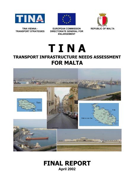
T I N A<br />
TRANSPORT INFRASTRUCTURE NEEDS ASSESSMENT<br />
FOR <strong>MALTA</strong><br />
FINAL REPORT<br />
April 2002
TINA in <strong>MALTA</strong> Final Report<br />
FINAL REPORT<br />
TINA<br />
a Common <strong>Transport</strong> Infrastructure Needs Assessment<br />
Identification of the network components for a future<br />
Trans-European <strong>Transport</strong> <strong>Network</strong><br />
in<br />
<strong>MALTA</strong><br />
Drafted by TINA VIENNA – <strong>Transport</strong> Strategies<br />
Auerspergstrasse 15, 1082 - Vienna, Austria<br />
APRIL 2002<br />
TINA VIENNA – <strong>Transport</strong> Strategies Page 2
TINA in <strong>MALTA</strong> Final Report<br />
1 INTRODUCTION..................................................................................................5<br />
1.1 PREAMBLE.......................................................................................................... 5<br />
1.2 TRANSPORT INFRASTRUCTURE NEEDS ASSESSMENT IN <strong>MALTA</strong>......................... 5<br />
2 DESCRIPTION OF THE EXISTING SITUATION IN TRANSPORT<br />
INFRASTRUCTURE ............................................................................................8<br />
2.1 <strong>MALTA</strong>’S PROGRESS TOWARDS ACCESSION.......................................................... 8<br />
2.1.1 PREAMBLE...................................................................................................... 8<br />
2.1.2 RECENT DEVELOPMENTS UNDER THE ASSOCIATION AGREEMENT (INCLUDING<br />
BILATERAL TRADE)...................................................................................................... 8<br />
2.1.3 COMMUNITY ASSISTANCE................................................................................. 8<br />
2.1.4 NEGOTIATIONS / SCREENING............................................................................ 9<br />
2.1.5 TRANSPORT POLICY........................................................................................ 9<br />
3 THE TINA METHODOLOGY .............................................................................11<br />
3.1.1 THE MAIN ASSUMPTIONS ................................................................................ 12<br />
3.1.2 THE BACKBONE NETWORK ............................................................................. 12<br />
3.1.3 ADDITIONAL NETWORK COMPONENTS ............................................................. 12<br />
3.1.4 THE INVESTMENT MEASURES - COST OF THE NETWORK ................................... 13<br />
4 THE ECONOMIC FRAMEWORK.......................................................................15<br />
4.1 GDP DEVELOPMENT ......................................................................................... 15<br />
5 THE TINA NETWORK FOR <strong>MALTA</strong>..................................................................18<br />
5.1 GENERAL ASSUMPTIONS FOR THE DEFINITION OF THE NETWORK.......................... 18<br />
5.2 THE IMPORTANCE OF TOURISM AS JUSTIFICATION OF A<br />
HIGH QUALITY ROAD NETWORK........................................................................... 18<br />
5.3 THE NETWORK................................................................................................... 19<br />
5.3.1 THE TINA MAIN ROAD NETWORK .................................................................. 19<br />
5.3.2 ACCESS ROAD NETWORK.............................................................................. 20<br />
5.4 COST OF THE NETWORK ..................................................................................... 23<br />
6 THE DATABASE................................................................................................25<br />
7 TRAFFIC FORECAST........................................................................................27<br />
8 ASSESSMENT OF LOCAL ADMINISTRATIVE INFRASTRUCTURES ............32<br />
TINA VIENNA – <strong>Transport</strong> Strategies Page 3
TINA in <strong>MALTA</strong> Final Report<br />
8.1 TRANSPORT POLICY........................................................................................... 32<br />
8.2 EXISTING CAPACITY OF ADMINISTRATIVE INFRASTRUCTURES<br />
FOR TRANSPORT IN <strong>MALTA</strong>................................................................................. 34<br />
8.2.1 MINISTRY OF TRANSPORT AND COMMUNICATIONS ........................................... 35<br />
8.2.2 PLANNING AUTHORITY .................................................................................. 37<br />
8.3 INTERNATIONAL PRACTICE ................................................................................. 38<br />
8.3.1 LONDON ....................................................................................................... 42<br />
8.3.2 NEW YORK ................................................................................................... 43<br />
8.3.3 PARIS........................................................................................................... 44<br />
8.3.4 TOKYO ......................................................................................................... 46<br />
8.4 CONCLUSIONS - RECOMMENDATIONS REGARDING THE<br />
ADMINISTRATIVE STRUCTURES ........................................................................... 48<br />
8.5 A PROPOSAL FOR ACTIONS IN ORDER TO ASSIST THE FORMATION AND<br />
IMPLEMENTATION OF NATIONAL TRANSPORT POLICY............................................ 51<br />
9 PRE-ASSESSMENT OF PROJECTS – PRIORITISATION ...............................55<br />
9.1 IN GENERAL ...................................................................................................... 55<br />
9.2 METHODOLOGY FOR THE PRELIMINARY PRIORITISATION OF MEASURES ............... 57<br />
9.3 ASSESSMENT AND PRIORITISATION OF MEASURES .............................................. 58<br />
9.3.1 ROAD PROJECTS........................................................................................... 60<br />
9.3.2 SEAPORT PROJECTS...................................................................................... 74<br />
9.3.3 AIRPORT PROJECTS ...................................................................................... 76<br />
10 CONCLUSIONS, RECOMMENDATIONS........................................................78<br />
10.1 THE TINA NETWORK ......................................................................................... 78<br />
10.2 DEVELOPMENT OF THE NETWORK ...................................................................... 78<br />
10.3 OPERATION OF THE NETWORK ........................................................................... 79<br />
ANNEX I – MAPS ....................................................................................................80<br />
TINA NETWORK <strong>MALTA</strong>.............................................................................................. 81<br />
TINA NETWORK <strong>MALTA</strong> – NETWORK STATUS.............................................................. 82<br />
TINA NETWORK <strong>MALTA</strong> – NETWORK CONDITION ......................................................... 83<br />
TINA NETWORK <strong>MALTA</strong> – ROAD TRAFFIC 1999 (AADT) .............................................. 84<br />
TINA NETWORK <strong>MALTA</strong> – ROAD TRAFFIC 2005 (AADT) .............................................. 85<br />
TINA NETWORK <strong>MALTA</strong> – ROAD TRAFFIC 2010 (AADT) .............................................. 86<br />
TINA NETWORK <strong>MALTA</strong> – ROAD TRAFFIC 2015 (AADT) .............................................. 87<br />
TINA NETWORK <strong>MALTA</strong> – BOTTLENECKS 1999 ........................................................... 88<br />
TINA NETWORK <strong>MALTA</strong> – BOTTLENECKS 2005 ........................................................... 89<br />
TINA NETWORK <strong>MALTA</strong> – BOTTLENECKS 2010 ........................................................... 90<br />
TINA NETWORK <strong>MALTA</strong> – BOTTLENECKS 2015 ........................................................... 91<br />
ANNEX II – PRINTOUT OF DATABASE.................................................................92<br />
ANNEX III – DATABASE STRUCTURE................................................................164<br />
TINA VIENNA – <strong>Transport</strong> Strategies Page 4
TINA in <strong>MALTA</strong> Final Report<br />
INTRODUCTION<br />
1.1 PREAMBLE<br />
This document concludes the <strong>Transport</strong> Infrastructure Needs Assessment (TINA) in <strong>Malta</strong>,<br />
as it was carried out between April 2001 and March 2002. The whole work was undertaken,<br />
based on the Terms of Reference of the Contract MLT-01-002.00 of the European<br />
Commission. The Report would be never concluded without the fruitful co-operation with the<br />
Maltese authorities and the European Commission. The data included in the database are<br />
fully based on the information provided by the Maltese authorities. The elaboration of the<br />
data, and the conclusions and recommendations throughout the report – although they have<br />
been exhaustingly discussed with the Maltese authorities - reflect the opinion of the Study<br />
Team.<br />
The whole work, including the methodology, the structure of the report, the elaboration of the<br />
data, all the assumptions and the GIS are in line with the TINA principles, as they were<br />
approved at the TINA Senior Officials Group meeting 27/28 June 1999 in Potsdam by the 15<br />
Member States and the candidate countries for accession and documented in the “<strong>Transport</strong><br />
Infrastructure Needs Assessment Final Report, November 1999”.<br />
The present report follows the “Inception Report, May 2001“ and the “Progress Report,<br />
November 2001”. It includes the latest data and information by the Maltese authorities, a<br />
new analysis of the administrative structures related to transport in <strong>Malta</strong>, a new evaluation<br />
of costs and an analysis of the suggested priorities. The Report is completed with the<br />
database and GIS, provided electronically. Additional useful information (e.g. the complete<br />
ToR, the Mission Reports, etc.) are not included in this Report, but anyone can find them in<br />
the Inception or Progress Report for the TINA in <strong>Malta</strong>.<br />
1.2 TRANSPORT INFRASTRUCTURE NEEDS ASSESSMENT IN <strong>MALTA</strong><br />
The first Structured Dialogue between the <strong>Transport</strong> Council of the EU and the <strong>Transport</strong><br />
Ministers of the associated countries, in September 1995, recommended inter alia<br />
undertaking a <strong>Transport</strong> Infrastructure Needs Assessment (TINA) for the candidate countries<br />
for accession.<br />
In July 1996, the European Parliament and Council adopted, based on Article 155 of the<br />
Treaty, a Decision on Guidelines for the development of the Trans-European <strong>Transport</strong><br />
<strong>Network</strong> 1 . This contains outline plans for the land transport networks and criteria for network<br />
nodes such as airports or seaports. The Guidelines constitute a declaration of intent by the<br />
Union for the development of a single multi-modal transport network to meet the needs of<br />
the transport sector.<br />
In April 1997, the European Commission proposed a structure for European transport<br />
networks serving the entire continent to the Third Pan-European <strong>Transport</strong> Conference at<br />
Helsinki 1997, in which the Trans-European <strong>Transport</strong> <strong>Network</strong> of the European Union, and<br />
its extension to the future new Members plays a prominent role (reference COM 97(172)).<br />
This structure was eventually included into the declaration of the Helsinki Conference.<br />
On the basis of this environment, the Commission launched the TINA process, with a view to<br />
defining the future Trans-European <strong>Transport</strong> Infrastructure <strong>Network</strong> in the enlarged<br />
European Union, using the criteria of Decision 1692/96/EC. The Commission has throughout<br />
ensured that this multilateral process remained consistent with the overall Pre-Accession<br />
1 Decision No 1692/96/EC of the European Parliament and of the Council of 23 July 1996 on Community Guidelines for the<br />
development of the trans-European transport network, OJ L228 September 1996<br />
TINA VIENNA – <strong>Transport</strong> Strategies Page 5
TINA in <strong>MALTA</strong> Final Report<br />
Strategy, notably the Accession Partnerships and the National Programmes for the Adoption<br />
of the Acquis.<br />
The <strong>Transport</strong> Infrastructure Needs Assessment (TINA) process was designed to initiate the<br />
development of a multi-modal transport network within the territory of the candidate countries<br />
for accession: Estonia, Latvia, Lithuania, the Czech Republic, Slovakia, Hungary, Poland,<br />
Slovenia, Romania, Bulgaria, and Cyprus. The work was completed in November 1999. The<br />
defined network, or the TINA <strong>Network</strong>, has thereafter been the basis of the discussion for<br />
the future extension of the TEN, and its financing. This network development complies with<br />
the principles, objectives and criteria as set out in the Guidelines for the development of a<br />
Trans-European <strong>Transport</strong> <strong>Network</strong> in the territory of the European Union (Decision<br />
1692/96/EC).<br />
During screening for the <strong>Transport</strong> Chapter of the Acquis in November 1999, <strong>Malta</strong> formally<br />
expressed its interest to the Commission, in the development of the Trans-European<br />
<strong>Transport</strong> <strong>Network</strong> (TEN-T) and, as a candidate accession country, in the extension of the<br />
<strong>Transport</strong> Infrastructure Needs Assessment (TINA) activities to the Maltese Islands.<br />
Although the TINA process commenced in 1996 and <strong>Malta</strong> was at that time not one of the<br />
eleven candidate countries selected for participation, the integration of <strong>Malta</strong> into European<br />
transport networks is considered to be vital from a regional, social and economic<br />
perspective.<br />
The Maltese government was interested in participating in the specific undertaking of a TINA<br />
exercise (or similar exercise) at a national level. To this end, the government has agreed to<br />
allocate funds under the 4 th Financial Protocol for the carrying out of a TINA study. This<br />
study comprises apart from the tasks carried out in the first stage, which was the setting up<br />
of a transport databank and transport network analysis with indicative prioritisation the<br />
assessment of local administrative infrastructures.<br />
The procedures for <strong>Malta</strong>’s accession to the European Union have already started and <strong>Malta</strong><br />
is soon expected to become a full member. This event will play an important role to the<br />
future of the country and will influence the status in many sectors of the economy. The<br />
extension of the TINA process to <strong>Malta</strong> is a first step to assess the transport infrastructure of<br />
the Maltese islands, in relation to the provisions of the TINA <strong>Network</strong> in the other acceding<br />
countries, and the TEN Guidelines (European Parliament and Council’s Decisions 1692/96<br />
and 1346/2001). The current project – <strong>Transport</strong> Infrastructure Needs Assessment in <strong>Malta</strong> -<br />
first intends to identify the transport network that can be considered as the basis for the<br />
future extension of the Trans-European transport network on the island. The identification of<br />
this multi-modal network (consisting of roads, ports and one airport) takes into consideration<br />
the needs of the country, its specific characteristics and its economic capacity to realise the<br />
proposed infrastructure (based on the same realistic assumptions of TINA, i.e. allocation of<br />
1.5% of annual GDP for transport infrastructure). The definition of the network is followed by<br />
the identification of those investment measures, which - in a horizon up to 2015 - will<br />
modernise and upgrade the existing transport infrastructure to a level, which complies with<br />
the European requirements.<br />
The TINA project for <strong>Malta</strong> has been based on two main phases: The first phase concerns<br />
the definition of the network; the second phase concerns the identification of investment<br />
measures by which the identified network would be brought up to a desired quality level.<br />
The first phase was developed with the intention to define the TINA multi-modal transport<br />
network, which could be realised in the time horizon of 2015, taking into consideration the<br />
expected development of the country.<br />
To define the network, parameters like the political vision, the economic framework, the cost<br />
of the investment measures, the existing financing opportunities, the traffic forecast and the<br />
efficient operation of the network were amongst the factors which were taken into<br />
consideration. The definition of the transport infrastructure that can be part of the enlarged<br />
TINA VIENNA – <strong>Transport</strong> Strategies Page 6
TINA in <strong>MALTA</strong> Final Report<br />
TEN was followed by a parallel examination of the administrative structure that rules the<br />
transport operations in the country.<br />
The second phase concerned the identification of possible investment measures, and their<br />
pre-assessment in view of a first prioritisation of their importance. Costs estimates for the<br />
identified measures are also included in the Report.<br />
All the parts of the multi-modal transport network, its main technical and operating<br />
characteristics, and all the reported investment measures are part of the TINA database and<br />
GIS, developed in the context of this project, linking geographical, technical (infrastructural)<br />
and traffic information.<br />
The general steps of the process, as they were set in the Terms of Reference, were:<br />
• Setting up of a transport databank and development of the TINA GIS for <strong>Malta</strong><br />
• Traffic forecast<br />
• Assessment of local Administrative Infrastructures<br />
• Pre-assessment of projects - Prioritisation<br />
TINA VIENNA – <strong>Transport</strong> Strategies Page 7
TINA in <strong>MALTA</strong> Final Report<br />
2 DESCRIPTION OF THE EXISTING SITUATION IN TRANSPORT INFRASTRUCTURE<br />
2.1 <strong>MALTA</strong>’S PROGRESS TOWARDS ACCESSION 2<br />
2.1.1 PREAMBLE<br />
With a view to the Helsinki European Council - following the February 1999 update of the<br />
Commission’s opinion on <strong>Malta</strong>’s application for membership - the Commission issued its<br />
first Regular Report on <strong>Malta</strong>’s progress towards accession in October 1999.<br />
After the request of the European Council, the Commission presented a second Regular<br />
Report on <strong>Malta</strong> in November 2000 before the Nice European Council.<br />
Now the Commission has prepared this third Regular Report on <strong>Malta</strong>’s progress towards<br />
accession with a view to the Laeken European Council in December 2001.<br />
This Report shows also the considerable progress since the 2000 Regular Report and<br />
covers the period until 28 February 2002 as it examines new initiatives. In addition, the<br />
Report provides an overall assessment of the global situation for each of the aspects, which<br />
remain to be taken by <strong>Malta</strong> in preparing for accession.<br />
2.1.2 RECENT DEVELOPMENTS UNDER THE ASSOCIATION AGREEMENT (INCLUDING<br />
BILATERAL TRADE)<br />
On the 9 th of July the 6 th meeting - the first meeting since July 1990 - of the <strong>Malta</strong>-EU<br />
Association Committee was held in Valletta. One of the covered main points was the<br />
monitoring of Maltese commitments with respect to the Accession Partnership and the<br />
National Programme for the Adoption of the Acquis.<br />
The Joint Parliamentary Committee comprising representatives of the Maltese and European<br />
Parliaments has met in November 2000 in Strasbourg and in May 2001 in <strong>Malta</strong>.<br />
The EC remains <strong>Malta</strong>'s major trading partner, with around 33% of <strong>Malta</strong>’s exports and 60%<br />
of imports in 2000, compared to 49% and 65%, respectively, in 1999.<br />
<strong>Malta</strong> has continued to implement a plan aiming at dismantling all levies on EC imported<br />
products by 2003, except for agricultural products. On the basis of a mandate from the<br />
Council, the Commission held discussions with <strong>Malta</strong> in April 2001 with a view to fully<br />
liberalising trade in fish and fishery products between <strong>Malta</strong> and the EC. The Commission is<br />
proposing to the Council an agreement for that purpose.<br />
2.1.3 COMMUNITY ASSISTANCE<br />
The Commission proposed a pre-accession regulation for <strong>Malta</strong> in October 1999 following a<br />
request by the Council in March 1999. This contract provided for total pre-accession aid to<br />
<strong>Malta</strong> of € 38 million for the period 2000-2004 and made <strong>Malta</strong>’s participation in MEDA<br />
regional programmes available. In addition, <strong>Malta</strong> is eligible for the EIB pre-accession facility<br />
and for the € 6.425 billion EIB facility for Mediterranean countries.<br />
The total pre-accession aid allocated to <strong>Malta</strong> in 2001 was € 7.5 million.<br />
2 Source: Regular Report 2001, Brussels 13.11.2001, from the Commission on <strong>Malta</strong>’s progress towards accession<br />
TINA VIENNA – <strong>Transport</strong> Strategies Page 8
TINA in <strong>MALTA</strong> Final Report<br />
2.1.4 NEGOTIATIONS / SCREENING<br />
By the end of January 2000 the analytical examination of the acquis with <strong>Malta</strong> was<br />
completed, by June 2001 negotiations on all chapters (with the exception of chapter 7 –<br />
Agriculture- chapter 30 - Institutions and chapter 31 – Other) had been opened.<br />
Then the following 17 chapters had been provisionally closed, already by the end of<br />
September 2001:<br />
Industrial Policy, SMEs, Science & Research, Education & Training, Culture & Audio-visual<br />
policy, Common Foreign & Security Policy, External Relations, Telecommunications,<br />
Company Law, Economic & Monetary Union, Statistics, Consumers and Health Protection,<br />
Financial control, Energy, Free movement of Goods, Freedom to provide services, Free<br />
movement of persons.<br />
The transport chapter was provisionally closed in October 2001.<br />
2.1.5 TRANSPORT POLICY<br />
While transport is a key factor in modern economies, <strong>Malta</strong> continued to align its legislation<br />
with the acquis and achieved some progress, in particular in the fields of road transport<br />
safety and maritime safety, while only limited progress was achieved in air transport.<br />
As demand for Trans-European <strong>Transport</strong> <strong>Network</strong>s, a methodology for the collection and<br />
collation of information for the compilation of Community road infrastructure accounts has<br />
been established to bring <strong>Malta</strong>'s accounting system for expenditure on infrastructure in line<br />
with the requirements of the acquis.<br />
For preparing <strong>Malta</strong>’s transport system to meet the demands of enlargement and sustainable<br />
development it needs a high standing on an economic, social and environmental viewpoint.<br />
2.1.5.1 LATEST DEVELOPMENTS<br />
Land transport sector, its progress was achieved in the field of road transport with regard to<br />
driving licences - aligning on the acquis by new legislation in January 2001 - and<br />
administrative capacity.<br />
The new <strong>Malta</strong> <strong>Transport</strong> Authority consists of four Directorates (<strong>Road</strong>, Public <strong>Transport</strong>,<br />
Traffic Management and Licensing and Testing) and is responsible for all land transport<br />
issues including inspections and controls. A supervisory board is in place, already fully<br />
operational from the second half of 2001.<br />
Air transport: On January 1 st 2002, a new company (<strong>Malta</strong> Air Traffic Services Ltd.) was set<br />
up to administer the air traffic services in <strong>Malta</strong>. Regulations transposing the EC Regulation<br />
on the denied boarding compensation system for scheduled were published in April 2001.<br />
Other legislation was enacted throughout the period under review included:<br />
• Act XIX of 2001 - Code of Conduct for Computerised Reservation Systems. This ACT<br />
implements the provisions of Council Regulation 2299/89<br />
• LN 78 of 2001 - Civil Aviation (Denied Boarding Compensation) Regulations, 2001.<br />
This relates to Regulation Council 295/91.<br />
• LN 161 of 2001 - Definition and Use of Compatible Technical Specifications for the<br />
Procurement of Air Traffic Management Equipment and Systems Regulations, 2001.<br />
This relates to Commission Directive 97/15, Council Directive 93/65 and Commission<br />
Regulation 2082/2000.<br />
• LN 162 of 2001 - Air Navigation (Noise Certification and Operation of Aircraft) Order,<br />
2001. This relates to Council Directives 92/14,80/51 and 89/629.<br />
TINA VIENNA – <strong>Transport</strong> Strategies Page 9
TINA in <strong>MALTA</strong> Final Report<br />
Maritime transport: <strong>Malta</strong> has made progress, including with regard to maritime safety. In<br />
May 2001 a Maritime <strong>Transport</strong> Action Plan with the aim of establishing a timetable for<br />
alignment with the acquis was submitted to the Commission. <strong>Malta</strong>’s efforts to enforce EU<br />
maritime safety standards were increased. It has implemented a reform of Port State control<br />
records and an increase of flag state inspections. The Pilotage and Mooring Regulations<br />
were amended in June 2001 to introduce a tax differential in favour of tankers with<br />
segregated ballast tanks in line with the corresponding EC regulation.<br />
The <strong>Malta</strong> Maritime Authority (MMA) has a clear view of the technical problems and future<br />
opportunities. It is strengthening its administrative capacity with fifteen new flag and Port<br />
State control inspectors, as well as supporting clerical staff. Officials and inspectors of the<br />
MMA have undertaken training activities related to maritime safety, flag state implementation<br />
and marine engineering.<br />
In 2000, a number of ships representing 1.5 million gross tonnages were deleted from the<br />
Maltese ship register or refused entry. Nevertheless, <strong>Malta</strong> still has the biggest commercial<br />
fleet of all accession countries (1505 ships with 28 170 010 gross tonnage as of 31.12.2000)<br />
and the average age of <strong>Malta</strong>’s fleet has not changed significantly as compared to 1999.<br />
According to 2000 statistics under the Paris Memorandum of Understanding (MoU), the<br />
percentage of <strong>Malta</strong> flag vessels detained following port State control was11.81%, an<br />
increase compared to 1999 (10.63%). This compares to an average for EU-flagged vessels<br />
of 3.9% in 2000. The MMA is in the process of concluding agreements with its authorised<br />
classification societies to regulate the relationship.<br />
2.1.5.2 OVERALL ASSESSMENT<br />
<strong>Malta</strong>’s transport infrastructure is a key element in the functioning of economy, internally and<br />
external trade. Therefore <strong>Malta</strong> is extremely interested to be in line with the EC acquis. So<br />
important parts of road and air transport law remain to be transposed, and sustained efforts<br />
are needed as regards maritime safety.<br />
<strong>Malta</strong> still has to finalise the report that should form the basis for extending the Trans-<br />
European <strong>Transport</strong> <strong>Network</strong>s to <strong>Malta</strong> after accession.<br />
On road transport, <strong>Malta</strong> still needs to adopt the necessary legislation on fiscal<br />
harmonisation, market access, access to the profession, dangerous goods and passenger<br />
transport. The administrative capacity of the new <strong>Malta</strong> <strong>Transport</strong> Authority will have to be<br />
strengthened, in particular by training its staff for the new responsibilities arising from the<br />
acquis and also setting up the required systems of training for transport operators and<br />
contractors.<br />
On air transport, the legislation to comply with the acquis on slot allocation, ground handling<br />
and accident investigation still needs to be adopted.<br />
As regards maritime safety, <strong>Malta</strong>’s vessel detention rate as a result of Port State Controls<br />
remains very high, and has increased from 1999 to 2000. In the Paris Memorandum of<br />
Understanding 2000 annual report, <strong>Malta</strong> is ranked a one of the medium-to-high risk flag<br />
States. <strong>Malta</strong> should further single out old ships with lower safety standards and efforts<br />
should be continued to further strengthen the administrative capacity of the MMA and<br />
improve the safety record of the Maltese commercial fleet.<br />
TINA VIENNA – <strong>Transport</strong> Strategies Page 10
TINA in <strong>MALTA</strong> Final Report<br />
3 THE TINA METHODOLOGY<br />
The <strong>Transport</strong> Infrastructure Needs Assessment (TINA) process has been initiated through<br />
the first structured dialogue, held in September 1995 between the <strong>Transport</strong> Council and the<br />
<strong>Transport</strong> Ministers of the associated countries, resulted inter alia into a recommendation to<br />
perform a <strong>Transport</strong> Infrastructure Needs Assessment for, at that time eleven, candidate<br />
countries for accession. The process has been designed to initiate the development of a<br />
multi-modal transport network within the territory of the candidate countries for accession:<br />
Estonia, Latvia, Lithuania, the Czech Republic, Slovakia, Hungary, Poland, Slovenia,<br />
Romania, Bulgaria, and Cyprus. This network development should comply with the<br />
principles, objectives and criteria as set out in the Guidelines for the development of a Trans-<br />
European <strong>Transport</strong> <strong>Network</strong> in the territory of the European Union (Decision 1692/96/EC of<br />
the European Parliament and of the Council on Community Guidelines for the development<br />
of the Trans-European <strong>Transport</strong> <strong>Network</strong>).<br />
The general TINA process can be divided in two main stages: The first stage concerns the<br />
definition of the network where cost estimates play a major role. The second stage concerns<br />
the identification of investment measures by which the identified network would be brought<br />
up to a desired quality level.<br />
The first stage was developed with the intention to define the TINA multi-modal transport<br />
network, which could be realised in the time horizon of 2015, taking into consideration the<br />
expected economic development of the countries concerned. In this respect, all the<br />
necessary parameters that play a role while designing a network were identified and<br />
investigated. The political vision, the economic framework, the cost of the investment<br />
measures, the existing financing opportunities, the traffic forecast and the efficient operation<br />
of the network were amongst the factors which were investigated in the process of defining<br />
the TINA network.<br />
The second stage concerned possible investment measures. The reported measures were<br />
analysed comparing cost estimates of the different countries with unit cost estimates<br />
provided under a separate project financed under PHARE MCTP 3 . This analysis led to a<br />
fairly solid basis of cost estimates for the network.<br />
The TINA Final Report for the eleven candidate countries for accession (November 1999)<br />
sets the basic reference framework for future project assessment. This project assessment,<br />
to be done in the context of future TINA work and under ISPA will generate a dynamic list of<br />
projects in order of their priority for the development of the network. The TINA process led to<br />
the identification of viable investment projects, which will, in the future extended TEN-T, be<br />
candidates for projects of common interest. In the context of pre-accession financing, the<br />
ISPA team, on the basis of the TINA findings, in now performing a more detailed project<br />
analysis of all the proposals, which will be considered for financing.<br />
The general steps of the TINA process, as they are analysed, were:<br />
(a) to set the main rules on which the hypothesis of constructing the network should be<br />
built;<br />
(b) to identify a multi-modal backbone network using global criteria, such as those which<br />
led to identification of the Crete Corridors and their adjustments and additions as<br />
endorsed at the third Pan-European <strong>Transport</strong> Conference of Helsinki;<br />
(c) to identify those additional network components (i.e. links (rail, road, inland<br />
waterways) and nodes (airports, ports, terminals)), which are necessary to transform<br />
the Helsinki "Corridor approach" into a real transport “network approach”, with similar<br />
attributes to those described in Decision 1692/96/EC for the TENs;<br />
3 “Updating of <strong>Transport</strong> Unit Costs in Acceding Countries”, COWI Consult<br />
TINA VIENNA – <strong>Transport</strong> Strategies Page 11
TINA in <strong>MALTA</strong> Final Report<br />
(d) to identify all possible investment measures which contribute to develop the TINA<br />
network as defined in the previous steps; to make an estimation of their cost;<br />
(e) to report on the network development in certain years (2000, 2005, 2010 and 2015);<br />
(f) to develop a GIS for the TINA network linking geographical, economic and traffic<br />
information.<br />
In more detail:<br />
3.1.1 THE MAIN ASSUMPTIONS<br />
The definition of the TINA network was based on a certain number of assumptions:<br />
• the network should be in line with the criteria laid down in the EU Guidelines for the<br />
Development of the TENs (Council Decision 1692/96/EC), according to the objectives<br />
described in Article 154 of the Treaty;<br />
• the technical standards of the future infrastructure should ensure consistency<br />
between the capacity of network components and their expected traffic. To achieve<br />
this, it was accepted that these standards should be in line with the recommendations<br />
of the UN/ECE Working Party on <strong>Transport</strong> Trends and Economics (WP.5) on the<br />
definition of transport infrastructure capacities (Trans/WP.5/R.60);<br />
• the time horizon for achievement of the network should be 2015;<br />
• the cost of the network should be consistent with realistic forecasts of financial<br />
resources, so that average costs should not exceed 1.5% of each country's annual<br />
GDP over the period up to 2015.<br />
3.1.2 THE BACKBONE NETWORK<br />
The backbone network was the starting point of the TINA process for a differential network<br />
design. This network was defined by the Commission, so as to be identical with the links and<br />
nodes of the ten multi-modal Pan-European <strong>Transport</strong> Corridors on the territory of the TINA<br />
countries, as endorsed at the Third Pan-European <strong>Transport</strong> Conference in Helsinki, June<br />
1997. In Estonia and Latvia the backbone network also included one major East-West link<br />
from Corridor I towards Corridor IX in each country. The routing of the Crete/ Helsinki<br />
Corridors was provided by the TINA Secretariat, using relevant information from the Steering<br />
Committees or other working groups of the Crete/ Helsinki Corridors, and by consulting the<br />
UN TEM and TER Offices, etc. The alignment of the backbone network was endorsed by the<br />
TINA Senior Officials´ Group at their June 1998 meeting in Vienna. For certain Corridors the<br />
respective Steering Committees might still present adjustments to the network, which should<br />
be assessed by the Group about their appropriateness for the TINA network.<br />
3.1.3 ADDITIONAL NETWORK COMPONENTS<br />
In addition to the backbone network, during the TINA process additional network<br />
components were proposed to be included in the final TINA <strong>Network</strong>. Special consideration<br />
was given to the continuation of the existing Trans-European <strong>Transport</strong> <strong>Network</strong> beyond the<br />
present borders. The very first candidates for additional network components, subject to the<br />
assessment of the Group and the subgroups, were the proposals for Corridor adjustments<br />
assigned to the TINA Group by the ad hoc Group for the preparation of the Helsinki<br />
Conference. Each proposal was accompanied by sufficient information on its economic<br />
viability. The network components were proposed by the delegates of the TINA subgroups,<br />
the TINA Secretariat and the Commission. The proposing country or body or both, was<br />
responsible for submitting all the relevant information, together with the proposal.<br />
TINA VIENNA – <strong>Transport</strong> Strategies Page 12
TINA in <strong>MALTA</strong> Final Report<br />
The additional network components needed to:<br />
• be in line with the given financial framework;<br />
• give priority, where possible, to the better use of existing infrastructure;<br />
• be able to comply with the set time-period for the development of the network (2015);<br />
• be able, together with the backbone network, to form a network which would be in<br />
line with the criteria laid down in the EU Guidelines for the TENs.<br />
All the proposals were discussed in the three regional subgroup meetings; the TINA<br />
Secretariat compiled all these proposals into one, and incorporated this into the TINA<br />
<strong>Network</strong> that was addressed by the TINA Group in June 1998 and in the latest meeting of<br />
the Group in Potsdam in June 1999.<br />
The backbone network and the additional network components form the total TINA network,<br />
which will constitute the basis of the proposal for the extension of the TENs in the enlarged<br />
Union.<br />
3.1.4 THE INVESTMENT MEASURES - COST OF THE NETWORK<br />
For the cost estimation of the network, possible investment measures had to be identified by<br />
which the existing infrastructure is brought to a level which complies with the UN-ECE<br />
recommendations (WP.5) relating technical standards and features of infrastructure with<br />
capacities and expected traffic on the network. Each country reported its proposals for such<br />
possible investment measures. In some cases the investment measures as proposed by the<br />
countries, are designed to satisfy national strategic interests, not always coinciding with<br />
European perspectives. Seeing the TINA network as the future extension of the TENs in an<br />
enlarged Union, one should always recall the TEN-Tr Guidelines requirements, about the<br />
criteria, which refer to “projects of common interest”. In this respect, and in order to apply the<br />
Decision's 1692/EC requirements, the European Commission has to identify those possible<br />
investment measures that are of particular interest for the Union as a whole.<br />
The cost of the entire network results from the addition of all the reported individual<br />
measures. First estimations for the cost of the network were presented in the first TINA<br />
Progress Report and in the Draft Final TINA Report. In the Final Report, a final estimate<br />
appears (€ 91.6 billion), based on new information, updated by the countries. The completion<br />
of the backbone network constitutes about three-quarters of the total. From the results of a<br />
PHARE Study 4 concerning the construction unit costs in the acceding countries, an<br />
independent indication for this cost was derived (according to the results of this Study, the<br />
costs of the railway and road components of the network might be substantially reduced).<br />
Working for the design of the TINA network, the countries made their proposals identifying a<br />
number of measures, which contribute to the realisation of an infrastructure, which should<br />
have standards and technical characteristics according to their views. However, in case of<br />
common financing, these proposals should be also looked under the light of the<br />
recommendations of the UN-ECE Working Party on <strong>Transport</strong> Trends and Economics<br />
(WP.5) on the definition of transport capacities, taking into consideration the future traffic<br />
forecast. Ambitious plans may be useful for the countries and the future users, but the failure<br />
of investment in transport infrastructures to keep up with growth in demand for mobility can<br />
have severe economic and social consequences. In the TINA process, the future demand<br />
should define the needs of the infrastructure to be constructed. This future demand was<br />
investigated for all modes, from the results of a relevant PHARE Study 5 . The TINA Final<br />
Report based some conclusions on the network design on the results of this Study, using a<br />
traffic scenario with the maximum forecasted traffic per section.<br />
4 Updating of <strong>Transport</strong> Unit Costs in Acceding Countries, COWI Consult<br />
5 Traffic Forecast on the ten Pan-European Corridors of Helsinki, NEA<br />
TINA VIENNA – <strong>Transport</strong> Strategies Page 13
TINA in <strong>MALTA</strong> Final Report<br />
Before any decision on financing/funding individual projects is taken, the projects proposed<br />
for implementation should be subject to a socio-economic assessment.<br />
The TINA Group has recommended establishing a common method for socio-economic<br />
project assessment, which the funding and financing institutions would endorse. In addition,<br />
environmental assessment needs to be incorporated into this socio-economic appraisal at<br />
both network and project level. A relevant proposal for a common methodology has been<br />
approved, after its elaboration by the European Commission and the TINA Secretariat, using<br />
the expertise of the main IFIs (World Bank, EIB and EBRD) and representatives of the<br />
academic community.<br />
In order to obtain compatible results, the methodology of the <strong>Transport</strong> Infrastructure Needs<br />
Assessment (TINA) in <strong>Malta</strong> was fully based on the assumptions and principles of the TINA<br />
process for the other eleven candidate countries for accession.<br />
TINA VIENNA – <strong>Transport</strong> Strategies Page 14
TINA in <strong>MALTA</strong> Final Report<br />
4 THE ECONOMIC FRAMEWORK<br />
4.1 GDP DEVELOPMENT<br />
According to the information of EUROSTAT 6 and OECD economic survey the following table<br />
illustrates on one hand the last years’ economic development (percent change on previous<br />
year) in the 13 candidate countries for accession and their produced GDP per capita at<br />
current prices and exchange rates in EURO (same unit as used in TINA FINAL Report,<br />
November 1999):<br />
GDP growth rates GDP per capita<br />
in % in % in % in % in % in EURO<br />
1996 1997 1998 1999 2000 2000<br />
BULGARIA -10.1 7.0 3.5 2.4 5.8 1,590<br />
CYPRUS 1.9 2.5 5.0 4.5 4.8 14,290<br />
CZECH REPUBLIC 4.3 -0.8 -1.2 -0.4 2.9 5,360<br />
ESTONIA 4.0 10.4 5.0 -0.7 6.9 3,810<br />
HUNGARY 1.3 4.6 4.9 4.2 5.2 5,030<br />
LATVIA 3.3 8.6 3.9 1.1 6.8 3,270<br />
LITUNANIA 4.7 7.3 5.1 -3.9 3.9 3,320<br />
<strong>MALTA</strong> 4.0 4.9 3.4 4.1 5.4 10,030<br />
POLAND 6.1 6.8 4.8 4.1 4.0 4,450<br />
ROMANIA 3.9 -6.1 -4.8 -2.3 1.6 1,770<br />
SLOVAKIA 6.2 6.2 4.1 1.9 2.2 3,890<br />
SLOVENIA 3.5 4.6 3.8 5.2 4.6 9,810<br />
TURKEY 7.0 7.5 3.1 -4.7 7.2 3,230<br />
CC-13 5.0 4.7 2.9 0.0 5,0 3,600<br />
EU15 1.6 2.5 2.9 2.6 3.3 22,500<br />
Table 4-1: Annual GDP growth rates and GDP per capita in €<br />
Table 4-1 illustrates that the GDP per capita produced in <strong>Malta</strong> exceeds by far the average<br />
of the thirteen candidate countries. <strong>Malta</strong> has been catching-up with the EU; the produced<br />
gross domestic product in <strong>Malta</strong> reaches, with a figure of € 10,030 (12,600 at Purchasing<br />
Power Standards (PPS)), already 45% (53.2% at PPS) of the capita GDP produced in the<br />
European Union and exceeds the average one in the other accession countries by a factor<br />
of 2.8.<br />
The average growth rate of the GDP for the last five years in <strong>Malta</strong> was in general terms<br />
stable with an annual growth between 3.4 and 5.4 percent. The figures of the first three<br />
quarters of the year 2001 with minus 1.4 to plus 2.0 percent are resulting from the global and<br />
European economic development in this period. Nevertheless the Maltese economy is<br />
performing and a number of important structural reforms are being gradually implemented.<br />
Trade liberalisation continued with the removal of import levies. The government is<br />
progressively reducing its weight in the economy although the privatisation of several public<br />
enterprises has been delayed. The financial sector has been strengthened after the<br />
introduction of new legislation reinforcing the regulatory and supervisory framework. Interest<br />
rates were fully liberalised in 2000 and the liberalisation process with respect to exchange<br />
controls will be completed by the first quarter of 2002.<br />
6 Statistic in focus: The GDP of the Candidate Countries; figures for the third quarter of 2001; February 2002<br />
TINA VIENNA – <strong>Transport</strong> Strategies Page 15
TINA in <strong>MALTA</strong> Final Report<br />
Diagram 4-1 shows the total GDP per capita at current prices and exchanges rates in Euro<br />
for the 13 candidate countries for accession and the European Unions’ average.<br />
1<br />
GDP per capita in 2000 in EURO<br />
0 5.000 10.000 15.000 20.000 25.000<br />
BG CY CZ EE HU LV<br />
LT MT PL RO SK SI<br />
TR CC-13 EU-15<br />
Diagram 4-1: GDP per capita<br />
These data constitute a starting point for extrapolation for the future. According to the<br />
Forecasts by European Commission/ Directorate General Economic and Financial Affairs 7 –<br />
the situation in <strong>Malta</strong> was positively evaluated.<br />
The outlook for real output growth for the period 2001 to 2004 remains with 3.3 percent<br />
stable at slightly lower level than those of the previous three years. Further improvement of<br />
the public finances is expected over the next years, in line with the sharp decrease of the<br />
public deficit experienced in 2000. The budget deficit could be decreased from 1998 (10.9<br />
percent of GDP in 1998) to 2000 (6.8 percent of GDP in 2000) and it is further expected to<br />
keep this trend towards the end of the forecast period (3.9 percent of GDP in 2004).<br />
The GDP growth over 2001-2004 is supported by an increase in the contribution of net<br />
exports to growth and moderate increases in domestic demand. In 2000, output growth has<br />
been driven primarily by a good export performance led by growth in the EU and a large<br />
investment activity, which was mainly induced by manufacturing companies expanding within<br />
the electronics sector. An increase in consumer demand contributed further to growth.<br />
Besides this major negative contribution, the net surpluses in the services account have<br />
decreased significantly. This is mainly due to the negative developments in the transport and<br />
other services account, which is very much linked to the abrupt increase in imports of goods.<br />
Foreign direct investment is expected to increase during the forecast period. If the<br />
contribution of privatisation deals is excluded, foreign direct investment in 2000 has<br />
remained broadly stable in comparison to 1999. The environment for domestic investment<br />
7 Evaluation of the 2001 pre-accession economic programmes of candidate countries, January 2002<br />
TINA VIENNA – <strong>Transport</strong> Strategies Page 16
TINA in <strong>MALTA</strong> Final Report<br />
will improve with the new package of incentives provided by the Business Development Act.<br />
Further privatisation deals are expected to increase foreign investment in 2001-2002.<br />
The outlook for public finances in 2001-2002 remains positive and implies a further reduction<br />
of the budget deficit. Higher revenues due to relatively robust real GDP growth and a better<br />
tax enforcement will underpin the decrease, while expenditure growth will decrease primarily<br />
as a result of strong controls aiming to reduce social security benefits fraud.<br />
For the future trends in <strong>Malta</strong> (2002-2015), the same assumptions as used in the<br />
assessment process of the 11 other acceding countries have been applied. These<br />
preconditions for the future development have been discussed in various fora with the<br />
European Commission, the TINA Senior Officials’ Group, EUROSTAT and representatives<br />
from OECD.<br />
The extrapolation to the future years was made under the assumption that growth rates<br />
gradually converge with average growth rates in the Union. The possible evolution of the<br />
whole economy of the countries for the future was built for each of the considered forecast<br />
periods in three scenarios (high, moderate and low). With this assumption, it is likely that the<br />
GDP in <strong>Malta</strong> will nearly double between now and the year 2015.<br />
The moderate scenario, which was taken as the reference scenario assumes that average<br />
growth rates in the acceding countries will reach level of 3 to 6%. The level of 4 to 6% will be<br />
reached at the stage of accession and be maintained for 5 years and will then slowly<br />
converge with EU levels.<br />
The optimistic scenario assumes that average growth rates in the acceding countries will<br />
reach the level of 6 to 7%. The preconditions for this optimistic scenario are mainly a strict<br />
policy of structural reform and a compensation for the increase in salaries by an increased<br />
labour productivity; this would have several consequences: competitiveness of exports<br />
secures benefits of the current balance, interest rates remain relatively low and would assist<br />
as a consequence direct investments, reducing the dependency on foreign investments. The<br />
optimistic scenario is therefore based on the assumption that the accession process will<br />
follow the optimistic plan of the European Commission.<br />
A more negative scenario would assume that GDP growth rates would be equal to or slightly<br />
less than the EU average growth rate of 2.5% expected for the next 15 years. This very<br />
negative assumption would imply that the acceding countries would not benefit at all from the<br />
accession process, a fairly unlikely scenario.<br />
Using the moderate scenario, the total accumulated produced GDP in <strong>Malta</strong> (starting with €<br />
3.9 billion in 2000) in the period 2002 to 2015 (14 years) is about € 80 billion.<br />
Nevertheless the differences between the optimistic or the pessimistic scenario vis à vis the<br />
moderate scenario on average do not exceed 12 %. The pessimistic scenario will amount to<br />
about 90% of the moderate one; the optimist scenario will in total be only 10% higher than<br />
the moderate scenario.<br />
Growth scenario <strong>MALTA</strong><br />
Low € 1,015 million<br />
Moderate € 1,160 million<br />
High € 1,320 million<br />
Table 4-2: 1,5% accumulated GDP 2002 – 2015<br />
As in the TINA process for the eleven acceding countries, it appears justified to take, as a<br />
working hypothesis for the TINA in <strong>Malta</strong> process, the forecast figures derived from the<br />
moderate growth scenario.<br />
Again like TINA, it is assumed that as an indicator for a realistic ceiling of planned<br />
infrastructure investments, their cost should not on average exceed 1.5% of the GDP in the<br />
coming years.<br />
TINA VIENNA – <strong>Transport</strong> Strategies Page 17
TINA in <strong>MALTA</strong> Final Report<br />
5 THE TINA NETWORK FOR <strong>MALTA</strong><br />
5.1 GENERAL ASSUMPTIONS FOR THE DEFINITION OF THE NETWORK<br />
Similar to the first phase of the TINA process for the 11 candidate countries for accession,<br />
the definition of the TINA network in <strong>Malta</strong> was based on certain assumptions:<br />
• the network should be in line with the criteria laid down in the EU Guidelines for the<br />
Development of the TENs (Council Decision 1692/96/EC and 1346/2001 for the<br />
assessment of transport infrastructure in <strong>Malta</strong>), according to the objectives described in<br />
Article 154 of the Treaty;<br />
• the technical standards of the future infrastructure should ensure consistency between<br />
the capacity of network components and their expected traffic. To achieve this, it was<br />
accepted that these standards should be in line with the recommendations of the<br />
UN/ECE Working Party on <strong>Transport</strong> Trends and Economics (WP.5) on the definition of<br />
transport infrastructure capacities (Trans/WP.5/R.60);<br />
• the time horizon for achievement of the network should be 2015;<br />
• the cost of the network should be consistent with realistic forecasts of financial<br />
resources, so that average costs should not exceed 1.5% of each country's annual GDP<br />
over the period up to 2015.<br />
The TINA process provides a reference framework for the transport network in the enlarged<br />
EU. As such, it should reflect transport needs at trans-national level, and would therefore<br />
need to be complemented by national and regional development strategies, developed in<br />
each candidate country, for their transport sector investments. In the case of <strong>Malta</strong>, such<br />
strategies are included in the present Report, mainly for the road network. In this respect,<br />
the complete TINA road network (including the TINA <strong>Main</strong> <strong>Road</strong> <strong>Network</strong> and the Access<br />
<strong>Road</strong> <strong>Network</strong>) in <strong>Malta</strong> mostly reflects national needs, but it is by all means<br />
complementary to and consistent with the feature of the TEN and the rest of the TINA<br />
network.<br />
5.2 THE IMPORTANCE OF TOURISM AS JUSTIFICATION OF A HIGH QUALITY ROAD NETWORK<br />
Between 1995 and 2000, there has been a steady growth in the influx of tourists by around<br />
1.5% per annum, and in the year 2000, the total number of tourist arrivals in <strong>Malta</strong> reached<br />
1.2 million i.e. three times more than <strong>Malta</strong>’s residential population.<br />
Statistical analysis of data collected as part of an expenditure survey carried out in 1998<br />
indicated that tourism earnings in the Maltese Islands’ amounted to around € 800 million<br />
each year; this may be broken down as follows:<br />
Aviation related (Air<strong>Malta</strong> and airport) Revenue € 175.88 million<br />
Passenger handling Revenue € 14.88 million<br />
Accommodation Revenue € 314.75 million<br />
Catering (food and beverage) Revenue € 133.90 million<br />
Domestic <strong>Transport</strong> Revenue € 35.75 million<br />
Recreation Revenue € 48.85 million<br />
Shopping Revenue € 66.90 million<br />
Other Revenue € 7.72 million<br />
TOTAL € 798.63 million<br />
Source: The Economic Impact of Tourism in <strong>Malta</strong>, <strong>Malta</strong> Tourism Authority, 2000<br />
Tourism has an impact on the four main aspects of the Maltese economy; namely:<br />
employment, Gross National Product, Government income and imports and outflows. In<br />
1998 its impact was estimated as follows:<br />
TINA VIENNA – <strong>Transport</strong> Strategies Page 18
TINA in <strong>MALTA</strong> Final Report<br />
a) Employment: 41,451 persons (34% of the total working population) were<br />
employed directly or indirectly within the tourism sector.<br />
b) Gross National Product: The direct impact of €348 million accounting for 10.45%<br />
of the national total GNP.<br />
c) Government Income: the maximum impact contribution of tourism sector<br />
components to government income in 1998 was 21%.<br />
d) Import + Outflows: Slightly more than 9% of total imports and outflows are as a<br />
direct result of tourism earnings, this rises to 13.69% when indirect earnings are<br />
taken into account.<br />
The 1998 expenditure survey was also used to get an idea of what further expenditure<br />
tourists would be prepared to indulge in during their stay in <strong>Malta</strong> if no financial or time<br />
constraints were existent and what type of facilities and attractions they would like this<br />
destination to offer. From the responses, it is clearly evident that transport and its<br />
infrastructure play the most important role in the tourists’ perception of staying in <strong>Malta</strong><br />
(accounting 33.6% of responses). 28.9% of tourists felt that more investment should be<br />
made in improving road infrastructure, its signage, pavements, footpaths and the quality and<br />
frequency of bus services (used by 80.6% of tourists). A further 4.7% of respondents felt that<br />
further investment should be made to improve the quality of car hire and taxi services.<br />
In conclusion, it can be seen that in a small country such as <strong>Malta</strong> that has few natural<br />
resources, the economy is almost totally dependent on the service sector and, in particular,<br />
on tourism. In highly competitive tourism market, a poor perception by the visitor of a<br />
country’s transport system can, in the medium to long term, cause irreparable damage to the<br />
tourist industry and, through the multiplier effect, to the economy as a whole.<br />
5.3 THE NETWORK<br />
The TINA process in <strong>Malta</strong> was designed to initiate the development of a multi-modal<br />
transport network within the territory of the country. The <strong>Transport</strong> Infrastructure Needs<br />
Assessment in <strong>Malta</strong> resulted in a TINA <strong>Main</strong> <strong>Road</strong> <strong>Network</strong> and a network of access roads<br />
to the TINA main road network. In the consultants view only this complete network would<br />
satisfy the international needs of transporting goods arriving at the ports to its destinations<br />
on the island on one hand and to facilitate movements of international travels on the other<br />
hand. In another – future - stage, <strong>Malta</strong> together with the European Commission and the<br />
other Member States will decide (during the revision of the TEN Guidelines, starting probably<br />
in 2003), which parts of the complete TINA network in the island will be considered as a part<br />
of the extended TEN.<br />
5.3.1 THE TINA MAIN ROAD NETWORK<br />
Defining the TINA <strong>Main</strong> <strong>Road</strong> <strong>Network</strong> and estimating its cost were the first steps of the<br />
elaboration of a network for <strong>Malta</strong>. In order to link the international ports and the international<br />
airport, which represent the link to the Trans-European <strong>Transport</strong> <strong>Network</strong>, with the main<br />
centres of the islands of <strong>Malta</strong> and Gozo, <strong>Road</strong> No. 1 has been taken as basis for the main<br />
network definition. It was understood that all parties concerned agreed on the need of this<br />
network connection so that further justifications were not required.<br />
According to the above assumptions the TINA <strong>Main</strong> <strong>Network</strong> has been defined as follows<br />
(from West to East):<br />
Victoria (capital of Gozo) – Mgarr (ferry station on Gozo) – Cirkewwa (ferry<br />
station on <strong>Malta</strong>) – Bugibba – St. Julian’s – Marsa – Valletta (including the links<br />
to Grand Harbour; Passenger Sea Terminal) – Luqa (airport) – Birzebbugia<br />
(Freeport)<br />
TINA VIENNA – <strong>Transport</strong> Strategies Page 19
TINA in <strong>MALTA</strong> Final Report<br />
5.3.2 ACCESS ROAD NETWORK<br />
Following the methodology elaborated within the TINA process further network elements<br />
facilitating the access to the TINA <strong>Main</strong> <strong>Road</strong> <strong>Network</strong> have been proposed. These network<br />
components were proposed by the consultant in close cooperation with the Maltese<br />
authorities. The following justifications, which are in line with the criteria as established<br />
during the first phase of the TINA process are the basis of this network proposal.<br />
The alignment and its justification (from North/West to South/East):<br />
San Lawrenz (Gozo) – Victoria (Gozo)<br />
San Lawrenz is a new resort that is being developed particularly for upmarket<br />
tourists. Tourist access to San Lawrenz from the Mgarr ferry service or the helicopter<br />
terminal in Xewkija necessitates traffic passing through the historical centre of<br />
Victoria, a centre which is now becoming congested and heavily polluted by road<br />
traffic, particularly in the Summer months. The link to San Lawrenz incorporates a<br />
city by-pass road project that would serve to mitigate these growing traffic problems.<br />
Marsalforn (Gozo) – Victoria (Gozo) – Xlendi (Gozo)<br />
Marsalforn and Xlendi are the two main tourist accommodation centres in Gozo.<br />
According to the survey carried out by Tour Operators and Travel Agents Association<br />
in 1997, 55% of tourists visit these two localities.<br />
Bugibba – Rabat<br />
This additional component links the country’s main tourist accommodation centre St.<br />
Paul’s Bay, Bugibba and Mellieha (20,000 beds) with the Country’s old capital Mdina<br />
and its suburbs Rabat.<br />
This link is of primary importance for the development of cultural-tourism in <strong>Malta</strong>.<br />
Mdina, ‘The Silent City’ is a living-museum and houses masterpieces of baroque<br />
architecture, Norman palaces and Roman archaeology and catacombs. A survey by<br />
Tour Operators and Travel Agents Association in 1997 identified that 85% of all<br />
tourists to <strong>Malta</strong> visit Rabat and Mdina.<br />
The link is of a poor quality and many sections fall below acceptable design-safety<br />
standards. A high number of different scheduled bus services that are mainly used by<br />
tourists travel along this link at frequent intervals. The usage of this link by tourists<br />
staying in the northwest of <strong>Malta</strong> is expected to grow in relation to the expected<br />
increase in peak and off-peak season tourism over the next 15 years.<br />
Rabat – Marsa<br />
This link for most of its length is a high quality, dual-two lane carriageway that was<br />
newly constructed in the early 1990s. It is considered to be a very important access<br />
road to the TINA <strong>Main</strong> <strong>Road</strong> <strong>Network</strong> for three principal reasons: agricultural,<br />
warehousing and tourism.<br />
• Agricultural – Ta’ Qali, the centre for trading, importing and exporting agricultural<br />
produce is directly connected onto this link. Over recent years <strong>Malta</strong>’s export<br />
market particularly in potatoes, onions and other perishable products such as<br />
flowers has been steadily growing. Such a market is dependant on a fast delivery<br />
and seamless transport connections to Europe to ensure the maintenance of high<br />
quality of produce being sold<br />
• Warehousing – the link between Rabat and Marsa has been zoned in the<br />
Structure Plan for the Maltese Islands for land uses of goods storage and<br />
warehouse-distribution. The link is lined with warehouses and storage areas for<br />
machinery, industrial parts, timber and new cars that have arrived in <strong>Malta</strong> by sea<br />
via the port area.<br />
TINA VIENNA – <strong>Transport</strong> Strategies Page 20
TINA in <strong>MALTA</strong> Final Report<br />
• Tourism – the link provides important access between tourist resorts in the South<br />
of <strong>Malta</strong> and the historical centre of Rabat and Mdina.<br />
Birkirkara By-pass (Mosta – Birkirkara – Msida)<br />
This link has an important role as a relief road for a critical central section of the TINA<br />
<strong>Main</strong> <strong>Road</strong> <strong>Network</strong> for north–south traffic. The section of the <strong>Main</strong> <strong>Network</strong> between<br />
nodes EA12 (Paceville) and EA15 (Kappara Roundabout) has a capacity constraint<br />
imposed upon it by the existence of a site of special scientific interest on the coastal<br />
side of the route. This constraint means that accommodation of future traffic growth<br />
would not be fully realised on this part of the link and that, instead, a parallel link<br />
would be required to alleviate some of the congestion on the TINA <strong>Main</strong> <strong>Network</strong>.<br />
The Birkirkara by-pass link currently fulfils this network function during the morning<br />
peak and evening hours. This additional network component is also the main access<br />
route to the national hospital (800 bed), University (8,000 students) and a major<br />
import/export oriented manufacturing Industrial Estate.<br />
Link to Manoel Island (Msida – Manoel Island)<br />
The North Harbour area is the second largest centre for tourist accommodation -with<br />
well over 15,000 beds. Since 1998, a major ten-year tourism development project for<br />
the area has been underway which involves the renovation of Fort Manoel on Manoel<br />
Island and the development of a tourist complex accommodating 1,000 new<br />
apartments and a 340-berth yacht marina on Manoel Island and Tigné Point at a cost<br />
of € 350 million.<br />
Tourist arrivals at the International airport and sea passenger terminal are<br />
transported by road along the TINA <strong>Main</strong> <strong>Road</strong> <strong>Network</strong> to the periphery of this area<br />
and then access the North Harbour area (with a certain degree of difficulty) by three<br />
narrow and unsuitable access roads.<br />
Even with the present traffic impact of tourist-related traffic on the access roads<br />
leading to the area serious bottlenecks to traffic have developed. The projected<br />
increase in tourism emanating from new development in the area shall undoubtedly<br />
necessitate road upgrade link underneath the built-up area between the TINA <strong>Main</strong><br />
<strong>Network</strong> to the coastal north Harbour area, along which, most tourist accommodation<br />
and entertainment establishments are situated.<br />
Link to Marsamxett (Msida – Marsamxett – Valletta)<br />
The link from the TINA <strong>Main</strong> <strong>Road</strong> <strong>Network</strong> to the Port of Marsamxett is considered<br />
to be an important additional network component in terms of both international and<br />
regional transport.<br />
Marsamxett Port is used as the main bulk or containerised terminal for internal interisland<br />
traffic; in 2001, this port handled over 100,000 tonnes of freight. The Port is<br />
conveniently close to the main network that directly serves the international seaports<br />
of Valletta and Marsaxlokk and is very often used as the initial or final leg in an<br />
international journey between Europe and Gozo.<br />
This link also connects the country’s main international yachting marina to the<br />
backbone network.<br />
Link to Cottonera<br />
The additional component link from the TINA <strong>Main</strong> <strong>Network</strong> to the Cottonera area is<br />
important for several reasons; namely: access to Port of Valletta, cultural tourism,<br />
industrial and conservation of heritage.<br />
TINA VIENNA – <strong>Transport</strong> Strategies Page 21
TINA in <strong>MALTA</strong> Final Report<br />
• Access to Laboratory Wharf (Port of Valletta) – the link provides access to the<br />
part of the Port of Valletta that handles the international sea transportation of<br />
grain, cement, new vehicles and some of the containers.<br />
• Cultural Tourism – much of the building in Cottonera area, particularly in the town<br />
centres and around the coast, dates back to the time of the Knights of <strong>Malta</strong> (mid<br />
16 th Century). There are a number of historically significant buildings such<br />
auberges, palaces and fortification structures (most of which have now become<br />
museums) that are promoted and marketed for international cultural tourism<br />
purposes. According to a recent survey carried out by the <strong>Malta</strong> Tourism<br />
Authority, 80% of tourists visit historical sites in <strong>Malta</strong>. A major new tourism<br />
project is currently being implemented in this area, which involves the restoration<br />
and refurbishment of historic buildings around Dockyard creek. This project aims<br />
at generating economic activity and creating jobs in the area and further<br />
developing Cottonera from a tourist, cultural and historical point of view. The<br />
project shall increase the number of hotel beds from 700 to 1,100 and holiday<br />
residences by 160 units; other features include an international yacht marina<br />
accommodating 274 berths and retail, office and leisure facilities. A high number<br />
of different scheduled bus services travel along this link at frequent intervals that<br />
are well patronised by tourists.<br />
• The Cottonera area is also important from an industrial perspective as it houses<br />
Kordin Industrial Estate for which connection to the port area is essential in the<br />
import and export of essential materials and products. Another thriving industry in<br />
the locality is the Mediterranean Film Studio (MFS) located in Kalkara, which has<br />
been servicing film producers from around the world for over 35 years. MFS<br />
continues to host blockbuster films as well as a wide range of low budget<br />
features, television series, commercials and music videos.<br />
• Conservation of Heritage – the anticipated growth in cultural tourism in this part of<br />
<strong>Malta</strong> shall, without a doubt, exert considerable pressure on the existing local<br />
road network centre due to its traditional narrow layout of street and the<br />
expansion constraints of fortifications. To meet future transport needs, a by-pass<br />
road has been planned to help alleviate the weak links or bottlenecks that may<br />
develop over the next 15 years.<br />
Concluding the TINA <strong>Main</strong> <strong>Network</strong> and the Access <strong>Road</strong>s to the TINA <strong>Main</strong> <strong>Network</strong><br />
consists of (for a detailed description of all the sections see Annex II):<br />
• 1 airport<br />
• 5 ports (Valletta, Marsaxlokk, Cirkewwa, Mgarr, Marsamxett)<br />
• 51 km of TINA <strong>Main</strong> <strong>Road</strong>s<br />
• 45 km of Access <strong>Road</strong>s<br />
The detailed description of every section including technical characteristics, traffic flows,<br />
projects and cost estimations can be found in Annex II.<br />
The total network as presented in the map seems to be quite dense. Nevertheless, the index<br />
showing the density of <strong>Malta</strong>’s <strong>Main</strong> road network versus the population reaches not more<br />
than about 65% of the ration in the Union. The ratio of the total road network in <strong>Malta</strong> versus<br />
its population exceeds the ratio in the European Union by about 20%.<br />
However, there are two strong arguments that can justify this “density”:<br />
<strong>Malta</strong>’s urbanisation covers the most of the island, with a very high diversity over the total<br />
area, and the population needs a dense road network to cover its social needs for transport.<br />
To serve the population, the European Union and the candidate countries for accession use<br />
two types of “longitudinal” networks: roads and railways. If we consider the lack of railways in<br />
<strong>Malta</strong>, then the road network is by far not as dense as in the other countries. The density of<br />
the TINA <strong>Main</strong> road network in <strong>Malta</strong> compared with the total (rail and road) network in the<br />
TINA VIENNA – <strong>Transport</strong> Strategies Page 22
TINA in <strong>MALTA</strong> Final Report<br />
Union reaches only 32 %. If one calculates with the length of <strong>Malta</strong>’s total road network and<br />
compares this index with Unions’ one for the total road and rail network <strong>Malta</strong> reaches only<br />
61% of the density in the Union.<br />
Surface Area Population<br />
In km² in mil. inh. in km in km<br />
Length Km per million Inhabitants<br />
<strong>Road</strong>s Rails <strong>Road</strong>s Rails <strong>Road</strong> and<br />
Rail<br />
Cyprus 9,250 0.60 425 - 708.33 - 708.33<br />
<strong>Malta</strong> - <strong>Main</strong> <strong>Network</strong> 316 0.39 51 - 130.77 - 130.77<br />
<strong>Malta</strong> - Total <strong>Network</strong> 316 0.39 96 - 246.15 - 246.15<br />
TOTAL TINA (without <strong>Malta</strong>) 1,087,617 105.90 18,638 20,924 176.00 197.58 373.58<br />
EUROPEAN UNION 2,238,700 372.10 75,300 73,900 202.36 198.60 400.96<br />
Ratio CEEC/EC 48.58% 28.46% 24.75% 28.31% 86.97% 99.49% 93.17%<br />
Ratio <strong>Malta</strong> (main net.)/EC 0.01% 0.10% 0.07% 64.62% 32.61%<br />
Ratio <strong>Malta</strong> (total net.)/EC 0.01% 0.10% 0.13% 121.64% 61.39%<br />
Ratio <strong>Malta</strong> (main net.)/TINA 0.03% 0.37% 0.27% 74.30% 35.00%<br />
Ratio <strong>Malta</strong> (total net.)/TINA 0.03% 0.37% 0.52% 139.86% 65.89%<br />
Table 5-1: <strong>Main</strong> indices for the TINA network in <strong>Malta</strong> (<strong>Main</strong> network and total network), Cyprus, CEECs and EU<br />
5.4 COST OF THE NETWORK<br />
The cost of the entire network results from the addition of all the reported individual<br />
measures, as reported by the responsible authorities in <strong>Malta</strong>. Working for the design of the<br />
TINA network, <strong>Malta</strong> made its proposals identifying a number of measures, which contribute<br />
to the realisation of transport infrastructure elements, which comply with the current and<br />
future economic and social needs. The identified investment measures have to be further<br />
elaborated to form concrete projects, ready for financing. In line with the international<br />
practice, before any decision on financing/funding individual projects, the projects proposed<br />
for implementation should be subject to a socio-economic assessment, and environmental<br />
impact analysis.<br />
The costs to realise the multi-modal TINA <strong>Main</strong> <strong>Network</strong> in <strong>Malta</strong> (including main roads, ports<br />
and one airport) are estimated with € 399.62 million. The additional costs to realise the<br />
Access <strong>Road</strong> <strong>Network</strong> is estimated with € 90.66 million.<br />
The costs to realise the total TINA <strong>Network</strong> till 2015 sum up to € 490.28 million.<br />
Table 5-2 below has been elaborated using the figures for forecasted GDP per country<br />
(period: 1999 to 2015, for the first 11 candidate countries, TINA Final Report, November<br />
1999) and the forecast for <strong>Malta</strong> (see Chapter 4). The table illustrates the comparison of the<br />
expected accumulated GDP with the construction costs for the TINA network for each<br />
country. Thus, the table shows the economic capacity of each country to construct the TINA<br />
network in its territory, under the TINA assumptions.<br />
TINA VIENNA – <strong>Transport</strong> Strategies Page 23
TINA in <strong>MALTA</strong> Final Report<br />
1.5 % of the accumulated GDP<br />
Cost in €<br />
Countries<br />
2002 – 2015<br />
billion<br />
Bulgaria 3.0 - 3.2 - 3.8 5.3<br />
Cyprus 2.8 - 2.9 - 3.2 1.1<br />
Czech Republic 12.0 - 13.2 - 14.4 10.2<br />
Estonia 1.3 - 1.3 - 1.6 0.6<br />
Hungary 13.4 - 14.8 - 17.2 10.2<br />
Latvia 1.4 - 1.5 - 1.7 2.0<br />
Lithuania 2.1 - 2.2 - 2.5 2.3<br />
<strong>Malta</strong> – <strong>Main</strong> <strong>Network</strong> 1.02 – 1.16 – 1.32 0.40<br />
<strong>Malta</strong> – Total <strong>Network</strong> 1.02 – 1.16 – 1.32 0.49<br />
Poland 42.1 - 47.4 - 49.3 36.4<br />
Romania 7.8 - 9.5 - 10.3 11.2<br />
Slovak Republic 6.1 - 6.3 - 6.8 6.5<br />
Slovenia 5.9 - 6.4 - 6.7 5.8<br />
Table 5-2: accumulated GDP versus construction costs of the network<br />
Diagram 5-1 illustrates the results of Table 5-2, showing the construction costs of the TINA<br />
<strong>Network</strong> per country, versus the financial ceiling.<br />
An assessment on costs shows that <strong>Malta</strong> is fare below the threshold of 1.5 % of the<br />
accumulated GDP set in the TINA process.<br />
The possible ceiling for the construction of the network is about € 1.16 billion (moderate<br />
scenario) while the reported costs (calculated with the main network) sum up to € 399.62<br />
million. This represents with 34% about 1/3 of the accepted framework. Even, if one<br />
calculates with the total network costs of € 490.28, the ceiling is far not touched (42%).<br />
Billion Euro<br />
3<br />
2<br />
1<br />
0<br />
Bulgaria<br />
Estimated construction costs for the TINA <strong>Network</strong><br />
Cyprus<br />
Czech Republic<br />
Estonia<br />
Hungary<br />
Latvia<br />
Lithuania<br />
<strong>Malta</strong> <strong>Main</strong> <strong>Network</strong><br />
<strong>Malta</strong> Total <strong>Network</strong><br />
Poland<br />
Romania<br />
Slovakia<br />
Cost of the <strong>Network</strong> 1.5% of the accumulated GDP till 2015<br />
Diagram 5-1: Estimated construction cost for the TINA <strong>Network</strong><br />
Slovenia<br />
TINA VIENNA – <strong>Transport</strong> Strategies Page 24
TINA in <strong>MALTA</strong> Final Report<br />
6 THE DATABASE<br />
The purpose of the TINA Information System (TIS) is to provide a display and query tools as<br />
well as information management capabilities for the TINA process. Using the system, the<br />
users can maintain and review both a graphical and a textual transport database and<br />
perform simple analyses and reports. The System offers tools for creation, editing,<br />
management, analysis, display and mapping of technical transport information on personal<br />
computer. It includes a high quality map and transport database for the entire TINA territory<br />
out of which the countries' data can be extracted. The System supports data collection and is<br />
used to create transport maps, analyses and reports. It can save, update, elaborate and<br />
retrieve the received information and print various reports. The user can review networks<br />
based on actual transport infrastructure and traffic data, and generate overview maps,<br />
statistical reports and technical analyses.<br />
The TINA <strong>Network</strong> on <strong>Malta</strong> is described through a specific database developed by TINA<br />
VIENNA for the needs of the study.<br />
This database focuses on the necessary background information of the existing situation of<br />
the transport network, and provides information about the future development of the<br />
network. The detailed information of foreseen development and future status of the network<br />
includes key financial and alignment information on the per year basis. It contains<br />
information for the following transport modes:<br />
� roads<br />
� seaports<br />
� airports<br />
� sealinks<br />
� airlinks<br />
The <strong>Malta</strong> transport database is composed of two main data sets: textual and graphical. The<br />
textual database stores detailed information about the transport infrastructure, traffic flows<br />
and projects; the graphical part includes cartographic description of transport networks<br />
covering all the area of <strong>Malta</strong>.<br />
The textual database is organized in a tabular way, with each table consisting of group of<br />
fields related to a specific type of information (i.e. a road section, projects, etc.).<br />
It is implemented in a relational database environment.<br />
For details about database structure see Annex III.<br />
The geographical database consists of two main data types: nodes, representing airports<br />
and seaports; and links, representing roads, sealinks and airlinks. All items are connected to<br />
textual attributes presenting technical information, projects and traffic flows. These attributes<br />
are the main source of information used in preparation and validation of transport models.<br />
The whole database is based on a specific concept with the same functionality used for all<br />
transport modes. For each mode, the geographical information can be overlapped with<br />
detailed thematic data on infrastructure, traffic, type of environment, terrain and sections’<br />
condition. This specific information can also be accessed both through data queries and<br />
directly by pointing on the map.<br />
The database can be accessed, queried, displayed and modified with broad range of<br />
commercial and custom-made GIS software platforms. The network elements were identified<br />
in a way compatible with the geographic information systems used in the European<br />
Commission and during the TINA exercise. The geographical location of all segments has<br />
been carefully represented.<br />
TINA VIENNA – <strong>Transport</strong> Strategies Page 25
TINA in <strong>MALTA</strong> Final Report<br />
The modular architecture makes easy to add new information and accommodate any<br />
specific requirements of further work whenever necessary. Designed to improve the data<br />
collection process, it also provides the built-in flexibility for further data management as well<br />
as mapping, reporting and data querying.<br />
In the present status, the database contains information on 60 road sections, 5 seaports, 1<br />
airport, 22 internal sealinks and 1 internal airlink.<br />
The data structure is illustrated on the following schema:<br />
TINA VIENNA – <strong>Transport</strong> Strategies Page 26
TINA in <strong>MALTA</strong> Final Report<br />
7 TRAFFIC FORECAST<br />
A transport infrastructure needs assessment is strongly linked to traffic forecast.<br />
In the TINA for the eleven candidate countries for accession (1997-1999) the countries made<br />
their proposals identifying a number of measures, which would contribute to the realization of<br />
an infrastructure, which had standards and technical characteristics according to their needs.<br />
However, practice shows that in case of common financing, proposals should be also looked<br />
under the light of common recommendations. UN-ECE Working Party on <strong>Transport</strong> Trends<br />
and Economics (WP.5) provides reliable common basis for the definition of transport<br />
capacities, taking into consideration the future traffic forecast.<br />
Although ambitious plans may be useful for the countries and the future users, the failure of<br />
investment in transport infrastructures to keep up with growth in demand for mobility can<br />
have severe economic and social consequences. In the TINA process for the eleven<br />
countries, the future demand defined the needs of the infrastructure that should be<br />
constructed. The need for detailed future traffic forecasts (based on common sources and<br />
assumptions) led the European Commission to launch a specific Study for Traffic Forecasts<br />
on the TINA network. The Study was concluded in July 1999 and covers the future planning<br />
needs, while also providing basic information for the purpose of project linked cost-benefit<br />
analysis (reference: ToR of the PHARE Study "Traffic Forecast on the ten Pan-European<br />
<strong>Transport</strong> Corridors of Helsinki", NEA – IWW – INRETS, July 1999).<br />
Based on the base year databases, forecasts were made. Several scenarios were<br />
developed, containing descriptions of socio-economic development, of the integration<br />
process in Central Europe and of the completion of infrastructure. The forecasting<br />
techniques used contained growth models, partly based on developments of transport times<br />
and costs and partly based on the effect of the harmonisation of the transports markets<br />
within Europe. Before applying the assignment phase, the tons of freight transport and the<br />
number of passengers have been translated into number of vehicles.<br />
As the traffic volumes play a significant role in investment allocation, the traffic forecast is a<br />
procedure with direct economic impacts and has to be dealt efficiently, minimizing the risks<br />
of miscalculation and wrong judgement.<br />
In the case of <strong>Malta</strong>, the necessary investment to upgrade the capacity of the transport<br />
infrastructure has been undertaken during the last years, regarding air and maritime<br />
transport.<br />
The present air terminal became fully operational on 25 March 1992, closing down the old<br />
terminal after 35 years. This relatively new terminal has been designed to serve annual<br />
volumes of 5.0 million passengers. The current traffic is about 3.0 million passengers as<br />
reported in the last annual report of MIA, with a rate of increase of 10% during the past six<br />
years (from 2.7 million passengers in 1995 to 3.0 million passengers in 2001).<br />
Under these circumstances the airport is bound not to face capacity problems for the next 15<br />
years.<br />
Year<br />
Total passenger movements<br />
(arrivals + departures)<br />
Average annual change<br />
1995 2,644,595<br />
1996 2,564,578 -3.03%<br />
1997 2,752,635 7.33%<br />
1998 2,875,473 4.46%<br />
1999 2,984,558 3.79%<br />
2000 3,004,714 0.68%<br />
2015 if current trends continue Less than 4,000,000<br />
Table 7-1: annual passenger growth; Source: MIA, Annual Statistical Review, 2000<br />
TINA VIENNA – <strong>Transport</strong> Strategies Page 27
TINA in <strong>MALTA</strong> Final Report<br />
Regarding maritime transport, the port of Valletta has the problem of expansion as it does<br />
not have the necessary space. However, a certain amount of expansion of the port<br />
hinterland could be possible with the acquisition of property and land in the port area from<br />
third parties.<br />
As far as Freeport is concerned, the recently (1999) constructed Terminal Two, <strong>Malta</strong><br />
Freeport’s second container terminal is one of the largest infrastructure projects ever<br />
undertaken in <strong>Malta</strong>. Terminal Two is capable of handling three mother vessels, one feeder<br />
and a ro-ro vessel simultaneously. With such an additional capacity the Freeport has limited<br />
needs of expansion.<br />
However there is a plan of expansion through new constructions concerning the distripark<br />
facilities. An additional 36 warehousing units will be constructed. Each unit will have a<br />
covered area of 500m 2 with clear headroom of 8m and an uncovered area of 395m 2 . Larger<br />
units can be made available by liking adjacent warehouses.<br />
154,967m 2 of land is available for the further expansion of the Terminal One yard area<br />
increasing the number of container ground slots by 3,578. It will also provide a Magazine<br />
Area to support the Terminal Two volumes.<br />
Valletta<br />
Port Year<br />
Marsaxlokk<br />
Cirkewwa<br />
Marsamxett<br />
Mgarr<br />
(Gozo)<br />
1998<br />
1999<br />
2000<br />
2001<br />
2005<br />
2010<br />
2015<br />
1998<br />
1999<br />
2000<br />
2001<br />
2005<br />
2010<br />
2015<br />
1998<br />
1999<br />
2000<br />
2001<br />
2005<br />
2010<br />
2015<br />
1998<br />
1999<br />
2000<br />
2001<br />
2005<br />
2010<br />
2015<br />
1998<br />
1999<br />
2000<br />
2001<br />
2005<br />
2010<br />
2015<br />
Total freight<br />
traffic volumes<br />
(1000 tonnes)<br />
2,497<br />
2,374<br />
2,817<br />
2,832<br />
2,950<br />
3,000<br />
3,010<br />
13,053<br />
12,784<br />
13,797<br />
15,278<br />
20,000<br />
27,000<br />
32,000<br />
83<br />
87<br />
90<br />
92<br />
105<br />
115<br />
120<br />
92<br />
85<br />
67<br />
101<br />
115<br />
125<br />
135<br />
175<br />
172<br />
157<br />
193<br />
220<br />
240<br />
255<br />
Table 7-2: Seaport Traffic Forecasts<br />
Number of<br />
passenger<br />
movements<br />
494,976<br />
483,352<br />
384,860<br />
447,517<br />
560,000<br />
650,000<br />
800,000<br />
Nil<br />
Nil<br />
Nil<br />
Nil<br />
Nil<br />
Nil<br />
Nil<br />
2,850,794<br />
2,933,479<br />
3,047,101<br />
3,138,514<br />
3,500,000<br />
4,100,000<br />
4,460,000<br />
25,990<br />
23,824<br />
21,519<br />
22,210<br />
25,000<br />
30,000<br />
40,000<br />
2,876,784<br />
2,957,303<br />
3,068,620<br />
3,160,724<br />
3,525,000<br />
4,130,000<br />
4,500,000<br />
Transshipment<br />
facilities for<br />
short<br />
distance<br />
shipping<br />
Seaport open<br />
to any user on<br />
a nondiscriminatory<br />
basis<br />
Major role in<br />
international<br />
maritime<br />
transport<br />
Seaport<br />
category<br />
(Art. 12 of<br />
amended<br />
Guidelines<br />
(A, B or C)<br />
Yes Yes Yes A<br />
Yes Yes Yes A<br />
No Yes No C<br />
No Yes No C<br />
No Yes No C<br />
TINA VIENNA – <strong>Transport</strong> Strategies Page 28
TINA in <strong>MALTA</strong> Final Report<br />
In contrast to the other modes of transport, road transport faces severe congestion problems<br />
in <strong>Malta</strong>. It has been reported that there are a lot of problems due to the inadequate physical<br />
capacity of the road system all over the Maltese islands. The problem is expected to become<br />
worsen the coming years, if no measures are taken to expand the existing capacity.<br />
One of the main rules underlying the TINA process is that the technical standards of future<br />
infrastructure should ensure that there is consistency between the capacity of network<br />
components and their expected traffic. To achieve this, it was accepted that these standards<br />
should be in line with the recommendations of the UN/ECE Working Party on <strong>Transport</strong><br />
Trends and Economic (WP.5) on the definition of transport infrastructure capacities<br />
(Trans/WP.5/R.60).<br />
The efficiency of a traffic network depends, on the one hand, on the structure and density of<br />
the network and, on the other, on the quality of single network elements -sections and points<br />
of interconnection. The level of service concept and the relations between capacity and<br />
quality of transport service is an indicator drawn upon in order to identify deficient parts of a<br />
network.<br />
The main cause of infrastructure bottlenecks is insufficient infrastructure capacity. In order to<br />
eliminate bottlenecks of this kind, measures to extend capacity are, therefore, necessary. A<br />
quantifiable and practical bottleneck criterion that is to be found in all European countries is<br />
that of road capacity. It allows for the comparison of bottlenecks in various countries.<br />
The capacity of a road is generally defined by the maximum number of vehicles capable of<br />
passing a section of a road. Capacity always relates to a set of operating conditions<br />
concerning infrastructure on the one hand and traffic on the other.<br />
When defining the elements of bottlenecks and missing links the quality of service of a<br />
transport infrastructure is implicitly determined. On the other hand, the notion of capacity is<br />
related to the explicit description of corresponding quality levels of transport service which<br />
may be defined by the values of a number of quality indices such as vehicle speed, travel<br />
time, regularity of transport, comfort and convenience, cost of vehicle movement etc. If a<br />
high quality of transport service is to be obtained, a somewhat reduced capacity must be<br />
accepted. Conversely, if the acceptable quality level is lowered, a higher capacity will be<br />
achieved. From this interrelationship, it follows that for each mode of transport a compromise<br />
has to be achieved between capacity and level of service, which is specific for each<br />
particular case. Thus, the precondition for the identification of bottlenecks is the<br />
determination of the desired quality of transport service required. The capacity can be<br />
determined depending on this quality.<br />
In the case of roads, the term "quality of transport service" is used to refer to a number of<br />
parameters, such as travel speed and travel time, traffic interruptions, and freedom of<br />
manoeuvre, safety and comfort.<br />
Between these different parameters of influence, there are multiple interrelations. On the<br />
other hand, the quality of transport service depends on the infrastructure situation, as there<br />
are the concepts of horizontal and vertical alignments, number of lanes, width of lanes,<br />
quality of road surface, etc. In addition, the volume and composition of traffic plays a<br />
decisive role in the quality of transport service.<br />
To forecast the future traffic in <strong>Malta</strong>, the use of a sophisticated model was necessary and<br />
most recommended. The TRIPS model had already been installed and developed by the<br />
Planning Authority since 1999. The necessary software was loaded onto the Planning<br />
Authority network and the use of the model was already tested, therefore the use of this<br />
model suited perfectly the needs of the current project.<br />
The model was initially created based on the Household Travel Survey conducted by Price<br />
Waterhouse Coopers in co-operation with the Maltese Authorities, on 25 November 1998.<br />
Survey forms were sent to 15,165 households. The target sample was 8,000 households,<br />
TINA VIENNA – <strong>Transport</strong> Strategies Page 29
TINA in <strong>MALTA</strong> Final Report<br />
with at least a 33% return rate from each locality. The survey resulted in 7,855 responses,<br />
covering 20,929 people and over 51,000 trips. This represented the 51.3% of the sample<br />
and reached over 33% in each locality. The <strong>Transport</strong> Planning Unit considered the results<br />
satisfactory.<br />
After the data was collected it first had to be calibrated with the help of the latest census<br />
(1995). The next step for the development of the model was to calculate and forecast the car<br />
ownership, which is usually done by taking into account data concerning the increase of<br />
household income or GDP. However, in this case, data to construct a relationship between<br />
car ownership and household income or GDP was not available, therefore the rate of growth<br />
in car ownership was derived from the registration records of the Driver and Vehicle<br />
Licensing Department (DVLD). A simple exponential curve was projected to rise towards the<br />
saturation level. The growth rate of the past years as well as the effects of the saturation<br />
level was the main factors assessed during the calculations. The saturation levels for vehicle<br />
ownership were determined by setting the model so that all adults hold driving licenses.<br />
The next major item needed for travel demand forecasts was the number of trips generated<br />
by households. The use of public transport and the occupation categories were the main<br />
elements used for the build of the car and bus trips matrices for the morning peak hour and<br />
for all day. The morning peak trips were taken from the period between 06:00 and 09:00 and<br />
then factored by 3/7 to represent a peak hour from 07:30 to 08:30.<br />
Trip rates and vehicle ownership were related to household composition by fitting linear<br />
regression models to the Household Travel Survey data. The models were then used to<br />
predict changes in trip rates and vehicle ownership from the projected changes in household<br />
composition.<br />
The travel forecasting was based on Structure Plan Review projections of population,<br />
households and employment.<br />
A number of different scenarios were run in order to test the sensitivity of the model.<br />
A trips project had been created to run the transport model for different land use scenarios.<br />
A single project can produce forecasts for both highways and public transport in both 2010<br />
and 2020. The initial scenarios assumed that housing and employment would remain in the<br />
same locations. Increases in housing and employment over and above the initial levels<br />
represented developments that could be disposed according to planning policy. The<br />
scenarios were defined by the location of these disposable land uses. The scenarios tested<br />
had the same population and employment forecasts, therefore the total number of trips was<br />
always the same. What the scenarios specified, was the location of the trip ends, since the<br />
model allows for them to be proportioned according to different land uses specified by zone,<br />
representing the development options of the scenario. The model provides the ability of<br />
comparing any two scenarios.<br />
The prime output is a small file of total travel costs. There are four lines of data, each<br />
preceded by a heading line. The four lines are:<br />
1. Public <strong>Transport</strong> data for 2010<br />
2. Public <strong>Transport</strong> data for 2020<br />
3. Highway data for 2010<br />
4. Highway data for 2020<br />
Each line has three items of data. For Public <strong>Transport</strong> they are:<br />
1. Total Travel time, in passenger minutes<br />
2. Total Travel distance, in passenger kilometres<br />
3. Total Travel time in vehicle, in passenger minutes<br />
Walking and waiting time can be deduced from the difference between the first and last of<br />
these. No weighting is applied to walk or wait time.<br />
TINA VIENNA – <strong>Transport</strong> Strategies Page 30
TINA in <strong>MALTA</strong> Final Report<br />
For highways, the three items of data are:<br />
1. Total Travel time, in vehicle minutes<br />
2. Total Travel distance, in vehicle kilometres<br />
3. Total generalized cost, in vehicle minutes,<br />
where cost = time in minutes + 1 /2 distance in kilometres<br />
The model was used to forecast the future (2010) road traffic in <strong>Malta</strong>. The results were<br />
based on traffic counts (daily 2 hours counts in 1999), and were transformed to AADT 8 using<br />
parameters specially selected for <strong>Malta</strong> 9 . For 2015 the forecast was made by extrapolation of<br />
the 1999 and 2010 figures<br />
The final outcome in AADT is shown in a separate map in Annex I. The results can also be<br />
seen in the TINA database, where they were also used for the TINA GIS.<br />
The main results are shown in the following tables:<br />
site - node<br />
number -<br />
TINA code /<br />
year<br />
Rabat -<br />
GA32-GA34<br />
- MTR006,<br />
MTR007<br />
Xewkija -<br />
GA34-GA35<br />
- MTR008<br />
Mgarr -<br />
GA37-GA38<br />
- MTR011<br />
Marsalforn -<br />
GA41-GA32<br />
- MTR013,<br />
MTR014<br />
Rabat -<br />
GA32-GA14<br />
- MTR015<br />
(one way)<br />
Xlendi -<br />
GD17-GD16<br />
- MTR016<br />
1999 14605 16413 8251 6863 7708 2652<br />
2005 16447 18484 9293 7729 8681 2987<br />
2010 18159 20408 10260 8533 9584 3298<br />
2015 19085 21449 10783 8969 10073 3466<br />
Table 7-3: Traffic forecast for road sections on Gozo<br />
site - node<br />
number -<br />
TINA code /<br />
year<br />
Cirkewwa -<br />
NA1-NA2 -<br />
MTR020<br />
Bugibba -<br />
NA8-NA9 -<br />
MTR025,<br />
MTR026<br />
St. Julians -<br />
EA12-EA14 -<br />
MTR029<br />
Marsa -<br />
EA20-EA21 -<br />
MTR036<br />
Luqa -<br />
WA22-WA23<br />
- MTR037<br />
Hal-Far -<br />
WA26-SA27<br />
- MTR041<br />
1999 3615 20469 81382 135779 35048 7570<br />
2005 2999 22982 80930 159970 35437 6364<br />
2010 2486 25076 80553 180129 35762 5360<br />
2015 2650 26123 81737 190209 36901 5406<br />
Burmarrad -<br />
ND2-ND3 -<br />
MTR042<br />
Mdina -<br />
NA14-NA15 -<br />
MTR045<br />
Attard -<br />
WA9-WA8 -<br />
MTR046<br />
Birkirkara -<br />
WA7-WA6 -<br />
MTR047<br />
L-Iklin -<br />
WA2-WA1 -<br />
MTR050<br />
Valletta -<br />
EA7A-EA5 -<br />
MTR052<br />
Paola -<br />
EA21-SA11 -<br />
MTR056<br />
14715 14681 39834 46623 20706 95028 14036<br />
21731 29333 55192 58942 34437 84929 46906<br />
27578 41543 67990 69208 45879 76512 74297<br />
30502 47648 74389 74341 50667 76512 87993<br />
Table 7-4: Traffic forecast for road sections on <strong>Malta</strong><br />
8 AADT: Annual Average Daily Traffic<br />
9 These parameters were provided by the Planning Authority of <strong>Malta</strong><br />
TINA VIENNA – <strong>Transport</strong> Strategies Page 31
TINA in <strong>MALTA</strong> Final Report<br />
8 ASSESSMENT OF LOCAL ADMINISTRATIVE INFRASTRUCTURES<br />
8.1 TRANSPORT POLICY<br />
Policy on transport was always one of the very significant points for discussion in the Union,<br />
characterised by many peculiarities, as the many options of this field often mislead the<br />
rational development of the various transport structures, at least on a national level. After<br />
thirty years of continuous partial interventions, Common <strong>Transport</strong> Policy has now taken a<br />
concrete shape, with clear objectives, which can be very broadly summarised in the principle<br />
of “sustainable mobility”.<br />
<strong>Transport</strong> is a key factor in modern economies. But there is a permanent contradiction<br />
between society, which demands ever more mobility, and public opinion, which is becoming<br />
increasingly intolerant of chronic delays and the poor quality of some transport services. As<br />
demand for transport keeps increasing, the Community's answer cannot be just to build new<br />
infrastructure and open up markets. The transport system needs to be optimised to meet the<br />
demands of enlargement and sustainable development, as set out in the conclusions of the<br />
Gothenburg European Council. A modern transport system must be sustainable from an<br />
economic and social as well as an environmental viewpoint.<br />
Plans for the future of the transport sector must take account of its economic importance. In<br />
the Union, total expenditure runs to some 1,000 billion Euro, which is more than 10% of<br />
gross domestic product. The sector employs more than ten million people. It involves<br />
infrastructure and technologies whose cost to society is such that there must be no errors of<br />
judgment. Indeed, it is because of the scale of investment in transport and its determining<br />
role in economic growth that the authors of the Treaty of Rome made provision for a<br />
common transport policy with its own specific rules.<br />
For a long time, the European Community was unable, or unwilling, to implement the<br />
common transport policy provided for by the Treaty of Rome. For nearly 30 years the Council<br />
of Ministers was unable to translate the Commission's proposals into action. It was only in<br />
1985, when the Court of Justice ruled that the Council had failed to act, that the Member<br />
States had to accept that the Community could legislate. Later on, the Treaty of Maastricht<br />
reinforced the political, institutional and budgetary foundations for transport policy. On the<br />
one hand, qualified majority replaced unanimity, in principle, even though in practice Council<br />
decisions still tend to be unanimous.<br />
The European Parliament, as a result of its powers under the co-decision procedure, is also<br />
an essential link in the decision-making process, as was shown in December 2000 by its<br />
historic decision to open up the rail freight market completely in 2008. Moreover, the<br />
Maastricht Treaty included the concept of the trans-European network, which made it<br />
possible to come up with a plan for transport infrastructure at European level with the help of<br />
Community funding.<br />
The Commission’s first White Paper on the future development of the common transport<br />
policy was published in December 1992. The guiding principle of the document was the<br />
opening-up of the transport market. Over the last ten years, this objective has been generally<br />
achieved, except in the rail sector. Nowadays, lorries are no longer forced to return empty<br />
from international deliveries. They can even pick up and deliver loads within a Member State<br />
other than their country of origin. <strong>Road</strong> cabotage has become a reality. Air transport has<br />
been opened up to competition, which no one now questions, particularly as our safety levels<br />
are now the best in the world. This pening-up has primarily benefited the industry and that is<br />
why, within Europe, growth in air traffic has been faster than growth of the economy. The<br />
first real advance in common transport policy brought a significant drop in consumer prices,<br />
combined with a higher quality of service and a wider range of choices, thus actually<br />
changing the lifestyles and consumption habits of European citizens. Personal mobility,<br />
TINA VIENNA – <strong>Transport</strong> Strategies Page 32
TINA in <strong>MALTA</strong> Final Report<br />
which increased from 17 km a day in 1970 to 35 km in 1998, is now more or less seen as an<br />
acquired right.<br />
The co-ordinated infrastructure modernisation and the development of sophisticated<br />
transport control systems came as results of the dynamic policy for transport efficiency.<br />
Interoperability is still an important goal to be achieved, though there was a big progress in<br />
this field as well.<br />
However, it is a matter for regret that modern techniques and infrastructure have not always<br />
been matched by modernization of company management (particularly rail companies).<br />
Despite the successful opening-up of the transport market over the last ten years, the fact<br />
remains that completion of the internal market makes it difficult to accept distortions of<br />
competition resulting from lack of fiscal and social harmonisation.<br />
The fact that there has been no harmonious development of the common transport policy is<br />
the reason for current problems such as: – unequal growth in the different modes of<br />
transport. While this reflects the fact that some modes have adapted better to the needs of a<br />
modern economy, it is also a sign that not all external costs have been included in the price<br />
of transport and certain social and safety regulations have not been respected, notably in<br />
road transport. Consequently, road now makes up 44% of the goods transport market<br />
compared with 41% for short sea shipping, 8% for rail and 4% for inland waterways. The<br />
predominance of road is even more marked in passenger transport, road accounting for 79%<br />
of the market, while air with 5% is about to overtake railways, which have reached a ceiling<br />
of 6%;<br />
• congestion on the main road and rail routes, in towns, and at airports;<br />
• harmful effects on the environment and public health, and of course the heavy toll of<br />
road accidents.<br />
In an effort to resolve some fundamental differences between its Member States, the<br />
Commission argues, road controls play an essential role in ensuring compliance with the<br />
rules, and they should, therefore, be made more effective and uniform. The introduction of<br />
the electronic tachograph in the near future is one element of this. Moreover, a paper on<br />
inspections and penalties, to be put forward, will draw attention to the need for a systematic<br />
exchange of information, coordination of inspection activities, regular consultations between<br />
national administrations and training of inspectors.<br />
Regarding short sea shipping, the European Parliament has adopted a comprehensive<br />
policy statement on this issue. It stresses the need to develop appropriate infrastructure, and<br />
calls for environmental laws on ship’s engines and bunker oil. It also proposes more flexible<br />
rules on waste and the use of pilot services for short sea shipping.<br />
The European Parliament supports the use of key performance indicators (KPI): “The<br />
development of best practices and KPIs can make a very important contribution towards<br />
enhancing the performance of short sea shipping; once established, KPIs can be used to<br />
compare performance between operators and other modes of transport and will help to<br />
identify infrastructure bottlenecks and highlight where improvements can be made. Support<br />
for more infrastructure development is one of the main considerations of the European<br />
policy. The European Parliament calls the Commission to consider more closely the question<br />
of the links between short sea shipping and other means of transport or infrastructures for<br />
access by land, so as to ensure that both the industrial and commercial sectors enjoy the<br />
infrastructures necessary to sustain their economic activities properly. It also welcomes the<br />
Commission’s attention to the problems of bottlenecks. Moreover, the European Parliament<br />
calls on the European Investment Bank and the European Commission to ensure that port<br />
infrastructure investment projects are adequately represented in the development of the<br />
Trans-European <strong>Network</strong>s.<br />
The European Parliament asks for measures to eliminate the environmental shortcomings of<br />
short sea shipping, even if it also recognizes the environmental advantages of this sector.<br />
TINA VIENNA – <strong>Transport</strong> Strategies Page 33
TINA in <strong>MALTA</strong> Final Report<br />
One important piece of policy is the necessary complementarity between various forms of<br />
transport and the value of opting for maritime transport wherever it is competitive. According<br />
to the European Commission, the private sector plays an important role in short sea<br />
activities, but nevertheless, there are certain aspects of market conditions which require the<br />
intervention of public authorities at regional, national and European level. They need to:<br />
• Ensure that there is no distortion of competition<br />
• Review and, if necessary, abolish the compulsory use of certain port services<br />
• Tackle any abuse of dominant positions in port services<br />
• Simplify and streamline administrative formalities and documents<br />
• Optimise infrastructure for links with the hinterland<br />
The European Parliament has expressed its will for joint investment programs in the<br />
Mediterranean area, in the Adriatic and in the ports of the Canary Islands, the Azores and<br />
Madeira, taking account in particular of incentives for short sea shipping lines and<br />
simplification of customs and embarkation procedures. More generally, it calls for<br />
administrative requirements to be harmonized and applied effectively by the national port<br />
authorities, for more precise application of European customs legislation and for closer<br />
cooperation between all parties involved (customs and transport services). Further clauses in<br />
the Parliament’s Resolution stress the importance of collecting appropriate statistics and of<br />
more effective promotion campaigns for short sea shipping, and the need for technological<br />
research and for encouraging electronic data exchanges between all involved in the sector.<br />
8.2 EXISTING CAPACITY OF ADMINISTRATIVE INFRASTRUCTURES FOR TRANSPORT IN<br />
<strong>MALTA</strong><br />
In <strong>Malta</strong>, transport infrastructure and operations are a key element in the effective<br />
functioning of its economy, internally, as well as for external trade. Especially the maritime<br />
transport capability, due to <strong>Malta</strong>’s location on an important central point, provides a<br />
revenue-earning service that contributes significantly to economic activity and growth.<br />
The Government and the private sector have sought to develop this capability by building<br />
and maintaining efficient transport structures that can in general satisfy the demand. The<br />
existing structures that manage the transport business in <strong>Malta</strong> are individually well<br />
organized, with good performance and staff and equipment that meet the modern<br />
challenges. However, the whole system has some problems, mainly due to the diversity of<br />
responsibilities between several bodies and the lack of additional staff, especially necessary<br />
in view of <strong>Malta</strong>’s accession in the Union.<br />
The transport sector plays a major role in providing employment, accounting for<br />
approximately 15% of the total work force, but the excellent perspectives due to the<br />
improving position of the country in the international competition results in increased needs<br />
for qualified employment in the sector. From the public administrative point of view, the<br />
sector is structured in three legs, i.e. its main activities and responsibilities are shared<br />
between the portfolios of the Ministries of <strong>Transport</strong> and Communications, Environment and<br />
Public Works and the Ministry of Finance. This is a common structure for many European<br />
countries, which distinguish the state responsibilities for transport strategy and policy making<br />
(Ministries of <strong>Transport</strong>) from public financing (Ministries of Finance) and construction<br />
business (Ministry of Environment/ Public Works). It is also a rather common practice to<br />
separate some vital fields of transport business (like Civil Aviation, railways, ports, etc.) from<br />
the pure public sector, establishing either state owned companies or separate divisions<br />
(unfortunately with limited autonomy the most of the times). In this respect, the European<br />
problems that remain unsolved for many years (combination of a public strategy with private<br />
capitals, environmental respect, autonomy in the management of state enterprises,<br />
privatisation with the public and social interests being ensured, etc.) can be also seen in the<br />
case of <strong>Malta</strong>.<br />
TINA VIENNA – <strong>Transport</strong> Strategies Page 34
TINA in <strong>MALTA</strong> Final Report<br />
A peculiarity in the structure of the <strong>Malta</strong> transport sector is the Planning Authority. The<br />
Planning Authority is under the Ministry of Home Affairs and reports directly to the Prime<br />
Minister’s Cabinet. It has a very important and active role in the transport planning,<br />
combining the expertise and databases of several Ministries 10 .<br />
Some more details on the transport structures in <strong>Malta</strong> follow:<br />
8.2.1 MINISTRY OF TRANSPORT AND COMMUNICATIONS<br />
The principal role of the Ministry is to formulate policy in the fields of <strong>Transport</strong> and<br />
Communications. The functions emanating from this role include monitoring and controlling<br />
the economy efficiency and effectiveness of the organisations and departments falling within<br />
the portfolio, with the scope of ensuring that the desired goods and objectives are achieved.<br />
The Portfolio of the Ministry includes the regulation of civil aviation, maritime transport,<br />
passenger transport, traffic and roads planning, vehicle licensing and testing, postal<br />
services, and telecommunications.<br />
The structure of the Ministry includes the following organisations:<br />
1. <strong>Malta</strong> <strong>Transport</strong> Authority<br />
2. <strong>Malta</strong> Maritime Authority<br />
3. Department of Civil Aviation<br />
4. Wireless Telegraphy Department<br />
5. <strong>Malta</strong> Communications Authority<br />
A new Law, enacted by the Parliament set up the new <strong>Transport</strong> Authority comprising four<br />
Directorates:<br />
• the <strong>Road</strong>s Directorate,<br />
• the Public <strong>Transport</strong> Directorate,<br />
• the Traffic Control Directorate and<br />
• the Licensing and Testing Directorate.<br />
The functions of the <strong>Malta</strong> <strong>Transport</strong> Authority include:<br />
• to plan, provide, secure, and promote the provision of, a properly integrated, safe,<br />
economical and efficient transport system by road by any means presently obtaining<br />
or that may be available in the future<br />
• to occupy, construct, re-construct, administer, maintain, repair and restore the road<br />
system<br />
• to establish codes, standards and specifications for road construction<br />
• to be responsible for the testing, registration and licensing of motor vehicles and the<br />
drivers thereof;<br />
• to be responsible for the regulation, management, safety and control of road traffic<br />
and the transport of persons and goods;<br />
• to determine the short term and long term objectives for the performance of the<br />
above functions;<br />
• to develop the necessary strategy and policies to achieve these objectives;<br />
• to provide, secure and promote the proper training for persons engaged or to be<br />
engaged in the public transport services and to promote the welfare of such persons;<br />
• to compile and keep up-to-date records and the necessary data for its functions;<br />
10 The existence of an agency with this political power (out of the traditional Ministries of <strong>Transport</strong>) is not common in Europe;<br />
however, the cooperation with it gave us an overall excellent impression.<br />
TINA VIENNA – <strong>Transport</strong> Strategies Page 35
TINA in <strong>MALTA</strong> Final Report<br />
The <strong>Malta</strong> Maritime Authority comprises three Directorates:<br />
• Merchant Shipping Directorate<br />
• Ports Directorate<br />
• Yachting Directorate<br />
The main objectives of the <strong>Malta</strong> Maritime Authority are:<br />
• to market <strong>Malta</strong> as a world maritime centre<br />
• to facilitates foreign trade<br />
• to render the administration, services and operation of ports and the yachting centres<br />
more efficient and cost effective<br />
• to standardize practices in line with the European Union<br />
• to attract cruise liner traffic<br />
• to market the <strong>Malta</strong> flag abroad<br />
Principal functions and responsibilities of the <strong>Malta</strong> Maritime Authority are:<br />
• to ensure efficient operation and further improvements of ports and yachting centres<br />
• to register ships and carry out the administration of services contemplated in the<br />
Merchant Shipping Act<br />
• the overall control for the preservation of good order in territorial and internal waters<br />
of <strong>Malta</strong> in the ports and their land and sea approaches<br />
• to develop the human resource of port personnel and seafarers<br />
• the prevention and control of pollution of ports<br />
• the provision of appropriate safety measures related to ports and shipping<br />
• to advise Government on any matter relating to ports, merchant shipping, marine<br />
pollution prevention and control, and on any matter relating to its functions and duties<br />
The Ports Directorate is considered as the Port Authority in <strong>Malta</strong>. Besides its commercial<br />
role of developing business opportunities in local ports, particularly in the port of Valletta, it<br />
also has the regulatory role of ensuring:<br />
• the safety of navigation in ports and territorial waters;<br />
• the provision of maritime services;<br />
• the prevention and control of maritime pollution; and<br />
• the planning and development of local transport needs in respect of cargo and<br />
passengers.<br />
The Directorate is headed by an Executive Director and is assisted by the Harbour Master<br />
and the Deputy Executive Director. It comprises six departments, namely: Marine,<br />
Operations, Administration, Research and Development, <strong>Main</strong>tenance and Port Workers<br />
Office.<br />
<strong>Malta</strong> Freeport<br />
The <strong>Malta</strong> Freeport is a corporation under the portfolio of the Ministry of Economic Services.<br />
The Maltese Government set up <strong>Malta</strong> Freeport in January 1988, with the specific scope of<br />
developing the port of Marsaxlokk into a commercially viable hub port on international levels.<br />
Since the start up of operations, <strong>Malta</strong> Freeport has established itself as a major maritime<br />
transhipment logistic centre in the Mediterranean region. The main facilities that have been<br />
established, namely two container terminals, an oil products terminal and the distripark<br />
facilities are all functioning well, contributing to the port’s excellent perspectives for the<br />
future.<br />
<strong>Malta</strong> Freeport Corporation is the Authority administrating <strong>Malta</strong> Freeport's operational<br />
activities. It enjoys a distinctive regulatory role with special regard being given to ensure<br />
compliance with the Company's policies. <strong>Malta</strong> Freeport Terminals Ltd. is the single<br />
operating company, amalgamating the activities of container handling, industrial storage and<br />
TINA VIENNA – <strong>Transport</strong> Strategies Page 36
TINA in <strong>MALTA</strong> Final Report<br />
investment. The Company fulfils its role efficaciously and harmonises the port operations<br />
thereat, guaranteeing clients minimum bureaucracy in all its activities to enhance their<br />
business operations.<br />
<strong>Malta</strong> Freeport has also invested in other related activities, namely:<br />
• CMC Ltd., which provides coastal management consultancy services, including<br />
engineering services; it is made up of <strong>Malta</strong> Freeport Corporation and Svasek<br />
Ingineurs of Holland.<br />
• Freeport Training Centre, which is responsible for the training of all Freeport<br />
personnel; it operates in close collaboration with the Port of Rotterdam College for<br />
<strong>Transport</strong> and Shipping.<br />
The Ministry of Finance is in process of privatising the operations and the management of<br />
the <strong>Malta</strong> Freeport by way of the sale of up to 100% of the share capital of <strong>Malta</strong> Freeport<br />
Terminals Limited.<br />
The <strong>Malta</strong> Freeport’s Act established part of the port of Marsaxlokk as the free trade zone.<br />
Goods transferred out of the Freeport into <strong>Malta</strong> are subject to duty. Licensed companies<br />
operating within <strong>Malta</strong> Freeport’s free trade zone enjoy various fiscal benefits including<br />
exemption from paying income tax on the gains and profits arising from its trade or business<br />
exercised in the Freeport. According to the <strong>Malta</strong>’s Freeport’s Act, for the lease of a storage<br />
area in the Freeport Zone, a licence may only be granted to a limited liability company<br />
constituted and registered under the law of <strong>Malta</strong> and which does not issue shares to bearer.<br />
The principal functions and responsibilities of the Department of Civil Aviation include:<br />
• regulation of all aviation activities to ensure compliance with ICAO, ECAC,<br />
EUROCONTROL and JAA international standards and conventions;<br />
• ensuring the airworthiness of <strong>Malta</strong> registered aircraft as well as the technical<br />
capabilities and medical fitness of aircrew;<br />
• issuance of licences or certificates of validation to pilots and aircraft maintenance<br />
engineers and air traffic controllers employed by <strong>Malta</strong> International Airport plc.;<br />
• monitoring the technical operation of aircraft owned by Air <strong>Malta</strong>, Medavia, and other<br />
aircraft operators ensures that their operations were conducted in conformity with<br />
international standards;<br />
• issuance of traffic rights to aircraft operators for the operation of scheduled and nonscheduled<br />
air services to and from <strong>Malta</strong>;<br />
• approval of air fares charged by the scheduled carriers and monitoring the application<br />
of air services agreements;<br />
• negotiation of bilateral agreements with other countries<br />
In the air transport field, the Ministry of Finance holds a shareholding in commercial entities,<br />
which includes Air <strong>Malta</strong> p.l.c. and the <strong>Malta</strong> International Airport p.l.c.<br />
Air <strong>Malta</strong>, the Maltese National Airline company was registered as a limited liability company<br />
and from December 1997 is registered as Air <strong>Malta</strong> p.l.c. increasing its share capital to 33<br />
million Lm. Subsidiaries of Air <strong>Malta</strong> p.l.c include Air Supplies and Catering Co. Ltd, which<br />
provide duty free goods and <strong>Malta</strong> Air Charter that operates the inter-island helicopter<br />
service.<br />
8.2.2 PLANNING AUTHORITY<br />
The Planning Authority is under Ministry of Home Affairs. Planning is administered at the<br />
national level by the Planning Authority together with the subsidiary commissions and<br />
committees set up through the provisions of the Development Planning Act. The Board of<br />
the Authority is composed of 15 members, appointed by the Prime Minister, and includes<br />
official representatives of the Ministries of Environment, Social Policy, Finance, Agriculture<br />
TINA VIENNA – <strong>Transport</strong> Strategies Page 37
TINA in <strong>MALTA</strong> Final Report<br />
and Infrastructure, plus two Members of Parliament, one appointed by the Prime Minister<br />
and one by the Leader of the Opposition. The other eight members (who include the<br />
Chairman and Deputy Chairman) are independent, representing private interests, including<br />
commercial and industrial activities, social and community affairs and the environment.<br />
The Authority is accountable to Cabinet for all matters of strategy and policy, the Structure<br />
Plan and any matter affecting more than one ministerial portfolio.<br />
The Public Works Division is one of the Divisions of the Ministry for the Environment.<br />
The Public Works is structured in seven Departments, with each Department having distinct<br />
roles and responsibilities. The seven Departments are the following:<br />
1. Building and Engineering<br />
2. Building Construction Industry<br />
3. Construction and <strong>Main</strong>tenance<br />
4. Drainage<br />
5. Manufacturing and services<br />
6. Waste Management strategy Implementation<br />
7. Finance and Administration<br />
The construction and maintenance of the principal roads are under the authority of the<br />
Construction and <strong>Main</strong>tenance Department. Contracts for public transport infrastructure<br />
constructions are under the aegis of the Works Division/Projects, Works and Supplies for<br />
Bid.<br />
8.3 INTERNATIONAL PRACTICE<br />
Figure 8-1 presents a typical organization chart of the Ministry of <strong>Transport</strong> and<br />
Communications of a Union’s State. This is a common structure between many European<br />
countries; it provides a satisfactory overall control of all the transport questions that are<br />
handled directly from the Ministry.<br />
Normally, the strategic questions and the political guidelines come from the Political level<br />
(Minister, Vice Minister(s), General Secretaries) while, all the technical matters are<br />
monitored by the Ministry’s hierarchy. The structure foresees four main Divisions-<br />
Directorates, that in our example are the Passengers Traffic, the Freight Traffic, the<br />
Technical Control Directorate and the Informatics (Computing) Directorate. One can notice<br />
that critical fields of the transport business are out of this structure. Thus, Railways system is<br />
ruled by an autonomous Railway Company (a State Company having the form of a Societe<br />
Anonyme), and Civil Aviation is an totally autonomous Directorate. However, the Minister of<br />
<strong>Transport</strong> and Communications has the responsibility for their performance. The Urban<br />
public transport is structured into several state companies (buses, tram, metro), under the<br />
aegis of a co-ordinating body that gives the overall guidelines. The Ministry of <strong>Transport</strong> is<br />
responsible for all these companies as well.<br />
Finally, maritime transport and roads management belong to different Ministries (Maritime<br />
and Public Works-Environment, respectively). Big airports and ports function autonomously,<br />
sometimes as Societes Anonymes.<br />
In comparison to the case of <strong>Malta</strong>, this structure provides for some more autonomy of<br />
certain fields, like Civil Aviation and Urban transport. If we compare the structures of the<br />
pure Ministries’ organisation, we can see that two strong independent Directorates are<br />
missing, i.e. the International Affairs Dpt. (also covering the Union’s questions and the<br />
Informatics Dpt.). A similar like Informatics Dpt. in <strong>Malta</strong> can be found in another authority<br />
(Planning), but the International Affairs Dpt. is a unit that could be very useful and could be<br />
created the sooner possible 11 .<br />
11 All the candidate countries have established Departments in their Ministries of <strong>Transport</strong>, dealing with the European affairs<br />
TINA VIENNA – <strong>Transport</strong> Strategies Page 38
TINA in <strong>MALTA</strong> Final Report<br />
Figure 8-1: Typical organization chart of the Ministry of <strong>Transport</strong> and Communications<br />
TINA VIENNA – <strong>Transport</strong> Strategies Page 39
TINA in <strong>MALTA</strong> Final Report<br />
Another useful unit that could be created in the frame of the <strong>Malta</strong> <strong>Transport</strong> Authority is a<br />
unit responsible for the co-financing of transport infrastructure projects. Its duties could<br />
include elaboration of financing regulation (Community Funds, IFIs regulations, etc.), cooperation<br />
with private investors, concessions, etc.<br />
Due to the British cultural influence in <strong>Malta</strong>, some details of the United Kingdom<br />
organisation of public transport business are mentioned herewith:<br />
Within the United Kingdom there are a number of Acts that have shaped transport and<br />
planning dating back to the <strong>Transport</strong> Act of 1555, which obligated parishioners to contribute<br />
towards maintenance of roads. Government intervention, however, was kept to a minimum<br />
until after the Second World War, with the nationalization of the railways in 1947. Before<br />
General Election in May 1997, there were two main government departments with direct<br />
influence on transport: the Department of <strong>Transport</strong> and the Department of the Environment.<br />
These two departments have now been merged to form part of a new Department of the<br />
Environment, <strong>Transport</strong> and the Regions, which is headed by a Secretary of State.<br />
The Department of the Environment, <strong>Transport</strong> and the Regions is responsible in England<br />
for all transport matters that are functions of national government. It is responsible<br />
throughout the United Kingdom for airports policy; railways; major ports; road traffic law and<br />
the Highway Code; the taxation, safety and testing of road vehicles; the licensing and resting<br />
of drivers; the licensing of lorry and bus operators and the registration of bus services; civil<br />
aviation (including international air service agreements) and vehicle licensing and<br />
registration. The Department is directly responsible for capital investment in motorways and<br />
other trunk roads and it provides financial support and exercises controls on investment in<br />
other public sector transport projects.<br />
The Department for <strong>Transport</strong>, Local Government and the Regions (DTLR) has been<br />
created as a part of the Ministry for <strong>Transport</strong> to bring together key responsibilities for the<br />
sustainable development of transport in communities. The main aim of the DTLR is to<br />
contribute to the development of prosperous and safe communities by improving the current<br />
transport system, which is regarded as an essential factor of people’s lives.<br />
DTLR's main objectives supporting its aim are:<br />
• reliable, safe and integrated transport for everyone, which respects the environment;<br />
• a sustainable pattern of land use, promoted by an efficient planning system;<br />
• a high quality of life for all in our towns and cities;<br />
• the renewal of our most deprived communities;<br />
• a decent home for everyone;<br />
• effective community leadership and high quality public services through elected local<br />
government;<br />
• successful regions, which develop a strategic vision for the future;<br />
• improved health and safety by reducing risks from work activity, buildings and fire;<br />
• improved transport safety and crime prevention.<br />
The Department is responsible for some £56 billion of public expenditure in 2001-02. It<br />
manages some £19 billion allocated to its programmes, including transport, housing and<br />
regeneration. It provides on behalf of central Government as a whole just under £37 billion of<br />
funding for local government. Developing a better transport system is essential for<br />
sustainable economic success. The goal is to have villages, towns and cities where<br />
businesses can thrive and people have access to all the services they need. To do this most<br />
effectively, there is an effort to integrate transport needs with policy on planning, housing,<br />
and urban renewal. The Neighbourhood Renewal Unit has been set up to address the<br />
problems of the most deprived communities. DTLR works closely with every local<br />
government.<br />
TINA VIENNA – <strong>Transport</strong> Strategies Page 40
TINA in <strong>MALTA</strong> Final Report<br />
Safety is a central theme, thus, DTLR sponsors the Health and Safety Executive, amongst<br />
other important agencies, non-departmental public bodies and nationalised industries. As<br />
well as implementing the key programmes, DTLR plays a major part in achieving the<br />
Government's priorities in public health, crime prevention and employment. They develop<br />
their policies within the framework of sustainable development and the Government's<br />
environmental targets. DTLR has a good cooperation with other European partners.<br />
Regarding planning, the main objective is that local planning authorities and developers<br />
should adopt a realistic approach to achieving mixed-use development. In order to<br />
encourage mixed-use development, local planning authorities should adopt a flexible<br />
approach to planning standards, including, for example, reducing the level of parking<br />
provision and allowing increased densities, while having regard to the availability of<br />
alternative modes of transport, residential amenity and the needs of local businesses.<br />
Unnecessary delays in the planning system can result in extra costs, wasted capital, delayed<br />
production, reduced employment opportunities, and lost income and productivity. The<br />
Government and local planning authorities therefore have a responsibility to ensure that<br />
delays in preparing development plans, and in determining planning applications and<br />
appeals are minimised. The Government has set local planning authorities the target of<br />
deciding 80% of planning applications within 8 weeks. Performance against this target is<br />
monitored and the results published on a regular basis. The Audit Commission also requires<br />
local authorities to publish certain planning performance indicators. Targets have also been<br />
set for central government. The Planning Inspectorate has been set a series of demanding<br />
targets for its main business areas. Where the Secretary of State takes the decision on<br />
appeals, he aims to decide 80% of cases within eight weeks of receiving the Inspector's<br />
report. Speed of decision is one factor in the overall quality of service provided by local<br />
planning authorities. The Government is concerned that overall quality is maintained and<br />
enhanced. Where local authorities are unable to meet the eight week target, they should<br />
give the applicant reasons and set a date by which they expect to make a decision. In the<br />
few cases where this is not possible, they should explain what still needs to be done and<br />
how long this is likely to take.<br />
The examined examples gave an idea of how State transport business can be organized.<br />
However, in <strong>Malta</strong>, the transport has many peculiar needs that –normally-cannot totally be<br />
covered by the structures of a European State. The main peculiarity of <strong>Malta</strong> is its small size<br />
and the high density of the urban environment. So, <strong>Malta</strong>’s transport profile resembles more<br />
to an urbanized area than to an average European country’s landscape. The rural areas<br />
seem to disappear as the development of the built-up areas increases every year. This is<br />
something that has been pointed out from the beginning of this study, when problems,<br />
stemming from the urbanization of nodes initially planned to serve rural traffic, were<br />
mentioned.<br />
In this context and for this particular case, it would be very interesting and helpful to examine<br />
the organizational structure used in the transport business of very extended cities. Figure<br />
8-2, Figure 8-3, Figure 8-4 and Figure 8-5 show the organization of the transport in the cities of<br />
London, Paris, New York and Tokyo respectively 12 . Each of the four cities has different<br />
organizational structures that relate to the planning and provision of transport. These are<br />
either influenced by strong centralism tendencies of national government or by a strong<br />
sense of regionalism. A brief description of each of the four transport systems follows:<br />
12 Source: “The Four World Cities <strong>Transport</strong> Study”, London Research Centre, 2000<br />
TINA VIENNA – <strong>Transport</strong> Strategies Page 41
TINA in <strong>MALTA</strong> Final Report<br />
8.3.1 LONDON<br />
The Department of the Environment, <strong>Transport</strong> and the Region has a number of executive<br />
agencies, including the Highways Agency, the Driving Standards Agency, the Driver and<br />
Vehicle Licensing Agency, the Vehicle Certification Agency and the Vehicle Inspectorate.<br />
The Department works closely with many other bodies -particularly local highway authorities<br />
that are responsible for all roads other than motorways and trunk roads, which are the<br />
responsibility of the Highways Agency.<br />
In London responsibilities are fragmented, with a number of non-government organisations<br />
involved. This has resulted in decision-making powers being concentrated at national level.<br />
The fragmentation of responsibilities has often meant that decisions are not being taken and,<br />
overall, the result has been a weakened planning system.<br />
Figure 8-2 summarises the range of services managed by various organisations in London.<br />
Responsibility for some services is shared. Ultimate responsibility for strategic and local<br />
planning lies with the Secretary of State for the Environment, <strong>Transport</strong> and the Regions. ?<br />
statutory joint committee of the London boroughs, the London Planning Advisory Committee,<br />
advises both the Secretary of State and the boroughs on strategic planning and transport<br />
issues and on major development proposals. Other organisations, such as London<br />
<strong>Transport</strong>, which currently manages the metro system and procures bus services in the<br />
capital, have boards directly appointed by national government.<br />
Although there are a number of national government sources of finance for transport, the<br />
role of the private sector in capital projects is strongly encouraged in order to reduce<br />
government subsidy. The government has encouraged the private sector involvement in<br />
projects ranging from road building to development of light rail, as well as major nontransport<br />
related projects. Car user taxes include car registration tax, fuel tax, and valueadded<br />
tax, which are all processed through national government general accounts. <strong>Road</strong><br />
construction and improvement funds are then allocated through the national budget. The<br />
Highways Authority is for motorway and trunk roads, while local roads are constructed and<br />
maintained by local authorities using grants from national government. London <strong>Transport</strong>,<br />
which receives no government subsidy for running the metro system, receives funds for bus<br />
operations, new line construction and renovation of existing track, stations and rolling stock.<br />
TINA VIENNA – <strong>Transport</strong> Strategies Page 42
TINA in <strong>MALTA</strong> Final Report<br />
NATIONAL<br />
REGIONAL<br />
SUB-<br />
REGIONAL<br />
<strong>Transport</strong> planning and policy<br />
Treasury<br />
The Department of the<br />
Environment, <strong>Transport</strong><br />
and the Region<br />
Government Office for the<br />
Southeast (GOSE)<br />
Government Office for<br />
London (GOL)<br />
London Planning Advisory<br />
Committee<br />
Meropolitan Police<br />
London Pride Partnership<br />
Figure 8-2: Organisation chart - London<br />
8.3.2 NEW YORK<br />
Home Office<br />
Highways Agency<br />
SERPLAN<br />
London Regional<br />
Passengers Committee<br />
Cabinet Office for<br />
London<br />
Loacl Authorities<br />
Local Authorities in<br />
Southeast<br />
London<br />
<strong>Transport</strong><br />
<strong>Transport</strong> provision<br />
Railtrack<br />
Office of<br />
Passenger Rail<br />
Franchising<br />
(OPRAF)<br />
London<br />
Underground<br />
Private train<br />
operators<br />
Office of the Rail<br />
Regulator (ORR)<br />
LT Buses<br />
Private bus<br />
operators<br />
The government of the United States is a federal system, in which the states cede power to<br />
the national government, a tri-partite structure of the President, the Congress and the<br />
Judiciary. Until the early 196Os, the national government's participation in transport came<br />
solely through its powers to handle interstate and foreign commerce and provide post offices<br />
and post roads. There was no provision for contributing to public transport except by<br />
providing airports and their safety mechanisms. The states actually built the highways;<br />
national highway funds were granted to the states through the Department of Commerce.<br />
The New York region covers parts of three of the nation's 50 states: New Jersey, New York<br />
and Connecticut. Each stare has the same three branches of government as the national<br />
government: Governors negotiate state budgets, executive agencies report to the governor,<br />
and quasi-independent authorities are usually controlled by governors through appointment<br />
of a majority of their boards.<br />
All three states of the New York region have delegate the power to regulate land-use to<br />
municipalities, through both New Jersey and Connecticut have state land-use plans that<br />
ought to guide local decisions. Traffic enforcement is usually performed by local police within<br />
a municipality and by state police on state-operated motorways.<br />
The New York region is, like London, fragmented, between three States and numerous other<br />
jurisdictions, so no co-ordinated planning takes place. The lack of effective planning in both<br />
London and New York is leading to a growth of scattered low density developments, nearly<br />
always car-based, taking hold throughout the regions.<br />
In the New York region decision-making organisations and operators are concentrated at the<br />
State or sub-regional level. The United States Department of <strong>Transport</strong> is the main<br />
organisation with decision-making powers at national level, but planning and provision are<br />
decentralised to the States. There are no uniform structures for the planning or operation of<br />
TINA VIENNA – <strong>Transport</strong> Strategies Page 43
TINA in <strong>MALTA</strong> Final Report<br />
transport. The existing legislative framework provides flexible use of <strong>Transport</strong>ation Trust<br />
Fund revenues among all transport modes. About 83% of the Trust Fund revenues come<br />
from fuel taxation and the rest from other motor vehicle related fees and taxes. National<br />
funds represent only a portion of total transport funding on a state level. State funding from<br />
vehicle-related taxes and tolls is matched by local contributions, generated by property and<br />
sales taxes and parking fees and fines. Each of the three states in the New York region has<br />
a dedicated source of transport funds, generated primarily by state petrol taxes and motorvehicle<br />
related fees. Except for Connecticut, tolls are an important source of revenues.<br />
However, the levels of taxation are quite different, as are the sources and reliability of<br />
supplementary funds.<br />
NATIONAL<br />
REGIONAL<br />
SUB-<br />
REGIONAL<br />
<strong>Transport</strong> planning and policy <strong>Transport</strong> provision<br />
US Department of<br />
<strong>Transport</strong>ation (USDOT)<br />
Regional Plan Association<br />
New York Metropolitan<br />
<strong>Transport</strong>ation Council<br />
New Jersy <strong>Transport</strong>ation<br />
Planning Authority<br />
Figure 8-3: Organisation chart - New York<br />
8.3.3 PARIS<br />
US Environment<br />
Protection Agency<br />
(USEPA)<br />
Tri-State <strong>Transport</strong><br />
Campaign<br />
Permanent Citizens<br />
Advisory Committee<br />
New York City<br />
Department of<br />
<strong>Transport</strong>ation<br />
Municipal Planning<br />
Organisations in<br />
Connecticut<br />
New York State<br />
Department of<br />
<strong>Transport</strong>tation<br />
New Jersey City<br />
Department of<br />
<strong>Transport</strong>ation<br />
Connecticut<br />
Department of<br />
<strong>Transport</strong>ation<br />
Port Authority of<br />
NY and NJ<br />
Metropolitan<br />
<strong>Transport</strong><br />
Authority<br />
NY State<br />
Thruway<br />
NJ Transit<br />
CT Transit<br />
AMTRAK<br />
TRANSCOM<br />
Long Island Bus<br />
Private bus<br />
operators<br />
Metro North and<br />
State Island<br />
Railway<br />
The National Government in France is made up of two bodies: the National Assembly<br />
(Assemblee Nationale), with directly elected deputies, and the Senate (Senat), with<br />
members elected indirectly through local authorities. At regional level, functions are divided<br />
between three levels of Authority: regions (régions), departments (départements), and<br />
municipalities (communes).<br />
The Regional Council (Ile-de-France for the Paris region) is composed of directly elected<br />
members, each elected for a period of six years and who elect the President of the Regional<br />
Council (President du Conseil Regional). The Council is consulted on the preparation of the<br />
national plan; and makes decisions to encourage regional development.<br />
The General Council of a department acts under the authority of its President who is elected<br />
by members of the council. The eight departments of the Ile-de-France<br />
are the Ville de Paris (which is uniquely both a department and a municipality), Hauts-de-<br />
Seine, Val-de-Marne, Yvelines, Val d' Oise, Seine-et-Marne, and Essonne.<br />
TINA VIENNA – <strong>Transport</strong> Strategies Page 44
TINA in <strong>MALTA</strong> Final Report<br />
Each Municipal Council elects a mayor from amongst its members. Since 1973,<br />
municipalities have been strongly encouraged to form associations, which are organisations<br />
of a group of municipalities or a mixed association of municipalities, departments, and other<br />
organisations. In areas outside the Ile-de-France, these associations can play a major role in<br />
transport planning as the «organising authority". Responsibility for urban public transport<br />
rests with municipalities or associations of municipalities wherever an «urban transport<br />
perimeter" has been set; they then become the organising authority. In the Paris region the<br />
set up is significantly different with the national government taking a direct organisational<br />
and managerial role. The decentralisation laws of 1982 redefined the powers of French local<br />
authorities, transferring some national government responsibilities to a more local level.<br />
The French system seeks to avoid overlapping jurisdictions. National government, therefore,<br />
has sole, regulatory authority and can impose obligations on the regions, departments and<br />
municipalities. <strong>Main</strong> roads are in the responsibility of the national government, which<br />
therefore acts as contracting authority, through the Direction Departementale de<br />
l'Equipement (a national government technical service operating at departmental level).<br />
National government is represented at local level by the regional prefect, and the<br />
departmental prefects. In the Ile-de-France the regional prefect is also the prefect of Paris.<br />
In contrast with the other French regions, overall authority for enforcement of traffic law rests<br />
with the Director of Police (Prefet de Police), rather than the mayor or the president of the<br />
Regional Council.<br />
Unlike the two previous cities in Paris geographical and political remit of major transportrelated<br />
organisations can be met. Although national government has a strong input through<br />
the Regional Prefect, transport provision is planned centrally at regional level, covering the<br />
whole of the Ile-de-France. Non-government organisations do not have a significant impact.<br />
There are a number of different mechanisms in France to fund transport, based on users,<br />
employers, local authorities and national government. Much of the budget comes from a<br />
hypothecated employer’s tax, the “versement de transport”. This payment is made by<br />
employers with 10 or more salaried employees within the Ile-de-France. It varies in different<br />
areas of the region but it is 2.2% of the payroll. A “planning contract” is made between the<br />
national government and the region concerning public transport and road capital investment.<br />
As part of the “planning contract”, the Ile-de-France contributes between 75% and 80% of<br />
the funding and subsidies for public transport and road programmes. It thus contributes far<br />
more than the national government to the funding of major regional transport infrastructures<br />
and the running of the public transport system.<br />
TINA VIENNA – <strong>Transport</strong> Strategies Page 45
TINA in <strong>MALTA</strong> Final Report<br />
NATIONAL<br />
SUB-<br />
REGIONAL<br />
<strong>Transport</strong> planning and policy <strong>Transport</strong> provision<br />
Economy<br />
Finance and the<br />
Budget<br />
Facilities and<br />
Housing<br />
National Ministers<br />
<strong>Transport</strong><br />
The Interior<br />
Societe Nationale de<br />
Chemins de Fer<br />
Regional Council<br />
Syndicat des<br />
<strong>Transport</strong>s<br />
Direction<br />
Regie Autonome<br />
des <strong>Transport</strong>s<br />
REGIONAL Regional Prefect<br />
Regionale de l'<br />
Equipement d' Ile-<br />
Association pour le<br />
de-France<br />
Developpement l'<br />
Amelioration des<br />
Institut d'<br />
Amenagement et d'<br />
Urbanisme de la<br />
Region Ilede-France<br />
Transpoprts Routiers en<br />
Region Ile-de'France<br />
Paris Council<br />
Figure 8-4: Organisation chart - Paris<br />
8.3.4 TOKYO<br />
7 General<br />
councils<br />
Departments<br />
Association<br />
Professionelles<br />
The national government of Japan, the Diet, consists of the House of Councillors (the Upper)<br />
and the House of Representatives (the Lower House). The Japanese constitution applies the<br />
principle of autonomy to local government. ? special law, applicable to only one local<br />
government area, cannot be enacted by the Diet without the consent of the majority of the<br />
voters in the area. The Tokyo region consists of the Tokyo Metropolis and three<br />
neighbouring prefectures, Saitama, Kanagawa and Chiba. Together they account for 26% of<br />
Japan's total population. The Tokyo Metropolis is a self-governing unit (the Tokyo<br />
Metropolitan Government) at the prefectural level consisting of 23 special wards, the Tama<br />
area and a string of islands in the Tokyo bay.<br />
In Japan, national government has a strong influence on regional transport planning and<br />
policy. <strong>Transport</strong> policy is formulated and implemented by various national government<br />
agencies particularly by the Ministry of <strong>Transport</strong> and the Ministry of Construction. Policies<br />
are usually formulated and implemented with reference to the policies of a number of<br />
ministries. For example, for road transport, in addition to the Ministry of <strong>Transport</strong>, which has<br />
jurisdiction over registration, inspection and maintenance of vehicles, and the Ministry of<br />
Construction, which has jurisdiction over construction and maintenance of roads, the<br />
National Police Agency has jurisdiction over road traffic, the Ministry of Labour over<br />
administration of professional drivers, the Ministry of International Trade and Industry over<br />
manufacturing of vehicles and the Ministry of Finance over vehicle tax.<br />
TINA VIENNA – <strong>Transport</strong> Strategies Page 46
TINA in <strong>MALTA</strong> Final Report<br />
Currently, the Ministry of <strong>Transport</strong> has jurisdiction over not only transport including railways,<br />
private cars and aviation, but tourism and development of harbour districts. It monitors<br />
transport systems, through various laws including the Railway Operations Law and the <strong>Road</strong><br />
<strong>Transport</strong>ation Law.<br />
The aims of the Ministry of Construction are to aid new developments, to balance<br />
developments between different areas, and to tackle urban and housing problems. The<br />
Ministry of Construction is also responsible for managing most of the toll and national roads<br />
(within designated sections, that constitute the main arterial routes).<br />
Tokyo has a centralised policy system. Like Paris, non-government organisations have little<br />
impact. Tokyo also has strong national planning networks. It’s planning system is<br />
characterised by the seeking of a consensus. Planning is based on shared powers and<br />
responsibilities amongst the national ministries, the local governments and the private<br />
sector.<br />
The level of funding of transport schemes is decided annually by the Tokyo Metropolitan<br />
Government as part of its annual budget process. Then, decisions on specific new projects<br />
and allocations of funds are made. <strong>Transport</strong> funding also comes from taxes on petrol,<br />
private car acquisition, and petrol delivery tax. Money raised from these taxes go to local<br />
authorities. In addition there is an extensive toll road system encompassing all expressways,<br />
some general roads, tunnels and bridges. In Tokyo the Metropolitan Express Public<br />
Corporation has authority for toll roads within the region, working within the basic plan<br />
provided by the Ministry of Construction. Toll roads themselves are financed through<br />
guaranteed government bonds, public enterprise bonds and private placement bonds. Both<br />
for the construction of new roads and railways there is a substantial financial input from<br />
private developers.<br />
NATIONAL<br />
REGIONAL<br />
SUB-<br />
REGIONAL<br />
<strong>Transport</strong> planning and policy <strong>Transport</strong> provision<br />
Ministru of<br />
Construction<br />
Pretectural<br />
Assemblies:<br />
Salama, Ciba,<br />
Kanagaka<br />
Figure 8-5: Organisation chart - Tokyo<br />
Ministry of<br />
<strong>Transport</strong><br />
Other egencies -<br />
e.g.<br />
Environmental<br />
Agency<br />
Tokyo<br />
Metropolitan<br />
Government<br />
Municipal<br />
Assemblies and<br />
Majors<br />
Japanese Railway<br />
Construction<br />
Corporation<br />
Japan railway<br />
Corporation<br />
Metropolitan<br />
Expressway Public<br />
Corporation<br />
TMG oend<br />
Subwaybus<br />
Japan Highway<br />
Public Corporation<br />
Private Companies<br />
TRTA Private Companies<br />
TINA VIENNA – <strong>Transport</strong> Strategies Page 47
TINA in <strong>MALTA</strong> Final Report<br />
8.4 CONCLUSIONS - RECOMMENDATIONS REGARDING THE ADMINISTRATIVE STRUCTURES<br />
Some general statements for the Maltese transport structures are that the general frame is<br />
comprised by two sets of “responsibilities”:<br />
• The first set of political responsibilities refers to the direct government interventions,<br />
i.e. direct state participation by using public funds for providing and securing<br />
� transport infrastructure<br />
� transport services<br />
� administrative structures (institutions)<br />
• The second set of responsibilities refers to the implementation, control and<br />
harmonization of rules governing the<br />
� market entry conditions, including the access to the profession<br />
� price regulation<br />
� fiscal conditions<br />
� social regulation of transport<br />
� technical vehicle and equipment standards<br />
� transport operations<br />
Both objectives are sufficiently covered by the existing structures. The existing problems<br />
are not more serious than the ones that can be found in any European country. However, to<br />
mention some of these problems, we once more have to refer to the diversity of authorities,<br />
responsibilities and duties between several Ministries, Authorities and Departments. With the<br />
existing structures, an effective, global and coherent transport policy sometimes becomes a<br />
difficult task, and the setting of basic guidelines turns to be a subject for time consuming<br />
discussions. A good example on duplicating responsibilities is the field of roads constructions<br />
and maintenance, where the administrations of the <strong>Malta</strong> <strong>Transport</strong> Authority/ <strong>Road</strong><br />
Directorate and Ministry of Environment/ Public Works Division share, not so clearly, their<br />
authorisation.<br />
The data 13 collection and their proper elaboration and use is a remarkable problem, which<br />
must be solved. The current process encourages the diversity of data sources, the lack of<br />
compatibility and the misuse of the existing information. One sole centre for collecting,<br />
elaborating and distributing data could be an effective tool for better planning 14 . In general,<br />
and if the present system does not radically change, the existing Planning Authority can play<br />
the role of the co-ordinating body, even for transport questions.<br />
In addition, the main idea to improve the existing situation is based on a number of general<br />
principles, which will determine the future course of the national economy, and include the<br />
liberalisation of the economy and its institutions, the elimination of distortions, and the<br />
development of an appropriate investment climate. These are to be realised through:<br />
• Activating the role of the private sector in the areas of infrastructure and basic<br />
services<br />
• Restructuring public sector institutions undergoing financial difficulties; improving<br />
their efficiency; and gradually implementing measures to eliminate subsidies, recover<br />
costs, free prices, production and wages, and adopt commercial performance criteria.<br />
• Increasing the efficiency of Government departments, promoting decentralisation and<br />
delegation of authority and preventing duplication and overlapping in the functions of<br />
various departments (especially between the Planning Authority and the Ministry of<br />
<strong>Transport</strong> and Telecommunications).<br />
13<br />
All kind of data, like traffic flows, existing infrastructure, maintenance needs, vehicles, finance, road capacities and<br />
performance, etc.<br />
14<br />
The present Report makes a relevant suggestion on this issue<br />
TINA VIENNA – <strong>Transport</strong> Strategies Page 48
TINA in <strong>MALTA</strong> Final Report<br />
<strong>Malta</strong> is restructuring its legislative and institutional framework, to be completely in line with<br />
the acquis communautaire. However, after the completion of the restructuring process, when<br />
the barriers will have been removed, special care must be taken (from both central and<br />
peripheral administrative bodies) in order to issue –without delays- the necessary acts that<br />
will ensure the application of the new rules. This necessity is mentioned, as it has been a<br />
negative experience in other countries, that lost precious time even when they moved their<br />
legislative barriers, simply because there were delays in issuing the relevant administrative<br />
acts.<br />
One of the Government's key aims is to encourage continued economic development in a<br />
way, which is compatible with its stated political, social and environmental objectives.<br />
Industry and commerce have always sought locational advantage in response to various<br />
external factors. The capacity of the existing (or planned) transport network is therefore an<br />
important factor to be taken into account in the preparation of every development plan. In<br />
defining suitable locations for development, plan policies should take into account:<br />
• the contribution to regenerating existing urban areas;<br />
• access to the transport network;<br />
• links with other businesses;<br />
• the workforce catchment area;<br />
• the availability of adequate infrastructure; and<br />
• various transport considerations including the particular needs of the freight industry.<br />
In every case, a competitive tendering system –compatible to the European provisions- can<br />
contribute to the effectiveness of the whole construction and operation process.<br />
In the construction and operation field (for transport as well), the cooperation between public<br />
and private partnership is encouraged by the Union’s policies 15 . In this context, there are<br />
several forms of cooperation; some of the common forms that the PPP can take, are:<br />
• B.O.T. (Build-Operate-Transfer)<br />
• B.O.O.T. (Build-Own-Operate-Transfer)<br />
• B.T.O. (Build-Transfer-Operate)<br />
• B.O.O. (Build-Own-Operate)<br />
• B.O.L.T. (Build-Own-Lease-Transfer)<br />
• Turn-key contracts<br />
• Private Services Contracts<br />
• Developer Financing<br />
• Leveraged Leasing<br />
Developing its transport infrastructures, <strong>Malta</strong> can study and chose the scheme that each<br />
time can match better with its strategies.<br />
In order to achieve sustainable patterns of development and to help reduce the<br />
environmental impacts of transport, local authorities should try to integrate their transport<br />
programmes and land-use policies in ways which help to:<br />
• reduce growth in the length and number of motorised journeys;<br />
• encourage alternative means of travel which have less environmental impact; and<br />
hence<br />
• reduce reliance on the private car<br />
• create the necessary (and currently missing) parking spaces for private cars and<br />
trucks<br />
15 Public-Private Partnership (PPP): see Opinion of the Economic and Social Committee (ECOSOC) “Renforcement des droits<br />
de concesions et des contrats de Partenariats publics-prives”<br />
TINA VIENNA – <strong>Transport</strong> Strategies Page 49
TINA in <strong>MALTA</strong> Final Report<br />
A main prerequisite for the reduction of the use of the private cars is the improvement of the<br />
quality and efficiency of the public transport means (buses). All over Europe the public<br />
transport systems are based on the State subsidies, and it cannot be differently in <strong>Malta</strong>.<br />
However, the European provisions for public service obligation contracts, based on clear<br />
rules for all the actors must also apply for <strong>Malta</strong>. In the same context, the provision of the<br />
proper space to create buses stations and good interchange facilities is a vital detail to run<br />
efficiently the whole system. The public sector can co-operate with the private sector for the<br />
best possible operation of the bus stations.<br />
In preparing transport development plans, authorities should take account of economic and<br />
social considerations, such as serving current and future needs, revitalizing and broadening<br />
the local economy respecting the environment. The European experience has shown that<br />
better organization of transport can bring many more benefits than constructing new<br />
infrastructure. Especially in the case of dense urban areas like <strong>Malta</strong>, new constructions<br />
might mean huge costs and serious negative impacts on the environment.<br />
All local economies are subject to change and the planning system should make adequate<br />
provision for this. Authorities need to take into account the future needs of transport,<br />
especially after the enlargement of the Union, when the new environment may influence the<br />
Maltese patterns in transport business.<br />
A very peculiar point for <strong>Malta</strong> is the unique character of many of its regions, like the greater<br />
Valletta region. The old buildings and the impressive surrounding ask for special<br />
consideration and treatment. New constructions have a significant effect on the character<br />
and quality of an area. They define public spaces, streets and vistas and inevitably create<br />
the context for future development. These effects can be for the benefit of an area but they<br />
can also have very negative effects. As a general rule, transport interventions in sensitive<br />
urban environment must be very careful and very well designed. The key objective for the<br />
planning should be to foster forms of development which encourage walking, cycling and<br />
public transport use. Good design should be the aim of all those involved in the development<br />
process and should be encouraged everywhere. Good design can help promote sustainable<br />
development; improve the quality of the existing environment; attract business and<br />
investment; and reinforce civic pride and a sense of place. It can help to secure continued<br />
public acceptance of necessary new development. In this context, an individual “planning<br />
authority” 16 for the greater Valletta region could contribute towards these objectives.<br />
In the past, the transport sector has been developed without full recognition of the socioeconomic<br />
costs and benefits to the Maltese economy as a whole. This is now reflected by<br />
the following pressing concerns in the sector:<br />
• to reduce the burden the transport sector imposes on the Government’s budget;<br />
• to rationalize the regulations of transport sector;<br />
• to increase accountability and commercial orientation of public enterprises in the sector<br />
• to maximize the positive social effects of the private transport entities<br />
• to control the serious negative social impacts of the transport sector on a particularly<br />
sensitive area like <strong>Malta</strong> (i.e. safety, congestion, environment, etc.)<br />
Addressing these concerns the Government must undertake better-cost recovery in the<br />
whole transport sector and improve efficiency, mainly through organizational and financial<br />
restructuring of the public entities. Privatisation is also a concrete step towards better<br />
efficiency. A study on institutional issues in the transport sector can identify a number of<br />
alternatives managerial structures to best formulate and implement transport policy,<br />
particularly with regard to the various sub-sectors while achieving effective cost and quality<br />
control. A policy study is concerned with cost recovery from the transport system’s users in<br />
order to offset the Government’s expenditure on transport infrastructure (including new<br />
16 In the framework of the existing Planning Authority, or in the framework of the <strong>Malta</strong> <strong>Transport</strong> Authority<br />
TINA VIENNA – <strong>Transport</strong> Strategies Page 50
TINA in <strong>MALTA</strong> Final Report<br />
construction, reconstruction and maintenance). A review of the present transport regulatory<br />
regime addresses issues of tariff setting, overloading and penalties, licensing and importexports<br />
controls.<br />
The country’s civil aviation has also good levels regarding cost recovery. The main problem<br />
is the road sector, where the road use costs are still a grey area for public administration<br />
(despite the very serious work of the two last years). The charging system for the use of the<br />
road is an interesting question, but the following basic principles –taken by the theory-<br />
should be followed:<br />
According to the State of the Art on the nature of road use costs, there are four main<br />
categories that form what is called “road use costs”:<br />
• Private Cost (a): the direct operating cost of the vehicle, borne by the motorist<br />
himself;<br />
• Social Cost (b): the variable road maintenance cost, borne by the public road<br />
authority;<br />
• Social Cost (c): congestion cost, borne by all other users of the road; and<br />
• Environmental Cost (d): atmospheric and noise pollution, severance of communities<br />
by busy roads, etc.<br />
The central problem in formulating a policy for user charges is to deal with (b), (c) and (d).<br />
Private cost (a) can be generally disregarded: it is self-financing.<br />
Since the sum of these elements comprises the resources foregone because of the vehicle<br />
journey, it is clear that all these costs should be reflected in the user’s accounts.<br />
It is considered that social cost category (b) –the monetary cost to highway agencies that<br />
should be recovered from road users, if economic efficiency is to be maximized- should<br />
comprise only variable road (maintenance) costs. On a direct interpretation, this has been<br />
taken to mean only the cost of physically repairing damage to the roads caused by the<br />
passage of vehicles, leaving all other costs of the road network –construction, maintenance<br />
due to climatic degradation or non-vehicular users, and the administration and policing of the<br />
roads- to be met from other sources.<br />
Last but not least, the problem with the proper training in road business should be<br />
mentioned. It has been stated that there is a serious problem with the inadequate skills of<br />
the local people who are involved in the transport infrastructure construction business. This<br />
is directly reflected to the poor quality and the cost of transport infrastructure development,<br />
in every stage of the process (planning, maintenance, monitoring, new constructions). A<br />
main suggestion that can be stated on this item is that the Academic Community, the public<br />
sector and the private sector should cooperate in order to provide the proper means for the<br />
best possible academic and technical education and training of the people that are currently<br />
(or they will be in the future) involved in the transport business. State aid –compatible to the<br />
Union’s principles 17 - can be used for this purpose.<br />
8.5 A PROPOSAL FOR ACTIONS IN ORDER TO ASSIST THE FORMATION AND<br />
IMPLEMENTATION OF NATIONAL TRANSPORT POLICY<br />
In the framework of the present TINA Report for <strong>Malta</strong>, and examining the administrative<br />
structures regarding the transport business in <strong>Malta</strong>, the Study Team felt that the various<br />
steps to collect and elaborate data, and formulate a certain transport policy can follow a well<br />
defined framework, which could ensure effectiveness, compatibility and continuity. In this<br />
context, the following proposal has the character of a contribution that presents certain<br />
17 Council Regulation (EC) No 659/1999 of 22 March 1999 laying down detailed rules for the application of Article 93 of the EC<br />
Treaty<br />
TINA VIENNA – <strong>Transport</strong> Strategies Page 51
TINA in <strong>MALTA</strong> Final Report<br />
practices, actions or ideas, that the Maltese authorities can consider for implementation,<br />
during their long effort to improve the monitoring of the transport system.<br />
Objectives<br />
In <strong>Malta</strong>, the strategic planning of the transport system (which includes all transport modes)<br />
is characterized by a “multi-level” approach, as the various responsible authorities make their<br />
plans and programmes with an excellent knowledge of their field, but with a questionable<br />
knowledge of the global needs.<br />
The Ministry of <strong>Transport</strong> and Communications has the responsibility to define the national<br />
transport policy (a branch of the Ministry -a Secretariat- covers a lot of transport questions<br />
for Gozo).<br />
In the land transport sector, the implementation of transport policy and the programming of<br />
works is the responsibility of the <strong>Malta</strong> <strong>Transport</strong> Authority. Land transport policy is<br />
developed within the existing frameworks of the Structure Plan for the Maltese Islands’,<br />
national development plan and is continuously being kept in line with government<br />
environmental policies.<br />
In the maritime sector, the <strong>Malta</strong> Maritime Authority has a clear view of the technical<br />
problems and future opportunities, but it is not clear whether its ideas have effective access<br />
to the decision making level. The Freeport is a different case, as its privatisation underlines<br />
its individual function and development; its main objective is its best positioning in the<br />
international competition, and this viewpoint should be encouraged. It is for this reason that<br />
the Ports Consultative Council, recently set-up by Government is recommending the<br />
development of a National Ports Policy with clear guidelines as to the objectives and<br />
functions of each port, but at the same time highlighting the importance that ports catering<br />
for international traffic should be complimentary to each other. It also recommended that<br />
establishment of one authority for the management and development of port assets and the<br />
harmonisation of port related legislation.<br />
In the air transport field, <strong>Malta</strong>’s structures follow the common international model, with the<br />
public Civil Aviation authority and the “privatised” (or functioning like private) air company.<br />
Once more, the various development scenarios must be synchronized in a common<br />
transport policy, in order to avoid frictions that can be avoided (the concept for a new airport<br />
at Gozo shows the need for synchronization).<br />
The current system of transport planning lacks of a permanent working “system” 18 -<br />
dedicated only to transport- whose main responsibility would be the collection of data and<br />
information, the analysis of trends and capabilities, the identification of the weaknesses, the<br />
analysis of various scenarios and the reporting to the decision makers. The data collected<br />
will be the main input -on a permanent basis- for the process of transport policy making.<br />
Good current examples indicating the need for coordinated policy are the discussions on the<br />
need of a new airport at Gozo, the southern road corridor and the question of the ferry tunnel<br />
from Sliema to Valletta.<br />
The Ministry of <strong>Transport</strong> and Communications must keep the total responsibility to define<br />
the national transport policy. It is also the body that represents the country to all international<br />
fora, and has under its supervision the main authorities of transport in <strong>Malta</strong>. It has the total<br />
responsibility for issues like safety, training, licensing, technical inspection, etc. All these<br />
duties must be kept and further strengthened. The vital question on the impacts of transport<br />
on environment must be emphasized, and the separate division in the Ministry must be<br />
further supported.<br />
Thus, the establishment of the working “system” that can permanently survey the transport<br />
business in the country must be also within the responsibilities of the Ministry.<br />
18 In another terminology, “a surveillance and planning mechanism for rationalisation of the business of transport”<br />
TINA VIENNA – <strong>Transport</strong> Strategies Page 52
TINA in <strong>MALTA</strong> Final Report<br />
The establishment and promotion of this system prerequisites the agreement between the<br />
Ministry and the various existing authorities dealing with transport on the necessity of such<br />
an effort. This agreement can be based on a Memorandum of Understanding (i.e. on a<br />
paper describing the positive intentions for cooperation) to be signed between the Ministry<br />
and the various transport authorities.<br />
This MoU will clarify the responsibilities, actions and necessary negotiations that each of the<br />
parties must undertake in the process of forming the national transport policy.<br />
Necessary actions<br />
To achieve the objectives of this system, it is necessary to undertake concrete actions that<br />
will draw the terms, apply, develop, and evaluate a pilot operation of the system.<br />
One of the main parts of the system will be the “Decision Support Mechanism”. This<br />
mechanism will be in reality a common reference of data, evaluation methods and modern<br />
analysing tools, that can be used by all the authorities to form scenarios on compatible<br />
assessments, to analyse these scenarios, to evaluate their impacts, and finally, to draw<br />
conclusions that will be based on compatible and comparable bases. The potential users of<br />
this “Decision Support Mechanism” are the four Directoratesof the <strong>Malta</strong> <strong>Transport</strong><br />
Authority, the Maritime Authority, the Department of Civil Aviation , as well as the transport<br />
companies that operate in <strong>Malta</strong> like the <strong>Malta</strong> Airways, the Freeport, etc.<br />
The whole action to establish the full system can follow the following eight stages:<br />
Phase 1 1. Description and evaluation of present condition. Analysis of the users’<br />
needs<br />
Phase 2 2. Structure of the system – Business plan<br />
3. Structure of the Decision Support Mechanism – Business plan<br />
4. Drafting, finalization and signing of the Memorandum of Understanding<br />
Phase 3 5. Development of the necessary software for the system<br />
6. Establishment of the mechanism for data collection<br />
Phase 4 7. Pilot implementation of the system<br />
8. Evaluation of the system, amendments and finalization<br />
During phase 1 the existing situation must be surveyed and analysed. The actions will focus<br />
on the structures, working methods, staff and administration of the existing authorities that<br />
deal with transport, and on the relevant institutional and legislative statutes that govern their<br />
legal existence.<br />
<strong>Main</strong> achievements out of this phase will be the identification of the labour and training<br />
needs, the needs of equipment, the level of cooperation between divisions and authorities,<br />
etc. Concerning the data and information, this first phase will analyse the existing databanks,<br />
the layout of data, missing data, duplication of work, etc. Every information for <strong>Malta</strong> will be<br />
compared to the relevant statistic requirements set up by the European Community.<br />
One of the main purposes of phase 2 will be the definition of the structure of the working<br />
“system” as well as the description of its implementation. The main concept is that a suitable<br />
architecture structure should be identified, capable to meet the current and future<br />
requirements. At this point, it is very important to define the system’s parameters as accurate<br />
as possible. The system will be supported by peripheral computer units that will be installed,<br />
connected to a central unit and to each other via an appropriate network. The exact number<br />
and location of all the above units will be defined in accordance to the needs and purposes<br />
of the Ministry. During this phase, the structure of the whole “system” will be described in<br />
terms of data flow diagrams, data dictionaries, etc., while specific emphasis will be given to<br />
the elaboration of collected data according to user’s requirements. The business plan of the<br />
“system” will be described and will include, among others, the daily function of the “system”,<br />
the way of data input, the format of the results and in general every aspect concerning the<br />
operation of the “system”.<br />
TINA VIENNA – <strong>Transport</strong> Strategies Page 53
TINA in <strong>MALTA</strong> Final Report<br />
The description of the whole “system” will be based on the two main categories of tools,<br />
which are necessary for the analysis:<br />
• Tools, which allow the elaboration of the available databanks and create useful<br />
quantitative and qualitative information<br />
• Tools, which permit the geographical elaboration of data, connecting the collected<br />
information with maps. Due to the nature of the transport data, the implementation of<br />
such a geographic information system (GIS) is necessary for a clear concept of the<br />
data information.<br />
The existing GIS in <strong>Malta</strong> can be a very good basis for such an exercise. However, there are<br />
many more data and new fields that must be incorporated into the GIS, to include all<br />
transport parameters and make the GIS a real dynamic tool not only for effective<br />
presentation but also for analyses and policy formulation.<br />
In addition, the phase 2 will include the signing of the above described MoU, which will<br />
define in detail the necessary contribution of all the involved parties and will guarantee their<br />
commitment and full participation.<br />
During phase 3 the identified architecture of the necessary software for the system will be<br />
constructed. The new software must be adjusted to the specific needs of the system that<br />
cannot be fulfilled by existing software. This is a typical procedure for every software<br />
development and includes definition of the tools that will be used and description of the<br />
procedures that will follow.<br />
In the same stage, the mechanism for data collection will be established. The participation of<br />
all involved parties as well as the type and format of the data they will provide will be under<br />
MoU’s surveillance. It must be ensured that all necessary information will be collected,<br />
avoiding at the same time useless overlapping. In case that the above data provided by the<br />
parties cannot meet the demands of the system, the way of how the system will respond with<br />
new data collection, input into the system and databank maintenance has to be defined.<br />
As a regular procedure, the system will first be implemented on a pilot basis. This will be the<br />
first part of the last phase (phase 4). The central and a couple of peripheral units as well as<br />
the developed software will be installed in places provided by the Ministry. This pilot<br />
implementation will not be a simple test with hypothetical situations but it will be based on<br />
real data, therefore it will reveal possible inadequacies of the system and will indicate the<br />
needed adjustments, which will be made.<br />
The second part of this stage concerns the evaluation of the whole system, which will be<br />
made in parallel to the pilot implementation. This evaluation must be in line with the<br />
standards set in previous stages and will include all parameters of the system such as<br />
technical adequacy, functional liability, ease in use, etc. After the final amendments that<br />
might be necessary the system will be ready for full installation and use.<br />
It is estimated that the whole circle of designing, developing, testing and implementing the<br />
system will take 18 months.<br />
TINA VIENNA – <strong>Transport</strong> Strategies Page 54
TINA in <strong>MALTA</strong> Final Report<br />
9 PRE-ASSESSMENT OF PROJECTS – PRIORITISATION<br />
9.1 IN GENERAL<br />
A report about transport infrastructure needs normally includes all those necessary<br />
measures to bring an existing infrastructure to an upgraded “new” level, which will be able to<br />
satisfy the existing and future demands. However, an assessment of the needs has to go<br />
one step beyond, i.e. to suggest an investment strategy, which will take into consideration<br />
the urgent needs vis-à-vis the available resources. In this context, a preliminary prioritisation<br />
process has to be undertaken among the already identified necessary investment measures,<br />
based on certain basic parameters and assumptions. This assessment will clearly define the<br />
priority fields of action for the country, and will identify those projects, which can be first<br />
studied in order to implement the projects pipeline, which will be proposed for immediate<br />
financing. The investment measures which will be defined as priorities will form a new<br />
“basket” for short term action; the remaining investments measures identified during the<br />
TINA process will form the “medium” or “long” term needs. However the “baskets” of projects<br />
are not strictly locked, without being the subject of future new considerations. Any change in<br />
the existing socio-economic or political conditions can raise once more the priorities<br />
question, in a dynamic and flexible assessment process.<br />
So, the TINA list of possible investment measures for <strong>Malta</strong> will form the basis for the<br />
identification of socio-economically and financially viable investment projects, which in the<br />
future will be considered and eventually co-financed as appropriate by the various<br />
international financial institutions (IFIs). Investment needs of the order of EURO 490.28<br />
Million have been identified for the completion of the TINA network in <strong>Malta</strong> by 2015,<br />
comprising road, airport and sea port infrastructures. In the description of these investment<br />
needs, no clear distinction has been made between actual projects and possible<br />
investments. In the next stage of the process, socio-economically and financially viable<br />
projects need to be identified from the list of possible investment measures. This project<br />
screening process will require inter alia a solid socio-economic cost benefit analysis so that<br />
they can be forwarded for consideration of financing through European funding or the<br />
various IFIs.<br />
In a world of limited budgets, however, this is not sufficient to justify a transport investment<br />
project - it must also be financially viable for those on the supply side of the transport<br />
market, including transport operators, infrastructure providers and government finance<br />
ministries. The secondary aim of the appraisal framework is therefore to report clearly on the<br />
financial implications or financial non-viability of the project from the viewpoint of these<br />
organisations.<br />
In this context,<br />
• effects on transport system efficiency and safety;<br />
• environmental impacts;<br />
• policy impacts beyond the transport system; and<br />
• financial implications for transport providers.<br />
are key factors that can justify or not, a possible future investment.<br />
The process may be based on physical or institutional objectives. Physical planning may be<br />
summarised in the representation of the future infrastructure to be achieved, which will serve<br />
as a canvas to bring coherence in the selection, definition and programming of individual<br />
infrastructure development projects. Institutional objectives are usually mixed with physical<br />
objectives to provide the requested organisational, administrative, legal and regulatory<br />
framework in which the development of the system has to take place, and which may<br />
significantly influence the physical development.<br />
TINA VIENNA – <strong>Transport</strong> Strategies Page 55
TINA in <strong>MALTA</strong> Final Report<br />
A number of possible investment measures have been already identified. The competent<br />
authorities have proposed these measures aiming at improving the strategic transport<br />
infrastructure in <strong>Malta</strong>. These measures refer to all the transport modes of the island, i.e.<br />
roads, seaports and airports. The complete list of the identified measures is provided in the<br />
database of this report, including all the main features of these proposed investments.<br />
The investment measures have been identified during the TINA process through discussions<br />
with all relevant Directorates responsible for infrastructure development, i.e.:<br />
1. <strong>Malta</strong> <strong>Transport</strong> Authority<br />
� the <strong>Road</strong>s Directorate<br />
� the Public <strong>Transport</strong> Directorate<br />
� the Traffic Control Directorate and<br />
� the Licensing and Testing Directorate<br />
2. <strong>Malta</strong> Maritime Authority<br />
3. Department of Civil Aviation<br />
4. Planning Authority<br />
Any decision on setting priorities regarding infrastructure development, directly affects the<br />
nature and feature of the country’s development for the next years. It is therefore<br />
unavoidable that, beside any technical approach, a “political touch” has to be taken into<br />
consideration when attempting to put infrastructure investments in a rank.<br />
This is to say that in parallel to the methodology used for preliminary ranking of the identified<br />
projects, the opinion of the Maltese officials was decisive, especially as all those opinions<br />
were constructive, realistic and fully in line with the general principles of the European<br />
orientation of the country.<br />
There are very good perspectives for an efficient plan to upgrade transport infrastructure in<br />
<strong>Malta</strong>. The most serious of the many existing advantages are the high level of<br />
administration, the good starting point of the infrastructure (<strong>Malta</strong>’s transport infrastructure<br />
has a remarkable status, especially when compared to the relevant infrastructure of other<br />
candidate countries) and the high GDP (which provides the necessary background for<br />
investments). All these factors are in general sufficient to support the effective planning of<br />
transport infrastructure development.<br />
On the other hand, there are some serious disadvantages as well. The most important of<br />
these disadvantages are the high variations of traffic between the seasons, the lack of space<br />
due to the high density of the population, the lack of alternative means of transport (metro,<br />
tram, rail), and the serious problems related to the poor quality of environmental conditions,<br />
which limit the spectrum of alternatives regarding infrastructure development. In addition,<br />
being an island, <strong>Malta</strong> is highly dependent on air and maritime transportation. The small size<br />
of the country limits the multimodal character of inland transport, as road modes have the<br />
total share of inland transport, and the limited space puts barriers on the potential of the<br />
Valletta port. The high level of urbanisation creates many problems with the traffic, and as a<br />
result, traffic jams are an often phenomenon in the island. The lack of parking areas (for<br />
private cars and lorries) is also a problem to be taken into consideration in any development<br />
plan. Even in small quantities, transferring the commodities from one mode to the other in<br />
the Maltese terminals (international airport, port of Valletta) requires handling and,<br />
sometimes warehousing operations which may be costly, time consuming and unsafe.<br />
Governmental policies towards facilitation and utilization of intermodal equipment should be<br />
more straightforward.<br />
All the above points were among the topics in subsequent discussions with the relevant<br />
authorities of <strong>Malta</strong>, and they are taken into consideration to identify the relevant importance<br />
of the possible investment measures, proposed for <strong>Malta</strong>. During the discussions and the<br />
analysis, another consideration, useful in the pre-prioritisation process, was the comparison<br />
of the traffic forecasts with the existing capacities of the different sections of the network.<br />
TINA VIENNA – <strong>Transport</strong> Strategies Page 56
TINA in <strong>MALTA</strong> Final Report<br />
This immediately indicated the bottlenecks (i.e. where traffic congestion will appear) and<br />
thus, where upgrading existing infrastructure has to be envisaged.<br />
9.2 METHODOLOGY FOR THE PRELIMINARY PRIORITISATION OF MEASURES<br />
The already identified possible investment measures are not characterized by similar level of<br />
“maturity”. Although there are measures already studied in detail, including accurate<br />
estimations of costs and economic viability, there are other measures of low maturity, i.e.<br />
either without any studies, or with older studies that need to be reviewed and updated. For<br />
the latter, their identification is mostly based on rough estimations and empirical assumption.<br />
The most of the measures are, though, well defined; they are simple interventions on<br />
infrastructure elements that need maintenance or upgrading. This is the case of the most of<br />
the proposed road projects, which mostly refer to maintenance and upgrading of road<br />
junctions. However, we have also some proposals that their maturity is questionable, like<br />
the proposed “Connection Project/ intra-harbour ferry links”. These projects may be very<br />
important for the development of the country (and they may not), but, nevertheless, they<br />
need to be studied in detail.<br />
For a clear picture of the proposed measures economic and social viability, some classic<br />
approaches like Cost – Benefit Analysis (CBA) or Multi-Criteria Analysis (MCA) could be<br />
used. However, such an approach would require time and availability of data, which are<br />
beyond the scale of this Report.<br />
Without special analyses, the effects of the proposed investment measures are often difficult<br />
to be quantified. The estimation of economic indices and the assessment of external effects<br />
require a closer approach to the projects. However, sometimes, a rough estimation of their<br />
significance for the completion of the network can be assessed. Essential parameters like<br />
contribution of the project on the quality of service, safety or environment can be estimated.<br />
For this preliminary estimation, which on a large scale can provide an index of priority, the<br />
present Report largely adopts and maintains certain principles that have been used by<br />
ECMT in relevant papers. Also taking into account the lack of data in this stage of analysis,<br />
the criteria used, are grouped under three main categories:<br />
• Quality of Service,<br />
• <strong>Network</strong> Coherency,<br />
• Effectiveness of Investment.<br />
Under these main categories, sub-criteria have been introduced specific to fit the objectives<br />
and specifics of the TINA in <strong>Malta</strong> exercise. In this context,<br />
Quality of Service includes the criteria:<br />
� Improving transport safety and speed, and<br />
� Environmental effects<br />
<strong>Network</strong> Coherency<br />
� Interconnection of existing networks and multimodal consistency<br />
Effectiveness of Investment<br />
� Degree of urgency<br />
The measures were examined and their proposed priority is based on their compliance with<br />
the above criteria. In addition, the assessment was undertaken relative to a do-minimum<br />
base case. The do-minimum scenario should represent a realistic view of what is likely to<br />
happen in the absence of the proposals. The do-something scenario should be based on the<br />
preferred scheme, including, for example, alignment details, stop locations, journey time<br />
estimates, service frequency and fares.<br />
TINA VIENNA – <strong>Transport</strong> Strategies Page 57
TINA in <strong>MALTA</strong> Final Report<br />
9.3 ASSESSMENT AND PRIORITISATION OF MEASURES<br />
A detailed list of all the proposed investment measures is included in the TINA database for<br />
<strong>Malta</strong>.<br />
The construction cost of the TINA total network is estimated to € 490.28 million, out of which:<br />
� € 233.60 million for investments on the road network (including € 90.66 for the<br />
access road network)<br />
� € 40 million for investments on the international airport of <strong>Malta</strong><br />
� € 216.68 million for investments on seaports<br />
The cost of realising the network has resulted from the Maltese authorities' estimations.<br />
Table 9-1 shows the estimated cost of the required investments by mode.<br />
Mode of transport Estimated cost (in MEURO)<br />
<strong>Road</strong>s (total network) 233.60<br />
Ports 216.68<br />
Airport 40.00<br />
Table 9-1: estimated cost of the required investments<br />
Table 9-2 shows the estimated cost allocation for all modes of transport in three time<br />
periods, 2001-2005, 2006-2010 and 2011-2015.<br />
Mode of<br />
<strong>Transport</strong><br />
Time Periods<br />
2000-2005 2005-2010 2010-2015<br />
<strong>Road</strong>s 122.69 47.38 63.51<br />
Seaports 72.99 32.60 111.09<br />
Airport 40.00 0 0<br />
All three modes 235.68 79.98 174.60<br />
Table 9-2: estimated cost allocation for all modes<br />
Table 9-3 shows the estimated cost allocation for roads in three time periods, 2001-2005,<br />
2006-2010 and 2011-2015.<br />
Estimated cost (in MEURO)<br />
Years<br />
for road projects<br />
2000 - 2005 122.69<br />
2006 - 2010 47.38<br />
2011 - 2015 63.51<br />
Table 9-3: estimated cost allocation for roads<br />
All the measures refer to the <strong>Malta</strong> TINA total <strong>Network</strong>, as defined by the Study, and have<br />
been identified by the Maltese authorities. The investment or capital costs include fees,<br />
design, land acquisition and other preliminary works, as have been estimated at this stage,<br />
by the Maltese authorities. For those proposed measures that are not yet properly studied,<br />
the investment costs might slightly change in the future.<br />
The following diagrams give a visual presentation of the results of the above Table 9-1,<br />
Table 9-2 and Table 9-3.<br />
TINA VIENNA – <strong>Transport</strong> Strategies Page 58
TINA in <strong>MALTA</strong> Final Report<br />
250<br />
200<br />
150<br />
100<br />
50<br />
0<br />
Estimated construction costs (in Meuro) per mode<br />
233,6<br />
216,68<br />
<strong>Road</strong>s (total) Ports Airport<br />
Diagram 9-1: estimated construction cost per mode<br />
250<br />
200<br />
150<br />
100<br />
50<br />
0<br />
Estimated construction cost (in € Mil.) for all modes per<br />
time period<br />
235,682<br />
79,989<br />
TINA VIENNA – <strong>Transport</strong> Strategies Page 59<br />
40<br />
174,607<br />
2000-2005 2005-2010 2010-2015<br />
Diagram 9-2: estimated construction cost for all modes per time period<br />
140<br />
120<br />
100<br />
80<br />
60<br />
40<br />
20<br />
0<br />
Estimated cost (in € mil.) of road projects (total<br />
network)<br />
122.692<br />
47.389<br />
63.517<br />
2000-2005 2005-2010 2010-2015<br />
Diagram 9-3: estimated construction cost for road projects per time period
TINA in <strong>MALTA</strong> Final Report<br />
Cost estimation for the proposed measures by mode<br />
(all costs in € million)<br />
<strong>Road</strong> Airport Sea ports TOTAL<br />
<strong>Malta</strong> 196.90 40 209.04 19 445.94<br />
Gozo 36.70 - 7.64 44.34<br />
TOTAL 233.60 40 216.68 490.28<br />
Table 9-4: Cost estimation for the proposed measures by mode<br />
Allocation of the money for the proposed measures between three time periods up to<br />
2015, according to national plans<br />
Period Total amount of money to be spent for the<br />
construction of the <strong>Network</strong><br />
2001 – 2005 € 235.68 million<br />
2006 – 2010 € 79.99 million<br />
2011 – 2015 € 174.61 million<br />
Table 9-5: allocation of the money for the proposed measures, according to national plans<br />
Normally, if the origin of the financing source is one common budget, the prioritisation<br />
process of transport infrastructure projects takes into consideration all the proposed<br />
measures, regardless the mode they are referring to, and identifies those which best<br />
correspond to the selected criteria. This was not the case for <strong>Malta</strong>; priorities were identified<br />
only between the proposed projects of the same “mode groups”. This was done mainly for<br />
two reasons:<br />
The first reason was that there was a considerable lack of data to allow an in depth analysis<br />
and a reasonable comparison between the effects that measures of different modes have on<br />
the overall country’s transportation system.<br />
The second reason was the significantly different importance and role that each mode of<br />
transport plays in <strong>Malta</strong>’s transport scene. While road is the dominant mode for transport<br />
within the state (both for passengers and goods), the ports and airport are related to<br />
international transport (ports mainly for goods and the airport mainly for passengers).<br />
Therefore, each mode has its own unique contribution to the whole system and that makes<br />
the assessment and prioritisation of modes rather a political issue than a technical one.<br />
9.3.1 ROAD PROJECTS<br />
For the assessment and prioritisation of road projects, the recent analysis of the <strong>Malta</strong><br />
<strong>Transport</strong> Authority, as it is presented in the “Master Plan for the <strong>Road</strong>s of <strong>Malta</strong> and Gozo” 20<br />
was used According to this analysis, road safety is the critical priority in the development of<br />
the country’s road network and this must be reflected in the prioritisation of relevant projects.<br />
Previous studies have shown that <strong>Malta</strong> is the country with the highest level of per capita<br />
motorization in Europe and that the number of road accident fatalities per vehicle-kilometre<br />
is consistently above European averages.<br />
It is recognized that the road safety is the result of the contribution of three different<br />
“factors”: the driver, the vehicle and the condition of the road itself. The Maltese Government<br />
has indeed taken certain serious initiatives in order to reduce the number of accidents and<br />
improve safety. Such measures, like the obligatory seat belt usage, the compulsory use of<br />
crash helmets for motorized two-wheelers, the installation of traffic lights, the protected<br />
pedestrian crossings, the intensified police presence on the roads, etc., have resulted in<br />
some improvement. However, the problem has not been solved. This problem, apart from<br />
the incalculable cost in human lives and grief, results (with conservative calculations) in very<br />
19 out of which, 115.62 is foreseen for the Valletta Port and 67.96 for the Freeport<br />
20 By GTZ (German consultants to the <strong>Road</strong>s Directorate)<br />
TINA VIENNA – <strong>Transport</strong> Strategies Page 60
TINA in <strong>MALTA</strong> Final Report<br />
high economic losses, equivalent to around Lm 12 Million per year (1999). This is about 3<br />
times the annual budgetary allocation for roads in the country.<br />
The Master Plan identifies the technical, financial and political issues that are the core of the<br />
problem for the poor condition of the road network in <strong>Malta</strong> and Gozo and proposes a<br />
reconstruction and upgrading programme for the country' s road network. This programme is<br />
based on an expected service lifetime of road, of between 15-20 years. The main objectives<br />
are to improve rideability of arterial and distributor network, increase the capacity of the<br />
system and introduce a viable rehabilitation and maintenance programme that insures the<br />
proper performance of the road system.<br />
The programme is structured into six stages, which are correlated to the necessary<br />
interventions to the road system. Each stage is linked with a certain group of actions –<br />
phases (e.g. phase A focuses on rehabilitation and maintenance, phases B and C on<br />
upgrading, etc.). The phase A, which is related to the rehabilitation and maintenance, is<br />
subdivided into five sub-phases, A1, A2, A3, A4 and A5. This categorization took into<br />
consideration the mean condition of each road segment of the network, from the viewpoint of<br />
its “serviceability”. This allows a correct planning, handling and budgeting procedure. For<br />
example, a route with a mean value indicating a “good condition” situation has a life<br />
expectancy that asks for attention at a later stage than those segments with bad condition,<br />
which need urgent maintenance measures to be taken.<br />
The elaboration of<br />
a) the urgency for rehabilitation and maintenance measures and<br />
b) the time horizons, as they are set in the national planning<br />
defined six main priority groups of measures. An additional examination of the level that the<br />
measures fulfil the main performance criteria (described in the above paragraphs), defined<br />
more specific priorities.<br />
More specifically, the six main priority groups of road projects are the following:<br />
First Priority Projects<br />
To the first priority belong all the proposed projects of Phase A1.<br />
As it shown in Table 9-7 this category includes 10 projects, with a total cost of € 41.52<br />
million.<br />
Second Priority Projects<br />
To the second priority belong all the proposed projects of Phase A2.<br />
As it shown in Table 9-7 this category includes 12 projects, with a total cost of € 46.92<br />
million.<br />
Third Priority Projects<br />
To the third priority belong all the proposed projects of Phase A3.<br />
As it shown in Table 9-8 his category includes 12 projects, with a total cost of € 22.27 million.<br />
Fourth Priority Projects<br />
To the fourth priority belong all the proposed projects of Phase A4. To the same priority<br />
belong also the projects of the Phase A5, which are planned to be completed by the end of<br />
year 2005 as well as the projects, which are not included in the Master Plan and are also<br />
planned to be completed by the end of year 2005.<br />
As it shown in Table 9-9 this category includes 18 projects, with a total cost of € 41.60<br />
million.<br />
TINA VIENNA – <strong>Transport</strong> Strategies Page 61
TINA in <strong>MALTA</strong> Final Report<br />
Fifth Priority Projects<br />
To the fifth priority belong all the proposed projects of Phase A5, which are planned to be<br />
completed after 2005 and by the end of year 2010 as well as the projects, which are not<br />
included in the Master Plan and are also planned to be completed after 2005 and by the end<br />
of year 2010.<br />
As it shown in Table 9-10 this category includes 7 projects, with a total cost of € 17.77<br />
million.<br />
Sixth Priority Projects<br />
To the sixth priority belong the rest of the projects, i.e. all projects planned to be completed<br />
after 2010 and by the end of year 2015.<br />
As it shown in Table 9-11 this category includes 7 projects, with a total cost of € 63.52<br />
million.<br />
For the First Priority Projects (Phase A1), a further examination of the proposed measures,<br />
in relation with the defined criteria, gives the following recommendations:<br />
All the proposals refer on projects aiming at improving transport safety and speed. Their<br />
positive environmental impacts are becoming of greater significance as the current expected<br />
traffic growths. The degree of urgency is also increasing, directly linked to the traffic, as well.<br />
In this respect, the projects P4, P5 and P10 (with a cost of € 6.181, € 4.087 and € 2.675<br />
million respectively) seem to have a higher priority as they apply to the arterial road network,<br />
they refer to the main road from Valletta to Cirkewwa (Gozo) 21 and they serve very high<br />
traffic volumes.<br />
It is worth mentioning that the list with the identified proposed measures, provided by the<br />
Maltese authorities, does not include fundamental measures of stage 2, i.e. upgrading of the<br />
network. Upgrading means increasing the capacity of the network, taking radical care for the<br />
bottlenecks elimination. The study showed that there are currently many bottlenecks on the<br />
road network, which are mainly results of the high density of population, the motorization<br />
level, the urbanization and the high (and seasonal) traffic volumes. The main identified<br />
bottlenecks refer to the parts of the network between Valletta and Gozo, and between<br />
Valletta and Zebbug and Rabat. The traffic flows on these sections sometimes reach AADT<br />
of about 80,000 – 100,000 vehicles, or even more. As a first urgent action, the<br />
reconstruction of all the junctions (roundabouts) is recommended 22 . But for radical solutions,<br />
it is recommended to carry out a study of the network and its capacity capabilities and<br />
needs, in order to propose a complete programme with new road elements constructions,<br />
such as multi level junctions, additional lanes, new alignments, etc. The assessment of the<br />
external benefits of this programme (reduction of congestions and VOC 23 , travel time,<br />
environment, etc.) will justify the costs involved to solve the existing problems with<br />
bottlenecks.<br />
21 More accurately: Project P10 refers to the link Valletta-Mosta<br />
22 Already included in the proposals<br />
23 Vehicle operation cost<br />
TINA VIENNA – <strong>Transport</strong> Strategies Page 62
TINA in <strong>MALTA</strong> Final Report<br />
Code <strong>Road</strong><br />
P1<br />
P2<br />
P3<br />
P4<br />
P5<br />
P6<br />
P7<br />
P8<br />
GD2 - Dwejra-<br />
GA28 - Gharb<br />
jct. to Gozo<br />
Heliport-GA36 -<br />
Ghajnsielem<br />
GA36 -<br />
Ghajnsielem-<br />
GA38 - Mgarr<br />
(ferry station)<br />
NA7 -Xemxija<br />
Bay-NA8 -<br />
Bugibba<br />
Roundabout<br />
NA10 - jct. to<br />
Splash&Fun-<br />
NA11 - St.<br />
Andrew's<br />
WA25 - jct. to<br />
Gudja-WA26 -<br />
jct. Peace Lab<br />
WA26 - jct.<br />
Peace Lab-<br />
SA27 - jct.<br />
Freeport<br />
NA8 - Bugibba<br />
Roundabout-<br />
ND3 - Mosta<br />
Roundabout<br />
Code of<br />
road<br />
<strong>Road</strong><br />
Category<br />
MTR001 Arterial road<br />
MTR010 Arterial road<br />
MTR011 Arterial road<br />
MTR024 Arterial road<br />
MTR027 Arterial road<br />
MTR040 Arterial road<br />
MTR041 Arterial road<br />
MTR042<br />
Distributor<br />
road<br />
From-To<br />
(Length[km])<br />
GD2 - Dwejra-<br />
GA28 - Gharb<br />
(2,7)<br />
jct. to Gozo<br />
Heliport-GA36 -<br />
Ghajnsielem (0,7)<br />
GA36 -<br />
Ghajnsielem-<br />
GA38 - Mgarr<br />
(ferry station)<br />
(1,8)<br />
NA7 - Xemxija<br />
Bay-NA8 -<br />
Bugibba<br />
Roundabout (2,7)<br />
NA10 - jct. to<br />
Splash&Fun-<br />
NA11 - St.<br />
Andrew's (2,6)<br />
WA26 - jct. Peace<br />
Lab-WA26 - jct.<br />
Peace Lab (3,7)<br />
WA26 - jct. Peace<br />
Lab-SA27 - jct.<br />
Freeport (3)<br />
NA8 - Bugibba<br />
Roundabout-ND3<br />
- Mosta<br />
Roundabout (3,8)<br />
Description<br />
Removal of existing asphalt, recompacting of<br />
base, recycling of removed asphalt for base<br />
course, ashpalt wearing course; reconstruction of<br />
junctions GD2, GD1 (San Lawrenz) and GA28<br />
Reconstruction of junctions GD2 (Dwejra), GD1<br />
(San Lawrenz) and GA28 (Gharb)<br />
Removal of existing asphalt, recompacting of<br />
base, recycling of removed asphalt for base<br />
course, ashpalt wearing course; reconstruction of<br />
junction GA36 Reconstruction of junction GA36<br />
Removal of existing asphalt, recompacting of<br />
base, recycling of removed asphalt for base<br />
course, ashpalt wearing course; reconstruction of<br />
junctions GA37a, GA37 and GA38 Reconstruction<br />
of junctions GA37a, GA37 and GA38<br />
Removal of existing asphalt, recompacting of<br />
base, recycling of removed asphalt for base<br />
course, ashpalt wearing course; reconstruction of<br />
junction NA8 Reconstruction of junction NA8<br />
Removal of existing asphalt, recompacting of<br />
subbase Typ I, introduction of asphalt base<br />
course, binder course and wearing course or<br />
cement stabilisation; reconstruction of junction<br />
NA11 Reconstruction of junction NA11<br />
Removal of existing asphalt, recompacting of<br />
subbase Typ I, introduction of asphalt base<br />
course, binder course and wearing course or<br />
cement stabilisation; reconstruction of junction<br />
WA26<br />
Removal of existing asphalt, recompacting of<br />
subbase Typ I, introduction of asphalt base<br />
course, binder course and wearing course or<br />
cement stabilisation; reconstruction of junction<br />
SA27 Reconstruction of junction SA27<br />
Removal of existing asphalt, recompacting of<br />
subbase Typ I, introduction of asphalt base<br />
course, binder course and wearing course or<br />
cement stabilisation; reconstruction of junctions<br />
ND1, ND2, ND3 and ND3a Reconstruction of<br />
Year of<br />
completion Category<br />
Cost<br />
(MEURO)<br />
Phase Island<br />
2003 Reconstruction 4.261 A1 Gozo<br />
2002 Reconstruction 1.086 A1 Gozo<br />
2002 Reconstruction 3.037 A1 Gozo<br />
2002 Reconstruction 6.181 A1 <strong>Malta</strong><br />
TINA VIENNA – <strong>Transport</strong> Strategies Page 63<br />
2003<br />
2005<br />
2003<br />
2003<br />
Extended<br />
Reconstruction<br />
Extended<br />
Reconstruction<br />
Extended<br />
Reconstruction<br />
Extended<br />
Reconstruction<br />
4.087 A1 <strong>Malta</strong><br />
5.328 A1 <strong>Malta</strong><br />
4.732 A1 <strong>Malta</strong><br />
6.012 A1 <strong>Malta</strong>
TINA in <strong>MALTA</strong> Final Report<br />
Code <strong>Road</strong><br />
P9<br />
P10<br />
ND12 - Tal-<br />
Qlejja<br />
Roundabout-<br />
NA14 - jct.<br />
Saqqajja<br />
NA22 -<br />
Roundabout<br />
Mosta<br />
(monument)-<br />
WA2 -<br />
Roundabout to<br />
Lija<br />
Code of<br />
road<br />
MTR044<br />
Table 9-6: First Priority Projects<br />
Code <strong>Road</strong><br />
P1<br />
P2<br />
P3<br />
GA28 - Gharb-<br />
GA29 - jct. to<br />
Gharsi<br />
GA41 -<br />
Marsalforn-<br />
GA40 -<br />
Capuchini<br />
Church<br />
GA40 -<br />
Capuchini<br />
Church-GA32 -<br />
main Victoria<br />
jct.<br />
<strong>Road</strong><br />
Category<br />
Distributor<br />
road<br />
MTR049 Arterial road<br />
Code of<br />
road<br />
<strong>Road</strong><br />
Category<br />
MTR002 Arterial road<br />
MTR013 Arterial road<br />
MTR014 Arterial road<br />
From-To<br />
(Length[km])<br />
ND12 - Tal-Qlejja<br />
Roundabout-<br />
NA14 - jct.<br />
Saqqajja (2,5)<br />
NA22 - jct.<br />
rd.5/rd.17/rd.18-<br />
WA2 - jct.<br />
rd.5/rd.19 (2)<br />
From-To<br />
(Length[km])<br />
GA28 - Gharb-<br />
GA29 - jct. Gharsi<br />
(1,3)<br />
GA41 -<br />
Marsalforn-GA40<br />
- Capuchini<br />
Church (3)<br />
GA40 - Capuchini<br />
Church-GA32 -<br />
main Victoria jct.<br />
(0,3)<br />
Description<br />
junctions ND1, ND2, ND3 and ND3a<br />
Removal of existing asphalt, recompacting of<br />
subbase Typ I, introduction of asphalt base<br />
course, binder course and wearing course or<br />
cement stabilisation; reconstruction of junctions<br />
ND13 and NA14 Reconstruction of junctions ND13<br />
and NA14<br />
Removal of existing asphalt, recompacting of<br />
subbase Typ I, introduction of asphalt base<br />
course, binder course and wearing course or<br />
cement stabilisation; reconstruction of junctions<br />
NA21 and WA2 Reconstruction of junctions NA21<br />
and Wa2<br />
Year of<br />
completion Category<br />
Cost<br />
(MEURO)<br />
Phase Island<br />
TINA VIENNA – <strong>Transport</strong> Strategies Page 64<br />
2003<br />
2001<br />
Extended<br />
Reconstruction<br />
Extended<br />
Reconstruction<br />
Total estimated cost for the First priority projects: 41.52<br />
Description<br />
Removal of existing asphalt, recompacting of<br />
base, recycling of removed asphalt for base<br />
course, ashpalt wearing course<br />
Removal of existing asphalt, recompacting of<br />
base, recycling of removed asphalt for base<br />
course, ashpalt wearing course; reconstruction of<br />
junction GA41 Reconstruction of junction GA41<br />
Removal of existing asphalt, recompacting of bse,<br />
recycling of removed asphalt for base course,<br />
ashpalt wearing course; reconstruction of junction<br />
GA40<br />
Year of<br />
completion Category<br />
Cost<br />
(MEURO)<br />
4.123 A1 <strong>Malta</strong><br />
2.675 A1 <strong>Malta</strong><br />
Phase Island<br />
2004 Reconstruction 2.172 A2 Gozo<br />
2004 Reconstruction 4.762 A2 Gozo<br />
2004 Reconstruction 0.511 A2 Gozo
TINA in <strong>MALTA</strong> Final Report<br />
Code <strong>Road</strong><br />
P4<br />
P5<br />
P6<br />
P7<br />
P8<br />
P9<br />
P10<br />
P11<br />
NA1 - Cirkewwa<br />
(ferry station)-<br />
NA4 - jct. at<br />
Seabank Hotel<br />
(Mellieha)<br />
NA4 - jct. at<br />
Seabank Hotel<br />
(Mellieha)-NA5 -<br />
jct. to Manikata<br />
NA5 - jct. to<br />
Manikata-NA6 -<br />
Roundabout at<br />
Belleview<br />
NA6 -<br />
Roundabout at<br />
Belleview-NA7 -<br />
Xemxija Bay<br />
NA8 - Bugibba<br />
Roundabout-<br />
NA9 - jct. to<br />
Naxxar/Iklin<br />
NA9 - jct. to<br />
Naxxar/Iklin-<br />
NA10 - jct. to<br />
Splash&Fun<br />
ND3 - Mosta<br />
Roundabout-<br />
ND12 - Tal-<br />
Qlejja<br />
Roundabout<br />
NA14 - jct.<br />
Saqqajja-WA9 -<br />
jct. Attard<br />
Code of<br />
road<br />
<strong>Road</strong><br />
Category<br />
MTR020 Arterial road<br />
MTR021 Arterial road<br />
MTR022 Arterial road<br />
MTR023 Arterial road<br />
MTR025 Arterial road<br />
MTR026 Arterial road<br />
MTR043<br />
Distributor<br />
road<br />
MTR045 Arterial road<br />
From-To<br />
(Length[km])<br />
NA1 - Cirkewwa<br />
(ferry station)-<br />
NA4 - jct. at<br />
Seabank Hotel<br />
(Mellieha) (4,2)<br />
NA4 - jct. at<br />
Seabank Hotel<br />
(Mellieha)-NA5 -<br />
jct. to Manikata<br />
(1,8)<br />
NA5 - jct.to<br />
Manikata-NA6 -<br />
Roundabout at<br />
Belleview (1,4)<br />
NA6 -<br />
Roundabout at<br />
Belleview-NA7 -<br />
Xemxija Bay (2,9)<br />
NA8 - Bugibba<br />
Roundabout-NA9<br />
- jct. to<br />
Naxxar/Iklin (1,2)<br />
NA9 - jct. to<br />
Naxxar/Iklin-NA10<br />
- jct. to<br />
Splash&Fun (4,4)<br />
ND3 - Mosta<br />
Roundabout-<br />
ND12 - Tal-Qlejja<br />
Roundabout (1,7)<br />
NA14 - jct.<br />
Saqqajja-WA9 -<br />
jct. Attard (3,6)<br />
Description<br />
Removal of existing asphalt, recompacting of<br />
base, recycling of removed asphalt for base<br />
course, ashpalt wearing course; reconstructions of<br />
junctions NA1, NA2, NA3 and NA4 Reconstruction<br />
of junctions NA1, NA2, NA3 and NA4<br />
Removal of existing asphalt, recompacting of<br />
base, recycling of removed asphalt for base<br />
course, ashpalt wearing course; reconstruction of<br />
junction NA5 Reconstruction of junction NA5<br />
Removal of existing asphalt, recompacting of<br />
base, recycling of removed asphalt for base<br />
course, ashpalt wearing course; reconstruction of<br />
junction NA6 Reconstruction of junction NA6<br />
Removal of existing asphalt, recompacting of<br />
base, recycling of removed asphalt for base<br />
course, ashpalt wearing course; reconstruction of<br />
junction NA7 Reconstruction of junction NA7<br />
Removal of existing asphalt, recompacting of<br />
base, recycling of removed asphalt for base<br />
course, ashpalt wearing course; reconstruction of<br />
junction NA9 Reconstruction of junction NA9<br />
Removal of existing asphalt, recompacting of<br />
subbase Typ I, introduction of asphalt base<br />
course, binder course and wearing course or<br />
cement stabilisation; reconstruction of junctions<br />
NA10, NA10a and NA10b Reconstruction of<br />
junctions NA10, NA10a and NA10b<br />
Removal of existing asphalt, recompacting of<br />
subbase Typ I, introduction of asphalt base<br />
course, binder course and wearing course or<br />
cement stabilisation; reconstruction of junctions<br />
ND12 and ND12a Reconstruction of junction<br />
ND12 and ND12a<br />
Removal of existing asphalt, recompacting of<br />
subbase Typ I, introduction of asphalt base<br />
course, binder course and wearing course or<br />
cement stabilisation; reconstruction of junctions<br />
NA15, WA10 and WA9 Reconstruction of<br />
Year of<br />
completion Category<br />
Cost<br />
(MEURO)<br />
Phase Island<br />
2004 Reconstruction 6.887 A2 <strong>Malta</strong><br />
2003 Reconstruction 4.337 A2 <strong>Malta</strong><br />
2003 Reconstruction 3.362 A2 <strong>Malta</strong><br />
2003 Reconstruction 4.598 A2 <strong>Malta</strong><br />
2003 Reconstruction 2.745 A2 <strong>Malta</strong><br />
TINA VIENNA – <strong>Transport</strong> Strategies Page 65<br />
2003<br />
Extended<br />
Reconstruction<br />
7.025 A2 <strong>Malta</strong><br />
2003 Reconstruction 2.773 A2 <strong>Malta</strong><br />
2003<br />
Extended<br />
Reconstruction<br />
5.775 A2 <strong>Malta</strong>
TINA in <strong>MALTA</strong> Final Report<br />
Code <strong>Road</strong><br />
P12<br />
WA9 - jct.<br />
Attard-WA8 -<br />
jct. to St. Anton<br />
Gardens<br />
Code of<br />
road<br />
Table 9-7: Second Priority Projects<br />
Code <strong>Road</strong><br />
P1<br />
P2<br />
P3<br />
P4<br />
P5<br />
GA29 - jct. to<br />
Gharsi-GA30 -<br />
jct. at N.W.<br />
Rabat<br />
GA30 - jct. at<br />
N.W. Rabat-<br />
GA31 - jct. to<br />
Zebbug<br />
GA31 - jct. to<br />
Zebbug-GA32 -<br />
main Victoria<br />
jct.<br />
GA32 - main<br />
Victoria jct.-<br />
GA33 - jct. to<br />
Marsalforn<br />
GA33 - jct. to<br />
Marsalforn-<br />
GA34 - jct. to<br />
Xewkija<br />
<strong>Road</strong><br />
Category<br />
MTR046 Arterial road<br />
Code of<br />
road<br />
<strong>Road</strong><br />
Category<br />
MTR003 Arterial road<br />
MTR004 Arterial road<br />
MTR005 Arterial road<br />
MTR006 Arterial road<br />
MTR007 Arterial road<br />
From-To<br />
(Length[km])<br />
WA8 - jct. to St.<br />
Anton Gardens-<br />
WA8 - jct. to St.<br />
Anton Gardens<br />
(0,9)<br />
From-To<br />
(Length[km])<br />
GA29 - jct. to<br />
Gharsi-GA30 -<br />
jct.at N.W. Rabat<br />
(9)<br />
GA30 - jct.<br />
rd.1/rd.12-GA31 -<br />
jct. rd.1/rd.2 (0,3)<br />
GA31 - jct.to<br />
Zebbug-GA32 -<br />
main Victoria jct.<br />
(0,4)<br />
GA32 -main<br />
Victoria jct.-GA33<br />
- jct. to Marsalforn<br />
(0,7)<br />
GA33 - jct. to<br />
Marsalforn-GA34<br />
- jct. to Xewkija<br />
(0,2)<br />
Description<br />
junctions NA15, WA10 and WA9<br />
Removal of existing asphalt, recompacting of<br />
subbase Typ I, introduction of asphalt base<br />
course, binder course and wearing course or<br />
cement stabilisation; reconstruction of junction<br />
WA8<br />
Year of<br />
completion Category<br />
Cost<br />
(MEURO)<br />
Phase Island<br />
TINA VIENNA – <strong>Transport</strong> Strategies Page 66<br />
2003<br />
Extended<br />
Reconstruction<br />
Total estimated cost for the Second priority projects: 46.92<br />
Description<br />
Removal of existing asphalt, recompacting of<br />
base, recycling of removed asphalt for base<br />
course, ashpalt wearing course; reconstruction of<br />
junctions GA29 and GA30 Reconstruction of<br />
junctions GA29 and GA30<br />
Removal of existing asphalt, recompacting of<br />
base, recycling of removed asphalt for base<br />
course, ashpalt wearing course; reconstruction of<br />
junction GA31 Reconstruction of junction GA31<br />
Removal of existing asphalt, recompacting of<br />
base, recycling of removed asphalt for base<br />
course, ashpalt wearing course; reconstruction of<br />
junction GA32 Reconstruction of junction GA32<br />
Removal of existing asphalt, recompacting of<br />
base, recycling of removed asphalt for base<br />
course, ashpalt wearing course; reconstruction of<br />
junction GA33 Reconstruction of junction GA33<br />
Removal of existing asphalt, recompacting of<br />
base, recycling of removed asphalt for base<br />
course, ashpalt wearing course; reconstruction of<br />
junction GA34 Reconstruction of junction GA34<br />
Year of<br />
completion Category<br />
Cost<br />
(MEURO)<br />
1.973 A2 <strong>Malta</strong><br />
Phase Island<br />
2004 Reconstruction 1.441 A3 Gozo<br />
2004 Reconstruction 0.436 A3 Gozo<br />
2004 Reconstruction 0.575 A3 Gozo<br />
2004 Reconstruction 1.011 A3 Gozo<br />
2004 Reconstruction 0.287 A3 Gozo
TINA in <strong>MALTA</strong> Final Report<br />
Code <strong>Road</strong><br />
P6<br />
P7<br />
P8<br />
P9<br />
P10<br />
P11<br />
P12<br />
GA34 - jct. to<br />
Xewkija-GA35 -<br />
Xewkija<br />
GA35 - Xewkijajct.<br />
to Gozo<br />
Heliport<br />
GA32 - main<br />
Victoria jct.-<br />
GD16 - jct. to<br />
Xlendi<br />
GD16 - jct. to<br />
Xlendi-GD17 -<br />
Xlendi Bay<br />
WA23 -<br />
Roundabout<br />
Freight terminal<br />
(Luqa Airport)-<br />
WA24 -<br />
Roundabout<br />
Gudja Airport<br />
EA21 - Marsa<br />
traffic light jct.-<br />
EA9 - Ghajn<br />
Dwieli<br />
Roundabout<br />
EA9 - Ghajn<br />
Dwieli<br />
Roundabout-<br />
SD7 -<br />
Mediterranean<br />
Film Studios<br />
Code of<br />
road<br />
<strong>Road</strong><br />
Category<br />
MTR008 Arterial road<br />
MTR009 Arterial road<br />
MTR015<br />
MTR016<br />
Distributor<br />
road<br />
Distributor<br />
road<br />
MTR038 Arterial road<br />
MTR056 Arterial road<br />
MTR057<br />
Table 9-8: Third Priority Projects<br />
Distributor<br />
road<br />
From-To<br />
(Length[km])<br />
GA34 - jct.<br />
Xewkija-GA35 -<br />
Xewkija (1,2)<br />
GA35 - Xewkijajct.<br />
to Gozo<br />
Heliport (1,4)<br />
GA32 - main<br />
Victoria jct.-GD16<br />
- jct. to Xlendi<br />
(0,75)<br />
GD16 - jct. to<br />
Xlendi-GD17 -<br />
Xlendi Bay (2,2)<br />
WA23 -<br />
Roundabout<br />
Freight terminal<br />
(Luqa Airport)-<br />
WA24 -<br />
Roundabout<br />
Gudja Airport<br />
(0,6)<br />
EA21 -Marsa<br />
traffic light jct.-<br />
EA9 -Ghajn Dwieli<br />
Roundabout (1,2)<br />
EA9 - Ghajn<br />
Dwieli<br />
Roundabout-SD7<br />
- Mediterranean<br />
Film Studios (4,2)<br />
Description<br />
Removal of existing asphalt, recompacting of<br />
base, recycling of removed asphalt for base<br />
course, ashpalt wearing course; reconstruction of<br />
junction GA35 Reconstruction of junction GA35<br />
Removal of existing asphalt, recompacting of<br />
base, recycling of removed asphalt for base<br />
course, ashpalt wearing course; reconstruction of<br />
junction to Gozo heliport Reconstruction of<br />
junction to Gozo heliport<br />
Removal of existing asphalt, recompacting of<br />
base, recycling of removed asphalt for base<br />
course, asphalt wearing course; reconstruction of<br />
junctions GD21, GD10, GD14 and GD16<br />
Removal of existing asphalt, recompacting of<br />
base, recycling of removed asphalt for base<br />
course, asphalt wearing course; reconstruction of<br />
junction GD17<br />
Removal of existing asphalt, recompacting of<br />
subbase Typ I, introduction of asphalt base<br />
course, binder course and wearing course or<br />
cement stabilisation; reconstruction of junction<br />
WA24 Reconstruction of junction WA24<br />
Removal of existing asphalt, recompacting of<br />
subbase Typ I, introduction of asphalt base<br />
course, binder course and wearing course or<br />
cement stabilisation Reconstruction of junctions<br />
EA8 and EA9<br />
Removal of existing asphalt, recompacting of<br />
subbase Typ I, introduction of asphalt base<br />
course, binder course and wearing course or<br />
cement stabilisation; reconstruction of junctions<br />
SD1, SD3, SD5, SD6 and SD7 Reconstruction of<br />
junctions SD1, SD3, SD5 SD6 and SD7<br />
Year of<br />
completion Category<br />
Cost<br />
(MEURO)<br />
Phase Island<br />
2004 Reconstruction 1.925 A3 Gozo<br />
2004 Reconstruction 2.262 A3 Gozo<br />
2005 Reconstruction 0.972 A3 Gozo<br />
2005 Reconstruction 3.162 A3 Gozo<br />
TINA VIENNA – <strong>Transport</strong> Strategies Page 67<br />
2005<br />
2005<br />
2005<br />
Extended<br />
Reconstruction<br />
Extended<br />
Reconstruction<br />
Extended<br />
Reconstruction<br />
Total estimated cost for the Third priority projects: 22.27<br />
1.372 A3 <strong>Malta</strong><br />
2.825 A3 <strong>Malta</strong><br />
5.998 A3 <strong>Malta</strong>
TINA in <strong>MALTA</strong> Final Report<br />
Code <strong>Road</strong><br />
P1<br />
P2<br />
P3<br />
P4<br />
P5<br />
P6<br />
P7<br />
NA11 - St.<br />
Andrew's-EA12<br />
- Paceville<br />
EA12 -<br />
Paceville-EA14<br />
- jct. to S.<br />
Gwann/St.<br />
Julian's<br />
EA14 - jct. to S.<br />
Gwann/St.<br />
Julian's-EA15 -<br />
Kappara<br />
Roundabout<br />
EA15 - Kappara<br />
Roundabout-<br />
EA16 - Tal-<br />
Qroqq jct.<br />
WA18 -<br />
Hamrun-<br />
WA19A - jct. to<br />
Valletta<br />
WA19A - jct. to<br />
Valletta-EA20 -<br />
Roundabout<br />
Match factory<br />
EA20 -<br />
Roundabout<br />
Match factory-<br />
EA21 - Marsa<br />
traffic light jct.<br />
Code of<br />
road<br />
<strong>Road</strong><br />
Category<br />
MTR028 Arterial road<br />
MTR029 Arterial road<br />
MTR030 Arterial road<br />
MTR031 Arterial road<br />
MTR034 Arterial road<br />
MTR035 Arterial road<br />
MTR036 Arterial road<br />
From-To<br />
(Length[km])<br />
NA11 - St.<br />
Andrew's-EA12 -<br />
Paceville (1,3)<br />
EA12 - Paceville-<br />
EA14 - jct.to S.<br />
Gwann/St.<br />
Julian's (1,2)<br />
EA14 - jct. to S.<br />
Gwann/St.<br />
Julian's-EA15 -<br />
Kappara<br />
Roundabout (0,8)<br />
EA15 - Kappara<br />
Roundabout-<br />
EA16 - Tal-Qroqq<br />
jct. (0,8)<br />
WA18 - Hamrun-<br />
WA19A - Marsa<br />
(1)<br />
WA19A - jct. to<br />
Valletta-EA20 -<br />
Roundabout<br />
Match factory<br />
(0,5)<br />
EA20 -<br />
Roundabout<br />
Match factory-<br />
EA21 - Marsa<br />
traffic light jct. (1)<br />
Description<br />
Removal of existing asphalt, recompacting of<br />
base, recycling of removed asphalt for base<br />
course, ashpalt wearing course<br />
Removal of existing asphalt, recompacting of<br />
subbase Typ I, introduction of asphalt base<br />
course, binder course and wearing course or<br />
cement stabilisation; reconstruction of junctions<br />
EA13 and EA12 (extended reconstruction;<br />
grade-separated intersection) Reconstruction of<br />
junction EA13 and EA12 (extended<br />
reconstruction; grade-separated intersection)<br />
Removal of existing asphalt, recompacting of<br />
subbase Typ I, introduction of asphalt base<br />
course, binder course and wearing course or<br />
cement stabilisation; reconstruction of junction<br />
EA14 Reconstruction of junction EA14<br />
Removal of existing asphalt, recompacting of<br />
subbase Typ I, introduction of asphalt base<br />
course, binder course and wearing course or<br />
cement stabilisation; reconstruction of junction<br />
EA16 Reconstruction of junction EA16<br />
Removal of existing asphalt, recompacting of<br />
subbase Typ I, introduction of asphalt base<br />
course, binder course and wearing course or<br />
cement stabilisation; reconstruction of junctions<br />
WA19 and WA19a Reconstruction of junctions<br />
WA19 and WA19a<br />
Removal of existing asphalt, recompacting of<br />
subbase Typ I, introduction of asphalt base<br />
course, binder course and wearing course or<br />
cement stabilisation<br />
Removal of existing asphalt, recompacting of<br />
subbase Typ I, introduction of asphalt base<br />
course, binder course and wearing course or<br />
cement stabilisation; reconstruction of junctions<br />
EA20 and EA21 Extended reconstruction of<br />
junctions EA20 and EA21 (grade-separated<br />
Year of<br />
completion Category<br />
Cost<br />
(MEURO)<br />
Phase Island<br />
2007 Reconstruction 2.968 A4 <strong>Malta</strong><br />
TINA VIENNA – <strong>Transport</strong> Strategies Page 68<br />
2007<br />
2007<br />
2007<br />
2007<br />
2007<br />
2007<br />
Extended<br />
Reconstruction<br />
Extended<br />
Reconstruction<br />
Extended<br />
Reconstruction<br />
Extended<br />
Reconstruction<br />
Extended<br />
Reconstruction<br />
Extended<br />
Reconstruction<br />
2.486 A4 <strong>Malta</strong><br />
1.83 A4 <strong>Malta</strong><br />
1.83 A4 <strong>Malta</strong><br />
2.287 A4 <strong>Malta</strong><br />
1.148 A4 <strong>Malta</strong><br />
3.887 A4 <strong>Malta</strong>
TINA in <strong>MALTA</strong> Final Report<br />
Code <strong>Road</strong><br />
P8<br />
P9<br />
P10<br />
P11<br />
P12<br />
P13<br />
EA21 - Marsa<br />
traffic light jct.-<br />
WA23 -<br />
Roundabout<br />
Freight terminal<br />
(Luqa Airport)<br />
WA24 -<br />
Roundabout<br />
Gudja Airport-<br />
WA25 - jct. to<br />
Gudja<br />
WA8 - jct.to St.<br />
Anton Gardens-<br />
WA18 - Hamrun<br />
ND12 - Tal-<br />
Qlejja<br />
Roundabout-<br />
NA22 -<br />
Roundabout<br />
Mosta<br />
(monument)<br />
EA5 - jct. Bieb<br />
il-Bombi-EA6 -<br />
Roundabout<br />
War Memorial<br />
EA16 - Tal-<br />
Qroqq jct.-ED3 -<br />
Msida traffic<br />
light jct.<br />
Code of<br />
road<br />
<strong>Road</strong><br />
Category<br />
MTR037 Arterial road<br />
MTR039 Arterial road<br />
MTR047 Arterial road<br />
MTR048<br />
Distributor<br />
road<br />
MTR053 Arterial road<br />
MTR059<br />
Distributor<br />
road<br />
From-To<br />
(Length[km])<br />
EA21 - Paola-<br />
WA23 - Luqa<br />
(2,3)<br />
WA24 -<br />
Roundabout<br />
Gudja Airport-<br />
WA25 - jct. to<br />
Gudja (0,7)<br />
WA8 - jct. to St.<br />
Anton Gardens-<br />
WA18 - Hamrun<br />
(0,8)<br />
ND12 - Tal-Qlejja<br />
Roundabout-<br />
NA22 -<br />
Roundabout<br />
Mosta<br />
(monument) (2,3)<br />
EA6 -<br />
Roundabout War<br />
Memorial-EA6 -<br />
Roundabout War<br />
Memorial (0,9)<br />
EA16 - Tal-Qroqq<br />
jct.-ED3 - Msida<br />
traffic light jct.<br />
(0,5)<br />
Description<br />
intersection including bridge construction)<br />
Removal of existing asphalt, recompacting of<br />
subbase Typ I, introduction of asphalt base<br />
course, binder course and wearing course or<br />
cement stabilisation; reconstruction of junction<br />
WA23; extended reconstruction of junction<br />
WA22 (grade-separated intersection)<br />
Reconstruction of junction WA23 Extended<br />
reconstruction of junction WA22 (gradeseparated<br />
intersection)<br />
Removal of existing asphalt, recompacting of<br />
subbase Typ I, introduction of asphalt base<br />
course, binder course and wearing course or<br />
cement stabilisation; reconstruction of junction<br />
WA25 Reconstruction of junction WA25<br />
Removal of existing asphalt, recompacting of<br />
subbase Typ I, introduction of asphalt base<br />
course, binder course and wearing course or<br />
cement stabilisation; reconstruction of junctions<br />
WA6 and WA7 Reconstruction of junctions<br />
WA6 and WA7<br />
Removal of existing asphalt, recompacting of<br />
subbase Typ I, introduction of asphalt base<br />
course, binder course and wearing course or<br />
cement stabilisation; reconstruction of junctions<br />
ND12 and ND11<br />
Removal of existing asphalt, recompacting of<br />
subbase Typ I, introduction of asphalt base<br />
course, binder course and wearing course or<br />
cement stabilisation; reconstruction of junction<br />
EA6<br />
Removal of existing asphalt, recompacting of<br />
subbase Typ I, introduction of asphalt base<br />
course, binder course and wearing course or<br />
cement stabilisation<br />
Year of<br />
completion Category<br />
Cost<br />
(MEURO)<br />
Phase Island<br />
TINA VIENNA – <strong>Transport</strong> Strategies Page 69<br />
2007<br />
2007<br />
2007<br />
2005<br />
2002<br />
2004<br />
Extended<br />
Reconstruction<br />
Extended<br />
Reconstruction<br />
Extended<br />
Reconstruction<br />
Extended<br />
Reconstruction<br />
Extended<br />
Reconstruction<br />
Extended<br />
Reconstruction<br />
5.266 A4 <strong>Malta</strong><br />
1.606 A4 <strong>Malta</strong><br />
6.312 A4 <strong>Malta</strong><br />
3.311 A4 <strong>Malta</strong><br />
1.973 A5 <strong>Malta</strong><br />
1.098 A5 <strong>Malta</strong>
TINA in <strong>MALTA</strong> Final Report<br />
Code <strong>Road</strong><br />
P14<br />
P15<br />
P16<br />
P17<br />
P18<br />
ED4 - Sa<br />
Maison jct.-EA5<br />
- jct. Bieb il-<br />
Bombi<br />
jct. to Gozo<br />
Heliport-Gozo<br />
Heliport<br />
EA7A - jct. Triq<br />
Dicembru 13-<br />
EA5 - jct. Bieb<br />
il-Bombi<br />
EA6 -<br />
Roundabout<br />
War memorial-<br />
Sea Passenger<br />
Terminal<br />
EA16A - jct. to<br />
St. Venera<br />
tunnels-ED3 -<br />
Msida traffic<br />
light jct.<br />
Code of<br />
road<br />
<strong>Road</strong><br />
Category<br />
MTR061 Distributor<br />
road<br />
MTR012<br />
<strong>Main</strong><br />
connection<br />
road<br />
MTR052 Arterial road<br />
MTR054<br />
MTR058<br />
Table 9-9: Fourth Priority Projects<br />
Code <strong>Road</strong><br />
P1<br />
EA16 - Tal-<br />
Qroqq jct.-<br />
EA16A - jct. to<br />
Msida Valley<br />
Code of<br />
road<br />
<strong>Main</strong><br />
connection<br />
road<br />
<strong>Main</strong><br />
connection<br />
road<br />
<strong>Road</strong><br />
Category<br />
MTR032 Arterial road<br />
From-To<br />
(Length[km])<br />
ED4 - Sa Maison<br />
jct.-EA5 - jct. Bieb<br />
il-Bombi (0,5)<br />
jct. to Gozo<br />
Heliport-Gozo<br />
heliport (0,4)<br />
EA7A - jct. Triq<br />
Dicembru 13-EA5<br />
- jct. Bier il-Bombi<br />
(0,8)<br />
EA6 -<br />
Roundabout War<br />
memorial-Sea<br />
Passenger<br />
Terminal (0,9)<br />
EA16A - jct. to St.<br />
Venera tunnels-<br />
ED3 - Msida<br />
traffic light jct.<br />
(0,7)<br />
From-To<br />
(Length[km])<br />
EA16 -Tal-Qroqq<br />
jct.-EA16A - jct. to<br />
Msida Valleay<br />
(0,5)<br />
Description<br />
Removal of existing asphalt, recompacting of<br />
subbase Typ I, introduction of asphalt base<br />
course, binder course and wearing course or<br />
cement stabilisation; reconstruction of junction<br />
ED4<br />
Removal of existing asphalt, recompacting of<br />
base, recycling of removed asphalt for base<br />
course, asphalt wearing course, reconstruction<br />
of junction to heliport<br />
Removal of existing asphalt, recompacting of<br />
subbase Typ I, introduction of asphalt base<br />
course, binder course and wearing course or<br />
cement stabilisation; extended reconstruction of<br />
junction EA5<br />
Removal of existing asphalt, recompacting of<br />
subbase Typ I, introduction of asphalt base<br />
course, binder course and wearing course or<br />
cement stabilisation<br />
Removal of existing asphalt, recompacting of<br />
subbase Typ I, introduction of asphalt base<br />
course, binder course and wearing course or<br />
cement stabilisation; extended reconstruction of<br />
junction ED3<br />
Year of<br />
completion Category<br />
Cost<br />
(MEURO)<br />
Phase Island<br />
TINA VIENNA – <strong>Transport</strong> Strategies Page 70<br />
2002<br />
Extended<br />
Reconstruction<br />
2002 Reconstruction 0.575<br />
2002<br />
2003<br />
2002<br />
Extended<br />
Reconstruction<br />
Extended<br />
Reconstruction<br />
Extended<br />
Reconstruction<br />
0.723 A5 <strong>Malta</strong><br />
1.762<br />
1.531<br />
1.011<br />
Total estimated cost for the Fourth priority projects: 41.60<br />
Description<br />
Removal of existing asphalt, recompacting of<br />
subbase Typ I, introduction of asphalt base<br />
course, binder course and wearing course or<br />
cement stabilisation; extended reconstruction of<br />
junction EA16a and rooute re-alignment<br />
(including bridge construction) Extended<br />
reconstruction of junction EA16a and route realignment<br />
(including bridge construction)<br />
Year of<br />
completion Category<br />
2009<br />
Extended<br />
Reconstruction<br />
Cost<br />
(MEURO)<br />
Not<br />
included in<br />
Masterplan<br />
Not<br />
included in<br />
Masterplan<br />
Not<br />
included in<br />
Masterplan<br />
Not<br />
included in<br />
Masterplan<br />
Gozo<br />
<strong>Malta</strong><br />
<strong>Malta</strong><br />
<strong>Malta</strong><br />
Phase Island<br />
1.148 A5 <strong>Malta</strong>
TINA in <strong>MALTA</strong> Final Report<br />
Code <strong>Road</strong><br />
P2<br />
P3<br />
P4<br />
P5<br />
P6<br />
P7<br />
EA16A - jct. to<br />
Msida Valley-<br />
WA18 - Hamrun<br />
WA2 -<br />
Roundabout to<br />
Lija-EA16 - Tal-<br />
Qroqq jct.<br />
WA19A - jct. to<br />
Valletta-EA7A -<br />
jct. Triq<br />
Dicembru 13<br />
ED3 - Msida<br />
traffic light-ED4<br />
- Sa Maison jct.<br />
ED4 - Sa<br />
Maison jct.-<br />
Marsamxett<br />
Harbour<br />
ED3 - Msida<br />
traffic light jct.-<br />
Manoel Island<br />
Code of<br />
road<br />
<strong>Road</strong><br />
Category<br />
MTR033 Arterial road<br />
MTR050 Arterial road<br />
MTR051 Arterial road<br />
MTR060 Distributor<br />
road<br />
MTR062<br />
MTR063<br />
Table 9-10: Fifth Priority Projects<br />
<strong>Main</strong><br />
connection<br />
road<br />
<strong>Main</strong><br />
connection<br />
road<br />
From-To<br />
(Length[km])<br />
EA16A - jct. to<br />
Msida Valley-<br />
WA18 - Hamrun<br />
(1,2)<br />
WA2 -<br />
Roundabout to<br />
Lija-EA16 - Tal-<br />
Qroqq jct. (3,2)<br />
WA19A - jct. to<br />
Valletta-EA7A -<br />
jct. Triq Dicembru<br />
13 (0,7)<br />
ED3 - Msida<br />
traffic light-ED4 -<br />
Sa Maison jct.<br />
(1,3)<br />
ED4 - Sa Maison<br />
jct.-Marsamxett<br />
Harbour (0,25)<br />
ED3 - Msida<br />
traffic light jct.-<br />
Manoel Island<br />
(1,3)<br />
Description<br />
Removal of existing asphalt, recompacting of<br />
subbase Typ I, introduction of asphalt base<br />
course, binder course and wearing course or<br />
cement stabilisation; reconstruction of junctions<br />
WA17 and WA18 Reconstruction of junctions<br />
WA17 and WA18<br />
Removal of existing asphalt, recompacting of<br />
subbase Typ I, introduction of asphalt base<br />
course, binder course and wearing course or<br />
cement stabilisation; reconstruction of junctions<br />
WA1 and EA22<br />
Removal of existing asphalt, recompacting of<br />
subbase Typ I, introduction of asphalt base<br />
course, binder course and wearing course or<br />
cement stabilisation<br />
Removal of existing asphalt, recompacting of<br />
subbase Typ I, introduction of asphalt base<br />
course, binder course and wearing course or<br />
cement stabilisation<br />
Removal of existing asphalt, recompacting of<br />
subbase Typ I, introduction of asphalt base<br />
course, binder course and wearing course or<br />
cement stabilisation<br />
Removal of existing asphalt, recompacting of<br />
subbase Typ I, introduction of asphalt base<br />
course, binder course and wearing course or<br />
cement stabilisation<br />
Year of<br />
completion Category<br />
Cost<br />
(MEURO)<br />
Phase Island<br />
TINA VIENNA – <strong>Transport</strong> Strategies Page 71<br />
2009<br />
2007<br />
2006<br />
2008<br />
2008<br />
2006<br />
Extended<br />
Reconstruction<br />
Extended<br />
Reconstruction<br />
Extended<br />
Reconstruction<br />
Extended<br />
Reconstruction<br />
Extended<br />
Reconstruction<br />
Extended<br />
Reconstruction<br />
2.825 A5 <strong>Malta</strong><br />
7.5 A5 <strong>Malta</strong><br />
1.523 A5 <strong>Malta</strong><br />
2.211 A5 <strong>Malta</strong><br />
0.364<br />
2.198<br />
Total estimated cost for the Fifth priority projects: 17.77<br />
Not<br />
included in<br />
Masterplan<br />
Not<br />
included in<br />
Masterplan<br />
<strong>Malta</strong><br />
<strong>Malta</strong>
TINA in <strong>MALTA</strong> Final Report<br />
Code <strong>Road</strong><br />
P1<br />
P2<br />
P3<br />
P4<br />
P5<br />
P6<br />
Sea Passenger<br />
terminal-EA7A -<br />
jct. Triq<br />
Dicembru 13<br />
GA28 - Gharb-<br />
GA29 - jct. to<br />
Gharsi<br />
NA4 - jct. at<br />
Seabank Hotel<br />
(Mellieha)-NA5 -<br />
jct. to Manikata<br />
NA4 - jct. at<br />
Seabank Hotel<br />
(Mellieha)-NA5 -<br />
jct. to Manikata<br />
EA14 - jct. to S.<br />
Gwann/St.<br />
Julian's-EA15 -<br />
Kappara<br />
Roundabout<br />
EA21 - Marsa<br />
traffic light jct.-<br />
WA23 -<br />
Roundabout<br />
Freight terminal<br />
(Luqa Airport)<br />
Code of<br />
road<br />
MTR055<br />
<strong>Road</strong><br />
Category<br />
<strong>Main</strong><br />
connection<br />
road<br />
MTR002 Arterial road<br />
MTR021 Arterial road<br />
MTR026 Arterial road<br />
MTR030 Arterial road<br />
MTR037 Arterial road<br />
From-To<br />
(Length[km])<br />
Sea Passenger<br />
Terminal-EA7A -<br />
jct. Triq Dicembru<br />
13 (1,8)<br />
GA29 - jct. to<br />
Gharsi-GA35 -<br />
Xewkija ()<br />
NA4 - jct. at<br />
Seabank Hotel<br />
(Mellieha)-NA7 -<br />
Xemxija Bay ()<br />
NA9 - jct. to<br />
Naxxar/Iklin-EA12<br />
- Paceville ()<br />
EA15 - Kappara<br />
Roundabout-<br />
Manoel Island ()<br />
EA21 - Marsa<br />
traffic light jct.-<br />
WA22 - jct. to<br />
Santa Lucija ()<br />
Description<br />
Link to Sea Passenger Terminal The link road<br />
will pass through the existing infrastruture, which<br />
has to be upgraded between node EA7a and the<br />
Sea Passenger Terminal. The project will include<br />
a grade-separated junction at node EA7a.<br />
By-Pass at Victoria Gozo The by-pass at Victoria<br />
will deviate the traffic from the city centre and<br />
includes a tunnel construction.<br />
Major route re-alignment between Xemxija and<br />
Mellieha Bay This proposed re-alignment will<br />
improve on the currently steep gradients in the<br />
area. This re-alignment includes tunnel<br />
construction.<br />
Major Route Re-alignment along the coast road<br />
at Bahar ic-Caghaq The route re-alignment<br />
between nodes NA9 and NA10 is proposed to<br />
eliminate the dangerous curves along the coast<br />
road. The proposed route passes through the<br />
Maghtab Landfill. The re-alignment between<br />
nodes NA11a and EA12 will include tunnel<br />
construction.<br />
Kappara Junction and Tunnel to Manoel Island<br />
The signalized roundabout at junction EA15 is to<br />
be upgraded to a grade separated junction with a<br />
new access tunnel to Manoel Island.<br />
Marsa project Junction EA21 which is currently a<br />
signalized junction has to be developed as the<br />
main grade separated junction with other<br />
improvements being carried out on nodes EA20,<br />
EA20a, EA8 and SA11. The construction of a<br />
bridge is envisaged between nodes EA21 and<br />
WA22.<br />
Year of<br />
completion Category<br />
Cost<br />
(MEURO)<br />
2015 Upgrading 3.811<br />
Phase Island<br />
Not<br />
included in<br />
Masterplan<br />
TINA VIENNA – <strong>Transport</strong> Strategies Page 72<br />
2015<br />
2015<br />
2015<br />
2015<br />
New<br />
Construction<br />
New<br />
Construction<br />
New<br />
Construction<br />
New<br />
Construction<br />
8.223<br />
11.475<br />
13.098<br />
10.898<br />
2015 Upgrading 9.325<br />
Long term<br />
project<br />
Long term<br />
project<br />
Long term<br />
project<br />
Long term<br />
project<br />
Long term<br />
project<br />
<strong>Malta</strong><br />
Gozo<br />
<strong>Malta</strong><br />
<strong>Malta</strong><br />
<strong>Malta</strong><br />
<strong>Malta</strong>
TINA in <strong>MALTA</strong> Final Report<br />
Code <strong>Road</strong><br />
P7<br />
EA9 - Ghajn<br />
Dwieli<br />
Roundabout-<br />
SD7 -<br />
Mediterranean<br />
Film Studios<br />
Code of<br />
road<br />
Table 9-11: Sixth Priority Projects<br />
<strong>Road</strong><br />
Category<br />
MTR057 Distributor<br />
road<br />
From-To<br />
(Length[km])<br />
EA9 - Ghajn<br />
Dwieli<br />
Roundabout-SD7<br />
- Mediterranean<br />
Film Studios ()<br />
Description<br />
By-Pass at the Cottonera Area The by-pass from<br />
node EA9 to SD7 will include stretches of new<br />
construction, a tunnel at Fgura and the<br />
upgrading of existing roads.<br />
Year of<br />
completion Category<br />
Cost<br />
(MEURO)<br />
Phase Island<br />
TINA VIENNA – <strong>Transport</strong> Strategies Page 73<br />
2015<br />
New<br />
Construction<br />
6.687<br />
Total estimated cost for the Sixth priority projects: 63.52<br />
Long term<br />
project<br />
<strong>Malta</strong>
TINA in <strong>MALTA</strong> Final Report<br />
9.3.2 SEAPORT PROJECTS<br />
Fifteen projects have been identified by the Maltese authorities at this stage for the<br />
development of the seaports infrastructure. Nine of these projects refer to Valletta port, four<br />
refer to Marsaxlokk, while one project refers to each of the ports Cirkewwa and Mgarr (<strong>Malta</strong><br />
– Gozo ferry link).<br />
All these projects are shown in Table 9.12<br />
It is clear that each of the above-mentioned ports plays its own role in <strong>Malta</strong>’s maritime<br />
transport. The Grand Harbour of Valletta is without dispute <strong>Malta</strong>’s main port for cruise<br />
passengers, being also an important freight and transshipment center. At the same time, the<br />
<strong>Malta</strong> Freeport has become a very important maritime transhipment center in the<br />
Mediterranean, being ranked as the third leading transhipment port in this region, and with<br />
even better perspectives. On the other hand, the ports of Cirkewwa and Mgarr although<br />
having no international character, they are very important ports for the interconnection of the<br />
Maltese islands, <strong>Malta</strong> and Gozo.<br />
In this context, the prioritisation of <strong>Malta</strong>’s seaport projects matches with the Maltese<br />
recommendations, which indicate a group of three projects as top priority: Projects P7 for<br />
Valletta port, with a cost of € 0.25 million, P8 for Valletta, with a cost of € 26.28 million and<br />
P15 for Cirkewwa, with a cost of € 25.46 million already committed. Projects P5 and P9 for<br />
Valletta and P14 for Mgarr are the second priorities.<br />
It must be stated that projects referring to the Marsaxlokk cannot be considered as having<br />
competing priorities with the other projects, as –in general- they aim at different financing<br />
schemes and sources.<br />
Code Location Description of project Years Category Stage Importance<br />
P1 Valletta<br />
P2 Valletta<br />
P3 Valletta<br />
P4 Valletta<br />
"Connections" Project - This project<br />
aims to establish multi-modal links<br />
between towns and cities surrounding<br />
Valletta's ports. The project is being<br />
proposed by Government and<br />
envisages the establishment of intraharbour<br />
ferry links, the construction of<br />
elevator systems to facilitate<br />
communication between the periphery<br />
and the city, tunnelling underneath the<br />
capital to ease communications and<br />
the construction of underground car<br />
parks to ease commuter problems.<br />
Development of Barriera Wharf - The<br />
development of this area shall be<br />
required to accommodate the increase<br />
in cruise liners which are in <strong>Malta</strong> on a<br />
transit basis.<br />
Extension of Wine Wharf - The<br />
Authority is considering the extension<br />
of Wine Wharf and the construction of<br />
dedicated ramps thereon allowing also<br />
for the re-alignment of Gun Wharf and<br />
the extension of Pinto Wharf by a<br />
further 60 meters. Besides catering for<br />
cruise liners over 300 meters, this<br />
project will be mainly focused on<br />
accommodation of the ever increasing<br />
size of ferry passenger vessels.<br />
Extension of Fuel Wharf - The<br />
Authority is considering the possibility<br />
of extending Fuel Wharf towards<br />
Laboratory Wharf by approximately<br />
250 meters in order to increase the<br />
open storage area and the berth<br />
NA<br />
New<br />
Construction<br />
Cost<br />
(MEURO)<br />
Planned Medium 50.00<br />
NA Upgrading Planned Medium 7.76<br />
NA<br />
NA<br />
New<br />
Construction<br />
New<br />
Construction<br />
Planned Medium 2.59<br />
Planned High 13.00<br />
TINA VIENNA – <strong>Transport</strong> Strategies Page 74
TINA in <strong>MALTA</strong> Final Report<br />
Code Location Description of project Years Category Stage Importance<br />
P5 Valletta<br />
P6 Valletta<br />
P7 Valletta<br />
P8 Valletta<br />
P9 Valletta<br />
open storage area and the berth<br />
availability for large ro-ro vessels.<br />
Refurbishment of Deep Water Quay -<br />
This quay is over 400 metres long and<br />
is furnished with 3 sheds offering a<br />
covered storage area of about<br />
3000m2. The major part of the Deep<br />
Water Quay superstructure has been<br />
constructed on piles in the early<br />
1960s, when the majority of cargo was<br />
handled in small packages. Therefore,<br />
there are strict weight limitations on<br />
what could be handled at this berth. In<br />
view of the above considerations the<br />
Authority is commissioning a study of<br />
the required maintenance to the piles<br />
and the alterations to upgrade the<br />
carrying capacity of the quay apron.<br />
The necessary upgrading works and<br />
the time-frame required shall only be<br />
established once the study is<br />
concluded.<br />
Flagstone Wharf - Upgrading of this<br />
wharf and its facilities into an oil<br />
terminal<br />
Coal Wharf - The works consists of<br />
repairs and upgrading of this wharf at<br />
Marsa in Grand Harbour, locality of<br />
Paola. These works can be<br />
summarised as follows: - Excavation<br />
of existing dilapidated deck of cope<br />
beam; - Reinstating backfill with<br />
selected hard core material; -<br />
Reinstating the deck with reinforced<br />
concrete slabs; - Reinstating the<br />
coping with reinforced concrete beam;<br />
- Establishing port facilities like<br />
bollards, service trench, fender eyes,<br />
etc.<br />
Sea Passenger Terminal - The Valletta<br />
Sea Passenger Terminal Project<br />
covers an approximate land area of<br />
45,000 sq.m, and is being developed<br />
to attract potential cruise passengers<br />
visitors to the Valletta Grand Harbour.<br />
The aim is to bring about a process of<br />
physical upgrading and enhancement<br />
of the existing facilities including the<br />
conservation of historical buildings<br />
also found in the area.<br />
Construction of Trade Center at Deep<br />
Water Quay - The concept behind the<br />
trade centre is to offer to port users the<br />
possibility of a one-stop shop where all<br />
port services can be availed of under<br />
one roof. Apart from housing the <strong>Malta</strong><br />
Maritime Authority, the building will<br />
have space available for various port<br />
service providers. This should<br />
contribute to smoother and quicker<br />
bureaucratic processes and alleviate<br />
the road congestion that often occurs<br />
during office hours.<br />
Cost<br />
(MEURO)<br />
NA Upgrading Under Study High 5.17<br />
NA Upgrading Planned High 0.58<br />
01.01.2001/<br />
30.06.2001 Reconstruction<br />
01.10.2001/<br />
30.04.2005<br />
01.01.2002/<br />
31.12.2004<br />
New<br />
Construction<br />
New<br />
Construction<br />
Under<br />
Construction<br />
Under<br />
Construction<br />
High 0.25<br />
High 26.28<br />
Under Study High 10.00<br />
TINA VIENNA – <strong>Transport</strong> Strategies Page 75
TINA in <strong>MALTA</strong> Final Report<br />
Code Location Description of project Years Category Stage Importance<br />
P10 Marsaxlokk<br />
(Freeport)<br />
P11 Marsaxlokk<br />
(Freeport)<br />
P12 Marsaxlokk<br />
(Freeport)<br />
P13 Marsaxlokk<br />
(Freeport)<br />
P14 Mgarr<br />
P15 Cirkewwa<br />
Table 9-12: Seaport projects<br />
Upgrading of Delimara Reporting<br />
Station - In order to improve the level<br />
of navigation system the Authority has<br />
drawn up plans to upgrade its stations<br />
which are used to control navigation<br />
within the Maltese territorial waters.<br />
This project involves investment in<br />
new infrastructure facilities particularly<br />
in the installation of a new station at<br />
the port of Marsaxlokk, within the<br />
Delimara lighthouse.<br />
Installation of five new super post-<br />
Panamax quay cranes to reach full<br />
handling capacity at <strong>Malta</strong> Freeport<br />
Container Yard Expansion and<br />
construction of additional distripark<br />
(warehousing) facilities<br />
Installation of 12 new Rubber Tyred<br />
Gantries at <strong>Malta</strong> Freeport to reach full<br />
handling capacity<br />
Construction of Mgarr (Gozo) berths -<br />
As part of the major project mentioned<br />
under the Cirkewwa entry, upgrading is<br />
also being carried out in the berthing<br />
and passenger handling facilities in the<br />
port of Mgarr (Gozo). This entails the<br />
extension of a quay and the building of<br />
a passenger terminal.<br />
Construction of Cirkewwa berths - A<br />
major project is underway to upgrade<br />
the berthing and passenger handling<br />
facilities in the port of Cirkewwa. This<br />
port caters mainly for the ferry service,<br />
which operates between <strong>Malta</strong> and<br />
Gozo. The project involves<br />
construction of two berths and the<br />
extension of the breakwater and the<br />
building of a passenger terminal.<br />
9.3.3 AIRPORT PROJECTS<br />
01.01.2001/<br />
31.12.2001<br />
01.01.2004/<br />
31.12.2012<br />
01.01.2008/<br />
31.12.2010<br />
01.01.2008/<br />
31.12.2010<br />
01.01.2002/<br />
31.12.2003<br />
10.01.2000/<br />
30.04.2005<br />
Cost<br />
(MEURO)<br />
Upgrading Planned Medium 3.36<br />
New<br />
Construction<br />
Under Study High 32.00<br />
Upgrading Under Study High 10.40<br />
New<br />
Construction<br />
New<br />
Construction<br />
New<br />
Construction<br />
Under Study High 22.20<br />
Ready for<br />
Construction<br />
Under<br />
Construction<br />
High 7.64<br />
High 25.46<br />
Total estimated cost for the seaport projects: 216.68<br />
The identified projects (as shown in Table 9-133) have the special characteristic that they all<br />
refer to the same airport, Luqa Airport, which is the only international airport in <strong>Malta</strong>. It is<br />
therefore obvious that all these proposed measures share a common objective, which is the<br />
development of the infrastructure of this particular terminal. It is also recognised that some of<br />
these measures can be characterised as urgent, from a technical viewpoint, even if the<br />
airport faces no capacity problems at present and it is not expected to face such problems in<br />
the near future.<br />
In this context, the only appropriate way for the prioritisation of these projects is their<br />
technical analysis as well as the maturity for constructions they already have. The given<br />
importance (high and medium) by the Maltese authorities also defines the priorities.<br />
To conclude the discussion on prioritisation, where a scheme definition (for example, the<br />
Valletta port development or the Luqa airport development) includes measures that all aim at<br />
the same objective, then, above all, only a technical examination of the proper sequence of<br />
actions can define the priorities.<br />
TINA VIENNA – <strong>Transport</strong> Strategies Page 76
TINA in <strong>MALTA</strong> Final Report<br />
Nr. Code Description of project Years Category Stage Importance<br />
1 03<br />
2 06<br />
3 04<br />
4 01<br />
5 05<br />
6 02<br />
Resurfacing of Apron 9 pavement -<br />
Resurfacing of the main aircraft parking<br />
area (Apron 9) pavement is necessary<br />
since the present surface has<br />
deteriorated, testing and technical<br />
conclusions indicate that the most cost<br />
effective solution lies in the replacement<br />
of the present asphalt surface by a hard<br />
standing (concrete) pavement.<br />
Construction of Internal Flights' Gate - To<br />
construct new passenger flow pathways<br />
and additional gate for internal flights and<br />
prepare for the implementation of<br />
Schengen agreement requirements. The<br />
works include the construction of<br />
additional offices to cater for airline/ground<br />
handler/s office requirements.<br />
Resurfacing of Apron 8 pavement -<br />
Resurfacing of aircraft parking area, Apron<br />
8 pavement is necessary since the<br />
present surface has deteriorated. The<br />
works comprises in the replacement of<br />
damaged hard standing areas of the<br />
apron pavement.<br />
Resurfacing of runway 06/24 pavement -<br />
Resurfacing of runway 06/24 pavement is<br />
necessary since the present surface has<br />
deteriorated, reaching the stage that<br />
closure of runway to heavy aircraft will be<br />
necessary. The present asphalt surface<br />
must be removed and the runway<br />
resurfaced.<br />
Construction of Taxiway Apron 9 to Apron<br />
8 - To construct taxiway, parallel to<br />
runway 14/32, from apron 9 to apron 8, in<br />
order to improve access, particularly to<br />
manouvering aircraft between aprons 8<br />
and 9. This taxiway will improve<br />
operations, increase the runway handling<br />
capacity and provide aircraft access from<br />
main aircraft park (apron 9) to runway<br />
06/24 in the event of closure of main<br />
runway 14/32<br />
Resurfacing of the main runway 14/32<br />
pavement - Resurfacing of the main<br />
runway 14/32 pavement is necessary<br />
since the present surface has<br />
deteriorated, testing and technical<br />
conclusions indicate that the expected<br />
lifetime of the present surface is 1-2<br />
years. The present asphalt surface must<br />
be removed and the runway resurfaced.<br />
Table 9-133: Airport Projects<br />
01.06.2001/<br />
31.12.2003 Reconstruction<br />
01.10.2001/<br />
01.06.2002<br />
01.10.2001/<br />
31.12.2003<br />
01.10.2001/<br />
01.06.2002<br />
01.01.2003/<br />
01.06.2004<br />
01.01.2003/<br />
01.06.2004<br />
New<br />
Construction<br />
Ready for<br />
Construction<br />
Ready for<br />
Construction<br />
Cost<br />
(MEURO)<br />
High 3<br />
High 4<br />
Reconstruction Under study Medium 1<br />
Reconstruction Under study High 8<br />
New<br />
Construction<br />
Planned High 12<br />
Reconstruction Under study High 12<br />
Total estimated cost for the airport projects: 40.00<br />
TINA VIENNA – <strong>Transport</strong> Strategies Page 77
TINA in <strong>MALTA</strong> Final Report<br />
10 CONCLUSIONS, RECOMMENDATIONS<br />
10.1 THE TINA NETWORK<br />
The TINA <strong>Network</strong> in <strong>Malta</strong>, resulted from a number of essential considerations, such as the<br />
existing needs of the country, the economic limits to construct this network based on the<br />
current and future GDP of the country, the linkage of traffic forecasts to infrastructure needs,<br />
etc. However, the TINA road network in <strong>Malta</strong> may not be “automatically” considered as the<br />
Commission’s proposal for the extended TEN in the country. This is because the road<br />
network in the Maltese islands is –normally- focused on national needs. Which parts of this<br />
TINA network can be considered as part of the TEN will be decided during the forthcoming<br />
major revision of the TEN Guidelines. On the contrary, the identified TINA network in <strong>Malta</strong><br />
includes five ports, out of which, the two (Valletta and Marsaxlokk) should definitely be part<br />
of the revised TEN. The same applies for the one international airport in <strong>Malta</strong>.<br />
The final TINA <strong>Network</strong> in <strong>Malta</strong> comprises 96 km of roads, 5 seaports and one airport. The<br />
outline of the <strong>Network</strong> has been finally defined; however, minor changes in its shape might<br />
occur, if future studies prove this necessity.<br />
The <strong>Network</strong> seems to serve well the Maltese islands, from any viewpoint (economic,<br />
touristic, social).<br />
The ratio of network length to surface area is significantly higher in <strong>Malta</strong> than inside the EU<br />
and the other candidate countries. However, the ratio of network length to population is far<br />
below than in European regions, if we take into consideration that there is no rail network in<br />
<strong>Malta</strong>, so all the transport needs are covered by roads.<br />
The cost to construct the <strong>Network</strong> has been estimated by the Maltese authorities at €<br />
490.28 million (€ 233.60 million for the total road network, € 40.00 million for the one airport<br />
and € 216.68 million for the five identified seaports).<br />
10.2 DEVELOPMENT OF THE NETWORK<br />
An essential element in the whole TINA planning process was that this <strong>Network</strong> would have<br />
a realistic prospect of its construction being financed, based on a perspective of an average<br />
construction cost of about 1.5% of GDP in the country.<br />
From the Report it appears that, the complete realisation of the network in <strong>Malta</strong> is<br />
absolutely realistic in the time horizon of 2015.<br />
Of course, things can be even more positive, if the involvement of the private sector or the<br />
IFIs can be ensured. In such a case, more ambitious options of the network can be<br />
scheduled, especially for the road network, where the many bottlenecks require more radical<br />
changes in the context of increasing the infrastructure capacity.<br />
In its present stage, the development of the <strong>Network</strong> is scheduled according to the national<br />
plans. However, the national planning should concentrate more on the need for balanced<br />
development between modes, and thus, the synchronisation of the plans and actions<br />
between the several transport authorities must be strengthened. In this respect, the<br />
development of the maritime transport (through the strengthening of the two very important<br />
ports of the island) should go in parallel with the respective improvement of the road traffic<br />
that serves the social needs of the islands’ inhabitants.<br />
Certain necessary investment measures were identified as priorities. These priorities were<br />
described by mode; however, there is a common sense, that the road rehabilitation<br />
programme (including all the measures of phase A of the national roads Master Plan) must<br />
have a better position in every ranking regarding inter-modal priorities. The reason is simple,<br />
and is related to the poor existing condition of the pavement in many road sections, requiring<br />
TINA VIENNA – <strong>Transport</strong> Strategies Page 78
TINA in <strong>MALTA</strong> Final Report<br />
immediate action. If no action is taken, then, many sections will deteriorate rapidly and the<br />
rehabilitation cost will be automatically multiplied.<br />
Furthermore, preference will be given to projects which lever additional forms of finance, e.g.<br />
combinations of grant and loan financing in public-private partnerships.<br />
It is worth mentioning that any plan for the construction of the network requires the definition<br />
of concrete projects. This process will need detailed feasibility and environmental studies on<br />
a case by case basis, in order to define viable projects which can form an -as much as<br />
possible- viable network (ref.: Article 2, point (f) of the Decision No 1692/96/EC). The<br />
assessment of the projects can be based on the methodology for projects assessment,<br />
which was submitted as a part of the original TINA Final Report (November 1999).<br />
10.3 OPERATION OF THE NETWORK<br />
The operation of the <strong>Network</strong> is the second fundamental option of its existence. Even if the<br />
<strong>Network</strong> exists, it must be ensured that the infrastructure must be used in the most efficient<br />
way. For the proper operation of the <strong>Network</strong>, two separate options appear:<br />
• The technical tools to be introduced on the <strong>Network</strong> to improve the level of its<br />
services and to make it more attractive. The introduction of the Intelligent <strong>Transport</strong><br />
Systems (ITS) on the TINA <strong>Network</strong> can serve this objective.<br />
• The sufficient legislative - institutional framework to ensure access under the best<br />
conditions, eliminating any administrative obstacles and barriers, and thus improving<br />
its exploitation. In this sense, the adoption of the EU acquis and the effective<br />
implementation of the relevant UN/ECE Agreements and Conventions are a<br />
prerequisite for the better functioning of the <strong>Network</strong>. However, the speed of<br />
implementation depends on the available financial means; intermediate solutions<br />
might be more adequate.<br />
Based on the EU provisions for the European networks, it can be said that the absolute<br />
objectives are:<br />
• An internal market which works efficiently and facilitates the free movement of goods<br />
and people<br />
• A coherent, integrated transport system using the most appropriate technologies<br />
• Social policies to protect and promote the interests of those working in and using<br />
transport<br />
TINA VIENNA – <strong>Transport</strong> Strategies Page 79
TINA in <strong>MALTA</strong> Final Report<br />
ANNEX I – MAPS<br />
TINA NETWORK <strong>Malta</strong><br />
TINA NETWORK <strong>Malta</strong> – <strong>Network</strong> Status<br />
TINA NETWORK <strong>Malta</strong> – <strong>Network</strong> Condition<br />
TINA NETWORK <strong>Malta</strong> – <strong>Road</strong> Traffic 1999 (AADT)<br />
TINA NETWORK <strong>Malta</strong> – <strong>Road</strong> Traffic 2005 (AADT)<br />
TINA NETWORK <strong>Malta</strong> – <strong>Road</strong> Traffic 2010 (AADT)<br />
TINA NETWORK <strong>Malta</strong> – <strong>Road</strong> Traffic 2015 (AADT)<br />
TINA NETWORK <strong>Malta</strong> – Bottlenecks 1999<br />
TINA NETWORK <strong>Malta</strong> – Bottlenecks 2005<br />
TINA NETWORK <strong>Malta</strong> – Bottlenecks 2010<br />
TINA NETWORK <strong>Malta</strong> – Bottlenecks 2015<br />
TINA VIENNA – <strong>Transport</strong> Strategies Page 80
TINA in <strong>MALTA</strong> Final Report<br />
ANNEX II – PRINTOUT OF DATABASE<br />
TINA VIENNA – <strong>Transport</strong> Strategies Page 92
TINA in <strong>MALTA</strong> Final Report<br />
<strong>MALTA</strong> <strong>ROADS</strong> – <strong>Main</strong> <strong>Road</strong> <strong>Network</strong><br />
ROAD SECTION FROM GA32 - main Victoria jct. TO: GA33 - jct. to Marsalforn<br />
Code Length Condition Category <strong>Road</strong> Number Remarks<br />
MTR006 0,7 poor Arterial road 1<br />
TECHNICAL INFORMATION:<br />
From-To [km] Year<br />
Nr Of<br />
Width [m] Pavement<br />
Lanes<br />
Des.<br />
Speed<br />
[km/h]<br />
Max Axle Max<br />
Load Gradient<br />
[kN] [m/km]<br />
Terrain F/H/M Environment<br />
[km]<br />
U/R/S [km]<br />
0 - 0,7 2001 2 7,5 asphalt 0,7 / - / - 0,7 / - / -<br />
0 - 0,7 2004 2 7,5 asphalt 0,7 / - / - 0,7 / - / -<br />
TRAFFIC INFORMATION:<br />
Year Pass. Cars Trucks Busses Passengers Tons AADT<br />
1999 14605<br />
2005 16447<br />
2010 18159<br />
2015 19085<br />
PROJECT INFORMATION:<br />
From - To<br />
Code Remarks Years Category<br />
(Length [km])<br />
GA32 -main<br />
Victoria<br />
jct. TO GA33 - jct.<br />
to<br />
Marsalforn (0,7)<br />
01<br />
Removal of existing asphalt, recompacting of base, recycling of<br />
removed<br />
asphalt for base course, ashpalt wearing course; reconstruction<br />
of<br />
junction GA33<br />
Reconstruction of junction GA33<br />
ROAD SECTION FROM GA33 - jct. to Marsalforn TO: GA34 - jct. to Xewkija<br />
Code Length Condition Category <strong>Road</strong> Number Remarks<br />
TINA VIENNA – <strong>Transport</strong> Strategies Page 93<br />
IRR<br />
[%]<br />
Remarks<br />
Stage<br />
Importance<br />
Total<br />
/<br />
[MEURO]<br />
Year<br />
Cost<br />
Cost<br />
2004 1,011<br />
- /<br />
Under Study /<br />
Reconstruction<br />
2004 - Total: 1,011
TINA in <strong>MALTA</strong> Final Report<br />
MTR007 0,2 poor Arterial road 1<br />
TECHNICAL INFORMATION:<br />
From-To [km] Year<br />
Nr Of<br />
Width [m] Pavement<br />
Lanes<br />
Des.<br />
Speed<br />
[km/h]<br />
Max<br />
Max Axle<br />
Gradient<br />
Load [kN]<br />
[m/km]<br />
TINA VIENNA – <strong>Transport</strong> Strategies Page 94<br />
Terrain F/H/M Environment<br />
[km]<br />
U/R/S [km]<br />
0 - 0,2 2001 2 7,5 asphalt 0,2 / - / - 0,2 / - / -<br />
0 - 0,2 2004 2 7,5 asphalt 0,2 / - / - 0,2 / - / -<br />
TRAFFIC INFORMATION:<br />
Year Pass. Cars Trucks Busses Passengers Tons AADT<br />
1999 14605<br />
2005 16447<br />
2010 18159<br />
2015 19085<br />
PROJECT INFORMATION:<br />
From - To<br />
Code Remarks Years Category<br />
(Length [km])<br />
GA33 - jct. to<br />
Marsalforn TO<br />
GA34 -<br />
jct. to Xewkija (0,2)<br />
01<br />
Removal of existing asphalt, recompacting of base,<br />
recycling of removed<br />
asphalt for base course, ashpalt wearing course;<br />
reconstruction of<br />
junction GA34<br />
Reconstruction of junction GA34<br />
ROAD SECTION FROM GA34 - jct. to Xewkija TO: GA35 - Xewkija<br />
IRR<br />
[%]<br />
Remarks<br />
- /<br />
Reconstruction Under Study / -<br />
2004<br />
Code Length Condition Category <strong>Road</strong> Number Remarks<br />
MTR008 1,2 poor Arterial road 1<br />
TECHNICAL INFORMATION:<br />
From-To [km] Year<br />
Nr Of<br />
Width [m] Pavement<br />
Lanes<br />
Des.<br />
Speed<br />
[km/h]<br />
Max<br />
Max Axle<br />
Gradient<br />
Load [kN]<br />
[m/km]<br />
Terrain F/H/M Environment<br />
[km]<br />
U/R/S [km]<br />
Stage / Total Cost [MEURO]<br />
Importance Year Cost<br />
2004 0,287<br />
Remarks<br />
Total: 0,287
TINA in <strong>MALTA</strong> Final Report<br />
0 - 1,2 2001 2 10 asphalt 80 50 1,2 / - / - 1,2 / - / -<br />
0 - 1,2 2004 2 7,5 asphalt 80 50 1,2 / - / - 1,2 / - / -<br />
TRAFFIC INFORMATION:<br />
Year Pass. Cars Trucks Busses Passengers Tons AADT<br />
1999 16413<br />
2005 18484<br />
2010 20408<br />
2015 21449<br />
PROJECT INFORMATION:<br />
From - To<br />
Code Remarks Years Category<br />
(Length [km])<br />
GA34 - jct.<br />
Xewkija<br />
TO GA35 -<br />
Xewkija<br />
(1,2)<br />
01<br />
Removal of existing asphalt, recompacting of base,<br />
recycling of removed<br />
asphalt for base course, ashpalt wearing course;<br />
reconstruction of<br />
junction GA35<br />
Reconstruction of junction GA35<br />
ROAD SECTION FROM GA35 - Xewkija TO: jct. to Gozo Heliport<br />
Code Length Condition Category <strong>Road</strong> Number Remarks<br />
MTR009 1,4 poor Arterial road 1<br />
TECHNICAL INFORMATION:<br />
From-To [km] Year<br />
Nr Of<br />
Width [m] Pavement<br />
Lanes<br />
Des.<br />
Speed<br />
[km/h]<br />
Max<br />
Max Axle<br />
Gradient<br />
Load [kN]<br />
[m/km]<br />
TINA VIENNA – <strong>Transport</strong> Strategies Page 95<br />
IRR<br />
[%]<br />
Stage / Total Cost [MEURO]<br />
Importance Year Cost<br />
2004 1,925<br />
- /<br />
Under Study /<br />
Reconstruction<br />
2004 high Total: 1,925<br />
Terrain F/H/M Environment<br />
[km]<br />
U/R/S [km]<br />
0 - 1,4 2001 2 10 asphalt 80 50 1,4 / - / - 1,4 / - / -<br />
0 - 1,4 2004 2 7,5 asphalt 80 50 1,4 / - / - 1,4 / - / -<br />
TRAFFIC INFORMATION:<br />
Remarks<br />
Year Pass. Cars Trucks Busses Passengers Tons AADT
TINA in <strong>MALTA</strong> Final Report<br />
PROJECT INFORMATION:<br />
From -<br />
(Length [km])<br />
To<br />
Code Remarks Years Category<br />
Stage<br />
IRR [%]<br />
Importance<br />
/ Total Cost [MEURO]<br />
Year Cost<br />
2004 2,262<br />
GA35 - Xewkija<br />
TO<br />
jct. to Gozo<br />
Heliport<br />
(1,4)<br />
01<br />
Removal of existing asphalt, recompacting of base,<br />
recycling of removed<br />
asphalt for base course, ashpalt wearing course;<br />
reconstruction of<br />
junction to Gozo heliport<br />
Reconstruction of junction to Gozo heliport<br />
ROAD SECTION FROM jct. to Gozo Heliport TO: GA36 - Ghajnsielem<br />
TINA VIENNA – <strong>Transport</strong> Strategies Page 96<br />
- / 2004 Reconstructio<br />
n<br />
Code Length Condition Category <strong>Road</strong> Number Remarks<br />
MTR010 0,7 poor Arterial road 1<br />
TECHNICAL INFORMATION:<br />
From-To [km] Year<br />
Nr Of<br />
Width [m] Pavement<br />
Lanes<br />
Des.<br />
Speed<br />
[km/h]<br />
Max<br />
Max Axle<br />
Gradient<br />
Load [kN]<br />
[m/km]<br />
Terrain F/H/M Environment<br />
[km]<br />
U/R/S [km]<br />
0 - 0,7 2001 2 10 asphalt 80 50 0,7 / - / - 0,7 / - / -<br />
0 - 0,7 2002 2 7,5 asphalt 80 50 0,7 / - / - 0,7 / - / -<br />
TRAFFIC INFORMATION:<br />
Under Study /<br />
high Total: 2,262<br />
Remarks<br />
Year Pass. Cars Trucks Busses Passengers Tons AADT<br />
PROJECT INFORMATION:<br />
From -<br />
(Length [km])<br />
To<br />
Code Remarks Years Category<br />
IRR<br />
[%]<br />
Stage<br />
Importance<br />
Total Cost<br />
/<br />
[MEURO]<br />
Year Cost<br />
jct. to Gozo 01 Removal of existing asphalt, recompacting of base, recycling - / 2002 Reconstruction Under Study / 2002 1,086
TINA in <strong>MALTA</strong> Final Report<br />
Heliport<br />
TO GA36 -<br />
Ghajnsielem (0,7)<br />
of removed<br />
asphalt for base course, ashpalt wearing course;<br />
reconstruction of<br />
junction GA36<br />
Reconstruction of junction GA36<br />
ROAD SECTION FROM GA36 - Ghajnsielem TO: GA38 - Mgarr (ferry station)<br />
Code Length Condition Category <strong>Road</strong> Number Remarks<br />
MTR011 1,8 poor Arterial road 1<br />
TECHNICAL INFORMATION:<br />
From-To [km] Year<br />
Nr Of<br />
Width [m] Pavement<br />
Lanes<br />
Des.<br />
Speed<br />
[km/h]<br />
Max<br />
Max Axle<br />
Gradient<br />
Load [kN]<br />
[m/km]<br />
TINA VIENNA – <strong>Transport</strong> Strategies Page 97<br />
Terrain F/H/M Environment<br />
[km]<br />
U/R/S [km]<br />
0 - 1,5 2001 2 10 asphalt 50 1,5 / - / - 1,5 / - / -<br />
1,5 - 1,8 2001 2 10 asphalt 50 76 - / 0,3 / - 0,3 / - / -<br />
0 - 1,8 2002 2 7,5 asphalt 80 76 1,5 / 0,3 / - 1,8 / - / -<br />
TRAFFIC INFORMATION:<br />
high<br />
Remarks<br />
Total: 1,086<br />
Year Pass. Cars Trucks Busses Passengers Tons AADT<br />
1999 8251<br />
2005 9293<br />
2010 10260<br />
2015 10783<br />
PROJECT INFORMATION:<br />
From -<br />
(Length [km])<br />
To<br />
Code Remarks Years Category<br />
IRR<br />
[%]<br />
Stage<br />
Importance<br />
Total Cost<br />
/<br />
[MEURO]<br />
Year Cost<br />
GA36 - 01 Removal of existing asphalt, recompacting of base, recycling - / 2002 Reconstruction Under Study / 2002 3,037
TINA in <strong>MALTA</strong> Final Report<br />
Ghajnsielem<br />
TO GA38 - Mgarr<br />
(ferry station) (1,8)<br />
of removed<br />
asphalt for base course, ashpalt wearing course;<br />
reconstruction of<br />
junctions GA37a, GA37 and GA38<br />
Reconstruction of junctions GA37a, GA37 and GA38<br />
ROAD SECTION FROM NA1 - Cirkewwa (ferry station) TO: NA4 - jct. at Seabank Hotel (Mellieha)<br />
Code Length Condition Category <strong>Road</strong> Number Remarks<br />
MTR020 4,2 poor Arterial road 1<br />
TECHNICAL INFORMATION:<br />
From-To [km] Year<br />
Nr Of<br />
Width [m] Pavement<br />
Lanes<br />
Des.<br />
Speed<br />
[km/h]<br />
Max<br />
Max Axle<br />
Gradient<br />
Load [kN]<br />
[m/km]<br />
TINA VIENNA – <strong>Transport</strong> Strategies Page 98<br />
Terrain F/H/M Environment<br />
[km]<br />
U/R/S [km]<br />
0 - 2,4 2001 2 10 asphalt 80 70 2,4 / - / - - / 2,4 / -<br />
2,4 - 2,7 2001 2 7,5 asphalt 80 70 - / 0,3 / - - / 0,3 / -<br />
2,7 - 4,2 2001 4 15 asphalt 80 101 - / 1,5 / - - / 1,5 / -<br />
0 - 2,7 2004 2 7,5 asphalt 80 70 2,4 / 0,3 / - - / 2,7 / -<br />
2,7 - 4,2 2004 4 15 asphalt 80 101 - / 1,5 / - - / 1,5 / -<br />
TRAFFIC INFORMATION:<br />
high<br />
Remarks<br />
Total: 3,037<br />
Year Pass. Cars Trucks Busses Passengers Tons AADT<br />
1999 3615<br />
2005 2999<br />
2010 2486<br />
2015 2650<br />
PROJECT INFORMATION:<br />
From - To<br />
Code Remarks Years Category<br />
(Length [km])<br />
IRR<br />
[%]<br />
Stage / Total Cost [MEURO]<br />
Importance Year Cost<br />
NA1 - Cirkewwa 01 Removal of existing asphalt, recompacting of base, - / 2004 Reconstruction Planned / 2004 6,887
TINA in <strong>MALTA</strong> Final Report<br />
(ferry station) TO<br />
NA4 - jct. at<br />
Seabank<br />
Hotel (Mellieha)<br />
(4,2)<br />
recycling of removed<br />
asphalt for base course, ashpalt wearing course;<br />
reconstructions of<br />
junctions NA1, NA2, NA3 and NA4<br />
Reconstruction of junctions NA1, NA2, NA3 and NA4<br />
ROAD SECTION FROM NA4 - jct. at Seabank Hotel (Mellieha) TO: NA5 -jct. to Manikata<br />
Code Length Condition Category <strong>Road</strong> Number Remarks<br />
MTR021 1,8 poor Arterial road 1<br />
TECHNICAL INFORMATION:<br />
From-To [km] Year<br />
Nr Of<br />
Width [m] Pavement<br />
Lanes<br />
Des.<br />
Speed<br />
[km/h]<br />
Max<br />
Max Axle<br />
Gradient<br />
Load [kN]<br />
[m/km]<br />
TINA VIENNA – <strong>Transport</strong> Strategies Page 99<br />
Terrain F/H/M Environment<br />
[km]<br />
U/R/S [km]<br />
0 - 1,8 2001 4 15 asphalt 80 100 - / 1,8 / - - / 1,8 / -<br />
0 - 1,8 2003 4 15 asphalt 80 100 - / 1,8 / - - / 1,8 / -<br />
TRAFFIC INFORMATION:<br />
high<br />
Remarks<br />
Year Pass. Cars Trucks Busses Passengers Tons AADT<br />
PROJECT INFORMATION:<br />
From - To<br />
Code Remarks Years Category<br />
(Length [km])<br />
NA4 - jct. at<br />
Seabank<br />
Hotel (Mellieha)<br />
02<br />
TO<br />
NA7 - Xemxija Bay<br />
(-)<br />
Major route re-alignment between Xemxija and Mellieha<br />
Bay<br />
This proposed re-alignment will improve on the currently<br />
steep gradients<br />
in the area. This re-alignment includes tunnel<br />
construction.<br />
- / New<br />
2015 Construction<br />
IRR<br />
[%]<br />
Total: 6,887<br />
Stage / Total Cost [MEURO]<br />
Importance Year Cost<br />
2015 11,475<br />
Planned / -<br />
Total: 11,475<br />
NA4 - jct. at 01 Removal of existing asphalt, recompacting of base, - / Reconstruction Planned / 2003 4,337
TINA in <strong>MALTA</strong> Final Report<br />
Seabank<br />
Hotel (Mellieha)<br />
TO<br />
NA5 - jct. to<br />
Manikata<br />
(1,8)<br />
recycling of removed<br />
asphalt for base course, ashpalt wearing course;<br />
reconstruction of<br />
junction NA5<br />
Reconstruction of junction NA5<br />
ROAD SECTION FROM NA5 - jct. to Manikata TO: NA6 - Roundabout at Belleview<br />
Code Length Condition Category <strong>Road</strong> Number Remarks<br />
MTR022 1,4 poor Arterial road 1<br />
TECHNICAL INFORMATION:<br />
From-To [km] Year<br />
Nr Of<br />
Width [m] Pavement<br />
Lanes<br />
Des.<br />
Speed<br />
[km/h]<br />
Max<br />
Max Axle<br />
Gradient<br />
Load [kN]<br />
[m/km]<br />
TINA VIENNA – <strong>Transport</strong> Strategies Page 100<br />
2003 high<br />
Terrain F/H/M Environment<br />
[km]<br />
U/R/S [km]<br />
0 - 1,4 2001 4 15 asphalt 80 37 - / 1,4 / - - / 1,4 / -<br />
0 - 1,4 2003 4 15 asphalt 80 37 - / 1,4 / - - / 1,4 / -<br />
TRAFFIC INFORMATION:<br />
Remarks<br />
Year Pass. Cars Trucks Busses Passengers Tons AADT<br />
PROJECT INFORMATION:<br />
From - To<br />
Code Remarks Years Category<br />
(Length [km])<br />
NA5 - jct.to<br />
Manikata<br />
TO NA6 -<br />
Roundabout at<br />
Belleview (1,4)<br />
01<br />
Removal of existing asphalt, recompacting of base,<br />
recycling of removed<br />
asphalt for base course, ashpalt wearing course;<br />
reconstruction of<br />
junction NA6<br />
Reconstruction of junction NA6<br />
ROAD SECTION FROM NA6 - Roundabout at Belleview TO: NA7 - Xemxija Bay<br />
- / 2003 Reconstruction<br />
Code Length Condition Category <strong>Road</strong> Number Remarks<br />
IRR<br />
[%]<br />
Total: 4,337<br />
Stage / Total Cost [MEURO]<br />
Importance Year Cost<br />
2003 3,362<br />
Under Study /<br />
high Total: 3,362
TINA in <strong>MALTA</strong> Final Report<br />
MTR023 2,9 poor Arterial road 1<br />
TECHNICAL INFORMATION:<br />
From-To [km] Year<br />
Nr Of<br />
Width [m] Pavement<br />
Lanes<br />
Des.<br />
Speed<br />
[km/h]<br />
Max<br />
Max Axle<br />
Gradient<br />
Load [kN]<br />
[m/km]<br />
TINA VIENNA – <strong>Transport</strong> Strategies Page 101<br />
Terrain F/H/M Environment<br />
[km]<br />
U/R/S [km]<br />
0 - 1,6 2001 2 7,5 asphalt 50 100 - / 1,6 / - - / 1,6 / -<br />
1,6 - 2,9 2001 2 7,5 asphalt 50 93 - / 1,3 / - 1,3 / - / -<br />
0 - 2,9 2003 2 7,5 asphalt 50 100 - / 2,9 / - 1,3 / 1,6 / -<br />
TRAFFIC INFORMATION:<br />
Remarks<br />
Year Pass. Cars Trucks Busses Passengers Tons AADT<br />
PROJECT INFORMATION:<br />
From - To<br />
Code Remarks Years Category<br />
(Length [km])<br />
NA6 - Roundabout<br />
at<br />
01<br />
Belleview TO NA7 -<br />
Xemxija Bay (2,9)<br />
Removal of existing asphalt, recompacting of base, recycling<br />
of removed<br />
asphalt for base course, ashpalt wearing course;<br />
reconstruction of<br />
junction NA7<br />
Reconstruction of junction NA7<br />
ROAD SECTION FROM NA7 -Xemxija Bay TO: NA8 - Bugibba Roundabout<br />
- / 2003 Reconstruction<br />
Code Length Condition Category <strong>Road</strong> Number Remarks<br />
MTR024 2,7 poor Arterial road 1<br />
TECHNICAL INFORMATION:<br />
From-To [km] Year<br />
Nr Of<br />
Width [m] Pavement<br />
Lanes<br />
Des.<br />
Speed<br />
[km/h]<br />
Max<br />
Max Axle<br />
Gradient<br />
Load [kN]<br />
[m/km]<br />
Terrain F/H/M Environment<br />
[km]<br />
U/R/S [km]<br />
0 - 2,7 2001 4 15 asphalt 80 46 - / 2,7 / - - / 2,7 / -<br />
0 - 2,7 2002 4 15 asphalt 80 46 - / 2,7 / - - / 2,7 / -<br />
IRR<br />
[%]<br />
Remarks<br />
Stage<br />
Importance<br />
Total Cost<br />
/<br />
[MEURO]<br />
Year Cost<br />
2003 4,598<br />
Planned /<br />
high Total: 4,598
TINA in <strong>MALTA</strong> Final Report<br />
TRAFFIC INFORMATION:<br />
Year Pass. Cars Trucks Busses Passengers Tons AADT<br />
PROJECT INFORMATION:<br />
From - To<br />
Code Remarks Years Category<br />
(Length [km])<br />
NA7 - Xemxija Bay<br />
TO<br />
NA8 - Bugibba<br />
Roundabout (2,7)<br />
01<br />
Removal of existing asphalt, recompacting of base, recycling of<br />
removed<br />
asphalt for base course, ashpalt wearing course; reconstruction<br />
of<br />
junction NA8<br />
Reconstruction of junction NA8<br />
ROAD SECTION FROM NA8 - Bugibba Roundabout TO: NA9 - jct. to Naxxar/Iklin<br />
Code Length Condition Category <strong>Road</strong> Number Remarks<br />
MTR025 1,2 poor Arterial road 1<br />
TECHNICAL INFORMATION:<br />
From-To [km] Year<br />
Nr Of<br />
Width [m] Pavement<br />
Lanes<br />
Des.<br />
Speed<br />
[km/h]<br />
Max<br />
Max Axle<br />
Gradient<br />
Load [kN]<br />
[m/km]<br />
TINA VIENNA – <strong>Transport</strong> Strategies Page 102<br />
IRR<br />
[%]<br />
Stage<br />
Importance<br />
Total Cost<br />
/<br />
[MEURO]<br />
Year Cost<br />
2002 6,181<br />
- / 2002 Reconstruction Planned / - Total: 6,181<br />
Terrain F/H/M Environment<br />
[km]<br />
U/R/S [km]<br />
0 - 1,2 2001 2 10 asphalt 80 1,2 / - / - - / 1,2 / -<br />
0 - 1,2 2003 4 15 asphalt 1,2 / - / - - / 1,2 / -<br />
TRAFFIC INFORMATION:<br />
Year Pass. Cars Trucks Busses Passengers Tons AADT<br />
1999 20469<br />
2005 22982<br />
2010 25076<br />
2015 26123<br />
PROJECT INFORMATION:<br />
Remarks
TINA in <strong>MALTA</strong> Final Report<br />
From - To<br />
Code Remarks Years Category<br />
(Length [km])<br />
NA8 - Bugibba<br />
Roundabout TO<br />
NA9<br />
- jct. to Naxxar/Iklin<br />
(1,2)<br />
01<br />
Removal of existing asphalt, recompacting of base, recycling of<br />
removed<br />
asphalt for base course, ashpalt wearing course; reconstruction<br />
of<br />
junction NA9<br />
Reconstruction of junction NA9<br />
ROAD SECTION FROM NA9 - jct. to Naxxar/Iklin TO: NA10 - jct. to Splash&Fun<br />
Code Length Condition Category <strong>Road</strong> Number Remarks<br />
MTR026 4,4 medium Arterial road 1<br />
TECHNICAL INFORMATION:<br />
From-To [km] Year<br />
Nr Of<br />
Width [m] Pavement<br />
Lanes<br />
Des.<br />
Speed<br />
[km/h]<br />
Max<br />
Max Axle<br />
Gradient<br />
Load [kN]<br />
[m/km]<br />
TINA VIENNA – <strong>Transport</strong> Strategies Page 103<br />
IRR<br />
[%]<br />
- / 2003 Reconstruction Planned / -<br />
Terrain F/H/M Environment<br />
[km]<br />
U/R/S [km]<br />
0 - 1,9 2001 2 10 asphalt 80 1,9 / - / - - / 1,9 / -<br />
1,9 - 3,1 2001 2 10 asphalt 80 1,2 / - / - - / 1,2 / -<br />
3,1 - 4,4 2001 2 10 asphalt 80 1,3 / - / - - / 1,3 / -<br />
0 - 4,4 2003 2 7,5 asphalt 80 4,4 / - / - - / 4,4 / -<br />
TRAFFIC INFORMATION:<br />
Remarks<br />
Stage<br />
Importance<br />
Total<br />
/<br />
[MEURO]<br />
Year Cost<br />
Cost<br />
2003 2,745<br />
Total: 2,745<br />
Year Pass. Cars Trucks Busses Passengers Tons AADT<br />
1999 20469<br />
2005 22982<br />
2010 25076<br />
2015 26123<br />
PROJECT INFORMATION:<br />
From - To<br />
Code Remarks Years Category<br />
(Length [km])<br />
IRR<br />
[%]<br />
Total Cost<br />
Stage /<br />
[MEURO]<br />
Importance<br />
Year Cost
TINA in <strong>MALTA</strong> Final Report<br />
NA9 - jct. to<br />
Naxxar/Iklin TO<br />
EA12<br />
- Paceville (-)<br />
02<br />
NA9 - jct. to<br />
Naxxar/Iklin TO<br />
NA10<br />
01<br />
- jct. to Splash&Fun<br />
(4,4)<br />
Major Route Re-alignment along the coast road at Bahar ic-<br />
Caghaq<br />
The route re-alignment between nodes NA9 and NA10 is<br />
proposed to<br />
eliminate the dangerous curves along the coast road. The<br />
proposed route<br />
passes through the Maghtab Landfill. The re-alignment<br />
between nodes<br />
NA11a and EA12 will include tunnel construction.<br />
Removal of existing asphalt, recompacting of subbase Typ I,<br />
introduction<br />
of asphalt base course, binder course and wearing course or<br />
cement<br />
stabilisation; reconstruction of junctions NA10, NA10a and<br />
NA10b<br />
Reconstruction of junctions NA10, NA10a and NA10b<br />
ROAD SECTION FROM NA10 - jct. to Splash&Fun TO: NA11 - St. Andrew's<br />
TINA VIENNA – <strong>Transport</strong> Strategies Page 104<br />
- / 2015 New<br />
Construction<br />
- / 2003 Extended<br />
Reconstruction<br />
Code Length Condition Category <strong>Road</strong> Number Remarks<br />
MTR027 2,6 poor Arterial road 1<br />
TECHNICAL INFORMATION:<br />
From-To [km] Year<br />
Nr Of<br />
Width [m] Pavement<br />
Lanes<br />
Des.<br />
Speed<br />
[km/h]<br />
Max<br />
Max Axle<br />
Gradient<br />
Load [kN]<br />
[m/km]<br />
Terrain F/H/M Environment<br />
[km]<br />
U/R/S [km]<br />
0 - 2,6 2001 2 10 asphalt 80 54 1,2 / 1,4 / - - / 2,6 / -<br />
0 - 2,6 2003 2 7,5 asphalt 80 54 1,2 / 1,4 / - - / 2,6 / -<br />
TRAFFIC INFORMATION:<br />
Remarks<br />
- / -<br />
Planned / -<br />
Year Pass. Cars Trucks Busses Passengers Tons AADT<br />
PROJECT INFORMATION:<br />
2015 13,098<br />
Total: 13,098<br />
2003 7,025<br />
Total: 7,025
TINA in <strong>MALTA</strong> Final Report<br />
From - To<br />
Code Remarks Years Category<br />
(Length [km])<br />
NA10 - jct. to<br />
Splash&Fun TO<br />
NA11<br />
- St. Andrew's (2,6)<br />
01<br />
Removal of existing asphalt, recompacting of subbase Typ I,<br />
introduction<br />
of asphalt base course, binder course and wearing course or<br />
cement<br />
stabilisation; reconstruction of junction NA11<br />
Reconstruction of junction NA11<br />
ROAD SECTION FROM NA11 - St. Andrew's TO: EA12 - Paceville<br />
TINA VIENNA – <strong>Transport</strong> Strategies Page 105<br />
- / 2003 Extended<br />
Reconstruction<br />
Code Length Condition Category <strong>Road</strong> Number Remarks<br />
MTR028 1,3 poor Arterial road 1<br />
TECHNICAL INFORMATION:<br />
From-To [km] Year<br />
Nr Of<br />
Width [m] Pavement<br />
Lanes<br />
Des.<br />
Speed<br />
[km/h]<br />
Max<br />
Max Axle<br />
Gradient<br />
Load [kN]<br />
[m/km]<br />
Terrain F/H/M Environment<br />
[km]<br />
U/R/S [km]<br />
0 - 1,3 2001 2 7,5 asphalt 50 1,3 / - / - 1,3 / - / -<br />
0 - 1,3 2007 2 7,5 asphalt 50 1,3 / - / - 1,3 / - / -<br />
TRAFFIC INFORMATION:<br />
IRR<br />
[%]<br />
Remarks<br />
Year Pass. Cars Trucks Busses Passengers Tons AADT<br />
PROJECT INFORMATION:<br />
From - To<br />
Code Remarks Years Category<br />
(Length [km])<br />
NA11 - St.<br />
Andrew's<br />
TO EA12 -<br />
Paceville<br />
(1,3)<br />
01<br />
Removal of existing asphalt, recompacting of base, recycling of<br />
removed<br />
- / 2007 Reconstruction<br />
asphalt for base course, ashpalt wearing course<br />
ROAD SECTION FROM EA12 - Paceville TO: EA14 - jct. to S. Gwann/St. Julian's<br />
IRR<br />
[%]<br />
Stage<br />
Importance<br />
Total Cost<br />
/<br />
[MEURO]<br />
Year Cost<br />
2003 4,087<br />
Planned / - Total: 4,087<br />
Stage<br />
Importance<br />
Total Cost<br />
/<br />
[MEURO]<br />
Year Cost<br />
2007 2,968<br />
Planned /<br />
high Total: 2,968
TINA in <strong>MALTA</strong> Final Report<br />
Code Length Condition Category <strong>Road</strong> Number Remarks<br />
MTR029 1,2 poor Arterial road 1<br />
TECHNICAL INFORMATION:<br />
From-To [km] Year<br />
Nr Of<br />
Width [m] Pavement<br />
Lanes<br />
Des.<br />
Speed<br />
[km/h]<br />
Max<br />
Max Axle<br />
Gradient<br />
Load [kN]<br />
[m/km]<br />
TINA VIENNA – <strong>Transport</strong> Strategies Page 106<br />
Terrain F/H/M Environment<br />
[km]<br />
U/R/S [km]<br />
0 - 0,8 2001 4 15 asphalt 80 0,8 / - / - 0,2 / 0,6 / -<br />
0,8 - 1,2 2001 4 15 asphalt 80 60 - / 0,4 / - 0,2 / 0,2 / -<br />
0 - 1,2 2007 4 15 asphalt 80 60 0,8 / 0,4 / - 0,4 / 0,8 / -<br />
TRAFFIC INFORMATION:<br />
Year Pass. Cars Trucks Busses Passengers Tons AADT<br />
1999 81382<br />
2005 80930<br />
2010 80553<br />
2015 81737<br />
PROJECT INFORMATION:<br />
From - To<br />
Code Remarks Years Category<br />
(Length [km])<br />
EA12 - Paceville<br />
TO<br />
EA14 - jct.to S. 01<br />
Gwann/St. Julian's<br />
(1,2)<br />
Removal of existing asphalt, recompacting of subbase Typ I,<br />
introduction<br />
of asphalt base course, binder course and wearing course or<br />
cement<br />
stabilisation; reconstruction of junctions EA13 and EA12<br />
(extended<br />
reconstruction; grade-separated intersection)<br />
Reconstruction of junction EA13 and EA12 (extended<br />
reconstruction;<br />
grade-separated intersection)<br />
- / 2007 Extended<br />
Reconstruction<br />
ROAD SECTION FROM EA14 - jct. to S. Gwann/St. Julian's TO: EA15 - Kappara Roundabout<br />
Remarks<br />
Code Length Condition Category <strong>Road</strong> Number Remarks<br />
IRR<br />
[%]<br />
Stage<br />
Importance<br />
Total Cost<br />
/<br />
[MEURO]<br />
Year Cost<br />
2007 2,486<br />
Planned /<br />
high Total: 2,486
TINA in <strong>MALTA</strong> Final Report<br />
MTR030 0,8 poor Arterial road 1<br />
TECHNICAL INFORMATION:<br />
From-To [km] Year<br />
Nr Of<br />
Width [m] Pavement<br />
Lanes<br />
Des.<br />
Speed<br />
[km/h]<br />
Max<br />
Max Axle<br />
Gradient<br />
Load [kN]<br />
[m/km]<br />
TINA VIENNA – <strong>Transport</strong> Strategies Page 107<br />
Terrain F/H/M Environment<br />
[km]<br />
U/R/S [km]<br />
0 - 0,8 2001 4 15 asphalt 80 45 - / 0,8 / - 0,8 / - / -<br />
0 - 0,8 2007 4 15 asphalt 80 - / 0,8 / - 0,8 / - / -<br />
TRAFFIC INFORMATION:<br />
Remarks<br />
Year Pass. Cars Trucks Busses Passengers Tons AADT<br />
PROJECT INFORMATION:<br />
From - To<br />
Code Remarks Years Category<br />
(Length [km])<br />
EA15 - Kappara<br />
Roundabout TO<br />
Manoel Island (-)<br />
EA14 - jct. to S.<br />
Gwann/St. Julian's<br />
TO<br />
EA15 - Kappara<br />
Roundabout (0,8)<br />
02<br />
01<br />
Kappara Junction and Tunnel to Manoel Island<br />
The signalized roundabout at junction EA15 is to be<br />
upgraded to a grade<br />
separated junction with a new access tunnel to Manoel<br />
Island.<br />
Removal of existing asphalt, recompacting of subbase Typ I,<br />
introduction<br />
of asphalt base course, binder course and wearing course or<br />
cement<br />
stabilisation; reconstruction of junction EA14<br />
Reconstruction of junction EA14<br />
ROAD SECTION FROM EA15 - Kappara Roundabout TO: EA16 - Tal-Qroqq jct.<br />
- / 2015 New<br />
Construction<br />
- / 2007 Extended<br />
Reconstruction<br />
Code Length Condition Category <strong>Road</strong> Number Remarks<br />
MTR031 0,8 medium Arterial road 1<br />
TECHNICAL INFORMATION:<br />
IRR<br />
[%]<br />
Stage<br />
Importance<br />
Total<br />
/<br />
[MEURO]<br />
Year Cost<br />
Cost<br />
2015 10,898<br />
Planned /<br />
high Total: 10,898<br />
2007 1,83<br />
Planned /<br />
high Total: 1,83
TINA in <strong>MALTA</strong> Final Report<br />
From-To [km] Year<br />
Nr Of<br />
Width [m] Pavement<br />
Lanes<br />
Des.<br />
Speed<br />
[km/h]<br />
Max<br />
Max Axle<br />
Gradient<br />
Load [kN]<br />
[m/km]<br />
TINA VIENNA – <strong>Transport</strong> Strategies Page 108<br />
Terrain F/H/M Environment<br />
[km]<br />
U/R/S [km]<br />
0 - 0,8 2001 6 22 asphalt 80 15 0,8 / - / - - / 0,8 / -<br />
0 - 0,8 2007 6 22 asphalt 80 15 0,8 / - / - - / 0,8 / -<br />
TRAFFIC INFORMATION:<br />
Remarks<br />
Year Pass. Cars Trucks Busses Passengers Tons AADT<br />
PROJECT INFORMATION:<br />
From - To<br />
Code Remarks Years Category<br />
(Length [km])<br />
EA15 - Kappara<br />
Roundabout TO<br />
01<br />
EA16<br />
- Tal-Qroqq jct. (0,8)<br />
Removal of existing asphalt, recompacting of subbase Typ I,<br />
introduction<br />
of asphalt base course, binder course and wearing course or<br />
cement<br />
stabilisation; reconstruction of junction EA16<br />
Reconstruction of junction EA16<br />
ROAD SECTION FROM EA16 - Tal-Qroqq jct. TO: EA16A - jct. to Msida Valley<br />
- / 2007 Extended<br />
Reconstruction<br />
Code Length Condition Category <strong>Road</strong> Number Remarks<br />
MTR032 0,5 medium Arterial road 1<br />
TECHNICAL INFORMATION:<br />
From-To [km] Year<br />
Nr Of<br />
Width [m] Pavement<br />
Lanes<br />
Des.<br />
Speed<br />
[km/h]<br />
Max<br />
Max Axle<br />
Gradient<br />
Load [kN]<br />
[m/km]<br />
Terrain F/H/M Environment<br />
[km]<br />
U/R/S [km]<br />
0 - 0,5 2001 4 15 asphalt 80 45 - / 0,5 / - - / 0,5 / -<br />
0 - 0,5 2009 4 15 asphalt 80 45 - / 0,5 / - - / 0,5 / -<br />
TRAFFIC INFORMATION:<br />
IRR<br />
[%]<br />
Remarks<br />
Stage<br />
Importance<br />
Total Cost<br />
/<br />
[MEURO]<br />
Year Cost<br />
2007 1,83<br />
Planned /<br />
high Total: 1,83<br />
Year Pass. Cars Trucks Busses Passengers Tons AADT<br />
PROJECT INFORMATION:
TINA in <strong>MALTA</strong> Final Report<br />
From - To<br />
Code Remarks Years Category<br />
(Length [km])<br />
EA16 -Tal-Qroqq<br />
jct.<br />
TO EA16A - jct. to 01<br />
Msida Valleay<br />
(0,5)<br />
Removal of existing asphalt, recompacting of subbase Typ I,<br />
introduction<br />
of asphalt base course, binder course and wearing course or<br />
cement<br />
stabilisation; extended reconstruction of junction EA16a and<br />
rooute<br />
re-alignment (including bridge construction)<br />
Extended reconstruction of junction EA16a and route realignment<br />
(including bridge construction)<br />
ROAD SECTION FROM EA16A - jct. to Msida Valley TO: WA18 - Hamrun<br />
TINA VIENNA – <strong>Transport</strong> Strategies Page 109<br />
- / 2009 Extended<br />
Reconstruction<br />
Code Length Condition Category <strong>Road</strong> Number Remarks<br />
MTR033 1,2 medium Arterial road 1<br />
TECHNICAL INFORMATION:<br />
From-To [km] Year<br />
Nr Of<br />
Width [m] Pavement<br />
Lanes<br />
Des.<br />
Speed<br />
[km/h]<br />
Max<br />
Max Axle<br />
Gradient<br />
Load [kN]<br />
[m/km]<br />
Terrain F/H/M Environment<br />
[km]<br />
U/R/S [km]<br />
0 - 1,2 2001 4 15 asphalt 80 45 - / 1,2 / - - / 1,2 / -<br />
0 - 1,2 2009 4 15 asphalt 80 45 - / 1,2 / - - / 1,2 / -<br />
TRAFFIC INFORMATION:<br />
IRR<br />
[%]<br />
Remarks<br />
Stage<br />
Importance<br />
Total Cost<br />
/<br />
[MEURO]<br />
Year Cost<br />
2009 1,148<br />
Planned /<br />
high Total: 1,148<br />
Year Pass. Cars Trucks Busses Passengers Tons AADT<br />
PROJECT INFORMATION:<br />
From -<br />
(Length [km])<br />
To<br />
Code Remarks Years Category<br />
IRR<br />
[%]<br />
Stage<br />
Importance<br />
Total Cost<br />
/<br />
[MEURO]<br />
Year Cost<br />
EA16A - jct. to 01 Removal of existing asphalt, recompacting of subbase Typ I, - / 2009 Extended Planned / 2009 2,825
TINA in <strong>MALTA</strong> Final Report<br />
Msida<br />
Valley TO WA18 -<br />
Hamrun (1,2)<br />
introduction<br />
of asphalt base course, binder course and wearing course or<br />
cement<br />
stabilisation; reconstruction of junctions WA17 and WA18<br />
Reconstruction of junctions WA17 and WA18<br />
ROAD SECTION FROM WA18 - Hamrun TO: WA19A - jct. to Valletta<br />
Code Length Condition Category <strong>Road</strong> Number Remarks<br />
MTR034 1 medium Arterial road 1<br />
TECHNICAL INFORMATION:<br />
From-To [km] Year<br />
Nr Of<br />
Width [m] Pavement<br />
Lanes<br />
Des.<br />
Speed<br />
[km/h]<br />
Max<br />
Max Axle<br />
Gradient<br />
Load [kN]<br />
[m/km]<br />
TINA VIENNA – <strong>Transport</strong> Strategies Page 110<br />
Terrain F/H/M Environment<br />
[km]<br />
U/R/S [km]<br />
0 - 1 2001 4 15 asphalt 80 1 / - / - - / 1 / -<br />
0 - 1 2007 4 15 asphalt 80 30 1 / - / - - / 1 / -<br />
TRAFFIC INFORMATION:<br />
Reconstruction high<br />
Remarks<br />
Year Pass. Cars Trucks Busses Passengers Tons AADT<br />
PROJECT INFORMATION:<br />
From - To<br />
Code Remarks Years Category<br />
(Length [km])<br />
WA18 - Hamrun<br />
TO<br />
WA19A - Marsa<br />
(1)<br />
01<br />
Removal of existing asphalt, recompacting of subbase Typ I,<br />
introduction<br />
of asphalt base course, binder course and wearing course or<br />
cement<br />
stabilisation; reconstruction of junctions WA19 and WA19a<br />
Reconstruction of junctions WA19 and WA19a<br />
ROAD SECTION FROM WA19A - jct. to Valletta TO: EA20 - Roundabout Match factory<br />
- / 2007 Extended<br />
Reconstruction<br />
Code Length Condition Category <strong>Road</strong> Number Remarks<br />
IRR<br />
[%]<br />
Total: 2,825<br />
Stage<br />
Importance<br />
Total Cost<br />
/<br />
[MEURO]<br />
Year Cost<br />
2007 2,287<br />
Under Study /<br />
high Total: 2,287
TINA in <strong>MALTA</strong> Final Report<br />
MTR035 0,5 medium Arterial road 1<br />
TECHNICAL INFORMATION:<br />
From-To [km] Year<br />
Nr Of<br />
Width [m] Pavement<br />
Lanes<br />
Des.<br />
Speed<br />
[km/h]<br />
Max<br />
Max Axle<br />
Gradient<br />
Load [kN]<br />
[m/km]<br />
TINA VIENNA – <strong>Transport</strong> Strategies Page 111<br />
Terrain F/H/M Environment<br />
[km]<br />
U/R/S [km]<br />
0 - 0,5 2001 4 15 asphalt 50 30 - / 0,5 / - 0,5 / - / -<br />
0 - 0,5 2007 4 15 asphalt 80 30 - / 0,5 / - 0,5 / - / -<br />
TRAFFIC INFORMATION:<br />
Remarks<br />
Year Pass. Cars Trucks Busses Passengers Tons AADT<br />
PROJECT INFORMATION:<br />
From - To<br />
Code Remarks Years Category<br />
(Length [km])<br />
WA19A - jct. to<br />
Valletta TO EA20<br />
-<br />
Roundabout<br />
Match<br />
factory (0,5)<br />
01<br />
Removal of existing asphalt, recompacting of subbase Typ I,<br />
introduction<br />
of asphalt base course, binder course and wearing course or<br />
cement<br />
stabilisation<br />
- / 2007 Extended<br />
Reconstruction<br />
ROAD SECTION FROM EA20 - Roundabout Match factory TO: EA21 - Marsa traffic light jct.<br />
Code Length Condition Category <strong>Road</strong> Number Remarks<br />
MTR036 1 medium Arterial road 1<br />
TECHNICAL INFORMATION:<br />
From-To [km] Year<br />
Nr Of<br />
Width [m] Pavement<br />
Lanes<br />
Des.<br />
Speed<br />
[km/h]<br />
Max<br />
Max Axle<br />
Gradient<br />
Load [kN]<br />
[m/km]<br />
Terrain F/H/M Environment<br />
[km]<br />
U/R/S [km]<br />
0 - 1 2001 8 30 asphalt 80 1 / - / - - / 1 / -<br />
0 - 1 2007 8 30 asphalt 80 1 / - / - - / 1 / -<br />
TRAFFIC INFORMATION:<br />
IRR<br />
[%]<br />
Remarks<br />
Stage<br />
Importance<br />
Total Cost<br />
/<br />
[MEURO]<br />
Year Cost<br />
2007 1,148<br />
Planned /<br />
high Total: 1,148<br />
Year Pass. Cars Trucks Busses Passengers Tons AADT
TINA in <strong>MALTA</strong> Final Report<br />
1999 135779<br />
2005 159970<br />
2010 180129<br />
2015 190209<br />
PROJECT INFORMATION:<br />
From - To<br />
Code Remarks Years Category<br />
(Length [km])<br />
EA20 -<br />
Roundabout<br />
Match factory TO<br />
EA21 - Marsa<br />
traffic<br />
light jct. (1)<br />
01<br />
Removal of existing asphalt, recompacting of subbase Typ<br />
I, introduction<br />
of asphalt base course, binder course and wearing course<br />
or cement<br />
stabilisation; reconstruction of junctions EA20 and EA21<br />
Extended reconstruction of junctions EA20 and EA21<br />
(grade-separated<br />
intersection including bridge construction)<br />
TINA VIENNA – <strong>Transport</strong> Strategies Page 112<br />
- / 2007 Extended<br />
Reconstruction<br />
ROAD SECTION FROM EA21 - Marsa traffic light jct. TO: WA23 - Roundabout Freight terminal (Luqa Airport)<br />
IRR<br />
[%]<br />
Stage / Total Cost [MEURO]<br />
Importance Year Cost<br />
2007 3,887<br />
Planned /<br />
high Total: 3,887<br />
Code Length Condition Category <strong>Road</strong> Number Remarks<br />
MTR037 2,3 poor Arterial road 1<br />
TECHNICAL INFORMATION:<br />
From-To [km] Year<br />
Nr Of<br />
Width [m] Pavement<br />
Lanes<br />
Des.<br />
Speed<br />
[km/h]<br />
Max<br />
Max Axle<br />
Gradient<br />
Load [kN]<br />
[m/km]<br />
Terrain F/H/M Environment<br />
[km]<br />
U/R/S [km]<br />
0 - 1,6 2001 4 15 asphalt 80 58 - / 1,6 / - - / 1,6 / -<br />
1,6 - 2,3 2001 4 13 asphalt 80 0,7 / - / - 0,7 / - / -<br />
0 - 2,3 2007 4 15 asphalt 80 58 1,9 / 0,4 / - 1,9 / 0,4 / -<br />
TRAFFIC INFORMATION:<br />
Year Pass. Cars Trucks Busses Passengers Tons AADT<br />
1999 35048<br />
2005 35437<br />
2010 35762<br />
Remarks
TINA in <strong>MALTA</strong> Final Report<br />
2015 36901<br />
PROJECT INFORMATION:<br />
From - To<br />
Code Remarks Years Category<br />
(Length [km])<br />
EA21 - Marsa<br />
traffic<br />
light jct. TO WA22<br />
02<br />
-<br />
jct. to Santa Lucija<br />
(-)<br />
EA21 - Paola TO<br />
WA23 - Luqa (2,3) 01<br />
Marsa project<br />
Junction EA21 which is currently a signalized junction has to<br />
be developed<br />
as the main grade separated junction with other<br />
improvements being<br />
carried out on nodes EA20, EA20a, EA8 and SA11. The<br />
construction of a<br />
bridge is envisaged between nodes EA21 and WA22.<br />
Removal of existing asphalt, recompacting of subbase Typ I,<br />
introduction<br />
of asphalt base course, binder course and wearing course or<br />
cement<br />
stabilisation; reconstruction of junction WA23; extended<br />
reconstruction of<br />
junction WA22 (grade-separated intersection)<br />
Reconstruction of junction WA23<br />
Extended reconstruction of junction WA22 (grade-separated<br />
intersection)<br />
TINA VIENNA – <strong>Transport</strong> Strategies Page 113<br />
- / 2015 Upgrading<br />
- / 2007 Extended<br />
Reconstruction<br />
ROAD SECTION FROM WA23 - Roundabout Freight terminal (Luqa Airport) TO: WA24 - Roundabout Gudja Airport<br />
IRR<br />
[%]<br />
Stage / Total Cost [MEURO]<br />
Importance Year Cost<br />
2015 9,325<br />
Planned /<br />
high Total: 9,325<br />
2007 5,266<br />
Planned /<br />
high Total: 5,266<br />
Code Length Condition Category <strong>Road</strong> Number Remarks<br />
MTR038 0,6 poor Arterial road 1<br />
TECHNICAL INFORMATION:<br />
From-To [km] Year<br />
Nr Of<br />
Width [m] Pavement<br />
Lanes<br />
Des.<br />
Speed<br />
[km/h]<br />
Max<br />
Max Axle<br />
Gradient<br />
Load [kN]<br />
[m/km]<br />
Terrain F/H/M Environment<br />
[km]<br />
U/R/S [km]<br />
0 - 0,6 2001 4 15 asphalt 80 0,6 / - / - - / 0,6 / -<br />
Remarks
TINA in <strong>MALTA</strong> Final Report<br />
0 - 0,6 2005 4 15 asphalt 80 0,6 / - / - - / 0,6 / -<br />
TRAFFIC INFORMATION:<br />
Year Pass. Cars Trucks Busses Passengers Tons AADT<br />
PROJECT INFORMATION:<br />
From - To<br />
Code Remarks Years Category<br />
(Length [km])<br />
WA23 -Roundabout<br />
Freight terminal<br />
(Luqa<br />
Airport) TO WA24 -<br />
Roundabout Gudja<br />
Airport (0,6)<br />
01<br />
Removal of existing asphalt, recompacting of subbase Typ I,<br />
introduction<br />
of asphalt base course, binder course and wearing course or<br />
cement<br />
stabilisation; reconstruction of junction WA24<br />
Reconstruction of junction WA24<br />
ROAD SECTION FROM WA24 - Roundabout Gudja Airport TO: WA25 - jct. to Gudja<br />
TINA VIENNA – <strong>Transport</strong> Strategies Page 114<br />
- / 2005 Extended<br />
Reconstruction<br />
Code Length Condition Category <strong>Road</strong> Number Remarks<br />
MTR039 0,7 poor Arterial road 1<br />
TECHNICAL INFORMATION:<br />
From-To [km] Year<br />
Nr Of<br />
Width [m] Pavement<br />
Lanes<br />
Des.<br />
Speed<br />
[km/h]<br />
Max<br />
Max Axle<br />
Gradient<br />
Load [kN]<br />
[m/km]<br />
Terrain F/H/M Environment<br />
[km]<br />
U/R/S [km]<br />
0 - 0,7 2001 4 15 asphalt 80 0,7 / - / - - / 0,7 / -<br />
0 - 0,7 2007 4 15 asphalt 80 0,7 / - / - - / 0,7 / -<br />
TRAFFIC INFORMATION:<br />
IRR<br />
[%]<br />
Remarks<br />
Stage<br />
Importance<br />
Total Cost<br />
/<br />
[MEURO]<br />
Year Cost<br />
2005 1,372<br />
Planned /<br />
high Total: 1,372<br />
Year Pass. Cars Trucks Busses Passengers Tons AADT<br />
PROJECT INFORMATION:<br />
From -<br />
(Length [km])<br />
To<br />
Code Remarks Years Category<br />
IRR<br />
[%]<br />
Stage<br />
Importance<br />
Total Cost<br />
/<br />
[MEURO]<br />
Year Cost<br />
WA24 - 01 Removal of existing asphalt, recompacting of subbase Typ I, - / 2007 Extended Planned / 2007 1,606
TINA in <strong>MALTA</strong> Final Report<br />
Roundabout<br />
Gudja Airport TO<br />
WA25 - jct. to<br />
Gudja<br />
(0,7)<br />
introduction<br />
of asphalt base course, binder course and wearing course or<br />
cement<br />
stabilisation; reconstruction of junction WA25<br />
Reconstruction of junction WA25<br />
ROAD SECTION FROM WA25 - jct. to Gudja TO: WA26 - jct. Peace Lab<br />
Code Length Condition Category <strong>Road</strong> Number Remarks<br />
MTR040 3,7 good Arterial road 1<br />
TECHNICAL INFORMATION:<br />
From-To [km] Year<br />
Nr Of<br />
Width [m] Pavement<br />
Lanes<br />
Des.<br />
Speed<br />
[km/h]<br />
Max<br />
Max Axle<br />
Gradient<br />
Load [kN]<br />
[m/km]<br />
TINA VIENNA – <strong>Transport</strong> Strategies Page 115<br />
Terrain F/H/M Environment<br />
[km]<br />
U/R/S [km]<br />
0 - 3,7 2001 2 7,5 asphalt 80 37 - / 3,7 / - - / 3,7 / -<br />
TRAFFIC INFORMATION:<br />
Reconstruction high<br />
Remarks<br />
Year Pass. Cars Trucks Busses Passengers Tons AADT<br />
PROJECT INFORMATION:<br />
From - To<br />
Code Remarks Years Category<br />
(Length [km])<br />
WA26 - jct. Peace<br />
Lab<br />
TO WA26 - jct.<br />
Peace<br />
Lab (3,7)<br />
01<br />
Removal of existing asphalt, recompacting of subbase Typ I,<br />
introduction<br />
of asphalt base course, binder course and wearing course or<br />
cement<br />
stabilisation; reconstruction of junction WA26<br />
ROAD SECTION FROM WA26 - jct. Peace Lab TO: SA27 - jct. Freeport<br />
Code Length Condition Category <strong>Road</strong> Number Remarks<br />
MTR041 3 poor Arterial road 1<br />
TECHNICAL INFORMATION:<br />
- / -<br />
Extended<br />
Reconstruction<br />
IRR<br />
[%]<br />
Total: 1,606<br />
Stage<br />
Importance<br />
Total Cost<br />
/<br />
[MEURO]<br />
Year Cost<br />
2000 5,328<br />
- / -<br />
Total: 5,328
TINA in <strong>MALTA</strong> Final Report<br />
From-To [km] Year<br />
Nr Of<br />
Width [m] Pavement<br />
Lanes<br />
Des.<br />
Speed<br />
[km/h]<br />
Max<br />
Max Axle<br />
Gradient<br />
Load [kN]<br />
[m/km]<br />
TINA VIENNA – <strong>Transport</strong> Strategies Page 116<br />
Terrain F/H/M Environment<br />
[km]<br />
U/R/S [km]<br />
0 - 3 2001 2 7,5 asphalt 80 40 - / 3 / - - / 3 / -<br />
0 - 3 2003 2 7,5 asphalt 80 40 - / 3 / - - / 3 / -<br />
TRAFFIC INFORMATION:<br />
Year Pass. Cars Trucks Busses Passengers Tons AADT<br />
1999 7570<br />
2005 6364<br />
2010 5360<br />
2015 5406<br />
PROJECT INFORMATION:<br />
From - To<br />
Code Remarks Years Category<br />
(Length [km])<br />
WA26 - jct. Peace<br />
Lab<br />
TO SA27 - jct.<br />
Freeport (3)<br />
01<br />
Removal of existing asphalt, recompacting of subbase<br />
Typ I, introduction<br />
of asphalt base course, binder course and wearing course<br />
or cement<br />
stabilisation; reconstruction of junction SA27<br />
Reconstruction of junction SA27<br />
2002 /<br />
2003<br />
ROAD SECTION FROM WA19A - jct. to Valletta TO: EA7A - jct. Triq Dicembru 13<br />
Code Length Condition Category <strong>Road</strong> Number Remarks<br />
MTR051 0,7 medium Arterial road 6<br />
TECHNICAL INFORMATION:<br />
From-To [km] Year<br />
Nr Of<br />
Width [m] Pavement<br />
Lanes<br />
Des.<br />
Speed<br />
[km/h]<br />
Max<br />
Max Axle<br />
Gradient<br />
Load [kN]<br />
[m/km]<br />
Extended<br />
Reconstruction<br />
Terrain F/H/M Environment<br />
[km]<br />
U/R/S [km]<br />
0 - 0,7 2001 4 15 asphalt 80 40 0,7 / - / - 0,7 / - / -<br />
0 - 0,7 2006 4 15 asphalt 80 40 0,7 / - / - 0,7 / - / -<br />
IRR<br />
[%]<br />
Remarks<br />
Remarks<br />
Stage / Total Cost [MEURO]<br />
Importance Year Cost<br />
2003 4,732<br />
Planned /<br />
high Total: 4,732
TINA in <strong>MALTA</strong> Final Report<br />
TRAFFIC INFORMATION:<br />
Year Pass. Cars Trucks Busses Passengers Tons AADT<br />
PROJECT INFORMATION:<br />
From - To<br />
Code Remarks Years Category<br />
(Length [km])<br />
WA19A - jct. to<br />
Valletta TO EA7A -<br />
jct.<br />
Triq Dicembru 13<br />
(0,7)<br />
01<br />
Removal of existing asphalt, recompacting of subbase Typ I,<br />
introduction<br />
of asphalt base course, binder course and wearing course or<br />
cement<br />
stabilisation<br />
ROAD SECTION FROM EA7A - jct. Triq Dicembru 13 TO: EA5 - jct. Bieb il-Bombi<br />
TINA VIENNA – <strong>Transport</strong> Strategies Page 117<br />
- / 2006 Extended<br />
Reconstruction<br />
Code Length Condition Category <strong>Road</strong> Number Remarks<br />
MTR052 0,8 medium Arterial road 6<br />
TECHNICAL INFORMATION:<br />
From-To [km] Year<br />
Nr Of<br />
Width [m] Pavement<br />
Lanes<br />
Des.<br />
Speed<br />
[km/h]<br />
Max<br />
Max Axle<br />
Gradient<br />
Load [kN]<br />
[m/km]<br />
Terrain F/H/M Environment<br />
[km]<br />
U/R/S [km]<br />
0 - 0,8 2001 4 15 asphalt 80 40 0,3 / 0,5 / - 0,8 / - / -<br />
0 - 0,8 2002 4 15 asphalt 80 40 0,3 / 0,5 / - 0,8 / - / -<br />
TRAFFIC INFORMATION:<br />
IRR<br />
[%]<br />
Remarks<br />
Stage<br />
Importance<br />
Total Cost<br />
/<br />
[MEURO]<br />
Year Cost<br />
2006 1,523<br />
Planned /<br />
high Total: 1,523<br />
Year Pass. Cars Trucks Busses Passengers Tons AADT<br />
1999 95028<br />
2005 84929<br />
2010 76512<br />
2015 76512<br />
PROJECT INFORMATION:<br />
From - To<br />
Code Remarks Years Category<br />
(Length [km])<br />
IRR<br />
[%]<br />
Total Cost<br />
Stage /<br />
[MEURO]<br />
Importance<br />
Year Cost
TINA in <strong>MALTA</strong> Final Report<br />
EA7A - jct. Triq<br />
Dicembru 13 TO<br />
EA5<br />
- jct. Bier il-Bombi<br />
(0,8)<br />
01<br />
Removal of existing asphalt, recompacting of subbase Typ I,<br />
introduction<br />
of asphalt base course, binder course and wearing course or<br />
cement<br />
stabilisation; extended reconstruction of junction EA5<br />
ROAD SECTION FROM EA5 - jct. Bieb il-Bombi TO: EA6 - Roundabout War Memorial<br />
TINA VIENNA – <strong>Transport</strong> Strategies Page 118<br />
- / 2002 Extended<br />
Reconstruction<br />
Code Length Condition Category <strong>Road</strong> Number Remarks<br />
MTR053 0,9 medium Arterial road 6<br />
TECHNICAL INFORMATION:<br />
From-To [km] Year<br />
Nr Of<br />
Width [m] Pavement<br />
Lanes<br />
Des.<br />
Speed<br />
[km/h]<br />
Max<br />
Max Axle<br />
Gradient<br />
Load [kN]<br />
[m/km]<br />
Terrain F/H/M Environment<br />
[km]<br />
U/R/S [km]<br />
0 - 0,9 2001 4 15 asphalt 50 0,9 / - / - 0,9 / - / -<br />
0 - 0,9 2002 4 15 asphalt 50 0,9 / - / - 0,9 / - / -<br />
TRAFFIC INFORMATION:<br />
Remarks<br />
2002 1,762<br />
Planned /<br />
high Total: 1,762<br />
Year Pass. Cars Trucks Busses Passengers Tons AADT<br />
PROJECT INFORMATION:<br />
From - To<br />
Code Remarks Years Category<br />
(Length [km])<br />
EA6 - Roundabout<br />
War Memorial TO<br />
EA6<br />
- Roundabout War<br />
Memorial (0,9)<br />
01<br />
Removal of existing asphalt, recompacting of subbase Typ I,<br />
introduction<br />
of asphalt base course, binder course and wearing course - / 2002<br />
or cement<br />
stabilisation; reconstruction of junction EA6<br />
Extended<br />
Reconstruction<br />
ROAD SECTION FROM EA6 - Roundabout War memorial TO: Sea Passenger Terminal<br />
Code Length Condition Category <strong>Road</strong> Number Remarks<br />
MTR054 0,9 poor <strong>Main</strong> connection road<br />
TECHNICAL INFORMATION:<br />
IRR<br />
[%]<br />
Stage<br />
Importance<br />
Total Cost<br />
/<br />
[MEURO]<br />
Year Cost<br />
2002 1,973<br />
Under Study /<br />
high Total: 1,973
TINA in <strong>MALTA</strong> Final Report<br />
From-To [km] Year<br />
Nr Of<br />
Width [m] Pavement<br />
Lanes<br />
Des.<br />
Speed<br />
[km/h]<br />
Max<br />
Max Axle<br />
Gradient<br />
Load [kN]<br />
[m/km]<br />
TINA VIENNA – <strong>Transport</strong> Strategies Page 119<br />
Terrain F/H/M Environment<br />
[km]<br />
U/R/S [km]<br />
0 - 0,9 2001 2 7 asphalt 50 80 - / 0,9 / - 0,9 / - / -<br />
0 - 0,9 2003 2 7 asphalt 50 80 - / 0,9 / - 0,9 / - / -<br />
TRAFFIC INFORMATION:<br />
Remarks<br />
Year Pass. Cars Trucks Busses Passengers Tons AADT<br />
PROJECT INFORMATION:<br />
From - To<br />
Code Remarks Years Category<br />
(Length [km])<br />
EA6 - Roundabout<br />
War memorial TO<br />
Sea<br />
01<br />
Passenger Terminal<br />
(0,9)<br />
Removal of existing asphalt, recompacting of subbase Typ I,<br />
introduction<br />
of asphalt base course, binder course and wearing course or<br />
cement<br />
stabilisation<br />
ROAD SECTION FROM Sea Passenger terminal TO: EA7A - jct. Triq Dicembru 13<br />
- / 2003 Extended<br />
Reconstruction<br />
Code Length Condition Category <strong>Road</strong> Number Remarks<br />
MTR055 1,8 poor <strong>Main</strong> connection road<br />
TECHNICAL INFORMATION:<br />
From-To [km] Year<br />
Nr Of<br />
Width [m] Pavement<br />
Lanes<br />
Des.<br />
Speed<br />
[km/h]<br />
Max<br />
Max Axle<br />
Gradient<br />
Load [kN]<br />
[m/km]<br />
Terrain F/H/M Environment<br />
[km]<br />
U/R/S [km]<br />
0 - 1,8 2001 2 7,5 asphalt 50 1,8 / - / - 1,8 / - / -<br />
0 - 1,8 2015 2 7,5 asphalt 50 1,8 / - / - 1,8 / - / -<br />
TRAFFIC INFORMATION:<br />
IRR<br />
[%]<br />
Remarks<br />
Stage<br />
Importance<br />
Total Cost<br />
/<br />
[MEURO]<br />
Year Cost<br />
2003 1,531<br />
Under Study /<br />
- Total: 1,531<br />
Year Pass. Cars Trucks Busses Passengers Tons AADT<br />
PROJECT INFORMATION:<br />
From - To<br />
(Length [km])<br />
Code Remarks Years Category IRR [%] Stage<br />
Importance<br />
/ Total Cost [MEURO]
TINA in <strong>MALTA</strong> Final Report<br />
(Length [km]) Importance Year Cost<br />
Sea Passenger<br />
Terminal TO<br />
EA7A -<br />
jct. Triq Dicembru<br />
13<br />
(1,8)<br />
01<br />
Link to Sea Passenger Terminal<br />
The link road will pass through the existing infrastruture,<br />
which has to be<br />
upgraded between node EA7a and the Sea Passenger<br />
Terminal. The<br />
project will include a grade-separated junction at node<br />
EA7a.<br />
TINA VIENNA – <strong>Transport</strong> Strategies Page 120<br />
- / 2015 Upgrading<br />
2015 3,811<br />
Under Study /<br />
high Total: 3,811
TINA in <strong>MALTA</strong> Final Report<br />
<strong>MALTA</strong> <strong>ROADS</strong> – Access <strong>Road</strong> <strong>Network</strong><br />
ROAD SECTION FROM GD2 - Dwejra TO: GA28 - Gharb<br />
Code Length Condition Category <strong>Road</strong> Number Remarks<br />
MTR001 2,7 poor Arterial road 1<br />
TECHNICAL INFORMATION:<br />
From-To [km] Year<br />
Nr Of<br />
Width [m] Pavement<br />
Lanes<br />
Des.<br />
Speed<br />
[km/h]<br />
Max<br />
Max Axle<br />
Gradient<br />
Load [kN]<br />
[m/km]<br />
TINA VIENNA – <strong>Transport</strong> Strategies Page 121<br />
Terrain F/H/M Environment<br />
[km]<br />
U/R/S [km]<br />
0 - 1,1 2001 2 7,5 asphalt 50 146 - / 1,1 / - - / 1,1 / -<br />
1,1 - 2,7 2001 2 7,5 asphalt 50 126 - / 1,6 / - 1,6 / - / -<br />
0 - 2,7 2003 2 7,5 asphalt 50 126 - / 2,7 / - 1,6 / 1,1 / -<br />
TRAFFIC INFORMATION:<br />
Remarks<br />
Year Pass. Cars Trucks Busses Passengers Tons AADT<br />
PROJECT INFORMATION:<br />
From - To<br />
Code Remarks Years Category<br />
(Length [km])<br />
GD2 - Dwejra TO<br />
GA28 - Gharb 01<br />
(2,7)<br />
Removal of existing asphalt, recompacting of base, recycling<br />
of removed<br />
asphalt for base course, ashpalt wearing course;<br />
reconstruction of<br />
junctions GD2, GD1 (San Lawrenz) and GA28<br />
Reconstruction of junctions GD2 (Dwejra), GD1 (San<br />
Lawrenz) and GA28<br />
(Gharb)<br />
ROAD SECTION FROM GA28 - Gharb TO: GA29 - jct. to Gharsi<br />
- / 2003 Reconstruction<br />
Code Length Condition Category <strong>Road</strong> Number Remarks<br />
MTR002 1,3 poor Arterial road 1<br />
IRR<br />
[%]<br />
Stage / Total Cost [MEURO]<br />
Importance Year Cost<br />
2003 4,261<br />
Under Study /<br />
- Total: 4,261
TINA in <strong>MALTA</strong> Final Report<br />
TECHNICAL INFORMATION:<br />
From-To [km] Year<br />
Nr Of<br />
Width [m] Pavement<br />
Lanes<br />
Des.<br />
Speed<br />
[km/h]<br />
Max<br />
Max Axle<br />
Gradient<br />
Load [kN]<br />
[m/km]<br />
TINA VIENNA – <strong>Transport</strong> Strategies Page 122<br />
Terrain F/H/M Environment<br />
[km]<br />
U/R/S [km]<br />
0 - 1,3 2001 2 7,5 asphalt 80 44 - / 1,3 / - - / 1,3 / -<br />
0 - 1,3 2004 2 7,5 asphalt 80 44 - / 1,3 / - - / 1,3 / -<br />
TRAFFIC INFORMATION:<br />
Remarks<br />
Year Pass. Cars Trucks Busses Passengers Tons AADT<br />
PROJECT INFORMATION:<br />
From - To<br />
Code Remarks Years Category<br />
(Length [km])<br />
GA28 - Gharb TO<br />
GA29 - jct. Gharsi<br />
(1,3)<br />
GA29 - jct. to<br />
Gharsi<br />
TO GA35 -<br />
Xewkija<br />
(-)<br />
01<br />
02<br />
Removal of existing asphalt, recompacting of base, recycling<br />
of removed<br />
asphalt for base course, ashpalt wearing course<br />
By-Pass at Victoria Gozo<br />
The by-pass at Victoria will deviate the traffic from the city<br />
centre and<br />
includes a tunnel construction.<br />
ROAD SECTION FROM GA29 - jct. to Gharsi TO: GA30 - jct. at N.W. Rabat<br />
- / 2004 Reconstruction<br />
- / 2015 New<br />
Construction<br />
Code Length Condition Category <strong>Road</strong> Number Remarks<br />
MTR003 0,9 poor Arterial road 1<br />
TECHNICAL INFORMATION:<br />
From-To [km] Year<br />
Nr Of<br />
Width [m] Pavement<br />
Lanes<br />
Des.<br />
Speed<br />
[km/h]<br />
Max<br />
Max Axle<br />
Gradient<br />
Load [kN]<br />
[m/km]<br />
Terrain F/H/M Environment<br />
[km]<br />
U/R/S [km]<br />
0 - 0,9 2001 2 7,5 asphalt 80 44 - / 0,9 / - - / 0,9 / -<br />
0 - 0,9 2004 2 7,5 asphalt 80 44 - / 0,9 / - - / 0,9 / -<br />
TRAFFIC INFORMATION:<br />
IRR<br />
[%]<br />
Remarks<br />
Total Cost<br />
Stage /<br />
[MEURO]<br />
Importance<br />
Year Cost<br />
2004 2,172<br />
Under Study /<br />
- Total: 2,172<br />
2015 8,223<br />
Under Study /<br />
- Total: 8,223
TINA in <strong>MALTA</strong> Final Report<br />
Year Pass. Cars Trucks Busses Passengers Tons AADT<br />
PROJECT INFORMATION:<br />
From - To<br />
Code Remarks Years Category<br />
(Length [km])<br />
GA29 - jct. to<br />
Gharsi<br />
TO GA30 - jct.at<br />
N.W.<br />
Rabat (9)<br />
01<br />
Removal of existing asphalt, recompacting of base, recycling<br />
of removed<br />
asphalt for base course, ashpalt wearing course;<br />
reconstruction of<br />
junctions GA29 and GA30<br />
Reconstruction of junctions GA29 and GA30<br />
ROAD SECTION FROM GA30 - jct. at N.W. Rabat TO: GA31 - jct. to Zebbug<br />
TINA VIENNA – <strong>Transport</strong> Strategies Page 123<br />
- / 2004 Reconstruction<br />
Code Length Condition Category <strong>Road</strong> Number Remarks<br />
MTR004 0,3 poor Arterial road 1<br />
TECHNICAL INFORMATION:<br />
From-To [km] Year<br />
Nr Of<br />
Width [m] Pavement<br />
Lanes<br />
Des.<br />
Speed<br />
[km/h]<br />
Max<br />
Max Axle<br />
Gradient<br />
Load [kN]<br />
[m/km]<br />
Terrain F/H/M Environment<br />
[km]<br />
U/R/S [km]<br />
0 - 0,3 2001 2 7,5 asphalt 0,3 / - / - 0,3 / - / -<br />
0 - 0,3 2004 2 7,5 asphalt 0,3 / - / - 0,3 / - / -<br />
TRAFFIC INFORMATION:<br />
IRR<br />
[%]<br />
Remarks<br />
Stage<br />
Importance<br />
Total Cost<br />
/<br />
[MEURO]<br />
Year Cost<br />
2004 1,441<br />
Under Study /<br />
- Total: 1,441<br />
Year Pass. Cars Trucks Busses Passengers Tons AADT<br />
PROJECT INFORMATION:<br />
From -<br />
(Length [km])<br />
To<br />
Code Remarks Years Category<br />
IRR<br />
[%]<br />
Stage<br />
Importance<br />
Total Cost<br />
/<br />
[MEURO]<br />
Year Cost<br />
GA30 - jct. 01 Removal of existing asphalt, recompacting of base, recycling - / 2004 Reconstruction Under Study / 2004 0,436
TINA in <strong>MALTA</strong> Final Report<br />
rd.1/rd.12<br />
TO GA31 - jct.<br />
rd.1/rd.2 (0,3)<br />
of removed<br />
asphalt for base course, ashpalt wearing course;<br />
reconstruction of<br />
junction GA31<br />
Reconstruction of junction GA31<br />
ROAD SECTION FROM GA31 - jct. to Zebbug TO: GA32 - main Victoria jct.<br />
Code Length Condition Category <strong>Road</strong> Number Remarks<br />
MTR005 0,4 poor Arterial road 1<br />
TECHNICAL INFORMATION:<br />
From-To [km] Year<br />
Nr Of<br />
Width [m] Pavement<br />
Lanes<br />
Des.<br />
Speed<br />
[km/h]<br />
Max<br />
Max Axle<br />
Gradient<br />
Load [kN]<br />
[m/km]<br />
TINA VIENNA – <strong>Transport</strong> Strategies Page 124<br />
Terrain F/H/M Environment<br />
[km]<br />
U/R/S [km]<br />
0 - 0,4 2001 2 7,5 asphalt 0,4 / - / - 0,4 / - / -<br />
0 - 0,4 2004 2 7,5 asphalt 0,4 / - / - 0,4 / - / -<br />
TRAFFIC INFORMATION:<br />
-<br />
Remarks<br />
Year Pass. Cars Trucks Busses Passengers Tons AADT<br />
PROJECT INFORMATION:<br />
From - To<br />
Code Remarks Years Category<br />
(Length [km])<br />
GA31 - jct.to<br />
Zebbug<br />
TO GA32 - main<br />
Victoria jct. (0,4)<br />
01<br />
Removal of existing asphalt, recompacting of base, recycling<br />
of removed<br />
asphalt for base course, ashpalt wearing course;<br />
reconstruction of<br />
junction GA32<br />
Reconstruction of junction GA32<br />
ROAD SECTION FROM jct. to Gozo Heliport TO: Gozo Heliport<br />
- / 2004 Reconstruction<br />
Code Length Condition Category <strong>Road</strong> Number Remarks<br />
IRR<br />
[%]<br />
Total: 0,436<br />
Stage<br />
Importance<br />
Total Cost<br />
/<br />
[MEURO]<br />
Year Cost<br />
2004 0,575<br />
Under Study /<br />
- Total: 0,575
TINA in <strong>MALTA</strong> Final Report<br />
MTR012 0,4 poor <strong>Main</strong> connection road<br />
TECHNICAL INFORMATION:<br />
From-To [km] Year<br />
Nr Of<br />
Width [m] Pavement<br />
Lanes<br />
Des.<br />
Speed<br />
[km/h]<br />
Max<br />
Max Axle<br />
Gradient<br />
Load [kN]<br />
[m/km]<br />
TINA VIENNA – <strong>Transport</strong> Strategies Page 125<br />
Terrain F/H/M Environment<br />
[km]<br />
U/R/S [km]<br />
0 - 0,4 2001 2 7,5 asphalt 50 55 - / 0,4 / - - / 0,4 / -<br />
TRAFFIC INFORMATION:<br />
Remarks<br />
Year Pass. Cars Trucks Busses Passengers Tons AADT<br />
PROJECT INFORMATION:<br />
From - To<br />
Code Remarks Years Category<br />
(Length [km])<br />
jct. to Gozo<br />
Heliport<br />
TO Gozo heliport<br />
(0,4)<br />
01<br />
Removal of existing asphalt, recompacting of base, recycling<br />
of removed<br />
asphalt for base course, asphalt wearing course,<br />
reconstruction of<br />
junction to heliport<br />
ROAD SECTION FROM GA41 - Marsalforn TO: GA40 - Capuchini Church<br />
- / 2002 Reconstruction<br />
Code Length Condition Category <strong>Road</strong> Number Remarks<br />
MTR013 3 poor Arterial road 3<br />
TECHNICAL INFORMATION:<br />
From-To [km] Year<br />
Nr Of<br />
Width [m] Pavement<br />
Lanes<br />
Des.<br />
Speed<br />
[km/h]<br />
Max<br />
Max Axle<br />
Gradient<br />
Load [kN]<br />
[m/km]<br />
Terrain F/H/M Environment<br />
[km]<br />
U/R/S [km]<br />
0 - 2,5 2001 2 7,5 asphalt 80 48 - / 2,5 / - - / 2,5 / -<br />
2,5 - 3 2001 2 7,5 asphalt 50 83 - / 0,5 / - 0,5 / - / -<br />
0 - 3 2004 2 7,5 asphalt 80 48 - / 3 / - 0,5 / 2,5 / -<br />
TRAFFIC INFORMATION:<br />
IRR<br />
[%]<br />
Stage<br />
Importance<br />
Total Cost<br />
/<br />
[MEURO]<br />
Year Cost<br />
2002 0,575<br />
Under Study /<br />
high Total: 0,575<br />
Year Pass. Cars Trucks Busses Passengers Tons AADT<br />
1999 6863<br />
Remarks
TINA in <strong>MALTA</strong> Final Report<br />
2005 7729<br />
2010 8533<br />
2015 8969<br />
PROJECT INFORMATION:<br />
From - To<br />
Code Remarks Years Category<br />
(Length [km])<br />
GA41 - Marsalforn<br />
TO<br />
GA40 - Capuchini<br />
Church (3)<br />
01<br />
Removal of existing asphalt, recompacting of base,<br />
recycling of removed<br />
asphalt for base course, ashpalt wearing course;<br />
reconstruction of<br />
junction GA41<br />
Reconstruction of junction GA41<br />
ROAD SECTION FROM GA40 -Capuchini Church TO: GA32 - main Victoria jct.<br />
TINA VIENNA – <strong>Transport</strong> Strategies Page 126<br />
- / 2004 Reconstruction<br />
Code Length Condition Category <strong>Road</strong> Number Remarks<br />
MTR014 0,3 poor Arterial road 3<br />
TECHNICAL INFORMATION:<br />
From-To [km] Year<br />
Nr Of<br />
Width [m] Pavement<br />
Lanes<br />
Des.<br />
Speed<br />
[km/h]<br />
Max<br />
Max Axle<br />
Gradient<br />
Load [kN]<br />
[m/km]<br />
Terrain F/H/M Environment<br />
[km]<br />
U/R/S [km]<br />
0 - 0,3 2001 2 7,5 asphalt 50 83 - / 0,3 / - 0,3 / - / -<br />
0 - 0,3 2004 2 7,5 asphalt 50 48 - / 0,3 / - 0,3 / - / -<br />
TRAFFIC INFORMATION:<br />
IRR<br />
[%]<br />
Stage / Total Cost [MEURO]<br />
Importance Year Cost<br />
2004 4,762<br />
Under Study /<br />
- Total: 4,762<br />
Year Pass. Cars Trucks Busses Passengers Tons AADT<br />
1999 6863<br />
2005 7729<br />
2010 8533<br />
2015 8969<br />
PROJECT INFORMATION:<br />
Remarks
TINA in <strong>MALTA</strong> Final Report<br />
From - To<br />
(Length [km])<br />
GA40 - Capuchini<br />
Church TO GA32 -<br />
main Victoria jct.<br />
(0,3)<br />
Code Remarks Years Category<br />
01<br />
Removal of existing asphalt, recompacting of base, recycling<br />
of removed<br />
asphalt for base course, ashpalt wearing course;<br />
reconstruction of<br />
junction GA40<br />
ROAD SECTION FROM GA32 - main Victoria jct. TO: GD16 - jct. to Xlendi<br />
TINA VIENNA – <strong>Transport</strong> Strategies Page 127<br />
- / 2004 Reconstruction<br />
Code Length Condition Category <strong>Road</strong> Number Remarks<br />
MTR015 0,75 poor Distributor road 10<br />
TECHNICAL INFORMATION:<br />
From-To [km] Year<br />
Nr Of<br />
Lanes<br />
Width [m] Pavement<br />
Des.<br />
Speed<br />
[km/h]<br />
Max Axle<br />
Load [kN]<br />
Max<br />
Gradient<br />
[m/km]<br />
Terrain F/H/M<br />
[km]<br />
Environment<br />
U/R/S [km]<br />
0 - 0,75 2001 2 6 asphalt 50 65 - / 0,75 / - - / 0,75 / -<br />
0 - 0,75 2005 2 6 asphalt 50 65 - / 0,75 / - - / 0,75 / -<br />
TRAFFIC INFORMATION:<br />
IRR<br />
[%]<br />
Stage /<br />
Importance<br />
Total Cost<br />
[MEURO]<br />
Year Cost<br />
2004 0,511<br />
Under Study /<br />
- Total: 0,511<br />
Remarks<br />
Year Pass. Cars Trucks Busses Passengers Tons AADT<br />
1999 7708<br />
2005 8681<br />
2010 9584<br />
2015 10073<br />
PROJECT INFORMATION:<br />
From - To<br />
(Length [km])<br />
GA32 - main<br />
Victoria<br />
jct. TO GD16 -<br />
jct. to<br />
Xlendi (0,75)<br />
Code Remarks Years Category IRR [%]<br />
01<br />
Removal of existing asphalt, recompacting of base,<br />
recycling of removed<br />
asphalt for base course, asphalt wearing course;<br />
reconstruction of<br />
junctions GD21, GD10, GD14 and GD16<br />
- / 2005 Reconstruction<br />
Stage / Total Cost [MEURO]<br />
Importance Year Cost<br />
2005 0,972<br />
Under Study /<br />
- Total: 0,972
TINA in <strong>MALTA</strong> Final Report<br />
ROAD SECTION FROM GD16 - jct. to Xlendi TO: GD17 - Xlendi Bay<br />
Code Length Condition Category <strong>Road</strong> Number Remarks<br />
MTR016 2,2 poor Distributor road 10<br />
TECHNICAL INFORMATION:<br />
From-To [km] Year<br />
Nr Of<br />
Lanes<br />
Width [m] Pavement<br />
Des.<br />
Speed<br />
[km/h]<br />
Max Axle<br />
Load [kN]<br />
Max<br />
Gradient<br />
[m/km]<br />
Terrain F/H/M<br />
[km]<br />
TINA VIENNA – <strong>Transport</strong> Strategies Page 128<br />
Environment<br />
U/R/S [km]<br />
0 - 2,2 2001 2 7,5 asphalt 80 60 - / 2,2 / - 0,5 / 1,7 / -<br />
0 - 2,2 2005 2 7,5 asphalt 80 60 - / 2,2 / - 0,5 / 1,7 / -<br />
TRAFFIC INFORMATION:<br />
Remarks<br />
Year Pass. Cars Trucks Busses Passengers Tons AADT<br />
1999 2652<br />
2005 2987<br />
2010 3298<br />
2015 3466<br />
PROJECT INFORMATION:<br />
From - To<br />
(Length [km])<br />
GD16 - jct. to<br />
Xlendi<br />
TO GD17 - Xlendi<br />
Bay<br />
(2,2)<br />
Code Remarks Years Category<br />
01<br />
Removal of existing asphalt, recompacting of base, recycling<br />
of removed<br />
asphalt for base course, asphalt wearing course;<br />
reconstruction of<br />
junction GD17<br />
ROAD SECTION FROM NA8 - Bugibba Roundabout TO: ND3 - Mosta Roundabout<br />
- / 2005 Reconstruction<br />
Code Length Condition Category <strong>Road</strong> Number Remarks<br />
MTR042 3,8 poor Distributor road 16<br />
TECHNICAL INFORMATION:<br />
IRR<br />
[%]<br />
Stage /<br />
Importance<br />
Total Cost<br />
[MEURO]<br />
Year Cost<br />
2005 3,162<br />
Under Study /<br />
- Total: 3,162
TINA in <strong>MALTA</strong> Final Report<br />
From-To [km] Year<br />
Nr Of<br />
Lanes<br />
Width [m] Pavement<br />
Des.<br />
Speed<br />
[km/h]<br />
Max Axle<br />
Load [kN]<br />
Max<br />
Gradient<br />
[m/km]<br />
Terrain F/H/M<br />
[km]<br />
TINA VIENNA – <strong>Transport</strong> Strategies Page 129<br />
Environment<br />
U/R/S [km]<br />
0 - 2,8 2001 2 10 asphalt 80 31 2,8 / - / - 0,8 / 2 / -<br />
2,8 - 3,8 2001 2 10 asphalt 80 79 - / 1 / - - / 1 / -<br />
0 - 3,8 2003 2 7,5 asphalt 80 79 2,8 / 1 / - 0,8 / 3 / -<br />
TRAFFIC INFORMATION:<br />
Remarks<br />
Year Pass. Cars Trucks Busses Passengers Tons AADT<br />
1999 14715<br />
2005 21731<br />
2010 27578<br />
2015 30502<br />
PROJECT INFORMATION:<br />
From - To<br />
(Length [km])<br />
NA8 - Bugibba<br />
Roundabout TO<br />
ND3<br />
- Mosta<br />
Roundabout<br />
(3,8)<br />
Code Remarks Years Category<br />
01<br />
Removal of existing asphalt, recompacting of subbase Typ I,<br />
introduction<br />
of asphalt base course, binder course and wearing course or<br />
cement<br />
stabilisation; reconstruction of junctions ND1, ND2, ND3 and<br />
ND3a<br />
Reconstruction of junctions ND1, ND2, ND3 and ND3a<br />
- / 2003<br />
ROAD SECTION FROM ND3 - Mosta Roundabout TO: ND12 - Tal-Qlejja Roundabout<br />
Extended<br />
Reconstruction<br />
IRR<br />
[%]<br />
Stage /<br />
Importance<br />
ready for<br />
Construction /<br />
high<br />
Code Length Condition Category <strong>Road</strong> Number Remarks<br />
MTR043 1,7 poor Distributor road 16<br />
TECHNICAL INFORMATION:<br />
From-To [km] Year<br />
Nr Of<br />
Lanes<br />
Width [m] Pavement<br />
Des.<br />
Speed<br />
[km/h]<br />
Max Axle<br />
Load [kN]<br />
Max<br />
Gradient<br />
[m/km]<br />
Terrain F/H/M<br />
[km]<br />
Environment<br />
U/R/S [km]<br />
Remarks<br />
Total Cost<br />
[MEURO]<br />
Year Cost<br />
2003 6,012<br />
Total: 6,012
TINA in <strong>MALTA</strong> Final Report<br />
0 - 1,7 2001 2 7,5 asphalt 80 35 - / 1,7 / - - / 1,7 / -<br />
0 - 1,7 2003 2 7,85 asphalt 80 35 - / 1,7 / - - / 1,7 / -<br />
TRAFFIC INFORMATION:<br />
Year Pass. Cars Trucks Busses Passengers Tons AADT<br />
PROJECT INFORMATION:<br />
From - To<br />
(Length [km])<br />
ND3 - Mosta<br />
Roundabout TO<br />
ND12<br />
- Tal-Qlejja<br />
Roundabout (1,7)<br />
Code Remarks Years Category<br />
01<br />
Removal of existing asphalt, recompacting of subbase Typ I,<br />
introduction<br />
of asphalt base course, binder course and wearing course or<br />
cement<br />
stabilisation; reconstruction of junctions ND12 and ND12a<br />
Reconstruction of junction ND12 and ND12a<br />
ROAD SECTION FROM ND12 - Tal-Qlejja Roundabout TO: NA14 - jct. Saqqajja<br />
TINA VIENNA – <strong>Transport</strong> Strategies Page 130<br />
- / 2003 Reconstruction<br />
Code Length Condition Category <strong>Road</strong> Number Remarks<br />
MTR044 2,5 poor Distributor road 16<br />
TECHNICAL INFORMATION:<br />
From-To [km] Year<br />
Nr Of<br />
Lanes<br />
Width [m] Pavement<br />
Des.<br />
Speed<br />
[km/h]<br />
Max Axle<br />
Load [kN]<br />
Max<br />
Gradient<br />
[m/km]<br />
Terrain F/H/M<br />
[km]<br />
Environment<br />
U/R/S [km]<br />
0 - 1,5 2001 2 7,5 asphalt 80 44 - / 1,5 / - - / 1,5 / -<br />
1,5 - 2,5 2001 2 7,5 asphalt 80 133 - / 1 / - 0,2 / 0,8 / -<br />
0 - 2,5 2003 2 7,5 asphalt 80 133 - / 2,5 / - 0,2 / 2,3 / -<br />
TRAFFIC INFORMATION:<br />
IRR<br />
[%]<br />
Stage /<br />
Importance<br />
Total Cost<br />
[MEURO]<br />
Year Cost<br />
2003 2,773<br />
Planned /<br />
high Total: 2,773<br />
Remarks<br />
Year Pass. Cars Trucks Busses Passengers Tons AADT
TINA in <strong>MALTA</strong> Final Report<br />
PROJECT INFORMATION:<br />
From - To<br />
(Length [km])<br />
ND12 - Tal-Qlejja<br />
Roundabout TO<br />
NA14<br />
- jct. Saqqajja (2,5)<br />
Code Remarks Years Category<br />
01<br />
Removal of existing asphalt, recompacting of subbase Typ I,<br />
introduction<br />
of asphalt base course, binder course and wearing course or<br />
cement<br />
stabilisation; reconstruction of junctions ND13 and NA14<br />
Reconstruction of junctions ND13 and NA14<br />
ROAD SECTION FROM NA14 - jct. Saqqajja TO: WA9 - jct. Attard<br />
TINA VIENNA – <strong>Transport</strong> Strategies Page 131<br />
- / 2003<br />
Extended<br />
Reconstruction<br />
Code Length Condition Category <strong>Road</strong> Number Remarks<br />
MTR045 3,6 poor Arterial road 7<br />
TECHNICAL INFORMATION:<br />
From-To [km] Year<br />
Nr Of<br />
Lanes<br />
Width [m] Pavement<br />
Des.<br />
Speed<br />
[km/h]<br />
Max Axle<br />
Load [kN]<br />
Max<br />
Gradient<br />
[m/km]<br />
Terrain F/H/M<br />
[km]<br />
Environment<br />
U/R/S [km]<br />
0 - 1 2001 2 7,5 asphalt 80 74 - / 1,6 / - - / 1,6 / -<br />
1 - 2,4 2001 2 10 asphalt 80 11 1,4 / - / - - / 1,4 / -<br />
2,4 - 3,6 2001 2 7,5 asphalt 50 18 0,6 / - / - 0,6 / - / -<br />
0 - 3,6 2003 2 7,5 asphalt 80 74 2 / 1,6 / - 0,6 / 3 / -<br />
TRAFFIC INFORMATION:<br />
IRR<br />
[%]<br />
Stage /<br />
Importance<br />
Total Cost<br />
[MEURO]<br />
Year Cost<br />
2003 4,123<br />
Planned /<br />
high Total: 4,123<br />
Remarks<br />
Year Pass. Cars Trucks Busses Passengers Tons AADT<br />
1999 14681<br />
2005 29333<br />
2010 41543<br />
2015 47648<br />
PROJECT INFORMATION:<br />
From - To<br />
(Length [km])<br />
Code Remarks Years Category<br />
IRR<br />
[%]<br />
Stage /<br />
Importance<br />
Total Cost<br />
[MEURO]
TINA in <strong>MALTA</strong> Final Report<br />
NA14 - jct.<br />
Saqqajja<br />
TO WA9 - jct.<br />
Attard<br />
(3,6)<br />
01<br />
Removal of existing asphalt, recompacting of subbase Typ I,<br />
introduction<br />
of asphalt base course, binder course and wearing course or<br />
cement<br />
stabilisation; reconstruction of junctions NA15, WA10 and WA9<br />
Reconstruction of junctions NA15, WA10 and WA9<br />
ROAD SECTION FROM WA9 - jct. Attard TO: WA8 - jct. to St. Anton Gardens<br />
TINA VIENNA – <strong>Transport</strong> Strategies Page 132<br />
- / 2003<br />
Extended<br />
Reconstruction<br />
Code Length Condition Category <strong>Road</strong> Number Remarks<br />
MTR046 0,9 poor Arterial road 7<br />
TECHNICAL INFORMATION:<br />
From-To [km] Year<br />
Nr Of<br />
Lanes<br />
Width [m] Pavement<br />
Des.<br />
Speed<br />
[km/h]<br />
Max Axle<br />
Load [kN]<br />
Max<br />
Gradient<br />
[m/km]<br />
Terrain F/H/M<br />
[km]<br />
Environment<br />
U/R/S [km]<br />
0 - 0,9 2001 4 15 asphalt 80 0,9 / - / - 0,9 / - / -<br />
0 - 0,9 2003 4 15 asphalt 80 0,9 / - / - 0,9 / - / -<br />
TRAFFIC INFORMATION:<br />
Year Cost<br />
2003 5,775<br />
Planned /<br />
high Total: 5,775<br />
Remarks<br />
Year Pass. Cars Trucks Busses Passengers Tons AADT<br />
1999 39834<br />
2005 55192<br />
2010 67990<br />
2015 74389<br />
PROJECT INFORMATION:<br />
From - To<br />
(Length [km])<br />
Code Remarks Years Category<br />
IRR<br />
[%]<br />
Stage /<br />
Importance<br />
Total Cost<br />
[MEURO]<br />
Year Cost<br />
WA8 - jct. to St. 01 Removal of existing asphalt, recompacting of subbase Typ I, - / 2003 Extended Planned / 2003 1,973
TINA in <strong>MALTA</strong> Final Report<br />
Anton Gardens<br />
TO<br />
WA8 - jct. to St.<br />
Anton Gardens<br />
(0,9)<br />
introduction<br />
of asphalt base course, binder course and wearing course or<br />
cement<br />
stabilisation; reconstruction of junction WA8<br />
ROAD SECTION FROM WA8 - jct.to St. Anton Gardens TO: WA18 - Hamrun<br />
TINA VIENNA – <strong>Transport</strong> Strategies Page 133<br />
Reconstruction high<br />
Code Length Condition Category <strong>Road</strong> Number Remarks<br />
MTR047 3 medium Arterial road 7<br />
TECHNICAL INFORMATION:<br />
From-To [km] Year<br />
Nr Of<br />
Lanes<br />
Width [m] Pavement<br />
Des.<br />
Speed<br />
[km/h]<br />
Max Axle<br />
Load [kN]<br />
Max<br />
Gradient<br />
[m/km]<br />
Terrain F/H/M<br />
[km]<br />
Environment<br />
U/R/S [km]<br />
0 - 0,8 2001 2 7,5 asphalt 50 20 0,8 / - / - 0,8 / - / -<br />
0,8 - 3 2001 4 15 asphalt 80 45 2,2 / - / - - / 2,2 / -<br />
0 - 0,8 2007 2 7,5 asphalt 50 20 0,8 / - / - 0,8 / - / -<br />
0,8 - 3 2007 4 15 asphalt 80 45 2,2 / - / - - / 2,2 / -<br />
TRAFFIC INFORMATION:<br />
Remarks<br />
Total: 1,973<br />
Year Pass. Cars Trucks Busses Passengers Tons AADT<br />
1999 46623<br />
2005 58942<br />
2010 69208<br />
2015 74341<br />
PROJECT INFORMATION:<br />
From - To<br />
(Length [km])<br />
Code Remarks Years Category<br />
IRR<br />
[%]<br />
Stage / Total Cost [MEURO]<br />
Importance Year Cost<br />
WA8 - jct. to St. 01 Removal of existing asphalt, recompacting of subbase Typ I, - / 2007 Extended Planned / 2007 6,312
TINA in <strong>MALTA</strong> Final Report<br />
Anton Gardens TO<br />
WA18 - Hamrun<br />
(0,8)<br />
introduction<br />
of asphalt base course, binder course and wearing course or<br />
cement<br />
stabilisation; reconstruction of junctions WA6 and WA7<br />
Reconstruction of junctions WA6 and WA7<br />
TINA VIENNA – <strong>Transport</strong> Strategies Page 134<br />
Reconstruction high<br />
ROAD SECTION FROM ND12 - Tal-Qlejja Roundabout TO: NA22 - Roundabout Mosta (monument)<br />
Code Length Condition Category <strong>Road</strong> Number Remarks<br />
MTR048 2,3 poor Distributor road 17<br />
TECHNICAL INFORMATION:<br />
From-To [km] Year<br />
Nr Of<br />
Lanes<br />
Width [m] Pavement<br />
Des.<br />
Speed<br />
[km/h]<br />
Max Axle<br />
Load [kN]<br />
Max<br />
Gradient<br />
[m/km]<br />
Terrain F/H/M<br />
[km]<br />
Environment<br />
U/R/S [km]<br />
0 - 2,3 2001 2 7,5 asphalt 50 2,3 / - / - 1,2 / 1,1 / -<br />
0 - 2,3 2005 2 7,5 asphalt 50 2,3 / - / - 1,2 / 1,1 / -<br />
TRAFFIC INFORMATION:<br />
Remarks<br />
Year Pass. Cars Trucks Busses Passengers Tons AADT<br />
PROJECT INFORMATION:<br />
From - To<br />
(Length [km])<br />
ND12 - Tal-Qlejja<br />
Roundabout TO<br />
NA22<br />
- Roundabout Mosta<br />
(monument) (2,3)<br />
Code Remarks Years Category<br />
01<br />
Removal of existing asphalt, recompacting of subbase Typ I,<br />
introduction<br />
of asphalt base course, binder course and wearing course or<br />
cement<br />
stabilisation; reconstruction of junctions ND12 and ND11<br />
- / 2005<br />
Extended<br />
Reconstruction<br />
ROAD SECTION FROM NA22 - Roundabout Mosta (monument) TO: WA2 - Roundabout to Lija<br />
IRR<br />
[%]<br />
Stage /<br />
Importance<br />
Code Length Condition Category <strong>Road</strong> Number Remarks<br />
MTR049 2 poor Arterial road 5<br />
TECHNICAL INFORMATION:<br />
Total: 6,312<br />
Total Cost<br />
[MEURO]<br />
Year Cost<br />
2005 3,311<br />
Planned /<br />
high Total: 3,311
TINA in <strong>MALTA</strong> Final Report<br />
From-To [km] Year<br />
Nr Of<br />
Lanes<br />
Width [m] Pavement<br />
Des.<br />
Speed<br />
[km/h]<br />
Max Axle<br />
Load [kN]<br />
Max<br />
Gradient<br />
[m/km]<br />
Terrain F/H/M<br />
[km]<br />
TINA VIENNA – <strong>Transport</strong> Strategies Page 135<br />
Environment<br />
U/R/S [km]<br />
0 - 0,6 2001 4 15 asphalt 50 12 0,6 / - / - 0,6 / - / -<br />
0,6 - 1,6 2001 2 10 asphalt 80 1 / - / - - / 1 / -<br />
1,6 - 2 2001 2 7,5 asphalt 50 0,4 / - / - 0,4 / - / -<br />
0 - 0,6 2002 4 15 asphalt 50 12 0,6 / - / - 0,6 / - / -<br />
0,6 - 2 2002 2 7,5 asphalt 80 12 1,4 / - / - 0,4 / 1 / -<br />
TRAFFIC INFORMATION:<br />
Remarks<br />
Year Pass. Cars Trucks Busses Passengers Tons AADT<br />
PROJECT INFORMATION:<br />
From - To<br />
(Length [km])<br />
NA22 - jct.<br />
rd.5/rd.17/rd.18<br />
TO<br />
WA2 - jct.<br />
rd.5/rd.19<br />
(2)<br />
Code Remarks Years Category<br />
01<br />
Removal of existing asphalt, recompacting of subbase Typ I,<br />
introduction<br />
of asphalt base course, binder course and wearing course<br />
or cement<br />
stabilisation; reconstruction of junctions NA21 and WA2<br />
Reconstruction of junctions NA21 and Wa2<br />
ROAD SECTION FROM WA2 - Roundabout to Lija TO: EA16 - Tal-Qroqq jct.<br />
- / 2001<br />
Extended<br />
Reconstruction<br />
IRR<br />
[%]<br />
Stage /<br />
Importance<br />
Under<br />
Construction<br />
/ high<br />
Code Length Condition Category <strong>Road</strong> Number Remarks<br />
MTR050 3,2 poor Arterial road 5<br />
TECHNICAL INFORMATION:<br />
From-To [km] Year<br />
Nr Of<br />
Lanes<br />
Width [m] Pavement<br />
Des.<br />
Speed<br />
[km/h]<br />
Max Axle<br />
Load [kN]<br />
Max<br />
Gradient<br />
[m/km]<br />
Terrain F/H/M<br />
[km]<br />
Environment<br />
U/R/S [km]<br />
0 - 1,5 2001 4 15 asphalt 80 43 1 / 0,5 / - 1,5 / - / -<br />
1,5 - 3,2 2001 4 15 asphalt 80 30 1,7 / - / - 1,7 / - / -<br />
0 - 1,5 2005 4 15 asphalt 80 43 1 / 0,5 / - 1,5 / - / -<br />
Remarks<br />
Total Cost<br />
[MEURO]<br />
Year Cost<br />
2002 2,675<br />
Total: 2,675
TINA in <strong>MALTA</strong> Final Report<br />
1,5 - 3,2 2007 4 15 asphalt 80 30 1,7 / - / - 1,7 / - / -<br />
TRAFFIC INFORMATION:<br />
Year Pass. Cars Trucks Busses Passengers Tons AADT<br />
1999 20706<br />
2005 34437<br />
2010 45879<br />
2015 50667<br />
PROJECT INFORMATION:<br />
From - To<br />
(Length [km])<br />
WA2 - Roundabout<br />
to<br />
Lija TO EA16 -<br />
Tal-Qroqq jct. (3,2)<br />
Code Remarks Years Category<br />
01<br />
Removal of existing asphalt, recompacting of subbase Typ I,<br />
introduction<br />
of asphalt base course, binder course and wearing course or<br />
cement<br />
stabilisation; reconstruction of junctions WA1 and EA22<br />
TINA VIENNA – <strong>Transport</strong> Strategies Page 136<br />
- / 2007<br />
ROAD SECTION FROM EA21 - Marsa traffic light jct. TO: EA9 - Ghajn Dwieli Roundabout<br />
Extended<br />
Reconstruction<br />
IRR<br />
[%]<br />
Stage /<br />
Importance<br />
ready for<br />
Construction /<br />
-<br />
Code Length Condition Category <strong>Road</strong> Number Remarks<br />
MTR056 1,2 poor Arterial road 8<br />
TECHNICAL INFORMATION:<br />
From-To [km] Year<br />
Nr Of<br />
Lanes<br />
Width [m] Pavement<br />
Des.<br />
Speed<br />
[km/h]<br />
Max Axle<br />
Load [kN]<br />
Max<br />
Gradient<br />
[m/km]<br />
Terrain F/H/M<br />
[km]<br />
Environment<br />
U/R/S [km]<br />
0 - 1,2 2001 4 15 asphalt 80 38 - / 1,2 / - 1,2 / - / -<br />
0 - 1,2 2005 4 15 asphalt 80 38 1,2 / - / - - / 1,2 / -<br />
TRAFFIC INFORMATION:<br />
Remarks<br />
Total Cost<br />
[MEURO]<br />
Year Cost<br />
2007 7,5<br />
Total: 7,5<br />
Year Pass. Cars Trucks Busses Passengers Tons AADT<br />
1999 14036<br />
2005 46906<br />
2010 74297
TINA in <strong>MALTA</strong> Final Report<br />
2015 87993<br />
PROJECT INFORMATION:<br />
From - To<br />
(Length [km])<br />
EA21 -Marsa<br />
traffic<br />
light jct. TO EA9<br />
-Ghajn Dwieli<br />
Roundabout (1,2)<br />
Code Remarks Years Category<br />
01<br />
Removal of existing asphalt, recompacting of subbase Typ I,<br />
introduction<br />
of asphalt base course, binder course and wearing course or<br />
cement<br />
stabilisation<br />
Reconstruction of junctions EA8 and EA9<br />
TINA VIENNA – <strong>Transport</strong> Strategies Page 137<br />
- / 2005<br />
Extended<br />
Reconstruction<br />
ROAD SECTION FROM EA9 - Ghajn Dwieli Roundabout TO: SD7 - Mediterranean Film Studios<br />
IRR<br />
[%]<br />
Stage /<br />
Importance<br />
Code Length Condition Category <strong>Road</strong> Number Remarks<br />
MTR057 4,2 poor Distributor road 23<br />
TECHNICAL INFORMATION:<br />
From-To [km] Year<br />
Nr Of<br />
Lanes<br />
Width [m] Pavement<br />
Des.<br />
Speed<br />
[km/h]<br />
Max Axle<br />
Load [kN]<br />
Max<br />
Gradient<br />
[m/km]<br />
Terrain F/H/M<br />
[km]<br />
Environment<br />
U/R/S [km]<br />
0 - 4,2 2001 2 9 asphalt 50 50 3 / 1,2 / - 2,7 / 1,5 / -<br />
0 - 4,2 2005 2 7,5 asphalt 80 50 3 / 1,2 / - 2,7 / 1,5 / -<br />
TRAFFIC INFORMATION:<br />
Total Cost<br />
[MEURO]<br />
Year Cost<br />
2005 2,825<br />
Planned /<br />
high Total: 2,825<br />
Remarks<br />
Year Pass. Cars Trucks Busses Passengers Tons AADT<br />
PROJECT INFORMATION:<br />
From - To<br />
(Length [km])<br />
Code Remarks Years Category<br />
IRR<br />
[%]<br />
Stage /<br />
Importance<br />
Total Cost<br />
[MEURO]<br />
Year Cost<br />
EA9 - Ghajn Dwieli 02 By-Pass at the Cottonera Area - / 2015 New Under Study / 2015 6,687
TINA in <strong>MALTA</strong> Final Report<br />
Roundabout TO<br />
SD7<br />
- Mediterranean<br />
Film<br />
Studios (-)<br />
EA9 - Ghajn Dwieli<br />
Roundabout TO<br />
SD7<br />
- Mediterranean<br />
Film<br />
Studios (4,2)<br />
01<br />
The by-pass from node EA9 to SD7 will include stretches of<br />
new<br />
construction, a tunnel at Fgura and the upgrading of<br />
existing roads.<br />
Removal of existing asphalt, recompacting of subbase Typ<br />
I, introduction<br />
of asphalt base course, binder course and wearing course<br />
or cement<br />
stabilisation; reconstruction of junctions SD1, SD3, SD5,<br />
SD6 and SD7<br />
Reconstruction of junctions SD1, SD3, SD5 SD6 and SD7<br />
- / 2005<br />
ROAD SECTION FROM EA16A - jct. to St. Venera tunnels TO: ED3 - Msida traffic light jct.<br />
TINA VIENNA – <strong>Transport</strong> Strategies Page 138<br />
Construction high<br />
Extended<br />
Reconstruction<br />
Code Length Condition Category <strong>Road</strong> Number Remarks<br />
MTR058 0,7 poor <strong>Main</strong> connection road<br />
TECHNICAL INFORMATION:<br />
From-To [km] Year<br />
Nr Of<br />
Lanes<br />
Width [m] Pavement<br />
Des.<br />
Speed<br />
[km/h]<br />
Max Axle<br />
Load [kN]<br />
Max<br />
Gradient<br />
[m/km]<br />
Terrain F/H/M<br />
[km]<br />
Environment<br />
U/R/S [km]<br />
0 - 0,7 2001 2 7,5 asphalt 50 0,7 / - / - 0,7 / - / -<br />
0 - 0,7 2002 2 7,5 asphalt 50 0,7 / - / - 0,7 / - / -<br />
TRAFFIC INFORMATION:<br />
Total: 6,687<br />
2005 5,998<br />
Planned /<br />
medium Total: 5,998<br />
Remarks<br />
Year Pass. Cars Trucks Busses Passengers Tons AADT<br />
PROJECT INFORMATION:<br />
From - To<br />
(Length [km])<br />
Code Remarks Years Category<br />
IRR<br />
[%]<br />
Stage /<br />
Importance<br />
Total Cost<br />
[MEURO]<br />
Year Cost<br />
EA16A - jct. to 01 Removal of existing asphalt, recompacting of subbase Typ I, - / 2002 Extended Planned / 2002 1,011
TINA in <strong>MALTA</strong> Final Report<br />
St.<br />
Venera tunnels<br />
TO<br />
ED3 - Msida<br />
traffic<br />
light jct. (0,7)<br />
introduction<br />
of asphalt base course, binder course and wearing course or<br />
cement<br />
stabilisation; extended reconstruction of junction ED3<br />
ROAD SECTION FROM EA16 - Tal-Qroqq jct. TO: ED3 - Msida traffic light jct.<br />
TINA VIENNA – <strong>Transport</strong> Strategies Page 139<br />
Reconstruction high<br />
Code Length Condition Category <strong>Road</strong> Number Remarks<br />
MTR059 0,5 medium Distributor road 22<br />
TECHNICAL INFORMATION:<br />
From-To [km] Year<br />
Nr Of<br />
Lanes<br />
Width [m] Pavement<br />
Des.<br />
Speed<br />
[km/h]<br />
Max Axle<br />
Load [kN]<br />
Max<br />
Gradient<br />
[m/km]<br />
Terrain F/H/M<br />
[km]<br />
Environment<br />
U/R/S [km]<br />
0 - 0,5 2001 4 15 asphalt 80 50 - / 0,5 / - 0,5 / - / -<br />
0 - 0,5 2004 4 15 asphalt 80 50 - / 0,5 / - 0,5 / - / -<br />
TRAFFIC INFORMATION:<br />
Remarks<br />
Year Pass. Cars Trucks Busses Passengers Tons AADT<br />
PROJECT INFORMATION:<br />
From - To<br />
(Length [km])<br />
EA16 - Tal-Qroqq<br />
jct.<br />
TO ED3 - Msida<br />
traffic<br />
light jct. (0,5)<br />
Code Remarks Years Category<br />
01<br />
Removal of existing asphalt, recompacting of subbase Typ I,<br />
introduction<br />
of asphalt base course, binder course and wearing course or - / 2004<br />
cement<br />
stabilisation<br />
ROAD SECTION FROM ED3 - Msida traffic light TO: ED4 - Sa Maison jct.<br />
Extended<br />
Reconstruction<br />
IRR<br />
[%]<br />
Stage /<br />
Importance<br />
Code Length Condition Category <strong>Road</strong> Number Remarks<br />
MTR060 1,3 medium Distributor road 22<br />
Total: 1,011<br />
Total Cost<br />
[MEURO]<br />
Year Cost<br />
2004 1,098<br />
Under Study /<br />
high Total: 1,098
TINA in <strong>MALTA</strong> Final Report<br />
TECHNICAL INFORMATION:<br />
From-To [km] Year<br />
Nr Of<br />
Lanes<br />
Width [m] Pavement<br />
Des.<br />
Speed<br />
[km/h]<br />
Max Axle<br />
Load [kN]<br />
Max<br />
Gradient<br />
[m/km]<br />
Terrain F/H/M<br />
[km]<br />
TINA VIENNA – <strong>Transport</strong> Strategies Page 140<br />
Environment<br />
U/R/S [km]<br />
0 - 1,3 2001 4 13,2 asphalt 50 1,3 / - / - 1,3 / - / -<br />
0 - 1,3 2008 4 13,2 asphalt 50 1,3 / - / - 1,3 / - / -<br />
TRAFFIC INFORMATION:<br />
Remarks<br />
Year Pass. Cars Trucks Busses Passengers Tons AADT<br />
PROJECT INFORMATION:<br />
From - To<br />
(Length [km])<br />
ED3 - Msida<br />
traffic<br />
light TO ED4 -<br />
Sa<br />
Maison jct. (1,3)<br />
Code Remarks Years Category<br />
01<br />
Removal of existing asphalt, recompacting of subbase Typ I,<br />
introduction<br />
of asphalt base course, binder course and wearing course or<br />
cement<br />
stabilisation<br />
ROAD SECTION FROM ED4 - Sa Maison jct. TO: EA5 - jct. Bieb il-Bombi<br />
- / 2008<br />
Extended<br />
Reconstruction<br />
Code Length Condition Category <strong>Road</strong> Number Remarks<br />
MTR061 0,5 medium Distributor road 22<br />
TECHNICAL INFORMATION:<br />
From-To [km] Year<br />
Nr Of<br />
Lanes<br />
Width [m] Pavement<br />
Des.<br />
Speed<br />
[km/h]<br />
Max Axle<br />
Load [kN]<br />
Max<br />
Gradient<br />
[m/km]<br />
Terrain F/H/M<br />
[km]<br />
Environment<br />
U/R/S [km]<br />
0 - 0,5 2001 2 7,5 asphalt 50 50 - / 0,5 / - 0,5 / - / -<br />
0 - 0,5 2002 2 7,5 asphalt 50 50 - / 0,5 / - 0,5 / - / -<br />
TRAFFIC INFORMATION:<br />
IRR<br />
[%]<br />
Stage /<br />
Importance<br />
Total Cost<br />
[MEURO]<br />
Year Cost<br />
2008 2,211<br />
Under Study /<br />
- Total: 2,211<br />
Remarks<br />
Year Pass. Cars Trucks Busses Passengers Tons AADT<br />
PROJECT INFORMATION:
TINA in <strong>MALTA</strong> Final Report<br />
From - To<br />
(Length [km])<br />
ED4 - Sa Maison<br />
jct.<br />
TO EA5 - jct. Bieb<br />
il-Bombi (0,5)<br />
Code Remarks Years Category<br />
01<br />
Removal of existing asphalt, recompacting of subbase Typ I,<br />
introduction<br />
of asphalt base course, binder course and wearing course or<br />
cement<br />
stabilisation; reconstruction of junction ED4<br />
ROAD SECTION FROM ED4 - Sa Maison jct. TO: Marsamxett Harbour<br />
TINA VIENNA – <strong>Transport</strong> Strategies Page 141<br />
- / 2002<br />
Extended<br />
Reconstruction<br />
Code Length Condition Category <strong>Road</strong> Number Remarks<br />
MTR062 0,25 poor <strong>Main</strong> connection road Connection to ferry station<br />
TECHNICAL INFORMATION:<br />
From-To [km] Year<br />
Nr Of<br />
Lanes<br />
Width [m] Pavement<br />
Des.<br />
Speed<br />
[km/h]<br />
Max Axle<br />
Load [kN]<br />
Max<br />
Gradient<br />
[m/km]<br />
Terrain F/H/M<br />
[km]<br />
Environment<br />
U/R/S [km]<br />
0 - 0,25 2001 2 7,5 asphalt 50 0,25 / - / - 0,25 / - / -<br />
0 - 0,25 2008 2 7,5 asphalt 50 0,25 / - / - 0,25 / - / -<br />
TRAFFIC INFORMATION:<br />
IRR<br />
[%]<br />
Stage /<br />
Importance<br />
Total Cost<br />
[MEURO]<br />
Year Cost<br />
2002 0,723<br />
Under Study /<br />
- Total: 0,723<br />
Remarks<br />
Year Pass. Cars Trucks Busses Passengers Tons AADT<br />
PROJECT INFORMATION:<br />
From - To<br />
(Length [km])<br />
ED4 - Sa Maison<br />
jct.<br />
TO Marsamxett<br />
Harbour (0,25)<br />
Code Remarks Years Category<br />
01<br />
Removal of existing asphalt, recompacting of subbase Typ I,<br />
introduction<br />
of asphalt base course, binder course and wearing course or<br />
cement<br />
stabilisation<br />
ROAD SECTION FROM ED3 - Msida traffic light jct. TO: Manoel Island<br />
- / 2008<br />
Extended<br />
Reconstruction<br />
IRR<br />
[%]<br />
Stage /<br />
Importance<br />
Code Length Condition Category <strong>Road</strong> Number Remarks<br />
Total Cost<br />
[MEURO]<br />
Year Cost<br />
2008 0,364<br />
Under Study /<br />
- Total: 0,364
TINA in <strong>MALTA</strong> Final Report<br />
MTR063 1,3 poor <strong>Main</strong> connection road 127<br />
TECHNICAL INFORMATION:<br />
From-To [km] Year<br />
Nr Of<br />
Lanes<br />
Width [m] Pavement<br />
Des.<br />
Speed<br />
[km/h]<br />
Max Axle<br />
Load [kN]<br />
Max<br />
Gradient<br />
[m/km]<br />
Terrain F/H/M<br />
[km]<br />
TINA VIENNA – <strong>Transport</strong> Strategies Page 142<br />
Environment<br />
U/R/S [km]<br />
0 - 1,3 2001 2 10 asphalt 50 30 1 / 0,3 / - 1,3 / - / -<br />
0 - 1,3 2006 2 10 asphalt 50 30 1 / 0,3 / - 1,3 / - / -<br />
TRAFFIC INFORMATION:<br />
Remarks<br />
Year Pass. Cars Trucks Busses Passengers Tons AADT<br />
PROJECT INFORMATION:<br />
From - To<br />
(Length [km])<br />
ED3 - Msida<br />
traffic<br />
light jct. TO<br />
Manoel<br />
Island (1,3)<br />
Code Remarks Years Category<br />
01<br />
Removal of existing asphalt, recompacting of subbase Typ I,<br />
introduction<br />
of asphalt base course, binder course and wearing course or<br />
cement<br />
stabilisation<br />
- / 2006 Extended<br />
Reconstruction<br />
IRR<br />
[%]<br />
Stage / Total Cost [MEURO]<br />
Importance Year Cost<br />
2006 2,198<br />
Under Study /<br />
- Total: 2,198
TINA in <strong>MALTA</strong> Final Report<br />
<strong>MALTA</strong> AIRPORTS<br />
AIRPORT: Luqa<br />
Code<br />
Capacity<br />
[Planes/day]<br />
Passenger<br />
Terminals<br />
Freight<br />
Terminals<br />
Aircraft<br />
Stands<br />
MTA001 200 1 1 24<br />
RUNWAYS INFORMATION:<br />
TRAFFIC INFORMATION:<br />
TINA VIENNA – <strong>Transport</strong> Strategies Page 143<br />
Navigational Aids Load Type Remarks<br />
2 ILS (14/32), 2 Radar, 1 06/24: PCN 75; 14/32:<br />
VOR, 3 NDB, 3 DME PCN 100<br />
Number Width [m] Length [m]<br />
06/24 45 2377<br />
14 60 3544<br />
32 60 3355<br />
Year Total turnover Tons unloaded Tons loaded<br />
Passenger<br />
Arrivals<br />
Passenger<br />
Departures Type<br />
Connections<br />
% Country<br />
1990 826471<br />
1991 958230<br />
1992 1080642<br />
1993 9374 1143216<br />
1994 11161 1277617 1287044<br />
1995 11468 1262455 1278775<br />
1996 12714 1216238 1227264<br />
1997 11989 1306271 1311417<br />
1998 11613 1367251 1375983<br />
1999 13699 1440844 1441507<br />
Origin 34,9 United<br />
2000 13699 1460769 1451977<br />
Kingdom<br />
Origin 16,9 Germany<br />
Origin 11,5 Italy<br />
Remarks
TINA in <strong>MALTA</strong> Final Report<br />
PROJECT INFORMATION:<br />
TINA VIENNA – <strong>Transport</strong> Strategies Page 144<br />
Origin 5,4 France<br />
Origin 4,6 Netherlands<br />
Destination 34,8 United<br />
Kingdom<br />
Destination 16,8 Germany<br />
Destination 11,5 Italy<br />
Destination 5,3 France<br />
Destination 4,8 Libya<br />
Code Remarks Years Category<br />
01<br />
02<br />
03<br />
Resurfacing of runway 06/24 pavement - Resurfacing of runway 06/24<br />
pavement is necessary<br />
since the present surface has deteriorated, reaching the stage that closure of<br />
runway to heavy<br />
aircraft will be necessary. The present asphalt surface must be removed and<br />
the runway<br />
resurfaced.<br />
Resurfacing of the main runway 14/32 pavement - Resurfacing of the main<br />
runway 14/32<br />
pavement is necessary since the present surface has deteriorated, testing and<br />
technical<br />
conclusions indicate that the expected lifetime of the present surface is 1-2<br />
years. The present<br />
asphalt surface must be removed and the runway resurfaced.<br />
Resurfacing of Apron 9 pavement - Resurfacing of the main aircraft parking<br />
area (Apron 9)<br />
pavement is necessary since the present surface has deteriorated, testing and<br />
technical<br />
conclusions indicate that the most cost effective solution lies in the<br />
replacement of the present<br />
asphalt surface by a hard standing (concrete) pavement.<br />
2001 /<br />
2002<br />
2003 /<br />
2004<br />
IRR<br />
[%]<br />
Stage /<br />
Importance<br />
Total Cost<br />
[MEURO]<br />
Year Cost<br />
2001 8<br />
Reconstruction Under Study /<br />
high Total: 8<br />
Reconstruction Under Study /<br />
high<br />
2001 /<br />
2003 Reconstruction<br />
ready for<br />
Construction /<br />
high<br />
2003 6<br />
2004 6<br />
Total: 12<br />
2001 0,5<br />
2002 1,5<br />
2003 1<br />
Total: 3
TINA in <strong>MALTA</strong> Final Report<br />
04<br />
05<br />
06<br />
Resurfacing of Apron 8 pavement - Resurfacing of aircraft parking area,<br />
Apron 8 pavement is<br />
necessary since the present surface has deteriorated. The works comprises in<br />
the replacement of<br />
damaged hard standing areas of the apron pavement.<br />
Construction of Taxiway Apron 9 to Apron 8 - To construct taxiway, parallel to<br />
runway 14/32,<br />
from apron 9 to apron 8, in order to improve access, particularly to<br />
manouvering aircraft<br />
between aprons 8 and 9. This taxiway will improve operations, increase the<br />
runway handling<br />
capacity and provide aircraft access from main aircraft park (apron 9) to<br />
runway 06/24 in the<br />
event of closure of main runway 14/32<br />
Construction of Internal Flights' Gate - To construct new passenger flow<br />
pathways and additional<br />
gate for internal flights and prepare for the implementation of Schengen<br />
agreement requirements.<br />
The works include the construction of additional offices to cater for<br />
airline/ground handler/s<br />
office requirements.<br />
AIRPORT: Gozo Heliport<br />
Code<br />
MTA002<br />
Capacity<br />
[Planes/day]<br />
RUNWAYS INFORMATION:<br />
TRAFFIC INFORMATION:<br />
Passenger<br />
Terminals<br />
Freight<br />
Terminals<br />
Aircraft<br />
Stands<br />
2001 /<br />
2003<br />
2003 /<br />
2004<br />
2001 /<br />
2002<br />
TINA VIENNA – <strong>Transport</strong> Strategies Page 145<br />
Reconstruction Under Study /<br />
medium<br />
New<br />
Construction<br />
New<br />
Construction<br />
Planned / high<br />
Navigational Aids Load Type Remarks<br />
Number Width [m] Length [m]<br />
Year Total turnover Tons unloaded Tons loaded<br />
Passenger<br />
Arrivals<br />
Passenger<br />
Connections<br />
Departures Type % Country<br />
2001 0,2<br />
2002 0,8<br />
Total: 1<br />
2003 6<br />
2004 6<br />
Total: 12<br />
2001 1<br />
ready for<br />
Construction /<br />
2002 3<br />
high Total: 4<br />
Remarks
TINA in <strong>MALTA</strong> Final Report<br />
PROJECT INFORMATION:<br />
Code Remarks Years Category IRR [%]<br />
TINA VIENNA – <strong>Transport</strong> Strategies Page 146<br />
Stage / Total Cost [MEURO]<br />
Importance Year Cost
TINA in <strong>MALTA</strong> Final Report<br />
<strong>MALTA</strong> AIRLINKS<br />
AIRLINK: Luqa TO: Gozo<br />
Code Frequency Travel Time [h] Remarks<br />
MTAL01 min. 6 times/day 0,25<br />
TRAFFIC INFORMATION:<br />
Year Passengers Goods [Tons]<br />
1995 55585<br />
1996 46051<br />
1997 47997<br />
1998 51422<br />
1999 47976<br />
2000 53675<br />
TINA VIENNA – <strong>Transport</strong> Strategies Page 147
TINA in <strong>MALTA</strong> Final Report<br />
<strong>MALTA</strong> SEAPORTS<br />
SEAPORT: Valletta<br />
Code Area [km2] Remarks<br />
MTP001 2,1<br />
QUAYS INFORMATION:<br />
Number Name Length [m] Depth [m] Area [m2] Remarks<br />
Coal Wharf (Inner) 110 6,5 7230<br />
Pinto Wharf 2 264 8,4 25937 Length of Pinto Wharf 1&2; area of Pinto Wharf 1-5<br />
Pinto Wharf 3 171 10 25937 Area of Pinto Wharf 1-5<br />
Pinto Wharf 4 250 11 25937 Length of Pinto Wharf 4&5; area of Pinto Wharf 1-5<br />
Pinto Wharf 5 250 11 25937 Length of Pinto Wharf 4&5; area of Pinto Wharf 1-5<br />
Deep Water Quay 1 350 9,5<br />
Length of Deep Water Quay 1-3; area of Deep Water<br />
42268<br />
Quay 1-5<br />
Length of Deep Water Quay 1-3; area of Deep Water<br />
Deep Water Quay 2 350 9,5 42268 Quay 1-5;<br />
Grain handled by a 12 500 t capacity silo<br />
Deep Water Quay 3 350 9,5<br />
Length of Deep Water Quay 1-3; area of Deep Water<br />
42268<br />
Quay 1-5<br />
Pinto Wharf 1 264 8,4 25937 Length of Pinto Wharf 1&2; area of Pinto Wharf 1-5<br />
Deep Water Quay 5 74 5 42268 Area of Deep Water Quay 1-5<br />
Ras Hanzir Dolphins 80 7 No quay storage<br />
Coal Wharf (Outer) 120 4 1838<br />
Laboratory and Magazine Wharf 443 12 42107 Area of Laboratory and Magazine Wharfs<br />
Laboratory Wharf (South Quay<br />
N° 1)<br />
117 7,3 42107 Area of Laboratory and Magazine Wharfs<br />
Laboratory Wharf (South Quay<br />
N° 2)<br />
72 7,3 42107 Area of Laboratory and Magazine Wharfs<br />
Flagstone Wharf 217 12 15899<br />
Gun Wharf 92 7,4 5128<br />
TINA VIENNA – <strong>Transport</strong> Strategies Page 148
TINA in <strong>MALTA</strong> Final Report<br />
TRAFFIC INFORMATION:<br />
Year Passenger<br />
Arrivals<br />
Wine Wharf 73 8 2486<br />
Church Wharf 370 2 No quay storage<br />
Deep Water Quay 4 138 8 42268 Area of Deep Water Quay 1-5<br />
Passengers<br />
Departures<br />
Freight<br />
Loaded<br />
Freight<br />
Unloaded<br />
Trucks<br />
Loaded<br />
Trucks<br />
Unloaded<br />
Liquid<br />
Bulk<br />
[Tons]<br />
Dry Bulk<br />
[Tons]<br />
TINA VIENNA – <strong>Transport</strong> Strategies Page 149<br />
General<br />
Bulk<br />
[Tons]<br />
Type<br />
Type % Country<br />
1990 64592 68525 90826 2247354 2352 4877 303000 596967 1438213<br />
1991 64655 61851 89302 2031452 2223 4599 221000 665231 1234523<br />
1992 90909 92033 247774 2031180 2199 4542 347000 579580 1352374<br />
1993 114500 116549 255323 1775027 2389 5059 310326 485595 1234429<br />
1994 112707 115654 187002 2116314 2440 4897 708081 466233 1129002<br />
1995 105630 110965 213692 2520930 2452 5115 925051 785604 1023967<br />
1996 149213 160052 228817 2157785 2265 4824 810806 630785 945011<br />
1997 215777 208307 257051 2641349 5047 5244 710655 496438 1691307<br />
1998 179864 167629 312215 2185274 6259 5689 553871 497112 1446506<br />
1999 145089 145478 296864 2078035 6552 6106 656752 520955 1197192<br />
2000 105840 105028 264492 2553395 6446 6945 894652 473825 1428235<br />
Origin<br />
Destination<br />
12 Italy<br />
12 Italy<br />
PROJECT INFORMATION:<br />
Code Remarks Years Category<br />
Flagstone Wharf - Upgrading of this wharf and its facilities into an oil<br />
01<br />
terminal<br />
02 Sea Passenger Terminal - The Valletta Sea Passenger Terminal Project<br />
covers an approximate land<br />
area of 45,000 sq.m, and is being developed to attract potential cruise<br />
passengers visitors to the<br />
Valletta Grand Harbour. The aim is to bring about a process of physical<br />
IRR<br />
[%]<br />
Stage /<br />
Importance<br />
- / - Upgrading Planned / high<br />
2001 /<br />
2005<br />
New<br />
Construction<br />
Under Study /<br />
high<br />
Total Cost<br />
[MEURO]<br />
Year Cost<br />
2015 0,58<br />
Total: 0,58<br />
2001 6,194612<br />
2002 10,87534<br />
2003 3,740491<br />
2004 5,47156
TINA in <strong>MALTA</strong> Final Report<br />
Valletta Grand Harbour. The aim is to bring about a process of physical<br />
upgrading and<br />
enhancement of the existing facilities including the conservation of<br />
historical buildings also found<br />
in the area.<br />
Coal Wharf - The works consists of repairs and upgrading of this wharf at<br />
Marsa in Grand<br />
Harbour, locality of Paola. These works can be summarised as follows: -<br />
Excavation of existing<br />
dilapidated deck of cope beam; - Reinstating backfill with selected hard<br />
03<br />
core material; -<br />
Reinstating the deck with reinforced concrete slabs; - Reinstating the<br />
coping with reinforced<br />
concrete beam; - Establishing port facilities like bollards, service trench,<br />
fender eyes, etc.<br />
Refurbishment of Deep Water Quay - This quay is over 400 metres long<br />
and is furnished with 3<br />
sheds offering a covered storage area of about 3000m2. The major part<br />
of the Deep Water Quay<br />
superstructure has been constructed on piles in the early 1960s, when<br />
the majority of cargo was<br />
handled in small packages. Therefore, there are strict weight limitations<br />
04 on what could be<br />
handled at this berth. In view of the above considerations the Authority is<br />
commissioning a<br />
study of the required maintenance to the piles and the alterations to<br />
upgrade the carrying<br />
capacity of the quay apron. The necessary upgrading works and the timeframe<br />
required shall<br />
only be established once the study is concluded.<br />
05 Construction of Trade Center at Deep Water Quay - The concept behind<br />
the trade centre is to<br />
offer to port users the possibility of a one-stop shop where all port<br />
services can be availed of<br />
under one roof. Apart from housing the <strong>Malta</strong> Maritime Authority, the<br />
2001 /<br />
2001<br />
TINA VIENNA – <strong>Transport</strong> Strategies Page 150<br />
Reconstruction<br />
- / - Upgrading<br />
2002 /<br />
2004<br />
New<br />
Construction<br />
Under<br />
Construction<br />
/ high<br />
Total: 26,282<br />
2001 0,25<br />
Total: 0,25<br />
2015 5,1708<br />
Under Study /<br />
high Total: 5,1708<br />
Under Study /<br />
high<br />
2002 2<br />
2003 5<br />
2004 2<br />
2005 1
TINA in <strong>MALTA</strong> Final Report<br />
06<br />
07<br />
08<br />
09<br />
under one roof. Apart from housing the <strong>Malta</strong> Maritime Authority, the<br />
building will have space<br />
available for various port service providers. This should contribute to<br />
smoother and quicker<br />
bureaucratic processes and alleviate the road congestion that often<br />
occurs during office hours.<br />
Extension of Fuel Wharf - The Authority is considering the possibility of<br />
extending Fuel Wharf<br />
towards Laboratory Wharf by approximately 250 meters in order to<br />
increase the open storage<br />
area and the berth availability for large ro-ro vessels.<br />
Extension of Wine Wharf - The Authority is considering the extension of<br />
Wine Wharf and the<br />
construction of dedicated ramps thereon allowing also for the realignment<br />
of Gun Wharf and the<br />
extension of Pinto Wharf by a further 60 meters. Besides catering for<br />
cruise liners over 300<br />
meters, this project will be mainly focused on accommodation of the ever<br />
increasing size of ferry<br />
passenger vessels.<br />
Development of Barriera Wharf - The development of this area shall be<br />
required to accommodate<br />
the increase in cruise liners which are in <strong>Malta</strong> on a transit basis.<br />
"Connections" Project - This project aims to establish multi-modal links<br />
between towns and cities<br />
surrounding Valletta's ports. The project is being proposed by<br />
Government and envisages the<br />
establishment of intra-harbour ferry links, the construction of elevator<br />
systems to facilitate<br />
communication between the periphery and the city, tunnelling underneath<br />
the capital to ease<br />
communications and the construction of underground car parks to ease<br />
commuter problems.<br />
TINA VIENNA – <strong>Transport</strong> Strategies Page 151<br />
- / -<br />
- / -<br />
New<br />
Construction<br />
New<br />
Construction<br />
- / - Upgrading<br />
- / -<br />
New<br />
Construction<br />
Planned / high<br />
Total: 10<br />
2015 13<br />
Total: 13<br />
2015 2,5854<br />
Planned /<br />
medium Total: 2,5854<br />
Planned /<br />
2015 7,7562<br />
medium Total: 7,7562<br />
2015 50<br />
Planned /<br />
medium Total: 50
TINA in <strong>MALTA</strong> Final Report<br />
SEAPORT: Marsaxlokk (Freeport)<br />
Code Area [km2] Remarks<br />
MTP002 3,7 Figures from <strong>Malta</strong> Freeport categorised under General Bulk are being disclosed in TEUs.<br />
QUAYS INFORMATION:<br />
Number Name Length [m] Depth [m] Area [m2] Remarks<br />
Oil Tanking 650 16 14000 Depth of the oil tanking quay: 6 - 16 m<br />
Delimara Power Station 250 9,1 1250<br />
1 Terminal 2 - North Quay 480 15,5 210998 Area for whole Terminal 2<br />
1 Terminal 1 - North Quay 1000 14,5 263648 Area for whole Terminal 1<br />
2 Terminal 2 - South Quay 660 15,5 210998 Area for whole Terminal 2<br />
2 Terminal 1 - West Quay 168 9,5 263648 Area for whole Terminal 1<br />
Terminal 2 - West Quay/Ro-Ro<br />
3<br />
Quay<br />
220 15,5 210998 Area for whole Terminal 2<br />
TRAFFIC INFORMATION:<br />
Year Passenger<br />
Arrivals<br />
Passengers<br />
Departures<br />
Freight<br />
Loaded<br />
Freight<br />
Unloaded<br />
Trucks<br />
Loaded<br />
Trucks<br />
Unloaded<br />
Liquid<br />
Bulk<br />
[Tons]<br />
Dry Bulk<br />
[Tons]<br />
TINA VIENNA – <strong>Transport</strong> Strategies Page 152<br />
General<br />
Bulk<br />
[Tons]<br />
1990 298824 94500<br />
1991 217186 157631<br />
1992 343507 259232<br />
1993 308071 288192<br />
1994 705892 383060<br />
1995 922868 514767<br />
1996 2192329 593013<br />
1997 2522534 662648<br />
1998 2220034 1071669<br />
1999 2221414 1044972<br />
2000 3354958 1033052<br />
Type<br />
Type % Country<br />
Origin 15 Italy<br />
Origin 3 United<br />
Kingdom
TINA in <strong>MALTA</strong> Final Report<br />
PROJECT INFORMATION:<br />
Code Remarks Years Category<br />
01<br />
02<br />
03<br />
Upgrading of Delimara Reporting Station - In order to improve the level of<br />
navigation system the<br />
Authority has drawn up plans to upgrade its stations which are used to<br />
control navigation within<br />
the Maltese territorial waters. This project involves investment in new<br />
infrastructure facilities<br />
particularly in the installation of a new station at the port of Marsaxlokk,<br />
within the Delimara<br />
lighthouse.<br />
Installation of five new super post-Panamax quay cranes to reach full<br />
handling capacity at <strong>Malta</strong><br />
Freeport<br />
Installation of 12 new Rubber Tyred Gantries at <strong>Malta</strong> Freeport to reach full<br />
handling capacity<br />
2001 /<br />
2001<br />
2004 /<br />
2012<br />
2008 /<br />
2010<br />
TINA VIENNA – <strong>Transport</strong> Strategies Page 153<br />
Upgrading<br />
New<br />
Construction<br />
New<br />
Construction<br />
Origin 3 Belgium<br />
Origin 2 Spain<br />
Origin 1 Netherlands<br />
Destination 26 Italy<br />
Destination 8 Spain<br />
Destination 2 United<br />
Kingdom<br />
Destination 2 Greece<br />
Destination 2 France<br />
IRR<br />
[%]<br />
Stage /<br />
Importance<br />
Planned /<br />
medium<br />
Under Study /<br />
high<br />
Under Study /<br />
high<br />
Total Cost<br />
[MEURO]<br />
Year Cost<br />
2001 2<br />
2002 1,361<br />
Total: 3,361<br />
2004 6,4<br />
2006 6,4<br />
2008 6,4<br />
2010 6,4<br />
2012 6,4<br />
Total: 32<br />
2008 7<br />
2009 8<br />
2010 7,2<br />
Total: 22,2
TINA in <strong>MALTA</strong> Final Report<br />
04<br />
Container Yard Expansion and construction of additional distripark<br />
(warehousing) facilities<br />
SEAPORT: Mgarr<br />
2008 /<br />
2010<br />
TINA VIENNA – <strong>Transport</strong> Strategies Page 154<br />
Upgrading<br />
Code Area [km2] Remarks<br />
MTP003 0,11<br />
QUAYS INFORMATION:<br />
Number Name Length [m] Depth [m] Area [m2] Remarks<br />
1 Ro-Ro Berth 90 6 1800<br />
2 Pier 135 6 4800<br />
TRAFFIC INFORMATION:<br />
Year Passenger<br />
Arrivals<br />
Passengers<br />
Departures<br />
Freight<br />
Loaded<br />
Freight<br />
Unloaded<br />
Trucks<br />
Loaded<br />
Trucks<br />
Unloaded<br />
1993 9564 9028<br />
1994 9713 9156<br />
1995 8843 9343<br />
1996 1314556 1413343 45358 9759<br />
1997 1348221 1462653 10158 10142<br />
1998 1392346 1458448 9199 12573<br />
1999 1439088 1494391 8951 12178<br />
2000 1548515 1498586 9977 8246<br />
PROJECT INFORMATION:<br />
Liquid<br />
Bulk<br />
[Tons]<br />
Dry Bulk<br />
[Tons]<br />
Code Remarks Years Category<br />
01 Construction of Mgarr (Gozo) berths - As part of the major project<br />
mentioned under the<br />
Cirkewwa entry, upgrading is also being carried out in the berthing and<br />
2002 /<br />
2003<br />
General<br />
Bulk<br />
[Tons]<br />
New<br />
Construction<br />
IRR<br />
[%]<br />
Under Study /<br />
high<br />
Type<br />
2008 5,4<br />
2010 5<br />
Total: 10,4<br />
Type % Country<br />
Stage /<br />
Importance<br />
ready for<br />
Construction /<br />
high<br />
Total Cost<br />
[MEURO]<br />
Year Cost<br />
2002 3,8192<br />
2003 3,8192
TINA in <strong>MALTA</strong> Final Report<br />
Cirkewwa entry, upgrading is also being carried out in the berthing and<br />
passenger handling<br />
facilities in the port of Mgarr (Gozo).<br />
This entails the extension of a quay and the building of a passenger<br />
terminal.<br />
SEAPORT: Cirkewwa<br />
Code Area [km2] Remarks<br />
MTP004 0,05<br />
QUAYS INFORMATION:<br />
Number Name Length [m] Depth [m] Area [m2] Remarks<br />
1 Breakwater 100 6 1500<br />
2 New pier 100 6 1200<br />
3 Small craft berth 90 2 1350<br />
TRAFFIC INFORMATION:<br />
Year Passenger<br />
Arrivals<br />
Passengers<br />
Departures<br />
Freight<br />
Loaded<br />
Freight<br />
Unloaded<br />
Trucks<br />
Loaded<br />
Trucks<br />
Unloaded<br />
1993 9028 9564<br />
1994 9156 9713<br />
1995 9343 8843<br />
1996 1314556 1413343 9099 9423<br />
1997 1348221 1462653 10142 10158<br />
1998 1392346 1458448 4589 9199<br />
1999 1439088 1494391 4830 8951<br />
2000 1498586 1548515 8246 9977<br />
PROJECT INFORMATION:<br />
Liquid<br />
Bulk<br />
[Tons]<br />
TINA VIENNA – <strong>Transport</strong> Strategies Page 155<br />
Dry Bulk<br />
[Tons]<br />
Code Remarks Years Category<br />
General<br />
Bulk<br />
[Tons]<br />
IRR<br />
[%]<br />
high<br />
Type<br />
Total: 7,6384<br />
Type % Country<br />
Stage /<br />
Importance<br />
Total Cost<br />
[MEURO]<br />
Year Cost
TINA in <strong>MALTA</strong> Final Report<br />
01<br />
Construction of Cirkewwa berths - A major project is underway to<br />
upgrade the berthing and<br />
passenger handling facilities in the port of Cirkewwa. This port caters<br />
mainly for the ferry<br />
service, which operates between <strong>Malta</strong> and Gozo. The project involves<br />
construction of two<br />
berths and the extension of the breakwater and the building of a<br />
passenger terminal.<br />
SEAPORT: Marsamxett<br />
2000 /<br />
2005<br />
TINA VIENNA – <strong>Transport</strong> Strategies Page 156<br />
New<br />
Construction<br />
Code Area [km2] Remarks<br />
MTP005 1,24<br />
QUAYS INFORMATION:<br />
Number Name Length [m] Depth [m] Area [m2] Remarks<br />
Hay Wharf 140 6 2500<br />
TRAFFIC INFORMATION:<br />
Year Passenger<br />
Arrivals<br />
Passengers<br />
Departures<br />
Freight<br />
Loaded<br />
Freight<br />
Unloaded<br />
Trucks<br />
Loaded<br />
1996 28990<br />
1998 3992<br />
1999 23824 3674<br />
2000 21519 2946<br />
PROJECT INFORMATION:<br />
Trucks<br />
Unloaded<br />
Liquid<br />
Bulk<br />
[Tons]<br />
Dry Bulk<br />
[Tons]<br />
General<br />
Bulk<br />
[Tons]<br />
Code Remarks Years Category IRR [%]<br />
Under<br />
Construction<br />
/ high<br />
Type<br />
2000 1,9583<br />
2001 3,9166<br />
2002 7,8332<br />
2003 7,8332<br />
2004 3,9166<br />
Total: 25,4579<br />
Type % Country<br />
Stage / Total Cost [MEURO]<br />
Importance Year Cost
TINA in <strong>MALTA</strong> Final Report<br />
<strong>MALTA</strong> SEALINKS<br />
SEALINK: Valletta TO: Catania (I)<br />
Code Connection Type Frequency Travel Time [h] Remarks<br />
MTPL01 Freight twice weekly 10<br />
TRAFFIC INFORMATION:<br />
Year Passengers Goods [Tons] Cars Trucks<br />
2000 1272 22749<br />
SEALINK: Valletta TO: Catania [- Reggio Calabria (I)]<br />
Code Connection Type Frequency Travel Time [h] Remarks<br />
MTPL02 Freight 3-times a week 8<br />
TRAFFIC INFORMATION:<br />
Year Passengers Goods [Tons] Cars Trucks<br />
2000 532 40151<br />
SEALINK: Valletta TO: Catania (I) [- Licata (I) - Pozzallo (I)]<br />
Code Connection Type Frequency Travel Time [h] Remarks<br />
MTPL03 Passenger daily during summer season 3<br />
TRAFFIC INFORMATION:<br />
Year Passengers Goods [Tons] Cars Trucks<br />
2000 26399<br />
SEALINK: Valletta TO: Genova (I) [- Tunis (TUN) - Marseille (F)]<br />
Code Connection Type Frequency Travel Time [h] Remarks<br />
TINA VIENNA – <strong>Transport</strong> Strategies Page 157
TINA in <strong>MALTA</strong> Final Report<br />
MTPL04 Freight weekly 30<br />
TRAFFIC INFORMATION:<br />
Year Passengers Goods [Tons] Cars Trucks<br />
2000 485 124440<br />
SEALINK: Valletta TO: Lisboa (P)<br />
Code Connection Type Frequency Travel Time [h] Remarks<br />
MTPL05 Freight fortnightly 85<br />
TRAFFIC INFORMATION:<br />
Year Passengers Goods [Tons] Cars Trucks<br />
2000 7269<br />
SEALINK: Valletta TO: Pozzallo (I)<br />
Code Connection Type Frequency Travel Time [h] Remarks<br />
MTPL06 Ferry<br />
twice daily during summer<br />
season<br />
1,5<br />
TRAFFIC INFORMATION:<br />
Year Passengers Goods [Tons] Cars Trucks<br />
2000 85631<br />
SEALINK: Valletta TO: Pozzallo (I) [- Catania (I)]<br />
Code Connection Type Frequency Travel Time [h] Remarks<br />
MTPL07 Passenger daily during summer season 1,5<br />
TRAFFIC INFORMATION:<br />
Year Passengers Goods [Tons] Cars Trucks<br />
2000 20187<br />
TINA VIENNA – <strong>Transport</strong> Strategies Page 158
TINA in <strong>MALTA</strong> Final Report<br />
SEALINK: Valletta TO: Reggio Calabria (I)<br />
Code Connection Type Frequency Travel Time [h] Remarks<br />
MTPL08 Freight weekly 14<br />
TRAFFIC INFORMATION:<br />
Year Passengers Goods [Tons] Cars Trucks<br />
2000 1222 14394<br />
SEALINK: Valletta TO: Reggio Calabria (I)<br />
Code Connection Type Frequency Travel Time [h] Remarks<br />
MTPL09 Freight twice weekly 12<br />
TRAFFIC INFORMATION:<br />
Year Passengers Goods [Tons] Cars Trucks<br />
2000 1099 54462<br />
SEALINK: Valletta TO: Salerno (I) [- Valencia (SP)]<br />
Code Connection Type Frequency Travel Time [h] Remarks<br />
MTPL10 Freight weekly 20<br />
TRAFFIC INFORMATION:<br />
Year Passengers Goods [Tons] Cars Trucks<br />
2000 2337 39911<br />
SEALINK: Marsaxlokk (Freeport) TO: Southampton (UK) [- Hamburg (D) -<br />
Rotterdam (NL)]<br />
Code Connection Type Frequency Travel Time [h] Remarks<br />
<strong>Malta</strong> Freeport Corporation could not provide<br />
MTPL11 Freight weekly 240 tonnage figures for freight,<br />
therefore figures are in TEU.<br />
TINA VIENNA – <strong>Transport</strong> Strategies Page 159
TINA in <strong>MALTA</strong> Final Report<br />
TRAFFIC INFORMATION:<br />
Year Passengers Goods [Tons] Cars Trucks<br />
2000 7635<br />
SEALINK: Marsaxlokk (Freeport) TO: Pireas (GR) [- Thessaloniki (GR)]<br />
Code Connection Type Frequency Travel Time [h] Remarks<br />
<strong>Malta</strong> Freeport Corporation could not provide tonnage<br />
MTPL12 Freight weekly 24 figures for freight,<br />
therefore figures are in TEU.<br />
TRAFFIC INFORMATION:<br />
Year Passengers Goods [Tons] Cars Trucks<br />
2000 7576<br />
SEALINK: Marsaxlokk (Freeport) TO: Thessaloniki (GR)<br />
Code Connection Type Frequency Travel Time [h] Remarks<br />
<strong>Malta</strong> Freeport Corporation could not provide tonnage figures for<br />
MTPL13 Freight weekly 48 freight,<br />
therefore figures are in TEU.<br />
TRAFFIC INFORMATION:<br />
Year Passengers Goods [Tons] Cars Trucks<br />
2000 5080<br />
SEALINK: Marsaxlokk (Freeport) TO: Salerno (I) [- Genova (I) - Fos (F) -<br />
Barcelona (SP) - Lisboa (P)]<br />
Code Connection Type Frequency Travel Time [h] Remarks<br />
<strong>Malta</strong> Freeport Corporation could not<br />
MTPL14 Freight forthnightly 24 provide tonnage figures for freight,<br />
therefore figures are in TEU.<br />
TINA VIENNA – <strong>Transport</strong> Strategies Page 160
TINA in <strong>MALTA</strong> Final Report<br />
TRAFFIC INFORMATION:<br />
Year Passengers Goods [Tons] Cars Trucks<br />
2000 1915<br />
SEALINK: Marsaxlokk (Freeport) TO: Le Havre (F) [- Rotterdam (NL) -<br />
Hamburg (D) - Zeebrugge (B)]<br />
Code Connection Type Frequency Travel Time [h] Remarks<br />
<strong>Malta</strong> Freeport Corporation could not<br />
MTPL15 Freight weekly 144 provide tonnage figures for freight,<br />
therefore figures are in TEU.<br />
TRAFFIC INFORMATION:<br />
Year Passengers Goods [Tons] Cars Trucks<br />
2000 7336<br />
SEALINK: Marsaxlokk (Freeport) TO: Hamburg (D) [- Rotterdam (NL) -<br />
Zeebrugge (B) - Le Havre (F)]<br />
Code Connection Type Frequency Travel Time [h] Remarks<br />
<strong>Malta</strong> Freeport Corporation could not<br />
MTPL16 Freight weekly 168 provide tonnage figures for freight,<br />
therefore figures are in TEU.<br />
TRAFFIC INFORMATION:<br />
Year Passengers Goods [Tons] Cars Trucks<br />
2000 12118<br />
SEALINK: Marsaxlokk (Freeport) TO: Barcelona (SP) [- Fos (F) - Genova (I) -<br />
Napoli (I)]<br />
Code Connection Type Frequency Travel Time [h] Remarks<br />
TINA VIENNA – <strong>Transport</strong> Strategies Page 161
TINA in <strong>MALTA</strong> Final Report<br />
MTPL17 Freight weekly<br />
<strong>Malta</strong> Freeport Corporation could not provide<br />
168 tonnage figures for freight,<br />
therefore figures are in TEU.<br />
TRAFFIC INFORMATION:<br />
Year Passengers Goods [Tons] Cars Trucks<br />
2000 663<br />
SEALINK: Marsaxlokk (Freeport) TO: Gioia Tauro (I) [- Algeciras (SP)]<br />
Code Connection Type Frequency Travel Time [h] Remarks<br />
<strong>Malta</strong> Freeport Corporation could not provide tonnage<br />
MTPL18 Freight weekly 24 figures for freight,<br />
therefore figures are in TEU.<br />
TRAFFIC INFORMATION:<br />
Year Passengers Goods [Tons] Cars Trucks<br />
2000 2176<br />
SEALINK: Marsaxlokk (Freeport) TO: Ancona (I) [- Gioia Tauro (I) - Trieste<br />
(I) - Venezia (I)]<br />
Code Connection Type Frequency Travel Time [h] Remarks<br />
<strong>Malta</strong> Freeport Corporation could not provide<br />
MTPL19 Freight weekly 60 tonnage figures for freight,<br />
therefore figures are in TEU.<br />
TRAFFIC INFORMATION:<br />
Year Passengers Goods [Tons] Cars Trucks<br />
2000 2730<br />
SEALINK: Marsaxlokk (Freeport) TO: Liverpool (UK) [- Leixoes (P) - Lisboa (P)<br />
- Pireas (GR) - Salerno (I)]<br />
TINA VIENNA – <strong>Transport</strong> Strategies Page 162
TINA in <strong>MALTA</strong> Final Report<br />
Code Connection Type Frequency Travel Time [h] Remarks<br />
<strong>Malta</strong> Freeport Corporation could not<br />
MTPL20 Freight every 10 days 456 provide tonnage figures for freight,<br />
therefore figures are in TEU.<br />
TRAFFIC INFORMATION:<br />
Year Passengers Goods [Tons] Cars Trucks<br />
2000 81<br />
SEALINK: Cirkewwa TO: Mgarr<br />
Code Connection Type Frequency Travel Time [h] Remarks<br />
MTPL21 Ferry every 30 minutes 0,4<br />
TRAFFIC INFORMATION:<br />
Year Passengers Goods [Tons] Cars Trucks<br />
1998 2850794 573938 17700<br />
1999 2933479 635209 17372<br />
2000 3047101 712976 16823<br />
SEALINK: Marsamxett TO: Mgarr<br />
Code Connection Type Frequency Travel Time [h] Remarks<br />
During summer season a high speed catamaran is operated between<br />
MTPL22 Ferry daily<br />
<strong>Malta</strong> and<br />
1,5<br />
Gozo. The figures for passengers relate to this S.E.S. Victoria<br />
Express Service.<br />
TRAFFIC INFORMATION:<br />
Year Passengers Goods [Tons] Cars Trucks<br />
1998 5664 5809<br />
1999 23824 7953 5532<br />
2000 21525 3645 4348<br />
TINA VIENNA – <strong>Transport</strong> Strategies Page 163
TINA in <strong>MALTA</strong> Final Report<br />
ANNEX III – DATABASE STRUCTURE<br />
Sections<br />
Name Description Data Type Input Values<br />
Mode <strong>Transport</strong> mode Text <strong>Road</strong>s<br />
Seaports<br />
Airports<br />
Sealinks<br />
Airlinks<br />
<strong>Road</strong>s<br />
Name Description Data Type Input Values<br />
From Start node of the road segment. Text<br />
To End node of the road segment. Text<br />
Length Total length of the road segment Number Km<br />
Category Category of the road segment Text Motorway<br />
Expressway<br />
National road<br />
Condition The condition of the road Text Good<br />
Medium<br />
Poor<br />
Code Unique code of the road segment Text<br />
<strong>Road</strong> Nr Nr of the road (if applicable) Text<br />
Description Description of the road section i.e.<br />
bottlenecks, safety hazards, etc.<br />
Text<br />
<strong>Road</strong>s Technical Data<br />
Name Description Data Type Input Values<br />
From Km Starting km Number<br />
To Km End km Number<br />
Year Date<br />
Nr Of Lanes Number of lanes Number<br />
Pavement Type of pavement Text Asphalt<br />
Rigid<br />
Design Speed Designed speed of the section Number Km/h<br />
Maximum<br />
Gradient<br />
Maximum gradient of the section Number m/Km<br />
Maximum Axle Maximum axle load of the section Number kN<br />
Load<br />
Width Width of the section Number m<br />
FlatKm Total length of section in flat terrain Number Km<br />
HillyKm Total length of section in hilly terrain Number Km<br />
MountKm Total length of section in mountainous<br />
terrain<br />
Number Km<br />
UrbanKm Total length of section in urban areas Number Km<br />
RuralKm Total length of section in rural areas Number Km<br />
SensitiveKm Total length of section in sensitive<br />
areas<br />
Number Km<br />
Remarks Any additional remarks Text<br />
<strong>Road</strong>s Traffic<br />
Name Description Data Type Input Values<br />
Year Date<br />
NrOfPass Total nr of passengers per day Number passengers/day<br />
NrOfPassCars Total nr of passenger cars per day Number Cars/day<br />
NrOfTons Total nr of tons per day Number Tons/day<br />
NrOfTrucks Total nr of trucks per day Number Trucks/day<br />
TINA VIENNA – <strong>Transport</strong> Strategies Page 164
TINA in <strong>MALTA</strong> Final Report<br />
NrOfBusses Total nr of busses per day Number Busses/day<br />
Remarks Any additional remarks Text<br />
Seaports<br />
Name Description Data Type Input Values<br />
Name Name of port Text<br />
Area Port area Number Km²<br />
Code Unique code of the port Text<br />
Remarks Any additional remarks Text<br />
Seaports Traffic<br />
Name Description Data Type Input Values<br />
Year Date<br />
Dry Bulk Tons Dry bulk tons in total turnover Number Tons/year<br />
General Bulk General bulk tons in total turnover Number Tons/year<br />
Tons<br />
Liquid Bulk Tons Liquid bulk tons in total turnover Number Tons/year<br />
Pass Arrivals Nr of passengers arrivals Number Passengers/year<br />
Pass Departures Nr of passengers' departures Number Passengers/year<br />
Freight Loaded Total tons of freight loaded Number Tons/year<br />
Freight<br />
Unloaded<br />
Total tons of freight unloaded Number Tons/year<br />
Trucks Loaded Total nr of trucks loaded Number Trucks/year<br />
Trucks<br />
Unloaded<br />
Total nr of trucks unloaded Number Trucks/year<br />
Remarks Any additional remarks Text<br />
Seaports Traffic connections<br />
Name Description Data Type Input Values<br />
Type Connection type Text Origin<br />
Destination<br />
Country Connection origin/destination country Text<br />
Percentage Percentage of total traffic Number %<br />
Seaports Quays<br />
Name Description Data Type Input Values<br />
Number Quay number Number<br />
Name Quay name Text<br />
Length Length of quay Number m<br />
Min. draught Quay minimum draught Number m<br />
Area Quay area Number m²<br />
Remarks Any additional remarks Text<br />
Airports<br />
Name Description Data Type Input Values<br />
Name Name of airport Text<br />
Code Unique code of the airport Text<br />
Passenger<br />
Terminals<br />
Nr of passenger terminals Number<br />
Freight<br />
Nr of freight terminals Number<br />
Terminals<br />
Stands Nr of stands Number<br />
Capacity Airport capacity Number Planes/day<br />
Load Type Airport load type Text<br />
Navigational<br />
Aids<br />
Airport navigational aids Text<br />
Remarks Any additional remarks Text<br />
Airports Traffic<br />
TINA VIENNA – <strong>Transport</strong> Strategies Page 165
TINA in <strong>MALTA</strong> Final Report<br />
Name Description Data Type Input Values<br />
Year Number<br />
Pass Arrivals Nr of passengers arrivals Number Passengers/year<br />
Pass Departures Nr of passengers' departures Number Passengers/year<br />
Freight Loaded Total tons of freight loaded Number Tons/year<br />
Freight<br />
Unloaded<br />
Total tons of freight unloaded Number Tons/year<br />
Remarks Any additional remarks Text<br />
Airports Traffic connections<br />
Name Description Data Type Input Values<br />
Type Connection type Text Origin<br />
Destination<br />
Country Connection origin/destination country Text<br />
Percentage Percentage of total traffic Number %<br />
Airports Runways<br />
Name Description Data Type Input Values<br />
Number Runway number Text<br />
Width Runway width Number m<br />
Length Runway length Number m<br />
Airlinks<br />
Name Description Data Type Input Values<br />
From Origin airport Text<br />
To Destination airport Text<br />
Code Unique code of the airlink Text<br />
Frequency Frequency of connection Text<br />
Travel time Connection travel time Number hours<br />
Remarks Any additional remarks Text<br />
Airlinks Traffic<br />
Name Description Data Type Input Values<br />
Year Date<br />
Nr Of Tons Total tons of freight Number Tons/year<br />
Nr<br />
Passengers<br />
Of Total nr of passengers Number Passengers/year<br />
Remarks Any additional remarks Text<br />
Sealinks<br />
Name Description Data Type Input Values<br />
From Origin seaport Text<br />
To Destination seaport Text<br />
Code Unique code of the airlink Text<br />
Service Type Type of connection Text Freight<br />
Passenger<br />
Ferry<br />
Frequency Frequency of connection Text<br />
Travel time Connection travel time Number hours<br />
Remarks Any additional remarks Text<br />
Sealinks Traffic<br />
Name Description Data Type Input Values<br />
Year Date<br />
Nr Of Cars Total nr of cars Number Cars/year<br />
Nr Of trucks Total nr of trucks Number trucks/year<br />
Nr Of Tons Total tons of freight Number Tons/year<br />
Nr Of Total nr of passengers Number Passengers/year<br />
TINA VIENNA – <strong>Transport</strong> Strategies Page 166
TINA in <strong>MALTA</strong> Final Report<br />
Passengers<br />
Remarks Any additional remarks Text<br />
Projects<br />
Name Description Data Type Input Values<br />
From Start localization Text<br />
To End localization Text<br />
Code Unique code of the project Text<br />
Length Project total length Number km<br />
Start Date Project start date Date<br />
End Date Project end date Date<br />
Total cost Project total cost Number MEURO<br />
Category Project category Text Reconstruction<br />
Upgrading<br />
New construction<br />
Stage Project current stage Text Under construction<br />
Ready for<br />
construction<br />
Planned<br />
Under study<br />
Importance Project relative importance Text High<br />
Medium<br />
Low<br />
Remarks Any additional remarks Text<br />
Projects COSTS<br />
Name Description Data Type Input Values<br />
Year Date<br />
Cost Project cost in year Number MEURO<br />
Remarks Any additional remarks Text<br />
Photos<br />
Name Description Data Type Input Values<br />
Name Name of the section Text<br />
Description Photo description Text<br />
Remarks Any additional remarks Text<br />
TINA VIENNA – <strong>Transport</strong> Strategies Page 167