

Thirsk Conservation Area Assessment - Hambleton District Council
Thirsk Conservation Area Assessment - Hambleton District Council
Thirsk Conservation Area Assessment - Hambleton District Council
- No tags were found...

Create successful ePaper yourself
Turn your PDF publications into a flip-book with our unique Google optimized e-Paper software.
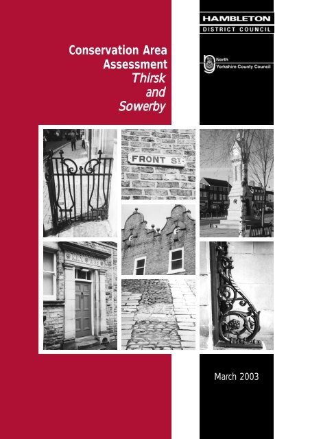
<strong>Conservation</strong> <strong>Area</strong><strong>Assessment</strong><strong>Thirsk</strong>andSowerbyMarch 2003
Introduction<strong>Thirsk</strong> is an attractive market town with a population of 8000 which serves an extensive part of the Vale ofYork.It lies 13 km north east of Ripon on the principal road from West Yorkshire to the North York Moors. Thepresent town is centred on the Market Place, but on the east bank of the Cod Beck is the former MarketPlace of Old <strong>Thirsk</strong>, forming St. James Green and Little Green.The Purpose of this BookletThe purpose of this booklet is to provide a detailedappraisal and detailed guidance on those townscapefeatures, buildings and spaces which make the <strong>Thirsk</strong> andSowerby <strong>Conservation</strong> <strong>Area</strong> an area of special architecturalor historic interest.It will assist in the control of development and will applythe heritage policies of the adopted Local Plan to thedistinctive and individual characteristics of <strong>Thirsk</strong> andSowerby, and will be adopted as supplementary planningguidance.Because of the limitations of space, it is not possible torefer to every building in the <strong>Conservation</strong> <strong>Area</strong>. Theomission of any particular building or feature should not betaken to imply that it is of no interest.The booklet contains:1. A map showing the main features which make <strong>Thirsk</strong>and Sowerby attractive historic places.2. A description of the conservation area, identifying itsspecial character and important features whichshould be taken note of when new buildings areproposed.3. Some ideas for improving the appearance of thehistoric parts of <strong>Thirsk</strong> and Sowerby.What is a <strong>Conservation</strong> <strong>Area</strong>?A conservation area is an area of “special architectural orhistoric interest, the character or appearance of which it isdesirable to preserve or enhance”. The <strong>Thirsk</strong> and Sowerby<strong>Conservation</strong> <strong>Area</strong> was designated on 12 August 1971.The boundary was amended on 27 February 1990 by theinclusion of Town End terraces at Sowerby and parts ofLong Street.Designation is a recognition of the group value of buildingsand their surroundings and the need to protect not justindividual buildings but the character of the area as awhole. The special character of an area derives from acombination of many things, such as trees, walls, openspaces, groups of buildings and the way they are arranged.Every area is unique.What Controls Apply?Within the 48 <strong>Conservation</strong> <strong>Area</strong>s in the <strong>District</strong>, a number ofspecial controls apply. In addition the policies of the<strong>Hambleton</strong> <strong>District</strong> Wide Local Plan aim to ensure that anydevelopment is in accordance with the special architecturalor historic interest of the area.Further general advice on <strong>Conservation</strong> <strong>Area</strong>s is given inPlanning Information Note No.2 available from the PlanningDepartment.The emphasis is always on preserving or enhancing thosebuildings, spaces and features which give eachconservation area its special distinctive character.A Brief HistoryThe early history of <strong>Thirsk</strong> is obscure but the bronze ageround barrow of Pudding Pie Hill constructed about 4500years ago is perhaps the oldest man made feature in thearea. In 1994, a small Anglo Saxon cemetery of 6th centurydate was excavated at Castle Garth beneath the laterMedieval castle. However, it was in the later Medievalperiod that <strong>Thirsk</strong> developed the street pattern that hassurvived until today.By the late Saxon period there were two manors at <strong>Thirsk</strong>,the smaller one lay east of the Cod Beck while the largerone lay on the west bank.The western settlement may originally have grown uparound the church, opposite the river crossing which wasprobably a ford at the end of Stammergate.Around 1100, the manor was confiscated by the Crown, andit is probable that the borough was founded on the eastbank during the early 12th century. The borough hadburgesses (free land owners), a market held on St. James’Green and a chapel.The moated site built near the river crossing between theborough and the parish church may have contained a smallcastle built at this time. However, recent archaeological workat this site proved inconclusive.The western settlement of New <strong>Thirsk</strong> was laid outalongside the castle. The castle was believed to have beenAN ASSESSMENT OF THE THIRSK AND SOWERBY CONSERVATION AREA
<strong>Thirsk</strong> in 1856© North Yorkshire County Record OfficeAN ASSESSMENT OF THE THIRSK AND SOWERBY CONSERVATION AREA
uilt around 1092 by Robert de Stuteville. It passed to theDe Mowbray family, and was destroyed in 1176.The building plots around the Market Place were probablylaid out to attract new settlers. Over the centuries, New<strong>Thirsk</strong> gradually took over the market role from Old <strong>Thirsk</strong>,the cattle fair at St. James’ Green ending in the late 19thCentury.The town was bypassed by the main east coast railway in1841, being reached by the Leeds and <strong>Thirsk</strong> Railway in1848. The area known as Sowerby Town End was laid outin piecemeal speculative terraces and villas between 1850and 1910, giving a distinctive piece of townscape to thetown.Components of the <strong>Conservation</strong><strong>Area</strong>Town and Country<strong>Thirsk</strong> is characterised by extensive green spaces whichextend along the Cod Beck and penetrate almost right intothe centre of the town. To the north of the town centre, theRacecourse and the walled <strong>Thirsk</strong> Hall Park contain thetown and define the frontier between the town and country.These open spaces have shaped the development of thetown over many years.Origins and Street Plan of <strong>Thirsk</strong>At <strong>Thirsk</strong>, two important roads running north to south comewithin a few hundred yards of each other across the CodBeck.On the east bank is the York to Yarm road and on the westbank the road from Boroughbridge and Topcliffe toNorthallerton and Darlington.On the east bank lay the Borough of <strong>Thirsk</strong>, centred on therectangular market that was later partly infilled withbuildings and divided into St. James’ Green and Little Green.Traces of the burgage plot pattern can readily be seen,especially on the east side of Long Street, where the plotends are bounded by a back lane, now reduced in statusto a footpath.The western settlement of New <strong>Thirsk</strong> was established nextto the castle and is believed to have been defended by abank and ditch, traces of which were excavated in 1999 atthe Nursery site, to the east of the Market Place. Potterydating from 1180 to 1220 was also found. The road fromTopcliffe is routed through Westgate and Castlegate via aseries of dog legged corners into the Market Place and backout along Kirkgate.Castlegate, <strong>Thirsk</strong>The Holmes, <strong>Thirsk</strong>At Norby, The Holmes flanking the Cod Beck, with theirwillow and alder trees extend as far as the Parish Churchand the path to St. James’ Green.The former mill stream which ran alongside the road andalong Marage Road ran through The Holmes and thepresent Millgate Car Park to the mill at the south side of MillBridge (the present Mill Garden).South of the Market Place, footpaths lead onto the Flatts, anextensive area of meadows flanking the Cod Beck andextending south to Blakey Lane and World’s End, Sowerbyand containing the town to the south-east.Within the <strong>Thirsk</strong> and Sowerby <strong>Conservation</strong> <strong>Area</strong>, a numberof distinctive sub areas can be defined, as follows:• Market Place• Kirkgate• St. James’ Green, Little Green and Ingramgate• Sowerby Front Street• Sowerby Town End TerracesMarket PlaceThe rectangular Market Place enclosed by continuousfrontages of 2 and 3 storey buildings forms the heartof the town. The roads which enter the Market Placeare mostly narrow and curving, which prevents viewsAN ASSESSMENT OF THE THIRSK AND SOWERBY CONSERVATION AREA
Place, while the plots to the north side are truncatedby Gillings Court.West side of the Market Place towards Kirkgateinto the Market Place until the last moment. Thisheightens the contrast between the narrowconstricted approach roads and the sudden entry intoa broad open space.The buildings in the Market Place are particularlyvaried, and range from medieval timber framingencased in later brickwork, to 18th century townhouses and coaching inns displaying classicaldetailing, through 19th century Victorian commercialbuildings in a range of styles to a small amount ofrather bland 20th century redevelopment. Notable19th century details are the turned joinery at 19Market Place, the doors, stone and ironwork at 37Market Place and the curved doors at 9 Market Place.There was quite a lot of rebuilding and refronting ofbuildings in the Market Place around 1900, when theMidland Bank (now the HSBC) was built, and whennumbers 89 and 64 Market Place were refronted withcurving Flemish style gables. The former Post Officeblock in the centre of the Market Place replaced ablock of other buildings in 1909, and Barclays Bankwas built in 1912. These Edwardian buildings aresome of the most distinctive in the town centre.Many of the vernacular brick and pantile outbuildingsdown yards behind Finkle Street, Millgate and marketPlace are former workshops or industrial buildings. Tothe rear of 17 Finkle Street is a former tannerybuilding which retains its characteristic upper floortimber louvres, although now converted to houses.Off Millgate in Dyer’s Yard are the altered buildings ofthe former dye house, while behind 49 Market Placeis a range of mono-pitched roof, former saddleryworkshops with characteristic large skylights.The extensive cobbled areas are a distinctive featureof the Market Place, while other cobbled areassurvive in some of the alleys and yards off the MarketPlace and in Kirkgate. Many of the brick wallsbounding the yards and backlands are formermedieval plot boundaries. These plots run back to aback lane, Chapel Street, on the south side of MarketKirkgateKirkgate is, architecturally, the most important street inthe town and is the most complete. South of Pick’s(Masonic) Lane, the narrow road contained by brickbuildings still retains something of a medievalcharacter, as do Finkle Street and Millgate. North ofPick’s (Masonic) Lane, the road widens out, and islined by many 18th century buildings in unbrokenfrontages, curving northwards towards the church. Afew medieval buildings survive here, notably 26-28Kirkgate and the Cross Keys Public House with visibletimber framing. To the rear of the buildings, brickwalls define the boundaries of building plots andgardens, with a back lane to the west of Kirkgate.Brewer’s Court off Kirkgate contains the remainingbuildings of Rhodes’ Brewery, now converted to flats.The 3 storey brewhouse bearing the date and initials1803 WR (for William Rhodes) and tall brick chimneystack are prominent features. The Whinstone slabcartway into the former brewery yard is anothernoteworthy feature, while the character of Kirkgate isenhanced by strips of cobbles along each side of theroadway.Many of the yards off Kirkgate and Market Placecontain small terraces of brick cottages built in the18th and 19th centuries. Many of these remainrelatively unaltered and although not listed as beingof special architectural or historic interest, they providea characteristic element in the townscape.Kirkgate and St. Mary’s ChurchThe large 15th century parish church closes the viewalong Kirkgate, and is flanked by <strong>Thirsk</strong> Hall, an 18thcentury country house in an urban setting. Thechurch tower is a prominent local landmark, clearlyvisible on approaching the town and from manypoints within it.AN ASSESSMENT OF THE THIRSK AND SOWERBY CONSERVATION AREA
St. James’ Green, Little Green and Ingramgatemost of its length south of the parish church, FrontStreet is lined with greens planted with lime trees,giving it a rural character. A back lane runs round theplots on the west side of Front Street, and this area ischaracterised by high brick boundary walls and anumber of former farm buildings in brick and pantile.St. James GreenSt. James’ Green, Little Green, The Crescent andIngramgate form an area of distinctive character, withthe greens flowing into each other at the east end ofthe John Carr designed Mill Bridge of 1789. Some ofthe houses in Bridge Street retain turned joinerycanopies and bay windows.St. James’ Green is a wide space with little houseson all sides set well back from the road behind smallgreens. The buildings are mainly two storey cottagesof varying height and with differing roof pitches. Theeast side contains the best buildings, a pair of 18thcentury town houses. The backlands each side of theGreen retain brick boundary walls and fences to theplotlands, a relic of the burgage plots of the formermedieval borough.The smaller Little Green has less immediatearchitectural interest, with modern housing on itseastern, western and northern edges. To the southeast,the walled garden of The Crescent bounds thegreen, with a path into Ingramgate.The Crescent was built in the late 19th century, in thewalled garden of the 18th century Ingram House. Thehigh garden wall survives for most of its length, andis most prominent along the bank of Cod Beck intoIngramgate. The Crescent is terminated by IngramHouse which faces towards the town centre upFinkle Street, abutting Ingramgate.Ingramgate is a spacious street with the housesraised above the road behind wide verges. Behindthe houses on the north side of the street is a densepattern of boundary walls and fences enclosing theplots and back gardens. At the west end, Ingramgateturns sharply over the bridge into Finkle Street,producing the effect of the town centre piling up toblock the way.Sowerby Front StreetImmediately south of the Market Place lies SowerbyParish, the historic heart of which is Front Street. ForFront Street, SowerbyEach side of Front Street has a discontinuousfrontage of houses and cottages, dating from the16th to the 20th centuries. The oldest example, atOxmoor Farm, contains timber framing with closestudding dating from the 16th century.Nos 124-130 are possibly timber framed cottages ofsimilar date, but with the timbering hidden within abrick skin. Many of the cottages and houses datefrom the 18th and 19th centuries, and many had baywindows added in the later 19th century.84 Front Street is an 18th century cottage with stonedoor surround and windows with keystones beneatha stone dentilled eaves cornice, unusual features ona cottage in this location. Rows of cottages and laterVictorian villas with prominent central porches andcanted bays sit alongside each other. Perhaps theoddest development is the row of three Regencyhouses 49-51 Front Street, with steps up to theentrance over a basement, a very urban form ofdevelopment for Sowerby.Sowerby Town End TerracesSowerby Town End terraces is an area of verydifferent character, of much more urban 19th centuryappearance. The area was developed piecemeal afterthe arrival of the railway in the mid 19th century,between about 1850 and 1910.By 1856, Sowerby Terrace, Sowerby Grove andMowbray Terrace had been completed and parts ofMowbray Place built.The terraces were built piecemeal, and what appearsto be a uniform development shows a great varietyof detailed variation between the terraces and evenwithin individual terraces.AN ASSESSMENT OF THE THIRSK AND SOWERBY CONSERVATION AREA
Most of the terraces have their main elevations withenclosed gardens facing south, the gardens beingbounded by iron railings and gates. Much of theboundary to Sowerby Road is formed by a high brickwall, with coach houses and former stables atSowerby Terrace.Topcliffe Road, SowerbyAt the rear of each terrace are small yards withcoalhouses and WCs, bounded by high walls andsolid board doors. Most of the back lanes are asphaltwith York stone kerbs, but a stretch of patent Scoriablocks survives to the rear of 20-46 Topcliffe Road.These blue blocks were made from iron slag onTeesside in the 19th century. The oldest terracesshow how the Georgian and Regency influencelingered on well into the 19th century, with smallpaned sash windows, arch headed staircasewindows and, in Mowbray Place, a single stairwindow with gothic glazing bars.Hints of a Regency influence can be seen inMowbray Place, which with its hipped roof and 16pane sash windows resembles a Regency villa. Somehouses in Mowbray Place have windows with narrowglazed margins, a Regency feature, and scribedstucco window heads.Belgrave Terrace was built by 1871 and unusuallyfaces north across a communal grassed area towardsthe other communal open space fronting SowerbyTerrace. Belgrave Terrace has canted bay windowswith four pane sashes and wooden door cases withflat pilasters similar to those used at 28-40 TopcliffeRoad.South Terrace and South Crescent form the southernend of the area of terraces. South Terrace has cantedbay windows with flat roofs, paired flat pilasterdoorcases and iron gutters carried on a deep whitebrick cornice.South Crescent, built in 1910, is much plainer, withalmost no applied timber detailing. Contrasting whitebrick is used to form quoins, string course, eavesdetail and door surrounds.The development of Melbourne Place was nevercompleted, and three pairs of houses mark the startof the street. The houses in Melbourne Place aremuch more simply detailed, with only swept brickwindow and door heads offering relief to plainelevations. The gardens and yards at South Crescentand Melbourne Place are bounded by brick wallscapped with interlocking clay ridge tiles, a distinctivefeature in this area.Victoria Terrace was built piecemeal from the late19th century, and is notable for the turned joineryused on canopies and porches. The houses have amixture of straight and canted bays under hippedslate roofs, with some roof dormers with carvedbargeboards.Victoria Avenue, SowerbyThe entrance to Victoria Avenue is flanked by twogroups of late 19th century terraces in red brick withtimbered dormer gables.Belgrave Terrace., SowerbyAN ASSESSMENT OF THE THIRSK AND SOWERBY CONSERVATION AREA
BuildingsThe overall impression of <strong>Thirsk</strong> is of a brick built town.However, in the Market Place and to a lesser extent, thestreets leading off it there is a greater variety, with 17thcentury timber framing hidden behind later rendering, and18th century and 19th century brick buildings.The most important buildings in the <strong>Conservation</strong> <strong>Area</strong> arethe Church of St Mary in Kirkgate (Grade I), the Church of StOswald, Sowerby (Grade II*) and <strong>Thirsk</strong> Hall (Grade II*). Thereare several grade II buildings in the Market Place worthy ofnote, including the HSBC Bank, The Three Tuns Hotel andThe Golden Fleece Hotel. Earlier timber framed buildingsinclude Oxmoor Farm, Sowerby and The Blacksmith’s Arms.<strong>Thirsk</strong> HallChurch of St MaryThis is the Parish Church prominently located at thenorth end of Kirkgate, and visible from the northernapproaches to the town. It is a fine perpendicularchurch, of outstanding quality for North Yorkshire, builtbetween 1430 and 1480.Church of St Oswald, SowerbyThis is the Parish Church of Sowerby, standing on theeast side of Main Street. It has a Norman southdoorway, and a squat tower, built from the 15thcentury.The church was greatly altered and extended in threephases in the 19th and early 20th centuries. E BLamb, architect of Thirkleby Church, designed thenave, crossing, transepts and chancel in 1842;Hodgson Fowler added the wooden lantern in 1879-83, while Walter Brierley, designer of County Hall,Northallerton, added the north aisle in 1902.<strong>Thirsk</strong> Hall<strong>Thirsk</strong> Hall lies next to the Parish Church. Built in1720, it was extended and raised in height by JohnCarr in 1770. These extensions converted the houseinto a country house in an urban setting, the housebeing set back slightly from the frontage of Kirkgate.Immediately south of the Hall is the 18th centurystable block with stone details, and a group of brickfarm buildings including a dovecote, all alongside anextensive cobbled yard.The grounds of <strong>Thirsk</strong> Hall extend to about twentyacres, and are largely enclosed by high brick walls tothe north, west and south. The hall park forms asignificant green wedge which has inhibited urbanexpansion to the north west.The tower of the parish church and the clumps oftrees planted between the church and the hallprovide a picturesque setting for the hall.83 Market Place (The Blacksmith’s Arms)This is one of the few timber framed buildings in thetown centre to have been surveyed by the RoyalCommission on the Historical Monuments of England.The earliest parts date from the 15th century, and thebuilding comprises a range originally gable end ontothe street and a side wing. There is also a stair turretand staircase and two storey covered passage, alldating from the 17th century. The building wasrefronted around 1900, at which time a pair of cantedbays were added, and large first floor gable windowsinserted.77 Market Place (HSBC Bank)This stone building of 17th century style was builtaround 1900 for the Yorkshire Banking company, anddesigned by Bedford and Kitson. With its mullion andtransom windows, stone pilasters and finials and fineiron gates at the front it is one of the bestcommercial buildings in the Market Place.54 Market Place (The Three Tuns Hotel)This brick building possibly dates back to the 17thcentury, with the oldest part being the low rear wingwhich has been much altered and extendedsouthwards. Most of the building we see today datesfrom the 18th century, the three storey hip roofedbuilding with its 19th century porch occupies aprominent spot in the south east corner of theMarket Place. The most impressive internal feature isthe late 17th or early 18th century staircase withtwisted balusters.The Three Tuns was by repute, the Dower House ofthe Bell family prior to their purchase of the <strong>Thirsk</strong>Estate in 1723. The walled garden of The Three Tunsto the south east became a nursery garden in the19th century, and has now been redeveloped forhousing. South, in Chapel Street, is the tall brickcoach house and dovecote once belonging to theDower House, and now used as a workshop.AN ASSESSMENT OF THE THIRSK AND SOWERBY CONSERVATION AREA
Building Materials<strong>Thirsk</strong> lies in the Vale of York, and not surprisingly, brick isthe predominant material. This varies from the brownmottled 18th century brick, to orange and fiery red pressedbrick of the 19th century. Market Cross Jeweller’s shop at 73Market Place is an example of late 19th century polychromebrickwork, while numbers 89 and 64 Market Place haveFlemish style brick gables dating from the late 19th andearly 20th century. The gable at 89 Market Place bears adate plaque 1901 with A for Ayre. Flemish style gables alsoappear at the Institute building on The Flatts.Coatings of stucco render on many buildings around theMarket Placeconceal oldertimberframing.Buildingsknown tocontaintimberframinginclude 45Market Place(PatriciaDawson), 60Market Place(the formerOld GoldenLion) and TheBlacksmith’sArms.MillgateStone is very little used in the town, apart from the ParishChurch. The Midland Bank (HSBC), built 1904 in a free styleuses stonework gables, cornices, heraldic shield andbulbous entrance columns in a lively way.Buildings are roofed mainly in pantiles or Welsh slate. Stoneslates are almost wholly absent, as is cobbled walling.Cobbles are found as paving, along with York stone flagsalong the yards and alleyways running off the Market Place.Local Plan Policy BD4 emphasises the importance of locallydistinctive building materials.Applying the <strong>Assessment</strong>When considering applications for development in aconservation area, a local planning authority is required topay special attention to the desirability of preserving orenhancing the character or appearance of the conservationarea. The <strong>Conservation</strong> <strong>Area</strong> <strong>Assessment</strong> seeks to provide asound basis for development control through providingsupplementary guidance to the heritage policies of theadopted local plan on those townscape features, buildingsand spaces that make the area special.Local Plan Policy H1 requires that “Development within oraffecting the setting of a conservation area should seek topreserve or enhance all features which contribute positivelyto the area’s character or appearance. Special regard will bepaid to the impact of proposed development on thecharacter or appearance of conservation areas, anddevelopment likely to have an adverse impact .. will not bepermitted”The <strong>Assessment</strong> identifies distinctive sub areas, notablebuildings and characteristic details and materials whichprovide local distinctiveness to <strong>Thirsk</strong> and Sowerby.Unlisted buildings which contribute to the character orappearance of the <strong>Thirsk</strong> and Sowerby <strong>Conservation</strong> <strong>Area</strong>are identified on the map contained in the <strong>Assessment</strong>. Thedemolition of any of these buildings would be contrary toPolicy HH3.New development could have an adverse impact on theconservation area, and under Policy HH4 new developmentshould comply with the following criteria:“1. The position of the building on its site shouldrelate to surrounding buildings and open space;2. Materials should be appropriate to the area and inkeeping with the surrounding buildings;3. The mass of the building should be in scale andharmony with surrounding buildings and the area;4. The design of the building should ensure that theproportions of the parts are in scale with eachother and relate to adjoining buildings, whiledetailing should be appropriate to the buildingand the locality;5. The development should not adversely affect thestreetscape, roofscape, skyline and setting of theconservation area or significant views in and outof the area;6. The development should not adversely affectimportant open spaces as identified .... underPolicy BD5 “Within the conservation <strong>Area</strong> are a number of neutral areasthat neither enhance nor significantly detract from thequality of the area. They mostly contain modern buildings ingood condition but built in a variety of styles which fail toreflect local traditions of building.Many of these buildings fail to respect the character of thearea in terms of style, design, materials and location, and inAN ASSESSMENT OF THE THIRSK AND SOWERBY CONSERVATION AREA
their siting they frequently disrupt the traditional plot patternof the historic area.Most of the neutral areas are found around the edges ofthe <strong>Conservation</strong> <strong>Area</strong> or lie just beyond it. The setting ofthe scheduled monument of Castle Garth is not enhancedby the various modern buildings between the Castle siteand Newsham Road and Station Road. The redevelopmentof such sites in accordance with Policy HH4 would enhancethe appearance of the <strong>Conservation</strong> <strong>Area</strong>.The <strong>Assessment</strong> provides guidance on the application ofthe criteria of Policy HH4 to the <strong>Conservation</strong> <strong>Area</strong> and itssub areas identified in the <strong>Assessment</strong>. Within each ofthese, it will be necessary for new development to respectthe character of that particular area.Several of the sub areas are characterised by long narrowgardens or yards to the rear of the main streets, boundedby high brickwalls orhedges. Suchboundaries areoften theoldest physicalevidence ofmedievalpropertylayouts, andare of greathistoricimportance.Policy HH5controls theamalgamationof adjacentplots and thedemolition ofJohnson’s Yard, <strong>Thirsk</strong>buildingsbehind retained facades.All development in conservation areas should seek topreserve or enhance the character of the area, and PolicyHH6 seeks to control alterations to buildings in conservationareas to meet this aim.Where the character or appearance of the conservation areais threatened by alterations to unlisted dwellinghouses,Article 4 Directions will be made, as set out in PolicyHH8.The effect of these will be to bring within the scope ofplanning control alterations to dwelling houses hithertoallowed as permitted development.The <strong>Conservation</strong> <strong>Area</strong> East of Cod Beck, around St. JamesGreen, <strong>Thirsk</strong> Town Centre and Sowerby Town End is alreadycovered by Article 4 Directions and a further Direction isproposed to cover Front Street, SowerbyConsultations on these Directions is being undertaken withlocal residents, businesses and other interested parties.The<strong>Assessment</strong>identifies anumber ofdistinctive localfeatures suchas turnedjoinery tosomeshopfronts andin somestreets, notablyVictoriaAvenue, stoneand ironworkdetails in theMarket Place,the formerbreweryBrewer’s Court, Kirkgatechimney inKirkgate and the high brick boundary walls. Policy HH9seeks the retention of such features in the <strong>Conservation</strong><strong>Area</strong>.Policy HH10 seeks to retain traditional paving materialswhere they are found. The widespread use of cobbles inthe Market Place and many yards is noted in theassessment, as is the use of the regionally significant TeesScoria block in Sowerby Town End.The importance of trees in the conservation area isrecognised, and the assessment notes the significance oftrees at Front Street Sowerby and near <strong>Thirsk</strong> Hall. PolicyHH11 aims to safeguard trees of high amenity value.The historic street pattern is one of the key determinants oftown centre character and proposals to demolish frontagebuildings to improve sight lines and access need to beconsidered against Policy HH12 which aims to maintain thesense of enclosure created by narrow streets.While most of the <strong>Conservation</strong> <strong>Area</strong> is of high visual quality,there are several areas where piecemeal demolition, decayand damage detract from the special character andappearance of the area.A number of these areas areidentified under Policy HH14 as areas where enhancementor the repair of buildings needs to be focussed as follows:• Rear of Nos 45-71 Market Place (north side)• Rear of Nos 30-54 Market Place (south side)• North side of Picks (Masonic) LaneAN ASSESSMENT OF THE THIRSK AND SOWERBY CONSERVATION AREA
Action in these areas could include the repair and reuse oftraditional buildings, the relaying of traditional pavingmaterials as means of enhancement.Listed Buildings are of particular importance in defining thespecial architectural and historic interest of the <strong>Conservation</strong><strong>Area</strong>. All listed buildings in the <strong>Conservation</strong> <strong>Area</strong> are listedin an annex and shown on the map. Proposals to demolisha listed building will be considered against Policy HH15 anda record will be required to be made as under Policy HH16.Alterations to listed buildings will be considered againstPolicy HH17.Proposals affecting the setting of a listed building areconsidered against Policy HH18. The <strong>Assessment</strong> notes theimportance of the Parish Church in distant views of thetown, and of the setting of <strong>Thirsk</strong> Hall. The importance ofviews, roofscapes and skylines is emphasised by Policy BD3which states that “New development which wouldadversely affect public views of skylines, roofscapes,landmark buildings and vistas of towns and villages will notbe permitted. Where alterations are proposed, skyline orrooftop features such as chimneys, cupolas, spires, towersor domes should be retained”A number of scheduled monuments in the <strong>Conservation</strong><strong>Area</strong> arereferred to inthe<strong>Assessment</strong>and these areaffordedprotectionunder PolicyHH19.Knowledge ofthe earlyorigins of<strong>Thirsk</strong> hasincreased inrecent yearswith thediscovery of6th centuryburialsThe Packhorse Bridge, Sowerbybeneath the Castle, and evidence of the medieval townbank and ditch around the Market Place. The presumed lineof the town bank and ditch is an area of higharchaeological potential where Policy HH20 would beapplied.Grants for EnhancementThe <strong>Council</strong> wishes to encourage schemes to preserve orenhance the character or appearance of the conservationarea. Under the <strong>Conservation</strong> <strong>Area</strong> Preservation andEnhancement Scheme (CAPE), grants of 50% are offeredtowards the repair and retention of features of interest andto reinforce the special attraction of the area.Eligible items include:• The repair of boundary walls.• The relaying of natural stone paving.• The undergrounding of wires.• The removal of intrusive signs.Further details of the grant are available from the <strong>Council</strong>.Grants for Building RepairUnder the <strong>Thirsk</strong> Heritage Economic Regeneration Scheme,variable grants of 40-60% are available towards the repair ofmost buildings around <strong>Thirsk</strong> Market Place. Buildings inneed of repair not qualifying under HERS may qualify forHistoric Building Grant. Details are available from the <strong>Council</strong>.Further AdviceIf you need further advice, please contact:Planning Policy and Economic Development,Planning and Environmental Services Department,<strong>Hambleton</strong> <strong>District</strong> <strong>Council</strong>,Civic Centre, Stone Cross, Northallerton DL6 2UUTelephone: 01609 767054Fax: 01609 767248E-mail: planningpolicy@hambleton.gov.ukWebsite: www.hambleton.gov.ukAN ASSESSMENT OF THE THIRSK AND SOWERBY CONSERVATION AREA
Listed Buildings in the <strong>Thirsk</strong> and Sowerby <strong>Conservation</strong> <strong>Area</strong>SOWERBY PARISHChapel Street: No 2 IIFormer Stable and Dovecote IIFront Street: Church of St Oswald II*Churchyard wall with piersand overthrowsIIThe Manor HouseIIDovecote S. of Manor House IIManor Farm Threshing barnwith attached gin gang IINo 27IINo 33IINos 47-51IINo 71IINo 68IINo 76IIFront Street: Nos 86-88 IINos 90-90aIINo 96IINo 98IINos 124-130IINo 136aIINo 138 Crown and Anchor PH IINo 140IINos 142-4IINos 146 –8IINo 172IIGarden Wall to 172 IITown End Bridge (alsoscheduled Ancient Monument) IITHIRSK PARISHBridge Street: Mill Bridge IICastlegate: No 10 IINos 13, 13a, 15-17 IICemetery Road: Brick walls N. of <strong>Thirsk</strong> Hall IINos 1-2IIFinkle Street: Nos 18-22 IIHalifax Building Society (No 24) IINos 19-21IINew BridgeIIIngramgate: No 1 IINos 7, 9, 11IIMilepost opposite No 15 IINo 15IIKirkgate: Nos 7-15 IINos 21-3IINo 29IINo 31IINo 33IINo 35II<strong>Thirsk</strong> HallII*Brick wall south of <strong>Thirsk</strong> Hall IIStables at <strong>Thirsk</strong> Hall IIOutbuildings incorporatingdovecotIIChurch of St MaryINos 10-12IINos 14-18IINo 24 and Friends MeetingHouseIINos 26-28llNos 30-2 (Cross Keys PH) IINos 42-52IIPump at rear of No 52 IIMarket Place: Market Clock IINos 2-6IINos 10-12No 40IINos 42-4 (The Golden FleeceHotel)IINos 46-52IINo 54 (The Three Tuns) IINos 60-62IINo 13 (former Royal Oak Hotel) IINo 21-7IINo 45IINo 47 (The Darrowby Inn) IINo 57 (The Royal)IINos 61-3IINo 65 (Co-op)IINo 75 (The Black Bull) IINo 77IINo 83 (The Blacksmiths Arms) IIMillgate: Nos 8-16 IISt. James’ Green: No 8IINos 35, 36,37IINo 38IIWestgate Court House andInspectors HouseIIAN ASSESSMENT OF THE THIRSK AND SOWERBY CONSERVATION AREA


