City of Binghamton LWRP - New York State Department of State
City of Binghamton LWRP - New York State Department of State
City of Binghamton LWRP - New York State Department of State
- No tags were found...

You also want an ePaper? Increase the reach of your titles
YUMPU automatically turns print PDFs into web optimized ePapers that Google loves.
<strong>City</strong> <strong>of</strong> <strong>Binghamton</strong>Local Waterfront Revitalization ProgramAdopted:<strong>City</strong> Council, November 21, 2005Approved:Acting NYS Secretary <strong>of</strong> <strong>State</strong> Frank P. Milano, December 23, 2005
2.5.2 Existing Zoning ........................................................................................ 132.5.3 Land Side Ownership................................................................................ 152.5.4 Underutilized, Abandoned or Deteriorated Sites ........................................ 152.6 Water Use Characteristics............................................................................... 172.6.1 Existing Water Uses.................................................................................. 172.6.2 Water Side Ownership .............................................................................. 192.7 Parks, Recreation and Open Spaces ................................................................ 192.7.1 Facilities................................................................................................... 192.7.2 Programs.................................................................................................. 212.8 Cultural Resources ......................................................................................... 222.8.1 Facilities................................................................................................... 222.8.2 Programs.................................................................................................. 242.9 Historic Resources.......................................................................................... 252.9.1 Historic Structures ................................................................................... 252.9.2 Historic Districts ...................................................................................... 272.10 Scenic Resources.......................................................................................... 282.11 Environmental Resources ............................................................................. 302.11.1. Wildlife Management Areas .................................................................... 302.11.2. Significant Fish and Wildlife Habitats..................................................... 302.11.3. Wetlands ............................................................................................... 302.11.4. Water Quality ........................................................................................ 312.12 Development Considerations......................................................................... 312.12.1. Flood Hazard Areas................................................................................ 312.12.2. Soils ...................................................................................................... 322.12.3 Hazards to Navigation............................................................................. 332.12.4 Public Sewer and Water .......................................................................... 34ii
2.13 Transportation Characteristics...................................................................... 342.13.1. Road Systems........................................................................................ 342.13.2 Air Service .............................................................................................. 362.13.3 Public Transit ......................................................................................... 362.13.4 Pedestrian and Bicycle Circulation.......................................................... 372.13.5 Gateways................................................................................................ 382.14 Key Waterfront Revitalization Issues ............................................................. 38Section III - Waterfront Revitalization Policies............................................................. 1General Policy ........................................................................................................ 1Economic Development Policies .............................................................................. 8Waterfront Natural Resources Policies .................................................................. 12General Environmental Policies ............................................................................ 18Recreation and Cultural Policies ........................................................................... 21Section IV - Proposed Projects.................................................................................... 14.1 Proposed Land and Water Uses......................................................................... 14.2 Proposed Concept Plan ..................................................................................... 54.2.1 Design Principles ........................................................................................ 54.2.2 Central Business District General Design Concept .................................... 104.2.3 <strong>Binghamton</strong> Plaza..................................................................................... 124.2.4 Sandy Beach Park .................................................................................... 144.3 Proposed Projects ........................................................................................... 164.3.1 Central Business District Improvements ................................................... 164.3.2 North Side Planning Projects..................................................................... 204.3.3 East Side Planning Projects ...................................................................... 214.3.4 West Side Planning Projects ...................................................................... 224.4. Trail Enhancements ...................................................................................... 26iii
Section V - Local Implementation Techniques ............................................................ 15.1 Local Planning Initiatives .................................................................................. 15.2 Existing Local Laws and Regulations................................................................. 25.3 Additional Local Laws Needed to Implement <strong>LWRP</strong>............................................ 45.4 Other Required Public and Private Actions ........................................................ 85.5 Administrative Actions Necessary for Implementation........................................ 95.6 Local Management Structure and Procedures ................................................. 105.7 Financial Resources........................................................................................ 11Section VI - <strong>State</strong> Actions and Programs Likely to Affect Implementation .................... 16.1. <strong>State</strong> Actions and Programs ............................................................................. 26.2. <strong>State</strong>/Federal Programs Necessary to Further <strong>LWRP</strong> ...................................... 17Section VII - Local Commitment and Consultation ..................................................... 17.1. Local Commitment........................................................................................... 17.2. Consultation with Federal, <strong>State</strong> and Local Agencies ........................................ 27.3. Consultation with Local Officials...................................................................... 27.4. Public Outreach............................................................................................... 37.4.1. Focus Groups............................................................................................ 37.4.2 Public Presentations ................................................................................... 4Appendix 1 – Goals and Objectives............................................................................. 1Appendix 2 – Public Input Session Summary ............................................................. 1Appendix 3 – Focus Group Session Summary ............................................................ 1Appendix 4 – Consistency Review Law........................................................................ 1Appendix – 5 Guidelines for Notification and Review <strong>of</strong> <strong>State</strong> Agency Actions .............. 1iv
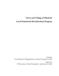
Section I Waterfront Revitalization Area1.1 Regional ContextThe <strong>City</strong> <strong>of</strong> <strong>Binghamton</strong> is located in the southern tier <strong>of</strong> <strong>New</strong> <strong>York</strong> <strong>State</strong>, at thejunction <strong>of</strong> the Susquehanna and Chenango Rivers. <strong>Binghamton</strong> is located within aone-day drive <strong>of</strong> many major northeastern cities, including Buffalo (220 miles), Albany(130 miles), <strong>New</strong> <strong>York</strong> <strong>City</strong> (170 miles), Philadelphia, PA (180 Miles), Burlington, VT(270 miles), Boston, MA (300 miles) and Baltimore, MD (260 miles).Figure 2-1 Regional Context Map -<strong>Binghamton</strong>, <strong>New</strong> <strong>York</strong>Source: www.mapquest.comThe <strong>City</strong> <strong>of</strong> <strong>Binghamton</strong> is conveniently located in Broome County, and is easilyaccessible from both the north and south via Interstate 81. The <strong>City</strong> is also accessiblefrom the north via Interstate 88. In addition, <strong>Binghamton</strong> is located within a shortdrive <strong>of</strong> many other regional destinations, including:Rochester, NYSyracuse, NYCorning, NYElmira, NYIthaca, NYWillkes-Barre, PA150 miles70 miles70 miles50 miles48 miles80 milesThe Susquehanna and Chenango Rivers are the defining physical elements within the<strong>City</strong>, forming an integral natural resource for the <strong>City</strong> to develop, both as a local assetand regional tool. It is important to realize that the Susquehanna and ChenangoRivers are not isolated within the <strong>City</strong> <strong>of</strong> <strong>Binghamton</strong> boundaries. Both Rivers beginnorth <strong>of</strong> the <strong>City</strong>, with the Chenango terminating in <strong>Binghamton</strong>, where it merges withSection I - 1
the Susquehanna River. The Susquehanna continues to run south <strong>of</strong> <strong>Binghamton</strong>,meandering through the Pennsylvania hills and northern Maryland before it emptiesinto the Chesapeake Bay.Figure 2-2 Susquehanna and Chenango Rivers1.2 Waterfront Revitalization Area Boundary Rationale1.2.1 Land SideCreating a sound rationale for the development <strong>of</strong> the waterfront revitalization areaboundaries is an important tool for determining what uses and parcels are eitherincluded, or excluded, from the waterfront revitalization area. A variety <strong>of</strong> factorscontribute to the development <strong>of</strong> the waterfront revitalization area boundaries,including natural features, natural and manmade barriers, waterfront relationshipsand economic development.Natural FeaturesThe two most prominent natural features in the <strong>City</strong> <strong>of</strong> <strong>Binghamton</strong> are theSusquehanna and Chenango Rivers. They are obvious elements for inclusion in a planintending to target the waterfront and water-based uses.Natural, park and open space areas, particularly those located within close proximityto the waterfront, have been purposely included in the waterfront revitalization areaSection I - 2
oundaries. The physical relationship between these open space areas and thewaterfront is apparent, as many activities and programming for the two featurescomplement one another.Natural and Manmade BarriersWhether natural or manmade, barriers create specific issues that affect the location <strong>of</strong>the boundary lines developed for the waterfront revitalization area. These barriers cancreate specific problems, particularly with respect to access, movement andneighborhood character.When possible, boundary lines are located on the far side <strong>of</strong> major roadways. Thepopularity <strong>of</strong> the automobile for average Americans in the mid-twentieth Century hada lasting impact on the <strong>City</strong> <strong>of</strong> <strong>Binghamton</strong> due to the creation <strong>of</strong> a large number <strong>of</strong>highways and major roadways. At one point in the <strong>City</strong>'s history these roadways mayhave made sense, but with the decrease in the <strong>City</strong>'s population the use <strong>of</strong> theseroadways has continuously dwindled. The majority <strong>of</strong> these highways were built alongside, or within close proximity to the waterfront, making access to the waterfront fromareas behind them near impossible. Including them within the waterfrontrevitalization area boundaries will allow these roadways, which currently hinderaccess and development, to be positively affected by future <strong>LWRP</strong> policies.Waterfront RelationshipsAccess to the waterfront and the waterfronts relationship and compatibility tosurrounding areas is a critical component relative to the development <strong>of</strong> the boundaryline for the waterfront revitalization area. All recreation oriented land uses, such asnaturalized open space areas and parks, were included within the waterfrontrevitalization area boundaries due to the direct relationship these uses have withpotential future developments along the waterfront.All major existing access points, including the Washington Street pedestrian bridge,were included in the waterfront revitalization area.Economic DevelopmentIn order to strengthen the relationship <strong>of</strong> a revitalized waterfront with economicdevelopment that will benefit the entire <strong>City</strong>, the existing central business district wasincluded in the waterfront revitalization area, as well as pocket commercial areas thatcould potentially benefit from improvements to the waterfront. The success <strong>of</strong> thewaterfront and the downtown core are inter-related, with each having the ability tolargely affect the other. Success along the waterfront will surely bolster revitalizationefforts and investments in the central business district, and vice versa.Section I - 3
1.2.2 Water SideThe Susquehanna River is a designated inland waterway as defined in <strong>New</strong> <strong>York</strong> <strong>State</strong>Executive Law, Article 42, Section 911, and therefore is a necessary component forinclusion in the boundaries for the Local Waterfront Revitalization Program.The Chenango River is not defined as an inland waterway by <strong>New</strong> <strong>York</strong> <strong>State</strong> but isincluded as part <strong>of</strong> the waterfront revitalization area because <strong>of</strong> its connection to theSusquehanna River and its prominence as a waterfront feature within the <strong>City</strong>.1.3 Waterfront Revitalization Area Boundary DescriptionThe boundary for the <strong>City</strong> <strong>of</strong> <strong>Binghamton</strong> Local Waterfront Revitalization Programgenerally conforms to the boundaries <strong>of</strong> the Chenango and Susquehanna Rivers. See:Revitalization Area Boundary Map.1.3.1 Land Side GeneralThe landward boundary for the <strong>LWRP</strong> generally includes the following areas:• The northern and southern borders <strong>of</strong> the Susquehanna River from thewestern edge <strong>of</strong> the <strong>City</strong> to the eastern boundary.• The western and eastern borders <strong>of</strong> the Chenango River from thenorthern <strong>City</strong> limits to its confluence with the Susquehanna River.Any land bodies located within the Susquehanna River.1.3.2 Land Side DetailedBeginning at the western border <strong>of</strong> the <strong>City</strong>, on the southern side <strong>of</strong> the SusquehannaRiver, the boundary follows the southern right-<strong>of</strong>-way <strong>of</strong> Vestal Parkway until itreaches the western property line <strong>of</strong> MacArthur Park; then southerly along the parcelto Vestal Avenue; then along the northern border <strong>of</strong> Vestal Avenue to Tremont Avenue;then northerly along the eastern border <strong>of</strong> Tremont Avenue to where it bisects ConklinAvenue; then easterly along the southern border <strong>of</strong> Conklin Avenue to John Street;then north along the western border <strong>of</strong> John Street; then along the rear property line<strong>of</strong> the public service property fronting the Susquehanna River; then easterly along thenorthern border <strong>of</strong> Jackson Street to Otsiningo Street; then northerly along thewestern border <strong>of</strong> Otsiningo Street until it bisects Webster Street; then easterly alongthe northern border <strong>of</strong> Webster Street, but including the entire parcel south <strong>of</strong>Webster Street between Baldwin Street and Hayes Street; then southerly along thewestern border <strong>of</strong> Pierce Creek to Belden Street and northerly along the eastern borderto Kennedy Street; then easterly along the southern border <strong>of</strong> Kennedy Street to HomeAvenue; then north along the western border <strong>of</strong> Home Avenue to Home Court; thenfollowing Home Court, including all parcels fronting onto Home Court until it bisectsConklin Avenue (Route 7); then easterly on Conklin Avenue (Route 7) to Duke Street;Section I - 4
the northerly on Duke Street, including parcels fronting on both sides <strong>of</strong> Duke Street;then easterly on Baltimore Avenue, including all parcels fronting onto the street; thensoutherly on Bond Street to Delavan Avenue; then easterly following the southernborder <strong>of</strong> Delavan Avenue to Ruthven place; then including all parcels on the easternside <strong>of</strong> Ruthven Place, as well as the entire road width; then following the northernborder <strong>of</strong> all parcels fronting onto Conklin Avenue and Holmes Place until the easternedge <strong>of</strong> the city limits.The boundary resumes on the northern side <strong>of</strong> the Susquehanna River at the westernedge <strong>of</strong> the city, traveling in an easterly direction along the northern border <strong>of</strong>Riverside Drive, incorporating all parcels south <strong>of</strong> Riverside Drive, to Oak Street; thennortherly along the eastern border <strong>of</strong> Oak Street to Leroy Street; then easterly alongthe southern side <strong>of</strong> Leroy Street to Front Street; then northerly along Front Street,incorporating all parcels to the east <strong>of</strong> Front Street, as well as all parcels which frontonto the western border <strong>of</strong> Front Street until the northern city limits.The boundary resumes at the northern boundary on the eastern side <strong>of</strong> the ChenangoRiver and continues in a southerly direction along Chenango Street, incorporating allparcels to the west <strong>of</strong> Chenango Street and all parcels to the east which front ontoChenango Street; then southwesterly along <strong>State</strong> Street, including all parcels west <strong>of</strong><strong>State</strong> Street to the Chenango and all parcels fronting on <strong>State</strong> Street to the east; theneasterly along the northern right-<strong>of</strong>-way <strong>of</strong> the D and H Railroad line until it intersectswith NYS Route 363; then easterly along the northern right-<strong>of</strong>-way <strong>of</strong> the CR Railroadand Canadian Pacific line, including all parcels fronting onto the right-<strong>of</strong>-way; theneasterly along Court Street (US Route 11), including all parcels south <strong>of</strong> Court Streetto the Susquehanna River and all parcels north <strong>of</strong> Court Street fronting onto the streetand following the parcel lines designated as commercial according to the <strong>City</strong> <strong>of</strong><strong>Binghamton</strong> Future Zoning Map in the Comprehensive Plan; then easterly until theeastern limits <strong>of</strong> the <strong>City</strong>.All land bodies located within the Susquehanna River are included in the waterfrontrevitalization area.1.3.3 Water SideThe waterside boundaries for the Local Waterfront Revitalization Program include allportions <strong>of</strong> the Chenango and Susquehanna Rivers located within the boundaries <strong>of</strong>the <strong>City</strong> <strong>of</strong> <strong>Binghamton</strong>.Section I - 5
Section II Inventory and Analysis2.1 Historical OverviewWhen the last Ice Age receded from the land that eventually became <strong>New</strong> <strong>York</strong> <strong>State</strong>,the valley that forms around the confluence <strong>of</strong> the Chenango and Susquehanna Riverswas created. The area on which the modern <strong>City</strong> <strong>of</strong> <strong>Binghamton</strong> exists was originallyinhabited by several small Indian settlements until the late 1770's when the land wasturned over for white development. According to history compiled by the BroomeCounty Historical Society, at this time over 230,000 acres <strong>of</strong> land was sold to anumber <strong>of</strong> land speculators from Massachusetts in order to settle a land disputebetween the <strong>New</strong> England <strong>State</strong> and <strong>New</strong> <strong>York</strong>.The most desirable area <strong>of</strong> this land purchase, at the confluence <strong>of</strong> the rivers, wasgranted to William Bingham, for whom the <strong>City</strong> was eventually named. Bingham wasan affluent banker from Philadelphia who had great visions for the development <strong>of</strong> asuccessful village on the site. Joshua Whitney served as Bingham's land agent andbusiness manager and was able to attract residents to the site <strong>of</strong> the new village onthe banks <strong>of</strong> the Chenango River. By 1800 Court Street and Water Street wereconstructed and in 1802 the first courthouse was built on land donated by Binghamfor use as a public square. The construction <strong>of</strong> the courthouse was a pivotal turningpoint and signaled the rising importance <strong>of</strong> the Village <strong>of</strong> Chenango Point, as it wasthen called.The rivers became the economic force in the community and within a few years theVillage had a variety <strong>of</strong> successful shops, merchants and drugstores. The process <strong>of</strong>clearing the land for development also contributed to the beginning <strong>of</strong> a sizable lumberindustry, with goods being carried along the Chenango and Susquehanna Rivers.Simultaneously, the population <strong>of</strong> <strong>Binghamton</strong> was rapidly growing, with an increasein its population from three hundred (300) in 1812 to two thousand (2,000) in 1840.The rivers, although a favorable economic asset, were not without their problems. Thewater levels in the rivers fluctuated greatly and the use <strong>of</strong> rafts to transport goods was<strong>of</strong>ten slow and cumbersome. It <strong>of</strong>ten took over a month for lumber and other goods toreach destinations outside <strong>of</strong> the immediate area. The need for a new transport systemled to appeals for the creation <strong>of</strong> a canal system in the area, similar to that <strong>of</strong> the ErieCanal that opened in 1825. In <strong>Binghamton</strong> the struggle for a canal was a difficultbattle, with heated discussions surrounding the location <strong>of</strong> its northern terminus. In1834 Utica was selected as that terminus and in 1837 the first boat on the ChenangoCanal arrived in <strong>Binghamton</strong>, signifying the long-awaited connection between<strong>Binghamton</strong>, Utica and the Erie Canal. During the midst <strong>of</strong> the canal debate, the town<strong>of</strong> <strong>Binghamton</strong> was legally incorporated as a Village on May 3, 1834. On June 4, 1834Section II - 1
<strong>Binghamton</strong>'s first government was established and hopes were high for the future <strong>of</strong>the valley.The opening <strong>of</strong> the Chenango Canal was a great boost for the Village, as it establishedthe first truly reliable means <strong>of</strong> transportation. The success <strong>of</strong> the canal brought aninflux <strong>of</strong> people into the valley, promoting the growth <strong>of</strong> <strong>Binghamton</strong> as a businessand lumbering center. However, even before the canal was finished a new type <strong>of</strong>transportation was waiting in the wings that threatened the canal's very existence -the railroad. The <strong>Binghamton</strong> and Susquehanna Railroad Company was established in1833 and two years later the Erie Railroad was constructed in an east-west directionacross the state. In 1848 the first train crossed the tracks in <strong>Binghamton</strong>, signifyingthe beginning <strong>of</strong> the end for the Chenango Canal. The value <strong>of</strong> the canal as a means totransport goods was great; however it could not compete against the speed <strong>of</strong> therailroad.Despite efforts to resurrect the canal in the 1860's, by the 1870's use <strong>of</strong> the facilityhad all but ended. In 1875 the canal was <strong>of</strong>ficially closed and the locks were filled,sold to the <strong>City</strong> and used for the construction <strong>of</strong> <strong>State</strong> Street.The development <strong>of</strong> railroads throughout the <strong>City</strong>, in both the north-south and eastwestdirections, allowed <strong>Binghamton</strong> access to other areas throughout the United<strong>State</strong>s. The area now had a means <strong>of</strong> transportation that would allow large amounts <strong>of</strong>goods to be shipped in and out to both national and international markets. By 1865the Village <strong>of</strong> <strong>Binghamton</strong> had grown to over ten thousand people and on April 9, 1867the village was incorporated as a city. The upgrading to city status was one <strong>of</strong> themajor changes that helped to improve the quality <strong>of</strong> life for area residents.Industry, which had been the staple <strong>of</strong> the <strong>City</strong>'s economy, slowly began to disappearand transform in the late 1800's. Although the lumber industry did not vanishcompletely, it began to focus more on finished goods, such as furniture and wagonand carriage manufacturing. In 1858 the first cigar factory opened in <strong>Binghamton</strong>,symbolizing the future direction in which the <strong>City</strong>'s industry was heading. The number<strong>of</strong> factories in the <strong>City</strong> grew continually for the next four years, until over fifty firmswere involved with the manufacturing <strong>of</strong> cigars. The cigar manufacturing industryemployed over five thousand people in the <strong>City</strong> and <strong>Binghamton</strong> became second in thecountry in the number <strong>of</strong> cigars manufactured, second only to <strong>New</strong> <strong>York</strong> <strong>City</strong>.The success <strong>of</strong> the cigar industry spilled over into other industries in the area,bringing opportunities for developments in the community service sector, includinghospitals, opera houses and libraries. In turn, thousand <strong>of</strong> houses were constructedduring the late nineteenth century, adding to <strong>Binghamton</strong>'s image as "The Parlor <strong>City</strong>".As the twentieth century arrived, more transformations within the valley wereinevitable. The early twentieth century brought major employers into the area,including the Endicott-Johnson Company. Workers in all fields, and particularly cigarmanufacturing, were taking a stand and demanding higher wages, a cleaner workSection II - 2
environment and shorter workdays. The constant labor upheavals weakened the <strong>City</strong>'sindustries and the number <strong>of</strong> employees gradually began to drop. Labor issues,coupled with the introduction <strong>of</strong> automated machinery and the growing popularity <strong>of</strong>the cigarette caused the closing <strong>of</strong> all major cigar-manufacturing companies within<strong>Binghamton</strong> by 1920.World War I and the Great Depression created hardships in cities throughout thecountry, although the Depression was not felt as severely in <strong>Binghamton</strong> as in manyother areas. The strength <strong>of</strong> major businesses, such as Endicott-Johnson, IBM andAnsco helped to stave <strong>of</strong>f many <strong>of</strong> the negative economic repercussions from theDepression.The 1930's were a bit brighter for the <strong>City</strong> and federal aid programs <strong>of</strong>fered during theRoosevelt administration contributed to the construction <strong>of</strong> a new post <strong>of</strong>fice, a statepark and a number <strong>of</strong> major roadway and sewer projects.However, the upbeat spirit experienced by the <strong>City</strong> at this time was dealt a crucialblow in 1935, and again in 1936, as tremendous floods destroyed significant portions<strong>of</strong> the <strong>City</strong>. The floods caused several million dollars' worth <strong>of</strong> damage to property andleft eighteen people dead. This catastrophe led to the development <strong>of</strong> adequatefloodwater protection measures, including the flood control walls seen along theriverbanks and the creation <strong>of</strong> the reservoir at Whitney Point.The outbreak <strong>of</strong> World War II brought further changes to the <strong>City</strong> <strong>of</strong> <strong>Binghamton</strong>. Morewomen were forced to enter the workforce as men left to fight the war in Europe.Larger industries, such as Endicott-Johnson, benefited from the war by way <strong>of</strong> largemilitary contracts. War veterans arrived back in the <strong>State</strong>s at the conclusion <strong>of</strong> thewar with new hopes for the future, including the desire to have families. The babyboom years erupted in the 1940's and <strong>Binghamton</strong> reached the height <strong>of</strong> itspopulation in the 1950's, when it peaked at eighty-five thousand.This boom was followed by the gradual decline <strong>of</strong> the <strong>City</strong>'s major industries. Endicott-Johnson was beginning a long period <strong>of</strong> downsizing and small mills and heavyindustries were closing all over the <strong>City</strong> as they were replaced by "high-tech"industries such as Link, General Electric and IBM. The new types <strong>of</strong> industry werefollowed by new lifestyles and the <strong>City</strong>, with its dirt and noise, no longer held theappeal that it once did. The automobile made travel easy and large numbers <strong>of</strong> peopleand businesses began to move to the outskirts <strong>of</strong> the valley where real estate costswere lower and ample land was available for development. The <strong>City</strong> now faced a longprocess <strong>of</strong> deterioration as it approached a low time in the area's history. The 1960'smarked significant changes to many avenues <strong>of</strong> American life. NYS Route 17 andInterstate 81 were constructed in the <strong>City</strong>, making travel more efficient but breakingup neighborhoods and businesses with once rich histories.Section II - 3
The new highways brought with them a phenomenon known as shopping centers anddowntown retail slowly lost its appeal to those living in the suburbs. The concept <strong>of</strong>"urban renewal" hit the <strong>City</strong> hard as decision makers opted to remove older structuresthat were considered to be in poor condition. Unfortunately public monies were notreadily available to rebuild <strong>Binghamton</strong>, leaving holes and vacant parcels scatteredthroughout its landscape. However, major developments continued to go up insurrounding suburban communities, including the construction <strong>of</strong> the <strong>State</strong>University <strong>of</strong> <strong>New</strong> <strong>York</strong> at <strong>Binghamton</strong> in Vestal and Broome Community College inDickinson.The loss <strong>of</strong> industries has continued to haunt <strong>Binghamton</strong> in recent years and todaythe largest employers in the area include the various government sectors and<strong>Binghamton</strong> University. <strong>Binghamton</strong> is currently in a crucial position regarding itsfuture. The <strong>City</strong> is at the point where it needs to clearly define its role in the future inorder to turn-around the downward spiral it has been experiencing for the past threedecades.2.2 Demographic OverviewThe demographic characteristics <strong>of</strong> a community are important in determining andplanning for development and programming for community facilities and activities.The population, age <strong>of</strong> that population and household characteristics will help toestablish the basis for waterfront recommendations.2.2.1 Population TrendsSince the middle <strong>of</strong> the 20th Century, the population <strong>of</strong> <strong>Binghamton</strong> has consistentlydecreased. The loss <strong>of</strong> population is largely attributable to the downsizing andrestructuring <strong>of</strong> <strong>Binghamton</strong>'s largest industries and employers, namely IBM,Raytheon and Endicott-Johnson. In addition, the post-war era brought increasedautomobile ownership that enabled many employers and residents to relocate tosurrounding suburban areas, such as Vestal and Johnson <strong>City</strong>.<strong>Binghamton</strong>'s population peaked in 1950, when the population <strong>of</strong> the <strong>City</strong> was justunder 90,000 people. The population has decreased steadily ever since, with a loss <strong>of</strong>45% between 1950 and 2000. Almost 26% <strong>of</strong> the population, or 22,551 people, left the<strong>City</strong> between 1950 and 1970 during the post-war suburban migration. Today thepopulation <strong>of</strong> the <strong>City</strong> is estimated at 47,380, with population projections completedby <strong>Binghamton</strong> University predicting a continued decrease through 2004.When compared to the <strong>State</strong>, County and similar surrounding communities,<strong>Binghamton</strong> has seen one <strong>of</strong> the largest decreases in its population between 1990 and2000, 10.6% respectively. However, <strong>Binghamton</strong> is not the only Southern Tiercommunity suffering from a dwindling population base. Broome County saw a 5.5%population decrease, Corning a 9.2% decrease and Ithaca a 0.9% decrease. TheseSection II - 4
trends contradict statewide population characteristics, as the population for <strong>New</strong> <strong>York</strong><strong>State</strong> increased 8.1% between 1990 and 2000.2.2.2 Age CharacteristicsThe age characteristics <strong>of</strong> residents within the <strong>City</strong> <strong>of</strong> <strong>Binghamton</strong> are importantbecause they can have a significant impact on the types <strong>of</strong> waterfront projects andwaterfront uses that could be developed within the community. Age characteristics forthe region, which includes the Towns <strong>of</strong> Union, Vestal and <strong>Binghamton</strong>, are similar tothose <strong>of</strong> the <strong>City</strong> itself.The <strong>City</strong> has a considerable senior population, with 17.6% <strong>of</strong> residents over the age <strong>of</strong>65. Over a quarter <strong>of</strong> the population (26.1%), is over the age <strong>of</strong> 55. Recreational andwaterfront programming for this age group should be a focus for the <strong>City</strong>, as theseresidents generally have special needs and interests.Just less than thirty percent <strong>of</strong> the population (29.6%) falls between the ages <strong>of</strong> 15and 34. This is an important age group to consider, as they are likely to be regularusers <strong>of</strong> recreational and waterfront facilities and opportunities. Additional userswithin this age group, attributable to the nearby location <strong>of</strong> <strong>Binghamton</strong> University,should also be considered when programming the future <strong>of</strong> the waterfront.The following table shows the distribution <strong>of</strong> age groups within the <strong>City</strong> andthroughout the region.Table 2-1Age Characteristics - <strong>City</strong> <strong>of</strong> <strong>Binghamton</strong> and Surrounding RegionAge Group<strong>Binghamton</strong>2000Region2000<strong>Binghamton</strong>1990Region1990Under 5 years 6.1 5.4 6.6 6.45 to 9 year 6.2 6 5.7 6.110 to 14years15 to 19years20 to 24years25 to 34years5.9 6.3 4.7 5.65.8 9.1 5.3 8.110.8 7.5 11.4 8.513 11 17.2 16.6Section II - 5
Age Group<strong>Binghamton</strong>2000Region2000<strong>Binghamton</strong>1990Region199035 to 44years45 to 54years55 to 59years60 to 64years13.7 15 12.9 13.512.5 12.8 8.5 10.44.5 5 4 4.74 4.3 4.6 565+Source: United <strong>State</strong>s Bureau <strong>of</strong> the CensusA quarter <strong>of</strong> the population falls between the ages <strong>of</strong> 35 and 54 years, creating anothersignificant opportunity for waterfront development. This age group tends to be lesstransient, more economically stable and <strong>of</strong>ten have families. This age group tends tolook for family-oriented activities and educational programs for their children.2.3 Economic ConsiderationsThe economic characteristics and composition <strong>of</strong> <strong>City</strong> residents is a key factor in thedevelopment <strong>of</strong> a Local Waterfront Revitalization Program. Household and familyincomes, as well as general economic trends, help to determine the economic wellbeing<strong>of</strong> a community and the types <strong>of</strong> waterfront projects that could be sustainedthere.2.3.1 Income CharacteristicsThe <strong>City</strong> <strong>of</strong> <strong>Binghamton</strong>, according to 1990 Census data, has a significantly lowermedian household income, family income and per capita income than both BroomeCounty and <strong>New</strong> <strong>York</strong> <strong>State</strong>. However, when compared to other surroundingcommunities within the region, their economic characteristics are similar.This data indicates that the entire region may be suffering from a poor economicclimate, when compared to other areas <strong>of</strong> the County and <strong>State</strong>. Incomecharacteristics for the <strong>City</strong>, County, <strong>State</strong> and surrounding communities can be foundin the chart below:Section II - 6
Table 2-2 <strong>City</strong> <strong>of</strong> <strong>Binghamton</strong> and comparable communities IncomeCharacteristics, 1990Median HouseholdIncomeMedian FamilyIncomePer CapitaIncome<strong>Binghamton</strong> $20,891 $29,169 $12,106Corning $24,127 $31,923 $13,736Ithaca $17,738 $30,787 $9,213Scranton, PA $21,060 $28,431 $11,108BroomeCounty<strong>New</strong> <strong>York</strong><strong>State</strong>$28,743 $35,824 $13,626$32,965 $39,741 $16,501Source: United <strong>State</strong>s Bureau <strong>of</strong> the CensusThe median household income in <strong>Binghamton</strong> is higher than in Ithaca, NY, but lowerthan both Scranton, PA and Corning, NY. Per capita income is higher in <strong>Binghamton</strong>,at $12,106, than in both Ithaca, NY ($9,213) and Scranton, PA ($11,108). This data,with surrounding communities showing no substantially larger income characteristics,indicates that <strong>Binghamton</strong> is comparable to other communities in the region withrespect to its economic well-being.Table 2-3<strong>City</strong> <strong>of</strong> <strong>Binghamton</strong> and comparable communities Income Types,1990Income Types<strong>Binghamton</strong> Corning Ithaca Scranton, PABroomeCountyWage and Salary 68.9% 68.2% 81.6% 65.3% 75.5%Non-farm Selfemployment 8.1% 9.1% 13.4% 7.4% 9.8%Social Security 34.9% 37.4% 18.1% 41.9% 30.7%Public Assistance 10.5% 8.9% 5.4% 9.8% 6.3%Retirement Income 20.8% 24.7% 11.9% 20.1% 20.9%Source: United <strong>State</strong>s Bureau <strong>of</strong> the CensusSection II - 7
The source <strong>of</strong> income within a municipality can also help to determine thatcommunity's economic state. The chart above summarizes various income types in<strong>Binghamton</strong>, Broome County and surrounding communities.<strong>Binghamton</strong> is relatively consistent with both the surrounding communities and theCounty when looking at the percentage <strong>of</strong> persons earning wage and salary incomeand non-farm self-employment income. Ithaca has a significantly larger number <strong>of</strong>persons earning salary incomes and non-farm self-employment incomes, indicatingthat there are a large number <strong>of</strong> persons undertaking entrepreneurial activities in thatcommunity.The above data also shows that <strong>Binghamton</strong> is relatively average compared to otherareas with respect to the number <strong>of</strong> households reporting Social Security income.Corning and Scranton are slightly higher, while Broome County is 4.2% lower. Ithaca,NY has a significantly lower percentage <strong>of</strong> people reporting Social Security income, atonly 18.1%. However, it is worthy to note that <strong>Binghamton</strong> has the highest percentage<strong>of</strong> people reporting income from public assistance, at 10.5%.2.3.2 Employment CharacteristicsA review <strong>of</strong> employment characteristics in the <strong>City</strong> <strong>of</strong> <strong>Binghamton</strong>, Broome County,<strong>New</strong> <strong>York</strong> <strong>State</strong> and comparable communities shows the percentage <strong>of</strong> people in eacharea that work in specific industries. In <strong>Binghamton</strong>, the primary employmentindustries are Service (19.2%), Pr<strong>of</strong>essional Specialty (17.1%) and AdministrativeSupport (14.9%). These are also the three highest industries in both Broome Countyand <strong>New</strong> <strong>York</strong> <strong>State</strong>, although the composition is slightly different. These employmentcategories are clear indications that the economy is evolving away from the technical,industrial-based jobs, into more information driven occupations that require a higherlevel <strong>of</strong> education and training.Today the <strong>City</strong> <strong>of</strong> <strong>Binghamton</strong> relies heavily on both the educational and medical fieldsto provide employment opportunities for residents. This is a major shift from itsoriginal industrial based roots. <strong>Binghamton</strong> University and the <strong>City</strong> School District arekey employers for <strong>Binghamton</strong> residents.Major hospitals within the <strong>City</strong> boundaries, including Lourdes Hospital, <strong>Binghamton</strong>General and the <strong>Binghamton</strong> Psychiatric Center are also responsible for sustaining asizable employment base within the <strong>City</strong>.2.4 Housing TrendsUnderstanding the occupancy and ownership rates <strong>of</strong> households within the <strong>City</strong> isone way to measure the stability and overall economic climate <strong>of</strong> the community. Areview <strong>of</strong> housing trends will help to assess the existing value <strong>of</strong> the <strong>City</strong>'s housingstock and neighborhoods.Section II - 8
2.4.1 Ownership CharacteristicsGeneral national and state trends indicate that a homeownership rate <strong>of</strong> 50 percent isa reliable indicator <strong>of</strong> economic stability and should be considered a minimum targetrate within any community. Census data has shown that since 1940, homeownershiprates in the United <strong>State</strong>s have steadily increased.According to 1990 Census data, 64 percent <strong>of</strong> households in the United <strong>State</strong>s wereowner-occupied and in 2000, 66 percent <strong>of</strong> households were owner- occupied.Although slightly lower than the national level, <strong>New</strong> <strong>York</strong> <strong>State</strong> has also experiencedpositive homeownership trends. In 1990 the homeownership rate was 52.2 percentand in 2000 it had increased to 53 percent.Unfortunately, <strong>Binghamton</strong> has not duplicated the national and statewidehomeownership trends. In 1990, only 44.4% <strong>of</strong> the housing stock in the <strong>City</strong> wasowner-occupied. The <strong>City</strong> saw that number decrease 3.1 percent between 1990 and2000, when their owner-occupied housing rate dropped to 43 percent. This isconsiderably lower than the minimum target rate for a community <strong>of</strong> 50 percent,signifying potential trouble for the <strong>City</strong>, its housing stock and its neighborhood andeconomic stability.2.4.2 Occupancy CharacteristicsThe occupancy and vacancy rates for housing in a community are also relevant factorsin determining neighborhood stability. In 1990, 91.8 percent <strong>of</strong> housing units withinthe <strong>City</strong> were occupied and 8.2 percent were vacant. By 2000, the number <strong>of</strong> vacanthousing units had increased 46.6 percent, accounting for 12 percent <strong>of</strong> the totalhousing stock.In addition to the increasing number <strong>of</strong> vacant housing units in the <strong>City</strong>, there isconcern that illegal conversions <strong>of</strong> single-family homes into multiple unit dwellings isbecoming more common, resulting in further disruptions to some <strong>of</strong> <strong>Binghamton</strong>'shistorically single- family neighborhoods. Some have attributed these housing trendsto the downsizing <strong>of</strong> major employers in the <strong>City</strong> over the last decade and theUniversity's commitment to increase its student population.2.4.3 Housing CostsThe cost <strong>of</strong> owning a home in <strong>Binghamton</strong> is significantly less than in manysurrounding communities. Because the median cost <strong>of</strong> a home is significantly lower($48,000), the corresponding tax rates are also lower.The chart below shows the median cost <strong>of</strong> a home in <strong>Binghamton</strong> and surroundingcommunities, as well as the total average tax burden:Section II - 9
Table 2-4<strong>City</strong> <strong>of</strong> <strong>Binghamton</strong> and surrounding communities Housing CostsPlace Median Housing Cost Total tax Burden<strong>Binghamton</strong>, <strong>City</strong> <strong>of</strong> $ 48,000 $2,231Corning, <strong>City</strong> <strong>of</strong> $71,000 $2,584Endicott, Village <strong>of</strong> $69,900 $3,318Ithaca, <strong>City</strong> <strong>of</strong> $76,000 $2,448Johnson <strong>City</strong>, Village <strong>of</strong> $54,600 $2,439Vestal, Town <strong>of</strong> $64,900 $2,063Place Average $64,067 $2,514Source: Yahoo Real Estate Listing2.5 Land Use Characteristics2.5.1 Existing Land UsesThis section analyzes the land uses within the <strong>City</strong> <strong>of</strong> <strong>Binghamton</strong> <strong>LWRP</strong> boundaries.Land uses found within the waterfront revitalization area boundaries includecommercial, residential, recreation and entertainment, community services, publicservices and industrial. See: Existing Land Use MapCommercialCommercial uses account for 21.4 acres, or 21 percent, <strong>of</strong> the total land area withinthe waterfront revitalization area boundaries. Commercial land uses within thewaterfront revitalization area have developed primarily along the western and easternbanks <strong>of</strong> the Chenango River and throughout the Central Business District. Thesecommercial uses and services are typical <strong>of</strong> those that would be located within a <strong>City</strong>'scommercial center, including a department store, restaurants, cafes, a drug store,specialty stores and clothing stores.A secondary strip <strong>of</strong> commercial development is located along Route 11 on the easternside <strong>of</strong> the <strong>City</strong>. This area <strong>of</strong> commercial and service businesses is identifiable by thelarge-scale, suburban character <strong>of</strong> the developments, including national chainrestaurants, such as McDonald's, and car repair and service stations.A small enclave <strong>of</strong> commercial uses is located south <strong>of</strong> the Susquehanna River alongSouth Washington Street, and is locally referred to as "South Bridge". This commercialarea includes small, specialty stores, as well as newer commercial developments,including restaurants and a grocery store. While many <strong>of</strong> the businesses are inSection II - 10
freestanding buildings, the emergence <strong>of</strong> commercial uses and services in plazasettings has also begun to occur in this area <strong>of</strong> the <strong>City</strong>.ResidentialResidential uses are the second largest land use within the waterfront revitalizationarea, accounting for approximately 23 acres, and are interspersed throughout thewaterfront revitalization area boundaries. One <strong>of</strong> the oldest residential areas <strong>of</strong> the<strong>City</strong> is located north <strong>of</strong> the Susquehanna River and south <strong>of</strong> Riverside Drive. This area<strong>of</strong> the <strong>City</strong> is still a thriving residential district, consisting <strong>of</strong> many architecturally andhistorically significant homes.A second concentration <strong>of</strong> residential homes is located north <strong>of</strong> the SusquehannaRiver, directly east <strong>of</strong> the Central Business District. These residential homes aretypically smaller in scale and were generally constructed in the mid 1900's. The thirdmajor concentration <strong>of</strong> residential uses in the waterfront revitalization area is locatedsouth <strong>of</strong> the Susquehanna River at the eastern edge <strong>of</strong> the <strong>City</strong>, directly west <strong>of</strong> SandyBeach Park. This area <strong>of</strong> residential includes newer homes, as well as small, cottagestyle homes that developed along the banks <strong>of</strong> the Susquehanna River.RecreationA number <strong>of</strong> recreation areas and facilities are located within the waterfrontrevitalization area boundaries that could play a role in the development <strong>of</strong> the <strong>LWRP</strong>.Recreation based land uses account for a total <strong>of</strong> 10.8 acres, or 11% <strong>of</strong> the total area<strong>of</strong> the study area. The Recreation Facilities Map depicts these places. These openspace and recreation facilities are interspersed throughout the waterfront revitalizationarea, along the banks <strong>of</strong> both rivers and within the designated Central BusinessDistrict. The recreation uses found within the waterfront revitalization area provide fora wide array <strong>of</strong> activities and programming, including minor league sports, activesports opportunities, passive recreation opportunities and water-based recreation. Theparks and facilities within the waterfront revitalization area service specificneighborhoods, as well as provide <strong>City</strong>-wide recreation opportunities for residents andvisitors.Recreation features and facilities located within the waterfront revitalization area arelisted below. Detailed explanations <strong>of</strong> each <strong>of</strong> the facilities, including location andassociated amenities, are described in further detail in Section 2.7 - Parks, Recreationand Open Spaces.1. Broome County Veteran's Memorial Arena2. Cheri A. Lindsey Park3. Columbus Park4. Confluence ParkSection II - 11
5. J.F.K. Park6. MacArthur Park7. Martin Luther King Park and Promenade8. NYSEG Stadium9. Sandy Beach Park10. Veteran's Park11. Tyler Park12. Washington Street Mall & Parlor <strong>City</strong> Commons13. Webster Street PlaygroundActivities, programs and facilities in Otsiningo Park, a county owned park locateddirectly outside the <strong>City</strong> limits and waterfront revitalization area boundaries, will alsoplay an important role in the development <strong>of</strong> the waterfront within the waterfrontrevitalization area, with respect to linkages and duplicate programming. OtsiningoPark is a widely-used regional recreation facility that provides opportunities forpassive and active recreation, including an extensive multi-use trail system.Community and Public ServicesThere are a small number <strong>of</strong> community service uses and public services in thewaterfront revitalization area that could impact the recommendations <strong>of</strong> the <strong>City</strong> <strong>of</strong><strong>Binghamton</strong> Local Waterfront Revitalization Program. Specific community and publicservice uses located within the waterfront revitalization area boundaries include the<strong>City</strong> <strong>of</strong> <strong>Binghamton</strong> Post Office, <strong>City</strong> Hall, Broome County Office Building, BroomeCounty Courthouse, Broome County Public Library at Court Street, <strong>State</strong> OfficeBuilding, Federal Court Building, South View Station Post Office, <strong>Binghamton</strong> FireCompany #5 and the <strong>Binghamton</strong> Fire Company #3. The majority <strong>of</strong> these uses arelocated within the Central Business District, providing a concentration <strong>of</strong> publicservices within a small, confined area <strong>of</strong> the <strong>City</strong>.On the eastern border <strong>of</strong> the <strong>City</strong> is one large community service parcel owned by the<strong>Binghamton</strong> Psychiatric Center. The total land area in the waterfront revitalizationarea dedicated to commercial and public services is 34 acres.IndustrialIndustrial uses are a limited land use within the waterfront revitalization area,accounting for only a total <strong>of</strong> 3.5 acres, and are generally scattered, as opposed toclustered in specific locations. However, there are two small concentrations <strong>of</strong>industrial uses within the <strong>LWRP</strong> boundaries. The first is located south <strong>of</strong> theSection II - 12
Susquehanna River, including and directly surrounding the parcel currently ownedand occupied by Crowley Foods. These waterfront parcels have exceptional views <strong>of</strong>the River and may be more suitable locations for recreation or commercial uses thatcould better utilize the waterfront site. The second concentration <strong>of</strong> industrial usesincludes the parcels directly north <strong>of</strong> Court Street from the Chenango River and east.These industrial parcels, which once were the stronghold <strong>of</strong> the <strong>City</strong> economy, arecurrently largely underutilized, as many <strong>of</strong> the buildings are vacant or only partiallyused for industrial purposes.2.5.2 Existing ZoningThe waterfront revitalization area is composed <strong>of</strong> a number <strong>of</strong> residential, commercial,industrial and overlay zoning districts, shown in the Existing Zoning Map and asidentified below:Residential Zoning Districts:R- 1 Residential - Single FamilyR-2 Residential - 1 & 2 Family Sales and TownhousesR-4 Residential - Medium DensityR-5 Residential - High DensityCommercial Zoning Districts:C-1 Service CommercialC-2 Downtown BusinessOverlay Districts:OD- 1 Strip CommercialOD-2 Specialty CommercialOD-3 General Neighborhood BusinessOD-5 Pr<strong>of</strong>essional OfficeOD-6 MedicalIndustrial District:INDIndustrialThe residential zoning districts allow for the construction <strong>of</strong> a wide range <strong>of</strong> residentialstructures. The Single Family Residential (R-1) District permits low density, one-unitdwellings. The R-2 District allows for a mixture <strong>of</strong> one-unit dwellings and scatteredSection II - 13
two-unit dwellings, aimed at creating a moderate population density. The MediumDensity Residential District (R-4) designates areas where a wide range <strong>of</strong> dwelling unittypes is desirable for the creation <strong>of</strong> a moderate population density. The R-5 HighDensity Residential District includes areas where multiple housing units predominateand a moderate to high population density is desirable. The range <strong>of</strong> zoning districtsalong the riverfront creates a variety <strong>of</strong> unique development opportunities.The development <strong>of</strong> the C-1 Service Commercial District is to designate areas <strong>of</strong> the<strong>City</strong> where a concentrated mix <strong>of</strong> commercial, service and light industrial activities aredesirable. The C-2 Downtown Business District provides for areas <strong>of</strong> the <strong>City</strong> where avariety <strong>of</strong> commercial and service oriented businesses are desirable. These includelarge retail stores, specialty shops and services, business services, financialinstitutions, <strong>of</strong>fices, theaters, hotels, government buildings and sports andentertainment facilities which have a city-wide or regional significance.The C-2 District is considered the traditional central business district.Five overlay districts fall within the waterfront revitalization area boundaries. The OD-1 Overlay District, Strip Commercial, is provided to designate areas withnonresidential land uses mixed with residential development along stretches <strong>of</strong> maintraffic routes. The OD-2 Specialty Commercial District was established to encouragethe re-use <strong>of</strong> existing large residential structures to alternative uses, includingcommercial, personal service, civic, cultural and other <strong>of</strong>fice activities. The desiredcharacter <strong>of</strong> the OD- 2 District is a well-balanced mixture <strong>of</strong> housing and specializedland use activities. The General Neighborhood Business District (OD-3) permits andencourages a variety <strong>of</strong> relatively small-scale general retail, service and <strong>of</strong>fice activitiesthat are located along existing streets, providing goods and services to surroundingneighborhoods. Designated uses in the OD-5 Overlay District, Pr<strong>of</strong>essional Office,include pr<strong>of</strong>essional <strong>of</strong>fices which have transitioned from single unit housing locatedon large lots. Land use restrictions in this district are aimed at preserving thearchitectural, historical and visual quality and character <strong>of</strong> existing development whileproviding for more intensive and compatible use <strong>of</strong> land for housing and <strong>of</strong>ficepurposes. The Medical Overlay District (OD-6) designates areas <strong>of</strong> the <strong>City</strong> deemedsuitable for the medical services and facilities. These districts developed in existingresidential neighborhoods and the future development <strong>of</strong> these areas is based onconsiderate development that is not detrimental to the character <strong>of</strong> adjacentresidential neighborhoods.The Industrial (IND) District permits general, light and heavy industrial uses wherethey have been traditionally located within the <strong>City</strong>. The Industrial District uses aresubject to regulations and performance standards aimed at mitigating the negativeenvironmental impacts <strong>of</strong> traffic, noise, smoke, odors and other potential nuisances.The industrial character <strong>of</strong> this district is desirable and should be preserved byrestricting incompatible uses.Section II - 14
In order to stimulate economic development within the <strong>City</strong>, and encourageappropriate water dependent and water-enhanced development along the lengths <strong>of</strong>both the rivers, revisions to the existing <strong>City</strong> zoning ordinance would be required inthe future. The existing zoning is traditional use-based zoning and in some areas maybe too restrictive with respect to allowable uses. Zoning revisions that provide theopportunity for a greater variety <strong>of</strong> uses, promoting mixed-use developments insuitable areas, would be desirable.2.5.3 Land Side OwnershipLand ownership within the waterfront revitalization area is divided among private,public and semi-public entities, as shown on the Land Ownership Map. The largestpercentage <strong>of</strong> land within the <strong>LWRP</strong> waterfront revitalization area boundaries isprivately owned, accounting for approximately 572 acres, or 53% <strong>of</strong> the total landarea. Approximately 455 acres or 41% <strong>of</strong> land is publicly owned. Semi-publicownership accounts for 47 acres (5%) <strong>of</strong> land within the waterfront revitalization areaand approximately 1% <strong>of</strong> the total land area ownership is unknown.The large percentage <strong>of</strong> private ownership contributes to the lack <strong>of</strong> public access atlocations along both rivers. In order to improve access to the waterfront, and along thewaterfront, the <strong>City</strong> should consider negotiating with private property owners for thepurchase <strong>of</strong> desirable parcels or easements along waterfront properties. The <strong>City</strong> mayalso consider obtaining permits from landowners in order to acquire the right todevelop trails along the privately owned land.In the western portion <strong>of</strong> the <strong>City</strong>, north <strong>of</strong> the Susquehanna River and west <strong>of</strong> theChenango River waterfront land is held primarily in private ownership. Along theeastern banks <strong>of</strong> the Chenango River land is primarily privately owned with a number<strong>of</strong> large parcels under public ownership.The central business district, situated between the Chenango and SusquehannaRivers, is equally divided among public, semi-public and private ownership. Landsnorth <strong>of</strong> the Susquehanna River and east <strong>of</strong> NYS Route 7 are largely privately owned,with the exception <strong>of</strong> the railroad tracks, until the <strong>Binghamton</strong> Psychiatric Center,which is a large, publicly owned parcel. Land south <strong>of</strong> the Susquehanna River isprimarily a mix <strong>of</strong> public and private ownership. Publicly owned lands are generallysignificant sized parcels, including schools, parklands and vacant parcels.2.5.4 Underutilized, Abandoned or Deteriorated SitesThis section highlights sites within the <strong>City</strong> <strong>of</strong> <strong>Binghamton</strong> <strong>LWRP</strong> waterfrontrevitalization area that are underutilized, abandoned or deteriorated, and theUnderutilized, Abandoned & Deteriorated Sites Map locates these places. Theproperties described below are those that reflect specific properties in the <strong>City</strong> thathave not been fully taken advantage <strong>of</strong> and those properties that have been developedin a manner that does not capitalize on their attributes. Each <strong>of</strong> the propertiesSection II - 15
identified below, if properly developed, would enhance the waterfront area for residentsand tourists.<strong>Binghamton</strong> Psychiatric CenterAlthough not directly located on waterfront land, the <strong>Binghamton</strong> Psychiatric Centerproperty is within close proximity to the Susquehanna River, and views from thehilltop site to the waterfront are prevalent. Due to the substantial acreage <strong>of</strong> the site,its premier location within the <strong>City</strong> <strong>of</strong>f <strong>of</strong> US Route 11 (Court Street) and theestablished infrastructure currently supporting the site, the Psychiatric Center wouldbe an ideal location for a large-scale redevelopment project.Vehicular InterchangesOn two areas <strong>of</strong> land north <strong>of</strong> the Susquehanna River, there are currently vehicularinterchanges that occupy significant portions <strong>of</strong> valuable, waterfront land. These"clover leafs" were once considered necessary infrastructure in the <strong>City</strong> in order toexpedite vehicular traffic through the downtown. With a dwindling population and alower amount <strong>of</strong> local traffic traveling within the <strong>City</strong> limits, these interchanges are nolonger necessary in the <strong>City</strong>. These parcels could provide a higher public benefit asopen space, community gathering areas or recreational areas. The sites also havepotential to be future commercial property due to their prominent waterfrontlocations.Additional Vacant SitesLocated south <strong>of</strong> the Susquehanna River and bordered by Pierce Creek to the west andDuke Street to the east, there is a vacant parcel <strong>of</strong> land that has been slated for afuture subdivision and residential development. The quality <strong>of</strong> the site and its primelocation make it a desirable piece <strong>of</strong> waterfront property. If the site is not developed asa residential subdivision, other development potentials should be investigated.A second vacant site is located directly north <strong>of</strong> the Susquehanna River, south <strong>of</strong>Court Street between the intersections <strong>of</strong> Oliver Street and Fairview Avenue. Thisparcel is currently undeveloped.There is a vacant site north <strong>of</strong> the Susquehanna River at the corner <strong>of</strong> Front Streetand Riverside Drive. The site includes four parcels <strong>of</strong> land, directly adjacent to theriverfront. The site is currently covered with vegetation.A large section <strong>of</strong> vacant land is available north <strong>of</strong> the Susquehanna River that followsalong the rear parcel lines <strong>of</strong> Lourdes Hospital and adjacent residentialneighborhoods. This tract <strong>of</strong> land could be utilized in the future for trail developmentand open space amenities.Section II - 16
2.6 Water Use Characteristics2.6.1 Existing Water UsesIn general, neither the Chenango, nor Susquehanna Rivers are navigable forrecreational boating, as water depths are <strong>of</strong>ten under a foot during dry periods. Article42 <strong>of</strong> <strong>New</strong> <strong>York</strong> <strong>State</strong> Executive Law defines "water dependent use" as "activities thatrequire a location in, on, over or adjacent to the water because the activities requiredirect access to the water, and the use <strong>of</strong> water is an integral part <strong>of</strong> the activity".Water-enhanced uses are also defined by the <strong>State</strong> as those "activities that do notrequire a location on or adjacent to the water to function, but whose location on thewaterfront could add to the public enjoyment and use <strong>of</strong> the water's edge, if properlydesigned and sited. Water-enhanced uses are generally <strong>of</strong> a recreational, cultural,commercial or retail nature".In the waterfront revitalization area, water dependent uses would be classified asthose that utilize the Susquehanna and Chenango Rivers for significant portions <strong>of</strong>their activities. The depth <strong>of</strong> water in both the Chenango and Susquehanna Riverslimits the number and quality <strong>of</strong> water-dependent uses that can take place on thesewaterways. Although water levels do rise during periods <strong>of</strong> heavy rain, the depths,which typically range from 1/2 to six feet, are not consistent enough to allow fortypical, large-scale recreational boating vessels. Small recreational vessels, such asrowboats, canoes and paddleboats require less water depth and may be used on therivers. The Susquehanna River, east <strong>of</strong> the Rockbottom Dam and at Sandy Beach Parktends to be deeper than at other locations on the rivers and is one <strong>of</strong> the best locationswithin the <strong>City</strong> for the use <strong>of</strong> small, water-based recreation vessels.Increased accessibility to the waterfront, for a variety <strong>of</strong> users and activities, has beenidentified as a goal <strong>of</strong> the waterfront development project for the <strong>City</strong>. Only a restrictednumber <strong>of</strong> access points are provided for public access to the water, and there arecurrently few designated boat launches for public use within the waterfrontrevitalization area. One such boat launch is located directly south <strong>of</strong> <strong>Binghamton</strong>Plaza. The <strong>City</strong> does not <strong>of</strong>ficially maintain this boat launch and there is no signageidentifying the location as a boat launch. A second boat launch is located on the northside <strong>of</strong> the Susquehanna River at the Rockbottom Dam. This boat launch is generallyrecognized as an emergency access point for the local police and fire departments,though the general public does occasionally use the boat launch for private purposes.A third boat launch is maintained at Sandy Beach Park. This boat launch is not easilydefinable but is used on a steady basis by the general public, particularly by thoseusing the rivers for fishing purposes. All <strong>of</strong> the boat launches located in the <strong>City</strong> wouldbenefit from improvements and updates. Public access to the waterfront is hindered inmany areas by existing flood control features, which are required by law to bemaintained in their current state. In many areas <strong>of</strong> the <strong>City</strong>, particularly along thenorthern banks <strong>of</strong> the Susquehanna River, the flood control walls are constructed to aSection II - 17
height that allows no view to the River, resulting in a lack <strong>of</strong> physical and visualassociation between the waterfront and the rest <strong>of</strong> the <strong>City</strong>.A variety <strong>of</strong> flood control features are utilized along the riverbanks for protectivepurposes. These include concrete floodwalls, concrete paved slopes, stone-pavedslopes, earthen dikes and low walls built at the water’s edge. The locations <strong>of</strong> thevarious flood control features within the waterfront revitalization area are shown onthe Riverbank Characteristics Map. Concrete floodwalls are generally located on theeastern banks <strong>of</strong> the Chenango River and along the northern banks <strong>of</strong> theSusquehanna River. The concrete floodwalls are vertical concrete walls along the top,or near the top, <strong>of</strong> the riverbank and are generally five to eight feet in height. Concretepaved slope features are found along the western banks <strong>of</strong> the Chenango River and ona small portion <strong>of</strong> the eastern banks. This sloped concrete paving follows the naturalline <strong>of</strong> the riverbank, reinforcing the bank against future erosion and damage. Stonepaved slope features are located along both banks <strong>of</strong> the Chenango River, near itsconfluence with the Susquehanna and in the northern portion <strong>of</strong> the <strong>City</strong>. The stonepaved slope consists <strong>of</strong> three to five foot cut stones placed within the naturalriverbank, which create a flat surface for protecting the banks from damage. Earthendikes, or natural grass slopes, are used for protective purposes primarily along thesouthern banks <strong>of</strong> the Susquehanna River, though an earthen dike is also locatedalong a small portion <strong>of</strong> the eastern bank <strong>of</strong> the Chenango River. Low walls,constructed <strong>of</strong> sheet pile or concrete and ranging in height from five to eight feet inheight are generally found at various locations along the northern banks <strong>of</strong> theSusquehanna River.In addition to restrictions imposed by existing flood control features, in some locationsresidential and commercial developments and private ownership <strong>of</strong> waterfront land isthe greatest deterrent to waterfront access for the general public.These constraints are not obstacles that could be overcome through theimplementation <strong>of</strong> appropriate planning measures, including obtaining rights toprivately owned waterfront land for trail development and designing trails in a mannerthat work with, as opposed to against, the existing flood control features. Potentials forfuture trail development in conjunction with flood control features may be found inSection 4.4 - Trail Enhancements.In general, public access to the rivers is limited to <strong>City</strong> owned waterfront parks andrecreation facilities as identified in Section 2.7, as well as the existing and futureChenango River trail. Waterfront open space and recreation facilities provideopportunities for active recreation uses, such as baseball, basketball and soccer, aswell as passive recreation uses, such as picnicking, bird watching and fishing.Confluence Park is a small park and open space area located at the confluence <strong>of</strong> theChenango and Susquehanna Rivers in the <strong>City</strong> Central Business District that iscurrently in its final phase <strong>of</strong> construction. Confluence Park provides direct access toSection II - 18
the water, and the public takes advantage <strong>of</strong> the location for wading in the rivers andfishing, in addition to land-based passive recreation uses, such as picnicking.Due to existing constraints affecting the waterfront in the <strong>City</strong>, the <strong>Binghamton</strong>waterfront is currently an underutilized and under- appreciated resource. Althoughthe rivers do provide a limited variety <strong>of</strong> recreational, environmental and visualoptions, opportunities should be expanded.2.6.2 Water Side OwnershipThe ownership <strong>of</strong> underwater lands rests primarily with <strong>New</strong> <strong>York</strong> <strong>State</strong>.2.7 Parks, Recreation and Open SpacesOne measure <strong>of</strong> the quality <strong>of</strong> life in a community is the quality and location <strong>of</strong> theparks and recreation resources and programs. The <strong>LWRP</strong> waterfront revitalization areaincludes a number <strong>of</strong> significant park and open space parcels, providing for a variety<strong>of</strong> recreation uses and opportunities.2.7.1 FacilitiesParks and recreation facilities located within the <strong>LWRP</strong> boundary are summarizedbelow.Chenango River PromenadeThe Chenango River Promenade is currently under construction in the <strong>City</strong>, and willprovide access along the eastern banks <strong>of</strong> the Chenango River. The project is beingconstructed in phases, with the first phase being developed between Water Street andEast Clinton Street.The Promenade will allow for a variety <strong>of</strong> users and will include landscaping,informational kiosks, benches and decorative lighting features. When completed, thePromenade will extend from Confluence Park to Cheri A. Lindsey Park at the northernmost edge <strong>of</strong> the <strong>City</strong>. Limited waterfront walkways already exist at locations along theChenango River in the general vicinity <strong>of</strong> Court Street.Cheri A. Lindsey ParkLocated on the eastern border <strong>of</strong> the Chenango River, Cheri A. Lindsey Park provides avariety <strong>of</strong> recreational facilities for <strong>City</strong> residents and visitors. This 13.77-acre facilityis the most destination-oriented recreation facility within the <strong>LWRP</strong> boundary, with itsunique, regional BMX track and location abutting the Chenango River. Also includedat this facility is an outdoor swimming pool, playground, baseball diamond andbasketball court. Picnicking, fishing and parking are also available on-site. Askateboard park is currently under construction within the Park. Access and linkagesbetween the park and surrounding residential neighborhoods will be improved.Section II - 19
Columbus ParkColumbus Park is a 3.35-acre park located on Hawley Street. The park includesupdated play equipment, a splash pad, basketball courts, an outdoor swimming pool,s<strong>of</strong>tball fields and benches. Located at the rear <strong>of</strong> the park is the St. Mary <strong>of</strong> theAssumption Recreation Center, which houses an indoor swimming pool.Confluence ParkConfluence Park is located on a 1.89-acre parcel that was formerly known as MemorialPlaza. Upgrades and improvements to the site are currently underway, with anexpected completion date in late 2002. Confluence Park, situated at the northeasternconfluence <strong>of</strong> the Susquehanna and Chenango Rivers, will include an open gatheringarea, seating and an overlook for fishing and will serve as the hub for the <strong>Binghamton</strong>Waterfront Trail project.J. F. K. ParkAmenities in J.F.K. Park consist <strong>of</strong> small sculptures, benches, a flagpole and a John F.Kennedy Memorial. The park is on a 0.42-acre parcel in the <strong>City</strong>'s central businessdistrict at the intersection <strong>of</strong> Chenango Street and Henry Street.MacArthur ParkPark amenities included on this 25.19-acre parcel are tennis courts, s<strong>of</strong>tball andbaseball diamonds, a track, a football field, a variety <strong>of</strong> play equipment and an outdoorswimming pool. Parking is also available on-site. MacArthur Park is located adjacentto the MacArthur Elementary School on Vestal Avenue.Sandy Beach ParkSandy Beach Park is located on the southern border <strong>of</strong> the Susquehanna River, withaccess <strong>of</strong>f <strong>of</strong> Conklin Avenue. Areas for s<strong>of</strong>tball, football, baseball, basketball andpicnicking are provided on-site. In addition, there is a boat launch for water-basedactivities and parking on the 15.24-acre parcel.Veteran's ParkVeteran's Park is a 7.05-acre open space area with benches and monuments dedicatedto the Veterans <strong>of</strong> several different wars. The green space lines the southern border <strong>of</strong>the Susquehanna River and northern border <strong>of</strong> Conklin Avenue between theWashington Street Pedestrian Bridge and the Exchange Street Bridge.Tyler ParkTyler Park is a small 0.78-acre parcel located on the western edge <strong>of</strong> the ChenangoRiver on Front Street.Section II - 20
Valley Street PlaygroundAccessible from Valley Street, the Valley Street Playground is a 13.03-acre site withgreen space and play equipment.Washington Street Mall & Parlor <strong>City</strong> CommonsThe Washington Street Mall runs along Washington Street from Hawley Street toMetro Center. From Hawley Street to Court Street the Mall is open to both vehicularand pedestrian traffic. The Mall is strictly pedestrian accessible from Court Street toMetro Center. There is a small pocket park, Parlor <strong>City</strong> Commons, located <strong>of</strong>f <strong>of</strong>Washington Street between Hawley and Court Streets. The Commons features seatingareas, an outdoor café and rear access to several restaurants that front onto <strong>State</strong>Street.Webster Street PlaygroundThe Webster Street Playground is located on a 3.25-acre site at the intersection <strong>of</strong>Webster and Baldwin Streets. The playground includes green space, play equipmentand the South Side Pool.2.7.2 ProgramsThe <strong>City</strong> <strong>of</strong> <strong>Binghamton</strong> provides recreation programs for its residents, which areadministered at various facilities throughout the <strong>City</strong>. The descriptions <strong>of</strong> recreationprograms that are available within the <strong>City</strong> have been included to illustrate the level <strong>of</strong>recreation opportunities currently available to <strong>City</strong> <strong>of</strong> <strong>Binghamton</strong> residents andvisitors.The <strong>City</strong> <strong>of</strong>fers recreation programs year-round, for a variety <strong>of</strong> different age groups atlocations both within and outside <strong>of</strong> the <strong>LWRP</strong> waterfront revitalization areaboundaries. The majority <strong>of</strong> <strong>City</strong>-sponsored recreation programs that take place withinthe waterfront revitalization area are held at MacArthur Park facilities. Theseprograms include, but are not limited to, tennis, youth soccer, youth baseball, minorleague baseball, tee-ball baseball, girls pee-wee s<strong>of</strong>tball, girls junior league s<strong>of</strong>tball,track & field, swimming, Safety Town and activities related to the Summer FunProgram.In addition to the activities listed above, additional <strong>City</strong>-sponsored recreationprogramming is <strong>of</strong>fered at alternative facilities within the <strong>City</strong>. These programs includebasketball, golf, basketball shooting clinics, baseball, football, and cheerleading.Special events are held throughout the year in addition to the regularly scheduledprograms that are <strong>of</strong>fered. These special events include senior games, the Chris ThaterMemorial Bike Race, the Danielle 5k Run, tennis tournaments and Recreation ParkCarousel rides.Section II - 21
2.8 Cultural Resources2.8.1 FacilitiesBroome County Public LibraryLocated at 185 Court Street, the Central Library <strong>of</strong>fers <strong>City</strong> residents a comfortableatmosphere in which they may pursue their educational, cultural and recreationalinterests. The original library opened in October 1904 through a monetary gift fromAndrew Carnegie. In 1985 Broome County took over the operation <strong>of</strong> the library fromthe <strong>City</strong> and in November 2000, the library moved to its current location on CourtStreet. The new building is equipped with meeting rooms, public access computers,micr<strong>of</strong>ilm and micr<strong>of</strong>iche readers, coin-operated copier machines, a children's libraryand a local history center.The library is open six days a week and is closed on Sundays throughout the year.Monday through Thursday the library is open from 9 AM to 9 PM and Fridays andSaturdays from 9 AM to 5 PM. The library is closed on Saturdays during the summermonths. The Broome County Public Library <strong>of</strong>fers a variety <strong>of</strong> materials for loan,including books, magazines, videos, compact discs, encyclopedias and audiocassettes.In addition to the main library on Court Street, four additional branch libraries arelocated within the <strong>City</strong> <strong>of</strong> <strong>Binghamton</strong>, one within the waterfront revitalization areaboundaries at MacArthur Elementary School on Vestal Avenue. The other branches,located at 119 Robinson Street, 307 Conklin Avenue and 10 Glenwood Avenue areoutside the <strong>LWRP</strong> waterfront revitalization area.The library also <strong>of</strong>fers specialty departments, including business resources, youthservices and a local history center. The business resources department <strong>of</strong>fersmaterials relevant to business development, including demographic information,directories <strong>of</strong> businesses and suppliers, planning materials, business instructionalvideos, investment reporting services and small business newsletters and magazines.The Youth Services <strong>Department</strong> <strong>of</strong>fers materials and programs to meet the educationaland recreational needs <strong>of</strong> the areas children. Storytimes, a reading club, weeklyspecial themed programs, tours and multi-media computers are available for children<strong>of</strong> all ages. The library also provides space for the Broome County Historical Society,receiving upwards <strong>of</strong> 50,000 visitors annually.Forum TheatreThe Forum Theatre is located at 236 Washington Street and is home to the<strong>Binghamton</strong> Philharmonic Orchestra, the Tri-Cities Opera, the Broadway TheaterLeague and various other small dance groups. The Forum provides a uniqueopportunity to local performing arts groups to present their acts in an elegantlyrestored vaudeville house which seats approximately 1,500 people. In addition, theSection II - 22
theatre organ found within the Forum Theatre is one <strong>of</strong> the few remaining organs <strong>of</strong> itskind still in existence.Roberson Museum and Science CenterThe Roberson Museum and Science Center is located within the <strong>LWRP</strong> boundary, at30 Front Street. The Museum is named after Alonzo Roberson Jr. who was born in<strong>Binghamton</strong> in 1861. As a prosperous businessman, Alonzo bought a lumbercompany and enjoyed many successes. In 1907 Alonzo and his wife moved to aprestigious Italian Renaissance Revival home on Front Street that was designed by C.Edward Vosbury, a prominent <strong>Binghamton</strong> architect. Alonzo lived in the house untilhis death in 1934 and in his will he declared that he wanted to establish an"education center" in his home after its use by his widow.The Roberson Museum opened in 1954 as the Roberson Memorial Center and todaythe Roberson Museum and Science Center provide entertaining educational programsfor people <strong>of</strong> all ages to enjoy. Permanent exhibits include "Voices and Visions" whichfocuses on the history <strong>of</strong> the area, a hands-on science gallery and the "Edwin A. Linkand the Air Age" exhibit that looks at World War II aviation through interactivestations, games, and examples <strong>of</strong> clothing, instruments and aircrafts. The LinkPlanetarium is also located in the Roberson Museum with planetarium shows freewith museum admission.Veterans Memorial ArenaThe Broome County Veterans Memorial Arena opened in 1973 and has consistentlyprovided a diverse array <strong>of</strong> entertainment options for residents <strong>of</strong> <strong>Binghamton</strong>, and all<strong>of</strong> Broome County. Annually, over half a million people attend events here, includingthe United Hockey League BC Icemen, Disney on Ice, concerts, trade shows, amateursporting events and additional pr<strong>of</strong>essional and scholastic events. Veterans MemorialArena is also home to the recently acquired <strong>Binghamton</strong> Senators <strong>of</strong> the AmericanHockey League (AHL). The <strong>Binghamton</strong> Senators are the farm club team <strong>of</strong> the OttawaSenators <strong>of</strong> the National Hockey League (NHL). The Arena, located on <strong>State</strong> Street indowntown, has a seating capacity <strong>of</strong> 7,200.Visitor CenterThe <strong>Binghamton</strong> Visitor Center is located on the Roberson Museum complex and isthe perfect place to begin exploring the programs, facilities and events that thecommunity has to <strong>of</strong>fer. Housed within the Visitor Center are exhibits relating to theSusquehanna Heritage Area, including an exhibit gallery, interactive computers and asmall theater. In addition, visitors have the opportunity to learn about the <strong>City</strong>'shistoric districts, the <strong>City</strong>'s industrial roots and additional information regarding theheritage <strong>of</strong> the Triple Cities area. Brochures and maps are available for additionalinformation on the history <strong>of</strong> the <strong>City</strong> and other area attractions, destinations andamenities.Section II - 23
2.8.2 ProgramsBroome County Arts CouncilThe Broome County Arts Council is located in the <strong>LWRP</strong> waterfront revitalization area,in the historic Decker Mansion at 31 Front Street. The mission <strong>of</strong> the Broome CountyArts Council is to preserve local cultural heritage by working with local organizationsto provide a network <strong>of</strong> support services. Originally founded in 1948, the CommunityArts Council became part <strong>of</strong> the Roberson Museum complex in 1954 and in 1986 itbecame its own entity and was renamed the Broome County Arts Council. The BroomeCounty Arts council provides a wide scope <strong>of</strong> programs and services to both membersand the community at large. Programs and services include the United Cultural Fund,SOS grant program, grant writing assistance, workshops and seminars, art exhibitionspace and referral services.<strong>New</strong> <strong>York</strong> <strong>State</strong> Heritage Trails - Revolutionary War Heritage TrailThe Heritage <strong>New</strong> <strong>York</strong> Program was established by the <strong>State</strong> <strong>of</strong> <strong>New</strong> <strong>York</strong> to preserve,interpret and celebrate the history found throughout the state. A major component <strong>of</strong>the program is to coordinate the development <strong>of</strong> a series <strong>of</strong> thematic trails, known asHeritage Trails. By focusing on specific themes, the trails will encourage visitors toexplore specific sites and develop a more thorough understanding <strong>of</strong> the role <strong>New</strong> <strong>York</strong>has played in a number <strong>of</strong> historical events. The program, through partnerships withlocally based organizations, aims to make sites more marketable and accessible to thepublic, increasing visitation numbers and educational opportunities. Heritage tourismwill be promoted and links will be made between thematic properties through websites, brochures, signage, informational kiosks and special exhibits.The first <strong>of</strong> the heritage trails within the <strong>City</strong> <strong>of</strong> <strong>Binghamton</strong>, and <strong>LWRP</strong> waterfrontrevitalization area, is the Revolutionary War Heritage Trail. This trail was developed inorder to recognize and preserve <strong>New</strong> <strong>York</strong>'s significant sites and to educate the publicon the <strong>State</strong>'s critical role in the American Revolutionary War. Specific sites within the<strong>City</strong>, including Confluence Park and the Roberson Museum and Science Center arecurrently designated as Revolutionary War Heritage Trail sites.Susquehanna Heritage AreaThe Susquehanna Heritage Area, formerly known as the Susquehanna Urban CulturalPark, is an imaginative revitalization program designed to recognize the inherentqualities <strong>of</strong> historic areas. Adopted in 1986, the Susquehanna Heritage Area is one <strong>of</strong>seventeen historic areas in <strong>New</strong> <strong>York</strong> <strong>State</strong> that depicts specific areas <strong>of</strong> the state'sheritage. The goal <strong>of</strong> the program is to focus on the potentials for economic,educational and recreational opportunities within heritage areas. The primary themes<strong>of</strong> the Heritage Area spotlight the industrial expansion and labor policies thatdeveloped in <strong>Binghamton</strong> in the late 19th and early 20th Centuries, and theimmigration that resulted from development. During this time <strong>Binghamton</strong> was anSection II - 24
international center for the production <strong>of</strong> cigars, accounting for a quarter <strong>of</strong> the <strong>City</strong>'slabor force and generating abundant citywide prosperity. Further developments,including Endicott-Johnson's theory <strong>of</strong> employees as "working partners" and theemergence <strong>of</strong> IBM furthered the areas industrial success. Immigrants arrived in the<strong>City</strong> in great numbers, sharing in the region's prosperity, building elaborate churchesand contributing to the local architectural, cultural and social history <strong>of</strong> the region.The Susquehanna Heritage Area Visitor Center, operated by the SusquehannaHeritage Area Program, is located within the waterfront revitalization area boundarieson the Roberson Museum and Science Center property at 30 Front Street.2.9 Historic Resources2.9.1 Historic StructuresThe <strong>City</strong> <strong>of</strong> <strong>Binghamton</strong> has a rich history and is home to a wide array <strong>of</strong> historic andcultural sites that should be protected and preserved for the future. The HistoricResources Map depicts the historic sites and structures in the <strong>City</strong>. Demolitions andredevelopment to historic structures in the <strong>City</strong> in the 1970's led the <strong>City</strong> to develop amore thorough database <strong>of</strong> local landmarks and noteworthy structures. The followingstructures, located in the waterfront revitalization area, have local significance and/orare listed on the <strong>State</strong> or National Registers <strong>of</strong> Historic Places.BridgesTransportation has played an integral part in the history <strong>of</strong> the <strong>City</strong> <strong>of</strong> <strong>Binghamton</strong>,and access across the rivers has been crucial to the development <strong>of</strong> the <strong>City</strong>'sdowntown and outlying neighborhoods. A number <strong>of</strong> bridges, which have played apivotal role in the <strong>City</strong>'s history, are located within the <strong>LWRP</strong> waterfront revitalizationarea. The Court Street Bridge was the first bridge constructed in the <strong>City</strong>. Otherhistorically significant bridges that cross the Chenango River include the Art Decostyle East Clinton Street Bridge (1936), Memorial Bridge (1925) and the railroad bridgelocated just north <strong>of</strong> the East Clinton Street Bridge.A number <strong>of</strong> bridges also provide access over the Susquehanna, with the oldest bridgedating back to the late 1800's. The Washington Street Bridge, which has beenrenovated for pedestrian use only, was built in 1886 and is the longest parabolic archbridge in <strong>New</strong> <strong>York</strong>. This bridge is listed on the National Register <strong>of</strong> Historic Places.The Exchange Street Bridge was originally built in 1874 as a footbridge and wasadapted for vehicular traffic in 1902. The <strong>State</strong> Street Bridge (1954) and the TompkinsStreet Bridge (1963) are still utilized, while the Rock Bottom Bridge, which was built in1911, has been torn down.Section II - 25
BuildingsThere are a considerable number <strong>of</strong> buildings within the <strong>LWRP</strong> waterfrontrevitalization area <strong>of</strong> local and national historic significance. The following selectedbuildings provide a sampling <strong>of</strong> the architectural and historical jewels located withinthe waterfront revitalization area, including those listed on the <strong>State</strong> and/or NationalRegisters <strong>of</strong> Historic Places.Table 2-5Historic Structures InventoryStructure NameAddressYearBuiltStyleNationalRegisterChenango Canal <strong>State</strong> Street 1834 Not Applicable -Christ Church 191 Washington St. 1853 Gothic Revival YCounty Courthouse Exchange St. 1898 Beaux Arts YDavidge Mansion 31 Front Street 1903 Georgian -Dunk House 4 Pine St. 1854 Gothic Revival -Fair Stone/Cigar Co. 10-24 Wall St. 1870’sFair Stone/Lester Bro. 7-9 Court St. 1864 ItalianateFirst Congregational 113 Front Street 1869 GothicFirst National Bank 49 Court St. 1923 Neoclassical YFirst Presbyterian 42-46 Chenango St. 1863 RomanesqueFrank Whitney House 63 Front St. 1828 Greek RevivalJonas Kilmer Mansion 9 Riverside Drive 1898 Queen AnneMason Randall House 22 Front St. 1800’s Federal MixMeagley House 35 Front St. 1872<strong>New</strong>ell House 46 front St. 1912Old <strong>City</strong> Hall 79-99 Collier St. 1899 Beaux Arts YPerry Block 89-91 Court St. 1876 Renaissance YPhelps Mansion 191 Court St. 1870 Second Empire YSection II - 26
Structure NameAddressYearBuiltStyleNationalRegisterPress Building 19-21 Chenango St. 1904 Beaux Arts YPublic Library Exchange St. 1903 Neoclassical YRoberson Mansion 30 Front St. 1904 Renaissance YSecurity MutualCourt/ ExchangeSt. 1904 Baroque YSt. Patrick’s Church 11 Leroy St. 1872 Gothic RevivalSt. Patrick’s Rectory 9 Leroy St. 1893 NeoclassicalStephan’s Square 81-87 <strong>State</strong> St. 1888 Victorian YStephan’s Market 56-58 Court St. 1838 Second Empire YWalter J. Moon House 33 Front St. 1870 Shingle StyleSource: Preservation Association <strong>of</strong> the Southern tier, <strong>Binghamton</strong> Walking Tour Brochure2.9.2 Historic DistrictsIn addition to a list <strong>of</strong> single structures, the <strong>City</strong> <strong>of</strong> <strong>Binghamton</strong> recognized theimportance <strong>of</strong> developing historic districts in which multiple structures would bedesignated. Working with local and state preservation agencies, the <strong>City</strong> developednumerous historic districts and areas that they found to be worthy <strong>of</strong> recognition,based on their historical and cultural contributions to the <strong>City</strong>. The following providesa brief outline and description <strong>of</strong> the existing historic districts, all <strong>of</strong> which fallcompletely or partially within the <strong>LWRP</strong> waterfront revitalization area boundaries.Court Street National Register Historic DistrictThe Court Street Historic District was originally established in 1984 and includes 108historic structures. The general boundaries <strong>of</strong> this district include the Chenango Riverto the west, Hawley Street on the south, the terminus <strong>of</strong> commercial development nearCarroll Street to the east and modern development to the north. The majority <strong>of</strong> thebuildings in the Court Street Historic District were built between 1840 and 1939. Theychronicle some <strong>of</strong> the earliest development in the <strong>City</strong>. The district provides soundexamples <strong>of</strong> late 19th Century and early 20th Century commercial and publicarchitecture in a variety <strong>of</strong> styles, ranging from Greek Revival to the Beaux ArtsClassical Press Building at 19 Chenango Street. The district is a showcase <strong>of</strong> worksdesigned by regionally known architects, including Isaac Perry and Truman I Lacey.Section II - 27
<strong>State</strong> / Henry Street National Register DistrictThe <strong>State</strong> / Henry Street Historic District was <strong>of</strong>ficially designated in 1986. Thisdistrict includes properties facing <strong>State</strong> Street between Henry and Lewis Streets andHenry Street between Water and Prospect Streets. The district is represented by a widevariety <strong>of</strong> architectural styles, including Gothic, Romanesque, Vernacular, Neo-Classical and Art Deco. The district is comprised <strong>of</strong> approximately 23 commercial andindustrial buildings that developed after the closing <strong>of</strong> the Chenango Canal in 1877.Rail Terminal National Register Historic DistrictThe Rail Terminal National Register Historic District is <strong>of</strong> particular importance to the<strong>City</strong> due to its simultaneous development with the area's railway systems and its closeties to the <strong>City</strong>'s industrial growth in the late 19th Century. The structures within thedistrict are associated with the development <strong>of</strong> the Erie and Delaware/HudsonRailroads and are constructed primarily <strong>of</strong> masonry with decorative brick features.The district was <strong>of</strong>ficially adopted in 1986. The general boundaries <strong>of</strong> the RailTerminal District are <strong>State</strong> Street to the west, Lewis Street to the south and NorthDepot Street and Eldredge Street to the north.The Local Landmark DistrictAs a specific component <strong>of</strong> the Susquehanna Heritage Area, the Local LandmarkDistrict was formed to illustrate the architectural styles prominent during the period<strong>of</strong> growth in the late 19th and early 20th Centuries. Two hundred and sixty structureswere designated as local landmarks, with building types ranging from residential toreligious structures. Architectural styles represented in the district include Victorian,Neo-Classical, Greek Revival, Beaux Arts and Vernacular.2.10 Scenic ResourcesThe <strong>City</strong> <strong>of</strong> <strong>Binghamton</strong> <strong>of</strong>fers diverse topography that ranges from gently rollingterrain in the northernmost areas to flat valley terrain. The Historic Resources Maplocates the places with spectacular views <strong>of</strong> the rivers throughout the <strong>City</strong>, includingthe waterfront revitalization area. At some locations however, views are obstructed orpartially obstructed by woods and vegetation, roadways, structures, and in manyareas, flood control features, such as floodwalls.The most magnificent views <strong>of</strong> both <strong>of</strong> the rivers are available from Confluence Park.This location is at the confluence <strong>of</strong> the Chenango and Susquehanna Rivers andallows for unobstructed views <strong>of</strong> the rivers vegetated banks. The Washington Streetpedestrian bridge, adjacent to Confluence Park, also provides spectacular viewingopportunities <strong>of</strong> both rivers and surrounding banks.Section II - 28
Views <strong>of</strong> the Chenango River can be best appreciated from the following locationswithin the <strong>LWRP</strong> boundary area:Bevier Street BridgeNYS Route 17 BridgeThe foot <strong>of</strong> Prospect StreetCheri A. Lindsey ParkClinton Street BridgeCourt Street BridgeMemorial BridgeConfluence ParkChenango River PromenadeA significant portion <strong>of</strong> the Chenango River is obstructed from view by concretefloodwalls and stone and concrete paved slope flood control features. These areparticularly visible for the average traveler in the northern area <strong>of</strong> the <strong>City</strong> and alongthe lower section <strong>of</strong> the river before it merges with the Susquehanna. The flood controlfeatures limit both visual and physical access to the river, currently limiting the rivers'attractiveness as a community resource.Unobstructed and magnificent views <strong>of</strong> the Susquehanna River are best appreciatedfrom the following locations, starting at the western edge <strong>of</strong> the river within the <strong>City</strong>limits:Along Vestal Parkway (NYS Route 434)Memorial BridgeWashington Street Pedestrian BridgeConfluence Park<strong>State</strong> Street BridgeExchange Street BridgeTompkins Street BridgeSandy Beach ParkThe Susquehanna River does not <strong>of</strong>fer particularly open views in many locations dueto high concentrations <strong>of</strong> residential, commercial and private development along itsSection II - 29
anks. Views are hampered in other areas by woods and vegetation that preventmotorists along waterfront streets from appreciating the river views. A minimalnumber <strong>of</strong> locations along the Susquehanna River have flood control features thatrestrict views to the river.2.11 Environmental Resources2.11.1. Wildlife Management AreasThere are currently no designated Wildlife Management Areas within the <strong>Binghamton</strong>city limits. As defined by the <strong>New</strong> <strong>York</strong> <strong>State</strong> <strong>Department</strong> <strong>of</strong> EnvironmentalConservation, Wildlife Management Areas (WMA)" are lands owned by NYS under thecontrol and management <strong>of</strong> the <strong>Department</strong> <strong>of</strong> Environmental Conservation's Division<strong>of</strong> Fish, Wildlife and Marine Resources". The WMA program is part <strong>of</strong> a long-term effortto establish permanent access to lands in <strong>New</strong> <strong>York</strong> <strong>State</strong> for the protection andpromotion <strong>of</strong> its fish and wildlife resources.The closest Wildlife Management Area to <strong>Binghamton</strong> is in the Village <strong>of</strong> WhitneyPoint, located 18 miles north <strong>of</strong> the <strong>City</strong>. The Whitney Point WMA, formed by theconstruction <strong>of</strong> the Whitney Point flood control dam, includes over 4,645 acres <strong>of</strong>multiple-use facilities for recreational purposes.2.11.2. Significant Fish and Wildlife HabitatsSignificant fish and wildlife habitats are designated by the <strong>New</strong> <strong>York</strong> <strong>State</strong> <strong>Department</strong><strong>of</strong> <strong>State</strong> and were originally created to preserve areas where the wildlife is endangeredor <strong>of</strong> unique importance. Once designated as a significant habitat by the <strong>Department</strong><strong>of</strong> <strong>State</strong>, the designated land or water area is monitored by the <strong>Department</strong> <strong>of</strong> <strong>State</strong> toensure that proposed developments within the general area do not disturb the existingcharacter and quality <strong>of</strong> the habitat. There are no designated significant fish andwildlife habitats within the waterfront revitalization area.2.11.3. WetlandsThe US Army Corps <strong>of</strong> Engineers protects wetlands under Section 404 <strong>of</strong> the CleanWater Act, irrespective <strong>of</strong> their size. The Chenango and Susquehanna Rivers, asunderwater lands, are protected by the US Army Corps <strong>of</strong> Engineers as federal wetlandareas. Also included are land masses located within the Susquehanna River.However, to be protected under the Freshwater Wetlands Act (passed by the <strong>New</strong> <strong>York</strong><strong>State</strong> legislature in 1975 and administered through the NYS DEC) a wetland must be12.4 acres or larger in size. Wetlands smaller than this size are protected only if theyare considered to be <strong>of</strong> unusual local importance. According to wetland mappingprovided by the NYS <strong>Department</strong> <strong>of</strong> Environmental Conservation, there are no wetlandareas within the waterfront revitalization area or the <strong>City</strong> <strong>of</strong> <strong>Binghamton</strong> that aresubject to, or protected by the Freshwater Wetlands Act.Section II - 30
2.11.4. Water QualityPursuant to the Federal Clean Water Act <strong>of</strong> 1977 (PL 95-217) the <strong>State</strong> has classifiedits coastal and other waters in accordance with considerations <strong>of</strong> best usage in theinterest <strong>of</strong> the public and has adopted water quality standards for each class <strong>of</strong>waters. The Susquehanna River, within the <strong>City</strong> <strong>of</strong> <strong>Binghamton</strong> has been classified "A"for which the best use is designated public water supply with filtration anddisinfection. The Chenango River, within the <strong>City</strong>, is classified "B".The current threats to water quality within the <strong>City</strong> <strong>of</strong> <strong>Binghamton</strong> are primarily fromnon-point sources, as opposed to point-sources. Point-source discharge, which stemsfrom an identifiable source, is currently not a significant threat within the <strong>City</strong>.However, as future waterfront development occurs, the <strong>City</strong> should assess themethods <strong>of</strong> pollutant discharge for each individual project and make approvalcontingent on satisfactorily meeting local standards and requirements.Non-point pollution, in contrast, is pollution that originates from sources that are notlocalized or easily identifiable, such as when rain or snowmelt runs over land, picksup pollutants and transports the pollutants to local water bodies, such as theChenango and Susquehanna Rivers. Non-point sources are the primary threat towater quality within the waterfront revitalization area.Priority actions taken by the <strong>City</strong> should include efforts to identify non-point pollutionsources, and subsequently reducing and removing them. The <strong>City</strong> should consultfederal documentation and reports, including the 1987 Clean Water Act and theCoastal Non- Point Pollution Program to integrate pollution prevention and pollutionreduction initiatives into local planning documents and strategies, in addition toidentifying and implementing appropriate best management practices.In addition the <strong>City</strong> could undertake a public education process to inform residents <strong>of</strong>how their actions may impact non-point source pollution, thus adversely affectingwater quality within the <strong>City</strong>. Simple lifestyle changes, such as no littering, the properdisposal <strong>of</strong> toxic household products and limited use <strong>of</strong> fertilizers, for example, wouldhelp to decrease the amount <strong>of</strong> non-point source pollution in the community. Inaddition, the <strong>City</strong> should closely monitor development sites, create litter removal andclean-up programs and prohibit direct and indirect discharges <strong>of</strong> refuse into theRivers, at a minimum, to reduce non-point source pollution.2.12 Development Considerations2.12.1. Flood Hazard AreasThe hazard <strong>of</strong> floods, and their occurrences, has been a defining feature <strong>of</strong> the <strong>City</strong> <strong>of</strong><strong>Binghamton</strong> since its origins. The flood potential within the <strong>City</strong> exists along theshores <strong>of</strong> both the Susquehanna and Chenango Rivers. The highest flood levels everSection II - 31
ecorded for all <strong>of</strong> Broome County were the 1935 and 1936 flooding <strong>of</strong> the Chenangoand Susquehanna Rivers, respectively. The summertime flood <strong>of</strong> the Chenango in1935 resulted from a series <strong>of</strong> heavy thunderstorms that occurred over south central<strong>New</strong> <strong>York</strong>. This storm also caused the flooding <strong>of</strong> the Susquehanna, although notnearly as drastically as the flood on March 19, 1936. This flood was caused by twoprimary factors, the thawing <strong>of</strong> existing snow and heavier than average precipitationlevels. Precipitation from March 1St through March 19th totaled 5.13 inches, and bymonth’s end the total had reached 6.24 inches, almost 3.5 inches over normalprecipitation levels.The potential for future floods remains a prominent concern within the communitywith possible results ranging from minor inconveniences such as flooded yards to thepotential loss <strong>of</strong> homes and businesses. In some cases the threat <strong>of</strong> flooding limitsspecific development potentials and in others it poses substantial threats to existinguses. After the major floods <strong>of</strong> 1935 and 1936, flood control walls and amenities wereconstructed along large stretches <strong>of</strong> both the Susquehanna and Chenango Rivers. Theflood control features range from concrete floodwalls or concrete paved slopes toearthen dikes or low walls along the water’s edge.According to the <strong>City</strong> <strong>of</strong> <strong>Binghamton</strong> Flood Hazard Boundary Map, areas <strong>of</strong> the <strong>City</strong> inFlood Hazard Zone A are within the 100-year flood boundary, areas in Zone B arebetween the limits <strong>of</strong> the 100- year and 500-year flood boundary, areas in Zone C areoutside the 500-year flood boundary and land classified in Zone D are those areas thathave undetermined, but potential, flood hazards.The Flood Hazard Boundary Map indicates that the entire length <strong>of</strong> the Chenango andSusquehanna Rivers are in Zone A, the 100-year flood boundary. The entire length <strong>of</strong>Pierce Creek that flows north into the Susquehanna River is also located within a ZoneA flood hazard area. The specific boundaries <strong>of</strong> Flood Hazard Zone A, or the 100-yearflood boundary, are located for reference on the Riverbanks Characteristics Map.The Zone B areas in the <strong>City</strong> <strong>of</strong> <strong>Binghamton</strong>, and the <strong>LWRP</strong> waterfront revitalizationarea, are significant and generally follow the banks <strong>of</strong> the two rivers. One major ZoneB area exists in a residential section <strong>of</strong> the <strong>City</strong>, directly south <strong>of</strong> the SusquehannaRiver, bordered by John Street to the west, Conklin Avenue to the south and HayesStreet to the east. Other significant Zone B areas exist north <strong>of</strong> the Susquehanna toRobinson Street, along the eastern bank <strong>of</strong> the Chenango River to <strong>State</strong> Street andwest <strong>of</strong> the Chenango on the land north <strong>of</strong> the railway lines.2.12.2. SoilsAccording to the Broome County Soil Survey, issued in 1971 by the United <strong>State</strong>s<strong>Department</strong> <strong>of</strong> Agriculture Soil Conservation Service, the following are thepredominant soil series located within the <strong>City</strong> <strong>of</strong> <strong>Binghamton</strong> <strong>LWRP</strong> waterfrontrevitalization area boundaries:Section II - 32
• Chenango - Howard - Unadilla association• Tioga - Chenango - Howard association• Lordstown - Volusia - Mardin associationPrimary characteristics <strong>of</strong> each <strong>of</strong> these soils, and there general location within thewaterfront revitalization area, are described below.Chenango - Howard - Unadilla associationSoils in the Chenango - Howard - Unadilla association are generally located along thebanks <strong>of</strong> both the Chenango and Susquehanna Rivers and throughout the CentralBusiness District. The Chenango series consists <strong>of</strong> deep, well-drained, mediumtextured gravelly soils that form in glacial outwash. These soils are extensive on valleyfloors and terraces and alluvial fans and on kames and eskers. Gently slopingChenango soils are among the best in the County for crops, although the mediummoisture capacity limits yields in dry years. Steeper slopes with these soils are verydroughty and many <strong>of</strong> these soils are good for some nonfarm uses, as they are finesources <strong>of</strong> sand and gravel.Tioga - Chenango - Howard associationThe Tioga - Chenango - Howard association soils can be found along the banks <strong>of</strong> theChenango River in northern <strong>Binghamton</strong>. This association is defined by deep, welldrained,medium textured soils that originally formed in deposits <strong>of</strong> medium acid toslightly acid alluvium on flood plains. These soils are not among the most productivein the County. Nutrient deficiencies and occasional flooding are the main limitations t<strong>of</strong>arming and flooding is the main drawback to nonfarm uses.Lordstown - Volusia - Mardin associationThe Lordstown - Volusia - Mardin association is located, within the waterfrontrevitalization area, on the southern side <strong>of</strong> the Susquehanna River but not directlyadjacent to the River itself. This association consists <strong>of</strong> moderately deep, well-drainedsoils and deep well-drained to somewhat poorly drained soils that have impervioussubsoil. Lordstown soils are generally gently to steeply sloping and are scatteredthroughout much <strong>of</strong> the county. These soils are suitable for early tillage and for springgrazing. The slope and depth to bedrock are limitations for many nonfarm uses <strong>of</strong>these soils.2.12.3 Hazards to NavigationThe low water depths in both the Susquehanna and Chenango Rivers provide one <strong>of</strong>the most significant hazards to water-based navigation. Two sanitary sewer line pipecrossings provide additional hazards to water navigation. One pipe is located at theSection II - 33
confluence <strong>of</strong> the Susquehanna and Chenango Rivers. The second pipe is locateddownstream in the Susquehanna River, where the <strong>City</strong> line meets the Town <strong>of</strong> Vestal.2.12.4 Public Sewer and WaterThe entire <strong>LWRP</strong> waterfront revitalization area is within public sewer and water serviceareas. Both the public sewer and public water systems are in good conditionthroughout the waterfront revitalization area. Proposed development projects outlinedin the <strong>LWRP</strong> are not significant enough that they would warrant the need for theexpansion <strong>of</strong> public sewer or public water lines.Storm sewer outfall locations and sizes are documented on the Storm Sewer OutfallsInventory Map.2.13 Transportation CharacteristicsThe transportation network in a community determines how easily people and goodscan move into, out <strong>of</strong> and within a community and the <strong>LWRP</strong> waterfront revitalizationarea. The access and circulation systems inventory includes an investigation <strong>of</strong> theexisting transportation systems including roads, air, pedestrian access, public transitand boat access.2.13.1. Road SystemsThe road system in <strong>Binghamton</strong> includes Interstate Highways, a US Route, NY <strong>State</strong>Routes, arterial roads and additional town roads.Major RoadwaysThe major arterial road within the <strong>City</strong> <strong>of</strong> <strong>Binghamton</strong>, providing easy access in andout <strong>of</strong> the <strong>City</strong>, is Interstate 81. Interstate 81 runs into the <strong>City</strong> from the north, whereit intersects with the <strong>New</strong> <strong>York</strong> <strong>State</strong> Thruway at the <strong>City</strong> <strong>of</strong> Syracuse. Within the <strong>City</strong>,Route 81 turns slightly east and follows the northern border <strong>of</strong> the Susquehanna Riverin a southeasterly direction out <strong>of</strong> the <strong>City</strong> and into northern Pennsylvania. Only aminimal portion <strong>of</strong> Interstate 81 is included in the <strong>LWRP</strong> waterfront revitalization areaboundaries.Interstate 88 does not run directly into the <strong>City</strong>, but provides access from northern<strong>New</strong> <strong>York</strong> <strong>State</strong> into the Town <strong>of</strong> Fenton, located directly north <strong>of</strong> <strong>Binghamton</strong>. InFenton, Interstate 88 splits and becomes NYS Route 7 or Interstate 81, both <strong>of</strong> whichtraverse the <strong>City</strong>.US Route 11 is a second major arterial in and around the <strong>City</strong> <strong>of</strong> <strong>Binghamton</strong>. Route11 begins north <strong>of</strong> the <strong>City</strong> and enters the <strong>City</strong> as Front Street, which is includedwithin the <strong>LWRP</strong> waterfront revitalization area. At the intersection <strong>of</strong> Front Street andMain Street, Route 11 turns east and continues into the neighboring Town <strong>of</strong>Kirkwood.Section II - 34
In the easterly direction, Route 11 is locally known as Court Street and is included, inits entirety, in the <strong>LWRP</strong> waterfront revitalization area boundary. US Route 11 is ingood condition and is a widely used roadway within the <strong>City</strong>, providing access into andout <strong>of</strong> the Central Business District.NYS RoutesA number <strong>of</strong> NY <strong>State</strong> Roadways are located within the <strong>City</strong> <strong>of</strong> <strong>Binghamton</strong>, providinga means <strong>of</strong> easy access around the <strong>City</strong> and into neighboring communities. <strong>New</strong> <strong>York</strong><strong>State</strong> Route 17 enters the <strong>City</strong> from the west and merges with Interstate Route 81 innorthern <strong>Binghamton</strong>, continuing in an easterly direction out <strong>of</strong> the <strong>City</strong>. NYS 17 willbe designated as Interstate 86 once Federal Interstate mandates are met. Route 17 isin good condition. However, due to the high number <strong>of</strong> accidents that occur on theroadway near its merge with Interstate Route 81, Route 17 is scheduled forrealignment by the <strong>New</strong> <strong>York</strong> <strong>State</strong> <strong>Department</strong> <strong>of</strong> Transportation. As part <strong>of</strong> the realignment,the potential relocation <strong>of</strong> the vehicular crossing over the Chenango Riverwill be addressed. The <strong>Department</strong> <strong>of</strong> Transportation has already recognized the needfor better pedestrian and bicycle access across the river and will consider those issuesas the re-alignment project proceeds.NYS Route 434, known locally as Vestal Parkway, runs parallel to the SusquehannaRiver on the southern side. At the approximate location <strong>of</strong> the Washington StreetPedestrian Bridge, Route 434 becomes NYS Route 7. NYS Route 7 begins north <strong>of</strong> the<strong>City</strong> at Port Dickinson and continues south, crossing the Susquehanna and mergingwith Route 434 before continuing east out <strong>of</strong> <strong>Binghamton</strong>, following the southernborder <strong>of</strong> the Susquehanna River. Vestal Parkway is included in the waterfrontrevitalization area boundaries, as are small portions <strong>of</strong> Route 7 at various differentlocations. NYS <strong>State</strong> 434 is a heavily utilized roadway, carrying the majority <strong>of</strong> trafficbetween the <strong>City</strong> and all communities to the west, including <strong>Binghamton</strong> University.NYS Route 363 splits from Route 7 just north <strong>of</strong> Robinson Street in the <strong>City</strong>,continuing south until it reaches the northern edge <strong>of</strong> the Susquehanna River, whichit continues to follow in a westerly direction. Route 363 is a heavily traveled roadwithin the waterfront revitalization area and is <strong>of</strong>ten utilized by vehicles as a "through"road, as opposed to a local road that services traffic to the downtown. NYS Route 363is a major obstruction between the Central Business District and the waterfront due tothe speed and volume <strong>of</strong> traffic, as well as the limited number <strong>of</strong> identifiablepedestrian crossings. The potential to divert non-local traffic from Route 363 to othermajor roadways around the <strong>City</strong> needs to be considered in an attempt to create a morepedestrian and waterfront friendly landscaped parkway at this location.Local RoadsSection II - 35
All roads, excluding major roadways defined above, which lead to the waterfront, areconsidered local roads. In the western portion <strong>of</strong> the <strong>City</strong>, roads included in thiscategory that fall within the <strong>LWRP</strong> waterfront revitalization area are primarily thosewhich are perpendicular to Riverside Drive. These roadways are primarily dead endsthat terminate at the River, with the only access to them from Riverside Drive. Theseroads are generally in good condition.Local roads in the eastern section <strong>of</strong> the <strong>City</strong>, within the waterfront revitalization areaboundaries, include all roadways within the existing central business district. Thelocations <strong>of</strong> these roadways, depending on their direction, provide access to either theChenango River (east-west) or Susquehanna River (north-south). In the southernsection <strong>of</strong> the <strong>City</strong> local roads running perpendicular to Conklin Avenue (NYS Route 7)are included in the waterfront revitalization area and generally terminate at thewaterfront right-<strong>of</strong>- way.2.13.2 Air ServiceAir service to the <strong>Binghamton</strong> region is provided through the <strong>Binghamton</strong> RegionalAirport located in Maine, NY, approximately 8 miles northwest <strong>of</strong> the <strong>City</strong> <strong>of</strong><strong>Binghamton</strong>. The airport was originally opened in 1951 as a small hub airport toservice the growing commercial needs <strong>of</strong> the southern tier <strong>of</strong> <strong>New</strong> <strong>York</strong>. Since itsopening over 50 years ago, the airport has undergone several expansion projects,including a runway expansion, an apron expansion to accommodate more commercialaircraft and most recently, a major upgrade to the passenger terminal. Upgradesincluded the modernization <strong>of</strong> the terminal, including Internet connectivity in thedeparture lounge, private work stations, data ports, telephones and a conferencecenter and meeting room.The newly renovated facility is owned and operated by the Broome County <strong>Department</strong><strong>of</strong> Aviation. The airport primarily services business and leisure travelers, with 35 dailyflights to four major hub airports. The major airlines that fly in and out <strong>of</strong> <strong>Binghamton</strong>Regional Airport are US Airways, Northwest and United Express.2.13.3 Public TransitPublic transportation within the <strong>City</strong> <strong>of</strong> <strong>Binghamton</strong> is provided by BC Transit, apublic transportation system owned and operated by Broome County. BC Transitcovers seventeen routes over eighty square miles in the urbanized cores <strong>of</strong><strong>Binghamton</strong>, Endicott and Johnson <strong>City</strong>.The BC Transit downtown <strong>of</strong>fice, commonly referred to as BC Junction, is locatedwithin the <strong>LWRP</strong> waterfront revitalization area boundaries, on Hawley Street between<strong>State</strong> and Exchange Streets. The BC Junction serves as a main transfer point for allBC Transit buses that have layovers there to allow for bus transfers and stops. BCTransit is nationally recognized for its safety, having one <strong>of</strong> the lowest accident rates inthe country. BC Transit also accommodates alternative forms <strong>of</strong> travel, as all busesSection II - 36
are equipped with bicycle racks that can secure up to two bicycles at a time. BCTransit charges a fee <strong>of</strong> $1.00 per trip, with service <strong>of</strong>fered seven days a week. TheMonday through Saturday schedule includes regular trips throughout the servicearea, with many routes having extended service until 12:00 AM. The Sunday scheduleis limited to service between 11:30 AM and 6:00 PM.The Broome County <strong>Department</strong> <strong>of</strong> Public Transportation (BCDOT) providesparatransit services, including BC Lift and BC Country. BC Lift serves the urban areaswithin the <strong>LWRP</strong> waterfront revitalization area and is available for those individualswho are unable to ride the fixed route service due to mental or physical disabilities.BC Lift requires a fee <strong>of</strong> $2.00 for all trips. BC Country is made available to thoseindividuals living outside <strong>of</strong> the Triple Cities in rural areas who need to travel to theurban core <strong>of</strong> the Triple Cities. These buses travel to various rural areas in the Countyon specific scheduled days <strong>of</strong> the week. There is a fee for BC Country service anddiscounts are provided for those with disabilities.2.13.4 Pedestrian and Bicycle CirculationThere are deficiencies in the pedestrian circulation system within the <strong>City</strong> <strong>of</strong><strong>Binghamton</strong>, with respect to waterfront access. The central business district and theneighborhoods immediately surrounding the downtown core have ample sidewalks forpedestrian circulation. Many <strong>of</strong> the small neighborhood enclaves also have sidewalksystems that allow for safe travel over short distances within the immediateneighborhood vicinity.Shortcomings <strong>of</strong> the pedestrian circulation system are most evident along majorroadways within the <strong>City</strong>. Pedestrian and bicycle circulation is limited or non-existentalong many major roadways, including the Vestal Parkway. In these areas walkingwould be considered dangerous for most users, as road shoulders are not wide enoughto ensure a high comfort level against the heavy traffic and high speeds <strong>of</strong> passingvehicular traffic. None <strong>of</strong> the existing pedestrian paths are truly suitable for avidmulti-use recreational uses.Similar shortcomings also exist with respect to bicycle circulation in the <strong>City</strong>.Experienced cyclists may be more comfortable traveling on existing <strong>City</strong> roads, as theytend to be more at ease sharing the road and interacting with motorists. However,inexperienced or recreational cyclists would likely find the same roadways to bedangerous and unnerving. There are designated bicycle routes within the <strong>City</strong>,including the <strong>Binghamton</strong> Metropolitan Bicycle Route System and the NYSDOT BikeRoute 17. The local bike route system is geared towards more utilitarian purposes,such as commuting, errands and access to some <strong>of</strong> the <strong>City</strong>'s more populardestinations. NYSDOT Bike Route 17 is geared more towards long distance riding andbicycle touring. The <strong>Binghamton</strong> Metropolitan Bicycle Route System and the NYSDOTBike Route 17are on-road signed bicycle routes designed to be a continuous networkSection II - 37
linking residential, commercial and business districts, educational institutions andrecreational areas. All applicable routes are outlined in the <strong>Binghamton</strong> MetropolitanBicycle Route Map.Efforts are being taken within the <strong>City</strong> to improve pedestrian and bicycle circulationsystems. Bike and pedestrian improvements to roads on the bike route system, as wellas for all Federal eligible roads in the <strong>Binghamton</strong> Urban Area, are considered whenroads are scheduled for construction. The <strong>City</strong> also considers pedestrian and bicycleneeds and accommodations when completing locally funded road projects,reconstructing sidewalks and adding bike lanes in association with roadwayimprovements.Residents <strong>of</strong> the <strong>City</strong> <strong>of</strong> <strong>Binghamton</strong> are most interested in seeing the development <strong>of</strong>multi-use recreation trails that would provide opportunities for walkers, bicyclers,rollerbladers, hikers and runners. A trail along the Chenango River is currently in thedesign and funding phase and will provide an additional recreational opportunity for<strong>City</strong> residents and visitors. Additional paths could be provided along the waterfront orin alternative areas <strong>of</strong> the <strong>City</strong>, possibly along former railroad right <strong>of</strong> ways as part <strong>of</strong> aRails-to-Trails program. A Rails-to-Trails program has already been developed inneighboring communities, including Vestal, located to the west <strong>of</strong> <strong>Binghamton</strong>.2.13.5 GatewaysGateways into the <strong>City</strong>, and within the <strong>City</strong>, are not well defined or easily identifiablefor those traveling from surrounding communities, or within the <strong>City</strong> limits <strong>of</strong><strong>Binghamton</strong>. Signature gateways are needed within the <strong>City</strong> to identify entry into thedowntown core and to waterfront developments. Potential gateway locations have beendetermined in the <strong>Binghamton</strong> Metropolitan Transportation Study, however, thespecific design for these gateways should be determined in future planning initiativesinvolving the <strong>City</strong> and <strong>City</strong> residents.2.14 Key Waterfront Revitalization IssuesBased on the detailed inventory and analysis <strong>of</strong> economic and physical attributes <strong>of</strong>the waterfront revitalization area, a number <strong>of</strong> issues have been identified that shouldbe considered as the Local Waterfront Revitalization Program is further developed andpromoted. The key issues and opportunities identified as part <strong>of</strong> the Inventory andAnalysis, including potential development / re-development sites, available resourcesand constraints are summarized below:• Linkages between the waterfront and the downtown must be strengthened andenhanced through streetscape and other public improvements;• Public access opportunities must be enhanced through the completion <strong>of</strong> theChenango River Promenade;Section II - 38
• Public improvements must be intensified in the downtown core that build upon,and take advantage <strong>of</strong>, the <strong>City</strong>'s historic building stock and character;• Innovative flood control feature alternatives will be researched andimplemented, in order to improve access to the waterfront;• Strengthen the North Side neighborhood planning process by coordinatingefforts between the local neighborhood and community groups, <strong>City</strong> <strong>of</strong>ficialsand stakeholders and the <strong>New</strong> <strong>York</strong> <strong>State</strong> College <strong>of</strong> Environmental Science andForestry;• Gateways, established at key locations into the <strong>City</strong> at the borders <strong>of</strong> adjacentcommunities and within the <strong>City</strong> limits at targeted intersections within thedowntown and along the waterfront, will create identifiable nodes;• The population <strong>of</strong> the <strong>City</strong> <strong>of</strong> <strong>Binghamton</strong> has continuously decreased since1950, resulting in fewer people to take advantage <strong>of</strong> waterfront amenities;• A quarter <strong>of</strong> the population is between the ages <strong>of</strong> 35 and 54, creating the needfor specific services and programs that should be addressed in the LocalWaterfront Revitalization Program• Current zoning classifications in the waterfront revitalization area need to beupdated and revised to accommodate flexible development opportunities,including provisions for mixed use developments and design guidelinestandards for buildings, sites and streetscapes;• Over half <strong>of</strong> the land in the waterfront revitalization area is privately owned,creating specific obstacles and constraints with respect to public access to therivers;• Underutilized, abandoned and deteriorated sites within the waterfrontrevitalization area will be developed / re-developed in the future to create moredesirable, community-oriented waterfront facilities and amenities;• A number <strong>of</strong> the existing park and open space facilities are in need <strong>of</strong> upgradesand expansion in order to continue to adequately serve the needs and desires <strong>of</strong>residents;• Scenic views <strong>of</strong> the rivers exist from locations throughout the study area andefforts should be made to preserve them as future growth and developmentoccurs along the waterfront;• Environmental resources, such as wildlife, water quality and wetlands, are notsignificant issues within the waterfront revitalization area with respect tocreating barriers for future development;Section II - 39
• Flood hazards are a particular concern for the <strong>City</strong>, which has, on numerousoccasions, suffered from severe flood damage over the past Century;• A significant portion <strong>of</strong> the waterfront revitalization area is located within the100-year and 500-year flood boundary and this should be taken intoconsideration when new development is proposed;• Vehicular circulation in, and around, the waterfront revitalization area, and the<strong>City</strong> <strong>of</strong> <strong>Binghamton</strong>, is relatively fluid and no major circulation problemscurrently exist in the <strong>City</strong>;• NYS Route 363, or North Shore Drive, is a heavily utilized through road thatcrosses through the <strong>City</strong>'s central business district and abuts the south side <strong>of</strong>the Susquehanna River, creating a barrier and limiting access <strong>of</strong> all typesbetween the <strong>City</strong>'s downtown and riverfront at this location;• Pedestrian circulation is limited along the waterfront, on major roadways andalong some secondary streets;• Shoulder widths on major roadways are not conducive for regular use forpedestrians and bicycles;• There are a minimal number <strong>of</strong> multi-use trails designated within the <strong>City</strong> andthe waterfront revitalization area;• There are designated bicycle routes within the <strong>City</strong>, but the routes are in need<strong>of</strong> expansion and safety upgrades in order to increase use for general,recreation purposes.Section II - 40
Section III Waterfront Revitalization PoliciesAn integral part <strong>of</strong> the Local Waterfront Revitalization Program is the adaptation <strong>of</strong> the<strong>State</strong>-established waterfront policies by the local communities. This allowscommunities, like <strong>Binghamton</strong>, to identify their own waterfront issues and utilize localapproaches to address them. Once the <strong>LWRP</strong> is accepted by the <strong>Department</strong> <strong>of</strong> <strong>State</strong>,the local policies possess the legal authority for any activity occurring within thedesignated <strong>LWRP</strong> boundary.The policies identified below for the <strong>City</strong> <strong>of</strong> <strong>Binghamton</strong> are consistent with thoseestablished by the <strong>New</strong> <strong>York</strong> <strong>Department</strong> <strong>of</strong> <strong>State</strong>, yet they are specifically tailored tomeet the specific needs and characteristics <strong>of</strong> the <strong>City</strong>. The policies have beendeveloped in accordance with input obtained through meetings with local <strong>of</strong>ficials, the<strong>LWRP</strong> Steering Committee and interested citizens and organizations. Backgrounddocuments, including the recently completed <strong>City</strong> <strong>of</strong> <strong>Binghamton</strong> Comprehensive Planand Future Zoning map were also reviewed and considered in the development <strong>of</strong> the<strong>LWRP</strong> policies.Policy standards are provided for each <strong>Department</strong> <strong>of</strong> <strong>State</strong> designated policy t<strong>of</strong>urther explain the general policy. They provide standards by which the local, stateand federal government can better determine if the overall <strong>LWRP</strong> policies are beingadequately addressed and met within the community.General PolicyPolicy 1Foster a pattern <strong>of</strong> development in the riverfront area thatenhances community character, preserves open space, makesefficient use <strong>of</strong> infrastructure, makes beneficial use <strong>of</strong> acoastal location, and minimizes adverse effects <strong>of</strong>development.The dominance <strong>of</strong> waterfront features in the <strong>City</strong> <strong>of</strong> <strong>Binghamton</strong> and the rivers’ vitalityis a critical component <strong>of</strong> the future character and development <strong>of</strong> the area. Thecharacter <strong>of</strong> the waterfront revitalization area is currently defined by commercial andresidential development, interspersed with open and green spaces. The <strong>City</strong>’scommercial enclaves, as well as the traditional central business district, are includedin the waterfront revitalization area boundaries. <strong>New</strong> development in the <strong>City</strong> has beenlimited, as a large portion <strong>of</strong> new commercial and residential growth has taken placein adjoining “suburban” communities. Infrastructure (roads, water, and sewer) hasmade this outlying development easy to accommodate.Section III - 1
The revitalization <strong>of</strong> waterfront areas is one <strong>of</strong> the most effective means <strong>of</strong> encouragingeconomic growth and rejuvenating residential and commercial districts in the <strong>City</strong>.The longstanding planning goals <strong>of</strong> the <strong>City</strong> <strong>of</strong> <strong>Binghamton</strong> are to increase theutilization <strong>of</strong> the waterfront and promote economic development in order to improvethe overall quality <strong>of</strong> life for <strong>Binghamton</strong> residents and visitors. The future zoningmap, as proposed in the <strong>City</strong> <strong>of</strong> <strong>Binghamton</strong>’s Comprehensive Plan, identifies specificareas <strong>of</strong> the <strong>City</strong>, namely along Main Street, in the existing CBD and along portions <strong>of</strong>both rivers for future commercial development and economic growth, with residentialdevelopment focused to the more outlying areas. Inherent in these goals is thepreservation <strong>of</strong> the region’s abundant natural resources, while allowing for additionalcommercial and residential growth.The <strong>City</strong> <strong>of</strong> <strong>Binghamton</strong> <strong>LWRP</strong> policies seek to advance these longstanding planninggoals and to further the shared vision <strong>of</strong> the areas future. The policies are designed t<strong>of</strong>oster a development pattern that provides for:• the beneficial use <strong>of</strong> waterfront areas:• enhances existing recreation, open space and natural areas;• encourages water dependent uses; minimizes potential adverse impactsassociated with further development; and• protects stable residential areas.Development that does not reinforce the traditional land use pattern within the <strong>City</strong>would result in the loss <strong>of</strong> their landscape and overall community character.Policy StandardsPolicy 1.1Ensure that development or uses make beneficial use <strong>of</strong> theirwaterfront location and concentrate future developments toappropriate waterfront sites in order to revitalizedeteriorated and underutilized waterfront sites andstrengthen the overall waterfront focus <strong>of</strong> the <strong>City</strong> <strong>of</strong><strong>Binghamton</strong>.Although the <strong>City</strong> <strong>of</strong> <strong>Binghamton</strong> is situated directly on two rivers, it has limitedpotential for future development and redevelopment directly along the water’s edge.Due to the fact that water-based uses are limited, it is important that the <strong>City</strong>encourage development and redevelopment that is appropriate for a waterfrontlocation and is properly sited, designed and oriented towards the water. If thedevelopment is not directly adjacent to the water, it should have strong pedestrianSection III - 2
connections that expand upon the current pedestrian circulation system and easilylink residents and visitors to the various activities and facilities located on thewaterfront.Existing water-dependent and water-enhanced uses that are currently situated alongthe water’s edge will be protected and allowed to fully continue functioning as accessto the water is an integral part <strong>of</strong> these uses. <strong>New</strong> development directly at the water’sedge which is not dependent on a waterfront location or which cannot make beneficialuse <strong>of</strong> a waterfront location should be avoided. Any new development, particularlylarge-scale projects and activities, should be located where infrastructure is adequateto support the proposed development or could be easily upgraded to service the newdevelopment. <strong>New</strong> development, and particularly redevelopment efforts, should befocused in the Central Business District where the necessary public infrastructure isalready in place. The revitalization <strong>of</strong> the downtown should be viewed as integral to thesustainability <strong>of</strong> future waterfront development.Uses should be avoided that would result in a loss <strong>of</strong> waterfront resources, ignore thewaterfront setting as indicated in design and orientation or that do not deriveeconomic benefit from a waterfront location. A development pattern that avoidsenvironmentally sensitive areas exhibiting poor drainage, high erosion hazard, extremeflood hazards, sensitive riverbank features and a high scenic and aesthetic qualityshould be promoted.To accommodate new waterfront development in an orderly manner and foster a safe,convenient atmosphere, the issue <strong>of</strong> access and parking should be addressed for avariety <strong>of</strong> vehicle types, including bicycles. The <strong>City</strong> <strong>of</strong> <strong>Binghamton</strong> will review theirlocal land use regulations to ensure that provisions for parking within close proximityto the waterfront are made.Regulations should be determined regarding the specific number <strong>of</strong> spaces that arerequired for various new uses that may begin to emerge in the waterfront revitalizationarea, such as a community gathering area, mixed-use development nodes andexpanded recreation and open space facilities. Specific parking requirements areoutlined in the <strong>City</strong> <strong>of</strong> <strong>Binghamton</strong> Zoning Code, Section 1005, and should bereviewed for their applicability to the waterfront revitalization area when the <strong>City</strong> <strong>of</strong><strong>Binghamton</strong> undertakes the process <strong>of</strong> updating their Zoning Code. For uses proposedwithin the waterfront revitalization area, parking requirements are currentlydetermined to be as follows:Dwelling, one-unitDwelling, two-unitDwelling, multiple unit2 spaces4 spaces2 spacesSection III - 3
Recreation facilityTheaterRestaurantHotel and motelGeneral RetailPr<strong>of</strong>essional Office1 space for each three occupants based on maximumcapacity1 space for each four seats1 space for each 100 s/f1.5 spaces per room1 space for each 250 s/f <strong>of</strong> gross floor area1 space per 300 s/fParking requirements and standards should be revised and reviewed based on theimplementation <strong>of</strong> proposed projects within the waterfront revitalization area.Incentives should be <strong>of</strong>fered to develop shared parking facilities to ensure minimalimpact to the aesthetic quality <strong>of</strong> the waterfront and to promote efficient use <strong>of</strong> landand resources. Bicycle parking facilities for both long-term (bike lockers) and shortterm(bike racks) should be considered at appropriate locations. The <strong>City</strong> shouldprovide a reduction in the number <strong>of</strong> required <strong>of</strong>f-street parking spaces for uses thatprovide bicycle parking or that make special provisions to accommodate bicyclists.Consideration <strong>of</strong> the seasonal nature <strong>of</strong> bicycle use should be given in approving thisreduction.Policy 1.2Protect stable residential areas from deterioration andincompatible uses, while providing additional housingoptions.Residential areas along the Chenango and Susquehanna Rivers are generally stableand range from older housing to renovated housing and new construction, and aregenerally located within specific, concentrated areas. One fully developed residentialarea within the waterfront revitalization area boundaries is located on the south side<strong>of</strong> Riverside Drive between the northern banks <strong>of</strong> the Susquehanna River. Thisresidential area consists <strong>of</strong> larger scale homes, with construction dates ranging fromthe late 1800’s to the present. This is one <strong>of</strong> the most stable, successful residentialneighborhoods within the <strong>City</strong>.A second residential neighborhood within the <strong>LWRP</strong> waterfront revitalization area islocated directly east <strong>of</strong> the Central Business District, bordered by Carroll Street to thewest, Henry Street to the north and the Susquehanna River to the east and south.Additional residential pockets are located in northern <strong>Binghamton</strong> along ChenangoStreet and on the east side <strong>of</strong> the <strong>City</strong> between Conklin Avenue and the SusquehannaRiver.Section III - 4
The predominant type <strong>of</strong> housing in all <strong>of</strong> these neighborhoods is single-familyresidential and are not subject to any foreseeable changes in market conditions orfactors which would significantly alter the existing character.In protecting viable residential areas, the existing housing stock should be preservedand opportunities provided for the development <strong>of</strong> a variety <strong>of</strong> housing types to meetthe needs <strong>of</strong> a variety <strong>of</strong> people. <strong>New</strong> development located in or adjacent to existingresidential areas should be compatible with existing neighborhood characters.Whenever practical, infill techniques should be used to integrate affordable housing inexisting neighborhoods, on existing lots.<strong>Binghamton</strong>, in a joint effort with Cornell University – College <strong>of</strong> EnvironmentalScience and Forestry and local neighborhood groups working on behalf <strong>of</strong>neighborhoods in the northern area <strong>of</strong> the <strong>City</strong>, are currently involved in a planningendeavor aimed at improving various elements <strong>of</strong> the north side neighborhoods.Today the north side neighborhoods are characterized by deteriorating residentialproperties, under-utilized commercial properties and conflicting highway patterns. Theplanning process currently being undertaken is focused on creating programming anddevelopment scenarios that would re-establish the residential quality and conditionsin the area redevelop <strong>Binghamton</strong> Plaza as a commercial destination and enhanceamenities at Cheri A. Lindsey Park for residents and visitors. The focus rests primarilyon strengthening the existing stable residential neighborhoods, with the expectationthat improvements in the commercial base would be a logical and natural, marketdrivenoutcome.<strong>New</strong> large-scale uses that have a large amount <strong>of</strong> parking, noise and garbageassociated with them should be avoided in stable residential areas. Whereappropriately scaled commercial development is allowed to occur only if provisions aremade to reduce impacts on adjacent neighborhoods, including screening, light andnoise reduction.Policy 1.3Ensure that development or land uses take appropriateadvantage <strong>of</strong> their riverfront location.There is only a limited amount <strong>of</strong> waterfront land in the <strong>City</strong> <strong>of</strong> <strong>Binghamton</strong> suitablefor further development purposes. Allowing only market forces to determine the future,long-term use <strong>of</strong> these lands will not be enough to ensure an attractive, publiclyaccessible waterfront in the <strong>City</strong>. This policy seeks to provide a measure <strong>of</strong> control t<strong>of</strong>uture waterfront uses in the region by devoting these lands to uses that are waterdependentor water-enhanced. It is important that the <strong>City</strong> encourage developmentand redevelopment that is appropriate for a waterfront location and is properly sited,designed and oriented towards the water. If the development is not directly adjacent toSection III - 5
the water, it should have strong pedestrian connections that expand upon the currentpedestrian circulation system and easily link residents and visitors to the variousactivities and facilities located on the waterfront.Water-dependent uses are defined by the <strong>Department</strong> <strong>of</strong> <strong>State</strong> as those “activities thatrequire a location, in, on, over or adjacent to the water because the activities requiredirect access to water, and the use <strong>of</strong> water is an integral part <strong>of</strong> the activity”. Waterenhanceduses are also defined by the <strong>State</strong> as those “activities that do not require alocation on or adjacent to the water to function, but whose location on the waterfrontcould add to public enjoyment and use <strong>of</strong> the water’s edge, if properly designed andsited. Water-enhanced uses are generally <strong>of</strong> a recreational, cultural, commercial, orretail nature”.There are currently a limited variety <strong>of</strong> opportunities available for residents andvisitors to enjoy the Chenango and Susquehanna Rivers and water-enhanced uses, asopposed to water-dependent uses, account for the majority <strong>of</strong> current land uses alongthe river’s edges. The role the rivers played in the history <strong>of</strong> the area and their currentpotentials could fuel future tourism efforts throughout the <strong>City</strong>, and the region.Maintaining and enhancing the water-dependent and water-enhanced uses along theriverbanks is recognized as integral to the future vision <strong>of</strong> the <strong>City</strong>. Existing waterdependentand water-enhanced uses that are currently situated along the water’s edgeshould be protected and allowed to fully continue functioning as access to the water isan integral part <strong>of</strong> these uses. <strong>New</strong> development directly at the water’s edge which isnot dependent on a waterfront location or which cannot make beneficial use <strong>of</strong> awaterfront location should be avoided.The lands along the Chenango River should be developed as an “urban waterfront”with urban characteristics, such as defined boardwalks, railings, benches, lightingand hard-edge amenities which are consistent with the existing character <strong>of</strong> theChenango riverfront. Lands along the Susquehanna riverfront should be developed asa “natural waterfront”, consistent with existing conditions. Amenities would includenatural trails, wooded lots and naturalized open space areas. Cheri A. Lindsey Park,Sandy Beach Park, Confluence Park and existing boat launch areas should be furtherpromoted as the most suitable locations for water-dependent uses within the <strong>City</strong> <strong>of</strong><strong>Binghamton</strong>.Policy 1.4Maintain and enhance natural areas and open space land.Natural areas and open space lands in the <strong>City</strong> <strong>of</strong> <strong>Binghamton</strong> produce immeasurablepublic benefits. In addition to the aesthetic and recreational contributions that theselands supply, they also support wildlife, providing habitats for birds, fish and otherwild animals. In addition, the rivers provide a water source for the region andcontribute to the overall economy <strong>of</strong> the area.Section III - 6
The loss <strong>of</strong> economic, environmental and aesthetic values <strong>of</strong> important natural andopen space lands within the <strong>City</strong> <strong>of</strong> <strong>Binghamton</strong> should be avoided. Protect andmaintain the natural resource values <strong>of</strong> the <strong>City</strong> <strong>of</strong> <strong>Binghamton</strong>, including open water,creeks, woodlands, beaches and the diversity <strong>of</strong> wildlife and fish resources to themaximum extent possible. Whenever possible, avoid expanding infrastructure andservices which would promote conversion <strong>of</strong> these lands to other uses. The naturalareas and open spaces that should be maintained to the greatest extent possibleinclude all public park and recreation areas within the waterfront revitalization areaand the natural riverbank characteristics along both banks <strong>of</strong> the Susquehanna River.Trail development in this area should preserve, to the greatest extent possible, thenatural character <strong>of</strong> the riverbanks and not encroach on the habitats <strong>of</strong> any naturalresources or wildlife.Policy 1.5Maintain and enhance park and recreation lands in the <strong>City</strong>.Parks and recreation lands in the <strong>City</strong> <strong>of</strong> <strong>Binghamton</strong> produce immeasurable publicbenefits. These lands supply residents and visitors with active and passive recreationopportunities and improve the overall quality-<strong>of</strong> life experience. The <strong>City</strong> shouldpromote park and recreation lands for the purpose <strong>of</strong> supplying residents and visitorswith active and passive recreation opportunities that improve the overall quality-<strong>of</strong> lifeexperience and provide additional recreation oriented activities within the <strong>City</strong>. Apartfrom minimal shoreline trails, park and recreation use <strong>of</strong> the waterfront is currentlyquite limited in the <strong>City</strong> due to flood control features and walls.Policy 1.6Minimize potential adverse land use, environmental andeconomic impacts that would result from proposeddevelopments.To enhance community character and maintain and improve the quality <strong>of</strong> the naturaland man-made environments <strong>of</strong> the community, any potential adverse impacts onexisting development, the natural environment and the economy must be addressedand mitigated. All local (zoning and site plan review), state and federal reviewprocesses should be strictly administered and enforced in an effort to ensure theprotection <strong>of</strong> the <strong>City</strong> <strong>of</strong> <strong>Binghamton</strong> community, including the adherence <strong>of</strong> allrequirements <strong>of</strong> the <strong>State</strong> Environmental Quality Review Act (SEQRA).All new uses within the <strong>City</strong> <strong>of</strong> <strong>Binghamton</strong> <strong>LWRP</strong> boundaries should relate to theunique qualities associated with a waterfront location and match existing sitecharacteristics, limit disturbance to land and water and foster visual compatibilitywith surrounding areas. All potential projects shall be reviewed and this review shalltake into account the economic, social and environmental interests <strong>of</strong> the <strong>City</strong>. Alldevelopment shall take place in a manner that preserves community character,Section III - 7
environmental quality, open space, natural resources and existing water-dependentuses. Existing developments should consider alterations that promote the redesignand configuration <strong>of</strong> these uses to make better use <strong>of</strong> their waterfront location, withfaçade openings on the waterside.Economic Development PoliciesPolicy 2Protect <strong>Binghamton</strong>’s water-dependent uses and promotesiting <strong>of</strong> new water-dependent uses in suitable locations.As described in further detail in Section 2.6 <strong>of</strong> Chapter 2.0 – Inventory and Analysis,the Chenango and Susquehanna Rivers are generally not navigable, due to the shallowdepth <strong>of</strong> the water in both rivers. As such, water uses are confined to small watercraft,such as paddleboats, canoes and rowboats, resulting in a limited amount <strong>of</strong> activitywithin the waterways. In addition, public access to the rivers is further constrained bya system <strong>of</strong> flood control walls and features that have been constructed along theshorelines. Due to the restricted amount <strong>of</strong> water use activity that exists in theChenango and Susquehanna Rivers, a Harbor Management element <strong>of</strong> the LocalWaterfront Revitalization Program is not necessary.Existing water-dependent uses in the <strong>City</strong> <strong>of</strong> <strong>Binghamton</strong> include a number <strong>of</strong> small,underutilized boat launches and recreational fishing facilities. The continuedenhancement <strong>of</strong> these limited uses is desirable to preserve and promote the <strong>City</strong>’scharacter and economic well being. Actions that would adversely impact or interferewith these and other water-dependent uses should be avoided.Many water-dependent uses are <strong>of</strong>ten supported by, and integrated with, non- waterdependentuses that are complementary and supportive to the water- dependent useand do not impair the functioning <strong>of</strong> the water-dependent use. In many cases, thesesupport uses are considered water-enhanced uses. The water-enhanced uses <strong>of</strong>tenprovide beneficial support to the primary use, as well as an additional convenience towaterfront users.Sub-policies and policy standards for the siting <strong>of</strong> water-dependent and non- waterdependentuses are established below.Policy StandardsPolicy 2.1 Protect existing water-dependent uses located near oradjacent to the Chenango and Susquehanna Rivers.Section III - 8
As new developments are considered along the Chenango and Susquehanna Rivers,the impacts <strong>of</strong> the development on existing water-dependent uses should beconsidered. Actions that would adversely impact or interfere with these existing usesshould be avoided. Existing uses within the <strong>City</strong> <strong>of</strong> <strong>Binghamton</strong> include all identifiedboat launches and recreational fishing facilities.In specific cases, non-water dependent uses on waterfront lands may be allowedprovided that one or more <strong>of</strong> the following criteria are met: the use is an accessory useto a water-dependent use and contributes to the sustainment <strong>of</strong> the water-dependentuse, the use accentuates the water-dependent use and is accompanied by ademonstrable commitment to continue operation <strong>of</strong> a water-dependent use, the use issited and operated so as not to interfere with the principal operation <strong>of</strong> the site <strong>of</strong> awater-dependent use or the use does not preclude future expansion <strong>of</strong> a waterdependentuse.Policy 2.2Promote the siting <strong>of</strong> new water-dependent uses at suitablelocations along the Chenango and Susquehanna riverfronts.<strong>New</strong> water-dependent uses proposed for the <strong>City</strong>’s riverfront areas have a varied choice<strong>of</strong> possible sites due to the large expanse <strong>of</strong> waterfront in the area. Careful review <strong>of</strong>each individual project is required to ensure the development does not adverselyimpact the natural environment, existing community character or scenic or aestheticresources.The <strong>City</strong> should seek to attract a mix <strong>of</strong> unique, water-based businesses andattractions that increase the activity at appropriate sites along the waterfront whilenot harming the existing natural riverfront character. Uses that are not directly waterdependentor water-enhanced should be avoided in these locations but relocated in anarea near these waterfront lands.The development and redevelopment <strong>of</strong> new and existing waterfront parks, such asSandy Beach, Confluence Park and Cheri A. Lindsey Park, should include public openspace, such as green space, recreation facilities or water- dependent uses, such as aboat launch or marina. The preservation and enhancement <strong>of</strong> the <strong>City</strong> <strong>of</strong><strong>Binghamton</strong>’s waterfront as an anchor for regional wide resident and visitor amenitiesshould be encouraged. The <strong>City</strong> could build upon existing waterfront tourismmeasures, such as the <strong>New</strong> <strong>York</strong> <strong>State</strong> Heritage Trail – Revolutionary War program, topromote its history, amenities and to further <strong>City</strong> wide economic development.Policy 2.3Allow water-enhanced uses that complement or improve theviability <strong>of</strong> water-dependent uses.Section III - 9
Water-enhanced uses are those activities that do not require a location on the water t<strong>of</strong>unction, but whose location on the waterfront could add to public enjoyment and use<strong>of</strong> the water’s edge, if properly designed and sited. Acceptable water-enhanced usesare generally <strong>of</strong> a recreational, cultural, commercial or retail nature. Along the <strong>City</strong> <strong>of</strong><strong>Binghamton</strong> waterfront, acceptable water-enhanced uses may include waterfronttrails, open space areas for passive recreation activities, commercial uses oriented tothe water, restaurants which make use <strong>of</strong> their waterfront views and active recreationfacilities. The waterfront should be both visibly and physically connected to the <strong>City</strong>’scentral business district in order to promote the economic development <strong>of</strong> both areas.The following criteria shall be considered when determining if a water-enhanced use isappropriate along the waterfront:• the use would provide an economic incentive to prevent the loss <strong>of</strong> a waterdependentuse,• the use would be sited and operated so that it does not interfere with waterdependentuses, or• the use would be sited in a manner that, as far as can be determined, does notpreclude future expansion <strong>of</strong> a water-dependent use.Policy 2.4Promote the efficient management <strong>of</strong> surface waters andunderwater lands within the <strong>City</strong> <strong>of</strong> <strong>Binghamton</strong>.To effectively administer this policy, the <strong>City</strong> <strong>of</strong> <strong>Binghamton</strong> shall adopt suitableplanning techniques for water uses, as outlined in Chapter 6.0: Techniques for LocalImplementation. A number <strong>of</strong> techniques, known as water surface laws, could beimplemented to reduce any potential conflicts between activities and uses in therivers, such as water use zones. Due to limited use <strong>of</strong> the rivers for navigation andrecreational purposes, potential conflicts are minimal, but should still be addressed.Policy 3Protect agricultural lands.The intent <strong>of</strong> this policy, as stated by the <strong>Department</strong> <strong>of</strong> <strong>State</strong>, is to conserve andprotect agricultural land by preventing the conversion <strong>of</strong> farmland to other uses andprotect existing and potential agricultural production.For the purposes <strong>of</strong> this policy, agricultural lands are lands included in agriculturaldistricts as created under Article 25 – AA <strong>of</strong> the Agricultural and Markets Law; landscomprised <strong>of</strong> soils classified in soil groups 1, 2, 3 or 4 according to the NYS<strong>Department</strong> <strong>of</strong> Agriculture and Markets Land Classification System; or lands used inagricultural production, as defined in Article 25-AA <strong>of</strong> the Agriculture and MarketsLaw.Section III - 10
This policy does not directly apply to the <strong>City</strong> <strong>of</strong> <strong>Binghamton</strong>, as there are noagricultural lands within the <strong>LWRP</strong> waterfront revitalization area boundaries, or withinthe <strong>City</strong> limits.Policy 4Promote sustainable use <strong>of</strong> fish and wildlife resources.Continued use <strong>of</strong> the <strong>City</strong>’s living marine resources depends on maintaining the longtermhealth and abundance <strong>of</strong> fisheries resources and their habitats, and on ensuringthat the resources are sustained in usable abundance and diversity for futuregenerations. This requires the active management <strong>of</strong> fisheries, protection andconservation <strong>of</strong> habitats and maintenance <strong>of</strong> water quality at a level that will fosteroccurrence and abundance <strong>of</strong> living marine resources. Allocation and use <strong>of</strong> theavailable resources must be consistent with the restoration and maintenance <strong>of</strong>healthy stocks and habitats. They must also maximize the benefits <strong>of</strong> resource use soas to provide valuable recreational experiences and viable business opportunities forrecreational fishing.Activities that might have a significant adverse impact on fish or wildlife populationsshould not be undertaken. The sub-policies and policy standards below expand uponthese objectives.Policy StandardsPolicy 4.1Ensure the long-term maintenance and health <strong>of</strong> the livingmarine resources in the waters <strong>of</strong> the <strong>City</strong> <strong>of</strong> <strong>Binghamton</strong>.Any project that permanently or significantly creates increased sedimentation, erosionor toxic discharge into the river should not be undertaken in order to ensure the longtermmaintenance <strong>of</strong> living resources in the Chenango and Susquehanna Rivers.The <strong>City</strong> <strong>of</strong> <strong>Binghamton</strong>, in an effort to ensure the recreational use <strong>of</strong> living marineresources, should manage these resources in a manner that places primaryimportance on maintaining the long-term health and abundance <strong>of</strong> fisheries, results insustained usable abundance and diversity <strong>of</strong> marine resources, does not interfere withpopulation and habitat maintenance and restoration efforts and takes advantage <strong>of</strong>the best available scientific information in managing the resources.Policy 4.2 Provide for recreational fishing use <strong>of</strong> the <strong>City</strong> <strong>of</strong><strong>Binghamton</strong>’s waters.Section III - 11
Recreational fishing opportunities should be protected and expanded within the <strong>City</strong> <strong>of</strong><strong>Binghamton</strong>. Direct public use <strong>of</strong> marine resources provides recreational experiencesand economic benefits that could play an integral role in the future identity <strong>of</strong> the <strong>City</strong>.The <strong>City</strong> should expand existing infrastructure needed to meet these recreationalneeds, including additional boat launches, fishing piers and docks. There is currentlyno commercial fishing activity occurring in the Chenango or Susquehanna Riverswithin the <strong>City</strong> limits <strong>of</strong> <strong>Binghamton</strong>.Recreational uses <strong>of</strong> fish and wildlife resources include not only consumptive uses,such as fishing and hunting, but also such non-consumptive uses as wildlifephotography, bird watching and nature study. Walkways and trails along theriverbanks support these types <strong>of</strong> activities. The <strong>City</strong> may also consider designatingspecific locations that would educate visitors as to the common types <strong>of</strong> wildlife foundin these portions <strong>of</strong> the Chenango and Susquehanna Rivers. This would be animportant tool in educating the general public <strong>of</strong> the importance <strong>of</strong> the natural worldand diversity <strong>of</strong> the natural environment in their own community.The <strong>City</strong> should also work to protect and manage native stocks and restoresustainable populations <strong>of</strong> indigenous fish and wildlife species and other living marineresources. The protection <strong>of</strong> native stocks includes protecting the genetic integrity <strong>of</strong>recognizable native populations that can be placed at risk by inappropriate stocking.Native stocks also need to be protected from adverse impacts due to introduction <strong>of</strong>non-indigenous species.Waterfront Natural Resources PoliciesPolicy 5 Protect and restore ecological resources, includingsignificant fish and wildlife habitats, wetlands, and rareecological communities.Significant Fish and Wildlife Habitats, identified by the <strong>State</strong> <strong>Department</strong> <strong>of</strong>Environmental Conservation as critical to the maintenance or re-establishment <strong>of</strong>species <strong>of</strong> fish and wildlife in the waterfront area and designated by the Secretary <strong>of</strong><strong>State</strong>, must be protected for the habitat values they provide and to avoid permanentadverse changes to the local ecosystem.Policy StandardsPolicy 5.1Protect and restore significant fish and wildlife habitats inthe <strong>City</strong> <strong>of</strong> <strong>Binghamton</strong>.Section III - 12
As stated under Policy 4, all projects that take place along the riverfronts must bedeveloped in a manner that ensures the protection <strong>of</strong> fish and wildlife resources. Whenindividual projects are reviewed, potential impacts on fish and wildlife habitats shouldbe considered. No significant fish and wildlife habitats have been designated withinthe <strong>City</strong> <strong>of</strong> <strong>Binghamton</strong> <strong>LWRP</strong> waterfront revitalization area boundaries. Should anysignificant habitats be identified and designated, the <strong>City</strong> should take every necessarystep to ensure their long- term protection and promote their restoration. Identified ordesignated.In the review process for future development, the following should be considered asappropriate: avoidance <strong>of</strong> activities that would destroy or impair the value <strong>of</strong> habitatsthrough direct physical alteration, disturbance or pollution, or indirectly affect the loss<strong>of</strong> habitat, avoidance <strong>of</strong> ecologically sensitive areas when siting new development,schedule development or other activities to avoid vulnerable periods in life cycles <strong>of</strong>habitats and encouragement <strong>of</strong> project designs that will result in the least amount <strong>of</strong>potential adverse impact on habitats.Policy 5.2Ensure land use or development does not harm freshwaterwetlands or wooded areas.Wetlands in the <strong>City</strong> <strong>of</strong> <strong>Binghamton</strong> provide benefits to the natural environment aswell as to the people living there: habitats for fish and wildlife, erosion and floodcontrol, natural pollution treatment, groundwater protection and aesthetic open space.There are no significant wetlands in the <strong>City</strong> <strong>of</strong> <strong>Binghamton</strong> identified by criteria setforth in the Freshwater Wetlands Act. However, as determined by criteria set forth bythe US Army Corps <strong>of</strong> Engineers, wetlands in the <strong>City</strong> include the entire length <strong>of</strong> theChenango and Susquehanna Rivers, as well as all land bodies located within theSusquehanna River. When new developments are considered, <strong>State</strong> and federalwetland maps should be consulted to ensure these areas are not adversely affected.This information should be made available, for public review, to the communities fordisplay in local government <strong>of</strong>fices.<strong>New</strong> developments affecting, or potentially affecting wetland areas within thewaterfront revitalization area would be subject to all federal regulations under Section404 <strong>of</strong> the Clean Water Act. Section 404 <strong>of</strong> the Clean Water Act establishes a programto regulate the discharge <strong>of</strong> dredged or filled material into wetlands within the United<strong>State</strong>s. When applying for a permit for a development, Section 404 requires that stepsbe taken to avoid wetland impacts where practicable, potential impacts to wetlandsmust be minimized and compensation must be provided for any remaining,unavoidable impacts through activities to restore or create wetlands. The Army Corps<strong>of</strong> Engineers is the primary agency responsible for administering Section 404, withassistance from the Environmental Protection Agency.Section III - 13
Wooded tracts <strong>of</strong> land make up a considerable portion <strong>of</strong> land within the <strong>LWRP</strong>waterfront revitalization area, most notable along the southern riverbanks <strong>of</strong> theSusquehanna River. These areas are important to maintain, as they contribute to thenatural ecosystem <strong>of</strong> the region, function in the role <strong>of</strong> habitat preservation andprovide beauty to the overall landscape <strong>of</strong> the <strong>City</strong>.Policy 6Protect and improve water resources.The purpose <strong>of</strong> this policy is to protect the quality and quantity <strong>of</strong> water resources inthe <strong>City</strong> <strong>of</strong> <strong>Binghamton</strong>. Factors that affect water quality include both point and nonpointsource pollution. The quantity <strong>of</strong> water resources in the region is measured bythe maintenance <strong>of</strong> an adequate supply <strong>of</strong> potable water for private and public use.The entire <strong>LWRP</strong> waterfront revitalization area is part <strong>of</strong> the Susquehanna Riverwatershed. Activities that take place within the <strong>LWRP</strong> waterfront revitalization area <strong>of</strong><strong>Binghamton</strong> can directly impact the entire watershed area. Taking this intoconsideration, the <strong>City</strong> proposes the following sub-policies and policy standards asrelated to Policy 6.Policy StandardsPolicy 6.1Prohibit discharges in the <strong>City</strong> <strong>of</strong> <strong>Binghamton</strong> that wouldharm water quality.This sub-policy focuses on discharges into the Susquehanna and Chenango Riversthat have an identifiable source, known as a point-source discharge. In order tominimize discharges from point-source uses, the <strong>City</strong> should undertake periodicmonitoring <strong>of</strong> the Chenango and Susquehanna Rivers to identify unwanted dischargesat the earliest possible stage.For all future waterfront developments that may act as a point-source discharge use,the city should assess the method <strong>of</strong> pollutant discharge for each proposed projectsand make project approval contingent on satisfactorily meeting local standards.Policy 6.2Minimize non-point pollution <strong>of</strong> waters within the <strong>City</strong> <strong>of</strong><strong>Binghamton</strong> and manage activities causing non-pointpollution.Non-point pollution is pollution that originates from sources that are not localized oreasily identifiable. Non-point source pollution is created when rain, snowmelt andother water sources run over the land, picking up pollutants and transporting them tolocal water bodies. The <strong>City</strong> <strong>of</strong> <strong>Binghamton</strong>’s water quality is most affected by non-Section III - 14
point pollutants, including storm water run<strong>of</strong>f. The <strong>City</strong> should identify non-pointpollution sources and focus on reducing and removing these sources.Non-point pollution includes run-<strong>of</strong>f from urban areas, where every individualcontributes to the problem simply by performing everyday activities. This is one source<strong>of</strong> non-point pollution in the <strong>City</strong> <strong>of</strong> <strong>Binghamton</strong>. The <strong>City</strong> should inform residents <strong>of</strong>the repercussions <strong>of</strong> their careless behavior on the environment and inform them <strong>of</strong>how they may be able to change their behavior. Simple lifestyle changes can helpprevent and minimize non-point source pollution in the environment. The followinghabits, if adopted by local residents and visitors, would aid in the reduction <strong>of</strong> nonpointpollution in the <strong>City</strong> <strong>of</strong> <strong>Binghamton</strong>:⎯ Proper disposal <strong>of</strong> household products containing toxic ingredients⎯ Regular maintenance <strong>of</strong> household septic systems⎯ Return <strong>of</strong> used car oil to local service stations or recycling centers⎯ Use <strong>of</strong> fertilizers and pesticides sparingly⎯ Avoid litteringLimiting non-point sources <strong>of</strong> pollution is the best way to avoid any future non-pointpollution. In addition to the efforts defined above, this can be done in the communityby:⎯ Reducing pollutant loads to water sources by managing unavoidablenon-point sources <strong>of</strong> pollution and use appropriate best managementpractices as defined in federal non-point source control programs⎯ Ensuring the total suspended solids in run<strong>of</strong>f at development sitesremain at predevelopment levels⎯ Prevent increased erosion or velocity <strong>of</strong> storm water run<strong>of</strong>f⎯ Minimizing the run<strong>of</strong>f <strong>of</strong> contaminants from roads into waterfront areas⎯ Prohibiting direct and indirect discharges <strong>of</strong> refuse into the Rivers⎯ Removing and disposing <strong>of</strong> litter from surface waters and riverbanksDevelopment projects and any activity located near the water may also be responsiblefor non-point pollution. At the federal level, non-point source pollution is controlled byamendments to the 1987 Clean Water Act and the Coastal Non-Point PollutionProgram. The <strong>City</strong> should consult these documents to integrate pollution preventionand pollution reduction initiatives into local planning documents and strategies.Section III - 15
Policy 7Minimize loss <strong>of</strong> life, structures, and natural resources fromflooding and erosion.In response to existing erosion and flood hazards, the <strong>City</strong> <strong>of</strong> <strong>Binghamton</strong> hasconstructed flood control features, including flood control walls and dikes, along amajority <strong>of</strong> the <strong>City</strong>’s riverfront. The <strong>City</strong> has experienced flooding <strong>of</strong> the Chenangoand Susquehanna Rivers at various times throughout history and a number <strong>of</strong> thesefloods have been severe, causing extensive property damage and hardships forresidents and business owners.Flood control features may contribute to increased erosion, aesthetic impairments, theloss <strong>of</strong> public recreational resources, loss <strong>of</strong> natural habitats and water qualitydegradation. The cumulative impact <strong>of</strong> these structures can be large and must beconsidered in the future design and programming for waterfront areas within the <strong>City</strong>.Although the majority <strong>of</strong> <strong>Binghamton</strong>’s riverbanks have some form <strong>of</strong> flood controlfeature, there are stretches that remain in their natural state. The natural shorelinehas an inherent natural, social and economic value that should be respected to ensurecontinuing benefits to the <strong>City</strong>, region and state.Sub-policies and policy standards pertaining to Policy 7 are outlined below.Policy StandardsPolicy 7.1Minimize losses <strong>of</strong> human life and structures from floodingand erosion hazards through appropriate managementmeasures.This policy is applicable to all flood hazard areas identified by the Federal EmergencyManagement Agency. A significant portion <strong>of</strong> the <strong>LWRP</strong> boundary area is located in the<strong>City</strong>’s 100 and 500-year Flood Hazard Boundary. In order to minimize the potentialadverse effects <strong>of</strong> flooding, the <strong>City</strong> should, to the greatest extent possible, locatedevelopment and structures away from areas <strong>of</strong> known flooding and erosion hazardsand avoid development other than water-dependent uses in flood hazard areas. Inaddition, non-water related uses should be located as far inland as practicable fromidentified flood hazard areas.In locations that do not currently have flood control features in place, vegetative, nonstructuralmeasures should, to the greatest extent possible, be utilized to manageflooding and erosion hazards. Vegetative, non-structural measures that have areasonable probability <strong>of</strong> managing flooding and erosion, based on riverbankcharacteristics including exposure, geometry and sediment composition should beconstructed in order to increase the protective capabilities <strong>of</strong> natural protectiveSection III - 16
features. Hard structural erosion protection measures for erosion control should beused only where other means will not be effective.Policy 7.2Ensure that development is not permitted in areas where siteconditions or location may pose a danger to public safety,public health or result in property damage and encourage acoordinated approach to the use <strong>of</strong> land and the management<strong>of</strong> water in areas subject to flooding.Due to the history-based potential for flooding in <strong>Binghamton</strong>, the <strong>City</strong> shoulddiscourage all development from the 100-year floodplain, in order that the 100- yearflood can be carried without substantial increases in flood heights. The boundaries <strong>of</strong>the 100-year and 500-year floodplains are described in detail in Section 2.0 –Inventory and Analysis. All development within the 100-year floodplain should bediscouraged and guidelines within the <strong>City</strong>’s Zoning Ordinance for FloodplainManagement (Chapter 503) should be amended to ensure that development is strictlycontrolled in these areas. When development is permitted within the 100-yearfloodplain, hazards from flooding should be minimized through the advancement <strong>of</strong>suitable regulations that define acceptable construction techniques and materials,siting and maintenance <strong>of</strong> drainage areas.Policy 7.3Protect public lands and use <strong>of</strong> these lands when undertakingall erosion or flood control projects.Avoid losses or likely losses <strong>of</strong> public lands or use <strong>of</strong> these lands, including publicaccess along the banks, which can be reasonably attributed to or anticipated to resultfrom flood control or erosion protection structures.Policy 7.4Ensure the expenditure <strong>of</strong> public funds for flooding anderosion control projects results in a public benefit.The <strong>City</strong> should give priority in expenditure <strong>of</strong> public funds to actions which protectpublic health and safety, mitigate flooding and erosion problems caused by previoushuman intervention, protect areas <strong>of</strong> intensive development and protect substantialpublic investment in land, infrastructure and facilities. The expenditure <strong>of</strong> publicfunds for flooding or erosion control projects is limited to those circumstances wherepublic benefits exceed public costs and is prohibited for the exclusive purpose <strong>of</strong>protection for private development. The <strong>City</strong> should consider the use <strong>of</strong> lands in<strong>Binghamton</strong> that are susceptible to flooding or erosion for the development <strong>of</strong> trails.Factors to be used in determining public benefit attributable to the proposed flood orerosion control measure include: economic benefits derived from protection <strong>of</strong> publicSection III - 17
infrastructure and investment and protection <strong>of</strong> water-dependent commerce;protection <strong>of</strong> significant natural resources and maintenance or restoration <strong>of</strong>waterfront processes; integrity <strong>of</strong> natural protective features; extent <strong>of</strong> publicinfrastructure investment; or extent <strong>of</strong> existing or potential public use.General Environmental PoliciesPolicy 8Protect and improve air quality.This policy provides for protection <strong>of</strong> the <strong>City</strong> <strong>of</strong> <strong>Binghamton</strong> from air pollutiongenerated within the waterfront revitalization area boundaries or from outside the areawhich adversely affects the air quality in the waterfront revitalization area.Policy StandardsPolicy 8.1Minimize existing air pollution and prevent new air pollutionin the <strong>City</strong> <strong>of</strong> <strong>Binghamton</strong>.The <strong>City</strong> should ensure that developments proposed for the riverfront areas <strong>of</strong><strong>Binghamton</strong> do not exceed thresholds established by the federal Clean Air Act and<strong>State</strong> air quality laws, including restricting emissions or air contaminants to theoutdoor atmosphere that are potentially injurious or unreasonably interfere withenjoyment <strong>of</strong> life or property.The <strong>City</strong> should strive to limit pollution resulting from vehicle movement or operation,including actions that directly or indirectly change transportation uses or operationresulting in increased pollution. Promoting their existing public transportationnetwork for residents and increasing participation in carpooling programs through anincentive program would help to achieve this goal within the <strong>City</strong>.Policy 8.2Policy 8.3Assist the <strong>State</strong> whenever possible in the administration <strong>of</strong>its air quality statutes pertaining to chlor<strong>of</strong>luorocarboncompounds.Assist the <strong>State</strong> whenever possible in the administration <strong>of</strong>its air quality statutes pertaining to the atmosphericdeposition <strong>of</strong> pollutants in the region.Section III - 18
Policy 9Promote appropriate use and development <strong>of</strong> energy andmineral resources.The intent <strong>of</strong> this policy is to foster the conservation <strong>of</strong> energy resources in the <strong>City</strong> <strong>of</strong><strong>Binghamton</strong> by seeking alternative energy sources, providing for standards to ensuremaximum efficiency and minimum environmental impacts when siting energyfacilities, minimizing the impact <strong>of</strong> fuel storage facilities.Policy 9.1Foster the conservation <strong>of</strong> energy resources.The conservation <strong>of</strong> energy should be an important part <strong>of</strong> future planning initiativeswithin the <strong>City</strong> <strong>of</strong> <strong>Binghamton</strong>.Energy efficiency can be achieved through several means that fall into the jurisdiction<strong>of</strong> local governments, including: promoting the increased use <strong>of</strong> public transportationwithin, and around, the <strong>City</strong> <strong>of</strong> <strong>Binghamton</strong> and surrounding communities, increasingenergy efficiency <strong>of</strong> transportation by integrating various modes <strong>of</strong> transportation(boat, pedestrian, bicycle, auto, rail, air and public) and coordinating with largerregional entities, promoting energy efficient design in new developments, including theuse <strong>of</strong> solar energy, protection from wind and landscaping for thermal control andpromoting energy efficiency through design upgrades <strong>of</strong> existing facilities.In addition, improvements need to be made to the existing pedestrian and bicyclecirculation system within the <strong>City</strong> that would allow people to move more effectivelyfrom location to location in an environment that is comfortable and safe. Thisincludes improving connections between residential neighborhoods, parks andplaygrounds, the waterfront, neighborhood commercial areas and the central businessdistrict.Policy 9.2Promote alternative energy sources that are self-sustaining,including solar and wind powered energy generation.While promoting the use <strong>of</strong> alternative energy sources in the <strong>City</strong>, interference withwaterfront resources, including migratory birds and waterfront processes should besimultaneously avoided.Policy 9.3 Ensure maximum efficiency and minimum adverseenvironmental impact when siting major energy-generatingfacilities.Major energy generating facilities may not be sited on a waterfront location due totheir potential adverse environmental impacts.Section III - 19
Policy 10Minimize environmental degradation from solid waste andhazardous substances and wastes.The intent <strong>of</strong> this policy is to protect people from sources <strong>of</strong> contamination and toprotect the water resources in the <strong>City</strong> <strong>of</strong> <strong>Binghamton</strong> from degradation throughproper control and management <strong>of</strong> wastes and hazardous materials.Solid wastes are those materials defined under ECL 27-0701 and 6 NYCRR Part 360-1.2. Hazardous wastes are those materials defined under ECL 27- 0901 and 6 NYCRRPart 371. Substances hazardous to the environment are defined under ECL 37-0101.Toxic pollutants are defined under ECL 17-0105.Policy StandardsPolicy 10.1 Manage solid waste to protect public health and controlpollution.The disposal <strong>of</strong> solid wastes should be properly and effectively planned for prior toundertaking major development or activities generating solid wastes. The city shouldpromote methods <strong>of</strong> effectively reusing or recycling solid waste materials. Suchmethods could include the development and marketing <strong>of</strong> products manufactured withrecovered materials. All efforts should be made to prevent the discharge <strong>of</strong> solid wastesinto the environment by using proper handling, management and transportationpractices.Policy 10.2 Manage hazardous wastes to protect public health andcontrol pollution.Hazardous wastes should be managed in accordance with the following priorities:⎯ Eliminating or reducing the generations <strong>of</strong> hazardous wastes to the greatestextent feasible;⎯ Recovering, reusing or recycling remaining hazardous wastes to the greatestextent feasible; and⎯ Using treatment, detoxification or destruction technologies to dispose <strong>of</strong>hazardous wastes that cannot be reduced, recovered, reused or recycled.Policy 10.3 Protect the environment from degradation due to toxicpollutants and substances hazardous to the environment andpublic health.Section III - 20
In the city <strong>of</strong> <strong>Binghamton</strong>, the release <strong>of</strong> toxic pollutants or substances hazardous tothe environment that would have a deleterious effect on fish and wildlife resourcesshould be prevented to the greatest extent possible. All unregulated releases <strong>of</strong>hazardous substances in the <strong>City</strong> <strong>of</strong> <strong>Binghamton</strong> should be reported to theappropriate county or state agency.Policy 10.4 Encourage the safe transportation <strong>of</strong> hazardous substancesand wastes through the <strong>City</strong> <strong>of</strong> <strong>Binghamton</strong>.Solid wastes, particularly hazardous wastes, shall not be transported, stored, treatedor disposed <strong>of</strong> in any manner that would adversely affect groundwater and surfacewater supplies, significant fish and wildlife habitats, recreation areas or scenicresources within the <strong>City</strong> <strong>of</strong> <strong>Binghamton</strong>.Policy 10.5 Site solid waste and hazardous waste facilities to avoidpotential degradation <strong>of</strong> water resources.Solid and hazardous waste facilities should not be sited within the waterfrontrevitalization area boundaries unless there is a demonstrated need to do so. If theneed for a waterfront location is demonstrated, minimize impairment <strong>of</strong> resources bysiting these facilities so that they are not located in or would not adversely affect:natural protective feature areas, surface waters or primary water supplies, habitatscritical to fish and wildlife species, vulnerable plant species and rare ecologicalcommunities and/or wetlands.Recreation and Cultural PoliciesPolicy 11Improve public access to and use <strong>of</strong> public lands and waters.Along many stretches <strong>of</strong> the <strong>City</strong> <strong>of</strong> <strong>Binghamton</strong> waterfront, physical and visual accessto the water and shoreline is limited for the general public. With the exception <strong>of</strong>community parks and open space areas along the waterfront, a significant portion <strong>of</strong>the waterfront is privately owned or in the hand <strong>of</strong> a semi- public entity such as theRoberson Museum complex. The main objective <strong>of</strong> the <strong>City</strong> is to improve facilities,providing increased public access, waterfront recreation and to link existing and newaccess and recreation sites in the <strong>City</strong>. The <strong>City</strong> <strong>of</strong> <strong>Binghamton</strong> will take the necessarysteps to maximize the appropriate use <strong>of</strong> the waterfront to ensure public access in amanner that will not adversely impact sensitive natural areas.Steps are already being undertaken to improve access along the waterfront. TheChenango River Promenade is a major project, to be completed in phases, which willcreate a continuous multi-use trail along the eastern side <strong>of</strong> the Chenango River fromSection III - 21
Confluence Park north to Cheri A. Lindsey Park. The project is a key initiative beingundertaken by the <strong>City</strong> to improve physical and visual access to the water’s edge.The development <strong>of</strong> flood control features is responsible for limiting recreationalopportunities and public access to much <strong>of</strong> the waterfront. Problems in accessing thewater are further heightened by limiting access and recreational opportunities to localresidents. Reduced visual accessibility has resulted from the loss <strong>of</strong> vantage points oroutright blockage <strong>of</strong> views. <strong>Binghamton</strong>’s riverbanks have the potential to <strong>of</strong>fer acontinuous right <strong>of</strong> access along its edge.Policy StandardsPolicy 11.1 Promote appropriate and adequate physical access andrecreation to waterfront resources throughout the <strong>City</strong> <strong>of</strong><strong>Binghamton</strong>.Improving public access to the <strong>Binghamton</strong> waterfront is integral to the development<strong>of</strong> the community, as public access and associated recreation facilities can attracttourists, improve the quality <strong>of</strong> life for residents and generate revenues for thecommunity. A variety <strong>of</strong> measures should be made in an effort to promote thewaterfront within the <strong>City</strong> <strong>of</strong> <strong>Binghamton</strong> as an anchor for tourism and recreationdevelopment throughout the region. These efforts may include one or more <strong>of</strong> thefollowing:⎯ Complete the Chenango River Promenade in its entirety, creating continuouswaterfront access from Confluence Park to Cheri A. Lindsey Park;⎯ Promote and foster improved linkages between the Chenango River Promenadeand downtown <strong>Binghamton</strong> through enhanced and strengthened pedestrianconnections;⎯ Provide a transportation network that unites the waterfront by developing <strong>New</strong><strong>York</strong> Route 363 as a “parkway” that includes points <strong>of</strong> interest for accessibilityto the water and surrounding areas;⎯ Reconstruct Route 434 in a manner that accommodates pedestrian and bicycleconnections to Pennsylvania Avenue;⎯ Promote the conversion <strong>of</strong> existing cloverleaf’s on the north side <strong>of</strong> theSusquehanna River (intersections <strong>of</strong> NY 363 and NY 434) for future communityuse and development as open space, a community gathering area orrecreational facilities;Section III - 22
⎯ Strengthen connections from the north and western areas <strong>of</strong> the <strong>City</strong> to thesouthern side <strong>of</strong> the Susquehanna River and out to <strong>Binghamton</strong> University;⎯ Create interpretive nodes, picnic areas, multi-use trails and active recreationnodes along the entire waterfront;⎯ Promote the acquisition <strong>of</strong> lands for public use and parklands to meet existingand projected needs;⎯ If private and non-water-related uses do locate in this area, visual and physicalpublic access to the waterfront should be included in the development andenforced through site plan review;⎯ Access points should be developed in addition to waterfront trails, providingmovement from parallel streets and outlying areas;⎯ Protect and maintain existing public access and recreation facilities along theChenango and Susquehanna Rivers;⎯ Provide amenities on the road network for non-motorized modes <strong>of</strong>transportation, such as improved sidewalks, pedestrian crosswalks and bikelanes to ensure maximum access to the waterfront;⎯ Promote the development <strong>of</strong> a regional multi-use recreation trail along theriverbanks that services both residents and visitors <strong>of</strong> the <strong>City</strong> <strong>of</strong> <strong>Binghamton</strong>;and⎯ Link existing and future trails within the <strong>City</strong> with regional and local trails insurrounding communities.Policy 11.2 Provide public visual access to waterfront lands and thewater in the <strong>City</strong> <strong>of</strong> <strong>Binghamton</strong>.To the greatest extent possible, views <strong>of</strong> the Chenango and Susquehanna Rivers fromroads, facilities and public access locations should be expanded upon to allow for themaximum appreciation <strong>of</strong> the beauty <strong>of</strong> these resources, as well as to increase theattractiveness <strong>of</strong> the waterfront for residents and tourists.The following standards should be applied within the <strong>City</strong> with respect to the desiredobjective <strong>of</strong> maintaining and increasing visual access to waterfront lands and thewater:⎯ Preventing the loss <strong>of</strong> existing visual access by limiting the scale, design,location or structures <strong>of</strong> development or activities;Section III - 23
⎯ Protecting view corridors provided by streets and other public areas leading tothe waterfront.⎯ Requiring that all roads that run perpendicular to the rivers should terminateat the river with, at a minimum, visual access.⎯ Creating visual access to the waterfront at 250-foot intervals along the entirelengths <strong>of</strong> the Chenango and Susquehanna Rivers within the <strong>City</strong> <strong>of</strong><strong>Binghamton</strong>, promoting an increased level <strong>of</strong> visual access to the waterfront.⎯ Allowing vegetative or structural screening <strong>of</strong> an industrial or commercialwaterfront site if the resulting overall visual quality outweighs the loss <strong>of</strong> visualaccess.Policy 11.3 Increase opportunities for public access at appropriate siteswithin the <strong>City</strong> <strong>of</strong> <strong>Binghamton</strong> waterfront areas.The creation <strong>of</strong> additional access to trails and facilities in areas where there iscurrently limited or no public access should be developed as a key priority within the<strong>City</strong>.Specific constraints should be considered for all developments along the waterfront, inorder to ensure that public access is maximized and adequately planned for.Constraints for buildings along both waterfronts should adhere to the following:A building setback from the water’s edge <strong>of</strong> 20 feet along the banks <strong>of</strong> the ChenangoRiver (urban waterfront) should be required to allow for the development <strong>of</strong> publicwalkways, boardwalks and amenities.A building setback from the water’s edge <strong>of</strong> 100 feet along the Susquehanna River(natural waterfront) should be required to allow for the maintenance <strong>of</strong> naturalconditions along the waterfront and the development <strong>of</strong> naturalized trails andamenities.Policy 11.4 Provide access and recreation opportunities which arecompatible with the <strong>City</strong> <strong>of</strong> <strong>Binghamton</strong>’s natural resources.Existing access and recreational opportunities along the riverfronts should beexpanded upon in the <strong>City</strong>, while simultaneously considering the natural resourcesSection III - 24
found in these areas. Contiguous trails along the banks <strong>of</strong> the Chenango andSusquehanna Rivers for the recreational use <strong>of</strong> fish and wildlife resources should bepromoted and developed to foster public appreciation <strong>of</strong> these resources.Policy 12Enhance visual quality and protect outstanding scenicresources.The inherent scenic qualities <strong>of</strong> the <strong>City</strong> <strong>of</strong> <strong>Binghamton</strong>’s rivers and surroundinglandscape contribute significantly to the area’s beauty and character. Many waterviews can be appreciated from Vestal Parkway, Front Street, various bridges andwaterfront parks and open space areas. While not a tangible attribute, the region’sscenic qualities are nonetheless important to maintaining its identity as a waterfrontcommunity. Areas <strong>of</strong> visual opportunity should be protected and additional sitesenhanced for enjoyment by the general public.Policy StandardsPolicy 12.1 Protect and improve the visual quality <strong>of</strong> resources withinthe <strong>City</strong> <strong>of</strong> <strong>Binghamton</strong>’s waterfront areas.The Chenango and Susquehanna Rivers are two <strong>of</strong> the most valuable assets that<strong>Binghamton</strong> currently has to build upon and enhance. The protection <strong>of</strong> the scenicand aesthetic qualities <strong>of</strong> these assets, in addition to its recreational role, is a mainpriority for the <strong>City</strong>. In this regard the <strong>City</strong> proposes to encourage developments andactivities along the rivers that will add visual interest to the waterfront and to considerthe impact <strong>of</strong> new developments on existing visual resources. The <strong>City</strong> should strive toavoid structures or activities along the waterfront that introduce visual interruptionsto landscapes such as intrusive artificial lighting, intrusion into open space areas andchanges to the continuity <strong>of</strong> natural riverbanks and vegetation.Policy 12.2 Identify and develop parcels that have potential to enhancethe public’s appreciation <strong>of</strong> the visual resources in the <strong>City</strong>.Although there are numerous locations within the <strong>City</strong> that <strong>of</strong>fer spectacular views <strong>of</strong>the water, in many areas views are limited and hindered by flood control features,waterfront access and natural barriers. To this end, the <strong>City</strong> proposes to promote theSection III - 25
development <strong>of</strong> additional overlooks and viewing areas at appropriate locations alongthe banks <strong>of</strong> both the Chenango and Susquehanna Rivers. Viewing areas should beestablished approximately every 1,000 feet on both sides <strong>of</strong> the Chenango River toallow for maximum viewing opportunities.Policy 13Preserve historic resources located in the waterfront area.The intent <strong>of</strong> this policy is to preserve the historic and archaeological resources <strong>of</strong> the<strong>City</strong> <strong>of</strong> <strong>Binghamton</strong>, within the <strong>LWRP</strong> waterfront revitalization area. These resourcesnot only provide points <strong>of</strong> interest for residents and tourists, they become valuablelinks with the region’s past. This policy recognizes the importance <strong>of</strong> preserving suchtreasures, as well as the overall quality <strong>of</strong> the adjacent areas.For purposes <strong>of</strong> this policy, historic resources are those structures, landscapes,districts, areas or sites that are:• in a federal or state park established in order to protect the resource• on, nominated, or deemed eligible to be on the National or <strong>State</strong> Register <strong>of</strong>Historic Places• managed by the <strong>State</strong> Nature and Historic Preserve Trust or the <strong>State</strong> NaturalHeritage Trust• on the inventories <strong>of</strong> archaeological sites maintained by the <strong>State</strong> Education<strong>Department</strong> <strong>of</strong> the <strong>State</strong> Office <strong>of</strong> Parks, Recreation and Historic Preservation• locally designated as a historic or archaeological resource protected by a locallaw or ordinancePolicy StandardsPolicy 13.1 Maximize preservation and retention <strong>of</strong> historic resources.The provisions <strong>of</strong> this policy are applicable to the following resources, which are listedon the National Register <strong>of</strong> Historic Places and further described in Section 2.0 –Inventory and Analysis:Christ Church, 191 Washington StreetCounty Courthouse, Exchange StreetDunk House, 4 Pine StreetFair Store / Cigar Company, 10 – 24 Wall StreetSection III - 26
First National Bank, 49 Court StreetOld <strong>City</strong> Hall, 79 – 99 Collier StreetPerry Block, 89 – 91 Court StreetPhelps Mansion, 191 Court StreetPress Building, 19 – 21 Chenango StreetPublic Library, Exchange StreetRoberson Mansion, 30 Front StreetSecurity Mutual, Court / Exchange StreetStephen’s Square, 81 – 87 <strong>State</strong> StreetStephen’s Market, 56–58 Court StreetThe <strong>City</strong> <strong>of</strong> <strong>Binghamton</strong> has a strong architectural history with many historicalbuildings and structures located within the <strong>LWRP</strong> waterfront revitalization areaboundaries. The <strong>City</strong> recognizes that public investment in historical development isimportant to illustrate a commitment to the business community who may later investin the <strong>City</strong>, and the waterfront. The <strong>City</strong> should promote the designation <strong>of</strong> historiclandmarks that reflect elements <strong>of</strong> the region’s culture, social, economic, political andarchitectural history as “landmarks’ to be protected. These landmarks should berenovated, when possible, and promoted in the community. All possible efforts shouldbe undertaken to minimize the loss <strong>of</strong> historic resources or the historic character <strong>of</strong>the resources when it is not possible to completely preserve the resource. The <strong>City</strong> <strong>of</strong><strong>Binghamton</strong> protects local landmarks and significant historical buildings throughtheir Landmarks Ordinance. All regulations and procedures outlined in the ordinanceapply to all applicable historical buildings within the <strong>LWRP</strong> waterfront revitalizationarea boundaries. The current <strong>City</strong> <strong>of</strong> <strong>Binghamton</strong> Landmarks Ordinance guidelinesand regulations are consistent with the policies stated herein.In order to take full advantage <strong>of</strong> the city’s historical assets, appropriate publicimprovements should be completed. Funds, in the form <strong>of</strong> existing grants or lowinterest loans, are available and should be sought for these types <strong>of</strong> improvements andenhancements. The <strong>City</strong> should continue to work with the <strong>State</strong> <strong>of</strong> <strong>New</strong> <strong>York</strong> topromote the area’s history through the Heritage <strong>New</strong> <strong>York</strong> Trails program and applyfor designation as a trail site / gateway.In order to avoid potential adverse impacts <strong>of</strong> development on adjacent or nearbyhistoric resources, land use controls should be implemented which control theSection III - 27
development size, scale, proportion, materials and features in order to ensurecompatibility with nearby historic resources.Policy 13.2 Protect and preserve archaeological resources in the <strong>LWRP</strong>waterfront revitalization area.The <strong>City</strong> <strong>of</strong> <strong>Binghamton</strong> has a long and important history. The area served as a site <strong>of</strong>the Revolutionary War, as a stop on the Underground Railroad and its location alongthe Chenango Canal was instrumental in the areas development. To ensurearcheological remains <strong>of</strong> the historical aspects <strong>of</strong> the <strong>City</strong> are protected, the location <strong>of</strong>archaeological resources in the review <strong>of</strong> proposed actions should be considered by the<strong>City</strong> <strong>of</strong> <strong>Binghamton</strong> by consulting any archaeological resources inventory mappingprepared by the <strong>State</strong> <strong>Department</strong> <strong>of</strong> Environment or private consultants whenreviewing proposed actions. If impacts are anticipated on a significant archeologicalresource, potential adverse impacts should be minimized by redesigning the project,reducing direct impacts on the resource and/or documenting and recovering data andartifacts prior to construction.Section III - 28
Section IV Proposed Projects4.1 Proposed Land and Water UsesThe uses proposed for the <strong>Binghamton</strong> waterfront must achieve a compatible mixture<strong>of</strong> activities that satisfy the desired vision for the waterfront and central businessdistrict. Proposed land and water uses are intended to provide the <strong>City</strong> with a basis forphysically achieving their short and long-term goals and objectives. The development<strong>of</strong> the waterfront, as well as adjacent neighborhoods, must produce an aestheticallypleasing result in order to attract private investment in new facilities and attractions.Waterfront development should also encourage increased public use <strong>of</strong> existing andproposed retail, commercial, recreational, residential, open space and tourist facilities.The waterfront revitalization area has been divided into the following future land useclassifications:⎯ Residential⎯ Historic Museum District⎯ Waterfront Village⎯ Urban Village Center⎯ Regional Mixed-Use⎯ Central Business District⎯ Waterfront Industrial / Mixed Use⎯ Open Space / Recreational⎯ Institutional⎯ Public Service⎯ Planned DevelopmentThe majority <strong>of</strong> the land use classifications allow for a variety <strong>of</strong> uses, as mixed-useareas, containing business and service uses, retail, light industrial potentials, housingopportunities, recreation opportunities and cultural activities are key to therevitalization <strong>of</strong> urbanized areas, such as <strong>Binghamton</strong>. Development trends, in recentSection IV - 1
years, have transitioned to the development <strong>of</strong> mixed use centers, where the variety <strong>of</strong>uses are successful due to the support that they <strong>of</strong>fer to one another.Descriptions <strong>of</strong> each <strong>of</strong> the proposed land uses, as identified from the Future Land UsePlan and the Future Land Uses Map, are provided in more detail below.ResidentialResidential areas within the waterfront revitalization area boundaries are proposedalong the eastern border <strong>of</strong> the Chenango River in northern <strong>Binghamton</strong>, along thewestern border <strong>of</strong> the Chenango River east <strong>of</strong> Front Street, parcels located betweenRiverside Drive and the Susquehanna River and south <strong>of</strong> the Susquehanna River onthe eastern edge <strong>of</strong> the <strong>City</strong>.These residential areas will provide for a wide array <strong>of</strong> residential uses, ranging fromsingle-family homes to multiple family housing projects, depending on the appropriatecharacter <strong>of</strong> the area and market forces. These residences will optimally be supportedby, and will support, surrounding services and retail opportunities. The revitalization<strong>of</strong> residential neighborhoods will bring people back into the <strong>City</strong>, provided that they<strong>of</strong>fer desirable amenities, including easy waterfront access and linkages to thedowntown and surrounding attractions. These areas should build on the uniquequalities <strong>of</strong> the existing urban residential neighborhoods characterized byunobstructed front yards, pedestrian scale streetscapes and buildings designed to becompatible with the neighborhood.Historic Museum DistrictThe Historic Museum District is located along the western banks <strong>of</strong> the SusquehannaRiver, directly north <strong>of</strong> Riverside Drive on both sides <strong>of</strong> Front Street.The parcels <strong>of</strong> land designated as part <strong>of</strong> the Historic Museum District will be thefocus <strong>of</strong> development that is based on the history <strong>of</strong> the <strong>City</strong> and rivers, and on theeducational potentials <strong>of</strong> the site. The goal <strong>of</strong> the district is to create an "educationalwaterfront campus", centered on the existing Roberson Museum and Visitors Centercomplex. Potential land uses in this area will be associated with educational andeconomic development, as well as mixed uses that would complement and support the"educational campus" and the waterfront location.Waterfront VillageThe Waterfront Village areas are located directly adjacent to the Chenango River, onboth the eastern and western banks. The areas designated for Waterfront Village willinclude <strong>of</strong>fice, niche retail, boutiques, specialty shops and additional small-scale useson the first floor and residential uses on the second and third stories. All buildings inthis district should be oriented to the water, with façade openings facing theSection IV - 2
waterfront and apparent physical and visual access between the rivers and nearbydevelopments.Urban Village CenterThe Urban Village Center is proposed on the southern side <strong>of</strong> the Susquehanna,centered around the existing South Washington Street commercial district. The UrbanVillage Center should be developed as a small- scale entertainment and commercialdistrict with strong waterfront connections. Residential uses should be integrated inan appropriate manner, as infill development or on the upper stories <strong>of</strong> mixed-usebuildings. Commercial and entertainment-based uses in the district should be lowintensity, unobtrusive and conducted in a manner that is compatible with thesurrounding residences. The Urban Village Center should be designed for easypedestrian circulation. Buildings in this area should be consistent with existingstructures, ranging in height from one to four stories. The demand for public services,transportation and utilities would be relatively low.Regional Mixed-UseRegional Mixed-Use areas are proposed along Court Street in the western section <strong>of</strong>the <strong>City</strong> and on the western side <strong>of</strong> the Chenango River on the current site <strong>of</strong> the<strong>Binghamton</strong> Plaza. The Regional Mixed-Use areas are defined by a variety <strong>of</strong> uses thatare corridors. Typical uses found in these areas include big box retail, chainrestaurants and grocery stores that can draw a wider audience. The character <strong>of</strong> theseareas should be preserved through appropriate design elements including amenities ortreatments that create, enhance and reinforce the design relationships between thebuildings, sites and streets. Although uses in this area may tend to be consideredmore "suburban", the Regional Mixed-Use areas should be established with an urbanambience that focuses on pedestrian and waterfront linkages.Central Business DistrictThe Central Business District, located at the confluence <strong>of</strong> the <strong>City</strong>'s two rivers, willallow for uses typically found in urban downtowns. The CBD is intended to foster avibrant, safe twenty-four hour center city by encouraging residential developmentwhile retaining and further developing a broad range <strong>of</strong> commercial, <strong>of</strong>fice,institutional, public, cultural and entertainment uses. The CBD should serve as theanchor for the waterfront and be considered a desirable place to live, work andrecreate. The historical and architectural integrity <strong>of</strong> the CBD should be maintainedand used as a basis to guide future development that is compatible and harmoniouswith the existing character.Section IV - 3
Waterfront Industrial / Mixed UseThe Waterfront Industrial / Mixed Use area is located on the eastern side <strong>of</strong> theChenango River, flanking both sides <strong>of</strong> the <strong>City</strong>'s existing railroad line. The WaterfrontIndustrial / Mixed Use land classification will allow for the adaptive re-use <strong>of</strong> existingindustrial buildings into mixed-use developments that could potentially includecommercial, residential and <strong>of</strong>fice uses. <strong>New</strong> developments in this area shouldconform to the existing character. Residential conversions could accommodateinnovative l<strong>of</strong>t-style living spaces and meet the needs <strong>of</strong> those seeking the benefits <strong>of</strong>live-work arrangements within the downtown. In addition to re-use opportunities,these parcels would provide an area within the <strong>City</strong> where a broad range <strong>of</strong> lightindustrial uses would be suitable.Open Space / RecreationalOpen Space / Recreational areas are located at various locations throughout thewaterfront revitalization area, and include local parks, recreation facilities, naturalwildlife areas and open spaces along the riverbanks. Open Space / Recreational landuses are those developed and naturalized areas within the waterfront revitalizationarea boundaries designated for active or passive recreational use and/or thecontinuation <strong>of</strong> natural habitats, including forests and woodlands, wetlands, wildlifeand vegetation. These areas are protected from developments that would adverselyaffect the natural amenities <strong>of</strong>fered at these locations.InstitutionalInstitutional land uses include those major parcels within the waterfront revitalizationarea boundaries that are currently considered institutional, including LourdesHospital and local educational facilities. These facilities <strong>of</strong>fer services that are vital tothe sustainability and quality <strong>of</strong> life within the <strong>City</strong> <strong>of</strong> <strong>Binghamton</strong>.Public ServicePublic service land uses have been identified on the future land use plan at locationswhere public services already exist.Planned DevelopmentThe Planned Development land use category has been applied to the land currentlyoccupied by the <strong>Binghamton</strong> Psychiatric Center. This land use category is intended tocreate a flexible development opportunity, allowing for variation in the relationship <strong>of</strong>uses and structures as part <strong>of</strong> a cohesive, unified project.Section IV - 4
4.2 Proposed Concept Plan4.2.1 Design PrinciplesThe overall design concept for the <strong>City</strong> <strong>of</strong> <strong>Binghamton</strong>, as depicted in the Study AreaConcept Plan Map and related to the development <strong>of</strong> a Local Waterfront RevitalizationProgram, is to establish desirable water-based uses for the <strong>City</strong> <strong>of</strong> <strong>Binghamton</strong>'swaterways and adjacent lands, resulting in the establishment <strong>of</strong> a "destination" thatserves the recreational, social and economic needs <strong>of</strong> residents and visitors.The physical design aims to make the waterfront more accessible - physically, visuallyand psychologically. Physical access, by means <strong>of</strong> waterfront trails, the opening up <strong>of</strong>roadways and the creation <strong>of</strong> additional linkages is evident in the concept plan. Visualaccess is improved through the development <strong>of</strong> strategically placed viewing areas andplatforms, as well as the "opening" <strong>of</strong> sightlines between the downtown and waterfront.The entire waterfront will be more pedestrian and bicycle friendly, through theenhanced trail system, streetscape improvements and additional links betweenexisting and future open spaces, commercial areas, residential enclaves and regionaldestinations in surrounding communities.The pedestrian circulation system will be further enhanced as the vehicularcirculation system is addressed, including the removal <strong>of</strong> existing vehicularinfrastructure that is no longer necessitated by current and future traffic trends. Thisspecifically includes the current infrastructure located north <strong>of</strong> the SusquehannaRiver and directly east <strong>of</strong> South Washington Street. NYS Route 363 should become alandscaped parkway with fewer traffic lanes and additional traffic calming amenities,including crosswalks.In place <strong>of</strong> the vehicular infrastructure that will be removed, a number <strong>of</strong> alternativedevelopments have been proposed in the concept plan for that parcel <strong>of</strong> land,including the creation <strong>of</strong> a civic plaza with an amphitheater and skating pond. Thecivic plaza would serve as a gathering space for <strong>City</strong>-wide events and could be utilizedfor a number <strong>of</strong> year-round attractions, including ice skating in the winter andoutdoor concerts and performances in the summer. The civic plaza would fill anexisting gap within the <strong>City</strong>, as there is currently no public gathering place and, at itsproposed location, it would also create an important link between downtown and thewaterfront.AccessPhysical and visual access to the waterfront from surrounding residentialneighborhoods, the central business district and parklands is increased with thedevelopment <strong>of</strong> "access standards". Physical access to the waterfront should bedeveloped at approximately 500-foot intervals along the entire lengths <strong>of</strong> the ChenangoSection IV - 5
and Susquehanna Rivers, promoting an increased level <strong>of</strong> access at existing publicwaterfront areas and developing new access points at locations where there iscurrently no clearly defined public entry points. Access points are developed inaddition to waterfront trails, providing movement from parallel streets and outlyingareas.Visual access was also a priority in the development <strong>of</strong> the Concept Plan, with visualaccess created at approximately 250-foot intervals along the lengths <strong>of</strong> both rivers.Vehicular CirculationThe vehicular circulation concept for the <strong>City</strong>'s waterfront areas is intended toestablish a more streamlined vehicular circulation system that will reduce automobiletraffic confusion and create more efficient outlets for automobiles throughout the <strong>City</strong>,and particularly along the waterfront.Major roadways along the waterfront currently act as significant barriers between thewaterfront and surrounding lands and are viewed as unsafe and hazardous bypedestrians and bicyclers attempting to get from one side to the other. Minimizing theimpacts <strong>of</strong> these roadways is a key objective in reorganizing the vehicular circulationsystem along the waterfront.The concept plan proposes the removal <strong>of</strong> the cloverleaf at the intersection <strong>of</strong> <strong>State</strong>Street and NYS Route 363. The removal <strong>of</strong> the cloverleaf will simplify the existingtransportation network and supply the <strong>City</strong> with a vital waterfront site suitable for alarge-scale development project. NYS Route 363 would then be altered from its existingcondition into a landscaped parkway with decreased traffic speeds, pedestriancrossings at regular intervals and improved visual access to the waterfront.All major streets within the central business district are enhanced in the Concept Planas "connector" streets with significant street line landscaping, creating strong linkagesbetween the downtown and the waterfronts to the west (Chenango River) and south(Susquehanna River), as well as developments to the north and east. "Bump-outs" areproposed throughout the central business district and at designated intervals alongNYS Route 363. A bump-out is an extension <strong>of</strong> the sidewalk into the road that islandscaped and helps to define driving lanes and parking spaces, psychologicallyreduce traffic speeds, <strong>of</strong>fer areas for landscaping and ease pedestrian crossings.Distinctive paving patterns should be established at designated intersections withinthe central business district, establishing an additional "calming" element for trafficand signifying key locations. Distinctive paving patterns should be established at thelocation <strong>of</strong> all "local' gateways, including major intersections along South WashingtonStreet and <strong>State</strong> Street in the central business district.Section IV - 6
Pedestrian / Bicycle CirculationPedestrian accessibility is enhanced along the entire lengths <strong>of</strong> both sides <strong>of</strong> theChenango and Susquehanna Rivers and within the central business district toencourage increased use <strong>of</strong> the waterfront and downtown. A continuous "green" trailsystem has been developed for the entire waterfront within the <strong>City</strong> from the northernborder to the southern edge <strong>of</strong> the rivers and from the western border <strong>of</strong> the <strong>City</strong> to theeastern border. The Future Trail Location Concept Plan Map shows how the trailfollows the river banks. Portions <strong>of</strong> the trail are conceptually located on privateproperty - in these areas the <strong>City</strong> should negotiate with private property owners toobtain the rights to develop these lands as trails.The <strong>City</strong> could utilize a number <strong>of</strong> different mechanisms, including the purchase orlease <strong>of</strong> entire parcels, the purchase <strong>of</strong> easements or the <strong>City</strong> could obtain permits todevelop the land, ensuring the property owner retains ownership.Due to existing characteristics and land uses along the Chenango River, trails andassociated uses should be developed as an "urban waterfront" with features that arecommonly linked to urbanized areas. These features include defined boardwalks,railings, benches, lighting and other hard- edged amenities that are consistent withthe existing character along the Chenango.The Susquehanna River, in contrast, should be viewed as a "natural waterfront"consistent with the riverbanks current attributes. Amenities along the Susquehannashould include natural trails, wooded lots and naturalized, open space areas, withdevelopments pushed back from the water's edge.GatewaysThe physical concept plan identifies several specific gateways within the <strong>City</strong> that"announce" ones arrival into <strong>Binghamton</strong>. The gateways should be enhanced anddeveloped to clearly showcase ones entry into both the <strong>City</strong>, and to the waterfrontarea.Section IV - 7
Figure 4-1 Typical Gateway DesignThere are a number <strong>of</strong> significant gateways into the <strong>City</strong> from surroundingmunicipalities. When entering the <strong>City</strong> from the northwest along NYS Route 17, FrontStreet becomes the primary gateway and entry point into the <strong>City</strong>. From the north, onthe eastern side <strong>of</strong> the Chenango River, Chenango Street is an important gateway intothe central business district. Entering the <strong>City</strong> limits from the Town <strong>of</strong> Vestal to thewest, major gateways are located on the Vestal Parkway (NYS Route 434) south <strong>of</strong> theSusquehanna River, and Riverside Drive north <strong>of</strong> the Susquehanna River. At theeastern border, major gateways into the <strong>City</strong> are located along Court Street north <strong>of</strong>the River and along Conklin Avenue south <strong>of</strong> the River.Additional "local" gateways are also identified within the <strong>City</strong>. These gateways aretailored more towards identifying features and destinations that are important toresidents and visitors spending time within the <strong>City</strong> at local attractions and creatingsightlines between the downtown and the waterfront. "Local" gateways within thedowntown are located at major intersections, primarily along South WashingtonStreet.Open SpaceA continuous "green" trail system has been developed for the waterfront in order toincrease active and passive recreation opportunities in areas along, and adjacent to,the waterfront. The contiguous open space system would be maintained in its naturalcondition in some areas (Susquehanna River) and would be designed and "urbanized"in other areas (Chenango River). Interpretive nodes, picnic areas and active recreationnodes will be developed at intervals along the length <strong>of</strong> the trails, which should linkwith regional and local trails in surrounding communities.Section IV - 8
A number <strong>of</strong> new park and gathering spaces have been proposed within the waterfrontrevitalization area boundaries. The creation <strong>of</strong> a "Central Park", at the corner <strong>of</strong> <strong>State</strong>Street in the CBD provides a green area for use by downtown employees and creates asmall, centralizing element within the CBD. A civic plaza is proposed for the locationwhere vehicular infrastructure is to be removed in the downtown. The civic plaza couldbe developed as an all-purpose community gathering area and passive recreation parkwithin close proximity to the waterfront. The civic plaza would include recreationbasedfeatures such as a skating pond and an amphitheater for outdoor shows andevents. The intent <strong>of</strong> this gathering space is to allow residents and visitors tosimultaneously enjoy the natural assets <strong>of</strong> the rivers and the urbanized, downtownlocation.The potential recycling <strong>of</strong> occupied urban land (ex. parking garages) into open spaceareas will require that additional issues be addressed within the downtown, includingthe displacement and relocation <strong>of</strong> parking areas that service nearby businesses andattractions.Existing park and recreation areas have also been enhanced to further meet therecreation needs <strong>of</strong> residents and visitors. Recreation facilities, natural areas, trailsand sports opportunities have been expanded upon and improved all along thewaterfront to meet the active and passive recreational needs <strong>of</strong> the <strong>City</strong>. Improvementsat Sandy Beach Park and Cheri A. Lindsey Park are described in further detail inSection 3.2.Mixed Use DevelopmentThe physical Concept Plan proposes the development <strong>of</strong> several mixed-use areaswithin the <strong>LWRP</strong> waterfront revitalization area boundaries. The new mixed-use areaswould potentially satisfy the retail, <strong>of</strong>fice and housing needs that are currentlydeficient in the downtown.There are two areas within the CBD that are targeted for future mixed-usedevelopments. The first is located between the eastern banks <strong>of</strong> the Chenango Riverand west <strong>of</strong> South Washington Street, bordered by NYS Route 363 to the south. Thisarea <strong>of</strong> the CBD is designated as a Waterfront Village. Buildings currently located onthe site could be adaptively re-used or replaced, depending on the desired characterfor the area.The second location designated for mixed use is the Washington Street Mall, whichcould be redeveloped or replaced with a new development. In both cases, the first floorshould be dedicated to retail development, including specialty stores and restaurantsand the second floor would be targeted for commercial/<strong>of</strong>fice development.Section IV - 9
The third and fourth floors, where applicable, could be used for student housing andor market rate apartment buildings. Additional mixed-use buildings, as identifiedherein, should also be targeted for development throughout the CBD.A third site within the waterfront revitalization area boundaries, but outside <strong>of</strong> theCBD is also designated for future mixed-use development. This site is located in thenorthern portion <strong>of</strong> the <strong>City</strong>, to the east <strong>of</strong> the Chenango River, along Chenango Street.The site is currently the home <strong>of</strong> the <strong>Binghamton</strong> Plaza. Large portions <strong>of</strong> the existingplaza could be retained for the future development, with alterations made to thefaçade and to the buildings orientation, improving its relationship to the waterfrontand making it more accessible and welcoming for pedestrians. The re-designed plazawould include a variety <strong>of</strong> retail and restaurant opportunities, enhanced by theirwaterfront views and access.The new mixed-use developments should reflect the waterfront character <strong>of</strong> theirlocations. These areas will <strong>of</strong>fer additional retail, <strong>of</strong>fice and housing options for <strong>City</strong>residents and visitors and should complement their waterfront location, as well asexisting goods and services already <strong>of</strong>fered within the <strong>City</strong>.4.2.2 Central Business District General Design ConceptThe Central Business District is currently an underutilized waterfront asset within the<strong>City</strong>. A lack <strong>of</strong> visual and physical access points currently prohibits the development <strong>of</strong>a strong relationship between the central business district and surrounding riverfrontareas. The proposed concept plan strengthens relationships to the waterfront, visuallyand physically, while simultaneously promoting economic development potentials andcommunity spirit.Section IV - 10
Figure 4-2 Proposed Concept Plan - Central Business DistrictThe proposed concept plan enhances north-south and east-west arterials, creatingimproved sightlines and visual continuity between the downtown and waterfront.Pedestrian linkages have been developed, as well as waterfront amenities forpedestrians to enjoy.Site features, including a Civic Plaza and a Waterfront Village create "destinations"and a "sense <strong>of</strong> place" for residents and visitors within the central business district.The Tourism Interpretive Center, in correlation with the Roberson Museum andWaterfront Educational Facility located across the River, creates a unique museumcampus that becomes a significant destination in the <strong>City</strong>.Opportunities and ConstraintsThe proposed concept plan for the central business district <strong>of</strong>fers significant potentialsand opportunities for the <strong>City</strong> to expand upon, but is not without constraints that willhave to be considered and addressed, in more detailed studies, before implementationcould be successfully achieved. The general benefits and issues associated with theconcept plan, if implemented as shown here, are identified below:Opportunities⎯ Enhanced property values throughout the central business district⎯ Increased tax revenues and higher tax baseSection IV - 11
⎯ Improved waterfront access, both visually and physically⎯ Increased open space and recreation opportunities in the downtown⎯ Streamlined vehicular infrastructure network⎯ Improved pedestrian safety, accessibility and connectivity⎯ Create relationship and on-going communication with NYS <strong>Department</strong> <strong>of</strong>Transportation to coordinate future roadway improvements, including possibleby-pass road, reducing "through" traffic along North Shore Drive (NYS 363)Constraints⎯ Feasibility and cost <strong>of</strong> removal <strong>of</strong> the existing vehicular infrastructure,⎯ specifically the existing cloverleaf north <strong>of</strong> North Shore Drive (NYS 363)⎯ Feasibility <strong>of</strong> North Shore Drive (NYS 363) becoming a landscaped parkway,based on current traffic levels and demand⎯ Funding sources for major renovation and development projects⎯ Funding for sufficient municipal parking facilities4.2.3 <strong>Binghamton</strong> PlazaAs proposed, Cheri A. Lindsey Park and <strong>Binghamton</strong> Plaza should be enhanced as awaterfront mixed-use and recreational destination within the <strong>City</strong>. Reconfiguredentryways into the park and retail center would make the area more welcoming andaccessible, for both vehicles and pedestrians.The existing plaza should be reconfigured so it is oriented to the waterfront, withfaçade openings on the waterside. Streetscapes along Chenango Street and West <strong>State</strong>Street should tie in with a designated waterfront theme, uniting all developments onthe site.Recreation facilities and programs in the Park would remain in their current locationswith designated site enhancements, including landscaping and improved accessibilityand connectivity to surrounding attractions.Waterfront improvements should be "formal" with hard edges and urbancharacteristics including viewing platforms, a riverfront promenade, boat launch,fishing piers, picnic area and a waterfront multi-use trail. Additional retail, <strong>of</strong>fice andrestaurant opportunities would be supported throughout the site at designatedlocations.Section IV - 12
Figure 4-3 Proposed Concept Plan - <strong>Binghamton</strong> PlazaOpportunities and ConstraintsThe proposed concept plan for the redevelopment <strong>of</strong> <strong>Binghamton</strong> Plaza and theadjacent Cheri A. Lindsey Park <strong>of</strong>fers significant potentials and opportunities for the<strong>City</strong> to expand upon. However, the redevelopment will not be achieved withoutfinancial support and cooperation from other government agencies and organizations.The potentials and constraints <strong>of</strong> the plan, if implemented as shown in the concept,are identified briefly below:Opportunities⎯ Enhanced visual quality <strong>of</strong> entry into the <strong>City</strong> from NYS Route 17, onto FrontStreet (view across River);⎯ Developed pedestrian and bicycle connections north <strong>of</strong> the <strong>City</strong> to existing openspace and trail developments, such as Otsiningo Park;⎯ Improved property values and tax base;⎯ Enhanced retail opportunities;⎯ Improved waterfront access, both visually and physically;Section IV - 13
⎯ Strengthened waterfront connections through building orientation and linkages;⎯ Improved pedestrian accessibility and connectivity;⎯ Create relationship and on-going communication with NYS <strong>Department</strong> <strong>of</strong>Transportation to direct future roadway improvements, including realignment <strong>of</strong>Route 81 Bridge to coordinate with <strong>City</strong> plansConstraints⎯ Funding sources for site amenities, including viewing platforms⎯ Initiating private investment in retail facilities⎯ Cooperation <strong>of</strong> existing land and building owners to follow the design and⎯ development recommendations as outlined in the concept plan4.2.4 Sandy Beach ParkThe proposed concept plan for Sandy Beach Park would increase passive and activerecreation opportunities on both the land and waterside <strong>of</strong> the park. The park, in anideal waterfront location, is currently an underutilized waterfront asset within the<strong>City</strong>. An enhanced entry, connections to the Conklin Avenue bike lane to the south,residential streets to the west and the railroad bridge to the northwest would improvethe parks pr<strong>of</strong>ile within the community.The natural attributes <strong>of</strong> the site should be maintained along the riverfront, with allimprovements and enhancements pushed back from the water’s edge in order tomaintain the natural character.On-site recreation facilities should be improved and expanded upon, with an updateds<strong>of</strong>tball field, football/soccer field, basketball court, boat launch and a dock. An onsiterental <strong>of</strong>fice for small watercraft, such as canoes and paddleboats, would increasewater usage in this area. The development <strong>of</strong> a beach would also provide residents andvisitors an additional water- dependent activity in which to partake. Additionalamenities, including ample parking, parking for trailers and restrooms should beincluded on the site as a convenience for users.Opportunities and ConstraintsThe proposed concept plan for the enhancement <strong>of</strong> Sandy Beach Park <strong>of</strong>fers significantpotentials and opportunities for the <strong>City</strong> to expand upon.The development <strong>of</strong> the Park into a local and regional destination will not likely beachieved without financial support from private investors. The potentials andconstraints <strong>of</strong> the plan, if implemented as shown in the concept, are identified below:Section IV - 14
Opportunities⎯ Increased active and passive recreation opportunities not currently available atthe site - s<strong>of</strong>tball field, soccer / football field, trails, basketball court;⎯ Developed pedestrian and bicycle connections across the railroad bridge, toneighboring residential streets and existing roadside bike lanes;⎯ Improved waterfront access, both visually and physically;⎯ Improved pedestrian accessibility and connectivity;⎯ Improved water-based active and passive recreation opportunities - beach, boatlaunch;⎯ Pr<strong>of</strong>it-based private investment opportunities - boat rentals, docks.Figure 4-4 Proposed Concept Plan - Sandy Beach ParkConstraints⎯ Securing private investment for site enhancements and improvements⎯ Obtaining public funds for general site improvementsSection IV - 15
4.3 Proposed ProjectsThe following section describes specific land and water projects that are proposedwithin the <strong>City</strong> <strong>of</strong> <strong>Binghamton</strong> Local Waterfront Revitalization Program waterfrontrevitalization area boundaries. The projects have been developed in response to:⎯ the available sites, needs, resources and opportunities identified in Section 2.0,Inventory and Analysis, <strong>of</strong> this <strong>LWRP</strong>;⎯ the policies and actions set forth in Section 3.0, Waterfront RevitalizationProgram Policies, <strong>of</strong> this <strong>LWRP</strong>;⎯ the design principles and concept plan presented in Section 4.2 - ProposedConcept Plan; and⎯ the Goals and Objectives identified by the <strong>City</strong> <strong>of</strong> <strong>Binghamton</strong>, the <strong>LWRP</strong>Steering Committee and through public input obtained throughout the <strong>LWRP</strong>planning process.The proposed projects, with locations identified in the Proposed Projects Map, buildupon the guiding design principles for the waterfront and will increase public access toand around the Rivers, create additional locations for active and passive recreationopportunities within the <strong>City</strong> and promote and stimulate economic developmentpotentials.The identification <strong>of</strong> proposed projects have been divided into six categories, includingthe Central Business District, <strong>Binghamton</strong> Plaza, Sandy Beach, the North SideNeighborhood, Marketing Initiatives and Future Planning Initiatives. An overview <strong>of</strong>each <strong>of</strong> the categories including the specific resources, opportunities and constraints<strong>of</strong> each is discussed, followed by the specific projects that should be implemented toachieve the needs <strong>of</strong> each.4.3.1 Central Business District ImprovementsProject #1 - Chenango River PromenadeThe <strong>City</strong> has identified the implementation <strong>of</strong> the Chenango River Promenadedevelopment as a priority-planning project within the <strong>City</strong>, particularly as it relates toimproving waterfront access and enhancing the attractiveness <strong>of</strong> the Chenango River.The <strong>City</strong> has segmented the extension and enhancement efforts <strong>of</strong> the Chenango RiverPromenade into three phases. Upon completion, the Promenade will extend fromConfluence Park north to Cheri A. Lindsey Park and <strong>Binghamton</strong> Plaza.The first phase <strong>of</strong> the plan, which is currently in its final stage, includes thedevelopment <strong>of</strong> Confluence Park and the renovation <strong>of</strong> the existing trail from the SouthWashington Street pedestrian bridge to Memorial Bridge. The total cost <strong>of</strong> the firstSection IV - 16
phase is $400,000, which is being partially financed through a $100,000Environmental Protection Fund grant through the OPRHP. Phase 2 <strong>of</strong> the project, asproposed by the <strong>City</strong>, involves the VI mile to 1/2 mile extension <strong>of</strong> the Promenade fromthe Memorial Bridge to the East Clinton Street Bridge. The preliminary estimated costfor this phase <strong>of</strong> the project is $1.2 million. The <strong>City</strong> will receive a $200,000Environmental Protection Fund grant from OPRHP and a $340,000 grant from SenatorLibous to supplement the costs <strong>of</strong> Phase 2. Phase 3 <strong>of</strong> the project includes a 4,000-foot extension <strong>of</strong> the trail from the East Clinton Street Bridge to Cheri A. Lindsey Parkand <strong>Binghamton</strong> Plaza. A TEA-21 grant application for this phase <strong>of</strong> the project, in theamount <strong>of</strong> $489,500, was recently awarded to the <strong>City</strong> for the one-mile stretch <strong>of</strong> thetrail from East Clinton Street to Cheri A. Lindsey Park. Local match for the grant willbe provided through in-kind services and a $100,000 Community Development BlockGrant.Funding gaps for Phases 2 and 3 <strong>of</strong> the project total approximately $670,000. The <strong>City</strong>has submitted a 2002 Land and Water Conservation Fund application in the amount<strong>of</strong> $659,800 for the completion <strong>of</strong> Phases 2 and 3 <strong>of</strong> the Chenango River Promenadeproject. Award decisions for pending grants are the only existing obstacles for thecontinued implementation <strong>of</strong> this project.In addition to efforts along the eastern banks <strong>of</strong> the Chenango River, it is also possiblethat similar trail development could take place along the western banks <strong>of</strong> the River,creating a contiguous multi-use waterfront trail along the entire length <strong>of</strong> theChenango. To accommodate a variety <strong>of</strong> users, trails would be developed with aminimum width <strong>of</strong> ten feet (10'-0"). The specific details <strong>of</strong> this trail construction wouldhave to be established under future planning initiatives and permission, in the form <strong>of</strong>easements or other agreement, would have to be made with private land owners inorder to gain necessary public access rights for trail construction on private land.Estimated Project Cost: To be determinedProject #2 - Downtown LightingThe installation <strong>of</strong> new street lighting within the downtown is viewed as a key projectwithin the <strong>City</strong>. The <strong>City</strong> has already completed a conceptual study that identified twopotential design options, ranging in cost from 1 million to 1.5 million. The first phase<strong>of</strong> the project, scheduled to commence in the Spring <strong>of</strong> 2003, will include theinstallation <strong>of</strong> lighting along Court Street from the eastern edge <strong>of</strong> the Chenango Riverto Exchange Street.The <strong>City</strong> has committed $500,000 <strong>of</strong> Community Development funds for the project,and the remainder <strong>of</strong> the funding for the implementation <strong>of</strong> the project still needs to bedetermined. The <strong>City</strong> has applied for $250,000 through the Environmental ProtectionFund from the <strong>Department</strong> <strong>of</strong> <strong>State</strong> and $350,000 through the <strong>New</strong> <strong>York</strong> <strong>State</strong> EnergyResearch & Development Agency.Section IV - 17
Estimated Project Cost:$1 million to $1.5 millionProject #3 - StreetscapesThe <strong>City</strong> has identified the need to make investments to major corridors within theCentral Business District with respect to streetscape improvements andenhancements that increase the overall visual aesthetics <strong>of</strong> the downtown andstrengthen its relationship to the waterfront. These primary downtown corridorsinclude Henry Street, Court Street, Washington Street and <strong>State</strong> Street.The addition <strong>of</strong> street trees, landscaping, benches and trash receptacles throughoutthe downtown will enhance the visual appeal <strong>of</strong> the area, making it more attractive todowntown investors and the general public who travel to the downtown for variousservices. Reinvestment by existing businesses and the attraction <strong>of</strong> new businesseswith the desire to improve the overall character <strong>of</strong> the downtown should beencouraged.In addition to general streetscape improvements, the <strong>City</strong> has given priority to thereconstruction <strong>of</strong> two major downtown thoroughfares - Court Street and <strong>State</strong> Street.Final plans for the reconstruction have not yet been developed and funding for theprojects has not been secured.Estimated Project Cost:Court Street reconstruction $2,300,000<strong>State</strong> Street reconstruction $ 1,100,000General streetscape improvements $ 200,000TOTAL $ 3,600,000Project #4 - NYS Route 363 (North Shore Drive)The stretch <strong>of</strong> NYS Route 363 north <strong>of</strong> the Susquehanna River and directly south <strong>of</strong>the Central Business District has, in recent years, become a major vehicular trafficcorridor through the <strong>City</strong> <strong>of</strong> <strong>Binghamton</strong>. The speed and volume <strong>of</strong> traffic, as well asthe lack <strong>of</strong> pedestrian crossing points along the corridor, has become an issue in the<strong>City</strong>. NYS Route 363 has become a physical obstacle between the waterfront and therest <strong>of</strong> the <strong>City</strong> at this particular location.The conversion <strong>of</strong> NYS Route 363 to a parkway with a landscaped median, pedestriancrossings and additional traffic calming measures will be a primary initiative <strong>of</strong> the<strong>City</strong>. This conversion would be consistent with other <strong>City</strong> planning measures aimed atimproving physical and visual access to the water and creating a more pedestrianfriendlyriverfront.Section IV - 18
Estimated Project Cost:$1.6 - $2.3 millionProject #5 - Gorgeous Washington Street ImprovementsThe <strong>City</strong> <strong>of</strong> <strong>Binghamton</strong> has identified the revitalization <strong>of</strong> Washington Street as aprimary initiative within the Central Business District. A coalition <strong>of</strong> business ownersalong Washington Street has teamed with the <strong>City</strong> to develop a conceptual plan for theredevelopment and improvement <strong>of</strong> this area. The project will include the installationand reconstruction <strong>of</strong> streetscape improvements along the Washington Streetpedestrian way in the <strong>City</strong>'s downtown historic district.The <strong>City</strong> has committed $100,000 <strong>of</strong> Community Development funds for the GorgeousWashington project and there is an additional grant application pending for $25,000through the Main Street NY Downtown Development Initiative through the Governor'sOffice for Small Cities.Estimated Project Cost: $1,175,000Project #6 - Civic Plaza and Community Gathering AreaIn an effort to further the <strong>City</strong>'s desired objective <strong>of</strong> creating more usable land alongthe waterfront for use by the community, the development <strong>of</strong> a gathering area andcivic plaza for community events would be desirable at the site <strong>of</strong> the existingvehicular cloverleaf. The community gathering area would include an amphitheater foroutdoor concerts and shows, a civic plaza for special events and festivals and theinstallation <strong>of</strong> a pond to provide year-round, on-site recreation opportunities.Should the designated site not become available for development by the <strong>City</strong>, theconstruction <strong>of</strong> an amphitheater along the Chenango River Promenade near the MainStreet Bridge has been proposed. The <strong>City</strong> has completed a conceptual plan for theamphitheater project, but has not yet determined a cost estimate or funding sourcesfor the amphitheater at this location.Estimated Project Cost: $500,000 - $1,000,000Project #7 - Waterfront VillageAn underutilized site currently exists along the Chenango River waterfront that isbounded by the Chenango River to the west, North Shore Drive to the south,Washington Street to the east and Main Street to the north. In an effort to createattractions and a destination on the waterfront, the <strong>City</strong> should consider redevelopingthis site as a mixed-use waterfront commercial, entertainment and residential area <strong>of</strong>the <strong>City</strong>. Cost estimates for the redevelopment <strong>of</strong> the site would be dependent on theexact type <strong>of</strong> uses that were determined for the site.Estimated Project Cost:To be determinedSection IV - 19
Project #8 - Roberson Museum SiteThe Roberson Museum complex is currently located on the western side <strong>of</strong> theChenango River, with Front Street as its western border and Riverside Drive as itssouthern border. Directly south <strong>of</strong> Riverside Drive, at the confluence <strong>of</strong> the <strong>City</strong>'s tworivers is an undeveloped parcel <strong>of</strong> prime waterfront land. Redevelopment <strong>of</strong> this land,in coordination with expansion efforts <strong>of</strong> the Roberson and water-based educationalfacilities would be consistent with the goals and policies <strong>of</strong> the <strong>LWRP</strong>, and the longrangeplans <strong>of</strong> the <strong>City</strong> to develop relationships and partnerships with school districts,colleges and universities for waterfront and downtown revitalization efforts.Estimated Project Cost:To be determined4.3.2 North Side Planning ProjectsProject #9 - <strong>Binghamton</strong> Plaza<strong>Binghamton</strong> Plaza is located in northern <strong>Binghamton</strong> and is bounded by theChenango River to the west and Chenango and West <strong>State</strong> Streets to the east.<strong>Binghamton</strong> Plaza and additional surrounding commercial properties located along theroadway are underutilized properties within the <strong>City</strong> and their redevelopment andenhancement are considered key to the overall revitalization <strong>of</strong> the North Sideneighborhood.As part <strong>of</strong> an overall revitalization plan for the North Side neighborhood and the <strong>City</strong>as a whole, <strong>Binghamton</strong> Plaza should be a primary focus for enhancement efforts dueto its location on the waterfront, as a gateway into the <strong>City</strong> and because <strong>of</strong> itscommercial contribution to the economic sustainability <strong>of</strong> the <strong>City</strong>. The <strong>City</strong> shouldencourage private investment that focuses on re-orientating uses away from theroadside and to the waterside, façade improvements and the opening <strong>of</strong> additionalcommercial and restaurant uses. Public improvements, including landscaping,parking lot reorganization, improved site signage, installation <strong>of</strong> public amenities(benches, trash receptacles) and pedestrian circulation improvements will be requiredby the <strong>City</strong> in order to stimulate private investment interest.The <strong>City</strong> is currently working with Cornell University and the College <strong>of</strong> EnvironmentalScience and Forestry on programming and development scenarios for all <strong>of</strong> the NorthSide, which is generally considered the area north <strong>of</strong> the railroad tracks, east <strong>of</strong> theChenango River, west <strong>of</strong> Brandywine Avenue and south <strong>of</strong> Routes 17 and 81. TheNorth Side neighborhood, as well as <strong>Binghamton</strong> Plaza, was addressed in the <strong>City</strong>'sdraft Comprehensive Plan but revitalization scenarios require further refinement bythe <strong>City</strong>.Estimated Project Cost: To be determinedSection IV - 20
Project #10 - Route 17 Bridge OverpassLocated in northern <strong>Binghamton</strong>, the Route 17 overpass crosses the Chenango River,carrying traffic from western <strong>Binghamton</strong> to the Route 81 interchange. This is aheavily utilized vehicular bridge that does not currently provide safe and accessiblepedestrian or bicycle access across the Chenango River. The <strong>City</strong> has identified theneed for pedestrian access at this location, particularly as an important recreationorientedlinkage between Cheri A. Lindsey Park and Otsiningo Park to the northwest.The <strong>New</strong> <strong>York</strong> <strong>State</strong> <strong>Department</strong> <strong>of</strong> Transportation has informed the <strong>City</strong> <strong>of</strong> their desireto re-locate and or make improvements to the existing Route 17 Bridge overpass andthe <strong>City</strong> has expressed their desire to have pedestrian and bicycle access integratedinto the improvement plans.Estimated Project Cost: Not ApplicableProject #11 - Boat LaunchWithin the general vicinity <strong>of</strong> the <strong>Binghamton</strong> Plaza there is a small boat launch thatis used by area fisherman for access to the waters <strong>of</strong> the Chenango River. The boatlaunch is not maintained and access to the site is difficult, as no formal roadways leadto the water-based amenity. There is a need to upgrade the facility, including improvedaccess, signage and additional site amenities, including picnic tables and waterfronttrails. No funding has yet to be identified for the project, however, as a stand aloneproject this would be an important implementation initiative within the larger priorityproject <strong>of</strong> increasing waterfront access throughout the <strong>City</strong> and increasing waterdependentuses along the waterfront.Estimated Project Cost: $20,000 - $30,0004.3.3 East Side Planning ProjectsProject #12 - Sandy Beach ParkSandy Beach Park is an active and passive recreation area located on the eastern side<strong>of</strong> the <strong>City</strong>, which abuts the Susquehanna River. The entry into the park is not clearlydefined, which may adversely affect the amount <strong>of</strong> usage at the park. Currently thepark has a s<strong>of</strong>tball diamond, soccer field and a basketball court that are in need <strong>of</strong>substantial upgrades and improvements. A lack <strong>of</strong> public necessities, including publicrestrooms, picnic tables and trash receptacles, is an additional negative attribute <strong>of</strong>the park. A natural beach area, an enhanced boat launch and a dock for small, nonmotorizedvessels are proposed in the park to increase the number <strong>of</strong> water-dependentuses available in the <strong>City</strong>. Complementary to these uses would be a rental facility forsmall water vessels (canoes, paddle boats, kayaks), which should ideally be a privatedevelopment initiative. A natural trail system, that builds upon the natural character<strong>of</strong> the site and links the park to surrounding neighborhoods and amenities, should beSection IV - 21
constructed in coordination with trail development along the entire length <strong>of</strong> theSusquehanna River.Estimated Project Cost:Active Recreation Field Improvements $50,000Waterside Enhancements (dock, beach, etc.) $100,000Public Amenities $50,000Rental Facility $75,000TOTAL $275,000Project #13 - <strong>Binghamton</strong> Psychiatric Center SiteAn approximately 190-acre site is situated on a hilltop overlooking Route 11 and theSusquehanna River. This site is directly accessible from Route 11, which has turnedinto a commercial corridor comprised primarily <strong>of</strong> suburban-style developments, suchas fast food chain restaurants and large-scale automotive uses. Route 11 is a majoraccess road between the <strong>City</strong> <strong>of</strong> <strong>Binghamton</strong> Central Business District and the Town<strong>of</strong> Kirkwood to the east. The site is currently occupied by the <strong>Binghamton</strong> PsychiatricCenter and a number <strong>of</strong> complementary services. The majority <strong>of</strong> the site is expectedto be under <strong>City</strong> ownership in the near future and the <strong>City</strong> has identified the need todetermine what the highest and best use <strong>of</strong> the site may be in terms <strong>of</strong> itsredevelopment potential. Additional planning studies, including a feasibility/marketstudy and a development plan would be required to identify what uses may be mostsuccessful at this location once under control by the <strong>City</strong>.Estimated Project Cost:$20,000 - $30,000 (Feasibility / Market Study)4.3.4 West Side Planning ProjectsProject #14 - Pedestrian BridgeThe <strong>City</strong> has identified that pedestrian and bicycle access and circulation is asignificant issue throughout the <strong>City</strong>, particularly between the North Sideneighborhoods and across the Susquehanna River to southern locations and otherareas west <strong>of</strong> the <strong>City</strong>, including the <strong>Binghamton</strong> University campus along Route 434.The construction <strong>of</strong> an additional pedestrian and bicycle use only bridge across theSusquehanna River, in the vicinity <strong>of</strong> Lourdes Hospital has been the topic <strong>of</strong>discussion among <strong>City</strong> residents. Implementation <strong>of</strong> this project would result in animportant connection between the <strong>City</strong> and the University, in addition to improvingwaterfront access opportunities in an area where access is currently limited.Section IV - 22
The pedestrian bridge would link on the western banks at the rear <strong>of</strong> the LourdesHospital site. Access to the River at this location is largely inaccessible to the generalpublic behind the hospital but could be improved with the installation <strong>of</strong> trails andpassive recreation areas. Walkways around the site by the riverbanks would connectthe site to surrounding neighborhoods and developments.Estimated Project Cost: $400,000 - $450,000Project #15 - Bike Lanes along Route 434Route 434 is a major artery in the <strong>City</strong> that provides the primary route between the<strong>City</strong> <strong>of</strong> <strong>Binghamton</strong> and the Town <strong>of</strong> Vestal, as well as <strong>Binghamton</strong> University. Route434, known locally as the Vestal Parkway, has limited shoulder widths and in manyareas there is a substantial drop <strong>of</strong>f between the roadway and the Susquehanna River.These roadway characteristics provide unsafe and detrimental conditions for bicyclersand walkers.The <strong>City</strong>, working in coordination with the NYS <strong>Department</strong> <strong>of</strong> Transportation, hasdetermined that improving pedestrian and bicycle opportunities, including theaddition <strong>of</strong> designated bike lanes, is a top priority as future transportationimprovements are considered and implemented along Route 434. The NYS <strong>Department</strong><strong>of</strong> Transportation has agreed that any future improvements to Route 434 will take intoconsideration opportunities for alternative modes <strong>of</strong> transportation.The development <strong>of</strong> bike lanes along Route 434, in conjunction with the construction<strong>of</strong> a pedestrian bridge across the Susquehanna River would be an integral part <strong>of</strong> thelarger proposed trail system that would link the entire lengths <strong>of</strong> both riverfronts to allareas <strong>of</strong> the <strong>City</strong>, as well as surrounding communities.Estimated Project Cost: N/A 4.3.5 Future Planning ProjectsProject #16 - GatewaysImprovements to several key gateways in the <strong>City</strong> are a priority. The goal <strong>of</strong> the city isto create signature gateways that lead into the Central Business District form severaldifferent locations around the <strong>City</strong>. The <strong>Binghamton</strong> Metropolitan TransportationStudy has conducted a study for the location <strong>of</strong> these gateways, however, specificdesigns for these gateways have not been completed. A visual preference survey isunderway within the <strong>City</strong> to identify public preferences regarding land uses,landscaping and desirable road configurations. The <strong>Binghamton</strong> MetropolitanTransportation Study is sponsoring this phase <strong>of</strong> the project and is expected tocomplete their investigations by the end <strong>of</strong> 2002. The preparation <strong>of</strong> detailed designsfor each <strong>of</strong> the designated gateways and the identification <strong>of</strong> funding sources forimplementation will be the next steps that will need to be undertaken by the <strong>City</strong>.Estimated Project Cost:$25,000 per gatewaySection IV - 23
Project #17 - Susquehanna River TrailThe <strong>City</strong> has proposed a riverfront trail that extends along the southern banks <strong>of</strong> theSusquehanna River from Sandy Beach Park west to Veterans Park, which is locateddirectly to the east <strong>of</strong> the Washington Street pedestrian bridge. The vision for this traildevelopment should be expanded to include lands along the entire length <strong>of</strong> theSusquehanna River, on both the northern and southern banks. The trail will benaturalized along the Susquehanna River in order to maintain the natural character <strong>of</strong>the existing riverbanks. Amenities along the trail in these naturalized areas wouldinclude interpretive areas and plaques, wooded lands and open spaces for passiverecreation activities.Trail development would ultimately link with trails and destinations throughout the<strong>City</strong>, and in surrounding communities. In order to accommodate a variety <strong>of</strong> users,including walkers, joggers, rollerbladers and bicyclers, the trail would be a minimumwidth <strong>of</strong> ten feet (10'-0"). The specific details <strong>of</strong> this trail construction would have to beestablished under future planning initiatives and the riverbank characteristics atvarious locations would be the defining factor as to what type <strong>of</strong> trail is constructed.Potential construction approaches for trails, based on riverbank characteristics areincluded as part <strong>of</strong> this <strong>LWRP</strong>.Permission to build the trail, in the form <strong>of</strong> easements or other agreement, would haveto be made with private land owners in order to gain necessary public access rights fortrail construction on private lands.Estimated Project Cost: To be determinedProject #18 - Rockbottom Dam ParkThe <strong>City</strong> <strong>of</strong> <strong>Binghamton</strong> has prepared a conceptual plan for the expansion <strong>of</strong> a parkand recreation area along the banks <strong>of</strong> the Susquehanna River at the RockbottomDam. Enhancements at Rockbottom Dam Park have been identified as priorityprojects by the <strong>City</strong> in an effort to improve pedestrian access and recreationopportunities along the waterfront. Improvements on the northern side <strong>of</strong> the Daminclude two enhanced boat launches, picnic areas, a recreation area, defined accessroads, a bait and tackle shop and a fishing pier. On the southern side <strong>of</strong> the river,improvements include a waterfront trail, fishing area, patio space for the existing ParkDiner and paved trails linking the water to bike lanes along the <strong>City</strong>'s roadways. Thepotential for a ferry that carries passengers from one side <strong>of</strong> the river to the other, justeast <strong>of</strong> the Dam has been proposed.Estimated Project Cost: To be determinedProject #19 - <strong>City</strong>wide Signage/Way-Finding Program<strong>Binghamton</strong> has identified the need to improve signage throughout the CentralBusiness District and waterfront areas. This need will intensify as additionalSection IV - 24
waterfront development and programming begins. Funding should be sought for acohesive sign program throughout the <strong>City</strong> that attracts residents and visitors, andinforms them <strong>of</strong> opportunities. The design and format <strong>of</strong> the sign program, as well asits implementation, should be a priority in the city in order to stimulate residentinterest and excitement.Estimated Project Cost: $50,000Project #20 - Update <strong>City</strong>wide Zoning OrdinanceThe <strong>City</strong> has identified the need to update and revise the <strong>City</strong>'s Zoning Ordinance toreflect the recommendations <strong>of</strong> the Local Waterfront Revitalization Program, includingthe designation <strong>of</strong> new zoning districts and design standards. After the <strong>City</strong> adoptstheir recently completed Comprehensive Plan (tentatively scheduled for Spring 2003),the <strong>City</strong> should begin the process <strong>of</strong> updating their zoning to incorporate therecommendations <strong>of</strong> both planning documents. This should be a priority project in the<strong>City</strong> in order to ensure that future development is consistent with the policies andrecommendations <strong>of</strong> the Local Waterfront Revitalization Program.Estimated Project Cost:$75,000 - $100,000 4.3.6 Marketing and PromotionProject #21 - Promotional LiteratureIn order to adequately promote the <strong>City</strong> to local residents, business owners andvisitors, the <strong>City</strong> is in need <strong>of</strong> a formal marketing strategy. The <strong>City</strong> will be responsiblefor preparing promotional literature for distribution at the <strong>Binghamton</strong> VisitorsCenter, regional tourism centers and area travel agencies. The Local DevelopmentCorporation and the <strong>Department</strong> <strong>of</strong> Economic Development have developed marketingbrochures and a new <strong>City</strong> website is currently under construction but additionalmarketing techniques are needed to showcase the <strong>City</strong> within the market area.Future promotional literature should highlight the recreational happenings andattractions along the <strong>City</strong>'s waterfront, as well as special events and programsavailable for people to partake in along, and within close proximity to the waterfrontand the central business district. Due to the number <strong>of</strong> historic structures, sites andevents associated with the waterfront revitalization area, the <strong>City</strong> should focusportions <strong>of</strong> the literature on developing historic themes and events.The identification <strong>of</strong> available financial resources for promotional purposes andtechnical assistance will need to be explored further.Estimated Project Cost: $5,000 - $100,000Dependent on extent <strong>of</strong> marketing campaign and activities that are undertakenSection IV - 25
4.4. Trail EnhancementsAs identified in the concept plan, the <strong>Binghamton</strong> waterfront should ideally include acontiguous trail system along both sides <strong>of</strong> the Chenango and Susquehanna Rivers.However, existing conditions and trail potentials differ from location to location.During an on-site inventory <strong>of</strong> the entire waterfront within the <strong>City</strong>, sitecharacteristics were identified and recorded at various locations along bothwaterfronts. Information obtained during these site observations were used to identifypotential ways in which a multi-use trail could be integrated into the existingwaterfront landscape, based on the attributes <strong>of</strong> the riverbanks.1. Trail Above Slope ProtectionAlong the banks <strong>of</strong> the ChenangoRiver, in the northern sector <strong>of</strong>the <strong>City</strong>, the riverbanks arecharacterized by stone slopeprotection features. In this areatrail development would be mostdesirable located between theslope protection features and theroadway.2. Trail at Top <strong>of</strong> LeveeAlong the western banks <strong>of</strong> theChenango River, north <strong>of</strong> theCourt Street Bridge, there is acontinuous levee that wasconstructed in order to preventthe flooding <strong>of</strong> the River. Atthis location, a trail would bemost suitable if constructedalong the top <strong>of</strong> the levee. Atthis location, trail users couldenjoy unobstructed views <strong>of</strong>the River.Section IV - 26
3. Trail Behind Floodwall Near RoadwayOn the east side <strong>of</strong> theChenango River, primarily indowntown <strong>Binghamton</strong>, thebanks <strong>of</strong> the river are linedwith concrete flood controlwalls. In this area <strong>of</strong> the <strong>City</strong>,trails should be constructedon the outside <strong>of</strong> the floodcontrol walls.Wherever possible, trails should be elevated above existing grade to allow for views tothe waterfront. A planter strip may be designed to s<strong>of</strong>ten the area between the trailand roadway.4. Trail Along Road Above RiverbankAlong the western banks <strong>of</strong> theChenango River, north <strong>of</strong> MainStreet, steep slopes prevent a trailfrom being constructed along theriverbank and there are no manmadeflood protection features,with only natural vegetationexisting between the River androadways. At this location the trailshould be developed along eitherside <strong>of</strong> the existing roadway tomaximize the potentials <strong>of</strong> the site.Section IV - 27
5. Trail Along Back Parking LotsDevelopments along the westernbanks <strong>of</strong> the Chenango River,near the confluence <strong>of</strong> the tworivers typically have parking lotslocated between the existingstructures and the riverbank.Multi-use trails should beplaced on the riverside <strong>of</strong> theparking lots in order to take fulladvantage <strong>of</strong> waterfrontamenities and features.6. Trail Between Levee and RiverOn the southern side <strong>of</strong> theSusquehanna River, near thewestern <strong>City</strong> limits, a multiusetrail would be mostsuitably located on the landbetween the flood control leveeand the natural vegetationalong the riverbank. Trailsplaced along the inside <strong>of</strong> thelevee, as opposed to theoutside, would allow forunobstructed views <strong>of</strong> theRiver.Section IV - 28
7. Trail in Parkland Behind FloodwallAt various locations along bothsides <strong>of</strong> the Susquehanna Riverthere are concrete floodwalls thathave been constructed to preventproperty damage due to the flooding<strong>of</strong> the River. At these locations,trails should be constructed on theoutside <strong>of</strong> the flood control walls ina manner that makes the best use<strong>of</strong> the waterfront location. The trailshould be elevated above theexisting grade in order to provideusers with unhindered views <strong>of</strong> theRiver over the flood control walls.8. Trail Opposite Levee, Away from RiverSouth <strong>of</strong> the SusquehannaRiver, in the area just east <strong>of</strong>the Rock Bottom Darn, trailsshould be constructed on theoutside <strong>of</strong> the levee, due to thephysical constraints <strong>of</strong> the siteand related safety issues. Viewsto the River will be onlypartially obstructed.Section IV - 29
9. Trail Along Natural RiverbankOn the southern side <strong>of</strong> theSusquehanna River, includingSandy Beach and areas west,trail development should occurdirectly along the naturalriverbank. The physicalcharacteristics in this areamake it ideal for thedevelopment <strong>of</strong> a multiuse trailthat takes full advantage <strong>of</strong> thesurrounding environment.Existing vegetation, which isthick in many areas, should becleared to allow for maximumvisibility while still maintainingthe desirable natural character.10. Trail Along Steep Natural RiverbankAlong the northern side <strong>of</strong> the Susquehanna River, from the eastern <strong>City</strong> limitswestward, the riverbank issignificantly steeper than inother areas <strong>of</strong> the <strong>City</strong>. Inthese areas the trail should belocated along a level plateauwithin the slope, with naturalvegetation both above andbelow. The multi-use trail inthis area will be natural in itscharacter, with an abundance<strong>of</strong> native plants, shrubberyand trees.Section IV - 30
Section V Local Implementation TechniquesThe following section describes the <strong>City</strong> techniques and management structure forimplementation <strong>of</strong> the <strong>City</strong> <strong>of</strong> <strong>Binghamton</strong> <strong>LWRP</strong>. It describes land use controls thatare necessary for implementation <strong>of</strong> the <strong>LWRP</strong> and describes the means for long-termmanagement <strong>of</strong> <strong>Binghamton</strong>'s <strong>LWRP</strong>. It specifies the authority <strong>of</strong> the <strong>City</strong> to implementthe <strong>LWRP</strong> and presents the organizational strategy that the <strong>City</strong> will follow toimplement the <strong>LWRP</strong>'s policies and projects.5.1 Local Planning InitiativesThe following section summarizes land use and planning documents that have beencompleted, or are in the process <strong>of</strong> being completed, which may have implications onthe future <strong>of</strong> the <strong>City</strong> <strong>of</strong> <strong>Binghamton</strong>.<strong>City</strong> <strong>of</strong> <strong>Binghamton</strong> Comprehensive PlanThe <strong>City</strong> <strong>of</strong> <strong>Binghamton</strong> is currently completing a two-year process to update theComprehensive Plan for the <strong>City</strong>. The Comprehensive Plan, worked on by an outsideconsulting team, was prepared with full input by <strong>City</strong> staff and elected <strong>of</strong>ficials. TheComprehensive Plan looks at the entire <strong>City</strong>, rather then focusing on waterfront areas,and identifies potential revitalization efforts and coordinated design schematics.The Comprehensive Plan identifies goals for the <strong>City</strong>, policies to address the goals andspecific actions to implement the policies. Many <strong>of</strong> the <strong>LWRP</strong> recommendations andpolicies were derived from, or build upon, those contained in the Comprehensive Plan.<strong>Binghamton</strong> Metropolitan Greenway StudyThe <strong>Binghamton</strong> Metropolitan Greenway Study was completed in 1999 in an effort toimprove bicycle and pedestrian transportation opportunities throughout the greater<strong>Binghamton</strong> metropolitan region. Trail Master Plans were described in detail in thestudy, which identified trail development opportunities and obstacles for thirteen trailsystems in, and around, the <strong>City</strong> <strong>of</strong> <strong>Binghamton</strong>. Specifically addressed were trailsystems along the East and West banks <strong>of</strong> the Chenango River and along theSusquehanna River. The study identified trail design standards, including <strong>of</strong>f-roadtrails, on-road trails, trailhead facilities, access control and signage, as well as a longtermimplementation strategy.During the development <strong>of</strong> the policies, recommendations and concept plans preparedfor the <strong>LWRP</strong>, the <strong>Binghamton</strong> Metropolitan Greenway Study was reviewed and allpertinent information was considered and integrated, as deemed appropriate.Section V - 1
Susquehanna River Greenway PlanThe Susquehanna Greenway Plan was prepared by <strong>Binghamton</strong> University in 2000 toaddress the benefits <strong>of</strong> constructing a greenway within the <strong>City</strong> <strong>of</strong> <strong>Binghamton</strong>. Thedocument explores options and routes for a linear park within the <strong>City</strong>, examinesecological resources, economic development potentials, financing issues and legalmatters. The plan was reviewed during the compilation <strong>of</strong> the Local WaterfrontRevitalization program for the <strong>City</strong> <strong>of</strong> <strong>Binghamton</strong>.5.2 Existing Local Laws and RegulationsOne <strong>of</strong> the primary means <strong>of</strong> implementing the <strong>City</strong> <strong>of</strong> <strong>Binghamton</strong> <strong>LWRP</strong> is throughlocal laws and regulations that concern, or are related to, land use. The following locallaws and regulations <strong>of</strong> the <strong>City</strong> <strong>of</strong> <strong>Binghamton</strong> are relevant to the implementation <strong>of</strong>this <strong>LWRP</strong>.<strong>Binghamton</strong> Zoning OrdinanceThe Zoning Ordinance <strong>of</strong> the <strong>City</strong> <strong>of</strong> <strong>Binghamton</strong>, adopted April 7, 1987, was preparedto provide for the orderly growth <strong>of</strong> the <strong>City</strong>, to promote public health, safety and thegeneral welfare <strong>of</strong> its citizens, to prevent the overcrowding <strong>of</strong> land, to minimizeconflicts among land uses and buildings and to safeguard the heritage <strong>of</strong> the <strong>City</strong> <strong>of</strong><strong>Binghamton</strong>.The Zoning Ordinance regulates all land use activities in the <strong>City</strong> and establishesspecific land use classifications, or districts, which govern development andredevelopment actions. Within each <strong>of</strong> the districts, the zoning establishes setbacksand density requirements, arrangement <strong>of</strong> buildings, area covered by lots, open spacesto be preserved, provisions for <strong>of</strong>f-street parking, accessory uses, fences and walls,lighting, screening and landscaping, in addition to other similar issues typicallyregulated under zoning ordinances. The document also includes all regulationsgoverning the <strong>City</strong> Planning Commission and Zoning Board <strong>of</strong> Appeals.The existing zoning districts located within the Local Waterfront RevitalizationProgram waterfront revitalization area boundaries are identified and described indetail in the Inventory and Analysis section <strong>of</strong> this <strong>LWRP</strong>.The Zoning Ordinance is an important element in the implementation <strong>of</strong> the <strong>LWRP</strong>since all development must conform with the regulations specified for the district inwhich the development is proposed. No <strong>LWRP</strong> actions or policies can be undertakenwithout meeting the requirements <strong>of</strong> the zoning ordinance, therefore modifications tothe zoning ordinance shall be required if the <strong>LWRP</strong> policies and recommendations areto be fully implemented. Recommendations for appropriate and necessarySection V - 2
amendments to the <strong>City</strong>'s existing Zoning Ordinance are incorporated as part <strong>of</strong> this<strong>LWRP</strong>.The <strong>City</strong> anticipates adoption <strong>of</strong> their Comprehensive Plan in May 2003 and willcommence a complete overhaul <strong>of</strong> the existing Zoning Ordinance at this time. Allrecommended zoning districts and amendments identified within the Local WaterfrontRevitalization Program, will be incorporated into the Zoning Ordinance Update.Subdivision RegulationsThe <strong>City</strong> <strong>of</strong> <strong>Binghamton</strong> has Subdivision Regulations that require the submission <strong>of</strong>proposed subdivisions to the <strong>City</strong> Planning Commission for review and approval. Theregulations include standards for submittals <strong>of</strong> applications, street layout, intersectionconfiguration, cul-de-sac requirements, construction and design standards, provisionsfor drainage and water and sewer systems as well as provisions for landscaping andrecreation areas.Amendments to this land use regulation may not be significant with respect to theimplementation <strong>of</strong> this <strong>LWRP</strong> due to the fact that there are very few areas within thewaterfront revitalization area boundaries, or the <strong>City</strong>, where further subdivision <strong>of</strong>land can occur that has not already been developed.<strong>City</strong> <strong>of</strong> <strong>Binghamton</strong> Landmarks OrdinanceAs stated within, the <strong>City</strong> <strong>of</strong> <strong>Binghamton</strong> Landmarks Ordinance was adopted in orderto:1 Promote the educational, cultural, economic and general welfare <strong>of</strong> the publicthrough the protection, enhancement and perpetuation <strong>of</strong> landmarks anddistricts <strong>of</strong> historic and cultural significance;2 Safeguard the <strong>City</strong>'s historic, aesthetic and cultural heritage by preservinglandmarks and districts <strong>of</strong> historical and cultural significance;3 Stabilize and improve property values;4 Foster civic pride in the legacy <strong>of</strong> beauty and achievements <strong>of</strong> the past;5 Protect and enhance the <strong>City</strong>'s attractions to tourists and visitors and provide astimulus to new business;6 Strengthen the economy <strong>of</strong> the <strong>City</strong>; and7 Promote the use <strong>of</strong> landmarks and districts <strong>of</strong> historic and cultural significanceas sites for the education, pleasure and welfare <strong>of</strong> the people <strong>of</strong> the <strong>City</strong> <strong>of</strong><strong>Binghamton</strong>.Section V - 3
The law establishes a Commission on Architecture and Urban Design <strong>of</strong> elevenpersons and specifies certain types <strong>of</strong> qualifications that are required. The Ordinanceoutlines the powers <strong>of</strong> the Commission and all pertinent procedures and regulationsrequired as part <strong>of</strong> those powers. As currently written, the <strong>City</strong> <strong>of</strong> <strong>Binghamton</strong>Landmarks Ordinance implements the historic and cultural resource protectionpolicies <strong>of</strong> the <strong>LWRP</strong>.Floodplain Management (Chapter 503)This Chapter <strong>of</strong> the <strong>City</strong>'s Zoning Ordinance states that "no permits for use within thefloodplain management area, as delineated on the flood insurance rate map datedJune 1, 1977, for the <strong>City</strong> <strong>of</strong> <strong>Binghamton</strong> shall be permitted without compliance withthe floodplain management regulations as set forth in Local Law No. 5 <strong>of</strong> 1987".Projects within the floodplain management area are reviewed to ensure that hazardsfrom flooding are minimized through appropriate standards concerning constructiontechniques and materials, siting and protection and maintenance <strong>of</strong> drainage areas.Performance Standards (Chapter 504)The purpose <strong>of</strong> these performance standards is to regulate the potentiallyobjectionable aspects <strong>of</strong> land uses or activities in the <strong>City</strong> <strong>of</strong> <strong>Binghamton</strong> by theapplication <strong>of</strong> specific standards whenever possible. This involves standards forallowable conditions with respect to various environmental parameters, includingnoise, vibration, atmospheric pollutants (smoke, dust, etc.), radiation, electromagneticinterference, humidity and heat and light.<strong>State</strong> Environmental Quality Review ActThe DEC Division <strong>of</strong> Regulatory Affairs manages the <strong>State</strong> Environmental QualityReview Act (SEQRA). SEQRA is a law that establishes a process that requires theconsideration <strong>of</strong> environmental factors early in the planning stages <strong>of</strong> actions that aredirectly undertaken, funded or approved by local, regional and state agencies. The <strong>City</strong>considers all applicable requirements under SEQRA during review <strong>of</strong> all qualifyingprojects.5.3 Additional Local Laws Needed to Implement <strong>LWRP</strong>The <strong>City</strong> <strong>of</strong> <strong>Binghamton</strong> recognizes that waterfront and downtown renewal andrevitalization is one <strong>of</strong> the most effective means <strong>of</strong> stabilizing and rejuvenatingresidential and commercial districts within the waterfront revitalization area, andthroughout the <strong>City</strong>. <strong>City</strong> efforts will focus on promoting the waterfront character <strong>of</strong>the <strong>City</strong>, encouraging additional water-dependent and water-enhanced uses andpromoting additional commercial and recreational activities that have historicallySection V - 4
made waterfront communities appealing as commercial and residential areas forresidents, as well as visitors.The previous Section (5.2) outlined the various local laws and regulations <strong>of</strong> the <strong>City</strong> todetermine how well they implement the policies and proposals <strong>of</strong> the <strong>City</strong> <strong>of</strong><strong>Binghamton</strong> Local Waterfront Revitalization Program. The only local regulation in need<strong>of</strong> updating and revision in the immediate future is the <strong>City</strong> <strong>of</strong> <strong>Binghamton</strong> ZoningOrdinance, including the incorporation <strong>of</strong> design standards in appropriate areas andnew zoning districts that provide for a wider array <strong>of</strong> uses along the waterfront.Adoption <strong>of</strong> <strong>New</strong> Zoning DistrictsAlthough the <strong>City</strong> is not proposing drastic changes in general land uses along thewaterfront and in the Central Business District, the <strong>LWRP</strong> suggests that increasedflexibility and a shift to mixed-use development is most desirable within the waterfrontrevitalization area, for the purposes <strong>of</strong> creating a 24-hour downtown and waterfront, tospur economic development initiatives, to increase residential and commercialopportunities and to create development that is visually consistent and aestheticallypleasing. It is recommended that the <strong>City</strong> update their current Zoning Ordinance,including all <strong>of</strong> their existing zoning classifications in order to accommodate and guidefuture developments and changes in land uses. All zoning districts and land useclassifications are shown on the enclosed map, labeled "Future Land Use and Zoning".Proposed zoning and land use classifications within the waterfront revitalization areaboundaries are identified in detail in Section 4.1 <strong>of</strong> this <strong>LWRP</strong>, and include thefollowing:Residential (R)Historic Museum District (HMD)Waterfront Village (WV)Urban Village Center (UVC)Regional Mixed Use (RMU)Central Business District (CBD)Waterfront Industrial / Mixed Use (WI)Open Space / Recreational (OS)Institutional (INS)Public Service (PS)Planned Development (PD)The HMD, WV, UVC, RMU, CBD, WI and PD districts strive to encourage a mix <strong>of</strong>residential, entertainment and commercial uses to serve as a catalyst for the economicand physical revitalization <strong>of</strong> the entire <strong>City</strong> core. It is the purpose <strong>of</strong> these districts toencourage development with a consistent set <strong>of</strong> design standards that ensure a unifiedSection V - 5
and comprehensively planned development, which will function effectively and achievea high standard <strong>of</strong> site planning and architectural design. Both the <strong>LWRP</strong> and themixed use zoning districts, identified above, call for a high level <strong>of</strong> public access toeach <strong>of</strong> the Rivers.There are heavily populated residential neighborhoods within the waterfrontrevitalization area that do not lend themselves to mixed-use developments and shouldbe recognized as residential enclaves that provide a stable residential base to the <strong>City</strong>.These areas are located along Riverside Drive, northern Chenango Street and at theeastern edge <strong>of</strong> the <strong>City</strong> on the southern side <strong>of</strong> the Susquehanna River. These areaswould be classified under the Residential (R) Zoning District. This zoning districtmirrors the existing type and pattern <strong>of</strong> one and two family residential developmentfound along these areas <strong>of</strong> the waterfront.Open Space / Recreational (OS) uses are those existing park and open space areas, aswell as additional undeveloped lands within the waterfront revitalization area that areideal locations for future park and open space development. The unique attributes <strong>of</strong>open space areas and parklands, and their contribution to the overall quality-<strong>of</strong>-life ina community, warrants the establishment <strong>of</strong> their own zoning classification in order toaddress their specific issues.A new Planned Development (PD) Zoning Classification has been included specificallyfor the <strong>Binghamton</strong> Psychiatric Center site. This will allow the site to be developed as aplanned development for the entire site, ensuring the site is developed with uses thatcomplement and work with one another, as opposed to competing against oneanother.Institutional (INS) and Public Service (PS) Zoning Districts are established to identifyexisting institutional and public service land uses in the waterfront revitalization areathat do not reasonably fit into any <strong>of</strong> the other mixed-use zoning districts.While the <strong>LWRP</strong> identifies the laws and regulations in need <strong>of</strong> updating within the<strong>City</strong>, the actual rewriting <strong>of</strong> the zoning, as part <strong>of</strong> a separate planning process, will benecessary. This should be considered a priority project by the <strong>City</strong> and should beundertaken in an immediate and timely manner. The <strong>City</strong> will be adopting theirComprehensive Plan in May 2003, and will commence work immediately thereafter tocomplete a thorough revision and update <strong>of</strong> their existing Zoning Ordinance. Allrecommended zoning districts and amendments, as identified within the LocalWaterfront Revitalization Program, will be incorporated into the Zoning OrdinanceUpdate at this time.The recommended zoning amendments, as described above, are not required to beimmediately updated in order to begin implementation <strong>of</strong> the Local WaterfrontRevitalization Program.Section V - 6
Adoption <strong>of</strong> Design Standards in Designated Zoning DistrictsIn order to create an attractive waterfront and downtown, design standards should beimplemented in the waterfront revitalization area that coordinate with existing and /ordesired architectural and design characteristics <strong>of</strong> the different "character areas" alongthe waterfront. Design standards are necessary to address, at a minimum, thefollowing building and streetscape criteria:Overall Design and Building StyleArchitectural DetailsBuilding Mass and HeightBuilding SetbackBuilding OrientationWindow CoverageSignageLightingLandscapingScreening and BufferingLot CoveragePublic AccessRelationship to WaterfrontOff-Street ParkingOn-Site Utilities and ServicesAs the <strong>City</strong> begins the process <strong>of</strong> updating their Zoning Ordinance in 2003, designstandards will be incorporated to ensure consistency with the recommendations <strong>of</strong> theLocal Waterfront Revitalization Program.Establish a <strong>New</strong> Local Law to be entitled the "<strong>City</strong> <strong>of</strong> <strong>Binghamton</strong> WaterfrontConsistency Review Law"The purpose <strong>of</strong> this new local law is to establish a framework and procedures foragencies in the <strong>City</strong> to consider the policies and purposes <strong>of</strong> the <strong>LWRP</strong> when reviewingapplications for actions or direct agency actions located within the <strong>City</strong>; and to assurethat such actions and direct actions are consistent with the policies and purposes <strong>of</strong>the <strong>City</strong>'s <strong>LWRP</strong>. The text <strong>of</strong> this law is included as an Appendix <strong>of</strong> this document.This proposed local law establishes consistency review procedures for <strong>City</strong> actionswithin the <strong>City</strong> in order to implement the <strong>LWRP</strong>. This local law will require <strong>of</strong> eachboard, department, <strong>of</strong>fice, <strong>of</strong>ficer or other body <strong>of</strong> the <strong>City</strong> that its actions to directlyundertake, or to permit, fund or otherwise approve any project, use or activity withinthe <strong>City</strong>, be consistent to the maximum extent practicable with the <strong>State</strong> and localSection V - 7
policies set forth in the <strong>City</strong> <strong>of</strong> <strong>Binghamton</strong> Local Waterfront Revitalization Program.To this end, the <strong>LWRP</strong> Consistency Review Law establishes procedures for:1 initial review <strong>of</strong> proposed actions in a manner compatible with requirements <strong>of</strong>the <strong>State</strong> Environmental Quality Review Act (SEQRA) and Title 6, Part 617 NYCRR;2 advisement and assistance to applicants (if involved) and/or the boards, thedepartments, <strong>of</strong>fices, <strong>of</strong>ficers or other bodies <strong>of</strong> the <strong>City</strong> involved regardingforms, procedures, etc.; and3 <strong>LWRP</strong> consistency and SEQRA review through advisement from a newly createdWaterfront Advisory Committee and the local lead agency, respectively.Adopt a <strong>New</strong> Local Law to Establish the <strong>City</strong> <strong>of</strong> <strong>Binghamton</strong> Waterfront AdvisoryCommitteeIn order to provide general oversight for administration <strong>of</strong> the <strong>City</strong>'s Local WaterfrontRevitalization Program and technical assistance in the form <strong>of</strong> advice, the <strong>City</strong> shouldcreate, by local law, a Waterfront Advisory Committee. Such Committee wouldfunction as the <strong>City</strong> entity that is primarily responsible, in an advisory capacity, forimplementing the policies, purposes and projects contained within the <strong>City</strong> <strong>of</strong><strong>Binghamton</strong>'s Local Waterfront Revitalization Program. The Committee would als<strong>of</strong>unction as the <strong>City</strong> agency that makes recommendations for consistency <strong>of</strong> actionswith the <strong>City</strong>'s <strong>LWRP</strong> as prescribed by the <strong>City</strong>'s Waterfront Consistency Review Law,located in Appendix 4 <strong>of</strong> this document.5.4 Other Required Public and Private ActionsSecure Necessary Waterfront EasementsA property survey and easements or other means <strong>of</strong> negotiated passage will need to besecured for private properties bordering on the Chenango or Susquehanna Riverswhere the waterfront trail is proposed.Private Investment in Public AmenitiesThe implementation <strong>of</strong> certain components <strong>of</strong> the proposed waterfront redevelopmentprojects will require significant private investment. This includes the construction andmaintenance <strong>of</strong> commercial facilities, residential structures, rental facilities andcertain other amenities. The <strong>City</strong> and other involved public agencies should seek themaximize the contribution <strong>of</strong> private funds toward the development <strong>of</strong> publicamenities, such as portions <strong>of</strong> waterfront trails, internal roadways, parkimprovements, parking facilities and public restrooms.Section V - 8
Economic Development StrategyIt is recommended that the <strong>City</strong> undertake an economic development feasibility studyto uncover the realistic redevelopment potentials and future uses within the CentralBusiness District and at appropriate locations along the waterfront. The economicdevelopment strategy would determine what would be the highest and best uses forthe lands within the waterfront revitalization area, based on local supply and demandand market needs.Broome County is currently completing a regional economic development strategy thatthe <strong>City</strong> <strong>of</strong> <strong>Binghamton</strong> could build upon with respect to developing there owneconomic strategy. <strong>Binghamton</strong> should maintain a role in the development <strong>of</strong> theBroome County Economic Development Strategy in order to more clearly recognize thepotentials <strong>of</strong> the local economy, as well as there position in the regional economy. Inaddition, the participation <strong>of</strong> the <strong>City</strong> in the planning process will assist the <strong>City</strong> inbuilding regional partnerships and relationships that will be <strong>of</strong> a benefit far into thefuture.Continue Trail Development in Accordance with BMTS Greenway StudyThe <strong>City</strong> should continue to invest in the development <strong>of</strong> a contiguous trail systemthrough the <strong>City</strong> that would enhance public use along the water and improveconnections between different neighborhood areas within the <strong>City</strong>. Trail locations havebeen identified in the BMTS Greenway Study and the document should be consultedwith respect to future trail development.5.5 Administrative Actions Necessary for ImplementationThe following section summarizes the additional administrative actions that should beundertaken in order to successfully implement the <strong>LWRP</strong>:Obtain Services <strong>of</strong> Additional Grant WriterThe <strong>City</strong> <strong>of</strong> <strong>Binghamton</strong> <strong>Department</strong> <strong>of</strong> Planning, Housing and CommunityDevelopment should hire an additional part-time grant writer to assist the departmentin the research and writing <strong>of</strong> grant applications for funding opportunities toimplement future waterfront development efforts.Designate a "Waterfront Coordinator" to Oversee Waterfront Related ActivitiesThe <strong>City</strong> <strong>of</strong> <strong>Binghamton</strong> should create a new position within the <strong>Department</strong> <strong>of</strong>Planning, Housing and Community Development that focuses solely on planning as itrelates to waterfront programming and development. The Waterfront Coordinatorcould be a full or part-time position and would be responsible for coordinating withother department staff and grant writers to seek funding for identified projects, solicitSection V - 9
private development interest, organize activities and special events, create waterfrontthemed marketing and promotional materials and manage general planning efforts forall waterfront related projects.Develop Partnerships with Local Schools, Universities and CollegesThe <strong>City</strong> should pursue relationships with the local school district and area collegesand universities in order to fully address the needs and concerns <strong>of</strong> the variouseducational institutions with respect to future waterfront development efforts. Workingin conjunction with these institutions, the <strong>City</strong> should strive to develop waterfrontfacilities and amenities that promote educational opportunities, with the Rivers andriverbanks acting as a field laboratory for scientific and natural studies <strong>of</strong> the livingenvironment.Determine Maintenance Schedule and Responsibilities for WaterfrontIn order to sustain the character <strong>of</strong> the waterfront as a clean, safe and welcomingattraction within the <strong>City</strong>, a maintenance schedule, including responsibilities, is animportant issue for the <strong>City</strong> to address. The <strong>City</strong> should develop a maintenanceschedule that identifies what <strong>City</strong> department, or other local organization holdsresponsibility for maintaining specific waterfront facilities and amenities and how<strong>of</strong>ten the designated maintenance is required. The maintenance requirements shouldthen be incorporated into the <strong>City</strong> budget to ensure that they are consistently andadequately upheld. When new, private developments are considered for any locationwithin the waterfront revitalization area, they should be required to submit their ownmaintenance schedule, outlining the frequency and extent <strong>of</strong> their actions tosatisfactorily maintain the facility and/or lands that are under their ownership.5.6 Local Management Structure and ProceduresIt is the intention <strong>of</strong> the <strong>City</strong> <strong>of</strong> <strong>Binghamton</strong> that the revitalization <strong>of</strong> the <strong>City</strong> takesplace in a coordinated and comprehensive manner that ensures a proper balancebetween the protection <strong>of</strong> natural resources and the need for economic developmentand revitalization.In order to provide a <strong>LWRP</strong> focus within the community, the <strong>City</strong> needs to enact aWaterfront Advisory Committee Local Law and a Local Consistency Review Law thatprovide for the establishment <strong>of</strong> an advisory committee and a process for review <strong>of</strong>actions within the <strong>City</strong> for consistency with the <strong>LWRP</strong>. The procedures for review areidentified in the Local Consistency Review Law found in Appendices 4 <strong>of</strong> this <strong>LWRP</strong>.The Waterfront Advisory Committee, once created, will assist in interpreting the <strong>LWRP</strong>to the <strong>City</strong> Council, the Planning Commission, the Zoning Board <strong>of</strong> Appeals and anyand all other <strong>City</strong> agencies, <strong>of</strong>ficers, personnel and the general public, and will also beSection V - 10
esponsible for coordinating and/or overseeing implementation <strong>of</strong> projects identified inSection 4.0 - Proposed Projects <strong>of</strong> the <strong>LWRP</strong>. The main role <strong>of</strong> the Waterfront AdvisoryCommittee will be to advise the <strong>City</strong> Council, Mayor and Planning Commission on theconsistency <strong>of</strong> proposed actions in the <strong>City</strong> with the policies <strong>of</strong> the <strong>City</strong>'s <strong>LWRP</strong>. Therecommendation <strong>of</strong> consistency by the Waterfront Advisory Committee will be animportant element in the decision by the Lead Agency relating to both thedetermination <strong>of</strong> consistency and the eventual approval, disapproval, or modification<strong>of</strong> the project proposal.The purpose <strong>of</strong> the <strong>LWRP</strong> Consistency Review Law is to provide a framework foragencies <strong>of</strong> the <strong>City</strong> to consider the policies, purposes and common interestscontained in the <strong>City</strong>'s <strong>LWRP</strong> when reviewing applications for actions or direct <strong>City</strong>agency actions and to assure that such actions are consistent with those policies andpurposes. The procedures for consistency review are intended to ensure that all <strong>of</strong> thepolicies <strong>of</strong> the <strong>City</strong>'s <strong>LWRP</strong> are considered, to the greatest extent possible, in theformulation or a proposed action. Timing for review by the Waterfront AdvisoryCommittee will be established so as to avoid delays in the permitting process.All proposals for land development in the waterfront revitalization area are subject tothe <strong>City</strong>'s land use regulations, in addition to the policies set forth in the LocalWaterfront Revitalization Program for the <strong>City</strong> <strong>of</strong> <strong>Binghamton</strong>.5.7 Financial ResourcesThere are three main funding implications associated with implementation <strong>of</strong> the<strong>City</strong>'s <strong>LWRP</strong>. These include administrative costs associated with local management <strong>of</strong>the <strong>LWRP</strong>, capital and revenue costs associated with project implementation and costsrelated to the maintenance and upkeep <strong>of</strong> projects.Management costs and technical assistance support must be budgeted by the <strong>City</strong>and financed out <strong>of</strong> general revenues. This involves creating a separate budget item forthe administration <strong>of</strong> the <strong>LWRP</strong> by the Waterfront Advisory Committee to cover thecosts <strong>of</strong> consistency reviews, production <strong>of</strong> an annual report and generaladministrative needs.The second funding implications involve costs associated with capital projects and theimplementation <strong>of</strong> projects identified in Section 4.0 <strong>of</strong> this <strong>LWRP</strong>. Although the <strong>City</strong>will need to take the lead in achieving the implementation <strong>of</strong> these projects, it isunlikely that the <strong>City</strong> will be able to provide the financial resources necessary toimplement these projects without additional assistance from other entities or as part<strong>of</strong> a public/private partnership.A key element in obtaining money from outside sources is the ability <strong>of</strong> the <strong>City</strong> toprovide a local match. This match is essential in leveraging money from both theSection V - 11
public and private sector. The local match can generally take a number <strong>of</strong> differentforms, including funding from the <strong>City</strong>, the provision <strong>of</strong> materials or labor from the<strong>City</strong> and the use <strong>of</strong> volunteers and staff time to provide a monetary equivalent. It isalso advantageous to link <strong>LWRP</strong> projects with other capital improvement projects thatare current, or planned within the <strong>City</strong>, whenever possible, as it will help to stretchthe benefits <strong>of</strong> limited public funding and achieve multiple objectives.There are a number <strong>of</strong> financial resources available for the acquisition <strong>of</strong> lands, siteimprovements, facility development, job creation, economic development,environmental conservation and circulation system improvements, includingpedestrian bicycle networks. Federal, state and local funding resources should beconsidered and combined for maximum benefit to the <strong>City</strong> for the implementation <strong>of</strong>recommendations and policies within the Local Waterfront Revitalization Program.The availability <strong>of</strong> many funding sources varies greatly from year-to-year, andtherefore must be monitored closely. Maintaining up-to-date information regardingqualification criteria, application schedules, requirements and procedures arenecessary to take full advantage <strong>of</strong> all grant monies available. The list <strong>of</strong> potentialfunding sources on the following pages provides an overview <strong>of</strong> perspective fundingalternatives (federal, state and local) that the <strong>City</strong> could potentially target and secureduring their efforts to improve and enhance their existing and future waterfrontfacilities, amenities and programs, as presented in the <strong>LWRP</strong>.Federal Sources:Economic Development AdministrationEligibility:Projects:Rural and urban areas in the Nation that are economicallydistressedAssistance is available to areas experiencing high unemployment,low income or severe economic distress in order to generate jobs,retain existing jobs and stimulate industrial and commercialgrowthLocal Match: VariesLimit:Contact:VariesEconomic Development AdministrationFederal Highway Administration Federal Lands Highway FundsEligibility:MunicipalitiesSection V - 12
Projects:Funds may be used for the construction <strong>of</strong> pedestrian walkwaysand trails in conjunction with roads, highways and parkwaysLocal Match: None RequiredLimit:Contact:One hundred (100) percent federal share programFederal Highway AdministrationAttn: <strong>New</strong> <strong>York</strong> <strong>State</strong> Pedestrian CoordinatorIntermodal Surface Transportation Efficiency Act Eligibility: MunicipalitiesProjects:Funds may be used for the development <strong>of</strong> transportation-relatedbicycle and pedestrian facilitiesLocal Match: <strong>State</strong>s are required to allocate ten (10) percent <strong>of</strong> their federalhighway funds for transportation enhancementsLimit:Contact:None Identified<strong>New</strong> <strong>York</strong> <strong>State</strong> <strong>Department</strong> <strong>of</strong> TransportationOutdoor Recreation Acquisition, Development and Planning Land and WaterConservation FundEligibility:Projects:MunicipalitiesFunds may be used for the acquisition and / or development <strong>of</strong>public outdoor recreation facilitiesLocal Match: At least fifty (50) percent <strong>of</strong> total project costsLimit:Contact:Fifty (50) percent <strong>of</strong> total project costs<strong>Department</strong> <strong>of</strong> the InteriorNational Park Service Regional Office - President's Council on Physical Fitnessand SportsEligibility:Projects:<strong>State</strong>s, local municipalities, private agencies and non-pr<strong>of</strong>itorganizationsFunds may be used for the development, implementation andimprovement <strong>of</strong> physical fitness and sports programsLocal Match: Project SpecificLimit:None IdentifiedSection V - 13
Contact:Federal GovernmentRivers, Trails and Conservation Assistance ProgramEligibility:Projects:Municipalities and non-pr<strong>of</strong>it organizationsFunds may be used for technical assistance services, includingresource assessment, regional assessments and workshops<strong>of</strong>fering advice on conservation techniques in communities hopingto protect rivers, trails and greenways on lands without FederalownershipLocal Match: Project SpecificLimit:Contact:None IdentifiedNational Park Service<strong>State</strong> Sources:Community Development Block Grant - <strong>State</strong> AdministeredEligibility<strong>State</strong> governments responsible for distributing the funds to units<strong>of</strong> general local governments, including metropolitan cities andurban countiesProjects: Assistance may be used for projects that would improvecommercial buildings, commercial strips, downtown areas andbusiness districts, as well as, new construction projects,renovation improvements, s<strong>of</strong>t costs related to construction orrenovation and preliminary planning feasibility studies, surveys orreports related to these projectsLocal Match: VariesLimit:Contact:Varies<strong>Department</strong> <strong>of</strong> Housing and Urban DevelopmentEmpire <strong>State</strong> Development Corporation -Commercial Area DevelopmentFinancingEligibility:Municipalities, Industrial Development Agencies, not-for-pr<strong>of</strong>itcorporations or any business or group <strong>of</strong> businesses authorized toconduct business in <strong>New</strong> <strong>York</strong> <strong>State</strong>Section V - 14
Projects: Assistance may be used for projects that would improvecommercial buildings, commercial strips, downtown areas andbusiness districts, as well as, new construction projects,renovation improvements, s<strong>of</strong>t costs related to construction orrenovation and preliminary planning feasibility studies, surveys orreports related to these projectsLocal Match: Fifty (50) percent match requiredLimit:Up to 30% <strong>of</strong> total project costs for new construction andrenovations - range from $75,000 to $1,000,000. Up to 50% <strong>of</strong>total s<strong>of</strong>t costs, preliminary planning and feasibility studies -range from $25,000 to $100,000Contact: Empire <strong>State</strong> Development, 212-803-3614<strong>New</strong> <strong>York</strong> Landmarks Conservancy - Consulting Resources ExchangeEligibility:Projects:Historic religious buildings and sites located within <strong>New</strong> <strong>York</strong><strong>State</strong>, owned by a religious institution and designated under alocal preservation law or listed in the <strong>State</strong> or National Registers <strong>of</strong>Historic PlacesGrants may be used for retaining pr<strong>of</strong>essional services for thepreservation <strong>of</strong> houses <strong>of</strong> worship, including conditions surveys,specification writing, project management, engineering reports,stained glass surveys, energy audits and fund raising consultantsLocal Match: Fifty (50) percent match requiredLimit: None identifiedContact:Sacred Sites Program<strong>New</strong> <strong>York</strong> Landmarks Conservancy 141 Fifth Avenue, <strong>New</strong> <strong>York</strong>, <strong>New</strong> <strong>York</strong> 10010,212-995-5260<strong>New</strong> <strong>York</strong> Landmarks Conservancy - Sacred Sites ProgramEligibility:Historic religious buildings and sites located within <strong>New</strong> <strong>York</strong><strong>State</strong>, owned by a religious institution and designated under alocal preservation law or listed in the <strong>State</strong> or National Registers <strong>of</strong>Historic PlacesSection V - 15
Projects: Funds may be used for general activities related to thepreservation <strong>of</strong> historic religious buildings and sitesLocal Match: Fifty (50) percent match requiredLimit: $15,000Contact: Director, Sacred Sites Program, <strong>New</strong> <strong>York</strong> LandmarksConservancy 141 Fifth Avenue, <strong>New</strong> <strong>York</strong>, <strong>New</strong> <strong>York</strong> 10010, (212)-995-5260<strong>New</strong> <strong>York</strong> <strong>State</strong> Council on the Arts - Architecture, Planning and DesignEligibility: Nonpr<strong>of</strong>it group with tax exempt status or a unit <strong>of</strong> governmentProjects:Funds may be used for a wide variety <strong>of</strong> historic preservationactivities, including public programming (workshops, conferences),design and building condition studies, publications andexhibitionsLocal Match: Formal match is not requiredLimit: $300 - $10,000Contact:Director, APD, <strong>New</strong> <strong>York</strong> <strong>State</strong> Council on the Arts 915 Broadway,<strong>New</strong> <strong>York</strong>, <strong>New</strong> <strong>York</strong> 10010, (212)-387-7013<strong>New</strong> <strong>York</strong> <strong>State</strong> Council on the Arts - Capital Funding InitiativeEligibility:Projects:Applicants must have received funding from <strong>New</strong> <strong>York</strong> <strong>State</strong>Council on the Arts for three consecutive years in order to beeligibleGrants may be used for capital improvements to nonpr<strong>of</strong>it artsfacilities including theaters, museums and historical societybuildingsLocal Match: Fifty (50) percent match requiredLimit: $25,000Contact:<strong>New</strong> <strong>York</strong> <strong>State</strong> Council on the Arts, 915 Broadway, <strong>New</strong> <strong>York</strong>,<strong>New</strong> <strong>York</strong> 10010, (212)-387-7018<strong>New</strong> <strong>York</strong> <strong>State</strong> <strong>Department</strong> <strong>of</strong> Environmental Conservation Clean Water / CleanAir Bond ActSection V - 16
Eligibility: Municipalities, not-for-pr<strong>of</strong>it corporations, public benefitcorporations and public authoritiesProjects:Funds may be used for projects that focus on issues involvingclean water, safe drinking water, solid waste, environmentalrestoration and air qualityLocal Match: Project SpecificLimit:Contact:Fifty (50) to ninety (90) percent <strong>of</strong> the total project costs<strong>New</strong> <strong>York</strong> <strong>State</strong> <strong>Department</strong> <strong>of</strong> Environmental Conservation<strong>New</strong> <strong>York</strong> <strong>State</strong> Office <strong>of</strong> Parks, Recreation and Historic PreservationEnvironmental Protection Act and Clean Water / Clean Air Bond ActEligibility: Municipalities, not-for-pr<strong>of</strong>it corporations, public benefitcorporations and public authoritiesProjects:Funds are available for acquiring a permanent easement in landsor a fee title to lands, waters or structures for use by the public forpark, recreation, conservation or preservation purposesLocal Match: Fifty (50) percent match required for <strong>State</strong> fundsLimit: Environmental Protection Act - $350,000Clean Water / Clean Air Bond Act - $500,000Contact: <strong>New</strong> <strong>York</strong> <strong>State</strong> Office <strong>of</strong> Parks, Recreation and HistoricPreservation<strong>New</strong> <strong>York</strong> <strong>State</strong> <strong>Department</strong> <strong>of</strong> <strong>State</strong> Environmental Protection Fund Eligibility:MunicipalitiesProjects:Funds are available for use in implementing recommendationsand policies in Local Waterfront Revitalization Program's and forgeneral waterfront developmentLocal Match: At least fifty (50) percent <strong>of</strong> total project costsLimit:Contact:Fifty (50) percent <strong>of</strong> total project costs<strong>New</strong> <strong>York</strong> <strong>State</strong> <strong>Department</strong> <strong>of</strong> <strong>State</strong><strong>New</strong> <strong>York</strong> <strong>State</strong> <strong>Department</strong> Of Transportation ISTEA TransportationEnhancement ProgramSection V - 17
Eligibility:Projects:Municipalities and incorporated groupsFunds are available for transportation enhancement activitiesincluding facilities for pedestrians and bicycles, acquisition <strong>of</strong>scenic easements and scenic or historic sites, scenic or historichighway programs, landscaping and other scenic beautification,historic preservation and removal <strong>of</strong> outdoor advertisingLocal Match: At least twenty (20) percent <strong>of</strong> total project costsLimit:Eighty (80) percent <strong>of</strong> total project costsContact: <strong>New</strong> <strong>York</strong> <strong>State</strong> <strong>Department</strong> <strong>of</strong> Transportation, (518)-457-4835Preservation League <strong>of</strong> <strong>New</strong> <strong>York</strong> <strong>State</strong> and NYS Council on the Arts Preserve<strong>New</strong> <strong>York</strong> Grant ProgramEligibility: Municipalities and not-for-pr<strong>of</strong>it organizations with 501(c) (3)statusProjects:Funds are available for three types <strong>of</strong> projects: historic structurereports, historic landscape reports and cultural resource surveysand may be used for consultant fees and travel, photography,report production costs and other associated expensesLocal Match: Formal match is not requiredLimit: $3,000 - $15,000Contact:Preservation League <strong>of</strong> <strong>New</strong> <strong>York</strong> <strong>State</strong>, Tania G. Werbizky,Director Technical and Grants Program, (607)-272-6510Recreation Trails ProgramEligibility:Projects:Counties, municipalities, school districts and private non-pr<strong>of</strong>itgroupsFunds may be used to support the acquisition, development,rehabilitation and maintenance <strong>of</strong> trails and trail-related projectsLocal Match: Project SpecificLimit:None IdentifiedContact: <strong>New</strong> <strong>York</strong> <strong>State</strong> Office <strong>of</strong> Parks, Recreation and HistoricPreservation,Attn: Chief <strong>of</strong> GrantsSection V - 18
Local and Private Sources:Decker FoundationThe Decker Foundation, started in 1979 by Dr. G. Clifford and Florence B. Decker,assists charitable organizations that service the residents <strong>of</strong> Broome County and the<strong>City</strong> <strong>of</strong> <strong>Binghamton</strong>. This assistance is in the form <strong>of</strong> grants that may be used forcapital projects or new and innovative projects and programs. Opportunities tend t<strong>of</strong>ocus primarily on educational, medical, cultural and human service organizations.The Foundation requires an application form be completed for any grant request.Application forms are available via telephone, over the Internet or by written request.Deadlines for grant applications over $5,000.00 are due by the first day <strong>of</strong> March,May, September and November. Grants under $5,000 are accepted at any timethroughout the year.Additional information regarding the Decker Foundation may be obtained from: Dr. G.Clifford & Florence B. Decker Foundation, Attention: Gerald E. Putnam, ExecutiveDirector, 8 Riverside Drive, <strong>Binghamton</strong>, <strong>New</strong> <strong>York</strong> or by calling 607-722¬0211. TheDecker Foundation Home Page may be found on the Internet atwww.hancock.net/~deckerfn/index.htmlThe NYSEG Foundation, Inc.Grant monies and funding from the NYSEG Foundation, Inc. are available tocommunity-based organizations throughout upstate <strong>New</strong> <strong>York</strong> with an InternalRevenue Service classification as a 501(c)(3).The NYSEG Foundation, Inc. was established in 1998 in an effort to protect andenhance the well-being and prosperity <strong>of</strong> the communities that the company serves.NYSEG fully supports community-based organizations that enhance the economic,cultural and social well-being <strong>of</strong> a municipality and provide financial support, as wellas volunteer hours in support <strong>of</strong> these traditions.Priority is given to education programs, health and human service programs thatemphasize health care improvements and early childhood development, programs thatpromote cultural diversity and advocate community involvement and organizationsthat encourage economic development or environmental protection.Requests for funding and assistance must be made in writing to the foundation andadditional information is available through the local community developmentrepresentative. In the <strong>Binghamton</strong> area, additional information regarding communitySection V - 19
outreach and development may be obtained from Alan Hertel, Manager atahertel@nyseg.com or Bob Pass, Coordinator at bpass@nyseg.com.United Way <strong>of</strong> Broome County, Inc.The United Way <strong>of</strong> Broome County provides Special Assistance Grants to local healthand human service agencies within the <strong>City</strong> <strong>of</strong> <strong>Binghamton</strong> and throughout theCounty. In conjunction with the Helen T. Howland Foundation, the United Wayprovides one-time grants for start-up costs and projects that are either related to highprioritycommunity needs or are special one-time projects that cannot be covered bythe organization's normal operating budget.In the past, grant monies have been used to meet local youth recreational needs,cultural purposes and transportation programs. Monetary assistance in 2002 rangedfrom $9,000 to $316,000.Additional information regarding the United Way <strong>of</strong> Broome County, Inc. and theirassistance programs can be obtained from the organization at 607-729-2592 or viaemail at info@uwbroome.org. The United Way <strong>of</strong> Broome County <strong>of</strong>fice is located 101South Jensen Road in Vestal, <strong>New</strong> <strong>York</strong> 13850 and their mailing address is PO Box550, <strong>Binghamton</strong>, <strong>New</strong> <strong>York</strong> 13902-0550.Local Community Foundations:In addition to the foundations described above, the following local community andbusiness related foundations should be contacted regarding potential grants andassistance that may be available to organizations and projects in the <strong>Binghamton</strong> areathat further the recommendations contained within this <strong>LWRP</strong>:DonationsAkel FoundationClee FoundationCommunity FoundationCrowley FoundationEgleston FoundationGassney FoundationKresze FoundationLocal clubs and organizations, special interest groups, private developers andinvestors should be viewed as potential sources <strong>of</strong> money, services and labor for thedevelopment and maintenance <strong>of</strong> waterfront facilities and programs. The discretionand personal input <strong>of</strong> the donor would determine the amount <strong>of</strong> the donation andwhere or what the funds would be used for. Property owners with waterfront landsSection V - 20
may also choose to donate or lease their land for public use and / or futuredevelopment by the <strong>City</strong>.The Foundation CenterThe Foundation Center is one <strong>of</strong> the most thorough sources for obtaining informationon private funding sources, with information on over 40,000 foundations <strong>of</strong>feringprivate monies. Grant information is well organized by geography, types <strong>of</strong> supportand affiliations, making it easy for local governments to identify sources that are morelikely to have a greater impact on local needs. The Foundation Center also <strong>of</strong>fersadditional information on researching corporate donations, government fundingsources and Internet sources. In order to use the resources provided by TheFoundation Center, a registration fee is required.Section V - 21
Section VI <strong>State</strong> Actions and Programs Likely to AffectImplementation<strong>State</strong> actions will affect and be affected by implementation <strong>of</strong> the <strong>City</strong> <strong>of</strong> <strong>Binghamton</strong><strong>LWRP</strong>. Under <strong>State</strong> law and the U.S. Coastal Zone Management Act, certain <strong>State</strong>actions within or affecting the local waterfront area must be “consistent” or “consistentto the maximum extent practicable” with the enforceable policies and purposes <strong>of</strong> the<strong>LWRP</strong>. This consistency requirement makes the <strong>LWRP</strong> document a unique,intergovernmental mechanism for determining future policies and decisions andpreventing detrimental actions from occurring within the waterfront revitalizationarea. At the same time, the active participation <strong>of</strong> select <strong>State</strong> and federal agencies islikely to be necessary in order to implement specific provisions identified within the<strong>LWRP</strong>.This section identifies the actions and programs <strong>of</strong> <strong>State</strong> agencies that should beundertaken in a manner consistent with the <strong>LWRP</strong>. This is a generic list <strong>of</strong> actions andprograms that is supplied by the <strong>New</strong> <strong>York</strong> <strong>State</strong> <strong>Department</strong> <strong>of</strong> <strong>State</strong>. Some <strong>of</strong> theprograms and actions listed may not be relevant to this specific <strong>LWRP</strong>.Pursuant to the <strong>State</strong> Waterfront Revitalization <strong>of</strong> Coastal Areas and Inland WaterwaysAct (Executive Law, Article 42), the Secretary <strong>of</strong> <strong>State</strong> individually and separatelynotifies affected <strong>State</strong> agencies <strong>of</strong> those agency actions and programs that are to beundertaken in a manner consistent with approved <strong>LWRP</strong>’s. The list <strong>of</strong> <strong>State</strong> actionsand programs included herein are informational only and do not represent, orsubstitute for, the required identification and notification procedures. The current<strong>of</strong>ficial list <strong>of</strong> actions subject to <strong>State</strong> consistency requirements may be obtained fromthe <strong>New</strong> <strong>York</strong> <strong>State</strong> <strong>Department</strong> <strong>of</strong> <strong>State</strong>.In addition, this section also includes a more focused and descriptive list <strong>of</strong> <strong>State</strong> andfederal agency actions that are necessary for further implementation <strong>of</strong> the <strong>LWRP</strong>. It isrecognized that a <strong>State</strong> or federal agency’s ability to undertake such actions is subjectto a variety <strong>of</strong> factors and considerations. The consistency requirements cannot beused to require a <strong>State</strong> or federal agency to undertake an action it could not undertakepursuant to other provisions <strong>of</strong> the law. Reference should be made to Section 6.0 –Local Implementation Techniques, which discusses <strong>State</strong> and federal assistanceneeded to implement the <strong>LWRP</strong>.Section VI - 1
6.1. <strong>State</strong> Actions and ProgramsOffice <strong>of</strong> the Aging1.00 Funding and/or approval programs for the establishment <strong>of</strong> new or expandedfacilities providing various services for the elderly.<strong>Department</strong> <strong>of</strong> Agriculture and Markets1.00 Agricultural Districts Program2.00 Rural Development Program3.00 Farm Worker Services Programs.4.00 Permit and approval programs:4.01 Custom Slaughters/Processor Permit4.02 Processing Plant License4.03 Refrigerated Warehouse and/or Locker Plant LicenseDivision <strong>of</strong> Alcoholic Beverage Control / <strong>State</strong> Liquor Authority1.00 Permit and Approval Programs:1.01 Ball Park - Stadium License1.02 Bottle Club License1.03 Bottling Permits1.04 Brewer's Licenses and Permits1.05 Brewer's Retail Beer License1.06 Catering Establishment Liquor License1.07 Cider Producer's and Wholesaler's Licenses1.08 Club Beer, Liquor, and Wine Licenses1.09 Distiller's Licenses1.10 Drug Store, Eating Place, and Grocery Store Beer Licenses1.11 Farm Winery and Winery Licenses1.12 Hotel Beer, Wine, and Liquor LicensesSection VI - 2
1.13 Industrial Alcohol Manufacturer's Permits1.14 Liquor Store License1.15 On-Premises Liquor Licenses1.16 Plenary Permit (Miscellaneous-Annual)1.17 Summer Beer and Liquor Licenses1.18 Tavern/Restaurant and Restaurant Wine Licenses1.19 Vessel Beer and Liquor Licenses1.20 Warehouse Permit1.21 Wine Store License1.22 Winter Beer and Liquor Licenses1.23 Wholesale Beer, Wine, and Liquor LicensesDivision <strong>of</strong> Alcoholism and Alcohol Abuse1.00 Facilities, construction, rehabilitation, expansion, or demolition or the funding<strong>of</strong> such activities.Permit and approval programs:2.01 Certificate <strong>of</strong> approval (Substance Abuse Services Program)Permit and approval:3.01 Letter Approval for Certificate <strong>of</strong> Need3.02 Operating Certificate (Alcoholism Facility)3.03 Operating Certificate (Community Residence)3.04 Operating Certificate (Outpatient Facility)3.05 Operating Certificate (Sobering-Up Station)Council on the Arts1.00 Facilities construction, rehabilitation, expansion, or demolition or the funding<strong>of</strong> such activities.2.00 Architecture and environmental arts program.Section VI - 3
<strong>Department</strong> <strong>of</strong> BankingPermit and approval programs:1.01 Authorization Certificate (Bank Branch)1.02 Authorization Certificate (Bank Change <strong>of</strong> Location)1.03 Authorization Certificate (Bank Charter)1.04 Authorization Certificate (Credit Union Change <strong>of</strong> Location)1.05 Authorization Certificate (Credit Union Charter)1.06 Authorization Certificate (Credit Union Station)1.07 Authorization Certificate (Foreign Banking Corporation Change <strong>of</strong>Location)1.08 Authorization Certificate (Foreign Banking Corporation PublicAccommodations Office)1.09 Authorization Certificate (Investment Company Branch)1.10 Authorization Certificate (Investment Company Change <strong>of</strong> Location)1.11 Authorization Certificate (Investment Company Charter)1.12 Authorization Certificate (Licensed Lender Change <strong>of</strong> Location)1.13 Authorization Certificate (Mutual Trust Company Charter)1.14 Authorization Certificate (Private Banker Charter)1.15 Authorization Certificate (Public Accommodation Office - Banks)1.16 Authorization Certificate (Safe Deposit Company Branch)1.17 Authorization Certificate (Safe Deposit Company Change <strong>of</strong> Location)1.18 Authorization Certificate (Safe Deposit Company Charter)1.19 Authorization Certificate (Savings Bank Charter)1.20 Authorization Certificate (Savings Bank De Novo Branch Office)1.21 Authorization Certificate (Savings Bank Public Accommodations Office)Section VI - 4
1.22 Authorization Certificate (Savings and Loan Association Branch)1.23 Authorization Certificate (Savings and Loan Association Change <strong>of</strong>Location)1.24 Authorization Certificate (Savings and Loan Association Charter)1.25 Authorization Certificate (Subsidiary Trust Company Charter)1.26 Authorization Certificate (Trust Company Branch)1.27 Authorization Certificate (Trust Company-Change <strong>of</strong> Location)1.28 Authorization Certificate (Trust Company Charter)1.29 Authorization Certificate (Trust Company Public Accommodations Office)1.30 Authorization to Establish a Life Insurance Agency1.31 License as a Licensed Lender1.32 License for a Foreign Banking Corporation BranchOffice <strong>of</strong> Children and Family Services1.00 Facilities construction, rehabilitation, expansion, or demolition or the funding<strong>of</strong> such activities.2.00 Homeless Housing and Assistance Program.3.00 Permit and approval programs:3.01 Certificate <strong>of</strong> Incorporation (Adult Residential Care Facilities)3.02 Operating Certificate (Children's Services)3.03 Operating Certificate (Enriched Housing Program)3.04 Operating Certificate (Home for Adults)3.05 Operating Certificate (Proprietary Home)3.06 Operating Certificate (Public Home)3.07 Operating Certificate (Special Care Home)3.08 Permit to Operate a Day Care Center<strong>Department</strong> <strong>of</strong> Correctional ServicesSection VI - 5
1.00 Facilities construction, rehabilitation, expansion, or demolition or the funding<strong>of</strong> such activities.Dormitory Authority <strong>of</strong> the <strong>State</strong> <strong>of</strong> <strong>New</strong> <strong>York</strong>1.00 Financing <strong>of</strong> higher education and health care facilities.2.00 Planning and design services assistance program.Empire <strong>State</strong> Development / Empire <strong>State</strong> Development Corporation1.00 Preparation or revision <strong>of</strong> statewide or specific plans to address <strong>State</strong> economicdevelopment needs.2.00 Allocation <strong>of</strong> the state tax-free bonding reserve.Education <strong>Department</strong>1.00 Facilities construction, rehabilitation, expansion, demolition or the funding <strong>of</strong>such activities.2.00 Permit and approval programs:2.01 Certification <strong>of</strong> Incorporation (Regents Charter)2.02 Private Business School Registration2.03 Private School License2.04 Registered Manufacturer <strong>of</strong> Drugs and/or Devices2.05 Registered Pharmacy Certificate2.06 Registered Wholesale <strong>of</strong> Drugs and/or Devices2.07 Registered Wholesaler-Repacker <strong>of</strong> Drugs and/or Devices2.08 Storekeeper's Certificate<strong>New</strong> <strong>York</strong> <strong>State</strong> Energy Research and Development Authority1.00 Issuance <strong>of</strong> revenue bonds to finance pollution abatement modifications inpower-generation facilities and various energy projects.<strong>Department</strong> <strong>of</strong> Environmental Conservation1.00 Acquisition, disposition, lease, grant <strong>of</strong> easement and other activities related tothe management <strong>of</strong> lands under the jurisdiction <strong>of</strong> the <strong>Department</strong>.Section VI - 6
2.00 Classification <strong>of</strong> Waters Program; classification <strong>of</strong> land areas under the CleanAir Act.3.00 Facilities construction, rehabilitation, expansion, or demolition or the funding<strong>of</strong> such activities.4.00 Financial assistance/grant programs:4.01 Capital projects for limiting air pollution4.02 Cleanup <strong>of</strong> toxic waste dumps4.03 Flood control, beach erosion and other water resource projects4.04 Operating aid to municipal wastewater treatment facilities4.05 Resource recovery and solid waste management capital projects4.06 Wastewater treatment facilities5.00 Funding assistance for issuance <strong>of</strong> permits and other regulatory activities (<strong>New</strong><strong>York</strong> <strong>City</strong> only).6.00 Implementation <strong>of</strong> the Environmental Quality Bond Act <strong>of</strong> 1972, including:(a)Water Quality Improvement Projects(b) Land Preservation and Improvement Projects including WetlandPreservation and Restoration Projects, Unique Area Preservation Projects,Metropolitan Parks Projects, Open Space Preservation Projects andWaterways Projects.7.00 Marine Finfish and Shellfish Programs.8.00 <strong>New</strong> <strong>York</strong> Harbor Drift Removal Project.9.00 Permit and approval programs:Air Resources9.01 Certificate <strong>of</strong> Approval for Air Pollution Episode Action Plan9.02 Certificate <strong>of</strong> Compliance for Tax Relief - Air Pollution Control Facility9.03 Certificate to Operate: Stationary Combustion Installation; Incinerator;Process, Exhaust or Ventilation System9.04 Permit for Burial <strong>of</strong> Radioactive MaterialSection VI - 7
9.05 Permit for Discharge <strong>of</strong> Radioactive Material to Sanitary Sewer9.06 Permit for Restricted Burning9.07 Permit to Construct: a Stationary Combustion Installation; Incinerator;Indirect Source <strong>of</strong> Air Contamination; Process, Exhaust or VentilationSystemConstruction Management9.08 Approval <strong>of</strong> Plans and Specifications for Wastewater Treatment FacilitiesFish and Wildlife9.09 Certificate to Possess and Sell Hatchery Trout in <strong>New</strong> <strong>York</strong> <strong>State</strong>9.10 Commercial Inland Fisheries Licenses9.11 Fishing Preserve License9.12 Fur Breeder's License9.13 Game Dealer's License9.14 Licenses to Breed Domestic Game Animals9.15 License to Possess and Sell Live Game9.16 Permit to Import, Transport and/or Export under Section 184.1 (11-0511)9.17 Permit to Raise and Sell Trout9.18 Private Bass Hatchery Permit9.19 Shooting Preserve Licenses9.20 Taxidermy License9.21 Permit - Article 15, (Protection <strong>of</strong> Water) - Dredge or Deposit Material in aWaterway9.22 Permit - Article 15, (Protection <strong>of</strong> Water) - Stream Bed or BankDisturbances9.23 Permit - Article 24, (Freshwater Wetlands)Hazardous SubstancesSection VI - 8
9.24 Permit to Use Chemicals for the Control or Elimination <strong>of</strong> Aquatic Insects9.25 Permit to Use Chemicals for the Control or Elimination <strong>of</strong> AquaticVegetation9.26 Permit to Use Chemicals for the Control or Extermination <strong>of</strong> UndesirableFishLands and Forest9.27 Certificate <strong>of</strong> Environmental Safety (Liquid Natural Gas and LiquidPetroleum Gas)9.28 Floating Object PermitMarine Regatta Permit9.30 Navigation Aid PermitMarine Resources9.31 Digger's Permit (Shellfish)9.32 License <strong>of</strong> Menhaden Fishing Vessel9.33 License for Non-Resident Food Fishing Vessel9.34 Non-Resident Lobster Permit9.35 Marine Hatchery and/or Off-Bottom Culture Shellfish Permits9.36 Permits to Take Blue-Claw Crabs9.37 Permit to Use Pond or Trap Net9.38 Resident Commercial Lobster Permit9.39 Shellfish Bed Permit9.40 Shellfish Shipper's Permits9.41 Special Permit to Take Surf Clams from Waters other than the AtlanticOcean9.42 Permit - Article 25, (Tidal Wetlands)Mineral Resources9.43 Mining PermitSection VI - 9
9.44 Permit to Plug and Abandon (a non-commercial, oil, gas or solutionmining well)9.45 Underground Storage Permit (Gas)9.46 Well Drilling Permit (Oil, Gas, and Solution Salt Mining)Solid Wastes9.47 Permit to Construct and/or Operate a Solid Waste Management Facility9.48 Septic Tank Cleaner and Industrial Waste Collector PermitWater Resources9.49 Approval <strong>of</strong> Plans for Wastewater Disposal Systems9.50 Certificate <strong>of</strong> Approval <strong>of</strong> Realty Subdivision Plans9.51 Certificate <strong>of</strong> Compliance (Industrial Wastewater Treatment Facility)9.52 Letters <strong>of</strong> Certification for Major Onshore Petroleum Facility Oil SpillPrevention and Control Plan9.53 Permit - Article 36, (Construction in Flood Hazard Areas)9.54 Permit for <strong>State</strong> Agency Activities for Development in Coastal ErosionHazards Areas9.55 <strong>State</strong> Pollutant Discharge Elimination System (SPDES) PermitApproval -Drainage Improvement District9.57 Approval - Water (Diversions for) Power9.58 Approval <strong>of</strong> Well System and Permit to Operate9.59 Permit - Article 15, (Protection <strong>of</strong> Water) - Dam9.60 Permit - Article 15, Title 15 (Water Supply)9.61 River Improvement District Approvals9.62 River Regulatory District Approvals9.63 Well Drilling Certificate <strong>of</strong> Registration9.64 401 Water Quality Certification10.00 Preparation and revision <strong>of</strong> Air Pollution <strong>State</strong> Implementation Plan.Section VI - 10
11.00 Preparation and revision <strong>of</strong> Continuous Executive Program Plan.12.00 Preparation and revision <strong>of</strong> <strong>State</strong>wide Environmental Plan.13.00 Protection <strong>of</strong> Natural and Man-made Beauty Program.14.00 Urban Fisheries Program.15.00 Urban Forestry Program.16.00 Urban Wildlife Program.Environmental Facilities Corporation1.00 Financing program for pollution control facilities for industrial firms and smallbusinesses.Facilities Development Corporation1.00 Facilities construction, rehabilitation, expansion, or demolition or the funding<strong>of</strong> such activities.Office <strong>of</strong> General Services1.00 Administration <strong>of</strong> the Public Lands Law for acquisition and disposition <strong>of</strong> lands,grants <strong>of</strong> land and grants <strong>of</strong> easement <strong>of</strong> land under water, issuance <strong>of</strong> licensesfor removal <strong>of</strong> materials from lands under water, and oil and gas leases forexploration and development.2.00 Administration <strong>of</strong> Article 4-B, Public Buildings Law, in regard to the protectionand management <strong>of</strong> <strong>State</strong> historic and cultural properties and <strong>State</strong> uses <strong>of</strong>buildings <strong>of</strong> historic, architectural or cultural significance.3.00 Facilities construction, rehabilitation, expansion, or demolition.<strong>Department</strong> <strong>of</strong> Health1.00 Facilities construction, rehabilitation, expansion, or demolition or the funding<strong>of</strong> such activities.2.00 Permit and approval programs:2.01 Approval <strong>of</strong> Completed Works for Public Water Supply Improvements2.02 Approval <strong>of</strong> Plans for Public Water Supply Improvements.2.03 Certificate <strong>of</strong> Need (Health Related Facility - except Hospitals)2.04 Certificate <strong>of</strong> Need (Hospitals)Section VI - 11
2.05 Operating Certificate (Diagnostic and Treatment Center)2.06 Operating Certificate (Health Related Facility)2.07 Operating Certificate (Hospice)2.08 Operating Certificate (Hospital)2.09 Operating Certificate (Nursing Home)2.10 Permit to Operate a Children's Overnight or Day Camp2.11 Permit to Operate a Migrant Labor Camp2.12 Permit to Operate as a Retail Frozen Dessert Manufacturer2.13 Permit to Operate a Service Food Establishment2.14 Permit to Operate a Temporary Residence/Mass Gathering2.15 Permit to Operate or Maintain a Swimming Pool or Public Bathing Beach2.16 Permit to Operate Sanitary Facilities for Realty Subdivisions2.17 Shared Health Facility Registration CertificateDivision <strong>of</strong> Housing and Community Renewal and its Subsidiaries and Affiliates1.00 Facilities construction, rehabilitation, expansion, or demolition.2.00 Financial assistance/grant programs:2.01 Federal Housing Assistance Payments Programs (Section 8 Programs)2.02 Housing Development Fund Programs2.03 Neighborhood Preservation Companies Program2.04 Public Housing Programs2.05 Rural Initiatives Grant Program2.06 Rural Preservation Companies Program2.07 Rural Rental Assistance Program2.08 Special Needs Demonstration Projects2.09 Urban Initiatives Grant ProgramSection VI - 12
2.10 Urban Renewal Programs3.00 Preparation and implementation <strong>of</strong> plans to address housing and communityrenewal needs.Housing Finance Agency1.00 Funding programs for the construction, rehabilitation, or expansion <strong>of</strong> facilities.2.00 Affordable Housing CorporationJob Development Authority1.00 Financing assistance programs for commercial and industrial facilities.Medical Care Facilities Financing Agency1.00 Financing <strong>of</strong> medical care facilities.Office <strong>of</strong> Mental Health1.00 Facilities construction, rehabilitation, expansion, or demolition or the funding<strong>of</strong> such activities.2.00 Permit and approval programs:2.01 Operating Certificate (Community Residence)2.02 Operating Certificate (Family Care Homes)2.03 Operating Certificate (Inpatient Facility)2.04 Operating Certificate (Outpatient Facility)Office <strong>of</strong> Mental Retardation and Development Disabilities1.00 Facilities construction, rehabilitation, expansion, or demolition or the funding<strong>of</strong> such activities.2.00 Permit and approval programs:2.01 Establishment and Construction Prior Approval2.02 Operating Certificate Community Residence2.03 Outpatient Facility Operating CertificateDivision <strong>of</strong> Military and Naval Affairs1.00 Preparation and implementation <strong>of</strong> the <strong>State</strong> Disaster Preparedness Plan.Section VI - 13
Natural Heritage Trust1.00 Funding program for natural heritage institutions.Office <strong>of</strong> Parks, Recreation and Historic Preservation1.00 Acquisition, disposition, lease, grant <strong>of</strong> easement or other activities related tothe management <strong>of</strong> land under the jurisdiction <strong>of</strong> the Office.2.00 Facilities construction, rehabilitation, expansion, or demolition or the funding<strong>of</strong> such activities.3.00 Funding program for recreational boating, safety and enforcement.4.00 Funding program for <strong>State</strong> and local historic preservation projects.5.00 Land and Water Conservation Fund programs.6.00 Nomination <strong>of</strong> properties to the Federal and/or <strong>State</strong> Register <strong>of</strong> Historic Places.7.00 Permit and approval programs:7.01 Floating Objects Permit7.02 Marine Regatta Permit7.03 Navigation Aide Permit7.04 Posting <strong>of</strong> Signs Outside <strong>State</strong> Parks8.00 Preparation and revision <strong>of</strong> the <strong>State</strong>wide Comprehensive Outdoor RecreationPlan and the <strong>State</strong>wide Comprehensive Historic Preservation Plan and otherplans for public access, recreation, historic preservation or related purposes.9.00 Recreation services program.10.00 Urban Cultural Parks Program.Power Authority <strong>of</strong> the <strong>State</strong> <strong>of</strong> <strong>New</strong> <strong>York</strong>1.00 Acquisition, disposition, lease, grant <strong>of</strong> easement and other activities related tothe management <strong>of</strong> land under the jurisdiction <strong>of</strong> the Authority.2.00 Facilities construction, rehabilitation, expansion, or demolition.<strong>New</strong> <strong>York</strong> <strong>State</strong> Science and Technology Foundation1.00 Corporation for Innovation Development Program.Section VI - 14
2.00 Center for Advanced Technology Program.<strong>Department</strong> <strong>of</strong> <strong>State</strong>1.00 Appalachian Regional Development Program.2.00 Coastal Management Program.3.00 Community Services Block Grant Program.4.00 Permit and approval programs:4.01 Billiard Room License4.02 Cemetery Operator4.03 Uniform Fire Prevention and Building Code<strong>State</strong> University Construction Fund1.00 Facilities construction, rehabilitation, expansion, or demolition or the funding<strong>of</strong> such activities.<strong>State</strong> University <strong>of</strong> <strong>New</strong> <strong>York</strong>1.00 Acquisition, disposition, lease, grant <strong>of</strong> easement and other activities related tothe management <strong>of</strong> land under the jurisdiction <strong>of</strong> the University.2.00 Facilities construction, rehabilitation, expansion, or demolition or the funding<strong>of</strong> such activities.<strong>Department</strong> <strong>of</strong> Transportation1.00 Acquisition, disposition, lease, grant <strong>of</strong> easement and other activities related tothe management <strong>of</strong> land under the jurisdiction <strong>of</strong> the <strong>Department</strong>.2.00 Construction, rehabilitation, expansion, or demolition <strong>of</strong> facilities, including butnot limited to:(a)(b)(c)(d)Highways and parkwaysBridges on the <strong>State</strong> highways systemHighway and parkway maintenance facilitiesRail facilities3.00 Financial assistance/grant programs:Section VI - 15
3.01 Funding programs for construction/reconstruction andreconditioning/preservation <strong>of</strong> municipal streets and highways(excluding routine maintenance and minor rehabilitation)3.02 Funding programs for development <strong>of</strong> the ports <strong>of</strong> Albany, Buffalo,Oswego, Ogdensburg and <strong>New</strong> <strong>York</strong>3.03 Funding programs for rehabilitation and replacement <strong>of</strong> municipalbridges3.04 Subsidies program for marginal branch lines abandoned by Conrail3.05 Subsidies program for passenger rail service4.00 Permits and approval programs:4.01 Approval <strong>of</strong> applications for airport improvements (construction projects)4.02 Approval <strong>of</strong> municipal applications for Section 18 Rural and Small UrbanTransit Assistance Grants (construction projects)4.03 Approval <strong>of</strong> municipal or regional transportation authority applicationsfor funds for design, construction and rehabilitation <strong>of</strong> omnibusmaintenance and storage facilities4.04 Approval <strong>of</strong> municipal or regional transportation authority applicationsfor funds for design and construction <strong>of</strong> rapid transit facilities4.05 Certificate <strong>of</strong> Convenience and Necessity to Operate a Railroad4.06 Highway Work Permits4.07 License to Operate Major Petroleum Facilities4.08 Outdoor Advertising Permit (for <strong>of</strong>f-premises advertising signs adjacent tointerstate and primary highway)4.09 Real Property Division Permit for Use <strong>of</strong> <strong>State</strong>-Owned Property5.00 Preparation or revision <strong>of</strong> the <strong>State</strong>wide Master Plan for Transportation andsub-area or special plans and studies related to the transportation needs <strong>of</strong> the<strong>State</strong>.6.00 Water Operation and Maintenance Program--Activities related to thecontainment <strong>of</strong> petroleum spills and development <strong>of</strong> an emergency oil-spillcontrol network.Urban Development Corporation (and its subsidiaries and affiliates)Section VI - 16
1.00 Acquisition, disposition, lease, grant <strong>of</strong> easement or other activities related tothe management <strong>of</strong> land under the jurisdiction <strong>of</strong> the Corporation.2.00 Planning, development, financing, construction, major renovation or expansion<strong>of</strong> commercial, industrial, and civic facilities and the provision <strong>of</strong> technicalassistance or financing for such activities, including, but not limited to, actionsunder its discretionary economic development programs such as the following:(a)(b)(c)(d)(e)Tax-Exempt Financing ProgramLease Collateral ProgramLease Financial ProgramTargeted Investment ProgramIndustrial Buildings Recycling Program3.00 Administration <strong>of</strong> special projects.4.00 Administration <strong>of</strong> <strong>State</strong>-funded capital grant programs.Division <strong>of</strong> Youth1.00 Facilities construction, rehabilitation, expansion, or demolition or the fundingor approval <strong>of</strong> such activities.6.2. <strong>State</strong>/Federal Programs Necessary to Further <strong>LWRP</strong><strong>State</strong> Actions and Programs Necessary to Further <strong>LWRP</strong><strong>Department</strong> <strong>of</strong> Economic DevelopmentAny action or provision <strong>of</strong> funds for the development or promotion <strong>of</strong> tourism relatedactivities or development.Any action involving the Seaway Trail.<strong>Department</strong> <strong>of</strong> Environmental ConservationPlanning, development, construction, major renovation, or expansion <strong>of</strong> facilities inwaterfront, including recreational improvement projects.Advance assistance under the Small Communities and Rural Wastewater TreatmentGrant Program and a subsequent construction grant subsidy.Review <strong>of</strong> actions within National Register Districts pursuant to SEQRA.Section VI - 17
Division <strong>of</strong> Housing and Community RenewalProvision <strong>of</strong> funding under the Rural Preservation Company Program.Approval <strong>of</strong> funding for Rural Area revitalization Program projects.Job Development AuthorityProvision <strong>of</strong> low interest mortgage loans to local non-pr<strong>of</strong>it development corporationsto finance commercial and industrial facilities.Office <strong>of</strong> General ServicesPrior to any development occurring in the water or immediate waterfront, the Office <strong>of</strong>General Services should be consulted for a determination <strong>of</strong> the <strong>State</strong>’s interest inunderwater or formerly underwater lands and for authorization to use and occupythese lands.Office <strong>of</strong> Parks, Recreation and Historic PreservationPlanning, development, construction, major renovation or expansion <strong>of</strong> recreationalfacilities or the provision <strong>of</strong> funding for such facilities.Provision for funding for <strong>State</strong> and local activities from the Land and WaterConservation fund.Planning, development, implementation or the provision <strong>of</strong> funding for recreationservices programs.Certification <strong>of</strong> properties within National Register Districts.Provision <strong>of</strong> funding for <strong>State</strong> and local historic preservation activities.Review <strong>of</strong> Type I Actions within National Historic Districts.Activities under Urban Cultural Park program.<strong>Department</strong> <strong>of</strong> <strong>State</strong>Provision <strong>of</strong> funding for the implementation <strong>of</strong> an approved <strong>LWRP</strong>.Provision <strong>of</strong> funding under the Community Services Block Grant program.<strong>Department</strong> <strong>of</strong> TransportationAssistance for street repairs through the Consolidated Highway ImprovementsProgram.Section VI - 18
Direct actions and/or assistance to develop downtown gateways, pedestrian accessand streetscape improvements, as further described in section IV – Proposed Uses andProjects.Federal Actions and Programs Necessary to Further <strong>LWRP</strong><strong>Department</strong> <strong>of</strong> Housing and Urban DevelopmentOffice <strong>of</strong> the Assistant Secretary for Community Planning and DevelopmentFunding under Urban Development Action Grant Program for core area and MadisonBarracks projects.Funding under the Community Development Block Grant Program for improvementsin the waterfront.<strong>Department</strong> <strong>of</strong> DefenseCorps <strong>of</strong> EngineersReview <strong>of</strong> any proposed action within a National Register District pursuant to NEPA.<strong>Department</strong> <strong>of</strong> the InteriorNational Park ServiceProvision <strong>of</strong> funding under Land and Water Conservation Fund Program.Review <strong>of</strong> federal actions within the National Register Districts pursuant to NEPA.<strong>Department</strong> <strong>of</strong> the TreasuryContinuation <strong>of</strong> Incentives for Qualified Building Rehabilitation.Provision <strong>of</strong> appropriate tax-exempt status for non-pr<strong>of</strong>it agencies active in thewaterfront area.Economic Development AdministrationAssistance under the Public Works and Economic Development Act for streetimprovements.<strong>Department</strong> <strong>of</strong> TransportationUnited <strong>State</strong>s Coast GuardMaintenance/rehabilitation <strong>of</strong> facilities.Section VI - 19
Section VI - 20
Section VII Local Commitment and Consultation7.1. Local CommitmentIn the spring 2002, the <strong>City</strong> <strong>of</strong> <strong>Binghamton</strong> established a Steering Committee tooversee the development <strong>of</strong> a Local Waterfront Revitalization Program. The SteeringCommittee, and project responsibility, was largely undertaken through the<strong>Department</strong> <strong>of</strong> Planning, Housing and Community Development. Representatives fromthe <strong>Department</strong> served as the primary contacts during the project development andplayed an integral leadership role, including the organization <strong>of</strong> the SteeringCommittee. The selected Steering Committee membership reflects a range <strong>of</strong> expertise,interests and experience, including transportation, history, economic development andthe local business community.With respect to preparation <strong>of</strong> the draft Local Waterfront Revitalization Program, theSteering Committee met on a regular basis with the designated consultant to reviewthe various sections <strong>of</strong> the <strong>LWRP</strong> and <strong>of</strong>fer comments and suggestions. On average,Steering Committee meetings were held approximately every six (6) weeks during theseven (7) month planning process. The <strong>City</strong> <strong>of</strong>fered the financial resources needed tosecure the consultant selected to complete the <strong>LWRP</strong>, as well as provided considerabletime for the review <strong>of</strong> the document and attendance at Steering Committee meetings,focus group sessions and public open houses and staff resources were utilized toprovide all necessary information needed for the document. In addition to the regularCommittee meetings, the <strong>City</strong> maintained contact with their designated representativefrom the NYS <strong>Department</strong> <strong>of</strong> <strong>State</strong> throughout the planning process, in order tomaintain open communications regarding the progress <strong>of</strong> the draft document. Three(3) focus group sessions and two (2) public open houses were also hosted by the <strong>City</strong>at various times during the process to provide the general public with the opportunityto share their insights and review the information developed as part <strong>of</strong> the programThe <strong>City</strong> is dedicated to the development and improvement <strong>of</strong> their waterfront and iscurrently involved in enhancement efforts in addition to the <strong>LWRP</strong>. Recent effortsundertaken within the <strong>City</strong> include the renovation and development <strong>of</strong> ConfluencePark. Improvements at this location include benches, a fishing overlook, trails andgreen space. The <strong>City</strong> is also expanding a waterfront promenade along the eastern side<strong>of</strong> the Chenango River, adding pedestrian amenities such as multi-use trails, lighting,benches, landscaping and connecting the various waterfront components.Neighborhood groups also have played a vital role in redevelopment efforts in the <strong>City</strong>.The North Side is currently working with the <strong>City</strong> and Cornell University to determineSection VII - 1
a future vision for the northern neighborhoods, including <strong>Binghamton</strong> Plaza. This is aunique community run process.Designated a Quality Community by the <strong>New</strong> <strong>York</strong> <strong>State</strong> <strong>Department</strong> <strong>of</strong> <strong>State</strong>, the <strong>City</strong>is undertaking a number <strong>of</strong> revitalization projects in areas directly affecting thewaterfront and the Central Business District. These projects are further identified inSection 4.0 - Proposed Projects <strong>of</strong> this <strong>LWRP</strong>, and include infrastructureimprovements, safety and accessibility and the general aesthetic character <strong>of</strong> the <strong>City</strong>.7.2. Consultation with Federal, <strong>State</strong> and Local AgenciesOn-going consultation with various government entities, local agencies, stakeholdersand private individuals was an integral part <strong>of</strong> preparing the Local WaterfrontRevitalization Program for the <strong>City</strong> <strong>of</strong> <strong>Binghamton</strong>. Throughout the planning process,local and state government agencies were contacted for the purposes <strong>of</strong> obtainingnecessary information and coordinating actions.Consultation during the preparation <strong>of</strong> the draft <strong>LWRP</strong> involved correspondence,telephone contacts and meetings. The agencies and groups listed below providedessential background information and data pertinent to the preparation <strong>of</strong> the <strong>LWRP</strong>.Federal AgenciesArmy Corps <strong>of</strong> Engineers<strong>Department</strong> <strong>of</strong> the Housing and Urban Development National Park Service<strong>State</strong> Agencies<strong>Department</strong> <strong>of</strong> Environmental Conservation <strong>Department</strong> <strong>of</strong> <strong>State</strong><strong>Department</strong> <strong>of</strong> TransportationOffice <strong>of</strong> Parks, Recreation and Historic PreservationLocal Agencies, Groups and Organizations<strong>City</strong> <strong>of</strong> <strong>Binghamton</strong><strong>Department</strong> <strong>of</strong> Planning, Housing and Community Development<strong>Department</strong> <strong>of</strong> Economic Development Engineering <strong>Department</strong>Mayor's Office<strong>Binghamton</strong> Metropolitan Transportation Study Broome County EnvironmentalManagement Broome County Soil and WaterSusquehanna Heritage Area7.3. Consultation with Local OfficialsThe <strong>City</strong> <strong>of</strong> <strong>Binghamton</strong> Local Waterfront Revitalization Program Steering Committeewas made up <strong>of</strong> representatives from various <strong>City</strong> and County agencies andSection VII - 2
organizations, as well as local stakeholders form the business community. TheSteering Committee met on a regular basis throughout the planning process to reviewdraft sections <strong>of</strong> the <strong>LWRP</strong>. The Steering Committee was responsible for providingpertinent information and comments on the draft <strong>LWRP</strong> and served as a reviewingmechanism for the development <strong>of</strong> the plan.The Steering Committee consisted <strong>of</strong> representatives from the following agencies andorganizations:<strong>City</strong> <strong>of</strong> <strong>Binghamton</strong>-<strong>Department</strong> <strong>of</strong> Planning, Housing and Community Development <strong>Department</strong> <strong>of</strong>EngineeringMayor's Office<strong>Binghamton</strong> Metropolitan Transportation StudyBroome County Environmental Management CouncilBroome County Soil and Water<strong>New</strong> <strong>York</strong> <strong>State</strong> <strong>Department</strong> <strong>of</strong> Transportation, Region 9National Park Service, Rivers and TrailsSusquehanna Heritage AreaHoliday Inn, <strong>City</strong> <strong>of</strong> <strong>Binghamton</strong>Security Mutual, <strong>City</strong> <strong>of</strong> <strong>Binghamton</strong>7.4. Public OutreachIn order to ensure the needs and desires <strong>of</strong> the community were reflected in the LocalWaterfront Revitalization Program, a public outreach program was undertaken whichprovided opportunities for members <strong>of</strong> the community to discuss their ideas and learnmore about the <strong>LWRP</strong> process. Included in the public outreach program were three (3)focus group sessions and two (2) public open houses detailed below:7.4.1. Focus GroupsIn order to obtain public input regarding the existing conditions, opportunities,constraints and visions for the potential <strong>of</strong> the waterfront revitalization area, three (3)focus group sessions were held at the beginning <strong>of</strong> the planning process. The focusgroup sessions were two (2) hour discussions with special interest groups, identifiedas having a relevant interest or association with the development <strong>of</strong> the LocalWaterfront Revitalization Program for the <strong>City</strong> <strong>of</strong> <strong>Binghamton</strong>. Potential participantsreceived invitations to take part in the session via standard mail. Those who did notreply to the initial invitation were telephoned and personally invited to contribute tothe session. A summary <strong>of</strong> their input is included in the Appendix <strong>of</strong> this document.Section VII - 3
The focus group sessions were held on Friday, May 3rd with representatives from thefollowing special interest groups and organizations: economic development, recreationand environment and tourism. A list <strong>of</strong> attendees for each session is provided below:Economic DevelopmentTourismLisa Brown, Crowley FoodsBernadette Blaisure, <strong>New</strong> <strong>York</strong> <strong>State</strong> Electric and Gas Daniel Lord, BBPANikki Lord, BBPASally Robb, M & T BankWilliam Von Iderstein, <strong>New</strong> <strong>York</strong> <strong>State</strong> Electric and Gas A. Ferrara, <strong>Binghamton</strong>UniversityDiran Kradjian, Kradjian EnterprisesChris Papastrat, Park DinerSherry Eaton, Gorgeous WashingtonCarin Webb, <strong>City</strong> <strong>of</strong> <strong>Binghamton</strong>Carolyn Price, <strong>Binghamton</strong> SchoolsGeorge Akel, Akel / Lane DevelopmentGary Leats, <strong>Binghamton</strong> PlazaRecreation and EnvironmentAnna Kinney, Finch Hollow Nature CenterSusan Cowing, League <strong>of</strong> Women VotersLarry Reistetter, Broome County Parks and Recreation Tom Carter, Triple CitiesRunners ClubJo Malin, West Side Neighborhood Association David Ligeikis, NYS <strong>Department</strong><strong>of</strong> Transportation Kristin Schafer, Triple Cities Hiking ClubBetty Casey, Roberson MuseumJudi Hess, Broome County ChamberSteve Contento, Ross Park ZooDick Jacobs, CEO, American Automobile Association7.4.2 Public PresentationsTwo (2), well-publicized public open houses were held during the <strong>LWRP</strong> planningprocess to solicit comments and generate interest in the plan. The publicpresentations allowed the general community to identify their concerns and desires forthe development <strong>of</strong> the <strong>Binghamton</strong> waterfront, while simultaneously learning aboutthe <strong>LWRP</strong> planning and development process. Local media reported on theSection VII - 4
development <strong>of</strong> the <strong>LWRP</strong> and provided the public with important informationregarding progress and meeting dates.The first public meeting was held on August 1, 2002 at 7:00 PM in the DeckerCommunity Room at the main branch <strong>of</strong> the Broome County Library, located on CourtStreet within the <strong>City</strong>. Invitations to the public open house were sent to over onehundred local business owners and focus group attendees, as well as advertised in thelocal newspaper. Approximately thirty (30) members <strong>of</strong> the community came to thefirst public open house, where they were given information regarding the <strong>LWRP</strong>process and the benefits <strong>of</strong> having an approved <strong>LWRP</strong>. Participants were asked to takepart in an information gathering session, which was facilitated by the consultantthrough the use <strong>of</strong> a slide presentation and workbooks. The questions posed to thecommunity covered a range <strong>of</strong> topics relevant to the <strong>LWRP</strong>, including waterfrontprogramming, access and connections, community pride, tourism, regionalcooperation, environment, education and economic development. The results <strong>of</strong> thecommunity input are summarized in the Appendix <strong>of</strong> this document.The second public open house was held on September 26, 2002 at 7:00 PM in theDecker Community Room at the Broome County Library. At this meeting the generalpublic was presented information from the final draft plan, including an overview <strong>of</strong>the <strong>LWRP</strong> process, goals and objectives, inventory, recommendations, concept plans,trail designs, implementation techniques and a proposed management plan.Section VII - 5
Appendix 1 – Goals and ObjectivesThrough dialogue with <strong>City</strong> representatives, community leaders and the community atlarge, the Local Waterfront Revitalization Program provides the <strong>City</strong> <strong>of</strong> <strong>Binghamton</strong>with a clear direction on how to enhance and improve its waterfront and surroundingareas. The goals and objectives <strong>of</strong> the plan are reflective <strong>of</strong> the determined needs anddesires <strong>of</strong> the community, relevant both for today and for the future.The following goals and objectives will provide the <strong>City</strong> with an important foundationand guidance in addressing specific waterfront issues, obstacles and concerns.Waterfront ProgrammingGoal:To establish mixed-use waterfront facilities and programmingthat make the optimal use <strong>of</strong> the <strong>City</strong>’s waterfrontObjectives:⎯ To designate specific locations within the waterfront revitalizationarea for potential residential, commercial, <strong>of</strong>fice, open space andrecreational development and encourage these where appropriate;⎯ To encourage upgrades, improvements and/or the redevelopment <strong>of</strong>existing structures, facilities and landscapes;⎯ To determine site programming, including trails, site amenities andlandscaping that would enhance the overall visual appearance <strong>of</strong> thewaterfront revitalization area;⎯ To determine specific activities that would be effective within thewaterfront revitalization area, based on needs and desires <strong>of</strong> residentsand users, and prepare recommendations to physically plan for them.Access and ConnectionsGoal:To increase public access to the <strong>City</strong>’s waterfront, bothphysically and visually, and encourage connections betweenthe waterfront and surrounding neighborhoods, businesses andnearby attractions.Appendix 1 - 1
Objectives:⎯ To establish more effective access points to the waterfront, openingup facilities and recreation opportunities to the general public,ensuring all residents have access to recreation and open spaceamenities within the <strong>City</strong>;⎯ To develop a system <strong>of</strong> travel along the waterfront that enables peopleto walk easily and safely along the water’s edge and encourages thistype <strong>of</strong> use;⎯ To create a cohesive trail system which provides connections betweenwaterfront amenities and surrounding developments, allowing peopleto move freely and effortlessly from the waterfront to other keydevelopment areas within the <strong>City</strong>;⎯ To implement a way finding program that would clearly identifywaterfront destinations, access points, pedestrian and bicycle routesand connections to surrounding uses.Community PrideGoal:To provide programs, activities and facilities in the waterfrontrevitalization area, this will instill feelings <strong>of</strong> community prideand encourage community involvementObjectives:⎯ To create a public gathering area on the waterfront to celebrate smalland large-scale community events;⎯ To encourage residents to spend more time partaking in passive andactive waterfront opportunities;⎯ To improve safety and security measures along the waterfront,ensuring users <strong>of</strong> facilities and program participants feel comfortableand at ease;⎯ To ensure the on-going maintenance and upkeep <strong>of</strong> waterfrontfacilities and public open space areas for continued enjoyment by thepublic.Appendix 1 - 2
Economic DevelopmentGoal:To strive for sustainable and feasible economic developmentthat will have the greatest economic and social impacts on the<strong>City</strong> <strong>of</strong> <strong>Binghamton</strong>.Objectives:⎯ To use the waterfront development as a catalyst for the expansion <strong>of</strong>the existing economic and employment base, stimulating retail,commercial and business development in the <strong>City</strong>’s central businessdistrict core;⎯ To work with existing businesses and developers to implement therevitalization and development strategies <strong>of</strong> this plan;⎯ To maintain open communication with neighboring municipalitiesand plan for economic development on a regional basis;⎯ To develop educational programs aimed at increasing business skillsand <strong>of</strong>fering technical support for existing businesses, encouragingthe expansion <strong>of</strong> existing businesses along the waterfront;⎯ To develop and maintain communications with <strong>Binghamton</strong>University, encouraging joint programs and the development <strong>of</strong>waterfront facilities.Regional CooperationGoal: To establish and sustain long-term partnerships withneighboring communities and local organizations for thedevelopment and on-going maintenance <strong>of</strong> the waterfrontObjectives:⎯ To maintain contact with surrounding municipalities to ensure the<strong>City</strong> is aware <strong>of</strong> decisions that may affect their development plans;⎯ To develop relationships with local organizations and regionalplanning agencies in order to ensure the <strong>City</strong> is involved in decisionsthat could impact the quality <strong>of</strong> life and the condition <strong>of</strong> theirwaterfront;⎯ To work with surrounding municipalities and organizations ondeveloping regional programs and activities;Appendix 1 - 3
⎯ To coordinate water related activities with municipalities locatedalong the Susquehanna River.TourismGoal:To attract more visitors, both locally and regionally, to the<strong>City</strong> <strong>of</strong> <strong>Binghamton</strong>Objectives:⎯ To highlight, protect and enhance the scenic, historic and culturalresources in the waterfront revitalization area;⎯ To work with neighboring communities and related organizations topromote waterfront activities and opportunities unique to the region, andtie those activities to other opportunities within the Central BusinessDistrict;⎯ To attract interest and <strong>of</strong>fer a wide array <strong>of</strong> recreation and educationalopportunities not widely <strong>of</strong>fered in other communities in the region.EnvironmentGoal:To protect and enhance environmental resources along thewaterfrontObjectives:⎯ To implement best management practices that will create minimalnegative impacts on the environment and natural resources foundwithin the waterfront revitalization area, while maximizing usage;⎯ To enhance natural areas, visually and physically, for additionalpublic use and enjoyment;⎯ To ensure flood risks and concerns are considered in the proposedredevelopment plans for the waterfront;⎯ To protect significant environmentally sensitive areas from furtherdevelopment, resulting in natural areas which will continue tocontribute to the existing character <strong>of</strong> the waterfront.Appendix 1 - 4
EducationGoal:To provide a natural, living educational resource for thecommunityObjectives:⎯ To develop facilities and programs which will provide a laboratory forlearning on the waterfront;⎯ To care for and maintain the waterfront to a level that will allow forcontinued use and enjoyment by those seeking educationalopportunities;⎯ To work with local school districts, local organizations and the<strong>Binghamton</strong> University to implement programs that will be beneficialand contribute to their educational goals.Appendix 1 - 5
Appendix 2 – Public Input Session SummaryAt the first Public Informational Meeting regarding the Local Waterfront RevitalizationProgram planning process, held at 7:00 PM on August 1, 2002 at the Broome CountyPublic Library, attendees were given the opportunity to <strong>of</strong>fer input regarding theirvision for the future <strong>of</strong> the waterfront in the <strong>City</strong>. All attendees were provided aquestionnaire, which they were asked to fill in and return. The following is a summary<strong>of</strong> input compiled from the questionnaires:Waterfront Programming1) What are the future land uses that you believe would be most successful, andsuitable, along the “urbanized” waterfront?(Rate each on a scale <strong>of</strong> 1-5, with 1 being the lowest and 5 the highest)Land Use 1 2 3 4 5Residential 4 1 8 6 6Boutique Retail 2 2 1 6 15Office 7 3 9 3 3Recreational 1 1 1 5 17Light Industrial 11 8 3 0 3Large Scale Commercial 20 2 0 1 2Land Use 1 2 3 4 5Residential 16% 4% 32% 24% 24%Boutique Retail 8% 8% 4% 24% 58%Office 28% 12% 36% 12% 12%Recreational 4% 4% 4% 20% 68%Light Industrial 44% 32% 12% - 12%Appendix 2 - 1
Land Use 1 2 3 4 5Large Scale Commercial 80% 8% - 4% 8%Summary:The most the respondents believe that recreation / open space and small-scaleboutique retail are the most desirable land uses along the waterfront. Large-scalecommercial, including big box developments, were seen as the least desirable land usefor the waterfront.2) What specific activities / amenities would be most effective within thewaterfront revitalization area to increase usage by residents and visitors?(Rate each on a scale <strong>of</strong> 1-5, with 1 being the lowest and 5 the highest)1 2 3 4 5Waterfront Trail 0 2 1 3 19Community Area 1 0 4 7 13Land-based Recreation 0 4 3 9 9Water-based Recreation 2 1 5 8 9Tourism Center 5 3 6 5 61 2 3 4 5Waterfront Trail 0 8% 4% 12% 76%Community Area 4% 0 16% 28% 52%Land-based Recreation 0 16% 12% 36% 36%Water-based Recreation 8% 4% 20% 32% 36%Tourism Center 20% 12% 24% 20% 24%Summary:The majority <strong>of</strong> respondents (76%) would like to see a multi-use waterfront traildeveloped in the community. In addition over half <strong>of</strong> the respondents felt strongly thatthe development <strong>of</strong> a community gathering area would entice people to use theAppendix 2 - 2
waterfront more frequently. An enhanced tourism center was rated as the lowestpriority, with respect to increasing waterfront usage.Access and Connections3) What changes, if any, would you like to see along Route 363 (North ShoreDrive), north <strong>of</strong> the Susquehanna River? (choose one)Option Preference PercentageRemain as is 4 16%Widen with more travel lanes 0 -Widen with on-street parking 2 8%Narrow with fewer travel lanes 0 -Parkway with median, pedestrian access 13 52%Remove cloverleaf to create green space 6 24%Summary:Over half <strong>of</strong> the respondents (52%) would like to see North Shore Drive become a morepedestrian friendly roadway, with a landscaped median and additional pedestriancrossings. Approximately a quarter <strong>of</strong> respondents (24%) would like to see thecloverleaf removed to create more usable green space.4) How should parking be accommodated for waterfront-based activities? (chooseone)Option Preference PercentageLarge, centralized, landscaped lot 2 8%Several small, satellite, landscaped lots 20 80%Parking garage 3 12%Summary:The majority <strong>of</strong> respondents would like to see waterfront parking accommodatedthrough the development <strong>of</strong> small, landscaped lots interspersed at key locations.Appendix 2 - 3
5) Do you agree with the following statements? (yes / no)a) The waterfront would benefit from an improved pedestrian and bicyclecirculation system, increasing connections to surrounding areas.Yes No Yes No24 1 96% 4%Summary:Almost all respondents felt that the waterfront would benefit from an improvedcirculation system for pedestrians and bicyclists.b) Improved visual access is needed around existing flood control features.Yes No Yes No23 2 92% 8%Summary:Almost all respondents (92%) felt that the improved visual access to the waterfront is apriority.c) A cohesive trail system, along the entire length <strong>of</strong> the waterfront, would improveaccess and increase waterfront usage?Yes No Yes No23 2 92% 8%Summary:The majority <strong>of</strong> respondents believe that a trail system along the waterfront wouldimprove usage and access to the river’s edge.6) The following are important amenities that should be developed along thewaterfront and in the Central Business District:(Rate each on a scale <strong>of</strong> 1-5, with 1 being the lowest and 5 the highest)1 2 3 4 5Way-finding / sign program 2 0 4 5 14Appendix 2 - 4
1 2 3 4 5On-road bicycle lanes 4 4 4 3 10Off-road bicycle trail 0 1 4 6 14Sidewalks 2 1 4 3 15Multi-use recreation trail 2 0 0 4 19Historic interpretive trail 1 4 3 5 121 2 3 4 5Way-finding / sign program 8% - 16% 20% 56%On-road bicycle lanes 16% 16% 16% 12% 40%Off-road bicycle trail - 4% 16% 24% 56%Sidewalks 8% 4% 16% 12% 60%Multi-use recreation trail 8% - - 16% 76%Historic interpretive trail 4% 16% 12% 20% 48%Summary:Residents generally feel that an <strong>of</strong>f-road bicycle trail, sidewalks and a multi-userecreation trail would be the most desirable amenities along the waterfront in theCentral Business District.Community Pride7) What are the most significant constraints that must be overcome in therevitalization <strong>of</strong> the <strong>Binghamton</strong> waterfront?(Rate each on a scale <strong>of</strong> 1-5, with 1 being the lowest and 5 the highest)1 2 3 4 5Safety and security 0 1 1 8 15Pedestrian/bicycle access 0 1 4 10 10Appendix 2 - 5
Maintenance 2 1 3 3 16No public gathering area 2 4 6 4 9Community perception 1 1 2 7 14Vehicular traffic 7 7 3 3 5Funding for redevelopment 2 1 6 5 111 2 3 4 5Safety and security - 4% 4% 32% 60%Pedestrian/bicycle access - 4% 16% 40% 40%Maintenance 8% 4% 12% 12% 64%No public gathering area 8% 16% 24% 16% 36%Community perception 4% 4% 8% 28% 56%Vehicular traffic 28% 28% 12% 12% 20%Funding for redevelopment 8% 4% 24% 20% 44%Summary:When considering constraints against waterfront development, over half <strong>of</strong> therespondents felt that maintenance (64%), safety and security (60%) and communityperception (56%) were the biggest obstacles to overcome. Vehicular traffic was notperceived as a major constraint, nor was the lack <strong>of</strong> a public gathering area forcommunity events.Tourism8) Do you believe the <strong>Binghamton</strong> waterfront has the potential to be developed asa local or regional tourist destination? (yes / no)Yes No Yes NoLocal 22 3 88% 12%Regional 19 6 76% 24%Summary:Appendix 2 - 6
Over three quarters <strong>of</strong> all respondents believe that the <strong>Binghamton</strong> waterfront has thepotential to be developed as a local (88%) and regional (76%) tourist destination.9) What tourist themes could be developed along the waterfront?Chenango Canal 21Cigar Industry 9Civil War 12Historic Architecture 18Underground Railroad 13Industrial History 14Southern Gateway to NYS 12Summary:Based on responses, the most popular tourism development themes are the ChenangoCanal, the <strong>City</strong>’s historic architecture and its industrial history.Regional Cooperation10) Do you see the <strong>Binghamton</strong> waterfront directly related to, and having arelationship with, any <strong>of</strong> the following?(Rate each on a scale <strong>of</strong> 1-5, with 1 being the lowest and 5 the highest)1 2 3 4 5Other waterways in County 1 7 4 3 10Surrounding communities 2 2 4 7 10<strong>Binghamton</strong> University 1 1 2 5 15Surrounding open space areas 0 2 1 8 141 2 3 4 5Other waterways in County 4% 28% 16% 12% 40%Appendix 2 - 7
Surrounding communities 8% 8% 16% 28% 40%<strong>Binghamton</strong> University 4% 4% 8% 20% 60%Surrounding open space areas - 8% 4% 32% 56%Summary:Respondents felt that the <strong>Binghamton</strong> waterfront had the strongest relationship with<strong>Binghamton</strong> University. The <strong>City</strong>’s waterfront is perceived to be least strongly relatedto waterways throughout Broome County.11) How important is it for <strong>Binghamton</strong> to work with surrounding municipalities,including Broome County, in the development <strong>of</strong> the waterfront in the <strong>City</strong>?(choose one)Option Preference PercentageVery important, essential to futuredevelopment19 76%Important, relationships may benefit <strong>City</strong> 4 16%Not important, <strong>City</strong> should not pursuepartnerships1 4%No opinion 1 4%Summary:The majority <strong>of</strong> respondents (76%) believe that it is very important for the <strong>City</strong> to workwith the County and surrounding municipalities in developing the waterfront.Environment12) Would you like to see the natural character along the Susquehanna River bepreserved, as opposed to developed and “urbanized”? (yes / no)Yes No Yes No25 0 100% -Summary:All respondents feel that the natural character along the Susquehanna River shouldbe preserved.Appendix 2 - 8
Education13) Do you believe the waterfront provides an educational opportunity as a “naturallaboratory” for learning? (yes / no)Yes No Yes No22 3 88% 12%Summary:The majority <strong>of</strong> respondents (88%) believe the waterfront could be developed as a“natural laboratory” for educational purposes.14) Should the <strong>City</strong> pursue partnerships with <strong>Binghamton</strong> University and the localschool district for education-based waterfront development? (yes / no)Yes No Yes No24 1 96% 4%Summary:Almost all respondents (96%) would like to see the <strong>City</strong> pursue partnerships with<strong>Binghamton</strong> University and the local school district for education-based waterfrontdevelopment.Economic Development15) The following should be further explored for assistance in revitalizing thewaterfront and / or central business district: (please provide contact names andphone numbers)Local Businesses:Schools:Washington Street businessesGorgeous WashingtonMaggie Martin-Art Mission<strong>Binghamton</strong> Business and Pr<strong>of</strong>essional AssociationAbsolute Music – Dan LordEureka Company<strong>Binghamton</strong> High SchoolBOCES Vocational School – Harry BarnesSusquehanna SchoolAppendix 2 - 9
College/University:Government Agency:Other:Catholic Central High SchoolChenango Forks Schools – Steve Busch, 648-7446<strong>Binghamton</strong> UniversityBroome County Community CollegeCornell UniversitySyracuse ESFTown <strong>of</strong> VestalNYSDOTBroome County Parks <strong>Department</strong>BMTCCivic Groups (Project Pride, Rotary)Federal Highway <strong>Department</strong> (FHWA)Susquehanna River WatchHarry BarnesBroome County Teachers GroupNorth Side ShalamAhwaga Canoe ClubAdditional CommentsI have long wished we could develop a hands-on museum <strong>of</strong> our industrial history,including the development <strong>of</strong> the computer, shoes and film – to name a few. “<strong>State</strong>-<strong>of</strong>the-art”computer equipment designed for children and youth to explore could be anational draw if presented effectively. Connecting such a development with waterfronttrails might enhance both developments.Concerns: To preserve green space and open space along the trail system.Suggest separating wheeled transport from pedestrian traffic for safety and feeling <strong>of</strong>security.Suggest providing basic amenities (restrooms, drinking fountains, lighting, gardens,etc.) in the urbanized section <strong>of</strong> the trails, and at suitable intervals throughout thesystem.Please refer to gentleman’s idea about building a pedestrian bridge by LourdesHospital. It’s a good idea.Pedestrian bridge from west side to Route 434This is a great idea.Find a way to hook the west side to the south side near SUNY.Appendix 2 - 10
As a paddling instructor, and paddler in many disciplines, I would like to see accessfor canoes and kayaks. Also, as more people utilize the water, law enforcement mustbe present on the water. There already exists a conflict between jet skis and paddlersat Sandy Beach. Thank you. Steve Busch, 648-7446 or sbusch@stny.rr.com.Would like to see part <strong>of</strong> the rivers developed like San Antonio, TX with restaurants,etc.Provide portages around dams/pipes crossing the rivers to encourage canoe/kayakopportunities. Also possible exercise stations along trail for fitness buffs and markersto keep track <strong>of</strong> distances.Long time in coming – make it happen before I get “too old”If there is some way the plan can convey to the public how beneficial a trail systemwould be to this area that would be great. There is an overwhelming negative feelingtowards trails – they cost too much, they attract crime, etc. The major problem withthis community is that no one wants to take a leap <strong>of</strong> faith and try something new.It’s great that people are enjoying areas like San Antonio with Riverwalks. This areawill never be San Antonio. To make this work we need a unique plan with public inputthroughout the entire process. The public needs to be instrumental in creating a planlike this or it will never work.Appendix 2 - 11
Appendix 3 – Focus Group Session SummaryThe following summarizes responses that were recorded at each <strong>of</strong> the three FocusGroup Sessions held in the <strong>City</strong> on May 2, 2002 with respect to obtaining informationrelevant to the development <strong>of</strong> the Local Waterfront Revitalization Program. A list <strong>of</strong>participants from each focus group is also included.Focus Group 1 – Business / Economic DevelopmentAttendees: George Akel, Akel/Lane DevelopmentBernadette Blaisure, NYSEGLisa Brown, Crowley FoodsSherry Eaton, Gorgeous WashingtonTony Ferrara, <strong>Binghamton</strong> UniversityDiran Kradjian, Kradjian EnterprisesDaniel Lord, BPBA – <strong>Binghamton</strong> Pr<strong>of</strong>essional Business Assoc.Nikki Lord, BPBACarolyn Price, <strong>Binghamton</strong> School DistrictSally Robb, M&TChris Papastrat, Park DinerWilliam Von Iderstein, NYSEGGary Leatz, <strong>Binghamton</strong> PlazaChris Klein, <strong>City</strong> <strong>of</strong> <strong>Binghamton</strong>Laurie Kimball, <strong>City</strong> <strong>of</strong> <strong>Binghamton</strong>Carin Webb, <strong>City</strong> <strong>of</strong> <strong>Binghamton</strong>Mylene Serrano, <strong>City</strong> <strong>of</strong> <strong>Binghamton</strong>Kimberly Thaler, peter j. smith & company, inc.Mary Kopaskie, peter j. smith & company, inc.Focus Group QuestionsIf anything was possible, and there were no constraints (i.e. time, budget, etc.), what isyour personal “ideal vision” for the <strong>Binghamton</strong> waterfront?Active waterfrontBarge by Tompkins Street - Dinner/Show on the waterPedestrians along the waterfront – more pedestrian bridgesCyclistsFishingRestaurantsAmphitheater – South Washington Street Bridge – SymphonyAppendix 3 - 1
Clean and environmentally pristinePedestrian access is important.Dredge river to accommodate small boats – ACOE was supposed to dredge.There are dykes along the way – is this an obstacle.Landing point – put boat in and head to other surrounding communities - “Water Taxi”– link communities.Increased navigation on the river.<strong>Binghamton</strong> topography – steep – water passes through quickly.Different from Owego – flattens and water pools.Inflatable Dam – could be a solution – is this cheaper than dredging?We have beautiful rivers but have not capitalized on them – what is the result <strong>of</strong>Confluence Park – 1st step in the right direction – how effective will this be?Shouldn’t be too big <strong>of</strong> a project – “hesitant”.Safe – all days <strong>of</strong> the year at all times.Flood walls are necessary – how do we combine with safety – and all the amenities –benefits <strong>of</strong> being along the water – capitalize.Pedestrian traffic that moves around.Lost the Pops on the River event – certain amount <strong>of</strong> liability – <strong>City</strong> has discontinued.From a business perspective – needs to be balanced with business.The pr<strong>of</strong>essional community – the arts community – retailPeople like to walk and shop.Should bring the community together.Draw attention to CBD – as an attraction.Business community should play a vital role – important for the viability <strong>of</strong> the river –can’t just be limited to recreation.Shops, restaurants – always busy – centered on the downtown.Historic preservation is also important – people need to understand what <strong>Binghamton</strong>was – part <strong>of</strong> the Erie Canal system.What do you see as the biggest obstacles and constraints currently facing the <strong>City</strong>, andparticularly the waterfront that need to be addressed in the plan?There is a lot <strong>of</strong> interest in the waterfront.Many people have a wait and see attitude.People are concerned about their personal safety.Attitude in the area – people are negative towards anything that is new or different.Money is always a huge impediment.End up with less than we might have had.Topography itself hurts the city.Banks are steep – prevents “building” in certain areasAppendix 3 - 2
Development only at key points along the RiverPeople at the water – is there an issue with this?Personal safety issue – perceptionSo many plans – come and go – people do studies and nothing ever happensDon’t believe anything will ever changePr<strong>of</strong>ile <strong>of</strong> the <strong>City</strong> is not high enoughOften ignored – “Destination USA” is an example<strong>Binghamton</strong> wasn’t even considered as the “Gateway” to the <strong>State</strong>How can the <strong>City</strong> increase its pr<strong>of</strong>ile?Politics may get in the way once in a whileNeed economic strength combined with political strengthAll the special interest groups must come together – political, environment, arts,education – people focus on their own issues and <strong>of</strong>ten ignore the larger picture - Thisis a hurdle being worked on – but more can be doneSafety is a perception – more people help make the user feel safe – need to avoidfeelings <strong>of</strong> isolationWeed and seed program – the <strong>City</strong> needs to work on making people feel safeMore Police – Safety issue is a perception and then it becomes a reality – police onbicyclesNeed capital investment – piece meal approach may not work – need money to get thisdonePeople need to see progress – trails, phones, maintenanceNeed to see a significant changeTopography is not perfect – capital resources should be focuses on specific projectsand areas – start small and work from thereFocus on downtown first – then move onThe length <strong>of</strong> the waterfront is immenseFortunate to have a vibrant downtown – large department store and three hotelsMaximize Visibility all times <strong>of</strong> the dayDestinationWe also have cold weather – have to consider the seasons – four seasons <strong>of</strong> use notjust the summerNot enough people or moneyNeed money from state, federal and private sourcesFederal funding is short in NYS – we need moreSenators don’t get money for all <strong>of</strong> NYS – money goes downstate –Private dollars are pr<strong>of</strong>it drivenNeed to attract students and elderly – downtown housingHave people populate the downtown areaCooperation is essentialSeed money – construction, more development and then other things followMoney, Planning, CoordinationAppendix 3 - 3
Need to get the entire community behindA united voiceMore regional cooperationWhat is good for one community is good for the entire countyEncourage people to spend money in the <strong>City</strong>, County and Region20-30 governmental units impact the University aloneHave to benefit the entire Southern TierEducation – NOW – to children, the elderly, the general public – start now to get peopleto buy-in to the projectPeople must respect the projectGet in to the schools and have the children take ownershipWhat specific issues, if any, would you like to see addressed in the <strong>LWRP</strong> that aredirectly related to business, development and economic opportunities?Development <strong>of</strong> a single plan – have a visionHave a clear idea <strong>of</strong> where the waterfront is goingRegional VisionWe start, we stop, we start, we stop, we do a little we stop – and on and onIt’s our community – we need to find the ownership – this is a good thing to do – weare all going to benefitDo projects really well – focus on “Phase 1” and then move onRestaurants and shops attract peopleLinking the various facilities along the River – start small to achieve the visionWashington Street – 45 members – mostly grass roots – dedication <strong>of</strong> the people wholive and work there have made this work – people feel ownershipWillingness to work with the <strong>City</strong> on the overall visionThe BBPA – can be used as a conduit – they can promote the waterfront – musiciansto donate time<strong>City</strong> - Sponsor events – on the waterfront, concerts – can help to get people to thewaterfrontFocus Group 2 – Recreation and Environmental OrganizationsAttendees: Susan Cowing, League <strong>of</strong> Women Voters and EMCTom Carter, Triple Cities Runners ClubAnna Kinney, Finch Hollow Nature PreserveDave Ligeikis, NYSDOTJo Malinen, West Side Neighborhood AssociationLarry Reistetter, Broome County Parks and RecreationKristin Schafer, Triple Cities Hiking ClubChris Klein, <strong>City</strong> <strong>of</strong> <strong>Binghamton</strong>Appendix 3 - 4
Aurie Kimball, <strong>City</strong> <strong>of</strong> <strong>Binghamton</strong>Kimberly Thaler, peter j. smith & company, inc.Mary Kopaskie, peter j. smith & company, inc.Focus Group QuestionsIf anything was possible, and there were no constraints (i.e. time, budget, etc.), what isyour personal “ideal vision” for the <strong>Binghamton</strong> waterfront?2 visionsSan Antonio – riverfront1 - Our downtown – more retail – near the CBD – splits the business district2 - Other vision – series <strong>of</strong> dams to create usable water on both rivers – summers aredry – river’s edge – walking and hiking trailsBoats on the waterMore use <strong>of</strong> the river – both high and low water – see watercraft infrequently – inOwego there is water skiingSail boats, canoes, skulls – BU rowing teamACCESS – there is very little right now – Confluence Park is a startNeed trails – places for people to stop and have picnicsVision needs to extend beyond <strong>Binghamton</strong>Clean river – there is a lot <strong>of</strong> dumping in the river – need to keep cleanSouth side – flood walls are unattractive – but necessaryMurals on the walls – competition – block by block – childrenBridge is wonderful – more landscaping is needed on both ends – native plantmaterialsSouth side <strong>of</strong> the bridge needs additional amenitiesHow can the “hard walls” be s<strong>of</strong>tenedTrail system – that links the entire region – walkers, runners, in-line skaters, babystrollers, cyclists – non-motorized vehicles and boatingParks along the way – attractive is importantPleasant and safeThis will increase the quality <strong>of</strong> life and the number <strong>of</strong> people that use the trailSafe, flat track – people want this – they will usePeople would use trailsPeople want active places to goEugene, Oregon (as an example) paved paths along and across the rivers, link withneighborhoods, marked, maintained, mileage increments, wide enough (10-15 feetwide) – critical so there is not congestion and so that it is safe without conflictsbetween users, lightingOtsiningo Park – heavily used – link the waterfront with this ParkGrants will be necessaryAppendix 3 - 5
This will take timeKeep views open – this is important for safety reasons – visibility is importantPicnic areas, site furniture, water fountainsWhat do you see as the biggest obstacles and constraints currently facing the <strong>City</strong>, andparticularly the waterfront that need to be addressed in the plan?Secluded areas could be an issue – creates safety issuesSignage is importantFlooding is an issue that has to be consideredFloodwalls – how can you plan a trail with these in placePark should be built in conjunction with the Susquehanna River Basin CommissionReleases (if things are dammed) during the summer could impact otherparks/communities in the regionWhatever happens in the Susquehanna will impact the entire region – can’t plan thisin isolationMoney – who will pay for all <strong>of</strong> thisThere have to be clear prioritiesHow much are tax payers going to have to payThe sounds <strong>of</strong> the river and uses could impact the neighborhoodsSecurityThere is a lot <strong>of</strong> private property that extends along the river – west side <strong>of</strong> Chenangoin particularMaintenance and cleanObesity is an epidemic – federal money to increase how walkable communities are tohelp this issueSusquehanna River Basin CommissionWinter maintenance – ice build-upDon’t want to limit to only summer months – ice build-up – damage could occur andlimit use in the cold monthsRemovable or permanently tied downBolted in place so that they are easier to maintain (no weeds), and then they are notstolenVery conservative areaThis will be very expensive – <strong>City</strong> residents don’t want to pay more taxes for anything –want taxes to be stable or even decreaseMarketing in the proper way is essentialShow the long-term benefitsQuality <strong>of</strong> life – connect to health for publicityPeople are looking for attractions when they relocateVestal – rails to trails – DOT money – Enhancement Program – more applications forextensionAppendix 3 - 6
What specific issues, if any, would you like to see addressed in the <strong>LWRP</strong>, which aredirectly related to recreation opportunities and the environment?Water quality – the cleaner the rivers, the more people will use the amenitiesRegionally – this is an issue – the rivers used to be very polluted – this is not the caseanymoreNeed to change people’s perception <strong>of</strong> the rivers – so that people see them as amenitiesrather than something you turn your back to when you developEducation <strong>of</strong> the public is essentialIdentify the top visual areas <strong>of</strong> the riversThe connector bridge – There are outstanding views – 201 BridgeNeed to enhance these types <strong>of</strong> amenitiesViewing platformsTake advantage <strong>of</strong> the spectacular parts <strong>of</strong> the rivers – identify and enhance theseareasCould help to promote the area to outsidersNodes – tied togetherGreenways study – completed by the County – the <strong>City</strong> is trying to follow this to thegreatest extent possibleUltimate – all on the riverbank – but sometimes we may have to move the trail andinto the neighborhoodsSignage and marking is key if this occurs – residents need to cooperateNEED TO LINK ALL THE TRAILSLink all the segments together – Regional momentum – link the entire communityPeople might commute to work on the trail systemCommunity needs to be more pedestrian friendly – sidewalks are essential – peopleneed to have a choiceFocus Group 3 - TourismAttendees: Betty Casey, Roberson MuseumSteve Contento, Ross Park ZooGail Domin, Visitors Center and Susquehanna Heritage AreaJudi Hess, CVBDick Jacobs, CEO, AAAChris Klein, <strong>City</strong> <strong>of</strong> <strong>Binghamton</strong>Laurie Kimball, <strong>City</strong> <strong>of</strong> <strong>Binghamton</strong>Kimberly Thaler, peter j. smith & company, inc.Mary Kopaskie, peter j. smith & company, inc.Appendix 3 - 7
Focus Group QuestionsIf anything was possible, and there were no constraints (i.e. time, budget, etc.), what isyour personal “ideal vision” for the <strong>Binghamton</strong> waterfront?San Antonio – restaurants, shopsFloodwalls are an issue – but can we have mixed use, dinner boatsWalkways and bikeways are importantCreate a destinationTwo hotels on waterfront are important – Roberson across the river – naturalspringboardDowntown to find these activitiesOwego – Front Street area – shops, restaurantEncourage a length <strong>of</strong> stay – zoo – link with other attractions in the regionCreate a destinationAttract and encourage to stayDoesn’t have to be really unique – tremendous rest area – have people stay over-nightor twoAlready a great family destinationSize <strong>of</strong> community – location <strong>of</strong>f the highway – inexpensive – pushing for people tocome for a long weekend – the price <strong>of</strong> things are so low – there are great golf courses –all <strong>of</strong> these things should be linkedRiver needs better access – public involvement is essentialMake it easy for people to get to the riverAccess is essential – easy – business and attractions – trail, walkways, docks – thesethings enhance the entire waterfrontGreat marking to link with surrounding communities and attractionsNodes and hubs <strong>of</strong> activity – parking and then people go <strong>of</strong>f and enjoy the <strong>City</strong>Can’t even get to the waterfront right nowPops on the River – sponsorship was an issue – got expensive to do on the riverAmphitheater on the River to be able to bring in eventsPeople on a dock – music on land – potential behind RobersonPedestrian Bridge activitiesUtilize the facilities that are there for tourism attractions – “Dance on the Bridge”More water – potential to dam – dredging – water in the river during the summer isreally lowMore usable in the wintertime – 6 months out <strong>of</strong> the year there is snow or coldweatherKeep momentum – closed pavilions, cross country trails, ice fishing – winter activities– ice rink on the trail – flood the trailRiverwalk is a keyWhat do Susquehanna and Chenango (land <strong>of</strong> the stinking onion) meanFestival <strong>of</strong> lights along the river – bonfires, First Night – lighting the <strong>City</strong> buildingsAppendix 3 - 8
Music along the riverWhat do you see as the biggest obstacles and constraints currently facing the <strong>City</strong>, andparticularly the waterfront that need to be addressed in the plan?Funding – moneyPerceptionDiscouragement – we’ve tried this beforePeople fear that illegal activity will occurNIMBYJustification – losing population and getting older – if it’s too OUT THERE – it won’t flyNeed to revitalize the downtownStart simple and build <strong>of</strong>f <strong>of</strong> thisLink with activities that are occurring nowThings happening now have to be consideredThis should work in conjunction with the things going on<strong>City</strong> welcomes new ideas and will try new thingsHave to get the public on board<strong>City</strong> supports many <strong>of</strong> the things going onWeather is an issue – things should be usable year-roundParking to allow convenient access to the riverfrontGood current on the river – water doesn’t freeze10 foot wide strip – can you get pedestrians and cyclists on this narrow an areaFloodwall is also a realityNeed to look at both sides <strong>of</strong> the riverBank is steep on both sides – canoe access is difficult – near Roberson – could banksbe reshapedTwo rivers – different characteristicsSome uses may be more appropriate only on one riverThere is a regional plan to be consideredIntangibles impact the quality <strong>of</strong> lifePeople are active – young families look for these activitiesThey want to get outsideSome inactivity during the cold months – some things could be used – try to avoiddrain on maintenanceTry to attract people – business – limited traffic during some parts <strong>of</strong> the year – thiscould limit people’s willingness to investVendors that can pull out during the winterYear-round activity – access by locals and touristsReduced hours in the winterWhat are other communities doingAppendix 3 - 9
There is a PR issue – regional attraction to use downtown <strong>Binghamton</strong> as a kick start– regional riverbank and trail conceptInvestments are tied togetherThere has been a lot <strong>of</strong> planning and little doneSome small successes – need more – people need to have confidenceOvercome the typical negativism that people <strong>of</strong>ten haveWhat will be different this time – why is this differentDevelopment must link and continue – expand outside <strong>of</strong> the downtown – tie intoexisting successesNeeds to be bigger than the <strong>City</strong> <strong>of</strong> <strong>Binghamton</strong> – they need to have regionalcooperation and linkagesBring in the surrounding communities for consensus – reach out to communities thatmay be able to benefit from this project – buy-inWhat specific issues, if any, would you like to see addressed in the <strong>LWRP</strong> that aredirectly related to the tourism industry?Northern community – so the number <strong>of</strong> people visiting varies greatly during the year<strong>Binghamton</strong> is a great <strong>City</strong> – this area can prosper and the waterfront can act as acatalyst – economic deterioration is a realityKey is to have more activities – shops, retails, restaurants, vendorsPlaces for tourists and localsPeople want to be by the water – they link to the waterSafety issue – make sure secure, well lit and that they are safe – this area is safePeople have to feel safe – perception is key.Development <strong>of</strong> shops – don’t duplicate what is occurring – something that is uniqueand affordableHave to consider tourists and residents – who supports whenIssue with shortening the “Party on the Patio” – <strong>City</strong> has to be careful <strong>of</strong> this – it’s hardto get people to invest in a community – this is short-sitedBusinesses say it’s hard to get young people and they don’t want to stayActivities for young people are importantOutside activities are important<strong>City</strong> Council needs to recognize the importance <strong>of</strong> young peopleTrying to attract business – they will invest other places if there is no cooperationDon’t let the special interests dictate policyNegotiations rather than ramming things down people’s throatsBarriers need to be broken down – more cooperation – why things are happeningPolitics have to be put asideThere are things worth seeing here – need to convince those in charge <strong>of</strong> how specialthe area really is – inherently beautiful, natural, industrial historyRivers are a themeAppendix 3 - 10
Blend <strong>of</strong> existing facilities helping each other is importantStart spending <strong>City</strong> money won’t get support unless you can prove that people aregoing to come in – routine maintenance is <strong>of</strong>ten ignored – these things need to betaken care <strong>of</strong> <strong>of</strong>tenAppendix 3 - 11
Appendix 4 – Consistency Review Law<strong>City</strong> <strong>of</strong> <strong>Binghamton</strong>, (Broome County) <strong>New</strong> <strong>York</strong>Local Law No.<strong>of</strong> the year 200__Be it enacted by the <strong>City</strong> Council <strong>of</strong> the <strong>of</strong> the <strong>City</strong> <strong>of</strong> <strong>Binghamton</strong>, <strong>New</strong> <strong>York</strong> asfollows:GENERAL PROVISIONSSection 1. Title.This local law will be known as the <strong>City</strong> <strong>of</strong> <strong>Binghamton</strong> Waterfront Consistency ReviewLaw. Section 2. Authority and Purpose.This local law is adopted under the authority <strong>of</strong> the Municipal Home Rule Law and theWaterfront Revitalization <strong>of</strong> Coastal Areas and Inland Waterways Act <strong>of</strong> the <strong>State</strong> <strong>of</strong><strong>New</strong> <strong>York</strong> (Article 42 <strong>of</strong> the Executive Law).The purpose <strong>of</strong> this local law is to provide a framework for agencies <strong>of</strong> the <strong>City</strong> <strong>of</strong><strong>Binghamton</strong> to consider policies and purposes contained in the Local WaterfrontRevitalization Program when reviewing applications for actions or direct agency actionslocated in the coastal area; and to assure that such actions and direct actions areconsistent with the said policies and purposes.It is the intention <strong>of</strong> the <strong>City</strong> <strong>of</strong> <strong>Binghamton</strong> that the preservation, enhancement, andutilization <strong>of</strong> the natural and manmade resources <strong>of</strong> the unique coastal area <strong>of</strong> the<strong>City</strong> <strong>of</strong> <strong>Binghamton</strong> take place in a coordinated and comprehensive manner to ensurea proper balance between natural resources and the need to accommodate populationgrowth and economic development. Accordingly, this local law is intended to achievesuch a balance, peiinitting the beneficial use <strong>of</strong> coastal resources while preventing:loss <strong>of</strong> living estuarine resources and wildlife; diminution <strong>of</strong> open space areas orpublic accesses to the waterfront; erosion <strong>of</strong> shoreline; impairment <strong>of</strong> scenic beauty;losses due to flooding, erosion and sedimentation; or permanent adverse changes toecological systems.The substantive provisions <strong>of</strong> this Local Law shall apply while there is in existence a<strong>City</strong> <strong>of</strong> <strong>Binghamton</strong> Local Waterfront Revitalization Program which has been adoptedin accordance with Article 42 <strong>of</strong> the Executive Law <strong>of</strong> the <strong>State</strong> <strong>of</strong> <strong>New</strong> <strong>York</strong>.Appendix 4 - 1
Section 3. Definitions.A. "Actions" mean either Type I or unlisted actions as defined in SEQRA regulations (6N.Y.C.R.R. 617.2) which are undertaken by an agency and which include:1. Projects or physical activities, such as construction or other activities that mayaffect the environment by changing the use, appearance or condition <strong>of</strong> any naturalresource or structure, that:Are directly undertaken by an agency; orInvolve funding by an agency; orRequire one or more new or modified approvals from an agency orAgencies;2. Agency planning and policy making activities that may affect the environment andcommit the agency to a definite course <strong>of</strong> future decisions3. Adoption <strong>of</strong> agency rules, regulations and procedures, including Local Laws, codes,ordinances, executive orders and resolutions that may affect the environment; and4. Any combinations <strong>of</strong> the above.This law does not apply to Type II, excluded or exempt actions as defined in theS.E.Q.R.A. regulations 6 N.Y.C.R.R. Part 617."Agency " means any board, agency, department, <strong>of</strong>fice, other body, or <strong>of</strong>ficer <strong>of</strong> the<strong>City</strong> <strong>of</strong> <strong>Binghamton</strong>."Coastal area" means that portion <strong>of</strong> the <strong>New</strong> <strong>York</strong> <strong>State</strong> coastal waters and adjacentshorelands as defined in Article 42 <strong>of</strong> the Executive Law which is located within theboundaries <strong>of</strong> the <strong>City</strong> <strong>of</strong> <strong>Binghamton</strong>, as shown on the Coastal Area map on file in the<strong>of</strong>fice <strong>of</strong> the Secretary <strong>of</strong> <strong>State</strong> and as delineated in the <strong>City</strong> <strong>of</strong> <strong>Binghamton</strong> LocalWaterfront Revitalization Program."Coastal Assessment Form (CAF)" means the form used by an agency to assist it indetermining the consistency <strong>of</strong> an action with the Local Waterfront RevitalizationProgram."Consistent" means that the action will fully comply with the <strong>LWRP</strong> policy standardsand conditions and, whenever practicable, will advance one or more <strong>of</strong> them.Appendix 4 - 2
"Direct Actions" means actions planned and proposed for implementation by anagency, such as, but not limited to a capital project, rule making, procedure makingand policy making."Local Waterfront Revitalization Program (<strong>LWRP</strong>)" means the Local WaterfrontRevitalization Program <strong>of</strong> the <strong>City</strong> <strong>of</strong> <strong>Binghamton</strong>, approved by the Secretary <strong>of</strong> <strong>State</strong>pursuant to the Waterfront Revitalization and Coastal Resources Act (Executive Law,Article 42), a copy <strong>of</strong> which is on file in the Office <strong>of</strong> the Clerk <strong>of</strong> the <strong>City</strong> <strong>of</strong><strong>Binghamton</strong>.H. "Waterfront Advisory Committee" or "Committee" means the Waterfront AdvisoryCommittee <strong>of</strong> the <strong>City</strong> <strong>of</strong> <strong>Binghamton</strong>, as created by Local Law No. xxx <strong>of</strong> the <strong>City</strong> <strong>of</strong><strong>Binghamton</strong>.Section 4. Waterfront Advisory Committee.The Committee is authorized to review and make recommendations to appropriateagencies regarding the consistency <strong>of</strong> proposed actions with the <strong>City</strong> <strong>of</strong> <strong>Binghamton</strong>Local Waterfront Revitalization Program policy standards. The Planning Commission ishereby appointed the Waterfront Advisory Committee and charged with theadministration and implementation <strong>of</strong> this local law and is authorized to review andmake recommendations to the appropriate agencies regarding the consistency <strong>of</strong>proposed action within the <strong>City</strong> <strong>of</strong> <strong>Binghamton</strong> Local Waterfront RevitalizationProgram policy standards.Section 5. Review <strong>of</strong> Actions.'Whenever a proposed action is located in the <strong>City</strong>'s Coastal Area, an agency shall,prior to approving, fielding or undertaking the action, make a determination that isconsistent with the <strong>LWRP</strong> policy standards and conditions set forth in Paragraph 7herein.Whenever an agency receives an application for approval or funding <strong>of</strong> an action or asearly as possible in the agency's formulation <strong>of</strong> a direct action to be located in theCoastal Area, the applicant, or in the case <strong>of</strong> a direct action, the agency, shall preparea Coastal Assessment Form (CAF) to assist with the consistency review <strong>of</strong> the proposedaction.The agency shall refer a copy <strong>of</strong> the completed CAF to the Committee within ten (10)days <strong>of</strong> its submission and prior to making its determination, shall consider therecommendation <strong>of</strong> the Committee with reference to the consistency <strong>of</strong> the proposedaction.After referral from an agency, the Committee shall consider whether the proposedaction is consistent with the <strong>LWRP</strong> policy standards and conditions set forth inAppendix 4 - 3
Paragraph 7 herein. The Committee shall require the applicant to submit all completedactions, CAF's and any other information deemed to be necessary to its consistencyrecommendation.The Committee shall render its written recommendation to the agency within thirty(30) days following referral <strong>of</strong> the CAF form the agency, unless extended by mutualagreement <strong>of</strong> the Committee and the applicant or in the case <strong>of</strong> the direct action, theagency. The recommendation shall indicate whether, in the opinion <strong>of</strong> the Committeethe proposed action is consistent with or inconsistent with one or more <strong>of</strong> the <strong>LWRP</strong>policy standards or conditions and shall elaborate in writing the basis for its opinion.The Committee shall, along with its consistency recommendation, make anysuggestions to the agency concerning modification, <strong>of</strong> the proposed action to make itconsistent with <strong>LWRP</strong> policy standards and conditions or to greater advance them.In the event that the Committee's recommendation is not forthcoming within thespecified time, the referring agency shall make its decision without the benefit <strong>of</strong> theCommittee's recommendation.If the Agency and the Committee concur int he consistency <strong>of</strong> the proposed action, theagency may proceed with the action. In the event that the agency, after reviewing thewritten recommendation <strong>of</strong> the Committee, finds that it disagrees with the consitencyrecommendation <strong>of</strong> the Committee, the agency shall, within fifteen (15) days, prepare awritten finding detailing its position and transmit it to the Committee. The Committeeand the agency shall mneet to resolve their differences within fifteen (15) days <strong>of</strong> theCommittee's receipt <strong>of</strong> the agency's findingIf the Committee and the agency cannot reach a mutually agreeable determination <strong>of</strong>consistency, the matter shall be referred to the <strong>City</strong> Council for a finding <strong>of</strong>consistency. The agency shall take no action until the <strong>City</strong> Council has made adetermination and finding <strong>of</strong> consistency with the <strong>LWRP</strong>.The provisions <strong>of</strong> Sub-section G shall not apply to the Zoning Board <strong>of</strong> Appeals.Instead, where the Zoning Board <strong>of</strong> Appeals is the agency, the Zoning Board <strong>of</strong>Appeals shall consider the written consistency recommendation <strong>of</strong> the Committeewhen reviewing and considering an application for a variance.K. Actions to be undertaken within the waterfront area shall be evaluated forconsistency in accordance with the following <strong>LWRP</strong> policy standards and conditions,which are derived from and further explained and described in Section III <strong>of</strong> the <strong>City</strong> <strong>of</strong><strong>Binghamton</strong> <strong>LWRP</strong>, a copy <strong>of</strong> which is on file in the <strong>City</strong>'s <strong>Department</strong> <strong>of</strong> Planning,Housing and Community Development and available for inspection during normalbusiness hours. Agencies which undertake direct actions shall also consult withSection IV <strong>of</strong> the <strong>LWRP</strong> in making their consistency determination. The action shall beconsistent with the policies to:Appendix 4 - 4
Foster a pattern <strong>of</strong> development in the riverfront area that enhances communitycharacter, preserves open space, makes efficient use <strong>of</strong> infrastructure, makesbeneficial use <strong>of</strong> a coastal location, and minimizes adverse effects <strong>of</strong> development.Protect water-dependent uses and promote siting <strong>of</strong> new water-dependent uses insuitable locations.Promote sustainable use <strong>of</strong> fish and wildlife resources.Protect and restore ecological resources, including significant fish and wildlifehabitats, wetlands, and rare ecological communities.Protect and improve water resources.Minimize loss <strong>of</strong> life, structures, and natural resources from flooding and erosion.Protect and improve air quality.Promote appropriate use and development <strong>of</strong> energy and mineral resources.Minimize environmental degradation from solid waste and hazardous substances andwastes.Improve public access to and use <strong>of</strong> public lands and waters.Enhance visual quality and protect outstanding scenic resources.Preserve historic resources located in the waterfront revitalization area.L. If the agency determines that the action would not be consistent with one or more<strong>of</strong> the <strong>LWRP</strong> policy standards and conditions, such action shall not be undertakenunless the agency makes a written finding with respect to the proposed action that:No reasonable alternatives exist which would permit the action to be undertaken in amanner which will not substantially hinder the achievement <strong>of</strong> such <strong>LWRP</strong> policystandards and conditions.The action would be undertaken in a manner which will minimize all adverse effectson such <strong>LWRP</strong> policy standards and conditions.The action will advance one or more <strong>of</strong> the other <strong>LWRP</strong> policy standards andconditions: andThe action will result in an overriding <strong>City</strong>, regional or state-wide public benefit.Such a finding shall constitute a detenuination that the action is consistent with the<strong>LWRP</strong> policy standards and conditions.Appendix 4 - 5
M. Each agency shall maintain a file for each action made the subject <strong>of</strong> a consistencydetermination, including any recommendations received from the Committee. Suchfiles shall be made available for public inspection upon request.Section 6. Enforcement.The <strong>City</strong> Zoning Enforcement Officer and Building Inspectors shall be responsible forenforcing this Local Law. No work or activity on a project in the Coastal Area which issubject to review under this Local Law shall be commenced or undertaken until theZoning Enforcement Officer has been presented with a written determination from anagency that the action is consistent with the <strong>City</strong>'s <strong>LWRP</strong> policy standards andconditions. In the event that an activity is not being performed in accordance with thisLocal Law or any conditions imposed thereunder, the Zoning Enforcement Officer,Building Inspector or any authorized <strong>of</strong>ficial <strong>of</strong> the <strong>City</strong> shall issue a stop work orderand all work shall immediately cease. No further work or activity shall be undertakenon this project so long as a stop work order is in effect.Section 7. Violations.A. A person who violates any <strong>of</strong> the provisions <strong>of</strong>, or who fails to comply with anyconditions imposed by, this chapter shall have committed a violation, punishable by afine not exceeding five hundred (500) dollars for a conviction <strong>of</strong> a first <strong>of</strong>fense andpunishable by a fine <strong>of</strong> one thousand (1,000) dollars for a conviction <strong>of</strong> a second orsubsequent <strong>of</strong>fense. For the purpose <strong>of</strong> conferring jurisdiction upon courts andjudicial <strong>of</strong>ficers, each week <strong>of</strong> continuing violation shall constitute a separate violation.B. The <strong>City</strong> attorney is authorized and directed to institute any and all actions andproceedings necessary to enforce this local law. Any civil penalty shall be in addition toand not in lieu <strong>of</strong> any criminal prosecution and penalty.Section 8. Severability.The provisions <strong>of</strong> this Local Law are severable. If any provision <strong>of</strong> this Local Law isfound invalid, such finding shall not affect the validity <strong>of</strong> this Local Law as a whole orany part <strong>of</strong> provision here<strong>of</strong> other than the provision so found to be invalid.Section 9. Effective Date.This Local Law shall take effect immediately upon filing with the Secretary <strong>of</strong> <strong>State</strong> inaccordance with Section 27 <strong>of</strong> the Municipal Home Rule Law.Appendix 4 - 6
Appendix – 5 Guidelines for Notification and Review <strong>of</strong> <strong>State</strong>Agency ActionsWhere Local Waterfront Revitalization Programs are in EffectI. PURPOSES OF GUIDELINESA. The Waterfront Revitalization <strong>of</strong> Coastal Areas and Inland Waterways Act(Article 42 <strong>of</strong> the Executive Law) and the <strong>Department</strong> <strong>of</strong> <strong>State</strong>'s regulations (19 NYCRRPart 600) require certain state agency actions identified by the Secretary <strong>of</strong> <strong>State</strong> to beconsistent to the maximum extent practicable with the policies and purposes <strong>of</strong>approved Local Waterfront Revitaliza-tion Programs (<strong>LWRP</strong>s). These guidelines areintended to assist state agencies in meeting that statutory consistency obligation.B. The Act also requires that state agencies provide timely notice to thesitus local government whenever an identified action will occur within an area coveredby an approved <strong>LWRP</strong>. These guidelines describe a process for complying with thisnotification requirement. They also provide procedures to assist local governments incarrying out their review responsibilities in a timely manner.C. The Secretary <strong>of</strong> <strong>State</strong> is required by the Act to confer with state agenciesand local governments when notified by a local government that a proposed stateagency action may conflict with the policies and purposes <strong>of</strong> its approved <strong>LWRP</strong>.These guidelines establish a procedure for resolving such conflicts.II.DEFINITIONSA. Action means:1. A "Type 1" or "Unlisted" action as defined by the <strong>State</strong>Environmental Quality Review Act (SEQRA);2. Occurring within the boundaries <strong>of</strong> an approved <strong>LWRP</strong>; and3. Being taken pursuant to a state agency program or activity whichhas been identified by the Secretary <strong>of</strong> <strong>State</strong> as likely to affect thepolicies and purposes <strong>of</strong> the <strong>LWRP</strong>.B. Consistent to the maximum extent practicable means that an action willnot substantially hinder the achievement <strong>of</strong> any <strong>of</strong> the policies andpurposes <strong>of</strong> an approved <strong>LWRP</strong> and, whenever practicable, will advanceone or more <strong>of</strong> such policies. If an action will substantially hinder any <strong>of</strong>Appendix 5 - 1
the policies or purposes <strong>of</strong> an approved <strong>LWRP</strong>, then the action must beone:1. For which no reasonable alternatives exist that would avoid orovercome any substantial hindrance;2. That will minimize all adverse effects on the policies or purposes <strong>of</strong>the <strong>LWRP</strong> to the maximum extent practicable; and3. That will result in an overriding regional or statewide publicbenefit.C. Local Waterfront Revitalization Program or <strong>LWRP</strong> means a programprepared and adopted by a local government and approved by theSecretary <strong>of</strong> <strong>State</strong> pursuant to Executive Law, Article 42; which programcontains policies on the management <strong>of</strong> land, water and man-maderesources, proposed land uses and specific projects that are essential toprogram implementation.III.NOTIFICATION PROCEDUREA. When a state agency is considering an action as described in II above,the state agency shall notify the affected local government.B. Notification <strong>of</strong> a proposed action by a state agency:1. Shall fully describe the nature and location <strong>of</strong> the action;2. Shall be accomplished by use <strong>of</strong> either the <strong>State</strong> Clearinghouse,other existing state agency notification procedures, or through analternative procedure agreed upon by the state agency and localgovernment;3. Should be provided to the local <strong>of</strong>ficial identified in the <strong>LWRP</strong> <strong>of</strong>the situs local government as early in the planning stages <strong>of</strong> theaction as possible, but in any event at least 30 days prior to theagency's decision on the action. (The timely filing <strong>of</strong> a copy <strong>of</strong> acompleted Coastal Assessment Form with the local <strong>LWRP</strong> <strong>of</strong>ficialshould be considered adequate notification <strong>of</strong> a proposed action.)C. If the proposed action will require the preparation <strong>of</strong> a draft environmentalimpact statement, the filing <strong>of</strong> this draft document with the chiefexecutive <strong>of</strong>ficer can serve as the state agency's notification to the situslocal government.IV.LOCAL GOVERNMENT REVIEW PROCEDUREAppendix 5 - 2
A. Upon receipt <strong>of</strong> notification from a state agency, the situs localgovernment will be responsible for evaluating a proposed action againstthe policies and purposes <strong>of</strong> its approved <strong>LWRP</strong>. Upon request <strong>of</strong> thelocal <strong>of</strong>ficial identified in the <strong>LWRP</strong>, the state agency should promptlyprovide the situs local government with whatever additional informationis available which will assist the situs local government to evaluate theproposed action.B. If the situs local government cannot identify any conflicts between theproposed action and the applicable policies and purposes <strong>of</strong> its approved<strong>LWRP</strong>, it should inform the state agency in writing <strong>of</strong> its finding. Uponreceipt <strong>of</strong> the local government's finding, the state agency may proceedwith its consideration <strong>of</strong> the proposed action in accordance with 19NYCRR Part 600.C. If the situs local government does not notify the state agency in writing <strong>of</strong>its finding within the established review period, the state agency maythen presume that the proposed action does not conflict with the policiesand purposes <strong>of</strong> the municipality's approved <strong>LWRP</strong>.D. If the situs local government notifies the state agency in writing that theproposed action does conflict with the policies and/or purposes <strong>of</strong> itsapproved <strong>LWRP</strong>, the state agency shall not proceed with its consideration<strong>of</strong>, or decision on, the proposed action as long as the Resolution <strong>of</strong>Conflicts procedure established in V below shall apply. The localgovernment shall forward a copy <strong>of</strong> the identified conflicts to theSecretary <strong>of</strong> <strong>State</strong> at the time when the state agency is notified. Innotifying the state agency, the local government shall identify the specificpolicies and purposes <strong>of</strong> the <strong>LWRP</strong> with which the proposed actionconflicts.V. RESOLUTION OF CONFLICTSA. The following procedure applies whenever a local government has notifiedthe Secretary <strong>of</strong> <strong>State</strong> and state agency that a proposed action conflictswith the policies and purposes <strong>of</strong> its approved <strong>LWRP</strong>:1. Upon receipt <strong>of</strong> notification from a local government that aproposed action conflicts with its approved <strong>LWRP</strong>, the stateagency should contact the local <strong>LWRP</strong> <strong>of</strong>ficial to discuss thecontent <strong>of</strong> the identified conflicts and the means for resolvingthem. A meeting <strong>of</strong> state agency and local governmentrepresentatives may be necessary to discuss and resolve theidentified conflicts. This discussion should take place within 30Appendix 5 - 3
days <strong>of</strong> the receipt <strong>of</strong> a conflict notification from the localgovernment.2. If the discussion between the situs local government and the stateagency results in the resolution <strong>of</strong> the identified conflicts, then,within seven days <strong>of</strong> the discussion, the situs local governmentshall notify the state agency in writing, with a copy forwarded tothe Secretary <strong>of</strong> <strong>State</strong>, that all <strong>of</strong> the identified conflicts have beenresolved. The state agency can then proceed with itsconsideration <strong>of</strong> the proposed action in accordance with 19NYCRR Part 600.3. If the consultation between the situs local government and thestate agency does not lead to the resolution <strong>of</strong> the identifiedconflicts, either party may request, in writing, the assistance <strong>of</strong>the Secretary <strong>of</strong> <strong>State</strong> to resolve any or all <strong>of</strong> the identifiedconflicts. This request must be received by the Secretary within15 days following the discussion between the situs localgovernment and the state agency. The party requesting theassistance <strong>of</strong> the Secretary <strong>of</strong> <strong>State</strong> shall forward a copy <strong>of</strong> theirrequest to the other party.4. Within 30 days following the receipt <strong>of</strong> a request for assistance,the Secretary or a <strong>Department</strong> <strong>of</strong> <strong>State</strong> <strong>of</strong>ficial or employeedesignated by the Secretary, will discuss the identified conflictsand circumstances preventing their resolution with appropriaterepresentatives from the state agency and situs local government.5. If agreement among all parties cannot be reached during thisdiscussion, the Secretary shall, within 15 days, notify both parties<strong>of</strong> his/her findings and recommendations.6. The state agency shall not proceed with its consideration <strong>of</strong>, ordecision on, the proposed action as long as the foregoingResolution <strong>of</strong> Conflicts procedures shall apply.Appendix 5 - 4