City of Jefferson Curry Creek Water Supply Watershed - River Basin ...
City of Jefferson Curry Creek Water Supply Watershed - River Basin ...
City of Jefferson Curry Creek Water Supply Watershed - River Basin ...

Create successful ePaper yourself
Turn your PDF publications into a flip-book with our unique Google optimized e-Paper software.
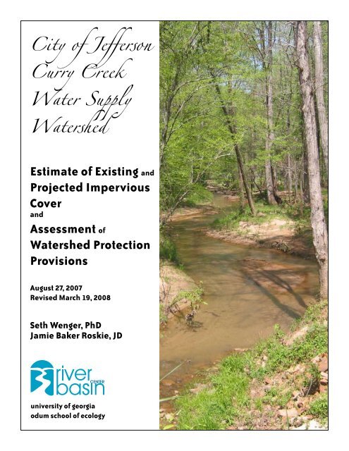
<strong>City</strong> <strong>of</strong> <strong>Jefferson</strong><strong>Curry</strong> <strong>Creek</strong><strong>Water</strong> <strong>Supply</strong><strong>Water</strong>shedEstimate <strong>of</strong> Existing andProjected ImperviousCoverandAssessment <strong>of</strong><strong>Water</strong>shed ProtectionProvisionsAugust 27, 2007Revised March 19, 2008Seth Wenger, PhDJamie Baker Roskie, JDuniversity <strong>of</strong> georgiaodum school <strong>of</strong> ecology
<strong>City</strong> <strong>of</strong> <strong>Jefferson</strong> <strong>Curry</strong> <strong>Creek</strong> <strong>Water</strong> <strong>Supply</strong><strong>Water</strong>shedEstimate <strong>of</strong> Existing and Projected ImperviousCover and Assessment <strong>of</strong> <strong>Water</strong>shedProtection ProvisionsAugust 27, 2007Revised March 19, 2008Seth Wenger, PhDJamie Baker Roskie, JDUGA <strong>River</strong> <strong>Basin</strong> CenterUGA Land Use ClinicContentsIntroduction..........................................................................................................................................11. Analysis <strong>of</strong> Existing Impervious Cover...................................................................................22. Prediction <strong>of</strong> Impervious Cover under <strong>Water</strong>shed Buildout........................................43. Review <strong>of</strong> <strong>Jefferson</strong> Policies.......................................................................................................74. Summary <strong>of</strong> Results and Recommendations.......................................................................9Reference.............................................................................................................................................10Acknowledgments............................................................................................................................10Amendment Notes............................................................................................................................10
IntroductionCurrently, the main water supply source for the <strong>City</strong> <strong>of</strong> <strong>Jefferson</strong> is the <strong>Curry</strong> <strong>Creek</strong> Reservoiron <strong>Curry</strong> <strong>Creek</strong>, immediately north <strong>of</strong> the city center. The <strong>Curry</strong> <strong>Creek</strong> watershed drains 6,717acres <strong>of</strong> land, 48% <strong>of</strong> which lies within the boundaries <strong>of</strong> the city, and 52% <strong>of</strong> which lies withinunincorporated Jackson County. The <strong>Curry</strong> <strong>Creek</strong> watershed is classified as a Small <strong>Water</strong><strong>Supply</strong> <strong>Water</strong>shed by the State <strong>of</strong> Georgia for purposes <strong>of</strong> the Environmental Planning Criteria,pursuant to the Georgia Planning Act. In accordance with these rules, the <strong>City</strong> <strong>of</strong> <strong>Jefferson</strong>passed the <strong>Curry</strong> <strong>Creek</strong> <strong>Water</strong> <strong>Supply</strong> <strong>Water</strong>shed Protection Ordinance to place the followingrestrictions on the watershed:• Perennial streams are protected with 100 foot natural vegetative buffers and an additional50 foot impervious surface setback;• Hazardous materials handling facilities are restricted;• Streets do not require curb and gutter and road crossings minimize run<strong>of</strong>f; and• No more than 25% <strong>of</strong> land area within the watershed may be covered with impervioussurfaces.The final requirement is challenging because the watershed is experiencing significant residential,commercial and institutional development, and the northern part <strong>of</strong> the watershed lies within anindustrial zone.In an effort to meet the 25% limit without imposing unreasonable restrictions on any individuallandowners or development class, the <strong>City</strong> <strong>of</strong> <strong>Jefferson</strong> contracted with the University <strong>of</strong> Georgiain 2003 to develop recommendations for managing development within the watershed. Theresulting report (“Recommendations to Manage Growth & Protect <strong>Water</strong> Quality,” Wenger andRoskie 2003) made six recommendations:• An overlay zone that limits the amount <strong>of</strong> impervious cover within each parcel <strong>of</strong> thewatershed based on zoning classification;• A conservation subdivision ordinance to provide developers with flexibility to meet theimpervious limit on residential parcels;• The rezoning <strong>of</strong> one parcel that appears unsuitable for industrial development fromindustrial to residential classification;• Acquisition and permanent protection <strong>of</strong> at least 100 acres <strong>of</strong> land in the watershed;• A policy limiting rezonings within the watershed; and• A stormwater ordinance.The purpose <strong>of</strong> the recommendations was to meet the 25% limit and protect water quality whileimposing minimal restrictions and respecting the property rights <strong>of</strong> landowners.In this report, we evaluate the success <strong>of</strong> efforts to comply with the 25% impervious surface limitand the degree to which the previous recommendations have been implemented. This report isdivided into four sections:1) An analysis <strong>of</strong> existing impervious area in the city <strong>of</strong> <strong>Jefferson</strong> within <strong>Curry</strong> <strong>Creek</strong>watershed;2) A projection <strong>of</strong> future impervious area at full buildout within <strong>Curry</strong> <strong>Creek</strong> watershed;3) A review <strong>of</strong> the extent to which the <strong>City</strong> <strong>of</strong> <strong>Jefferson</strong> implemented the recommendations<strong>of</strong> the 2003 report; and4) A summary <strong>of</strong> results and recommendations.<strong>City</strong> <strong>of</strong> <strong>Jefferson</strong> <strong>Curry</strong> <strong>Creek</strong> <strong>Water</strong> <strong>Supply</strong> <strong>Water</strong>shed: Estimate <strong>of</strong> Existing andProjected Impervious Cover and Assessment <strong>of</strong> <strong>Water</strong>shed Protection Provisions
1. Analysis <strong>of</strong> Existing Impervious CoverTo date there has been no accurate estimate <strong>of</strong> the existing impervious cover in <strong>Curry</strong> <strong>Creek</strong>watershed. The Northeast Georgia Regional Development Center (NEGRDC) had previouslyestimated imperviousness <strong>of</strong> the watershed at over 10%, although this included water bodies asimpervious surfaces and therefore was a significant overestimate (Wenger and Roskie 2003). Aspart <strong>of</strong> this study, we hand digitized impervious cover from aerial photographs, a method that ismore accurate than commonly-used alternatives, such as derivation from satellite imagery.MethodsUsing digitized aerial photographs from November 2005 (the most recent available), we handdelineated ro<strong>of</strong>s, driveways, and other impervious surfaces using a Geographic InformationSystem (GIS). For the road network, we based impervious cover on the most recent availableroad coverage supplied by the NEGRDC, and adjusted the results based on aerial photographsas necessary. For the watershed boundary we used a map supplied by Engineering ManagementIncorporated, which differed slightly from the boundary used in the 2003 report. Although pondswithout impervious liners are not normally counted as impervious cover for most purposes, theEnvironmental Protection Division (EPD) requires that they be considered 100% imperviousfor purposes <strong>of</strong> compliance with the 25% limit, and they were included in this estimate. Wecalculated total imperviousness within all <strong>of</strong> <strong>Curry</strong> <strong>Creek</strong> watershed and within the subset <strong>of</strong> thewatershed that lies within the municipal limits <strong>of</strong> the <strong>City</strong> <strong>of</strong> <strong>Jefferson</strong>, using the latest availablemunicipal boundaries (2004).ResultsThe total area within <strong>Curry</strong> <strong>Creek</strong> watershed is 6,717 acres. Of this, 5.6% is impervious, including2.3% in ponds. The portion <strong>of</strong> <strong>Curry</strong> <strong>Creek</strong> watershed within the <strong>City</strong> <strong>of</strong> <strong>Jefferson</strong> is 3,233 acres,<strong>of</strong> which 7.5% is impervious, including 3.9% in ponds (Figure 1, next page).<strong>City</strong> <strong>of</strong> <strong>Jefferson</strong> <strong>Curry</strong> <strong>Creek</strong> <strong>Water</strong> <strong>Supply</strong> <strong>Water</strong>shed: Estimate <strong>of</strong> Existing andProjected Impervious Cover and Assessment <strong>of</strong> <strong>Water</strong>shed Protection Provisions
Figure 1. Existing impervious cover within <strong>Curry</strong> <strong>Creek</strong> watershed.<strong>City</strong> <strong>of</strong> <strong>Jefferson</strong> <strong>Curry</strong> <strong>Creek</strong> <strong>Water</strong> <strong>Supply</strong> <strong>Water</strong>shed: Estimate <strong>of</strong> Existing andProjected Impervious Cover and Assessment <strong>of</strong> <strong>Water</strong>shed Protection Provisions
2. Prediction <strong>of</strong> Impervious Cover under <strong>Water</strong>shed BuildoutWe next projected the impervious cover under full buildout for (a) the portion <strong>of</strong> <strong>Curry</strong> <strong>Creek</strong>watershed that lies within the <strong>City</strong> <strong>of</strong> <strong>Jefferson</strong> and (b) the entire <strong>Curry</strong> <strong>Creek</strong> watershed.MethodsWe assumed that parcels currently developed in accordance with zoning and future land usedesignations would not change in impervious cover. For example, an industrial-zoned parcelwith an industrial building and parking lot was assumed not to change in imperviousness, incontrast to an industrial-zoned parcel with only a farmhouse.We assumed other parcels would develop according to their zoning designations and withinimpervious limits set by the <strong>City</strong> <strong>of</strong> <strong>Jefferson</strong> <strong>Curry</strong> <strong>Creek</strong> <strong>Water</strong>shed Overlay DistrictRegulations (Figure 2). These regulations limit commercial and industrial development to 60%imperviousness, residential development to 12% imperviousness and institutional developmentto 40% imperviousness. We estimated that most parcels would be developed with imperviousnessnear the limit or slightly below that for their respective zones. Therefore, we assumed that themean imperviousness at buildout in each zone would be about 10% lower than the limit for thatzone (rounded to the nearest whole digit). Thus, commercial and industrial development wouldbe 54% impervious at buildout, and residential development would be 11% at buildout. We usedthe <strong>Jefferson</strong> 2004 zoning map supplied by the NEGRDC and updated it with recent annexationsand rezonings supplied by Jeff Killip <strong>of</strong> the <strong>City</strong> <strong>of</strong> <strong>Jefferson</strong>.Based on aerial photography, three subdivisions appeared to be partially built-out. To increase theaccuracy <strong>of</strong> impervious cover projections for these subdivisions, the imperviousness <strong>of</strong> the builtportion was calculated and the resulting impervious surface ratio was applied to the undevelopedportion. Of the three subdivisions analyzed in this way, one was 16% impervious, one 10%impervious and one 8% impervious. It was assumed that the subdivided, unbuilt parcels in thesubdivision with 16% imperviousness were grandfathered and exempt from the 12% imperviouslimit <strong>of</strong> the Overlay District Regulations.For undeveloped parcels within the <strong>Curry</strong> <strong>Creek</strong> watershed that are not currently in city limits(i.e., for those in Jackson County), we used Jackson County zoning, future land use, the judgment<strong>of</strong> Jeff Killip regarding potential rezoning <strong>of</strong> parcels that may be annexed in the future, and ourown judgment. We made the conservative assumption that parcels in the northeast portion <strong>of</strong>the watershed would eventually be rezoned industrial, even though this is not entirely consistentwith existing Jackson County future land use maps. This therefore represents a worst-casescenario. We assumed the balance <strong>of</strong> land would be residential (Figure 2). A small strip <strong>of</strong> thewatershed along the northern boundary fell within the I-85 right-<strong>of</strong>-way and was assumed to be80% impervious. Many <strong>of</strong> the residential areas currently in Jackson County are developing at alower density than those within <strong>Jefferson</strong>, so we used a 10% impervious estimate rather than the11% estimate used for those already within the limits <strong>of</strong> the <strong>City</strong> <strong>of</strong> <strong>Jefferson</strong>.For one recently annexed industrial parcel (65-003), a preliminary site plan was provided by the<strong>City</strong> <strong>of</strong> <strong>Jefferson</strong>. The plan showed imperviousness on this site to be 30%, so this value was usedin preference to the standard 54%. We assumed all water bodies were 100% impervious.<strong>City</strong> <strong>of</strong> <strong>Jefferson</strong> <strong>Curry</strong> <strong>Creek</strong> <strong>Water</strong> <strong>Supply</strong> <strong>Water</strong>shed: Estimate <strong>of</strong> Existing andProjected Impervious Cover and Assessment <strong>of</strong> <strong>Water</strong>shed Protection Provisions
Results and DiscussionThe estimated impervious cover at buildout for <strong>Curry</strong> <strong>Creek</strong> watershed is 24.7% (Table 1). Thisis just within the 25% impervious cover limit. The majority (54%) <strong>of</strong> this impervious cover isassociated with industrial-zoned parcels. Counting only the parcels currently within the <strong>City</strong><strong>of</strong> <strong>Jefferson</strong>, impervious cover at buildout is estimated at 25.5%. Parcels currently in JacksonCounty have a predicted impervious cover <strong>of</strong> 20.4% at buildout.Figure 2. Classes assigned to parcels to estimate buildout impervious cover inthe <strong>Curry</strong> <strong>Creek</strong> watershed.<strong>City</strong> <strong>of</strong> <strong>Jefferson</strong> <strong>Curry</strong> <strong>Creek</strong> <strong>Water</strong> <strong>Supply</strong> <strong>Water</strong>shed: Estimate <strong>of</strong> Existing andProjected Impervious Cover and Assessment <strong>of</strong> <strong>Water</strong>shed Protection Provisions
Table 1. Estimate <strong>of</strong> Impervious Cover at Buildout for <strong>Curry</strong> <strong>Creek</strong> <strong>Water</strong>shed,<strong>City</strong> <strong>of</strong> <strong>Jefferson</strong>.Class Total Acres % Impervious Impervious AcresCurrently in <strong>Jefferson</strong>Commercial 27.5 54.0% 14.8Conservation 22.1 2.0% 0.4Existing Developed 327.7 13.1% 45.9Industrial 911.5 54.0% 492.2Industrial – 30% 95.4 30.0% 28.6Institutional 150.4 36.0% 54.1New Residential (12% imp.) 1151.6 11.0% 126.7Other Residential 531.6 9.7% 56.5Currently in Jackson CountyExisting Developed 131.5 19.0% 25.0Industrial 749.6 54.0% 404.8New Residential 2447.9 10.0% 244.8I-85 10.4 80.0% 8.3<strong>Water</strong> Bodies 159.4 100.0% 159.4Total 6716.8 24.7% 1661.6Notes: “Existing Developed” only includes a portion <strong>of</strong> existing impervious cover; some areas are assumed t<strong>of</strong>urther develop and are included in other categories. Partially developed subdivisions are included in the category<strong>of</strong> “Other Residential” along with large-lot residential development. “Industrial-30%” is a single industrialdevelopment project (parcel 65-003) estimated at 30% impervious cover.Note that these estimates differ somewhat from those <strong>of</strong> the 2003 report. This analysis includesa more accurate and detailed estimate <strong>of</strong> existing imperviousness than the previous study, andtherefore should produce more accurate predictions <strong>of</strong> imperviousness at watershed buildout.According to these calculations, it is not necessary for <strong>Jefferson</strong> to acquire and permanentlyprotect additional land in the <strong>Curry</strong> <strong>Creek</strong> watershed in order to meet the 25% limit (suchacquisition had been a recommendation <strong>of</strong> the 2003 report). Considering that the projectedfuture imperviousness is already close to the 25% limit, however, there is essentially no latitudefor upzoning parcels unless the additional imperviousness is <strong>of</strong>fset by land conservation ordownzoning <strong>of</strong> other parcels. In addition, these estimates are predicated on broad assumptionsabout the zoning <strong>of</strong> future annexations. If a portion <strong>of</strong> the land expected to be annexed asresidential is actually annexed at a more dense zoning classification, the impervious cover <strong>of</strong><strong>Curry</strong> <strong>Creek</strong> watershed will exceed the 25% limit. If this should occur, it is recommended thatthe city acquire and preserve conservation land to <strong>of</strong>fset the excess.<strong>City</strong> <strong>of</strong> <strong>Jefferson</strong> <strong>Curry</strong> <strong>Creek</strong> <strong>Water</strong> <strong>Supply</strong> <strong>Water</strong>shed: Estimate <strong>of</strong> Existing andProjected Impervious Cover and Assessment <strong>of</strong> <strong>Water</strong>shed Protection Provisions
3. Review <strong>of</strong> <strong>Jefferson</strong> PoliciesWe reviewed the policies passed by the <strong>Jefferson</strong> <strong>City</strong> Council to assess consistency with the 2003<strong>Curry</strong> <strong>Creek</strong> <strong>Water</strong>shed “Recommendations to Manage Growth & Protect <strong>Water</strong> Quality” (Wengerand Roskie 2003). In the 2003 report, the team made the following recommendations:1) Creation <strong>of</strong> an overlay zone that limits the amount <strong>of</strong> impervious cover in the watershedaccording to zoning classifications (A draft model ordinance was appended to thereport.).2) Adoption <strong>of</strong> a conservation subdivision ordinance to help developers meet imperviouscover limits on residential properties.3) The rezoning <strong>of</strong> one parcel from industrial to residential.4) Adoption <strong>of</strong> a general policy limiting rezonings in the watershed and managingannexations into the watershed.5) Acquisition and/or permanent preservation <strong>of</strong> at least 100 acres <strong>of</strong> land in thewatershed.6) Adoption <strong>of</strong> a stormwater ordinance that protections water quality across thejurisdiction.Following is the status <strong>of</strong> these recommendations:1) An overlay zone was adopted that limits impervious cover according to zoningclassification and also contains provisions related to annexation and rezonings(per number 4 above). However, modifications were made to the suggested modelordinance. An analysis <strong>of</strong> the substantive differences between the model and theadopted ordinance, along with changes recommended by the 2007 study team to theadopted ordinance, are included below.2) A conservation subdivision ordinance was adopted by the <strong>City</strong>. An analysis <strong>of</strong> themain provisions <strong>of</strong> that ordinance pertaining to water quality appears below.3) The particular parcel remains zoned industrial.4) As explained above, acquisition or permanent preservation is no longer a keyrecommendation.5) A somewhat different policy regarding annexations and rezonings was adopted bythe Council—see the analysis <strong>of</strong> the overlay zone below.6) A stormwater ordinance has not been adopted. This is discussed below.<strong>Curry</strong> <strong>Creek</strong> <strong>Water</strong>shed Impervious Cover Overlay ZoneAfter the 2003 report was submitted, the <strong>City</strong> <strong>of</strong> <strong>Jefferson</strong> passed an overlay ordinance for the<strong>Curry</strong> <strong>Creek</strong> watershed. This ordinance, while not exactly the same as the study team’s modelordinance, contained most <strong>of</strong> the model’s substantive requirements, including the imperviouscover limitations in residential, commercial, and industrial zones (as well as an additional, andappropriate, institutional zone.)However, the model ordinance suggested by the study team in the 2003 report contained aprovision requiring that development plans submitted for sites within the watershed overlayshould include an estimate <strong>of</strong> the overall impervious cover on the site and that this plan should<strong>City</strong> <strong>of</strong> <strong>Jefferson</strong> <strong>Curry</strong> <strong>Creek</strong> <strong>Water</strong> <strong>Supply</strong> <strong>Water</strong>shed: Estimate <strong>of</strong> Existing andProjected Impervious Cover and Assessment <strong>of</strong> <strong>Water</strong>shed Protection Provisions
e prepared by a licensed surveyor. In the ordinance that was adopted, the Zoning Administratorhas discretion to require “a numerical estimate and graphical depiction <strong>of</strong> impervious coverareas and locations to be prepared by a registered land surveyor or other qualified pr<strong>of</strong>essional.”(See Section 10.4.18.) The study team repeats its original recommendation that the imperviouscover estimate by a licensed surveyor be mandatory. This is necessary to ensure maintenance <strong>of</strong>accurate measurements <strong>of</strong> impervious cover within the watershed.Also, in Section 10.4.19 <strong>of</strong> the adopted regulations, entitled “Stormwater Treatment,” thereis a section allowing the Zoning Administrator and <strong>City</strong> Engineer to authorize a developmentto exceed the impervious surface limitations “upon meeting the requirements <strong>of</strong> this section,”including that the “directly connected impervious area within the development” not exceed 15%.Although the intent behind this section is good, the provision is problematic. First, the GeorgiaPlanning Act requires a 25% limit on total impervious surfaces and does not consider whether ornot such impervious surfaces are directly connected (although we agree that a directly connectedimpervious surface standard would be an improvement over the total impervious surfacestandard). Therefore, allowing exceptions to the impervious surface limits will in all likelihoodcause the total imperviousness <strong>of</strong> the watershed to exceed 25%, placing the <strong>City</strong> <strong>of</strong> <strong>Jefferson</strong>out <strong>of</strong> compliance with the state requirement. In addition, even if Georgia were to move to adirectly connected impervious cover standard, the 15% level is too high for residential districts.Finally, the section provides insufficient guidance on stormwater management best managementplans. It should at least include appropriate references to the Georgia Stormwater ManagementManual (GSMM), and preferably should refer to a stormwater ordinance adopted by the <strong>City</strong> <strong>of</strong><strong>Jefferson</strong> (see below for more on necessary elements <strong>of</strong> a stormwater ordinance). For now, werecommend that Section 10.4.19 be struck.The 2003 report’s model overlay ordinance contains provisions barring rezonings and annexationsthat have the effect <strong>of</strong> increasing impervious cover in the watershed beyond acceptable levels.The ordinance adopted by the <strong>City</strong> allows the Council to deny rezoning requests based on potentialincreases <strong>of</strong> impervious cover. There is no provision for annexations. It may be that in passingthe ordinance the Council was concerned about improperly limiting the discretion <strong>of</strong> futureCouncils and thus did not bar inappropriate rezonings but rather allowed discretion to deny. Thisis a policy choice appropriately left to the Council. However, the adopted ordinance should atleast contain a provision requiring the Council to consider the effect <strong>of</strong> future annexations andrezonings on impervious cover limits in the watershed.Conservation Subdivision OrdinanceThe 2003 report made several recommendations for necessary elements <strong>of</strong> a conservationsubdivision. These recommendations were:1) Conservation subdivisions should be a use by right in residential zones.2) The minimum required open space should be 40%.3) Permissible and prohibited activities in the open space should be clearly defined.4) The open space should be permanently protected.5) Conservation subdivision regulations should give developers flexibility in design toallow developments to meet the open space requirements.6) Conservation subdivision regulations should be compatible with stormwaterregulations.7) Conservation subdivision regulations should be “density neutral” when comparedwith the jurisdiction’s traditional subdivision regulations.<strong>City</strong> <strong>of</strong> <strong>Jefferson</strong> <strong>Curry</strong> <strong>Creek</strong> <strong>Water</strong> <strong>Supply</strong> <strong>Water</strong>shed: Estimate <strong>of</strong> Existing andProjected Impervious Cover and Assessment <strong>of</strong> <strong>Water</strong>shed Protection Provisions
Following the 2003 report, the <strong>City</strong> adopted a conservation subdivision ordinance which largelymeets the 2003 team’s recommendations. Conservation subdivisions are a use by right in RR-1, RR-2, RR-3, R-1, R-2, R-3 and R-4 zones. The minimum open space requirement is 40%.Permissible and prohibited activities in the open space are clearly defined. Permanent protection<strong>of</strong> the open space through a conservation easement is required. Developers are given flexibilityin subdivision design to enable them to meet the open space requirement while maintainingthe density allowed by the underlying zoning. The ordinance requires that the density <strong>of</strong> theunderlying zone should not be exceeded by the conservation subdivision; thus, the ordinanceis density neutral. However, as <strong>Jefferson</strong> has not adopted a stormwater ordinance, it is notpossible for the conservation subdivision ordinance to be in compliance with the stormwaterregulations.Stormwater RegulationThe 2003 report contained recommendations regarding stormwater regulations and included amodel ordinance. The stormwater ordinance was designed to address the concern that withoutgood stormwater control significant water quality deterioration can occur even under the 25%impervious cover limitation. As mentioned above, <strong>Jefferson</strong> has not adopted a stormwaterordinance. There are some provisions regarding stormwater design in the Quad Cities UDCSuburban/Urban and Exurban/Rural Design and Improvement Requirements, and the PlanningCommission has adopted the Georgia Stormwater Management Manual by resolution. However,this study team reiterates the recommendation that the <strong>City</strong> adopt an actual stormwater ordinance,in order to create a more certain environment for water quality protection. The team would bewilling to once again make model provisions available upon the <strong>City</strong>’s request.4. Summary <strong>of</strong> Results and RecommendationsBased on delineation from aerial photography from November 2005, the proportion <strong>of</strong> <strong>Curry</strong><strong>Creek</strong> watershed covered in impervious surfaces is 5.6%. Our forecast <strong>of</strong> future imperviousnessat watershed buildout, based on the latest available data, is 24.7%. This meets the state-mandated25% limit. The estimate assumes the implementation <strong>of</strong> recommendations 1-3, below.We make the following recommendations to the <strong>City</strong> <strong>of</strong> <strong>Jefferson</strong> to provide a high level <strong>of</strong>surety that the 25% impervious limit will be met and that water quality within <strong>Curry</strong> <strong>Creek</strong>Reservoir will be protected:1) We recommend that an estimate <strong>of</strong> impervious cover be mandatory for all submitteddevelopment plans within the overlay zone.2) We recommend that Section 10.4.19 <strong>of</strong> the overlay district regulations be struck.3) We recommend adding a provision to the overlay district regulations requiring thatthe Council consider the effect <strong>of</strong> any proposed rezonings and annexations in <strong>Curry</strong><strong>Creek</strong> <strong>Water</strong>shed on the ability <strong>of</strong> the <strong>City</strong> <strong>of</strong> <strong>Jefferson</strong> to meet the 25% imperviouscover limit.4) We recommend that the <strong>City</strong> <strong>of</strong> <strong>Jefferson</strong> adopt a stormwater ordinance consistentwith the Georgia Stormwater Management Manual. This is not necessary to meet the25% impervious limit but would be very valuable in protecting the water quality in<strong>Curry</strong> <strong>Creek</strong> Reservoir.<strong>City</strong> <strong>of</strong> <strong>Jefferson</strong> <strong>Curry</strong> <strong>Creek</strong> <strong>Water</strong> <strong>Supply</strong> <strong>Water</strong>shed: Estimate <strong>of</strong> Existing andProjected Impervious Cover and Assessment <strong>of</strong> <strong>Water</strong>shed Protection Provisions
ReferenceWenger, S. J. and J. B. Roskie, 2003. <strong>City</strong> <strong>of</strong> <strong>Jefferson</strong> <strong>Curry</strong> <strong>Creek</strong> <strong>Water</strong>shed: Recommendationsto Manage Growth and Protect <strong>Water</strong> Quality. University <strong>of</strong> Georgia, Athens, GA.AcknowledgmentsGreg Anderson and Rachel Katz digitized 2005 impervious cover. Jody Rhodes reviewed theQuad Cities conservation subdivision ordinance. Janna Custer reviewed the Quad Cities <strong>Curry</strong><strong>Creek</strong> Reservoir watershed protection overlay. Jerry Weitz, Jerry Hood and Corinne Valentinemade thoughtful edits to earlier drafts.Amendment NotesThis document was amended on March 13, 2008 to correct the estimates <strong>of</strong> existing and futureimpervious cover. Two main changes were made:• In the original version, water bodies were assumed to be pervious. In this version, waterbodies were corrected to be considered 100% impervious, according to EPD protocol.• In the original version, currently undeveloped parcels were projected to eventuallydevelop to the impervious limits imposed by zoning. This was clearly unrealistic; inreality, at least some <strong>of</strong> these parcels will develop at a lower density with less imperviouscover. This assumption was revised so that the mean impervious cover for undevelopedparcels was projected to be 90% <strong>of</strong> the established limit.Changes to the relevant tables and text were made accordingly. Some clarifying edits were alsomade to the section describing methods <strong>of</strong> prediction.10<strong>City</strong> <strong>of</strong> <strong>Jefferson</strong> <strong>Curry</strong> <strong>Creek</strong> <strong>Water</strong> <strong>Supply</strong> <strong>Water</strong>shed: Estimate <strong>of</strong> Existing andProjected Impervious Cover and Assessment <strong>of</strong> <strong>Water</strong>shed Protection Provisions
University <strong>of</strong> Georgia <strong>River</strong> <strong>Basin</strong> Center110 <strong>River</strong>bend Road, Room 101Athens, GA 30602-1510(706) 583-0463 • Fax (706) 583-0612www.rivercenter.uga.edu