PDF Format - 1681Ko - Pavillon de l'Arsenal
PDF Format - 1681Ko - Pavillon de l'Arsenal
PDF Format - 1681Ko - Pavillon de l'Arsenal

Create successful ePaper yourself
Turn your PDF publications into a flip-book with our unique Google optimized e-Paper software.
CONTENTSPARIS A CITY IN THE MAKINGPermanent exhibitionBEFORE COMMENTSBy Bertrand DELANOËMayor of ParisBy Anne HIDALGOFirst Deputy Mayor of Parisin charge of Urban planning and ArchitectureChairwoman of the <strong>Pavillon</strong> <strong>de</strong> l’ArsenalPRESS RELEASEINTRODUCTIONBy Philippe SimonArchitect and scientific curator of the exhibitionPRESENTATION OF THE DIGITAL MODELAROUND THE EXHIBITIONGui<strong>de</strong>d tours, mediation and gui<strong>de</strong>d walksSCIENTIFIC COMMISSIONCREDITS/ THANKS
BERTRAND DELANOËMayor of ParisSince 2001, Paris and the surrounding municipalities at the heart of the Île-<strong>de</strong>-France area havebeen <strong>de</strong>veloping joint projects, a first in the history of the Region. In 2008, over 180 municipalitiesand local entities came together, creating the Syndicat mixte d’étu<strong>de</strong>s Paris Métropole (MixedStudy Group for the Paris Metropolitan Area) to discuss the future of the area.In light of this change, I <strong>de</strong>ci<strong>de</strong>d to support the initiative put forward by the <strong>Pavillon</strong> <strong>de</strong> l’Arsenal,whose role is to showcase the current and future architectural and urban planning scenarios of theCity of Paris, to renew its permanent exhibition. Henceforth, the exhibition focuses on the entiremetropolitan area used and shared everyday by millions of men and women from all walks of lifeand from all age groups: resi<strong>de</strong>nts, workers, passers-by.Exhibiting these plans and projects is a necessary and innovative way of fostering better knowledgeof the area’s history. It is also an opportunity for us to remember that, e.g., in the not-so-distantpast, film director Marcel Carné <strong>de</strong>scribed the town of Nogent-sur-Marne as the “Sunday afternoonEl Dorado”. Moreover, not only is the exhibition an invitation to get better acquainted with thecity, it is also a step towards our common future.The Greater Paris Metropolitan Area is still very new, but given its dynamic spirit, in time, it willcompletely reinvent the 21st Century capital city. The time has come to explain how the city wasbuilt, to talk about its farming origins and the grand expectations of the early 20th Century, fromthe Trente Glorieuses to the most contemporary of projects.It is a comprehensive and ambitious work, which is now available to the public. Our wholeheartedthanks go to everyone who contributed to the exhibition.
BEFORE COMMENTSANNE HIDALGOFirst Deputy Mayor of Paris,in charge of Urban Planning and Architecture,Chariwoman of the <strong>Pavillon</strong> <strong>de</strong> l’Arsenal<strong>Pavillon</strong> <strong>de</strong> l’Arsenal’s new permanent exhibition, “Paris, a City in the Making,” presents the architecturaland urban history of the municipalities located at the heart of the Île-<strong>de</strong>-France Regionand which now make up a global metropolis.For the first time ever, through over 1000 documents selected by Philippe Simon, architect, professorand curator, one thousand five hundred years’ worth of our cities’ history is told. A book <strong>de</strong>velopedat the same time as the exhibition, sketches the outline of the city of the future.In this vast area, projects of all scales, types and dimensions are discussed, exchanged and sharedwith the resi<strong>de</strong>nts, with those who breathe life into the cities. The one burning question is: wherewill we be in 10 years’ time? Our fellow citizens have never been as curious, as intent on changeand as involved. New tools (such as the internet, social networks, 3-D mo<strong>de</strong>ls of cities and citystreets) create new opportunities for building new projects together – a true <strong>de</strong>mocratic challenge.All attention is focused on the Seine, the “founding” river. The expressways on the riverbanksinsi<strong>de</strong> Paris are being reclaimed, and form an integral part of the reinvention of the riversi<strong>de</strong>areas along the Seine, the Marne, the Oise and the canals. Many of the projects aim to reconcileenhanced quality of city life, green corridors, public transport and economic growth, while meetingthe need for welcoming and open public areas.Another challenge is to continue to build the city, to improve and enhance it, be it old or new. Wehave come to un<strong>de</strong>rstand that the existing city is the fruit of a rich and eventful past and have learntto pay more attention to the faubourgs and post-war Paris. But we also know now how to build onnew land, such as the Batignolles district, in the North-Eastern quadrant of Paris, or even alongthe Seine around Bercy-Charenton all the way to Les Ardoines. Lastly, we must meet the expectationsof those who live and work in neighbourhoods sandwiched between municipalities or perchedon the bor<strong>de</strong>r between different towns where the land and living conditions were difficult. Many ofour projects seek to solve these issues. All around us, new urban landscape are emerging and newways of <strong>de</strong>veloping a mixing-facilities, welcoming and sustainable city, are invented.Public transport and public areas are of capital importance. Each and every one of us must beable to travel simply and freely; whether on foot or by bike in a calm and reassuring environmentor by bus, tram, metro or RER, or even by car, which for some remains absolutely essential. Localgovernments have un<strong>de</strong>rtaken many projects to improve the transport network coverage, based onexisting infrastructure. These will give rise to new tramways, mo<strong>de</strong>rn buses, a refurbished RER
and local train network, bicycle lanes and new services such as the Vélib’ and Autolib’ self-servicebike and car rentals.Cities also need symbols, places which remain in one’s mind, and daring architecture. Throughouthistory, major facilities have always acted as a showcase of the creativity of the times; buildings, ofcourse, but also new public areas in which resi<strong>de</strong>nts play a key role. I have in mind, the Canopy andgar<strong>de</strong>n at Les Halles, or the Place <strong>de</strong> la République and the expressways on the riverbanks, whichas I mentioned, will become a place where the city breathes and relaxes. Building upwards is anotherway of sharing our era’s creativity, with a view to creating a sustainable city.These few examples do not do justice to what is being built everyday through the projects supportedby your representatives, <strong>de</strong>veloped by public and private clients, together with the people wholive, work, grow and study in the area. The sheer volume of projects requires shared knowledgeand the involvement of everyone. These are the key ingredients behind the success of our actionsand will enable us to be even more ambitious and adapt new strategies.The digital features inclu<strong>de</strong>d in the exhibition will allow us to perpetually update it. Visitors will beable to follow <strong>de</strong>velopments on a 37m² digital mo<strong>de</strong>l at the <strong>Pavillon</strong> <strong>de</strong> l’Arsenal or from home, overthe Internet.I am <strong>de</strong>lighted that this vision and knowledge of the city are now available to all so that together,we may continue to contribute to the future of our city.© Vincent Fillon
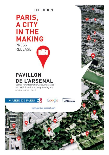
PRESSRELEASE<strong>Pavillon</strong> <strong>de</strong> l’Arsenal’s new permanent exhibitionis over 800m² <strong>de</strong>dicated to the metropolis ofParis as it was, is and will be. Over 1,000 archiveddocuments, photographs, maps, plans andfilms are on display, as well as a 37m2 digitalmo<strong>de</strong>l entitled “Paris, Metropolis 2020”, <strong>de</strong>velopedin partnership with Google and JCDecaux.The digital mo<strong>de</strong>l is a world first, providing a 2Dor 3D overview of key areas marked out for re<strong>de</strong>velopment,the new transport networks and theiconic architecture of the city of tomorrow in theirgeographical context. Using Google Earth technologyand mapping software, “Paris, Metropolis2020” provi<strong>de</strong>s visitors with a unique interactiveexperience and an opportunity to discover the cityon a multitu<strong>de</strong> of scales, with thematic or freetours. The mo<strong>de</strong>l is <strong>de</strong>signed to be constantlyupdated. It is participative tool bringing togetherall those involved in the making of the city andallowing them to share their work.“Paris, a city in the making” is a timeline retracingthe origins of the area, and explaining thecommon history of the municipalities comprisingthe metropolitan area so that all visitors areable to un<strong>de</strong>rstand how the region as we knowit came to be. The exhibition is built around anumber of landmark themes illustrating howthe metropolis was shaped by the needs of agriculture,ornamentation or roadways, and thentransformed, adapted and integrated in a processof urban planning that emerged un<strong>de</strong>r theinfluence of <strong>de</strong>mographic, technological, economicand political <strong>de</strong>velopments.Visitors are offered an insight into what is happeningtoday and what is planned for the future“where, everyday, projects of every dimensionare discussed, exchanged, shared with localresi<strong>de</strong>nts and with all those who make the citya living entity”, as Anne Hidalgo, First DeputyMayor of Paris responsible for Urban Planningand Architecture and Chairwoman of the <strong>Pavillon</strong><strong>de</strong> l’Arsenal, writes in the preface to a workon the metropolitan projects and areas of tomorrow*coproduced in parallel to the exhibition.Reconquering the Seine, carefully preservingthe continuity of the city, whether it be the faubourgsor the post-war city, investing and innovatingin new real estate, improving mobilityand public spaces, <strong>de</strong>veloping iconic architecture,building upwards, etc. “Paris, a city in themaking” is the first event to ever bring together,in the same place and at the same time, all thelatest in urban and metropolitan architecture.Around the main exhibition, the <strong>Pavillon</strong> <strong>de</strong> l’Arsenalalso runs workshops for children in conjunctionwith the City of Paris Schools Department, as wellas gui<strong>de</strong>d walking tours organised with Les Promena<strong>de</strong>sUrbaines association.* Paris, a city in the makingProduced in conjunction with Connaissance <strong>de</strong>s Arts44 pages, 9 euros
INTRODUCTIONPHILIPPE SIMONArchitect and teacherScientific curatorAnd what if the Paris metropolitan area wasnot just a new concentric zone ad<strong>de</strong>d to thecity of Paris but rather an agglomeration of allthe existing towns around it? The land hithertoorganised around agricultural or ornamentalconsi<strong>de</strong>rations and roadways is transformed inaccordance with <strong>de</strong>mographical, technological,economic and political constraints. Over time,the metropolitan area was crafted as the towns’common history took shape but the main drivingforce behind the change has always been to attainbalance.FOUNDATIONSA strong river with powerful tributaries, gentlerrivers carving <strong>de</strong>ep cuts into valleys, fields,some features jutting out, floodable plains, fewmarshlands… And in the centre of all that, Lutetia,capital of the Parisii1. Renamed Paris circathe year 300, the city became the capital, first ofthe Frankish Kingdom around 506-508, and thenof the Kingdom of France in the 12th Century.THE WALLED CITYIts status as Capital city of a State gave it adominant position, the traces of which are stillvisible in today’s landscape. Thus, between 1190and 1220, Philippe Auguste had a fortified wallbuilt around the city of Paris to protect it. Thewall separated the city from the surroundingcountrysi<strong>de</strong> and formed a clear bor<strong>de</strong>r betweenthe two worlds. The city was a closed, controlleduniverse while on the other si<strong>de</strong> of the wall werethe faubourgs, banlieues2, countrysi<strong>de</strong>…The succession of military (that of Charles Vfrom 1356 and 1383, and Louis XIII in 1566), administrative(Louis XV had posts put up to markthe end of building land) or tax bor<strong>de</strong>rs (LouisXVI’s Wall of the Farmers-General) illustrated aclear <strong>de</strong>sire to permanently control the city’s expansion.The city had to remain within in certainlimits and not exceed a certain area. Paris becamevery <strong>de</strong>nse: buildings became ever higher,courtyards were filled and <strong>de</strong>nser areas subdivi<strong>de</strong>d.Beyond the faubourgs, the city’s outskirtsconsisted of a collection of villages and smalltowns speckled along the endless countrysi<strong>de</strong>.However, at regular intervals, Paris spilledover. The very poor, who could no longer affordhousing in the city, and the very wealthy, whocould afford to escape the overcrow<strong>de</strong>d city andwanted to build houses more suited to their fortunesleft the city and moved into the outlyingareas. This type of spontaneous “urban” expansioncontributed both to the formation of thelandscape and influenced official <strong>de</strong>cisions.THE OTHER CAPITALThe constant expansion of Paris was offset in1682, when Louis XIV moved the capital of theKingdom to Versailles, to the palace and citythat he had had erected in the middle of thecountrysi<strong>de</strong>. The King chose to move away fromParis in or<strong>de</strong>r to <strong>de</strong>velop an i<strong>de</strong>al mo<strong>de</strong>l in whichthe Castle would be the interface between thecity and gar<strong>de</strong>ns. This structure, involving bothnature and an urban setting then spread: eachmunicipality acquired a small castle which wouldtake over woods and fields to <strong>de</strong>velop artificiallynatural parks and gar<strong>de</strong>ns. Paradoxically, thesame happened in Paris. With a view to continuousimprovement, squares and avenues were
<strong>de</strong>veloped as an extension of the city centre, suchas the Avenue <strong>de</strong>s Tuileries, which then becamethe Champs-Élysées. These features take shapein the midst of a still rural area, a structuredlandscape which would serve as the backdropfor the city’s expansion in the 18th and 19th Centuries.Later, in 1794, the Artists’ Plan advocatedlaying roads and squares through existing areasand arranging them like paths cutting throughwoods and fields.NETWORKS TO CONNECTAt the beginning of the 19th Century, a new factorcompletely changed the way urban resi<strong>de</strong>ntsrelated to space, which until then, was containedwithin the city. Networks to transport people,water, energy and raw material at speed were<strong>de</strong>veloped. It all began in 1808 with the Canal <strong>de</strong>l’Ourcq, which provi<strong>de</strong>d Paris with its drinkingwater: from then on, the City began to see theconnection between enhanced urban comfortand sprawling into the surrounding areas. Then,beginning in 1825, the Canal Saint-Denis andCanal Saint-Martin enabled boats to circumventthe crow<strong>de</strong>d city centre. In 1837, the first railwaywas opened between Paris and Saint-Germainen-Laye.Very quickly, trains totally changed thetraditional ratio between distance and traveltime. It became possible to live outsi<strong>de</strong> of thecity and even to mass transport goods to far-off<strong>de</strong>stinations. Near train stations entirely newareas sprang up, such as Le Vésinet, for whichbuilding began in 1856. A new type of separationemerged: between resi<strong>de</strong>ntial areas and thosecovered in warehouses, plants and factories.COUNTRYSUDE TO CITY :THE THIERS WALLA fortified wall, known as the Thiers wall wasbuilt between 1841 and 1844 just a few kilometresfrom Paris, in the heart of the countrysi<strong>de</strong>. A seriesof forts were built along with the wall at ashort distance from it, encroaching on neighbouringtowns and creating no-build zones whichlater penalised the towns as they <strong>de</strong>veloped.The perimeter between the wall and Paris wasannexed in 1860 by Haussmann, which meantthat the octroi (tax boundary) had to be pushedback towards the forts. Many factories, as wellas the housing built for their workers, movedinto the banlieues, where large areas set asi<strong>de</strong>for heavily polluting industries were created:near railway lines, the canals or the abattoirs atLa Villette.A ring of industrial areas begins to form, a precursorof the “Red Ring” of the 20th century.That was the last concentric expansion of Paris.After 1871, the walls were consi<strong>de</strong>red obsoleteand unnecessary.Consi<strong>de</strong>red a potential landholding, the i<strong>de</strong>a ofdismantling the Thiers Wall sparked off a <strong>de</strong>batein which opposite urban mo<strong>de</strong>ls competed. Theone, supported by Jules Siegfried and the Muséesocial, sought to do away with the separationbetween Paris and the banlieues and to extendthe urban system to the former wall. On theother hand, Louis Dausset argued that the landaround the walls should be preserved and turnedinto open spaces in which hygienism wouldreign. The latter eventually prevailed.THE CHANGES BROUGHT ABOUT BY PEACEIn 1919 the fortified wall was eventually dismantledand replaced by a green belt: a ring offacilities and social housing, once again cuttingParis off from the banlieues.Moreover, the influx of inhabitants was such thatthe issue of housing reached a critical point. In1921, Paris had the highest number of inhabitantsin all its history: 2.9 million inhabitants.Entire areas lacked sewerage systems anddrinking water; some cases of the plague wereeven reported. After the unsanitary areas werei<strong>de</strong>ntified, a re-housing policy was launched andthe first low-cost housing ma<strong>de</strong> its appearancewithin Paris, in the ring and the gar<strong>de</strong>n estatesbuilt in outlying municipalities. These neighbourhoodswere based on the Anglo-Americanmo<strong>de</strong>l in which nature was the feather in a city’scap.At the same time, Le Corbusier launched a ratherprovocative project, the Neighbour Plan,which presented a new version of Paris in whichthe central arrondissements were completely
<strong>de</strong>molished and replaced by a mo<strong>de</strong>rn city ma<strong>de</strong>up of towers and expressways. This fantasy oftotalling <strong>de</strong>molishing the existing city to producea new version remained with architects and buildingplanners for many years.The population of the region continued to grow.In 1919, the “Cornu<strong>de</strong>t” Law imposed a plan forthe expansion and improvement of all municipalitieswith over 10,000 inhabitants. This led to thecreation of the Higher Committee for the Developmentand General Organisation of the ParisRegion (CSAORP) in 1928. Un<strong>de</strong>r the lea<strong>de</strong>rshipof Henri Prost, the committee launched a projectto reduce the high <strong>de</strong>nsity in the city centre ofboth people and industry, and to contain urbansprawl. Therefore, it advocated organising theregion around highways and a network of publictransport as well as the creation of large areasoutsi<strong>de</strong> the city for urgent re<strong>de</strong>velopment, similarto the gar<strong>de</strong>n-estate mo<strong>de</strong>l. Individual housingwas encouraged, especially through the“Loucheur” law of 1928, which led to the creationof new estates which do not always have thenecessary sewerage or road networks. Duringthis very period, housing policy became a truedriving force behind land <strong>de</strong>velopment.MODERNITY : LARGES AND HIGHWAYSAfter the war, Paris and the banlieues have to<strong>de</strong>al first with reconstruction, and then with anincrease in their population, making housing anabsolute priority, in a situation where discomfortand unsanitary conditions remain rife. Public policyten<strong>de</strong>d to encourage the building of housesaccording to innovative procedures which aim tosave time and money. The mix of housing andtertiary, industrial or leisure activities was athing of the past, with each urban functionrestricted to its own area. In the 1950s the firstlarge resi<strong>de</strong>ntial complexes were built - theywould be followed by others until the last waserected in 1973. The new estates rose up on availablefarmland far from existing neighbourhoods,public transport and jobs. The complexes werebuilt on the principles of the Athens Charter: thedirection of the sun and the air were of the absoluteessence, the concepts of architectural unitsand entirely public land were upheld.This mo<strong>de</strong>rn streak also reached cities, whereold, unsanitary neighbourhoods were <strong>de</strong>stroyedand replaced, like in Choisy-le-Roi and Ivry. Arefurbishment was even drawn up for Paris in1965, consisting of <strong>de</strong>stroying almost all of theoutlying arrondissements in or<strong>de</strong>r to build a mo<strong>de</strong>rn,rational city. This refurbishment did not,however, contain urban sprawl, which remainedfragmented and unstructured, with part of thepopulation still living in shanty towns.AT LAST A REGION-CAPITAL, OR ALMOST...The District of the Paris Region was created in1961 un<strong>de</strong>r the lea<strong>de</strong>rship of Paul Delouvrier.The i<strong>de</strong>a was to create a new authority whichwould be in<strong>de</strong>pen<strong>de</strong>nt of the State and wouldcoordinate hitherto scattered urbanisation.In 1965, the Gui<strong>de</strong>lines for Urban Developmentand Planning for the Paris Region (Sdaurp) accentuatedthe creation of hubs in the banlieues3,around airports and the business district at LaDéfense, with universities and Gran<strong>de</strong>s Ecolesmoving out of Paris. But the main goal, apartfrom <strong>de</strong>veloping the public transport network,was to release the stranglehold on the city,through the creation of five new towns4. Bothnear and far from the Capital5, these towns offeredalternative urban lifestyles, closer to nature.Developed along innovative mo<strong>de</strong>ls such as thespreading and organic city, they were <strong>de</strong>stinedto become new regional centres, including housing,jobs, leisure activities and education.Governance changed with the creation of theÎle-<strong>de</strong>-France Region in 1976 and – for the firsttime since the French Revolution – the electionof a Mayor for Paris in 1977. But regional urbanplanning schemes – Sdau (1976) and Sdrif (1994)– were not able to overcome the fragmentationof the region, <strong>de</strong>spite the <strong>de</strong>velopment of theRER network and the extension of metro linesinto the banlieue. Similar to existing large-scaleurban services such as waste processing andsewerage, joint regional policies were implementedfor parks, hospitals, universities andcertain cultural centres.Moreover, since the post-war period, individual
housing was encouraged by many elected representativesand was believed to meet the needsof the population. This resulted in a never-endinglandscape of subdivi<strong>de</strong>d estates. The citycentre was far, commuting become extremelytime-consuming and cars become omnipresent.Dreams of individual happiness were confrontedwith the constraints of living in a community.Thus, <strong>de</strong>spite all attempts to organise the city,it continued to extend and sprawl into a multitu<strong>de</strong>of estates consisting of individual housing.Certain areas were quickly labelled “un<strong>de</strong>rprivileged”,and nature was slowly choked by the<strong>de</strong>velopment of industrial and commercial areaswhich aimed to capitalise on profitable real-estate.Despite the efforts of Banlieues 89 since 1983and the group of architects known as 75021 toovercome such problems, they subsist and areexacerbated until the late 20th Century. Thenecessary awareness for building a sustainablecity, Paris’ opening up to its neighbours and theconvergence of policies6 in the early 21st Centurymark the beginning of a new metropolitan era.the new areas would not be as <strong>de</strong>nse as beforeand the new buildings would take inspirationfrom historical mo<strong>de</strong>ls. These laws, and a seriesof others, enable a better un<strong>de</strong>rstanding of thereality of the area. It seems very clear that suchpolicies will not be sufficient.TOWARDS AN ACTIVE, SHARED CITYParis and the metropolitan area had many challengesto face in the early 21st century: economic,environmental and social. At the same time, newpublic policies were <strong>de</strong>veloped to tackle theseissues. Passed in 2000, the Law on “Solidarityand Urban Mo<strong>de</strong>rnisation,” the SRU, was a steptowards completing entirely local management.It advocated consultation and diversity, with aview to eliminating poor ghettos and increasingsocial diversity in or<strong>de</strong>r to reduce the disparitiesbetween towns. That same year, the RATP andSNCF form a cooperation body called the STIF[7],the goal of this reorganisation is to bring overallimprovement to the public transport networkof the Île-<strong>de</strong>-France area. In 2003, Anru (NationalAgency for Urban Renewal) is created. Thisagency inherits over 20 years of mismanagmentof the maintenance of the large complexes builtin the 50s-70s. The State tasks it with transformingmany so-called “problem areas” based ona policy of <strong>de</strong>struction—reconstruction, in which7
© Vincent Fillon
GENERAL PRESENTATIONOF THE DIGITAL MODELPARIS, METROPOLIS 2020A world first, <strong>de</strong>veloped in partnership with Google and JCDecaux, the Paris, Métropole 2020 is a37m2 screen presenting the vast areas un<strong>de</strong>rgoing change, future public transport networks an<strong>de</strong>mblematic architecture in the making in the Paris metropolitan area.The digital mo<strong>de</strong>l is a work of technological prowess on display for the greater public. It is based onGoogle Earth, the leading geographic navigation software that has been downloa<strong>de</strong>d over 1 billiontimes across the globe. For the first time, visitors can view the Paris area in various scales and inHigh Definition on 48 low-energy LED screens. This digital mo<strong>de</strong>l also provi<strong>de</strong>s a unique opportunityto simultaneously display what currently exists and what the future of the Paris agglomerationholds, on Google Earth.Who has never dreamt of having an aerial view of the area stretching from Paris to Le Havre? Whohas never wanted to discover the future face of the city in 3D now? The mo<strong>de</strong>l is controlled viatouch screens and provi<strong>de</strong>s an exceptionally <strong>de</strong>tailed tour of the city on the broa<strong>de</strong>st, most generalof scales, all the way down to the smallest-local scale. In just a few clicks, you can zoom into anyParisian arrondissement and have a 3D look at the Philharmonic project or that of Les Halles orthe Louis Vuitton Foundation for Creation; fly over the Avenue <strong>de</strong> France in the13th arrondissementor look at the areas North-East of the city to discover what the neighbourhoods or tomorrow willlook like; see the new overall public transport network of the entire Ile <strong>de</strong> France or the variousjoint <strong>de</strong>velopments projects on the banks of the Seine spanning from Carrières-sous-Poissy to Ivry.Paris, Métropole 2020 is also an educational and interactive experience. It is simple and easy to useand enables virtual tours of the area along geographic or thematic lines, as well as gui<strong>de</strong>d toursand key word searches. The mo<strong>de</strong>l <strong>de</strong>signed to be used and appreciated by all, from children, tostu<strong>de</strong>nts, Parisians or resi<strong>de</strong>nts of Ile <strong>de</strong> France as well as French and Foreign professionals, is aninvitation to dive into and discover the heart of the metropolitan area.Paris, Métropole 2020 is participative tool bringing together all those involved in the making of thecity (project owners, <strong>de</strong>velopers and architects etc.) and enabling them to showcase their work. Itwill initially contain over 1300 statistics. Designed to be constantly updated, this project, <strong>de</strong>ar tothe <strong>Pavillon</strong> <strong>de</strong> l’Arsenal and its partners, is a programme for sharing information. It can also beaccessed via the internet (www.parismetropole2020.com) and will be integrated into Google Earthin 2012.
© Vincent Fillon
WHY GOOGLE SUPPORTS THIS PROJECT :Late 2010, the <strong>Pavillon</strong> <strong>de</strong> l’Arsenal approachedGoogle France asking if they could use GoogleEarth to power a new interactive display highlightingthe Paris metropolitan area as it will bein 2020 with upcoming buildings in 3D. This projectis fully consistent with Google’s mission: toorganize information and make it accessible toeveryone. Google builds global platforms andtools to share mapping and cultural content withthe general public. A true technical challengeand a world first, this display showcases themajor upcoming urban <strong>de</strong>velopment areas, thenew transportation systems and architecturesemblematic of the city of tomorrow in their truegeographical context in 2D or 3D.A 20% PROJECT :This project started as part of a 20% project (atGoogle, an engineer can spend one day in five ona personal project) of a Parisian Googler, with thesupport of the newly created Cultural Institute inParis. They immediately saw in this partnershipa great way to make information available thatwill eventually become a reality for all locals andtourists of the capital. Engineers from our Parisoffice and from California joined this project to<strong>de</strong>liver what is today the largest screen in theworld using Google Earth.DESCRIPTION OF THE TECHNICAL SETUP:Back in 2009, Google <strong>de</strong>veloped the first LiquidGalaxy, an entirely new way to display GoogleEarth on eight screens - which creates an immersiveexperience of virtually flying around theglobe. Since then, we’ve built dozens of LiquidGalaxies all over the world and open sourced theco<strong>de</strong> so anyone can build their own.This installation is running on Liquid Galaxy co<strong>de</strong>which we enhanced to manage and synchronize48 versions of Google Earth. Satellite imagery ofParis was also refreshed with higher resolutionimages of the Paris area in or<strong>de</strong>r to make theexperience even more magical.To go from 8 screens positioned in a semicircleto 48 screen flat display, we had to «flatten theworld» to avoid the distortion due to the naturalshape of the globe. Using multi-touch controllersrequired us to translate the finger movementsinto mouse movements and keyboardinputs (as Google Earth does not natively supportmulti-touch input in its <strong>de</strong>sktop computerversion). It was also necessary to synchronizethe 48 versions of Google Earth, add the geographicalcontent of Paris in 2020 and <strong>de</strong>velop anautomated database for the <strong>Pavillon</strong> <strong>de</strong> l’Arsenalteam to use and be able to update their contentand publish it directly on the display and the Internet.THE CULTURAL INSTITUTE :In September 2010, Eric Schmidt, CEO of Googlepresented an ambitious investment plan forFrance which inclu<strong>de</strong>d the opening of an engineeringcenter and the creation of a culturalinstitute in the Paris headquarters. The CulturalInstitute aims to <strong>de</strong>velop technological solutionsfor viewing, hosting and digitizing culturalcontent in or<strong>de</strong>r to promote the creation, protectionand promotion of cultural content online.Composed primarily of engineers, the culturalinstitute is hea<strong>de</strong>d by Steve Crossan.
Depuis sa création, JCDecaux propose aux collectivitéslocales et aux citadins <strong>de</strong>s servicesdont l’objectif est d’améliorer la qualité <strong>de</strong> vieen ville mais aussi <strong>de</strong> favoriser la mobilité et lacommunication durable.Les nouvelles technologies <strong>de</strong> l’information et <strong>de</strong>la communication, et notamment les supports <strong>de</strong>communication digitale, permettent aujourd’huid’innover pour apporter <strong>de</strong>s services en phaseavec les attentes émergentes <strong>de</strong>s citoyens etpromouvoir <strong>de</strong>s usages fluidifiant l’informationdans la ville.JCDecaux a souhaité être un acteur <strong>de</strong> ce projetnovateur qui inscrit le digital dans la ville. Riche<strong>de</strong>s échanges avec les autres partenaires, lenuméro un mondial <strong>de</strong> la communication estheureux d’avoir apporté son savoir faire et sonexpertise à cette réalisation exigeant la plusgran<strong>de</strong> qualité d’exécution.Désormais, cette maquette numérique constituela preuve que les nouvelles technologiesdigitales, tout en suscitant <strong>de</strong>s usages inédits,sont sources <strong>de</strong> nouvelles émotions, celles duXXIème siècle
AROUNDTHE EXBIBITIONMEDIATIONEach week-end, mediators are at the publicdisposition and propose gui<strong>de</strong>d visits of thepermanent exhibition at 3pmInformations : 01 42 76 33 97URBAN WALKSAROUND THE EXHIBITIONIn partnership with the associationPromena<strong>de</strong>s UrbainesSaturday the 7th of january 20121-6 pmLA PORTE DES LILASwith Christophe Catsaros, critic of architectureSunday the 5th of february 201211am - 6 pmLA PORTE DE LA CHAPELLEwith Denis Moreau, writer of the«Suburbs of Paris»THEMATIC WORKSHOPS FOR CHILDREN«La forme d’une ville»In partnership with DASCOAnimation of the workshops : LudwikGui<strong>de</strong>d by an architect, children discover thecity visiting the <strong>Pavillon</strong> <strong>de</strong> l’Arsenal’s permanentexhibition . They discover how the city isbuilt and observ the elements that constitutethe city : buildings, public spaces, circulations...During the workshop, they learn different technicsof representation of the city and / or theyconstruct mo<strong>de</strong>ls and plans.Those workshops are reserved to Paris’s centerof leisureSince the 18th of january 2012,every wednesdayfrom 2.30 pm to 6.30pmFree workshops, 12 places by workshopsRegistration/ informations : 01 42 76 32 45 /31 22Saturday the 10th of march1 - 6 pmLA PORTE POUCHETwith Manon Sajaloli, Gaëlle <strong>de</strong>s Déserts, urbanismstu<strong>de</strong>nts, Maxime Douche, ingenior andarchitecture stu<strong>de</strong>ntSunday the 25th of march 20121 - 6 pmLA PORTE DE MONTREUILwith Charlotte Lardinois, interior architectRegistration, 10 eurosinscriptions@promena<strong>de</strong>s-urbaines.com
SCIENTIFIC COMMISSIONPHILIPPE SIMONArchitecte dplg, 1989 / D.E.A. «le projet architectural et urbain», 1994.Maître assistant à l’école nationale supérieure d’architecture Paris-MalaquaisMembre associé au laboratoire <strong>de</strong> recherche Architecture-Culture-Société XIXe-XXIe siècles(UMR/AUSSER CNRS./MCC n°3329)Architecte conseil <strong>de</strong> l’Etat auprès <strong>de</strong> la DDTM <strong>de</strong> l’Au<strong>de</strong>Membre du collectif d’architectes Paris.UCOMMISSARIAT D’EXPOSITIONS D’ARCHITECTURE• «Paris, visite guidée, exposition permanente du <strong>Pavillon</strong> <strong>de</strong> l’Arsenal», «le Carré Bleu,revue internationale d’architecture» (avec Catherine Blain), «Aménager Boulogne-Billancourt»,«Les premières fois qui ont inventé Paris», «Bor<strong>de</strong>aux, unir les <strong>de</strong>ux rives», «Architecturestransformées» (avec Edith Girard), «De toit en toit, les toits <strong>de</strong> Paris» (avec François Leclercq)...RECHERCHE• « Pour l’autonomie <strong>de</strong> l’immeuble » (avec une équipe internationale, Paris-Montréal-Chicago),Ignis Mutat Res, Ministère <strong>de</strong> la culture (2011-2013)• « L’habitat contemporain » (avec Monique Eleb), PUCA, Ministère <strong>de</strong> l’écologie, 2009-2011• « Plus <strong>de</strong> toit, Paris surélevé » (avec Sabri Bendimérad), Paris 2030, Ville <strong>de</strong> Paris, 2009-2012• Consultant pour l’équipe MVRDV-AFF-ACS, dans le cadre <strong>de</strong> l’appel d’idée « Grand Pari(s) »,2008• Programmation scientifique <strong>de</strong> différents musées dont le musée <strong>de</strong> la forteresse à Luxembourg,et le musée d’histoire <strong>de</strong> la ville <strong>de</strong> Luxembourg…TRAVAUX EN ASSOCIATION AVEC JANINE GALIANO (DEPUIS 1990)• Fondation <strong>de</strong> sarl Galiano-Simon-Ténot en 2001• Mention au Prix <strong>de</strong> la Première œuvre 2000 pour un ensemble <strong>de</strong> logements à Paris 20e,• Prix <strong>de</strong> l’architecture Basse Normandie 2011, prix du CAUE 14 pour la réhabilitation <strong>de</strong> l’ex-usineWon<strong>de</strong>r à Lisieux.MAITRISE D’ŒUVRE ET URBANISME• Nombreuses opérations et concours <strong>de</strong> logements (Paris, métropole parisienne, Bretagne) pour<strong>de</strong>s maîtres d’ouvrage publics et privés, et pour du collectif et <strong>de</strong> l’intermédiaire.• Interventions sur <strong>de</strong>s bâtiments historiques, comme la Tour Eiffel, l’usine Won<strong>de</strong>r à Lisieux,ou le projet urbain Pajol à Paris 18e…CONSEIL EN PROGRAMMATION ARCHITECTURALE POUR DES LIEUX PATRIMONIAUX• Tour Eiffel Paris 7e, Hôtel-Dieu à Lyon, divers bureaux <strong>de</strong> postes <strong>de</strong>s années 30, Carreaudu Temple à Paris 3e, la cita<strong>de</strong>lle <strong>de</strong> Doullens (Somme), etc.9
CREDITSPARIS, A CITY IN THE MAKINGExhibition created by the <strong>Pavillon</strong> <strong>de</strong> l’Arsenal<strong>de</strong>cember 2011ChairwomanAnne Hidalgo, First Deputy Mayor of Paris,in charge of urbanism and architectureExhibition Curator :Dominique Alba, architect, General DirectorAlexandre Labasse, architect, DirectorMarianne Carrega, architect, General DirectorDeputy and Editor DirectorMarion Dambrin, architect, Exhibitions Directorwith Capucine Pantin, Kim Lêand Jean-Sébastien Lebreton, architectsAntonella Casellato, documentalist, Center fordocumentation Director, Caroline Leroyand Christine Hoarau-Beauval, documentalists,assisted by Jérémie CouraudonJulien Pansu, architect, Communication and multimediaDirector with Hélène Ficat and Marine LafiteYamin Souary, RégisseurScientific conceptionPhilippe Simon, architect, teacherGaliano-Simon architecturesassisted by Laurence Benoist-Veillet, architect,teacherand Anita Pouchard-Serra, Maï-Ama DioufRedaction secretary : Julie HouisTranslation and secretary redaction in english :Daniela Pellarini (Socrate & Platon)Scénography 2011Sylvain Enguehard, <strong>de</strong>sign graphiqueDigital mo<strong>de</strong>l “Paris, métropolis 2020”created by the <strong>Pavillon</strong> <strong>de</strong> l’Arsenalin partnership with :Pierre Lebeau, David Metge, Maxime Tiran,Razvan CuleaEndpoint CorpKiel Christofferson, Adam VollrathPierre-Jean Maurel, Regional DirectorThomas Morel, Events Directorand JCDecaux teamsL’Atelier parisien d’urbanisme (APUR)Christine Delaye, Berna<strong>de</strong>tte Eychenne,Emmanuel Faure, Mara Marincioniet Laurent PlanchotDesign et interfaces integrations : ultranoirJean-Christophe Suzanne, Gilles Toussoukpé,Éric Depietromaria, Olivier ReixTraitement and integration of the projects :Alma Gazeau Divalen Soobraydoo,Claire Graeffly, architectsScénography 2003Finn Geipel et Giulia Andi, LIN, architectsand urbanistsBureau d’étu<strong>de</strong>s techniques : CertBureau <strong>de</strong> contrôle : SOCOTECCoques : Ductal ® Lafarge, réalisation : Bonna SablaRealisation et cut 2011Montage : RM ProductionImpressions : Bsmd Avant-Gar<strong>de</strong>Transferts : PurecolorsVi<strong>de</strong>os animations : Pablo HnatowFilms cuts : Année Zéro, Stéphane DesmoustierVi<strong>de</strong>o application : iPcreaRénovation of the plastra mo<strong>de</strong>l of Paris : AnnieCluzel, maquettistet la the urbanism Direction of the City of Paris,Genie civl technical services and interiors amenagment
THANKSThe <strong>Pavillon</strong> <strong>de</strong> l’Arsenal and the scientific curatorthank :the City of Paris,Conceptors, architects, urbanists, landscapist, andall the city, <strong>de</strong>veloppers, projects owners, of all theprojects presented in the exhibition,and directions, institutions, organisms an<strong>de</strong>t societues that have contributed at the realisationof the exhibition :l’Académie d’Architecture, l’AFP Photo, l’Agencenationale pour la rénovation urbaine, archipostcard.blogspot.com, les Archives <strong>de</strong> la presse, les Archives<strong>de</strong> Noisy-le-Sec, les Archives <strong>de</strong> Paris, les Archivesdépartementales <strong>de</strong> la Seine-Saint-Denis,<strong>de</strong> Meurthe-et-Moselle, <strong>de</strong>s Hauts-<strong>de</strong>-Seine,<strong>de</strong>s Yvelines et du Val-<strong>de</strong>-Marne, les Archivesmunicipales <strong>de</strong> Boulogne-Billancourt, <strong>de</strong> la Ville<strong>de</strong> Vanves, <strong>de</strong> Saint-Denis et <strong>de</strong> Saint-Ouen,la Biliothèque <strong>de</strong>s arts décoratifs, la Bibliothèqueadministrative <strong>de</strong> l’Hôtel <strong>de</strong> Ville, la Bibliothèqued’étu<strong>de</strong> et <strong>de</strong> conservation <strong>de</strong> Besançon,la Bibliothèque Forney, la Bibliothèque historique<strong>de</strong> la Ville <strong>de</strong> Paris, la Bibliothèque Kandinsky,la Bibliothèque municipale du Vésinet,la Bibliothèque nationale <strong>de</strong> France, le CAUE 94,la Cité <strong>de</strong> l’Architecture et du Patrimoine / Centred’archives d’architecture du XX e siècle, le Centre <strong>de</strong>sarchives historiques <strong>de</strong> la SNCF, le Conseil général<strong>de</strong> la Seine-Saint-Denis / Service patrimoineculturel, Defacto, Disney, la Direction régionaleinterdépartementale <strong>de</strong> l’équipement et <strong>de</strong>l’aménagement d’Île-<strong>de</strong>-France, l’École <strong>de</strong>s ponts etchaussées, ETH-Bibliothek <strong>de</strong> Zürich, la FondationLe Corbusier, le Forum <strong>de</strong>s images, Gamma-Rapho,GE Capital Real Estate, Groupe Scala, l’Institut géographiquenational, l’Institut d’aménagementet d’urbanisme <strong>de</strong> la Région Île-<strong>de</strong>-France, l’Institutnational <strong>de</strong> l’Audiovisuel, l’Institut <strong>de</strong> rechercheet d’histoire <strong>de</strong>s textes, l’Institut pour l’histoire<strong>de</strong> l’aluminium, les mairies <strong>de</strong> Neuilly-sur-Seineet <strong>de</strong> Noisiel, le musée d’art et d’histoire <strong>de</strong>Saint-Denis, le musée d’histoire urbaine et sociale<strong>de</strong> Suresnes, le musée <strong>de</strong>s Années 30 <strong>de</strong> Boulogne-Billancourt, le musée <strong>de</strong>s Arts Décoratifs, le musée<strong>de</strong> la Ville <strong>de</strong> Saint-Quentin, le musée <strong>de</strong>l’Île-<strong>de</strong>-France, le musée du Louvre, le musée Rodin,la photothèque <strong>de</strong>s musées <strong>de</strong>s arts décoratifs,la photothèque <strong>de</strong> la RATP, la photothèque Renault,Retromag, la Réunion <strong>de</strong>s musées nationaux,Rheinisches Bildarchiv Köln, Roger-Viollet,Saint-Gobain Archives, la SAN du Val d’Europe,le Service patrimoines et inventaires <strong>de</strong> la RégionÎle-<strong>de</strong>-France, la Société d’Histoire du groupeRenault, la Société d’Histoire du Vésinet,Wallraf-Richartz-Museum & Fondation Corboudla Parisienne <strong>de</strong> Photographie et Paris Match
L’exposition “Paris, la métropole et ses projets”et la maquette numérique “Paris, métropole 2020”sont réalisées avec :la Ville <strong>de</strong> Parisla Direction <strong>de</strong> l’urbanisme <strong>de</strong> la Ville <strong>de</strong> ParisParis Habitat-Oph / Rivp / Semaest / Semapa /Semavip / Semi<strong>de</strong>p / SemPariSeine / Sgim /Siemp / Spla Paris Batignolles AménagementL’Atelier parisien d’urbanismeGoogleJCDecauxet le soutien <strong>de</strong> :Altarea CogedimBeacon Capital PartnersBNP Paribas Real EstateBouwfonds Marignan ImmobilierCaisse <strong>de</strong>s DépôtsCofely GDF SuezCofitem-CofimurCoteba Groupe ArteliaEgisEmerigeEpa<strong>de</strong>saEspaces FerroviairesFoncière <strong>de</strong>s RégionsFondation d’Entreprise Bouygues ImmobilierGecinaGenerali France ImmobilierIca<strong>de</strong>Immobilière 3FKaufman & BroadNacaratNexityOgicPorts <strong>de</strong> ParisRatp, Sedp, Logis-TransportsSefri-CimeSo<strong>de</strong>arifSyctom, l’agence métropolitaine <strong>de</strong>s déchetsménagersUnibail-RodamcoVinci Immobilier