Reconstrucciones Regionales de las Variaciones Climáticas en ...
Reconstrucciones Regionales de las Variaciones Climáticas en ...
Reconstrucciones Regionales de las Variaciones Climáticas en ...

Create successful ePaper yourself
Turn your PDF publications into a flip-book with our unique Google optimized e-Paper software.
40°S<br />
20°S<br />
EQ<br />
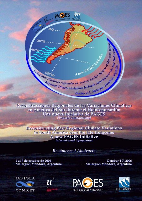
<strong>Variaciones</strong> climáticas regionales <strong>en</strong> América <strong>de</strong>l Sur durante el Holoc<strong>en</strong>o tardío<br />
60°W<br />
A new PAGES initiative<br />
Regional Climate Variations in South America<br />
over the late Holoc<strong>en</strong>e<br />
October 4-7, Malargüe, M<strong>en</strong>doza, Arg<strong>en</strong>tina<br />
<strong>Reconstrucciones</strong> <strong>Regionales</strong> <strong>de</strong> <strong>las</strong> <strong>Variaciones</strong> <strong>Climáticas</strong><br />
<strong>en</strong> América <strong>de</strong>l Sur durante el Holoc<strong>en</strong>o tardío:<br />
Una nueva Iniciativa <strong>de</strong> PAGES<br />
Simposio Internacional<br />
Reconstructing Past Regional Climate Variations<br />
in South America over the late Holoc<strong>en</strong>e:<br />
A new PAGES Initiative<br />
International Symposium<br />
Resúm<strong>en</strong>es / Abstracts<br />
4 al 7 <strong>de</strong> octubre <strong>de</strong> 2006 October 4-7, 2006<br />
Malargüe, M<strong>en</strong>doza, Arg<strong>en</strong>tina Malargüe, M<strong>en</strong>doza, Arg<strong>en</strong>tina
El Simposio ha sido<br />
<strong>de</strong>clarado <strong>de</strong> interés por:<br />
• El Honorable Consejo <strong>de</strong> Deliberante<br />
<strong>de</strong> Malargüe, M<strong>en</strong>doza, Arg<strong>en</strong>tina.<br />
• La Honorable Cámara <strong>de</strong> Diputados <strong>de</strong><br />
la Provincia <strong>de</strong> M<strong>en</strong>doza, Arg<strong>en</strong>tina.<br />
The Symposium has be<strong>en</strong><br />
<strong>de</strong>clared of interest by:<br />
• The Honorable City Council of<br />
Malargüe, M<strong>en</strong>doza, Arg<strong>en</strong>tina.<br />
• The Honorable Chamber of Deputies<br />
of M<strong>en</strong>doza Province, Arg<strong>en</strong>tina.<br />
Instituciones Organizadoras / Organizing Institutions<br />
PAGES (Past Global Changes), International Geosphere-Biosphere Programme, Bern,<br />
Switzerland.<br />
IANIGLA (Instituto Arg<strong>en</strong>tino <strong>de</strong> Nivología, Glaciología y Ci<strong>en</strong>cias Ambi<strong>en</strong>tales), M<strong>en</strong>doza,<br />
Arg<strong>en</strong>tina.<br />
University of Bern, Bern, Switzerland.<br />
Municipalidad <strong>de</strong> Malargüe, M<strong>en</strong>doza, Arg<strong>en</strong>tina.<br />
CRIDC (C<strong>en</strong>tro Regional <strong>de</strong> Investigación y Desarrollo Cultural), Malargüe, M<strong>en</strong>doza,<br />
Arg<strong>en</strong>tina.<br />
Comité Organizador Local / Local Organizing Committee<br />
Ricardo Villalba, IANIGLA, M<strong>en</strong>doza, Arg<strong>en</strong>tina (coordinador/coordinator).<br />
Martin Grosjean, Bern University, Switzerland (coordinador/coordinator).<br />
José A. Boninsegna, IANIGLA, M<strong>en</strong>doza, Arg<strong>en</strong>tina.<br />
María <strong>de</strong>l Rosario Prieto, IANIGLA, M<strong>en</strong>doza, Arg<strong>en</strong>tina.<br />
Lydia Espizua, IANIGLA, M<strong>en</strong>doza, Arg<strong>en</strong>tina.<br />
Eduardo Piovano, CIGES, Córdoba, Arg<strong>en</strong>tina.<br />
Antonio Lara, Universidad Austral <strong>de</strong> Chile, Chile.<br />
Ricardo Scollo, Director <strong>de</strong> Cultura, Municipalidad <strong>de</strong> Malargüe, M<strong>en</strong>doza, Arg<strong>en</strong>tina.<br />
Fabiana González, Directora <strong>de</strong> Turismo, Municipalidad <strong>de</strong> Malargüe, M<strong>en</strong>doza, Arg<strong>en</strong>tina.<br />
Agra<strong>de</strong>cimi<strong>en</strong>tos / Acknowledgem<strong>en</strong>ts<br />
PAGES (Past Global Changes)<br />
IANIGLA (Instituto Arg<strong>en</strong>tino <strong>de</strong> Nivología, Glaciología y Ci<strong>en</strong>cias Ambi<strong>en</strong>tales)<br />
Municipalidad <strong>de</strong> Malargüe<br />
CONICET (Consejo Nacional <strong>de</strong> Ci<strong>en</strong>cia y Técnica)<br />
Ag<strong>en</strong>cia Nacional <strong>de</strong> Promoción Ci<strong>en</strong>tífica y Tecnológica,<br />
Secretaría <strong>de</strong> Ci<strong>en</strong>cia, Tecnología e Innovación Productiva<br />
Río Tinto, Potasio Río Colorado S.A.<br />
Aguas Dadone S.A.<br />
2
Objetivo<br />
Contar con reconstrucciones climáticas<br />
regionales <strong>de</strong> alta resolución (estacionales a<br />
<strong>de</strong>c<strong>en</strong>ales) para los últimos 1000-3000 años<br />
es una <strong>de</strong> <strong>las</strong> áreas prioritarias <strong>de</strong>ntro <strong>de</strong> los<br />
programas internacionales tales como el<br />
WCRP (World Climate Research<br />
Programme) y el IGBP (Programa<br />
Internacional <strong>de</strong> la Geósfera-Biósfera),<br />
especialm<strong>en</strong>te sus sub-programas CLIVAR<br />
(Climate Variability and Predictability) y<br />
PAGES (Past Global Changes), y el<br />
WMO/UNEP IPCC (Panel<br />
Intergubernam<strong>en</strong>tal sobre el Cambio<br />
Climático). Sin esta información es muy<br />
difícil discriminar <strong>en</strong>tre los cambios<br />
climáticos producidos por los modos <strong>de</strong><br />
variabilidad climática natural y aquellos<br />
inducidos por el hombre. Importantes<br />
progresos se han observado reci<strong>en</strong>tem<strong>en</strong>te<br />
<strong>en</strong> <strong>las</strong> técnicas <strong>de</strong> reconstrucción climática,<br />
<strong>en</strong> el manejo <strong>de</strong> un gran número <strong>de</strong> registros<br />
<strong>de</strong> alta y baja frecu<strong>en</strong>cia, <strong>en</strong> la cantidad y<br />
calidad <strong>de</strong> <strong>las</strong> re<strong>de</strong>s <strong>de</strong> registros disponibles<br />
a esca<strong>las</strong> regionales, hemisféricas y globales.<br />
Las reconstrucciones regionales son <strong>de</strong><br />
particular importancia ya que <strong>las</strong><br />
variaciones climáticas a escala regional y los<br />
ev<strong>en</strong>tos extremos asociados exhib<strong>en</strong><br />
amplitu<strong>de</strong>s mucho más importantes que <strong>las</strong><br />
registradas a esca<strong>las</strong> hemisféricas o globales.<br />
Son precisam<strong>en</strong>te a nivel regional don<strong>de</strong> los<br />
impactos <strong>de</strong> la variabilidad climática se<br />
hac<strong>en</strong> s<strong>en</strong>tir más int<strong>en</strong>sam<strong>en</strong>te sobre <strong>las</strong><br />
activida<strong>de</strong>s socio-económicas.<br />
El objetivo <strong>de</strong> la Confer<strong>en</strong>cia es<br />
reunir a todos los especialistas <strong>en</strong> registros<br />
paleoclimáticos <strong>de</strong> alta resolución <strong>de</strong><br />
América <strong>de</strong>l Sur para t<strong>en</strong>er a través <strong>de</strong> la<br />
pres<strong>en</strong>taciones <strong>de</strong> sus trabajos una visión<br />
regional <strong>de</strong> los avances logrados durante los<br />
últimos años, así como establecer normas <strong>de</strong><br />
colaboración, manejo <strong>de</strong> información e<br />
implem<strong>en</strong>tación <strong>de</strong> pautas futuras para el<br />
avance <strong>de</strong> los estudios <strong>en</strong> el campo <strong>de</strong> la<br />
variabilidad climática <strong>en</strong> difer<strong>en</strong>tes regiones<br />
<strong>de</strong> América <strong>de</strong>l Sur.<br />
Objective<br />
Counting with high resolution regional<br />
climatic reconstructions (seasonal to<br />
<strong>de</strong>c<strong>en</strong>nial) for the past 1000-3000 years is<br />
one of the priority areas within the<br />
international programmes such as WCRP<br />
(World Climate Research Programme) and<br />
IGBP (International Geosphere-Biosphere<br />
Programme), especially their subprogrammes<br />
CLIVAR (Climate Variability<br />
and Predictability) and PAGES (Past Global<br />
Changes), and the WMO/UNEP IPCC<br />
(Intergovernm<strong>en</strong>tal Panel on Climate<br />
Change). Without this information it is<br />
difficult to discriminate betwe<strong>en</strong> natural and<br />
human-induced mo<strong>de</strong>s of climatic<br />
variability. Important progress has rec<strong>en</strong>tly<br />
be<strong>en</strong> observed in the techniques of climatic<br />
reconstruction, in the managem<strong>en</strong>t of a large<br />
data sets, and in the quantity and quality of<br />
the networks of records available at<br />
regional, hemispheric and global scales. The<br />
regional reconstructions are particularly<br />
important, since the climatic variations at<br />
regional scale and the associated extreme<br />
ev<strong>en</strong>ts pres<strong>en</strong>t much more important ranges<br />
than those registered at hemispheric or<br />
global scales. It is, in fact, at regional level<br />
where the impacts of the climatic variability<br />
affect more int<strong>en</strong>sely the socio-economic<br />
activities.<br />
The objective of the Confer<strong>en</strong>ce is to<br />
gather all the experts in high resolution<br />
paleoclimatic records of South America in<br />
or<strong>de</strong>r to gain, through the pres<strong>en</strong>tations of<br />
their work, a regional vision of the<br />
advancem<strong>en</strong>ts achieved during the <strong>las</strong>t<br />
years, as well as to establish collaboration<br />
norms, information managem<strong>en</strong>t and<br />
implem<strong>en</strong>tation of future gui<strong>de</strong>lines for the<br />
advancem<strong>en</strong>t of studies in the field of<br />
climatic variability in differ<strong>en</strong>t regions of<br />
South America.<br />
3
Mapa <strong>de</strong> Ubicación / Location Map<br />
4
Ciudad <strong>de</strong> Malargüe / City of Malargüe<br />
5
“Thesaurus”<br />
C<strong>en</strong>tro <strong>de</strong> Conv<strong>en</strong>ciones y Exposiciones / Conv<strong>en</strong>tion and Expo C<strong>en</strong>ter<br />
Oral Sessions<br />
Poster Sessions<br />
Entrance<br />
6
Symposium Program<br />
October 4 th<br />
08:00 Field trip M<strong>en</strong>doza-Malargüe<br />
19:00 Reception at the Thesaurus C<strong>en</strong>ter and Registration<br />
October 5 th<br />
09:00 Welcome to the meeting Villalba / Grosjean<br />
09:15 Welcome to Malargüe Local authorities<br />
Morning Session<br />
09:30<br />
Pres<strong>en</strong>t climate variability in South America<br />
Mo<strong>de</strong>rators: Mathias Vuille and Rosa Compagnucci<br />
How can we link local paleoclimatic signals with global<br />
circulation anomalies?<br />
R<strong>en</strong>é Garreaud<br />
10:00 Climate variability in the c<strong>en</strong>tral An<strong>de</strong>s of South America Mathias Vuille<br />
10:30<br />
Teleconnection of Arg<strong>en</strong>tinean An<strong>de</strong>s Climatic fluctuations and<br />
high to low latitu<strong>de</strong> processes<br />
Rosa Compagnucci<br />
11:00 Coffee break<br />
11:30<br />
12:00<br />
Searching pres<strong>en</strong>t patterns of climate variability in the past:<br />
Lessons learnt from Europe<br />
Searching pres<strong>en</strong>t patterns of climate variability in the past:<br />
How far we can go in South America?<br />
12:30 Lunch break<br />
Afternoon Sessions<br />
Heinz Wanner<br />
Ricardo Villalba<br />
Climate variability in South America from historical docum<strong>en</strong>ts<br />
Mo<strong>de</strong>rators: María <strong>de</strong>l Rosario Prieto and Alain Gioda<br />
14:20<br />
Docum<strong>en</strong>tary and early instrum<strong>en</strong>tal data from southern South<br />
America: pot<strong>en</strong>tial for climate reconstructions<br />
María <strong>de</strong>l Rosario Prieto<br />
14:40<br />
Docum<strong>en</strong>tary and early instrum<strong>en</strong>tal data from the tropical<br />
An<strong>de</strong>s: pot<strong>en</strong>tial for climate reconstructions<br />
Alain Gioda<br />
15:00 A new chronology of El Niño ev<strong>en</strong>ts from historical docum<strong>en</strong>ts Ricardo García Herrera<br />
15:20<br />
Early instrum<strong>en</strong>tal records in South America: 18th c<strong>en</strong>tury<br />
temperature data from Lima, Peru<br />
Late Holoc<strong>en</strong>e ENSO manifestations and tropical-extratropical<br />
Carlos Carcelén Reluz<br />
15:40 teleconnection patterns from geological and historical records<br />
in northern Chile<br />
Gabriel Vargas<br />
16:00 Coffee break, wine break and Poster Session<br />
7
Climate variability in South America from tree-ring records<br />
Mo<strong>de</strong>rator: José Boninsegna<br />
17:00 A high-resolution δ13C 400-year tree-ring record for Patagonia<br />
as an indicator of past atmospheric conditions<br />
Fi<strong>de</strong>l Roig<br />
17:25<br />
Past rainfall variability reconstructed from Pilgero<strong>de</strong>ndron<br />
uviferum tree-ring records in southernmost South America<br />
Juan Carlos Arav<strong>en</strong>a<br />
17:50 ENSO variability from tree-ring records José Boninsegna<br />
18:15<br />
Tree-ring network to reconstruct climate variability in the<br />
c<strong>en</strong>tral An<strong>de</strong>s of Chile and Arg<strong>en</strong>tina.<br />
El Niño Southern Oscillation signal in world highest elevation<br />
Carlos LeQuesne<br />
18:35 tree-ring chronologies from the Altiplano Plateau at 4,600 m<br />
a.s.l.<br />
Duncan Christie<br />
18:00<br />
International Cooperation for Earth Sci<strong>en</strong>ce Studies: The Italian<br />
Approach<br />
18:20 Adjourn for the day<br />
08:30<br />
08:50<br />
09:10<br />
09:30<br />
09:50<br />
10:10<br />
October 6 th<br />
Morning Sessions<br />
Gabriele Paparo<br />
Climate variability in South America from lake and marine records<br />
Mo<strong>de</strong>rators: Martín Grosjean and Eduardo Piovano<br />
Lake sedim<strong>en</strong>ts as archives for high-resolution quantitative<br />
climate reconstructions of the <strong>las</strong>t 1000 years: Pot<strong>en</strong>tial,<br />
Martin Grosjean<br />
chall<strong>en</strong>ges and limitations<br />
Bl<strong>en</strong>ding historical and limnogeological records of the Little Ice<br />
Eduardo Piovano<br />
Age in Southern South America<br />
Sedim<strong>en</strong>tological results from the Paleopeces research effort<br />
David Field<br />
suggest c<strong>en</strong>t<strong>en</strong>nial-scale shift in ocean productivity off Peru<br />
1000 years record from Lagoa Gran<strong>de</strong> (southeastern region of<br />
Luiz Pess<strong>en</strong>da<br />
Brazil)<br />
Climate variability in Southeastern Brazil during the <strong>las</strong>t 4kyrs<br />
Ana Luiza Albuquerque<br />
BP based on marine and coastal lagoons sedim<strong>en</strong>ts<br />
A high-resolution poll<strong>en</strong> and diatom record from Laguna Los<br />
Polulos (22°36’S/66°44’W/4500 masl), NW Arg<strong>en</strong>tinean Puna,<br />
Liliana Lupo<br />
since ca. 800 AD<br />
10:30 Coffee break<br />
Climate variability in South America from high-resolution poll<strong>en</strong> records<br />
Mo<strong>de</strong>rators: Patricio Mor<strong>en</strong>o and Aldo Prieto<br />
11:00<br />
High-resolution paleoecology during the Late Holoc<strong>en</strong>e in NW<br />
Colombia<br />
César Augusto Velásquez<br />
Ruiz<br />
11:20 Vegetation history in the Peruvian An<strong>de</strong>s<br />
Pot<strong>en</strong>tial for obtaining a high-resolution poll<strong>en</strong> record, showing<br />
Blanca León<br />
11:40 winter precipitation in the semi-arid coast of Chile (32ºS)<br />
during the <strong>las</strong>t 2000 years<br />
Antonio Maldonado<br />
12:00<br />
Vegetation history and climatic variability during the Late<br />
Holoc<strong>en</strong>e at Pampa grasslands: the state of the art<br />
Aldo Prieto<br />
12:20<br />
Holoc<strong>en</strong>e fire, climate, and vegetation linkages in southern<br />
South America: local and regional comparisons<br />
Cathy Whitlock<br />
8
12:40<br />
High <strong>en</strong>vironm<strong>en</strong>tal variability over the <strong>las</strong>t 3000 years<br />
<strong>de</strong>duced from small closed-basin lakes in NW Patagonia<br />
13:00 Lunch break<br />
Afternoon Session<br />
Patricio Mor<strong>en</strong>o<br />
14:30<br />
Climate variability from ice cores<br />
Mo<strong>de</strong>rator: Patrick Ginot<br />
The 1000-year long climate history in South America from ice<br />
cores: pot<strong>en</strong>tial and limits<br />
Patrick Ginot<br />
15:00<br />
Firn and ice core records from high-elevation sites in the midlatitu<strong>de</strong><br />
An<strong>de</strong>s<br />
Andrés Rivera<br />
15:30 Climate variations in Bolivia inferred from tropical ice cores Edson Ramírez<br />
16:00 Coffee, wine-break and Poster Session<br />
17:30 Gui<strong>de</strong>d visit to the dinosaurs path field near Malargüe<br />
20:00 Fri<strong>en</strong>dship Dinner<br />
October 7 th<br />
Morning Sessions<br />
Glacier records in South America during the past three mill<strong>en</strong>nia<br />
Mo<strong>de</strong>rator: Lydia Espizua<br />
08:30<br />
Rec<strong>en</strong>t <strong>de</strong>ndrogalciological investigations in the Patagonian<br />
An<strong>de</strong>s of Arg<strong>en</strong>tina<br />
Mariano Masiokas<br />
08:55 The Little Ice Age in the C<strong>en</strong>tral An<strong>de</strong>s of M<strong>en</strong>doza, Arg<strong>en</strong>tina Lydia Espizua<br />
09:20<br />
Anomalous c<strong>en</strong>tury fluctuations of Glaciar Perito Mor<strong>en</strong>o,<br />
southern Patagonia<br />
Pedro Skvarca<br />
09:45 Historical glacier variations in Chile Andrés Rivera<br />
10:10 Glacier Variations in the Tropical An<strong>de</strong>s Edson Ramírez<br />
10:30 Coffee break<br />
11:00<br />
Speleotherms<br />
Mo<strong>de</strong>rator: Ricardo Villalba<br />
Stalagmite Evi<strong>de</strong>nce of Droughts in Belize at the Time of the<br />
C<strong>las</strong>sic Maya Collapse and the Pot<strong>en</strong>tial for Similar Highresolution<br />
Paleo<strong>en</strong>vronm<strong>en</strong>tal Records from Speleothems in<br />
Southern South America<br />
George Brook<br />
11:30<br />
Human-climate interactions<br />
Mo<strong>de</strong>rator: Rick Battarbee<br />
Palaeolimnology, pollution and lake restoration Rick Battarbee<br />
11:50<br />
Paleolimnological evi<strong>de</strong>nce of <strong>en</strong>vironm<strong>en</strong>tal changes during<br />
the <strong>las</strong>t 2000 years in south-c<strong>en</strong>tral Chile<br />
Roberto Urrutia<br />
12:10<br />
Climatic change and human occupation in the prean<strong>de</strong>an<br />
region of NW Arg<strong>en</strong>tina during the Upper Holoc<strong>en</strong>e<br />
José Manuel Sayago<br />
12:30 Lunch break<br />
9
14:30<br />
14:50<br />
15:20<br />
15:50<br />
Afternoon Sessions<br />
Multi-proxy reconstructions and climate mo<strong>de</strong>ling<br />
Mo<strong>de</strong>rator: Bette Otto-Bliesner<br />
Multiproxy climate reconstructions: The example from Europe<br />
and the pot<strong>en</strong>tial for South America<br />
Juerg Luterbacher<br />
Climate Mo<strong>de</strong>l Simulations of the South America Response to a<br />
Cold North Atlantic: Some Preliminary Results<br />
Bette Otto-Bliesner<br />
Climatic simulations for Middle Holoc<strong>en</strong>e of South America<br />
with CPTEC Mo<strong>de</strong>l, from differ<strong>en</strong>t contour conditions<br />
Luci<strong>en</strong>e Melo<br />
Antarctic Oscillation and its implications for proxy-based<br />
reconstructions<br />
Flavio Justino<br />
16:10 Coffee, wine-break and Poster Session<br />
PAGES initiative in South America<br />
Mo<strong>de</strong>rators: Julie Brigham-Grette and Heinz Wanner<br />
17:00 PAGES: Mission and programs Brigham-Grette / Kiefer<br />
17:20<br />
PAGES in the Southern Hemisphere: variation on orbital time<br />
scales<br />
Peter Kershaw<br />
17:40 PAGES across the Americas: from PEP I to the new initiatives Brian Luckman<br />
18:00 LOTRED South America: A new PAGES Initiative Grosjean / Villalba<br />
18:15 Closure and wrap up<br />
October 8 th<br />
09:00 Field trip to La Payunia (volcano field) and Llancanelo Lake<br />
10
Oral Pres<strong>en</strong>tation Abstracts<br />
Pres<strong>en</strong>t climate variability in South America<br />
How can we link local paleoclimatic signals with global circulation anomalies? (1)<br />
R<strong>en</strong>é D. Garreaud<br />
Departm<strong>en</strong>t of Geophysics, Universidad <strong>de</strong> Chile. rgarreau@dgf.uchile.cl<br />
The cont<strong>en</strong>t of this pres<strong>en</strong>tation was motivated by a recurr<strong>en</strong>t and very relevant question<br />
formulated by colleagues in the paleoclimatology community, namely, giv<strong>en</strong> a time series of,<br />
say, precipitation at a single point what can we say about the large-scale circulation? The<br />
variability in the refer<strong>en</strong>ce time series can be <strong>de</strong>rived using a variety of tools, ranging from<br />
simple visual inspection to complex wavelet analysis, and one would like interpreting such<br />
local variations in terms of large-scale circulation anomalies.<br />
To address this question we will use short (i.e., part of <strong>las</strong>t c<strong>en</strong>tury) but<br />
compreh<strong>en</strong>sive precipitation and circulation datasets, <strong>de</strong>scribed briefly in the first part of the<br />
pres<strong>en</strong>tation. These datasets inclu<strong>de</strong> atmospheric and oceanic reanalysis, as well as grid<strong>de</strong>danalysis<br />
and station-observations of precipitation and surface air temperature.<br />
In the second part of the talk, we docum<strong>en</strong>t the local coupling betwe<strong>en</strong> circulation<br />
and precipitation at differ<strong>en</strong>t time-scales. Basically, we display on a map the correlation<br />
betwe<strong>en</strong> collocated time series of precipitation (P) and zonal (east-west) flow aloft (U). At<br />
intraseasonal and longer time-scales, both variables are positive and significantly correlated<br />
over much of the midlatitu<strong>de</strong> oceans, since strong westerlies are conducive of a rapid growth<br />
and fast succession of baroclinic disturbances, leading to an increase of cyclonic/frontal<br />
precipitation. At or near the contin<strong>en</strong>ts, the local P-U correlation is significantly perturbed by<br />
orographic effects. The clearest example occurs precisely in the southern An<strong>de</strong>s; the P-U<br />
correlation is high and positive to the west of the range, <strong>de</strong>creasing sharply and ev<strong>en</strong><br />
changing its sign to the east.<br />
In the <strong>las</strong>t part of the pres<strong>en</strong>tation, we move from the local to the large-scale<br />
perspective. Here we review the main mo<strong>de</strong>s of atmospheric variability on curr<strong>en</strong>t climate<br />
(ENSO, SAM, ZW3, PDO, etc.) with special emphasis on their fingerprints on rainfall and<br />
surface air temperature on the southern South American region.<br />
(1) Part of this pres<strong>en</strong>tation is inclu<strong>de</strong>d in the work “Precipitation and circulation covariability in the extratropics”<br />
available from http://www.dgf.uchile.cl/r<strong>en</strong>e/PUBS/storm.pdf.<br />
Climate variability in the c<strong>en</strong>tral An<strong>de</strong>s of South America<br />
Mathias Vuille<br />
Climate System Research C<strong>en</strong>ter, University of Massachusetts, Amherst, USA. mathias@geo.umass.edu<br />
A successful grid<strong>de</strong>d multi-proxy reconstruction of climate parameters such as precipitation<br />
or temperature, which is both dynamically consist<strong>en</strong>t and physically meaningful, requires a<br />
11
<strong>de</strong>tailed knowledge of the main mo<strong>de</strong>s of spatiotemporal climate variability. Here we<br />
discuss the spatial and temporal variability of these mo<strong>de</strong>s over a region which is known for<br />
its wealth of paleoclimatic information, the c<strong>en</strong>tral An<strong>de</strong>s (~15-30°S). Evi<strong>de</strong>nce from a large<br />
number of observational and mo<strong>de</strong>ling studies suggests that the leading mo<strong>de</strong> of pres<strong>en</strong>tday<br />
interannual climate variability is associated with El Niño - Southern Oscillation (ENSO)<br />
and that this tropical Pacific forcing can easily be i<strong>de</strong>ntified in precipitation and temperature<br />
records, but also in proxy data such as tropical An<strong>de</strong>an ice cores. We will review the<br />
teleconnection mechanisms which lead to this dominant ENSO influ<strong>en</strong>ce and discuss the<br />
issue of (non)-stationarity, which is very relevant in this context. In addition we will show<br />
how appar<strong>en</strong>t discrepancies in the proxy record may be related to spatially varying<br />
s<strong>en</strong>sitivities toward ENSO due to the complex topography of the Altiplano region. A<br />
discussion of other mo<strong>de</strong>s of variability (e.g. a 20 th c<strong>en</strong>tury warming tr<strong>en</strong>d), which are<br />
superimposed on ENSO and a pres<strong>en</strong>tation of a new high-resolution grid<strong>de</strong>d data set of<br />
summer precipitation, which may be useful for calibration purposes, will <strong>en</strong>d this<br />
pres<strong>en</strong>tation.<br />
Teleconection of Arg<strong>en</strong>tinean An<strong>de</strong>s Climatic<br />
fluctuations and high to low latitu<strong>de</strong> processes<br />
Rosa Hilda Compagnucci<br />
Facultad <strong>de</strong> Ci<strong>en</strong>cias Exactas, Físicas y Naturales, UBA, Bu<strong>en</strong>os Aires, Arg<strong>en</strong>tina. rhc@at.fc<strong>en</strong>.uba.ar<br />
River runoff, precipitation and temperature in the C<strong>en</strong>tral and South An<strong>de</strong>s of Arg<strong>en</strong>tina are<br />
highly correlated with the inter-annual climate variability that occurs in high and low<br />
latitu<strong>de</strong>s.<br />
The runoff variations of rivers with basins in the C<strong>en</strong>tral An<strong>de</strong>s Cordillera and in the<br />
Southern portion of Patagonia are significantly correlated with variations of the sea surface<br />
temperature (SST) in the Equatorial Pacific at inter annual to <strong>de</strong>cadal scales. An important<br />
compon<strong>en</strong>t of the variance can be explained by El Niño/Southern Oscillation (ENSO).<br />
Positive (negative) anomalies of the SST during the austral winter correspond with abundant<br />
(low) snow fall at high mountain altitu<strong>de</strong>s, with the consequ<strong>en</strong>t increase (<strong>de</strong>crease) of<br />
summer streamflow.<br />
However, the rivers with basin in the northern and c<strong>en</strong>tral part of Patagonia do not<br />
show any signal related to ENSO. In that region, the runoff predominantly reflects the<br />
influ<strong>en</strong>ce of ice conditions of the Bellinghaus<strong>en</strong> - Amunds<strong>en</strong> and Wed<strong>de</strong>ll Seas. In g<strong>en</strong>eral,<br />
positive anomalies in the conc<strong>en</strong>tration of sea ice ((SIC) in the Wed<strong>de</strong>ll Sea and in the eastern<br />
sector of the Bellinghaus<strong>en</strong> Sea are associated with positive precipitation anomalies over the<br />
basins situated to the north of 45°S and with negative anomalies to the south.<br />
We conclu<strong>de</strong> that the inter annual variations of the C<strong>en</strong>tral and Patagonian rivers<br />
streamflows are related to the winter circulation anomalies that, in turn, are strongly<br />
influ<strong>en</strong>ced by particular tropical SST anomalies and/or high latitu<strong>de</strong> conditions related to<br />
the quantity of sea ice.<br />
During the summer, the precipitation in the foothills of the eastern C<strong>en</strong>tral An<strong>de</strong>s is related<br />
to the SST conditions in the South Atlantic Ocean and do not show any relation to ENSO.<br />
The inter-annual variability of the precipitation is modulated by a 18 year semiperiodic<br />
cycle prior to the 1976/77 austral summer. After this year, the summer precipitation<br />
variance seems to be dominated by a longer period wave. This climatic change is associated<br />
12
with a change in the teleconnection betwe<strong>en</strong> the precipitation and the circulation conditions<br />
and SST of the South Atlantic sector<br />
Precipitations in Patagonia also show differ<strong>en</strong>t signal of variability for winter and<br />
summer. Furthermore, precipitation pres<strong>en</strong>t inverse anomaly signals in the north and the<br />
south sectors.<br />
Sea ice conditions are associated to both precipitation and temperature anomalies that<br />
occur over all the Southern part of South America due to special patterns of spatial SIC<br />
anomalies. The temporal variability of the sea ice in the Austral Seas are partially related to<br />
the ENSO cycle<br />
Searching for patterns of past climate variability:<br />
lessons learned from European studies<br />
Heinz Wanner<br />
NCCR Climate and Institute of Geography, University of Bern, Switzerland wanner@giub.unibe.ch<br />
Diagnosing the long-term state of the climate system requires the simultaneous analysis of<br />
differ<strong>en</strong>t climatological state variables such as temperature (SAT, SST), precipitation and air<br />
pressure. These variables th<strong>en</strong> form the basis of the so-called Long Term Reconstruction and<br />
Diagnostics (LOTRED) approach which aims to inclu<strong>de</strong> reconstructed as well as mo<strong>de</strong>l data.<br />
Thanks to a large number of data from natural archives and, also based on a rich<br />
variety of docum<strong>en</strong>tary evi<strong>de</strong>nce, a <strong>de</strong>tailed analysis of these of state variables was carried<br />
out for Europe for the <strong>las</strong>t 500 years with a reasonable resolution (seasonal to monthly, grid<br />
spacing 0.5° – 5°; see the contribution by Luterbacher). These data allow the systematic<br />
c<strong>las</strong>sification of those seasonal climate patterns or ev<strong>en</strong> those climate regimes (Steph<strong>en</strong>son et<br />
al. 2004) which <strong>de</strong>termined the climate dynamics during the investigated period. The<br />
combined analysis of seasonal data in the state space <strong>de</strong>monstrates the known fact that the<br />
climate system behaves nearly stochastic. On the contin<strong>en</strong>tal to regional scale, internal<br />
variability dominates over natural forcing. It will be an exciting chall<strong>en</strong>ge to perform similar<br />
studies in other areas such as South America, mainly also as a basis for the combination with<br />
mo<strong>de</strong>ling studies.<br />
Searching patterns of climate variability in the past:<br />
How far we can go in South America?<br />
Ricardo Villalba<br />
Departam<strong>en</strong>to <strong>de</strong> D<strong>en</strong>drocronología e Historia Ambi<strong>en</strong>tal, IANIGLA, C.C. 330, (5500) M<strong>en</strong>doza, Arg<strong>en</strong>tina.<br />
ricardo@lab.cricyt.edu.ar<br />
Instrum<strong>en</strong>tal records provi<strong>de</strong> a compreh<strong>en</strong>sive view of climate variations in South America<br />
and their interactions with dominant mo<strong>de</strong>s of atmospheric circulation (such as ENSO, PDO,<br />
Tropical Atlantic SSTs, AAO) during the past 50-100 years. However, a longer- term<br />
perspective on climate variability across South America is vital to a compreh<strong>en</strong>sive<br />
un<strong>de</strong>rstanding of the behavior of the regional climatic system un<strong>de</strong>r differ<strong>en</strong>t forcing<br />
conditions (e.g. increased CO2) and how interannual mo<strong>de</strong>s of climate variability interact<br />
13
with <strong>de</strong>cadal and c<strong>en</strong>t<strong>en</strong>nial mo<strong>de</strong>s. Over rec<strong>en</strong>t <strong>de</strong>ca<strong>de</strong>s, evi<strong>de</strong>nce from diverse proxy<br />
records has provi<strong>de</strong>d insight into past climate variability in South America. Although<br />
consist<strong>en</strong>t patterns of variability have emerged from areas with relatively abundant proxyinformation<br />
on past climate, many paleoclimatic studies (or their interpretations) remain<br />
controversial.<br />
The new LOTRED-South America initiative is int<strong>en</strong><strong>de</strong>d to provi<strong>de</strong> consist<strong>en</strong>t patterns<br />
of past climate variability across this region. Facing this chall<strong>en</strong>ge, paleoclimatologists must<br />
be concerned with the consist<strong>en</strong>cy and reliability of these proxy records. How well do proxyrecords<br />
reflect pres<strong>en</strong>t and past climate fluctuations? Are these results consist<strong>en</strong>t with what<br />
is known about climate and physical processes recor<strong>de</strong>d in the region during the 20 th<br />
c<strong>en</strong>tury? Do the pres<strong>en</strong>tly observed relationships betwe<strong>en</strong> climate and proxy records remain<br />
stable over time? Are we conscious of the proxy-record limitations? Examples from highresolution<br />
proxy climate records in South America will be provi<strong>de</strong>d that illustrate the<br />
pot<strong>en</strong>tial and limitations of these records and highlight the need for a multi-proxy approach<br />
to provi<strong>de</strong> consist<strong>en</strong>t reconstructions of past regional climates.<br />
Climate variability in South America from historical docum<strong>en</strong>ts<br />
Docum<strong>en</strong>tary and early instrum<strong>en</strong>tal data from southern South America:<br />
pot<strong>en</strong>tial for climate reconstruction<br />
María <strong>de</strong>l Rosario Prieto<br />
Departam<strong>en</strong>to <strong>de</strong> D<strong>en</strong>drocronología e Historia Ambi<strong>en</strong>tal, IANIGLA, M<strong>en</strong>doza, Arg<strong>en</strong>tina. mrprieto@lab.cricyt.edu.ar<br />
En esta pon<strong>en</strong>cia se ofrecerá un breve panorama sobre la pot<strong>en</strong>cialidad <strong>de</strong> la docum<strong>en</strong>tación<br />
histórica disponible <strong>en</strong> la región sur <strong>de</strong> Sudamérica, es <strong>de</strong>cir Paraguay, Uruguay, Chile y<br />
Arg<strong>en</strong>tina, para obt<strong>en</strong>er reconstrucciones continuas y rigurosas <strong>de</strong> <strong>las</strong> temperaturas, <strong>las</strong><br />
precipitaciones y otras variables climáticas <strong>de</strong> <strong>las</strong> últimas c<strong>en</strong>turias cuya ocurr<strong>en</strong>cia haya<br />
quedado registrada int<strong>en</strong>cionalm<strong>en</strong>te o <strong>en</strong> forma casual <strong>en</strong> <strong>las</strong> fu<strong>en</strong>tes.<br />
Se dará <strong>en</strong> primer lugar un vistazo sobre la distribución espacio-temporal <strong>de</strong> la<br />
docum<strong>en</strong>tación histórica <strong>en</strong> la región: inicio <strong>de</strong> la misma y período que abarca, t<strong>en</strong>i<strong>en</strong>do <strong>en</strong><br />
cu<strong>en</strong>ta que <strong>en</strong> la América conquistada por España la ext<strong>en</strong>sión temporal <strong>de</strong> <strong>las</strong><br />
reconstrucciones climáticas varía <strong>de</strong> acuerdo con la fecha <strong>de</strong>l ingreso <strong>de</strong> los españoles a cada<br />
región americana. Se <strong>de</strong>be consi<strong>de</strong>rar a<strong>de</strong>más que <strong>en</strong> algunas regiones y <strong>en</strong> relación a<br />
<strong>de</strong>terminados ev<strong>en</strong>tos climáticos los registros son bastante tardíos (por ejemplo, la caída <strong>de</strong><br />
granizo <strong>en</strong> M<strong>en</strong>doza o la ocurr<strong>en</strong>cia <strong>de</strong> precipitaciones nivales <strong>en</strong> la cordillera).<br />
Hay mayor información para los tiempos <strong>de</strong> la Colonia española que durante el siglo<br />
XIX. Como el sur <strong>de</strong> Sudamérica fue una región relativam<strong>en</strong>te marginal durante el dominio<br />
español los datos instrum<strong>en</strong>tales fueron casi inexist<strong>en</strong>tes <strong>en</strong> esa etapa. Solam<strong>en</strong>te a partir <strong>de</strong>l<br />
últomo cuarto <strong>de</strong>l siglo XIX se com<strong>en</strong>zaron a registrar los ev<strong>en</strong>tos meteorológicos <strong>en</strong> forma<br />
sistemática. Los periódicos com<strong>en</strong>zaron a informar sobre los f<strong>en</strong>óm<strong>en</strong>os <strong>de</strong>l tiempo<br />
alre<strong>de</strong>dor <strong>de</strong> 1830/50.<br />
El análisis <strong>de</strong> <strong>las</strong> fu<strong>en</strong>tes pot<strong>en</strong>ciales <strong>de</strong> información paleoclimática incluye, <strong>en</strong>tre<br />
otros ítems, la exploración <strong>de</strong> los ámbitos físicos dón<strong>de</strong> rastrear la docum<strong>en</strong>tación, por lo que<br />
se indicarán los archivos y hemerotecas regionales y extrarregionales más relevantes.<br />
Asimismo se consi<strong>de</strong>rará el tipo <strong>de</strong> información necesaria para elaborar series climáticas y<br />
14
los docum<strong>en</strong>tos que se <strong>de</strong>b<strong>en</strong> buscar, t<strong>en</strong>i<strong>en</strong>do <strong>en</strong> cu<strong>en</strong>ta que la docum<strong>en</strong>tación es difer<strong>en</strong>te<br />
para cada etapa , colonial y republicana.<br />
Las fu<strong>en</strong>tes pot<strong>en</strong>ciales específicas <strong>de</strong> información paleoclimática para América <strong>de</strong>l<br />
Sur, aunque varían <strong>de</strong> región <strong>en</strong> región, incluy<strong>en</strong>, <strong>en</strong>tre otras: antiguas inscripciones, anales y<br />
crónicas, registros gubernam<strong>en</strong>tales, registros privados, registros marítimos y comerciales,<br />
papeles personales, como diarios y correspon<strong>de</strong>ncia, escritos ci<strong>en</strong>tíficos o quasi ci<strong>en</strong>tíficos,<br />
como los diarios meteorológicos (no instrum<strong>en</strong>tales), tempranos registros instrum<strong>en</strong>tales<br />
fragm<strong>en</strong>tados , mapas, dibujos y fotografías, periódicos <strong>de</strong>s<strong>de</strong> el siglo XIX <strong>en</strong> a<strong>de</strong>lante y<br />
cua<strong>de</strong>rnos <strong>de</strong> bitácora.<br />
La información se pue<strong>de</strong> analizar también <strong>de</strong> acuerdo a <strong>las</strong> características geográficas,<br />
dado que los gran<strong>de</strong>s sistemas geográficos americanos ti<strong>en</strong><strong>en</strong> una i<strong>de</strong>ntidad propia que se<br />
traduce <strong>en</strong> fu<strong>en</strong>tes difer<strong>en</strong>ciadas para su tratami<strong>en</strong>to.<br />
• Las cordilleras: datos sobre la nieve, los glaciares y los <strong>de</strong>shielos estivales.<br />
• Los océanos o regiones costeras: los cua<strong>de</strong>rnos <strong>de</strong> bitácora o los informes sobre salidas y<br />
<strong>en</strong>tradas <strong>de</strong> embarcaciones.<br />
• En ecosistemas agríco<strong>las</strong>: datos relacionados con la marcha <strong>de</strong> <strong>las</strong> cosechas, la cría <strong>de</strong>l<br />
ganado y el precio <strong>de</strong> los productos.<br />
• Litoral fluvial: datos sobre <strong>las</strong> gran<strong>de</strong>s inundaciones y crecidas<br />
• En todos : datos sobre temperatura, precipitaciones, anomalías climáticas<br />
Se pres<strong>en</strong>tarán y com<strong>en</strong>tarán los resultados obt<strong>en</strong>idos hasta la fecha <strong>en</strong> Arg<strong>en</strong>tina y<br />
Chile, sobre todo <strong>en</strong> cuanto a series <strong>de</strong> precipitaciones y <strong>de</strong> caudales, aclarando que es más<br />
difícil elaborar series <strong>de</strong> temperatura por la m<strong>en</strong>or calidad y cantidad <strong>de</strong> los datos.<br />
Se analizarán <strong>las</strong> perspectivas futuras: lo exist<strong>en</strong>te y lo que resta por hacer <strong>en</strong> este campo,<br />
tanto <strong>de</strong>s<strong>de</strong> la perspectiva espacial como <strong>de</strong>s<strong>de</strong> la temporal.<br />
Una nueva cronología <strong>de</strong> El Niño a partir <strong>de</strong> fu<strong>en</strong>tes primarias<br />
Ricardo García Herrera<br />
Departam<strong>en</strong>to <strong>de</strong> Física <strong>de</strong> la Atmósfera, Universidad Complut<strong>en</strong>se, Madrid. rgarciah@fis.ucm.es<br />
El Niño- Oscilación <strong>de</strong>l Sur (ENSO <strong>en</strong> su acrónimo inglés) es la principal fu<strong>en</strong>te <strong>de</strong><br />
variabilidad <strong>de</strong>l sistema climático. Compr<strong>en</strong><strong>de</strong> dos f<strong>en</strong>óm<strong>en</strong>os: EL Niño, que es un<br />
cal<strong>en</strong>tami<strong>en</strong>to <strong>de</strong> <strong>las</strong> aguas superficiales <strong>de</strong>l Pacífico ori<strong>en</strong>tal y la Oscilación <strong>de</strong>l Sur, que es<br />
una variación a gran escala <strong>de</strong>l sistema <strong>de</strong> presión atmosférica <strong>de</strong>l trópico. Su impacto no se<br />
limita al Pacífico tropical, sino, que, mediante la alteración que provoca <strong>en</strong> la convección<br />
tropical, se exti<strong>en</strong><strong>de</strong> a amplias regiones <strong>de</strong>l globo. El interés <strong>de</strong> su estudio radica <strong>en</strong> una serie<br />
<strong>de</strong> factores tanto climáticos como socioeconómicos. Por una parte pres<strong>en</strong>ta un<br />
comportami<strong>en</strong>to cuasi periódico, <strong>en</strong> torno a <strong>las</strong> 7-8 años, pero modulado por oscilaciones <strong>en</strong><br />
esca<strong>las</strong> multi<strong>de</strong>cádicas y superiores. A<strong>de</strong>más, aunque se está avanzando <strong>en</strong> su predicción, no<br />
se conoc<strong>en</strong> <strong>las</strong> causas capaces <strong>de</strong> <strong>de</strong>s<strong>en</strong>ca<strong>de</strong>nar un episodio <strong>de</strong> El Niño. Sus manifestaciones<br />
más extremas incluy<strong>en</strong> inundaciones, sequías, <strong>de</strong>splazami<strong>en</strong>tos <strong>de</strong> pesquerías y alteraciones<br />
<strong>en</strong> el patrón normal <strong>de</strong> temperaturas, llegando a adquirir características catastróficas. Todo<br />
ello justifica el énfasis que <strong>en</strong> los últimos años está poni<strong>en</strong>do la comunidad ci<strong>en</strong>tífica <strong>en</strong><br />
analizar los distintos ángulos <strong>de</strong> ENSO.<br />
15
Uno <strong>de</strong> los principales retos p<strong>en</strong>di<strong>en</strong>tes es evaluar su comportami<strong>en</strong>to pasado.<br />
Aunque parezca una paradoja, cuanto mejor conozcamos cómo ha evolucionado <strong>en</strong> el<br />
pasado, más probabilida<strong>de</strong>s t<strong>en</strong>dremos <strong>de</strong> <strong>en</strong>t<strong>en</strong><strong>de</strong>r los mecanismos físicos que lo g<strong>en</strong>eran y<br />
<strong>de</strong> mejorar su predicción. Si bi<strong>en</strong> <strong>en</strong> la actualidad se dispone <strong>de</strong> un <strong>de</strong>nso sistema <strong>de</strong><br />
seguimi<strong>en</strong>to <strong>de</strong> ENSO, a través <strong>de</strong> la medida casi continua <strong>de</strong> la temperatura <strong>de</strong> la superficie<br />
<strong>de</strong>l mar Pacífico mediante un sistema que combina boyas y satélites, es obvio que <strong>las</strong><br />
evi<strong>de</strong>ncias <strong>de</strong> ENSO <strong>en</strong> los siglos pasados son mucho más difíciles <strong>de</strong> <strong>en</strong>contrar,<br />
especialm<strong>en</strong>te antes <strong>de</strong> 1850, ya que no hay datos proce<strong>de</strong>ntes <strong>de</strong> aparatos como<br />
termómetros o barómetros. Por ello es necesario recurrir a indicios indirectos como los<br />
<strong>de</strong>nominados proxies que son variables no estrictam<strong>en</strong>te climáticas, pero cuya variabilidad<br />
está parcialm<strong>en</strong>te influ<strong>en</strong>ciada por el clima.<br />
Los archivos docum<strong>en</strong>tales son una fu<strong>en</strong>te excel<strong>en</strong>te <strong>de</strong> información climática ya que<br />
pue<strong>de</strong>n cont<strong>en</strong>er información <strong>de</strong> una gran variedad <strong>de</strong> proxies como impuestos, cosechas y<br />
<strong>de</strong> ocurr<strong>en</strong>cia <strong>de</strong> ev<strong>en</strong>tos extremos como huracanes o inundaciones. A<strong>de</strong>más, permite<br />
obt<strong>en</strong>er datarlos con mayor precisión que ninguna otra fu<strong>en</strong>te proxy, pudiéndose alcanzar<br />
resolución horaria.<br />
El objetivo <strong>de</strong> este trabajo es pres<strong>en</strong>tar los primeros resultados sobre una nueva<br />
cronología <strong>de</strong> El Niño, obt<strong>en</strong>ida <strong>de</strong>spués <strong>de</strong> más <strong>de</strong> tres años <strong>de</strong> trabajo con fu<strong>en</strong>tes<br />
primarias <strong>en</strong> archivos peruanos y <strong>en</strong> el Archivo G<strong>en</strong>eral <strong>de</strong> Indias. La cronología cubre el<br />
periodo 1550 a 1900. A partir <strong>de</strong> la transcripción <strong>de</strong> <strong>las</strong> fu<strong>en</strong>tes docum<strong>en</strong>tales se elaboró un<br />
conjunto <strong>de</strong> indicadores <strong>de</strong> la ocurr<strong>en</strong>cia <strong>de</strong> episodios EN <strong>en</strong> el área <strong>de</strong> Trujillo <strong>en</strong> el Norte<br />
<strong>de</strong> Perú. Se obtuvieron unos 2000 registros pot<strong>en</strong>cialm<strong>en</strong>te útiles para la cronología. Los<br />
mismos se examinaron in<strong>de</strong>p<strong>en</strong>di<strong>en</strong>te por varios climatólogos e historiadores, llegándose<br />
finalm<strong>en</strong>te a una interpretación conjunta, que permitió i<strong>de</strong>ntificar un total <strong>de</strong> 52 episodios<br />
Niño. Los resultados así obt<strong>en</strong>idos se comparan con cronologías previas y se evalúan <strong>las</strong><br />
principales esca<strong>las</strong> pres<strong>en</strong>tes <strong>en</strong> la serie temporal resultante.<br />
Registros tempranos <strong>en</strong> Sudamérica: La temperatura <strong>de</strong> Lima <strong>en</strong> el siglo XVIII<br />
Carlos Guillermo Carcelén Reluz<br />
Departam<strong>en</strong>to <strong>de</strong> Historia, Universidad Nacional Mayor <strong>de</strong> San Marcos, Perú. ccarcel<strong>en</strong>r@hotmail.com<br />
La elaboración <strong>de</strong>l banco <strong>de</strong> datos históricos sobre el <strong>de</strong>s<strong>en</strong>volvimi<strong>en</strong>to <strong>de</strong>l clima <strong>en</strong> el área<br />
c<strong>en</strong>tral <strong>de</strong>l Perú durante el siglo XVIII revela hasta que punto nuestra tarea <strong>de</strong> recolección <strong>de</strong><br />
fu<strong>en</strong>tes y elaboración <strong>de</strong> series cuantitativas a llegado a bu<strong>en</strong> termino, consi<strong>de</strong>rando el grave<br />
problema que resulta <strong>en</strong>contrar testimonios <strong>de</strong> la actividad climática <strong>en</strong> un <strong>de</strong>terminado<br />
tiempo histórico.<br />
Para la mayoría <strong>de</strong> los hombres <strong>de</strong> nuestros días resulta <strong>de</strong> poca importancia el tema,<br />
ya que sus condiciones <strong>de</strong> vida no se <strong>de</strong>terminan por <strong>las</strong> estaciones y m<strong>en</strong>os por <strong>las</strong><br />
condiciones climáticas, a pesar <strong>de</strong> <strong>las</strong> repercusiones <strong>de</strong> f<strong>en</strong>óm<strong>en</strong>os como El Niño, el<br />
cal<strong>en</strong>tami<strong>en</strong>to global y los reci<strong>en</strong>tes <strong>de</strong>sastres <strong>en</strong> América <strong>de</strong>l Norte.<br />
En cambio para los habitantes <strong>de</strong> Lima y sus zonas aledañas <strong>en</strong> el siglo XVIII si lo era,<br />
ya que para la actividad agrícola resultaba imprescindible un conocimi<strong>en</strong>to at<strong>en</strong>to <strong>de</strong> los<br />
f<strong>en</strong>óm<strong>en</strong>os climáticos, y para ello es bi<strong>en</strong> sabido que existían métodos <strong>de</strong> reconocimi<strong>en</strong>to <strong>de</strong>l<br />
<strong>de</strong>s<strong>en</strong>volvimi<strong>en</strong>to <strong>de</strong> <strong>las</strong> estaciones <strong>de</strong>s<strong>de</strong> la época prehispánica.<br />
Estas preocupaciones se v<strong>en</strong> reconocidas <strong>en</strong> un siglo como el XVIII don<strong>de</strong> la<br />
investigación, el <strong>de</strong>scubrimi<strong>en</strong>to y la racionalidad son una espacie <strong>de</strong> moda e incluso forma<br />
16
<strong>de</strong> vida, sobre todo <strong>de</strong>s<strong>de</strong> mediados <strong>de</strong>l siglo XVIII con la aparición <strong>de</strong> infinidad <strong>de</strong> estudios,<br />
<strong>en</strong>sayos, crónicas y publicaciones don<strong>de</strong> el tema recurr<strong>en</strong>te es el clima y <strong>en</strong> g<strong>en</strong>eral todo tipo<br />
<strong>de</strong> f<strong>en</strong>óm<strong>en</strong>o <strong>de</strong>l medio ambi<strong>en</strong>te y la naturaleza.<br />
Nuestra mayor preocupación, como investigadores, radica especialm<strong>en</strong>te <strong>en</strong> el hecho<br />
<strong>de</strong> que los antiguos pobladores <strong>de</strong> Lima no <strong>de</strong>jaron muchos vestigios o testimonios <strong>de</strong>finidos<br />
<strong>de</strong> <strong>las</strong> manifestaciones climáticas por ellos vividas (y hasta sufridas). Preocupación que se<br />
comp<strong>en</strong>sa por la gran cantidad <strong>de</strong> información proporcionada <strong>de</strong>s<strong>de</strong> distintos ángulos y<br />
diversidad <strong>de</strong> fu<strong>en</strong>tes, tanto <strong>de</strong> habitantes <strong>de</strong> la zona como <strong>de</strong> la gran cantidad <strong>de</strong> viajeros<br />
extranjeros.<br />
En socieda<strong>de</strong>s como la peruana <strong>de</strong>l siglo XVIII, <strong>en</strong> don<strong>de</strong> los avances ci<strong>en</strong>tíficos no<br />
permitían un control más óptimo <strong>de</strong> la naturaleza, el hombre como actor social <strong>de</strong>p<strong>en</strong><strong>de</strong>rá<br />
<strong>de</strong>l conocimi<strong>en</strong>to <strong>de</strong> <strong>las</strong> manifestaciones <strong>de</strong>l clima (o estado <strong>de</strong>l tiempo como se <strong>de</strong>cía<br />
<strong>en</strong>tonces). Este conocimi<strong>en</strong>to será es<strong>en</strong>cial ya que se convertía <strong>en</strong> un elem<strong>en</strong>to <strong>de</strong> primera<br />
línea <strong>en</strong> el <strong>de</strong>sarrollo y planificación <strong>de</strong> sus activida<strong>de</strong>s productivas.<br />
Estas variaciones según <strong>las</strong> fu<strong>en</strong>tes consultadas se reflejaran <strong>en</strong> un increm<strong>en</strong>to <strong>de</strong> la<br />
temperatura promedio <strong>en</strong>tre los años <strong>de</strong> 1754 a 1800 <strong>en</strong> unos 0.23 grados c<strong>en</strong>tígrados.<br />
Mi<strong>en</strong>tras que <strong>las</strong> máximas <strong>en</strong> el mismo laxo <strong>de</strong> tiempo se increm<strong>en</strong>tan <strong>en</strong> 0.85 grados y <strong>las</strong><br />
mínimas bajan <strong>en</strong> unos 0.35 grados.<br />
Late Holoc<strong>en</strong>e ENSO manifestations and tropical-extratropical teleconnection<br />
patterns from geological and historical records in northern Chile<br />
Gabriel Vargas 1, José Rutllant 2, Luc Ortlieb 3<br />
1 Departm<strong>en</strong>to <strong>de</strong> Geología, Universidad <strong>de</strong> Chile, Plaza Ercilla 803, Santiago, Chile. gvargas@ing.uchile.cl<br />
2 Departm<strong>en</strong>to <strong>de</strong> Geofísica, Universidad <strong>de</strong> Chile, Blanco Encalada 2002, Santiago, Chile. 3 PALÉOTROPIQUE,<br />
Institut <strong>de</strong> Recherche pour le Développem<strong>en</strong>t, 32 Av<strong>en</strong>ue H<strong>en</strong>ri Varagnat, 93143 Bondy Cé<strong>de</strong>x, France.<br />
El Niño, the warm phase of the ENSO cycle, involves ocean-climate anomalies in the tropical<br />
Pacific Ocean and in the extratropics, which frequ<strong>en</strong>tly result in heavy rainfall episo<strong>de</strong>s<br />
along the equatorial and subtropical regions including the hyperarid coast of western South<br />
America.<br />
The chronostratigraphy of <strong>de</strong>bris flow <strong>de</strong>posits from northern Chile and southern<br />
Peru and its comparison with other paleoclimate records at the western si<strong>de</strong> of the An<strong>de</strong>s<br />
indicate that the mo<strong>de</strong>rn ENSO mo<strong>de</strong> of climate variability operated during the second half<br />
of the Holoc<strong>en</strong>e. Several lines of evi<strong>de</strong>nce support an onset of mo<strong>de</strong>rn El Niño<br />
manifestations at 5,300-5,500 cal BP and an increased frequ<strong>en</strong>cy of major ev<strong>en</strong>ts during<br />
rec<strong>en</strong>t times.<br />
On a shorter time-scale, the analysis of historical docum<strong>en</strong>tary sources from C<strong>en</strong>tral<br />
Chile and the Peru coastal region suggests differ<strong>en</strong>t patterns of ENSO-teleconnection<br />
systems before and after the early ninete<strong>en</strong>th c<strong>en</strong>tury. Its is only after ~1817 AD that El Niño<br />
manifestations are characterized by both precipitation excess in winter in c<strong>en</strong>tral Chile and<br />
anomalous summer rainfalls along the coast of Southern Ecuador and northern Peru. Before<br />
that date, and for three c<strong>en</strong>turies, these c<strong>las</strong>sical manifestations did not occur concomitantly<br />
during any giv<strong>en</strong> El Niño ev<strong>en</strong>t.<br />
These results point to an increased influ<strong>en</strong>ce of ENSO in the subtropical region of the<br />
southeastern Pacific during the Late Holoc<strong>en</strong>e, and especially since the early ninete<strong>en</strong>th<br />
c<strong>en</strong>tury wh<strong>en</strong> it has be<strong>en</strong> superimposed to a global warming tr<strong>en</strong>d.<br />
17
Climate variability in South America from tree-ring records<br />
A high-resolution δ 13 C 400-year tree-ring record for Patagonia<br />
as an indicator of past atmospheric conditions<br />
Fi<strong>de</strong>l Roig<br />
Departam<strong>en</strong>to <strong>de</strong> D<strong>en</strong>drocronología e Historia Ambi<strong>en</strong>tal, IANIGLA, M<strong>en</strong>doza, Arg<strong>en</strong>tina. froig@lab.cricyt.edu.ar<br />
The isotopic composition of carbon contained in tree rings may reflect the 13CO2 variations in<br />
the atmosphere related to the global carbon cycle. In this paper, we pres<strong>en</strong>t a 400-year δ 13C<br />
record that shows evi<strong>de</strong>nce of relationships with atmospheric δ 13C expressed by the couples<br />
13Cair- 13Cwood and CO2,air- 13Cwood. Comparisons were supported by a well-replicated and<br />
significant cross-correlated 13C tree-ring conifer record from Northwest Patagonia. Thus, the<br />
strong common variability in 13C/ 12C ratios among individuals provi<strong>de</strong>s a good<br />
repres<strong>en</strong>tation of the δ 13C tr<strong>en</strong>ds in the region. The 400-year δ 13C curve shows regular<br />
fluctuations betwe<strong>en</strong> the 1600s and the beginning of 1800s and a long-term <strong>de</strong>cline after 1840,<br />
falling most rapidly during the <strong>las</strong>t 50 years. The δ 13C <strong>de</strong>crease after 1950 is particularly<br />
sharper from the 1970’s to date. The similar scale of change observed betwe<strong>en</strong> our 13Cwood<br />
record and those from other regions of the World suggests that tr<strong>en</strong>ds in Patagonia are<br />
repres<strong>en</strong>tative of global 13Cair values. Moreover, global atmospheric 13CO2 and CO2 values are<br />
strongly correlated with the tree-ring isotopic record. We discuss the pot<strong>en</strong>tial of this record<br />
as an indicator of atmospheric CO2 for both the past and pres<strong>en</strong>t in the Southern<br />
Hemisphere.<br />
Past rainfall variability reconstructed from Pilgero<strong>de</strong>ndron uviferum<br />
tree-ring records in southernmost South America<br />
Juan Carlos Arav<strong>en</strong>a 1,2 and Brian H. Luckman 2<br />
1 C<strong>en</strong>tro <strong>de</strong> Estudios Cuaternarios (CEQUA) – Universidad <strong>de</strong> Magallanes, Punta Ar<strong>en</strong>as, Chile. jarav<strong>en</strong>a@uwo.ca<br />
2 Departm<strong>en</strong>t of Geography, University of Western Ontario, London ,Ontario, Canada.<br />
Pilgero<strong>de</strong>ndron uviferum is an <strong>en</strong><strong>de</strong>mic conifer species of Chile and adjac<strong>en</strong>t areas in<br />
Arg<strong>en</strong>tina that grows betwe<strong>en</strong> 39° S and 54 º S and from sea level up to the upper tree line.<br />
Tree-ring width series from this species has be<strong>en</strong> reported significantly correlated with<br />
fluctuations in precipitation and temperature. There are, however, only 3 published<br />
Pilgero<strong>de</strong>ndron chronologies from south of 44° S and no tree-ring based climatic<br />
reconstruction using this species for this region. A rec<strong>en</strong>tly constructed network of 20 treering<br />
chronologies for Pilgero<strong>de</strong>ndron uviferum from the west coast of southernmost South<br />
America is analyzed in relation to its time series characteristics, spatial and temporal<br />
variability in the common signal of these series, and the correlation of this common signal<br />
with instrum<strong>en</strong>tal rainfall records. The best-correlated combinations of monthly<br />
precipitation records and tree-growth series were used to reconstruct two regional rainfall<br />
averages. The first regional average was formed with precipitation records from nine<br />
Northern Patagonia stations. The reconstructed precipitation series ext<strong>en</strong>ds betwe<strong>en</strong> 1625<br />
and 1994, explaining a 51% of the variance. The second regional average inclu<strong>de</strong>s<br />
18
precipitation records from five Southern Patagonia stations and its reconstructed series<br />
ext<strong>en</strong>ds from 1550 to 1994, explaining 33% of the total variance. The spectral characteristics<br />
of both reconstructed series were analyzed and their temporal and spatial variability are<br />
discussed in relation to the atmospheric circulation systems operating in this region.<br />
ENSO variability from tree-ring records<br />
José A. Boninsegna<br />
Departam<strong>en</strong>to <strong>de</strong> D<strong>en</strong>drocronología e Historia Ambi<strong>en</strong>tal, IANIGLA, M<strong>en</strong>doza, Arg<strong>en</strong>tina. pbonin@lab.cricyt.edu.ar<br />
El Niño-Southern Oscillation (ENSO) has a large impact in several regions of the Southern<br />
Hemisphere. During the El Niño (La Niña) outbreaks extreme and contrasting weather<br />
conditions with wi<strong>de</strong>-ranging and oft<strong>en</strong> severe effects occur.<br />
Several paleo-records have be<strong>en</strong> used to reconstruct ENSO low and high frequ<strong>en</strong>cy<br />
variability. Most of these reconstructions have be<strong>en</strong> done in the Northern Hemisphere where<br />
the paleo-records are more abundant, consist<strong>en</strong>t and ev<strong>en</strong> distributed that in the South.<br />
The number of paleo-records in the Southern Hemisphere has increased in the <strong>las</strong>t<br />
years, in particular the tree-ring collections in New Zealand and in South America. We<br />
analyze the pot<strong>en</strong>tialities and problems to reconstruct ENSO from the new<br />
<strong>de</strong>ndrochronologies with emphasis in those <strong>de</strong>veloped in South America. Some examples of<br />
reconstructions are also discussed.<br />
Tree-ring network to reconstruct climate variability<br />
in the c<strong>en</strong>tral An<strong>de</strong>s of Chile and Arg<strong>en</strong>tina<br />
Carlos LeQuesne 1, David W. Stahle 2, José A. Bonisegna 3,<br />
Jonathan Barichivich 1, Cesar Acuña 4, Andrés Rivera 4<br />
1 Instituto <strong>de</strong> Silvicultura, Universidad Austral <strong>de</strong> Chile, casilla 567 Valdivia, Chile. Tel.: 56 63 221190. clequesn@uach.cl<br />
2 Departm<strong>en</strong>t of Geosci<strong>en</strong>ces, Ozark Hall 113, University of Arkansas, Fayetteville, AR 72701. 3 Instituto Arg<strong>en</strong>tino <strong>de</strong><br />
Nivología y Glaciología y Ci<strong>en</strong>cias Ambi<strong>en</strong>tales, Ruiz Leal s/n Parque San Martín (5500), M<strong>en</strong>doza, Arg<strong>en</strong>tina.<br />
4 Laboratorio <strong>de</strong> Glaciología y Cambio Climático, C<strong>en</strong>tro <strong>de</strong> Estudios Ci<strong>en</strong>tíficos, Arturo Prat 514, Valdivia, Chile<br />
Only about 5% of the global paleoclimate records come from the Southern Hemisphere. In<br />
the west coast of southern South America at c<strong>en</strong>tral Chile, the moisture-s<strong>en</strong>sitive coniferous<br />
Austrocedrus chil<strong>en</strong>sis provi<strong>de</strong>s one of the most robust tree-ring proxies for climate variability<br />
over the <strong>las</strong>t mill<strong>en</strong>nium. We are <strong>de</strong>veloping a mill<strong>en</strong>nial long tree-ring network through the<br />
steep precipitation gradi<strong>en</strong>t betwe<strong>en</strong> the hyperarid and Mediterranean climate regime to the<br />
south (32-35ºS). Using this network we have reconstructed the precipitation variability of<br />
c<strong>en</strong>tral Chile for the <strong>las</strong>t 800 years. Our results show a clear shift from <strong>de</strong>cadal to increased<br />
interannual mo<strong>de</strong> of variability after 1850, appar<strong>en</strong>tly linked to <strong>en</strong>hanced ENSO-like activity,<br />
along with an increased drought risk and sustained glacier retreat. Several multi-year<br />
drought episo<strong>de</strong>s are <strong>de</strong>tected (), confirming the previous paleoclimatic findings and<br />
historical records. In a human dim<strong>en</strong>sion context, our findings are very relevant because the<br />
zone <strong>en</strong>compass the highest populated area of Chile and one of the most important binational<br />
economic corridors Chile-Arg<strong>en</strong>tina, which largely <strong>de</strong>p<strong>en</strong><strong>de</strong>nts on freshwater for<br />
19
urban, agricultural and industrial consumption. The future work will be focused in improve<br />
the geographic and time coverage of the network along with the <strong>de</strong>velopm<strong>en</strong>t of<br />
collaborative research for interhemispheric comparisons.<br />
El Niño Southern Oscillation Signal in World Highest Elevation<br />
Tree-Ring Chronologies from the Altiplano Plateau at 4,600 m a.s.l.<br />
D.A. Christie 1, A. Lara 1, J.A. Barichivich 1, R. Villalba 2, M.S. Morales 2 & E.A. Cuq 1<br />
1 Laboratorio <strong>de</strong> D<strong>en</strong>drocronología, Facultad <strong>de</strong> Ci<strong>en</strong>cias Forestales, Universidad Austral <strong>de</strong> Chile, Valdivia, Chile.<br />
duncan@s<strong>en</strong>dadarwin.cl 2 Departam<strong>en</strong>to <strong>de</strong> D<strong>en</strong>drocronología e Historia Ambi<strong>en</strong>tal, IANIGLA, M<strong>en</strong>doza, Arg<strong>en</strong>tina.<br />
El Niño-Southern Oscillation (ENSO) is the largest source of inter-annual variability<br />
operating in the earth's climate system, and is associated with extreme weather conditions<br />
having large social, ecological and economic impacts.<br />
Several tree-rings records have be<strong>en</strong> utilized to reconstruct past ENSO variability but<br />
none of them comes from South America. On the Altiplano plateau in the c<strong>en</strong>tral An<strong>de</strong>s are<br />
located the world highest elevation forest composed by Polylepis tarapacana trees 4,000-5,000<br />
m a.s.l. We use two tree-ring chronologies in or<strong>de</strong>r to analyze the regional climate and ENSO<br />
influ<strong>en</strong>ces on P. tarapacana growth at the east and west An<strong>de</strong>an slopes on the Altiplano.<br />
P. tarapacana growth has a strong common signal and a complex relation with<br />
summer temperature and precipitation. Ring-width has an inverse relation with temperature<br />
respect to precipitation. Temperature has a positive and negative influ<strong>en</strong>ce on ring-width<br />
during curr<strong>en</strong>t and previous summer, respectively. Tree-growth is positively correlated with<br />
spring-summer tropical Pacific SSTs, with a spatial pattern resembling to ENSO wedge. In<br />
g<strong>en</strong>eral the El Niño (La Niña) ev<strong>en</strong>ts are well recor<strong>de</strong>d in the chronologies, <strong>de</strong>termining<br />
above (below) mean anomalies on tree-growth. P. tarapacana chronologies offer a good<br />
opportunity to future multi-proxy ENSO reconstructions.<br />
Climate variability in South America from lake and marine records<br />
Lake sedim<strong>en</strong>ts as archives for high-resolution quantitative climate<br />
reconstructions of the <strong>las</strong>t 1000 years: pot<strong>en</strong>tial, chall<strong>en</strong>ges and limitations<br />
Martin Grosjean<br />
NCCR Climate and Institute of Geography, University of Bern, Erlachstrasse 9a, 3012 Bern, Switzerland.<br />
grosjean@giub.unibe.ch<br />
Quantitative high-resolution multi-proxy climate reconstructions at the global and regional<br />
scale have become very important in rec<strong>en</strong>t years. While tree rings, ice cores and<br />
docum<strong>en</strong>tary data are wi<strong>de</strong>ly used for such efforts, it is extremely rare that lake sedim<strong>en</strong>t<br />
data series are inclu<strong>de</strong>d in such multi-proxy reconstructions. The problem is the<br />
“translation” of sedim<strong>en</strong>t proxies into quantitative climate state variables. This is also the<br />
case for (southern) South America, where most of the lake sedim<strong>en</strong>t archives are explored in<br />
20
a qualitative way only (e.g. ‘warmer’, ‘cooler’, ‘dryer’ etc. than pres<strong>en</strong>t), and quantification<br />
remains a difficult task.<br />
This paper explores the methodological chall<strong>en</strong>ges for lake sedim<strong>en</strong>t–based<br />
(sub)<strong>de</strong>cadal quantitative climate reconstructions, whereby the target of the reconstruction is<br />
a time-series for a climate state variable (e.g. precipitation, temperature, …) for a particular<br />
season (summer, winter, annual mean) which <strong>de</strong>picts climate variability in a known specific<br />
frequ<strong>en</strong>cy band (interannual, <strong>de</strong>cadal and c<strong>en</strong>t<strong>en</strong>nial scale) with attributed uncertainties.<br />
This information is required for multi-proxy climate reconstructions.<br />
For lake sedim<strong>en</strong>ts, three major problems have to be solved: (1) Calibration of the lake<br />
sedim<strong>en</strong>t proxies with a climate variable using statistical tools (calibration “Space for Time”<br />
or “Calibration in Time”), (2) ‘Best’ age-<strong>de</strong>pth mo<strong>de</strong>ls (for the 20 th c<strong>en</strong>tury and back in time),<br />
which is most critical if “Calibration in Time” is used, and (3) continuous sampling at a<br />
resolution that is 3-5 times higher than the frequ<strong>en</strong>cy band of climate variability un<strong>de</strong>r<br />
investigation. Methodological limitations related to these three problems and additional<br />
effects such as bio-turbation lead g<strong>en</strong>erally to a loss of the high-frequ<strong>en</strong>cy climate signal that<br />
may pot<strong>en</strong>tially be preserved in lake sedim<strong>en</strong>ts. A particular chall<strong>en</strong>ge for quantitative<br />
climate reconstructions from lake sedim<strong>en</strong>ts is the ‘correct’ amplitu<strong>de</strong> of the low-frequ<strong>en</strong>cy<br />
climate changes.<br />
Bl<strong>en</strong>ding historical and limnogeological records<br />
of the Little Ice Age in Southern South America<br />
Eduardo L. Piovano 1, Marcela Cioccale 2, Daniel<br />
Ariztegui 3, Gabriela Zanor 1, Francisco Córdoba 1<br />
1 CIGES, Universidad Nacional <strong>de</strong> Córdoba, Arg<strong>en</strong>tina. epiovano@efn.uncor.edu 2 Universidad Nacional <strong>de</strong> Chilecito,<br />
Arg<strong>en</strong>tina. 3 Institute Forel and Dept. of Geology & Paleontology, U. of G<strong>en</strong>eva, Switzerland.<br />
The clear paucity of complete and well-dated paleoclimate archives covering the LIA across<br />
Southern South America has be<strong>en</strong> a major difficulty for <strong>de</strong>picting the regional <strong>en</strong>vironm<strong>en</strong>tal<br />
variability during this interval. Although the precise timing of the LIA is still a mater of<br />
<strong>de</strong>bate, our contribution is focused on the comparison of hydrological balances southward<br />
the Tropic of Capricorn (23.5° S) up to ca. 52° S. We reviewed the most significant published<br />
limnogeological and historical records, bl<strong>en</strong>ding both climate archives for <strong>en</strong>larging the<br />
<strong>en</strong>vironm<strong>en</strong>tal reconstructions for this time-window. Paleoclimate records were selected<br />
throughout a wi<strong>de</strong> geographical range and climate regimes: a) Pampean plains; b) An<strong>de</strong>an<br />
Altiplano and Puna; c) C<strong>en</strong>tral and Southern Chile; and d) Northern An<strong>de</strong>an Patagonia and<br />
Extra An<strong>de</strong>an Southern Patagonia.<br />
SSA climate archives show a complex pattern of timing and climate variability during<br />
the LIA. There is, however, a noticeable antiphased hydrological balance at both si<strong>de</strong>s of the<br />
Arid Diagonal. Numerous paleohydrological reconstructions suggest wet conditions during<br />
the LIA, southward and westward of the Diagonal Arida (i.e., Patagonia, c<strong>en</strong>tral and<br />
southern Chile) as well as part of Puna. Conversely, this cold climate phase in the Pampean<br />
plains and Altiplano, was repres<strong>en</strong>ted by pervasive draught. The antiphased cold-wet vs.<br />
cold-dry hydrological conditions at differ<strong>en</strong>t latitu<strong>de</strong>s in SSA reveal that increased rainfall<br />
triggered by int<strong>en</strong>sified Westerlies are synchronous with dry conditions resulting from a<br />
diminished monsoonal activity.<br />
21
Several forcing factors <strong>de</strong>termine the increase or <strong>de</strong>crease of moisture transport from<br />
the tropics into the Pampean plains. Ongoing limnogeological studies in Salinas <strong>de</strong><br />
Ambargasta (29° S - 64° W) and lagunas Mar Chiquita (30° S - 62° W), Melincué (33° S -<br />
61°W) and Enca<strong>de</strong>nadas <strong>de</strong>l Oeste <strong>de</strong> Bu<strong>en</strong>os Aires (37 °S - 62°W) may help to dis<strong>en</strong>tangle<br />
the mechanisms behind the most rec<strong>en</strong>t and past climate variability in the subtropics of<br />
South America.<br />
Sedim<strong>en</strong>tological results from the Paleopeces research effort<br />
suggest c<strong>en</strong>t<strong>en</strong>nial-scale shift in ocean productivity off Peru<br />
D. Field 1, D. Gutiérrez, R. Salvatteci, M. Morales, F. Velazco,<br />
L. Ortlieb, A. Sifeddine, P. Tapia, V. Ferreira, T. Baumgartner, G. Vargas<br />
1 Monterey Bay Aquarium Research Institute, Moss Landing, CA. dfield@mbari.org<br />
Laminated sedim<strong>en</strong>ts from the Peruvian shelf provi<strong>de</strong> a means to examine the role of the<br />
eastern subtropical Pacific system in <strong>de</strong>cadal- to-c<strong>en</strong>t<strong>en</strong>nial-scale variability. We <strong>de</strong>scribe<br />
results from the PALEOPECES research group for two differ<strong>en</strong>t box cores that ext<strong>en</strong>d several<br />
c<strong>en</strong>turies back in time. Cores were subsampled at multi-year resolution and dated using<br />
excess 210Pb activity profiles, radiocarbon analyses, and the occurr<strong>en</strong>ce of several slumps that<br />
likely resulted from known tsunami ev<strong>en</strong>ts. Proxy records of ocean climate and variability<br />
are <strong>de</strong>veloped based on fish scales, diatoms, organic carbon and its isotopic signatures, and<br />
other sedim<strong>en</strong>tological properties.<br />
A predominant feature from the records is a rapid climate shift that occurred in the<br />
mid-19 th c<strong>en</strong>tury, whereby inferred near-surface productivity increased based on diatoms,<br />
total organic carbon, and the abundance of anchovy scales. The increase in surface<br />
productivity, presumably associated with ocean cooling, is consist<strong>en</strong>t with other proxy<br />
records indicating reduced oxyg<strong>en</strong> conc<strong>en</strong>trations. This change suggests that rapid shifts in<br />
ocean climate may occur on c<strong>en</strong>t<strong>en</strong>nial timescales with large effects on natural resources.<br />
The mid-19th c<strong>en</strong>tury shift is consist<strong>en</strong>t with tree ring records that indicate warming<br />
in the Patagonian An<strong>de</strong>s and may be negatively related with ocean temperatures off the<br />
coast of Peru due to an int<strong>en</strong>sification of the southeast Pacific subtropical high. The inferred<br />
increase in productivity continues during the 20 th c<strong>en</strong>tury, <strong>de</strong>spite a tr<strong>en</strong>d towards increasing<br />
Sea Surface Temperatures (SSTs). We discuss the relative role of an increase in coastal<br />
upwelling and increasing SSTs.<br />
22
1000 years record from Lagoa Gran<strong>de</strong> (southeastern region of Brazil)<br />
Saia, S.E.M.G. 1; Pess<strong>en</strong>da, L.C.R. 1,*; Gouveia, S.E.M. 1; Sifeddine, A. 2;<br />
Amaral, P.G.C. 3; Ledru, M.P. 2; Garcia, R.J.F. 4; Arav<strong>en</strong>a, R. 5; B<strong>en</strong>dassolli, J.A. 6<br />
1 C<strong>en</strong>ter for Nuclear Energy in Agriculture (CENA/USP), 14C Laboratory, Brazil. 2 IRD - Institut <strong>de</strong> Recherche pour le<br />
Développem<strong>en</strong>t, France. 3 Geosci<strong>en</strong>ce Institute/University of São Paulo, Brazil. 4 Herbarium of the São Paulo City, Brazil.<br />
5 University of Waterloo, Canada. 6 C<strong>en</strong>ter for Nuclear Energy in Agriculture (CENA/USP), Stable Isotopes Laboratory,<br />
Brazil. * Pres<strong>en</strong>ting author. pess<strong>en</strong>da@c<strong>en</strong>a.usp.br<br />
The study site is located in the PETAR - Parque Estadual Turístico do Alto do Ribeira, São<br />
Paulo State, southeastern region of Brazil. A sedim<strong>en</strong>t core of 167 cm was collected in a<br />
natural lake (Lagoa Gran<strong>de</strong>) surroun<strong>de</strong>d by the Atlantic Forest. Elem<strong>en</strong>tal and isotopic<br />
analysis of C and N, poll<strong>en</strong> and 14C dating were used in or<strong>de</strong>r to reconstruct the vegetation<br />
history of the region during the late Holoc<strong>en</strong>e and its relation with climate changes.<br />
The results of the sedim<strong>en</strong>t organic matter composition of Lagoa Gran<strong>de</strong> indicated<br />
that the <strong>en</strong>vironm<strong>en</strong>tal conditions were relatively stable during the <strong>las</strong>t 1000 years,<br />
characterized by the pres<strong>en</strong>ce of C3 plants and phytoplankton, suggesting humid climatic<br />
conditions and that probably the lake wasn’t dry during the <strong>las</strong>t mill<strong>en</strong>nium. An increase in<br />
the frequ<strong>en</strong>cy of Weinmannia was observed from ~400 years BP to ~300 years BP, suggesting<br />
the pres<strong>en</strong>ce of a warmer climate. In the same period it was observed an increase in the<br />
frequ<strong>en</strong>cy of Cyperaceae and spores, that could be related with the colonization of lake<br />
margins by this plant, probably due to the <strong>de</strong>crease of the water column.<br />
Climate variability in Southeastern Brazil during the <strong>las</strong>t<br />
4kyrs BP based on marine and coastal lagoons sedim<strong>en</strong>ts.<br />
Ana Luiza Albuquerque 1, Bruno J. Turcq 1,2, Ab<strong>de</strong>lfettah Sifeddine 2, Heitor Evangelista 3,<br />
Flor<strong>en</strong>ce Sylvestre 2, Michelle Morata <strong>de</strong> Andra<strong>de</strong> 1, Alice Cruz Candido da Silva 1<br />
1 Programa <strong>de</strong> Geoquímica Ambi<strong>en</strong>tal, Universida<strong>de</strong> Fe<strong>de</strong>ral Flumin<strong>en</strong>se, Niterói, RJ – BRAZIL. analuspa@uol.com.br<br />
2 Institute <strong>de</strong> Recherche pour le Developpem<strong>en</strong>t – IRD / FRANCE. 3 Universida<strong>de</strong> do Estado do Rio <strong>de</strong> Janeiro – UERJ-<br />
BRAZIL.<br />
Climate variability in southeastern Brazil was studied through of confront betwe<strong>en</strong> marine<br />
and coastal lagoons sedim<strong>en</strong>t cores drilled from Cabo Frio, in Rio <strong>de</strong> Janeiro coast. One of<br />
interesting feature of Cabo Frio is the occurr<strong>en</strong>ce of a seasonal coastal upwelling, which<br />
provi<strong>de</strong> a very dry local climate (semi-arid). Our results showed an int<strong>en</strong>se variability in the<br />
upwelling during the <strong>las</strong>t 4kyrs cal BP, especially wh<strong>en</strong> compared with the early and middle<br />
Holoc<strong>en</strong>e. Similar variability pattern is also recor<strong>de</strong>d in other parts of South America, such<br />
as Cariaco Basin in V<strong>en</strong>ezuela. In both case, it is possibly correlate the high variability phase<br />
with the int<strong>en</strong>sification of ENSO ev<strong>en</strong>ts after 4kyrs cal BP. Exactly the same variability<br />
pattern was also recor<strong>de</strong>d in Rio <strong>de</strong> Janeiro coastal lagoon sedim<strong>en</strong>ts. However, in sedim<strong>en</strong>ts<br />
of coastal lagoon, we could also observe a clear t<strong>en</strong><strong>de</strong>ncy to drier climates to the top core,<br />
which is characterized by carbonate nodules. Time series analyses of some laminated<br />
sections of this lagoon core were studied using wavelet power tools. The results showed at<br />
least two marked cyclicities patterns of 2,5 yrs and 29,3 yrs. These cycles may be linked to<br />
large scale climate ph<strong>en</strong>om<strong>en</strong>on, such as ENSO and South Atlantic Decadal Oscillations.<br />
23
A high-resolution poll<strong>en</strong> and diatom record from Laguna Los Polulos<br />
(22°36’S/66°44’W/4500 masl), NW Arg<strong>en</strong>tinean Puna, since ca. 800 AD<br />
Liliana Lupo 1, Marcelo Morales 2, Antonio Maldonado 3, Martin Grosjean 4<br />
1 CONICET- Laboratorio <strong>de</strong> Palinología - UNJU - Grupo Yavi. Alberdi 49, SS <strong>de</strong> Jujuy, (4600) Jujuy, Arg<strong>en</strong>tina.<br />
lupoli@imagine.com.ar 2 CONICET - Sección Arqueología - ICA - FFyL - Universidad <strong>de</strong> Bu<strong>en</strong>os Aires, 25 <strong>de</strong> Mayo 217,<br />
3er piso (C1002ABE), Bu<strong>en</strong>os Aires, Arg<strong>en</strong>tina. marcelomoralesarq@gmail.com 3 C<strong>en</strong>tro <strong>de</strong> Estudios Avanzados <strong>en</strong> Zonas<br />
Aridas (CEAZA), Casilla 599, B<strong>en</strong>av<strong>en</strong>te 980, La Ser<strong>en</strong>a, Chile. amaldona@user<strong>en</strong>a.cl<br />
4 University of Bern - NCCR Climate, Erlachstrasse 9a CH-3012 Bern – Switzerland. grosjean@giub.unibe.ch<br />
Poll<strong>en</strong> and diatom data from Laguna Polulos are pres<strong>en</strong>ted. L. Polulos is a brakish-saline<br />
highland lake surroun<strong>de</strong>d by high An<strong>de</strong>an grasslands with a low vegetation cover (ca. 10-<br />
15%). The 120 cm long sedim<strong>en</strong>t core has a basal age of ~550 AD ( 14C y 210Pb). The poll<strong>en</strong><br />
record, analysed every 1 to 11 cm, shows several periods with dominance of littoral<br />
vegetation, which is interpreted as periods with low lake levels betwe<strong>en</strong> 1870-1700, 1500-<br />
1400, and 1050-650 AD; and humid periods as suggested by the pres<strong>en</strong>ce of poll<strong>en</strong> from<br />
regional terrestrial vegetation with a maximum betwe<strong>en</strong> 1700 and 1500 AD. A tr<strong>en</strong>d towards<br />
more brackish conditions is suggested by the increase of Pediastrum abundance in the poll<strong>en</strong><br />
spectrum since 1910 AD.<br />
The diatom record (analysed every 2 cm) shows similar g<strong>en</strong>eral tr<strong>en</strong>ds, with strong<br />
short-term variability and strong lake level shifts (<strong>de</strong>cadal scale; within 10-15 years). High<br />
lake levels are recognized, by b<strong>en</strong>thic to plankton ratios, during the <strong>las</strong>t 100-150 years,<br />
betwe<strong>en</strong> 1660 and 1590 AD and circa 666 AD. Dry mom<strong>en</strong>ts occurred betwe<strong>en</strong> 1540 and 1310<br />
AD.<br />
We discuss the relationship of these results with previously published<br />
paleo<strong>en</strong>vironm<strong>en</strong>tal information from the An<strong>de</strong>an region, and with broa<strong>de</strong>r scale climatic<br />
changes as during the Little Ice Age (LIA) and Medieval Climatic Anomaly chronozones.<br />
Climate variability in South America from high-resolution poll<strong>en</strong> records<br />
Paleoecología <strong>de</strong> alta resolución <strong>de</strong>l Holoc<strong>en</strong>o Tardío<br />
<strong>en</strong> el Norocci<strong>de</strong>nte <strong>de</strong> Colombia<br />
César A. Velásquez R.<br />
Universidad Nacional <strong>de</strong> Colombia, Me<strong>de</strong>llín. cave<strong>las</strong>q@unalmed.edu.co<br />
Con base <strong>en</strong> dos perforaciones realizadas <strong>en</strong> lagunas <strong>de</strong>l páramo <strong>de</strong> Frontino (6° 29’ N; 76° 6’<br />
W), su correlación con otros registros <strong>de</strong> la zona y una alta resolución metodológica, se<br />
<strong>de</strong>tectaron y caracterizaron a escala <strong>de</strong>cadal cambios <strong>en</strong> el ambi<strong>en</strong>te <strong>de</strong> sedim<strong>en</strong>tación, clima,<br />
vegetación local y regional. La transición Holoc<strong>en</strong>o Medio/Tardío fue muy húmeda y <strong>en</strong>tre<br />
3200-2650 años interpol. 14C BP muy seco y posiblem<strong>en</strong>te tan cálido como hoy. Entre 2650-<br />
2300 años interpol. 14C BP el clima t<strong>en</strong>dió a ser frío y húmedo. De 2300-1900 años interpol.<br />
14C BP se hizo un poco más cálido y seco con un pulso fuerte <strong>de</strong> sequía cerca a 2200-2100<br />
años interpol. 14C BP. Entre 1900-1200 años interpol 14C BP, fue húmedo y con t<strong>en</strong><strong>de</strong>ncia<br />
progresiva a <strong>en</strong>friami<strong>en</strong>to. Des<strong>de</strong> 1300 años interpol. 14C BP hasta el pres<strong>en</strong>te hay t<strong>en</strong><strong>de</strong>ncia<br />
al cal<strong>en</strong>tami<strong>en</strong>to aunque con altibajos notables. Entre los pulsos fríos c<strong>en</strong>trados <strong>en</strong> 1300 y <strong>en</strong><br />
24
650 años interpol. 14C BP se pres<strong>en</strong>tó un ciclo cálido con humedad variable, que <strong>en</strong>globa el<br />
Óptimo Climático Medieval registrado <strong>en</strong> el Hemisferio Norte. En los últimos 750 años se ha<br />
pres<strong>en</strong>tado una fuerte variación <strong>en</strong> la vegetación y el clima. Los ev<strong>en</strong>tos más fríos están<br />
c<strong>en</strong>trados aproximadam<strong>en</strong>te <strong>en</strong> 650, 450, 330, 248, 197, 140 y 70 años interpol. 14C BP que<br />
coinci<strong>de</strong>n <strong>en</strong> bu<strong>en</strong>a medida con los llamados mínimos <strong>de</strong> radiación solar <strong>de</strong> Wolf, Spörer y<br />
Maun<strong>de</strong>r y el siglo IXX. Los últimos 100 años muestran fuerte t<strong>en</strong><strong>de</strong>ncia al cal<strong>en</strong>tami<strong>en</strong>to e<br />
increm<strong>en</strong>to <strong>en</strong> la humedad Des<strong>de</strong> hace un mil<strong>en</strong>io <strong>de</strong>sapareció el cuerpo <strong>de</strong> agua <strong>en</strong> los sitios<br />
<strong>de</strong> estudio y ha predominado un ambi<strong>en</strong>te pantanoso.<br />
La estimación <strong>de</strong>l cambio <strong>en</strong> la temperatura con base <strong>en</strong> <strong>las</strong> anomalías <strong>de</strong> temperatura<br />
<strong>de</strong>l Hemisferio Norte, muestra fuertes fluctuaciones, aunque parece que ha estado siempre<br />
por <strong>de</strong>bajo <strong>de</strong> la actual. Des<strong>de</strong> el punto <strong>de</strong> vista causal, la bu<strong>en</strong>a correlación <strong>en</strong>tre <strong>las</strong><br />
variaciones <strong>de</strong> la vegetación y el clima <strong>de</strong>l páramo <strong>de</strong> Frontino con los cambios <strong>en</strong> la<br />
producción <strong>de</strong> 14C atmosférico y los cambios <strong>en</strong> la temperatura <strong>de</strong>l Hemisferio Norte<br />
(últimos mil años), permite concluir que la variación <strong>en</strong> la actividad solar es la causa<br />
principal <strong>de</strong> los cambios observados <strong>en</strong> este sector <strong>de</strong> la cordillera Occi<strong>de</strong>ntal <strong>de</strong> Colombia.<br />
Los principales ciclos climáticos registrados por el pol<strong>en</strong> fueron <strong>de</strong> 21-22, 44, 52-54, 77-80, 90-<br />
110 (98), 124, 200, 400 y 667 años. Todos estos ciclos muestran correspon<strong>de</strong>ncia con<br />
observaciones realizadas (difer<strong>en</strong>tes herrami<strong>en</strong>tas <strong>de</strong> estudio) <strong>en</strong> otros sitios <strong>de</strong>l mundo y<br />
relacionadas directam<strong>en</strong>te con cambios <strong>en</strong> la actividad solar.<br />
Vegetation history in the Peruvian An<strong>de</strong>s<br />
Blanca León 1, 2 & K<strong>en</strong>neth R. Young 2<br />
1 Museo <strong>de</strong> Historia Natural, Universidad Nacional Mayor <strong>de</strong> San Marcos, Lima, Perú. blanca.leon@mail.utexas.edu<br />
2 Departm<strong>en</strong>t of Geography and the Environm<strong>en</strong>t, University of Texas at Austin, U.S.A.<br />
The flora and ecological settings of Peru are consi<strong>de</strong>red among the most diverse in the<br />
world. The history of their <strong>de</strong>velopm<strong>en</strong>t is linked to the uplift of the An<strong>de</strong>an cordilleras and<br />
the processes that accompany climatic change. The occurr<strong>en</strong>ce of latitudinal and altitudinal<br />
gradi<strong>en</strong>ts is reflected in differ<strong>en</strong>ces in floristic composition among differ<strong>en</strong>t slopes and<br />
basins. These differ<strong>en</strong>ces can also be linked to the evolutionary history of the plant lineages<br />
involved. Here, we summarize what is known for the period after the mid-Holoc<strong>en</strong>e to<br />
<strong>de</strong>velop and compare sc<strong>en</strong>arios of plant cover with pres<strong>en</strong>t day plant composition and<br />
vegetation. Because, wi<strong>de</strong>spread land cover alterations by people began long ago, these<br />
might have had the effect of exacerbating the isolation and fragm<strong>en</strong>tation of distributions of<br />
some species. Contemporary and rapid climate change may pot<strong>en</strong>tially excerpt pressure on<br />
the physiological limits of some An<strong>de</strong>an species, and limitations on dispersal might also<br />
prev<strong>en</strong>t their establishm<strong>en</strong>t in alternative sites. Evi<strong>de</strong>nce in fossil poll<strong>en</strong> proxies of<br />
wi<strong>de</strong>spread anthropog<strong>en</strong>ic landscape alteration in northern Peru dates 3500 year ago. This<br />
means that species s<strong>en</strong>sitive to burning and other habitat modifications would have be<strong>en</strong><br />
altered in their distributions and abundances, while other species might have be<strong>en</strong> favored.<br />
Curr<strong>en</strong>t climate change is thus acting upon a subset of the original An<strong>de</strong>an flora, in many<br />
cases with species relatively robust or resili<strong>en</strong>t in the face of the human-caused landscape<br />
modifications, at least as judged by their continued persist<strong>en</strong>ce.<br />
Key words: An<strong>de</strong>s, Peru, flora, vegetation, mid-Holoc<strong>en</strong>e<br />
25
Pot<strong>en</strong>cialidad <strong>de</strong> obt<strong>en</strong>er un registro polínico <strong>de</strong> alta resolución,<br />
indicador <strong>de</strong> precipitaciones invernales para la costa semiárida<br />
<strong>de</strong> Chile (32ºS), durante los últimos 2000 años.<br />
Antonio Maldonado 1 & Jonathan Barichivich 2<br />
1 C<strong>en</strong>tro <strong>de</strong> Estudios Avanzados <strong>en</strong> Zonas Áridas, La Ser<strong>en</strong>a, Chile. amaldona@user<strong>en</strong>a.cl<br />
2 Instituto <strong>de</strong> Silvicultura, Universidad Austral <strong>de</strong> Chile, Valdivia, Chile. campsidium@uach.cl<br />
Se pres<strong>en</strong>tan resultados <strong>de</strong>l análisis polínico y <strong>de</strong> micropartícu<strong>las</strong> <strong>de</strong> carbón <strong>de</strong>l registro Palo<br />
Colorado ubicado <strong>en</strong> la costa semiárida <strong>de</strong> Chile. De acuerdo a la relación profundidad <strong>de</strong><br />
sedim<strong>en</strong>tos/fechados radiocarbónicos (AMS), es posible obt<strong>en</strong>er una resolución <strong>en</strong>tre<br />
muestras <strong>de</strong> 22 a 6 años por c<strong>en</strong>tímetro <strong>de</strong> sedim<strong>en</strong>to, si embargo a la fecha el registro<br />
polinico ha sido analizado <strong>en</strong>tre 1 y 9 cm/muestra y el registro <strong>de</strong> carbón, continuam<strong>en</strong>te<br />
cada 1 cm.<br />
Los análisis <strong>de</strong> carbón, muestran dos mom<strong>en</strong>tos con alta pres<strong>en</strong>cia <strong>de</strong> carbón <strong>en</strong> los<br />
sedim<strong>en</strong>tos, <strong>en</strong>tre ~1500-1000 años AP y a partir <strong>de</strong> 500 años AP, ambos periodos son<br />
acompañados por aum<strong>en</strong>tos <strong>en</strong> <strong>las</strong> proporciones polínicas <strong>de</strong> Escallonia.<br />
El registro polínico, muestra el dominio <strong>de</strong>l principal indicador <strong>de</strong> humedad Mirtáceas <strong>en</strong>tre<br />
2200-1400 años AP, sin embargo con alta variabilidad y acompañado <strong>de</strong> los máximos valores<br />
<strong>de</strong> pol<strong>en</strong> <strong>de</strong> plantas anuales y bulbosas, abundantes durante años anormalm<strong>en</strong>te lluviosos,<br />
como son los años El Niño. Luego un periodo relativam<strong>en</strong>te seco, el cual comi<strong>en</strong>za a<br />
disminuir a partir <strong>de</strong> 1100 años AP. Los últimos 500 años muestran una disminución <strong>de</strong> los<br />
indicadores <strong>de</strong> humedad con máximos <strong>en</strong> torno a 330 años AP, y la posterior recuperación<br />
<strong>de</strong> este indicador.<br />
Análisis <strong>de</strong>ndrocronológicos muestran la s<strong>en</strong>sibilidad <strong>de</strong>l principal indicador <strong>de</strong><br />
humedad <strong>de</strong>l registro Myrceug<strong>en</strong>ia exsucca a <strong>las</strong> precipitaciones <strong>de</strong> invierno.<br />
Se discute la relación <strong>de</strong> los resultados con dinámicas <strong>de</strong> ocupaciones humanas y ev<strong>en</strong>tos <strong>de</strong><br />
gran escala como Pequeña Edad <strong>de</strong>l Hielo y Cal<strong>en</strong>tami<strong>en</strong>to Medieval.<br />
Financiami<strong>en</strong>to FONDECYT #3040032; 1030585<br />
Vegetation history and climatic variability during the<br />
Late Holoc<strong>en</strong>e at Pampa grasslands: the state of the art<br />
Prieto, A.R., Stutz, S., Vilanova, I. and Tonello, M.<br />
CONICET. Laboratorio <strong>de</strong> Paleoecología y Palinología. Facultad <strong>de</strong> Ci<strong>en</strong>cias Exactas y Naturales, Universidad<br />
Nacional <strong>de</strong> Mar <strong>de</strong>l Plata, Funes 3250, 7600 Mar <strong>de</strong>l Plata, Arg<strong>en</strong>tina. aprieto@mdp.edu.ar<br />
In the Pampa grasslands (34º - 39º S; 56º - 63º W) the vegetational history based on poll<strong>en</strong><br />
analysis has be<strong>en</strong> mainly conducted at alluvial sites since poll<strong>en</strong> records from shallow lakes<br />
are temporally and spatially limited. Ev<strong>en</strong> though poll<strong>en</strong> assemblages in alluvial sequ<strong>en</strong>ces<br />
may be biased as a result of episodic and irregular accumulation of sedim<strong>en</strong>ts, these<br />
sequ<strong>en</strong>ces are amazingly constant over large distances and contain very well preserved<br />
poll<strong>en</strong> grains in large quantities giving us the possibility to obtain important<br />
paleo<strong>en</strong>vironm<strong>en</strong>tal information. In this overview, we selected key proxy palynogical<br />
records with differ<strong>en</strong>t temporal and spatial resolution in or<strong>de</strong>r to evaluate the response of<br />
26
the vegetation to differ<strong>en</strong>t forcings during the late Holoc<strong>en</strong>e and to show the advancem<strong>en</strong>ts<br />
achieved over the <strong>las</strong>t years. The vegetation changes are discussed at individual sites by<br />
comparing them with other paleo<strong>en</strong>vironm<strong>en</strong>tal proxy and historical data. A quantitative<br />
climatic reconstruction applying a poll<strong>en</strong>-climate calibration mo<strong>de</strong>l is pres<strong>en</strong>ted and<br />
discussed as an example of quantification of paleoclimatic variables. Poll<strong>en</strong> records allowed<br />
us to infer (1) a pattern of <strong>en</strong>vironm<strong>en</strong>tal variability to large-scale, mainly in precipitation<br />
and humid in<strong>de</strong>x during the late Holoc<strong>en</strong>e, (2) sea level variations as the main forcing<br />
affecting the vegetation of the southeastern coast betwe<strong>en</strong> 6500 and 4000 yr B.P and, (3)<br />
anthropog<strong>en</strong>ic impact on vegetation over the <strong>las</strong>t ca. 300 years, which correlate accurately<br />
with evi<strong>de</strong>nce concerning the docum<strong>en</strong>tary information. In addition, poll<strong>en</strong> and no-poll<strong>en</strong><br />
palynomorph records have rec<strong>en</strong>tly allowed to propose an alternative explanation for the<br />
vegetational change from shallow lakes.<br />
Contributions to Projects CONICET PIP PIP5667 and UNMDP Exa 349/06<br />
Holoc<strong>en</strong>e fire, climate, and vegetation linkages in southern South America:<br />
local and regional comparisons<br />
C. Whitlock 1, M.M. Bianchi 2, P.I. Mor<strong>en</strong>o 3, P.J. Bartlein 4<br />
1 Dept Earth Sci<strong>en</strong>ces, Montana State Univ., Bozeman MT 59717 USA. whitlock@montana.edu 2 CONICET – Univ.<br />
Nacional <strong>de</strong>l Comahue, 8400 San Carlos <strong>de</strong> Bariloche, Rio Negro, Arg<strong>en</strong>tina. 3 Institute Ecology & Biodiversty and Dept.<br />
Ecological Sci<strong>en</strong>ces, Univ. Chile, Santiago, Chile. 4 Dept. Geography, Univ. Oregon, Eug<strong>en</strong>e OR 97403 USA.<br />
The role of fire on Holoc<strong>en</strong>e time scales is un<strong>de</strong>rstood at individual sites by comparing<br />
charcoal and poll<strong>en</strong> records with other paleo<strong>en</strong>vironm<strong>en</strong>tal proxy and mo<strong>de</strong>l simulations.<br />
Records from the forest-steppe ecotone in western Arg<strong>en</strong>tina disclose the fire and vegetation<br />
history at lat 41-43S. Prior to 13 ka, dry conditions and sparse vegetation appar<strong>en</strong>tly lacked<br />
suffici<strong>en</strong>t fuels to burn ext<strong>en</strong>sively. Fire activity increased betwe<strong>en</strong> 13 and 11.4 ka,<br />
contemporaneous with a regionally <strong>de</strong>fined cold dry period. The early-Holoc<strong>en</strong>e period was<br />
characterized by high fire frequ<strong>en</strong>cy in dry sites and low frequ<strong>en</strong>cy in wet sites, and<br />
indicates a sharp <strong>de</strong>crease in moisture eastward from the An<strong>de</strong>s. A shift to a surface-fire<br />
regime occurred betwe<strong>en</strong> 7.5 and 4.4 ka, preceding the expansion of Austrocedrus by 1000-<br />
1500 years at individual sites. The shift is consist<strong>en</strong>t with increased interannual climate<br />
variability and the onset or str<strong>en</strong>gth<strong>en</strong>ing of ENSO in the late Holoc<strong>en</strong>e.<br />
To <strong>de</strong>tect large-scale patterns in past fire activity, charcoal records were examined<br />
along a transect from subtropic to subantarctic biomes. Fire activity was greater than pres<strong>en</strong>t<br />
at ca. 12 ka and increased further and was wi<strong>de</strong>spread at 9 ka. Fire activity <strong>de</strong>creased and<br />
became more spatially variable by 6 ka, and this tr<strong>en</strong>d continued to pres<strong>en</strong>t. Atmospheric<br />
circulation anomalies for pres<strong>en</strong>t-day high-fire years implicate a southward shift in<br />
westerlies to explain the early-Holoc<strong>en</strong>e fire maximum. Such conditions appar<strong>en</strong>tly<br />
prevailed for mill<strong>en</strong>nia wh<strong>en</strong> the pole-to-equator temperature gradi<strong>en</strong>ts were weaker and<br />
annual and spring-summer temperatures were higher than pres<strong>en</strong>t.<br />
27
High <strong>en</strong>vironm<strong>en</strong>tal variability over the <strong>las</strong>t 3000 years<br />
<strong>de</strong>duced from small closed-basin lakes in NW Patagonia<br />
P.I. Mor<strong>en</strong>o<br />
Institute of Ecology and Biodiversity, Dept. of Ecological Sci<strong>en</strong>ces, University of Chile. pimor<strong>en</strong>o@abello.dic.uchile.cl<br />
High-resolution poll<strong>en</strong> and charcoal records from NW Patagonia (40-43°S, the Chilean Lake<br />
District) indicate mill<strong>en</strong>nial and multi-mill<strong>en</strong>nial tr<strong>en</strong>ds in vegetation change and fire<br />
activity since the Last Glacial Maximum. Most records from this area show the following<br />
patterns over <strong>las</strong>t 3000 years: (i) <strong>en</strong>d of a multimill<strong>en</strong>nial phase characterized by cool-wet<br />
conditions (7800-2700 cal yr BP), (ii) establishm<strong>en</strong>t of mixed rainforest communities<br />
(Valdivian and North Patagonian) through reshuffling of “ancestral” Holoc<strong>en</strong>e assemblages,<br />
(iii) expansion and dominance of tree species favored by disturbance, and (iii) increase in fire<br />
activity (high magnitu<strong>de</strong>, high frequ<strong>en</strong>cy, short fire-free intervals). Fire activity reached a<br />
maximum betwe<strong>en</strong> 900-1100 years ago and <strong>de</strong>clined thereafter until a rec<strong>en</strong>t increase related<br />
to disturbance by European settlers over the <strong>las</strong>t two c<strong>en</strong>turies. Altogether these data point<br />
to increased climate variability in the area adjac<strong>en</strong>t to the SE Pacific, most likely linked to the<br />
occurr<strong>en</strong>ce of frequ<strong>en</strong>t and severe summer droughts. Negative anomalies in summer<br />
precipitation are characteristic of El Niño ev<strong>en</strong>ts in this part of southern Chile, suggesting the<br />
acc<strong>en</strong>tuation of a tr<strong>en</strong>d that had started earlier, at about 5000-5700 cal yr BP. The <strong>en</strong>igmatic<br />
drop in fire activity over the <strong>las</strong>t mill<strong>en</strong>nium <strong>de</strong>serves <strong>de</strong>tailed stratigraphic and tree ring<br />
analyses. A possibility exists that climate change related to the Little Ice Age suppressed the<br />
occurr<strong>en</strong>ce of fire, at least in this part of Patagonia.<br />
Acknowledgm<strong>en</strong>ts: Institute of Ecology and Biodiversity P05-002, Fon<strong>de</strong>cyt 1030766<br />
Climate variability from ice cores<br />
The 1000-year long climate history in South America from ice cores:<br />
pot<strong>en</strong>tial and limits<br />
P. Ginot and F.Vimeux<br />
IRD Great Ice, Bolivia and France. ginot@lgge.obs.ujf-gr<strong>en</strong>oble.fr and Francoise.Vimeux@cea.fr<br />
Since 1983, an international effort on ice core investigations along the An<strong>de</strong>an mountain<br />
range has be<strong>en</strong> <strong>de</strong>veloped to infer paleoclimate and <strong>en</strong>vironm<strong>en</strong>tal information from the<br />
Equator southward to 30°S. In the northern part of this transect, from Ecuador to Bolivia in<br />
the region affected by tropical NE-winds and moisture coming from the Atlantic Ocean and<br />
the Amazonian Basin, the time range covered by the archive reaches about 25,000 years.<br />
Southern, in the Westerlies circulation pattern with Pacific Ocean moisture source, the<br />
reduced investigations allow only reaching a few c<strong>en</strong>turies of reconstruction.<br />
Tropical ice cores offer a high temporal resolution (a seasonal resolution over the <strong>las</strong>t<br />
c<strong>en</strong>turies), allowing a <strong>de</strong>tailed study of specific ev<strong>en</strong>ts or periods, such as the Little Ice Age,<br />
the climate variability over <strong>las</strong>t few c<strong>en</strong>turies, the ENSO history and the 20 th c<strong>en</strong>tury with the<br />
well known abrupt feature around 1970. We focus here on chemical, insoluble dust and<br />
water isotopic analyses over the <strong>las</strong>t 1000 years and we compare all the ice cores together,<br />
28
discussing resemblances or differ<strong>en</strong>ces. For example, we will focus on 1- proxies allowing to<br />
reconstruct accumulation history, 2- the common water stable isotope <strong>de</strong>cadal signal over the<br />
20th c<strong>en</strong>tury (Quelccaya, Huascarán, Sajama and Illimani) and 3- the pot<strong>en</strong>tial signal of<br />
global warming in some proxies.<br />
At <strong>las</strong>t, we will discuss about limits of ice cores investigations. Specifically, we will<br />
discuss about the proxy calibration and the difficulty to study strong climate mo<strong>de</strong>s like<br />
ENSO.<br />
Firn and ice core records from high-elevation sites in the mid-latitu<strong>de</strong> An<strong>de</strong>s<br />
Margit Schwikowski 1, Heinz W. Gäggeler 1,2, Theo J<strong>en</strong>k 1, Sabina<br />
Brütsch 1, David Bolius 1, Gino Casassa 3, Andres Rivera 3,4,*<br />
1 Paul Scherrer Institut, CH-5232 Villig<strong>en</strong> PSI, Switzerland. margit.schwikowski@psi.ch 2 Departm<strong>en</strong>t of Chemistry and<br />
Biochemistry, University of Bern, Freiestrasse 3, CH-3012 Bern, Switzerland. 3 C<strong>en</strong>tro <strong>de</strong> Estudios Ci<strong>en</strong>tíficos, Av. Prat<br />
514, Valdivia, Chile. 4 Laboratorio <strong>de</strong> Glaciología, Departam<strong>en</strong>to <strong>de</strong> Geografía, Universidad <strong>de</strong> Chile, Marcoleta 250,<br />
Santiago, Chile. * Pres<strong>en</strong>ting author. arivera@cecs.cl<br />
Since 2001 firn and ice cores have be<strong>en</strong> retrieved from high-elevation sites in the southern<br />
An<strong>de</strong>s in a joint collaboration betwe<strong>en</strong> Paul Scherrer Institut (PSI) from Switzerland and<br />
C<strong>en</strong>tro <strong>de</strong> Estudios Ci<strong>en</strong>tíficos (CECS) in Chile. PSI has be<strong>en</strong> in charge of the drilling,<br />
sampling and chemical analyses of the firn and ice cores, while CECS has be<strong>en</strong> responsible<br />
for glaciological characterization and site selection. The objective of the program is to retrieve<br />
firn and ice core records that can yield unique peleoclimate and paleo<strong>en</strong>vironm<strong>en</strong>tal records<br />
i<strong>de</strong>ally spanning several c<strong>en</strong>turies from mid-latitu<strong>de</strong>s in the Southern Hemisphere. During<br />
the exploration phase 3 firn cores were recovered from the Southern Patagonia Icefield in<br />
2001 (Paso Marconi, 49°11' S, 73°09' W, 1543 m a.s.l., 4 m firn core; Gorra Blanca Sur, 49°09' S,<br />
73°07' W,1836 m a.s.l., 3 m core; and Gorra Blanca Norte, (49°08' S, 73°03' W, 2300 m a.s.l., 5<br />
m core), one 5.5. m firn core from Glaciar Esmeralda, Cerro El Plomo in Chile in 2003<br />
(33°14‘S, 70°13‘W, 5300 m a.s.l.), and one 13.5 m firn core record from Glaciar La Ollada,<br />
Cerro Mercedario in Arg<strong>en</strong>tina in 2003 (31°58‘S, 70°07‘W, 6070 m a.s.l.). Of these cores, the<br />
sites at Gorra Blanca Norte and Cerro Mercedario proved to be a<strong>de</strong>quate for paleoclimatic<br />
interpretation, while the other lower sites are not useful because of abundant melting and<br />
water percolation which obliterates the glaciochemical signals (Bolius et al., in press,<br />
Schwikowski et al., in press). Based on the promising paleoclimate results from the firn cores<br />
obtained at Cerro Mercedario and Gorra Blanca Norte, a main drilling phase was performed,<br />
retrieving a 104 m <strong>de</strong>ep ice core at Glaciar La Ollada, Cerro Mercedario, at 6070 m a.s.l. in<br />
2005, and a 50.6 m core at the northern plateau of Cordón Mariano Mor<strong>en</strong>o, 2580 m a.s.l.,<br />
Southern Patagonia Icefield, in 2006. Preliminary inspection of both these ice cores shows a<br />
good pot<strong>en</strong>tial for obtaining long paleoclimate records. The results obtained from the<br />
analysis of the shallow firn cores will be pres<strong>en</strong>ted and discussed, as well as the glaciological<br />
characterization of the sites. The <strong>de</strong>ep ice drilling operations at Cerro Mercedario and<br />
Mariano Mor<strong>en</strong>o will also be <strong>de</strong>scribed.<br />
Acknowledgm<strong>en</strong>ts: Paul Scherrer Institut, Swiss National Sci<strong>en</strong>ce Foundation (Grant N° 200021-100289), C<strong>en</strong>tro<br />
<strong>de</strong> Estudios Ci<strong>en</strong>tíficos, Fon<strong>de</strong>cyt 1040989 and 1061269, National Geographic Society Grant 7587-04.<br />
29
Glacier records in South America during the past three mill<strong>en</strong>nia<br />
Rec<strong>en</strong>t <strong>de</strong>ndroglaciological investigations in the Patagonian An<strong>de</strong>s of Arg<strong>en</strong>tina<br />
Mariano H. Masiokas 1,2, Ricardo Villalba 2,<br />
Brian H. Luckman 1, Silvia Delgado 2 and Alberto Ripalta 2<br />
1 Departm<strong>en</strong>t of Geography, University of Western Ontario, N6A 5C2, London, Ontario, Canada. 2 Laboratorio <strong>de</strong><br />
D<strong>en</strong>drocronología, IANIGLA-CRICYT, CC330 (5500), M<strong>en</strong>doza, Arg<strong>en</strong>tina. mmasiok2@uwo.ca<br />
In 1998 IANIGLA started <strong>de</strong>ndroglaciological investigations in the Patagonian An<strong>de</strong>s of<br />
Arg<strong>en</strong>tina to characterize the main spatial and temporal glacial and climatic fluctuations in<br />
the region over the <strong>las</strong>t 1000 years. Eight sites with relatively small glaciers and forestcovered<br />
Neoglacial moraines were initially selected for study betwe<strong>en</strong> 39˚S and 50˚S.<br />
Aerial photographs, satellite imagery and docum<strong>en</strong>tary evi<strong>de</strong>nce showing past<br />
glacier front positions were used to evaluate glacier changes during the past c<strong>en</strong>tury. Treering/radiocarbon<br />
dating of trees growing on these moraines or affected by glacier <strong>de</strong>posits<br />
were used to obtain approximate ages for the main glacier ev<strong>en</strong>ts during the past c<strong>en</strong>turies<br />
(Table 1). Tree-ring based climate reconstructions can provi<strong>de</strong> annually resolved records of<br />
past temperature and precipitation variability for this region. The low-frequ<strong>en</strong>cy climatic<br />
signal from these records will be compared with the glacial history from each study area.<br />
Mutual cross-validation from these two in<strong>de</strong>p<strong>en</strong><strong>de</strong>nt proxies should provi<strong>de</strong> a reliable<br />
regional climate record over the <strong>las</strong>t c<strong>en</strong>turies.<br />
Field investigations and sampling over several years, together with the laboratory<br />
analysis of the tree-ring samples collected, have established the feasibility of this project and<br />
the initial results are promising. Evi<strong>de</strong>nce from tree-ring based temperature reconstructions<br />
for the north and south Patagonian An<strong>de</strong>s indicate that in g<strong>en</strong>eral periods of ext<strong>en</strong><strong>de</strong>d cold<br />
conditions coinci<strong>de</strong> with the <strong>de</strong>ndrogeomorphic dating of moraines associated with the Little<br />
Ice Age in both regions. Numerous in situ stumps, appar<strong>en</strong>tly killed during glacier advances,<br />
have be<strong>en</strong> found at several study sites and will provi<strong>de</strong> better <strong>de</strong>finition of the glacier history<br />
at those sites.<br />
This project repres<strong>en</strong>ts the first attempt to integrate in<strong>de</strong>p<strong>en</strong><strong>de</strong>nt proxy climate<br />
records in the north and south Patagonian An<strong>de</strong>s of Arg<strong>en</strong>tina. Together with a critical<br />
analysis of 20 th-c<strong>en</strong>tury climatic variations in the region, this will allow us to evaluate the<br />
rec<strong>en</strong>t climatic changes in a broa<strong>de</strong>r, longer-term perspective.<br />
The Little Ice Age in the An<strong>de</strong>s of M<strong>en</strong>doza, Arg<strong>en</strong>tina<br />
Lydia E. Espizua<br />
Instituto Arg<strong>en</strong>tino <strong>de</strong> Nivología, Glaciología y Ci<strong>en</strong>cias Ambi<strong>en</strong>tales (IANIGLA) / Consejo Nacional <strong>de</strong> Investigaciones<br />
Ci<strong>en</strong>tíficas y Técnicas (CONICET). CC 330, 5500, M<strong>en</strong>doza, Arg<strong>en</strong>tina. lespizua@lab.cricyt.edu.ar<br />
The El Azufre and El Peñón valleys at 35º S latitu<strong>de</strong> and Las Damas and Las Choicas valleys<br />
at 34º55 S latitu<strong>de</strong> in the headwater of the Río Gran<strong>de</strong> basin were studied since the maximum<br />
Little Ice Age (LIA) in the C<strong>en</strong>tral An<strong>de</strong>s of Arg<strong>en</strong>tina. The glaciers pres<strong>en</strong>ts well preserved<br />
moraines attributed to former c<strong>en</strong>turies. Based on morphological characteristics, the<br />
proximity to the active glaciers, and radiocarbon ages, the LIA maximum occurred in the<br />
30
second half of the 15 th-17 th c<strong>en</strong>turies, a glacier minor re-advanced occurred during the second<br />
half of the 17 th-18 th and in the 19 th c<strong>en</strong>turies. After 1894/1896 the glaciers betwe<strong>en</strong> 33º-35º S<br />
have rece<strong>de</strong>d nearly continuously. Within the g<strong>en</strong>eral retreat, the glaciers advanced during<br />
the 1980´s.<br />
Key Words: Little Ice Age; glacier fluctuations; C<strong>en</strong>tral An<strong>de</strong>s; M<strong>en</strong>doza; Arg<strong>en</strong>tina.<br />
Anomalous c<strong>en</strong>tury fluctuations of Glaciar Perito Mor<strong>en</strong>o, southern Patagonia<br />
Pedro Skvarca<br />
Instituto Antártico Arg<strong>en</strong>tino, Cerrito 1248, C1010AAZ Bu<strong>en</strong>os Aires, Arg<strong>en</strong>tina. glacio@dna.gov.ar<br />
While most Patagonian glaciers recee<strong>de</strong>d during the past c<strong>en</strong>tury, Glaciar Perito Mor<strong>en</strong>o<br />
(GPM) was advancing or in near steady state during the same period. GPM has 254 km 2 in<br />
area, drains the Southern Patagonian Icefield to the east, calving into Lago Arg<strong>en</strong>tino. It is<br />
well known for repeated formation of ice-dams and consequ<strong>en</strong>t ruptures over the 20 th<br />
c<strong>en</strong>tury to the pres<strong>en</strong>t. The glacier has be<strong>en</strong> advancing from 1899 until 1917, wh<strong>en</strong> reached<br />
the P<strong>en</strong>ínsula Magallanes for the first time. Since th<strong>en</strong> GPM has be<strong>en</strong> fluctuating close to the<br />
steady state. However, analysis of aerial photography and Landsat images reveal that glacier<br />
is pres<strong>en</strong>tly at its most advanced position since 1947, with positive areal gain. Evi<strong>de</strong>nce of<br />
rec<strong>en</strong>t glacier advance was also <strong>de</strong>tected at glacier margin. In addition, surface elevations<br />
measured in 2002 show a consi<strong>de</strong>rable ice-thick<strong>en</strong>ning at lower parts of ablation area,<br />
suggesting a positive mass balance which could have led to formation of the very rec<strong>en</strong>t icedams.<br />
Ice-damming occurred in 2003 and 2005, with ruptures in early 2004 and 2006,<br />
resepectively. A c<strong>en</strong>tury glacier fluctuations will be analized through compilation of field<br />
surveys, aerial photographs and sequ<strong>en</strong>tial satellite images. In addition, 10-year temperature<br />
data available from automatic weather station (AWS) installed in 1995 at GPM will be<br />
pres<strong>en</strong>ted and discussed in correlation with 5-<strong>de</strong>ca<strong>de</strong> record from the nearby synoptic<br />
station Lago Arg<strong>en</strong>tino.<br />
Historical glacier variations in Chile<br />
Andres Rivera, Francisca Bown, Cesar Acuña and Gino Casassa<br />
C<strong>en</strong>tro <strong>de</strong> Estudios Ci<strong>en</strong>tíficos, Valdivia, Chile. arivera@cecs.cl<br />
In Chile have be<strong>en</strong> accounted more than 1760 glaciers with a total area of approximately<br />
22,000 km 2, however, only a hundred have be<strong>en</strong> analyzed in terms of historical frontal<br />
variation and few other glaciological properties. The ol<strong>de</strong>st precise historical records about a<br />
Chilean glacier was recor<strong>de</strong>d in 1766 (Glaciar San Rafael), while a couple of glaciers were<br />
<strong>de</strong>scribed in 1830 (Glaciar Pio XI) and 1842 (Glaciar Cipreces). By the <strong>en</strong>d of the ninete<strong>en</strong><br />
c<strong>en</strong>tury, several other have be<strong>en</strong> explored and studied, especially in Patagonia, where<br />
Glaciares O’Higgins was firstly visited in 1896 and Glaciar Dickson in 1897. From all the<br />
analyzed Chilean glaciers, up to 6% have shown a net advance during differ<strong>en</strong>t study<br />
periods, especially Glaciar Pío XI which advanced during the tw<strong>en</strong>tieth c<strong>en</strong>tury betwe<strong>en</strong><br />
1925 and 1928 and betwe<strong>en</strong> 1945 and 1997. A 7% of the glaciers have shown no significant<br />
31
change, while 87% showed a negative rate of variation, ranging from a few meters per year<br />
to a maximum of 792 m a-1 at Glaciar Marinelli betwe<strong>en</strong> 1992-2000. To date, the glacier retreat<br />
continues, as well as the negative mass balances and significant ice thinning rates. This<br />
shrinking process is thought to be <strong>en</strong>hanced if the observed atmospheric warming persists in<br />
the future, affecting the future availability of water resources on glacierized basins. H<strong>en</strong>ce,<br />
the contribution of Chilean glaciers to eustatic global sea-level rise during the <strong>las</strong>t five<br />
<strong>de</strong>ca<strong>de</strong>s was estimated to yield 8.2% of the worldwi<strong>de</strong> contribution of small glaciers on<br />
Earth, being mainly constrained by changes experi<strong>en</strong>ced by glaciers in Patagonia.<br />
Speleotherms<br />
Stalagmite Evi<strong>de</strong>nce of Droughts in Belize at the Time of the C<strong>las</strong>sic Maya<br />
Collapse and the Pot<strong>en</strong>tial for Similar High-resolution Paleo<strong>en</strong>vronm<strong>en</strong>tal<br />
Records from Speleothems in Southern South America<br />
George A. Brook<br />
Departm<strong>en</strong>t of Geography, University of Georgia, Ath<strong>en</strong>s GA, 30602, USA. gabrook@uga.edu<br />
The Maya civilization in C<strong>en</strong>tral America peaked during a C<strong>las</strong>sic Period from A.D. 25 to<br />
900, but <strong>de</strong>clined abruptly in the years A.D. 750 to 900. Reliably-dated reflectance,<br />
luminesc<strong>en</strong>ce, stable isotope, and petrography from a stalagmite from western Belize<br />
indicate a series of droughts from A.D. 700 to 1135 coinciding with the collapse of the Maya<br />
civilization. Two earlier droughts recor<strong>de</strong>d by the stalagmite coinci<strong>de</strong> with the Prec<strong>las</strong>sic<br />
Abandonm<strong>en</strong>t and the Maya Hiatus periods of <strong>de</strong>cline. Comparison of the stalagmite record<br />
with distant records shows broa<strong>de</strong>r-scale climatic teleconnections betwe<strong>en</strong> C<strong>en</strong>tral and South<br />
America.<br />
In southern South America limestone caves are suffici<strong>en</strong>tly common to allow<br />
speleothem studies in several climatic regions. These secondary carbonates can be dated<br />
accurately by U-series to ~500 ka allowing periods of growth and no-growth, which are<br />
induced by changing climatic conditions, to be <strong>de</strong>fined. Speleothem carbonate and fluid<br />
inclusion O and H isotopic characteristics can indicate past temperature and moisture<br />
conditions, including information about the air masses that brought precipitation, as well as<br />
the int<strong>en</strong>sity of the precipitation. Speleothems may also trap and preserve poll<strong>en</strong> and other<br />
plant micro and macrofossils, wh<strong>en</strong> nearby, highly-oxidized c<strong>las</strong>tic sedim<strong>en</strong>ts do not. C<br />
isotopes can be an additional source of vegetation data as they can reveal whether the plant<br />
cover above the cave consisted largely of C3 or C4 plants. Finally, some stalagmites have<br />
annual and ev<strong>en</strong> sub-annual layers so that very <strong>de</strong>tailed paleo<strong>en</strong>vronm<strong>en</strong>tal records can be<br />
obtained, which can be compared, for example, with high-resolution tree-ring, lacustrine,<br />
and instrum<strong>en</strong>tal data.<br />
Keywords: C<strong>las</strong>sic Maya Collapse, stalagmites, South America, caves, paleoclimates.<br />
32
Human-climate interactions<br />
Palaeolimnology, pollution and lake restoration<br />
Richard W. Battarbee<br />
Environm<strong>en</strong>tal Change Research C<strong>en</strong>tre, University College London, Gower St. London WC1E 6BT. ucfabat@ucl.ac.uk<br />
Lakes are highly distinctive features of the earth’s surface. They vary greatly in distribution,<br />
size, age, origin, chemistry, biology and in the ext<strong>en</strong>t of their alteration by human activity.<br />
Lakes close to human settlem<strong>en</strong>ts, receiving waste-water and run-off from agricultural land,<br />
have be<strong>en</strong> very heavily modified by the effects of eutrophication, others with low natural<br />
alkalinity close to industrial areas have suffered from acidification, and in many arid and<br />
semi-arid regions of the world abstraction of fresh-water for drinking and irrigation has<br />
caused severe salinisation.<br />
Ev<strong>en</strong> in the most remote regions that are relatively free from these pressures it is<br />
possible to <strong>de</strong>tect the pres<strong>en</strong>ce of long-range transported air pollutants that accumulate in<br />
the food chain. And all lakes are now exposed to additional threats from gre<strong>en</strong>house-gas<br />
forced climate change acting both directly in terms of changing temperature, precipitation<br />
and wind regimes and indirectly through the influ<strong>en</strong>ce of climate change on catchm<strong>en</strong>t landuse<br />
and on the behaviour of pollutants.<br />
Un<strong>de</strong>rstanding how these pressures combine and interact to change the structure and<br />
functioning of lake ecosystems on differ<strong>en</strong>t time-scales is a c<strong>en</strong>tral focus of limnological<br />
research requiring the combined expertise of both neo-limnologists, palaeolimnologists and<br />
lake mo<strong>de</strong>llers. In this pres<strong>en</strong>tation I will <strong>de</strong>scribe this approach using examples from lake<br />
acidification research and explain how we are using a palaeolimnological approach to assess<br />
lake status both at individual sites and across Europe. I will stress the importance of<br />
combining data in c<strong>en</strong>tral databases in or<strong>de</strong>r to reconstruct patterns of human impact on lake<br />
at both regional and global scales.<br />
Lake ecosystem research in PAGES is co-ordinated by the LIMPACS activity un<strong>de</strong>r<br />
the Focus 4 heading. For more information visit: www.geog.ucl.ac.uk/ecrc/limpacs.<br />
Evi<strong>de</strong>ncias paleolimnologicas <strong>de</strong> cambios ambi<strong>en</strong>tales<br />
durante los últimos 2 mil años, <strong>en</strong> el c<strong>en</strong>tro sur <strong>de</strong> Chile<br />
Urrutia R 1, A. Araneda 1, F. Cruces 2, L. Torres 2, F. Torrejón 1,<br />
L. Chirinos 3, R. Barra 1, R. M<strong>en</strong>doza 1 & I. Alvial 1<br />
1 Unidad <strong>de</strong> Sistemas Acuáticos, C<strong>en</strong>tro EULA, Universidad <strong>de</strong> Concepción. rurrutia@u<strong>de</strong>c.cl 2 Departam<strong>en</strong>to<br />
<strong>de</strong> Botánica, Universidad <strong>de</strong> Concepción. 3 Depto. Ing<strong>en</strong>iería, Pontificia Universidad Católica <strong>de</strong>l Perú, Perú.<br />
La preocupación por el cambio climático se <strong>de</strong>be principalm<strong>en</strong>te al rápido y evi<strong>de</strong>nte<br />
increm<strong>en</strong>to <strong>de</strong> la temperatura global <strong>en</strong> los últimos 150 años. Según el IPCC la temperatura<br />
promedio global durante el siglo XX aum<strong>en</strong>tó <strong>en</strong> 0,6 ºC ± 0,2, respecto <strong>de</strong> períodos <strong>de</strong><br />
refer<strong>en</strong>cia previos. Antece<strong>de</strong>ntes indican que este aum<strong>en</strong>to <strong>en</strong> la temperatura global, se <strong>de</strong>be<br />
al aum<strong>en</strong>to <strong>en</strong> la conc<strong>en</strong>tración <strong>de</strong> gases <strong>de</strong> efecto inverna<strong>de</strong>ro, específicam<strong>en</strong>te el CO2, cuya<br />
conc<strong>en</strong>tración producto <strong>de</strong> la actividad antrópica se ha increm<strong>en</strong>tado aproximadam<strong>en</strong>te <strong>en</strong><br />
33
80 ppm <strong>de</strong>s<strong>de</strong> el año 1750 hasta el año 2000. No obstante este evi<strong>de</strong>nte “cal<strong>en</strong>tami<strong>en</strong>to”, cuya<br />
responsabilidad se atribuye a la actividad antrópica, reconstrucciones reci<strong>en</strong>tes han indicado<br />
la exist<strong>en</strong>cia <strong>de</strong> una alternancia <strong>en</strong>tre períodos cálidos y fríos <strong>en</strong> los últimos 2000 años, época<br />
<strong>en</strong> la cuál no existían impactos antrópicos <strong>de</strong>rivados <strong>de</strong> la quema <strong>de</strong> combustibles fósiles. Por<br />
lo tanto, tales variaciones t<strong>en</strong>drían como forzante más importante a la variabilidad natural<br />
<strong>de</strong>l sistema climático global. De este modo la reconstrucción <strong>de</strong> <strong>las</strong> variaciones climáticas<br />
sobre esca<strong>las</strong> <strong>de</strong> tiempo anual, interanual y <strong>de</strong>cadal <strong>en</strong> los últimos 1000 años ha llegado a ser<br />
consi<strong>de</strong>rado como un objetivo prioritario <strong>en</strong> la investigación <strong>de</strong>l cambio climático actual<br />
(WCRP CLIVAR, IGBP PAGES). De acuerdo con lo planteado anteriorm<strong>en</strong>te, el pres<strong>en</strong>te<br />
trabajo ti<strong>en</strong>e por finalidad <strong>en</strong>tregar antece<strong>de</strong>ntes acerca <strong>de</strong>l impacto antrópico y su relación<br />
con el cambio climático global, <strong>en</strong> lagos <strong>de</strong>l C<strong>en</strong>tro Sur <strong>de</strong> Chile.<br />
Climatic change and human occupation in the prean<strong>de</strong>an<br />
region of NW Arg<strong>en</strong>tina during the Upper Holoc<strong>en</strong>e<br />
Sayago J.M. 1,2, Sampietro M.M. 1,2, Caria M. 1,2, Collantes M.M. 1<br />
1 Instituto <strong>de</strong> Geoci<strong>en</strong>cias y Medio Ambi<strong>en</strong>te (INGEMA), Univ. Nac. <strong>de</strong> Tucumán. 2 Consejo<br />
Nacional <strong>de</strong> Investigaciones Ci<strong>en</strong>tíficas y Técnicas, Arg<strong>en</strong>tina. sayagojm@infovia.com.ar<br />
Authors as O’Bri<strong>en</strong> et al (1995), Van Geel & R<strong>en</strong>se<strong>en</strong> (1998), Sayago et al. (2005) postulated<br />
the exist<strong>en</strong>ce of cool and/or wet period betwe<strong>en</strong> 3,5 to 1,5 ky in differ<strong>en</strong>t regions of the<br />
world that in the northwestern arg<strong>en</strong>tina would have coinci<strong>de</strong> with the expanction of the<br />
main agrarian cultures. During the called Formative Period in the intermontaneous valley of<br />
Trancas (Yungas forest <strong>en</strong>vironm<strong>en</strong>t) Caria and Sayago (2005) established a Can<strong>de</strong>laria<br />
occupation dated in 3400 AP, which. ceramic remains in a well <strong>de</strong>veloped paleosols suggest<br />
wet and possible warm climate. Toward the west, in the Tafí Valley un<strong>de</strong>r a drier climate,<br />
several authors <strong>de</strong>tected occupations from the Tafí culture betwe<strong>en</strong> 2500 AP to 1200AP. The<br />
int<strong>en</strong>sive agrarian activity in addition to polinic and palaeoedaphic evi<strong>de</strong>nces suggest wetter<br />
conditions than pres<strong>en</strong>t, with a progressive t<strong>en</strong><strong>de</strong>ncy to dryness (Sampietro et al., 2003). The<br />
pres<strong>en</strong>ce of ext<strong>en</strong>sive Formative terrace system in the Santa María Valley confirm the larger<br />
water availability during the Formative if compared with pres<strong>en</strong>t day conditions. Strecker<br />
(1987) dated in 2190 AP fluvial back swamp sedim<strong>en</strong>t with a progressive transition to aridic<br />
conditions. Finally, in Antofagasta <strong>de</strong> la Sierra (Catamarca province), Tchilinguirian and<br />
Olivera, (2003) <strong>de</strong>scribed in a cropping terrace, fluvial sedim<strong>en</strong>ts dated in 3000 AP. In<br />
conclusion, during the 3,5 to 1,5 ky wet conditions influ<strong>en</strong>ced the spanction of the Formative<br />
cultures betwe<strong>en</strong> the western Chaco and the dry An<strong>de</strong>s. The reinforcem<strong>en</strong>t of the Southern<br />
Atlantic High in addition to ITCZ would have influ<strong>en</strong>ce the pres<strong>en</strong>ce of wet and possible<br />
warmer <strong>en</strong>vironm<strong>en</strong>tal conditions betwe<strong>en</strong> the 25º to 28º s. lat. A possible northward<br />
displacem<strong>en</strong>t of the Southern Paciphic Polar Front would have influ<strong>en</strong>ce the meridional<br />
Puna Altiplain during that period.<br />
34
Multi-proxy reconstructions and climate mo<strong>de</strong>ling<br />
Multi-proxy climate reconstructions: The example<br />
from Europe and the pot<strong>en</strong>tial for South America<br />
Jürg Luterbacher and collaborators<br />
NCCR Climate and Institute of Geography, Climatology and Meteorology, University of Bern,<br />
Hallerstrasse 12, CH-3012 Bern, Switzerland. juerg@giub.unibe.ch<br />
The new project LOTRED-SA (Long-Term climate REconstruction and Dynamics of southern<br />
South America: A collaborative, high-resolution multi-proxy approach<br />
(http://www.pages.unibe.ch/sci<strong>en</strong>ce/initiatives/lotred-sa/in<strong>de</strong>x.html; a collaboration<br />
betwe<strong>en</strong> PAGES; the University of Bern and IANIGLA M<strong>en</strong>doza) aims at collating in a<br />
collaborative effort existing and new data sets from disperse sources and use sophisticated<br />
statistical methodologies to produce climate reconstructions at differ<strong>en</strong>t temporal and spatial<br />
scales. These methods are curr<strong>en</strong>tly tested and implem<strong>en</strong>ted for Europe within the Swiss<br />
National C<strong>en</strong>ter of Excell<strong>en</strong>ce in Research on Climate NCCR Climate. The importance of<br />
differ<strong>en</strong>t South American climate proxies (docum<strong>en</strong>tary and from natural archives) for<br />
regional to sub-contin<strong>en</strong>tal scale temperature and precipitation reconstructions as well as<br />
issues of stability, stationarity, amplitu<strong>de</strong> and extremes, dynamical interpretations and<br />
GCM/reconstruction comparisons will be addressed.<br />
A new PhD stu<strong>de</strong>nt will start working on these issues in October 2006, thus we will<br />
not be able to pres<strong>en</strong>t first results yet but much interested in the new studies and data<br />
pres<strong>en</strong>ted at the workshop. Rather, the talk will show examples from Europe, which offers a<br />
high quantity and quality of long instrum<strong>en</strong>tal station series, a wi<strong>de</strong> range of docum<strong>en</strong>tary<br />
evi<strong>de</strong>nce (i.e. reports from chronicles, daily weather reports, ship logbooks, the time of<br />
freezing and op<strong>en</strong>ing up of waterways, religious ceremonies, etc.) as well as high and low<br />
spatio-temporal resolved natural proxies (tree-rings, tropical and non-tropical corals,<br />
speleothems, lake sedim<strong>en</strong>ts, vermetid reefs, etc.). This multi-proxy climate information<br />
makes Europe i<strong>de</strong>al for climate reconstructions at differ<strong>en</strong>t time and space scales (e.g.<br />
Luterbacher et al. 2004; Xoplaki et al. 2005; Guiot et al. 2005; Pauling et al. 2006), as well as<br />
the analysis of changes in climate extremes and socio-economic impacts prior to the<br />
instrum<strong>en</strong>tal period and could thus be a example for South America within the LOTRED-SA<br />
project. The talk discusses the European regional coverage and the possibilities/limitations<br />
of these proxies and pres<strong>en</strong>ts yet unexplored archives (marine and from land) and their<br />
pot<strong>en</strong>tial for past climate reconstructions. We also address the question on the importance of<br />
docum<strong>en</strong>tary and natural proxies, the location and the number of proxies for European<br />
temperature reconstructions at seasonal time scale. Methodologies of multi-proxy climate<br />
reconstructions (putting differ<strong>en</strong>t climate related proxies together), and<br />
calibration/verification issues will be pres<strong>en</strong>ted. The evolution of European climate and<br />
associated uncertainties, tr<strong>en</strong>ds and extremes over the <strong>las</strong>t half mill<strong>en</strong>nium will be discussed.<br />
The lessons learnt from Europe and future chall<strong>en</strong>ges will also be addressed.<br />
35
Climate Mo<strong>de</strong>l Simulations of the South America Response<br />
to a Cold North Atlantic: Some Preliminary Results<br />
Otto-Bliesner, Bette 1; Brady, Esther 1; Morrill, Carrie 2<br />
1 Climate and Global Dynamics Division, National C<strong>en</strong>ter for Atmospheric Research, Boul<strong>de</strong>r, CO, 80305. ottobli@ucar.edu<br />
and brady@ucar.edu 2 NOAA National Climatic Data C<strong>en</strong>ter, Paleoclimatology Program, Boul<strong>de</strong>r, CO, 80305,<br />
carrie.morrill@noaa.gov<br />
Proxy records for some regions of the Southern Hemisphere show a correlation on mill<strong>en</strong>nial<br />
time scales with North Atlantic cold ev<strong>en</strong>ts, including the Heinrich ev<strong>en</strong>ts, the Younger<br />
Dryas, and the 8.2 ka ev<strong>en</strong>t. Two simulations for the mid-Holoc<strong>en</strong>e with the National C<strong>en</strong>ter<br />
for Atmospheric Research (NCAR) Community Climate System Mo<strong>de</strong>l, version 3 (CCSM3), a<br />
global, coupled ocean-atmosphere-sea ice-land surface mo<strong>de</strong>l, will be pres<strong>en</strong>ted. The control<br />
simulation prescribed changes in gre<strong>en</strong>house gases and orbital parameters appropriate for<br />
8.5 ka. In a s<strong>en</strong>sitivity simulation for 8.5 ka, we additionally induced much col<strong>de</strong>r North<br />
Atlantic sea surface temperatures by adding freshwater into the North Atlantic Ocean from<br />
50 to 70°N latitu<strong>de</strong>. The North Atlantic region responds rapidly to this freshwater forcing<br />
with much col<strong>de</strong>r sea surface and atmospheric temperatures, expan<strong>de</strong>d sea ice, and a<br />
reduced ocean thermohaline circulation. The much col<strong>de</strong>r North Atlantic induces a shift<br />
southward of the marine Intertropical Converg<strong>en</strong>ce Zone (ITCZ) over the tropical Atlantic<br />
Ocean, drying over the Caribbean and northern South America, and increased precipitation<br />
over the Altiplano and southern Brazil. Over the tropical eastern Pacific, col<strong>de</strong>r temperatures<br />
and reduced precipitation occur north of and on the equator and warmer temperatures and<br />
increased precipitation south of 5°S latitu<strong>de</strong>. In addition, the s<strong>en</strong>sitivity simulation exhibits a<br />
bipolar response in the Atlantic Ocean basin with warming over the south Atlantic<br />
associated with a reversal in the meridional ocean heat transport south of the equator.<br />
Simulaciones <strong>Climáticas</strong> para el Holoc<strong>en</strong>o Medio sobre América <strong>de</strong>l Sur<br />
con el Mo<strong>de</strong>lo <strong>de</strong>l CPTEC, a partir <strong>de</strong> condiciones <strong>de</strong> contorno difer<strong>en</strong>tes<br />
Maria Luci<strong>en</strong>e Melo<br />
CPTEC/INPE, Instituto Nacional <strong>de</strong> Pesquisas Espaciais, Cachoeira Palista, Brasil. luci<strong>en</strong>e@cptec.inpe.br<br />
Se analizan <strong>las</strong> t<strong>en</strong><strong>de</strong>ncias <strong>de</strong> variaciones climáticas <strong>en</strong> el Holoc<strong>en</strong>o Medio (HM), <strong>de</strong>ntro <strong>de</strong><br />
un contexto <strong>de</strong> cambio climático para Suramérica, utilizando el MCG T062L28 <strong>de</strong>l CPTEC.<br />
Las simulaciones son realizadas a partir <strong>de</strong> la modificación <strong>de</strong> parámetros orbítales y<br />
conc<strong>en</strong>tración <strong>de</strong> CO2, utilizando dos conjuntos <strong>de</strong> TSM (climatología <strong>de</strong>l AMIP y g<strong>en</strong>erada<br />
por el MCG acoplado océano- atmósfera, <strong>de</strong>l IPSL). Los resultados fueron comparados con<br />
<strong>las</strong> simulaciones realizadas por el PMIP e indicios paleoclimáticos. Observándose un<br />
comportami<strong>en</strong>to más húmedo <strong>en</strong> el nor<strong>de</strong>ste, durante casi todo el año <strong>en</strong> el HM, con<br />
excepción <strong>de</strong>l otoño, don<strong>de</strong> se verifica un <strong>de</strong>splazami<strong>en</strong>to más al norte <strong>de</strong> la ZCIT. La región<br />
c<strong>en</strong>tral, sur y su<strong>de</strong>ste fue marcada por una reducción <strong>en</strong> <strong>las</strong> precipitaciones, concordando<br />
con estudios peleoambi<strong>en</strong>tales. En la temperatura se verificó una señal <strong>de</strong> <strong>en</strong>friami<strong>en</strong>to<br />
durante el HM, todo el año, excepto para <strong>las</strong> regiones sur y su<strong>de</strong>ste, <strong>las</strong> cuales muestran una<br />
señal <strong>de</strong> cal<strong>en</strong>tami<strong>en</strong>to, concordando con resultados <strong>de</strong>l PMIP.<br />
Se verificó una reducción <strong>de</strong> la int<strong>en</strong>sidad <strong>de</strong>l flujo medio <strong>en</strong> 850hPa, sobre el<br />
contin<strong>en</strong>te, durante el HM, <strong>de</strong>bido a la disminución <strong>en</strong> la variación estacional <strong>de</strong> la<br />
36
insolación <strong>en</strong> el hemisferio sur, ocasionando m<strong>en</strong>ores gradi<strong>en</strong>tes <strong>de</strong> temperatura. También se<br />
comprobó la <strong>de</strong>sint<strong>en</strong>sificación <strong>de</strong> la circulación <strong>de</strong> la alta subtropical <strong>de</strong>l Atlántico Sur, que<br />
pue<strong>de</strong> estar asociada al <strong>de</strong>splazami<strong>en</strong>to para el sur <strong>de</strong> la ZCIT, y la disminución <strong>de</strong> la<br />
circulación <strong>de</strong>l chorro <strong>de</strong> bajos niveles durante todas <strong>las</strong> estaciones. Esa disminución ti<strong>en</strong>e un<br />
impacto significativo <strong>en</strong> el transporte <strong>de</strong> la humedad <strong>de</strong> la cu<strong>en</strong>ca Amazónica hacia la cu<strong>en</strong>ca<br />
<strong>de</strong> La Plata, y consecu<strong>en</strong>tem<strong>en</strong>te sobre la formación <strong>de</strong> la ZCAS.<br />
Antarctic Oscillation and its implications for proxy-based reconstructions<br />
Flavio Justino 1 and W.R. Peltier 2<br />
1 Universida<strong>de</strong> Fe<strong>de</strong>ral <strong>de</strong> Vicosa, Brazil. fjustino@atmosp.physics.utoronto.ca 2 University of Toronto, Canada.<br />
Through the analysis of a sequ<strong>en</strong>ce of coupled atmosphere-ocean climate simulations,<br />
Justino and Peltier (2006, GRL, Vol. 32) <strong>de</strong>monstrated that the spatial variability of the Arctic<br />
Oscillation is expected to have be<strong>en</strong> drastically differ<strong>en</strong>t un<strong>de</strong>r glacial boundary conditions<br />
compared to today. In this pres<strong>en</strong>tation, we will pres<strong>en</strong>t further evi<strong>de</strong>nce that a distinct form<br />
of temporal and spatial variability of the Antarctic Oscillation is also predicted to have<br />
existed during the LGM as compared to pres<strong>en</strong>t-day conditions. As will be shown, these<br />
changes in the structure of extra-tropical climate variability will have to be carefully<br />
consi<strong>de</strong>red wh<strong>en</strong> temperature or precipitation/snowfall are estimated from paleo-proxy data<br />
for the LGM interval. We will furthermore discuss appar<strong>en</strong>t changes in tropical-extratropical<br />
coupling betwe<strong>en</strong> pres<strong>en</strong>t-day and glacial conditions.<br />
PAGES initiative in South America<br />
PAGES: Mission and Programs<br />
Julie Brigham-Grette 1 and Thorst<strong>en</strong> Kiefer 2<br />
1 PAGES SCC Chair / University of Massachusetts, Amherst, USA. brigham-grette@geo.umass.edu<br />
2 PAGES IPO, Sulg<strong>en</strong>eckstrasse 38, 3007 Bern, Switzerland. thorst<strong>en</strong>.kiefer@pages.unibe.ch<br />
PAGES (Past Global Changes) is a core project of the International Geosphere-Biosphere<br />
Programme (IGBP). The primary objective of PAGES is to improve our un<strong>de</strong>rstanding of<br />
past climate and <strong>en</strong>vironm<strong>en</strong>tal change. To this <strong>en</strong>d, PAGES works to promote integrative<br />
research activities and support the international paleosci<strong>en</strong>ce community, through fostering<br />
collaboration and communication, and <strong>en</strong>suring access to and dissemination of results, data,<br />
and other relevant information. These objectives are achieved by means of international<br />
sci<strong>en</strong>tific meetings, outreach products, sci<strong>en</strong>tific publications, and the PAGES newsletter and<br />
website (www.pages-igbp.org). While PAGES itself is not a research institution, it helps to<br />
i<strong>de</strong>ntify overarching issues in paleosci<strong>en</strong>ce and <strong>en</strong>sure that they are addressed in a coher<strong>en</strong>t<br />
manner. Four sets of questions of prime curr<strong>en</strong>t interest will be targeted by PAGES in the<br />
coming years:<br />
37
• Climate Forcing and S<strong>en</strong>sitivity: What is the history of the main climate forcing factors<br />
and the s<strong>en</strong>sitivity of the climate-<strong>en</strong>vironm<strong>en</strong>t system to these forcings? In what precise<br />
sequ<strong>en</strong>ce have changes in forcings, surface climate, and ecological systems occurred?<br />
• Climate Variability: How have global climate and the Earth’s natural <strong>en</strong>vironm<strong>en</strong>t<br />
changed in the past? What are the main mo<strong>de</strong>s of variability at orbital to sub-<strong>de</strong>cadal<br />
timescales, and how do they relate to each other and to the mean state of the climate<br />
system?<br />
• Earth System Dynamics: How have differ<strong>en</strong>t parts of the Earth System interacted to<br />
produce internal feedbacks on regional and global scale? What are the causes and<br />
thresholds of rapid transitions betwe<strong>en</strong> quasi-stable climatic and <strong>en</strong>vironm<strong>en</strong>tal states,<br />
in particular on timescales that are relevant to society? How reversible are these<br />
changes?<br />
• Anthropog<strong>en</strong>ic Versus Natural Change: To what ext<strong>en</strong>t and since wh<strong>en</strong> has human activity<br />
modified climate and the global/regional <strong>en</strong>vironm<strong>en</strong>t? How can anthropog<strong>en</strong>ically<br />
induced change be dis<strong>en</strong>tangled from natural responses to external forcing mechanisms<br />
and internal system dynamics?<br />
The rec<strong>en</strong>tly revised framework for activities to address these questions is provi<strong>de</strong>d<br />
by four new thematic Foci: (1) Past Climate Forcings; (2) Reconstruction and Mo<strong>de</strong>ling of<br />
Regional Climates and Mo<strong>de</strong>s of Variability; (3) Land/Ocean/Cryosphere/Biosphere<br />
Dynamics and Linkages; and (4) Past Human-Climate-Environm<strong>en</strong>t Interactions. These Foci<br />
are complem<strong>en</strong>ted by four Cross-Cutting Themes on chronostratigraphy, proxy issues, data<br />
managem<strong>en</strong>t, and dissemination and outreach. Several old PAGES program elem<strong>en</strong>ts,<br />
including the Pole-Equator-Pole (PEP) transects are incorporated within this revised<br />
structure, many after a transformation to adjust them to the new sci<strong>en</strong>tific targets. The<br />
LOTRED-SA group can be se<strong>en</strong> as a mo<strong>de</strong>l example of a spin-off of the PEP 1 transect<br />
through the Americas but now with a more regional and temporal focus, and with the<br />
objective of higher <strong>de</strong>tail on climate reconstruction and process un<strong>de</strong>rstanding.<br />
PAGES in the Southern Hemisphere: variation on orbital timescales<br />
Peter Kershaw 1 and Jan-Ber<strong>en</strong>d Stuut 2<br />
1 School of Geography and Environm<strong>en</strong>tal Sci<strong>en</strong>ce, Monash University. peter.kershaw@arts.monash.edu.au<br />
2 Research C<strong>en</strong>tre Ocean Margins, University of Brem<strong>en</strong>, Germany.<br />
It has be<strong>en</strong> g<strong>en</strong>erally assumed that there has be<strong>en</strong> a global pattern of climate change<br />
controlled by insolation forcing and ice volume changes in the mid latitu<strong>de</strong>s of the northern<br />
hemisphere. This assumption has be<strong>en</strong> str<strong>en</strong>gth<strong>en</strong>ed by results of records from the world’s<br />
oceans and from Antarctica. However, long records from the southern hemisphere are<br />
<strong>de</strong>monstrating a rather more complex pattern of climate change on land through the direct<br />
influ<strong>en</strong>ce of insolation or its modification through ENSO activity. There is also evi<strong>de</strong>nce of<br />
the system being non-stationary or switching from one forcing state to another. Patterns and<br />
causes of climate change in the southern hemisphere are being addressed through a<br />
programme ‘Land-Ocean Correlation of Long Records from the Southern Hemisphere at<br />
Orbital and Sub-Orbital Scales’ that is hoped will become incorporated into the PAGES<br />
structure.<br />
38
PAGES across the Americas: from PEP I to the new initiatives<br />
Brian H. Luckman<br />
Departm<strong>en</strong>t of Geography, University of Western Ontario, London, Canada N6A 3K1. luckman@uwo.ca<br />
The initial structure of PAGES in the Americas was highly successful. PEP-1 was well led<br />
and focused, culminating in the publication of Merida overview volume with an increased<br />
focus on Southern Hemisphere studies. The transect concept caught on and has be<strong>en</strong><br />
particularly useful leading to, inter alia, the Inter American Institute for Global Change<br />
Research Collaborative Research Network (CRN03) on climate variability from treeline sites.<br />
This brought together sci<strong>en</strong>tists from both hemispheres, establishing a continuing<br />
cooperation that has resulted in many of the high resolution records pres<strong>en</strong>ted at this<br />
meeting. The unique configuration of this mountain transect is echoed in the<br />
recomm<strong>en</strong>dations from the rec<strong>en</strong>t CONCORD (Climate Change: Organizing the Sci<strong>en</strong>ce for<br />
the American Cordillera confer<strong>en</strong>ce (see http://mri.scnatweb.ch/privatedownloads/Report<br />
WB_v1.pdf) and the aims for the Gloria project in the Americas and the Mountain Climate<br />
observing system of GCOS.<br />
Following Merida the mom<strong>en</strong>tum faltered following the illness and untimely <strong>de</strong>ath of<br />
Geoff Seltzer. PAGES work in the Americas must now refocus around the more thematic and<br />
regional themes curr<strong>en</strong>tly being <strong>de</strong>veloped and the subject of ext<strong>en</strong>sive discussions at this<br />
meeting. At the largest scale climate variability remains a major issue and the provision of<br />
new data sets (particularly from the Southern Hemisphere) offers the pot<strong>en</strong>tial for more<br />
integrated studies on ENSO and <strong>de</strong>ca<strong>de</strong> to c<strong>en</strong>tury climate variability that should be the<br />
focus of ongoing PAGES-CLIVAR cooperation.<br />
Projects associated with the new PAGES initiatives are in the process of <strong>de</strong>velopm<strong>en</strong>t.<br />
I pres<strong>en</strong>t here simply a few i<strong>de</strong>as, biased by my own interests, of possible areas where these<br />
new projects might <strong>de</strong>velop. There needs to be a strong paleofocus on water availability.<br />
Critical elem<strong>en</strong>ts are glacier loss, magnitu<strong>de</strong>, frequ<strong>en</strong>cy and ext<strong>en</strong>t of past droughts and the<br />
reconstruction of streamflows, all areas to which paleo data can provi<strong>de</strong> significant context<br />
for future managem<strong>en</strong>t and planning of water resources throughout the Americas. Although<br />
consi<strong>de</strong>rable work along these lines has be<strong>en</strong> done in North America, such studies are only<br />
just beginning in Latin America and there are significant difficulties to overcome e.g. the<br />
<strong>de</strong>velopm<strong>en</strong>t of compatible data bases for drainage basins spanning several national<br />
boundaries (e.g. Rio <strong>de</strong> la Plata, Amazonia) or the possibility to <strong>de</strong>velop a grid<strong>de</strong>d PDSI<br />
reconstruction for South America. Some of these may be overcome by new initiatives such as<br />
LOTRED but that has a southern south American focus and much work along these lines is<br />
nee<strong>de</strong>d in the tropics.<br />
Another important gap is the <strong>en</strong>vironm<strong>en</strong>tal history of the tw<strong>en</strong>tieth c<strong>en</strong>tury.<br />
Although we t<strong>en</strong>d to think of this as “the pres<strong>en</strong>t”, in much of the tropics and Latin America<br />
appropriate <strong>en</strong>vironm<strong>en</strong>tal records do not exist (particularly prior to 1950) and need to be<br />
<strong>de</strong>veloped as a context for planning. High resolution records and proxy techniques are<br />
clearly nee<strong>de</strong>d that would allow strong projects to <strong>de</strong>velop at the interface betwe<strong>en</strong><br />
paleoclimate, mo<strong>de</strong>rn process studies and human dim<strong>en</strong>sions initiatives on the impacts and<br />
adjustm<strong>en</strong>ts to these ev<strong>en</strong>ts by human populations. On a longer time frame these high<br />
resolution records are providing insight into relationships betwe<strong>en</strong> human populations and<br />
the <strong>en</strong>vironm<strong>en</strong>t in pre- and post Hispanic America that have strong links with other IHDP<br />
programs and initiatives such as the Dark Nature Project of ICSU.<br />
39
List of Posters<br />
No. Title Author/s<br />
1<br />
2<br />
3<br />
4<br />
5<br />
6<br />
7<br />
8<br />
9<br />
Pres<strong>en</strong>t climate variability in South America<br />
Inter<strong>de</strong>cadal-to-c<strong>en</strong>t<strong>en</strong>nial variations in temperature over<br />
subtropical arg<strong>en</strong>tina and the solar forcing<br />
Climate patterns in patagonia during the medieval warm period<br />
and the little ice age: proxy data and <strong>de</strong>picting mo<strong>de</strong>l<br />
The 1976/77 austral summer climate transition: an interfer<strong>en</strong>ce<br />
ph<strong>en</strong>om<strong>en</strong>on for the summer temperature in subtropical ‘cuyo’<br />
plains leeward the an<strong>de</strong>s<br />
Local impact of Global Circulation Pattern in Synoptic<br />
Variability of Upwelling in Cabo Frio (Rio <strong>de</strong> Janeiro, Brazil).<br />
Analysis on 1971 – 1980 daily data<br />
Características <strong>de</strong> la variabilidad espacio-temporal <strong>de</strong> la<br />
temperatura invernal <strong>en</strong> capas medias <strong>de</strong> la atmósfera <strong>en</strong><br />
relación con extremos <strong>de</strong> caudal <strong>en</strong> <strong>las</strong> regiones <strong>de</strong> Cuyo y<br />
Norte <strong>de</strong> la Patagonia<br />
Déficit y superávit <strong>de</strong> caudal <strong>en</strong> los ríos Atuel y Chubut y su<br />
relación con la propagación <strong>de</strong> ondas <strong>de</strong> Rossby estacionarias<br />
Secu<strong>en</strong>cias Principales <strong>de</strong> altura geopot<strong>en</strong>cial <strong>en</strong> los niveles <strong>de</strong><br />
1000 y 500 hPa asociadas a extremos opuestos <strong>de</strong> caudal para<br />
ríos <strong>de</strong> <strong>las</strong> regiones <strong>de</strong> Cuyo y Norte <strong>de</strong> la Patagonia<br />
Analysis of some meteorological variables recor<strong>de</strong>d at 4000 m in<br />
the Arg<strong>en</strong>tinean subtropical an<strong>de</strong>an region<br />
The 20th c<strong>en</strong>tury limnological and rainfall variation across the<br />
Pampean plains of c<strong>en</strong>tral Arg<strong>en</strong>tina<br />
Agosta, Barrucand, Bettolli<br />
Agosta, Favier Dubois,<br />
Compagnucci<br />
Agosta and Martin<br />
Andra<strong>de</strong>, Albuquerque,<br />
Turcq, Sifeddine, da Silva<br />
Araneo, Compagnucci<br />
Araneo, Compagnucci<br />
Araneo, Compagnucci<br />
Castañeda, Ratto<br />
Córdoba, Piovano, Pasquini<br />
10 Rec<strong>en</strong>t lake level variability in Patagonia, Arg<strong>en</strong>tina Pasquini, Lecomte, Depetris<br />
11<br />
12<br />
13<br />
Climatic jumps for 500 hPa geopot<strong>en</strong>tial height monthly<br />
anomalies in Caribbean and South America<br />
Patrones asociados a extremos <strong>de</strong> temperatura mínima <strong>en</strong> el sur<br />
<strong>de</strong> Arg<strong>en</strong>tina<br />
Yuchech<strong>en</strong>, Bischoff,<br />
Canziani<br />
Zotelo<br />
Climate variability in South America from historical docum<strong>en</strong>ts<br />
Evaluating socio-economic change in the An<strong>de</strong>s from domestic<br />
animal <strong>de</strong>nsities<br />
Chepstow-Lusty, Frogley,<br />
L<strong>en</strong>g, Cundy, Boess<strong>en</strong>kool,<br />
Bush, Gioda, Bauer<br />
14 Historia <strong>de</strong>l clima <strong>de</strong> Colombia Gioda<br />
15<br />
16<br />
17<br />
Contribución al conocimi<strong>en</strong>to <strong>de</strong>l clima <strong>de</strong> Bu<strong>en</strong>os Aires <strong>en</strong> el<br />
período preinstrum<strong>en</strong>tal<br />
Otero<br />
Climate variability in South America from tree-ring records<br />
Tree-ring based reconstructions of snow avalanches along an<br />
<strong>en</strong>vironm<strong>en</strong>tal gradi<strong>en</strong>t in southern Patagonia<br />
D<strong>en</strong>droclimatological reconstruction in the Cordillera Real<br />
(Bolivia): Preliminary results.<br />
Casteller, Villalba, Stöckli<br />
Delval, Jomelli, Soliz,<br />
Pacajes, Argollo<br />
40
18<br />
19<br />
20<br />
Dominant patterns of tree growth in North-western Arg<strong>en</strong>tina:<br />
Their relationships with climate<br />
Reconstrucción histórica <strong>de</strong> los caudales <strong>de</strong>l Río Bermejo a<br />
partir <strong>de</strong> registros <strong>de</strong>ndrocronológicos<br />
Pot<strong>en</strong>cialidad <strong>de</strong>ndrocronológica <strong>de</strong> <strong>las</strong> especies <strong>de</strong> la<br />
Chiquitanía (15-20°S), Santa Cruz, Bolivia<br />
Ferrero, Villalba<br />
Flam<strong>en</strong>co, Villalba,<br />
Rodriguez<br />
López Callejas, Villalba<br />
21 D<strong>en</strong>droclimatological pot<strong>en</strong>tial of Araucaria angustifolia Oliveira, Roig, Pillar<br />
22<br />
23<br />
24<br />
25<br />
26<br />
27<br />
28<br />
29<br />
30<br />
31<br />
32<br />
33<br />
34<br />
The pot<strong>en</strong>tial of Rhizophora for climate reconstructions in the<br />
tropics<br />
Tree-ring and isotopic variations of Nothofagus Pumilio forests<br />
along an altitudinal gradi<strong>en</strong>t in El Chalt<strong>en</strong>, Santa Cruz,<br />
Arg<strong>en</strong>tina<br />
Ramírez Correa, Beltrán,<br />
Molina, <strong>de</strong>l Valle<br />
Srur, Villalba, Villagra,<br />
Hertel<br />
Climate variability in South America from lake and marine records<br />
Utilización <strong>de</strong> morfogrupos <strong>de</strong> foraminíferos <strong>de</strong>l Holoc<strong>en</strong>o<br />
Medio-Tardío para la interpretación paleoambi<strong>en</strong>tal <strong>de</strong>l golfo<br />
Nuevo, provincia <strong>de</strong>l Chubut, Arg<strong>en</strong>tina<br />
Luminesc<strong>en</strong>ce Dating of Relict Lake Shorelines and Relict<br />
Dunes: A Late Quaternary Wet or Dry History of the Etosha Pan<br />
Region of Namibia<br />
OSL Dating of Fluvial and Lacustrine Sedim<strong>en</strong>ts in Quaternary<br />
Studies: The Late Pleistoc<strong>en</strong>e-Holoc<strong>en</strong>e History of Lake Ngami,<br />
Botswana, Southern Africa<br />
Cambios <strong>en</strong> la productividad marina <strong>en</strong> los últimos ~300 años, a<br />
partir <strong>de</strong>l analisis multiproxy <strong>de</strong> sedim<strong>en</strong>tos laminados <strong>de</strong> alta<br />
resolución <strong>en</strong> la Bahía <strong>de</strong> Mejillones (23ºs), norte <strong>de</strong> Chile<br />
Registro paleolimnológico <strong>de</strong> cambios ambi<strong>en</strong>tales <strong>en</strong> el Lago<br />
Laja (Chile C<strong>en</strong>tral) durante los últimos 1000 años<br />
A paleolimnological reconstruction for the <strong>las</strong>t mill<strong>en</strong>nium from<br />
Lago Lepué (~43°S), Isla Gran<strong>de</strong> <strong>de</strong> Chiloé, based on diatom<br />
analysis: preliminary results.<br />
Sedim<strong>en</strong>tary and micropalo<strong>en</strong>tological response to Mid<br />
Holoc<strong>en</strong>e sud<strong>de</strong>n sea level falls in Bu<strong>en</strong>os Aires coast: a<br />
paleoclimatic perspective<br />
500-year-record multiproxy paleolimnology study of a shallow<br />
pampean lake and GCR flux<br />
The Cauca Lake: a pot<strong>en</strong>tial high-resolution climate record from<br />
tropical America for the Late Holoc<strong>en</strong>e<br />
Marine productivity and sea surface temperature changes in<br />
Northern Patagonia during the <strong>las</strong>t 1,800 years inferred from a<br />
multi-proxy analysis of Jacaf channel sedim<strong>en</strong>ts (Chile, 44° S)<br />
Hydrological changes in a subtropical saline complex - Mo<strong>de</strong>rn<br />
and Late Quaternary sedim<strong>en</strong>ts of Salina <strong>de</strong> Ambargasta,<br />
c<strong>en</strong>tral Arg<strong>en</strong>tina<br />
Bernasconi, Cusminsky<br />
Brook<br />
Brook<br />
Caniupán, Sánchez, Pantoja,<br />
Lange, Vargas, Muñoz,<br />
Salamanca, Castro, Nuñez<br />
Cruces, Torres, Araneda,<br />
Torrejón, Scharf, Treutler,<br />
Vivero, Urrutia<br />
Díaz Pardo, Mor<strong>en</strong>o,<br />
Maidana<br />
Laprida, Compagnucci,<br />
García, Violante<br />
Laprida, Compagnucci,<br />
Chaparro, Sinito, Valero<br />
Garcés, Navas<br />
Martínez, Escobar,<br />
Yokoyama, Ruiz, Battarbee,<br />
Jones, Velez<br />
Rebolledo, León, Sepúlveda,<br />
Lange, Pantoja, Figueroa,<br />
Nuñez<br />
Zanor, Piovano, Ariztegui<br />
41
35<br />
36<br />
37<br />
38<br />
39<br />
40<br />
41<br />
42<br />
43<br />
44<br />
45<br />
46<br />
Climate variability in South America<br />
from high-resolution poll<strong>en</strong> records<br />
Postglacial forest history at the forest-steppe ecotone in<br />
Northern Patagonia<br />
Changes in forest cover, the southern westerlies, fire regimes,<br />
and human disturbance associated with the Little Ice Age in SW<br />
Patagonia (51ºS), Chile<br />
Climate change approach in the Colombian Caribbean since the<br />
Holoc<strong>en</strong>e<br />
Vegetation, climate, and fire history in SW Patagonia over the<br />
<strong>las</strong>t 3300 years<br />
South Atlantic island records show highly variable Holoc<strong>en</strong>e<br />
climate<br />
Late Holoc<strong>en</strong>e Moisture Balance Variability Inferred From<br />
Stable Isotopes and Poll<strong>en</strong>, Southwest Patagonia, Chile<br />
Variabilidad ambi<strong>en</strong>tal <strong>de</strong>l Holoc<strong>en</strong>o <strong>en</strong> regiones áridas y<br />
semiáridas <strong>de</strong>l c<strong>en</strong>tro-oeste <strong>de</strong> Arg<strong>en</strong>tina<br />
Late Holoc<strong>en</strong>e poll<strong>en</strong> records from Laguna Las Vizcachas and<br />
Laguna Chaltel (49º-51ºs; 71º-72ºw), Santa Cruz, Arg<strong>en</strong>tina<br />
Late Holoc<strong>en</strong>e quantitative paleoclimatic reconstruction from<br />
poll<strong>en</strong> records at Pampa grasslands<br />
Vegetation and climatic history of the coast of c<strong>en</strong>tral Chile over<br />
the <strong>las</strong>t 3000 yr: The Laguna Matanzas record (~34ºS)<br />
Bianchi, Whitlock, Markgraf<br />
Cár<strong>de</strong>nas, Mor<strong>en</strong>o, Villa-<br />
Martínez<br />
Castaño, Urrego, Polanía,<br />
Bernal, Ruiz, Correa, Toro,<br />
Molina<br />
François, Mor<strong>en</strong>o, Villa-<br />
Martinez<br />
Ljung and Björck<br />
Moy, Dunbar, Francois,<br />
Mor<strong>en</strong>o, Villa Martinez<br />
Paez, Zárate, Rojo, Navarro,<br />
Guerci, Chiesa, Srur<br />
Quintana, Paez, SALSA<br />
team<br />
Tonello, Prieto<br />
Villa-Martínez<br />
Glacier records in South America during the past three mill<strong>en</strong>nia<br />
I<strong>de</strong>ntification to cryospheric geoindicators in the high<br />
mountains from NW Arg<strong>en</strong>tina.<br />
Reconstrucción <strong>de</strong> sistemas paleo-glaciares <strong>de</strong> los Volcanes<br />
Villarrica y Mocho <strong>en</strong> la Región <strong>de</strong> Los Lagos, Chile<br />
Ahumada<br />
Bravo, Rivera, Clavero<br />
47 Glacier Fluctuations at Cerro Tupungato Ferri, Espizúa, Pitte<br />
48<br />
49<br />
Delimitation of the geocryog<strong>en</strong>ic processes and associated<br />
geomorphic belts in Los Alisos National Park, Tucumán.<br />
Tr<strong>en</strong>ds in historical and rec<strong>en</strong>t glacier variations in subtropical<br />
high mountain areas: Case examples from the Karakoram<br />
Mountains with a comparison to the glacier dynamics in the<br />
An<strong>de</strong>s.<br />
Ibañez Palacios, Ahumada<br />
Iturrizaga<br />
50 Rock glaciers in the Río Cerrillos basin, Catamarca province Páez , Ahumada<br />
51<br />
52<br />
53<br />
Registros históricos sobre el avance <strong>de</strong>l glaciar San Rafael<br />
(Patagonia sept<strong>en</strong>trional): otra huella <strong>de</strong> la Pequeña Edad <strong>de</strong>l<br />
Hielo <strong>en</strong> Chile?<br />
Late Quaternary glacial chronologies in the Chilean and<br />
Arg<strong>en</strong>tinean An<strong>de</strong>s (30-40°S) based on Surface Exposure Dating<br />
Climate variability from diverse proxys<br />
Transporte eólico <strong>de</strong> partícu<strong>las</strong> <strong>en</strong> Mejillones, Chile (~23°s) e<br />
implicancias paleoceanográficas<br />
Torrejón, Araneda, Aguayo,<br />
Torres, Cruces, Cisternas,<br />
Urrutia<br />
Zech, Kull, Veit<br />
Flores, Vargas, Rutllant<br />
42
54<br />
55<br />
Lich<strong>en</strong>ometry in the Patagonian An<strong>de</strong>s: a study of Rhizocarpon<br />
geographicum growth rates in relation to climatic variations<br />
Southwestern-South Atlantic Paleoclimate Reconstruction by<br />
Geochemistry and Sclerochronology of Brazilian Corals<br />
Garibotti, Masiokas,<br />
Villalba<br />
Godiva, Evangelista,<br />
Sifeddine, Leão, Kikuchi,<br />
Kempel<br />
56 Landsli<strong>de</strong>s: A climate change signal in the C<strong>en</strong>tral An<strong>de</strong>s Moreiras, Olmedo, Diaz<br />
57<br />
58<br />
59<br />
60<br />
61<br />
62<br />
63<br />
64<br />
65<br />
66<br />
67<br />
South Atlantic Changes in Precipitation during the mid-<br />
Holoc<strong>en</strong>e<br />
Paleo<strong>en</strong>vironm<strong>en</strong>ts of the Holoc<strong>en</strong>e <strong>de</strong>posits of Corta<strong>de</strong>ras<br />
(Arg<strong>en</strong>tina): Malacological assemblages<br />
Paleo<strong>en</strong>vironm<strong>en</strong>tal reconstruction of the Pay<strong>en</strong>ia and Laguna<br />
Llancanelo Natural Reserves, M<strong>en</strong>doza, Arg<strong>en</strong>tina:<br />
Paleovolcanism and Paleolimnology<br />
Eolian ev<strong>en</strong>ts in Médanos Gran<strong>de</strong>s dune field (San Juan<br />
province) during the late Holoc<strong>en</strong>e<br />
I<strong>de</strong>ntifying key tephra layers for paleoclimate reconstructions in<br />
Northern Patagonia<br />
Past and pres<strong>en</strong>t atmospheric circulation: un<strong>de</strong>rstanding the<br />
spatial and temporal fluxes variation and prov<strong>en</strong>ance of dust in<br />
southern South America<br />
Human-climate interactions<br />
Cambios climáticos y poblami<strong>en</strong>to humano <strong>en</strong> el Holoc<strong>en</strong>o<br />
tardío <strong>de</strong> Patagonia Austral<br />
Contributions to the paleo<strong>en</strong>vironm<strong>en</strong>tal studies of southern<br />
m<strong>en</strong>doza: archaeologial perspective<br />
Geomorfología Dinámica Holoc<strong>en</strong>a y Contexto Climático<br />
durante la Ocupación <strong>de</strong>l Sitio Arqueológico Temprano Santa<br />
Julia, Los Vilos<br />
Humidity changes in the Northern Atacama around Palpa-<br />
Nasca (14°30’S) during the Holoc<strong>en</strong>e<br />
Multi-proxy reconstructions and climate mo<strong>de</strong>ling<br />
Climatic change of the Arg<strong>en</strong>tina in the <strong>las</strong>t 1000 years. A<br />
multiproxy analysis<br />
Oliveira e Wainer<br />
Steffan, Rousseau<br />
Rovere, Violante, Carcione,<br />
M<strong>en</strong>día, Paparo, Mar<strong>en</strong>go,<br />
Lagorio, Osterrieth, Laprida,<br />
Sepúlveda, Regairaz<br />
Tripaldi, Forman<br />
Villarosa, Outes<br />
Villoslada, Gaiero, Bidart,<br />
Chemale<br />
Goñi, Belardi<br />
Neme, Durán, Gil,<br />
Cortegoso<br />
Ortega, Vargas, Jackson,<br />
Mén<strong>de</strong>z, Seguel<br />
Unkel, Kromer, Wagner,<br />
Eitel<br />
Compagnucci, Ton<br />
43
Poster Abstracts<br />
Pres<strong>en</strong>t climate variability in South America<br />
Inter<strong>de</strong>cadal-to-c<strong>en</strong>t<strong>en</strong>nial variations in temperature<br />
over subtropical Arg<strong>en</strong>tina and the solar forcing<br />
E.A. Agosta 1,3, M. Barrucand 2,3 and M.L. Bettolli 2,3<br />
1 Programa <strong>de</strong> Estudios <strong>de</strong> Procesos Atmosféricos <strong>en</strong> el Cambio Global, Pontificia Universidad Católica Arg<strong>en</strong>tina (UCA).<br />
agosta@at.fc<strong>en</strong>.uba.ar 2 Departam<strong>en</strong>to <strong>de</strong> Ci<strong>en</strong>cias <strong>de</strong> la Atmósfera y los Océanos, Facultad <strong>de</strong> Ci<strong>en</strong>cias Exactas y Naturales,<br />
Universidad <strong>de</strong> Bu<strong>en</strong>os Aires. 3 Consejo Nacional <strong>de</strong> Investigaciones Ci<strong>en</strong>tíficas y Técnicas (CONICET).<br />
The relationship betwe<strong>en</strong> the solar forcing and observed temperature and precipitation series<br />
from subtropical Arg<strong>en</strong>tina, north of 40°S, is explored using the Galactic Cosmic Rays (GCR)<br />
as a proxy data of solar forcing at interanual to multi<strong>de</strong>cadal scales. The relationship is also<br />
analyzed in temperature and precipitation long refer<strong>en</strong>ce series using reconstructed isotope<br />
Be10-solar forcing (Bard et al. 2000). Temperature series are highly associated to inter<strong>de</strong>cadal<br />
variations of the solar forcing via the cuasi-11-year solar cycle. The relationship can be direct<br />
or indirect, with varying phase along the annual cycle and during the c<strong>en</strong>tury. The signal in<br />
precipitation does not seem to be clear <strong>en</strong>ough as in temperature, at least linearly.<br />
Atmospheric variables are analyzed according to the phase (high or low) of the GCR flux.<br />
Some of the inter<strong>de</strong>cadal changes in temperature could be attributed to thermal advection<br />
and/or to irradiative forcing un<strong>de</strong>r clear sky conditions, all these provoked by the dynamics<br />
of the circulation. The atmospheric circulation anomalies could be induced by the GCR<br />
ionization effects on the Atmosphere and/or to solar irradiance effects on propagation of<br />
Rossby waves in the troposphere (Shin<strong>de</strong>ll et al. 2001). A fraction of the warming observed in<br />
subtropical eastern Arg<strong>en</strong>tina since mid-19th c<strong>en</strong>tury could be attributed to the c<strong>en</strong>t<strong>en</strong>nial<br />
variation of the solar forcing.<br />
Climate patterns in Patagonia during the medieval warm period<br />
and the Little Ice Age: Proxy data and <strong>de</strong>picting mo<strong>de</strong>l<br />
Eduardo A. Agosta 1,4, Cristian Favier Dubois 2,4 and Rosa H. Compagnucci 3,4<br />
1 Programa <strong>de</strong> Estudios <strong>de</strong> Procesos Atmosféricos para el cambio Global, Pontificia Universidad Católica Arg<strong>en</strong>tina (UCA).<br />
agosta@at.fc<strong>en</strong>.uba.ar 2 Arqueología, Facultad <strong>de</strong> Ci<strong>en</strong>cias Sociales, Universidad Nacional <strong>de</strong>l C<strong>en</strong>tro. 3 Departam<strong>en</strong>to <strong>de</strong><br />
Ci<strong>en</strong>cias <strong>de</strong> la Atmósfera y los Océanos, Facultad <strong>de</strong> Ci<strong>en</strong>cias Exactas y Naturales, Universidad <strong>de</strong> Bu<strong>en</strong>os Aires. 4 Consejo<br />
Nacional <strong>de</strong> Investigaciones Ci<strong>en</strong>tíficas y Técnicas (CONICET).<br />
The Medieval Warm Period (MWP) occurred around 800-1200 AD and is one of the most<br />
persist<strong>en</strong>t climate anomalies. Normally, the MWP is associated with the occurred long-term<br />
maximum solar magnetic activity and/or with the observed long-term minimum Galactic<br />
Cosmic Rays (GCRs) input into the Atmosphere. In Patagonia, the climate anomaly is usually<br />
referred to negative precipitation anomalies (Villalba 1994, Haberzttl et al. 2005). But the<br />
analysis of differ<strong>en</strong>t proxy-data shows a complex schedule, with differing precipitation<br />
patterns betwe<strong>en</strong> Northern Patagonia and Southern Patagonia (Favier Dubois 2003). For<br />
44
instance, there appears a <strong>de</strong>velopm<strong>en</strong>t of regional soil in Southern Patagonia that is abs<strong>en</strong>t in<br />
Northern Patagonia (Favier Dubois 2006). From the GCR/Climate variability relationship<br />
along the cuasi-11-year cycle observed in southern South America during 1958-2003, bipolar<br />
dry/wet climate composite anomalies are obtained for northern/southern Patagonia during<br />
low GCR flux years (Agosta et al. 2004). These climate anomalies are similar to those<br />
obtained by Labraga (1997), by mo<strong>de</strong>ling future conditions un<strong>de</strong>r anthropog<strong>en</strong>ic warming,<br />
and they can be related to those found in the MWP through proxy-data.<br />
Another relevant climate anomaly is the Little Ice Age (LIA) observed betwe<strong>en</strong> 1300-<br />
1800 AD that is associated with low solar magnetic activity and/or with high GCR flux.<br />
Some hints reveal glacier advances during the LIA in both Northern and Southern Patagonia<br />
(Luckman and Villalba 2001, G<strong>las</strong>ser et al. 2004). This could be due to differing climate<br />
processes. The climate composite anomalies during high GCR flux years in the period 1958-<br />
2003 are consist<strong>en</strong>t with possible glacier advances in Patagonia similar to those observed in<br />
the LIA.<br />
The 1976/77 austral summer climate transition: An interfer<strong>en</strong>ce ph<strong>en</strong>om<strong>en</strong>on<br />
for the summer temperature in subtropical ‘Cuyo’ plains leeward the An<strong>de</strong>s<br />
Eduardo A. Agosta 1,3 and Paula B. Martin 2,3<br />
1 Programa <strong>de</strong> Estudios <strong>de</strong> Procesos Atmosféricos para el cambio Global, Pontificia Universidad Católica Arg<strong>en</strong>tina (UCA).<br />
agosta@at.fc<strong>en</strong>.uba.ar 2 C<strong>en</strong>tro <strong>de</strong> Investigación <strong>de</strong>l Mar y la Atmósfera y Departam<strong>en</strong>to <strong>de</strong> Ci<strong>en</strong>cias <strong>de</strong> la Atmósfera y los<br />
Océanos (DCAO), Universidad <strong>de</strong> Bu<strong>en</strong>os Aires (UBA). 3 Consejo Nacional <strong>de</strong> Investigaciones Ci<strong>en</strong>tíficas y Técnica<br />
(CONICET)<br />
The summer (Oct-Mar) temperature in the subtropical ‘Cuyo’ plains, leeward the An<strong>de</strong>s<br />
(SCP, roughly betwe<strong>en</strong> 28°-36°S and 65°-70°W), shows both spatial and time-phase<br />
coher<strong>en</strong>ce at interanual to inter<strong>de</strong>cadal scales (Agosta et al. 2004). Thus, it can be consi<strong>de</strong>red<br />
as a thermally climatic region. In addition, this region seems to be s<strong>en</strong>sitive to changes in the<br />
climate system, such as the 1976/77 austral summer climate transition (ASCT) thoroughly<br />
studied (IPCC 2001, Huang et al. 2005). For example, Compagnucci et al. (2002) found that<br />
the summer precipitation variability in the region un<strong>de</strong>rw<strong>en</strong>t a shift towards lower<br />
frequ<strong>en</strong>cies attributable to the ASCT, giving rise to a prolonged wet period from mid-1970s<br />
until the early 2000s. The ASCT seems to have provoked changes in the atmospheric<br />
circulation over southern South America (Camilloni et al. 2005, Agosta and Compagnucci<br />
2006). Its effects are also evi<strong>de</strong>nt in temperature as an interfer<strong>en</strong>ce ph<strong>en</strong>om<strong>en</strong>on. It is found<br />
that temperature variability shows significant cuasi-oscillations in the bands around 11 and<br />
18 years. The former is interrupted by mid-1970s, recovered since the late 1980s and strongly<br />
linked to the solar forcing. The latter appears as a consequ<strong>en</strong>ce of the ASCT, filling the gap<br />
left by the cuasi-11-yr. cycle betwe<strong>en</strong> 1977 and 1988 roughly. It is to note that the ASCT<br />
produces changes in the c<strong>en</strong>ters of action of the atmospheric circulation associated to the<br />
interanual temperature variability. It is <strong>de</strong>rived that the solar forcing plays a relevant role in<br />
the interanual-to-inter<strong>de</strong>cadal temperature variability beyond the predominant atmospheric<br />
circulation conditions established over the SCP.<br />
45
Local impact of Global Circulation Pattern in Synoptic Variability of Upwelling<br />
in Cabo Frio (Rio <strong>de</strong> Janeiro, Brazil). Analysis on 1971 – 1980 daily data.<br />
Michelle Morata <strong>de</strong> Andra<strong>de</strong> 1, Ana Luiza S. Albuquerque 1, Bruno<br />
Turcq 1,2, Ab<strong>de</strong>lfettah Sifeddine 2, Alice Cruz Candido da Silva 1<br />
1 Universida<strong>de</strong> Fe<strong>de</strong>ral Flumin<strong>en</strong>se-UFF, Departm<strong>en</strong>t of Environm<strong>en</strong>tal Geochemistry, Outeiro São João Baptista, s/n°,<br />
Niterói, RJ, Brazil. analuspa@uol.com.br 2 Institut <strong>de</strong> Recherche pour le Développem<strong>en</strong>t-IRD, PALEOTROPIQUE, 32, Av.<br />
H<strong>en</strong>ri Varagnat, 93143, Bondy, France.<br />
Cabo Frio coastal upwelling is a very dynamic system, which is basically controlled by<br />
regional winds pattern. This study had as subject the better un<strong>de</strong>rstanding in the synoptical<br />
scale the wind and sea surface temperature (SST) relationship. The first step consisted by a<br />
characterization of SST and winds consi<strong>de</strong>ring their frequ<strong>en</strong>cy, int<strong>en</strong>sity and persist<strong>en</strong>cy<br />
patterns. Our results showed the abs<strong>en</strong>ce of significant direct correlation betwe<strong>en</strong> wind and<br />
SST. However, a cross-correlation betwe<strong>en</strong> these two parameters showed that is necessary a<br />
lag-time of ca. -2 days in persist<strong>en</strong>t NE winds to promote cold waters upwelling. Thereafter,<br />
the more interesting and surprising results was the clear local expression of some global<br />
climate patterns, such as NAO, SOI and PDO in<strong>de</strong>xes. One of drastic examples is the year of<br />
1976, which was completely anomalous in Cabo Frio upwelling, and was also marked by<br />
abrupt change in PDO in<strong>de</strong>x. Maybe, it could be explained by the changes in the position<br />
and int<strong>en</strong>sity of high pressure c<strong>en</strong>ters, especially in the South Atlantic Subtropical Highs.<br />
Características <strong>de</strong> la variabilidad espacio-temporal <strong>de</strong> la temperatura<br />
invernal <strong>en</strong> capas medias <strong>de</strong> la atmósfera <strong>en</strong> relación con extremos<br />
<strong>de</strong> caudal <strong>en</strong> <strong>las</strong> regiones <strong>de</strong> Cuyo y Norte <strong>de</strong> la Patagonia<br />
Diego C. Araneo y Rosa H. Compagnucci<br />
Dpto. <strong>de</strong> Cs. <strong>de</strong> la Atmósfera y los Océanos, FCEyN, UBA / CONICET, Bu<strong>en</strong>os Aires, Arg<strong>en</strong>tina. araneo@at.fc<strong>en</strong>.uba.ar<br />
En este trabajo se analizan <strong>las</strong> características <strong>de</strong> la distribución espacial <strong>de</strong> <strong>las</strong> anomalías <strong>de</strong><br />
temperatura <strong>en</strong> la capa 1000–500 hPa, asociadas a años <strong>de</strong> déficit y superávit <strong>de</strong> caudal <strong>en</strong> los<br />
ríos Atuel y Chubut, cuyo comportami<strong>en</strong>to temporal es repres<strong>en</strong>tativo <strong>de</strong>l observado para<br />
los ríos <strong>de</strong> <strong>las</strong> regiones <strong>de</strong> Cuyo y el Norte patagónico respectivam<strong>en</strong>te.<br />
Para ambos ríos, tanto <strong>las</strong> anomalías compuestas <strong>de</strong> espesores <strong>de</strong> la capa 1000-500<br />
hPa, como <strong>las</strong> temperaturas <strong>en</strong> el nivel <strong>de</strong> 700 hPa, revelan los mismos patrones, con c<strong>en</strong>tros<br />
positivos ubicados sobre el Pacífico Sur y negativos el Pacífico c<strong>en</strong>tral y el Atlántico Sur,<br />
ext<strong>en</strong>diéndose sobre el contin<strong>en</strong>te hasta alcanzar la cordillera por su flanco ori<strong>en</strong>tal. Los<br />
patrones observados para casos <strong>de</strong> déficit <strong>de</strong> caudal, exhib<strong>en</strong> campos similares pero con<br />
anomalías <strong>de</strong> signos opuestos.<br />
Estas configuraciones <strong>de</strong> anomalías <strong>de</strong> temperatura, respon<strong>de</strong>n casi perfectam<strong>en</strong>te a<br />
<strong>las</strong> advecciones térmicas inducidas por los campos anómalos <strong>de</strong> circulación, con c<strong>en</strong>tros<br />
negativos sobre regiones dominadas por flujos anómalos <strong>de</strong>l Sur y positivos con flujos<br />
anómalos <strong>de</strong>l Norte.<br />
Las difer<strong>en</strong>cias <strong>en</strong>tre los campos observados para cada río, manifiestan una t<strong>en</strong><strong>de</strong>ncia<br />
al aum<strong>en</strong>to <strong>de</strong> temperatura sobre el Pacífico fr<strong>en</strong>te a <strong>las</strong> costas <strong>de</strong> Chile al sur <strong>de</strong> 35ºS y una<br />
disminución al norte y sobre el Atlántico; para el caso <strong>de</strong> exceso <strong>de</strong> caudal <strong>en</strong> Atuel y déficit<br />
<strong>en</strong> Chubut, y viceversa.<br />
46
Por otra parte, el análisis espectral <strong>de</strong> <strong>las</strong> series temporales <strong>de</strong>l módulo <strong>de</strong>l gradi<strong>en</strong>te<br />
<strong>de</strong> espesores <strong>en</strong> el área <strong>de</strong> la cordillera, revela una t<strong>en</strong><strong>de</strong>ncia al aum<strong>en</strong>to <strong>en</strong> la frecu<strong>en</strong>cia <strong>de</strong><br />
pasajes frontales sobre la región para años <strong>de</strong> superávit <strong>de</strong> caudal.<br />
Déficit y superávit <strong>de</strong> caudal <strong>en</strong> los ríos Atuel y Chubut y su<br />
relación con la propagación <strong>de</strong> ondas <strong>de</strong> Rossby estacionarias<br />
Diego C. Araneo y Rosa H. Compagnucci<br />
Dpto. <strong>de</strong> Cs. <strong>de</strong> la Atmósfera y los Océanos, FCEyN, UBA / CONICET, Bu<strong>en</strong>os Aires, Arg<strong>en</strong>tina. araneo@at.fc<strong>en</strong>.uba.ar<br />
La variabilidad temporal mostrada por los caudales <strong>de</strong> los ríos Atuel y Chubut es bu<strong>en</strong>a<br />
indicadora <strong>de</strong> la correspondi<strong>en</strong>te a los ríos <strong>de</strong> <strong>las</strong> regiones <strong>de</strong> Cuyo (<strong>de</strong>s<strong>de</strong> el río Jáchal hasta<br />
el Colorado) y el Norte <strong>de</strong> la Patagonia (<strong>de</strong>s<strong>de</strong> el río Neuquén hasta el S<strong>en</strong>guer)<br />
respectivam<strong>en</strong>te.<br />
Mediante el estudio <strong>de</strong> los vectores <strong>de</strong>finidos por Plumb, <strong>de</strong>rivados <strong>de</strong>l Flujo <strong>de</strong><br />
Eliass<strong>en</strong>–Palm y calculados <strong>en</strong> base a <strong>las</strong> anomalías <strong>de</strong> función corri<strong>en</strong>te, <strong>en</strong> este trabajo se<br />
estudian <strong>las</strong> características g<strong>en</strong>erales <strong>de</strong> la propagación <strong>de</strong> ondas <strong>de</strong> Rossby estacionarias,<br />
asociadas a extremos observados <strong>en</strong> el escurrimi<strong>en</strong>to anual <strong>de</strong> los ríos Atuel y Chubut.<br />
En el caso <strong>de</strong> excesos <strong>de</strong> caudal <strong>en</strong> Atuel, los vectores revelan una onda que se<br />
propaga casi zonalm<strong>en</strong>te <strong>en</strong> dirección a la región <strong>de</strong> Cuyo prov<strong>en</strong>i<strong>en</strong>te <strong>de</strong>l Pacífico c<strong>en</strong>tral,<br />
con un c<strong>en</strong>tro ciclónico <strong>en</strong> altura a barlov<strong>en</strong>to <strong>de</strong> la cordillera. Una onda secundaria atraviesa<br />
el Pacífico <strong>de</strong>s<strong>de</strong> el Ecuador <strong>en</strong> dirección al Polo con una alternancia <strong>de</strong> anomalías <strong>de</strong><br />
circulación ciclónica y anticiclónica. En los casos <strong>de</strong> déficit, esta segunda onda se manifiesta<br />
con mayor claridad e incluso continúa hacia el Atlántico, atravesándolo con dirección SO–<br />
NE, mi<strong>en</strong>tras que la primera se ubica más al Sur, recorri<strong>en</strong>do la Patagonia. Adicionalm<strong>en</strong>te,<br />
los c<strong>en</strong>tros <strong>de</strong> circulación inviert<strong>en</strong> su s<strong>en</strong>tido con respecto a los observados para los casos <strong>de</strong><br />
exceso <strong>de</strong> caudal.<br />
En el caso <strong>de</strong> Chubut, <strong>las</strong> configuraciones son similares a <strong>las</strong> observadas para Atuel,<br />
aunque retiradas algo más al Sur.<br />
La diverg<strong>en</strong>cia <strong>de</strong> los flujos <strong>de</strong> Plumb revela la interacción <strong>en</strong>tre <strong>las</strong> perturbaciones<br />
tranci<strong>en</strong>tes y el flujo básico, el cual parece aum<strong>en</strong>tar al barlov<strong>en</strong>to <strong>de</strong> la Cordillera <strong>en</strong> los<br />
casos <strong>de</strong> superávit <strong>de</strong> caudal.<br />
Secu<strong>en</strong>cias Principales <strong>de</strong> altura geopot<strong>en</strong>cial <strong>en</strong> los niveles<br />
<strong>de</strong> 1000 y 500 hPa asociadas a extremos opuestos <strong>de</strong> caudal<br />
para ríos <strong>de</strong> <strong>las</strong> regiones <strong>de</strong> Cuyo y Norte <strong>de</strong> la Patagonia<br />
Diego C. Araneo y Rosa H. Compagnucci<br />
Dpto. <strong>de</strong> Cs. <strong>de</strong> la Atmósfera y los Océanos, FCEyN, UBA / CONICET, Bu<strong>en</strong>os Aires, Arg<strong>en</strong>tina. araneo@at.fc<strong>en</strong>.uba.ar<br />
A lo largo <strong>de</strong> la Cordillera <strong>de</strong> los An<strong>de</strong>s pue<strong>de</strong>n i<strong>de</strong>ntificarse dos regiones <strong>en</strong> <strong>las</strong> cuales la<br />
variabilidad temporal <strong>de</strong> los caudales <strong>de</strong> sus ríos muestra características similares. Dichas<br />
fluctuaciones están bi<strong>en</strong> repres<strong>en</strong>tadas por <strong>las</strong> observadas para los ríos Chubut (sobre el<br />
Norte <strong>de</strong> la Patagonia) y Atuel (sobre Cuyo).<br />
47
Si bi<strong>en</strong> no es común <strong>en</strong>contrar años con anomalías extremas <strong>de</strong> signos contrarios para<br />
los escurrimi<strong>en</strong>tos anuales <strong>de</strong> estos dos ríos, exist<strong>en</strong> excepciones tales como el año 1986, <strong>en</strong> el<br />
que se registra superávit <strong>en</strong> el <strong>de</strong>rrame <strong>de</strong>l Atuel y déficit <strong>en</strong> el <strong>de</strong>l Chubut o el año 1971 <strong>en</strong> el<br />
que se observa lo contrario.<br />
Mediante un Análisis <strong>de</strong> Secu<strong>en</strong>cias Principales multinivelado <strong>de</strong> cinco días, aplicado<br />
a los campos <strong>de</strong> alturas geopot<strong>en</strong>ciales <strong>de</strong> 1000 y 500 hPa, <strong>en</strong> el pres<strong>en</strong>te trabajo se estudian<br />
los principales patrones <strong>de</strong> circulación a escala sinóptica, observados durante la estación fría<br />
(Mayo–Octubre) correspondi<strong>en</strong>te a los años m<strong>en</strong>cionados, analizando <strong>las</strong> distintas<br />
características que <strong>de</strong>rivan <strong>en</strong> pres<strong>en</strong>cia <strong>de</strong> extremos opuestos <strong>de</strong> caudal <strong>en</strong> los ríos Atuel y<br />
Chubut.<br />
Los patrones obt<strong>en</strong>idos muestran coefici<strong>en</strong>tes <strong>de</strong> carga con t<strong>en</strong><strong>de</strong>ncia a signos<br />
opuestos <strong>en</strong>tre los años estudiados, <strong>en</strong> 12 <strong>de</strong> <strong>las</strong> 18 compon<strong>en</strong>tes ret<strong>en</strong>idas, lo cual pone <strong>de</strong><br />
manifiesto la inversión <strong>en</strong> <strong>las</strong> características <strong>de</strong> la circulación para ambos períodos.<br />
Las configuraciones sinópticas exhibidas por <strong>las</strong> compon<strong>en</strong>tes, muestran el<br />
<strong>de</strong>splazami<strong>en</strong>to <strong>de</strong> los sistemas sinópticos responsables <strong>de</strong> la g<strong>en</strong>eración <strong>de</strong> precipitación <strong>en</strong><br />
una <strong>de</strong> <strong>las</strong> regiones estudiadas y <strong>de</strong> la inhibición <strong>de</strong> la misma <strong>en</strong> la otra, con características<br />
opuestas <strong>en</strong> cada año.<br />
Analysis of some meteorological variables recor<strong>de</strong>d<br />
at 4000 m in the Arg<strong>en</strong>tinean subtropical An<strong>de</strong>an region<br />
M. Elizabeth Castañeda 1 y Norma Ratto 2<br />
1 Departam<strong>en</strong>to <strong>de</strong> Ci<strong>en</strong>cias <strong>de</strong> la Atmósfera y los Océanos, Universidad <strong>de</strong> Bu<strong>en</strong>os Aires/CONICET,Bu<strong>en</strong>os Aires,<br />
Arg<strong>en</strong>tina. eliza@at.fc<strong>en</strong>.uba.ar 2 Museo Etnográfico Juan B. Ambrosetti (FFyL-UBA), (1091). Bu<strong>en</strong>os Aires, Arg<strong>en</strong>tina.<br />
Large interdiurnal variability was recor<strong>de</strong>d in most variables; which is not unexpected giv<strong>en</strong><br />
the geographical location. Daily fields of the NCEP /NCAR Reanalysis relate the dates of<br />
large variability to cold surges affecting the region. Hourly frequ<strong>en</strong>cy of winds show<br />
prefer<strong>en</strong>tial directions of SW-NW, pres<strong>en</strong>ting the largest variability during November and<br />
December that allows to presume a dampness contribution to the region from differ<strong>en</strong>t<br />
sources.<br />
An automatic weather station was installed in January 2004, at the Destacam<strong>en</strong>to La<br />
Gruta of G<strong>en</strong>darmería Nacional (26° 52’ 35”S – 68° 18’ 37”W, 4000 m) in the subtropical<br />
An<strong>de</strong>s of the province of Catamarca. The mountain weather conditions were observed from<br />
April through December in or<strong>de</strong>r to better un<strong>de</strong>rstand the upper level atmospheric signals in<br />
the region. The <strong>de</strong>sign of the weather station as well as the <strong>de</strong>scription of its installation and<br />
operation and a preliminary analysis of the data recor<strong>de</strong>d is shown. The variables recor<strong>de</strong>d<br />
were air temperature, maximum and minimum temperatures, humidity, rainfall and wind.<br />
The pres<strong>en</strong>ce of fall<strong>en</strong> snow was informed by the Bor<strong>de</strong>r Police Force staff, and satellite<br />
images confirm it. Most of the variables showed a great interdiurnal variability, which is to<br />
be expected giv<strong>en</strong> the geographic location of the study area. Daily fields of the NCEP<br />
/NCAR Reanalysis relate the dates of large variability to cold surges affecting the region.<br />
Hourly frequ<strong>en</strong>cy of winds was greater for winds blowing from the SW-NW. The greater<br />
variability in wind direction observed towards the <strong>en</strong>d of the year can indicate that the<br />
moisture flux to the region comes from differ<strong>en</strong>t sources.<br />
48
The 20 th c<strong>en</strong>tury limnological and rainfall variation<br />
across the Pampean plains of c<strong>en</strong>tral Arg<strong>en</strong>tina.<br />
Francisco Córdoba, Eduardo Piovano and Andrea I. Pasquini<br />
CIGeS, Universidad Nacional <strong>de</strong> Córdoba, Arg<strong>en</strong>tina. franciscocordoba@efn.uncor.edu<br />
Paleo<strong>en</strong>vironm<strong>en</strong>tal research in South American extratropics suggests that an integrated<br />
network of archives is ess<strong>en</strong>tial to <strong>de</strong>fine regional climate reconstructions. The analyses of<br />
long-term hydro-climatological series are crucial to calibrate proxy climate archives for an<br />
improved reconstruction of past Earth-system interactions at middle latitu<strong>de</strong>s.<br />
Hydroclimatic records across c<strong>en</strong>tral Arg<strong>en</strong>tina, show contrasting hydrological<br />
balances during the <strong>las</strong>t 110 years. The 20 th c<strong>en</strong>tury lake level records of Laguna Mar<br />
Chiquita (30°E, 62°W), Laguna Melincue (33°E, 61°W) and Lagunas Enca<strong>de</strong>nadas <strong>de</strong>l Oeste<br />
(LEO) (37°E, 62°W), highlight the s<strong>en</strong>sitivity of these lakes to temporal hydrological<br />
unev<strong>en</strong>ness. Rainfall analysis and lake-water levels during the 20 th c<strong>en</strong>tury reveal: a) high<br />
annual precipitations and thus comparatively higher lake levels during 1914, 1915, 1919 and<br />
1923; b) a long dry interval and extremely low lake levels from 1930 to 1970, including a<br />
hydrological reverse during the late 50´s and early 60´s, and c) an outstanding humid phase<br />
since the 70´s that triggered pervasive lake level increases across the Pampean region,<br />
synchronous with changes in the Río <strong>de</strong> la Plata basin. Both, the dry and wet phases have<br />
profoundly disrupted social activities in the region.<br />
Further studies on the limnogeologeological record the pampean lakes will offer the<br />
opportunity to improve the un<strong>de</strong>rstanding of past changes in the meridional atmospheric<br />
circulation. In particular, the climate archive of LEO will provi<strong>de</strong> important clues on the past<br />
monsoonal activity at its southernmost influ<strong>en</strong>ce and a better <strong>de</strong>finition of the antiphased<br />
hydrological balance that is pres<strong>en</strong>t at both si<strong>de</strong>s of the Arid Diagonal.<br />
Rec<strong>en</strong>t lake level variability in Patagonia, Arg<strong>en</strong>tina<br />
Andrea I. Pasquini, Karina L. Lecomte, and Pedro J. Depetris<br />
C<strong>en</strong>tro <strong>de</strong> Investigaciones Geoquímicas y <strong>de</strong> Procesos <strong>de</strong> la Superficie (CIGeS), F.C.E.F. y N., Universidad Nacional <strong>de</strong><br />
Córdoba, Avda. V. Sarsfield 1611, X5016 CGA CORDOBA, ARGENTINA. apasquini@com.uncor.edu<br />
As a geomorphologic relict of Pleistoc<strong>en</strong>e glaciations, a string of numerous proglacial lakes<br />
bor<strong>de</strong>rs the Patagonian An<strong>de</strong>s (South of ~38ºS). We have inspected the anomalous<br />
<strong>de</strong>partures from seasonal variations in instrum<strong>en</strong>tal records (at most ~45 years-long)<br />
collected in several lakes: Lacar, Mascardi, Steff<strong>en</strong>, Escondido, Puelo, Vinter, Arg<strong>en</strong>tino, and<br />
Rico. Lakes north of 41ºS show maximum gage (water) level during (southern) winter<br />
months; lakes betwe<strong>en</strong> ~42ºS and ~45ºS appear as transitional; lakes south of ~50ºS show<br />
maximum gage level in early fall. Most lakes show a pronounced level fluctuation<br />
throughout the available yearly records and, in g<strong>en</strong>eral, violate homoscedacity. Lake<br />
Arg<strong>en</strong>tino shows narrow water level variability (5-9%), and most vary betwe<strong>en</strong> 20 and 30%.<br />
Seasonal K<strong>en</strong>dall test shows that, in g<strong>en</strong>eral, there are no tr<strong>en</strong>ds in anomalous lake water<br />
levels (i.e., <strong>de</strong>sesasonalized). Lake Mascardi (mostly fed by meltwater from the retreating<br />
Tronador Glacier) is a contrasting example, showing a <strong>de</strong>creasing tr<strong>en</strong>d in level anomalies<br />
during summer months. Likewise, the Manso River (both, feeding and draining the<br />
Mascardi) shows a <strong>de</strong>creasing tr<strong>en</strong>d in historical discharge anomalies. The harmonic analysis<br />
49
of anomalous lake levels shows interannual and <strong>de</strong>cadal periodicities in lakes Mascardi,<br />
Escondido, Lacar, and Arg<strong>en</strong>tino. In addition, a quasi-<strong>de</strong>cadal oscillation was also observed<br />
in lakes Steff<strong>en</strong>, Puelo, and Vinter. There are indications that there is a significant coher<strong>en</strong>ce<br />
betwe<strong>en</strong> water level anomalies among lakes and also with ENSO occurr<strong>en</strong>ces in the Pacific.<br />
The associated phase spectra indicate that there are 12-15 months lags betwe<strong>en</strong> ENSO<br />
occurr<strong>en</strong>ces and its effect on anomalous lake water levels.<br />
Climatic jumps for 500 hPa geopot<strong>en</strong>tial height monthly anomalies<br />
in the Caribbean and South America<br />
Adrián Enrique Yuchech<strong>en</strong> 1, Susana Amalia Bischoff 2, Pablo Osvaldo Canziani 1<br />
1 PEPACG, UCA/CONICET. aey@uca.edu.ar 2 Departam<strong>en</strong>to <strong>de</strong> Ci<strong>en</strong>cias <strong>de</strong> la Atmósfera y los Océanos,<br />
Facultad <strong>de</strong> Ci<strong>en</strong>cias Exactas y Naturales, Universidad <strong>de</strong> Bu<strong>en</strong>os Aires.<br />
The scope of this work is to <strong>de</strong>tect climatic jumps in 500 hPa geopot<strong>en</strong>tial height monthly<br />
anomalies at 18 rawinson<strong>de</strong> stations of South America and Caribbean. To do this, interannual<br />
variability is analyzed applying the Yamamoto test to the monthly anomalies dataset.<br />
500 hPa geopot<strong>en</strong>tial height is obtained from rawinson<strong>de</strong>s at the following stations: Grantley<br />
Adams (TBPB, 78954), Piarco International Airport (TTPP, 78970), Hato Airport (TNCC,<br />
78988), Rochambeau (SOCA, 81405), Brasilia (SBBR, 83378), Galeão (SBGL, 83746), Curitiba<br />
(SBCT, 83840), Porto Alegre Aero (SBPA, 83971), Antofagasta (SCFA, 85442), Quintero<br />
(SCER, 85543), Puerto Montt (SCTE, 85799), Punta Ar<strong>en</strong>as (SCCI, 85934), Salta Aero (SASA,<br />
87047), Resist<strong>en</strong>cia Aero (SARE, 87155), Córdoba Aero (SACO, 87344), Ezeiza Aero (SAEZ,<br />
87576), Santa Rosa Aero (SAZR, 87623), Neuquén Aero (SAZN, 87715), Comodoro Rivadavia<br />
Aero (SAVC, 87860). The dataset cover the period January 1973 – July 2006.<br />
Climatic jumps are <strong>de</strong>tected as follows (year [station]):<br />
Jan 1985 [SAVC]<br />
Feb 1980 [SAZR, SCCE]; 1987 [SASA]<br />
Mar 1983/4 [SOCA]; 1992 [SBPA]; 2000 [SBPA]<br />
Apr 1980 [SBPA]; 1981/2 [SASA]; 1983/4 [SBCT]; 1984 [SARE]; 1989 [SBBR]<br />
May 1979/80 [SCTE]; 1980 [SAZN]; 1981/2 [SAEZ]; 1983 [SOCA]; 1989 [SBBR]; 1990/1 [SOCA]<br />
Jun 1986 [SCCI]; 1988/1989/1990 [SBBR]; 1997 [TNCC]; 1999/2000 [SBPA]<br />
Aug 1980/1 [TNCC]<br />
Sep 1983/4 [SOCA]; 1992 [SOCA]<br />
Oct 1984/5 [SOCA]; 1990/1/2 [SOCA]<br />
Nov 1979 [SAZR]; 1979/1980/1981 [SBGL]; 1983/4/5 [87155]; 1985/6 [SASA]<br />
Dec 1979 [SBBR]; 1983/4 [SOCA]; 1993 [SASA]<br />
No stations jumps are <strong>de</strong>tected for July. Summarizing, the Caribbean region pres<strong>en</strong>t<br />
climatic jumps only during Southern Hemisphere (SH) winter months (Jun-Jul-Aug).<br />
Climatic jumps at Equatorial South American stations (5º N – 5º S) are pres<strong>en</strong>t in all seasons,<br />
except for SH winter months. Climatic jumps in C<strong>en</strong>tral South America (5º S – 40º S) are<br />
pres<strong>en</strong>t all year long; however, the number of stations with a <strong>de</strong>tected jumps is maximum<br />
during SH fall months (Mar-Apr-May). Finally, climatic jumps at Southern South American<br />
stations (south of 40º S) are pres<strong>en</strong>t in all seasons except for SH spring months (Sep-Oct-<br />
Nov).<br />
50
Patrones asociados a extremos <strong>de</strong> temperatura mínima <strong>en</strong> el sur <strong>de</strong> Arg<strong>en</strong>tina<br />
Carlos Zotelo<br />
Dpto. Ci<strong>en</strong>cias <strong>de</strong> la Atmósfera, Universidad <strong>de</strong> Bu<strong>en</strong>os Aires. zotelo@at.fc<strong>en</strong>.uba.ar<br />
En g<strong>en</strong>eral los estudios sobre ev<strong>en</strong>tos extremos <strong>de</strong> temperatura <strong>en</strong> Sudamérica, se c<strong>en</strong>tran <strong>en</strong><br />
el análisis <strong>de</strong> <strong>las</strong> características <strong>de</strong> <strong>las</strong> t<strong>en</strong><strong>de</strong>ncias <strong>de</strong> temperaturas, medias, máximas y<br />
mínimas y su relación directa o indirecta con el cambio climático. Sin embargo, exist<strong>en</strong> pocos<br />
antece<strong>de</strong>ntes bibliográficos <strong>en</strong> Arg<strong>en</strong>tina sobre estos ev<strong>en</strong>tos extremos <strong>en</strong> esca<strong>las</strong><br />
subclimáticas. El objetivo principal <strong>de</strong> este trabajo consiste <strong>en</strong> obt<strong>en</strong>er un mo<strong>de</strong>lo simple y<br />
directo, capaz <strong>de</strong> pre<strong>de</strong>cir dichos sucesos con un alto grado <strong>de</strong> precisión. Para ello se<br />
estudiaron los ev<strong>en</strong>tos climáticos extremos durante el invierno <strong>en</strong> el período 1959-2001 <strong>en</strong> la<br />
región patagónica, <strong>de</strong>terminándose umbrales <strong>en</strong> la temperatura mínima <strong>en</strong> cada estación, se<br />
caracterizaron climáticam<strong>en</strong>te dichos ev<strong>en</strong>tos <strong>en</strong> magnitud, frecu<strong>en</strong>cia y ext<strong>en</strong>sión territorial<br />
y se <strong>de</strong>terminaron los patrones <strong>de</strong> circulación g<strong>en</strong>eral asociados <strong>en</strong> los meses previos a fin <strong>de</strong><br />
proporcionar al pronosticador una nueva herrami<strong>en</strong>ta para ser consi<strong>de</strong>rada <strong>en</strong> estos casos.<br />
Climate variability in South America from historical docum<strong>en</strong>ts<br />
Evaluating socio-economic change in the An<strong>de</strong>s from domestic animal <strong>de</strong>nsities<br />
A. C. Chepstow-Lusty 1, M. R. Frogley 2, M. J. L<strong>en</strong>g 3, A. B. Cundy 2,<br />
K. P. Boess<strong>en</strong>kool 4, M. B. Bush 5, A. Gioda 6, B. S. Bauer 7<br />
1 C<strong>en</strong>tre <strong>de</strong> Bio-Archéologie et d’Ecologie, UMR 5059 CNRS, Université <strong>de</strong> Montpellier II, F-34095 Montpellier ce<strong>de</strong>x 05,<br />
France. a.lusty@tiscali.fr 2C<strong>en</strong>tre for Environm<strong>en</strong>tal Research, University of Sussex, Brighton BN1 9QJ, UK. 3NERC<br />
Isotope Geosci<strong>en</strong>ces Laboratory, Keyworth, Nottingham NG12 5GG, UK. 4School of Earth, Ocean and Planetary Sci<strong>en</strong>ces,<br />
University of Cardiff, Park Place, Cardiff CF10 3YE, UK. 5Departm<strong>en</strong>t of Biological Sci<strong>en</strong>ces, Florida Institute of<br />
Technology, 150 West University Boulevard, Melbourne FL 32901, USA. 6Greatice IRD, Maison <strong>de</strong>s Sci<strong>en</strong>ces <strong>de</strong> l’Eau <strong>de</strong><br />
Montpellier, 34090 Montpellier, France. gioda_ird@yahoo.com 7Departm<strong>en</strong>t of Anthropology, The University of Illinois at<br />
Chicago, Illinois 60302, USA.<br />
Here we pres<strong>en</strong>t an alternative method of reconstructing socio-economic shifts in a rural<br />
An<strong>de</strong>an setting from the analysis of the frequ<strong>en</strong>cy of oribatid mite remains pres<strong>en</strong>t in a<br />
sedim<strong>en</strong>tary lake sequ<strong>en</strong>ce. Oribatid mites are soil-dwelling microarthropod <strong>de</strong>tritivores,<br />
some of which inhabit areas of grassland pasture. One of the primary controls governing<br />
their abundance in such habitats is the level of animal dung <strong>de</strong>posited. We propose that past<br />
fluctuations in mite remains can be related to the <strong>de</strong>nsity of domestic animals using the area<br />
of pasture and, by ext<strong>en</strong>sion, may provi<strong>de</strong> a proxy for human population shifts in the area<br />
through time. To test this hypothesis, we analysed a high-resolution (~6 years) mite record<br />
from a sequ<strong>en</strong>ce of well-dated sedim<strong>en</strong>ts from Marcacocha, a climatically-s<strong>en</strong>sitive lake site<br />
located close to an important Inca trading route across the An<strong>de</strong>s. The timing and magnitu<strong>de</strong><br />
of mite fluctuations at Marcacocha since the 1530s show remarkable correspon<strong>de</strong>nce with a<br />
series of major, well-docum<strong>en</strong>ted socio-economic shifts in the region relating political and<br />
climatic pressures. This provi<strong>de</strong>d the confi<strong>de</strong>nce to ext<strong>en</strong>d the record back a further 700<br />
years and reconstruct changes in domestic herbivore <strong>de</strong>nsities for a period of time that lacks<br />
historical docum<strong>en</strong>tation and thereby infer changes in human occupation of the basin. In<br />
particular, high mite abundances appear to correspond clearly with the rapid rise and fall of<br />
51
the Inca Empire (c. AD 1400-1532). We speculate that small lake basins such as Marcacocha<br />
may be particularly suitable for obtaining continuous oribatid mite records and providing<br />
the possibility of reconstructing large herbivore abundances in the An<strong>de</strong>s and elsewhere.<br />
Historia <strong>de</strong>l clima <strong>de</strong> Colombia<br />
José Daniel Pabón 1, Germán Torres 2, Sara Gonzalez 3, Alain Gioda 4<br />
1 Departam<strong>en</strong>to <strong>de</strong> Geografía, Universidad Nacional <strong>de</strong> Colombia, Bogotá. 2 Postgrado <strong>de</strong> Meteorología, Universidad<br />
Nacional <strong>de</strong> Colombia, Bogotá. 3 Archivo G<strong>en</strong>eral <strong>de</strong> la Nación (Colombia), Bogotá. 4 IRD, UR 32, Montpellier, Francia.<br />
gioda_ird@yahoo.com<br />
Las fases extremas <strong>de</strong> variabilidad climática y el cambio climático inci<strong>de</strong>n <strong>de</strong> diversa forma<br />
<strong>en</strong> la sociedad g<strong>en</strong>erando impactos socioeconómicos y ambi<strong>en</strong>tales <strong>de</strong> gran magnitud. Una<br />
<strong>de</strong> <strong>las</strong> formas <strong>en</strong> que <strong>las</strong> variaciones <strong>de</strong>l clima repercute <strong>en</strong> la sociedad es a través <strong>de</strong> la<br />
disponibilidad <strong>de</strong> agua. Periodos con déficit <strong>de</strong> precipitación g<strong>en</strong>era sequías con los<br />
correspondi<strong>en</strong>tes impactos <strong>en</strong> la agricultura y gana<strong>de</strong>ría, <strong>en</strong> el abastecimi<strong>en</strong>to para la<br />
población y <strong>en</strong> la salud; los períodos con exceso <strong>de</strong> precipitación propician la ocurr<strong>en</strong>cia <strong>de</strong><br />
<strong>de</strong>sbordami<strong>en</strong>tos, <strong>de</strong>slizami<strong>en</strong>tos e inundaciones con consecu<strong>en</strong>cias catastróficas <strong>en</strong> la<br />
población y <strong>en</strong> <strong>las</strong> activida<strong>de</strong>s que esta <strong>de</strong>sarrolla.<br />
Se ti<strong>en</strong>e establecido que diversa regiones <strong>de</strong>l planeta son vulnerables <strong>en</strong> diverso<br />
grado ante <strong>las</strong> fases extremas <strong>de</strong> la variabilidad climática asociadas a los f<strong>en</strong>óm<strong>en</strong>os El Niño<br />
y La Niña; igualm<strong>en</strong>te, difer<strong>en</strong>tes regiones y sectores socioeconómicos <strong>de</strong> los países son<br />
vulnerables ante un cambio climático. Es necesario reducir esta vulnerabilidad y una forma<br />
es g<strong>en</strong>erar conocimi<strong>en</strong>to sobre los diversos aspectos <strong>de</strong> la variabilidad climática y <strong>de</strong>l cambio<br />
climático, así como a través <strong>de</strong>l conocimi<strong>en</strong>to <strong>de</strong> los impactos y la respuesta <strong>de</strong> la sociedad a<br />
ev<strong>en</strong>tos que ocurrieron <strong>en</strong> el pasado. El conocimi<strong>en</strong>to <strong>de</strong> <strong>las</strong> experi<strong>en</strong>cias vividas por la<br />
sociedad <strong>en</strong> el pasado servirá <strong>de</strong> lección que permitirá al país prepararse mejor para afrontar<br />
<strong>las</strong> fases extremas <strong>de</strong> variabilidad climática y el cambio climático que se expresará<br />
marcadam<strong>en</strong>te <strong>en</strong> los <strong>de</strong>c<strong>en</strong>ios v<strong>en</strong>i<strong>de</strong>ros. El conocimi<strong>en</strong>to <strong>de</strong> la historia climática <strong>de</strong>l<br />
pasado, <strong>de</strong> <strong>las</strong> oscilaciones climáticas <strong>de</strong> diversa escala temporal y <strong>de</strong> los impactos que <strong>en</strong><br />
cada época ha t<strong>en</strong>ido el clima <strong>en</strong> la sociedad y el medio natural, ti<strong>en</strong>e valor práctico como<br />
herrami<strong>en</strong>ta básica para diagnosticar la relación clima-sociedad <strong>en</strong> el pres<strong>en</strong>te y prever lo<br />
que podría ocurrir <strong>en</strong> el futuro y asegurar respuestas efectivas a <strong>las</strong> condiciones que<br />
sobrev<strong>en</strong>gan.<br />
Colombia esta expuesta a <strong>las</strong> fases extremas <strong>de</strong> la variabilidad climática (Montealegre<br />
& Pabón, 2000; CAF, 2000) y al cambio climático (Pabón 2003). Es necesario <strong>en</strong>tonces dar una<br />
mirada retrospectiva al clima y a su relación con la sociedad colombiana. Ev<strong>en</strong>tos climáticos<br />
pasados, su impacto y la respuesta <strong>de</strong> la sociedad a los mismos sirv<strong>en</strong> <strong>de</strong> esc<strong>en</strong>arios <strong>de</strong><br />
ori<strong>en</strong>tación <strong>de</strong> lo que podría suce<strong>de</strong>r si se pres<strong>en</strong>taran nuevam<strong>en</strong>te dichas condiciones ahora<br />
(con características socioeconómicas difer<strong>en</strong>tes) o <strong>en</strong> años y <strong>de</strong>c<strong>en</strong>ios futuros <strong>en</strong> un clima<br />
cambiado.<br />
Con base <strong>en</strong> lo anterior, <strong>en</strong> este trabajo se propone realizar el estudio <strong>de</strong> la historia <strong>de</strong>l<br />
clima <strong>de</strong> Colombia <strong>de</strong> los últimos quini<strong>en</strong>tos años, <strong>en</strong> la medida como <strong>las</strong> fu<strong>en</strong>tes <strong>de</strong><br />
información lo permitan. En un proyecto interinstiucional, con la participación <strong>de</strong>l<br />
Departam<strong>en</strong>to <strong>de</strong> Geografía <strong>de</strong> la Universidad Nacional <strong>de</strong> Colombia y el Archivo G<strong>en</strong>eral<br />
<strong>de</strong> la Nación, se explorarán diversas fu<strong>en</strong>tes <strong>en</strong> <strong>las</strong> que habría la posibilidad <strong>de</strong> <strong>en</strong>contrar<br />
información refer<strong>en</strong>te al clima <strong>de</strong> difer<strong>en</strong>tes regiones <strong>de</strong> lo que hoy constituye el territorio<br />
colombiano, acor<strong>de</strong> a lo planteado <strong>en</strong> un análisis <strong>de</strong> antece<strong>de</strong>ntes por Pabón & Torres (2004).<br />
52
Contribution to the knowledge of Bu<strong>en</strong>os Aires climate<br />
in the period previous to the instrum<strong>en</strong>tation<br />
Osvaldo Otero<br />
C<strong>en</strong>tro <strong>de</strong> Estudios <strong>de</strong> Historia Americana Colonial, Facultad <strong>de</strong> Humanida<strong>de</strong>s y Ci<strong>en</strong>cias <strong>de</strong> la Educación, Universidad<br />
Nacional <strong>de</strong> La Plata (CEHAC-FHaCE-UNLP) / LEMIT-CIC Laboratorio <strong>de</strong> Entr<strong>en</strong>ami<strong>en</strong>to Multidisciplinario para la<br />
Investigación Tecnológica, Comisión <strong>de</strong> Investigaciones Ci<strong>en</strong>tíficas <strong>de</strong> la Pcia. <strong>de</strong> Bu<strong>en</strong>os Aires. otero@fibertel.com.ar<br />
The pres<strong>en</strong>t text gathers and analyzes the varying temperature on the period going from the<br />
In<strong>de</strong>p<strong>en</strong><strong>de</strong>nce to the first years of the National Organization. It is based upon daily series<br />
published in the Registro Estadístico <strong>de</strong> la Pcia. <strong>de</strong> Bu<strong>en</strong>os Aires (1822-1825), series gathered and<br />
published by R. Trelles in the Registro Estadístico <strong>de</strong>l Estado <strong>de</strong> Bu<strong>en</strong>os Aires on the 1850’s<br />
(<strong>de</strong>aling with data from the 1820’s and 1830’s), as well as information published in the<br />
journal The British Packet and Arg<strong>en</strong>tine News from 1826 until the late 1860’s.<br />
The report focuses in two research projects which are in curr<strong>en</strong>t <strong>de</strong>velopm<strong>en</strong>t.<br />
The first one approaches the problem of the relationship betwe<strong>en</strong> technology and<br />
slavery from a socio-technical perspective. It analyzes the characteristics of the sea transport<br />
of slaves, where the climate variables are fundam<strong>en</strong>tal.<br />
The second project aims, in its first stage, at studying the climate variables that took<br />
place on the <strong>las</strong>t few years, modifying the <strong>en</strong>vironm<strong>en</strong>tal characteristics and having an<br />
impact on the cycle of rains. The study is ori<strong>en</strong>ted towards the formulation of a predictable<br />
mo<strong>de</strong>l of such cycle, and the way it impacts on the margins of river Salado. Many cities are<br />
located at scarce c<strong>en</strong>timetres over the floodplain. But over which floodplain? The cities<br />
<strong>de</strong>velopm<strong>en</strong>t has be<strong>en</strong> calculated in a short term projection. This resulted in floods taking<br />
place, at pres<strong>en</strong>t, in areas where the ph<strong>en</strong>om<strong>en</strong>on was previously unknown. Therefore, the<br />
climatic characteristics of the Pampas t<strong>en</strong>d to a progressive and quick modification as well as<br />
the wet weather flow that will impact on the cities and their curr<strong>en</strong>t infrastructure.<br />
Climate variability in South America from tree-ring records<br />
Tree-ring based reconstructions of snow avalanches along<br />
an <strong>en</strong>vironm<strong>en</strong>tal gradi<strong>en</strong>t in southern Patagonia<br />
Alejandro Casteller 1, Ricardo Villalba 1 and Veronika Stöckli 2<br />
1 Instituto Arg<strong>en</strong>tino <strong>de</strong> Nivología, Glaciología y Ci<strong>en</strong>cias Ambi<strong>en</strong>tales (IANIGLA). casteller@lab.cricyt.edu.ar<br />
2 Swiss Fe<strong>de</strong>ral Institute for Snow and Avalanche Research SLF<br />
Meteorological factors such as the amount and type of precipitation, air temperature, wind<br />
speed and direction, influ<strong>en</strong>ce the occurr<strong>en</strong>ce of snow avalanches in mountainous regions. In<br />
forested areas, trees growing along avalanche tracks allow reconstructing past avalanche<br />
ev<strong>en</strong>ts with year accuracy. Scar and reaction wood formation, stem ecc<strong>en</strong>tricity variations<br />
and abrupt growth changes are common features observed in trees impacted by avalanche<br />
ev<strong>en</strong>ts. In the Patagonian An<strong>de</strong>s, the marked precipitation gradi<strong>en</strong>t in west-east direction<br />
53
<strong>de</strong>termines differ<strong>en</strong>ces in the amount and type of snow, which in turn affects the avalanche<br />
regimes across the An<strong>de</strong>s. In this paper we report the <strong>de</strong>velopm<strong>en</strong>t of tree-ring based<br />
avalanche chronologies along the west-east precipitation gradi<strong>en</strong>t from the humid Laguna<br />
<strong>de</strong>l Desierto (49°04’ S, 72°51’ W) to the mesic Laguna Madre-Hija (49°18’ S, 72°57’ W) sites, El<br />
Chaltén, Santa Cruz, Arg<strong>en</strong>tina. At these sites, Nothofagus pumilio (southern-hemisphere<br />
beech) is the dominant tree species. Avalanche chronologies were compared with regional<br />
climate data to <strong>de</strong>termine the climatic conditions more strongly related to avalanche ev<strong>en</strong>ts<br />
along the precipitation gradi<strong>en</strong>ts. Reconstructed chronologies in the region back to early 18 th<br />
c<strong>en</strong>tury and provi<strong>de</strong> a reliable record of extreme past avalanche ev<strong>en</strong>ts.<br />
D<strong>en</strong>droclimatological reconstruction in the Cordillera Real (Bolivia):<br />
Preliminary results<br />
Cécile Delval 1,2, Vinc<strong>en</strong>t Jomelli 1,2, Claudia Soliz 3, Jeanett Pacajes 3, Jaime Argollo 3<br />
1 IRD Great Ice Maison <strong>de</strong>s Sci<strong>en</strong>ces <strong>de</strong> l’Eau, 34000 Montpellier, France. 2 CNRS Laboratoire <strong>de</strong> Géographie<br />
Physique <strong>de</strong> Meudon, 92195, France. Vinc<strong>en</strong>t.Jomelli@cnrs-bellevue.fr 3 IGEMA-UMSA La Paz Bolivia.<br />
High resolution proxies in the tropical An<strong>de</strong>s are extremely limited. In this study we<br />
analyzed the links betwe<strong>en</strong> climate and the growth of Polylepis pepei, a species that lives in<br />
high Amazonian si<strong>de</strong> altitu<strong>de</strong> valleys of the tropical An<strong>de</strong>s. Trees were selected in Zongo<br />
valley (Cordillera Real) near La Paz (Bolivia) at 4200 m asl. 12 trees were sampled on a g<strong>en</strong>tle<br />
lateral moraine and 11 others on a scree slope.<br />
The common time window of the two chronologies ext<strong>en</strong>ds over the <strong>las</strong>t sixties years.<br />
Correlation functions with climatic data were carried out. On both sites, the variation of the<br />
ring-width <strong>de</strong>p<strong>en</strong>ds on one hand of precipitations occurring in October (rain season) of the<br />
growth year and on the other hand on rare rainy ev<strong>en</strong>ts occurring in June during the dry<br />
season. However, the two sites show a differ<strong>en</strong>t relationship with temperature. On the scree<br />
slope a negative relationship is observed betwe<strong>en</strong> the ring-width and temperature of the<br />
col<strong>de</strong>st month of the year (July), while cold temperatures observed during the dry season do<br />
not affect significantly the trees which grow on the moraine. The op<strong>en</strong>work texture of the<br />
scree slope allows a better thermal conductivity and affects the growth of the trees. From our<br />
<strong>de</strong>ndroclimatic reconstructions we can highlight <strong>de</strong>cadal variations of precipitation which<br />
occurred during the <strong>las</strong>t sixty years, especially the dryness of the Forties. Extreme ev<strong>en</strong>ts are<br />
also recor<strong>de</strong>d, especially El Niño ev<strong>en</strong>ts which occurred in 1982-83 and in 1997-98.<br />
54
Dominant patterns of tree growth in North-western Arg<strong>en</strong>tina:<br />
Their relationships with climate<br />
Ferrero, E.; Villalba, R.<br />
Departam<strong>en</strong>to <strong>de</strong> D<strong>en</strong>drocronología e Historia Ambi<strong>en</strong>tal, IANIGLA, C.C. 330, (5500) M<strong>en</strong>doza, Arg<strong>en</strong>tina.<br />
mferrero@lab.cricyt.edu.ar and ricardo@lab.cricyt.edu.ar<br />
The mountain topography in North-western Arg<strong>en</strong>tina (NOA) originates a wi<strong>de</strong> range of<br />
<strong>en</strong>vironm<strong>en</strong>tal gradi<strong>en</strong>ts along which tree growth responds differ<strong>en</strong>tially to climate. Thus,<br />
tree growth can be influ<strong>en</strong>ced by temperature (in moist, cool sites), or by precipitation (dry,<br />
warm sites). Since 1980’s two tree species from the montane forests have be<strong>en</strong> studied:<br />
Juglans australis (“nogal criollo” Juglandaceae) and Cedrela lilloi (“cedro rosado” Meliaceae).<br />
Up to now, 34 ring-width chronologies have be<strong>en</strong> <strong>de</strong>veloped from these species. Previous<br />
studies indicate large differ<strong>en</strong>ces of interannual variations in tree growth betwe<strong>en</strong> sites and a<br />
wi<strong>de</strong> variety of responses to climate across differ<strong>en</strong>t <strong>en</strong>vironm<strong>en</strong>ts.<br />
In this pres<strong>en</strong>tation we <strong>de</strong>termine the range of tree growth responses of Juglans and<br />
Cedrela to climatic variations in NOA. We emphasized the i<strong>de</strong>ntification of common signals<br />
betwe<strong>en</strong> sites and species, in or<strong>de</strong>r to <strong>de</strong>termine the dominant patterns of tree growth and<br />
their relationships with climate. Based on the similarity in interannual growth variations<br />
betwe<strong>en</strong> sites, individual chronologies were grouped into regional chronologies. This<br />
procedure is expected to <strong>en</strong>hance the regional climatic signal pres<strong>en</strong>t in the tree-ring records.<br />
The regional signal in the chronologies is str<strong>en</strong>gth<strong>en</strong> wh<strong>en</strong> a large number of samples from<br />
<strong>en</strong>vironm<strong>en</strong>tally similar sites is inclu<strong>de</strong>d in a common record, which ev<strong>en</strong>tually will lead to<br />
better reconstructions of the past climate variations in the NOA region.<br />
Reconstrucción histórica <strong>de</strong> los caudales <strong>de</strong>l Río Bermejo<br />
a partir <strong>de</strong> registros <strong>de</strong>ndrocronológicos<br />
Eduardo A. Flam<strong>en</strong>co 1, Ricardo Villalba 2, Rafael O. Rodrígez 1<br />
1 INTA (Instituto Nacional <strong>de</strong> Tecnología Agropecuaria), Instituto <strong>de</strong> Clima y Agua. Las Cabañas y Los Reseros S/N-1712,<br />
Castelar, Bu<strong>en</strong>os Aires, Arg<strong>en</strong>tina. Tel./Fax: 4621-0125/5663. eflam<strong>en</strong>co@cnia.inta.gov.ar 2 Departam<strong>en</strong>to <strong>de</strong><br />
D<strong>en</strong>drocronología e Historia Ambi<strong>en</strong>tal, IANIGLA-CONICET. M<strong>en</strong>doza, Arg<strong>en</strong>tina. ricardo@lab.cricyt.edu.ar<br />
Estudiar <strong>las</strong> variaciones temporales y espaciales <strong>de</strong> largo plazo <strong>de</strong>l sistema climático, así<br />
como la i<strong>de</strong>ntificación <strong>de</strong> señales antrópicas superimpuestas <strong>en</strong> la variabilidad natural <strong>de</strong>l<br />
clima, requiere contar con series temporales ext<strong>en</strong>sas que cubran <strong>de</strong>s<strong>de</strong> <strong>las</strong> algunas c<strong>en</strong>turias<br />
hasta el último mil<strong>en</strong>io.<br />
Si <strong>de</strong>seáramos realizar un análisis <strong>de</strong> la variabilidad climática <strong>en</strong> escala <strong>de</strong> décadas a<br />
c<strong>en</strong>turias no podríamos hacerlo sobre la base <strong>de</strong> series hidrometeorológicas instrum<strong>en</strong>tales,<br />
<strong>de</strong>bido a la limitada ext<strong>en</strong>sión <strong>de</strong> estos registros <strong>en</strong> Arg<strong>en</strong>tina y <strong>en</strong> particular <strong>en</strong> el noroeste<br />
arg<strong>en</strong>tino don<strong>de</strong> raram<strong>en</strong>te superan los 60 años.<br />
La D<strong>en</strong>drocronología es una herrami<strong>en</strong>ta a<strong>de</strong>cuada para ext<strong>en</strong><strong>de</strong>r series <strong>de</strong> variables<br />
climáticas <strong>en</strong> el pasado. Los anillos <strong>de</strong> los árboles prove<strong>en</strong> series continuas, precisam<strong>en</strong>te<br />
datadas con un nivel <strong>de</strong> resolución anual.<br />
En este estudio, <strong>las</strong> variaciones interanuales <strong>en</strong> el crecimi<strong>en</strong>to <strong>de</strong> los anillos <strong>de</strong>l nogal<br />
criollo (Juglans australis Griseb) y <strong>de</strong>l cedro tucumano (Cedrela lilloi C.DC) han sido<br />
empleadas para reconstruir la variaciones <strong>de</strong> caudales estacionales <strong>de</strong>l Río Bermejo <strong>de</strong>s<strong>de</strong> el<br />
55
año 1791. Hemos elegido esta variable hidrometeorológica por ser una excel<strong>en</strong>te expresión<br />
<strong>de</strong>l ciclo hidrológico <strong>en</strong> la naturaleza, ya que integra precipitación, infiltración y<br />
evapotranspiración sobre gran<strong>de</strong>s áreas.<br />
Para vincular caudales y crecimi<strong>en</strong>to anual <strong>de</strong> los anillos hemos utilizado una rama<br />
<strong>de</strong> la Intelig<strong>en</strong>cia Artificial <strong>de</strong>nominada Re<strong>de</strong>s Neuronales Artificiales, si<strong>en</strong>do aplicado durante<br />
la etapa <strong>de</strong> apr<strong>en</strong>dizaje o calibración <strong>de</strong>l mo<strong>de</strong>lo el algoritmo Back Propagation.<br />
Palabras Clave: <strong>de</strong>ndrocronología, variabilidad climática, caudales, re<strong>de</strong>s neuronales artificiales<br />
Pot<strong>en</strong>cialidad <strong>de</strong>ndrocronológica <strong>de</strong> <strong>las</strong> especies<br />
<strong>de</strong> la Chiquitanía (15-20°S), Santa Cruz, Bolivia<br />
Lidio López Callejas y Ricardo Villalba<br />
Departam<strong>en</strong>to <strong>de</strong> D<strong>en</strong>drocronología e Historia Ambi<strong>en</strong>tal, Instituto Arg<strong>en</strong>tino <strong>de</strong> Nivología, Glaciología y Ci<strong>en</strong>cias<br />
Ambi<strong>en</strong>tales (IANIGLA/CRICYT/CONICET). Casilla <strong>de</strong> Correo 330, (5500) M<strong>en</strong>doza, Arg<strong>en</strong>tina. Lopez@lab.cricyt.edu.ar<br />
En Bolivia, el estudio <strong>de</strong> la variabilidad climática está limitado por la falta y poca ext<strong>en</strong>sión<br />
<strong>de</strong> los datos instrum<strong>en</strong>tales. Por lo tanto, resulta <strong>de</strong> gran interés recurrir a indicadores o<br />
archivos ambi<strong>en</strong>tales que puedan proveer información proxy-climática que permita<br />
reconstruir los cambios ambi<strong>en</strong>tales a escala regional. Entre estos indicadores están los<br />
anillos <strong>de</strong> los árboles que prove<strong>en</strong> series continuas que pue<strong>de</strong>n ser mo<strong>de</strong>ladas para<br />
reconstruir, con precisión, <strong>las</strong> variaciones anuales <strong>de</strong> la temperatura, la precipitación y la<br />
presión atmosférica durante <strong>las</strong> últimas c<strong>en</strong>turias. En este trabajo se pres<strong>en</strong>ta los resultados<br />
preliminares <strong>de</strong> un inv<strong>en</strong>tario <strong>de</strong>ndrológico <strong>de</strong> 15 especies <strong>de</strong>l Cerrado Boliviano<br />
(Chiquitanía) y sus áreas <strong>de</strong> transición al bosque húmedo Amazónico y el Parque Chaqueño<br />
seco, <strong>de</strong>stinado a <strong>de</strong>terminar la pres<strong>en</strong>cia <strong>de</strong> especies con anillos <strong>de</strong> crecimi<strong>en</strong>to bi<strong>en</strong><br />
<strong>de</strong>finidos, con bu<strong>en</strong>as características <strong>de</strong>ndrocronológicas (anillos <strong>de</strong> carácter anual,<br />
uniformidad circular), que permitan reconstruir <strong>las</strong> variaciones <strong>de</strong> los parámetros climáticos<br />
durante <strong>las</strong> últimas c<strong>en</strong>turias <strong>en</strong> distintas eco-regiones <strong>de</strong>l Cerrado Boliviano. En aquel<strong>las</strong><br />
especies con anillos <strong>de</strong> crecimi<strong>en</strong>to <strong>de</strong>finidos, estos fueron visualm<strong>en</strong>te datados y finalm<strong>en</strong>te<br />
medidos con una precisión <strong>de</strong> 0.01 mm. Del total <strong>de</strong> especies examinadas hasta el pres<strong>en</strong>te,<br />
solo 2 <strong>de</strong> el<strong>las</strong> Ana<strong>de</strong>nanthera colubrina (curupaú) y C<strong>en</strong>trolobium microchate (tarara amarilla)<br />
pose<strong>en</strong> anillos anuales <strong>de</strong> crecimi<strong>en</strong>to cuyas variaciones interanuales correlacionan <strong>en</strong>tre<br />
radios <strong>de</strong> un mismo árbol y <strong>en</strong>tre individuos <strong>de</strong> un mismo sitio. Las muestras analizadas <strong>de</strong><br />
estas especies alcanzan eda<strong>de</strong>s próximas a los ci<strong>en</strong> años, pero creemos que es posible obt<strong>en</strong>er<br />
material más longevo, el que permita reconstruir <strong>las</strong> variaciones pasadas <strong>de</strong>l clima <strong>de</strong> los<br />
llanos <strong>de</strong> Bolivia durante <strong>las</strong> últimas c<strong>en</strong>turias.<br />
56
D<strong>en</strong>droclimatological pot<strong>en</strong>tial of Araucaria angustifolia<br />
Juliano Morales Oliveira 1, Fi<strong>de</strong>l Alejandro Roig 2 & Valério DePatta Pillar 1<br />
1 Programa <strong>de</strong> Pós Graduação em Ecologia, Departam<strong>en</strong>to <strong>de</strong> Ecologia, Universida<strong>de</strong> Fe<strong>de</strong>ral do Rio Gran<strong>de</strong> do Sul<br />
(UFRGS), Porto Alegre, RS, 91540-000, Brazil. oliveirajm@ecologia.ufrgs.br 2 Instituto Arg<strong>en</strong>tino <strong>de</strong> Nivología, Glaciología<br />
y Ci<strong>en</strong>cias Ambi<strong>en</strong>tales, C<strong>en</strong>tro Regional <strong>de</strong> Investigaciones Ci<strong>en</strong>tíficas y Tecnológicas, CC 330, M<strong>en</strong>doza, 5500, Arg<strong>en</strong>tina.<br />
Araucaria angustifolia is a promising species for studies of climatically s<strong>en</strong>sitive<br />
growth ring series from tropical and subtropical rain forests. This conifer lives on mountain<br />
ecosystems of Southeastern South America, a transition region betwe<strong>en</strong> tropical and<br />
temperate climates. Anatomic and isotopic evi<strong>de</strong>nce indicated that growth rings of A.<br />
angustifolia are seasonally formed. Furthermore, good growth-ring synchronicity among<br />
individuals within a forest stand has be<strong>en</strong> reported. Nevertheless, the association betwe<strong>en</strong><br />
the growth-ring series and climate conditions is not yet known.<br />
This study aims to build a growth-ring chronology of A. angustifolia and to investigate<br />
its association with meteorological time series. Increm<strong>en</strong>t borer samples of 41 trees (2-4<br />
samples/tree) were collected in São Francisco <strong>de</strong> Paula, RS, Brazil. The samples were<br />
prepared, measured, and cross-dated according to standard <strong>de</strong>ndrochronological methods.<br />
Because of anatomical irregularities, mainly missing-rings and <strong>de</strong>nsity fluctuations, only 17<br />
trees could be correctly cross-dated and used to construct an average ring-width chronology<br />
for the site.<br />
The chronology covers the 1940 - 2003 period, with a mean correlation among<br />
individuals of r=0.47. Correlation analysis indicates that A. angustifolia growth is directly<br />
associated to precipitation during the spring-summer season (Sep-Mar), and inversely to the<br />
maximum temperature at the begging of the spring (Oct-Nov). Previous March to June<br />
temperature is directly related to growth. These results show that A. angustifolia is s<strong>en</strong>sitive<br />
to water supply during the growing season, especially on the first months wh<strong>en</strong> high<br />
maximum temperature may cause water <strong>de</strong>ficits. High temperature conditions on March to<br />
June might induce carbohydrate formation to be used in the following growing period.<br />
These evi<strong>de</strong>nces support that Araucaria angustifolia is a climate s<strong>en</strong>sitive species, with good<br />
pot<strong>en</strong>tial for <strong>de</strong>ndroclimatological studies.<br />
The study was supported by IAI 03SGP211-223. JMO and VP are supported by CNPq (Brazil) funding.<br />
The pot<strong>en</strong>tial of Rhizophora for climate reconstructions in the tropics<br />
Jorge A. Ramírez, Manuel Beltrán, Eliana C. Molina, Jorge I. <strong>de</strong>l Valle<br />
Universidad Nacional <strong>de</strong> Colombia, Se<strong>de</strong> Me<strong>de</strong>llín. Departam<strong>en</strong>to <strong>de</strong><br />
Ci<strong>en</strong>cias Forestales. Me<strong>de</strong>llín, Colombia. jaramir3@unal.edu.co<br />
Rhizophora is a pantropical g<strong>en</strong>us dominant in mangroves. As it grows in the ocean-contin<strong>en</strong>t<br />
ecotone it is expected to respond quickly to sea level rise caused by global warming and to<br />
secular changes of temperature of the Pacific Ocean produced by ENSO. Rhizophora is also<br />
affected by temporal oscillations of water salinity because of rainfall pulses and their effects<br />
on streamflow discharged by rivers to the ocean. Ev<strong>en</strong> though for more than 70 years<br />
sci<strong>en</strong>tists <strong>de</strong>nied the exist<strong>en</strong>ce of annual growth rings in Rhizophora, rec<strong>en</strong>t reports from<br />
America and Africa found, not only annuals rings but also a strong relation betwe<strong>en</strong> them<br />
57
and climate. In the mangroves of the Cispatá Bay, Colombian Caribbean region, this work<br />
<strong>de</strong>monstrates the exist<strong>en</strong>ce of annual growth rings in Rhizophora mangle. They are formed by<br />
alternate bands of earlywood and latewood. Earlywood characterized by dark color, low<br />
<strong>de</strong>nsity and low number of vessels per unit area, while latewood had light color, high wood<br />
<strong>de</strong>nsity and abundant vessels. Wood <strong>de</strong>nsitography was ma<strong>de</strong> by Computerized Axial<br />
Tomography. We found high correlations betwe<strong>en</strong> several variables: porosity and annual<br />
rainfall (r=0.84; P=0.008), wood <strong>de</strong>nsity and streamflow (r=-0.79; P=0.006), and wood <strong>de</strong>nsity<br />
and relative humidity of the air (r=-0.63; P=0.048). These results suggest the trem<strong>en</strong>dous<br />
pot<strong>en</strong>tial to reconstruct the past tropical climates using live and <strong>de</strong>ad trees as we <strong>de</strong>tect semifossils<br />
Rhizophora trees buried thousands years ago in the peat swamps near to mangrove<br />
forests. The importance of such approach is evi<strong>de</strong>nt in locations where long term<br />
instrum<strong>en</strong>tal data are not available, which are common around the tropics.<br />
Tree-ring and isotopic variations of Nothofagus Pumilio forests<br />
along an altitudinal gradi<strong>en</strong>t in El Chalt<strong>en</strong>, Santa Cruz, Arg<strong>en</strong>tina<br />
Srur, A. 1, Villalba, R. 1, Villagra, M. S. 1, Hertel, D. 2<br />
1 Departm<strong>en</strong>t of D<strong>en</strong>drocronology and Environm<strong>en</strong>t History, IANIGLA-CONICET. asrur@lab.cricyt.edu.ar 2 Universidad<br />
<strong>de</strong> Götting<strong>en</strong>, Inst. Albrecht-von-Haller of Botany. Departm<strong>en</strong>t of Ecology and Ecosystemic Research.<br />
Nothofagus pumilio tree-ring and δ 13C variations along an altitudinal gradi<strong>en</strong>t in El Chalt<strong>en</strong>,<br />
Santa Cruz, Arg<strong>en</strong>tina were investigated in relation to climate variations during the 20th<br />
c<strong>en</strong>tury. Three sampled plots were established in the upper- middle- and low-sectors of the<br />
forest. All trees were measured and cored with increm<strong>en</strong>t bores. Samples from three<br />
individuals from each altitudinal stand were isotopically analyzed. The upper-limit forest<br />
pres<strong>en</strong>ts healthy, snow-stunted individuals with diameter
Climate variability in South America from lake and marine records<br />
Utilización <strong>de</strong> morfogrupos <strong>de</strong> foraminíferos <strong>de</strong>l Holoc<strong>en</strong>o Medio-Tardío para la<br />
interpretación paleoambi<strong>en</strong>tal <strong>de</strong>l golfo Nuevo, provincia <strong>de</strong>l Chubut, Arg<strong>en</strong>tina<br />
E. Bernasconi y G. Cusminsky<br />
CONICET- C<strong>en</strong>tro Regional Universitario Bariloche. Universidad Nacional <strong>de</strong>l Comahue.<br />
Quintral 1250. Bariloche CP (8400) Río Negro, Arg<strong>en</strong>tina. emibernasconi@yahoo.com.ar<br />
Se realizaron infer<strong>en</strong>cias paleoambi<strong>en</strong>tales a partir <strong>de</strong> la fauna <strong>de</strong> foraminíferos b<strong>en</strong>tónicos<br />
recuperados <strong>de</strong> cuatro testigos <strong>de</strong>l golfo Nuevo. La edad <strong>de</strong> los sedim<strong>en</strong>tos abarca <strong>de</strong>s<strong>de</strong> el<br />
Holoc<strong>en</strong>o Medio hasta el Holoc<strong>en</strong>o Reci<strong>en</strong>te. Las especies predominantes <strong>en</strong> g<strong>en</strong>eral fueron<br />
Buccella peruviana f. campsi (Boltovskoy), Buliminella elegantissima (d’ Orbigny) y Bulimina<br />
patagonica d’ Orbigny. Esta asociación estaría indicando un ambi<strong>en</strong>te <strong>de</strong> plataforma interna..<br />
En base a los morfogrupos se pue<strong>de</strong> <strong>de</strong>terminar que se pres<strong>en</strong>taron <strong>en</strong> g<strong>en</strong>eral un mayor<br />
número <strong>de</strong> individuos infaunales que epifaunales. La relación <strong>en</strong>tre estos individuos<br />
indicaría variaciones <strong>en</strong> cuanto al cont<strong>en</strong>ido <strong>de</strong> oxíg<strong>en</strong>o y materia orgánica, que serían los<br />
principales factores ambi<strong>en</strong>tales que afectarían la distribución <strong>de</strong> los foraminíferos. Las<br />
condiciones reductoras inferidas por la pres<strong>en</strong>cia <strong>de</strong> ejemplares piritizados<br />
fundam<strong>en</strong>talm<strong>en</strong>te <strong>de</strong> la especie Buliminella elegantissima <strong>en</strong>contradas <strong>en</strong> el golfo Nuevo,<br />
ciertas asociaciones faunísticas (como el hallazgo <strong>de</strong> especies oportunisticas como, Buliminella<br />
elegantissima y especies <strong>de</strong> los géneros Bolivina, Globobulimina, Bulimina y Uvigerina) y los<br />
resultados <strong>de</strong> los análisis cuantitativos estarían reflajando una t<strong>en</strong><strong>de</strong>ncia durante el Holoc<strong>en</strong>o<br />
Medio, <strong>de</strong>s<strong>de</strong> condiciones marinas normales <strong>de</strong> plataforma interna a condiciones marinas<br />
marginales, hacia el Holoc<strong>en</strong>o Reci<strong>en</strong>te. Este cambio habría com<strong>en</strong>zado <strong>en</strong>tre los 6.900 y<br />
6.600 años BP, sugiri<strong>en</strong>do fluctuaciones <strong>en</strong> la dinámica circulatoria <strong>de</strong>l golfo provocadas<br />
posiblem<strong>en</strong>te por un cambio climático, repres<strong>en</strong>tado por un aum<strong>en</strong>to <strong>en</strong> <strong>las</strong> precipitaciones y<br />
<strong>en</strong> la <strong>de</strong>scarga fluvial.<br />
Luminesc<strong>en</strong>ce Dating of Relict Lake Shorelines and Relict Dunes: A Late<br />
Quaternary Wet or Dry History of the Etosha Pan Region of Namibia<br />
George A. Brook<br />
Departm<strong>en</strong>t of Geography, University of Georgia, Ath<strong>en</strong>s GA, 30602, USA. gabrook@uga.edu<br />
Pans cover 5637 km 2 of the Etosha National Park in northern Namibia. By far the largest is<br />
Etosha Pan ext<strong>en</strong>ding 55 km north to south and 120 km east to west, with an area of 4760<br />
km 2. Relict shorelines at ca. 5, 2.5 and 1 m above the pres<strong>en</strong>t pan surface on the slope of a<br />
lunette at the western <strong>en</strong>d of Etosha Pan indicate higher and more prolonged lake conditions<br />
than today, while relict linear dunes suggest much drier and windier periods in the past.<br />
OSL analyses of shoreline sedim<strong>en</strong>ts provi<strong>de</strong> ages of ca. 5.4, 2.5, and 0.9 ka respectively with<br />
the youngest shoreline sedim<strong>en</strong>ts resting on an anci<strong>en</strong>t pan surface dating to ca. 11 ka. The<br />
evi<strong>de</strong>nce indicates dry conditions in the pan at ca. 11 ka, wetter conditions and higher lake<br />
levels in the early to middle Holoc<strong>en</strong>e, followed by a <strong>de</strong>cline in flood levels to the pres<strong>en</strong>t.<br />
However, periods of inundation were of suffici<strong>en</strong>t duration to produce shorelines at the<br />
southwestern <strong>en</strong>d of the pan due to the prevailing northeasterly winds that would have<br />
59
maximized wave action along this section of the pan margin. OSL ages for the upper 6 m of<br />
sand in a relict linear dune near Oshivelo at the eastern <strong>en</strong>d of Etosha Pan suggest dune<br />
activity at 55-46, 33-27, and 18 ka.<br />
Comparison with other paleo<strong>en</strong>vironm<strong>en</strong>tal records from Namibia, Botswana and the<br />
Northern Cape, South Africa, suggest increased wetness in the region during the late<br />
Quaternary at ca. 16-12, 7.0-4.7, 3.6-2.2, and 1.8-0.8 ka. Prior to ca. 8.0 ka the Etosha evi<strong>de</strong>nce<br />
indicates a climate drier than today. Dry intervals are suggested at 50, 30 and 20 ka. The wet<br />
interval at Etosha Pan at 7.0-4.7 ka, and the dry interval in the Oshivelo dune at 20 ka, are<br />
well docum<strong>en</strong>ted at many sites and correlate with the period of maximum wetness at 7-6 ka,<br />
and a promin<strong>en</strong>t dry interval at 20 ka, evi<strong>de</strong>nt in South Atlantic marine sedim<strong>en</strong>t cores off<br />
the Namibian coast.<br />
Keywords: Etosha Pan; OSL dating; Namibia; late Quaternary climate change, relict dunes.<br />
OSL Dating of Fluvial and Lacustrine Sedim<strong>en</strong>ts in Quaternary Studies:<br />
The Late Pleistoc<strong>en</strong>e-Holoc<strong>en</strong>e History of Lake Ngami, Botswana, Southern Africa<br />
George A. Brook<br />
Departm<strong>en</strong>t of Geography, University of Georgia, Ath<strong>en</strong>s GA, 30602, USA. gabrook@uga.edu<br />
Lake Ngami is a 3000 square km internal drainage basin at the distal <strong>en</strong>d of the Okavavango<br />
Delta in Botswana. The Thaoge River in the west and the Kunyere in the east feed most<br />
water to the lake. At low lake levels the Nchabe River, which joins the Kunyere before it<br />
<strong>en</strong>ters the lake basin, may also supply water to the basin; at high lake levels the Nchabe<br />
serves as a discharge route for lake overflow. The lake was ext<strong>en</strong>sive in the late 1800s wh<strong>en</strong><br />
visited by David Livingstone. It has be<strong>en</strong> dry since the 1980s but floo<strong>de</strong>d for the first time in<br />
25 years in 2004. Floodplain, <strong>de</strong>ltaic, and lacustrine sedim<strong>en</strong>ts at the eastern <strong>en</strong>d of the Lake<br />
Ngami basin record high lake levels at ca. 50, 36-25, and 6-1 ka based on OSL 4.0 mm aliquot<br />
minimum ages for fluvial sands. The fluvial sands record active flow of the Kunyere and<br />
perhaps also the Nchabe River into the Lake Ngami basin. As the lake filled with water the<br />
fluvial <strong>de</strong>posits were submerged with <strong>de</strong>position of clays and diatomites. Diatoms in<br />
diatomite layers above the sands fall into three main assemblages that correspond with the<br />
three age ranges of the un<strong>de</strong>rlying sands. These indicate that Lake Ngami reached<br />
successively lower elevations over time from ca. 50-1 ka. Ev<strong>en</strong>tual shallowing of the lake led<br />
to incision of previously <strong>de</strong>posited sedim<strong>en</strong>ts. Cycles of filling and draining produced a<br />
nested sequ<strong>en</strong>ce of younger fluvial and lake sedim<strong>en</strong>ts in the ero<strong>de</strong>d sections of earlier<br />
<strong>de</strong>posits. The three Lake Ngami high-stands correspond with evi<strong>de</strong>nce of increased rainfall<br />
in other parts of Southern Africa.<br />
Keywords: Lake Ngami; OSL dating; Botswana; diatomites; climate change.<br />
60
Cambios <strong>en</strong> la productividad marina <strong>en</strong> los últimos ~300 años,<br />
a partir <strong>de</strong>l análisis multiproxy <strong>de</strong> sedim<strong>en</strong>tos laminados <strong>de</strong> alta<br />
resolución <strong>en</strong> la Bahía <strong>de</strong> Mejillones (23ºs), norte <strong>de</strong> Chile<br />
Magaly Caniupán 1,3, Gloria E. Sánchez 2,3, Silvio Pantoja 3,4, Carina B. Lange 3,4, Gabriel<br />
Vargas 5, Práxe<strong>de</strong>s Muñoz 6, Marco Salamanca 4, Rodrigo Castro 3 & Lilian Nuñez 3<br />
1 Programa <strong>de</strong> Postgrado <strong>en</strong> Oceanografía, Departam<strong>en</strong>to <strong>de</strong> Oceanografía, Universidad <strong>de</strong> Concepción. acaniupa@u<strong>de</strong>c.cl<br />
2 Programa <strong>de</strong> Postgrado <strong>en</strong> Ci<strong>en</strong>cias Biológicas Área Botánica, Departam<strong>en</strong>to <strong>de</strong> Botánica, Universidad <strong>de</strong> Concepción.<br />
3 C<strong>en</strong>tro <strong>de</strong> Investigación Oceanográfica <strong>en</strong> el Pacífico Sur-Ori<strong>en</strong>tal (FONDAP-COPAS). 4 Departam<strong>en</strong>to <strong>de</strong> Oceanografía,<br />
Universidad <strong>de</strong> Concepción. 5 Departam<strong>en</strong>to <strong>de</strong> Geología, Universidad <strong>de</strong> Chile, 6Departam<strong>en</strong>to <strong>de</strong> Biología Marina,<br />
Universidad Católica <strong>de</strong>l Norte.<br />
Se caracterizaron sedim<strong>en</strong>tos laminados <strong>de</strong> Bahía <strong>de</strong> Mejillones, Chile (23ºS) con el fin <strong>de</strong><br />
estudiar los cambios <strong>en</strong> la productividad marina y su relación con <strong>las</strong> fluctuaciones <strong>de</strong> la<br />
temperatura superficial <strong>de</strong>l mar (TSM) durante el pasado reci<strong>en</strong>te, a través <strong>de</strong> un análisis<br />
multi-proxy que incluyó carbono orgánico, nitróg<strong>en</strong>o total, clorins, alqu<strong>en</strong>onas, ópalo<br />
biogénico y diatomeas. Se analizaron los primeros 30 c<strong>en</strong>tímetros <strong>de</strong> la columna <strong>de</strong><br />
sedim<strong>en</strong>to (muestreada con Box corer) que correspon<strong>de</strong>n a los últimos ~300 años. El carbono<br />
orgánico fluctuó <strong>en</strong>tre 1 y 11%, el nitróg<strong>en</strong>o total <strong>en</strong>tre 0.1 y 1%, la conc<strong>en</strong>tración <strong>de</strong> clorins<br />
<strong>en</strong>tre 197 y 736 nmol g-1 y <strong>de</strong> alqu<strong>en</strong>onas <strong>en</strong>tre 1.6 y 21.5 µg g-1. El cont<strong>en</strong>ido <strong>de</strong> opal<br />
biogénico fluctuó <strong>en</strong>tre 7 y 23%. Las diatomeas fueron el grupo más abundante (8x10<br />
7–1x10 9<br />
valvas g -1sc), aportando el 99% <strong>de</strong>l total <strong>de</strong> organismos silíceos (silicoflagelados, radiolarios,<br />
espícu<strong>las</strong> <strong>de</strong> esponjas). Las diatomeas <strong>de</strong> surg<strong>en</strong>cia dominaron el registro, caracterizado por<br />
esporas <strong>de</strong> Chaetoceros, que aportaron el 79% al total <strong>de</strong> diatomeas. La estimación <strong>de</strong> la TSM a<br />
partir <strong>de</strong> alqu<strong>en</strong>onas osciló <strong>en</strong>tre los 15.5 y 18.7ºC. Del análisis multi-proxy se infiere que la<br />
productividad marina total aum<strong>en</strong>tó a partir <strong>de</strong> ~1800 al pres<strong>en</strong>te, coincidi<strong>en</strong>do con una<br />
disminución <strong>de</strong> la TSM <strong>de</strong> ~2ºC, probablem<strong>en</strong>te <strong>de</strong>bido a la int<strong>en</strong>sificación <strong>de</strong> los ev<strong>en</strong>tos <strong>de</strong><br />
surg<strong>en</strong>cia costera. Es interesante <strong>de</strong>stacar que <strong>en</strong> los primeros 5 cm <strong>de</strong> sedim<strong>en</strong>to (~50 años)<br />
se observó una caída <strong>de</strong>l ópalo biogénico y valvas <strong>de</strong> diatomeas presumiblem<strong>en</strong>te <strong>de</strong>bido a<br />
procesos <strong>de</strong> mezcla.<br />
Palabras claves: alqu<strong>en</strong>onas, ópalo biogénico, diatomeas, sedim<strong>en</strong>tos laminados, Chile, productividad silícea.<br />
Agra<strong>de</strong>cimi<strong>en</strong>tos: C<strong>en</strong>tro FONDAP-COPAS, Proyecto FONDECYT 1040503, Escuela <strong>de</strong> Graduados <strong>de</strong> la<br />
Universidad <strong>de</strong> Concepción.<br />
Registro paleolimnológico <strong>de</strong> cambios ambi<strong>en</strong>tales <strong>en</strong> el<br />
Lago Laja (Chile C<strong>en</strong>tral) durante los últimos 1000 años.<br />
F. Cruces 1, 2, L. Torres 1, 2, A. Araneda 2, F. Torrejón 2, B. Scharf 3,<br />
H.C. Treutler 3, C. Vivero 2 & R. Urrutia 2<br />
1 Departam<strong>en</strong>to <strong>de</strong> Botánica, Universidad <strong>de</strong> Concepción. 2 GEP (Grupo <strong>de</strong> Estudios Paleolimnológicos), Unidad <strong>de</strong> Sistemas<br />
Acuáticos, C<strong>en</strong>tro EULA, Universidad <strong>de</strong> Concepción. rurrutia@u<strong>de</strong>c.cl 3UFZ-C<strong>en</strong>trum, Leipzig, Germany<br />
A través <strong>de</strong>l análisis <strong>de</strong> diversos proxies preservados <strong>en</strong> la matriz sedim<strong>en</strong>taria, se realizó<br />
una reconstrucción <strong>de</strong> <strong>las</strong> condiciones ambi<strong>en</strong>tales <strong>en</strong> el Lago Laja durante los últimos 1000<br />
años. Para ello, se extrajo un núcleo <strong>de</strong> sedim<strong>en</strong>to <strong>de</strong>s<strong>de</strong> la zona <strong>de</strong> mayor profundidad <strong>de</strong>l<br />
lago, estableciéndose la edad <strong>de</strong> los estratos mediante la actividad <strong>de</strong> los radioisótopos 210Pb<br />
y 14C. El perfil fue caracterizado mediante el análisis <strong>de</strong> parámetros físico-químicos<br />
61
(características texturales, materia orgánica y sílice biogénica), y se reconstruyeron los<br />
<strong>en</strong>sambles <strong>de</strong> diatomeas, quironómidos y pol<strong>en</strong>. Los <strong>en</strong>sambles <strong>de</strong> diatomeas pres<strong>en</strong>taron<br />
una importante disminución <strong>de</strong> <strong>las</strong> especies Fragilaria constru<strong>en</strong>s y Fragilaria pinnata hacia la<br />
actualidad, <strong>en</strong> tanto que aum<strong>en</strong>tó la abundancia <strong>de</strong> los taxa Asterionella formosa, Aulacoseira<br />
distans y los <strong>de</strong>l género Cyclotella; al mismo tiempo se observó una drástica disminución <strong>en</strong> la<br />
conc<strong>en</strong>tración <strong>de</strong> diatomeas <strong>en</strong> los estratos con material volcánico. Los quironómidos<br />
también muestran una clara relación con la <strong>de</strong>positación <strong>de</strong> estos estratos, disminuy<strong>en</strong>do la<br />
abundancia <strong>de</strong> los taxa Parachironomus, Paratanytarsus y Macropelopia junto con el índice <strong>de</strong><br />
diversidad, el cual aum<strong>en</strong>ta progresivam<strong>en</strong>te hacia los estratos superficiales <strong>de</strong> la columna<br />
sedim<strong>en</strong>taria. El pol<strong>en</strong> evi<strong>de</strong>ncia fluctuaciones <strong>en</strong> la humedad, reflejado por cambios <strong>en</strong><br />
Nothofagus tipo dombeyi, Poaceae y Ephedra; por otra parte se registra un fuerte impacto<br />
antrópico durante los últimos 100 años, inferidos por la aparición <strong>de</strong> Plantago y el increm<strong>en</strong>to<br />
<strong>de</strong> Poaceae y Asteraceae subf. Cichorioidae. Finalm<strong>en</strong>te, es posible indicar que los cambios<br />
<strong>en</strong> los proxies analizados, estarían asociados principalm<strong>en</strong>te a la actividad volcánica, y que<br />
<strong>en</strong> tiempos reci<strong>en</strong>tes los cambios se relacionan con la actividad antrópica.<br />
Agra<strong>de</strong>cimi<strong>en</strong>tos: Fon<strong>de</strong>cyt Nº1050647, DIUC Nº205.310.044-1.0, Conicyt (Beca Doctoral), Escuela <strong>de</strong> graduados<br />
<strong>de</strong> la Universidad <strong>de</strong> Concepción.<br />
A paleolimnological reconstruction for the <strong>las</strong>t mill<strong>en</strong>nium from Lago Lepué<br />
(~43°S), Isla Gran<strong>de</strong> <strong>de</strong> Chiloé, based on diatom analysis: preliminary results<br />
Díaz, C.A. 1, Mor<strong>en</strong>o, P.I. 1 and Maidana, N.I. 2<br />
1 Institute of Ecology and Biodiversity, Departm<strong>en</strong>t of Ecological Sci<strong>en</strong>ces, Universidad <strong>de</strong> Chile. cdp@cea.cl<br />
2 DBBE, FCEN, UBA-CONICET, Arg<strong>en</strong>tina.<br />
Here we report a high-resolution diatom record from a NW Patagonian lake spanning the<br />
<strong>las</strong>t 1000 years. The record from Lago Lepué (~43°S) shows 104 taxa, with many species<br />
known only from subantarctic areas, along with a significant number (29) of uni<strong>de</strong>ntified<br />
and/or presumably new taxa. The available information on the ecological attributes of the<br />
most repres<strong>en</strong>tative taxa allows some preliminary infer<strong>en</strong>ces on past fluctuations in pH,<br />
trophic status and water level. The diatom stratigraphy over the <strong>las</strong>t 1000 years is<br />
repres<strong>en</strong>ted mainly by the alternation of assemblages dominated by the b<strong>en</strong>thic Encyonopsis<br />
difficilis-Brachysira brebissonii and the planctonic Aulacoseira distans-A. alpig<strong>en</strong>a. We i<strong>de</strong>ntify<br />
three stages in the rec<strong>en</strong>t paleolimnological history of Lago Lepué: (i) the interval betwe<strong>en</strong><br />
1000-900 yr BP is characterized by a progressive increase lake level and a reconstructed<br />
<strong>de</strong>crease in nutri<strong>en</strong>t availabilitity, (ii) a high lake level stands occurred betwe<strong>en</strong> 900-700 yr<br />
maintaining an stable oligotrophic condition, and (iii) a <strong>de</strong>clining lake level tr<strong>en</strong>d since 700<br />
yr BP showing an increase in nutri<strong>en</strong>t conc<strong>en</strong>trations, mainly since the most rec<strong>en</strong>t ~200<br />
years and probably related to human activities.<br />
The inferred low stand in lake levels betwe<strong>en</strong> 1000-900 yr BP are contemporaneous<br />
with peak fire activity, as indicated by a high-resolution charcoal record from the same lake<br />
sedim<strong>en</strong>t core. On the other hand, the inferred high-lake level stand in Lago Lepué betwe<strong>en</strong><br />
900-700 yr BP was coeval with a promin<strong>en</strong>t <strong>de</strong>cline in fire activity. While, diminished lake<br />
level indicated by diatoms from 700 yr BP (specially the <strong>las</strong>t ~200 yr BP) is correlated with<br />
the increased fire activity by human colonization.<br />
Consi<strong>de</strong>ring that Lago Lepué is a small closed-basin lake, fed almost exclusively by<br />
rainfall, we suggest variations in the amount of precipitation brought by the westerly winds<br />
62
over the <strong>las</strong>t mill<strong>en</strong>nium, with an appar<strong>en</strong>t maximum betwe<strong>en</strong> 900-700 yr BP just before the<br />
onset of the Little Ice Age.<br />
Acknowledgm<strong>en</strong>ts: Instituto <strong>de</strong> Ecología y Biodiversidad (IEB) P05-002, Fon<strong>de</strong>cyt 1030766, CONICYT.<br />
Sedim<strong>en</strong>tary and micropalo<strong>en</strong>tological response to Mid Holoc<strong>en</strong>e<br />
sud<strong>de</strong>n sea level falls in Bu<strong>en</strong>os Aires coast: a paleoclimatic perspective<br />
Cecilia Laprida 1,2, Rosa Compagnucci 1,2, Natalia García 1 and Roberto Violante 3<br />
1 Universidad <strong>de</strong> Bu<strong>en</strong>os Aires. 2 CONICET. chechu@gl.fc<strong>en</strong>.uba.ar 3 Servicio <strong>de</strong> Hidrografía Naval.<br />
A sedim<strong>en</strong>tary core collected from -12.8 m at 36º45’43”S - 56º37’13”W, Southwest Atlantic,<br />
reveals the Mid-Holoc<strong>en</strong>e history of the northern arg<strong>en</strong>tine inner shelf. Paleo<strong>en</strong>vironm<strong>en</strong>tal<br />
changes and paleo-sea-level tr<strong>en</strong>ds were reconstructed from 6000 to 3000 years BP using<br />
b<strong>en</strong>thic foraminifera. The primary evi<strong>de</strong>nce strongly supports two secondary, highfrequ<strong>en</strong>cy<br />
sea level falls reflected by two pulses of mud <strong>de</strong>position in the shoreface toe.<br />
Paleosalinities reached maximum values at ~5500 years ago and thereafter <strong>de</strong>clined<br />
continuously to mo<strong>de</strong>rn values, whereas paleoproductivity and diversity <strong>de</strong>creased strongly<br />
during sea level falls. The timing of these Mid-Holoc<strong>en</strong>e sea level oscillations was compare<br />
with the <strong>de</strong>cadal-scale periodicity observed in a proxy record of solar variability, the sunspot<br />
number reconstructed by Solanski et al (2004, 2005), and with atmospheric CO2 conc<strong>en</strong>tration<br />
consi<strong>de</strong>ring Taylor Dome geochemistry series (Grootes et al., 1994, 1999). During the time<br />
elapsed by the core, two intervals of unussually low sun activity occurred, whereas CO2<br />
conc<strong>en</strong>tration increases quasi-monotonally. This allows us to infer that the two episo<strong>de</strong>s of<br />
sud<strong>de</strong>n sea level fall recognized are related with an abrupt climatic change to cooler and<br />
probably drier conditions contemporary of a <strong>de</strong>crease in solar irradiance. The two successive<br />
episo<strong>de</strong>s of sea level fall coinci<strong>de</strong> with abrupt increased of sea ice in the South Atlantic and<br />
climatic cooling and/or changes in moisture conditions in various regions of both<br />
hemispheres. This period corresponds to the onset of the Neoglaciation.<br />
500-year-record multiproxy paleolimnology study<br />
of a shallow pampean lake and GCR flux<br />
Cecilia Laprida 1,2, Rosa Compagnucci 1,2, Marcos Chaparro 3,2,<br />
Ana María Sinito 2,3, B<strong>las</strong> Valero Garcés 4 and Ana María Navas 5<br />
1 Universidad <strong>de</strong> Bu<strong>en</strong>os Aires. 2 CONICET, Arg<strong>en</strong>tina. chechu@gl.fc<strong>en</strong>.uba.ar 3 Universidad <strong>de</strong>l C<strong>en</strong>tro <strong>de</strong> la<br />
Provincia <strong>de</strong> Bu<strong>en</strong>os Aires. 4 Instituto Pir<strong>en</strong>aico <strong>de</strong> Ecología, Spain. 5 Estación Experim<strong>en</strong>tal Aula Dei, Spain.<br />
Short sedim<strong>en</strong>t cores from Chascomús Lake, a shallow lake in the Pampas from Bu<strong>en</strong>os<br />
Aires province, Arg<strong>en</strong>tina (35°36’S-58°00’W) were investigated to reconstruct high-frequ<strong>en</strong>cy<br />
climatic variations for the <strong>las</strong>t 500 years. Our analysis of cores focuses on changes in<br />
sedim<strong>en</strong>tological, paleontological, geochemical, and rock-magnetic parameters in or<strong>de</strong>r to<br />
characterize the physical and chemical paleohydrology and river influ<strong>en</strong>ce on the lake, and<br />
allow for the correlation among cores for lake-level reconstructions. The chronology is<br />
constrained by AMS 14C dating (1460 AD, at ~35 cm <strong>de</strong>pth). As a working hypothesis, we<br />
63
consi<strong>de</strong>r a constant sedim<strong>en</strong>tation rate since there is no drastic changes in sedim<strong>en</strong>tary<br />
facies. Two increases in lake-level associated with pulses of fluvial input were recognized<br />
around 1725 AD and 1880 AD. C<strong>las</strong>tic sedim<strong>en</strong>t flux as indicated by grain size remained<br />
minimal during low lake-level stages, wh<strong>en</strong> Limnocythere-dominated assemblages reflect<br />
high alkalinity and groundwater input. Thereafter, Cypri<strong>de</strong>is-dominated assemblages, lower<br />
organic carbon cont<strong>en</strong>t, increase grain size and conc<strong>en</strong>tration/grain size magnetic<br />
parameters indicate increased fluvial influ<strong>en</strong>ce to the lake, and the pres<strong>en</strong>ce of diluted, low<br />
salinity waters. We compare the timing of these lake- level fluctuations with the galactic<br />
cosmic ray flux (GCR) calculated from the Taylor Dome dataset. Low lake levels coinci<strong>de</strong><br />
with intervals of unussually high GCR flux (=low solar activity), related with the Maun<strong>de</strong>r<br />
and Dalton Solar Minima. This allows to infer that lake sedim<strong>en</strong>ts in the Arg<strong>en</strong>tine Pampas<br />
contain valuable paleoclimate information related with high frequ<strong>en</strong>cy climatic variability.<br />
The Cauca Lake: a pot<strong>en</strong>tial high-resolution climate record<br />
from tropical America for the Late Holoc<strong>en</strong>e<br />
Jose Ignacio Martínez 1, Jaime Escobar 2, Yusuke Yokoyama 3,<br />
Oscar Ruiz 4, Rick Battarbee 5, Viv Jones 5, Maria Isabel Velez 6<br />
1 Departm<strong>en</strong>to <strong>de</strong> Geologia, EAFIT University, Me<strong>de</strong>llín, Colombia. jimartin@eafit.edu.co 2 Antioquia School of Engineering<br />
(EIA), Me<strong>de</strong>llin, Colombia. SNRE, University of Florida, Gainesville, USA. jaimee@ufl.edu 3 Departm<strong>en</strong>t of Earth and<br />
Planetary Sci<strong>en</strong>ces, University of Tokyo, Japan. 4 National Colombian University, Me<strong>de</strong>llín, Colombia. 5 ECRC, University<br />
College London. 6 University of Regina, Canada.<br />
Among three terrace levels, exposed along the Cauca River in northwestern Colombia, the<br />
San Nico<strong>las</strong> terrace contains a lacustrine succession of laminated sedim<strong>en</strong>ts. The San Nico<strong>las</strong><br />
lake episo<strong>de</strong> was ~50km long and ~110 m <strong>de</strong>ep and originated from the damming of the<br />
Cauca River by the Guasimo landsli<strong>de</strong>, triggered by tectonic activity during the late<br />
Holoc<strong>en</strong>e. Laminae possibly repres<strong>en</strong>t annual to seasonal ev<strong>en</strong>ts of riverine input and<br />
lacustrine sedim<strong>en</strong>tation controlled by the dynamics of the intertropical converg<strong>en</strong>ce zone<br />
(ITCZ) and the ENSO ph<strong>en</strong>om<strong>en</strong>on. The 30 m thick succession is exposed along La Batea<br />
Creek, where three segm<strong>en</strong>ts containing mud-silt laminae, four volcanic ash and two<br />
hardground(?) layers, and a mollusk horizon, are recognized. Five radiocarbon dates show<br />
that the basal paleosol is 20ky BP, and that sedim<strong>en</strong>t <strong>de</strong>position was, appar<strong>en</strong>tly, continuous<br />
from 3ky BP onwards. Preliminary sedim<strong>en</strong>t accumulation rates are suggestive of ~1.5 cma -1.<br />
Therefore, we expect to reconstruct the sub-<strong>de</strong>cadal climate history of northwestern South<br />
America from a site close to the Panama Isthmus, where large amounts of moisture are<br />
exported from the Caribbean to the Pacific, and the ENSO influ<strong>en</strong>ce is felt through the Choco<br />
jet.<br />
64
Marine productivity and sea surface temperature changes<br />
in Northern Patagonia during the <strong>las</strong>t 1,800 years inferred from a<br />
multi-proxy analysis of Jacaf channel sedim<strong>en</strong>ts (Chile, 44° S)<br />
Lor<strong>en</strong>a Rebolledo 1, 2*, Tania León 2, Julio Sepúlveda 3, Carina Lange 2,<br />
Silvio Pantoja 2, Dante Figueroa 4 & Lilian Nuñez 2<br />
1 Graduate Program in Oceanography, Departm<strong>en</strong>t of Oceanography, School of Natural Sci<strong>en</strong>ces & Oceanography,<br />
University of Concepción, P.O. Box 160-C, Concepción, Chile. lrebolle@u<strong>de</strong>c.cl 2 Departm<strong>en</strong>t of Oceanography and C<strong>en</strong>ter<br />
for Oceanographic Research in the eastern South Pacific (FONDAP-COPAS), University of Concepción, P.O. Box 160-C,<br />
Concepción, Chile. tleon@u<strong>de</strong>c.cl 3 International Graduate Program-Proxies in Earth History (EUROPROX), Research<br />
C<strong>en</strong>ter Ocean Margins (RCOM), University of Brem<strong>en</strong>, Leob<strong>en</strong>er Strasse, MARUM, D-28359, Germany. 4 Departm<strong>en</strong>t of<br />
Geophysics (DGEO), University of Concepción, P.O. Box 160-C, Concepción, Chile.<br />
A multi-proxy approach based on the abundance of siliceous microorganisms (diatoms,<br />
silicoflagellates, chrysophyte cysts), organic geochemical proxies (SiOPAL, Corg, C/N ratio) and<br />
alk<strong>en</strong>ones (as proxies of sea surface temperature) preserved in the sedim<strong>en</strong>ts of the Jacaf<br />
channel (St. 33; 44° 21'S, 72° 58'W, 510 m water <strong>de</strong>pth), Chilean fjords, evi<strong>de</strong>nce major<br />
paleoproductivity and sea surface temperature (SST) changes over the <strong>las</strong>t ~ 1,800 years. The<br />
downcore record clearly shows two productivity mo<strong>de</strong>s: The first period, prior to ~800 cal yr<br />
BP, is characterized by <strong>de</strong>creased marine productivity and a reduced contin<strong>en</strong>tal signal,<br />
pointing to reduced precipitation, and runoff in a relatively warmer climate. In contrast, the<br />
second period betwe<strong>en</strong> ~700 and 72 cal yr BP is characterized by high productivity<br />
accompanied by an increased contin<strong>en</strong>tal signal, suggesting higher precipitation and runoff<br />
in a col<strong>de</strong>r climate sc<strong>en</strong>ario. Both time intervals are separated by an abrupt transition of ca.<br />
100 years which roughly coinci<strong>de</strong>s with the beginning of the Little Ice Age (LIA). In addition<br />
to an overall g<strong>en</strong>eral cooling tr<strong>en</strong>d, the record based on alk<strong>en</strong>one-<strong>de</strong>rived SSTs shows two<br />
marked cold periods, 730-580 cal yr BP (1220-1370 AD) and 430-264 cal yr BP (1520 -1686<br />
AD), which roughly coinci<strong>de</strong> with tree ring data from Patagonia (Villalba, 1990 Quaternary<br />
Research 34, 346-360). The correspon<strong>de</strong>nce betwe<strong>en</strong> our results and other paleoclimate studies<br />
carried out in South America and Antarctica, <strong>de</strong>monstrates that the fjord area of Northern<br />
Patagonia is not only s<strong>en</strong>sitive to local climatic variability but also responds to regional and<br />
possibly global variability.<br />
Acknowledgem<strong>en</strong>ts: Escuela <strong>de</strong> Graduados Universidad <strong>de</strong> Concepción; CIMAR FIORDO-7 CPF 01-10 Project of<br />
the Comité Oceanográfico Nacional; CIEP Patagonia Project #206.112.097-1SP; Dirección <strong>de</strong> Investigación Project<br />
# 202.112.82-1CL; C<strong>en</strong>tro <strong>de</strong> Investigación Oceanográfica <strong>en</strong> el Pacífico Sur-Ori<strong>en</strong>tal FONDAP-COPAS.<br />
Hydrological changes in a subtropical saline complex - Mo<strong>de</strong>rn and<br />
Late Quaternary sedim<strong>en</strong>ts of Salina <strong>de</strong> Ambargasta, c<strong>en</strong>tral Arg<strong>en</strong>tina<br />
Gabriela A. Zanor 1, Eduardo L. Piovano 1 & Daniel Ariztegui 2<br />
1 CIGES, Universidad Nacional <strong>de</strong> Córdoba, Arg<strong>en</strong>tina. gzanor@efn.uncor.edu 2 Institute Forel and Departm<strong>en</strong>t of Geology<br />
and Paleontology, University of G<strong>en</strong>eva, Switzerland.<br />
Salina <strong>de</strong> Ambargasta is a discharge playa with a water <strong>de</strong>ficit of 850 mm/year, occupying a<br />
topographically closed <strong>de</strong>pression (ca. 9500 km 2) in c<strong>en</strong>tral Arg<strong>en</strong>tina (29°S-64°W). The<br />
Ambargasta <strong>de</strong>positional complex is ruled by the regional hydrology, the semiarid climate<br />
and the tectonic setting. Geomorphology, mineralogy, instrum<strong>en</strong>tal data and image analyses<br />
65
allowed the characterization of c<strong>las</strong>tic/saline mudflats, ephemeral lakes as well as a paleo<br />
dune field and paleofloodplains.<br />
Variations in sedim<strong>en</strong>tary <strong>en</strong>vironm<strong>en</strong>ts respond to seasonality that is undoubtedly<br />
recor<strong>de</strong>d through instrum<strong>en</strong>tal data (e.g., precipitation). Lakes are filled with brines during<br />
the austral summer (December to March) switching to c<strong>las</strong>tic and saline surfaces until the<br />
next rainy season. The s<strong>en</strong>sitivity of the system to hydrological changes throughout time can<br />
be tracked using sedim<strong>en</strong>tary cores retrieved in the saline-c<strong>las</strong>tic mudplain and studied with<br />
a quantitative multiproxy approach including petrophysical properties, microstratigrapy,<br />
organic-inorganic geochemistry and mineralogy. Preliminary vertical facies analyses allow<br />
reconstructing the Ambargasta paleo<strong>de</strong>positional evolution. The lowermost units record<br />
fluctuating ephemeral lakes including laminated, organic matter-bearing, gypsum and<br />
halite-rich clays. The uppermost sections were <strong>de</strong>posited in a c<strong>las</strong>tic mudflat, dominated by<br />
red massive clays and the intrasedim<strong>en</strong>tary growth of gypsum and halite. Sand layers and<br />
phytoliths repres<strong>en</strong>t rapid and high <strong>en</strong>ergy ev<strong>en</strong>ts. Ongoing investigations (stable isotopes<br />
and dating) will allow to unravel the <strong>en</strong>vironm<strong>en</strong>tal history of this system during the Late<br />
Quaternary. The further combination of this record with similar studies steaming from<br />
c<strong>en</strong>tral Arg<strong>en</strong>tina will provi<strong>de</strong> critical data to reconstruct the role of the middle latitu<strong>de</strong>s<br />
during times of major climatic reorganization.<br />
Climate variability in South America from high-resolution poll<strong>en</strong> records<br />
Postglacial forest history at the forest-steppe ecotone in Northern Patagonia,<br />
M. M. Bianchi 1, C. Whitlock 2, V. Markgraf 3<br />
1 CONICET - Universidad Nacional <strong>de</strong>l Comahue, Quintral 1250 (8400) San Carlos <strong>de</strong> Bariloche, Arg<strong>en</strong>tina.<br />
mariam@bariloche.com.ar 2 Dept. Earth Sci<strong>en</strong>ces, Montana State University, Bozeman MT 59717 USA.<br />
3 INSTAAR, University of Colorado, Boul<strong>de</strong>r CO 80903 USA.<br />
High-resolution poll<strong>en</strong> records from Laguna el Trébol in the Nahuel Huapi area and Lago<br />
Mosquito, 150 km to the south, as well as published records provi<strong>de</strong> information on the longterm<br />
vegetational changes that occurred near the forest-steppe ecotone betwe<strong>en</strong> lat. 41° to<br />
42.5° S. during late-glacial and Holoc<strong>en</strong>e periods.<br />
Prior to 15 ka, the L. el Trébol area was characterized by steppe vegetation with forest<br />
patches. Betwe<strong>en</strong> 15 - 11.4 ka, this mosaic was replaced by op<strong>en</strong> Nothofagus forest. This forest<br />
<strong>de</strong>veloped and diversified in the early Holoc<strong>en</strong>e and Austrocedrus chil<strong>en</strong>sis expan<strong>de</strong>d at 5.9<br />
ka. The pres<strong>en</strong>t-day Nothofagus forest with lesser amounts of A. chil<strong>en</strong>sis was established at<br />
3.5 ka. At L. Mosquito, a steppe-shrubland vegetation <strong>de</strong>veloped prior to 9 ka and was<br />
replaced by op<strong>en</strong> Nothofagus forest betwe<strong>en</strong> 9 - 4 ka. The expansion of A. chil<strong>en</strong>sis occurred<br />
about two thousand years later than in the L el Trébol region. A shift towards Nothofagus-<br />
Austrocedrus forest started at 2.7 ka, and continued to the pres<strong>en</strong>t. The history of the steppe<br />
forest ecotone is linked to long-term climate tr<strong>en</strong>ds, including warming in the late-glacial, a<br />
steep<strong>en</strong>ing of moisture gradi<strong>en</strong>ts in the early Holoc<strong>en</strong>e, and greater climate variability in the<br />
late Holoc<strong>en</strong>e. The role of human activity along this ecotone may also have be<strong>en</strong> significant.<br />
66
Changes in forest cover, the southern westerlies, fire regimes, and human<br />
disturbance associated with the Little Ice Age in SW Patagonia (51ºS), Chile<br />
M.L. Cár<strong>de</strong>nas 1, P.I. Mor<strong>en</strong>o 1,2, R. Villa-Martínez 2<br />
1 Institute of Ecology and Biodiversity, Departm<strong>en</strong>t of Ecological Sci<strong>en</strong>ces, University of Chile. mlcar<strong>de</strong>n@puc.cl<br />
2 C<strong>en</strong>tro <strong>de</strong> Estudios <strong>de</strong>l Cuaternario, Chile.<br />
Here we report a high-resolution poll<strong>en</strong> record spanning the <strong>las</strong>t 1100 years obtained from<br />
Lago Eberhard (51º34’S, 72º40’W), a small closed-basin lake located in SW Patagonia, Chile.<br />
The record shows the continuous dominance of Nothofagus forests betwe<strong>en</strong> 900-1890 AD<br />
un<strong>de</strong>r cool-wet conditions. Within this background, we i<strong>de</strong>ntify a rise in Nothofagus and<br />
<strong>de</strong>cline in grasses starting at 1400 AD, suggesting an increase in precipitation. An abrupt<br />
<strong>de</strong>cline in forest vegetation occurred at 1890 AD, along with an increase in grasses, the exotic<br />
Rumex, and int<strong>en</strong>se fire activity.<br />
We interpret past variations in the perc<strong>en</strong>t abundance of the submerged aquatic plant<br />
Myriophyllum as indicative of past lake level fluctuations. Today Myriophyllum forms a <strong>de</strong>nse<br />
cover near the littoral zone of Lago Eberhard. We infer that lake-level lowering associated<br />
with dry periods in the past, will drive expansions of Myriophyllum to the <strong>de</strong>ep portions of<br />
the lake (and viceversa). The poll<strong>en</strong> record from Lago Eberhard shows important increases in<br />
Myriophyllum betwe<strong>en</strong> 1150-1350 and 1890-2004 AD, and its abs<strong>en</strong>ce in the interv<strong>en</strong>ing<br />
periods. Based on this data and their close agreem<strong>en</strong>t with variations in the upland<br />
vegetation (forest cover), we propose that increased precipitation of westerly origin during<br />
the Little Ice Age (LIA) drove a rise in lake level, expansion of Nothofagus, and a <strong>de</strong>cline in<br />
fire activity in SW Patagonia. These conditions <strong>en</strong><strong>de</strong>d abruptly at the culmination of the LIA,<br />
acc<strong>en</strong>tuated by large-scale disturbance by means of fire, livestock grazing, and agriculture<br />
associated with the arrival of European settlers.<br />
Acknowledgm<strong>en</strong>ts: Instituto <strong>de</strong> Ecología y Biodiversidad (IEB) P05-002, Fon<strong>de</strong>cyt 1040204<br />
Climate change approach in the Colombian Caribbean since the Holoc<strong>en</strong>e<br />
Ana Rosa Castaño, Ligia Estela Urrego, Jaime Polanía, Gladys Bernal,<br />
Mauricio Ruiz, Alexan<strong>de</strong>r Correa, Luis Jairo Toro, Eliana Molina<br />
Universidad Nacional <strong>de</strong> Colombia, Se<strong>de</strong> Me<strong>de</strong>llín. AA 569 Me<strong>de</strong>llín, Colombia. arcastan@unalmed.edu.co<br />
The Colombian Caribbean coast <strong>en</strong>compasses an area of 194.513 km 2 and a shoreline about<br />
1820 km long. Pres<strong>en</strong>t vegetation cover reflects SW-NE climatic gradi<strong>en</strong>t characterized by<br />
tropical rain forest to the southern part and tropical dry forest and subtropical <strong>de</strong>sert<br />
scrubland towards the north. Environm<strong>en</strong>tal history has recor<strong>de</strong>d several changes since the<br />
early Holoc<strong>en</strong>e related to fluvio-marine dynamics, mainly flooding, sedim<strong>en</strong>tation and<br />
erosion processes, and relative sea level changes, as a response not only to the global and<br />
regional climate changes, but also to local tectonic processes and anthropog<strong>en</strong>ic<br />
disturbances.<br />
Palynological records performed on coastal lagoon sedim<strong>en</strong>ts have recor<strong>de</strong>d lake<br />
formations and mangrove establishm<strong>en</strong>t since Holoc<strong>en</strong>e climatic optimum. Other records are<br />
showing rec<strong>en</strong>t sea level rise and inland mangrove colonization. Instrum<strong>en</strong>tal climate<br />
records evi<strong>de</strong>nce rainfall <strong>de</strong>creases during <strong>las</strong>t 50 years at the northern zone, which has<br />
67
affected ext<strong>en</strong>sion, composition and productivity of the ecosystems. Stream flow monitoring<br />
in the Sinú <strong>de</strong>lta has also shown Enso related variations and sea level rise during <strong>las</strong>t 40<br />
years.<br />
In or<strong>de</strong>r to contribute to the knowledge of ecosystem alterations and its relation to<br />
pres<strong>en</strong>t climate change, we are performing multi-proxy analysis at differ<strong>en</strong>t scales and<br />
resolutions. Those analysis inclu<strong>de</strong> proxies such as satellital images, microfossils, mainly<br />
poll<strong>en</strong> and foramminifera, corals, geochemical proxies and isotopic dating.<br />
Vegetation, climate, and fire history in SW Patagonia over the <strong>las</strong>t 3300 years<br />
Francois, J.P. 1, Mor<strong>en</strong>o, P.I. 1,2 and Villa-Martinez, R. 2<br />
1 Institute of Ecology and Biodiversity, Departm<strong>en</strong>t of Ecological Sci<strong>en</strong>ces, Universidad <strong>de</strong> Chile. geofrancois@gmail.com<br />
2 C<strong>en</strong>tro <strong>de</strong> Estudios <strong>de</strong>l Cuaternario (CEQUA).<br />
In this study we address these fundam<strong>en</strong>tal questions: How did the southern edge of the<br />
westerly wind belt change during the <strong>las</strong>t three mill<strong>en</strong>nia? Is there a discernable effect of<br />
these changes in the regional vegetation? Did these shifts in vegetation modulate the<br />
occurr<strong>en</strong>ce of natural (or human-induced) fires? Or viceversa? High-resolution poll<strong>en</strong> and<br />
charcoal records from Lago Guanaco (51°S, 71°W) afford a <strong>de</strong>tailed account of changes in<br />
vegetation, climate, and fire regimes in SW Patagonia. The site is located in the c<strong>en</strong>tre of<br />
Torres <strong>de</strong>l Paine National Park, close to the ecotone betwe<strong>en</strong> Nothofagus-dominated forests<br />
and the Patagonian steppe. The geographic position and floristic composition of this<br />
vegetation boundary is largely controlled by precipitation of westerly origin that spills<br />
eastward over the An<strong>de</strong>an massif, along with local edaphic conditions and disturbance<br />
regimes. We i<strong>de</strong>ntify two discrete pulses of arboreal expansion at 2800 and 600 yr BP which<br />
led to the establishm<strong>en</strong>t and persist<strong>en</strong>ce of woodland and forest communities, respectively.<br />
We interpret these data as indicating a stepwise <strong>en</strong>croachm<strong>en</strong>t and/or eastward shift of<br />
Nothofagus–dominated communities driv<strong>en</strong> by increases in westerly precipitation.<br />
Superimposed upon this tr<strong>en</strong>d we observe a <strong>de</strong>crease in forest un<strong>de</strong>rstorey herbs and an<br />
increase of op<strong>en</strong> shrubland taxa betwe<strong>en</strong> 1900-600 yr BP, suggestive of greater<br />
discontinuity/patchiness of the Nothofagus-dominated woodland. D<strong>en</strong>se Nothofagus forests<br />
dominated betwe<strong>en</strong> 600-60 yr BP. This condition <strong>en</strong><strong>de</strong>d abruptly at the <strong>en</strong>d of the 19 th<br />
c<strong>en</strong>tury through a nearly instantaneous transformation to grass-dominated communities,<br />
driv<strong>en</strong> by the onset of large-scale disturbance by fire and overgrazing brought by European<br />
settlers.<br />
Acknowledgm<strong>en</strong>ts: Instituto <strong>de</strong> Ecología y Biodiversidad (IEB), Fundación CEQUA, Fon<strong>de</strong>cyt 1040204.<br />
South Atlantic island records show highly variable Holoc<strong>en</strong>e climate<br />
Karl Ljung & Svante Björck<br />
Lund University, Swe<strong>de</strong>n. karl.ljung@geol.lu.se<br />
By studying terrestrial climate archives, such as peat and lake sedim<strong>en</strong>ts, on islands it is<br />
possible to obtain well dated high-resolution paleoclimate records from locations where<br />
68
otherwise only marine records are available. This is advantageous since it gives a direct<br />
atmospheric climate signal and allows for reliable radiocarbon dating, i.e. no reservoir<br />
effects. One of the main aims of the ATLANTIS-project is to correlate the late Quaternary<br />
climate history of Southern and Northern hemispheres in the Atlantic and adjac<strong>en</strong>t areas<br />
along an island transect. Apart from Antarctic P<strong>en</strong>insula sites, two sites are studied in the<br />
southern hemisphere: the Tristan da Cunha island group in the c<strong>en</strong>tral South Atlantic, and<br />
Isla <strong>de</strong> los Estados in easternmost Tierra <strong>de</strong>l Fuego. These studies are carried out with a<br />
multiproxy approach including poll<strong>en</strong>, diatom and geochemical analyses, paleomagnetic<br />
measurem<strong>en</strong>ts, and <strong>de</strong>tailed radiocarbon dating.<br />
On Tristan da Cunha low lake-level with peat growth during the early Holoc<strong>en</strong>e indicates<br />
drier condition than at pres<strong>en</strong>t. At 9500-9000 cal. yr BP lake levels rose and conditions<br />
became wetter and more variable, with recurring periods of high precipitation. These<br />
changes are possibly linked to regional and global circulation changes, such as the str<strong>en</strong>gth<br />
of the thermohaline circulation and position/str<strong>en</strong>gth of major circulation systems.<br />
During field work in 2005 on Isla <strong>de</strong> los Estados several cores were collected, with almost<br />
complete Holoc<strong>en</strong>e coverage. Many of the records show large lithologic variability, and the<br />
results from these cores will be an important data set for future studies of north-south<br />
climate linkages and the role of the Atlantic for the Holoc<strong>en</strong>e climate <strong>de</strong>velopm<strong>en</strong>t.<br />
Late Holoc<strong>en</strong>e Moisture Balance Variability Inferred<br />
from Stable Isotopes and Poll<strong>en</strong>, Southwest Patagonia, Chile<br />
Moy, Christopher 1; Dunbar, Robert 1; Francois, Jean Pierre 2;<br />
Mor<strong>en</strong>o, Patricio 2; Villa Martinez, Rodrigo 3<br />
1 Dept. of Geological and Environm<strong>en</strong>tal Sci<strong>en</strong>ces, Stanford University, Stanford, CA, USA. moyc@stanford.edu<br />
2 Dept. <strong>de</strong> Ci<strong>en</strong>cias Ecológicas, Universidad <strong>de</strong> Chile, Santiago, Chile. 3 C<strong>en</strong>tro <strong>de</strong> Estudios <strong>de</strong>l Cuaternario,<br />
Universidad <strong>de</strong> Magallanes, Punta Ar<strong>en</strong>as, Chile.<br />
Here we pres<strong>en</strong>t late Holoc<strong>en</strong>e lacustrine records of climate change related to westerly wind<br />
variability from southwest Patagonia, Chile. We focus on Lago Guanaco (51˚S, 72˚W), a small<br />
hydrologically closed-basin lake, and use stable isotope and poll<strong>en</strong> data from this site and<br />
three additional lakes in or<strong>de</strong>r to reconstruct changes in moisture balance related to the<br />
westerlies. Changes in moisture balance and forest <strong>de</strong>nsity/proximity are primarily reflected<br />
in downcore variations in δ 18O bivalve, the Nothofagus/Poaceae paleovegetation in<strong>de</strong>x, and the<br />
C/N ratio of organic matter. These variables docum<strong>en</strong>t changes in the isotopic composition<br />
of the lake water, which is strongly influ<strong>en</strong>ced by evaporation, as well as shifts in the<br />
forest/steppe ecotone during the <strong>las</strong>t 1800 years. More negative isotopic values at ~1350 cal<br />
yr BP and at the onset of the Little Ice Age (LIA) at ~450 cal yr BP correspond to cooler<br />
and/or wetter conditions. Increases in C/N and paleovegetation in<strong>de</strong>x values culminate<br />
betwe<strong>en</strong> 100 and 400 cal yr BP and are indicative of forest expansion and increased terrestrial<br />
organic matter input to the lake. Coinci<strong>de</strong>ntly, <strong>en</strong>richm<strong>en</strong>t of δ 18Obivalve and δ 18Oostraco<strong>de</strong> are<br />
indicative of increased evaporation during spring/summer months. Tak<strong>en</strong> together, the data<br />
indicate that during peak LIA conditions, summer precipitation was reduced while annual<br />
moisture balance increased to allow for forest expansion. A poleward displacem<strong>en</strong>t of the<br />
southern margin of the westerlies can account for the observed change in the<br />
precipitation/evaporation regime.<br />
69
Variabilidad ambi<strong>en</strong>tal <strong>de</strong>l Holoc<strong>en</strong>o <strong>en</strong> regiones<br />
áridas y semiáridas <strong>de</strong>l c<strong>en</strong>tro-oeste <strong>de</strong> Arg<strong>en</strong>tina<br />
Paez, M.M. 1, M.A. Zárate 2,6, L. Rojo 1,6, D. Navarro 1,6, A. Guerci 3, J. Chiesa 4, A. Srur 5,6<br />
1 Laboratorio <strong>de</strong> Paleoecología y Palinología. Departam<strong>en</strong>to <strong>de</strong> Biología, Facultad <strong>de</strong> Ci<strong>en</strong>cias Exactas y Naturales,<br />
Universidad Nacional <strong>de</strong> Mar <strong>de</strong>l Plata. Funes 3250 (7600) Mar <strong>de</strong>l Plata. mmpaez@mdp.edu.ar 2 Facultad <strong>de</strong> Ci<strong>en</strong>cias<br />
Exactas y Naturales, Universidad Nacional <strong>de</strong> La Pampa. Santa Rosa, La Pampa. 3 Antorchas. Museo <strong>de</strong> Historia Natural <strong>de</strong><br />
San rafael, M<strong>en</strong>doza. 4 Departam<strong>en</strong>to <strong>de</strong> Geología, Universidad Nacional <strong>de</strong> San Luis, San Luis. 5 IANIGLA-CRICYT,<br />
M<strong>en</strong>doza. 6 CONICET.<br />
La compr<strong>en</strong>sión <strong>de</strong> la variabilidad naturtal <strong>de</strong>l Holoc<strong>en</strong>o radica <strong>en</strong> la resolución<br />
cronoestratigráfica y <strong>en</strong> la correlación <strong>de</strong> los ev<strong>en</strong>tos <strong>de</strong>tectados <strong>en</strong> difer<strong>en</strong>tes tipos <strong>de</strong><br />
registros (vegas, secu<strong>en</strong>cias aluviales y lacustres y sitios arqueológicos). La respuesta<br />
difer<strong>en</strong>cial <strong>de</strong> los proxies (estratigrafía, sedim<strong>en</strong>tología, pol<strong>en</strong>, carbón vegetal, diatomeas,<br />
moluscos) es <strong>de</strong>p<strong>en</strong>di<strong>en</strong>te <strong>de</strong> la localización <strong>de</strong> los registros <strong>en</strong> los difer<strong>en</strong>tes gradi<strong>en</strong>tes<br />
altitudinales y latitudinales. Los estudios multidisciplinarios realizados <strong>en</strong>tre los 32°-38° S<br />
permit<strong>en</strong> discutir <strong>las</strong> hipótesis sobre los cambios climáticos <strong>de</strong>l Holoc<strong>en</strong>o medio y tardío. La<br />
variación regional <strong>de</strong> la vegetación, a esca<strong>las</strong> <strong>de</strong> c<strong>en</strong>turias y mil<strong>en</strong>ios, evi<strong>de</strong>ncia el increm<strong>en</strong>to<br />
<strong>de</strong> condiciones áridas <strong>de</strong>s<strong>de</strong> ca. 9.500 14C años AP. Entre los ca. 5.000-6.000 14C años AP <strong>en</strong><br />
alta montaña comi<strong>en</strong>za la acumulación sedim<strong>en</strong>taria <strong>en</strong> los ambi<strong>en</strong>tes <strong>de</strong> vega actuales, se<br />
inicia la excavación <strong>en</strong> aflu<strong>en</strong>tes <strong>de</strong>l curso medio <strong>de</strong>l río Tunuyán y ocurr<strong>en</strong> cambios <strong>en</strong> los<br />
niveles lacustres <strong>de</strong> Salina <strong>de</strong>l Bebe<strong>de</strong>ro. Las asociaciones polínicas señalan vegetación<br />
Andina, <strong>de</strong>l Monte y <strong>de</strong>l Monte-Espinal y comunida<strong>de</strong>s halófitas e hidrófitas que reflejan la<br />
dinámica <strong>de</strong> los sistemas fluvial y lacustre. En el último mil<strong>en</strong>io se evi<strong>de</strong>ncian fluctuaciones<br />
<strong>en</strong> el transporte sedim<strong>en</strong>tario y <strong>de</strong> <strong>las</strong> asociaciones polínicas <strong>en</strong> Precordillera y una<br />
<strong>de</strong>gradación (excavación vertical) <strong>en</strong> la cu<strong>en</strong>ca media <strong>de</strong> los ríos Tunuyán y <strong>de</strong>l Atuel. La<br />
respuesta difer<strong>en</strong>cial <strong>de</strong> los ambi<strong>en</strong>tes se discute <strong>en</strong> relación con <strong>las</strong> ocupaciones humanas.<br />
Contribución a los Proyectos PIP 5819, UNMdP-EXA 275/03, 354/06, PICT03-04-14695, UNLPam 186<br />
Late Holoc<strong>en</strong>e poll<strong>en</strong> records from Laguna Las Vizcachas and<br />
Laguna Chaltel (49º-51ºS; 71º-72ºW), Santa Cruz, Arg<strong>en</strong>tina<br />
Flavia A. Quintana 1, 2, Marta M. Paez 1 and the SALSA team 3<br />
1 Laboratorio <strong>de</strong> Paleoecología y Palinología. Facultad <strong>de</strong> Ci<strong>en</strong>cias Exactas y Naturales. Universidad Nacional <strong>de</strong> Mar <strong>de</strong>l<br />
Plata. Funes 3250. 7600 Mar <strong>de</strong>l Plata. 2 CONICET. fquintan@mdp.edu.ar 3 Members of “South Arg<strong>en</strong>tinean Lake<br />
Sedim<strong>en</strong>t Archives and mo<strong>de</strong>lling” project. German Climate Research Program (DEKLIM).<br />
The poll<strong>en</strong> records of two lakes from southern Patagonia were studied to provi<strong>de</strong> new<br />
paleo<strong>en</strong>vironm<strong>en</strong>tal information within the multiproxy approach of the SALSA project. We<br />
analysed a 83 cm long core (VIZ 05/6) from Laguna Las Vizcachas (50º42,390’S; 71º58,640’W)<br />
which is located at 1100 m a.s.l. in Las Vizcachas plateau and surroun<strong>de</strong>d by a grassland of<br />
Festuca pallesc<strong>en</strong>s. Three dates show a basal age of 1537 cal. yr. BP and the poll<strong>en</strong> spectra<br />
repres<strong>en</strong>t a grass steppe accompanied by Nassauvia, Asteraceae subfam. Asteroi<strong>de</strong>ae,<br />
Empetrum and Aca<strong>en</strong>a. The other core (CHA 04/5) was recovered from the bor<strong>de</strong>r of the maar<br />
Laguna Chaltel (49º57,650’S; 71º7,670’W), located in the Pampa Alta volcanic plateau at 800<br />
m a.s.l. The area is covered by the Nassauvia glomerulosa semi<strong>de</strong>sert and surroun<strong>de</strong>d by the<br />
70
Verb<strong>en</strong>a tri<strong>de</strong>ns shrublands and the Festuca pallesc<strong>en</strong>s grasslands. The analysis was focused on<br />
a laminated section located from 69 to 104 cm <strong>de</strong>pth, below an unconformity. Two dates<br />
show that the section <strong>en</strong>compasses from 3520 to 3955 cal. yr. BP and the poll<strong>en</strong> assemblage<br />
repres<strong>en</strong>ts a grass steppe along with high diversity of other types as S<strong>en</strong>ecio, Ephedra<br />
frustillata, Nassauvia and Aca<strong>en</strong>a. In both records Nothofagus dombeyi type and the algae taxon<br />
Botryococcus are pres<strong>en</strong>t with higher values in Las Vizcachas. Pediatrum was also found in<br />
these sequ<strong>en</strong>ces with low proportion. The comparison with other records as Laguna Potrok<br />
Aike pointed out similar tr<strong>en</strong>ds in the poll<strong>en</strong> spectra.<br />
Contribution to <strong>de</strong> projects: UNMdP-EXA 275/03, 334/06; SALSA - BMBF 01 LD 0034/0035.<br />
Late Holoc<strong>en</strong>e quantitative paleoclimatic reconstruction<br />
from poll<strong>en</strong> records at Pampa grasslands<br />
Tonello, M. S. and Prieto, A. R.<br />
CONICET. Laboratorio <strong>de</strong> Paleoecología y Palinología, Facultad <strong>de</strong> Ci<strong>en</strong>cias Exactas y Naturales,<br />
Universidad Nacional <strong>de</strong> Mar <strong>de</strong>l Plata, Funes 3250, 7600 Mar <strong>de</strong>l Plata, Arg<strong>en</strong>tina. mtonello@mdp.edu.ar<br />
The Pampa grasslands are the most ext<strong>en</strong>sive region covered by grasses in Arg<strong>en</strong>tina (32º -<br />
39º S). These grasslands repres<strong>en</strong>t one of the highest diversity grasslands in the world and<br />
their distribution is climatically <strong>de</strong>termined. Nowadays, natural grasslands are partially<br />
substituted for agroecosystems since the region has an important economic value. Accurate<br />
reconstructions of late Holoc<strong>en</strong>e climate are nee<strong>de</strong>d to better un<strong>de</strong>rstand the grasslands<br />
response to climate change. Using a calibration mo<strong>de</strong>rn poll<strong>en</strong>-climate data set, two late<br />
Holoc<strong>en</strong>e fossil poll<strong>en</strong> records [Empalme Querandíes (EQ), in c<strong>en</strong>tral Pampa grasslands and<br />
Sauce Chico (SCh), in the southwest boundary of Pampa grasslands] are interpreted in terms<br />
of mean annual precipitation (MAP) and annual humid in<strong>de</strong>x (AHI) by applying the mo<strong>de</strong>rn<br />
analogue technique. During the <strong>las</strong>t 3000 14C yrs B.P estimated MAP and IHA values in EQ<br />
showed fluctuations of ca. 100 mm around the mo<strong>de</strong>rn values. Estimated MAP and IHA<br />
values in SCh showed fluctuations of high frequ<strong>en</strong>cy (200 to 300 mm) betwe<strong>en</strong> ca. 4500 and<br />
ca. 1500 14C years B.P. These values become higher than mo<strong>de</strong>rn ones (up to 200 mm)<br />
betwe<strong>en</strong> ca. 1500 and 1000 14C years B.P. and <strong>de</strong>creased (up to 100-150 mm) during the <strong>las</strong>t ca.<br />
500 14C years B.P. The reconstruction shows significant variability in the hydric regim<strong>en</strong><br />
(MAP and AIH) during the late Holoc<strong>en</strong>e and the rec<strong>en</strong>t establishm<strong>en</strong>t of the mo<strong>de</strong>rn<br />
climatic conditions. Further improvem<strong>en</strong>t of these quantitative reconstructions and an<br />
a<strong>de</strong>quate chronological control for a meaningful correlation will allow testing the exist<strong>en</strong>ce<br />
of a regional large-scale climatic variability.<br />
Contributions to Projects CONICET PIP PIP5667 and UNMDP Exa 349/06<br />
71
Vegetation and climatic history of the coast of c<strong>en</strong>tral Chile<br />
over the <strong>las</strong>t 3000 yr: The Laguna Matanzas record (~34ºS)<br />
Rodrigo Villa-Martínez<br />
C<strong>en</strong>tro <strong>de</strong> Estudios <strong>de</strong>l Cuaternario (CEQUA), Av<strong>en</strong>ida Bulnes 01855, Punta Ar<strong>en</strong>as.<br />
rodrigo.villa@umag.cl, rodvilla@uchile.cl<br />
The transitional character of c<strong>en</strong>tral Chilean climate and the influ<strong>en</strong>ce of El Niño-Southern<br />
Oscillation (ENSO) make this a key region for monitoring past climatic changes. This area is,<br />
however, poorly known in terms of paleoclimate. Here, I report a poll<strong>en</strong>, microalgae and<br />
charcoal record from Laguna Matanzas (33°45-46 S; 71°40-42’ W), a lagoon located on the<br />
coast of C<strong>en</strong>tral Chile, that docum<strong>en</strong>ts high climatic variability over the <strong>las</strong>t 3000 cal yr. High<br />
perc<strong>en</strong>tages of Gramineae and Cyperaceae, along with herbs and traces of arboreal taxa<br />
dominate the record betwe<strong>en</strong> 3000 and 2800 cal yr B.P. An increase of the perc<strong>en</strong>tages of<br />
Ch<strong>en</strong>opodiaceae and <strong>de</strong>cline of Gramineae, suggest a <strong>de</strong>crease of precipitation betwe<strong>en</strong> 2800<br />
and 2500 cal yr B.P. An increase in precipitation is inferred based on a rise of arboreal<br />
elem<strong>en</strong>ts, Gramineae, herbaceous and aquatics taxa betwe<strong>en</strong> 2500-600 cal yr B.P. Large<br />
amplitu<strong>de</strong> fluctuations of poll<strong>en</strong>, microalgae and charcoal accumulation rates during this<br />
lapse suggest high precipitation variability. The abrupt drop in accumulation rates value<br />
observed in all taxa, betwe<strong>en</strong> 1300 and 600 yr cal. B.P., will be caused by high sedim<strong>en</strong>ts<br />
variability and dunes formation ev<strong>en</strong>ts. At 600 yr cal, the increases of the arboreal and shrub<br />
taxa indicate the establishm<strong>en</strong>t of sclerophyllous coastal forest. Over the <strong>las</strong>t 60 cal yr the<br />
sclerophyllous vegetation has be<strong>en</strong> replaced by Pinus and Eucalyptus forests. The<br />
precipitation variability docum<strong>en</strong>ted in this record is compatible with the i<strong>de</strong>a that the<br />
mediterranean climate of c<strong>en</strong>tral Chile during late Holoc<strong>en</strong>e has be<strong>en</strong> modulated by ENSO.<br />
Acknowledgem<strong>en</strong>ts: Fon<strong>de</strong>cyt N° 2990012<br />
Glacier records in South America during the past three mill<strong>en</strong>nia<br />
I<strong>de</strong>ntification to cryospheric geoindicators<br />
in the high mountains from NW of Arg<strong>en</strong>tine<br />
Ana Lía Ahumada<br />
CONICET / Instituto <strong>de</strong> Geología <strong>de</strong> Cuaternario y Paleoclimas, Fundación Miguel Lillo.<br />
Miguel Lillo 251, San Miguel <strong>de</strong> Tucumán, CP 4000, Arg<strong>en</strong>tina. ana-ahumada@arg<strong>en</strong>tina.com<br />
Geoindicators are measures (magnitu<strong>de</strong>s, frequ<strong>en</strong>ces, rates and tr<strong>en</strong>ds) of geological<br />
processes and ph<strong>en</strong>om<strong>en</strong>a that occur at or near the Earth’s surface and subject to changes<br />
that are significant for un<strong>de</strong>rstanding <strong>en</strong>vironm<strong>en</strong>tal change over periods of 100 years or<br />
less. The geoindicators concept can be applied to un<strong>de</strong>rstanding past <strong>en</strong>vironm<strong>en</strong>tal changes.<br />
In the high mountain is recomm<strong>en</strong>dable i<strong>de</strong>ntify cryospheric geoindicators related to snow<br />
cover, glaciers, permafrost and solifluction processes.<br />
The mountain geomorphology in the high an<strong>de</strong>an altitudinal belts from NW of<br />
Arg<strong>en</strong>tine preserved g<strong>en</strong>erally geocryog<strong>en</strong>ic forms: Rock glaciers are <strong>de</strong>tected at the<br />
Nevados of Acay, Chañi, Cachi and Santa Victoria Ranges. At the Aconquija, Quilmes and<br />
72
Calchaquíes Ranges rec<strong>en</strong>t fieldworks reveals abundance of active rock glaciers, indicators of<br />
discontinuous mountain permafrost, and associated suites the geoforms (talus, gelifluction,<br />
block fields, patterned ground and thermokarst fusion forms).<br />
Cryospheric geoindicators have be<strong>en</strong> i<strong>de</strong>ntified that are applicable to monitoring and<br />
assessing geological changes in this mountain region. Examples of typical cryospheric<br />
geoindicators are giv<strong>en</strong> and briefly <strong>de</strong>scribed.<br />
Reconstrucción <strong>de</strong> sistemas paleo-glaciares <strong>de</strong> los Volcanes<br />
Villarrica y Mocho <strong>en</strong> la Región <strong>de</strong> Los Lagos, Chile<br />
Claudio Bravo 1, Andrés Rivera 1,2 y Jorge Clavero 3<br />
1Escuela <strong>de</strong> Geografía Universidad <strong>de</strong> Chile. cbravo@glaciologia.cl 2 C<strong>en</strong>tro Estudios Ci<strong>en</strong>tíficos,<br />
Valdivia, Chile. 3 Servicio Nacional <strong>de</strong> Geología y Minería, Chile.<br />
Se pres<strong>en</strong>ta una propuesta metodológica para la reconstrucción <strong>de</strong> sistemas paleo-glaciares<br />
<strong>de</strong> los c<strong>en</strong>tros volcánicos Villarrica (39º 25’ 12” S, 71º 56’ 27” W, 2847 m.s.n.m.) y Mocho (39º<br />
55’ 48” S, 72º 01’ 46” W, 2422 m.s.n.m.) <strong>de</strong> la Región <strong>de</strong> Los Lagos <strong>de</strong>l sur <strong>de</strong> Chile. Las<br />
condiciones y características <strong>de</strong> esta región permit<strong>en</strong> el análisis <strong>de</strong> la respuesta glacial fr<strong>en</strong>te<br />
a los cambios climáticos tanto actuales como pasados y la influ<strong>en</strong>cia <strong>de</strong> la actividad volcánica<br />
sobre la dinámica glacial.<br />
La reconstrucción <strong>de</strong> los sistemas glaciares se conc<strong>en</strong>trará <strong>en</strong> <strong>las</strong> cu<strong>en</strong>cas <strong>de</strong> los<br />
glaciares Pichillancahue-Turbio <strong>de</strong>l Volcán Villarrica y Huilo-Huilo <strong>de</strong>l Volcán Mocho,<br />
don<strong>de</strong> ya han sido <strong>de</strong>scritos algunos <strong>de</strong> los sistemas morrénicos <strong>de</strong> la Glaciación Llanquihue<br />
(Última Glaciación). Se analizarán fotografías aéreas e imág<strong>en</strong>es satelitales Terra ASTER, con<br />
el fin <strong>de</strong> <strong>de</strong>terminar otros sistemas morrénicos adyac<strong>en</strong>tes a los volcanes. La <strong>de</strong>terminación<br />
<strong>de</strong> la geomorfología glacial se completará con estudios <strong>de</strong> terr<strong>en</strong>o, don<strong>de</strong> se observarán<br />
rasgos superficiales que indiqu<strong>en</strong> la pres<strong>en</strong>cia <strong>de</strong> <strong>de</strong>pósitos glaciares.<br />
La <strong>de</strong>terminación <strong>de</strong> la geomorfología glacial permitirá construir los perfiles glaciares<br />
sobre la base <strong>de</strong> la formulación propuesta por Nye (1952) y utilizada por diversos autores<br />
para la reconstrucción <strong>de</strong> sistemas glaciares y sus perfiles topográficos (G<strong>las</strong>ser y Jansson,<br />
2005). La <strong>de</strong>terminación <strong>de</strong> estos perfiles teóricos se corregirá con los espesores actuales<br />
calculados para ambos glaciares y con la resultante topografía subglacial.<br />
Glacier fluctuations at Cerro Tupungato<br />
Ferri Hidalgo L.¹, Espizua, L.² and Pitte, P.³<br />
¹ IANIGLA – FONCYT. lferri@lab.cricyt.edu.ar ² IANIGLA – CONICET. ³ IANIGLA.<br />
In the surroundings of Cerro Tupungato (6800 meters), Province of M<strong>en</strong>doza, Arg<strong>en</strong>tina,<br />
there are ones of the main groups of glaciers at the mountain range of the An<strong>de</strong>s. As other<br />
glaciers in the world, these also have be<strong>en</strong> submitted to climatic changes that have led to<br />
their regression since the beginning of the 20 th c<strong>en</strong>tury. The fact that glaciers have a big<br />
significance as water resources, ev<strong>en</strong> more for the oasis of M<strong>en</strong>doza, justify to know how<br />
they have behaved in the <strong>las</strong>t years studying their fluctuations. This study is based on<br />
interpretation of historical material from 1912, aerial photographs of 1962 and LANDSAT-5<br />
73
satellite images from 1987 to 2005 that allow us to reconstruct the rec<strong>en</strong>t glacier fluctuations.<br />
These kinds of valley glaciers have a collective field of accumulation area with radial flow on<br />
the slope of the volcano Tupungato. Measures of their l<strong>en</strong>gths and areas have be<strong>en</strong> done to<br />
evaluate their behavior throughout the <strong>las</strong>t c<strong>en</strong>tury. A g<strong>en</strong>eral retreat of these glaciers has<br />
be<strong>en</strong> observed, although this regression is not very significant in the <strong>las</strong>t years since glaciers<br />
pres<strong>en</strong>t certain stability with few variations in their l<strong>en</strong>gths and areas.<br />
Key words: climatic change, glacier fluctuations, remote s<strong>en</strong>sing.<br />
Delimitation of the geocryog<strong>en</strong>ic processes and associated<br />
geomorphic belts in Los Alisos National Park, Tucumán.<br />
Gloria P. Ibañez Palacios 1 y Ana Lía Ahumada 1,2<br />
1 Instituto <strong>de</strong> Geología <strong>de</strong> Cuaternario y Paleoclimas. Fundación Miguel Lillo. Miguel Lillo 251,<br />
San Miguel <strong>de</strong> Tucumán, CP 4000. fmlgeo@tucbbs.com.ar 2 CONICET.<br />
The Los Alisos National Park is located in the Eastern slope of the Aconquija Range. It<br />
ext<strong>en</strong>ds from the 874 to 5200 m a.s.l. and covering an approximated area of 10.000 hectares.<br />
Its more outstanding altitu<strong>de</strong> is the Cº <strong>de</strong> la Bolsa (5200 m a.s.l.).<br />
Through the interpretation of satellite images and aerial photography and with the<br />
support of the field control the distribution of cryog<strong>en</strong>ic geoforms was <strong>de</strong>termined.<br />
Within this belt two altitudinal levels could be differ<strong>en</strong>tiated: The parageocryog<strong>en</strong>ic<br />
zone (paraperiglacial), from 2000 m to 4000 m a.s.l. This is the seasonal ground freezing area<br />
located below the lowest terminus of rock glaciers. The slopes in this zone are smooth and<br />
usually showing the action of needle ice and soil solifluction. The ol<strong>de</strong>r morainic level occur<br />
in this region. The geocryog<strong>en</strong>ic zone (periglacial) is located above 4000 m a.s.l. It lowest limit<br />
is indicated by the lowest terminus of active rock glaciers. In this zone, the<br />
cryofragm<strong>en</strong>tation and the criofluction processes prevail. The slopes are steep and it is<br />
characterized by the following geocryog<strong>en</strong>ic features: block gelifluction, tongue gelifluction<br />
with vegetation or not, talus, active sorted patterned ground, unsorted patterned ground<br />
with vegetation, active rock glaciers and inactive rock glaciers. There are two levels of lateral<br />
moraines evi<strong>de</strong>nce of a holoc<strong>en</strong>e activity glacial. Active rock glaciers indicate high mountain<br />
permafrost.<br />
The simultaneous coexist<strong>en</strong>ce of differ<strong>en</strong>t ages and activity geoforms in the<br />
altitudinal belts reflects alternate paleoclimatic conditions, during the differ<strong>en</strong>t phases from<br />
humidity and drying of the Holoc<strong>en</strong>e.<br />
74
Tr<strong>en</strong>ds in historical and rec<strong>en</strong>t glacier variations in subtropical high<br />
mountain areas: Case examples from the Karakoram Mountains in regard<br />
to the glacier dynamics in the Aconcagua-Juncal Massifs (An<strong>de</strong>s)<br />
Lasafam Iturrizaga<br />
Geography / High Mountain Geomorphology, Institute of Geography, University of Goetting<strong>en</strong>, Germany. liturri@gwdg.<strong>de</strong><br />
The pres<strong>en</strong>tation focuses on the historical and rec<strong>en</strong>t glacier dynamics in the subtropical<br />
mountain range of the Karakoram on the base of field observations carried out in the period<br />
of 1992 – 2006 on over 40 glaciers. Moreover, historical docum<strong>en</strong>ts, such as photographs and<br />
travel reports, as well as air and satellite images have be<strong>en</strong> inclu<strong>de</strong>d in the compilation, in<br />
or<strong>de</strong>r to provi<strong>de</strong> an overview on the tr<strong>en</strong>d of glacier dynamics in the 20 th c<strong>en</strong>tury. Further<br />
indicators for glacier fluctuations are the formation of ice-dammed lakes, which have be<strong>en</strong><br />
inclu<strong>de</strong>d in the study.<br />
The Karakoram possess the longest valley glaciers outsi<strong>de</strong> of the polar regions<br />
reaching of up to 72 km in l<strong>en</strong>gth. Ev<strong>en</strong> though a consi<strong>de</strong>rable part of the Karakoram glaciers<br />
have shown signs of glacier retreat, most of the longer glaciers (> 45 km), such as the Baltoro,<br />
Batura, Khurdopin glaciers have be<strong>en</strong> almost stagnant in the <strong>las</strong>t c<strong>en</strong>tury. Ev<strong>en</strong> some of the<br />
clean-type glaciers (“Blankeisgletscher”), such as the Yazghil and the Barpu glaciers, did not<br />
retreat. However, many glaciers have mainly shrinked by downwasting rather than by icefrontal<br />
recession. At the same time a lot of glaciers, in particular the purely avalanche-fed<br />
glaciers, have shown consi<strong>de</strong>rably high amounts of vertical changes of the glacier surface.<br />
The Karakoram glaciers are accompanied by lateral moraine complexes over several<br />
<strong>de</strong>cakilometers in l<strong>en</strong>gth. Therefore observations from the lateroglacial <strong>en</strong>vironm<strong>en</strong>ts and<br />
their morphodynamic will be pres<strong>en</strong>ted. The Great Lateral Moraine (GLM), mainly<br />
attributed to the Little Ice Age, is ev<strong>en</strong> today overtopped by glacier thick<strong>en</strong>ing in the middle<br />
and lower parts of the glaciers.<br />
The Karakoram is well known for glacier surges, such as the Hassanabad and Kutiah<br />
glaciers, which supposed to have advanced about 10 km in only a few months in historical<br />
and rec<strong>en</strong>t times. In the <strong>las</strong>t <strong>de</strong>ca<strong>de</strong> (1990s), glacier advances have as well be<strong>en</strong> reported from<br />
this mountain area. Such catastrophic advances have be<strong>en</strong> mainly confined to medium sized<br />
glaciers. However, it must be consi<strong>de</strong>red that sud<strong>de</strong>n advances of tributary glaciers have<br />
another g<strong>en</strong>etic background than surges of trunk glacier tongues.<br />
Glacier fluctuations have received increasingly more att<strong>en</strong>tion using them as<br />
indicators for climate change. The reactions of the individual glaciers on climate change in<br />
the 20 th c<strong>en</strong>tury differ consi<strong>de</strong>rably in respect to time-scale. In the whole, the dynamic of the<br />
Karakoram glaciers proves to be rather differ<strong>en</strong>t from the neighbouring mountain ranges,<br />
such as the Pamir, Himalayas and Ti<strong>en</strong>shan, which are characterized by a g<strong>en</strong>eral glacier<br />
retreat. It might be assumed that especially the longer Karakoram glaciers will react <strong>de</strong>layed<br />
to a global temperature warming. Moreover, topographical factors play a major role in<br />
glacier fluctuations. Therefore advancing and retreating glaciers occur in adjac<strong>en</strong>t valleys – a<br />
ph<strong>en</strong>om<strong>en</strong>on which is also rather common in other mountain ranges. Regularly observations<br />
on individual glaciers are still not available for the Karakoram and especially the surging<br />
glaciers have be<strong>en</strong> mostly visited only once. However, some of the more obvious glacier<br />
dynamics is not climatic-controlled but rather a result of the individual topographical setting<br />
of the glacial catchm<strong>en</strong>t areas. Therefore it needs a careful selection of glaciers wh<strong>en</strong> using<br />
glaciers as climatic indicators. The glaciers of the Aconcagua and Juncal Massifs in the An<strong>de</strong>s<br />
show partly similar glacier types to those of the Karakoram, ev<strong>en</strong> though their spatial ext<strong>en</strong>t<br />
75
is much lower than in the Karakoram. Glacier dynamics in reaction to climatic change shall<br />
be discussed in the light of an interhemispherical comparision.<br />
Rock glaciers in the Río Cerrillos basin, Catamarca province<br />
Silvia Verónica Páez 1, Ana Lía Ahumada 1,2<br />
1 Instituto <strong>de</strong> Geología <strong>de</strong> Cuaternario y Paleoclimas, Fundación Miguel Lillo, Tucumán. verpaez@yahoo.com 2 CONICET<br />
The Río Cerrillos Basin is located in the west slope of Aconquija Range. The study area cover<br />
29.57 km 2 with SE- NW runoff tr<strong>en</strong>d. It contain six sub-basins, showing asymmetrical slopes,<br />
talus accumulation, rock glaciers and lateral moraines. The greatest altitu<strong>de</strong> come up to 5200<br />
m. A.S.L.( Cº Tipil<strong>las</strong>) and 5500 m. A.S.L.( Cº Chimberí, Cº <strong>de</strong>l Bolsón). The interesting area<br />
has a semi-arid climate, with precipitations lower than 200mm, and an annual average of<br />
temperature un<strong>de</strong>r 8º C. Through the interpretation of aerial photographs and satellite<br />
images we were ma<strong>de</strong> the inv<strong>en</strong>tory of macroforms and a <strong>de</strong>tail map. There was i<strong>de</strong>ntified<br />
19 rock glaciers, covering 1,11 km 2 of the basin area. These active forms are indicators of<br />
mountain permafrost.<br />
Following the g<strong>en</strong>etic c<strong>las</strong>sification of Corte, only one type of primary or talus rock<br />
glacier has be<strong>en</strong> i<strong>de</strong>ntified: 14 active rock glaciers shows upper 30º slopes, flow lines and<br />
movem<strong>en</strong>t marks. The average of active front altitu<strong>de</strong> is 4500 m. A.S.L., covering an area of<br />
0.90 km 2.<br />
Since an average of 4100 m. A.S.L. at two c<strong>en</strong>tral basins there are 5 secondary or<br />
glacig<strong>en</strong>ic origin rock glaciers. There are connected to a lateral moraines system( since 4000<br />
m. A.S.L.), evi<strong>de</strong>nce of a former holoc<strong>en</strong>e glacial activity. Its area cover 0.21 km 2.<br />
The rock glaciers in the Río Cerrillos basin shows sev<strong>en</strong> c<strong>las</strong>ses of exposure, the SW<br />
c<strong>las</strong>s( 26.31 %) inclu<strong>de</strong> the most important geoforms conc<strong>en</strong>tration.<br />
Registros históricos sobre el avance <strong>de</strong>l glaciar San Rafael (Patagonia<br />
sept<strong>en</strong>trional): Otra huella <strong>de</strong> la Pequeña Edad <strong>de</strong>l Hielo <strong>en</strong> Chile?<br />
Fernando Torrejón1, Alberto Araneda1, Mauricio Aguayo2, Laura Torres1, 3,<br />
Fabiola Cruces1, 3, Marco Cisternas4 & Roberto Urrutia1 1 GEP (Grupo <strong>de</strong> Estudios Paleolimnológicos) Unidad <strong>de</strong> Sistemas Acuáticos, C<strong>en</strong>tro EULA-Chile, Universidad <strong>de</strong><br />
Concepción y C<strong>en</strong>tro <strong>de</strong> Investigación <strong>en</strong> Ecosistemas <strong>de</strong> la Patagonia (CIEP), Casilla 160-C, Concepción, Chile.<br />
rurrutia@u<strong>de</strong>c.cl 2 Unidad <strong>de</strong> Planificación Territorial y Sistemas Urbanos, C<strong>en</strong>tro EULA-Chile, Universidad <strong>de</strong><br />
Concepción. 3 Departm<strong>en</strong>to <strong>de</strong> Botánica, Universidad <strong>de</strong> Concepción. 4 Facultad <strong>de</strong> Agronomía, Pontificia Universidad<br />
Católica <strong>de</strong> Valparaíso.<br />
A partir <strong>de</strong> fu<strong>en</strong>tes histórico docum<strong>en</strong>tales que datan <strong>de</strong>s<strong>de</strong> mediados <strong>de</strong>l siglo XVII a inicios<br />
<strong>de</strong>l siglo XX, escritas por exploradores españoles y luego por chil<strong>en</strong>os, que visitaron la<br />
laguna San Rafael, se <strong>de</strong>scribe el comportami<strong>en</strong>to pasado <strong>de</strong>l glaciar San Rafael. La evi<strong>de</strong>ncia<br />
histórica muestra claram<strong>en</strong>te un pulso <strong>de</strong> <strong>en</strong>friami<strong>en</strong>to <strong>en</strong> la zona, que g<strong>en</strong>eró un avance <strong>de</strong>l<br />
glaciar. El registro indica condiciones cálidas para 1675, quizás similares a <strong>las</strong> actuales,<br />
don<strong>de</strong> el glaciar no p<strong>en</strong>etraba al interior <strong>de</strong> la laguna. Posteriorm<strong>en</strong>te, durante el siglo XIX,<br />
se habría producido un notorio avance <strong>de</strong>l glaciar hacia el interior <strong>de</strong> la laguna, el que se<br />
76
hace evi<strong>de</strong>nte <strong>en</strong> el año 1875. En 1904 se reconoce un leve retroceso <strong>de</strong>l glaciar respecto <strong>de</strong> <strong>las</strong><br />
condiciones exist<strong>en</strong>tes 29 años atrás. El período <strong>de</strong> <strong>en</strong>friami<strong>en</strong>to antes m<strong>en</strong>cionado, estaría<br />
<strong>de</strong>ntro <strong>de</strong> la v<strong>en</strong>tana temporal <strong>de</strong> la ocurr<strong>en</strong>cia <strong>de</strong> la Pequeña Edad <strong>de</strong> Hielo <strong>en</strong> Europa, <strong>de</strong><br />
esta manera <strong>las</strong> fu<strong>en</strong>tes históricas confirmarían, <strong>de</strong> forma in<strong>de</strong>p<strong>en</strong>di<strong>en</strong>te, la manifestación <strong>de</strong><br />
este f<strong>en</strong>óm<strong>en</strong>o <strong>en</strong> el sur <strong>de</strong> Chile.<br />
Finaciami<strong>en</strong>to: Proyectos DIUC 205.310.044-1.0, Fon<strong>de</strong>cyt 1060633, 1060227 y C<strong>en</strong>tro <strong>de</strong> Investigación <strong>en</strong><br />
Ecosistemas <strong>de</strong> la Patagonia (CIEP).<br />
Late Quaternary glacial chronologies in the Chilean and<br />
Arg<strong>en</strong>tinean An<strong>de</strong>s (30-40°S) based on Surface Exposure Dating<br />
Roland Zech 1, Christoph Kull 2, Heinz Veit 1<br />
1 Geographical Institute, University of Bern, Hallerstr. 12, 3012 Bern, Switzerland. Roland.Zech@giub.unibe.ch<br />
2 PAGES IPO, Sulg<strong>en</strong>eckstrasse 38, 3007 Bern, Switzerland<br />
The Chilean and Arg<strong>en</strong>tinean An<strong>de</strong>s from 30-40°S are a key area for a better un<strong>de</strong>rstanding<br />
of the climate system, because they mark the transition zone betwe<strong>en</strong> the moisture-bearing<br />
westerlies to the south and the ‘Arid Diagonal’ to the north. Late Quaternary changes in the<br />
latitudinal position or the int<strong>en</strong>sity of the westerlies should therefore be s<strong>en</strong>sitively recor<strong>de</strong>d<br />
in suitable paleoclimate archives.<br />
We apply surface exposure dating on moraines along a N-S transect in or<strong>de</strong>r to<br />
<strong>de</strong>termine timing and ext<strong>en</strong>t of the <strong>las</strong>t glaciation: First exposure ages from ~30°S show that<br />
glaciers reached maximum ext<strong>en</strong>ts during the Lateglacial (14-12 ka BP) and at ~30 ka BP<br />
(Zech et al. 2006, Palaeo3 234 (2-4): 277-286; Zech et al., submitted). The lateglacial advances<br />
correlate with corresponding ev<strong>en</strong>ts on the Altiplano (glacial advances and lake<br />
transgression phases) and in SE-Brazil (e.g. speleothem data), indicating the southward<br />
influ<strong>en</strong>ce of the int<strong>en</strong>sified tropical circulation. So far, we could not date lateglacial moraines<br />
south of ~30°S, whereas the maximum ice ext<strong>en</strong>t at ~39°S is also docum<strong>en</strong>ted by moraines<br />
dated to 30 ka BP. We t<strong>en</strong>tatively infer that the moisture source at 30 ka BP was mainly the<br />
westerlies. They seem to have provi<strong>de</strong>d more moisture th<strong>en</strong> than during the global<br />
temperature minimum at ~20 ka BP.<br />
Within the ongoing research we try to (i) ext<strong>en</strong>d the glacial chronologies spatially, (ii)<br />
refine the chronologies temporally and (iii) to quantify the paleoclimatic conditions<br />
(temperature versus precipitation).<br />
77
Climate variability from diverse proxys<br />
Transporte eólico <strong>de</strong> partícu<strong>las</strong> <strong>en</strong> Mejillones, Chile (~23°S)<br />
e implicancias paleoceanográficas<br />
Val<strong>en</strong>tina Flores 1, Gabriel Vargas 1, José Rutllant 2<br />
1 Departam<strong>en</strong>to <strong>de</strong> Geología, Facultad <strong>de</strong> Ci<strong>en</strong>cias Físicas y Matemáticas, Universidad <strong>de</strong> Chile. Plaza Ercilla 803, Santiago.<br />
vflores@ing.uchile.cl 2 Departam<strong>en</strong>to <strong>de</strong> Geofísica, Facultad <strong>de</strong> Ci<strong>en</strong>cias Físicas y Matemáticas, Universidad <strong>de</strong> Chile. Blanco<br />
Encalada 2002, Santiago<br />
En la p<strong>en</strong>ínsula <strong>de</strong> Mejillones (~23ºS) vi<strong>en</strong>tos predominantes <strong>de</strong>l S-SW transportan partícu<strong>las</strong><br />
líticas hacia el norte y g<strong>en</strong>eran surg<strong>en</strong>cia <strong>en</strong> Punta Angamos, favoreci<strong>en</strong>do altas tasas <strong>de</strong><br />
producción primaria <strong>en</strong> bahía Mejillones. Así, sedim<strong>en</strong>tos laminados líticos y biogénicos <strong>en</strong><br />
fondo <strong>de</strong> la bahía permit<strong>en</strong> reconstrucciones paleoceanográficas <strong>de</strong> alta resolución.<br />
Mediante perfiles verticales <strong>de</strong> vi<strong>en</strong>to <strong>en</strong> Pampa Mejillones se <strong>de</strong>terminó la velocidad<br />
<strong>de</strong> fricción (u*) y el parámetro <strong>de</strong> rugosidad (z0). Mediciones continuas <strong>de</strong> vi<strong>en</strong>to permitieron<br />
estimar la variabilidad <strong>de</strong> u* y <strong>de</strong> un índice <strong>de</strong> surg<strong>en</strong>cia. El flujo eólico horizontal <strong>de</strong><br />
partícu<strong>las</strong> (G) se <strong>de</strong>terminó mediante sistemas captores <strong>de</strong> polvo.<br />
El vi<strong>en</strong>to a 4 m <strong>de</strong> altura <strong>en</strong> la estación Orica pres<strong>en</strong>ta un ciclo anual influ<strong>en</strong>ciado por el<br />
anticiclón subtropical y el gradi<strong>en</strong>te termal tierra-mar, g<strong>en</strong>erándose velocida<strong>de</strong>s máximas<br />
durante primavera y verano. El z0 calculado (~10 -5 m) resultó inferior al esperado,<br />
explicándose por la extrema planicie <strong>de</strong> la pampa.<br />
Los valores máximos <strong>de</strong> u* prece<strong>de</strong>n a los <strong>de</strong> G. Este <strong>de</strong>sfase indicaría una<br />
preparación previa <strong>de</strong>l suelo durante periodos con u* > 0.5 m/s, que favorecería la erosión y<br />
el transporte <strong>en</strong> los periodos sigui<strong>en</strong>tes.<br />
La utilización <strong>de</strong> partícu<strong>las</strong> líticas <strong>en</strong> el sedim<strong>en</strong>to marino pot<strong>en</strong>cia reconstrucciones<br />
cuantitativas <strong>de</strong>l vi<strong>en</strong>to favorable a la surg<strong>en</strong>cia a esca<strong>las</strong> <strong>de</strong>cadal a mil<strong>en</strong>aria, habiéndose así<br />
inferido un increm<strong>en</strong>to <strong>de</strong> la int<strong>en</strong>sidad <strong>de</strong>l vi<strong>en</strong>to <strong>en</strong> la zona a partir <strong>de</strong>l último siglo.<br />
Lich<strong>en</strong>ometry in the Patagonian An<strong>de</strong>s: A study of Rhizocarpon<br />
geographicum growth rates in relation to climatic variations.<br />
Garibotti I. A. 1, M. H. Masiokas 1,2 and R. Villalba 1<br />
1 Instituto Arg<strong>en</strong>tino <strong>de</strong> Nivología, Glaciología y Ci<strong>en</strong>cias Ambi<strong>en</strong>tales (CRICyT, CONICET), M<strong>en</strong>doza, Arg<strong>en</strong>tina.<br />
ir<strong>en</strong>eg@lab.cricyt.edu.ar 2 Departm<strong>en</strong>t of Geography, University of Western Ontario, London, Ontario, Canada.<br />
Although lich<strong>en</strong>ometry has a large pot<strong>en</strong>tial for dating glacier fluctuations during rec<strong>en</strong>t<br />
c<strong>en</strong>turies, it has rarely be<strong>en</strong> used in the Patagonian An<strong>de</strong>s. We evaluate the usefulness of<br />
Rhizocarpon geographicum for dating glacier <strong>de</strong>posits based on the <strong>de</strong>velopm<strong>en</strong>t of<br />
lich<strong>en</strong>ometric growth curves. Five glacier forelands, two in the north (41° S) and three in the<br />
south (49° S) sectors, were investigated along the Patagonian An<strong>de</strong>s. Lich<strong>en</strong> diameters were<br />
measured in surfaces previously dated using historical photographs and tree-ring methods.<br />
R. geographicum growth rates range betwe<strong>en</strong> 0.09 and 0.56 mm yr -1. Growth rates are<br />
significantly higher in wetter than in drier sites. Rates of growth g<strong>en</strong>erally reflect the steep<br />
west-east gradi<strong>en</strong>t in precipitation across the An<strong>de</strong>s. Logarithmic and linear growth curve<br />
78
mo<strong>de</strong>ls were i<strong>de</strong>ntified. The logarithmic mo<strong>de</strong>l better fits the growth rates in wetter sites,<br />
whereas the linear mo<strong>de</strong>l does in drier sites. We conclu<strong>de</strong> that R. geographicum growth is<br />
affected in larger <strong>de</strong>gree by moisture conditions (as related to the precipitation gradi<strong>en</strong>t)<br />
than by latitudinal differ<strong>en</strong>ces. To increase our confi<strong>de</strong>nce in the use of lich<strong>en</strong>ometry across<br />
the Patagonian An<strong>de</strong>s, more glacier forelands will be surveyed and additional control points<br />
with well-docum<strong>en</strong>ted ages i<strong>de</strong>ntified.<br />
Southwestern-South Atlantic Paleoclimate Reconstruction by<br />
Geochemistry and Sclerochronology of Brazilian Corals<br />
Godiva, D. 1,2; Evangelista, H. 2; Sifeddine, A. 1,3; Leão, Z. 4; Kikuchi, R.K.P. 4; Kempel, M. 5<br />
1 Departam<strong>en</strong>to <strong>de</strong> Geoquímica Ambi<strong>en</strong>tal, UFF, Brasil. danygodiva@yahoo.com.br 2 Laboratório <strong>de</strong> Radioecologia e<br />
Mudanças Globais, UERJ, Brasil. 3 Institut <strong>de</strong> Recherche pour le Développem<strong>en</strong>t – IRD, France. 4 Laboratório <strong>de</strong> Zoologia,<br />
UFBA, Brasil. 5 Deparatam<strong>en</strong>to <strong>de</strong> S<strong>en</strong>soriam<strong>en</strong>to Remoto, INPE, Brasil.<br />
It is acceptable that physical and chemical changes in the marine <strong>en</strong>vironm<strong>en</strong>t, induced by<br />
ocean-atmospheric processes, can be imprinted in massive coral skeletons. Interannual<br />
variations of sea surface temperature (SST), salinity and sedim<strong>en</strong>t apportionm<strong>en</strong>t are<br />
recor<strong>de</strong>d in the high and low <strong>de</strong>nsity bands of coral growth skeleton. The use of spectral<br />
analyses as the Morlet wavelet <strong>de</strong>composition and the iterative regression applied to<br />
Southwestern-South Atlantic coral growth and to climatic parameters (SST, air temperature,<br />
precipitation, SOI and solar irradiation) indicate a significant inverse relationship betwe<strong>en</strong><br />
SOI and coral growth at the 4 yr – 8 yr frequ<strong>en</strong>cy band. These results suggest that annually<br />
produced coral growth bands are affected by El Niño and La Niña ev<strong>en</strong>ts through their<br />
climate teleconnections in the South Atlantic contin<strong>en</strong>tal region. In addition, for the longterm<br />
variation (8 yr – 11 yr frequ<strong>en</strong>cy band), solar irradiance together with air temperature<br />
and precipitation were significantly correlated to coral growth. At pres<strong>en</strong>t time, a drilling<br />
program is being conducted at the Brazilian coast (from the latitu<strong>de</strong> 03º51’S - 22º44’S) which<br />
aims at searching evi<strong>de</strong>nces of long-term associations betwe<strong>en</strong> the coral sclerochronology<br />
and geochemistry with respect to climate parameters, along the mid-Holoc<strong>en</strong>e.<br />
Landsli<strong>de</strong>s: a climate change signal in the C<strong>en</strong>tral An<strong>de</strong>s<br />
Stella M. Moreiras*, Victoria Olmedo, and Ángel F. Díaz<br />
* Consejo Nacional <strong>de</strong> Investigaciones Ci<strong>en</strong>tíficas y Tecnológicas (CONICET). Instituto Arg<strong>en</strong>tino <strong>de</strong> Nivología, Glaciología<br />
y Ci<strong>en</strong>cias Ambi<strong>en</strong>tales (IANIGLA)-. Av. Dr Ruiz Leal s/n. Parque. (5500). M<strong>en</strong>doza. Arg<strong>en</strong>tina. Casilla Correo 330. Tel:<br />
(54-0261) 4287029 (ext. 45). Fax: 54-0261-4285940). moreiras@lab.cricyt.edu.ar<br />
Ev<strong>en</strong> though landsli<strong>de</strong>s can be related to shaking movem<strong>en</strong>ts in seismic areas, they have<br />
be<strong>en</strong> wi<strong>de</strong>ly linked to climate forcing. Their relation with extraordinary climate ph<strong>en</strong>om<strong>en</strong>a<br />
such as El Niño has be<strong>en</strong> broadly referred for differ<strong>en</strong>t regions around the world as well.<br />
H<strong>en</strong>ce, frequ<strong>en</strong>cy and activity gra<strong>de</strong> of landsli<strong>de</strong>s g<strong>en</strong>erated by rainstorms constitute good<br />
proxies for climate change.<br />
Along the M<strong>en</strong>doza river (32ºS), in the C<strong>en</strong>tral An<strong>de</strong>s, summer rainstorms are a major<br />
factor for landsli<strong>de</strong> distribution. The recurr<strong>en</strong>ce of rockfall and <strong>de</strong>bris flows, varying from<br />
months to years in differ<strong>en</strong>t places, is boosting due to climate change related to both<br />
79
precipitation and temperature increase in the An<strong>de</strong>s ranges. Greater water availability as<br />
consequ<strong>en</strong>ce of the rapid snow thawing caused by higher temperatures, and int<strong>en</strong>se rainfalls<br />
favour hillslope instability in this arid region. So, landsli<strong>de</strong> frequ<strong>en</strong>cy has be<strong>en</strong> growing<br />
during the <strong>las</strong>t three <strong>de</strong>ca<strong>de</strong>s. Moreover, landsli<strong>de</strong> frequ<strong>en</strong>cy increases during ENSO warm<br />
episo<strong>de</strong>s associated with increased precipitation, both greater snow accumulation during<br />
winter, as well as int<strong>en</strong>se summer rainstorms are recor<strong>de</strong>d in these periods.<br />
As a consequ<strong>en</strong>ce of global climate change, we suspect that landsli<strong>de</strong> frequ<strong>en</strong>cy may<br />
be higher in the future. These findings evi<strong>de</strong>ncing a greater pot<strong>en</strong>tial landsli<strong>de</strong> hazard regard<br />
to economical impact on our regional economy as an international road connecting M<strong>en</strong>doza<br />
with Santiago <strong>de</strong> Chile is settled along the M<strong>en</strong>doza river where more than 300 thousands<br />
vehicles are moving per year.<br />
South Atlantic Changes in Precipitation during the Mid-Holoc<strong>en</strong>e<br />
Adriana B. <strong>de</strong> Oliveira & Ilana Wainer<br />
Institute of Oceanography, University of São Paulo, Brazil. adrianab@usp.br<br />
The Mid-Holoc<strong>en</strong>e (6000 years ago - 6K) is a period characterized by variations in the earth’s<br />
orbital parameters, leading to a climate very differ<strong>en</strong>t than today's. It is known for the<br />
differ<strong>en</strong>t seasonal and latitudinal distribution of incoming solar radiation at the top of earth’s<br />
atmosphere as compared to the pres<strong>en</strong>t day.,In or<strong>de</strong>r to investigate the differ<strong>en</strong>ces in rainfall<br />
betwe<strong>en</strong> the two periods for the South Atlantic Region, two very differ<strong>en</strong>t numerical mo<strong>de</strong>ls<br />
are used. They are i) National C<strong>en</strong>ter for Atmospheric Research Community Climate System<br />
Mo<strong>de</strong>l (NCAR CCSM, version 3) and ii) Institut Pierre Saint-Laplace G<strong>en</strong>eral Circulation<br />
Mo<strong>de</strong>l (IPSL GCM) Results show that the major differ<strong>en</strong>ces in precipitation are confined<br />
south of the equator. Differ<strong>en</strong>ces in the annual averaged precipitation <strong>de</strong>crease over the<br />
Amazon region and increase over the adjac<strong>en</strong>t ocean. Higher rainfall values in the mid-<br />
Holoc<strong>en</strong>e can be noticed over the South Atlantic in both mo<strong>de</strong>ls results. The results suggests<br />
that during this period the Intertropical Converg<strong>en</strong>ce Zone (ITCZ) remained in the Southern<br />
Hemisphere longer than during the pres<strong>en</strong>t, mainly within the CCSM3 results. Over the<br />
South American contin<strong>en</strong>t conditions were dryer in the mid-Holoc<strong>en</strong>e wh<strong>en</strong> compared to the<br />
pres<strong>en</strong>t (approximately 0.3mm/day). With respect to the seasonal climatology, the main<br />
differ<strong>en</strong>ces in precipitation is observed during summer for both mo<strong>de</strong>ls results. Precipitation<br />
shows positive values (about 0.8 mm/day) over the ocean during the mid-Holoc<strong>en</strong>e<br />
summer. The Intertropical Converg<strong>en</strong>ce Zone is displaced further south.in this period.<br />
80
Paleo<strong>en</strong>vironm<strong>en</strong>tal reconstruction of the Pay<strong>en</strong>ia and Laguna Llancanelo Natural<br />
Reserves, M<strong>en</strong>doza, Arg<strong>en</strong>tina: Paleovolcanism and Paleolimnology<br />
Rovere, E.I. 1, R.A. Violante 2, J.M. Carcione, J.E. M<strong>en</strong>día, G. Paparo, H.G. Mar<strong>en</strong>go,<br />
S.L. Lagorio, M.L. Osterrieth, C. Laprida, E. Sepúlveda, C. Regairaz<br />
1 Direccion <strong>de</strong> Geologia Regional, SEGEMAR. erover@mecon.gov.ar 2 Servicio <strong>de</strong> Hidrografía Naval. violante@hidro.gov.ar<br />
The region of Pay<strong>en</strong>ia and Laguna Llancanelo Natural Reserves evolved during the<br />
Holoc<strong>en</strong>e mainly in response to volcanic and climatic forcings. These two aspects have<br />
interacted conditioning biodiversity, human settlem<strong>en</strong>t and land use.<br />
Climatic characteristics are complex due to interaction among the climates of<br />
southwestern Pampas, northwestern Patagonia and the An<strong>de</strong>s. Following the Last Glacial<br />
Maximum, climatic fluctuations were significant, particularly in the late Holoc<strong>en</strong>e wh<strong>en</strong><br />
alternating cold (Neoglacial) and warm periods occurred accompanied by changes in the<br />
rains and winds patterns as well as in fluvial and glacifluvial dynamics.<br />
Volcanism was an important factor since pre-Holoc<strong>en</strong>e times, participating in the<br />
mo<strong>de</strong>lling of the landscape by producing ext<strong>en</strong>sive lava flows, hundreds of monog<strong>en</strong>ic<br />
cones, fields of pyroc<strong>las</strong>tic ejecta and other pyroc<strong>las</strong>tic features. Some field evi<strong>de</strong>nces reflect<br />
the wind dynamics during volcanic eruptions and are important for un<strong>de</strong>rstanding climatevolcanism<br />
interaction.<br />
A research project aimed at reconstructing the regional paleo<strong>en</strong>vironm<strong>en</strong>tal evolution<br />
is pres<strong>en</strong>tly being planned. The objective is to un<strong>de</strong>rstand the geological and climatic<br />
processes that interv<strong>en</strong>ed in the late Holoc<strong>en</strong>e history. Volcanic, climatic, <strong>en</strong>vironm<strong>en</strong>tal,<br />
limnological and pedological studies are some aspects to be studied in surface and<br />
subsurface volcanic and sedim<strong>en</strong>tary sequ<strong>en</strong>ces.<br />
Geophysical surveys will be performed in or<strong>de</strong>r to obtain subsurface structural<br />
characteristics and rocks-sedim<strong>en</strong>ts properties as well as to <strong>de</strong>termine the thickest<br />
sedim<strong>en</strong>tary sequ<strong>en</strong>ces suitable for drilling and recovering of continuous sedim<strong>en</strong>tary<br />
columns. Once the sedim<strong>en</strong>tary cores were obtained, proxies such as sedim<strong>en</strong>tology,<br />
petrography, biostratigraphy, geochemistry and geochronology will be used for<br />
reconstructing paleo<strong>en</strong>vironm<strong>en</strong>tal, volcanic and climatic aspects.<br />
Paleo<strong>en</strong>vironm<strong>en</strong>ts of the Holoc<strong>en</strong>e <strong>de</strong>posits of Corta<strong>de</strong>ras (Arg<strong>en</strong>tina):<br />
Malacological assemblages<br />
Steffan P. 1 & Rousseau D.-D. 2<br />
1 CONICET-INCUAPA. Dto. <strong>de</strong> Arqueología. FACSO. UNCPBA. Av. Del Valle 5737. Olavaria, CP 7400, Bu<strong>en</strong>os Aires,<br />
Arg<strong>en</strong>tina. psteffan@soc.unic<strong>en</strong>.edu.ar 2 Université Montpellier II, Institut <strong>de</strong>s Sci<strong>en</strong>ces <strong>de</strong> l'Evolution, UMR CNRS-UM2<br />
5554, case 61, place E. Bataillon, 34095 Montpellier ce<strong>de</strong>x 05, France / Lamont-Doherty Earth Observatory of Columbia<br />
University, Palisa<strong>de</strong>s, N.Y. 10964, USA.<br />
Terrestrial mollusk fauna are very good indices of past contin<strong>en</strong>tal <strong>en</strong>vironm<strong>en</strong>ts. Their<br />
study is particularly poorly <strong>de</strong>veloped in Arg<strong>en</strong>tina. Thus the proposed study aims to be a<br />
case study for further investigations in South America. Doing so, the Holoc<strong>en</strong>e site of<br />
Corta<strong>de</strong>ras yiel<strong>de</strong>d a sedim<strong>en</strong>tary record indicating the alternation betwe<strong>en</strong> fluvial loams<br />
and paleosols. The sedim<strong>en</strong>t was sampled for the mollusk cont<strong>en</strong>t and shows terrestrial and<br />
fresh water species. Their analysis indicates, through the biological successions, the record of<br />
81
<strong>en</strong>vironm<strong>en</strong>tal variations and their correlation with more g<strong>en</strong>eral climatic ev<strong>en</strong>ts occurring<br />
at the same time. The comparison betwe<strong>en</strong> the mollusk record and other studies performed<br />
in the studied area supports the interpretation proposed in term of paleo<strong>en</strong>vironm<strong>en</strong>t and<br />
paleoclimate, especially precipitation. Consi<strong>de</strong>ring the mo<strong>de</strong>rn interfer<strong>en</strong>ce of climatic<br />
factors, this study supports the proposal of isohyets displacem<strong>en</strong>ts in relation to the<br />
displacem<strong>en</strong>t of Converg<strong>en</strong>ce Intertropical's Zone (ITZC), as responsible for the variation of<br />
precipitations.<br />
Key words: contin<strong>en</strong>tal mollusks, pale<strong>en</strong>vironm<strong>en</strong>ts, paleoclimate variations, precipitation regime, Holoc<strong>en</strong>e.<br />
Eolian ev<strong>en</strong>ts in Médanos Gran<strong>de</strong>s dune field (San Juan province)<br />
during the late Holoc<strong>en</strong>e<br />
Tripaldi, Alfonsina 1 and Stev<strong>en</strong> L. Forman 2<br />
1 Departam<strong>en</strong>to Ci<strong>en</strong>cias Geológicas y CONICET, Facultad <strong>de</strong> Ci<strong>en</strong>cias Exactas y Naturales, Universidad <strong>de</strong> Bu<strong>en</strong>os Aires,<br />
C1428EHA, Bu<strong>en</strong>os Aires, Arg<strong>en</strong>tina. alfo@gl.fc<strong>en</strong>.uba.ar 2 Departm<strong>en</strong>t of Earth and Environm<strong>en</strong>tal Sci<strong>en</strong>ces, University of<br />
Illinois at Chicago, Chicago, IL 60607, USA. slf@uic.edu<br />
Although eolian sand is ubiquitous in western intermontane valleys of Arg<strong>en</strong>tina, reflecting<br />
significant climate variability in the Late Quaternary and Holoc<strong>en</strong>e, this record has not yet<br />
a<strong>de</strong>quately <strong>de</strong>ciphered. A first dating of eolian sand in Médanos Gran<strong>de</strong>s dune field (MG)<br />
have allowed obtaining several ages from the <strong>las</strong>t 2200 yrs. MG dune field, located to the<br />
south of San Juan province, is one of the largest and tallest intermountain eolian system in<br />
Arg<strong>en</strong>tina. It is placed in one of the driest region of Arg<strong>en</strong>tina, with a mean annual<br />
precipitation of 88.3 mm/yr and >80% of the precipitation occuring betwe<strong>en</strong> October and<br />
March (1901-1990) and where austral summer temperatures can oft<strong>en</strong> exceed 40°C. The<br />
resultant drift pot<strong>en</strong>tial are due north at 352°, characterized by low <strong>en</strong>ergy winds. MG dune<br />
field is formed by a complex dune-field pattern pointing out the superimposition of differ<strong>en</strong>t<br />
dune types due to several episo<strong>de</strong>s of eolian construction/reactivation. At Lizard section (31°<br />
41,957’ S; 68° 9,76’ W), to the northwest of MG dune field, eolian units cover alluvial gravel<br />
and are repres<strong>en</strong>ted by sand sheet <strong>de</strong>posits. OSL ages for quartz extracts from that eolian<br />
sands indicate <strong>de</strong>positional ages of 2070 ± 150, 600 ± 40, 400 ± 45 and 410 ± 40 yrs BP.<br />
I<strong>de</strong>ntifying key tephra layers for paleoclimate reconstructions<br />
in Northern Patagonia.<br />
Gustavo Villarosa and Valeria Outes<br />
Grupo <strong>de</strong> Estudios Ambi<strong>en</strong>tales, CRUB, Universidad Nacional <strong>de</strong>l Comahue. Quintral 1250,<br />
8400 Bariloche, Arg<strong>en</strong>tina. gustavov@crub.uncoma.edu.ar<br />
Several studies based on lacustrine records provi<strong>de</strong> <strong>de</strong>tailed Postglacial paleoclimate<br />
reconstructions for Northern Patagonia. Rec<strong>en</strong>t evi<strong>de</strong>nce of a cool episo<strong>de</strong> occurred during<br />
the Late-Glacial, betwe<strong>en</strong> 11,400 and 10,200 14C yr BP was provi<strong>de</strong>d by Ariztegui et al., 1997,<br />
Hajdas et al., 2003, Whitlock et al., 2006. This ev<strong>en</strong>t has be<strong>en</strong> associated to the Younger Dryas<br />
and Gerz<strong>en</strong>see/Killarney oscillation i<strong>de</strong>ntified in the northern hemisphere. Tephras <strong>de</strong>rived<br />
82
from explosive eruptions of An<strong>de</strong>an volcanoes can provi<strong>de</strong> precise chronologies and reliable<br />
stratigraphic markers allowing correlation and dating of this and other climatic ev<strong>en</strong>ts in<br />
records from both si<strong>de</strong>s of the An<strong>de</strong>s.<br />
Five well-<strong>de</strong>fined macroscopic tephra layers i<strong>de</strong>ntified in Lake Mascardi <strong>de</strong>posited<br />
during the Huelmo/Mascardi Cold Reversal (Hajdas et al., 2003) are consi<strong>de</strong>red good<br />
regional markers to trace this episo<strong>de</strong>. Their g<strong>las</strong>s separates have be<strong>en</strong> characterized using<br />
major, trace and rare earth elem<strong>en</strong>ts geochemistry and pyroc<strong>las</strong>ts morphology. They range in<br />
composition from basaltic an<strong>de</strong>site to dacite.<br />
Dating of these tephras is based on a refined AMS chronological mo<strong>de</strong>l (Hajdas et al.,<br />
2003). MT10-7 layer (9,900 14C yr BP) pres<strong>en</strong>ts a characteristic bimodal g<strong>las</strong>s composition: a<br />
dark grey an<strong>de</strong>sitic fraction and an olive grey dacitic population. Pyroc<strong>las</strong>tic layers with<br />
similar petrographic characteristics have be<strong>en</strong> i<strong>de</strong>ntified in several lakes of the Chilean Lake<br />
District, their possible correlation is being studied.<br />
A conspicuous white tephra layer was <strong>de</strong>posited at 8600 14C yr BP, after the<br />
culmination of this cold period. Another thick white dacitic lapilli layer marks the beginning<br />
of the Late Holoc<strong>en</strong>e in Lake Mascardi record at 4,400 14C yr BP. These markers can be traced<br />
along the northern Nahuel Huapi area.<br />
Past and pres<strong>en</strong>t atmospheric circulation: Un<strong>de</strong>rstanding the spatial and temporal<br />
fluxes variation and prov<strong>en</strong>ance of dust in southern South America<br />
Bárbara Villoslada 1, Diego Gaiero 2, Susana Bidart 2, and Farid Chemale Jr 3<br />
1 CIGeS, FCEFyN, Universidad Nacional <strong>de</strong> Córdoba, Arg<strong>en</strong>tina. bvillosl@efn.uncor.edu 2 Departam<strong>en</strong>to <strong>de</strong> Geología,<br />
Universidad Nacional <strong>de</strong>l Sur, Bahía Blanca, Arg<strong>en</strong>tina. 3 IG/UFRGS, Universida<strong>de</strong> Fe<strong>de</strong>ral do Rio Gran<strong>de</strong> do Sul, Porto<br />
Alegre, Brazil.<br />
We operate a network of five dust sampling station along the Patagonian coast (Trelew, San<br />
Julián and Río Gran<strong>de</strong>, 43°S-54°S) and at C<strong>en</strong>tral Arg<strong>en</strong>tina (Marcos Juárez and Bahía Blanca,<br />
33°S-39°S). Additionally, we collected top soils samples from the three most important dust<br />
sources in southern South America (SSA). The main objective is to characterize the dynamic<br />
of vertical and horizontal fluxes and <strong>de</strong>termine the differ<strong>en</strong>t sources of dust transported in<br />
the region. The dust samples from the differ<strong>en</strong>t sampling sites and samples from the<br />
pot<strong>en</strong>tial sources areas are being characterized by differ<strong>en</strong>t methods: e.g., grain-sized and<br />
mineralogical analyses (X-ray diffraction and SEM), chemical measurem<strong>en</strong>ts (major, trace<br />
elem<strong>en</strong>ts/ REEs) and isotopic composition (Sr, Nd and Pb).<br />
Preliminary results indicate seasonal variation and clear latitudinal differ<strong>en</strong>ce of dust<br />
fluxes. The highest mean vertical dust fluxes are observed at the northern sampling stations<br />
according to increasing precipitations. On the contrary, the highest mean annual horizontal<br />
dust fluxes are recor<strong>de</strong>d in the Patagonian region in agreem<strong>en</strong>t with persist<strong>en</strong>t and higher<br />
wind velocities.<br />
The mineralogical, chemical and isotopic composition of dust samples from the<br />
differ<strong>en</strong>t sampling sites are heterog<strong>en</strong>eous and point to differ<strong>en</strong>t regional prov<strong>en</strong>ance. By<br />
comparing this information with similar data <strong>de</strong>termined at the differ<strong>en</strong>t pres<strong>en</strong>t dust<br />
sources in SSA it allows to estimate pres<strong>en</strong>t and past atmospheric circulation and climatic<br />
changes (increase/<strong>de</strong>crease aridity) across the region.<br />
83
Human-climate interactions<br />
Cambios climáticos y poblami<strong>en</strong>to humano<br />
<strong>en</strong> el Holoc<strong>en</strong>o tardío <strong>de</strong> Patagonia Austral<br />
Rafael Goñi 1 y Juan B. Belardi 2<br />
1 Instituto Nacional <strong>de</strong> Antropología y P<strong>en</strong>sami<strong>en</strong>to Latinoamericano, Universidad <strong>de</strong> Bu<strong>en</strong>os Aires / Universidad <strong>de</strong>l<br />
C<strong>en</strong>tro. rgoni@filo.uba.ar 2 CONICET / Universidad <strong>de</strong> la Patagonia Austral. silespi@infovia.com.ar<br />
La Patagonia Austral se caracteriza por ser un ambi<strong>en</strong>te mayoritariam<strong>en</strong>te semi<strong>de</strong>sértico, <strong>en</strong><br />
el cual se produjeron importantes variaciones climáticas a lo largo <strong>de</strong>l Holoc<strong>en</strong>o (Stine y<br />
Stine 1990, González 1994). En investigaciones que se vi<strong>en</strong><strong>en</strong> llevando a cabo <strong>de</strong>s<strong>de</strong> hace<br />
varios años <strong>en</strong> la región <strong>de</strong> los lagos Cardiel/Strobel, Posadas/Salitroso,<br />
Belgrano/Burmeister y San Martín/Tar (<strong>en</strong>tre otros Goñi et al. 2000 –2002 y 1999, Goñi y<br />
Barri<strong>en</strong>tos 2004, Aschero et al. 2005), se han marcado relaciones consist<strong>en</strong>tes <strong>en</strong>tre el<br />
poblami<strong>en</strong>to humano <strong>en</strong> el pasado y tales cambios climáticos. En este trabajo se focalizará la<br />
at<strong>en</strong>ción <strong>en</strong> los últimos 2500 años, durante los cuales se produjeron fuertes <strong>de</strong>sc<strong>en</strong>sos <strong>de</strong> la<br />
humedad ambi<strong>en</strong>tal a nivel regional (Stine 1994). En tal s<strong>en</strong>tido, estas <strong>de</strong>secaciones habrían<br />
afectado notablem<strong>en</strong>te la movilidad <strong>de</strong> <strong>las</strong> poblaciones humanas, g<strong>en</strong>erando un nuevo<br />
esc<strong>en</strong>ario social. La <strong>de</strong>nominada Anomalía Climática Medieval (Stine 2000), f<strong>en</strong>óm<strong>en</strong>o<br />
climático <strong>de</strong> escala global, cobra especial importancia para el estudio <strong>de</strong> la región bajo<br />
análisis. Entonces, se pres<strong>en</strong>tarán los resultados obt<strong>en</strong>idos <strong>en</strong> <strong>las</strong> investigaciones <strong>de</strong> estos<br />
difer<strong>en</strong>tes sectores <strong>de</strong>l extremo sur, a los fines <strong>de</strong> discutir cómo <strong>de</strong>s<strong>de</strong> la arqueología es<br />
posible también discutir f<strong>en</strong>óm<strong>en</strong>os climáticos y ambi<strong>en</strong>tales <strong>de</strong> escala amplia, dado que los<br />
mismos conforman el esc<strong>en</strong>ario <strong>en</strong> el cual se <strong>de</strong>sarrollaron <strong>las</strong> socieda<strong>de</strong>s cazadoras <strong>en</strong> el<br />
pasado.<br />
Contributions to the paleo<strong>en</strong>vironm<strong>en</strong>tal studies of southern M<strong>en</strong>doza:<br />
Archaeologial perspective<br />
Gustavo Neme 1, Víctor Durán 2, Adolfo Gil 1, Valeria Cortegoso 2<br />
1 CONICET - Museo <strong>de</strong> Historia Natural <strong>de</strong> San Rafael. aneme@poraire.net 2 CONICET - Universidad Nacional <strong>de</strong> Cuyo.<br />
Archaeological record constitutes a valid approach to un<strong>de</strong>rstand the relationships betwe<strong>en</strong><br />
humans and <strong>en</strong>vironm<strong>en</strong>t. It not only constitutes a paleoecological record because of the<br />
biological evi<strong>de</strong>nces associated to human occupations but due to the fact that humans<br />
themselves are significant compon<strong>en</strong>ts of past ecosystems. Human paleoecology allows to<br />
explore the variability of the archaeological record in terms of human strategies as well as to<br />
offer perspectives for the un<strong>de</strong>rstanding of past evolutionary processes.<br />
Results of archaeological research gui<strong>de</strong>d by this perspective are pres<strong>en</strong>ted. This<br />
studies involved research lines in: zoo-archaeology, taphonomy, archaeobotanic,<br />
bioanthropology, and geoarchaeology.<br />
It is showed a synthesis with the 14C tr<strong>en</strong>d related to archaeological record from<br />
M<strong>en</strong>doza. Aspects of human biogeography and settlem<strong>en</strong>t in differ<strong>en</strong>t <strong>en</strong>vironm<strong>en</strong>ts since<br />
12.000 years BP are introduced. Information on the <strong>en</strong>vironm<strong>en</strong>tal setting and expected<br />
human strategies is discussed.<br />
84
Human adaptations to arid-semiarid high cordillera and lowland plain regions of<br />
southern M<strong>en</strong>doza, and their relationships with <strong>en</strong>vironm<strong>en</strong>tal changes in the <strong>las</strong>t 1000 years<br />
are especially <strong>de</strong>veloped. The selected sites to illustrate land use and natural resource<br />
managem<strong>en</strong>t by prehistoric societies are from Diamante lagoon, Atuel river valley,<br />
Llancanelo lagoon and Payunia.<br />
Consi<strong>de</strong>ring their archaeological record, int<strong>en</strong>sification strategies (greater foraging<br />
effici<strong>en</strong>cy in response to resource scarcity) and exchange with societies from the other si<strong>de</strong> of<br />
cordillera are discussed. Cases of <strong>en</strong>vironm<strong>en</strong>tal information recovered (volcanic,<br />
archaeobotanic and faunistic record, poll<strong>en</strong>, etc) are pres<strong>en</strong>ted. Un<strong>de</strong>rstand human<br />
occupations imply the compreh<strong>en</strong>sion of making <strong>de</strong>cisions within a particular<br />
<strong>en</strong>vironm<strong>en</strong>tal context and improve the knowledge about past human impact on regional<br />
ecosystems.<br />
Geomorfología Dinámica Holoc<strong>en</strong>a y Contexto Climático durante la<br />
Ocupación <strong>de</strong>l Sitio Arqueológico Temprano Santa Julia, Los Vilos<br />
Cristina Ortega 1, Gabriel Vargas 1, Donald Jackson 2, César Mén<strong>de</strong>z 2, Roxana Seguel 3<br />
1 Departam<strong>en</strong>to <strong>de</strong> Geología, Universidad <strong>de</strong> Chile, Plaza Ercilla 803, Santiago, Chile. crortega@ing.uchile.cl and<br />
gvargas@ing.uchile.cl 2 Departam<strong>en</strong>to <strong>de</strong> Antropología, Universidad <strong>de</strong> Chile, Ignacio Carrera Pinto 1045, Santiago, Chile.<br />
djackson@uchile.cl and cm<strong>en</strong><strong>de</strong>zm@uchile.cl 3 C<strong>en</strong>tro Nacional <strong>de</strong> Conservación y Restauración, DIBAM, Tabaré 654,<br />
Santiago, Chile. rseguel@cncr.cl<br />
Este trabajo trata <strong>de</strong>l contexto climático y fisiográfico <strong>en</strong> que se <strong>de</strong>s<strong>en</strong>volvieron ocupaciones<br />
humanas <strong>en</strong> Los Vilos, Norte Chico <strong>de</strong> Chile, <strong>de</strong>s<strong>de</strong> el Pleistoc<strong>en</strong>o tardío hasta tiempos<br />
históricos.<br />
La distribución altimétrica <strong>de</strong> tres terrazas <strong>de</strong> abrasión marina alzadas,<br />
probablem<strong>en</strong>te durante el Pleistoc<strong>en</strong>o, sugier<strong>en</strong> una configuración espacial similar a la<br />
actual.<br />
Dos plataformas marinas, una a -130 ± 10 m b.n.m. y otra a -50 ± 10 m b.n.m., indican<br />
que el nivel <strong>de</strong>l mar, según datos globales, estuvo a esas profundida<strong>de</strong>s durante el Último<br />
Máximo Glacial (LGM) y hace 10 mil años atrás, respectivam<strong>en</strong>te.<br />
Eda<strong>de</strong>s 14C <strong>de</strong> sitios arqueológicos asociados a cinco sistemas dunarios muestran que<br />
hubo vi<strong>en</strong>tos int<strong>en</strong>sos <strong>de</strong>s<strong>de</strong> el SW y sufici<strong>en</strong>te disponibilidad <strong>de</strong> ar<strong>en</strong>a <strong>en</strong> una plataforma<br />
marina expuesta durante el LGM, hace 16 mil, 11 mil y 7.500 años cal. A.P.<br />
Tres terrazas aluviales fueron <strong>de</strong>positadas <strong>en</strong> la quebrada Mal Paso. La más antigua<br />
habría sido g<strong>en</strong>erada producto <strong>de</strong>l bloqueo <strong>de</strong> la escorr<strong>en</strong>tía hace 16 mil años y está<br />
constituida por la Unidad Turbas <strong>de</strong> Santa Julia, cuya base correspon<strong>de</strong> al nivel arqueológico<br />
paleoindio Santa Julia datado <strong>en</strong> 12.900 años cal. A.P.,y por la Unidad Aluvial Santa Julia.<br />
Éstas unida<strong>de</strong>s sugier<strong>en</strong>: escasas a débiles precipitaciones <strong>en</strong>tre los 12.900 y 4.560 años, y<br />
lluvias torr<strong>en</strong>ciales <strong>en</strong>tre los 4.560 y 2.700 años. El <strong>de</strong>sbloqueo e incisión final <strong>de</strong> la quebrada<br />
más la g<strong>en</strong>eración <strong>de</strong> dos terrazas aluviales <strong>en</strong>cajadas constituidas por bloques posiblem<strong>en</strong>te<br />
evi<strong>de</strong>ncia una int<strong>en</strong>sificación <strong>de</strong> <strong>las</strong> lluvias torr<strong>en</strong>ciales a partir <strong>de</strong> los últimos 2.700 años.<br />
85
Humidity changes in the Northern Atacama<br />
around Palpa-Nasca (14°30’S) during the Holoc<strong>en</strong>e<br />
Ingmar Unkel 1, Bernd Kromer 2, Günther Wagner 2, Bernhard Eitel 3<br />
1 GeoBioSphere C<strong>en</strong>tre, Quaternary Geology, Lund University, Sölvegatan 12, 223 62 Lund, Swe<strong>de</strong>n.<br />
ingmar.unkel@geol.lu.se 2 Hei<strong>de</strong>lberg Aca<strong>de</strong>my of Sci<strong>en</strong>ces, c/o Institute for Environm<strong>en</strong>tal Physics, INF 229, 69120<br />
Hei<strong>de</strong>lberg, Germany. 3 Departm<strong>en</strong>t of Geography, University of Hei<strong>de</strong>lberg, INF 348, 69120 Hei<strong>de</strong>lberg, Germany.<br />
Today the Atacama <strong>de</strong>sert is one of the driest places on earth. However, in the study area<br />
around Palpa and Nasca, South Peru (75-76°W, 14-15°S), palaeoclimate proxies show several<br />
semi-arid phases throughout the Holoc<strong>en</strong>e:<br />
• A more humid period during the early Holoc<strong>en</strong>e favoured an op<strong>en</strong> grass land, which<br />
allowed the accumulation of <strong>de</strong>sert loess (Eitel et al., 2005).<br />
• The Paracas and Nasca cultures existing in that region betwe<strong>en</strong> the 9 th c<strong>en</strong>tury BC and<br />
7 th c<strong>en</strong>tury AD had propitious conditions to evolve and to settle close to the rivers fed<br />
by the monsoonal precipitation in the Cordillera Occi<strong>de</strong>ntal.<br />
• Culminating aridity after 600 AD might have caused the collapse of the Nasca<br />
civilisation.<br />
• The onset of semi-arid climate towards the <strong>en</strong>d of the Late Intermediate period (~ 14 th<br />
c<strong>en</strong>tury AD), allowed a reoccupation of the area.<br />
Here we pres<strong>en</strong>t 14 C-data (a) from loess snails (Scutalus sp.) found at the loess basis,<br />
indicating an onset of the loess sedim<strong>en</strong>tation betwe<strong>en</strong> 13.4 and 11.2 ka cal BP; (b) from<br />
sedim<strong>en</strong>ts of river terraces, a <strong>de</strong>bris-flow and again loess snails (Scutalus sp.), indicating<br />
appreciable geomorphic activity betwe<strong>en</strong> 1390 and 1714 cal AD. This latter phase is<br />
isochronous to the Little Ice Age period on the northern hemisphere and to an increase in the<br />
ice accumulation on the Quelccaya glacier in the Peruvian Altiplano (Thompson et al., 1985;<br />
Unkel et al., 2006, submitted). A comparison to the El Niño record of Rein and colleagues<br />
(2004) offshore Peru is also discussed.<br />
86
Multi-proxy reconstructions and climate mo<strong>de</strong>ling<br />
Climatic change of the Arg<strong>en</strong>tina in the <strong>las</strong>t 1000 years: A multiproxy analysis<br />
Rosa H. Compagnucci 1 and Eduardo P. Ton 2<br />
1 Facultad <strong>de</strong> Ci<strong>en</strong>cias Exactas, Físicas y Naturales. UBA Bu<strong>en</strong>os Aires Arg<strong>en</strong>tina. E-mail: rhc@at.fc<strong>en</strong>.uba.ar 2 Facultad <strong>de</strong><br />
Ci<strong>en</strong>cias Naturales- Museo <strong>de</strong> La Plata – Universidad Nacional <strong>de</strong> La Plata. eptonni@fcnym.unlp.edu.ar<br />
The periods of great solar activity coinci<strong>de</strong> with a minimum flow of galactic cosmic rays<br />
(GCR), while those of minimum solar activity g<strong>en</strong>erate a maximum flow of GCR. An analogy<br />
betwe<strong>en</strong> these periods and such ev<strong>en</strong>ts as the Medieval Thermal Maximum (MTM, 800-1200<br />
AD), and the Little Ice Age (LIA,1550-1900 AD) is proposed. During these periods, anomalies<br />
are g<strong>en</strong>erated in the precipitations and temperatures in differ<strong>en</strong>t regions of the southern<br />
South America that inclu<strong>de</strong> modifications in the seasonal patterns. These modifications are<br />
reflected in the distributions of the mammals and other faunal elem<strong>en</strong>ts in the late Holoc<strong>en</strong>e.<br />
The MTM <strong>de</strong>termined the ext<strong>en</strong>sion of the distribution range of chacoan micromammals into<br />
the east of the pampean region (i.e.: Desmodus sp., Pseudorizomys wavrini, Bibimys chaco<strong>en</strong>sis in<br />
Bu<strong>en</strong>os Aires Province); outsi<strong>de</strong> of it, st<strong>en</strong>oic mammals are recor<strong>de</strong>d in the c<strong>en</strong>tral counties<br />
of Arg<strong>en</strong>tina (Cavia aperea, Myocastor coypus in Santiago <strong>de</strong>l Estero Province), and an<br />
important pedog<strong>en</strong>etic ev<strong>en</strong>t is verified in Patagonia. In the south of the Mesopotamia, for<br />
the same lapse a period of aridity is observed (an assemblage of terrestrial gastropods near<br />
Diamante city, Entre Ríos Province). The LIA was manifested during the XVIII and XIX<br />
c<strong>en</strong>turies by a strong aridity. C<strong>en</strong>tral and patagonian mammals are recor<strong>de</strong>d at this mom<strong>en</strong>t<br />
in areas curr<strong>en</strong>tly above 900 mm of middle annual precipitation<br />
87
Índice por Autor / In<strong>de</strong>x by Author<br />
Acuña, C. ............................................................................... 19, 31<br />
Agosta, E.A. .......................................................................... 44, 45<br />
Aguayo, M. ................................................................................. 76<br />
Ahumada, A.L. ............................................................... 72, 74, 76<br />
Albuquerque, A.L.S. ............................................................ 23, 46<br />
Alvial, I. ....................................................................................... 33<br />
Amaral, P.G.C. ........................................................................... 23<br />
Araneda, A. .................................................................... 33, 59, 76<br />
Araneo, D.C. ......................................................................... 46, 47<br />
Arav<strong>en</strong>a, J.C. ............................................................................... 18<br />
Arav<strong>en</strong>a, R. ................................................................................. 23<br />
Argollo, J. .................................................................................... 54<br />
Ariztegui, D. ......................................................................... 21, 65<br />
Barichivich, J.A. ............................................................. 19, 20, 26<br />
Barra, R. ....................................................................................... 33<br />
Barrucand,M. .............................................................................. 44<br />
Bartlein, P.J. ................................................................................ 27<br />
Battarbee, R.W. ..................................................................... 33, 64<br />
Bauer, B.S. ................................................................................... 51<br />
Baumgartner, T. ......................................................................... 22<br />
Belardi, J.B. .................................................................................. 84<br />
Beltrán, M. .................................................................................. 57<br />
B<strong>en</strong>dassolli, J.A. ......................................................................... 23<br />
Bernal, G. ..................................................................................... 67<br />
Bernasconi, E. ............................................................................. 59<br />
Bettolli, M.L. ............................................................................... 44<br />
Bianchi, M.M. ....................................................................... 27, 66<br />
Bidart, S. ...................................................................................... 83<br />
Bischoff, S.A. ............................................................................... 50<br />
Björck, S. ...................................................................................... 68<br />
Boess<strong>en</strong>kool, K.P. ....................................................................... 51<br />
Bolius, D. ..................................................................................... 29<br />
Boninsegna, J.A. ................................................................... 19, 19<br />
Bown, F. ....................................................................................... 31<br />
Brady, E. ...................................................................................... 36<br />
Bravo, C. ...................................................................................... 73<br />
Brigham-Grette, J. ...................................................................... 37<br />
Brook, G.A. ..................................................................... 32, 60, 61<br />
Brütsch, S. ................................................................................... 29<br />
Bush, M.B. ................................................................................... 51<br />
Caniupán, M. .............................................................................. 61<br />
Canziani, P.O. ............................................................................. 50<br />
Carcelén Reluz, C.G. ................................................................. 16<br />
Carcione, J.M. ............................................................................. 81<br />
Cár<strong>de</strong>nas, M.L. ........................................................................... 67<br />
Caria, M. ...................................................................................... 34<br />
Casassa, G. ............................................................................ 29, 31<br />
Castañeda, M.E. ......................................................................... 48<br />
Castaño, A.R. .............................................................................. 67<br />
Casteller, A. ................................................................................ 53<br />
Castro, R. ..................................................................................... 61<br />
Chaparro, M. .............................................................................. 63<br />
Chemale Jr, F. ............................................................................. 83<br />
Chepstow-Lusty, A.C. .............................................................. 51<br />
Chiesa, J. ...................................................................................... 70<br />
Chirinos, L. ................................................................................. 33<br />
Christie, D.A. .............................................................................. 20<br />
Cioccale, M. ................................................................................ 21<br />
Cisternas, M. ............................................................................... 76<br />
Clavero, J. .................................................................................... 73<br />
Collantes, M.M. .......................................................................... 34<br />
Compagnucci, R.H. .................................... 12, 44, 46, 47, 63, 87<br />
Córdoba, F. ........................................................................... 21, 49<br />
Correa, A. .................................................................................... 67<br />
Cortegoso, V. .............................................................................. 84<br />
Cruces, F. ......................................................................... 33, 59, 76<br />
Cruz Candido da Silva, A. ................................................ 23, 46<br />
Cundy, A.B. ............................................................................... 51<br />
Cuq, E.A. .................................................................................... 20<br />
Cusminsky, G. ........................................................................... 59<br />
<strong>de</strong>l Valle, J.I. ............................................................................... 57<br />
Delgado, S. ................................................................................. 30<br />
Delval, C. .................................................................................... 54<br />
DePatta Pillar, V. ....................................................................... 56<br />
Depetris, P.J. .............................................................................. 49<br />
Diaz, A.F. .................................................................................... 79<br />
Díaz, C.A. ................................................................................... 62<br />
Dunbar, R. .................................................................................. 69<br />
Durán, V. .................................................................................... 84<br />
Eitel, B. ........................................................................................ 86<br />
Escobar, J. ................................................................................... 64<br />
Espizua, L.E. ........................................................................ 30, 73<br />
Evangelista, H. .................................................................... 23, 79<br />
Favier Dubois, C. ...................................................................... 44<br />
Ferreira, V. ................................................................................. 22<br />
Ferrero, E. ................................................................................... 55<br />
Ferri Hidalgo, L. ........................................................................ 73<br />
Field, D. ...................................................................................... 22<br />
Figueroa, D. ............................................................................... 65<br />
Flam<strong>en</strong>co, E.A. .......................................................................... 55<br />
Flores, V. ..................................................................................... 78<br />
Forman, S.L. ............................................................................... 82<br />
François, J.P. ........................................................................ 68, 69<br />
Frogley, M.R. ............................................................................. 51<br />
Gäggeler, H.W. .......................................................................... 29<br />
Gaiero, D. ................................................................................... 83<br />
García Herrera, R. ..................................................................... 15<br />
García, N. ................................................................................... 63<br />
Garcia, R.J.F. .............................................................................. 23<br />
Garibotti, I.A. ............................................................................. 78<br />
Garreaud, R.D. .......................................................................... 11<br />
Gil, A. .......................................................................................... 84<br />
Ginot, P. ...................................................................................... 28<br />
Gioda, A. .............................................................................. 51, 52<br />
Godiva, D. .................................................................................. 79<br />
González, S. ............................................................................... 52<br />
Goñi, R. ....................................................................................... 84<br />
Gouveia, S.E.M. ......................................................................... 23<br />
Grosjean, M. ......................................................................... 20, 24<br />
Guerci, A. ................................................................................... 70<br />
Gutiérrez, D. .............................................................................. 22<br />
Hertel, D. .................................................................................... 58<br />
Ibañez Palacios, G.P. ................................................................ 74<br />
Iturrizaga, L. .............................................................................. 75<br />
Jackson, D. .................................................................................. 85<br />
J<strong>en</strong>k, T. ........................................................................................ 29<br />
Jomelli, V. ................................................................................... 54<br />
Jones, V. ...................................................................................... 64<br />
Justino, F. .................................................................................... 37<br />
Kempel, M. ................................................................................. 79<br />
Kershaw, P. ................................................................................ 38<br />
Kiefer, T. ..................................................................................... 37<br />
Kikuchi, R.K.P. .......................................................................... 79<br />
Kromer, B. .................................................................................. 86<br />
Kull, C. ........................................................................................ 77<br />
Lagorio, S.L. ............................................................................... 81<br />
Lange, C.B. ........................................................................... 61, 65<br />
Laprida, C. ........................................................................... 63, 81<br />
Lara, A. ....................................................................................... 20<br />
Leão, Z. ....................................................................................... 79<br />
Lecomte, K.L. ............................................................................. 49<br />
Ledru, M.P. ................................................................................ 23<br />
88
L<strong>en</strong>g, M.J. .................................................................................... 51<br />
León, B. ........................................................................................ 25<br />
León, T. ........................................................................................ 65<br />
LeQuesne, C. .............................................................................. 19<br />
Ljung, K. ...................................................................................... 68<br />
López Callejas, L. ....................................................................... 56<br />
Luckman, B.H. ............................................................... 18, 30, 39<br />
Lupo, L. ....................................................................................... 24<br />
Luterbacher, J. ............................................................................ 35<br />
Maidana, N.I. .............................................................................. 62<br />
Maldonado, A. ..................................................................... 24, 26<br />
Mar<strong>en</strong>go, H.G. ............................................................................ 81<br />
Markgraf, V. ............................................................................... 66<br />
Martin, P.B. ................................................................................. 45<br />
Martínez, J.I. ............................................................................... 64<br />
Masiokas, M.H. .................................................................... 30, 78<br />
Melo, M.L. ................................................................................... 36<br />
Mén<strong>de</strong>z, C. .................................................................................. 85<br />
M<strong>en</strong>día, J.E. ................................................................................. 81<br />
M<strong>en</strong>doza, R. ................................................................................ 33<br />
Molina, E.C. .......................................................................... 57, 67<br />
Morales Oliveira, J. .................................................................... 56<br />
Morales, M. ................................................................................. 22<br />
Morales, M. ................................................................................. 24<br />
Morales, M.S. .............................................................................. 20<br />
Morata <strong>de</strong> Andra<strong>de</strong>, M. ...................................................... 23, 46<br />
Moreiras, S.M. ............................................................................ 79<br />
Mor<strong>en</strong>o, P.I. ................................................. 27, 28, 62, 67, 68, 69<br />
Morrill, C. .................................................................................... 36<br />
Moy, C. ........................................................................................ 69<br />
Muñoz, P. .................................................................................... 61<br />
Navarro, D. ................................................................................. 70<br />
Navas, A.M. ................................................................................ 63<br />
Neme, G. ..................................................................................... 84<br />
Nuñez, L. ............................................................................... 61, 65<br />
Oliveira, A.B. .............................................................................. 80<br />
Olmedo, V. .................................................................................. 79<br />
Ortega, C. .................................................................................... 85<br />
Ortlieb, L. .............................................................................. 17, 22<br />
Osterrieth, M.L. .......................................................................... 81<br />
Otero, O. ...................................................................................... 53<br />
Otto-Bliesner, B. ......................................................................... 36<br />
Outes, V. ...................................................................................... 82<br />
Pabón, J.D. .................................................................................. 52<br />
Pacajes, J. ..................................................................................... 54<br />
Páez, M.M. .................................................................................. 70<br />
Páez, S.V. ..................................................................................... 76<br />
Pantoja, S. .............................................................................. 61, 65<br />
Paparo, G. ................................................................................... 81<br />
Pasquini, A.I. .............................................................................. 49<br />
Peltier, W.R. ................................................................................ 37<br />
Pess<strong>en</strong>da, L.C.R. ......................................................................... 23<br />
Piovano, E.L. ................................................................... 21, 49, 65<br />
Pitte, P. ......................................................................................... 73<br />
Polanía, J. .................................................................................... 67<br />
Prieto, A.R. ............................................................................ 26, 71<br />
Prieto, M.R. ................................................................................. 14<br />
Quintana, F.A. ............................................................................ 70<br />
Ramírez, J.A. ............................................................................... 57<br />
Ratto, N. ...................................................................................... 48<br />
Rebolledo, L. ............................................................................... 65<br />
Regairaz, C. ................................................................................. 81<br />
Ripalta, A. ................................................................................... 30<br />
Rivera, A. ................................................................. 19, 29, 31, 73<br />
Rodriguez, R.O. .......................................................................... 55<br />
Roig, F.A. .............................................................................. 18, 56<br />
Rojo, L. ......................................................................................... 70<br />
Rousseau, D-D. .......................................................................... 81<br />
Rovere, E.I. ................................................................................. 81<br />
Ruiz, M. ...................................................................................... 67<br />
Ruiz, O. ....................................................................................... 64<br />
Rutllant, J. ............................................................................. 17, 78<br />
Saia, S.E.M.G. ............................................................................ 23<br />
Salamanca, M. ........................................................................... 61<br />
Salvatteci, R. .............................................................................. 22<br />
Sampietro, M.M. ....................................................................... 34<br />
Sánchez, G.E. ............................................................................. 61<br />
Sayago, J.M. ............................................................................... 34<br />
Scharf, B. ..................................................................................... 59<br />
Schwikowski, M. ....................................................................... 29<br />
Seguel, R. .................................................................................... 85<br />
Sepúlveda, E. ............................................................................. 81<br />
Sepúlveda, J. .............................................................................. 65<br />
Sifeddine, A. ............................................................ 22, 23, 46, 79<br />
Sinito, A.M. ................................................................................ 63<br />
Skvarca, P. .................................................................................. 31<br />
Soliz, C. ....................................................................................... 54<br />
Srur, A. ................................................................................. 58, 70<br />
Stahle, D.W. ............................................................................... 19<br />
Steffan, P. ................................................................................... 81<br />
Stöckli, V. ................................................................................... 53<br />
Stutz, S. ....................................................................................... 26<br />
Stuut, J-B ..................................................................................... 38<br />
Sylvestre, F. ................................................................................ 23<br />
Tapia, P. ...................................................................................... 22<br />
Ton, E.P. ..................................................................................... 87<br />
Tonello, M.S. ........................................................................ 26, 71<br />
Toro, L.J. ..................................................................................... 67<br />
Torrejón, F. ..................................................................... 33, 59, 76<br />
Torres, G. .................................................................................... 52<br />
Torres, L. ........................................................................ 33, 59, 76<br />
Treutler, H.C. ............................................................................. 59<br />
Tripaldi, A. ................................................................................. 82<br />
Turcq, B.J. ............................................................................. 23, 46<br />
Unkel, I. ...................................................................................... 86<br />
Urrego, L.E. ................................................................................ 67<br />
Urrutia, R ....................................................................... 33, 59, 76<br />
Valero Garcés, B. ....................................................................... 63<br />
Vargas, G. ........................................................... 17, 22, 61, 78, 85<br />
Veit, H. ........................................................................................ 77<br />
Velásquez R., C.A. .................................................................... 24<br />
Velazco, F. .................................................................................. 22<br />
Velez, M.I. .................................................................................. 64<br />
Vilanova, I. ................................................................................. 26<br />
Villagra, M.S. ............................................................................. 58<br />
Villalba, R. ........................................ 13, 20, 30, 53, 55, 56, 58, 78<br />
Villa-Martinez, R. .................................................... 67, 68, 69, 72<br />
Villarosa, G. ............................................................................... 82<br />
Villoslada, B. .............................................................................. 83<br />
Vimeux, F. .................................................................................. 28<br />
Violante, R.A. ...................................................................... 63, 81<br />
Vivero, C. ................................................................................... 59<br />
Vuille, M. .................................................................................... 11<br />
Wagner, G. ................................................................................. 86<br />
Wainer, I. .................................................................................... 80<br />
Wanner, H. ................................................................................. 13<br />
Whitlock, C. ......................................................................... 27, 66<br />
Yokoyama, Y. ............................................................................ 64<br />
Young, K.R. ................................................................................ 25<br />
Yuchech<strong>en</strong>, A.E. ........................................................................ 50<br />
Zanor, G. .................................................................................... 21<br />
Zanor, G.A. ................................................................................ 65<br />
Zárate, M.A. ............................................................................... 70<br />
Zech, R. ....................................................................................... 77<br />
Zotelo, C. .................................................................................... 51<br />
89
ÍNDICE / CONTENTS<br />
Instituciones Organizadoras /<br />
Organizing Institutions.......................................................................................................... 2<br />
Comité Organizador Local /<br />
Local Organizing Committee ................................................................................................ 2<br />
Agra<strong>de</strong>cimi<strong>en</strong>tos /<br />
Acknowledgem<strong>en</strong>ts.................................................................................................................. 2<br />
Objetivo /<br />
Objective................................................................................................................................... 3<br />
Mapa <strong>de</strong> Ubicación /<br />
Location Map........................................................................................................................... 4<br />
Mapa <strong>de</strong> Malargüe /<br />
Map of Malargüe ..................................................................................................................... 5<br />
Plano <strong>de</strong>l C<strong>en</strong>tro <strong>de</strong> Conv<strong>en</strong>ciones y Exposiciones /<br />
Plan of the Conv<strong>en</strong>tion and Expo C<strong>en</strong>ter............................................................................. 6<br />
Programa <strong>de</strong>l Simposio /<br />
Symposium Program............................................................................................................... 7<br />
Resúm<strong>en</strong>es <strong>de</strong> Pres<strong>en</strong>taciones Orales /<br />
Oral Pres<strong>en</strong>tation Abstracts................................................................................................ 11<br />
Lista <strong>de</strong> Posters /<br />
List of Posters ........................................................................................................................ 40<br />
Resúm<strong>en</strong>es <strong>de</strong> Posters /<br />
Poster Abstracts .................................................................................................................... 44<br />
Índice por Autor /<br />
In<strong>de</strong>x by Author ..................................................................................................................... 88