

Satellite oceanography
Satellite oceanography
Satellite oceanography
SHOW LESS
- No tags were found...

You also want an ePaper? Increase the reach of your titles
YUMPU automatically turns print PDFs into web optimized ePapers that Google loves.
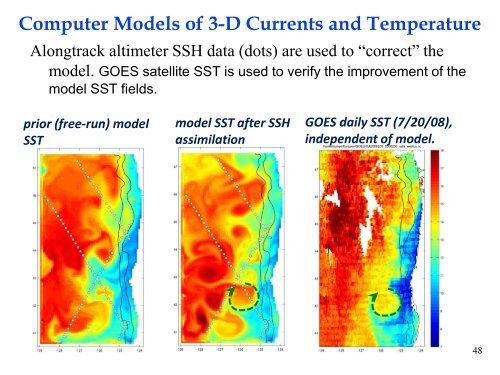
Computer Models of 3-D Currents and TemperatureAlongtrack altimeter SSH data (dots) are used to “correct” themodel. GOES satellite SST is used to verify the improvement of themodel SST fields.prior (free-run) modelSSTmodel SST after SSHassimilationGOES daily SST (7/20/08),independent of model.48


