Syllabus - Bharathidasan University
Syllabus - Bharathidasan University
Syllabus - Bharathidasan University

You also want an ePaper? Increase the reach of your titles
YUMPU automatically turns print PDFs into web optimized ePapers that Google loves.
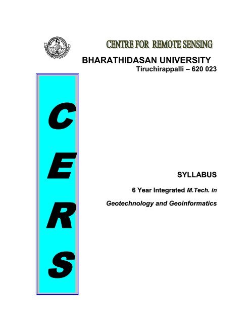
C<br />
E<br />
R<br />
S<br />
BHARATHIDASAN UNIVERSITY<br />
Tiruchirappalli – 620 023<br />
SYLLABUS<br />
6 Year Integrated M.Tech. in<br />
Geotechnology and Geoinformatics
CENTRE FOR REMOTE SENSING<br />
BHARATHIDASAN UNIVERSITY,TIRUCHIRAPPALLI-23<br />
Six Year Integrated Course<br />
M.Tech., GEOTECHNOLOGY AND GEOINFORMATICS ( Regular - 6 year)<br />
MTISC-0206G - INTRODUCTION TO GEOTECHNOLOGY ---- 3credits<br />
1. Earth System Processes: 6hrs<br />
Earth Sciences: Definition, Branches of Earth Sciences, Scope and importance of Earth<br />
Sciences<br />
Earth System Processes: Origin, interior & age of the Earth – Plate tectonics –<br />
Formation of Continents & Oceans – Mountain building activities – origin of rivers –<br />
Physiography of the Earth.<br />
2. Lithology, Structure, Geomorphology: 12hrs<br />
Lithology: Rock forming minerals – Igneous, Sedimentary & Metamorphic Rocks –<br />
Stratigraphy.<br />
Structure: Folds, faults, geotectonics and their significance.<br />
Geomorphology: Various Geomorphic Processes – Regional Geomorphology of India –<br />
Geological Ecosystems.<br />
3. Natural Resources and Disasters: 12hrs<br />
Natural Resources: Mineral Provinces of India and exploration strategies –<br />
Hydrocarbon provinces of India and exploration strategies–Water Resources and<br />
exploration strategies. Soil, Forest & Biomass and Marine resources.<br />
Natural Disasters: Geodynamic Processes and Natural Disasters (Seismicities –<br />
Landslides – Floods – Tsunami – Other Natural Disasters).<br />
4. Remote Sensing Based Mapping: 12hrs<br />
Aerial Remote Sensing – Satellite Remote Sensing Principles – Digital Image<br />
Processing concepts – GPS based mobile mapping principles – Image interpretation<br />
principles for Geotechnology.<br />
5. Geoinformatics: 6hrs
Definition & Concepts – Input Sources (Satellite, Aerial & Ground based) - Computer<br />
based Geospatial data base generation – data modeling on Natural Resources, Eco<br />
Systems & Natural Disasters – Information Systems.<br />
Text Books:<br />
1. Parbin Singh,2008: A text book ofg Engineering & General Geology;, S.K.Katarria &<br />
Sons, New Delhi.<br />
2. Mahapatra, G.B., 2007: A text book of Geology, CBS publishers & distributors, New<br />
Delhi<br />
References:<br />
1.M.S. Krishnan, Geology of India & Burma, Higginbothams (P) Ltd., Chennai. 1968.<br />
2.George Joseph, Fundamentals of Remote Sensing, 2 nd Edition, Cambridge <strong>University</strong><br />
Press. 2005.<br />
3.Arthur Holmes, Principles of Physical geology, Thomas Nelson & Sons, USA 1964.<br />
4.Gokkhale and Rao. Ore deposits of India, Thomson press, New Delhi, 1972.<br />
5.Krishnaswamy, S. India’s mineral resources, Oxford and IBH publishing, New Delhi.<br />
1979.<br />
6.Edwin H. Pascoe, A manual of the Geology of India and Burma, Controller of<br />
Publication, Govt. of India, New Delhi. 1973.<br />
7.Sinha. R.K., A Treatise on Industrial Minerals of India, Allied Publishers Pvt. Ltd.,<br />
Chennai, 1967.<br />
8.Alfred Harker, Petrology for students, <strong>University</strong> Press, Cambridge.<br />
9.Read, H.H. Rutley’s Elements of Mineralogy, Thomas Murby & Co. London. 1947.<br />
10. Alexander N.Winchell, Elements of Optical Mineralogy, Vol.I & II, Wiley Easter<br />
Pvt. Ltd., Publishers New Delhi. 1968.<br />
11. Lillesand, T.M. and Kiefer, P.W, Remote Sensing and Image Interpretation, John<br />
Wiley & Sons, New York. 1986.
12. Burrough, P.A. Principles of Geographical Information Systems for Land<br />
Resources Assessment, Clarandone Press, Oxford. 1986.<br />
13. Frank Press Raymond Siever: Understanding Earth (3 rd ed). W.H. Freeman and<br />
Company. New York . 2000<br />
14. B. J. Skinner and S.C. Porter: The Dynamic Earth – An Introduction to Physical<br />
Geology 3 rd edition. John Wiley & Sons, New York. 1995<br />
15. P. McL. D. Duff : Holme’s Principles of Physical Geology (4 th ed). Chapman & Hall.<br />
London. 1996<br />
MTIGT0301: PHYSICAL GEOLOGY AND GEODYNAMICS ------ 3credits<br />
1. Perspectives of Geology: Branches of Geology – Epigene and Hypergene Geology-<br />
Scientific applications of Geology – Relation of Geology with other Sciences (Physics,<br />
Chemistry, Biology and Social Sciences). 6hrs<br />
2. Solar System and Earth: Solar system - Density and Movement of the Earth –<br />
Gravitational field of Earth – Origin of the Earth and Age of the Earth (various<br />
Hypothesis, concepts and Theories. 6hrs<br />
3. Interior of the Earth: Structure of the Earth Interior (Crust, Mantle and Core) –<br />
Earthquakes (Origin and Effects, Earthquake Belts, Epicenter, Seismograph, Magnitude<br />
Scale) – Volcanoes (Types and Causes, Types of Eruption, Diapirism) – Tectonic<br />
Movements (Isostasy) – Mountain Building Activities. 12hrs<br />
4. Earth Surface Processes-I: River dynamics (Drainage Types and Pattern, Erosion,<br />
Transportation, Deposition) – Coastal dynamics (Types of Coasts, Origin of Coasts,<br />
Coastal Processes) Seas and Oceans and their Geological Activities (Waves, Currents,<br />
Offshore profile, Coastal Erosion – Transportation - Deposition, Marine Deposits,<br />
Submarine Canyon)- Interactive dynamics amongst tectonics, Riverine and<br />
Oceanographic Processess 12hrs<br />
5. Earth Surface Processes-II: Geological actions of Wind, Sand Dunes, Cycle of<br />
Erosion, Transportation and Deposition - Dynamics of Lakes (Origin of lakes, nature<br />
and development of lakes, different types of Lakes, lacustrine deposits) –Underground<br />
water (Origin, type of Groundwater, Solution Caves and Caverns, Geysers ) – Glaciers<br />
and their Geological Actions. 12hrs
Text Books:<br />
1. P.J. Wyllie, The Dynamic Earth, John Wiley and Sons. 1971.<br />
2. J.A. Jacobs, Physics and Geology, R.D. Russel and J.T.Wilson,<br />
3. Duff. P.Mcl.D, Principles of Physical Geology - Holmes, 4 th Ed. Chapman and<br />
Hall, London. 1992<br />
4. Girija Bhushan Mahapatra, A Text Book of Geology, CBS Publishers &<br />
Distributors, 4596/1A, 11 Daryaganj, New Delhi, 1987.<br />
5. Girija Bhushan Mahapatra, Text Book of Physical Geology, CBS Publishers &<br />
References:<br />
Distributors, 4596/1A, 11 Daryaganj, New Delhi, 1994<br />
1. International Series in the Earth Sciences, Mc Graw Hill Book Co., 1959.<br />
2. B.F. Windley, The Evolving Continents, John Wiley & Sons, 1978.<br />
3. Allen Cox, Plate Tectonics, Freeman and Company, 1973.<br />
4. Porters and Skinner - Principles of Geology, Printice Hall,<br />
5. Marie Morisawa, Rivers Forms and Process, Geomorphology Texts, Longman<br />
Group Limited, 1985.<br />
6. Jauhari V.P., Sustaining River Linking, A Mittal Publications, A-110, Mohan<br />
Garden, New Delhi, 2005.<br />
7. Carter R.W.G, Coastal Environments, An Introduction to the Physical, Ecological<br />
and Cultural Systems of Coaslines, Academic Press Limited, 1988.<br />
8. Lecture Notes - Remote Sensing Applications in Coastal Geomorphology and<br />
Coastal zone Resources, January 3-30, 1991, Sponsored by <strong>University</strong> Grants<br />
Commission, 1991.<br />
9. David H.K. Amiran and Andrew W. Wilson, Coastal Deserts - Their Natural and<br />
Human Environments, The <strong>University</strong> of Arizona Press, Tucson, Arizona, 1973.<br />
10. Ramachandra T.V., Rajasekara Murthy C., and Ahalya N.Restoration of Lakes and<br />
Wetlands, Allied Publishers (P) Limited,751, Anna Salai, Chennai, 2002.
MTIGT0302: SURVEYING AND CARTOGRAPHY ------- 2credits<br />
1. Surveying: Chain survey - Plane Table Survey - Surveying with Theodolite -<br />
Electronic Survey. 6hrs<br />
2. GPS Basics: Introduction – Satellite, Control and User Segments – Signal<br />
Components – Errors in GPS observations – GPS positioning – Differential GPS.<br />
GPS Mapping: Conventional – Static – Kinematic – Semi kinematic (Stop &Go) -<br />
Rapid static Mobile mapping. 6hrs<br />
3. Introduction to Cartography: Definition - Nature of Cartography - History -<br />
Cartographic problems. Cartographic Characters: Scales & their functions - Directions<br />
& Co-ordinates & their functions - Geographic Co-ordinates - Physiography -<br />
Features in Toposheets (Spot height, Triangulation points, relative heights, contours,<br />
streams, cultural features) Types of Map. 6hrs<br />
4. Map Projection: Types of Map projections - Conical, Polyconic, Cylindrical, Equal<br />
area or Lamberts cylindrical, Mercators, zenithal, Gnomonic projections for world map,<br />
Continental map - Recent projections.<br />
Map compilation: Map Design & Layout - Lettering & Toponomy - Mechanics of<br />
map construction. 6hrs<br />
5. Computer Assisted Cartography: Input data types (point, line, polygon and Raster<br />
data) - Data source (Toposheet, Aerial Photo,} Input devices – (Magnifier, Stereoscope,<br />
Video Camera, Digitiser board, Scanners) - Modelling Devices (Computer, Photo<br />
writer, Plotter) - Cartographic processes (Contouring, Density slicing, 3D Projection,<br />
Area Calculation, Volume Estimation) - Storage Devices - Output devices - Special<br />
Merits of Digital Cartography. 8hrs
Text Books:<br />
1. Lahee, F.H, Field Geology, Sixth Edition, CBS Publishers & Distributors, Delhi,<br />
1987.<br />
2. Mishra R.P and Ramesh A, Fundamentals of Cartography, Concept publishing<br />
company, New Delhi, 1989.<br />
3. Punmia B.C., Ashok Kumar Jain and Arun Kumar Jain, Surveying (Volume I, II<br />
References:<br />
& III) 5 th Edition (Through revised & Enlarged), Lakshmi Publications (P) Ltd.,<br />
113, Golden House, New Delhi – 110 002, 2005.<br />
1. Teunissen, P.J.G. and Kleusberg, A, (Eds.) GPS for Geodesy, Springer Verlag,<br />
Germany, 1998.<br />
2. Gunter Seeber: Satellite Geodesy- Foundations, Methods and Applications, Walter<br />
de Gruyter, Berlin, New York 1993.<br />
3. Arogyasamy, R.N.P. Courses in Mining Geology, Oxford & IBH Publishing Co.,<br />
Pvt. Ltd., New Delhi, 4 th Edition.<br />
4. Campbell, J, Introductory Cartography, Printers Hall Englewood Cliffs, N,J, 1984.<br />
5. Robinson A.H., Morrison J.L., Mucehreke P.C., and Kummer A.J. Elements of<br />
Cartography, John Weily & Sons, 6th Edition. 1995.<br />
6. Elliott D. Kaplan, Christopher J. Hegarty, Understanding GPS Principles and<br />
Applications, Artech House Inc., 685 Canton Street, Norwood, MA 02062, Second<br />
Edition, 2006.<br />
7. Jeff Thurston and Thomas K. Poiker, Integrated Geospatial Technologies, A Guide<br />
to GPS, GIS and Data Logging, John Wiley 7& Sons, Inc., Hoboken, New Jersey,<br />
2003.<br />
8. Teunissen P.J.D and Kleusberg A., GPS for Geodesy, Springer, 2nd Edition, 1998.
Surveying:<br />
PRACTICALS: SURVEYING & CARTOGRAPHY ----- 1credit<br />
1. Chain survey - Plane Table Survey - Surveying with Theodolite - Electronic Survey.<br />
2. GPS Mapping: Conventional – Static – Kinematic – Semi kinematic (Stop &Go)-<br />
12hrs<br />
Rapid static, Mobile mapping. 4hrs<br />
Cartography:<br />
1. Preparation of Simple Vector Map 3hrs<br />
2. Preparation of Contours 3hrs<br />
3. Preparation of Planimetrically controlled thematic Map 3hrs<br />
4. Toposheet reading 3hrs<br />
5. Preparation of Cross sections 2hrs<br />
6. Preparation of 3D block diagrams 2hrs
MTIGT0303: AERIAL REMOTE SENSING & PHOTOGRAMMETRY -- 4credits<br />
1. Aerial Photography: History - Types of Photographs - Scale of Photographs, (Scale in<br />
Vertical & Tilted Photographs, Average Photo scale) - Relief displacement - Tilt<br />
displacement - Scale distortions - Radiometric characters. 12 Hrs.<br />
2. Stereo Models : Monoscopy - Stereoscopy - Pseudoscopy - Base height Ratio -Vertical<br />
Exaggeration - Stereoscopic Parallax & Height measurement - Analog Photogrametric<br />
Techniques. Photo Mosaics: Photo indexing - Photo mosaic (uncontrolled, semi<br />
controlled & Controlled mosaics) – Flight planning – Aerial triangulation.<br />
16 Hrs.<br />
3. Digital Photogrammetry I: Data sources and input processes (Digital Cameras,<br />
Operation principles, Scanners for analog to digital conversion) - Digital<br />
Photogrammetric techniques & processes (Digital Photogrammetric equipment, Stereo<br />
viewing, image measurements, co-ordinate systems, image transformation, image<br />
orientation) 16 Hrs.<br />
4. Digital Photogrammetry II : Ortho Photo – Rectification – DEM- ALTM –<br />
LIDAR – SRTM, Cartosat. 10 Hrs.<br />
5. Photo Interpretation Keys & Elements: Photo Interpretation Keys<br />
(Definition, its parts, Key sets, Types of Study) - Photo Interpretation Elements (Photo<br />
elements - Tone, Texture, Color, Shadow) - Geotechnical / Geomorphic elements<br />
(Landforms, Drainage, Erosional pattern, vegetative cover, Landuse, Shape & size of<br />
objects). 10 Hrs.
Text Books:<br />
1. Wolf, P.R. Elements of Photogrammetry Mcgraw Hill Book Co., Tokyo. 1974.<br />
2. Moffit H.F. And Edward, M.M, Photogrammetry, 3rd Edition, Harper and Row<br />
Publishers, New York. 1980.<br />
3. Bhatt. A.B., Aerial Photography & Remote Sensing (An Introduction), Bishen<br />
Singh& Mahendra Pal Singh Pub., 1994.<br />
4. Rampal, Handbook of Aerial Photography and Interpretation, Concept publishing.<br />
1999.<br />
References:<br />
1. American Society of Photogrammetry, Manual of Remote Sensing (II Edition), ASP,<br />
Falls Church, Virginia. 1983.<br />
2. Burnside, C.D., Mapping From Aerial Photographs, Collins Publishers. 1985.<br />
3. John, T.Smith Jr, Manual of Colour Aerial Photography (I Edition) American Society<br />
of Photogrammetry, ASP Falls Church, Virginia, 1968.<br />
4. Colwell, Robert, Manual of Photographic Interpretation, American Society Of<br />
Photogrammetry, ASP Falls Church, Virginia. 1960.<br />
5. David Paine. Aerial Photography and Image Interpretation for Resource<br />
Management, John Wiley & Sons, New York. 2003.<br />
6. Yves Egels; Digital Photogrammetry, Tailor & Francis Inc. 2002.<br />
7. Yongru Huang A, Digital Photogrammetry system for Industrial Monitoring<br />
8. George Joseph, Fundamentals of Remote Sensing, Cambridge <strong>University</strong> Press,<br />
2nd Edition.<br />
9. Shiv N. Pandey, Principles and Applications of Photogeology, Wiley Eastern<br />
Limited, India.1987.<br />
10. Michel Kasser and Yves Egels, Digital Photogrammetry, Taylor & Francis Inc., 2002.
MTIGT0304: SATELLITE REMOTE SENSING ------ 4credits<br />
1. Principles of Remote Sensing: Definition - History & Concepts - Electromagnetic<br />
Radiation (Source, Mode of Energy transfer, Radiation Principles, Black b ody<br />
radiation). 10 Hrs.<br />
2. Electro Magnetic Radiation (EMR): EMR Spectrum - EMR Interaction with<br />
Atmosphere (Absorption, Scattering & Atmospheric windows) - EMR Interaction with<br />
Earth surface (Absorption & reflection ) - Spectral Response pattern - Energy<br />
budgeting in Remote Sensing. 10 Hrs.<br />
3. Sensors and Platforms: Resolutions (Spectral, Spatial, Temporal, Radiometric) -<br />
Platforms - Sensors - Scanning & Orbiting Mechanism of Satellites and Data<br />
Acquisition. Optical Remote Sensing: Basic concepts – Optical sensors and scanners.<br />
12 Hrs.<br />
4. Thermal & Microwave Remote Sensing: Thermal Remote Sensing :Basic concepts -<br />
Thermal sensors & scanners - Thermal Inertia. Microwave Remote Sensing: Basic<br />
concepts - Microwave sensors and Radiometers - Geometric characters -<br />
Radargrammetry ( SLAR / SAR) - LIDAR – Hyper spectral Remote Sensing: basic<br />
concepts. 20 Hrs.<br />
5. Remote Sensing Satellites ( LANDSAT Series - IRS Series - IRS-P series – Cartosat -<br />
Spot Series - ASTER, MODIS – IKONOS – QUICKBIRD - ORBVIEW – ERS) -<br />
Meteorological Satellites – Shuttle Mission – Developments of Remote Sensing in<br />
India - Future Remote Sensing Missions). 12 Hrs.<br />
Text Books:<br />
1. Lillesand, T.M. And P.W.Kiefer, Remote Sensing and Image Interpretation, John<br />
Wiley & Sons, New York. Third Edition, 2007.<br />
2. Curran, P. Principles of Remote Sensing, Longman, London. 1985.<br />
3. Sabins, F.F.Jr., Remote Sensing Principles and Interpretation, Freeman,<br />
Sanfrancisco. 1978.
References:<br />
1. American Society of Photogrammetry, Manual of Remote Sensing, ASP Falls<br />
Church, Virginia. 2nd Volume, 1983.<br />
2. Lo.C.P. Applied Remote Sensing, Longman, London. 1986.<br />
3. Richadson, B.F.Jr. (Ed), Introduction to Remote Sensing of the Environmen t,<br />
Kendall / Hunt, Dubuque, Iowa. 1978.<br />
4. Burney, S.S, Application of Thermal Imaging, Adam Hilger Publications, 1988.<br />
5. Drury S.A, A Guide to Remote Sensing - Interpreting Images of Earth, Oxford<br />
Science Publications, Oxford. 1990.<br />
6. Floyd M. Henderson, Principles & Applications of Imaging Radar, John Wiley &<br />
Sons, New York. 1998.<br />
7. Duda, R.D and P.E.Hart Pattern Classification And Scene Analysis, Wiley<br />
Interscience, New York. 1972.<br />
8. Jensen, J.R Introductory Digital Image Processing: A Remote Sensing Perspective,<br />
Prentice-Hall, New York. 1986.<br />
9. Pratt, S.K. Digital Image Processing, Wiley - Inter Science, New York. 1978.<br />
10. Schowengerdt, R.A Techniques For Image Processing And Classification In<br />
Remote Sensing, Academic Press, New York. 1983.<br />
11. Nilblack, W An Introduction To Digital Image Processing, III Edition, Prentice Hall<br />
International. 1986.<br />
12. Jain AK Fundamentals of Digital Image Processing, Prentice Hall, N.J1989.<br />
13. Hord M.P, Digital Image Processing or Remotely Sensed Data, Academic Press.<br />
1982.<br />
14. Wilson,W.J, Principles of Artificial Intelligence, Springier Verlag, Berlin,<br />
Heidelberg. 1980.<br />
15. Nag P. & M. Kudrat, Digital Remote Sensing, Concept Publishing Co., New Delhi,<br />
1998.<br />
16. Paul Mather, Computer Processing of Remotely-Sensed Images An Introduction,<br />
Third Edition, John Wiley & Sons, Chichester, West Sussex. 2004..
MTIGT0305: PRACTICAL - AERIAL AND SATELLITE REMOTE SENSING<br />
2credits<br />
1. Stereo vision Test and Anatomy of Pocket, Prism & Mirror Stereoscopes. 6 Hrs.<br />
2. Decoding, Marking & Transfer of Principal Points, Base line drawing, Flight line<br />
marking, 3D Observation, Tracing details, Transfer the details to base map.<br />
6 Hrs.<br />
3. Determination of scales of Aerial Photographs. 6 Hrs.<br />
4. Height and Slope measurements. 12 Hrs.<br />
5. Interpretation of Aerial Photographs (Stereo vision). 6 Hrs.<br />
6. Study of Various Visual Remote Sensing Equipments. 6 Hrs.<br />
7. Decoding of Different Satellite data. 4 Hrs.<br />
8. Interpretation of Black & White and False colour Multi Band Imagery. 6 Hrs.<br />
9. Interpretation of Thermal & Microwave Imagery. 6 Hrs.<br />
10. Transfer of Information from Imagery to Base Map. 6 Hrs.
MTIGT0306: CRYSTALLOGRAPHY AND MINERALOGY 4 credits<br />
1. Elements of Crystallography: Crystalline and Amorphous forms - Symmetry and<br />
Classification of Crystals - System of Crystal Notation - (Weiss and Millerian) - Forms<br />
and Habits. Crystal Systems ( Isometric, Tetragonal, Hexagonal, Orthorhombic,<br />
Monoclinic, Triclinic, Twinning-crystalline Aggregates – Columnar, Fibrous, Lamellar,<br />
Granular - Imitative shapes and Psudomorphism. 12 Hrs.<br />
2. Crystal Properties: Space Symmetry Elements- Translation – Rotation- Reflection -<br />
Inversion Screw and Glide-point groups and Crystal classes - Derivation of 32 Crystal<br />
classes based on Schoenfiles notation - Bravies lattices and their Derivation - An<br />
outline of Space Groups. X-ray Crystallography. 12 Hrs.<br />
3. Physical Mineralogy: Physical Properties: (Colour – Structure – Form – Luster -<br />
Transparency – Streak – Hardness – Specific Gravity – Tenacity – Feel – Taste –<br />
Odour) - Electrical, Magnetic and Thermal properties-Determination of Specific<br />
Gravity (Jolly’s spring balance, Walker’s steel yard, Pynometer methods) - Empirical<br />
and Structural formula of minerals – Isomorphism, Polymorphism and Psudomorphism<br />
- Atomic substitution and Solid solution in minerals - Non Crystalline minerals -<br />
Fluorescence in minerals - Metamict state. 16 Hrs.<br />
4. Optical Mineralogy: Optical Properties (Colour – Form – Cleavage - Refractive Index<br />
- Relief – Alteration – Inclusions – Zoning – Pleochroism – Extinction - Polarization<br />
colours – Birefringence) – Twinning - Optic sign (Uniaxial and biaxial) - Interference<br />
figures - Primary and Secondary Optic axes - Optic axial angle measurements – Optic<br />
Orientation – Dispersion in Crystals - Optic anomalies 12 Hrs.<br />
5. Mineral Groups: Ortho and Ring Silicates (Olivine group - Garnet group). Alumino<br />
silicates (Epidote group - Zircon – Staurolite – Beryl - Cordierite and Tourmaline).<br />
Sheet Silicates (Mica group - Chlorite group and Clay minerals) - Chain Silicates<br />
(Pyroxene group - Amphibole group and Wollastonite). Frame work Silicates (Quartz -<br />
Feldspar - Feldspathoid - Zeolite and Scapolite groups) - Non-silicate (Spinel group,<br />
Carbonates and Phosphates). 12 Hrs.
Text Books:<br />
1. Dana, E.S, A Text Book of Mineralogy, Wiley Eastern, 1955.<br />
2. Flint, Y, Basic Crystallography, Mid Publishers, 1970.<br />
3. Phillips, F.C. Longman, An Introduction to Crystallography, 1956.<br />
4. Bloss.F.B., Crystallography and crystal New york 1971<br />
References:<br />
1. Berry Mason, L.G, Mineralogy, W.H. Freeman & co - 1961.<br />
2. D. Perkins, (2002), Mineralogy, 2 nd Edition, Pearson Education (Singapore) Pte. Ltd, Delhi,<br />
483pp, ISBN 81-7808-831-2<br />
3. W. D. Nesse, (2000), Introduction to Mineralogy, Oxford <strong>University</strong> Press, ISBN 0 -19-<br />
510691-1<br />
4. Naidu, P.R.J,. Optical Crystallography.<br />
5. Wahlstrom, E.F, Optical Crystallography, John wiley, 1960.<br />
6. Azaroff, L.V, Elements of X-ray Crystallography, 1968.<br />
7. Deer, W.A, Howie, R.A and J.Zussman, Longmans An Introduction to the Rock<br />
Forming Minerals, 1966.<br />
8. Alexander N.Winchell, Elements of Optical Mineralogy, Part I and II, Wiley<br />
Eastern (p) Ltd, 1968.<br />
9. Ernest, E.Walhstrom, Optical Crystallography, John Wiley & Sons.1960.<br />
10. Kerr B.F, Optical Mineralogy. Mc Graw Hill, 5 th Edition, New York-1995.<br />
11. Mitra, S, Fundamentals of Optical Spectroscopic and X-ray Mineralogy.
MTIGT0307: PRACTICAL – CRYSTALLOGRAPHY AND MINERALOGY<br />
2credits<br />
1. Crystal models of type minerals in each class of systems - Crystal Projections,<br />
Stereographic projections and calculation of crystal elements. 12 Hrs.<br />
2. Megascopic identification of Quartz, Feldspar, Feldspathoid, Pyroxene, Amphibole<br />
groups – Identification of important Silicates: Tourmaline, Topaz, Beryl, Zircon,<br />
Rutile, Apatite, Calcite, Gypsum. Metamorphic Minerals: Garnet, Cordierite, Kyanite,<br />
Sillimanite, Andalusite, Sphene, Staurolite, Chondrodite. 12 Hrs.<br />
3. Microscopic study of Quartz, Feldspar, Feldspathoid, Pyroxene, Amphibole groups –<br />
Identification of important Silicates: Tourmaline, Topaz, Beryl, Zircon, Rutile, Apatite,<br />
Calcite, Gypsum. Metamorphic Minerals: Garnet, Cordierite, Kyanite, Sillimanite,<br />
Andalusite, Sphene, Staurolite, Chondrite - Calculation of Molecular and Structural<br />
formulae of some important minerals 16 Hrs.<br />
4. Determination of cell dimensions and identification of minerals from X-ray<br />
diffractogram - Separation of minerals by different methods - Identification of minerals<br />
through Chemical analysis 12 Hrs.<br />
5. Determination of Optical properties of Minerals by Classical methods - Birefringence<br />
of minerals-using Break compensator - Pleochroic scheme-2V by Mallards method -<br />
Determination of Orientation of Plagioclase in thin section and its An content from<br />
Extinction angle measurements - Optic signs of Uniaxial and Biaxial minerals.<br />
12 Hrs.
MTIGT0308: PALAEONTOLOGY 3 credits<br />
1. Introduction: Definition of Palaeontology- Animal Habits - Fossils and their modes of<br />
Preservation- (Petrification, Permineralisation, Carbonisation, Recrystallisation,<br />
Silicification – Moulds – Casts – Tracts – Trails, etc) - Uses of Fossils- (Indicators of<br />
Stratigraphy, Climate, Palaeogeography – Evolution and Migration of life forms-<br />
Indicators of Coal and Petroleum deposits - Life through Ages). 9 Hrs.<br />
2. Invertebrate Palaeontology: Morphology - Characters - Structural changes -<br />
Evolutionary Trends, Stratigraphic importance and application of Trilobites -<br />
Graptolites – Corals – Echinoderms – Brachiopods - Cephalopods.<br />
10 Hrs.<br />
3. Vertebrate Palaeontology: Classification of Vertebrates - Principal groups of<br />
Vertebrates – Ostracoderms – Acanthodians – Placoderms - Devonian fishes- (Sharks,<br />
Chondichthyes and Bony fishes) Mesozoic reptiles- (Primitive and Thecodonts) -<br />
Dinosaurs and their Classification – Bird Fossils - Evolutionary History of Horse –<br />
Elephant - Man. 10 Hrs.<br />
4. Micropalaeontology: Definition of Micropalaeontology - Types of Microfossils<br />
(Foraminifers, Ostrocods) Morphological Characters - Classification - Evolutionary<br />
trends and distribution - Ecology and Palaeoecology - Application of<br />
Micropalaeontology in Environmental interpretation and Petroleum Geology - Field<br />
and Laboratory Techniques of sampling and separation of microfossils. 10 Hrs.<br />
5. Plant Fossils and Palaeobotany: Fossilization of Plants (Compression-Modes – Casts<br />
– Impressions – Petrifaction - Sources of Plant Fossils) – Classification - Geological<br />
Distribution and Characteristics of various Plant Fossils – (Thallaphyta: Algal,<br />
Bacteria, Fungi; Ryophyta: Moss; Psilophyta: Psilotum; Lycopodiophyta: Lycopodium,<br />
Selaginella, Lepidoderition - Sigillaria Equisetophyta: Calamites; Pteridospermae:<br />
seedforms Gymnosperm: Angiosperm - Palynology: Spores and Pollen Grains, their<br />
Fossilization and Source of Fossils. ) 9 Hrs.
Text Books:<br />
1. Woods, H., Invertebrate Palaeontology, 1959.<br />
2. Agashe S.N, Palaeobotony, Oxford IBH, 1995.<br />
3. Carroll, E., Freeman, Vertebrate Palaeontology, 1988.<br />
4. Shrock,R.R and Twenhofel,W.H. 1987. Principles of Invertebrate Paleontology.<br />
McGraw Hill, New York.<br />
5. Jain, P.C and Anantharaman, M.S., 2005. Palaeontology : Evolution and Animal<br />
Distribution. (6 th edition), Vishal Publishing Co, New Delhi<br />
6. Moore,R.C, Lalicker, C.G & Fisher, A.G (1997). Invertebrate fossils.<br />
References:<br />
(1 st Indian edition), CBS Publishers & Distributors, New Delhi.<br />
1. Palaeobotany , Arnold, C.A. AnInt, to, PHI, 1950.<br />
2. Invertebrate Palaeontology and Evolution - Clarksm, ENK., ELBS, 1985.<br />
3. Colbert, E.N., The Evolution of Vertebrates,1955.<br />
4. Kummel, B, History of the Earth, Eurasia, Pub- 1968.<br />
5. Moore, R.C. et.al, Fossil Invertebrates, 1952.<br />
6. Raup and Stanely, Principles of Palaeontology, CBS, 1985.<br />
7. Romer, A.S., Vertebrate Palaeontology, Chicago <strong>University</strong>, 1960.<br />
8. Shrock, R.R. and Twenhotel W.H., Principles of Invertebrates, 1953.<br />
9. Swineston, H.H., Outlines of Palaeontology, PHI, 1950
MTIGT0401: DIGITAL IMAGE PROCESSING ------- 4credits<br />
1. Principles of Image Processing: Digital Image formats - Image Processing systems -<br />
Raster & Vector files. 6 Hrs.<br />
2. Image Rectification & Restoration: Geometric Errors (Sources of Errors, Correction<br />
Processes) - Radiometric errors (Sources of errors, correction processes). 16 Hrs.<br />
3. Image Enhancement: Single Band Enhancement (Image reduction & Magnification,<br />
Contrast Stretching, Filtering & edge enhancement) - Multiband Enhancement (Band<br />
ratioing, colour composites generation, Principal Component Analysis, NDVI)<br />
16 Hrs.<br />
4. Image Classification: Pattern Recognition - Supervised classification – Unsupervised<br />
classification - Sub pixel classification - Classification accuracy assessment. 16 Hrs.<br />
5. Multi Mode Image Analysis: Image Registration - Differencing & Ratioing –<br />
Multisensor & Multimode data fusion. 10 Hrs.<br />
Text Books :<br />
1. Lillisand, T.M. and Kiefer, P.W, Remote Sensing and Image Interpretation, John<br />
Wiley & Sons, New York. 1986.<br />
2. Curran, P. Principles of Remote Sensing, Longman, London. 1985.<br />
3. William K.Pratt, Digital Image Processing, John Wiley & Sons, Inc., Third Edition,<br />
2003.<br />
References :<br />
1. American Society of Photogrammetry, Manual of Remote Sensing, ASP Falls<br />
Church, Virginia, 2nd Volume, 1983.<br />
2. Lo.C.P, Applied Remote Sensing, Longman, London, 1986.<br />
3. Richadson, B.F.Jr. (Ed), Introduction to Remote Sensing of the Environment, Kendall<br />
/ Hunt, Dubuque, Iowa. 1978.<br />
4. Paul J. Gibson and Clara H. Power, Introductory Remote Sensing, Digital Image<br />
Processing and Applications, Routledge, 2000.<br />
5. John A. Richards and Xiuping Jia, Remote Sensing Digital Image Analysis An<br />
Introduction, Springer-Verlag Berlin Heidelberg, Fourth Edition, 2006.
MTIGT0402: PRACTICAL - DIGITAL IMAGE PROCESSING ------- 2credits<br />
1. Generation of Histogram, cumulative frequency curve.<br />
6 Hrs.<br />
2. Generation of Linearly stretched & non linearly stretched images using calculator<br />
6 Hrs.<br />
3. Generation of Filtered, Ratioed & Normalised ratioed Images using calculators<br />
4. Generation of PC1 PC2 and PC3 using Statistical software.<br />
5. Image Processing of Test Window – various combinations of FCC<br />
6. Image Processing of Test Window – Linear, Non linear stretching.<br />
9 Hrs.<br />
6 Hrs.<br />
6 Hrs.<br />
6 Hrs.<br />
7. Image Processing of Test Window – Filtering, Ratioing and Normalised Ratioing<br />
6 Hrs.<br />
8. Image Processing of Test Window – PC, NDVI analysis<br />
9. Image Processing of Test Window – Image Classification Techniques<br />
10. Image Processing of Test Window – Image fusion Techniques<br />
6 Hrs.<br />
6 Hrs.<br />
6 Hrs.
MTIGT0403: IGNEOUS & METAMORPHIC PETROLOGY<br />
4 credits<br />
1. Forms and Structures of Igneous rocks - Intrusives and their relation to Geological<br />
Structures (Concordant and Discordant forms - Multiple Intrusions - Composite<br />
Intrusions) - Composition and Constitution of Magmas - Structure and Texture of<br />
Igneous Rocks- Formation of Igneous rocks: Crystallization of Unicomponent Magma -<br />
Phase Equilibria studies of Binary and Ternary Silicate system - Crystallisation of<br />
Basaltic magma. 12 Hrs.<br />
2. Classification of Igneous rocks – Microtextures and Structures of Igneous rocks and<br />
their Petrogenetic Significance - Petrography of Igneous rocks – Tabular Classification<br />
- Petrography of Acid-Intermediate - Basic and Ultrabasic rocks - Diversity of Igneous<br />
rocks - Reaction Principle - Magmatic Crystallization – Assimilation - Petrographic<br />
province and various diagrams - Plate Tectonics and Magmatic Evolution - Fluid<br />
Inclusion studies of Igneous rocks. Evolution of Basalts -Petrogenesis of<br />
Granites, Pegmatities, Alkaline rocks, Monomineralic rocks, Charnockites and<br />
Ultramafics. 14 Hrs.<br />
3. Definition of Metamorphism - Scope of Metamorphism – Controlling factors of<br />
Metamorphism - Kinds of Metamorphism and its Products - Classification and<br />
Nomenclature - Petrography of Metamorphic rocks (Schists – Gneisses – Granulites) -<br />
Metamorphic textures and Microstructures and their relation to Metamorphic<br />
conditions. 12 Hrs.<br />
4. Mineral Paragenesis of Metamorphic rocks - Stability of Metamorphic minerals -Stress<br />
and Antistress minerals - Mineralogical phase rule – Zones - Grades and Facies<br />
concepts of Metamorphism - Facies changes - Graphical representation of facies -<br />
Metamorphic differentiation - Metamorphism in relation to Magma and Plate<br />
Tectonics / Orogeny - Granitization to migmatites – Anatexis - Determination of age of<br />
Metamorphic rocks -Petrogenesis of Amphibolites - Charnockites and layered<br />
Gneisses. 14 Hrs.
5. Mineral and Rock Spectra: Spectral properties of Minerals and Rocks – influence of<br />
Physical & Chemical Properties of Minerals properties of Minerals and Rocks, over<br />
reflectance spectra. Mapping of Igneous & Metamorphic rocks: Its expression in field –<br />
Its expression in Aerial and Raw Satellite images – Mapping through processing of<br />
digital images. 12Hrs.<br />
Text Books:<br />
1. Tyrell, G.W, Petrology, - Methuren and Co, Students edition, 1989.<br />
2. Turner, F.J. and Verhoogen, J., Igneous and Metamorphic Petrology - Mc Graw<br />
Hill Book co., 1960.<br />
3. Best, M.G., Igneous Petrology, CBS- 1986.<br />
4. Turner, F.J. & Verhoogen, J., Igneous and Metamorphic Petrology, Mc Graw Hill<br />
Book co, 1960.<br />
5. Turner F.J., Metamorphic Petrology, Mc Graw Hill, 1980.<br />
6. Tyrell, G.W., Petrology, Methuren and Co., (Students ed.), 1989.<br />
7. Yardley, BN .An Introduction to Metamorphic Petrology - W. Longman, New York<br />
-1989<br />
References:<br />
1. Philipotts, A Igneous and Metamorphic Petrology,. Prentice Hall -(1992)<br />
2. Bose, M.K., Igneous Petrology, World Press, 1997.<br />
3. Daniel, Barker, S., Igneous Rocks - Prentice Hall, Englewood Cliffs, New Jersey-<br />
1983.<br />
4. Williams, H, Turner, F.J. and Ghilbert, C.M., Petrography, W.H. Freeman and Co-<br />
1954.<br />
5. Paul C.Hess, Origin of Igneous Rocks, Harvard <strong>University</strong> press, Cambridge<br />
London, England -1989.<br />
6. Anthony Hall, Igneous Petrology, ELBS Publishers, 1987.
7. Donald W.Hyndman., Petrology of Igneous and Metamorphic Rocks, McGraw Hill<br />
Book co., 1968.<br />
8. Wahlstrom, E.E., Theoretical Igneous Petrology, John Wiley and Sons, 1961.<br />
9. Nockolds, S.R., Knox, R.W.O.B., Chinner, G.A., Petrology for Students,<br />
Cambridge <strong>University</strong> Press, 1979.<br />
10. E.Ranguin, Geology of Granites, Inter science Publishers, 1966.<br />
11. Hess, H.H, and Poldervaart, A., Basalts, Vol. I and II, ed, -1967.<br />
12. Mehnert, K.R Migmatites and the Origin of Granitic Rocks, Elsevier Pub. Co. 1968.<br />
13. Butcher, K. and Frey, M., Petrogenesis of Metamorphic Rocks, Springer Verlag,<br />
(1994).<br />
14. Kretz.R., Metamorphic Crystallization, John and Co., 1994.<br />
15. Bhaskar Rao, Metamorphic Petrology, International Book House, Second Ed.12,<br />
U.B.Bangalow Road, New Delhi -1986<br />
16. Philipotts, A Igneous and Metamorphic Petrology . Prentice Hall -(1992)<br />
17. Barth, T.F.W., Theoretical Petrology, John & Wiley and sons, Principles of<br />
Petrology, 1962.<br />
18. Williams, H, Turner, F.J and Ghilbert C.M., Petrography, W.H. Freeman and Co,<br />
1954.<br />
19. Nockolds, S.R. Knox, R.W.O.B. and Chinner, G.A., Petrology for Students,<br />
Cambridge <strong>University</strong> Press, 1979.<br />
20. Wernest G.Ehlers and Harvey Blatt, Igneous, Sedimentary and Metamorphic<br />
Rocks, CBS Publishers and Distributors, New Delhi, 1987.<br />
21. The Study of Rocks in Thin Sections - W.W. Moorhouse, Harper and sons - 1969.<br />
22. Donald W. Hyndman, Petrology of Igneous and Metamorphic Rocks, McGraw Hill<br />
Book co, 1968.<br />
23. Mehnert, K.R., Migmatites and the Origin of Granitic Rocks, Elsevier Pub. Co.,<br />
1968.
MTIGT0404: PRACTICAL -IGNEOUS & METAMORPHIC PETROLOGY<br />
2credits<br />
1. Megascopic identification of Igneous and Metamorphic rocks. 6 Hrs.<br />
2. Microscopic identification of Rock Fabrics, Mineral assemblages of Igneous and<br />
Metamorphic rocks. 9 Hrs.<br />
3. Calculation of C.I.P.W. Norm, Niggli values, variation diagrams: Binary- Harker,<br />
Niggli; Ternary variation diagrams. ACF, AKF and AFM diagrams. REE<br />
distribution patterns and petrogenetic significance of rocks. 12 Hrs.<br />
4. Modal analysis of rocks by point counter-Semi quantitative estimation of chemical<br />
composition of rocks, interpretation. 12 Hrs.<br />
5. Interpretation of Igneous Rocks through Aerial Photographs. 10 Hrs.<br />
6. Interpretation of Igneous Rocks using Raw Satellite Images 3 Hrs.<br />
7. Interpretation of Igneous Rocks using Digital Satellite Images. 3 Hrs.<br />
8. Interpretation of Metamorphic rocks using Aerial Photographs. 3 Hrs.<br />
9. Interpretation of Metamorphic rocks using Raw Satellite data 3 Hrs.<br />
10. Interpretation of Metamorphic rocks using Digital Satellite Image 3 Hrs.
MTIGT0405: SEDIMENTARY PETROLOGY<br />
4 credits<br />
1. Sedimentary Rocks: Weathering and Sedimentary Cycle - Physical properties of<br />
particles- (Surface texture - Particle size of shape, Sphericity and roundness - Mass<br />
properties of Sedimentary particles) - Mineral Stability and their Significance -<br />
Porosity and Permeability 10 Hrs.<br />
2. Nature and Origin of Sedimentary Rocks: Broad Classification and<br />
Composition of Sedimentary rocks – Textures, Structures and their<br />
Environmental Significance - Petrography of Clastic and Nonclastic rocks-<br />
Mineralogy and Chemical composition of Siliceous, Iron bearing rocks -<br />
Phosphorites and Evaporites - Nodules and Diagenetic Seggregates - Folk<br />
and Dunham’s Classification - Lithification and Diagenesis. 12 Hrs.<br />
3. Transportation and Sedimentation: Aquatic, Aeolian process - Glacial and<br />
Gravitational processes –Grain size analysis of sediments - Graphical representation<br />
and their Geological significane - Heavy minerals and provenance - Palaeocurrent<br />
analysis (Collection of palaeocurrent data, Pr esentation and interpretation of<br />
palaeocurrent data) - Sedimentary facies. 16 Hrs.<br />
4. Environment of Deposition: Nonmarine, Transitional and Marine<br />
Environments - Products of Environment - Subsurface Environments -<br />
Subsurface pressure – Temperature – Fluids and Fluid flow in sedimentary<br />
basins- Sedimentology. Evolution of Sedimentary Basins: Tectonism and evolution<br />
of basins, Origin of Petroleum and Gas and Metallogeny - Sedimentary Models<br />
(Concepts and Laws), Geophysical models and Tectonic theory. 16 Hrs.<br />
5. Mapping of Sedimentary Rocks: Expression in the field – Expressions in Aerial<br />
Photographs – Expression in raw satellite images – Mapping of sedimentary rocks –<br />
using digitally processed images. 10 Hrs.
Text Books:<br />
1. Pettijohn, F.J. Sedimentary Rocks, Harper & Bros. 3 rd Ed. 1995.<br />
2. Hatch F.H., Rastall R.H., Petrology of Sedimentary Rocks, Murby & co., 1941,<br />
3. Krumbein W.C.and Pettijohn F.J., Manual of Sedimentary Petrology, 1938<br />
References:<br />
1. Friedman, G.M. Sanders, Principles of Sedimentalogy, E.J.John Wiley and sons,<br />
New York. 1978.<br />
2. Allen J.R.L. Principles of Physical Sedimentation, George Allen & Unwin, 1985.<br />
3. Nichols.H. G. Sedimentary Environments, Blackwell. 1999.<br />
4. Einsele, G. Sedimentary Basins, Springer Verlag. 1992.<br />
5. Pettijohn F.J. Potter P.E., and Siever R. Sand and Sandstone, Springer- Verlag -<br />
1990.<br />
6. Wilson, J.L. Carbonate facies in Geological History, Springer Verlag, New York-<br />
1975.<br />
7. Richard C. Shelley, Applied Sedimentology, Academic press, New York-1992<br />
8. Sengupta.S. Introduction to Sedimentology, Oxford-IBH, 1997.<br />
9. Reineck, H.E., and Singh J.P. Depositional Sedimentary Environments, Springer<br />
Verlag, 1980.<br />
10. Bhattacharya, A. and Chakraborth. C. Analysis of Sedimentary Successions,<br />
Oxford-IBH, 2000.<br />
11. Twenhofel W.H. and Tayler S.A., Methods of Study of Sediments, Mc. Graw Hill<br />
Book Co., 1941.<br />
12. Twenhofel W.H., Principles of Sedimentation, Mc. Graw Hill Book Co-Petrology<br />
of R.L.Folk, 1961, Sedimentary rocks, Hemphills -1950.<br />
13. Wilson, J.L. Carbonate Facies in Geological History, Springer Verlag, New York-<br />
1975.<br />
14. .Miller H.B, Sedimentary Petrography, Vol.1.and II. George Allen and Unwin Ltd-<br />
1962.<br />
15. Collision, J.D. & Thompson, D.B. Sedimentary Structures. 2 nd Ed. Unwin Hyman,<br />
London-1989.<br />
16. Tucker M.E. & Wright V.P.. Carbonate Sedimentology, Macwell Scientific<br />
Publication, London- 1990.
MTIGT0406: PRACTICAL: PALAEONTOLOGY AND SEDIMENTARY<br />
PALAEONTOLOGY:<br />
PETROLOGY<br />
2credits<br />
1. Identification and description of Mega Fossils. 10hrs<br />
2. Methods of separation of microfossils – 6hrs<br />
3. Identification of selected Taxa of the microfossil groups under the stereo binocular<br />
microscope 9hrs<br />
4. Observation of morphological characters of some particular species of Benthic and<br />
Planktonic Foraminifera. 9hrs<br />
SEDIMENTARY PETROLOGY:<br />
5. Grain size analysis of sediments, Graphic presentation of data, Statistical<br />
parameters of grain size. 6hrs<br />
6. Variation of grain size with distance of transport and their environmental<br />
interpretation. Exercises in grains size: Sphericity, roundness calculation. 6hrs<br />
7. Heavy mineral analysis – methods of separation and analysis. Provenance<br />
interpretation 6hrs.<br />
8. Interpretation of Aerial Photographs for Sedimentary Rock mapping. 6hrs<br />
9. Interpretation of Satellite Images for Sedimentary Rock mapping 3hrs<br />
10. Interpretation of Digitally processed data for Sedimentary Rock mapping. 3hrs
MTIGT0407 – Elective I – 3credits<br />
MTIGT0408 – Elective –II- 3 credits
MTIGT0501: GEOGRAPHIC INFORMATION SYSTEMS ---3credits<br />
1. Basics of GIS: Definition - Usefulness of GIS - Components of GIS - Computer<br />
Hardware, Software Modules and Organizational Context of GIS. 6 Hrs.<br />
2. Data Structure: Data Structure in GIS - Types of Data (Points, Lines and<br />
Polygons)- Data Base Structures (Raster Data Structures and Vector data Structures) -<br />
Data Conversion, (Vector to Raster and Raster to Vector). 6 Hrs.<br />
3. Data Input, Verification, Storage and Output: Spatial Data Input Processes and<br />
Devices (Sources of data, - Different Types of Data Entry methods, viz., Manual<br />
input, Run length code, Digitization, Automated Scanning, etc. – Vector to Raster<br />
conversion – Raster to Vector conversion - Input devices) - Entry of non-spatial data<br />
– Linking of Spatial & Non-spatial data – Data Verification (Errors of different types)<br />
– Correction (Rubber Sheet Transformation, Bilinear interpolation, Cubic<br />
Convolution, etc.) – GIS capabilities for Data correction – Data output (Types of<br />
Output, GIS Capabilities for output, Output devices). 12 Hrs.<br />
4. Methods of Spatial Interpolation and Digital Elevation Model: Spatial<br />
Interpolation: Basic Principles of Interpolation – Methods of Interpolation<br />
(Interpolation by Joining Boundaries, viz., Simple vector maps, Theisson polygons)<br />
– Global Methods of Interpolation, Local Interpolation (Trend Surface Analysis) –<br />
Local Interpolation (Splines) - Optimal Interpolation (Kriging).<br />
Digital Elevation Modeling: Need For Three Dimensional Models - Methods of DEM<br />
- Products of DTM (Contour Maps, Shaded Relief Map, Maps Related To Slopes,<br />
Line of Sight Maps, Drainage Analysis, Volume Estimation, etc.) - Usefulness of<br />
DEM/DTM. 12 Hrs.<br />
5. Data Analysis and Spatial Modeling: Simple data retrieval – Data retrieval through<br />
Boolean Logic – Map Overlaying and Cartographic Modeling (Two layers, Multiple<br />
layers, Binary, Index, Regression, and Process Models) – Overlay analysis,<br />
Capabilities (Point Operations, Regional Operations, Neighbourhood Operations) –<br />
Buffering – Cartographic Modeling using Natural Language Commands –<br />
Advantages and disadvantages of Carto modeling – Net work analysis. 12 Hrs.
Text Books:<br />
1. Burrough, P.A Principles of Geographical Information Systems for Land Resources<br />
Assessment, Clarandone Press, Oxford, 1986.<br />
2. Kang - Tsung Chang, Introduction to Geographic Information System, MC<br />
References:<br />
Graw Hill, Boston. 2002.<br />
1. Campbell, J, Introductory Cartography, Printers Hall Englewood Cliffs, N.J, 1984.<br />
2. Dent B.D, Principles of Thematic Map Design, Addition - Wesley, Reading, Mass.<br />
1985.<br />
3. Freeman, H and Pieroni, GG., Map Data Processing, Academic Press, New York.<br />
1980.<br />
4. Monmonier, M.A, Computer Assisted Cartography - Principles and Prospects,<br />
Prentice Hall, Englewood Cliffs, NJ, 1982.<br />
5. Tomlinson, R.F Calkins, H.S and. Marble, D.F, Computer Handling of Geographic<br />
Data, UNESCO, Geneva. 1976.<br />
6. Graeme F. & Bonham Carter, Geographic Information Systems for Geoscientists,<br />
Modelling with GIS, Pergamon Publications, 1994.
MTIGT0502: PRACTICAL- GEOGRAPHIC INFORMATION SYSTEMS<br />
----- 2credits<br />
1. Scanning and Geo referencing of Thematic map 3 Hrs.<br />
2. Onscreen Digitization, Editing, Labeling and Preparation of vector layers 12 Hrs.<br />
3. Projection and Transformation of vector layers & length / area calculation for<br />
geometric objects 6 Hrs.<br />
4. Generation of non-spatial data base with Unique-Id 6 Hrs.<br />
5. Linking of Spatial and Non Spatial data, Query based Retrieval and Spatial display<br />
of non-spatial data 6 Hrs.<br />
6. Data pre-processing for GIS analysis – Regrouping, Dissolving / Merging 6 Hrs.<br />
7. GIS Analyses (Buffering and Overlay) & Preparation of Look-up table 6 Hrs.<br />
8. Data / Map Presentation in a suitable layout 3 Hrs.<br />
9. Generation of 3D images 6 Hrs.<br />
10. Exposure to various GIS packages (GRAM++, Arc View). 10 Hrs.
MTIGT0503: STRATIGRAPHY AND INDIAN GEOLOGY 3 credits<br />
1. Introduction: Principles of Stratigraphy – Stratigraphic classification –<br />
Lithostratigraphic – Biostratigraphic - Chronostratigraphic and Geologic Time units -<br />
Correlation - Physical and Palaeontologic: Homotaxis, Imperfections in Geological<br />
Records. 6 Hrs.<br />
2. Precambrian – Carboniferous: Precambrian Structure and Tectonics of India – Cratonic<br />
Rocks (Dharwars, Singhbhum, Aravalli and Baster) – Stratigraphy, Structure and Tectonics<br />
and Economic Importance (Cuddapah, Vindhyan, Kaladgi, Bhima and their equivalents - and<br />
their Sedimentation, Depositional Environment, Primary, Sedimentary Structures, Fossils).<br />
Cambrian to Lower Carboniferous systems: - their distributions, Geological Succession and<br />
Fossils - Age Discussion of the Saline Series. 12 Hrs.<br />
3. Upper Carboniferous – Cretaceous: Gondwana Group: Classification - Geological<br />
Succession – Distribution - Correlation - Structure - Sedimentation - Fossils -<br />
Palaeogeography and Economic importance - Triassic of Spiti - Jurassic of Kutch:<br />
Stratigraphy - Classification and Faunal characteristics - Cretaceous of Trichinopoly<br />
and Pondicherry: Stratigraphy, Distribution and Faunal Characteristics,<br />
Palaeogeography of Cretaceous Period 12 Hrs.<br />
4. Cretaceous – Tertiary: Deccan Traps: Distribution - Structural Features - Inter-<br />
Trappean and Infra-trappean beds, Lameta beds - Age and Economic importance.<br />
Tertiary group: Cretaceous-Tertiary transition in India- Rise of Himalayas, Facies and<br />
distribution - Eocene, Oligocene and Lower Miocene systems, their distribution,<br />
Stratigraphy and Fauna - Siwaliks-their distribution - Constitution, Sedimentation,<br />
climate, Fossils and correlation.<br />
Quaternary Geology: Pleistocene-Holocene system - Division and distribution - Glacial<br />
and Interglacial periods - Igneous Epochs in India. 12 Hrs.<br />
5. Sequence Stratigraphy - Bio-Stratigraphy - Seismic Stratigraphy - Eustasy and<br />
Isostasy - Concepts and Principles of Evolution. 6 Hrs.
Text Books:<br />
1. Wadia D, Geology of India, Mc Graw Hill Book Co. 1973.<br />
2. Krishnan, M.S., Geology of India and Burma. 6 th Edition, CBS Publishers and<br />
distributors. 1982.<br />
References:<br />
1. Ravindra Kumar, Fundamentals of Historical Geology and Stratigraphy of India,<br />
Wiley Eastern Ltd, New Delhi, 1985.<br />
2. Weller, J.M., Stratigraphic Principles and Practice, Harper & Bros. Publishers, New<br />
York - 1960.<br />
3. Gignox, M... Grabau.A.W, Stratigraphic Geology, Principles of Stratigraphy, 1960.<br />
4. Dunbar, C.S. & Rodgers.J, Principles of Stratigraphy, 1957,<br />
5. Read, H.H. and Waston, 1. 2 Vols, Earth’s History, London, 1972.<br />
6. Gupta, V.J, Indian Precambrian Stratigraphy.<br />
7. Gupta, V.J, Indian Palaeozoic Stratigraphy.<br />
8. Gupta, V.J, Indian Mesozoic Stratigraphy.<br />
9. Gupta, V.J, Indian Cenozoic Stratigraphy.<br />
10. Balasubramanian, M.N., Structure and Tectonics of India.
MTIGT0504: STRUCTURAL GEOLOGY<br />
--- 3 credits<br />
1. Basic Principles: Definition and Scope of Structural Geology – Primary and<br />
Secondary Structures- Field Mapping – Stereographic projection. 6hrs<br />
2. Folds Mapping: Types Of Folds – Geometry, Classifications and Recognition of Folds<br />
In Field - Structural Trend Line Mapping (Using Aerial Photographs, Satellite Images,<br />
Resistivity Data, Air Borne Magnetic Data) - Deduction Of Fold Styles from structural<br />
trend line data. 12hrs<br />
3. Lineaments / Faults Mapping: Morphology and Classifications of faults -<br />
Manifestation of Faults (In Field, Aerial Photographs and Satellite Images) - Lineament<br />
Mapping and Analysis - Basin Tectonics. 12hrs<br />
4. Microstructures and Structures of Sedimentation and Intrusion: Joints and Shear<br />
fractures – Cleavage, foliation and lineation – shear zones – Conformity structures<br />
related to igneous intrusion, diapirs, salt domes etc- Remote Sensing and GIS based<br />
mapping techniques. 12hrs<br />
5. Geotectonics: Plate tectonics - Oceanic and continental crusts – continental drift –<br />
Geological and Geophysical evidences - paleomagnetism- Isostasy, orogeny &<br />
epiorogeny – seismic belts of the earth – Seismicity and plate movements –<br />
Geodynamics of the Indian plate – Wide Field sensor (WIFS) in reg ional tectonic<br />
mapping. 6hrs<br />
Text Books:<br />
1. Billings, M. P. Structural Geology, Prentice-Hall, Inc, New Jersey, USA, 1972.<br />
2. Hobbs, B. E., Means, W. D., & Williams, P. E. An Outline of Structural Geology,<br />
John Wiley & Sons, Inc, Australia 1976.<br />
3. Gupta R.P, Remote Sensing Geology, Springer - Verlag - New York, London,<br />
1991.
References:<br />
1. Barber D. J. & Meredith, Deformation processes in minerals, ceramics and rocks,<br />
Unwin Hyman, Boston, 1990.<br />
2. Condie, K. C. Plate Tectonics & Crustal Evolution, Butterworth-Heinemann,<br />
Boston, 4th Edition, 1977.<br />
3. Hull, D. & Bacon, D. J. Introduction to Dislocations, Pergamon Press, New York<br />
3rd Edition, 1984.<br />
4. Ramsay & Huber, Folds and Fractures (Volume II).<br />
5. Brain F.Windley, The evolving Continents, John Wiley & Sons, New York.<br />
6. Ben A Van der Pluijm and Stephen Marshak, Earth Structure.<br />
7. Lillisand, T.M. and P.W.Kiefer, Remote Sensing and Image Interpretation, John<br />
Wiley & Sons, New York, 1986.<br />
8. Sabins, F.F.Jr., Remote Sensing Principles and Interpretation, Freeman,<br />
Sanfrancisco. 1978.<br />
9. Paine, D.P, Aerial photography and image interpretation for resource management,<br />
Wiley and Sons, New York. 1981.<br />
10. Park, R.G, Foundation of Structural Geology, Blackie and Sons Ltd., Glasgow,<br />
New Zealand. 1983.<br />
11. Siegal, B.S and A.K. Gillespie (eds.), Remote Sensing in Geology, John, Wiley and<br />
Sons, New York. 1980.<br />
12. Drury, S.A A guide to Remote Sensing Interpreting Images of Earth, Oxford<br />
Science Publications, Oxford. 1990.<br />
13. Gary L.Prost Remote Sensing For Geologists - A Guide to Image Interpretation,<br />
Gordon and Breach Science Publishers, The Netherlands. 1997.<br />
14. Ramasamy, SM. Trends in Geological Remote Sensing - Rawat Publishers,Jaipur<br />
15. Rao. D.P, Remote Sensing for Earth Resources, Association of Exploration<br />
Geophysicists, 2 nd Edition, Hyderabad.<br />
16. Surendra Singh, Geomorphology and Remote Sensing in Environmental<br />
Management, Scientific publishers.
MTIGT0505: PRACTICAL – GEOINFORMATICS IN TECTONIC ANALYSIS<br />
--- 2 Credits<br />
1. Study of Topographical maps: 3 Hrs.<br />
Identification of land forms, major structures such as Fold, Fault, Joint,<br />
Unconformities and Intrusions.<br />
2. Uses of Clinometer and Brunton Compass: 6 Hrs.<br />
Laboratory exercises in structural Geology maps contours – Completion of<br />
outcrops.<br />
3. Three point problems 8 Hrs.<br />
(1) Fold maps<br />
(2) Fault maps<br />
(3) Unconformity maps<br />
4. Combination of any two structures: 8 Hrs.<br />
Such as Fold and Fault, Fault and Unconformities.<br />
Drawing of cross – sections across the geological maps to bring out the structure of<br />
the area.<br />
Interpretation of structures, determining the Order of Superposition of beds.<br />
An account of geological sequences that affected the area.<br />
5. Exercise on structural geology problems/Graphical determination of Dip in gradient.<br />
Determination of True dip by simple calculation.<br />
Determination of Apparent dip by Graphical method.<br />
Determination of Thickness of bed by calculation, on a level ground. 9 Hrs.<br />
6. Mapping of structural trendlines and folds using aerial photographs and satellite<br />
images. 9 Hrs.<br />
7. Mapping and analysis of lineaments using aerial photographs and satellite images. 9 Hrs.<br />
8. Structural analysis using DEM wrapped FCC satellite data. 3 Hrs.<br />
9. Structural analysis using SRTM shaded relief map 3 Hrs.<br />
10. Tectonic modeling using aerial photographs and satellite images. 6 Hrs.
MTIGT0506: GEOMORPHOLOGY AND MODERN GEODYNAMICS<br />
3 Credits<br />
1. Basic Principles of Geomorphology. 3 Hrs.<br />
2. Denudational Geomorphology: need for studying the denudational geomorphology -<br />
Process of weathering - Types of landforms - Their expressions and manifestations (In<br />
Field, Aerial Photographs and Satellite Image) - Resources, Hazards and Environmental<br />
appraisals and Management in Denudational Geomorphic Systems.<br />
Tectonic Geomorphology: Need for Studying the Tectonic Geomorphology - Types of<br />
Landforms - Their origin and manifestations (in field, Aerial Photographs and Satellite<br />
Images) - Resources, Hazards and Environmental Appraisals And Management in<br />
Tectano Geomorphic Systems. 12 Hrs.<br />
3. Fluvial Geomorphology: Need for studying the Fluvial Geomorphology - Drainages<br />
(Classification, Morphology and Types) - Life Cycle of River Systems - Constructional<br />
and Destructional Landforms( in Youthful, Mature and Old Stages) - Migratory<br />
Behaviour of Rivers - Manifestation of Fluvial Landforms (in field, Aerial Photographs<br />
and Satellite Images) - Resources, Hazards and Environmental Appraisals and<br />
Management in Riverine Systems.<br />
Coastal Geomorphology: Need for Studying Coastal Geomorphology - Coastal Zone<br />
Processes - Classification of Shorelines, - Constructional and Destructional Landforms(<br />
in Emerging, Submerging, Neutral and Compound – Coasts) - Manifestations of<br />
Coastal Landforms (In Field, Aerial Photographs and Satellite Images) - Resources,<br />
Hazards and Environmental Appraisals And Management of Coastal Systems.<br />
15 Hrs.<br />
4. Aeolian Geomorphology: Need for Studying Aeolian Geomorphology - Processes in<br />
Arid Region - Landform Types and Morphology, Manifestations of Aeolian Land<br />
Forms (in field, Aerial Photographs and Satellite Images) - Resources, Hazards and<br />
Environmental Appraisals and Management of Aeolian Systems.<br />
Volcanic Geomorphology: Need For Studying Volcanic Geomorphology - Origin Of<br />
Volcanoes - Spatial Distribution of Volcanoes Around The World – Different
Volcanic Landforms and their Manifestations (in field, Aerial Photographs and Satellite<br />
Images) - Resources, Hazards and Environmental Appraisals and Management of<br />
Volcanic Systems. 9 Hrs.<br />
5. Ground Water Generated Landforms: Need for its Study – Landform Types - Their<br />
Expressions (In Field, Air Photo and Satellite Images).<br />
Bio-genic Landforms: Need For its Study – Landform Types - Their Expressions (In<br />
Field, Air Photo and Satellite Images).<br />
Glacial Geomorphology: Need For its Study – Landform Types - Their Expressions<br />
(In Field, Air Photo and Satellite Images). 9 Hrs.<br />
Text Books:<br />
1. Thornbury, W.D., Principles of Geomorphology, John Wiley and Sons, 2nd<br />
Edition, New York. 1985.<br />
2. Jha. V.C., Geomorphology and Remote Sensing, ACB Publications.<br />
3. Verstappen, H. Remote Sensing in Geomorphology, Elsevier, Amsterdam. 1977.<br />
References:<br />
1. American Society of Photogrammetry, Manual of Remote Sensing, ASP Falls<br />
Church, Virginia. 1983.<br />
2. Drury, S.A A guide to Remote Sensing Interpreting Images of Earth, Oxford<br />
Science Publications, Oxford. 1990.<br />
3. Gupta R.P Remote Sensing Geology, Springer - Verlag - New York, London,<br />
1991.<br />
4. Gary L.Prost Remote Sensing For Geologists - A Guide to Image Interpretation,<br />
Gordon and Breach Science Publishers, The Netherlands. 1997.<br />
5. Doehring, Geomorphology in Arid Regions, Allen and Unwin, London. 1980.<br />
6. Verstappen,H. Applied Geomorphology, Elsevier, Amsterdam. 1983.
7. Ramasamy, SM. Trends in Geological Remote Sensing - Rawat Publishers, Jaipur,<br />
1996.<br />
8. Rao. D.P, Remote Sensing for Earth Resources - Association of Exploration<br />
Geophysicists, 2 nd Edition, Hyderabad, 1999.<br />
9. Surendra Singh, Geomorphology and Remote Sensing in Environmental<br />
Management, Scientific publishers, 1992.<br />
10. Tripathi. N.K. Remote Sensing in Geosciences, Anmol Publications, 1998.<br />
11. David Paine, Aerial Photography & Image Interpretation for Resource<br />
Management, John Wiley & Sons, 1981.<br />
12. Keller E.A., Environmental Geology, CBS Publishers, 1985.<br />
13. Chouhan. T.S., Applied Remote Sensing and Photo Interpretation, Vigyan<br />
Prakashan, 1996.<br />
14. Rice R.J, Fundamentals of Geomorphology, E.L.B.S, Longman, 1988.<br />
15. Chouhan, T.S., Readings in Remote Sensing Applications, Scientific publishers,<br />
1992.<br />
16. Ramasamy, SM., Remote Sensing in Geology, Rawat Publishers<br />
17. Ramasamy, SM., Remote Sensing in Geomorphology, New India Publishing<br />
Agency, New Delhi, 2005.<br />
18. Ramasamy, SM., C.J. Kumanan, The Indian Context – Allied Publishers, Chennai.<br />
19. Ramasamy, SM., C.J. Kumanan, Sivakumar, Bhoopsingh, Geomatics in Tsunami,<br />
New India Publishing Agency, New Delhi.
MTIGT0507: PRACTICAL- GEOINFORMATICS IN GEOMORPHOLOGY<br />
2 Credits<br />
1. Block diagrams of Tectonic geomorphology of undeformed and marginally<br />
deformed provinces 4 Hrs.<br />
2. Block diagrams of Tectonic geomorphology of intensely deformed provinces.<br />
4 Hrs.<br />
3. Block diagrams of fluvial geomorphology. 4 Hrs.<br />
4. Block diagrams of Coastal, Shore and Shelf Zones. 4 Hrs.<br />
5. Tectonic geomorphic mapping using aerial photographs and satellite images.<br />
9 Hrs.<br />
6. Denudational geomorphic mapping using aerial photographs and satellite images.<br />
7. Fluvial geomorphic mapping using aerial photographs and satellite images.<br />
8. Coastal geomorphic mapping using aerial photographs and satellite images.<br />
9. Aeolian geomorphic mapping using aerial photographs and satellite images.<br />
10. Glacial geomorphic mapping using aerial photographs and satellite images.<br />
9 Hrs.<br />
9 Hrs.<br />
9 Hrs.<br />
6 Hrs.<br />
6 Hrs.
MTIGT0508 –Elective III – 3 credits<br />
MTIGT0509—Elective-IV – 3 credits
MTIGT0601- ECONOMIC GEOLOGY ---4 Credits<br />
1. Introduction: Physical properties, Chemical composition, mode of occurrences and<br />
Indian distributions of native elements and metals (Gold, Silver, Platinum), semi metals<br />
(Arsenic, Antimony) and non metals (Diamonds, Graphites) – Sulphides (Sphene,<br />
Molybdenite, Cinnabar, Aresenicpyrite, Stibnite, etc.) – Halites (halites, fluorite) –<br />
Oxides (Rutile, Corundum, Iluminite, Cassiterite, Columbite, Tantalite, Spinel,<br />
Franklinite, Chrysoberyl, Beryl) – Tungstates (Wolframite, Scheelite) – Talc, Steatite,<br />
Asbestos, Tourmaline. 12 Hrs.<br />
2. Metaliferous deposits: Mineralogy, mode of occurrence and distribution of Iron,<br />
Manganese, Aluminium, Lead and Zinc, chromium and Gold in India. 12 Hrs.<br />
3. Industrial Minerals: Mineralogy, mode of occurrence and distribution of minerals<br />
used for Abrasives, Fertiliser, Paint, Refractory, Glass, Ceramic and Cement. 12 Hrs.<br />
4. Economic ore mineral deposits: Ore and gangue minerals – Hypogene (Primary) and<br />
Supergene (Secondary) deposits – concentration of elements in the crustal rocks -<br />
Classification of ore mineral deposits (Lindgren’s, Bateman’ s and recent<br />
classifications).<br />
Metallogenic provinces and epochs – Distribution pattern of ore resources in the world<br />
– review of crustal evolution and metallogeny and evidences from Indian shield-<br />
Geologic Thermometry – Non isotopic methods – Direct and indirect methods –<br />
Isotopic methods – Principles of ore microscopy – microtextures of ore minerals and<br />
their significance. 16 Hrs.<br />
5. Processes and environment of ore formation: Magmatic Deposits – Contact<br />
metasomatic deposit – Hydrothermal deposits- Sedimentary and residual deposits –<br />
Metamorphic deposits – Oxidation and supergene enrichment – Paragenesis of mineral<br />
deposits. 12 Hrs.
Text Books:<br />
1. Bateman, AM and Jonsen, M.L., Economic mineral Deposits, John Wiley<br />
2. Gokhale & Roa, Ore Deposits of India, Thomson press, 1972,<br />
3. Krishnaswamy,S., Indian Mineral Resources, Oxford IBH, 1980,<br />
References:<br />
1. Alkinson, Ore Deposit Geology Chapman & Hall,1985<br />
2. Craig, 1985, Ore Petrology and Petrography, Wiley, 1981.<br />
3. Desppande M.L., Gemstones and Semiprecious stones. Indian Minerals, Vol-32<br />
No.1 Geol. Survey of India Pub. 1978.<br />
4. Iyengar, N.K.N. Mineral wealth of Tamilnadu, Madras Govt.<br />
5. Karanth, K.V., Gems and Gem Industry in India, Geol. Soc., 2000.<br />
6. Krishnan, M.S. Mineral Resources of Madras, Geology Society of India Pub.<br />
7. Laford,S.J., Industrial minerals and Rocks, AIME Pub., 1975.<br />
8. Lindgren, W, Mineral Deposits, McGraw Hill, 1942.<br />
9. Nancy, & Ron Perry, Practical Gem Cutting, David & Charles, 1982.<br />
10. Prasad, V., Economic Geology, CBS Pub., 1994.<br />
11. Ram Dohr, P., Ore Deposits and their Relationship, Springer Verlaz, 1960.<br />
12. Stanter, R.L. Ore Petrology, McGraw Hill, 1972.<br />
13. Sinha RK & Sharma, N.L., Treatise on Industrial Minerals of India, Pub, 1967.<br />
14. Subramanyan, K.S. Geology of Tamilnadu and Pondicherry, Geol Soc. India, Pub.,<br />
2001.<br />
15. GSI, Geology and Mineral Resources of Tamilnadu, Geol. Survey of India Pub.
MTIGT0602: GEOINFORMATICS IN MINERAL EXPLORATION<br />
---4 Credits<br />
1. Introduction: Ore genesis in relation to mineral exploration – Controls of<br />
mineralization (physiographic, mineralogical, structural controls) – Guides to ore<br />
deposits (physiographic, mineralogical, stratigraphic, lithological and structural<br />
guides). 8 Hrs.<br />
2. Geological techniques and procedures of exploration - study of outcrops – sampling<br />
of on spot and lab analysis of samples – panning of soils and their interpretation -<br />
trenching – pitting – exploratory drills – Geological logging of bore hole samples –<br />
calculation of average grades – documentation of exploration. 16 Hrs.<br />
3. Remote Sensing based mineral targeting: Mapping of Lithologically, Structurally<br />
and Geomorphologically Controlled Mineral Deposits Using Raw and Digitally<br />
Enhanced Data – Optimisation of Spectral Bands and Enhancement Techniques for<br />
mineral targeting– Thermal and Microwave Remote Sensing for Mineral Exploration –<br />
Imaging Spectometry. 16 Hrs.<br />
4. GIS based mineral targeting: GIS based visualization of geophysical data (resistivity,<br />
gravity, magnetic, seismic, radiometric, aero geophysical and geochemical data) for<br />
Mineral exploration. 12 Hrs.<br />
5. Geostatistical Modeling: GIS Integration of Multi Thematic Data for Mineral<br />
Exploration – Prognostic Modelling of Target areas for Mineral Exploration. 12 Hrs.<br />
References:<br />
1. American Society of Photogrammetry, Manual of Remote Sensing, ASP Falls<br />
Church, Virginia. 1983.<br />
2. Gary L.Prost Remote Sensing for Geologists - A Guide to Image interpretation,<br />
Gordon and Breach Science Publishers, The Netherlands. 1997.<br />
3. Bateman, A. Economic Mineral Deposits, John Wiley.<br />
4. Krishnasamy S., Indian’s Mineral Resources, Oxford IBH, 1980.
5. Sinha R.K., A Treatises on industrial Minerals of India - Allied Publishers.<br />
6. Ramasamy, SM. Trends in Geological Remote Sensing - Rawat Publishers,Jaipur<br />
7. Alexey F. Bunlcin and Konstantin I-Voliak, Lasser Remote Sensing of the Ocean<br />
Methods and Applications – Wiley Series, John Wiley & Sons. inc. New York,<br />
pp.244.<br />
8. Lavorsen, A.I. Geology of Petroleum, Second Edition, CBS Publishers and<br />
Distributors, New Delhi, p.724, 1985.<br />
9. Rao, D.P. Remote Sensing for Earth Resources, Second Edition, Association of<br />
Exploration Geophysicist, Hyderabad p.212, (CERS-236), 1999.<br />
10. Amurskii G.I., Abramenok, G.A., Bondarieva M.S. and Solov’ev, N.N., Remote<br />
Sensing Methods in Studying Tectonic Fractures in Oil and Gas bearing<br />
formations, Oxford & IBH Publishing Co. Pvt. Ltd. New Delhi, p.138,1991.<br />
11. Alistarir R. Brown, Interpretation of Three Dimensional Seismic Data, American<br />
Association of Petroleum Geologists, USA, p.194, 1986.<br />
12. Kearey P. and M. Brooks, An introduction to Geophysical Exploration, English<br />
Language Book Society / Blackwell Scientific Publications, p. 296 (CERS 51).<br />
1989.<br />
13. Parasnis D.S., Principles of Applied Geophysics, Fourth Edition, Chawpman &<br />
Hall, New York, p. 402, CERS 49, 1986.
MTIGT0603: PRACTICAL: ECONOMIC GEOLOGY AND MINERAL EXPLORATION<br />
--- 2 Credits<br />
1. Megascopic identification of metallic minerals 9 Hrs.<br />
2. Megascopic identification of metalliferous minerals 9 Hrs.<br />
3. Megascopic identification of industrial minerals 6 Hrs.<br />
4. Microscopic identification of metallic minerals 9 Hrs.<br />
5. Microscopic identification of metalliferous minerals 6 Hrs.<br />
6. Spectral reflectance of metallic minerals 6 Hrs.<br />
7. Interpretation of resistivity data for mineral exploration 6 Hrs.<br />
8. Interpretation of gravity and air borne data for mineral exploration 6 Hrs.<br />
9. 3D geophysics in mineral exploration 3 Hrs.<br />
10. Geomatics in mineral exploration 4 Hrs.
MTIGT0604: SURFACE AND GROUNDWATER HYDROLOGY AND<br />
MANAGEMENT<br />
--- 4 Credits<br />
1. Surface Water Resources: Hydrological Cycle - Global Distribution of Surface water<br />
Bodies – Drainage Morphometry – Sources of Surface water – Snow, Rainfall and<br />
groundwater table. Modelling assumptions - choice of equation - phenomena and model<br />
geometry - choice of variables and parameters - data and knowledge acquisition -<br />
model building – calibration and verification, results presentation. 12Hrs.<br />
2. Geoinformatics in Surface Water Resources: Satellite data based Surface water<br />
budgeting and Quantification – Automated drainage Mapping Using DEM – Spectral<br />
Response Pattern of Water – Water quality mapping and monitoring using Remote<br />
Sensing – Infra Red data based Water Quantity Forecasting – Water quality Mapping<br />
and Monitoring using satellite data. 12 Hrs.<br />
3. Groundwater Resources: Groundwater Origin & Occurrence: Sources of Groundwater<br />
– Classification of Groundwater. Aquifer Types: Crystalline Aquifer, Sedimentary<br />
aquifer, Unconsolidated Sedimentary Aquifer, Geomorphic aquifer. Targeting:<br />
General Investigations- Geological mapping- Geological Cross sections - Well<br />
inventory – Geophysical Methods – Drilling and Exploration - Pump tests -<br />
Groundwater Assessment and Budgeting - Issues and conservation Strategies. 16 Hrs.<br />
4. Geoinformatics in Groundwater Resources: Geoinformatics and evaluation of<br />
lithologically controlled, Structurally controlled and Geomorphologically controlled<br />
aquifers – Concept of Hydro geomorphic mapping. Natural and Artificial recharge site<br />
selection - detection of site specific mechanisms – Quantification of allowable<br />
recharge. 12 Hrs.<br />
5. Hydrological Models: Surface Water Hydrological Models: Snow melt Runoff<br />
modeling – GIS based Runoff modeling – Various hydrological models using<br />
Geoinformatics. Models for Inter watershed water transfer. Groundwater models:<br />
Stochastic – MOD Flow- Linear – Finite Element Modeling. 12 Hrs.
Text Books:<br />
1. David Keith Todd, Groundwater Hydrology, Wiley Student Edition.<br />
2. Raghunath H.M., Ground Water, New Age International (P) Limited Publishers,<br />
1987.<br />
3. Ramakrishnan. S. Groundwater, 1998.<br />
References:<br />
1. Chang, H.H. Fluvial processes in river engineering, John Wiley and Sons, New<br />
York. 1988.<br />
2. Bedient, P.B, Hydrology and flood Plain analysis, Addision westery publishing<br />
company. 1988.<br />
3. Driscoll, F.S. Groundwater & Wells, 2 nd Edition, Scientific Publishers, Joclpur,<br />
1986.<br />
4. Karanth K.R., Groundwater Assessment Development and Management, Tata<br />
McGraw Hill Publishing Company Limited, New Delhi, 1987.<br />
5. Clorer. R.C., Groundwater Management.<br />
6. Scalf M.R., Manual of SW Quality Sampling procedure<br />
7. Mutreja, K.N Applied Hydrology, Tata McGraw Hill Publishing Company<br />
Limited, New Delhi, 1986.<br />
8. Thomann R.V, Principles of Surface Water Quality Modelling and Control, HIE,<br />
Harper & Row, Publishers, New York, 1987.<br />
9. Mohammed Ali, George E Radosevich, Water Resource Policy for Asia, A. A.<br />
Balkema/Rotterdam/Boston, 1987.<br />
10. Mcdonald AT, Water Resources : Issues and Strategies, Longman Scientific &<br />
Technical, 1988.<br />
11. Pillai, K.M., Water Management and Planning, Himalaya Publishing House, 1987.<br />
12. Gower. A.M., Water Quality in Catchment Ecosystem, John Willey & Sons, 1980.<br />
13. Ramesam. V. Trends in Groundwater Research, The Geological Society of India,<br />
Bangalore, 1987.<br />
14. Trivedi, R.N., Shatrunjay Kumar Sing, Water Resources and Quality Management,<br />
Commonwealth Publishers, New Delhi, 1990.<br />
15. Fetter C.W. Applied Hydrology, CBS Publishers & Distributors, 1988.<br />
16. Gautam Mahajan. Groundwater Surveys and investigations, Ashish Publishing<br />
House, New Delhi, 1995.<br />
17. Chow V.T., maidment, D.R., and Mays, L.W. applied Hydrology, McGraw Hill,<br />
New York,pp.530 to 537. 1988.
18. Deman, MCJ. Smith G.S and H.T.Verstappen (eds), Remote Sensing for resources<br />
development and environmental management, A.A.Ballkema Publishers,<br />
Totterdam, Netherlands. 1986.<br />
19. Fraysee, G. (ed), Remote Sensing application agriculture and hydrology,<br />
A.A.Balkema Publishers, Totterdam., 1980.<br />
20. Paine, D.P, Aerial photography and image interpretation for resource management,<br />
Wiley and Sons, New York. 1981.<br />
21. Solomonson, V.V and P.D.Bharsan, The contribution of space observations to<br />
water resources management, Paragamon press, New York. 1980.<br />
22. Johnson, A.I, Hydrologic applications of space technology, IAHS Publication, No.<br />
165, 1985.<br />
23. Engman, E.T and R.J.Gurney, Remote Sensing in Hydrology, Chapman and Hall<br />
publishers. 1991.<br />
24. Hall.D.K, Remote Sensing of Ice and Snow, Chapman and Hall, 1985.<br />
25. Govardhan, V., Remote Sensing and Water Management in Command areas,<br />
International Book Distributing Co., Lucknow, India, 1993.<br />
26. Muralikrishna, I.V Spatial information Technology (Remote Sensing & GIS)<br />
Vol. I & II, B.S. Publications, 2001.<br />
27. Ramasamy, SM., Remote Sensing in Water Resources, Rawat Publishers, Jaipur.<br />
28. Foster, T.Gurnell, A.M., ans Petts, G.E., (eds), Sediment and water quality in river<br />
catchments, John Wiley & Sons, Chichester, 1995. (Ed. Vol)<br />
29. Goodchild, M.J., Parks, B.C., and Steyaert.L.T. (ed) Environmental Modeling with<br />
GIS, Oxford <strong>University</strong> Press, 1993.(Ed. Vol).
MTIGT0605: PRACTICAL: GEOINFORMATICS IN WATER RESOURCES<br />
MANAGEMENT<br />
--- 2 Credits<br />
1. Spectro Radiometric Survey of Water Bodies. 12 Hrs.<br />
2. Analysis of Aerial Photographs and Satellite Images for Drainage Morphometry<br />
and Water Shed Demarcation. 12 Hrs.<br />
3. Surface Water Resources, Snow and water quality mapping using Aerial and<br />
Satellite Data. 6 Hrs.<br />
4. Mapping of Lithologically controlled Aquifers using Satellite and Aerial data. 6 Hrs.<br />
5. Mapping of Structurally controlled Aquifers using Satellite and Aerial data. 6 Hrs.<br />
6. Mapping of Geomorphologically controlled Aquifers using Satellite and Aerial data.<br />
6 Hrs.<br />
7. GIS based Aquifer Function Modeling. 4 Hrs.<br />
8. Optical data analysis for Groundwater targeting & Recharge. 4 Hrs.<br />
9. Thermal data analysis for Groundwater targeting & Recharge 4 Hrs.<br />
10. Microwave data analysis for Groundwater targeting & Recharge 4 Hrs.
MTIGT0606- 3 credits (Elective – V)<br />
MTIGT0607 ---- 3 credits (Elective - VI)<br />
MTIGT0608 – Field Training ----- 2 Credits
MTIGT0701: GEOINFORMATICS IN HYDROCARBON AND ENERGY<br />
RESOURCES<br />
--- 3 Credits<br />
1. Basic Principles: Hydrocarbon - (Definition, organic and inorganic theories of<br />
Hydrocarbon genesis) – Migration and Entrapment – Diversity in Occurrences – Basin<br />
Analysis and Basin History – Field Geological and Geophysical methods of Oil<br />
Exploration. 6 Hrs.<br />
2. Remote Sensing based oil exploration: Remote Sensing for Oil Exploration in<br />
Terrestrial basins – detection of obscured Structures, buried structures and basement<br />
structures for Oil Exploration. 9 Hrs.<br />
3. Integrated Remote Sensing and GIS in Oil Exploration: Integrated Hyperspectral<br />
Remote Sensing & GIS – Analysis of deep seated Geological Structures and faults–<br />
Establishment of connectivity of faults at the surface through DEM based Multimode<br />
Multidepth Geophysical and Borehole Data – Detection of zone of degasification using<br />
soil tonal anomalies through Hyper-spectral data – Geochemical Anomalies –<br />
Identification of Locales for Hydrocarbon Exploration. 12 Hrs.<br />
4. Offshore Oil Exploration: Mode of Occurrence – Exploration Methods – ETOPO<br />
Data and sea bed tectonic studies – SAR data and oil seepage detection – LIDAR<br />
applications – GIS based integrated techniques. 9 Hrs.<br />
5. Coal & Geothermal Exploration: Coal Exploration: Origin of Coal – Sedimentology<br />
of coal bearing strata – Mode of occurrence – Structures associated with coal seams –<br />
Clit mapping – Methane rich coal detection - Classification of Coal – Chemical<br />
analysis of coal – Integrated Remote Sensing and GIS in Coal Exploration.<br />
Geothermal Exploration: Geothermal Resources – Thermal Remote Sensing Data<br />
Analysis – Water temperature Analysis – Heat flow Analysis – Neotectonic Analysis –<br />
Data integration. 12 Hrs.
References:<br />
1. Chouhan. T.S., Joshi, K.N., Applied Remote Sensing and Photo Interpretation,<br />
Vigyan Prakashan, 1996.<br />
2. Chouhan, T.S., Joshi, K.N., Readings in Remote Sensing Applications, Scientific<br />
publishers, 1992.<br />
3. Ramasamy, SM., Remote Sensing in Geology, Rawat Publishers<br />
4. Ramasamy, SM., Remote Sensing in Geomorphology, New India Publishing<br />
Agency, New Delhi.<br />
5. Ramasamy, SM., Remote Sensing in Geomorphology, New India Publishing<br />
Agency, New Delhi.<br />
6. Deman, MCJ, Smith G.S and H.T.Verstappen (eds.) Remote Sensing for resources<br />
development and environmental management, A.A.Ballkema Publishers,<br />
Totterdam, Netherlands.<br />
7. Paine, D.P 1981: Aerial photography and image interpretation for resource<br />
management, Wiley and Sons, New York. 1986.<br />
8. Levorsen A.I., Geology of Petroleum, CBS Publishers and Distributors, Delhi,<br />
Second Edition, 1985.<br />
9. Joseph E. Robinson, Computer Applications in Petroleum Geology, Hutchinson<br />
Ross Publishing Company, 1982.<br />
10. Bhagwan Sahay, Petroleum Exploration and Exploitation Practices, Allied<br />
Publishers Limited, Anna Salai, Chennai, 1994.<br />
11. Chandra D. and Singh R.M, Petroleum (Indian Context) , TARA Book<br />
Agency,Rathayatra-Gurubagh Road, Kamachha, Varanasi, 2003.
MTIGT0702: GEOINFORMATICS IN ENGINEERING GEOLOGY<br />
3 Credits<br />
1. Role of Geology in planning, designing and construction of engineering structures –<br />
Engineering properties of rocks and soft sediments - stresses in rocks - modulus of<br />
elasticity, deformation – Poisson’s ratio and their measurement. Geotechnical<br />
Significance of soils: Glacial – alluvial - Aeolian deposits – organic deposits – residual<br />
soils. Soil mechanics - soil classification 12 Hrs.<br />
2. Dams and reservoirs engineering ( types of dams, dam foundation rock problems) -<br />
Geotechnical evaluation of tunnels (types of tunnels; methods of tunneling;<br />
classification of ground for tunneling purposes) - Aseismic design of building -<br />
influence of geological causes for failures of engineering structures 12 Hrs.<br />
3. Geoinformatics in roads, bridges, culverts and ghat roads: Site suitability evaluation -<br />
(Lithological, structural, Geomorphologic considerations) Site specific remedial<br />
measures. 12 Hrs.<br />
4. Concept of 3D GIS in foundation engineering. 6 Hrs.<br />
5. Coastal Engineering & Offshore Engineering 6 Hrs.<br />
References:<br />
1. Maslov N.N., Basic Engineering Geology and Soil Mechanics, Mir Publishers<br />
Moscow, 1987.<br />
2. Blyth, F.G.H. and De Freitas, M.H, A Geology for Engineers, Elsevier, 7 th Edition.<br />
3. Shiv N.Pandey, Principles and Applications of Photogeology, Wiley Eastern Limited,<br />
India, 1987.<br />
4. Girija Bhushan Mahapatra, A Text Book of Geology, CBS Publishers & Distributors,<br />
New Delhi, 1987.<br />
5. Ravi P. Gupta, Remote Sensing Geology, Springer (India) Privat e Limited, Akash<br />
Deep Building, Barakhamba Road, Second Edition, New Delhi, 2003.<br />
6. Burrough, P.A Principles of Geographical Information Systems for Land Resources<br />
Assessment, Clarandone Press, Oxford, 1986.
MTIGT0703: PRACTICAL – HYDROCARBON EXPLORATION AND<br />
ENGINEERING GEOLOGY<br />
2 Credits<br />
1. Interpretation of Remotely Sensed Data for Oil Exploration 10 Hrs.<br />
2. Interpretation of Geophysical data for Oil Exploration 9 Hrs.<br />
3. Integrated Analysis for Hydrocarbon Exploration 9 Hrs.<br />
4. Interpretation of Remote Sensing Data for Geothermal Zones 6 Hrs.<br />
5. Mining Practical 6 Hrs.<br />
6. GIS based slope mapping 6 Hrs.<br />
7. Geoinformatics in alignment of tunnels 6 Hrs.<br />
8. Geoinformatics in site selection for dams and reservoir 4 Hrs.<br />
9. Geoinformatics in ghat road alignment 4 Hrs.<br />
10. GIS based 3D analysis of subsurface for foundation engineering. 4 Hrs.
MTIGT0704: GEOINFORMATICS IN GEOHAZARDS<br />
3 Credits<br />
1. Remote Sensing in Neo – Seismotectonics: Mapping of Lineament anomalies –<br />
Geomorphic anomalies (Tectonic, De nudational, Fluvial, Coastal & Aeolian) –<br />
Resistivity anomalies – Gravity & other Geophysical anomalies – Ground water<br />
anomalies – historic seismic data analysis – GIS integration and risk assessment.<br />
12 Hrs.<br />
2. Remote Sensing & GIS in Landslides and Slope Stability: Mapping of Landslides<br />
morphology – Landslides Classification – Geological and triggering parameters – GIS<br />
based LHZ (Integrated slope mapping, Integrated Terrain analy sis, Parametric ranking<br />
method, BIS and other methods) – Factor of safety – Risk assessment – Mitigation<br />
Strategies. 12 Hrs.<br />
3. Remote Sensing & GIS in Tsunami disasters: Tsunami inundation mapping using<br />
field & Satellite data – Elucidation of interface dynamics between Tsunami & coastal<br />
land systems – Mitigation strategies – Tsunami vulnerability mapping. 6 Hrs.<br />
4. Remote Sensing & GIS in Flood disasters: Flood Vulnerability mapping using<br />
historical flood data and post flood Remote Sensing data – Detection of causative<br />
factors of flood – Remedial strategies. 6 Hrs.<br />
5. Remote Sensing & GIS in Other Disasters: Mapping and mitigation of disasters<br />
(Cyclone - drought - Volcanic - Glacial - Desert - Coastal erosion - Salt water intrusion -<br />
Soil erosion and Reservoir Siltation.) 12 Hrs.
References:<br />
1. Chouhan.T.S., Joshi, K.N., Applied Remote Sensing and Photo Interpretation,<br />
Vigyan Prakashan, 1996.<br />
2. Chouhan, T.S., Joshi, K.N., Readings in Remote Sensing Applications, Scientific<br />
publishers, 1992.<br />
3. Ramasamy, SM., Remote Sensing in Geology, Rawat Publishers<br />
4. Ramasamy, SM., Remote Sensing in Geomorphology, New India Publishing<br />
Agency, New Delhi, 2005.<br />
5. Ramasamy, SM., C.J. Kumanan, The Indian Context – Allied Publishers, Chennai.<br />
6. Ramasamy, SM., C.J. Kumanan, Sivakumar, Bhoop Singh, Geomatics in Tsunami,<br />
New India Publishing Agency, New Delhi.<br />
7. Ramasamy, SM., Remote Sensing in Geomorphology, New India Publishing<br />
Agency, New Delhi, 2007.
MTIGT0705 -Elective VII - 3 credits<br />
MTIGT0706 – Elective - VIII- 3 credits<br />
MTIGT0707: Industrial / Mini Project ---- 3 Credits
MTIGT0801 – Project in Geoinformatics –<br />
Credits 12
MTIGT0901: HYPERSPECTRAL REMOTE SENSING IN GEOTECHNOLOGY<br />
4 Credits<br />
1. Introduction: Understanding hypersectra, Multispectral vs hyperspectral remote<br />
sensing, Multispectral and Hyperspectral Image Data, Spectral Signatures in the<br />
Visible, Near Infrared and Shortwave Infrared regions of EMR, Hyperspectral Issues.<br />
12 Hrs.<br />
2. Hyperspectral Imaging Devices: Principles of operation, specifications of various<br />
sensors - Spectrographic imagers - hyperspectral sensors, Design tradeoffs. Data<br />
formats and systems, AVIRIS, CASI, MODIS, Hyperion. 12 Hrs.<br />
3. Preprocessing of Hyperspectral Data: Data Cube, Hyperspectral Profiles, Data<br />
Redundancy. Problems with Dimensionality, Principal Component, Minimum Noise<br />
Fraction (MNF), Atmospheric Correction, Atm ospheric Correction<br />
Measures, Empirical Line Calibration, Empirical Flat Field Optimized, Reflectance<br />
Transformation (EFFORT), Continuum Removal, Spectral Feature Fitting.<br />
12 Hrs.<br />
4. Hyperspectral Data Analysis: techniques for analysis of hyperspectral data, Derivative<br />
spectral analysis, spectral unmixing, MTMF, case studies.<br />
12 Hrs.<br />
4. Applications: Applications of Hyperspectral lmage Analysis Mineral exploration,<br />
References:<br />
Forestry, soil mapping, water quality studies, quantification of biophysical<br />
parameters. 16 Hrs.<br />
1. American Society of Photogrammetry, Manual of Remote Sensing (2nd Edition),<br />
ASP Falls Church, Virginia, 1983.<br />
2. Lillisand, T.M. and Kiefer, P.W, Remote Sensing and Image interpretation, John<br />
Wiley & Sons, New York. 1986<br />
3. Hord R.Michel, Remote Sensing Methods and Application, John Wiley and Sons.<br />
1986.<br />
4. Alexay Bunkin & Konstantin Volia.K, - Laser Remote Sensing of the Ocean<br />
Methods & Publications. John Wiley & Sons, New York, 2001.
MTIGT0902: THERMAL AND MICROWAVE REMOTE SENSING IN<br />
GEOTECHNOLOGY<br />
4 Credits<br />
1. Thermal Remote Sensing: Definition – Radiant temperature – Black body radiation –<br />
Thermal Emissivity of materials – Thermal energy interaction with atmosphere –<br />
Thermal energy interaction with terrain elements – Kinetic and radiant temperature –<br />
Thermal energy detectors – Thermal radiometers – Thermal scanners and data<br />
collection. 16 Hrs.<br />
2. Interpretation and Application of Thermal data: Day time and night time thermal<br />
data – behaviour and manifestation of objects – Thermal inertia – thermography and<br />
heat loss – geometric characteristics of thermal scanner imagery (scale distortion, relief<br />
displacement, flight parameters distortion) – Radiometric calibrations (Airborne<br />
radiometer references, internal black body source references, Air to Ground correlation)<br />
– temperature mapping of earth surface – application of thermal remote sensing.<br />
12 Hrs.<br />
3. Microwave Remote Sensing: Basic principles – RADAR systems – SLAR operations<br />
– Spatial resolution – geometric characters of SLAR imagery (Slant Range and<br />
distortion, relief displacement, parallax, transmission characteristics of RADAR<br />
signals) – influence of earth surface features over Radar energy (geometry, electrical<br />
property, soils, vegetation, water, etc.) – interpretation of Radar imagery. 12 Hrs.<br />
4. Space Borne Radar Sensing: Space borne Radar Sensing – Seasat – SIR – ERS-I –<br />
Radarsat – JERS – Elements of passive microwave remote sensing (sensors) –<br />
applications of LIDAR sensing. 12 Hrs.<br />
5. Applications of Microwave Remote Sensing: Applications of Microwave remote<br />
sensing - SAR Interferometry and its applications. 12 Hrs.
References:<br />
1. American Society of Photogrammetry, Manual of Remote Sensing (2nd Edition),<br />
ASP Falls Church, Virginia, 1983.<br />
2. Curran, P. Principles of Remote Sensing, Longman, London. 1985.<br />
3. Barrett, E.C. and L.R.Curits, introduction To Environmental Remote Sensing,<br />
Halstged Press, Wiley, New York. 1976.<br />
4. Lillisand, T.M. and Kiefer, P.W, Remote Sensing and Image interpretation, John<br />
Wiley & Sons, New York. 1986.<br />
5. Lintz, J. and Simonett L.S. (Eds.), Remote Sensing of Environment, Addit ion-<br />
Wesley, Readings, Mass. 1976.<br />
6. Lo.C.P. Applied Remote Sensing, Longman, London. 1986.<br />
7. Richadson, B.F.Jr.(Ed), Introduction To Remote Sensing of The Environment,<br />
Kendall / Hunt, Dubuque, Iowa. 1978.<br />
8. Sabins, F.F.Jr., Remote Sensing Principles and interpretation, Freeman,<br />
Sanfrancisco. 1978.<br />
9. Schanda,E. (Ed), Remote Sensing for Environmental Science, Springerverlag. 1976.<br />
10. Burney, S.S Application of Thermal Imaging, Adam Hilger Publications. 1988.<br />
11. Hord R.Michel, Remote Sensing Methods and Application, John Wiley and Sons.<br />
1986.<br />
12. Drury S.A, A Guide to Remote Sensing - interpreting Images of Earth, Oxford<br />
Science Publications, Oxford. 1990.<br />
13. Floyd M. Henderson; Principles & Applications of Imaging Radar, John Wiley &<br />
Sons, New York, 1998.<br />
14. Alexay Bunkin & Konstantin Volia.K, - Laser Remote Sensing of the Ocean<br />
Methods & Publications. John & Wiley & Sons, New York, 2001.
MTIGT0903: PRACTICAL - HYPERSPECTRAL, THERMAL AND MICROWAVE<br />
REMOTE SENSING IN GEOTECHNOLOGY<br />
2 Credits<br />
1. Spectro radiometric measurements of rock forming minerals in hyperspectral ranges<br />
9 Hrs.<br />
2. Spectro radiometric measurements of rocks, ores and gangue minerals in hyperspectral<br />
ranges 9 Hrs.<br />
3. Spectro radiometric measurements of soil, water, plants/leave stock in hyperspectral<br />
ranges 9 Hrs.<br />
4. Interpretation of thermal imagery for geological mapping 9 Hrs.<br />
5. Interpretation of day and night thermal imagery 6 Hrs.<br />
6. Interpretation of heat loss from day time thermal data 4 Hrs.<br />
7. Interpretation of microwave imagery in geology 4 Hrs.<br />
8. Interpretation of ERS, Radarsat and SIR data 6 Hrs.<br />
9. Generation and interpretation of SAR Interferograms 4 Hrs.<br />
10. Interpretation of LASAER Remote sensing data 4 Hrs.
MTIGT0904: ADVANCED DIGITAL IMAGE PROCESSING IN<br />
GEOTECHNOLOGY --- 4 Credits<br />
1. Image Representation, Description and Segmentation: Representation scheme,<br />
boundary descriptors, Regional descriptors, Morphology, Relational descriptors,<br />
Defining discontinuities, Edge linking and boundary detection, Region, Oriented<br />
segmentation, Region growing, Use of motion 12 Hrs.<br />
2. Image Restoration and Enhancement: Degradation model, Definition, Discrete<br />
formulation, Algebraic approach, Inverse filtering, Geometrical transformation, Other<br />
separable image transform, Wavelet transform, Scale, Space transform, Image fusion in<br />
spectral domain and scale, Space domain 12 Hrs.<br />
3. Image Recognition and Interpretation: Elements of Image analysis, Pattern and<br />
Pattern classes, Context classifier, Spatial context, Stacked vector approach, Theory of<br />
evidence, Decision theory, Decision rules, Structural method, Parametric and non<br />
parametric classification, Sub pixel classification, Fuzzy set classification,<br />
Hyperspectral image analysis, Image cube, Feature extraction, Classification<br />
algorithms. 12 Hrs.<br />
4. Neural Nets in Image Analysis: Fundamental, Processing elements, Training Neural<br />
Network, Back probogation, Training and testing Hopifield network, Choosing Neural<br />
Network parameter, Neural Network for linear and non linear discrimination problems,<br />
Exercise, Case study 12 Hrs.<br />
5. Knowledge Based Image Analysis: Fundamentals, Knowledge processing, Structure,<br />
Representation, Rules, inference mechanism, Handling multisource and multisensor<br />
data, Labelling proposition, Knowledge base case study, Exercise. 16 Hrs.<br />
References:<br />
1. John.A.Richards, “Remote sensing digital image analysis, An introduction” Second,<br />
revised and enlarged edition, Springer & Verlag publishers, 1993.<br />
2. Robert A.Schowengerdt, “Remote sensing models and methods for image processing,<br />
Second edition, Academic press, 1977.<br />
3. Rafael C.Gonzalez and Richard E.Woods, “Digital Image processing”, Second<br />
edition, Addison, Wesley publishers, 1993.<br />
4. Dwayne Philips, “Image processing in C; Analysing and enhancing digital images”.<br />
5. James R.Parker, “Algorithms for image processing and computer vision”. 1996.
MTIGT0905: GEOINFORMATICS IN COASTAL DYNAMICS AND COASTAL<br />
MANAGEMENT<br />
4 Credits<br />
1. Coastal Dynamics and Geomorphology: Origin of seas and oceans – Ocean<br />
Morphology – Oceanic crust and Ocean margins – Sea Bottom Topography –<br />
Continental Margin, Shelf, Slope, Sub marine canyon – Ocean basin floor – Abyssal<br />
hills, plains & gaps – Mid oceanic rise & ridges -Application of ETOPO and other<br />
satellite data in sea bed morphology.<br />
Circulation of the Ocean – Waves – Tides – Classification of Shorelines – Estuaries and<br />
related environments - Deltas and its types – Barrier Island complex – Rocky coast –<br />
Reefs – Continental shelf – Outer Continental margin - Constructional and<br />
Destructional Landforms( in Emerging, Submerging, Neutral and Compound – Coasts)<br />
- Manifestations of Coastal Landforms( in Field, Aerial Photographs and Satellite<br />
Images). 12 Hrs.<br />
2. Environmental Concerns: Environmental Concerns- Characteristics of Pollution –<br />
Sediment - Oil pollution and Industrial wastes – Sewage discharges – Toxic algal<br />
blooms – Eutropication – Thermal discharge – Human Impact - Bathymetry using<br />
satellite data. 12 Hrs.<br />
3. Coastal management Applications Sensors / Platforms: Remote sensing in Coastal<br />
zone management, Spatial, Spectral, Radiometric and Temporal resolutions, Sensors,<br />
ETM, IKONOS, SPOT X S, seaWIFS, ERS, Along track scanning radiometer (ASTR),<br />
OCEANSAT, RADARSAT, accuracies with different sensors, Limitations.<br />
12 Hrs.<br />
4. Principles of Integrated Coastal Zone Management: Basic principle, Database<br />
management, ICZM model concept, Matrix approach to coastal interactions, solutions<br />
to the problems.<br />
Socio, Economic and Legal aspects of Coastal Zone Management: Stake holder<br />
identification, Protocols in management of Ocean, Coastal seas and Lands, Legal<br />
controls which affect use of National coastal zones, Laws on coastal regulation zone.<br />
16 Hrs.
5. Integrated Coastal Zone Management Applications: The ICZM development process:<br />
Demonstration, Consolidation, Extension, Coastal Bio-diversity, Coastal environmental<br />
impact assessment, Resource allocation conflict, Sustainable development, case studies.<br />
References:<br />
12 Hrs.<br />
1. Gupta R.P, Remote Sensing Geology, Springer - Verlag - New York – London,<br />
1991<br />
2. Gary L.Prost, Remote Sensing for Geologists - A Guide to Image interpretation,<br />
Gordon and Breach Science Publishers, The Netherlands, 1997.<br />
3. Thornbury, W.D, Principles of Geomorphology (2nd Edition) John Wiley and Sons,<br />
New York, 1985.<br />
4. Verstappen, H, Remote Sensing in Geomorphology, Elsevier, Amsterdam, 1977.<br />
5. Verstappen,H, Applied Geomorphology, Elsevier, Amsterdam, 1983.<br />
6. Jha. V.C., Geomorphology and Remote Sensing, ACB Publications, 2000.<br />
7. Surendra Singh; Geomorphology and Remote Sensing in Environmental<br />
Management, Scientific publishers, 1992.<br />
8. Keller E.A., Environmental Geology, CBS Publishers, 1985.<br />
9. Rice R.J. Fundamentals of Geomorphology, E.L.B.S, Longman, 1988.<br />
10. Chouhan, T.S., Joshi, K.N., Readings in Remote Sensing Applications, Scientific<br />
publishers, 1992.<br />
11. Ramasamy, SM., Remote Sensing in Geomorphology, New India Publishing<br />
Agency, New Delhi, 2005.<br />
12. Edwards, A.J. (Ed.) Applications of Satellite and Airborne Image data to coastal<br />
management. Coastal region and Small Island papers N0.4 (UNESCO, Paris), 1999.<br />
13. Green, E.P., Mumby, P.J., Edwards, A.J. and Clark, C.D. (Ed. A.J.Edwards).<br />
Remote Sensing handbook for tropical coastal management. Coastal management<br />
source books.3. UNESCO, Paris. X + 316, 2000.<br />
14. Clark,J, Handbook for Coastal zone Management. NY and London, Lewis<br />
Publishers Kenchington R.et.al (Eds) ICZM Training manual, Bangkok: UNEP post<br />
J, 1996.<br />
15. Lundin CG, Guidelines for integrated coastal zone management. World banm<br />
environmentally sustainable development series, 1996.
MTIGT0906 -- Elective IX --- 4 credits<br />
MTIGT0907-- Elective X--- 4 credits
MTIGT1001:NANOTECHNOLOGY - 4 Credits<br />
1. Introduction to Nanotechnology and Nanogeoscience: 12hrs<br />
Introduction to Nanotechnology - Consequences of the nanoscale for technology and<br />
society, Introduction to Nanogeoscience.<br />
2. Nanoremote Sensing 12hrs<br />
Hyperspectral Remote Sensing and its application in Geotechnology – Ultraspectral<br />
Remote Sensing and its significance in Geotechnology.<br />
3. Nanocrystals, Nanominerals, Nanofossils and Nanostructures 16hrs<br />
Nanocrystals, types, genesis and significance – Nanominerals, origin, mode of occurrence<br />
and its significance – Microscope based nanostructures and their significance in structure<br />
and tectonic mapping – Field based nanostructures and their significance in structure and<br />
tectonic studies - Nanomagnetic particles and deduction of ancient magnetic fields and<br />
their application in regional tectonics.<br />
4. Nanotechnology in mineral, water and hydrocarbon exploration 12hrs<br />
Nanotechnology in mineral exploration – Nanotechnology (Isotope) in water resources<br />
exploration – Nanofossils in hydrocarbon exploration – Nanotechnology in marine mineral<br />
exploration.<br />
5. Nanotechnology in Environmental Geotechnology 12hrs<br />
Nanoparticle interactions in Sedimentary systems - Water and mineral interactions on the<br />
nanoscale - Nanoterrain features in landslide vulnerability mapping – Nanogeosystem<br />
features in seismotectonic and seismic vulnerability mapping– Nanotechnology in water<br />
pollution and marine pollution<br />
References:<br />
1. Hari Singh Nalwa : Encyclopedia of Nanoscience and Nanotechnology, EditedVol.<br />
American Scientific Publishers, ISBN 1-58883-001-2, March 2004<br />
2. J. F. Banfield and A. Navrotsky : Nanoparticles and the environment: edited Vol .<br />
Reviews in mineralogy and geochemistry, vol. 44, Mineralogical Society of America<br />
and the Geochemical Society, Washington, DC 2001, (ISBN 0-939950-56-1)<br />
3. Lynn E. Foster : Nanotechnology: Science, Innovation, and Opportunity, Published by<br />
Prentice Hall Professional Technical Reference, Pub. Date: December 2005,ISBN-13:<br />
9780131927568<br />
4. Peter Baláz : Mechanochemistry in Nanoscience and Minerals Engineering:, Publisher:<br />
Springer; 1 edition (December 8, 2 008)ISBN-10:3540748547, ISBN-13: 978-<br />
3540748540<br />
5. K E Drexler : Nanosystems: Molecular Machinery, Manufacturing and Computation,<br />
Wiley (1992), ISBN 0471575186
MTIGT1002: COMPUTER PROGRAMMING IN GEOTECHNOLOGY<br />
4 Credits<br />
1. Programming Concepts: Sample Model of a Computer - Algorithms and Flow<br />
Charts - Programming Fundamentals - (Constants Variables, Operators and<br />
Expressions) - Programming Statements – (Branching and Looping, Arrays,<br />
Functions and Procedures) - String Processing and File Handling. 7 Hrs.<br />
2. Programming Languages: VB.Net- Introduction to VB.NET – Implementation<br />
of object Oriented Programming concepts in VB.NET – Windows controls –<br />
Database connectivity through ADO.NET 15 Hrs.<br />
3. Programming Language – JAVA : Introduction to distinct features of Java –<br />
Object orientation of Java - Exception handling – Java database connectivity<br />
4. Introduction to CAD: Concepts in CAD – Elements needed for designing.<br />
14 Hrs.<br />
12 Hrs.<br />
5. Database Connectivity: Concepts – Methods – Components – Programming in<br />
Visual Basic involving database connectivity through Oracle. 16 Hrs.<br />
References:<br />
1. Muthu, C, Programming with JAVA, Vijay Nicole Imprints Private Ltd, Chennai.<br />
2004.<br />
2. Cornell, Visual Basic 6 from the Ground Up, Tata Mc Graw hill, 2001.<br />
3. Michael Abbey, Oracle 8I. A Beginner’s Guide, Tata Mc Graw Hill, 1999.<br />
4. Kevin Loney, Rachel Carmichel, Oracle SQL & Pl/SQL Annotated Archives, Tata<br />
McGraw hill.<br />
5. Ibrahim Zeied, Autocad, Theory and Practice, Tata Mc Graw hill, 2000.<br />
6. Thomas A. Powell, Web Design - The Complete Reference, Tata Mc Graw hill,<br />
2000.<br />
7. David Mercer, HTML-Introduction to web page design and development,<br />
Mc Graw hill, 2002.<br />
8. Shubhi Lall, Structured Programming and Computer Graphics, <strong>University</strong> Book<br />
House (P) Ltd., 79, Chaura Rasta, Jaipur – 2002.<br />
9. Manish Soni, Auto CAD 2000, <strong>University</strong> Book House Pvt. Ltd., 79, Chaura<br />
Rasta, Jaipur, 2005.
MTIGT1003: GIS BASED 3D VISUALIZATION IN GEOTECHNOLOGY<br />
4 Credits<br />
1. Principles of 3D Visualization: Data Input (x, y, z) – TIN – Vertical Exaggeration –<br />
DEM based visualization – Concepts of Shaded Relief mapping. 12 Hrs.<br />
2. 3D Visualisation of Topographic Data: Generation of x, y, z data – 3D visulasation of<br />
topography – DEM based topographic analysis – shaded relief – applications.<br />
12 Hrs.<br />
3. 3D Visualisation of Geophysical Data: X, Y, Z data from different sources –<br />
Generation of DEM, Different processed outputs of DEM, Shaded relief maps of<br />
Gravity, Magnetic and Resistivity data – Its applications. 16 Hrs.<br />
4. 3D Visualisation of Subsurface Lithology: Collection of borehole data – working out<br />
lithology and lithotop of various horizons – DEM of shaded relief of thickness of<br />
various formations, Depth of various formations and litho top of various formation –<br />
their interpretations. 12 Hrs.<br />
5. 3D Visualisation of Groundwater: Collection of water level and other aquifer<br />
variables (Transmissivity, Permeability, Storage co-efficient, etc.) – Generation of x, y,<br />
z – Generation of DEM and shaded relief of groundwater systems and interpretation.<br />
References:<br />
12 Hrs.<br />
1. Burrough, P.A Principles of Geographical Information Systems for Land Resources<br />
Assessment, Clarandone Press, Oxford, 1986.<br />
2. Graeme F.Bonham-Carter, Geographic Information Systems for Geoscientists:<br />
Modelling with GIS, Pergamon Publications, 1994.<br />
3. Sabins, F.F.Jr., Remote Sensing Principles and Interpretation, Freeman,<br />
Sanfrancisco. 1978.<br />
4. Lillisand, T.M. and P.W.Kiefer, Remote Sensing and Image Interpretation, John<br />
Wiley & Sons, New York, 1986.
MTIGT1004: PRACTICAL – GEOTECNOLOGY AND 3D VISUALIZATION<br />
2 Credits<br />
1. Generation of DEM and 3D visualization. 6 Hrs.<br />
2. DEM based topographic analysis. 6 Hrs.<br />
3. Satellite Image wrapped DEM based topographic analysis 6 Hrs.<br />
4. Shaded relief of topographic data and its interpretations. 6 Hrs.<br />
5. 3D visualization, DEM and shaded relief of gravity data and its interpretation.<br />
6 Hrs.<br />
6. 3D visualization of DEM and shaded relief of magnetic – airborne magnetic data<br />
and its interpretation. 6 Hrs.<br />
7. 3D visualization of DEM and shaded relief of muti depth gravity data and its<br />
interpretations. 6 Hrs.<br />
8. 3D visualization of DEM and shaded relief of bore hole depth and subsurface<br />
lithology and interpretations 10 Hrs.<br />
9. 3D visualization of DEM and shaded relief of Ground water levels and<br />
interpretations. 6 Hrs.<br />
10. 3D visualization of DEM and shaded relief of Aquifer variables (T, K & S).<br />
6 Hrs.
MTIGT1005 -- Elective XI --- 4 credits<br />
MTIGT1006 -- Elective XII – 4 credits
MTIGT1101: GEOINFORMATICS IN RIVERINE GEOTECHNOLOGY<br />
4 Credits<br />
1. Fluvial Geomorphology: Drainage types – Drainage pattern – Life history of rivers<br />
(youthful stage, dynamics and landforms – Old stage, dynamics and landforms) –<br />
Fluvial geomorphology and natural resources environment and disasters. 8 Hrs.<br />
2. Drainage morphometry and fluvial dynamics: Automated drainage mapping using<br />
GIS – Drainage Morphometric analysis. 8 Hrs.<br />
3. Fluvial Systems & Resources: Placer minerals – Palaeo channels, palaeo levels and<br />
palaeo minerals – Sand deposits (sand mining, issues of sand mining) – back swamps<br />
and clay deposits – Surface water resources (quantifications) – Ground water resources<br />
(hydro geomorphology, natural recharge, artificial recharge) – Models for inter basin<br />
water transfer. 16 Hrs.<br />
4. Fluvial systems and Riverine Engineering: Dams & Reservoirs (Site selection for<br />
dams and reservoirs on geological criterion – Problems – EEA) – Roads, bridges and<br />
culverts (Site selection, Foundation studies using 3D visualization, bore hole lithology<br />
and geophysical data – environmental issues). 16 Hrs.<br />
5. Natural and Environmental Disasters: Floods (Flood Hazard Zonation mapping,<br />
causative factors, management techniques) – Water logging (mapping, factors<br />
controlling water logging, management) – Soil erosion (mapping of erosion prone<br />
areas, factors, conservation) – Sedimentation (mapping, management) – Environmental<br />
pollution (mapping, management). 16 Hrs.<br />
References:<br />
1. Singh R.B., Disaster Management, Rawat Publications, Jaipur, 2000.<br />
2. Roy P.S. and Van Westen C.J., Natural Disasters and their Mitigation Remote<br />
Sensing and Geographic Information System Perspectives, 2000.<br />
3. Sinha P.C., Hydrological Disasters, Anmol Publications Pvt. Ltd., New Delhi,<br />
India, 1998.<br />
4. Sharma H.S., Perspectives in Geomorphology, Quantitative Fluvial<br />
Geomorphology, Concept Publishing Company, New Delhi, Volume II, 1982.
5. Paul Mosley M., Experimental Fluvial Geomorphology, John Wiley & Sons, 1987.<br />
6. Howard H. Chang, Fluvial Processes in River Engineering, A Wiley Inter science<br />
Publication, John Wiley & Sons, 1988.<br />
7. Barry F.Beck, and William L. Wilson, Karst Hydrogeology: Engineering and<br />
Environmental Applications, A.A.Balkema / Rotterdam/Boston, 1987.<br />
8. Marie Morisawa, Rivers Forms and Process, Geomorphology Texts, Longman<br />
Group Limited, 1985.
MTIGT1102: WEB GIS<br />
4 Credits<br />
1. Web Design: Basics of HTML – Page Structure – Block tags – Document creation -<br />
Handling with color, text, linking. 10 Hrs.<br />
2. Advanced Concepts of HTML: Handling images, Multimedia, tables, mathematical<br />
equations, Style sheets. 14 Hrs.<br />
3. Scripting Language Programming for Web-I: VB Script – Constructs – Usage of<br />
scripting constructs in web designing. 12 Hrs.<br />
4. Scripting Language Programming for Web – II : Revolutionary new approach to<br />
dynamic web programming through ASP.NET – Server side controls – Validation<br />
controls – Database connectivity to websites through data control 16 Hrs.<br />
5. Distributed WebGIS : Internet mapping – Distributed WEBGIS concepts. 12 Hrs.<br />
References:<br />
1. Thomas A. Powell, Web Design – The Complete Reference, Tata Mc Graw Hill, 2000.<br />
2. David Mercer, HTML, Introduction to web page design and development, Tata Mc<br />
Graw Hill, 2002.<br />
3. Peng Z.R. and Tsou M.H, Internet GIS – Distributed Geographic Information Services<br />
for the Internet & Wireless Network. John Wiley & Sons. Inc. New York. 2003.
MTIGT1103: DATABASE MANAGEMENT SYSTEMS<br />
4 Credits<br />
1. Introduction: DataBase – Definition of DateBase Management Systems (DB MS) –<br />
Advantage and Disadvantages of DBMS – DataBase Architecture: Standalone database<br />
system, Multi-user database system, Teleprocessing, Client/Server, Recourse sharing,<br />
distributed data processing. File Organisation Sequential, index Sequential, Direct<br />
Files. 12 Hrs.<br />
2. Data Models: Hierarchical Data Model – Implementation of Hierarchical model Design<br />
of a Hierarchical database – Network – Data description in Network model – Design of<br />
a Network Database, and Relational Data model – Keys – Type of relationship –<br />
Components of Relational Database - Implementation of Relational data model.<br />
15 Hrs.<br />
3. Introduction to SQL: Data Types – Components of SQL – Data Definition Language,<br />
Data Manipulation Language, Data Control Language – Simple Queries. 9 Hrs.<br />
4. Advanced Concepts in SQL: SQL Functions, Relational Operators (Union, Intersect,<br />
Inner Join, Outer Join) – Nested Queries – Database security and Protecting Data.<br />
12 Hrs.<br />
5. Database Programming with PL/SQL: Data Type, Operators, Control Structures –<br />
Procedures - Triggers - Exceptions, System Defined Exception, User Defined<br />
Exception. 16 Hrs.
References:<br />
1. Bipin C Desai, An Introduction to Database Systems, First Edition, Galgotia<br />
Publications Pvt. Ltd, 1998.<br />
2. Henry F korth & Abraham Silberschetz, Database system concepts, Mc Graw Hill<br />
Publications.<br />
3. Henry F Korth & Abraham Silberschetz, Database System Concepts.<br />
4. Majumdar and bhattacharya, Database management system, Fourth Reprint, Tata<br />
Mc Grawhill Publishing, 1999.<br />
5. Database Management Systems- Shubhi Lall, <strong>University</strong> Book House (P) Ltd., 79,<br />
Chaura Rasta, Jaipur – 3, India, 2001.<br />
6. Kevin Loney, Rachel Carmicel: Oracle SQL & PL/SQL Annotated Archives, Tata<br />
Mc Graw hill.
MTIGT1104: SPATIAL DECISION SUPPORT SYSTEM<br />
4 Credits<br />
1. Introduction to Spatial Decision Support System: Definition – Concepts –<br />
Multicriterian Approach – Usefulness. 7 Hrs.<br />
2. Designing of Spatial Database: Identification of Geographic features – attributes &<br />
data layer – Defining the storage parameters for each attribute – ensuring of co-ordinate<br />
registration – map projection – Transformation. 12 Hrs.<br />
3. Designing of Non spatial Database: Creation of data table file to hold the attributes –<br />
Adding up of description attribute values to table – Different types of sources of data<br />
entry – Checking for errors. 12 Hrs.<br />
4. Linking of Spatial Database & with Non spatial Database: Verifying of common<br />
item, availability and joining of attribute – table with existing spatial records – spatial<br />
display of non spatial data. 15 Hrs.<br />
5. Designing & Coding of QUBIS: Planning for the user requirement – preparation of<br />
spatial & Non spatial relational databases – QUBIS Designing – QUBIS Coding<br />
(Testing, Error handling, Monitoring, User interface Development. 18 Hrs.<br />
References:<br />
1. Jeremiah Lindemann, Lisa Markham, Robert Burke, Janis Davis, Thad Tilton,<br />
Introduction to Programming ArcObjects with VBA, ESRI , USA. 2004.<br />
2. Kang-Tsung Chang, Programming ArcObjects with VBA, A Task Oriented<br />
Approach, CRC Press.<br />
3. ArcObjects Developer’s Guide – ArcInfo 8, ESRI INC., California, 1999.<br />
4. Andrew Macdonald, Buiding a Geodatabase – ArcInfo 8, ESRI INC., California,<br />
1999.<br />
5. Michael Zeiler, Modelling Our World – The ESRI Guide to Geodatabase Design,<br />
ESRI INC., California, 1999.<br />
6. Kang-tsung chang, Introduction to Geographic Information Systems, McGraw Hill,<br />
2002.
MTIGT1105 -- Elective XIII – 4 credits
MTIGT1201 – Major Project in Geotechnology and Geoinformatics –<br />
Credits 12
CENTRE FOR REMOTE SENSING<br />
BHARATHIDASAN UNIVERSITY, TIRUCHIRAPPALLI-23<br />
Six Year Integrated Course<br />
M.Tech. GEOTECHNOLOGY AND GEOINFORMATICS<br />
ELECTIVES
SEMESTER – IV
STATISTICS IN GEOTECHNOLOGY<br />
ELECTIVE – I<br />
3 Credits<br />
1. Basic Statistics : Frequency Distributions, Cumulative Frequency Distributions and<br />
Frequency Curves, Measures of Central Tendencies – (Mean, Median and Mode) -<br />
Measures of Dispersion – (Range, Variance and Standard Deviation). 9 Hrs<br />
2. Regression Analysis: Linear Correlation Coefficient - Linear Regression - Non- Linear<br />
Regression - Multiple Correlation and Multiple Regression, Factor and Factor Varimax<br />
analysis. 9 Hrs<br />
3. Sampling: Theory of Sampling - Population and Sample - Sampling Survey Methods -<br />
Estimation of Mean and Proportion in Simple Random Sampling. 12Hrs<br />
4. Statistical inference: Testing of Hypothesis and Tests of Significance for Mean,<br />
Proportion and Variance . 9 Hrs<br />
5. Concept of Modeling: Fundamentals of Modeling - Types of Modeling – (Parametric -<br />
Stochastic - Predictive types and Illustrations). 9 Hrs<br />
Text Books:<br />
1. Freund, J.E., Modern Elementary Statistics, Prentice Hall of India, 1981.<br />
2. Saroj K.Pal : Statistics for Geoscientists Techniques and Applications, Concept<br />
Publishing company, New Delhi,1998<br />
References:<br />
1. Urray R. Spiegel, Theory And Problems Of Statistics, Schaum’s Outline Series -<br />
Mcgraw Hill Book Company, 1972.<br />
2. Sizeh, B, Use And Abuse Of Statistical Methods In The Earth Science, Oxford<br />
<strong>University</strong> Press, Oxford, 1987.<br />
3. Margaret Armstrong : Basic Linear Geostatistics, Springer, 1998.<br />
4. Taxali, PC Software Made Simple, Tata McGrawhill Publications, 1987.
DRILLING AND MINING TECHNOLOGY<br />
ELECTIVE – II<br />
3 Credits<br />
1. Drilling: Types of Drilling methods - Percussion Drills - Rotary Drills - Other Drilling<br />
Methods, Drill Sampling – Accuracy of bore Hole Sampling, Bore Hole Problems (bore<br />
hole deviation, core recovery etc.,) - Bore Hole Logging, Preservation and Sampling of<br />
cores. 12 Hrs<br />
2. Surface Mining: Basic Concepts of Alluvial mining, Strip Mining, Open cast Mining<br />
or Quarrying, Open pit mining - Break even stripping Ratio - Determination of Pit<br />
limits for Different cutoffs - Determination of ultimate depth. 9 Hrs<br />
3. Underground Mining: Open stopes: Methods of Open stopes - Supports for stoping -<br />
Square set method. Filled stopes: Methods of Filled stopes, Shrinkage stopes, Mitchell<br />
slicing systems - Caving methods - Advantages and disadvantages of different<br />
underground mining methods. 9 Hrs<br />
4. Mining Methods for Mineral and Oil: Metal mining methods – Coal mining methods<br />
– Mining methods of Hydrocarbon – Problems in various mining. 9 Hrs<br />
5. Mining Methods for Groundwater: Test holes and well logs – Well design - Well<br />
development - Methods for constructing shallow wells & deep wells – Well completion<br />
– Pumping equipment – Protection of wells – Well rehabilitation – Horizontal wells –<br />
Groundwater Extraction methods. 9 Hrs<br />
Textbooks:<br />
1. Arogyasamy, R.N.P. Courses in Mining Geology, 4 TH Edition, Oxford & IBH<br />
Publishing Co., Pvt. Ltd., New Delhi.<br />
2. Deshmuk D.J. Elements of Mining Technology, Dhanbad, Vidyaprakashan, 1998.
References:<br />
1. Mc Kinstry, H.E. Mining Geology, New York, Prentice-Hall Inc., 1970.<br />
2. Bruce, A.K., Surface Mining, Colorado, Society for Mining, Metallurgy and<br />
Exploration Inc., 1990.<br />
3. Hustrulid H.V. and Mark Kuchta, Open Pit Mine Planning and Design<br />
Fundamentals, Brookfield, USA: A.A Balkema, 1995.<br />
4. Hartman, Howard, L. Introduction to Mining Engineering, New York,: John Wiley<br />
& Sons, 1987.<br />
5. Driscoll, F.S., Groundwater & Wells, 2 nd edition, Scientific Publishers, Jodhpur,<br />
1986.<br />
6. Karanth K.R. Groundwater Assessment, Development and Management. TATA<br />
McGraw-Hill Publishing Company Ltd., Delhi. 1987.<br />
7. Davind Keith Todd, Groundwater Hydrology, Second Edition, John Willey &<br />
Sons, Singapore, 1980.<br />
8. Ramakrishnan. S. Groundwater, 1998.
ELECTIVE – I & II<br />
NUCLEAR AND ISOTOPE GEOLOGY 3 Credits<br />
1. Introduction 6 Hrs<br />
Introduction to isotope chemistry and geochronology. Fundamentals of dating methods<br />
Experimental work. Application of different dating methods and interpretation of data.<br />
2. Isotope geochemistry 9 Hrs<br />
Stable isotope Geochemistry of rocks and minerals. Geochronology of the crystalline<br />
rocks. Archaean Geochronology. Isotope and trace element geochemistry of the Earth's<br />
mantle.<br />
3. Dating techniques 12 Hrs<br />
Fission track dating and geologic annealing of fission tracks. U/Th-Pb dating of minerals.<br />
40Ar/39Ar dating principles, techniques and application in orogenic terrains.<br />
Geochronology of ophiolites.<br />
4. Dating of Rocks 12 Hrs<br />
Recent trends to Rb-Sr dating of sedimentary and metamorphic rocks. Geochemical studies<br />
of sedimentary and metamorphic rocks. Geochemistry of lead. Archaeometry dating.<br />
Theory of cooling Ages.<br />
5. Isotope geology 9 Hrs<br />
Carbon isotope in petroleum geochemistry. Sulfur Isotopes. Stable hydrogen and Oxygen<br />
Isotopes in water cycle. Diffusion experiments in Isotope geology with case studies.<br />
Text books:<br />
1. Fraure, G, Principles of Isotope Geology, John Wiley, Ed., 1986.<br />
References:<br />
1. Bradely, R. S., Quaternary paleoclimatology Methods of palaeoclimatic reconstruction,<br />
Allen & Unwin Inc., US, 1985 Jager. E. and Hunzirer .J. C. Lectures in Isotope<br />
Geology. Springer and Verlag Berlin, Heildelbero. 1979.<br />
2. Jager.E. and Hunzier. J.C. Lectures in Isotope Geology. Springer and Verlag Berlin,<br />
Heildelberg.1979.<br />
3. Stokes, .A., An introduction to tree ring dating, <strong>University</strong> of Chicago Press, Chicago.<br />
1968.<br />
4. Dickin, A.P. Radiogenic Isotope Geology Cambridge <strong>University</strong> Press. Cambridge.<br />
1997.
1. Introduction<br />
MICROPALAEONTOLOGY<br />
ELECTIVE – I & II<br />
3 Credits<br />
Introduction to microfossils and micropalaeontology, Historical development of<br />
micropalaeontological studies world-wide in general and India in particular, Applications<br />
of microfossils viz, biostratigraphical, palaeoecological, palaeo biogeographical and<br />
economical (hydrocarbon and coal) uses. Divisions of the marine environment and their<br />
characteristic fauna and flora. 9 Hrs<br />
2. Field Sampling and Lab Studies<br />
Surface and sub-surface sampling methods, processing of samples, preparation of<br />
thin sections of larger foraminifera. Sampling techniques for ecological studies living<br />
microforms. Scanning Electron Microscope photographic techniques. 6 Hrs<br />
3. Test morphology<br />
Wall structure, dimorphism, classification, evolution and ecology/ paleoecology of<br />
Foraminifera, Biometrics of important larger foraminifera, Stratigraphy of foraminifera<br />
with emphasis on Indian stratigraphic horizons. 9 Hrs<br />
4. Carapace morphology<br />
Ecdysis, Scatter diagrams (Ontogenic studies), classification, evolution and ecology<br />
/ palaeoecology of Ostracoda. Applications of functional morphological characteristics in<br />
environmental studies, Carapace/valve ratio, adult/juvenile ratio, predation and pyritisation<br />
of carapace to interpret palaeoecology and hydrocarbon potential. Morphology, mineralogy<br />
and geological distribution of nanofossils. 12Hrs<br />
5. Skeletal morphology<br />
Wall structure, classification, palaeoecology and palaeo-oceanography of<br />
Radiolaria -Morphology and classification of Conodonts, Bryozoa, Diatoms and Pteropods.<br />
Palynological techniques, Morphology, distinguishing characteristics of spores and pollen<br />
and their uses in oil industry. 12 Hrs
Text Books:<br />
1. Gérard Bignot : Elements of micropalaeontology: microfossils, their geological and<br />
palaeobiological applications, Edition: illustrated, reprint, Published by Springer, 1985<br />
ISBN 0860104907, 9780860104902<br />
2. D. Graham Jenkins : Applied Micropaleontology, Edition: illustrated, Published by<br />
Springer, 1993, ISBN 0792322649, 9780792322641<br />
References:<br />
1. Brian McGowran : Biostratigraphy: Microfossils and Geological Time, Edition:<br />
illustrated, Published by Cambridge <strong>University</strong> Press, 2005, ISBN 0521837502,<br />
9780521837507<br />
2. Howard Armstrong, M. D. Brasier : Microfossils, Edition: 2, illustrated, Published<br />
by Wiley-Blackwell, 2005, ISBN 0632052791, 9780632052790<br />
3. Simon K. Haslett : Quaternary Environmental Micropalaeontology, Edited Vol.,<br />
Published by Arnold, 2002, ISBN 0340761989, 9780340761984<br />
4. Robert Wynn Jones : Applied palaeontology, Edition: illustrated, Published by<br />
Cambridge <strong>University</strong> Press, 2006, ISBN 0521841992, 9780521841993<br />
5. Ronald E. Martin : Environmental micropaleontology: the application of<br />
microfossils to environmental geology, Edition: illustrated, Published by Springer,<br />
2000, ISBN 030646232X, 9780306462320
SEMESTER - V
ELECTIVE – III & IV<br />
GEOPHYSICAL EXPLORATION 3 Credits<br />
1. Introduction: Definition of Geophysics – Physical properties of Earth – Classification<br />
of Geophysical Methods – Historical development. 6 Hrs<br />
2. Electrical and Electro Magnetic Methods: Electrical properties of the Earth – Self<br />
Potential method – Resistivity Method (Principles, Instruments, Field procedure,<br />
Interpretation and application) Equi – Potential line Method – Potential Drop Ratio Method<br />
– 2D and 3D Tomography, Principles – Instruments – Methods of exploration (Lateral<br />
Exploration, Vertical Loop, Horizontal Loop, E.M. depth Soundings) – Interpretation of<br />
E.M. data – Effective depth of E.M. Surveys – Application of E. M. methods.<br />
9 Hrs<br />
3. Gravity and Magnetic Methods: Gravity Methods: Introduction – Gravitational field<br />
of the Earth – Density of rocks and Minerals – Instruments – Field procedure for data<br />
collection – Reduction of gravity data – Gravity Anomaly mapping – Interpretation and<br />
application.<br />
Magnetic Methods: Introduction – Earth Magnetism – Magnetism of Rocks and Minerals –<br />
Different Magnetometer and Calibration – procedure for data collection – Reduction of<br />
data – Magnetic Anomaly maps – Magnetometer for marine surveys.<br />
12 Hrs<br />
4. Seismic Methods: General principles – Seismic prospecting – Elastic properties of<br />
Rocks – Refraction and Reflection of Seismic waves. Refraction method of Survey<br />
(principles – Instruments – Data collecting Methods – Data Interpretation and application).<br />
Reflection method (principles – Instruments – Data collecting Methods – Data<br />
Interpretation and application). 9 Hrs<br />
5. Airborne Geophysical Surveys and other Surveys: Air borne Geophysical Survey:<br />
Introduction – Advantages and Limitations – Aerial Survey procedure – Data<br />
Interpretation. Radioactivity Methods: Introduction – Radioactive decay - Radio activity of<br />
Rocks and Minerals – Instruments – Data collecting procedure – Data Interpretation and<br />
application. Well logging: Introduction – Different Well logging Methods – Interpretation<br />
and application. 12 Hrs
Text Books:<br />
1. Kearey P. & M. Brooks, An introduction to Geophysical Exploration English<br />
Language Book Society / Blackwell Scientific Publications, p. 296. 1989.<br />
2. Parasmis D.S. Principles of Applied Geophysics, Chawpman & Hall, New York,<br />
Fourth Edition, p. 402, 1986. American Society of Photogrammetry, Manual of Remote<br />
Sensing, ASP Falls Church, Virginia. 1983.<br />
References:<br />
1. Gary L.Prost Remote Sensing for Geologists - A Guide to Image interpretation,<br />
Gordon and Breach Science Publishers, The Netherlands. 1997.<br />
2. Bateman, A. Economic Mineral Deposits.<br />
3. Krishnasamy S., Indian’s Mineral Resources.<br />
4. Sinha R.K., A Treaties on industrial Minerals of India - Allied Publishers.<br />
5. Ramasamy, SM. Trends in Geological Remote Sensing, Rawat Publishers, Jaipur,<br />
1996.<br />
6. Alexey F. Bunkin and Konstantin I- Voliak, Laser Remote Sensing of the Ocean-<br />
Methods and Applications, Wiley Series, John Wiley & Sons. inc. New York, pp.244.,<br />
2001<br />
7. Lavorsen, A.I. Geology of Petroleum, CBS Publishers & Distributors, Second<br />
Edition, New Delhi, p.724. 1985.<br />
8. Rao, D.P. Remote Sensing for Earth Resources, Association of Exploration<br />
Geophysicist, Second Edition, Hyderabad p.212, (CERS-236) 1999.<br />
9. Amurskii G.I., G.A. Abramenok, M.S., Bondarieva & N.N. Solov’ev, Remote<br />
Sensing Methods in Studying Tectonic Fractures in Oil and Gas bearing formations,<br />
Oxford & IBH Publishing Co. Pvt. Ltd. New Delhi, p. 138. 1991.<br />
10. Alistarir R. Brown, interpretation of Three Dimensional Seismic Data, American<br />
Association of Petroleum Geologists, USA, p. 194. 1986.
GEOCHEMICAL EXPLORATION<br />
ELECTIVE – III & IV<br />
3 Credits<br />
1. Introduction: General principles – Geochemical environment – Geochemical dispersion<br />
– Geochemical mobility (trac e elements in stable minerals, hypo gene mobility – super<br />
gene mobility – association of elements 6 Hrs<br />
2. Pattern of dispersion: Primary halos and leakage halos – secondary halos and<br />
dispersion trains – statistical distribution of background values – Interpretation of<br />
geochemical anomalies – Key and path finder elements – sampling techniques – chemical<br />
analyses 12 Hrs<br />
3. Geochemical surveys – I: Reconnaissance surveys and detailed surveys –<br />
lithogeochemical surveys (sampling, analysis, contours of equal elemental values,<br />
interpretation) - Pedogeochemical surveys (soil zones, collection of soil sample, heavy<br />
mineral separation and interpretation). 12 Hrs<br />
4. Geochemical surveys – II: Hydrogeochemical surveys (anomalies in natural water,<br />
anomalies in drainage sediments, collection of water samples and sediments, on spot and<br />
lab analysis, interpretation) – Biogeochemical surveys (collection of plant material<br />
samples, chemical analysis, interpretation) – Geobotanical survey (indicato r plants,<br />
interpretation of anomalies). 12 Hrs<br />
5. Spectral signature based geochemical mapping: Chemical properties of minerals and<br />
rocks and spectral reflection – spectral signature based geochemical mapping<br />
Text books:<br />
1. Govett. GJ.S (Ed.). Hand book of Exploration Geochemistry, Elsevier. 1983.<br />
2. Kans Kopt, K.B. Introduction to Geochemistry. 1967.<br />
3. Mason, B and Moore, C.B. Introduction to Geochemistry, Wiley Eastern. 1991.<br />
6 Hrs<br />
References<br />
1. Faure, G. Principles of Isotope geology. John Willey. 1986Livinson. A.A., Int. to<br />
Exploration Geochemistry. 1976,<br />
2. Marshal, C.P and Fairbridge, R.W., Encycopaedia of Geochemistry, Kluwer<br />
Academy. 1999.<br />
3. Solovov, A.P., Geochemical Prospecting, Mir Publishers, Moscow, 1987.
INDUSTRIAL GEOLOGY<br />
ELECTIVE – III & IV<br />
3 Credits<br />
1. Geology in Mining Industry 12 Hrs<br />
Role of geologist in mine/mineral based industry, specific aspects of coal and mineral<br />
deposits, mining geological aspects of Indian ore occurrences- Bauxite. Iron ore,<br />
Limestone, Granites for dimension stone. Elementary principles on mine surveying.<br />
2. Mineral Economics and Finance 12 Hrs<br />
Sources of Mine Finance, factors governing profitability value, types of ore<br />
reserves/resource base, concepts of DCF, Depreciation, Present Value, Fixed/Operating<br />
costs, conservation, utilization of low grade mineral wealth, Bulk sampling for pilot plant<br />
studies, pricing, Demand analysis, Balance sheet, P&L Account.<br />
3. Project Evaluation 9 Hrs<br />
Project Evaluation methods- NPV, IRR, ERR, DCF, Evaluation of prospects of operating<br />
mines, feasibility studies, preparation of mine plan under MCR 1960.<br />
4. Numerical Problems 9 Hrs<br />
Calculation of dip strike, pitch from Borehole data, fault data interpretation, ore reserve<br />
calculations, surface and under ground Deposits, preparing slice plans from Borehole data.<br />
5. Mining Policy 6 Hrs<br />
National Mineral Policy, Prospecting License, Mining Lease, Important mines/ minerals<br />
related Acts and Rules -MMRD, MCDR, Environment Protection and Forest Acts.<br />
References:<br />
1. Kennedy, Bruce, Surface mining. A., 2 nd Ed. Society for mining, metallurgy and<br />
Exploration Inc, Colorado, 1990.<br />
2. Gentry D. W & J. a Neill, Mine Investment Analyses. Society of Mining Engineers of<br />
American Inst. Of mining, Metallurgical and Petroleum Engg. Onc. New York 1984.<br />
3. Kaulir K C, Introduction to Mineral Economics. Wiley Eastern Ltd. 1993.<br />
SME Mining Engg. Volume1, 1992.
SEQUENCE STRATIGRAPHY<br />
ELECTIVE – III & IV<br />
3 Credits<br />
1. Introduction 9 Hrs<br />
Introduction to sequence stratigraphy, scope, applications in exploration of hydrocarbons,<br />
stratigraphic terminology, problems and research trends, stratigraphic architecture, facies<br />
and sea level cycles.<br />
2. Methods for studying sequence stratigraphy 9 Hrs<br />
Construction of sequence framework, importance of unconformities, assessing regional and<br />
global changes in sea level, areas and volumes of stratigraphic units, hypsometric curves,<br />
back stripping, integrated tectonic stratigraphic analysis.<br />
3. Sequence Depositional model 9 Hrs<br />
Depositional systems and systems tracts, sequence boundaries, litho-log analysis,<br />
sedimentary facies, fossil assemblages, counts and their controls, paleoecology &<br />
Milankovitch processes.<br />
4. Stratigraphic cycles 9 Hrs<br />
Types of stratigraphic cycles, tectno-stratigraphic model, Eustasy, epiorogeny, global cycle<br />
chart, tectonic mechanisms.<br />
5. Sequence biostratigraphy, chronostratigraphy and correlation 12 Hrs<br />
Determination of the biostratigraphic framework, diachroneity of the biostratigraphic<br />
record, dating and correlation of stratigraphic events, time in sequence stratigraphy.<br />
Applications of sequence bio stratigraphy.<br />
Text Books:<br />
1. Andrew D. M. Geology of stratigraphic sequences Springer publ. Newyork. 1997.<br />
2. Emery, D., and Myers, K, Sequence Stratigraphy, Blackwell Science, Publ. 1996.<br />
References:<br />
1 Weimer and Posmentier, Sequence Stratigraphy, sedimentary Geology, 1993.<br />
2 Seismic stratigraphy -Applications to hydrocarbon exploration, AAPG Memoir No. 26.<br />
1977.<br />
3. Van Wagonar., P. R. Vail an ovelView of the fundamentals of sequence stratigraphy and<br />
key definitions. Sea level changes -an integrated approach. SEPM Publ. No. 42, 1988.
SEMESTER - VI
ELECTIVE – V & VI<br />
COMPUTER APPLICATIONS IN GEOTECHNOLOGY<br />
3 Credits<br />
1. Basics of Computers: An introduction to computers, development of computers,<br />
Hardware and Software - Fundamentals of Computers – Operating systems - Input devices,<br />
output devices & storage devices-Primary, secondary, central processing unit - Computer<br />
languages, translators. 6 Hrs<br />
2. Microsoft Power Point & Excel: Introduction to Microsoft Power Point: Functions<br />
and Exploring Power Point Views - Creating a Presentation - Delivering and Printing a<br />
Presentation - Animations and Slide Show applications to geoinformatics. Functions of<br />
Microsoft Excel: Starting Microsoft Excel - Excel Work Environment - Changing the Size<br />
of a Workbook and Excel Window - Cell and Cell address - Standard Toolbar - The<br />
formatting Toolbar - The Formula Bar - Components of an Excel Workbook - Moving Data<br />
& Copying Data - Relative Cell Addressing & Absolute Cell Addressing - Formulas using<br />
Numbers - Simple graphs - Functions and Applications of Microsoft Excel to<br />
Geoinformatics. 15 Hrs<br />
3. Data communication and network: Introduction to networks, local area network<br />
devices, topologies, protocols, wide area networks, servers, hubs, nodes, modes, Internet.<br />
6 Hrs<br />
4. Information Super Highway: Internet: Introduction to Internet - Scope of Internet -<br />
Equipment required for an Internet Connection - Electronic Mail - Concepts of Information<br />
Storehouse - Suring the Net - Browsing the WWW - Search Engines and their applications.<br />
Application of internet to geoinformatics. 6 Hrs<br />
5. Web design: HTML: Basic & advanced HTML., Blocks tags, Document creations,<br />
linking, handling Images, tables and Maths equations, style sheets. 15 Hrs<br />
Textbooks:<br />
1. Fundamentals of computers – V. Rajaraman, PHI publication.<br />
2. Sanjay Saxena, A First Course in Computers 2003 Edition, Vikas publishing<br />
house Pvt Ltd., New Delhi, 2006.<br />
3. McNamer, Local Area Networks, BPB Publications<br />
4. Toom Savole using HTML (Second Edition).<br />
5. Andrew S. Tanenbaum, Computer Networks, Pearson Prentice Hall, Fourth<br />
Edition, 2003.
ELECTIVE – V & VI<br />
MARINE GEOLOGY AND GEOINFORMATICS IN SEA BED EXPLORATION<br />
3 Credits<br />
1. Basic Principles: Origin of seas and oceans – Ocean Morphology – Oceanic crust and<br />
Ocean margins – Sea Bottom Topography – Continental Margin, Shelf, Slope, Sub marine<br />
canyons – Ocean basin floor – Abyssal hills, plains & gaps – Mid oceanic ridges<br />
Application of ETOPO and other satellites in sea bed morphology. 12 Hrs<br />
2. Physical Phenomena and Features of the Ocean: Marine remote sensing in Ocean<br />
circulation: (Waves, Currents, Tides, Turbidity, Submarine Sedimentation processes,<br />
marine sediments – Tectonic history of oceans. 9 Hrs<br />
3. Ocean Resources: Classification of marine mineral deposits – Origin and depositional<br />
system of marine resources – Beach placers, Shelf deposits, Deep Ocean phosphatic and<br />
Polymetallic nodules, Sulphate deposits, Hydrocarbon deposits – Sea water as resource –<br />
Remote Sensing and GIS application. 9 Hrs<br />
4. Physical & Chemical Oceanography: Concepts of sea level changes – Physical &<br />
Chemical properties of sea water – Marine Pollution – Pathways, Residence time,<br />
Pollutants in marine environment – Impact of climate over Oceanography - Remote<br />
Sensing and GIS applications in marine pollution 9 Hrs<br />
5. Geoinformatics in Ocean Studies and sea bed exploration: Mapping of sea surface<br />
elevation & temperature using sea satellite data – pigment & chlorophyll mapping –<br />
turbidity mapping – mapping of sea level change and assessment of its impact over coastal<br />
system – Potential Fishing Zone (PFZ) mapping – marine mineral exploration.<br />
9 Hrs
Textbooks:<br />
1. Kennet, J.P., Marine geology. Printice Hall Inc., New Jersy, 813p, 1982<br />
2. Kerth. S, Ocean Science, John Wiley and Sons. Inc. New York. 1996<br />
References:<br />
1. Chouhan. T.S., Applied Remote Sensing and Photo Interpretation, Vigyan Prakashan,<br />
Jodhpur,1996.<br />
2. Chouhan, T.S & Joshi K.N, Readings in Remote Sensing Applications, Scientific<br />
publishers, Jodhpur, 1992.<br />
3. E. Seibold & W.H.Berger, The sea floor. Springer-Verlag, Berlin, 1982.<br />
4. J.Weisberg & H. Parish, Introductory Oceanography.McGraw Hill, 1974.<br />
5. B.W.Pipkin, D.S.Gorslin, R.E.Casey & D.E. Hammord,.Laboratory exercises in<br />
oceanography. W.H.Freeman & Co., San Francisco, 255p., 1972<br />
6. J.J. Bhatt. Oceanography - Exploring the Planet Ocean. D.Van. Nostrand Company,<br />
New York, 1994.<br />
7. Shepard, F. P. Submarine Geology, Harper and Row Publ. Newyork, 1994.<br />
8. James, K, Marine geology Prentice Hall, Inc. Englewood Clifs. N. J. 07632.<br />
9. Eric. C. Bird Coasts, an introduction to coastal geomorphology, III ed. Basil Black well<br />
Publ. 1984.
ELECTIVE – V & VI<br />
MINERAL PROCESSING TECHNOLOGY<br />
3 Credits<br />
1. Introduction Need for mineral beneficiation – importance, scope, advantage and<br />
limitations of mineral beneficiation – Major unit operations involved – material<br />
balancing. 6 hrs<br />
2. Mineral Dressing I: Objectives, liberation – importance and determination of<br />
liberation mesh size, crushing – fundamentals of breakage, construction and<br />
operational features of primary and secondary crushers ( HJaw and Gyratory<br />
crushers, cone and roll crushers) – Grinding – theory, ball and rod mills –<br />
construction and operation, circulating load problems 12 hrs<br />
3. Mineral Dressing II: Laboratory sizing and industrial screening – movement of<br />
solids and liquids – free, hindered and equal settling – rake, spiral and hydrocyclone<br />
classifiers. 9 hrs<br />
4. Ore Beneficiation –I : Classification : types of classifiers. Gravity concentration :<br />
principles. Types of Gravity separators ; Heavy Medium Separation - Separating<br />
Vessels. Magnetic Separation : Types of Magnetic Separators - Low intensity and<br />
high intensity Machines : High Tension Separation. 9 hrs<br />
5. Ore Beneficiation –II : Froth Flotation technique of Separation of Complex<br />
Text Books:<br />
Sulfide over : Reagents : Collectors, Frothers and Regulators - Activators &<br />
Depressants. Disposal of Tailings. 9hrs<br />
1. Gaudin : Principles of mineral dressing - -Tata Mc. Graw Hill Publishing co., Ltd<br />
2. Richards and Looke : Text books of ore dressing - Mc.Graw Hill Pub.Co. Inc.<br />
3. Roberts: Elements of ore dressing<br />
4. Pryor : Mineral processing -<br />
5. Taggart : Handbook of Mineral dressing -<br />
6. Taggarat : Elements of dressing
1. Ground water chemistry<br />
APPLIED HYDROGEOCHEMISTRY<br />
ELECTIVE – V & VI<br />
3 Credits<br />
Equilibrium and redox reaction -activity coefficients -solution -precipitation - saturation<br />
indices with respect to common minerals adsorption -ion exchange processes in ground<br />
water. 9 Hrs<br />
2. Sample collection and parameters<br />
Chemical parameters -Sampling and influence of well conditions -Sampling for<br />
environmental isotopes -pore water sampling -Calculation of parameters - representation of<br />
results -hydrochemical sections -Statistical diagrams and techniques.<br />
3. Ground water chemical evolution<br />
12 Hrs<br />
Hydrochemical sequences- major -ion evolution -groundwater in carbonate terrain -<br />
crystalline rocks -sedimentary deposit -interpretation of isotope data. 9 Hrs<br />
4. Flow and transport<br />
Transport processes -advection -dispersion -diffusion- hydrochemical processes during<br />
flow -influence of saline waters. 9 Hrs<br />
5. Hydrogeochemical studies<br />
Chemical processes in relation to hydrogeology -regional hydrogeochemical studies -<br />
mixing of waters -hydrogeochemical models -case studies. 9 Hrs<br />
References:<br />
1. Lloyd, J. W. and Heathcote, J.A., National inorganic hydrochemistry in relation to<br />
groundwater, Oxford university press, 1985.<br />
2. Freeze, R.A and Cherry, J.A. Groundwater, Printice Hall, 1979.<br />
3. Stumm, W. and Morgan, J.J., Aquatic chemistry, An introduction emphasizing chemical<br />
equilibria in natural waters. Wiley Interscience, New York, 1981.<br />
4. Garrels, R.M and Christ, C.L, Solutions, minerals and Equibria, Harper and Row, New<br />
York, -1965
SEMESTER – VII
ELECTIVE – VII & VIII<br />
GEOINFORMATICS IN MOUNTAINOUS GEOTECHNOLOGY<br />
3 Credits<br />
1. Mapping of Mountainous Resources: Mapping of mountains (Lithology, Structure,<br />
Geomorphology, Land use / Land cover, Drainage, etc.) using Aerial Photographs, Satellite<br />
FCC, SRTM and DEM FCC. 6 Hrs<br />
2. Mapping of Mountainous Disasters: Seismo-tectonic corridor mapping, Landslides<br />
morphology – Landslides Classification – Geological and triggering parameters – GIS<br />
based LHZ (Integrated slope mapping, Integrated Terrain analysis, Parametric ranking<br />
method, BIS and other methods) – Factor of safety – Risk assessment – Mitigation<br />
Strategies. Mapping of areas of Soil Erosion – Identification of causative parameters –<br />
Suggestion of remedial measures to arrest the silt in the catchment area. 12 Hrs<br />
3. Forest Environment & Ecology: Introduction – Forest Taxonomy – Forest density<br />
and type mapping using Remote Sensing techniques – Inventory of Forest lands –<br />
Vegetation Assessment – Timber Volume Estimation.<br />
Forest cover type mapping, density assessment and quantitative measurements,<br />
deforestation / afforestation / encroachment mapping. Factors for degradation of forests –<br />
Delineation of degraded forests – Damage assessment. Environment laws & legislation in<br />
India 12 Hrs<br />
4. Geoinformatics in Environment & Ecosystem assessment: Remote sensing and GIS<br />
in Environmental impact assessment due to exploitation & mining, water pollution impact<br />
assessment (Surface water ,and ground water), land degradation assessment (Solid waste<br />
disposal, Radioactive waste disposal, liquid waste disposal), Ecosystem degradation<br />
assessment in hill ecosystem. Forest Ecosystem Management and Protection, Preservation<br />
and Recreation. 12 Hrs<br />
5. Geoinformatics in slope stability and hill area development: Site suitability<br />
evaluation (Litholog ical, structural and Geomorphologic considerations), Site specific<br />
remedial measures. 6 Hrs
References:<br />
1. Gupta P.N., and Roy A.K., Mountain Resource Management and Remote Sensing,<br />
Surya Publication, Dehradun. 1991.<br />
2. Anurag Sharma, Ecology of Landslide Damages, Pointer Publishers, Jaipur, India, 1993.<br />
3. Bell, F.G. Geological Hazards: Their Assessment, Avoidance and Mitigation. E and FN<br />
SPON, Routledge, London, 1999.<br />
4. David Alxander, National Disasters. UCL Press, London. Research Press, New Delhi,<br />
1993.<br />
5. Moores, E.M. and Twiss, R.J., Tectonics. W.H.Freeman and Company, New York,<br />
1995.<br />
6. Nick Carter, W. Disaster Management – A Disaster Manager’s Handbook. Asian<br />
Development Bank, Philippines, 1991.<br />
7. Penelis, G. G and Kappos, A.J. Earthquake-resistant Concrete Structures, E and FN<br />
SPON, London, 1997.<br />
8. Ramasamy, SM. Trends in Geological Remote Sensing - Rawat Publishers, Jaipur,<br />
1996<br />
9. Avasthy R.K., Bhoop Singh, Sivakumar R. Landslides: A Perception and Initiatives of<br />
DST. Indian Society of Engineering Geology. 2006.<br />
10. Gupta P.N, Roy, A.K. Mountain Resource Management and Remote Sensing. Surya<br />
Publications, Dehradun. 1991.<br />
11. Ramasamy, SM., Remote Sensing in Geomorphology, New India Publishing Agency,<br />
New Delhi.
GEOINFORMATICS IN EARTHQUAKES<br />
ELECTIVE – VII & VIII<br />
3 Credits<br />
1. Fundamentals of Neo – Seismotectonics: Strain Accumulation – Elastic Rebound and<br />
Faulting – Energy Release and Seismic waves – Physical parameters of Earthquake source<br />
– Magnitude –Seismic moment and Fault plane solution - Geological and Seismological<br />
input for Seismic evaluation on magnitude – Frequency relations.<br />
12 Hrs<br />
2. Remote Sensing Inputs in Neo-Seismotectonics: Anomaly Mapping using raw and<br />
Digitally Enhanced Aerial & Satellite Remote Sensing data, Shaded Relief Maps and FCC<br />
wrapped DEM – Lineament Anomalies - Disharmonies in Structural Trend Lines and Fold<br />
Styles - Geomorphic anomalies (Tectonic, Denudational, Fluvial, Coastal & Aeolian).<br />
9 Hrs<br />
3. Geophysical Inputs in Neo-Seismotectonics Identification of Resistivity, Seismic,<br />
Gravity & Geomagnetic anomalies – Three Dimensional Modelling of Subsurface<br />
Geological Structures using GIS - Ground water anomalies – Historic seismic data analysis<br />
– Generation of GIS Database. 9 Hrs<br />
4. Seismic Hazard Mapping and Risk Assessment through seismic data analysis:<br />
Intensity and earthquake strong motion – seismic hazard analysis and estimation of design<br />
ground motions – seismic hazard mapping – seismic zonation and response – design codes<br />
– protective and reducing measures for infrastructures and structures – regulation of<br />
landuse 9 Hrs<br />
5. Geoinformatics in Seismic hazard mapping and risk assessment : GIS Integration of<br />
Remote sensing derived inputs, Geophysical Inputs, Groundwater Anomalies and Historic<br />
data and Vulnerability analysis (Hazard Zonation Mapping) and Risk Assessment. Case<br />
Studies. 9 Hrs
References:<br />
1. Bell, F.G. Geological Hazards: Their Assessment, Avoidance and Mitigation. E and FN<br />
SPON, Routledge, London, 1999.<br />
2. David Alxander, National Disasters. UCL Press, London. Research Press, New Delhi,<br />
1993.<br />
3. Moores, E.M. and Twiss, R.J., Tectonics. W.H.Freeman and Company, New York,<br />
1995.<br />
4. Nick Carter, W. Disaster Management – A Disaster Manager’s Handbook. Asian<br />
Development Bank, Philippines, 1991.<br />
5. Penelis, G. G and Kappos, A.J. Earthquake-resistant Concrete Structures, E and FN<br />
SPON, London, 1997.<br />
6. Ramasamy, SM. Trends in Geological Remote Sensing - Rawat Publishers, Jaipur<br />
7. Avasthy R.K., Bhoop Singh, Sivakumar R. Landslides: A Perception and Initiatives of<br />
DST. Indian Society of Engineering Geology. 2006.<br />
8. Gupta P.N, Roy, A.K. Mountain Resource Management and Remote Sensing. Surya<br />
Publications, Dehradun. 1991.<br />
9. Ramasamy, SM., Remote Sensing in Geomorphology, New India Publishing Agency,<br />
New Delhi, 2005.
1. Introduction:<br />
GEOINFORMATICS IN QUATERNARY GEOLOGY<br />
ELECTIVE – VII & VIII<br />
3 Credits<br />
Introduction to Quaternary period and types of Quaternary deposits. End of the tertiary<br />
period and prologue to the Quaternary period, tectonic movements, magnetic polarity<br />
reversal, colluvium, alluvium, aeolian deposits, glacial, action of the sea and littoral<br />
sedimentation, salars, tufa and travertines, soil types, shallow water reserves and sediments<br />
used in human activities. 12 Hrs<br />
2. Quaternary study techniques<br />
Relative chronologies and correlation, use of flora and fauna, non radioactive techniques,<br />
radioactive techniques. dating methods- radiocarbon, U/Th, Pb-Pb with case studies and<br />
dendrochronology 9 Hrs<br />
3. Characteristics of the Quaternary Period<br />
Causes of Quaternary climate change, manifestation of Quaternary climate change and<br />
current issues in climate change, Human and Quaternary climate change, fauna at the<br />
Pliocene-Quaternary transition, emergence of hominids and evolution of Man. 9 Hrs<br />
4. Quaternary Climate Change<br />
The climate between 2.5 Myr and 130,000 yr, ice ages, glaciations, last glaciations and the<br />
last glacial maximum, the deglaciation and the Holocene, Ocean and deep sea<br />
environments, terrestrial environments, lake and desert environments, soils. Humid tropical<br />
environments, subtropical arid zones and warm deserts, fluctuation in the polar region and<br />
Mediterranean environments. 9 Hrs<br />
5. Deformation during the Quaternary Period<br />
Recent crustal movements and young magamatism, post glacial crustal uplift, Analysis of<br />
Quaternary sediments from borehole data, climate modeling and prediction of climate<br />
change. 9 Hrs<br />
References:<br />
1. Bradley, R.S. Quaternary paleoclimatology, methods of paleoclimatic reconstruction,<br />
Allen and Unwin, US 1985.<br />
2. Riser, J.A.M., Quaternary Geology and the Environment, Springer, Praxis Publishing,<br />
Chichister, UK. 2001.
ELECTIVE – VII & VIII<br />
GEOINFORMATICS IN SOIL SCIENCE<br />
3 Credits<br />
1. Introduction to Soil Science<br />
Nature and importance of Soil, soil formation, soil survey, physical chemical and<br />
biological characters of soil, Relationship between Soil, plants and animal. 9 Hrs<br />
2. Soil Types<br />
Soil types and classification, soil genesis, Soil mineralogy and geochemistry of soil types:<br />
laterites, bauxites, ardisols, vertisols, camborthids. Application of soil micromorphology<br />
and landscape evolution. Radiometric age determination of soils 12 Hrs<br />
3. Soil Nutrients and Crop Production<br />
Elements essential for plants and animals, soil nutrients - nitrogen, phosphrous, potassium,<br />
calcium, magnesium and sulphur in soil and its significance in plant growth,<br />
micronutrients. 9 Hrs<br />
4. Soil Quality and Landscape<br />
Soil and water relation, organic matter in soil, functions of organic matter, organic matter<br />
and soil structure, organic matter and essential elements, tillage, cropping systems and<br />
fertility and case studies. 12 Hrs<br />
5. Soil Management and Conservation<br />
Introduction, irrigation, drainage soil management for field crops, gardens, lawns, pastures,<br />
rangelands and forests. Conservation factors and implementation methods.<br />
6 Hrs<br />
References:<br />
1. Nyle C. Brady, Ray R. Weil, The Nature and Properties of Soils (13th Edition) Prentice<br />
Hall, 2002.<br />
2. Donald L. Sparks, Environmental Soil Chemistry, 2002.<br />
3. Raymond B. Daniels, Richard D. Hammer., Soil Geomorphology, John Wiley & Sons,<br />
2000.<br />
4. M.E. Sumner, Hand book of soil Science, 1992.<br />
5. Donald Sparks, Donald L. Sparks D, Environmental Geochemistry, Academic Press,<br />
2002.
SEMESTER – IX
ELECTIVE - IX & X<br />
GEOINFORMATICS IN ENVIRONMENTAL GEOTECHNOLOGY<br />
4 Credits<br />
1. Concepts and principles of Environmental Geotechnology: Time scales of global<br />
changes in the ecosystem and climate - impact of circulation in atmosphere and oceans on<br />
climate - Carbon dioxide in atmosphere - limestone deposits in the geological sequences -<br />
records of palaeo temperature in ice cores of glaciers - global warming caused by CO2<br />
increase in present atmosphere due to indiscrete exploitation of fossil fuels –<br />
Environmental law of India. 12 Hrs<br />
2. Remote Sensing Application to environmental Studies: Introduction – Environmental<br />
satellites (GOES, NOAA, AVHRR, CZCR) – Monitoring (land, water, atmosphere and<br />
ocean) – case studies 12 Hrs<br />
3. Soil degradation study using Remote Sensing and GIS: Taxonomical classification<br />
of soils - soil survey interpretation and mapping - impact of agricultural and industrial<br />
activity on soil properties – soil salinity – soil erosion studies – Application of Remote<br />
Sensing and GIS in assessing the soil degradation and soil erosion. 12 Hrs<br />
4. Surface and Ground water pollution: Impact assessment of degradation and<br />
contamination of surface water and groundwater quality due to industrialization and<br />
urbanization - organic and inorganic contamination of groundwater and its remedial<br />
measures - water logging problems due to the indiscrete construction of canals, reservoirs<br />
and dams – Role of Remote Sensing and GIS in surface and groundwater pollution control<br />
and monitoring. 16 Hrs<br />
5. Air quality Monitoring: Atmosphere (chemicals – particulate matters present in the<br />
atmosphere – allowable limit – Remote Sensing techniques to monitor atmosphere<br />
constituents – air pollution due to industrial activity – monitoring of air pollution modeling<br />
using GIS. 12 Hrs
References:<br />
1. Surendra Singh, Geomorphology and Remote Sensing in Environmental Management,<br />
Scientific Publishers, Jodhpur, 1992.<br />
2. Pritchard M.D.W., Environmental Science, Butterworth Scientific, 1982.<br />
3. Majid Husain, and Syed Sajid Husain Zaidi, Environmental Management in India,<br />
Manak Publications Pvt. Ltd., 1996.<br />
4. Abbasi S.A., Water Resources Projects and Their Environmental Impacts, Discovery<br />
Publishing House, New Delhi, 2001.<br />
5. Pirazizy A.A., Environmental Geography and Natural Hazards, Concept Publishing<br />
Company, New Delhi, 1992.<br />
6. Anjaneyulu Y., Environmental Impact Assessment Methodologies, BS Publications,4-<br />
4-309, Giriraj Lane, Sultan Bazar, Hyderabad, 2002.<br />
7. Raghunath H.M., Ground Water, New Age International (P) Limited, Publishers,<br />
Second Edition, 1987.<br />
8. Gautam Mahajan, Ground Water Surveys and Investigation, Ashish Publishing House,<br />
New Delhi, 2009.
1. Evolution of Deserts<br />
GEOINFORMATICS IN DESERT GEOTECHNOLOGY<br />
ELECTIVE - IX & X<br />
4 Credits<br />
Definition and distribution of deserts – causes of aridity – Global distribution of deserts –<br />
Genesis and evolution of deserts – Topographic survey of desert surfaces – weathering<br />
processes and forms (Exfoliation, Frost weathering, wet – dry weathering, salt weathering,<br />
weathering of sandstone). 16 Hrs<br />
2. Aeolian processes and landforms<br />
Definition – sources of sand – actions of wind – wind erosion and landforms (wind carved<br />
rocks, bowels and caves, Desert parameters deflation basins blow out etc.,) Landforms of<br />
wind transport – Land forms of wind deposition (different types of dunes Loess deposits) –<br />
Palaeo Aeolian deposits. 12 Hrs<br />
3. Mountain – Plain Systems<br />
Mountain – Plain evolution: general model slope retreat hypothesis (parallel retreat, down<br />
wearing retreat, drainage basin, mantle controlled plantation, etc - hypothesis) – Cold<br />
deserts (Processes) 12 Hrs<br />
4. Fluvial Systems<br />
Precipitation – Run off – Stream erosion landforms – Piedmonts – debris covered slopes –<br />
Debris fans, Wash Controlled slopes – Ephemeral Streams – Channel geometrics in desert<br />
– Perennial rivers – Palaeo fluvial landforms and buried rivers – Alluvial fans – Mudflows<br />
– Playa lakes 12 Hrs<br />
5. Land and water resources development<br />
Mechanisms of Soil Conservation – Dune stabilization – Water conservation and<br />
management. 12 Hrs
References:<br />
1. Sen, A.K.and Amal Kar, Desertification and its control in the Thar, Sahara & Sahel<br />
Regions, Scientific Publishers, Jodhpur, India, 1993.<br />
2. Ron Cooke, Andrew Warren and Andrew Goudie, Desert Geomorphology, UCL<br />
Press Limited, London, England, 1993.<br />
3. Thornbury, W.D. Principles of Geomorphology, John Wiley & Sons, New York,<br />
Second Edition, 1985.<br />
4. Bloom, A.L. Geomorphology – A systematic analysis of Late Cenozoic landforms.<br />
Prentice-Hall, New Delhi.<br />
5. Arthur Holmes and Doris L. Holmes Principles of Physical Geology, ELBS,<br />
English Language Book Society / Van Nostrand Reinhold (UK) Co. Ltd, Third<br />
Edition, 1978.<br />
6. Doehring, Geomorphology in Arid Regions, Allen and Unwin, London. 1980.<br />
7. Rice R.J. Fundamentals of Geomorphology, E.L.B.S, Longman, 1988.<br />
8. Keller E.A., Environmental Geology, CBS Publishers, 1985.<br />
9. Drury, S.A, A guide to Remote Sensing Interpreting Images of Earth, Oxford<br />
Science Publications, Oxford. 1990.
1. Introduction<br />
GEOINFORMATICS IN URBAN AND RURAL<br />
GEOTECHNOLOGY<br />
ELECTIVE - IX & X<br />
4 Credits<br />
Importance of Remote Sensing and Geographic analysis system for the study of Human<br />
settlement, data products required for Human settlement studies, Visual and digital<br />
analytical techniques and selection of appropriate software. Attribute data :<br />
Cadastral data (Cadastral records and Land information systems), socio -economic, natural<br />
resource and facility data. 12 Hrs<br />
2. Urban Planning<br />
Urban Morphology Zoning system, Urban land use zoning (residential, recreational,<br />
commercial), Urban sprawl, identification of new areas for Urban development. 12 Hrs<br />
3 Rural Planning<br />
Rural morphology, land type and landuse pattern, land surveys and land records, cadastral<br />
data, multipurpose cadaster and land Infontlation system. Population, density of Population<br />
in rural and urban areas. 12 Hrs<br />
4. Geoinformatics in Hazard zone Management<br />
1dentification of a hazardous material and hazardous zone, hazard zone geometry,<br />
anticipation hazard management, spatial and cartographic modeling of hazard zones.<br />
12 Hrs<br />
5. Geoinformatics in Automated mapping (AM) and Facility management (FM)<br />
Resource management in human settlements. Analysis of Infrastructure :<br />
Educational, Health care, recreational, commercial and transport data in Urban & rural<br />
planning 16 Hrs<br />
References:<br />
1. Bonham -Carter G.F., Geographic Information System for Geoscientists, Pergamon<br />
Press, Tarrytown, New York, 1994.<br />
2. Burough, P .A., Principles of Geographic Information System for Land Resources<br />
Assessment, Clarendon Press, Oxford, 1986.<br />
3. Brench, M.C. City. Planning and Aerial information. Harvard <strong>University</strong>, Cambridge,<br />
1971.<br />
4. Berling, G .L. and Roy, W. W. Application of Aerial Photographs and Remote sensing<br />
Imagery in Urban research and Studies, Monticell, 1989.<br />
5. Bounden, L. W. Multisensor .Signature of urban morphology, function and evaluation,<br />
Department of Geography, <strong>University</strong> of California.
1. Introduction:<br />
GEOINFORMATICS IN AGRICULTURE AND FORESTRY<br />
ELECTIVE - IX & X<br />
4 Credits<br />
Importance of remote sensing and geographic analysis system for the study of Agriculture<br />
and Forestry, Data products required for the study, Visual and Digital Technique, selection<br />
of appropriate software. 12 Hrs<br />
2. Classification of Forests, Forests Ecosystem<br />
Fauna and Flora, controlled and uncontrolled grazing and soil erosion, landslide, Forest<br />
fire, Flood and drought, Anthropogenic activities and its impact on the ecosystem.<br />
Vegetation Zone (Types of Vegetation) ; Biomass, Canopy 12 Hrs<br />
3. Forest Information System<br />
Concept of Forest resource information system and forest protection management.<br />
4. Agriculture<br />
12 Hrs<br />
Concepts for Agric. Studies, Agric land use survey and techniques, Crop condition<br />
assessment and yield estimation. 12 Hrs<br />
5. Information Technology in Agriculture and soils<br />
Information systems, Decision support systems, Precision Agriculture soils<br />
Soil Geology and Database -Information extraction process. 16 Hrs<br />
References:<br />
1. B. K. Ranganath, Lecture notes on Application of Remote Sensing and GIS in<br />
Forestry, RRSC, ISRO, 40th Main, Eshwamagar, Bangalore.<br />
2. Akbar Sha, A. Geographical Information System in Forestry Management,<br />
Conservation of Forests, Kamataka Forest Dept.<br />
3. Remote sensing and Image Interpretation, Ed. Lillesand T. M. and Kiefer R. M.,<br />
Fourth Edition, Wiley, 1999.<br />
4. Manual of Remote Sensing. Vol. 1 & 2, American society of Photogrammetry, Editorin-Chief<br />
R. N. Colwell, Second Edition, 1983.<br />
5. Agricultural Situation in India, Ministry of Agriculture, Govt. of India, 1996.<br />
6. Space Technolog't for Sllstainab]e Development, Ed. U. R. rao, Tata McGraw Hill<br />
Publns., New Delh, 1996.<br />
7. A framwork for land evalution, soils Bulletin no. 32, FAO of UN, Rome, 1976.<br />
8. Guidelines for land use planning, FAO Development Series 1, FAO of UN, Rome,<br />
1993.<br />
9. Soil erosion and conservation, Ed. R.P.C. Morgan, Second Edition, Longman, 1995.
SEMESTER – X
ELECTIVE – XI & XII<br />
GEODESY 4 Credits<br />
1. Geometric Geodesy: Astro-geodetic determination of the reference spheroid –<br />
Transformation of Geodetic data between reference datum – The Bursa-Wolf<br />
transformation model, Horizontal and Vertical Geodetic datum – Three dimensional<br />
geodesy. 12 Hrs.<br />
2. Gravimetric Geodesy: Gravimeters and Gravity networks – Moving base Gravimetry,<br />
Base station Networks; Potsdam Network, IGSN 71, IAGBN. Gravity reduction<br />
techniques – Gravimetric and Astro-geodetic methods of determination of Geoid and<br />
Deflection of vertical. Anomalous potential and gravity; Stoke’s Integral, use of<br />
spherical harmonics. Deviation of generalized stoke’s equation; Disturbing potential<br />
and Geoid undulation, Zero order undulation, Deflection of the vertical theory –<br />
Veining – Meinez Formulae. 16 Hrs.<br />
3. Physical Geodesy: Potential theory – Solution of Laplace equation of spherical<br />
harmonics, concept of Ellipsoidal harmonics. Earth’s gravitational field and Reference<br />
fields – Gravity and its potential of the earth in terms of spherical harmonics, Gravity<br />
field of the level ellipsoid; Equations for gravity and potential, Gravity on the ellipsoid.<br />
12 Hrs.<br />
4. Satellite Geodesy: Perturbed orbits; Equation of motion, the disturbing function,<br />
osculating ellipse, lagrange and Gaussian planetary equations, Gravitational<br />
perturbations, Atmospheric drag. Luni-Solar perturbations, Solar-Radiation pressure.<br />
Engineering geodesy – crustal movements, Earth tides. 12 Hrs.<br />
5. Miscellaneous: Gyrotheodolites, Hydrostatic leveling, precise leveling – Procedures<br />
and computations. Lunar and planetary Geodesy. 12 Hrs.<br />
References:<br />
1. G.Bomford, Geodesy, Clarendon Press, Oxford, 1980.<br />
2. Wolfgang Torge, Geodesy, Walter de Gruyter, Berlin, 1991.<br />
3. Gunter Seeber, Stellite Geodesy, Walter de Gruyter, Berlin, 1993.<br />
4. Ivan I, Mueller and Karl H TAmsayer, Introduction to Surveying, Frederick Ungar<br />
Publishing Co., New York<br />
5. Teunissen P.J.D., GPS for Geodesy, Springer, 2nd Edition, 1998.
GEOTECHNOLOGY IN SUSTAINABLE DEVELOPMENT<br />
ELECTIVE – XI & XII<br />
4 Credits<br />
1. Principles of Sustainable Development: Definition – inventory of natural resources<br />
(Mineral, Energy Resources, Water soil, Forest and Biomass) – Evaluation of Status of<br />
exploitation of natural resources – Evaluation of availability versus depletion – possible<br />
environmental issues – Resources versus societal needs – Sustainable development<br />
strategies. 16 Hrs<br />
2. Thematic data bases: Lithology – Structure – Geomorphology – Slope – Drainage and<br />
Water shed – Slope – Land use / Land Cover – Climate / Rain fall transport and<br />
settlement. 12 Hrs<br />
3. Resources Management I: Mineral resources exploration and management – Water<br />
resources exploration, harvesting and management. 12 Hrs<br />
4. Resources Management II: Agriculture and Command area management – Animal<br />
husbandry and Fishes management – Energy and power engineering – Health and<br />
sanitation. 12 Hrs<br />
5. Socio – Economics: Social Properties– Demographic profile – Cultural profile -<br />
Economic– Status – Sustainable development and society. 12 Hrs<br />
References:<br />
1. Qihao Weng and Quattrochi, Dale A. Urban Remote Sensing, CRC Press, Taylor<br />
and Francis Group, New York, 2007.<br />
2. Sokhi, B.S., and Rashid, S.M., Remote Sensing of Urban Environment, Manak<br />
Publications Pvt. Ltd., 1999.<br />
3. Indian Society of Remote Sensing, (Organiser) & Haryana Agricultural <strong>University</strong><br />
(Hosted), Proceedings National Symposium on Remote Sensing in Rural<br />
Development, 1988.<br />
4. Indian Society of Remote Sensing, (Organiser) & Remote Sensing Applications<br />
Centre, Uttar Pradesh, Lucknow, Proceedings of National Symposium on Remote<br />
Sensing for Sustainable Development.<br />
5. Jean – Paul Donnay, Barnsley, Mike J. and Longley, Paul A. Remote Sensing and<br />
Urban Analysis, Taylor & Francis Inc, New York, 2001.
ELECTIVE – XI & XII<br />
GEOTECHNOLOGY IN CLIMATE CHANGE STUDIES 4 Credits<br />
1. Climate Change: Definition – Climate Systems (Atmosphere, Hydrosphere,<br />
Lithosphere, Land surface, Biosphere) Sources of climate change (Natural Climate,<br />
Variations, Human induced variations) – Climate change past and future – driver’s of<br />
climate change – Impacts of Climate change. 16 Hrs<br />
2. Green house effect and Global Warming: Global carbon budget – Soil carbon –<br />
Carbon cycle – Biophysical and Human component carbon cycle – High arctic carbon<br />
sink – Green house effect (Green house gas emissions) Effects of global warming (an<br />
Terrestrial and agnatic Ecosystems, Biogeochemical cycling, C02 concentrations,<br />
Nitrogen deposition, Ecological impacts, global dimming, Disease incidence, over<br />
water and lake productivity). 16 Hrs<br />
3. Multitemporal data analysis of Glacier and Mountain System. 12 Hrs<br />
4. Multitemporal data analysis on Riverine and Coastal System. 12 Hrs<br />
5. Climate Change impact geospatial models. 8 Hrs<br />
References:<br />
1. Andrew M. Carleton, Satellite Remote Sensing in Climatology, CBS publishers &<br />
Distributors Pvt. Ltd., New Delhi, 1992.<br />
2. Kumarasamy, K. Dr., Kamaraj, E.C. Dr., Anand, P.H. Dr. Samuvel Selvaraj, R Dr,<br />
and Kumar, V., Kalanilaiyal, Grace Publications, Kumbakonam, 2001.<br />
3. Howard H.Chang, Fluvial Processes in River Engineering, John Wiley & Sons,<br />
New York, 1988.<br />
4. Clayton, K.M., Geomorphology Texts Rivers From and Process, Commonwealth<br />
Printing Press Ltd., Hong Kong, 1985.<br />
5. Radhakrishna B.P., Coastal Geomorphology in India, Geological Society of India,<br />
Bangalore, 1987.<br />
6. David H.K.Amiran, and Andrew W. Wilson, Coastal Deserts - Their Natural and<br />
Human Environments, The <strong>University</strong> of Arizona Press, Tucson, Arizona, 1973.
ELECTIVE – XI & XII<br />
GEOINFORMATICS IN GLACIAL GEOTECHNOLOGY - 4 Credits<br />
1. Evolution of Glaciers: Definition, distribution of Glaciers – Causes of Glaciation<br />
– Global distribution of glaciers– Genesis and evolution of glaciers - Survey of<br />
Glaciated terrain – Types of Glaciers –Forms and Weathering processes.<br />
12hrs<br />
2. Glacial Processes and Landforms: Definition – Actions of Glaciers –Nivation,<br />
Ablation, Calving, Seerace, Glacier Erosion - destructional landforms (Cirques,<br />
Aretes, U-Valleys, Striations, Roches-Moutannees, Crag and tail, etc. -<br />
Constructional / depositional features – Moraines-Types of moraines, Drumlins,<br />
Basket of egg topography, Tills, etc. Rock formations - Tillites, Breccia. 16hrs<br />
3. Glacio-Fluvial, Glacio-lacustrine Processes and associated Landforms : Glacio-<br />
fluvial transportation, erosional and depositional processes and related landforms,–<br />
outwash plain – Kame Terraces, Eskers, Kettles, logging-stone, Stratified drift,<br />
Varves. Glacio-lacustrine processes and related landforms - Fiords, Icebergs.<br />
12hrs<br />
4. Glacial Landsystems: Definition – Ice-Marginal Terrestrial Landsystems –<br />
Supraglacial Landsystems – Surging Glacier Landsystems – Glaciated Valley<br />
Landsystems – Plateau Icefield Landsystems – Paraglacial Landsystems –<br />
Subaquatic Landsystems – Palaeo-Ice Stream Landsystems. 12hrs<br />
5. Land and Water Resources Development: Mass balance of the Glaciers –<br />
References:<br />
Meltwater Streams and Channels – Glacial and Proglacial Lakes, Tarns, Kettle<br />
lakes - Glacial aquifers – Conservation and Management. 12hrs<br />
1. Manmohan Nath Kaul, Glacial and Fluvial Geomorphology of Western Himalaya.<br />
Concept Publishing Company, New Delhi. 1990.<br />
2. David J.A. Evans, Glacial Landsystems, Published by Hodder Arnold, London,<br />
2005.<br />
3. Thornbury, W.D., Principles of Geomorphology, John Wiley and Sons, 2nd<br />
Edition, New York. 1985.<br />
4. Jha. V.C., Geomorphology and Remote Sensing, ACB Publications.<br />
5. Verstappen, H. Remote Sensing in Geomorphology, Elsevier, Amsterdam. 1977.
SEMESTER – XI
CURRENT TRENDS IN GIS<br />
1. Automated Mapping (AM) and Facilities Management (FM):<br />
ELECTIVE – XIII<br />
4 Credits<br />
AM / FM -Definition -Applications in AM -FM studies in Water, Waste Water, Electric<br />
Utilities -Telecom applications, Radio coverage Prediction, Signal Strength Mapping -<br />
Case Studies. 12 Hrs<br />
2. Demographic and Business Applications<br />
Definition -Crime Analysis, Electoral Redistributing, Marketing and Retailing -Case<br />
Studies. 12 Hrs<br />
3. Network Applications<br />
Vehicle Routing -Scheduling, Vehicle Tracking and Navigation: Integration of GPS and<br />
GIS data -Case Studies. 12 Hrs<br />
4. Open Source GIS<br />
Serving Spatial and Non Spatial data on the Internet -Principles and Issues -Server and<br />
Client Side Configuration -Web based GIS Applications -Software Modules -Case Studies.<br />
5. Miscellaneous Topics<br />
12 Hrs<br />
Fuzzy logic and Neural Network applications using GIS, 3D GIS Case Studies. 16 Hrs<br />
References:<br />
1. Burrough, PA., Principles of Geographical Information Systems, Oxford <strong>University</strong><br />
Press, 1997.<br />
2. DeMers, Michael N, Fundamentals of Geographic Information Systems, John Wiley and<br />
Sons, 1999.<br />
3. David J., Bringing Geographical Information Systems into Business, Second Edition<br />
Grimshaw, John Wiley and Sons, 1999.<br />
4. Christian, Serving Maps on the Internet: Geographic Information on the World Wide<br />
Web Harder, ESRI Press, 1998.
GEOINFORMATICS IN OPERATIONS RESEARCH<br />
1. Introduction to Operations Research<br />
ELECTIVE – XIII<br />
4 Credits<br />
Nature and significance- Models and Modelling- Methodology- Applications and Scope;<br />
basic operations research models -Computer Software. 12 Hrs<br />
2. Linear Programming (L.P.)<br />
Problem formulation -structure and assumptions- standard form- Graphical solution -<br />
solution by simplex method- Sensitivity Analysis -Formulations of Dual Linear problem -<br />
Advantages of Duality -Use of L. P. Packages. 12 Hrs<br />
3. Dynamic Programming (D.P.)<br />
Bellman's optimality criteria -problem formulation and solution -Forward and Backward<br />
recursive approaches -Use of D.P. Packages. 12 Hrs<br />
4. Project Management: PERT and CPM<br />
Basic differences between PERT and CPM -steps involved -Network components and<br />
precedence Relationships -critical path analysis -Resource allocation -Use of computer<br />
packages. 12 Hrs<br />
5. Simulation<br />
Steps -Advantages and Disadvantages -Deterministic and Stochastic simulation -<br />
simulation of Inventory problems -Queing problems -Investment -maintenance problem -<br />
PERT problem -Role of computers in simulation. 16 Hrs<br />
References:<br />
1. Hiller, P. S. and G. I. Lieberman, Operations Research, Holder- day Inc., 1974. Sharma,<br />
J. K.,<br />
2. Operations Research Theory and Applications, Mac Mil/an India Limited, 1998.<br />
3. Frank S. Budnick, Dennis Mcleavey and Richard Mojena, Principles of Operations<br />
Research for Management, All India Traveler Delhi, 1988.
OBJECT ORIENTED INFORMATION SYSTEM<br />
ELECTIVE – XIII<br />
4 Credits<br />
1. Principles of Object Orientation<br />
Motivations for OOP, objects and classes, abstraction and encapsulation, messages in-<br />
heritance, overriding, multiple inheritance, dynamic binding, virtual methods, inclusion<br />
polymorphism abstract classes, virtual classes dynamic binding mechanisms in Smalltalk<br />
and C ++ OO notations. 12 Hrs<br />
2. Comparative Study of Object Programming Language<br />
CRC method for designing classes, interclass relationships - A Comparative Study of some<br />
typical Object Oriented Programming Languages such as C ++ , JAVA, Eiffel and Smalltalk.<br />
Purity in Object orientation: the Smalltalk paradigm. 16 Hrs<br />
3. Object Oriented Analysis and Design<br />
Introduction to object oriented software engineering, use case analysis, object diagrams<br />
Dynamic Models, object interaction diagrams and state diagrams functional model from<br />
analysis to design relevant topics from various methodologies such as Jacobson,<br />
Rumbaugh, Booch, and Unified Methodology Elements of Design Reuse, Object oriented<br />
design patterns 16 Hrs<br />
4. Object Oriented Systems<br />
Object oriented Concurrent and Distributed Systems, Active Objects, Charm++,<br />
subcontracting, object oriented concurrency mechanisms, CORBA standard.<br />
Advanced concepts such as inheritance anomaly, reflection in object oriented systems,<br />
multiple interfaces, filter objects, compositional filters, business objects and meta, objects.<br />
5. Object Oriented Modeling<br />
16 Hrs<br />
Object Orientation: Modeling and Design Paradigms, OOM of hardware for embedded<br />
systems, object orientation and structural design, integrated system design with an object<br />
oriented methodology. 8 Hrs
Text Books:<br />
1. Timothy Budd, Introduction to Object Oriented Programming, Addison, Wesley, 1991.<br />
2. James Rumbaugh et al., Object,Oriented Modeling and Design, Prentice Hall, 1991.<br />
3. Laylor, D., Object Oriented Information System Planning & Implementation, John<br />
Wiley & IMS, New York, 1992.<br />
4. Jean-Michel Berge, Oz Levia and Jacques Rouillard, Object Oriented Modeling and<br />
Design, Vol 7, Springer, Kluwer Academic Publishers, 1996.<br />
References:<br />
1. A Goldberg, Smalltalk -80: The Language and its Implementation, Addison, Wesley,<br />
1983.<br />
2. M. Ellis, B. Stroustrup, Annotated C++ reference manual, Addison, Wesley, 1990.<br />
3. James Gosling et al., The JAVA Language Specification.<br />
4. Bertrand Meyer, Object Oriented Software Construction, Prentice Hall, 1988.<br />
5. Ivar Jacobson, Object Oriented Software Engineering: A Use Case Driven Approach,<br />
Addison, Wesley, 1992.<br />
6. Grady Booch, Object Oriented Analysis and Design, 2nd ed., Benjalnin/Cummings,<br />
1994.<br />
7. Eric Gaillma et al., DesifJn Patterns, Aclrlison, Wesley, 1995.<br />
8. Gul Agha et al., Research Directions in Concurrent Object Oriented Programming,<br />
MIT Press, 1993.
1. Introduction<br />
EXPERT SYSTEMS FOR REMOTE SENSING AND GIS<br />
SEMESTER – XIII<br />
4 Credits<br />
Introduction to Expert Systems -Definition, why build an expert system, application areas<br />
of expert system, and how are expert systems used -Characteristic of Expert Systems -<br />
Structure of expert system, phases and people involved in building an expert systems -<br />
Types of ES -Rule based, Frame Based, Hybrid, Model based, Real time, Ready made -<br />
Categories of ES -Design, Planning, Monitoring, Debugging, Repaid, Instruction and<br />
Control Systems. 12 Hrs<br />
2. Knowledge Representation<br />
Types of knowledge representation: Object, rules, semantic networks. frames, and logic-<br />
Inference Techniques -Types of reasoning: deductive, inductive. adductive, analogical.<br />
Commonsense and non monotonic- types of inference: forward and backward chaining,<br />
search techniques. 12 Hrs<br />
3. Rule Based Expert Systems<br />
Evolution- architecture of rule based expert systems-examples of rule-based systems:<br />
backward chaining and forward chaining-rule based systems and tasks on designing<br />
backward and forward chaining-rule based system -Mycin, prospector. 12 Hrs<br />
4. Approaches to Inexact Reasoning<br />
Probability theory, Bayesian theory, example, variation and Prospector: an expert system<br />
application that employed Bayesian approach -Certainty theory: overview, uncertain<br />
evidence, uncertain rules, uncertain inferencing, certainly factor and certainty factor<br />
example program -Fuzzy Logic Overview of fuzzy logic, forming fuzzy sets, fuzzy set<br />
representation, hedges, set operations, inference of fuzzy logic and building a fuzzy logic<br />
expert system. 12 Hrs<br />
5. Frame based Expert Systems<br />
Overview, anatomy of a class, subclass, instance, properties, inheritance, facets, methods,<br />
encapsulation, rules interaction with objects and design methodology for frame based<br />
system: define problem, analyze domain, define classes, instances, rules and object<br />
communications, design interface, evaluate system and expand system- VP Expert, N<br />
Expert -Introduction. 16 Hrs<br />
References:<br />
1. J. Durkin, "Expert Systems Design and Development': Prentice Hal" 1994.<br />
2. E. Turban, "Expert Systems and Applied Artificial Intelligence", MacMillan, 1992.<br />
3. Dan W Patterson, "Introduction to Artificial Intelligence and Expert Systems", Prentice<br />
Hall, 1990.<br />
4. J. L. Ennine, "Expert Systems: Theory and Practice", Prentice Hall, 1995.