BWSR Snapshots - Minnesota Board of Water and Soil Resources
BWSR Snapshots - Minnesota Board of Water and Soil Resources
BWSR Snapshots - Minnesota Board of Water and Soil Resources

Create successful ePaper yourself
Turn your PDF publications into a flip-book with our unique Google optimized e-Paper software.
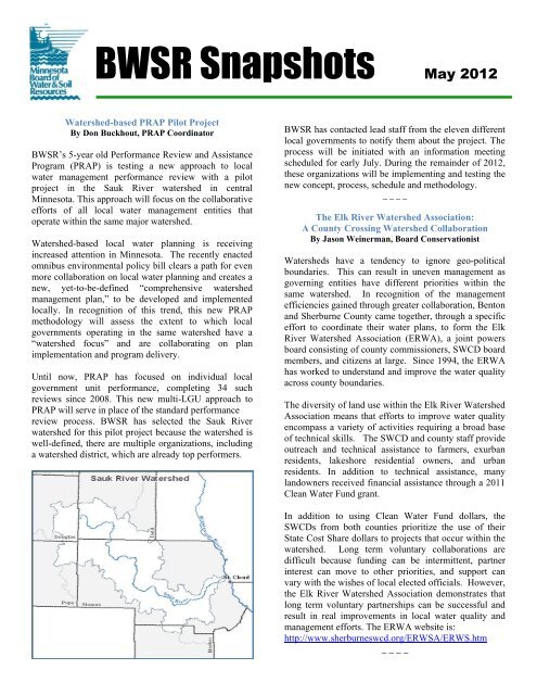
<strong>BWSR</strong> <strong>Snapshots</strong> May 2012<br />
<strong>Water</strong>shed-based PRAP Pilot Project<br />
By Don Buckhout, PRAP Coordinator<br />
<strong>BWSR</strong>’s 5-year old Performance Review <strong>and</strong> Assistance<br />
Program (PRAP) is testing a new approach to local<br />
water management performance review with a pilot<br />
project in the Sauk River watershed in central<br />
<strong>Minnesota</strong>. This approach will focus on the collaborative<br />
efforts <strong>of</strong> all local water management entities that<br />
operate within the same major watershed.<br />
<strong>Water</strong>shed-based local water planning is receiving<br />
increased attention in <strong>Minnesota</strong>. The recently enacted<br />
omnibus environmental policy bill clears a path for even<br />
more collaboration on local water planning <strong>and</strong> creates a<br />
new, yet-to-be-defined “comprehensive watershed<br />
management plan,” to be developed <strong>and</strong> implemented<br />
locally. In recognition <strong>of</strong> this trend, this new PRAP<br />
methodology will assess the extent to which local<br />
governments operating in the same watershed have a<br />
“watershed focus” <strong>and</strong> are collaborating on plan<br />
implementation <strong>and</strong> program delivery.<br />
Until now, PRAP has focused on individual local<br />
government unit performance, completing 34 such<br />
reviews since 2008. This new multi-LGU approach to<br />
PRAP will serve in place <strong>of</strong> the st<strong>and</strong>ard performance<br />
review process. <strong>BWSR</strong> has selected the Sauk River<br />
watershed for this pilot project because the watershed is<br />
well-defined, there are multiple organizations, including<br />
a watershed district, which are already top performers.<br />
<strong>BWSR</strong> has contacted lead staff from the eleven different<br />
local governments to notify them about the project. The<br />
process will be initiated with an information meeting<br />
scheduled for early July. During the remainder <strong>of</strong> 2012,<br />
these organizations will be implementing <strong>and</strong> testing the<br />
new concept, process, schedule <strong>and</strong> methodology.<br />
_ _ _ _<br />
The Elk River <strong>Water</strong>shed Association:<br />
A County Crossing <strong>Water</strong>shed Collaboration<br />
By Jason Weinerman, <strong>Board</strong> Conservationist<br />
<strong>Water</strong>sheds have a tendency to ignore geo-political<br />
boundaries. This can result in uneven management as<br />
governing entities have different priorities within the<br />
same watershed. In recognition <strong>of</strong> the management<br />
efficiencies gained through greater collaboration, Benton<br />
<strong>and</strong> Sherburne County came together, through a specific<br />
effort to coordinate their water plans, to form the Elk<br />
River <strong>Water</strong>shed Association (ERWA), a joint powers<br />
board consisting <strong>of</strong> county commissioners, SWCD board<br />
members, <strong>and</strong> citizens at large. Since 1994, the ERWA<br />
has worked to underst<strong>and</strong> <strong>and</strong> improve the water quality<br />
across county boundaries.<br />
The diversity <strong>of</strong> l<strong>and</strong> use within the Elk River <strong>Water</strong>shed<br />
Association means that efforts to improve water quality<br />
encompass a variety <strong>of</strong> activities requiring a broad base<br />
<strong>of</strong> technical skills. The SWCD <strong>and</strong> county staff provide<br />
outreach <strong>and</strong> technical assistance to farmers, exurban<br />
residents, lakeshore residential owners, <strong>and</strong> urban<br />
residents. In addition to technical assistance, many<br />
l<strong>and</strong>owners received financial assistance through a 2011<br />
Clean <strong>Water</strong> Fund grant.<br />
In addition to using Clean <strong>Water</strong> Fund dollars, the<br />
SWCDs from both counties prioritize the use <strong>of</strong> their<br />
State Cost Share dollars to projects that occur within the<br />
watershed. Long term voluntary collaborations are<br />
difficult because funding can be intermittent, partner<br />
interest can move to other priorities, <strong>and</strong> support can<br />
vary with the wishes <strong>of</strong> local elected <strong>of</strong>ficials. However,<br />
the Elk River <strong>Water</strong>shed Association demonstrates that<br />
long term voluntary partnerships can be successful <strong>and</strong><br />
result in real improvements in local water quality <strong>and</strong><br />
management efforts. The ERWA website is:<br />
http://www.sherburneswcd.org/ERWSA/ERWS.htm<br />
_ _ _ _
State <strong>and</strong> Federal Agencies Working Together<br />
on Wetl<strong>and</strong> Training<br />
By Lynda Peterson, Metro Wetl<strong>and</strong> Specialist<br />
For the past two years <strong>BWSR</strong> <strong>and</strong> the Corps <strong>of</strong><br />
Engineers (Corps) have partnered to train wetl<strong>and</strong> staff<br />
from both agencies. Wetl<strong>and</strong> staff primarily review<br />
wetl<strong>and</strong> delineations submitted by private wetl<strong>and</strong><br />
consultants, but we seldom do wetl<strong>and</strong> delineations. This<br />
partnership resulted in having Corps <strong>and</strong> <strong>BWSR</strong> wetl<strong>and</strong><br />
staff do actual on-site delineations.<br />
In 2011, two training sessions were held in Brainerd <strong>and</strong><br />
Farmington. First, delineations were completed, then<br />
wetl<strong>and</strong> staff defended why they chose a particular<br />
wetl<strong>and</strong> boundary. In 2012, two more sessions are<br />
scheduled. At a recent session in Willmar staff from<br />
both agencies reviewed aerial photographic slides <strong>of</strong><br />
agricultural fields throughout the past 20 years <strong>and</strong><br />
determined whether aerial photography showed evidence<br />
<strong>of</strong> hydrology. Then the staff from both agencies went<br />
on-site <strong>and</strong> completed wetl<strong>and</strong> delineations for the areas<br />
that showed hydrology. Ten project managers from the<br />
Corps <strong>and</strong> five <strong>BWSR</strong> wetl<strong>and</strong> specialists attended this<br />
session.<br />
At the end <strong>of</strong> May another session will be held in the<br />
Cloquet area to teach the staff from both agencies about<br />
the red clay soils that are dominant in the Northeast<br />
Region <strong>of</strong> the State.<br />
This combined training has given both agencies a<br />
comfort level with each other <strong>and</strong> involved technical<br />
abilities to provide better <strong>and</strong> more efficient program<br />
delivery <strong>and</strong> public service.<br />
Wetl<strong>and</strong> or not? That is the first Question.<br />
Second Question: where is the boundary?<br />
_ _ _ _<br />
Grass Lake Restoration – Recent Phase<br />
By Tom Wenzel, Senior <strong>Water</strong> <strong>Resources</strong> Engineer<br />
In the fall <strong>of</strong> 2011, another phase <strong>of</strong> the Grass Lake<br />
Prairie Wetl<strong>and</strong> restoration project was constructed. This<br />
phase <strong>of</strong> restoration involved a cooperative venture<br />
between the state’s Reinvest in <strong>Minnesota</strong> (RIM)<br />
Reserve program <strong>and</strong> the USDA’s Wetl<strong>and</strong>s Reserve<br />
Program (WRP), along with a private l<strong>and</strong>owner’s need<br />
to develop a suitable wetl<strong>and</strong> replacement site for recent<br />
wetl<strong>and</strong> impacts within the city <strong>of</strong> Willmar. The work<br />
was completed in the northeast corner <strong>of</strong> the Grass Lake<br />
Project area <strong>and</strong> included the restoration <strong>of</strong> several<br />
drained wetl<strong>and</strong>s with one large wetl<strong>and</strong> area<br />
approximately 80 acres in size.<br />
Historic Grass Lake <strong>and</strong> 2011 Restoration Areas<br />
The Grass Lake Prairie Wetl<strong>and</strong> is approximately 1,200<br />
acres in size <strong>and</strong> is located just to the southeast <strong>of</strong> the<br />
city <strong>of</strong> Willmar in K<strong>and</strong>iyohi County. Drainage <strong>of</strong> the<br />
lakebed began in 1885 for farming purposes. Beginning<br />
in the early 1990s, a combination <strong>of</strong> several factors<br />
including above normal precipitation cycles, increased<br />
run<strong>of</strong>f from upstream watershed areas <strong>and</strong> inadequate<br />
drainage capacity <strong>of</strong> the ditch system through the area,<br />
caused significant crop losses within the lakebed.<br />
As a result <strong>of</strong> these marginal farming conditions, most <strong>of</strong><br />
the l<strong>and</strong>owners within the basin have enrolled just over<br />
1,300 acres <strong>of</strong> the lakebed into perpetual conservation<br />
easements, primarily through RIM Reserve. These<br />
easements were secured for the purpose <strong>of</strong> restoring the<br />
drained lakebed to a shallow prairie wetl<strong>and</strong> <strong>and</strong> its<br />
surrounding shoreline to native prairie to the extent<br />
practicable.
Recent restoration efforts within the lakebed have been<br />
limited to smaller, isolated areas where outcomes could<br />
be feasibly attained as the restoration <strong>of</strong> the larger<br />
project is still being planned through the coordinated<br />
efforts <strong>of</strong> state, federal, <strong>and</strong> local government agencies<br />
along with conservation groups <strong>and</strong> the project<br />
l<strong>and</strong>owners. The phase <strong>of</strong> work completed this past fall<br />
is located within a separate, isolated area <strong>of</strong> the lakebed<br />
with the restored wetl<strong>and</strong>s all being at elevations higher<br />
than what is currently being considered for a larger,<br />
main basin. The work was in an area where a new RIM-<br />
WRP easement for 243 acres was recently secured.<br />
Prior to its restoration, this area <strong>of</strong> the project contained<br />
a variety <strong>of</strong> former wetl<strong>and</strong> habitats all extensively<br />
drained by subsurface tile <strong>and</strong> open ditches. A branch <strong>of</strong><br />
a county ditch system was successfully ab<strong>and</strong>oned in the<br />
project area through a petition <strong>and</strong> hearing with the<br />
K<strong>and</strong>iyohi County <strong>Board</strong>, the local drainage authority.<br />
One large 80-acre shallow wetl<strong>and</strong> basin was restored<br />
via installation <strong>of</strong> a steel sheet pile structure across a<br />
drainage ditch.<br />
Primary Sheetpile Outlet Structure<br />
A 1,000-acre-plus drainage area contributes run<strong>of</strong>f to<br />
this restored wetl<strong>and</strong>. In addition, five other smaller, tile<br />
drained depressional wetl<strong>and</strong>s were restored. The<br />
restoration work also involved raising <strong>and</strong> protecting a<br />
field access road, outletting <strong>and</strong> protecting an upstream<br />
functioning subsurface drainage tile, <strong>and</strong> constructing<br />
several embankments to help manage <strong>and</strong> control<br />
wetl<strong>and</strong> run<strong>of</strong>f.<br />
In total, the cost <strong>of</strong> construction for this phase <strong>of</strong> work<br />
was approximately $290,000. The majority <strong>of</strong> these<br />
costs were covered by the adjoining private l<strong>and</strong>owner in<br />
their work to restore wetl<strong>and</strong> areas on their property as<br />
part <strong>of</strong> a wetl<strong>and</strong> replacement plan. This restoration plan<br />
was completed by <strong>BWSR</strong> staff with the assistance <strong>and</strong><br />
support <strong>of</strong> the local <strong>Soil</strong> <strong>and</strong> <strong>Water</strong> Conservation District<br />
(SWCD) <strong>and</strong> Natural <strong>Resources</strong> Conservation Service<br />
(NRCS).<br />
Restoration efforts within other areas <strong>of</strong> the Grass Lake<br />
Project are continuing, with additional construction work<br />
scheduled for this fall.<br />
Recent View <strong>of</strong> 2011 Restoration Area<br />
_ _ _ _