SHIP-TO-SHORE MOVEMENT - NavyGirl.org
SHIP-TO-SHORE MOVEMENT - NavyGirl.org
SHIP-TO-SHORE MOVEMENT - NavyGirl.org

You also want an ePaper? Increase the reach of your titles
YUMPU automatically turns print PDFs into web optimized ePapers that Google loves.
U.S. NAVY NWP 3-02.1(Formerly NWP 22-3 (Rev. B))U.S. MARINE CORPS MCWP 3-31.5<strong>SHIP</strong>-<strong>TO</strong>-<strong>SHORE</strong> <strong>MOVEMENT</strong>THIS PUBLICATION IS REQUIRED FOR OFFICIAL USEOR FOR ADMINISTRATIVE OR OPERATIONAL PUR-POSES ONLY. DISTRIBUTION IS LIMITED <strong>TO</strong> U.S. GOV-ERNMENT AGENCIES. OTHER REQUESTS FOR THISDOCUMENT MUST BE REFERRED <strong>TO</strong> COMMANDER,NAVAL DOCTRINE COMMAND, 8952 FIRST STREET,SUITE 200, NORFOLK, VA 23511-3790.DEPARTMENT OF THE NAVYOFFICE OF THE CHIEF OF NAVAL OPERATIONSAND HEADQUARTERS, U.S. MARINE CORPS0411LP10015541 (Reverse Blank) CHANGE 1
-DEPARTMENT OF THE NAVYNAVAL DOCTRINE COMMAND8952 FIRST STREET, SUITE 200NORFOLK VA 2351 l-3790NWP 22-3 (Rev. B)FMFM l-8August 1993LETTER OF PROMULGATION1. NWP 22-3 (REV. B)/FMFM 1-8, <strong>SHIP</strong>-<strong>TO</strong>-<strong>SHORE</strong> <strong>MOVEMENT</strong>, is an Unclassified naval warfare publication.It shall be handled in accordance with NWP 0, Naval Warfare Documentation Guide.2. NWP 22-3 (REV. B)/FMFM 1-8 is effective upon receipt and supersedes NWP 22-3 (REV. A)/FMFM 1-8,<strong>SHIP</strong>-<strong>TO</strong>-<strong>SHORE</strong> <strong>MOVEMENT</strong>, which shall be destroyed without report.3. Disclosure of this publication or portions thereof to foreign governments or international <strong>org</strong>anizations shall bein accordance with NWP 0.-=TtsGGRear Admiral, U.S. NavyCommander, Naval Doctrine CommandU.S. Navy Distribution: See page 5 for distribution list.U.S. Marine Corps Distribution: PCN139 tJlJlJlJ,l, tJl3 (Reverse Blank) ORIGINAL
U.S. Navy DistributionNWP 22-3(B):<strong>SHIP</strong>-<strong>TO</strong>-<strong>SHORE</strong> <strong>MOVEMENT</strong>SNDL PART IPaper/Micro21A1 Commander in Chief, U.S. Atlantic Fleet 221A2 Commander in Chief, U.S. Pacific Fleet 1 121A3 Commander in Chief, U.S. Naval Forces, EuropeONLY: CINCUSNAVEUR LONDON UK 222A1 Fleet Commander LANT 122A2 Fleet Commander PACONLY: COMSEVENTHFLT 1ONLY: COMTHIRDFLT 122A3 Fleet Commander EUR 123A2 Naval Force Commander PACONLY: COMNAVFORJAPAN YOKOSUKA JA 1ONLY: COMNAVFORKOREA SEOUL KOR 123A3 Force Commander CentralONLY: COMUSNAVCENT BAHRAIN 123B1 Special Force Commander LAN<strong>TO</strong>NLY: USCOMSOLANT 123B2 Special Force Commander PACONLY: COMNAVSPECWARCOM CORONADO CA, 1COMASWFORPAC PEARL HARBOR HI23B3 Special Force Commander EURONLY: COMARSURVRECFORSIXTHFLT DET SIGONELLA IT, 1COMAREASWFORSIXTHFL<strong>TO</strong>NLY: COMARSURVRECFORSIXTHFLT DET ROTA SP 223C3 Naval Reserve Force Commander 124A Air Force Commanders 124D1 Surface Force Commander LAN<strong>TO</strong>NLY: COMNAVSURFLANT NORFOLK VA 224D2 Surface Force Commander PACONLY: COMNAVSURFPAC SAN DIEGO CA 224G Submarine Force Commanders 124H2 Fleet Training Command PAC 124J Fleet Marine Force Commands 1 325A Mine Warfare Command 125A1 Mine Countermeasures GroupONLY: COMCMGRU ONE SEATTLE WA 1ONLY: COMCMGRU TWO 126A Amphibious Group 326B3A Surface Reserve Forces Detachment 126C1 Beach Group LANT 226C2 Beach Group PAC 226E1 Amphibious Unit LANT5 ORIGINAL
U. S. Navy Distribution (continued)ONLY: ACU FOUR, ACU TWO 1ONLY: COMSPECBOATRON TWO, SPECBOATU TWO TWO 1ONLY: BMU TWO 826E2 Amphibious Unit PACONLY: ACU FIVE, ACU ONE 126F3 Operational Test and Evaluation Force 126H1 Fleet Training Group and Detachment LAN<strong>TO</strong>NLY: FLETRAGRU DET NORFOLK 126J1 Afloat Training Group and Detachment LAN<strong>TO</strong>NLY: COMAFLOATRAGRULANT NORFOLK VA 426J2 Afloat Training Group and Detachment PACONLY: AFLOATRAGRUMIDPAC PEARL HARBOR HI 126Q2 Nuclear Weapons Training Group PAC 126R1 Mobile Inshore Undersea Warfare Unit and Group LANT 126R2 Mobile Inshore Undersea Warfare Unit and GroupPACLESS: MIUWU 111 126V2 Landing Force Training Command PAC 526W1 Cargo Handling and Port Group LANT 126W1A Reserve Cargo Handling Training Battalion 126CC Fleet Coordinating Group 126FF Mine Warfare Inspection Group 126GG1 Explosive Ordnance Disposal Mobile Unit and GroupLAN<strong>TO</strong>NLY: EODMU TWO 126GG2 Explosive Ordnance Disposal Mobile Unit and GroupPACONLY: EODMU ONE, COMEODGRU ONE, EODMU ELEVEN, 1EODMU NINEONLY: EODMU THREE 1ONLY: EODMU FIFTEEN 226JJ1 Fleet Area Control and Surveillance Facility LAN<strong>TO</strong>NLY: FACSFAC JACKSONVILLE FL 126QQ1 Special Warfare Group, Unit and Detachment LAN<strong>TO</strong>NLY: COMNAVSPECWARGRU TWO 126QQ2 Special Warfare Group, Unit and Detachment PACONLY: NAVSPECWARUNIT ONE 126HHH1 Fleet Tactical Deception Group LAN<strong>TO</strong>NLY: COMFLETACREADGRU NORFOLK VA 126KKK1 Tactical Training Group LANT 226KKK2 Tactical Training Group PAC 126SSS Medical Treatment FacilityONLY: MEDTRE FAC COMFORT 126YYY Carrier Airborne Early Warning Weapons School 128A2 Carrier Group PACONLY: COMCARGRU ONE 16 ORIGINAL
U. S. Navy Distribution (continued)28B Cruiser-Destroyer Group 128C1 Surface Group LAN<strong>TO</strong>NLY: COMSURFWARDEVGRU LITTLE CREEK VA 128D1 Destroyer Squadron LANT 128D2 Destroyer Squadron PACONLY: COMDESRON FIFTEEN 128E Surface Squadron 128L1 Amphibious Squadron LANTLESS: COMPHIBRON TEN, COMPHIBRON TWELVE 2ONLY: COMPHIBRON TEN 128L2 Amphibious Squadron PACLESS: COMPHIBRON NINE, COMPHIBRON SEVEN 2ONLY: COMPHIBRON SEVEN 1ONLY: COMPHIBRON NINE 129A1 Guided Missile Cruiser LANT (CG) (CGN)LESS: USS ANZIO (CG 68), 1USS BAINBRIDGE (CGN 25),USS HUE CITY (CG 66)USS VICKSBERG (CG 69)ONLY: USS HUE CITY (CG 66), USS ANZIO (CG 68), 1USS VICKSBURG (CG 69)29A2 Guided Missile Cruiser PAC (CG) (CGN)ONLY: USS MOBILE BAY (CG 53) 1USS ARKANSAS (CGN 41)ONLY: USS CHOSIN (CG 65), USS SHILOH (CG 67) 129B1 Aircraft Carrier LANT (CV) (CVN)LESS: USS ENTERPRISE (CVN 65) 129B2 Aircraft Carrier PAC (CV) (CVN)LESS: USS CARL VINSON (CVN 70) 1ONLY: USS CARL VINSON (CVN 70) 129E1 Destroyer LANT (DD) 963 Class 129E2 Destroyer PAC (DD) 963 ClassONLY: OLDENDORF (DD 972) 129AA Guided Missile Frigate (FFG) 7 Class 131A Amphibious Command Ship (LCC) 2 131B1 Amphibious Cargo Ship LANT (LKA) 131B2 Amphibious Cargo Ship PAC (LKA) 231G1 Amphibious Transport Dock LANT (LPD) 131G2 Amphibious Transport Dock PAC (LPD) 231H1 Amphibious Assault Ship LANT (LHA), (LPH)LESS: USS GUAM (LPH 9) 3ONLY: USS GUAM (LPH 9) 3 131H2 Amphibious Assault Ship PAC (LHA), (LPH) 331I1 Dock Landing Ship (LSD) LANT 231I2 Dock Landing Ship (LSD) PACLESS: ANCHORAGE (LSD 36), FORT FISHER (LSD 40), 1MOUNT VERNON (LSD 39)7 ORIGINAL
U. S. Navy Distribution (continued)45J Headquarters BattalionONLY: 2ND MARDIV HQBN 145K Headquarters and Service Battalion 245L1 Infantry and Reconnaissance BattalionONLY: 3RD MARINES 1ST BN, 1ST RECONBN, 2 13RD MARINES 2ND BN, 7TH MARINES 2ND BN,3RD MARINES 3RD BN, 3RD RECONBN45M Medical Battalion and Logistic CompanyLESS: 2ND MEDBN 245N Motor Transport Battalion and CompanyONLY: 8TH MTBN, 1ST MEB BSSG MTCO 2ONLY: NINTH MTBN 2 145O Light Antiaircraft Missile BattalionLESS: 2ND LAAMBN 2ONLY: 2ND LAAMBN 2 145Q Division and Service Support Group and BattalionLESS: 1ST FSSG, 1ST FSSG DET CHARLIE, 51ST MEB BSSG, 2ND FSSG HQSVCBN,2ND FSSG MAINTBN, CG THIRD FSSG,FIRST FSSG FWDONLY: CG THIRD FSSG 1 1ONLY: 1ST FSSG 5 5ONLY: 1ST MEB BSSG 5 345R Communication BattalionLESS: 8TH COMMBN 2 2ONLY: 8TH COMMBN 145T Air Naval Gunfire Liaison Company, FMF 5 245U Missile Battalion Headquarters and Service Battery 245V Expeditionary Brigade and UnitONLY: 1ST MEB, 6TH MEB, 15TH MEU 2ONLY: 13TH MEU, 11TH MEU, 26TH MEU 2 1ONLY: 24TH MEU 2ONLY: 22ND MEU 2 2ONLY: CG NINTH MEB 145W Task Force and Group 245Y Tank BattalionONLY: 3RD TKBN 245BB Dental Battalion and CompanyLESS: 2ND DENBN 245FF Radio Battalion 245HH Landing Support BattalionLESS: THIRD LDGSPTBN 2ONLY: THIRD LDGSPTBN 145JJ Low Altitude Air DefenseONLY: 2ND LAAD BN 146B Aircraft Wing10 ORIGINAL
U. S. Navy Distribution (continued)ONLY: 3RD MAW 2 1ONLY: 2ND MAW 2 3ONLY: CG FIRST MAW 2 246C1 Marine Aircraft Group and DetachmentsLESS: MAG 46 DET A, MAG FORTY NINE, 2 2MAG FOUR ONE, MAG FOUR SIX DET B,MAG FOUR TWO DET B, MAG THREE SIX,MAG TWO FOUR, MAG TWO SIXONLY: MAG TWO FOUR, MAG FOUR ONE, MAG TWO SIX, 2MAG THREE SIX46C3 Air Control Group 1 146D2 All Weather Attack Squadron (VMA) (VMA(AW))LESS: VMA AW THREE THREE TWO, VMA THREE ONE ONE, 1 1VMA TWO ONE ONE, VMFA AW ONE TWO ONEONLY: VMA TWO ONE ONE, VMA THREE ONE ONE 1ONLY: VMA AW THREE THREE TWO 146D3 Fighter-Attack Squadron (VMFA) 1 146E Observation Squadron (VMO)ONLY: VMO ONE 146F Marine Wing Communications Squadron and DetachmentONLY: MWCS EIGHTEEN, MWCS 28 1 1ONLY: MWCS 38 146G Wing Headquarters Squadron 146H Transport Squadron (VMGR)LESS: VMGR TWO FIVE TWO 1 146J Marine Air Control SquadronLESS: MACS 7, MACS FOUR, MACS TWO 1ONLY: MACS FOUR, MACS TWO 1 1ONLY: MACS 7 146K Marine Air Support Squadron 1 146M Headquarters Squadrons and Logistics Squadron 146P2 Helicopter Squadron (HMM) (HMH) (HML) (HMA)LESS: HMLA 267 DET B, HMLA ONE SIX SEVEN, 1HMLA THREE SIX NINE, HMM ONE SIX SIX,HMM TWO SIX SIXONLY: HMLA ONE SIX SEVEN 1 146P4 Helicopter Training SquadronsLESS: HMT THREE ZERO TWO 146Q Wing Support GroupLESS: MWSG FOUR SEVEN 1 1ONLY: MWSG FOUR SEVEN 146R Marine Wing Support SquadronONLY: MWSS FOUR SEVEN FOUR 146S1 Air Traffic Control Squadron LANT 146S2 Air Traffic Control Squadron Detachment PACLESS: MATCS FOUR EIGHT DET BRAVO 111 ORIGINAL
U. S. Navy Distribution (continued)46U Aviation Weapons and Tactics Squadron 146V Tactical Electronic Warfare Squadron (VMAQ) andDetachmentsLESS: VMAQ FOUR, VMAQ ONE 150A Unified CommandsONLY: USCINCSO QUARRY HEIGHTS PM 1ONLY: USCINCCENT MACDILL AFB FL 450C Subordinate Unified CommandsONLY: COMICEDEFOR KEFLAVIK IC 151B3 Southern Europe AreaONLY: COMSTRIKFORSOUTH 1T-100Y (T-AH) Hospital ShipONLY: COMFORT (T-AH 20) 1SNDL PART IIPaper/MicroA3 Chief of Naval OperationsONLY: (N3/N5), (N88), (N42), (N931) 1ONLY: (N85) 1A5 Chief of Naval Personnel 1A6 Commandant of the Marine Corps 3B2 Defense AgenciesONLY: JVS CFAD WASHING<strong>TO</strong>N DC 1B2A Special Agencies Staffs Boards and CommitteesONLY: JCS J7 1B2I Joint Doctrine Center 1B3 College and UniversityONLY: COMDT AFSC NORFOLK VA 1B5 Coast GuardONLY: COMUSCG WASHING<strong>TO</strong>N DC (G-T<strong>TO</strong>-3V) 1C1A Naval Personnel at Army ActivitiesONLY: COMGENSTAFCOL FT LEAVENWORTH, 1U.S. ARMY C&G STAFF COLLEGEONLY: CDRUSAJFKSPWAR CENSCH FT BRAGG NC 2C2C Navy Liaison Officers at Air Force ActivitiesONLY: NAVLIAOFF HURLBURT FIELD 1C4P Marine Corps Communication-Electronics School 1C4EE Center for Naval Analyses 1C5B Navy Section Military Assistance Advisory GroupsONLY: CHNAVSECMAGG PORTUGAL LISBON PO 1ONLY: CHNAVSEC JUSMAGTHAI BANGKOK TH 1C21 Assistant for Administration to the Under 1Secretary of the Navy DetsC25A Support Activity DetachmentsONLY: OPNAVSUPPACT DET FT RITCHIE MD 212 ORIGINAL
U. S. Navy Distribution (continued)C60D Fleet Surveillance Support Command Detachment 1E3A Laboratory ResearchONLY: NRL WASHING<strong>TO</strong>N DC 3 1FA4 Aviation ActivitiesONLY: COMNAVAVNACTS BRUNSWICK ME 1FA7 Station LAN<strong>TO</strong>NLY: NAVSTA PANAMA CANAL RODMAN PM 1FA30 Weapons Training Facility 1FB7 Air Station PACONLY: NAS ALAMEDA, NAS ADAK AK, MAS LEMOORE, 1NAS MIRAMARONLY: NAS AGANA GQ 2FB34 Fleet ActivitiesONLY: COMFLEACT SASEBO JA, COMFLEACT OKINAWA JA 1FC14 Air Station NAVEUR 1FE4 Security Group ActivityONLY: NAVSECGRUACT MISAWA JA 1ONLY: NAVSECGRUACT NORTHWEST (CHESAPEAKE VA) 2FF5 Safety Center 1FF18 Tactical Support Activity 5FF38 Naval Academy 1FF42 Postgraduate School 1 1FF44 War College 5FG2 Computer and Telecommunications StationsONLY: NAVCOMTELSTRA ROTA SP 1FG4 Computer and Telecommunications ActivityONLY: NAVCOMTELSTRA SAN DIEGO CA 1FG6 Computer and Telecommunications Area Master StationsLESS: NCTAMS MED NAPLES IT 1FH1 Medical and SurgeryONLY: BUMED WASHING<strong>TO</strong>N DC 1FH36 Healthcare Support Office EUR 1FJA10 Manpower Analysis Center 1FKA1A Air Systems Command 1FKA1B Space and Naval Warfare Systems Command 1FKA1C Facilities Engineering Command 1FKA1G Sea Systems Command 2FKN2 Construction Battalion CenterONLY: CBC GULFPORT MS 1FKP4A Coastal Systems Station Dahlgren Division 1FKP4E Surface Warfare Center and DivisionONLY: NAVSURFWARCENDIV PORT HUENEME CA, 1NAVSURFWARCEN CARDERROCKDIV BETHESDA MDONLY: NAVSURFWARCENDIV DAHLGREN VA 4FKP7 ShipyardONLY: NAV<strong>SHIP</strong>YD PUGET SOUND (BREMER<strong>TO</strong>N) 113 ORIGINAL
U. S. Navy Distribution (continued)FKP14 Fleet Combat Direction Systems Support Activity 1FKP20 AEGIS Training CenterLESS: AEGIS TRASUPPGRU SAN DIEGO CA 1FKQ6C Command Control and Ocean Surveillance Center RDTE Division 2FKR3E Weapons Evaluations Facility 1FKR6A Air Warfare Center Aircraft DivisionONLY: NAVAIRWARCENACDIV WARMINSTER PA 1FKR6B Air Warfare Center Weapons DivisionONLY: NAVAIRWARCENWPNDIV CHINA LAKE CA 2FKR6C Air Weapons StationONLY: NAVAIRWPNSTA PT MUGU CA 1FP1 Naval Doctrine Command 1FR4 Air Facility COMNAVRESFORONLY: NAF DETROIT 1FR10 Reserve CenterONLY: NAVMARCORESCEN ATLANTA, 1NAVMARCORESCEN BESSEMER,NAVMARCORESCEN BROOKLYN,NAVMARCORESCEN BUFFALO,NAVRESCEN COLUMBUS GA,NAVRESCEN CLEVELAND OH,NAVMARCORESCEN COLUMBUS OHIO,NAVMARCORESCEN DALLAS TX,NAVMARCORESCEN DENVER,NAVMARCORESCEN EL PASO,NAVMARCORESCEN ENCINO,NAVMARCORESCEN LOUISVILLE,NAVRESCEN SYRACUSE,NAVRESCEN OKLAHOMA CITY,NAVMARCORESCEN ORLANDO,NAVMARCORESCEN PITTSBURGH,NAVMARCORESCEN PORTLAND OR,NAVRESCEN RICHMOND,NAVMARCORESCEN ROCK ISLAND,NAVMARCORESCEN ST LOUIS,NAVMARCORESCEN ST PAUL,NAVMARCORESCEN SALT LAKE CITY,NAVMARCORESCEN TREASURE ISLAND CA,NAVMARCORESCEN SPRINGFIELD MO,ONLY: NAVRESCEN MISSOULA MT, 1NAVMARCORESCEN <strong>TO</strong>PEKA, NAVRESCEN WICHITAONLY: NAVMARCORESCEN MONTGOMERY 6FR23 Reserve Readiness CentersLESS: NAVMARCORESREDCEN NORFOLK VA, 1NAVMARCORESREDCEN PHOENIX AZ,NAVMARCORESREDCEN SAN DIEGO CA,14 ORIGINAL
U. S. Navy Distribution (continued)NAVRESCEN CHARLES<strong>TO</strong>N,NAVRESREDCEN PORTLAND MEFS1 Office of Naval IntelligenceONLY: ONI WASHING<strong>TO</strong>N DC 1FT1 Chief of Education and Training 1FT6 Air Station CNE<strong>TO</strong>NLY: NAS PENSACOLA FL 1ONLY: NAS CORPUS CHRISTI TX 2FT13 Air Technical Training Center 1FT22 Fleet Combat Training CenterONLY: FCTCLANT VIRGINIA BEACH VA 1ONLY: FCTCPAC 2FT24 Fleet Training CenterONLY: FLETRACEN MAYPORT 1ONLY: FLETRACEN NORFOLK 1 1ONLY: FLETRACEN SAN DIEGO CA 25FT28 Education and Training Center 1FT30 Service School ComandONLY: SERVSCOLCOM GREAT LAKES 2FT35 Amphibious SchoolONLY: NAVPHIBSCOL CORONADO SAN DIEGO CA 1ONLY: NAVPHIBSCOL LITTLE CREEK VA 35FT43 Surface Warfare Officers School Command 10FT46 Fleet Anti-Submarine Warfare Training CenterONLY: FLEASWTRACENLANT 1FT51 Fleet and Mine Warfare Training Center 2FT60 Education and Training Support CenterONLY: NETSCPAC SAN DIEGO CA 1FT72 Department of Naval ScienceONLY: DPTNAVSCI TXMARICAD GALVES<strong>TO</strong>N TX, 1DPTNAVSCI USMERMARCAD KINGS POINTFT78 Education & Training Program Management Support Activity 1FT97 Navy and Marine Corps Intelligence Training Center 1FW1 National Naval Medical Center 1V2 Marine Barracks 1V5 Marine Corps Air StationONLY: MCAS CHERRY POINT NC, 1MCAS KANEOHE BAY, HI,MCAS EL <strong>TO</strong>RO (SANTA ANA CA)V6 Aircraft Wing Marine Corps 2 3V8 Marine Corps Research, Development and Acquisition Command 1V11 Marine Corps Institute 1V12 Marine Corps Combat Development Command 12V16 Marine Corps Base15 ORIGINAL
U. S. Navy Distribution (continued)ONLY: CG MCB CAMP BUTLER JA, 1CG MCB CAMP PENDLE<strong>TO</strong>NONLY: CG MCB CAMP LEJEUNE 1 1V22 Marine Corps Aircraft GroupLESS: FOURTH LAAM BN, 1FOURTH LAAM BN (H&S BATT DET A PASADENA),FOURTH LAAM BN (H&S BATT DET B HAYWARD),MACG 48, MAG 41 DET B,MAG FOUR NINE DET B, MAG FOUR ONE,MAG FOUR ONE DET A, MAG FOUR SIX,MAG FOUR SIX DET C, MAG FOUR TWOONLY: MAG 41 DET B, MACG 48, FOURTH LAAM BN, 1 1MAG FOUR ONE DET A,FOURTH LAAM BN (H&S BATT DET A PASADENA),MAG FOUR SIX,FOURTH LAAM BN (H&S BATT DET B HAYWARD)V23 Logistics Base Marine CorpsONLY: CG MCLB ALBANY 2V25 Marine Corps Air-Ground Combat Center 3 1MISC Miscellaneous AddressesONLY: USMC REPRESENTATIVE FT KNOX, 1USMC REPRESENTATIVE FT BENNING,HQ TAC/XPJ, APL/JHU, 3D LAVBNONLY: AEGISCOMBATSYSENGDIVSITE MOORES<strong>TO</strong>WN NJ 1ONLY: NAVSUPPCEN SIGONELLA 1 116 ORIGINAL
NWP 22-3 (Rev. B)FMFM 1-8August 1994PUBLICATION NOTICEROUTING1. CHANGE 1 to NWP 22-3 (REV. B)/FMFM 1-8, <strong>SHIP</strong>-<strong>TO</strong>-<strong>SHORE</strong> <strong>MOVEMENT</strong>, is available inthe Naval Warfare Publications Library and is effective upon receipt.2. Summary:a. A terminology update was done to change Marine Expeditionary Brigade (MEB) to MarineExpeditionary Force(Forward) (MEF(FWD)) and Brigade Service Support Group (BSSG)to Force Service Support Group(Forward) (FSSG(FWD)).Naval Warfare Publications CustodianNaval warfare publications must be made readily available toall users and other interested personnel within the U.S. Navy.Note to Naval Warfare Publications CustodianThis notice should be duplicated for routing to cognizant personnel in accordance with NWP 17 (Reverse Blank) CHANGE 1
Ship-to-Shore MovementCHAPTER 1 — CONCEPTCONTENTSPageNo.1.1 PURPOSE ............................................ 1-11.2 BACKGROUND .........................................1-11.3 <strong>SHIP</strong>-<strong>TO</strong>-<strong>SHORE</strong> <strong>MOVEMENT</strong> CONCEPT ..........................1-21.4 <strong>SHIP</strong>-<strong>TO</strong>-<strong>SHORE</strong> <strong>MOVEMENT</strong> PLANNING CONSIDERATIONS .............1-31.4.1 Embarkation Flexibility .....................................1-31.4.2 Oceanographic Considerations ..................................1-31.4.3 Supporting Operations ......................................1-41.4.4 Preassault Operations ......................................1-41.4.5 Prelanding Operations ......................................1-41.4.6 In-Stride Operations .......................................1-41.4.7 Relative Strength Requirements .................................1-41.4.8 Control ..............................................1-41.4.9 Considerations for Displacement Landing Craft Employment .................1-51.4.10 Displacement Landing Craft Support Requirements. ......................1-51.4.11 Considerations for Helicopter Employment ...........................1-51.4.12 Helicopter Support Requirements ................................1-61.4.13 Consideration for Landing Craft Air Cushion (LCAC) Employment ..............1-61.4.14 LCAC Support Requirements ..................................1-61.5 LANDING MEANS .......................................1-61.5.1 Amphibious Ships ........................................1-61.5.2 Military Sealift Command (MSC) Ships .............................1-81.5.3 Helicopters ............................................1-91.5.4 Landing Craft. ..........................................1-91.5.5 Amphibious Assault Vehicles (AAVs). .............................1-91.5.6 Special Purpose Craft ......................................1-101.5.7 Miscellaneous Vehicles and Support Components .......................1-101.6 AMPHIBIOUS WARFARE (AMW) PUBLICATIONS ....................1-111.6.1 Joint Doctrine ..........................................1-111.6.2 Battle Group (BG) Level Naval Warfare Publications (NWPs) ................1-111.6.3 AMW NWPs and Allied Tactical Publications (ATPs) ....................1-111.6.4 Other Publications .......................................1-111.6.5 Platform-Specific NWPs ....................................1-121.6.6 Other Tactical Publications ...................................1-121.6.7 Type Commander Standard Operating Procedures (SOPs). ..................1-1219 CHANGE 1
CHAPTER 2 — ORGANIZATION AND COMMANDPageNo2.1 PURPOSE ............................................2-12.2 ORGANIZATION ........................................2-12.3 NAVAL FORCES ........................................2-12.3.1 Transport Group .........................................2-22.3.2 Movement Groups ........................................2-22.3.3 Control Groups ..........................................2-32.3.4 Naval Beach Group (NBG) ...................................2-32.4 LANDING FORCE (LF). ....................................2-32.4.1 Command Element (CE) .....................................2-52.4.2 Ground Combat Element (GCE) .................................2-52.4.3 Aviation Combat Element (ACE) ................................2-52.4.4 Combat Service Support Element (CSSE) ............................2-52.4.5 Landing Force Support Party (LFSP) ..............................2-52.4.6 Tactical Logistics (TACLOG) Group ..............................2-52.4.7 Marine Expeditionary Force (MEF) ...............................2-62.4.8 Marine Expeditionary Force(Forward) (MEF(FWD)) ......................2-62.4.9 Marine Expeditionary Unit (MEU) ...............................2-62.4.10 Special Purpose Force (SPF) ...................................2-62.4.11 Marine Air-Ground Task Force (MAGTF) Movement .....................2-62.4.12 Follow-up Forces. ........................................2-72.5 COMMAND RELATION<strong>SHIP</strong>S ................................2-72.5.1 Amphibious Task Force (ATF) and LF Commanders ......................2-72.5.2 Attack Group and Landing Group ................................2-72.5.3 Ship’s Commanding Officer (CO) and CO of Troops ......................2-72.5.4 Relationship Between Ship’s CO and Embarked Helicopter Units ...............2-72.5.5 Command of LFSP ........................................2-7CHAPTER 3 — PLANNING3.1 PURPOSE ............................................3-13.2 BACKGROUND .........................................3-13.3 PLANNING PROCESS .....................................3-13.3.1 Planning Sequence ........................................3-13.3.2 Troops and Equipment Categories ................................3-23.4 PREPARATION OF DOCUMENTS ..............................3-43.4.1 Documents Prepared by Navy ..................................3-43.4.2 Documents Prepared by the Landing Force (LF) ........................3-203.5 ORGANIZATION OF THE LANDING AREA ........................3-383.5.1 Sea Operating Areas ......................................3-383.5.2 Beach and Inland Areas. ....................................3-4220 CHANGE 1
PageNo3.6 NIGHT AND LOW-VISIBILITY <strong>SHIP</strong>-<strong>TO</strong>-<strong>SHORE</strong> PLANNING ..............3-43CHAPTER 4 — CONDUCTING THE WATERBORNE <strong>SHIP</strong>-<strong>TO</strong>-<strong>SHORE</strong> <strong>MOVEMENT</strong>4.1 PURPOSE ............................................4-14.2 BACKGROUND ........................................ 4-14.2.1 Final Preparations and Approach ................................4-14.3 EXECUTION ..........................................4-24.3.1 Pre-H-Hour Transfers ......................................4-24.3.2 Waterborne Ship-to-Shore Movement Control Organization ..................4-24.3.3 Control Areas. ..........................................4-64.3.4 Debarkation ...........................................4-84.3.5 Dispatching Scheduled Waves to the Beach ..........................4-104.3.6 Waterborne Ship-to-Shore Movement Control .........................4-124.3.7 Beaching, Retracting, and Return. ...............................4-134.3.8 Communications ........................................4-134.3.9 Landing Ship Tank (LST) Beaching and Causeway Operations ................4-154.3.10 Landing Nonscheduled Units ..................................4-154.3.11 Landing Prepositioned Emergency Supplies ..........................4-164.3.12 General Unloading .......................................4-164.3.13 Offloading the Assault Follow-On Echelon (AFOE) ......................4-164.4 SEABASING ..........................................4-164.5 TACTICAL LOGISTICS (TACLOG) GROUP ........................4-164.6 MEDICAL REGULATING (MEDREG). ...........................4-17CHAPTER 5 — CONDUCTING THE HELICOPTERBORNE <strong>SHIP</strong>-<strong>TO</strong>-<strong>SHORE</strong> <strong>MOVEMENT</strong>5.1 PURPOSE ............................................5-15.2 BACKGROUND .........................................5-15.2.1 Helicopter Employment .....................................5-15.2.2 Tactical Organization ......................................5-25.2.3 Helicopterborne Ship-to-Shore Movement Control Organization ................5-25.3 COMMAND RELATION<strong>SHIP</strong>S ................................5-25.3.1 Relationship Between Ship’s Commanding Officer (CO) and EmbarkedHelicopter Unit ..........................................5-25.4 ORGANIZATION. ....................................... 5-35.4.1 Tactical Air Control Group (TACGRU) .............................5-35.4.2 Tactical Air Officer (TAO). ...................................5-45.4.3 Tactical Air Controller (TAC) ..................................5-45.4.4 Tactical Air Control Center Afloat (TACC Afloat) .......................5-45.4.5 Helicopter Coordination Section Officer (HCSO) ........................5-45.4.6 Helicopter Coordination Section (HCS) .............................5-421 CHANGE 1
PageNo.5.4.7 Helicopter Transport Group/Unit Commander. .........................5-55.4.8 Primary Helicopter Direction Center (HDC). ..........................5-55.4.9 Helicopter Logistics Support Center (HLSC) ..........................5-75.4.10 Airborne Coordination ......................................5-75.4.11 Aerial Observer (AO) ......................................5-85.4.12 Initial Terminal Guidance (ITG) Team .............................5-85.4.13 Helicopter Support Team (HST) .................................5-85.4.14 Tactical Logistics (TACLOG) Group ..............................5-85.4.15 Air Control Ashore ........................................5-85.5 EXECUTION ..........................................5-95.5.1 Enplanement ...........................................5-95.5.2 Troop and Equipment Categories ................................5-95.5.3 Helicopter Areas, Routes, and Points ..............................5-95.5.4 Helicopter Operations With Control Afloat ..........................5-105.5.5 Downed Helicopter Recovery Operations ...........................5-115.5.6 Sequence of Events for Helicopter Tactical or CSS Requests From aHelicopterborne Unit ......................................5-115.5.7 Sequence of Events for Helicopter Tactical or CSS Requests From aSurfaceborne Unit. .......................................5-135.5.8 Helicopter Operations With Control Ashore ..........................5-155.6 DELEGATION OF AUTHORITY ...............................5-155.6.1 Airborne Control of Helicopters ................................5-155.6.2 Changing from Primary to Alternate Helicopter Landing Zones (HLZs) ...........5-155.6.3 Changing Approach and Retirement Routes ..........................5-165.6.4 Changing the Landing Sequence ................................5-165.7 HELICOPTER CONTROL COMMUNICATIONS ......................5-165.7.1 Communications Planning ...................................5-165.7.2 Helicopter Command, Control, and Coordination Nets ....................5-165.7.3 Helicopter Support Team (HST) Nets .............................5-165.7.4 LFSP Nets. ...........................................5-18CHAPTER 6 — PROTECTIVE MEASURES IN THE AMPHIBIOUS OBJECTIVEAREA (AOA)6.1 PURPOSE ............................................6-16.2 BACKGROUND .........................................6-16.3 PROTECTIVE MEASURES ..................................6-16.3.1 Amphibious Defense Zone Coordinator (ADZC) ........................6-16.3.2 Inshore Undersea Warfare (IUW) Forces ............................6-16.3.3 Defense Against Sneak Attack ..................................6-26.3.4 Defense Against Enemy Meaconing, Interference, Jamming, Intrusion (MIJI) .........6-46.3.5 Operational Deception (OPDEC) ................................6-46.3.6 Chemical, Biological, and Radiation (CBR) Countermeasures .................6-422 CHANGE 1
PageNo.APPENDIX A — USE OF DEBARKATION STATIONS INCLUDING PROCEDURESFOR CALLING BOATS ALONGSIDE OR IN<strong>TO</strong> WELL DECKSA.1 DEBARKATION STATIONS .................................A-1A.1.1 Debarkation Station Criteria ...................................A-1A.1.2 Identification of Debarkation Stations. .............................A-1A.1.3 Procedures for Calling Boats and Displacement Landing CraftAlongside ............................................A-1A.1.4 Procedures for Calling Displacement Landing Craft into WellDecks/to Tank Decks ......................................A-2A.1.5 Landing Craft Air Cushion (LCAC) Procedures ........................A-3APPENDIX B — LANDING CRAFT AND AMPHIBIOUS VEHICLE FORMATIONS ANDCONTROL SIGNALSB.1 LANDING CRAFT AND AMPHIBIOUS VEHICLE FORMATIONS ............B-1B.1.1 Order of Assault Craft in Formation. ..............................B-1B.1.2 Distance and Interval for Displacement Landing Craft .....................B-1B.1.3 Distance and Interval for Landing Craft Air Cushion (LCAC) .................B-1B.2 CONTROL SIGNALS. .....................................B-1APPENDIX C — IDENTIFICATION FLAGS, INSIGNIA, MARKERS, LIGHTS, ANDSIGNALSC.1 STANDARD IDENTIFICATION. ...............................C-1C.1.1 Flags ...............................................C-1C.1.2 Insignia. .............................................C-1C.1.3 Beach, Unloading Point, and Oceanographic Markers .....................C-1C.1.4 Cargo Identification .......................................C-1C.1.5 Beach, Unloading Point, and Oceanographic Lights ......................C-2C.1.6Night and Low Visibility Identification Lights for Amphibious Vehiclesand Displacement Landing Craft ................................C-2C.1.7 Line of Departure (LOD) Dispatching Signals .........................C-2C.1.8 Beaching Signals. ........................................C-2C.1.9 Visual Emergency Signals ....................................C-2C.2 LANDING CRAFT AIR CUSHION (LCAC) .........................C-2APPENDIX D — GRID REFERENCE SYSTEM OF WAVE CONTROLD.1 PURPOSE ............................................D-1D.1.1 Grid Construction ........................................D-1D.1.2 Wave Control ..........................................D-1D.1.3 Voice Communications Procedures ...............................D-3D.1.4 Visual Procedures for Transmitting Grid Positions .......................D-523 CHANGE 1
PageNo.APPENDIX E — QUIET LANDING PROCEDURES (QLPS)E.1 DEFINITION ..........................................E-1E.2 WATERBORNE <strong>SHIP</strong>-<strong>TO</strong>-<strong>SHORE</strong> <strong>MOVEMENT</strong> CONTROL ................E-1E.2.1 Procedures ............................................E-1E.2.2 Visual Signals ..........................................E-1E.2.3 Manning .............................................E-1E.3 HELICOPTERBORNE <strong>SHIP</strong>-<strong>TO</strong>-<strong>SHORE</strong> <strong>MOVEMENT</strong> CONTROL ............E-1E.3.1 Procedures ............................................E-2E.3.2 Visual Signals ..........................................E-2APPENDIX F — RESPONSIBILITIES FOR LOADING, S<strong>TO</strong>WING, AND OFFLOADINGOF LANDING FORCE (LF) EQUIPMENTF.1 SCOPE ..............................................F-1F.1.1 Personnel .............................................F-1F.1.2 Material .............................................F-1APPENDIX G — MEDICAL REGULATING (MEDREG)G.1 PURPOSE ............................................G-1G.2 BACKGROUND ........................................G-1G.3 ORGANIZATION. .......................................G-1G.3.1 Amphibious Task Force (ATF) MEDREG Organization ....................G-1G.3.2 Landing Force (LF) MEDREG Organization ..........................G-4G.4 MEDREG PLAN ........................................G-5G.4.1 Casualty Evacuation Planning ..................................G-6G.4.2 MEDEVAC Precedence .....................................G-6G.4.3 MEDREG Coordination .....................................G-7G.4.4 Execution ............................................G-8G.5 MASS CASUALTIES ......................................G-9G.5.1 Guidelines for Mass Casualties .................................G-9G.5.2 Preparation for Mass Casualties .................................G-9G.5.3 Guidelines for Chemical, Biological, or Radiation (CBR) Mass Casualties. .........G-10APPENDIX H — SUPPLEMENTARY BOAT EQUIPMENTH.1 GENERAL. ...........................................H-1H.1.1 Control and Rescue Boats ....................................H-1H.1.2 Displacement Landing Craft. ..................................H-1H.1.3 Special Operations ........................................H-124 CHANGE 1
PageNo.APPENDIX I — SALVAGE OPERATIONSI.1 MISSION .............................................I-1I.2 ORGANIZATION ........................................I-1I.2.1 Primary Control Officer (PCO). .................................I-1I.2.2 Assistant Boat Group Commander (ABGC) ...........................I-1I.2.3 Beachmaster ...........................................I-1I.3 SALVAGE BOATS AND TEAMS ...............................I-1I.3.1 Heavy Salvage Boat .......................................I-1I.3.2 Light Salvage Boat ........................................I-1I.3.3 Salvage Teams ..........................................I-1I.4 SALVAGE EQUIPMENT ....................................I-1I.5 AFLOAT SALVAGE OPERATIONS ..............................I-2I.5.1 Salvage Procedures ........................................I-2I.6 BEACH PARTY SALVAGE OPERATIONS ..........................I-5I.6.1 Boat Broached or Hard Aground .................................I-5I.6.2 Emergency Ramp Raising Methods ...............................I-6I.7 LANDING CRAFT AIR CUSHION (LCAC) SALVAGE OPERATIONS ...........I-8I.7.1 Seaward of the Surf Zone. ....................................I-8I.7.2 Inland of the Surf Zone ......................................I-8APPENDIX J — THE TACTICAL LOGISTICS (TACLOG) GROUPJ.1 FUNCTION ...........................................J-1J.2 BACKGROUND .........................................J-1J.2.1 Parrallel Chains of Command ..................................J-1J.2.2 Navy and Landing Force (LF) Organizations ..........................J-1J.3 TACLOG DETACHMENT COMMON FUNCTIONS .....................J-1J.4 ORGANIZATION ........................................J-3J.4.1 Transitioning From a Tactical to Combat Service Support (CSS) Focus ............J-3J.4.2 TACLOG Group Organizational Considerations ........................J-3J.4.3 LF TACLOG Detachment ....................................J-3J.4.4 Ground Combat Element (GCE) TACLOG Detachment ....................J-4J.4.5 Surfaceborne Regimental Landing Team (RLT) TACLOG Detachment ............J-4J.4.6 Helicopterborne RLT TACLOG Detachment ..........................J-5J.5 COMMUNICATIONS ......................................J-5J.5.1 LF Tactical Net (TACNET) ...................................J-5J.5.2 Supported Unit TACNET ....................................J-5J.5.3 Helicopterborne Unit Command Net ...............................J-5J.5.4 Helicopter Support Team (HST) Control Net ..........................J-525 CHANGE 1
PageNo.J.5.5 Landing Force Support Party (LFSP) Command Net ......................J-6J.5.6 LFSP Control Net. ........................................J-6J.6 DOCUMENTS ..........................................J-6J.7 REPORTS ............................................J-6APPENDIX K — THE LANDING FORCE SUPPORT PARTY (LFSP)K.1 GENERAL. ...........................................K-1K.1.1 Unity of Effort ..........................................K-1K.2 MISSIONS AND FUNCTIONS. ................................K-1K.2.1 Landing Force (LF) Element Functions .............................K-1K.2.2 Navy Element Functions. ....................................K-3K.3 LFSP ORGANIZATION ....................................K-4K.3.1 LFSP Headquarters (HQ) ....................................K-4K.3.2 Shore Party. ...........................................K-5K.3.3 Beach Party. ..........................................K-10K.3.4 LFSP Special Attachments ...................................K-13K.3.5 Ship’s Platoon .........................................K-13K.4 POST LFSP OPERATIONS ..................................K-14K.4.1 Air Combat Element (ACE) and Naval Construction Regiment(NCR) Organization ......................................K-14K.4.2 Beach Party and Naval Beach Group (NBG) .........................K-15K.5 PLANNING ..........................................K-15K.5.1 Initiating Directive .......................................K-15K.5.2 Commander, Amphibious Task Force (CATF) and Commander,Landing Force (CLF) Commander’s Concept and Guidance .................K-15K.5.3 Subordinate Commander’s Concepts .............................K-15K.5.4 LFSP Missions and Tasks ...................................K-17K.5.5 LFSP Concept for Support and Organization for Combat ...................K-17K.5.6 LFSP Operations Plan (OPLAN). ...............................K-17K.6 COMMUNICATIONS .....................................K-17K.6.1 LFSP Command Net ......................................K-17K.6.2 LFSP Control Net .......................................K-17K.6.3 Helo Request (HR) Net. ....................................K-17K.6.4 Helicopter Support Team (HST) Control Net .........................K-17K.6.5 Supported Unit Tactical Net ..................................K-17APPENDIX L — THE HELICOPTER SUPPORT TEAM (HST)L.1 PURPOSE ............................................L-1L.2 FUNDAMENTALS .......................................L-1L.2.1 Helicopterborne Operations ...................................L-126 CHANGE 1
PageNo.L.2.2 Planned Combat Service Support (CSS) Buildup ........................L-2L.3 HST ORGANIZATION AND RESPONSIBILITIES ......................L-2L.3.1 HST Organization ........................................L-2L.3.2 HST Responsibilities. ......................................L-4L.4 HST OPERATIONS .......................................L-5L.4.1 Embarkation ...........................................L-5L.4.2 Organization for Landing ....................................L-5L.4.3 Operations Ashore ........................................L-5L.4.4 Termination of HST Operations .................................L-5L.5 COMMUNICATIONS. .....................................L-7L.5.1 HST Logistics Support. .....................................L-7L.5.2 HCE ...............................................L-7APPENDIX M — OPERATIONAL TASKING AMPHIBIOUS (OPTASK AMPHIB)M.1 PURPOSE ............................................M-1M.2 REFERENCE ..........................................M-1M.3 MESSAGE FORMAT .....................................M-1INDEX ...................................................Index-127 CHANGE 1
LIST OF ILLUSTRATIONSPageNo.CHAPTER 1 — CONCEPTFigure 1-1 PERMA: Phases of an Amphibious Operation ........................1-2Figure 1-2 Amphibious Ship Troop, Helicopter, Landing Craft, andAssault Craft Capabilities ...................................1-7CHAPTER 2 — ORGANIZATION AND COMMANDFigure 2-1 Control Organization During the Ship-to-Shore Movement .................2-2Figure 2-2 Marine Air-Ground Task Force (MAGTF) Organization ..................2-4Figure 2-3 Attack Group and Landing Group Relationships WhenCommander, Landing Force (CLF) Retains Command ....................2-8Figure 2-4 Attack Group and Landing Group Relationships WhenCommand is Delegated ....................................2-9CHAPTER 3 — PLANNINGFigure 3-1 Listing of Ship-to-Shore Movement Documents .......................3-4Figure 3-2 Navy Planning Responsibilities and Sequence ........................3-5Figure 3-3 Landing Force (LF) Planning Responsibilities andSequence (Waterborne) ....................................3-6Figure 3-4 LF Planning Responsibilities and Sequence(Helicopterborne) .......................................3-7Figure 3-5 Example of a Naval Landing Plan Format ..........................3-8Figure 3-6 Example of a Landing Craft Availability Table .......................3-10Figure 3-7 Example of a Landing Craft Employment Plan .......................3-11Figure 3-8 Example of a Debarkation Schedule .............................3-13Figure 3-9 Example of a Ship’s Diagram ................................3-14Figure 3-10 Example of an Approach Schedule .............................3-15Figure 3-11 Example of an Assault Wave Diagram ...........................3-17Figure 3-12 Example of a Landing Area Diagram ............................3-18Figure 3-13 Example of a Transport Area Diagram ...........................3-19Figure 3-14 Example of a Beach Approach Diagram. ..........................3-20Figure 3-15 Example of a Sea Echelon Area ...............................3-21Figure 3-16 Example of a LF Landing Plan Format ...........................3-22Figure 3-17 Example of an Amphibious Vehicle Availability Table ..................3-24Figure 3-18 Example of a Landing Craft and Amphibious VehicleAssignment Table ......................................3-25Figure 3-19 Example of a Landing Diagram ...............................3-26Figure 3-20 Example of an LF Serial Assignment Table .........................3-27Figure 3-21 Serial Number Allocation ..................................3-28Figure 3-22 Example of a Landing Priority Table ............................3-29Figure 3-23 Example of an LF Landing Sequence Table ........................3-30Figure 3-24 Example of an Assault Schedule. ..............................3-31Figure 3-25 Example of an Amphibious Vehicle Employment Plan ...................3-32Figure 3-26 Example of a Helicopter Availability Table ........................3-33Figure 3-27 Example of a Heliteam Wave and Serial Assignment Table ................3-3428 CHANGE 1
PageNo.Figure 3-28 Example of a Helicopter Landing Diagram .........................3-35Figure 3-29 Example of a Helicopter Employment and Assault LandingTable (HEALT) .......................................3-36Figure 3-30 Example of a GCE Landing Plan Format ..........................3-37Figure 3-31 Example of a Consolidated Landing and Approach Plan ..................3-38Figure 3-32 Example of an ACE/LF Aviation Landing Plan Format. ..................3-40Figure 3-33 Ocean Operating Areas and Sea Areas in the AOA .....................3-41CHAPTER 4 — CONDUCTING THE WATERBORNE <strong>SHIP</strong>-<strong>TO</strong>-<strong>SHORE</strong> <strong>MOVEMENT</strong>Figure 4-1 Control Organization During the Waterborne Ship-to-ShoreMovement ...........................................4-3Figure 4-2 Example of Displacement Craft and LCAC Control Areas ..................4-7Figure 4-3 Assembly and Wave Forming Circles. ............................4-9Figure 4-4 Underway Launch Scenario .................................4-11Figure 4-5 Waterborne Ship-to-Shore Movement Communications Matrix ..............4-14CHAPTER 5 — CONDUCTING THE HELICOPTERBORNE <strong>SHIP</strong>-<strong>TO</strong>-<strong>SHORE</strong> <strong>MOVEMENT</strong>Figure 5-1 Control Organization During the Helicopterborne Ship-to-ShoreMovement ...........................................5-3Figure 5-2 Helicopter Tactical or Combat Service Support (CSS) RequestsFrom a Helicopterborne Unit ................................5-12Figure 5-3 Helicopter Tactical or CSS Requests From a Surfaceborne Unit ..............5-14Figure 5-4 Helicopterborne Ship-to-Shore Movement Communications Matrix ............5-17CHAPTER 6 — PROTECTIVE MEASURES IN THE AMPHIBIOUS OBJECTIVE AREA (AOA)Figure 6-1 AOA CWC Organization With Supporting Force Commander asCWC in Supsit A Using an Amphibious Defense Zone Coordinator(ADZC) ............................................6-2Figure 6-2 The Amphibious Defense Zone (ADZ) ............................6-3Figure 6-3 CBR Defense Instructions ..................................6-7APPENDIX A — USE OF DEBARKATION STATIONS INCLUDING PROCEDURES FOR CALLINGBOATS ALONGSIDE OR IN<strong>TO</strong> WELL DECKSFigure A-1Day and Night Signals for Calling Boats and Displacement LandingCraft to Debarkation Stations, Well Decks, and Tank Decks ................A-2APPENDIX B — LANDING CRAFT AND AMPHIBIOUS VEHICLE FORMATIONS AND CONTROLSIGNALSFigure B-1 Landing Craft and Amphibious Vehicle Formations .....................B-2Figure B-2 Arm and Hand Control Signals — Displacement Landing Craft andAmphibious Vehicles .....................................B-329 CHANGE 1
PageNo.APPENDIX C — IDENTIFICATION FLAGS, INSIGNIA, MARKERS, LIGHTS,AND SIGNALSFigure C-1 Table of Lights ........................................C-5Figure C-2 Floating Dump Cargo Identification .............................C-6Figure C-3 Departure Time Sequence ..................................C-7Figure C-4 Standard Flags and Identification Insignia ..........................C-8Figure C-5 Beach Markets (From Seaward) ...............................C-10Figure C-6 Oceanographic Markers (From Seaward) ..........................C-12Figure C-7 Miscellaneous Beach Signs .................................C-13Figure C-8 Unloading Point Markers ..................................C-14Figure C-9 Miscellaneous Flags and Identification Insignia ......................C-17Figure C-10Day and Night Displacement Landing Craft and AmphibiousVehicle Beaching Hand Signals ...............................C-20Figure C-11 Day and Night Landing Ship Causeway Operations Signals ................C-25Figure C-12 LCAC Maneuvering Hand Signals .............................C-26APPENDIX D — GRID REFERENCE SYSTEM OF WAVE CONTROLFigure D-1 Example of a Grid Diagram of the Boat Lane ........................D-2Figure D-2 Table of Standard Planning Data for Ship-to-Shore Movement ...............D-3APPENDIX G — MEDICAL REGULATING (MEDREG)Figure G-1 ATF Medical Regulating (MEDREG) Organization .....................G-2Figure G-2 LF MEDREG Organization. .................................G-3Figure G-3 Primary Casualty Receiving and Treatment Ship (PCRTS)Medical Capabilities .....................................G-5Figure G-4 Medical Emergency Evacuation (MEDEVAC) Capabilities .................G-7APPENDIX H — SUPPLEMENTARY BOAT EQUIPMENTFigure H-1 Boat Equipment for Control and Rescue Boats. .......................H-2Figure H-2 Boat Equipment for Displacement Landing Craft ......................H-4APPENDIX I — SALVAGE OPERATIONSFigure I-1 Towing a Broached or Grounded Boat Off the Beach. ....................I-3Figure I-2 Alongside Tow. ........................................I-4Figure I-3 Quick Tow ...........................................I-5Figure I-4 Beachmaster Method of Raising LCM 8 Ramp (Aluminumor Steel) ............................................I-7APPENDIX J — THE TACTICAL LOGISTICS (TACLOG) GROUPFigure J-1 TACLOG Group Organization for a MEF-sized MAGTF ..................J-230 CHANGE 1
PageNo.APPENDIX K — THE LANDING FORCE SUPPORT PARTY (LFSP)Figure K-1 MAGTF Organization for the Ship-to-Shore Movement. ..................K-2Figure K-2 Basic Landing Force Support Party (LFSP) Organization ..................K-5Figure K-3 LFSP, Shore Party, and Beach Party Command Relationships ...............K-6Figure K-4 Basic Shore Party Team Organization ............................K-9Figure K-5 Basic Beach Party Group Organization ...........................K-11Figure K-6 Basic CLZ Control Team (CCT) Organization .......................K-14Figure K-7 Notional LFSP Planning Process ..............................K-16APPENDIX L — THE HELICOPTER SUPPORT TEAM (HST)Figure L-1 The Helicopter Support Team (HST) Organization .....................L-3Figure L-2 A Representative Helicopter Landing Zone .........................L-631 (Reverse Blank) CHANGE 1
RECORD OF CHANGESChange No. andDate of ChangeDate of EntryPage Count Verifiedby (Signature)Change 1 8/94 11-8-94 R.L. Weston33 ORIGINAL
RECORD OF CHANGESChange No. andDate of ChangeDate of EntryPage Count Verifiedby (Signature)34 ORIGINAL
PREFACENWP 22-3 (Rev. B)/FMFM 1-8, <strong>SHIP</strong>-<strong>TO</strong>-<strong>SHORE</strong><strong>MOVEMENT</strong>, amplifies Joint Pub 3-02, Joint Doctrinefor Amphibious Operations. Together with relatednaval warfare publications (NWPs) and FleetMarine Force manuals (FMFMs), NWP 22-3/FMFM1-8 is used as a guide for the planning and execution ofthe ship-to-shore movement.NWP 22-3/FMFM 1-8 is not intended to stereotypeship-to-shore operations nor prevent an officer exercisingtactical command from initiating and issuingspecial instructions. Its primary purpose is to obtainbasic uniformity while permitting the developmentand flexibility required by each tactical situation.Throughout this publication, references to otherpublications imply the effective edition.Report any page shortage by letter to Director, NavyTactical Support Activity.ORDERING DATAOrder a new publication or change, as appropriate,through the Navy Supply System.Changes to the distribution and allowance lists (toadd or delete your command from the distribution list,or to modify the number of copies of a publication thatyou receive) must be made in accordance with NWP 0.RECOMMENDED CHANGESRecommended changes to this publication may besubmitted at any time using the accompanying formatfor routine changes.Atlantic fleet units and stations submit recommendationsto:COMMANDER NAVAL SURFACE FORCEU.S. ATLANTIC FLEETNORFOLK VA 23520Pacific fleet units and stations submit recommendationsto:COMMANDER NAVAL SURFACE FORCEU.S. PACIFIC FLEETSAN DIEGO CA 92135All other units and CONUS shore activities submitrecommendations to:COMMANDER NAVAL SURFACE FORCEU.S. ATLANTIC FLEETNORFOLK VA 23520U.S. Marine Corps units submit recommendations to:COMMANDING GENERAL (WF06)MARINE CORPS COMBAT DEVELOPMENTCOMMANDQUANTICO VA 22134-5001In addition, forward two copies of all recommendationsto:DIREC<strong>TO</strong>RNAVTACSUPPACTWASHING<strong>TO</strong>N NAVY YARD BLDG 200901 M STREET SEWASHING<strong>TO</strong>N DC 20374-5079URGENT CHANGE RECOMMENDATIONSWhen items for changes are considered to be urgent(as defined in NWP 0, and including matters of safety),this information shall be sent by message (see accompanyingsample message format) to Commander NavalSurface Force, U.S. Atlantic Fleet, with informationcopies to Naval Doctrine Command, CNO (N853), NavalSafety Center (if appropriate), Navy Tactical SupportActivity, and all other commands concerned, clearly explainingthe proposed change. Information addresseesshould comment as appropriate. See NWP .CHANGE SYMBOLSRevised text in changes is indicated by a black verticalline in either margin of the page, like the one printednext to this paragraph. The change symbol showswhere there has been a change. The change might bematerial added or information restated. A change symbolin the margin by the chapter number and title indicatesa new or completely revised chapter.35 ORIGINAL
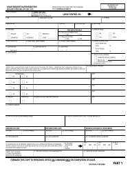
(CLASSIFICATION)RECOMMENDEDCHANGE <strong>TO</strong>: ______________________________________________________(PUBLICATION NUMBER / REVISION / CHANGE)DATE: _____________LOCATION: _____________ ____________ ____________ ____________(PAGE) (PARA) (LINE) (FIG. NO.)TYPE OF CHANGE: ADD _____ DELETE _____ MODIFY _____ TEXT _____ FIGURE _____EXACT CHANGE RECOMMENDED:USE ADDITIONAL SHEETS IF NEEDED. GIVE VERBATIM TEXT CHANGES. IF FIGURE IS <strong>TO</strong> BE ADDED,SUPPLY ROUGH SKETCH OR IDENTIFY SOURCE. IF FIGURE IS <strong>TO</strong> BE CHANGED, INCLUDE A MARKED UP COPY OF EXISTING FIGURE.RATIONALE:SUBMITTED BY: _____________________________ __________________________(ORIGINATING COMMAND)(ORIGINA<strong>TO</strong>R SEQUENCE NO.)______________________________(POINT OF CONTACT)__________________________(PHONE - IDENTIFY AV OR COMM)PRA ACTION: ACCEPTED ______ MODIFIED ______ REJECTED ______REMARKS: (USE ADDITIONAL SHEETS IF NEEDED)______________________________(PRA POINT OF CONTACT)__________________________(PHONE - IDENTIFY AV OR COMM)CONFERENCE DATE: _______________________ CONFERENCE AGENDA ITEM NO.: __________PAGE _____ OF ______(CLASSIFICATION)36 ORIGINAL
FM<strong>TO</strong>INFOORIGINA<strong>TO</strong>RCOMNAVSURFLANT NORFOLK VA/JJJ//CNO WASHING<strong>TO</strong>N DC//N853//COMNAVDOCCOM NORFOLK VA//JJJ//CINCPACFLT PEARL HARBOR HI//JJJ//OR CINCLANFLT NORFOLK VA///JJJ//COMNAVSURFPAC SAN DIEGO CAJJJ//NAVSAFECEN NORFOLK VA//JJJ//NAVTACSUPPACT WHITE OAK MD//40//Others as appropriate (See Appendix A of NWP 0)BTCLASSIFICATION//N03510//SUBJ/URGENT CHANGE RECOMMENDATION FOR NWP 3-02.1REF/A/DOC/NWP 1-01//REF/B/(As required)//AMPN/(As required)//POC//(As required)RMKS/1. IAW REF A URGENT CHANGE IS RECOMMENDED FOR NWP 3-02.12. PAGE _______ ART/PARA NO _______ LINE NO _______ FIG NO _______3. PROPOSED NEW TEXT (Include classification)4. JUSTIFICATIONMessage provided for subject matter; ensure that actual message conforms to MTF requirements.37 (Reverse Blank) ORIGINAL
CHAPTER 1Concept1.1 PURPOSETo discuss the doctrine, command relationships,techniques, and procedures for planning and executingthe ship-to-shore movement during the assault phase ofamphibious operations. This publication describes:1. The <strong>org</strong>anization of Navy and landing forces(LFs) to conduct Marine Expeditionary Force(MEF)-sized amphibious operations2. Command relationships within and betweenthese forces3. The planning process required to develop theamphibious task force (ATF) landing plan4. The conduct of the waterborne andhelicopterborne ship-to-shore movements5. Protective measures in the amphibious objectivearea (AOA) to minimize danger to the ATF.NWP 22-3 serves as a guide for operational staffs,unit commanders, and school commands.1.2 BACKGROUNDAn amphibious operation is an attack launched fromthe sea by naval and LFs embarked in ships or craft involvinga landing on a hostile or potentially hostileshore. Amphibious operations are conducted in severalphases: planning, embarkation, rehearsal, movement,and assault (PERMA). These phases are described inFigure 1-1. A detailed description of each phase is containedin Joint Pub 3-02, “Joint Doctrine for AmphibiousOperations.”The initiating directive is an order to CATF to conductan amphibious operation. The format and contentsof the initiating directive is discussed in Joint Pub 3-02.When the initiating directive is received, planning beginswith the development of the LF concept of operationsashore. This concept outlines the commander,landing force’s (CLF’s) intent on how operationsashore will be conducted. It includes the <strong>org</strong>anizationrequired for the landing and the scheme of maneuverashore. The scheme of maneuver ashore is CLF’s tacticalplan for the LF to accomplish the assigned mission.It determines which LF units are required at the variouslanding locations within the landing area. Further, thescheme of maneuver ashore is used to assign LF units tolanding craft, landing ships, and helicopters for theship-to-shore movement. This concept is examined byall commanders for supportability and is approved bycommander, amphibious task force (CATF) prior tocommencement of detailed planning.With an approved concept of operations ashore, LFand naval requirements to accomplish the mission areconsolidated and compared with the means available toCATF (forces, lift, logistics, etc.). If the means availabledo not satisfy these requirements, additional means arerequested from higher authority. If additional means arenot available, the concept of operations ashore is adjustedaccordingly or another concept is developed.The ATF landing plan is prepared after the final allocationof means is made. This plan is composed of navaland LF documents which present in detail theinstructions to execute the waterborne and helicopterborneship-to-shore movement. These documentsare explained in Chapter 3. With the ATF landing plancompleted, embarkation planning begins.The assignment of personnel, equipment, and suppliesto shipping with their sequence for embarkationconstitutes the loading plan. The loading plan is derivedfrom and totally supports the ATF landing plan.The ATF is a task <strong>org</strong>anization of naval forces and aLF with <strong>org</strong>anic aviation, formed to conduct an amphibiousoperation. The ATF is composed of amphibious assaultships and military sealift command (MSC)-ownedor chartered ships, collectively referred to as assaultshipping, and other supporting forces described in JointPub 3-02, which are <strong>org</strong>anized into transport group(s) tocarry the LF to designated landing area(s).Following embarkation, the ATF moves from pointsof embarkation to the AOA. A rehearsal to test theATF landing plan is normally conducted during themovement phase.1-1 ORIGINAL
Planning — A continuous process from the receipt of the initiating directive to the termination of theoperation. Results in: LF concept of operations ashore ATF landing plan Loading plan ATF <strong>org</strong>anization.Embarkation — The period during which the LF is embarked in shipping. LF <strong>org</strong>anized into assault echelon and assault follow-on echelon.Rehearsal — Normally conducted during the movement phase to test the adequacy of the landing plan,timing of detailed operations, combat readiness of participating forces, and testcommunications.Movement ——The ATF departs embarkation/rehearsal area and proceeds to the AOA. Organized intomovement groups.Operations occurring during movement are: Supporting operations Advance force operations.Assault — Begins when enough of the ATF is in position in the landing area to initiate the ship-to-shoremovement and terminates with accomplishment of the mission. Includes: Supporting arms Ship-to-shore movement (Note 1) Logistics/combat service support (CSS) (Note 1) Medical regulating (Note 1).Note 1.These areas will be discussed in detail in subsequent chapters and appendixes.Figure 1-1.PERMA: Phases of an Amphibious OperationFor movement the ATF may be <strong>org</strong>anized intomovement groups. Movement groups consist of assaultshipping with escorts and combat logistics forces requiredfor protection and sustainability. Paragraphs2.3.1 and 2.3.2 discuss transport and movement groupsfurther. The LF is <strong>org</strong>anized into echelons: the assaultechelon (AE) and assault follow-on echelon (AFOE).Paragraph 2.4.11 describes the AE and AFOE further.The AOA is a geographical area, delineated in theinitiating directive, for the purposes of command andcontrol within which is located the objective(s) to be securedby the ATF. This area must be of sufficient size toensure accomplishment of the ATF’s mission and mustprovide sufficient area for conducting necessary sea,air, and land operations.Supporting and preassault operations are conductedwhile the assault echelon of the ATF is en route.The assault phase begins when enough of the ATF isin position in the landing area to permit CATF to commencethe ship-to-shore movement. The landing area isthat part of the objective area within which are conductedthe landing operations of an amphibious force. Itincludes the beach, approaches to the beach, transportareas, fire support areas (FSAs), air occupied by closesupporting aircraft, and land included in the advance inlandto the initial objective.1.3 <strong>SHIP</strong>-<strong>TO</strong>-<strong>SHORE</strong> <strong>MOVEMENT</strong> CONCEPTShip-to-shore movement during the assault phaseof an amphibious operation is the deployment of the1-2 ORIGINAL
LF from assault shipping to designated areas ashore. Itsobjective is to land troops, equipment, and supplies atprescribed times and places and in the <strong>org</strong>anization forlanding necessary to support the LF scheme of maneuverashore. The ship-to-shore movement is waterborne,helicopterborne, or a combination of both. It is initiatedfrom beyond the enemy’s visual and ground based radarrange (hereafter referred to as over-the-horizon (OTH)),near shore, or a combination of both. It commenceswhen CATF orders the execution by signaling, “Landthe landing force.” It concludes when the unloading ofall assault shipping is complete. Unloading operationstake place in two periods. The initial unloading period istactical and provides for the rapid buildup of combatpower ashore and quick response to LF tactical and logisticalrequirements. The general unloading period isprimarily logistical and emphasizes the rapid unloadingof personnel and material remaining in AE and AFOEshipping required to support LF operations ashore.1.4 <strong>SHIP</strong>-<strong>TO</strong>-<strong>SHORE</strong> <strong>MOVEMENT</strong> PLANNINGCONSIDERATIONSThe LF scheme of maneuver ashore determines themajor aspects of the ship-to-shore movement. Specificship-to-shore movement planning considerations are:1. OTH or near shore launch2. Helicopterborne, waterborne, or a combination3. Location of landing beaches, landing craft aircushion landing zones (CLZs), and helicopterlanding zones (HLZs)4. Assault shipping dispersal5. Composition and timing of assault waves6. Tactical integrity of the LF.Selection of these considerations is affected by:1. Hydrographic features of beach approaches2. Beach size and trafficability to support thelanding3. Characteristics of CLZs and HLZs and theirapproaches.1.4.1 Embarkation Flexibility. The <strong>org</strong>anizationfor embarkation must be compatible with the LFlanding plan. To achieve a landing in proper formationto initiate combat, the LF is <strong>org</strong>anized for the tacticalintegrity of helicopterborne and waterborne units participatingin the ship-to-shore movement. This is accomplishedby combat loading troops, equipment, andsupplies in assault shipping. The tactical integrity of agiven unit does not always require an entire unit to embarkin a single ship. The main focus of the loading planand <strong>org</strong>anization for embarkation is to facilitate asmooth flow of units and supplies ashore during theship-to-shore movement. Cross decking units from oneship to another prior to commencement of the shipto-shoremovement, referred to as pre-H-hour transfers,can enhance the efficiency of the ship-to-shore movement,particularly when the LF was embarked prior tothe completion of detailed planning. However, extensivecross decking can have an adverse impact on helicopterand landing craft availability for theship-to-shore movement. The ability to dischargetroops and supplies from MSC or MSC-chartered assaultshipping is a critical consideration in the <strong>org</strong>anizationfor embarkation that requires detailed planning.The <strong>org</strong>anization for embarkation also provides formaximum flexibility to support alternate plans that maybe adopted. The LF landing plan and scheme of maneuverashore are based on conditions and enemy capabilitiesthat existed in the AOA prior to embarkation of theLF. A change in conditions of friendly or enemy forcesduring the movement phase may cause major changesin the LF landing plan with no opportunity for reloadingthe LF. In a situation such as this the phases of anamphibious operation change from PERMA to embarkation,movement, planning, rehearsal, and assault(EMPRA). The extent to which changes in the LF landingplan can be accomplished depends upon the <strong>org</strong>anizationfor embarkation. Joint Pub 3-02.2, “JointDoctrine for Amphibious Embarkation,” discusses embarkationin detail.1.4.2 Oceanographic Considerations. Oceanographicconsiderations influence the type of ship-toshoremovement adopted. Principal oceanographicconsiderations are:1. Hydrographic features of offshore areas, particularlyout to the 3 1/2 fathom curve2. Extent of mineable waters3. Capacity of beaches for landing troops,equipment, and supplies4. Suitability of beaches for beaching landingships, landing craft, and employing causewaysand amphibious assault vehicles (AAVs) underexpected weather and tidal conditions1-3 ORIGINAL
1.4.3 Supporting Operations. Supporting operationsare those requested by CATF and conducted outsidethe area. CATF is responsible for by forces otherthan those assigned to the ATF. They are ordered by thecommander who issued the initiating directive. Supportingoperations conducted in the AOA prior to orduring the amphibious operation are coordinated withCATF. Examples of supporting operations are:1. Tactical and strategic military deception operationsto influence enemy actions2. Interdiction operations to isolate the landingarea3. Destruction of specific targets4. Antiair, antisubmarine, and antisurface warfare(AAW, ASW, and ASUW) operations to gainair superiority and naval supremacy in the AOA5. Special operations to secure information6. Psychological or unconventional warfare7. Minesweeping and minelaying.1.4.4 Preassault Operations. Preassault operationsare conducted in the AOA by elements of the ATFprior to commencement of the assault. These operationsare conducted by the advance force commanderand are designed to gain current information about theenemy and prepare the landing area for assault landings.Joint Pub 3-02 discusses the advance force <strong>org</strong>anization.Examples of preassault operations are:1. Destruction of targets by tactical air and navalsurface fire support2. Reconnaissance3. Raids4. Hydrographic surveys, surf observations, andweather reporting5. Electronic warfare (including cryptologicsupport to amphibious warfare)6. Military deception operations7. Minesweeping8. Underwater demolition.1.4.5 Prelanding Operations. Prelanding operationstake place between the commencement of the assaultphase and the commencement of ship-to-shoremovement. They encompass a continuation of the preparationconducted by the advanced force but prelandingoperations focus on the landing area and concentratespecifically on the landing beaches, HLZs, and CLZs tobe used by the LF. The transition between preassaultand prelanding operations may not be discernible asthere is no break in activity.1.4.6 In-Stride Operations. In-stride operationsare similar to prelanding operations, but are conductedas an integral component of the ship-to-shore movement.They immediately precede the arrival of troops atlanding beaches or landing zones (LZs).1.4.7 Relative Strength Requirements. Toachieve success, the ATF should be assured of air superiority,naval supremacy against enemy surface andsubsurface forces, and a substantial numerical superiorityover enemy forces in the landing area. In the face ofcompelling necessity, an amphibious operation may beundertaken on the basis of a reasonable total superiorityof forces. For example, air superiority and naval supremacymay justify a landing even though the ATFdoes not possess the desired numerical superiority inground forces, provided friendly surface and air unitscan be used effectively against enemy forces to negatetheir numerical advantage.1.4.8 Control. Ship-to-shore movement is the mostcritical part of an amphibious assault. Close coordinationbetween the helicopterborne and waterbornemovements and supporting, preassault, prelanding, andin-stride operations with the flexibility to change theATF landing plan is required to ensure maximum tacticaleffectiveness during the landing and subsequentrapid buildup of combat power ashore. Positive centralizedcontrol of the ship-to-shore movement is maintainedby CATF and CLF through control groups andtemporary <strong>org</strong>anizations with the execution of thewaterborne and helicopterborne ship-to-shore movementsdelegated to subordinate commanders. The Navycontrol <strong>org</strong>anization for the waterborne and helicopterborneship-to-shore movement is described in Chapters4 and 5 respectively. The LF establishes three temporary<strong>org</strong>anizations to facilitate the ship-to-shoremovement and provide tactical and logistical support toLF units ashore. These <strong>org</strong>anizations are the tactical logistics(TACLOG) group, landing force support party(LFSP), and helicopter support team (HST). These <strong>org</strong>anizationsare described in Appendixes J, K, and Lrespectively.1-4 ORIGINAL
1.4.9 Considerations for Displacement LandingCraft Employment. The principal considerations foremploying displacement landing craft are:1. The role of the waterborne operation in the LFconcept of operations2. Location, size, hydrographic features, andtrafficability of beaches3. Availability of hydrographic surveys ofbeach approaches4. Suitability of sea state and surf conditions forlanding craft operations5. Enemy capabilities and disposition, especiallylocation, type, and density of antisurface weapons6. Requirement for supporting arms and combatservice support (CSS)7. Displacement landing craft, with landingcraft air cushioned (LCAC), comprise the principalheavy lift offload capability for LF equipmentand supplies.1.4.10 Displacement Landing Craft SupportRequirements. All amphibious ships have thecapability to refuel landing craft and accomplishgeneral maintenance. Welldeck ships, designated asboat havens, provide dry docking facilities forstructural repairs and a safe haven during inclementweather, consistent with offload requirements as theassault progresses.Provisions for salvage operations should be includedin CATF’s ship-to-shore movement plan. The primarycontrol officer (PCO) is responsible for landing craftand amphibious vehicle salvage operations at a coloredbeach. The assistant boat group commander (ABGC) isresponsible for conducting salvage operations seawardof the surf zone and the beach party performs thesefunctions inside the surf zone. Appendix I provides additionalinformation on salvage operations.1.4.10.1 Beach Party. A beach party, the navalelement of the LFSP, is established ashore to facilitate:1. Command and control for the flow of troops,equipment, and supplies onto the beach2. Displacement landing craft beaching andretracting3. Causeway operations4. Limited construction5. Landing craft and amphibious vehicle salvageoperations6. Amphibious assault bulk fuel system(AABFS) operations7. Evacuation of casualties and prisoners of war8. CLZ control.Appendix K describes in detail how the beach partysupports the waterborne ship-to-shore movement andits command relationship with the LFSP.1.4.11 Considerations for Helicopter Employment.Objectives that cannot be attained bywaterborne amphibious operations often may beachieved by helicopterborne operations The principalconsiderations for the employment of helicopters are:1. The role of the helicopter in the LF concept ofoperations. Helicopters can be employed fromOTH to achieve tactical surprise.2. Quantity and types of helicopters available.3. Numbers of helicopter-capable ships availablethat can operate and maintain helicoptersand that can only operate helicopters.4. Location, nature, number, and size of HLZsand their approach and retirement lanes.5. Enemy capabilities and dispositions, especiallylocation, type, and density of antiaircraftweapons.6. Oceanographic/weather influences on thehelicopterborne ship-to-shore movement:a. Suitability of sea state for launch andrecovery of helicoptersb. Weather conditions to be encountered atlaunch/recovery, en route, and at the HLZ.This includes ceiling, visibility, icing, andturbulence.7. Requirements for supporting arms, linkup,and CSS.1-5 ORIGINAL
8. Availability of alternate plans for landingserials scheduled for helicopterborne wavesaborted during the landing.1.4.12 Helicopter Support Requirements. Allships that have helicopter refueling and rearming capabilitiesshould be considered when establishing a refueling/rearmingcycle. When practicable, helicopterdecks should not be smaller than two landing spots tomaintain helicopter section integrity. For sustainedhelicopter operations, repositioning skid-configuredhelicopters to LPDs and LSTs should be considered toease deck handling and spotting problems on the LHD,LHA, and LPH. As the assault progresses, helicopterforward arming and refueling points (FARPs) are establishedashore by the LF.Provisions for the recovery of aircraft downed in thelanding area should be included in CLF’s OPORD andarrangements should be made to provide maintenanceteams, and temporary storage of these aircraft.1.4.12.1 Helicopter Support Team (HST). TheHST is employed in an HLZ to facilitate the landingand movement of helicopterborne troops, equipment,supplies, and the evacuation of casualties and prisonersof war. Appendix L describes in detail how the HSTsupports the helicopterborne ship-to-shore movementand its command and <strong>org</strong>anizational relationship withthe helicopterborne unit commander and LFSP.1.4.13 Considerations for Landing Craft AirCushion (LCAC) Employment. The principalconsiderations for the employment of LCAC are:1. LCAC can be employed from OTH to achievetactical surprise2. LCACs are not constrained by tidal conditionsand most hydrographic features3. LCAC complements the vertical assault in anOTH amphibious assault by providing combatsupport that is not helicopter deliverable4. Alternate beaches can be included to tacticallyemploy LCACs speed and mobility5. LCAC operations beyond the high watermark could influence the scheme of maneuverashore6. A beach separation of 500 yards from displacementlanding craft is required7. Employing LCAC will decrease the overallnumber of landing craft the ATF is capable oftransporting and decrease the quantity ofpreloaded equipment.1.4.14 LCAC Support Requirements. The LSD41 class ship is designed specifically to operate andsupport LCACs. The LHD, LHA, LPD, and LSD 36class ships have been designed or modified to conductLCAC operations but do not have the <strong>org</strong>anicadministrative and logistics support LCAC requires.These ships can provide boat haven facilities andlimited maintenance support. The LHD, LHA, andLSD 36 class can be fitted with military vans(MILVANs) to provide an acceptable level of logisticsupport if sufficient LSD 41 class ships are notavailable. MILVANs are not moveable and using themmust be weighted against the reduction of LFembarkation area that occurs.Provisions for the salvage and recovery of inoperableLCACs should be included in CATF’s OPORD.Appendix I discusses the responsibility of the PCO andbeach party for conducting LCAC salvage operations.1.4.14.1 LCAC Landing Zone (CLZ) ControlTeam (CCT) and CLZ Support Team (CST). TheCCT and CST provide LCAC terminal guidance fromseaward of the LCAC penetration point (CPP) to the CLZ,unload or load LCACs, and direct the movement of personnel,equipment, and supplies out of the CLZ. AppendixK describes in detail how these teams support thewaterborne ship-to-shore movement and their commandand <strong>org</strong>anizational relationship with the LFSP.1.5 LANDING MEANSThe ship-to-shore movement of troops, equipment,and supplies ultimately depends on the landing meansavailable. These include amphibious ships, MSC ships,amphibious vehicles, landing craft, and helicopters.The general characteristics of these are described inNWP 11-1, “Characteristics and Capabilities of U.S.Navy Combatant Ships,” NWP 11-2, “Characteristicsand Capabilities of U.S. Navy Auxiliaries and MSCShips,” NWP 22-5/FMFM 4-2, “The Naval BeachGroup,” and NWP 22-8/FMFM 1-15, “MSC Support ofAmphibious Operations.” Figure 1-2 provides a comparisonof amphibious ship troop, helicopter, landingcraft, and assault craft capabilities within the ATF.1.5.1 Amphibious Ships. Navy ships specificallydesigned to embark, transport, land, and supportthe LF in assault operations and capable of beingloaded or unloaded by naval personnel without1-6 ORIGINAL
ShipClassTroopsHelo(Note 1)LCAC or LCU or LCM 8 or LCM 6 or AAVLCC 19 0 1 NA NA NA NA NALHD 1,873 42 3 2 8 12 --(Note 2)LHA 1,903 38 1 4 10 14 --(Note 2)LPH 1,745 27 NA NA NA NA NALPD 4 915 6 1 1 4 9 26LSD 36 333 1 23 9 20 49(Note 4)LSD 41 362 6 43 10 21 64(Note 5)LSD 41 Var 362 6 2 1 4 6 45LST 365 1(Note 3)LKA 229 1 NA NA 4(Note 6)NA NA NA NA 33Notes:1. CH46E equivalents.2. Tactical employment of AAVs is not normally conducted from the LHD or LHA.3. When causeways are not side loaded.4. Three LCACs can be carried with mezzanine deck removed.5. Five LCACs can be carried with vehicle ramp raised.6. Organic landing craft.5(Note 6)Figure 1-2. Amphibious Ship Troop, Helicopter, Landing Craft, and Assault Craft CapabilitiesNAexternal assistance in the AOA are amphibious ships.The following paragraphs describe amphibious shipclasses available for use as assault shipping.1.5.1.1 Amphibious Command Ship (LCC).The LCC serves as a command ship for CATF, CLF,and tactical air commanders during amphibious operations.It is equipped with the naval tactical data system(NTDS), joint operational tactical system(JOTS), and officer in tactical command informationexchange system (OTCIXS) and provides facilitiesfor a joint communications center (JCC), joint intelligencecenter (JIC), tactical air control center afloat(TACC afloat), supporting arms coordinating center(SACC), TACLOG detachment, and naval and LFcommand centers for coordination of both thewaterborne and helicopterborne ship-to-shore movement.The LCC may also provide facilities for theATF medical regulating control center (ATF MRCC)but has limited <strong>org</strong>anic medical facilities and is unsuitableas a casualty receiving and treatment ship(CRTS).1.5.1.2 General Purpose Amphibious AssaultShip (LHA). The LHA combines the operationalcapabilities of the LPH, LPD, LSD, and LKA. It hashelicopter, vertical/short take-off and landing(V/S<strong>TO</strong>L), and vertical take-off and landing (V<strong>TO</strong>L)operating facilities greater than the LPH, welldeckcapacity greater than the LPD and LSD (includingLCAC and boat haven capability), and vehicle andcargo capacity comparable to the LKA. The LHA alsoprovides facilities for Navy and Marine Corpscommand and control as it is NTDS, JOTS, andOTCIXS-equipped with facilities for a JCC, JIC,TACC afloat, SACC, TACLOG, helicopter direction1-7 CHANGE 1
center (HDC), helicopter logistics support center(HLSC), and central control of the waterborne andhelicopterborne ship-to-shore movement. When augmentedwith a fleet surgical team (FST), the LHAsserve as primary CRTSs and provide medical regulatingand triage functions for early definitive medical andsurgical care for combat casualties. The LHA has a secondarymission of power projection and a tertiary missionof sea control when employing AV 8 and SH 60aircraft in these roles.1.5.1.3 Multipurpose Amphibious AssaultShip (LHD). The LHD is the Navy’s largest amphibiousship. While similar in mission and capabilities tothe LHA, it has expanded medical facilities; expandedcommand and control capabilities, including the integratedtactical amphibious warfare data system(ITAWDS) and the Marine Corps position locating andreporting system (PLRS); and expanded LCAC capabilities.However, the vehicle stowage capacity of theLHD is less than the LHA.1.5.1.4 Amphibious Assault Ship (LPH). TheLPH supports the helicopterborne ship-to-shore movement.It embarks, transports, and lands troops and theirhelicopter-transportable equipment and supplies. Additionally,it can operate V/S<strong>TO</strong>L aircraft. Most LPHsprovide facilities for Navy and Marine Corps commandand control, including a JCC, JIC, TACC afloat, SACC,TACLOG, HDC, and HLSC. When augmented with anFST, the LPHs serve as primary CRTSs.1.5.1.5 Amphibious Transport Dock (LPD). TheLPD transports and lands troops and their equipment andsupplies by means of landing craft, AAVs, and helicopters.It can function as a primary control ship (PCS) for thewaterborne ship-to-shore movement. It has extensive ammunition,cargo, and vehicle storage facilities. LPD’shave limited helicopter storage and control facilities andare V/S<strong>TO</strong>L capable. Some ships of this class are configuredwith Navy and Marine Corps command and controlfacilities including a JCC, JIC, TACC afloat, SACC, andTACLOG. The LPD has limited medical facilities but issuitable as a secondary CRTS when medical augmentationis provided.1.5.1.6 Dock Landing Ship (LSD). The LSDtransports and lands AAVs or landing craft and theiraccompanying troops and equipment. It can beemployed as a helicopter landing platform, PCS, andboat haven. The LSD has limited medical facilities butis suitable as a secondary CRTS when medicalaugmentation is provided. The LSD 41 class is theprimary support and operating platform for LCAC andmay be used as the LCAC control ship (LCS).1.5.1.7 Tank Landing Ship (LST). The LST landspersonnel and vehicles directly on the beach by beachingor over causeways, by offloading to landing craft,or by discharging AAVs from its tank deck offshore. Itnormally transports side-loaded causeways selfpropelled(CSP)/pontoon causeway sections to thelanding area. The LST can function as a PCS and operatehelicopters if the main deck is clear of cargo andside-loaded causeways are not embarked (helicopterscan hover when causeways are embarked). When augmentedwith appropriate medical personnel, equipment,and supplies, the LST may, after offloading itsassault cargo, function as a casualty collecting and sortingstation for casualties who cannot be immediatelymoved to a CRTS. The LST may also transport casualtiesto rear area medical facilities.1.5.1.8 Amphibious Cargo Ship (LKA). The LKAlifts and lands heavy vehicles, equipment, and large quantitiesof ammunition and supplies using displacement landingcraft and helicopters. Offloading the LKA by <strong>org</strong>anic displacementlanding craft is time consuming when comparedto launching preloaded landing craft, which limits the LKA’sparticipation in scheduled waterborne waves. It has limitedmedical facilities but is suitable as a secondary CRTS whenmedical augmentation is provided.1.5.2 Military Sealift Command (MSC) Ships.The MSC owns or charters a number of ships whichhave an application in amphibious operations. Theseships provide the following capabilities: hospital(TAH), troop transport, tanker, heavy lift, cargo(breakbulk, container, and roll-on roll-off (RORO)),and special purpose (aviation logistic support (TAVB)and auxiliary crane ship (TACS)).Also three forward deployed squadrons, each consistingof four to five ships, with equipment and suppliesassociated with a Marine ExpeditionaryForce(Forward) (MEF(FWD)) prepositioned aboardeach squadron have been formed. MEF(FWD) personnelare airlifted to the AOA to assemble with theirequipment brought by the maritime prepositioningship squadron (MPSRON). MPSRONs can offloadequipment instream with <strong>org</strong>anic cargo handlingequipment and landing craft if port facilities are notavailable. In either situation, a permissive environmentis required. In addition, a TAH and TAVB maybe assigned to support MPS operations. NWP22-10/FMFM 1-5, “Maritime Prepositioning Force(MPF) Operations” provides details of MPFoperations.Employment of MPSRON or MSC-owned/charteredshipping as assault shipping in support of1-8 CHANGE 1
amphibious operations presents unique discharge andcontrol problems that must be thoroughly considered inplanning the ship-to-shore movement of supplies andmaterial. The Navy cargo handling and port group(NAVCHAPGRU) and naval reserve cargo handlingbattalion (NRCHB) augment the naval beach group andprovide advisors, supervisors, and skilled stevedoresfor planning and executing cargo handling operationsfrom MSC-chartered assault shipping. NWP 22-8/FMFM 1-15 provides details on MSC capabilities and<strong>org</strong>anization.1.5.3 Helicopters. Helicopters employed in theship-to-shore movement are <strong>org</strong>anic to the LF and theiremployment is determined by the CLF. They are usedfor troop and equipment transport, escort, and commandand control during the helicopterborne shipto-shoremovement. LF helicopters may be transportedin and operated from all amphibious ships. Flight deckcertification status for each ship class specifying helicoptertypes, restrictions on day or night operations,and support facilities available is contained inLHA/LPH/LHD naval air training and operating proceduresstandardization programs (NA<strong>TO</strong>PS) manual orAPP 2, “Helicopter Operations From Ships Other ThanAircraft Carriers (HOSTAC).” The types of helicoptersemployed by a Marine air-ground task force (MAGTF)when embarked as the LF are:1. CH53D/E (Sea Stallion): Primarily heavycargo/equipment lift and troop movement2. CH46E (Sea Knight): Primarily troop movementand medium cargo/equipment lift3. UH1N (Huey): Command and control andtroop movement4. AH1T/W (Cobra): Escort and close-in fire(CIF) support.For details refer to NWP 55-9/FMFM 5-3-ASH series,“Assault Support Helicopter Tactical Manuals”and NWP 55-3/FMFM 5-36-AH1 series, “TacticalManual for AH1 Aircraft.”1.5.3.1 Advantages. Tactical advantages of thehelicopter are:1. Ascend and descend vertically into small unpreparedareas for loading and unloadingtroops/supplies2. Deliver fresh troops in <strong>org</strong>anized units to theobjective3. Increase the LF’s flexibility and mobility4. Increase the depth of the battle field5. Provide speed significantly greater than thatof ground transportation in movement about thebattle area6. Provide rapid medical emergency evacuation(MEDEVAC) with minimum additional shockor trauma to casualties.1.5.3.2 Disadvantages. Disadvantages in employinghelicopters in the ship-to-shore movement include:1. Weather can limit or eliminate helicopterflights, in particular: low visibility, high winds,or icing2. Helicopters are maintenance intensive3. Helicopter operations require precise commandand control for deconfliction with other airoperations and supporting arms.1.5.4 Landing Craft. The types of landing craftused to land troops, equipment, and supplies and forcommand and control are:1. Landing craft, utility (LCU)2. Landing craft, mechanized (LCM 6 and LCM 8)3. Landing craft, vehicle, personnel (LCVP)(Atlantic only)4. Landing craft air cushion (LCAC)5. Landing craft, personnel, large (LCPL).Displacement landing craft include LCUs, LCMs,and LCVPs. They beach where hydrographic conditionspermit and have bow ramps for rapidly dischargingpersonnel and equipment directly onto the beach.LCM 8, LCM 6, and LCVP craft are <strong>org</strong>anic to variousamphibious ships. In addition, naval beach groupsmaintain a pool of steel hull displacement landing craftand LCACs for deployment. These craft are usuallypreloaded and lifted to the landing area in the welldecksof LHAs, LHDs, LSDs, and LPDs.1.5.5 Amphibious Assault Vehicles (AAVs).These vehicles, employed from LSTs and welldeckships, are <strong>org</strong>anic to the LF. They include:1-9 ORIGINAL
1. Amphibious assault vehicle personnel carrier(AAVP7)2. Amphibious assault vehicle command andcontrol (AAVC7)3. Amphibious assault vehicle recovery(AAVR7).AAVs operate on land and water and can negotiatesome coral reefs and obstacles that would prevent displacementlanding craft from beaching. The AAVP7carries 17 to 20 combat loaded troops.AAVs are part of CLF’s mechanized assets for continuingthe waterborne assault to inland objectives. Assuch, AAVs should not be designated to continue withthe initial unloading phase.1.5.6 Special Purpose Craft. Special purposecraft used to transport troops or special operations capable(SOC) forces for raids, reconnaissance, and specialoperations in support of the assault are:1. Combat rubber raiding craft (CRRC)2. Rigid raiding craft (RRC)3. Rigid hull inflatable boat (RHIB)4. Zodiac5. Special weapons craft light (SWCL).Special purpose craft are employed by LF reconnaissanceteams; sea-air-land (SEAL) teams; and troopunits to conduct advance force operations, clandestineassault support, and raids. These small rubber or fiberglassboats are very sensitive to surf conditions and operatingareas should be carefully selected andenvironmental conditions continuously monitored.1.5.7 Miscellaneous Vehicles and SupportComponents. Miscellaneous craft, boats, and specialpurpose systems used to support the assault and logisticsbuildup ashore are described in the followingparagraphs. For details see NWP 22-5/FMFM 4-2.1.5.7.1 Lighter, Amphibious Resupply, Cargo-5Ton (LARC V). LARC Vs are amphibious vehiclesused for logistics support operations over the beach andfor salvage operations inside the surf zone.1.5.7.2 Pontoon Causeway Sections. Wherebeach gradient does not permit the direct beaching oflanding ships, pontoon causeway sections may be usedto bridge the gap from the ship to the beach. Causewaysin barge ferry configurations can be used to moveequipment from ships to the beach where the gradientdoes not allow the LST marriage to a causeway pier.Causeway sections are side-loaded on LSTs, carried inwelldeck ships, or by MSC ships to the landing areawhere they are assembled into a causeway pier or bargeferry.1.5.7.3 Causeway Section, Powered (CSP).CSPs are pontoon causeway sections configured withpropulsion and steering equipment. When used forbarge ferry operations, a CSP section and pontooncauseway sections are married together and can conductstern gate marriages, enter welldecks, or be loadedby crane while moored alongside to transfer cargo fromships in the transport areas to the beach. They are transportedto the landing area side-loaded on LSTs or inwell deck or MSC ships.1.5.7.4 Side-Loadable Warping Tugs (SLWTs).SLWTs are CSPs specially configured to maneuver,connect, beach, and retrieve other causeway sections;place and retrieve anchors; install offshore bulk fuelsystems; act as pushers for barge ferries; and be salvageboats. They are transported to the landing areaside-loaded on LSTs or in welldeck or MSC ships.1.5.7.5 Causeway Tender Boats (AtlanticOnly). Causeway tender boats are LCM 6s that havebeen modified and structurally reinforced to maneuvercauseway sections. They are carried in well deck ships.1.5.7.6 Amphibious Assault Bulk Fuel System(AABFS). The AABFS is a buoyant system that providesrapid transfer of fuel ashore before docking facilitiesare available. The AABFS is installed by an elementof the naval beach group. It permits the transfer offuel from an AO, LST, or MSC tanker offshore to landingforce fuel bladders ashore.1.5.7.7 Salvage Boats. Salvage boats are speciallyconfigured LCMs or LCVPs (Atlantic only) usedto conduct landing craft salvage operations. Appendix Idiscusses the manning, equipage, and operational employmentof these boats.1.5.7.8 Free Boats. Free boats are AAVs or landingcraft that are available to carry commanders,command and control groups, or LF personnel ashore.Free boat requirements are established by CLF.Requirements are weighed against landing craft andAAV availability, since craft dedicated to this purposeare not available for troop lift, except on a second-trip1-10 ORIGINAL
asis. Operation of free boats in the vicinity of the lineof departure (LOD) and boat lanes, prior to the landingof all scheduled waves, is coordinated with the PCO.1.6 AMPHIBIOUS WARFARE (AMW)PUBLICATIONSIn addition to this manual, other AMW relevant publicationsinclude joint doctrine, battle group (BG) levelnaval warfare publications (NWPs), AMW specificNWPs and allied tactical publications (ATPs), otherpublications, platform specific NWPs, other tacticalpublications, and type commander standard operatingprocedures (SOP).1.6.1 Joint Doctrine. These are fundamentalprinciples which guide the actions of military forces.Significant publications include:Joint Pub 3-02, “Joint Doctrine for AmphibiousOperations ”Joint Pub 3-02.1, “Joint Doctrine for LandingForce Operations”Joint Pub 3-02.2, “Joint Doctrine for AmphibiousEmbarkation”Joint Pub 3-09, “Doctrine for Joint Fire Support ”Joint Pub 3-06(16), “Riverine Operations (U)”Joint Pub 4-01.2, “Sealift Support ”Joint Pub 4-01.6, “Joint Logistics Over the Shore(JLOTS).”1.6.2 Battle Group (BG) Level Naval WarfarePublications (NWPs). NWP 10 series publicationsare the authoritative sources for the conduct of BG operations.Significant NWPs in this series include:NWP 10-1, “Composite Warfare Commander’sManual (U)”NWP 10-1-10, “Operational Reports (U)”NWP 10-1-21, “Antiair Warfare Commander’sManual (U)”NWP 10-1-22, “Antisurface Warfare Commander’sManual (U)”NWP 10-1-40, “Electronic Warfare Coordination(U)”NWP 10-1-41, “Navy Operational Deceptionand Counterdeception (U)”NWP 10-1-50, “Battle Group Communications (U).”1.6.3 AMW NWPs and Allied Tactical Publications(ATPs). These are the authoritative sources forplanning and conducting amphibious operations.NWPs and ATPs in this series are:NWP 22-2/FMFM 1-7, “Supporting Arms inAmphibious Operations”NWP 22-4, “Navy Special Warfare in AmphibiousOperations”NWP 22-5/FMFM 4-2, “The Naval Beach Group”NWP 22-8/FMFM 1-15, “MSC Support of AmphibiousOperations”NWP 22-9/FMFM 13-4, “Naval ConstructionForce Support of MAGTF Operations”NWP 22-10/FMFM 1-5, “Maritime PrepositioningForce (MPF) Operations”ATP 8, “Doctrine for Amphibious Operations”ATP 36, “Amphibious Operations — Ship-to-Shore Movement”ATP 37, “Supporting Arms in AmphibiousOperations”ATP 38, “Amphibious Reconnaissance”ATP 39, “Amphibious Embarkation.”1.6.4 Other Publications. These publications contributesignificantly towards planning and conductingamphibious operations. Significant publications in thiscategory include:FMFM 1, “Warfighting”NWP 6, “Operational Medical and DentalSupport”NWP 8, “Command and Control (U)”NWP 11-1, “Characteristics and Capabilities ofU.S. Navy Combatant Ships (U)”1-11 ORIGINAL
NWP 11-2, “Characteristics and Capabilities ofU.S. Navy Auxiliaries and MSC Ships (U)”NWP 11-3, “Characteristics and Capabilities ofU.S. Navy Aircraft (U)”NWP 11-4, “Characteristics and Capabilities ofU.S. Navy Weapons, Sensors, and CommunicationSystems (U)”NWP 12 series publications provide informationon the threat and naval tactical intelligenceNWP 15 series publications provide informationon naval special warfare forcesNWP 27 series publications provide informationon mine warfareNWP 28, “Nuclear Warfare Operations (U)”NWP 32, “Antiair Warfare (U)”NWP 40, “Inshore Undersea Warfare (U)”NWP 42, “Shipboard Helicopter OperatingProcedures”NWP 55-3/FMFM 5-36-AH1 Series, “TacticalManual for AH1 Aircraft”NWP 55-9/FMFM 5-3-ASH Series, “AssaultSupport Helicopter Tactical Manuals”NWP 62-1, “CBRD Handbook for Training”NWP 67-1, “Shipboard V/S<strong>TO</strong>L Aircraft OperatingProcedures”NWP 80, “Strategic Sealift Planning and OperationsDoctrine of the U.S. Navy”APP 2, “Helo Operations for Ships Other ThanAircraft Carriers (HOSTAC)”APP 4, Vol I, “Allied Maritime Structured Messages(U)”MCM 3-1, Volume 2, “Threat Reference Guideand Countertactics (U)”NAVMED P5133/FMFM 4-51, “Task ForceMedical Regulating Manual”Safe Engineering and Operations (SEAOPS)Manual for Landing Craft Air Cushion (LCAC),Volumes I through VLHA/LPH/LHD Naval Air Training and OperatingProcedures Standardization (NA<strong>TO</strong>PS)Manual.1.6.5 Platform-Specific NWPs. NWP 55, NWP60, NWP 65, and NWP 70 series publications describeresponsibilities, procedures, and tactics used by air,surface ship, and submarine commanders in single unitoperations. Amphibious publications in the NWP 65Series, “Class Tactical Manual,” are:NWP 65-15, “LHA Class Tactical Manual (U)”NWP 65-18, “LPH Class Tactical Manual (U)”NWP 65-19, “LPD/AGF Class Tactical Manual (U)”NWP 65-20, “LSD 36 Class Tactical Manual (U)”NWP 65-21, “LST 1179 Class Tactical Manual (U)”NWP 65-23, “LSD 41 Class Tactical Manual (U)”NWP 65-25, “LCC 19 Class Tactical Manual (U)”NWP 65-30, “LHD Class Tactical Manual (U)”1.6.6 Other Tactical Publications. Tacticalmemorandums (TACMEMOs), tactical notices(TACNOTEs) and experimental tactics (EXTACs)contain newly developed AMW tactics for evaluation.1.6.7 Type Commander Standard OperatingProcedures (SOPs). Instructions issued by typecommanders providing platform specific SOPs. Specificguidance for conducting amphibious evolutionsare contained in:COMNAVSURFLANT/COMNAVSURFPAC-INST 3340.3 Series, “Wet Well Operations”COMNAVSURFLANT/COMNAVSURFPAC-INST 3840.1 Series, “Joint Surf Manual”COMNAVSURFPACINST 3120.6 Series/FMFPACO 3120.6 Series, “SOP for AAVOperations”COMNAVSURFLANT/COMNAVSURFPAC-INST 3000.15/FMFPAC/FMFLAN<strong>TO</strong> 3000.15,“SOP for Raiding Craft”1-12 ORIGINAL
COMNAVSURFLANT/COMNAVSURFPAC-INST C3516.22 Series, “LHA Combat SystemCapabilities”COMNAVSURFLANT/COMNAVSURFPAC-INST C3516.23 Series, “LPH Combat SystemCapabilities”COMNAVSURFLANT/COMNAVSURFPAC-INST C3516.24 Series, “LPD Combat SystemCapabilities”COMNAVSURFLANT/COMNAVSURFPAC-INST C3516.27 Series, “LSD 36 Combat SystemCapabilities”COMNAVSURFLANT/COMNAVSURFPAC-INST C3516.28 Series, “LST 1179 Combat SystemCapabilities”COMNAVSURFLANT/COMNAVSURFPAC-INST C3516.29 Series, “LKA Combat SystemCapabilities”COMNAVSURFLANT/COMNAVSURFPAC-INST C3516.36 Series, “LSD 41 Combat SystemCapabilities”COMNAVSURFLANT/COMNAVSURFPAC-INST C3516.41 Series, “LHD Combat SystemCapabilities.”1-13 (Reverse Blank) ORIGINAL
CHAPTER 2Organization and Command2.1 PURPOSEThis chapter provides the <strong>org</strong>anization and commandrelationships for planning and conducting theship-to-shore movement.2.2 ORGANIZATIONThe task <strong>org</strong>anization for conducting amphibious operationsis determined by the mission and collectively iscalled the amphibious task force (ATF). The ATF includesnaval and landing forces (LFs) with <strong>org</strong>anic aviationand logistic support. The <strong>org</strong>anization of navalforces is discussed in Joint Pub 3-02, “Joint Doctrine forAmphibious Operations” and paragraph 2.3. The <strong>org</strong>anizationof Marine Corps forces when used as the LF isdiscussed in paragraph 2.4. When developing this task<strong>org</strong>anization, special emphasis is given to task groupingfor economy of force and coordination between Navyand LF parallel chains of command. Specifically,1. Limited amphibious shipping dictates that theLF be task <strong>org</strong>anized into echelons. Only the LFunits and equipment required to execute the initialassault will be embarked in amphibious shipping.2. A transport group is formed for each landingarea to maintain LF unit integrity to execute thelanding plan. It can be subdivided into movementgroups/units based on ports of embarkation,individual ship’s speed, for mutualprotection en route the amphibious objectivearea (AOA), and when they are required in thelanding area.3. The interrelationship of Navy and LF tasks duringthe planning and execution of amphibious operationsrequires the establishment of parallel chainsof command with corresponding Navy and LF commandersdesignated at various echelons for planning,command, control, and coordination. Mattersthat affect both the Navy and LF are dealt with bythe parallel chains of command. Correspondingcommanders maintain a close relationship to ensurethat, except in an emergency, no commander makesa decision that ultimately affects the correspondingcommander without consultation.4. Establishment of parallel Navy and LF chainsof command normally follow the below sequence:a. CLF develops the concept of operations ashoreand obtains CATF’s approval of that concept.b. The LF is task <strong>org</strong>anized into tactical combat<strong>org</strong>anizations (RLTs/BLTs) to supportCLF’s concept of operations ashore.c. The sequence of movement ashore of theLF’s tactical combat <strong>org</strong>anizations is developed(<strong>org</strong>anization for landing).d. CATF establishes a Navy chain of commandto parallel each LF tactical combat <strong>org</strong>anizationthat executes the ship-to-shoremovement (surface- and helicopter-borne.)e. Each LF tactical combat <strong>org</strong>anization commanderestablishes a TACLOG Detachmentto represent the commander and be collocatedwith the corresponding Navy commander inthe parallel chain of command.The initial stage of the ship-to-shore movement is characterizedby decentralized execution of the landing planby subordinate commanders with commander, amphibioustask force (CATF) and commander, landing force(CLF) maintaining centralized control through their respectivecontrol groups. The composition of the ATF andthe command relationships established to execute theship-to-shore movement will be discussed in this chapter.Control groups (the tactical air control group (TACGRU)and Navy control group) and the tactical logistics(TACLOG) group are covered in this chapter to showtheir <strong>org</strong>anizational relationship within the ATF. Chapters4, 5, and Appendix J provide a detailed description ofeach control group and the TACLOG group and theirfunction in the ship-to-shore movement.2.3 NAVAL FORCESThe Navy officer responsible for the operation and,except during the planning phase, exercising commandauthority over the ATF to ensure success of theamphibious operation is CATF. CATF maintainsoverall control of the assault through control groups.2-1 ORIGINAL
Figure 2-1 shows how the ATF is <strong>org</strong>anized to control theship-to-shore movement.2.3.1 Transport Group. The transport group is asubdivision of the ATF, composed of assault shippingwhich provides support for embarkation, movement,and landing of the LF. If more than one landing area iscontained in the AOA a transport group will be formedfor each landing area. Transport groups are combatloaded to support the landing plan.2.3.1.1 Transport Unit. A transport unit is task <strong>org</strong>anizedto land troops and equipment for a specific coloredbeach/landing zone (LZs).2.3.2 Movement Groups. The ATF may be task<strong>org</strong>anized into movement groups based on ports of embarkation,individual ship’s speed, mission, and whenthey are required to arrive in the landing area. A movementgroup will include all required screen and logisticsupport.COMMANDERAMPHIBIOUSTASKFORCE(CATF)COMMANDERLANDINGFORCE(CLF)TACTICAL AIR CONTROL GROUPNAVY CONTROL GROUPTACTICAL AIROFFICER(TAO)(NOTE 1)CENTRALCONTROLOFFICER(CCO)(NOTE 1)TACTICALLOGISTICS(TACLOG)GROUPTACTICAL AIRCONTROL CENTERAFLOAT(TACC AFLOAT)HELICOPTERTRANSPORT UNITCOMMANDER(LZ EAGLE)HELICOPTERTRANSPORT UNITCOMMANDER(LZ HAWK)PRIMARYCONTROLOFFICER(PCO)REDBEACHPRIMARYCONTROLOFFICER(PCO)BLUEBEACHHELICOPTERCOORDINATIONSECTION(HCS)PRIMARYHELICOPTERDIRECTIONCENTER(HDC)HELICOPTERLOGISTICSSUPPORTCENTER(HLSC)PRIMARYHDCHLSCLEGEND:COMMANDOPERATIONAL CONTROLCOORDINATIONLIAISONTACTICAL CONTROLNOTE 1: CATF WILL DESIGNATE EITHER THE TAO OR CCO AS THE SINGLE POINT OF CONTACT <strong>TO</strong>RESOLVE ISSUES AND MAKE DECISIONS AFFECTING EITHER THE WATERBORNE ORHELICOPTERBORNE <strong>SHIP</strong>-<strong>TO</strong>-<strong>SHORE</strong> <strong>MOVEMENT</strong>S. ISSUES INVOLVING AIR SPACEMANAGEMENTARE SAFETY OF FLIGHTANDAREALWAYS RESOLVED BY THE TAO.Figure 2-1. Control Organization During the Ship-to-Shore Movement2-2 ORIGINAL
2.3.3 Control Groups. CATF maintains centralizedcontrol of the ship-to-shore movement through theNavy control group and TACGRU. The ship-to-shoremovement of a large LF may involve multiple coloredbeaches and LZs. Depending on the size of the amphibiousoperation and location of beaches and LZs, severalcontrol units may be <strong>org</strong>anized to provide precise controlfunctions. A central control officer (CCO) and tacticalair officer (TAO) plan and conduct the waterborneand helicopterborne assaults. If several colored beachesare specified in the landing plan, the CCO will designatea primary control officer (PCO) at each coloredbeach for coordination and control of the waterborneassault. For planning the air assault the TAO is assistedby the helicopter coordination section officer (HCSO).The HCSO is generally the officer-in-charge of thehelicopter coordination section (HCS) of the tactical aircontrol center afloat (TACC afloat). If several LZs arespecified in the landing plan, the TAO will designate aprimary helicopter direction center (HDC) to provideair traffic control of the helicopterborne assault intoeach LZ.2.3.3.1 Control of Waterborne Assault. Thewaterborne ship-to-shore movement from assault shippingto colored beaches is controlled by the Navy controlgroup. Organization of this group is based on thelocation and number of beaches. Chapter 4 provides adetailed discussion of the waterborne ship-to-shoremovement and its control <strong>org</strong>anization, the Navycontrol group.2.3.3.2 Control of Helicopterborne Assault.The helicopterborne ship-to-shore movement from assaultshipping into LZs is controlled by the TACGRU.CATF controls all air operations in the AOA throughthe TACC afloat. Air traffic control functions for thehelicopterborne ship-to-shore movement are delegatedfrom the HCS of the TACC afloat to primary HDCs, theair traffic control agency for helicopter transportgroup/unit commanders. Chapter 5 provides a detaileddiscussion of the helicopterborne ship-to-shore movementand its control <strong>org</strong>anization, the TACGRU.2.3.3.3 Concept of Control. CATF exercisescentralized control of the ship-to-shore movementthrough control groups and by decentralizing theexecution to subordinate commanders. Each controlgroup provides the positive control functions andcoordination with supporting arms that is necessaryto conduct their part of the ship-to-shore movement.CLF establishes three temporary LF <strong>org</strong>anizations,the TACLOG group, landing force support party(LFSP), and helicopter support team (HST) tofacilitate and influence the ship-to-shore movementand keep advised of the progress of the assault. Liaisonis maintained between the Navy control <strong>org</strong>anizationand TACLOG group to resolve any conflicts involvingthe waterborne and helicopterborne ship-to-shoremovements. Appendix J, K, and L provide a detaileddiscussion of the TACLOG group, LFSP, and HSTrespectively.2.3.4 Naval Beach Group (NBG). The NBG is apermanently <strong>org</strong>anized command which providesbeachmaster units (BMUs), amphibious constructionbattalions (PHIBCBs), and displacement/air cushionassault craft units (ACUs) to the ATF to support thelanding of a Marine Expeditionary Force (MEF). It providesNavy elements to CATF and CLF in support ofthe waterborne ship-to-shore movement and LFSP operations.During maritime prepositioning force (MPF)operations, commander NBG becomes commander navalsupport element (NSE) and directs the naval cargohandling and port group (NAVCHAPGRU) element.Detailed information on the NBG is provided in NWP22-5, “The Naval Beach Group.”2.3.4.1 Beachmaster Unit (BMU). The BMUconducts beach party operations to facilitate the landingand movement of troops, equipment, and suppliesacross the beach and the evacuation of casualties andprisoners of war. Beach party functions are discussed inAppendix K.2.3.4.2 Amphibious Construction Battalion(PHIBCB). The PHIBCB provides causeways, fuel systems,and limited construction, such as beach improvementsand egress routes, in support of beach party operations.2.3.4.3 Assault Craft Unit (ACU). The ACUprovides displacement landing craft and landing craftair cushion (LCAC) to the ATF for the ship-to-shoremovement, general off load, MPF or military sealiftcommand (MSC) operations, withdrawal, and backloadoperations.2.4 LANDING FORCE (LF)The LF is the highest troop echelon in the ATFand encompasses the entire Marine air-ground taskforce (MAGTF). The MAGTF is structured andequipped to conduct expeditionary operations anddefend advance naval and air bases. It is composedof: the command element (CE), ground combat element(GCE), aviation combat element (ACE), andcombat service support element (CSSE) under a singlecommander who has the command and controlassets to direct the force. MAGTFs can be task <strong>org</strong>anizedto any size, but normally are a MEF, Marine2-3 CHANGE 1
Expeditionary Force(Forward) (MEF(FWD)), MarineExpeditionary Unit (MEU), or special purpose force(SPF). These tailored forces are able to exploit thecombat power inherent in closely integratedair-ground operations. CLF has operational commandof the LF. Marine Corps forces used in amphibiousoperations are provided from the Fleet Marine Force(FMF) which is a balanced force of combined armscomprising land, air, and service support elements.Figure 2-2 shows the MAGTF <strong>org</strong>anization. These elementsand <strong>org</strong>anizations will be explained further inthis chapter.MEFCOMMAND ELEMENT(CE)MEFMARINEDIVISIONFORCESERVICESUPPORTGROUP(FSSG)MARINEAIRCRAFTWING(MAW)LANDINGFORCERESERVE(NOTE 2)MARINEWINGHQSQUADRON(MWHS)MARINEAIRCONTROLGROUP(MACG)MARINEWINGSUPPORTGROUP(MWSG)MEF(FWD)(NOTE 1)REGIMENTALLANDINGTEAM(RLT)FORCESERVICESUPPORTGROUP(FORWARD)(FSSG(FWD))MARINEAIRCRAFTGROUP(MAG)MEU(NOTE 3)BATTALIONLANDINGTEAM(BLT)MEUSERVICESUPPORTGROUP(MSSG)COMPOSITEHELICOPTERSQUADRONGCE CSSE ACENOTES:1. A MEF(FWD) MAY BE INCLUDED AS A SEPARATE ELEMENT <strong>TO</strong> CONDUCT AIR-GROUND OPERATIONS SEPARATEDSUFFICIENTLY IN SPACE OR TIME FROM OTHER MEF ELEMENTS <strong>TO</strong> PRECLUDE MEF COMMAND AND CONTROL.2. ONE OF THE SUBORDINATE UNITS OF THE GCE MAY BE DESIGNATED AS THE LANDING FORCE RESERVE.3. CONSIDERED THE FORWARD DEPLOYED AFLOAT ELEMENT OF A LARGER LANDING FORCE.Figure 2-2. Marine Air-Ground Task Force (MAGTF) Organization2-4 CHANGE 1
2.4.1 Command Element (CE). The CE is theMAGTF headquarters. It is a permanent <strong>org</strong>anizationcomposed of the commander, general or executive andspecial staff sections, the headquarters section, and therequisite communications and service supportfacilities. The CE provides the command, control, andcoordination that is essential for effective planning andexecution of operations by the other three elements ofthe MAGTF. The CE staff liaisons with higher,adjacent, and supporting commands.2.4.2 Ground Combat Element (GCE). TheGCE is task <strong>org</strong>anized to conduct ground combat operations.It is constructed around an infantry combat unitand varies in size from a reinforce infantry battalion toone or more Marine divisions. The GCE also includesappropriate combat support and combat service support(CSS) units. It is generally through the GCE that theMAGTF generates combat power through the use offirepower and mobility. Normally, there is only oneGCE in a MAGTF. However, in large scale operations(more than one MEF) multiple GCEs may beemployed.2.4.2.1 Division. The Marine division is a balancedforce of combat and combat support units <strong>org</strong>anizedand equipped to conduct sustained combat operationswith or without reinforcement.2.4.2.2 Regimental Landing Team (RLT). TheRLT is a task <strong>org</strong>anization composed of an infantry regimentreinforced by combat support and CSS units. TheRLT may be employed as an integral part of a divisionor as a semi-independent or independent maneuverunit.2.4.2.3 Battalion Landing Team (BLT). The BLTis a task <strong>org</strong>anization composed of an infantry battalionreinforced by combat support and CSS units. The BLTmay be employed as an integral part of the RLT or as asemi-independent or independent maneuver unit.2.4.3 Aviation Combat Element (ACE). TheACE is task <strong>org</strong>anized to provide all or a portion of thefunctions of Marine Corps aviation based on the tacticalsituation and the MAGTF’s mission and size. Thesefunctions are air reconnaissance, antiair warfare(AAW), assault support, offensive air support, electronicwarfare (EW), and control of aircraft and missiles.The ACE is <strong>org</strong>anized around an aviation headquartersand varies in size from a reinforced helicoptersquadron to one or more Marine aircraft wings(MAWs). It includes command and air control agencies,combat, combat support, and CSS units.Normally, there is only one ACE in a MAGTF.As the ship-to-shore movement progresses and CLFassumes responsibility for air operations, he exercisescontrol through facilities established ashore by theACE. Chapter 5 discusses these facilities in detail.2.4.4 Combat Service Support Element(CSSE). The CSSE is task <strong>org</strong>anized to providethe full range of CSS necessary to accomplish theMAGTF mission. This CSS includes supply, maintenance,deliberate engineering, transportation,and health services. The CSSE can vary in sizefrom a MEU service support group (MSSG), forceservice support group (forward) (FSSG(FWD)), orone or more force service support group (FSSG).Normally, there is only one CSSE in a MAGTF.The development of CSS areas (CSSAs) ashore tosupport the LF during the initial stage of an amphibiousassault is accomplished by the LFSP.2.4.5 Landing Force Support Party (LFSP).The LFSP is a temporary LF <strong>org</strong>anization establishedto provide the LF with initial combat support and CSSduring the ship-to-shore movement until relieved bythe CSSE. Its mission is to:1. Facilitate the landing and movement oftroops, equipment, and supplies across beachesand into landing zones (LZs), ports, and airfields2. Assist in the evacuation of casualties and prisonersof war3. Assist in the beaching and retraction of landingships, landing craft, amphibious vehicles,and salvage of landing craft and amphibiousvehicles4. Facilitate the establishment of the CSSE,ACE, and NBG ashore.Appendix K discusses the <strong>org</strong>anization and functionsof the LFSP.2.4.6 Tactical Logistics (TACLOG) Group.The TACLOG group is a temporary LF <strong>org</strong>anizationwhich advises the CLF and Navy control <strong>org</strong>anizationof LF requirements during the ship-to-shore movementand assists in expediting the landing of personnel,equipment, and supplies in accordance with the ATFlanding plan. TACLOG detachments are collocatedwith CATF and CLF, the TAO or CCO, PCOs, andhelicopter transport group unit commander(s). AppendixJ discusses the <strong>org</strong>anization and functions of theTACLOG group.2-5 CHANGE 1
2.4.7 Marine Expeditionary Force (MEF). TheMEF is a MAGTF built around a division, MAW, andFSSG with 60 days of sustainability. It is tailored forany intensity of combat and any geographic environment.The MEF is the largest (50,000 marines and sailors)and most powerful MAGTF and is commanded bya general officer.2.4.7.1 GCE. The GCE of a MEF is normally a Marinedivision reinforced with appropriate combat supportand CSS units. In a MEF, however, the GCE mayconsist of multiple reinforced infantry divisions under asingle GCE commander. A MEF may include an <strong>org</strong>anicMEF(FWD) or MEU for employment as a landinggroup to conduct operations separated sufficientlyin time or distance from other MEF elements or to temporarilycommit a MEF(FWD) or MEU when the MEFis the follow-on force. These operations would normallybe of limited duration.2.4.7.2 ACE. The ACE of a MEF is a MAW task <strong>org</strong>anizedfor command and control, helicopter transport,tactical air, and AAW operations. In a MEF, however,the ACE may consist of multiple MAWs under a singleACE commander. It is <strong>org</strong>anized for the early establishmentashore of its control agencies.2.4.7.3 CSSE. The CSSE of a MEF is the FSSG. Itis structured to support a one-division and one-wingMAGTF. The FSSG will itself be task <strong>org</strong>anized as all<strong>org</strong>anic units may not be required or augmentationfrom another FSSG may be required to meet the CSSrequirements for an additional division or wing.2.4.8 Marine Expeditionary Force(Forward)(MEF(FWD)). A MEF(FWD) is a MAGTF builtaround a reinforced infantry regiment, a Marine aircraftgroup (MAG), and a FSSG(FWD) with 30 days ofsustainability. During crisis situations, a MEF(FWD)can be forward deployed afloat for extended periods toprovide immediate response. The MEF(FWD) conductsamphibious assault operations of limited scopeand is normally the precursor of a MEF. It consists of8,000-18,000 marines and sailors and is commanded bya general officer.2.4.8.1 GCE. The GCE of a MEF(FWD) is normallyan RLT.2.4.8.2 ACE. The ACE of a MEF(FWD) is normallya MAG. It has substantially more aviation capabilitiesthan a MEU. It contains command and control facilities,AAW capabilities, including light antiaircraft missile(LAAM) battalions, and is <strong>org</strong>anized for the earlyestablishment ashore of its control agencies.2.4.8.3 CSSE. The CSSE of a MEF(FWD) is theFSSG(FWD) which is task <strong>org</strong>anized from the FSSG.2.4.9 Marine Expeditionary Unit (MEU). AMEU is a MAGTF built around a BLT, a compositehelicopter squadron, and an MSSG with 15 days ofsustainability. It is not envisioned that a MEU will routinelyconduct amphibious assault operations. It is consideredthe forward deployed afloat element of a largerLF, such as a MEF(FWD). It is special operations capable(SOC) and conducts limited combat or immediatereaction operations such as noncombatant evacuationoperations (NEO), limited objective attacks, and raids.It consists of 1,800 - 4,000 Marines and sailors and iscommanded by a colonel.2.4.9.1 GCE. The GCE of a MEU is normally aBLT.2.4.9.2 ACE. The ACE of a MEU is normally a compositehelicopter squadron reinforced with fixed-wing(V/S<strong>TO</strong>L and observation) aircraft. The ACE does notnormally contain aviation resources to conduct active airdefense of the landing area. However, it does possess alow altitude air defense (LAAD) stinger surface-to-airmissile (SAM) capability for area defense.2.4.9.3 CSSE. The CSSE of a MEU is the MSSGwhich is task <strong>org</strong>anized from the FSSG.2.4.10 Special Purpose Force (SPF). The SPFis a MAGTF that deploys by air or sea in self-containedand self-sustained increments tailored for specific contingencies.It provides a rapid employment of combatforces into an area of operations with five days ofsustainability. The air contingency and air alert battalionsare an example of an SPF.2.4.11 Marine Air-Ground Task Force(MAGTF) Movement. Strategic lift constraints andtactical considerations dictate that some MAGTFs beecheloned into the landing area. For embarkation andmovement, MEUs are employed as single units, exceptthat fixed-wing aviation, when included, may be deployedby air. The MEF and MEF(FWD) are dividedinto two echelons:1. Assault echelon (AE)2. Assault follow-on echelon (AFOE).2.4.11.1 Assault Echelon (AE). The AE is theelement of a force that is scheduled for initial assaultin the landing area. It includes those units that arrivein the landing area on or before D-day in assault2-6 CHANGE 1
shipping, air transported units such as airborne forces,self deploying aircraft, and air transported support units.2.4.11.2 Assault Follow-on Echelon (AFOE).In amphibious operations, that echelon of the assaulttroops, vehicles, aircraft, equipment, and supplieswhich, though not needed to initiate the assault, isrequired to support and sustain the assault. In order toaccomplish its purpose, it is normally required in thelanding area no later than five days (D+4) after commencementof the assault landing. Because sufficientamphibious shipping is not available, a portion or all ofthe AFOE may be transported in MSC shipping designatedas assault shipping. The AFOE may arrive on atime schedule, with some elements required as early asD-day, or remain in a specified operating area untilcalled forward by CATF as requested by CLF. A portionof the AFOE may include air-deployable personnel toassemble with their equipment carried on MPF ships.Assault shipping assigned to the AFOE reports to CATFfor operational control on arrival at ports of embarkation.2.4.12 Follow-up Forces. Although not a part ofthe LF, planning for follow-up forces must be accomplishedby CATF and CLF. Follow-up personnel,equipment, and supplies may be transported by sea, air,or a combination of these means to provide forces forreinforcement, subsequent operations ashore, or basedevelopment. On arrival in the AOA, follow-up forcesand shipping report to CATF for operational control.2.5 COMMAND RELATION<strong>SHIP</strong>SCommand relationships described in this sectionpertain to the planning and execution of theship-to-shore movement.2.5.1 Amphibious Task Force (ATF) and LFCommanders. Once the LF is embarked in the ATF,CATF assumes full responsibility for the ATF and theoperation. CLF, subject to CATF’s command authority,is responsible for the conduct of operations ashore.To carry out these responsibilities, parallel chains ofcommand are established by CATF and CLF with correspondingNavy and LF commanders designated ateach tactical echelon which create special requirementsfor consultation. No significant decision by either commanderthat affects the plans, disposition, or intentionsof the other should be made without consulting thecommander concerned. Changes to the ATF landingplan will be made only after consultation between andconcurrence by both commanders.2.5.2 Attack Group and Landing Group. Itmay be necessary to form attack groups and landinggroups as subordinate parallel task groups within theATF when:1. Simultaneous or nearly simultaneous assaultsare conducted in landing areas so widely separatedas to preclude effective control by a singletactical commander.2. The size of the force involved precludes effectivecentralized control.2.5.2.1 Attack Group. The attack group is a subordinatetask <strong>org</strong>anization of the naval force. It containsassault shipping and supporting naval units <strong>org</strong>anizedto transport, protect, land, and support a landing group.2.5.2.2 Landing Group. The landing group is asubordinate task <strong>org</strong>anization of the LF capable of conductinglanding operations, under a single tactical commander,against a position or group of positions.2.5.2.3 Command Authority. Under certain conditionsan attack group commander may be delegatedcommand authority over a corresponding landinggroup commander. This authority will be delegated byCATF during the planning phase after consultationwith CLF. The command relationship between an attackgroup commander and landing group commanderis then essentially the same as between CATF and CLF.Figure 2-3 shows the command relationships whenCLF retains command of a landing group and Figure2-4 shows the command relationship when commandof a landing group is delegated to the attack group commanderby CATF.2.5.3 Ship’s Commanding Officer (CO) and COof Troops. The CO of a ship transporting troops exercisescommand authority over all persons embarkedas prescribed by Navy Regulations. While embarked,troop administration is a function of the CO of troops,subject to regulations from the ship’s CO.2.5.4 Relationship Between Ship’s CO andEmbarked Helicopter Units. Paragraph 5.3.1discusses this relationship.2.5.5 Command of LFSP. CLF exercises commandover the LFSP. CATF directs NBG elements toform the beach party and to report to CLF for planning.Operational control of the beach party may be passed tothe CLF at this time. CLF, in turn, passes operationalcontrol of the beach party to the LFSP commander.Navy beach party commanders, as subordinates of theLFSP, retain command of Navy units ashore. For furtherinformation, see NWP 22-5 and Appendix K.2-7 ORIGINAL
ESTABLISHINGAUTHORITYSUPPORTINGFORCESCOMMANDERAMPHIBIOUSTASK FORCECOMMANDERLANDINGFORCEOTHERGROUPSATTACKGROUP(S)LANDINGGROUP(S)OTHERUNITSTRANSPORTUNIT(S)CONTROLUNIT(S)TRANSPORTELEMENT(S)CONTROLELEMENT(S)COORDINATION DURING PLANNINGCATF SERVES AS COORDINATION AUTHORITY FOR CONDUCT OF PLANNINGCOORDINATION DURING OPERATIONSCOMMANDOPERATIONAL CONTROLFigure 2-3. Attack Group and Landing Group Relationships WhenCommander, Landing Force (CLF) Retains Command2-8 ORIGINAL
ESTABLISHINGAUTHORITYSUPPORTINGFORCESCOMMANDERAMPHIBIOUSTASK FORCECOMMANDERLANDINGFORCEOTHERGROUPSATTACKGROUP(S)LANDINGGROUP(S)OTHERUNITSTRANSPORTUNIT(S)CONTROLUNIT(S)TRANSPORTELEMENT(S)CONTROLELEMENT(S)COORDINATION DURING PLANNINGCATF SERVES AS COORDINATION AUTHORITY FOR CONDUCT OF PLANNINGCOORDINATION DURING OPERATIONSCOMMANDOPERATIONAL CONTROLLANDING FORCEUNITS NOT A PAR<strong>TO</strong>F THELANDING GROUPFigure 2-4. Attack Group and Landing Group Relationships When Command is Delegated2-9 (Reverse Blank) ORIGINAL
CHAPTER 3Planning3.1 PURPOSEThis chapter covers the planning process for theship-to-shore movement and how the amphibious objectivearea (AOA) and landing area are <strong>org</strong>anized tofacilitate amphibious operations.3.2 BACKGROUNDDetailed planning for the ship-to-shore movement beginsafter the landing force (LF) concept of operationsashore is approved by commander, amphibious task force(CATF). The ship-to-shore movement plan is the integratedsum of detailed plans, tables, diagrams, and schedulesthat are prepared by Navy and LF commanders.These documents provide the instructions for conductingthe ship-to-shore movement and they are issued by CATFand commander, landing force (CLF) as an appendix tothe amphibious operations annex of the operation order(OPORD), message OPORD supplements, or an APP-4,“Allied Tactical Messages (U),” formatted message suchas the operational tasking amphibious (OPTASKAMPHIB). The ship-to-shore movement plan is integratedwith the plan for supporting fire and provides forthe requisite combat service support (CSS) to the LF duringthe early stages of the assault. Altogether the documentscomposing the ship-to-shore movement,supporting fire, and CSS constitute the amphibious taskforce (ATF) landing plan. This chapter details the planningsequence CATF and CLF follow in order to landtroops, equipment, and supplies at prescribed times andplaces and in the <strong>org</strong>anization for landing required to supportthe LF scheme of maneuver ashore. The naval landingplan (contained in CATF’s OPORD) and the LFlanding plan (contained in CLF’s OPORD) will be developedand each document will be explained relative to itscontribution in developing the ship-to-shore movementplan. The <strong>org</strong>anization of the landing area is discussed toshow the inter-relationship between the planning processand the establishment of operating areas and controlstations to systematically and efficiently conduct amphibiousoperations. Doctrine and terminology in this chapterprovide the basic building blocks for planning amphibiousoperations involving over-the-horizon (OTH)assaults, underway launches of waterborne and helicopterborneassault waves, and offloading the LF fromanchorages in a near shore assault.3.3 PLANNING PROCESSDeveloping the ship-to-shore movement plan is asynergistic effort that relies on a systematic approach toplanning and adherence to doctrine. The planning processinvolves coordination between all levels of theparallel chains of command established to supportCATF and CLF. Commander’s guidance, based on theLF concept of operations ashore, is provided to subordinatecommanders. The means to land the LF are tabulatedand apportioned. Subordinate commandersprepare individual plans, tables, schedules, and diagramsfor approval and consolidation into the naval andLF landing plans.3.3.1 Planning Sequence. The ATF landing planis developed in the following sequence:1. CATF approves the LF concept of operationsashore.2. CATF issues a planning directive specifyingthe principal plans that are to be developed and aplan of action and milestones. It includes:a. Mission statementb. Commander’s analysisc. Assumptionsd. Means availablee. Proposed courses of actionf. Operational security (OPSEC) guidanceg. Coordinating instructions.3. CLF provides commander’s guidance andpublishes an outline plan; subordinate commandersissue outline plans using those of thenext higher command as a guide.4. Subordinate commanders submit LF requirementsand recommendations to the next higher command.5. Subordinate commanders determine navalrequirements.6. CATF consolidates LF and navalrequirements.a. Using consolidated requirements, thenumber of amphibious ships, military sealift3-1 ORIGINAL
command (MSC) ships, helicopters, landingcraft, and amphibious vehicles required tosupport the operation is determined.b. Available means are assigned and LF requirementsare incorporated.c. If the means available do not satisfy the requirements,the commander concerned requestsadditional means. If not provided, thecommander adjusts the plan accordingly oranother concept of operations ashore isdeveloped.7. Subordinate commanders prepare naval andLF ship-to-shore movement documents after thefinal allocation of means. These documents arecoordinated and approved by CATF and CLFand become the naval and LF landing plans.8. CATF and CLF coordinate CSS and supportingfire planning with ship-to-shore movementplanning.9. The ATF landing plan is the naval and LFlanding plans integrated with CSS and supportingfire.3.3.1.1 Naval Planning. Naval planning for theship-to-shore movement focuses on developing the unloading,landing control, and medical regulating(MEDREG) plans. These plans are summarized inparagraphs 3.3.1.1.1 through 3.3.1.1.3 and are explainedin detail later in this chapter.3.3.1.1.1 Unloading Plan. The unloading plan establishesthe sequence and designates the means foroffloading the LF from assault shipping to achieve theproper formation for landing. The debarkation scheduleand heliteam wave and serial assignment table are theprincipal documents developed to achieve this.3.3.1.1.2 Landing Control Plan. The landingcontrol plan <strong>org</strong>anizes the landing area into operatingand control areas to:1. Regulate and deconflict assault shippingmovements2. Launch landing craft, amphibious assault vehicles(AAVs), and helicopters3. Establish control areas, points, and stationsfor directing the waterborne and helicopterborneship-to-shore movements4. Provide operating areas for supporting forcesprotecting the landing area and involved in theassault.Principal documents comprising this plan are listedin paragraph 3.4.1.13.3.3.1.1.3 Medical Regulating (MEDREG) Plan.The MEDREG plan allocates ATF assets to transportand provide triage, medical, and surgical care for combatcasualties. Appendix G discussed the MEDREGprocess in detail.3.3.1.2 Landing Force (LF) Planning. LF planningfor the ship-to-shore movement focuses on developingthe sequence and <strong>org</strong>anization for landing. This isa synergistic process as the LF landing plan is the integrationof naval and LF waterborne and helicopterborneship-to-shore movement plans into a single coordinatedplan that provides for the rapid build up of combat powerashore with the requisite CSS for sustained combat operations.To achieve this goal the LF develops the sequenceand <strong>org</strong>anization for landing by:1. Allocating or specifying landing means tosubordinate commanders based on availabilityand in accordance with the LF concept of operationsashore.2. Allocating blocks of serial numbers to subordinatecommanders.3. Determining the relative landing priorities ofthe LF.4. Tasking the ground combat element (GCE)commander to prepare landing plans based onassigned tasks and priorities.5. Correlating and consolidating subordinatelanding plans into the LF landing plan.3.3.1.2.1 Planning Coordination. Appropriateplans, tables, diagrams, and schedules are included inthe LF landing plan. These documents are coordinatedwith naval plans for coordination of movement in thelanding area.3.3.2 Troop and Equipment Categories. Forplanning the ship-to-shore movement, LF troops andsupplies are arranged in five movement categories:1. Scheduled waves2. On-call waves3-2 ORIGINAL
3. Nonscheduled units4. Prepositioned emergency supplies5. Remaining LF supplies.3.3.2.1 Scheduled Waves. Scheduled waves havetheir time, place, and formation for landing predetermined.They consist of helicopters, landing craft, orAAVs carrying serialized assault troops and their initialCSS ashore.After waterborne waves cross the line of departure(LOD)/landing craft air cushion (LCAC) departurepoint (CDP) and helicopterborne waves leave the departurepoint, the landing of scheduled waves normallyproceeds without change in order to maintain the momentumof the assault and provide for the rapid build upof combat power ashore. Waterborne waves land in accordancewith the assault schedule (paragraph 3.4.2.8).Helicopterborne waves proceed in accordance with thehelicopter employment and assault landing table(HEALT) (paragraph 3.4.2.13).3.3.2.2 On-Call Waves. On-call waves are thoseelements of the LF whose need ashore early in thelanding is expected, but the time and place of landingcannot be accurately predetermined. They are subjectto immediate or emergency call and are positionedto be readily available after H-hour. On-callwaves consist of serialized combat units, combatsupport units, and CSS and are requested by tacticalcommanders ashore through the tactical logistics(TACLOG) group. Helicopterborne on-call wavesare positioned aboard ship. Waterborne on-callwaves remain aboard ship for delivery by static orunderway launch or are positioned at the LOD inlanding craft. If adequate numbers of landing craftare not available, on-call serials may wait aboardship for a subsequent trip by landing craft. When thetactical situation ashore and hydrographic conditionspermit, landing ships, landing craft, and AAVs mayland on-call waves.To preserve the high-priority status of on-call waves,their number is kept to a minimum. Waterborne on-callwaves are listed in the assault schedule. Helicopteron-call waves are listed in the HEALT.3.3.2.3 Nonscheduled Units. Nonscheduled unitsare the remaining serialized units of the LF assaultechelon (AE), with their CSS, whose landing isexpected before general unloading begins. The needfor nonscheduled units ashore is usually not animmediate or emergency requirement. They arelanded when requested by tactical commanders throughthe TACLOG group and they may be landed beforeon-call waves are completed, if required.Each subordinate LF commander prepares a landingsequence table for nonscheduled units. These tablesprioritize nonscheduled units order of landing. If it isplanned to land CSS, Navy, or aviation elements acrossa beach before the nonscheduled units landing is completed,CLF will inform the GCE commander of theseunits with their priority so they can be listed in the GCEcommander’s landing sequence table.The GCE commander’s landing sequence table isforwarded to CLF for consolidation. CLF prepares a LFlanding sequence table which consolidates allnonscheduled units, including combat support, CSS,and aviation units.3.3.2.4 Prepositioned Emergency Supplies.Prepositioned emergency supplies are designated byCLF to meet expected critical needs for CSS replenishmentearly in the ship-to-shore movement. These serializedsupplies, available for immediate deliveryashore, are <strong>org</strong>anized into floating dumps andprestaged helicopter-lifted supplies.3.3.2.4.1 Floating Dumps. Because of the limitedamount of CSS landed with assault units, it is necessaryto begin replenishing supplies ashore early in the assault.Tactical CSS requirements are met by establishingfloating dumps in the proximity of the LOD.Floating dumps consist of preplanned, balanced loadsof supplies, such as ammunition, water, lubricants, etc.,that are boated in landing craft. They minimize the timethat critically needed supplies can be brought to thebeach and when used they can be reconstituted.Floating dumps are landed when requested by a tacticalcommander through the TACLOG group, and are listedin the landing craft employment plan (paragraph3.4.1.3) and landing craft and amphibious vehicle assignmenttable (paragraph 3.4.2.3).3.3.2.4.2 Prestaged Helicopter-Lifted Supplies.Similar in purpose to floating dumps, prestagedhelicopter-lifted supplies are positioned aboard helicoptercapable ships. These serialized supplies can bedelivered to either helicopterborne or surfaceborneunits. They are requested by a tactical commanderashore through the TACLOG group and are listed in theheliteam wave and serial assignment table (paragraph3.4.2.11).3.3.2.5 Remaining LF Supplies. Remaining LFsupplies are serialized and consist of replenishment3-3 ORIGINAL
supplies and equipment not included in a unit commander’sprescribed loads, floating dumps, orprestaged helicopter-lifted supplies. These supplies arelisted in embarkation documents and constitute the majorportion of CSS transported into the landing areawith the AE and assault follow-on echelon (AFOE).Certain supplies are selectively offloaded to maintaindump levels ashore, however, the bulk of remaining LFsupplies are landed during general unloading.3.4 PREPARATION OF DOCUMENTSA number of documents are prepared by Navy andLF commanders to plan the ship-to-shore movement.Figure 3-1 lists these documents. Figure 3-2 illustratesthe preparation sequence and relationship betweeneach document prepared by Navy and Figures 3-3 and3-4 show LF documents for waterborne andhelicopterborne assaults respectively. These documentsare described in the following paragraphs.3.4.1 Documents Prepared by Navy. Some orall of these documents may be included in theOPORD/OPTASK AMPHIB.3.4.1.1 Naval Landing Plan. The naval landingplan <strong>org</strong>anizes the landing area for the ATF to conductand control the ship-to-shore movement, offload the LF,and provide for MEDREG. It consists of the unloading,landing control, and MEDREG plans and other navaldocuments prepared to support LF planning. Figure 3-5contains the format for the naval landing plan.3.4.1.2 Landing Craft Availability Table. Thelanding craft availability table lists the type and numberof landing craft available from each ship of the transportgroup, categorized by total landing craft requiredfor naval and LF use. This table is the basis for landingcraft assignment to the ship-to-shore movement. It isprepared by the central control officer (CCO). An exampleof a landing craft availability table is depicted inFigure 3-6.Prepared by NavyNaval Landing Plan (Figure 3-5)Landing Craft Availability Table (Figure 3-6)Landing Craft Employment Plan (Figure 3-7)Debarkation Schedule (prepared jointly by ship’s COand CO of troops) (Figure 3-8)Ship’s Diagram (Figure 3-9)Pontoon Causeway PlanUnloading PlanApproach Schedule (Figure 3-10)Assault Wave Diagram (Figure 3-11)Landing Area Diagram (Figure 3-12)Transport Area Diagram (Figure 3-13)Beach Approach Diagram (Figure 3-14)Sea Echelon Area (Figure 3-15)Landing Control PlanMedical Regulating PlanPrepared by Landing ForceLF Landing Plan (Figure 3-16)Amphibious Vehicle Availability Table (Figure 3-17)Landing Craft and Amphibious Vehicle AssignmentTable (Figure 3-18)Landing Diagram (Figure 3-19)LF Serial Assignment Table (Figure 3-20)Landing Priority Table (Figure 3-22)LF Landing Sequence Table (Figure 3-23)Assault Schedule (Figure 3-24)Amphibious Vehicle Employment Plan (Figure 3-25)Helicopter Availability Table (Figure 3-26)Heliteam Wave and Serial Assignment Table(Figure 3-27)Helicopter Enplaning ScheduleHelicopter Landing Diagram (Figure 3-28)Helicopter Employment and Assault Landing Table(HEALT) (Figure 3-29)GCE Landing Plan (Figure 3-30)Consolidated Landing and Approach Plan(Figure 3-31)ACE/LF Aviation Landing Plan (Figure 3-32)Figure 3-1. Listing of Ship-to-Shore Movement Documents3-4 ORIGINAL
CONCEPT OF OPERATIONSMEDICALREGULATINGPLANLANDING CRAFTAVAILABILITYTABLEAPPROACHSCHEDULELANDINGAREADIAGRAMSEA ECHELONPLANLANDING CRAFTEMPLOYMENTPLANASSAULTWAVEDIAGRAMTRANSPORTAREADIAGRAMDEBARKATIONSCHEDULEBEACHAPPROACHDIAGRAM<strong>SHIP</strong>'SDIAGRAMLANDINGCONTROLPLANPON<strong>TO</strong>ONCAUSEWAYPLANUNLOADINGPLANCLF<strong>SHIP</strong>-<strong>TO</strong>-<strong>SHORE</strong><strong>MOVEMENT</strong>PLANLEGEND:DIRECTION OF FLOWCOORDINATIONNOTE: LANDING PLAN DOCUMENTS PUBLISHED IN THE OPORD ARE UNDERLINED.Figure 3-2. Navy Planning Responsibilities and Sequence3.4.1.3 Landing Craft Employment Plan. Thelanding craft employment plan specifies the movementof landing craft to satisfy naval and LF requirements. Itindicates: number of landing craft, type, parent ship,ships they will report to, time they will report, and theperiod attached. It allocates landing craft for pre-H-hourtransfers, scheduled and on-call waves (in accordancewith the landing diagram), and naval use. This plan isprepared by the CCO. An example of a landing craftemployment plan is depicted in Figure 3-7.3-5 ORIGINAL
CONCEP<strong>TO</strong>FOPERATIONSLEGENDDIRECTION OF FLOWSCHEDULED WAVESON-CALL WAVESNONSCHEDULED UNITSAAVAVAILABILITYTABLELANDINGCRAFT ANDAMPHIBIOUSVEHICLEASSIGNMENTTABLE(NOTE 2)LANDINGDIAGRAM(NOTE (2)ASSAULTSCHEDULE(NOTE 3)LANDINGCRAFTAVAILABILITYTABLESCHEDULEDWAVESLANDINGCRAFTAVAILABILITYTABLEON-CALLWAVESASSIGNMENT<strong>TO</strong><strong>SHIP</strong>PINGALLOCATIONOFSERIALNUMBERSLFSERIALASSIGNMENTTABLEAMPHIBIOUSVEHICLEEMPLOYMENTPLANCATFNON-SCHEDULEDUNITSAMPHIBIOUSVEHICLEAVAILABILITYTABLELANDINGPRIORITYTABLELFLANDINGSEQUENCETABLEGCELANDINGPLANNOTES:1. LANDING PLAN DOCUMENTS PUBLISHED IN THE OPORD ARE UNDERLINED.2. PREPARED ONLY AT BLT LEVEL.3. PREPARED AT RLT AND HIGHER LEVELS.<strong>SHIP</strong>-<strong>TO</strong>-<strong>SHORE</strong><strong>MOVEMENT</strong>PLANFigure 3-3. Landing Force (LF) Planning Responsibilities and Sequence (Waterborne)3.4.1.4 Debarkation Schedule. The debarkationschedule provides for the timely and orderlydebarkation of troops and equipment and emergencysupplies for the waterborne ship-to-shore movement.It is prepared jointly by the commanding officer(CO) of each ship and senior operational troop commanderor CO of troops. It lists each debarkation station,the boat teams assigned to that station, the typeof landing craft assigned, and the boat order alongside.The debarkation schedule is supplemented by aship’s diagram showing the location of each debarkationstation and the boat team that loads there. Boatteams that load in well decks will be shown on the debarkationschedule and ship’s diagram. These3-6 ORIGINAL
CONCEP<strong>TO</strong>FOPERATIONSHELICOPTER LANDINGDIAGRAMACE/LFAVIATIONLANDING PLANHELICOPTERAVAILABILITY TABLE(WITH PROJECTEDCAPABILITIES)HELITEAM WAVE ANDSERIAL ASSIGNMENTTABLESCHEDULED WAVESON-CALL WAVESNONSCHEDULED UNITSHELICOPTEREMPLOYMENTAND ASSAULTLANDINGTABLE<strong>SHIP</strong>-<strong>TO</strong>-<strong>SHORE</strong><strong>MOVEMENT</strong>PLANALLOCATION OFSERIAL NUMBERSASSIGNMENT<strong>TO</strong><strong>SHIP</strong>PINGHELICOPTERAVAILABILITYTABLELEGENDDIRECTION OF FLOWNOTE: LANDING PLAN DOCUMENTS PUBLISHED IN THE OPORD ARE UNDERLINED.Figure 3-4. LF Planning Responsibilities and Sequence (Helicopterborne)documents are prepared after embarkation and areused by debarkation station control personnel. Examplesof a debarkation schedule and ship’s diagram aredepicted in Figures 3-8 and 3-9.3.4.1.5 Unloading Plan. The unloading plan showsthe means and sequence to debark the LF. It consists of thelanding craft availability table and landing craft employmentplan, coordinated with the amphibious vehicle availabilitytable (paragraph 3.4.2.2) and amphibious vehicleemployment plan (paragraph 3.4.2.9), the debarkationschedule, and heliteam wave and serial assignment table.3.4.1.6 Approach Schedule. The approach scheduleindicates, for each scheduled wave, the times of arrival/departurefrom various points, including: parentship, rendezvous area, LOD, control points, and thebeach. It gives wave numbers, courses and speeds landingcraft follow, names of control officers, hull numbersof control ships, and other necessary information.It is used by all levels in conducting the waterborneship-to-shore movement, from the central control officer(CCO) to landing craft coxswains/craftmasters.The approach schedule is prepared by the primarycontrol officer (PCO) for each battalion (orequivalent) landing team (BLT). Approach schedulesare submitted via the CCO to CATF and CLF forconsolidation and to coordinate the overall ship-toshoremovement. An example of an approachschedule is depicted in Figure 3-10.3.4.1.7 Assault Wave Diagram. The assault wavediagram graphically displays scheduled waves, landingcraft, control ships, on-call waves, and floating dumpsas they appear at H-hour. This diagram is prepared bythe PCO based on wave compositions in the landing diagram(paragraph 3.4.2.4). The assault wave diagrampresents a picture of the boat and LCAC groups andcontrol ship’s positions for a colored beach and LCAClanding zone (CLZ) and is used by the same personnelas the approach schedule. An example of an assaultwave diagram is depicted in Figure 3-11.3.4.1.8 Pontoon Causeway Plan. The pontooncauseway plan includes details on transportation, timing,launching, beaching location, and initial operationalassignment. It also contains instructions forcauseway security, maintenance, heavy-weather procedures,and salvage. CATF, in coordination with CLF,prepares the plan.3-7 ORIGINAL
Naval Landing PlanCLASSIFICATIONCopy____of____copiesCommander Amphibious Group TwoCTF 25 OPORD 1-[ ]FPO________________101200 March 19 __Appendix 3 (Ship-to-Shore Movement) to Annex R (Amphibious Operations) to CTF 25 OPORD 1-[ ].Ref: (a) USCINCLANT 031430Z MAR XX (Initiating directive)(b) CTF 26OPORD 1-[ ](c) NWP 22-3Time Zone: H1. Amphibious operations will be conducted as directed by ref (a). D-Day is 4 June 19XX. H and L-hours are040430H June 19XX. The landing force’s landing plan is in ref (b).2. Advance force operations will be conducted IAW appendix 1. The ATF will enter the AOA at 032100H andproceed to the transport area.3. Waterborne and helicopterborne assaults will be conducted at RED and GREEN beaches and landingzones Hawk and Dove. ATF movement to the transport area and conduct of amphibious operations to achieveATF objectives will be IAW this appendix and ref (b). Tab A provides detailed instructions for the Navy control andoffload plans. Ref (b) is the landing force’s landing plan and when combined with these instructionsconstitutes the ATF landing plan.4. Protective measures in the AOA will be IAW Appendix 2.5. Reembarkation plan is in Appendix 5.6. Supporting arms will be conducted IAW Appendix 7.7. Medical regulating will be IAW Annex H.Tabs:A. Waterborne ship-to-shore movementB. Helicopterborne ship-to-shore movementDavid JonesCaptain, U.S. NavyChief of StaffDistribution: IAW Annex Z.Page NumberCLASSIFICATIONFigure 3-5. Example of a Naval Landing Plan Format (Sheet 1 of 2)3-8 ORIGINAL
Representative Enclosures to Tabs A and BTab AEnclosureTab BEnclosure(1) Unloading Plan(2) Approach Schedule(3) Assault Wave Diagram(4) Pontoon Causeway Plan(5) Assault Area Diagram(6) Transport Area Diagram(7) Beach Approach Diagram(8) Sea Echelon Plan(9) Landing Control Plan(10) Alternate Landing Plan(1) Helicopter Landing Diagram(2) Helicopter Employment and Assault Landing TableFigure 3-5. Example of a Naval Landing Plan Format (Sheet 2 of 2)3.4.1.9 Landing Area Diagram. The landing areadiagram is an overlay for an appropriate scale chart. Itgraphically shows the landing area’s most important details,such as: beach designations, boat lanes, LOD, amphibiousvehicle and LCAC launching areas (CLAs),causeway operating areas, transport areas, and fire supportareas (FSAs) in the immediate vicinity of the boatand LCAC transit lanes. This diagram provides the overallpicture of the seaward approaches in the landing areaand is prepared by the CCO. An example of a landing areadiagram is depicted in Figure 3-12.3.4.1.10 Transport Area Diagram. The transportarea diagram is an overlay for an appropriate scale chartshowing the area from the beach to 1,000 yards seawardof the outermost transport area anchorage or underwaysector. Figure 3-13 depicts an example of a transport areadiagram. The diagram provides a detailed picture of thetransport area and is prepared by the CCO and includesthe following:1. Transport area(s) and assignment of all ships toanchorages or underway sectors2. Helicopter transport areas3. Control ships’ positions4. Boat and approach lanes5. CLA, CDP, transit lanes, control points, andLCAC penetration points (CPPs)6. LODs7. Amphibious vehicle launching area/AAVunderway launch track8. Causeway operating areas9. Designation of landing beaches10. Distances:a. From beach to center of transport areab. From beach to LODc. From approach lane marker ships to LODd. Width of beaches.11. Courses (true and magnetic):a. From LOD to beachesb. From approach lane marker ships to LOD.3.4.1.11 Beach Approach Diagram. The beachapproach diagram is an overlay for a large-scale chartextending from each colored beach seaward to 500yards beyond the LOD. It shows the position ofcontrol ships, landing craft, and boats from the boatgroup in the vicinity of the LOD and boat lanes afterthe last scheduled wave has landed. It provides a3-9 ORIGINAL
Landing Craft Availability TableShip LCAC LCVP LCM 6 LCM 8 LCPL LCU RemarksTotal Landing Craft on BoardWHIDBEY ISLAND (LSD 41)WASP (LHD 1)TREN<strong>TO</strong>N (LPD 14)CHARLES<strong>TO</strong>N (LKA 113)PORTLAND (LSD 37)Other ships (listed separately)43821125312442242221438One LCM 8 rigged forheavy salvage.Total 16 15 20 34 20 11Less 10% for spares 2 1 2 3 2 1Total available for employment 14 14 18 31 18 10Landing Craft for Naval UseSafety boats/wave guidesBoat group commander/assistantboat group commanderCauseway tender boatsSalvage boatsMedical boats 144224Total for naval use 1 4 6 2 4Total available for landing forceuse13 10 12 29 14 10Figure 3-6. Example of a Landing Craft Availability Tablepicture of the boat lanes for on-call waves and subsequentserials. An example of a beach approach diagramis depicted in Figure 3-14. It is prepared by the PCOand includes the following:1. Designation (color and number) and dimensionsof the colored beach2. LOD3. Distance from beach to LOD4. Position of:a. Primary and secondary control ships (PCSand SCS)3-10 ORIGINAL
Landing Craft Employment PlanPART I — BEACH RED ONEA. PRE-H-HOUR TRANSFERSNo. ofCraftTypeFrom ParentShipReportToTime ofArrivalPeriodAttachedRemarks3LCM 6LSD 38LPD 12H-90One tripTransfer serials 1081, 1082, and1088 to LST 1186.2LCM 6LSD 39LSD 39LTLFOne tripTransfer serials 1074, 1076 and1078 to LPD 13.1LCM 8LPD 4LPD 4LTLFOne tripTransfer serials 1100 and 1102 toLST 1181.Notes:1. Pre-H-hour transfers should be avoided whenever possible.2. Pre-H-hour transfers to well deck ships should be executed in the well deck. If LCVPs must be used, theyshould be received alongside.3. LTLF as used here means “Land the landing force.”PART I — BEACH RED ONEB. SCHEDULED AND ON-CALL WAVESNo. ofCraftTypeFrom ParentShipReportToTime ofArrivalPeriodAttachedRemarks4LCACLSD 41LSD 41H-30Until releasedBEACH RED ONE CLZ6LCM 6LSD 36LSD 37H-60Until releasedWave 3. Two boat officers embarked.2LCULSD 39LSD 37H-50One tripWave 4. One boat officer embarked.3LCM 8LKA 117LSD 37H-60One tripWave 3. One boat officer embarked.2LCM 8LKA 116LSD 37H-HourOne tripSerials 1090, 1091 on-call.Figure 3-7. Example of a Landing Craft Employment Plan (Sheet 1 of 2)b. Control boatsc. Medical boatsd. Salvage boatse. Traffic control boatsf. Boat group commander (BGC)g. Assistant boat group commander (ABGC)5. Return boat lanes.3.4.1.12 Sea Echelon Plan. A sea echelon is aportion of the assault shipping which withdraws from,or remains out of, the transport area during anamphibious landing and operates in designated areas toseaward in an on-call or unscheduled status. The seaechelon plan provides for the dispersion of assault3-11 ORIGINAL
PART I — BEACH RED ONEC. NAVAL USENo. ofCraftTypeFrom ParentShipReportToTime ofArrivalPeriodAttachedRemarks1 LCPL LSD 37 LSD 37 LTLF Until released1 LCVP LST 1196 LST 1196 LTLF Until released1 LCM 6 LPD 7 LSD 37 H-90 Until released1 LCVP LST 1180 LSD 1180 LTLF Until released1 LCM 6 LPD 12 LSD 37 H-90 Until released1 LCVP LST 1186 LSD 1196 H-50 Until released1 LCVP LPD 4 LSD 37 H-Hour Until released1 LCVP LST 1190 LST 1190 LTLF Until releasedBoat group commander BEACHRED ONE embarked.Wave guide officer for wave oneBEACH RED ONE embarked.Salvage crew and full salvageequipment allowance embarked.Wave guide officer for wave twoBEACH RED ONE embarked.Assistant salvage boat officerembarked.Assistant wave guide officer waveone BEACH RED ONE embarked.Medical boat BEACH RED ONE.Medical officer embarked.Assistant wave guide officer wavetwo BEACH RED ONE embarked.2 LCM 6 LKA 116 PCO LTLF Until released Floating dumps2 LCM 6 LKA 117 PCO LTLF Until released Floating dumpsPART II — BEACH RED TWO (Same format as above)PART III — BEACH BLUE TWO (Same format as above)Figure 3-7. Example of a Landing Craft Employment Plan (Sheet 2 of 2)shipping, establishes the sea echelon area, <strong>org</strong>anizesthe landing area to reduce the minesweeping effort, andpromulgates the priority sequence table. The decisionto employ a sea echelon is reached jointly by CATF andCLF early in the planning phase because of its influenceon embarkation and the ATF landing plan. Thesea echelon plan is prepared by CATF. An example of asea echelon area is depicted in Figure 3-15.3.4.1.12.1 Considerations for using a SeaEchelon. CATF must balance the desirable aspectsof dispersion and mobility against the limitations theymay impose on the ATF landing plan and scheme ofmaneuver ashore in the decision to use a sea echelon.Many factors tend to drive the ATF further offshore andto a highly dispersed formation. They include:1. Standoff range of enemy shore weapons2. Enemy capability to use chemical, biological,or radiation (CBR) weapons3. Enemy mining of near shore waters3-12 ORIGINAL
Debarkation ScheduleBoatOrderAlongsideDebarkation StationsRED 1 WHITE 3 BLUE 5 YELLOW 7 GREEN 9 WellDeck(Note 3)1st LCM 2-3BT 2-3LCM 2-5BT 2-5LCM 2-7BT 2-7LCM 2-1BT 2-1LCM 2-9BT 2-9LCU 3-1BT 3-12nd (Note 1) LCM 2-2BT 2-2LCM 2-4BT 2-4LCM 2-6BT 2-6LCM 00-1BT 00-1 (Note 2)LCM 2-8BT 2-8LCU 3-2BT 3-23rd LCM 3-3BT 3-3LCM 3-5BT 3-5LCM 3-7BT 3-7LCM 3-1BT 3-1LCM 3-9BT 3-9LCU 3-3BT 3-34th (Note 1) LCM 3-2BT 3-2LCM 3-4BT 3-4LCM 3-6BT 3-6LCM 4-2BT 4-2LCM 3-8BT 3-8LCU 3-4BT 3-45th LCM 4-1BT 4-1LCM 4-3BT 4-3LCM 4-5BT 4-5LCM 4-4BT 4-4LCM 5-1BT 5-1LCU 3-5BT 3-56th (Note 1) LCM 5-2BT 5-2LCM 5-3BT 5-3LCM 5-4BT 5-4LCM 5-5BT 5-5LCM 6-2BT 6-27th LCM 6-1BT 6-1LCM 6-3BT 6-3LCM 6-5BT 6-5LCM 6-4BT 6-4LCM 6-6BT 6-68th (Note 1) LCM 7-3BT 7-3LCM 7-2BT 7-2LCM 7-1BT 7-1LCM 7-5BT 7-5LCM 7-4BT 7-49thLCM 00-2BT 00-2 (Note 2)LCM 7-6BT 7-6RED 2(Note 1)WHITE 4 (Note 1) BLUE 6(Note 1)YELLOW 8(Note 1)GREEN 10(Note 1)Notes:1. If sea conditions permit unloading from both sides of the ship, boat teams listed on lines 2, 4, 6, and 8debark over port side, even numbered debarkation stations.2. On-call serials.3. For ships with well deck.Figure 3-8. Example of a Debarkation Schedule3-13 ORIGINAL
STERN<strong>SHIP</strong>'S DIAGRAMRED 1NETWHITE 3NETBLUE 5NETYELLOW 7NETGREEN 9NET2-3(2-2)3-3(3-2)4-1(5-2)6-1(7-3)2-5(2-4)3-5(3-4)4-3(5-3)6-3(7-2)00-22-7(2-6)3-7(3-6)4-5(5-4)6-5(7-1)7-62-1(00-1)3-1(4-2)4-4(5-5)6-4(7-5)2-9(2-8)3-9(3-8)5-1(6-2)6-6(7-4)13 5STARBOARD(ODD NUMBERS)79BOW2PORT(EVEN NUMBERS)4 6RED WHITE BLUE YELLOW GREEN810RED 2NETWHITE 4NETBLUE 6NETYELLOW 8NETGREEN 10NETIF DEBARKED FROM BOTH SIDES OF THE <strong>SHIP</strong>, BOAT TEAMS INPARENTHESES WILL DEBARK AT EVEN NUMBERED DEBARKATION STATIONS.Figure 3-9. Example of a Ship’s Diagram4. Likelihood of sneak attack by swimmers,small craft, or light aircraft5. Increase in the element of surprise due to beingoutside enemy sensor range.These factors must be balanced against other factorswhich dictate moving the ATF closer to the beachareas. They include:1. Total air supremacy and surface andsubsurface superiority achieved in the AOA2. The delay involved in long transit distancesslowing the rapid buildup of combat powerashore, called the “time constant of delay”3. A paucity of supporting forces dictating concentratingthe ATF to reduce screenrequirements4. Reduced effectiveness of command andcontrol capability as distance off shore isincreased.3-14 ORIGINAL
Approach ScheduleH – Hour 0530 LocalBEACH RED 1WaveLeave Rendezvous/Launch AreaCross Line ofDepartureLand1 H - 23 min H - 20 min H - Hour2 H-20min H-17min H+3min3 H-17min H-14min H+6min4 H -14 min H - 11 min H + 9 min5 H + 2 min H + 5 min H + 16 min6 H + 9 min H + 12 min H + 26 min7 H + 13 min H + 19 min H + 33 min8 H + 23 min H + 26 min H + 40 min9 H + 30 min H + 33 min H + 47 minH – Hour 0530 LocalBEACH RED CLZWave Leave CDP CCP 1 CCP 2 CPP CLZ1 H - 24 min H - 12 min H - 6 min H - 3 min H - Hour2 H - 14 min H - 2 min H + 4 min H + 7 min H + 10 min3 H - 4 min H + 8 min H + 14 min H + 17 min H + 20 min4 H + 6 min H + 18 min H + 24 min H + 27 min H+30minFigure 3-10. Example of an Approach Schedule (Sheet 1 of 2)3-15 ORIGINAL
H – Hour 0530 LocalBEACH RED 2Courses: a. Rendezvous area to LOD: 140° True, 144° Magneticb. LOD to beach: 174° True, 178° MagneticBoat Group Commander: LT Hewwood, USNAsst Boat Group Commander: LTJG Ge<strong>org</strong>e, USNRPrimary Control Officer: CAPT Queeg, USN, embarked in LPD 4LCAC Group Commander LT O.P. Hatch, USNNotes:1. Wave composition is shown in figure 3-11.2. Distances used to compute times shown:a. AAVs are launched 300 yards seaward of LODb. Rendezvous area to LOD is 1,000 yardsc. LOD to beach is 4,000 yards.3. Speeds used to compute times shown: AAVP LCU LCM 6 LCACa. Launch/rendezvous area to LOD 4 10 8b. LOD to 1,000 yards from beach 5 10 8c. From 1,000 yards to beach (battle speed) 6 12 10d. LCAC from CDP to CPP. 404. Adjustment to supporting fire plan is required for LCACs to cross the beach prior to H-hour.Figure 3-10. Example of an Approach Schedule (Sheet 2 of 2)3.4.1.12.2 Responsibilities. Employing a seaechelon does not alter CATF’s doctrinal or tacticalresponsibility to land and support the LF. The seaechelon plan should not be so restrictive that it reducesthe LF’s tactical effectiveness and jeopardizes missionaccomplishment.3.4.1.12.2.1 Commander Amphibious TaskForce (CATF). CATF is responsible for developingthe sea echelon plan. Plan development includes:1. Selecting the sea echelon area2. Organizing the sea echelon area into operatingareas3. Phasing assault shipping into the transportarea to provide for the rapid buildup of combatpower ashore4. Providing command, control, and communicationsfor the ship-to-shore movement5. Incorporating defensive measures6. Providing an alternate plan to land andreinforce the LF.A sea echelon plan is developed to regulate and efficientlycontrol the ATF’s movements and minimizemessage communication requirements. This planincludes:1. The composition of the sea echelon2. A sea echelon area overlay3. A priority sequence table listing the order thatships from the sea echelon will enter the transportarea for landing scheduled waves and to conductthe initial and general unloading phases4. The procedure for requesting ships out of prioritysequence5. General instructions, such as defining trafficpatterns for entering and leaving the transportarea, unloading instructions, regulating points,and so forth.3.4.1.12.2.2 Commander Landing Force (CLF).CLF is responsible for developing a scheme ofmaneuver ashore that is compatible with the ATFemployed in a sea echelon. During the ship-to-shoremovement, CLF advises CATF of any tactical or3-16 ORIGINAL
ASSAULT WAVE DIAGRAMLCAC LANDINGZONE (CLZ)LCACDEPARTUREPOINT (CDP)WAVE 1RED BEACHWAVE 1LCACPENETRATIONPOINT (CPP)WAVE 2WAVE 34,000 YDRED ONERED TWOWAVE 4FLOATINGDUMPSECONDARYCONTROL <strong>SHIP</strong>SPRIMARYCONTROL <strong>SHIP</strong>FLOATINGDUMPLODLODLCACCONTROLPOINT (CCP)WAVE 5 WAVE 5AMPHIBIOUS ASSAULTVEHICLE (AAV) LAUNCH TRACKWAVE 6WAVE 6SER 427WAVE 7WAVE 7CAUSEWAYOPERATING AREAWAVE 8WAVE 8WAVE 9SER 429APPROACH LANEMARKER <strong>SHIP</strong>WAVE 9NOTES:1. POSITION OF WAVES SHOWN ARE AT H-HOUR.2. CONTROL <strong>SHIP</strong>'S STATIONS ARE NOT FIXED ON THE LOD BUT MAY BE ASSIGNEDUNDERWAY SEC<strong>TO</strong>RS <strong>TO</strong> AVOID THE <strong>SHORE</strong>-BASED THREATS.3. ON-CALL SERIALS 427 AND 429 ARE EN ROUTE <strong>TO</strong> THE SECONDARY CONTROL <strong>SHIP</strong>S.LEGENDAAVPLCULCMLCACBOAT GROUP COMMANDERASSISTANT BOAT GROUP COMMANDERWAVE GUIDE OFFICER (AAV WAVES) ORBOAT WAVE COMMANDER (BOATED WAVES)ASSISTANT WAVE GUIDE OFFICER OR BOATWAVE COMMANDERFigure 3-11. Example of an Assault Wave Diagram3-17 ORIGINAL
3,000 YDLANDING AREA DIAGRAMFSA ICAUSEWAYOPERATINGAREAREDFSA IIRETURNBOAT LANEREDBEACH1 24,000 YD348ºTCLZ3,000 YDLCACLANDING ZONELOD328ºTLCACPENETRATIONPOINTPOINTGOLFAMPHIBIOUSVEHICLELAUNCHINGAREACLZRETURNBOAT LANEBLUEBEACH4,000 YD1 2340ºT000ºTAMPHIBIOUS VEHICLELAUNCHING AREALODCAUSEWAYOPERATINGAREAGREENFSA IIIFSA IVTRANSPORT AREA ATRANSPORT AREA CTRANSPORT AREA BTRANSPORT AREA DLCACCONTROLPOINTLCACDEPARTUREPOINTHELICOPTERTRANSPORT AREARED BEACHHELICOPTERTRANSPORT AREABLUE BEACHLCACLAUNCH AREAALCACLAUNCH AREABNOTES:1. CONTROL <strong>SHIP</strong>S' STATIONS ARE NOT FIXED AND MAY BE ASSIGNED UNDERWAY SEC<strong>TO</strong>RS <strong>TO</strong> AVOID <strong>SHORE</strong>-BASED THREATS.2. AAV LAUNCHES MAY TAKE PLACE WITH THE LAUNCH <strong>SHIP</strong> UNDERWAY IN THE AAV LAUNCHING AREA.Figure 3-12. Example of a Landing Area Diagramlogistical problems associated with the “time constantof delay” that is inherent with the sea echelon concept.The “time constant of delay” is the time involved fromthe moment a request for a ship out of sequence is receiveduntil that ship arrives in the transport area.3.4.1.12.2.3 The Sea Echelon Commander.When the ATF is employed in a sea echelon, CATFnormally delegates control of the sea echelon to asubordinate commander. The sea echelon commanderexercises movement control over all shipping in the seaechelon area. This commander maintains coordinationwith the CCO and TACLOG group in order that shipmovements in the sea echelon area conform to the prioritysequence table and ships in an on-call status orwith nonscheduled units embarked can be moved intothe transport area as scheduled in the shortest possibletime.3-18 ORIGINAL
TRANSPORT AREA DIAGRAMCLZLCACLANDINGZONECLZREDDISTANCESGREENBEACHBETWEEN BEACHBEACH1,200 YD CENTERS 4,150 YD 1,050 YDLCACPENETRATIONPOINTCAUSEWAYOPERATINGPOINTPRIMARYCONTROL<strong>SHIP</strong>000ºT/006ºM3,500YDSECONDARY PRIMARYCONTROL CONTROL<strong>SHIP</strong><strong>SHIP</strong>LOD000ºT/006ºMSECONDARYCONTROL<strong>SHIP</strong>CAUSEWAYOPERATINGPOINTLCACCONTROLPOINT3420321844SEC<strong>TO</strong>R C3016AMPHIBIOUS VEHICLELAUNCHING AREA8APPROACH LANEMARKER <strong>SHIP</strong>34SEC<strong>TO</strong>R A422814324011,200 YD <strong>TO</strong> LOD6302,000YD2,000YD3826C 095ºT/101ºM6'000 YD124BOATHAVENAPPROACH LANEMARKER <strong>SHIP</strong>28362TRANSPORT AREACONTROL <strong>SHIP</strong>2410C 054ºT/060ºM4,400 YD9,800 YD <strong>TO</strong> LODSEC<strong>TO</strong>R DCENTRALCONTROL<strong>SHIP</strong>22LCC12,350 YD <strong>TO</strong> LODAPPROACH LANEMARKER <strong>SHIP</strong>32,500YDBOATHAVEN2,000YDTRANSPORT AREACONTROL <strong>SHIP</strong>2,500YD1119C 054ºT/060ºM4,400 YD9,800 YD <strong>TO</strong> LOD2337C 313ºT/319ºM6,000 YD 11,200 YD <strong>TO</strong> LOD292,000YD5133139SEC<strong>TO</strong>R E25AMPHIBIOUS VEHICLELAUNCHING AREAAPPROACH LANEMARKER <strong>SHIP</strong>41715273343935SEC<strong>TO</strong>R B172945SEC<strong>TO</strong>R F19312133HELICOPTER TRANSPORTAREALCACDEPARTUREPOINTNOTES:1. CONTROL <strong>SHIP</strong>S' STATIONS ARE NOT FIXED ON THE LOD AND MAY BE ASSIGNED UNDERWAY SEC<strong>TO</strong>RS <strong>TO</strong> AVOID <strong>SHORE</strong>-BASED THREATS.2. AAV LAUNCHES MAY TAKE PLACE WITH THE LAUNCH <strong>SHIP</strong> UNDERWAY IN THE AMPHIBIOUS VEHICLE LAUNCHING AREA.3. LHD/LHA/LPHs MAY BE ASSIGNED ANCHORAGES IN THE TRANSPORT AREA.Figure 3-13. Example of a Transport Area Diagram3.4.1.12.2.4 Ship-to-Shore Movement ControlProcedures. Control of the waterborne andhelicopterborne ship-to-shore movements is exercisedby the Navy control group and tactical air control group(TACGRU), respectively. Control procedures arediscussed in Chapters 4 and 5.3.4.1.13 Landing Control Plan. The landingcontrol plan consists of the approach schedule, assaultwave diagram, pontoon causeway plan, landing areadiagram, transport area diagram, beach approachdiagram, HEALT, and sea echelon plan (if applicable).These documents provide the Navy controlgroup and TACGRU with the necessary instructionsto control the waterborne and helicopterborneship-to-shore movement.3.4.1.14 MEDREG Plan. The MEDREG plancontains policy for the evacuation of casualties tocasualty receiving and treatment ships (CRTSs) by3-19 ORIGINAL
BEACH APPROACH DIAGRAMRED BEACHRED 1 RED 22,000 YDRED 1ASSISTANTBOAT GROUPCOMMANDERSALVAGEBOATSRED 1BOAT GROUPCOMMANDER/TRAFFIC CONTROLRED 2BOAT GROUPCOMMANDER/TRAFFIC CONTROLMEDICALBOATRED 1RETURNBOATLANE4,000 YD (M)RED 2RETURNBOATLANEFLOATINGDUMPFLOATINGDUMPSECONDARYCONTROL<strong>SHIP</strong>PRIMARYCONTROL<strong>SHIP</strong>SECONDARYCONTROL<strong>SHIP</strong>RED 2ASSISTANTBOAT GROUPCOMMANDERSTANDBYSALVAGE BOATSTANDBYMEDICALBOATAMPHIBIOUS ASSAULTVEHICLE (AAV) LAUNCH TRACKBOAT HAVENFigure 3-14. Example of a Beach Approach Diagramhelicopter or landing craft. It establishes the ATF andLF medical regulating control centers (ATF MRCCand LF MRCC), provides for primary medical regulatingand triage, and for the secondary medical regulatingand evacuation of casualties by air/surface means torear area medical facilities following early definitivemedical/surgical treatment on board CRTSs. It is preparedby CATF and discussed further in Appendix G.3.4.2 Documents Prepared by the LandingForce (LF). LF prepared documents are included inCLF’s OPORD or issued as message supplements tothe OPORD.3.4.2.1 LF Landing Plan. The LF landing plandesignates the forces that will be going ashore andpromulgates the means, <strong>org</strong>anization, sequence, andlanding priorities. It is the integrated sum of detailedplans prepared by the LF. Figures 3-3 and 3-4 show thepreparation sequence and relationship between eachdocument. Figure 3-16 contains a format for the LFlanding plan. In addition the LF landing plan will:1. Allocate blocks of serial numbers tosubordinate commands2. Correlate the landing sequence for units notlanded with the GCE but landing prior to generalunloading3. Coordinate GCE landing plans.3-20 ORIGINAL
SEA ECHELON AREARED BEACHGREEN BEACHPRIMARYCONTROL <strong>SHIP</strong>PRIMARYCONTROL <strong>SHIP</strong>LODLODANCHORAGESOR UNDERWAYAREASSWEPT LANESTRANSPORTSWEPTTRANSPORTLANEAREASWEPTTRANSPORTLANECLAHELICOPTER TRANSPORTAREACLASEAECHELONAREA(RED BEACH)SEAECHELONAREA(GREEN BEACH)SCREENSCREENFigure 3-15. Example of a Sea Echelon Area3-21 ORIGINAL
LF Landing PlanCLASSIFICATIONCopy____of____copies2nd Marine Expeditionary Force(CTF 26) OPORD 1-[ ]c/o FPO151200 March 19Appendix 3 (Ship-to-Shore Movement) to Annex R (Amphibious Operations) to Operation Order - [ ].Ref: (a) NWP 22-3(b) FMFM 1-8(c) CTF 25 Operation Order 1-[ ](d) FMF Order [ ] (Combat Service Support SOP)Time Zone: H1. Ship-to-shore assault operations will be conducted IAW Annex C to CTF 25 OPORD 1-[ ]. Tabs Aand B of this appendix, and references (a) through (d) provide detailed procedures or amplifying instructions.2. Advance force operations are IAW appendix 1 to Annex R of ref (c).3. Protective measures in the amphibious objective area (AOA) are IAW appendix 2 to Annex R of ref (c).4. Reembarkation plan is IAW appendix 5 to Annex R of ref (c).5. LF scheme of maneuver ashore is IAW appendix 6 to Annex R of this OPORD.6. Supporting arms are IAW appendix 7 to Annex R of ref (c).BY COMMAND OF LIEUTENANT GENERAL ALFAB.C. DELTABrigadier General,U.S. Marine CorpsTabs:A. Waterborne ship-to-shore movementB. Helicopterborne ship-to-shore movementDistribution: IAW Annex Z to CTF 25 OPORD 1-[ ].Page NumberCLASSIFICATIONFigure 3-16. Example of a LF Landing Plan Format (Sheet 1 of 2)3-22 ORIGINAL
Representative Enclosures to Tabs A and BTab AEnclosureTab BEnclosure(1) Landing Craft and Amphibious Vehicle Assignment Table(2) Landing Diagram(3) Amphibious Vehicle Availability Table(4) Assault Schedule(5) Landing Priority Table(6) Landing Sequence Table(7) Landing Craft and Amphibious Vehicle Employment Plant(8) Division/Regimental/Battalion Landing Plan(9) Shore Party Plan(10) Alternate Landing Plan(1) Heliteam Wave and Serial Assignment Table(2) Helicopter Availability Table(3) Helicopter Landing Diagram(4) Helicopter Employment and Assault Landing Table(5) ACE/LF Aviation Landing PlanFigure 3-16. Example of a LF Landing Plan Format (Sheet 2 of 2)3.4.2.2 Amphibious Vehicle Availability Table.The amphibious vehicle availability table is preparedby a representative from the GCE and lists the numberand type of amphibious vehicles available for landings,the LF units embarked in them, the ships carrying them,and any remarks. An example of an amphibious vehicleavailability table is depicted in Figure 3-17.3.4.2.3 Landing Craft and Amphibious VehicleAssignment Table. The landing craft and amphibiousvehicle assignment table <strong>org</strong>anizes the LF AE intoboat teams; assigns boat teams to scheduled waves,on-call waves, or nonscheduled units; lists the LF unitsassigned to boat teams; shows the precise position ofthe boat teams in the assault waves; and includesinstructions for floating dumps. This table and the debarkationschedule provide the ship’s CO with the informationneeded for debarking troops and floatingdump supplies. The table is prepared by a representativefrom the GCE and promulgated concurrently withthe landing diagram. An example of a landing craft andamphibious vehicle assignment table is depicted inFigure 3-18.3.4.2.3.1 Boat Space Allowances. A boat spaceallowance is a variable that accounts for the space andweight factor of personnel/equipment being assigned toa landing craft or amphibious vehicle. It is used so thatthe maximum loading capacity of the craft will not beexceeded.3.4.2.3.2 Tactical Integrity. Boat teams are assignedpositions in assault waves to maintain tacticalintegrity. For example, a rifle squad and its equipmentis assigned in the assault wave formation in proper relationto other squads of the platoon to facilitate unit employmenton landing. Nonscheduled units are alsoboated tactically.3.4.2.3.3 Guidelines for Assignment to BoatTeams. The assignment of headquarters units and attachedor supporting troops, such as forward observers,naval gunfire spotters, and communications personnel,is made to the landing craft or amphibious vehicle carryingthe unit to which they are attached or will directlysupport. If these units are assigned to separate craft, thecraft will be given a position in the assault wave formationthat will facilitate tactical integrity on landing.The risk of debilitating losses in commandechelons is reduced by distributing these personnelamong several landing craft/amphibious vehicles. Forexample, the BLT commander with a skeletonheadquarters group and the BLT executive officer andhis skeleton headquarters group are boated in differentlanding craft. Each skeleton staff is capable ofconducting BLT operations if the other is lost.Similarly, the risk of heavy loss in one arm of serviceis reduced by distribution of personnel among severallanding craft. For example, a communications platoonis boated in several landing craft and given positions3-23 ORIGINAL
Amphibious Vehicle Availability TableShipAmphibiousVehicle UnitNumber and TypeAmphibious VehiclesAAVP7 AAVC7 AAVR7RemarksLST 11791st Plat, Co A, 2nd Asit Amphib Bn2nd Plat, Co A, 2nd Asit Amphib Bn101011LST 11803rd Plat, Co A, 2nd Asit Amphib BnHq Plat, Co A, 2nd Asit Amphib Bn103 2 1LST 1181 4th Plat, Co A, 2nd Asit Amphib Bn 10LSD 36 Co B, 2nd Asit Amphib Bn 43 2 1LSD 37 4th Plat, Co D, 2nd Asit Amphib Bn 10LSD 37 Hq Plat, Co D, 2nd Asit Amphib Bn 3 2 1Total 187 15 6Figure 3-17. Example of an Amphibious Vehicle Availability Tablein the assault wave formation that will facilitate tacticalintegrity on landing.The priority for landing craft and amphibious vehicleassignment is: assault units, support units, and reserveunits.3.4.2.4 Landing Diagram. The landing diagramgraphically shows the tactical deployment of boatteams in scheduled waves. It provides the wave composition,showing AAVs/landing craft and boat teams,and touchdown times for a colored or numbered beachand CLZ. The landing diagram is prepared by a representativefrom the GCE and promulgated concurrentlywith the landing craft and amphibious vehicle assignmenttable. It is distributed to all Navy control grouppersonnel. An example of a landing diagram is depictedin Figure 3-19.3.4.2.5 LF Serial Assignment Table. The LF serialassignment table lists in numerical order the serialnumbers of all units that are landed prior to generalunloading. The table is a ready reference for the compositionof each unit assigned a serial number and anexample is depicted in Figure 3-20.3.4.2.5.1 Serial Numbers. A serial is a groupingof LF personnel and equipment which originates fromthe same ship and, for tactical or logistical reasons, willland on a specified beach, CLZ, or helicopter landingzone (HLZ) at the same time. An abstract number is assignedto each serial for reference. A serial numberdoes not preclude the use of code names, designations,or unit titles when that is expedient, and it does not prescribeany priority in landing. PCS, SCS, LCAC controlship (LCS), TACLOG detachments, and each helicopterdirection center (HDC) maintain a serial log toinclude: serial number, time requested, time dispatched,and time of arrival at the beach or landing zone(LZ).3.4.2.5.2 Allocation and Assignment of SerialNumbers. Early in the planning phase, CLF allocatesa block of consecutive serial numbers, based on administrative<strong>org</strong>anization, to each LF and naval unit to belanded. Allocation begins at the highest echelon. Eachunit then allocates a consecutive portion of its block tosubordinate units, and allocation continues until eachelement within the LF has a block of consecutive numbers.An example of block serial number allocation isdepicted in Figure 3-21.The allocation of block serial numbers to units isbased on the administrative <strong>org</strong>anization and the assignmentof individual serial numbers is based on thetactical <strong>org</strong>anization for landing. This allows serialnumbers to be issued early in the planning phase beforethe tactical <strong>org</strong>anization has been determined. Changescan also be made at the appropriate level as planningprogresses.3-24 ORIGINAL
Landing Craft and Amphibious Vehicle Assignment TableCraft No.Personnel and MaterialBoatSpacesBEACH RED 1FormationFirst Wave1-1AAVP71-2AAVP71st Sqd. 1st Plt. Co BCorpsmanMG Tm. 1st MG Sqd81mm FO Tm/w 1 Radio OperatorPlt Cmdr. 1st Plt. Co BMsgr Radio Operator2d SqdCorpsman1st and 2d Tm, 3d AArm Sec. Weapons Co111321711111418X 1-1X 1-2X 1-3X 1-4X 1-5X 1-61-3AAVP7Sqd Ldr. 3d Sqd. 1st Plt. Co B1st Fire Tm. 3d Sqd. Co CCorpsmanMG Tm & Sqd Ldr. 1st MG Sqd60mm Sec Ldr1st Sqd. 60mm Sec1st Aslt Tm151413217X 1-7X 1-8X 1-9X 1-10Third WaveWedge3-1LCM 8Sec Ldr. 1st TK sec.Tank Crew, 1st TK sec1 M60A1136872-0-3-1-0- -0-3-2 3-3On-CallSerialLCM 800-1AAVC7VTRDet. 1st Plat (Rem). Co A, 2d TK BnBLT Cmd GroupBn CmdrS-3Asst S-3, ALONGF LNOWpns Co CmdrArty LNORadio OpFloating Dump68573111111410LCM 8Floating dumpNote: Prepared and promulgated concurrently with the landing diagram.Legend:X = AAVP7O = LCM 8Figure 3-18. Example of a Landing Craft and Amphibious Vehicle Assignment Table3-25 ORIGINAL
Landing DiagramBEACH RED 1H-Hour 0530 LocalScheduledWavesWave CompositionAsit Plats, Co A and Co BWave 1H-Hour1-1(X)1-2X1-3X1-4X1-5X1-6X1-7X1-8XCo A (-) and Co B (-)Wave 2H+3min2-1(X)2-2X2-3X2-4X2-5X2-6X2-7X2-8XLeading Plats, Co C and 81 Mort PlatWave 3H+6min3-1(X)3-2X3-3X3-4X3-5X3-6X3-7X3-8XCo C (-)Wave 4H+9min4-1(X)4-2X4-3X4-4X4-5X4-6X4-7X4-8XWpn CoWave 5H+16min5-6U5-4U5-2U5-1(U)5-3U5-5UHandSCo(-)Wave 6H+26min6-8M6-6M6-4M6-2M6-1(M)6-3M6-5M6-7MNote: Prepared and promulgated concurrently with the LandingCraft and Amphibious Vehicle Assignment Table.Legend:X — AAVPU — LCUM — LCM( ) — Wave CommanderFigure 3-19. Example of a Landing Diagram3-26 ORIGINAL
LF Serial Assignment TableSerialNo.UnitPersonnelMaterialEquipmentVehiclesNumber ofCraft andTypeParentShipRemarks1401 Asit Plats, Co A (rein) 98 NormalCombat4-AAVP LST 1179 1st WaveBeach RED 11402 Co A (-) (rein) 91 NormalCombat4-AAVP LST 1196 2nd WaveBeach RED 11403 Asit Plats, Co B (rein) 96 NormalCombat4-AAVP LST 1179 1st WaveBeach RED 11404 Co B (-) (rein) 95 NormalCombat4-AAVP LST 1196 2nd WaveBeach RED 11500 Asit Plats, Co D 15 NormalCombat1-CH46 LHA 1 1st Wave LZHAWK2101 1st Plt, Co A1st Tks Bn12 3-M6OA1Tks1-LCU LSD 40 3rd WaveBeach RED 12251 B Btry 34 2-M1984-M9232-M1054-HMMWV1-LCU LHA 1 On Call BeachRed 1Figure 3-20. Example of an LF Serial Assignment TableAfter subordinate units have prepared serial assignmenttables, they are forwarded to the next higher echelonfor consolidation. The serial tables are ultimatelyforwarded to CLF where the LF serial assignment tableis prepared.Information contained in the LF serial assignmenttable is duplicated in other LF documents which listsserials in priority order for landing, rather than innumerical sequence.3.4.2.6 Landing Priority Table. The landingpriority table is a worksheet used by CLF to show theplanned buildup of forces ashore. It is based on the LFconcept of operations ashore and provides the basis forthe phased deployment of LF units ashore. It lists majorunits to be landed in priority order, the landing day, andthe designated beaches/LZs, if known. An example of alanding priority table is depicted in Figure 3-22.3.4.2.7 LF Landing Sequence Table. The LFlanding sequence table is a complete listing of the estimatedlanding sequence of nonscheduled units (includingcombat support, CSS, and aviation units). It is theprincipal document used by control agencies in directingthe ship-to-shore movement of these units. CLFprepares the LF landing sequence table. Subordinatecommanders extract pertinent parts of the table for theiruse. An example of a LF landing sequence table isdepicted in Figure 3-23.This table is the basis for developing embarkationand loading plans for nonscheduled units. It alsoprovides the sequence to beach LSTs withnonscheduled units.3-27 ORIGINAL
Allocation of Blocks by LFH & S Co, 1 MAF 0 to 5001st FSSG 501 to 1200NMCB 1200 to 13001st MARDIV 1301 to 22002nd MARDIV 2201 to 31001st MAW 3101 to 4000Allocation of Blocks by DivisionHQBN 1301 to 13501st MAR 1401 to 1500Allocation of Blocks by WingMWHS 3101 to 3200MAG-13 3201 to 3300Allocation of Blocks by RegimentHQ CO 1st MAR 1401 to 14251st BN 1st MAR 1426 to 1475Figure 3-21. Serial Number Allocation3.4.2.8 Assault Schedule. The assault scheduleprovides the formation, composition, and timing ofscheduled and on-call waves. The GCE commanderconsiders subordinate commanders’ recommendationsregarding numbers of waves on to designated beachesand numbers and types of amphibious vehicles andlanding craft in each wave when preparing this schedule.An example of an assault schedule is depicted inFigure 3-24.3.4.2.9 Amphibious Vehicle EmploymentPlan. The amphibious vehicle employment planshows the planned employment of AAVs and lighter,amphibious resupply, cargo-5 ton (LARC Vs) in the assault,including their employment after arrival at thebeach. The GCE commander considers subordinatecommanders’ recommendations when preparing theplan in addition to information contained in the landingdiagram and assault schedule. An example of an amphibiousvehicle employment plan is depicted in Figure3-25.3.4.2.10 Helicopter Availability Table. Thehelicopter availability table shows the number ofhelicopters available for the helicopterborne ship-toshoremovement. It lists helicopter units and their callsign, number of helicopters available for first andsubsequent trips, helicopter model, parent helicoptertransport, maximum deck launch spots available oneach helicopter transport, and tentative helicopter loadcapacity. The table is prepared by a representative fromthe air combat element (ACE) and pertains only toD-day operations. An example of a helicopter availabilitytable is depicted in Figure 3-26.3.4.2.11 Heliteam Wave and Serial AssignmentTable. The heliteam wave and serial assignmenttable specifies the troop units, supplies, andequipment that are to be loaded into each helicopter. Itidentifies each heliteam (analogous to a boat team) byserial number with the wave number and helicopterposition in the wave. An example of a heliteam waveand serial assignment table is depicted in Figure 3-27.The weight column provides a check that maximumhelicopter lift capability is not exceeded by the serial. Ahelicopter enplaning schedule (similar to the ship’sdiagram) is also prepared to show each enplaningstation on the flight deck, the sequence and location forspotting helicopters, and the heliteam serials assignedto that enplaning station. This table and schedule isprepared on each helicopter transport by the helicopterborneunit commander, assisted by the helicopterunit commander, and it is coordinated with the ship’sCO.3.4.2.12 Helicopter Landing Diagram. The helicopterlanding diagram graphically displays routes toand from HLZs. An example of the helicopter landingdiagram is depicted in Figure 3-28. It shows the helicoptertransport area, rendezvous point (RP), departurepoint (DP), approach and retirement routes, other controlpoints, LZs, and remarks for clarity. The diagram isprepared by a representative from the ACE in coordinationwith the helicopter coordination section (HCS) andhelicopter transport group/unit commander and is submittedto CATF for approval and coordination with thewaterborne assault and supporting fire planning.3.4.2.13 Helicopter Employment and AssaultLanding Table (HEALT). The HEALT is a detailedplan for the movement of helicopterborne troops,equipment, and supplies. It is the landing timetable forthe helicopterborne ship-to-shore movement and specifiesthe assignment of serials to helicopters for scheduledand on-call waves.This document is the basis for preparing flightschedules and is used by the primary HDC to controlhelicopter movements. The HEALT is prepared by arepresentative from the ACE in coordination with the3-28 ORIGINAL
UnitLanding Priority TableDay of Anticipated LandingD D+1 D+2 D+3 D+4 D+5 D+6 D+7 D+8RemarksRLT 5 X RED beachRLT 7 X GREEN beach3rd MAW X Landing zones to bedesignated1st FSSG X Establish BSAs at REDand GREEN beaches1st SRIG X RED and GREEN beach1st Radio Bn (-) X RED beachMedical Co (rein) X RED beach1st CommBn (-) X RED beach1st Medical Bn (-) X RED beachFigure 3-22. Example of a Landing Priority TableHCS and primary HDC and is submitted to CATF forapproval and coordination with supporting fire planning.CLF publishes the approved diagram and subordinatecommanders publish extracts for their units. Anexample of a HEALT is depicted in Figure 3-29.3.4.2.14 Ground Combat Element (GCE)Landing Plan. The majority of LF detailed planningfor the ship-to-shore movement is conducted by theGCE commander. CLF and CATF must furnish the followinginformation to subordinate units before planningbegins:1. Combat, combat support, CSS, LF aviation,and naval elements to be landed2. Availability of helicopters, landing craft, andamphibious vehicles.3.4.2.14.1 Contents of the Plan. The GCElanding plan is published as Appendix 3 to Annex R(Amphibious Operations) to the GCE OPORD. Itincludes a general description of the forces to belanded, the ship-to-shore control procedures,<strong>org</strong>anization of the GCE TACLOG detachment, andthe use of pontoon causeways for nonscheduled units.An example of the GCE landing plan format is depictedin Figure 3-30.3.4.2.14.2 Assault Units. All pertinent informationfor landing subordinate units is furnished to thoseunits by the GCE headquarters. On the basis of this information,these units submit their landing plans toheadquarters, and the GCE landing plan is publishedwith the following documents:1. Assault schedule2. HEALT3. Serial assignment table4. Heliteam wave and serial assignment table5. LF landing sequence table6. Amphibious vehicle employment plan7. Landing craft availability table8. Helicopter landing diagram9. Helicopter availability table.3-29 ORIGINAL
LF Landing Sequence TableUnitElementSerialNo.Carrier No.TypeShip Beach Remarks1st & 2nd Plat ACo2nd Tk Bn (FMF)905 3 LCU LSD REDACo(-) 2nd Tk Bn(FMF)9063 LCULSDRED1st & 2nd Plat BCo2nd Tk Bn9073 LCULSDBLUEBCo(-) 2nd Tk Bn9083 LCULSDBLUE1/101/10ABtryBBtryCBtry1013101410157 LCM7 LCM7 LCMLPDLPDLPDREDREDREDHqBtryDBtry101610233 LCM8 LCMLPDLPDREDBLUEDiv TacCP4014 LCMLHABLUEACo(-) 2nd Eng.1054 LCMLSDREDFigure 3-23. Example of an LF Landing Sequence Table3.4.2.14.3 LF Reserve. Reserve units prepare alanding plan in the same manner as an assault unit.However, if the entire LF reserve is a nonscheduledunit, its deployment is prescribed in the LF landing sequencetable. Serial assignment tables are prepared forall units landing prior to general unloading.3.4.2.15 Regimental Landing Plan. The regimentallanding team (RLT) commander considers thetactical recommendations of BLT commanders andsubmits his recommended landing plan to the GCEcommander. After the GCE landing plan is published,the RLT commander extracts pertinent information andpublishes it as the RLT landing plan. The documentscomprising the RLT landing plan are the same as thosefor the GCE landing plan.3.4.2.15.1 Other Regiments. Reserve RLTs preparelanding plans according to the landing categorythey are assigned. Units to be landed prior to generalunloading prepare serial assignment tables. Landing ofnonscheduled units is prescribed in the LF landing sequencetable. Elements of regiments and reserve RLTsto be landed in on-call waves appear in the assaultschedule, landing diagram, or HEALT.3.4.2.16 Battalion Landing Plan. BLT commandersprepare the following documents as appropriate:1. HEALT2. Heliteam wave and serial assignment table3. Landing craft and amphibious vehicle assignmenttable4. Landing diagram3-30 ORIGINAL
Assault ScheduleBeachREDBLUEWaveTime1 2 1 2Craft/VEHUnitSerialCraft/VEHUnitSerialCraft/VEHUnitSerialCraft/VEHUnitSerial1 H-hour 8 AAVPAsit Plats E&F Cos (+),BLT 2/6604/7048 AAVPAsit Plats A&B Cos,BLT 1/6203/3038 AAVPAsit Plats A&B Cos,BLT 2/2606/7068 AAVPAsit Plats A&B Cos,BLT 1/21801/18022 H+3 min 6 AAVPE&F Cos (+)605/7056 AAVPA&B Cos (+)204/3046 AAVPE&F Cos (+)607/7076 AAVPA&B Cos (+)1802/18033 H+7 min 4 AAVPLeading Plats G Co8034 AAVPLeading Plats C Co4054 AAVPLeading Plats G Co8044 AAVPLeading Plats C Co406Rept PCS atH+90 minRept PCS atH+50 minRept PCS atH+55 minRept PCS atH+60 min2 AAVPRecon Party 2/1010 AAVPI&K Cos (+), BLT 3/61302/1502/200110 AAVPLeading Plats L & Wpn Cos, BLT 3/61701/180310 AAVPL & Wpn Cos (+) BLT 3/61702/18056 AAVPBLT Hq 3/621012 AAVPRecon Party 1/108 LCMI&K Cos (+), BLT 3/22201/2301/160210 LCMLeading Plats L & Wpn Cos, BLT 3/21703/18042 LCML & Wpn Cos (+), BLT 3/22401/25016 LCMBLT Hq 3/22601Rept ACCS atH+90 minRept ACCS atH+120 min10 LCMDivision Adv CP19013 LST2nd Tk Bn (+) rein907Figure 3-24. Example of an Assault Schedule3-31 ORIGINAL
Amphibious Vehicle Employment PlanShipNumber and TypeAmphibious VehiclesAAVP7 AAVC7 AAVR7 LARCWave Destination RemarksLST 1179LST 1180LSD 36LSD 37LST 1179LST 1180LSD 36LSD 37555555 1551 1 BEACH RED 1 Aslt Plats, Co BAsit Plats, Co F1 1 BEACH RED 2 Aslt Plats, Co AAsit Plats, Co B2 BEACH RED 1 Co E (-), BLT 2/6Co F (-), BLT 2/62 BEACH RED 2 Co A (-), BLT 1/6Co B (-), BLT 1/6LST 1181 10 1 3 BEACH RED 1 Co G, BLT 2/6LSD 38 10 1 3 BEACH RED 2 Co C, BLT 1/6(etc. for the entire first trip of vehiclesLPD 4 2 Primary control shipRED beachLSD 37 2 Primary control shipRED beachLand Beach PartyTeamLand Beach PartyTeam(etc. for subsequent employment)Figure 3-25. Example of an Amphibious Vehicle Employment Plan5. Consolidated landing and approach plan (preparedjointly by the BLT and PCO, in lieu of usingseparate employment plans and approachschedules). An example of a consolidated landingand approach plan is depicted in Figure 3-31.6. Debarkation schedule (prepared jointly byship’s CO and CO of troops).3.4.2.16.1 Battalions Other Than Infantry.Combat support unit commanders prepare the samedocuments as the BLT for orderly debarkation andmovement ashore.3.4.2.17 Air Combat Element (ACE)/LF AviationLanding Plan. The ACE/LF aviation landingplan outlines the ACE commander’s plans for establishingaviation units ashore by air and surface means.It provides detailed plans for landing air elements embarkedin assault shipping with scheduled or on-callwaves or as nonscheduled units. This plan serves as theLF aviation landing plan when the wing is the ACE. Anexample of an ACE/LF aviation plan format is depictedin Figure 3-32.3.4.2.17.1 Contents. The plan provides for theechelonment and landing sequence of aviation units establishedashore. It contains:3-32 ORIGINAL
Helicopter Availability TableHelicoptorUnit andCall SignNumberofHelicoptersNumber ofHelicoptersAvailableFirst OtherTrip Trips90% 75%(Note 1) (Note 1)ModelParentHelicopterTransportMaximumDeckLaunchSpotsAvailableTentative LoadCapacityCargoTroops(lb)Remarks(asappropriate)HMM-163(ANVIL)12 10 9 CH-46E LHA 1 9 16 4,080All external liftcapable.HMM-164(RIPPER)12 10 9 CH-46E LPH 7 7 16 4,080All external liftcapable.HMA-266(SCARFACE)12 10 9 AH-1W LPH 2 7 NA NA Escort and CASHMA-267(HOBO)12 10 9 UH-1N LHA 1 9 83,000(Note 2)Ten armed with50-cal MG.HMH-465(HAULER)16 14 12 CH-53E LHA 3 9 32 32,000Equipped withaircraft recoverysling.HMH-466(ELVIS)16 14 12 CH-53D LHA 2 9 32 14,000All external liftcapable.Notes:1. These percentages may vary from operation to operation.2. The UH-1N has only 220 cubic feet of cargo space and would normally exceed available volume before exceedingweight limitations.3. Sea level at 90°F.Figure 3-26. Example of a Helicopter Availability Table1. Detailed landing documents for air elementswhich move ashore prior to general unloading2. Ship-to-shore control provisions3. Confirmation on pontoon causeways, fuelhandling systems, and landing naval constructionregiment (NCR) elements to support aviationfacilities ashore.3.4.2.17.2 Composition of Echelons. Elements ofair control support and fixed wing S<strong>TO</strong>VL squadrons andhelicopter groups comprise the first echelon and arelanded by helicopter and landing craft as part of the LFSP(see Appendix K). The second echelon of these units islanded across beaches normally as nonscheduled unitsand consists of heavy equipment and personnel requiredfor sustained operations.The initial echelon of the remainder of fixed wingaircraft groups is personnel and heavy equipment forbase operations and maintenance. This echelon is surface-liftedinto the AOA and landed across beaches.The second echelon comprising aircraft, pilots, andcrews is flown into the AOA when facilities are ready.3-33 ORIGINAL
Heliteam Wave and Serial Assignment TableWaveHeliteamFlightSerial(Note 1)Lift Capacity XXXXPersonnel(Note 2)Supplies andNumberEquipmentTotalTroop Unit Personnel EquipmentWeightANVIL 101100-11st Sqd, 1st Plat, Co AAslt Tm, 1st Aslt Sqd, Wpns Plat13316IM Dragon (31 lb)2 Dragon Rds (50 lb)3,840 81 3,921ANVIL 102100-22nd Sqd, 1st Plat, Co AAslt Tm, Aslt Sqd, Wpns Plat13316IM Dragon (31 lb)2 Dragon Rds (50 lb)3,840 81 3,921ANVIL 103100-3Plat Cdr, 1st Plat, Co AMsgr3d Sqd (-)CorpsmanSqd Ldr, 1st MG SqdMG Tm, 1st MG Sqd, Wpns Plat119114171AN/PRC-77 (22 lb) 4,080 22 4,102ANVIL 110100-10Elms 3d Sqd, 1st Plat, Co AMG Tm, 1st MG Sqd, Wpns PlatLZ Cntl Tm (RED)Plat Sgt, 1st Plat, Co AMsgrPlat Guide, 1st Plat, Co ACorpsmanSqd Ldr, 1st Aslt Sqd, Wpns Plat54311111171 MG (24 lb) 4,080 24 4,104Notes:1. The heliteam flight serial is: ANVIL Heliteam squadron radio call sign1 Heliteam wave number01 Heliteam position in the wave100 Troop unit serial assignment-1 Troop unit heliteam number2. Lift capability is computed by the ACE based on helicopter model and expected environmental conditions.Figure 3-27. Example of a Heliteam Wave and Serial Assignment TableThe LF aviation <strong>org</strong>anization for landing will differgreatly from their task <strong>org</strong>anization for combat operationsbecause of the division of air groups and squadronsinto landing elements and the wide variation intime and method of landing these elements. TheACE/LF aviation landing plan provides for aregroupment of these elements into echelons which isdescribed in the general paragraph of the OPORD.3.4.2.17.3 Scheduled, On-Call, and NonscheduledElements. The ACE/LF aviation planlists air elements landed in scheduled and on-call wavesor as nonscheduled units. It also contains landing documentsextracted from GCE landing plans to describethe method and sequence for landing. These documentsare:3-34 ORIGINAL
HELICOPTER LANDING DIAGRAMROUTE 6LANDING ZONEASH (PRI)YELLOWGREENOBJECTIVEBLUEPINKORANGEPURPLEAUSTINCORPUSCHRISTI200HOUS<strong>TO</strong>N300CROSSBURGTEMPELANDING ZONEOAK (ALT)KEE LAKEDOUGLASPHOENIXCRAC RIVERB&ORRFLIGHT ALTITUDES:AS ESTABLISHED DURINGPLANNING AND WRITTEN INTHE OPERATION ORDER.ROUTE 6FORT WORTHTUCSONTEXAS(PRIMARY)(ALTERNATE)ARIZONACOASTLINEDALLASHELICOPTERTRANSPORTAREALEGEND:IP (INITIAL POINT)CP (CONTROL POINT)DP (DEPARTURE POINT)RP (RENDEZVOUS POINT)PCP (PENETRATION CONTROL POINT)Figure 3-28. Example of a Helicopter Landing Diagram3-35 ORIGINAL
Helicopter Employment and Assault Landing TableWaveHelicopterUnit andFlight No.NumberandModel ofHelicopterFrom To Time DestinationHelicopter HelicopterLoad Launch Land LZ LSTransport TransportTroop UnitSerialRemarks1stANVIL-110 CH-46ELHA 1LHA 1PreloadH-21H-HrHawkBlueCo A (-) (Rein)Ser 101RIPPER-17 CH-46ELPH 7LPH 7PreloadH-21H-HrHawkGreenCo B (-) (Rein)Ser 105SCARFACE-14 AH-1WLPH 2LPH 2PreloadH-21NANANAEscortHCA (refuel asHOBO-11 UH-1NLHA 1LHA 1PreloadH-21NANANAnecessary)2dANVIL-29 CH-46ELHA 1LHA 1PreloadH-11H+10EagleRedElms Co “A”Ser 107RIPPER-27 CH-46ELPH 7LPH 7PreloadH-11H+10EagleGreenElms Co “B”Ser 103SCARFACE-24 AH-1WLPH 2LPH 2PreloadH-11NANANAEscort3dANVIL-39 CH-46ELHA 1LPH 5H+39H+45H+71RobinRedCO C (-) (Rein)Ser 211RIPPER-36 CH-46ELPH 7LPH 5H+39H+45H+71RobinBlueElms Co “C”Ser 212SCARFACE-34 AH-1WLPH 2LPH 5NAH+45NANANAEscortOn-callHAULERELVIS16 CH-53E16 CH-53DLHA 3LHA 4LHA 3LHA 2TBATBAOn orderOn orderTBATBATBATBATBATBAResupplyResupplyFigure 3-29. Example of a Helicopter Employment and Assault Landing Table (HEALT)1. Extracts from assault schedules, HEALTs,and heliteam wave and serial assignment tables2. Serial assignment table3. Landing sequence table.Serials, not part of the LFSP, to be landed inscheduled and on-call waves are submitted to CLF forcoordination and approval. The GCE commander isthen furnished the information to integrate air serialsinto the assault schedule. Nonscheduled units are serializedand incorporated into the LF landing sequencetable.Air control units, aviation headquarters squadrons,and base and logistics squadrons may be landed prior tocommencement of general unloading to establish air facilitiesashore. These units are normally landed asnonscheduled units.Helicopter support teams (HSTs) are landed inscheduled waves. Air support radar teams usually arelanded in on-call waves and are shown in the GCE’s assaultschedule or HEALT. Other air elements landedearly in the ship-to-shore movement are serialized andshown in the GCE and LF landing sequence tables asnonscheduled units.3.4.2.17.4 Airfields, Pontoon Causeways,Fuel Handling Systems, and EngineeringOperations. The status of fixed-wing aviation facilitiesashore determines when air elements will land. Informationon when facilities will be ready is providedin the ACE/LF aviation landing plan and includes:1. Time NCR elements will land and commencework on airfields2. Estimated time installation of pontooncauseways for landing heavy aviation equipmentwill be completed3-36 ORIGINAL
GCE Landing PlanCLASSIFICATIONCopy____of____copies2nd Marine Division (Reinf)(CTG 26.1)c/o FPO011200 April 19Appendix 3 (Ship-to-Shore Movement) to Annex R (Amphibious Operations) to Order 1-[ ].Ref: (a) NWP 22-3(b) FMFM 1-8(c) CTF 25 Operation Order 1-[ ](d) FMF Order___________(CSS SOP)Time Zone: H1. GENERALa. This plan calls for:(1) Landing 1 RLT in 2 separate landing zones.(2) Landing 1 RLT over beaches, with 2 BLTs abreast.(3) Landing of scheduled waves to be accomplished by helicopter, LCAC, and AAV.(4) The early landing of tanks to be accomplished by the beaching of LSTs as soon as scheduledwaves have landed in assigned zones and on assigned beaches, secured dominating terrain,and cleared beach obstacles.(5) The landing of the division reserve by helicopter and landing craft.b. For detailed instructions see enclosures in TABS.2. CONTROL MEASURESa. Ship-to-shore control in accordance with reference (a), (b), and (c).b. TACLOG detachments <strong>org</strong>anize, embark, and function in accordance with references (c) and (d).3. PON<strong>TO</strong>ON CAUSEWAYS AND BARGESa. TAB A to appendix 3 to reference (c) refers.BY COMMAND OF MAJOR GENERAL ZULUTabs:A. Waterborne ship-to-shore movementB. Helicopterborne ship-to-shore movementW. X. YANKEEColonel, U.S. Marine CorpsChief of StaffDistribution: IAW Annex Z to CTF 26 OPORD 1-[ ].Page NumberCLASSIFICATIONFigure 3-30. Example of a GCE Landing Plan Format3-37 ORIGINAL
Consolidated Landing and Approach PlanApproach Schedule(1) Scheduled WavesWaveNo.Composition Unit SourceLeaveLaunchArea orShipLeaveLODLandRemarks12348 AAVP8 AAVP3 LCM 83 LCM 8Aslt PlatsCo AAslt PlatsCo B1st PlatCo B, 3rd Tank Bn1st PlatCo B, 3rd Tank BnLST 1179LST 1196LPD 14LSD 39H-13H-11H-5H-hourH-7H-5H-2H+3H-hourH+3H+6H+9Ser 1401, 1405Ser 1402, 1406Ser 0103, 1403, 1407Ser 0104, 1404, 1408(2) On-Call WavesSerial Composition Unit SourceReportToTimeRemarks0905090610071 LCU1 LCM 82 LARCBPT “A”BPT “A”BPT “A”LSD 37LPD 4LPD 12PCSPCSPCSH-hourH-hourH-hourFollow wave 4Follow wave 4Follow wave 4Figure 3-31. Example of a Consolidated Landing and Approach Plan (Sheet 1 of 2)3. Estimated times airfields will be operational4. Estimated time fuel handling systems fromthe beach to aircraft operating sites will beoperational.3.5 ORGANIZATION OF THE LANDING AREASea, beach, and inland operating areas in the landingarea are selected to meet tactical requirements and facilitatecontrol of the ship-to-shore movement. Succeedingparagraphs deal with the sea and land<strong>org</strong>anization of the landing area.3.5.1 Sea Operating Areas. Sea operating areasare established to minimize the possibility of interferencewith amphibious operations by elements of theATF or supporting forces. Sea operating areas establishedto support amphibious operations are ocean operatingareas and sea areas in the landing area.3.5.1.1 Ocean Operating Areas. Ocean operatingareas are located outside the landing area and maybe located inside or outside of the AOA. They are establishedby CATF or higher authority. These areas, asdepicted in Figure 3-33, are:3-38 ORIGINAL
Landing Craft and Amphibious Vehicle Employment Plan(1) Scheduled WavesNo. Type From ToTime ofArrivalPeriodAttachedRemarks32LCM 8LCM 8LPD 14LSD 39LPD 14LSD 39LTLFLTFLOne TripOne TripWave 3 Ser 0103Wave 4 Ser 0104(2) On-Call Waves112LCULCM 8LARC VLSD 36LPD 8LPD 13LSD 36LPD 8LPD 13H-15H-15H-15One TripOne TripUntil releasedSer 0905Ser 0906Ser 1007Landing Craft for Naval Use11311LCPLLCPLLCVPLCVPLCM 6LSD 37LSD 37LST 1179LPD 14LSD 37PCSPCSLST 1179LST 1179PCSLTLFLTLFLTLFLTLFLTLFUntil releasedUntil releasedUntil releasedUntil releasedUntil releasedBGC lead wave 3ABGC, follow wave 4WGO, waves 1 and 2AWGO for wave 2Salvage boat follow wave 4Figure 3-31. Example of a Consolidated Landing and Approach Plan (Sheet 2 of 2)1. A close support area. Aircraft carrier battlegroups (CVBGs), surface action groups (SAGs),and logistics groups assigned as supportingforces in the initiating directive operate in thisarea. As supporting forces, their actions are integratedand coordinated with the landing plan.2. A distant retirement area. This area is dividedinto a number of operating areas for assault shippingto retire to in the event of heavy weather,enemy action, or for protective dispersion.3.5.1.2 Sea Areas in the Landing Area. Seaareas in the landing area are established by CATF andpromulgated in the OPORD or OPTASK AMPHIB.They are depicted in Figure 3-33.3.5.1.2.1 Screening Areas. Aircraft, ships, andsubmarines from the ATF and supporting forcesproviding antiair, antisurface, and antisubmarinewarfare (AAW, ASUW, and ASW) protection to theATF operate in screening areas. Defensive minefieldscould also be employed to augment theprotective screen.These areas are <strong>org</strong>anized under the composite warfarecommander (CWC) concept and provide maximumprotection to forces operating in the landingarea. These areas are not depicted in Figure 3-33 becausetactical, atmospheric, and oceanographic variablesmust be considered to arrive at proper stationassignments.3-39 ORIGINAL
CLASSIFICATIONAppendix 3 (Ship-to-Shore Movement) to Annex R (Amphibious Operations) to OPORD 1- [ ].Ref: (a) LFM-02(b) FMFM 3-3(c) NWP 22-3Time Zone: HACE/LF Aviation Landing Plan1. GENERALa. This plan calls for:(1) Landing 1 MASS, 2 MACS, and detachments of 2 MABS (VH) with the assault elements of the 1st Division,by helicopter, landing craft, and amphibious vehicles.(2) Landing 1 MACS, MHWS and 2 MABS (VH/VA) (-) and detachments of 2 H&MS(HR) by serialsover beaches to be designated.(3) Landing the remainder of the wing less 1 MAG VF/VA in sequence during general unloading bysurface means and air.(4) Landing 1 MAG VF/VA after follow-up shipping arrives in the AOA about D+10.(5) For detailed instructions see appendixes2. <strong>SHIP</strong>-<strong>TO</strong>-<strong>SHORE</strong> CONTROLa. Wing TACLOG officers embark and function with TACLOG detachments in accordance with CTF 26 OPORD 1-[ ].b. Wing units in scheduled, on-call, and nonscheduled waves land under division and FSSG control.3. AIRFIELDS, PON<strong>TO</strong>ON CAUSEWAYS, FUEL HANDLING SYSTEMS, AND ENGINEER OPERATIONSa. Airfields and operating bases Designation Time Estimated OperationalV-1 D + 4V-2 D + 7V-3 (HR) D + 3V-4 (HR) D + 4V-5 D + 5V-6 D + 10b. Pontoon causeways to be installed Red 1 and Blue 2 after D + 2 for landing aviation and engineering equipment.c. 1st FSSG (Bulk Fuel Company) installs AABFS from Red 1 and Blue 1 to airfields and helicopter operating areas commencingD+2inaccordancewith priorities in Wing Administrative Plan 1-[ ].d. Two naval construction battalions and one force engineer battalion land commencingD+2forrepair and construction of airfields and operating bases.BY COMMAND OF MAJOR GENERAL WILDTabs:A. Division Assault Schedule (extract)B. Division Landing Sequence Table (extract)C. Division Helicopter Employment and Assault Landing Table (extract)D. Division Heliteam Wave and Serial Assignment Table (extract)E. LF Landing Sequence Table (extract)F. LF Serial Assignment TableG. Wing Echelons for LandingDistribution: IAW Annex Z to CTF 26 OPORD 1-[ ].R.M. BLUEColonel, U.S. Marine CorpsChief of StaffCLASSIFICATIONFigure 3-32. Example of an ACE/LF Aviation Landing Plan Format3-40 ORIGINAL
CLZCLZFIRESUPPORTAREAHLZCPPBOAT LINESCAUSEWAYOPERATING AREAAMPHIBIOUS VEHICLEINNER LAUNCHING AREATRANSPORT AREACLAOUTER TRANSPORT AREACCPHELICOPTERTRANSPORTAREASEA ECHELON AREACLALANDING AREADISTANT RETIREMENT AREACLOSE SUPPORT AREAFigure 3-33. Ocean Operating Areas and Sea Areas in the AOA3-41 ORIGINAL
3.5.1.2.2 Landing Area. The landing area is thatpart of the objective area within which are conductedthe landing operations of an amphibious force. Itincludes the beach, approaches to the beach, transportareas, FSAs, the air occupied by close supporting aircraft,and the land included in the advance inland to theinitial objective.CATF’s mission determines the number of landingareas selected in the AOA. Normally a transport groupis formed to conduct landing operations at each landingarea.3.5.1.2.3 Transport Area. The transport area is anarea assigned to a transport <strong>org</strong>anization for the purposeof debarking troops and equipment. This area maybe divided into an inner and outer area and includes thehelicopter transport area. A transport area supports oneor more colored beaches or HLZs depending on thedistance between them.3.5.1.2.3.1 Outer Transport Area. The outertransport area is an area located inside the screeningarea to which assault shipping proceed initially afterentering the AOA. This area is located sufficiently seawardof landing beaches to be beyond shore batteryrange. Assault shipping remains underway in the outertransport area and may initiate an OTH assault or isphased into the inner transport area for a near shoreassault.3.5.1.2.3.2 Inner Transport Area. The innertransport area is an area located as close to the landingbeach as depth of water, navigational hazards, boat traffic,and enemy action permit, to which assault shippingmay move to expedite unloading. During the initialstages of the ship-to-shore movement, assault shippingis underway or anchored, based on the threat, to debarktroops and equipment.During general unloading assault shipping normallyanchors to facilitate the offload and the water depth andbottom characteristics of the inner transport area shouldsupport this.3.5.1.2.3.3 Helicopter Transport Areas.Helicopter transport areas are located in the transportarea for launching/recovering helicopters. The areashould provide ample maneuvering room to maintainrequired relative winds during helicopter operations.3.5.1.2.4 Control Ship Stations. Control shipstations are assigned for guiding and controlling theship-to-shore movement. These stations are static positionsor underway sectors to avoid shore-based threats.3.5.1.2.5 Amphibious Vehicle LaunchingAreas. Amphibious vehicle launching areas are locatedas close to the AAV LOD as possible to minimizeAAV transit times. Assault shipping moves into thisarea to launch AAVs underway, while lying to, or fromanchor.3.5.1.2.6 Landing Craft Air Cushion (LCAC)Launch Area (CLA). CLAs are located in the transportarea. The CLA and CLZ are connected by transitlanes. In an OTH assault, CLAs may be locatedanywhere in the landing area.3.5.1.2.7 Causeway Operating Areas. Thecauseway operating area is normally located on theflanks of boat lanes and includes a sea and beach component.The sea component is used for causewaylaunching and assembly. The beach component supportscauseway emplacement for offload operations.3.5.1.2.8 Fire Support Areas (FSAs). Navalsurface fire support (NSFS) ships operate in FSAs toprovide supporting fire to the LF. FSAs are located toprovide optimum fields of fire; to be as near shore ashazards to navigation permit; and to remain clear ofboat, approach, and transit lanes.3.5.1.2.9 Sea Echelon Area. The sea echelonarea is located in the landing area seaward of the transportarea. The ATF operates in the sea echelon area fordispersion and mobility. Assault shipping is phased inand out of transport areas in accordance with the prioritysequence table as the assault progresses. Paragraph3.4.1.12 provides additional information on the seaechelon concept of operations.3.5.2 Beach and Inland Areas. CLF, incoordination with CATF, selects the location of beachand inland operating areas, including the inland routesand control points for helicopter and LCAC movement.3.5.2.1 Combat Service Support Area (CSSA).The CSSA is a forward logistic support installation inlandof the BSA having less than the full spectrum ofCSS capabilities. The landing force support party(LFSP) operates the CSSA until relieved by the LSSE(see Appendix K) and provides minimum essentialCSS to the LF in supply, maintenance, deliberate engineering,transportation, health services, and administrativeservices.3.5.2.2 Beach Support Area (BSA). A BSA isestablished by the LFSP and contains facilities forunloading troops and material, logistically supportingthe LF, and the evacuation of casualties or prisoners3-42 ORIGINAL
of war. BSAs are disestablished when the CSSA is established.Appendix K describes in detail the CSS functionsperformed in the BSA.3.5.2.3 Landing Zone Support Area (LZSA). AnLZSA is established by the LFSP when a planned CSSbuildup in an LZ commences. A planned CSS buildupis discussed in Appendix L.3.5.2.4 Helicopter Inland Areas. Paragraph 5.5.3and Figure 3-28 depicts helicopter routes and HLZs.3.5.2.5 Landing Craft Air Cushion (LCAC)Inland Areas. Paragraph 4.3.3.2 discusses LCACinland routes and CLZs.3.5.2.6 Forward Arming and Refueling Point(FARP). A temporary facility <strong>org</strong>anized, equipped,and deployed by the aviation commander to providefuel and ammunition to aviation maneuver units incombat.3.6 NIGHT AND LOW-VISIBILITY <strong>SHIP</strong>-<strong>TO</strong>-<strong>SHORE</strong> PLANNINGNight waterborne and helicopterborne ship-toshoremovements are conducted to exploit thetactical advantages of landing under the cover ofdarkness. The possibility of low-visibility conditionsexisting in the landing area, however, could requiresome modifications to the landing plan. Increasedseparation between assault shipping, stricter controlprocedures for the waterborne and helicopterborneship-to-shore movements, changes to the timing ofassault waves, increasing casualty holding capacityashore, or postponement of helicopter operationsmay be some factors that CATF and CLF consideredin developing an alternate plan to land underlow-visibility conditions. Appendix C describesnight and low-visibility lighting displays for landingcraft.3-43 (Reverse Blank) ORIGINAL
CHAPTER 4Conducting the WaterborneShip-to-Shore Movement4.1 PURPOSEThis chapter discusses the doctrine, methodology,and command and control for landing force (LF) debarkationand the waterborne ship-to-shore movement.4.2 BACKGROUNDWith air superiority and naval supremacy established,the amphibious task force (ATF) enters the landingarea to commence the assault phase. The potentialemployment of air-to-surface/surface-to-surface missiles(ASM/SSMs) or chemical, biological, or radiation(CBR) weapons against the ATF may dictate that thetransport group remain dispersed and mobile within thelanding area. Tactics for conducting the waterborneship-to-shore movement focus on underway launchesof preloaded amphibious assault vehicles (AAVs) andlanding craft with a minimum number of control ships,craft, and personnel on station. Landing craft air cushion(LCAC) launched from over-the-horizon (OTH)complement the helicopterborne assault. AAVs anddisplacement landing craft launched underway in thenear shore area, close to the line of departure (LOD),continue the momentum of the assault and buildup ofcombat power ashore. Underway LF debarkation is anatural progression of amphibious ship design. WorldWar II vintage transports carrying troops and equipmentthat debarked by nets and cargo booms into landingcraft at anchorages have been replaced by shipswith multispot flight decks, well decks, and tank deckswith preloaded helicopters, AAVs, LCACs, and displacementlanding craft that debark the LF underway atspeeds up to 20 kts. This chapter discusses the range ofoptions available to commander, amphibious task force(CATF) for initiating LF debarkation and theship-to-shore movement. Doctrine associated withstatic LF debarkation is covered because it provides additionaloptions and, in some variations, is applicable tounderway LF debarkation.4.2.1 Final Preparations and Approach. Priorto entering the landing area, CATF and commander,landing force (CLF) evaluate the ATF’s readiness foramphibious operations. Surf observation (SUROB)reports, beach survey intelligence reports (BSIRs), andconfirmatory beach report (CONBREP) from seaair-land(SEAL)/Marine reconnaissance (RECON)teams are relayed by the advance force commander toCATF to validate that conditions are suitable for thewaterborne ship-to-shore movement. A key factor in determiningthe suitability of environmental conditions toconduct the waterborne ship-to-shore movement is thecalculation of the modified surf index (MSI). COM-NAVSURFLANT/COMNAVSURFPACINST 3840.1Series, “Joint Surf Manual,” provides the methodologyfor calculating the MSI and displacement landing craftMSI operating parameters. Based on this information,CATF confirms the primary or alternate landing plan,H-hour, and initiates the landing by executing the signal,“Land the landing force.” H-hour is the time at which theinitial assault troops or the landing force land on thebeach or in CLZs or HLZs. The time interval between“Land the landing force” and H-hour depends on severalvariables, such as: size and complexity of theship-to-shore movement, numbers of pre-H-hourtransfers, method of LF debarkation (underway orstatic), and distances from launch points to the beach.4.2.1.1 Positioning. The transport group arrives inthe landing area and ships complete all required actionswithout further signal to meet H-hour. CATF’s controlplan <strong>org</strong>anizes the landing area and specifies the level ofcontrol required for the ship-to-shore movement. For underwayLF debarkation, the number of control stationsmay be reduced for the ship-to-shore movement becausethe launch ship’s navigation equipment can accuratelyposition assault craft close to the LOD, thus reducing therequirements for approach ships, primary and secondarycontrol ships (PCSs and SCSs), and boat group commanders(BGCs). The installation of global positioningsystem (GPS) navigation equipment in assault craft willfurther reduce the requirement for a PCS and LCACcontrol ship (LCS) to control scheduled waves. Buoys orradar beacons deployed during advanced force operationsalso assist in accurately positioning and guiding assaultcraft during the ship-to-shore movement.4.2.1.2 Landing Sequence. Waterborne troopsand equipment are arranged in the categories4-1 ORIGINAL
discussed in paragraph 3.3.2. Scheduled and on-callwaves land in accordance with the assault schedule.Scheduled waves are controlled to the beach by theNavy control group. On-call waves, nonscheduledunits, and prepositioned emergency supplies arelanded in accordance with the LF landing sequence tableor as requested by ground combat element (GCE)tactical commanders through the tactical logistics(TACLOG) group. A beach support area (BSA) is establishedashore to facilitate the movement of troops,combat service support (CSS), and evacuation of casualties.When the tactical situation ashore permits,CLF requests that general unloading begin.4.3 EXECUTIONParagraph 1.3 discusses the concept of theship-to-shore movement which commences whenCATF executes the signal, “Land the landing force”and concludes when the unloading of all assault shippingis completed.4.3.1 Pre-H-Hour Transfers. If pre-H-hour transfersshould become necessary because the means availablefor embarkation were not sufficient to maintain LF integrity,the cross decking of personnel and equipment shouldbe accomplished by helicopter, landing craft, or boat. Themost efficient method should be chosen. If waterbornetransfers are required, CLF provides the following informationfor the landing craft employment plan:1. Boat team or serial number2. Ship on which the boat team or serial numberis embarked3. Ship to which the boat team or serial will bedelivered4. Number of personnel, equipment, and suppliesto be moved.The means are launched to complete pre-H-hourtransfers as specified by CATF or when “Land thelanding force” is executed.4.3.2 Waterborne Ship-to-Shore MovementControl Organization. The waterborne ship-to-shoremovement control <strong>org</strong>anization is the Navy control group.The Navy control group consists of personnel, ships, boats,and landing craft that are designated to plan and control thewaterborne ship-to-shore movement. Figure 4-1 depicts the<strong>org</strong>anization of the Navy control group for the waterborneship-to-shore movement. Only the <strong>org</strong>anization for redbeach is shown. A similar <strong>org</strong>anization for blue beachwould be established. This <strong>org</strong>anization supports largescale amphibious operations, particularly when a transportgroup anchors off landing beaches for LF debarkation andthe Navy control group provides positive control of allscheduled waves during the waterborne ship-to-shoremovement. During smaller scale amphibious operationsand in particular when LF debarkation is conducted underway,CATF may reduce the number of control ships, boats,and personnel shown in Figure 4-1.4.3.2.1 Central Control Officer (CCO). A CCOis designated by CATF to plan and conduct thewaterborne ship-to-shore movement. The CCO is normallyembarked in a central control ship (CCS) and is responsiblefor:1. Planning and supervising the waterborneship-to-shore movement2. Organizing the Navy control group to supportthe ATF landing plan3. Maintaining liaison with the tactical air officer(TAO)4. Maintaining liaison with the TACLOG group(see Appendix J).4.3.2.2 Assistant Central Control Officer(ACCO). An ACCO may be designated when two ormore landing areas are used or when the landing area hasbeaches located where centralized control isimpracticable.4.3.2.3 Primary Control Officer (PCO). A PCO isdesignated for each colored beach and is responsible for:1. Providing detailed plans, called PCO instructions,to conduct the ship-to-shore movement foramphibious assaults or withdrawals across a coloredbeach2. Maintaining current location and status of allships, landing craft, and boats assigned to conductthe landing on the assigned beach3. Monitoring surf conditions and weather predictionsand recommending the termination ofboating when conditions warrant4. Maintaining the status of debarkation orembarkation5. Landing scheduled waves at the correct beachat the specified time4-2 ORIGINAL
COMMANDER AMPHIBIOUS TASK FORCE(CATF)COMMANDER LANDINGFORCE (CLF)CENTRAL CONTROL OFFICER(CCO)TACTICALLOGISTICS(TACLOG)GROUPLANDINGFORCESUPPORTPARTY(LFSP)PRIMARY CONTROL OFFICER(PCO)BLUE BEACH(NOTE 1)PRIMARY CONTROL OFFICER(PCO)RED BEACH<strong>SHORE</strong> PARTYCOMMANDERRED BEACHBEACH PARTYCOMMANDERRED BEACHLCACCONTROLOFFICER(LCO)CAUSEWAYTRANSPORTUNITCOMMANDERBOAT GROUPCOMMANDER(BGC) RED 1BOAT GROUPCOMMANDER(BGC) RED 2(NOTE 2)SECONDARYCONTROLOFFICER(SCO)APPROACHLANECONTROLOFFICERASSISTANTBOAT GROUPCOMMANDER(ABGC)LEGEND:WAVE GUIDEOFFICER(WGO)BOAT WAVECOMMANDER(BWC)COMMANDOPERATIONAL CONTROLCOORDINATIONLIAISONNOTES:1. ONLY THE ORGANIZATION FOR RED BEACH IS SHOWN. A SIMILAR ORGANIZATION IS IN EFFECT FOR BLUE BEACH.2. ONLY THE ORGANIZATION FOR BEACH RED 1 IS SHOWN. A SIMILAR ORGANIZATION IS IN EFFECT FOR BEACH RED 2.3. THIS ORGANIZATION REFLECTS THE REQUIREMENTS FOR THE MOST DEMANDING OPERATIONAL ENVIRONMENT,GENERALLY ASSOCIATED WITH AN MEF. FUNCTIONS MAY BE COMBINED OR ELIMINATED WHEN APPROPRIATE.Figure 4-1. Control Organization During the Waterborne Ship-to-Shore Movement6. Arranging for fueling boats and providingrest and food for boat crews7. Providing liaison to the surfaceborne RLTTACLOG detachment8. Conducting assault craft salvage operations9. Coordinating the employment of landingships and craft within his area of responsibilityfollowing the initial assault.4.3.2.4 Primary Control Ship (PCS). The PCSprovides support for the embarked PCO and a boatcontrol team to track and control assault craft. PCS responsibilitiesinclude controlling scheduled waves tothe beach and assisting the PCO in:1. Maintaining a plot of all ships, assault craft,and boats within the PCO control area2. Coordinating the movements of on-callwaves and nonscheduled units3. Coordinating landing ship, amphibious vehicle,landing craft, and boat trafficmovements during general offload or LFbackload.4-3 ORIGINAL
The PCS may be assigned a fixed point station, normallythe left flank of the LOD, or an underway sectorin the vicinity of the LOD. PCS controls an RLT landingacross a colored beach or a single BLT landingacross a numbered beach. When two BLTs land acrossa numbered colored beach, the PCS will control thescheduled waves of one BLT.4.3.2.4.1 Boat Control Team. The boat controlteam plots, tracks, and controls the movements ofscheduled waves from the PCS’s combat informationcenter (CIC). Team members are:1. Supervisor2. Wave controller3. Grid plotter4. Radio net operators (ALFA and BRAVO nets)5. Radar operator6. Visual bearing taker7. Signalman for visual communications.The boat control team uses the signals in Appendix C toalert waves of LOD departure times and the amphibiousgrid system explained in Appendix D for wave controlfrom the rendezvous or underway launch area to the beach.4.3.2.5 Secondary Control Officer (SCO) andSecondary Control Ship (SCS). The SCO embarksin the SCS and is a principal assistant to the PCO. The SCSis assigned a fixed point station on the LOD or underwaysector in the vicinity of the PCS. SCO/SCS duties include:1. Maintaining duplicate control records andplots required of the PCO and PCS2. Monitoring PCO radio circuits3. Controlling the waterborne ship-to-shoremovement over a numbered colored beach whentwo or more numbered beaches are designatedfor a colored beach4. Assuming PCO and PCS duties in anemergency.When two or more numbered beaches are in operation,an additional SCO and SCS may be assigned as abackup or to control the third or additional coloredbeaches.4.3.2.6 Approach Lane Control Officer andApproach Lane Marker Ship. When multiplecolored beaches are specified in the ATF landing planapproach lane control officers and marker ships are stationedduring static debarkation of the LF to mark LODapproaches to assist boat groups departing the transportarea. The approach lane control officer reports to thePCO.4.3.2.7 Boat Group. A boat group consists of controlpersonnel and boats, amphibious vehicles, anddisplacement landing craft in scheduled waves for anumbered colored beach. Each boat group has a BGCand an assistant boat group commander (ABGC). EachAAV wave has a wave guide officer (WGO) and eachdisplacement landing craft wave has a boat wave commander(BWC) assigned.Appendix C discusses identification flags, lights,markers, and signals used in the waterborne shipto-shoremovement. These special designator flags aretaken down when displacement landing craft and controlboats cross the LOD and are redisplayed after thelast scheduled wave has landed.4.3.2.7.1 The Boat Group Commander (BGC).The BGC embarks in a landing craft, personnel, large(LCPL) displaying the ZERO flag over the beach flagand is under the tactical control of the PCO. The BGC isthoroughly briefed on the approach schedule; assaultwave, landing area, and transport area diagrams; andweather conditions and is responsible for:1. Maintaining discipline within the boat group2. Maintaining proper wave positions in the rendezvousarea3. Leading the first displacement landing craftwave from the rendezvous or underway launcharea to the surf zone4. Controlling waterborne traffic off the beach.After all scheduled waves have landed, the BGC becomesthe traffic control officer for the beach and reportsto the beach party for operations inside the surfline and the PCO for operations seaward of the surfzone. Appendix H lists equipment requirements for theBGC’s boat.4.3.2.7.2 Assistant Boat Group Commander(ABGC). The ABGC embarks in an LCPL displayingthe WHISKEY flag over the beach flag and reports tothe BGC. The ABGC is responsible for:4-4 ORIGINAL
1. Assuming BGC duties in an emergency2. Assisting in <strong>org</strong>anizing waves into proper positionin the rendezvous area3. Assisting in dispatching waves from the rendezvousarea to arrive at the LOD on time4. Checking for stragglers or malfunctioning/damagedassault craft in later waves5. Following the last scheduled wave to the surfzone6. Conducting landing craft and amphibious vehiclesalvage operations.After all scheduled waves have landed, the ABGCbecomes the senior salvage officer afloat for the beachand reports to the beach party for salvage operations insidethe surf zone and the PCO for salvage operationsseaward of the surf zone. If salvage operations are notrequired, the ABGC’s loiter position is shown in thebeach approach diagram. Appendix H lists equipmentrequirements for the ABGC’s boat.4.3.2.7.3 Boat Wave Commander (BWC). TheBWC embarks in the number one displacement landingcraft and displays the beach flag over the wave numbernumerical flag. The BWC communicates with theBGC, ABGC, and PCS and is responsible for:1. Forming the wave into the proper <strong>org</strong>anizationfor landing2. Maintaining boat discipline in the wave3. Maintaining proper boat and wave intervals4. Arriving at the LOD and beach on time.The BWC boat is normally in the van of a column,apex of a wedge, or center of a line abreast formation.The grid reference system of wave control (see AppendixD) is used to control boat waves. Grid directionsare provided from the parent ship or the approachlane marker ship until the BWC reports to the PCS.The PCS provides directions to the BWC during theapproach to the beach. The BWC directs the wave returningto the PCS, remaining clear of incomingwaves.4.3.2.7.4 Wave Guide Officer (WGO). A WGOmay be assigned to each AAV wave. The WGO leadsthe wave to the LOD and takes station on the wave’sleft flank prior to crossing the LOD. Normally the AAVwave commander, the senior LF officer in the numberone AAV in the wave, assumes the role of WGO. In thissituation, the wave guides on the AAV wavecommander en route to the beach. If the AAV is not thedesignated WGO, the ship launching the wave providesthe WGO embarked in a boat displaying the beach flagover the wave number numerical flag. The WGO/AAVwave commander’s responsibilities are the same as theBWC. The grid reference system of wave control (seeAppendix D) is used by the PCS to control AAVwaves.AAV safety boats are provided by the ship launchingAAVs during training exercises. They assist AAVswith mechanical problems and evacuate embarked LFpersonnel if required. Safety boats do not display anyflags or insignia by day and display normal navigationlights at night.4.3.2.7.5 Floating Dumps. Paragraph 3.3.2.4.1describes the requirements for establishing floatingdumps. They are listed in the landing craft employmentplan and positioned in the vicinity of the LOD, underPCS control, as shown in the approach diagram. Floatingdumps display a green flag over a numeral flag from AppendixC corresponding to the cargo being carried.4.3.2.7.6 Medical Boats. Medical boats are listedin the landing craft employment plan and are positionedoff the landing beach, under PCS control, as shown inthe approach diagram. Medical personnel and equipmentare embarked to transport casualties from thebeach to a casualty receiving and treatment ship(CRTS). Medical boats display the MIKE flag over thebeach flag.4.3.2.7.7 Salvage Boats. Salvage boats are listedin the landing craft employment plan and are positionedas shown in the approach diagram. Landing craft configuredto conduct salvage operations are not suitablefor carrying troops or equipment. Appendix H lists theequipment carried in each salvage boat and Appendix Idiscusses their operational tasking. Salvage boats displaythe SIERRA flag over the beach flag.4.3.2.8 Landing Craft Air Cushion (LCAC)Control Officer (LCO). The LCO embarks in theLCS and assists the PCO by providing detailed plansfor the ship-to-shore movement of LCACs. TheLCAC ship-to-shore movement is planned and conductedunder the centralized control of the Navycontrol group <strong>org</strong>anization. Because of LCAC’sunique capabilities compared to displacement landingcraft, the PCO delegates various planning aspects and4-5 ORIGINAL
LCAC control from the LCAC departure point (CDP)to LCAC penetration point (CPP) to the LCO. TheLCO reports to the PCO and is responsible for:1. Providing detailed plans, called LCO instructions,to conduct the LCAC ship-to-shoremovement2. Controlling LCACs from the CDP to the CPP3. Maintaining the current location and status ofall LCACs assigned to conduct the landing4. Monitoring surf conditions and weather predictionsand recommending to the PCO the terminationof LCAC operations when conditions warrant5. Arranging for fueling LCACs and providingrest and food for LCAC crews.4.3.2.9 LCAC Control Ship (LCS). The LCS providessupport for the embarked LCO and an LCACcontrol team to control LCAC groups from the LCAClaunch area (CLA) to the CPP.4.3.2.9.1 LCAC Control Team. The LCAC controlteam is analogous to the boat control team. Duringthe ship-to-shore movement the team provides advisoryor positive control to LCAC groups en route to theCPP. During general offload the team controls or monitorsLCAC movements as directed by the PCO.4.3.2.10 LCAC Group. An LCAC group consists oftwo or more LCACs that comprise a scheduled wave.LCACs do not display any amphibious unique visualsignals or insignia because of the foreign object damage(FOD) these devices could cause. Appendix C containsLCAC beach markings and maneuvering hand signals.4.3.2.10.1 LCAC Group Commander (LGC).The LGC is analogous to the BWC in the boat group.The LGC is from the assault craft unit (ACU) LCACdetachment and embarks in an LCAC with either GPSfor navigation or the USQ-90 position locating and reportingsystem (PLRS) (when available) for commandand control.4.3.2.11 Causeway Transport Unit Commander.The causeway transport unit commander isthe senior LST commanding officer (CO) carryingcauseways at each colored beach that directs theoffload and assembly of causeway sections forinstallation as causeway piers or employment as bargeferries. Paragraph 4.3.9 discusses LST beaching andcauseway operations in greater detail.4.3.3 Control Areas. Displacement craft andLCAC control areas and positions are established inthe landing area to deconflict tactical operations, definetransit lanes for the LCAC and boat groups, identifygeographic positions for timing, and to positioncontrol ships/boats to guide the waterborne shipto-shoremovement. Displacement craft control areasare the approach lane, LOD, and boat lane. LCACcontrol areas are the CLA, CDP, transit lane, LCACcontrol points (CCPs), CPP, and LCAC landing zone(CLZ). Figure 4-2 depicts displacement craft andLCAC control areas.4.3.3.1 Displacement Craft Control Areas.AAVs and displacement landing craft begin their timedtransit to the beach from the LOD. The timing for eachscheduled wave is established in the approach schedule.Signals to alert waves of their LOD departure timesare contained in Appendix C.4.3.3.1.1 Approach Lane. An approach lane isan extension of the boat lane from the LOD towardthe transport area. It indicates the exact route displacementlanding craft use to approach the LODfrom the transport area when static debarkation isemployed. It may be identified by a marker ship,boat, or buoy. Adjacent approach lanes may be parallelor diverge seaward to provide for early dispersionof assault waves.4.3.3.1.2 Line of Departure (LOD). The LOD isan offshore coordinating line to assist displacementcraft and AAVs to land on designated beaches at scheduledtimes. It marks the seaward end of the boat lane.Each colored beach has an LOD and topographic, hydrographic,and tactical considerations determine thespecific location. It may be marked by PCS/SCS, boats,or buoys. When scheduled waves are launched underwaythe LOD may be unmarked. Displacement craftwaves are dispatched to the beach from this line. A separateLOD may be provided for AAVs to reducewaterborne transit times.4.3.3.1.3 Boat Lane. A boat lane extends seawardfrom the landing beach to the LOD. The width of thelanding beach determines the width of the boat lane. Aflank of the boat lane is designated as the return boat laneto deconflict traffic patterns of displacement landingcraft returning towards the LOD and approaching thebeach.4.3.3.2 LCAC Control Areas. LCAC groups begintheir timed transit to the beach from the CDP. Thetiming for each scheduled wave is established in theapproach schedule.4-6 ORIGINAL
CLZCLZEGRESSROUTECLZINGRESSROUTE500 YDMINIMUMDISTANCERETURNBOATLANEBOATLANELODAPPROACHLANERETURNTRANSITLANEAPPROACHTRANSITLANEINNER TRANSPORT AREAOUTER TRANSPORT AREALEGEND:LCAC DEPARTURE POINT (CDP)LCAC CONTROL POINT (CCP)CLALCAC PENETRATION POINT (CPP)Figure 4-2. Example of Displacement Craft and LCAC Control Areas4-7 ORIGINAL
4.3.3.2.1 LCAC Launch Area (CLA). The CLAis the area designated by CATF in which LCAC launchoperations occur. It may be located several thousandyards to 100 nm offshore and is of sufficient size to permitunderway launch operations.4.3.3.2.2 LCAC Departure Point (CDP). TheCDP is the geographic position marking the seawardend of the LCAC transit lane. CDPs are not loiter orrendezvous points. Launch timing should permitLCACs to proceed directly to the CDP and continue tothe next control point. The LCO designates CDPs.4.3.3.2.3 LCAC Transit Lanes. LCAC transitlanes connect CDPs to CPPs and may include CCPs selectedfor tactical, environmental, or traffic control purposes.Separation between LCAC transit lanes and displacementcraft approach and boat lanes is 500 yards <strong>org</strong>reater. To compensate for LCAC sideslip and allow forbeach marking identification, the final leg of the transit laneshould be 1 to 5 nm long, depending on the severity of turnfrom the previous leg. Separate transit lanes for eachLCAC sortie may be established or a single transit lanemay be established as the ATF closes the beach. It may alsobe desirable to have separate approach and return transitlanes. The LCO designates transit lanes.4.3.3.2.4 LCAC Control Point (CCP). A CCP isa geographic position established along the transit laneto control the ship-to-shore movement of LCAC groups.Unlike displacement craft control procedures whichgenerally involve minute-by-minute position updates,LCAC groups proceed to the beach independently or receiveonly periodic position reports relative to CCPsfrom the LCS. Paragraph 4.3.6.2 discusses the types ofLCAC control methods. The LCO designates CCPs.4.3.3.2.5 LCAC Penetration Point (CPP). ACPP is the geographic position where the LCAC groupcrosses the high water mark. The selection of CPPs isinfluenced by a variety of factors, including ease ofidentification, tactical scheme of maneuver ashore, localtopography, and suitability for nearby CLZs whileavoiding LCAC nonnegotiable features such as duneswith sharp dropoffs or excessively wide trenches.CATF selects CPPs.4.3.3.2.6 LCAC Landing Zone (CLZ). CLZs areselected by CLF. They are selected based on a varietyof factors supporting the LF scheme of maneuverashore, including number of LCACs simultaneouslyin the CLZ, type of cargo discharged, proximity tohelicopter landing zones (HLZs)/colored beacheswhen troop and equipment assembly is required,general terrain features, trafficability, and avoidanceof bottlenecks leading into and out of CLZs. Ideally,CLZs are surveyed to verify suitability and determinethe best route from the CPP to the CLZ. Separate CLZingress and egress routes are desirable. Fire, demolition,mine removal, etc., may be required to prepare theCLZ as a result of the survey.4.3.3.2.7 LCAC Landing Site (CLS). The CLS isan individual landing site within the CLZ. As a planningestimate, a 100 yard diameter area is required foreach LCAC. Size is increased further for sloping terrainor other natural or man made features which requiregreater LCAC maneuvering room.4.3.4 Debarkation. Debarkation is the unloadingof troops, equipment, and supplies from a ship or aircraft.It can be accomplished from a ship that is underway,lying to, or at anchor. Appendix A discusses theuse of debarkation stations and procedures for callinglanding craft alongside or into welldecks.4.3.4.1 Debarkation Schedule. The sequenceand means for LF waterborne debarkation isestablished in the landing diagram, landing craft andamphibious vehicle assignment table, and LF landingsequence table. Individual ship’s debarkation means,sequence, and procedures are contained in the debarkationschedule and ship’s bills. Paragraph 3.4.1.4discusses the debarkation schedule in detail.4.3.4.2 Static Debarkation Sequence. Thisdoctrine establishes the methodology for displacementlanding craft to load, form into waves, and proceed tothe beach in a well-defined and controlled processwhen the transport group conducts LF debarkationfrom ships lying to or at anchor. Some of this doctrine isadaptable to underway debarkation.4.3.4.2.1 Assembly and On-Call Circles.Assembly circles are located off the ship’s bow, beam,and quarter. On-call circles are located astern. On-callcircles interfere with traffic flow in and out of welldecks and are not used by these ships. Displacementlanding craft initially proceed to assembly circles.Displacement landing craft are not pre-designated for aspecific boat team and are called from assembly circlesto debarkation stations to load by flaghoist or flashinglight signal as specified in Appendix A. Boat teamsnormally load into displacement landing craft alongsidethe ship using debarkation nets. Hand lines lowerlight equipment and boat team paddles. Boat teams alsoload using the craft’s bow ramp in the well deck. TheBWC is embarked in the number one displacementlanding craft of each wave and displays the beach flagover the wave number numerical flag. Loaded4-8 ORIGINAL
displacement landing craft proceed from debarkationstations to wave forming circles. Figure 4-3 depicts thelocation of assembly and wave forming circles and thesequence landing craft follow.Displacement landing craft in on-call circles do nothave specific assignments. They replace landing craftin assembly circles with mechanical problems.Preloaded displacement landing craft launched underwaymay initially proceed to assembly circles andguide on the launch ship. When all landing craft areformed up, the launch ship dispatches the wave to a rendezvousarea.4.3.4.2.2 Wave Forming Circles. Wave formingcircles are located off the ship’s bow and facilitateWAVE FORMING CIRCLES50 YD50 YDDISTANCE50 <strong>TO</strong> 200 YD<strong>TO</strong> WAVEFORMINGCIRCLES<strong>TO</strong> WAVEFORMINGCIRCLES62 RED150 YD4 WHITE 350 YD6 BLUE 550 <strong>TO</strong>50 YD4 100 YD100 YD 3YELLOW50 YD 50 YD87GREEN10 92 15ASSEMBLY CIRCLES50 YDON-CALLBOATSON-CALLBOATSNOTES:1. LANDING CRAFT APPROACH <strong>SHIP</strong> FROM ASSEMBLY CIRCLES ONE AND TWO ONLY.2. LANDING CRAFT IN MID<strong>SHIP</strong> ASSEMBLY CIRCLES (3 AND 4) AND FORWARD ASSEMBLY CIRCLES (5 AND 6) DO NOTEXECUTE AU<strong>TO</strong>MATIC CIRCLE SHIFT UNTIL ALL LANDING CRAFT HAVE CLEARED AFTER CIRCLES.3. IN EXECUTING AU<strong>TO</strong>MATIC ASSEMBLY CIRCLE SHIFT, LANDING CRAFT FOLLOW A FIGURE-EIGHT PATTERN <strong>TO</strong> EFFECTREVERSAL IN DIRECTION OF <strong>MOVEMENT</strong> IN FOLLOWING CIRCLES.4. UNDER CONDITIONS OF LOW VISIBILITY, ASSEMBLY CIRCLES ARE MOVED CLOSER <strong>TO</strong> THE SIDE (25 <strong>TO</strong> 50 YARDS).5. LOADED LANDING CRAFT PROCEED FROM ALONGSIDE DEBARKATION STATIONS <strong>TO</strong> WAVE FORMING CIRCLES.6. WAVE FORMING CIRCLES ADJUST DISTANCE FOR POSITIVE RADAR TRACKING.7. THE BOAT WAVE COMMANDER (BWC) LEADS THE WAVE <strong>TO</strong> THE RENDEVOUS AREA.Figure 4-3. Assembly and Wave Forming Circles4-9 ORIGINAL
wave forming while providing the ship’s CIC an opportunityto identify and track the wave. Waves are dispatchedfrom wave forming circles and proceed to therendezvous area in a column formation, controlled enroute by the parent ship. The BWC leads the wave andreports to the PCS for control on entering the rendezvousarea. Figure 4-3 depicts the location of waveforming circles.4.3.4.2.3 Rendezvous Area. The rendezvousarea is seaward of the LOD. It is the area where displacementlanding craft waves form into proper wavesequence. Boat waves are dispatched from the rendezvousarea by visual or radio signals from PCS in accordancewith Appendix C, or on signal from the BWC, tocross the LOD at the time specified in the approachschedule.4.3.4.3 Amphibious Assault Vehicle (AAV)Debarkation. Boat teams are loaded into AAVs inthe tank or well deck in accordance with the debarkationschedule. AAVs are launched while the ship is underway,anchored, or lying to in the amphibious vehiclelaunching area and proceed directly to the beach tominimize transit time and troop fatigue.4.3.4.4 Underway Launch of AAVs and LandingCraft. AAVs and preloaded displacement landing craftare normally launched underway. This tactic minimizeslaunch ship time close to the beach, vulnerability to hostileaction, and maximizes the element of surprise. AAVsare launched close to the AAV LOD on a time line so eachwave can proceed directly to the beach. Displacementlanding craft are launched in the inner transport area orclose to the LOD according to CATF’s control plan. Figure4-4 depicts an example of an underway launch scenario.Displacement landing craft are launched in adisplacement landing craft launching area, designated bythe PCO, with the launch ships retiring to the outer transportarea. As the wave one AAV launch ship passes thisarea, displacement landing craft guide on this ship,proceed to a rendezvous area, and follow AAV waves tothe beach. The AAV wave commander, the senior LF officer/noncommissionedofficer (NCO) in each wave, directsthe wave. Each BWC directs subsequent waves todepart the rendezvous area to cross the LOD at prescribedtimes. Positive wave control may be accomplished by employingone AAV launch ship as a PCS assigned to an underwaysector seaward of the LOD. LCAC movementsoccur simultaneously with the displacement craftship-to-shore movement with the LGC directing eachLCAC wave. Medical and salvage boats are assigned tospecific waves and floating dumps remain in the rendezvousarea. The SCS, approach lane officer and ship,BGC, ABGC, and WGO are not utilized during this underwaylaunch scenario. The procedures for conductingdisplacement landing craft underway launches are containedin the type commander’s standard operating procedures(SOPs).4.3.5 Dispatching Scheduled Waves to theBeach. Scheduled waves are dispatched from therendezvous area or CLA by the PCS or LCS, or departwithout signal to meet the times prescribed in the approachschedule. Appendixes B and C discuss landingcraft and AAV formations and control signals.4.3.5.1 AAV Waves. AAVs are normally launchedunderway in a column formation close to the LOD.They may be launched while the ship is lying to or anchoredin the amphibious vehicle launching area.The column follows the WGO or AAV wave commanderuntil all AAVs are launched and then executes aflanking maneuver toward the beach and maneuvers in aline-abreast formation down the boat lane to touchdownat the prescribed time. AAV standard distance is 25yards in daylight and 50 yards at night or during low visibility.When 1,000 yards from the beach battle speed isordered by the PCS, WGO, or AAV wave commander,unless this results in early landing of the first wave.4.3.5.2 Displacement Landing Craft Waves.Displacement landing craft are normally launched underwayand proceed to a rendezvous area or directly tothe LOD. When dispatched to the beach, as the last displacementlanding craft in the wave clears the rendezvousarea a wedge is formed on signal from the BWCen route to the LOD. The BWC directs a line abreastformation prior to crossing the LOD, except duringlow-visibility when a wedge is maintained up to 1,000yards from the beach.Standard distance between displacement landingcraft is 50 yards in daylight and 25 yards at night or duringlow-visibility, with the exception of LCUs, forwhich standard distance is 50 yards during day andnight. When 1,000 yards from the beach, battle speed isordered by the PCS or BWC.4.3.5.3 LCAC Groups. LCACs proceed to thebeach in groups of two or more craft. Each group is directedby an LGC.LCACs are launched in the CLA to pass through theCDP at the time prescribed in the approach schedule.The CDP is analogous to the LOD. LCACs proceeddown transit lanes with adjustments to course andspeed directed by the LCS or LGC, according to thecontrol method used.4-10 ORIGINAL
CLZRED BEACHCPPCCPLODAAVLAUNCHTRACKPCSWAVE 3WAVE 4WAVE 1 AAVLAUNCH <strong>SHIP</strong>RENDEZVOUSAREAWAVE 5WAVE 6WAVE 2 AAVLAUNCH <strong>SHIP</strong>CCPDISPLACEMENTLANDING CRAFTLAUNCHINGAREAINNER TRANSPORT AREAOUTER TRANSPORT AREACDPCLADISPLACEMENTLANDING CRAFTLAUNCH <strong>SHIP</strong>SLEGEND:<strong>MOVEMENT</strong>FUTURE <strong>MOVEMENT</strong>Figure 4-4. Underway Launch Scenario4-11 ORIGINAL
LCACs proceed to the beach in either a line of bearingor line abreast to starboard, wedge, column, ordeceptive (from different directions) formation. Minimumdistances between LCACs is 100 yards. The LGCwill specify the distance between LCACs after consideringthe type of formation, speed, sea state, and visibility.The LGC is in the lead craft.4.3.5.3.1 Navigation. The LCAC navigation suiteconsists of a GPS/Omega MX 1105, LN-66 radar, gyrocompass, and doppler velocity indicator. GPS providesan accurate track to within 50 yards of the CPP for OTHtransits. All LCACs are not GPS-equipped and the gyrocompass and doppler velocity indicator are used todead reckon (DR) currents and compensate for advanceand transfer. The probable error in DR tracks for OTHtransits is 2 nm or greater. When the radar is operated,navigation accuracy is improved. Large surface contacts,like an LSD can be detected at 12 to 15 nm. Lowlying beach areas are difficult to detect beyond 6 to 8nm.4.3.6 Waterborne Ship-to-Shore MovementControl. Figure 4-1 shows the <strong>org</strong>anization of aNavy control group. Paragraph 2.3.3 discusses the conceptof decentralized execution of the waterborneship-to-shore movement through the Navy controlgroup.4.3.6.1 Displacement Craft Control. Control ofdisplacement craft in the boat lane varies from advisoryto positive control. PCS advisory control functionscould be delegated to the boat group, or PCS can provideminute by minute positive control directions toeach wave with the complete boat group <strong>org</strong>anizationassisting. Control of scheduled waves is accomplishedusing the grid reference system which is explained inAppendix D. Appendix E discusses quiet landing procedures(QLPs).4.3.6.2 LCAC Control. There are three types ofLCAC control: advisory, independent, and positive.The type of control selected depends on the mission andtactical situation, the LCAC navigation suite installed,and LCS command and control capabilities. The LCACship-to-shore movement is conducted using the Navycontrol group <strong>org</strong>anization. The CCO plans and executesthe waterborne ship-to-shore movement, includingLCAC operations. The PCO is responsible forLCAC operations at a colored beach and delegatesLCAC control functions to the LCO.4.3.6.2.1 Advisory Control. LCACs are providedthe launch position and a vector to the firstcontrol point. The LCS tracks the LCAC group andperiodically gives the LGC a current position andtime early or late based on the approach schedule.The LGC modifies course and speed to regain theplanned CCP. Advisory control is the preferred controlprocedure.4.3.6.2.2 Independent Control. Independentcontrol is used when assaults are conducted underemission control (EMCON) conditions. With GPS installed,LCACs are capable of independent movementfrom OTH to an unmarked CPP.4.3.6.2.3 Positive Control. During positive controlthe LCACs navigation information is continuouslyupdated via an external control source which may beelectronic, voice communications, or data link.Radar is the primary sensor for determining anLCAC’s position relative to the LCS. Voice communicationsare used to provide position and vectorinformation to the LGC. The followingprocedures are employed in LCAC group positivecontrol:1. LCAC group is launched and crosses the CDPat the designated time. LCACs may maneuver ina zigzag, execute a 360° turn, or increase speedto adjust CDP arrival time. Since the LCAC willbe over the hump (18 to 21 kts), speed should notdrop below 25 kts.2. Position information is provided every minuteusing designations from Appendix D.Speed up and slow down commands are notused. For multiple leg transit lanes, the LCSprovides time and distance to turn. A 600 to700 yard tactical diameter is used for computingturn points. If the LCAC group is significantlyoff track, a left or right correction indegrees command is given (“vector left 15°”).If the LCAC group is early in excess of 5 minutes,a 360° turn port or starboard may be usedto recover the timeline.3. When running multiple legs to the beach inhigh sea states, it may be necessary to establishdifferent notional speeds on each leg, or accept atime late or early on the first leg which is madeup or lost on subsequent legs.4. When the distance to the beach is beyond radarrange and radar contact cannot be continuouslymaintained by the LCS, the followingprocedures are employed:4-12 ORIGINAL
a. Aircraft Relay. Aircraft are stationed toprovide the LCAC group’s position to theLCS. This may be done electronically usingtactical data systems or physically by placingthe aircraft in immediate proximity to theLCAC group. Aircraft also act as a radio relay.b. Trail Ship Control. A ship or surface craft ispositioned to maintain radar contact with theLCAC group en route to the beach. Positioningthe trail ship inshore before LCAC launch is necessaryto maintain radar contact with the higherspeed LCAC. The LCAC group remains undertrail ship control until the LGC identifies the CPPand assumes control of the group. The trail shipmaintains position until the LCAC group’s returnand provides radar tracking back to the LCS.4.3.6.2.4 OTH Command and Control. LCAC OTHcommand and control systems provide the means for the LCSto electronically control the LCAC group in an OTH ship-toshoremovement. The VSQ-90 PLRS is an example of anelectronic system being adapted for positive control of LCACs.Return to force procedures must be incorporated intoOTH planning as identification friend or foe (IFF)equipment is not installed in LCACs. Options to identifyreturning LCAC are:1. Establishing fixed return lanes2. Designating a positive identification radar advisoryzone (PIRAZ) station3. Using challenge and reply procedures4. Radiating the LCAC’s LN-66 radar for electronicwarfare (EW) identification.4.3.7 Beaching, Retracting, and Return. Attouchdown each wave reports, “Wave (number) touchdown,touchdown, touchdown” as follows:1. Displacement craft report on the beach boatcontrol circuit (ALFA net) and then displacementlanding craft shift to beach boat operationscircuit (BRAVO net) and AAVs shift to the appropriateLF tactical net.2. LCACs report on the LCAC control net andthen shift to the CLZ control net.4.3.7.1 AAVs. AAVs normally do not stop at thebeach. They continue inland with embarked troops inaccordance with the scheme of maneuver ashore.4.3.7.2 Displacement Landing Craft. Displacementlanding craft operations at the beach arecontrolled by the beach party, which is landed as ascheduled or on-call wave. Displacement landing craftbeach, lower the ramp, offload troops and equipment,raise the ramp, and retract off the beach on signal froma beach party traffic controlman. If the beach party isnot established the wave retracts on signal from theBWC. Displacement landing craft late retracting waitfor the next incoming wave to beach in order not to interferewith their approach. The beach party or BGCkeeps the PCS advised of the status of debarkation orembarkation and if landing craft are delayed using theBRAVO net. Displacement landing craft back clear ofthe surf zone and return via the return boat lane. TheBGC, as traffic control officer, assists by directing returningdisplacement landing craft to avoid delayingincoming waves.4.3.7.3 LCACs. LCACs in scheduled and on-callwaves are controlled to the CPP by the LCAC controlteam. The CPP is separated from the boat lane flank byat least 500 yards to deconflict LCAC’s high speed approachfrom relatively slower displacement landingcraft and amphibious vehicles. A CLZ control team(CCT) is landed as early as possible to provide terminalcontrol for the LCAC group from seaward of the CPP tothe CLZ using the CLZ control net. LCAC control/coordinationmay be provided by SEAL or division orforce RECON teams until the CCT is established. Thedistance inland that CLZs are established is governedby the tactical situation. LCACs do not transition to LFcontrol, like AAVs. LCACs land in groups of two ormore and proceed to the CLZ by an ingress route. Theydischarge troops, equipment, and cargo and, when directedby the CCT, return to the beach by a separateegress route. For general unloading, LCACs report directlyto the PCS.4.3.8 Communications. Communications to controlscheduled waves and coordinate initial and generaloffloading at a landing area are shown in Figure 4-5.These communication nets are explained in the followingparagraphs and a detailed discussion of the transmissionsused on these nets is provided in Appendix D.4.3.8.1 Control Ship Coordination Net. Thecontrol ship coordination net is used for overall coordinationof the waterborne ship-to-shore movement.4.3.8.2 Primary Control Net. The primary controlnet is used to exchange command and control informationand for coordinating the ship-to-shoremovement at a colored beach.4-13 ORIGINAL
SUBSCRIBERSNETSCONTROL <strong>SHIP</strong> COORDINATIONPRIMARY CONTROLBEACH BOAT CONTROL (ALFA NET)BEACH BOAT OPS (BRAVO NET)LCAC CONTROLCLZ CONTROLCAUSEWAY CONTROLCAUSEWAY TUG CIRCUITLFSP COMMANDLFSP CONTROLLF CSSMEDREGCCOCPCO X C C XSCO X X X XLCO X X CBOAT CONTROL TEAM X X XBOAT GROUP X XLCAC CONTROL TEAM X XLCAC GROUP W X XCLZ CONTROL TEAM X CLCAC AIRBORNE CONTROLWBEACH PARTY X X W WCAUSEWAY TRANSPORT UNIT CDR X X CLSTs X X XPHIBCB X X CDEBARK CONTROLXLF TACLOG DET X X CGCE TACLOG DET X X XSURF RLT TACLOG DET X X XCSSE W W C/SLFSP C X X<strong>SHORE</strong> PARTY X C XMRCOMEDREG TEAMSCXLEGEND:C — NET CONTROL STATIONX — GUARDW — WHEN DIRECTEDC/S — NECOS WHEN ESTABLISHED A<strong>SHORE</strong>Figure 4-5. Waterborne Ship-to-Shore Movement Communications Matrix4.3.8.3 Beach Boat Control (ALFA Net). TheALFA net is used during near shore ship-to-shoremovements to provide vector information to scheduledwaves for a numbered or colored beach. AAVs shift toLF tactical and displacement landing craft shift tobeach boat operations (BRAVO net) circuits onbeaching.4.3.8.4 Beach Boat Operations (BRAVO Net).The BRAVO net is used to coordinate the initial andgeneral offload at a numbered or colored beach.4.3.8.5 LCAC Control Net. The LCAC controlnet may be a UHF/HF clear voice net or data link system.If PLRS is installed, the PLRS master station to4-14 ORIGINAL
LCAC user unit link may perform this function. AnE2C or SH 60 in an LCAC airborne control role guardsthis net. It is used to provide vector information toLCAC groups en route to or from CLZs supporting anumbered colored beach.4.3.8.6 CLZ Control Net. The CLZ control net isused to control LCACs from the CPP into and out of aCLZ.4.3.8.7 Causeway Control Net. The causewaycontrol net is used to coordinate causeway operationsand marriages at a colored beach.4.3.8.8 Causeway Tug Circuit. The causewaytug circuit is used to direct warping tugs/tender boatsduring causeway assembly, movement, and marriagesat a colored beach.4.3.8.9 Landing Force Support Party (LFSP)Command Net. The LFSP command net is used bythe LFSP to direct CSS operations with TACLOGdetachments, the shore party, and helicopter supportteam (HST).4.3.8.10 LFSP Control Net. The LFSP controlnet is used by the shore party to coordinate logistics requestsfrom surfaceborne units with the surfaceborneRLT TACLOG detachment.4.3.8.11 Landing Force (LF) Combat ServiceSupport (CSS) Net. The LF CSS net provides CSScoordination with TACLOG detachments when the appropriateCSSE is established ashore.4.3.8.12 Medical Regulating Net. The MEDREGnet provides communications between the ATF or LFmedical regulating control officer (MRCO) and eachmedical regulating team (MRT). Appendix G providesadditional information on the MEDREG system.4.3.9 Landing Ship Tank (LST) Beaching andCauseway Operations. Control of LST beachingand causeway operations is the responsibility of theNavy control group <strong>org</strong>anization.4.3.9.1 Beaching Operations. When directed bythe PCO, LSTs proceed from the transport area alongapproach lanes to the beach. A BISR, prepared bySEAL or division or force RECON teams, is used to selectthe beaching site and approach track from the threeand one-half fathom curve. When offloading is completed,LSTs return to the transport area via retirementlanes. The beach party provides special beach markerswhich are shown in Appendix C.4.3.9.2 Causeway Operations. Based on the LFlanding sequence table or requests from the surfaceborneRLT TACLOG detachment, the PCO directsthe causeway transport unit commander (senior LSTCO carrying causeways) to assemble and install causewaypiers or initiate barge ferry operations. Special signalsand beach markers for causeway operations areshown in Appendix C.4.3.9.2.1 Pontoons as a Causeway Pier. Thecauseway transport unit commander, when directed bythe PCO, is responsible for coordinating the splashingof pontoon causeway sections, pier assembly, anddispatching the pier to the beach. The amphibious constructionbattalion (PHIBCB) detachment from thenaval beach group (NBG) offloads causeway sections,assembles, and maneuvers the pier to the beach. As thecauseway pier enters the surf zone, control is passed tothe beach party for emplacement and operation of thepier.When the PCO directs withdrawal of the pier, thebeach party directs the retraction clear of the surf zone,passes control to the causeway transport unit commanderwho, through the PHIBCB detachment, coordinatesmovement, pier disassembly, and returningpontoon sections to each LST for backloading.4.3.9.2.2 Pontoons as a Barge Ferry. Thecauseway transport unit commander, when directed bythe PCO, coordinates assembling pontoon causewaysections into barge ferries. As each ferry is operational,control is passed to the PCS for ship-to-shore bargeferry operations using the BRAVO net for controllingbeaching and offloading operations. As each bargeferry offload is completed, the beach party directs theretraction and when clear of the surf zone passes controlto the PCS for additional operations. When thePCO directs barge ferry backloading, control is passedto the causeway transport unit commander for disassemblingand returning causeway pontoon sections toLSTs for backloading.4.3.10 Landing Nonscheduled Units. Nonscheduledunits are landed in accordance with the LFlanding sequence table or as requested by tactical commandersashore through the surfaceborne RLTTACLOG detachment. Nonscheduled units are identifiedby serial numbers in the LF serial assignment table.The PCO is responsible for landing them.4.3.10.1 Requesting. When a tactical commanderashore requests a nonscheduled unit be landed, therequest is made to the shore party on the supportedunit tactical or LFSP control net, passed to the4-15 ORIGINAL
surfaceborne RLT TACLOG detachment on the LFSPcontrol or command net, and action is taken by the PCOwho has cognizance over the beach on which thesurfaceborne unit landed. The PCO directs the ship carryingthe serial on the BRAVO net to prepare it foroffload and provides appropriate landing craft formovement to the beach. Paragraph 5.5.7 describes thesequence of events for helicopter tactical or CSS requestsfrom a surfaceborne unit.4.3.10.2 Movement. When the serial is boated,displacement landing craft are dispatched to the PCS.LCACs are dispatched to either the PCS or LCS. Whenthe PCO has verified shore party readiness to receivethe serial, landing craft are dispatched to the beach.4.3.11 Landing Prepositioned EmergencySupplies. The number and types of landing craft,AAVs, or landing ships used as floating dumps is specifiedin the landing craft and amphibious vehicle assignmenttable. Floating dumps report to the PCS and arepositioned in accordance with the assault wave diagram.They are dispatched to the beach by the PCSwhen requested by tactical commanders ashore throughthe surfaceborne RLT TACLOG detachment.A control boat, with a floating dump control officerembarked, takes charge to ensure that PCS orders areexecuted. When there is no further requirement forfloating dumps, supplies remaining aboard the dumpsare landed and the landing craft, landing ships, andAAVs are released for other duties.4.3.12 General Unloading. General unloading isthe debarkation of LF units, supplies, and equipmentfrom ships as rapidly as conditions ashore permit.CATF initiates general unloading on the recommendationof CLF when:1. The progress of the attack is favorable andpermits discontinuing the structurally controlledmovement of tactical units and supplies ashore2. Sufficient quantities of all classes of suppliesare already ashore and segregated into dumps3. BSAs are established4. Adequate security exists for supply installationsashore.4.3.12.1 Landing Craft Employment forGeneral Unloading. When general unloadingcommences, all landing craft are employed. Landingcraft previously ordered to load nonscheduled unitswill complete the assignment and floating dumps aredirected to the beach to offload.4.3.12.2 Control. Control during general unloadingis delegated to each ship with direct liaison authorizedwith the PCO for the most efficient use of landingcraft. Each ship advises the PCO hourly on offloadprogress by reporting the percent of personnel, cargo,and vehicles offloaded and the estimated time thatoffload operations will be completed (PCVT report).4.3.13 Offloading the Assault Follow-On Echelon(AFOE). CATF is responsible for offloadingAFOE shipping and conducts the offload using theNavy control group. Additional information is containedin NWP 22-8, “MSC Support of AmphibiousOperations.”4.4 SEABASINGSeabasing is when the majority of CSS is maintainedaboard assault shipping. This concept is employedwhen the ATF mission is such that establishing facilitiesashore to perform CSS functions such as supply,transportation, medical, intermediate level maintenance,automated data processing, and engineer supportis not required.Seabasing requires that assault shipping remain inthe landing area to provide continuous logistics support.To support this concept, ships are designated forLF maintenance operations with spaces reserved for repairfacilities or CSS functions. LF maintenance personnelare embarked aboard these ships for surface orhelicopter delivery of maintenance contact teams tosupport LF units engaged ashore. Seabasing supply,medical, and maintenance functions require that theembarkation configuration be structured to performthese functions for the duration of the operation.Seabasing is appropriate only for a Marine ExpeditionaryUnit (MEU)-sized Marine air-ground task force(MAGTF). For larger MAGTFs, consideration shouldbe given to placing some, if not most, CSS supportashore. The transition from seabasing to conventionalCSS can be made at any time after the initial landing.4.5 TACTICAL LOGISTICS (TACLOG) GROUPTACLOG detachments are collocated with and advisethe Navy control group of LF requirements duringthe ship-to-shore movement. Appendix J provides a detaileddescription of the <strong>org</strong>anizational and operationalrelationships of the TACLOG group.4-16 ORIGINAL
4.6 MEDICAL REGULATING (MEDREG)MEDREG is a system that moves combat casualtiesfrom the injury site through successive echelons of careto treatment facilities that provide the required level ofcare. The system ensures that casualties move only asfar rearward, in the continuum of care, as treatmentneeds dictate. The MEDREG plan deals with the movementof casualties to CRTSs using assets <strong>org</strong>anic to theATF. Appendix G provides a detailed description of theMEDREG <strong>org</strong>anization and handling mass casualtiesduring the assault.4-17 (Reverse Blank) ORIGINAL
CHAPTER 5Conducting the HelicopterborneShip-to-Shore Movement5.1 PURPOSEThis chapter discusses the doctrine, command relationships,delegation of authority, and the command and control<strong>org</strong>anization for conducting landing force (LF)debarkation and the helicopterborne ship-to-shoremovement.5.2 BACKGROUNDHelicopters add significant flexibility to the amphibiousassault. They operate from all amphibious ships andland in almost any cleared site within the landing area.During the build up of combat power ashore helicoptersrapidly project the LF into helicopter landing zones(HLZs) to achieve surprise, avoid obstacles or defenses,or provide depth in the assault. Helicopters also quicklyrespond to tactical requests for their employment.Helicopterborne forces are of necessity forces without<strong>org</strong>anic heavy armor. Their employment is coordinatedwith waterborne assault forces for linkup andcombat support.5.2.1 Helicopter Employment. In the ship-toshoremovement, helicopters are used primarily for trooptransport and logistics resupply. They are also used incommand and control, observation, liaison, medicalemergency evacuation (MEDEVAC), reconnaissance(RECON), search and rescue (SAR), tactical recovery ofaircrew and pilot (TRAP), and illumination roles in supportof the assault. Heavy lift helicopters are employed totransport artillery and light armored vehicles. Attack helicoptersprovide close-in fire (CIF) support, armed escort,and antiarmor capabilities. Helicopters are also used in thetactical employment of troops already ashore, whetherhelicopter or surface-landed. Helicopter movements mustbe closely coordinated with other users of airspace:fixed-wing aircraft and supporting fires. This coordinationis provided during the ship-to-shore movementthrough the commander, amphibious task force’s(CATF’s) tactical air officer (TAO) and a helicopter coordinationsection (HCS) in the tactical air control centerafloat (TACC afloat).The HCS provides a central agency for planning and coordinatinghelicopter operations. Helicopters are LF assetsunder the operational control of commander, landing force(CLF). They support the scheme of maneuver ashore whilealso being responsive to tactical requests from the LF. Assuch, they are responsive to the plans and tactical decisionsof CLF, subject to the overall authority of CATF. The LFaviation combat element (ACE) commander, acting forCLF, provides an ACE detachment to the HCS. It is thepresence of the ACE detachment which empowers theHCS to direct the employment of LF helicopters. To facilitatehelicopter responsiveness to LF requirements, CATFdesignates a helicopter transport group/unit commander foreach helicopter landing zone (HLZ) within the landingarea. Within the parallel chain of command, the helicoptertransport group/unit commander is the counterpart of theLF helicopterborne unit commander who executes thehelicopterborne assault into the designated HLZ. The helicoptertransport group/unit command establishes a primaryhelicopter direction center (HDC) to provide helicopter airtraffic control functions and a helicopter logistics supportcenter (HLSC) to coordinate helicopter deliveryrequirements. An HCS detachment is assigned to the helicoptertransport group/unit commander to direct the employmentof LF helicopters within the helicopter transportgroup/unit commander’s assigned sector. This sector normallyincludes the airspace surrounding helicopter capableships, the helicopter approach and retirement lanes to andfrom the HLZ, and the airspace around that HLZ. The HCSdetachment will include representatives from the ACE detachmentwhich empowers the HCS detachment to directLF helicopter employment within their assigned sector.The LF helicopterborne unit commander establishes a tacticallogistics (TACLOG) detachment which is collocatedwith the helicopter transport group/unit commander. Requestsfrom the helicopterborne unit ashore are madethrough the TACLOG detachments. The HLSC locates therequested combat support or combat service support (CSS)afloat and advises the HCS detachment of helicopter requirements.The HCS performs similar functions as theHCS within its sector of responsibility. Air traffic control isexercised through the primary HDC. Paragraphs 5.4.6,5.4.8, and 5.4.9 discuss the HCS, primary HDC, andHLSC respectively, in particular the designation of a primaryHDC to provide air traffic control for the5-1 ORIGINAL
helicopterborne ship-to-shore movement duringmultideck helicopter transport operations.5.2.2 Tactical Organization. Normally, helicoptersare placed by CLF in support of the ground combatelement (GCE) commander during the assault. This necessitatesclose coordination between the LF and Navyparallel chains of command. The helicopterborne unitcommander’s scheme of maneuver ashore dictates helicopteremployment. Liaison between representativesfrom the helicopterborne unit commander, air combatelement (ACE), HCS, and helicopter transport group/unit commander is required to develop the helicopteremployment and assault landing table (HEALT).5.2.3 Helicopterborne Ship-to-Shore MovementControl Organization. During the helicopterborneship-to-shore movement, CATF maintainscentralized control of helicopter operations through thetactical air control group (TACGRU) and decentralizesthe execution to a helicopter transport group/unit commander(s).The control <strong>org</strong>anization for thehelicopterborne ship-to-shore movement is depicted inFigure 5-1. The <strong>org</strong>anization shown is for a single LZ.When multiple LZs are employed in the landing area, ahelicopter transport unit commander with a similar airtraffic control and logistics support <strong>org</strong>anization will bedesignated for each LZ.Complete centralization of control by CATF, however,would limit CLF and subordinate commanders inreacting quickly to changing tactical situations and makingminor adjustments to the landing plan. Complete decentralizationof control, on the other hand, wouldcompound problems of coordinating supporting armsand air space management, and deprive CLF of the abilityto influence the tactical situation by rapidly employinghelicopter assets. This is particularly significant in aship-to-shore movement involving more than one HLZwhere CLF must shift helicopter assets, especially heavylift helicopters, from support of one helicopterborne unitto another. While centralized control is maintained byCATF through the TACGRU and by CLF through theTACLOG group, the execution of the helicopterborneship-to-shore movement is decentralized to a helicoptertransport group/unit commander by delegating the airtraffic control of helicopters to a primary HDC and specificauthority to change certain aspects of the assault isdelegated to subordinate LF commanders.5.3 Command RelationshipsCATF is responsible for the amphibious operationand exercises command authority to ensure missionsuccess. Helicopter and helicopterborne units are componentparts of the LF under the CLF’s operational control.Helicopterborne operations in an amphibiousoperation do not alter the command relationship betweenCATF and CLF. CATF exercises his commandauthority over these operations through CLF.5.3.1 Relationship Between Ship’s CommandingOfficer (CO) and Embarked HelicopterUnit. Helicopter units are under CLF’soperational control. U.S. Navy Regulations establishesthe authority of the ship’s CO with respect to aircraftembarked in or operating from his ship.5.3.1.1 Authority of Ship’s CO. The ship’s COhas certain authority and responsibility over embarkedhelicopter units. These include, but are not limited to:1. Indoctrinating pilots and crews in safety-offlightoperations related to shipboard operations2. Requiring all-weather day/night pilot qualificationsfor shipboard land/launch operations3. Providing landing, launching, and air trafficcontrol in the vicinity of the ship4. Providing landing signal control5. Maintaining control of flight deck and hangardeck operations and spotting6. Providing and operating helicopter deckhandling and servicing equipment7. Providing intermediate maintenance facilitiesfor helicopters8. Loading personnel, equipment, and cargo inhelicopters9. Manifesting personnel10. Handling and loading ammunition11. Refueling helicopters12. Providing heavy weather protection forhelicopters5.3.1.2 Coordination Between Helicopter UnitCommander and Ship’s CO. The following mattersrelated to operating LF helicopters from a ship arecoordinated between the helicopter unit commanderand ship’s CO:5-2 ORIGINAL
COMMANDERAMPHIBIOUS TASK FORCE(CATF)COMMANDERLANDING FORCE(CLF)TACTICAL AIROFFICER(TAO)TACTICAL LOGISTICS(TACLOG)GROUPTACTICAL AIR CONTROLCENTER AFLOAT(TACC AFLOAT)HELICOPTERCOORDINATIONSECTION (HCS)(NOTE 1)TACTICAL AIRCOORDINA<strong>TO</strong>R(AIRBORNE)(TAC(A))HELICOPTERTRANSPORT UNITCOMMANDER(LZ EAGLE)PRIMARY HELICOPTERDIRECTION CENTER(PRIMARY HDC)(NOTE 2)HELICOPTERTRANSPORT UNITCOMMANDER(LZ HAWK)HELICOPTER LOGISTICSSUPPORT CENTER(HLSC)ASSAULT SUPPORTCOORDINA<strong>TO</strong>R(AIRBORNE)(ASC(A))HELICOPTERSLEGEND:COMMANDOPERATIONAL CONTROLTACTICAL CONTROLCOORDINATIONLIAISONAIR TRAFFIC CONTROLNOTES:1.2.WHERE MULTIPLE LZs ARE USED, AN HCS DETACHMENT (SEE PARAGRIS COLOCATED WITH EACH PRIMARY HDC.WHERE MULTIPLE LZs ARE USED, ONE HDC IN EACH HETRANSPORT UNIT IS DESIGNATED THE PRIMARY HDC (SEE P5.4.8).ONLY THE ORGANIZATION FOR LZ HAWK IS SHOWN FOR SISMILAR ORGANIZATION IS IN EFFECT FOR LZ EAGLE.Figure 5-1. Control Organization During the Helicopterborne Ship-to-Shore Movement1. Pilot qualifications and limitations2. Aircraft limitations3. Pilot briefings4. Arrival, departure, and en route positionreporting5. Fuel, maintenance, and ordnance statusreporting.5.4 ORGANIZATIONCATF employs the TACGRU and helicopter transportgroup/unit commander to plan and conduct thehelicopterborne ship-to-shore movement. CLF employsthe TACLOG group to assist Navy control officers.This <strong>org</strong>anization is depicted in Figure 5-1.5.4.1 Tactical Air Control Group (TACGRU).The TACGRU is a tactical component of anamphibious force which provides aircraft control andwarning facilities afloat for offensive and defensive5-3 ORIGINAL
missions within the amphibious objective area (AOA).The TACGRU operates the TACC afloat, or tactical airdirection center (TADC), to control all aircraft in theAOA. A component of the TACGRU, known as thetactical air control squadron (TACRON), provides themanning for the TACC afloat or TADC.5.4.2 Tactical Air Officer (TAO). The TAO is anaval aviator or naval flight officer responsible for coordinatingthe planning of all phases of air participation inthe amphibious operation and air operations of supportingforces en route to and in the AOA. Until air control isphased ashore, the TAO is charged with control of:1. All aircraft in the AOA assigned for tactical airoperations, including offensive and defensive air2. All other aircraft entering or passing throughthe AOA3. All air warning facilities in the AOA.For the helicopterborne ship-to-shore movement theTAO is responsible for:1. Planning and supervising the helicopterborneship-to-shore movement2. Organizing the TACGRU to support the amphibioustask force (ATF) landing plan3. Coordinating with the central control officer(CCO)4. Maintaining liaison with the TACLOG group(see Appendix J).5.4.3 Tactical Air Controller (TAC). The TACis the officer in charge of all operations in the TACCafloat. This officer is responsible to the TAO for thecontrol of all aircraft and air warning facilities withinthe AOA.5.4.4 Tactical Air Control Center Afloat (TACCAfloat). The TACC afloat is the principal air operationsinstallation from which all aircraft and air warningfunctions of tactical air operations in the AOA arecontrolled. All tactical aircraft and helicopter operationsare coordinated with supporting arms and otherair operations through the TACC afloat.A TADC, located on the alternate command ship, isdesignated and assumes TACC afloat duties shouldCATF’s flagship become a casualty.5.4.4.1 Tactical Air Direction Center (TADC).The TADC is a subordinate air operations installationof the TACC afloat, or tactical air command centerashore (TACC ashore), from which aircraft and airwarning service functions of tactical air operations inan area of responsibility are directed. For example, aTADC is established for an attack group commander,as defined in paragraph 2.5.2, to conduct a simultaneousor nearly simultaneous assault at a landing areawidely separated from the main assault; to support theadvance force commander conducting preassault operations;or on the alternate flagship.5.4.5 Helicopter Coordination Section Officer(HCSO). The HCSO is a naval aviator or naval flightofficer responsible for the operation of the HCS of theTACC afloat. The HCSO coordinates the planning andexecution of the helicopterborne ship-to-shore movementfor the TAO.5.4.6 Helicopter Coordination Section (HCS).The HCS is an integral part of the TACC afloat. It coordinatesall helicopter operations conducted by subordinateair traffic control agencies. The HCS has two subdivisions:the helicopter coordination unit (HCU) andhelicopter advisory unit (HAU). The HCU directs andcoordinates helicopter employment; the HAU monitorshelicopter status, fuel requirements, available deckspace, helicopter locations, helicopter armament, andthe progress of the helicopterborne assault. This data ispassed to the HCU to assist in helicopter employmentdecisions and actions. The HCS is augmented with personnelfrom the ACE during all phases of an amphibiousoperation.The ACE also provides advice to the HCS on the employmentand availability of helicopters and crews.An HCS Det, located on the alternate command ship,is designated and assumes HCS duties should CATF’sflagship become a casualty.5.4.6.1 Functions and Mission. Functions andmission of the HCS are:1. Coordinate helicopter movements with supportingarms and other air traffic in the AOA2. Assign sectors, routes, and control points toeach primary HDC when not covered in the operationsorder (OPORD), or when changes occur3. Monitor helicopter operations conducted byprimary HDCs, including MEDEVAC missions5-4 ORIGINAL
4. Maintain readiness data on helicopters andhelicopter capable ships5. Act on requests for additional helicopter support6. Reallocate and redirect helicopters whenrequired7. Monitor SAR operations8. Prepare the daily air plan.5.4.6.2 Communications. To accomplish thesefunctions and missions, the HCS is the net control stationfor the helicopter request (HR), helicopter administrative(HA), and helicopter command (HC) nets.These nets are described in paragraph 5.7.2.5.4.6.3 HCS Dets. When multiple LZs are designatedan HCS Det is collocated with each primaryHDC. The HCS Det performs functions similar to theHCS within its sector of responsibility which allows theprimary HDC to focus on helicopter air traffic control.Functions of the HCS Det are:1. Advise the helicopter transport unit commanderon the most efficient employment ofhelicopters2. Coordinate helicopter employment, when required,with the HCS3. Coordinate changes to the HEALT with thehelicopterborne RLT TACLOG detachment,HLSC, and primary HDC4. Issue instructions to helicopter capable shipsto open flight decks and launch or recoveraircraft5. Maintain liaison with the medical regulating team(MRT) to direct MEDEVAC helicopters to the appropriatecasualty receiving and treatment ship (CRTS)6. Guard the HC, HR, and HA nets.5.4.6.4 Amphibious Task Force (ATF) MedicalRegulating Control Center (MRCC). The ATFMRCC is collocated with the HCS and:1. Maintains current medical capabilities ofships in the AOA2. Designates which ships are to receive andtreat casualties3. Maintains liaison with MRTs collocated withprimary HDCs on the medical regulating(MEDREG) net.See Appendix G for additional information onMEDREG.5.4.7 Helicopter Transport Group/Unit Commander.A helicopter transport group/unit commanderis designated for each LZ and is responsible forproviding helicopter air traffic control and facilitatingthe movement of serials ashore by helicopter. To accomplishthis, the primary HDC and HLSC are collocatedwith the helicopter transport group/unit commander.The helicopter transport group/unit commanderis also responsible for:1. Taking tactical control of assigned ships2. Landing scheduled waves in accordance withthe HEALT and helicopter landing diagram3. Maintaining the current location and status ofships and helicopters assigned to conduct the landing4. Monitoring weather conditions and recommendingthe termination of flight operationswhen conditions warrant5. Maintaining the status of debarkation orembarkation6. Maintaining liaison with the helicopterborneRLT TACLOG detachment.The helicopter transport group/unit commander’srole in the helicopterborne ship-to-shore movement isanalogous to the primary control officer (PCO).5.4.8 Primary Helicopter Direction Center(HDC). The primary HDC is responsible for the airtraffic control of helicopters operating within its assignedsector. In situations where multiple LZs are used,one HDC in each helicopter transport unit is designatedby the TAO as the primary HDC. The primary HDCcontrols its part of the helicopterborne ship-to-shoremovement by combining positive radar control with proceduralcontrol and providing air traffic control for helicoptersfrom a rendezvous point (RP) to an LZ and fromthe LZ to a breakup point. It is a subordinate agency underthe tactical control of the HCS for helicopteremployment matters and operational control of the helicoptertransport group/unit commander for helicopter airtraffic control matters. It is the single air traffic controlagency for helicopter employment orders originating5-5 ORIGINAL
from the HCS, helicopter transport group/unit commander,and helicopterborne unit commander. Examplesof employment orders synthesized by the primaryHDC are: helicopter control and coordination ordersfrom the HCS, safety of flight orders from the helicoptertransport group/unit commander, and changes to theHEALT ordered by the helicopterborne unit commander.Other HDCs are designated as air operationscenters and are responsible only for air traffic controlwithin their local control areas. The primary HDC utilizesthe HEALT and helicopter landing diagram as thetime schedule and blueprint for the assault and coordinateswith the assault support coordinator (airborne)(ASC(A)) (formerly the helicopter coordinator (airborne)(HC(A)) and HCS Det.Facilities for primary HDCs are located in LHD,LHA, and LPH class ships and personnel that operatethese facilities are provided from ship’s company.After helicopter control has been phased ashore, theprimary HDC assists the direct air support center(DASC) by controlling helicopters between ships andthe shore and being prepared to reassume control, if required.An alternate primary HDC is designated and assumescontrol should the primary HDC become acasualty.5.4.8.1 Functions and Mission. The functionsand mission of the primary HDC are:1. Operate under the tactical control of the HCS2. Control the movement of all helicopters operatingin their assigned sector3. Maintain a continuous radar plot of assignedtransport helicopters and escorts4. Act on requests for helicopter employmentfrom the HCS, helicopter transport unit commander,and helicopterborne unit commander5. Maintain and report to the HCS Det the statusand location of assigned helicopters6. Advise the HCS Det on helicopter movementrequiring coordination with supporting arms7. Monitor (ASC(A)) operations8. Control the movement of MEDEVAC helicoptersto CRTSs based on the recommendationsof the medical regulating control officer(MRCO).5.4.8.2 Organization. The <strong>org</strong>anization of the primaryHDC is described in paragraphs 5.4.8.2.1 to5.4.8.2.4. HDCs designated as air operations centersare similarly manned; however, air traffic control islimited to local control areas.5.4.8.2.1 Helicopter Director. The helicopter directoris a helicopter qualified naval aviator in charge ofall operations in the HDC. The helicopter director is responsiblefor:1. Safe movement of helicopters in the assignedcontrol area2. Maintaining liaison with the HCS Det.5.4.8.2.2 Helicopter Direction (HD) Net Officer.The HD net officer:1. Is the HD net controller2. Maintains communications with airbornehelicopters, ASC(A)s, and escort aircraft3. Keeps the helicopter director informed of helicopterand escort aircraft movements and readiness4. Issues instructions to helicopters and escortaircraft under HDC air traffic control as directedby the helicopter director.5.4.8.2.3 Helicopter Air Controller. The helicopterair controller:1. Maintains a continuous radar plot of helicoptersand escort aircraft under primary HDC airtraffic control2. Maintains voice communications with theHD net officer3. Assumes net control of the HD net when positiveradar air traffic control is directed by thehelicopter director, issues maneuvering instructionsto assigned helicopters and escort aircraft,and informs helicopter capable ships of the transferof flight control from the primary HDC to individualships air operations centers4. Advises the helicopter director of any unusualhelicopter movements in approach and retirementroutes or identified radar contacts5. Provides helicopter separation in the assignedcontrol area.5-6 ORIGINAL
5.4.9 Helicopter Logistics Support Center(HLSC). The HLSC is manned by LHD, LHA, orLPH ship’s company personnel and it is located in closeproximity to the HCS Det and helicopterborne regimentallanding team (RLT) TACLOG detachment. Theofficer-in-charge of the HLSC is the helicopter logisticscoordinator (HLC).The HLSC coordinates the debarkation of serials inaccordance with the HEALT and LF landing sequencetable. Debarkation of on-call waves and nonscheduledunits, including deviations from the LF landing plan,are coordinated with the applicable ships by the HLSCusing the helicopter logistics command net.After receiving a tactical request for serials, thehelicopterborne RLT TACLOG detachment advisesthe HCS Det and HLSC, so the HCS Det can allocatehelicopters and the HLSC can notify the specific shipcarrying the serial of an impending requirement. Afterthe allocation of helicopters has been confirmed by theHCS Det, the HLSC provides the details of the plannedlift to the debarkation control officer of the shipconcerned.Responsibilities of the HLSC are:1. Maintain liaison with the helicopterborneRLT TACLOG detachment and HCS Det and issueinstructions to ships to prepare serials forhelicopter debarkation2. Maintain the status of serials including:(a) Time of request(b) Verification of the request(c) Time serial departs from delivery deck(d) Identification of helicopter carryingserial.An alternate HLSC is designated in the same ship asthe alternate primary HDC. The alternate HLSC is activatedconcurrently with the HLSC and is prepared toassume the duties of the HLSC, if required.5.4.10 Airborne Coordination. Airborne coordinationis conducted by the ASC(A) and tactical air coordinator(airborne) (TAC(A)).5.4.10.1 Assault Support Coordinator (Airborne)(ASC(A)). The ASC(A) (formerly theHC(A)) is a LF helicopter qualified aviator airborne inthe landing area in a command and control helicopter. Itis imperative that the ASC(A) is thoroughly knowledgeablein every facet of the operation.The ASC(A) is responsible for the followingfunctions under the cognizance of the primaryHDC:1. Airborne coordination and air traffic controlof helicopters from the penetration control point(PCP) en route to and from the LZ2. Coordination with TAC(A)s to ensure thatfixed-wing preparation strikes controlled by theTAC(A)s are accurately conducted, timely, andsufficient3. Advising the primary HDC on the status ofthe landing including changes made in the selectionof LZs.The ASC(A) provides information concerning:1. Weather along approach and retirementroutes and in the LZ2. Enemy operations observed along approachand retirement routes3. Alterations to helicopter routes4. Employment of supporting arms, includingTAC(A) activities.5.4.10.2 Tactical Air Coordinator (Airborne)(TAC(A)). The TAC(A) is an aviator who coordinates,from an aircraft, the action of aircraft engaged inclose support of ground or sea forces. The TAC(A),when employed, is the senior coordinator with authorityover all aircraft operating within his area ofresponsibility.As an on-site airborne extension of the TACCafloat, the TAC(A)’s primary responsibility is airbornedeconfliction and coordination of air assetswith supporting arms within his assigned area.The TAC(A) coordinates with the ASC(A), tacticalair control parties (TACPs), forward air controllers(airborne) (FAC(A)s), and the firedirection centers of artillery (fire support coordinationcenter (FSCC)) and naval surface fire support(NSFS) ships (supporting arms coordinationcenter (SACC)). The TAC(A) reports to theTACC afloat.5-7 ORIGINAL
TAC(A) responsibilities are:1. Utilization of assigned assets:(a) Coordinates close air support (CAS)missions(b) Effects handoffs to aircraft terminalcontrollers(c) Relays threat updates/battle damageassessments(d) Ensures aircraft deconfliction(e) Coordinates helicopter and fixed-wingoperations2. Visual reconnaissance3. Coordination of fire with NSFS ships and artilleryunits4. Assuming FAC(A) when directed5. Compiling comprehensive debriefs.5.4.11 Aerial Observer (AO). During the assaultphase, AO missions in the objective area provide aerialreconnaissance, NSFS spotting, and CAS direction.AO personnel are provided from the ACE.CLF coordinates requests from subordinate units forAO missions and forwards them to the TACC afloat toschedule aircraft and execute the missions.5.4.12 Initial Terminal Guidance (ITG) Team.An ITG team from division or force RECON providesterminal guidance for helicopter waves from the initialpoint (IP) to the LZ or for vertical takeoff and landing(V<strong>TO</strong>L) aircraft to an LZ. An ITG team is inserted intoan LZ in advance of the helicopter support team (HST)to execute prelanding RECON tasks and establish andoperate signal devices.The ITG team reports enemy activity that may opposethe landing. The use of an ITG team may preventLZ preparation due to the presence of friendly troops inor around the LZ.ITG team responsibilities are:1. Determining if there are obstructions in theLZ, including chemical, biological, and radiation(CBR) hazards.2. Giving advance notice of enemy position.3. Establishing homing and guidance devices.(If LZ preparation precludes the use of ITGteams, a homing device may be inserted by aerialdrop after LZ preparation is completed.)4. Recommending action by following helicopterwaves.ITG team command relationships are described indetail in Appendix L.5.4.13 Helicopter Support Team (HST). HSTsfacilitate the landing and movement of personnel, supplies,equipment, and the evacuation of casualties andprisoners of war. HSTs are described in Appendix L.5.4.14 Tactical Logistics (TACLOG) Group.The TACLOG group is described in Appendix J.5.4.15 Air Control Ashore. CLF establishes thefollowing <strong>org</strong>anizations ashore to control tactical aircraftand helicopters and coordinate supporting arms.5.4.15.1 Direct Air Support Center (DASC). TheDASC is a subordinate component of a tactical air controlsystem designed for control and direction of CAS andother tactical air support operations. It is collocated withthe FSCC and operates under the ACE commander’s direction.In addition to tactical air support operations,DASC controls helicopters when control is passed fromthe TACC afloat to DASC. The LF MRCC is collocatedwith the DASC for advice on casualty movement. As longas helicopters are based afloat, the primary HDC remainsin operation to provide air traffic control for helicoptersoperating between ships and the shore.5.4.15.2 Tactical Air Control Party (TACP). ATACP is a subordinate operational component of a tacticalair control system designed to provide air liaisonto the LF and control aircraft.5.4.15.2.1 Forward Air Controller (FAC). TheFAC is a naval aviator assigned to the TACP who, from aforward ground or airborne position, controls CAS aircraft.5.4.15.3 Air Support Radar Team (ASRT). TheASRT is a subordinate operational component of theTACC afloat or TACC ashore which provides groundcontrolledprecision flight path guidance and weaponsrelease direction.5.4.15.4 Tactical Air Operations Center(TAOC). The TAOC provides for the direction and5-8 ORIGINAL
control of all en route air traffic and air defense operations,to include manned interceptors and surface-to-airweapons, in an assigned area. It is under the operationalcontrol of the TACC ashore and provides sector antiairwarfare (AAW) coordination.5.4.15.5 Tactical Air Command Center Ashore(TACC Ashore). When air control is passed ashore,CLF exercises control of air operations through the ACEcommander and the TACC ashore. When the TACCashore is established and CLF accepts responsibility forall aircraft and air warning functions of tactical air operationsin the AOA, the TACC afloat becomes a TADC.5.5 EXECUTIONThe helicopterborne ship-to-shore movement ofscheduled waves to helicopter landing zones (HLZs) isconducted in accordance with the HEALT and helicopterlanding diagram. After launching, helicopters proceed tothe HLZ via specific control points (CPs) and routes asdescribed in paragraph 5.5.4.2. After discharging theirloads, helicopter waves rendezvous and proceed via specificCPs and routes to a breakup point. At the breakuppoint, individual flights return to their respective ships orproceed as directed by the primary HDC.On return trips helicopters may be used forMEDEVAC. In such cases, they proceed from the HLZvia the retirement route directly to the CRTS, unlessotherwise directed by the primary HDC acting on advicefrom the ATF MRCO.5.5.1 Enplanement. LF enplanement in helicoptersis conducted by shipboard debarkation control personnelassisted by LF personnel.Troops in the helicopterborne ship-to-shore movementare <strong>org</strong>anized into heliteams in accordance withthe heliteam wave and serial assignment table. Passengermanifests are prepared, life preservers are providedby the helicopter squadron, and troops are mustered inan assembly area.Heliteams are moved, under the control of heliteamleaders, from the assembly area to the flight deck stagingarea. At the proper time, heliteams are led by guidesto helicopter loading points where they enplane underthe direction of the helicopter loading supervisor. Theguide collects the manifests, marks them with the helicopter’sidentification number, and passes them to thedebarkation control representative.5.5.2 Troop and Equipment Categories.Helicopterborne troops and supplies are arranged in thesame categories as for the waterborne ship-to-shoremovement. These categories are discussed in paragraph3.3.2.5.5.2.1 Scheduled Waves. Scheduled waves landin accordance with the HEALT. The scheduled time forthe first helicopterborne wave to land is L-hour, whichmay be concurrent with H-hour or another time may bedesignated depending on the scheme of maneuver ashore.5.5.2.2 On-Call Waves. On-call waves are listedin the HEALT and held in readiness aboard ship. Theyland when requested by tactical commanders throughthe helicopterborne RLT TACLOG detachment.5.5.2.3 Nonscheduled Units. Nonscheduled unitsland in accordance with the LF landing sequence tableupon completion of scheduled waves or as requested bytactical commanders through the helicopterborne RLTTACLOG detachment.Once started, the landing of nonscheduled units maybe interrupted to permit the landing of on-call waves orother selected serials, or it may be temporarily suspendedbecause of unforeseen conditions, such as ahigh-priority mission.5.5.2.4 Prestaged Helicopter-Lifted Supplies.Paragraph 3.3.2.4.2 covers prestaged helicopter-liftedsupplies.5.5.3 Helicopter Areas, Routes, and Points. Thefollowing areas, routes, and points are used to direct andcontrol the movement of helicopters during the shipto-shoremovement. Figure 3-28 depicts an example of ahelicopter landing diagram and shows the areas, routes, andpoints discussed in paragraphs 5.5.3.1 to 5.5.3.11.5.5.3.1 Landing Zone (LZ). An LZ is a specificarea for landing V<strong>TO</strong>L aircraft or helicopters. LZs aredesignated by code names.5.5.3.2 Helicopter Landing Zone (HLZ). AnHLZ is a specified ground area for landing helicoptersto embark or disembark troops/cargo. An HLZ maycontain one or more landing sites and is designated by acode name. The operation and <strong>org</strong>anization of HLZs isdiscussed in detail in Appendix L.5.5.3.3 Landing Site. A landing site is an areawithin an HLZ containing one or more landing pointsfor a single flight or wave of helicopters to land and embarkor disembark troops/cargo. Landing sites do nothave to be geographically contiguous and are designatedby a color.5-9 ORIGINAL
5.5.3.4 Landing Point. A landing point is an areawithin a landing site where one helicopter or V<strong>TO</strong>L aircraftcan land. Landing points are designated by the useof two-digit numbers.5.5.3.5 Helicopter Approach and RetirementRoute. Helicopter approach and retirement routesare a track or series of tracks along which helicoptersmove to and from a departure point (DP) to a specifiedHLZ. Planned routes facilitate coordinating helicoptermovement with fire support plans and are designatedby the names of states.5.5.3.6 Penetration Control Point (PCP). ThePCP is the point along a helicopter approach route atwhich helicopter waves penetrate a coastline. PCPs aredesignated by names of cities.5.5.3.7 Initial Point (IP). The IP is an air controlpoint in the vicinity of the HLZ from which individualflights of helicopters are directed to landing sites. IPsare designated by names of cities.5.5.3.8 Rendezvous Point (RP). The RP is at agiven altitude and position relative to the departurepoint (DP) for assembling helicopters. RPs are notnamed.5.5.3.9 Departure Point (DP). The DP is an aircontrol point at the seaward end of the helicopter approachroute from which helicopter waves are dispatchedto the IP. DPs are designated by names of cities.5.5.3.10 Control Point (CP). A CP is a positionmarked by a buoy, ship or craft, electronic device, or conspicuousterrain feature that is used as an aid to navigationor for timing. CPs are designated by names of cities.5.5.3.11 Breakup Point. The breakup point iswhere helicopters returning from an HLZ break formationand are released to return to individual ships or dispatchedfor other employment. The breakup point maybe the same as the DP.5.5.4 Helicopter Operations With ControlAfloat. Helicopters are launched at the times and inthe order prescribed in the HEALT. Control proceduresand requests for on-call waves and non-scheduled unitsare described in paragraphs 5.5.4.1 to 5.5.4.6.5.5.4.1 Helicopter Platform Landing/LaunchControl. Helicopter air traffic control is maintainedby primary flight (PriFly) control on the land/launchnet for takeoff, landing, and operations in the ship’scontrol area (normally a five nm radius). Underinstrument flight rules (IFR) conditions, the LHD,LHA, or LPH’s HDC controls approaches and departureswithin the ship’s control area. Under visual flightrules (VFR) conditions, air traffic control of aircraft departingthe ship’s control area is passed from PriFly toHDC. Air traffic control of returning aircraft is passedin the reverse order. The shift of air traffic control is coordinatedbetween HDC and PriFly and aircraft are directedto shift radio frequencies.5.5.4.1.1 Helicopter Carrier Air Traffic ControlProcedures. Helicopter carrier air traffic controlprocedures are contained in the LHA/LPH/LHD navalair training and operating procedures standardizationprogram (NA<strong>TO</strong>PS) manual.5.5.4.1.2 Rescue Helicopter Procedures. Rescuehelicopter procedures are contained in NWP 42,“Shipboard Helicopter Operating Procedures” and theLHA/LPH/LHD NA<strong>TO</strong>PS manual.5.5.4.1.3 Helicopter Safety Boat (HSB). ForHSB requirements, refer to NWP 42. Appendix H listsspecial purpose equipment carried in the HSB.5.5.4.2 En Route Control. An HDC takes controlof each flight on the HD net before they arrive at the RPand controls the flight to the RP where air traffic controlis shifted to the primary HDC. The HSC Det reports thestatus of assault waves to the HCS as they proceed inboundon approach routes on the helicopter command(HC) net. The flight leader checks in with the ASC(A)for air traffic control at the PCP. When the ASC(A) determinesthat terminal guidance is operational in theHLZ, terminal control is passed to the ITG team or helicoptercontrol element (HCE) of the HST.On leaving the LZ, the flight leader checks in withthe primary HDC or ASC(A) for air traffic control tothe breakup point where flights are cleared for individualship’s control for landing and reloading.Shipboard and airborne (if available) radar is used tomaintain continuous radar surveillance of all flights/waves, particularly at night or during marginal weather.5.5.4.3 Terminal Information. When helicoptersreport to the ASC(A), or TAC(A), for air traffic control,they are briefed on any changes to the prebriefed HLZsituation, including:1. Wind direction and velocity2. Physical obstructions in the HLZ5-10 ORIGINAL
3. Friendly and enemy positions4. How the HLZ is marked5. Other matters of interest.Prior to landing, the pilot informs the heliteam leaderof the direction in which the helicopter will be headingafter landing.5.5.4.4 Requests for On-Call Waves. Requestsfor on-call waves are normally made by tactical commanderson the helicopterborne unit command net tothe HST and then transmitted to the helicopterborneRLT TACLOG detachment on the HST control net.The TACLOG detachment monitors the supported unittactical net to anticipate tactical and logisticalrequirements.Upon receipt of a request for on-call waves, thehelicopterborne RLT TACLOG detachment notifiesthe HCS Det and HLSC of the request. The HSC Detprovides helicopters for the requested lift and the primaryHDC directs their movement to the appropriateship and HLZ. The HLSC issues instructions to shipsconcerned to prepare troops, supplies, or equipment fordebarkation. The HCS and Marine air-ground taskforce (MAGTF) command element (CE) monitor theserequests and by silence indicate concurrence.5.5.4.5 Requests for Nonscheduled Units. Afterscheduled waves are landed, or sooner if requested bytactical commanders ashore, nonscheduled units arelanded in accordance with the LF landing sequence table.The method for requesting nonscheduled units earlyor out of sequence is identical to that for on-call waves.5.5.4.6 Changes in Landing Sequence.Helicopterborne unit requests for serials out of sequenceare identical to those for on call waves. Thehelicopter transport unit commander first determinesthat ship loading will support the request. With his concurrencethe HLSC directs the appropriate ship to preparethe serials for debarkation. The HCS Det divertsreturning helicopters or directs helicopters to launch toaccomplish the mission. The HCS and LF TACLOGdetachment monitor these requests and by silence indicateconcurrence.5.5.4.7 Medical Emergency Evacuation(MEDEVAC). During the initial phase of thehelicopterborne ship-to-shore movement, casualtiesare moved to casualty evacuation stations. Empty helicopterstransport casualties to CRTSs on return flights.As the landing progresses, the air plan designatesMEDEVAC helicopters (modified transport helicopters)to evacuate casualties. Such helicopters will havea hospital corpsman and medical supplies and equipmentembarked. Casualties are transported to specificCRTS based on the advice of the ATF MRCO collocatedwith the HCS. Appendix G describes these proceduresand the MEDREG <strong>org</strong>anization in detail.5.5.5 Downed Helicopter Recovery Operations.Successful helicopter recovery operations, inthe event an aircraft is forced down due to mechanicalfailure or enemy fire, depends upon the expeditious andcoordinated actions of the maintenance recovery team,security element, and recovery vehicle.The OPORD specifies plans for recovering downedhelicopters and includes as a minimum:1. Organization of helicopter maintenancerecovery teams by type of aircraft2. Security elements available for employment3. Designated equipment requirements by typeaircraft4. Designated recovery vehicles, call signs, andfrequencies.5.5.6 Sequence of Events for HelicopterTactical or CSS Requests From a HelicopterborneUnit. Refer to Figure 5-2 while reading paragraphs5.5.6.1 and 5.5.6.2. Paragraph 5.7 explains thecommunications nets being used.5.5.6.1 Tactical Support Request. Requests fortactical support are made as follows:1. Helicopterborne unit ashore requests helicoptersfor tactical support on the HR net.2. The MAGTF CE monitors the HR net and negateor give consent by silence.3. The HCS Det receives the request on the HRnet and takes action if helicopters are available.If helicopters are not available or the requestgenerates a conflict with present requirements,the HCS Det refers the request to the HCS on theHC net.4. The HSC Det directs helicopters be launchedon the HC net and provides helicopter routing, ifrequired, to the HCS for coordination withsupporting arms.5-11 ORIGINAL
HLZHSTHELICOPTERBORNEUNITLPH/LPD/LHA/LHDCATFCLFPRIMARY HDC(HCS DET)TACC(HCS)MAGTFCEHELICOPTERBORNERLT TACLOGDETACHMENTLF TACLOGDETACHMENTHLSCLEGEND:HR NETSUPPORTED UNIT TACTICAL NETHELICOPTERBORNE UNIT COMMAND NETHST CONTROL NETHELO LOGISTICS COMMAND NETHELO LAND/LAUNCH NETHD NETHC NETHLZ CONTROL NETRENDEZVOUS POINT (RP)INITIAL POINT (IP)NOTE 1. REFER <strong>TO</strong> PARAGRAPH 5.5.6 FOR SEQUENCE OF EVENTS.Figure 5-2. Helicopter Tactical or Combat Service Support (CSS) Requests From a Helicopterborne Unit5-12 ORIGINAL
5. Assigned helicopter platform controls helicoptersfrom the ship to the RP on theland/launch or an HD net. At the RP air trafficcontrol is turned over to the primary HDC.6. The primary HDC controls helicopters fromthe RP to the PCP on an HD net.7. The ASC(A) controls helicopters from thePCP to IP on the HD net.8. The HCE of the HST controls helicoptersfrom the IP to the HLZ on the HLZ control net.5.5.6.2 CSS Request. Requests for CSS are madeas follows:1. Helicopterborne unit ashore requests CSSfrom the HST on the helicopterborne unit commandnet.2. HST checks dumps. If supplies are not availableashore, HST requests supplies from thehelicopterborne RLT TACLOG detachment onthe HST control net.3. The helicopterborne RLT TACLOG detachmentcoordinates delivery with the HLSC andHCS Det.4. HLSC locates supplies afloat and directs appropriateships to prepare supplies for helicopterlift on the helicopter logistics command net.5. The HCS Det directs helicopters to belaunched on the HC net and provides helicopterrouting, if required, to the HCS for coordinationwith supporting arms.6. The primary HDC provides air traffic controlen route the HLZ as described in paragraph5.5.6.1.5.5.7 Sequence of Events for Helicopter Tacticalor CSS Request From a Surfaceborne Unit.Refer to Figure 5-3 while reading paragraphs 5.5.7.1and 5.5.7.2. Paragraph 5.7 explains the communicationsnets being used.5.5.7.1 Tactical Support Request. Requests fortactical support are made as follows:1. Surfaceborne unit requests helicopters fortactical support from the LFSP on the supportedunit tactical net.2. The LFSP relays the request to the HCS Deton the HR net.3. The MAGTF CE monitors the HR net and negatesor gives consent by silence.4. The HCS Det directs helicopters be launchedon the HC net and provides helicopter routing, ifrequired, to the HCS for coordination with supportingarms.5. Assigned helicopter platform controls helicoptersfrom the ship to the RP on theland/launch or an HD net. At the RP flight controlis turned over to the primary HDC.6. The primary HDC provides air traffic control enroute the HLZ as described in paragraph 5.5.6.1.5.5.7.2 CSS Request. Requests for CSS are madeas follows:1. Surfaceborne unit makes CSS request on supportedunit tactical or landing force support party(LFSP) control net. LFSP checks beach dumpsand serials are not available.2. LFSP requests the surfaceborne RLTTACLOG detachment located on the primarycontrol ship (PCS), on the LF CSS or LFSP commandnet, provide the serials. The surfaceborneRLT TACLOG detachment locates the serials onships in the transport group and surface meansare not available for delivery or helicopter deliveryis determined to be the most expedientdelivery method.3. The surfaceborne RLT TACLOG detachmentpasses the request to the LF TACLOG detachmentto coordinate helicopter employment withthe MAGTF CE. With MAGTF CE concurrencethe LF TACLOG detachment notifies thehelicopterborne RLT TACLOG detachment ofthe CSS requirement on the LF CSS net and thisTACLOG detachment coordinates with the HSCDet and HLSC for delivery of the serials.4. HLSC directs the appropriate ships to preparethe serials for helicopter lift on the helicopter logisticscommand net.5. The HSC Det directs helicopters be launchedon the HC net and provides helicopter routing, ifrequired, to the HCS for coordination withsupporting arms.5-13 ORIGINAL
SURFACEBORNEUNITHLZHSTLFSPBLUEBEACHPCSSURFACEBORNERLT TACLOGDETACHMENTCLFCATFLPH/LPD/LHA/LHDPRIMARYHDC(HCS DET)MAGTFCETACC AFLOAT(HCS)HLSCLPD/LPH(NOTE 1)LF TACLOGDETACHMENTHELICOPTERBORNERLT TACLOGDETACHMENTLEGEND:SUPPORTED UNIT TACTICAL NETLFSP CONTROL NETLF CSS NETHELO LOGISTICS COMMAND NETLFSP COMMAND NETHELO LAND/LAUNCH NETHD NETHC NETNOTES:1. CAN BE ANY AMPHIBIOUS <strong>SHIP</strong>.2. REFER <strong>TO</strong> PARAGRAPH 5.5.7 FOR SEQUENCE OF EVENTS.HR NETHLZ CONTROL NETRENDEZVOUS POINT (RP)INITIAL POINT (IP)Figure 5-3. Helicopter Tactical or CSS Requests From a Surfaceborne Unit5-14 ORIGINAL
6. The launch helicopter platform shifts helicoptersto the land/launch net of the helicopter platformwith the serial embarked.7. Helicopters load serials, launch, and are directedto the RP on the land/launch or an HD net.At the RP helicopters are directed to shift to theprimary HDC for air traffic control.8. The primary HDC provides air traffic control enroute the HLZ as described in paragraph 5.5.6.1.5.5.8 Helicopter Operations With Control Ashore.Phasing any portion of air control ashore is formallyexecuted between CATF and CLF. Transfer of air controlfunctions ashore generally occurs when the facilities forcoordinating supporting fire and air control are established. Tocontrol helicopters and coordinate their operations with supportingfire, the LF establishes the DASC and FSCC ashore.5.5.8.1 Control of Helicopters is Ashore andHelicopters are Based Afloat. As long as helicopterunits are based afloat, primary HDCs continue tofunction under the direction of the DASC and remainprepared to resume air traffic control of helicopters inthe event of a casualty to the DASC.Preplanned helicopter employment is controlled bythe DASC. Emergency requests for on-call helicoptermissions from surfaceborne units are made on the TARnet. DASC requests on-call helicopters ashore on theHR net and coordinates the mission with supportingfire through the FSCC and HCS.If helicopters ashore are not available, DASC requeststhe HCS provide them on the HC or HR net. The HCS issuesorders to launch helicopters for missions assignedby DASC and the primary HDC controls them from theRP to the CP specified by DASC. At the CP, DASC assumesflight control of the helicopters and directs themission. Close liaison and coordination is maintainedbetween the HCS and DASC in order that each may becognizant of helicopter availability and employment.5.5.8.2 Control of Helicopters is Ashore andHelicopters are Based Ashore. Procedures forcontrol of helicopters ashore are in accordance with appropriateLF manuals.5.6 DELEGATION OF AUTHORITYMaximum flexibility is given to subordinate commandersduring amphibious operations by delegatingauthority to change and coordinate certain aspects ofthe assault. For the helicopterborne ship-to-shoremovement delegation of authority to change includes,but is not limited to:1. Airborne control of helicopters2. Changing from primary to alternate HLZs3. Changing approach and retirement routes4. Changing the landing sequence.Examples of authority to coordinate that may be delegatedare:1. Coordination of helicopter flights with otheraircraft and supporting fire2. Coordination of maneuvers between adjacenttroop units3. Coordination of supporting fire with troopmaneuvers.The authority delegated must be clearly delineated inthe OPORD. OPORDs must also establish:1. The conditions under which these changesmay be made2. The extent that changes may be made withoutapproval from higher authority3. The details of reporting changes4. Other actions required to ensure coordinationof helicopter operations with fire support andother air operations.5.6.1 Airborne Control of Helicopters. Theairborne control of helicopters in the AOA duringmultideck operations may be delegated to an ASC(A).Paragraph 5.4.10 provides additional information onairborne coordination.5.6.2 Changing from Primary to AlternateHelicopter Landing Zones (HLZs). CLF selectsprimary and alternate HLZs for each LF objectivebased on recommendations from the helicopterborneand helicopter unit commanders. When the use ofeither HLZ will not affect the scheme of maneuver,plan of supporting fire, or adjacent or higher troopunits, the helicopterborne unit commander, incoordination with the helicopter unit commander andASC(A), may be delegated the authority to changefrom the primary to alternate HLZ to exploit a tacticaladvantage or improve a ground situation. If the use of5-15 ORIGINAL
an HLZ will affect adjacent or higher level troop units,this authority cannot be delegated below the highesttroop unit affected or the SACC.5.6.3 Changing Approach and RetirementRoutes. Representatives from the ACE in coordinationwith the HCS and helicopter transport group/unitcommander select primary and alternate approach andretirement routes between HLZs and the DP.When the plan of supporting fire permits both the alternateand primary routes to be designated as an airspacecoordination area, even when not in use, theauthority to shift from primary to alternate routes maybe delegated to the helicopter director or ASC(A).When the use of other than preselected routes willnot affect the scheme of maneuver ashore, plan of supportingfire, or adjacent or higher troop units, theASC(A) may select routes to accomplish the mission asrequired. If the use of any route will affect adjacent orhigher level troop units, this authority cannot be delegatedbelow the highest level troop unit affected or theSACC.If the decision to utilize a different route requires establishingan airspace coordination area, the authorityto change approach and retirement routes cannot bedelegated below the TACC afloat or TACC ashorewhen all air control functions have been phased ashore.5.6.4 Changing the Landing Sequence. Thehelicopterborne unit commander will designate the orderfor landing in the HEALT. As the landing progresses,it may be advantageous to land certain unitsearlier than scheduled. The authority to direct a changein the landing sequence is normally delegated to thehelicopterborne unit commander.Transport group/unit loading must be consideredwhen changing the landing sequence of helicopterborneunits. Serials not readily available aboard shipwill not be changed to an earlier loading time withoutthe concurrence of the helicopter transport group/unitcommander.5.7 HELICOPTER CONTROL COMMUNICATIONSIn helicopter operations, flight control is exercisedprimarily through voice radio. For quiet landings orwhen emission control (EMCON) policy dictates, detailedbriefings are conducted and visual signals andhandwritten message boards are used by flight deck andLZ control personnel. These procedures are explainedin Appendix E.5.7.1 Communications Planning. Representativesfrom the HCS, primary HDCs, ATF and LFMRCCs, ATF and LF MRCOs, and helicopterborne andhelicopter units are involved in communications planning.Helicopter nets are listed in CATF’s communicationsplan. A separate helicopter communications plan is notpublished. Figure 5-4 provides a communications matrixfor the helicopterborne ship-to-shore movement.5.7.2 Helicopter Command, Control, andCoordination Nets. Most nets for helicopter command,control, and coordination are in use during themovement phase. These nets are described in the followingparagraphs.5.7.2.1 Helicopter Command (HC) Net. TheHC net is used by the HCS, HCS Det, air operation centers(HDCs), and ASC(A)s to coordinate and direct theemployment of helicopters. It is used by the HCS Det todirect the launching of helicopters from helicopter capableships for specific missions.5.7.2.2 Helicopter Administrative (HA) Net.The HA net is used by the HCS, HCS Det, and helicoptercapable ships for administrative and logistics matterspertaining to helicopter operations. It may be combinedwith the HC net.5.7.2.3 Helicopter Request (HR) Net. The HRnet is used by the HCS, HCS Det, helicopterborne unitTACP and HST, and LFSP to request immediate helicoptersupport. The LFSP guards this net forsurfaceborne units.5.7.2.4 Helicopter Direction (HD) Net. The HDnet is used by the primary HDC or air operations centers(HDCs) for positive or advisory air traffic controlof helicopters. The helicopter air controller utilizes theHD net to direct the flight course and altitude of helicoptersand holdings, letdowns, and climbouts when required.ASC(A) and TAC(A) use the HD net for airtraffic control in the objective area.5.7.2.5 Land/Launch Net. A land/launch net isused by each PriFly for helicopter air traffic controlwithin their control area under VFR conditions.5.7.3 Helicopter Support Team (HST) Nets.Nets employed by the HST are described in the followingparagraphs.5.7.3.1 HST Control Net. The HST control netprovides for the exchange of logistics information betweenthe HST, TACLOG detachments, and LFSP.5-16 ORIGINAL
COMMAND, CONTROL, COORD HST LFSPNETSSUBSCRIBERSHELO CMDHELO ADMINHELO REQUESTHELO DIRECTIONLAND/LAUNCHHST CONTROLLZ CONTROLHCE LOCAL (NOTE 3)HLZ LOCALLFSP CMDLF CSSHELO LOG CMD (NOTE 3)MEDREGTACC AFLOAT (HCS) C C C PTADC P P P PPRIMARY HDC (HCS DET) P P P CASC(A) X W W WTAC(A) W W<strong>SHIP</strong>S X X X C XESCORT HELOS W WTRANSPORT HELOS W W W WLF TACLOG DET X CGCE TACLOG DET X X XSURF RLT TACLOG DET P X XHELO RLT TACLOG DET X X XLFSP X X W C X<strong>SHORE</strong> PARTY P XHST X C CHCE W XLZ CONTROL TEAM X C C XACE W W W W X WCSSE W W C/STACP (NOTE 1)XTACP (NOTE 2)WDASC C/A C/AFSCCXHLSCMRCOMEDREG TEAMSNOTES:1. HELICOPTER-LIFTED LF UNITS.2. SURFACE-LIFTED LF UNITS3. ACTIVATED ON “AS REQUIRED” BASIS ONLY.4. NETS MAY BE COMBINED WHERE PRACTICABLE.5. REFER <strong>TO</strong> NWP 22-2 FOR SUPPORTING ARMSCOMMUNICATIONS NETS.CLEGEND:C — NET CONTROL STATION (NECOS)P — BE PREPARED <strong>TO</strong> ASSUME NECOSX — GUARDC/A — NECOS WHEN AIR CONTROL IS PHASED A<strong>SHORE</strong>W — GUARD WHEN DIRECTEDC/S — NECOS WHEN CSSE IS PHASED A<strong>SHORE</strong>CXFigure 5-4. Helicopterborne Ship-to-Shore Movement Communications Matrix5-17 ORIGINAL
Multiple HST control nets may be required dependingon the scope of helicopter operations.5.7.3.2 LZ Control Net. The LZ control net isused by the HCE for helicopter terminal control fromthe IP to the HLZ. It also provides communicationswith the ASC(A).5.7.3.3 Helicopter Control Element (HCE) LocalNet. The HCE local net is used by the HCE commanderto contact landing sites within an HLZ.5.7.3.4 HLZ Local Net. The HLZ local net is usedby the HST to control supply dumps, maintenance sites,evacuation points, etc., within an HLZ.5.7.4 LFSP Nets. Nets employed in logistics operationsare described in the following paragraphs.5.7.4.1 LF Support Party (LFSP) CommandNet. The LFSP command net is described in paragraph4.3.8.9.5.7.4.2 Landing Force (LF) CSS Net. The LFCSS net is described in paragraph 4.3.8.11.5.7.4.3 Helicopter Logistic Command Net.The helicopter logistics command net is used by theHLSC for directing ships to prepare serials for offloadby helicopters.5-18 ORIGINAL
CHAPTER 6Protective Measures in the AmphibiousObjective Area (AOA)6.1 PURPOSEThis chapter discusses protective measures to minimizedisruption of the ship-to-shore movement and provide defensein depth for the amphibious task force (ATF).6.2 BACKGROUNDActive and passive protective measures in the AOAcover the complete warfare spectrum. Protective measuresare developed within the combined warfare commander(CWC) concept for antiair, antisurface, antisubmarine, andelectronic warfare (AAW, ASUW, ASW, and EW) offensiveand defensive operations. The commander, amphibioustask force (CATF) may supplement the CWC<strong>org</strong>anization in the AOA with mine countermeasures, inshoreundersea warfare (IUW) forces, a sneak attack defenseplan, operational deception (OPDEC), individualship security measures, and dispersion and mobility offorces to increase the ATF’s defensive posture. Protectivemeasures are implemented to enhance the ATF’s survivability,particularly during the ship-to-shore movementwhen the ATF is most vulnerable. This chapter discussesthe options available to CATF to provide protection to theATF while maintaining the momentum of the assault andrapid buildup of combat power ashore.6.3 PROTECTIVE MEASURESWithin the CWC <strong>org</strong>anization the following protectivemeasures may be implemented by CATF to enhancethe ATF’s survivability in the AOA.6.3.1 Amphibious Defense Zone Coordinator(ADZC). Figure 6-1 depicts the ADZC concept whichprovides AAW defense for the ATF while also assisting thetactical air control center afloat (TACC afloat) in managingthe high volume of air traffic in the AOA. The ATF AAWdefense is based on the battle group or force AAW plan andis fully integrated with the overall battle group or forceAAW defense. To achieve this integration a primary AAWplatform, normally a CG, is designated as the ADZC. TheADZC functions as CATF’s antiair warfare commander(AAWC) and as a sector AAWC for the battle group orforce CWC. The AOA is included in the sector AAWC’sarea as shown in Figure 6-2. As commander, landingforce’s (CLF’s) air defense capability becomes operationalashore the tactical air operation center (TAOC) reports tothe ADZC as a landward sector AAW coordinator for integrationinto the AOA defense. When air control is phasedashore the ADZC reports to the tactical air command centerashore (TACC ashore) as a seaward sector AAW coordinator.In joint operations under an air component commander,a similar relationship is established to fully integrate theAOA into the force AAW defense.6.3.2 Inshore Undersea Warfare (IUW) Forces.The mission of IUW forces is to utilize the capabilities ofsurveillance and intelligence assets coupled with an <strong>org</strong>aniccommand, control, and communications capability to detect,localize, and report surface and subsurface activity within aspecific area of responsibility. The <strong>org</strong>anic command, control,and communications capability allows IUW forces to interactwith the ATF or warfare commanders where the shallowwater environment in the AOA precludes the effective use ofdeep water assets. The purpose of IUW forces is to:1. Provide surface and subsurface surveillancein AOAs, harbors, approaches, and roadsteads2. Detect, identify, and track high speed surfacecraft and hostile submarines3. Collect and disseminate visual, acoustic, andelectromagnetic intelligence data4. Support surface or airborne mine countermeasuresoperations5. Provide command, control, and communicationsassets to tactical commanders6. Provide navigation data to afloat units7. Control ship movements within harbors/anchorages.6.3.2.1 IUW Forces. IUW forces are deployedby air, land, or sea means. These forces are <strong>org</strong>anizedinto tactical elements with an IUW group providing6-1 ORIGINAL
CWC(NOTE 1)EWCCATFAMPHIBIOUSDEFENSE ZONECOORDINA<strong>TO</strong>R(ADZC) (NOTE 2)TACCAFLOATHCSPRIMARYHDCFAAWC(NOTE 1)FASUWC(NOTE 1)FASWC(NOTE 1)CAP, AEWAIRCRAFT(NOTE 3)SUCAP, ASWAIRCRAFT(NOTE 4)LFHELOSLEGEND:TACTICAL COMMANDTACTICAL CONTROLCOORDINATIONNOTES:1. LOCATED OUTSIDE THE AOA.2. ADZC COORDINATES AIR SPACE MANAGEMENT WITH TACC AFLOAT.3. CAP AND AEW AIRCRAFT CHECK IN WITH THE ADZC AND REMAINUNDER ADZC CONTROL.4. OTHER AIRCRAFT ENTERING THE AOA CHECK IN WITH THE ADZCFOR AIR SPACE DECONFLICTION WITH OTHER OPERATIONS.Figure 6-1. AOA CWC Organization With Supporting Force Commander as CWC inSupsit A Using an Amphibious Defense Zone Coordinator (ADZC)the operational control for IUW units. IUW forces caninterface with national or NA<strong>TO</strong> tactical units to identify,localize, and neutralize hostile contacts by employinghigh speed surface craft or tactical aircraft inoffensive roles.6.3.2.2 Capabilities. IUW units operate afloat orashore from a self-contained equipment shelter with thefollowing capabilities:1. Surface search radar with a 24 nm range2. Passive acoustic detection using sonobuoys3. Satellite, voice, and teletype encryptedcommunications.NWP 40, “Inshore Undersea Warfare (U),” providesadditional information on the <strong>org</strong>anization, capabilities,and employment of IUW forces.6.3.3 Defense Against Sneak Attack. Attackscan be expected from high-speed surface craft, midgetsubmarines, and swimmers while the ATF is in thelanding area. Attack from missile firing surfaceships/submarines is also given consideration. Protectivemeasures against these threats include but are notlimited to:1. Effective use of supporting forces/IUWforces/electronic warfare support measures(ESM) to detect submarines and high speedsurface craft6-2 ORIGINAL
BATTLE GROUP OR FORCEAREA OF RESPONSIBILITYADZCG/DDGAOAFigure 6-2. The Amphibious Defense Zone (ADZ)2. Mining the flanks of the AOA from the shoreseaward to 100 fathoms3. Maintaining proper lighting conditions4. Close-in picket boat patrols5. Periodically dropping hand grenades or explosivecharges6. Keeping screws slowly turning over if anchoredand periodically veering or heavingaround anchor chains7. Helicopter patrols8. Special boat squadron (SPECBOATRON)patrols for coastal interdiction of small craft andintelligence gathering6-3 ORIGINAL
9. Search and destroy operations against enemymissile firing platforms10. Maintaining appropriate readiness conditions,such as condition 1A11. Stationing additional lookouts equippedwith night observation devices (NODs)12. Operating sonars in the active mode13. Operating bow thruster (LST/LHA)intermittently14. Remaining underway or periodically shiftinganchorages15. Deploying the ATF in a sea echelon forforce dispersion and to remain over the horizon.6.3.3.1 Sneak Attack Defense Coordinator(SADC). Defensive measures employed againstsmall, technologically unsophisticated forces conductinga sneak attack against the ATF operating in thelanding area requires well defined command and controlprocedures. Small forces employed in this mannercould remain undetected by warfare commanders posturedto encounter traditional AAW, ASUW, and ASWthreats. CATF designates a SADC in the operationaltasking amphibious (OPTASK AMPHIB) message toconcentrate on detecting and destroying this type ofthreat. Responsibilities of the SADC include:1. Developing plans for detecting and counteringsneak attacks by swimmers, surface craft,and aircraft in the assault area2. Establishing threat thresholds for increasingor decreasing the ATF’s sneak attack readinessposture3. Coordinating search and attack procedureswith warfare commanders and IUW forces.IUW forces are trained and equipped to conduct thismission from shore or sea-based locations and may bedesignated as the SADC.6.3.4 Defense Against Enemy Meaconing,Interference, Jamming, Intrusion (MIJI). Inorder to minimize enemy disruption from MIJI oncommunication nets used during the ship-to-shoremovement, CATF may direct quiet landing procedures(QLPs) be used. Appendix E describes the proceduresfor conducting a quiet landing.6.3.5 Operational Deception (OPDEC).OPDEC measures that CATF may direct are:1. Emission control (EMCON)2. Force dispersion3. Electronic deception4. Deceptive lighting.OPDEC plans are prepared by personnel assigned toCATF’s staff from fleet tactical deception groups(FLTDECGRUs).6.3.6 Chemical, Biological, and Radiation(CBR) Countermeasures. In the event that CBRweapons are employed against the ATF, the ability tosustain operations, particularly during the ship-toshoremovement, presents significant challenges toCATF and CLF. The CBR environment differs fromthe conventional assault environment in the followingareas:1. The primary challenge to sustained operationsis the survivability of people2. CBR detection requires specializedequipment3. Optimum personnel protective measures maydegrade mission capability.Enhanced survivability is achieved by timely andcomplete intelligence data, use of protective equipmentand clothing, and employment of countermeasures.The key to successful CBR countermeasuresis preparation. This includes verifying that the appropriateequipment is properly maintained, operable,and personnel are trained to use it. Manycountermeasures entail some degree of mission degradationwhich must be evaluated to determine theproper course of action. For example, the countermeasureswash down (CMWD) system is an effectivedevice as a pre-attack CBR countermeasure.Contaminates that strike a ship covered with a flowingwater film are normally washed overboard. Theextensive deck loading of landing force (LF) equipmenton most amphibious ships, however, reducesthe effectiveness of the CMWD system. If the CBRthreat level is high then jettisoning LF equipment orleaving it behind may be warranted. Or, the ship’semployment may be such that an acceptable level ofrisk can be taken with the equipment deck loaded.6-4 ORIGINAL
6.3.6.1 Risk Assessment. Risk is the assesseddifference between the threat level and the use of appropriatelevels of countermeasures. The risk of casualtiesand contamination is evaluated and weighed against thepotential mission degradation from mission orientedprotective posture (MOPP) measures implemented, suchas personnel heat stress from reduced ventilation or protectiveclothing. A risk assessment begins with an intelligenceassessment describing the threat with a time framefor employment. Intelligence information consists of:1. Status of enemy CBR warfare capability2. Assessment of the political will to employCBR weapons under the current and projectedtactical situation3. Ranges of CBR delivery systems4. Threat axis and potential attack patterns.6.3.6.2 CBR Risk Levels. The risk of encounteringa CBR attack is categorized into four levels of increasingprobability. These levels constitute decisionpoints for implementing corresponding MOPP countermeasures.These risk categories are:1. Suspected. The enemy possesses a CBR capability.Implementation of MOPP-1 countermeasuresis warranted.2. Possible. The political will to use CBR weaponsexists. Implementation of MOPP-2 is warranted.3. Probable. A statement of intent to employCBR weapons, changes in political or militaryposture, or the use of CBR weapons in the objectivearea has already occurred. Implementationof MOPP-3 is warranted.4. Imminent. Confirmation of increased activityfor immediate employment of CBR weapons.Implementation of MOPP-4 is warranted.6.3.6.3 Mission Oriented Protective Posture(MOPP). The four MOPP levels and associatedcountermeasures are briefly described in the followingparagraphs. For a detailed explanation, refer to NWP62-1, “CBRD Handbook for Training.”6.3.6.3.1 MOPP-1. Individual protective equipmentand medical supplies are issued to personnel. The CBRdefense bill is reviewed, personnel assignments are verified,and equipment is inventoried. CBR countermeasure,detection, and monitoring systems are tested.6.3.6.3.2 MOPP-2. The protective mask is in thecarrier and worn by all personnel. Primary and secondarydecontamination stations and routes are designated.Appropriate CBR supplies are prepositioned. Materialcondition ZEBRA (modified) is set throughout theATF.6.3.6.3.3 MOPP-3. Protective overgarments areworn and readiness condition II is set for any unit of theATF operating within the effective range of CBR deliverysystems.6.3.6.3.4 MOPP-4. Attack is imminent Readinesscondition 1 and circle WILLIAM are set. All countermeasuresystems are operating.6.3.6.4 CBR Defense Plan. A CBR defense plan isprepared when the risk level is suspected or higher. Someof the factors considered in developing this plan are:1. Developing an alternate landing plan to exploitlanding craft air cushion (LCAC) and helicopterspeed and maneuverability to avoidcontaminated areas.2. Identifying alternate landing areas to take advantageof prevailing wind conditions3. Utilizing a sea echelon for ATF dispersal4. Reducing the number of exposed personnelon ships and craft to the minimum number to sustainthe assault5. Establishing decontamination teams for theboat group and shore party to conduct personneland equipment decontamination and monitoring6. Promulgating prophylaxis procedures fornerve agent pretreatment medicinals7. Identifying casualty receiving and treatmentships (CRTS) to receive contaminated helicoptersand landing craft8. Establishing procedures in the medical regulating(MEDREG) plan to decontaminate casualtiesduring triage9. Establishing permissible levels of CBRcontamination10. Designating areas where the residual contaminationprohibits access or access is permittedon a controlled or nonstop basis only.6-5 ORIGINAL
11. Defining courses of actions for CBR warningconditions white, yellow, and red for the followingsituations: before scheduled waves havelanded, while the ship-to-shore movement is inprogress, and during general unloading. Coursesof action are developed for each warningcondition for:a. The transport groupb. Naval surface fire support (NSFS) shipsc. Landing craftd. Helicopterse. Beach party team/shore party team.Figure 6-3 provides an example of CBR defense instructionsthat may be implemented when conditionwarning yellow is set.6.3.6.4.1 CBR Defense Centers. CATF, CLF,and each ship-to-shore movement control agency establishesa CBR defense center. The CBR defense centercontains a display of the transport area whereground zero or initial estimates of chemical or biologicalcontamination can be plotted. Monitoring by CBRteams is directed from the CBR defense center. The resultsare plotted on the display, evaluated, and disseminated.The evaluated information forms the basis forCATF and CLF’s decision to continue with or alter theassault.The joint intelligence center (JIC) is an integral partof CATF’s CBR defense center. The JIC provides intelligenceestimates and assessments on the enemy’s CBRwarfare capability and political will to employ theseweapons, and evaluates information from theater andnational sensors to provide early warning on the potentialemployment of CBR systems.6.3.6.4.2 Decontamination. Provisions for thedecontamination of ships, landing craft, essential LFequipment, and casualties is included in the CBR defenseplan. Specially equipped and trained personnel indecontamination procedures are established in the boatgroup and shore party by CATF and CLF. CATF mayaugment salvage boats to accomplish this. The primaryfunction of these teams is to restore units capable ofcontinuing offensive operations that have been subjectedto a CBR attack. Due to the time consuming levelof effort required to effectively decontaminate mostequipment used in the ship-to-shore movement, CATFand CLF may designate LF elements to continue the assaultin a CBR environment and fight “dirty.”The decision to expose the ATF to specific CBRdosage levels is made by CATF. The CBR defense planspecifies the maximum acute and chronic contaminationdosage that personnel will receive before beingevacuated.6.3.6.4.3 Mass Casualties. A CBR mass casualtyplan is included in the MEDREG plan due to thepotential for large numbers of casualties during a CBRattack.6-6 ORIGINAL
Warning Yellow(CBR Attack Probable)Transport GroupSurface Fire Support ShipsIndividual ShipsLanding CraftControl GroupHelicoptersContinue operations as scheduled unless otherwise directedContinue NSFS operations as practicable and as directed by Commander,Gunfire Support Group1. Set modified material condition ZEBRA2. Get underway3. Reduce exposed topside personnel to a minimum consistent withoperations in progress4. Don protective clothing and gas masks5. Continue operations as scheduled unless otherwise directed.1. Continue operations as scheduled2. If transports sortie, remain in vicinity of primary control ship.Continue operations as scheduled unless otherwise directedContinue operations as scheduled unless otherwise directedFigure 6-3. CBR Defense Instructions6-7 (Reverse Blank) ORIGINAL
APPENDIX AUse of Debarkation Stations IncludingProcedures for Calling Boats Alongside orInto Well DecksA.1 DEBARKATION STATIONSDebarkation stations and nets are employed foroffloading troops, equipment, and cargo into boats orlanding craft alongside an amphibious ship.A.1.1 Debarkation Station Criteria. Most MSCand all commercial ships are not equipped to meet the requirementsof debarkation station criteria. NWP 22-8/FMFM 1-15, “MSC Support of Amphibious Operations,”provides amplifying information on the capabilitiesof these ships. Debarkation station criteria are:1. The location of debarkation stations is specifiedin amphibious ship’s blueprints. Areas adjacentto debarkation stations will be as free ofobstructions as possible.2. Proper deck fittings are installed for securingdebarkation nets and handrails.3. Handrails are rigged for troops to grasp whenclimbing onto the nets.4. Debarkation nets are equipped with woodenspreader bars of sufficient length to completelytraverse the net. The first spreader bar is in thefirst mesh. Subsequent spreader bars are spacedto not exceed eight meshes. The bottom spreaderbar is installed so that it will be approximatelythree feet above the gunwale of an LCM. In addition,there should be an adequate amount of netbelow the bottom spreader bar to allow for landingcraft movement during rough weather.5. Debarkation nets are marked with white verticallines for traffic lanes. The number of trafficlanes will depend on the class of ship.6. Debarkation nets will be folded under and pulledoutboard by the boat crew during loading until they arerelieved by the first group down the net. After the landingcraft is loaded, the net is pulled clear for retrieving.7. Debarkation net retrieving lines are installedto the outboard ends of the last spreader bar.A.1.2 Identification of Debarkation Stations.There is a maximum of 10 debarkation stations, five onthe starboard and five on the port sides, with each stationidentified by a color and a number (odd numberedto starboard; even numbered to port). Figure A-1 liststhe colors and their corresponding station numbers.A.1.3 Procedures for Calling Boats and DisplacementLanding Craft Alongside. Visual signalsare used to call boats and displacement landingcraft from assembly circles to embark troops, equipment,or supplies at debarkation stations. These signalsare explained in Figure A-1.A.1.3.1 Day. The starboard and port yardarms are usedto display the signals for the starboard and port debarkationstations respectively. The type of boat or displacementlanding craft is called to the station by displaying the designatedflag in Figure A-1 over the colored debarkation stationflag. For example, to call an LCM 8 to debarkation stationBLUE 6, the signal bridge hoists the numeral 8 flag over theBLUE flag at the port yardarm. The next LCM 8 to reach thesix o’clock position in assemble circle two proceeds todebarkation station BLUE 6. When the LCM 8 is alongsidethe designated station, the flag signal is hauled down.A.1.3.2 Night. A light box is mounted on a swivelbase for aiming at a particular assembly circle on eachside of the ship. The box is fitted with three holes in avertical line and is shielded at the front so that the lightsare visible in one assembly circle only. The size of theholes permits installing the standard colored light filtersused for a 12-inch searchlight.The top color in the light box indicates starboard orport side, the middle color indicates type of boat ordisplacement landing craft desired, and the bottomcolor designates the debarkation station. These colorsare explained in Figure A-1.A-1 ORIGINAL
Information to Signal Day Signal Flags Night Signal LightsSidesStarboardPortUse starboard yardarmUse port yardarmTop GREEN lightTop RED lightBoats and DisplacementLanding CraftLCPLLCVPLCUAAVLCM 6LCM 8L FLAGP FLAGU FLAGT FLAG6 FLAG8 FLAGMiddle AMBER lightMiddle RED lightMiddle WHITE lightMiddle AMBER light, flashingMiddle BLUE lightMiddle GREEN lightStations Color Starboard PortRED 1 2WHITE 3 4BLUE 5 6YELLOW 7 8GREEN 9 10RED FLAGWHITE FLAGBLUE FLAGYELLOW FLAGGREEN FLAGBottom RED lightBottom WHITE lightBottom BLUE lightBottom AMBER lightBottom GREEN lightWell Deck/Tank DeckNote: Paragraph A.1.4 containsspecial signals forthe LHA well deck.WHISKEY FLAGTop WHITE lightMiddle (type landing craft indicatedby middle light marry up andenter well deck)Bottom WHITE lightNote: Turned off for calling singlelanding craft into well deckor to tank deckFigure A-1. Day and Night Signals for Calling Boats and Displacement LandingCraft to Debarkation Stations, Well Decks, and Tank DecksEach debarkation station suspends a small,single-cell flashlight that is the same color as the debarkationstation marker. All lights are in the same locationas the station marker painted on the hull and identify thestations as the boat or landing craft comes alongside.When the boat or landing craft is alongside, the lightbox signal is turned off.Debarkation net night markings consist of a singlecell,red flashlight or red chemlight attached to each sideof the net approximately 1 foot above each spreader bar.The seapainter for each debarkation station is alsomarked with a red light.A.1.3.3 Day and Night. Displacement landingcraft are called alongside when directed by thedebarkation officer. Loudspeakers may be used as asupplementary means of communication. Radiocommunications to the boat group commander, or hisassistant, may be used as a backup.A.1.4 Procedures for Calling DisplacementLanding Craft into Well Decks/to Tank Decks.Visual signals are used to call displacement landingcraft into well decks, or to an LST for stern gate marriages,to embark troops or cargo.A.1.4.1 Day. These visual signals are similar tothose used to call boats or displacement landing craft todebarkation stations. For well decks the signal for adisplacement landing craft shown in Figure A-1 ishoisted over the WHISKEY flag. To call an LCM 8, forexample, the signal bridge hoists (on either yardarmwith the exception of LHAs) flag 8 over flagWHISKEY, which means that a single LCM 8 is toenter the well deck. To bring two LCM 8s marriedtogether into the well, the signal is flag 8 over flag 8over flag WHISKEY. This indicates that two LCM 8sare to marry up and enter the well deck. For the LHAwell deck, signal flags will be hoisted on the port orA-2 ORIGINAL
starboard yardarm to indicate which side of the splitwell deck the displacement landing craft is to make.To call LCUs or AAVs to the LST tank deck, the signalbridge hoists the appropriate flag from Figure A-1over the WHISKEY flag from either yardarm.A.1.4.2 Night. The same light box is used as describedin paragraph A.1.3.2, and the same middle lightcolor signals are used as for calling displacement landingcraft alongside. The top light for calling displacementlanding craft to the well deck is white, vice red <strong>org</strong>reen. The bottom light is left blank when calling singlelanding craft. The bottom light is white to have a displacementlanding craft marry up. For LHAs a steadytop white light indicates a displacement landing craft isto make the starboard side of the split well deck. Aflashing white top light indicates the port side of thesplit well.A.1.5 Landing Craft Air Cushion (LCAC) Procedures.The physical characteristics of LCACspreclude maintaining an effective visual signal watch.Directions for LCACs to enter a well or proceed to a debarkationstation are made over the man-on-the-move(MOM) voice radio system or the LCAC control net.A-3 (Reverse Blank) ORIGINAL
APPENDIX BLanding Craft and Amphibious VehicleFormations and Control SignalsB.1 LANDING CRAFT AND AMPHIBIOUSVEHICLE FORMATIONSThe various types of formations for landing craft andamphibious vehicles are shown in Figure B-1.B.1.1 Order of Assault Craft in Formation.Assault craft form in numerical order as follows:1. In column or echelon formations, landingcraft and amphibious vehicles form in numericalorder from the van to the rear.2. Amphibious assault vehicles (AAVs) in aline-abreast formation are numbered from theleft flank to the right flank. They are launched inboat team number sequence (1-1, 1-2, 1-3, etc.)in a column to facilitate a subsequent flankingmovement to a line-abreast formation.3. Landing craft in line-abreast, wedge, and“vee” formations station the number one craft inthe center of the wave, with odd-numbered craftto starboard and even-numbered craft to port.B.1.2 Distance and Interval for DisplacementLanding Craft. The standard distance betweendisplacement landing craft formed in waves is 50yards in daylight and 25 yards at night or during lowvisibility, with the exception of LCUs, for whichstandard distance is 50 yards during day and night.During periods of reduced visibility, displacementlanding craft will close sufficiently to see signals fromthe landing craft ahead or abeam and will open thedistance to 50 yards when 1,000 yards from the beach.The boat group commander (BGC) directs the tacticalmaneuvering of the boat group using the arm and handcontrol signals shown in Figure B-2. Wave guide officers(WGOs) and boat wave commanders (BWCs) executethe maneuvers for their wave using these samecontrol signals while maintaining the proper waveinterval.B.1.3 Distance and Interval for Landing CraftAir Cushion (LCAC). Minimum distance forLCAC is 100 yards. The LCAC group commander(LGC) will specify the distance between LCACs afterconsidering the type of formation, speed, sea state, andvisibility.The LGC directs the tactical maneuvering ofLCACs using the man-on-the-move (MOM) voice radiosystem or other communications net specified inthe communications plan.B.2 CONTROL SIGNALSArm and hand signals for control of displacementlanding craft and amphibious vehicles are shown inFigure B-2.BWCs and WGOs use semaphore flags during daylightand signal wands with lights corresponding to thecolor of the beach at night for visual signaling.B-1 ORIGINAL
WEDGELINE ABREASTBASEBASECOLUMNVEEBASEBASELEGEND:ECHELON(RIGHT)DIRECTION OF FORMATION <strong>MOVEMENT</strong>"CLOSE UP": DISTANCE (INTERVAL) OF ALLELEMENTS OF FORMATION IS DECREASED<strong>TO</strong>WARD THE BASE.BASE"EXTEND OR OPEN UP": DISTANCE (INTERVAL)OF ALL ELEMENTS OF FORMATION ISINCREASED FROM THE BASE.Figure B-1. Landing Craft and Amphibious Vehicle FormationsB-2 ORIGINAL
1. ASSEMBLE OR PASS <strong>TO</strong>W LINE2. ATTENTIONDAYSmall circle, palm out.NIGHT1.3.2.Turn light on when right arm is extended overhead;execute large horizontal circle. Turn light off beforelowering arm. Repeat as necessary.Turn light on when arm is in the starting position.Turn light off when signal is completed. Repeatas necessary.Figure B-2. Arm and Hand Control Signals—Displacement Landing Craft and Amphibious Vehicles (Sheet 1 of 16)B-3 ORIGINAL
3. CEASE FIRING4. CLOSE UPDAYNIGHT2.2.3.1.1.Turn light on when arm is in the starting position.Turn light off when signal is completed. Repeat asnecessaryTurn light on when arms are in starting position;execute signal, turning light off when handstouch overhead. Repeat as necessary.Figure B-2. Arm and Hand Control Signals—Displacement Landing Craft and Amphibious Vehicles (Sheet 2 of 16)B-4 ORIGINAL
5. I DO NOT UNDERSTAND6. COLUMN RIGHT (LEFT)DAYNIGHTTurn lights on as hands are brought down acrossthe face; hold in position, parallel, horizontal, untilacknowledged, or executed. Turn lights off whilestill in front of the face.Turn light on as arm is extended; hold in position untilunderstood, executed, or acknowledged. Turn lightoff while arm is still extended. Repeat as necessary.Figure B-2. Arm and Hand Control Signals—Displacement Landing Craft and Amphibious Vehicles (Sheet 3 of 16)B-5 ORIGINAL
7. COMMENCE FIRING8. DECREASE SPEED (VEHICLES) ORQUICK TIME (DISMOUNTED TROOPS)DAYNIGHT2.2.1.1.Turn light on when arm is in the starting position.Turn light off when signal is completed. Repeat asnecessary.Turn light on when arm is in the starting position.Turn light off when signal is completed. Arm does notmove above the horizontal. Repeat as necessary.Figure B-2. Arm and Hand Control Signals—Displacement Landing Craft and Amphibious Vehicles (Sheet 4 of 16)B-6 ORIGINAL
9. DISPERSE10. DISMOUNT, DOWN, TAKE COVERDAYNIGHT1.5.4.1. 2.Turn light on when arm is in starting position. Returnarm to starting position after each movement in agiven direction. Turn light off after arm has beenmoved to the rear.3.2.Turn light on when arm is in starting position;turn light off when arm is down at the side.Repeat as necessary.Figure B-2. Arm and Hand Control Signals—Displacement Landing Craft and Amphibious Vehicles (Sheet 5 of 16)B-7 ORIGINAL
11. ECHELON RIGHT (LEFT)12. DISREGARD PREVIOUS COMMANDOR AS YOU WEREDAYNIGHTTurn lights on when arms are in correct positions.Turn lights off before taking arms from the signalposition. Repeat as necessary.Hand wands are crossed instead of the hands. Turnlights on when wands are in position overhead. Turnlights off when understood or acknowledged.Figure B-2. Arm and Hand Control Signals—Displacement Landing Craft and Amphibious Vehicles (Sheet 6 of 16)B-8 ORIGINAL
13. FORM COLUMN14. ADVANCE OR MOVE OUTDAYNIGHTTurn light on when arm movement for signal is started.Turn light off when completed. Repeat as necessary.Face the desired direction of movement; turn light onwhen arm is extended to the rear; then swing armoverhead and forward in the direction of desiredmovement; turn light off when arm is horizontal.Repeat as necessary.Figure B-2. Arm and Hand Control Signals—Displacement Landing Craft and Amphibious Vehicles (Sheet 7 of 16)B-9 ORIGINAL
15. HALT, S<strong>TO</strong>P, OR S<strong>TO</strong>P <strong>TO</strong>WING16. INCREASE SPEED OR DOUBLE TIMEDAYHand raised, palm out.NIGHT1. 3.2.Turn light on when arm is in the signal position; blinklight several times. Turn light off before lowering arm.Turn light on when arm is in the starting position.Turn light off when signal is completed. Repeatas necessary.Figure B-2. Arm and Hand Control Signals—Displacement Landing Craft and Amphibious Vehicles (Sheet 8 of 16)B-10 ORIGINAL
17. FROM LINE FORMATION DEPLOY IN<strong>TO</strong>LINE ABREAST18. MAN OVERBOARDDAYNIGHT1. 2.Turn lights on as arms are extended; hold in signalposition until understood, executed, or acknowledged.Turn lights off while arms are still in signal position.Repeat as necessary.Turn light on when arm is in vertical position, executecomplete circle, blinking the light; turn light off whenarm is returned to the vertical position. Repeat asnecessary.Figure B-2. Arm and Hand Control Signals—Displacement Landing Craft and Amphibious Vehicles (Sheet 9 of 16)B-11 ORIGINAL
19. MOUNT20. OPEN UP OR EXTENDDAYNIGHT2.1.2.1.Turn light on in starting position. Turn light off when armis at 45º above horizontal. Repeat as necessary.Turn lights on when arms are in starting position.Turn lights off when arms are horizontal. Repeatas necessary.Figure B-2. Arm and Hand Control Signals—Displacement Landing Craft and Amphibious Vehicles (Sheet 10 of 16)B-12 ORIGINAL
21. BY THE RIGHT (LEFT) FLANK22. STARTING ENGINES OR PREPARE <strong>TO</strong> MOVEDAYNIGHTExtend both arms in direction of movement; turnlights on; hold in position until understood; toexecute the movement, drop the hands smartlyto the sides; turn lights off after execute.Turn light on when arm is in starting position.Turn light off when signal is completed.Figure B-2. Arm and Hand Control Signals—Displacement Landing Craft and Amphibious Vehicles (Sheet 11 of 16)B-13 ORIGINAL
23. S<strong>TO</strong>P ENGINE24. "VEE" FORMATIONDAYThis signal should not be used for waterborne AAVsNIGHT3.1.2.Turn light on when arm is in starting position.Turn light off when signal is completed.Turn lights on as arms are extended; hold insignal position until understood, executed, oracknowledged. Turn lights off while arms arestill in signal position. Repeat as necessary.Figure B-2. Arm and Hand Control Signals—Displacement Landing Craft and Amphibious Vehicles (Sheet 12 of 16)B-14 ORIGINAL
25. WEDGE FORMATION26. BREAKDOWNDAY3. 1.2.NIGHT3.1.2.Turn lights on as arms are extended; hold in signalposition until understood, executed, or acknowledged.Turn lights off while arms are still in signal position.Repeat as necessary.Turn lights on with arms extended overhead. Swingarms forward and down to knees. Swing armsforward and upward from knees to overhead.Continue motion until signal is understood.Figure B-2. Arm and Hand Control Signals—Displacement Landing Craft and Amphibious Vehicles (Sheet 13 of 16)B-15 ORIGINAL
27. COMMENCE <strong>TO</strong>WING28. CAST OFF <strong>TO</strong>W LINEDAYNIGHTTurn light on when arm is in the extended startingposition. Move arm in semicircle from right horizontaldownward to left horizontal. Turn off light when signalis complete. Repeat as necessary.Cross arms in front of body several times, usingswinging motion with wand in each hand.Figure B-2. Arm and Hand Control Signals—Displacement Landing Craft and Amphibious Vehicles (Sheet 14 of 16)B-16 ORIGINAL
29. AIR ATTACK30. CBR WARNINGDAYNIGHTRapidly cross and uncross arms fully extendedabove the head with wand in each hand.Cover both eyes with wand held in the right handto warn of the use of CBR weapons.Figure B-2. Arm and Hand Control Signals—Displacement Landing Craft and Amphibious Vehicles (Sheet 15 of 16)B-17 ORIGINAL
31. VEC<strong>TO</strong>R LEFT (RIGHT)DAYSIGNALMAN FACING BEACH.One arm straight out to side on which turn is to bemade, other arm raised straight up, palm forward.NIGHTSLighted wand in each hand — onestraight out, other straight up.Figure B-2. Arm and Hand Control Signals—Displacement Landing Craft andAmphibious Vehicles (Sheet 16 of 16)B-18 ORIGINAL
APPENDIX CIdentification Flags, Insignia, Markers,Lights, and SignalsC.1 STANDARD IDENTIFICATIONA variety of identification flags, insignia, markers,and lights are used in the ship-to-shore movement toidentify control ships, boats, and waves assigned to acolored beach. They are shown in Figures C-1 throughC-9. In addition, displacement landing craft andamphibious vehicle beaching signals, landing shipcauseway operations signals, and landing craft aircushion (LCAC) maneuvering hand signals are shownin Figures C-10, C-11, and C-12 respectively. Allcontrol boats and assault craft from the boat groupassigned to scheduled waves remove from sight allflags and insignia when crossing the line of departure(LOD). Required flags and insignia are displayedagain in the boat group following the landing of thelast scheduled wave, or earlier if directed by the beachparty.C.1.1 Flags. Flags are displayed from the stern ofboats and the starboard bow of displacement landingcraft. These flags are discussed in paragraph 4.3.2.7and are shown in various figures of this appendix. Thesize of these flags is equivalent to a number eight signalflag or larger.All wave guide officer (WGO), boat wave commander(BWC), and assistant boat group commander(ABGC) boats will carry the ZERO,WHISKEY, and numeral flags for all waves to facilitatesubstitution of one boat for another, ifrequired.C.1.2 Insignia. Boat teams are identified byboat team paddles displayed in the forward sectionof amphibious vehicles and displacement landingcraft prior to crossing the LOD. These paddles facilitateassault craft forming into waves duringstatic debarkation. They are optional when an underwaylaunch is conducted. An example of a boatteam paddle and other insignia is shown in FigureC-9.C.1.2.1 Boat Team Paddles. A boat team paddleis marked with the boat team number obtainedfrom the landing craft and amphibious vehicleassignment table.The number on the paddle indicates the scheduledwave and position of the assault craft in that wave. Thefirst digit(s) indicates the wave, the last digit(s) the positionwithin the wave. For example, boat team paddle2-1 indicates the first assault craft in the second wave;boat team paddle 7-3 indicates the third assault craft inthe seventh wave.Boat team paddles are readable from any directionand are made to these specifications:1. Three rectangular-shaped boards, 14 by 10inches, nailed together to form a three-sided figureattached to a wooden staff, 6 feet by 2 inchesby 2 inches2. Black numerals, 7 inches high, on a whitebackground.C.1.3 Beach, Unloading Point, and OceanographicMarkers. Markers are used to indicatepositions assault craft proceed to, to mark channelsor obstructions off beaches, and provideinformation. They are positioned by the beachparty. Beach marker flags or panels for which nodimensions are given are approximately the size ofa number four signal flag. Fluorescent cloth isused whenever possible for easier identificationunder all weather conditions. Figures C-5 throughC-8 depict these markers.C.1.4 Cargo Identification. Displacementlanding craft and amphibious vehicles carryingcargo display distinctive flags or lights so thatcontrol and beach party personnel may readilyidentify the type of cargo embarked. The flags andlights used to identify various types of cargo arelisted in Figure C-2. For example, a displacementlanding craft assigned to a floating dump andcarrying 81-mm ammunition flies a FIVE flag underC-1 ORIGINAL
a GREEN flag; or, at night shows a single steady AM-BER light under a steady GREEN light. A displacementlanding craft carrying a nonscheduled unit serial,such as bulk cargo, flies a RED flag under a GREENflag; or at night shows two steady RED lights under asteady GREEN light.C.1.5 Beach, Unloading Point, and OceanographicLights. At night and during conditions oflow visibility, colored lights are used in lieu of flags ormarkers. These lights and their purpose are shown inFigures C-5 through C-9. Beach marker lights are visiblefrom the LOD. All other lights are visible from atleast 1,000 yards. Beach and unloading point lights aredirectional, with a maximum 10-point arc of visibilityto seaward. Oceanographic lights are always all-aroundlights.C.1.6 Night and Low Visibility IdentificationLights for Amphibious Vehicles and DisplacementLanding Craft. Identification lightsdisplayed by the boat group are explained in FiguresC-1, C-2, and C-9. Wake lights are in addition tostandard navigation lights which may be darkened,dimmed, or displayed at normal brilliance based onthe tactical situation. Prior to H-hour identificationlights are screened and visible only from astern. AfterH-hour they are converted to all-around lights byboat crews.C.1.7 Line of Departure (LOD) DispatchingSignals. The LOD dispatching signals are shown inFigure C-3. Visual flag signals may be paralleled on thebeach boat control (ALFA net) circuit or by flashinglight by the primary control ship (PCS). All signallights are shielded and aimed at the approaching waveonly.Numeral flags are flown from the port and starboardhalyards by the PCS. Waves with two-digit numbersare dispatched by a hoist using the numeral flag correspondingto the last digit of the wave number.C.1.8 Beaching Signals. The visual signals usedby the beach party to direct displacement landing craft inbeach operations are shown in Figure C-10. The beachboat operation (BRAVO net) circuit or loud hailers maybe used in lieu of or to parallel these visual signals.C.1.9 Visual Emergency Signals. Emergencysituations will be identified by boats, displacementlanding craft, and amphibious vehicles as follows:1. Man overboard — OSCAR flag2. Breakdown — Lifejacket on perpendicularboat hook3. Fire/flooding — BRAVO flag4. Loss of receive/transmit communications —ZULU flag5. AAV emergency — NOVEMBER flaga. Aircraft red tracer with red starb. Turning headlights on and offc. Spotlight or battle lantern held vertically.At night the BRAVO net may be used to identifyemergency situations.C.2 LANDING CRAFT AIR CUSHION (LCAC)LCACs do not display any amphibious unique flags,lights, or insignia because of the foreign object damage(FOD) these devices could cause. For night operations,LCACs display normal navigation lights, as the tacticalsituation permits, which include an air cushioned vehicle(ACV) light. The ACV light is an amber, all around,120 flashes per minute light. LCAC beach markers areshown in Figure C-5 and maneuvering hand signals areshown in Figure C-12.C-2 ORIGINAL
IDENTIFICATION FLAGS, INSIGNIA, MARKERS,LIGHTS, AND SIGNALSFigure C-1.Figure C-2.Figure C-3.Figure C-4.Figure C-5.Figure C-6.Figure C-7.Figure C-8.Figure C-9.Figure C-10.Figure C-11.Figure C-12.Table of LightsFloating Dump Cargo IdentificationDeparture Time SequenceStandard Flags and Identification InsigniaBeach Markers (From Seaward)Oceanographic Markers (From Seaward)Miscellaneous Beach SignsUnloading Point MarkersMiscellaneous Flags and Identification InsigniaDay and Night Displacement Landing Craft and Amphibious Vehicle Beaching SignalsDay and Night Landing Ship Causeway Operations SignalsLCAC Maneuvering Hand Signals.C-3 (Reverse Blank) ORIGINAL
Lightsa. Ships, Boats, and Landing CraftCentral Control ShipAssistant Central Control ShipPrimary Control ShipSecondary Control ShipApproach Lane Marker ShipBoat Group Commander (Traffic Control Officer)Assistant Boat Group Commander (Senior Salvage Oficer)Boat Wave CommanderWave Displacement Landing CraftSalvage BoatsMedical BoatsFloating Dumps2, vertical, blinking WHITE2, vertical, blinking, color to be designated1, steady, directed seaward, same color as beach (all-around after1st wave touches down)1, blinking, same color as beach1, steady, same color as beach, directed seaward3 wake lights, vertical, 1 foot apart, same color as beach (convertibleto all-around)3 wake lights, horizontal, 2 feet apart, RED (convertible to all-around)2 wake lights, vertical, 1 foot apart, same color as wave1 or 2 wake lights, horizontal, colored (see c)3 wake lights, horizontal, 2 feet apart, RED (convertible to all-around)3, vertical, steady, 1 foot apart, GREEN, all-around2 or 3 vertical (1 steady GREEN over 1 to 2 cargo colors, 2 feet apart)(see Figure C-2)b. Ocean Markers and Navigation AidsObstructionChannel, port sideChannel, starboard sideFairwayBlinking WHITE over blinking REDBlinking GREENBlinking REDBlinking WHITEc. Screened Wake Lights1st Wave2nd Wave3rd Wave4th Wave5th Wave6th Wave7th Wave8th WaveSuccessive Waves1 RED1 BLUE1 AMBER1 GREEN2 RED (see note)2 BLUE (see note)2 AMBER (see note)2 GREEN (see note)Repeat entire sequenceNote: Two lights, horizontal, 3 feet apart.Figure C-1. Table of LightsC-5 ORIGINAL
Floating DumpSuppliesDayGREEN Flag OverCargo FlagNightSteady GREEN Light OverCargo Color Light(s),2 Feet ApartRationsMedical SuppliesWater81-mm AmmunitionBulk CargoSelf-Propelled VehiclesCargo Requiring Prime MoverONE flagTWO flagFOUR flagFIVE flagRED flagBLUE flagYELLOW flag1 steady WHITE light1 steady GREEN light1 steady BLUE light1 steady AMBER light2 steady RED lights2 steady BLUE lights2 lights, steady BLUE over steady AMBERFigure C-2. Floating Dump Cargo IdentificationC-6 ORIGINAL
WaveDepartureTimeDayNightWave One5 minute standby2 minute standby1 minute standbyDeparture timeOne flag at dipOne flag close-up———One flag hauled down todispatch waveSteady RED light for 30 secondsFlashing RED light for 30 secondsFlashing RED light for 50 seconds then a10-second steady RED lightExtinguish 10-second steady RED light todispatch waveWave Two2 minute standby1 minute standbyDeparture timeNumeral flag of waveclose-up———Numeral flag hauleddown to dispatch waveFlashing BLUE light for 30 secondsFlashing BLUE light for 50 seconds, then a10-second steady BLUE lightExtinguish 10-second steady BLUE light todispatch waveWave Three Same as wave two AMBER light is usedWave Four Same as wave two GREEN light is usedWave Five Same as wave two RED light is usedWave Six Same as wave two BLUE light is usedSuccessive WavesContinue using cycle outlined above for waves three through sixFigure C-3. Departure Time SequenceC-7 ORIGINAL
ABGCWAVEFIVE(LCM)WAVEFOUR(LCM)BGCWAVETHREE(AAV)APPROACHLANEMARKER<strong>SHIP</strong>LCMWAVECDRLCMWAVECDRAAVWAVECDRAAVWAVEGUIDEBOATCENTRALCONTROL <strong>SHIP</strong>ASSISTANTCENTRALCONTROL <strong>SHIP</strong>LEGENDSTEADY LIGHTBLINKING LIGHTAPPROACH LANEMARKER <strong>SHIP</strong>Figure C-4. Standard Flags and Identification Insignia (Sheet 1 of 2)C-8 ORIGINAL
BEACHRED ONERED BEACH BLUE BEACHBEACHRED TWOLINE OFDEPARTUREBEACHBLUE ONEBEACHBLUE TWOLINE OFDEPARTUREWAVETWO(AAV)WAVEONE(AAV)AAVWAVEGUIDEBOATSECONDARYCONTROL<strong>SHIP</strong>AAVWAVECDRAAVWAVEGUIDEBOATAAVWAVECDRPRIMARYCONTROL<strong>SHIP</strong>SECONDARYCONTROL<strong>SHIP</strong>SPRIMARYCONTROL<strong>SHIP</strong>NOTE:SECONDARYCONTROLIn instances where there is an assistant <strong>SHIP</strong>wave guide boat for wave one, it shouldbe positioned at the right flank.Figure C-4. Standard Flags and Identification Insignia (Sheet 2 of 2)C-9 ORIGINAL
LEFTBEACH RED ONECENTERRIGHTDAY12'30"6'6'12'30"NIGHTLEGENDSTEADY LIGHT BLINKING LIGHTLEFTBEACH RED TWOCENTER6'RIGHT6'DAY3'NIGHTFigure C-5. Beach Markers (From Seaward) (Sheet 1 of 2)C-10 ORIGINAL
LCAC PENETRATION POINT (CPP)DAYBEACH EGRESSRIGHT FLANKLEFT FLANKTHREE 6-FOOT BY 6-FOOT MARKERS WHITEBACKGROUND WITH INVERTED INTERNATIONALORANGE TRIANGLE. PLACED IN AN INVERTED"Y" <strong>TO</strong> MARK RIGHT AND LEFT FLANKS ANDBEACH EGRESS POINT.NIGHTTHREE STROBE LIGHTS, ORANGE (ORINFRARED), 3 FEET APART MOUNTED ON APOLE. PLACED IN AN INVERTED "Y" <strong>TO</strong> MARKRIGHT AND LEFT FLANKS AND BEACH EGRESSPOINT.LEGENDSTEADY LIGHTBLINKING LIGHTFigure C-5. Beach Markers (From Seaward) (Sheet 2 of 2)C-11 ORIGINAL
ROCKS, SHOALS ANDOBSTRUCTIONPORTDAYNIGHTLEGENDSTEADY LIGHTBLINKING LIGHTSTARBOARDFAIRWAY OF CHANNELDAYNIGHTFigure C-6. Oceanographic Markers (From Seaward)C-12 ORIGINAL
ONEWAYAMMO6"18"THIS SIGN ALSO USED <strong>TO</strong>DENOTE DIRECTIONOF TRAFFIC FLOWDUMP DIRECTIONSIGNDUDFLAG18"4'2'S.P.AIDSP CP18" 4' 2'EVASTADUMPFLAGMEDICAL EVACUATIONSTATION<strong>SHORE</strong>PARTY10"C.P.ROADWAYSPCPSPCP2'3'MINE CLEAREDAREA<strong>SHORE</strong> PARTYFigure C-7. Miscellaneous Beach SignsC-13 ORIGINAL
AMMORATIONS6'DAY6'NIGHTLEGENDSTEADY LIGHTBLINKING LIGHTTRACKED VEHICLESMEDICAL SUPPLIES CASUALTYEVACUATIONDAYNIGHTFigure C-8. Unloading Point Markers (Sheet 1 of 3)C-14 ORIGINAL
WHEELED VEHICLESLEGENDSTEADY LIGHTBLINKING LIGH<strong>TO</strong>IL AND GASMISCELLANEOUS SUPPLIESDAYNIGHTFigure C-8. Unloading Point Markers (Sheet 2 of 3)C-15 ORIGINAL
BEACHING POINT FOR LSTCAUSEWAY RANGE MARKERSDAYNIGHTLEGENDSTEADY LIGHTBLINKING LIGHTPORTSTARBOARDDAYNIGHTFigure C-8. Unloading Point Markers (Sheet 3 of 3)C-16 ORIGINAL
ZEROWBOAT GROUPCOMMANDER(TRAFFIC CONTROLOFFICER -- afterscheduled waves havelanded, BOAT GROUPCOMMMANDER assumesthis duty.)ASST. BOAT GROUPCOMMANDER (SENIORSALVAGE OFFICEREACH BEACH)BEACHFLAGBEACHFLAGC N YCHANNELCONTROL BOATAAV EMERGENCYFLAGAMPHIBIOUSVEHICLE POOLCONTROL OFFICERSELF PROPELLEDVEHICLES EMBARKEDBULK CARGOREQUIRINGPERSONNEL ORCRANE <strong>TO</strong> UNLOADFigure C-9. Miscellaneous Flags and Identification Insignia (Sheet 1 of 3)C-17 ORIGINAL
CARGO REQUIRINGASSISTANCE OF PRIMEMOVER <strong>TO</strong> UNLOADBOATS ASSIGNED<strong>TO</strong> FLOATINGDUMPSMCASUALTY RECEIVINGTREATMENT <strong>SHIP</strong> (CRTS)2-32-3BOAT TEAMPADDLES(3RD BOAT2ND WAVE)5SALVAGEBOATFigure C-9. Miscellaneous Flags and Identification Insignia (Sheet 2 of 3)C-18 ORIGINAL
RED ONEBEACHFLAGBACKGROUNDWHITESTRIPESRED TWO(FLOWN ONLY FROMLANDING CRAFT ORCONTROL VESSEL)COLOROFBEACHNO. OFBEACHSTERNSIDEAAV BEACHDESIGNATION(RED TWO)MBMEDICALBOATWSENIORBEACHMASTERBEACH FLAGLEGENDSTEADY LIGHTBLINKING LIGHTFigure C-9. Miscellaneous Flags and Identification Insignia (Sheet 3 of 3)C-19 ORIGINAL
MeaningDayNightCalling boats to thebeachFor LCM andsmaller boats:QUEBEC flag held high in front ofbody and waved parallel to beachat which boat is to land.A steady white light (two wands tiedtogether) mounted on a 6-foot polewaved over the head in the samemanner as the QUEBEC flag.For LCU:UNIFORM flag held high in front ofbody and moved as for LCM.Two white wands held at the sides of thebody, then pointed straight up. Resumeposition and repeat, extinguishing lightbefore each downward stroke.Figure C-10. Day and Night Displacement Landing Craft and AmphibiousVehicle Beaching Hand Signals (Sheet 1 of 5)C-20 ORIGINAL
Meaning Day NightDirecting boats tothe beachArms are extended in front of body at aslight angle toward the deck with palms ofhands facing upward; hands are thenbrought in toward body by bending armsat elbows.Arms are used in the same manner asday signal except white wands are used,extinguishing the light before thedownward stroke.Turn away (to keeplanding craft andamphibious vehiclesfrom beaching)NEGATIVE pennant is waved abovehead in same manner as QUEBEC flag.White wands are held straight out atshoulder height parallel to deck andwaved horizontally so that they alternatelyare crossed and extended at arm's length.Figure C-10. Day and Night Displacement Landing Craft and AmphibiousVehicle Beaching Hand Signals (Sheet 2 of 5)C-21 ORIGINAL
MeaningDayNightHoldLeft arm extended above head with fist.Arms extended with one while wand shininghorizontally and the other vertically to froman inverted "L." May be at either side or infront of signalman.Sending boatsoutArms are held out, bent up at elbows andpalms of hands facing away from body;then extend arms out horizontally. Asbreaker approaches stern of boat, anincrease in engine speed may be indicatedby more rapid movement of the arms.Arms are used in the same manner as daysignal except white wands are used,extinguishing the light before the upwardstroke.Figure C-10. Day and Night Displacement Landing Craft and AmphibiousVehicle Beaching Hand Signals (Sheet 3 of 5)C-22 ORIGINAL
MeaningDayNightSalvage (to callsalvage boats toeffect salvage)SIERRA flag is waved above head.Traffic controlman is seaward at baseof disabled boat.A steady red light (two wands tied together)mounted on a 6-foot pole waved over thehead from left to right.Ramp up anddoggedArms held out parallel to deck withhands held open and pointed up.Coxswains acknowledge with samesignal to inform traffic controlmanramp is up and dogged.Arms held out parallel to deck with wands pointedstraight up (Coxswains acknowledge with samesignal to inform traffic controlman ramp is up anddogged.)Figure C-10. Day and Night Displacement Landing Craft and AmphibiousVehicle Beaching Hand Signals (Sheet 4 of 5)C-23 ORIGINAL
MeaningDayNightRamp downArms held out parallel to deck with handsheld open and pointed down.Coxswain acknowledge with samesignal.Arms held out parallel to deck with wands pointedstraight down. Coxswains acknowledge withsame signal.Stop towingBRAVO flag held high in front of bodyand waved parallel to beach in vicinityof boat being salvaged.Flashing red wand held front of body and wavedparallel to beach in vicinity of boat being salvaged.Figure C-10. Day and Night Displacement Landing Craft and AmphibiousVehicle Beaching Hand Signals (Sheet 5 of 5)C-24 ORIGINAL
DayNightCauseway Team SignalsSafe to make causewayUnsafe, do not use causewayGreen flagRed flagGreen lightRed lightShip SignalsLanding ships at causeway will. . . Hoist PREP at the dip upon commencementof loading or offloading.Closeup PREP at 15 minutes to estimatedcompletion. Haul down PREP whenmarriage has been broken.Transmit information to beachparty on BRAVO net.Figure C-11. Day and Night Landing Ship Causeway Operations SignalsC-25 ORIGINAL
MeaningDayNightThis marshallArms above head in verticalwith palms facing forward.Same as day withaddition of wands.Proceed to next marshallRight or left arm down. Other armmoves across the body and extendsto indicate direction to next marshall.Same as day withaddition of wands.Slow downRight arm extended downward. Moveup to horizontal position. Repeat asnecessary.Turn light on when arm is in thestarting position. Turn light offwhen signal is completed. Armdoes not move above thehorizontal. Repeat as necessary.Figure C-12. LCAC Maneuvering Hand Signals (Sheet 1 of 7)C-26 ORIGINAL
MeaningDayNightMove aheadTurn to portArms are extended in front of body at aslight angle toward the deck with palmsof hands facing upward. Hands arethen brought in toward body bybending arms at elbows.Arms are used in same manner asday signal except wands are used,extinguishing the light before thedownward stroke.One arm straight out to side on whichturn is to be made. Other arm raisedstraight up. Palm forward.Lighted wand in each hand. Onestraight out. Other straight up.Turn to starboardOne arm straight out to side on whichturn is to be made. Other arm raisedstraight up. Palm forward.Lighted wand in each hand. Onestraight out. Other straight up.Figure C-12. LCAC Maneuvering Hand Signals (Sheet 2 of 7)C-27 ORIGINAL
MeaningDayNightMove backLanding directionArms are held out bent up at elbowsand palms of hands facing away frombody. Then extend arms outhorizontally.Arms are used in same manner asday signal except wands are used,extinguishing the light before theupward stroke.Increase cushionMarshall turns and faces direction craftis to land. The arms are lowered from avertical position to a horizontal position.Same as day with addition of wands.Arms overhead slightly angled. Waveboth arms at the same time in acircular motion.Same as day with addition of wands.Figure C-12. LCAC Maneuvering Hand Signals (Sheet 3 of 7)C-28 ORIGINAL
MeaningDayNightHover and stopArms extended horizontally sidewayspalms downward and bring arms intochest repeating until craft hovers.Same as day with addition of wands.Decrease cushionArms down slightly angled apart. Moveboth arms in a circular motion at thesame time.Same as day with addition of wands.Translate to portRight arm extended horizontally sidewaysin direction of movement andother arm swung over the head insame direction in a repeating motion.Same as day with addition of wands.Figure C-12. LCAC Maneuvering Hand Signals (Sheet 4 of 7)C-29 ORIGINAL
MeaningDayNightTranslate to starboardLeft arm extended horizontally sidewaysin direction of movement andother arm swung over the head insame direction in a repeating motion.Same as day with addition of wands.Stop emergencyArms down and crossed in front andthen swung out at an angle repeatinguntil understood.Same as day with addition of wands.LandArms crossed and extended downwardsin front of the body.Same as day with addition of wands.Figure C-12. LCAC Maneuvering Hand Signals (Sheet 5 of 7)C-30 ORIGINAL
MeaningDayNightConnect powerDisconnect powerHands above head left fist partiallyclenched. Right hand moved indirection of left hand with first twofingers inserted into circle madeby fingers of the left hand.Same as day with addition of wands.Start enginesHands above head left fist partiallyclenched. Right hand moved awayfrom left hand withdrawing first twofingers from circle made by fingersof the left hand.Same as day with addition of wands.Right arm down at angle and movedin a clockwise circle until enginesare started.Turn light on when arm is in startingposition. Turn light off when signalis complete.Figure C-12. LCAC Maneuvering Hand Signals (Sheet 6 of 7)C-31 ORIGINAL
MeaningDayNightCut enginesEither arm and hand level withshoulder moving across throatpalm downward. The hand ismoved sideways with armsremaining bent.Same as day with addition of wands.Ramp downArms held out parallel to deck withhands held open and pointed down.Same as day with addition of wands.Ramp up and doggedArms held out parallel to deck withhands held open and pointed up.Same as day with addition of wands.Figure C-12. LCAC Maneuvering Hand Signals (Sheet 7 of 7)C-32 ORIGINAL
APPENDIX DGrid Reference System of Wave ControlD.1 PURPOSEThe grid reference system is used for positive controlof scheduled waves from the rendezvous area orunderway launch position to the beach. The grid is adead reckoning tracer (DRT) overlay composed of a seriesof boat lanes from the line of departure (LOD) tothe beach, marked with the times and speeds applyingto each wave. A standard radio telephone voice procedureis used that reduces voice transmissions to a minimumwhile providing accurate positions to the waves.This system may also be used to control displacementlanding craft en route to the rendezvous area oron-call waves or nonscheduled units during darkness orreduced visibility.D.1.1 Grid Construction. The boat control teamdevelops the grid diagram, constructing one boat lane foreach wave to be controlled. This minimizes confusion andprovides a clear and concise plot of each wave’s movement.An example of this diagram is shown in Figure D-1.Longitudinal lines in the grid diagram divide thelane into three sections: “L” (left), “C” (center), and“R” (right). Left and right sections are each 40 percentof the total width; the center section is 20 percent of thetotal width of the grid.Lateral lines are drawn at 200 yard intervals alongthe grid diagram and numbered to indicate distanceto-goin hundreds of yards.Wave positions on the grid diagram are described bya letter (“L,” “C,” or “R”) followed by a number of oneor two digits to indicate position in the boat lane anddistance to the beach. Positions outside the boat laneare indicated by the double letter “RR” or “LL.”Time lines are plotted on the grid diagram by the followingmethod:1. Using Figure D-2 determine speed of advance(SOA) and battle speed (BS) for the wave (LCM 6).2. For the final 1,000 yard transit, waves will bemaking BS; therefore, count backwards from thetouchdown time to the BS line, accounting forthe complete time (whole and fraction ofminutes).3. Divide the time from LOD to BS using theSOA and accounting for the complete time.4. Label the times on the boat lanes as shown inFigure D-1. This determines the LOD crossingtime.5. When controlling more than one wave, thetime clock is divided into four primes:Prime Time (Seconds) Waves Marked0 52-1/2 to 07-1/2 1, 5, 91 07-1/2 to 22-1/2 2, 6, 102 22-1/2 to 37-1/2 3, 7, 113 37-1/2 to 52-1/2 4, 8, 12By using the 15 second primes for grid construction(and grid position transmission), the complete time forthe transit can be systematically accounted for.D.1.2 Wave Control. Prior to debarkation, the boatgroup commander (BGC), boat wave commanders (BWCs),and wave guide officers (WGOs) are issued a grid diagramof the boat lane. Displacement landing craft waves in therendezvous area are provided navigational assistance by theprimary control ship (PCS) to maintain proper distancesfrom the LOD. The boat control team starts marking theposition of each wave on the grid diagram as they depart therendezvous area. As each wave crossed the LOD, the boatcontrol team advises the WGO or BWC of the wave’sposition as described in paragraph D.1.3, if voice radio isused, or paragraph D.1.4, if flashing light is used. The gridpositions may be supplemented with vectors and “early” or“late” information as necessary. The WGO or BWC, onreceipt of a grid position that indicates the wave is not in thecenter of the boat lane/not progressing according to schedule,adjusts the course and speed of the wave to regain schedule.If it is apparent to the boat control team that a WGO orBWC is not taking appropriate action to maintain theD-1 ORIGINAL
RED0610LL020406081012LCBSR09 208 207 206 306 205 2RR9.0 KTNOTES:1. The boat lane shown is constructed for wave 3, 7, 9,or 11 to cross the LOD at 0558 and touchdown at0610.2. The use of solid distance lines and dashed timelines is optional.3. SOA is listed for each boat lane:— LOD to battle speed (7.0 kt)— Battle speed to beach (9.0 kt).4. Each boat lane is color coded.5. Asterisks indicate required reports to the centralcontrol officer made on the control shipcoordination net.6. Distance (LOD to beach) are shown on the left sideand times (LOD to beach) are shown on the rightside of the grid diagram.7. Control ships' stations are not fixed on the LOD.They may be assigned underway sectors to avoidthe shore-based threats. When an underway sectoris used a navigation point is designated to fix thePCS's position by radar prior to marking a wave'sposition.14069° T072° M161804 203 22002 27.0 KT2201 22400 2LL26LCR59 2RR2858 230LOD0558Figure D-1. Example of a Grid Diagram of the Boat LaneD-2 ORIGINAL
Craft TypeBattleSpeed(kt)Good Weather(Note 1)SOAFoul Weather(Note 2)LCVPLCM (6)LCM (6) HPELCM (8)LCM (8) (Note 3)LCU 1627LCU 1646AAVP 79.09.013.011.014.010.011.08.07.07.08.08.08.08.010.06.56.56.06.06.04.05.04.55.0Notes:1. Modified surf index less than 6.2. Modified surf index greater than 6.3. Aluminum hull.Modified surf index is a single dimensionless numberwhich provides a guide for judging the feasibility oflanding operations for each type of displacementlanding craft.Figure D-2. Table of Standard Planning Data for Ship-to-Shore Movementwave in the center of the boat lane and on schedule,they may direct changes by ordering vector and speedchanges to that wave.Grid positions are transmitted every minute to wavesen route from the rendezvous area to 200 yards from thebeach, in accordance with the prime schedule from paragraphD.1.1. If corrective action is required by the wave,grid positions may be transmitted more frequently. Gridpositions are provided once each minute in periods oflow visibility from the rendezvous area to the beach.To obtain the full benefit from the grid, WGOs andBWCs plot their position each time the PCS transmits itto obtain a track of their wave’s progress. The effects ofwind and sea, or taking incorrect actions, can then bedetermined and corrected. Once reliable radio communicationsare established, grid positions are transmittedwithout requiring WGOs/BWCs to receipt for eachtransmission. However, a receipt for vector or speedchanges is always required. If the WGO/BWC fails toreceipt for orders by radio, the PCS will continue totransmit “in the blind” and request visualacknowledgment.D.1.3 Voice Communications Procedures.Communications circuits, sample voice callups, andtypical net transmissions for wave control are providedin the following paragraphs.D.1.3.1 Communications Circuits. The communicationscircuits used to control the waterborneship-to-shore movement are described in the followingparagraphs.D.1.3.1.1 Boat Control and Operations Nets.Two nets are designated for each colored beach. Thebeach boat control net, ALFA net, is a directed netutilized by the PCS to pass grid positions and vectorsto scheduled waves from the rendezvous orunderway launch area until touchdown. The beachboat operations net, BRAVO net, is utilized by thePCS and other ships to control boats prior to beingdispatched to the beach and following wave touchdown.Touchdown reports and administrative trafficbetween PCS and landing craft are also passed on thisnet and judicious use is required to prevent clutteringthe net.D-3 ORIGINAL
D.1.3.1.2 Control Ship Coordination Net. Ifmore than one colored beach is being utilized a controlship coordination net is established for coordinating theassault and providing status reports between primarycontrol officers (PCOs) and the central control officer(CCO). The PCO makes the following reports on thisnet: When each wave is crossing the LOD, wave one is1,200 yards and 500 yards from the beach, and touchdownfor each wave. Examples of the reports are givenin paragraph D.1.3.3. Reports to the PCO on this netwill include status of landing craft, ongoing salvage operations,degrading/improving surf conditions (otherthan SUROB reports), etc.D.1.3.2 Net Procedures. The control shipcoordination net and BRAVO net utilize dailychanging call signs. The ALFA net utilizes JANAP 119call signs. The PCS, BGC, and assistant boat groupcommander (ABGC) use the JANAP 119 call signsshown below on all nets to avoid confusion.UNITCCOPCO/PCS BLUE BEACHBGC FOR BLUEONE BEACHABGC FOR BLUEONE BEACHBWC WAVE ONE,BLUE ONE BEACHJANAP 119CALL SIGNCATSKILLBLUE CATSKILLCLAPPER BLUEONECLAPPER JR.BLUE ONEONE BLUE ONED.1.3.3 Sample Voice Transmissions for BlueBeach. Sample voice transmissions for blue beachare provided in the following paragraphs.Wave Two Blue One turnover from parent ship toPCS (BRAVO net):“ ____ ____ ____ (wave), this is ___ ___ ___(parent ship). Report to Blue Catskill for controland vector to the beach. Over.” See note 1.Wave Two Blue One reporting to PCS (BRAVOnet):“Blue Catskill, this is ___ ___ ___ (wave). Reportingfor control and vector to the beach.Over.”Positive control (BRAVO net):“___ ___ ___ (wave), this is Blue Catskill. Haveyou under positive radar control. Steercourse____ speed____ for the LOD. Set and driftat the LOD is (direction) and (speed in knots).Switch to channel ALFA. Over.” See note 2.“___ ___ ___ (AAV wave), this is Blue Catskill.Have you under positive radar control. Maintainpresent course and speed. Over.”“___ ___ ___ (AAV wave), this is Blue Catskill.Have you under positive radar control. Steercourse____ speed____ for the LOD. Set and driftat the LOD is (direction) and (speed in knots).My intention is to execute a left (right) flankingmovement seaward of the LOD. Shift to channelALFA. Over.” See note 3.Wave dispatch from the LOD (ALFA net):“Two Blue One, this is Blue Catskill. You aredispatched from the LOD to the beach. Steercourse____ speed ____. Over.” See notes 4 and5.LOD crossing report (control ship coordination net):“Catskill (CCO), this is Blue Catskill. Two BlueOne crossed LOD late one half. Over.” See note6.Grid posits (ALFA net):“Two Blue One, this is Blue Catskill. Grid positromeo three eight. Out.” (Wave Two Blue One ison the right side of boat lane, 3,800 yards fromthe beach, and on time.)“Two Blue One, this is Blue Catskill. Grid positromeo three zero early one. Out.” (Wave TwoBlue One is on the right side of boat lane, 3,000yards from beach, and is early 1 minute.)Vectoring waves (ALFA net):“Two Blue One, this is Blue Catskill. Grid positromeo three zero early one. Vector left ten.Over.” See note 7.“Two Blue One, this is Blue Catskill. Grid positromeo romeo two seven early one. Vector lefttwenty. Over.” See note 8.D-4 ORIGINAL
Speed changes (ALFA net):“Two Blue One, this is Blue Catskill. Grid positcharlie two four early one. Slow down. Over.”“Two Blue One, this is Blue Catskill. Grid posit romeotwo zero late two. Speed up. Over.” See note 9.1,200/500 yard reports (wave one only) (control shipcoordination net):“Catskill, this is Blue Catskill. One Blue One at1,200 (500) yards, on time (early or late). Over.”See note 6.Battle speed (ALFA net):“Two Blue One, this is Blue Catskill. Grid positCharlie one zero. Battle speed, battle speed.Over.” See notes 10 and 11.Touchdown report (each wave on BRAVO net):“Blue Catskill, this is ___ ___ ___ (wave).Touchdown. Touchdown. Touchdown. Over.”Touchdown report (control ship coordination net):“Catskill, this is Blue Catskill. Two Blue Onetouchdown. Late one-quarter. Over.” See note 6.D.1.3.4 Governing Notes1. ___ ___ ___, where appearing, indicates thedaily changing call sign.2. The shift to boat ALFA can be ordered byPCS when desired, but no later than when wavescross the LOD. If no shift order is given, waveswill automatically shift to the ALFA net oncrossing the LOD.3. AAV waves require an “intention” statementfrom PCS when PCS takes positive radar control.4. A full callup is required for all transmissionsto ensure that the proper wave receives the information.When ordering courses to waves, givethem in degrees magnetic.5. Dispatch orders are not required if waveshave shifted to the ALFA net or the automaticshift to the ALFA net upon crossing the LOD isprovided for in the operations order(OPORDER), PCO instructions, or prebriefed.6. All reports to the CCO will include a time status.Fractions of minutes are spoken as onequarter,one-half, three-quarters, and so forth.7. Due to the general nature of magnetic boatcompasses, after waves cross the LOD changecourse by vectors in tens of degrees, vice giving acourse heading. The BGC, ABGC, and BWCsshould still compare their magnetic compassheadings with PCS while transiting to the rendezvousarea. Vectors may be given at any time andin any amount to maintain a wave’s position in thecenter of the boat lane. However, vectors shouldbe limited to 10° in the surf zone for boat safety.8. Waves outside the boat lane must be vectoredto regain the boat lane.9. Prior to the order for battle speed, speedchanges may be given at any time to keep waveson time. Speed changes must be ordered whenwaves are early or late two minutes or more.10. Battle speed will be ordered at the 1,000 yardmark. Even if a wave is making maximum speedprior to the 1,000 yard mark, the order “battlespeed, battle speed” is still mandatory at that time.However, the battle speed order for wave one maybe delayed to preclude landing early.11. Note that all information transmissions endin “out” and those directing waves to perform aduty end in “over.” If at any time it is desired fora wave to receipt for information, end the transmissionwith “over.”D.1.4 Visual Procedures for Transmitting GridPositions. Grid positions by flashing light or Nancywill normally be preceded only by the wave number.However, if confusion would result from transmittinginto different numbered boat lanes or different coloredbeach lanes, the callup is modified. For example, to callthe wave commander of wave three, blue two beach,the normal callup is: numeral 3. If confusion would resultthe callup is transmitted as: numeral 3 Blue numeral2. The PCS, after establishing communicationswith the wave commander, transmits the grid position.The wave commanders receipt for each group byflashing “T” and receipt for the message with “R.”Visual grid positions and information aretransmitted by PCS using the following procedures.D-5 ORIGINAL
1. After the wave callup, insert the group “GP.”This acts as a proword and alerts the receiver thata grid position is to follow.2. Transmit the grid position using “L” for left,“C” for center, “R” for right, and “LL” or “RR”for being outside of the boat lane to the left orright, respectively. The distance from the beachis transmitted in hundreds of yards as a single ordouble numeral. For example “9” equals 900yards, “41” equals 4,100 yards from the beach.3. Transmit “T” followed by two digits to indicatethe time, in minutes, of the grid position.Knowing the time of the position, the wave commanderknows how early or late the wave is oncethe position is plotted. Knowledge of grid positiontime is important because, depending on theproficiency of the boat control team, receipt ofthe grid position can take up to two minutes fromthe time it was computed.4. If necessary to order a speed up or slow down,the group “SS” or “TT,” respectively, is sent.5. If necessary to order a course change, a vector,“V,” in tens of degrees indicating the directionleft, “L,” or right, “R,” is sent. For example,to change course 20° to the right, the group“V2R” is sent. Direction of the vector is alwaysincluded.6. The group “BS BS” is an order to go to battlespeed.7. If needed, the group “TA” is an order to turnaway.The following examples are provided:Signal4GPL40T322GPR32T47SS1GPLL29T52V2R3GPC20T17TTMeaningWave four grid posit is in theleft portion of the boat lane4,000 yards from the beach attime 32.Wave two grid posit is in theright portion of the boat lane3,200 yards from the beach attime 47 and speed up isordered.Wave one grid posit is outsideof the boat lane to the left 2,900yards from the beach at time 52and vector 20° to the right isordered.Wave three grid posit is in thecenter of the boat lane 2,000yards from the beach at time 17and slow down is ordered.Experienced signalmen capable of receiving eightwords per minute are required in each control boat.Upon wave touchdown, the signal “TD TD TD” is sentto PCS.D-6 ORIGINAL
APPENDIX EQuiet Landing Procedures (QLPs)E.1 DEFINITIONA quiet landing is conducting the ship-to-shore movementof scheduled waves without using voice radio communications.Ordering a quiet landing by the commander,amphibious task force (CATF) is a means of counteringenemy efforts to disrupt the ship-to-shore movementthrough meaconing, interference, jamming, intrusion(MIJI) of control circuits. Conducting a quiet landing doesnot involve the imposition of total emission control(EMCON) but rather a restriction on the use of radio communicationsto control scheduled waves. The use of radars,ship-to-shore terminations, and other radio circuitsnecessary to the amphibious operation may be authorized.E.2 WATERBORNE <strong>SHIP</strong>-<strong>TO</strong>-<strong>SHORE</strong><strong>MOVEMENT</strong> CONTROLQLPs for the waterborne ship-to-shore movementuse the grid reference system of wave control, which isexplained in Appendix D. QLPs provide a visualmethod for changing a wave’s course and speed whichis an alternative to the procedures in paragraph D.1.4.E.2.1 Procedures. Flashing light, flag hoist, or semaphoreare used to send course and speed signals to waveguide officers (WGOs) and boat wave commanders(BWCs) to control scheduled waves. The course and speedsignals are formatted as discussed in paragraph E.2.2.Radio circuits normally used to control theship-to-shore movement are energized and checked outprior to the assault. These radio circuits then may beused when visual signaling with the surface assaultwaves is unsuccessful and it is necessary to correct oralter the wave’s movement.When the PCS breaks radio silence to correct a situation,the initial radio transmission is authenticated.Thereafter, authentication procedures are used to validateeach transmission. Authentication tables are issuedto boat group control personnel includingprovisions for a two-hour delay in H-hour. As soon asthe situation is corrected, control reverts back to QLPsand the primary control ship (PCS) directs a shift to apredesignated alternate control frequency for the circuiton which radio silence was broken.Touchdown of each surface wave is visually signaledto the PCS by the WGO or BWC by flashing “TDTD TD.” QLPs remain in effect for landing craft untiltouchdown of the last waterborne scheduled wave.E.2.2 Visual Signals. Visual signals for dispatchingwaterborne waves from the line of departure (LOD) arediscussed in Appendix C. These signals are used to alertscheduled waves of their LOD crossing time. After ascheduled wave has crossed the LOD, PCS sends courseand speed signals to the wave at one-minute intervals.The signal is in three parts: wave identification, coursechange, and speed. Wave identification is indicated by thecorresponding wave numeral. Course change is indicatedby ROMEO for right and LIMA for left. The amount ofcourse change is indicated by multiple letters, each representing10°. For example, “R” indicates turn right 10°,“RR” indicates turn right 20°, and so forth. If changingcourse is unnecessary, the letter CHARLIE is signaled,meaning maintain present course. Speed orders are indicatedby numerals indicating the speed desired. For example,“4” means make 4 knots, “1” means make 1 knotor bare steerageway, and so forth. Battle speed is indicatedby repeating the letter BRAVO three times. Examplesof QLP signals are as follows.SIGNAL MEANING4RR7 Wave 4, turn right 20°, make 7knots1L3 Wave 1, turn left 10°, make 3knots2C5 Wave 2, maintain course, make 5knots3CBBB Wave 3, maintain course, makebattle speed.E.2.3 Manning. When QLPs are used, the controlboat crew should include a signalman capable of receivingeight words per minute.E.3 HELICOPTERBORNE <strong>SHIP</strong>-<strong>TO</strong>-<strong>SHORE</strong><strong>MOVEMENT</strong> CONTROLQLPs for the helicopterborne ship-to-shore movementare used in conjunction with the helicopter landingdiagram and helicopter employment and assaultlanding table (HEALT).E-1 ORIGINAL
E.3.1 Procedures. A detailed premission briefingof helicopter commanders, aircrews, flight deck personnel,helicopter controllers, and other personnel involvedwith the helicopterborne ship-to-shore movementis essential when QLPs are used. A prelaunchbriefing update can be given on the flight deck prior tolaunch if required. The wave rendezvous point (RP) islocated over the launch platform. This eliminates anyconfusion that could occur from multiple helicoptersproceeding to an RP with only a visual vector and it allowsthe flight leader to observe the wave’s launch.When wave rendezvous is completed, the flight leaderleads the wave to the helicopter landing zone (HLZ) viathe primary approach route system, in accordance withthe time schedule contained in the HEALT. To assistthe wave, a ship or landing craft can mark the departurepoint (DP). Visual markers at the landing zone are usedto indicate the primary or secondary HLZ.Touchdown of each helicopter wave is reported overthe appropriate radio circuit by the flight leader. Upondischarging their load, helicopters rendezvous byflights using QLPs and automatically proceed to thebreakup point where they either return to the parentship or proceed to embark additional assault elementsprescribed in the HEALT.All radio circuits used during helicopter operationsare energized for possible use during an emergency orsafety related situation.QLPs remain in effect for helicopters until touchdownof the last helicopterborne scheduled wave.E.3.2 Visual Signals. “Ziplip” or EMCON landlaunch procedures using standard helicopter handlingsignals contained in the LHD, LHA, or LPH naval airtraining and operating procedures standardization program(NA<strong>TO</strong>PS) manual or APP 2, “Helo Operationsfor Ships Other Than Aircraft Carriers (HOSTAC)” areused by landing signal enlisted (LSE) helicopter directors.Sign or chalk boards are used to provide vector, altimeter,and wind envelop information to pilots. Additionalvisual signals may be specified and included inthe premission briefing.E-2 ORIGINAL
APPENDIX FResponsibilities for Loading, Stowing, andOffloading of Landing Force (LF)EquipmentF.1 SCOPEThis appendix covers, in general terms, the responsibilitiesof the Navy and LF for the loading, stowing, andoffloading of LF equipment. For detailed information,refer to Joint Pub 3-02.2, “Joint Doctrine for AmphibiousEmbarkation.”F.1.1 Personnel. Although civilian personnel mayperform some cargo loading and stowing functions, thisappendix assumes that they are not available. Undersuch circumstances, responsibilities are as follows.F.1.1.1 Landing Force (LF). During loading operationsthe LF provides personnel to:1. Spot equipment and cargo on the pier or inlanding craft2. Rig slings3. Hook on equipment and cargo4. Spot equipment and cargo in holds or otherstowage areas in accordance with the loading plan5. Secure all equipment and cargo for sea to thesatisfaction of the ship’s commanding officer.During the movement phase, the LF provides personnelto supplement shipboard security forces and toresecure cargo, as required.During offloading operations, the LF provides personnelto work in holds or other stowage areas untilcargo offloading and cleanup is completed.The LF personnel are referred to as the ship’splatoon.F.1.1.2 Navy. The Navy provides landing craftcrews, winch operators, hatch captains, and safety officersduring loading and offloading operations. Duringthe movement phase they ensure that equipment andcargo remains properly secured for sea by conductingfrequent security checks, assisted by LF personnel.F.1.2 Material. The LF and Navy are responsible forproviding specific material to handle or secure equipmentand cargo.F.1.2.1 LF.The LF provides:1. Dunnage and shoring2. Waterproofing of equipment and material, asrequired3. Full <strong>org</strong>anic allowance of equipment (primemover and trailer, for example)4. Special or additional items of material handlingequipment (MHE) not included in theship’s loading characteristics pamphlet (SLCP)5. Banding materials and equipment for reconstitutingdamaged pallets.F.1.2.2 Navy. Each SLCP lists cargo handling capabilitiesand MHE including:1. Size and number of cargo nets2. Size and number of gripes3. Other tiedown equipment available4. Size and number of slings (including chinehook slings), sheet metal plate hooks, rollers, lifts,pinch bars, and other cargo handling devices.F.1.2.3 MSC Ships. When MSC ships are used inamphibious operations, special arrangements may berequired to obtain sufficient nets, gripes, and tiedownequipment. These provisions are discussed in NWP22-8, “MSC Support to Amphibious Operations.”The discharge of cargo from MSC-chartered ships inan amphibious objective area (AOA) is discussed inparagraph 1.5.2.F-1 (Reverse Blank) ORIGINAL
APPENDIX GMedical Regulating (MEDREG)G.1 PURPOSEThis appendix describes the amphibious task force’s(ATF’s) <strong>org</strong>anization which regulates casualty movementduring the ship-to-shore movement.G.2 BACKGROUNDSimultaneous with the ship-to-shore movement, landingforce (LF) casualties are transported by surface and airto casualty treatment locations in the amphibious objectivearea (AOA) for immediate medical treatment. Ensuringthat sufficient medical treatment facilities (MTFs)are available and that a MEDREG <strong>org</strong>anization is establishedis a responsibility of the commander, amphibioustask force (CATF). This appendix describes this <strong>org</strong>anizationand discusses medical planning considerations.G.3 ORGANIZATIONMEDREG is the orderly coordinated movement ofcasualties from the injury site through successive echelonsof care to an MTF capable of providing the requiredtreatment. An MTF is any afloat or ashore facility where<strong>org</strong>anized medical care is available. They may range insize and capability from a hospital corpsman to a 1,000bed hospital ship. CATF is responsible for establishingthe MEDREG <strong>org</strong>anization to regulate the movement ofcasualties during an amphibious operation and arrangefor further evacuation of casualties outside the AOA.MEDREG planning is both a CATF and commander,landing force (CLF) responsibility. Each commander isresponsible for:1. Developing a medical plan as part of each operationorder (OPORD).2. Allocating communication frequencies (preferablysecure) and assets for the medical regulatingnet (MRN).3. Establishing a MEDREG <strong>org</strong>anization whichincludes an ATF and LF medical regulating controlcenter (MRCC) and medical regulatingteams (MRTs). When required, this <strong>org</strong>anizationshould include augmentation by a USAFaeromedical evacuation liaison team (AELT)and a mobile aeromedical staging facility(MASF) to coordinate evacuations out of theAOA.Figure G-1 depicts the ATF MEDREG <strong>org</strong>anizationwhen CATF has control. As CLF establishes commandand control facilities for combat service support (CSS)and air operations ashore, and when agreed to by bothCATF and CLF, MEDREG control may be phasedashore. Figure G-2 depicts the LF MEDREG <strong>org</strong>anizationwhen CLF has control.G.3.1 Amphibious Task Force (ATF) MEDREGOrganization. The ATF MEDREG <strong>org</strong>anization,shown in Figure G-1, coordinates the movement of casualtiesby surface and air means to casualty receivingand treatment ships (CRTSs) in the AOA. The <strong>org</strong>anizationand the responsibility of each agency is discussedin the following paragraphs.G.3.1.1 Commander, Amphibious Task Force(CATF) Surgeon. The CATF surgeon is the seniormedical officer on CATF’s staff and represents the commanderin all matters pertaining to medical support requiredfor an amphibious operation. In developing theMEDREG plan the CATF surgeon is responsible for:1. Ensuring the OPORD provides guidance for theproper functioning of the MEDREG <strong>org</strong>anization2. Coordinating medical planning with adjacentand higher headquarters, to include the LF surgeon3. Coordinating with Navy operations for designatingprimary and secondary CRTSs (PCRTSsand SCRTSs), locating medical augmentation withNavy ship-to-shore control agencies, and so forth4. Implementing the MEDREG <strong>org</strong>anization5. Training personnel assigned MEDREG dutiesby ensuring that all personnel involved understandthe concepts and procedures employedin this system6. Monitoring the MEDREG process duringoperationG-1 ORIGINAL
COMMANDERAMPHIBIOUS TASK FORCE(CATF)CATFSURGEONJOINT MEDICALREGULATING OFFICE(JMRO)LFSURGEONATFMEDICAL REGULATINGCONTROL CENTER(ATF MRCC)SUPPORTINGFORCESMTFsATFMEDICAL REGULATINGCONTROL OFFICER(ATF MRCO)HELICOPTERCOORDINATIONSECTION (HCS)MRTsTAHsMRTsPRIMARYHDCs(HCS DET)MRTsPCSsMRTsPCRTSsMRTsSCRTSsMRTsEVACUATIONSTATION(ESs)BATTALIONAIDSTATIONS(BASs)CONTROLCOORDINATIONLIAISONHESBESFigure G-1. ATF Medical Regulating (MEDREG) OrganizationG.3.1.1.1 Fleet Surgical Team (FST). An FSTis a 21 person medical team permanently assigned to afleet commander (Atlantic and Pacific) to support deployedmedical commitments. FSTs provide the nucleusfor ATF medical support during amphibiousoperations.G.3.1.1.2 Mobile Medical Augmentation ReadinessTeams (MMARTs). MMARTs provide medicalaugmentation during peacetime contingencies, suchas limited military operations and disaster relief. Theyare sponsored by the bureau of medicine and surgery(BUMED) and come from CONUS MTFs whereMMART personnel are permanently assigned. Duringmobilization, MMARTs cease to exist and operatingforces are brought up to their full medical allowance.MMARTs provide the following medical capabilities:surgical, specialty treatment, special psychiatric rapidintervention team (SPRINT), preventative medicine,disaster support, and MEDREG. NAVMEDCOMINST6440.2, “MMART Manual,” provides additionalinformation.G.3.1.2 ATF Medical Regulating ControlCenter (MRCC). The ATF MRCC coordinates themovement of casualties within the AOA. It isnormally collocated with the helicopter coordinationsection (HCS), is manned by personnel from the FST,G-2 ORIGINAL
COMMANDERLANDING FORCE(CLF)LFSURGEONJOINT MEDICALREGULATING OFFICE(JMRO)CATFSURGEONLF MRCCSUPPORTINGFORCESMTFsLF MRCODASCMRTsTAHsMRTsPRIMARYHDCs(HCS DET)MRTsPCSsMRTsPCRTSsMRTsSCRTSsMRTsESsBASsMRTsMTFsCONTROLCOORDINATIONLIAISONHESBESFigure G-2. LF MEDREG OrganizationMMART, medical personnel augmentation system(MPAS), or ship’s company, and is headed by theATF medical regulating control officer (MRCO). TheATF MRCC is responsible for MEDREG and medicalcapability status maintenance.The ATF MRCC coordinates with the joint medicalregulating office (JMRO) to evacuate casualties outsidethe AOA.G.3.1.3 ATF Medical Regulating ControlOfficer (MRCO). The ATF MRCO is a medicalservice corps (MSC) officer who regulates themovement of casualties within the ATF. The ATFMRCO directs the operation of the ATF MRCC, medicalregulating teams (MRTs), and is net control for theMRN. The ATF MRCO reports to the CATF surgeonand is responsible for:1. Initiating advance planning and coordinationwith the LF and advising the CATF surgeon onMEDREG matters.2. Acting on requests for MEDREG from MRTsby recommending the preferred CRTS andtransportation mode for casualty movement. TheHCS detachment with the primary helicopterdirection center (HDC) or primary controlG-3 ORIGINAL
officer (PCO) can accept or reject the transportationmode recommendation based on tacticalcircumstances.3. Notifying CRTSs of inbound casualties.4. Maintaining the master facilities spot statusboard.5. Arranging for lateral casualty movement betweenCRTSs to match treatment needs withmedical capabilities.6. Coordinating casualty evacuation outside theAOA with JMRO.G.3.1.4 Medical Regulating Teams (MRTs).MRTs consist of medical regulators, provided from theFST, embarked unit’s medical personnel, or MMART/MPAS and radio operators that are assigned to CRTSs,MTFs ashore, and ship-to-shore movement controlagencies. MRTs report to the ATF or LF MRCO andare responsible for:1. Guarding the MRN2. Maintaining a facilities spot status board3. Providing current medical capabilities, casualtyevacuation status, and other information tothe ATF or LF MRCO4. Providing advice to HCS detachments withprimary HDCs and PCOs on moving casualties5. Preparing to assume ATF or LF MRCC duties ifthe ATF or LF MRCC is unresponsive to the MRNor if designated the alternate ATF or LF MRCC.G.3.1.5 Casualty Receiving and Treatment Ship(CRTS). A CRTS has the required operational capabilityand resources to provide medical treatment to casualties.G.3.1.5.1 Primary Casualty Receiving andTreatment Ship (PCRTS). A PCRTS has the bestmedical treatment capabilities and resources whencompared with other ships in the ATF. The LHD, LHA,or LPH class ships are normally designated as PCRTSs.Figure G-3 lists various PCRTS’s medical capabilities.G.3.1.5.2 Secondary Casualty Receiving andTreatment Ship (SCRTS). A SCRTS has reducedmedical treatment capabilities and resources whencompared to a PCRTS. Examples are the LPD, LSD,LKA, and LST class ships.G.3.1.5.3 Hospital Ships (TAHs). TAHs haveextensive medical capabilities that are equivalent to a continentalUnited States (CONUS) MTF. They are MSCcharteredships designed to support amphibious operations.TAHs do not have a secure voice communicationscapability, a stipulation of the Geneva conventions, whichmust be considered during MEDREG planning.G.3.1.6 Medical Regulating Net (MRN). TheMRN is a dedicated communications net, preferably secure,that provides rapid communications between theATF or LF MRCO and MRTs. It is used for MEDREG,blood reporting, blood requests, and providing statusreports so that the ATF or LF MRCO has current informationon the capabilities of each MTF. Units thatguard the MRN are:1. The ATF and LF MRCC2. HCS detachment with primary HDCs3. PCSs4. All CRTSs5. Each MTF ashore, except battalion aid stations(BASs)6. Each evacuation station (ES).G.3.2 Landing Force (LF) MEDREG Organization.The LF MRCC normally embarks in the sameship, lands in the same serial, and collocates ashorewith the direct air support center (DASC). The phasingashore of MEDREG control may occur after the DASCis operational and air control has been phased ashore.When MEDREG control is phased ashore, the LFMRCO assumes net control of the MRN and requestsfacility spot status reports from all MTFs to bring themaster facility spot status board up-to-date. The ATFMRCC becomes the alternate control agency and continuesto monitor the MRN.G.3.2.1 LF Surgeon. The LF surgeon is the seniormedical officer in CLF’s staff and represents the commanderin all matters pertaining to LF medical supportrequired for an amphibious operation. The LF surgeon’sresponsibilities are similar to the CATF surgeonfor <strong>org</strong>anizing, implementing, and monitoring the LFMEDREG <strong>org</strong>anization.G.3.2.2 LF MRCC. The LF MRCC is normally collocatedwith the DASC and performs the same functionsas the ATF MRCC discussed in paragraphG.3.1.2.G-4 ORIGINAL
PCRTSOperatingRoomsIntensive CareBedsWardBedsOverflowBedsLHDLHALPH64226172 to 4 (Note 1)505016 to 18 (Note 1)528300200TAH (Note 2) 12 80 900 0Notes:1. Varies due to commissioning date.2. Capability equivalent to general hospital. Provided for comparison only.Figure G-3. Primary Casualty Receiving and Treatment Ship (PCRTS) Medical CapabilitiesG.3.2.3 LF MRCO. The LF MRCO supervises theLF MRCC and when MEDREG is phased ashore hasresponsibilities similar to the ATF MRCO. The LFMRCO recommends the preferred destination for casualtytreatment and transportation mode to the DASC orPCS and advises CRTSs or MTFs ashore of inboundcasualties.G.3.2.4 Line Company Hospital Corpsman.Hospital corpsmen assigned to the LF that are trained inemergency care and life support are the first echelon ofmedical treatment to go ashore. They provide directsupport to platoons, squads, and BASs.G.3.2.5 Battalion Aid Stations (BASs). BASsare highly mobile medical units that provide initial resuscitationto traumatic casualties and limited routinehealth care.G.3.2.6 Evacuation Stations (ESs). As thelanding force support party (LFSP) phases ashore, ESsare established. Beach evacuation stations (BESs) andhelicopter landing zone evacuation stations (HESs)provide collection, triage, emergency treatment, andthey coordinate with the shore party to move casualtiesto CRTSs or MTFs ashore.G.3.2.7 Medical Battalions. When the beachheadis secured companies from the medical battalionphase ashore. Each collection and clearing companyprovides a MTF with resuscitative surgical capabilityand 60 flow-through beds. Each surgical support companyprovides a resuscitative surgical capability and150 flow-through beds.G.3.2.8 Rapidly Deployable Medical Facility(RDMF). The RDMF is comprised of four 250-bedfacilities which can function independently or beconfigured together to provide up to a 1,000 bed facility.It provides combat medical support ashore tothe LF.G.4 MEDREG PLANCATF promulgates the MEDREG plan which setsthe policy for casualty evacuation within the ATF. Specifically,the following items are included:1. A tabulation of the medical resource capabilitiesof ships in the ATF, to include the number ofmedical personnel embarked and their qualifications,patient care beds, operating rooms, clinicallaboratory capabilities, x-ray equipment available,whole-blood and blood products availableand storage capacity, and so forth2. The precedence for evacuating casualties3. A primary casualty evacuation plan whichdescribes procedures for regulating the flow ofcasualties to CRTs for early definitive medicalcare4. A secondary casualty evacuation plan forevacuating casualties to rear area MTFs or outsidethe AOA5. A mass casualties planG-5 ORIGINAL
6. The location and responsibility of each unit(MRCC, MRTs, and so forth) in the MEDREG<strong>org</strong>anization7. A list of all MTFs with normal and maximumcasualty capacities8. The reports required from each unit in theMEDREG <strong>org</strong>anization.G.4.1 Casualty Evacuation Planning. Casualtyevacuation planning is divided into primary and secondarycategories.G.4.1.1 Primary Casualty Evacuation Plan.primary casualty evacuation plan describes:The1. Moving casualties from the battle area to ESswith subsequent movement to CRTSs or MTFsashore2. Moving casualties from the battle area directlyto CRTSs or MTFs ashore3. Moving casualties laterally between CRTSsor MTFs ashore.G.4.1.2 Secondary Casualty Evacuation Plan.The secondary casualty evacuation plan describesmoving casualties to in theater MTFs, such as fleet hospitalsor TAHs, or to MTFs out of theater.G.4.1.3 Considerations Which Make MEDREGDifficult. Medical emergency evacuations (MED-EVACs) are normally required during theship-to-shore movement when the majority of air andsurface means available are dedicated to the rapidbuildup of combat power ashore. The following considerationscomplicate MEDREG:1. Interference with the movement of air andsurface scheduled waves by diverting helicoptersor landing craft for MEDEVACs must be minimizedto maintain the momentum of the assault.2. Initially casualties are un<strong>org</strong>anized, notself-supporting, and must be delivered to ESs forMEDEVAC.3. MEDEVACs cannot be postponed because ofcombat or weather conditions. Delays increasethe number of casualties which eventually willoverload the CRTS’s capabilities.4. The use of aircraft in areas suspected ofchemical, biological, or radiation (CBR)contamination may reintroduce CBR agents intothe atmosphere and contaminate casualties andhelicopters. Helicopter decontamination is atime consuming evolution.G.4.1.4 Medical Emergency Evacuation(MEDEVAC) Assets. The ATF assets used totransport casualties with their ambulatory or litter capacitiesare shown in Figure G-4.G.4.1.4.1 Medical Boats. Medical boats displaythe MIKE flag over the beach flag and contain a hospitalcorpsman, first aid supplies, 20 liters (minimum)with floatation equipment installed, voice and visualcommunications equipment, lifejackets, and tarpaulinsfor inclement weather.Well deck configured CRTSs normally direct themedical boat into the well to discharge casualties at theramp. CRTSs without well decks direct the medicalboat alongside and hoist casualties aboard by litter orcollar slings.Medical boats are designated in the landing craftavailability table and maintain positions off the beachin accordance with the beach approach diagram.G.4.1.4.2 Helicopters. Helicopters provide themost rapid and least traumatic means of MEDEVACand are normally the preferred option for transportingseriously injured casualties to CRTSs or MTFs ashore.All helicopters are normally committed in the helicopteremployment and assault landing table (HEALT)for transporting scheduled waves. HelicopterMEDEVACs are conducted on a lift of opportunitybasis.G.4.2 MEDEVAC Precedence. Any MEDEVACfrom a combat area poses varying degrees of risk. Therisks which are assumed by personnel accomplishing theMEDEVAC will depend, among other factors, on the urgencyof the medical care required. For this reason, casualtiesare prioritized strictly on the basis of their medicaltreatment requirements. Casualties should not beover-classified to hasten their evacuation for administrativereasons. Over-classification could cause delay in theevacuation of casualties with more critical medicalneeds, resulting in a possible loss of life. The followingMEDEVAC precedence is used:1. Urgent: assigned to emergency cases thatshould be evacuated as soon as possible, but notdelayed longer than two hours, in order to savelife, limb, or eyesight.G-6 ORIGINAL
Asset Ambulatory or LitterUH-1NCH-46CH-53LARC VAAVLCVPLCM 6LCM 8LCULCAC7225225253680200400Note 131524126173050100Note 1Note 1. Depends on the number of portable shelters installed.Figure G-4. Medical Emergency Evacuation (MEDEVAC) Capabilities2. Priority: assigned to sick and wounded personnelrequiring prompt medical care. The individualshould be evacuated within four hours or the medicalcondition could deteriorate and an urgent precedencewill be assigned.3. Routine: assigned to sick and wounded personnelrequiring evacuation but whose condition isnot expected to deteriorate significantly. This categoryshould be evacuated within 24 hours.Helicopters are generally requested for urgent and priorityprecedence MEDEVACs.G.4.3 MEDREG Coordination. The ATF or LFMRCO use the reports and status boards described in thefollowing paragraphs to coordinate MEDREG within theATF.G.4.3.1 Reports. The format for each report and frequencyis contained in the OPORD. NAVMEDP-5133/FMFM 4-51, “Task Force Medical RegulatingManual,” also discusses these reports.G.4.3.1.1 Medical Joining Report. A medicaljoining report is submitted within 24 hours by all shipsand MTFs joining the ATF. This report lists the numberof:1. Dedicated operating rooms2. Other operating areas suitable for basic surgicalprocedures3. Fitted and portable x-ray machines4. Refrigerators suitable for whole blood storageand total capacity5. Blood units on hand by type6. Walking blood donors by type7. Intensive care beds8. Sickbay beds9. Overflow beds.G-7 ORIGINAL
G.4.3.1.2 Facilities Spot Status Report.CRTSs and MRTs ashore must submit a facilities spotstatus report to the ATF or LF MRCO to update themaster facility spot status board maintained in the ATFor LF MRCCs. This report contains the followinginformation:1. Number of operating beds2. Beds occupied3. The patient and backlog time for each operatingroom4. The patient and backlog time for each operatingarea5. Patients requiring lateral transfer6. Patients requiring evacuation out of the AOA.G.4.3.1.3 Medical Census Report. This reportis submitted by each MTF as they become operationaland then daily. It provides the ATF or LF MRCO with adaily summary and it contains:1. Operating beds available2. Patients admitted3. Operating beds occupied4. Patients remaining5. Patients returned to duty6. Patients evacuated7. Deaths8. Patients requiring evacuation9. Unusual incidents10. Outpatient visits11. Unresolved medical logistics problems.G.4.3.1.4 Blood Status Report. The blood statusreport is provided by each CRTS and MTF ashoreand it provides by type the number of blood units:1. On hand with expiration dates2. Transferred3. Expended4. Required within 10 days.G.4.3.2 Status Boards. The ATF and LF MRCOand MRTs use the following status boards to coordinateMEDREG within the ATF.G.4.3.2.1 Facilities Spot Status Board. The facilitiesspot status board displays each MTF with their capabilities,including: bed status, specialty treatment available,and blood status. The ATF or LF MRCO determinesthe best suited CRTS or MTF ashore to direct casualties toby referring to this status board. MRTs update this informationby submitting a facilities spot status report.G.4.3.2.2 Regulating Status Board. The regulatingstatus board displays for the ATF or LF MRCOthe number of patients at each CRTS or MTF ashorewaiting for a lateral transfer to a more capable CRTS orMTF.G.4.3.2.3 Blood Status Board. The blood statusboard displays the quantity of blood available at each MTF.G.4.4 Execution. As the ship-to-shore movementsprogress, BESs and HESs are established at each coloredbeach and landing zone, collocated with the shore partyand helicopter support team (HST) respectively, by theLFSP. The shore party or HST use the BRAVO or helicopterrequest (HR) net, respectively, to relayMEDEVAC requests from a BES or HES. Requestsfrom a BES are processed by the PCS MRT which usesthe MRN to advise the ATF MRCO of the requirement.The ATF MRCO recommends a CRTS that is capable ofreceiving and treating the casualties and the transportationmode. With PCS or HSC detachment concurrencefor transportation, the PCS MRT advises the CRTS ofincoming casualties and mode of transportation. Requestsfrom an HES are processed by the primary HDCMRT which uses the MRN to advise the ATF MRCO ofthe requirement. The ATF MRCO recommends a CRTS.A helicopter is normally provided for urgent and priorityprecedence casualties located at an HES. With HSC detachmentor PCS concurrence for transportation, the primaryHDC MRT advises the CRTS of incoming casualtiesand mode of transportation.Casualties may be placed onboard helicopters or inmedical boats as lifts of opportunity prior to the establishmentof a BES or HES. In this case, the helicopter ormedical boat advises the primary HDC or PCS of theMEDEVAC situation and the primary HDC or PCSacting on the advice of the ATF MRCO directs the helicopteror medical boat to a CRTS.G-8 ORIGINAL
CRTSs make periodic facilities spot status reports tothe ATF MRCO to maintain the master facility spot statusboard current.CRTSs display a MIKE flag by day and, when tacticalconditions permit, a blinking green light at night toindicate that they may receive further casualties. Theflag is hauled down and the light is extinguished whenCRTSs are unable to accommodate further casualties.As the assault progresses, the medical battalion establishesMTFs ashore to augment CRTSs. When anairfield is secured, the AELT and MASF can beginevacuating casualties to fleet and general hospitals intheater or as directed.TAHs enter the AOA as the tactical situation permits.When within helicopter range the ATF or LFMRCO can direct casualties to the TAH.When the LF MRCC is established and air controlhas been passed to the DASC, control of MEDREGmay be formally passed ashore to CLF. WithMEDREG control ashore, CRTSs and MTFs ashore advisethe LF MRCO of their current capabilities throughfacilities spot status reports.G.5 MASS CASUALTIESA mass casualties situation occurs when a largenumber of casualties have been produced simultaneouslyor within a short period of time and the availablemedical support and MEDEVAC capabilities havebeen exceeded. Mass casualties management is guidedby the principal medical objective of providing thegreatest good for the greatest number. In this situationnormal triage procedures are modified and casualtiesare categorized based on their probability of survivaland the urgency of medical treatment. MEDEVAC precedenceand execution procedures remain as discussedin paragraphs G.4.2 and G.4.4, respectively.G.5.1 Guidelines for Mass Casualties. Prompttriage is the key to effective casualty management. Casualtiesare classified into four general treatmentcategories:1. Minimal: casualties who require simple treatmentprocedures by medical or nonmedical personnelto quickly return to duty. Follow-uptreatment may be needed after termination of themass casualties phase.2. Delayed: casualties who require timeconsuming major surgical procedures but whoselife is not threatened by the delay of that surgery.Only emergency and sustaining treatment is provideduntil these patients can be evacuated or untilthe mass casualties phase is terminated and therequired surgery can be performed.3. Immediate: casualties who require immediateresuscitative treatment. Procedures used shouldnot consume excessive time and should be economicalin terms of medical resources.4. Expectant: casualties with injuries so massivethat the probability of survival is low even withconcentrated medical efforts. Patients in this categoryare provided symptomatic and supportivecare and monitored for any changes in condition.Intensive medical efforts on these casualties aremade after the mass casualties phase is terminatedor when permitted by the medicalworkload.A mass casualties situation creates massive disruptionto combat, combat support, and combat servicesupport operations. The impact of large numbers of injured,and possibly CBR contaminated, casualties toCRTSs and MTFs ashore is effectively managed only ifmass casualty plans have been developed and all personneltrained in their execution. Self-aid and buddyaid is the first level of care rendered in many instancesand may be the key to a casualty’s survival. Althoughthe nature of medical management in a mass casualtiessituation is to provide the greatest good for the greatestnumber, at no time should the abandonment of a singlecasualty be contemplated. The classification of casualtiespermits focusing medical resources on the needs ofthose casualties who require immediate lifesaving effortsand those who can be quickly returned to duty toreconstitute the combat power of the LF.G.5.2 Preparation for Mass Casualties. EachCRTS and theater MTFs ashore must have a mass casualtiesplan that includes:1. Designating mass casualties handlingpersonnel2. Training personnel in mass casualties triageprocedures3. Developing and rehearsing standard operatingprocedures (SOPs) for receiving, triage,movement, and medical treatment4. Prepositioning medical supplies and equipmentat reception/triage areasG-9 ORIGINAL
5. Establishing procedures and designatingareas for monitoring, decontamination, and treatingCBR casualties.G.5.3 Guidelines for Chemical, Biological, orRadiation (CBR) Mass Casualties. Paragraph6.3.6 discusses CBR countermeasures and mission orientedprotective posture (MOPP) levels. Choices forhandling CBR contaminated mass casualties are to decontaminatethe casualties at ESs or bring them toCRTSs for decontamination. In either situation, CBRmass casualties management involves integrating damagecontrol and medical personnel.G.5.3.1 Decontamination Conducted Ashore.For decontaminating casualties ashore special teamsfor triage, decontamination, and evacuation may be established.These teams operate CBR mass casualtiesESs where treatment is limited to initial resuscitativeand stabilization procedures. Treatment categories arethe same as described in paragraph G.5.1. Decontaminationis limited to the measures necessary to protectother personnel and equipment from becoming contaminatedand prevent further CBR injury to casualties.G.5.3.2 Decontamination Conducted Afloat.For decontaminating casualties aboard CRTSs, proceduresto receive contaminated medical boats and helicoptersare established and an area is designated for decontaminationof the casualties. Routes are designated tomove casualties from the point of arrival to triage areasand then to medical spaces. Monitoring teams continuallyassess contamination levels being introduced aboardship. The medical boats and aircraft used for CBRMEDEVACs will require time consuming decontaminationbefore they can be returned for LF operations.G-10 ORIGINAL
APPENDIX HSupplementary Boat EquipmentH.1 GENERALThe equipment requirements listed in this appendixare in addition to the equipment in a boat or displacementlanding craft allowance list or required by otherpublications. LCUs and LCACs are not included in thisappendix as all required equipment is covered in thecraft’s applicable allowance list.H.1.1 Control and Rescue Boats. See Figure H-1.H.1.2 Displacement Landing Craft.H-2.See FigureH.1.3 Special Operations. Additional or differentequipment may be required for special operations.Requirements for these operations should be set forth inthe operation order.H-1 ORIGINAL
Number Required by BoatEquipmentBoat GroupCommanderAsst.Boat GroupCommanderSalvageBoatHeloSafetyBoatAnchor, 100 fathoms of line, and marker buoyAxe, bolt cutters, hacksaw, and metal shearsBattle lanternBinocularsBlankets (minimum of 10)Buckets, 8-quart sizeBull horn, electric, portableBuoy for tow line (any inherently buoyant object)Clock with sweep second handDiving equipment set, shallow waterDosimeter, DT-60 personnel, accumulator (1 per man)Dosimeter, pocket (key man), IM-143Emergency cutting outfit (Note 1)Fire extinguishers, CO 2 , (15 lb)Flags and lights, set, special (see Appendix C)Flags, semaphore, set, type 1 or 2FlashlightsGeiger counter, AN/PDR-27Geiger counter, AN/PDR-43Gun, line throwing, 2 spools of shot line per gunHearing protection (1 per man)Heaving lines (100-foot)Jumper cable, battery, approximately 15-foot longKnivesLife ringsLight, red, 32 pointMarker float smokeMedical kitMessenger, 21-thread, 150 fm.Nets, recovery, rigged on each side for immediate useOil, lube, 5-gallon canPlugs, damage control kitQuick tow strap, 17-foot, 3-1/2 inch nylonRadar reflectorRadio equipment, portableRamp raising equipment (Note 2)Repair and replacement parts kit, miscellaneousSalvage pump (P-250) (Note 3)Signal flares, day/nightSignal lamp, portableSignaling light, infrared, portableSpot light, portable0001001010X100112000X2000000001011200001101011031110X100112001X3100001101121210101101041061101X212112112X310000010112121110100113110000000000010000X002412102000110006101Figure H-1. Boat Equipment for Control and Rescue Boats (Sheet 1 of 2)H-2 ORIGINAL
Number Required by BoatEquipmentBoat GroupCommanderAsst.Boat GroupCommanderSalvageBoatHelo SafetyBoatStokes litter with flotation gearSwimmer safety linesTow line, 150 fathoms, 5-inch nylonWater, fresh, for engine cooling (5-gallon can)Wands for flashlights, luciteWire bridle 3/4-inch, 20-foot legs with 7/8-inch swivelatached, 7/8-inch safety shackleWire cuttersWrench, adjustable, 12-inch00012000001121100021211214000000Notes:1. Emergency cutting outfit includes:One striker (with spare flints)One welding glovesOne cutting goggle (6 shade)One apparatus wrenchOne tip cleanerTwo spare tips2. Ramp raising equipment includes:One 2-fold purchase reeved with 260 feet of 2-1/2 nylonOne 40-foot, 3/4-inch wire strapTwo 90-foot, 3/4-inch wire strapsTwo 16-foot, 3/4-inch wire strapsTwo 18-foot, 3/4-inch wire strapsFour 10-inch steel snatch blocksTwo 4-foot, 3/4-inch wire strapsTwo 3-ton ratchet type come-alongs with 15-foot reachTen 7/8-inch safety shacklesTwo 3-foot 2-1/2-inch nylon straps3. P-250 includesOne exhaust hoseTwo 1-1/2-inch fire hosesTwo 1-1/2-inch vary nozzlesOne 2-1/2-inch fire hoseTwo spanner wrenchesOne peri-jet eductorOne tri-gate (special)One 4-inch discharge hoseTwo 6-gallon fuel containersOne in-line eductorFour 5-gallon AFFF cansOne 20-foot suction hoseOne footvalve strainer.Figure H-1. Boat Equipment for Control and Rescue Boats (Sheet 2 of 2)H-3 ORIGINAL
EquipmentNumber Required by BoatLCVP LCM LCPLAntibroaching lines, set of 2(a)(b)15 fathoms 3-inch manila15 fathoms 3-1/2-inch manila100100Dosimeter, DT-60 personnel, accumulator (1 per man)XXXDosimeter, pocket (key man)111Flags, cargo (red, yellow, blue, green, see Appendix C)110Flags, semaphore set, type 1 or 2111Flashlights222Oil, lube (extra) (gallons)5105Ramp hoisting tackle set (emergency)(a)(b)(c)2-fold purchase2-1/2-inch nylon, 20 fathomsRatchet type come-along110002000Sand, bucket111Water for cooling engines (gallons)5105Note:X denotes that quantity varies with size of boat crew.Figure H-2. Boat Equipment for Displacement Landing CraftH-4 ORIGINAL
APPENDIX ISalvage OperationsI.1 MISSIONDuring the waterborne ship-to-shore movement assaultcraft casualties are inevitable. The mission of thesalvage <strong>org</strong>anization is to keep boat lanes and beachesclear of disabled boats and assault craft so that thewaterborne ship-to-shore movement is not delayed.I.2 ORGANIZATIONSalvage operations in the amphibious objective area(AOA) is the responsibility of the commander, amphibioustask force (CATF). The primary control officer(PCO) is delegated the responsibility for conducting assaultcraft salvage operations at a colored beach. Thebeachmaster is the senior salvage officer ashore and reportsto the PCO for salvage operations conducted insidethe surf zone. The assistant boat group commander(ABGC) is the senior salvage officer afloat and reports tothe PCO for salvage operations conducted outside thesurf zone and to the beachmaster for salvage operationsinside the surf zone. Designated ships <strong>org</strong>anize salvageteams and rig and equip LCMs as heavy salvage boatsand LCVPs or LCPLs as light salvage boats.I.2.1 Primary Control Officer (PCO). The PCO isresponsible for conducting landing craft salvage operationsat a colored beach to keep the beach, boat and landingcraft air cushion (LCAC) transit lanes, and LCAClanding zones (CLZs) unobstructed.I.2.2 Assistant Boat Group Commander (ABGC).The ABGC is embarked in an LCPL and directs all landingcraft salvage operations during the ship-to-shoremovement until the beach party is established ashore. Afterthe last scheduled wave has landed, the ABGC is thesenior salvage officer afloat and reports to the PCO for salvageoperations seaward of the surf zone and to thebeachmaster for salvage operations inside the surf zone.I.2.3 Beachmaster. The beachmaster, once thebeach party is established ashore, is the senior salvageofficer ashore. The beachmaster reports to the PCO forsalvage operations inside the surf zone. The lighter, amphibiousresupply, cargo - 5 tons (LARC Vs) and bulldozersare <strong>org</strong>anic salvage assets used by the beach partywith salvage boats assisting as required.I.3 SALVAGE BOATS AND TEAMSSalvage boats are categorized as heavy or light salvageboats. They are <strong>org</strong>anic specially configuredlanding craft manned by salvage teams from ships inthe transport group.I.3.1 Heavy Salvage Boat. A heavy salvage boatis normally an LCM 6, converted by boat alteration19C dated 5 May 1963 for LCM 6s and 68C (Rev. A)dated 3 November 1987 for LCM 6 HPEs. They arestationed outside the surf zone to maintain a good viewof the beach and boat lanes.I.3.2 Light Salvage Boat.is normally an LCPL.A light salvage boatI.3.3 Salvage Teams. Salvage teams consist ofpersonnel from one ship trained as a team in accordancewith qualification requirements in the type commander’smaster training plan. Salvage teams are in additionto the boat crew and are <strong>org</strong>anized as follows:1. Heavy salvage boat:1 — Salvage officer1 — BMC/BM1 (salvage rigger)1 — EN1/EN21 — HT2/HT31 — RM3/RMSN1 — SM3/SMSN1 — HM3/HMSN1—SNNote: One team member is a qualified searchand rescue (SAR) swimmer.2. Light salvage boat:1 — BM2/BM3 (salvage rigger)1 — SM3/SMSN1 — HT2/HT31 — RM3/RMSN1—SNI.4 SALVAGE EQUIPMENTSalvage equipment for heavy and light salvageboats is listed in Appendix H.I-1 ORIGINAL
I.5 AFLOAT SALVAGE OPERATIONSThe steps taken to free a broached boat or take a disabledboat under tow will vary according to the circumstances.A successful salvage operation depends on theability of the salvage team to work out the best procedurefor each situation. LCAC salvage operations arecovered in paragraph I.7.I.5.1 Salvage Procedures. This section describesboats in various situations and provides recommendedsalvage procedures or actions to be taken bythe salvage team or boat crew.I.5.1.1 Action Aboard a Broached Boat. Abroached boat is nearly broadside to the surf andgrounded on the beach.I.5.1.1.1 Boat Stability. The crew aboard abroached boat utilizes pumps, buckets, helmets, or anycontainer available to bail and minimize the amount ofwater in the boat. The less water in a boat, the less complicatedthe salvage operation is.I.5.1.1.2 Engine Use. The boat’s engine should bekept running, if possible, with the drive in forward gear.Screw wash prevents incoming surf from carrying a towline into the screw or rudder. As the engine accelerates inforward gear in combination with a receding wave, thescrew discharge and wave current will wash sand awayfrom the rudder and skeg. This helps prevent rudderdamage and enables the boat to retract off the beachwithout the stern digging into the sand. It also helps tominimize fishtailing on retraction and maintain controlof the boat as it ungrounds and tends to slingshot off thebeach from the tension in the tow line. Keeping the enginein forward gear adds to the strain on a tow line but isa key part of safely pulling a broached boat off the beach.I.5.1.2 Passing a Tow Line to a Broached orHard Aground Boat. The following proceduresare used to pass a tow line in preparation for towing abroached or hard aground boat off the beach.I.5.1.2.1 Light Surf. In light surf the salvage boatapproaches close enough to pass the tow line directly to thestranded boat. If the beach is flat and the surf is breakingwell to seaward, the salvage boat may beach and pass thetow line. If the surf is breaking close inshore or the beach issteep, the salvage boat may approach from the windward orupcurrent, whichever is stronger, side of the broached boatand throw a heaving line attached to the tow line.Approaching from windward or upcurrent will enable theheaving line to be passed more effectively and the distancewill decrease as the salvage boat is set toward the strandedboat by the wind or current. Standby heaving lines shouldbe available in case the first line falls short. It may be necessaryto begin the tow with the salvage boat downwind ofthe broached boat. As soon as the boat has been pulled freeand is at right angles to the surf, the salvage boat shouldmaneuver to make the tow from an upwind position untilclear of the surf zone.I.5.1.2.2 Heavy Surf. In a heavy surf the salvageboat remains outside the surf zone and shoots a shotlineor floats a messenger through the surf by attaching oneend to a life ring or kapok life jacket. The crew of thebroached boat uses the messenger to haul in the towline. The kapok life jacket is preferred due to the sailarea it presents to the wind. When connecting a tow lineto a broached or grounded boat in this situation, obtainthe beachmaster’s permission to use the line-throwinggun to preclude injuring personnel on the beach withthe line throwing projectile.I.5.1.2.3 Steep Beach Made Treacherous by aHeavy Backwash and Current. The salvage boatbeaches downwind and downcurrent from the strandedboat. The tow line is carried by hand and secured to thestranded boat. This procedure lessens the danger ofheavy backwash or current carrying the tow line intothe screws of either boat and is used only when recommendedby the beachmaster.I.5.1.3 Towing a Broached or Hard AgroundBoat. For towing LCVPs and LCMs off the beach,the tow line is connected to the stern bitts, cleats, orsampson post on the towed boat as shown in Figure I-1.LCVPs and LCMs are towed off the beach stern firstand a bridle is always used for LCMs. The followingequipment is required:1. One 150-fathom, 5-inch double braided nylonor kevlar equivalent tow line2. One wire bridle with 20-foot, 3/4-inch legswith 7/8-inch swivels3. One 7/8-inch safety shackle4. Three 100-foot heaving lines5. One 150-fathom, 21-thread messenger6. One buoy for tow line.I.5.1.3.1 LCVP Tow. The salvage boat, after consideringthe surf conditions, sends over the tow line.The LCVP crew attaches the tow line to the sternsampson post. The LCVP is ready to be towed.I-2 ORIGINAL
FWDFWDLCM-6LCVPAFTAFTAFTAFTSALVAGE BOATSALVAGE BOATDIRECTION OF <strong>TO</strong>WFWDFWDFigure I-1. Towing a Broached or Grounded Boat Off the BeachI.5.1.3.2 LCM Astern Tow. The salvage boat, afterconsidering the surf conditions, passes a tow line attachedto a 3/4-inch wire bridle leg with a safetyshackle. The wire bridle is attached to stern quartercleats or bitts on the LCM. The LCM is ready to betowed.I.5.1.4 Towing Alongside, Astern, and QuickTow. There are three methods of towingdisplacement landing craft: alongside, astern, andquick tow. The alongside tow, also called themaneuvering tow, is used only for short distances andwhen placing the tow alongside a ship or dock. For aI-3 ORIGINAL
long tow, particularly in bad weather, the astern towis preferred. The quick tow is an expedient methodto temporarily connect a tow line. COMNAVSURF-LANT/COMNAVSURFPACINST 3340.3 Series, “WetWell Operations,” discussed the procedures for towing anamphibious assault vehicle (AAV). The Safe Engineeringand Operations (SEAOPs) Manual discusses the proceduresfor towing LCACs.I.5.1.4.1 Alongside Tow. The towing boat slowlyapproaches either quarter of the tow. Fenders are riggedand 3-1/2-inch nylon bow, stern, and spring lines areready for use. When the towing boat is alongside thetow’s quarter, a line is secured to the bow of the towingboat and the stern of the tow to serve as a spring orpower line. A second line is secured to the bow of eachboat to serve as a forward breast or steering line. A thirdline is secured to the stern of the towing boat and thetow’s outboard quarter to serve as an aft breast line. Alllines are made taut and secured before the boats proceed.If the boats are required to enter the surf zonewhen the alongside tow is used, the towing boat is onthe downwind side of the towed boat. Figure I-2 depictsthe line arrangements for an alongside tow.I.5.1.4.2 Astern Tow. The same equipment describedin paragraph I.5.1.3 is required when towingLCMs or LCVPs; however, the bridle is fastened tobow fittings on the LCM or LCVP. The 5-inch doublebraided nylon tow line is used without the bridle fortowing LCPLs. After the tow line is connected thetowing boat proceeds slowly ahead and pays out towline to provide a catenary before commencing the tow.I.5.1.4.3 Quick Tow. The quick tow is used to getan inoperable boat out of the way of incoming assaultwaves as quickly as possible. A 3-1/2-inch nylon line,17 feet long with an eye splice at each end is used as astrap. By using this strap from the forward inboard cleatof the salvage boat to the forward inboard cleat of thetow, approach and line handling times are minimized.The disadvantage of this method is reduced maneuverabilityof the tow. Figure I-3 depicts a quick tow’s linearrangement.I.5.1.5 Guidance When Towing. The followingrules are observed by the salvage crew and crew of thetowed craft when towing:1. Extreme care is taken so the tow line does notfoul the screws of either boat.2. When freeing a broached or grounded boatthe tow line is made fast to centerline deck fittingsat the stern of both boats. If the broachedboat is not equipped with a centerline stern fittinga bridle is secured to bitts or cleats on thestern quarters of the broached boat. A bridle is alwaysused when freeing an LCM.3. A broached boat is not towed from one quarter.Such a procedure is dangerous andinefficient.FWDFWDDIRECTION OF <strong>TO</strong>W<strong>TO</strong>WINGBOATAFTAFTFigure I-2. Alongside TowI-4 ORIGINAL
FWDFWDDIRECTION OF <strong>TO</strong>W<strong>TO</strong>WINGBOATAFTAFTFigure I-3. Quick Tow4. Slack in the tow line is taken up slowly andsmoothly. Full throttle is never used. When thetow line is taut, a steady strain is maintained.When towing a broached boat off the beach itwill come off a few inches at a time, as eachwave raises the stern. Be patient if the boat doesnot break free immediately.5. Once free from the beach, the boat is towedclear of the surf zone at a speed compatible withsurf conditions, but never too fast.6. When the tow line is attached and under astrain, the salvage boat will respond sluggishly torudder orders as the stern must drag the tow withit when turning. To correct this condition, easethe strain on the tow line enough to allow theboat to turn in the direction desired. Caution,take in slack to keep from fouling the screwswhen slacking off on the tow line.I.5.1.6 Fire or Flooding. A P-250 pump is riggedon the salvage boat for fighting fires, controlling flooding,or dewatering a boat. A boat on fire is approachedfrom upwind. From this position firefighting efforts aremore efficient and the salvage boat will drift closer tothe disabled boat. The fire is attacked with aqueous filmforming fluid (AFFF) as most boat fires will be classbravo fires. When the fire is extinguished, the salvageboat comes alongside to inspect and dewater the boat.Minimum lines are used to secure the boat alongsideand these lines are rigged to be cast off and slipped freefrom the salvage boat.I.5.1.7 Structural Integrity. A hull inspection ismade prior to freeing a broached boat from the beach.This inspection can be completed by the broachedboat’s crew, if required. Any breach in the integrity ofthe hull is repaired by caulking, plugging, or weldingbefore the boat is towed free of the beach.I.6 BEACH PARTY SALVAGE OPERATIONSIncorporated into the mission of the beach party isconducting salvage operations inside the surf zone. Thebeachmaster is the senior salvage officer ashore and reportsto the PCO when conducting salvage operations.The beachmaster is assisted by the ABGC and salvageboats assigned to the boat group.I.6.1 Boat Broached or Hard Aground. Whenthe beach party is established ashore, the preferredoption to free a broached or hard aground boat is forthe beachmaster to use a LARC V with an antibroachingline to position the boat perpendicular tothe surf line and assist the boat, using its engines, toretract. If the beachmaster requires assistance, a towline is connected to the stern of the boat and a salvageI-5 ORIGINAL
oat assists the boat in retracting off the beach. As a lastresort, particularly if the screws and rudders are buriedin the sand, the tow line is slipped under the broachedboat’s bow and fastened to a bitt or cleat on the beachside. The tow line is used to pivot the bow into the surfusing the stern as a pivot point. This procedure is usedonly when recommended by the beachmaster.I.6.2 Emergency Ramp Raising Methods. Asalvage operation routinely conducted by the beachmasteror assault craft crews is raising ramps that are inoperabledue to a parted cable or failed winch. Theequipment used during this operation is required oneach LCM or LARC V by the craft’s allowance list.I.6.2.1 Emergency LCM 8 Ramp Raising. Thepreferred method to raise an inoperable LCM 8 ramp isto rig a lifting pendant as shown in Figure I-4. The followingequipment is required:1. Two 90-foot, 3/4-inch wire pendants2. Four 4-foot, 3/4-inch wire straps3. Two 10-inch steel snatch blocks4. Six 7/8-inch safety shackles.The LCM 8 is firmly beached perpendicular to thesurf line and a LARC V is positioned on each side of thebow. A 4-foot wire strap is passed through the accessholes located on the outboard edges of the ramp. A7/8-inch shackle is connected through both eyes of thewire strap to one eye of a 90-foot wire pendant on eachside. Each 90-foot pendant is led up the gunwale,through the bow fairlead chuck, and then aft to the forwardhoisting padeye. A 4-foot wire strap is passedthrough each forward hoisting padeye and both eyes areshackled to a 10-inch snatch block. Fairlead each90-foot pendant through a snatch block and lead the bitterends outboard and back to a LARC V.Shackle the bitter end of each 90-foot pendant to ashock absorber attached to the LARC V kingpost orbow padeye. The LARC Vs position at a 20° angle tothe LCM 8 and back down simultaneously until a strainis exerted on the pendants and the ramp rises. When theramp is closed the ramp latches automatically lock itshut. Do not slack off on the pendants until the loadbinders are put in place and tightened.I.6.2.1.1 Steel Hull LCM 8 Pull-Lift Method.The pull-lift method is accomplished by the boat crew.The following equipment is required:1. Two 3-ton ratchet type come-alongs with15-foot reach capability2. Two 16-foot, 3/4-inch wire straps3. Two 18-foot, 3/4-inch wire straps4. Four 10-inch metal snatch blocks5. Eight 3/4-inch safety shackles.A 10-inch snatch block is shackled to each padeyeon the gunwales aft of the bow ramp latches. Fairlead a16-foot wire strap through each snatch block andshackle one end to the bow ramp lifting padeye andshackle a 10-inch snatch block (floating snatch block)to the bitter end of each wire strap. Shackle the 18-footwire straps to the midship’s padeyes and fairlead eachthrough a floating snatch block and aft. Shackle eachchain hoist standing block, or come-along, to the aftpadeyes. Shackle the chain hoist hauling blocks to thebitter ends of the 18-foot wire straps. As the ramp israised, remove the slack in the ramp cable, if possible.When the ramp is fully raised, secure the ramp dogs.I.6.2.1.2 Aluminum Hull LCM 8 Pull-LiftMethod. The following equipment is required:1. Two 3-ton ratchet type come-alongs with15-foot reach capability2. Four 7/8-inch safety shackles.Each chain hoist, or come-along, is shackled into abulkhead padeye aft of the ramp latches. The haulingblock is shackled into each ramp lifting padeye. Theramp is raised using the come-along and secured.I.6.2.2 Emergency LCM 6 Ramp Raising. Thebeachmaster method for raising LCM 6 ramps is applicableto Atlantic fleet LARC Vs only as kingposts arenot rigged on Pacific fleet LARC Vs. In addition, theLCM 6 ramp may be raised by using a 10,000-poundcapacity forklift.I.6.2.2.1 LCM 6 Beachmaster Method. Thismethod is similar to the LCM 8 steel hull beachmastermethod. Only the port side of the ramp is rigged for lifting.The following equipment is required:1. One 15-foot, 3/4-inch wire strap2. One 3-foot, 3/4-inch wire strap3. Two 7/8-inch safety shackles.I-6 ORIGINAL
7/8-INCHSHACKLE3-FOOT X 3/4-INCH WIRE PENDANT90-FOOT X 3/4-INCH WIRE PENDANTLED <strong>TO</strong> PRIME MOVER ON BEACH7/8-INCHSHACKLE10-INCH SNATCH BLOCKINTERIOR VIEW OF WING WALL (PORT SIDE)4-FOOT X 3/4-INCH WIRE PENDANTFORWARD HOISTING PADEYEFigure I-4. Beachmaster Method of Raising LCM 8 Ramp (Aluminum or Steel)I-7 ORIGINAL
The LCM 6 is firmly beached perpendicular to thesurf line and a LARC V is positioned on the port side,bow to bow. A 3-foot wire strap is passed through theport side of the ramp’s framework and shackled to the15-foot wire strap. The bitter end of the 15-foot wirestrap is shackled to the LARC V’s king post. The coxswainuses the engines to maintain the LCM 6 firmly onthe beach as the LARC V drives forward and raises theramp.I.6.2.2.2 LCM 6 Pull-Lift Method. This methodis also similar to the pull-lift method for raising theLCM 8 steel hull ramp. Only one side of the ramp isrigged for lifting. The following equipment is required:1. One 3-ton ratchet type come-along with15-foot reach capability2. One 40-foot, 3/4-inch wire strap3. Two 4-foot, 3/4-inch wire straps4. Two 7/8-inch safety shackles.A 4-foot wire strap is passed through the rampframework and both eye splices are shackled to the40-foot wire strap. The come-along is attached to thebitter end of the 40-foot wire strap. Pass the second4-foot wire strap through the aft hoisting ring andshackle both eye splices to the come-along. Raise theramp and secure the ramp dogs.I.6.2.2.3 LCM 6 Forklift Method. Position theforks of a 10,000-pound forklift under the ramp. Lift theramp while simultaneously moving the forklift towards theLCM 6. Hold the ramp in position and secure the ramp dogs.I.6.2.3 Emergency LCVP Ramp Raising. Thebeachmaster and pull-lift methods are used to raise theLCVP ramp.I.6.2.3.1 LCVP Beachmaster Method. Three tofive personnel manually raise the ramp and hold it inposition until the ramp dogs are secured.I.6.2.3.2 LCVP Pull-Lift Method. This method issimilar to the LCM 6 and 8 pull-lift methods. The followingequipment is required:1. One two-fold purchase reeved with 20 fathomsof 2-1/2-inch nylon line2. Two 3-foot, 2-1/2-inch nylon straps.Attach one eye of a 3-foot nylon strap to the midship’scleat and lead the other eye over the gunwale intothe cargo compartment. Install chaffing gear where thestrap crosses the gunwale. Shackle the standing blockof the two-fold purchase into the other eye of this strap.Pass the second 3-foot nylon strap through the ramp’sbattle port and place the hauling block hook into botheyes of this strap. The ramp is raised by operating thetwo-fold purchase.I.7 LANDING CRAFT AIR CUSHION (LCAC)SALVAGE OPERATIONSLCAC salvage operations are conducted under theexisting salvage <strong>org</strong>anization. A disabled LCAC seawardof the surf zone is towed by another LCAC to anLCAC support ship for repairs. Inside the surf zone,the beachmaster assists disabled LCACs or coordinateswith the PCO for maintenance teams to affectrepairs.I.7.1 Seaward of the Surf Zone. Salvage operationsof a disabled LCAC seaward of the surf zone iscoordinated by the PCO. Typically an LCAC that isunable to go on cushion is still able to provide its ownpropulsion in the displacement mode to return to anLCAC support ship for repairs. If an LCAC is unableto provide its own propulsion it is towed by anotherLCAC. Towing equipment is carried onboard eachLCAC as specified in the craft allowance list (CAL)and procedures are delineated in the SEAOPSmanual.I.7.2 Inland of the Surf Zone. The beachmasterassists LCACs that have lost mobility due to terrain featuresexceeding operating parameters. Normally a bulldozeris used with a tow line to assist LCACs in thistype of situation. For a disabled LCAC requiring maintenanceassistance to affect repairs that are beyond thecapability of the LCAC’s crew or onboard supply support,the beachmaster coordinates the required assistancewith the PCO on the BRAVO net. The LCACcontrol officer (LCO) is then tasked to assemble the required<strong>org</strong>anizational level repair expertise or supplysupport and arrange transportation. Salvage operationsconducted inland of the high water mark on the beachare coordinated with the shore party. This procedure isanalogous to the system used to repair a disabledhelicopter ashore.I-8 ORIGINAL
APPENDIX JThe Tactical Logistics (TACLOG) GroupJ.1 FUNCTIONThe TACLOG group is a temporary landing force (LF)<strong>org</strong>anization that is collocated with the Navy ship-to-shoremovement control <strong>org</strong>anization. It advises commander,landing force (CLF); commander, amphibious task force(CATF); and Navy control officers of changes to the LFlanding plan and their effects on the tactical situationashore, facilitates the movement of tactical units and logisticalsupport requested by LF tactical commanders ashore,and provides CLF with the status of the ship-to-shoremovement and a mechanism to influence the assault.J.2 BACKGROUNDThe ship-to-shore movement is a complex evolution designedto rapidly transfer LF combat power ashore to accomplisha specified mission. To conduct the ship-to-shoremovement the Navy establishes control <strong>org</strong>anizations thatare described in Chapters 4 and 5. The LF establishes threetemporary <strong>org</strong>anizations to facilitate the ship-to-shore movement,provide tactical and logistical support to LF unitsashore, and keep CLF advised of the progress of the assault.These <strong>org</strong>anizations are: the TACLOG group, landing forcesupport party (LFSP), and helicopter support team (HST).These Navy and LF <strong>org</strong>anizations provide the mechanismsfor combat units to move ashore and receive tactical and logisticalsupport without having to focus on these areas.This appendix describes the <strong>org</strong>anization and functionsof the TACLOG group and its relationship with the Navycontrol <strong>org</strong>anization and, through the LFSP and HST,combat units ashore. Refer to Appendix K and L for a detaileddescription of the LFSP and HST <strong>org</strong>anizationsrespectively.J.2.1 Parallel Chains of Command. Joint Pub3-02, “Joint Doctrine for Amphibious Operations,” requiresthe establishment of parallel chains of commandbetween the Navy and LF to plan and conduct amphibiousoperations. These parallel chains of command enableCATF and CLF to decentralize the planning and executionof the ship-to-shore movement to subordinate commanders.Corresponding commanders can then closelycoordinate their planning and operations with the oppositecommander in the parallel chain of command.J.2.2 Navy and Landing Force (LF) Organizations.The Navy control <strong>org</strong>anization provides positivecentralized control of the ship-to-shore movement. Closecoordination between the waterborne and helicopterbornemovements and supporting, prelanding, and in-stride operationswith the flexibility to change the amphibious taskforce (ATF) landing plan is required to ensure maximumtactical effectiveness during the landing and subsequentrapid buildup of combat power ashore. The LFSP accompaniessurfaceborne units ashore during the waterborneship-to-shore movement to facilitate the flow of personnel,equipment, and supplies across the beach and toestablish a beach support area (BSA) to provide directcombat service support (CSS) to these units. Requests foron-call waves, prepositioned emergency supplies,nonscheduled units, and adjustments to the LF landingplan are made by tactical commanders through the LFSPto the surfaceborne regimental landing team (RLT)TACLOG detachment for the required liaison with primarycontrol officers (PCOs) to provide the tactical units,CSS, or adjust the LF landing plan. The HST performs asimilar function for helicopterborne units. Requests aremade by tactical commanders through the HST to thehelicopterborne RLT TACLOG detachment for the requiredliaison with the helicopter transport group/unitcommander (primary helicopter direction center (HDC),and helicopter logistics support center (HLSC)).The TACLOG group is the interface between LF unitsashore and the Navy control <strong>org</strong>anization. It responds toLF tactical and CSS requests and liaises with the Navycontrol <strong>org</strong>anization to respond to these requests. To facilitatethis liaison, the TACLOG detachment at each LFechelon is embarked in the same ship with the Navy control<strong>org</strong>anization exercising operational control over theship-to-shore movement of that LF echelon. Figure J-1depicts the TACLOG group <strong>org</strong>anization for a MarineExpeditionary Force (MEF)-sized Marine air-ground taskforce (MAGTF). Smaller MAGTFs will not require suchan extensive TACLOG group structure.J.3 TACLOG DETACHMENT COMMONFUNCTIONSCommon functions pertain to each TACLOG detachmentdepicted in Figure J-1. These functions are:J-1 ORIGINAL
COMMANDERAMPHIBIOUSTASK FORCE(CATF)LF TACLOGDETACHMENTCOMMANDERLANDING FORCE(CLF)TACTICAL CENTRALAIR CONTROLOFFICER OFFICER(TAO) (CCO)(NOTE 1)GCE TACLOGDETACHMENT(NOTE 1)GCECOMMANDERPRIMARYCONTROLOFFICER(PCO)SURFACEBORNERLTTACLOGDETACHMENTSURFACEBORNERLTCOMMANDERHELICOPTERTRANSPORTGROUP/UNITCOMMANDER(PRIMARYHDC ANDHLSC)HELICOPTERBORNERLTTACLOGDETACHMENTHELICOPTERBORNERLTCOMMANDERLEGEND:COMMANDCOORDINATIONLIAISONNOTE 1. CATF WILL DESIGNATE EITHER THE TAO OR CCO AS THE SINGLE POINT OF CONTACT<strong>TO</strong> RESOLVE ISSUES WITH THE GCE COMMANDER AND MAKE DECISIONS AFFECTINGEITHER THE WATERBORNE OR HELICOPTERBORNE <strong>SHIP</strong>-<strong>TO</strong>-<strong>SHORE</strong> <strong>MOVEMENT</strong>S.ISSUES INVOLVING AIR SPACE MANAGEMENT ARE SAFETY OF FLIGHT AND AREALWAYS RESOLVED BY THE TAO.Figure J-1. TACLOG Group Organization for a MEF-sized MAGTF1. Coordinate pre-D-day and pre-H-hourtransfers2. Monitor the landing of scheduled waves and providerecommendations to the Navy control <strong>org</strong>anizationon landing on-call and nonscheduled serials3. Process tactical and logistical requests fromLF tactical commanders4. Advise the Navy control <strong>org</strong>anization of thelocation of serials and preferred transportation(landing craft or helicopter)5. Advise the Navy control <strong>org</strong>anization of thepriority for landing serials if beach/landing zone(LZ) congestion or shortages of transportationassets affect the tactical or CSS situation ashore6. Advise the Navy control <strong>org</strong>anization of adjustmentsrequired to the LF landing plan andtheir effects on the tactical situation ashore7. Maintain a date-time group (DTG) record ofscheduled, on-call, and nonscheduled serialsshowing when requested, dispatched, andreceived8. Coordinate the planned CSS buildup in combatservice support areas (CSSAs) with theLFSP9. Represent the commander in decisions thatmay affect tactical operations ashore (within thelimits of the authority delegated)10. Coordinate transport group movement withthe Navy control <strong>org</strong>anization11. Coordinate withdrawal/backload operationswith the Navy control <strong>org</strong>anization in accordancewith priorities and preferredtransportation modes established by thesupported commander.J-2 ORIGINAL
J.4 ORGANIZATIONThe TACLOG group <strong>org</strong>anization in a MEF-sizedMAGTF contains TACLOG detachments that representthe LF command element (CE) (LF TACLOG detachment),Marine division (ground combat element(GCE) TACLOG detachment), surfaceborne RLTs(surfaceborne RLT TACLOG detachments), andhelicopterborne RLTs (helicopterborne RLT TACLOGdetachments). This <strong>org</strong>anization is depicted in FigureJ-1. The requirement to keep CLF apprised of the statusof the ship-to-shore movement and provide a mechanismto influence the assault is balanced against the necessityto decentralize the execution of the shipto-shoremovement to subordinate commanders andhave decisions made at the lowest level possible in theparallel chain of command.The LF TACLOG detachment is the seniorTACLOG group agency. It exercises coordinatingauthority; as defined in Joint Publication 1-02,“Department of Defense Dictionary of Military andAssociated Terms”; over subordinate TACLOG detachments.The LF TACLOG detachment advises CLFon the progress of the ship-to-shore movement andchanges being contemplated by subordinate commanders.The LF TACLOG detachment does not have operationalcontrol of subordinate TACLOG detachments,therefore CLF, if necessary, may direct changes to theLF landing plan or influence the decisions of subordinatecommanders through his command authority overthe LF.Alternate TACLOG detachments are formed andembarked in the alternate ATF flagship, alternate primaryHDCs, and secondary control ships (SCSs) designatedto replace primary control ships (PCSs) inemergency situations.J.4.1 Transitioning From a Tactical to CombatService Support (CSS) Focus. The initialunloading period is tactical and provides for the rapidbuildup of combat power ashore and quick response toLF tactical and logistical requirements. The general unloadingperiod is primarily logistical and emphasizesthe rapid unloading of personnel and equipment remainingin assault shipping. During the initial unloadingperiod the TACLOG group’s focus is tactical andeach TACLOG detachment is directed by a representativefrom the respective commander’s G/S-3 (operations)staff section. At specified times during the initialunloading period the TACLOG group’s focus transitionsfrom a tactical to logistical orientation and eachTACLOG detachment is then directed by a representativefrom the respective commander’s G/S-4 (logistics)staff section. The decision on when the LF TACLOGdetachment transitions from a tactical to logistical focusis made by the CLF based on the tactical situationashore. Subordinate TACLOG detachments transitionwhen various levels of tactical and CSS units and capabilities,discussed in the following paragraphs, are positionedashore.J.4.2 TACLOG Group Organizational Considerations.The TACLOG group’s <strong>org</strong>anization is prescribedby CLF in the LF operations order (OPORD).CLF specifies which subordinate commanders formTACLOG detachments. Subordinate commanders determinethe precise composition of their respectiveTACLOG detachments based on the mission assignedand the type of force to be employed and have operationalcontrol of the detachment. The following considerationsare pertinent for establishing a TACLOGgroup <strong>org</strong>anization:1. Personnel assigned to a typical TACLOG detachmentare from the commander’s G/S-3 andG/S-4 staff section, embarkation <strong>org</strong>anization,communications section, and administrative section.Representatives from each LF unit embarkedin scheduled and on-call waves may alsobe assigned.2. Personnel have a detailed knowledge of operationsand embarkation orders, ship’s landingplans, tactical and CSS plans and capabilities,and each document comprising the ATF landingplan. These documents are listed in paragraphJ.6.3. Dedicated communications equipment isavailable on each control ship.J.4.3 LF TACLOG Detachment. The combatservice support element (CSSE) commander is responsiblefor forming and directing the LF TACLOG detachment.As such, the CSSE commander is intimatelyinvolved with the operational and logistical aspects ofthe assault and monitors the progress of establishing theLFSP ashore. Key personnel are provided from the LFCE and CSSE commander’s G-3 and G-4 staff sections.The LF TACLOG detachment is collocated with CATFand CLF.J.4.3.1 LF TACLOG Detachment Functions.The following functions are specific to the LFTACLOG detachment and are in addition to the commonTACLOG group functions listed in paragraphJ.3:J-3 ORIGINAL
1. Advise the CLF on the TACLOG group structurethat is required to support the ATF landingplan2. Advise the CATF and CLF on changes to theLF landing plan or scheme of maneuver ashore,emphasizing their effects on the tactical situation3. Coordinate issues with subordinateTACLOG detachments that require resolution byCATF or CLF.J.4.3.2 LF TACLOG Detachment Transition ofFocus. The CSSE commander is assisted in directingLF TACLOG detachment operations during the initialunloading period by a representative from the LFG-3 staff section. When all scheduled and on-callwaves have landed this responsibility transitions fromthe LF G-3 representative to a representative from theCSSE G-3 staff section. The decision on when this transitionoccurs is made by the CLF based on the tacticalsituation ashore. The CSSE commander, when satisfiedthat sufficient CSS capability is ashore, recommends toCLF that the responsibility for CSS operations ashoreshift from the LFSP to the force service support group(FSSG) and the general unloading period begins. WithCATF’s concurrence the general unloading periodcommences. CLF directs that the LF TACLOG detachmenttransition from the CSSE G-3 representative to arepresentative from the LF G-4 and the CSSE commanderand staff proceed ashore. The LF TACLOG detachmentcontinues operations until a specified level ofLF supplies are positioned ashore.J.4.4 Ground Combat Element (GCE) TACLOGDetachment. The GCE commander forms the GCETACLOG detachment. Key personnel are provided fromthe GCE commander’s G-3 and G-4 staff sections. It iscollocated with the Navy control <strong>org</strong>anization responsiblefor planning and conducting the waterborne andhelicopterborne ship-to-shore movements. The complexityof an amphibious operation warrants establishingseparate Navy control <strong>org</strong>anizations for the waterborneand helicopterborne ship-to-shore movements. CATFwill designate either the central control officer (CCO) ortactical air officer (TAO) as the single point of contactfor the GCE commander to resolve issues and make decisionsaffecting either ship-to-shore movement. Issuesinvolving air space management are safety of flight andare ultimately resolved by the TAO. Paragraph 4.3.2.1provides additional information on the CCO and paragraph5.4.2 on the TAO.J.4.4.1 GCE TACLOG Detachment Functions.The following functions are specific to the GCETACLOG detachment and are in addition to the commonTACLOG group functions listed in paragraph J.3:1. Monitor the waterborne and helicopterborneship-to-shore movements to ensure a balancedbuildup of combat power ashore2. Coordinate changes to the LF landing planwith the surfaceborne and helicopterborne RLTTACLOG detachments to facilitate the balancedbuild up of combat power ashore3. Advise the LF TACLOG detachment periodicallyon the progress of the assault.J.4.4.2 GCE TACLOG Detachment Transitionof Focus. GCE TACLOG detachment operationsduring the landing of scheduled and on-call waves aredirected by a representative from the GCE G-3 staffsection. When all scheduled and on-call waves havelanded this responsibility transitions to a representativefrom the G-4 staff section. The GCE TACLOG detachmentterminates operations when the GCE commander’sheadquarters moves ashore.J.4.5 Surfaceborne Regimental Landing Team(RLT) TACLOG Detachment. A surfaceborneRLT TACLOG detachment is established by each RLTcommander conducting an assault over a coloredbeach. Key personnel are provided from the RLT commander’sS-3 and S-4 staff sections and it is collocatedwith the PCO. Paragraph 4.3.2.3 provides additional informationon the PCO. Subordinate battalion landingteams (BLTs) provide representatives to the surfaceborneRLT TACLOG detachment to resolve issues thataffect their unit. Surfaceborne TACLOG detachmentsare not established below the RLT echelon unless BLTsare conducting operations in landing areas widely separatedfrom the RLT commander which precludes effectivecommand and control.J.4.5.1 Surfaceborne RLT TACLOG DetachmentFunctions. The following functions are specificto the surfaceborne RLT TACLOG detachmentand are in addition to the common TACLOG groupfunctions listed in paragraph J.3:1. Monitor the landing of scheduled waves andprovide recommendations to the PCO on landingon-call waves and nonscheduled units.2. Advise the GCE TACLOG detachment andPCO of adjustments required to the assaultschedule and LF landing sequence table and theireffects on the tactical situation ashore.J-4 ORIGINAL
3. Process tactical and logistical requests fromsurfaceborne units. These requests are receivedfrom the LFSP and the sequence of events andcommunications nets used are described in paragraphs5.5.6 and 5.5.7.4. Coordinate the maintenance of basic loadsupply levels in the BSA and a planned CSSbuildup in a CSSA with the LFSP.J.4.5.2 Surfaceborne RLT TACLOG DetachmentTransition of Focus. The commander’s responsibilityto direct the surfaceborne RLT TACLOGdetachment and the procedure for transitioning from arepresentative of the S-3 staff section to the S-4 representativeis the same as described for the GCETACLOG detachment. The surfaceborne RLTTACLOG detachment terminates operations when allscheduled and on-call serials and nonscheduled unitsassigned to the RLT have landed.J.4.6 Helicopterborne RLT TACLOG Detachment.A helicopterborne TACLOG detachment is establishedwhen helicopterborne forces consist of a battalion-sizedforce or larger. For a MEF-sized MAGTF thehelicopterborne force is normally an RLT and thehelicopterborne RLT TACLOG detachment is collocatedwith the helicopter transport group/unit commander (primaryHDC and HLSC). If helicopterborne forces arelanded in multiple LZs, a helicopterborne TACLOG detachmentis established with each primary HDC to advisethe helicopterborne unit commander and helicopter transportunit commander of the status of the helicopterborneassault. Close coordination and liaison between thehelicopterborne RLT TACLOG detachment, helicoptercoordination section (HCS) detachment, primary HDC,and HLSC is required during the landing of on-call wavesand nonscheduled units because of the increased probabilityof change to the planned employment of helicopters inorder to maximize their tactical advantages of speed andmobility. Paragraphs 5.4.6, 5.4.7, 5.4.8, and 5.4.9 provideadditional information on the HCS detachment, helicoptertransport unit commander, primary HDC, and HLSCrespectively.J.4.6.1 Helicopterborne RLT TACLOG DetachmentFunctions. The following functions are specificto the helicopterborne RLT TACLOG detachmentand are in addition to the common TACLOG groupfunctions listed in paragraph J.3:1. Monitor the landing of scheduled waves andprovide recommendations to the HCS detachmentand HLSC for landing on-call waves andnonscheduled units.2. Advise the HCS detachment, HLSC, andGCE TACLOG detachment of adjustments requiredto the helicopter employment and assaultlanding table (HEALT) and their effects on thetactical situation ashore.3. Process tactical and logistical requests fromhelicopterborne units. Requests are normally receivedfrom the HST and the sequence of eventsand communications nets used are described inparagraphs 5.5.6 and 5.5.7.4. Coordinate the maintenance of basic loadsupply levels in the LZ with the HST and aplanned CSS buildup in a landing zone supportarea (LZSA) with the LFSP.J.4.6.2 Helicopterborne RLT TACLOG DetachmentTransition of Focus. The commander’s responsibilityto direct the helicopterborne RLTTACLOG detachment and the procedure fortransitioning from a representative of the S-3 staff sectionto the S-4 representative is the same as describedfor the GCE TACLOG detachment. The helicopterborneRLT TACLOG detachment terminates operationswhen all scheduled and on-call serials andnonscheduled units assigned to the RLT have landed.J.5 COMMUNICATIONSThe following paragraphs describe the communicationsconnectivity between LF units and the TACLOGgroup. For additional information on communicationsnets used during the ship-to-shore movement refer toparagraph 4.3.8 and 5.7.J.5.1 LF Tactical Net (TACNET). The LF TACNETfacilitates command, control, and coordination of the assaultbetween CLF and GCE, air combat element (ACE),and CSSE commanders. CLF influences the decisions ofsubordinate commanders on this net.J.5.2 Supported Unit TACNET. The supportedunit TACNET is monitored by the shore party, HST,and the appropriate TACLOG detachment to anticipatelogistics requests.J.5.3 Helicopterborne Unit Command Net. Thehelicopterborne unit command net is an internal netused by the helicopterborne unit to request logisticssupport from their HST.J.5.4 Helicopter Support Team (HST)Control Net. The HST control net is used to requeston-call air serials, resupply missions, and to facilitateJ-5 ORIGINAL
the exchange of information between the HST,helicopterborne RLT TACLOG detachment, andLFSP. Multiple HST control nets may be required dependingon the scope of helicopter operations.J.5.5 Landing Force Support Party (LFSP)Command Net. The LFSP command net is used bythe LFSP to direct CSS operations with thesurfaceborne and helicopterborne RLT TACLOG detachments,shore party, and HST.J.5.6 LFSP Control Net. The LFSP control net isused by surfaceborne units to request support from theLFSP and by the LFSP to coordinate logistics requestsfrom surfaceborne units with the surfaceborne RLTTACLOG detachment.J.6 DOCUMENTSThe documents used by the TACLOG group arelisted below and described in Chapter 3.1. Amphibious vehicle availability table2. Landing diagram3. Landing craft and amphibious vehicleassignment table4. LF serial assignment table5. LF landing sequence table6. Assault schedule7. Helicopter availability table8. Helicopter landing diagram9. Heliteam wave and serial assignment table10. Helicopter employment and assault landingtable (HEALT)11. Sea echelon plan12. Landing area diagram13. Approach schedule14. Landing craft availability table15. Landing craft employment plan.J.7 REPORTSPeriodic reports from TACLOG detachments arerequired to keep CLF, LF tactical commanders, andNavy control officers informed of the status of theship-to-shore movement. The periodicity and formatfor these reports is contained in LF OPORDs.J-6 ORIGINAL
APPENDIX KThe Landing Force Support Party (LFSP)K.1 GENERALThe LFSP is a temporary landing force (LF) <strong>org</strong>anization,composed of Navy and LF elements, that facilitates theship-to-shore movement and provides initial combat supportand combat service support (CSS) to the LF. Its mission is tosupport the landing and movement of troops, equipment, andsupplies across beaches and into landing zones (LZs). To ensuresuccess in an amphibious operation, the LF must rapidlyestablish itself ashore. The LFSP is task <strong>org</strong>anized to facilitatethat rapid buildup of combat power ashore by ensuringan <strong>org</strong>anized and uniform flow of personnel, equipment, andsupplies over and into beaches and LZs in support of the LFscheme of maneuver ashore. Simply stated, the LFSP facilitatesthe execution of the LF landing plan. The LFSP is task<strong>org</strong>anized primarily from the naval beach group (NBG) andother Navy <strong>org</strong>anizations as directed by commander, amphibioustask force (CATF); and the combat service supportelement (CSSE), aviation combat element (ACE), andground combat element (GCE) of the LF. The concept ofLFSP operations is to centralize the responsibility for combatsupport and CSS functions normally provided by the CSSE,ACE, and Navy under a single <strong>org</strong>anization during the initialstages of the assault for unity of effort. As the LF establishesitself ashore, the LFSP <strong>org</strong>anization matures to provide anexpanding range of support and services to the LF until relievedby the CSSE. Figure K-1 depicts the Marineair-ground task force (MAGTF) <strong>org</strong>anization for theship-to-shore movement. Chapter 2 describes the MAGTF<strong>org</strong>anization. Appendix J describes the tactical logistics(TACLOG) group <strong>org</strong>anization. This appendix describes theLFSP <strong>org</strong>anization, functions, and operational and commandrelationships; post-LFSP combat support and CSS operations;and the planning process for establishing the LFSP.K.1.1 Unity of Effort. An attack launched from thesea against an enemy deployed and prepared on land is acomplex evolution. Many aspects of any plan can gowrong and enemy actions disrupt the plan. It is not possibleto plan for every contingency, therefore reliance on individualinitiative to act and make correct decisions is essential.This is particularly true during the ship-to-shoremovement. The LFSP is task <strong>org</strong>anized to resolve problemswith the LF landing plan. A critical aspect of this <strong>org</strong>anizationis the cooperation required among LF andNavy elements for unity of effort to achieve a commongoal. Commanders must develop in their staffs and subordinatesthe desire to cooperate among themselves andwith other elements of the amphibious task force (ATF).Unity of effort must extend up and down each parallelchain of command, so that all echelons are working to attainthe same goal. The development of teamwork is anessential ingredient for unity of effort which is necessaryfor the decisive application of the full combat power potentialof the ATF. Without unity of effort, disruptions tothe ATF landing plan produce friction which can provefatal to the amphibious operation.K.2 MISSIONS AND FUNCTIONSThe primary mission of the LFSP is to provide initialcombat support and CSS for the LF during theship-to-shore movement. Commander, landing force(CLF) is responsible for <strong>org</strong>anizing a system to accomplishthis mission and other specific support functionsin the landing area. The CSSE commander is normallydesignated by the CLF to form the LFSP. Other missionsof the LFSP are to:1. Facilitate the landing and movement oftroops, equipment, and supplies across beachesand into LZs, ports, and airfields2. Assist in the efforts to evacuate casualties andprisoners of war during the early stages of theassault3. Assist in the beaching and retraction of landingships, landing craft, pontoon causeway piers,and amphibious vehicles4. Direct landing craft and amphibious vehiclesalvage operations inside the surf zone5. Facilitate the establishment of the CSSE,ACE, and NBG ashore.K.2.1 Landing Force (LF) Element Functions.Functions performed by LF elements of the LFSP arecommand and control, beach support area (BSA) development,beach throughpoint, support for helicopterborneunits, and other functions. These functions aredescribed in the following paragraphs.K-1 ORIGINAL
MAGTFCOMMAND ELEMENTGROUNDCOMBAT ELEMENT(GCE)AVIATIONCOMBAT ELEMENT(ACE)COMBAT SERVICESUPPORT ELEMENT(CSSE)LANDING FORCESUPPORT PARTY(LFSP)TACTICALLOGISTICS(TACLOG) GROUPLEGEND:OPERATIONAL CONTROLFigure K-1. MAGTF Organization for the Ship-to-Shore MovementK.2.1.1 Command and Control.control functions are:Command and1. Establish and operate information centers andmaintain current situation maps to assist LF units2. Control traffic in the BSA3. Maintain communications with waterborneand helicopterborne unit commanders and theirTACLOG detachments4. Establish lateral communications betweenbeaches and LZs5. Maintain a record, by category, of units,equipment, and amount of supplies landed6. Establish, as a part of the overall LF warningsystem, a system to warn of attacks within theBSA.K.2.1.2 BSA Development. BSA developmentfunctions are:1. Select, on the recommendations of the Navyelement, locations for causeways, landing ships,and landing craft to beach2. Mark beach unloading points3. Construct helicopter landing points4. Establish multiclass supply dumps to includeamphibious assault fuel systems5. Mark/remove obstacles6. Construct and maintain beach lateral and exitroads7. Provide local security and coordinate theoverall defense of the BSA with naval elements.K.2.1.3 Beach Throughput. Beachfunctions are:throughput1. Assist units in landing and moving acrossbeachesK-2 ORIGINAL
2. Coordinate the movement of amphibious vehiclescarrying supplies; unload supplies fromlanding craft, ships, and helicopters; and movesupplies to LF units or dumps as required3. Operate amphibious assault fuel facilities4. Provide emergency maintenance anddewaterproofing facilities for equipment landedin the waterborne assault5. Load helicopters with supplies for further deliveryinland.K.2.1.4 Support for Helicopterborne Units.Support functions for helicopterborne units are:1. Provide training to helicopterborne tacticalunits and helicopter support teams (HSTs)2. Provide landing support and helicopter controlelements (HCEs) to the helicopterborneunit’s HST (see Appendix L)3. Provide CSS to helicopterborne units whenHST operations cease (see Appendix L).K.2.1.5 Other Functions. Other functions performedare:1. Process requests from LF units ashore forsupplies or pass requests to the appropriateTACLOG detachment2. Establish and operate forward arming and refuelingpoints (FARPs) and lagger points3. Establish and operate beach evacuation stations(BESs)4. Establish and operate enemy prisoner of war(EPW) holding facilities5. Evacuate casualties and EPWs to designatedlocations6. Provide graves registration services7. Initiate civil affairs and military governmentactivities8. Provide personnel for ship’s platoons, whendirected (see paragraph K.3.5)9. Provide training for ship’s platoons of LFunits10. Provide landing craft air cushion (LCAC)landing zone (CLZ) support teams (CSTs) to thebeach party (see paragraph K.3.2.2.3)11. Provide support to countermine operationsin the beach zone to include attached LF explosiveordnance disposal (EOD) personnel12. Construct CLZs.K.2.2 Navy Element Functions. Functions performedby the Navy element of the LFSP are:1. Install navigational aids/markers and removeobstacles in beach approaches2. Advise shore party commanders of suitablesites for beaching amphibious vehicles, landingcraft, landing ships, and pontoon causeway piers3. Direct the beaching and retraction of landingships, landing craft, pontoon causeway piers, andamphibious vehicles4. Observe and report surf conditions to the primarycontrol officer (PCO)5. Salvage and effect emergency repairs to landingcraft and amphibious vehicles (see Appendix I)6. Assist in the local security of the BSA7. Maintain communications with PCOs andbeach parties on adjacent beaches8. Assist in the evacuation of casualties andEPWs9. Mark beach landing sites10. Direct displacement landing craft to andfrom beach landing sites11. Direct LCACs to and from CLZs12. Install the amphibious assault bulk fuel system(AABFS)13. Advise the LFSP commander of Navy activityin the BSA14. Provide support, to include attached NavyEOD personnel, to countermine operations conductedin very shallow water and surf zones.K-3 ORIGINAL
K.3 LFSP ORGANIZATIONEstablishing the LFSP <strong>org</strong>anization is normally theresponsibility of the CSSE commander. To ensureunity of effort, the LFSP operates as a subordinate elementof the LF under the operational control of CLF.The <strong>org</strong>anization and mission of the LF dictate the specificstructure of the LFSP. The LFSP is task <strong>org</strong>anizedto accommodate the number of landing beaches/LZsthe LF will use, the size of the units landing, and themission assigned. The LFSP provides combat supportand CSS to waterborne and helicopterborne units. Theshore party and beach party elements provide this supportto waterborne assault units carried in displacementlanding craft through shore party and beach party teamsoperating numbered colored beaches. Waterborne assaultunits carried in LCACs are supported by LCACcontrol teams (CCTs) and CSTs operating CLZs.Helicopterborne assault units are supported by helicoptersupport elements (HSEs) which provide attachmentsto the HST of the helicopterborne unit.The nucleus of LFSP personnel are from the CSSE,ACE, and naval construction regiment (NCR) withaugmentation from other LF units, the NBG, special attachmentssuch as sea-air-land (SEAL) teams, EODunits, and so forth. The composition of the LFSP is determinedduring the initial planning phase. The specifictask <strong>org</strong>anization for an LFSP may vary, but for planningpurposes a basic LFSP structure is depicted inFigure K-2. The LFSP consists of:1. LFSP headquarters (HQ)2. Shore party3. Beach party4. Special attachments5. Ship’s platoons.K.3.1 LFSP Headquarters (HQ). The LFSPcommander, and staff, control landing support operationswithin the landing area. This HQ ensures effectivelanding support through close coordination with subordinateunits, timely reinforcement, and consolidation ofshore party and beach party elements. The LFSP maturesfrom a small cell in the early stages of theship-to-shore movement when beach and LZ operationsare decentralized to a robust <strong>org</strong>anization as LFSPoperations expand and become more centralized. Asmore functions and capabilities move ashore the LFSPcommand and control capability grows accordingly untilthe CSSE, ACE, NCR, and NBG are establishedashore and assume responsibility of their functions.Figure K-3 illustrates the command relationshipswithin the LFSP.Personnel from the LFSP HQ are from the CSSE,ACE, NCR, and NBG. These personnel provide the requiredexpertise that is not normally available fromeach <strong>org</strong>anization in the initial stages of the assault.When the LFSP is dissolved, and the various functionsperformed by the LFSP transition to each <strong>org</strong>anization,the individuals who performed those tasks for the LFSPwill perform them for their parent <strong>org</strong>anizations.In the initial stages of the ship-to-shore movementthe LFSP HQ is afloat. LFSP operations are decentralizedto the shore party and beach party teams on numberedcolored beaches. Operational control for landingsupport operations on the numbered colored beach resideswith the shore party team commander. When theshore party and beach party groups are establishedashore on a colored beach, they assume operationalcontrol of their respective teams. Operational controlfor landing support operations on each colored beachresides with the shore party group commander. Whenthe shore party and beach party HQs are establishedashore, and the shore party commander has consolidatedcommand of the shore party groups, operationalcontrol of the shore party and beach party groups transitionsto the shore party and beach party commanders respectively.Concurrent with this transition, the LFSPHQ is established ashore and the LFSP commander assumesoperational control of the shore party, beachparty, special attachments, and all other LFSP unitsashore. If the LFSP HQ is not established ashore concurrentlywith the beach party and shore party HQs, operationalcontrol for landing support operations in thelanding area resides with the shore party commanderuntil the LFSP commander assumes operational control.The LFSP HQ personnel and equipment landed areminimal as the shore party and beach party HQs formthe predominant part of the LFSP HQ.The size and capability of the shore party and beachparty expands as the magnitude of LFSP responsibilityand activity expands. For example, when HST operationscease, the LFSP assumes responsibility for sustainmentof the helicopterborne unit and operation ofthe landing zone support area (LZSA). HCEs attachedto the helicopterborne unit’s HST return to LFSP operationalcontrol. The size of the LFSP HQ increases inproportion to the activity level ashore, but this increaseis small relative to the growth of the shore party andbeach party HQs. This is because the majority of LFSPcommand and control tasks are performed by the shoreparty and beach party HQs.K-4 ORIGINAL
LANDING FORCESUPPORT PARTY(LFSP)LFSPHEADQUARTERS(HQ)<strong>SHORE</strong>PARTYSPECIALATTACHMENTSBEACHPARTY<strong>SHIP</strong>S'PLA<strong>TO</strong>ONS<strong>SHORE</strong> PARTYHQ<strong>SHORE</strong> PARTYGROUP(S)(NOTE 1)SPECIALATTACHMENTSHELICOPTERSUPPORTELEMENT(HSE)BEACH PARTYHQBEACH PARTYGROUP(S)(NOTE 1)SPECIALATTACHMENTS<strong>SHORE</strong>PARTYGROUPHQCLZSUPPORTTEAM (CST)(NOTE 3)HELICOPTERCONTROLELEMENT(HCE)(NOTE 4)FARPSUPPORTTEAM(NOTE 5)BEACHPARTYTEAM(S)(NOTE 2)BEACHSUPPORTUNIT<strong>SHORE</strong>PARTYTEAM(S)(NOTE 2)BEACHPARTYGROUPHQCLZCONTROLTEAM (CCT)(NOTE 6)NOTES:1. ONE FOR EACH COLORED BEACH.2. ONE FOR EACH NUMBERED COLORED BEACH.3. ONE FOR EACH CLZ CONTROL TEAM (CCT).4. ONE FOR EACH HELICOPTER SUPPORT TEAM (HST)5. ONE FOR EACH FORWARD ARMING AND REFUELING POINT (FARP).6. ONE FOR EACH LCAC LANDING ZONE (CLZ).LEGEND:OPERATIONAL CONTROLFigure K-2. Basic Landing Force Support Party (LFSP) OrganizationK.3.2 Shore Party. The shore party is the LF componentof the LFSP It is task <strong>org</strong>anized to facilitate thelanding and movement of waterborne troops, equipment,and supplies and the evacuation of casualties andEPWs. The nucleus for shore party personnel is thelanding support battalion (LSB), force service supportgroup (FSSG) augmented with personnel and equipmentfrom the GCE, ACE, NCR, and other CSSE units.The shore party consists of the following elements:1. Shore party HQ2. Shore party groups3. HSEs4. Special attachments.Functions performed by the shore party are listed inparagraph K.2.1.K.3.2.1 Shore Party HQ. The shore party HQconsists of command and administrative, medical, militarypolice (MP), communications, motor transport andequipment, and liaison sections. These sections are describedin the following paragraphs.K-5 ORIGINAL
BEFORE <strong>SHORE</strong> PARTY GROUP AND BEACH PARTY GROUP LAND<strong>SHORE</strong> PARTYTEAMCOMMANDERCATF(NOTE 1)<strong>SHORE</strong> PARTYTEAM(S)BEACH PARTYTEAM(S)AFTER <strong>SHORE</strong> PARTY GROUP AND BEACH PARTY GROUP ARE ESTABLISHED A<strong>SHORE</strong><strong>SHORE</strong> PARTYGROUPCOMMANDERCATF(NOTE 1)<strong>SHORE</strong> PARTYGROUP(S)BEACH PARTYGROUP(S)AFTER <strong>SHORE</strong> AND BEACH PARTY ARE ESTABLISHED A<strong>SHORE</strong> AND LFSPASSUMES OPERATIONAL CONTROL OF LANDING SUPPORT OPERATIONSLFSPCOMMANDERCATF(NOTE 1)<strong>SHORE</strong> PARTYHQLFSPHEADQUARTERS(HQ)BEACH PARTYHQ<strong>SHORE</strong> PARTYBEACH PARTYLEGEND:OPERATIONAL CONTROLCOORDINATIONNOTE 1. CATF MAY TASK THE BEACH PARTY WITH MISSIONS THAT DO NOT INVOLVE OR AFFECT THE LF. WHEN THISOCCURS, THE BEACH PARTY COMMANDER KEEPS THE <strong>SHORE</strong> PARTY OR LFSP COMMANDER INFORMED.Figure K-3. LFSP, Shore Party, and Beach Party Command RelationshipsK-6 ORIGINAL
K.3.2.1.1 Command and Administrative. Thecommand and administrative section is formed fromthe LSB HQ.K.3.2.1.2 Medical. The medical section is formedfrom the medical battalion, FSSG. This section plansmedical regulating (MEDREG) for the LFSP, supervisesoperation of BESs and helicopter evacuation stations(HESs), and prepares evacuation reports requiredby higher HQ.K.3.2.1.3 MP. The MP section is formed from the divisionor FSSG MP company. This section supervisesshore party MP activities. Additionally, it establishes theLF EPW stockade and directs EPW evacuation operations.K.3.2.1.4 Communications. The communicationssection is formed from the LSB with augmentationfrom the communications company, headquartersand service (H&S) battalion, FSSG. (See FMFM 3-32,“MAGTF Communications” for additional informationon shore party communications.K.3.2.1.5 Motor Transport and Equipment.Motor transport units or detachments are under the controlof the shore party HQ. However, vehicles requiredby the shore party commander and operations officerare under the control of the command and administrativesection.K.3.2.1.6 Liaison. The liaison section is formedfrom units that are attached to or under the operationalcontrol of the shore party.K.3.2.2 Shore Party Group. The shore partygroup is responsible for supporting a colored beachover which a regimental landing team (RLT), or equivalentArmy force, lands. Upon landing, the shore partygroup commander assumes control of landing supportactivities of subordinate shore party teams, and beginsconsolidating activities at the group level. Shore partygroup functions include:1. Allocating shore party team personnel andequipment as required2. Establishing shore party group communicationsand consolidating shore party teamcommunications3. Providing liaison personnel to supportedunit’s HQs4. Coordinating defensive measures5. Coordinating with the beach party groupcommander6. Submitting reports and records.As illustrated in Figure K-2, the shore party groupconsists of a HQ, two or more shore party teams, one ormore CSTs and special attachments. The nucleus forshore party group personnel is the landing support company,LSB, FSSG.K.3.2.2.1 Shore Party Group HQ. The shoreparty group HQ contains command and administrative,MP, evacuation, communications, motor transport andequipment, and replacement draft personnel sections.These sections are initially established by shore partyteams and when the shore party group is establishedashore it assumes control of each section. Attachmentswhich do not have a service or task to perform as part ofone of the shore party teams are normally retained underthe control of the shore party group HQ.K.3.2.2.1.1 Command and Administrative.The nucleus for command and administrative sectionpersonnel is the landing support company HQ.K.3.2.2.1.2 MP. The MP section consists of thecommanding officer of the attached MP unit andadministrative and communications personnel asrequired. This section coordinates operations of MPelements attached to shore party teams.K.3.2.2.1.3 Evacuation. This section maintainsrecords of personnel evacuated, and ensures that casualtyevacuation procedures are functioning effectively.K.3.2.2.1.4 Communications. The communicationssection provides communications for the shoreparty group HQ. When the shore party group is establishedashore, it consolidates communications establishedby the shore party teams. When communicationssections of shore party teams are no longer required,they return to the shore party group’s communicationssection.K.3.2.2.1.5 Motor Transport and Equipment.The nucleus for motor transport and equipment sectionpersonnel is the H&S and landing support equipmentcompanies, LSB with augmentation as required fromthe motor transport and engineer support battalions,FSSG, and division combat engineer battalion.K.3.2.2.1.6 Replacement Draft Personnel.Replacement draft personnel unload, handle,breakdown, and place bulk cargo in BSA dumps.K-7 ORIGINAL
Initial assignment of replacement draft personnel maybe to ships’ platoons. When a ship completes offload,replacement draft personnel report to a shore partygroup labor pool. During the initial and general offloadperiods, replacement draft personnel are used as longshoremenat beach unloading points and dumps withinthe BSA. The number of replacement draft personnelavailable to the shore party will decrease as the schemeor maneuver ashore carries the assault closer to theforce beachhead line (FBHL) and the requirement forreplacements in combat units increases.K.3.2.2.2 Shore Party Team(s). Shore partyteam(s) support a numbered colored beach. The nucleusfor shore party team personnel is the landing supportplatoon (LSP), LSB, FSSG with augmentation forspecific missions. As shown in Figure K-4, the shoreparty team consists of an advance party, HQ, shore platoon,service platoon, and motor transport/heavy equipmentplatoon.K.3.2.2.2.1 Advance Party. The shore party teamadvance party is composed of command, liaison, communications,and beach party sections. The advanceparty is a temporary group formed from the variousshore party and beach party team elements. It conductsearly beach reconnaissance, establishes communications,and marks landing sites and dumps. The advanceparty reverts to their parent units in the shore party andbeach party teams when they come ashore, except forliaison sections operating with the battalion landingteam (BLT). The liaison section remains with the BLTand becomes part of the shore party team HQ.K.3.2.2.2.2 Shore Party Team HQ. The shoreparty team HQ includes command, evacuation, MP,communications, and security sections. Command sectionpersonnel are provided from the HQ, LSP; evacuationsection personnel are from the medical battalion,FSSG; MP section normally consists of a detachmentfrom the MP company, H&S battalion, FSSG; communicationssection normally consists of a detachmentfrom the communications platoon, H&S company,LSB, and other communications units as required; andsecurity section personnel are augmented specificallyfor this duty.K.3.2.2.2.3 Shore Platoon. The shore platoonconsists of a detachment from the shore party platoon,augmented as necessary. The shore platoon establishesand operates facilities for unloading supplies andequipment from landing craft or helicopters and movementof that material to dumps, staging areas, or out ofthe BSA.K.3.2.2.2.4 Service Platoon. The service platoonconsists of command, dump, and maintenance salvagesections. It is <strong>org</strong>anized from the shore party platoonaugmented by specialist personnel from other FSSGunits. The service platoon <strong>org</strong>anizes and operatesdumps, maintenance, and salvage areas in the BSA.K.3.2.2.2.5 Motor Transport/Heavy EquipmentPlatoon. The motor transport/heavy equipment platoon’svehicles are provided by the motor transport battalion,LSB, engineer support battalion, FSSG, andcombat engineer battalion of the division. This platoonprovides engineer equipment and motor transport supportto the shore party team.K.3.2.2.3 CLZ Support Team(s) (CST). Theshore party CST operates under the operational control,or in direct support, of the beach party CCT. The operationalcontrol or direct support relationship is normallybased on the proximity of the CLZ to other shore partyand beach party activities. The CST performs the samefunctions in the CLZ as the shore platoon of the shoreparty team performs on the beach. The CST unloadspersonnel, equipment, and supplies from LCACs andfacilitates their movement out of the CLZ. The activitiesof the CST are normally confined to the CLZ itself.Supply dumps, staging, or assembly areas adjacent toor associated with a CLZ are normally run by anothershore party element. Paragraph K.3.3.2.4 describes theCCT. In situations where a section of the CCT is assignedto a beach party team, a CST section is tasked<strong>org</strong>anized to accompany the CCT section and the commandor support relationship is specified by the LFSPcommander. A CST is <strong>org</strong>anized into the sections describedin the following paragraphs.K.3.2.2.3.1 Command. The command section coordinatesall activity associated with unloading andmoving personnel, equipment, and supplies fromLCACs/CLZ.K.3.2.2.3.2 Movement Control. The movementcontrol section directs the flow of personnel, equipment,and supplies.K.3.2.2.3.3 Material Handling Equipment(MHE). The MHE section provides and operatesequipment used to unload LCACs and clear the CLZ.K.3.2.2.3.4 Maintenance. The maintenance sectionprovides maintenance support for equipment, exclusiveof electronics, and vehicles used by the CSTand CCT, including inoperative vehicles/equipment inserials coming ashore in order to clear them fromLCACs/CLZ.K-8 ORIGINAL
<strong>SHORE</strong> PARTYTEAMADVANCE PARTY(NOTE 1)<strong>SHORE</strong> PARTYTEAMHEADQUARTERS(HQ)<strong>SHORE</strong>PLA<strong>TO</strong>ONSERVICEPLA<strong>TO</strong>ONMO<strong>TO</strong>R TRANSPORT/HEAVY EQUIPMENTPLA<strong>TO</strong>ONCOMMANDSECTIONMILITARYPOLICESECTIONCOMMANDSECTIONCOMMANDSECTIONCOMMANDSECTIONLIAISONSECTION(NOTE 1)COMMANDSECTIONBEACHSECTIONDUMPSECTIONEQUIPMENTSECTIONCOMMUNICATIONSECTIONEVACUATIONSECTIONMAINTENANCESALVAGESECTIONMO<strong>TO</strong>RTRANSPORTSECTIONBEACH PARTYSECTIONCOMMUNICATIONSECTIONSECURITYSECTIONLEGEND:OPERATIONAL CONTROLNOTE 1. THE ADVANCE PARTY IS DISESTABLISHED WHEN THE <strong>SHORE</strong> PARTY TEAM AND BEACH PARTY TEAM HQs LAND, EXCEPTFOR THE LIAISON SECTION WHICH CONTINUES <strong>TO</strong> OPERATE WITH THE BLT AS A SECTION OF THE <strong>SHORE</strong> PARTY TEAM HQ.Figure K-4. Basic Shore Party Team OrganizationK.3.2.2.3.5 Motor Transport. The motor transportsection provides the vehicles used by CST.K.3.2.3 Helicopter Support Element (HSE). TheACE commander is responsible for helicopter terminal guidanceand arming and refueling aircraft ashore during theship-to-shore movement. These tasks must be accomplishedeven though the ACE commander and ACE combat supportand CSS units are not ashore. The ACE commander fulfillsthese obligations through the HSE by task <strong>org</strong>anizing HCEsand FARP support teams and providing them to the LFSP.The LFSP then provides helicopter terminal guidance andarming and refueling capabilities through the HCEs andFARP support teams until the ACE is established ashore andassumes these responsibilities.K.3.2.3.1 HCE. During the initial stages ofamphibious operations the Marine air command andcontrol system (MACCS) is not established. The LFSPtask <strong>org</strong>anizes the HSE (to include HCEs) to meet missionrequirements and provides task <strong>org</strong>anized HCEs tothe helicopterborne unit’s HST.The HCE is task <strong>org</strong>anized into three sections: airtraffic control, communications, and helicoptermaintenance and repair. Personnel and equipment forthe air traffic control and communications sectionscome from the Marine air traffic control squadron(MATCS) and Marine wing communication squadron(MWCS) of the Marine wing control group (MWCG)respectively. The air traffic control section establishesand operates electronic and visual navigation aids toguide aircraft, and controls helicopter operationswithin the LZ. Aircraft maintenance personnel comefrom the helicopter squadron making the lift. Crash,fire, and rescue personnel, and their portableequipment, come from a rotary wing (RW) Marinewing support squadron (MWSS[RW]) of the MarineK-9 ORIGINAL
wing support group (MWSG). If a helicopter refuelingcapability is required in the LZ, fuel team personneland equipment from the MWSS(RW) are included inthe HCE.K.3.2.3.2 FARP Support Team. FARPs are establishedashore as early as the tactical situation permits,and provide the arming and refueling capabilities that arenecessary for flexible and mobile helicopter operations.FARPs decrease aircraft response and turn around timesto meet LF requirements, and reduce LF dependence onNavy ships for arming and refueling services. Personnel,equipment, and supplies to establish and operate a FARPare in on-call waves or non-scheduled units; the lattercategory being the norm. The FARP support team is task<strong>org</strong>anized like the HCE with personnel and equipmentprovided from the same <strong>org</strong>anizations. The FARP supportteam <strong>org</strong>anization differs from an HCE as follows:1. The FARP support team has an aviation ordnancesection to prepare and load ordnance on aircraft.This section is from helicopter/AV-8squadrons, and from the RW Marine air logisticssquadrons (MALS[RW])/fixed wing (FW)MALS.2. The helicopter maintenance and refuelingsection includes AV-8 squadron maintenancepersonnel.When called ashore, a FARP support team, and itssupplies and equipment, moves by helicopter or landingcraft. Criteria to establish a FARP includes:1. Distance and stability of the forward edge ofthe battle area (FEBA)2. Aircraft time on station3. Physical security requirements4. Susceptibility of FARP location to indirectfire5. Command and control requirements6. Coordination of logistics efforts: location ofClass III and V dumps, adequacy of road networks,and level of helicopter support necessaryto sustain FARP operations7. Anticipated duration of FARP operations at aspecific location before movement to a new locationis necessary to support the LF scheme of maneuverashore.For additional information of FARP operations seeNWP 55-9/FMFM 5-3-ASH Series, “Assault SupportHelicopter Tactical Manuals.”K.3.2.4 Shore Party Special Attachments. Inaddition to ATF units which are provided to the LFSPas special attachments (see paragraph K.3.4), units maybe attached to the shore party to facilitate throughputoperations within the BSA. For example, EOD andcombat engineer personnel may be attached to conductcounter mine operations.K.3.3 Beach Party. The beach party is the Navycomponent of the LFSP and is under the operational controlof the LFSP commander. Figure K-2 depicts the <strong>org</strong>anizationalrelationship between the beach party, shoreparty, and LFSP, and paragraph K.3.1 describes the commandrelationship between the beach party and shore partyuntil each respective HQ and the LFSP HQ are establishedashore. The beach party consists of the following:1. Beach party HQ2. Beach party group(s)3. Special attachments.For further information on the beach party see NWP22-5/FMFM 4-3, “The Naval Beach Group.” Functionsperformed by the beach party are listed in paragraphK.2.2.K.3.3.1 Beach Party HQ. Personnel and equipmentfor the beach party HQ comes from the NBG. Thebeach party HQ provides command and control forbeach party operations.K.3.3.2 Beach Party Group. The beach party groupis the Navy counterpart to the shore party group. A beachparty group supervises and coordinates all Navy activitieson a colored beach. The beach party group <strong>org</strong>anization isdepicted in Figure K-5 and consists of the following:1. Beach party group HQ2. Beach party team(s)3. Beach support unit4. CCTsK.3.3.2.1 Beach Party Group HQ. The beachparty group HQ is primarily from the BMU. It landswith the shore party group HQ. The commandrelationships between the beach party, shore party, andLFSP are discussed in paragraph K.3.1.K-10 ORIGINAL
BEACH PARTYGROUPHEADQUARTERSBEACH PARTYTEAM(S)CLZ CONTROLTEAM(S)BEACH SUPPORTUNITHEADQUARTERSTRAFFICCONTROLSECTIONOCEANOGRAPHICSECTIONBOAT REPAIRSECTIONCOMMUNICATIONSSECTION (VISUALAND RADIO)SALVAGESECTIONCLZ CONTROLSECTION(NOTE 1)CAUSEWAYPLA<strong>TO</strong>ONFUELSPLA<strong>TO</strong>ONCAMPSUPPORTPLA<strong>TO</strong>ONCAUSEWAYSBOYANTAABFS(NOTE 2)LOGISTIC/PERSONNELSUPPORTWARPINGTUGSOPDS(NOTES 2 AND 3)EQUIPMENTMAINTENANCEPON<strong>TO</strong>ONBARGESLIMITEDCONSTRUCTIONELCAS(NOTES 2 AND 3)LEGEND:OPERATIONAL CONTROLRRDF(NOTE 2)NOTES:1. WHEN CLZs ARE WITHIN THE CONFINES OF A NUMBERED COLORED BEACH, A CLZCONTROL SECTION IS PART OF A BEACH PARTY TEAM.2. PARAGRAPH K.3.3.2.3. DESCRIBES THESE.3. OPDS AND ELCAS CAPABILITIES ARE NOT AVAILABLE DURING THE INITIAL ASSAULT.Figure K-5. Basic Beach Party Group OrganizationK.3.3.2.2 Beach Party Team. The beach partyteam is the Navy counterpart of the shore party team. Itsupervises and coordinates all Navy activities on anumbered colored beach. The beach party team commanderis a Navy officer who lands with the shore partyteam commander, and remains under the operationalcontrol of the shore party team commander until theshore party group and beach party group commandersare established ashore. The beach party team is composedof the following sections:K.3.3.2.2.1 Beach Party Team HQ. The beachparty team HQ section contains the beach party teamcommander, communications, and administrative assistants.Part of this section lands with the shore partyteam advance party.K.3.3.2.2.2 Communications. The communicationssection provides communications connectivitywith the PCO and adjacent beaches.K-11 ORIGINAL
K.3.3.2.2.3 Traffic Control. The traffic controlsection controls traffic at unloading points at the beach,and directs the beaching and retraction of landing craft.K.3.3.2.2.4 Salvage. The salvage section containspersonnel and equipment, such as tractor dozers andamphibious vehicles, from the NBG amphibious constructionbattalion (PHIBCB) and BMU that assistlanding craft to beach and retract, accomplish minorbeach improvements, and salvage landing craft and amphibiousvehicles inside the surf zone.K.3.3.2.2.5 Oceanographic. The oceanographicsection contains SEALS who report to the beach partyteam commander after completing advance forceoperations. SEALS mark and remove obstacles inbeach approaches up to the high water mark, conducthydrographic surveys, beach survey intelligencereports (BSIRs), perform lifeguard duties, and markchannels and navigation hazards.K.3.3.2.2.6 CLZ Control Section. The CLZ controlsection is a part of the beach party team when aCLZ is within the confines of a numbered coloredbeach (see paragraph K.3.3.2.4).K.3.3.2.2.7 Boat Repair. The boat repair sectioncontains specialists from the NBG assault craft unit(ACU) who perform emergency repairs to landing crafton the beach. Landing craft requiring extensive repairsare towed to designated ships.K.3.3.2.3 Beach Support Unit. The beach supportunit is from the NBG’s PHIBCB and consists of:1. Causeway Platoon. The causeway platoon providescauseways to land equipment and suppliesover the beach. Pontoon causeways are launched,assembled, and moved to the beach when directedby the PCO. Once causeways are secured on thebeach, they are under the operational control of thebeach party commander and operations are conductedby beach support unit personnel.2. Fuels Platoon. The fuels platoon installs theAABFS when directed by the PCO. After installation,personnel operating the system are fromthe beach support unit.3. Camp Support Platoon. The camp supportplatform provides limited beach construction toestablish the camp and communication support.The beach support unit provides:1. Causeway piers for stand-off and compressionmarriages2. Container-over-the-shore (COTS) systems.Each COTS system includes one elevated causewaysystem (ELCAS) and six four-sectioncauseway ferries3. Roll-on/roll-off discharge facility (RRDF)4. AABFS, and off-shore POL discharge system(OPDS)5. Landing craft and amphibious vehiclesalvage6. Camp support and limited construction.Not all elements of the beach support unit are under theoperational control of the beach party at all times. For example,barge ferries and RRDFs, when operating awayfrom the beach, operate under the PCO’s control, and elementsthat install and operate the AABFS, althoughashore, do not come under the control of the LFSP untilthe installation is complete. Tasks which are performedashore are done under the control of the beach party commanderand are accomplished without direction from theshore party or LFSP commander. In this manner, unity ofeffort and cooperation is accommodated without imposingunnecessary constraints on Navy operations.K.3.3.2.4 CLZ Control Team (CCT). A CCTcontrols LCACs from seaward of the LCAC penetrationpoint (CPP) to a CLZ for unloading, and then back to thesurf zone. A CST is provided by the shore party group tosupport each CCT (see paragraph K.3.2.2.3). CCTs arefrom the NBG’s BMU. CCT is analogous to a beach partyteam. As shown in Figure K-5 the CCTs are coequal withbeach party teams. CLZs are normally located away fromlanding beaches. In those cases where a CLZ falls withinthe confines of a numbered colored beach, a CLZ controlsection is placed under the operational control of the beachparty team responsible for the numbered colored beach.The CCT’s primary mission is to provide command,control, and communications to facilitate the landing oftroops, equipment, vehicles, and supplies in CLZs. TheCCT:1. Establishes the command post2. Enters radio nets with the LCAC control officer(LCO)3. Organizes the CLZK-12 ORIGINAL
4. Provides traffic control for LCACs from seawardof the CPP to the CLZ5. Assists in evacuation of LF casualties/EPWs6. Reports surf conditions and the general beachsituation to the LCO.K.3.3.2.4.1 CCT Organization. The CCT is <strong>org</strong>anizedto control LCACs from seaward of the CPP to theCLZ, within the CLZ, their unloading, and return transitto the surf zone. The CCT <strong>org</strong>anization is depicted inFigure K-6 and contains:1. Advance party2. CCT HQ3. Terminal guidance section4. Communications section5. CSTK.3.3.2.4.2 Advance Party. The advance partylands as early as possible. It is task <strong>org</strong>anized fromother CCT elements. They survey the CLZ and ingressand egress routes to determine their suitability forLCAC operations. Additionally, they establishcommunications and LCAC initial terminal guidancecapabilities. When the CCT lands, the advance party isdisestablished and reports to parent units within theCCT.K.3.3.2.4.3 CCT HQ. The CCT HQ is composed ofpersonnel from the NBG’s BMU. It provides commandand control for all LCAC operations between the CPPand CLZ, to include operations within the CLZ.K.3.3.2.4.4 Terminal Guidance Section. Theterminal guidance section is composed of BMU personnelthat employ visual signals to direct LCACsthrough the CPP, in ingress routes, into the CLZ, and inegress routes back to the surf zone.K.3.3.2.4.5 Communications Section. Thecommunications section is composed of BMU personnelthat provide communications between the CCT,LCACs, beach party group, and the LCO.K.3.3.2.4.6 CST. The CST is composed of shoreparty group personnel that perform support functions inthe CLZ. These functions and command relationshipwith the beach party are covered in paragraphK.3.2.2.3.K.3.3.3 Beach Party Special Attachments.Special attachments are made to the beach party to performtasks or provide capabilities not normally includedin the beach party <strong>org</strong>anization. These attachments mayprovide support to the LF, but more likely perform Navytasks that are more effective when performed from thebeach. As an example, the clearance of obstacles andmines in the surf zone (high water mark to 10-foot waterdepth) and the very shallow water zone (10-foot to 40-footof water depth) by SEALs and Navy EOD is most efficientlyaccomplished from the beach. As the amphibiousassault progresses, additional units not directly associatedwith the LFSP, such as the ACU and Naval cargo handlingand port group (NAVCHAPGRU), may phaseashore and be attached to the beach party.K.3.4 LFSP Special Attachments. Special attachmentsare made to the LFSP for defense of the BSA,to provide liaison personnel, and for specialized tasks.For example, air defense units may be attached to establishfacilities to detect and counter air attacks in the BSA.During the early stages of the assault CLF may deploytactical units to counter threats in the BSA/LZSA or theLFSP commander, in an emergency situation, may takeoperational control of any units operating in theBSA/LZSA to provide area defense. If U.S. Army, or alliedunits, are included in the LF, representatives fromthese <strong>org</strong>anizations are attached to the LFSP for liaisonand coordination. The NCR element may be attached tothe LFSP. The NCR is a LF controlled unit that is usedfor construction tasks that are beyond the capabilities orfocus of Marine Corps engineer units. The NCR, alsocalled “sea bees” constructs or repairs air and CSS facilitiesfor LF use and develops or improves the transportationnetwork within the BSA/LZSA.K.3.5 Ship’s Platoon. A ship’s platoon consists ofLF personnel responsible for loading, stowing, andoffloading LF equipment and supplies. When a shipcarries equipment and supplies that belong only to LFunits embarked on that ship, the ship’s platoon issourced from the ship’s embarked troops at the directionof the commanding officer of troops (COT). If replacementdraft personnel are available, they may beassigned to the LFSP for use as ships’ platoons on shipsthat carry supplies and equipment not <strong>org</strong>anic to embarkedLF units, such as assault follow-on echelon(AFOE) ships. Ships’ platoon personnel are availablefor reassignment to shore party group labor pools oncompletion of their ship’s offload or they revert to theirparent unit. Replacement draft personnel may be assignedto unload follow-up shipping, utilized for generallabor in BSAs, or as replacements for tactical units.If possible, ship’s platoons for backload operationsshould consist of the same personnel.K-13 ORIGINAL
CLZCONTROL TEAM(CCT)CCTHEADQUARTERS(HQ)ADVANCEPARTY(NOTE 1)CLZSUPPORT TEAM(CST)(NOTE 2)TERMINALGUIDANCESECTIONCOMMANDSECTIONCOMMUNICATIONSSECTION<strong>MOVEMENT</strong>CONTROLSECTIONLEGEND:OPERATIONAL CONTROLMATERIALHANDLINGEQUIPMENTSECTIONNOTES:1. ADVANCE PARTY IS DISESTABLISHED AND REPORTS <strong>TO</strong> CCT WHEN CCT LANDS.2. EITHER OPERATIONAL CONTROL OR IN DIRECT SUPPORT. SEE PARAGRAPHK.3.2.2.3 FOR CRITERIA.MAINTENANCESECTIONMO<strong>TO</strong>RTRANSPORTSECTIONFigure K-6. Basic CLZ Control Team (CCT) OrganizationK.4 POST LFSP OPERATIONSCLF directs that LFSP operations cease and theLFSP dissolves based on the recommendation ofthe CSSE commander. This recommendation ismade when the CSSE commander determines thatthere is sufficient CSSE units and command andcontrol capability in place ashore. Termination ofLFSP operations signals the establishment of theCSSE ashore. It does not indicate the end of theship-to-shore movement; the amphibious operation;the CATF and CLF doctrinal relationship; orthe existing command relationship between Navyand LF <strong>org</strong>anizations.K.4.1 Air Combat Element (ACE) and NavalConstruction Regiment (NCR) Organization.When LFSP operations cease, if the HQs for the ACEK-14 ORIGINAL
and NCR are not yet established ashore, those ACE andNCR units that were part of the LFSP will change operationalcontrol to the CSSE commander to maintainunity of effort until their respective HQs are establishedand ready to assume operational control of their units.K.4.2 Beach Party and Naval Beach Group(NBG). To maintain unity of effort if the NBG HQ isnot ashore when LFSP operations terminate, the beachparty changes operational control to the CSSE. Thischange in operational control does not alter the beachparty commander’s latitude to accomplish Navy functionsnot directly related to LF operations. These functionsare discussed in paragraph K.3.3.2.3. This relationshipcontinues until the NBG HQ lands and assumesoperational control of the beach party. TheCSSE commander retains operational control of theNBG until sufficient Navy capability is establishedashore for the NBG commander to assume operationalcontrol of landing support operations in the beach/portarea from the CSSE commander. At this time, CATFmay establish a Navy support activity to direct landingsupport and port operations and the NBG changes operationalcontrol to the Navy support activity.K.5 PLANNINGLFSP operations involves many diverse functionsperformed by various <strong>org</strong>anizations from the LF andNavy. A basic concept of LFSP operations is to facilitateunity of effort during the ship-to-shore movementthrough consolidation of ship-to-shore functions underthe LFSP commander which simplifies the <strong>org</strong>anizationproviding initial combat support and CSS to theLF. LFSP planning begins on receipt of the initiatingdirective. LFSP planners plan concurrently with otherLF and Navy <strong>org</strong>anizations in the parallel chains ofcommand. Subordinate commanders can not wait untilall plans are published. Because combat is a dynamicevent and circumstances change, LFSP plans must beflexible. This is achievable through concurrent and parallelplanning that is started early and adjusted throughfrequent consultation with LF and Navy <strong>org</strong>anizations.Figure K-7 illustrates a notional LFSP planning process.This process is described in the followingparagraphs.K.5.1 Initiating Directive. This document statesthe ATF mission. Its significance to the LFSP is it alertsthe LF that formation of an LFSP must begin; an LFSPis always formed for an amphibious operation. Withinthe initiating directive is essential information for planningthe operation, such as the location which providesweather and topography constraints such as jungle orarctic conditions. This information enables the CSSE,which is responsible for establishing the LFSP, to beginplanning and initiate liaison with appropriate LF andNavy <strong>org</strong>anizations.K.5.2 Commander, Amphibious Task Force(CATF) and Commander, Landing Force (CLF)Commander’s Concept and Guidance. Thecommander’s concept and guidance provide a startingpoint to begin planning. In the initial stages these conceptsare not extremely detailed. They provide focus forplanning. CLF’s concept and guidance outlines howCLF intends to conduct operations ashore, and is a focalpoint for unity of effort for all LF and attached <strong>org</strong>anization.Much of the initial planning, regardless of thecommander’s concept, is common to any operation,such as messing, berthing, and equipment and personnelreadiness. Some planning is unique to each operation,such as the LFSP <strong>org</strong>anization, number and designationof beaches, HLZs, CLZs, and so forth. CLF’sconcept and guidance narrows the alternatives consideredby subordinate commanders during the initialplanning phase.K.5.3 Subordinate Commander’s Concepts.Predicated on the information contained in CATF’s andCLF’s concepts and guidance, subordinate commandersof the LF and Navy develop their concepts. Theseconcepts provide the base line for LFSP planning.These concepts also are not detailed, but provide focusfor the planning efforts of subordinate commanders andthe LFSP.K.5.3.1 G C E Commander’s Concept. TheGCE commander’s concept provides an estimate ofcolored beaches, CLZs, HLZs, and the size of GCEunits to enter these areas.K.5.3.2 ACE Commander’s Concept. TheACE commander’s concept provides an estimate ofhelicopters required to support the helicopterborneassault, HLZ air control and refueling requirements,numbers of FARPs, and a time line when they arerequired ashore.K.5.3.3 CSSE Commander’s Concept. TheCSSE commander’s concept provides an estimate ofhow to accomplish the logistics buildup and a time lineof when the CSSE will be established ashore and LFSPoperations terminate.K.5.3.4 CATF’s Concept. CATF’s ship-to-shore(STS) movement concept provides an overview of howCATF intends to support the LF’s STS movement requirementsand an estimate of beach party activities.K-15 ORIGINAL
INITIATINGDIRECTIVECATF AND CLFCOMMANDER'SCONCEPT/GUIDANCEGCE CONCEPTACE CONCEPTCSSE CONCEPTCATF STS CONCEPTLFSPMISSIONSAND TASKSPLANNINGLFGCEACECSSENCRNAVY STS <strong>MOVEMENT</strong>(NOTE 1)TYPE, TIME, INTENSITY,LOCATION, DURATIONANALYSIS OFLFSP MISSIONSAND TASKSLFSPCONCEPT FORSUPPORTCONCEPT OFOPERATIONS(NOTE 1)LFSPORGANIZATIONFOR COMBA<strong>TO</strong>PLANs(NOTE 1)LFSPOPLANEXECUTION(NOTE 1)EXECUTIONLEGEND:DIRECTION OF FLOWNOTE 1. PARALLEL AND CONCURRENT PLANNING.Figure K-7. Notional LFSP Planning ProcessK-16 ORIGINAL
K.5.4 LFSP Missions and Tasks. An analysisof LFSP missions and tasks is performed. The missionsand tasks are grouped by type, time, intensity, location,and duration. This process develops a LFSP concept forsupport and, based on the notional LFSP <strong>org</strong>anization,a LFSP <strong>org</strong>anization for combat is created.K.5.5 LFSP Concept for Support and Organizationfor Combat. With the LFSP concept forsupport and <strong>org</strong>anization for combat completed, LFSPplanners consult with the various <strong>org</strong>anizations thatcontribute units to the LFSP to refine the concept and<strong>org</strong>anization. Concurrently, planning by other LF andNavy units proceeds, and a clearer operational picturedevelops. Information such as scheme of maneuverashore, fire support requirements, required supply levels,casualty estimates, EPW forecasts, NCR information,and so forth enables LFSP planners to determinetask <strong>org</strong>anizations and command and control requirements.When the initial requirements are completedthey are forwarded to CLF for review and approval.CLF tasks the various LF <strong>org</strong>anizations to provide thenecessary support to the LFSP, and submits a request toCATF for Navy support. Concurrent and parallel planningwith close liaison between LF and Navy <strong>org</strong>anizationscontinues. As LF plans mature, CATF establishesthe ship-to-shore movement control <strong>org</strong>anization as aparallel chain of command to the levels of commandemployed by the LF to execute the STS movement.When the Navy control <strong>org</strong>anization is established, theLF establishes a TACLOG group (see Appendix J) toassist, advise, and coordinate with the Navy control <strong>org</strong>anization.LFSP planners plan and coordinate closelywith these <strong>org</strong>anizations.K.5.6 LFSP Operations Plan (OPLAN). TheLFSP OPLAN is published and disseminated concurrentlywith LF subordinate commanders’ OPLANs.Concurrent and parallel planning continues afterOPLAN publication and on through execution of theoperation. When necessary, and when possible,changes to the LFSP OPLAN are published.K.6 COMMUNICATIONSThe following paragraphs describe the communicationsconnectivity required by the LFSP to carry out itsmission.K.6.1 LFSP Command Net. The LFSP commandnet is used to direct CSS operations with the TACLOGgroup, shore party, and HST.K.6.2 LFSP Control Net. The LFSP control netprovides a means for surfaceborne combat units to requestsupport from the LFSP and for the LFSP to coordinatelogistics requests from surfaceborne combatunits with the TACLOG group.K.6.3 Helo Request (HR) Net. The HR net isused to coordinate helicopter support for LF unitsashore. The LFSP guards this net for surfaceborneunits.K.6.4 Helicopter Support Team (HST) ControlNet. The HST control net is used to exchange logisticsinformation between the HST, TACLOG group,and LFSP.K.6.5 Supported Unit Tactical Net. The supportedunit tactical net is monitored by the LFSP andappropriate TACLOG detachment to anticipate requestsfor logistics support.Refer to Chapters 4 and 5 for further information oncommunications connectivity during the ship-to-shoremovement.K-17 (Reverse Blank) ORIGINAL
APPENDIX LThe Helicopter Support Team (HST)L.1 PURPOSEUsing helicopterborne forces in the amphibious assaultis one of the most important tactical weapons of thelanding force (LF). By its nature, an assault byhelicopterborne forces is a complex evolution requiringdetailed planning to integrate all aspects of the amphibioustask force (ATF). At the ATF level of planning andstaff functioning, the coordination of surfaceborne andhelicopterborne assault forces is critical to project powerashore and the exploitation of enemy weaknesses.This appendix covers HST fundamentals, <strong>org</strong>anization,and responsibilities and the operational aspects ofproviding combat service support (CSS) to thehelicopterborne unit. ATF tactical plans must supportthe helicopterborne unit in a rapidly changing environmentover widely dispersed areas. The CSS necessaryto sustain this unit must be tailored to the special considerationsof helicopterborne operations. Terminologyused in this appendix is primarily United States MarineCorps (USMC) related, but is applicable to any LF.L.2 FUNDAMENTALSBecause of the complexity and rapid nature ofhelicopterborne operations, any confusion during therapid buildup of combat power ashore in a helicopterlanding zone (HLZ) can be fatal. Therefore, all elementsof the Marine air-ground task force (MAGTF)and Navy control agencies must coordinate planningand be familiar with the role that each plays during amphibiousoperations.L.2.1 Helicopterborne Operations. The followingfactors are fundamental to helicopterborne operations.1. The helicopterborne unit commander is responsiblefor all aspects of the operation in theHLZ. The helicopterborne unit receives supportand augmentation from other LF <strong>org</strong>anizations,but the helicopterborne unit commander retainsoperational control.2. An HST is formed for all helicopterborne operationsto facilitate the rapid, <strong>org</strong>anized, and efficientbuildup of balanced combat power in the objectivearea. The composition and commander of the HST isdecided by the helicopterborne unit commander basedon the mission and whether a CSS buildup is planned.3. HST members must be trained to carry out assignedduties. The team must be familiar with allaspects of landing operations. The HST commanderis responsible for planning and coordinatingHST training.4. The role of the landing force support party(LFSP) in supporting a helicopterborne operationdepends on the mission and task <strong>org</strong>anization of theLF. The level of support provided to thehelicopterborne unit by the LFSP may vary fromlanding zone (LZ) operations training to providingpersonnel and equipment to form the HST headquartersand LZ platoon if a CSS buildup is planned.5. The helicopterborne unit and attachments areresponsible for preparing, rigging, and hookingup their <strong>org</strong>anic equipment and supplies for externalhelicopter lift.6. Within the LF, slings and cargo nets used forexternal helicopter lifts are centrally controlledand managed by the LFSP. Landing supportunits provide training in the use of this equipmentto helicopterborne units.7. To ensure unity of effort during a helicopterborneoperation all units are under the operationalcontrol of the helicopterborne unit commander.The LF operation order will specify whenor under what conditions operational control ofthese units passes back to their parent <strong>org</strong>anization.8. Helicopter initial terminal guidance for assaultwaves is normally provided by division or force reconnaissanceunits. Initial terminal guidance is extremelycritical for night helicopterborneoperations. Once established in the LZ, the HSTassumes responsibility for helicopter terminalguidance from the reconnaissance unit. The reconnaissanceunit is assigned follow-on missions bythe helicopterborne unit commander or higherheadquarters, as appropriate.L-1 ORIGINAL
9. HST operations are normally terminatedwhen the helicopterborne unit is no longer dependenton helicopters as the primary means ofsupport or when a planned CSS buildup commencesin the LZ.L.2.2 Planned Combat Service Support (CSS)Buildup. Understanding what constitutes a plannedCSS buildup is also a fundamental aspect of helicopterborneoperations. Based on the mission, ahelicopterborne unit moves ashore with the necessarypersonnel, equipment, and a basic load of consumablesupplies. The basic load carried by the helicopterborneunit is prescribed by the commander, landing force(CLF). The terms “basic load” and “prescribed load”are used interchangeably.The basic load, for all classes of consumable suppliesexcept ammunition (Class V), is expressed in days ofsupply (DOS). DOS is the amount of supplies that a unitrequires to sustain itself in combat for one day. For example,a DOS of food, water, and fuel is three meals andtwo canteens of water (more in hot climates) per individual,and the fuel required for one day’s operation of <strong>org</strong>anicequipment as specified in the table of authorizedmaterial. A DOS for other supplies such as sand bags,barbed wire, repair parts, and so forth is normally specifiedin the unit’s standard operating procedure (SOP).The basic load for ammunition has two parts; a basicallowance (BA) and day of ammunition (DOA). TheBA is the quantity of ammunition specified in MarineCorps Order P8010 to be maintained for each weaponemployed in combat. A DOA is the total ammunition,calculated at standard consumption rates, for each <strong>org</strong>anicand attached weapon employed in combat.An example of a helicopterborne unit’s basic load is:two DOA, two DOS. The BA is a requirement that isimplied and normally not stated. In addition to the BAthe unit will carry sufficient ammunition and consumablesupplies to sustain itself in combat for two dayswithout resupply. The basic load is issued to, controlled,and carried by the helicopterborne unit to theobjective area. The basic load is considered helicopterborneunit <strong>org</strong>anic supplies. The helicopterborne unitcommander will specify what portions of the basic loadwill be carried by subordinate units and what portionswill be retained under central control in HLZ dumpsrun by the HST.Movement of the helicopterborne unit’s basic load tothe objective area and resupply of the basic load to maintainthe specified supply level is not considered a CSSbuildup. A CSS buildup takes place when additionalsupplies above and beyond the basic load are moved to theobjective area. For example, a supply safety level of oneor two DOS/DOA moved to the objective area constitutesa CSS buildup. When a CSS buildup in an LZ commences,control of the LZ transitions from the helicopterborneunit HST to the LFSP and the LZ is redesignateda landing zone support area (LZSA).The LF operation order specifies when control of theLZ passes from the HST to the LFSP. Passing controlcan be specified by time, event (such as when sufficientLFSP command and control capability is in the LZ), oron order of the CLF.L.3 HST ORGANIZATION AND RESPONSI-BILITIESThe helicopterborne unit is supported by <strong>org</strong>anic, attached,and external CSS elements <strong>org</strong>anized to pushsupplies, material, and ammunition forward by air. Theprimary CSS <strong>org</strong>anization within the helicopterborneunit is the HST.The HST provides support in helicopterborne operationsby facilitating the landing and movement ofhelicopterborne forces, equipment, and supplies to andwithin the HLZ. The HST also supports the evacuationof casualties and enemy prisoners of war.L.3.1 HST Organization. The HST is task <strong>org</strong>anizedand composed of personnel and equipment fromthe helicopterborne force and the LFSP, augmentedfrom other LF units as required. Normally, an HST isassigned to each HLZ and provides support to units operatingin and around that zone. Its <strong>org</strong>anization isbased on the contemplated operation. The HST normallyconsists of an advance party, headquarters, helicoptercontrol element (HCE), and LZ platoon asshown in Figure L-1. The basic functions of each ofthese elements are explained in the followingparagraphs.L.3.1.1 Advance Party. The advance party,normally 8 to 10 members with hand-carried equipment,includes representatives from all elements of the HST.The advance party lands early, selects suitable areas forestablishing CSS installations, establishes the advanceparty command post (CP), and places unloading pointmarkers. Unloading point markers are described in AppendixC and are the same as those used by the LFSP inthe beach support area (BSA). They indicate where thevarious categories of supplies are landed and where casualtiesare evacuated. The officer in charge (OIC) of the advanceparty assumes operational control over the divisionor force reconnaissance unit that provided the initialL-2 ORIGINAL
HELICOPTERSUPPORT TEAM(HST)ADVANCEPARTY(NOTE 1)HSTHEADQUARTERSHELICOPTERCONTROL ELEMENT(HCE)LANDING ZONE (LZ)PLA<strong>TO</strong>ONCOMMANDSECTIONAIR TRAFFICCONTROLSECTIONCOMMANDSECTIONCOMMUNICATIONSSECTIONCOMMUNICATIONSSECTIONSUPPLYSECTIONMILITARY POLICESECTIONHELICOPTERMAINTENANCE ANDREFUELING SECTIONEQUIPMENTSECTIONSECURITYSECTIONEVACUATIONSECTIONNOTE 1. THE ADVANCE PARTY IS DISBANDED UPONARRIVAL OF THE HST HEADQUARTERS.LIAISONSECTIONFigure L-1. Helicopter Support Team (HST) Organizationterminal guidance into the LZ. The OIC retains control ofthe reconnaissance unit until the HCE of the HST assumesresponsibility for helicopter air traffic control.When the HST is established in the LZ, the advanceparty disbands and personnel revert to their parent elementswithin the HST.L.3.1.2 HST Headquarters. The HST headquarterselement may come from the service platoon of thehelicopterborne unit when no CSS buildup is planned,or from the landing support platoon of the LFSP when aCSS buildup is planned. Providing LFSP landing supportpersonnel to form the HST headquarters when aCSS buildup is planned simplifies transfer of control ofthe LZ to the LFSP when a CSS buildup commences.The headquarters element assumes control of the LZfrom the advance party as rapidly as possible. The HSTcommander establishes the CP in an area readily accessibleby surface and helicopter transportation means.The HST headquarters consists of:1. A command section provided by the appropriateplatoon headquarters, augmented asrequired2. A communications section provided by thecommunications platoon of the helicopterborneunit or from the LFSP, as appropriate3. A military police section from the militarypolice company, division headquarters battalion,or the LFSP, as appropriateL-3 ORIGINAL
4. A security section provided by the helicopterborneunit5. An evacuation section provided by the medicalsection of the helicopterborne unit6. A liaison section provided by the helicopterborneunit.L.3.1.3 Helicopter Control Element (HCE).The air combat element (ACE) commander, throughthe HCE, is responsible for air traffic control ashore ofaircraft within the MAGTF. During the initial stages ofamphibious operations the Marine air command andcontrol system (MACCS) is not established so HCEsare provided by the ACE to the LFSP, and the HCEs becomepart of the LFSP’s helicopter support element(HSE). The LFSP in turn task <strong>org</strong>anizes the HSE (to includeHCEs) to meet mission requirements and providestask <strong>org</strong>anized HCEs to the helicopterborne unitfor inclusion in the HST.The HCE consists of:1. An air traffic control section provided by theMarine air traffic control squadron (MATCS)2. A communications section provided by theMarine air communication squadron (MACS) ofthe Marine wing control group (MWCG)3. A helicopter maintenance and refueling sectionprovided as follows: Maintenance personnel from the helicoptersquadron making the lift Crash, fire, and rescue personnel andequipment from a rotary wing (RW) Marinewing support squadron (MWSS(RW)) of theMarine wing support group (MWSG) Fuel team personnel and equipment froma MWSS(RW).L.3.1.4 Landing Zone (LZ) Platoon. The LZplatoon is provided by the unit providing the HST commandsection and it is <strong>org</strong>anized into command, supply,and equipment sections. If material handling equipmentis required in the LZ or if helicopter slings and relatedequipment are required for external lifts, theequipment section is provided by the LFSP as this typeof equipment is not <strong>org</strong>anic to combat units. This isvalid whether or not a CSS buildup is planned.L.3.2 HST Responsibilities. The HST performstasks within an LZ similar to those performed by theLFSP in the BSA. An HST:1. Establishes communications with the headquarterselement of the helicopterborne unit,supporting helicopters, tactical logistics (TAC-LOG) groups, and the primary helicopter directioncenter (HDC)/assault support coordinator(airborne) (ASC(A))2. Prepares and marks landing sites, removes ormarks obstacles, and sets up wind directionindicators3. Selects areas for supply dumps and other CSSinstallations, HST CP, helicopter evacuation stations(HESs), and defensive positions to provideHLZ security4. Controls helicopter operations within the LZand supports helicopterborne units landing in theLZ5. Unloads helicopters to include external lifts6. Loads cargo nets, pallets, slings, and casualtieson board helicopters7. Establishes dumps, issues supplies, and maintainsnecessary records of supplies received, issued,and available8. Maintains the helicopterborne unit’s basicload at the prescribed level9. Passes requests for replenishment of the basicload, supplies not contained in the HLZ dumps,or on-call serials to the helicopterborne RLTTACLOG detachment collocated with the primaryHDC and HLSC10. Provides personnel and vehicle groundcontrol11. Maintains a situation map and informationcenter12. Performs emergency helicopter repair andrefueling13. Evacuates prisoners of war and casualties14. Performs fire-fighting duties in the HLZ.L-4 ORIGINAL
L.4 HST OPERATIONSThe following paragraphs discuss HST embarkation,<strong>org</strong>anization for landing, and operations ashore.L.4.1 Embarkation. If the helicopterborne unit isembarked aboard several amphibious ships, the HSTmay be spread loaded, however, this is not mandatory.L.4.2 Organization for Landing. The HST isformed into heliteams for the ship-to-shore movement.The heliteams and their equipment are normally landedin scheduled waves. The position of the HST serials inthe scheduled waves of the helicopterborne unit is determinedby the landing plan of that unit. Theynormally land in the following sequence:1. Advance party2. HCE3. HST headquarters (first echelon)4. LZ platoon (first echelon)5. HST headquarters (second echelon)6. LZ platoon (second echelon)7. HST equipment.L.4.3 Operations Ashore. HST operations ashoreparallel those of the LFSP. Communications are establishedbetween the HST and the Navy air traffic controlagency (primary HDC/ASC(A)), helicopterborne RLTTACLOG detachment, helicopterborne unit commandelement, helicopters subsequently arriving in the HLZ,and, when a CSS build-up is planned, the LFSP commander.Emergency supplies and troop serials requiredout of sequence are requested by the helicopterborneunit through the HST commander.L.4.3.1 Helicopter Landing Zone (HLZ) Organization.The HLZ is <strong>org</strong>anized to effectively accomplishassigned helicopter support tasks. The developmentof the HLZ is generally the same as the developmentof the BSA and the HCE’s role is analogous to thebeach party. The equipment available for HST use islimited to that which is transportable by helicopter. Arepresentative HLZ is shown in Figure L-2.L.4.3.2 Control of Aircraft. The control of aircrafttraffic in and around HLZs is a critical element inhelicopterborne operations. As control of aircraft is oneof the six functions of Marine Corps aviation, it is theresponsibility of the ACE commander to provide theLFSP with sufficient trained personnel and equipmentfor HSTs to establish air traffic control facilities in eachHLZ. Helicopter control required in the HLZ is initiallyprovided by initial terminal guidance teams from divisionor force reconnaissance. When the HST is established,these control functions are assumed by the HCE.The air traffic control section of the HCE directs aircrafttraffic in, out, and around the LZ by coordinatingwith the ASC(A). The ASC(A) deconflicts helicoptertraffic with fixed wing aircraft activities by coordinatingwith the tactical air coordinator (airborne)(TAC(A)). During the ship-to-shore movement, theASC(A) is an extension of the primary HDC and theTAC(A) is an extension of the TACC afloat.Windsocks, panels, and range lights for night operationsare installed under the cognizance of the LZ controlofficer. Helicopters approaching or departing theHLZ check in with the LZ control officer by radio forlanding or takeoff instructions. Approaching pilotsidentify the cargo they are carrying to enable the LZcontrol officer to direct them to a specific landing point.When in the vicinity of the landing point, the aircraft istaken under the control of a ground controller by visualmeans and signaled into the proper landing position.L.4.3.3 Aircraft Maintenance and Refueling.Aircraft maintenance and refueling facilities within theHLZ are minimal. However, personnel are available tomake minor repairs and adjustments to aircraft and toprovide emergency refueling. If major repairs are required,additional maintenance personnel and equipmentare flown from ships to the HLZ.L.4.3.4 Movement of Supplies. Troops, equipment,and supplies are kept clear of HLZ landing pointsto prevent interference with helicopters landing and departingthe area. Transportation and material handlingequipment within the HLZ is minimal, therefore, landingpoints must be placed as close to dump sites as possible.Adequate equipment and personnel must beavailable to move incoming supplies rapidly to dumpsites, and prepackaged supplies must be kept within theweight limitations of the HLZ cargo handlingequipment.L.4.4 Termination of HST Operations. HSToperations normally terminate when the helicopterborneunit is no longer dependent on helicopter supportas the primary means of CSS or when a plannedCSS buildup commences in the HLZ. When HST operationsend, and if there is no longer any requirement forthe HLZ to operate, the HCE will terminate operationsand revert to LFSP operational control.L-5 ORIGINAL
PWCOLLLANDINGPOINTEVACCUT TREESSUPPLYLANDINGPOINTWIND TEEHSTSUPPLYLANDINGPOINTSUPPLYLANDINGPOINTNOTE: SEE APPENDIX C <strong>TO</strong> IDENTIFY UNLOADING POINT MARKERS.Figure L-2. A Representative Helicopter Landing ZoneL-6 ORIGINAL
In cases where HST operations terminate and thereis still a requirement for helicopter support to sustainthe operation, a CSS buildup will take place and the LZwill become a LZSA. Control of the LZSA is exercisedby the LFSP. Since the ACE’s MACCS is not normallyestablished ashore at this stage of the operation, theHCE will revert to the LFSP and continue operationsunder the LFSP until such time as the ACE commandercan assume responsibility for air traffic control.L.5 COMMUNICATIONSThe following paragraphs describe the communicationsconnectivity required by the HST to carry out its mission.L.5.1 HST Logistics Support. The HST is <strong>org</strong>anizedand equipped to provide direct CSS to itshelicopterborne unit. The communications nets describedin the following paragraphs facilitate this logisticsupport.L.5.1.1 Helicopterborne Unit Command Net.The helicopterborne unit command net is an internalnet used by the helicopterborne unit to request logisticssupport from their HST.L.5.1.2 HST Control Net. The HST control net isused to forward CSS requests to the helicopterborneRLT TACLOG detachment and the LFSP.L.5.1.3 HLZ Local Net. The HLZ local net is usedto connect all subordinate activities in the HLZincluding supply dumps, evacuation sites, and theHCE. A parallel wire communications system is installedif time and the tactical situation permit.L.5.1.4 Wire Communications. A wire communicationssystem is established between the HST commandelement and the helicopterborne unit commandelement. This system includes a direct line from theHST to the helicopterborne unit S-4 to coordinated CSSrequests.L.5.2 HCE. The HCE is <strong>org</strong>anized and equipped toconduct helicopter approach and terminal guidancecontrol. The communications nets described in the followingparagraphs support the HCE.L.5.2.1 Helicopter Direction (HD) Net. The HDnet is guarded by the LZ control officer to obtain informationon inbound and outbound helicopters. In addition,the HD net may be used to advise the ASC(A) andother control agencies of the situation in the HLZ.L.5.2.2 LZ Control Net. The LZ control net isused by the LZ control officer to control helicoptersfrom the initial point (IP) to the HLZ and within theHLZ.L.5.2.3 HCE Local Net. The HCE local net providesthe HCE commander with communications tocontrol helicopter control personnel in each of the landingsites of the HLZ. This net may be supplanted oraugmented with a wire communications system.L-7 (Reverse Blank) ORIGINAL
APPENDIX MOperational Tasking Amphibious(OPTASK AMPHIB)M.1 PURPOSEThe OPTASK AMPHIB is a formatted message used bythe commander amphibious task force (CATF), central controlofficer (CCO), or primary control officer (PCO) to promulgateor change information concerning an amphibiousoperation. The information provided in this message maycover multiple beaches and landing zones, specific phases ofthe operation, or change information provided in a previousOPTASK AMPHIB or the operation order (OPORD).M.2 REFERENCEAPP 4, Volume 1, “Allied Maritime Structured Messages(U),” provides detailed instructions for preparing theOPTASK AMPHIB and should be consulted for additionalinformation and specific arrangement of each data field.M.3 MESSAGE FORMATThe following is a general synopsis of an OPTASKAMPHIB:MSGID/OPTASK AMPHIB/CTF XX/001/JAN– The message identification above denotesthe first OPTASK AMPHIB transmitted byCTFXX in JanuaryA1/REF/ (reference)– The appropriate OPORD or operation codename is inserted.A2/PERIOD/ (period of operations)– The specific time period covered by theOPTASK AMPHIB is inserted.B1/ADVOPS/ (advance force operations)– The geographic location, period of time, objectives,and special instructions for advanceforce operations are described using free text.B2/RHRSLDG/ (rehearsal landing)– The geographic location, period of time,and type of landing (turnaway, surfaceonly, without troops, and so forth) aredefined.B3/DLDG/ (D-day landing)– The geographic location, date, type of landing,objectives, H-hour, and L-hour are defined.C1/DUTIES/ (amphibious warfare)– Amphibious warfare general duties, such asprimary control ship (PCS), sneak attack defensecoordinator (SADC), primary casualtyreceiving and treatment ship (PCRTS), andso forth are listed with the unit responsible foreach.C2/NGSASIG/ (naval gunfire support areaassignments)– The ship’s name, fire support area (FSA)assignment, mission, zone of fire, supportedlanding force (LF) unit, and periodof assignment are listed.D1/CHARTS/ (charts and maps)– The nautical charts or maps, supporting theamphibious operation, are listed with theircorresponding hydrographic office (H.O.)or identification numbers.D2/AOA/ (amphibious objective area)– The AOA boundaries and altitude (or flightlevel) restrictions are defined. Air spaceboundaries (if different from AOA boundaries)are also defined.D3/SEAECH/ (sea echelon)– Used only to change the sea echelon areaoverlay provided in the OPORD.D4/REFPOINT/ (reference point)– Gives the name and geographic position ofa navigation or friendly air contact referencepoint.D5/BEACHCTR/ (beach center)– The name, color, and number of each beachare listed with the geographic position ofbeach center and depth of the beachprovided.M-1 ORIGINAL
D6/BOATLANE/ (boat lane)– The boat lane axis, length, and the locationof the return boat lane are given.D7/LNCHCORR/ (launch corridor)– The underway launch track and scenarioare described using free text.D8/LOD/ (line of departure)– The LOD’s geographic position is given.D9/ANCHOR/ (anchorage)– Anchorages are designated and listed byname or alpha-numeric designation.D10/LPHAREA/ (helicopter transport area)– The helicopter transport area is defined.D11/FSSTN/ (fire support stations)– Used only to change fire support stations inthe naval surface fire support (NSFS) areaoverlay provided in the OPORD.D12/FSPOINT/ (fire support reference point)– A number and geographic position aregiven for each fire support reference point.D13/FSAREA/ (fire support area)– Used only to change fire support areas inthe NSFS area overlay provided in theOPORD.D14/NGSZONES/ (naval gunfire support zones)– Used only to change naval gunfire supportzones in the NSFS area overlay provided inthe OPORD.D15/BEACHEAD/ (force beach head line(FBHL) trace)– Used only to change the FBHL overlay providedin the OPORD.D16/HELOLZ/ (helicopter landing zone (HLZ))– A designation, geographic position, and descriptionof each HLZ are given.D17/HELOCORR/ (helicopter flight corridors)– Helicopter primary and secondary transitlanes from the helicopter landing diagramare listed.D18/HELOCONT/ (helicopter control)– Free text is used to define helicopter launchsites, rendezvous points, transit altitudes (inbound and outbound), and so forth.E1/ADVMOV/ (advance force movement)– The time of advance force detachment, thedetachment position, and point of intendedmovement (PIM) are given.E2/ATFMOV/ (main body movement)– The formation used to approach the AOA,arrival time at point OSCAR, order of entry,interval between ships, speed, and theguide are designated.F1/SURFASLT/ (surface assault waves)– Each wave is listed for each colored ornumbered beach by wave number withwave composition, ship launching thewave, and touch down time specified.F2/HELOASLT/ (helicopter assault waves)– Each wave is listed for each HLZ by wavenumber with wave composition, ship launchingthe wave, and touch down time specified.G1/NGSFIRE/ (naval gunfire schedule of fire)– The target number, description, position,type of ammunition to be used, firing instructions,commence fire time, cease firetime, and type of fire are given.H1/PRECASOP/ (pre-H hour close air support(CAS))– The target number, type of target, numberof aircraft required, aircraft mission, timeon target, cease fire time and unit providingthe aircraft are given.K1/RSTDFIRE/ (restricted fire plan)– Used only to change the NSFS area overlayprovided in the OPORD.K2/RSTDAIR/ (restricted air plan)– The target number, position of the firingunit and target, maximum ordinate, effectivetime, and stop time are given.K3/ANTIMECH/ (antimechanized plan)– Used only to change the antimechanizedplan provided in the OPORD.K4/RADARBCN/ (radar beacon plan)– Used only to change the radar beacon planprovided in the OPORD.L1/RHRSLPXD/ (rehearsal landing post exercisediscussion)– The time, location, required attendees, andtransportation support arranged are defined.M-2 ORIGINAL
L2/CAUSEWAY/ (causeway operations)– The causeway operating area is defined andthe position for causeway emplacement andthe order ships will marry to each causewaypier are given.L3/BARGEOPS/ (barge ferry operations)– The ship providing the barge ferry causewaysand the order of ships that will offloadusing them are described.L4/OFFLOAD/ (general offload)– The general offload plan and PCS proceduresare described using free text.L5/AABFS/ (amphibious assault bulk fuelsystem)– AABFS employment; beach transferpoints; launch, employment, and recoveryschedule; support boat requirements; ecologicalprecautions; and amplifying instructionsare provided for each AABFS.N1/COMMS/ (communications)– Used only to change the OPTASKCOMMS.N2/EMCON/ (emission control plan)– Provided in ATP 1 format to commandsthat were not on distribution for theOPTASK EW.P1/POSTPONE/ (postponement plan)– The ATF operating area and the effectivetime period are described.X1/REPINST/ (reporting instructions)– Special reporting instructions not coveredelsewhere may be inserted.Y1/SPECINST/ (special instructions)– Special instructions not covered elsewheremay be inserted.Y2/SPECINFO/ (special information)– Special information not covered elsewheremay be inserted.Z1/ACKNLDGE/ (acknowledgment)– Message addees required to acknowledgethe OPTASK AMPHIB are listed.M-3 (Reverse Blank) ORIGINAL
IndexAAerial Observer ..................5-8Air Control Ashore ................5-8Air Support Radar Team. .............5-8AmphibiousAssault Bulk Fuel System ...........1-10Construction Battalion .............2-3Defense Zone Coordinator ...........6-1Publications ..................1-11Vehicle Availability Table ..........3-23Vehicle Employment .............3-28Vehicle Launching. ..............3-42Amphibious Assault Vehicles ...........1-9Beaching, Retracting, and Return .......4-13Amphibious Ships .................1-6Assault Ship (LPH) ...............1-8Cargo Ship (LKA) ...............1-8Command Ship (LCC) .............1-7Dock Landing Ship (LSD) ...........1-8General Purpose Assault Ship (LHA) .....1-7Multipurpose Assault Ship (LHD) .......1-8Tank Landing Ships (LST) ...........1-8Transport Dock (LPD) ............. 1-8Approach Lane Control Officer ..........4-4Approach Schedule ................3-7AssaultCraft Unit ....................2-3Echelon .....................2-6Follow-up Echelon ...............2-7Schedule ...................3-28Support Coordinator (Airborne) ........5-7Wave Diagram .................3-7Assembly Circles .................4-8Aviation Combat Element ............2-5Landing Plan .................3-32Attack Group ...................2-7BPage No.Battalion Aid Stations ..............G-5Battalion Landing Team .............2-5Landing Plan .................3-30Beachmaster Unit .................2-3Beach Approach Diagram .............3-9Beach Party ....................1-5,........................K-10Salvage Operations ...............I-5Beach Support Area ...............3-42.........................K-2BoatControl Team ..................4-4Equipment ...................H-1Group ......................4-4Lane ......................4-6Space .....................3-23Wave Commander ...............4-5CPage No.Cargo Handling and Stowage ...........F-1Casualty Receiving and Treatment Ships . . . . G-4CausewayOperating Area ................3-42Operations ...................4-15Sections .................... 1-10Central Control Officer ..............4-2Chemical, Biological, and RadiationCountermeasures ................6-4Decontamination ................6-6Mass Casualties ................6-6Mission Oriented Protective Posture . . . . . . 6-5Risk Assessment ................6-5Combat Landing .................F-1Combat Service Support Area ..........3-42Combat Service Support Element .........2-5Command Element ................2-5Command Relationships .............2-7.........................5-2Commander Amphibious Task Force .......2-1Commander Landing Force ............2-3CommunicationsHelicopters. ..................5-16Landing Craft .................4-13.........................D-3Concept of Operations Ashore. ..........1-1Index-1ORIGINAL
ConsiderationsDisplacement Landing Craft Employment . . . 1-5Helicopter Employment ............1-5LCAC Employment ..............1-6Oceanographic .................1-3Sea Echelon Area ...............3-12ControlAdvisory ...................4-12Areas ......................4-6Ashore, Helicopters ..............5-15Displacement Craft ..............4-12Groups .....................2-3LCAC .....................4-12DDebarkationAmphibious Assault Vehicle .........4-10Schedule ....................3-6Stations .....................A-1Sequence, Static. ................4-8Delegation of Authority .............5-15Direct Air Support Center .............5-8DocumentsPrepared by Landing Force ..........3-20Prepared by Navy ................3-4Dispatching Scheduled Waves ..........4-10Displacement Landing CraftSupport Requirements .............1-5EEmbarkation ....................1-3Enplanement ....................5-9Equipment Categories ...............3-2Evacuation Station ................G-5FPage No.Fire Support Area. ................3-42Flags ........................C-1Fleet Surgical Team ................G-2Floating Dumps ..................3-3.........................4-5Forward Air Controller ..............5-8Forward Arming and Refueling Points .....K-10Free Boats ....................1-10Follow-up Forces .................2-7GGeneral Unloading Period .............1-2Grid Reference System of Wave Control .....D-1Ground Combat Element .............2-5Landing Plan. .................3-29HHelicopterApproach and Retirement Routes .......5-10Availability Table ...............3-28Breakup Point .................5-10Combat Service Support Requests ......5-11.........................5-13Control Element ................K-9.........................L-4Control Point .................5-10Coordination Section ..............5-4Direction Center ................5-5Departure Point ................5-10Employment ..................5-1Employment and Assault Landing Table . . . 3-28Enroute Control ................5-10Initial Point ..................5-10Inland Areas ..................3-43Landing Diagram ...............3-28Landing Zone ..................5-9Logistics Support Center ............5-7Penetration Control Point ...........5-10Rendezvous Point ...............5-10Safety Boat ..................5-10Support .....................1-6Support Element ................K-9Support Team. .................L-6.........................L-1Tactical Requests ...............5-11Transport Area. ................3-42Transport Group/Unit Commander .......5-5Types ......................1-9Heliteam Wave and Serial Assignment Table . . 3-28IPage No.Initial Terminal Guidance Team. .........5-8Initial Unloading Period ..............1-2Initiating Directive. ................1-1........................K-15Index-2ORIGINAL
In-Shore Undersea Warfare Forces ........6-1In-Shore Operations ................1-4LPage No.Landing Area ...................3-42Diagram .....................3-9Organization ..................3-38Landing Craft ...................1-9and Amphibious Vehicle Assignment Table . . 3-23Assembly and on-call circles ..........4-8Availability Table. ...............3-4Beaching, Retracting, and Return .......4-13Control Signals .................B-1Employment Plan ................3-5Formations ...................B-1Maneuvers ...................4-10Procedures and Calling Alongside, intoWelldecks, or to Tankdecks ........A-1Landing Craft Air CushionAdvisory Control ...............4-12Beaching, Retracting, and Return .......4-13Control Areas ..................4-6Control Officer .................4-5Control Point ..................4-8Control-Ship ..................4-6Control Signals ................(C-2)Control Team ..................4-6........................K-12Departure Point .................4-8Group ......................4-6Group Commander ...............4-6Independent Control ..............4-12Inland Areas ..................3-43Landing Zone ..................4-8Landing Zone Control Team .........K-12Landing Zone Support Team. .........K-8Launch Area ..................3-42.........................4-8OTH Control. .................4-13Penetration Point ................4-8Positive Control ................4-12Salvage Operations ...............I-8Support Requirements .............1-6Transit Lanes ..................4-8Landing Control Plan ...............3-2Landing Diagram .................3-24Landing Force ...................2-3Equipment Stowage and Security .......F-1Landing Plan. .................3-20Landing Sequence Table ...........3-27Serial Assignment Table. ...........3-24Support Party ..................2-5.........................K-1Landing Group .................2-7Landing Priority Table ............3-27Landing Zone ..................5-9Landing Zone Support Area ..........3-43Lighter, Amphibious, Resupply, Cargo ....1-20Lights, Signal or Marker ............C-2Line of Departure .................4-6MPage No.MarineAir-Ground Task Force .............2-3.........................2-6Expeditionary Force ..............2-6Expeditionary Force(Forward) .........2-6Expeditionary Unit ............... 2-6Markers, Beach and Oceanographic .......C-1Mass Casualties ..................G-9Meaconing, Interference, Jamming, Intrusion . . . 6-4Medical Boats ...................5-5.........................G-6Medical Emergency Evaluation .........5-11Assets. .....................G-6Precedence ...................G-6Medical Regulating ................G-1Control Center .................G-2.........................G-4Control Officer .................G-3.........................G-5Net.......................G-4Plan .......................G-5Reports .....................G-7Status Boards ..................G-8Teams. .....................G-4Military Sealift Command .............1-8Mobile Medical AugmentationReadiness Teams ................G-2Movement Group .................2-2Index-3 CHANGE 1
Page No.Page No.NNaval Beach Group ................2-3Naval Landing Plan ................3-4Nonscheduled Units ................3-3.........................5-9Requests for ..................5-11OOcean Operating Areas. .............3-38On-call Circles ...................4-8On-call Waves ...................3-3.........................5-9Requests for ..................5-11Operational Deception ...............6-4Operational Tasking Amphibious . . . . . . . . M-1PParallel Chains of Command ...........2-1..........................J-1PlanningLanding Force. .................3-2Naval ......................3-2Sequence ....................3-1Pontoon Causeway Plan ..............3-7Preassault Operations ...............1-4Pre-H-Hour Transfers ...............4-2Prelanding Operations ...............1-4Prepositioned Emergency Supplies ........3-3Prestaged Helicopter-Lifted Supplies .......3-3Primary Control Officer ..............4-2Primary Control Ship ...............4-3Primary Helicopter Direction Center .......5-5Protective Measures ................6-1QQuiet Landing Procedures .............E-1RRegimental Landing Team. ............1-5Landing Plan. .................3-30Relative Strength. .................1-4Remaining LF Supplies ..............3-3Rendezvous Area .................4-10SSalvage .......................I-1Salvage Boats. ..................1-10..........................I-1Scheduled Waves .................3-3.........................5-9Screening Area ..................3-39Scheme of Maneuver Ashore ...........1-1Seabasing .....................4-16Sea Echelon Plan .................3-11Sea Operating Areas ...............3-38Secondary Control Officer. ............4-4Secondary Control Ship ..............4-4Serial Numbers ..................3-24Ship-To-Shore MovementConcept .....................1-2Control .....................1-4.........................2-3.........................4-2.........................5-2Low Visibility .................3-43Planning Considerations ............1-3Ship’s Platoon ..................K-13Shore Party ....................K-5Side-Loadable Warping Tug ...........1-10Sneak Attack Defense Coordinator . . . . . . . . 6-4Special Purpose Craft. ..............1-10Special Purpose Force ...............2-6Supporting Operations ...............1-4TTactical Air Command Center Ashore . . . . . . 5-4Tactical Air Control Center Afloat . . . . . . . . 5-4Tactical Air Control Party .............5-8Tactical Air Control Coordinator (Airborne) . . . 5-7Tactical Air Control Group ............5-3Tactical Air Direction Center ...........5-4Tactical Air Officer ................5-4Tactical Air Operations Center ..........5-8Tactical Integrity .................3-23Tactical Logistics Group ..............J-1Time Constant of Delay .............3-12Transport Area ..................3-42Index-4 CHANGE 1
Page No.Page No.Transport Area Diagram ..............3-9Transport Group ..................2-2Troop Categories. .................3-2UUnderway Launch ................4-10Unity of Effort. ..................K-1Unloading Plan ..................3-7WWave Forming Circles. ..............4-9Wave Guide Officer ................4-5WavesAAV......................4-10Dispatching To The Beach ..........4-10Displacement Landing Craft. .........4-10Forming Circles. ................4-9Grid Reference System of Wave Control . . . D-1LCAC .....................4-10Index-5 (Reverse Blank)ORIGINAL
LIST OF EFFECTIVE PAGESEffective PagesPage NumbersChange 11 (Reverse Blank)Original3 (Reverse Blank)Original 5 thru 16Change 117 (Reverse Blank)Change 119 thru 31 (Reverse Blank)Original33 thru 37 (Reverse Blank)Original 1-1 thru 1-6Change 1 1-7, 1-8Original1-9 thru 1-13 (Reverse Blank)Original 2-1, 2-2Change 1 2-3 thru 2-6Original2-7 thru 2-9 (Reverse Blank)Original3-1 thru 3-43 (Reverse Blank)Original4-1 thru 4-17 (Reverse Blank)Original 5-1 thru 5-18Original6-1 thru 6-7 (Reverse Blank)OriginalA-1 thru A-3 (Reverse Blank)Original B-1 thru B-18OriginalC-1 thru C-3 (Reverse Blank)Original C-5 thru C-32Original D-1 thru D-6Original E-1, E-2OriginalF-1 (Reverse Blank)Original G-1 thru G-10Original H-1 thru H-4Original I-1 thru I-8Original J-1 thru J-6OriginalK-1 thru K-17 (Reverse Blank)OriginalL-1 thru L-7 (Reverse Blank)OriginalM-1 thru M-3 (Reverse Blank)OriginalIndex-1, Index-2Change 1Index-3, Index-4OriginalIndex-5 (Reverse Blank)Change 1LEP-1 (Reverse Blank)LEP-1 (Reverse Blank) CHANGE 1
NWP 22-3 (Rev. B)/FMFM 1-8