Global Burned Area Detection: MODIS and beyond - IGAC Project
Global Burned Area Detection: MODIS and beyond - IGAC Project
Global Burned Area Detection: MODIS and beyond - IGAC Project
- No tags were found...

You also want an ePaper? Increase the reach of your titles
YUMPU automatically turns print PDFs into web optimized ePapers that Google loves.
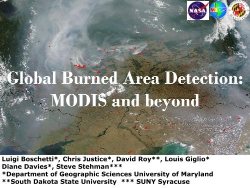
<strong>Global</strong> <strong>Burned</strong> <strong>Area</strong> <strong>Detection</strong>:<strong>MODIS</strong> <strong>and</strong> <strong>beyond</strong>Luigi Boschetti*, Chris Justice*, David Roy**, Louis Giglio*Diane Davies*, Steve Stehman****Department of Geographic Sciences University of Maryl<strong>and</strong>**South Dakota State University *** SUNY Syracuse
Fire detection from satellite• Active fires = fires actively burning at theoverpass time of the satellite; detectionmostly based on temperature.• <strong>Burned</strong> areas = areas affected by firewithin a certain time interval; detectionbased on the effects of fire on vegetation(removal of photosintetic activity, charcoalon the ground, exposed soil).
• <strong>Global</strong> Product 500m• Monthly Composite –showing date of burning( Roy <strong>and</strong> Boschetti
Algorithm• Automated, without training data or human intervention• Rolling BRDF based expectation change detection: semi-Physicallybased; less dependent upon imprecise but noise tolerantclassification techniques; very few thresholds• Applied independently per pixel to daily gridded <strong>MODIS</strong> 500ml<strong>and</strong> surface reflectance time series=> globally map 500m location <strong>and</strong> approximate day of burningRoy et al,2002, 2005Roy, Boschetti, Ju, Justice 2008
Conceptual Scheme (one pixel, time series)observedrtime
Conceptual Schemeobservedrt-1time
Conceptual SchemeBRDF Inversion windowobservedrt-1time
Conceptual SchemeBRDF Inversion windowobservedpredictedrr (t|t-1)t-1time
Conceptual SchemeBRDF Inversion windowobservedpredictedrr (t|t-1)r (t|t-1)t-1time
Conceptual SchemerBRDF Inversion windowobservedpredictedr (t+1|t)r (t+1|t)ttime
Animation: 5 Months of burning,Okavango Delta, Botswana, 2002.Produced using multitemporal rollingBRDF-based change detection approach,Roy et al. 2002
Example of Quality Assessment:Comparison with polygons by theEuropean Forest Fire ServiceBoschetti et al, 2008
Validation Protocol• L<strong>and</strong>sat-based validation protocol– Developed in SAFARI2000 with SAFNet– Exp<strong>and</strong>ed to other GOFC-GOLD regional networks– Protocol advocated & now adopted by the CEOSCal/Val program• Multi-temporal L<strong>and</strong>sat data– interpreted by regional experts– map the area burned between acquisitions– generate independent reference data set• All independent reference data to be made available tothe community via the <strong>MODIS</strong> fire web site
Time 1:L<strong>and</strong>sat ETM+Sept. 4th
Time 2:L<strong>and</strong>sat ETM+Oct 6thYellow vectors = ETM+ interpretedburned areas occurring between thetwo ETM+ acquisitions
<strong>MODIS</strong>500m<strong>Burned</strong> <strong>Area</strong>sTime 1 Sept. 4toTime 2 Oct. 6White vectors = ETM+ interpretedburned areas occurring between thetwo ETM+ acquisitions
Validation Metrics• Regression – regional spatial accuracyassessment5 x 5 km cellsRoy <strong>and</strong> Boschetti 2009• Confusion matrix statistics (overall, user’s &producer’s accuracy) – pixel level accuracy assessment
VALIDATION SITESAfrica
VALIDATION SITES
VALIDATION SITESCentral <strong>and</strong> South America
VALIDATION SITESEurope
VALIDATION SITESSiberia
Validation of <strong>Burned</strong> <strong>Area</strong> ProductTemporal Reporting Accuracy• To date we have concentrated on product spatialreporting accuracy• The product also reports the ~day of detection• The nominal uncertainty due to the daily rollingBRDF inversion window is 8 days• Temporal product accuracy increasingly relevantto user community– near real time air quality– atm. transport models (weather on day of burn, plume injection height)– some regional assessment applications (nat. resource, disaster management)
C6 validation strategy• Make use of the free availability of L<strong>and</strong>sat data• Sampling in time <strong>and</strong> space, automatic selectionof all the suitable pairs of cloud-free data• Existing Stage 2 dataset used for preliminaryestimation of the variance• Will allow calibration of the moderate resolutionestimates• Product independent – suitable for internationalcollaboration• Basis for operational assessment (VIIRS LDCMera)
… from <strong>MODIS</strong> to L<strong>and</strong>sat
… we have used L<strong>and</strong>sat data forvalidation <strong>and</strong> quality assessment ofmoderate resolution burned areaproducts.
… we have used L<strong>and</strong>sat data forvalidation <strong>and</strong> quality assessment ofmoderate resolution burned areaproducts.Why not to map burned areas fromL<strong>and</strong>sat using the same fully automatic,systematic approach of <strong>MODIS</strong>?
<strong>MODIS</strong>-L<strong>and</strong>sat data fusion for highspatial resolution multi-annual wall towall burned area mapping of theconterminous United StatesBoschetti, L. (Principal Investigator, University of Maryl<strong>and</strong>),Roy, D.P. (Co-Investigator, South Dakota State University GIScCE),Funded by NASA NNH09ZDA001N-TERRAQUA The Science of Terra<strong>and</strong> Aqua - Multi-Platform <strong>and</strong> Sensor Data Fusion,February 2011 – January 2014
Input dataset: WELD L<strong>and</strong>sat• NASA-funded (David Roy P.I)• Preprocessed, mosaiced, tiled L<strong>and</strong>satdata• Whole L<strong>and</strong>sat 7 US dataset processed• Makes it possible to implement aautomatic processing chain for thematicproducts (<strong>MODIS</strong> approach)• Pontentially exp<strong>and</strong>ing to global
WELD Tile Map (CONUS has 501 5000x5000 30m pixel tiles in Albers)
<strong>Burned</strong> area polygons for 2002 (MTBS) – thebiggest fire is on the California-Oregon border
0 10 205KilometersWELD tileh01v05WELD tileh02v05Summer2002composite
WELD tileh01v05WELD tileh02v05Summer2002compositeMOD14 <strong>Global</strong> Active Fire Product
WELD tileh01v05WELD tileh02v05Fall2002composite
WELD tileh01v05WELD tileh02v05Fall2002compositeL<strong>and</strong>sat <strong>Burned</strong> <strong>Area</strong> Map
WELD tileh01v05WELD tileh02v05Fall2002composite
The methodologyFIRST PASS: PIXEL BASED SEMANTIC CHANGEDETECTION•The weekly WELD products are classified using the SIAM automatic classifier into96 spectral categories (Baraldi et al. 2010). SIAM is a physical model-based, fullyautomatic (no training) decision-tree classifier based on prior spectral knowledge ofsurface types observed from space.•The 52 SIAM classified weekly products per WELD tile enables the adoption of achange detection strategy based on semantics applied to the SIAM spectralcategories: a set of explicit rules applied to the spectral category time series, detectingall the transitions between categories that are compatible with burning, while avoidingpotentially spurious changes, is developed.• The changes considered compatible with burning are:Vegetation → SoilVegetation with high LAI → Vegetation with low LAIVegetation → CharcoalLight Soil → Dark Soil
SECOND PASS: SEGMENTBASED DATA FUSIONThe c<strong>and</strong>idate burned areas detected by temporal analysis of the SIAMspectral categories are segmented using an approach based on theirproximity in space <strong>and</strong> time, <strong>and</strong> integrated with the <strong>MODIS</strong> active fireproduct.A burned area segment is confidently detected if:a) it contains a <strong>MODIS</strong> active fire detection in the sametemporal interval of the spectral changesORb) it is adjacent to a segment already confirmed as confident, <strong>and</strong> the spectralchanges in the two segments are detected in the same temporal interval.The contextual analysis is iterated until no new segments are identified asconfidently burned.
<strong>Global</strong> WELD April 20101.8km TOA true color browse, each browse pixel generated from 60 x 60 30m WELD pixels, sinusoidal projection
Timeline for futuredevelopments
• MCD45 is currently undergoing a fullreprocessing with improved code(Collection 5.1). The results will beavailable in the fall.• Redesigned code with integration of activefires will be ready by the end of the year(Collection 6).• VIIRS (<strong>MODIS</strong> successor) successfullylaunched. The active fire product is part ofthe st<strong>and</strong>ard product suite, no funding atthe moment for burned area product
More information<strong>MODIS</strong> fire products: http://modis-fire.umd.eduInternational coordination on fire monitoring:http://gofc-fire.umd.edu/International coordination on product validation:http://lpvs.gsfc.nasa.gov/GOFC REDD Sourcebook:http://www.gofc-gold.uni-jena.de/redd/