2012 - 2021 Watershed Management Plan Volume I - Comfort Lake ...
2012 - 2021 Watershed Management Plan Volume I - Comfort Lake ...
2012 - 2021 Watershed Management Plan Volume I - Comfort Lake ...

Create successful ePaper yourself
Turn your PDF publications into a flip-book with our unique Google optimized e-Paper software.
<strong>2012</strong> - <strong>2021</strong> <strong>Watershed</strong><strong>Management</strong> <strong>Plan</strong><strong>Volume</strong> IOctober 2011<strong>Comfort</strong> <strong>Lake</strong>-Forest <strong>Lake</strong> <strong>Watershed</strong> District
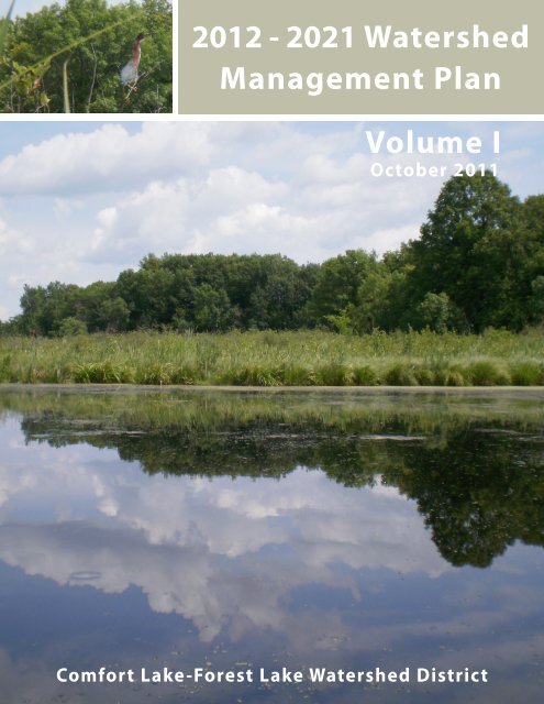
Cover Image:Large Image: FL 44 PondSmall Image: Detail of a Green Heron (Butorides virescens) from FL 44 PondDocument Component SpecsText: Staples • multipurpose paper, 24 lb. text – 50% post-consumer fibers, FSC Certified.Back Cover: Neenah Paper • Esse • Texture, Sapphire • 100 lb. cover • 30% post-consumer fibers, Green Seal ® CertifiedWire Binding: Manufactured using recycled high carbon steel
TABLE OF CONTENTS<strong>Volume</strong> 11. EXECUTIVE SUMMARY........................................................................................................................ 12. INTRODUCTION .................................................................................................................................... 32.1. Purpose......................................................................................................................................... 42.2. Mission.......................................................................................................................................... 42.3. Layout of this <strong>Plan</strong> ........................................................................................................................ 72.4. History of District........................................................................................................................... 82.5. Board of Managers and Administration ........................................................................................ 92.6. Committees................................................................................................................................. 103. ISSUES & GOALS ............................................................................................................................... 113.1. Floodplain ................................................................................................................................... 113.1.1 Issue .............................................................................................................................. 113.1.2 Goals.............................................................................................................................. 113.1.3 Objectives ...................................................................................................................... 113.2. <strong>Lake</strong>s .......................................................................................................................................... 123.2.1 Issue .............................................................................................................................. 123.2.2 Goals.............................................................................................................................. 123.2.3 Objectives ...................................................................................................................... 123.3. Streams....................................................................................................................................... 143.3.1 Issue .............................................................................................................................. 143.3.2 Goals.............................................................................................................................. 143.3.3 Objectives ...................................................................................................................... 143.4. Wetlands ..................................................................................................................................... 153.4.1 Issue .............................................................................................................................. 153.4.2 Goals.............................................................................................................................. 153.4.3 Objectives ...................................................................................................................... 153.5. Upland Resources ...................................................................................................................... 163.5.1 Issue .............................................................................................................................. 163.5.2 Goals.............................................................................................................................. 163.5.3 Objectives ...................................................................................................................... 163.6. Groundwater ............................................................................................................................... 173.6.1 Issue .............................................................................................................................. 173.6.2 Goals.............................................................................................................................. 173.6.3 Objectives ...................................................................................................................... 173.7. Public Education ......................................................................................................................... 183.7.1 Issue .............................................................................................................................. 183.7.2 Goals.............................................................................................................................. 183.7.3 Objectives ...................................................................................................................... 183.8. Interagency Communication ....................................................................................................... 193.8.1 Issue .............................................................................................................................. 193.8.2 Goals.............................................................................................................................. 193.8.3 Objectives ...................................................................................................................... 19CLFLWD <strong>Watershed</strong> <strong>Management</strong> <strong>Plan</strong>
4. IMPLEMENTATION ............................................................................................................................. 214.1. Introduction ................................................................................................................................. 214.1.1 <strong>Management</strong> Areas ....................................................................................................... 224.2. Implementation <strong>Plan</strong> Structure ................................................................................................... 224.3. Implementation Schedule and Cost Table.................................................................................. 254.4. Administration (1000 Series) ...................................................................................................... 254.4.1 Board Administration (1001) .......................................................................................... 254.4.2 General Office Expenses (1002) ................................................................................... 254.4.3 General Administration (1003)....................................................................................... 254.4.4 Professional Services (1004)......................................................................................... 264.5. Programs (3000 Series).............................................................................................................. 274.5.1 District Rules and Rulemaking (3001) ........................................................................... 274.5.2 Permitting (3002) ........................................................................................................... 284.5.3 Monitoring and Data Assessment (3003) ...................................................................... 304.5.4 Non-Point Source Pollution Abatement Program (3004)............................................... 334.5.5 Education and Outreach (3005)..................................................................................... 364.5.6 Technical Resource Sharing and Interagency Communication (3006)......................... 384.5.7 Research (3007) ............................................................................................................ 404.5.8 Measurement of Progress (3008).................................................................................. 414.6. Projects (5000 Series) ................................................................................................................ 424.6.1 Floodplain (5100 Series)................................................................................................ 424.6.2 <strong>Lake</strong>s (5200 Series)....................................................................................................... 434.6.3 Streams (5300 Series)................................................................................................... 554.6.4 Wetlands (5400 Series) ................................................................................................. 584.6.5 Upland Resources (5500 Series)................................................................................... 634.6.6 Groundwater (5600 Series) ........................................................................................... 644.6.7 Public Education (5700 Series) ..................................................................................... 664.6.8 Interagency Communication (5800 Series) ................................................................... 66CLFLWD <strong>Watershed</strong> <strong>Management</strong> <strong>Plan</strong>
5. IMPLEMENTATION SCHEDULE AND COST TABLE ....................................................................... 756. MEASURING IMPLEMENTATION PROGRESS................................................................................. 816.1. Quantitative Assessment: Issue Areas Addressed..................................................................... 816.1.1 Projects .......................................................................................................................... 816.1.2 Programs ....................................................................................................................... 816.2. Adaptive <strong>Management</strong>: Meeting <strong>Lake</strong> Goals for Water Quality ................................................. 827. FINANCING APPROACH .................................................................................................................... 837.1. Funding Options.......................................................................................................................... 837.1.1 Ad Valorem Taxes ......................................................................................................... 837.1.2 Special Assessments..................................................................................................... 847.1.3 Water <strong>Management</strong> Fees .............................................................................................. 847.1.4 Emergency Projects....................................................................................................... 847.1.5 Outside Funding Sources .............................................................................................. 847.2. Proposed Funding Mechanisms ................................................................................................. 857.2.1 General Funding ............................................................................................................ 857.2.2 Alternate Funding Methods............................................................................................ 908. INTERGOVERNMENTAL COORDINATION AND IMPACT ............................................................... 958.1. Local Government Agencies....................................................................................................... 958.1.1 Roles.............................................................................................................................. 958.1.2 Impact of <strong>Plan</strong>................................................................................................................ 958.2. State Government Agencies..................................................................................................... 1018.2.1 Roles............................................................................................................................ 1018.3. Federal Government Agencies ................................................................................................. 1028.3.1 Roles............................................................................................................................ 1029. AMENDMENTS TO THIS PLAN........................................................................................................ 10310. ANNUAL REPORTING ...................................................................................................................... 105CLFLWD <strong>Watershed</strong> <strong>Management</strong> <strong>Plan</strong>
<strong>Volume</strong> 211. LAND AND WATER RESOURCE INVENTORY ............................................................................... 10711.1. Location ................................................................................................................................ 10711.2. Climate and Precipitation....................................................................................................... 10811.2.1 Climate Change ...................................................................................................... 11211.3. Topography and Geomorphology.......................................................................................... 11511.3.1 Meltwater Deposits and Ground Moraine ............................................................... 11611.3.2 Terminal Moraine Deposits..................................................................................... 11611.3.3 <strong>Lake</strong> Deposits ......................................................................................................... 11611.4. Soils ................................................................................................................................ 12111.5. Geology ................................................................................................................................ 12211.5.1 Surficial Geology..................................................................................................... 12311.5.2 Bedrock Geology .................................................................................................... 12411.6. Surface Water Resources ..................................................................................................... 13111.6.1 <strong>Watershed</strong> Hydrology ............................................................................................. 13111.6.2 DNR Public Waters and Wetlands.......................................................................... 13211.6.3 Rivers and Streams ................................................................................................ 14111.6.4 Active Recreation <strong>Lake</strong>s ......................................................................................... 14311.6.5 Passive Recreation <strong>Lake</strong>s ...................................................................................... 17611.6.6 Wetlands ................................................................................................................. 18911.6.7 Drainage Systems................................................................................................... 19711.7. Impaired Waters .................................................................................................................... 19811.7.1 <strong>Lake</strong>s....................................................................................................................... 19811.7.2 Watercourses.......................................................................................................... 20011.8. Floodplain .............................................................................................................................. 20111.9. Natural Communities ............................................................................................................. 20511.9.1 Minnesota Land Cover Classification System Mapping ......................................... 20511.10. Fish & Wildlife.......................................................................................................................... 20611.10.1 Fish ......................................................................................................................... 20611.10.2 Wildlife..................................................................................................................... 20611.11. Groundwater Resources.......................................................................................................... 21111.11.1 Aquifers................................................................................................................... 21111.11.2 Groundwater Recharge, Groundwater Discharge, & GroundwaterFlow ......................................................................................................................... 21211.11.3 Groundwater Appropriations, Well Head Protection Areas,and Source Water Assessment Areas .................................................................... 21311.11.4 Groundwater Quality and Quantity ......................................................................... 21411.11.5 Groundwater Monitoring ......................................................................................... 21411.11.6 Groundwater Dependent Natural Resources.......................................................... 21511.11.7 Groundwater Studies .............................................................................................. 21711.12. Monitoring................................................................................................................................ 22511.12.1 Ongoing Efforts ....................................................................................................... 22511.12.2 Additional Project-Specific Monitoring Efforts......................................................... 22711.13. Land Use and Public Utilities................................................................................................... 23311.14. Unique Features and Scenic Areas......................................................................................... 23411.14.1 Rare Biological Features......................................................................................... 234CLFLWD <strong>Watershed</strong> <strong>Management</strong> <strong>Plan</strong>
11.15. Pollutant Sources .................................................................................................................... 24711.16. Permitted Discharges .............................................................................................................. 24711.16.1 Municipal Separate Storm Sewer System (MS4) Stormwater................................ 24711.16.2 Construction and Industrial Stormwater.................................................................. 24711.16.3 Point Sources.......................................................................................................... 24811.16.4 Feedlots .................................................................................................................. 24811.17. Potential Environmental Hazards ............................................................................................ 24911.17.1 Contaminated Sites................................................................................................. 24911.17.2 Leaking Above- & Below-ground Storage Tanks.................................................... 24911.17.3 Wells ....................................................................................................................... 24911.18. District Study Inventory............................................................................................................ 25511.18.1 CLFLWD Six <strong>Lake</strong>s TMDL Implementation <strong>Plan</strong> (February 2010)......................... 25511.18.2 CLFLWD Six <strong>Lake</strong>s TMDL (February 2010)........................................................... 25511.18.3 <strong>Watershed</strong> and <strong>Lake</strong> Water Quality Modeling Investigation for theDevelopment of a <strong>Watershed</strong> Capital Improvement <strong>Plan</strong> (Dec. 2007)................... 25611.18.4 Hydraulic Capacity and Model Calibration Report (May 2005) .............................. 25611.18.5 <strong>Comfort</strong> <strong>Lake</strong>, Chisago County Phase I Resource Investigation(April 2000, last revised September 2002) ............................................................. 25611.18.6 Shoreland Inventory of <strong>Comfort</strong> <strong>Lake</strong>, Chisago County (April 1999) ..................... 25711.18.7 <strong>Lake</strong> Assessment Program, Big and Little <strong>Comfort</strong> <strong>Lake</strong>s,Chisago County, Minnesota (April 1995)................................................................ 25711.18.8 Abandoned JD 1 ..................................................................................................... 25711.18.9 <strong>Lake</strong> Water Quality Summary for Shields, Bone, Sylvan (Halfbreed)and Forest <strong>Lake</strong>s (February 1990) ......................................................................... 25811.18.10 A Stable Isotope/Chemical Investigation of <strong>Lake</strong>-GroundwaterInteractions at Forest <strong>Lake</strong> (June 1990)................................................................. 25811.18.11 <strong>Lake</strong> Diagnostic Feasibility Study for Forest, Shields andBone <strong>Lake</strong>s (November 1987)................................................................................ 25911.19. Status of Local Comprehensive <strong>Plan</strong>s and Water <strong>Plan</strong>s......................................................... 26111.20. Shoreland and Floodplain Ordinances .................................................................................... 26212. GAPS ANALYSIS............................................................................................................................. 26313. REFERENCES ................................................................................................................................ 264CLFLWD <strong>Watershed</strong> <strong>Management</strong> <strong>Plan</strong>
List of FiguresFigure 1. CLFLWD Location. ..................................................................................................................5Figure 2. Project Locations in the Bone <strong>Lake</strong> <strong>Management</strong> District.....................................................67Figure 3. Project Locations in the Little <strong>Comfort</strong> <strong>Lake</strong> <strong>Management</strong> District .......................................69Figure 4. Project Locations in the Forest <strong>Lake</strong> <strong>Management</strong> District...................................................71Figure 5. Project Locations in the <strong>Comfort</strong> <strong>Lake</strong> <strong>Management</strong> District ................................................73Figure 6. CLFLWD <strong>Lake</strong> <strong>Management</strong> Districts...................................................................................93Figure 7. County and Municipal Boundaries of CLFLWD...................................................................109Figure 8. CLFLWD topography...........................................................................................................117Figure 9. CLFLWD geomorphology....................................................................................................119Figure 10. CLFLWD soils by hydrologic group...................................................................................125Figure 11. The surficial geology of the CLFLWD................................................................................127Figure 12. The bedrock geology of the CLFLWD...............................................................................129Figure 13. CLFLWD surface waters and major subwatersheds.........................................................133Figure 14. Minor Subwatersheds........................................................................................................135Figure 15. DNR public waters.............................................................................................................137Figure 16. District Streams .................................................................................................................139Figure 17. Total phosphorus monitoring data for Bone <strong>Lake</strong>. ............................................................147Figure 18. Total phosphorus monitoring data of Shields <strong>Lake</strong>...........................................................153Figure 19. Total phosphorus monitoring data for Little <strong>Comfort</strong> <strong>Lake</strong>. ...............................................167Figure 20. Total phosphorus monitoring data for <strong>Comfort</strong> <strong>Lake</strong>.........................................................173Figure 21. Total phosphorus monitoring data for Moody <strong>Lake</strong>...........................................................179Figure 22. Total phosphorus monitoring data for School <strong>Lake</strong>...........................................................187Figure 23. CLFLWD national wetland inventory.................................................................................191Figure 24. Wetland Quality Classification based onMinnesota Land Cover Classification System data...........................................................193Figure 25. CLFLWD impaired waters. ................................................................................................203Figure 26. Presettlement Vegetation data for Washington and Chisago County...............................207Figure 27. Landcover (MLCCS) data for CLFLWD.............................................................................209Figure 28. Map of generalized groundwater contours for theQuaternary Water Table Aquifer........................................................................................219Figure 29. Map of Water Appropriations, Source Water Assessments,and Well Protection Areas ................................................................................................221Figure 30. Groundwater Dependent <strong>Plan</strong>t Communities....................................................................223Figure 31. Monitoring sites within CLFLWD. ......................................................................................229Figure 32. Water quality grades of CLFLWD lakes ............................................................................231Figure 33. Percent of <strong>Watershed</strong> in each Land Use Category...........................................................233Figure 34. CLFLWD Chisago County (1989) land use.......................................................................235Figure 35. CLFLWD Washington County (2005) land use. ................................................................237Figure 36. Future (2020) land use within CLFLWD............................................................................239Figure 37. CLFLWD Metropolitan Urban Service Area. .....................................................................241Figure 38. Open spaces and recreational areas. ...............................................................................243Figure 39. Minnesota County Biological Survey Sites........................................................................245Figure 40. Permitted pollution sources. ..............................................................................................251Figure 41. Environmental hazards......................................................................................................253CLFLWD <strong>Watershed</strong> <strong>Management</strong> <strong>Plan</strong>
List of TablesTable 1. <strong>Lake</strong> water quality goals. ........................................................................................................13Table 2. Implementation plan organization: categories and areas.......................................................24Table 3. <strong>Lake</strong> water quality goals. ........................................................................................................82Table 4. Capital Improvement Project Summary (all in 2010 dollars) ..................................................87Table 5. Areas of <strong>Lake</strong> <strong>Management</strong> Districts......................................................................................90Table 6. Current Local Water <strong>Management</strong> <strong>Plan</strong> (LWMP) and Ordinance Status...............................95Table 7. Local <strong>Plan</strong> Adoption Deadlines...............................................................................................96Table 8. Goals for In-lake Water Quality and Phosphorus Load Reductions.......................................98Table 9. 2000, 2020 and 2030 Populations by Municipality ...............................................................108Table 10. Monthly temperature and precipitation averages for the period from 1958 through2009 at National Weather Service Station Number 212881 in Forest <strong>Lake</strong>, MN.................111Table 11. Storm events and recurrence intervals...............................................................................111Table 12. Impacts to Minnesota water resources as a result of climate change................................113Table 13. Soil classification. ...............................................................................................................121Table 14. CLFLWD lakes impaired for aquatic recreation* due to excess nutrients..........................199Table 15. CLFLWD impaired watercourses........................................................................................200Table 16. Existing 100-year Flood Elevations for District <strong>Lake</strong>s ........................................................201Table 17. Summary of lake monitoring through the Metropolitan Council'sCitizen Assisted <strong>Lake</strong> Monitoring Program (CAMP) through 2009. ...................................226Table 18. Summary of lake monitoring through theChisago Volunteer <strong>Lake</strong> Monitoring Program. ...................................................................226Table 19. <strong>Lake</strong> <strong>Watershed</strong> Land Use Summary.................................................................................233Table 20. Status of local water plans..................................................................................................261Table 21. Status of floodplain and shoreland ordinances. .................................................................262CLFLWD <strong>Watershed</strong> <strong>Management</strong> <strong>Plan</strong>
List of Appendices<strong>Volume</strong> 1Appendix A:Non-Point Source Pollution Abatement Program DescriptionsAppendix B:Sunrise River Water Quality and Flowage Project PetitionAppendix C:Washington County Budget and Financial Policy #2403<strong>Volume</strong> 2Appendix D:Water Quality Data SummaryAppendix E:Gaps AnalysisAppendix F:Rare FeaturesCLFLWD <strong>Watershed</strong> <strong>Management</strong> <strong>Plan</strong>
1. EXECUTIVE SUMMARYThe <strong>Comfort</strong> <strong>Lake</strong>-Forest <strong>Lake</strong> <strong>Watershed</strong> District (CLFLWD) was created in 1999 to help solveand prevent water resource problems over a 49 square mile watershed encompassing drainage toBone <strong>Lake</strong>, Forest <strong>Lake</strong> and <strong>Comfort</strong> <strong>Lake</strong> as well as drainage to a number of smaller lakes andstreams. Drainage from <strong>Comfort</strong> <strong>Lake</strong>, the District’s “outlet”, enters the Sunrise River andultimately drains to the St. Croix River. The District includes portions of the City of Wyoming,Chisago City, Chisago <strong>Lake</strong> Township, Franconia Township, the City of Forest <strong>Lake</strong> and the Cityof Scandia. The CLFLWD is governed by an appointed, five-member Board of Managers.The Mission of the District is to protect and improve its water resources through adaptivemanagement approaches and education of local stakeholders. This <strong>Watershed</strong> <strong>Management</strong> <strong>Plan</strong>is intended to support that mission as a guide for the activities of the <strong>Comfort</strong> <strong>Lake</strong>-Forest <strong>Lake</strong><strong>Watershed</strong> District through the year <strong>2021</strong>. The <strong>Plan</strong> outlines the issues the District will addressand establishes the goals, objectives and actions the District intends to use to tackle the identifiedissues over the next ten years. Local water management plan requirements are outlined and buildon or bring together existing plans and programs of the municipalities.The <strong>Plan</strong> identifies eight major issue areas: Floodplain, <strong>Lake</strong>s, Streams, Wetlands, UplandResources, Groundwater, Public Education, and Interagency Communication with goals focusingon the adaptive management of water and upland resources through District projects andprograms and through education and coordination.• Floodplain goals include conserving flood storage capacity and limiting flood damage.• <strong>Lake</strong> goals include management to protect and improve water quality, to limit the spreadand entry of invasive species, and the preservation of shoreline buffers.• Stream goals are similar and focus on managing stream water quality and habitat,aquatic invasive species management education, and the preservation and establishmentof stream buffers.• Wetland goals address coordination with local governments to ensure no net loss,improving wetland habitat, research on phosphorus cycling in wetlands and thepreservation and establishment of wetland buffers.• Upland Resources goals include improving the beneficial use of upland areas forstormwater management, maintaining and restoring uplands, and promoting uplandsconservation.• Groundwater goals address the protection of groundwater quality and quantity andmaintaining the function of groundwater-dependent natural resources.• Public Education goals address providing education and outreach services to the publicto increase knowledge of and appreciation for the resources of the District andincreasing stewardship and participation in District programs.• Interagency Communication goals focus on partnerships that ensure efficient and costeffectiveuse of funds for water resource management and coordination of efforts towardmanaging water resources.Programs and projects are outlined to address the identified issues and goals at an average annualcost of about $2.7 million. The planned programs of the District are: District Rules &Rulemaking, Permitting, Monitoring & Data Assessment, Non-Point Source PollutionAbatement, Education & Outreach, Technical Resource Sharing & Interagency Communication,Research, and Measurement of Progress. Projects are outlined to address each of the issue areasand capital improvements are included where needed. Capital improvements are differentiatedfrom other projects because capital improvements are larger, more complex projects that oftenrequire land acquisition or land rights and have long term maintenance and operation needs. Theplanned capital improvement projects implement methods to protect or improve the water qualityof District lakes as well as enhance or improve wetlands, streams, and other natural resources.<strong>2012</strong>-<strong>2021</strong> <strong>Comfort</strong> <strong>Lake</strong>-Forest <strong>Lake</strong> <strong>Watershed</strong> <strong>Management</strong> <strong>Plan</strong> 1
(this page intentionally blank)<strong>2012</strong>-<strong>2021</strong> <strong>Comfort</strong> <strong>Lake</strong>-Forest <strong>Lake</strong> <strong>Watershed</strong> <strong>Management</strong> <strong>Plan</strong> 2
2. INTRODUCTIONWater resources are dynamic systems, fluctuating with climate, shifting withseasons, and changing over years and decades. The management of waterresources requires an equally dynamic strategy; a strategy that can adapt andchange with the climate, the seasons, and through the years as the resourcesreflect the changing conditions of the watershed.Adaptive management is an iterative approach of implementation, evaluation, and coursecorrection that reflects the dynamic nature of water resources. The District sets an adaptivemanagement policy to be able to react to changing conditions while also remaining mindful of thelong term goals for the resources of the District. One of the primary goals of the District is torestore and maintain lake water quality as appropriate to each resource. Excess nutrients are themain factor degrading water quality in most District <strong>Lake</strong>s. Nutrient load reduction projects havebeen initially defined as included in this <strong>Plan</strong>. However, the incorporation of additional practices,changes to the siting or type of practice, and changes to project scheduling may be needed toreflect conditions observed in the watershed. In-lake conditions do not necessarily respondquickly to changes in the watershed. Adaptive management decisions will therefore be madebased on long term observed trends in lake water quality as well as evaluations of theeffectiveness of specific practices.AssessProgressDesignStrategyAdaptive<strong>Management</strong>EvaluateImplementMonitor<strong>2012</strong>-<strong>2021</strong> <strong>Comfort</strong> <strong>Lake</strong>-Forest <strong>Lake</strong> <strong>Watershed</strong> <strong>Management</strong> <strong>Plan</strong> 3
2.1. PurposeThe <strong>Comfort</strong> <strong>Lake</strong>-Forest <strong>Lake</strong> <strong>Watershed</strong> District (CLFLWD) is a special purpose unitof local government, established under Minnesota Statutes 103D, which was created tohelp solve and prevent water resource problems. The CLFLWD is governed by anappointed, five-member Board of Managers.The <strong>Comfort</strong> <strong>Lake</strong>-Forest <strong>Lake</strong> <strong>Watershed</strong> District covers 49 square miles insouthwestern Chisago County and northwestern Washington County (Figure 1). TheDistrict encompasses drainage to Bone <strong>Lake</strong>, Forest <strong>Lake</strong> and <strong>Comfort</strong> <strong>Lake</strong> as well asdrainage to a number of smaller lakes and streams. Drainage from <strong>Comfort</strong> <strong>Lake</strong>, theDistrict’s “outlet”, enters the Sunrise River and ultimately drains to the St. Croix River.The District includes portions of the City of Wyoming, Chisago City, Chisago <strong>Lake</strong>Township, Franconia Township, the City of Forest <strong>Lake</strong> and the City of Scandia.This <strong>Watershed</strong> <strong>Management</strong> <strong>Plan</strong> is intended to guide the activities of the <strong>Comfort</strong><strong>Lake</strong>-Forest <strong>Lake</strong> <strong>Watershed</strong> District through the year <strong>2021</strong>. The <strong>Plan</strong> establishes thegoals, objectives and actions the District intends to use to address the identified issuesover the next ten years.The CLFLWD is not the only organization working to address the types of issuesidentified in this plan. Other government agencies, private organizations, and localcitizens play a large role in implementing solutions to the water and natural resourcemanagement issues within the <strong>Comfort</strong> <strong>Lake</strong>-Forest <strong>Lake</strong> <strong>Watershed</strong> District. TheCLFLWD has identified actions in this plan which are intended to build on the efforts ofthese other entities and also position CLFLWD as a local leader in specific efforts toaddress issues of high priority to the District.2.2. MissionThe Mission of the District is to protect and improveits water resources through adaptive managementapproaches and education of local stakeholders.The District emphasizes adaptive management principles supported by sound scientifictechnologies and methods to develop uniform, fiscally responsible and integratedapproaches to water management in an ongoing effort to protect and improve theDistrict’s water resources. In addition, the District stresses education and outreach toStakeholders, in order to:• increase awareness regarding water resource issues, and• understand their role in protecting and improving the quality of our water resources.<strong>2012</strong>-<strong>2021</strong> <strong>Comfort</strong> <strong>Lake</strong>-Forest <strong>Lake</strong> <strong>Watershed</strong> <strong>Management</strong> <strong>Plan</strong> 4
<strong>2012</strong>-<strong>2021</strong> <strong>Comfort</strong> <strong>Lake</strong>-Forest <strong>Lake</strong> <strong>Watershed</strong> <strong>Management</strong> <strong>Plan</strong> 5Figure 1. Location Map of the CLFLWD
<strong>2012</strong>-<strong>2021</strong> <strong>Comfort</strong> <strong>Lake</strong>-Forest <strong>Lake</strong> <strong>Watershed</strong> <strong>Management</strong> <strong>Plan</strong> 6
2.3. Layout of this <strong>Plan</strong>This <strong>Watershed</strong> <strong>Management</strong> <strong>Plan</strong> is broken into a number of sections that providebackground, guidance, and direction for the District’s operations. The basis for theDistrict’s work is outlined in the Issues and Goals section and spelled out in more detailin the Implementation section.The issues, goals and objectives define the focus of the District’s work. The details ofhow the issues will be addressed and how the objectives will be met is outlined in theImplementation section. The planned programs and projects that will be implemented toaddress the identified issues and goals are detailed in the Implementation section,including project and program summaries, scheduling, costs, progress metrics, andfunding guidance. Additional detail on evaluation of progress toward the District’s goalsis included in the Measurement of Progress section and additional detail on the funding ofDistrict activities is included in the Funding section.The District’s work interrelates with the activities of other government agencies. TheIntergovernmental Coordination and Impacts section discusses how the District plans towork with local, state, and federal agencies and provides an analysis of the impact of this<strong>Plan</strong> on local governments, including the requirements for local water plans.The District reports its activities through an annual report as summarized in the AnnualReport section. In addition, the District may need to update or revise this <strong>Plan</strong> and theprocess to complete revisions to the <strong>Plan</strong> is included in the <strong>Plan</strong> Amendments section.The final section of the <strong>Plan</strong>, the Land and Water Resource Inventory, includesbackground data on the surface water, groundwater, natural resources, and climateconditions of the District. This data and analysis, as well as the data collected annuallyby the District, provides the basis for the identified issues, goals, objectives, andimplementation actions included in this <strong>Plan</strong>.Example of <strong>Lake</strong> Summary included in Land & Water Resource Inventory (Vol. II)<strong>2012</strong>-<strong>2021</strong> <strong>Comfort</strong> <strong>Lake</strong>-Forest <strong>Lake</strong> <strong>Watershed</strong> <strong>Management</strong> <strong>Plan</strong> 7
2.4. History of DistrictSince the early 1980s, some type of water management organization has operated withinmuch of the present <strong>Comfort</strong> <strong>Lake</strong>-Forest <strong>Lake</strong> <strong>Watershed</strong> District (CLFLWD). The Cityof Forest <strong>Lake</strong>, Town of Forest <strong>Lake</strong> and Town of New Scandia developed a JointPowers Agreement to establish the Forest <strong>Lake</strong> <strong>Watershed</strong> <strong>Management</strong> Organization(FLWMO), in accordance with Minnesota Statute sections 473.875 to 473.883, onDecember 19, 1983. The FLWMO expanded in 1987 to include the drainage areas forBone and Twin <strong>Lake</strong>s. The FLWMO developed a plan, conducted several lakemanagement studies and implemented permit and fertilizer management programs forlake protection.As water management issues surrounding Judicial Ditch 1 became increasingly complexin the late 1990s and the ditch was ultimately abandoned, the FLWMO was expanded tocreate the New <strong>Watershed</strong> <strong>Management</strong> Organization (NEWMO). A primary purpose ofexpansion was to address the water management issues associated with the abandoned JD1. Residents filed a petition for formation of the CLFLWD following the disbanding ofthe NEWMO, because of the lack of an agreeable financing mechanism.Seventy-four residents within the proposed boundary for the <strong>Comfort</strong> <strong>Lake</strong> - Forest <strong>Lake</strong><strong>Watershed</strong> (CLFLWD) petitioned the Board of Water and Soil Resources (BWSR) toestablish the CLFLWD on November 18, 1998. Petitioners included various residents ofthe District including agricultural land owners and lakeshore landowners. The petitionwas also supported by the communities and county boards. A public hearing concerningthe establishment of the CLFLWD was subsequently held on June 21, 1999 at the Forest<strong>Lake</strong> City Hall Council Chambers. The CLFLWD was formed by order of the BWSR onSeptember 23, 1999.The area described by the petition encompassed approximately 49 square miles in theCities of Forest <strong>Lake</strong> and Wyoming, and the Towns of Chisago <strong>Lake</strong>s, Wyoming, Forest<strong>Lake</strong> and New Scandia. The petition included the area encompassed by the predecessororganization, the Forest <strong>Lake</strong> <strong>Watershed</strong> <strong>Management</strong> Organization (FLWMO), plus thedrainage area of <strong>Comfort</strong> <strong>Lake</strong> in Chisago County; i.e., Joint Ditch No. 1 (JD 1). TheMinnesota Department of Natural Resources recommended a larger boundary includingthe entire Sunrise River to the north, but the boundary outlined in the petition wasapproved. One of the exhibits to the establishment order consisted of a map showing theproposed boundary. Although not listed by the petition, this map showed a small portionof Columbus Township in Anoka County as included in the CLFLWD. After recognizingthis discrepancy and realizing the Higgins <strong>Lake</strong> area consisted of a closed basin, BWSRremoved this portion of Anoka County from the CLFLWD by order dated May 24, 2000.Historic Agriculture in the Region<strong>2012</strong>-<strong>2021</strong> <strong>Comfort</strong> <strong>Lake</strong>-Forest <strong>Lake</strong> <strong>Watershed</strong> <strong>Management</strong> <strong>Plan</strong> 8
2.5. Board of Managers and AdministrationThe CLFLWD is governed by an appointed, five-member Board of Managers. Managersare appointed by the counties within which the <strong>Watershed</strong> District is located. Because the<strong>Comfort</strong> <strong>Lake</strong> - Forest <strong>Lake</strong> <strong>Watershed</strong> District is located within Chisago andWashington counties, the make up of the Board of Managers reflects the percent of thewatershed within each County. Roughly 60 percent of CLFLWD is within WashingtonCounty and 40 percent is within Chisago County. Therefore, in CLFLWD, two managersare appointed by Chisago County and three managers are appointed by WashingtonCounty. The county board provides public notice before making appointments and mayonly appoint voting residents of the <strong>Watershed</strong> District who are not a public officer of thecounty, state or federal government. Soil and water conservation supervisors may bewatershed district managers. Each manager holds a three-year term of office and may bereappointed for further three-year terms.The District has an administrator on staff and contracts work with an engineering firm,legal firm, and accounting firm in addition to contracting work with the two County Soiland Water Conservation Districts.The Board of Managers involved in the preparationof this <strong>Watershed</strong> <strong>Management</strong> <strong>Plan</strong> were:Richard P. Damchik, President9109 N. Shore Trail, Forest <strong>Lake</strong>, MN 55025Representative County: Washington - Expires: 09-23-2013Telephone: 651-464-5890 / E-mail: dick.damchik@clflwd.orgJackie A. Anderson, Vice President25484 East <strong>Comfort</strong> Drive, Forest <strong>Lake</strong>, MN 55025Representative County: Chisago - Expires: 9-23-<strong>2012</strong>Telephone: 651-792-3860 / E-mail: jackie.anderson@clflwd.orgWayne S. Moe, Secretary22877 Mallard Ave North, Scandia, MN 55073Representative County: Washington - Expires: 09-23-<strong>2012</strong>Telephone: 651-433-4968 / E-mail: wayne.moe@clflwd.orgJon W. Spence, Manager25582 <strong>Comfort</strong> Drive, Chisago City, MN 55013Representative County: Chisago - Expires: 09-23-2011Telephone: 763-526-3126 / E-mail: jon.spence@clflwd.orgJohn T. Lynch, Treasurer920 15th Street SE, Forest <strong>Lake</strong>, MN 55025Representative County: Washington - Expires: 09-23-2011Telephone: 651-464-3022 / E-mail: tom.lynch@clflwd.org<strong>2012</strong>-<strong>2021</strong> <strong>Comfort</strong> <strong>Lake</strong>-Forest <strong>Lake</strong> <strong>Watershed</strong> <strong>Management</strong> <strong>Plan</strong> 9
2.6. CommitteesThe <strong>Comfort</strong> <strong>Lake</strong> - Forest <strong>Lake</strong> <strong>Watershed</strong> District <strong>Watershed</strong> (CLFLWD) has twocommittees that meet as needed to advise the District: a Citizens Advisory Committeeand a Technical Advisory Committee.The Citizens Advisory Committee (CAC) is a group that is made up of local citizenswho provide input to the Board of Managers on water-related community concernsand issues. The CAC's purpose, as established by the Board of Managers is toprovide public input to the CLFLWD regarding policy and project matters, providea channel of communication to the Board Managers, aid in fostering a positivepublic image of the CLFLWD, and help to educate the public about the CLFLWD'sgoals and accomplishments.The Technical Advisory Committee (TAC) is comprised of staff from cities andtownships having all or a portion of their boundary within the CLFLWD. Further,the TAC includes technical staff from Chisago and Washington County,Metropolitan Council, DNR, MPCA, BWSR and other agencies. The TAC’s mainpurpose is to provide input on project and planning efforts of the District and assistin defining methods to coordinate water and natural resource management efforts ofthe various municipalities and agencies with the actions of the District.CLFLWD <strong>Lake</strong> Clean Up 2006<strong>2012</strong>-<strong>2021</strong> <strong>Comfort</strong> <strong>Lake</strong>-Forest <strong>Lake</strong> <strong>Watershed</strong> <strong>Management</strong> <strong>Plan</strong> 10
3. ISSUES & GOALSThe <strong>Comfort</strong> <strong>Lake</strong>-Forest <strong>Lake</strong> <strong>Watershed</strong> District identified key issues influencing the water andnatural resources of the District and established goals and objectives to address the identifiedissues. Issues were identified by the Board, Technical Advisory Committee, and CitizenAdvisory Committee based on the data identified in the Land and Water Resource Inventory andGaps Analysis (see <strong>Volume</strong> II of this <strong>Plan</strong>) as well as individual knowledge of the issues affectingthe resources in the District. While all of these issues are important to the District and itsresources, some issues were identified as higher priority for focused efforts under this <strong>Plan</strong>. Atthis time, issues affecting the water quality of lakes are the main focus of District efforts assupported by public education and interagency coordination. The Implementation section of this<strong>Plan</strong> (Section 4) outlines the programs and specific actions planned to address each issue area.District issues and goals are organized by the following Issue Areas as identified through theplanning process:1. Floodplain2. <strong>Lake</strong>s3. Streams4. Wetlands5. Upland Resources6. Groundwater7. Public Education8. Interagency Communication3.1. Floodplain3.1.1 IssueWaterbodies and constructed stormwater management facilities within theDistrict provide storage of flood waters. Flooding is a natural occurrence that isvital to the health of many ecosystems. However, the District risks losing floodstorage volume through land and basin alterations. The loss of the 100-yearflood storage volume and alterations to floodplains or stormwater facility outletscan increase the frequency, elevation, and duration of flooding and causeincreased impacts to infrastructure, property and the natural environment.3.1.2 GoalsA. Prevent encroachment of the 100-year floodplain to conserve water storagecapacity and maintain floodplain hydrology.B. Limit flood damage to infrastructure and natural resources.3.1.3 Objectives1. Rely on municipalities with state-approved floodplain ordinances to implementfloodplain protection standards.2. Implement floodplain protection standards through District Rules & RulemakingProgram and Permitting Program for municipalities that do not have a stateapprovedfloodplain ordinance.3. Limit the impact of flooding by managing stormwater runoff rates and volumesthrough the District Rules & Rulemaking Program and Permitting Program.4. Reduce or mitigate in areas with known flooding and/or high water problems.<strong>2012</strong>-<strong>2021</strong> <strong>Comfort</strong> <strong>Lake</strong>-Forest <strong>Lake</strong> <strong>Watershed</strong> <strong>Management</strong> <strong>Plan</strong> 11
3.2. <strong>Lake</strong>s3.2.1 Issue<strong>Lake</strong>s are popular recreational assets in the District. In addition, lakes providedetention of flood waters, feeding grounds for wildlife, and habitat for fish andother aquatic organisms. <strong>Lake</strong>s can also provide a certain degree of pollutantsettling, treatment through in-lake processes, and cooling of stormwater runoffwhile still maintaining good water quality. However, land use and landmanagement practices have caused excessive discharge of pollutants, impactingthe water quality and recreational use of a number of lakes within the District.Other lakes are at risk of impacts to water quality and recreational use due toinvasive species, current land use practices or land use and land managementchanges. This changing backdrop requires adaptive management.3.2.2 GoalsA. Adaptively manage District lakes to protect and improve water quality andrecreational utility as appropriate to each lake (see Table 1).B. Be proactive in aquatic invasive species management through education andprojects that improve lake water quality and/or reduce the risk of entry ofinvasive species.C. Preserve existing shoreland buffers and encourage the establishment of newbuffers and lakescaping for water quality and habitat benefits.3.2.3 Objectives1. Implement projects and capital improvements identified in this <strong>Plan</strong>, as feasible,to reduce watershed nutrient loading to District lakes, limit internal nutrientloads, and manage for healthy fish and aquatic macrophyte populations.2. Address a portion of the total phosphorus load reduction needed to attain totalphosphorus load capacities of impaired lakes through the projects and capitalimprovements identified in this <strong>Plan</strong>.3. Implement nutrient and sediment load reduction projects through the Non-PointSource Pollution Abatement Grant Program.4. Monitor lake water quality through the Monitoring Program to guide adaptivemanagement and provide the measure of progress.5. Implement projects identified in this <strong>Plan</strong> to manage aquatic invasive species inlakes where these species present a water quality problem or that can lead to orbe a cause of water quality degradation.6. Work to limit the spread of aquatic invasive species to unimpacted lakes throughthe Education & Outreach Program and the Research Program.7. Work to improve rough fish management for water quality through the ResearchProgram.8. Protect shoreland buffers through the District Rules & Rulemaking Program andPermitting Program.9. Encourage and implement reestablishment of shoreland buffers and shorelinerestoration through the Non-Point Source Pollution Abatement Grant Program.<strong>2012</strong>-<strong>2021</strong> <strong>Comfort</strong> <strong>Lake</strong>-Forest <strong>Lake</strong> <strong>Watershed</strong> <strong>Management</strong> <strong>Plan</strong> 12
Table 1. <strong>Lake</strong> water quality goals.<strong>Lake</strong>Measured AverageConcentrationYearsof Data10-yearIn-<strong>Lake</strong> TotalPhosphorusGoal20-yearIn-<strong>Lake</strong> TotalPhosphorusGoalLong TermIn-<strong>Lake</strong> TotalPhosphorusGoalConcentration Concentration 1 Load 2 Concentration 3Moody 384 μg/l TP 3 60 μg/l TP 40 μg/l TP 144 lb/yr 40 μg/l TPBone 85 μg/l TP 21 40 μg/l TP 40 μg/l TP 669 lb/yr 30 μg/l TPBirch 90 μg/l TP 3 60 μg/l TP 60 μg/l TP 471lb/yr 60 μg/l TPSchool 62 μg/l TP 4 50 μg/l TP 40 μg/l TP 452 lb/yr 40 μg/l TPLittle<strong>Comfort</strong>118 μg/l TP 5 40 μg/l TP 40 μg/l TP 577 lb/yr 30 μg/l TPShields 336 μg/l TP 18 100 μg/l TP 60 μg/l TP 195 lb/yr 60 μg/l TPSylvan 21 μg/l TP 21 20 μg/l TP 20 μg/l TP 69 lb/yr 20 μg/l TPForest 41 μg/l TP 24
3.3. Streams3.3.1 IssueStreams are an essential element to the hydrology and ecology of the District.Streams convey baseflow and floodwaters, connect District lakes, and providehabitat to both aquatic and terrestrial organisms. Stream reaches can interactwith groundwater as discharge or recharge areas. District watercourses havebeen affected by ditching and by alterations in land use and land managementthat have disrupted the hydrology and ecology of the stream ecosystem. Manmadeditches in particular generally have lower water quality, and lack habitatand diversity of natural systems without proper restoration and management.3.3.2 GoalsA. Adaptively manage District streams to protect and improve water quality,maintain stream hydrology, and improve stream habitat.B. Be proactive in aquatic invasive species management education.C. Preserve existing stream buffers and encourage the establishment of buffers forwater quality and habitat benefits.3.3.3 Objectives1. Implement studies identified in this <strong>Plan</strong> to improve the District’s understandingof its stream systems in order to improve water quality, hydrology, and habitat.2. Implement projects identified in this <strong>Plan</strong> to improve the District’s streamsystems in order to improve water quality, hydrology, and habitat as appropriateto the site.3. Monitor stream water quality through the Monitoring Program to guide adaptivemanagement and provide the measure of progress.4. Work to limit the spread of aquatic invasive species to streams through theEducation & Outreach Program and the Research Program.5. Protect streambank buffers through the District Rules & Rulemaking Programand Permitting Program.6. Encourage and implement reestablishment of stream buffers and stream bankrestoration through the Non-Point Source Pollution Abatement Grant Program.Meandering stream in CLFLWD<strong>2012</strong>-<strong>2021</strong> <strong>Comfort</strong> <strong>Lake</strong>-Forest <strong>Lake</strong> <strong>Watershed</strong> <strong>Management</strong> <strong>Plan</strong> 14
3.4. Wetlands3.4.1 IssueWetlands provide valuable ecological and hydrologic functions including waterquality treatment, flood attenuation and storage, wildlife habitat, and recreationalopportunities. Historically the area now designated as the District underwent asignificant loss of wetland resources caused by wetland draining and filling. TheDistrict’s remaining wetland resources are at risk of further degradation fromland use practices that increase stormwater input, decrease water quality, alterhydrologic patterns, and limit wildlife habitat within and adjacent to wetlands.Land use changes (including changes in hydrology, topography, soils, and landcover) can alter the natural hydrologic regime of the wetland and can alter thefunctions of the wetlands and affect downstream water resources.3.4.2 GoalsA. Ensure no net loss of wetland functions and values within the District.B. Coordinate with local government units to properly manage and protect wetlands.C. Increase type and habitat diversity of wetlands to support a broader range ofwetland functions, values and ecological restoration objectives.D. Identify, investigate and better understand the physiological procession ofwetlands to determine their role in water quality (e.g., source or sink forphosphorus).E. Preserve existing wetland buffers and encourage the establishment of buffers forwater quality and habitat benefits.3.4.3 Objectives1. Develop a wetland inventory and wetland restoration evaluation to providebaseline knowledge on the District’s wetland resources and identify restorationopportunities.2. Rely on municipalities and state and federal agencies to implement wetlandprotection and replacement standards within the District.3. Coordinate with local government units to ensure wetlands within the District areprotected by participating on Wetland Conservation Act Technical EvaluationPanels.4. Conduct wetland restorations as guided by the <strong>Plan</strong> to support a broader range ofwetland functions and values.5. Evaluate wetlands that are suspected phosphorus sources as identified in this <strong>Plan</strong>and implement needed feasible restorations.6. Work to better understand phosphorus cycling in wetlands through the ResearchProgram.7. Protect wetland buffers through the District Rules & Rulemaking Program andPermitting Program.8. Encourage and implement reestablishment of wetland buffers through the Non-Point Source Pollution Abatement Grant Program.<strong>2012</strong>-<strong>2021</strong> <strong>Comfort</strong> <strong>Lake</strong>-Forest <strong>Lake</strong> <strong>Watershed</strong> <strong>Management</strong> <strong>Plan</strong> 15
3.5. Upland Resources3.5.1 IssueVegetated upland areas provide habitat for wildlife and enable the land in thewatershed to retain, filter and/or infiltrate rainwater and stormwater runoff priorto discharge to District water resources. Land use practices that reduce coverageof vegetation increase stormwater runoff, erosion, and pollutant loading. Landuse practices that incorporate diverse vegetated areas, stormwater treatmentareas, buffers, and greenways provide a balance needed to sustain water qualityand habitat while also enhancing community values. While the primary focus ofthe District is on water resources, the health of the upland resources must beconsidered to protect and improve the water quality and upland habitats of theDistrict.3.5.2 GoalsA. Increase the beneficial use of upland areas such as open spaces, lawns, andlandscaped areas for stormwater management.B. Maintain and restore forests and grasslands both adjacent to and away fromwaterbodies to increase the biodiversity and area of native ecosystems and thequality and quantity of wildlife habitat.C. Promote upland conservation and land protection strategies throughout theDistrict.3.5.3 Objectives1. Conduct or support land cover classification studies within the District to providedata needed to plan for the protection and management of the District’s naturalresources.2. Encourage and implement improvements that enhance the beneficial use ofupland areas for stormwater management through the Non-Point SourcePollution Abatement Grant Program.3. Work with municipalities through the Technical Resource Sharing andInteragency Coordination Program to promote low impact and conservationdevelopment patterns that minimize the impact of development andredevelopment on existing upland resources and restore upland resources wherethey have been negatively impacted.4. Promote upland conservation and land protection through the Education &Outreach Program.Wetland at the north end of FL44 subwatershed<strong>2012</strong>-<strong>2021</strong> <strong>Comfort</strong> <strong>Lake</strong>-Forest <strong>Lake</strong> <strong>Watershed</strong> <strong>Management</strong> <strong>Plan</strong> 16
3.6. Groundwater3.6.1 IssueGroundwater is the source of drinking water for District residents. Groundwaterdischarge can generate baseflow in streams and support lakes and wetlands.Land-altering activities have the potential to impact groundwater resources aswell as groundwater dependent natural resources. Without proper land-use andwater resource management, many impacts may occur including contaminateddrinking water, reduced groundwater recharge, reduced groundwater quality,alterations to drinking water supply and alterations to the function and value ofgroundwater dependent natural resources.3.6.2 GoalsA. Protect groundwater from sources of contamination in order to maintain orimprove groundwater quality.B. Sustain the quantity of groundwater resources in the District.C. Maintain or improve the function of groundwater dependent natural resourceswithin the District.D. Coordinate efforts with Counties through groundwater plans and participation inWashington County Water Consortium.3.6.3 Objectives1. Complete a groundwater-dependent natural resource inventory and evaluation toprovide baseline knowledge on the District’s groundwater-dependent naturalresource and identify potential protection strategies.2. Require groundwater protection methods for infiltration features installed in localprojects as established in the District Rules & Rulemaking Program andPermitting Program.3. Raise awareness of groundwater-dependent natural resources within the Districtthrough projects identified in this <strong>Plan</strong> and through the Education & OutreachProgram.<strong>2012</strong>-<strong>2021</strong> <strong>Comfort</strong> <strong>Lake</strong>-Forest <strong>Lake</strong> <strong>Watershed</strong> <strong>Management</strong> <strong>Plan</strong> 17
3.7. Public Education3.7.1 IssueIndividuals within the community can make a significant difference in protectingDistrict water resources. Effective education programs enhance participation inDistrict activities and increase public knowledge relative to water. Many Districtresidents do not feel a personal connection with water and natural resources andtherefore do not have a sense of responsibility or ownership which hinders theDistrict’s ability to change behaviors and increase stewardship. An informedcommunity is empowered to take action in the interest of their land and waterresources.3.7.2 GoalsA. Provide education and outreach services to the public to increase knowledge ofand appreciation for surface water, groundwater and natural resources of theDistrict.B. Educate residents on stewardship methods to protect and improve surface water,groundwater and natural resources.C. Increase public awareness and participation in the District’s activities, plans, andprograms.3.7.3 Objectives1. Increase District stakeholders knowledge of and appreciation for surface water,groundwater and natural resources and their management through the Education& Outreach Program.2. Incorporate educational and public access components into the District’s projectsand capital improvements as feasible and as guided by this <strong>Plan</strong>.Scouts stenciling “Dump no waste – Drains to <strong>Lake</strong>” at stormsewers in CLFLWD<strong>2012</strong>-<strong>2021</strong> <strong>Comfort</strong> <strong>Lake</strong>-Forest <strong>Lake</strong> <strong>Watershed</strong> <strong>Management</strong> <strong>Plan</strong> 18
3.8. Interagency Communication3.8.1 IssueInteragency partnerships result in more cost-effective approaches to waterresource management and provide the additional benefit of creating ownership ofthe resources by a broader constituent base. The District seeks to create andnurture existing partnerships with the counties, municipalities and the State.These entities have common goals and responsibilities for resource protection.The District is in the unique position to be able to identify and supportcollaborations between various partners/stakeholders with similar projects andprograms. The District takes fiscal responsibility and efficiency seriously and issensitive to the economic status of its residents.3.8.2 GoalsA. Coordinate efforts with partners to ensure the most efficient and cost-effectiveuse of funds for water resource management.B. Act as the local office for facilitating public input on water resource-relatedissues; reacting in a timely manner to the concerns of citizens, and operating inan open and transparent manner.C. Actively participate in the evaluation of Total Maximum Daily Load (TMDL)studies and implementation of projects and programs to address impairments ofwaters within the District.D. Work with St. Croix Basin partners toward achieving the goals of St. Croix RiverBasin <strong>Plan</strong>ning Team and future TMDLs.3.8.3 Objectives1. Collaborate with municipalities, state and federal agencies, local organizations,and other stakeholders through the Technical Resource Sharing and InteragencyCoordination Program.Bone <strong>Lake</strong> Carp Harvest<strong>2012</strong>-<strong>2021</strong> <strong>Comfort</strong> <strong>Lake</strong>-Forest <strong>Lake</strong> <strong>Watershed</strong> <strong>Management</strong> <strong>Plan</strong> 19
(this page intentionally blank)<strong>2012</strong>-<strong>2021</strong> <strong>Comfort</strong> <strong>Lake</strong>-Forest <strong>Lake</strong> <strong>Watershed</strong> <strong>Management</strong> <strong>Plan</strong> 20
4. IMPLEMENTATION4.1. IntroductionImplementation activities in this plan are categorized asadministration, programs and projects. Projects include asubset of projects that are specifically capital improvements.The implementation plan identifies the specific projects,studies, and other activities necessary to implement plangoals. This implementation plan identifies initiatives andactivities identified by staff and Managers as necessary toachieve objectives that were suggested during the publicinvolvement process. The initiatives contained in theimplementation plan seek to protect and improve Districtresources. In many cases, implementation requires furtheraction and/or approval and participation of other parties.Inclusion of a program, project, or capital improvement in the implementation plan is nota set decision to implement that action. Implementation rests on annual Board decisionsto budget for and fund the action, and in some cases may require further legal proceduresand/or the approval or participation of other parties. The District will regularly evaluatethe water resources needs within the District and make appropriate changes in prioritiesduring the term of the implementation plan.The implementation plan focuses on those resource concerns that are of interest to and apriority for the District to address in the next 10 years. This may result in some resourceissues and concerns not being identified as a key area of focus in this <strong>Plan</strong>. This may bedue to the fact that other units of government may already address these areas, or becausethe methods for management of these issues are not yet clear, or they are not a priorityresource concern at this time. The District’s main focus at this time is on improvingwater quality in impaired or impacted lakes and on maintaining and enhancing waterquality in high quality lakes.The general strategy guiding District management and project planning is to implementimprovements starting at the “top” of the watershed and move toward the outlet. Thisstrategy will allow the District to begin improvements where the projects have the mostimpact throughout the watershed. Upstream water quality improvements lead to betterwater quality in downstream lakes, spreading water quality improvements through thewatershed. Upstream improvements are supported by focused projects that address waterquality improvements from upland areas draining directly to District lakes. For example,projects are planned first for Moody and Bone <strong>Lake</strong>s and progress downstream toward<strong>Comfort</strong> <strong>Lake</strong>. It is important to note that this general strategy is not intended to limit theDistrict’s ability to implement projects in other portions of the watershed where there isstrong local support, availability of grant funding, and/or the ability to add on to anexisting project of another local unit of government.Over the 10-year period of this implementation plan, as information becomes available,priorities evolve, new concerns emerge, or new technical approaches are developed, theDistrict will likely adapt the implementation plan to reflect this new information. Thelisting of initiatives in the implementation plan is not intended to exclude other initiativesconsistent with the goals identified in this <strong>Plan</strong>. If the new activity is widely different inscope or cost from that detailed in the implementation plan, plan amendments may berequired. If not, the District could proceed with a new initiative under the existingimplementation plan (see also Section 8: Amendments to this <strong>Plan</strong>).<strong>2012</strong>-<strong>2021</strong> <strong>Comfort</strong> <strong>Lake</strong>-Forest <strong>Lake</strong> <strong>Watershed</strong> <strong>Management</strong> <strong>Plan</strong> 21
4.1.1 <strong>Management</strong> AreasThe District uses a natural resource framework, tied to the identified issues, toimplement many of its activities and projects. The identified issue areas addressmajor natural resource types in addition to public education and interagencycommunication and establish the planning topics that form the framework formuch of the implementation plan:• Floodplain• <strong>Lake</strong>s• Streams• Wetlands• Upland Resources• Groundwater• Public Education• Interagency CommunicationImplementation actions are identified by the specific water bodies and/orresources which will be most directly impacted by the action. Theimplementation plan includes maps that group planned actions by their locationwithin four designated <strong>Lake</strong> <strong>Management</strong> Districts (see Figures 2 – 5). The <strong>Lake</strong><strong>Management</strong> Districts are tied to the four major subwatersheds within theDistrict: Bone <strong>Lake</strong>, Forest <strong>Lake</strong>, Little <strong>Comfort</strong> <strong>Lake</strong>, and <strong>Comfort</strong> <strong>Lake</strong> (seeSection 6: Funding).4.2. Implementation <strong>Plan</strong> StructureActivities are organized into three main categories:• Administration (1000 Series)• Programs (3000 Series)• Projects (5000 Series)The Administration (1000 series) and Program (3000 series) categories consist of thegeneral, watershed-wide, operation of the District and are often carried out by Districtstaff. The Projects category (5000 series) consists of feasibility studies and plans, as wellas capital improvement projects, which are provided special designation throughout as(CIP). Within each category are activity areas identified with a 4-digit code and a title.Finally, the most specific level of the implementation plan structure is theimplementation initiatives that were determined following a public input and reviewprocess. This method of assigning management categories, and codes to the variousimplementation actions is designed to facilitate the annual work plan and budgeting doneby the District by providing similarities to the fiscal accounting system, as well as beingable to transform it into a format that can be managed electronically.<strong>2012</strong>-<strong>2021</strong> <strong>Comfort</strong> <strong>Lake</strong>-Forest <strong>Lake</strong> <strong>Watershed</strong> <strong>Management</strong> <strong>Plan</strong> 22
Administration (1000 series)includes the four main areas of administrative activity and expenses. The types ofactivities and expenses conducted under each of the four areas is specified in Section 4.4of this <strong>Plan</strong>. The four areas under Administration are:• Board Administration (1001 series)• General Office Expenses (1002 series)• General Administrative (1003 series)• Professional Services (1004 series)Programs (3000 series)include one program area for each unique program of the District. Specific initiatives ofeach program are described either under the “Ongoing Operations” discussion whichoutlines the types of activities the program regularly conducts or are listed as specificinitiatives of the program. The specific initiatives may be ongoing, periodic or one-timeactions or functions of the District. The identified programs are subdivided (300X) asfollows:• District Rules and Rulemaking (3001 series)• Permitting (3002 series)• Monitoring & Data Assessment (3003 series)• Non-Point Source Pollution Abatement (3004 series)• Education and Outreach (3005 series)• Technical Resource Sharing and Interagency Communication (3006 series)• Research (3007 series)• Measurement of Progress (3008 series)Specific initiatives are identified with a letter. For example, the development of acomprehensive monitoring plan takes place under the Monitoring and Data AssessmentProgram (3003) as initiative B, so this initiative is identified as 3003B.Projects (5000 series)are further defined based on the applicable management area as defined in theIntroduction to the Implementation <strong>Plan</strong>; these management areas are subdivided by thehundreds-place (5X00) as follows:• Floodplain (5100 series)• <strong>Lake</strong>s (5200 series)• Streams (5300 series)• Wetlands (5400 series)• Upland Resources (5500 series)• Groundwater (5600 series)• Public Education (5700 series)• Interagency Communication (5800 series)In order to efficiently identify projects affecting the same District resource (e.g. Moody<strong>Lake</strong>), the last two digits of all Projects (5000 series) identify the waterbody most directlyaffected by the implementation initiative. The following are the last two-digit identifiers(50XX) for projects effecting specific District resources:20 – District-Wide21 – Moody <strong>Lake</strong>22 – Bone <strong>Lake</strong>23 – Birch <strong>Lake</strong>24 – School <strong>Lake</strong>25 – Little <strong>Comfort</strong> <strong>Lake</strong>26 – Shields <strong>Lake</strong>27 – Sylvan <strong>Lake</strong>28 – Forest <strong>Lake</strong>29 – <strong>Comfort</strong> <strong>Lake</strong>40 – Sunrise River41 – Bone-Birch-School-Little <strong>Comfort</strong>(BBSLC) Tributary99 – Other<strong>2012</strong>-<strong>2021</strong> <strong>Comfort</strong> <strong>Lake</strong>-Forest <strong>Lake</strong> <strong>Watershed</strong> <strong>Management</strong> <strong>Plan</strong> 23
Specific projects are further identified with a letter. For example, the implementation ofthe Sunrise River Water Quality/Quantity Regional Stormwater Project has been definedas primarily benefitting <strong>Comfort</strong> <strong>Lake</strong> and is therefore listed under the lake projectsspecific to <strong>Comfort</strong> <strong>Lake</strong> (5229) as project A, so the project is identified as 5229A.Information regarding the anticipated initiatives, partners, and costs involved for each ofthe implementation activities is presented in the implementation plan table and innarrative sections for each activity area.Table 2. Implementation plan organization: categories and areas.CodeADMINISTRATION1001 Board Administration1002 General Office Expenses1003 General Administrative1004 Professional ServicesCodePROGRAMS3001 District Rules and Rulemaking3002 Permitting3003 Monitoring & Data Assessment3004 Non-Point Source Pollution Abatement3005 Education and Outreach3006 Technical Resource Sharing & Interagency Communication3007 Research3008 Measurement of ProgressCodePROJECTS5100 Floodplain5200 <strong>Lake</strong>s5300 Streams5400 Wetlands5500 Upland Resources5600 Groundwater5700 Public Education5800 Interagency CommunicationShoreline Restoration<strong>2012</strong>-<strong>2021</strong> <strong>Comfort</strong> <strong>Lake</strong>-Forest <strong>Lake</strong> <strong>Watershed</strong> <strong>Management</strong> <strong>Plan</strong> 24
4.3. Implementation Schedule and Cost TableThe implementation schedule and cost table (Section 5) provides a summary of keyinformation about each implementation initiative including cost estimates, scheduling,specific issues areas that each implementation initiative addresses, potential partners, andlevel of financial commitment by the District. Where applicable, implementationinitiatives and their associated cost estimates were taken from previous studies. In othercases, the indicated costs are planning-level estimates based on current understanding ofthe scope of the initiative. In general, the table provides a planning-level projection thatcan be used as a guide or starting point for the more detailed annual budgeting process.The implementation plan table includes a general timeline of how the implementationinitiatives could be implemented over the 10 years of the <strong>Plan</strong>. Cost estimates are shownas either a one-time cost (typical of feasibility studies and CIPs) or as annual costs in thecase of on-going programs. An annual inflation rate of 3% has been applied to accountfor the expected increase in costs for initiatives which occur later in the schedule.Any project in the implementation plan that requires the use of private landowner rights(including any future additions) will be implemented only with landowner concurrenceand, as appropriate, a formal agreement.4.4. Administration (1000 Series)The District’s Administration Program addresses the oversight and administration of theDistrict’s basic functions and provides an office and staff presence for the District. TheAdministration Program includes the activities of the Board of Managers, the activities ofthe District Administrator and supporting staff, general professional services, and officeexpenses.4.4.1 Board Administration (1001)The Board Administration program includes activities such as the completion ofthe annual audit and support of the citizen advisory committee. Thisadministrative program also covers basic costs for insurance, association dues,and manager per diems and expenses.4.4.2 General Office Expenses (1002)The General Office Expenses program addresses the basic costs associated withrunning the District office. The expenses included in this program are officerental, computer supplies, cell phone, copier lease, office supplies, postage,newspaper notices, bank fees, mileage reimbursement, and conference attendancecosts.4.4.3 General Administration (1003)The General Administration program includes the activities, salary, and benefitsfor District staff. The District Administrator oversees and coordinates theactivities of the CLFLWD as guided by the Board and this <strong>Plan</strong>. TheAdministrator works with local municipalities, counties, and state and federalagencies to coordinate and facilitate progress toward the District’s goals. DistrictPrograms are led by the Administrator and are supported by activities of othergovernment agencies, partnerships and consultants.<strong>2012</strong>-<strong>2021</strong> <strong>Comfort</strong> <strong>Lake</strong>-Forest <strong>Lake</strong> <strong>Watershed</strong> <strong>Management</strong> <strong>Plan</strong> 25
The General Administration Program also provides the opportunity for Districtstaff to build their knowledge of water resource management and protection andthe current science behind management practices and technologies. Specificareas of interest for staff education may include staying up to date on the scienceof aquatic invasive species management, innovative stormwater managementbest practices for urban, rural and agricultural areas, land conservation, in-laketreatments, fisheries management, and others.4.4.4 Professional Services (1004)The Professional Services program addresses the basic expenses associated withgeneral bookkeeping, engineering, and legal services. This program coversactivities that address the general operations of the District such as ongoingbookkeeping and payment of bills and general legal and engineering advice tosupport District operations. Project specific professional services are budgetedand tracked under the specific projects and programs of the District.Restored Shoreline in CLFLWD<strong>2012</strong>-<strong>2021</strong> <strong>Comfort</strong> <strong>Lake</strong>-Forest <strong>Lake</strong> <strong>Watershed</strong> <strong>Management</strong> <strong>Plan</strong> 26
4.5. Programs (3000 Series)The District implements a set of programs that support their goals and objectives.District programs are as follows:• 3001 District Rules and Rulemaking• 3002 Permitting• 3003 Monitoring and Data Assessment• 3004 Non-Point Source Pollution Abatement• 3005 Education and Outreach• 3006 Technical Resource Sharing and Interagency Communication• 3007 Research• 3008 Measurement of ProgressInitiatives implemented through these programs address issues identified in the Districtand are compatible with District goals.4.5.1 District Rules and Rulemaking (3001)Program DescriptionA. Ongoing Initiatives: The District Rules and Rulemaking program establishes theDistrict’s standards and Rules through a rulemaking process and periodic updatesto the Rules and guidance documents. The program objectives are to utilize theDistrict Rules to:• Protect and improve lake water quality through total phosphorus loadreduction and volume control requirements.• Reduce the transport of sediment to District water bodies by implementingerosion control standards.• Protect water quality and improve habitat by requiring vegetated buffersalong District water bodies and waterways.• Limit the impact of shoreline and streambank alterations on waterresources by supporting the Minnesota Department of Natural Resources’implementation of its shoreline and streambank alterations standards.• Ensure that the capacity of culverts and other conveyances are maintainedin the District to limit changes to upstream and downstream flooding andto maintain hydraulic conditions needed to support District streams.• Limit increases in flooding through rate and volume control standards.• Limit floodplain impact and flood damage by supporting municipalimplementation of state-approved floodplain protection ordinances.• Ensure no net loss of wetlands within the District by supporting municipalimplementation of the Wetland Conservation Act.• Protect groundwater quality by requiring volume control throughinfiltration where feasible and by allowing alternative volume controlmeasures and banking options where infiltration is not recommended dueto contamination.• Address new or emerging issues.<strong>2012</strong>-<strong>2021</strong> <strong>Comfort</strong> <strong>Lake</strong>-Forest <strong>Lake</strong> <strong>Watershed</strong> <strong>Management</strong> <strong>Plan</strong> 27
B. Rule Implementation Review: Through this program the District will periodicallyreview implementation of District Rules and the standards with input frommunicipalities, state agencies and other interested parties. Input from this reviewprocess will be used to update the Rules and associated guidance documents.Progress Evaluation MetricSuccess in the District Rules and Rulemaking Program will be measured by thecontinued implementation of the District’s Rules and by the periodic reviews ofrule effectiveness.Potential PartnersThe primary partners for the implementation of the District Rules andRulemaking Program are the local municipalities who provide input on thestandards and their implementation.Potential Funding SourcesThe District Rules and Rulemaking Program is expected to primarily be fundedthrough the District’s annual levy.4.5.2 Permitting (3002)Program DescriptionA. Ongoing Initiatives: The Permitting Program implements the District Rules. Theprogram provides ongoing review of permit applications for consistency withDistrict Rules. The review of permit applications is conducted by staff andconsultants while the decision on issuance of variances and approval of permits isconducted by the Board. In some cases the Board may allow administrativeissuance of straightforward permits such as projects that only require compliancewith the erosion control standard. Ongoing tracking of aspects of the permittingprogram such as the frequency of inspections and the need for enforcementactions is conducted under the Permitting program. The Permitting programconducts regular inspections of sites with active permits. Inspections aretypically completed prior to soil disturbance, during construction activities andafter site stabilization to ensure that activities meet the requirements of thepermit, are constructed as designed, and do not negatively impact downstreamresources. Activities that help integrate and support the standards implementedby local governments and state agencies are also part of the permitting program.These activities include participating in Wetland Conservation Act (WCA),Army Corps of Engineers (ACOE), and Department of Natural Resources (DNR)wetland impact reviews and supporting local floodplain ordinanceimplementation by providing District models and data as needed.B. <strong>Volume</strong> Banking Program Oversight: A specific initiative of the PermittingProgram will be the oversight of the stormwater runoff volume banking program.The volume bank is established to aid in the implementation of provisions ofDistrict Rule which allows for the sequencing of stormwater managementincluding the replacement of required on-site volume control at an on off-sitelocation or payment into a stormwater management fund. The purpose of thevolume bank is to address the rule and to control the location of volume controlmitigation sites to those areas of the District where the Board of Managers havedetermined to best serve the overall water quality and quantity objectives of the<strong>Plan</strong>. Stormwater runoff carrying nutrients to lakes and rivers is a majorcontributor to the water quality problems in the District. Although manypollutants can be captured in ponds and other types of best management practices(BMPs), reducing the volume of runoff being carried to downstream water bodies<strong>2012</strong>-<strong>2021</strong> <strong>Comfort</strong> <strong>Lake</strong>-Forest <strong>Lake</strong> <strong>Watershed</strong> <strong>Management</strong> <strong>Plan</strong> 28
is an effective way of reducing annual loading even if pollutant concentrationsare very low. Local governments are more commonly requiring volumereduction in combination with traditional water quality ponds and BMPs as theDistrict has required through its Rules. In some cases, volume reductionstrategies such as those that focus on impervious surface reduction or infiltrationare not practicable. In those cases, a stormwater volume banking program canprovide needed stormwater volume reduction to compensate for areas where siteconstraints prohibit construction or volume reduction BMPs.The volume banking program will be administered by the District. The programwould function similar to a wetland bank where the District tracks debits andcredits to the account. The District will also play a more active role by planningfor and initiating capital projects in subwatersheds where volume reduction isneeded to meet specific water resource management objectives (5220A &5220B).Progress Evaluation MetricSuccess in the Permitting Program will be measured by the number of permitsissued which are inspected in compliance with the District Rules. Completion ofinspections in compliance with the District Rules on 90% – 100% of activepermits is measured as “Excellent”, 70% - 89% is measured as “Good”, 60% -79% is measured as “Fair” and completion of inspections on less than 60% ofactive permits is measured as “Poor”.Potential PartnersThe primary partners for the implementation of the Permitting Program are thelocal municipalities who assist in implementation of standards that protectresources within the District (e.g. Wetland Conservation Act, shorelandstandards, floodplain standards) and who conduct inspections of projects.Potential Funding SourcesThe Permitting Program is expected to primarily be funded through the reviewand inspection deposit required for non-government projects and through theDistrict’s annual levy for government-led projects.Raingarden Supported by a District Grant Program<strong>2012</strong>-<strong>2021</strong> <strong>Comfort</strong> <strong>Lake</strong>-Forest <strong>Lake</strong> <strong>Watershed</strong> <strong>Management</strong> <strong>Plan</strong> 29
4.5.3 Monitoring and Data Assessment (3003)Program DescriptionA. Ongoing Initiatives: The Monitoring and Data Assessment program conducts theDistrict’s water resource monitoring and completes evaluations of the collecteddata. The Monitoring and Data Assessment program will be guided by amonitoring and data assessment plan to be developed under this <strong>Watershed</strong><strong>Management</strong> <strong>Plan</strong>. In general, the Monitoring program conducts regular in-lake,in-stream and discharge monitoring on priority waterbodies and watercoursesincluding:• Bone <strong>Lake</strong>• Little <strong>Comfort</strong> <strong>Lake</strong>• Shields <strong>Lake</strong>• Sylvan <strong>Lake</strong>• Forest <strong>Lake</strong>• <strong>Comfort</strong> <strong>Lake</strong>• Sunrise RiverMonitoring Bone lakeIn addition, monitoring will be conducted periodically on all other waterbodies asscheduled for lake studies, stream studies, or project-based investigations.Collected data will be provided for inclusion in the Minnesota Pollution ControlAgency’s Environmental Data Access website 4 so that it is readily available toDistrict residents and local municipalities. Volunteers provide key support to thisprogram and may allow increased monitoring or longer duration monitoring thancan be completed with the funding levels of the District.The Monitoring and Data Assessment program will evaluate collected data atleast annually to evaluate the status and general trends in resource conditions. Aseparate initiative will conduct an in-depth review to guide adaptive managementand evaluate localized conditions (3003C). This program will also includeongoing support such as updates or field verification for District inventories ofwetlands, open space, natural areas, and stormwater management facilities aftercompletion of specific projects. The District will monitor or otherwise measurethe performance of the project to provide a specific numeric indication of theresults of the project and its contribution toward the goals of the District whenspecific quantifiable results are desired to measure the success of a specificproject beyond a modeled expected performance.The Monitoring and Data Assessment program also has several specificinitiatives including developing a monitoring plan and monitoring projects that4http://www.pca.state.mn.us/index.php/topics/environmental-data/eda-environmental-data-access/edaenvironmental-data-access-home.html<strong>2012</strong>-<strong>2021</strong> <strong>Comfort</strong> <strong>Lake</strong>-Forest <strong>Lake</strong> <strong>Watershed</strong> <strong>Management</strong> <strong>Plan</strong> 30
are anticipated to inform potential future projects. The following is a summaryof specific initiatives under this program.B. Develop Monitoring <strong>Plan</strong>: The District will develop a comprehensive monitoringplan to include both chemical and biological monitoring of all natural resourcetypes in order to strategically schedule and implement monitoring tasks thatintegrate the monitoring needs for TMDLs, District projects and programs, andgeneral resource tracking and evaluation. The plan will be facilitate efficient useof monitoring dollars and timely collection of data in anticipation of futureprojects. The plan will also outline monitoring protocols for standard monitoringparameters and will indicate a process to evaluate and include monitoring foradditional pollutants (e.g. chlorides, emerging contaminants) where specificconditions warrant.C. Comprehensive Data Analysis: Every three years the District will conduct an indepthanalysis of monitoring data to more completely and effectively characterizethe state of water bodies, identify potential pollutant sources (as applicable) andinform adaptive management and future resource management. Data will beanalyzed for spatial and temporal trends, correlations on both spatial andtemporal scales, and statistical tests of significance in the findings.D. Bone - Birch Tributary and Wetland Monitoring: Monitor the tributary andwetlands between Bone <strong>Lake</strong> and Birch <strong>Lake</strong> under wet, dry and normalhydrologic conditions to identify the source of an elevated total phosphorus loadto Birch <strong>Lake</strong>. Synoptic monitoring is recommended to allow comparison ofconcentrations along the tributary. Monitoring efforts along this tributary shouldbe combined with monitoring efforts to identify E. coli and low dissolved oxygensources and causes (5341D).E. Birch – School - Little <strong>Comfort</strong> <strong>Lake</strong> Tributary Monitoring: Complete synopticmonitoring of phosphorus between the School <strong>Lake</strong> outlet and the Little <strong>Comfort</strong><strong>Lake</strong> inlet to identify phosphorus sources and sinks to pinpoint the source of anincrease in phosphorus load. As a secondary effort, complete synopticmonitoring of phosphorus between the Birch <strong>Lake</strong> outlet and the School <strong>Lake</strong>inlet to identify phosphorus sources and sinks in that section. Monitoring effortsalong this tributary should be combined with monitoring efforts to identify E.coli and low dissolved oxygen sources and causes (5341D).F. Forest <strong>Lake</strong> Subwatershed Wetland Outlet Monitoring (FL44 subwatershed):Conduct monitoring of the outflow from the FL44 subwatershed into Forest <strong>Lake</strong>to determine phosphorus loads under varying hydrologic conditions. Phosphorusload models completed by the District estimated a high phosphorus load to Forest<strong>Lake</strong> from this subwatershed, however subsequent monitoring showedphosphorus loads were low from this high quality wetland. However, hydrologicconditions were dry in the year of subsequent monitoring. Further monitoringwill allow the District to verify whether or not this subwatershed is regularly alarge source of phosphorus load to Forest <strong>Lake</strong>.G. Stream Biotic Monitoring: Conduct periodic biotic monitoring District streams toevaluate stream health. Biotic monitoring will be conducted on the Sunrise andon the Bone-Birch-School-Little <strong>Comfort</strong> Tributary. This monitoring willprovide data on stream health and will support evaluation of the streams for otherwater quality parameters. To reduce costs and engage the public, volunteersshould be sought to conduct and assist with biotic monitoring. This effort will<strong>2012</strong>-<strong>2021</strong> <strong>Comfort</strong> <strong>Lake</strong>-Forest <strong>Lake</strong> <strong>Watershed</strong> <strong>Management</strong> <strong>Plan</strong> 31
uild on the biotic monitoring conducted through the Intensive <strong>Watershed</strong> Surveyof the Lower St. Croix <strong>Watershed</strong> 5 .H. Wetland Monitoring: Conduct monitoring on wetlands identified as likelyphosphorus sources to evaluate phosphorus sources and sinks and identifymanagement options. Wetland phosphorus monitoring will include totaldissolved phosphorus and soluble reactive phosphorus (also called dissolvedortho-phosphorus). Wetlands that may be targeted for investigation includeFL44, Shallow Pond, NBL17, and SBL38.I. Bone <strong>Lake</strong> Subwatershed Phosphorus Monitoring (NBL17 subwatershed):Complete additional monitoring of the phosphorus load from NBL17 (a Bone<strong>Lake</strong> subwatershed) to evaluate the need for a wetland restoration in thatsubwatershed. Synoptic monitoring to evaluate changes in concentration alongthe drainageway is recommended. Wetland phosphorus monitoring will includetotal dissolved phosphorus and soluble reactive phosphorus (also called dissolvedortho-phosphorus) and sediment evaluations.J. Bone <strong>Lake</strong> Subwatershed Phosphorus Monitoring (SBL38 subwatershed):Complete a diagnostic study to evaluate the source of the elevated phosphorusload in the wetland along the tributary to Bone <strong>Lake</strong> through subwatershedSBL38 (a Bone <strong>Lake</strong> subwatershed) to evaluate the need for a wetlandrestoration in that subwatershed. Synoptic monitoring to evaluate changes inconcentration along the drainageway is recommended. Wetland phosphorusmonitoring will include total dissolved phosphorus and soluble reactivephosphorus (also called dissolved ortho-phosphorus) and sediment evaluations.Progress Evaluation MetricSuccess in the Monitoring and Data Assessment Program will be measured bythe completion of monitoring and data evaluation needed to support the District’sactivities and evaluate progress toward water quality and resource goals and thequality and consistency of data collected.Potential PartnersThe primary partners for the implementation of the Monitoring and DataAssessment Program are the local volunteers who conduct monitoring within theDistrict through programs such as the Citizen Assisted Monitoring Program ofthe Metropolitan Council and the volunteer monitoring programs of theDepartment of Natural Resources.Potential Funding SourcesFunding for the Monitoring and Data Assessment Program is expected to beprimarily through the District’s annual levy. Funds spent by the District areleveraged by the actions of volunteers who contribute their time to track thequality of the District’s resources.5http://www.pca.state.mn.us/index.php/water/water-monitoring-and-reporting/water-quality-and-pollutants/waterquality-condition-monitoring/watershed-sampling-design-intensive-watershed-monitoring.html<strong>2012</strong>-<strong>2021</strong> <strong>Comfort</strong> <strong>Lake</strong>-Forest <strong>Lake</strong> <strong>Watershed</strong> <strong>Management</strong> <strong>Plan</strong> 32
4.5.4 Non-Point Source Pollution Abatement Program (3004)Program DescriptionA. Ongoing Initiatives: The CLFLWD implements four Non-Point Source PollutionAbatement Grant Programs, with the goal of providing public education andacceptance by demonstrating innovative and small-scale practices, constructingdistributed stormwater management facilities to reduce nutrient and sedimentloads to District waterbodies and improving shoreline condition and habitat. Thefour programs are a residential landowner focused program, an agricultural andrural lands focused program, a commercial property and community focusedprogram, and a municipal infrastructure and urban area focused program. Theprograms allow the implementation of retrofit projects on single familyresidential property, multifamily residential, commercial, non-profit, public orprivate school property, agricultural, and municipal property. The programstarget different sized projects for these various types of property and allow theDistrict to incorporate stormwater management and habitat improvements inareas of the District that would not require upgrades under District Rules. Inaddition, the programs engage the CLFLWD community in water resourcemanagement and protection.The grant programs accept applications from interested property owners. Eachapplication is reviewed by a committee of Board members and staff members toprovide a recommendation for approval by the full Board. Each year, the Boardwill establish a budget and levy for these four programs in keeping with theBoard’s assessment of the District’s needs and funding limitations. The budgetallocated to a specific grant initiative is intended to be used to cover project costsas indicated by the specific initiative (e.g. to implement best practices onshorelines). The costs of administering the program are allocated under ongoinginitiatives.If a grant is approved by the Board, a grant and maintenance agreement orrecorded maintenance instrument is required for the project. Upon completion ofthe project, staff will conduct a final site inspection for approval of theinstallation. Grant funding agreed to by the CLFLWD Board will be granted tothe applicant only after the project installation has been approved. Writtenguidelines are established for evaluation of projects under each program.Appendix A includes a full description of each of the programs and a summary ofeach program is given below.B. Residential Landowner Grant: The CLFLWD Residential Landowner BMP costsharegrants are available for all CLFLWD residents. Applications are acceptedat any time however, funds are limited and awarded on a first-come, first-servebasis. Potential projects are expected to improve onsite stormwater managementand/or improve the condition of the shoreline or streambank. Typical projectsinclude implementation of shoreland restoration, shoreland buffers, and raingardens.Cost share assistance for residential projects covers 50% of the cost forall materials and professional or volunteer labor (volunteer labor rates aredetermined annually) and 100% of design costs through the respective CountySWCDs for a maximum grant of $3,000 (or as designated annually by theBoard). The current program description is included in Appendix A. The Boardmay adjust terms of funding.<strong>2012</strong>-<strong>2021</strong> <strong>Comfort</strong> <strong>Lake</strong>-Forest <strong>Lake</strong> <strong>Watershed</strong> <strong>Management</strong> <strong>Plan</strong> 33
C. Agricultural and Rural Best <strong>Management</strong> Practice Incentives/Cost-Share: Best<strong>Management</strong> Practices (BMPs) are soil and water conservation practicesdesigned to maintain desirable water quality by preventing or reducing non-pointsource pollution. BMPs for agricultural areas are designed specifically to preventor minimize water quality degradation by controlling sediment, runoff velocitylevels, and the amount of fertilizer, pesticides, and animal waste transported inrunoff. The CLFLWD works with its local conservation agencies to enhance andpromote the local BMP incentive programs already available by providingadditional cost-share incentives as well as one-time up-front incentive bonuses.Priority will be placed on the promotion and installation of vegetated bufferstrips, pasture management and livestock exclusion, wetland restoration, nutrientmanagement, and ag-waste management. The level of cost-share and incentivepayments will be established on a semi-annual basis in coordination with thelocal conservation agencies.D. Commercial/Community Grant: The CLFLWD Community Grant programoffers grant grants for projects on commercial, multi-family residential, and nonprofitproperties that improve water quality and/or decrease stormwater runoffand/or preserve native plant and wildlife communities affected by lakes, riversand wetlands. Potential projects include shoreline and streambankrestoration/stabilization, pervious parking lots, raingardens, infiltration facilities,biofiltration facilities, and other stormwater management practices. Highestpriority is given to projects resulting in measureable reductions in stormwaterand nutrient loadings to receiving water resources and those with opportunitiesfor public education. Applications are accepted at any time however, funds arelimited and awarded on a first-come, first-serve basis. Grant assistance forcommunity projects covers up to 75% of project design and construction costs fora maximum grant of $15,000 (or as designated annually by the Board). Thecurrent program description is included in Appendix A. The Board may adjustterms of funding.E. (CIP) Municipal Stormwater Remediation Grant: The CLFLWD Municipal Grantprogram offers grants for projects on municipal property and right-of-ways toincorporate features that address stormwater management in areas that developedwithout adequate stormwater management and in areas where additional waterquality treatment is needed. Applications are accepted on an annual basis in acompetitive solicitation and funding cycle. Projects are expected to addressstormwater that drains to a priority waterbody and demonstrate estimatedreductions in runoff volume and/or pollutants of concern. Applications mustinclude an overall project justification, the conceptual design of the project, aswell as cost estimates and an estimation of water quality benefits and/or volumereduction. Grant assistance for municipal projects covers up to 50% of estimatedproject costs for a maximum grant of $50,000 (or as designated annually by theBoard). The program requirements are included in Appendix A.<strong>2012</strong>-<strong>2021</strong> <strong>Comfort</strong> <strong>Lake</strong>-Forest <strong>Lake</strong> <strong>Watershed</strong> <strong>Management</strong> <strong>Plan</strong> 34
Progress Evaluation MetricSuccess in the Non-Point Source Pollution Abatement Grant Program will bemeasured by the portion of allocated funding directed toward the completion ofprojects meeting program standards in each program area. Completion of 80 –100% of the goal is measured as “Excellent”, 50% - 79% is measured as “Good”,and completion of less than half is measured as “Fair” and no completion ismeasured as “Poor”.Potential PartnersThe primary partners for the implementation of the Non-Point Source PollutionAbatement Grant Programs are the Chisago and Washington County Soil andWater Conservation Districts (SWCD) who assist in the design of projects in theResidential Landowner Grant Program. The SWCDs and the Natural ResourcesConservation Service (NRCS) are also partners in the determination of availableconservation programs and design for conservation improvements in theAgricultural and Rural Best <strong>Management</strong> Practices Cost-Share/IncentivePrograms. Landowners, municipalities, and other grant recipients will also bepartners through implementation of projects.Potential Funding SourcesFunding for the Non-Point Source Pollution Abatement Grant Programs isexpected to be primarily through the District’s annual levy. Funds spent by theDistrict are leveraged by the grant recipients who contribute to the cost of theproject.Raingarden<strong>2012</strong>-<strong>2021</strong> <strong>Comfort</strong> <strong>Lake</strong>-Forest <strong>Lake</strong> <strong>Watershed</strong> <strong>Management</strong> <strong>Plan</strong> 35
4.5.5 Education and Outreach (3005)Program DescriptionA. Ongoing Initiatives: The District’s Education and Outreach program providesopportunities for District residents, local governments, and District staff to buildtheir knowledge and understanding of local water resources, the connection toupland resources and other water resources, and methods to protect and improvewater and upland resources. The program is primarily conducted at this timethrough the East Metro Water Resources Education Program and is furthersupported by the activities of District staff and Managers. The program engageslocal residents through volunteer activities such as shoreline plantings and lakeand stream monitoring, through the Citizen Advisory Committee, throughnewspaper articles, and by holding interactive training and “how-to” sessions onactions residents and/or municipal staff and/or District visitors can take to protectand improve the quality of District resources. Sessions may address a variety oftopics such as shoreline and streambank plantings, lakescaping, grazing andlivestock management, raingardens, stormwater harvesting and reuse forirrigation, land conservation, forest and prairie restoration, landscaping forwildlife, non-point education for municipal officials, turfgrass management,native aquatic vegetation, and/or aquatic invasive species control in addition toother topics. The program also provides education on well sealing and theChisago County and Washington County programs that assist well owners insealing abandoned wells.District staff and Managers conduct outreach and education efforts by attendinglocal events and lake association meetings to interact with residents and facilitatepublic input on water-resource related issues. Events typically attended byDistrict staff and/or Managers are the Children’s Water Festival and theWashington County Fair. The Education and Outreach Program also provideseducation to local officials through support and encouragement of participation inthe Non-point Education for Municipal Officials (NEMO) program whicheducates local officials on the connections between land use and water quality.The Education and Outreach program encourages resident participation in countyand statewide programs such as the Minnesota Department of Health well sealingprogram, the Department of Natural Resources volunteer lake level monitoringprogram, and the Minnesota Pollution Control Agency’s Citizen <strong>Lake</strong>Monitoring program. The District also maintains an up-to-date website withinformation on District activities, projects, and plans to help inform Districtresidents, permit applicants, and local governments on the activities of theDistrict.B. Summer Boat Launch Monitoring: A specific initiative of the District’sEducation and Outreach program supports efforts to provide enthusiastic,engaged and knowledgeable summer staff or others (e.g. intern, lake resident) atboat launches to offer education and supervision of actions to limit the spread ofinvasive species.<strong>2012</strong>-<strong>2021</strong> <strong>Comfort</strong> <strong>Lake</strong>-Forest <strong>Lake</strong> <strong>Watershed</strong> <strong>Management</strong> <strong>Plan</strong> 36
C. Standard Project Signage: Coupled with the general activities of the Educationand Outreach Program, a signage program is recommended to increase localawareness of the District, the watershed and its resources. A unified series ofsignage themes will be developed for standard District initiatives and messages,such as lakeshore buffers/stabilization; wetland restoration/protection;raingardens; etc. Each message will communicate a typical water resourcechallenge and/or initiative in the District and at the same time increase thepresence of the District.D. Local Student Engagement: The District will work to engage local students andtheir teachers through participation in District activities and through interactiveexhibits. The District will work to engage local teachers and their students inefforts such as resource monitoring, shoreline photographic surveys, nativeplantings, storm drain stenciling, and other activities as appropriate. Interactiveexhibits at events such as the Children’s Water Festival will also help to engagelocal students.Progress Evaluation MetricSuccess in the Education and Outreach Program will be measured by the level ofparticipation and exposure to the District’s education and outreach efforts.Potential PartnersThe primary partners for the implementation of the Education and OutreachProgram are the East Metro Water Resources Education staff, who implementeducation efforts on behalf of the District as well as the local municipalities andresidents who participate in education programs.Potential Funding SourcesThe Education and Outreach Program is expected to primarily be funded throughthe District’s annual levy.Surveying near Bone and Moody <strong>Lake</strong>s<strong>2012</strong>-<strong>2021</strong> <strong>Comfort</strong> <strong>Lake</strong>-Forest <strong>Lake</strong> <strong>Watershed</strong> <strong>Management</strong> <strong>Plan</strong> 37
4.5.6 Technical Resource Sharing and Interagency Communication (3006)Program DescriptionA. Ongoing Initiatives: The CLFLWD Technical Resource Sharing and InteragencyCommunication Program focuses on supporting the efforts of other governmentagencies and regional teams by providing data, studies, reports, and analysesconducted by the District that would assist their work. The District will activelyparticipate in regional teams and efforts such as the St. Croix Basin team, theWashington County Water Consortium, and the East Metro Water ResourcesEducation Program to assist in building and sustaining key partnerships and toencourage the transfer of information between groups. For example, the Districtwill provide the CLFLWD hydrology/hydraulic model to municipalities,counties, and state and federal agencies as needed to support floodplain mappingand management and will include work with BWSR and the U.S. Army Corps ofEngineers (ACOE) to ensure replacement of wetlands through banks or newwetlands within the District. In addition, the District will coordinate withmunicipalities, counties, neighboring watersheds and state agencies on commoninitiatives such as education efforts, establishment and analysis of regionalTMDLs (e.g. Sunrise River, St. Croix River), completion of regional studies (e.g.Sunrise River <strong>Watershed</strong> Study), water quality improvement efforts to addressTMDLs and impaired waters, monitoring and assessment of resources, acquiringgrants and funding for water quality and natural resource improvement projects,implementation of projects and capital improvements, and development andenforcement of standards, rules, and ordinances. Another major initiative of thisprogram is to facilitate planning and implementation for water and naturalresource related projects that cross municipal boundaries. For example, the U.S.Army Corps of Engineers Sunrise River Study will include information onwetland banking opportunities, watershed assessment data, and a water qualitymodel for the entire Sunrise River <strong>Watershed</strong>. When available the District willutilize this information in its programs and projects.The District’s Technical Resource Sharing and Interagency CommunicationProgram also addresses coordination for implementation of the recommendationsof CLFLWD Six <strong>Lake</strong>s TMDL and Implementation <strong>Plan</strong> as well as any neededDistrict involvement or support for future TMDL and implementation efforts.The District will track the estimated or measured phosphorus load reduction fromeach of its projects to assist the MPCA in evaluating progress toward theTMDLs. The District will actively participate in, or lead as needed, evaluationsof impaired streams and will participate in the overall Sunrise River <strong>Watershed</strong>Assessment and TMDL Project. The Sunrise River <strong>Watershed</strong> Assessment andTMDL Project will address all impairments in the Sunrise River watershed,which includes CLFLWD. The <strong>Lake</strong> St. Croix TMDL will address theimpairment of <strong>Lake</strong> St. Croix through an evaluation of the full watershed to <strong>Lake</strong>St. Croix, which also includes the area of the CLFLWD.B. Provide Comment on Municipal Variance Requests: The District will work withmunicipalities to ensure that the District receives notice and is aware of variancerequests from Municipal Ordinances that may have a direct or potential impacton water resources. The District will review the specific conditions of the siteand the variance request and will provide comment to the municipality onvariance considerations that are likely to impact the water and natural resourceswithin the District.<strong>2012</strong>-<strong>2021</strong> <strong>Comfort</strong> <strong>Lake</strong>-Forest <strong>Lake</strong> <strong>Watershed</strong> <strong>Management</strong> <strong>Plan</strong> 38
C. Modeling: The District prepared a watershed-wide hydrologic/hydraulic study in2005. As conditions in the watershed change with revisions to culverts,roadways, land use, and stormwater management, the District will periodicallyupdate the hydrologic/hydraulic model to reflect current watershed conditions.The model may also need to be updated to reflect changes in FEMA standards orchanges in sizes of rainfall events. The District has also prepared a watershedloading model to estimate the expected phosphorus load to each of the lakes inthe District. This model will also need periodic updates as land uses change andas unit area load values are updated.D. Geographic Information Systems (GIS): The CLFLWD Geographic InformationSystems initiative will establish and maintain a mapping database of Districtprojects, BMP grant projects and permit sites as well as other supportinginformation needed to evaluate progress in plan implementation and changes inthe physical landscape of the watershed. The District will maintain a list ofDistrict-specific GIS data that is available for those working on projects andstudies within the District.E. District Web Mapper: The District will develop a map viewer interface to viewrelevant information about the District’s resources, landscape, and activities. Theviewer is expected to be available to District staff and possibly also on theinternet to allow viewing of location and type of permits issued, projectscompleted by the District or through the Non-Point Source Pollution AbatementGrants Program, and to view basic data about land use, watershed boundaries,and resource data. The Web Mapper will primarily utilize existing data availablefrom the District, Chisago and Washington Counties, state agencies, andmunicipalities.F. <strong>Watershed</strong> <strong>Management</strong> <strong>Plan</strong> Update: Develop a watershed management plan for2022 through 2031. The plan will incorporate all required elements including anupdated land and water resource inventory, issues and goals, and a completeimplementation plan for the next decade.Progress Evaluation MetricSuccess in the Technical Resource Sharing and Interagency CommunicationProgram is measured in two ways. Success in the Technical Resource Sharingaspect of the program is measured by the use of District data and information byother parties. Success in the Interagency Communication aspect of the Programwill be measured by the percent of District initiatives and projects that areconducted in partnership or cooperation with another agency and the distribution.Completion of 70 – 100% of the District projects in cooperation with otheragencies is measured as “Excellent”, 50% - 69% is measured as “Good”, 30% -49% is measured as “Fair” and less than 30% is measured as “Poor”.Potential PartnersThe primary partners for the implementation of the Technical Resource Sharingand Interagency Communication Program are the other agencies andmunicipalities who are interested in utilizing information collected by the Districtand are interested in partnering on projects and initiatives of the District.Potential Funding SourcesThe Technical Resource Sharing and Interagency Communication Program isexpected to primarily be funded through the District’s annual levy.<strong>2012</strong>-<strong>2021</strong> <strong>Comfort</strong> <strong>Lake</strong>-Forest <strong>Lake</strong> <strong>Watershed</strong> <strong>Management</strong> <strong>Plan</strong> 39
4.5.7 Research (3007)A. Ongoing Initiatives: The District’s Research Program will allow the CLFLWD tostay up to date on current and future trends in water resource management andevaluation. The District recognizes the importance of understanding processesthat affect their water resources. Sound scientific research has the potential todevelop new technologies or management strategies that can help the Districtmeet its water quality goals. Initiatives of this program will include partnershipswith the University of Minnesota or other institutions to conduct research thatwill inform watershed management activities.A specific initiative of the Research and Positioning Program will be to conductand/or partner to implement research projects. Some of the research topics willbe specific to the District and others may benefit the broader water resources ofthe State. Research topics of particular interest to the District include:• Phosphorus cycling in flow-through wetlands,• Invasive species control• Entry risk for invasive species• Rough fish management• Innovative water quality treatment best management practicesThe District will actively pursue grant opportunities and partners to augment thecost of research projects that have the potential to inform resource managementdecisions in their watershed.Progress Evaluation MetricSuccess in the Research Program will be measured by the number of updates oncurrent research received by the Board and on the number of research initiativescompleted by the District or in partnership with the District. Completion of fourupdates and one research project per year is anticipated.Potential PartnersThe primary partners for the implementation of the Research Program areeducational institutions such as the University of Minnesota as well as relevantlocal, state and federal agencies.Potential Funding SourcesThe Research Program is expected to be funded through the District’s annuallevy and supported by outside grants.Monitoring Station<strong>2012</strong>-<strong>2021</strong> <strong>Comfort</strong> <strong>Lake</strong>-Forest <strong>Lake</strong> <strong>Watershed</strong> <strong>Management</strong> <strong>Plan</strong> 40
4.5.8 Measurement of Progress (3008)A. Ongoing Initiatives: The District’s Measurement of Progress Program will buildon the results of the Monitoring and Data Assessment Program to annuallyreview progress toward meeting the goals of the <strong>Plan</strong> (see also Section 5Measuring Implementation Success). An annual report will be developedthrough this program that catalogs and evaluates the activities and initiatives ofthe District each year and assesses the effectiveness of those initiatives in theshort term through targeted monitoring or other evaluations and assesses longerterm trends in water quality to determine progress toward District goals and theneed for changes to the planned efforts outlined in the adaptive managementstrategy.The plan outlines progress evaluation metrics for each program and for each setof projects addressing a certain issue area. The annual evaluation under theMeasurement of Progress Program will provide a:• List comparing planned projects and initiatives for the year (Section 5)against accomplished projects and initiatives to provide a year-by-yearevaluation of progress,• Numeric evaluation of each program or project area’s progress evaluationmetrics to provide an evaluation of ongoing progress toward completion ofplanned efforts,• Narrative evaluation of specific programs, initiatives, and projectscompleted or underway to provide individual evaluation of the success ofspecific efforts,• Summary of lake water quality trends to evaluate progress towardsachieving water quality goals and to guide adaptive management.Progress Evaluation MetricSuccess in the Measurement of Progress Program will be based on completion ofthe annual progress report.Potential PartnersThe Citizen Advisory Committee may be used to provide input on the success ofDistrict projects and programs.Potential Funding SourcesThe Measurement of Progress Program is expected to be funded through theDistrict’s annual levy.Surveying in Bone <strong>Lake</strong><strong>2012</strong>-<strong>2021</strong> <strong>Comfort</strong> <strong>Lake</strong>-Forest <strong>Lake</strong> <strong>Watershed</strong> <strong>Management</strong> <strong>Plan</strong> 41
4.6. Projects (5000 Series)In addition to ongoing initiatives, the District has identified specific projects to becompleted as one-time efforts. Projects identified in this <strong>Plan</strong> are likely to generateadditional projects in future District plans, but each project has a defined timeline and isthereby considered distinct from ongoing initiatives implemented through Districtprograms. District projects are organized based upon the following Issue Areas asidentified in Section 3 Issues & Goals:Surveying near Bone <strong>Lake</strong>5100 Floodplain5200 <strong>Lake</strong>s5300 Streams5400 Wetlands5500 Upland Resources5600 Groundwater5700 Public Education5800 Interagency CommunicationA number of the projects planned for the CLFLWD require the construction of physicalinfrastructure through capital improvements. These projects are identified parentheticallyby ‘(CIP).’ Approximate locations of planned projects are identified in Figure 2 throughFigure 5.4.6.1 Floodplain (5100 Series)District-Wide (5120)None at this time. Projects are anticipated to involve response to issues (as theyarise) regarding changes in floodplain.Sunrise River (5140)A. (CIP) Sunrise River Water Quality/Quantity Regional Stormwater Project:Implement modifications to increase flood storage as identified in the feasibilityand design phase of the project (5229B). The project’s main goal is to reduce thephosphorus load to <strong>Comfort</strong> <strong>Lake</strong> with a secondary goal of reducing flowing andflooding issues in localized areas along the Sunrise River. This project wasinitiated by petition of Chisago County (Appendix B). Floodplain improvementsmay include modifications to wetlands that restore wetland function and qualityincluding floodplain storage or installation of stormwater management facilitiesthat provide flood storage in addition to water quality treatment.Progress Evaluation MetricSuccess in addressing the issue areas identified in this plan relies on thecompletion of the majority of the identified projects in each issue area. Themetric for successful implementation of Floodplain Projects is the completion ofone project over the course of this <strong>Plan</strong>.Potential PartnersThe likely partners for a floodplain project are the municipality in which theproject is located as well as state and federal agencies such as the Department ofNatural Resources and the Army Corps of Engineers, who may also have aninterest in floodplain improvements.Potential Funding SourcesThe Floodplain Projects are expected to be funded primarily through theDistrict’s annual levy, though projects with localized benefits may be fundedthrough a location-specific method such as a subwatershed-based charge orspecial assessment on benefitting properties.<strong>2012</strong>-<strong>2021</strong> <strong>Comfort</strong> <strong>Lake</strong>-Forest <strong>Lake</strong> <strong>Watershed</strong> <strong>Management</strong> <strong>Plan</strong> 42
4.6.2 <strong>Lake</strong>s (5200 Series)District-Wide (5220)A. <strong>Volume</strong> Control Facility <strong>Plan</strong>ning & Design : The District has identified themanagement of runoff volume as a key method to move toward pre-developmenthydrology and reduce phosphorus loads and flooding concerns. The DistrictRules allow the use of banked volume credits in cases where volume control hasbeen maximized on site. Implementing a successful volume control bankingfacility requires an understanding of the watershed in terms of the nutrientreduction needs, flooding issues caused by excessive runoff volume and thephysical constraints of the system. The volume control facility siting andfeasibility evaluation process will include a needs-based assessment ofsubwatersheds throughout the District. Once priority watersheds are selected,site evaluations will be required to determine suitability for regional stormwatervolume banking projects. Ultimately, a feasible volume control facility locationwill be identified. Identified facilities may be used as volume control banks or toprovide needed volume control and water quality benefits for the District.B. (CIP) <strong>Volume</strong> Control Facility Implementation: The District Rules allow the useof banked volume credits in cases where volume control has been maximized onsite, however no bank sites have been constructed at this time. The District willconstruct a volume control facility to be used as a volume bank for properties thatcannot provide volume control under District Rules due to unfavorable siteconditions. Construction will be based on findings of the volume controlfeasibility study (5220A).C. Invasive Species Control Pilot Projects: Lead or partner on pilot projects andstudies needed to control and minimize the entry of invasive species into Districtlakes. The District will lead or actively partner to implement pilot projects andstudies to test innovative methods to limit and control the entry and spread ofinvasive species in the District’s lakes. An example of an invasive speciescontrol and risk management study that may be pursued is the evaluation of thesusceptibility of Forest <strong>Lake</strong> to zebra mussels or the addition of iron to the lakebed to manage curly-leaf pondweed. Methods found to be effective will beimplemented as appropriate throughout the District.D. Chemical Treatment of Inflows: A method to be considered through adaptivemanagement after completion of planned projects for each lake is the chemicaltreatment of inflows. If, through adaptive management evaluation, it is identifiedthat lake water quality is not trending toward improvement and no additional “onthe ground” water quality practices, including innovative practices, are found tobe effective in the lake’s watershed, then chemical treatment of inflows is anoption that should be considered. This method treats lake inflow with chemicalsthat bind to phosphorus, causing it to settle out and be collected.Dock on Forest <strong>Lake</strong><strong>2012</strong>-<strong>2021</strong> <strong>Comfort</strong> <strong>Lake</strong>-Forest <strong>Lake</strong> <strong>Watershed</strong> <strong>Management</strong> <strong>Plan</strong> 43
Moody <strong>Lake</strong> (5221)A. (CIP) Moody <strong>Lake</strong> Inlet Fish Barrier: Rough fish disturb the bottom sedimentsof lakes and can cause increases in the internal load of phosphorus in the lakewhen the fish are overly abundant. Moody <strong>Lake</strong> was identified as a lake withoverabundant rough fish. To address the movement of rough fish into Moody<strong>Lake</strong> the District will install a fish barrier at the inlet to Moody <strong>Lake</strong>. The barrierat the lake inlet will limit the movement of rough fish into habitat areas in thewetland north of Moody <strong>Lake</strong>. The fish barrier is planned to use an innovativedesign that prevents fish passage upstream and downstream. The method isappropriate for low-gradient sites and includes the installation of draintile on theupstream side of a culvert. The project is expected to be funded through grantsand supported by District funds.B. Curly-Leaf Pondweed <strong>Management</strong>: Manage curly-leaf pondweed in Moody<strong>Lake</strong> to reduce the internal phosphorus load. Curly-leaf pondweed will bemanaged, as allowed by DNR, through herbicide or harvesting treatmentsannually to limit the growth and decomposition of vegetation that results in anincrease in the phosphorus load to the lake.C. Alum Treatment: Conduct alum or other in-lake treatment to reduce the internalload of phosphorus to Moody <strong>Lake</strong>. First, the rough fish population likely wouldbe stabilized through harvesting (previously completed project and 5221D) andinstallation of fish barriers (5221A), the lake would be treated with alum or otherin-lake treatment to reduce the release of phosphorus from lake bottomsediments.D. Rough Fish <strong>Management</strong>: Remove rough fish to limit resuspension of lakebottom materials and reduce internal phosphorus load in Moody <strong>Lake</strong>. Roughfish harvests will be conducted on the lake to decrease the rough fish populationto a level that does not detrimentally impact the lake water quality.E. Macrophyte & Invasives Survey: A survey of aquatic macrophytes will beconducted periodically on Moody <strong>Lake</strong> to track the balance of aquatic vegetation.Aquatic macrophytes provide a metric of lake health that supports the waterquality data collected by the District. The intent is to conduct an aquaticmacrophyte survey every five years for the active recreation lakes of the District.The macrophyte survey will document the aquatic vegetation of the lake. Inaddition, an evaluation of the presence and extent of any invasive aquatic specieswill be conducted more frequently to be able to proactively manage invasivespecies and to track the effect of any aquatic invasive management conducted.Macrophyte surveys will be coordinated with the Department of NaturalResources.Bullhead Harvest on Moody <strong>Lake</strong><strong>2012</strong>-<strong>2021</strong> <strong>Comfort</strong> <strong>Lake</strong>-Forest <strong>Lake</strong> <strong>Watershed</strong> <strong>Management</strong> <strong>Plan</strong> 44
Bone <strong>Lake</strong> (5222)A. (CIP) Bone <strong>Lake</strong> Inlet and Outlet Fish Barriers: Rough fish disturb the bottomsediments of lakes and can cause increases in the internal load of phosphorus inthe lake when the fish are overly abundant. Bone <strong>Lake</strong> was identified as a lakewith overabundant rough fish. To address the movement of rough fish into Bone<strong>Lake</strong> the District will install a fish barrier at the outlet of Bone <strong>Lake</strong> and at theinlet to Bone <strong>Lake</strong> from Moody <strong>Lake</strong> in order to limit the movement of carpwithin the Bone <strong>Lake</strong> system. The barrier at the lake outlet will limit thepossibility of fish moving into the lake from the outlet stream and the barrier atthe inlet from Moody <strong>Lake</strong> will limit the movement of carp into habitat areas inthe wetland between Bone and Moody <strong>Lake</strong>s. The fish barriers are planned to usean innovative design that prevents fish passage upstream and downstream. Themethod is appropriate for low-gradient sites and includes the installation ofdraintile on the upstream side of a culvert. The project is expected to be fundedthrough grants and supported by District funds.B. Bone <strong>Lake</strong> Infiltration Basin <strong>Plan</strong>ning and Design (SBL07 subwatershed): <strong>Plan</strong>and design an infiltration basin to provide volume reduction and water qualityimprovement for drainage through subwatershed SBL07. The likely site is eastof the creek and along Oakhill Road North. The project would include diversionof flow to a constructed infiltration or water quality treatment basin.C. (CIP) Bone <strong>Lake</strong> Infiltration Basin Implementation (SBL07 subwatershed):Construct an infiltration basin to provide volume reduction and water qualityimprovement for drainage through Bone <strong>Lake</strong> subwatershed SBL07 based on thedesign developed (5222B). The facility will likely need to be located withprivate landowner participation. .D. Shoreline Survey: Conduct a shoreline survey to identify areas for improvementsin shoreline buffers and lakescaping and to provide a means for documentation ofchanges in shoreline condition. The shoreline survey is planned to includephotographs of the entire shoreline of the lake. The shoreline survey could alsoinclude more detailed analysis of shoreline properties including parcel specificsoils and erosion evaluation or identification of key areas for protection orrestoration.E. Curly-Leaf Pondweed <strong>Management</strong>: Manage curly-leaf pondweed in Bone <strong>Lake</strong>to reduce the internal phosphorus load. Curly-leaf pondweed will be managed, asallowed by DNR, through herbicide or harvesting treatments to limit the growthand decompostion of vegetation that results in an increase in the phosphorus loadto the lake.F. Alum Treatment: Conduct alum or other in-lake treatment to reduce the internalload of Bone <strong>Lake</strong>. After stabilization of the rough fish (carp) populationthrough harvesting (previously completed project and 5222G) and installation offish barriers (5222A), the lake would be treated with alum or other in-laketreatment to reduce the release of phosphorus from lake bottom sediments.G. Macrophyte & Invasives Survey: A survey of aquatic macrophytes will beconducted periodically on Bone <strong>Lake</strong> to track the balance of aquatic vegetation.Aquatic macrophytes provide a metric of lake health that supports the waterquality data collected by the District. The intent is to conduct aquatic macrophytesurveys will be conducted every five years for the active recreation lakes of the<strong>2012</strong>-<strong>2021</strong> <strong>Comfort</strong> <strong>Lake</strong>-Forest <strong>Lake</strong> <strong>Watershed</strong> <strong>Management</strong> <strong>Plan</strong> 45
District. The macrophyte survey will document the aquatic vegetation of thelake. In addition, an evaluation of the presence and extent of any invasiveaquatic species will be conducted more frequently to be able to proactivelymanage invasive species and to track the effect of any aquatic invasivemanagement conducted. Macrophyte surveys will be coordinated with theDepartment of Natural Resources.H. Rough Fish <strong>Management</strong>: Remove rough fish (carp) to limit resuspension of lakebottom materials and reduce internal phosphorus load in Bone <strong>Lake</strong>. Carpharvests will be conducted on the lake to decrease the carp population to a levelthat does not detrimentally impact the lake water quality. Carp managementactivities may be supported by the installation of a fish barrier through a separateproject.Birch <strong>Lake</strong> (5223)A. Phosphorus Source Assessment & Implementation <strong>Plan</strong>: Identify timing andlocation of any identified elevated phosphorus load to Birch <strong>Lake</strong> based on datacollected in the tributary and wetlands between Bone <strong>Lake</strong> and Birch <strong>Lake</strong>(2003D). Identify sources of elevated phosphorus load in order to inform futureimplementation activities.School <strong>Lake</strong> (5224)No projects planned for School <strong>Lake</strong> drainage area at this time.Shoreline Restoration on Forest <strong>Lake</strong><strong>2012</strong>-<strong>2021</strong> <strong>Comfort</strong> <strong>Lake</strong>-Forest <strong>Lake</strong> <strong>Watershed</strong> <strong>Management</strong> <strong>Plan</strong> 46
Little <strong>Comfort</strong> <strong>Lake</strong> (5225)A. Phosphorus Source Assessment & Implementation <strong>Plan</strong>: Evaluate the change inphosphorus load between the School <strong>Lake</strong> outlet and the Little <strong>Comfort</strong> <strong>Lake</strong>inlet to identify the source of an estimated 200 pound increase in phosphorusload and identify methods to reduce the load. Analyze synoptic monitoring datacollected along the stream between School <strong>Lake</strong> and Little <strong>Comfort</strong> <strong>Lake</strong> toidentify phosphorus sources and sinks.B. Shoreline Survey: Conduct a shoreline survey to identify areas for improvementsin shoreline buffers and lakescaping and to provide a means for documentation offuture changes in shoreline condition. The shoreline survey is intended toinclude photographs of the entire shoreline of the lake. The shoreline surveycould also include more detailed analysis of shoreline properties including parcelspecific soils and erosion evaluation or identification of key areas for protectionor restoration.C. Curly-Leaf Pondweed <strong>Management</strong>: Manage curly-leaf pondweed in Little<strong>Comfort</strong> <strong>Lake</strong> to reduce the internal phosphorus load. Curly-leaf pondweed willbe managed, as allowed by DNR, through herbicide or harvesting treatments orother methods to limit the growth and decomposition of vegetation that results inan increase in the phosphorus load to the lake.D. Rough Fish <strong>Management</strong>: Remove rough fish to limit resuspension of lakebottom materials and reduce internal phosphorus load in Little <strong>Comfort</strong> <strong>Lake</strong>.Rough fish harvests will be conducted on the lake to decrease the rough fishpopulation to a level that does not detrimentally impact the lake water quality.E. Alum Treatment: Conduct alum or other in-lake treatment to reduce the internalload of Little <strong>Comfort</strong> <strong>Lake</strong>. First, the carp population likely would be stabilizedthrough harvesting, then the lake would be treated with alum or other in-lake toreduce the release of phosphorus from lake bottom sediments.F. Macrophyte & Invasives Survey: A survey of aquatic macrophytes will beconducted periodically on Little <strong>Comfort</strong> <strong>Lake</strong> to track the balance of aquaticvegetation. Aquatic macrophytes provide a metric of lake health that supports thewater quality data collected by the District. The intent is to conduct aquaticmacrophyte surveys every five years for the active recreation lakes of theDistrict. The macrophyte survey will document the aquatic vegetation of thelake. In addition, an evaluation of the presence and extent of any invasiveaquatic species will be conducted more frequently to be able to proactivelymanage invasive species and to track the effect of any aquatic invasivemanagement conducted. Macrophyte surveys will be coordinated with theDepartment of Natural Resources.Little <strong>Comfort</strong> <strong>Lake</strong> - winter<strong>2012</strong>-<strong>2021</strong> <strong>Comfort</strong> <strong>Lake</strong>-Forest <strong>Lake</strong> <strong>Watershed</strong> <strong>Management</strong> <strong>Plan</strong> 47
Shields <strong>Lake</strong> (5226)A. Feasibility Study – Biomanipulation: Conduct a feasibility study on thebiomanipulation (manipulation of the balance between resident biologicalspecies, typically through modifications to the fish community) of Shields <strong>Lake</strong>to shift the shallow lake from the turbid water state to the clear water state. Thefeasibility study entails background data collection, analysis of data and somelimited monitoring (samples and surveys). A final report will identify the needand approach for biomanipulation activities. The load reduction due tobiomanipulation is anticipated to have the potential to reduce approximately 70%of the calibrated internal load, or approximately 600 pounds.Interactions between fish and zooplankton can have direct effects on algaldensity, which is connected to in-lake phosphorus levels. Biomanipulationincludes lake management procedures that either alter the food web to favorgrazing on algae by zooplankton, or that eliminate fish species that recyclenutrients, helping to shift the lake towards a clear water state. The stocking ofsport fish is a common example of biomanipulation. Biomanipulation activitieswould be conducted in close cooperation with the Department of NaturalResources to ensure that fish population, water quality, and fishing concerns areaddressed in a manner that best benefits the lake and its users.B. Rough Fish <strong>Management</strong>: Remove rough fish to limit resuspension of lakebottom materials and reduce internal phosphorus load in Shields <strong>Lake</strong>. Roughfish harvests will be conducted on the lake to decrease the rough fish populationto a level that does not detrimentally impact the lake water quality.C. Curly-Leaf Pondweed <strong>Management</strong>: Manage curly-leaf pondweed in Shields<strong>Lake</strong> to reduce the internal phosphorus load. Curly-leaf pondweed will bemanaged, as allowed by DNR, through herbicide or harvesting treatments to limitthe growth and decomposition of vegetation that results in an increase in thephosphorus load to the lake.D. Shoreline Survey: Conduct a shoreline survey to identify areas in need ofimprovements to shoreline buffers and lakescaping and to provide a means fordocumentation of future changes in shoreline condition. The shoreline survey isintended to include photographs of the entire shoreline of the lake. The shorelinesurvey could also include more detailed analysis of shoreline properties includingparcel specific soils and erosion evaluation or identification of key areas forprotection or restoration.E. Macrophyte & Invasives Survey: A survey of aquatic macrophytes will beconducted periodically on Shields <strong>Lake</strong> to track the balance of aquaticvegetation. Aquatic macrophytes provide a metric of lake health that supports thewater quality data collected by the District. The intent is to conducet aquaticmacrophyte surveys every five years for the active recreation lakes of theDistrict. The macrophyte survey will document the aquatic vegetation of thelake. In addition, an evaluation of the presence and extent of any invasiveaquatic species will be conducted more frequently to be able to proactivelymanage invasive species and to track the effect of any aquatic invasivemanagement conducted. Macrophyte surveys will be coordinated with theDepartment of Natural Resources.<strong>2012</strong>-<strong>2021</strong> <strong>Comfort</strong> <strong>Lake</strong>-Forest <strong>Lake</strong> <strong>Watershed</strong> <strong>Management</strong> <strong>Plan</strong> 48
Sylvan <strong>Lake</strong> (5227)A. Stormwater and Shoreline BMP <strong>Plan</strong>ning: Target the Sylvan <strong>Lake</strong> watershed forimplementation of stormwater and shoreline best management practices. Site anddesign raingardens, biofiltration basins, shoreline restoration and other bestmanagement practices to protect the high quality lake.B. (CIP) Stormwater and Shoreline BMP Implementation: Sylvan <strong>Lake</strong> is a highquality resource identified for protection of water quality. To protect waterquality in Sylvan <strong>Lake</strong>, the CLFLWD plans installation of distributed stormwaterbest management practices in the Sylvan <strong>Lake</strong> watershed. The project wouldinclude the installation of raingardens, biofiltration, shoreline restoration andother practices in the Sylvan <strong>Lake</strong> watershed to provide stormwater treatmentand encourage groundwater recharge to protect the high quality lake.C. Shoreline Survey: Conduct a shoreline survey to identify areas for improvementsin shoreline buffers and lakescaping and to provide a means for documentation ofchanges in shoreline condition. The shoreline survey is intended to includephotographs of the entire shoreline of the lake. The shoreline survey could alsoinclude more detailed analysis of shoreline properties including parcel specificsoils, groundwater seeps, and/or erosion evaluation or identification of key areasfor protection or restoration.D. Macrophyte & Invasives Surveys: A survey of aquatic macrophytes will beconducted periodically on Sylvan <strong>Lake</strong> to track the balance of aquatic vegetation.Aquatic macrophytes provide a metric of lake health that supports the waterquality data collected by the District. Aquatic macrophyte surveys will beconducted every five years for the active recreation lakes of the District. Themacrophyte survey will document the aquatic vegetation of the lake. In addition,an evaluation of the presence and extent of any invasive aquatic species will beconducted more frequently to be able to proactively manage invasive species andto track the effect of any aquatic invasive management conducted. Macrophytesurveys will be coordinated with the Department of Natural Resources.Typical Shoreline Macrophytes<strong>2012</strong>-<strong>2021</strong> <strong>Comfort</strong> <strong>Lake</strong>-Forest <strong>Lake</strong> <strong>Watershed</strong> <strong>Management</strong> <strong>Plan</strong> 49
Forest <strong>Lake</strong> (5228)A. Diagnostic Study and Implementation <strong>Plan</strong>: Conduct a diagnostic study or submitcurrent studies to be approved as a Diagnostic Study equivalent for the Forest<strong>Lake</strong> watershed and develop a detailed implementation plan for water qualityprotection. Funding can be sought through the MPCA’s Clean Water Partnershipprogram.B. (CIP) Forest <strong>Lake</strong> Diagnostic Study Implementation: Forest <strong>Lake</strong> has the thirdhighest water quality of the monitored lakes within the District, however,phosphorus concentrations have been hovering near impairment for many years.The lake is impacted by activities and land management in its contributingwatershed. The CLFLWD will implement the water quality protection measuresas identified in the Forest <strong>Lake</strong> Diagnostic Study and Implementation <strong>Plan</strong>(5228A) to address the protection and improvement of water quality in Forest<strong>Lake</strong>. Measures implemented are likely to include a wide range of BMPsincluding buffers, agricultural land management practices, bioretention facilities,infiltration facilities, filtration features.C. Urban Stormwater Retrofit <strong>Plan</strong>ning and Design (FL01 and FL81subwatersheds): The more urbanized areas of the City of Forest <strong>Lake</strong> primarilydeveloped at a time prior to the widespread installation of stormwatermanagement features. Therefore, the drainage from these areas enters Forest<strong>Lake</strong> with little pre-treatment. This project will prepare a plan identifyinglocations for installation of a retrofit project that address untreated runoffentering Forest <strong>Lake</strong> from the urban portions of the City of Forest <strong>Lake</strong>. Retrofitprojects will be evaluated in the subwatersheds FL01 and FL81, which includethe most urbanized areas draining to Forest <strong>Lake</strong>. Due to the nature of retrofits,private landowner participation may be necessary to implement some identifiedprojects. Potential projects that are deemed feasible because of landownercooperation and technical implementation potential will be designed forconstruction.D. (CIP) Urban Stormwater Retrofit Implementation (FL01 and FL81subwatersheds): Projects designed under the Urban Stormwater Retrofits<strong>Plan</strong>ning and Design Project (5228C) will be constructed. Retrofits may includea wide range of BMPs to improve water quality prior to entering Forest <strong>Lake</strong>,including raingardens, bioretention facilities, infiltration trenches, iron-enhancedfiltration, biofiltration, tree boxes, stormwater capture and reuse, proprietarydevices and a variety of other practices.E. Shoreline Survey: Conduct a shoreline survey to identify areas for improvementsin shoreline buffers and lakescaping and to provide a means for documentation offuture changes in shoreline condition. The shoreline survey is intended toinclude photographs of the entire shoreline of the lake. The shoreline surveycould also include more detailed analysis of shoreline properties including parcelspecific soils, groundwater seep locations, and/or erosion evaluation oridentification of key areas for protection or restoration.F. Macrophyte & Invasives Survey: A survey of aquatic macrophytes will beconducted periodically on Forest <strong>Lake</strong> to track the balance of aquatic vegetation.Aquatic macrophytes provide a metric of lake health that supports the waterquality data collected by the District. The intent is to conduct aquatic macrophytesurveys every five years for the active recreation lakes of the District. Themacrophyte survey will document the aquatic vegetation of the lake. In addition,<strong>2012</strong>-<strong>2021</strong> <strong>Comfort</strong> <strong>Lake</strong>-Forest <strong>Lake</strong> <strong>Watershed</strong> <strong>Management</strong> <strong>Plan</strong> 50
an evaluation of the presence and extent of any invasive aquatic species will beconducted more frequently to be able to proactively manage invasive species andto track the effect of any aquatic invasive management conducted. Macrophytesurveys will be coordinated with the Department of Natural Resources. Due tothe size of Forest <strong>Lake</strong>, the macrophyte and invasives survey may have to becompleted separately for each basin. <strong>Lake</strong>s 1 and 3 (west and east basins) wherethe public accesses are located are of higher priority than <strong>Lake</strong> 2 (center basin).G. Aquatic Macrophyte and Invasive Species <strong>Management</strong>: The CLFLWD willassist the City of Forest <strong>Lake</strong> and the Forest <strong>Lake</strong> - <strong>Lake</strong> Association indeveloping a plan for the management of aquatic macrophytes and invasivespecies in Forest <strong>Lake</strong>. The lake’s aquatic vegetation is currently managed basedon landowner interest in aquatic macrophyte management. This plan wouldensure that vegetation is managed holistically with a view toward the overallhealth of the entire lake. The District also will assist the City of Forest <strong>Lake</strong> andthe Forest <strong>Lake</strong> - <strong>Lake</strong> Association in the implementation of the developedmanagement plan.H. Imperial Avenue Area BMP Design (FL44 subwatershed): The FL44 WetlandAssessment and Feasibility Study (CLFLWD, 2010d) identified a number ofprojects that can be implemented to improve water quality in the FL44subwatershed wetland contributing to Forest <strong>Lake</strong>. This project will designbuffers, biofiltration, and other practices within the Imperial Avenue area of theForest <strong>Lake</strong> FL44 subwatershed in areas where the shoreline has been disturbedor is maintained as lawn and where drainage is not currently treated prior toentering the wetland. This project will focus on untreated roadways, untreatedresidential areas, and low quality buffers and provide treatment for this highquality wetland in subwatershed FL44 and for the un-impaired Forest <strong>Lake</strong>.I. (CIP) Imperial Avenue Area BMP Implementation (FL44 subwatershed):Implement buffers, biofiltration, and other practices within the Imperial Avenuearea of the Forest <strong>Lake</strong> FL44 subwatershed as identified in the project design.J. North Shore Trail BMP Design (FL44 subwatershed): The FL44 WetlandAssessment and Feasibility Study (CLFLWD, 2010d) identified a number ofprojects that can be implemented to improve water quality in the FL44subwatershed wetland contributing to Forest <strong>Lake</strong>. This project will design abiofiltration feature or other suitable feature to capture runoff from North ShoreTrail and treat it prior to discharge to the Forest <strong>Lake</strong> subwatershed FL44wetland. The project would provide treatment to an untreated area entering thishigh quality wetland in subwatershed FL44 and for the un-impaired Forest <strong>Lake</strong>.K. (CIP) North Shore Trail BMP Implementation (FL44 subwatershed): Implementbiofiltration basin or other designed feature to capture runoff from North ShoreTrail & treat it prior to discharge to the Forest <strong>Lake</strong> subwatershed FL44 wetland.The project would provide treatment from an untreated area entering this highquality wetland in subwatershed FL44 & for the un-impaired Forest <strong>Lake</strong>.L. In-<strong>Lake</strong> Treatment – Conduct alum or other in-lake treatment as appropriate toreduce the internal load of Forest <strong>Lake</strong>, if determined to be necessary forimproving in-lake water quality and/or for <strong>Comfort</strong> <strong>Lake</strong> water quality. In-laketreatments are likely to be targeted to <strong>Lake</strong>s 2 and 3 (the central and east basinsof Forest <strong>Lake</strong>), as these areas were identified in past studies as having higherinternal loads.<strong>2012</strong>-<strong>2021</strong> <strong>Comfort</strong> <strong>Lake</strong>-Forest <strong>Lake</strong> <strong>Watershed</strong> <strong>Management</strong> <strong>Plan</strong> 51
<strong>Comfort</strong> <strong>Lake</strong> (5229)A. Sunrise River Water Quality/Quantity Regional Stormwater Project Feasibilityand Design: Evaluate feasible project options and design a project in the SunriseRiver drainage area to reduce phosphorus loads to <strong>Comfort</strong> <strong>Lake</strong>. This projectwas initiated by petition of Chisago County (Appendix B). The project mayinclude urban retrofits, wetland restoration, ponding, filtration, biofiltration, orother methods to reduce phosphorus loads.B. (CIP) Sunrise River Water Quality/Quantity Regional Stormwater Project:Implement the project designed under the Sunrise River Water Quality/QuantityRegional Stormwater Project Feasibility and Design project (5229A) to reducephosphorus loads to <strong>Comfort</strong> <strong>Lake</strong> from the Sunrise River subwatershed.C. Shoreline Survey: Conduct an updated shoreline survey of <strong>Comfort</strong> <strong>Lake</strong> andcompare it to the 1998 shoreline survey to evaluate the amount of change that hasoccurred and to identify areas for improvements in shoreline buffers andlakescaping. The shoreline survey could also include more detailed analysis ofshoreline properties including parcel specific soils and erosion evaluation oridentification of key areas for protection or restoration.D. BMP Feasibility Study for District’s Tax Forfeited Land: <strong>Comfort</strong> <strong>Lake</strong> requiresa phosphorus load reduction from the contributing watershed in order to meetCLFLWD and state water quality goals. This project will conduct a feasibilitystudy for an infiltration, filtration, or wetland treatment system on the District’stax forfeited land to provide nutrient reduction to <strong>Comfort</strong> <strong>Lake</strong>.E. (CIP) BMP Implementation on District’s Tax Forfeited Land: Complete aninfiltration, filtration, or wetland treatment project on the District’s tax forfeitedproperty to provide water quality benefits for <strong>Comfort</strong> <strong>Lake</strong> based on findingsfrom the feasibility study.F. Bixby Park Stormwater Pond Design: Balancing wetland impact with waterquality benefit, design stormwater management features in Bixby Park to managedrainage to <strong>Comfort</strong> <strong>Lake</strong> from the more urban portions of the City of Forest<strong>Lake</strong> that developed prior to the incorporation of comprehensive stormwatermanagement facilities. The primary objective is to reduce sediment andphosphorus loads from developed and commercial areas of the city around 35Wand US 8 to the Sunrise River. A site in the Bixby Park area is likely because ithas a large drainage area but is upstream of the inflow from Forest <strong>Lake</strong>. Thedrainage from Forest <strong>Lake</strong>, while often amounting to a fairly large phosphorusload, is of low concentration and is difficult to treat in a stormwater pond. Thefeatures would be intended to provide water quality treatment for areas that havealready developed with inadequate water quality treatment as well asundeveloped areas draining through Bixby Park.G. (CIP) Bixby Park Stormwater Treatment Implementation: Construct stormwatermanagement features in Bixby Park or area identified in 5229F. These facilitiesare intended to manage drainage to <strong>Comfort</strong> <strong>Lake</strong> from the more urban portionsof the City of Forest <strong>Lake</strong> that developed prior to the incorporation ofcomprehensive stormwater management facilities. Construction would likelyoccur in winter when frost makes it possible to drive on wetland soils.<strong>2012</strong>-<strong>2021</strong> <strong>Comfort</strong> <strong>Lake</strong>-Forest <strong>Lake</strong> <strong>Watershed</strong> <strong>Management</strong> <strong>Plan</strong> 52
H. Macrophyte & Invasives Survey: A survey of aquatic macrophytes and aquaticinvasive species will be conducted periodically on <strong>Comfort</strong> <strong>Lake</strong> to track thebalance of aquatic vegetation. Aquatic macrophytes provide a metric of lakehealth that supports the water quality data collected by the District. The intent isto conduct aquatic macrophyte surveys every five years for the active recreationlakes of the District. The macrophyte survey will document the aquaticvegetation of the lake. In addition, an evaluation of the presence and extent ofany invasive aquatic species will be conducted more frequently to be able toproactively manage invasive species and to track the effect of any aquaticinvasive management conducted. Macrophyte surveys will be coordinated withthe Department of Natural Resources.<strong>Comfort</strong> lake - sunset<strong>2012</strong>-<strong>2021</strong> <strong>Comfort</strong> <strong>Lake</strong>-Forest <strong>Lake</strong> <strong>Watershed</strong> <strong>Management</strong> <strong>Plan</strong> 53
<strong>Lake</strong> Studies (5299)Conduct lake water quality studies and develop management plans for lakes inthe District that have not been evaluated (listed below). The study will include awatershed assessment, which entails watershed modeling and evaluation oflivestock operations, septic systems and other potential point sources ofpollutants. An in-lake assessment will include evaluating bathymetry, sedimentsamples, fish, zooplankton/phytoplankton and macrophyte populations. An inlakemodel will be developed to identify the phosphorus assimilative capacity ofthe lake. A lake management plan will be developed based on lake water qualitygoals (developed as a part of the study through the public involvement process)and modeling of phosphorus-reduction scenarios. Ultimately, an implementationplan will identify specific activities, as well as appropriate responsible parties,necessary to meet the management objectives for the lake. These studies willincorporate available data and information acquired from past studies into thenew investigations.A. Heims <strong>Lake</strong>B. First <strong>Lake</strong>C. Second <strong>Lake</strong>D. Third <strong>Lake</strong>E. Fourth <strong>Lake</strong>F. Sea <strong>Lake</strong>G. Nielsen <strong>Lake</strong>H. Clear lakeI. Twin <strong>Lake</strong>J. Cranberry <strong>Lake</strong>K. Elwell <strong>Lake</strong>L. Lendt <strong>Lake</strong>Progress Evaluation MetricSuccess in addressing the issue areas identified in this plan relies on thecompletion of the majority of the identified projects in each issue area. Themetric for successful implementation of <strong>Lake</strong>s Projects is the completion of theplanned projects over the course of this <strong>Plan</strong>. Completion of 90% - 100% of theplanned projects is rated as “Excellent”, completion of 80% - 89% is rated as“Good”, 50% - 79% is rated as “Fair”, and less than half the projects completedis rated as “Poor”. The ultimate indicator of success in the implementation of<strong>Lake</strong>s Projects is the attainment of goal water quality in the District’s lakes.Progress toward this ultimate goal will be tracked following an adaptivemanagement process (Section 5.2).Potential PartnersThe likely partners for <strong>Lake</strong>s Projects, especially capital improvements, are themunicipalities in which the project is located. <strong>Lake</strong> management and datacollection projects may involve partnerships with local lake associations as wellas local, state, and federal agencies such as Soil Water Conservation Districts andthe Minnesota Pollution Control Agency, who may also have an interest in lakeimprovements. The Department of Natural Resources is a likely partner for anylake management efforts, especially those pertaining to aquatic invasive speciesor fisheries management.Potential Funding SourcesThe <strong>Lake</strong>s Projects are expected to be funded primarily through the District’sannual levy and supported as possible through grants. Large projects may befunded through bonds. Projects with localized benefits may be funded through alocation-specific method such as a subwatershed-based charge or fee.<strong>2012</strong>-<strong>2021</strong> <strong>Comfort</strong> <strong>Lake</strong>-Forest <strong>Lake</strong> <strong>Watershed</strong> <strong>Management</strong> <strong>Plan</strong> 54
4.6.3 Streams (5300 Series)District-Wide Projects (5320)None at this time.Sunrise River (5340)A. Stream Assessment: Conduct a stream conveyance and geomorphology surveyon the Sunrise River. Any resource restoration and/or stormwater/floodmanagement project directly related to the Sunrise River will require criticalknowledge of this system. This information is necessary to make more informeddecisions regarding the resource and to develop associated watershedimprovement projects. This project will build on data available through theSunrise River watershed assessment projects.The project would include office study as well as a field survey. The field surveyprovides detailed information for refinement of the initial classification as well asthe analysis and design process. It would include as a minimum the collection ofthe channel dimension, pattern and profile, condition, capacity, controllingelevation and type of crossings, and the bed and bank materials (type and size).It is important to assess the condition of the stream as it relates to current andforecasted stability and state. This assessment process will addressentrenchment, width/depth & sinuosity, bank & bed stability, sediment supplyand transport, aggradation/degradation, and evolutionary trending. A review ofhistoric ditch records will also be conducted to evaluate the history of changesthat have impacted the river.Identifying unstable stream reaches and rectifying problem areas is a priority forthe District. The process will be initiated by identifying potential problem areasand prioritizing the sites for further investigation. By quantifying sediment yieldon eroding waterways, it’s possible to more accurately assess the cost benefit ofproposed stabilization projects. Feasibility studies can be conducted on selectedstream reaches and future capital projects implemented on those that meetDistrict objectives.Streambank project prioritization will consider the extent to which a projectwould address a systemic problem or ecological concern, the breadth of theproject’s benefits (e.g. diversity of habitat, water quality), the location in thewatershed, the contribution to a larger watershed plan, the degree of controversyand technical feasibility versus need.B. E. coli Source Assessment and Implementation <strong>Plan</strong>: Evaluate the source of highE. coli concentrations found in the stream and recommend methods for control.Support established or in-process TMDL projects by providing the data, sourceevaluation, and implementation recommendations needed to address elevated E.coli levels in the river. Provide this data either in support of the overall SunriseRiver <strong>Watershed</strong> Assessment and TMDL or as a separate initiative of theDistrict. This project will likely be conducted concurrently with project 5341D.C. (CIP) Forest <strong>Lake</strong> Outlet Channel Design and Restoration: The Forest <strong>Lake</strong>outlet channel has been identified in monitoring reports as a source of sedimentand nutrient loading, and in past studies as having excessive channel bankerosion and siltation. Considerations for project design and implementation may<strong>2012</strong>-<strong>2021</strong> <strong>Comfort</strong> <strong>Lake</strong>-Forest <strong>Lake</strong> <strong>Watershed</strong> <strong>Management</strong> <strong>Plan</strong> 55
include vegetative bank stabilization (native plants, etc.) and structural bankstabilization (e.g., riprap, concrete, etc.) where necessary to protect the banks andsurrounding buildings. Dredging of the channel could also be conducted toremove any deposited sediment. A management plan for neighboring propertieswould be developed in conjunction with landowners to minimize futuredisturbances and promote a stable channel.Bone-Birch-School-Little <strong>Comfort</strong> Tributary (5341)A. Stream Assessment: Conduct a stream conveyance and geomorphologyassessment on the Bone-Birch-School-Little <strong>Comfort</strong> Tributary. Any resourcerestoration and/or stormwater/flood management project directly related to theBone-Birch-School-Little <strong>Comfort</strong> Tributary will require knowledge of thesystem. This information is necessary to make more informed decisionsregarding the resource and to develop associated watershed improvementprojects.The project will include office study as well as a field survey. The field surveyprovides detailed information for refinement of the initial classification, as wellas the analysis and design process. It would include as a minimum the collectionof the channel dimensions, pattern and profile, the condition, capacity,controlling elevation and type of crossings, and the bed and bank materials (typeand size). It is important to assess the condition of the stream as it relates tocurrent and forecasted stability & state. This assessment process will addressentrenchment, width/depth & sinuosity, bank & bed stability, sediment supplyand transport, aggradation/degradation, evolutionary trending.Identifying unstable stream reaches and rectifying problem areas is a priority forthe District. The process will be initiated by identifying potential problem areasand prioritizing the sites for further investigation. By quantifying sediment yieldon eroding waterways, it’s possible to more accurately assess the cost benefit ofproposed stabilization projects. Feasibility studies can be conducted on selectedstream reaches and future capital projects implemented on the projects that meetDistrict objectives. The geomorphic assessment will support efforts to identifycauses of high nutrient loads and/or low dissolved oxygen.B. School-Little <strong>Comfort</strong> Tributary Stream Restoration Design (LCL04subwatershed): Based on results of phosphorus monitoring along the School-Little <strong>Comfort</strong> Tributary, design, as needed, a stream restoration for the channeldownstream of School <strong>Lake</strong> in the LCL04 subwatershed.C. (CIP) School-Little <strong>Comfort</strong> Tributary Stream Restoration (LCL04subwatershed): Restore natural channel downstream of School <strong>Lake</strong> in theLCL04 subwatershed as designed (5341B). The project may include installationof a new outlet for School <strong>Lake</strong>, the removal of a beaver dam and service roadculvert that are restricting flow through the channel, and the restoration ofvegetation to channel banks.D. E. coli and Dissolved Oxygen Source Assessment and Implementation <strong>Plan</strong>:Evaluate the source of high E. coli concentrations and the cause of low dissolvedoxygen concentrations found in the stream and recommend methods for control.Support the established or in-process TMDL projects by providing data, analysis,source evaluation, and implementation recommendations needed to addresselevated E. coli levels in the river. Provide this data in support of the overall<strong>2012</strong>-<strong>2021</strong> <strong>Comfort</strong> <strong>Lake</strong>-Forest <strong>Lake</strong> <strong>Watershed</strong> <strong>Management</strong> <strong>Plan</strong> 56
Sunrise River <strong>Watershed</strong> Assessment and TMDL or as a separate initiative of theDistrict. This project likely will be conducted concurrently with project 5340B.E. Buffer Survey: Complete a photographic buffer survey along the Bone-Birch-School-Little <strong>Comfort</strong> Tributary to evaluate the condition of existing buffers andto target buffer improvement projects. This project could be conducted inconjunction with the stream assessment (5341A).Progress Evaluation MetricSuccess in addressing the issue areas identified in this plan relies on thecompletion of the majority of the identified projects in each issue area. Themetric for successful implementation of Stream Projects is the completion of theplanned projects over the course of this <strong>Plan</strong>. Completion of 80% - 100% of theplanned projects is rated as “Excellent”, completion of 60% - 79% is rated as“Good”, 40% - 69% is rated as “Fair”, and less than 40% the projects completedis rated as “Poor”.Potential PartnersThe likely partners for Stream Projects are the municipalities in which the projectis located as well as the Sunrise River Basin team and state and federal agenciessuch as the Department of Natural Resources (DNR), Minnesota PollutionControl Agency (MPCA), and US Army Corps of Engineers (ACOE), who maybe interested in the collected data and restoration efforts.Potential Funding SourcesThe Stream Projects are expected to be funded primarily through the District’sannual levy and supported as possible through grants.Sunrise River<strong>2012</strong>-<strong>2021</strong> <strong>Comfort</strong> <strong>Lake</strong>-Forest <strong>Lake</strong> <strong>Watershed</strong> <strong>Management</strong> <strong>Plan</strong> 57
4.6.4 Wetlands (5400 Series)District-Wide (5420)A. Wetland Inventory: Complete a functional inventory of District wetlands. TheCLFLWD recognizes the important functions and services wetlands provide intheir watershed. The District places high value on functions such as waterquality and flooding as evidenced by their identified issues and goals. The firststep in addressing these issues and meeting goals is a thorough understanding ofthe wetland resources and their functional capacity. This understanding will befacilitated through a wetland functional assessment using the most recent stateapproved Minnesota Routine Assessment Methodology (MnRAM). Thismethodology provides a standardized process for mapping, inventorying andscoring wetlands for a suite of wetland functions. A public values survey,typically conducted through the Citizen Advisory Committee and <strong>Watershed</strong>Board, will support the functional assessment by providing important informationused to identify priority issues amongst the constituency. The inventory willspecifically identify partially drained wetlands. These priority issues help guidepolicy and capital projects that protect and enhance wetlands providing keyservices most valued by the public. Protection of groundwater dependantwetland resources, as well as wetlands that improve water quality fordownstream water bodies are important for the District. At a minimum, theDistrict will conduct a basic wetland inventory in conjunction with the ChisagoCounty MLCCS study and Washington County MLCCS update.Often a wetland inventory, functional assessment, values survey and resourceprotection prioritization/classification is completed under the auspices ofComprehensive Wetland Protection and <strong>Management</strong> <strong>Plan</strong> (CWPWP). TheWetland Conservation Act (WCA) provides specific guidance for completing aCWPMP and also requires notification to affected agencies prior to initiation.CWPMPs can be completed by agencies that operate as the WCA LocalGoverning Unit (LGU) or by entities that are not a WCA LGU. Within theCLFLWD there are multiple WCA LGUs. Ultimately a CWPMP is the processby which local agencies develop or adopt rules or ordinances that provide thedesired level of protection for their wetland resources. If CLFLWD communitiesdecide in the future that a CWPMP would be desirable, the CLFLWD wouldenvision itself as a partner in that effort.B. Wetland Restoration/Bank Feasibility Study: Conduct a feasibility study toinvestigate the creation of wetland banks within the District, potentially inpartnership with the U.S. Army Corps of Engineers using the results of theSunrise River <strong>Watershed</strong> Mitigation Pilot Study.Similar to most areas in Minnesota, the District has lost a significant percentageof the presettlement wetlands or many of the existing basins have been affectedby drainage. Realizing the benefits wetlands provide to the resources in thewatershed, the District will examine reestablishing and restoring degraded basinsin subwatersheds where restoration would be feasible and most beneficial todownstream resources. An outcome of the Wetland Inventory and FunctionalAssessment will be a prioritization of restoration sites that will help guide theselection of suitable restoration sites and a feasibility study of a selected site.<strong>2012</strong>-<strong>2021</strong> <strong>Comfort</strong> <strong>Lake</strong>-Forest <strong>Lake</strong> <strong>Watershed</strong> <strong>Management</strong> <strong>Plan</strong> 58
Wetland mitigation credits are a potential outcome of the wetland restorationprojects. Credits generated by these types of projects are a useful commodity forpublic and private organizations. The District may have interest in partneringwith other entities to select, design and build wetland restoration sites thatgenerate credits for deposit into the State wetland bank. Embarking on a wetlandbanking project requires planning, interagency coordination, money to purchasethe land or easement, and capital improvement funds for construction, long termmonitoring and administration.The project will further provide preliminary designs for wetland restoration ofthose degraded basins identified in the feasibility study.C. (CIP) Wetland Restoration/Bank Implementation: Reestablish and restoredegraded basins in subwatersheds where the generation of wetland credits isfeasible and where it provides benefits to downstream resources. The projectfocus will be to restore the diversity and hydrology of the identified formerwetlands and/or degraded wetlands and may create wetland banks within theDistrict. This effort will potentially be in partnership with Army Corps ofEngineers, Board of Water and Soil Resources and WCA LGUs. Findings fromthe Feasibility study (5420B) will guide siting and design.Purple Loosestrife (invasive species)in regional wetland<strong>2012</strong>-<strong>2021</strong> <strong>Comfort</strong> <strong>Lake</strong>-Forest <strong>Lake</strong> <strong>Watershed</strong> <strong>Management</strong> <strong>Plan</strong> 59
Moody <strong>Lake</strong> (5421)A. (CIP) Wetland Restoration and Cattle Exclusion (NBL12 subwatershed): Toimprove water quality contributing to Moody <strong>Lake</strong>, this project will restorewetland hydrology in Moody <strong>Lake</strong> subwatersheds NBL11, NBL12, and NBL19,and exclude livestock from the wetlands in Moody <strong>Lake</strong> subwatersheds NBL11and NBL12. The project is located west of Lofton Avenue and primarily north of250 th St. N. There is currently a herd of cattle having access to the stream andmuch of the area near the stream is bare soil. The project will includeimprovements that eliminate uncontrolled access to the wetland by livestock torestore wetland quality and improve downstream water quality.Bone <strong>Lake</strong> (5422)A. Phosphorus Source Assessment (NBL17 subwatershed): Complete a phosphorussource assessment to evaluate the source of the elevated phosphorus load in thewetland and drainage between Moody <strong>Lake</strong> and Bone <strong>Lake</strong>. Monitoring in 2003indicated an elevated phosphorus load from this NBL17 subwatershed. Aphosphorus source assessment will be conducted to evaluate phosphorus sourcesunder wet, dry and normal hydrologic conditions and to provide a more detailedevaluation of potential watershed sources.B. Wetland Restoration Feasibility and Design (NBL17 subwatershed): An elevatedphosphorus load was previously identified to Bone <strong>Lake</strong> from the NBL17subwatershed, this project will evaluate the feasibility of identified options anddesign a wetland restoration phosphorus load reduction project in the wetlanddirecting flow from Moody <strong>Lake</strong> to Bone <strong>Lake</strong>, if the wetland is identified as asource through the Phosphorus Source Assessment (5422A). Three alternativeswere previously identified as potential methods to isolate the conveyance of theMoody <strong>Lake</strong> discharge to Bone <strong>Lake</strong> from the wetland (CLFLWD, 2007a),however a variety of options may be considered based on the findings of thephosphorus source assessment (5422A).C. (CIP) Wetland Restoration (NBL17 subwatershed): Restore the wetland in Bone<strong>Lake</strong> subwatershed NBL17 as designed in 5422B. The project may includealterations to the NBL17 wetland including changes in drainage, channelalterations, and/or changes to the wetland hydroperiod in order to reducephosphorus while restoring wetland function.D. Phosphorus Source Assessment (SBL38 subwatershed): Complete a phosphorussource assessment to evaluate the source of the elevated phosphorus load in thewetland along the tributary to Bone <strong>Lake</strong> through subwatershed SBL38.E. Wetland Restoration <strong>Plan</strong>ning & Design (SBL38 subwatershed): An elevatedphosphorus load was previously identified to Bone <strong>Lake</strong> from the SBL38subwatershed, this project will develop plans for restoration of the wetland alongthe tributary to Bone <strong>Lake</strong> through subwatershed SBL38 as needed based ondiagnostic study.F. (CIP) Wetland Restoration (SBL38 subwatershed): Restore the wetland along theBone <strong>Lake</strong> tributary through subwatershed SBL38. The restoration is expectedto include improvements to habitat and plant diversity, installation of water levelcontrol structures, and pretreatment of inflow. The project may result in wetlandbanking credits.<strong>2012</strong>-<strong>2021</strong> <strong>Comfort</strong> <strong>Lake</strong>-Forest <strong>Lake</strong> <strong>Watershed</strong> <strong>Management</strong> <strong>Plan</strong> 60
Birch <strong>Lake</strong> (5423)A. Phosphorus Source Assessment (LCL20 subwatershed). An elevated phosphorusload was previously identified to Birch <strong>Lake</strong> from the LCL20 subwatershed, thisproject will conduct an assessment of the source of high phosphorus loads in theinflow to Birch <strong>Lake</strong>. One cause of loading may be the alternating flooding,draining and drying of the wetland sediments in the LCL20 subwatershed. Theassessment will evaluate the LCL20 subwatershed, as well as the remainder ofthe drainage area to Birch <strong>Lake</strong>.B. Wetland Restoration Design (LCL20 subwatershed): Design a wetlandrestoration in Birch <strong>Lake</strong> subwatershed LCL20, as guided by the phosphorussource assessment (5423A). The design is expected to address needed changes inthe hydraulic management of the wetland to limit cycling between wet and dryconditions that can increase phosphorus release.C. (CIP) Wetland Restoration (LCL20 subwatershed): Implement a wetlandrestoration in Birch <strong>Lake</strong> subwatershed LCL20. The project may includeinstallation of water level control structures to restore consistent wetlandhydrology.School <strong>Lake</strong> (5424)No projects planned for School <strong>Lake</strong> drainage area at this time.Little <strong>Comfort</strong> <strong>Lake</strong> (5425)No projects planned for Little <strong>Comfort</strong> <strong>Lake</strong> drainage area at this time.Shields <strong>Lake</strong> (5426)No projects planned for Shields <strong>Lake</strong> drainage area at this time.Sylvan <strong>Lake</strong> (5427)No projects planned for Sylvan <strong>Lake</strong> drainage area at this time.<strong>2012</strong>-<strong>2021</strong> <strong>Comfort</strong> <strong>Lake</strong>-Forest <strong>Lake</strong> <strong>Watershed</strong> <strong>Management</strong> <strong>Plan</strong> 61
Forest <strong>Lake</strong> (5428)A. (CIP) Wetland Restoration and Cattle Exclusion (FL44 subwatershed): Toimprove water quality in the FL44 subwatershed wetland contributing to Forest<strong>Lake</strong>, this project will exclude livestock from the wetlands in Forest <strong>Lake</strong>subwatershed FL44. One source of the most concentrated estimated load toFL44 is from the livestock operation at the northeast end of FL44. The projectwill include the installation of fencing, along with a 30-foot buffer to eliminatelivestock access.<strong>Comfort</strong> <strong>Lake</strong> (5429)No projects planned for <strong>Comfort</strong> <strong>Lake</strong> drainage area at this time.Progress Evaluation MetricSuccess in addressing the issue areas identified in this plan relies on thecompletion of the majority of the identified projects in each issue area. Themetric for successful implementation of Wetlands Projects is the completion ofthe planned projects over the course of this <strong>Plan</strong>. Completion of 80% - 100% ofthe planned projects is rated as “Excellent”, completion of 60% - 79% is rated as“Good”, 40% - 69% is rated as “Fair”, and less than 40% the projects completedis rated as “Poor”.Potential PartnersThe likely partners for Wetlands Projects are the municipalities in which theproject is located as well as the Sunrise River Basin team and state and federalagencies, such as the Department of Natural Resources (DNR), MinnesotaPollution Control Agency (MPCA), and US Army Corps of Engineers (ACOE),who may be interested in the collected data and restoration efforts.Potential Funding SourcesThe Wetlands Projects are expected to be funded primarily through the District’sannual levy and supported as possible through grants.Green Heron in Wetland in FL44 subwatershed<strong>2012</strong>-<strong>2021</strong> <strong>Comfort</strong> <strong>Lake</strong>-Forest <strong>Lake</strong> <strong>Watershed</strong> <strong>Management</strong> <strong>Plan</strong> 62
4.6.5 Upland Resources (5500 Series)District-Wide (5520)A. MLCCS Update: Conduct an MLCCS assessment of the District. Understandingland cover is important to evaluating basic hydrology, water quality and naturalresources. A standardized land cover mapping tool has been developed by theMinnesota Department of Natural Resources called the Minnesota Land CoverClassification System (MLCCS). This mapping system is being used state-wideto map existing land cover and when done periodically, it can be used to trackchanges over time. MLCCS is being used in many watershed managementapplications, such as hydrology modeling and natural resource inventories. TheChisago County portions of the District have not been mapped using MLCCS.The Washington County portions of the District have MLCCS mapping. It is apriority for the District to first complete MLCCS mapping for Chisago Countyand to update Washington County data in areas where changes have occurredsince the last mapping effort.Since the MLCCS includes both upland and wetland resources, it is a companiondata layer for any wetland inventory but also provides the information necessaryto inventory, prioritize and protect high valued upland resources. Often theMLCCS is used to develop a Natural Resources <strong>Management</strong> <strong>Plan</strong>, whichidentifies priority upland resources in the District and develops strategies fortheir long term protection.B. Natural Resources Inventory and Prioritization: The District will analyze thecollected MLCCS data to compile a natural resources inventory and set prioritiesfor protection and management of these resources.C. Invasive Species <strong>Management</strong> <strong>Plan</strong>: Prepare a management plan to guide theDistrict’s activities for upland invasive species management. The plan willprovide methods and goals to address upland invasive species such as buckthornwhere their presence is causing a water quality or habitat issue.Progress Evaluation MetricSuccess in addressing the issue areas identified in this plan relies on thecompletion of the majority of the identified projects in each issue area. Themetric for successful implementation of Upland Resources Projects is thecompletion of the planned projects over the course of this <strong>Plan</strong>. Completion ofall of the planned projects is rated as “Excellent”, completion of two projects israted as “Good”, completion of one project is rated as “Fair”, and completion ofno projects in this area is rated as “Poor”.Potential PartnersThe likely partners for Upland Resources Projects are Chisago and WashingtonCounties, as well as the Sunrise River Basin team and municipalities who may beinterested in the collected data.Potential Funding SourcesThe Upland Resources Projects are expected to be funded primarily through theDistrict’s annual levy and supported through grants and funding partnerships.<strong>2012</strong>-<strong>2021</strong> <strong>Comfort</strong> <strong>Lake</strong>-Forest <strong>Lake</strong> <strong>Watershed</strong> <strong>Management</strong> <strong>Plan</strong> 63
4.6.6 Groundwater (5600 Series)District-Wide (5620)A. Groundwater Dependent Natural Resource Inventory and Review: Inventory andverify groundwater dependent natural resources in the District. The groundwaterdependent natural resources inventory can be conducted in conjunction with theMLCCS study (5520B) and the wetland inventory (5420A). Groundwaterdependent resources are often unique in plant species present, are often of higherquality that other local resources, and require different techniques formanagement to ensure that the groundwater input is sustained. The inventorywill catalogue the groundwater dependent resources in the District.B. Groundwater Dependent Natural Resource Action <strong>Plan</strong>: Develop a plan for theprotection, restoration, management, and education needs for the identifiedgroundwater dependent natural resources. Based on the results of theGroundwater Dependent Natural Resource Inventory (5620A), an action plan forprotection, restoration, and management of these resources will be prepared toguide the actions of the District. Since these resources are often unique, the planwill also include recommendations for targeted educational efforts regardingGroundwater Dependent Natural Resources.C. Provide Comments on Water Appropriation Permit Applications: The CLFLWDwill review water appropriation permit applications submitted to CLFLWD fromthe Department of Natural Resources and will provide comments to the DNR.Moody <strong>Lake</strong> (5621)No projects planned for Moody <strong>Lake</strong> drainage area at this time.Bone <strong>Lake</strong> (5622)No projects planned for Bone <strong>Lake</strong> drainage area at this time.Birch <strong>Lake</strong> (5623)No projects planned for Birch <strong>Lake</strong> drainage area at this time.School <strong>Lake</strong> (5624)No projects planned for School <strong>Lake</strong> drainage area at this time.Little <strong>Comfort</strong> <strong>Lake</strong> (5625)No projects planned for Little <strong>Comfort</strong> <strong>Lake</strong> drainage area at this time.Shields <strong>Lake</strong> (5626)No projects planned for Shields <strong>Lake</strong> drainage area at this time.Sylvan <strong>Lake</strong> (5627)A. Groundwater Recharge Protection Feasibility Study: Groundwater interactionsare the largest components of Sylvan <strong>Lake</strong>’s water budget. Sylvan <strong>Lake</strong> does nothave a surface discharge. Excess inflow is lost to groundwater and evaporation.A feasibility study will identify the types of groundwater protection measuresthat can be implemented around Sylvan <strong>Lake</strong> and the benefits of these measures.The study will also evaluate historic lake levels, groundwater levels, and historicphotographs to increase the understanding of the interaction between lake levelsand groundwater levels in Sylvan <strong>Lake</strong>.<strong>2012</strong>-<strong>2021</strong> <strong>Comfort</strong> <strong>Lake</strong>-Forest <strong>Lake</strong> <strong>Watershed</strong> <strong>Management</strong> <strong>Plan</strong> 64
B. (CIP) Groundwater Recharge Protection Implementation: Groundwaterinteractions make up the largest component of Sylvan <strong>Lake</strong>’s water budget andcontribute to the high quality of the lake. In order to sustain healthy groundwaterinteractions with Sylvan <strong>Lake</strong>, the groundwater protection measures identifiedthrough the feasibility study (5637A) will be implemented around Sylvan <strong>Lake</strong> toprotect the lake’s interaction with groundwater and to protect the lake’s waterquality. Implementation measures may include infiltration features, pollutionprevention practices,Forest <strong>Lake</strong> (5628)A. Groundwater Dependent Natural Resource Interpretive Feature FeasibilityDesign and <strong>Plan</strong>ning (FL44 subwatershed): Groundwater dependent wetlands areunique resources within CLFLWD that can be highlighted as an asset to thecommunity. This project will evaluate the feasibility and design an interpretivetrail or overlook along the groundwater-dependent FL44 subwatershed wetlandto provide educational access to the resource and to provide information on thecharacteristics of this groundwater-dependent resource. Locations on existingpublic land will be evaluated and the project will be planned in cooperation withlandowners.B. Groundwater Dependent Natural Resource Interpretive Feature Implementation(FL44 subwatershed): Implement an interpretive trail or overlook along thegroundwater-dependent FL44 subwatershed wetland to provide education aboutthe characteristics of this groundwater-dependent resource as guided by thedesign and planning efforts (5628A).<strong>Comfort</strong> <strong>Lake</strong> (5629)No projects planned for <strong>Comfort</strong> <strong>Lake</strong> drainage area at this time.Progress Evaluation MetricSuccess in addressing the issue areas identified in this plan relies on thecompletion of the majority of the identified projects in each issue area. Themetric for successful implementation of Groundwater Projects is the completionof the planned projects over the course of this <strong>Plan</strong>. Completion of all of theplanned projects is rated as “Excellent”, completion of three projects is rated as“Good”, completion of two project is rated as “Fair”, and completion of less thantwo projects in this area is rated as “Poor”.Potential PartnersThe likely partners for Groundwater Projects are Chisago and WashingtonCounties as well as the municipalities in which the project is located.Potential Funding SourcesThe Groundwater Projects are expected to be funded primarily through theDistrict’s annual levy and supported as possible through grants.Lesser Duckweed and Watermeal in Wetland in FL44 subwatershed<strong>2012</strong>-<strong>2021</strong> <strong>Comfort</strong> <strong>Lake</strong>-Forest <strong>Lake</strong> <strong>Watershed</strong> <strong>Management</strong> <strong>Plan</strong> 65
4.6.7 Public Education (5700 Series)District-Wide (5720)A. Education in Public Parks – Land/Water Connection and District Resources:Utilize the District’s tax forfeited land and/or partnerships with other public landholders to, in one or more public parks, provide educational information on thewater resources and natural resources of the watershed and demonstrate theconnection between water quality and water quality best management practices,upland resources, and land management practices. Signage specific to theresources and connections to be highlighted at the park will be developed toincrease public understanding of the local resources and to highlight importantaspects of the interactions within the natural system. Trails, overlooks, and othermethods will be used to encourage interaction with the informational signage.Progress Evaluation MetricThe metric for successful implementation of Public Education Projects is thecompletion of the planned project over the course of this <strong>Plan</strong>.Potential PartnersThe likely partners for Public Education Project are Chisago and WashingtonCounties as well as the municipalities in which the project is located.Potential Funding SourcesThe Public Education Project is expected to be funded primarily through theDistrict’s annual levy and supported as possible through grants.4.6.8 Interagency Communication (5800 Series)No specific Interagency Communication projects at this time.Scouts Stencil Stormsewers in CLFLWD<strong>2012</strong>-<strong>2021</strong> <strong>Comfort</strong> <strong>Lake</strong>-Forest <strong>Lake</strong> <strong>Watershed</strong> <strong>Management</strong> <strong>Plan</strong> 66
<strong>2012</strong>-<strong>2021</strong> <strong>Comfort</strong> <strong>Lake</strong>-Forest <strong>Lake</strong> <strong>Watershed</strong> <strong>Management</strong> <strong>Plan</strong> 67Figure 2. Project Locations in the Bone <strong>Lake</strong> <strong>Management</strong> District
<strong>2012</strong>-<strong>2021</strong> <strong>Comfort</strong> <strong>Lake</strong>-Forest <strong>Lake</strong> <strong>Watershed</strong> <strong>Management</strong> <strong>Plan</strong> 68
<strong>2012</strong>-<strong>2021</strong> <strong>Comfort</strong> <strong>Lake</strong>-Forest <strong>Lake</strong> <strong>Watershed</strong> <strong>Management</strong> <strong>Plan</strong> 69Figure 3. Project Locations in the Little <strong>Comfort</strong> <strong>Lake</strong> <strong>Management</strong> District
<strong>2012</strong>-<strong>2021</strong> <strong>Comfort</strong> <strong>Lake</strong>-Forest <strong>Lake</strong> <strong>Watershed</strong> <strong>Management</strong> <strong>Plan</strong> 70
<strong>2012</strong>-<strong>2021</strong> <strong>Comfort</strong> <strong>Lake</strong>-Forest <strong>Lake</strong> <strong>Watershed</strong> <strong>Management</strong> <strong>Plan</strong> 71Figure 4. Project Locations in the Forest <strong>Lake</strong> <strong>Management</strong> District
<strong>2012</strong>-<strong>2021</strong> <strong>Comfort</strong> <strong>Lake</strong>-Forest <strong>Lake</strong> <strong>Watershed</strong> <strong>Management</strong> <strong>Plan</strong> 72
<strong>2012</strong>-<strong>2021</strong> <strong>Comfort</strong> <strong>Lake</strong>-Forest <strong>Lake</strong> <strong>Watershed</strong> <strong>Management</strong> <strong>Plan</strong> 73Figure 5. Project Locations in the <strong>Comfort</strong> <strong>Lake</strong> <strong>Management</strong> District
<strong>2012</strong>-<strong>2021</strong> <strong>Comfort</strong> <strong>Lake</strong>-Forest <strong>Lake</strong> <strong>Watershed</strong> <strong>Management</strong> <strong>Plan</strong> 74
5 Implementation Schedule and Cost TableImplementation InitiativesIssue AreasCIP One-Time/ Annual Timeframe 2011 <strong>2012</strong> 2013 2014 2015 2016 2017 2018 2019 2020 <strong>2021</strong> 10-Year TotalCOSTSFloodplain<strong>Lake</strong>sStreamsWetlandsUpland ResourcesGroundwaterPublic EducationInteragency Communication(current year,for comparison)TOTAL COSTSADMINISTRATION$17,438,000 $936,000 $1,007,009 $2,853,924 $3,155,647 $3,201,799 $3,598,477 $3,057,585 $3,194,926 $1,930,779 $2,091,057 $1,928,911 $2,717,451 $27,730,5570 $191,000 $190,820 $196,545 $202,441 $208,514 $214,770 $221,213 $227,849 $234,685 $241,725 $241,725 $248,977 $2,429,2631000 Administration 0 $191,000 $190,820 $196,545 $202,441 $208,514 $214,770 $221,213 $227,849 $234,685 $241,725 $241,725 $248,977 $2,429,2631001 Board Administration x x x x x x x x - $23,400 Annual $23,400 $24,102 $24,825 $25,570 $26,337 $27,127 $27,941 $28,779 $29,642 $29,642 $30,532 $297,8971002 General Office Expenses x x x x x x x x - $21,470 Annual $21,470 $22,114 $22,778 $23,461 $24,165 $24,890 $25,636 $26,405 $27,198 $27,198 $28,013 $273,3271003 General Administration x x x x x x x x $145,950 Annual $145,950 $150,329 $154,838 $159,484 $164,268 $169,196 $174,272 $179,500 $184,885 $184,885 $190,432 $1,858,038PROGRAMS$251,000 $423,000 $226,000 $468,000 $449,000 $477,000 $476,000 $496,000 $515,000 $527,000 $627,000 $613,000 $655,000 $5,529,5473001 District Rules and Rulemaking $5,000 $1,000 - $6,180 $1,061 $6,556 $1,126 $6,956 $1,194 $7,379 $1,267 $7,601 $7,829 $47,1483001A Ongoing Initiatives x x x x $1,000 Annual - $1,030 $1,061 $1,093 $1,126 $1,159 $1,194 $1,230 $1,267 $1,267 $1,305 $11,7313001B Rule Implementation Review x x x x x x $5,000 Every other year - $5,150 - $5,464 - $5,796 - $6,149 - $6,334 $6,524 $35,4173002 Permitting 0 $22,000 $20,000 $22,660 $23,340 $24,040 $24,761 $25,504 $26,269 $27,057 $27,869 $27,869 $28,705 $278,0743002A Ongoing Initiatives x x x x x x x $20,000 Annual $20,000 $20,600 $21,218 $21,855 $22,510 $23,185 $23,881 $24,597 $25,335 $25,335 $26,095 $254,6133002B <strong>Volume</strong> Banking Program Oversight x x x - $2,000 Annual - $2,060 $2,122 $2,185 $2,251 $2,319 $2,388 $2,460 $2,534 $2,534 $2,610 $23,4613003 Monitoring & Data Assessment $103,000 $56,000 $56,280 $66,208 $59,707 $70,240 $63,344 $65,244 $76,754 $69,217 $71,294 $81,428 $83,871 $763,5883003A Ongoing Initiatives x x x x x x $56,000 Annual $56,280 $57,968 $59,707 $61,499 $63,344 $65,244 $67,201 $69,217 $71,294 $71,294 $73,433 $716,4813003B Develop Monitoring <strong>Plan</strong> x x x x $15,000 <strong>2012</strong> - $15,450 - - - - - - - - - $15,4503003C Comprehensive Data Analysis x x x x $15,000 Every 3 years - - $15,914 - - $17,389 - - $19,002 - - $52,3043003D Bone - Birch Tributary and Wetland Monitoring x x x $12,000 <strong>2012</strong>-2013 - $6,180 $6,365 - - - - - - - - $12,5453003E Birch - School - Little <strong>Comfort</strong> <strong>Lake</strong> Tributary Monitoring x x x $12,000 <strong>2012</strong>-2013 - $6,180 $6,365 - - - - - - - - $12,5453003F Forest <strong>Lake</strong> Subwatershed Wetland Outlet Monitoring (FL44 subwatershe x x $5,000 <strong>2012</strong>-2013 - $2,575 $2,652 - - - - - - - - $5,2273003G Stream Biotic Monitoring x $20,000 2015, 2020 - - - - $22,510 - - - - $25,335 $26,095 $73,9413003H Wetland Monitoring x $8,000 Periodic - - - $8,742 - - $9,552 - - $10,134 $10,438 $38,8673003I Bone <strong>Lake</strong> Subwatershed Phosphorus Monitoring (NBL17 subwatershed) x x $8,000 2011 - - - - - - - - - - - -3003J Bone <strong>Lake</strong> Subwatershed Phosphorus Monitoring (SBL38 subwatershed) x x $8,000 <strong>2012</strong> - $8,240 - - - - - - - - - $8,2403004 Non-Point Source Pollution Abatement Grant 0 $271,000 $133,000 $278,615 $286,973 $295,583 $304,450 $313,584 $322,991 $332,681 $342,661 $342,661 $352,941 $3,306,1413004A Ongoing Initiatives x x x x x x $16,000 Annual $15,500 $15,965 $16,444 $16,937 $17,445 $17,969 $18,508 $19,063 $19,635 $19,635 $20,224 $197,3253004B Residential Landowner Grant x x x x x $30,000 Annual $58,750 $30,900 $31,827 $32,782 $33,765 $34,778 $35,822 $36,896 $38,003 $38,003 $39,143 $410,6693004C Agricultural and Rural Best <strong>Management</strong> Practice Incentives/Cost-Share x x x x x $30,000 Annual - $30,900 $31,827 $32,782 $33,765 $34,778 $35,822 $36,896 $38,003 $38,003 $39,143 $351,9193004D Commercial/Community Grant x x x x x $45,000 Annual $58,750 $46,350 $47,741 $49,173 $50,648 $52,167 $53,732 $55,344 $57,005 $57,005 $58,715 $586,6293004E Municipal Stormwater Remediation Grant x x x x x x YES $150,000 Annual - $154,500 $159,135 $163,909 $168,826 $173,891 $179,108 $184,481 $190,016 $190,016 $195,716 $1,759,5973005 Education and Outreach $18,000 $29,000 $16,900 $48,307 $30,660 $31,580 $32,527 $33,503 $34,508 $35,543 $36,610 $36,610 $61,194 $397,9423005A Ongoing Initiatives x x x x x x - $17,000 Annual $16,900 $17,407 $17,929 $18,467 $19,021 $19,592 $20,179 $20,785 $21,408 $21,408 $22,051 $215,1483005B Summer Intern at Boat Launches x x - $10,000 Annual - $10,300 $10,609 $10,927 $11,255 $11,593 $11,941 $12,299 $12,668 $12,668 $13,048 $117,3063005C Standard Project Signage x x x x x x x $18,000 - <strong>2012</strong>, <strong>2021</strong> - $18,540 - - - - - - - - $23,486 $42,0263005D Local Student Engagement x x x x x x x - $2,000 Annual - $2,060 $2,122 $2,185 $2,251 $2,319 $2,388 $2,460 $2,534 $2,534 $2,610 $23,4613006 Technical Resource Sharing + Interagency Communication $125,000 $15,000 - $14,935 $15,383 $15,845 $16,320 $16,809 $17,314 $17,833 $109,576 $79,173 $81,548 $384,7363006A Ongoing Initiatives x x x x x x x x - $2,000 Annual - $2,060 $2,122 $2,185 $2,251 $2,319 $2,388 $2,460 $2,534 $2,534 $2,610 $23,4613006B Provide Comment on Municipal Variance Requests x x x x x x $5,000 Annual - $5,150 $5,305 $5,464 $5,628 $5,796 $5,970 $6,149 $6,334 $6,334 $6,524 $58,6533006C Modeling x x x x x $5,000 Annual - $5,150 $5,305 $5,464 $5,628 $5,796 $5,970 $6,149 $6,334 $6,334 $6,524 $58,6533006D Geographic Information Systems (GIS) x x x x $2,000 Annual - $2,060 $2,122 $2,185 $2,251 $2,319 $2,388 $2,460 $2,534 $2,534 $2,610 $23,4613006E District Web Mapper x x x x x x x x $5,000 $1,000 2011 - $515 $530 $546 $563 $580 $597 $615 $633 $633 $652 $5,8653006F <strong>Watershed</strong> <strong>Management</strong> <strong>Plan</strong> Update x x x x x x x x $120,000 2019-<strong>2021</strong> - - - - - - - - $91,207 $60,805 $62,629 $214,6423007 Research 0 $25,000 - $25,750 $26,523 $27,318 $28,138 $28,982 $29,851 $30,747 $31,669 $31,669 $32,619 $293,2663006A Ongoing Initiatives x x $25,000 Annual - $25,750 $26,523 $27,318 $28,138 $28,982 $29,851 $30,747 $31,669 $31,669 $32,619 $293,2663008 Measurement of Progress 0 $5,000 - $5,150 $5,305 $5,464 $5,628 $5,796 $5,970 $6,149 $6,334 $6,334 $6,524 $58,6533008A Ongoing Initiatives x x x x x x x x $5,000 Annual - $5,150 $5,305 $5,464 $5,628 $5,796 $5,970 $6,149 $6,334 $6,334 $6,524 $58,653<strong>2012</strong>-<strong>2021</strong> <strong>Comfort</strong> <strong>Lake</strong>-Forest <strong>Lake</strong> <strong>Watershed</strong> <strong>Management</strong> <strong>Plan</strong> 75
<strong>2012</strong>-<strong>2021</strong> <strong>Comfort</strong> <strong>Lake</strong>-Forest <strong>Lake</strong> <strong>Watershed</strong> <strong>Management</strong> <strong>Plan</strong> 76
5 Implementation Schedule and Cost Table - cont.Implementation InitiativesIssue AreasCIP One-Time/ Annual Timeframe 2011 <strong>2012</strong> 2013 2014 2015 2016 2017 2018 2019 2020 <strong>2021</strong> 10-Year TotalCOSTSFloodplain<strong>Lake</strong>sStreamsWetlandsUpland ResourcesGroundwaterPublic EducationInteragency Communication(current year,for comparison)PROJECTS$17,187,000 $322,000 $590,009 $2,189,574 $2,504,254 $2,516,660 $2,907,414 $2,339,995 $2,452,225 $1,169,487 $1,222,053 $1,073,841 $1,813,243 $20,778,7565100 Floodplain 0 0 - - - - - - - - - - - -5140A Sunrise River Water Quality/Quantity Regional Stormwater Project x x x x x YES see 5228H see 5229A <strong>2012</strong>-2016 - - - - - - - - - - - -5200 <strong>Lake</strong>s $14,254,000 $319,000 $488,000 $1,717,010 $2,398,377 $2,240,418 $1,749,716 $2,013,543 $2,354,791 $1,167,519 $1,112,351 $362,423 $1,811,156 $17,415,3035220A <strong>Volume</strong> Control Facility <strong>Plan</strong>ning & Design x $70,000 2018 - - - - - - - $86,091 - - - $86,0915220B <strong>Volume</strong> Control Facility Implementation x YES $700,000 2019 - - - - - - - - $886,739 - - $886,7395220C Invasive Species Control Pilot Projects x $40,000 2017 - - - - - - $47,762 - - - - $47,7625220D Chemical Treatment of Inflows x YES $1,000,000 $200,000 unscheduled - -5221A (Moody) Moody <strong>Lake</strong> Inlet Fish Barrier x YES $75,000 2011 $75,000 $77,250 - - - - - - - - - $152,2505221B (Moody) Curly-Leaf Pondweed <strong>Management</strong> x - $15,000 Annual - $15,450 $15,914 $16,391 $16,883 $17,389 $17,911 $18,448 $19,002 $19,002 $19,572 $175,9605221C (Moody) Alum Treatment x $54,000 2011 $37,000 - - - - - - - - - - $37,0005221D (Moody) Rough Fish <strong>Management</strong> x $13,000 Every other year $23,500 $13,390 - $14,205 - $15,071 - $15,988 - $16,468 - $98,6225221E (Moody) Macrophyte & Invasives Survey x $7,000 $3,000 Every 5 years, Annual - $10,300 $3,183 $3,278 $3,377 $3,478 $11,941 $3,690 $3,800 $3,800 $3,914 $50,7605222A (Bone) Bone <strong>Lake</strong> Inlet and Outlet Fish Barriers x YES $210,000 <strong>2012</strong> - $216,300 - - - - - - - - - $216,3005222B (Bone) Bone <strong>Lake</strong> Infiltration Basin <strong>Plan</strong>ning and Design (SBL07) x $65,000 <strong>2012</strong> - $66,950 - - - - - - - - - $66,9505222C (Bone) Bone <strong>Lake</strong> Infiltration Basin Implementation (SBL07) x YES $425,000 2013 - - $450,883 - - - - - - - - $450,8835222D (Bone) Shoreline Survey x $8,700 2014 - - - $9,507 - - - - - - - $9,5075222E (Bone) Curly-Leaf Pondweed <strong>Management</strong> x $56,000 Annual - $57,680 $59,410 $61,193 $63,028 $64,919 $66,867 $68,873 $70,939 $70,939 $73,067 $656,9165222F (Bone) Rough Fish <strong>Management</strong> x $13,000 Every other year $23,500 $13,390 - $14,205 - $15,071 - $15,988 - $16,468 - $98,6225222G (Bone) Alum Treatment x $260,000 2013 - - $275,834 - - - - - - - - $275,8345222H (Bone) Macrophyte & Invasives Survey x $7,000 $3,000 Every 5 years, Annual - $3,090 $10,609 $3,278 $3,377 $3,478 $3,582 $12,299 $3,800 $3,800 $3,914 $51,2275223A (Birch) Phos. Source Assessment & Implementation <strong>Plan</strong> x $20,000 2017 - - - - - - $23,881 - - - - $23,8815225A (Little <strong>Comfort</strong>) Phos. Source Assessment & Implementation <strong>Plan</strong> x $25,000 <strong>2012</strong> - $25,750 - - - - - - - - - $25,7505225B (Little <strong>Comfort</strong>) Shoreline Survey x $5,200 2013 - - $5,517 - - - - - - - - $5,5175225C (Little <strong>Comfort</strong>) Curly-Leaf Pondweed <strong>Management</strong> x $8,000 Annual after 2016 - - - - - - $9,552 $9,839 $10,134 $10,134 $10,438 $50,0985225D (Little <strong>Comfort</strong>) Rough Fish <strong>Management</strong> x $21,000 Every other year - - - - - $24,345 - $25,827 - $26,602 - $76,7745225E (Little <strong>Comfort</strong>) Alum Treatment x $54,000 2020 - - - - - - - - - $68,406 - $68,4065225F (Little <strong>Comfort</strong>) Macrophyte & Invasives Survey x $7,000 $3,000 Every 5 years, Annual - $3,090 $3,183 $3,278 $3,377 $11,593 $3,582 $3,690 $3,800 $3,800 $13,048 $52,4405226A (Shields) Feasibility Study - Biomanipulation x $34,000 2017 - - - - - - $40,598 - - - - $40,5985226B (Shields) Rough Fish <strong>Management</strong> x $21,000 Every other year - - - - - $24,345 - $25,827 - $26,602 - $76,7745226C (Shields) Curly-Leaf Pondweed <strong>Management</strong> x $7,500 Annual after 2016 - - - - - $8,695 $8,955 $9,224 $9,501 $9,501 $9,786 $55,6615226D (Shields) Shoreline Survey x $5,200 2018 - - - - - - - $6,395 - - - $6,3955226E (Shields) Macrophyte & Invasives Survey x $7,000 $3,000 Every 5 years, Annual - $3,090 $3,183 $10,927 $3,377 $3,478 $3,582 $3,690 $12,668 $3,800 $3,914 $51,7085227A (Sylvan) Stormwater and Shoreline BMP <strong>Plan</strong>ning x $15,000 2014 - - - $16,391 - - - - - - - $16,3915227B (Sylvan) Stormwater and Shoreline BMP Implementation x YES $80,000 2015 - - - - $90,041 - - - - - - $90,0415227C (Sylvan) Shoreline Survey x $5,800 2016 - - - - - $6,724 - - - - - $6,7245227D (Sylvan) Macrophyte & Invasives Survey x $7,000 $3,000 Every 5 years, Annual - $3,090 $3,183 $3,278 $3,377 $11,593 $3,582 $3,690 $3,800 $3,800 $13,048 $52,4405228A (Forest) Diagnostic Study and Implementation <strong>Plan</strong> x $120,000 2016 - - - - - $139,113 - - - - - $139,1135228B (Forest) Forest <strong>Lake</strong> Diagnostic Study Implementation x YES $800,000 2018-2020 - - - - - - - - - - - -5228C (Forest) Urban Stormwater Retrofit <strong>Plan</strong>ning & Design (FL01, FL81) x $50,000 2017 - $51,500 - - - - - - - - - $51,5005228D (Forest) Urban Stormwater Retrofit Implementation (FL01, FL81) x YES $600,000 2018 - $618,000 - - - - $716,431 $737,924 - - - $2,072,3565228E (Forest) Shoreline Survey x $13,000 2015 - - - - $14,632 - - - - - - $14,6325228F (Forest) Macrophyte & Invasives Survey x $25,000 $3,000 Every 5 years, Annual $28,840 $29,705 $30,596 $3,377 $3,478 $3,582 $3,690 $35,470 $35,470 $36,534 $210,7405228G (Forest) Aquatic Macrophyte and Invasive Species <strong>Management</strong> x $10,000 Annual $10,300 $10,609 $10,927 $11,255 $11,593 $11,941 $12,299 $12,668 $12,668 $13,048 $117,3065228H (Forest) Imperial Ave Area BMP Design (FL44) x $12,000 2017 - - - - - - $14,329 - - - - $14,3295228I (Forest) Imperial Ave Area BMP Implementation (FL44) x YES $60,000 2018 - - - - - - - $73,792 - - - $73,7925228J (Forest) North Shore Trail BMP Design (FL44) x $20,000 2015 - - - - $22,510 - - - - - - $22,5105228K (Forest) North Shore Trail BMP Implementation (FL44) x YES $80,000 2016 - - - - - $92,742 - - - - - $92,7425228L (Forest) In-<strong>Lake</strong> Treatment x $1,230,000 <strong>2021</strong> - - - - - - - - - - $1,604,871 $1,604,8715229A (<strong>Comfort</strong>) Sunrise Regional Stormwater Project Feasibility & Design x $330,000 2011 $329,000 - - - - - - - - - - $329,0005229B (<strong>Comfort</strong>) Sunrise Regional Stormwater Project Implementation x YES $990,000 <strong>2012</strong>-2016 - $203,940 $210,058 $216,360 $222,851 $229,536 - - - - - $1,082,7455229C (<strong>Comfort</strong>) Shoreline Survey x $8,500 2013 - - $9,018 - - - - - - - - $9,0185229D (<strong>Comfort</strong>) BMP Feasibility Study for District's Tax Forfeited Land x $50,000 2013 - - $53,045 - - - - - - - - $53,0455229E (<strong>Comfort</strong>) BMP Implementation on District's Tax Forfeited Land x YES $500,000 2014 - - - $546,364 - - - - - - - $546,3645229F (<strong>Comfort</strong>) Bixby Park Stormwater Ponds Design x $264,000 <strong>2012</strong> - $271,920 - - - - - - - - - $271,9205229G (<strong>Comfort</strong>) Bixby Park Stormwater Treatment Implementation x YES $5,600,000 $1,600 2013-2017 - - $1,188,208 $1,225,603 $1,262,371 $1,300,242 $1,339,249 $1,968 $2,027 $2,027 $2,088 $6,323,7815229H (<strong>Comfort</strong>) Macrophyte & Invasives Survey x $7,000 $3,000 Every 5 years, Annual $3,090 $3,183 $10,927 $3,377 $3,478 $3,582 $3,690 $12,668 $3,800 $3,914 $51,7085299A (Heims) <strong>Lake</strong> Water Quality Study x $20,000 <strong>2012</strong> - $20,600 - - - - - - - - - $20,6005299B (First) <strong>Lake</strong> Water Quality Study x $20,000 2013 - - $21,218 - - - - - - - - $21,2185299C (Second) <strong>Lake</strong> Water Quality Study x $20,000 2013 - - $21,218 - - - - - - - - $21,2185299D (Third) <strong>Lake</strong> Water Quality Study x $20,000 2013 - - $21,218 - - - - - - - - $21,2185299E (Fourth) <strong>Lake</strong> Water Quality Study x $20,000 2014 - - - $21,855 - - - - - - - $21,8555299F (Sea) <strong>Lake</strong> Water Quality Study x $20,000 2014 - - - $21,855 - - - - - - - $21,8555299G (Nielsen) <strong>Lake</strong> Water Quality Study x $20,000 2015 - - - - $22,510 - - - - - - $22,5105299H (Clear) <strong>Lake</strong> Water Quality Study x $20,000 2016 - - - - - $23,185 - - - - - $23,1855299I (Twin) <strong>Lake</strong> Water Quality Study x $20,000 2017 - - - - - - $23,881 - - - - $23,8815299J (Cranberry) <strong>Lake</strong> Water Quality Study x $20,000 2018 - - - - - - - $24,597 - - - $24,5975299K (Elwell) <strong>Lake</strong> Water Quality Study x $20,000 2019 - - - - - - - - $25,335 - - $25,3355299L (Lendt) <strong>Lake</strong> Water Quality Study x $20,000 2020 - - - - - - - - - $25,335 - $25,335<strong>2012</strong>-<strong>2021</strong> <strong>Comfort</strong> <strong>Lake</strong>-Forest <strong>Lake</strong> <strong>Watershed</strong> <strong>Management</strong> <strong>Plan</strong> 77
<strong>2012</strong>-<strong>2021</strong> <strong>Comfort</strong> <strong>Lake</strong>-Forest <strong>Lake</strong> <strong>Watershed</strong> <strong>Management</strong> <strong>Plan</strong> 78
5 Implementation Schedule and Cost Table - cont.Implementation InitiativesIssue AreasCIP One-Time/ Annual Timeframe 2011 <strong>2012</strong> 2013 2014 2015 2016 2017 2018 2019 2020 <strong>2021</strong> 10-Year TotalCOSTSFloodplain<strong>Lake</strong>sStreamsWetlandsUpland ResourcesGroundwaterPublic EducationInteragency Communication(current year,for comparison)5300 Streams $464,000 $2,400 - $50,264 $849 $51,140 $62,803 $308,135 $955 $984 $1,013 $1,013 $1,044 $478,2015340A (Sunrise) Stream Assessment x $48,000 <strong>2012</strong> - $49,440 - - - - - - - - - $49,4405340B (Sunrise) E. coli Source Assessment & Implementation <strong>Plan</strong> x $10,000 2015 - - - - $11,255 - - - - - - $11,2555340C (Sunrise) Forest <strong>Lake</strong> Outlet Channel Design and Restoration x YES $50,000 20165341A (BBSLC Tributary) Stream Assessment x $38,000 2014 - - - $41,524 - - - - - - - $41,5245341B (BBSLC Tributary) School-Little <strong>Comfort</strong> Tributary Stream Restoration Design x $30,000 2015 - - - - $16,883 $17,389 - - - - - $34,2725341C (BBSLC Tributary) School-Little <strong>Comfort</strong> Tributary Stream Restoration (LCL04 x YES $250,000 $800 2016 - $824 $849 $874 $900 $290,746 $955 $984 $1,013 $1,013 $1,044 $299,2035341D (BBSLC Tributary) E. coli & DO Source Assessment & Imp. <strong>Plan</strong> x $30,000 2015 - - - - $33,765 - - - - - - $33,7655341E (BBSLC Tributary) Buffer Survey x $8,000 2014 - - - $8,742 - - - - - - - $8,7425400 Wetlands $2,147,000 $800 $102,009 $383,160 $83,811 $162,816 $968,838 $927 $955 $984 $108,689 $634,398 $1,044 $2,447,6325420A Wetland Inventory x $145,000 <strong>2012</strong>-2014 - $89,610 $30,766 $31,689 - - - - - - - $152,0655420B Wetland Restoration/Bank Feasibility Study x $85,000 2019 - - - - - - - - $107,675 - - $107,6755420C Wetland Restoration/Bank Implementation x YES $500,000 2020 - - - - - - - - - $633,385 - $633,3855421A (Moody) Wetland Restoration and Cattle Exclusion (NBL12) x x YES $62,009 2011 $62,009 - - - - - - - - - - $62,0095422A (Bone) Phosphorus Source Assessment (NBL17) x x $25,000 <strong>2012</strong> - $25,750 - - - - - - - - - $25,7505422B (Bone) Wetland Restoration Feasibility & Design (NBL17) x x $25,000 2013 - - $26,523 - - - - - - - - $26,5235422C (Bone) Wetland Restoration (NBL17) x x YES $260,000 <strong>2012</strong> - $267,800 - - - - - - - - - $267,8005422D (Bone) Phosphorus Source Assessment (SBL38) x x $25,000 2013 - - $26,523 - - - - - - - - $26,5235422E (Bone) Wetland Restoration <strong>Plan</strong>ning & Design (SBL38) x x $25,000 2014 - - - $27,318 - - - - - - - $27,3185422F (Bone) Wetland Restoration (SBL38) x x YES $240,000 2015 - - - - $270,122 - - - - - - $270,1225423A (Birch) Wetland Phosphorus Source Assessment (LCL20) x x $30,000 2014 - - - $32,782 - - - - - - - $32,7825423B (Birch) Wetland Restoration Design (LCL20) x x $65,000 2014 - - - $71,027 - - - - - - - $71,0275423C (Birch) Wetland Restoration (LCL20) x x YES $620,000 $800 2015 - - - - $698,716 $927 $955 $984 $1,013 $1,013 $1,044 $704,6535428A (Forest) Wetland Restoration & Cattle Exclusion (FL44) x x YES $40,000 2011 $40,000 - - - - - - - - - - $40,0005500 Upland Resources $79,000 - - $30,900 $21,218 $24,040 $7,879 - - - - - - $84,0375520A Invasive Species <strong>Management</strong> <strong>Plan</strong> x $7,000 2015 - - - - $7,879 - - - - - - $7,8795520B MLCCS Update x $50,000 <strong>2012</strong>-2013 - $30,900 $21,218 - - - - - - - - $52,1185520C Natural Resources Inventory and Prioritization x $22,000 2014 - - - $24,040 - - - - - - - $24,0405600 Groundwater $183,000 0 - $8,240 - $38,245 $50,648 $17,389 $95,524 - - - - $210,0475620A GW-Dependent Natural Resource Inventory and Review x $8,000 <strong>2012</strong> - $8,240 - - - - - - - - - $8,2405620B GW-Dependent Natural Resource Action <strong>Plan</strong> x $20,000 2014 - - - $21,855 - - - - - - - $21,8555227A (Sylvan) Groundwater Protection Feasibility Study x x $15,000 2014 - - - $16,391 - - - - - - - $16,3915227B (Sylvan) Groundwater Protection Implementation x x YES $45,000 2015 - - - - $50,648 - - - - - - $50,6485628A (Forest) GW-Dep. Natural Resource Interpretive Feature Feasibility (FL44) x $15,000 2016 - - - - - $17,389 - - - - - $17,3895628B (Forest) GW-Dep. Natural Resource Interpretive Feature Implementation (FL44) x $80,000 2017 - - - - - - $95,524 - - - - $95,5245700 Public Education $60,000 - - - - - $67,531 - - - - $76,006 - $143,5375720A Education in Public Parks – Land/Water Connection and District Reso x x x x x x x $60,000 2015, 2020 - - - - $67,531 - - - - $76,006 - $143,537<strong>2012</strong>-<strong>2021</strong> <strong>Comfort</strong> <strong>Lake</strong>-Forest <strong>Lake</strong> <strong>Watershed</strong> <strong>Management</strong> <strong>Plan</strong> 79
<strong>2012</strong>-<strong>2021</strong> <strong>Comfort</strong> <strong>Lake</strong>-Forest <strong>Lake</strong> <strong>Watershed</strong> <strong>Management</strong> <strong>Plan</strong> 80
6. MEASURING IMPLEMENTATION PROGRESSThe following tools for measuring successful implementation of this plan are to be used annuallyunder the District Program Measurement of Progress. The primary metric for evaluation ofprogress by the District is the movement toward lake water quality goals as measured by waterquality trends (Section 5.2, Adaptive <strong>Management</strong>). The key metric is a trend of total phosphorusconcentrations in District <strong>Lake</strong>s moving toward or maintaining goal concentrations (see <strong>Lake</strong>sGoal A). Because changes in lake quality resulting from alterations in the landscape takesignificant time to become evident within the lake, especially given variations in hydrologicconditions, a secondary metric is the completion of planned programs and projects. Thissecondary metric is a quantitative assessment of the completion of projects and the success ofprograms. This quantitative assessment will also allow evaluation of specific projects andinitiatives and allow evaluation of resource goals that are not directly tied to lake water quality.6.1. Quantitative Assessment: Issue Areas AddressedThe quantitative measurement of the District’s accomplishment of projects and programswill indicate progress on addressing District Issue Areas from the short term perspectiveof successful completion of planned program initiatives and projects.6.1.1 ProjectsThe District will perform an annual inventory of District projects accomplishedunder each Issue Area in the preceding year. Results will provide for a simpleassessment of which Issue Areas have received attention through project workand how that compares to project work that was intended for completion thatyear. Progress in each issue area will be evaluated based on the ProgressEvaluation Metrics identified in each issue area addressed by projects (seeSection 4.6).When specific quantifiable results are desired to measure the success of a specificproject beyond a modeled expected performance, the District will monitor orotherwise measure the performance of the project to provide a specific numericindication of the results of the project and its contribution toward the goals of theDistrict.6.1.2 ProgramsOngoing initiatives conducted through District Programs will be evaluated in asimilar manner. Since ongoing initiatives, by definition, have no point ofcompletion, District Board and staff will assign a numerical score (e.g., from 1-10) to each ongoing initiative based on the level of effort put into that program inthe preceding year.Additional evaluation of the success of District Programs will be completed byevaluating progress toward the goals of the program. Progress will be evaluatedbased on the Progress Evaluation Metrics identified in the program description(see Section 4.5).<strong>2012</strong>-<strong>2021</strong> <strong>Comfort</strong> <strong>Lake</strong>-Forest <strong>Lake</strong> <strong>Watershed</strong> <strong>Management</strong> <strong>Plan</strong> 81
6.2. Adaptive <strong>Management</strong>: Meeting <strong>Lake</strong> Goals for Water QualityMany of the implementation actions of District Programs (ongoing initiatives) andspecific projects are intended to decrease the total phosphorus loading to District’s lakes.Ten of these lakes have specific water quality goals based on findings from existing andongoing studies. Specific projects have been identified for many of these lakes.However, at this stage, nutrient reduction activities have not been identified for all of thelakes to the extent needed to fully meet the goals of this plan. In addition, the actualperformance of planned practices may vary from what was estimated after installation.Since the cumulative effect on water quality of planned and future projects is alsounknown, a feedback loop is necessary that evaluates lake water quality and then tailorsimplementation actions to the findings.Measuring the success of meeting lake water quality goals will therefore be conductedthrough an adaptive management process. As practices are implemented in a lake’swatershed, lake water quality will be monitored to evaluate the impact of the practice andthe proximity of phosphorus concentrations to the respective goal (10-year, 20-year orlong term – see Table 3). If water quality is nearing the goal, the implementation actionswill continue as planned. If water quality does not show improvement, theimplementation action will be reviewed and adapted as necessary.Table 3. <strong>Lake</strong> water quality goals.<strong>Lake</strong>Measured AverageConcentrationYearsof Data10-yearIn-<strong>Lake</strong> TotalPhosphorusGoal20-yearIn-<strong>Lake</strong> TotalPhosphorusGoalLong TermIn-<strong>Lake</strong> TotalPhosphorusGoalConcentration Concentration 6 Load 7 Concentration 8Moody 384 μg/l TP 3 60 μg/l TP 40 μg/l TP 144 lb/yr 40 μg/l TPBone 85 μg/l TP 21 40 μg/l TP 40 μg/l TP 669 lb/yr 30 μg/l TPBirch 90 μg/l TP 3 60 μg/l TP 60 μg/l TP 471lb/yr 60 μg/l TPSchool 62 μg/l TP 4 50 μg/l TP 40 μg/l TP 452 lb/yr 40 μg/l TPLittle<strong>Comfort</strong>118 μg/l TP 5 40 μg/l TP 40 μg/l TP 577 lb/yr 30 μg/l TPShields 336 μg/l TP 18 100 μg/l TP 60 μg/l TP 195 lb/yr 60 μg/l TPSylvan 21 μg/l TP 21 20 μg/l TP 20 μg/l TP 69 lb/yr 20 μg/l TPForest 41 μg/l TP 24
7. FINANCING APPROACH7.1. Funding OptionsThe CLFLWD can fund its administration, projects, and programs in a number of ways asdefined by Minnesota <strong>Watershed</strong> Law, Minnesota Statute Chapter 103D and theMetropolitan Surface Water <strong>Management</strong> Act, Minnesota Statute Chapter 103B. Thesemethods include ad valorem taxes, special assessments, water management fees,emergency funding, and other sources.7.1.1 Ad Valorem TaxesAn ad valorem levy is a levy on real property in which the amount of the levycorresponds to property value. The watershed-wide ad valorem levy produces taxrevenue from all taxable properties within the watershed.With respect to projects funded by an ad valorem levy, the <strong>Watershed</strong> Districtmay:• Use a portion of the Administrative Fund for construction andmaintenance of projects of common benefit to the watershed district(Minnesota Statutes 103D.905). Since this fund is normally used for thebasic organizational needs of the District, it is difficult to fund largeprojects using this source.• Levy to pay the cost attributable to the basic water management featuresof projects initiated by petition of a governmental subdivision of thewatershed district (Minnesota Statutes 103D.905). The per project levymay not exceed 0.00798 percent of the taxable market value for a periodof time not to exceed 15 consecutive years.• Levy for those improvements included in the watershed managementplan and implement planned projects without a petition (MinnesotaStatutes 103B.231). <strong>Watershed</strong> districts may levy ad-valorem taxes topay for capital improvements including maintenance of improvementseither over the entire watershed (Minnesota Statutes 103B.241) or overall property within a portion or subwatershed of the watershed district(Minnesota Statutes 103B.245 and Minnesota Statutes 103B.251). Inorder for the District to use either funding mechanism, projects, studies,and project maintenance must be adequately described in the watershedmanagement plan.Shoreline restoration and temporary erosion and sediment controls<strong>2012</strong>-<strong>2021</strong> <strong>Comfort</strong> <strong>Lake</strong>-Forest <strong>Lake</strong> <strong>Watershed</strong> <strong>Management</strong> <strong>Plan</strong> 83
7.1.2 Special AssessmentsFor certain types of projects, the CLFLWD may assess costs to property ownerssolely on the basis of benefits received. This form of taxation generally mustfollow very exacting legal procedures by the Board to authorize a project anddetermine damages and benefits to specific properties resulting from the project.• Projects may be paid for by assessment of benefited property if theproject is initiated by a petition, unanimous resolution of the managers,or other method prescribed in Minnesota Statute Chapter 103D.• Cities or residents may petition a watershed district for a project. Thepetitioners must guarantee the funds used to pay for the preliminaryfeasibility studies (Minnesota Statutes 103D.705).• A project may be instituted by resolution of a majority of thewatershed district managers, but the project must be financed by one ormore grants totaling at least 50 percent of the estimated cost and thetotal estimated cost to the watershed district may not be more than$750,000 (Minnesota Statutes 103D.601).7.1.3 Water <strong>Management</strong> FeesWater management fees are fees which raise money based on the benefits aparcel receives from an expenditure of watershed district funds or that parcel’scontribution to the water resource impact that the expenditure is for the purposeof addressing. Typically, a water management fee is a property charge based onstormwater characteristics for a type of land use (e.g. estimated phosphorus load,runoff volume).• <strong>Watershed</strong> districts may establish a watershed management district forthe purpose of collecting revenues and paying costs of projectsinitiated under Minnesota Statutes section 103B.231, and MinnesotaStatutes sections M103D.601, 605, 611, or 730 (Minnesota Statutes103D.729). For watershed districts to use this funding mechanism, itmust be included in the district’s watershed management plan, or theplan must be amended to include this funding mechanism.7.1.4 Emergency Projects<strong>Watershed</strong> district managers may declare an emergency and order work to bedone without a contract. The cost of work can be paid for either by specialassessment or an ad valorem tax levy, if the cost is not more than 25 percent ofthe most recent administrative ad valorem levy (Minnesota Statutes 103D.615) orwithout levy limits (Minnesota Statutes 103B.252).7.1.5 Outside Funding SourcesOther revenue/funding and financing options include state, federal, or privategrants or cost-share participation from other governmental bodies, expendituresby program/project partners, fees, contract payments, and District or countybonds. The Implementation section of this <strong>Plan</strong> outlines potential fundingpartners, grant sources, and other funding mechanisms that are likely to be usedfor the programs and projects of the District.<strong>2012</strong>-<strong>2021</strong> <strong>Comfort</strong> <strong>Lake</strong>-Forest <strong>Lake</strong> <strong>Watershed</strong> <strong>Management</strong> <strong>Plan</strong> 84
If the District unexpectedly requires funds outside of the levy cycle, it may obtainloans from Chisago or Washington counties, a commercial lender or anotherlender on negotiated terms.Funding from Washington County is also an available mechanism for fundingcapital improvement projects. Washington County funding is governed at thistime by the County’s Financial and Budget Policy # 2403 (Appendix C). Thepolicy establishes guidelines for the project stating that the project must befinancially sound, serve a public purpose of county-wide importance, and theproject will not have a negative financial impact on the County. Funds must berequested by April 1 st of the year prior to the time when funds will be needed.7.2. Proposed Funding Mechanisms7.2.1 General FundingAdministrative, Program, and General Project FundingThe <strong>Comfort</strong> <strong>Lake</strong>-Forest <strong>Lake</strong> <strong>Watershed</strong> District obtains the majority of itsfunding for water resource programs and projects from property taxes through awatershed-wide ad valorem levy. Other sources of funding include grants or costsharefrom other governmental bodies, expenditures by program/project partners,and permit fees. The direct financial burden on watershed residents has beenmoderated by the CLFLWD’s success in securing grant or cost-share fundsthrough programs administered by the Minnesota Board of Water and SoilResources, the Minnesota Pollution Control Agency and the MinnesotaDepartment of Natural Resources. The participation of volunteers in theDistrict’s programs and projects also helps to reduce the levied costs. TheImplementation section of this <strong>Plan</strong> outlines potential funding partners, grantsources, and other funding mechanisms that are likely to be used for theprograms and projects of the District.The CLFWLD maintains three funds: a General Fund, an Insurance Fund and aProjects/Programs Fund. The general fund addresses basic operations of theDistrict’s activities. The levy limit for this fund is $250,000 (Minnesota Statutes103D.905). The general fund is levied annually by the CLFLWD to support thecosts associated with maintaining administrative staff, consultant retainers, officespace and equipment, insurance, manager per diems and similar basicadministrative expenses. The Insurance Fund levy is about $8,000 and covers thecost for liability insurance for the District (Minnesota Statutes 466.06). TheProjects/Programs Fund levy covers the cost of implementing the projects andprograms of the District as guided by this <strong>Plan</strong>. This levy varies in amount, butwas $445,458 in 2009 and $497,000 in 2010 and 2011. The Projects/ProgramsFund allows the District to implement water and natural resource relatedprograms, projects and capital improvements. The funds may be accumulated topay for these projects and programs (Minnesota Statutes 103B.241).This levy authority highlights the importance of the <strong>Plan</strong> for CLFLWD activities.The <strong>Plan</strong> defines the programs and projects for which the CLFLWD mayexercise its taxing authority. The Minnesota Board of Water and Soil Resources,which oversees watershed district activity, has confirmed that the 103B.241 levymay be used broadly to fund the CLFLWD <strong>Watershed</strong> <strong>Management</strong> <strong>Plan</strong>preparation and both the administrative and project costs of carrying out theimplementation program in the plan.<strong>2012</strong>-<strong>2021</strong> <strong>Comfort</strong> <strong>Lake</strong>-Forest <strong>Lake</strong> <strong>Watershed</strong> <strong>Management</strong> <strong>Plan</strong> 85
The CLFLWD budget and levy process is:• Each year, the Board approves a budget and sets the amount of the levyfor the following year.• The Board must, by September 15, certify to the Washington County andChisago County Auditors the amount of the CLFLWD levy for thefollowing year. The watershed-wide ad valorem levy is apportionedbetween the two counties in proportion to the net tax capacity of each.This levy may be adjusted before a late-December date established byeach county auditor.• The Counties include the CLFLWD levy in their tax statements, collectthe levy, and distribute the proceeds to the CLFLWD, half the followingJuly and half the January thereafter.Capital Improvement Project FundingA watershed district which has adopted a watershed management plan inaccordance with Minnesota Statutes 103B.231 may fund capital improvementprojects in a number of different ways including:1. using its ad-valorem authority under Minnesota Statues 103B.241to accumulate funds to pay for capital improvement projectsidentified in its watershed management plan,2. certify for payment by the county all or any part of a capitalimprovement contained in the capital improvement program of theplan, Minnesota Statute 103B.251 (see Appendix C forWashington County Policy), and3. certification to the counties for all or parts of a capitalimprovement project initiated by petition under Minnesota Statutes103D including assessment levies against the benefited properties.The District expects that the majority of Capital Improvement Projects will befunded through the District’s Minnesota Statues 103B authorities. TheProjects/Programs Fund levy covers the cost of implementing the projects andprograms of the District as guided by this <strong>Plan</strong>. As discussed in theAdministrative, Program, and General Project Funding section above, this levyvaries in amount, but was $445,458 in 2009 and $497,000 in 2010 and 2011.This Projects/Programs Fund allows the District to implement water and naturalresource related programs, projects and capital improvements. The funds may beaccumulated to pay for these projects and programs (Minnesota Statutes103B.241).The planned capital improvement projects to be funded through this plan and theestimated project costs are summarized in Table 4. Each of these projects aredescribed in more detail in Section 4.6. The District will annually review itscapital improvement plan to refine the schedule and costs of planned projects asneeded.<strong>2012</strong>-<strong>2021</strong> <strong>Comfort</strong> <strong>Lake</strong>-Forest <strong>Lake</strong> <strong>Watershed</strong> <strong>Management</strong> <strong>Plan</strong> 86
Table 4. Capital Improvement Project Summary (all in 2010 dollars)CapitalImprovementProjectsProposedImplementationScheduleBeginEndAverageAnnualBudgetTotalCostMunicipal Stormwater Remediation Grant <strong>2012</strong> <strong>2021</strong> $150,000 $1,500,000<strong>Volume</strong> Control Facility Implementation 2019 2020 $350,000 $700,000Moody <strong>Lake</strong> Inlet Fish Barrier 2011 <strong>2012</strong> $37,500 $75,000Bone <strong>Lake</strong> Inlet and Outlet Fish Barriers 2011 <strong>2012</strong> $105,000 $210,000Bone <strong>Lake</strong> Infiltration Basin Implementation(SBL07 subwatershed)Sylvan <strong>Lake</strong> Stormwater andShoreline BMP Implementation2013 2014 $212,500 $425,0002015 2016 $40,000 $80,000Forest <strong>Lake</strong> Diagnostic Study Implementation 2018 2020 $267,000 $800,000Urban Stormwater Retrofit Implementation (FL01and FL81 subwatersheds)Imperial Avenue Area BMP Implementation(FL44subwatershed)North Shore Trail BMP Implementation(FL44 subwatershed)Sunrise River Water Quality/QuantityRegional Stormwater ProjectBMP Implementation on District’sTax Forfeited Land2018 2019 $300,000 $600,0002017 2018 $30,000 $60,0002019 2020 $40,000 $80,000<strong>2012</strong> 2016 $198,000 $990,0002014 2015 $250,000 $500,000Bixby Park Stormwater Pond Implementation 2013 2017 $1,120,000 $5,600,000Forest <strong>Lake</strong> Outlet Channel Restoration 2016 2017 $30,000 $50,000School-Little <strong>Comfort</strong> Tributary Stream Restoration(LCL04 subwatershed)2016 2017 $125,000 $250,000Wetland Restoration/Bank Implementation 2020 <strong>2021</strong> $250,000 $500,000Wetland Restoration and Cattle Exclusion (NBL12subwatershed)2011 <strong>2012</strong> $31,000 $62,000Wetland Restoration (NBL17 subwatershed) <strong>2012</strong> 2013 $130,000 $260,000Wetland Restoration (SBL38 subwatershed) 2015 2016 $120,000 $240,000Wetland Restoration (LCL20 subwatershed) 2015 2016 $310,000 $620,000Wetland Restoration and Cattle Exclusion(FL44 subwatershed)2011 <strong>2012</strong> $20,000 $40,000Groundwater Protection Implementation 2015 2016 $22,500 $45,000Chemical Treatment of InflowsUnscheduledUnscheduled$200,000 $1,000,000<strong>2012</strong>-<strong>2021</strong> <strong>Comfort</strong> <strong>Lake</strong>-Forest <strong>Lake</strong> <strong>Watershed</strong> <strong>Management</strong> <strong>Plan</strong> 87
Funding for capital improvements may also be supplemented by outside grantsand funding partnerships with municipalities or agencies as appropriate to theproject. One specific area where capital improvements are consistently fundedthrough the Project/Program Levy as supported by partnerships is in theDistrict’s Municipal Stormwater Remediation Grant Program. Under thisprogram, grant or cost-share funding will be used to implement stormwatermanagement improvements in the existing built landscape. The funding for anygiven project will be moderate, providing up to a maximum of $50,000 perproject. Further, the District believes that an efficient process for reviewingproposals and committing cost-share funds is necessary for capital projects suchas those that may be funded through the Municipal Stormwater RemediationGrant Program that have certain characteristics: they involve modest Districtexpenditure, involve practices and locations that cannot be identified in advance,and require the District to act quickly to take advantage of an opportunity.Local government or District representatives often become aware ofopportunities that arise within the context of an infrastructure or privateredevelopment project. For water quality elements to be incorporated into theproject, or to make use of the retrofit cost efficiencies that the project offers,action often must occur quickly. For these reasons, the District does not intend toundertake further formal amendments to this plan as individual projects areidentified. Rather, the District intends to follow a set of steps in reviewingindividual proposals that will ensure thorough review and a full opportunity forinput from public agencies, watershed residents and other interested parties. Forthe Municipal Stormwater Remediation Grant Program, these steps are asfollows:1. First, the overall program funding level will be set annually through theDistrict’s budgeting process, not to exceed $400,000 per year. This is anopen process that occurs in August and early September each year, andincludes a public hearing required by statute at which all parties canreview and address the Board of Managers on the District’s proposedprogram budget.2. Second, grant funding proposals will be processed and evaluatedaccording to a written set of guidelines adopted by the Board ofManagers. The primary purposes of these guidelines are to:• provide for consistency in District review and selection ofproposals for funding;• direct District funds to projects and locations that willimprove water quality in the most effective manner andconsistent with the priorities of the District plan; and• ensure that funding is formalized in a grant agreement thatguarantees project completion and maintenance.<strong>2012</strong>-<strong>2021</strong> <strong>Comfort</strong> <strong>Lake</strong>-Forest <strong>Lake</strong> <strong>Watershed</strong> <strong>Management</strong> <strong>Plan</strong> 88
The Board may revise these terms from time to time, but any revisions willnot deviate from the three purposes cited. The guidelines adopted by theBoard of Managers, after adoption of this <strong>Plan</strong>, must include the followingcriteria:• Funding up to 50 percent of estimated project cost, limited to waterquality improvement elements and not to exceed $50,000.• An annual, competitive solicitation/funding cycle with limitedopportunity for funding outside of the cycle.• Application requirements including conceptual design, projectjustification including water quality benefit estimates, and detailed costestimate.• Evaluation criteria include that the project:- Addresses stormwater that drains to a priority waterbody;- Demonstrates a reduction in runoff volume or identified pollutants;- Is designed consistent with established good engineering practices;and- Concerns a redevelopment retrofit or roadway improvement, andnot new development.• Required execution of a written cost-share agreement including, amongother things, the applicant’s commitment to maintenance of the fundedfacilities in perpetuity or, in the judgment of the Board of Managers, fora term of years appropriate to the nature of the improvement.• Fifty percent of funds payable only on project completion.• All project documentation maintained in the public record.3. Third, the citizens’ advisory committee will have a formalized role inreviewing submitted proposals and the Board carefully will consider thecommittee’s recommendations.4. Fourth, the District will follow the procedure of Minnesota Statutes§103B.251 before funding approval. This section requires that a publichearing be held to consider the merits of the proposal, with prior publishednotice, as well as written notice to all counties and cities within thewatershed. The Board will hear and consider all public comments and makefunding decisions in open public meeting.The District expects to fund the Municipal Stormwater Remediation GrantProgram from the ad valorem property tax levied annually on property within the<strong>Watershed</strong> District for the Project/Program Levy. However, other fundingsources such as regional, state or federal grants; subwatershed levies; or watermanagement fees could be explored in the future. The financial impact of theprogram on property taxpayers within the watershed will not be substantial. Theannual cost of the program is expected to remain a small part of the District’soverall annual expenditures. Further, the program was developed specifically tocomplement the District’s capital project and permitting programs with a tool toidentify and achieve water quality gains that those other programs cannot costeffectivelyaddress. The financial impact of the program on local units ofgovernment will be beneficial, as it will reduce stormwater infrastructure costs.Local units receiving program funds will assume maintenance and otherobligations involving cost, but if that cost is unacceptable in a given case,program funding is voluntary and need not be accepted.<strong>2012</strong>-<strong>2021</strong> <strong>Comfort</strong> <strong>Lake</strong>-Forest <strong>Lake</strong> <strong>Watershed</strong> <strong>Management</strong> <strong>Plan</strong> 89
7.2.2 Alternate Funding MethodsThe CLFLWD expects that a watershed-wide ad valorem levy will be theprimary source of funding for planned programs, projects, and capitalimprovements. However, the Board may determine that an alternate fundingmethod is more appropriate for specific projects and programs. The specificalternate methods identified in this <strong>Plan</strong> are permit and inspection fees, specialassessments, subwatershed taxing districts and water management fees.Permit Review and Inspection FeesThe CLFLWD implements its Rules through a permitting process. In order tocover the costs associated with the review and inspection of permitted sites, thepermittee pays the District a non-refundable permit fee and cash escrowestablished to reflect the District's actual costs of permit application review andfield inspection of the work, including investigation of the area affected by thework, analysis of the work, services of a consultant, including engineering andlegal consultants, and activity performed to determine or secure compliance withthe permit and District rules. The permit fee and escrow schedule are established,and amended from time to time, by resolution of the Board of Managers.Water <strong>Management</strong> FeeThrough a subsequent plan amendment, the District may establish watermanagement districts smaller than the entire watershed district, including four<strong>Management</strong> Districts to provide for the funding of projects with more localizedbenefit. The <strong>Management</strong> Districts are defined on a subwatershed basis throughprevious hydraulic and hydrologic and water quality modeling studies(CLFLWD, 2005 and CLFLWD, 2007a). Table 5 describes the four<strong>Management</strong> Districts and provides the areas of each and Figure 6 displays thelocation of the four districts.Table 5. Areas of <strong>Lake</strong> <strong>Management</strong> Districts<strong>Lake</strong><strong>Management</strong>DistrictsBone(includes North Bone,South Bone, and Firstand Second <strong>Lake</strong>subwatersheds)<strong>Comfort</strong>(includes <strong>Comfort</strong> <strong>Lake</strong>subwatersheds)Forest(includes Forest, Shieldsand Sylvan lakesubwatersheds)Little <strong>Comfort</strong>(includes Birch, School,and Little <strong>Comfort</strong> <strong>Lake</strong>drainage)Area(acres)(CLFLWD2007a)8,057Drainage Areas(subwatersheds)(See Figure 6)FLSL01-FLSL24NBL01-NBL24SBL01-SBL395,407 CL01-CL829,577FL01-FL77SL01-SL114,355 LCL01-LCL52MajorWaterbodies &Water CoursesBone, First, Moody,Sea, Second, andThird lakesAston, <strong>Comfort</strong>, andHeims lakes, andAbandoned JD1 andsouth branch of theSunrise RiverForest, Shields, andSylvan lakes, andthe south branch ofthe Sunrise RiverBirch, Little <strong>Comfort</strong>,and School lakes<strong>2012</strong>-<strong>2021</strong> <strong>Comfort</strong> <strong>Lake</strong>-Forest <strong>Lake</strong> <strong>Watershed</strong> <strong>Management</strong> <strong>Plan</strong> 90
The water management fee likely will establish a property charge based onstormwater characteristics for a type of land use. The fees will be tied to aparcel’s contribution to the cost of addressing downstream impacts. Runoffvolume and total phosphorus loading from parcels are parameters commonlyused to determine the water management fee for a parcel.There are many variations in the mechanisms used to compute watermanagement fees. A common approach is to assign a value equivalent to theamount of stormwater runoff generated by a parcel under a specifiedprecipitation event or an annual average runoff volume. Factors such as slope,percent impervious, runoff coefficients, size of parcel and landuse, or acombination, may be used to refine the runoff estimate from a parcel of land.The District is currently considering two approaches to establishing parcel fees;a runoff approach and a phosphorus export approach.• The runoff approach uses standard runoff coefficients for parcelshaving different landuse characteristics (i.e., percent impervious, runoffcoefficients based on formula calculating each land parcel’s stormwatercontribution, size of parcel and landuse, or a combination) to determinethe parcel’s fee. Average discharge (runoff volume) for a certain sizestorm is affected by land use in predictable ways, so the total runoffvolume from a parcel can be estimated and used to determine the fee.• The phosphorus export approach uses estimated phosphorusdischarges from a parcel to determine each land parcel’s fee. <strong>Lake</strong>swithin the District are impacted most strongly by the nutrient phosphorusand the phosphorus load to each waterbody directly influences its waterquality. Using standard phosphorous export coefficients for differentland uses results in the determination of the phosphorus load from eachparcel, and a fee can be calculated in order to address the load.In each case, discharges from individual parcels will be adjusted by an“equivalent hydraulic area” factor and applied to take into account the amount ofthe runoff which actually is expected to reach a downstream waterbody.The District will amend this plan accordingly once the fee calculation approach,and needed information is determined, calculated and prepared. In order to fulfillrequirements under Minnesota Statutes section 103D.729 the following need tobe determined in order to set-up and defined:• Description of <strong>Management</strong> Districts• Method Used to Determine Charge• The Amount that will be Raised Annually(can have as a cap or max. amount unit/yr)• Length of time Charge Will be in Place<strong>2012</strong>-<strong>2021</strong> <strong>Comfort</strong> <strong>Lake</strong>-Forest <strong>Lake</strong> <strong>Watershed</strong> <strong>Management</strong> <strong>Plan</strong> 91
(this page intentionally blank)<strong>2012</strong>-<strong>2021</strong> <strong>Comfort</strong> <strong>Lake</strong>-Forest <strong>Lake</strong> <strong>Watershed</strong> <strong>Management</strong> <strong>Plan</strong> 92
Y Y YYYYYYYYY YYY YYYYYYYYYYYYYYYYYYYYYYYYYYYYYYYYYYYYYYYYYYYYYYYYYYYYYYYYYYYYYYY YYYYYYYYYYYYYYYYYYYYYYYYYY YYYYYYYYYYYYYYYYYYYYYYYYEOR Inc X:\Clients_WD\00376_CLFLWD\0104_<strong>Watershed</strong>_<strong>Management</strong>_<strong>Plan</strong>\09_GIMS_ProjectName\GIS\LkMgmtDist.mxd Date: 11/23/2010 10:08:07 AM Name: ejensenY YYYY Y YYYY YYYYYYYYYYYY YYYYYYYYY YYY YYYYYYYYYYYYYYYYYYYYYYYYY YYYYY YYYY Y YYYYYYYYCL27CL22CL26CL25CL02CL03CL04YYYYYYYYYYYYYYYYYYYYY YHeimsCL20CL43 CL49CL50CL23 CL24CL31CL21CL44CL19CL45CL18CL48CL16CL47CL15CL34CL10CL14CL17CL11CL13CL30CL09 CL08CL12CL07CL01CL06CL05CL29CL61CL64 CL32YYYYYYY?A@ 8EGH 8CL55CL56CL57CL54CL59CL39CL53CL58<strong>Comfort</strong>LCL01CL42YCL41Little <strong>Comfort</strong> LCL32CL38LCL52LCL02LCL03CL52CL40LCL42LCL43LCL40LCL07CL37LCL49LCL41 LCL06LCL48LCL51LCL08LCL46LCL35CL65FL11CL36LCL44LCL50CL62LCL45FL09FL02LCL47FL10 FL12CL35FL87FL43 FL42FL81FL47FL46FL44FL01FL45ForestFL01 ForestFL53FL01FL54FL63FL70FL64FL55FL69FL62 ShieldsFL56FL71FL68 FL72FL61FL65 FL67FL58 FL57FL66FL73£¤ 61 FL60FL59EGH 61YY Y Y Y YYY YYYYYYYYY YYYYYYYYYYY YYYYYYYYYYY£¤ 8§¨¦ 35§¨¦ 35CL28CL82CL33YYYYY YYYYYCL51<strong>Comfort</strong>CL46Y YYYYYYYYYYY YY YYYYYY YYYYYYYYYYY YYYYYYY YYYYYYY Y Y YY Y YYYYYYYYYY Y Y Y Y YYYYYYYYYYYYYYYYYYYYYYY YYY YYYY YYYYYYYYYYYYYYYYYY YYYYYYYYYYYY YYYY YYYYY Y Y Y YYYYYYYYY YYYYYYYYYYYYYYYYYYYYYYYYYYYYYYYYYYYYY Y Y Y Y YYY YY YYY Y YYYYY Y Y YYYYYYYYYYY YYYY YYYYYYY Y Y Y Y YY YY Y YYYYYYY YYYYYYYYYYYYYYYYYYYYYYYYYY YYYYYYYYYYYYYYYYYY Y Y Y Y Y Y Y Y Y Y Y Y Y YYYYLCL04YYYYYYYYYYYYYSchoolLCL25LCL34LCL33YFL41LCL39YYYYFL13FL14FL26FL74YYYYYFL15FL25YYLCL09YYYYYYYYYYYYYYYYYYYYYYYYYYYYYYY YYYYYYYYYYYYYYYYYYYYYYYYYY YYYYLCL21BirchLCL11YYYYYYYYYYYYYYYYYYYYYYYYYYYYYYYYYYYYY Y YLittle <strong>Comfort</strong>TwinFL23FL24FL22FL27FL30FL76FL75LCL05FL16LCL24LCL38LCL28FL18FL17LCL12YYYYYYYY YYY Y Y Y Y Y YYYYYYYYYY YYYSL08SL07SylvanSL01YYYYYYYYYYYYY Y YYNBL21NBL05FL20LCL22ClearSL03Y YYYYYYYYYYYYLCL13LCL27LCL10LCL14FL19FL21FL29FL31FL38 FL37FL33CranberryFL35FL36FL34FL40ElwellFL39FL50FL48FL49FL51SL10FL77SL11FL78LCL36LCL37SL09FL52LCL26FL28NBL24LCL30LCL29LCL16SL02FL32SL06SL04YSL05YYYYYYYYYYYYYYYYYYYYYYYYNBL12YYYYYYYYYYLCL20LCL15Y YYYYYYYYY YYYYYY YYYYYYYYYY YYYYYYYYYYYYY YYY YYY Y Y Y Y YYYY YNBL09NBL11NBL19NBL18YYYYYYYY Y Y Y Y YLCL17 NielsonYYYYY YYYYY YY YYYYYY YYY YYYYYY Y Y YYNBL17NBL01YYYYYYY YBoneSBL01YY YNBL25NBL02NBL07FourthMoodyYYY Y YYYNBL14NBL13NBL23NBL16LendtYYYYYYYYYYYYYYYYYNBL08FLSL02NBL04 FLSL03FLSL23YYYYNBL20 FLSL01FLSL05YYYYYYYYYYYYY Y Y Y Y Y YYYYYYY YYYYYYNBL06FLSL04 Second FLSL07Lendt SecondFirstThirdNBL22FLSL22FLSL08Berglund MarshFLSL10NBL10SBL03FLSL09SBL02SeaBoneFLSL21FLSL25FLSL11SBL34 SBL04SBL06FLSL12SBL05SBL08SBL07LCL31SBL09SBL38SBL10SBL11FLSL19LCL18SBL17SBL12 SBL13SBL20SBL15SBL16 SBL18SBL14SBL27FLSL24FLSL06SBL19SBL21SBL37SBL23SBL22SBL28SBL24SBL35SBL29SBL30YFLSL15YYSBL31YYYYYYYYYYYFLSL17FLSL18FLSL16YYYYSBL39YYYYYYSBL25YYYYYYYYYYYYYYYYYYYYYYYFLSL14YY Y Y YSBL26SBL36 SBL33SBL32YYYYYYYYYYFLSL13YYYYYYYYYYY YYYY Y YFigure 6. CLFLWD <strong>Lake</strong> <strong>Management</strong> Districts?A@ 61 0 1YY Y YY Y YY YPolitical BoundaryCounty Boundary<strong>Lake</strong> Managment Districto0.5Miles<strong>2012</strong>-<strong>2021</strong> <strong>Comfort</strong> <strong>Lake</strong>-Forest <strong>Lake</strong> <strong>Watershed</strong> <strong>Management</strong> <strong>Plan</strong> 93
<strong>2012</strong>-<strong>2021</strong> <strong>Comfort</strong> <strong>Lake</strong>-Forest <strong>Lake</strong> <strong>Watershed</strong> <strong>Management</strong> <strong>Plan</strong> 94
8. INTERGOVERNMENTAL COORDINATION AND IMPACT8.1. Local Government Agencies8.1.1 RolesThe <strong>Comfort</strong> <strong>Lake</strong>-Forest <strong>Lake</strong> <strong>Watershed</strong> District works to ensure that itsactivities coordinate with and build on, but do not duplicate, those of themunicipalities and counties present within the <strong>Watershed</strong>. The District works tocoordinate with and support efforts of counties and municipalities toward theprotection and improvement of water and natural resources. The District willwork to coordinate with Counties and SWCDs as outlined in their respectivewater plans on efforts addressing common goals and implementation. Anotherarea of coordination is in the implementation of District Rules. The Rules focuson water and watershed management issues, but defer to existing municipal andstate permitting and review processes where those processes meet the goals of theDistrict. Therefore, municipalities and counties implement floodplainmanagement standards where ordinances have been approved by the state andimplement the Wetland Conservation Act. The MN Department of NaturalResources implements shoreline alterations standards and issues permits foractivities below the ordinary high water level. Beyond direct stormwatermanagement and water resource protection, municipalities and counties manageland use and a number of other types of infrastructure such as roadways, watertreatment systems, and septic systems which can impact surface and groundwaterresources as well. The municipality’s local water plan and county water planswill address the impact of these factors on local surface and groundwaterresources.8.1.2 Impact of <strong>Plan</strong>Local <strong>Plan</strong> AdoptionEach municipality within the District is required to complete a local watermanagement plan (LWMP) that conforms to Minnesota Statues 103B.235 andMinnesota Rules 8410.0160. The current status of LWMPs in each communitywithin the District is summarized below:Table 6. Current Local Water <strong>Management</strong> <strong>Plan</strong> (LWMP) & Ordinance StatusMunicipalityChisagoCityChisago<strong>Lake</strong> TwpLWMPStatusFloodplainOrdinanceStatusShorelandOrdinanceStatusNo <strong>Plan</strong> State Approved State ApprovedApprovedCounty<strong>Plan</strong>Through County,State ApprovedThrough County,State ApprovedForest <strong>Lake</strong> Approved State Approved State ApprovedFranconiaTwpApprovedCounty<strong>Plan</strong>Through County,State ApprovedThrough County,State ApprovedScandia Approved State Approved State ApprovedWyoming No <strong>Plan</strong> State Approved State ApprovedWetlandConservationAct StatusCity isLGUCounty is LGUCity isLGUCounty is LGUCity isLGUCity isLGU<strong>2012</strong>-<strong>2021</strong> <strong>Comfort</strong> <strong>Lake</strong>-Forest <strong>Lake</strong> <strong>Watershed</strong> <strong>Management</strong> <strong>Plan</strong> 95
After adoption of this District <strong>Watershed</strong> <strong>Management</strong> <strong>Plan</strong>, municipalities arerequired to revise or prepare LWMPs in accordance with Minnesota Statues103B.235 and Minnesota Rules 8410 that conform to this District <strong>Plan</strong>.Following BWSR approval and District Board's final adoption, the District willnotify each municipality of the requirement to revise or prepare LWMPs thatconform to this plan.In accordance with Minnesota Statues 103B and Minnesota Rules Chapter8410.0160, municipalities will adopt LWMPs within two years of the Board ofWater and Soil Resources' approval and the District’s adoption of this plan . TheCity of Forest <strong>Lake</strong> and the City of Scandia are located within more than onewatershed district. Therefore, these cities have to consider standards for multiplewatershed organizations when developing LWMPs and official controls. TheDistrict understands the need to be sensitive to consistency and coordination withthe adjacent watershed districts of Rice Creek and Carnelian Marine-St. Croix inimplementation of watershed standards and projects while maintaining theintegrity of District goals. The District will discuss with each municipality theoptions that address its circumstances and will collaboratively determine the mostpractical approach to meeting the requirements of this plan and Minnesota RulesChapter 8410. Table 7 lists the municipalities within the CLFLWD andidentifies the other watershed organizations within each municipality. The tableprovides the two year deadline for local plans and provides a recommended datefor local plan adoption that would satisfy all watershed plans and thereforeeliminate duplicative planning efforts.Table 7. Local <strong>Plan</strong> Adoption DeadlinesMunicipality<strong>Watershed</strong>swithinMunicipalityDate of<strong>Watershed</strong><strong>Plan</strong> UpdateRequiredDate forLocal <strong>Plan</strong>AdoptionRecommendedDate for Local<strong>Plan</strong> Adoption*Chisago City CLFLWD Nov. 2011 Nov. 2013 Nov. 2013Chisago <strong>Lake</strong>TwpForest <strong>Lake</strong>FranconiaTwpScandiaCLFLWD Nov. 2011 Nov. 2013 Nov. 2013CLFLWDRCWDNov. 2011Jan. 2010Nov. 2013Jan. <strong>2012</strong>Nov. 2013CLFLWD Nov. 2011 Nov. 2013 Nov. 2013CLFLWDCMSCWDRCWDNov. 2011Aug. 2010Jan. 2010Nov. 2013Aug. <strong>2012</strong>Jan. <strong>2012</strong>Nov. 2013Wyoming CLFLWD Nov. 2011 Nov. 2013 Nov. 2013*November 2013 represents the 2 year rule requirement for local plan adoption, however local unitsof government may submit a local plan prior to that date.After the District approves a LWMP, the municipality shall adopt and implementthe LWMP within 120 days and shall amend its official controls (ordinances,etc.) accordingly within 180 days. If a municipality later wishes to amend itsplan, it must submit the proposed amendment to the District for review ofconsistency with the District's management plan.<strong>2012</strong>-<strong>2021</strong> <strong>Comfort</strong> <strong>Lake</strong>-Forest <strong>Lake</strong> <strong>Watershed</strong> <strong>Management</strong> <strong>Plan</strong> 96
The District’s requirements for LWMP content coincide with or add on to therequirements of Minnesota laws and rules. The District is especially interested inseeing that the LWMP include the identification of local problems and correctiveactions that affect District concerns stated in this plan or require Districtcollaboration. LWMPs may adopt by reference all or portions of the District<strong>Plan</strong>. In addition, the District has established two sets of requirements forLWMPs:• Level 1 – a list of LWMP requirements for all local units of government andare required whether or not all or parts of the District <strong>Plan</strong> areadopted by reference• Level 2 – a list of LWMP requirements and ordinance and official controlrequirements for local units of government that wish to assume solepermitting authority. If a local unit of government wishes to be thesole permitting authority (issue permits for activities regulated by theDistrict’s Rules in lieu of the District issuing these permits), the localunit of government must first prepare a LWMP, obtain Districtapproval of the plan, and then adopt and enforce the appropriateordinances consistent with or more stringent than District standardsand rules. In this situation, the LWMP needs to meet additionalrequirements. The detailed requirements are described below.Level 1 Requirements for LWMP Content: All LWMPs must meet therequirements of Minnesota Statute 103B.235 and Minnesota Rule 8410.0160except as addressed by adoption of the District’s <strong>Plan</strong> by reference. All LWMPs,even those that adopt portions, or all, of the District’s <strong>Plan</strong> by reference theLWMP must:1. Include a map of stormsewer system.2. Describe the existing and proposed land use.3. Discuss how existing and proposed land uses support or impact water andnatural resources. Municipalities are unique in their responsibility to regulateand manage land use. The LWMP provides an opportunity to consider anyhistorical, current, or future connections between land use and water andnatural resources.4. Include a listing of any impaired waters (as shown on the MPCA’s 303(d)list) and approved TMDLs that are likely to result in wasteload or loadallocations within the local unit of government’s jurisdiction. The LWMPmust describe the local unit of government’s plan for implementing measuresto address approved TMDLs and the municipality’s allocated load.5. Outline the implementation actions planned to address lake water quality andphosphorus reduction goals outlined in Table 8. NPDES MS4 permitcommunities must also integrate their Stormwater Pollution PreventionProgram (SWPPP) policies, goals and actions into their LWMPs, inaccordance with MPCA requirements and schedules. Anti-degradationrequirements, policies, goals, and actions, must also be included, ifapplicable.6. Describe the local unit of government’s process which will be used to informthe District of requests for variances from municipal ordinances. TheDistrict will provide comment to the municipality on variance requests thatappear likely to impact the water and natural resources of the District.<strong>2012</strong>-<strong>2021</strong> <strong>Comfort</strong> <strong>Lake</strong>-Forest <strong>Lake</strong> <strong>Watershed</strong> <strong>Management</strong> <strong>Plan</strong> 97
Table 8. Goals for In-lake Water Quality and Phosphorus Load Reductions10-yearIn-<strong>Lake</strong> TotalPhosphorus Goal20-yearIn-<strong>Lake</strong> TotalPhosphorus Goal<strong>Lake</strong>Municipal Portionof Drainage AreaIn-<strong>Lake</strong>ConcentrationIn-<strong>Lake</strong>ConcentrationMaximumLoad to<strong>Lake</strong> 9Total LoadReductionNeeded 9MoodyChisago <strong>Lake</strong> Twp 98%Scandia 2%60μg/l TP 40 μg/l TP 144 lb/yr 879 lb/yrBoneBirchSchoolLittle<strong>Comfort</strong>Scandia 96%Chisago <strong>Lake</strong> Twp 4%Scandia 53%Chisago <strong>Lake</strong> Twp 29%Chisago City 11%Forest <strong>Lake</strong> 7%Chisago City 82%Forest <strong>Lake</strong> 10%Chisago <strong>Lake</strong> Twp 8%Wyoming 46%Chisago City 41%Forest <strong>Lake</strong> 13%40 μg/l TP 40 μg/l TP 669 lb/yr 560 lb/yr60 μg/l TP 60 μg/l TP 471 lb/yr 451 lb/yr50 μg/l TP 40 μg/l TP 452 lb/yr 476 lb/yr40 μg/l TP 40 μg/l TP 577 lb/yr 678 lb/yrShields Forest <strong>Lake</strong> 100% 100 μg/l TP 60 μg/l TP 195 lb/yr 911 lb/yrSylvanForestScandia 62%Forest <strong>Lake</strong> 38%Forest <strong>Lake</strong> 93%Scandia 6%Chisago City 1%20 μg/l TP 20 μg/l TP 69 lb/yr 0 lb/yr
7. Outline the local unit of government’s schedule for inspection, maintenanceand repair of stormwater management systems including schedules for:– sweeping of public and private streets and parking lots,– inspecting stormwater outfalls, skimmers, sumps, and ponds, and– maintenance and repair programs for stormwater facilities and watercontrol structures (e.g., cleaning catch basins, trash racks, pondexcavation, facility repairs, etc.).8. Summarize the municipality’s spill containment and clean-up plans.Identify the status of septic systems (if any) and describe the regulatory toolsin place, including local enforcement of existing local septic systemordinances, and whether ordinances are in conformance with the MPCA7080 Rules and Metropolitan Council requirements.For those communities that choose to adopt the District <strong>Plan</strong> by reference, theitems listed above can be provided to the District in memo form along with aletter that documents that the City:• is adopting the District <strong>Plan</strong> by reference, and• indicates that it will not be seeking delegation of District permitting authority.Level 2 District Requirements for sole permitting authority: In addition tothe requirements listed for Level 1, Municipalities desiring sole permittingauthority must also address the following additional requirements:1. The LWMP must describe the local unit of government’s ordinances andspecific regulatory provisions which are already in place and satisfy theDistrict Rules .2. The LWMP must describe any additional ordinances and regulatoryprovisions that need to be developed or revised to satisfy and incorporate theDistrict standards and District Rules and regulations.3. The LWMP must acknowledge and describe the respective roles of theDistrict and the local unit of government in managing the water quality of theDistrict-managed water bodies.4. The LWMP must describe the local unit of government’s permitting,inspection, and enforcement process (or proposed process) for land and wateralteration work as related to activities regulated by the District Rules. Thisdescription should include outlining the process for:– Reviewing development and redevelopment proposals and permitapplications– Review of preconstruction plans– Coordinating permit requests with other simultaneous reviewers– Coordinating timelines with other permitting agencies– Site inspections prior to project initiation, during construction, and aftersite stabilization.– Enforcement in cases on non-compliance.5. The applicable Municipal ordinances and local controls, including inspectionand enforcement programs, must be reviewed and approved by the Districtprior to initiating sole permitting authority.<strong>2012</strong>-<strong>2021</strong> <strong>Comfort</strong> <strong>Lake</strong>-Forest <strong>Lake</strong> <strong>Watershed</strong> <strong>Management</strong> <strong>Plan</strong> 99
In approving a Level 2 LWMP, the District may include reasonable conditions toensure that regulatory oversight of potential water resource impacts is preservedat the same level as if the District were continuing to apply its rules in parallelwith the local unit of government. For example, the District may reserve itsauthority to apply its permitting requirements to actions by state agencies, actionsof the local unit itself, and in other respects where the local unit does not have thesame authority as the District to provide regulatory oversight. The District alsomay prescribe reasonable reporting or review arrangements so that the Districtand the local unit can periodically review their mutual permitting activities withrespect to water resources.Delegation of District permitting will be done through a formal agreementbetween the local governmental unit and the District, including a formalmechanism for the auditing of the local program, annual reporting, andenforcement of non-compliance after delegation takes place.Financial ImpactThe financial impact of this plan on local governments includes the developmentof or updates to a local water management plan as well as costs associated withassisting in the implementation of projects and programs outlined in this plan.Each of the municipalities within the District are required to update their localwater plan within two years of adoption of this <strong>Plan</strong>. The cost for developing thelocal water plan can range from $15,000 to $100,000 depending on the level ofdetail.As identified in the implementation plan, the District intends to seek financialparticipation from its partners on projects of mutual benefit. The implementationplan identifies specific projects the District would consider implementing and thelikely sources of funding. In some cases the District will fund the entire projectand for others supplemental funding will be needed. The potential partners arealso listed. The <strong>Plan</strong> identifies sources of outside funding which could comefrom the partner entities listed or from other funding sources such as grants. TheDistrict intends to seek funding for these projects from the municipalities andother local government units which will benefit from the project and will pursueoutside funding sources such as grants to offset the expense. Numerous Federaland State funding opportunities exist to implement water quality improvementprojects.Local Water <strong>Management</strong> <strong>Plan</strong> Approval and AmendmentsThe Local Water <strong>Management</strong> <strong>Plan</strong> (LWMP) must be submitted for review andapproval through the following process (103B.235). Amendments made to theLWMP after its approval by CLFLWD are reviewed and approved following thissame process.• Each municipality will submit its LWMP to CLFLWD for review andapproval. Municipalities within Washington County will also submit theirLWMP to the County and to the Metropolitan Council. LWMPs required tobe submitted to Washington County should address groundwater protectionconsistent with the Washington County Groundwater <strong>Plan</strong> and require adiscussion of conflicts between infiltration and wellhead protection areas.Municipalities within Chisago County will submit their LWMP to theCounty if the County has completed a state-approved Groundwater <strong>Plan</strong>.<strong>2012</strong>-<strong>2021</strong> <strong>Comfort</strong> <strong>Lake</strong>-Forest <strong>Lake</strong> <strong>Watershed</strong> <strong>Management</strong> <strong>Plan</strong> 100
• The County and Metropolitan Council will complete its review within 45days and provide comments to CLFLWD on the consistency of the LWMPwith the applicable County or Metropolitan Council plans.• The CLFLWD will complete its review and take action on the LWMP within60 days unless an extension of the review period is agreed to by both parties.8.2. State and Regional Government Agencies8.2.1 RolesThe state agencies that primarily interact with the CLFLWD on issues of waterand natural resource management are the Minnesota Board of Water and SoilResources, the Minnesota Department of Natural Resources, and the MinnesotaPollution Control Agency. The regional agency that interacts with CLFLWD andthe municipalities within CLFLWD is the Metropolitan Council.The Board of Water and Soil Resources (BWSR) is the agency that oversees<strong>Watershed</strong> Districts and their activities. BWSR also oversees Soil and WaterConservation Districts, <strong>Watershed</strong> <strong>Management</strong> Organizations, and CountyWater Managers. Directly relevant to <strong>Watershed</strong> District activities, BWSRreviews and approves <strong>Watershed</strong> <strong>Management</strong> <strong>Plan</strong>s, assists in administration ofthe Wetland Conservation Act, and administers a number of grant and easementprograms.The Department of Natural Resources (DNR) manages a variety of naturalresource and water-related concerns in Minnesota. Those DNR activities thatrelate most closely with the goals of the CLFLWD are:• collection of water resource-related data (e.g. fisheries, aquaticvegetation, surface and groundwater levels, stream flow)• oversight and issuance of permits for shoreline standards andshoreline alterations, alterations in public waters and public wetlands,management of aquatic vegetation, and management of streams• establishment and review of floodplain standards• permits for surface- and ground-water use appropriations• native plant community and rare plant and animal data• fish stocking and fisheries management• providing lake accesses• wetland management and enforcementThe CLFLWD often utilizes data collected by the DNR in its analysis of lakesand streams in the District. The District depends on the DNR for its review andpermitting of aquatic vegetation management activities, water appropriations, andshoreline, in-lake, and streambank alterations and works with the DNR towardcommon goals such as the management of rough fish populations.The Minnesota Pollution Control Agency (MPCA) manages and tracks waterresources and other natural resources such as air and soil from a pollutionprevention perspective. The MPCA implements the Federal Clean Water Actwithin Minnesota and through that program, evaluates lakes and streams forcompliance with state water quality standards. Water bodies that do not meetstate standards are listed as “impaired” and measures to improve water qualityare enacted through total maximum daily load (TMDL) standards implementedthrough MPCA permits to dischargers including Municipal Separate Stormwater<strong>2012</strong>-<strong>2021</strong> <strong>Comfort</strong> <strong>Lake</strong>-Forest <strong>Lake</strong> <strong>Watershed</strong> <strong>Management</strong> <strong>Plan</strong> 101
Systems (MS4), construction and industrial stormwater, feedlots, and wastewater.The MPCA also oversees volunteer programs to monitor lakes and streams andacts as a repository for collected water quality data throughout the state. TheCLFLWD works with the MPCA to address impaired waters within the Districtand engages local volunteers to assist in water resource monitoring through theMPCA’s programs.The Metropolitan Council is a regional planning agency providing guidance andoversight of municipal plans for growth within the 7 county metropolitan area.The Metropolitan Council provides guidance addressing a number of topics forMunicipal Comprehensive <strong>Plan</strong>s including land use and surface watermanagement. Municipal Comprehensive <strong>Plan</strong>s, Local Water <strong>Management</strong> <strong>Plan</strong>sand <strong>Watershed</strong> District <strong>Watershed</strong> <strong>Management</strong> <strong>Plan</strong>s for communities arereviewed by the Metropolitan Council. The Metropolitan Council also provides anumber of services and programs within the metropolitan area. The programmost relevant to the work of the CLFLWD is the Citizen Assisted MonitoringProgram (CAMP) which engages and trains volunteers to collect water qualitydata on area lakes.The Minnesota Department of Transportation is responsible for the state’stransportation system including freeways and trunk highways. The MinnesotaDepartment of Transportation is the designated government unit responsible forimplementing the Wetland Conservation Act within the state road right-of-way.8.3. Federal Government Agencies8.3.1 RolesThe United States Army Corps of Engineers (ACOE) is the main federal agencywith whom the CLFLWD regularly interacts. The ACOE regulates activitiessuch as dredging and filling in waters of the United States through Section 404 ofthe Federal Clean Water Act. In 2009 through 2011, the ACOE conducted apilot study on watershed-based mitigation for the Sunrise River watershed. The<strong>Comfort</strong> <strong>Lake</strong>-Forest <strong>Lake</strong> watershed is part of the Sunrise River watershed andis incorporated into the study area of this project. The CLFLWD will build onthe findings of this study in its wetland banking and management programs.The CLFLWD also interacts with the Federal Emergency <strong>Management</strong> Agency(FEMA) through floodplain determinations and regulation. Standards forbuilding and filling activities near or within the floodplain are implementedlocally by municipalities enrolled in the FEMA National Flood InsuranceProgram. In support of the National Flood Insurance Program, 100-year floodelevations for local lakes are determined by FEMA through modeling efforts.The CLFLWD has provided its hydrologic/hydraulic model to FEMA for use infloodplain determination efforts.Shoreline restoration supported by District Grant Program<strong>2012</strong>-<strong>2021</strong> <strong>Comfort</strong> <strong>Lake</strong>-Forest <strong>Lake</strong> <strong>Watershed</strong> <strong>Management</strong> <strong>Plan</strong> 102
9. AMENDMENTS TO THIS PLANThe <strong>Comfort</strong> <strong>Lake</strong>-Forest <strong>Lake</strong> <strong>Watershed</strong> District (CLFLWD) Board of Managers intends thatthis <strong>Plan</strong> extend through <strong>2021</strong>. The CLFLWD may need to revise this <strong>Plan</strong> prior to the nextupdate for it to remain a useful long-term planning tool. <strong>Plan</strong> amendments will be needed ifsignificant changes are required involving goals, policies, administrative procedures, funding orthe capital improvement program, or if problems arise that are not addressed in the <strong>Plan</strong>. This<strong>Plan</strong> will remain in full effect through <strong>2021</strong> unless an updated plan is approved by BWSR prior tothat date. <strong>Plan</strong> amendments may be proposed to the CLFLWD Board by any agency, person,county, city or township, but only the CLFLWD Board may initiate the amendment process. Allproposed plan amendments must be submitted to the Board in writing, along with a statement ofthe problem, rational for the amendment and an estimate of associated costs.Technical information (i.e. from District initiated studies and monitoring and new data fromDistrict partners) will require frequent updating. The CLFLWD intends to post this updatedinformation on the District website. Technical information that results in new action items willbe incorporated into District operations through implementation of the District’s programs,projects and watershed management strategies as appropriate. Generally, these technical updatesand studies are considered part of the normal District operations consistent with the intent of the2010 <strong>Plan</strong> and will not trigger a <strong>Plan</strong> amendment. This includes implementation projectsresulting from “Focused” and “Impaired” watershed management activities that include a publicinput process. However, when the new technical information or study findings result in asignificant policy change, or the District intends to initiate a program or construct a capitalimprovement not sufficiently identified in the 2010 <strong>Plan</strong>, a plan amendment is required.Should the CLFLWD or BWSR decide that a general plan amendment is needed, the District willfollow the general plan amendment process described in Rule 8410.0140, Subp.2 and MS103B.231, Subd. 11. The general plan amendment process is the same review process as theprocess followed for the review of a plan update. The following are examples of situations wherea general plan amendment might be required:• The addition of a capital improvement project that is not included in the <strong>2012</strong> <strong>Plan</strong>.• The establishment of a water management district(s) to collect revenues and pay forprojects initiated through MS 103B.231, MS 103D.601, 605, 611 or 730.• The addition of new District programs or initiatives that are inconsistent with Districtobjectives and policies or have the potential to create significant financial impact.Unless the entire document is reprinted, all amendments adopted by the District will be printed inthe form of replacement pages for the plan, each page of which will:A. Show deleted text as stricken and new text as underlined on draft amendments beingconsidered; andB. Be renumbered as appropriate; andC. Include the effective date of the amendment.The District will maintain a distribution list of agencies and individuals who have received a copyof the plan and will distribute copies of amendments within 30 days of adoption. The Districtwill consider sending drafts of proposal amendments to all plan review authorities to seek theircomments before establishing a hearing date or commencing the formal review process.<strong>2012</strong>-<strong>2021</strong> <strong>Comfort</strong> <strong>Lake</strong>-Forest <strong>Lake</strong> <strong>Watershed</strong> <strong>Management</strong> <strong>Plan</strong> 103
Minor amendments to this plan may also be needed periodically as new data is collected andresource evaluations are conducted in the District. Minor plan amendments include planrevisions such as clarification or recodification of the <strong>Plan</strong> and its policies, inclusion of additionaldata, and other revisions to planned actions that will not adversely affect a local unit ofgovernment or diminish the CLFLWD’s ability to achieve its plan goals or implementationprogram.The CLFLWD will follow the following process for minor plan amendments:• The District will send copies of the proposed minor plan amendments to the affectedcities and townships, Metropolitan Council, Washington County, the state reviewagencies, and BWSR for review and comment at least 30 days before a holding a publicmeeting. The deadline for receipt of review comments will be the date of publicmeeting.• The District will hold a public meeting to explain the proposed amendments andpublish a legal notice of the meeting twice, at least 7 days and 14 days before the dateof the meeting .• The District will adopt and distribute the amendment after BWSR has either agreed it isa minor amendment or failed to act within 45 days of receipt of the amendment.• The following are examples of situations when the District would seek a minor planamendment:– When the share of project cost to be funded through District levy, at any time upuntil the project is ordered by the Board of Managers, exceeds the amountidentified in the Capital Improvement Program (CIP) by more than 25%, adjustedfor inflation.– When District completes an implementation plan or a study that results in projectsthat are not specifically described in the District’s CIP.Historic Round Barn at Moody <strong>Lake</strong><strong>2012</strong>-<strong>2021</strong> <strong>Comfort</strong> <strong>Lake</strong>-Forest <strong>Lake</strong> <strong>Watershed</strong> <strong>Management</strong> <strong>Plan</strong> 104
10. ANNUAL REPORTINGThe CLFLWD will annually prepare a report on the financial conditions of the District, the statusof all projects, the business transacted by the District and other matters affecting the interests ofthe watershed as guided by Minnesota Statutes 103D.351 and Minnesota Rules 8410.0150. Theannual report will also include the CLFLWD work plan for the next year.The annual report will summarize the activities of the District over the past year. The report willinclude basic information about the District such as a list of the <strong>Watershed</strong> District's Boardmembers and their contact information, advisory committee members and Board membervacancies at the end of the reporting year and a list of organization employees and consultants,along with their contact information. The report will also highlight the actions of the Districtover the course of the year including:• a review of the previous year's work plan goals and objectives and whether or notthey were achieved• a summary of the <strong>Watershed</strong> District's stormwater and drainage design performancestandards• a summary of the permits or variances issued and any enforcement action initiated bythe <strong>Watershed</strong> District or its local units of government• a summary of water quality monitoring data collected by the District or its local unitsof government• an evaluation of the status of local plan adoption and implementation based upon areview of the previous year's activities• the status of any locally adopted wetland banking program• a summary of activities related to the biennial solicitations for legal, professional, ortechnical consultant services• a description of the costs of each program element with respect to the overall annualbudgetThe annual report will include a projected work plan for the next year. The work plan will bedeveloped based on the planned activities outlined in this <strong>Plan</strong> as refined by the priorities andbudget constraints of the Board.The CLFLWD annual report will also contain a financial report with the approved budget,District revenues and expenditures, an assessment of changes in fund balances, a description ofthe costs of each program element with respect to the overall annual budget, as well as thefinancial audit report. The audit will be completed by a public accountant or the state auditor.A work plan designates program categories and work tasks or projects within each category eachfiscal year.Copies of the report will be submitted to the BWSR, the Commissioner of the Department ofNatural Resources and the Director of the Division of Waters of the Department of NaturalResources.<strong>2012</strong>-<strong>2021</strong> <strong>Comfort</strong> <strong>Lake</strong>-Forest <strong>Lake</strong> <strong>Watershed</strong> <strong>Management</strong> <strong>Plan</strong> 105
(this page intentionally blank)<strong>2012</strong>-<strong>2021</strong> <strong>Comfort</strong> <strong>Lake</strong>-Forest <strong>Lake</strong> <strong>Watershed</strong> <strong>Management</strong> <strong>Plan</strong> 106
AppendicesA-B-C<strong>Volume</strong> I
Appendix A: Non-Point Source Pollution Abatement Program Descriptions
220 North <strong>Lake</strong> Street, Forest <strong>Lake</strong>, MN 55025Phone 651.209.9753 Fax 651.209.9752 www.clflwd.org<strong>Comfort</strong> <strong>Lake</strong> – Forest <strong>Lake</strong> <strong>Watershed</strong> DistrictCommunity-BasedCost-Share Incentive ProgramThe <strong>Comfort</strong> <strong>Lake</strong> – Forest <strong>Lake</strong> <strong>Watershed</strong> District (CLFLWD) offers cost-share grants for projects that improve waterquality and/or decrease stormwater runoff and preserve native plant and wildlife communities affected by lakes, rivers andwetlands. Potential projects include shoreline and streambank restoration/stabilization, pervious parking lots, raingardensand erosion control projects. Highest priority is given to collaborative projects resulting in measureable reductions instormwater and nutrient loadings to receiving water resources and those with opportunities for public education. EligibilityCLFLWD BMP cost-share grants are available for municipal, commercial or multi-landowner/multi-parcel BMP projectslocated within CLFLWD on a first come first serve basis. These projects generally involve public dollars as matchingfunds and/or multiple landowners. For projects dealing with surface water on individual properties, please refer to theDistrict’s Residential Cost-Share Incentive Program. Application and Project Approval ProcessFirst, the potential applicant should schedule a site visit or pre-proposal meeting with CLFLWD and County SWCD staffto determine whether the project/site is a candidate for the cost-share grant program bycalling CLFLWD offices at 651.209.9753.At the initial site visit and/or pre-proposal meeting CLFLWD and SWCD representativeswill meet with the applicant to discuss the assistance request, the potential BMP project,design needs, and the partners and options for completing the project.If staff determines that the proposed project and project site is a candidate for the costsharegrant program, the applicant must then complete a CLFLWD cost-share grantapplication including workplan and submit it to CLFLWD offices at 220 North <strong>Lake</strong>Street, Forest <strong>Lake</strong>, MN 55025. Applications can be downloaded from the District’swebsite, clflwd.org, or can be requested by calling the CLFLWD offices.The resulting application will be reviewed and ranked by the CLFLWD cost-shareselection subcommittee and forwarded to the CLFLWD Board of Managers for approval.If approved for funding, work on the project may begin after all required permits areobtained by the applicant and CLFLWD staff is notified of start date. CLFLWD representatives may be available to assistthroughout the project as determined in the planning phase of the project. A cost-share and maintenanceagreement/easement will be required for the project (details of which can be obtained by contacting the District office). Available FundsCost-share assistance for projects cover a Board-determined percentage (not to exceed 75%) of project costs up to amaximum grant of $15,000. Expenses incurred before the grant is approved are not eligible. Reimbursement of FundsUpon completion of the project, CLFLWD and County SWCD staff will conduct a final site inspection for final approvalof the installation. Cost-share funding agreed to by the full CLFLWD Board (and not to exceed original estimate), will begranted to the applicant only after the project installation has been approved, all receipts for the project have been receivedand the full Board has approved payment.
220 North <strong>Lake</strong> Street, Forest <strong>Lake</strong>, MN 55025Phone 651.209.9753 Fax 651.209.9752 www.clflwd.orgCLFLWD Community-Based BMP Cost-Share Incentive Program ApplicationApplicant InformationOrganizationMailing AddressCity State Zip CodeEmail or webpageTax status (e.g. local government, 501(3)(c), etc.)Organization ContactProject ManagerOrganization Contact PhoneProject Manager PhoneOrganization Contact Cell PhoneProject Manager Cell PhoneOrganization Contact EmailProject Manager EmailProject InformationProject NameProject Location Address or DescriptionCity Township/Range/Section WaterbodyProject Start DateProject End DateProject Type (e.g. innovative practice, restoration, buffer enhancement, etc.)Total Cash Contributions From PartnersTotal In-Kind Contributions From PartnersTotal Grant Funds From Other SourcesEstimated Overall Project CostSubmission DateGrant Funds Requested
220 North <strong>Lake</strong> Street, Forest <strong>Lake</strong>, MN 55025Phone 651.209.9753 Fax 651.209.9752 www.clflwd.orgCommunity-Based Grant Program Application (continued)Work <strong>Plan</strong>Address each line item in the outline below in either a narrative or outline format. Items B and C may be brief in theinitial application and developed further later in the project planning and development process.A. Proposed Work <strong>Plan</strong>a. Describe the type of project proposed and the specific water resource issue or need addressed.b. Briefly describe the assistance needed for implementing the project (i.e. engineering/design assistance,financial assistance, project management, community outreach, etc.).c. Describe the anticipated water resource impacts and/or the alternate project that will occur if thefunding is not available.d. Describe the overall context of the project, if it is meeting the goals of a local comprehensive or lakemanagement plan, if it is a continuation or expansion of an existing project, etc.e. Provide a timetable for project implementation; including any deadlines or time-sensitive issues. Thisinformation may potentially be used to generate a payment schedule for grant funds and/or to assist inleveraging other funds.B. Project Operation and Maintenance (a maintenance agreement will be required for the project). Themaintenance agreement will address the following:a. Required maintenance activities and timetables for the project as detailed in the required maintenanceagreementb. Landowner and other parties responsible for the maintenance activitiesc. Funding source(s) for short- and long-term maintenanceA copy of the District’s required maintenance agreement can be obtained by contacting the District office.)C. Project Budgeta. Provide a description of the budget for the project. This may be in table format. Include the followinginformation:i. Budget category (i.e. engineering, materials, labor, oversight)ii. Brief description of the categoryiii. Funds requested for each categoryiv. Partner contributions for each categoryv. Total budget for the projectvi. Total grant amount requestedD. Resolution committing the applicant organization to the project and necessary project contributions.
220 North <strong>Lake</strong> Street, Forest <strong>Lake</strong>, MN 55025Phone 651.209.9753 Fax 651.209.9752 www.clflwd.orgCommunity-Based Grant Program Application (continued)Permit Information (project may not begin until all required permits are received)CLFLWDPermitCity/Township/CountyGradingDNR Aquatic <strong>Plan</strong>tDNR Public WatersWetland Conservation ActMPCA FeedlotMPCA NPDESArmy CorpsOtherRequiredYESY or NY or NY or NY or NY or NY or NY or NY or NDate Submitted Date Received Permit #FOR CLFLWD USE ONLYCost Share InformationDate application receivedCLFLWD RepresentativeCost share amount approved (may not exceed 75% of total estimatedcosts)Board meeting dateAmount Authorized for PaymentTotal eligible expenses from receiptsAmount authorized for payment (may not exceed cost share amountapproved)CLFLWD RepresentativeBoard meeting date
220 North <strong>Lake</strong> Street, Forest <strong>Lake</strong>, MN 55025Phone 651.209.9753 Fax 651.209.9752 www.clflwd.org<strong>Comfort</strong> <strong>Lake</strong> – Forest <strong>Lake</strong> <strong>Watershed</strong> DistrictResidential Cost-Share Incentive ProgramThe <strong>Comfort</strong> <strong>Lake</strong> – Forest <strong>Lake</strong> <strong>Watershed</strong> District (CLFLWD) offers cost-share grants for projects that improve waterquality and/or decreases stormwater runoff and preserves native plant and wildlife communities affected by lakes, riversand wetlands. Potential projects include shoreline and streambank restoration/stabilization, raingardens and erosioncontrol projects. Highest priority is given to collaborative projects and those with opportunities for public education. EligibilityCLFLWD BMP cost-share grants are available for all CLFLWD residents, non-profit organizations, government agencies,businesses and corporations located within CLFLWD, and public and private schools located within the CLFLWD.Applications are accepted at any time however, funds are limited and awarded “first-come, first-serve.” For municipal,commercial, and multi-landowner/multi-parcel projects, please refer to the District’s Community-Based Cost-ShareIncentive Program. Application and Project Approval ProcessFirst, the potential applicant should schedule a site visit with CLFLWD and County SWCD staff to determine whether thesite is a candidate for the cost-share grant program by calling CLFLWD offices at651.209.9753.If staff determines that the site is a candidate for the cost-share grant program, they willhelp the applicant with a conceptual design of the site. The applicant must then completea CLFLWD cost-share grant application and submit it to CLFLWD offices at 220 North<strong>Lake</strong> Street, Forest <strong>Lake</strong>, MN 55025. Applications can be downloaded from theDistrict’s website, clflwd.org, or can be requested by calling the CLFLWD offices.The resulting application will be reviewed and ranked by the CLFLWD cost-shareselection subcommittee and forwarded to the CLFLWD Board of Managers for approval.If approved, CLFLWD and County SWCD staff will help develop final design of theproject with cost estimates. The final design provides specific details of what types ofplants, rock, mulch, edger, etc. If approved, a cost-share and maintenance agreement willbe required for the project details of which can be obtained by contacting the Districtoffice). Available FundsCost-share assistance for residential projects cover 50% of all materials and professional or volunteer labor (volunteerlabor rates are determined annually) and 100% design through the respective County SWCD for a maximum grant of$3,000. Design’s other than those done through the County SWCD are 100% reimbursable up to a maximum of $500.Expenses incurred before the grant is approved are not eligible; the landowner can not be paid for more than their out ofpocket expense. Reimbursement of FundsUpon completion of the project, CLFLWD and County SWCD staff will conduct a final site inspection for final approvalof the installation. Cost-share funding agreed to by the full CLFLWD Board (and not to exceed original estimate), will begranted to the applicant only after the project installation has been approved, all receipts for the project have been receivedand the full Board has approved payment.
220 North <strong>Lake</strong> Street, Forest <strong>Lake</strong>, MN 55025Phone 651.209.9753 Fax 651.209.9752 www.clflwd.orgCLFLWD Residential BMP Cost-Share Incentive Program ApplicationContact InformationNameAddressCity State Zip CodeProject Location (if different than above)<strong>Lake</strong> or Stream (if applicable)Previous Grant Recipient? What Project?Home PhoneWork or Cell PhoneEmail AddressOther Contact InfoProject InformationProject Description: (Use additional sheets as necessary) Please let us know what types of BMP you want to install, if you will use only native plants, and who youare planning to have do most of the work.Water Quality Issues the Project will Address: Clean water, invasive species removal and/or reduce amount of water going downstream.Area treated by project (attach two-fttopography)Maximum Size of PracticeLanduse in Drainage AreaCost-Share RequestTotal Project Cost (Attach itemized list – required for cost-share) CLFLWD Cost-Share Request (Max of 50% of material and installation and 100%of SWCD design [$500 design maximum for designs other than SWCD] up to amaximum reimbursement cap of $3,000).Collaborators (List partners and contributing funds, if applicable)I certify to the best of my knowledge that the information included in this application is true, complete, and accurate.SignatureDateFor Official Use OnlySubcommittee Evaluation Date & Score Board Review Date Board ApprovedPayment 1 (Amount and Date Approved)YesNoPayment 2 (Amount and Date Approved)Approval Amount
220 North <strong>Lake</strong> Street, Forest <strong>Lake</strong>, MN 55025Phone 651.209.9753 Fax 651.209.9752 www.clflwd.org<strong>Comfort</strong> <strong>Lake</strong>- Forest <strong>Lake</strong> <strong>Watershed</strong> DistrictResidential BMP Cost-Share Incentive ProgramApplication Steps and ProceduresApplicant’s Step 1:Schedule a site visit with CLFLWD staff at 651-209-9753 or email us at doug.thomas@clflwd.org , or through theChisago County SWCD (651-674-2333) or Washington Conservation District (651-275-1136).CLFLWD Staff Step 1:CLFLWD and County SWCD staff will meet you at the site for a review to determine whether the site is a candidate forthe cost-share grant funds. The staff person will walk your site with you with a map to determine options for potentialcost-share projects.Applicant’s Step 2:If CLFLWD and County SWCD staff determine your site is a candidate for the cost-share grant program, complete andsubmit your application to Doug Thomas by mail at 220 North <strong>Lake</strong> Street, Forest <strong>Lake</strong>, MN 55025), fax (651-209-9752), or email (doug.thomas@clflwd.org ). Applications can be requested by calling the CLFLWD office at 651-209-9753, or by downloading the application from the CLFLWD website (clflwd.org)CLFLWD Staff Step 2:CLFLWD and County SWCD staff will review the application and if it seems to be a good candidate, the staff will helpthe applicant with a conceptual design of the site. This will be a collaboration of staff and the applicant. When theconceptual plan is complete with a cost estimate, it will go to the District’s selection subcommittee for their ranking. Aconceptual design will determine the size of the project but will not provide specific details of materials or plant speciesused, but rather general descriptions like grass, flower, shrub or tree.CLFLWD Staff Step 3:Following the subcommittee decision, you will receive written notification about whether your application was approvedfor funding. If funding was not approved, the staff may still provide technical assistance on the project. If funding isapproved, CLFLWD and County SWCD staff will help develop a final design of the project with the cost estimate. Thefinal design provides specific details of what types of plants, rock, mulch, edger etc. This final design will go before thefull board for final approval.Applicant’s Step 3:Upon Board approval, the applicant is approved to start working on the project. Receipts of materials, and labor will needto be kept and filed for reimbursement when the project is completed. The applicant will need to contact the CLFLWDstaff when the project is starting and at any major new task of work during the project. Any changes to the project designor extra materials or labor added to the project at this point do not qualify for cost share unless the Board authorizes theadditions or changes.CLFLWD Staff Step 4:Upon contact by the applicant, CLFLWD and County SWCD staff will visit the site to provide technical assistance andsite inspections. Site inspections will continue throughout the project construction. Upon completion of the project,CLFLWD and County SWCD staff will conduct a final site inspection and approval of the installation. Cost-share fundingagreed to by the full Board will be granted to the applicant only after the project installation has been approved, allreceipts for the project have been received, and the full Board has approved payment.
MUNICIPAL/URBAN STORMWATER REMEDIATION GRANT PROGRAM DESCRIPTIONDistrict cost-share funding for any given project will be moderate, to a maximum of $50,000 perproject. Further, the District believes that an efficient process for reviewing proposals andcommitting cost-share funds is necessary. Local government or District representatives oftenbecome aware of opportunities that arise within the context of an infrastructure or privateredevelopment project. For water quality elements to be incorporated into the project, or to makeuse of the retrofit cost efficiencies that the project offers, action often must occur quickly. For thesereasons, the District does not intend to undertake further formal amendments to this plan asindividual projects are identified. Rather, the District intends to follow a defined process inreviewing individual proposals that will ensure thorough review and a full opportunity for inputfrom public agencies, watershed residents and other interested parties.The process is as follows:1. The overall program funding level will be set annually through the District’s budgeting process,not to exceed $400,000 per year. This is an open process that occurs in August and earlySeptember each year, and includes a public hearing required by statute at which all parties canreview and address the Board of Managers on the District’s proposed program budget.2. Cost-share funding proposals will be processed and evaluated according to a written set ofguidelines adopted by the Board of Managers. The primary purposes of these guidelines are to:provide for consistency in District review and selection of proposals for funding; direct Districtfunds to projects and locations that will improve water quality in the most effective manner andconsistent with the priorities of the District plan; and ensure that funding is formalized in agrant agreement that guarantees project completion and maintenance. The Board may revisethese terms from time to time, but any revisions will not deviate from the three purposes cited.After adoption of the District’s <strong>2012</strong> -<strong>2021</strong> <strong>Watershed</strong> <strong>Management</strong> <strong>Plan</strong>, the Board ofManagers must adopt guidelines that specify the following:• Funding up to 50 percent of estimated project cost, limited to water quality improvementelements and not to exceed $50,000.• An annual, competitive solicitation/funding cycle with limited opportunity for fundingoutside of the cycle.• Application requirements including conceptual design, project justification includingwater quality benefit estimates, and detailed cost estimate.Evaluation criteria include that the project:• Addresses stormwater that drains to a priority waterbody;• Demonstrates a reduction in runoff volume or identified pollutants;• Is designed consistent with established good engineering practices; and• Concerns a redevelopment retrofit or roadway improvements, and not new development.• Required execution of a written cost-share agreement including, among other things, theapplicant’s commitment to indefinite maintenance of the funded facilities.• Fifty percent of funds payable only on project completion.• All project documentation maintained in the public record.3. The citizens’ advisory committee will have a formalized role in reviewing submitted proposalsand the Board carefully will consider the committee’s recommendations.4. The District will follow the procedure of Minnesota Statutes 103B.251 before fundingapproval. This section requires that a public hearing be held to consider the merits of theproposal, with prior published notice as well as written notice to all counties and cities withinthe watershed. The Board will hear and consider all public comments and make fundingdecisions in open public meeting
Appendix B: Sunrise River Water Quality and Flowage Project Petition
Appendix C: Washington County Budget and Financial Policy #2403
Financial and BudgetPolicy #2403Water <strong>Management</strong> Organization Capital Projects FinancingPolicyThe county will only consider approval for using its taxing authority to fund capital projects contained in the capitalimprovement program of the watershed management plan during plan implementation and upon receipt of an engineer’sreport that includes a detailed project scope and information on the amount and timing of the needed funds.GuidelinesA. The following requirements will apply for projects that will use county funds.1. The following criteria must be met for the county to consider funding the project:a. the proposed project serves a public purpose and is of countywidesignificance;b. the proposed project is financially sound; andc. the amount and timing of the funds will not have a significant negative financial impact on the county.2. The water management organization must submit the certification for payment prior to April 1 st of the yearpreceding the year in which the funds are needed;3. Upon receipt of a certification of payment for the cost of a capital improvement the county will determinewhether to use current revenue or to issue bonds to make the payment.a. The county will use current revenue when the county’s fund balance is sufficient to make thepayments for the project and when the cost of issuing bonds outweighs the benefits.b. The county will issue bonds when current revenue is not sufficient to make the payments for theproject and when the benefits outweigh the costs of issuing bonds.Implemented: July 26, 2005 Page 1 of 3Revised: August 23, 2005
Policy #24034. The amount needed to make the payment using current revenue or to make the debt service payment onbonds will be added to the county’s proposed property tax levy in the year following receipt of thecertification of payment and will be paid in the following manner:a. For payments being made using current revenue, payment will be made as part of the county’snormal process of distributing tax levies to all political subdivisions, on July 6 of the following year(year 1) and January 25 of the year after the following year (year 2) of receipt of the final certificationfor payment.b. For payments requiring the issuance of bonds, payment will be made upon sale of the bonds, but nosooner than 90 days after receipt of the final certification for payment.c. The county may, at its discretion, offer to make payment at any time of the year.5. To receive county funds the water management organization must submit the following information with thecertification of payment:a. <strong>Watershed</strong> management organization resolution ordering the project and certifying the county cost.b. Copy of the capital project plan.c. When certifying costs for projects located within a new special taxing district, the watershedmanagement organization must submit, to the county auditor, by July 1, a list of parcels comprisingthe special taxing district.6. All costs incurred by the county related to providing its full faith and credit to the watershed managementorganization and the cost of issuance of bonds shall be reimbursed by the organization.7. To recoup the costs of making the payment, the county will appropriate the proceeds of a tax levied on alltaxable property located within the territory of the watershed management organization or subwatershed unitin which the project is located.B. The following requirements will apply for costs not requiring county funds but requiring county involvement.1. When using an ad valorem property tax levy for payment of all or a portion of the costs of a capitalimprovement project, the watershed management organization must include the project cost as part of itsannual property tax levy certified to the county by September 15 th for the proposed levy and by December28 th for the final levy.Implemented: July 26, 2005 Page 2 of 3Revised: August 23, 2005
Policy #24032. When using a watershed management tax district for payment of all or a portion of the costs of a capitalimprovement project, the watershed management organization must notify the county auditor of theestablishment of the district by July 1 st in order to be effective for taxes payable and paid out in the followingyear and must submit the following information:a. Legal description and/or list of affected parcels (the county prefers a complete list of propertyidentification numbers);b. Amount to be levied; andc. Ordinance or resolution establishing the special tax district.3. When using a storm water utility for payment of all or a portion of the costs of a capital improvement project,the watershed management organization must certify all unpaid outstanding charges and must submit a listof parcels and the amount to be charged to each parcel to the county auditor by October 15 th for taxes dueand payable in January of the following year. All administrative costs incurred by the county administering astorm water utility on behalf of a water management organization shall be reimbursed by the watermanagement organization.4. The county would administer the property tax levy, storm water utility, and special assessments according tothe process prescribed by state statutes and would make payment through its normal process of distributingtax levies to political subdivisions on July 6 of the following year (year 1) and January 25 of the year after thefollowing year (year 2).ResponsibilityA. The Department of Assessment, Taxpayer Services and Elections will administer this policy.B. For situations requiring bonding, the responsible parties are as described in County Policy #2401 – County DebtPolicy.SourceMN Statute Section 103B.251,103D.901, subd. 2; and 103D.729; Chapter 241, 245, 444County Board action July 26, 2005Implemented: July 26, 2005 Page 3 of 3Revised: August 23, 2005