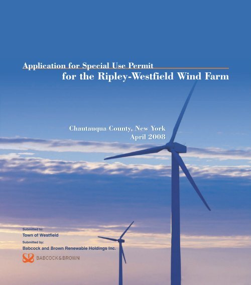
Town of Westfield - Ripley Westfield Wind Farm - Ecology ...
Town of Westfield - Ripley Westfield Wind Farm - Ecology ...
Town of Westfield - Ripley Westfield Wind Farm - Ecology ...
- No tags were found...

You also want an ePaper? Increase the reach of your titles
YUMPU automatically turns print PDFs into web optimized ePapers that Google loves.
02:002605_BB03_02-B2467L_<strong>Westfield</strong> SUP.doc-05/20/08Attachment 1Request for Special Use Permit
Do not write below this lineState AG Dist. Yes Noto <strong>Town</strong>/Village Boardto <strong>Town</strong>/Village Planning Boardto <strong>Town</strong>/Village ClerkPublic Hearing Dateto County PlanningSEQRNegative/Positive Declaration (SEQR)Legal Notice PublicationAdj. Property Owner NotificationTax Assessor NotificationDate <strong>of</strong> Board DecisionApprovedDisapprovedThe following documentation shall be affixed to, and permanently filed with thisapplication:■ Minutes <strong>of</strong> the Public Hearing■ Minutes <strong>of</strong> the Regular Board Meeting■ Special Use Permit Certificate or Notification <strong>of</strong> Approval/Disapproval to applicant.Provisions, restrictions, limitations, or reason(s) for denial:02:002605_BB03_02-B2467L_<strong>Westfield</strong> SUP.doc-05/20/08
Project DescriptionBabcock and Brown Renewable Holdings Inc. (Babcock & Brown) is proposing to construct andoperate a wind farm with an installed capacity <strong>of</strong> up to 125 megawatts (MW) in the towns <strong>of</strong><strong>Ripley</strong> and <strong>Westfield</strong>, Chautauqua County, New York (the “<strong>Ripley</strong>-<strong>Westfield</strong> <strong>Wind</strong> <strong>Farm</strong>” or“<strong>Wind</strong> <strong>Farm</strong>”). The <strong>Ripley</strong>-<strong>Westfield</strong> <strong>Wind</strong> <strong>Farm</strong> would include the following:■ Installation and operation <strong>of</strong> up to 83 wind turbine generators (WTG) in the towns <strong>of</strong><strong>Westfield</strong> and <strong>Ripley</strong> with 47 WTG in <strong>Westfield</strong> and 36 WTG in <strong>Ripley</strong>.■ Construction <strong>of</strong> approximately 11 miles <strong>of</strong> project access roads in the town <strong>of</strong> <strong>Westfield</strong> and9 miles <strong>of</strong> project access roads in the town <strong>of</strong> <strong>Ripley</strong> along corridors no more than 60 feet inwidth. These roads would allow vehicles to access each WTG to allow for construction <strong>of</strong>the WECS. After construction, the same corridors would be reduced to no more than 36 feetin width to allow access for operation and maintenance.■ Construction <strong>of</strong> an electrical collection system (ECS) predominantly along project accessroads, that would interconnect each WTG to a project substation located in the town <strong>of</strong><strong>Westfield</strong>. The ECS would be primarily buried, with some overhead lines only as necessary.■ Construction <strong>of</strong> a substation with one or more transformers that would increase the voltage <strong>of</strong>the electricity generated by the <strong>Wind</strong> <strong>Farm</strong> to the voltage <strong>of</strong> the National Grid transmissionline located within the project area. The transmission line is operated at 230,000 volts.■ Construction <strong>of</strong> an operation and maintenance building that would contain management<strong>of</strong>fices for <strong>Wind</strong> <strong>Farm</strong> personnel and equipment required to operate and maintain the <strong>Wind</strong><strong>Farm</strong>.■ A temporary construction laydown area where construction equipment and materials wouldbe located during the construction <strong>of</strong> the <strong>Wind</strong> <strong>Farm</strong>.Each WTG would consist <strong>of</strong> an enclosed monopole support tower, a nacelle at the top <strong>of</strong> eachtower containing the electrical generating equipment, and a three-bladed rotor attached to thenacelle. The specific WTG for the <strong>Wind</strong> <strong>Farm</strong> has not been selected; however, the capacity <strong>of</strong>each WTG is anticipated to be between 1.5 and 2.5 MW. The total generation capacity <strong>of</strong> the<strong>Wind</strong> <strong>Farm</strong> would not exceed 125 MW. If a larger WTG is selected, the number <strong>of</strong> WTGlocations would be reduced and the total length <strong>of</strong> the access roads and ECS would be reduced.The diameter <strong>of</strong> the rotor/blade assembly would not exceed 335 feet and the height <strong>of</strong> the WTG,including the rotor extending to its highest point, would not exceed 445 feet. A more preciseestimate <strong>of</strong> the diameter and height would depend on final equipment selection. Final WTG,ECS, and access road locations would be determined following environmental and engineeringstudies.ConsiderationsBabcock & Brown has made several assumptions in order to describe the <strong>Wind</strong> <strong>Farm</strong> andproduce the preliminary layout contained in this application. During this process, carefulconsideration has been given to the manner in which the <strong>Wind</strong> <strong>Farm</strong> has been located. The <strong>Wind</strong><strong>Farm</strong> has been presented in this application in a manner intended to reduce any impact on the02:002605_BB03_02-B2467 1L_<strong>Westfield</strong> SUP.doc-05/20/08
town and environment. Final design will depend, in part, on zoning issues, equipmentspecifications and the results <strong>of</strong> the comprehensive environmental review process.The selection <strong>of</strong> a specific WTG cannot occur until environmental, engineering, and wind dataare gathered, and all zoning issues are addressed. If the data and zoning issues support the use <strong>of</strong>a WTG with a generation capacity in the range <strong>of</strong> 2.0 MW to 2.5 MW, the <strong>Wind</strong> <strong>Farm</strong> wouldrequire fewer turbine sites than the number referenced in this application. Fewer WTG siteswould likely result in a reduction in the length <strong>of</strong> access roads, the collection system and theconstruction period. If the data and zoning require a WTG with a capacity <strong>of</strong> less than 2.0 MW,then the opportunity to decrease the number <strong>of</strong> WTG sites and realize the benefits referencedabove would be eliminated or reduced.During the development <strong>of</strong> this application, Babcock & Brown considered the concerns raised inthe community regarding the location <strong>of</strong> wind turbines. This consideration has resulted in,among other things, avoiding the placement <strong>of</strong> wind turbines on the side <strong>of</strong> the ridge that extendsthrough the town and positioning the turbines farther to the south.Site SafetyBraking. The <strong>Wind</strong> <strong>Farm</strong> would comply with the safety requirements contained in the <strong>Town</strong> <strong>of</strong><strong>Westfield</strong>’s zoning law for WECS and would include an automatic braking system that utilizesfeathering and disc brakes to prevent uncontrolled rotation, over-speeding, and excessivepressure on the tower structure, rotor blades and WTG components. In addition, the minimumdistance between the ground and the rotor would be at least 100 feet.Lighting. The Federal Aviation Administration (FAA) will require the <strong>Wind</strong> <strong>Farm</strong> to installlighting. The most conservative case for lighting provides for two lights on top <strong>of</strong> every nacelle.Based on the final layout, lighting may be reduced such that only the perimeter WTG’s areequipped with lights. Final WTG lighting requirements will be determined by the FAA.Signage. Weather-resistant signage that meets New York State OSHA requirements would beposted at the base <strong>of</strong> each WTG and at the point where each access road intersects with a publicroad. Each sign would state that no unauthorized access is permitted and would provide theemergency contact information for personnel qualified to shut down the facility.SetbacksThe <strong>Wind</strong> <strong>Farm</strong> will comply with the setback requirements contained in the <strong>Town</strong> <strong>of</strong> <strong>Westfield</strong>zoning law for WECS which state that:1. The minimum setback for any WECS tower from property lines <strong>of</strong> nonparticipatingproperty owners shall be equal to 1.5 times the proposed structure height, includingblades; and2. The minimum setback from dwellings, overhead utility lines, agricultural buildings,and other WECS shall be equal to 1.2 times the proposed structure height, includingblades.02:002605_BB03_02-B2467 2L_<strong>Westfield</strong> SUP.doc-05/20/08
Babcock & Brown would not begin initial operations until all required inspections have beencompleted and all approvals from the <strong>Town</strong> <strong>of</strong> <strong>Westfield</strong> have been received. The <strong>Town</strong> <strong>of</strong><strong>Westfield</strong>’s Code Enforcement Officer, or designated representative, would be able to inspect thefacility as necessary.02:002605_BB03_02-B2467 4L_<strong>Westfield</strong> SUP.doc-05/20/08
02:002605_BB03_02-B2467L_<strong>Westfield</strong> SUP.doc-05/20/08Attachment 3Project Location MapandProperty Owner Table
Noble RdParker RdDouglas Rd© <strong>Ecology</strong> & Environment, Inc. GIS Department Project #002605.BB03.01\\BUFSDL4\GIS\Buffalo\Chautauqua_<strong>Wind</strong>\Maps\MXDs\SUP\April_2008\project_area.mxd 04/15/2008DRAFTKlondike Rd9020Brockway RdMain StS State StShaver StE Side Hill Rd12Belson Rd67Substation891011121319201821 222332272428252926313334 3530Ogden RdCulver RdO & M Building<strong>Town</strong> <strong>of</strong><strong>Ripley</strong>Greenbush Rd828381Wattesburg RdOttoway RdSherman Rd7679807778Johnson Rd Welch Hill Rd7034556576859587169Lombard Rd6067726661141562656364Kent Rd1637173839Coon Rd404241 434445 46Jones Rd475048495152Sherman <strong>Westfield</strong> Rd36Pigeon Rd<strong>Town</strong> <strong>of</strong><strong>Westfield</strong>Lyons Rd<strong>Town</strong> <strong>of</strong>ChautauquaTurbine (04-11-2008)Substation (04-22-2008)7353<strong>Ripley</strong><strong>Westfield</strong>Project Area (02-11-2008)Laydown Area (02-21-2008)74755455Collection (04-11-2008)O & M Building (02-21-2008)Access Road (04-11-2008)<strong>Town</strong> BoundaryAttachment 3Project Facilities<strong>Ripley</strong>-<strong>Westfield</strong> <strong>Wind</strong> <strong>Farm</strong>04/22/080 0.25 0.5 1Miles
Property Owner TableWTG Print Key Owner Address <strong>Town</strong>1 241.00-1-50 Phillip Riedesel 6077 Welch Hill Rd <strong>Ripley</strong>2 241.00-1-50 Phillip Riedesel 6077 Welch Hill Rd <strong>Ripley</strong>3 258.00-2-16.1 Phillip J Knight 9309 Lombard Rd <strong>Ripley</strong>4 258.00-2-16.1 Phillip J Knight 9309 Lombard Rd <strong>Ripley</strong>5 258.00-2-26 Kenneth A Yovich Rt 76 <strong>Ripley</strong>6 242.00-1-12 Dale Babcock Belson Rd <strong>Ripley</strong>7 242.00-2-27 Phillip Riedesel Belson Rd <strong>Westfield</strong>8 242.00-2-25 Jeff Lee Fenton 6115 Parker Rd <strong>Westfield</strong>9 259.00-2-3 Linda M Alcorn Parker Rd <strong>Westfield</strong>10 259.00-2-12 Linda M Alcorn Parker Rd <strong>Westfield</strong>11 259.00-2-8 Douglas A Bowen Parker Rd <strong>Westfield</strong>12 259.00-2-4 Douglas A Bowen 5808 Parker Rd <strong>Westfield</strong>13 259.00-2-7 Douglas A Bowen 8844 Pigeon Rd <strong>Westfield</strong>14 259.00-1-8 Jeffery Phillip Lombard Rd <strong>Ripley</strong>15 259.00-1-8 Jeffery Phillip Lombard Rd <strong>Ripley</strong>16 259.00-2-34 Douglas A Bowen 5869 Parker Rd <strong>Westfield</strong>17 259.00-2-36 Douglas A Bowen Parker Rd <strong>Westfield</strong>18 242.00-2-11 Chester M Isaacs Belson Rd <strong>Westfield</strong>19 242.00-2-20 Phillip Riedesel 8724 Belson Rd <strong>Westfield</strong>20 242.00-2-20 Phillip Riedesel 8724 Belson Rd <strong>Westfield</strong>21 242.00-2-19 Kathryn B Johnson Douglas Rd <strong>Westfield</strong>22 242.00-2-19 Kathryn B Johnson Douglas Rd <strong>Westfield</strong>23 259.00-2-16 Joseph E Bittinger Pigeon Rd <strong>Westfield</strong>24 243.00-1-49 Frederick A Russell Douglas Rd <strong>Westfield</strong>25 243.00-1-48 Frederick A Russell 5996 Douglas Rd <strong>Westfield</strong>26 243.00-1-47 Storm Hill Hunting Camp Inc Douglas Rd <strong>Westfield</strong>27 243.00-1-41 Margaret Emory Sherman Rd <strong>Westfield</strong>28 243.00-1-42 Clifford J Foster Sherman Rd <strong>Westfield</strong>29 243.00-1-45 Margaret Emory Sherman Rd <strong>Westfield</strong>30 243.00-1-46.1 Sharon C Markham 5959 Sherman Rd <strong>Westfield</strong>31 243.00-1-46.2 Joseph E Bittinger Jr Sherman Rd <strong>Westfield</strong>32 259.00-2-17 Rickey C Coon Pigeon Rd <strong>Westfield</strong>33 260.00-2-2.1 Terrilyn D LaRose Pigeon Rd <strong>Westfield</strong>34 260.00-2-2.1 Terrilyn D LaRose Pigeon Rd <strong>Westfield</strong>35 260.00-2-17.2 Rickey C Coon Pigeon Rd <strong>Westfield</strong>36 260.00-2-48 Storm Hill Hunting Camp Inc 8397 Pigeon Rd <strong>Westfield</strong>37 259.00-2-21.1 Mark A Winslow Pigeon Rd <strong>Westfield</strong>38 259.00-2-21.1 Mark A Winslow Pigeon Rd <strong>Westfield</strong>39 260.00-2-47 Leonard Letendre 5671 Sherman Rd <strong>Westfield</strong>40 259.00-2-38 Leonard Letendre 5570 Parker Rd <strong>Westfield</strong>41 276.00-2-3 John J Boyle 5530 Parker Rd <strong>Westfield</strong>42 276.00-2-5 Leonard Letendre Parker Rd <strong>Westfield</strong>02:002605_BB03_02-B2467Turbine_Parcel_Addresses_April_15_2008.xls-4/17/2008
Property Owner TableWTG Print Key Owner Address <strong>Town</strong>43 276.00-2-9 Leonard Letendre Jones Rd <strong>Westfield</strong>44 276.00-2-8 Lawrence C Borowski 8762 Jones Rd <strong>Westfield</strong>45 276.00-2-11 Leonard J Letendre Jones Rd <strong>Westfield</strong>46 276.00-2-12 Leonard J Letendre 8568 Jones Rd <strong>Westfield</strong>47 276.00-2-21 Halsey L Van Lew 8751 Jones Rd <strong>Westfield</strong>48 276.00-2-21 Halsey L Van Lew 8751 Jones Rd <strong>Westfield</strong>49 276.00-2-20 G Donald Clancy 8637 Jones Rd <strong>Westfield</strong>50 276.00-2-13 Leonard Letendre Jones Rd <strong>Westfield</strong>51 276.00-2-15 Scott D Hansen Sherman Rd <strong>Westfield</strong>52 276.00-2-16 Scott D Hansen Sherman Rd <strong>Westfield</strong>53 276.00-2-16 Scott D Hansen Sherman Rd <strong>Westfield</strong>54 276.00-2-18 Leonard Letendre 4755 Sherman Rd <strong>Westfield</strong>55 293.00-2-6 Leonard Letendre 4731 Sherman Rd <strong>Westfield</strong>56 258.00-2-27 Donald L Saxton Rt 76 S <strong>Ripley</strong>57 276.00-1-1 Edward L Strain Rt 76 <strong>Ripley</strong>58 259.00-1-16 Donald Saxton 5469 Rt 76 S <strong>Ripley</strong>59 276.00-1-2 Edward L Strain 5317 Rt 76 <strong>Ripley</strong>60 276.00-1-4 Joseph Smeal Rt 76 S <strong>Ripley</strong>61 276.00-1-5.1 Greg Nellis 5300 Rt 76 S <strong>Ripley</strong>62 276.00-1-5.1 Greg Nellis 5300 Rt 76 S <strong>Ripley</strong>63 276.00-1-6 Francis Jordan 5294 Rt 76 S <strong>Ripley</strong>64 276.00-1-10 William Mitchell Kent Rd <strong>Ripley</strong>65 276.00-1-10 William Mitchell Kent Rd <strong>Ripley</strong>66 276.00-1-7 Charles A Brown 5246 Rt 76 <strong>Ripley</strong>67 276.00-1-9 Louise Leamer 5184 Rt 76 S <strong>Ripley</strong>68 276.00-1-31 Everett R Skinner 5235 Rt 76 S <strong>Ripley</strong>69 276.00-1-30 Everett R Skinner 5203 Rt 76 S <strong>Ripley</strong>70 275.00-1-22 Tri Creek <strong>Farm</strong>s Inc Johnson Rd <strong>Ripley</strong>71 276.00-1-29 Thomas A Barnhart 5145, 5131 Rt 76 <strong>Ripley</strong>72 276.00-1-12 Joseph Difrancisco Rt 76 <strong>Ripley</strong>73 276.00-1-14 Daniel B Reukauf 5114 Rt 76 S <strong>Ripley</strong>74 276.00-1-16 Timothy M Murray 5036 Rt 76 S <strong>Ripley</strong>75 293.00-1-5 Timothy M Murray Rt 76 <strong>Ripley</strong>76 275.00-1-6 Mark A Thoreson 5394 Wattlesburg Rd <strong>Ripley</strong>77 275.00-1-18 Dale K Davis 5360 Wattlesburg Rd <strong>Ripley</strong>78 275.00-1-20 Harold Smith 5268 Wattlesburg Rd <strong>Ripley</strong>79 275.00-1-20 Harold Smith 5268 Wattlesburg Rd <strong>Ripley</strong>80 275.00-1-34 Marshall McKillip 5148 Ottoway Rd <strong>Ripley</strong>81 275.00-1-1 Timothy J Barrett 5393 Wattlesburg Rd <strong>Ripley</strong>82 275.00-1-1 Timothy J Barrett 5393 Wattlesburg Rd <strong>Ripley</strong>83 275.00-1-67 Timothy J Barrett Wattlesburg Rd <strong>Ripley</strong>02:002605_BB03_02-B2467Turbine_Parcel_Addresses_April_15_2008.xls-4/17/2008
02:002605_BB03_02-B2467L_<strong>Westfield</strong> SUP.doc-05/20/08Attachment 4Full Environmental Assessment Formand Visual EAF Addendum
PART 1 – PROJECT INFORMATIONPrepared by Project SponsorNOTICE: This document is designed to assist in determining whether the action proposed may have a significant effect on theenvironment. Please complete the entire form, Parts A through E. Answers to these questions will be considered as part <strong>of</strong> theapplication for approval and may be subject to further verification and public review. Provide any additional information you believewill be needed to complete Parts 2 and 3.It is expected that completion <strong>of</strong> the full EAF will be dependent on information currently available and will not involve new studies,research, or investigation. If information requiring such additional work is unavailable, so indicate and specify each instance.NAME OF ACTION<strong>Ripley</strong>-<strong>Westfield</strong> <strong>Wind</strong> <strong>Farm</strong>LOCATION OF ACTION (Include Street Address, Municipality and County)<strong>Town</strong>s <strong>of</strong> <strong>Westfield</strong> and <strong>Ripley</strong> (Chautauqua County)NAME OF APPLICANT/SPONSORBabcock and Brown Renewable Holdings Inc.ADDRESS1600 Smith Street, Suite 4025CITY/POHoustonNAME OF OWNER (If different)NAADDRESSBUSINESS TELEPHONE(713) 308-4232STATETXZIP CODE77002BUSINESS TELEPHONE( )CITY/PO STATE ZIP CODE02:002605_BB03_02-B2469 2R_Draft <strong>Ripley</strong>_<strong>Westfield</strong> EAF.doc-4/25/08
DESCRIPTION OF ACTIONBabcock and Brown Renewable Holdings Inc. (“Babcock & Brown”) is proposing to construct and operate a windfarm with an installed capacity <strong>of</strong> up to 125-megawatt (MW) in the <strong>Town</strong>s <strong>of</strong> <strong>Ripley</strong> and <strong>Westfield</strong>, ChautauquaCounty, New York (the “<strong>Ripley</strong>-<strong>Westfield</strong> <strong>Wind</strong> <strong>Farm</strong>” or “<strong>Wind</strong> <strong>Farm</strong>”). The <strong>Ripley</strong>-<strong>Westfield</strong> <strong>Wind</strong> <strong>Farm</strong> wouldinclude the following:■■■■■■Installation and operation <strong>of</strong> up to 83 wind turbine generators (“WTG”) in the towns <strong>of</strong> <strong>Westfield</strong> and <strong>Ripley</strong> with47 WTG in <strong>Westfield</strong> and 36 WTG in <strong>Ripley</strong>.Construction <strong>of</strong> approximately 11 miles <strong>of</strong> project access roads in the town <strong>of</strong> <strong>Westfield</strong> and 9 miles <strong>of</strong> projectaccess roads in the town <strong>of</strong> <strong>Ripley</strong> along corridors no more than 60 feet in width. These roads would allowvehicles to access each WTG to allow for construction <strong>of</strong> the WECS. After construction, the same corridorswould be reduced to no more than 36 feet in width to allow access for operation and maintenance.Construction <strong>of</strong> an electrical collection system (ECS) predominantly along project access roads, that wouldinterconnect each WTG to a project substation located in the town <strong>of</strong> <strong>Ripley</strong>. The ECS would be primarily buried,with some overhead lines only as necessary.Construction <strong>of</strong> a substation with one or more transformers that would increase the voltage <strong>of</strong> the electricitygenerated by the <strong>Wind</strong> <strong>Farm</strong> to the voltage <strong>of</strong> the National Grid transmission line located within the project area.The transmission line is operated at 230,000 volts.Construction <strong>of</strong> an operation and maintenance building that would contain management <strong>of</strong>fices for <strong>Wind</strong> <strong>Farm</strong>personnel and equipment required to operate and maintain the <strong>Wind</strong> <strong>Farm</strong>.A temporary construction laydown area where construction equipment and materials would be located duringthe construction <strong>of</strong> the <strong>Wind</strong> <strong>Farm</strong>.Each WTG would consist <strong>of</strong> an enclosed monopole support tower, a nacelle at the top <strong>of</strong> each tower containg theelectrical generating equipment, and a three-bladed rotor attached to the nacelle. The specific WTG for the <strong>Wind</strong><strong>Farm</strong> has not been selected; however, the capacity <strong>of</strong> each WTG is anticipated to be between 1.5 and 2.5 MW. Thetotal generation capacity <strong>of</strong> the <strong>Wind</strong> <strong>Farm</strong> would not exceed 125 MW. If a larger WTG is selected, the number <strong>of</strong>WTG locations would be reduced and the total length <strong>of</strong> the access roads and ECS would be reduced. The diameter<strong>of</strong> the rotor/blade assembly would not exceed 335 feet and the height <strong>of</strong> the WTG, including the rotor extending to itshighest point, would not exceed 445 feet. A more precise estimate <strong>of</strong> the diameter and height would depend on finalequipment selection. Final WTG, ECS, and access road locations would be determined following environmental andengineering studies.For the purposes <strong>of</strong> this EAF, the "Study Area" or "Project Area" is defined as the outer boundary <strong>of</strong> the geographicarea that includes all project components and parcels. B&B expects to be granted property easements forapproximately 70% <strong>of</strong> this area (See Figure A-1 for a map <strong>of</strong> the Study Area). Turbine, ECS, and access roadlocations are preliminary. Final locations will be determined following environmental and engineering studies.Please Complete Each Question – Indicate N.A. if not applicableA. Site DescriptionPhysical setting <strong>of</strong> overall project, both developed and undeveloped areas.1. Present land use: Urban Industrial Commercial Residential (suburban) Rural (non-farm)Forest Agriculture Other vacant land/wetland/water2. Total acreage <strong>of</strong> project area: 8,222 acresTotal project area is inclusive <strong>of</strong> all land use types, however, the mapped wetland/water surface area acreage also maybe included within other land use types (e.g., forested, etc).APPROXIMATE ACREAGE PRESENTLY AFTER COMPLETIONMeadow or Brushland (Non-agricultural) 550 acres 522 acresForested 5113 acres 4932 acresAgricultural (Includes orchards, cropland, pasture, etc.) 2253 acres 2119 acresWetland (Freshwater <strong>of</strong> tidal as per Articles 24, 25 <strong>of</strong> ECL 382 acres 382 acres02:002605_BB03_02-B2469 3R_Draft <strong>Ripley</strong>_<strong>Westfield</strong> EAF.doc-4/25/08
APPROXIMATE ACREAGE PRESENTLY AFTER COMPLETIONWater Surface Area 10 acres 10 acresUnvegetated (Rock, earth or fill) 0 acres 0 acresRoads, buildings and other paved surfaces 237 acres 580acresOther (Indicate type) 0 acres 0 acres3. What is predominant soil type(s) on project site? Busti silt loam, 3 to 8 percent slopesa. Soil drainage: Well drained 5% <strong>of</strong> site Moderately well drained 14% <strong>of</strong> sitePoorly drained 81% <strong>of</strong> siteb. If any agricultural land is involved, how many acres <strong>of</strong> soil are classified within soil group 1 through 4 <strong>of</strong> the NYSLand Classification System? approximately 1,136 acres. (See 1 NYCRR 370)4. Are there bedrock outcroppings on project site? Yes Noa. What is the depth to bedrock? up to 77 (in feet)Based on known bedrock depths associated with soils present in Study area.5. Approximate percentage <strong>of</strong> proposed project site with slopes: 0-10% 84% 10-15 % 12%15% or greater 4%6. Is project substantially contiguous to, or contain a building, site, or district, listed on the State or National Registers <strong>of</strong> HistoricPlaces? Yes No According to NPS National Register Information System7. Is project substantially contiguous to a site listed on the Register <strong>of</strong> National Natural Landmarks?Yes No8. What is the depth <strong>of</strong> the water table? variable, 0-137 (in feet)9. Is site located over a primary, principal, or sole source aquifer? Yes No10. Do hunting, fishing, or shell fishing opportunities presently exist in the project area? Yes NoHunting and fishing.11. Does project site contain any species <strong>of</strong> plant or animal life that is identified as threatened or endangered? Yes NoAccording to the USFWS and NYSDEC, known threatened and endangered species migrate through area. Refer toAttachment B for Consultation Letters.Identify each species Bald Eagle and Sedge Wren12. Are there any unique or unusual land forms on the project site? (i.e., cliffs, dunes, other geological formations)Yes No Describe13. Is the project site presently used by the community or neighborhood as an open space or recreation area?Yes No If yes, explain Hunting, snowmobiling and ATV14. Does the present site include scenic views known to be important to the community? Yes No15. Streams within or contiguous to project area: Belson Creeka. Name <strong>of</strong> Stream and name <strong>of</strong> River to which it is tributary Lake Erie16. Lakes, ponds, wetland areas within or contiguous to project area:a. Name The Study Area contains 6 mapped NYSDEC wetland complexes (approx. 160 acres) and 67 mappedNWI wetlands (approx. 222 acres). Wetlands will be identified through field delineations. These wetlands willbe further described in a joint permit application to be submitted to NYSDEC and USACE.17. Is the site served by existing public utilities? Yes Noa) If Yes, does sufficient capacity exist to allow connection? Yes Nob) If Yes, will improvements be necessary to allow connection? Yes No proposed substation willbe required to connect to existing 230 kV transmission line operated by National Grid.18. Is the site located in an agricultural district certified pursuant to Agriculture and Markets Law, Article 25-AA, Section 303and 304? Yes No There are three Agricultural Districts in Study Area; 3601300, 3601301, and 3601304.19. Is the site located in or substantially contiguous to a Critical Environmental Area designated pursuant to Article 8 <strong>of</strong> theECL, and 6 NYCRR 617? Yes No20. Has the site ever been used for the disposal <strong>of</strong> solid or hazardous wastes? Yes NoB. Project Description1. Physical dimensions and scale <strong>of</strong> project (fill in dimensions as appropriate)a. Total contiguous acreage owned or controlled by project sponsor 5,910 (anticipated) acres.b. Project acreage to be developed 343 acres initially; NA acres ultimately.c. Project acreage to remain undeveloped 5,567 acres.d. Length <strong>of</strong> project, in miles N/A (If appropriate)e. If the project is an expansion, indicate percentage <strong>of</strong> expansion proposed N/A%f. Number <strong>of</strong> <strong>of</strong>f-street parking spaces existing None; proposed 5-10 for O&M building02:002605_BB03_02-B2469 4R_Draft <strong>Ripley</strong>_<strong>Westfield</strong> EAF.doc-4/25/08
g. Maximum vehicular trips generated per hour None (upon completion <strong>of</strong> project)? Negligibleh. If residential: Number and type <strong>of</strong> housing units: N/AOne Family Two Family Multiple Family CondominiumInitially N/A N/A N/A N/AUltimately N/A N/A N/A N/Ai. Dimensions (in feet) <strong>of</strong> largest proposed structure less than 445 feet. Foundation is less than 70 ft diameter. height;N/A width, N/Alengthj. Linear feet <strong>of</strong> frontage along a public thoroughfare project will occupy is? N/A ft.2. How much natural material (i.e., rock, earth, etc.) will be removed from the site? TBD depending on geotechnical studiesto be completed for the project. tons/cubic yards3. Will disturbed areas be reclaimed? Yes No N/Aa. If yes, for what intended purpose is the site being reclaimed? Same as prev. conditionb. Will topsoil be stockpiled for reclamation? Yes Noc. Will upper subsoil be stockpiled for reclamation? Yes No4. How many acres <strong>of</strong> vegetation (trees, shrubs, and ground covers) will be removed from site? Approximately 209 acres.Excludes all agricultural lands.5. Will any mature forest (over 100 years old) or other locally-important vegetation be removed by this project?Yes No6. If single phase project: Anticipated period <strong>of</strong> construction 6-9 months, (including demolition).7. If multi-phased: NAa. Total number <strong>of</strong> phases anticipated (number),b. Anticipated date <strong>of</strong> commencement phase 1 month year, (including demolition).c. Approximate complete date <strong>of</strong> final phase month year.d. Is phase 1 functionally dependent on subsequent phases? Yes No8. Will blasting occur during construction? Yes No TBD pending results <strong>of</strong> geotechnical surveys9. Number <strong>of</strong> jobs generated during construction 50-100; after project is complete 4-8.10. Number <strong>of</strong> jobs eliminated by this project None.11. Will project require relocation <strong>of</strong> any projects or facilities? Yes No If yes, explain12. Is surface liquid waste disposal involved? Yes Noa. If yes, indicate type <strong>of</strong> waste (sewage, industrial, etc.) and amount N/Ab. Name <strong>of</strong> water body into which effluent will be discharged N/A13. Is subsurface liquid waste disposal involved? Yes No Type14. Will surface area <strong>of</strong> an existing water body increase or decrease by proposal? Yes NoExplain15. Is project or any portion <strong>of</strong> project located in a 100 year flood plain? Yes No See attached Figure A-2.16. Will the project generate solid waste? Yes Noa. If yes, what is the amount per month TBD (during construction) tons none/negligible during operationsb. If yes, will an existing waste facility be used? Yes Noc. If yes, give name TBD. Due to materials identification and classification, multiple sites may be used. TheChautauqua County Landfill located at 3889 Towerville Road, Jamestown, NY is the closest landfill that acceptsConstruction and Demolition debris.d. Will any wastes not go into a sewage disposal system or into a sanitary landfill? Yes Noe. If yes, explain TBD for O&M building (potential septic system)17. Will the project involve the disposal <strong>of</strong> solid waste? Yes Noa. If yes, what is the anticipated rate <strong>of</strong> disposal? TBD tons/month. TBD during construction. Waste generated duringoperation will be negligible.b. If yes, what is the anticipated site life: N/A years.18. Will project use herbicides or pesticides: Yes No19. Will project routinely produce odors (more than one hour per day)? Yes No20. Will project produce operating noise exceeding the local ambient noise levels? Yes No TBD, noise impactswill be evaluated in the DEIS.21. Will project result in an increase in energy use? Yes NoIf yes, indicate type(s) negligible, electricity will be used for running electronic equipment and lighting.22. If water supply is from wells, indicate pumping capacity tbd gallons/minute. tbd during construction, and for O&M building.23. Total anticipated water usage per day tbd gallons/minute.24. Does project involve Local, State or Federal funding? Yes NoIf yes, explain02:002605_BB03_02-B2469 5R_Draft <strong>Ripley</strong>_<strong>Westfield</strong> EAF.doc-4/25/08
PART 2 – PROJECT IMPACTS AND THEIR MAGNITUDEResponsibility <strong>of</strong> Lead AgencyGeneral Information (Read Carefully)• In completing the form the reviewer should be guided by the question: Have my responses and determinations been reasonable?The reviewer is not expected to be an expert environmental analyst.• The Examples provided are to assist the reviewer by showing types <strong>of</strong> impacts and wherever possible the threshold <strong>of</strong> magnitudethat would trigger a response in column 2. The examples are generally applicable throughout the State and for mostsituations. But, for any specific project or site other examples and/or lower thresholds may be appropriate for a PotentialLarge Impact response, thus requiring evaluation in Part 3.• The impacts <strong>of</strong> each project, on each site, in each locality, will vary. Therefore, the examples are illustrative and have been<strong>of</strong>fered as guidance. They do not constitute an exhaustive list <strong>of</strong> impacts and thresholds to answer each question.• The number <strong>of</strong> examples per question does not indicate the importance <strong>of</strong> each question.• In identifying impacts, consider long term, short term and cumulative effects.Instructions (Read carefully)a. Answer each <strong>of</strong> the 20 questions in PART 2. Answer Yes if there will be any impact.b. Maybe answers should be considered as Yes answers.c. If answering No to a question then check the appropriate box (column 1 or 2) to indicate the potential size <strong>of</strong> the impact. Ifimpact threshold equals or exceeds any example provided, check column 2. If impact will occur but threshold is lower thanexample, check column 1.d. Identifying that an impact will be potentially large (column 2) does not mean that it is also necessarily significant. Any largeimpact must be evaluated in PART 3 to determine significance. Identifying an impact in column 2 simply asks that it belooked at further.e. If reviewer has doubt about size <strong>of</strong> the impact then consider the impact as potentially large and proceed to PART 3.f. If a potentially large impact checked in column 2 can be mitigated by change(s) in the project to a small to moderate impact,also check the Yes box in column 3. A No response indicates that such a reduction is not possible. This must be explainedin Part 3.IMPACT ON LAND1. Will the proposed action result in a physical change to the project site?1Small toModerateImpact2PotentialLargeImpact3Can Impact BeMitigated ByProject ChangeNO YESExamples that would apply to column 2• Any construction on slopes <strong>of</strong> 15% or greater, (15 foot rise per 100 foot<strong>of</strong> length), or where the general slopes in the project area exceed 10%.YesNo• Construction on land where the depth to the water table is less than 3Yes N<strong>of</strong>eet.• Construction <strong>of</strong> paved parking area for 1,000 or more vehicles. Yes No• Construction on land where bedrock is exposed or generally within 3Yes N<strong>of</strong>eet <strong>of</strong> existing ground surface.• Construction that will continue for more than 1 year or involve moreYes Nothan one phase or stage.• Excavation for mining purposes that would remove more than 1,000Yes Notons <strong>of</strong> natural material (i.e., rock or soil) per year.• Construction or expansion <strong>of</strong> a sanitary landfill. Yes No• Construction in a designated floodway. Yes No• Other impacts Yes No2. Will there be an effect to any unique or unusual land forms found on thesite? (i.e., cliffs, dunes, geological formations, etc) NO YES• Specific land forms: Yes No02:002605_BB03_02-B2469 7R_Draft <strong>Ripley</strong>_<strong>Westfield</strong> EAF.doc-4/25/08
IMPACT ON WATER3. Will proposed action affect any water body designated as protected?(Under Articles 15, 24, 25 <strong>of</strong> the Environmental Conservation Law,ECL)1Small toModerateImpact2PotentialLargeImpact3Can Impact BeMitigated ByProject ChangeNO YESExamples that would apply to column 2• Developable area <strong>of</strong> site contains a protected water body. Yes No• Dredging more than 100 cubic yards <strong>of</strong> material from channel <strong>of</strong> aYes Noprotected stream.• Extension <strong>of</strong> utility distribution facilities through a protected water body. Yes No• Construction in a designated freshwater or tidal wetland. Yes No• Other impacts: Yes No4. Will proposed action affect any non-protected existing or new body <strong>of</strong>water?NO YESExamples that would apply to column 2• A 10% increase or decrease in the surface area <strong>of</strong> any body <strong>of</strong> water orYes Nomore than a 10 acre increase or decrease.• Construction <strong>of</strong> a body or water that exceeds 10 acres <strong>of</strong> surface area. Yes No• Other impacts: Yes No5. Will Proposed Action affect surface or groundwater quality or quantity?NO YESExamples that would apply to column 2• Proposed Action will require a discharge permit. Yes No• Proposed Action requires use <strong>of</strong> a source <strong>of</strong> water that does not haveYes Noapproval to serve proposed (project) action.• Proposed Action requires water supply from wells with greater than 45Yes Nogallons per minute pumping capacity.• Construction or operation causing any contamination <strong>of</strong> a water supplyYes Nosystem.• Proposed Action will adversely affect groundwater. Yes No• Liquid effluent will be conveyed <strong>of</strong>f the site to facilities which presentlyYes Nodo not exist or have inadequate capacity.• Proposed Action would use water in excess <strong>of</strong> 20,000 gallons per day. Yes No• Proposed Action will likely cause siltation or other discharge into anYes Noexisting body <strong>of</strong> water to the extent that there will be an obvious visualcontrast to natural conditions.• Proposed Action will require the storage <strong>of</strong> petroleum or chemicalYes Noproducts greater than 1,100 gallons.• Proposed Action will allow residential uses in areas without waterYes Noand/or sewer services.• Proposed Action locates commercial and/or industrial uses which mayYes Norequire new or expansion <strong>of</strong> existing waste treatment and/or storagefacilities.• Other impacts: Yes No02:002605_BB03_02-B2469 8R_Draft <strong>Ripley</strong>_<strong>Westfield</strong> EAF.doc-4/25/08
6. Will proposed action alter drainage flow or patterns, or surface waterrun<strong>of</strong>f?1Small toModerateImpact2PotentialLargeImpact3Can Impact BeMitigated ByProject ChangeNO YESExamples that would apply to column 2• Proposed Action would change flood water flows. Yes No• Proposed Action may cause substantial erosion. Yes No• Proposed Action is incompatible with existing drainage patterns. Yes No• Proposed Action will allow development in a designated floodway. Yes No• Other impacts: Yes NoIMPACT ON AIR7. Will proposed action affect air quality?NO YESExamples that would apply to column 2• Proposed Action will induce 1,000 or more vehicle trips in any givenYes Nohour.• Proposed Action will result in the incineration <strong>of</strong> more than 1 tone <strong>of</strong>Yes Norefuse per hour.• Emission rate <strong>of</strong> total contaminants will exceed 5 lbs. per hour or a heatYes Nosource producing more than 10 million BTU’s per hour.• Proposed action will allow an increase in the amount <strong>of</strong> land committedYes Noto industrial use.• Proposed action will allow an increase in the density <strong>of</strong> industrialYes Nodevelopment within existing industrial areas.• Other impacts: Yes NoIMPACT ON PLANTS AND ANIMALS8. Will Proposed Action affect any threatened or endangered species?NO YESExamples that would apply to column 2• Reduction <strong>of</strong> one or more species listed on the New York or Federal list,Yes Nousing the site, over or near site or found on the site.• Removal <strong>of</strong> any portion <strong>of</strong> a critical or significant wildlife habitat. Yes No• Application <strong>of</strong> pesticide or herbicide more than twice a year, other thanYes N<strong>of</strong>or agricultural purposes.• Other impacts: Yes No9. Will Proposed Action substantially affect non-threatened or nonendangeredspecies?NO YESExamples that would apply to column 2• Proposed Action would substantially interfere with any resident ormigratory fish, shellfish or wildlife species.• Proposed Action requires the removal <strong>of</strong> more than 10 acres <strong>of</strong> matureforest (over 100 years <strong>of</strong> age) or other locally important vegetation.YesYesNoNo02:002605_BB03_02-B2469 9R_Draft <strong>Ripley</strong>_<strong>Westfield</strong> EAF.doc-4/25/08
IMPACT ON AGRICULTURAL LAND RESOURCES10. Will the Proposed Action affect agricultural land resources?1Small toModerateImpact2PotentialLargeImpact3Can Impact BeMitigated ByProject ChangeNO YESExamples that would apply to column 2• The proposed action would sever, cross or limit access to agriculturalland (includes cropland, hayfields, pasture, vineyard, orchard, etc.)YesNo• Construction activity would excavate or compact the soil pr<strong>of</strong>ile <strong>of</strong>Yes Noagricultural land.• The proposed action would irreversibly convert more than 10 acres <strong>of</strong>Yes Noagricultural land or, if located in an Agricultural District, more than 2.5acres <strong>of</strong> agricultural land. l• The proposed action would disrupt or prevent installation <strong>of</strong> agriculturalYes Noland management systems (e.g., subsurface drain lines, outlet ditches,strip cropping); or create a need for such measures (e.g., cause a farmfield to drain poorly due to increased run<strong>of</strong>f)• Other impacts: Yes NoIMPACT ON AESTHETIC RESOURCES11. Will proposed action affect aesthetic resources?NO YES(If necessary, use the Visual EAF Addendum in Section 617.20,Appendix B.)Examples that would apply to column 2• Proposed land uses, or project components obviously different from orYes Noin sharp contrast to current surrounding land use patterns, whetherman-made or natural.• Proposed land uses, or project components visible to users <strong>of</strong> aestheticYes Noresources which will eliminate or significantly reduce their enjoyment <strong>of</strong>the aesthetic qualities <strong>of</strong> that resource.• Project components that will result in the elimination or significantYes Noscreening <strong>of</strong> scenic views known to be important to the area.• Other impacts: Yes NoIMPACT ON HISTORIC AND ARCHAEOLOGICAL RESOURCES12. Will Proposed Action impact any site or structure <strong>of</strong> historic, prehistoricor paleontological importance?NO YESExamples that would apply to column 2• Proposed Action occurring wholly or partially within or substantiallycontiguous to any facility or site listed on the State or National Register<strong>of</strong> historic places.• Any impact to an archaeological site or fossil bed located within theproject site.• Proposed Action will occur in an area designated as sensitive forarchaeological sites on the NYS Site Inventory.• Other impacts:YesYesYesNoNoNo02:002605_BB03_02-B2469 10R_Draft <strong>Ripley</strong>_<strong>Westfield</strong> EAF.doc-4/25/08
IMPACT ON OPEN SPACE AND RECREATION1Small toModerateImpact2PotentialLargeImpact3Can Impact BeMitigated ByProject Change13. Will Proposed Action affect the quantity or quality <strong>of</strong> existing or futureopen spaces or recreational opportunities?NO YESExamples that would apply to column 2• The permanent foreclosure <strong>of</strong> a future recreational opportunity. Yes No• A major reduction <strong>of</strong> an open space important to the community. Yes No• Other impacts: Yes NoIMPACT ON CRITICAL ENVIRONMENTAL AREAS14. Will Proposed Action impact the exceptional or unique characteristics <strong>of</strong>a critical environmental area (CEA) established pursuant to subdivision6 NYCRR 617.14(g)?NO YESExamples that would apply to column 2• Proposed Action to locate within the CEA? Yes No• Proposed Action will result in a reduction in the quantity <strong>of</strong> theYes Noresource?• Proposed Action will result in a reduction <strong>of</strong> the quality <strong>of</strong> the resource? Yes No• Proposed Action will impact the use, function or enjoyment <strong>of</strong> theYes Noresource?• Other impacts: Yes NoIMPACT ON TRANSPORTATION15. Will there be an effect to existing transportation systems?NO YESExamples that would apply to column 2• Alteration <strong>of</strong> present patterns <strong>of</strong> movement <strong>of</strong> people and/or goods. Yes No• Proposed Action will result in major traffic problems. Yes No• Other impacts: Yes NoIMPACT ON ENERGY16. Will proposed action affect the community’s sources <strong>of</strong> fuel or energysupply?NO YESExamples that would apply to column 2• Proposed Action will cause a greater than 5% increase in the use <strong>of</strong> anyform <strong>of</strong> energy in the municipality.• Proposed Action will require the creation or extension <strong>of</strong> an energytransmission or supply system to serve more than 50 single or tw<strong>of</strong>amily residences or to sere a major commercial or industrial use.YesYesNoNo• Other impacts: Yes No02:002605_BB03_02-B2469 11R_Draft <strong>Ripley</strong>_<strong>Westfield</strong> EAF.doc-4/25/08
NOISE AND ODOR IMPACTS17. Will there be objectionable odors, noise, or vibration as a result <strong>of</strong> theProposed Action?1Small toModerateImpact2PotentialLargeImpact3Can Impact BeMitigated ByProject ChangeNO YESExamples that would apply to column 2• Blasting within 1,500 feet <strong>of</strong> a hospital, school or other sensitive facility. Yes No• Odors will occur routinely (more than one hour per day). Yes No• Proposed Action will produce operating noise exceeding the localYes Noambient noise levels for noise outside <strong>of</strong> structures.• Proposed Action will remove natural barriers that would act as a noiseYes Noscreen.• Other impacts: Yes NoIMPACT ON PUBLIC HEALTH18. Will Proposed Action affect public health and safety?NO YESExamples that would apply to column 2• Proposed Action may cause a risk <strong>of</strong> explosion or release <strong>of</strong> hazardousYes Nosubstances (i.e., oil, pesticides, chemicals, radiation, etc.) in the event<strong>of</strong> accident or upset conditions, or there may be a chronic low leveldischarge or emission.• Proposed Action may result in the burial <strong>of</strong> “hazardous wastes” in anyYes N<strong>of</strong>orm (i.e., toxic, poisonous, highly reactive, radioactive, irritating,infectious, etc.)• Storage facilities for one million or more gallons <strong>of</strong> liquefied natural gasYes Noor other flammable liquids.• Proposed action may result in the excavation or other disturbanceYes Nowithin 2,000 feet <strong>of</strong> a site used for the disposal <strong>of</strong> solid or hazardouswaste.• Other impacts: Yes NoIMPACT ON GROWTH AND CHARACTEROF COMMUNITY OR NEIGHBORHOOD19. Will proposed action affect the character <strong>of</strong> the existing community?NO YESExamples that would apply to column 2• The permanent population <strong>of</strong> the city, town or village in which theYes Noproject is located is likely to grow by more than 5%.• The municipal budget for capital expenditures or operating services willYes Noincrease by more than 5% per year as a result <strong>of</strong> this project.• Proposed action will conflict with <strong>of</strong>ficially adopted plans or goals. Yes No• Proposed action will cause a change in the density <strong>of</strong> land use. Yes No• Proposed action will replace or eliminate existing facilities, structures orYes Noareas <strong>of</strong> historic importance to the community.• Development will create a demand for additional community servicesYes No(e.g., schools, police and fire, etc.)• Proposed Action will set an important precedent for future projects. Yes No• Proposed Action will create or eliminate employment. Yes No02:002605_BB03_02-B2469 12R_Draft <strong>Ripley</strong>_<strong>Westfield</strong> EAF.doc-4/25/08
1Small toModerateImpact2PotentialLargeImpact3Can Impact BeMitigated ByProject Change• Other impacts: Yes No20. Is there, or is there likely to be, public controversy related to potential adverse environmental impacts?NOYESIf any action in Part 2 is identified as a potential large impact or if you cannot determine the magnitude <strong>of</strong> impact, proceedto Part 3.02:002605_BB03_02-B2469 13R_Draft <strong>Ripley</strong>_<strong>Westfield</strong> EAF.doc-4/25/08
PART 3 – EVALUATION OF THE IMPORTANCE OF IMPACTSResponsibility <strong>of</strong> Lead AgencyPart 3 must be prepared if one or more impact(s) is considered to be potentially large, even if the impact(s) may be mitigated.InstructionsDiscuss the following for each impact identified in Column 2 <strong>of</strong> Part 2:1. Briefly describe the impact.2. Describe (if applicable) how the impact could be mitigated or reduced to a small to moderate impact by project change(s).3. Base on the information available, decide if it is reasonable to conclude that this impact is important.To answer the question <strong>of</strong> importance, consider:• The probability <strong>of</strong> the impact occurring• The duration <strong>of</strong> the impact• Its irreversibility, including permanently lost resources <strong>of</strong> value• Whether the impact can or will be controlled• The regional consequence <strong>of</strong> the impact• Its potential divergence from local needs and goals• Whether known objections to the project relate to this impact.(Continue on attachments)02:002605_BB03_02-B2469 14R_Draft <strong>Ripley</strong>_<strong>Westfield</strong> EAF.doc-4/25/08
Attachment AProject Facilities Map
Noble RdParker RdDouglas Rd© <strong>Ecology</strong> & Environment, Inc. GIS Department Project #002605.BB03.01\\BUFSDL4\GIS\Buffalo\Chautauqua_<strong>Wind</strong>\Maps\MXDs\EAF_April_2008\project_area.mxd 04/15/200890DRAFT9020Klondike RdMain StS State StShaver StGreenbush Rd8283E Side Hill Rd81Wattesburg RdOttoway RdS <strong>Ripley</strong> RdBrockway RdSherman Rd767778798012Johnson Rd Welch Hill Rd7034556575859686971SubstationBelson RdLombard Rd761415606162636664656772Kent Rd89121011131617404118192021222332Coon Rd42434445 46Jones Rd50474849515237382425263339Sherman <strong>Westfield</strong> Rd272829313034 3536Lyons RdOgden RdCulver RdO & M BuildingPigeon RdTurbine (04-11-2008)Collection (04-11-2008)O & M Building (02-21-2008)Laydown Area (02-21-2008)7374755354Access Road (04-11-2008)Project Area (02-11-2008)55Substation (04-22-2008)Figure A-1Project Facilities<strong>Ripley</strong>-<strong>Westfield</strong> <strong>Wind</strong> <strong>Farm</strong>4/22/080 0.25 0.5 1Miles
© <strong>Ecology</strong> & Environment, Inc. GIS Department Project #002605.BB03.01\L:\Buffalo\Chautauqua_<strong>Wind</strong>\Maps\MXDs\EAF_April_2008\wetlands.mxd 01/09/2008RI-1WF-3DRAFTSubstation18678910192021 22232425272829121213113226313334 3530O & MBuilding34514151617SR-1737SH-3383936Belson CreekTwentymile Creek82838176777879705657585968696061666762656364404241 43444748SH-945 46504951807172SH-1852Turbine (04-11-2008)Access Road (04-11-2008)Substation (04-22-2008)NYS DEC Stream100-Year Flood ZoneNWI WetlandNYS DEC WetlandLaydown Area (02-21-2008)O & M Building (02-21-2008)Project Area (02-11-2008)Figure A-2Wetland, Streams and Floodplains<strong>Ripley</strong>-<strong>Westfield</strong> <strong>Wind</strong> <strong>Farm</strong>737475SR-2535455SH-204/22/080 0.5 1 Miles
Attachment BAgency Correspondence
Attachment CList <strong>of</strong> Permits and Consultations
AgencyLocal<strong>Town</strong> <strong>of</strong> <strong>Westfield</strong> <strong>Town</strong> Board<strong>Town</strong> <strong>of</strong> <strong>Ripley</strong> <strong>Town</strong> BoardChautauqua CountyNYS DOT, Chautauqua County HighwaySuperintendentChautauqua County Highway Superintendentand/or NYS DOTChautauqua County Health DepartmentStateNew York State Department <strong>of</strong> EnvironmentalConservationNew York State Department <strong>of</strong> TransportationNYS Historic Preservation OfficeNYS Public Service CommissionFederalUnited States Army Corps <strong>of</strong> EngineersFederal Aviation AdministrationUS Fish and WildlifePermit or Consultation Required<strong>Town</strong> Board Special Use Permit<strong>Town</strong> Building Permit<strong>Town</strong> Planning Board Special Use Permit<strong>Town</strong> Building PermitChautauqua County 239-M ConsultationIDA Pilot AgreementCounty and <strong>Town</strong> Road Use PermitsTemporary Parking PermitSeptic and Well PermitsSect. 401: Water Quality CertificationSPDES Storm WaterArticle 15 – Stream Disturbance PermitArticle 24 – Freshwater Wetlands PermitState Road Use PermitsConsultationSect. 68 Certificate <strong>of</strong> Public Convenience andNecessitySection 404: Waters <strong>of</strong> the USObstruction to Aviation: Approved Lighting PlanConsultation
617.20Appendix BState Environmental Quality ReviewVISUAL EAF ADDENDUMThis form may be used to provide additional information relating to Question 11 <strong>of</strong> Part 2 <strong>of</strong> the Full EAF.(To be completed by Lead Agency)VisibilityDistance BetweenProject and Resource (in Miles)1. Would the project be visible from: 0-¼ ¼-½ ½-3 3-5 5+! A parcel <strong>of</strong> land which is dedicated to and available G G G G Gto the public for the use, enjoyment and appreciation<strong>of</strong> natural or man-made scenic qualities?! An overlook or parcel <strong>of</strong> land dedicated to public G G G G Gobservation, enjoyment and appreciation <strong>of</strong> naturalor man-made scenic qualities?! A site or structure listed on the National or State G G G G GRegisters <strong>of</strong> Historic Places?! State Parks? G G G G G! The State Forest Preserve? G G G G G! National Wildlife Refuges and State Game Refuges? G G G G G! National Natural Landmarks and other outstanding G G G G Gnatural features?! National Park Service lands? G G G G G! Rivers designated as National or State Wild, Scenic G G G G Gor Recreational?! Any transportation corridor <strong>of</strong> high exposure, such G G G G Gas part <strong>of</strong> the Interstate System, or Amtrak?! A governmentally established or designated interstate G G G G Gor inter-county foot trail, or one formally proposed forestablishment or designation?! A site, area, lake, reservoir or highway designated as G G G G Gscenic?! Municipal park, or designated open space? G G G G G! County road? G G G G G! State road? G G G G G! Local road? G G G G G2. Is the visibility <strong>of</strong> the project seasonal? (i.e., screened by summer foliage, but visible during other seasons)GYesGNo3. Are any <strong>of</strong> the resources checked in question 1 used by the public during the time <strong>of</strong> year during which the project will be visible?GYesGNo
DESCRIPTION OF EXISTING VISUAL ENVIRONMENT4. From each item checked in question 1, check those which generally describe the surrounding environment.Within*¼ mile *1 mileEssentially undeveloped G GForested G GAgricultural G GSuburban Residential G GIndustrial G GCommerical G GUrban G GRiver, Lake, Pond G GCliffs, Overlooks G GDesignated Open Space G GFlat G GHilly G GMountainous G GOther G GNOTE: add attachments as needed5. Are there visually similar projects within:*½ mile GYes GNo 1 mile Yes No 2 miles Yes No 3 miles Yes No*Distance from project site is provided for assistance. Substitute other distances as appropriate.EXPOSURE6. The annual number <strong>of</strong> viewers likely to observe the proposed project isNOTE: When user data is unavailable or unknown, use best estimate.7,000,000CONTEXT7. The situation or activity in which the viewers are engaged while viewing the proposed action is:FREQUENCYHolidays/Activity Daily Weekly Weekends SeasonallyTravel to and from work G G G GInvolved in recreational activities G G G GRoutine travel by residents G G G GAt a residence G G G GAt worksite G G G GOther 7
02:002605_BB03_02-B2467L_<strong>Westfield</strong> SUP.doc-05/20/08Attachment 5Proposed Project Schedule