061211-Environmental Screening Report-IMAE.pdf - nirb
061211-Environmental Screening Report-IMAE.pdf - nirb
061211-Environmental Screening Report-IMAE.pdf - nirb

Create successful ePaper yourself
Turn your PDF publications into a flip-book with our unique Google optimized e-Paper software.
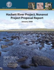
Regulatory ContextThe Mary River Project bulk sampling program will require several permits, licenses orauthorizations, as follows:• Inuit Land Use License III (Qikiqtani Inuit Association)• Quarry Concession (Qikiqtani Inuit Association)• Type B Water License (Inland Waters Act)• Class A Land Use Permit (Territorial Lands Act)• Fisheries Authorizations (Fisheries Act)• Exemption/approvals under the Navigable Waters Protection ActIn addition to the above authorizations, the Project proposal will be checked for conformance to theNorth Baffin Regional Land Use Plan, and will undergo environmental screening by the NunavutImpact Review Board pursuant to the Nunavut Land Claim Agreement (Article 12). In addition, an<strong>Environmental</strong> <strong>Screening</strong> is required under the Canadian <strong>Environmental</strong> Assessment Act beforepermits/authorizations may be issued by federal departments. This <strong>Environmental</strong> <strong>Screening</strong>Document has been prepared to provide agencies with sufficient supporting information to licensethis project.Natural EnvironmentThe Mary River Project is located on northern Baffin Island, which has a semi-arid arctic climate.The average temperature at Pond Inlet, the nearest location with a long-term climatic record, is-15.1 ºC. The mean annual precipitation at Pond Inlet is 190.8 mm, with 144.5 cm of snowfall and85.4 mm falling as rain. Historical records show that snow can occur in any month, and rainfall mayoccur from April through November. Pond Inlet experiences 24-hour darkness (with less than2 hours of twilight) from November 12 to January 29, and continuous sunshine from May 5 toAugust 7.Surficial landforms and deposits are associated with recent, widespread glaciation on Baffin Island.Surficial geology consists of locally abundant Holocene glacio lacustrine sediments, fluvialsediments (alluvial deposits) and marine and glacio-marine deltaic sediments, end moraine till, andwith occasional outcrops of pre-Quaternary bedrock and sedimentary rock formations. The NorthBaffin region and Mary River area lies within the Committee Belt, a granite-greenstone terranemixed with rift basin sediments and volcanic rocks; Precambrian mountain to the east andPalaeozoic lowland plateau to the west. The Project lies within the zone of continuous permafrost,with an active layer thickness of up to two metres and a total permafrost depth of about a halfkilometre.The extremely cold temperatures of the region, combined with permafrost ground conditions resultin a short period of runoff that typically occurs from June to September. All rivers and creeks, withperhaps the exception of the very largest systems, freeze completely solid during the wintermonths. The runoff coefficient is very high due to the combination of low temperatures, lowPage iii of xviNB102-00181/6-1Revision 0November 20, 2006