

Cadamstown.pdf - Offaly County Council
Cadamstown.pdf - Offaly County Council
Cadamstown.pdf - Offaly County Council

Create successful ePaper yourself
Turn your PDF publications into a flip-book with our unique Google optimized e-Paper software.
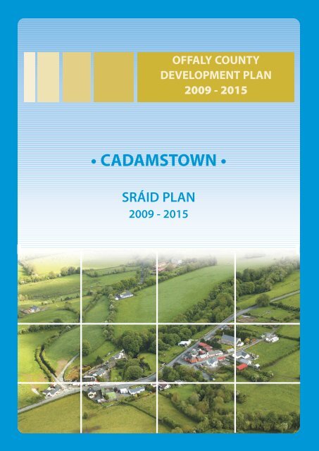
OFFALY COUNTYDEVELOPMENT PLAN2009 - 2015• CADAMSTOWN •SRÁID PLAN2009 - 2015
OFFALY COUNTY DEVELOPMENT PLAN 2009 - 2015Volume 2 - Settlement PlansCADAMSTOWN SRÁID PLAN2.2 Waste WaterEffluent is treated on individual sites by individualtreatment facilities, and it is envisaged that this willcontinue in the development of this sraid, except inlimited cases where in-depth development isappropriate [Refer to Volume 1, Chapter 7].2.3 Other Services(a) Social and Community InfrastructureA church and public house are located within the sraid.1.0 GENERAL INTRODUCTION ANDDEVELOPMENT CONTEXT1.1 Location<strong>Cadamstown</strong> is a small rural settlement on thenorthwestern flank of the Slieve Bloom Mountains. It islocated approximately 20km from Tullamore and 6kmsfrom Kinnitty along the R421 road where it crosses theSilver River.1.2 Settlement FormThe existing settlement is predominantly linear, centredon the bridge over the Silver River and comprises aChurch, public house and approximately 20 houses,with a population of approximately 60 people. Thebuilt fabric is mainly one or two storey and domestic inscale. The attractive approaches and the river valleyaffords <strong>Cadamstown</strong> a very attractive setting as well asgood access to the Slieve Bloom Way.1.3 TopographyThe area is generally sloping from both north and southdown to the Silver River. The slopes are more gentle onthe south side and consequently includes somerelatively flat areas suitable for development.2.0 SERVICES AND SOCIALINFRASTRUCTURE2.1 Water Supply<strong>Cadamstown</strong> is serviced by a piped water supply from aprivate group water scheme, sourced fromgroundwater supplies. Consent to the provision of awater supply will be required as part of planningpermissions granted.(b) RoadsThe roads serving the sraid are currently within 50km/per hr. speed limits. The two minor county roadswhich connect with the R421 in the sraid will requiresome modification at the road junction to improve theirsafety as the settlement expands.(c) FootpathsThe existing footpath network is a mix of formal andinformal. The formal network of footpaths should beextended in line with future development.Other Features• The Silver River and associated walkways areextremely attractive elements within the area.• The Church and its grounds contain a number ofartefacts namely; a cross inscribed grave slab, atwelfth century decorated animal head and ahuman face, possibly St. Lugna. It is possible thatthese stones, as well as many more used inconstructing <strong>Cadamstown</strong>, were originally fromthe Church at Letter.• Car-parking area at the entrance to the SlieveBloom Way.• The Mill and the Ardara Masonry Bridge to thewest and north add to the ambience of thesetting. The latter is of national significance andhas been taken into National care.• Mature hedge boundary adjacent to the R421 onthe south boundary of the sraid.3.0 KEY MESSAGES FOR CADAMSTOWNa) <strong>Cadamstown</strong> shall be developed in a properlyplanned and coherent manner, with the publichouse, and associated land to the front and thecar park at the Silver River as a focal point. Thissraid’s picturesque setting shall be retained andFebruary 2009 | <strong>Cadamstown</strong> Sráid Plan | page 218
OFFALY COUNTY DEVELOPMENT PLAN 2009 - 2015Volume 2 - Settlement Plansenhanced in accordance with appropriatelydesigned and very sensitive development.b) The promotion of very low-density linear orclustered style development within the sraid.c) The conservation and integration into newdevelopment of existing stone walls, trees andnative hedgerows, and promotion of similarmaterials for new boundaries.d) High quality designs, which are reflective of theexisting rural character of the village, withoutprecluding high quality innovativecontemporary designs.e) Promotion of natural building and boundarymaterials.4.0 GENERAL DEVELOPMENTOBJECTIVES4.1 Approx. total no. population envisagedPopulation growth should be at a relatively slow pacewithin the sraid envelope as delineated on theaccompanying map. It is envisaged that an additional30 dwellings approximately, catering for approximately90 people, could potentially be accommodatedtogether with small-scale commercial development.4.2 Allowable Units Per AnnumSmall numbers per annum. In permitting take-up ofdwellings, the <strong>Council</strong> will have regard to the totalnumber envisaged over the plan period. Someflexibility may be necessary when any major works arerequired to open up backland sites.4.3 Prioritiesa) Encourage consolidation within the sraiddevelopment envelope, which is in the main, onthe southeastern side of the R421.b) Enhancement of local infrastructure along allroutes within the settlement (i.e. public lighting,footpaths).c) Promote the redevelopment and / orrefurbishment of under-utilised sites.d) Encourage and facilitate co-operation between /amongst the different development interests inorder to maximise community gain, for thegreater good of the settlement.e) Encourage facilities for walkers and other visitorsto the Slieve Bloom area within or in closeproximity to the ‘sraid’ envelope.4.4 Shape and Form<strong>Cadamstown</strong> comprises both linear and dispersedsettlement patterns. The bridge over the Silver Rivergives the settlement a natural centre and this areacoupled with the Church, public house and SlieveBloom car park, should be promoted as a focal point forthis settlement.Any new development within the sraid will be basedupon a considered understanding of the area’scharacter and should be designed and located in such away that sympathetically reflects and respects it.4.5 Style / CharacterIt is <strong>Council</strong>’s intention that <strong>Cadamstown</strong> should retainas far as possible, its current rural character and that anydevelopment should respect and enhance this style.5.0 SPECIFIC DEVELOPMENTOBJECTIVES5.1 ArchaeologyIt is an objective of the <strong>Council</strong> to secure the protection(i.e. preservation in situ or at a minimum protection byrecord) of all archaeological monuments included in theRecord of Monuments and Places as established underSection 12 of the National Monuments (Amendment)Act 1994, and their setting. There are 2 RecordedMonuments listed on the Sites and Monuments Recordsited within this sraid.5.2 Protected StructuresA complete list is contained within the Record ofProtected Structures for the <strong>County</strong>. Policies containedwithin Volume 1 of the plan will apply.5.3 Amenities (Open Space)There is the potential for the development of an openspace area on lands to the south east of the R421 withinthe sraid to give depth to this settlement. This wouldentail more than two houses being built and as well asthe required Design Statement, a ‘master plan’highlighting an overview of the area may be required.5.4 Trees and BoundariesNew development should ensure the protection ofmature trees, hedgerows and the conservation ofexisting stone walls, and their integration into newdevelopment. Where the provision of new boundariesFebruary 2009 | <strong>Cadamstown</strong> Sráid Plan | page 219
OFFALY COUNTY DEVELOPMENT PLAN 2009 - 2015Volume 2 - Settlement Plansare required, these should comprise of native hedgerowplanting, or stone walls which consist of stone found inthe locality.Where comprehensive new development occurs, itshould take into account the pattern of existinghedgerows and incorporate same into layouts or plantconnecting hedgerows and incorporate same intolayouts or plant connecting hedgerows wherehedgerows removal to facilitate development works isnecessary.The <strong>Council</strong> will require that all new development willrespect the predominantly rural nature of thesettlement, in particular through the provision ofsensitive landscaping schemes. In the event that theremoval of tree(s) is deemed to be necessary, it will beconditional on replacement with appropriate species.5.5 Local Issuesa) The incremental provision of footpaths throughdevelopment contributions / specialdevelopment contributions, or requirements forworks as part of planning permissions granted isenvisaged to improve the amenities of the area.b) Adequate lighting to be provided along all routeswithin the enclosed settlement, over time.c) Progressively underground overhead cables. Inthe case of new development, ducting will berequired under new roads or new/upgradedfootpaths.d) Enhancement of ‘gateway’ features and naturaledges as the opportunities arise, so as to increasethe sense of place and character of thesettlement.e) Facilitate and encourage the appropriateredevelopment of dis-used and/or derelict siteswithin the settlement.f) Protect key archaeological sites.g) Access points to be provided where necessary,within the sraid.h) Protection and integration of stone walls in anyfuture developments.5.7 Map Annotation - Guidance &Requirements for Development1. This area is high. Any development should retainthe existing front hedgerow, where feasible andbe only single storey in height.2. This area could be examined in a comprehensivemanner and possibly the subject of a masterplan. This plan should address the followingpoints:a) Access should be from the two locationsindicated by red arrows on the accompanyingplan, where feasible and should allow vehicularaccess through the area. This will provide greaterpermeability to the built up area.b) Open space in this area should be proposed andincluded to form a focal point within this zoneand therefore make it more usable for thecommunity. (see para 5.3).c) Provide for pedestrian movement through thearea and give links to the adjoining amenity areasof the Silver River/Slieve Bloom Way to the north(Green hatched area on accompanying plan).d) Retain, protect and incorporate as a naturalfeature the hedge/stream on the northwesternboundary (Green line on accompanying plan).3. Extend and improve the amenity walkwaysrelated to the Silver River and Slieve Bloom Way,as resources permit (Green hatched area onaccompanying plan).5.6 Flood RiskAny proposed development along the Silver River mustsatisfy the <strong>Council</strong> that it is protected by design frompossible flood risk and incorporates at least theminimum setback from the bank as required by theOffice of Public Works.February 2009 | <strong>Cadamstown</strong> Sráid Plan | page 220
February 2009 | <strong>Cadamstown</strong> Sráid Plan | page 221


