Constraints Map - Blaenau Gwent County Borough Council
Constraints Map - Blaenau Gwent County Borough Council
Constraints Map - Blaenau Gwent County Borough Council
- No tags were found...

You also want an ePaper? Increase the reach of your titles
YUMPU automatically turns print PDFs into web optimized ePapers that Google loves.
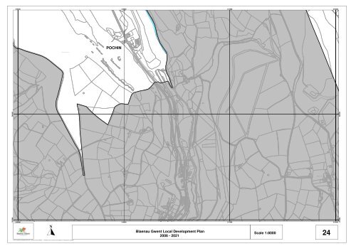
Nant Maes-yr-o nDrainTCBCRUndTrackPath (um)SRDrainDrainTrackBMBMFBDefUndUndFWUndFFSRUndDrainPontFWSPPostTrackTrackTrackSBTrackFWFW203000 204000A 4048FWBMTrackSPTrackTrackPostTrackTipSRFBFWPostRiverDismantled RailwayWellHallPath (um)SubwayWILLIAM'S STREETPNEWPORT ROADInnNew House(PH)TrackHo ly Co tageWyrloed BungalowTrackPostTrackTrackPlaygroundFWCro ft HeulogClubPostFWPost315000 316000 317000 318000A 4048414.2mDrainLevelIssuesCoed FedwgwaithDa ren DduQuarry(disused)SpreadsSpringsPondSpreadsPochin HouseIssuesA 4048The CroftPondMatharaSpreadsDan-y-brynBryn-y-da ranQuarryPochin(disused)Darren LevelHouses413.3mNant yr HelygSirhowy RiverCo Const, Asly Const, UA, C & ED Bdy(disused)IssuesBrynheulog(Afon Sirhywi)CollectsSpoutCo Const, Asly Const, UA, C & ED BdyPOCHINBM 276.91mBM 435.00mMynydd BedwellteSinks438.3mPondCoed Waun-bleiddianDrainQuarry(disused)407.5mDrainCollectsCo Const, Asly Const, UA, C & ED BdyIssuesDrainMAN MOEL ROADDrainBM 438.93mIssuesNant yr HelygSewage PipeDrainShingleSubway242.44m244.4m239.17mCoed y Llanerch231.9m247.8mBM 231.55m235.9mSheepfold225.5m261.7mCoed y LlanerchBM 265.65m259.9mPont GwaithyrhaearnCollects407.5mTrackBM 256.72mIssuesSpringGwaithyrhaearnBM 225.12mBM 271. 3mDismantled RailwayIssuesCollects277.6m438.6mPondCattle GridSinks275.2mBM 405.31m303.2mBM 285.57mIssues404.1mBM 243.10mBM 290.76mBM 285.31mCoed Pen-RhiwAir ShaftSpringMast315.7mCo Const, Asly Const,Co Const, Asly Const,UA, C & ED BdyBM 400.07mUA, C & ED BdyPond261.5m396.8m437.4mSpringPantymilah326.4mAir LevelPondPond312.4mBM 337.08m320.3mMynydd BedwellteSubwayCo Const, Asly Const, UA, C & ED BdyMynydd Bedwellte346.9mBM 262.95mManhole333.1mCoed y LlanerchPonds385.05mMAN-MOEL ROADPen-rhiw-gwaithCoed y Llanerch392.3m380.7mTrackBM 427.19mManholeBM 347.36m355.1m351.4mTy'r CwrtBM 353.38mBM 355.47mBM 357.83m376.4m351.1mTrack363.9m392.3mPath (um)HillsideCottages400.2mPath (um)354.8mBM 385.76mTon-y-ffald264.0m387.1m413.0mBM 398.88mPoundPath (um)BM 350.53mTrackBM 385.42mTrack393.2m359.4mSirhowyPath (um)Path (um)BM 407.97mBM 254.24m(AfonBM 391.14mSirhywi)Path (um)Path (um)243.2mGlay-yr-afonPath (um)Pen-rhiw-ffawyddog394.4m382.2mCo Const, Asly Const, UA, C & ED BdyPath (um)Llwyn-arfonTy-Ni BungalowChapelPath (um)354.8mPond383.7mLlanerchMan-moelPlaygroundBurialPath (um)GroundVi lage FarmSpringPath (um)Path (um)Holly BushTankBM 235.35mBM 385.47mPath (um)SpringPondIssuesTankWyrloed Holiday CottagesWyrloedCottagesPath (um)RAILWAY TERRACEPath (um)397.5m385.0mBM 379.07m372.2mBM 359.30mHolly BushChurchBungalowTankManholeCoed Pen-rhiwWyrloedFarmBM 393.45mCo Const, Asly Const, C & ED BdyPath (um)Spring382.2mSheepWashTir-y-pentrePath (um)Path (um)IssuesPath (um)Path (um)397.8mPen-yr-heol-fawrTy'r-capelTrackSports GroundQuarry(disused)TrackBM 396.36m396.5m395.3m242.6mPath (um)TrackSpringWorksTrackTy-GwynTy BrynUndPondPath (um)Llwyn-bâchWestlandAllotmentView GardensTrackTir RhosPath (um)BM 254.63mTrackTrackCraig BedwUnd391.1m373.4mIssuesLlwyn-bachTe raceA 4048GarageA 4048Path(um)315000 316000 317000 318000<strong>Blaenau</strong> <strong>Gwent</strong> Local Development PlanScale 1:80002006 - 202124+ Crown copyright and database rights 2011 Ordnance Survey LA09002L + Hawlfraint y Goron a hawliau cronfa ddata 2011 Arolwg Ordnans LA09002L203000 204000