DPZ04 - Chittagong Development Authority
DPZ04 - Chittagong Development Authority
DPZ04 - Chittagong Development Authority

You also want an ePaper? Increase the reach of your titles
YUMPU automatically turns print PDFs into web optimized ePapers that Google loves.
BAKALIA-CHANDGAON<br />
DPZ<br />
04 04
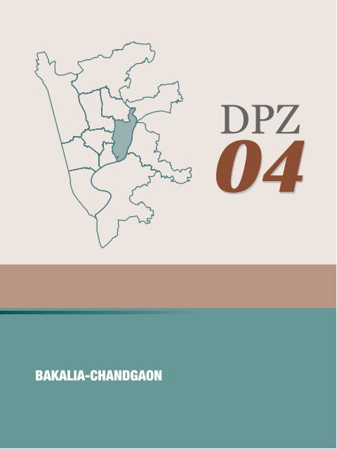
4.4 DPZ-04: BAKALIA-CHANDGAON<br />
4.4.1 EXISTING SITUATION<br />
a) Location and Administrative Boundary: The<br />
Zone is situated to the east of the city. It is bound<br />
by the Karnaphuli River on the east and south, the<br />
Halda River on the upper eastern portion, and the<br />
Nawab Sirajuddowla road, Kapashgola Road,<br />
Kothiber Hat and Chan Mia road in the west. The<br />
Patharghata and Boxirhat wards are in the west.<br />
The area covered by zone consists of Chandgaon<br />
and Bakalia Thana and seven wards which are 4, 5,<br />
6 17, 18, 19 and 35.<br />
b) Population: In accordance with the Population<br />
Census, the population has increased from 238,524<br />
in 1991 to 382,248 in 2001 and is projected to be<br />
702,650 in 2015. The highest population density is<br />
in South Bakalia.<br />
c) Land Ownership: Most of the land within the<br />
area is under private ownership. A significant size<br />
of land is under public control as for examples<br />
educational institutions and land of the Port<br />
<strong>Authority</strong> such as at Nazir Char. The port controls<br />
the riverside lands.<br />
d) Socio Economic Condition: According to the<br />
socio economic survey it is observed that the HH<br />
size ranges from 1 to 12 members. Most of the<br />
families consist of 4-6 members in DPZ 04. 51.50%<br />
of the total population is male and 48.50% is<br />
female.<br />
Approximately 23.18%, 21.71%, 20.21%, 12.50%,<br />
17.28%, 13.36 and 16.17% have completed<br />
secondary education in Ward 04, Ward 05, Ward<br />
06, Ward 17, Ward 18, ward 19 and Ward 35<br />
respectively. Most people are engaged in small and<br />
middle scale business. Livelihood on furniture<br />
industry and agriculture such as fish cultivation,<br />
livestock and poultry is high.<br />
4.4.2 EXISTING LAND USE AND<br />
DEVELOPMENT STATUS<br />
a) Residential: There are 43,086 structures in this<br />
area of which 30% pucca, 37% semi pucca, 24% tin<br />
sheds and 9% katcha. Of the total structures some<br />
<strong>DPZ04</strong> 04<br />
35,509 are used for residential purpose. Residential<br />
growth has largely taken place at Baubazaar,<br />
Chawkbazaar and Bahadderhat, in an unplanned<br />
manner along narrow roads and lanes. Highdensity<br />
residential development is also present<br />
along both sides of Mia Khan road, K.B. Aman Ali<br />
Road, Khawja Road, Balir Hat and<br />
Kalurghat/Kaptai road.<br />
It also extends in a scattered manner in different<br />
parts of the area. The planned Chandgaon R/A has<br />
been developed by CDA. Phase 1 of Kalpalok<br />
housing has recently been handed over. The Nur<br />
Nagar housing has been developed by the private<br />
sector with approval from CDA.<br />
A number of ponds have been filled to create<br />
residential sites. Due to rapid urbanization, the<br />
remaining vacant lands are being put to urban use<br />
through individual scattered efforts without<br />
proper access, drainage provision and urban<br />
amenities.<br />
b) Industrial: There are around 306<br />
manufacturing and processing industries in this<br />
zone. The Chaktai Area in Bakalia is a leading<br />
industrial and commercial activity centre. A large<br />
number of industries depend on water (river and<br />
canal) transportation. Industries consist of, rice,<br />
flour and oil and saw mills, ice and soap<br />
manufacturing, boat building and repair docks.<br />
A few soap industries are seen along the Mia Khan<br />
road. The Balir Hat has a concentration of furniture<br />
making and display shops. Furniture produced in<br />
this area serve the city.<br />
There are planned industrial estates at Mohra and<br />
Kalurghat, developed by CDA. However, many<br />
plots remain underused and vacant. Large<br />
industries exist in different parts of Bakalia and<br />
Chandgaon area such as the Osmani Glass factory,<br />
private textile, and paper and garments industries.<br />
c) Commercial: Approximately 4,152 commercial<br />
structures have been recorded of which most are<br />
small retail shops. Wholesale business in tin, steel,<br />
groceries, plastic goods, fishing, clothes, bamboo is<br />
common. Economic activities of this area are of<br />
4-51
4-52<br />
Table 4.4: Existing land use features of DPZ-04<br />
Sl. No. Type of use Area (in acre) Percentage<br />
1 Agriculture 925 11.29%<br />
2 Commercial 282 3.44%<br />
3 Education & Research 46 0.56%<br />
4 Manufacturing & Processing 540 6.59%<br />
5 Mixed Use 676 8.26%<br />
6 Office Use 44 0.54%<br />
7 Open/Community Space 149 1.82%<br />
8 Residential 1015 12.38%<br />
9 Service Facilities 29 0.35%<br />
10 Transportation 479 5.84%<br />
11 Vacant Land 1982 24.18%<br />
12 Water Body 1629 19.87%<br />
13 Miscellaneous 399 4.88%<br />
Total 8195 100%<br />
Source: Land use survey, 2006-2007<br />
regional interest. A large number of bank branches<br />
operate to facilitate business.<br />
Kalurghat growth centre mentioned in the<br />
Structure Plan 1995, is situated in the northeastern<br />
side and near to Kalurghat Bridge of the DPZ-04.<br />
d) Topography and Drainage: Topographically<br />
this zone is almost flat and gently sloping towards<br />
the east. However, the vast plain area can be<br />
divided into at least three morphological units,<br />
which are alluvial plain, marshy land and mud flats.<br />
A wide part in the west and north is the alluvial<br />
plains, which is fringed by relatively low-lying<br />
marshy lands. The drainage condition of this<br />
marshy land is very poor. The area along the<br />
Karnaphuli course is the mud flat, which is crisscrossed<br />
by tidal-creeks. Some important khals<br />
passing through this area are Chaktai khal and<br />
Chaktai diversion khal, Rajakhali khal, Tulatuli<br />
khal, Dhomkhali khal, Noa khal and Krisnakhali<br />
khal. These khals are primarily tidal in nature and<br />
play a vital role in discharging storm water into the<br />
Karnaphuli.<br />
e) Transport<br />
Road Network: This is a relatively less developed<br />
zone of <strong>Chittagong</strong>. Road network in this area is in<br />
a poor state and does not follow any regular<br />
pattern. The Karnaphuli Bridge Approach Road is<br />
one of the most important primary roads in this<br />
area. This road can be part of a future primary<br />
network in the north-south direction. Another<br />
major road is Kaptai Road from Bahadderhat<br />
Moore to Kalurghat Bridge, which is an east-west<br />
Pic. 4-29 Karnaphuli Bridge Approach Road.<br />
connection. There are some minor roads in this<br />
area namely Mia Khan road, K.B. Aman Ali road<br />
and Khawja road but alignments and interconnections<br />
of these roads are poor. Western part
4-54<br />
of the area has been developed in very tight form<br />
particularly at Baubazaar, Chawkbazaar,<br />
Dewanganj, Kurbaniganj, Bahadderhat and their<br />
adjoining areas. Access roads are very narrow and<br />
congested in East Sholashahar and West Bakalia.<br />
The link roads between the industrial and<br />
commercial areas at Chaktai and Karnaphuli<br />
Bridge Approach Road are narrow, congested and<br />
have poor surfacing.<br />
Water Transportation: Water transport along<br />
Chaktai Khal, Rajakhali Khal, Tulatuli khal and<br />
their branches within the study area are used as<br />
cheapest mean of transportation from and to<br />
<strong>Chittagong</strong>. Chaktai area situated on the bank of<br />
these khals at the southern end of the study area is<br />
an important commercial centre.<br />
Pic. 4-30 Existing canals keep pivotal role in water transport system<br />
of the city.<br />
f) Community Facilities<br />
i) Health Services: There is no large hospital.<br />
Approximately 25 small hospital, clinic and<br />
diagnostic centres are situated at Bakalia and<br />
Chandgaon area.<br />
ii) Education: Around 276 educational institutes<br />
are present consisting of primary and secondary<br />
schools, college and training centres.<br />
g) Utility Services<br />
i) Water Supply: Water supply line exists along<br />
the roads of Bakalia from which individual<br />
connections are provided to those who can<br />
afford it. Supply is irregular and has poor quality.<br />
Therefore, use of shallow tube wells is common.<br />
As the ground water table is going down,<br />
shallow tube wells are becoming inoperative.<br />
Deep tube wells are being sunk and are<br />
preferred as water supply from WASA is<br />
irregular. NGOs have assisted in providing deep<br />
tube wells to the urban poor. General residents<br />
of East Bakalia install deep tube well for<br />
drinking water supply use pond for other<br />
domestic purposes.<br />
ii) Gas and Electricity: Gas and electricity<br />
supplies are available in the built areas to those<br />
who can afford to pay for connections. Mud<br />
ovens are still used by the poor.<br />
iii) Drain and Sewerage: Roadside drains are of<br />
insufficient dimensions; vary in width and in<br />
poor conditions. Some dwellings have septic<br />
tank but in many cases sewage is discharged<br />
directly into khals or deposited in open latrines.<br />
With the help of NGOs some households have<br />
established sanitary ring latrines.<br />
iv) Solid waste: There is no proper solid waste<br />
management system in this area. People dump<br />
waste indiscriminately along the roadside, drain,<br />
pond and canal, polluting the surroundings.<br />
h) Leisure, Recreation, Parks and Open<br />
Spaces: The Zia Smriti Complex is located near to<br />
Chandgaon Residential Area. There is no other<br />
defined park<br />
Pic. 4-31 Zia Smriti Complex.<br />
i) Culture and Heritage: Fishermen Village has<br />
been developed over the past years in the mideastern<br />
side of this zone along the Karnaphuli<br />
River. Their livelihood depends on Karnaphuli<br />
River and other water bodies by catching fish<br />
and sells it to the local market. There is also
Borua Para (Buddhist Area) located in the eastsouth<br />
side of the Arakan Road in this DPZ.<br />
j) Agriculture: A large amount of land is used for<br />
agricultural purpose. Irrigation water is used for<br />
cultivation. Approximately 300 poultry farms<br />
and a large number of fish farms contribute to<br />
the local economy of Bakalia.<br />
The generalized Land use pattern of this area is the<br />
unplanned commercial zone in the south, planned<br />
residential area at Chandgaon, sporadic<br />
unplanned housing in between Chaktai and Shah<br />
Amanat Bridge approach road, planned industrial<br />
zone in the north and huge vacant area along the<br />
river side. However, some environmental issues in<br />
this planning zone are:<br />
4.4.3 EXISTING ENVIRONMENTAL ISSUES<br />
i) Water logging: An environmental concern in<br />
this zone is severe water logging. The worst<br />
affected are the lowlands of Bakalia and Chaktai.<br />
The main causes are siltation due to hill cutting<br />
and hill erosion in the uplands, encroachment of<br />
Pic. 4-32 Halda River- Only one natural breeding ground of local<br />
carps in the country<br />
<strong>DPZ04</strong> 04<br />
khal banks, depressed marshy lands in the south<br />
and east, and artificial obstacles across the<br />
drainage system.<br />
ii) Halda River front: Halda river is the only<br />
natural breeding ground of the local carps (such as<br />
Ruhi, Katol, Mrigal and Kali Baous). The River<br />
offers a typical environment for such carps to<br />
breed during first onset of the monsoon. However,<br />
in recent times, due to alteration of the Halda<br />
bank-line geometry, particularly modification of<br />
shoreline bends, this natural unique ecosystem is<br />
under threat.<br />
iii) Halda River Ecology: Near Kalurghat, the<br />
Halda River meets with the Karnaphuli as its<br />
tributary. Halda River is tidal in nature, but is very<br />
low in salinity. However, the extraction of surface<br />
water at Madunaghat site might increase the<br />
salinity limit of the river water. From the Kalurghat<br />
bridge point towards north, the Halda river reach<br />
is a special ecological zone.<br />
iv) Ponds and Water bodies: A large number of<br />
water bodies of different sizes are present, mostly<br />
near human settlements. The entire communities<br />
use some large ponds. Such ponds play an<br />
important role in environmental enhancement.<br />
v) Industrial Pollution: Some industries in the<br />
Kalurghat I/A, and outside, produce toxic wastes<br />
and effluents. Untreated effluents are discharged<br />
into the Karnaphuli River. The alarming pollution<br />
level is a threat to aquatic life.<br />
vi) Sand Mining from Karnaphuli: Karnaphuli<br />
riverbed is a source of sand quarrying. In between<br />
the Kalurghat and Shah Amanat Bridge tons of<br />
sands are mined in a traditional and unscientific<br />
way. This might have effect of river morphology<br />
and hydro-dynamics.<br />
4.4.4 HIGHER LEVEL PLANNING<br />
a) Structure plan 1995: Structure plan has<br />
identified Bakalia as one of three expansion areas<br />
of the city. Close proximity to the existing city areas<br />
and quick and easy connection, which will be<br />
achieved with the construction of the proposed<br />
road along the Karnaphuli, makes it a viable<br />
option as an immediate expansion area.<br />
4-55
4-56<br />
b) Urban <strong>Development</strong> Plan 1995: The<br />
following issues, problems, opportunities and<br />
required actions have been recognized in the<br />
Bakalia area in the Urban <strong>Development</strong> Plan. These<br />
are:<br />
Major issues and problems<br />
i) Susceptibility to limited impact from cyclonic<br />
surges<br />
ii) Susceptibility to seasonal flooding from the<br />
Karnaphuli: During monsoon and high tides a<br />
significant portion of land in this area is inundated.<br />
Flood level of this area can be categorized into<br />
three sub zones such as:<br />
Sub Zone 1: North east of the Karnaphuli River<br />
Bridge Approach Road, is inundated to a depth of<br />
5 feet. Water remains in this zone for a few weeks<br />
due to unplanned construction of roads without<br />
required provision of culverts for drainage.<br />
Sub Zone 2: The north of the junction of Chaktai<br />
and Rajakhali Khals. This zone is flooded in the<br />
monsoon to a depth of 4 to 5 '. Flood water<br />
remains for a few hours.<br />
Sub Zone 3: The area between Karnaphuli River<br />
and Rajakhali khal is inundated during the<br />
monsoon to a depth of 6 to 8 feet. This area is also<br />
affected by regular tidal flooding.<br />
iii) Haphazard development of urban fringe<br />
areas: Areas along the Chaktai khal have<br />
developed in an unplanned way with narrow and<br />
irregular road network. Adequate space for road<br />
and drainage network is mentioned in the CMMP<br />
as a prerequisite for urban development. Forward<br />
planning practice must be established to change<br />
this situation.<br />
iv) Presence of slum and squatter areas: A<br />
large number of slums exist in the area.<br />
v) Lack of direct access into the city: The<br />
Karnaphuli Bridge Approach Road is the only<br />
major north south access to the city. There is no<br />
major access in the east west direction.<br />
vi) Congested Chaktai Commercial Centre:<br />
Access to the Chaktai commercial area is poor.<br />
Roads are narrow and congested due to loading<br />
and unloading of goods in the streets. There are<br />
only two bridges crossing the Chaktai Khal namely<br />
Chamrar Gudam Bridge (approx. 20 ' wide) and<br />
Khatunganj Bridge (approx. 10 '). This causes<br />
severe congestion.<br />
Opportunities<br />
i) Proximity to the existing urban area: The<br />
Bakalia area is within half to one kilometer of<br />
important commercial centres at Anderkilla and<br />
Chawkbazaar area and within 2 km of Kotwali<br />
junction. It has thus been identified as a peripheral<br />
expansion area.<br />
ii) Road leading to new crossing of the<br />
Karnaphuli River: Karnaphuli Bridge and<br />
Karnaphuli Bridge Approach Road are important<br />
parts of the strategic road network of <strong>Chittagong</strong>.<br />
This Approach Road passes through the heart of<br />
Bakalia which has significantly improved<br />
accessibility into the area, thereby encouraging<br />
development.<br />
iii) Chaktai Commercial Area: Chaktai is an<br />
important commercial centre. Its renewal can<br />
greatly increase business prospects.<br />
iv) Proposed east-west link road in the<br />
Structure Plan: In the Long Term <strong>Development</strong><br />
Strategy for Traffic and Transportation, a major<br />
east west link road is proposed between Strand<br />
Road and the junction of Karnaphuli Bridge Road<br />
and its Approach Road. To complete the City’s<br />
primary road network, this link is highly<br />
recommended in the Structure Plan.<br />
When this road is constructed it will provide a<br />
major access between Bakalia and the City centre.<br />
This opening will lead further development in<br />
Bakalia area.<br />
c) Storm Water and Drainage Master Plan<br />
CMMP 1995: The DPZ 04 covers the entire area of<br />
Drainage Area No. 5a, Drainage Area No.5b,<br />
Drainage Area No. 7 and Drainage Area No. 9 of<br />
the Storm water and Drainage Master Plan of the<br />
CMMP. The prime proposals given for the area are<br />
khal rehabilitation, new primary khal, new<br />
secondary khal, flood storage pond, regulator.<br />
d) Long Term Strategy for Traffic and<br />
Transportation Master Plan CMMP 1995: Major<br />
long-term proposals are to construct road cum
embankment along the Karnaphuli River. This<br />
Master plan proposes a number of east-west and<br />
north south connection roads.<br />
4.4.5 DETAILED AREA DEVELOPMENT<br />
PROPOSALS<br />
The following development proposals have been<br />
shown in Figure no 4.8.<br />
a) Residential (Housing)<br />
R-04-01/R-04-02: The Chandgaon R/A and the<br />
Kalpalok R/A have been developed by CDA.<br />
Standards for provision of urban facilities and<br />
urban amenities have not been determined and<br />
needs to be ascertained. To ensure sustainability of<br />
planned areas CDA has to ensure adherence to<br />
building setback, provision of footpaths,<br />
mandatory open spaces at individual and collective<br />
levels and provision of adequate urban facilities to<br />
support the residential population. Ancillary uses<br />
such as small private offices employing less then 10<br />
persons, hairdressers, tailors, retail shops etc.<br />
serving the community may be permitted at<br />
designated location as per an approved design<br />
agreed by the community. Occupation of the new<br />
residential site has to be hastened in the areas<br />
identified in the figure 4.8.<br />
R-04-03: The new residential areas may be<br />
extended to accommodate all income groups<br />
(HI/MI/LI) in proportions stated in the guidance<br />
notes (Annex-2). Small-scale urban facilities<br />
(ancillary use) to support the local communities<br />
have to be incorporated. Employment<br />
opportunities of LI communities have to be<br />
considered and designed. The areas somewhat in<br />
the centre (both sides of K.B. Aman Ali Road and<br />
Khawja road) of the zone may be developed for all<br />
income groups (HI/MI/LI). Comprehensive<br />
development can only be achieved with large-scale<br />
development by a single authority through land<br />
readjustment techniques where it is required (Plan<br />
Implementation, Chapter-5). A major hospital and<br />
other urban facilities (ancillary use) and amenities<br />
will be incorporated. Guidelines and standards are<br />
provided in guidance notes (Annex-2).<br />
R-04-04: To the north of the rail track is a<br />
<strong>DPZ04</strong> 04<br />
spontaneously growing semi urban area. The<br />
<strong>Authority</strong> may guide the planned growth of the<br />
area for a MI and LI residential community through<br />
land management techniques. Opportunities for<br />
small commerce and urban facilities have to be<br />
incorporated.<br />
R-04-05: Borua Para located on the south of<br />
Arakan Road is a Buddhist predominant area. This<br />
study recommends to upgrade this area by<br />
providing required neighborhood services and<br />
facilities in consultation and co-operation with the<br />
local people. In this case, land readjustment<br />
technique may be introduced here.<br />
R-04-06: The DAP study proposes the area on the<br />
east of Kalurghat Industrial Area as predominant<br />
residential use. Industrial workers will get highest<br />
priority to live in this place but middle-income<br />
group may also have access to this area. Besides, a<br />
certain portion may be used for other purpose<br />
through proper consideration of the concerned<br />
authority.<br />
R-04-07: Taking into account the existing land use,<br />
the present study recommends this site for<br />
residential use. Attempts need to be taken to make<br />
access road, community facilities and open space in<br />
the area.<br />
R-04-08: These areas cover existing unplanned<br />
residential areas, industrial areas and commercial<br />
areas. These areas can be redeveloped with<br />
different planning techniques like Land<br />
Readjustment, and Site and Services Scheme. The<br />
commercial area near to Laldighi may be<br />
redeveloped by these techniques. Similarly other<br />
residential areas can be redeveloped in future for<br />
healthy neighborhood environment (Is not shown<br />
in the Figure 4.8).<br />
R-04-09: There are few slums developed scattered<br />
way into different parts of the DPZ 04. These slum<br />
areas can be upgraded in the existing places or<br />
relocated as low income housing (High Density)<br />
into the suitable locations. In this case, existing<br />
landowners will be compensated and provided<br />
required aid within the development process (Is<br />
not shown in the Figure 4.8).<br />
Implementing Agencies: CDA/NHA/CCC/Land<br />
owners/ Private land and housing Developers<br />
4-57
4-58<br />
Policies: Relevant policies for residential (housing),<br />
Chapter-2 and Guidance Notes: Relevant Sections<br />
and Sub-sections for residential (housing), Annex-<br />
2.<br />
b) Industrial<br />
In-04-01: The Kalurghat Planned Industrial area is<br />
grossly underused. The <strong>Authority</strong> must liaison with<br />
the relevant <strong>Authority</strong> to ensure full utilization.<br />
The environmental conditions of these estates<br />
must be significantly improved. No further land<br />
should be designated for industries unless these<br />
serviced plots are fully utilized under a legal<br />
mechanism. A tentative buffer zone must remain<br />
with plantation and green surrounding the<br />
industrial areas that may vary from 50ft to 150ft on<br />
the basis of prevailing physical situation of<br />
particular places. Owners of the industrial plots<br />
will be responsible to provide the required land for<br />
this buffer zone.<br />
In-04-02: The Bakalia area is prominent for<br />
furniture making. An area located Bolirhat and its<br />
environs, near to Karnaphuli River bank, may be<br />
further developed in a planned manner for<br />
expanding this activity and other small-scale<br />
industries. Facilities may be incorporated to<br />
Pic. 4-33 Furniture industry can promote local economy of this zone.<br />
facilitate tourism visitor facilities. Reserves may be<br />
made for large formal display and exhibition areas,<br />
warehousing and parking areas. In most cases,<br />
furniture is made in and around homes.<br />
Considering this practical situation, to support<br />
furniture industry, residential and some<br />
commercial uses can be provided in this strip of<br />
land.<br />
Implementing Agencies: CDA/BCIC/BSCIC<br />
Policies: Relevant policies on industrial and<br />
commercial use, Chapter-2 and Guidance Notes:<br />
Relevant sections and sub-sections of Guidance<br />
Notes 7 and 8, Annex-2.<br />
c) Commercial:<br />
Com-04-01: Current haphazardly commercial<br />
development in and around the Bahadderhat<br />
junction may be developed in a high class<br />
Pic. 4-34 High class commercial centre may be developed around the<br />
Bahadderhat junction.<br />
commercial centre, with sufficient offsets from the<br />
roads, wide public plazas, adequate parking<br />
facilities and bus bays. Buildings may be of<br />
unlimited FAR with maximum plot coverage of<br />
40%. Buildings will have to be of high architectural<br />
standard. These conditions will be same for the<br />
area Com-04-02 located to the south east of<br />
Arakan road and near bus terminal.<br />
Com-04-03/Com-04-04: Predominant commercial<br />
use in planned manner is recommended on the<br />
west of furniture industry as well as on the north<br />
of Mia Khan Road.<br />
Com-04-05: An area between the Chaktai and<br />
Chaktai diversion khal will be improved for<br />
development into a major planned warehousing<br />
and commercial centre. The <strong>Authority</strong> will ensure<br />
adequate access provision, off street parking and<br />
loading and unloading areas, adequate footpaths,<br />
and public open spaces. In addition, some other<br />
required uses can be encouraged here, for example
4-60<br />
residential and ancillary use considering existing<br />
situation.<br />
Com-04-06: This area located adjacent to the<br />
north east side of Shah Amanat Bridge Approach<br />
road can be used for commercial dominating and<br />
other uses.<br />
Com-04-07: The area situated to the south of the<br />
Anannya R/A may be used as predominant<br />
commercial use. In addition, other required uses<br />
may also be allowed here proportionately. Access<br />
road and parking facilities have to be designed to<br />
serve commercial activities.<br />
Com-04-08: Along the both sides of Arakan road<br />
that is located from Kaptai road till Kalurghat<br />
Bridge, can be considered to use as commercial<br />
dominating area. Besides in a certain scale other<br />
uses (residential, light industry and community<br />
facilities) may also be permitted.<br />
Implementing Agencies: CDA/CCC/PWD/other<br />
relevant Government Agencies/Private developer<br />
companies/Land owners.<br />
Policies: Relevant policies on industrial and<br />
commercial use, Chapter-2 and Guidance Note 9,<br />
Annex- 2.<br />
d) Mixed Use<br />
MU-04-01: The area between Chaktai Khal and<br />
Shah Amanat Bridge Approach Road may be<br />
guided to grow as planned mixed-use areas. The<br />
<strong>Authority</strong> will ensure upgrading of the area and<br />
protect it from localized flooding, improve access<br />
provisions and open spaces.<br />
MU-04-02/MU-04-03/MU-04-04/MU-04-05:<br />
These sites adjoining to the Kalurghat industrial<br />
area are suggested for mixed use in planned<br />
manner with good accessibility. Water based<br />
recreational facilities will be highly encouraged<br />
based on existing water body (khal).<br />
Implementing Agencies: CDA/NHA/CCC/PWD/Land<br />
owners/ Private land and housing Developers<br />
Policies: Relevant policies, Chapter-2 and Guidance<br />
Notes: Relevant notes, Annex-2.<br />
MU-04-06: This triangular shape site is<br />
recommended as mixed-use area.<br />
e) Drainage: According to the <strong>Chittagong</strong> Storm<br />
Water Drainage and Flood Control Master plan,<br />
1995, DPZ 04 comprises the whole area of Drainage<br />
Area No. 5a, Drainage Area No.5b, Drainage Area<br />
No. 7 and Drainage Area No. 9 of the Drainage<br />
Master Plan. Under the DAP some additional<br />
drainage works are recommended. These are<br />
detailed below:<br />
Drainage Master Plan Proposals:<br />
1. Rehabilitation of Chaktai khal, Noa khal and<br />
Uttara khal.<br />
2. Eleven secondary new khals in different parts of<br />
DPZ- 4.<br />
3. Two Primary khals of which one is 65 feet wide<br />
recommended within Bakalia Area and its<br />
tentative alignment lies in between K. B. Aman<br />
Ali Road and Khawja road from Chaktai khal at<br />
Bahadderhat to the Karnaphuli River and the<br />
other along the northern side of railway track<br />
parallel to Arakan Road and opposite side of<br />
Osmania Glass Factory.<br />
4. Four regulators on khals flowing into the<br />
Karnaphuli River.<br />
5. Two flood storage ponds, one is 9 hectare in<br />
Bakalia area and the other one is 10 ha in<br />
Chandgaon area.<br />
6. Flood defense is proposed on the right bank of<br />
the River Karnaphuli up to Kalurghat Bridge<br />
DAP proposal:<br />
1. To protect the existing khals from<br />
encroachment, a green corridor reserve is<br />
proposed on both sides.<br />
2. Rehabilitation of Tulatuli khal and other khals<br />
not covered in the Storm Water Drainage and<br />
Flood Control Master Plan, 1995, has to be<br />
rehabilitated. Retaining and preservation of 214<br />
ponds of 0.5 acre and above are mandatory. The<br />
accumulated size of these existing ponds and<br />
dighis proposed for preservation is<br />
approximately 162 acres. These ponds are<br />
identified in figure 4.8.<br />
3. The study recommends three additional<br />
regulators on the khals flowing into the<br />
Karnaphuli River.
4. Following drainage-guiding<br />
principles/guidelines C at page from 3-3 to 3-4<br />
remaining drainage networks is proposed and<br />
identified in the proposed land use plan of<br />
Figure 4.8.<br />
5. Where not shown specifically in the land use<br />
map, drainage guiding Principles/guidelines will<br />
apply.<br />
f) Transportation: In order to promote<br />
development in this DPZ in an organized<br />
manner, a number of primary and secondary<br />
roads are being proposed for development. The<br />
details are as follows:<br />
1.0 Embankment-cum-Road: In order to<br />
promote future development in this zone of<br />
<strong>Chittagong</strong> city, it is important to protect the bank<br />
of the river by constructing an embankment-cumroad<br />
along the Karnaphuli River from Shah<br />
Amanat Bridge to Kalurghat Bridge, which will be<br />
the eastern boundary of Bakalia and Chandgaon<br />
Area. This embankment-cum-road will extend<br />
from Karnaphuli Bridge Approach Road to the<br />
south-west up to Strand Road, but from Kalurghat<br />
Bridge to Madunaghat it will extend as<br />
embankment only. ROW of the embankment-cumroad<br />
would be 200 ft from Strand Road to Shah<br />
Amanat Bridge and 300 ft from that point to<br />
Kalurghat Bridge<br />
2.0 East-West Connecting Road: In order to<br />
develop a grid-iron pattern of road network, a<br />
number of important east-west links have been<br />
proposed for both Bakalia and Chandgaon areas.<br />
Most of these links will have a ROW of 60 ft. and<br />
the rest will have ROW of 40 ft, expect 2-more<br />
major east-west links, along the outer bypass,<br />
road. For details, Please See: Figure 4.8<br />
3.0 North-South Connecting Road: The<br />
Detailed Area Plan also proposed some important<br />
north-south roads in Bakalia and Chandgaon Area.<br />
One of these is an extension of Karnaphuli.<br />
Approach Road to the north, which will be partly<br />
of 120 ft ROW and partly of 100 ft ROW. The<br />
remaining north-south links are mostly of 60 ft.<br />
ROW. For details, please see Figure 4.8<br />
4.0 Road Widening: The other existing roads in<br />
this zone are not wide enough to provide smooth<br />
<strong>DPZ04</strong> 04<br />
circulation. It is, therefore, proposed to widen<br />
these roads as much as possible, say up to 30 ft. For<br />
details, please see Figure 4.8.<br />
g) Community Facilities:<br />
Comm-04-01: An area near to the centre of this<br />
zone can be reserved for education and research<br />
purposes. University, colleges, library, arts centre<br />
etc. may be established here in an urban setting<br />
befitting the elated use. Student residential<br />
facilities may be incorporated.<br />
Implementing Agencies: CDA/CCC/other relevant<br />
Government Agencies/Private developer<br />
companies.<br />
Policies: Relevant sections of the policies on<br />
community facilities, Chapter- 2.<br />
h) Leisure, Recreation, Parks and Open<br />
Spaces:<br />
There is no sufficient facility for recreation<br />
activities in this area. For better mental and health<br />
improvement of the local people it is mandatory to<br />
provide land for different types of recreation<br />
activities like parks, play ground, green and sports<br />
complex. Taking into consider this demand for<br />
recreational purpose the present study of DAP<br />
recommends a certain amount land in the study<br />
area.<br />
RO-04-01: An area eastern side of CDA Kalpalok<br />
R/A up to Karnaphuli River bank, may be<br />
developed as a river side amusement such as sport,<br />
leisure centre etc.<br />
RO-04-02: The triangular area south of the I/A and<br />
near to Karnaphuli River may be reserved for an<br />
urban park. A butterfly park may be incorporated<br />
which may operate as a commercial venture.<br />
RO-04-03: The junction of existing Arakan road<br />
and proposed new major road should be<br />
developed as a junction square park adorned with<br />
landscaped garden and sculptures. This will also<br />
apply for RO-04-04 and RO-04-05.<br />
RO-04-06: This area located to the west of<br />
Kalpalok R/A can be developed as park, civic centre<br />
and lake etc.<br />
RO-04-07: There is no stuffiest facility for<br />
recreational activities in this area. For better<br />
4-61
4-62<br />
mental and health improvement of the local<br />
people, it is mandatory to provide land for<br />
different types of recreational activities as for<br />
example, parks, playground, plantation and sports<br />
complex. Taking into consideration this demand<br />
for recreation purpose, the present study of DAP<br />
recommends for a certain amount of lands where<br />
it will be suitable in this DPZ (is not shown in the<br />
Figure 4.8).<br />
Implementing Agencies: CDA/CCC/Parjatan<br />
corporation/other relevant Government<br />
Agencies/Private developer companies.<br />
Policies: Relevant policies on leisure, recreation<br />
and open space, Chapter- 2 and Guidance note: 10.<br />
i) Utility Services:<br />
Ut-04-01: A Sewerage Treatment Plant is proposed<br />
to the East side of Kalurghat Industrial Area.<br />
Ut-04-02: The present DAP study recommends that<br />
the responsible agencies for the provision of utility<br />
services, will prepare their own detailed plan in<br />
respective fields.<br />
j) Culture and Heritage:<br />
CH-04-01: The ‘Borua Para’ located to the south of<br />
Arakan Road, is a settlement of an ethnic group.<br />
There is a big Mandir in this site. The area is<br />
recommended for cultural conservation. The<br />
physical condition of this neighborhood is poor.<br />
The <strong>Authority</strong> will ensure its enhancement and<br />
improvement, through provision of drainage,<br />
access roads and playgrounds.<br />
Implementing Agencies: CDA/NHA/CCC/other<br />
relevant Government Agencies/Private developer<br />
companies.<br />
Policies: Relevant policies on culture and heritage,<br />
Chapter- 2.<br />
k) Agriculture:<br />
A-04-01: There are lots of agricultural activities in<br />
this DPZ like fairies, paddy land and poultry firm.<br />
Considering the economic importance of<br />
agricultural activities in local peoples’ life the study<br />
recommends retention of a large amount of land<br />
for agriculture use. Besides, existing homestead<br />
can be retained as well as allowed further<br />
development in future.<br />
4.4.6 ENVIRONMENTAL PROTECTION AND<br />
ENHANCEMENT<br />
En-04-01: Considering the spectacular riverside<br />
view of the Karnaphuli, three riverside forests have<br />
been proposed so as to enhance the physical<br />
environment of the City. Mangrove forests under a<br />
natural environmental setting are recommended<br />
on the west bank of Karnaphuli. Artificial blockage<br />
should not be allowed to obstruct the natural tidal<br />
inundation of these two forests either due to the<br />
proposed highway along river or by any other<br />
means. These two forests will be rich in biodiversity<br />
and may also be a wildlife sanctuary.<br />
Another natural forest needs to be generated at<br />
the northern most trip of the zone and this should<br />
be open for public access, but in a sustainable way.<br />
En-04-02: On both side of the Halda riverbank, a<br />
narrow 100m wide belt has to be identified as<br />
Special Ecological Zone. No development activities,<br />
particularly physical change of shoreline would be<br />
allowed and must strictly control. All existing<br />
activities, particularly brickfields and sand mining<br />
activities, which are harmful to Halda ecology and<br />
carp breeding process, need to be stopped and<br />
removed.<br />
En-04-03: To enhance the city environment and<br />
make it habitable, it is necessary to build some<br />
parks and new Urban Green blocks in this zone.<br />
Some such locations are at Chandgaon crossing,<br />
near Kalpalok RA, and south of Noa khal mouth.<br />
This green park should be kept open for public visit<br />
and leisure.<br />
En-04-04: Industries are the major source of water<br />
and soil pollution in this area. The <strong>Authority</strong> will<br />
liaison with the DoE to stop all forms of pollution.<br />
Setting up of Industrial Waste Treatment Plant,<br />
either by individual industrial unit or group of<br />
units of similar operation must be ensured.<br />
En-04-05: All major khals should be rehabilitated;<br />
backlines should be marked and fixed. Along the<br />
backline there should be a buffer zone of green<br />
belt, ranging from 20 ft. to 50 ft. wide on both<br />
sides. However, for Chaktai diversion khal the bank<br />
lines for entire course should be fixed and the<br />
green belt can be extended from khal mouth up to
the confluence with Chaktai khal.<br />
4.4.7 PHASING PRINCIPLES AND<br />
IMPLEMENTATION GUIDELINES<br />
a) Phasing Principle<br />
The study area Bakalia is flat land and threatened<br />
by flood and cyclonic surge from the Karnaphuli<br />
River. All the development works recommended<br />
before in the Detailed Area Plan of this area is<br />
subject to the construction of new Road Cum<br />
Embankment along the Karnaphuli River. Before<br />
that any massive development is prohibited along<br />
the eastern side of Bakalia.<br />
Due to the high liquefaction zone in eastern side<br />
of Bakalia generally two storied building will be<br />
safe within around 1 .5 kilometers from the bank<br />
of the river. But more than two storied building<br />
can be constructed with proper Structural and<br />
Architectural Design.<br />
b) Implementation Guidelines<br />
Generally <strong>Chittagong</strong> <strong>Development</strong> <strong>Authority</strong><br />
(CDA) is responsible to perform development<br />
activities in <strong>Chittagong</strong> city. Now a day’s Private<br />
sector and NGOs are keeping important role into<br />
different fields of development activities of the<br />
society. CDA can implement its development works<br />
in cooperation with NGOs and Private Sector.<br />
<strong>DPZ04</strong> 04<br />
4-63
4-64