X - William W. Walker, Jr., Ph.D.
X - William W. Walker, Jr., Ph.D.
X - William W. Walker, Jr., Ph.D.
- No tags were found...

You also want an ePaper? Increase the reach of your titles
YUMPU automatically turns print PDFs into web optimized ePapers that Google loves.
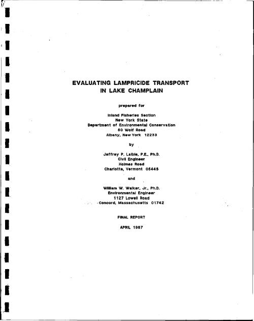
EVALUATING LAMPRICIDE TRANSPORTIN LAKE CHAMPLAINprepared forInland Fisheries SectionNew York StateDepartment of Environmental Conservation50 Wolf RoadAlbany, New York 12233byJeffrey P. Lalble, P.E., <strong>Ph</strong>.D.Civil EngineerHolmes RoadCharlotte, Vermont 05445and<strong>William</strong> W. <strong>Walker</strong>, <strong>Jr</strong>., <strong>Ph</strong>.D.Environmental Engineer1127 Lowell RoadConcord, Massachusetts 01742FINAL REPORTAPRIL 1987
TABLE OF CONTENTSSECTIONPAGE1. INTRODUCTION 12. TECHNICAL APPROACH 23. HYDRODYNAMIC ANALYSIS 34. MASS TRANSPORT ANALYSIS 45. WIND VELOCITY DATA 56 . MODEL TESTING 67. SIMULATION OF TFM APPLICATIONS 88. SIMULATION OF BAYER-73 APPLICATIONS 109. SENSITIVITY ANALYSIS 1110. DENSITY CURRENTS 1211. EMPIRICAL PLUME PROJECTIONS 1312. RESULTS 1513. SITE 1 - GREAT CHAZY RIVER 1514. SITE 2 - SARANAC RIVER 1715. SITE 3 - AUSABLE RIVER 1916. SITE 4 - LEWIS CREEK 2117. SITE 5 - PUTNAM CREEK 2318 . CONCLUSION 25REFERENCES 28FIGURES (1-74)TABLES (1-3)
1. INTRODUCTIONThis report provides technical assistance to the New York StateDepartment of Environmental Conservation (NYDEC) in projecting thetransport of lampricides applied to Lake Champlain tributaries and bays.This information will be used by NYDEC to evaluate impacts on watersupplies and on sensitive ecological areas and to design procedures formonitoring and mitigating impacts associated with the proposed lampreycontrol program.Mathematical models are used to project the spatial and temporalhistories of lampricide plumes resulting from specified treatmentconditions (defined by applied concentration, duration, location,streamflow, wind regime, and season). Evaluations have been conductedat five sites and seven proposed treatments:Site No.1234Great Chazy RiverSaranac RiverAusable RiverRiver/CreekLewis Creek5 Putnam CreekLampricide TreatmentTFM BayXXXXXXXSite locations are shown in Figure 1. For each site and treatment, thesize and duration of the lampricide plume have been projected down to 50and 20 ppb concentration levels.2. TECHNICAL APPROACHThe projections are based upon mathematical models representinghydrodynamics and mass transport in the embayment and open lake watersassociated with each application site. Two types of models areinvolved:(1) hydrodynamic model, which predicts current speeds anddirections in the lake surface layer as a function ofwind speeds, wind directions, and topography (Laible,1985a, 1985b,1986); and(2) transport model, which predicts concentration patterns asa function of current velocities, flows, appliedconcentrations, and topography (<strong>Walker</strong>,1985).The models are tested against field data from Rhodamine dye studiesconducted by the NYDEC between May and August, 1986 (Meyers,1986). Thefield data consist of river discharge rates, local wind conditions, dyeconcentrations and temperature recordings.The tasks required for projecting the transport at each site are asfollows:1
(1) Based upon review of dye study results, define modelregions.(2) Develop finite element grid for hydrodynamic model.(3) Run hydrodynamic model to generate lake circulationpatterns for various wind conditions.(4) Develop transport model grid.(5) Using circulation patterns generated by the hydrodynamicmodel, simulate dye release experiments and test modelsby comparing observed and predicted dye concentrations.(6) Use linked hydrodynamic and transport models to simulatelampricide plume under proposed treatment conditions(streamflow, applied concentration, duration) over arange of ambient wind conditions.Results of preliminary simulations and sensitivity analyses aredescribed in a previous report (Laible and <strong>Walker</strong>,1986). Initialsections of this report discuss basic concepts involved in thehydrodynamic analysis, mass transport analysis, and simulation oftreatment conditions. Detailed results for each site are subsequentlypresented. A final section summarizes results and compares plumeprojections with those developed by Meyers (1986) based upon dye studyresults.3. HYDRODYNAMIC ANALYSISCirculation patterns in the vicinities of the river mouths havebeen simulated using a steady-state finite element hydrodynamic model(FEM) which has been developed and applied elsewhere on Lake Champlain(Laible,1985a,1985b,1986). Lake circulation is driven by wind. Themodel first computes vertically averaged horizontal velocities of thefluid at discrete points (nodes) in the model region. Subsequently, thevertical distribution of the flow at each node is computed.Wind-driven flows vary over depth owing to development of two typesof currents: drift currents and slope currents. Drift currents aredirectly attributed to wind shear on the water surface. As water pilesup or is drawn away from the shoreline, a surface elevation gradientdevelops. This gradient causes a pressure in the opposite direction ofrising slope. This pressure drives fluid at the lower depths in adirection generally opposite to the direction of the wind (slopecurrent).The distribution of flow over depth generally starts with surfacecurrents aligned with the wind, except in deeper regions, where they maydeviate significantly due to Ekman frictional effects. With increaseddepth, the currents diminish and then reverse, pointing into the wind.In shallow regions, horizontal patterns are further complicated by2
effects of topography. Topographic flows interact with classical slopeand drift currents to form relatively complex velocity distributionswhich can only be described by numerical models of the type employed inthis study. For a detailed discussion of the finite element model, thereader is referred to Laible (1985a,1985b,1986).From the complex flow distribution, it is possible to evaluatetotal flows in the mixed layer at each node in each of the orthogonaldirections. This is done by integrating the vertical flow distributionover the mixed layer depth and keeping track of the total flow in eachof four directions (north, south, east, and west). The verticallyintegrated flows are used in the two-dimensional mass transport modeldescribed below.Circulation patterns have been generated at each site for eightdifferent wind directions (N,NE,E,SE,S,SW,W,NW) under a standard windspeed (8.7 miles per hour). Flow patterns for other wind speeds havebeen generated by scaling (flow rates are roughly proportional to thesquare of the effective wind speed). These current fields have beenused in modeling transport of dye and lampricide under appropriate windconditions, as described below.The hydrodynamic flow fields are presented as vector plots ofvertically averaged flow at each node and total flux (velocity timesdepth) at each node. A total of 80 flow fields and their associatedexchange and advective fields have been generated under this study.Examples for N and NE winds are presented for each site (e.g., Figures17 and 18). Reversing the direction of the arrows on these figuresyields circulation patterns under S and SW winds, respectively.4. MASS TRANSPORT ANALYSISMass transport simulations have been performed using S2D, a finitedifferencemodel developed in previous studies on Lake Champlain(<strong>Walker</strong>,1985; <strong>Walker</strong> et al.,1986). As compared with the triangular,link/node grid used by the FEM, S2D simulations are performed on a gridof square cells. The model is two dimensional (latitude and longitude)and has been designed for application to the lake surface layer. Eachcell is assumed to be completely mixed. Two basic modes of transportare considered:(1) advection (based upon current velocities supplied by thehydrodynamic model), and(2) diffusion (calculated from cell morphometry and anassumed diffusion or dispersion coefficient).The advective circulation patterns supplied by the FEM reflect winddrivencurrents in both directions across each cell interface. Exchangebetween adjacent cells can occur, for example, because of surface driftcurrents in one direction and bottom slope currents in the oppositedirection. Currents supplied by the hydrodynamic model generally3
dominate flow and mass transport between cells; the diffusive componentis relatively unimportant.In a steady-state mode, S2D solves for concentration fieldsresulting from a fixed loading regime and flow field. In a dynamicmode, S2D solves for time-varying concentration fields resulting fromtransient loading regimes (e.g., 12-hour lampricide application). Flowfields are fixed for a given run, however. To simulate transient flowfields (e.g., resulting from shifting wind directions or varyingtributary flows), a series of linked model runs must be performed; finalconcentrations for one run or time increment provide initial values forthe next. Boundary conditions can be specified as fixed concentrationor zero-gradient. The latter, more conservative boundary condition hasbeen used in the simulations discussed below.Consistent with previous model applications, a uniform cell size of400 meters has been employed. Mean cell depths have been derived fromLake Champlain navigation charts, which refer to minimum lake elevations(28.4 meters msl). Under 1986 spring-summer conditions, lake elevationswere near normal (1 to 1.2 meters above minimum). Accordingly, meandepths used in simulations have been increased by one meter relative tothose displayed in cell grid maps (e.g., Figure 19). A maximum mixedlayerdepth of 10 meters has been assumed in the hydrodynamic andtransport simulations; accordingly, depths are truncated at 10 meters.As described below, shallower mixed layers are assumed in mostsimulations.To permit use in transport simulations, flow fields generated bythe hydrodynamic model must be interpolated and integrated along cellinterfaces in the S2D grid. The resulting flows across each interfacemust also satisfy a water balance constraint on each cell. Considerableeffort has been expended in refining the methodology used for thesecalculations, in order to minimize errors involved in linking thehydrodynamic and transport models. The resulting procedure consists ofthe following steps:(1) read coordinates at FEM elements and nodes (x,y),corresponding velocities in each direction (+vx,-vx,+vy,-vy) and depths (z);(2) translate FEM coordinates (x,y) to S2D grid coordinates(column,row);(3) for each cell interface (excluding those bordering landmasses):(a) divide interface into 3 segments of equal length;(b)interpolate products +vx*z, -vx*z, +vy*z, -vy*z atcenter of each segment, using weighted sum of valuesat nearest node or element in each quadrant(NE,SE,SW,NW); weight - squared inverse distance;maximum distance - 1 row/column width;4
I(c) sum interpolated values over 3 segments and multiplyby cell width to get flows (nr/day), positive andnegative, across each segment;(4) formulate water balance equations and calculate waterbalance error (total flow in - total flow out) for eachcell;(5) divide the grid into regions of approximately 30 cells;(6) number regions in increasing order, so that highestnumbered regions border on boundary conditions;(7) for each region, in increasing order, correct waterbalance errors by adding a correction term for the netflow across each interface; exclude interfaces borderingcells in lower-numbered regions; select correction termsto minimize sum of squares of corrections, subject towater balance constraints; formulate problem usingLaGrange Method of Undetermined Multipliers; solveresulting system of linear equations (containing roughly3 x #cells unknowns) via Gauss Elimination;(8) store resultant flow matrix for use in subsequent runs.Prior to flow balance correction, median water balance errors for flowfields are on the order of 5%.5. WIND VELOCITY DATAWind speed and direction partially determine circulation patternspredicted by the hydrodynamic model and the path of dye or lampricidereleased into the lake at a particular location and time. Wind velocitymeasurements taken during the dye release study at each site have beendescribed previously (Laible and <strong>Walker</strong>,1986). The locations of windmeasurements made in the field are critical; because of the shelteringeffects of land masses, land-based measurements tend to under-predicteffective wind speeds driving lake circulation. Wind speeds measured atthe study sites were generally lower than speeds measured simultaneouslyat Burlington Airport. The latter provides a long term, quality windrecord which has been shown to be more useful than onsite measurementsfor modeling purposes because of the factors discussed above (Laible and<strong>Walker</strong>,1987).To provide perspectives on wind conditions, statistical analyses ofthe Burlington Airport wind record have been conducted for May throughSeptember of 1986 (3-hour observations). A cross-tabulation of windspeed and direction (Table 1) shows that there are two dominant windevents: South or Southeast (42.7% frequency) and North or Northwest(33.1% frequency). The frequency distribution for September only (themonth proposed for lampricide application) is similar to that for May-5
September. The distribution of total wind load (driving force for lakecirculation, roughly proportional to square of wind speed) is alsodominated by southerly and southeasterly winds (Table 2). Similarresults have also been obtained for the May-September 1984 wind recordfrom Burlington Airport (Laible and <strong>Walker</strong>,1987).The wind load factor (calculated as shown in Table 2) is defined asthe ratio of lake circulation rate at a given wind speed to thecirculation rate at a standard wind speed of 8.7 mph. Flow fields havebeen generated by the FEM for each site and wind direction under astandard wind speed of 8.7 mph (load factor - 1.0). Figure 2 displaysthe three-day moving-average load factor vs. time for the May-September1986 period. A three-day averaging period has been used because it is areasonable time scale for evaluating lampricide plume duration (from TFMapplication to dilution below 50 or 20 ppb concentration levels).Moving average load factors range from .5 to 4. Figure 2 providesindications of the probabilities of encountering lake circulation rateswhich are higher or lower than those simulated. As discussed below,sensitivity analyses indicate that lampricide plume durations arestrongly dependent upon circulation rates (wind load factors). Maximumplume areas and locations, however, are dependent primarily upon winddirections and mixed depths and are relatively insensitive tocirculation rates.6. MODEL TESTINGTable 3 summarizes dye study and lampricide treatment conditions ateach site. The models are tested by simulating dye study conditions(flow, applied concentration, duration, wind) and comparing observed andestimated maximum dye concentrations in each model cell over theduration of the dye measurements. In these simulations, dyeconcentrations are rescaled to an applied concentration of 1000 ppb.Observed and predicted plumes are compared at 100 and 10 ppb, whichcorrespond to 10-fold and 100-fold dilutions of the appliedconcentration, respectively. These comparisons are complicated by thefollowing factors:(1) variations in background fluorescence;(2) potential errors in measurement coordinates;(3) spatial data-reduction procedures;(4) estimation of effective wind speeds and directionsdriving lake circulation during the study period.These factors are discussed below.Variations in background (natural) fluorescence limit theresolution of the dye studies, especially for detecting high dilutionratios. As indicated in Table 3, maximum detectable dilution ratiosrange from 93 to 470 for the various sites, based upon background6
fluorescence values ranging from .02-.03 assumed by Meyers(1986). Thelatter values are very conservative, however. Based upon review of dyemeasurements taken at locations distant from the application pointand/or prior to the dye application, background fluorescence was highlyvariable and occasionally exceeded .1 units. A median value of .05seems more representative; this reduces the resolution range to 56-236.Variations in background fluorescence likely account for some of thedifferences between observed and predicted concentration contours,particularly at the 100-fold dilution level.As described by Meyers(1986), dye measurement locations weretracked using Loran-C units. Instrument drift and possible errors inthe transformation to orthogonal coordinates (latitude and longitude)are additional potential sources of error in the dye data.The model predicts the mean concentration in each cell and timestep. The dye sampling strategy tended to exclude null samples (i.e.,samples were more likely to be taken for laboratory analysis if theonboard fluorimeter indicated values which were significantly abovebackground levels.). Because of this strategy, limited number ofsamples, and the complexities involved in spatial weighting, it isinfeasible to calculate a mean dye concentration for each grid cell andtime period for comparison with model simulations. Accordingly, thecomparisons based upon the Tmsnrinunm dye concentration detected in eachcell over the duration of the study. Both random and deterministicfactors contribute to variability within model cells and partiallyexplain differences between observed (maximum) and predicted (mean) dyeconcentrations.For reasons discussed in Section 5, the selection of theappropriate wind regime (direction, speed) to drive the hydrodynamicmodel under dye study conditions is not straightforward. Each dye studyhas been simulated under three alternative sets of wind conditions:(1) Burlington Airport directions and speeds (updated at 3-hour increments) ;(2) Burlington Airport resultant direction and observed meanload factor, as defined in Table 2 (constant over entiresimulation period); and(3) Site directions and Burlington Airport speeds (updated at3-hour increments).Possibly because of sheltering effects, site measurements of wind speedare unrealistically low and have not been used in the simulations. Theabove wind cases provide a range of simulations for comparison with theobserved dye plumes.Based upon review of lake temperature profiles, the verticaldistribution of dye with depth, and comparison of observed and predicteddye plumes, the maximum depth of the mixed layer is adjusted to
epresent dye study conditions. To reflect thermal buoyancy of theinflowing streams, shallower depths (1.5-2 meters) have been used insimulating spring dye studies at the Great Chazy and Saranac Rivers.Greater depths (5-10 meters) have been used in simulating the dyestudies conducted during August at the remaining sites. Simulations ofTFM and Bayer-73 applications (scheduled for September) assume maximummixed layer depths of 5 meters. Subject to potential effects of inflowdensity currents (Section 10), the 5-meter mixed depth is conservative(likely causing over-estimation of plume areas) because the lakethermocline is likely to be found in the 15-20 meter range duringSeptember.7. SIMULATION OF TFM APPLICATIONSOnce the hydrodynamic and mass transport models have been set upand tested for a given lake region, simulation of TFM applications toinflow streams is relatively straightforward. The application isrepresented as a square wave in stream concentration (12 or 16 hours induration, depending upon site) at the prescribed treatment level.Hydrodynamic conditions (streamflow and lake circulation) are held fixedfor a given run. Lake concentration levels respond to the transientinput: concentrations near the river mouth increase during theapplication period and decrease thereafter, as the material istransported away from the mouth. The simulation is continued until allcell concentrations drop below 10 ppb.To illustrate the methodology employed in simulations of river TFMapplications, a "movie" of one treatment (Saranac River, North Wind) isshown in Figure 3. In this example, the simulation proceeds until allcell concentrations drop below 50 ppb (i.e., 90 hours). Results aresummarized in the form of a plot of maximum TFM concentration in eachmodel cell (last plot). Comparing this plot with the 50 ppb standarddefines the spatial extent of the lampricide plume. Plume duration isdefined as the time required (from start of lampricide loading to lake)for all cell concentrations to drop below the 50 ppb standard.Simulations such as that shown in Figure 3 are conducted separatelyfor each of eight wind directions and standard wind load. Theresulting plume maps (cell-maximum concentrations for each winddirection) are subsequently overlayed and compared to produce a single,composite grid of cell-maximum concentrations. An example is shown inFigure 4. The grid is subsequently overlayed on a lake chart andcontours are plotted for the 10, 20, and 50 ppb concentration levels.Derived in the way, the contours should surround the plume, regardlessof wind speeds and directions which are present at the time ofapplication. If the wind were from the south, for example, the plumewould tend to fill the northern portions of the contours.TFM simulations assume treatment conditions (streamflow, appliedconcentration, duration) specified in Table 3. Because the transportmodel is linear, simulation results can be rescaled to estimate maximum8
TFM concentration contours for other sets of treatment conditions. Thisrescaling is performed based upon the total mass of lampricide applied:where,C 0 = C t FF = ( Q Q Y Q T Q ) / ( Q t Y t T t )F- scale factorunder proposed treatment conditions:lake lampricide concentration (ppb)streamflow (cfs)applied lampricide concentration (ppb)duration of application (hrs)under simulated conditions (as defined in Table 3):C 0 - lake lampricide concentration (ppb)Q Q - streamflow (cfs)Y Q - applied lampricide concentration (ppb)T 0 = duration of application (hrs)This rescaling is inaccurate for locations in the immediate vicinity ofthe river inflow, but is accurate for defining plume boundaries at 50and 20 ppb concentration levels.For example, the maximum concentration grid shown in Figure 4 isbased upon a simulated streamflow of 600 cfs, applied TFM concentrationof 1.5 ppm, and treatment duration of 12 hours. Since concentrationsare displayed with a scale factor of 5, grid values greater then 10would represent the 50 ppb plume under the simulated treatmentconditions. Suppose that one wanted to use these results to predict the50 ppb contours for treatment conducted at a streamflow of 800 cfs,applied TFM concentration of 2 ppm, and treatment duration of 12 hours.The first step is to calculate the scale factor:F - (600 cfs x 1.5 ppm x 12 hrs) / (800 cfs x 2 ppm x 12 hrs )= .56The grid cell value corresponding to 50 ppb would be 50 x .56/5—5.6.Thus, all cells in Figure 4 with scaled concentrations equal to orexceeding 5.6 would be inside the 50 ppb contour under the modifiedtreatment conditions. Similar calculations can be performed to estimateother contour levels based upon the standard grid.9
8. SIMULATION OF BAYER-73 APPLICATIONSSimulation of Bayer-73 applications to delta areas is based uponthe same principles, but is more complicated because the effectiverelease period of the material must be considered. Bayer-73 is appliedin a granular form (5% active ingredient bound to sand particles with awater-soluble adhesive). When the material hits the water, the someportion of the active ingredient is released immediately into thesurface water. The sand particles sink and the remainder of the activeingredient is subject to slower release.One laboratory study (Seeyle,1987) has shown that less than 35% ofthe active ingredient is released into the water, based upon a singleovernight extraction in Lake Huron water (87 ppm alkalinity). Becauseof adsorption equilibria, however, multiple extractions may yield higherrelease percentages. Higher percentages may also be released into LakeChamplain waters because of differences in alkalinity.Ho and Gloss (1987) describe results of a study of Bayer-73 levelsfollowing treatment in Seneca Lake, New York. A 101-acre plot in thevicinity of a lake inflow was treated at the prescribed rate of 100 lbsBayer-73/acre (5% active ingredient). Concentrations of Bayer-73 werefollowed as a function of depth at nine stations over a 96-hour periodand ranged from
e explainable based upon hydrodynamic factors alone. Accordingly, 100%release is assumed in simulations of Lake Champlain Bayer-73applications. Based upon the time series behavior observed by Ho andGloss (Figure 5), an effective release period of 6 hours is assumed.Sensitivity of Bayer-73 plume behavior to assumed release period isillustrated in Figure 6. In this simulation, Bayer-73 is applied at 100lbs/acre to 175 acres near the mouth of the Saranac River under a northwind. Effects of alternative release periods (24, 12, 6, and 3 hours)on the simulated maximum concentrations and plume duration are shown.Plume duration is defined as the total length of time during which cellconcentration exceeds the 50 ppb criterion. A longer release periodincreases dilution in ambient currents and decreases plume size andduration. As distance from the application area increases, thesensitivity of the simulated maximum concentrations to the assumedrelease period decreases. This reflects the fact that, over reasonabletime scales for the release and under a given set of ambient conditions,the basic driving force for the creation of the lampricide plume in thesurrounding lake waters is the total mass of active material applied(i.e., 5 lbs/acre), not its rate of application or rate of release(lbs/acre-hour).Figure 6 indicates little difference between the 6-hour and 3-hoursimulations. Accordingly, the 6-hour release period supported by the Hoand Gloss study is used in simulating Bayer-73 applications to LakeChamplain. Projections are conservative (i.e., under-predict cell-meanconcentrations) because less than 100% of the active ingredient will bereleased into the water column and the dissolved material will besubject to various decay mechanisms (photolysis, adsorption, hydrolysis,uptake) as it is transported away from the application site.9. SENSITIVITY ANALYSESSensitivity analyses indicate that, for a given site, appliedconcentration, and river flow, the most important factors determiningthe maximum area of the dye or lampricide plume are wind direction andthe effective depth of the mixed layer. Figure 7 illustratessensitivities of maximum plume area to wind load and mixed layer depthfor the Saranac River TFM application under a north wind. Mixed depthand shoreline topography determine the availability of volume fordilution of the applied loading. Generally, plume areas will begreatest for wind directions which generate along-shore currents andhinder transport into deeper offshore regions. Wind speeds (whichdetermine transport rates) generally have a strong influence on plumeduration, but a weak influence on plume size and location, for a givenwind direction.Mechanisms responsible for decreasing lampricide or dyeconcentrations following application include:(1) dilution in the lake volume contained within thesimulation grid;11
(2) transport out of the simulation grid via wind-drivencurrents;(3) transport out of the simulation grid via river flow, asit moves through the lake towards the outlet;(4) transport out of the simulation grid in the main lakeflows to the north (driven by whole-lake water balance);(5) decay due to various physical, chemical, biologicalmechanisms.Generally, mechanism (1) is dominant for all simulations. Mass-balancecalculations indicate that mechanisms (2) and (3) are relativelyunimportant for the cases studied. Mechanisms (4) and (5) arepotentially important over long time scales, but have not beenconsidered in the simulations.All simulations assume that lampricide behaves conservatively inthe environment. Many studies have shown that TFM and, especially,Bayer-73 are subject to a number of physical, chemical, and biologicalprocesses which cause removal from the water column. Sedimentadsorption and photolysis are considered to be important decaymechanisms; half-lives in the range of 2.5-10 days have been reported(NRCC,1985; Ho and Gloss,1987). Because these mechanisms are notaccounted for, the simulations likely over-estimate the areas anddurations of the lampricide plumes following treatment. Sensitivityanalyses indicate that consideration of lampricide decay would generallyhave little effect on maximum plume areas (because these are generallyachieved a within one or two days after treatment) but may havesubstantial effects on predicted plume duration.10. DENSITY CURRENTSThe models assume that streams entering the lake are completelymixed into the lake epilimnion. Differences between inflowing streamtemperature and lake surface temperature, as driven primarily by season,can create a potential for the inflowing stream to float or sink to lakelayers of similar density. This phenomenon depends upon severalfactors, including temperature, flow velocities, stream and laketopographies (Fischer et al.,1979).To provide regional perspectives on the driving forces for inflowdensity currents, stream and lake temperature records from the St.Albans Bay area of Lake Champlain have been analyzed. The data consistof weekly temperature measurements at two locations between 1982 and1986, as derived from studies of St. Albans Bay being conducted by WaterResources Research Center of the University of Vermont. Figure 8compares monthly-average stream and lake surface temperatures.12
Average stream temperatures exceed the lake surface temperaturesonly during May. This creates a tendency for inflowing rivers to floaton the lake surface for some distance, until the density gradient isdissipated by wind, other sources of turbulence, and thermal diffusion.Stream temperatures average less than 1 deg-C below lake surfacetemperatures during June. As the season progresses from June throughOctober, the stream becomes increasingly cool relative to the lakesurface and a driving force for inflow plunging develops. DuringSeptember, the month proposed for lampricide treatment, the averagestream temperature (14 deg-C) is 5 degrees cooler than the lake surface(19 deg-C). Review of vertical temperature profiles from the KingslandBay area of Lake Champlain (Figure 9, from Smeltzer,1985) indicates thatthe 14-degree contour is found in a depth range of 15 to 25 metersduring September. Thus, if no entrance mixing is involved, Septemberstreamflow would tend to plunge to the 15-25 meter level, spreadlaterally at that level and eventually dissipate. In reality, dependingupon stream velocity and topography, some entrance mixing would tend tooccur and cause entrainment of warm lake surface waters, until the"plunge point" is encountered (Fischer et al.,1979). With entrancemixing, the plunging inflow stream would seek a shallower depth rangeand be incorporated sooner into the mixed layer.Effects of density currents are apparent in some of the dye studyresults. Mean and maximum dye concentrations are displayed by site anddepth interval in Figure 10. Concentrations have been rescaled to anapplied concentration of 1000, so that a value of 100 represents a 10-fold dilution of inflowing river water. As described by Meyers (1986),dye concentrated at the lake surface during May 1986 plume studies atthe Great Chazy and Saranac Rivers (1 and 6 in Figure 10). This isattributed to stream temperatures which were 6-10 deg F warmer than lakesurface temperatures (Table 3). During the August surveys, streams wereslightly cooler than lake surface (1-3 deg F) and the dye was mixed togreater depths.Seasonal variations may influence projections of lampricidebehavior based either upon the dye studies (Meyers,1986) or upon thetwo-dimensional models discussed below. The dye studies were conductedduring May and August, as compared with the proposed mid-to-lateSeptember lampricide treatment period. Because of differences in inflowplunging potential and mixed layer depths, the dye studies are limitedanalogues for plume behavior during the proposed treatment period.Additional interpretations of model results, given the potential fordensity currents, are presented in the Sections 13-18.11. EMPIRICAL PLUME PROJECTIONSTo supplement TFM plume projections based upon the models and uponcontour plotting (Meyers,1986), an alternative projection techniqueemploying dye measurements has been developed and applied to each site.The technique is based upon two fundamental concepts which result fromthe linearity of mass transport:13
(1) Under a given set of hydrodynamic conditions, plumeresponse is related to the total mass of applied material(streamflow x applied concentration x duration).(2) Once the material has been applied, maximum lakeconcentrations decay exponentially as a function of timeand distance from the river inflow, at rates whichreflect ambient hydrodynamics.The first concept permits rescaling of dye concentrations measured inthe lake to TFM concentrations under prescribed treatment conditions,based upon the ratio of TFM load to dye load. This rescaling isinaccurate at low travel distances and times (low dilution ratios forthe inflowing river). The second concept permits approximateextrapolation of maximum plume concentration as a function of time andspace on a semi-log scale. The exponential decay rate reflects the netinfluences of all transport processes operating during the study period.This is an approximation because effective dilution rates may vary withdistance from the inflow.The method is illustrated in Figure 11 using data from the May/Junedye study at the Saranac site. Measured dye concentrations are rescaledto TFM concentrations based upon the TFM/dye load ratio. The logarithmsof projected TFM concentrations are plotted as a function of time anddistance from the river inflow. Time is measured relative to the startof plume entry to the lake. Distance is calculated from the latitudeand longitude coordinates of the dye measurements relative to the rivermouth. To illustrate vertical aspects of plume behavior, differentsymbols are used to represent surface (x) and subsurface samples (o).Projections of time and distance required to reach 50 and 20 ppbmaximum concentration levels are based upon extrapolations of straightlines defining the upper portions of the scatter plots. These areillustrated by the dashed lines in Figure 11. The linearity of theselines is consistent with the exponential decay discussed above ((2)above).One advantage of this technique is that it is simple and easilyimplemented, given a data file containing dye measurements as a functionof latitude, longitude, depth, and time. It avoids the complex spatialaveraging and interpolation procedures required to generate contourdiagrams. Spatial analysis is still required, however, to projectdirectional aspects of the plume.The major limitation of the technique is that the projections arevalid only for the hydrodynamic conditions under which the dye studyoccurred. Projections may differ for wind speeds, wind directions, orlake mixed depths which are significantly different from thoseencountered during the dye study. Such variations can only beconsidered by conducting multiple dye studies or by using simulationmodels of the type described below.14
At long distances and times (high dilution factors and lowconcentrations), the dye measurements are increasingly sensitive tovariations in background fluorescence. As discussed above, veryconservative (low) values for background fluorescence have been used;this may lead to underestimation of decay rates and overestimation ofthe plume durations and distances using this technique.Despite limitations, this technique is useful for projecting andsummarizing dye plume behavior as a function of time, distance, anddepth. Based upon comparison of surface (x) and subsurface (o) samples,Figure 30 shows that the dye plume was initially concentrated at thesurface (high concentrations at short times and distances from the riverinflow). As time and distance increased, however, the dye became moreevenly distributed with depth.12. RESULTSTable 3 summarizes treatment conditions for each site, asprescribed by NYDEC. The upper limit of the specified flow range hasbeen used in the simulation of TFM and Bayer-73 treatments. Methodologyfor rescaling simulation results to project plumes resulting from otherstreamflows, concentrations, or durations is discussed above. Projectedplume areas (maximum TFM or Bayer-73 concentration > 50 ppb), distances,and durations are displayed for each treatment and wind direction inFigures 12,13, and 14, respectively.The following summary of figure numbers will assist readers inlocating key results for each site:Model RegionFinite Element MeshCirculation PatternsTransport Model GridEmpirical ProjectionsDye SimulationsPlume ProjectionsChazy Saranac Ausable Lewis Putnam15167-181920212-24252627-282930-3132-3334-39404142-4344454647-52535455-5657585960-62636465-6667686970-72Detailed results are discussed below.13. SITE 1 - GREAT CHAZY RIVERModel results for Site 1, Great Chazy River, are summarized in thefoilowing Figures:15 Model Region16 Finite Element Mesh17 Circulation Patterns - North Wind18 Circulation Patterns - Northeast Wind19 Transport Model Grid20 Empirical Projection of TFM Plume Based upon Dye Meas.15
21 Observed and Predicted Maximum Dye Concentrations22 Maximum TFM Concentrations vs. Wind Direction23 Cell Maximum TFM Concentrations24 Maximum TFM Concentration ContoursThe hydrodynamic and mass transport models have been developed, tested,and applied to the Great Chazy site using methods described in the abovesections. Results and unique features of this site are discussed below.Plume areas and durations projected for the Great Chazy TFMtreatment generally exceed those projected for other sites because oftwo primary factors: the relatively high quantity of TFM applied (1885lbs, Table 3) and the shallow nature of this lake region. Depths rangefrom 3000 meters), however, maximum dye concentrationswere similar in surface and subsurface samples. This indicates thatvertical mixing increased as the plume proceeded south, driven by thenorthern winds which were dominant after the dye entered the lake.Northern winds generated high flow velocities along the lake shore(Figure 17).16
Dye plume simulations under three wind conditions are compared withobserved surface and subsurface concentrations in Figure 21. Based uponthe observed dye distribution, simulations assume a maximum mixed layerdepth of 1.5 meters. The simulation using the resultant wind (North,Load Factor - 1.16) agrees best with the observations and successfullypredicts the southern extent of the plume.The proposed Great Chazy TFM treatment will occur at a streamflowof 150 cfs, applied concentration of 3.5 ppm, and duration of 16 hours.Projected cell maximum TFM concentrations are displayed as a function ofwind direction in Figure 22. Generally, N, NW, or NE winds would bemost conducive to transport of the applied TFM. Based upon simulationof northern winds, the proj ected 50 ppb contour would extent south tothe mouth of the Little Chazy and the 20 ppb contour would extend toTrembleau Point (Figure 24).Under other wind conditions (including dominant southern winds),the Great Chazy TFM plume would tend to remain within the King Bayregion. The long plume durations (200-300 hours) predicted for SE, S,and SW winds (Figure 14) reflect "trapping" of material in extremenorthern portions of the King Bay. Actual plume durations would belower because of decay mechanisms which are not considered in thesimulations.14. SITE 2 - SARANAC RIVERModel results for Site 2, Saranac River, are summarized in thefollowing Figures:25 Model Region26 Finite Element Mesh27 Circulation Patterns - North Wind28 Circulation Patterns - Northeast Wind29 Transport Model Grid30 Empirical Projection of TFM Plume (June)31 Empirical Projection of TFM Plume (August)32 Observed and Predicted Maximum Dye Concentrations (June)33 Observed and Predicted Maximum Dye Concentrations (August)34 Maximum TFM Concentrations vs. Wind Direction35 Cell Maximum TFM Concentrations36 Maximum TFM Concentration Contours37 Maximum Bayer-73 Concentrations vs. Wind Direction38 Cell Maximum Bayer-73 Concentrations39 Maximum Bayer-73 Concentration ContoursThe hydrodynamic and mass transport models have been developed, tested,and applied to the Saranac River site using methods described in theabove sections. Results and unique features of this site are discussedbelow.During the May 31-June 1 dye study, the inflowing river averaged 7-11 degrees F warmer than the lake surface temperature, the plume was17
initially concentrated at the lake surface. Figure 30 shows that atshort distances from the inflow, maximum surface dye concentrations (x)were much higher than maximum subsurface concentrations (o). At longdistances (> 3000 meters), however, maximum dye concentrations weresimilar in surface and subsurface samples. This indicates that verticalmixing increased as the plume traveled out into the lake. Generally,the pattern is similar to that observed at the Great Ghazy, excepttransport distances were somewhat shorter at Saranac because of greaterdepths and different wind conditions.During the August dye study, inflow and lake surface temperatureswere similar and the appeared in subsurface samples at shorter times anddistances from the inflow (Figure 31). A tendency for subsurface dyeconcentrations to exceed surface values developed as the plumeprogressed (e.g., times 15-20 hours, distances 500-1000 meters). Thismay have been caused by plunging of the river inflow; based upon surfacetemperature measurements at the mouth of the river, however, the riverwas only 0-2 degrees F cooler than the lake surface temperature and thusthere was little driving force for development of density currents.Temperature measurements in the river above the lake would provide animproved basis for evaluating the potential for density currents.Another possible explanation for the dye distributions observedduring the August survey involves extraneous sources of fluorescence inthe region, which would tend to interfere with the dye measurements.Surveys of the Cumberland Bay region conducted prior to dye applicationsindicated occasional "hot spots" of high fluorescence which could not bereadily explained (Meyers,J.A., NYDEC, Pers. Comm., 1987).As discussed above (Section 3), transport directions often varyvertically within the mixed layer owing to drift and slope currents. Athird explanation for the observed vertical behavior of the dye duringthe August study involves initial mixing, followed by shearing andtransport in different directions within the upper and lower portions ofthe mixed layer. Under the southern winds which were dominant duringthe dye study, predicted net flow velocities in the vicinity of theriver mouth are towards the north and east (Figure 27). The surfaceplume would tend to follow this path. Reverse currents on the bottom ofthe mixed layer, may have transported dye towards the south, however.Contour plots of maximum surface and subsurface dye concentrations(Figure 33) suggest that maximum dye concentrations were greater inregions south of the river mouth.Figure 31 reveals two outliers in the log(TFM) vs. distance plot.These were derived from a vertical profile taken south and east of theriver inflow (Column 6, Row 16 of the transport grid, Figure 29)approximately 30 hours after the dye plume reached the lake and 2500meters from the river mouth. Dye concentrations varied with depth asfollows (samples SB108, SB109, SB110):Depth (m) 0 1.5 3Dye (ppb) .07 .44 1.318
Other samples in the same general vicinity showed less variation withdepth and maximum concentrations less than .5 ppb. The field logindicates that the maximum depth at this location was 3 meters. If thisis true, entrainment of organic bottom sediments may explain theelevated fluorescence of the bottom sample. The recorded maximum depthis inconsistent with the lake navigational chart (Figure 25), whichindicates maximum depths in the range of 8.5-11 meters in this region.Dye plume simulations under three wind conditions are compared withobserved surface and subsurface concentrations in Figures 32 and 33 forthe June and August surveys, respectively. During the June survey, thedye apparently tracked further to the east (reaching Cumberland Head)than predicted by any of the simulations (Figure 32). It is possiblethat actual winds were more from the west or southwest than indicated bythe airport or site measurements. Agreement between observed andpredicted peak dye concentrations is generally good for all simulationsof the August release (Figure 33). The exception to this is theanomalous profile discussed above.The proposed Saranac River TFM treatment will occur at a streamflowof 600 cfs, applied concentration of 1.5 ppm, and duration of 12 hours.Projected cell maximum TFM concentrations are displayed as a function ofwind direction in Figure 34. Generally, N or NW winds would be mostconducive to transport of the applied TFM. Based upon simulation ofnorthern winds, the projected 50 ppb contour would extent south to theoil terminals and the 20 ppb contour would extend to Bluff Point (Figure36).Under other wind conditions, the Saranac TFM plume would tend toremain within the Cumberland Bay region. The long plume durations (120-140 hours) predicted for SE, S, SW, and W winds (Figure 14) reflect"trapping" of material in extreme northern portions of the CumberlandBay. Actual plume durations would be lower because of decay mechanismswhich are not considered in the simulations.The proposed Bayer-73 treatment of the Saranac River mouth willinvolve application of 100 lbs/acre of granular Bayer-73 to 175 acres.Plume projections are displayed in Figures 37-39. Because the totalmass of active ingredient applied (875 lbs, Table 3) is less than themass of TFM applied (2424 lbs), Bayer-73 plume projections fall withinthe TFM applications. Sensitivity to wind direction is qualitativelysimilar to that discussed above for TFM. Because Bayer-73 is lessstable (more subject to adsorption and photolysis) than TFM, projectedplume areas and durations are also more conservative.15. SITE 3 - AUSABLE RIVERModel results for Site 3, Ausable River, are summarized in thefollowing Figures:19
40 Model Region41 Finite Element Mesh42 Circulation Patterns - North Wind43 Circulation Patterns - Northeast Wind44 Transport Model Grid45 Empirical Projection of TFM Plume Based upon Dye Meas.46 Observed and Predicted Maximum Dye Concentrations47 Maximum TFM Concentrations vs. Wind Direction48 Cell Maximum TFM Concentrations49 Maximum TFM Concentration Contours50 Maximum Bayer-73 Concentrations vs. Wind Direction51 Cell Maximum Bayer-73 Concentrations52 Maximum Bayer-73 Concentration ContoursThe hydrodynamic and mass transport models have been developed, tested,and applied to the Ausable River site using methods described in theabove sections. Results and unique features of this site are discussedbelow.In contrast to the other treatment sites, which discharge intosheltered bays, the Ausable River discharges into a region which isdirectly exposed to the open lake (Figure 40). Lake depths drop offrapidly about 600 meters east of Ausable Point. Material transportedeast from the mouth should be dispersed rapidly. Potential transportdistances are greater, however, in the shallow shoreline regionsextending from Prey's Marina on the north to Port Kent on the south. Insimulating dye and TFM applications, flow is assumed to be split equallybetween the upper and lower mouths. Projections of 20 and 50 ppb plumecontours are insensitive to this assumption.The Ausable dye study was conducted in early August 1986 undersouth winds. A vertical profile taken near the river mouth 4 hoursafter the plume reached the lake indicated good initial mixing withdepth, with dye concentrations ranging from 1.2 to 1.6 ppb over a 12meters of depth. Stream temperatures were only about 1 degree F coolerthan the lake surface, so there was little driving force for developmentof density currents.Because of the exposed nature of Ausable Point and good initialmixing, dye concentrations dropped off rapidly as a function of time anddistance (Figure 45). The dye data are limited, however, by the lack ofobservations during the initial loading period (0-10 hours). Oneoutlier is evident at 24 hours after dye plume entry and distance of1500 meters from the Upper Mouth. This observation was taken in shallowwaters (Depth - 1 meter) northwest of Ausable Point. It is possiblethat this measurement reflected dye loadings from the Little AusableRiver, which was studied simultaneously. The timing of the measurementcoincided with the arrival of the trailing edge of the Little Ausabledye plume (Meyers,1986) and the measurement was taken approximately 500meters from the river mouth. Agreement between observed and predicted10-fold and 100-fold dilution plumes is reasonable for all simulatedwind conditions (Figure 46).20
Because the offshore open lake waters are deep at this siterelative to the assumed 5-meter mixed depth, the projections of offshoretransport, particularly the 20 and 10 ppb contours, are likely to bevery conservative. While a potential for inflow plunging exists atthis site under fall treatment conditions, this potential would bereduced by mixing which would occur as the plume travels across shallowshoreline regions with relatively high ambient current velocities(Figures 42,43) before reaching thermally stratified regions.The proposed Ausable River TFM treatment will occur at a streamflowof 400 cfs, applied concentration of 1.6 ppm, and duration of 12 hours.Projected cell maximum TFM concentrations are displayed as a function ofwind direction in Figure 47. The plume is driven south in shallowshoreline regions under N, NW, or W winds and is driven north under E,SE, or S winds. Other wind conditions are more conducive to transporteast into the open lake. Over a range of wind conditions, the simulated50 ppb TFM plume extends from Port Kent on the south to the mouth of theLittle Ausable River on the north. Because of open lake exposure,projected plume durations are relatively short (less than 40 hours forall wind directions, Figure 14).The proposed Bayer-73 treatment of the Ausable River mouth willinvolve application of 100 lbs/acre of granular Bayer-73 to 250 acres.Plume projections are displayed in Figures 37-39. Because the totalmass of active ingredient applied (1250 lbs, Table 3) is less than themass of TFM applied (1725 lbs), Bayer-73 plume projections fall withinthe TFM applications. Sensitivity to wind direction is qualitativelysimilar to that discussed above for TFM. Because Bayer-73 is lessstable (more subject to adsorption and photolysis) than TFM, projectedplume areas and durations are also more conservative.16. SITE 4 - LEWIS CREEKModel results for Site 4, Lewis Creek, are summarized in thefollowing Figures:53 Model Region54 Finite Element Mesh55 Circulation Patterns - North Wind56 Circulation Patterns - Northeast Wind57 Transport Model Grid58 Empirical Projection of TFM Plume Based upon Dye Meas.59 Observed and Predicted Maximum Dye Concentrations60 Maximum TFM Concentrations vs. Wind Direction61 Cell Maximum TFM Concentrations62 Maximum TFM Concentration ContoursThe hydrodynamic and mass transport models have been developed, tested,and applied to the Lewis Creek site using methods described in the abovesections. Results and unique features of this site are discussed below.21
Lewis Creek empties into Hawkins Bay, a shallow lake region insideMcDonough Point and Long Point (Figure 53). Under dominant south orsoutheast winds, the hydrodynamic model predicts a counter-clockwisecirculation pattern in Hawkins and Town Farm Bay region (east ofThompson's and McDonough Points, Figures 55-56).Direct measurements of current velocities were taken on severaloccasions during August and September of 1986 in offshore regions ofHawkins Bay (west of Gardiner Island) (Laible and <strong>Walker</strong>, 1987).Comparison of measured and modeled current velocities indicate that thehydrodynamic model captures the general structure of circulationpatterns in the region, but under-predicts current magnitudes, typicallyby a factor of two or more. Under-estimation of effective wind speedsdriving lake circulation and/or the effective wind shear coefficient maycontribute to differences between observed and predicted current speeds.The above field study results suggest that actual transport rates wouldbe higher and plume durations would be shorter than those predicted atthis site. Since the same methodology and wind shear coefficient havebeen used in all hydrodynamic simulations, this conclusion may hold forother sites as well.Dense stands of aquatic weeds (water milfoil) are present inshallow regions of Hawkins Bay during the summer. These likely impedemixing of the creek inflows and alter the predicted circulation patternsshown in Figures 55 and 56. Because the hydrodynamic model does notaccount for the presence of these weeds, initial mixing of creek inflowsis probably overestimated. This has minimal influence on simulation of50 and 20 ppb plumes, however, because they generally extend beyond theweed-infested regions. Weed beds would have less influence under falltreatment conditions compared with summer dye study conditions.The Lewis Creek dye study was conducted in mid August of 1986 undervariable winds with a resultant direction from the west. Interpretationof dye study results at this site is complicated by the high storm flowswhich were present during the study and by variations in backgroundfluorescence in the Hawkins and Town Farm Bays owing to turbid inflowsfrom Lewis and Little Otter Creeks. Another limitation is lack of datafrom shallow regions of Hawkins Bay near the creek mouths.The vertical distribution of fluorescence at this site was complex.At some locations and times, peak concentrations were found at depths of7.6 meters. At others, the dye was well-mixed to depths of 15 meters.Still at others, the dye was concentrated at the surface (0-3 meters).Density currents attributed to cold storm inflows, variations inbackground fluorescence, entrainment of organic material in bottomsamples, and shearing into surface and bottom currents likelycontributed to the complex vertical distribution observed at this site.The stormy conditions provided a less than ideal data set for modeltesting and plume projection.Decay of peak dye concentration as a function of time and distancewas reasonably exponential (Figure 58). Concentration projections at22
long times and distances are probably over-estimated because actualbackground fluorescence levels were higher than the assumed value (.02ppb). Model predictions for various wind conditions show the 10-foldand 100-fold dilution contours further to the east and south than themeasurements indicate (Figure 59). This may be attributed to thepresence of weed beds and other limitations in the dye data discussedabove. The measured and predicted plume areas are in good agreement.The proposed Lewis Creek TFM treatment will occur at a streamflowof 50 cfs, applied concentration of 6.5 ppm, and duration of 12 hours.Projected cell maximum TFM concentrations are displayed as a function ofwind direction in Figure 60. Under dominant SE, S, or SW winds, theplume is transported north and east on counter-clockwise currentstowards Town Farm Bay. North winds cause transport west towardsMcDonough Point. The projected maximum 50 ppb contour for all windconditions (Figure 62) fills Hawkins Bay (inside McDonough and LongPoints). The 20 ppb contour extends from the mouth of Kingsland Bayinto Town Farm Bay at a point east of Point Bay Marina.Under typical wind loads, projected plume duration for the LewisCreek treatment ranges from 20 to 80 hours (Figure 60). Actual plumedurations would be lower because of decay mechanisms which are notconsidered in the simulations and because observed current speeds areunder-predicted by the hydrodynamic model.17. SITE 5 - PUTNAM CREEKModel results for Site 5, Putnam Creek, are summarized in thefollowing Figures:63 Model Region64 Finite Element Mesh65 Circulation Patterns - North Wind66 Circulation Patterns - Northeast Wind67 Transport Model Grid68 Empirical Projection of TFM Plume Based upon Dye Meas.69 Observed and Predicted Maximum Dye Concentrations70 Maximum TFM Concentrations vs. Wind Direction71 Cell Maximum TFM Concentrations72 Maximum TFM Concentration ContoursThe hydrodynamic and transport models have been developed, tested, andapplied to the Putnam Creek site using methods described in the abovesections. Results and unique features of this site are discussed below.Putnam Creek discharges into a narrow portion of South LakeChamplain (Figure 63). The potential for transport of lampricide overlong distances is limited by the relatively small quantity of TFMapplied (686 lbs vs. 876-2424 lbs for other sites, Table 3) and bydilution in lake currents and advective flows. Moving east from themouth, lake contours follow a shallow shelf and subsequently drop ofsharply into the main channel (11-14 meters). Because of lake advection23
and dominant southern winds, plume transport would most likely occurtowards the north. Moving north in the main channel, maximum depthsdecrease from 11-14 meters to 7-9 meters in the region north to Crownand Chimney Points. The likelihood that this region will be thermallystratified under fall treatment conditions is low.Advection from south to north, as driven by inflows from thesouthern watersheds, is a potentially important source of dilution whichhas not been considered in the simulations discussed below. Based upondrainage area ratio (158 vs. 2900 km^), lake advection would provide aninitial dilution ratio of 18 for the applied TFM. This would reduce theapplied TFM concentration from 8.5 to .47 ppm, once the streamflow ismixed with the lake advective flows. Further decreases would occur as aresult of wind-driven currents and volume dilution considered in thesimulations.The Putnam Creek dye study was conducted in mid August of 1986under light southern winds. Interpretation of dye study results at thissite is complicated by the high storm flows which were present duringthe study and by variations in background fluorescence owing to theturbid character of the South Lake. Because of the cold storm flows,the river was roughly 3 degrees F cooler than the lake surface. Nearthe river inflow, the dye was sharply concentrated at a depth of 3meters. As time and distance from the dye loading increased, a moreuniform distribution with depth was achieved (Figure 68).The observed 100-fold dilution contour was located near YellowHouse Point, about 2000 meters north of the creek inflow (Figure 69).Variations in background fluorescence may cause over-statement of theobserved dye plume. Model projections for a maximum mixed-layer depthof 5 meters put this contour about 1200 meters north of the inflow.Lack of complete mixing in the lake cross-section near the river inflowlikely contributes to the under-estimation of the plume. Additionalsimulations assuming a maximum mixed-layer depth of 2 meters show betteragreement with the observations. This does not physically describe thesituation, however, because the dye was well mixed to depths up to 6meters at the northern edge of the plume; i.e., lack of mixing occurredonly near the river inflow.The proposed Putnam Creek TFM treatment will occur at a streamflowof 30 cfs, applied concentration of 8.5 ppm, and duration of 12 hours.Projected cell maximum TFM concentrations are displayed as a function ofwind direction in Figure 70. Consideration of lake advection wouldshift the plume directions towards the north and provide additionaldilution. The predicted maximum 50 ppb contour extends from the town ofCrown Point on the south to below Yellow House Point on the north(Figure 72). These simulations assume a maximum mixed layer depth of 5meters under proposed treatment conditions. Assuming a moreconservative maximum mixed-layer depth of 2 meters places the 50 ppb and20 ppb contours at the 20 and 10 ppb contours, respectively, shown forthe 5-meter mixed depth simulations in Figure 72.24
Under typical wind loads, projected 50-ppb plume duration for thePutnam Creek treatment ranges from 50 to 120 hours (Figure 60). Actualplume durations would be lower because TFM decay mechanisms and dilutionin lake advective flow are not considered in the simulations.18. CONCLUSIONThe plume projections described above are conservative estimates oftransport resulting from lampricide applications under the prescribedtreatment conditions. This section reviews important concepts thatshould be considered in interpreting the results. Plume projections arealso compared with those developed by Meyers (1986) based directly upondye measurements.Assuming that significant density currents do not develop, plumearea projections are conservative because a maximum mixed layer depth of5 meters has been assumed, whereas actual mixed layer depths exceeding12 meters are anticipated for September conditions. The assumed mixedlayer depth has a greater influence on simulations of deeper lake areas(e.g., Ausable) than on simulations of shallower lake areas (e.g., GreatChazy).Predicted contours refer to the mean concentration in the mixedlayer at a given latitude and longitude. Individual samples takenwithin the mixed layer at given location will be higher or lower thanthe predicted mean value. Testing of the predicted mean dyeconcentrations against the observed maximum concentrations in each modelcell considers this source of variability. Such comparisons arehindered by variations in background fluorescence, which influence theobserved maximum concentrations, particularly at high dilution ratios(low dye concentrations).Additional factors contributing to conservatism in the projectionsinclude:(1) Lampricide decay mechanisms are not considered.(2) Field studies have shown that current speeds predicted bythe hydrodynamic model are lower than measured values, atleast at the Lewis Creek site (Laible and <strong>Walker</strong>, 1987).(3) Transport and dilution attributed to lake advective flow(as driven by the whole-lake water balance) are ignored.Consideration of these factors would have more influence on predictedplume durations than on plume locations and maximum areas.Figure 73 provides additional information on plume duration. Foreach treatment, the logarithm of the maximum TFM or Bayer-73concentration (maximum of eight wind directions) is plotted against timein 50-hr increments. As discussed above, the long tails on the GreatChazy and Saranac decay curves reflect trapping of material in the25
extreme northern portions of King and Cumberland Bays, respectively,under south winds. The relatively slow decay of the Putnam TFM curvereflects lake morphometry; because dilution in the lake advective flowhas been ignored, however, the Putnam decay curve over-estimates lakeconcentrations, particularly at long times which would facilitate mixingof the plume with the lake cross-section. Potential effects oflampricide decay are represented in Figure 73 by super-imposing decayrates of .07 and .23 day'^ on the simulated dilution curve for eachtreatment. These rates correspond to half-lives of 10 and 3 days,respectively, a reasonable range for decay of TFM or Bayer-73 attributedto photolysis and sediment adsorption (NRCC.1985; Ho and Gloss,1987).One limitation of the maximum concentration grids (e.g., Figure 23)is that they may under-estimate maximum concentrations in the immediatevicinities of the river inflows because of possible incomplete mixing.This limitation should not influence peak concentrations in thevicinities of the projected 50 and 20 ppb contours, however.Another, potentially more severe limitation is the possibility thatdensity currents will develop under fall treatment conditions because oftemperature differences between the inflowing river and lake surface.Such conditions would tend to increase the time and distance requiredfor the plume to mix with the water column and reach 50 and 20 ppbconcentration levels. To a degree, the shallow (5 meter) mixed depthassumption compensates for errors due to lack of complete mixing.Assuming a (very conservative) maximum 2-meter mixed depth shifts themaximum concentration contours for each treatment outward, but in eachcase the 20 ppb contour for a 2-meter mixed depth falls inside of the 10ppb contour shown for a 5-meter mixed depth.The significance of inflow plunging would depend upon sitecharacteristics (in particular, stream velocity, shoreline and bottomtopography) and upon the presence of deep water intakes in the lakeregion. Additional modeling studies could be done to evaluatepotential dilution above and below the inflow plunge point. Because ofextensive data requirements and limitations in the state-of-the-art,however, a full three-dimensional modeling effort would not necessarilyyield results which are more accurate or reliable than those derivedfrom the two-dimensional models. A fall dye study is recommended toprovide a basis for testing model projections under conditions which aremore representative of the proposed treatment conditions.Model projections of maximum plume area are compared with resultsderived directly from the dye studies (Meyers,1986) in Figure 73. Thesketched contours of dye concentration were developed by Meyers using acontour plotting program. The shaded areas represent the maximum 50 ppbTFM contour based upon simulation of eight wind directions.To compare the projections, the dye or TFM concentrations have to berescaled based upon the ratio of dye load to TFM load (see Table 3).Based upon the loading ratio, the dye concentration contourcorresponding to the 50 ppb TFM contour can be calculated for each site.26
As shown in Figure 73, these dye concentrations are .09 ppb for GreatChazy, .12 ppb for Saranac (August), .14 ppb for Ausable, .20 ppb forLewis, and .15 ppb for Putnam.Note that the dye projections reflect lake conditions (wind, mixeddepth) which were present during the field study, whereas the modelprojections reflect maximum values for eight wind directions and amaximum mixed layer depth of 5 meters. When these differences areconsidered, the projections are generally consistent. Results for eachsite are described below.For the Great Chazy, the 50 ppb TFM contour should correspond tothe .09 ppb dye contour. As shown in Figure 73, however, the modelprojection more closely follows the .15 ppb contour. This difference isexplained based upon differences in mixed layer depth between the dyestudy and the simulated fall treatment. As discussed above, the dyefloated on the surface (< 2 meters) and did not mix vertically, exceptat long distances and times from the inflow. The model simulations arebased upon a maximum 5 meter mixed depth. Thus, the simulated plume(shaded area) falls well inside the .09 ppb dye contour for the GreatChazy.At the Saranac River site (August) , the 50 ppb TFM contour shouldcorrespond to the .12 ppb dye contour. Results for the June survey aresimilar (not shown). Because of the effects of different winddirections, the model proj ections span a range of contours. Thesouthern portion of the model plume reflects simulation of northernwinds. For south winds representative of the dye study, modelprojections correspond roughly to the 0.20 ppb dye contour. Some ofthis inconsistency may be attributed to effects of variations inbackground fluorescence and the relatively low resolution of the Saranacdye study for detecting high dilutions of the river inflow. Because ofthe inconsistency between the projections, the Saranac site is a likelycandidate for the fall dye study recommended above.Agreement between the simulated Ausable TFM plume and the .14 ppbdye contour is good. The southern area of the model plume extends wellbeyond the .05 ppb dye contour because of effects of northern windswhich were not present during the dye study.Agreement between the simulated Lewis Creek TFM plume and the .20ppb contour is also good. The dye study was conducted under shiftingwesterly winds. Simulation of southern and northern winds causes theplume to extend beyond .20 ppb contour to areas further west and north,but generally within Hawkins Bay.The Putnam Creek results are also consistent. The shaded modelplume coincides with the predicted .15 ppb dye contour. The dye studywas conducted under prevailing southerly winds.27
REFERENCESFischer, J.B., E.J. List, R.C.Y. Ho, J. Imberger, and N.H. Brooks,Mixing in Inland and Coastal Waters. Academic Press, New York, 1979.Ho, K.T.Y. and S.P. Gloss, "Distribution and Persistence of theLampricide Bayer 73 Following a Control Application", Canadian Journalof Fisheries and Aquatic Sciences. Vol. 44, No. 1, pp. 112-119, 1987.Laible, J.P., "<strong>Ph</strong>osphorus and Transport in Stevens Brook Wetland inSAB", Completion Report to University of Vermont Water ResourcesResearch Center, June 1985a.Laible, J.P., "Hydrodynamic Component of the Lake Champlain OffshoreHatchery Discharge Study", prepared for Vermont Department of Buildings,December 1985b.Laible, J.P., "Coupled Finite Element and Boundary Model for Flow andTransport in Lakes", Draft Manuscript Submitted to Advances in WaterResources. 1986.Laible, J.P. and W.W. <strong>Walker</strong>, "Evaluating Lampricide Transport in LakeChamplain", prepared for New York State Department of EnvironmentalConservation, Progress Report, December 1986.Laible, J.P. and W.W. <strong>Walker</strong>, "Transport Studies in Hawkins and TownFarm Bays", prepared for Vermont Department of Buildings, January 1987.Meyers, J.A., "Analysis of Rhodamine WT Dye Plume Studies on LakeChamplain, New York", Bureau of Monitoring and Assessment, New YorkState Department of Environmental Conservation, November 1986.National Research Council Canada, "TFM and Bayer 73: Lampricides in theAquatic Environment", NRCC Publication No. 22488, Associate Committee onScientific Criteria for Environmental Quality, ISSN 0316-0114, 1985.Seeley, J., Hammond Bay Laboratory, U.S. Fish and Wildlife Service,Unpublished Research on Bayer-73, Personal Communication, March 1987.Smeltzer, E. , "Lake Champlain Fish Hatchery Discharge Study", VermontDepartment of Water Resources and Environmental Engineering, 1985.<strong>Walker</strong>, W.W., "Documentation for P2D and S2D: Software for Analysis andPrediction of Water Quality Variations in Two Dimensions", prepared forVermont Department of Buildings and Vermont Department of WaterResources and Environmental Engineering, April 1985.<strong>Walker</strong>, W.W. , J.P. Laible, E.M. Owens, and S.W. Effler, "Impact of anOffshore Hatchery Discharge on <strong>Ph</strong>osphorus Concentrations in and AroundHawkins Bay, Lake Champlain", prepared for State of Vermont, Departmentof Fish and Wildlife, March 1986.28
1 Lake Champlain Study SitesLIST OF FIGURES2 3-Day Moving-Average Wind Load FactorBurlington Airport, 3-Hr Observations, May-September 19863 Simulated Response to Saranac TFM Treatment4 Site: Saranac River (Example)Cell Maximum TFM Concentrations5 Observed Water Column Responses to Bayer-73 Treatment6 Sensitivity of Simulated Lake Response to Bayer-73 Release Period7 Sensitivity of Plume Area and Duration to Wind Load and Mixed Depth8 Seasonal Variations in Stream and Lake Surface TemperaturesSt. Albans Bay, Lake Champlain, 1982-1986 Monthly Means9 Lake Champlain Temperature vs. Depth and Season10 Mean and Maximum Scaled Dye Concentrations vs. Site and Depth Range11 Site: Saranac-June (Example)Empirical Projection of TFM Plume Based upon Dye Measurements12 Simulation Summary - Maximum Plume Areas13 Simulation Summary - Maximum Plume Distance from Inflow14 Simulation Summary - Plume Duration15 Site: Great Chazy River, Model Region16 Site 1: Great Chazy River, Finite Element Mesh17 Site 1: Great Chazy RiverVertically Averaged Circulation Patterns - North Wind18 Site 1: Great Chazy RiverVertically Averaged Circulation Patterns - Northeast Wind19 Site 1: Great Chazy River, Transport Model Grid20 Site 1: Great Chazy RiverEmpirical Projection of TFM Plume Based upon Dye Measurements21 Site 1: Great Chazy RiverObserved and Predicted Maximum Dye Concentrations22 Site 1: Great Chazy RiverMaximum TFM Concentrations vs. Wind Direction
LIST OF FIGURES (CT)23 Site 1: Great Chazy River, Cell Maximum TFM Concentrations24 Site 1: Great Chazy River, Maximum TFM Concentration Contours25 Site 2: Saranac River, Model Region26 Site 2: Saranac River, Finite Element Mesh27 Site 2: Saranac RiverVertically Averaged Circulation Patterns - North Wind28 Site 2: Saranac RiverVertically Averaged Circulation Patterns - Northeast Wind29 Site 2: Saranac River, Transport Model Grid30 Site 2: Saranac River (June)Empirical Projection of TFM Plume Based upon Dye Measurements31 Site 2: Saranac River (August)Empirical Projection of TFM Plume Based upon Dye Measurements32 Site 2: Saranac River (June)Observed and Predicted Maximum Dye Concentrations33 Site 2: Saranac River (August)Observed and Predicted Maximum Dye Concentrations34 Site 2: Saranac RiverMaximum TFM Concentrations vs. Wind Direction35 Site 2: Saranac River, Cell Maximum TFM Concentrations36 Site 2: Saranac River, Maximum TFM Concentration Contours37 Site 2: Saranac RiverMaximum Bayer-73 Concentrations vs. Wind Direction38 Site 2: Saranac River, Cell Maximum Bayer-73 Concentrations39 Site 2: Saranac River, Maximum Bayer-73 Concentration Contours40 Site 3: Ausable River, Model Region41 Site 3: Ausable River, Finite Element Mesh42 Site 3: Ausable RiverVertically Averaged Circulation Patterns - North Wind43 Site 3: Ausable RiverVertically Averaged Circulation Patterns - Northeast Wind
LIST OF FIGURES (CT)44 Site 3: Ausable River, Transport Model Grid45 Site 3: Ausable RiverEmpirical Projection of TFM Plume Based upon Dye Measurements46 Site 3: Ausable RiverObserved and Predicted Maximum Dye Concentrations47 Site 3: Ausable RiverMaximum TFM Concentrations vs. Wind Direction48 Site 3: Ausable River, Cell Maximum TFM Concentrations49 Site 3: Ausable River, Maximum TFM Concentration Contours50 Site 3: Ausable RiverMaximum Bayer-73 Concentrations vs. Wind Direction51 Site 3: Ausable River, Cell Maximum Bayer-73 Concentrations52 Site 3: Ausable River, Maximum Bayer-73 Concentration Contours53 Site 4: Lewis Creek, Model Region54 Site 4: Lewis Creek, Finite Element Mesh55 Site 4: Lewis CreekVertically Averaged Circulation Patterns - North Wind56 Site 4: Lewis CreekVertically Averaged Circulation Patterns - Northeast Wind57 Site 4: Lewis Creek, Transport Model Grid58 Site 4: Lewis CreekEmpirical Projection of TFM Plume Based upon Dye Measurements59 Site 4: Lewis CreekObserved and Predicted Maximum Dye Concentrations60 Site 4: Lewis Creek, Maximum TFM Concentrations vs. Wind Direction61 Site 4: Lewis Creek, Cell Maximum TFM Concentrations62 Site 4: Lewis Creek, Maximum TFM Concentration Contours63 Site 5: Putnam Creek, Model Region64 Site 5: Putnam Creek, Finite Element Mesh65 Site 5: Putnam CreekVertically Averaged Circulation Patterns - North Wind
LIST OF FIGURES (CT)66 Site 5: Putnam CreekVertically Averaged Circulation Patterns - Northeast Wind67 Site 5: Putnam Creek, Transport Model Grid68 Site 5: Putnam CreekEmpirical Projection of TFM Plume Based upon Dye Measurements69 Site 5: Putnam CreekObserved and Predicted Maximum Dye Concentrations70 Site 5: Putnam CreekMaximum TFM Concentrations vs. Wind Direction71 Site 5: Putnam Creek, Cell Maximum TFM Concentrations72 Site 5: Putnam Creek, Maximum TFM Concentration Contours73 Simulated Maximum Concentrations vs. TimeTFM and Bayer-73 Applications - All Sites74 Comparison of Plume Projections
Figure 1Lake Champlain Study Sites^^SSSRr#---j
Figure 23-Day Moving-Average Wind Load FactorBurlington Airport, 3-Hr Observations, May-September 1986yoxovj avoi QNIM
I « 0 H8S1 2 34 5 67 8 9 10 11 12 13 14 15T » 20 HRS1 2 3 4 5 6 7 a 9 10 11 12 13 14 15T * 40 HRS1 2 3 4 5 6 7 8 9 10 11 12 13 14 15I » 90 HRS1 2 3 4 5 6 7 8 9 10 11 12 134|XXXXXXXXXX6|xxxxxxxxx7|xxxxxxill! 12|xxxxxxxxx13JXXXXXXXXX14|xxxxxxxxx15{xxxxxxxxx161 xxxxxxxxx17JXXXXXXXXX18|xxxxxxxxx19|xxxxxxxxx20| xxxxxxxxx21|xxxxxxxxx22jxxxxxxxxxxxx23|xxxxxxxxxxxx241xxxxxxxxxxxx25|xxxxxxxxxxxxXXXXXXXXXXXXXXXXXXXXXXXXXXXXXXXXX4|xxxxxxxxxxxxxxxxxxxxxxxxxxxxxxxxxxxxxxxxxx |6|xxxxxxxxx7jxxxxxx8|xxxxxx9|xxxxxxxxx10|xxxxxx 3911|xxxxxx 30 47 2812|xxxxxxxxx13|xxxxxxxxx17|xxxxxxxxx18|xxxxxxxxx19|xxxxxxxxx20{xxxxxxxxx21|xxxxxxxxx150 2427 1614|xxxxxxxxx 12 1015|xxxxxxxxx 416|xxxxxxxxx 122|xxxxxxxxxxxx23|xxxxxxxxxxxx24|xxxxxxxxxxxx251 xxxxxxxxxxxxs31864321121XXXXXXXXXXXXXXXXXX |xxxxxxxxxxxx|xxxxxxxxx|xxxxxx|41XXXXXXXXXXXXXXXXXXXXXXXXXXXXXXXXXXXXXXXXXX51 XXXXXXXXXXXXXXX6|xxxxxxxxx7|xxxxxx8|xxxxxx9|xxxxxxxxx10|xxxxxx 1311|xxxxxx 312|xxxxxxxxx13|xxxxxxxxxHjxxxxxxxxx15|xxxxxxxxx 20 1020|xxxxxxxxx21|xxxxxxxxx14152223357816|xxxxxxxxx 13 1017jxxxxxxxxx 718|xxxxxxxxx 419| XXXXXXXXX 1221 xxxxxxxxxxxx23|xxxxxxxxxxxx241 xxxxxxxxxxxx25|xxxxxxxxxxxx97531111234444211223221112211XXX1111xxxxxxxxxxxxxxxxxxxxxxxxxxxxxxxxxxxxXXXXXXXXXXXXXXXXXXXXXXXXXXXXXXXXXXXXXXXXXXXXXXXXXXXXXXXXX4|xxxxxxxxxxxxxxxxxxxxxxxxxxxxxxxxxxxxxxx5 { XXXXXXXXXXXXXXX6|xxxxxxxxx7|xxxxxx8|xxxxxx9|xxxxxxxxx10|xxxxxx11|xxxxxx12|xxxxxxxxx13|xxxxxxxxx14|xxxxxxxxx15|xxxxxxxxx16| XXXXXXXXX17|xxxxxxxxx18|xxxxxxxxx19|xxxxxxxxx20|xxxxxxxxx21|xxxxxxxxx1235891097221 xxxxxxxxxxxx23|xxxxxxxxxxxx24 {xxxxxxxxxxxx251 xxxxxxxxxxxx112345443311234333112311223xxx3 23 23 21111222211xxxxxxxxxxxxxxxxxxxxxxxx111111111XXXXXXXXXXXXXXXXXX11xxxxxxxxxT • 10 HRS1 2 3 4 5 67 8 9 10 11 12 13 14 154 j xxxxxxxxxxxxxxxxxxxxxxxxxxxxxxxxxxxxxxxxxx6|xxxxxxxxx7|xxxxxx9|xxxxxxxxxlOjxxxxxx 3316|xxxxxxxxx17|xxxxxxxxx18|xxxxxxxxxhjxxxxxxxxx20|xxxxxxxxx21|xxxxxxxxx211|xxxxxx228 94 24 412JXXXXXXXXX 27 9 113|xxxxxxxxx 6 3Hjxxxxxxxxx 1 1151 xxxxxxxxx22|xxxxxxxxxxxx23|xxxxxxxxxxxx241 xxxxxxxxxxxx25|xxxxxxxxxxxxXXXxxxxxxxxxxxxxxxxxxxxxxxxxxxXXXXXXXXXXXXXXXI • 30 WIS12 3 4 5 6 7 8 9 10 11 12 13 14 IS4|xxxxxxxxxxxxxxxxxxxxxxxxxxxxxxxxxxxxxxxxxx |6|xxxxxxxxx7|xxxxxx8|xxxxxx9|xxxxxxxxx10|xxxxxx 23 211|xxxxxx 7 1119|xxxxxxxxx20|xxxxxxxxx21|xxxxxxxxx912|xxxxxxxxx 30 1313|xxxxxxxxx 31 1414|xxxxxxxxx 24 1415|xxxxxxxxx 14 1116|xxxxxxxxx 417|xxxxxxxxx 216|xxxxxxxxx 122|xxxxxxxxxxxx23|xxxxxxxxxxxx24|xxxxxxxxxxxx25|xxxxxxxxxxxx9642444444421111221111XXXxxxxxxxxxxxxxxxxxx |XXXXXXXXXXXXXXX |xxxxxxxxxxxx|xxxxxxxxxxxx|XXXXXXXXX |XXXXXX |T > 60 HRS1 2 3 4 5 6 7 8 9 10 11 12 13 14 154|xxxxxxxxxxxxxxxxxxxxxxxxxxxxxxxxxxxxxxxxxx |51 XXXXXXXXXXXXXXX6|xxxxxxxxx7|xxxxxx8{xxxxxx9|xxxxxxxxxlOjxxxxxx 411|xxxxxx 112fxxxxxxxxx13|xxxxxxxxx14]xxxxxxxxx15|xxxxxxxxx16| xxxxxxxxx17|xxxxxxxxx18|xxxxxxxxx19| XXXXXXXXX20|xxxxxxxxx21)xxxxxxxxx1471115151311741221 xxxxxxxxxxxx231xxxxxxxxxxxx24|xxxxxxxxxxxx25|xxxxxxxxxxxx123456664311123444321111233311123333xxx2 111111222211xxxxxxxxxxxxxxxxxx!xxxxxxxxxxxxxxxxxx!XXXXXXXXXXXXXXX fXXXXXXXXXXXXXXX |xxxxxxxxxxxx!xxxxxxxxxxxx]xxxxxxxxx|xxxxxx)11' 11 11 11 11 1' 11 1' 1111MAXIMUM CONCENTRATIONS (ALL TIMES)1 2 3 4 5 6 7 8 9 10 11 12 13+••"-_...._.—4|XXXXXXXXXXXXXXXXXXXXXXXXXXXXXXXXXXXXXXX5|XXXXXXXXXXXXXXX6|xxxxxxxxx7| xxxxxxSjxxxxxx9jxxxxxxxxxlOjxxxxxx 44 5 111|xxxxxx235105 35 9 212|xxxxxxxxx 51 24 6 1131 xxxxxxxxx 32 17 4U| xxxxxxxxx 25 14 4 115|xxxxxxxxx 20 11 4 1 1 1 1Ujxxxxxxxxx 16 10 5 2 1 1 117|xxxxxxxxx 13 9 5 2 2 1 118|xxxxxxxxx 12 8 4 3 2 2 119jxxxxxxxxx 10 7 4 3 3 2 120|xxxxxxxxx 9 6 4 3 3 2 1XXXXXXXXXXXXXXXXXXXXXXXX211 xxxxxxxxx 7 5 4 3 3 2 1 122|xxxxxxxxxxxx 4 4 3xxx 2 1 123|xxxxxxxxxxxx 4 3 3 2 2 124|xxxxxxxxxxxx 3 3 3 2 1 1251xxxxxxxxxxxx 3 3 3 2 1 1XXXXXXXXXXXXXXXXXXXXXXXXXXXXXXXXX
Figure 4Site: Saranac River (Example)Cell Maximum TFM ConcentrationsComposite Projections for Eight Wind Directions, Units - ppb/5Flow - 600 cfs, Applied TFM Cone. - 1.5 ppm, Duration - 12 hrs1 2 3 4 5 6 7 8 9 10 11 12 13 14 15 16 17 183|xxxxxxxxxxxxxxxxxxxxxxxxxxxxxxxxxxxxxxxxxx MAX |4|xxxxxxxxxxxxxxxxxxxxxxxxxxxxxxxxxxxxxxxxxx5|xxxxxxxxxxxxxxx 9 8 6xxxxxxxxxxxxxxxxxxxxx6|xxxxxxxxx 16 14 11 9 6xxxxxxxxxxxxxxxxxxxxx7|xxxxxx 13 20 16 12 9 5xxxxxxxxxxxxxxxxxx8|xxxxxx 15 33 21139 4xxxxxxxxxxxxxxx9|xxxxxxxxx 46 23 14 93xxxxxxxxxxxx10|xxxxxx107 66 28 15 93xxxxxxxxxxxx11|xxxxxx261138 62 28 152xxxxxxxxx12|xxxxxxxxx 51 28 1213|xxxxxxxxx 32 19 1014|xxxxxxxxx 25 14 10151 xxxxxxxxx 20.1116|xxxxxxxxx 16 1017|xxxxxxxxx 13 918(xxxxxxxxx 12 8'19|xxxxxxxxx 10 720|xxxxxxxxx 9 6211xxxxxxxxx 8 522|xxxxxxxxxxxx 423|xxxxxxxxxxxx 424|xxxxxxxxxxxx 425|xxxxxxxxxxxx 4766444444339566443333776677553544323333 xxx3 23 23 255443334332222222114333333221111111122332211111222222xxxxxx2 1 12 2 12 2 11 '1 '1 '1 '1|1|1|1 1|
£0Q.Q.gi-
Figure 6Sensitivity of Simulated Lake Response to Bayer-73 Release PeriodSaranac River Treatment, North Wind, Cone. Units - ppb/5MAXIMUM BAYER-73 CONCENTRATION (PPB / 5)PLUME DURATION (CONC. BAYER-73 > 50 PPB), HOURSRELEASE PERIOD > 24 HOURS1 2 J 4 5 6 7 8 9 10 11 12 13 14 154|xxxxxxxxxxxxxxxxxxxxxxxxxxxxxxxxxxxxxxxxxx |51 xxxxxxxxxxxxxxx6|XXXXXXXXX7[xxxxxx8|xxxxxx9|xxxxxxxxx10|xxxxxx 5 1211|xxxxxx 112|xxxxxxxxx13|xxxxxxxxx14|xxxxxxxxx15|xxxxxxxxx16|xxxxxxxxx17| xxxxxxxxx18|xxxxxxxxx712 1185318643213211111xxxxxxxxxxxxxxxxxx |xxxxxxxxxxxxxxxxxx |xxxxxxxxxxxxxxx |xxxxxxxxxxxxxxx |xxxxxxxxxxxx|xxxxxxxxxxxx|xxxxxxxxx|xxxxxx|IIIiII1 2 3 4 5 6 7 8 9 10 11 12 13 14 154|xxxxxxxxxxxxxxxxxxxxxxxxxxxxxxxxxxxxxxxxxx I5)xxxxxxxxxxxxxxx61 xxxxxxxxx7)xxxxxx8|xxxxxx9)xxxxxxxxxxxxxxxxxxxxxxxxxxxIxxxxxxxxxxxxxxxxxxIxxxxxxxxxxxxxxx)xxxxxxxxxxxxxxxIxxxxxxxxxxxxI10|xxxxxx11)xxxxxx1512 12xxxxxxxxxxxxIxxxxxxxxx)12Ixxxxxxxxxxxxxxx)13IxxxxxxxxxH|xxxxxxxxx15|xxxxxxxxx16|xxxxxxxxx17) xxxxxxxxx18|xxxxxxxxxRELEASE PERIOD
Figure 7Sensitivity of Plume Area and Duration to Wind Load and Mixed DepthSaranac River TFM TreatmentSARANAC TFM APPLICATION - NORTH WINDWIND LOAD FACTORWIND LOAD FACTOR
Figure 8Seasonal Variations in Stream and Lake Surface TemperaturesSt. Albans Bay, Lake Champlain, 1982-1986 Monthly MeansMONTH
Figure 9Lake Champlain Temperature vs. Depth and SeasontrUJ032UJH-Q.UJCOco3O 3
Figure 10Mean and Maximum Scaled Dye Concentrations vs. Site and Depth RangeConcentration Units Scaled to River Application of 1000Sites:1-Great Chazy, 2-Saranac (August), 3-Ausable, 4-Lewis,5-Putnam, 6-Saranac (June)ON'DYECONCENTRATIONScftLEDDYE1000nfixinun DYE CONCENTRATION900 -800 -scftLEDDYE700 -S00500+00300 -200100SITE
Figure 11Site: Saranac-June (Example)Empirical Projection of TFM Plume Based upon Dye MeasurementsTIME - Hours from Entry of Lampricide Plume to LakeDISTANCE - Distance from River Inflow (Meters)LOG TFM - LogiQ (Projected TFM Cone, ppb), Rescaled from Dye DataTFM CONC - Measured Dye Cone, x TFM Load / Dye LoadLOAD - Streamflow x Applied Cone, x Treatment DurationSymbols:surface samples, o = subsurface samplesSARANAC - JUNE3.33.12.9x x2.7s.s2.32.11.31.7l.S1.3 X «» Oxoox »1.1 • son »oo x0.9 .» 4K8XOX20C0.70.50.3KO:«»»o:>aoxx x xac x«»\IS 25 35TFM(PPB)•50•20TIMESARANAC - JUNE3.33.12.92.72.S -2.3 •2.1 •1.9 •1.7 •l.S •1.3 -1.1 -0.90.70.5 -0.3,*r*X. x xx x*$
Figure 12Simulation Summary - Maximum Plume AreasmCD•CDCOCOI«toc«tCO55COCOUlCOUlUlUl_l- CQ-
_JFigure 13Simulation Summary - Maximum Plume Distance from Inflow*4/ /(S31IIAI) MOIdNI lAIOtid 30NV1SIQ lAlfllAIIXVIAI
Figure 14Simulation Summary - Plume Durationo coo00CMO(DCMOCMCMOOCMOCOotoo oCMoocooCOooCM(SUH) Nouvana aiAimd
Figure 15Site: Great Chazy RiverModel RegionMap Scale = 1:88816,1 Inch =1.4 Miles
Figure 16Site 1: Great Chazy RiverFinite Element MeshFinite ElementMeshSite 1Chazy223 Nodes367 Elements77 Bnd NodesSite 1 ChazyEost (m«tan)
Figure 17Site 1: Great Chazy RiverVertically Averaged Circulation Patterns - North Wind(Directions Reversed for South Wind)> ^I \\*CUCirculation PatternsFlux m*2/sIWind Direction
Figure 18Site 1: Great Chazy RiverVertically Averaged Circulation Patterns - Northeast Wind(Directions Reversed for Southwest Wind)Velocities m/sCirculation PatternsFlux m A 2/sWind Direction /
Figure 19Site 1: Great Chazy RiverTransport Model GridCell Depths (Meters) at Minimum Lake Elevation (92.9 ft.msl)xxx - Land Mass, Cell Dimension - 400 meters12345678910111213141516171819202122232425262728293031323334353637383940414243444546474849508 9 10 11 12 13 14 15 16 17 18 19 20 21xxxxxxxxxxxxxxxxxxxxxxxxxxxxxxxxxxxxxxxxxxxxxxxxxxxxxxxxxxxxxxx-^xxxxxxxxxxxxxxxxxxxxxxxxxxxxxxxxxxxxxxxxxxxxxxxxxxxxxxxxxxxxxxxxxxxxxxxxxxxxxxxxxxxxxxxxxx3113xxxxxxOxxxxxx|xxxxxxxxxxxxxxxxxxxxxxxxxxxxxxxxxxxxxxxxxxxxxxxxxxxxxxxxxxxxxxxxxxxxxxxxxxxxxxxxxxxxxxxxxxxxxxxxxxxxxxxxxxxxxxxxxxxxxxxxxxxxxxxxxxxxxxxxxxxxxxxxxxxxxxxxxxxxxxxxxxxxxxxxxxxxxxxxxxxxxxxxxxxxxxxxxxxxxxxxxxxxxxxxxxxxxxxxxxxxxxxxxxxxxxxxxxxxxxxxxxxxxxxxxxxxxxxxxxxxxxxxxxxxxxxxxxxxxxxxxxxxxxxxxxxxxxxxxxxxxxxxxxxxxxxx 0xxxxxxxxxxxxxxxxxx 0xxxxxxxxxxxxxxxxxx 0xxxxxxxxxxxxxxxxxx 0xxxxxxxxxxxxxxxxxx 0xxxxxxxxxxxxxxxxxx 0xxxxxxxxxxxxxxxxxx 0xxxxxxxxxxxxxxxxxxxxxxxxxxxxxxxxxxxxxxxxxxxxxxxxxxxxxxxxxxxxxxxxxxxxxxxxxxxxxxxxxxxxxxxxxxxxxxxxxxxxxxxxxxxxxxxxxxxxxxxxxxxxxxxxxxxxxxxxxxxxxxxxxxxxxxxxxxxxxxxxxxxxxxxxxxxxxxxxxxxxxxxxxxxxxxxxxxxxxxxxxxxxxxxxxxxxxxxxxxxxxxxxxxxxxxxxxxxxxxxxxxxxxxxxxxxxxxxxxxxxxxxxxxxxxxxxxxxxxxxxxxxxxxxxxxxxxxxxxxxx 3 7xxxxxxxxxxxx 3 6xxxxxxxxxxxx 3 6xxxxxxxxxxxxxxx 3xxxxxxxxxxxxxxx 1xxxxxxxxxxxxxxx 7xxxxxxxxxxxx 2 10xxxxxxxxxxxx 7 10xxx 0 3 4 7 9xxx 2 4 5 6 10xxx 0 3 3 4 6xxxxxx 3 4 5 5xxxxxx 0 4 4 4xxxxxxxxx 3 3 4xxxxxxxxx 1 2 306899910101010101010874o- 11011221000089101010691010101010107502211233332224444567710101010769910101010101053xxxxxxxxxxxxxxxxxxxxxxxxxxxxxxxxx44222111OxxxxxxOxxxxxxIxxxxxx1xxx1345443477998910101010108703445567910101010108013333347871066445333333111z221001349613336444443330333666556660323322234466033443333455503333333222333 6 6 5 3444333367777675136663553322234544438 4 1 1 34 0 0 1 2Ixxxxxx 0 0Oxxxxxxxxxxxx3333333222233333332322111xxx |1 xxx !1 0|2 2\3 2|3 1 I3 1 12 1 I2 1 |2 1 I2xxx |2xxx IZxxx |2xxx |2xxx |2 0|2 0|2 0|Ixxx |2xxx |Ixxx |Ixxx |1 xxx |1 xxx !1xxxxxxxxxxxxxxxxxxxxxxxx|1xxxxxxxxxxxxxxxxxxxxxxxx|Oxxxxxxxxxxxxxxxxxxxxxxxx|4xxxxxxxxxxxxxxxxxxxxxxxxxxx|1xxxxxxxxxxxxxxxxxxxxxxxxxxx|7xxxxxxxxxxxxxxxxxxxxxxxxxxxxxx|(xxxxxxxxxxxxxxxxxxxxxxxxxxxxxx!3xxxxxxxxxxxxxxxxxxxxxxxxxxxxxx|1xxxxxxxxxxxxxxxxxxxxxxxxxxxxxx!1xxxxxxxxxxxxxxxxxxxxxxxxxxxxxx!1xxxxxxxxxxxxxxxxxxxxxxxxxxxxxx|6xxxxxxxxxxxxxxxxxxxxxxxxxxxxxxxxx|6xxxxxxxxxxxxxxxxxxxxxxxxxxxxxxxxx|1xxxxxxxxxxxxxxxxxxxxxxxxxxxxxxxxx|Oxxxxxxxxxxxxxxxxxxxxxxxxxxxxxxxxxj7xxxxxxxxxxxxxxxxxxxxxxxxxxxxxxxxx|9xxxxxxxxxxxxxxxxxxxxxxxxxxxxxxxxxj101010106469xxxxxxxxxxxxxxxxxxxxxxxxxxxxxx|10xxxxxxxxxxxxxxxxxxxxxxxxxxxxxx|10 10xxxxxxxxxxxxxxxxxxxxxxxxxxx|10 10XXXXXXXXXXXXXXXXXXXXXXXXXXX|10 10XXXXXXXXXXXXXXXXXXXXXXXXXXX|10 10xxxxxxxxxxxxxxxxxxxxxxxxxxx|10 10xxxxxxxxxxxxxxxxxxxxxxxxxxx|
Figure 20Site 1: Great Chazy RiverEmpirical Projection of TFM Plume Based upon Dye MeasurementsTIME = Hours from Entry of Lampricide Plume to LakeDISTANCE - Distance from River Inflow (Meters)LOG TFM - Log 10 (Projected TFM Cone, ppb) , Rescaled from Dye DataTFM CONC - Measured Dye Cone, x TFM Load / Dye LoadLOAD - Streamflow x Applied Cone, x Treatment DurationSymbols: x = surface samples, o - subsurface samplesGREAT CHAZY3.33.1a.95.7 •E.Sa.3S.l1-9J1.7i.s ^1.31.10.90.7O.S0.3OXX X*x x xxxxx xx* x xv v X 5 oxXXXOx Xx* now xx oX"v. XV„ x X*x xXXx* xxXXoXOso 35 35 4-0oXXX^X*x**TFM(PPB)50-20TIDEGREAT CHAZY3.33.1B.9a.7S.Sa.32.11.91.71.51.31.10.90.7O.S0.3-•x« x*X*X Xf x xxxv Xx x# xx> 5< x x x sXo x*~XO X X OoX O X«•»x xXXXxXXx ar x< x o Xx x< Xx"* *-XXXXxx xX Noo< xo*«w»xx
Figure 21Site 1: Great Chazy RiverObserved and Predicted Maximum Dye ConcentrationsRescaled to Applied Cone, of 1000, Contours - 100-Fold DilutionObservedPredictedGreat Chazy , sea e factor = 1824 7 8 9 IS 11 12 13 14 15 16 17 18 1?6 7 8 9 18 11 1213, t11Ixxxxxxxxxxxxxxxxxxxxx depth = 812!xxxxxxxxxxxxxxxxxxxxx12!xxxxxxxxxxxxxxxxxxxxx max observedm»Yvvv» o 7 4xxxxxx13!xxxxxx 1 lxxxxxx14!xxx 22 14 IF •sjxxxxxxI4!xxxxxxxxx15ixxx 38 28 14 lBxxxxxx15!xxx T-il xxxxxx14!raiirt4 28 12xxx14lxxxJ21(i\ xxx 817!xxx224137 27 18 \V17!xxx38>fl3. 3B\ J 118!xxx349M * 819!xxx487114\47 481 129!xxx 7813817 11 8 1821!xxxxxxl28|9 a B22!xxxxxx 19 9 1423 lxxxxxx 121^424lxxxxxM/ 4l2S!xxxxxx 74 25 :24!xxxxxx /271xxxxxx 38 /28!xxxxxx 23 /29!xxxxxx18xxxxxxxxxxxxxxxxxxxxxxxxxxxxxxxxxxxxxxxxxxxxxxxxxxxxxxxxxxxxxxxxxxxxxxxx6 7 8 9 18 11 1213 14 15 14 17 18 19•—lllxxxxxxxxxxxxxxxxxxxx depth > 012!xxxxxxxxxxxxxxxxxxxxx max observed13!xxxxxx14!xxx15!xxxUlxxx17lxxx 1418'xxx19ixxx28!xxx21 lxxxxxx22lxxxxxx123!xxxxxxxxxxxx24lxxxxxx 20 21xxxxxxxxxxxxxxxxxxxxxxxxxxxxxx251xxxxxx 58xxxxxxxxxxxxxxxxxx26Ixxxxxxxxxxxxxxxxxxxxxxxx271xxxxxx 2529!xxxxxx 2829!xxxxxx4airport speeds - site directions18!xxxl31/V 2119!xxxf
Figure 22Site 1: Great Chazy RiverMaximum TFM Concentrations vs. Wind DirectionMaximum Mixed Layer Depth - 5 Meters, Units = ppb/53 4 5 8 7 8 9 10 11 12 13 14 IS 18 17 18 3 * 5 t 7 8 9 10 11 12 13 U IS U 17 IS 3 4 S 4 7 8 » 10 11 12 13 14 IS 18 17 18muni11 liuuugiwwKHlffiontnyxwuinnmmw12|. 1 113|xxxiuuauuwuMJUt 22 18 16xjouaix 2Itjxnxxxxxuax 34 » 17 ISian* 3 1 1 'IUluJuoUMnn 41 29 16 Human 4 1 1 1 1|1t|«xuuo«M>a S4 3S 16 13xu 7 5 2 1!7|XXXXXXXKXXXX 57 32 19 14 It < 5 3 2isjxxxxwuuuuux 28 10 10 8 8 4 2 22 3 5' 'I1 1|3 4 5 8 7 8 9 10 11 12 13 14 IS 14 17 18 3 4 5 8 7 8 9 10 11 12 13 14 15 18 17 18 3 4 S 6 7 8 9 10 11 12 13 14 15 14 17 ISI18 Suuuux 1 I8 8UKMCX 1 1 I8 8wowcx 2 11 |22 17«xx 9 5 2 1 1 1 |34 25 22 16 9 3 2 1 1 1|io to io io a 2 2 t3 4 5 4 3 2 ' 'I1 12 3 3 2 I 'I1 1 1 2 2 2 1 'I1 1 1 2 2 2 1 M1 1 1 2 2 2 1 1|1 1 1 2 2 2 1 1|1 1 1 1 1 Iw1 tnuuxuxvuouuulXXXJUOUUUUUOUQU |-r.„n„„„»|XXMPUMUUOPUUUUUUUt |xxxmouuouoouuuoout \XX»UOO0UtX»OOUCKJOtXXJt|XXXXXXXXXXXXXXXXJUUUUt Ijoouuoumxxxxxxjuuuuout IXXWUDCXXWXWOUUUUUOUIxxxwauauouououuuuuou I3 4 S 6 7 8 9 10 11 12 13 U 13 16 17 18 3 4 5 6 7 8 9 10 11 12 11 14 15 16 17 18 3 4 5 6 7 8 9 10 11 12 13 14 « 16 17 1813|wuuauaoguo(xx« 24 18 HxxxxwtKJUDWUOCWUUX 43 33 20 UuuuouISJXUMUOUUUUU a 34 20 14wx»wttjxntmiaauuon SS 35 19 13xxx 417Ixwunucx»uw 57 33 17 « 7 4isjxxxxwoaauaix 2 11 12 10 7 419|xxxxxxxiuuuu 1 3 6 7 6 420|UXMUWUUOU 1 1 6 5 3221 [luouoooouuuoougi 1 1 5 2 1 1 1 12 2 1 1 1 1 1124txxxmxxxxMuouK 125|lUPHPmnmwOOPUW 1 1Z7|UMMUOUO(MUUUM t 12St»aixxxxxjuuuDCRX 1 129|»lOlxxxnxxiotigaauau11|xxxxxx««xxxxw12|xxx»xx«xx»uuuuotxxxxx 42 232t|xxwuuauuuouguat22|«ououuuououo(x»23 txjuuuoauauouatxx25 [XJUUUUUUQUOUXXX26|xxwuuouuuuuuuu(27|xxxjuuguguououut28|XXXJOUXX»OUOUU(29|MJOUUUOUUXX»UCX30IXWUDUUUUUOCXXXX517t3129632211556976653211111Sxwoouc5xxxxxxSxxwout7xxx7543221111116. 24 33 32 21 21 11 11 11 11 11 11 11 H12221111Ml ||IIIIII1 I1 1 1 )1 1 1 J1 1 1 |1 1 1 1 |1 1 1 1 |Ixxxxxx 1 |Ixxxxxxxxjuaxl1 wuouauxxxwutxx (lidixxtwwrixwl1m jocrcxxwraifJDUOUOUOUOWUlBJXUUUUXJUXXK 1ft)37|xuugis111jouuuouuuuuaalMOUXXXXXXJUOWXXXXXJOttMXXXXXX*XXX»|
Figure 23Site 1: Great Chazy RiverCell Maximum TFM ConcentrationsComposite Projections for Eight Wind Directions, Units = ppb/5Flow - 150 cfs, Applied TFM Cone- 3.5 ppm, Duration - 16 hrs3 4 5 6 7 8 9 10 11 12 13 14 15 16 17 1810|xxxxxxxxxxxxxxxxxxxxxxxxxxxxxx11|xxxxxxxxxxxxxxxxxxxxxxxxxxxxxx12|xxxxxxxxxxxxxxxxxxxxxxxxxxxxxx13|xxxxxxxxxxxxxxx 24 18 16xxxxxx14|xxxxxxxxxxxx 43 33 2015xxxxxx15|xxxxxxxxxxxx 47 34 2014xxxxxx16|xxxxxxxxxxxx 78 42 22 17xxx 917|xxxxxxxxxxxx103 61 34 25 22 1618|xxxxxxxxxxxx 72 37 12 10 10 1019|xxxxxxxxxxxx 53 29 14 7 6 420|xxxxxxxxxxxx 48 30169 5 321|xxxxxxxxxxxxxxx 27 14 8 5 222|xxxxxxxxxxxxxxx 24 11 7 4 3231xxxxxxxxxxxxxxx 23 10 6 4 324|xxxxxxxxxxxxxxx 17 7 4 3 325|xxxxxxxxxxxxxxx 13 5 4 3 326|xxxxxxxxxxxxxxx 11 4 3 3 327|xxxxxxxxxxxxxxx 8 4 3 2 228|xxxxxxxxxxxxxxx 8 3 2 2 229|xxxxxxxxxxxxxxx 7 3 2 2 230|xxxxxxxxxxxxxxx 6 3 2 231|xxxxxxxxxxxxxxx 6 3 2 232|xxxxxxxxxxxxxxx 5 3 233|xxxxxxxxxxxx 4 4 2 234|xxxxxxxxxxxx 3 3 2 235|xxxxxx 1 1 2 2 1 136|xxxxxx 1 1 1 1 1 137|xxxxxx 1 1 1 1 1 111234598522233331122234432223111122332222111122222221 1|1 1|1 1|1 1|1 1|1 1|1 1|1 1|1 1|1 1|3xxxxxx 1 1|3xxxxxxxxxxxx|2XXXXXXXXXXXXXXX |2xxxxxxxxxxxxxxx|2xxxxxxxxxxxxxxx|2xxxxxxxxxxxxxxxxxx|2XXXXXXXXXXXXXXXXXX |2xxxxxxxxxxxxxxxxxxxxx|2xxxxxxxxxxxxxxxxxxxxx|1xxxxxxxxxxxxxxxxxxxxx|1xxxxxxxxxxxxxxxxxxxxx|1xxxxxxxxxxxxxxxxxxxxx|1xxxxxxxxxxxxxxxxxxxxxI
Figure 24Site 1: Great Chazy RiverMaximum TFM Concentration ContoursComposite Projections for Eight Wind Directions, Units - ppbFlow - 150 cfs, Applied TFM Cone- 3.5 ppm, Duration - 16 hrsMap Scale 1:59507,1 Inch - .939 Miles
Figure 25Site 2: Saranac RiverModel RegionMap Scale - 1:88816,1 Inch -1.4 Miles
Figure 26Site 2: Saranac RiverFinite Element MeshFinite ElementMeshSite 2Saranac207 Nodes340 Elements72 Bnd Nodes14000Site 2 Saranac1300010900£ 8000'9I 0300'I€4009'o 2003'Ea«t (motors)
Figure 27Site 2: Saranac RiverVertically Averaged Circulation Patterns - North Wind(Directions Reversed for South Wind)/COCMDcooCDcaC\N- ^ ^ _ —X *//CO^ECOCDrH•4->»-lo-^at>ct-ai+*•PaQ-C•*-•o4->ra"1DOt_•i-iC_)
Figure 28Site 2: Saranac RiverVertically Averaged Circulation Patterns - Northeast Wind(Directions Reversed for Southwest Wind)' \Vcoo +>C\J 0)« t_ox -aCO^sECOai•t-i4->•i-lor—1a*>toct_en-P+•>aQ-co•l-l•paf—IDO(_• rHCJ
Figure 29Site 2: Saranac RiverTransport Model GridCell Depths (Meters) at Minimum Lake Elevation (92.9 ft.msl)xxx - Land Mass, Cell Dimension - 400 meters1 2 3 4 5 6 7 8 9 10 11 12 13 14 15 16 17 18 19 20 21 22 23 24 25....................................................................... ----41 xxxxxxxxxxxxxxxxxxxxxxxxxxxxxxxxx 2 3 4 10 10 10 10 10 10 10 10 10 6 32 xxxxxxxxxxxxxxxxxxxxxxxxxxxxxxxxxxxxxxx 3 10 10 10 10 10 10 10 10 7 6xxx3 xxxxxxxxxxxxxxxxxxxxxxxxxxxxxxxxxxxxxxxxxx 6 10 10 10 10 10 10 10 8 6xxx4 xxxxxxxxxxxxxxxxxxxxxxxxxxxxxxxxxxxxxxxxxx 3 10 10 10 10 10 10 10 9 3xxx5 xxxxxxxxxxxxxxx 1 3 3 Ixxxxxxxxxxxxxxxxxxxxx 10 10 10 10 10 10 7xxxxxx6 xxxxxxxxx 1 1 3 3 4 4xxxxxxxxxxxxxxxxxxxxx 10 10 10 10 10 10 4xxxxxx7 xxxxxx 0 2 2 3 5 6 7 3xxxxxxxxxxxxxxxxxx 10 10 10 10 10 10 3xxxxxx8 xxxxxx 12 2 4 5 7 8 4xxxxxxxxxxxxxxx 3 10 10 10 10 10 8xxxxxxxxx9 xxxxxxxxx 2 3 4 6 9 8 6 3xxxxxxxxxxxx 6 10 10 10 10 10 7xxxxxxxxx10 xxxxxx 0 2 3 5 8 9 10 9 6xxxxxxxxxxxx 9 10 10 10 10 10 2xxxxxxxxx11 xxxxxx 0 2 4 9 9 10 10 10 8 4xxxxxxxxx 3 10 10 10 10 lOxxxxxxxxxxxx12 xxxxxxxxx 3 5 9 10 10 10 10 10 9 4xxxxxx 4 10 10 10 10 lOxxxxxxxxxxxx13 xxxxxxxxx 6 5 9 10 10 10 10 10 10 6 2 2 10 10 10 10 10 9xxxxxxxxxxxx14 xxxxxxxxx 6 7 10 10 10 10 10 10 10 10 10 2 10 10 10 10 10 10 Ixxxxxxxxx15 xxxxxxxxx 5 6 9 10 10 10 10 10 10 10 10 10 10 10 10 10 10 10 2xxxxxxxxx16 xxxxxxxxx 4 7 9 9 10 10 10 10 10 10 10 10 10 10 10 10 10 10 2xxxxxxxxx17 xxxxxxxxx 4 7 7 9 10 10 10 10 10 10 10 10 10 10 10 10 10 10 2xxxxxxxxx18 xxxxxxxxx 4 6 7 7 9 10 10 10 10 10 10 10 10 10 10 10 10 10 2xxxxxxxxx19 xxxxxxxxx 3 4 7 8 9 10 10 10 10 10 10 10 10 10 10 10 10 10 2xxxxxxxxx20 xxxxxxxxx 4 5 7 9 8 10 10 10 10 10 10 10 10 10 10 10 10 10 2xxxxxxxxx21 xxxxxxxxx 4 6 10 9 6 2 10 10 10 10 10 10 10 10 10 10 10 10 2xxxxxxxxx22 xxxxxxxxxxxx 6 9 9xxx 6 10 10 10 10 10 10 10 10 10 10 10 10 2xxxxxxxxx23 xxxxxxxxxxxx 4 10 10 4 10 10 10 10 10 10 10 10 10 10 10 10 10 2xxxxxxxxx24 xxxxxxxxxxxx 6 10 10 10 10 10 10 10 10 10 10 10 10 10 10 10 10 2xxxxxxxxx25 xxxxxxxxxxxx 6 10 10 10 10 10 10 10 10 10 10 10 10 10 10 10 10 2 Ixxxxxx
Figure 30Site 2: Saranac River (June)Empirical Projection of TFM Plume Based upon Dye MeasurementsTIME = Hours from Entry of Lampricide Plume to LakeDISTANCE - Distance from River Inflow (Meters)LOG TFM - Log 10 (Projected TFM Cone, ppb), Rescaled from Dye DataTFM CONC - Measured Dye Cone, x TFM Load / Dye LoadLOAD - Streamflow x Applied Cone, x Treatment DurationSymbols:x — surface samples, o — subsurface samplesSARANAC -JUNEx x *JX XX"N.x Xx Vx \0 x*x *X £ Xx «»v x> xx x #X«X. X AX * *;1*X *l.SX 'X *X1.3 -: x o xX®«< x .xx -X8*xx **£**8« ^ ^ xx» x*X XX XO» XX X
Figure 31Site 2: Saranac River (August)Empirical Projection of TFM Plume Based upon Dye MeasurementsTIME =• Hours from Entry of Lampricide Plume to LakeDISTANCE - Distance from River Inflow (Meters)LOG TFM - Log 10 (Projected TFM Cone, ppb), Rescaled from Dye DataTFM CONC - Measured Dye Cone, x TFM Load / Dye LoadLOAD - Streamflow x Applied Cone, x Treatment DurationSymbols:x - surface samples, o - subsurface samplesSARANAC - AUGUST3.33.12.92.72.52.32.11.91.71.51.31.10.90.70.50.3• *•.•.-0oX*XX 0X15oXXo«x X«oxx ** * xxoXXj© *X?X Xs*> xo x x> X>M» O X XO X o «x xx«o x x X X OSo XK X OX »w» o7«0f * 025 30V.•v.v.•v•^-35 +0 +5 SCTFM(PPB)50k20TINESARANAC - AUGUST3.33.1 •2.9 •2.72.S2.3 •2.11.91.7 -l.S1.31.10.90.7 •O.S0.30 500xx^ *» x* x oag** o Ot XX x?O 'x«x «& x xxOX tt XO XX< OX 8 O X OX O X>X« XX OX X 8o o o xp: x xxx xxxO OOX» «X OS X » oxx.» O OOO XX> oOo
Figure 32Site 2: Saranac River (June)Observed and Predicted Maximum Dye ConcentrationsRescaled to Applied Cone, of 1000, Contours - 100-Fold DilutionObservedPredictedSaranac June, scale (actor = 333.31 2 3 4 5 6 7 9 19 11 12 13 14 IS 16— +4! xxxxxxxxxxxxxxxxxxxxxxxxxxxxxxxxxxxxxxxxxxSSxxxxxxxxxxxxxxxxxxxxxxxxxxxxxxxxxxxxSixxxxxxxxx 'xxxxxxxxxxxxxxxxxxx7!xxxxxx x^W „J3XXXXXXXXXXXXXXXXXX8Sxxxxxx /2&w 315 45 38 16/719ixxxxxxxxx \28 29 \V 529!xxxxxxxxx 3X5 14/fl 421!xxxxxxxxx 2 6 8 5 222ixxxxxxxxxxxx 3 5 3xxx23ixxxxxxxxxxxx 1 2 224ixxxxxxxxxxxx 1 125!xxxxxxxxxxxx 1 14 32 11I4799731?456321xxxxxx13 14 2 14 3 2 13 2 2 12 2 11 11
Figure 33Site 2: Saranac River (August)Observed and Predicted Maximum Dye ConcentrationsRescaled to Applied Cone, of 1000, Contours - 100-Fold DilutionObservedPredictedSaranac August, scale factor = 333.31 2 3 4 5 6 7 8 9 18 11 12 13 14 15 16xxxxxxxxxxxxxxxxxxxxxxxxxxxxxxxxxxxxxxxxxxxxxxxxxxxxxxxxxxxxxxxxxxxxxxxxxxxxxxxxxxxxxxxxxxxxxxxxxxxXXXXXXXXX 26 16xxxxxx 16 2? 1? 1? 'xxxxxxxxxxxxxxxJ 9• —nax observedairport speeds - site directions1 2 3 4 5 6 7 8 9 18 11 12 13 14 15 16« _ •4 i XXXXXXXXXXXXXXXXXXXXXXXXXXXXXXXXXXXXXXXXXX5!xxxxxxxxxxxxxxxxxxxxxxxxxxxxxxxxxxxx6Sxxxxxxxxxxxxxxxxxxxxxxxxxxxxxx7!xxxxxx 1xxxxxxxxxxxxxxxxxx8! xxxxxx 5;xxxxxxxxxxxxxxx91xxxxxxxx1 xxxxxxxxxxxx19!xxxxxxl8n311543 xxxxxxxxxxxxll!xxxxxx9276223842 xxxxxxxxx12!xxxxxxxxxl482552 xxxxxx13!xxxxxxxxx14!xxxxxxxxxi5!xxxxxxxxx16!xxxxxxxxx17Sxxxxxxxxx18Sxxxxxxxxxresultant wind, direction = s, load factor = .771 2 3 4 5 6 7 8 9 IB 11 12 13 14 15 16•-4! xxxxxxxxxxxxxxxxxxxxxxxxxxxxxxxxxxxxxxxxxx5! xxxxxxxxxxxxxxxxxxxxxxxxxxxxxxxxxxxx6i xxxxxxxxxxxxxxxxxxxxxxxxxxxxxxxxxxxxxxxxxxxxxxxx7! xxxxxx3 lxxxxxxxxxxxxxxx8! xxxxxx7 2 xxxxxxxxxxxx9!9 3 Ixxxxxxxxxxxxxxxxxxxxxl9815419xxxxxxxxx11!xxxxxx359321xxxxxx12! xxxxxx931576277.13! XXXXXXXXX'14! XXXXXXXXX15! xxxxxxxxx16! xxxxxxxxx17! xxxxxxxxx18 xxxxxxxxxxxxxxxxxxairport speeds - airport directions1 2 3 4 5 6 7 8 9 18 11 12 13 14 15 16* •llxxxxxxxxxxxxxxxxxxxxxxxxxxxxxxxxx2iXXXXXXXXXXXXXXXXXXXXXXXXXXXXXXXXXXXXXXX3SXXXXXXXXXXXXXXXXXXXXXXXXXXXXXXXXXXXXXXXXXX4!xxxxxxxxxxxxxxxxxxxxxxxxxxxxxxxxxxxxxxxxxx5!xxxxxxxxxxxxxxx6!xxxxxxxxx7!xxxxxx8!xxxxxx9!xxxxxx19!xxxxxx341188H8U!xxxxxx91659534812!xxxxxxxxxJ2823313!xxxxxxxxx14!xxxxxxxxx15!xxxxxxxxx16!xxxxxxxxx17!xxxxxxxxx18!xxxxxxxxxxxxxxxxxxxxxxxxxxxxxxxxxxxxxxxxxxxxxxxxxxxxxxxxxxxxxxxxxxxxxxxxxxxxxxxxxxxxxxxxxxxxxxxxxxxxxxxxxxxx1 xxxxxxxxxxxxxxx
Figure 34Site 2: Saranac RiverMaximum TFM Concentrations vs. Wind DirectionMaximum Mixed Layer Depth - 5 Meters, Units - ppb/51 2 3 4 5 6 7 8 9 10 11 12 W 14 15 16 17 18 1 2 3 4 5 * 7 • 9 19 11 12 H 14 H U 17 161 2 3 4 5 4 7 8 9 10 11 12 13 14 15 16 17 183|xxx»uououxxxxxxS\xmmoaoooaam 96|«XXJUOQU 16 14 117|xxxxw 13 20 16 12SJXJOXXI 13 33 21 139|xxxxKXKX)t 46 23 1410|xxxxxx10T 66 28 IS11|iunxx261138 62 2ft IS12|xnuouowt 51 28 1213|xxxjuutxia( 32 19 10K|xuoouwa 25 14 1015|jaauauauat 20 1116|KXWOOOUOI 16 1017{XXJUOUOUoutxxx 9 621 IxjouauuxK 8 52Z|xwuouuoouaut 423|xxnaugtx»atx 424|xxxxxxxxxxxx 4TSlxnmmxxx 4766444444336999999S66443333776677553S44323333xxx333222SS443334332222222)143333332211111111^xniini"""" , "i3xxxxxxx»aua2 2XXXKXXXXK2 2 2XXXXXK3 2 2 1 13 2 2 2 ) 12 2 2 2 1 12 2 1 1 1 11 1 1 1 1 11 1 1 1 11 1 11 1 11 1 1 1I s . 1 11 1111|1I111t 11 1|I 1|> '11 1|11111|17 «Si(XJOooooooooo(»nnn(»>t»X7\xKuaat 13 20 16 11 9 6 5 S»JUPOOOOOUO(»(KX«X»;W8|UUMJW 15 33 19 12 8 6 4 ixxnuuououotxxu9|xxxx>uouu 46 22 11lOJjuxwuiW 65 22 917|xWXXJCM0t 1 118|*3 3)00000001 WH V H3 3joupuouotiouat2 2 tboooonotwiU|XMJWX2« 89 21 612|>13|314J,15|>1 1 1 1 21 1 1 1 21 1 1 1 21 1 1222Ujxxwuuux* 1 1 1 1 11 2 3 4 567• 9 10 11 12 13 14 IS 16 17 1612 3 4 5 6 7 8 9 10 11 12 13 14 1S 16 17 181 2 3 4 5 6 7 8 9 10 11 12 13 14 15 16 17 18,. w-———--w——-Mx*«xxx««xxx«xxxxxxxxxxxxxx6|xxxxxxxxx8|xxxxxx9|xxxxxxxxxXXXXXXXXXXXX10|xxxxxx 44 5 1XXXXXXXXXXXX11|xxxxxx23S10S 3S 9 2xxxxxxxml12|xxxxxx»xx S1 24 6 1XKXKXX13|xxxxxxxxx 32 17 414|xxxiiuxx» 2S 14 4 1ISJxxxxxxxxx 20 11 4 1 1 1 116|XKXKKXKKX 16 10 5 2 1 1 117|xxxxxxxxx 13 9 3 2 2 1 11S|xxxxxxxjcx 12 6 4 3 2 2 119|xxxxxxxxx 10 7 4 3 3 2 120|xxjuuuuuu 9 6 4 3 3 2 121txxxxxxxxx 8 5 4 3 3 2 1 122|xxxxxxxxxxxx 4 4 3xxx 2 1 123|XXXKXXXJU(IUIX 4 4 3 2 2 1 1Z4txxxxxxxxxxXX 4 3 3 2 1 123|xxxxxx«x»«x 4 3 3 2 1 11111111| 11111111111114|»x xxntxnuvixjuuujntwKxuooovxnxmixK6{xxxxxxxm 4 4 3 3 27|xxxxxx 6 3 3 5 3 3 2)OOPUUWOUUUUUUIIUUt6{xxxxxx 7 11 10 7 5 3 2XXXJUUUI wow Moot9(XXKXM»X 20 14 9 6 3 2 Imlojxxxxxx 57 43 25 15 9 4.1133 58 28 15 59 9 9 51 3 5 32 1Sluouxioaououauouauo4|»u«w«xx»auu»w,S.uawtxxiouoora. 76|xXHtitn»t 12 11 97JKXJUOX 11 13 12 9Sjxxxxxx 12 22 17 129|uuuguuuat 36 23 14lOIuuuutx 67 60 28 1411|KXXMX2541H 34 121 11 2 3 4 56769 10 11 12 13 14 13 16 17 181 2 3 4 3 6 7 8 9 10 11 12 13 14 15 16 17 161 2 3 4 5 6 7 8 9 10 11 12 13 14 15 16 17 183|xxxxion«xxxxx»>4|xxxxxxxxxnuaio(xxiauouo
Figure 35Site 2: Saranac RiverCell Maximum TFM ConcentrationsComposite Projections for Eight Wind Directions, Units - ppb/5Flow - 600 cfs, Applied TFM Cone- 1.5 ppm, Duration - 12 hrs1 2 3 4 5 6 7 8 9 10 11 12 13 14 15 16 17 183|xxxxxxxxxxxxxxxxxxxxxxxxxxxxxxxxxxxxxxxxxx MAX |4|xxxxxxxxxxxxxxxxxxxxxxxxxxxxxxxxxxxxxxxxxx5|xxxxxxxxxxxxxxx 9 8 7 6xxxxxxxxxxxxxxxxxxxxx6|xxxxxxxxx 16 14 11 9 7 6xxxxxxxxxxxxxxxxxxxxx7|xxxxxx 13 20 16 12 9 68|xxxxxx 15 33 21139 69|xxxxxxxxx 46 23 14 9 710|xxxxxx107 66 28 15 9 711|xxxxxx261138 62 28 15 55xxxxxxxxxxxxxxxxxx4xxxxxxxxxxxxxxx3xxxxxxxxxxxx3xxxxxxxxxxxx2 2xxxxxxxxx12|xxxxxxxxx 51 28 12 9 5 2 2 2xxxxxx13|xxxxxxxxx 32 19 10 5 3 3 2 2 1 114|xxxxxxxxx 25 14 6 5 3 2 2 2 1 115|xxxxxxxxx 20.1116|xxxxxxxxx 1617|xxxxxxxxx 1318|xxxxxxxxx 1219|xxxxxxxxx 1020|xxxxxxxxx 96 44 44 33 23 33 32 2 22 2112 1 11121 |xxxxxxxxx 8 3 322|xxxxxxxxxxxx23|xxxxxxxxxxxx24|xxxxxxxxxxxx25|xxxxxxxxxxxx10987654444107664444443,33 xxx3 23 23 2554433343322222221143333332211111111111I 1|> 1 l> 1 i> 1 l
Figure 36Site 2: Saranac RiverMaximum TFM Concentration ContoursComposite Projections for Eight Wind Directions, Units = ppbFlow - 600 cfs, Applied TFM Cone. -1.5 ppm, Duration - 12 hrsMap Scale 1:59507,1 Inch - .939 Miles
Figure 37Site 2: Saranac RiverMaximum Bayer-73 Concentrations vs. Wind DirectionMaximum Mixed Layer Depth •- 5 Meters, Units - ppb/51 2 3 4 S 6 7 8 9 10 11 12 13 14 15 16 17 183(XXXXXXXXXXXXXXXXXXXXXXXXXXXXXXXXXXXXXXXXXX4|xxxxxxxxx 4 47|xxxxxx 3 6 68|xxxxxx 4 10 109(xxxxxxxxx 15 1310(xxxxxx 8 33 2511(xxxxxx 1 25 232xxxxxxxxxxxxxxxxxxxxx2XXXXXXXXXXXXXXXXXXXKX2 2xxxxxxxxxxxxxxxxxx1 2 3 * 5 6 7 0 9 10 11 12 13 14 IS 16 17 18 t 2 3 4 5 A 7 8 9 10 11 12 IS 14 IS 1* 17 15cI3 2 2 2xxxw>4 3 2 2xxxxxxxxxxxxxxxxxxsu I(nun.11 2 3 4 5 6 7 8 9 10 11 12 13 14 IS 16 17 181 2 3 6 5 6 7 8 9 10 It 12 13 U 15 16 17 IS1 2 3 4 5 6 7 6 9 10 11 12 13 14 IS 16 17 18mXXXXXXXXKXXXXXXXXXXXXXXXKijXXXXXXXXXXXXXXXXXXXXXXXXXXKXXXXXXXXXXXXXXX3|XXXXXXXXXXXXXXXM1 2 3 4 5 6 7 8 9 10 11 12 13 14 15 16 17 183|XJO«WXlCUOUqtWXW)UOCWII]a«)0«M«]«3UOOt]g«t|xxu»oa» xxxxxxxxxxxxxxxxxxxxxxxxxxxxxxxx5|xxx««»«x.6|xxxxxxxxx7|xxxxxxX XXXXXXXXXXXX XX XXXS(xxxxxxXXXXXXXXXXXXXXX9|xxxxxxxxxXXXXXXXXXXXX10|xxxxxx 6 25 15xxxxxxjnmxnK11|xxxxxx 1 24 20xxxxxxxxx12(xxxxxxxxx 10 11xxxxxx13[xxxxxxxxxK(xxxxxxxxx15{xxxxxxxxx16JXXXXXXXXX17JXXXXXXXXX18(xxxxxxxxx19(XXXXXXXXX20 (xxxxxxxxx£1|xxxxxxxxx22|««xxxxx*xZ3|xxxxxxxxxx7643221124|xxxxxxxxxxxx25 (xxxxxxxxxxxx7543221143322221111 12 11 11XXX1 11 1 11 11xxxxxx. XXX 30t1 2 3urns« 5 6 7 •19 10 11 12 1] W IS 16 17 Umnwmmimn.. « 11 2 J t S 6 7 > 9 10 It 12 13 H IS 16 17 «61XXXXXXX3QI7(XXX*XXe(xxxxxx9(xxxxxxxxx 1 2 1lojxxxmx 8 32 23 511(xxxxxx 25 23 912|xxxxxxxxx 5 6 313[xxxxxxxxx 3 3 2K(xxxxxxxw 2 2 1116{xxx*xxxxx 2 117Jxxxxxxxxx 1 1ISfxxxxxxxxx 1 119(xxxxxxxxx 1 120(xxxxxxxxx 1 121(xxxxxxxxx 1 122(xxxxxxxxxxxx 123|xxxxxxxxxxxx 1XXXXXXXXXXXX«W I
Figure 38Site 2: Saranac RiverCell Maximum Bayer-73 ConcentrationsComposite Projections for Eight Wind Directions, Units - ppb/5Application Area - 175 Acres, Dose - 100 lbs/acre (5% Active Ingred.)1 2 3 4 5 6 7 8 9 10 11 12 13 14 15 16 17 18+ ........—.. ....—....—.... . +3|xxxxxxxxxxxxxxxxxxxxxxxxxxxxxxxxxxxxxxxxxx4Ixxxxxxxxxxxxxxxxxxxxxxxxxxxxxxxxxxxxxxxxxx5|xxxxxxxxxxxxxxx 3 2 2 2xxxxxxxxxxxxxxxxxxxxx6|xxxxxxxxx 4 4 4 3 2 2xxxxxxxxxxxxxxxxxxxxx7|xxxxxx 3 6 6 5 3 2 2 2xxxxxxxxxxxxxxxxxx8|xxxxxx 4 10 10 6 4 3 2 Ixxxxxxxxxxxxxxx9|xxxxxxxxx 15 13 6 4 3 2 1 Ixxxxxxxxxxxx10|xxxxxx 8 33 2511|xxxxxx 1 25 2312|xxxxxxxxx 10 1213|xxxxxxxxx 714|xxxxxxxxx 615|xxxxxxxxx 516|xxxxxxxxx 417|xxxxxxxxx 318|xxxxxxxxx 319|xxxxxxxxx 220|xxxxxxxxx 221 jxxxxxxxxx 222.|xxxxxxxxxxxx23 Ixxxxxxxxxxxx24|xxxxxxxxxxxx25Ixxxxxxxxxxxx865433221111169443222223421222111112 11 11 11 '1 11 '1 '1 •111 *11xxx1 1111111111Ixxxxxxxxxxxx1 Ixxxxxxxxx1 1 Ixxxxxx1 11 11
Figure 39Site 2: Saranac RiverMaximum Bayer-73 Concentration ContoursComposite Projections for Eight Wind Directions, Units - ppbApplication Area = 175 Acres, Dose - 100 lbs/acre (5% Active Ingred.)Map Scale 1:59507, 1 Inch - .939 miles
Figure 40Site 3: Ausable RiverModel RegionMap Scale - 1:88816, 1 Inch - 1.4 Miles
Finite ElementMeshSite 3Aus able252 Nodes432 Elements70 Bnd NodesSite 3 Aus; able1350011000-Ii«f •£ 3990-OZ1000-1990-East (nrntara)
Figure 42Site 3: Ausable RiverVertically Averaged Circulation Patterns - North Wind(Directions Reversed for South Wind)\I».•/(0NCM< EXDCO••-I•PoQ)t_•t-tOTDCK' ' . \n***tl \ \ ' • f fs-** */s. i••»"*-. -»(0*v.E0)01•«-«•p•*-rnsCD•P•paa.c••-1 o-po •—fDu t_•i-»C_>\
Figure 43Site 3: Ausable RiverVertically Averaged Circulation Patterns - Northeast Wind(Directions Reversed for Southwest Wind)A \ -^^-^i?• * »* iXcoco oCM CD{_E —iaX TJ3 CA\v\ -».S, -> - '- . . A•*. *I -JvNCONE(0aj•rl*»•rloo1—1cu>COcC_ai4J4Jaa.co•l-l•par—1ot_•rlC_JI »*.-
Figure 44Site 3: Ausable RiverTransport Model GridCell Depths (Meters) at Minimum Lake Elevation (92.9 ft.msl)xxx - Land Mass, Cell Dimension - 400 metersxxx 2 10 1 10 10 10 10 1 10 10 10xxx 2 10 1 10 10 10 10 1 10 10 10xxx 2 10 1 10 10 10 10 1 10 10 10xxxxxxxxxxxxxxxxxx 010 110 16 13 12010 10 10 10 110 10 10 10 110 10 10 10 110 10 10 10 110 10 10 10 16 10 10 10 110 10 1010 10 1010 10 1010 10 1010 10 1010 10 10xxxxxx 0 5 10 10 10 1 10 10 10xxxxxx 0 1 1 10 10 1 10 10 10xxxxxx xxxxx xxxxxxxxxx xxxxx xxxx013 10 16 10 110 10 1010 10 10xxxxxx xxxxx x 0 5 10 10 1 10 10 10xxxxxx xxxxx x 0 7 10 10 1 10 10 10xxxxxx xxxxx xxxx 3 10 10 1 10 10 10xxxxxx xxxxx X 1 3 8 10 1 10 10 10xxxxxx xxxxx x 0 1 2 3 10 10 10xxxxxx xxxxx XXXX 0 1 2 6 10 10xxxxxx xxxxx xxxx 0 0 3 5 9 10xxxxxx xxxxx xxxxx XX 0 29 10 10xxxxxx xxxxx xxxxx XXXXX 010 10 10xxxxxx xxxxx xxxxx XXXXXX xx10 10 10xxxxxx xxxxx xxxxx xxxxxx XX10 10 10xxxxxx xxxxx xxxxx xxxxxx xxxx9 10 10xxxxxx xxxxx xxxxx xxxxxx xxxx xxxxx xxxxxxxxxxx xxxxx xxxxx xxxxxx xxxx xxxxx xxxxxxxxxxx xxxxx xxxxx xxxxxx xxxx xxxxx xxxxx8 9 10 11 12 13 14 15 16 17 18 19 201010101010101010101010101010101010101010101010101099910101010101010101010101010101010101010101010101010101010101010101010101010101010101010101010101010101010101010101010101010101010101010101010101010101010101010101010101010101010101010101010101010101010101010101010101010101010101010101010101010101010101010101010101010101010101010101010101010101010101010101010101010101010101010101010101010101010101010101010101010101010101010101010101010101010
Figure 45Site 3: Ausable RiverEmpirical Projection of TFM Plume Based upon Dye MeasurementsTIME - Hours from Entry of Lampricide Plume to LakeDISTANCE - Distance from River Inflow (Meters)LOG TFM - Log^o (Projected TFM Cone, ppb), Rescaled from Dye DataTFM CONC - Measured Dye Cone, x TFM Load / Dye LoadLOAD - Streamflow x Applied Cone, x Treatment DurationSymbols:x - surface samples, o - subsurface samplesAUSABLE3.3 -J3.1 •2.9 -2.7 -2.S •2.3 -2.1 •1.9 •1.7 •l.S -1.3 •1.1 •0.9 -0.7 •O.S •0.3 •»«>X8 x*CsXXxoo>»x\*xX* ?\\\XXXX\o \10 IS 20 25XXXTFM(PPB)5020TttlEAUSABLE3.33.12.92.72.S2.32.11.91.71.51.31.10.90.70.50.3>\X\x oo oX OS XX\\\< * \\\XX X XS00 1000 1S00 2000 2500 3000 3500 4000 4-S00 S000TFM(PPB)-50-20DISTANCE
Figure 46Site 3: Ausable RiverObserved and Predicted Maximum Dye ConcentrationsRescaled to Applied Cone, of 1000, Contours - 100-Fold DilutionObservedPredictedausable scale factor • 363.4depth - 0, max observedairport speeda - aita directions4 5 6 7 8 9 10 11 12 131 2 3 4 5 6 7 8 9 10 11 12 135|xxx 2 2 16|xxx fi_J 5 2 17|xxx 13 211^. 8 38|xxx 22 34 23 iV 79|XXX 28 41 28 21 1310|xxxxxx 61 34 30 25 13,ll|xxxxxx 47 51 61 84 24 V14 Ixxxxxxxxxxxx 44 S3 1717|>18 Ixxxxxxxxxxxx 1 11S|:201depth > 0, max observed1 2 3 4 5 6 7 8 9 10 11 12 13resultant wind, direction - i, Load factor * .851 2 3 4 5 6 7 8 9 10 11 12 13+ ; +5|XXX 2 16|xxx 6^4 27|xxx 12 US68|XXX 20 19 13^9|xxx 26 34 21 14^10|xxxxxx 61 28 235 2ll|xxxxxx 36 35 45 66 29 15 s13|xxxxxxxxxxxxxxxll9/40 17 10/14 Ixxxxxxxxxxxx 43 42 19 12./%15Ixxxxxxxxxxxx 46 59 14 A 316|xxxxxxxxxxxxxxxloa 17/ 3 1airport speeds - airport directions1 2 3 5 6 7 8 9 10 11 12 1313 18|xxx 21 29 lila^S91XXX 27 40 22 16 10\5 210|xxxxxx 54 26 23 21 12\6ll|xxxxxx 33 36 51 86 30 15121 xxjuuuuuutx*xxxxl62\ 64 2114|xxxxxxxxxxxx 46 46 2015Ixxxxxxxxxxxx 49 J2 15
IFigure 47Site 3: Ausable RiverMaximum TFM Concentrations vs. Wind DirectionMaximum Mixed Layer Depth - 5 Meters, Units - Ppb/51 2 ] 4 5 6 7 • » 10 11 12 13 « 15 « 17 18 1 2 3 * 3 6 7 » » 10 11 12 IS 14 IS It 17 1» 1 2 3 * 5 6 7 • 9 10 11 12 13 H IS 14 17 IS2|xxx 2 2 2I|n> 2 2 2«|xu 13 3Sim 4 4 46|xxx 5 S 57|xxx 4 4 48|xxx 4 a 7»|««x 7 10 910|xxxxxx 11 11 10 9lljxxxxxx 12 14 14 1712|x>2 2 1115 3 2 2 111« 4 2 1 1 1 17 3 2 1 1 1 1 1 1> 30 17 1013|xxxxxxxxxxxxxxx 44 16 914|xxxxxxxxxxxx 14 20 10 8IStxxxxxxxxxxxx 13 20 12 10wjxxxxxxxxxxxx 17 28 14 818|xxxxxxxjx..xxxx..x.x 14 1122|>23|xx»xxxx»2(|XXXXXXXX»23|x>26|x>27|x>2S|»4 2 2 1 1 1 1 1 1 1MX |9 S 4 2 2 2 1 1 1 1 1 |7 5 3 2 2 1111 11 16 3 2 1 1 1 1 1 12 2 2 1112 2 1 1 1 113 2 2 2 2 2 118 6 5 4 3 3 2 16 S 4 4 J S 2 13 4 4 4 3 3 2 1ax 3 3 3 3 3 2 11|II1|1|1 'I'I1|'II2|xxx3|xxx4Jxxx 115|xxx 11 16J«H 27|xxx 3sjxxx 4 3 2 1 1 1 19Jxxx 4 5 4 3 2 1 1 1 1 1lojxxxxxx 6 S 4 2 1 1 1 1 1 1llfXXXXXX 8 8 9 4 2 2 2 111uuucx 19 9 4 3 2 2 1 1 113|xxxxxxxxxxxxxxx 44 14 6 3 2 2 11114|xxxxxxxxxxxx 9 11 8 2 1isjxxxxxxxxxxxx 10 IS 10 1 116|xxxxxxxnxxxxxx 29 917|xxxjotxxxxxxx18|xxxxxxxxxxxx19|.28[xxxxxxxxxxxxxmiMX.Mmxxxxxxxxxxx1 2 3 4 5 6 7 a 9 10 11 12 13 14 15 16 17 18 1 2 ] 4 3 6 7 B 9 10 11 12 13 14 15 16 17 18 1 2 3 4 S 6 7 a 9 10 11 12 13 14 IS 16 17 IS2|xxxsjxxx4|xxxS|x«x6(xn• It 2|XM 2 2 2 2 2) 3|xn 2 2 2 2 2{ 4|xu 3 3 3 3 2| 5|VU 4 4 4 3 3| 4|xxx S 5 5 4 3222221 1 12 1 12 1 1 12 1 1 12 1 1 1ffffi| 7|KJU 6 6 * 5 3 2| 8(xxx ft 8 7 6 4 2I 9|xxx 7 10 9 7 5 2f 10|XMXXX 11 11 10 9 3( 11|xXXXXX 12 14 » 17 52 1 1 11 1 1 11 1 1 11 1 1 12 1 1 113|XXXXXNUUXXXXXX 19 S14|xxxxxxxxxxxx 12 14 6IS(xxxxxxxxxxxx 11 12 92461241127| 13|XXXXXMXXXXXXXX 3S 7| 14|xxxxxxxxxxxx 12 IS S) 15|xxxxxxxxxxxx 13 20 32 1 1 12 1 1 11 1116|XXXXX»UWUUQUCX 32 IS 917|wuuuwuxjuw 11 22 It 818|xxxxxxoxxxx 11 14 12 619|xxxxxxxxxxxxxxx 12 It 7S4332111111111111{ 16|xxxxxxx)UUQtxxn 24 3| 17{XXMXXJU0U0UtU|xxxnxxxHxxI19|xxxxxx>xxxxxx»2Q|xxxxxxxxxxxxxxx 10 10 7874562441 13 23 32221 20|xxxAuuuxxxxxxx| 21 |xXXXXxXxxJPUtKXXXXXI22|x..xx»xxxxxxxxxxnx42422322322222III0|.«..x..«.«mlnix»xx24lxxxx.xnxxxxxxxx.xx2S|xxx«xxxxxxxxn»xxx2I26|X«.»..»».CTCTXXXXXX1I27|»..mi..«.,«nlxxxxt2S|K*XXXXXXXXXUXUXXXXU11 2S|xxxxxxxixx>ocxx4|xxx5Jxw6|xxxsjwoc1 2 3 4 5 6 7 8 9 10 11 12 13 14 13 16 17 18 1 2 3 4 S 6 7 8 9 10 11 12 13 14 13 16 17 189(xxx 1 1 1 1 1 110(MXXXXX 1 1 1 t 1lljxxxxxx 1 1 2 2 212|wcxxxxxxxxxxxxx 3 413|xxxxxxmwxj.xx 28 1214 [xxxxxxxxxxxx 14 17 915|xxxxxxxx)uuix 12 12 12 10lAtftxxxxwuBXXxxxx 37 18 11171XWWXXWOOUW 3 8 4IStxxwutxnxxx 1?0[Ht)OOUtHMItHHKWItXf I ...^nr«.»«......nnq|nuw»»»n»..»q wa| >>1^>mi» miUo,».„,„„„„,,,,„»ii24682t1243676111234SS3112344321122332111 1 11 1 12 1 12 2 12 1 12 1 11 1« 111111111 11 1 11 1 1|1 1 1|1 1 11 1111111111112|xxx3|xxxlOlxmxxx11|xxxxxx12|xxxxxuxxxxx13|.xxx.x.x.x«>14|xxxxxxxxxxxxIStxxxxxxxxxxxx16IXXXUXXXXXXX1
Figure 48Site 3: Ausable RiverCell Maximum TFM ConcentrationsComposite Projections for Eight Wind Directions, Units - ppb/5Flow = 400 cfs, Applied TFM Cone.-1.6 ppm, Duration - 12 hrs12345 6 7 89 10 11 12 13 14 1516 17 182|xxx 2 2 2 2 2 2 13|xxx 2 2 2 2 2 2 24|xxx 3 3 3 3 2 2 25|xxx 4 4 4 3 3 2 26|xxx 5 5 5 4 3 2 27|xxx 6 6 6 5 3 2 28|xxx 6 8 7 6 4 2 19|xxx 7 10 9 7 5 2 110|xxxxxx 11 11 10 9 4 211|xxxxxx 12'14-16 17 9 512|xxxxxxxxxxxxxxx 30 17 1013|xxxxxxxxxxxxxxx 44 16 914|xxxxxxxxxxxx 14 20 10 815|xxxxxxxxxxxx 13 20 12 1016|xxxxxxxxxxxxxxx 37 18 1117|xxxxxxxxxxxx 17 28 14 818|xxxxxxxxxxxx 16 21 13 719|xxxxxxxxxxxxxxx 18 14 920|xxxxxxxxxxxxxxx 17 14 1021|xxxxxxxxxxxxxxxxxx 14 1122|xxxxxxxxxxxxxxxxxxxxx 1123|xxxxxxxxxxxxxxxxxxxxxxxx24|xxxxxxxxxxxxxxxxxxxxxxxx111111112455676435688632345532234565432344322223454431122332122233444325Ixxxxxxxxxxxxxxxxxxxxxxxxxxx26|xxxxxxxxxxxxxxxxxxxxxxxxxxxxxxxxxxxx27|xxxxxxxxxxxxxxxxxxxxxxxxxxxxxxxxxxxx28|xxxxxxxxxxxxxxxxxxxxxxxxxxxxxxxxxxxx11122221212233333333t1121111122233332222222222211MAX |11 11 11 11 111 11 11 11 11 11 111111111|1|1|1|1|1|1|1|
Figure 49Site 3: Ausable RiverMaximum TFM Concentration ContoursComposite Projections for Eight Wind Directions, Units - ppbFlow - 400 cfs, Applied TFM Cone.-1.6 ppm, Duration - 12 hrsMap Scale 1:59507,1 Inch - .939 Miles
Figure 50Site 3: Ausable RiverMaximum Bayer-73 Concentrations vs. Wind DirectionMaximum Mixed Layer Depth - 5 Meters, Units - ppb/51 2 3 4 S 6 7 8 9 10 11 12 13 14 15 U 17 181 2 3 4 5 6 7 8 9 10 11 12 15 14 15 16 17 1« 1 2 3 4 5 8 7 8 9 10 11 12 13 K 15 16 17 182|nx 13|nx 14|nx 2S|n» 36|wx 37|xwc 48|.« 49|»n 510|ucnnllluouout12|«xnx«13|nnn«14|««XU.15|nn»»16|«n«nI7|nxn»1S|nnxxx11233467781 1 1 11 1 1 12 2 1 13 2 2 13 3 2 14 3 2 15 4 3 18 5 4 27 7 6 39 10 11 7woutx 22 10xxxxxJl 10M 79 25 10«x79 24 t4una 25 11n 12 19 10n i l 14 9191XXXXXXXXXXXXXXX 13 102Hxxxxxxxxxxxxxxxxxx 1022|«««n»23|nxnn24|x»»xx««2S|«ux«aluouou27|n«nn28lninimn»)»miwinnw»iixmonnm»xmwotMucxx11111111246779765678711111111334564323466421223442112344322112332111123'332211222211112233221111111111222222221 11 11 11 11 11 11 11 12 12 12 12 12 12 11 11 1KAX ||2|xxx3|!UUC4|n>51m6|««x 17|«n 2Sins 29|«n 210|nnn11|nnu12|xu»n13|«.14|u15|»16|»17|»1B|»19|«.20|»211»22|»23|»MI"25|»27|XXXXXXXXXXXX)UOUOUUUCOQUOI28|»2|xxxSW |3|xxx4|xxx5|«*6)xxx7|xxx8|xxx9|xxx10|XJUIXXX 1 1UJUOUQU 2 2 2 1 112|xxxxxxxxxxxxxxx 15 10 6 2 3 113|xxxxxxxxxxxxxxx 24 10 7 4 2 1 1 1Ulxxxxxxxxxxxx 65 24 10 6 3 2 11S|xxxxxxxxxxxx 53 15 5 4 2 1 116|xxxxxxxxxxxxxxx 13 3 2 2 1 1 1 1 1 1 11 1 1 1 I17|xxxxxxxxxixx 2 2 2 2 2 1 111 1 1 1 118|xxxxxxxxxxxx 2 2 2 2 2 1 11 1 1 119|xxxxxxxxucuxxx 2 2 1 1 1 1»|xxxxxxxxxxxxxxx 2 121Ixxxxxxxxxxxxxxxxxx22|XXXXXXXXKXXXXXXXXXKKX23|xxxxxxxxxxxxxxxxxxxxxxxx24|xxxxxxxxxxxxxxxxxxxxxxxx25Ixxxxxxxxxxxxxxxxxxxxxxxxxxxaixiy^wwmiuxxxxxxxxxxxxxxMOou27|XXKXXXXXXX«0tXXWtXXXXX.XXX)t)CXJOCX)OZaixxxxxicxxxxxxxxxxxxxxxxxxxxxxxxxxx)1 2 3 4 5 6 7 8 9 10 11 12 13 14 15 16 17 IS1 2 3 4 5 6 7 8 9 10 11 12 13 14 15 16 17 181 2 3 4 5 6 7 8 9 10 11 12 13 14 15 16 17 182|xxxM |3|xxx4|XXX3|xxx6|xxx7|«wSJKXX9(xxx1Q|axxxxx1t|xxxxxxt2|xXXXXXXXXXXXXXX 1t3|xmK»N»xmi» 9 2 1 1UJKXXWUMKWUUI 5* K * 3 a11S|xxxxxxxxxxxx 69 24 9 5 3ir|xKxxxxxxxxju 7 H 10 6 320|xwcxxxxxxxxxxxx 7 7 5 !2|xxxxxxxxxxxxxxxxxxxxx 5 421[xXXXXXXXXXXXXXXXXKXXftXXX 38Ixxxxxxxxxxxxxxxxxxxxxxxxxxx111111z32211222211 11 1 11 1 12 1 12 1 1Z 1 12 1 1* 1 16 2 15 3 16 4 2 1 1 1 16 5 3 2 1 1 121 [xxxxxxxximuuMixxK 622|xxxxxxxxxxxxxxxxxx«xx 5 4 3 2 2 2?TI ftKKWBXXXXXXXX XXXH WWXXJCT X 2 224JXXXXXXXXXXXXXXXXXXXXXXXX 2 225)xxxxxxxxxxxxxxxxxxxxxxxxxxx 128|XXXXXXXXXXXXXKKXXXXXXXXXXXX xxxx XXX XX 11 2 3 4 5 6 7 8 9 10 11 12 13 14 15 16 17 IB1 2 3 4 5 « 7 8 9 10 11 12 13 14 15 16 17 111 2 3 4 5 6 7 8 9 10 11 12 13 14 IS 16 17 182[xxx3|xxx*|XXX5|«x4|xxx7|xxxBJXXX9)xxxMI10]wooow 1 1 111|xxxxxx 1 1 1 1 1 11Z|XKX»XXXXXXXXKXK 2 3 31S|XXXXXXXXXKUXXX 12 4 4U|xxxxxxxxxxxx 53 17 8 71S|XXXXXXJUXXXX 67 25 14 91134561123441123321122221 |1 1 1111 )1 1 I1 |3 2 111532t7|xxxxxxxxxxxx 1 4 2118|XXRJUUUU0UUUI19[»XXXXXXXXXXXIUtX20|xxxxxxxxxxxxxxx21 Ixxxxxxxxxxxxxxxxxx221XXXXXXXXXXXXXXXXXXXXX23 IXXMJUCXXXXXXXXXXXXXXXXXXX2( (XXXXXXXXXXXXXXXXXXXXXXXXWlxmmiWWWHWriltKriHWMWH24 [XXXXXXXXXXXXXXXXXXXXXXXX2S|««nannn»»«iMn..».»n.26|«XXXXXXXXXXXXXXX»XXXXXXXXXXXXXX«UCUi281X KXXXXXXXXXXXXXKXXXXXXXAlMMXXKXXMXWJi'
Figure 51Site 3: Ausable RiverCell Maximum Bayer-73 ConcentrationsComposite Projections for Eight Wind Directions, Units - ppb/5Application Area - 250 Acres, Dose - 100 lbs/acre (5% Active Ingred.)1 2 3 4 5 6 7 8 9 10 11 12 13 14 15 16 17 182345678910xxxxxx2 1 1 1 111 xxxxxx12131415168 9 10 11 7 4 3 2 1 117181920212223XXXXXXXXXXXXxxxxxxxxxxxx! xxxxxxxxxxxxxxx 22 10 6 3 2 2 2xxxxxxxxxxxxxxx 28 10 7 4 3 3 2xxxxxxxxxxxx 79 25 10 7 5 4 3 2xxxxxxxxxxxx 79 26 14 9 6 4 2 2xxxxxxxxxxxxxxx 25 11 7 4 2 1 1xxxxxxxxxxxx 12 19 10 6 3 1 1 1xxxxxxxxxxxx 11 14 9 5 2 1 1 1xxxxxxxxxxxxxxx 13 10 6 3 2 1 1xxxxxxxxxxxxxxx 12 10 7 4 3 2 2xxxxxxxxxxxxxxxxxx 10 8 6 4 3 2xxxxxxxxxxxxxxxxxxxxx 7 6 4 3 3xxxxxxxxxxxxxxxxxxxxxxxx 4 3 3 324 |xxxxxxxxxxxxxxxxxxxxxxxx 2 2 2 225 xxxxxxxxxxxxxxxxxxxxxxxxxxx 2 2 226 xxxxxxxxxxxxxxxxxxxxxxxxxxxxxxxxxxxx27 xxxxxxxxxxxxxxxxxxxxxxxxxxxxxxxxxxxx28 I xxxxxxxxxxxxxxxxxxxxxxxxxxxxxxxxxxxxMAX
Figure 52Site 3: Ausable RiverMaximum Bayer-73 Concentration ContoursComposite Projections for Eight Wind Directions, Units - ppbApplication Area - 250 Acres, Dose - 100 lbs/acre (5% Active Ingred.)Map Scale 1:59507, 1 Inch - .939 miles149 iS" is? J6 t64 "01 '***a ©11.9 '0*f'j6 l3fcu "•' "'")6i *•"55 - I3U\P"*« nMM.i:n.„142>n>66•;ei?>•00?;
IFigure 53Site 4: Lewis CreekModel RegionMap Scale - 1:88816, 1 Inch -1.4 Miles
Edit (m«ter»)
Figure 55Site 4: Lewis CreekVertically Averaged Circulation Patterns - North Wind(Directions Reversed for South Wind)' / , —''N- - V v• \ oai£_c0)••v.£COai*r-t•t->• r*oof—1a>>COcL.a)-P+>aQ_co •rH+•>ac—^3O(_•rHo
Figure 56Site 4: Lewis CreekVertically Averaged Circulation Patterns - Northeast Wind(Directions Reversed for Southwest Wind)• »N*otooCM Q)< cox -ato*v.ECOQl•rl4->•F-lor—l oCD> •COc£_Q>+>-PaQ_co•It4Ja^ • ^r>oc_ •rHC_)
Figure 57Site 4: Lewis GreekTransport Model GridCell Depths (Meters) at Minimum Lake Elevation (92.9 ft.msl)xxx - Land Mass, Cell Dimension - 400 meters8 9 10 11 12 13 14 15 16 17 18 19 20 21 22IIIIIIIIIItI1 XX XXXX XXXXXX xxxxx x 10 10 10 10 10 1 10 10 10 1 0 4 2xxxxxxxxx2 XX XXXX XXXXXX xxxxx x 10 10 10 10 10 1 10 10x XX 3xxxx xxxxxxxxxxx3| XX XXXX XXXXXX xxx 7 10 10 10 10 10 1 10 10 1 Oxx xxxxx xxxxxxxxxxx*l xx XXXX XXXXXX xxx 1 0 10 10 10 10 10 1 10 10x xxxx x 0 0 Oxxxxxx5 xx XXXX XXXXXX xxxxx XXXX 10 10 10 10 1 10 10x xxxx 3 2 1 06 xx XXXX XXXXXX xxxxx xxxxx XXXX XXXX xxx 10 1 10 xxxx XX5 3 1 07| XX XXXX XXXXXX xxxxx xxxxx XXXX XXXX 10 10 1 10 10 10 1 6 3 1 xxx8 XX XXXX XXXXXX xxxxx xxxxx XXXX XXXX 10 10 1 10 10 10 1 7 5 2xxx9| XX XXXX XXXXXX xxxxx xxxxx XXXX x 10 10 10 1 10 10 10 1 6 3xxxxxx10| XX XXXX XXXXXX xxxxx xxxxx XXXX11 XX XXXX XXXXXX xxxxx xxxxx XX 110 10 10 110 10 10 110 10 10 110 10 10 17xxxxxxxxx2xxxxxxxxx12 XX XXXX XXXXXX xxxxx x 10 10 10 10 10 1 10 10 81xxxxxxxxx13 | XX XXXX XXXXXX xxxxx 10 10 10 10 10 1 10 8x XXIxxxxxxxxx14| XX XXXX XXXXXX xxx 1 10 10 10 10 10 1 Oxxx 6x XXXX xxxxx xxxxxxxxxxx15 j XX XXXX XXXXXX 10 1 10 10 10 10 6xx xxxx xxxx xxxx xxxxx xxxxxxxxxxx16| XX XXXX xxx 1 0 10 1 10 10 10 10 6xx xxxx xxxx xxxx xxxxx xxxxxxxxxxx17| XX XXXX xxx 10 10 1 10 10 7 xxx 2xx xxxx xxxx xxxx xxxxx xxxxxxxxxxx18| XX XXXX xxx 1 0 10 1 10 3 1 xxxx xxxx xxxx xxxx xxxx xxxxx xxxxxxxxxxx19| XX XXXX xxx 1 0 10 1 10 0 0 Ox xxxx xxxx xxxx xxxx xxxxx xxxxxxxxxxx20 I XX XXXX 10 10 10 1 10 3xx 0 xxxx xxxx xxxx xxxx xxxx xxxxx xxxxxxxxxxx
Figure 58Site 4: Lewis CreekEmpirical Projection of TFM Plume Based upon Dye MeasurementsTIME = Hours from Entry of Lampricide Plume to LakeDISTANCE - Distance from River Inflow (Meters)LOG TFM - Logj^Q (Projected TFM Cone, ppb), Rescaled from Dye DataTFM CONC - Measured Dye Cone, x TFM Load / Dye LoadLOAD - Streamflow x Applied Cone, x Treatment DurationSymbols: x - surface samples, o - subsurface samplesLEWIS3.33.12.92.78.5a.32.11.91.7l.S1.31.10.90.70.S0.3.."••-•"- X' i xo-i> Xw,o$•0Oo"**.xo x •&&*X O*3X XX«X< X«* xoxxXX xxo ocW/Wft y\ , ,X >*. "»s.X5*x* XXXX4Kwox•*-!•^.>•*XXs* # ^)&£^ x ^ ^Sk &? xx© 0BM :X «9
Figure 59Site 4: Lewis CreekObserved and Predicted Maximum Dye ConcentrationsRescaled to Applied Cone, of 1000, Contours - 100-Fold DilutionObservedPredictedLewis, scale factor = 186.38+1!2!3!4!5!depth - Bmax observed6 xxxxxxxxx78. xxxxxx?! xxxxxx18ixxx 1! XXX11!12!13! 314! 5 415!Ul+11 12 13 14 15 16 17 18 19 2B 21 22xxxxxxxxx!3xxx xxxxxxxxxxxxxxxiXXXXXX xxxxxxxxxxxxxxxxxx! xxxxxx!8xxxxxxxxxxxx23 43 4xxx!4 xxx!xxxxxx!xxxxxxxxx!xxxxxxxxx!34xxxxxxxxx!xxxxxxxxx!3xxxxxxxxxxxxxxxxxxxxx!xxxxxxxxxxxxxxxxxxxxxxxxxxxxxx!xxxxxxxxxxxxxxxxxxxxxxxxxxxxxx!? 18 13 12 13 14 15 16 17 18 1? 28 21 22j.1! depth > 8xxxxxxxxx!2! ntax observed xxx xxxxxxxxxxxxxxxi3!xxxxxx xxxxxxxxxxxxxxxxxx!4!xxxxxx!xxxxxx5!xxxxxx6!xxxxxxxxx5xxx!7!xxxxxxxxx!8!xxxxxxxxxxxx!9!xxx 2xxxxxxxxx!18Ixxx 8xxxxxxxxx!11!xxxxxxxxx!12! 213! 2 13xxxxxxxxxxxx!14!xxx xxxxxxxxxxxxxxxxxxxxx!15!xxxxxxxxxxxxxxxxxxxxxxxxxxxxxx!16!+ xxxxxxxxxxxxxxxxxxxxxxxxxxxxxx!airport speeds - site directions9 18 11 12 13 14 15 16 17 18 19 28 21 22+ +4!5!6!xxxxxxxxx7!xxxxxx8!xxxxxx9 ixxx18!xxx11!12!13!14!15!xxxxxxxxxx33xxxxxx1 21121xxxxxxxxxxxxxxxxxxxx2 2 2 2 13 4 5 5 25 7-, P 7xxx5 fTn\ 7xxx6/18 14xxxxxxSL2?xxxxxxxxx6L{3xxxxxxxxx4K£«XXXXXXXX2xxx 1 2\TBXXXXXXXXXxxx xxxxxxxxxxxxxxxxxxxxxxxxxxxxxxxxxxxxxxxxxxxxxxxxxxxresultant wind, direction = w, load factor = 1,239 lfl 11 12 13 14 15 16 17 18 1? 28 21 22•+3!xxxxxxxxxxxxxxxxxx!4!xxxxxxxxxxxx!xxxxxx 15!xxxxxxxxxxxxx 2 1 16!xxxxxx1 21 xxx7!2 3 2 2 JL 1 Ixxxxxxxxx8!3 4 5 7 Il8i 6xxxxxxxxx3 6?!H 34xxxxxxxxx18! xxx2 4 5 8 5ixxxxxxxxx11!1 2 2 IJtxxxxxxxx12!xxx 1 21Q2XXXXXXXXX13!xxx xxxxxxxxxxxxxxxxxxxxx;14!xxxxxxxxxxxxxxxxxxxxxxxxxxxxxx:+15!4airport speeds - airport directions9 18 1112 13 34 15 16 17 18 1? 28 21 22+3!xxxxxxxxxxxxxxxxxx4!xxxxxxxxxxxxxxxxxx 15!xxxx 1 16!xxxxxxxxx1 1 1 1 xxx7!xxxxxx12 2 2 ,f5k 3 Ixxx8!xxxxxx1 3 4 6 B3i 7xxxxxx2 4 6m 2lxxxxxxxxx?!xxx1 3 6 11 ,25xxxxxxxxx18!xxx2 3U3| .881XXXXXXXX11!12!xxx 2 5 Toxxxxxxxxxxxx xxxxxxxxxxxxxxxxxxxxx13!xxxxxxxxxxxxxxxxxxxxxxxxxxxxxx14! +•15!
Figure 60Site 4: Lewis CreekMaximum TFM Concentrations vs. Wind DirectionMaximum Mixed Layer Depth - 5 Meters, Units - ppb/5liili:::::n:J1I1I1H„'i"?nirX X m m C M C M * - * - * - - -B B B - ~ ~ - -B,11133333 ..3 3BBnBBO O «- CM IBills3X?7^^li a^-3 3II*- *- CO O- N N nN M 2 SCM •# f*. fON m m CM«- CM K> CMo«- M ro ~* utO «- CM M M 4 IA « N 4 «
Figure 61Site 4: Lewis CreekCell Maximum TFM ConcentrationsComposite Projections for Eight Wind Directions, Units - ppb/5Flow - 50 cfs, Applied TFM Cone- 6.5 ppm, Duration - 12 hrs6 7 8 9 10 11 12 13 14 15 16 17 18 19 20 21 223| MAX«l5|xxxxxx6|xxxxxxxxxxxxxxxxxx7|xxxxxxxxxxxxxxx8|xxxxxxxxxxxxxxx9|xxxxxxxxxxxx 110|xxxxxxxxxxxx 111|xxxxxxxxx 1 112|xxx 113|xxx1*1151xxxxxxxxxxxxxxxxxxIxxxxxx 2 2 2xxxxxx|xxxxxx 2 2 3 3 3)xxxxxx 3 3 3 4 4 3|1 1 1 2 2 3 3 5 5 5xxx|1 1 1 2 2 3 3 7 7 5xxx|1 1 1 2 3 4 5 11 8xxxxxx|1 1 2 2 4 6 9 18xxxxxxxxx|1 2 3 4 4 4 6 29xxxxxxxxx|2 3 5 7 10 12 20143xxxxxxxxx|1 2 2 3xxx 13 20 35xxxxxxxxx|1 1xxx 2xxxxxxxxxxxxxxxxxxxxx|xxxxxxxxxxxxxxxxxxxxxxxxxxxxxx |•+
Figure 62Site 4: Lewis CreekMaximum TFM Concentration ContoursComposite Projections for Eight Wind Directions, Units - ppbFlow = 50 cfs, Applied TFM Cone- 6.5 ppm, Duration - 12 hrsMap Scale 1:59507,1 Inch - .939 Miles
Figure 63Site 5: Putnam CreekModel RegionMap Scale - 1:88816, 1 Inch - 1.4 Miles
Figure 64Site 5: Putnam CreekFinite Element MeshFinite ElementMeshSite 5Putnam185 Nodes288 Elements80 Bnd Nodes1«S00
Figure 65Site 5: Putnam CreekVertically Averaged Circulation Patterns - North Wind(Directions Reversed for South Wind)•»^»"»A"^w.f,fefcVelocities m/sCirculation Patterns. >» —Flux m*2/sWind Direction
Figure 66Site 5: Putnam CreekVertically Averaged Circulation Patterns - Northeast Wind(Directions Reversed for Southwest Wind),«•• • " /Veldc i1m/sTluxm*2/sCirculation PatternsWind Direction /
wBW HX X X X XX X X X XX X X X XX X X X XX X X X XX X X X XX X X CM (MX X XX X Xx x o •* r-X XX Xx «- m r>- •*XXin in K M IM*- • N. mIO X XX XX XX X XX X XX X Xx x x x x x x x x x x x x x x x x x x x x x x x x x x o oX X X X X X X X X X X X X X X X X X X X X X X X X X XX X X X X X X X X X X X X X X X X X X X X X X X X X XO ( M ( M O X X X X X X X X X X X X X X X X X X X X X X X ( M t 0x x x x x x x x x x x x x x x x x x x x x x xx x x x x x x x x x x x x x x x x x x x x x xIM K) CI M Kl Kl N X «- CM M O X X X X X X K r N W CMx x x o o x xX X X X XX X X X Xx x x x x x xx x x x x x xO O O t - I M I < 1 4H I N K I M n M n
Figure 68Site 5: Putnam CreekEmpirical Projection of TFM Plume Based upon Dye MeasurementsTIME - Hours from Entry of Lampricide Plume to LakeDISTANCE - Distance from River Inflow (Meters)LOG TFM - Login (Projected TFM Cone, ppb), Rescaled from Dye DataTFM CONC - Measured Dye Cone, x TFM Load / Dye LoadLOAD - Streamflow x Applied Cone, x Treatment DurationSymbols: x - surface samples, o - subsurface samplesPUTNAM3.33.1S.9£.72.S3.3S.l1.91.71.51.31.10.90.70.50.30".XooX*X" x xooocOC XK— 1 —XoXXXXVKv^ix^X3XXaaexXXX
Figure 69Site 5: Putnam CreekObserved and Predicted Maximum Dye ConcentrationsRescaled to Applied Cone, of 1000, Contours - 100-Fold DilutionObserveddepth = 8, max observed12131415U17181?2821222324252627282?12 3 4 5 6 7 8xxxxxxxxxxxxxxx 8xxxxxx 5 5xxxxxxxxxxxxxxxxxxxxxxxxxxxxxxxxxxxxxxxxxxxxxxxxxxxxxxxxxxxxxxxxxxxxxxxxxxxxxxxxxxxxxxxxxxxxxxxxxx 8xxxxxxxxx 8xxxxxxlxxxxxxxxxxxxxxx2 IxxxxxxxxxxxxxxxxxxxxxxxxxxxxxxxxxxxxlZxxxxxxxxxxxxxxxxx'xxxxxxxx Ixxxxxx_ xxxxxxxx Bxxxxxxlxxxxxxxxxxxxxxxxxxxxxdepth > 8, max observedxxxxxxxxx 8xxxxxxxxx 1 2 3 4 5 6 7 8121314151617181?2821222324252627282?xxxxxxxxxxxxxxx 8xxxxxxxxxxxxxxxxxxxxxxxxxxxxxx3XXXXXXXXXXXXXXXxxxxxxxxxxxxxxxxxxxxxxxx9 587 7xxxxxxxxxl>1**vx xxxxxxxxX« >K xxxxxxxxxxxxxxxxx:xxxxxxxxx 43xxxxxxxxxXXXXXXXXX • lUijXXXXXXXXxxxxxxxxxxxxxxxxxx2821ifxxxxxxxxxxxxxxxxxxxxxxxxxxxxx 1xxxxxxxxx 1xxxxxxxxxxxxxxxxxxxxxxxxxxxxxxxxxxxxxxxxxxxxxxxxxxxxxxxxxxxxxxxxxxPutnam, scale factor = 84.75Predictedairport speeds - site directions1 2 3 4 5 6 7 814ixxxxxx15!xxxxxx16!xxxxxx17!xxxxxx18!xxxxxx19ixxxxxxxxx ,428lxxxxxxxxx lr21lxxxxxxxxx 2322!xxxxxxxx*»4S.23 lxxxxxxxxx 13fyxxxxxxxxxxxxxxxxxxxxxxxxxxxxxxxxx2xxxxxxxxx\5xxxxxxxxxVTjtxxxxxxxx.1lxxxxxxxxxHjtexxxxxxxx24 lxxxxxxxxx-"^ /7XXXXXXXXX25{xxxxxxxxxxxx 2 xxxxxx26lxxxxxxxxxxxxxxx27!xxxxxxxxxxxxxxx28lxxxxxxxxxxxxxxx29lxxxxxxxxxxxxxxxresultant wind, direction = s, load factor = 8.51141516171819282122232425262728291 2 3 4 5 6 7 8xxxxxxxxxxxxxxxxxxxxxxxxxxxxxxxxxxxxxxxxxxxxxxxxxxxxxxxxxxxxxxx2xxxxxxxxxxxxxxxxxx Axxxxxxxxx T3\ 6xxxxxxxxxxxxxxxxxx 31 IBxxxxxxxxxvxxxxxxxxxxxxxxxxxx xxxxxxxxxxxxxxxxxxl37xxxxxxxxxxxxxxxxxxxxxxxx'xxxxxxxxxxxxxxxxxx xxxxxxxxxxxxxxxxxxxxxxxxxxxxxxxxxxxxxxxxxxxxxairport xxxxxxxxx speeds - airport directions13141516171819282122232425262728291 2 3 4 5 6 7 8xxxxxxxxxxxxxxxxxxxxxxxxxxxxxxxxxxxxxxxxxxxxxxxxxxxxxxxxxxxxxxxxxxxxxxxxxxxxxxxxxxxxxxx_JL 2xxxxxxxxxxxxxxxxxx 11 \5xxxxxxxxxxxxxxxxxx 24 NJxxxxxxxxxxxxxxxxxx -52J lxxxxxxxxxxxxxxxxxxl24/8xxxxxxxxxXXXXXXXXX 'S^VXXXXXXXXXXXXXXXXXXXXXxxxxxxxxxxxxxxxxxxxxxxxxxxxxxxxxxxxxxxxxxxxxxxxxxxxxxxxxxxxxxxxxxx
Figure 70Site 5: Putnam CreekMaximum TFM Concentrations vs. Wind DirectionMaximum Mixed Layer Depth - 5 Meters, Units - ppb/5i n n u i t 2 5 * 5 4 7 • 1 2 I 4 5 4 7 •1| MAX x3txxxijxxxxxxSJxXXXXX6|xxxxxx7|xxxxxxsjxxxxxx9txxxxxxxxx10|xwuuuuuut11(xxxxxxxxx12|xxxxxxxxxisjxxxxxxtujxxxxxx 115|xxxxxx 116|xxxxxx 217txxxxxx 218|xxxxxx 319(xjtxxxxxxx20(xxxxxxxxx21|xxxxxxxxx22)xxxxxxxxx"mifflZiOT11122361227WfXXffTtWTTHlxxxxxxjxxxxxxjxxx)XXX|xxxjxxxjXXXXXx|xxxxxxjxxxxxxj1xxxxxxxxxl1 Ixxxxxx)1 Ixxxxxxj2 2xxxxxxj2 2xxxxxx|3xxxxxxxxx|Sxxxxxxxxxl7xxxxxxxxxj9xxxxxxxxx|42 Uxxxxxxxxxj23 |xxxxxxxxx128 26xxxxxxxxx)24|xxxxxxxxxZSJXXXXXXXXM ixx26(xxxxxxxxxZ7|xxxxxxxxx281 xxxxxxxxx29|xxxxxxxxK30|XXXXXXXXX512211113xxxxxxxxx|6 4xXXXXx|2 2xxxxxx|2 2xxxxxx|1 Ixxxxxx)1 IxXXXXX)1xxxxxxxxx|1| C m21"xXXXXXXkXXXXl3|xxxxxxxxxxxx)ijxxxxxxxxxxxxjsjxxxxxxxxxxxx)6(xxxxxxxxx|7|xxxxxxKKxj8 Ixxxxxxxxxj9|xxxxxxxxxxxx|10|xXXXKXXXX xxxxxxj11(XXXXXXXXX xxxxxxj12Jxxxxxxxxxxxxxxxj13(xxxxxx 1 1 1XXXXKXXXX|ujxxxxxx 1 1 1 Ixxxxxxj-UJxXXXXX 1 1 1 Ixxxxxxjttjxxxxxx 2 2 2 2xxxxxxj- 17(xxxxxx 2 2 2 2xxxxxx|18(xxxxxx 3 3 Sxxxxxxxxxl19|xxxxxxxxx i Sxxxxxxxxxj20|xxxxxxxxx 6 Oxxxxxxxxxj2t|xxxxxxxxx 10 9xxxxxxxxx|22Jxxxxxxxxx 20 Hxxxitxxxxx)23|xxxxxxxxx128 23xxxxxxxxx|.24|xxxxxxxxx 4 4xxxxxxxxx|25|»UUIXXXXXXXX 2 2xxxxxxt26(xxxxxxxxx 1 1 Ixxxxxxl27]xxxxxxxxx 1 1 1xxxxxx|28(xxxxxxxxxxxxxxx)29Jxxxxxxxitx xxxxxx)301 xxxxxxxxx xxxxxxxxxl1| SU x xxxxxxxxxxxl2|xxxxxxxxxxxl31 xxxxxxxxxxxx)4(xxxxxxxxxxxxl5|xxxxxxxxxxxxl6(KXXXXX«~l?|XXXXXXxxx|ajxxxxxx«xl9|xxxxxxxxxxxx|10|xxxxxxxxxxxxxxx)11(XXXXX*XXX xxxxxxj12txxxxxxxxxxxxxxxl13|xxxxxx xxxxxxxxxl14|xxxxxxIxxxxxxlIS{xxxxxx 1 1 1 1xxxxxx|1&|xxxxxx 1 1 t Ixxxxxxftfjxxxxxx 1 1 1 Ixxxxxxlisjxxxxxx 1 1 1 xxxxxxxxxl19|xxxxxxxxx 3 3xxxxxxxxx|20|xxxxxxxxx 5 Sxxxxxxxxxl21 (xxxxxxxxx U Sxxxxxxxxxl22|xxxxxxxxx 31 12xxxxxxxxx|23) xxxxxxxxx 92 ISxxxxxxxxxj24[xxxxxxxxx 19 8xmt)tHHftnn|25 | xxxxxxxxx* IXX 4 2xxxxxx|26|xxxxxxxxx 2 2 2xxxxxx|27|XXXXXXKXX 2 2 Ixxxxxx]28{xxxxxxxxx 1 1 1xxxxxx|29|xxxxxxxxx 1 1 1xxxxxx|30|xxxxxxxxx 1 1xxxxxxxxx{I i l t l U I 12 3*5478 1 2 3 4 5 6 7
Figure 71Site 5: Putnam CreekCell Maximum TFM ConcentrationsComposite Projections for Eight Wind Directions, Units - ppb/5Flow = 30 cfs, Applied TFM Cone- 8.5 ppm, Duration - 12 hrs12 3 4 5 6 7 81| MAX xxxxxxxxxxxxxxxj21xxxxxxxxxxxx|31 xxxxxxxxxxxx|4|xxxxxxxxxxxx|5|xxxxxxxxxxxx|6|xxxxxxxxx |7|xxxxxxxxx |8|xxxxxxXXX |9|xxxxxxxxxXXX |10|xxxxxxxxxxxxxxx|11|xxxxxxxxxxxxxxx|12|xxxxxxxxxxxxxxxj13|xxxxxx 1 1 1xxxxxxxxx|14|xxxxxx 1 1 1 1xxxxxx|1S|xxxxxx 1 1 1 1xxxxxx|16|xxxxxx 2 2 2 2xxxxxx|17|xxxxxx 2 2 2 2xxxxxx|18|xxxxxx 3 3 3xxxxxxxxx|19|xxxxxxxxx 6 5xxxxxxxxx|20|xxxxxxxxx 12 7xxxxxxxxx|21|xxxxxxxxx 27 9xxxxxxxxx|22|xxxxxxxxx 42 14xxxxxxxxx|23|xxxxxxxxx128 26xxxxxxxxx|24|xxxxxxxxx 51 13xxxxxxxxx|25|xxxxxxxxxxxx 6 4xxxxxx|26|xxxxxxxxx 2 2xxxxxx|27|xxxxxxxxx 2 2xxxxxx|28|xxxxxxxxx 1 1xxxxxx|29|xxxxxxxxx 1 Ixxxxxxl30|xxxxxxxxx221111x xxxxxxxxl
Figure 72Site 5: Putnam CreekMaximum TFM Concentration ContoursComposite Projections for Eight W ^ J ' ^ J g£Flow - 30 cfs, Applied TFM Cone- 8 5 ppm, Durat^-Map Scale 1:59507, 1 I* ch 939 MlieS" -
SARANAC TFMAUSABLE TFMa.6 •8.6 •a. • -a.«8.8 •2.0 •DECAY RATE (1/DAY)8.2e.o1.8 •1.6 •50 PPB-i.s1.61.* •1.8 •1.+l;s1.0&W7SARANAC BAYER-73AUSABLE BAYER-733.C2.6oaPMOH2.4 •8.2 •3.0 •2.*8.88.0O25OUen»Sw«SO1.01.61 . * •1.8 •1.0S ss:SO 100 ISO 800 8S0 300 350 *00 *S0 S00GREAT CHAZY TFM1.8'l.S1.4;S1.81.0100 ISO 800 250 300 3S0*00 *S0S00PUTNAM TFMH23755 Joij 850 300 350 *00 *S0 500LEWIS TFMFigure 73Simulated Maximum Concentrations vs. TimeTFM and Bayer-73 Applications - All SitesTIME (HOURS FROM START OF LOADING TO LAKE)
Figure 74Comparison of Plume ProjectionsShaded Area = Projected 50 ppb TFM PlumeContours - Maximum Dye Concentrations (Meyers,1986)Site 1: Great ChazyEquivalent Dye Contour - .09(August)Equivalent Dye Contour - .12 ppbSite 5: Putnam CreekEquivalent Dye Contour - .15 ppbJ-,-14";;-_Long FWater2a^Ch."?"*'"ApplicPointSite 3: Ausable RiverEquivalent Dye Contour - .14 ppbSite 4: Lewis CreekGreat ChazyEquivalent Dye Contour - .20 ppb
LIST OF TABLES1 Wind Speed and Direction Frequencies2 Distribution of Wind Load by Direction and Speed Interval3 Dye Study and Treatment Conditions
Table 1Wind Speed and Direction FrequenciesBurlington Airport, 3-Hr ObservationsMay-September 1986SPEEDmph N NE SEWIND DIRECTIONS SW W NW ALL024681012141618202224264.251.633.430.741.961.630.980.160.490.080.000.000.000.000.081.802.700.250.080.000.000.000.000.000.000.000.000.000.002.374.330.250.740.160.000.000.080.000.000.000.000.000.001.393.511.312.292.211.630.571.550.740.410.000.000.080.001.392.862.123.435.724.581.313.271.630.410.160.080.000.000.251.230.331.310.490.410.080.080.000.000.000.000.000.000.251.310.741.470.980.820.330.820.410.000.160.000.000.000.822.371.802.612.862.780.982.041.140.330.000.000.004.339.8921.737.5213.8914.0511.193.438.334.001.140.330.080.08ALL 15.36MeanSpeed 5.7mph4.904.57.925.115.6910.026.9611.34.178.07.2710.617.7311.0100.009.2SeptemberSPEEDmph N1986NEESEWIND DIRECTIONS SWWNWALL02468101214161820280.001.081.890.653.191.460.322.160.321.511.780.810.810.651.891.300.813.733.792.117.033.521.951.410.491.511.952.005.574.434.926.982.650.160.701.571.080.650.270.652.541.570.760.160.761.952.816.270.592.810.004.3810.986.8113.7419.699.469.8415.586.171.951.41ALL 8.27 2.81 4.92 28.18 30.50 4.16MeanSpeed 4.2 5.0 5.0 12.0 11.4 8.1mph5.79 15.36 100.009.5 9.6 8.9Table Entries: Percent of ObservationsSpeed = minimum of interval
Table 2Distribution of Wind Load by Direction and Speed IntervalBurlington Airport, 3-Hr ObservationsMay-September 1986SPEEDmph N NE SEWIND DIRECTIONS SW W NW ALL024681012141618202224260.000.140.720.281.171.651.450.341.230.270.000.160.530.090.040.200.820.090.420.170.230.120.730.501.412.432.531.184.032.561.770.840.120.620.812.095.937.322.718.435.701.870.910.570.020.240.130.750.510.630.170.200.020.290.280.971.061.290.682.031.430.910.070.530.691.603.134.312.035.304.071.470.000.854.482.888.4514.8817.537.1021.4714.035.111.810.570.84ALLMeanLoad7.260.750.830.271.940.3918.11V^-N.1.8337.072.18,2.651.018.961.9623.192.08100.001.59SeptemberSPEEDmph N1986NEE?1SE%WIND DIRECTIONS SWWNWALL02468101214161820280.000.250.690.332.091.200.080.810.170.350.610.541.250.160.690.670.543.424.262.7010.315.993.784.490.120.591.001.314.815.016.3110.134.540.040.261.001.010.750.110.331.781.411.070.040.301.001.865.620.623.610.001.024.073.509.1217.4710.6412.6222.7510.533.784.49ALL 4.56 1.05MeanLoad 0.40 0.322.74 37.01 33.83 3.06 4.70 13.04 100.000.48 2.70 2.17 1.01 1.32 1.40 1,52Table Entries: Percent of Total Wind Load Over Period of ObservationsLoad Factor - (.22 S 2 + .004775 S 3 )/19.8S - Mean Wind Speed (miles/hr)3H
Table 3Dye Study and Treatment ConditionsSite NumberRiver1 2 2 3 4 5Chazy Saranac Ausable Lewis PutnamDye Study Conditions (Meyers,1986)Date 1986 5/29Mean Flowcfs 225Applied Cone. ppb 5.5Applic. Duration hrs 125/317503.0128/810503.0128/66252.8128/111459.4128/136511.812Background Fluor. ppbResolution (a)Resolution (Back.-.05).02275110.0310060.0310060.039356.02470188.03393236Resultant WindWind Load FactorStream Temp, (b) deg-FLake Surface Temp. deg-FDye/TFM Load Factor (c)Max. Mixed Depth mN1.1667-7257-631.771.5NW.8467-6856-613.502.0S.7771-7272-732.505.0S.8570-7271-732.7310.0W1.23?72-734.1910.0S.5169-7073-743.005.0Prescribed TFM Treatment ConditionsStreamflowLowcfsHighcfsAssumedcfsTreatment Duration hrsApplied Cone. ppmTotal TFM Load lbsSpread Factor -.PtUfa^^o p A100 500150 600150 60016 123.5 1.51885 24243(d) 1nrIT175100.056875300400400121.617251TO2550 •50126.587613%r250Bayer-73 Treatment Conditions100Application Area acres.05Total Doselbs/acre6Active Fraction1250Duration of Release hrsActive Resolution Load = Maximum lbs detectable dilution factor -applied concentration / background fluorescence153030128.56861yiRiver inflow temperatures estimated from surface measurements inpeak of dye plume at river mouth; lake surface temperaturesestimated from surface measurments distant from river inflow.Dye Load / Prescribed TFM Load (lb/lb) x 1000Spread Factor accounts for dispersion of TFM in river above lake;cone, entering lake is divided by 3 and duration of loading ismultiplied by 3 (based upon dye study results).