GLA13 Data Dictionary (pdf) - ICESat - NASA
GLA13 Data Dictionary (pdf) - ICESat - NASA
GLA13 Data Dictionary (pdf) - ICESat - NASA

Create successful ePaper yourself
Turn your PDF publications into a flip-book with our unique Google optimized e-Paper software.
GLAH13 Product <strong>Data</strong> <strong>Dictionary</strong>1/30/13 1:04 PM(Dimensions)(standard_name)d_latDOUBLE(UNLIMITED)Spot 1 Coordinate <strong>Data</strong>, LatitudeCorrected(latitude)degrees_northThe geodetic latitude of the laser spot computed fromthe precision orbit, precision attitude, and ice-sheetspecific range after instrument corrections,atmospheric delays and tides have been applied. Thevalues are in degrees north.Rel 33GLASBinary<strong>Data</strong>DS_UTCTime_1d_lonDOUBLE(UNLIMITED)Spot 1 Coordinate <strong>Data</strong>, LongitudeCorrected(longitude)degrees_eastThe longitude of the laser spot computed from theprecision orbit, precision attitude, and ice-sheetspecific range after instrument corrections,atmospheric delays and tides have been applied. Thevalues are in degrees east.Rel 33GLASBinary<strong>Data</strong>DS_UTCTime_1i_trackINTEGER(UNLIMITED)Track(NOT_SET)NOT_SET The track number. Rel 33GLASBinary<strong>Data</strong>DS_UTCTime_1Group: <strong>Data</strong>_1HZ/Packet_dataThis group contains geolocation-related parameters.Group: <strong>Data</strong>_1HZ/QualityThis group contains quaility-related parameters and flags.Labelapid_ADLg_1_flg<strong>Data</strong>type(Dimensions)INTEGER_1(UNLIMITED)long_name(standard_name)APID <strong>Data</strong> Availability Flag(NOT_SET)NOT_SETunits description source coordinatesAltimeter Digitizer large wf packet APID availability flag for1st 10 shotsflag_valuesflag_meanings0, 1, 2 present filled_at_EDOSnever_received_ISIPS_filledRel 33GLASBinary<strong>Data</strong>DS_UTCTime_1apid_ADLg_2_flgINTEGER_1(UNLIMITED)APID <strong>Data</strong> Availability Flag(NOT_SET)NOT_SETAltimeter Digitizer large wf packet APID availability flag for2nd 10 shotsflag_valuesflag_meaningsRel 33GLASBinary<strong>Data</strong>DS_UTCTime_10, 1, 2 present filled_at_EDOSnever_received_ISIPS_filledapid_ADLg_3_flgINTEGER_1(UNLIMITED)APID <strong>Data</strong> Availability Flag(NOT_SET)NOT_SETAltimeter Digitizer large wf packet APID availability flag for3rd 10 shotsflag_valuesflag_meaningsRel 33GLASBinary<strong>Data</strong>DS_UTCTime_10, 1, 2 present filled_at_EDOSnever_received_ISIPS_filledapid_ADLg_4_flgINTEGER_1(UNLIMITED)APID <strong>Data</strong> Availability Flag(NOT_SET)NOT_SETAltimeter Digitizer large wf packet APID availability flag for4th 10 shotsflag_valuesflag_meaningsRel 33GLASBinary<strong>Data</strong>DS_UTCTime_10, 1, 2 present filled_at_EDOSnever_received_ISIPS_filledapid_ADSm_1_flgINTEGER_1(UNLIMITED)APID <strong>Data</strong> Availability Flag(NOT_SET)NOT_SETAltimeter Digitizer small wf packet APID availability flagfor 1st 10 shotsflag_valuesflag_meaningsRel 33GLASBinary<strong>Data</strong>DS_UTCTime_10, 1, 2 present filled_at_EDOSnever_received_ISIPS_filledapid_ADSm_2_flgINTEGER_1(UNLIMITED)APID <strong>Data</strong> Availability Flag(NOT_SET)NOT_SETAltimeter Digitizer small wf packet APID availability flagfor 2nd 10 shotsflag_valuesflag_meaningsRel 33GLASBinary<strong>Data</strong>DS_UTCTime_10, 1, 2 present filled_at_EDOSnever_received_ISIPS_filledapid_ADSm_3_flgINTEGER_1(UNLIMITED)APID <strong>Data</strong> Availability Flag(NOT_SET)NOT_SETAltimeter Digitizer small wf packet APID availability flagfor 3rd 10 shotsflag_valuesflag_meaningsRel 33GLASBinary<strong>Data</strong>DS_UTCTime_10, 1, 2 present filled_at_EDOSnever_received_ISIPS_filledapid_ADSm_4_flgINTEGER_1(UNLIMITED)APID <strong>Data</strong> Availability Flag(NOT_SET)NOT_SETAltimeter Digitizer small wf packet APID availability flagfor 4th 10 shotsflag_valuesflag_meaningsRel 33GLASBinary<strong>Data</strong>DS_UTCTime_1file:///Volumes/Users/jelee1/Development/glashdf/glas_hdf/doc/GLAH13_data_dict.htmlPage 3 of 33
GLAH13 Product <strong>Data</strong> <strong>Dictionary</strong>1/30/13 1:04 PMpredicted_orbit_usedonboard_orbit_usedorbit_man_flgINTEGER_1(UNLIMITED)POD flag (Orbit Flag)(NOT_SET)NOT_SETManeuver flag. If maneuvers occurred orbit is considereddegraded.flag_valuesflag_meaningsRel 33GLASBinary<strong>Data</strong>DS_UTCTime_10, 1 no_maneuversmaneuvers_occurred_during_this_recordorbit_model_flgINTEGER_1(UNLIMITED)POD flag (Orbit Flag)(NOT_SET)NOT_SETModel problems flag. model_problems indicated when orbitRMS > 5 cm; indicates required accuracy not met.flag_valuesflag_meaningsRel 33GLASBinary<strong>Data</strong>DS_UTCTime_10, 1 no_model_problemsmodel_problemsorbit_att_flgINTEGER_1(UNLIMITED)POD flag (Orbit Flag)(NOT_SET)NOT_SETAttitude flag; modeled_attitude_used indicates possible orbitdegradation.flag_valuesflag_meaningsRel 33GLASBinary<strong>Data</strong>DS_UTCTime_10, 1 instrument_attitude_used_for_orbitmodeled_attitude_usedorbit_array_flgINTEGER_1(UNLIMITED)POD flag (Orbit Flag)(NOT_SET)NOT_SETSolar ray orientation flag; modeled_solar_ray_orientationindicates possible orbit degradation.flag_valuesflag_meaningsRel 33GLASBinary<strong>Data</strong>DS_UTCTime_10, 1 solar_ray_orientation_used_frommeasurementmodeled_solar_ray_orientationorbit_gps_flgINTEGER_1(UNLIMITED)POD flag (Orbit Flag)(NOT_SET)NOT_SETGPS flag; GPS_data_missing indicates GPS data missingfrom portion of this record and possible degradation.flag_valuesflag_meaningsRel 33GLASBinary<strong>Data</strong>DS_UTCTime_10, 1 no_GPS_data_outageGPS_data_missingatt_offnadir_flgINTEGER_1(UNLIMITED)Attitude Flag 1(NOT_SET)NOT_SETOff-nadir angle flag; Indicates if off-nadir angle is withinlimits.flag_valuesflag_meaningsRel 33GLASBinary<strong>Data</strong>DS_UTCTime_10, 1 within_limit outside_limitsatt_oceansw_flgINTEGER_1(UNLIMITED)Attitude Flag 1(NOT_SET)NOT_SETOcean sweep flag; Indicates if an ocean sweep is within thetime frame of this record.flag_valuesflag_meaningsRel 33GLASBinary<strong>Data</strong>DS_UTCTime_10, 1 not_ocean_sweepocean_sweepatt_pointing_flgINTEGER_1(UNLIMITED)Attitude Flag 1(NOT_SET)NOT_SETTarget of opportunity off-pointing flag; Indicates if this recordis within time of target of opportunity off-pointing.flag_valuesflag_meaningsRel 33GLASBinary<strong>Data</strong>DS_UTCTime_10, 1 not_pointing pointingatt_steering_flgINTEGER_1(UNLIMITED)Attitude Flag 1(NOT_SET)NOT_SETSteering to reference track flag; Indicates if this record iswithin target of opportunity off-pointing.flag_valuesflag_meaningsRel 33GLASBinary<strong>Data</strong>DS_UTCTime_10, 1 not_pointing pointingatt_actual_flgINTEGER_1(UNLIMITED)Attitude Flag 1(NOT_SET)NOT_SETActual data bits flag; Indicates if the first 3 Attitide Flags havebeen set based on actual data, if ignore, then IGNORE thosebits.flag_valuesflag_meaningsRel 33GLASBinary<strong>Data</strong>DS_UTCTime_10, 1 actual ignoreatt_ist_flgINTEGER_1(UNLIMITED)Attitude Flag 1(NOT_SET)NOT_SETIST data flag; Indicates if IST data are good, missing for atleast a portion of the time of this frame, noisy for at least aportion of the time of this frame or noisy and missing for atleast a portion of the time of this frame.Rel 33GLASBinary<strong>Data</strong>DS_UTCTime_1flag_valuesflag_meaningsfile:///Volumes/Users/jelee1/Development/glashdf/glas_hdf/doc/GLAH13_data_dict.htmlPage 6 of 33
GLAH13 Product <strong>Data</strong> <strong>Dictionary</strong>1/30/13 1:04 PM0, 1, 2, 3 good missing noisymissing_noisyatt_gyro_flgINTEGER_1(UNLIMITED)Attitude Flag 1(NOT_SET)NOT_SETGYRO data flag; Indicates if GYRO data are good, missingfor at least a portion of the time of this frame, noisy for atleast a portion of the time of this frame or noisy and missingfor at least a portion of the time of this frame.Rel 33GLASBinary<strong>Data</strong>DS_UTCTime_1flag_valuesflag_meanings0, 1, 2, 3 good missing noisymissing_noisyatt_lrs_flgINTEGER_1(UNLIMITED)Attitude Flag 1(NOT_SET)NOT_SETLRS <strong>Data</strong> flag; Indicates the following conditions: LRS datagood, consists of star, laser and CRS; LRS data good, butno star data for at least a portion of this frame; LRS datagood, but no laser data for at least a portion of this frame;LRS data good, but no CRS data for at least a portion of thisframe; LRS data good, but only CRS data for at least aportion of this frame; LRS data good, but only laser data forat least a portion of this frame; LRS data good, but only stardata for at least a portion of this frame; Missing LRS for atleast a portion of the time of this frame.Rel 33GLASBinary<strong>Data</strong>DS_UTCTime_1flag_valuesflag_meanings0, 1, 2, 3, 4, 5, 6, 7 good no_star no_laserno_crs only_crs only_laseronly_star missing_lrsaltfrm_corr_flgINTEGER_1(UNLIMITED)Altimeter Frame Quality Flag(NOT_SET)NOT_SETCorrections flag; Indicates if all data in frame are good withappropriate corrections applied; or if some of data are notcorrected or have measurement problems.flag_valuesflag_meaningsRel 33GLASBinary<strong>Data</strong>DS_UTCTime_10, 1 good uncorrectedaltfrm_data_flgINTEGER_1(UNLIMITED)Altimeter Frame Quality Flag(NOT_SET)NOT_SETFrame data flag; Indicates if there are at least some usabledata in the frame; or if all elevations in the frame are bad dueto problems with corrections.flag_valuesflag_meaningsRel 33GLASBinary<strong>Data</strong>DS_UTCTime_10, 1 good not_goodaltfrm_meas_flgINTEGER_1(UNLIMITED)Altimeter Frame Quality Flag(NOT_SET)NOT_SETMeasurements flag; Indicates if all GLAS measurements aregood or if there is at least one unusable measurement in theframe.flag_valuesflag_meaningsRel 33GLASBinary<strong>Data</strong>DS_UTCTime_10, 1 good not_goodaltfrm_use_flgINTEGER_1(UNLIMITED)Altimeter Frame Quality Flag(NOT_SET)NOT_SETUsable Measurements flag; Indicates if there is at least oneusable measurement in the frame; or if all GLASmeasurements are bad.flag_valuesflag_meaningsRel 33GLASBinary<strong>Data</strong>DS_UTCTime_10, 1 usable not_usableGroup: <strong>Data</strong>_1HZ/Transmit_EnergyThis group contains information relating to transmit energy.Labeld_tpazimuth_avgd_tpeccentricity_avgd_tpmajoraxis_avgd_tpintensity_avg<strong>Data</strong>type(Dimensions)DOUBLE(UNLIMITED)DOUBLE(UNLIMITED)DOUBLE(UNLIMITED)DOUBLE(UNLIMITED)long_name(standard_name)Transmit Pulse azimuth - frame avg(NOT_SET)Transmit Pulse eccentricity - frameavg(NOT_SET)Transmit Pulse major axis - frameavg(NOT_SET)Transmit Pulse intensity - frame avg(NOT_SET)degreesNOT_SETmeterscountunits description source coordinatesTransmit pulse azimuth as measured by the LPA.Averaged over the 1-second frame. From ANC09.Transmit pulse eccentricity as measured by the LPA.Averaged over the 1-second frame. From ANC09.Transmit pulse major axis as measured by the LPA.Averaged over the 1-second time frame. FromANC09.Transmit pulse intensity as measured by the LPA.Averaged over the 1-second time frame. FromANC09.Rel 33GLASBinary<strong>Data</strong>Rel 33GLASBinary<strong>Data</strong>Rel 33GLASBinary<strong>Data</strong>Rel 33GLASBinary<strong>Data</strong>DS_UTCTime_1DS_UTCTime_1DS_UTCTime_1DS_UTCTime_1Group: <strong>Data</strong>_1HZ/Reflectivityfile:///Volumes/Users/jelee1/Development/glashdf/glas_hdf/doc/GLAH13_data_dict.htmlPage 7 of 33
GLAH13 Product <strong>Data</strong> <strong>Dictionary</strong>1/30/13 1:04 PMThis group contains reflectivity information.Label<strong>Data</strong>type(Dimensions)long_name(standard_name)units description source coordinatesd_localSolarTimeDOUBLE(UNLIMITED)Local apparent solar time(NOT_SET)seconds Local apparent solar time. Rel 33GLASBinary<strong>Data</strong>DS_UTCTime_1d_AzimuthDOUBLE(UNLIMITED)Local Azimuth(solar_azimuth_angle)degreesMean azimuth measured clockwise from north basedon latitude, longitude, and elevation of a 1 secondinterval of the trace of the ground footprint-center.Rel 33GLASBinary<strong>Data</strong>DS_UTCTime_1d_SolAngDOUBLE(UNLIMITED)Solar Angle(NOT_SET)degreesSolar Angle above or below the plane tangent to theellipsoid surface at the laser spot. Positive valuesmean the sun is above the horizon, while negativevalues mean it is below the horizon. The effect ofatmospheric refraction is not included. This is a lowprecisionvalue, with approximately one degreeaccuracy.Rel 33GLASBinary<strong>Data</strong>DS_UTCTime_1d_reflCor_atmDOUBLE(UNLIMITED)Reflectivity Correction Factor ForAtmospheric Effects(NOT_SET)NOT_SET This reflectance correction factor is calculated as 1 /e^(-2(tc+ta+tp+tm)), where tc is the cloud (column)integrated optical depth, ta is the aerosol (column)integrated optical depth, tp is the planetary boundarylayer optical depth, and tm is the molecular opticaldepth. tm is a constant equal to -log(gd_T_RTatm)/2,where gd_T_RTatm = 0.98 is defined inconst_elev_mod.f90 or read from ANC07-03. Theattenuation correction factor has been corrected formultiple scattering. The reflectance has beencorrected for waveform saturation.Rel 33GLASBinary<strong>Data</strong>DS_UTCTime_1Group: <strong>Data</strong>_1HZ/Elevation_FlagsThis group contains flags indicating the quality or suitability of elevation data.Label<strong>Data</strong>type(Dimensions)long_name(standard_name)units description source coordinatessurf_ld_flgINTEGER_1(UNLIMITED)Region Type(NOT_SET)NOT_SETRegion type flag; indicates presence of land.flag_valuesflag_meanings0, 1 no_land landRel 33GLASBinary<strong>Data</strong>DS_UTCTime_1surf_si_flgINTEGER_1(UNLIMITED)Region Type(NOT_SET)NOT_SETRegion type Sea Ice flag; indicates the presense of seaice.flag_valuesflag_meaningsRel 33GLASBinary<strong>Data</strong>DS_UTCTime_10, 1 no_sea_ice sea_icesurf_oc_flgINTEGER_1(UNLIMITED)Region Type(NOT_SET)NOT_SETRegion type ocean flag; indicates the presence ofocean.flag_valuesflag_meaningsRel 33GLASBinary<strong>Data</strong>DS_UTCTime_10, 1 no_ocean oceansurf_is_flgINTEGER_1(UNLIMITED)Region Type(NOT_SET)NOT_SETRegion type Ice Sheet flag; indicates the presence of icesheet.flag_valuesflag_meaningsRel 33GLASBinary<strong>Data</strong>DS_UTCTime_10, 1 no_ice_sheet ice_sheetrng_ldtide_flgINTEGER_1(UNLIMITED)Range Correction Flag(NOT_SET)NOT_SETLoad tides flag; Indicates if a correction for the dynamiceffect of load tides has been applied to the range beforethe elevation was calculated.flag_valuesflag_meaningsRel 33GLASBinary<strong>Data</strong>DS_UTCTime_10, 1 applied not_appliedrng_octide_flgINTEGER_1(UNLIMITED)Range Correction Flag(NOT_SET)NOT_SETOcean tides flag; Indicates if a correction for thedynamic effect of ocean tides has been applied to therange before the elevation was calculated.flag_valuesflag_meaningsRel 33GLASBinary<strong>Data</strong>DS_UTCTime_10, 1 applied not_appliedrng_setide_flagINTEGER_1(UNLIMITED)Range Correction Flag(NOT_SET)NOT_SETSolid earth tides flag; Indicates if a correction for thedynamic effect of solid earth tides has been applied tothe range before the elevation was calculated.flag_valuesflag_meaningsRel 33GLASBinary<strong>Data</strong>DS_UTCTime_1file:///Volumes/Users/jelee1/Development/glashdf/glas_hdf/doc/GLAH13_data_dict.htmlPage 8 of 33
GLAH13 Product <strong>Data</strong> <strong>Dictionary</strong>1/30/13 1:04 PMflag_valuesflag_meanings0, 1 applied not_appliedrng_drytrop_flgINTEGER_1(UNLIMITED)Range Correction Flag(NOT_SET)NOT_SETDry troposphere flag; Indicates if a correction forpropagation errors due to the dry troposphere wasapplied to the range before the elevation was calculated.flag_valuesflag_meaningsRel 33GLASBinary<strong>Data</strong>DS_UTCTime_10, 1 applied not_appliedrng_wettrop_flgINTEGER_1(UNLIMITED)Range Correction Flag(NOT_SET)NOT_SETWet troposphere flag Indicates if a correction forpropagation errors due to the wet troposphere wasapplied to the range before the elevation was calculated.flag_valuesflag_meaningsRel 33GLASBinary<strong>Data</strong>DS_UTCTime_10, 1 applied not_appliedrng_intbias_flgINTEGER_1(UNLIMITED)Range Correction Flag(NOT_SET)NOT_SETInternal range bias flag; Indicates if the internal rangebias was applied to the range before the elevation wascalculated and if the value of d_refRng on the recordhas this correction applied.Rel 33GLASBinary<strong>Data</strong>DS_UTCTime_1flag_valuesflag_meanings0, 1 applied not_appliedrng_plbias_flgINTEGER_1(UNLIMITED)Range Correction Flag(NOT_SET)NOT_SETPost-launch range bias flag; Indicates if the post-launchrange bias was applied to the range before the elevationwas calculated and if the value of d_refRng on therecord has this correction applied.Rel 33GLASBinary<strong>Data</strong>DS_UTCTime_1flag_valuesflag_meanings0, 1 applied not_appliedrng_model_flgINTEGER_1(UNLIMITED)Correction Status Flag(NOT_SET)NOT_SETGeophysical corrections flag; Indicates if the load andocean tides are from global model, regional model no. 1,regional model no. 2, or regional model no. 3.flag_valuesflag_meaningsRel 33GLASBinary<strong>Data</strong>DS_UTCTime_10, 1, 2, 3 global model_1 model_2model_3rng_oldmet_flgINTEGER_1(UNLIMITED)Correction Status Flag(NOT_SET)NOT_SETGeophysicat corrections flag; Indicates if tropospherecorrections are based on 6hr NCEP grids surroundingdata, 6hr NCEP grids but at least one was >6 but
GLAH13 Product <strong>Data</strong> <strong>Dictionary</strong>1/30/13 1:04 PMflag_valuesflag_meanings0, 1 available not_available<strong>Data</strong>atm_char_flagINTEGER_1(UNLIMITED)Atmosphere Characterization Flag(NOT_SET)NOT_SETFlag to characterize cloud and blowing snow state of theatmosphere based on combinations of hi_cloud (> 5 km),mid_cloud (>2, 500 m,
GLAH13 Product <strong>Data</strong> <strong>Dictionary</strong>1/30/13 1:04 PMGroup: /<strong>Data</strong>_40HZ/This group contains data with a rate of 40HZ. 40Hz data may be indexed to the 1HZ data using the i_rec_ndx parameter in each respective time group.Dimension ScalesLabelDS_UTCTime_40DS_DEMhiresArElv<strong>Data</strong>type(Dimensions)DOUBLE(UNLIMITED)INTEGER(UNLIMITED)long_name(standard_name)Transmit time of each shot in J2000seconds(time)Location index forD_DEMhiresArElv(NOT_SET)units description source coordinatesseconds since 2000-01-01 12:00:00 UTCNOT_SETThe transmit time of each shot in the 1 second framemeasured as UTC seconds elapsed since Jan 1 200012:00:00 UTC. This time has been derived from theGPS time accounting for leap seconds.This array indicates the relative position of eachd_DEMhiresArElv measurement. Direction is relative tothe spot and indicated in cardinal points. The positionof the spot is indicated as ORIGIN.flag_valuesflag_meanings1, 2, 3, 4, 5, 6, 7, 8, 9 NW N NE W ORIGIN ESW S SERel 33GLASBinary<strong>Data</strong>ConstantsNOT_SETNOT_SETGroup: <strong>Data</strong>_40HZ/TimeThis group contains the 40HZ index and time-related parametersi_rec_ndxLabel<strong>Data</strong>type(Dimensions)INTEGER(UNLIMITED)long_name(standard_name)GLAS Record Index(NOT_SET)NOT_SETunits description source coordinatesUnique index that relates this record to thecorresponding record(s) in each GLAS data product.Rel 33GLASBinary<strong>Data</strong>DS_UTCTime_40i_shot_countINTEGER(UNLIMITED)GLAS shot counter(NOT_SET)NOT_SETIdentifies each laser shot within a record index. Acombination of i_rec_ndx and i_shot_count can beused to uniquely identify each GLAS laser shot.Rel 33GLASBinary<strong>Data</strong>DS_UTCTime_40Group: <strong>Data</strong>_40HZ/GeolocationThis group contains geolocation-related parameters.d_latd_lonLabel<strong>Data</strong>type(Dimensions)DOUBLE(UNLIMITED)DOUBLE(UNLIMITED)long_name(standard_name)Coordinate <strong>Data</strong>, Latitude, specific tosea ice range(NOT_SET)Coordinate <strong>Data</strong>, Longitude, specificto sea ice range(NOT_SET)degrees_northdegrees_eastunits description source coordinatesThe geodetic latitude of the laser spot computed fromthe Precision orbit, precision attitude, and ice-sheetspecific range after instrument corrections,atmospheric delays and tides have been applied. Thevalues are in degrees north.The longitude of the laser spot computed from thePrecision orbit, precision attitude, and ice-sheetspecific range after instrument corrections,atmospheric delays and tides have been applied. Thevalues are in degrees east.Rel 33GLASBinary<strong>Data</strong>Rel 33GLASBinary<strong>Data</strong>DS_UTCTime_40DS_UTCTime_40Group: <strong>Data</strong>_40HZ/Elevation_SurfacesThis group contains the surface-related parameters.d_elevLabeld_BergElevd_SeaIceVar<strong>Data</strong>type(Dimensions)DOUBLE(UNLIMITED)DOUBLE(UNLIMITED)DOUBLE(UNLIMITED)long_name(standard_name)Sea Ice Surface Elevation(height_above_reference_ellipsoid)Iceberg Elevation(NOT_SET)Standard Deviation of the sea iceGaussian fitmetersmetersvoltsunits description source coordinatesSurface elevation with respect to the ellipsoid at thespot location determined by the ice-sheet specificrange after instrument corrections, atmosphericdelays and tides have been applied. The saturationelevation correction (d_satElevCorr) has not beenapplied and needs to be added to this elevation. Thiscan be over a one meter correction. If it is invalid thenthe elevation should not be used. The saturationcorrection flag (sat_corr_flg) is an important flag tounderstand the possible quality of the elevation data.The saturation index (i_satNdx) can be used for moreunderstanding of concerns on data quality fromsaturation effects. Also no correction for pulsespreading from forward scatter has been applied.For waveforms with more than 1 peak, icebergelevation is calculated using the difference betweenthe range offset of the maximum amplitude peak andthe range offset of the first peak. Computations aremade after atmospheric and tide corrections havebeen applied. The elevation computed is relative tothe ellipsoid.The Standard deviation of the difference between thefunctional fit and the received echo using standardRel 33GLASBinary<strong>Data</strong>Rel 33GLASBinary<strong>Data</strong>Rel 33GLASDS_UTCTime_40DS_UTCTime_40DS_UTCTime_40file:///Volumes/Users/jelee1/Development/glashdf/glas_hdf/doc/GLAH13_data_dict.htmlPage 11 of 33
GLAH13 Product <strong>Data</strong> <strong>Dictionary</strong>1/30/13 1:04 PM(NOT_SET)parameters. It is directly taken from GLA05 parameterd_wfFitSDev_2 (standard).Binary<strong>Data</strong>d_refRngDOUBLE(UNLIMITED)Reference Range(altimeter_range)metersRange in distance calculated from the time betweenthe centroid of the transmit pulse and the farthestgate from the spacecraft of the received pulse. Seethe rngcorrflg to determine any corrections that havebeen applied.Rel 33GLASBinary<strong>Data</strong>DS_UTCTime_40Group: <strong>Data</strong>_40HZ/Elevation_CorrectionsThis group contains elevation-related corrections.d_dTropLabel<strong>Data</strong>type(Dimensions)DOUBLE(UNLIMITED)long_name(standard_name)Range Correction, Dry Troposphere(altimeter_range_correction_due_to_dry_troposphere)metersunits description source coordinatesThe range correction due to the drytroposphere. Validity is based on results offinding a range with the standard fit.Rel 33GLASBinary<strong>Data</strong>DS_UTCTime_40d_wTropDOUBLE(UNLIMITED)Range Correction_Wet Troposphere(altimeter_range_correction_due_to_wet_troposphere)metersThe range correction due to the wettroposphere. (See ATBDs)Rel 33GLASBinary<strong>Data</strong>DS_UTCTime_40d_satElevCorrDOUBLE(UNLIMITED)Saturation Elevation Correction(NOT_SET)metersCorrection to elevation for saturatedwaveforms. This correction has NOT beenapplied to the data. To apply it, SUBTRACTthe correction from the range estimate. Toapply the correction to the elevations it mustbe ADDED to the elevation estimates.Rel 33GLASBinary<strong>Data</strong>DS_UTCTime_40d_ElevBiasCorrDOUBLE(UNLIMITED)Elevation Bias Correction(NOT_SET)metersCorrection to elevation based on post flightanalysis for biases determined for eachcampaign. This bias correction has not beenapplied to the data. To apply it, SUBTRACTthe correction from the range estimate. Toapply the correction to the elevations it mustbe ADDED to the elevation estimates.Rel 33GLASBinary<strong>Data</strong>DS_UTCTime_40Group: <strong>Data</strong>_40HZ/Elevation_AnglesThis group contains pointing angle parameters.Labeld_beamAzimuthd_beamCoelv<strong>Data</strong>type(Dimensions)DOUBLE(UNLIMITED)DOUBLE(UNLIMITED)Azimuth(NOT_SET)Co-elevation(NOT_SET)long_name(standard_name)degreesdegreesunits description source coordinatesThe direction, eastwards from north, of the laser beamvector as seen by an observer at the laser ground spotviewing toward the spacecraft (i.e., the vector from theground to the spacecraft). When the spacecraft isprecisely at the geodetic zenith, the value will be99999 degrees.Co-elevation (CE) is direction from vertical of the laserbeam as seen by an observer located at the laserground spot.Rel 33GLASBinary<strong>Data</strong>Rel 33GLASBinary<strong>Data</strong>DS_UTCTime_40DS_UTCTime_40Group: <strong>Data</strong>_40HZ/Elevation_OffsetsThe group contains elevation offsets. These offsets allow the elevation for the specific surface types to be derived.Labeld_cntRngOffd_SiRngFstd_siRngOffd_SigBegOffd_SigEndOffd_TrshRngOff<strong>Data</strong>type(Dimensions)DOUBLE(UNLIMITED)DOUBLE(UNLIMITED)DOUBLE(UNLIMITED)DOUBLE(UNLIMITED)DOUBLE(UNLIMITED)DOUBLE(UNLIMITED)long_name(standard_name)Centroid Range Offset(NOT_SET)Sea ice range increment to first peak(NOT_SET)Sea Ice Range Offset(NOT_SET)Signal Begin Range Offset(NOT_SET)Signal End Range Offset(NOT_SET)Threshold Retracker Range Offset(NOT_SET)metersMetersMetersmetersmetersmetersunits description source coordinatesOffset to be added to d_refRng to give the range indistance to the location of the centroid of the receivedecho from signal begin through signal end defined bythe standard parameters.Range increment to be added to reference range tocompute the sea ice specific range. This wasdetermined from centroid of first peak in sea icegaussian fit.Range offset to be added to d_refRng to calculate therange using the algorithm deemed appropriate for seaice.Offset to be added to d_refRng to give the range indistance to the location of the received echocalculated at the beginning of signal (closest to thespacecraft) using standard parameters.Offset to be added to d_refRng to give the range indistance to the location of the received echocalculated at the end of signal (farthest from thespacecraft) using standard parameters.Offset to be added to d_refRng to give the range indistance to the threshold retracker location of thereceived echo using standard parameters.Rel 33GLASBinary<strong>Data</strong>Rel 33GLASBinary<strong>Data</strong>Rel 33GLASBinary<strong>Data</strong>Rel 33GLASBinary<strong>Data</strong>Rel 33GLASBinary<strong>Data</strong>Rel 33GLASBinary<strong>Data</strong>DS_UTCTime_40DS_UTCTime_40DS_UTCTime_40DS_UTCTime_40DS_UTCTime_40DS_UTCTime_40file:///Volumes/Users/jelee1/Development/glashdf/glas_hdf/doc/GLAH13_data_dict.htmlPage 12 of 33
GLAH13 Product <strong>Data</strong> <strong>Dictionary</strong>1/30/13 1:04 PMGroup: <strong>Data</strong>_40HZ/QualityThis group contains quaility-related parameters and flags.Labelrng_uqf_sigbeg1_flg<strong>Data</strong>type(Dimensions)INTEGER_1(UNLIMITED)long_name(standard_name)Range Offset Quality/Use Flag(NOT_SET)NOT_SETunits description source coordinatesSignal begin range increment flag, standardflag_valuesflag_meanings0, 1 valid not_validRel 33GLASBinary<strong>Data</strong>DS_UTCTime_40rng_uqf_sigend1_flgINTEGER_1(UNLIMITED)Range Offset Quality/Use Flag(NOT_SET)NOT_SETSignal end range increment flag (standard).flag_valuesflag_meanings0, 1 valid not_validRel 33GLASBinary<strong>Data</strong>DS_UTCTime_40rng_uqf_thres1_flgINTEGER_1(UNLIMITED)Range Offset Quality/Use Flag(NOT_SET)NOT_SETThreshold retracker range increment flag (standard).flag_valuesflag_meanings0, 1 valid not_validRel 33GLASBinary<strong>Data</strong>DS_UTCTime_40rng_uqf_cent1_flgINTEGER_1(UNLIMITED)Range Offset Quality/Use Flag(NOT_SET)NOT_SETCentroid retracker range increment flag (standard).flag_valuesflag_meanings0, 1 valid not_validRel 33GLASBinary<strong>Data</strong>DS_UTCTime_40rng_uqf_sigbeg2_flgINTEGER_1(UNLIMITED)Range Offset Quality/Use Flag(NOT_SET)NOT_SETSignal begin range increment flag (alternate).flag_valuesflag_meanings0, 1 valid not_validRel 33GLASBinary<strong>Data</strong>DS_UTCTime_40rng_uqf_sigend2_flgINTEGER_1(UNLIMITED)Range Offset Quality/Use Flag(NOT_SET)NOT_SETSignal end range increment flag (alternate).flag_valuesflag_meanings0, 1 valid not_validRel 33GLASBinary<strong>Data</strong>DS_UTCTime_40rng_uqf_thres2_flgINTEGER_1(UNLIMITED)Range Offset Quality/Use Flag(NOT_SET)NOT_SETThreshold retracker range increment flag (alternate).flag_valuesflag_meanings0, 1 valid not_validRel 33GLASBinary<strong>Data</strong>DS_UTCTime_40rng_uqf_cent2_flgINTEGER_1(UNLIMITED)Range Offset Quality/Use Flag(NOT_SET)NOT_SETCentroid retracker range increment flag (alternate).flag_valuesflag_meanings0, 1 valid not_validRel 33GLASBinary<strong>Data</strong>DS_UTCTime_40rng_uqf_is_flgINTEGER_1(UNLIMITED)Range Offset Quality/Use Flag(NOT_SET)NOT_SETIce sheet range increment flag.flag_valuesflag_meanings0, 1 valid not_validRel 33GLASBinary<strong>Data</strong>DS_UTCTime_40rng_uqf_si_flgINTEGER_1(UNLIMITED)Range Offset Quality/Use Flag(NOT_SET)NOT_SETSea ice range increment flag.flag_valuesflag_meanings0, 1 valid not_validRel 33GLASBinary<strong>Data</strong>DS_UTCTime_40rng_uqf_ld_flgINTEGER_1(UNLIMITED)Range Offset Quality/Use Flag(NOT_SET)NOT_SETLand range increment flag.flag_valuesflag_meanings0, 1 valid not_validRel 33GLASBinary<strong>Data</strong>DS_UTCTime_40rng_uqf_oc_flgINTEGER_1(UNLIMITED)Range Offset Quality/Use Flag(NOT_SET)NOT_SETOcean range increment flag.flag_valuesflag_meanings0, 1 valid not_validRel 33GLASBinary<strong>Data</strong>DS_UTCTime_40sat_corr_flgINTEGER_1(UNLIMITED)Saturation Correction Flag(NOT_SET)NOT_SETSaturation Correction Flag; Indicates if the saturation isNot Saturated (i_satNdx=2 & i_pctSat=2 & i_pctSat>=2.0 & Full Width*
GLAH13 Product <strong>Data</strong> <strong>Dictionary</strong>1/30/13 1:04 PM(i_satNdx>=2 & i_pctSat>=2.0 & Full Width*>=100ns).flag_valuesflag_meanings0, 1, 2, 3, 4, 5 not_saturatedinconsequentialapplicable not_computednot_applicableelev_use_flgINTEGER_1(UNLIMITED)Elevation use flag(NOT_SET)NOT_SETFlag indicating whether the elevations on this recordshould be used.flag_valuesflag_meaningsRel 33GLASBinary<strong>Data</strong>DS_UTCTime_400, 1 valid not_validatt_pad_use_flgINTEGER_1(UNLIMITED)Pad Use Flag(NOT_SET)NOT_SETPAD Use Flag: Indicates if PAD used to determine spotlocation.flag_valuesflag_meaningsRel 33GLASBinary<strong>Data</strong>DS_UTCTime_400, 1 used not_usedatt_calc_pad_flgINTEGER_1(UNLIMITED)Calc Pad Use Flag(NOT_SET)NOT_SETCalc PAD Use Flag; Indicates if new PAD or pass-thruPAD was used to determine orbit.flag_valuesflag_meaningsRel 33GLASBinary<strong>Data</strong>DS_UTCTime_400, 1 new pass_thruatt_lpa_flgINTEGER_1(UNLIMITED)LPA Problem Flag(NOT_SET)NOT_SETLPA Problem Flag; Indicates if LPA is good, missing ornoisy.flag_valuesflag_meaningsRel 33GLASBinary<strong>Data</strong>DS_UTCTime_400, 1, 2 good missing noisysigma_att_flgINTEGER_1(UNLIMITED)Attitude Quality Indicator(NOT_SET)NOT_SETAttitude quality indicator flag.flag_valuesflag_meanings0, 50, 100, 127 good warning badnot_validRel 33GLASBinary<strong>Data</strong>DS_UTCTime_40i_satNdxINTEGER(UNLIMITED)Saturation Index(NOT_SET)nsThe count of the number of gates in a waveform whichhave an amplitude greater than or equal to i_satNdxTh(set in anc07_0004). The value 126 means 126 or moregates are above the saturation index threshold(i_satNdxth).Rel 33GLASBinary<strong>Data</strong>DS_UTCTime_40d_pctSATDOUBLE(UNLIMITED)Percent Saturation(NOT_SET)percentPercent saturation (d_pctSAT) is calculated using theformula: d_pctSAT= 100*(saturation index)/ ( signal end- signal begin in nanoseconds). The alternate signalend/begin are used for GLA14 d_pctSAT, while thestandard fit values are used for GLA06, 12, 13, and 15.The Saturation elevation correction is not applied in thegeolocation processing computation of lat, lon and elev.Because the saturation corrections are small and datais acquired within 5 deg off nadir, effects on lat and loncan be ignored. To apply the saturation elevationcorrection to the elevations on the products it must beADDED to the elevation estimates. Reported elevationsfor returns with invalid d_satElevCorr values andsat_corr_flg values of 3 or 4 are likely to have large,uncorrectable errors and should be excluded fromanalyses.Rel 33GLASBinary<strong>Data</strong>DS_UTCTime_40Group: <strong>Data</strong>_40HZ/Elevation_FlagsThis group contains flags related to the elevation estimates for each shot.Labelelv_cnt_1_flg<strong>Data</strong>type(Dimensions)INTEGER_1(UNLIMITED)long_name(standard_name)Elevation Definition Flag(NOT_SET)NOT_SETunits description source coordinatesStandard parameterization; true if centroid of receivedpulse between signal begin and signal end defined forstandard parameterization used to calculate elevation.flag_values0, 1 false trueflag_meaningsRel 33GLASBinary<strong>Data</strong>DS_UTCTime_40elv_cnt_2_flgINTEGER_1(UNLIMITED)Elevation Definition Flag(NOT_SET)NOT_SETAlternate parameterization;indicates if centroid ofreceived pulse between signal begin and signal enddefined for alternate parameterization used to calculateelevation.Rel 33GLASBinary<strong>Data</strong>DS_UTCTime_40flag_valuesflag_meaningsfile:///Volumes/Users/jelee1/Development/glashdf/glas_hdf/doc/GLAH13_data_dict.htmlPage 14 of 33
GLAH13 Product <strong>Data</strong> <strong>Dictionary</strong>1/30/13 1:04 PM0, 1 false trueelv_peak_1_flgINTEGER_1(UNLIMITED)Elevation Definition Flag(NOT_SET)NOT_SETStandard parameterization;Indicates if location of lastGaussian peak in received pulse for standardparameterization used to calculate elevation.flag_valuesflag_meaningsRel 33GLASBinary<strong>Data</strong>DS_UTCTime_400, 1 false trueelv_peak_2_flgINTEGER_1(UNLIMITED)Elevation Definition Flag(NOT_SET)NOT_SETAlternate parameterization;Indicates if location of lastGaussian peak in received pulse for alternateparameterization used to calculate elevation.flag_valuesflag_meaningsRel 33GLASBinary<strong>Data</strong>DS_UTCTime_400, 1 false trueelv_thres_flgINTEGER_1(UNLIMITED)Elevation Definition Flag(NOT_SET)NOT_SETThreshold retracker; Indicates if Location of thresholdretracker used to calculate elevation.flag_valuesflag_meaningsRel 33GLASBinary<strong>Data</strong>DS_UTCTime_400, 1 false trueelv_gauss_flgINTEGER_1(UNLIMITED)Elevation Definition Flag(NOT_SET)NOT_SETGaussion; Indicates if location associated with Gaussianwith largest peak used to calculate elevation.flag_valuesflag_meaningsRel 33GLASBinary<strong>Data</strong>DS_UTCTime_400, 1 false trueelv_other_flgINTEGER_1(UNLIMITED)Elevation Definition Flag(NOT_SET)NOT_SETOther algorithm; Indicates if other algorithm used tocalculate elevation - see software releasedocumentation for details.flag_valuesflag_meaningsRel 33GLASBinary<strong>Data</strong>DS_UTCTime_400, 1 false trueelv_cloud_flgINTEGER_1(UNLIMITED)Elevation Definition Flag(NOT_SET)NOT_SETCloud contamination; Indicates if Gain > flag value,indicating probable cloud contamination.flag_valuesflag_meaningsRel 33GLASBinary<strong>Data</strong>DS_UTCTime_400, 1 false trueGroup: <strong>Data</strong>_40HZ/Transmit_EnergyThis group contains transmit energy parameters.d_TxNrgLabel<strong>Data</strong>type(Dimensions)DOUBLE(UNLIMITED)Group: <strong>Data</strong>_40HZ/Geophysicallong_name(standard_name)1064 nm Laser Transmit Energy(NOT_SET)joulesunits description source coordinatesThe 1064 nm laser pulse transmitted energy in energyunits, computed from the digitized outgoing pulse, andthe transmit gain.Rel 33GLASBinary<strong>Data</strong>DS_UTCTime_40This group contains geophysical parameters.Labeld_d2refTrkd_DEM_elvd_DEMhiresArElvd_eqElv<strong>Data</strong>type(Dimensions)DOUBLE(UNLIMITED)DOUBLE(UNLIMITED)DOUBLE(UNLIMITED,9)DOUBLE(UNLIMITED)long_name(standard_name)Distance to the reference ground track(NOT_SET)DEM Elevation(NOT_SET)DEMhiresArElv(NOT_SET)Equilibrium Tide Elevation(sea_surface_height_amplitude_due_to_equilibrium_ocean_tide)units description source coordinatesmetersmetersmetersmetersDistance to the reference groundtrack.Elevation at the footprint locationfrom the SRTM30 (GTOPO30 +SRTM) Digital Elevation Model(DEM). The reference frame for theDEM elevation was changed to theTOPEX/Poseidon ellipsoid to make itconsistent with the GLAS elevations.d_DEMhiresArElv is a 9 elementarray of high resolution DEM values.The array index corresponds to theposition of the DEM value relative tothe spot. (5) is the footprint center.The equilibrium (long period) tide atlast valid shot over the ocean.Rel 33GLASBinary<strong>Data</strong>Rel 33GLASBinary<strong>Data</strong>Rel 33GLASBinary<strong>Data</strong>Rel 33GLASBinary<strong>Data</strong>DS_UTCTime_40DS_UTCTime_40DS_UTCTime_40DS_UTCTime_40file:///Volumes/Users/jelee1/Development/glashdf/glas_hdf/doc/GLAH13_data_dict.htmlPage 15 of 33
GLAH13 Product <strong>Data</strong> <strong>Dictionary</strong>1/30/13 1:04 PMd_erElvDOUBLE(UNLIMITED)Solid Earth Tide Elevation(NOT_SET)meters The solid earth tide elevation. Rel 33GLASBinary<strong>Data</strong>DS_UTCTime_40d_gdHtDOUBLE(UNLIMITED)Geoid(geoid_height_above_reference_ellipsoid)metersThe height of the geoid above theellipsoid. EGM2008 geoid heightabove the reference ellipsoid.Rel 33GLASBinary<strong>Data</strong>DS_UTCTime_40d_ldElvDOUBLE(UNLIMITED)Load Tide Elevation(NOT_SET)metersThe load tide elevation applied toeach shot.Rel 33GLASBinary<strong>Data</strong>DS_UTCTime_40d_ocElvDOUBLE(UNLIMITED)Ocean Tide Elevation(sea_surface_height_amplitude_due_to_non_equilibrium_ocean_tide)metersThe ocean tide elevation from theTPX07.1 tide model.Rel 33GLASBinary<strong>Data</strong>DS_UTCTime_40d_deltaEllipDOUBLE(UNLIMITED)Delta Ellipsoid(NOT_SET)metersSurface elevation (T/P ellipsoid)minus surface elevation (WGS84ellipsoid).Rel 33GLASBinary<strong>Data</strong>DS_UTCTime_40d_poTideDOUBLE(UNLIMITED)Pole Tide(sea_surface_height_amplitude_due_to_pole_tide)metersPole tide: an ocean tide which is theresult of the Chandler wobble (a freenutation of the Earth caused byfluctuating pressure on the bottom ofthe ocean, caused by temperatureand salinity changes and wind-drivenchanges in the circulation of theoceans).Rel 33GLASBinary<strong>Data</strong>DS_UTCTime_40i_DEM_hires_src_1INTEGER_1(UNLIMITED)High Resolution Source Flag(NOT_SET)NOT_SETHigh resolution DEM source provider;Indicates if no high res sourceavailable, unfinished research ShuttleRadar Topography Mission (SRTM)C-band 90m DEM produced by JPL(+-1.1km E-W swath), finished' SRTMC-band 90 m DEM produced by NGA(+-2.1km E-W swath), <strong>ICESat</strong>Greenland V1 1km DEM, <strong>ICESat</strong>Antarctica V1 500m DEM, 90mCanadian Digital Elevation <strong>Data</strong>(CDED), 90m Canadian DigitalElevation <strong>Data</strong> (CDED) if availableotherwise finished SRTM C-band 90m DEM.Rel 33GLASBinary<strong>Data</strong>DS_UTCTime_40flag_valuesflag_meanings0, 1, 2, 3, 4, 5, 6 none pre_srtmsrtm greenlandantarcticacded_90cded_srtmGroup: <strong>Data</strong>_40HZ/ReflectivityThis group contains reflectivity parameters.d_reflctUCLabeld_sDevNsOb1d_satNrgCorr<strong>Data</strong>type(Dimensions)DOUBLE(UNLIMITED)DOUBLE(UNLIMITED)DOUBLE(UNLIMITED)reflctUC(NOT_SET)long_name(standard_name)Standard deviation of 1064 nmBackground noise, (alternate)(NOT_SET)Saturation Energy Correction(NOT_SET)NOT_SETvoltsJoulesunits description source coordinatesReflectivity, not corrected for atmospheric effects, iscalculated as Refl = R/T, where R is the receivedenergy after it has been scaled for range, and T is thetransmitted energy. i_reflctUC has also been calibratedfor gain non-linearity (only for non-saturatedwaveforms), ground truth calibration and boresight shiftshadowing (BSS). It is not corrected for saturationeffects. If the shot is saturated (satindex above 2) thento correct for saturation the reflectivity estimate needsto be multiplied by the ratio of the corrected energy tothe uncorrected energy (sat corrected reflectivity =d_reflctUC * (d_RecNrgAll +d_satNrgCorr)/d_RecNrgAll). The atmosphericcorrected reflectivity may be calculated from thisuncorrected reflectivity by multiplying it byd_reflCor_atm. d_reflctUC is invalid whered_satNrgCorr is invalid.The standard deviation of the background noise(alternate parameters).Correction to energy for saturated waveforms. Thiscorrection has not been applied to the energy. It shouldbe ADDED to any echo pulse energy calculated fromthe pulse area under the waveform. Also any reflectivityestimates need to be corrected for this error in energymeasurement.Rel 33GLASBinary<strong>Data</strong>Rel 33GLASBinary<strong>Data</strong>Rel 33GLASBinary<strong>Data</strong>DS_UTCTime_40DS_UTCTime_40DS_UTCTime_40file:///Volumes/Users/jelee1/Development/glashdf/glas_hdf/doc/GLAH13_data_dict.htmlPage 16 of 33
GLAH13 Product <strong>Data</strong> <strong>Dictionary</strong>1/30/13 1:04 PMd_RecNrgAllDOUBLE(UNLIMITED)Received Energy signal begin tosignal end(NOT_SET)JoulesThis is calculated by taking the area under the receivedwaveform (referenced to the observed noise) from allresponses between the noise crossing before the firstthreshold crossing and the noise crossing after the lastthreshold crossing. It is a rescaled value from theGLA01 parameter d_recNrgAll_EU and is notrecomputed.Rel 33GLASBinary<strong>Data</strong>DS_UTCTime_40Group: <strong>Data</strong>_40HZ/WaveformThis group contains waveform-related parameters.d_skew2d_kurt2Labeld_maxRecAmpd_maxSmAmpi_numPki_gval_rcv<strong>Data</strong>type(Dimensions)DOUBLE(UNLIMITED)DOUBLE(UNLIMITED)DOUBLE(UNLIMITED)DOUBLE(UNLIMITED)INTEGER(UNLIMITED)INTEGER(UNLIMITED)Skewness(NOT_SET)long_name(standard_name)Kurtosis of the Received Echo(standard)(NOT_SET)Max Amplitude of Received Echo(NOT_SET)Peak Amplitude of SmoothedReceived Echo(NOT_SET)Number of Peaks found in the Return(NOT_SET)Gain Value used for Received Pulse(NOT_SET)NOT_SETNOT_SETunits description source coordinatesThe skewness of the received echo from signal beginto signal end using standard parameters.Kurtosis of the received echo from signal begin tosignal end using standard parameters.Rel 33GLASBinary<strong>Data</strong>Rel 33GLASBinary<strong>Data</strong>volts Maximum Amplitude of the Received Echo. Rel 33GLASBinary<strong>Data</strong>voltscountThe peak amplitude of the received echo after it hasbeen smoothed to remove high frequency noise (seeATBD).The number of peaks in the return echo found by thegaussian fitting procedure, using standardparameters.Rel 33GLASBinary<strong>Data</strong>Rel 33GLASBinary<strong>Data</strong>counts Gain value used for received pulse - uncalibrated. Rel 33GLASBinary<strong>Data</strong>DS_UTCTime_40DS_UTCTime_40DS_UTCTime_40DS_UTCTime_40DS_UTCTime_40DS_UTCTime_40Group: <strong>Data</strong>_40HZ/AtmosphereThis group contains atmosphere-related parameters.Labeld_FRir_cldtopd_FRir_intsigFRir_qa_flg<strong>Data</strong>type(Dimensions)DOUBLE(UNLIMITED)DOUBLE(UNLIMITED)INTEGER_1(UNLIMITED)long_name(standard_name)Full Resolution 1064 Cloud Top(NOT_SET)Full Resolution 1064 IntegratedSignal(NOT_SET)Full Resolution 1064 Quality Flag(NOT_SET)meters1/(m-sr)NOT_SETunits description source coordinatesFull resolution (40 Hz) cloud top height obtained fromthe 1064 atmospheric channel. This parameter is inGLA09.Though called 'integrated signal' this is actually anaverage of all bins in the above-ground portion of the1064 40 Hz profile with values above the threshold of1.0e-7 (1/(m-sr) units). This parameter is for a 1 secondrecord. This parameter is extracted from the equivalentparameter on GLA09.Full resolution 1064 Quality Flag; 0 - 12 indicate Clouddetected by cloud search algorithm with higher numbersindicating a stronger average signal from the regionstarting at cloud top and extending 500 m below cloudtop height; 13 = Indicates the possible presence of acloud based on the value of the integrated signalparameter (i_FRir_intsig) that was not detected directlyby the cloud search algorithm. When this occurs, the 40Hz cloud top height (i_Frir_cldtop) is set to a value of10.0 km; 14 = Indicates the likely presence of low clouds(< 150 m) based on elevated signal from the two binsabove the ground return bin that were not detecteddirectly by the cloud search algorithm. When this occurs,the 40 Hz cloud top height (i_Frir_cldtop) is set to avalue of 0.1.0; 15 = No cloudsRel 33GLASBinary<strong>Data</strong>Rel 33GLASBinary<strong>Data</strong>Rel 33GLASBinary<strong>Data</strong>DS_UTCTime_40DS_UTCTime_40DS_UTCTime_40flag_values0, 1, 2, 3, 4, 5, 6, 7, 8, 9,10, 11, 12, 13, 14, 15flag_meanings0 1 2 3 4 5 6 7 8 9 10 1112 possible likely/ANCILLARY_DATA/ANCILLARY_DATAAttributeCampaign3Jglas_osc_rate 1.00000002934Example Valuefile:///Volumes/Users/jelee1/Development/glashdf/glas_hdf/doc/GLAH13_data_dict.htmlPage 17 of 33
GLAH13 Product <strong>Data</strong> <strong>Dictionary</strong>1/30/13 1:04 PMglas_osc_rate_date 2008-02-13glas_osc_rate_time 22:27:27sc_osc_rate 0.99999998854809sc_osc_rate_date 2008-02-13sc_osc_rate_time 22:27:27internal_time_delay 0.0000151100internal_time_delay_date 2008-02-13internal_time_delay_time 22:27:27internal_range_delay 9.5560internal_range_delay_date 2008-02-13internal_range_delay_time 22:27:27Additional_AttributeglobAvSrfPres1 100918.3941886gASP_t1 257774400.0000000globAvSrfPres2 100918.8625019gASP_t2 257796000.0000000globAvSrfPres3 100950.7786572gASP_t3 257817600.0000000globAvSrfPres4 100970.2879132gASP_t4 257839200.0000000globAvSrfPres5 100983.5085598gASP_t5 257860800.0000000internal_range_delay_descinternal_time_delay_desc/METADATA/METADATAdescriptionAttributeHDFVersion HDF5 1.8.9ControlFile/METADATA/COLLECTIONMETADATADLLNameAttributeGranuleTimeDuration 81280SpatialSearchType<strong>Data</strong>FileFormatScienceMimeTypeBrowseMimeTypeBrowseOnlineMimeTypeShortNameLongNameCollectionDescriptionVersionID 33CitationforExternalPublicationCollectionStateMaintenanceandUpdateFrequencyAccessConstraintsTemporalKeywordSpatialKeywordSP_ICE_PATH_NO, SP_ICE_GLAS_StartBlock, SP_ICE_GLAS_EndBlock, ReferenceOrbit, Track, Timing_Drift, PercentGroundHit,Cycle, OrbitQuality, Instance, Range_Bias, Range_Bias_Date, Range_Bias_Time, Timing_Bias, Timing_Bias_Date,Timing_Bias_TimeInternal range calibration bias determined during GLAS instrument integration testing and validated in-flight, meters.Internal time calibration bias determined during GLAS instrument integration testing and validated in-flight, seconds.Example ValueThis group contains structured, computer-parseable ECHO-style collection and inventory-level metadata.cf_name=gla13_test.ctllibDsESDTGlGLASPoly.001Sh.soOrbitHDF5application/x-hdfeosapplication/x-hdfeosimage/jpegGLAH13GLAS/<strong>ICESat</strong> L2 Sea Ice Altimetry <strong>Data</strong> (HDF5)Example ValueGLAH13 contains sea ice and open ocean elevations corrected for geodetic and atmospheric effects, calculated from algorithms finetunedfor sea ice returns. Granules contain 14 orbits of data within a sea ice mask.The data used in this study were produced by the GLAS Science Team at the <strong>ICESat</strong> Science Investigator-led Processing System (I-SIPS) at <strong>NASA</strong>/GSFC. The data archive site is the NSIDC DAAC.In WorkDaily<strong>Data</strong> may not be reproduced or distributed without including the CitationForExternalPublication for this product included in thisMetadata. <strong>Data</strong> may not be distributed in an altered form without the written permission of the GLAS Science Team.DayGlobalfile:///Volumes/Users/jelee1/Development/glashdf/glas_hdf/doc/GLAH13_data_dict.htmlPage 18 of 33
GLAH13 Product <strong>Data</strong> <strong>Dictionary</strong>1/30/13 1:04 PM/METADATA/COLLECTIONMETADATA/AdditionalAttributesAttributePercentGroundHitOrbitQualityTrackInstrument_StateTiming_BiasTiming_DriftReferenceOrbitSP_ICE_PATH_NOSP_ICE_GLAS_StartBlockSP_ICE_GLAS_EndBlockCycleInstanceRange_BiasInstrument_State_DateInstrument_State_TimeRange_Bias_DateRange_Bias_TimeTiming_Bias_DateTiming_Bias_TimeTiming_Drift_DateTiming_Drift_Timeidentifier_product_doiidentifier_file_uuididentifier_product_doi_authorityAdditionalAttributesContainerAdditionalAttributesContainerAdditionalAttributesContainerAdditionalAttributesContainerAdditionalAttributesContainerAdditionalAttributesContainerAdditionalAttributesContainerAdditionalAttributesContainerAdditionalAttributesContainerAdditionalAttributesContainerAdditionalAttributesContainerAdditionalAttributesContainerAdditionalAttributesContainerAdditionalAttributesContainerAdditionalAttributesContainerAdditionalAttributesContainerAdditionalAttributesContainerAdditionalAttributesContainerAdditionalAttributesContainerAdditionalAttributesContainerAdditionalAttributesContainerAdditionalAttributesContainerAdditionalAttributesContainerAdditionalAttributesContainerExample Value/METADATA/COLLECTIONMETADATA/AdditionalAttributes/CycleAttributeExample ValueAdditionalAttribute<strong>Data</strong>typeintAdditionalAttributeDescriptionA count of the number of exact repeats of this reference orbit.AdditionalAttributeNameCycleParameterUnitsofMeasurementcountsParameterRangeBegin 0ParameterRangeEnd 250/METADATA/COLLECTIONMETADATA/AdditionalAttributes/InstanceAttributeExample ValueAdditionalAttribute<strong>Data</strong>typeintAdditionalAttributeDescriptionThe number of times that we have returned to a specific reference orbit.AdditionalAttributeNameInstanceParameterUnitsofMeasurementcountsParameterRangeBegin 1ParameterRangeEnd 99/METADATA/COLLECTIONMETADATA/AdditionalAttributes/Instrument_StateAttributeExample ValueAdditionalAttribute<strong>Data</strong>typeintAdditionalAttributeDescriptionFlag word that indicates which redundant units (laser, detector, oscillator) of the GLAS instrument are in operation.AdditionalAttributeNameInstrument_StateParameterUnitsofMeasurementFlag wordParameterRangeBegin 0ParameterRangeEnd 5file:///Volumes/Users/jelee1/Development/glashdf/glas_hdf/doc/GLAH13_data_dict.htmlPage 19 of 33
GLAH13 Product <strong>Data</strong> <strong>Dictionary</strong>1/30/13 1:04 PM/METADATA/COLLECTIONMETADATA/AdditionalAttributes/Instrument_State_DateAttributeAdditionalAttribute<strong>Data</strong>typeAdditionalAttributeDescriptionAdditionalAttributeNameExample ValuedateThe date that corresponds to the first valid Instrument_State. There is a maximum of two per granule.Instrument_State_Date/METADATA/COLLECTIONMETADATA/AdditionalAttributes/Instrument_State_TimeAttributeAdditionalAttribute<strong>Data</strong>typeAdditionalAttributeDescriptionAdditionalAttributeNameExample ValuetimeThe time that corresponds to the first valid Instrument_State. There is a maximum of two per granule.Instrument_State_Time/METADATA/COLLECTIONMETADATA/AdditionalAttributes/OrbitQualityAttributeAdditionalAttribute<strong>Data</strong>typeAdditionalAttributeDescriptionAdditionalAttributeNameParameterUnitsofMeasurementvarcharExample ValueStatus word that states what type of orbit was used during processing of the data for the granule. It specifies the models used in theorbit determination program. This provides an indication of the quality of the orbits being applied to the data.OrbitQualityFlag/METADATA/COLLECTIONMETADATA/AdditionalAttributes/PercentGroundHitAttributeExample ValueAdditionalAttribute<strong>Data</strong>typefloatAdditionalAttributeDescriptionPercent of data for this granule that had a detected ground return of the transmitted laser pulse.AdditionalAttributeNamePercentGroundHitParameterUnitsofMeasurementPercentParameterRangeBegin 0.0ParameterRangeEnd 100.0ParameterValueAccuracy 1ParameterMeasurementResolution 1/METADATA/COLLECTIONMETADATA/AdditionalAttributes/Range_BiasAttributeExample ValueAdditionalAttribute<strong>Data</strong>typeintAdditionalAttributeDescriptionThe additive calibration correction in millimeters to apply to range based on the science team cal/val activities.AdditionalAttributeNameRange_BiasParameterUnitsofMeasurementMillimetersParameterRangeBegin -10000ParameterRangeEnd 10000ParameterValueAccuracy 1ParameterMeasurementResolution 1/METADATA/COLLECTIONMETADATA/AdditionalAttributes/Range_Bias_DateAttributeAdditionalAttribute<strong>Data</strong>typeAdditionalAttributeDescriptionAdditionalAttributeNameExample ValuedateThe date that corresponds to the first valid Range_Bias. There are a maximum of two per granule.Range_Bias_Date/METADATA/COLLECTIONMETADATA/AdditionalAttributes/Range_Bias_TimeAttributeAdditionalAttribute<strong>Data</strong>typeAdditionalAttributeDescriptionAdditionalAttributeNameExample ValuetimeThe time that corresponds to the first valid Range_Bias. There are a maximum of two per granule.Range_Bias_Timefile:///Volumes/Users/jelee1/Development/glashdf/glas_hdf/doc/GLAH13_data_dict.htmlPage 20 of 33
GLAH13 Product <strong>Data</strong> <strong>Dictionary</strong>1/30/13 1:04 PM/METADATA/COLLECTIONMETADATA/AdditionalAttributes/ReferenceOrbitAttributeExample ValueAdditionalAttribute<strong>Data</strong>typeintAdditionalAttributeDescriptionAssigned number for which exact orbital elements describe the exact repeat orbit pattern.AdditionalAttributeNameReferenceOrbitParameterUnitsofMeasurementAssigned numberParameterRangeBegin 1ParameterRangeEnd 30000/METADATA/COLLECTIONMETADATA/AdditionalAttributes/SP_ICE_GLAS_EndBlockAttributeExample ValueAdditionalAttribute<strong>Data</strong>typeintAdditionalAttributeDescriptionInteger number within GLAS coverage scheme in which granule data ends.AdditionalAttributeNameSP_ICE_GLAS_EndBlockParameterRangeBegin 1ParameterRangeEnd 360/METADATA/COLLECTIONMETADATA/AdditionalAttributes/SP_ICE_GLAS_StartBlockAttributeExample ValueAdditionalAttribute<strong>Data</strong>typeintAdditionalAttributeDescriptionInteger number within GLAS coverage scheme in which granule data starts.AdditionalAttributeNameSP_ICE_GLAS_StartBlockParameterRangeBegin 1ParameterRangeEnd 360/METADATA/COLLECTIONMETADATA/AdditionalAttributes/SP_ICE_PATH_NOAttributeAdditionalAttribute<strong>Data</strong>typeintAdditionalAttributeDescriptionNumber which represents the GLAS path number.AdditionalAttributeNameSP_ICE_PATH_NOParameterRangeBegin 1ParameterRangeEnd 32768Example Value/METADATA/COLLECTIONMETADATA/AdditionalAttributes/Timing_BiasAdditionalAttribute<strong>Data</strong>typeAttributeAdditionalAttributeDescriptionAdditionalAttributeNameParameterUnitsofMeasurementintExample ValueThe time tag error determined by the calibration team that was added to the time tags to compute the true time of data as provided onthe granule.Timing_BiasMicrosecondsParameterRangeBegin -1000000ParameterRangeEnd +1000000/METADATA/COLLECTIONMETADATA/AdditionalAttributes/Timing_Bias_DateAttributeAdditionalAttribute<strong>Data</strong>typeAdditionalAttributeDescriptionAdditionalAttributeNameExample ValuedateThe date that corresponds to the first valid Timing_Bias. There are a maximum of two per granule.Timing_Bias_Date/METADATA/COLLECTIONMETADATA/AdditionalAttributes/Timing_Bias_TimeAdditionalAttribute<strong>Data</strong>typeAttributeAdditionalAttributeDescriptiontimeExample ValueThe time that corresponds to the first valid Timing_Bias. There are a maximum of two per granule.file:///Volumes/Users/jelee1/Development/glashdf/glas_hdf/doc/GLAH13_data_dict.htmlPage 21 of 33
GLAH13 Product <strong>Data</strong> <strong>Dictionary</strong>1/30/13 1:04 PMAdditionalAttributeNameTiming_Bias_Time/METADATA/COLLECTIONMETADATA/AdditionalAttributes/Timing_DriftAttributeExample ValueAdditionalAttribute<strong>Data</strong>typefloatAdditionalAttributeDescriptionThis is the ratio of the true time for a one second oscilator tick to nominal oneAdditionalAttributeNameTiming_DriftParameterRangeBegin -1.0ParameterRangeEnd +1.0/METADATA/COLLECTIONMETADATA/AdditionalAttributes/Timing_Drift_DateAttributeAdditionalAttribute<strong>Data</strong>typeAdditionalAttributeDescriptionAdditionalAttributeNameExample ValuedateThe date that corresponds to the first valid Timing_Drift. There are a maximum of two per granule.Timing_Drift_Date/METADATA/COLLECTIONMETADATA/AdditionalAttributes/Timing_Drift_TimeAttributeAdditionalAttribute<strong>Data</strong>typeAdditionalAttributeDescriptionAdditionalAttributeNameExample ValuetimeThe time that corresponds to the first valid Timing_Drift. There are a maximum of two per granule.Timing_Drift_Time/METADATA/COLLECTIONMETADATA/AdditionalAttributes/TrackAttributeExample ValueAdditionalAttribute<strong>Data</strong>typeintAdditionalAttributeDescriptionThe unique number assigned for each repeat ground track (one orbit) of the reference orbit.AdditionalAttributeNameTrackParameterUnitsofMeasurementcountsParameterRangeBegin 0ParameterRangeEnd 3000/METADATA/COLLECTIONMETADATA/AdditionalAttributes/identifier_file_uuidAttributeAdditionalAttribute<strong>Data</strong>typeAdditionalAttributeDescriptionAdditionalAttributeNamevarcharUniversally unique identifier for this data product's filesidentifier_file_uuidExample Value/METADATA/COLLECTIONMETADATA/AdditionalAttributes/identifier_product_doiAttributeAdditionalAttribute<strong>Data</strong>typeAdditionalAttributeDescriptionAdditionalAttributeNameExample ValuevarcharDigital object identifier that uniquely identifies this data productidentifier_product_doi/METADATA/COLLECTIONMETADATA/AdditionalAttributes/identifier_product_doi/InformationContentParameterValueAttribute10.5067/ICESAT/GLAS/DATA206Example Value/METADATA/COLLECTIONMETADATA/AdditionalAttributes/identifier_product_doi_authorityAttributeAdditionalAttribute<strong>Data</strong>typeAdditionalAttributeDescriptionAdditionalAttributeNamevarcharURL of the digital object identifier resolving authorityidentifier_product_doi_authorityExample Value/METADATA/COLLECTIONMETADATA/AdditionalAttributes/identifier_product_doi_authority/InformationContentfile:///Volumes/Users/jelee1/Development/glashdf/glas_hdf/doc/GLAH13_data_dict.htmlPage 22 of 33
GLAH13 Product <strong>Data</strong> <strong>Dictionary</strong>1/30/13 1:04 PMParameterValueAttributehttp://dx.doi.orgExample Value/METADATA/COLLECTIONMETADATA/CSDTDescriptionPrimaryCSDTIndirectReferenceImplementationCSDTCommentsAttributen-Dim Array of Recordstracks/orbitsHDFExample ValueTwo dimensional arrays with six segments per track (orbit).The segments are: (1)equator to +50 lat,(2)+50 lat across pole to +50 lat,(3)+50 deg lat to equator,(4)equator to -50 lat,(5)-50 deg lat across pole to -50 deg lat,(6)-50 deg lat to equator./METADATA/COLLECTIONMETADATA/CollectionAssociationGLAH06GLAH05GLAH01GLA00GLAH12GLAH14GLAH15AttributeCollectionAssociationContainerCollectionAssociationContainerCollectionAssociationContainerCollectionAssociationContainerCollectionAssociationContainerCollectionAssociationContainerCollectionAssociationContainerExample Value/METADATA/COLLECTIONMETADATA/CollectionAssociation/GLA00CollectionTypeCollectionUseShortNameAttributeVersionID 1Science AssociatedExample ValueThe initial collection of GLAS instrument data downlinked from the spacecraftGLA00/METADATA/COLLECTIONMETADATA/CollectionAssociation/GLAH01CollectionTypeCollectionUseShortNameAttributeVersionID 33Science AssociatedExample ValueLevel 1A file containing altimeter height, waveform data, and other data required to produce the Level 1B waveform productsGLAH01/METADATA/COLLECTIONMETADATA/CollectionAssociation/GLAH05CollectionTypeCollectionUseShortNameAttributeVersionID 33InputExample ValueLevel 1B file containing: the range corrections to the range from the waveform retracking algorithms, the surface roughness estimate,and the reflectanceGLAH05/METADATA/COLLECTIONMETADATA/CollectionAssociation/GLAH06CollectionTypeCollectionUseShortNameAttributeVersionID 33InputExample ValueLevel 1B file containing elevations, elevation corrections, surface roughness, reflectance, and associated timing and data qualityinformationGLAH06/METADATA/COLLECTIONMETADATA/CollectionAssociation/GLAH12CollectionTypeAttributeScience AssociatedExample Valuefile:///Volumes/Users/jelee1/Development/glashdf/glas_hdf/doc/GLAH13_data_dict.htmlPage 23 of 33
GLAH13 Product <strong>Data</strong> <strong>Dictionary</strong>1/30/13 1:04 PMCollectionUseLevel 2 file containing: corrected ice sheet elevations above the reference ellipsoid, surface roughness, reflectance, and thecorrections that were used. The product parameters are the result of product-specialized waveform fitting.ShortNameVersionID 33GLAH12/METADATA/COLLECTIONMETADATA/CollectionAssociation/GLAH14CollectionTypeCollectionUseShortNameAttributeVersionID 33Science AssociatedExample ValueLevel 2 file containing: corrected surface elevations above the reference ellipsoid, surface roughness, reflectance, and the correctionsthat were used. The product parameters are the result of product-specialized waveform fitting.GLAH14/METADATA/COLLECTIONMETADATA/CollectionAssociation/GLAH15CollectionTypeCollectionUseShortNameAttributeVersionID 33Science AssociatedExample ValueLevel 2 file containing: corrected Ocean elevations above the reference ellipsoid, surface roughness, reflectance, and the correctionsthat were used. The product parameters are the result of product-specialized waveform fitting.GLAH15/METADATA/COLLECTIONMETADATA/ContactOrganization<strong>Data</strong>_OriginatorArchiveAttributeContactOrganizationContainerContactOrganizationContainerExample Value/METADATA/COLLECTIONMETADATA/ContactOrganization/ArchiveAttributeExample ValueRoleArchiveHoursofServiceM-F, 8:00am to 5:00pm, Mountain TimeContactInstructionsFor inquiries, contact NSIDC User Services. Primary first level contact.ContactOrganizationNameNSIDC User ServicesStreetAddress CIRES/NSIDC University of Colorado Campus, Box 449CityBoulderStateProvinceColoradoPostalCode 80309-0449CountryUSATelephoneNumber 303-492-2468TelephoneNumberTypeFacsimileElectronicMailAddressnsidc@nsidc.org/METADATA/COLLECTIONMETADATA/ContactOrganization/<strong>Data</strong>_OriginatorAttributeExample ValueRole<strong>Data</strong> OriginatorHoursofServiceM-F, 8:00am to 4:30pm Eastern TimeContactInstructionsContact by e-mail firstContactOrganizationName<strong>ICESat</strong> Science Investigator-led Processing System (I-SIPS)StreetAddressBuilding 33, <strong>NASA</strong> Goddard Space Flight CenterCityGreenbeltStateProvinceMarylandPostalCode 20771CountryUSATelephoneNumber 757-864-1238TelephoneNumberTypeVoiceElectronicMailAddressDavid.W.Hancock@nasa.govfile:///Volumes/Users/jelee1/Development/glashdf/glas_hdf/doc/GLAH13_data_dict.htmlPage 24 of 33
GLAH13 Product <strong>Data</strong> <strong>Dictionary</strong>1/30/13 1:04 PM/METADATA/COLLECTIONMETADATA/ContactPersonAttributeHancockSchutzZwallyDiMarzioContactPersonContainerContactPersonContainerContactPersonContainerContactPersonContainerExample Value/METADATA/COLLECTIONMETADATA/ContactPerson/DiMarzioAttributeRoleProducerHoursofServiceM-F, 8:00am to 4:30pm Eastern TimeContactInstructionsNoneContactJobPositionDeputy Science Software Development ManagerContactFirstNameJohnContactMiddleNamePContactLastNameDiMarzioStreetAddressBuilding 33, Rm. B-209D, <strong>NASA</strong>/GSFCCityGreenbeltStateProvinceMarylandPostalCode 20771CountryUSATelephoneNumber 301-614-5893TelephoneNumberTypeVoiceElectronicMailAddressJohn.P.Dimarzio.1@nasa.govExample Value/METADATA/COLLECTIONMETADATA/ContactPerson/HancockAttributeRole<strong>Data</strong> OriginatorHoursofServiceM-F, 8:00am to 4:30pm. Eastern Time.ContactInstructionsNoneContactJobPositionScience Software Development Manager.ContactFirstNameDavidContactMiddleName W.ContactLastNameHancockStreetAddressBuilding N-159, <strong>NASA</strong>/GSFC Wallops Flight Facility.CityWallops IslandStateProvinceVirginiaPostalCode 23337CountryUSATelephoneNumber 757-824-1238TelephoneNumberTypeVoiceElectronicMailAddressDavid.W.Hancock@nasa.govExample Value/METADATA/COLLECTIONMETADATA/ContactPerson/SchutzRoleHoursofServiceContactInstructionsContactJobPositionContactFirstNameContactMiddleNameContactLastNameStreetAddressCityAttributeInvestigatorM-F, 8:00am to 4:30pm Central TimeNoneGLAS Science Team LeaderBobESchutz3925 W. Braker Lane, Center for Space ResearchAustinExample Valuefile:///Volumes/Users/jelee1/Development/glashdf/glas_hdf/doc/GLAH13_data_dict.htmlPage 25 of 33
GLAH13 Product <strong>Data</strong> <strong>Dictionary</strong>1/30/13 1:04 PMStateProvinceTexasPostalCode 78759-5321CountryUSATelephoneNumber 512-471-4267TelephoneNumberTypeVoiceElectronicMailAddressschutz@utcsr.ae.utexas.edu/METADATA/COLLECTIONMETADATA/ContactPerson/ZwallyAttributeRoleProducerHoursofServiceM-F, 8:00am to 4:30pm Eastern TimeContactInstructionsNone.ContactJobPosition<strong>ICESat</strong> Project ScientistContactFirstNameJayContactLastNameZwallyStreetAddress Building 33, Rm A-217CityGreenbeltStateProvinceMarylandPostalCode 20771CountryUSATelephoneNumber 301-614-5643TelephoneNumberTypeVoiceElectronicMailAddressJay.Zwally@nasa.govExample Value/METADATA/COLLECTIONMETADATA/DisciplineTopicParametersCryosphereOceansAttributeDisciplineTopicParametersContainerDisciplineTopicParametersContainerExample Value/METADATA/COLLECTIONMETADATA/DisciplineTopicParameters/CryosphereAttributeECSDisciplineKeywordECSTopicKeywordECSTermKeywordECSVariableKeywordEarth ScienceCryosphereSea IceIce RoughnessExample Value/METADATA/COLLECTIONMETADATA/DisciplineTopicParameters/Cryosphere/ECSParameterECSParameterKeywordAttributeLaser ReflectanceExample Value/METADATA/COLLECTIONMETADATA/DisciplineTopicParameters/OceansAttributeECSDisciplineKeywordECSTopicKeywordECSTermKeywordECSVariableKeywordEarth ScienceOceansSea IceSea Ice ElevationExample Value/METADATA/COLLECTIONMETADATA/DisciplineTopicParameters/Oceans/ECSParameterECSParameterKeywordAttributeLaser ReflectanceExample Value/METADATA/COLLECTIONMETADATA/ECSCollectionAttributeRevisionDate 2012-06-25Example Valuefile:///Volumes/Users/jelee1/Development/glashdf/glas_hdf/doc/GLAH13_data_dict.htmlPage 26 of 33
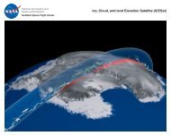
GLAH13 Product <strong>Data</strong> <strong>Dictionary</strong>1/30/13 1:04 PMSuggestedUsageProcessingCenterArchiveCenterVersionDescription<strong>Data</strong>setDisclaimerPointerECSCollectionGuidePointerECSCollectionGuidePointerCommentMiscellaneousInformationPointerMiscellaneousInformationPointerCommentGLAH13 contains sea ice, open ocean, and iceberg elevations corrected for geodetic and atmospheric effects, calculated fromalgorithms fine-tuned for sea ice returns. Granules contain 14 orbits of data within the sea ice mask. Each GLAH13 file was createdfrom an equivalent <strong>GLA13</strong> binary file. The data used to create the GLAH13 values are contained in the equivalent GLAHxx files for theGLAxx files. See the provenance metadata for the creation of the <strong>GLA13</strong>.GSFC I-SIPSNSIDCInitial Versionhttp://nsidc.org/data/icesat/disclaimer.htmlhttp://nsidc.org/data/docs/daac/glas_icesat_l1_l2_global_altimetry.gd.htmlGuide Document for this product at NSIDChttp://nsidc.org/daac/icesat/index.htmlGLAS Product page at NSIDC/METADATA/COLLECTIONMETADATA/Platform<strong>ICESat</strong>AttributePlatformContainerExample Value/METADATA/COLLECTIONMETADATA/Platform/<strong>ICESat</strong>PlatformShortNamePlatformLongNamePlatformTypeAttribute<strong>ICESat</strong>Ice, Cloud, and Land Elevation SatelliteSpacecraftExample Value/METADATA/COLLECTIONMETADATA/Platform/<strong>ICESat</strong>/InstrumentGLASGPSAttributeInstrumentContainerInstrumentContainerExample Value/METADATA/COLLECTIONMETADATA/Platform/<strong>ICESat</strong>/Instrument/GLASAttributeInstrumentShortNameGLASInstrumentLongNameGeoscience Laser Altimeter SystemInstrumentTechniqueLaser Altimetry and Light Detection and RadarNumberofSensors 3Example Value/METADATA/COLLECTIONMETADATA/Platform/<strong>ICESat</strong>/Instrument/GLAS/InstrumentCharacteristicSwathWidthAttributeInstrumentCharacteristicContainerExample Value/METADATA/COLLECTIONMETADATA/Platform/<strong>ICESat</strong>/Instrument/GLAS/InstrumentCharacteristic/SwathWidthAttributeExample ValueInstrumentCharacteristicNameSwathWidthInstrumentCharacteristicDescriptionThe width of the sensor scan as the satellite moves along the ground track.InstrumentCharacteristic<strong>Data</strong>TypeintInstrumentCharacteristicUnitkilometersInstrumentCharacteristicValue 2/METADATA/COLLECTIONMETADATA/Platform/<strong>ICESat</strong>/Instrument/GLAS/SensorLAPCCDAttributeSensorContainerSensorContainerSensorContainerExample Value/METADATA/COLLECTIONMETADATA/Platform/<strong>ICESat</strong>/Instrument/GLAS/Sensor/CDAttributeExample Valuefile:///Volumes/Users/jelee1/Development/glashdf/glas_hdf/doc/GLAH13_data_dict.htmlPage 27 of 33
GLAH13 Product <strong>Data</strong> <strong>Dictionary</strong>1/30/13 1:04 PMSensorShortNameSensorLongNameSensorTechniqueCDCloud LIDARMeasure of 1064nm return energy in 75m bins from 20km to surface/METADATA/COLLECTIONMETADATA/Platform/<strong>ICESat</strong>/Instrument/GLAS/Sensor/CD/SensorCharacteristicwavelengthAttributeSensorCharacteristicContainerExample Value/METADATA/COLLECTIONMETADATA/Platform/<strong>ICESat</strong>/Instrument/GLAS/Sensor/CD/SensorCharacteristic/wavelengthAttributeSensorCharacteristicNameSensorCharacteristicDescriptionSensorCharacteristic<strong>Data</strong>TypeSensorCharacteristicUnitSensorCharacteristicValuewavelengthdetectorvarcharnanometer1064 nmExample Value/METADATA/COLLECTIONMETADATA/Platform/<strong>ICESat</strong>/Instrument/GLAS/Sensor/LASensorShortNameSensorLongNameSensorTechniqueAttributeExample ValueLALaser AltimeterExact Measurement of Time between Transmit Pulse and receive ground return/METADATA/COLLECTIONMETADATA/Platform/<strong>ICESat</strong>/Instrument/GLAS/Sensor/LA/SensorCharacteristicwavelengthwaveformAttributeSensorCharacteristicContainerSensorCharacteristicContainerExample Value/METADATA/COLLECTIONMETADATA/Platform/<strong>ICESat</strong>/Instrument/GLAS/Sensor/LA/SensorCharacteristic/waveformAttributeSensorCharacteristicNamewaveformSensorCharacteristicDescriptiondigitizerSensorCharacteristic<strong>Data</strong>TypevarcharSensorCharacteristicUnitcountsSensorCharacteristicValue 0-255Example Value/METADATA/COLLECTIONMETADATA/Platform/<strong>ICESat</strong>/Instrument/GLAS/Sensor/LA/SensorCharacteristic/wavelengthAttributeSensorCharacteristicNameSensorCharacteristicDescriptionSensorCharacteristic<strong>Data</strong>TypeSensorCharacteristicUnitSensorCharacteristicValuewavelengthtransmissionvarcharnanometer1064 nmExample Value/METADATA/COLLECTIONMETADATA/Platform/<strong>ICESat</strong>/Instrument/GLAS/Sensor/PCSensorShortNameSensorLongNameSensorTechniqueAttributeExample ValuePCPhoton Counter for the 532 nm Aerosol ReturnsCounting of 532nm photon return in 75m bins 40km to surface/METADATA/COLLECTIONMETADATA/Platform/<strong>ICESat</strong>/Instrument/GLAS/Sensor/PC/SensorCharacteristicAttributeExample ValuewavelengthSensorCharacteristicContainerfile:///Volumes/Users/jelee1/Development/glashdf/glas_hdf/doc/GLAH13_data_dict.htmlPage 28 of 33
GLAH13 Product <strong>Data</strong> <strong>Dictionary</strong>1/30/13 1:04 PM/METADATA/COLLECTIONMETADATA/Platform/<strong>ICESat</strong>/Instrument/GLAS/Sensor/PC/SensorCharacteristic/wavelengthAttributeSensorCharacteristicNameSensorCharacteristicDescriptionSensorCharacteristic<strong>Data</strong>TypeSensorCharacteristicUnitSensorCharacteristicValuewavelengthdetectorvarcharnanometer532nmExample Value/METADATA/COLLECTIONMETADATA/Platform/<strong>ICESat</strong>/Instrument/GPSAttributeInstrumentShortNameGPSInstrumentLongNameGlobal Positioning System ReceiverInstrumentTechniqueRadionavigationNumberofSensors 1Example Value/METADATA/COLLECTIONMETADATA/Platform/<strong>ICESat</strong>/Instrument/GPS/SensorGPS_ReceiverAttributeSensorContainerExample Value/METADATA/COLLECTIONMETADATA/Platform/<strong>ICESat</strong>/Instrument/GPS/Sensor/GPS_ReceiverSensorShortNameSensorLongNameSensorTechniqueAttributeGPS ReceiverDual frequency GPS receiverPseudorange and carrier phaseExample Value/METADATA/COLLECTIONMETADATA/Platform/<strong>ICESat</strong>/PlatformCharacteristicOrbitInclinationOrbitalPeriodAttributePlatformCharacteristicContainerPlatformCharacteristicContainerExample Value/METADATA/COLLECTIONMETADATA/Platform/<strong>ICESat</strong>/PlatformCharacteristic/OrbitInclinationAttributeExample ValuePlatformCharacteristicNameOrbitInclinationPlatformCharacteristicDescriptionAngle between the orbit plane and the Earth's equatorial planePlatformCharacteristic<strong>Data</strong>TypefloatPlatformCharacteristicUnitDegreesPlatformCharacteristicValue 94.0/METADATA/COLLECTIONMETADATA/Platform/<strong>ICESat</strong>/PlatformCharacteristic/OrbitalPeriodAttributeExample ValuePlatformCharacteristicNameOrbitalPeriodPlatformCharacteristicDescriptionOrbital period in decimal minutes.PlatformCharacteristic<strong>Data</strong>TypefloatPlatformCharacteristicUnitMinutesPlatformCharacteristicValue 96.7/METADATA/COLLECTIONMETADATA/ProcessingLevelAttributeExample ValueProcessingLevelDescriptionGeophysical Quantities at the sensor resolution or geolocatedProcessingLevelID 2/METADATA/COLLECTIONMETADATA/Reviewfile:///Volumes/Users/jelee1/Development/glashdf/glas_hdf/doc/GLAH13_data_dict.htmlPage 29 of 33
GLAH13 Product <strong>Data</strong> <strong>Dictionary</strong>1/30/13 1:04 PMAttributeScienceReviewDate 2001-03-04ScienceReviewStatusQA at DAACsFutureReviewDate 2001-09-04Example Value/METADATA/COLLECTIONMETADATA/SpatialAttributeSpatialCoverageTypeHorizontalWestBoundingCoordinate -180.0NorthBoundingCoordinate 90.0EastBoundingCoordinate 180.0SouthBoundingCoordinate -90.0/METADATA/COLLECTIONMETADATA/StorageMediumClassExample ValueStorageMediumAttributeOnlineExample Value/METADATA/COLLECTIONMETADATA/TemporalAttributeTimeTypeUTCDateTypeJ2000TemporalRangeTypePeriodicPrecisionofSeconds 6EndsatPresentFlagYRangeBeginningDate 2003-01-13RangeBeginningTime 00:00:00RangeEndingDate 2010-01-13RangeEndingTime 00:00:00Example Value/METADATA/INVENTORYMETADATAAttributePGEVersion Version 1.2ShortNameGLAH13VersionID 33RangeBeginningTime 02:51:46RangeEndingTime 01:24:53RangeBeginningDate 2008-03-03RangeEndingDate 2008-03-04Example Value/METADATA/INVENTORYMETADATA/ECS<strong>Data</strong>GranuleAttributeReprocessingPlannedno further update anticipatedReprocessingActualreprocessedLocalGranuleIDGLAH13_633_2123_002_0141_0_01_0001.H5ProductionDateTime2013-01-16T18:58:11LocalVersionID 33Example Value/METADATA/INVENTORYMETADATA/InputGranuleInputPointerAttributeExample Valuegla13_test.ctl, tai-utc.dat, <strong>GLA13</strong>_633_2123_002_0141_0_01_0001.DAT, DsESDTGlGLAH13.033.desc/METADATA/INVENTORYMETADATA/MeasuredParameterAttributeExample Valuefile:///Volumes/Users/jelee1/Development/glashdf/glas_hdf/doc/GLAH13_data_dict.htmlPage 30 of 33
GLAH13 Product <strong>Data</strong> <strong>Dictionary</strong>1/30/13 1:04 PMParameterNameSurface_Elevation, Surface_Reflectance/METADATA/INVENTORYMETADATA/OrbitCalculatedSpatialDomainAttributeExample ValueOrbitNumber 27949, 27950, 27951, 27952, 27953, 27954, 27955, 27956, 27957, 27958, 27959, 27960, 27961, 27962, 27963StartOrbitNumber 27949StopOrbitNumber 27963EquatorCrossingLongitude -147.35388, -171.54936, 164.25522, 140.06049, 115.865814, 91.669395, 67.47331, 43.27821, 19.08381, -5.1098022, -29.304016,-53.499268, -77.69345, -101.887634, -126.08266EquatorCrossingTime 02:38:23, 04:15:02, 05:51:41, 07:28:20, 09:04:58, 10:41:37, 12:18:16, 13:54:55, 15:31:36, 17:08:15, 18:44:54, 20:21:33, 21:58:12,23:34:51, 01:11:29EquatorCrossingDate 2008-03-03, 2008-03-03, 2008-03-03, 2008-03-03, 2008-03-03, 2008-03-03, 2008-03-03, 2008-03-03, 2008-03-03, 2008-03-03, 2008-03-03, 2008-03-03, 2008-03-03, 2008-03-03, 2008-03-04/METADATA/INVENTORYMETADATA/ProductSpecificMetadataAttributePercentGroundHit 0OrbitQuality 6Example ValueTrack 141, 142, 143, 144, 145, 146, 147, 148, 149, 150, 151, 152, 153, 154, 155Instrument_State 373340Timing_Bias 0Timing_Drift 0ReferenceOrbit 1SP_ICE_PATH_NO 3163, 3164, 3165, 3166, 3167, 3168, 3169, 3170, 3171, 3172, 3173, 3174, 3175, 3176, 3177SP_ICE_GLAS_StartBlockSP_ICE_GLAS_EndBlockCycle 2Instance 23Range_Bias 0NOT SETNOT SETInstrument_State_Date 2008-02-13Instrument_State_Time 22:27:25Range_Bias_Date 2008-02-13Range_Bias_Time 22:27:27Timing_Bias_Date 2008-02-13Timing_Bias_Time 22:27:27identifier_product_doiidentifier_file_uuididentifier_product_doi_authority/METADATA/PROVENANCE/METADATA/PROVENANCE/STEP_110.5067/ICESAT/GLAS/DATA20641CD1087-8F17-4480-8E8D-914EFD16E65Chttp://dx.doi.orgProcessDateTimeAttribute2011-09-17T02:59:51Example Value/METADATA/PROVENANCE/STEP_1/ProcessAgentAttributeExample ValueNameglas_altType 2Version 6.0.1DescriptionThis process is an instantiation of the GLAS Science Algorithm Software (GSAS) 2 ATBDs./METADATA/PROVENANCE/STEP_1/ProcessInputNameAttributeExample ValueGLA05_633_2123_002_0141_1_01_0001.DAT, GLA05_633_2123_002_0141_2_01_0001.DAT,GLA05_633_2123_002_0141_3_01_0001.DAT, GLA05_633_2123_002_0141_4_01_0001.DAT,file:///Volumes/Users/jelee1/Development/glashdf/glas_hdf/doc/GLAH13_data_dict.htmlPage 31 of 33
GLAH13 Product <strong>Data</strong> <strong>Dictionary</strong>1/30/13 1:04 PMGLA05_633_2123_002_0142_1_01_0001.DAT, GLA05_633_2123_002_0142_2_01_0001.DAT,GLA05_633_2123_002_0142_3_01_0001.DAT, GLA05_633_2123_002_0142_4_01_0001.DAT,GLA05_633_2123_002_0143_1_01_0001.DAT, GLA05_633_2123_002_0143_2_01_0001.DAT,GLA05_633_2123_002_0143_3_01_0001.DAT, GLA05_633_2123_002_0143_4_01_0001.DAT,GLA05_633_2123_002_0144_1_01_0001.DAT, GLA05_633_2123_002_0144_2_01_0001.DAT,GLA05_633_2123_002_0144_3_01_0001.DAT, GLA05_633_2123_002_0144_4_01_0001.DAT,GLA05_633_2123_002_0145_1_01_0001.DAT, GLA05_633_2123_002_0145_2_01_0001.DAT,GLA05_633_2123_002_0145_3_01_0001.DAT, GLA05_633_2123_002_0145_4_01_0001.DAT,GLA05_633_2123_002_0146_1_01_0001.DAT, GLA05_633_2123_002_0146_2_01_0001.DAT,GLA05_633_2123_002_0146_3_01_0001.DAT, GLA05_633_2123_002_0146_4_01_0001.DAT,GLA05_633_2123_002_0147_1_01_0001.DAT, GLA05_633_2123_002_0147_2_01_0001.DAT,GLA05_633_2123_002_0147_3_01_0001.DAT, GLA05_633_2123_002_0147_4_01_0001.DAT,GLA05_633_2123_002_0148_1_01_0001.DAT, GLA05_633_2123_002_0148_2_01_0001.DAT,GLA05_633_2123_002_0148_3_01_0001.DAT, GLA05_633_2123_002_0148_4_01_0001.DAT,GLA05_633_2123_002_0149_1_01_0001.DAT, GLA05_633_2123_002_0149_2_01_0001.DAT,GLA05_633_2123_002_0149_3_01_0001.DAT, GLA05_633_2123_002_0149_4_01_0001.DAT,GLA05_633_2123_002_0150_1_01_0001.DAT, GLA05_633_2123_002_0150_2_01_0001.DAT,GLA05_633_2123_002_0150_3_01_0001.DAT, GLA05_633_2123_002_0150_4_01_0001.DAT,GLA05_633_2123_002_0151_1_01_0001.DAT, GLA05_633_2123_002_0151_2_01_0001.DAT,GLA05_633_2123_002_0151_3_01_0001.DAT, GLA05_633_2123_002_0151_4_01_0001.DAT,GLA05_633_2123_002_0152_1_01_0001.DAT, GLA05_633_2123_002_0152_2_01_0001.DAT,GLA05_633_2123_002_0152_3_01_0001.DAT, GLA05_633_2123_002_0152_4_01_0001.DAT,GLA05_633_2123_002_0153_1_01_0001.DAT, GLA05_633_2123_002_0153_2_01_0001.DAT,GLA05_633_2123_002_0153_3_01_0001.DAT, GLA05_633_2123_002_0153_4_01_0001.DAT,GLA05_633_2123_002_0154_1_01_0001.DAT, GLA05_633_2123_002_0154_2_01_0001.DAT,GLA05_633_2123_002_0154_3_01_0001.DAT, GLA05_633_2123_002_0154_4_01_0001.DAT,GLA09_633_2123_002_0141_0_01_0001.DAT, GLA11_633_2123_002_0141_0_01_0001.DAT,ANC01_006_20080302_180000_01_0000.DAT, ANC01_006_20080303_000000_01_0000.DAT,ANC01_006_20080303_060000_01_0000.DAT, ANC01_006_20080303_120000_01_0000.DAT,ANC01_006_20080303_180000_01_0000.DAT, ANC01_006_20080304_000000_01_0000.DAT,ANC01_006_20080302_180000_01_0002.DAT, ANC01_006_20080303_000000_01_0002.DAT,ANC01_006_20080303_060000_01_0002.DAT, ANC01_006_20080303_120000_01_0002.DAT,ANC01_006_20080303_180000_01_0002.DAT, ANC01_006_20080304_000000_01_0002.DAT,ANC01_006_20080302_180000_01_0003.DAT, ANC01_006_20080303_000000_01_0003.DAT,ANC01_006_20080303_060000_01_0003.DAT, ANC01_006_20080303_120000_01_0003.DAT,ANC01_006_20080303_180000_01_0003.DAT, ANC01_006_20080304_000000_01_0003.DAT,ANC01_006_20080302_180000_01_0004.DAT, ANC01_006_20080303_000000_01_0004.DAT,ANC01_006_20080303_060000_01_0004.DAT, ANC01_006_20080303_120000_01_0004.DAT,ANC01_006_20080303_180000_01_0004.DAT, ANC01_006_20080304_000000_01_0004.DAT,ANC01_006_20080302_180000_01_0001.DAT, ANC01_006_20080303_000000_01_0001.DAT,ANC01_006_20080303_060000_01_0001.DAT, ANC01_006_20080303_120000_01_0001.DAT,ANC01_006_20080303_180000_01_0001.DAT, ANC01_006_20080304_000000_01_0001.DAT,ANC01_006_20080302_180000_01_0005.DAT, ANC01_006_20080303_000000_01_0005.DAT,ANC01_006_20080303_060000_01_0005.DAT, ANC01_006_20080303_120000_01_0005.DAT,ANC01_006_20080303_180000_01_0005.DAT, ANC01_006_20080304_000000_01_0005.DAT,ANC01_006_20080302_180000_01_0006.DAT, ANC01_006_20080303_000000_01_0006.DAT,ANC01_006_20080303_060000_01_0006.DAT, ANC01_006_20080303_120000_01_0006.DAT,ANC01_006_20080303_180000_01_0006.DAT, ANC01_006_20080304_000000_01_0006.DAT,ANC01_006_20080302_180000_01_0007.DAT, ANC01_006_20080303_000000_01_0007.DAT,ANC01_006_20080303_060000_01_0007.DAT, ANC01_006_20080303_120000_01_0007.DAT,ANC01_006_20080303_180000_01_0007.DAT,TypeGLA05, GLA05, GLA05, GLA05, GLA05, GLA05, GLA05, GLA05, GLA05, GLA05, GLA05, GLA05, GLA05, GLA05, GLA05, GLA05,GLA05, GLA05, GLA05, GLA05, GLA05, GLA05, GLA05, GLA05, GLA05, GLA05, GLA05, GLA05, GLA05, GLA05, GLA05, GLA05,GLA05, GLA05, GLA05, GLA05, GLA05, GLA05, GLA05, GLA05, GLA05, GLA05, GLA05, GLA05, GLA05, GLA05, GLA05, GLA05,GLA05, GLA05, GLA05, GLA05, GLA05, GLA05, GLA05, GLA05, GLA09, GLA11, ANC01, ANC01, ANC01, ANC01, ANC01, ANC01,ANC01, ANC01, ANC01, ANC01, ANC01, ANC01, ANC01, ANC01, ANC01, ANC01, ANC01, ANC01, ANC01, ANC01, ANC01,ANC01, ANC01, ANC01, ANC01, ANC01, ANC01, ANC01, ANC01, ANC01, ANC01, ANC01, ANC01, ANC01, ANC01, ANC01,ANC01, ANC01, ANC01, ANC01, ANC01, ANC01, ANC01, ANC01, ANC01, ANC01, ANC01, ANC01, ANC01, ANC01, ANC01,ANC01, ANC01, ANC01, ANC01, ANC01, ANC01, ANC01, ANC01, ANC01, ANC01, ANC01, ANC01, ANC01, ANC01, ANC01,ANC04, ANC04, anc07, anc07, anc07, anc07, anc07, anc07, anc07, ANC08, ANC08, ANC09, ANC09, anc12, anc12, anc13, anc16,anc17, anc25, anc27, anc27, ANC33, anc41, anc45, anc45, anc45, anc45, anc45, anc45, anc45, anc45, anc45, anc45, anc45, anc45,anc45, anc45, anc45, anc51, anc51, anc51, anc51, anc51, anc51, anc51, anc51, anc51, anc51, anc51, anc51, anc51, anc51, anc51,anc52, anc52, anc54, anc54, anc54, anc54, anc54, anc54, anc55, ANC56, ANC57, anc58, anc58, anc58, anc58, anc58, anc58,anc58, anc58, anc58, anc58, anc58, anc58Version 633, 633, 633, 633, 633, 633, 633, 633, 633, 633, 633, 633, 633, 633, 633, 633, 633, 633, 633, 633, 633, 633, 633, 633, 633, 633,633, 633, 633, 633, 633, 633, 633, 633, 633, 633, 633, 633, 633, 633, 633, 633, 633, 633, 633, 633, 633, 633, 633, 633, 633, 633,633, 633, 633, 633, 633, 633, 006, 006, 006, 006, 006, 006, 006, 006, 006, 006, 006, 006, 006, 006, 006, 006, 006, 006, 006, 006,006, 006, 006, 006, 006, 006, 006, 006, 006, 006, 006, 006, 006, 006, 006, 006, 006, 006, 006, 006, 006, 006, 006, 006, 006, 006,006, 006, 006, 006, 006, 006, 006, 006, 006, 006, 006, 006, 006, 006, 006, 006, 006, 006, 006, 006, 007, 007, 033, 033, 033, 033,033, 033, 033, 015, 015, 076, 076, 004, 004, 006, 004, 004, 005, 001, 001, 001, 009, 033, 033, 033, 033, 033, 033, 033, 033, 033,033, 033, 033, 033, 033, 033, 003, 003, 003, 003, 003, 003, 003, 003, 003, 003, 003, 003, 003, 003, 003, 007, 007, 002, 002, 002,002, 002, 002, 001, 001, 001, 002, 002, 002, 002, 002, 002, 002, 002, 002, 002, 002, 002/METADATA/PROVENANCE/STEP_1/ProcessOutputAttributeName<strong>GLA13</strong>_633_2123_002_0141_0_01_0001.DATType<strong>GLA13</strong>Version 633Example Value/METADATA/PROVENANCE/STEP_2ProcessDateTimeAttribute2013-01-16T18:58:11.000000ZExample Value/METADATA/PROVENANCE/STEP_2/ProcessAgentfile:///Volumes/Users/jelee1/Development/glashdf/glas_hdf/doc/GLAH13_data_dict.htmlPage 32 of 33
GLAH13 Product <strong>Data</strong> <strong>Dictionary</strong>1/30/13 1:04 PMAttributeExample ValueName<strong>GLA13</strong>_h5_convertType<strong>Data</strong>_ReformatVersion Version 1.2 (January 2013)Description<strong>GLA13</strong> Conversion PGE/METADATA/PROVENANCE/STEP_2/ProcessInputAttributeExample ValueName./gla13_test.ctl, ../data/tai-utc.dat, ./<strong>GLA13</strong>_633_2123_002_0141_0_01_0001.DAT, ./DsESDTGlGLAH13.033.descTypeIN_CNTL, IN_ANC_TAIUTC, IN_<strong>GLA13</strong>, IN_ESDTVersion 0, 0, 1, 1/METADATA/PROVENANCE/STEP_2/ProcessOutputAttributeName./GLAH13_633_2123_002_0141_0_01_0001.H5TypeOUT_GLAH13Version 1UUID41CD1087-8F17-4480-8E8D-914EFD16E65CDOI10.5067/ICESAT/GLAS/DATA206Example Valuefile:///Volumes/Users/jelee1/Development/glashdf/glas_hdf/doc/GLAH13_data_dict.htmlPage 33 of 33