Habitat Restoration Plan for the Lower Tuolumne River Corridor ...
Habitat Restoration Plan for the Lower Tuolumne River Corridor ...
Habitat Restoration Plan for the Lower Tuolumne River Corridor ...
- No tags were found...
You also want an ePaper? Increase the reach of your titles
YUMPU automatically turns print PDFs into web optimized ePapers that Google loves.
7Natural channel processes...The foundation of a river ecosystem is <strong>the</strong> dynamic interactionof flowing water, sediment, and riparian vegetation.Alteration of one of <strong>the</strong>se factors disrupts<strong>the</strong> balance of <strong>the</strong> o<strong>the</strong>r factors. Forexample, clearing riparian vegetation mayincrease bank erosion and channelmeandering. Dams block <strong>the</strong> downstreammovement of gravel from <strong>the</strong> upperwatershed, causing gravel bars downstreamof dams to be scoured awaywithout being replaced. Absence of floods allows fine sedimentsto accumulate in gravels, inhibiting <strong>the</strong> survival ofchinook salmon eggs. These impacts in turn degrade oreliminate important fish and wildlife habitat and reduce <strong>the</strong>irpopulations.ATTRIBUTE #1Spatially complex channel shape (morphology)No single segment of river provides habitat <strong>for</strong> all species, but<strong>the</strong> sum of different areas of <strong>the</strong> river provides high-qualityhabitat <strong>for</strong> native species.“The channel is carved by <strong>the</strong> flowingwater, but it takes <strong>the</strong> <strong>for</strong>m dictatedby <strong>the</strong> sediment carried.”Luna LeopoldAttributes of river ecosystem integrityBased on an historical evaluation of <strong>Tuolumne</strong> <strong>River</strong> hydrology(streamflow patterns) and geomorphology (river channel<strong>for</strong>m), and a review of scientific literature, <strong>the</strong> Attributes of<strong>River</strong> Ecosystem Integrity were developedto describe how <strong>the</strong> <strong>Tuolumne</strong> <strong>River</strong>functioned historically, and also to serveas measurable restoration objectives. Bymanaging streamflows, reducing unwantedfine sediment supply, increasingimportant coarse sediment supply, andrestoring a natural channel <strong>for</strong>m, many of<strong>the</strong> critical river attributes and processes can be achieved.This restoration approach focuses on restoring a naturalpattern of periodic disturbance and continual re-growth thatcreates a mosaic of high quality habitat <strong>for</strong> many species,including salmon. Without <strong>the</strong>se dynamic processes, <strong>the</strong> riverhas become static and less biologically productive.ATTRIBUTE #3Frequently disturbed riverbed surfaceIn <strong>the</strong> upper river (from La Grange Dam to Hughson) where<strong>the</strong> river bed is mostly made of gravel, surface gravels andcobbles are moved downstream by moderate streamflowswhich occur on average every 1 or 2 years. In <strong>the</strong> lower river(from Hughson to <strong>the</strong> San Joaquin <strong>River</strong>) where <strong>the</strong> bed ismostly sand, sand is moved downstream during much of <strong>the</strong>year, creating migrating “dunes” and shifting sand bars.ATTRIBUTE #2Variable streamflow patternsSeasonal streamflow patterns are broadly predictable, butspecific flow magnitudes, timing, durations, and frequenciesare unpredictable due to runoff patterns produced by storms,droughts and snowmelt. Streamflow variability is a foundationof river ecosystem health.Streamflow X 1000 (cfs)1098765432101-OctWinterBaseflows1-NovWinterFlood1-Dec1-Jan1-Feb1-Mar1994 Unregulated Streamflows1994 Regulated StreamflowsSpringSnowmelt1-Apr1-May1-Jun1-JulSummerBaseflows1-Aug1-SepATTRIBUTE #4Periodic riverbed scour and fillIn gravel-bedded reaches, larger floods move entire gravelbars, not just <strong>the</strong>ir surface layers. These large floods occur onaverage every 3 to 5 years. This “scour” is typically accompaniedby “fill” from upstream gravel sources, which maintains abalance in natural channel <strong>for</strong>m. This process is important <strong>for</strong>removing fine sediments from salmon spawning gravels.ATTRIBUTE #5Balanced fine and coarse sediment volumesThe location and volumes of sediment within a river reachmay vary year to year, but over <strong>the</strong> long term <strong>the</strong> amount ofsediment entering and leaving <strong>the</strong> river is balanced, and <strong>the</strong>channel <strong>for</strong>m remains similar. A balanced sediment loadimplies that streamflows are periodically high enough to movemost sediment sizes (sand and boulders) in <strong>the</strong> river.
...<strong>the</strong> technical aspects of river ecosystemsAn example of <strong>the</strong> dynamics of naturalrivers is depicted at right. ( A) A channelwith adequate space to migrate (Attribute6) erodes <strong>the</strong> channel bank on<strong>the</strong> outside of <strong>the</strong> meander bend duringhigh flows (Attribute 2), ( B) encouragingaged riparian trees to topple into <strong>the</strong>channel (Attribute 9). ( C) A deep poolalso <strong>for</strong>ms here, which provides structuralcomplexity (Attribute 1) <strong>for</strong> good fishhabitat. As bank erosion continues, <strong>the</strong> pool“migrates” downstream (Attribute 6), but highquality habitat is maintained. (D) On <strong>the</strong> oppositebank, high flows (Attribute 2) scour and redeposit coarsesediments (Attributes 4 and 5), <strong>for</strong>ming a shallow bar on <strong>the</strong>inside of <strong>the</strong> meander bend (Attribute 1), and providing cleanspawning gravels. (E) This area, in turn, provides ideal slowwaterrearing conditions <strong>for</strong> juvenile chinook salmon, as wellas habitat <strong>for</strong> aquatic insects (fish food), amphibians andreptiles. (F) Progressively higher up <strong>the</strong>gravel bar surface, a dynamic interplay occursbetween receding water levels during <strong>the</strong> spring snowmelt(Attribute 2), and <strong>the</strong> presence of riparian tree seeds (Attribute7). These woody riparian trees are sporadically scoured out(Attribute 8), and those established high enough on <strong>the</strong> bankare toppled into <strong>the</strong> channel as <strong>the</strong> channel migrates backacross <strong>the</strong> valley (A).8ATTRIBUTE #6Periodic channel migration and/or avulsionThe channel erodes riverbanks, deposits new gravel bars, andestablishes meander patterns based on variable streamflows,valley slope, river channel confinement, sediment supply, andsediment size. In <strong>the</strong> gravel-bedded reaches, <strong>the</strong> channelmoves from one location to ano<strong>the</strong>r by sudden change, leavingmuch of <strong>the</strong> abandoned channel intact. In <strong>the</strong> sand-beddedreaches, meanders gradually erode through banks and cut offmeander bends, leaving oxbow lakes and wetlands.ATTRIBUTE #7A functional floodplainEvery one or two years, on average, high streamflows inundate<strong>the</strong> lowermost floodplains, deposit silts and sand, and stimulategermination of riparian vegetation. <strong>Lower</strong> terraces, at aslightly higher elevation than floodplains, are inundated byless frequent floods.ATTRIBUTE #9Self-sustaining, diverse riparian corridorBased on species life history strategies and streamflowpatterns, <strong>the</strong> riparian plant community is maintained by acontinual cycle of germination, growth, and death. Theriparian community thus contains young and old vegetation,and a diversity of species.ATTRIBUTE #8Infrequent channel resetting floodsSingle large floods (recurring once every 10 to 20 years) causemajor channel changes that rejuvenate riparian processes,<strong>for</strong>m and maintain side channels, and create off-channelwetlands, such as oxbows.ATTRIBUTE #10Naturally fluctuating groundwater tableGroundwater fluctuates on a seasonal and annual basis infloodplains, terraces, and sloughs.
T<strong>River</strong>s are resilient ecosystems with enormous capacity <strong>for</strong>self-rejuvenation. However, given that land-use practices and9 water regulation and diversion will continue, <strong>the</strong> river cannotrecover in a reasonable timeframe without help. The <strong>Restoration</strong><strong>Plan</strong> recommends several strategies to initiate recovery,such as filling mining pits, introducing spawning gravels,lowering selected floodplains to allow inundation, and replantingnative riparian vegetation. Equally important, floodand gravel management will help re-establish processes tomaintain restored areas and improve o<strong>the</strong>r areas.The <strong>Restoration</strong> <strong>Plan</strong> recommends general restorationstrategies <strong>for</strong> different reaches along <strong>the</strong> river, as well asspecific restoration projects within those reaches. Inherentwith any restoration plan of this scale is some degree ofuncertainty regarding <strong>the</strong> effectiveness of specific restorauolumne<strong>River</strong> restoration strategiesLong-term restoration recommendationsSAND-BEDDED ZONE (RM 0.0 TO RM 24.0)tion actions. There<strong>for</strong>e, an adaptive management programwould require 1) monitoring restoration sites, 2) evaluatingrestoration success against desired conditions, and 3)improving restoration strategies. This will ensure progresstoward recovery goals.Implementation of any restoration project will be subject toprior environment review by local, state, and federal regulatoryagencies. The TRTAC participants recognize thatdecisions affecting <strong>the</strong> <strong>Tuolumne</strong> <strong>River</strong> are influenced bydiverse policies relating to land use, water supply and use,water quality, flood control, fish and wildlife, and recreation,and are not governed solely by habitat considerations.Additionally, <strong>the</strong> TRTAC recognizes <strong>the</strong> importance ofcooperation and participation from private landowners, <strong>the</strong>local business community, and <strong>the</strong> general public.• Restore floodway capacity to 15,000 cfs or greater above Dry Creek and 20,000 cfs or greater below Dry Creek• Reduce urban and agricultural encroachment to create/maintain a 500-2,000 ft or greater floodway width• Remove rip-rap and berms where feasible to restore floodplains and to allow migration within <strong>the</strong> floodway• Seek conservation easements and/or land acquisitions (especially of flood-prone lands) from willing landowners• Remove exotic plants within riparian corridor and replant native species• Secure protection <strong>for</strong> existing mature valley oaks and Fremont cottonwoods• Improve water quality by managing urban, agricultural and industrial runoff into <strong>the</strong> river and into Dry CreekDryCreekMODESTOEMPIRESanJoaquin<strong>Tuolumne</strong>REACH 1 (RM 0.0-10.5)<strong>Lower</strong> Sand-bedded Reach• Restore off-channel wetlands to increasewildlife habitat• Create vegetative buffer to reduce soil erosionand filter agricultural runoff• Restore functional floodplains and nativeriparian <strong>for</strong>estsCERESREACH 2(RM 10.5-19.3)Urban Sand-bedded Reach• Increase public awareness of <strong>the</strong><strong>Tuolumne</strong> and promote cleanup,restoration and monitoring• Improve <strong>Tuolumne</strong> <strong>River</strong> RegionalPark by increasing area ofnative riparian trees• Create and preserve riparianbuffer along urban/industrialzones• Remove trash and debris,eliminate chronic sources ofpollution, and actively prohibitillegal dumpingREACH 3(RM 19.3-24.0)Upper Sand-beddedReach• Preserve existingurban setback fromriver• Create and preserve ariparian buffer alongurban/agriculturalzonesHUGHSONREACH 4In-Channel Gr• Isolate/fill inpredation onbedload tran• Restore a nat• Create and malong urban/
RIVER-WIDE RESTORATION GOALS• Chinook salmon habitat maintained by natural processes, sustaining a viable, naturallyreproducing chinook salmon population• Adequate quantity of high quality gravel, maintained by periodically replacing gravelstransported downstream by high flows• A dynamic river channel, maintained by floods of variable magnitude and frequency thatperiodically initiate critical channel processes• A continuous river floodway and riparian corridor from La Grange Dam to <strong>the</strong> confluencewith <strong>the</strong> San Joaquin <strong>River</strong>• Increased extent of naturally regenerating native riparian stands and decreased extentof exotic plants• Adaptive management program that continually reviews and refines restoration andmanagement activities, and addresses areas of scientific uncertainty that will improve ourunderstanding of river ecosystem processes• Improved water quality through urban and agricultural runoff management programs• Increased public awareness and involvement in <strong>the</strong> <strong>Tuolumne</strong> <strong>River</strong> restoration ef<strong>for</strong>tGreat Blue Heron10GRAVEL-BEDDED ZONE (RM 24.0-52.1)• Increase gravel supply throughout <strong>the</strong> zone and increase <strong>the</strong> frequency of gravel movement• Reduce fine sediment supply and storage• Restore floodway capacity to 15,000 cfs or greater• Reduce agricultural and mining encroachment to create/maintain a 500 ft or greater coridor width• Remove rip-rap and berms where feasible to restore floodplains and to allow migration within <strong>the</strong> floodway• Manage flood control releases to initiate bed movement and o<strong>the</strong>r dynamic channel processes• Restore a continuous corridor of native riparian vegetation• Improve habitat quality of off-channel wetlands• Seek conservation easements and/or land acquisitions (especially of flood-prone lands) from willing landowners• Remove exotic plants within riparian corridor and replant native species• Introduce alternative grazing strategies to promote riparian regenerationLA GRANGEDAM ❰LAGRANGEWATERFORD<strong>River</strong>HICKMAN(RM 24.0-34.2)avel Mining Reachstream mining pits to reduce bassjuvenile salmon and reestablishsport continuityural river and floodplain morphologyaintain riparian buffer (corridor)agricultural zonesREACH 5 (RM 34.2-40.3)Gravel Mining Reach• Isolate off-channel mining pits toprevent river connection duringfloods up to 15,000 cfs to reducesalmon stranding and bass predationon juvenile salmon• Increase floodway width to at least500 feet• Restore a natural river and floodplainmorphology• Restore and maintain ripariancorridor through gravel miningzonesREACH 6(RM 40.3-46.6)Dredger Tailing Reach• Reconstruct remnantchannel left by gold dredgeroperations to a natural riverand floodplain <strong>for</strong>m• Restore riffles to increasesalmon spawning andrearing habitat• Regrade floodplains toreduce salmon strandingand promote riparianregeneration• Reduce riparian encroachmentonto low flow channel• Reduce grazing impacts topromote riparian regenerationon floodplains• Secure remnant dredgertailings <strong>for</strong> future restorationREACH 7(RM 46.6-52.1)Critical SpawningReach• Reduce sand input intoriver and storage inriverbed (especially inspawning gravels)• Increase and maintainspawning gravel supply• Restore riffles toincrease salmonspawning and rearinghabitat• Regrade floodplains toreduce salmonstranding and promoteriparian regeneration• Reduce riparianencroachment ontoactive channel• Reduce grazingimpacts to promoteriparian regenerationon floodplains
11<strong>Restoration</strong> in progressResponding to <strong>the</strong> FERC Settlement Agreement mandate toimplement ten priority restoration projects by 2005, <strong>the</strong>TRTAC has received funding <strong>for</strong> several projects from <strong>the</strong>CALFED Ecosystem <strong>Restoration</strong> Program and <strong>the</strong> CVPIA’sAnadromous Fish <strong>Restoration</strong> Program (AFRP), implementedby <strong>the</strong> US Fish and Wildlife Service. The TRTAC has selectedsix projects (Phases I-IV of <strong>the</strong> Gravel Mining Reach andSpecial Run Pools 9 and 10) which are now in <strong>the</strong> planningand design phase. The remaining four projects are currentlybeing evaluated.valley oak leavesand acornsO<strong>the</strong>r entities are also proposing or conducting restorationactivities on <strong>the</strong> <strong>Tuolumne</strong> <strong>River</strong>, including <strong>the</strong> US Army Corpof Engineers, US Fish and Wildlife Service, Cali<strong>for</strong>nia Departmentof Fish and Game, Natural Resources ConservationService, East Stanislaus Resource Conservation District,Friends of <strong>the</strong> <strong>Tuolumne</strong>, Cali<strong>for</strong>nia State Parks, and <strong>the</strong> JointPowers Authority (City of Modesto, City of Ceres, and StanislausCounty). Several of <strong>the</strong>se projects are illustrated below.SAN JOAQUIN RIVERNATIONAL WILDLIFE REFUGEUS Fish and Wildlife ServiceThis site represents one of <strong>the</strong> few remainingfloodplains in <strong>the</strong> San Joaquin basinthat has much of its riparian habitat intact.Since this habitat is critical <strong>for</strong> resident andmigrant bird overwintering, breeding,<strong>for</strong>aging, and migration stopover, preservingthis site is essential. USFWS is purchasing<strong>the</strong>se frequently flooded lands toprotect riparian woodlands, revegetatecleared lands, and manage <strong>for</strong> wildlife.MODESTOTUOLUMNE RIVER REGIONAL PARKJoint Powers Authority(City of Modesto, City of Ceres, Stanislaus County)This project has been undertaken by <strong>the</strong> Cities of Modestoand Ceres, and Stanislaus County since 1967 with <strong>the</strong> visionof creating a continuous river park through <strong>the</strong> greaterModesto urban area. Approximately 700 acres of riversideproperty have been acquired to create <strong>the</strong> Park. The JointPowers Authority is now revising <strong>the</strong> land use plan <strong>for</strong> <strong>the</strong>Park, preparing a Master <strong>Plan</strong> <strong>for</strong> <strong>the</strong> Gateway Parcel at <strong>the</strong>Dry Creek confluence, and will soon be implementing avariety of restoration activities within <strong>the</strong> Park.DryCreekEMPIRESanJoaquin<strong>Tuolumne</strong>CERESHUGHSONGRAYSON RIVER RANCHCONSERVATION EASEMENTNatural Resources Conservation ServiceEast Stanislaus Resource Conservation DistrictCALFED/AFRPThe Grayson <strong>River</strong> Ranch site, located 5 milesfrom <strong>the</strong> confluence with <strong>the</strong> San Joaquin <strong>River</strong>, issubject to frequent flooding. A partnership ofnon-profit, local, state and federal agencies andgroups are funding a Perpetual ConservationEasement <strong>for</strong> this land. The Grayson project has<strong>the</strong> potential to become a model <strong>for</strong> futureconservation of floodplain and riparian habitatson <strong>the</strong> <strong>Lower</strong> <strong>Tuolumne</strong> <strong>River</strong>. (See p. 14 <strong>for</strong> amore detailed description.)SPECIAL RUN POOLS 9 AND 10CHANNEL RESTORATION<strong>Tuolumne</strong> <strong>River</strong> Technical Advisory CommitteeSRPs 9 and 10 are large in-channel gravel miningpits located in a mile-long reach downstream ofFox Grove County Park. These pits harbor populationsof non-native bass that are known to prey onyoung salmon. <strong>Restoration</strong> will eliminate basshabitat and increase riparian vegetation. Theseprojects have received funding from CALFED andUSFWS/AFRP, and construction will begin in 1999(see p. 13 <strong>for</strong> more detailed description).
<strong>Restoration</strong> TypesFloodway expansion: Provide a wider floodway and restorefloodplains to reduce river confinement, allow natural channelmigration, provide additional flexibility <strong>for</strong> dam operations toreduce <strong>the</strong> risk of catastrophic floods, increase riparianvegetation, and improve river habitat conditions.Riparian restoration: Replant riparian vegetation to helppromote natural regeneration, specifically targeting Fremontcottonwood and valley oak species.Channel reconstruction: Rebuild a natural channel shapethat allows gravel movement, channel migration, floodplaininundation, riparian regeneration, and sand/silt deposition onfloodplains.Conservation easements: Preserve riparian areas (especiallyflood-prone lands), while ownership of <strong>the</strong> land is maintainedby private individuals. Riparian restoration could be implementedwithin <strong>the</strong> conservation easement.Preservation sites: Preserve sites containing stands ofmature riparian trees.Sand management (fine sediment): Reduce fine sedimentwithin riverbed gravels, by prevention, mechanical meansand/or periodic managed flood releases.Gravel management (coarse sediment): Provide an initiallarge volume of gravel to replace <strong>the</strong> gravels lost over <strong>the</strong> pastcentury, <strong>the</strong>n periodically introduce gravel to balance <strong>the</strong> lossof gravels moved downstream during high streamflows.Additional management approaches: Increase water qualityby controlling urban and agricultural runoff; introducealternative grazing strategies within floodway to promotenative riparian regeneration and reduce bank erosion; introducevegetative buffer strips along <strong>the</strong> river and withinagricultural and urban lands to reduce soil loss, and todecrease sound, air and non-point source pollution into <strong>the</strong>riparian corridor.12BASSO ECOLOGICAL RESERVE LAND PURCHASECali<strong>for</strong>nia Department of Fish & Game, Stanislaus CountyAcquisition of three parcels totaling 42 acres is being funded by CALFED. This land between LaGrange Bridge and Basso Bridge represents <strong>the</strong> “missing link” connecting adjacent 350-acre (west)and 185-acre (east) county-owned parcels. This reach is one of <strong>the</strong> primary chinook salmon spawningareas, and <strong>the</strong> land purchase will protect this critical spawning habitat.LA GRANGEDAM ❰LAGRANGEWATERFORD<strong>River</strong>HICKMANGRAVEL MINING REACHFLOODWAY RESTORATION<strong>Tuolumne</strong> <strong>River</strong> Technical Advisory CommitteeThis 7-mile reach near Water<strong>for</strong>d (from RobertsFerry Bridge to <strong>the</strong> Old Reed Rock <strong>Plan</strong>t) supportsactive off-channel gravel mining, and was extensivelydamaged during <strong>the</strong> 1997 flood. CALFEDand USFWS/AFRP have funded <strong>the</strong> first of fourphases of this project, with Phase I, <strong>the</strong> upper twomiles of <strong>the</strong> project, set to begin in 1999. PhasesII-IV will proceed in subsequent years. <strong>Restoration</strong>activities will include increasing floodway capacityto convey at least 15,000 cfs, increasing salmonspawning and rearing habitat, protecting dikesand off-channel pits from future flood damage,and restoring riparian <strong>for</strong>ests on floodplains.SPAWNING GRAVEL SUPPLEMENTATIONCali<strong>for</strong>nia Department of Fish & Game, TRTACConstruction of La Grange Dam in 1893 permanentlyended gravel supply to downstream reaches of <strong>the</strong><strong>Tuolumne</strong> <strong>River</strong>. Restoring gravel supply to <strong>the</strong> <strong>Tuolumne</strong><strong>River</strong> below La Grange Dam will greatly improvesalmon spawning and rearing habitats. The project startswith initial mechanical placement of a large volume ofgravel to begin replacing over 100 years of lost gravelsupply, followed by periodic augmentation to maintainsupply as gravels slowly move downstream during highflows.
13Special Run Pools 9 and 10: A channel reconstruction projectAn excellent way to understand <strong>the</strong> scope of river restorationon <strong>the</strong> <strong>Tuolumne</strong> <strong>River</strong> is to witness a project in progress. Theopportunity will soon be af<strong>for</strong>ded by <strong>the</strong> Special Run Pool 9(SRP 9) <strong>Restoration</strong> Project. SRP 9 is located immediatelydownstream of Fox Grove County Park and is visible lookingwest from <strong>the</strong> Geer Road Bridge. The Technical AdvisoryCommittee selected SRP 9 as one of <strong>the</strong> Settlement Agreementprojects, and received approximately $2.5 million in fundingfrom CALFED and USFWS/AFRP. At present, environmentalpermitting and compliance documents are nearing completion,engineers are preparing final design details, and constructionis scheduled to begin in summer of 1999. TheTurlock Irrigation District is administering <strong>the</strong> project <strong>for</strong> <strong>the</strong>TRTAC.SRP 10SRP 9Instream and off-channel gravel mining began in this reach in <strong>the</strong> 1950s.Today, 30-foot deep pits provide habitat <strong>for</strong> bass (a predator of juvenilesalmon) and also block sediment movement through this reach.WHAT TO DOSection 12C of <strong>the</strong> Settlement Agreement specifies “at leasttwo pond isolation projects will be included in <strong>the</strong> 10 priorityprojects.” The TRTAC considered a variety of alternatives <strong>for</strong>restoring SRP 9, such as constructing a dike to separate <strong>the</strong>channel from <strong>the</strong> large backwater pit, or actively removingunwanted predator fish, leaving <strong>the</strong> pond intact. In <strong>the</strong> end,<strong>the</strong> TRTAC determined that <strong>the</strong> best solution was to refill <strong>the</strong>entire pit with gravel and cobble to reconstruct a natural riverchannel, restore a natural channel and floodplain <strong>for</strong>m, andre-vegetate floodplains with cottonwoods, valley oaks ando<strong>the</strong>r native vegetation. This approach will help restorenatural river processes, provide additional riparian habitat,and improve conditions <strong>for</strong> chinook salmon by creating newjuvenile habitat and eliminating predator habitat. By trying torestore “ecosystem processes”, in addition to improvingconditions <strong>for</strong> a single species, <strong>the</strong> SRP 9 project is essentiallya large-scale experiment, and will be thoroughly monitoredover <strong>the</strong> next several years to determine if project objectivesare met.As shown in a typical cross section through <strong>the</strong> SRPs, <strong>the</strong> existing channelis four times wider and at least two times deeper than it shouldbe. Narrowing <strong>the</strong> channel will eliminate bass habitat, allow gravelsto move through <strong>the</strong> reach, and provide floodplains <strong>for</strong> replantingriparian vegetation.A BRIEF HISTORYBeginning in <strong>the</strong> 1930s, gravel miners extracted valuable sandand gravel aggregate directly from <strong>the</strong> river channel, creatinglarge pits in <strong>the</strong> river with water depths up to 36 ft. Excavating<strong>the</strong>se ponds eliminated salmon spawning and rearing habitat,as well as entire floodplains and riparian vegetation. Theselarge pits now trap all coarse sediment (gravel and cobble)carried downstream by high flows, and provide warm-waterhabitat <strong>for</strong> non-native bass species that eat chinook salmonsmolts as <strong>the</strong>y migrate out to sea. Studies found largemouthbass densities to be as high as 750 adult bass per river-mile.Since every chinook salmon juvenile produced on <strong>the</strong> <strong>Tuolumne</strong><strong>River</strong> must pass through this reach, bass have <strong>the</strong>potential to consume many thousands of juvenile salmonduring <strong>the</strong> outmigration season. Reducing bass predation byeliminating <strong>the</strong>ir habitat is thus a high priority objective <strong>for</strong>restoring <strong>the</strong> chinook salmon population.When complete, <strong>the</strong> restored project reach may provide apermanant solution to decades-old problems, and represent asignificant piece of <strong>the</strong> 52-mile <strong>Tuolumne</strong> <strong>River</strong> corridorrestoration ef<strong>for</strong>t.In 1937, prior to aggregate extraction, this reach of <strong>the</strong> <strong>Tuolumne</strong> <strong>River</strong>had a natural channel <strong>for</strong>m and floodplain. Riparian vegetation wasscattered across <strong>the</strong> floodway and gravel bars were exposed at low flows.chinook salmon
G rayson <strong>River</strong> Ranch: A perpetual conservation easementThe Grayson <strong>River</strong> Ranch project is an excellent example ofways in which voluntary public participation and leadershipfrom local agencies can make <strong>the</strong> vision <strong>for</strong> a <strong>Tuolumne</strong> <strong>River</strong>floodway come to life. Located between river miles 5 and 6from <strong>the</strong> mouth of <strong>the</strong> <strong>Tuolumne</strong> <strong>River</strong>, <strong>the</strong> 140 acre Grayson<strong>River</strong> Ranch parcel was historically a river floodplain vegetatedwith riparian hardwood species. The property was cleared<strong>for</strong> cultivation as early as 1937, and has flooded repeatedlyover <strong>the</strong> years.14Following <strong>the</strong> 1997 flood , <strong>the</strong> property owner applied <strong>for</strong> andmay receive a Perpetual Conservation Easement <strong>for</strong> parts of<strong>the</strong> Grayson <strong>River</strong> Ranch parcel. The USDA Natural ResourcesConservation Service administers easement agreements incooperation with <strong>the</strong> East Stanislaus County Resource ConservationDistrict, linking with various local, state, federal, andnon-profit (e.g. FOTT) partners. The easement would allow <strong>for</strong>seasonal flooding and restoration of riparian habitats, whilekeeping <strong>the</strong> property in <strong>the</strong> hands of private owners. If <strong>the</strong>easement agreement is finalized, <strong>the</strong> NRCS will develop plans<strong>for</strong> restoring <strong>the</strong> parcel to more natural conditions, whichmay include revegetation with native riparian hardwoodspecies, and/or creating off-channel wetlands. With restoration,this land will provide increased fishery, wildlife, andflood management benefits.A few large stands of riparian vegetation persist along <strong>the</strong> <strong>Tuolumne</strong>.Although it took only decades to clear much of <strong>the</strong> land, centuries oldvalley oaks are not as quickly replaced. This multi-story, diverse canopyarchitecture provides habitat <strong>for</strong> many species of birds and wildlife.Even with dikes, many parcels of land near <strong>the</strong> confluence with <strong>the</strong> SanJoaquin <strong>River</strong> are frequently flooded (note traces of soil erosion from1997 floods). These <strong>for</strong>mer floodplains contain soils of marginal quality<strong>for</strong> agricultural production, and generally support feed crops <strong>for</strong> livestock.However, <strong>the</strong>y are ideally suited to sustain native hardwood <strong>for</strong>estsas well as a lush understory of flood-dependent plant species.VALLEY OAKThe majestic valley oak, once a symbolof <strong>the</strong> native Cali<strong>for</strong>nia landscape anda dominant figure in riparian <strong>for</strong>ests,is now nearly gone. Confined to lessthan 2 % of its original habitat state-wide,this flood-dependent native is endemic - it growsnowhere else but in Cali<strong>for</strong>nia. Land acquisitions orconservation easements may be <strong>the</strong> only way to preserve<strong>the</strong> rare remaining groves of valley oak and allow newtrees to propagate.Be<strong>for</strong>e <strong>the</strong> land along <strong>the</strong> <strong>Tuolumne</strong> had been converted to agriculture,old-growth oak <strong>for</strong>ests extended across <strong>the</strong> floodplain to merge with <strong>the</strong><strong>for</strong>ests along <strong>the</strong> Stanislaus, Merced and San Joaquin <strong>River</strong>s. In 1937,clearing of <strong>the</strong> Grayson <strong>River</strong> Ranch parcel was well underway.
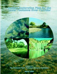
Front cover photographs (clockwise from top-left)• Adult chinook salmon returning to <strong>the</strong> river to spawn• A dynamic gravel bar near Basso Bridge at river mile 49.2• La Grange Dam at river mile 52.2• Mature valley oak and Fremont cottonwood riparian <strong>for</strong>est“The practice of conservation must spring from a convictionof what is ethically and aes<strong>the</strong>tically right, as well as what iseconomically expedient. A thing is right only when it tends topreserve <strong>the</strong> integrity, stability, and beauty of <strong>the</strong> community,and <strong>the</strong> community includes <strong>the</strong> soil, waters, fauna, and flora,as well as <strong>the</strong> people.”Aldo Leopold, 1947THIS DOCUMENT IS A SUMMARY OF THE<strong>Habitat</strong> <strong>Restoration</strong> <strong>Plan</strong> <strong>for</strong> <strong>the</strong> <strong>Lower</strong> <strong>Tuolumne</strong> <strong>River</strong> <strong>Corridor</strong>PREPARED FORThe <strong>Tuolumne</strong> <strong>River</strong> Technical Advisory CommitteeTurlock Irrigation District333 East Canal DriveTurlock, CA 95381(209) 883-8316WITH ASSISTANCE FROMUS Fish and Wildlife ServiceAnadromous Fish <strong>Restoration</strong> ProgramPREPARED BYMcBain & TrushP.O. Box 663Arcata, CA 95518(707) 826-7794FOR MORE INFORMATION CONTACTORModesto Irrigation District1231 Eleventh StreetModesto, CA 95354(209) 526-7459Printed with soy ink on recycled paperPrinted on a Heidelberg Direct Image, Chemical-Free Press


