Notice of Intent - Alabama Department of Environmental Management
Notice of Intent - Alabama Department of Environmental Management
Notice of Intent - Alabama Department of Environmental Management

Create successful ePaper yourself
Turn your PDF publications into a flip-book with our unique Google optimized e-Paper software.
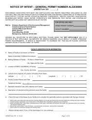
NOTICE OF INTENT – GENERAL PERMIT NUMBER ALG890000NPDES PERMIT NUMBER ALG890000 IS A GENERAL PERMIT AUTHORIZING DISCHARGES FROM SMALLNONCOAL/NONMETALLIC MINING AND DRY PROCESSING AND AREAS ASSOCIATED WITH THESE ACTIVITIES.Mail to: <strong>Alabama</strong> <strong>Department</strong> <strong>of</strong> <strong>Environmental</strong> <strong>Management</strong>Water DivisionPost Office Box 301463Montgomery, <strong>Alabama</strong> 36130-1463FOR OFFICE USE ONLYNPDES PERMIT NUMBERRECEIPT NUMBERPLEASE COMPLETE ALL QUESTIONS. RESPOND WITH “N/A” AS APPROPRIATE. INCOMPLETE OR INCORRECT ANSWERS, ORMISSING SIGNATURES WILL DELAY PROCESSING. IF SPACE IS INSUFFICIENT, CONTINUE ON AN ATTACHED SHEET(S) ASNECESSARY. ATTACH OTHER INFORMATION AS NEEDED. COMMENCEMENT OF ACTIVITES APPLIED FOR IN THISAPPLICATION ARE NOT AUTHORIZED UNTIL PERMIT COVERAGE HAS BEEN ISSUED BY THE DEPARTMENT. PLEASE TYPE ORPRINT LEGIBLY IN BLUE OR BLACK INK.DISCHARGES NOT COVERED BY GENERAL PERMIT ALG890000If the facility will have any <strong>of</strong> the following discharges, please contact the Mining and Natural Resources Section <strong>of</strong> ADEM before proceeding:1. Discharges from wet processing <strong>of</strong> mined materials;2. Discharge(s) from any mining operation that at any time has a total area <strong>of</strong> land disturbance that equals or exceeds five (5) acres in size; or3. Discharge(s) from any mining operations where the planned or proposed area <strong>of</strong> total land disturbance equals, exceeds, will equal orexceed, or is predicted to equal or exceed five (5) acres in sizePURPOSE OF THIS APPLICATIONInitial NOI for New FacilityInitial NOI for Existing Facility (Previous NPDES Permit AL_____________)Modification <strong>of</strong> General Permit No. ALG89___________ Reissuance <strong>of</strong> General Permit ALG89______________Transfer <strong>of</strong> General Permit No. ALG89_____________ Other________________________________________I. PERMITTEE INFORMATIONPermittee NameResponsible Official Phone NumberResponsible Owner/Operator or Official, and TitleResponsible Official E-Mail AddressResponsible Official (RO) Mailing AddressCity, State, and Zip CodeResponsible Official (RO) Street/Physical AddressCity, State, and Zip CodeII. FACILITY INFORMATIONFacility/Site NameFacility/Site Street Address or Location DescriptionFacility/Site Contact and TitleCity, State, and Zip CodeFacility Front Gate Latitude and Longitude (decimal or deg,min,sec)Facility/Site Contact Phone NumberCounty(s) ___________________________________________________________________________________________________________Detailed Directions to Site __________________________________________________________________________________________________________________________________________________________________________________________________________________III. ACTIVITY DESCRIPTIONPlease Specify Material to be Mined:Dirt and/or Chert Sand and/or Gravel Shale Common Clay Crushed Rock Dimension StoneOther ___________________________________________________________________________________________________________Area <strong>of</strong> the permitted site: Total site area in acres: ______________________ Total disturbed area in acres: ___________________________Narrative Description <strong>of</strong> Activity: ___________________________________________________________________________________________________________________________________________________________________________________________________________FINAL SMGP NOI (6) 2-25-13 Page 1 <strong>of</strong> 1
IV. TOPOGRAPHIC MAP SUBMITTALAttach to this application a 7.5 minute series USGS topographic map(s) no larger than 11 by 17 inches (several pages may be necessary), <strong>of</strong> the areaextending to at least one mile beyond property boundaries. The topographic map(s) must include a caption indicating the name <strong>of</strong> the topographicmap, name <strong>of</strong> the applicant, facility name, county, and township, range, & section(s) where the facility is located. The topographic map(s) mustshow the location <strong>of</strong> the facility including the site boundaries.V. RECEIVING WATERSList discharge point number, name <strong>of</strong> receiving water(s), latitude & longitude (decimal or deg,min,sec) <strong>of</strong> location(s) that run-<strong>of</strong>f enters thereceiving water, and the waterbody use classification.DischargePoint No.Receiving Water Latitude LongitudeWaterbody UseClassificationVI. IMPAIRED, TOTAL MAXIMUM DAILY LOAD (TMDL), AND HIGH QUALITY WATERSDoes the mining site discharge to a waterbody which is listed on the most recently EPA approved 303(d) list <strong>of</strong> impaired waters for a pollutant <strong>of</strong>concern, a waterbody for which a TMDL has been approved or established by EPA for a pollutant <strong>of</strong> concern, a waterbody assigned the Outstanding<strong>Alabama</strong> Water use classification in accordance with ADEM Admin. Code r. 335-6-10-.09, or a waterbody assigned a special designation inaccordance with ADEM Admin. Code r. 335-6-10-.10? Yes No If yes, attach/submit a copy <strong>of</strong> the BMP Plan that meets therequirements <strong>of</strong> Part III.D <strong>of</strong> the permit.VII. GENERAL INFORMATIONPlease be sure to submit a check for the appropriate application fee with the application. DO NOT SUBMIT THE APPLICATION ANDPERMIT FEE SEPARATELY.VIII. QUALIFIED CREDENTIALED PROFESSIONAL (QCP) CERTIFICATION“I certify under penalty <strong>of</strong> law that the technical information and data contained in this application, and a comprehensive Best <strong>Management</strong> PracticesPlan (BMP Plan) for the prevention and minimization <strong>of</strong> all sources <strong>of</strong> pollution in stormwater and authorized related process wastewater run<strong>of</strong>f hasbeen prepared under my supervision for this facility and associated regulated areas/activities. The BMP Plan meets the requirements <strong>of</strong> this permitand if properly implemented and maintained by the permittee, discharges <strong>of</strong> pollutants in stormwater run<strong>of</strong>f can reasonably be expected to beeffectively minimized to the maximum extent practicable according to the requirements <strong>of</strong> ADEM Administrative Code Chapter 335-6-6-.23 and thisPermit. The permittee has been advised that appropriate best management practices, pollution abatement/prevention facilities and structural &nonstructural management practices or <strong>Department</strong> approved equivalent management practices as detailed in the BMP Plan must be fullyimplemented and regularly maintained as needed at the facility in accordance with sound sediment, erosion, and other pollution control practices,permit requirements, and other ADEM requirements to ensure protection <strong>of</strong> groundwater and surface water quality.”QCP Designation/Description: ________________________________________________________________________________Address _______________________________________________________Registration/Certification #___________________Name and Title (type or print) ______________________________________ Phone Number ____________________________Signature ______________________________________________________Date Signed ______________________________IX. OPERATOR/RESPONSIBLE OFFICIAL SIGNATUREPursuant to ADEM Administrative Code Rule 335-6-6-.09, this NOI must be signed by a Responsible Official <strong>of</strong> the permittee who is the operator,owner, the sole proprietor <strong>of</strong> a sole proprietorship, a general/controlling member or partner, a ranking elected <strong>of</strong>ficial or other duly authorizedrepresentative for a unit <strong>of</strong> government; or an executive <strong>of</strong>ficer <strong>of</strong> at least the level <strong>of</strong> vice-president for a corporation, having overall responsibilityand decision making for the site/activity. “I certify under penalty <strong>of</strong> law that this form, the BMP Plan, and all attachments were prepared under mydirection or supervision in accordance with a system designed to assure that qualified personnel properly gathered and evaluated the informationsubmitted. Based on my inquiry <strong>of</strong> the qualified credentialed pr<strong>of</strong>essional (QCP) and other person or persons who manage the system or thosepersons directly responsible for gathering the information, the information submitted is, to the best <strong>of</strong> my knowledge and belief, true, accurate,correct, and complete. I am aware that there are significant penalties for submitting false information including the possibility <strong>of</strong> fine orimprisonment for knowing violations. I certify that this form has not been altered, and if copied or reproduced, is consistent in format and identicalin content to the ADEM approved form. I further certify that the proposed discharges described in this application have been evaluated for thepresence <strong>of</strong> any non-stormwater discharges and/or coal/mineral stormwater, or process wastewaters have been fully identified.”Name (type or print) ___________________________________________Signature ____________________________________________________Official Title _______________________________Date Signed ________________________________FINAL SMGP NOI (6) 2-25-13 Page 2 <strong>of</strong> 2