- Page 1 and 2: Report to the Secretary of State fo
- Page 3 and 4: South Down National Park Public Inq
- Page 5 and 6: Alton Town Council and Alton Societ
- Page 7 and 8: Aldingbourne Parish Council Harold
- Page 9 and 10: Beeches Action Group Tom Chapman Le
- Page 11 and 12: Chichester Archaeological Society N
- Page 13 and 14: Lord Albermarle & Trustees of Alber
- Page 15 and 16: R J Maile 72 Portland Road, Worthin
- Page 17 and 18: 20 List of newspapers where public
- Page 19 and 20: 65 The National Park Authority: A g
- Page 21 and 22: 107 DEFRA letter to Sam Howes 14 No
- Page 23 and 24: 151 a Appendices A & B1 151 b Appen
- Page 25 and 26: 195 Horsham District Council - Land
- Page 27 and 28: 234 a Planning and Compulsory Purch
- Page 29 and 30: 250 n British Geological Survey map
- Page 31: South Downs National Park Inquiry D
- Page 35 and 36: 34 1252 Mr Hughes 35 1377 Stansted
- Page 37 and 38: 116 3284aTC Telscombe Town Council
- Page 39 and 40: 197 2823BLa Bramshott & Liphook Par
- Page 41 and 42: 277 1588a Annex to Mr Carreck - Upp
- Page 43 and 44: 356 3656a/3694a Annex for Mr M A Sm
- Page 45 and 46: 437 3154TC/Tva (WR) Peacehaven Town
- Page 47 and 48: 516 925 (WR) Upper Beeding (section
- Page 49 and 50: 597 2712 (WR) Upper Beeding and Hen
- Page 51 and 52: Proofs of Evidence/Further Statemen
- Page 53 and 54: 1881/1/6 The Downs Area proof W. S.
- Page 55 and 56: 2435/1/5 Rottingdean Parish Council
- Page 57 and 58: 2697/1/4d David Jarvis, Section T,
- Page 59 and 60: 2939/1/1 See 2739 - Part 1 of 3 293
- Page 61 and 62: 3275/33/3 SDC - Cuckmere Valley Alt
- Page 63 and 64: 3534/1/1 In Principal objection on
- Page 65 and 66: Written Representations Document nu
- Page 67 and 68: 3399/2 Lewes District Council -Sue
- Page 69 and 70: 36 V Konssentein Objector 37 F Kons
- Page 71 and 72: 118 Brendan Clegg Supporter 119 Pet
- Page 73 and 74: 200 Mark Massie Supporter 201 G God
- Page 75 and 76: 279 Beryl Dring Objector 280 L Gibb
- Page 77 and 78: 362 Tony Pearson Supporter 363 Mike
- Page 79 and 80: 443 Y Hardwick Objector 444 M Parso
- Page 81 and 82: 526 D Johnson Supporter 527 Jan War
- Page 83 and 84:
608 Elizabeth Bickerton Supporter 6
- Page 85 and 86:
689 R Hollister Supporter 690 The O
- Page 87 and 88:
771 Annette Swift Objector 772 Patr
- Page 89 and 90:
852 J Channing Objector 853 M Under
- Page 91 and 92:
929 Peter Gregory Objector 930 Jane
- Page 93 and 94:
1012 Maura Lesser Objector 1013 Jan
- Page 95 and 96:
1093 B Furlong Objector 1094 A Well
- Page 97 and 98:
1173 A Hoadley Objector 1174 D Holm
- Page 99 and 100:
1256 L Clutterbuck Supporter 1257 O
- Page 101 and 102:
1338 I Gray Supporter 1339 D Herber
- Page 103 and 104:
1417 J Vizer Objector 1418 D Speed
- Page 105 and 106:
1499 Michael Beckett Objector 1500
- Page 107 and 108:
1582 Anita Gilson Objector 1583 Eli
- Page 109 and 110:
1664 Barrie Winship Supporter 1665
- Page 111 and 112:
1748 Geoff Cox Objector 1749 Kay Ke
- Page 113 and 114:
1831 D Drew Supporter 1832 Dominic
- Page 115 and 116:
1915 R Faggetter Objector 1916 A Pr
- Page 117 and 118:
1998 R Routh Objector 1999 Michael
- Page 119 and 120:
2077 B Bunett Objector 2078 Jane Ho
- Page 121 and 122:
2163 M Tanner Objector 2164 John Do
- Page 123 and 124:
2245 Frank Weller Objector 2246 Joh
- Page 125 and 126:
2326 David Oakley Supporter 2327 Ev
- Page 127 and 128:
2407 R Dean Supporter 2408 David Du
- Page 129 and 130:
2487 Graham Hampshire Objector 2488
- Page 131 and 132:
2570 Ben Whitaker Supporter 2571 J
- Page 133 and 134:
2653 R Bowey Liss Parish Council Ob
- Page 135 and 136:
2736 S Thompson Supporter 2737 S Sr
- Page 137 and 138:
2817 Rosalynd Lingard Supporter 281
- Page 139 and 140:
2897 P Kenney Supporter 2898 C Couc
- Page 141 and 142:
2979 P Bell Supporter 2980 T Stirli
- Page 143 and 144:
3061 D Digby Supporter 3062 E Coomb
- Page 145 and 146:
3146 K Dunkerton Objector 3147 E Fa
- Page 147 and 148:
3229 M Lejeune Objector 3230 K Pric
- Page 149 and 150:
3313 The Occupier Objector 3314 R N
- Page 151 and 152:
3394 A Metcalf The Hollywater Socie
- Page 153 and 154:
3476 A Ickeringill Objector 3477 He
- Page 155 and 156:
3559 E Nixon Objector 3560 D Hansfo
- Page 157 and 158:
3646 Peter Chapman Objector 3648 Sa
- Page 159 and 160:
3736 J Dobbelarr Objector 3737 C Ha
- Page 161 and 162:
3818 R Turner Objector 3819 A James
- Page 163 and 164:
3900 I Bentall Objector 3901 G Rowd
- Page 165 and 166:
3982 A Dadswell Objector 3983 H Ayl
- Page 167 and 168:
4064 R Brooker Objector 4065 S Broo
- Page 169 and 170:
4148 M Harris Objector 4149 D Marti
- Page 171 and 172:
4230 R Clarke Objector 4231 A Miles
- Page 173 and 174:
4312 J Wood Objector 4313 P McMahon
- Page 175 and 176:
4394 I Pearce Objector 4395 M Sowto
- Page 177 and 178:
4479 D Hand Objector 4480 R Greenhi
- Page 179 and 180:
4567 Dudley Burgess Objector 4568 L
- Page 181 and 182:
4649 D Wilcock Objector 4650 The Oc
- Page 183 and 184:
4732 D McDonald Objector 4733 J Lee
- Page 185 and 186:
4814 D Ells Objector 4815 B Ells Ob
- Page 187 and 188:
4896 Neil McLafferty Objector 4897
- Page 189 and 190:
4979 D Reed Supporter 4980 David Li
- Page 191 and 192:
5066 T Roe Objector 5067 J Forrest
- Page 193 and 194:
5148 S Gove Objector 5149 S Goodchi
- Page 195 and 196:
5230 P Rogers Objector 5231 M Wall
- Page 197 and 198:
5312 D Wise Objector 5313 M Greenwa
- Page 199 and 200:
5394 M Hines Objector 5395 B Witton
- Page 201 and 202:
5476 D Cresswell Objector 5477 C Ha
- Page 203 and 204:
5558 S Huffer Objector 5559 B Huffe
- Page 205 and 206:
5640 C Peck Objector 5641 B Gilling
- Page 207 and 208:
5725 C Lindsay Objector 5726 James
- Page 209 and 210:
5807 Robin Crane South Downs Campai
- Page 211 and 212:
5777 B Johnson Objector 5778 I Olne
- Page 213 and 214:
VOLUME 2 SOUTH DOWNS NATIONAL PARK
- Page 215 and 216:
Wealden District Council Dave Phill
- Page 217 and 218:
Slindon Parish Council Sheridan Ste
- Page 219 and 220:
United Kingdom Independence Party M
- Page 221 and 222:
Paula Blackledge Dr Mathew Pope Ann
- Page 223 and 224:
called Peter Rainier John Hyland Ta
- Page 225 and 226:
Peter Youngs INDIVIDUALS P Ravenscr
- Page 227 and 228:
South Downs National Park Inquiry C
- Page 229 and 230:
42 Countryside Agency Board Paper a
- Page 231 and 232:
87 The Hampshire Landscape, a Strat
- Page 233 and 234:
128 Notes on National Park File:COU
- Page 235 and 236:
171 Lewes District Local Plan - Ado
- Page 237 and 238:
211 Section B - North Itchen Valley
- Page 239 and 240:
237 AONB and National Park Manageme
- Page 241 and 242:
500 South Downs National Park (Desi
- Page 243 and 244:
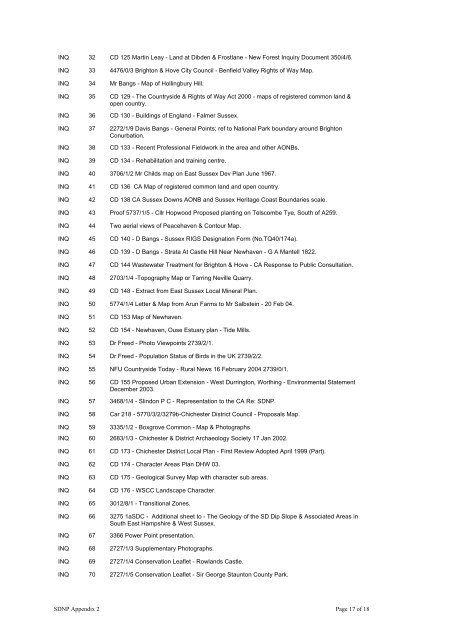
INQ 32 CD 125 Martin Leay - Land at
- Page 245 and 246:
Countryside Agency Responses CAR Nu
- Page 247 and 248:
75 216SD Mr Collins - St Dunstan's
- Page 249 and 250:
157 3399aTM Lewes District Council
- Page 251 and 252:
237 3547 Ms Rowland - Rock Common 2
- Page 253 and 254:
317 3275RP SDC - Land at Ryngmer (3
- Page 255 and 256:
397 2690LFa (WR) Hargreaves Securit
- Page 257 and 258:
477 524 (WR) + 200 Section K Upper
- Page 259 and 260:
556 1938 (WR) Upper Adur Valley (se
- Page 261 and 262:
637 237 (WR) Arun Valley ect (secti
- Page 263 and 264:
1254/1/4 National Farmers Union - R
- Page 265 and 266:
2163/1/5 see 2843/1/3 2163/1/6 see
- Page 267 and 268:
2552/1/4 Horsham District Council -
- Page 269 and 270:
2776/1/2 Funtington Parish Council
- Page 271 and 272:
3275/9/1 South Downs Campaign - Soc
- Page 273 and 274:
3358/1/2 see 2727/2/2 3363/1/1 J D
- Page 275 and 276:
4996/1/4 Mr & Mrs Hayward - Upper B
- Page 277 and 278:
2708/1 Mid Sussex District Council
- Page 279 and 280:
South Downs National Park - Represe
- Page 281 and 282:
77 Jane Clark Supporter 78 G Beck O
- Page 283 and 284:
159 Alison Owen Objector 160 Susan
- Page 285 and 286:
239 Michael Pepper Supporter 240 In
- Page 287 and 288:
321 Margaret Gray Objector 322 D Be
- Page 289 and 290:
402 J Taylor Objector 403 C Griffin
- Page 291 and 292:
485 The Occupiers Objector 486 The
- Page 293 and 294:
567 Rick Howorth Objector 568 S Lee
- Page 295 and 296:
649 Marjorie Ribbons Supporter 650
- Page 297 and 298:
730 A Woodhall Withdrawn 731 G Lock
- Page 299 and 300:
811 Judith Hutchinson Supporter 812
- Page 301 and 302:
890 Dorothy Tschaikov Supporter 891
- Page 303 and 304:
971 D Langston Objector 972 J Lanst
- Page 305 and 306:
1052 Douglas Andrews Objector 1053
- Page 307 and 308:
1133 P Janes Objector 1134 Rowland
- Page 309 and 310:
1214 Doreen Bradley Objector 1215 M
- Page 311 and 312:
1297 Hilary Rowles Supporter 1298 V
- Page 313 and 314:
1378 G Miles Cocking Parish Council
- Page 315 and 316:
1458 P Morgan Objector 1459 Mark Ch
- Page 317 and 318:
1540 T Williamson Objector 1541 Ray
- Page 319 and 320:
1623 Alan Clarke Supporter 1624 Bil
- Page 321 and 322:
1706 M Jones Supporter 1707 Joan Cl
- Page 323 and 324:
1789 Tony Becher Objector 1790 Pete
- Page 325 and 326:
1874 Lars Mansson Supporter 1875 Ph
- Page 327 and 328:
1957 Peter Middleton Exton Parish C
- Page 329 and 330:
2037 Keith Bankes Objector 2038 Der
- Page 331 and 332:
2118 H Boodrie Objector 2119 M Andr
- Page 333 and 334:
2204 Clive & Jo Morris & Crockett O
- Page 335 and 336:
2286 Frank Aylett Objector 2287 I N
- Page 337 and 338:
2367 R Harber Objector 2368 Derek K
- Page 339 and 340:
2447 E Robinson Supporter 2448 Andr
- Page 341 and 342:
2526 Frank Thompson Supporter 2527
- Page 343 and 344:
2611 Mary Herdman Supporter 2612 J
- Page 345 and 346:
2693 John Broomfield Objector 2694
- Page 347 and 348:
2776 N Brown Funtington Parish Coun
- Page 349 and 350:
2857 V Lines Objector 2858 M Koster
- Page 351 and 352:
2938 A White Supporter 2939 Peter E
- Page 353 and 354:
3019 C Austin Supporter 3020 W Ward
- Page 355 and 356:
3103 T Chesney Objector 3104 J Sand
- Page 357 and 358:
3186 M McCarthy Supporter 3187 M Wr
- Page 359 and 360:
3270 Robin Crane Objector 3271 M Wa
- Page 361 and 362:
3355 W Bradshaw Supporter 3356 D Da
- Page 363 and 364:
3435 C Breen Supporter 3436 D Richa
- Page 365 and 366:
3517 R Mihok Objector 3518 J Johnso
- Page 367 and 368:
3602 Justin Seabrook Objector 3604
- Page 369 and 370:
3696 Roland Hayward Objector 3697 A
- Page 371 and 372:
3777 P Yates Objector 3778 P Muge O
- Page 373 and 374:
3859 D Rowden Objector 3860 G Rowde
- Page 375 and 376:
3941 Z Brierley Objector 3942 J Orm
- Page 377 and 378:
4023 E Kelly Objector 4024 H Pacifi
- Page 379 and 380:
4105 R Jupp Objector 4106 K Winches
- Page 381 and 382:
4189 B Sharman Objector 4190 T Shel
- Page 383 and 384:
4271 K Newnham Objector 4272 M Harb
- Page 385 and 386:
4353 T Corrall Objector 4354 M Swai
- Page 387 and 388:
4437 D Hardy Supporter 4438 Roger C
- Page 389 and 390:
4522 W Beamish Objector 4523 D West
- Page 391 and 392:
4608 S Tigg Objector 4609 M Willard
- Page 393 and 394:
4691 H Reynolds Objector 4692 K Hey
- Page 395 and 396:
4773 J Raven Objector 4774 V Thomps
- Page 397 and 398:
4855 N Salmon Objector 4856 W Salmo
- Page 399 and 400:
4937 C Booty Supporter 4938 T Altre
- Page 401 and 402:
5025 R Metcalfe Objector 5026 D For
- Page 403 and 404:
5107 S Underwood Objector 5108 A Re
- Page 405 and 406:
5189 T McWatt Objector 5190 P McWat
- Page 407 and 408:
5271 M Hanson-Kahn Objector 5272 D
- Page 409 and 410:
5353 A Willard Objector 5354 S Horn
- Page 411 and 412:
5435 T Bush Objector 5436 J Moore O
- Page 413 and 414:
5517 S Dyball Objector 5518 K Paine
- Page 415 and 416:
5599 A Lewington Objector 5600 R Sc
- Page 417 and 418:
5681 C Wickham Objector 5682 B Parr
- Page 419 and 420:
5769 Arthur Green Goldstone Valley
- Page 421 and 422:
3348 A Weeks Winchester City Reside
- Page 423:
5798 J Beckett Objector 5799 P Look


