Introduction to GIS Learning Objectives Lecture Outline
Introduction to GIS Learning Objectives Lecture Outline
Introduction to GIS Learning Objectives Lecture Outline
You also want an ePaper? Increase the reach of your titles
YUMPU automatically turns print PDFs into web optimized ePapers that Google loves.
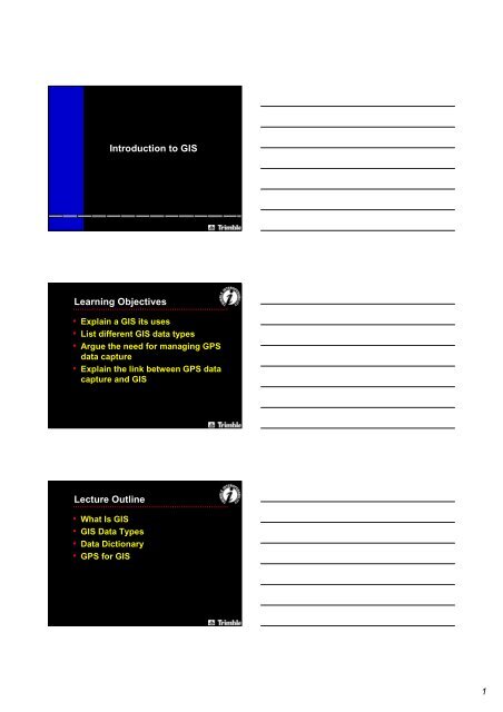
<strong>Introduction</strong> <strong>to</strong> <strong>GIS</strong><strong>Learning</strong> <strong>Objectives</strong>• Explain a <strong>GIS</strong> its uses• List different <strong>GIS</strong> data types• Argue the need for managing GPSdata capture• Explain the link between GPS datacapture and <strong>GIS</strong><strong>Lecture</strong> <strong>Outline</strong>• What Is <strong>GIS</strong>• <strong>GIS</strong> Data Types• Data Dictionary• GPS for <strong>GIS</strong>1
What is <strong>GIS</strong>?• Geographic Information System• Essentially an informationmanagement system– Integrates and s<strong>to</strong>res datacollected from different sources• Set of <strong>to</strong>ols for:– Capture– S<strong>to</strong>rage– Analysis– OutputWhat is a <strong>GIS</strong>?• “… a powerful set of <strong>to</strong>ols forcollecting, sorting, retrieving at will,transforming, analysing, anddisplaying spatial data from the realworld for a particular set ofpurposes”– Source Huxhold, An Intro <strong>to</strong> Urban <strong>GIS</strong>, 1991, quotingBorrugh<strong>GIS</strong> ComponentsDATAREALITYSTORE CAPTURETRANSFORMPRESENTKNOWLEDGEIMPRESSION2
What is a <strong>GIS</strong>?• A <strong>GIS</strong> is a database managementsystem for spatially distributedfeatures and the associatedattributes– Spatial data capture– Management– Analysis– Display– Decision making– ResearchUses for a <strong>GIS</strong>• Mapping geographicalcharacteristics for analysis• Modeling alternative processesfor management plans• Managing a utility’s assets• Moni<strong>to</strong>ring changes inenvironmental fac<strong>to</strong>rsIntegration of Data• <strong>GIS</strong> data – spatial relations anddatabases• A <strong>GIS</strong> allows integration of datacollected:– At different times– At different scales– Using various methods of capture3
Data Capture Sources• Digitizing from paper maps• Scanning• Traditional surveying techniques• Paper records & field notes• Pho<strong>to</strong>grammetry• Remote sensing• GPS<strong>GIS</strong> Data S<strong>to</strong>rage• There are two main types of datain a <strong>GIS</strong> database• Car<strong>to</strong>graphic - observations onspatially distributed features,activities, or events, which aredefinable as:– Points– Lines (Arcs)– Areas (Polygons)<strong>GIS</strong> Data S<strong>to</strong>rage• Non-Car<strong>to</strong>graphic - descriptiveinformation in a database aboutthe car<strong>to</strong>graphic features locatedon a map– Attributes– Attribute Values4
Point Features• Spatially distributed entities,activities or events• Points have a singlegeographic coordinatesuch as:– Tree– Traffic accident– Lamp postLine Features• Spatially distributed entities,activities or events• Lines (Arcs) are a series ofgeographic coordinates joined <strong>to</strong>form a line such as:– Road– Stream– RailwayArea Features• Spatially distributed entities,activities or events• Areas (Polygons) are a series ofgeographic coordinates joined<strong>to</strong>gether <strong>to</strong> form a boundary suchas:– Lake– Soil types5
Attributes• Description or characteristic of afeature• Possible attributes for the featureTree– Height– Diameter– Species– Condition– AgeAttribute Values• The value given <strong>to</strong> an attribute• Possible values for the attributesof a Tree feature– Height = 15m– Diameter = 0.75m– Species = Oak– Condition = Good– Age = 8 yearsTypes of Attribute Values• There are a number of differenttypes of attribute valuesFeature Attribute Attribute ValuesCharacter Pole Pole ID ABC123Numeric Pole Height 15mMenu Pole Condition GoodAveragePoorDate Pole Date User generatedAu<strong>to</strong> generatedTime Pole Time User generatedAu<strong>to</strong> generated6
What Data is in Your <strong>GIS</strong>?• What features do you map?• What attributes do you need <strong>to</strong>collect data on?• What attribute values can yougive the attribute?<strong>GIS</strong> Data Analysis• A <strong>GIS</strong> identifies relationshipsamong features in the database• Provide answers <strong>to</strong> queries thatare spatial (geographic)<strong>GIS</strong> Data Analysis• For example:– What is on...?– What is near...?– What is the closest...?– How far...?– How many...?– How does...?– Where is...in relation <strong>to</strong>...?– Why is...?7
Query and AnalysisData Query OutputSFBSoil Type - Area feature- Soil typesUnhealthytreesgrowingon landfillMapTrees on landfillTrees - Species- HealthReport- 3 trees growing onland fill- 2 trees are unhealthyData OrganizationTreeHealthGoodPoorSpeciesPineoakFeature nameAttributenamesAttributevaluesSoilTypeDepthFill 50Sand 125Data Input Requirements• Structured• Feature classification• Feature name• Attribute valuesFile 1 - Point Attributes1. Tree Good Pine2. Tree Poor oakFile 3 - Polygon Attributes1. Soil Fill 502. Soil Sand 125• Geographic locations– Single coordinatefor point features– Multiple coordinatesfor line and area featuresFile 2 - PointCoordinates1. X Y Z2. X Y ZFile 4 - PolygonCoordinates1. X1 Y1 Z1X2 Y2 Z2Xn Yn Zn2. X1 Y1 Z1etc.....8
ConclusionYou can now:• Explain what a <strong>GIS</strong> is and what itis used for• List different data types that canbe input <strong>to</strong> <strong>GIS</strong>• Argue the need <strong>to</strong> managefeatures and attributes collection• Explain the link between GPSdata capture and <strong>GIS</strong>Self Study• Read relevant module in StudyBook• Do self assessment quizReview Questions9


