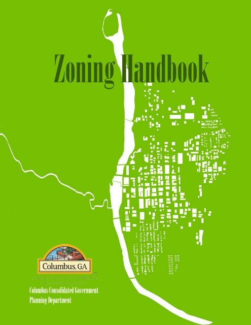
Zoning Handbook - Columbus, Georgia Consolidated Government
Zoning Handbook - Columbus, Georgia Consolidated Government
Zoning Handbook - Columbus, Georgia Consolidated Government
- No tags were found...

Create successful ePaper yourself
Turn your PDF publications into a flip-book with our unique Google optimized e-Paper software.
Table of ContentsIntroduction................................................................... 5<strong>Zoning</strong> and Overlay Districts................................... 6Residential <strong>Zoning</strong>....................................................... 11Historic <strong>Zoning</strong>............................................................. 31Commercial <strong>Zoning</strong>.................................................... 37Signage Specifications.............................................. 51Definitions...................................................................... 57Contact Information:420 10th Street<strong>Columbus</strong>, <strong>Georgia</strong> 31902Phone: 706-653-4116Fax: 706-653-4534Email: cpcmpo@columbusga.orgwebsite: www.columbusga.org/Planning3
Introduction<strong>Columbus</strong>, <strong>Georgia</strong>, once the site of a Creek IndianVillage, is one of the few cities in the United States to beplanned in advance of its founding. Established in 1828as a trading post to strengthen the western border of<strong>Georgia</strong>, <strong>Columbus</strong> was the last “frontier town” of theoriginal Thirteen Colonies.<strong>Columbus</strong>, which encompasses an area ofapproximately 218 square miles, is located in the westcentral part of the State of <strong>Georgia</strong> bordering on theAlabama state line, 90 miles southwest of the City ofAtlanta and approximately 80 miles east of Montgomery,Alabama.The original corporate area of <strong>Columbus</strong> was firstknown as the Coweta Reserve. A tract of 1,200 acres wasset aside by the State of <strong>Georgia</strong> for the location. Tractswere reserved for a courthouse (the present site of the<strong>Government</strong> Center of <strong>Columbus</strong>), male and femaleacademies, a jail and cemetery sites. More significantly, atract of land comprising between 300 and 400 acres wasdesignated as the City Commons and reserved for futureuse by the public. This is now occupied by the <strong>Columbus</strong>Civic Center, Memorial Stadium, and Golden Ball Park.<strong>Columbus</strong> was established in 1828 on theChattahoochee River, and subsequent growth has beento the north and northeast. Until recent years, theeconomy has been dominated by textiles and FortBenning. The central business district still remains a majoremployment center, but typically the population centersare on the fringes of this business district, and the lastarea of consolidation is essentially rural.As the northern most navigable point on theChattahoochee River from the gulf of Mexico, <strong>Columbus</strong>became a center of shipping and military manufacturing(water and rail transportation and hydro-electric power).<strong>Columbus</strong> has extended its corporate limits eighttimes since 1828 to maintain pace with urbandevelopment. In 1970, the citizens of <strong>Columbus</strong> andMuscogee County, with the exception of Bibb City, whichpreferred to remain semi-independent, voted toconsolidate to improve government services. Bibb Cityvoted in 2001 to consolidate into <strong>Columbus</strong>.The entire land area of Muscogee Countyencompasses approximately 140,000 acres making it thelargest city in <strong>Georgia</strong> in terms of land area. The 2006Census lists the population at 188,660.<strong>Columbus</strong> is located on the Fall Line, the naturaldivision of the Piedmont of north <strong>Georgia</strong> and the CoastalPlain of south <strong>Georgia</strong> and Florida. Its physical featuresinclude steep slopes in the north, transitioning to levelterrain in the south. Several streams and creeks providenatural drainage to the Chattahoochee River.Fort Benning Military Reservation, a primary U.S.Army training facility and the major employer of theregion, borders <strong>Columbus</strong> on the southeast and south.Development patterns of the community have beensignificantly influenced by its presence.The southern two-thirds of <strong>Columbus</strong> are comprisedof single-family residential property making up 27percent of all land use. Commercial and industrial landuses make up approximately 10 percent of the land usesin the area and are located principally in central <strong>Columbus</strong>,in two industrial parks bordering Fort Benning MilitaryReservation in east <strong>Columbus</strong>, and adjacent to severalmajor arterial roadways in north <strong>Columbus</strong>. The northand northeast sections of the community consist primarilyof low population densities. Many areas within thenorthern and northeastern parts of the city are stillundeveloped and it is in this area that most of the futuregrowth of commercial and residential is likely to occur.Historic buildings are located mostly in the centralportion of <strong>Columbus</strong> and include residential, commercialand public buildings. Private and public actions havedemonstrated the importance placed on historicresources. Both the private and the public sectors haverenovated many buildings in the past several years,particularly in the Historic District immediately south ofand along the western edge of the central businessdistrict.5
<strong>Zoning</strong> Districts and the <strong>Zoning</strong> Process6<strong>Columbus</strong> and <strong>Zoning</strong>“<strong>Zoning</strong> is the modern response to theindividual and collective needs of community life, theliving together of unrelated, interdependent people, asociety growing more complex as it expands. Althougha concept of comparatively recent origin, zoning hasits roots in basic societal necessities and pressuresthat from the very beginning of social life demand theaccommodations of individual interests to the commongood and welfare. . . . “-Former New Jersey Supreme CourtJustice Harry HeherAs <strong>Columbus</strong> continues to progress as acity it is important that growth and development ismanaged in an organized way which will benefit itscitizens. By utilizing the City’s Comprehensive Planand enforcing the current zoning districts, we canshape our community in a positive manner.The City has four main zoning categories.The zoning categories are: Residential/Historic,Commercial, Manufacturing/Industrial and Overlay/Special. The zoning districts within these fourclassifications determine how future developmentand land use will be implimented within the City of<strong>Columbus</strong>, GA.For a detailed view of zoning districts in thecity, you may visit www.columbusga.org/gis. On thiswebsite you will be able to utilize the city’s onlinedatabase and find out information for almost everyproperty within the City of <strong>Columbus</strong>. The chartlocated at the right of this page is a list of the zoningdistricts in <strong>Columbus</strong>, GA.<strong>Zoning</strong> ProcessThe zoning process begins when theapplicant obtains an application from the PlanningDepartment, completes the application, and returnsit to the staff. The applicant needs to make surethat all requirements are met and that all necessaryinformation is included such as: site plans (highdensity,residential, and commercial), legal description,and fees. A planning technician will then compose afolder of all received materials and the applicationprocessing begins. A work order is then submitted tothe GIS division in which maps are prepared for thesite being rezonedAn information sheet and site plan is sentto the Planning and Engineering departments to<strong>Zoning</strong> Districts and <strong>Zoning</strong>District Conversion ChartTABLE INSET:<strong>Zoning</strong> DistrictAgricultural, Residential and HistoricNoneHistoricResidential Estate--10Residential Estate--5Residential Estate--1Residential TransitionalSingle-family Residential--1Single-family Residential--2Single-family Residential--3Single-family Residential--4Residential Multifamily--1Residential Multifamily--2Residential Manufactured HomeCommercialUptownUPTCentral Riverfront DistrictNeighborhood CommercialResidential OfficeCommercial OfficeGeneral CommercialSpecial Activity and Technical CenterManufacturing/IndustrialTechnicalTECHLight Manufacturing/IndustrialHeavy Manufacturing/IndustrialOverlay and SpecialSpecific Area OverlaySAODPlanned Residential Unit DevelopmentPlanned Commercial DevelopmentPlanned Industrial/ManufacturingDevelopmentPlanned Mixed Use DevelopmentMill Restoration Overlay DistrictAbbreviationDeletedHISTRE10RE5RE1RTSFR1SFR2SFR3SFR4RMF1RMF2RMHCRDNCROCOGCSACLMIHMIPUDPCDPIDPMUDMROD
e reviewed. A notification map is prepared and anylots within a 300 foot radius are included. Notificationscontaining a letter, map are prepared and sent out to thecitizens located within the notification area.The application then goes before the PlanningAdvisory Commission, also referred to as PAC. PACthen hears the case and either approves or denies theapplication. The Planning Department then offersapproval or denial on the application.The application must be approved by at least oneof the two reviewing parties, the Planning Department orPAC to automatically be sent to Council. If the applicationis denied by the Planning Department, the applicantmust send a letter to the Clerk of Council requesting tocontinue forward with the public hearing.The application is then taken before the CityCouncil to be heard. It is then approved, approved withconditions, or denied.Overlay DistrictsAn overlay district is used to establish alternativeland development requirements to improve the aestheticsof a specific area of the community that requires specialattention. It consists of a defined area and establishes therequirements that are added to those of the underlyingregulations found in the UDO. The Planning Departmentthen assembles a group of stakeholders (neighborhoodgroups, developers, property owners and interestgroups) to discuss the overall goals as well as foreseeableeffects/problems in establishing an overlay. Topics oftendiscussed in meetings are public concerns with the natureof the regulations being imposed by the overlay district;the initial and long term costs of implementation andenforcement; etc. Once the language is agreed upon forthe Overlay District, it must then be taken before the citycouncil to be officially adopted.Master Planned DistrictsThere are some specific overlay districts that may alsobe implimented such as Master Planned DevelopmentOverlay Districts (MPD). There are many benefits to usinga MPD, they include:A. Comprehensive Plan. Encourages developmentor redevelopment that is consistent with the City’scomprehensive plan.B. Compatibility. Helps to ensure that developmentis compatible with the character, density or intensity ofadjacent uses.C. Creative Development. Development patternsachieve a more efficient and creative development orredevelopment of property.D. Efficiency. Economical and efficient arrangement ofbuildings.E. Innovation. Provides maximum opportunity forapplication of innovative concepts of development orredevelopment in the creation of aesthetically pleasingliving, shopping and working environments on propertiesof adequate size, shape and location.F. Preservation. To preserve the natural amenities andenvironmental assets of the land by encouraging thepreservation and improvement of scenic and functionalopen areasG. Design. Architectural and design features which areaesthetically pleasing and supportive of an enhancedquality of life and are reflective of area or communitycharacter.H. Public Services. To make use of existing public services,including water, sewer, drainage, roads and schools,or to assist the City with reconstruction, expansion orinstallation of required public services.I. Public Benefits. To provide one or more specificallyidentifiable benefits to the City and its residents, includingvoluntary dedication of land for public purposes,preservation of natural or cultural resource, eliminationof blight, or provide affordable housing.J. Flexibility and Balance. The MPD is a flexible overlayzoning district that is intended to provide an appropriatebalance between the density or intensity of developmentand the ability to provide adequate services for suchdevelopment.K. Approved Development. Development occursaccording to limitations of use, design, density, coverage,and planning as stipulated in an approved developmentplan approved by the Council.Common classifications under the MPD are:Planned Residential Unit Development (PUD), PlannedCommercial Development (PCD), Planned Industrial/Manufacturing Development (PID) and Planned MixedUse Development (PMUD). To learn more about theseany of these classifications, refer to the UDO.<strong>Zoning</strong> DistrictsThe chart on pages 8 shows the various zoningdistricts and their compatible land uses. With very fewexceptions, the City of <strong>Columbus</strong> follows very close tothese land uses. On page 9 you will find a flow chartwhich explains the rezoning process from start to finish.An overview of the more common zoningdistricts that are found within <strong>Columbus</strong> can be foundin the following chapters. In these chapters we willlook at common residential, historic, commercial andsignage zoning classifications and how it affects futuredevelopment and use. Please remember that all ofthe images within this publication are for illustrativepurpopses only and may not accurately reflect actualproperties within <strong>Columbus</strong>, <strong>Georgia</strong>.7
Future Land Use Plan CategoriesFuture Land Use Designation Description Associated <strong>Zoning</strong> CodesRural Residential Single-family residences on greater than 1 acre. RE-10, RE-5, RE-1, PUDSingle-Family ResidentialMulti-Family ResidentialGeneral CommercialNeighborhood CommercialLight IndustrialHeavy IndustrialPark/Recreation/ConservationOffice/ProfessionalMixed UseHigh Density Mixed UseTransportation, Communications,UtilitiesPublic InstitutionalSingle-family residential areas between 1 and 7.25units per acre.Multi-family residential areas up to 18 units peracre.Property where business and trade are conducted.They may be single-use or grouped together in ashopping center.Small-scale retail uses that serve surroundingneighborhoods with common goods and services.RT, SFR-1, SFR-2, SFR-3,SFR-4RMF-1, RMF-2, PCD, MROD,RMH, ROGC, PCD, PMUDNC, PMUDProperty used for warehousing, distribution,trucking and light manufacturing, which are primaryuses.TECH, LMI, PIDProperty used for heavy industrial uses such aslarge-scale manufacturing or mining.HMI, PIDAreas that have been developed or are proposed tobe developed for park, recreational use or protectedopen space.Any <strong>Zoning</strong> DistrictProperty that accommodates business concernsthat do not provide a product directly to customerson the premises, or do not as a primary activityinvolve manufacture, storage or distribution.Areas of mixed-use development (multi-familyresidential, office, commercial) up to 43 dwellingunits per acre.CO, RO, SAC, TECH, PCD,PMUDRO, H, PUD, PCD, PMUDAreas of mixed-use development containing bothhigh intensity commercial and residential uses withno limit placed on dwelling units per acre. UPT, CRD, PUD, PCD, PMUDAreas housing uses such as power generationplants, sewerage and water treatment facilities,railroad facilities, radio towers, public transit Any zoning district, if use isstations, telephone switching stations, airports, port consistent with the descriptionfacilities, or similar uses.of future land use.Areas housing local government’s communityfacilities, general government, and institutional landuses. Examples include schools, city halls, county Any zoning district, if use iscourthouses, landfills, health facilities, churches, consistent with the descriptionlibraries and police and fire stations.of future land use.8
<strong>Zoning</strong> ProcessThe applicant obtains an application from the Planning DepartmentAll necessary information is included in the application: site plan, legal description,picture(s) of the sign(s), and feesThe planning technician will begin processing the applicationThe GIS division prepares maps for the proposes rezoning siteAn information sheet and site plan is sent to Transportation Planning, Traffic Engineering,and Engineering departments to be reviewed.The application then goes before the Planning Advisory Commission (PAC)PAC then hears the case and recommends either approval or denialThe Planning Department then recommends approval or denial on theapplicationThe application must be approved by the Planning Department to automaticallybe sent to Council. If the application is denied by the Planning Department, theapplicant must send a letter to the Clerk of Council requesting to continueforward with the public hearing.Ad is ran for 15 days prior to Council meeting but no later than 45 days priorAfter the ad has been placed, notifications containing a letter, map, and agenda areprepared and sent out to the citizens located within the notification area (300ft radius ofproposed rezoned site)The application is then taken before the City Council to be heard. This first meeting is the 1stReading and is the public hearingThe following meeting is called the 2nd Reading. There is no public hearing and the case is votedapproved, approved with conditions, or denied.9
Residential11
RE10The purpose of the RE10, RE5 , and RE1 zoning districts is to provide a very low density residential zoning districtthat provides for large residential lots, limited agricultural uses, and the potential for clustered subdivisions that retain the ruralcharacter of the area.The RE10 zoning district is intended to be applied in areas that are:1. Rural in character and generally are not affected by urban development;2. Comprised of large numbers of acres in a single holding;3. Located where urban services such as central water and sewer are not available; and4. Considered to possess environmental and natural resources characteristics that should be encouraged to be retained inperpetuity.Property Development Regulations<strong>Zoning</strong>DistrictMin. LotSize(SquareFeet)RE10 435,600Max.Density(Units perAcre)Max. LotCoverageMin. LotWidth(Feet)Max. BldgHeight(Feet)Minimum Required Yard/Setback (Feet)FrontSideSideCornerRear1 per 10Acres 10% 250 35 100 75 100 50Notes13
RE5<strong>Zoning</strong>DistrictMin. LotSize(SquareFeet)RE5 217,800Max.Density(Units perAcre)Max. LotCoverageProperty Development RegulationsMin. LotWidth(Feet)Max. BldgHeight(Feet)Minimum Required Yard/Setback (Feet)FrontSideSideCornerRear1 per 5Acres 10% 200 35 100 50 75 100Notes14
RE1Property Development Regulations<strong>Zoning</strong>DistrictMin. LotSize(SquareFeet)Max.Density(Units perAcre)Max. LotCoverageMin. LotWidth(Feet)Max. BldgHeight(Feet)Minimum Required Yard/Setback (Feet)FrontSideSideCornerRE1 43,560 1 15% 125 35 50 20 50 40RearNotes15
SFR1Within the SFR1 zoningdistrict, you will find a lower densityresidential zoning district thatprotects a single family dwelling’sresidential character by prohibitingcommercial uses; allowing usesthat enhance residential areas, suchas places of worship, elementaryand secondary schools, andparks; and establishing propertydevelopment regulations thatpreserve open space.The SFR1 zoning districtis intended to be applied in areasthat are:1. Approved for development at adensity of more than one unit peracre;2. Existing with density of up totwo and one-half units per acre;and3. Existing with a present andfuture land use pattern that reflectsan area suitable for families.lot lineProperty Development Regulations<strong>Zoning</strong>DistrictMin.Lot Size(SquareFeet)Max.Density(UnitsperAcre)Max. LotCoverageMin.LotWidth(Feet)Max.BldgHeight(Feet)Minimum Required Yard/Setback(Feet)Front Side Side RearCornerNotes16SFR1 15,000 2.5 35% 100 35 30 10 30 30
SFR2The SFR2 zoning districtprovides a moderate densityresidential zoning district thatprotects a single-family dwellingresidential character by prohibitingcommercial uses; allowing usesthat enhance residential areas, suchas places of worship, elementaryand secondary schools, andparks; and establishing propertydevelopment regulations thatpreserve open space.The SFR2 zoning districtis intended to be applied in areasthat are:1. Approved for development at adensity of more than one unit peracre;2. Existing with a density of two tofour units per acre; and3. Existing with a present andfuture land use pattern that reflectsan area suitable for families.<strong>Zoning</strong>DistrictProperty Development RegulationsMin.Lot Size(SquareFeet)Max.Density(UnitsperAcre)Max.LotCoverageMin.LotWidth(Feet)Max.BldgHeight(Feet)Minimum Required Yard/Setback(Feet)Front Side Side RearCornerSFR2 10,000 4 35% 75 35 25 8 25 30Notes17
SFR3SF DetachedThe purpose of the SFR3zoning district is to provide amedium density residential zoningdistrict that protects single-familydwelling residential characterby prohibiting commercial uses;allowing uses that enhanceresidential areas, such as placesof worship, elementary andsecondary schools, and parks; andestablishing property developmentregulations that preserve openspace. In addition, the zoningdistrict also allows single-familyzero lot line dwellings.The SFR3 zoning districtis intended to be applied in areasthat are:1. Approved for development at adensity of more than one unit peracre;2. Existing with a density of threeto five and one-half units per acre;and3. Existing with a present andfuture land use pattern thatreflects an area suitable for familiesin detached and zero lot linedwellings.A maintenance easementof at least five feet in width will beincluded as part of the required sideyard for all zero lot line dwellings.lot lineProperty Development Regulations<strong>Zoning</strong>DistrictMin.Lot Size(SquareFeet)Max.Density(UnitsperAcre)Max.LotCoverageMin.LotWidth(Feet)Max.BldgHeight(Feet)Minimum Required Yard/Setback(Feet)Front Side Side RearCornerNotesSFR3SF Detached7,500 5.5 35% 60 35 25 8 25 3018
SFR4SF DetachedThe SFR4 zoning districtis to provides a higher densityresidential zoning district whileprotecting residential characterby prohibiting commercial uses;allowing uses that enhanceresidential areas, such as placesof worship, elementary andsecondary schools, and parks;and establishing propertydevelopment regulations thatpreserve open space.The SFR4 zoning districtis intended to be applied in areasthat are:1. Approved for development ata density of up to seven and onehalfunits per acre;2. Existing with a density of five toseven and one-half units per acre;and3. Existing with a current or futureland use pattern that reflectsan area suitable for families indetached single-family dwellings.lot line<strong>Zoning</strong>DistrictSFR4SF Detached20Property Development RegulationsMin.Lot Size(SquareFeet)Max.Density(UnitsperAcre)Max.LotCoverageMin.LotWidth(Feet)Max.BldgHeight(Feet)Minimum Required Yard/Setback(Feet)Front Side Side RearCorner6,000 7.25 35% 50 35 20 5 20 30Notes
SFR4Zero Lot Line1<strong>Zoning</strong>DistrictSFR4ZeroLot LineProperty Development RegulationsMin.Lot Size(SquareFeet)Max.Density(UnitsperAcre)Max.LotCoverageMin.LotWidth(Feet)Max.BldgHeight(Feet)Minimum Required Yard/Setback(Feet)Front Side Side RearCorner6,000 7.25 35% 50 35 20 0/101 20 30Note. 1 Maintenance easement of five feet to be provided.Notes21
RMF1SF DetachedThe RMF1 zoning districtis used primarily to provide a highdensity residential zoning districtthat allows a variety of dwellingtypes and maintains an overallresidential character by allowing alimited number of commercial usessuch as assisted or personal carefacilities and bed and breakfastinns; prohibiting other commercialuses; allowing uses that enhanceresidential areas, such as places ofworship, elementary and secondaryschools, and parks; and establishingproperty development regulationsthat are consistent with higherdensity residential concentrations.The RMF1 zoning districtis intended to be applied in areasthat are:1. Approved for development at adensity of up to fourteen and onehalfunits per acre;2. Existing with a density that mayrange from seven to eighteen unitsper acre; and3. Existing with a present or futureland use pattern that reflects an areasuitable for families in assisted andpersonal care facilities; detached,and zero lot line dwellings;multifamily dwellings; two familydwellings; and townhouses.lot line<strong>Zoning</strong>DistrictRMF1SF Detached22Property Development RegulationsMin.Lot Size(SquareFeet)Max.Density(UnitsperAcre)Max.LotCoverageMin.LotWidth(Feet)Max.BldgHeight(Feet)Minimum Required Yard/Setback(Feet)Front Side Side RearCorner6,000 7.25 35% 50 35 20 5 20 30Notes
RMF1Townhouselot line2<strong>Zoning</strong>DistrictProperty Development RegulationsMin.Lot Size(SquareFeet)Max.Density(UnitsperAcre)Max. LotCoverageMin.LotWidth(Feet)Max.BldgHeight(Feet)Minimum Required Yard/Setback(Feet)Front Side Side RearCornerRMF1Townhouse 1,800 18 50% 20 35 20 82 20 30(1,800)Note. 1 Number of square feet in parenthesis is the minimum lot area per individual dwelling unit ornonresidential use.2 Applies to end units only.Notes23
RMF1Duplexlot line2Property Development Regulations<strong>Zoning</strong>DistrictMin.Lot Size(SquareFeet)Max.Density(UnitsperAcre)Max.LotCoverageMin.LotWidth(Feet)Max.BldgHeight(Feet)Minimum Required Yard/Setback(Feet)Front Side Side RearCornerNotes24RMF1Duplex 6,000 14.5 50% 50 35 20 82 20 30(3,000)Note. 1 Number of square feet in parenthesis is the minimum lot area per individual dwelling unit ornonresidential use.2 Applies to end units only.
RMF1Multi-Familyand Condolot line2Property Development Regulations<strong>Zoning</strong>DistrictMin.Lot Size(SquareFeet)Max.Density(UnitsperAcre)Max.LotCoverageMin.LotWidth(Feet)Max.BldgHeight(Feet)Minimum Required Yard/Setback(Feet)Front Side Side RearCornerNotesRMF1MultifamilyandCondo6,000 14.5 35% 50 35 20 82 20 30(3,000)Note. 1 Number of square feet in parenthesis is the minimum lot area per individual dwelling unit ornonresidential use.2 Applies to end units only.25
RMF1andRMF2Non-ResidentialRMF1 and RMF2 Non-Residentialcategory typically include land usessuch as: places of worship, cemeteries,various public uses, hospices and daycare facilities.<strong>Zoning</strong>DistrictRMF1NonresidentialUseRMF2NonresidentialUse26Property Development RegulationsMin.Lot Size(SquareFeet)Max.Density(UnitsperAcre)Max.LotCoverageMin.LotWidth(Feet)Max.BldgHeight(Feet)Minimum Required Yard/Setback(Feet)Front Side Side RearCorner6,000 14.5 50% 50 35 20 82 20(3,000)7,500 16.5 40% 60 75 20 10 202 30(2,000)Note. 1 Number of square feet in parenthesis is the minimum lot area per individual dwelling unit ornonresidential use.2 Applies to end units only.Notes
RMF2Townhouse2lot lineThe RMF2 zoning district isto provide a high density residentialzoning district that allows onlymultifamily dwelling types andmaintains an overall residentialcharacter by allowing a limitednumber of commercial uses suchas assisted, retirement or personalcare facilities, and bed and breakfastinns; allowing secondary uses withinoffice, and institutional, prohibitingother commercial uses; allowing usesthat enhance residential areas, suchas places of worship, elementary andsecondary schools, and parks; andestablishing property developmentregulations that are consistentwith higher density residentialconcentrationsThe RMF2 zoning district isintended to be applied in areas thatare:1. Approved for development at adensity of up to 16.5 units per acre;2. Existing with a density that mayrange from seven to eighteen unitsper acre; and3. Existing with a present or futureland use pattern that reflects an areasuitable for families in assisted andpersonal care facilities; multifamilydwellings; two family dwellings; andtownhouses.Secondary uses arepermitted as provided in Section4.2.9 of the UDO.<strong>Zoning</strong>DistrictRMF2TownhouseProperty Development RegulationsMin.Lot Size(SquareFeet)Max.Density(UnitsperAcre)Max.LotCoverageMin.LotWidth(Feet)Max.BldgHeight(Feet)Minimum Required Yard/Setback(Feet)Front Side Side RearCorner1,800 18 50% 20 35 20 8 202 30(1,800)Note. 1 Number of square feet in parenthesis is the minimum lot area per individual dwelling unit ornonresidential use.2 Applies to end units only.Notes27
RMF2Duplexlot line2<strong>Zoning</strong>District28Property Development RegulationsMin.Lot Size(SquareFeet)Max.Density(UnitsperAcre)Max.LotCoverageMin.LotWidth(Feet)Max.BldgHeight(Feet)Minimum Required Yard/Setback(Feet)Front Side Side RearCornerRMF2Duplex 7,500 16.5 40% 60 75 20 10 202 30(2,000)Note. 1 Number of square feet in parenthesis is the minimum lot area per individual dwelling unit ornonresidential use.2 Applies to end units only.Notes
RMF2Multi-Familyand Condolot line2<strong>Zoning</strong>DistrictRMF2MultifamilyandCondoProperty Development RegulationsMin.Lot Size(SquareFeet)Max.Density(UnitsperAcre)Max.LotCoverageMin.LotWidth(Feet)Max.BldgHeight(Feet)Minimum Required Yard/Setback(Feet)Front Side Side RearCorner7,500 16.5 40% 60 75 20 10 202 30(2,000)Note. 1 Number of square feet in parenthesis is the minimum lot area per individual dwelling unit ornonresidential use.2 Applies to end units only.Notes29
Historic31
HISTSF DetachedThe primary reasons thatwe use the Historic <strong>Zoning</strong> District(HIST) are the following:1. To safeguard the architecturaland historic heritage of <strong>Columbus</strong>,<strong>Georgia</strong>;2. To promote the use of scenic andhistoric districts for the education,pleasure, and welfare of citizensand its visitors; and3. To provide and protect anenvironment suitable for residentialand other uses compatible withthose objectives.For more informationregarding properties that aredeemed Historic refer to thezoning ordinance or the Official<strong>Zoning</strong> Map of <strong>Columbus</strong>, <strong>Georgia</strong>.It is important to remember thatproperties within the HIST zoningdistrict are subject to review by theBoard of Historic and ArchitecturalReview (BHAR)<strong>Zoning</strong>DistrictHISTSF Detached32Property Development RegulationsMin.Lot Size(SquareFeet)Max.Density(UnitsperAcre)Max.LotCoverageMin. LotWidth(Feet)Max.BldgHeight(Feet)Minimum Required Yard/Setback(Feet)Front Side Side RearCorner4,000 21.75 100% 40 40 20 10 20 30(2,000)Notes. 1 Number of square feet in parenthesis is the minimum lot area per individual dwelling unit. 2Notes
HISTTownhouse1<strong>Zoning</strong>DistrictProperty Development RegulationsMin.Lot Size(SquareFeet)Max.Density(UnitsperAcre)Max.LotCoverageMin.LotWidth(Feet)Max.BldgHeight(Feet)Minimum Required Yard/Setback(Feet)Front Side Side RearCornerHISTTownhouse1,800 18.2 50% 20 35 20 8 20 30Notes. 1 Mainteneance easment of five feet to be provided.Notes33
HISTMulti-Familyand Condo<strong>Zoning</strong>DistrictHISTMultifamilyandCondo34Property Development RegulationsMin.Lot Size(SquareFeet)Max.Density(UnitsperAcre)Max.LotCoverageMin.LotWidth(Feet)Max.BldgHeight(Feet)Minimum Required Yard/Setback(Feet)Front Side Side RearCorner4,000 10.9 100% 40 40 20 10 20 30Notes
HISTNon ResidentialUse<strong>Zoning</strong>DistrictHISTNonresidentialUseProperty Development RegulationsMin.Lot Size(SquareFeet)Max.Density(UnitsperAcre)Max.LotCoverageMin.LotWidth(Feet)Max.BldgHeight(Feet)Minimum Required Yard/Setback(Feet)Front Side Side RearCorner4,000 None 100% 40 40 20 0 20 30Notes35
Commercial37
UPTMulti-Familyand CondoThe purpose of zoningdistrict is to provide a mixed usezoning district that provides forboth high intensity commercialand high density residential usesin an area that is adjacent andcomplementary to the CRD zoningdistrict.The UPT zoning districtis intended to be applied in areasthat are:1. Located in an area where highdensity and intensity developmentis encouraged;2. Located adjacent to the CRDzoning district; and3. Capable of allowingcomplementary existing andfuture land uses that can attractemployment, residential andentertainment activities in oneextended area.Secondary uses arepermitted as provided in Section4.2.9 of the UDO. Existingencroachments into a publicright-of-way shall comply with therequirements of Section 4.2.23 ofthe UDO. Properties within theUPT zoning district are subjectto review by the Uptown FacadeBoard as provided in Section 9.2.5and the BHAR as provided in Article7 of Chapter 9.<strong>Zoning</strong>DistrictUPTMultifamilyand Condo38Property Development RegulationsMin.Lot Size(SquareFeet)Max. Density(Unitsper Acre)Max.LotCoverageMin.LotWidth(Feet)Max.BldgHeight(Feet)Minimum Required Yard/Setback(Feet)Front Side Side RearCorner4,000 None 100% 40 150 25 12 25 40Notes
UPTNon ResidentialUse<strong>Zoning</strong>DistrictUPTNonresidentialUsesProperty Development RegulationsMin.Lot Size(SquareFeet)Max.Density(UnitsperAcre)Max.LotCoverageMin.LotWidth(Feet)Max.BldgHeight(Feet)Minimum Required Yard/Setback(Feet)Front Side Side RearCorner34,000 None 100% 40 150 25 0/15 0 03. 15 feet when abutting a residential zoning district.Notes39
UPTMixed Use<strong>Zoning</strong>DistrictProperty Development RegulationsMin.Lot Size(SquareFeet)Max.Density(Unitsper Acre)Max.LotCoverageMin.LotWidth(Feet)Max.BldgHeight(Feet)Minimum Required Yard/Setback(Feet)Front Side Side RearCornerUPTMixed 4,000 None 100% 40 150 030/15 0 0 2Uses2. Residential uses are to be located above the ground floor.3. 15 feet when abutting a residential zoning district.Notes40
CRDCRD<strong>Zoning</strong>DistrictCRDProperty Development RegulationsMin.Lot Size(SquareFeet)Max.Density(UnitsperAcre)Max.LotCoverageMin.LotWidth(Feet)See requirements for UPT zoning districtMax.BldgHeight(Feet)Minimum Required Yard/Setback(Feet)Front Side Side RearCornerNotes41
NCNC2<strong>Zoning</strong>DistrictProperty Development RegulationsMin.Lot Size(SquareFeet)Max.Density(UnitsperAcre)Max.LotCoverageMin.LotWidth(Feet)Max.BldgHeight(Feet)Minimum Required Yard/Setback(Feet)Front Side Side RearCorner22NC 4,000 42 100% 40 50 20 0/15 20 0/15(1,000)1. Number of square feet in parenthesis is the minimum lot area per individual dwelling unit.2. 15 feet when abutting a residential zoning district.Notes42
ROTownhouse<strong>Zoning</strong>DistrictProperty Development RegulationsMin.Lot Size(SquareFeet)Max.Density(Unitsper Acre)Max.LotCoverageMin.LotWidth(Feet)Max.BldgHeight(Feet)Minimum Required Yard/Setback(Feet)Front Side Side RearCornerROTownhouse 1,800 18 50% 20 35 20 8 20 30(1,800)1. Number of square feet in parenthesis is the minimum lot area per individual dwelling unit ornonresidential use.Notes43
ROMulti-Familyand Condo<strong>Zoning</strong>DistrictROMultifamilyandCondoProperty Development RegulationsMin.Lot Size(SquareFeet)10,000(1,000)Max.Density(UnitsperAcre)Max.LotCoverageMin.LotWidth(Feet)Max.BldgHeight(Feet)Minimum Required Yard/Setback(Feet)Front Side Side RearCorner43 100% 75 150 25 12 25 401. Number of square feet in parenthesis is the minimum lot area per individual dwelling unit or nonresidentialuse.Notes44
RONon ResidentialUseProperty Development Regulations<strong>Zoning</strong>DistrictMin.Lot Size(SquareFeet)Max.Density(UnitsperAcre)Max.LotCoverageMin.LotWidth(Feet)Max.BldgHeight(Feet)Minimum Required Yard/Setback(Feet)Front Side Side RearCornerNotesRONonresidential10,000 43 100% 75 150 25 12 25 40Uses1. Residential uses are to be located above the ground floor.45
ROMixed Use<strong>Zoning</strong>DistrictROMixedUses46Property Development RegulationsMin.Lot Size(SquareFeet)10,000(1,000)Max.Density(UnitsperAcre)Max.LotCoverageMin.LotWidth(Feet)Max.BldgHeight(Feet)Minimum Required Yard/Setback(Feet)Front Side Side RearCorner43 100% 75 150 25 12 25 40 2Notes1. Number of square feet in parenthesis is the minimum lot area per individual dwelling unit or nonresidentialuse.2. Residential uses are to be located above the ground floor.
CO11<strong>Zoning</strong>DistrictProperty Development RegulationsMin.Lot Size(SquareFeet)Max.Density(UnitsperAcre)Max.LotCoverageMin.LotWidth(Feet)Max.BldgHeight(Feet)Minimum Required Yard/Setback(Feet)Front Side Side RearCornerCO 3 Acres 21 50% 250 125 0 0/151 0 0/151Notes. 1 15 feet when abutting a residential zoning district.Notes47
GC11<strong>Zoning</strong>DistrictProperty Development RegulationsMin.Lot Size(SquareFeet)Max.Density(UnitsperAcre)Max. LotCoverageMin.LotWidth(Feet)Max.BldgHeight(Feet)Minimum Required Yard/Setback(Feet)Front Side Side RearCornerGC 4,000 None 100% 40 70 20 0/151 20 0/151Note. 1 15 feet when abutting a residential zoning district.Notes48
SAC<strong>Zoning</strong>DistrictProperty Development RegulationsMin.Lot Size(SquareFeet)Max.Density(UnitsperAcre)Max.LotCoverageMin.LotWidth(Feet)Max.BldgHeight(Feet)Minimum Required Yard/Setback(Feet)Front Side Side RearCornerSAC 130,680 40,000 80% 100 120 40 20 40 20Notes49
Signage51
SIGNSSignageBillboards are permitted in CG, LMI and HMIzoning districts and are subject to compliance with allother provisions of this Article. Maintaining the aestheticsof the entrances to this community, its gateways, isimportant. New or larger billboards within 660 feet shallnot be allowed along the following gateways:1. 2nd Avenue; and2. The J. R. Allen Parkway/U.S. 80/Falline Freewayfrom the Alabama state line past its intersection with the<strong>Columbus</strong> Manchester Expressway to its intersection withthe west side of Flat Rock Road. and I-185 north of itsintersection with the J. R. Allen Parkway/U.S. 80, except forsigns which may be authorized by the <strong>Georgia</strong> Departmentof Transportation within the highway right-of-way.Setback requirements for all billboard signs shallbe no less than 15 feet from the right-of-way. Billboardsshall be 12 feet by 25 feet, 25 feet by 25 feet, 10.5 feet by 36feet, or 14 feet by 48 feet and shall not exceed 672 squarefeet. In determining the square footage, the followingextensions are allowed and not included in the 672 squarefeet: a five-foot extension at the top, a two-foot extensionon each side, and a one-foot extension on the bottom.The maximum height of the sign and its structures shallbe 60 feet above the grade level at the foot of the signstructure to the top of the sign or sign structure. Ininstances where the level of the highway is elevated, themaximum height of the sign and its structure shall be 60feet above the grade level of the highway at the pointnearest the sign and its structure.52
SIGNSNo part of any permitted,outdoor advertising structures maybe erected within 1,250 feet on thesame side of the street with anyother billboard sign. Billboardslocated along limited access roadsshall not be located within 500 feetof an interchange, intersectionat grade, or safety rest area. Theforegoing 500-foot zone shall bemeasured along the highway fromthe point at which the pavementcommences or ceases to widen atexits from or entrances to the maintraveled way.A V-type and tri-face signshall be regarded as one sign aslong as the sides are not separatedby a distance exceeding 20 feet.With respect to a double faced(back to back) sign, the distancebetween the backs of each of thesides does not exceed five feet. Tomeasure the allowable sign areaof billboard signs permitted underthese regulations, a double-facedor V-shaped sign constitutes asingle sign as identified in Section4.4.9 of the UDO and is measuredby computing the area of one sideonly. With respect to tri-face signs,the total sign surface is measuredas the sum of the areas of anytwo adjacent sides. The allowablesign area of signs with equal sizeand shape for both double-faced(back-to-back) and V-shaped signsis measured by computing thearea of only one side of the sign.Both sides of the double-faced andV-shaped sign shall be of equal size.The sign area of sign with three ormore side, multiple sided signs, ismeasured as the sum of the area ofany two adjacent sides.53
SIGNSGenerally RO and CRD<strong>Zoning</strong> District Ground/MonumentSign may not exceed 150 squarefeet; 20 feet high. Monumentsigns within: UPT, NC, RO, CO, GC,LMI, and HMI <strong>Zoning</strong> Districts usethe standards below:- Lots Less Than 300 FeetRoad Frontage. One sign withmaximum height of 35 feet with amaximum of 250 square feet. Lotswith road frontage more than 300feet on one street are allowed oneadditional sign. Combined squarefootage for all signs shall notexceed 300 square feet.- Lots More Than 300 Feetof Road Frontage on Two Streets.Two signs with maximum heightof 35 feet and maximum squarefootage of 300 square feet forboth signs combined. For <strong>Zoning</strong>Districts RE10, RE5, RE1, SFR1, SFR2,SRF3, RMD, RMF1 and RMF2 <strong>Zoning</strong>District Ground/Monument Signsrefer to Section 4.4.4 of the UDOregarding exempt signs.54
Signage without permitsExcept as otherwise provided, the followingon-site signs may be erected without securing a permit,subject, however, to the terms and conditions containedbelow and meeting all other applicable codes andregulations. For a complete list of signs that are allowedwithout a permit, please contact the Planning Departmentor refer to the UDO.- Individual Residential Lots. Signs for individual residential lots1. Number. Signs must not exceed one in number.2. Maximum Dimensions. Signs shall have a maximum size ofsix square feet, six feet in height, and with a ten foot minimum setback.- Sale, Lease or Rental Signs. Signs advertising the sale, lease, or rentalof property.1. Number of Signs. Such signs shall be limited to one per streetfrontage per property.2. Maximum Dimensions. Signs shall not exceed six square feetin area in residential districts or 32 square feet in other districts.3. Location and Removal. Signs must be displayed on theproperty advertised for sale, lease, or rent. The signs must be removed nolater than seven days after the sale, lease, or rental of the property.- Ground or Monument Signs.1. Sign Permitted. A permanent ground or monument sign witha sign surface area of 15 square feet or less in a commercial, industrial, or ROzoning district.2. Exemption. This is not an extra sign, but is ground ormonument sign authorized by Section 4.4.10 of the UDO.- Specific Exemptions. Any sign inside a building and any sign attached orpainted on a building below roofline in a nonresidential zone. This includessigns on windows, awnings, canopies, and walls and includes projectingsigns and marquis signs.- Flags. Flags attached to freestanding poles mounted on the ground, ormounted on a building.1. Number. Not more than three in number.2. Commercial Use Prohibited. Flags shall not be used in such a way as toattract the attention of the public for commercial purposes.- Directional Signs. Directional signs, with copy not to exceed threesquare feet in area.- Holiday Decorations. Holiday decorations, lights or displays withno commercial messages erected in connection with the observance ofholidays.- Incidental Signs. Incidental signs limited to information or directionrelated to the permitted use on the lot or building or a directory sign withinan office park, industrial park, hospital campus, school campus, or withinthe confines of any other similar development.O. Banners.1. Permitted <strong>Zoning</strong> Districts. Banners used in commercial,industrial, or RO zoning districts.2. Location and Attachment. Banners must be attached at allcorners to a permanent principal structure or canopy.- Multifamily Building Signs. Multifamily building identification signs,addresses and parking lot identification signs for an individual building.Q. Menu Board Signs.1. Permitted. Menu boards shall be permitted in NC and CRDzoning districts.2. Maximum Number. One menu board shall be allowed perbusiness.3. Maximum Size. Boards shall not exceed nine square feet insize.4. Permitted Location. Boards shall be positioned so as to beadjacent to that business whose menu is listed on the board and be placedin a manner clearly visible to pedestrian traffic.5. Rights-of-way. Menu boards shall not be placed in a Cityright-of-way without permission from the City’s Traffic Engineer.6. Removal. All menu boards shall be removed at the end ofeach business day.R. Drive-Thru Menu Boards. Drive-thru menu boards set back beyondbuilding line.Prohibited signsThis section contains a list of some, but not allprohibited signs within <strong>Columbus</strong>. For a more extensiveand complete list of prohibited signs please contact thePlanning Department.A. Conflicts with Traffic Control Signals. Lights or signs that by color,location, or design resemble or conflict with traffic control signs or signals.B. Unshielded Illumination. Unshielded illuminated devices that produceglare or are a hazard or a nuisance to motorists or occupants of adjacentproperties such as sealed beam, flood or spotlights.C. Noise and Sounds. Signs that produce noise or sound capable of beingheard even though the sound produced are not understandable sounds.D. Emitting Signs. Signs that emit visible smoke, vapor, particles, or odor.E. Natural Features. Signs attached to trees or painted or drawn uponrocks or other natural features except posted on property or “no trespassing”signs less than three square feet.F. Unlicensed Vehicle Signs. Signs attached to or painted onto anunlicensed vehicle parked on and visible from a street, except on a licensedauto dealership property.G. Bench Signs. Bench signs in public right-of-way or within 30 feet ofstreet or public right-of-way.H. Revolving Signs.I. Roof Signs.J. Decorative Signs. Decorative items/deluxes/ornamentation.K. Moving Signs. Flappers/moving signs.L. Signs not Otherwise Identified. Any other sign not authorized asexempt from permitting or otherwise specifically authorized by this Article.Temporary signsTemporary signs shall be permitted subject to the requirements of thisSection.A. Temporary Sign Permit Required. A temporary sign may be erectedonly after obtaining a temporary sign permit from the inspections and codeenforcement division.B. Prohibited Locations. A temporary sign shall not be erected in aresidential zoned district.C. Time Limitations. A temporary permit cannot be obtained for the same55
property within a period of 30 days after the expiration date of a previoustemporary permit.D. Removal. If any temporary sign is not removed by the expiration dateof the permit, the Building Official may remove it and charge the costs ofremoval to the individual or enterprise responsible.E. Permitted Temporary Signs. Permitted temporary signs are listedbelow.:1. Civic Event Signs. Special event signs, banners, anddirectional signs directing the attention of the public to special eventssponsored, in whole or in part, by the City or by religious, charitable,nonprofit or public service groups may be erected on public property withthe approval of the City Manager.(A) Such signs shall be nonilluminated.(B) Such signs shall be allowed 30 days prior to the event andmust be removed within five days following the event.(C) Notwithstanding any other provision of this Code section,the City Manager may approve banners for placementon public rights-of-way recognizing an enterprise zone orredevelopment area on file with the Planning Division for aperiod not to exceed 12 months.2. Temporary Signs For New Businesses. A new businessor a business in a new location with no permanent signs may obtain atemporary permit for a sign for 90 days.(A) The maximum size of said sign shall be 32 square feet.(B) The sign must be removed at the end of 90 days or whenpermanent sign is erected or a permanent permit is issued forthe sign.3. Inflatable Signs and Advertising Balloons. A temporarypermit for 15 days per property may be granted for the use of on-siteinflatable signs/advertising balloons.(A) A temporary permit shall be obtained for not more thanone time in a six-month period.(B) The required setback is 20 feet from the right-of-way.(Ord. No. 05-79, § 1, 10-25-05)56
PlanningDefinitions57
Definitions(for a more complete list please see the UDO)Abandon means to discontinue a use for more than a specified period of time or to vacate a right-of-way, easement, or otherinterest in real property.Accessory use. See "Use, accessory."Acre means land or water, or combination thereof, containing 43,560 square feet.Addition to an Existing Building means any walled and roofed expansion to the perimeter of a building in which the addition isconnected by a common load-bearing wall other than a firewall.Advertise means to inform, to notify, to announce, to attract public attention by emphasizing desirable qualities in order toarouse a desire to purchase or invest.Agriculture, limited means non-intensive agricultural activities that may be commercial in nature, and include such activities asapiculture, forestry, groves, private and commercial equestrian activities, private and commercial kennels, produce stands, veterinaryoffices, and wholesale greenhouses and nurseries.Alley means a public or private minor right-of-way used primarily for service and vehicular access to the back or side of a property.Alteration means, for purposes related to historic preservation, any act or process that changes one or more of the exterior architecturalfeatures of a structure, including, but not limited to, the erection, construction, reconstruction or removal of any structure.Alteration means any change, addition, improvement, or modification to an existing structure.Applicant means any individual, corporation or person or their authorized representative applying for any development approval,permit or other form of approval required by the UDO.Application means a petition for approval of a zoning change, development permit, building permit, hardship variance, specialexception or appeal, or any other authorization for the use or development of a property under the requirements of this UDO.Aquifer means any stratum or zone of rock beneath the surface of the earth capable of containing or producing water from a well.Arborist means one who is versed in the art of arboriculture, including tree surgery, the prevention and cure of tree diseases andthe control of insect pests.Area of Shallow Flooding means designated AO or AH zone on the flood insurance rate map (FIRM) with base flood depths fromone to three feet, or where a clearly deemed channel does not exist, where the path of flooding is unpredictable and indeterminate,and where velocity flow may be evident.Area of Special Flood Hazard means the land in the flood plain within a community subject to a 1 percent or greater chance offlooding in any given year. In the absence of official designation by the Federal Emergency Management Agency, Areas of SpecialFlood Hazard shall be designated by the local community.Arterial Street. See "Street, arterial."Assisted living facility (ALF) means any facility which offers residence, services, meals, and skilled care to the elderly, and mayinclude one or more of the following types of services: (1) independent living; (2) assisted living; and (3) skilled nursing care.Banner means any sign having the characters, letters, illustrations or ornamentations applied to cloth, paper, or fabric of any kindwith only such material for backing.Base Flood means the flood having a one percent chance of being equaled or exceeded in any given year (100-year flood).Basement means a portion of a building partly underground or below the ground floor having a least one-half of its height above59
average grade.Berm means a mound of earth between two and six feet high used to buffer or screen a land use.Best management practices (BMPs) means a collection of structural measures and vegetative practices which, when properlydesigned, installed and maintained, will provide effective erosion and sedimentation control. The term "properly designed" meansdesigned in accordance with the hydraulic design specifications contained in the "Manual for Erosion and Sediment Control in<strong>Georgia</strong>" specified in O.C.G.A. § 12-7-6(b).Billboard means a sign with an area of 300 square feet or greater, which is supported by one or more columns, uprights or bracesin or upon the ground and is not attached to a building and is not mobile or temporary. A billboard may include a multiple messagesign that means a sign, display, or device that changes the message or copy on the sign electronically by movement or rotationof panels or slats.Board of Historic and Architectural Review is a seven-member historical preservation commission established by the <strong>Columbus</strong>City Council in accordance <strong>Georgia</strong> Code 2-6102.Buffer means land area used to visibly separate one use from another through screening and distance. See also "stream buffer"and "zoning buffer."Building Code means the technical codes adopted or adopted as amended by the City under the <strong>Georgia</strong> Uniform Codes Act.Building and construction trades office and shop means an establishment engaged in providing building and construction services,including air conditioning and heating, carpenters, contractors, electricians, masons, plumbers, roofers, and similar services.Building face or frontage means the length of the single front building elevation in which the primary entrance to the business islocated. If more than one business is located in a single building then such length shall be limited to that portion which is occupiedby each individual business.Building height means, as applicable, the vertical distance from the grade to: (1) the highest point of a flat roof; or (2) the deckline of a mansard roof; or (3) the average height between eaves and ridge for a gable, hip or gambrel roof; or (4) the averageheight between high and low points for a shed roof.Building Official means the director of inspections and code enforcement of <strong>Columbus</strong>, <strong>Georgia</strong> or his designated representatives.Building, accessory means detached subordinate building or portion thereof, the use of which is incidental to and customary inconnection with the main building or use and which is located on the same lot with such main building or use.Caliper means the diameter or thickness of the truck of a nursery-grown tree as measured at six inches above the top of the rootmass.Central business district (CBD) means areas zoned UPT and CRD by the Official <strong>Zoning</strong> Map.Certificate of appropriateness means a document approving a proposal to make a material change in the appearance of a designated historic property or of a structure, site, or work of art located within a designated historic district.City Arborist means the Manager of the Landscape and Forestry Division or designee.City Code means all ordinances, laws and regulations adopted by the Council of <strong>Columbus</strong>.City Engineer means the City Engineer or designee.City Engineer means the duly designated Director of the Department of Engineering of <strong>Columbus</strong>, <strong>Georgia</strong>, licensed and registered in <strong>Georgia</strong> to perform the duties of Engineer, as herein specified or duly authorized agent.City Land Planner means the individual employed within the Planning Department charged with reviewing subdivision plats andsite plans.City or City of <strong>Columbus</strong> means the <strong>Consolidated</strong> <strong>Columbus</strong> <strong>Government</strong>, <strong>Georgia</strong>, including the City of <strong>Columbus</strong> and MuscogeeCounty.Clean Water Act means the Federal Water Pollution Control Act, as amended.60
Clearing means the removal and proper disposal of exposed objectionable matter from an area, and may include but is not limitedto trees, roots, grass, underbrush, rubble, any type of structures, etc.Code means the Unified Development Ordinance (UDO) of the <strong>Columbus</strong> <strong>Consolidated</strong> <strong>Government</strong>.Commercial message means any sign wording, logo, or other representation that, directly or indirectly, names, advertises, or callsattention to a business, product, service, or other commercial activity.Common area means an area, including all improvements, designed for the use and enjoyment of residents in or users of a residentialor nonresidential structure.Community facilities means public or private facilities such as assembly halls, union halls, conference halls and centers, stadiumsor arenas, or auditoriums including accessory office or administrative space; nonprofit clubs and lodges; art galleries, museums,libraries, and theaters for live performances or films, videos, or other electronic medium; golf courses and clubhouses, excludingminiature golf; and public uses.Compatibility means land uses that are congruous, similar, and in harmony with one another inasmuch as they do not create orfoster undesirable health, safety, or aesthetic effects arising from direct association of dissimilar, contradictory, incongruous, ordiscordant activities, including but not limited to the impacts of intensity of use, traffic, hours of operation, aesthetics, noise, vibration,smoke, hazardous odors, radiation, function, and other land use conditions.Concealed support structure means any freestanding structure constructed for the primary purpose of supporting one or moreantennae but designed to resemble an architectural or natural feature of the specific environment, concealing or camouflagingthe presence of the antennae. The term includes but is not limited to clock towers, campaniles, water towers, silos, light poles,flagpoles, and artificial trees.Condition of <strong>Zoning</strong> Approval means a requirement adopted by the City Council at the time of approval of a zoning change,placing greater or additional requirements or restrictions on the property than provided in this Code in order to reduce an adverseimpact of the zoning change and to further the protection of the public health, safety, or general welfare.Council or City Council means the Council of <strong>Columbus</strong>.County means Muscogee County, <strong>Georgia</strong>.Critical establishment period means the first two years after a tree is planted.Critical root zone means an area on the ground around a tree that is within the drip line of a tree.Cultural facility means a public, private, or not for profit facility that provides cultural services, including but not limited to an artgallery, library, or museum.Cut means a portion of land surface or area from which earth has been removed or will be removed by excavation; the depthbelow original ground surface to excavated surface. Also know as "excavation."Cutting means (1) for the purpose of tree protection, the detaching or separating of any limb, branch, or root from a tree; for thepurpose of erosion control, the removal of any soil or other solid material from a natural ground surface.Deciduous means a plant with foliage that drops or dies at the end of a growing season.Demolition means the razing or destruction, whether entirely or in significant part, of a building, structure, site or object, andincludes the removal of building, structure or object from its site or the removal or destruction of the facade or surface.Density factor means, relating to tree preservation and replacement, a unit of measure used to prescribe the calculated treecoverage of a site.Density means the number of dwelling units allowed based upon gross acreage of a site.Design guidelines means a manual showing design features and examples of appropriate treatment of them that will preservethe historic and architectural character of a structure or district.61
Design Professional means a person registered in the State of <strong>Georgia</strong> as a Land Surveyor, Landscape Architect or ProfessionalEngineer.Designation means a decision by the Council of <strong>Columbus</strong> to designate such property as a "historic property" or as a "historicdistrict".Development permit means an application to use, alter, construct upon, or otherwise change the use of land, and includes anyapplications for comprehensive plan future land use map change, rezoning, special exception use, variance, temporary use or specialevent, building permit, clearing or grading permit, or other permit or approval that allows the alteration of land or a structure.Development permit means the authorization necessary to begin a land disturbing activity under the provisions of this ordinance.See also "site development permit."DHR means the <strong>Georgia</strong> Department of Human Resources.Diameter at Breast Height means the standard measure of tree size for trees existing on a site. The tree trunk is measured at aheight of four and one-half feet above the ground, and if a tree splits into multiple trunks below that point, the trunk is measuredat its most narrow point beneath the split.Diameter, tree means the diameter of a tree measured as follows:(1) For existing preserved trees, at a point four and one-half feet above the ground;(2) For new replaced trees, at a point six inches above ground; and(3) For multiple trunk trees, as provided in the measure of diameter at breast height.Director means, unless otherwise clearly identified, the Director of the Planning Department or designee, successor title or asdesignated by the City Manager.Distribution and warehousing means a facility engaged in the wholesale receipt, storage and distribution of equipment, manufacturedproducts, parts, processed foods, supplies and related items.DNR means the <strong>Georgia</strong> Department of Natural Resources.Drip line means a vertical line extending from the outermost branches of a tree to the ground.Drainage structure means a device composed of a virtually non-erodible material such as concrete, steel, plastic or other suchmaterial that conveys water from one place to another by intercepting the flow and carrying it to a release point for stormwatermanagement, drainage control or flood control purposes.Dwelling unit means any structure, or part thereof, that is designed to be occupied as living quarters by a single-family, containingseparate bathing, kitchen, and sanitary, and sleeping facilities.Dwelling, accessory means a secondary, subordinate dwelling that is attached to or detached from and located on the same lotas the principal structure.Dwelling, loft means a residential dwelling that is located above the ground floor of a multistory nonresidential building.Dwelling, manufactured means a structure, transportable in one or more sections, which, in the traveling mode, is eight bodyfeet or more in width, or 40 body feet or more in length, or, when erected on site, is 320 or more square feet and which is builton a permanent chassis and designed to be used as a dwelling with or without a permanent foundation when connected to therequired utilities and includes the plumbing, heating, air-conditioning, and electrical systems contained therein; except that suchterm shall include any structure which meets all the requirements of this paragraph except the size requirements and with respectto which the manufacturer voluntarily files a certification required by the secretary of Housing and Urban Development and complieswith the standards established under The National Mobile Home Construction and Safety Standards Act of 1974, 42 U.S.C.Section 5401, et seq.Dwelling, mobile home means a structure, transportable in one or more sections, which, in the traveling mode, is eight body feetor more in width or 40 body feet or more in length or, when erected on site, is 320 or more square feet and which is built on a permanentchassis and designed to be used as a dwelling with or without a permanent foundation when connected to the requiredutilities and includes the plumbing, heating, air-conditioning, and electrical systems contained therein and manufactured prior toJune 15, 1976.62
Dwelling, multifamily means a building or buildings containing separate bathing, kitchen, sanitary, and sleeping facilities designedto be occupied by three or more families living independently of each other as a separate housekeeping unit.Dwelling, second floor means a residential dwelling that is located above the ground floor of a two story nonresidential building.Dwelling, single-family detached means an unattached building, containing separate bathing, kitchen, sanitary, and sleepingfacilities designed to be occupied by not more than one family, not including manufactured and mobile homes.Dwelling, townhouse means two or more attached single-family dwellings separated from one another by impermeable oropaque party walls and sharing a common roof structure that may extend from one dwelling to another.Dwelling, duplex means a building containing separate bathing, kitchen, sanitary, and sleeping facilities designed to be occupiedby not more than two families living independently of each other as a separate housekeeping unit.Dwelling, zero lot line means a building containing separate bathing, kitchen, sanitary, and sleeping facilities designed to be occupiedby not more than one family, with the building located in such a manner that one or more sides of the building directly ona lot line.Elevated Building means a nonbasement building built to have the lowest floor of the lowest elevated area elevated above theground level by means of fill; solid foundation perimeter walls; pilings, columns, posts and piers, shear walls; or breakaway wallsadequately anchored so as not to impair the building during a base flood event.Employee residence means an accessory dwelling utilized by an employee working in the principal residential structure or theresident thereof.Employment agency means an establishment providing employee recruitment services on a full time, part time, or temporarybasis for professional, management, executive, administrative, and technical positions, but excluding day labor and labor pooloffices for manual labor.EPD means the Environmental Protection Division of the <strong>Georgia</strong> Department of Natural Resources.EPD Director means the Director of the Environmental Protection Division of the <strong>Georgia</strong> Department of Natural Resources.Erosion means the process by which land surface is worn away by the action of wind, water, ice, or gravity.Erosion and Sediment Control Plan means a plan for the control of soil erosion and sedimentation resulting from a land disturbingactivity and identifies all potential sources of pollution which may be expected to affect the quality of storm water dischargesfrom the construction site or common development.Existing construction means, for the purposes of flood damage prevention requirements, any structure for which the start ofconstruction commenced before March 1, 1983.Existing grade means the vertical location of the existing ground surface prior to cutting or filling.Exterior architectural features means the architectural style, general design, and general arrangement of the exterior of a buildingor other structure, including, but not limited to, kind or textures of the building material and siding; the type and style of allwindows, doors, porches, roofs, foundations, signs, landscaping, fencing and other appurtenant architectural fixtures, features,details or elements relative to the foregoing.Facade means the side of a building below the eaves.Facility means an area, building, lot, structure or other specific location in which one or more activities or uses occur.Fill means a portion of land surface to which soil or other solid material has been added; the depth above the original ground.Final stabilization means all land disturbing activities at a site have been completed and that for unpaved areas and areas notcovered by permanent structures, 100% of the soil surface is uniformly covered in permanent vegetation with a density of 70%or greater, or equivalent permanent stabilization measures such as the use of rip rap, gabions, permanent mulches or geotextiles,have been used. For the purposes of this definition, permanent vegetation shall consist of: planted trees, shrubs, perennial vines;a crop of perennial vegetation appropriate for the time of year and region; or a crop of annual vegetation and a seeding of target63
crop perennials appropriate for the region. Final stabilization applies to each phase of construction.Finished grade means the final elevation and contour of the ground after cutting or filling and conforming to the proposeddesign.Flood Hazard Boundary Map (FHBM) means an official map of a community, issued by the Federal Emergency ManagementAgency, where the boundaries of the areas of special flood hazard have been defined.Flood Insurance Rate Map (FIRM) means an official map of a community, on which the Federal Emergency Management Agencyhas delineated both the areas of special flood hazard or the risk premium zones applicable to the community.Flood Insurance Study means the official report provided by the Federal Emergency Management Agency evaluating flood hazardsand containing flood profiles and water surface elevations of the base flood.Floodway means the channel of a river or other watercourse and the adjacent land areas that must be reserved in order to dischargethe base flood without cumulatively increasing the water surface elevation more than a designated height.Floodplain, 100-year means, as provided in Chapter 5 of this Unified Development Ordinance, land in the floodplain subject to aone percent or greater statistical occurrence probability of flooding in any given year.Freeway means the highest type of arterial highway which has full control access giving preferential treatment to through traffic,and are typically multi-lane roadways with medians, grade separation at cross streets, ramp connections and frontage roadwaysfor access to adjoining properties.Garage, private means an attached or detached accessory residential building, including a carport, used for the parking or storageof automobiles operated by the occupants of the residence.<strong>Georgia</strong> Stormwater Management Manual means the most recent edition of the <strong>Georgia</strong> Stormwater Management Manual,Volume 2, first published August, 2001.Grading means altering the shape of the ground surfaces to a predetermined condition, and this includes stripping, cutting, filling,stockpiling and shaping, or any combination thereof and shall include the land in its cut or filled condition.Green space means any area retained as permanently vegetated land.Groom's quarters means an accessory dwelling unit for an employee of a commercial or private equestrian use.Ground cover means grasses or other plants grown to keep soil from being blown or washed away.Ground elevation means the original elevation of the ground surface prior to cutting or filling.Guest cottage means a secondary, subordinate dwelling that is attached to or detached from and located on the same lot as theprincipal structure.Half-street means a right-of-way dedicated for a new street by a developer along such developer's perimeter property line equalto only one-half of the total right-of-way width required by this Code. Dedication of a "half street" presumes future dedication ofa corresponding amount of right-of-way from adjoining land in order to provide the total right-of-way required for a proposedstreet. The dedication of additional right-of-way along an existing street is not considered a "half-street."Hazardous waste disposal facility means a facility that is designed and operated to accept, process and dispose of products thatare identified as hazardous waste or materials by federal, state or local agencies.Hazardous waste means debris, materials, products, refuse or waste that, due to chemical, biological or physical properties, cannotbe disposed of in a routine or common fashion due to potential threats to the health, safety and welfare of humans, naturaland environmental resources or habitats. Wastes include but are not limited to corrosives, explosives, flammable materials, irritants,medical wastes, oxidizers, pesticides, poisons or other materials identified by applicable federal, state, or local legislation.Height means that for the purposes of determining the height limits in all airport zones set forth in these regulations and shownon the airspace zoning map, the datum shall be mean sea level (MSL) unless otherwise specified.64
Height of sign means the vertical distance measured from grade of the adjacent street or highway to the highest point of the signor sign structure.Highest Adjacent Grade means the highest natural elevation of the ground surface, prior to construction, next to the proposedfoundation of a building.Historic district means a geographically definable area, urban or rural, which contains structures, sites, works of art, or a combinationthereof which: (1) have a special character or special historical or ethnic heritage or esthetic interest or value; (2) representone or more periods or styles of architecture typical of one or more eras in the history of <strong>Columbus</strong>, state, or region; and (3) causesuch area, by reason of such factors, to constitute a visibly perceptible section of <strong>Columbus</strong>.Historic property means a structure, site, or work of art, including the adjacent area necessary for the proper appreciation oruse thereof, deemed worthy of preservation by reason of its value to <strong>Columbus</strong>, state, or region for one or more of the followingreasons: (1) it is a landmark; or (2) it is an outstanding example of a structure representative of its era; or (3) it is one of the few remainingexamples of a past architectural style; or (4) it is a place or structure associated with an event or person of historic, ethnic,or cultural significance to <strong>Columbus</strong>, state, or region; or (5) it is a site of natural or esthetic interest that is continuing to contributeto the cultural or historic development and heritage of <strong>Columbus</strong>, state, or region.Holiday decoration means a temporary decoration for any special religious day or period.Home occupation means one or more commercial or occupational uses performed by a resident or family member of a residentialdwelling unit located in a residential zoning district.Homeowners or property owners association means an association organized to own, maintain, and operate common facilitiesand to enhance and protect their common interests.Hotspot means a land use or activity on a site that produces higher concentrations of trace metals, hydrocarbons or other prioritypollutants than are normally found in urban stormwater runoff. Examples of hotspots include gas stations, vehicle service andmaintenance areas, salvage yards, material storage sites, garbage transfer facilities, and commercial parking lots with high-intensityuse.Illicit connection means a connection to a municipal separate storm sewer system or connection to a combined sewer systemwithout proper authority, or any connection that results in discharge that is not composed entirely of unpolluted stormwaterrunoff except discharges pursuant to a NPDES permit.Improvements mean, in relation to nonconformities, structures, accessory structures and similar improvements constructed uponland, a lot or a parcel. Improvements shall not include the value of land, a lot or a parcel.Intensity means the maximum number of nonresidential gross square feet allowed in a zoning district, based upon the maximumlot coverage and maximum building height.Intersection sight distance: See "sight distance." means the clear view provided to a driver and oncoming vehicles at intersections.Impermeable means a barrier or other feature, such as a layer of rock that water cannot pass through or be absorbed by.Impervious surface means a man-made structure or surface that prevents the infiltration of stormwater into the ground belowthe structure or surface, such as a building, paved road or driveway, parking lot, deck, swimming pool or patio.Land development regulations means ordinances enacted by the Council for the regulation of any aspect of development andincludes any zoning, rezoning, permitted use, special exception use, prohibited use, planned development district, zoning district,overlay zoning district, subdivision, building construction, or sign, landscape, parking, land use, or similar regulations controllingthe development or use of land.Land disturbing activity means any activity which may result in soil erosion from water or wind and the movement of sedimentsinto state waters or onto lands within the state, including, but not limited to, clearing, dredging, grading, excavating, transporting,and filling of land but not including those practices as described as exempt under the Soil Erosion and Sedimentation Article ofChapter 8.Landmark means a structure or site listed in the National Register of Historic Places, U.S. Department of Interior, or designated by65
local ordinance in accordance with guidelines issued by the U. S. Department of Interior.Large maturing tree means large maturing tree species that shall be a minimum of eight feet in height and have a caliper of atleast two inches immediately after planting. These species shall have an average mature crown spread of at least 25 feet and aheight of 35 feet when grown in <strong>Columbus</strong>, <strong>Georgia</strong>.Logo means an established identifying symbol or mark associated with a business or business entity.Lot area means the area contained within the property lines of a lot, excluding space within any street right-of-way but includingthe area of any easement.Lot coverage means the portion of the area of a lot, normally expressed as a percentage, occupied by all buildings or structures,measured from the exterior walls, that are roofed or otherwise covered and that extend more than three feet above the surfaceground level, excluding screen enclosures and swimming pools, but including detached garages and accessory structures.Lot frontage means that portion of a lot that abuts a public or private street.Lot line, corner means a side lot line located on a street right-of-way.Lot line, front means the lot line fronting the street right-of-way.Lot line, interior means the lot line separating two lots.Lot line, rear means the lot line opposite the front lot line.Lot line, side means any lot line other than the front lot line or rear lot line.Lot lines means the lines creating or forming the boundary of a lot.Lot means a portion of a subdivision or any other parcel of land intended as a unit for transfer of ownership, or lease to, or separateuse of, another, or for development. The word "lot" includes, but is not limited to, "plot" or "parcel."Lot of record means a lot which is part of a subdivision approved in accordance with land subdivision requirements, a plat ofwhich has been lawfully recorded in the records of the Clerk of the Muscogee County Superior Court; or a parcel of land, the deedof which was lawfully recorded in the same office prior to May 27, 1970.Lot Size means the area contained within the property lines of a lot, excluding space within any street right-of-way but includingthe area of any easement.Lot width means the shortest distance between side lot lines measured at the required front building line.Lot, corner means a lot abutting upon two or more streets at their intersection.Lot, depth means the average horizontal distance between the front and rear lot lines.Lot, double frontage means a lot other than a corner lot that has frontage upon two or more streets that do not intersect.Lot, flag means a tract or lot of land of uneven dimensions in which the portion fronting on a street is less than the required minimumwidth required for construction of a building or structure on that lot.Lot, interior means any lot other than a corner lot.Lot, nonconforming means an lot that legally existed prior to the adoption this unified development ordinance or other, priorzoning code, but does not comply with current minimum lot size, lot depth or lot width requirements.Lot, single tier means a lot that backs upon a limited access highway, a railroad, a physical barrier, a major arterial, a nonresidentialuse, and to which access from the rear of the lot is usually prohibited.Lot, through. See "Lot, double frontage".66
Lot, zero lot line means a lot specifically designed and subdivided for construction of a zero lot line dwelling.Manager or City Manager means the appointed manager of the <strong>Columbus</strong> <strong>Consolidated</strong> <strong>Government</strong> or designee.Manufacturing, housing. See "Dwelling, manufactured."Manufacturing, heavy means the initial processing or treatment of raw materials or manufacturing of products that normallyrequire additional processing, fabrication, or assembly for ultimate use by the consumer.Manufacturing, light means the manufacturing, fabricating or processing of finished products or parts, generally from materialspreviously prepared; and includes the incidental storage, sales, and distribution of such products and parts, but does not includeheavy industrial processing of materials. Light manufacturing also includes the processing and manufacturing of food.Marquee means any permanent roof-like structure projecting beyond a building or extending along and projecting beyond thewall of the building, generally designed and constructed to provide protection from the weather.Material changes in appearance means a change that will affect the exterior architectural features or environmental features of ahistoric property or of any structure, site, or work of art within a historic district and may include any one or more of the following:(1) a reconstruction or alteration of the size, shape, or facade of a historic property, including relocation of any doors or windows orremoval or alteration of any architectural features, details, or elements; or (2) demolition of a historic property; or (3) commencementof excavation; or (4) a change in the location of advertising visible from the public right-of-way on any historic property; or(5) the erection, alteration, restoration, or removal of any building or other structures within designated historic district, includingwalls, fences, steps, pavements, driveways, trees or other appurtenant features, except exterior paint alterations.Mean Sea Level means the average height of the sea for all stages of the tide. It is used as a reference for establishing variouselevations within the flood plain. For purposes of this Ordinance, the term "mean sea level" is synonymous with National GeodeticVertical Datum (NGVD).Menu board means a freestanding sign usually hinged at the top, or attached in a sandwich manner, and widening at the bottomto form a shape similar to the letter "A". Such signs are usually designed to be temporary and are not considered permanent signs.Mobile home park means a parcel of land that has been planned, designed and improved for the parking of mobile homes usedas dwelling units.Mobile home. See "dwelling, mobile home."Model, residential means a permanent or temporary residential dwelling unit that is constructed for purpose of display to prospectivebuyers or renters.Modification means a type of administrative appeal that may be granted by the City Arborist only where specifically authorizedby this UDO.Modification. See "alteration."Moving, transfer and storage means an establishment engaged in packing, pickup, transfer and delivery of household goods andequipment from one location to another, and may include the short- or long-term storage of such goods and equipment.Municipal Separate Storm Sewer System means a conveyance or system of conveyances, including roads with drainage systems,highways, rights-of-way, municipal streets, catch basins, curbs, gutters, ditches, manmade channels, storm drains, detention/retentionponds, and other stormwater facilities, which are owned and operated or maintained by the <strong>Columbus</strong> <strong>Consolidated</strong> <strong>Government</strong>.National Geodetic Vertical Datum (NGVD) means as corrected in 1929, a vertical control used as a reference for establishing varyingelevations within the flood plain.Natural area means an area of natural vegetation that is generally undisturbed, un-maintained, and is self-perpetuating. It includesnot only trees, but also native shrubs, ground covers, wildflowers, vines, and grasses.New construction means as related to flood damage prevention means any structure for which the start of construction commencedafter March 1, 1983, and includes any subsequent improvements to the structure. Any walled and roofed addition whichis connected by a firewall or is separated by independent perimeter, load-bearing walls is new construction.67
New development means land disturbing activities, structural development including construction, installation or expansion of abuilding or other structure, or creation of impervious surfaces on a previously undeveloped site.Nonconforming use means any pre-existing structure, object of natural growth, or use of land which is inconsistent with the provisionsof Chapter 11 of these development regulations or any amendments thereto, relating to airports.Object means a material thing of functional, aesthetic, cultural, historic or scientific value that may be, by nature or design, movableyet related to a specific setting or environment.Obstructions mean, in relation to an outdoor cafe, permanent streetscape amenities that impede or delay free pedestrian passagealong a public sidewalk or space and shall include, but are not limited to, trees, postal boxes, planters, hydrants, light poles,and sign poles.Official Street Tree Planting Plan and Program means a plan and program adopted by the Council for the planting of trees alongpublic streets, parks and other public places.Outdoor storage means the outside or outdoor storage of goods, material, vehicles, and any other equipment associated with theprincipal use of a building.Overlay zoning district means a zoning district that provides for specific regulations to be applied to a designated area in combinationwith the requirements of the underlying or base zoning district.Owner means a person listed as such on the contemporaneous tax roll.Park means all public land set aside for open space and recreation purposes.Parking garage, commercial means an above- or below-ground structure designed and utilized for the temporary storage ofautomobiles for a fee. Services shall be limited to auto washing and detailing.Parking garage, private means an above- or below-ground structure designed and utilized for the temporary parking of automobilesassociated with a specific use or building.Parking lot means an impervious surface used for the parking, storage or display of motor vehicles, boats, recreational vehicles,etc.Parking lot, commercial means an improved, grade level area that is used for the temporary parking of automobiles for a fee.Pawn shop means a commercial use, operated by a pawnbroker, that is engaged in whole or in part in the business of lendingmoney on the security of pledged goods, or in the business of purchasing tangible personal property on the condition that it maybe redeemed or repurchased by the seller for a fixed price within a fixed period of time, or in the business of purchasing tangiblepersonal property from persons or sources other than manufacturers or licensed dealers.Perennial stream means a stream that flows throughout the whole year and may be identified as such on a United States GeologicService Quad map.Perimeter planting strip means any land area located within the boundary of a lot and required to be set aside and used for landscapingupon which only limited encroachments are authorized.Permitted use means any use allowed as a matter of right in a zoning district, subject to administrative review and compliancewith all requirements contained in this UDO.Personal care home or facility means an establishment providing personal care for more than 24 hours.Personal care means the for-profit or not-for-profit provision of housing, food, and one or more personal services on a fee basis totwo or more adults not related to the owner or operator by blood or marriage.Personal services means an establishment providing services of a personal nature that are necessary on a frequent or recurringbasis. Personal services may include the accessory retail sale of items related to the service rendered. Personal services typicallyinclude beauty and barbershops; clerical services; dog grooming; driving and flying schools; informational, instructional, personalimprovement, or services of a similar nature, typified by art and music schools; fortune telling and similar psychic services; inves-68
tigative services; laundries, coin-operated; laundries and dry cleaning drop off and pickup stations; licensed massage therapists;limited repair services; manicurists; photography studios; physical fitness centers and spas; shoe repair and shoeshine parlors;tattoo parlors; and wedding chapels.Personal services means, for the purposes of regulating personal care facilities, assistance with or supervision of essential activitiesof daily living such as eating, bathing, grooming, dressing, and ambulating, and the supervision of self-administered medicationand similar services.Persons means any individual, firm, partnership, corporation, company, association, joint stock association or government entity,including trustees, receivers, assignees, or similar representatives thereof.Place of worship, freestanding means a place of worship that is established as the principal use on a site, and is not locatedwithin building or development that includes two or more separate, distinct and different uses.Planned development means an overlay zoning district created to encourage creativity and imagination in the planning anddevelopment or redevelopment of large tracts of land for various uses and activities associated with a planned community underone master plan that may include a mix of land use types at different levels of intensity. In addition, a planned development also isencouraged to provide one or more benefits to the residents of the City.Planning Advisory Commission (PAC) means the advisory board appointed by the Council to review and make recommendationsto the City Council and the Department of Community Development with regard to: a comprehensive plan or parts thereoffor the development and redevelopment of the City; a zoning map; regulations for the subdivision of land within the city; a unifieddevelopment ordinance for the City; and such other matters as may be required by ordinance or by direction of the City Council.Planning Department means the department of the same name duly created by the Council of <strong>Columbus</strong>. References to actionby the "Planning Department" shall mean action by that administrative official of the <strong>Columbus</strong> <strong>Consolidated</strong> <strong>Government</strong> PlanningDepartment to whom responsibility for that action has been assigned by the Director of Planning.Planning Division means the Planning Division of the Planning Department. References to action by the "Planning Division" shallmean action by that administrative official of the <strong>Columbus</strong> <strong>Consolidated</strong> <strong>Government</strong> Planning Division to whom responsibilityfor that action has been assigned by the Director of the Planning Department.Pollution susceptibility means the relative vulnerability of an aquifer to being polluted from spills, discharges, leaks, impoundments,applications of chemicals, injections and other human activities in a recharge area.Postdevelopment conditions means the conditions that exist following the completion of the development activity in terms oftopography, vegetation, land use and rate, volume and direction of stormwater runoff.Predevelopment conditions means those land use conditions that existed prior to the initiation of the development activity interms of topography, vegetation, land use and rate, volume and direction of stormwater runoff.Premises means the space or property defined by the perimeter building structure or parcel of land assigned to a single occupancy.Presiding official means the person chairing a meeting of the Board of Historic Architectural Review, the Board of <strong>Zoning</strong> Appeals,the Council of <strong>Columbus</strong>, the Planning Advisory Commission, the Tree Board, the Uptown Facade Board, or similar board, intheir official capacity.Primary surface means a surface longitudinally centered on a runway. When the runway has a specially prepared hard surface,the primary surface extends 200 feet beyond each end of the runway. The widths are shown on the airport zoning map.Print shop means an establishment engaged in printing, blueprinting and related copying of documents, including establishmentsthat provide copiers, printers, and similar equipment for use by clients.Private tree means any tree located on private property.Produce stand means a temporary stand, structure, trailer or similar facility that is utilized to sell produce to passing motorists orpedestrians.Prohibited use means any use that is not a permitted use, a special exception use, or recognized as a similar use in a zoning dis-69
trict, and shall not be established in such district.Property means the real property, as a unit, which contains the premises and occupancies.Protected state river means any perennial river or watercourse that has an average annual flow of at least 400 cubic feet per second.The <strong>Georgia</strong> Department of Natural Resources (DNR) has identified the Chattahoochee River as a protected river.Pruning means the elimination of live and dead branches from a tree's crown to improve tree structure, enhance vigor and maintainsafety.Public improvement means the construction, enlargement, extension or other construction of a facility intended for dedicationto the City, including but not limited to a street, curb and gutter, sidewalk, cross drain, catch basin, traffic control and street namesign, or other roadway appurtenance other than a driveway apron connection; domestic water supply system main, fire hydrant,valve or other appurtenance other than a supply line to a building; or sanitary sewerage main or outfall, lift station, force main,manhole orother appurtenance other than a drain line from a building.Public places means all lands owned by the City.Public transportation facilities means a single or multimodal transportation facility that provides transportation to the public ona fare basis, including bus and train stations.Public tree means any tree located on property belonging to the City.Public uses are buildings or structures, activities, and uses of land that are owned, operated and maintained by a federal, state,local, or other governmental entity, and may include but is not limited to the following: active or passive parks; administrative offices;airports; arenas, coliseums, fairgrounds and stadiums; boat storage, wet or dry; employee residences associated with publicuses; libraries; convention, civic or trade centers; colleges or universities; correctional facilities; fire stations; maintenance yards;marina, dock, pier or yacht club; recreation centers; police stations or substations, and similar facilities.Recharge area means any portion of the earth's surface where water infiltrates into the ground to replenish an aquifer.Recreation center, private means a facility that provides recreational services for a fee, including swimming pools, tennis courts,and similar uses.Recreational facility means clubhouses, parks, swimming pools, tennis courts, trails and similar facilities constructed for the commonenjoyment of residents in a development or subdivision.Redevelopment means structural development including construction, installation or expansion of a building or other structure;creation or addition of impervious surfaces; replacement of impervious surface not part of routine maintenance; and land disturbingactivities associated with structural or impervious development. Redevelopment does not include such activities as exteriorremodeling.Rehabilitation means the act or process of returning a property to a state of utility through repair or alteration which makes possiblean efficient contemporary use while preserving those portions or features of the property which are significant to its historical,architectural, and cultural values.Removal means any relocation of a structure on its site or to another site, or the physical removal of a tree.Replacement tree means a new tree planted on a site to meet minimum site density factor requirements, regardless of whethertrees existed prior to any development.Residential development permit means a permit issued giving authorization to begin land disturbing activities for a single-familyresidential construction project as defined in Chapter 8 of this UDO.Residential zones means areas zoned RE10, RE5, RE1, RT, SFR1, SRF2, SFR3, RMD, RMF1, and RMF2 on the Official <strong>Zoning</strong> Map.Restaurant, accessory means a secondary use establishment that serves only a principal use such as a university or college, hotelor motel, institutional facility, office, retail, or similar large-scale use.Restoration means the act or process of accurately recovering the form and details of a property and its setting as it appeared at aparticular period of time by means of the removal of later work or by the replacement of missing earlier work.70
Resubdivision means a combination or recombination of previously recorded lots or tracts of contiguous land for purposes ofcreating a new lot or lots.Retirement home means a multifamily residential facility that provides independent living for elderly residents.Right-of-way means a strip of land over which the City has the right by ownership to construct a public street, sidewalk, or usefor public utilities.Road frontage means the number of linear feet fronting a road with access from property.Roadway drainage structure means a device such as a bridge, culvert or ditch, composed of a virtually non-erodible materialsuch as concrete, steel, plastic or other such material that conveys water under a roadway by intercepting the flow on one side ofa traveled way consisting of one or more defined lanes, with or without shoulder areas, and carrying water to a release point onthe other side.Roofline means the juncture of the roof and the perimeter wall of the structure.Screening means a method of visually shielding or obscuring one abutting or nearby structure or use from another by opaquefencing, walls, berms, densely planted vegetation, natural topography or the like.Secondary permittee means an individual builder, utility company, or utility contractor that conducts a construction activitywithin a common development.Secondary uses means those restricted uses that may be allowed within certain office, retail, hotel or motel, or institutional uses,including the following: barber and beauty shops, bookstores, cafeterias and restaurants, convenience food stores, drugstores andpharmacies, florists, gift shops, newsstands and cigar or tobacco shops, laundry and dry cleaning pickup/drop-off facilities, laundryfacilities for residents, mail services, personal services oriented to the residents or tenants of the building, and print shops.Sediment means solid material, both organic and inorganic, that is in suspension, is being transported or has been moved fromits site of origin by air, water, ice or gravity as a product of erosion.Sedimentation means the process by which eroded material is transported and deposited by the action of water, wind, ice, orgravity.Self-permitting means the process permitted by Chapter 8 involving single-family residential construction.Self-storage facility means a structure consisting of individual, self-contained units leased for storage of business, commercial, orpersonal goods and belongings.Setback means the distance from the property line to the nearest part of the applicable building, structure, or sign, measuredperpendicularly to the property line.Shelter, homeless. See "transient lodging."Shelter, temporary means a for-profit or not-for-profit facility that provides emergency or temporary housing or protective sanctuaryfor victims of spouse abuse, child abuse, and such crimes as rape, assault, or other forms of personal attack.Sign means any structure, housing, device, figure, statuary, painting display, message placard, other contrivance, or any partthereof, which is designed, constructed, created, engineered, used to advertise, or to provide data or information in the nature ofadvertising for any of the following purpose: to designate, identify, or indicate the name of the business of the owner or occupantof the premises upon which the advertising display is located; or, to advertise the business conducted, services available orrendered,or the goods produced, sold, or available for sale, upon the property where the advertising display is erected.Sign area means the entire face of a sign, including the surface and any framing projections, or molding but not including thesupport structure. Individual channel-type letters mounted on a building shall be measured by the area enclosed by four straightlines or lining each word.Sign, abandoned means any sign that is located on property which becomes vacant and is unoccupied for a period of threemonths or more, or any sign which pertains to a time, event, or service which no longer applies, shall be deemed to have beenabandoned, regardless of whether abandonment was intended.71
Sign, animated means any sign of which all or any part thereof visibly moves in any fashion whatsoever; and any sign whichcontains or uses for illumination any light, lights, lighting device or devices which changes color, flash, alternate, show movement,motion, or change the appearance of said or any part thereof automatically.Sign, awning or canopy means any sign that is a part of or attached to an awning, canopy, or other fabric, plastic, or structuralprotective cover over a door, entrance, window, or outdoor service area. A marquee is not a canopy.Sign, bench means a sign painted or attached to any portion of a bench.Sign, changeable copy means a sign designed to allow the changing of copy through manual, mechanical, or electrical means,including time and temperature. A trivision sign is a changeable copy sign.Sign, construction means a temporary sign erected on the parcel on which construction is taking place, thereby limited to theduration of the construction. This sign shall include the names of the architects, engineers, landscape architects, contractors, orsimilar artisans, and the owner, financial supporters, sponsors, and similar individuals or firms having a major role or interest withrespect to the structure or project.Sign, directional means directional messages, principally for pedestrian or vehicular traffic, such as "one way," "entrance," or "exit."Sign, directory means a sign for listing the tenants or occupants and their suite numbers of a building or center.Sign, double-faced means a single structure designed with the intent of providing copy on both sides.Sign, flappers/moving means a sign which swings or bends from a frame which is typically used for advertising, such as oil products,cigarettes, the Lottery, etc.Sign, flashing means a sign that contains an intermittent or sequential flashing light source or flashing illumination.Sign, ground means an outdoor sign supported by one or more uprights, posts, poles or bases in or upon the ground and independentof support from any building. Sometimes called a "detached," "freestanding" or "pole" sign.Sign, identification means a sign providing the name, address, and logo of a building or establishment on the premises wherethe sign is located as a mean of identifying said building or establishment.Sign, illegal means a sign that does not comply with all ordinances and regulations in effect at the time of its construction anderection. A sign that was legally erected, but whose use has ceased, or the structure upon which the display is placed has beenabandoned by its owner, not maintained or not used to identify or advertise an ongoing business for a period of not less thanthree months; a sign that was legally erected which later became nonconforming as a result of the adoption of an ordinance; asign which is adanger to the public or is unsafe; a sign which is a traffic hazard not created by relocation of streets or highways orby acts of the City of <strong>Columbus</strong>, <strong>Georgia</strong>.Sign, illuminated means a sign that emits or reflects, either directly or indirectly, artificial light from any source.Sign, incidental means a small sign limited to information and directions related to the permitted use on the lot or building onwhich the sign is located, and containing no direct illumination. Examples of incidental signs would include "no smoking," "restroom,""no soliciting," "no trespassing," "open," "closed," signs indicating hours of business, and similar information.Sign, inflatable means an inflatable balloon, blimp, or object used for advertising.Sign, marquee means any sign attached to, in any manner, or made a part of a marquee.Sign, message center means a sign designed to allow the changing of copy through manual, mechanical or electrical means,including time and temperature. A trivision sign is a message center sign.Sign, multiple-sided means any sign having more than two geometric surfaces upon which copy is placed.Sign, nonconforming means any advertising sign which was lawfully erected and maintained prior to such time as it came withinthe purview of this chapter and any amendments thereto, and which fails to conform to all applicable regulations and restrictionsof this chapter.Sign, non-illuminated means a sign that does not emit or reflect artificial light from any source either directly or indirectly.72
Sign, ornamentation means a sign having the characters, letters, illustrations, or ornamentations applied to cloth, paper, or fabricof any kind with only such material for a backing. To include pennants, streamers, garland, garnish, rotating and/or fluttering devicesdesignated to attract attention.Sign, permanent means a sign permanently affixed to a building or to the ground.Sign, portable means a sign mounted on a trailer type frame with or without wheels or skids designed to be transported and notpermanently attached to the ground or other permanent structure.Sign, projecting means any sign affixed to a building wall or structural and extending beyond the building wall, structure orbuilding line or property line.Sign, promotional means a sign erected on a temporary basis to promote the sale of new products, new management, newhours of operation, a new service, or to promote a special sale.Sign, real estate means an on-site sign pertaining to the sale or lease of the premises.Sign, revolving means any sign erected or constructed as to periodically change the direction toward which any plane containingthe sign surface area is oriented.Sign, roof means an erected or constructed above or placed upon or over a roof of a building which is wholly or partly supportedby such building. This does not include a mansard or facade sign.Sign, subdivision means any sign designed to identify a subdivision or neighborhood.Sign, temporary means a sign intended to be displayed for a limited period of time.Sign, vehicle means a sign, which is attached to or painted on a vehicle that is parked on, or adjacent to any property, the principalpurpose of which is to attract attention to a product sold or an activity or business located on such property.Sign, V-shaped means a sign constructed in the form of a "V" with an angle no greater than 45 degrees and at no point separatedby a distance greater than five feet.Sign, monument means an independent sign affixed to the ground and supported from grade to the bottom of the sign with theappearance of having a solid base.Site development permit means a permit issued giving authorization to begin land disturbing activities for all non-exempt landdisturbing activities other than those requiring a Residential Development Permit (RDP) or UDP (Utility Development Permit) orMLD (Minor Land Disturbance Permit) as defined in Chapter 10 of this UDO.Site means, for the purposes of historic preservation activities, the location of a significant event, a prehistoric or historic occupationor activity or a building or structure, whether standing, ruined or vanished, where the location itself maintains historical,cultural, or archaeological value regardless of the value of any existing structure.Site plan means a plan provided that reflects existing and proposed conditions on a site that is intended for construction. Thismay include but is not limited to topography, structures or additions, grading, drainage, erosion control measures, trees to besaved or planted to comply with the applicable standards of these land development regulations, best management practices,parking requirements, streets and other type improvements.Slope means the degree of deviation of a surface from the horizontal, usually expressed in percent or degrees.Small maturing tree means a small maturing tree species that shall be a minimum of five feet in height and have a caliper of atleast one and one-half inches immediately after planting. These species shall have an average mature crown spread of at least 15feet and a height of 25 feet when grown in <strong>Columbus</strong>, <strong>Georgia</strong>.Soil and Water Conservation District Approved Plan means an erosion and sedimentation control plan approved in writing bythe Pine Mountain Soil and Water Conservation District.Soil and Water Conservation District means the Pine Mountain Soil and Water Conservation District.73
Special exception use means a use which would not be appropriate generally or without restriction throughout a zoning districtbut which, if controlled as to number, area, location, or relation to the neighborhood, would not be detrimental to the publichealth, safety, welfare, morals, order, comfort, convenience, or appearance, and which may contain conditions of approval requiredby the Council.Stabilization means the process of establishing an enduring cover of vegetation by the installation of temporary or permanentstructures for the purpose of reducing to a minimum the erosion process and the resultant transport of sediment by wind, water,ice or gravity.Start of construction means, for the initiation of new construction or a substantial improvement, the date the development permitwas issued, provided the actual start of construction or substantial improvement was within 180 days of the permit date.State general permit means the National Pollution Discharge Elimination System general permit or permits for stormwater runofffrom construction activities as is now in effect or as may be amended or reissued in the future pursuant to the state's authorityto implement the same through federal delegation under the Federal Water Pollution Control Act, as amended, 33 U.S.C. Section1251, et seq., O.C.G.A. § 12-5-3(f).State waters means any and all rivers, streams, creeks, branches, lakes, reservoirs, ponds, drainage systems, springs, wells andother bodies of surface or subsurface water, natural or artificial, lying within or forming a part of the boundaries of the State whichare not entirely confined and retained completely upon the property of a single individual, partnership or corporation.Stormwater conveyance means stormwater features designed for the movement of stormwater through the drainage system,such as pipes, inlets, manholes, ditches, depressions, swales, streams, etc.Stormwater management facilities means constructed or natural components of a stormwater drainage system, designed toperform a particular function, or multiple functions, including, but not limited to pipes, swales, ditches, culverts, street gutters,detention basins, retention basins, constructed wetlands, infiltration devices, catch basins, oil/water separators, sediment basins,natural systems and modular pavement.Stormwater Management Manual means the <strong>Georgia</strong> Stormwater Management Manual, Volume 2, published August 2001, andas may be amended from time to time.Stormwater management means the collection, conveyance, storage, treatment and disposal of stormwater runoff in a mannerto meet the objectives of this chapter and which shall include a system of vegetation or structural measures, or both that controlsthe increased volume and rate of stormwater runoff and water quality impacts caused by manmade changes to the land.Stormwater runoff means the direct response of a land surface to precipitation and includes the surface and subsurface runoffthat enters a ditch, stream storm drain or other concentrated flow during and following precipitation.Stormwater runoff means the surface and subsurface runoff that enters a ditch, stream, storm drain or other concentrated flowduring and following precipitation.Story means that portion of a building included between the surface of any floor and the surface of the next floor above it, or ifthere be no floor above it, then the space between such floor and the ceiling next above it.Stream buffer means the area of land immediately adjacent to the banks along State waters to be maintained in an undisturbedand natural state of vegetation which facilitates the protection of water quality and aquatic habitat.Street means any vehicular way, other than an alley, that:(1) Is an existing federal, state, county or municipal roadway;(2) Is constructed as shown upon a plat approved pursuant to law and is open to vehicle travel;(3) Is constructed and open to vehicle travel as approved by other official action of the City Council; or(4) Is constructed and open to vehicle travel and shown on a plat duly filed and recorded in the Clerk's Office, Muscogee CountySuperior Court prior to the effective date of this Ordinance. Land between the street lines, whether improved or unimproved, shallbe considered part of the street.Street, arterial means, unless otherwise defined by an adopted transportation plan or the Comprehensive Plan, a street connectingtwo or more towns or communities, connecting two highways of equal or greater capacity, or serving as the primary access toa large land area.Street, collector means, unless otherwise defined by an adopted transportation plan or the Comprehensive Plan, a public street74
whose function is to collect traffic from neighborhoods and local streets and which connects to another public street of equal orgreater classification.Street, limited access means a street providing for traffic movement for expeditious movement for large volumes of through trafficbetween areas and across the city and not intended to provide land access service.Street, local--commercial or industrial means, unless otherwise defined by an adopted transportation plan or the ComprehensivePlan, any public street, except an alley, collector, or arterial, and which has a primary function to provide direct access toadjoining properties and which serves a limited area such as an industrial park or commercial subdivision.Street, local--residential means, unless otherwise defined by an adopted transportation plan or the Comprehensive Plan, anypublic street, except an alley, collector, or arterial, and which has a primary function to provide direct access to adjoining propertiesand which serves a limited area such as a neighborhood or a single subdivision.Street, low volume local means a local street that carries or is expected to carry fewer than 300 vehicle trips per day.Street, marginal access means a residential or nonresidential street parallel and adjacent to a major thoroughfare and whichprovides access to abutting properties with protection from through traffic.Street, private means a road or street that has not been accepted for maintenance by the City and that is not owned and maintainedby a federal, state, City, or another public entity.Structural erosion and sedimentation control measures means measures, identified in the publication Manual for Erosion andSediment Control in <strong>Georgia</strong> for the stabilization of erodible or sediment-producing areas by utilizing the mechanical propertiesof matter for the purpose of either changing the surface of the land or storing, regulating or disposing of runoff to prevent excessivesediment loss. Examples of structural erosion and sedimentation control practices are riprap, sediment basins, dikes, levelspreaders, waterways or outlets, diversions, grade stabilization structures, sediment traps and land grading.Structure means anything constructed or erected, the long-term or temporary use of which requires permanent location on orin the ground, or which is attached to something having permanent location in or on the ground, including but not limited to thefollowing: buildings, fences, gazebos, advertising signs, billboards, radio and television antennae, including supporting towers,and swimming pools.Structure, legal nonconforming means a building or structure that does not conform to the regulations for the district in which itis situated but which is legal because of its existence prior to the requirements of these land development regulations.Subdivision means division of a tract or parcel of land into two or more lots, building sites or other divisions for the purpose ofeither immediate or future sale, lease or building development, including all divisions of land involving a new street or a changein existing streets.Substantial damage means damage of any origin sustained by a structure whereby the cost of restoring the structure to itsbefore-damaged condition would equal or exceed 50 percent of the market value of the structure before damage occurred.Substantial improvement means any combination of repairs, reconstruction, alteration, or improvements to a building, takingplace during a five year period, in which the cumulative cost equals or exceeds 50 percent of the market value of the buildingprior to improvement. The market value of the building should be: (1) the appraised value of the building prior to the start ofthe initial repair or improvement; or (2) in the case of damage, the value of the building prior to the damage occurring. This termincludes structures that have incurred "substantial damage," regardless of the actual amount of the actual repair work performed.For the purposes of this definition, "substantial improvement" is considered to occur when the first alteration of any wall, ceiling,floor, or other structural part of the building commences, whether or not that alteration affects the external dimensions of thebuilding, as indicated in the definition above. The term does not, however, include those improvements of a building requiredto comply with existing health, sanitary or safety code specifications which are solely necessary to assure safe living conditions,which have been pre-identified through enforcement of this UDO and not solely triggered by an improvement or repair project.Technology park means an area that utilized an overall planned development approach to create a unified site that supportslight manufacturing, wholesaling and warehousing activities and office parks as the predominant use.Temporary use or special event means a use or event that is scheduled for a limited period of time and includes such activitiesas outdoor festivals, craft shows, carnivals and similar outdoor amusements, flea markets, plant sales, parades on public rights-ofway,seasonal sales of merchandise including fireworks and Christmas trees, concerts, and any similar other event.75
Topping means the severe cutting back of branches to a stub, bud, or a lateral branch not large enough to assume the terminalrole.Tower means any structure designed and constructed primarily for the support of one or more antennae and including guyed,self-support (lattice) and monopole types, excluding concealed support structures.Tree density standard (TDS) means the minimum number of Tree Density Units per acre, which must be achieved on a property.Tree density unit (TDU) means a credit assigned to a tree, based on the diameter of the tree, in accordance with tables containedin Article 6 of Chapter 4 of this Unified Development Ordinance.Tree master plan means a plan prepared by the Tree Board that guides the care, preservation, pruning, planting, replanting,removal, or disposition of trees on public lands.Tree means a usually tall, woody plant, distinguished from a shrub by having comparatively greater height and includes a largematuring tree and a small maturing tree.Tree permit means that consent given in writing by the City Arborist to a person, private firm or agency to maintain, remove or doany work requiring a permit involving any tree within the public right-of-way or other public property.Tree planting standards and specifications means the design standards and specifications adopted for the planting or maintenanceof trees.Tree protection area (TPA) means any portion of a site wherein are located existing trees which are proposed to be preserved inorder to comply with applicable requirements of these land development regulations, and shall include nothing less than the totalarea beneath the tree canopy as defined by the dripline of the tree or group of trees collectively.Tree protection or planting plan (TP/PP) means a plan that identifies tree protection areas where existing trees are to be protectedand preserved, and replacement trees planted on a property to meet minimum requirements, as well as methods of treeprotection to be undertaken on the site and other pertinent information.Tree save area means all areas designated for the purpose of meeting tree density requirements or preserving natural buffers.Tree, street means any existing tree or any tree to e planted on the street right-of-way.Tree thinning means selective cutting or thinning of trees only for the clear purpose of good forestry management in order toprotect said forest from disease or infestation and in no way shall be construed as including clear cutting.Tree, mature means an existing hardwood, pine or other valuable tree that is at least four inches in diameter as measured fourfeet above grade and has attained the capability of flowering and reproducing.Undisturbed vegetation means natural vegetation in a generally untouched, maintenance free, self-perpetuating stand comprisedof indigenous trees, shrubs, herbs, flowers or grasses.Use means the specific purpose for which land, a structure or a building is designed, arranged, intended or for which it is or maybe occupied or maintained. Unless otherwise indicated by the text of this UDO, "use" shall mean "principal use" and not "accessoryuse."Use, accessory means use subordinate in nature, extent or purpose to the principal use of a building or lot, and customarily incidentalthereto. Unless otherwise indicated by the text of this UDO, "use" shall mean "principal use" and not "accessory use."Use, legal nonconforming means a use of a building or land that does not conform to the regulations for the district in which it issituated but which is legal because of its existence prior to the requirements of the zoning ordinance.Use, noncommercial means a use serving a public purpose, such as a governmental office or facility, place of worship, private orpublic school and similar uses.Use, principal means the main use of a building or lot. Unless otherwise indicated by the text of this UDO, "use" shall mean "principaluse" and not "accessory use."Utility easement means the right-of-way acquired by a utility or governmental agency or private agency to locate utilities, includ-76
ing all types of pipelines, television cable, telephone and electric cables.Utility substation, minor means one or more elements means of utility distribution, collection, or transmission networks or facilities,which provide utility service to a relatively limited geographical area.Utility, major means one or more elements means of utility distribution, collection, or transmission networks or facilities thatprovides utility services to a regional or subregional geographic area, including electrical substations.Utility, minor or minor utility structures means minor utility improvements or structures providing for public safety, publicutilities, and similar elements to promote the public welfare are permitted, including such improvements as drainage facilities;fire hydrants; ground-mounted utilities support structures and poles for cable television, electricity, natural gas, telephone, andrelated services; lift or pump stations; postal collection boxes; public or private streets; water and sewer lines; and similar publicimprovements.Utility plant means utility plants, including sewer and water treatment plants, electrical generation facilities, and natural gasdistribution plants.Utility, public means a firm or organization, including any agency of a federal, state or local government or agency, that providesutility services, including cable television, electricity, natural gas, sanitary sewer, water, and similar services, to the public.Value means, for the purposes of addressing damaged, destroyed or nonconforming structures, the value of all buildings andrelated improvements, as determined by the latest official ad valorem property tax, excluding the value of the land, lot or parcel.Variance, hardship means the application of a requirement, standard or provision of this UDO will result in a hardship to theproperty or owner that is substantially unwarranted by the protection of the public health, safety or general welfare, and the needfor consistency among all properties similarly zoned.Variance, special exception means a method for requesting relief from the following requirements of this UDO: minimum buildingsetbacks; maximum building height; minimum lot width; minimum separation between agricultural and nonagricultural uses;public street frontage; buffers and screening; signage, in accordance with a uniform sign plan; parking requirements; roadwaywidths; storm water management requirements; and soil erosion and sedimentation requirements.Variance, use means a grant of authority to establish a use that is otherwise prohibited within the zoning district.Water supply reservoir means a governmentally owned impoundment of water for the purpose of providing water to one ormore governmentally owned drinking water systems. This definition specifically excludes the multipurpose reservoirs owned bythe U.S. Army Corps of Engineers.Water supply watershed means the area upstream of a governmentally owned public drinking water supply intake or reservoir.Watercourse means any natural or artificial watercourse, stream, river, creek, channel, ditch, canal, conduit, culvert, drain, waterway,guilty, ravine, or wash in which water flows either continuously or intermittently and which has a definite channel, bed andbanks, and including any area adjacent thereto subject to inundation by reason of overflow or floodwater.Wetlands means those areas that are inundated or saturated by surface or groundwater at a frequency and duration sufficient tosupport, and that under normal circumstances do support, a prevalence of vegetation typically adapted for life in saturated soilconditions. Wetlands generally include swamps, marshes, bogs and similar areas.Wetlands, protected means those wetlands identified on the National Wetlands Inventory maps prepared by the U.S. Fish andWildlife Service, or otherwise approved by the U.S. Army Corps of Engineers based on competent studies prepared by a registeredand qualified professional engineer.Yard means an open space on the same lot with a building, unoccupied and unobstructed from the ground upward, except bytrees or shrubbery or driveway or as otherwise provided herein.Yard, front means the area across the full width of the lot extending from the front line of the lot to the front line of the building,excluding steps and unenclosed porch or terrace and any driveway. Measurement of the front yard shall be determined by thedistance between the nearest front lot line and the nearest building line.Yard, rear means the area extending across the full width of the lot and measured between the rear line of the lot and rear line of77
the main building, excluding any driveway. Measurement of the rear yard shall be determined by the distance between the rearlot line and the nearest building line.Yard, side corner means the lot area between a main building and the side lot line, extending from the front yard to the rearyard, the width of which is the minimum horizontal distance between a street right-of-way and any structure or any projectionsthereto.Yard, side means an open, unoccupied space on the same lot with a building between the building and the side line of thelot, extending from the front building line to the rear yard, or to the rear line of the lot where no rear yard is required. It shall bedetermined by the average distance between the building line and the side property line, except that an existing structure on anirregular lot may be measured at the front building line.<strong>Zoning</strong> buffer means an area required by the unified development ordinance or as a condition of zoning, special exception use orvariance approval for a specific property.<strong>Zoning</strong> ordinance means the action by the Council of <strong>Columbus</strong> <strong>Georgia</strong> rezoning a property.Contact Information:420 10th Street<strong>Columbus</strong>, <strong>Georgia</strong> 31902Phone: 706-653-4116Fax: 706-653-4534Email: cpcmpo@columbusga.orgwebsite: www.columbusga.org/Planning78