Upper Welland River Watershed Plan - Niagara Peninsula ...
Upper Welland River Watershed Plan - Niagara Peninsula ...
Upper Welland River Watershed Plan - Niagara Peninsula ...
You also want an ePaper? Increase the reach of your titles
YUMPU automatically turns print PDFs into web optimized ePapers that Google loves.
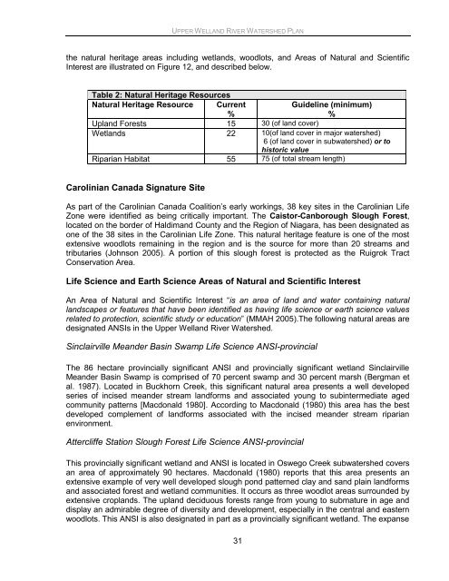
UPPER WELLAND RIVER WATERSHED PLANthe natural heritage areas including wetlands, woodlots, and Areas of Natural and ScientificInterest are illustrated on Figure 12, and described below.Table 2: Natural Heritage ResourcesNatural Heritage Resource Current%Guideline (minimum)%Upland Forests 15 30 (of land cover)Wetlands 22 10(of land cover in major watershed)6 (of land cover in subwatershed) or tohistoric valueRiparian Habitat 55 75 (of total stream length)Carolinian Canada Signature SiteAs part of the Carolinian Canada Coalition‟s early workings, 38 key sites in the Carolinian LifeZone were identified as being critically important. The Caistor-Canborough Slough Forest,located on the border of Haldimand County and the Region of <strong>Niagara</strong>, has been designated asone of the 38 sites in the Carolinian Life Zone. This natural heritage feature is one of the mostextensive woodlots remaining in the region and is the source for more than 20 streams andtributaries (Johnson 2005). A portion of this slough forest is protected as the Ruigrok TractConservation Area.Life Science and Earth Science Areas of Natural and Scientific InterestAn Area of Natural and Scientific Interest “is an area of land and water containing naturallandscapes or features that have been identified as having life science or earth science valuesrelated to protection, scientific study or education” (MMAH 2005).The following natural areas aredesignated ANSIs in the <strong>Upper</strong> <strong>Welland</strong> <strong>River</strong> <strong>Watershed</strong>.Sinclairville Meander Basin Swamp Life Science ANSI-provincialThe 86 hectare provincially significant ANSI and provincially significant wetland SinclairvilleMeander Basin Swamp is comprised of 70 percent swamp and 30 percent marsh (Bergman etal. 1987). Located in Buckhorn Creek, this significant natural area presents a well developedseries of incised meander stream landforms and associated young to subintermediate agedcommunity patterns [Macdonald 1980]. According to Macdonald (1980) this area has the bestdeveloped complement of landforms associated with the incised meander stream riparianenvironment.Attercliffe Station Slough Forest Life Science ANSI-provincialThis provincially significant wetland and ANSI is located in Oswego Creek subwatershed coversan area of approximately 90 hectares. Macdonald (1980) reports that this area presents anextensive example of very well developed slough pond patterned clay and sand plain landformsand associated forest and wetland communities. It occurs as three woodlot areas surrounded byextensive croplands. The upland deciduous forests range from young to submature in age anddisplay an admirable degree of diversity and development, especially in the central and easternwoodlots. This ANSI is also designated in part as a provincially significant wetland. The expanse31


