

Phase 1 Heritage Impact Assessment Report - SAHRA
Phase 1 Heritage Impact Assessment Report - SAHRA
Phase 1 Heritage Impact Assessment Report - SAHRA

You also want an ePaper? Increase the reach of your titles
YUMPU automatically turns print PDFs into web optimized ePapers that Google loves.
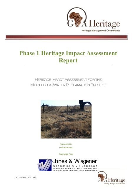
<strong>Phase</strong> 1 <strong>Heritage</strong> <strong>Impact</strong> <strong>Assessment</strong><strong>Report</strong><strong>Heritage</strong> <strong>Impact</strong> <strong>Assessment</strong> for theMiddelburg Water Reclamation ProjectPrepared By:G&A <strong>Heritage</strong>Prepared For:Jones & W agenerC o n s u l t i n g C i v i l E n g i n e e r s59 Bevan Road PO Box 1434 Rivonia 2128 South AfricaTel: 00 27 (0)11 519 0200 Fax: 00 27 (0)11 519 0201 email: post@jaws.co.zaMiddelburg Water Reclamation Projecti
23/06/2011CREDIT SHEETProject DirectorSTEPHAN GAIGHER (BA Hons, Archaeology, UP)Principal Investigator for G&A <strong>Heritage</strong>Member of ASAPA (Site Director Status)<strong>SAHRA</strong> Accredited <strong>Heritage</strong> PractitionerTel.: (015) 516 1561Cell.: 073 752 6583E-mail: stephan@lajuma.comWebsite: http://gaheritage.yolasite.com/<strong>Report</strong> AuthorSTEPHAN GAIGHERDisclaimer; Although all possible care is taken to identify all sites of cultural importance during the investigation ofstudy areas, it is always possible that hidden or sub-surface sites could be overlooked during the study. G&A<strong>Heritage</strong> and its personnel will not be held liable for such oversights or for costs incurred as a result of suchoversights.SIGNED OFF BY: STEPHAN GAIGHERMiddelburg Water Reclamation Projectii
23/06/2011MANAGEMENT SUMMARYSite name and location: Middelburg Water Reclamation Project, Middelburg Mpumalanga.Municipal Area: Steve Tshwete Local Municipality.Developer: Douglas Tavistock Joint Venture.Consultant: G&A <strong>Heritage</strong>, PO Box 522, Louis Trichardt, 0920, South Africa. 38A Voster Str. LouisTrichardt, 0920Date of <strong>Report</strong>: 23 June 2011The purpose of the management summary is to distil the information contained in the report into a formatthat can be used to give specific results quickly and facilitate management decisions. It is not the purposeof the management summary to repeat in shortened format all the information contained in the report, butrather to give a statement of results for decision making purposes.This study focuses on a single amendment to the untreated mine water pipeline associated with theMiddelburg Water Reclamation Project. Previous heritage investigations were performed by Cultmatrix ccon the original alignment of the pipeline. The occurrence of a sensitive wetland has however resulted in arealignment of one section of this pipeline. This study reports on the cultural sensitivity of the newalignment.A preliminary alignment has been drawn to lead the study; however this could be altered to some extentto avoid any identified heritage sites.The area is a possible repository for fossil materials as was indicated in the original report by Dr. de Jong.The information supplied by Roger Price, Council for Geoscience, is still applicable and it was foundunnecessary to duplicate the paleontological study here.The purpose of this heritage impact assessment is to outline the cultural heritage sensitivity of theproposed development area and to advise on mitigation should any heritage sites or landscapes beaffected.FindingsA small family graveyard was identified within the cow pasture close to the present alignment of thepipeline. The site contained five dressed graves.The remains of some type of built structure were identified close to the graveyard. This was toodilapidated to be identifiable. It is very possible that the structure is associated with the graves.Several stone heaps could be seen throughout the pastures. These are the result of field clearing andhave no cultural valueNo culturally sensitive landscape types could be identified within any of the study areas.RecommendationsIt is recommended that the structural remains and the graveyard be avoided by the construction. A safetyzone of 50m should be adhered to.Fatal FlawsMiddelburg Water Reclamation Projectiii
23/06/2011TABLE OF CONTENTSIntroduction .......................................................................................................... 1Background Information ..................................................................................... 3Proposed Middelburg Water Reclamation Project ............................................ 3Project Description .............................................................................................. 3Site Location ........................................................................................................ 3Alternatives Considered...................................................................................... 3Methodology........................................................................................................ 4Evaluating <strong>Heritage</strong> <strong>Impact</strong>s .............................................................................. 4Assessing Visual <strong>Impact</strong> ..................................................................................... 4Assumptions and Restrictions ............................................................................ 4Regional Cultural Context .................................................................................. 5Paleontology ........................................................................................................ 5Stone Age ............................................................................................................ 5Iron Age ............................................................................................................... 5The Historic Era................................................................................................... 6Cultural Landscape ............................................................................................. 8<strong>Assessment</strong> of <strong>Impact</strong>s .................................................................................... 11Activities that will affect the heritage environment ........................................... 11Post-Contact <strong>Heritage</strong> ...................................................................................... 11<strong>Impact</strong> Statement .............................................................................................. 11Paleontological sites ......................................................................................... 11Archeological Sites............................................................................................ 11Built Environment .............................................................................................. 12Cultural Landscape ........................................................................................... 13<strong>Impact</strong> <strong>Assessment</strong> Matrix ............................................................................... 15Resource Management Recommendations ................................................... 15Middelburg Water Reclamation Projectv
23/06/2011A considerable number of Late Iron Age, stone walled sites, dating from the 18 th and the 19 th centuries(some of which may have been occupied as early as the 16 th century), occur along and on top of therocky ridges of the eastern part of the Klipriviersberg towards Alberton. These settlements and features inthese sites, such as huts, were built with dry stone, reed and clay available from the mountain and theKlip River (Mason 1968, 1986).Stone walled settlements are concentrated in clusters of sites and sometimes are dispersed over largeareas making them vulnerable to developments of various kinds. A site consists of a circular or ellipticalouter wall that is composed of a number of scalloped walls facing inwards towards one or moreenclosures. Whilst the outer scalloped walls served as dwelling quarters for various family groups, cattle,sheep and goat were stock in the centrally located enclosures. Huts with clay walls and floors were builtinside the dwelling units. Pottery and metal items are common on the sites. However, iron and copperwere not produced locally on these sites.The Historic EraThis area is well known for its rich historic character and contains sites connected with several historicmilitary and political conflicts. Historic cemeteries (victim of conflict sites), provincial and privatemuseums, battlefield sites and other historic sites are found here.Middelburg Water Reclamation Project 6
23/06/2011Figure 1: The 1892 property act survey for the farm Goedehoop 315 JS.Middelburg Water Reclamation Project 7
23/06/2011Cultural LandscapeThe main cultural landscape type associated with this area is one of heavy industrial and mining activitiescombined with agricultural activities and power generation. The mine dumps visible from the site adds tothe atmosphere of mining and exploration. This cultural identity has grown to such an extent that itovershadows any previous cultural identity that the area might have had in the past.The cultural landscape for this area is also richly associated with the colonial period as well as its violentpast. A unique stone architectural heritage was established in the Eastern Highveld from the second halfof the 19th century well into the early 20th century. During this time period stone was used to buildfarmsteads and dwellings, both in urban and in rural areas. Although a contemporary stone architecturealso existed in the Karoo and in the Eastern Free State Province of South Africa a wider variety of stonetypes were used in the Eastern Highveld. These included sandstone, ferricrete (.ouklip.), dolerite(.blouklip.), granite, shale and slate.The origins of a vernacular stone architecture in the Eastern Highveld may be ascribed to various reasonsof which the ecological characteristics of the region may be the most important. Whilst this region isgenerally devoid of any natural trees which could be used as timber in the construction of farmsteads,outbuildings, cattle enclosures and other structures, the scarcity of fire wood also prevented themanufacture of baked clay bricks. Consequently stone served as the most important building material inthe Eastern Highveld.Figure 2: Photo indicating landscape typeMiddelburg Water Reclamation Project 8
Chapter3<strong>Impact</strong> <strong>Assessment</strong>Measuring and Evaluating the CulturalSensitivity of the Study AreaIn 2003 the <strong>SAHRA</strong> compiled the following guidelines to evaluate the cultural significance of individualheritage resources:TYPE OF RESOURCE- Place- Archaeological Site- Structure- Grave- Paleontological Feature- Geological FeatureTYPE OF SIGNIFICANCE1. HISTORIC VALUEIt is important in the community, or pattern of historyo Important in the evolution of cultural landscapes and settlement patternso Important in exhibiting density, richness or diversity of cultural features illustrating thehuman occupation and evolution of the nation, province, region or locality.o Important for association with events, developments or cultural phases that have had asignificant role in the human occupation and evolution of the nation, province, region orcommunity.o Important as an example for technical, creative, design or artistic excellence, innovationor achievement in a particular period.It has strong or special association with the life or work of a person, group or organisation ofimportance in historyo Importance for close associations with individuals, groups or organisations whose life,works or activities have been significant within the history of the nation, province, regionor community.It has significance relating to the history of slaveryo Importance for a direct link to the history of slavery in South Africa.2. AESTHETIC VALUEIt is important in exhibiting particular aesthetic characteristics valued by a community or culturalgroup.o Important to a community for aesthetic characteristics held in high esteem or otherwisevalued by the community.oooImportance for its creative, design or artistic excellence, innovation or achievement.Importance for its contribution to the aesthetic values of the setting demonstrated by alandmark quality or having impact on important vistas or otherwise contributing to theidentified aesthetic qualities of the cultural environs or the natural landscape within whichit is located.In the case of an historic precinct, importance for the aesthetic character created by theindividual components which collectively form a significant streetscape, townscape orcultural environment.3. SCIENTIFIC VALUEIt has potential to yield information that will contribute to anunderstanding of natural or cultural heritageMiddelburg Water Reclamation Project9
23/06/2011<strong>Assessment</strong> of <strong>Impact</strong>sActivities that will affect the heritage environmentPost-Contact <strong>Heritage</strong>Nature of <strong>Impact</strong>s: The development of the pipeline could negatively affect the graveyard site located atMWR 003 through trenching activities. The structural foundation remains found here could also benegatively affected by trenching and road building activities.Extent of <strong>Impact</strong>s: Localised damage to the site (see <strong>Impact</strong> Statement section for application).Nature of <strong>Impact</strong>: Possible post-contact site could be damaged locally by excavation activitiesWithout MitigationWith MitigationExtent Local LocalDuration Long term Long termMagnitude High LowProbability Probable ImprobableSignificance High HighStatus Negative PositiveReversibility Irreversible IrreversibleIrreplaceable loss of resource Yes NoCan impacts be mitigated No YesMitigationAlter alignment of pipeline to avoid graveyardCumulative impactsNoneResidual impactsLocal negativity towards mining activities<strong>Impact</strong> StatementPaleontological sitesNo paleontological sites of high value could be identified. Paleontological sites could be affected ifbedrock was to be disturbed during the trenching activities.MitigationPaleontological monitoring during excavation activities where bedrock is to be disturbed.Archeological SitesOne site of archaeological importance was identified in the study area. This is a small graveyard with atleast five graves. There are some associated structural foundations next to the graveyard that couldpossibly have been the farmstead. This site has a high, local significance.Figure 3: Graveyard at Site MWR 003Middelburg Water Reclamation Project 11
23/06/2011MitigationIt is recommended that the pipeline route be realigned to avoid the grave site and associated structuralruins. A safety buffer of 50 meters from the edge of the site is recommended.Built EnvironmentSome modern structures associated with farming were identified on the property adjacent to the sitethese include;- Brick shed with corrugated roof (modern)- Brick outbuildings (modern)- Metal chicken runs (modern)- Barb-wire fences (modern)- Concrete watering troughs (modern)- Concrete reservoirs (modern)- Dirt roads (modern)- FootpathsFigure 4: Dirt roads on siteFigure 5: Shed, outbuildings and fencesMiddelburg Water Reclamation Project 12
23/06/2011Figure 6: Watering troughsMitigationNone of the structures with the exception of the roads and fences will be affected by the trenchingactivities. It is recommended that the fences and roads be rehabilitated after construction of the pipeline.Cultural LandscapeThe following landscape types were identified during the study.Landscape Type Description Occurrencestillpossible?1 Paleontological Mostly fossil remains. Remains include microbial Yes, sub-fossils such as found in Baberton Greenstones2 Archaeological Evidence of human occupation associated with thefollowing phases – Early-, Middle-, Late Stone Age,Early-, Late Iron Age, Pre-Contact Sites, Post-ContactSites3 Historic BuiltEnvironment4 HistoricFarmland5 Historic ruraltown6 Pristine naturallandscape- Historical townscapes/streetscapes- Historical structures; i.e. older than 60 years- Formal public spaces- Formally declared urban conservation areas- Places associated with socialidentity/displacementThese possess distinctive patterns of settlement andhistorical features such as:- Historical farm yards- Historical farm workers villages/settlements- Irrigation furrows- Tree alignments and groupings- Historical routes and pathways- Distinctive types of planting- Distinctive architecture of cultivation e.g.planting blocks, trellising, terracing,ornamental planting.- Historic mission settlements- Historic townscapes- Historical patterns of access to a naturalamenity- Formally proclaimed nature reservessurfaceYes, subsurfaceNoYesNoNoIdentifiedon site?NoNoNoYes,reservoirs,furrows,pathwaysand farmyard.NoNoMiddelburg Water Reclamation Project 13
23/06/20117 RelicLandscape8 Burial groundsand grave sites9 AssociatedLandscapes10 HistoricalFarmyard11 Historicinstitutions- Evidence of pre-colonial occupation- Scenic resources, e.g. view corridors, viewingsites, visual edges, visual linkages- Historical structures/settlements older than 60years- Pre-colonial or historical burial sites- Geological sites of cultural significance.- Past farming settlements- Past industrial sites- Places of isolation related to attitudes tomedical treatment- Battle sites- Sites of displacement,- Pre-colonial burials (marked or unmarked,known or unknown)- Historical graves (marked or unmarked, knownor unknown)- Graves of victims of conflict- Human remains (older than 100 years)- Associated burial goods (older than 100 years)- Burial architecture (older than 60 years)- Sites associated with living heritage e.g.initiation sites, harvesting of natural resourcesfor traditional medicinal purposes- Sites associated with displacement &contestation- Sites of political conflict/struggle- Sites associated with an historic event/person- Sites associated with public memory- Setting of the yard and its context- Composition of structures- Historical/architectural value of individualstructures- Tree alignments- Views to and from- Axial relationships- System of enclosure, e.g. defining walls- Systems of water reticulation and irrigation,e.g. furrows- Sites associated with slavery and farm labour- Colonial period archaeology- Historical prisons- Hospital sites- Historical school/reformatory sites- Military bases12 Scenic visual - Scenic routes No No13 AmenityNoNolandscape- View sheds- View points- Views to and from- Gateway conditions- Distinctive representative landscape conditions- Scenic corridorsYesYesNoNoNoYes,possiblestructuralremains atMWR 003Yes, fivemarkedgraves atsite MWR003NoNoNoMitigationIt is recommended that the development designs take into account the positive and negativecharacteristics of the existing cultural landscape type and that they endeavor to promote the positiveaspects while at the same time mitigating the negative aspects.Middelburg Water Reclamation Project 14
23/06/2011<strong>Impact</strong> <strong>Assessment</strong> MatrixNHRA Class Identification Significance Impac RecommendationsSite GPStBuildings and MWR 001 25° 53’ 21” S Low None Nonestructures29° 23’ 54” EMWR 002 25° 53’ 12” S Low None None29° 24’ 04” EGraves and BurialGroundsMWR 003 25° 53’ 04” S29° 24’ 16” EHigh Severe Alter pipeline routealignmentResource Management RecommendationsAlthough unlikely, sub-surface remains of heritage sites could still be encountered during the constructionactivities associated with the project. Such sites would offer no surface indication of their presence due tothe high state of alterations in some areas as well as heavy plant cover in other areas. The followingindicators of unmarked sub-surface sites could be encountered:Ash deposits (unnaturally grey appearance of soil compared to the surrounding substrate);Bone concentrations, either animal or human;Ceramic fragments such as pottery shards either historic or pre-contact;Stone concentrations of any formal nature.The following recommendations are given should any sub-surface remains of heritage sites beidentified as indicated above:All operators of excavation equipment should be made aware of the possibility of the occurrenceof sub-surface heritage features and the following procedures should they be encountered.All construction in the immediate vicinity (50m radius of the site) should cease.The heritage practitioner should be informed as soon as possible.In the event of obvious human remains the South African Police Services (SAPS) should benotified.Mitigation measures (such as refilling etc.) should not be attempted.The area in a 50m radius of the find should be cordoned off with hazard tape.Public access should be limited.The area should be placed under guard.No media statements should be released until such time as the heritage practitioner has hadsufficient time to analyze the finds.ConclusionThe area investigated shows numerous signs of human occupation and especially agricultural activities.With the exception of the small graveyard and associated ruins, none of these structures have anycultural heritage significance at this stage. Provided the pipeline route can be deviated to skirt this sitewith at least a 50m safety buffer, no further mitigation is needed at this site. It is recommended thatshould bedrock be affected during trenching activities that a palaeontologist be appointed to monitor theconstruction activities.Middelburg Water Reclamation Project 15
23/06/2011Chapter3Site Register<strong>Heritage</strong> sites Identified within the Study AreaSite MWR 001GPS Coordinates25° 53’ 21” S29° 23’ 54” EA concrete watering trough of recent origin is located here. The trough is still in use and functional.Site MWR 002GPS Coordinates25° 53’ 12” S29° 24’ 04” EAt this site a large modern barn and associated outbuildings is located. All the structures are of a modernnature and building design.Modern structures at MWR 002Middelburg Water Reclamation Project 16
23/06/2011Site MWR 003GPS Coordinates25° 53’ 04” S29° 24’ 16” EGraveyard with five graves located at MWR 003Middelburg Water Reclamation Project 17
23/06/2011Possible structural remains at MWR 003A small graveyard is located at this site. It contains at least five marked graves. Some of the graves aremarked and dates of 1965, 1958 and 1977 could be discerned. The graves seem to be of western origin.The site also contains several earthen mounds that could possibly be the remains of a farmsteadassociated with the graves.Middelburg Water Reclamation Project 18
23/06/2011References Cited- Arts and Culture Task Group, (1995), Draft report for the Ministry of Arts, Culture, Science andTechnology. Pretoria: ACTAG.- Bewsher, P K, & De Jong, R C, (1997), Ecotourism and cultural resource management. Documentprepared for the SA Wildlife College. Pretoria: Centre for Ecotourism.- Canadian Parks Service, (1989). Proposed policy.- Cultural Institutions Act, No 119 of 1998.- De Jong, R.C., (1992). Draft policy guidelines for cultural resource management in natureconservation and forestry areas in South Africa. Pretoria: National Cultural History Museum(unpublished)- De Jong, R.C., (2011). <strong>Heritage</strong> <strong>Impact</strong> <strong>Assessment</strong> Revision 2 in Connection with Amendmentsto the Middelburg Water Reclamation Project, Steve Tswete Local Municipality, Mpumalanga.Unpublished HIA report.- Department of Arts, Culture, Science and Technology, (1996). White Paper on Arts, Culture and<strong>Heritage</strong>. Pretoria: SA Communication Service.- DEAT, (1996). White Paper on the Development and Promotion of Tourism in South Africa.Pretoria: The Department.- DEAT, (1998). A national strategy for Integrated Environmental Management in South Africa.Discussion document. Pretoria: The Department.- DEAT, (1998). White Paper on environmental management policy for South Africa. GovernmentGazette, Vol 395, No 18894, 15 May 1998.- Department of Public Works, (1998), White Paper 1997. Public Works towards the 21 st century.Government Gazette, Vol 391, No 18616, 14 January 1998.- Entries on towns in the Standard Encyclopedia of Southern Africa, published by Nasou, 1970-1976 (11 volumes).- Eskom <strong>Heritage</strong> website- Files in Gauteng Office of <strong>SAHRA</strong>, Northwards, Parktown, Johannesburg- Galla, A, (1996), Shifting the paradigm. A plan to diversify heritage practice in South Africa. CapeTown: South African Museums Association.- Gauteng Department of Economic Affairs and Finance, (1997). Gauteng Tourism White Paper.Johannesburg: The Department.- Hall, C.M, & McArthur, S. (eds), (1996). <strong>Heritage</strong> management in Australia and New Zealand.Draft publication.- Harrison, R, (1994). Manual of heritage management. Oxford: Butterworth Heinemann.- Jote, K, (1994). International legal protection of cultural heritage. Stockholm: Juristförlaget.- Mason, R. (1986). Origins of Black People of Johannesburg and the Southern Western CentralTransvaal AD350-1880. Occasional Paper No. 16 of the Archaeological Research Unit.- Musa, (1994). Museums for South Africa: Intersectoral investigation for national policy. Pretoria:MUSA Secretariat.- National <strong>Heritage</strong> Council Act, No 11 of 1999.- National <strong>Heritage</strong> Resources Act, No 25 of 1999.Middelburg Water Reclamation Project 19
23/06/2011- National Research Foundation, Nexus database of current and completed research projects- Republic of South Africa, (1996). Constitution of the Republic of South Africa, Act 108 of 1996.Government Gazette, Vol 378, No 17678, 18 December 1996.- Ross, M. (1996). Planning and the heritage. Policy and procedures. Second edition. London:E&FN Spon.- <strong>SAHRA</strong> website http://www.sahra.org.za- UNESCO, (1983). Conventions and recommendations concerning the protection of the culturalheritage. Paris: UNESCO.- US National Parks Service, (1988). Management Policies.Middelburg Water Reclamation Project 20
23/06/2011APPENDIX AGeneral MethodologyMiddelburg Water Reclamation Project 21
23/06/2011MethodologyInventoryInventory studies involve the in-field survey and recording of archaeological resources within a proposeddevelopment area. The nature and scope of this type of study is defined primarily by the results of theoverview study. In the case of site-specific developments, direct implementation of an inventory studymay preclude the need for an overview.There are a number of different methodological approaches to conducting inventory studies. Therefore,the proponent, in collaboration with the archaeological consultant, must develop an inventory plan forreview and approval by the <strong>SAHRA</strong> prior to implementation (Dincause, Dena F., H. Martin Wobst, RobertJ. Hasenstab and David M. Lacy 1984).Site SurveyingSite surveying is the process by which archaeological sites are located and identified on the ground.Archaeological site surveys often involve both surface inspection and subsurface testing. For thepurposes of heritage investigations, archaeological sites refer to any site with heritage potential (i.e.historic sites, cultural sites, rock art sites etc.).A systematic surface inspection involves a foot traverse along pre-defined linear transects which arespaced at systematic intervals across the survey area. This approach is designed to achieverepresentative area coverage. Alternatively, an archaeological site survey may involve a non-systematicor random walk across the survey area. Subsurface testing is an integral part of archaeological sitesurvey. The purpose of subsurface testing, commonly called "shovel testing", is to:(a) assist in the location of archaeological sites which are buried or obscured from the surveyor's view,and(b) help determine the horizontal and vertical dimensions and internal structure of a site.In this respect, subsurface testing should not be confused with evaluative testing, which is a considerablymore intensive method of assessing site significance (King, Thomas F., 1978).Once a site is located, subsurface testing is conducted to record horizontal extent, depth of the culturalmatrix, and degree of internal stratification. Because subsurface testing, like any form of site excavation,is destructive it should be conducted only when necessary and in moderation.Subsurface testing is usually accomplished by shovel, although augers and core samplers are also usedwhere conditions are suitable. Shovel test units averaging 40 square cm are generally appropriate, andare excavated to a sterile stratum (i.e. C Horizon, alluvial till, etc.).Depending on the site survey strategy, subsurface testing is conducted systematically or randomly acrossthe survey area. Other considerations such as test unit location, frequency, depth and interval spacing willalso depend on the survey design as well as various biophysical factors. (Lightfoot, Keng G. 1989).Survey SamplingSite survey involves the complete or partial inspection of a proposed project area for the purpose oflocating archaeological or other heritage sites. Since there are many possible approaches to field survey,it is important to consider the biophysical conditions and archaeological site potential of the survey area indesigning the survey strategy.Ideally, the archaeological site inventory should be based on intensive survey of every portion of theimpact area, as maximum area coverage will provide the most comprehensive understanding ofarchaeological and other heritage resource density and distribution. However, in many cases the size ofthe project area may render a complete survey impractical because of time and cost considerations.In some situations it may be practical to intensively survey only a sample of the entire project area.Sample selection is approached systematically, based on accepted statistical sampling procedures, orjudgementally, relying primarily on subjective criteria (Butler, W., 1984).Systematic Survey SamplingMiddelburg Water Reclamation Project 22
23/06/2011A systematic sample survey is designed to locate a representative sample of archaeological or heritageresources within the project area. A statistically valid sample will allow predictions to be made regardingtotal resource density, distribution and variability. In systematic sample surveys it may be necessary toexempt certain areas from intensive inspection owing to excessive slope, water bodies, landslides, landownership, land use or other factors. These areas must be explicitly defined. Areas characterized by anabsence of road access or dense vegetation should not be exempted. (Dunnel, R.C., Dancey W.S. 1983).Judgemental Survey SamplingUnder certain circumstances, it is appropriate to survey a sample of the project area based entirely onprofessional judgement regarding the location of sites. Only those areas which can reasonably beexpected to contain archaeological or heritage sites are surveyed.However, a sufficient understanding of the cultural and biophysical factors which influenced or accountedfor the distribution of these sites over the landscape is essential. Careful consideration must be given toethnographic patterns of settlement, land use and resource exploitation; the kinds and distribution ofaboriginal food sources; and restrictions on site location imposed by physical terrain, climatic regimes,soil chemistry or other factors. A judgemental sample survey is not desirable if statistically valid estimatesof total heritage resource density and variability are required (McManamon F.P. 1984).<strong>Assessment</strong><strong>Assessment</strong> studies are only required where conflicts have been identified between heritage resourcesand a proposed development. These studies require an evaluation of the heritage resource to beimpacted, as well as an assessment of project impacts. The purpose of the assessment is to providerecommendations as to the most appropriate manner in which the resource may be managed in light ofthe identified impacts. Management options may include alteration of proposed development plans toavoid resource impact, mitigative studies directed at retrieving resource values prior to impact, orcompensation for the unavoidable loss of resource values.It is especially important to utilize specialists at this stage of assessment. The evaluation of anyarchaeological resource should be performed by professionally qualified individuals.Site EvaluationTechniques utilized in evaluating the significance of a heritage site include systematic surface collectingand evaluative testing. Systematic surface collection is employed wherever archaeological remains areevident on the ground surface. However, where these sites contain buried deposits, some degree ofevaluative testing is also required.Systematic surface collection from archaeological sites should be limited, insofar as possible, to arepresentative sample of materials. Unless a site is exceptionally small and limited to the surface, noattempt should be made at this stage to collect all or even a major portion of the materials. Intensivesurface collecting should be reserved for full scale data recovery if mitigative studies are required.Site significance is determined following an analysis of the surface collected and/or excavated materials(Miller, C.L. II, 1989).Significance CriteriaThere are several kinds of significance, including scientific, public, ethnic, historic and economic, thatneed to be taken into account when evaluating heritage resources. For any site, explicit criteria are usedto measure these values. Checklists of criteria for evaluating pre-contact and post-contact archaeologicalsites are provided in Appendix B and Appendix C. These checklists are not intended to be exhaustive orinflexible. Innovative approaches to site evaluation which emphasize quantitative analysis and objectivityare encouraged. The process used to derive a measure of relative site significance must be rigorouslydocumented, particularly the system for ranking or weighting various evaluated criteria.Site integrity, or the degree to which a heritage site has been impaired or disturbed as a result of pastland alteration, is an important consideration in evaluating site significance. In this regard, it is importantto recognize that although an archaeological site has been disturbed, it maystill contain important scientific information.Middelburg Water Reclamation Project 23
23/06/2011<strong>Heritage</strong> resources may be of scientific value in two respects. The potential to yield information which, ifproperly recovered, will enhance understanding of Southern African human history is one appropriatemeasure of scientific significance. In this respect, archaeological sites should be evaluated in terms oftheir potential to resolve current archaeological research problems. Scientific significance also refers tothe potential for relevant contributions to other academic disciplines or to industry.Public significance refers to the potential a site has for enhancing the public's understanding andappreciation of the past. The interpretive, educational and recreational potential of a site are validindications of public value. Public significance criteria such as ease of access, land ownership, or scenicsetting are often external to the site itself. The relevance of heritage resource data to private industry mayalso be interpreted as a particular kind of public significance.Ethnic significance applies to heritage sites which have value to an ethnically distinct community or groupof people. Determining the ethnic significance of an archaeological site may require consultation withpersons having special knowledge of a particular site. It is essential that ethnic significance be assessedby someone properly trained in obtaining and evaluating such data.Historic archaeological sites may relate to individuals or events that made an important, lastingcontribution to the development of a particular locality or the province. Historically important sites alsoreflect or commemorate the historic socioeconomic character of an area. Sites having high historicalvalue will also usually have high public value.The economic or monetary value of a heritage site, where calculable, is also an important indication ofsignificance. In some cases, it may be possible to project monetary benefits derived from the public's useof a heritage site as an educational or recreational facility. This may be accomplished by employingestablished economic evaluation methods; most of which have been developed for valuating outdoorrecreation. The objective is to determine the willingness of users, including local residents and tourists, topay for the experiences or services the site provides even though no payment is presently being made.Calculation of user benefits will normally require some study of the visitor population (Smith, L.D. 1977).Assessing <strong>Impact</strong>sA heritage resource impact may be broadly defined as the net change between the integrity of a heritagesite with and without the proposed development. This change may be either beneficial or adverse.Beneficial impacts occur wherever a proposed development actively protects, preserves or enhances aheritage resource. For example, development may have a beneficial effect by preventing or lesseningnatural site erosion. Similarly, an action may serve to preserve a site for future investigation by covering itwith a protective layer of fill. In other cases, the public or economic significance of an archaeological sitemay be enhanced by actions which facilitate non-destructive public use. Although beneficial impacts areunlikely to occur frequently, they should be included in the assessment.More commonly, the effects of a project on heritage sites are of an adverse nature. Adverse impactsoccur under conditions that include:(a) destruction or alteration of all or part of a heritage site;(b) isolation of a site from its natural setting; and(c) introduction of physical, chemical or visual elements that are out-of-character with the heritageresource and its setting.Adverse effects can be more specifically defined as direct or indirect impacts. Direct impacts are theimmediately demonstrable effects of a project which can be attributed to particular land modifying actions.They are directly caused by a project or its ancillary facilities and occur at the same time and place. Theimmediate consequences of a project action, such as slope failure following reservoir inundation, are alsoconsidered direct impacts.Indirect impacts result from activities other than actual project actions. Nevertheless, they are clearlyinduced by a project and would not occur without it. For example, project development may inducechanges in land use or population density, such as increased urban and recreational development, whichmay indirectly impact upon heritage sites. Increased vandalism of heritage sites, resulting from improvedor newly introduced access, is also considered an indirect impact. Indirect impacts are much more difficultto assess and quantify than impacts of a direct nature.Once all project related impacts are identified, it is necessary to determinetheir individual level-of-effect on heritage resources. This assessment isMiddelburg Water Reclamation Project 24
23/06/2011aimed at determining the extent or degree to which future opportunities for scientific research,preservation, or public appreciation are foreclosed or otherwise adversely affected by a proposed action.Therefore, the assessment provides a reasonable indication of the relative significance or importance of aparticular impact. Normally, the assessment should follow site evaluation since it is important to knowwhat heritage values may be adversely affected.The assessment should include careful consideration of the following level-of-effect indicators, which aredefined in Appendix D:magnitudeseveritydurationrangefrequencydiversitycumulative effectrate of changeThe level-of-effect assessment should be conducted and reported in a quantitative and objective fashion.The methodological approach, particularly the system of ranking level-of-effect indicators, must berigorously documented and recommendations should be made with respect to managing uncertainties inthe assessment. (Zubrow, Ezra B.A., 1984).The study area was surveyed using standard archaeological surveying methods. The area was surveyedusing directional parameters supplied by the GPS and surveyed by foot. This technique has proven toresult in the maximum coverage of an area. This action is defined as;‘an archaeologist being present in the course of the carrying-out of the development works (which mayinclude conservation works), so as to identify and protect archaeological deposits, features or objectswhich may be uncovered or otherwise affected by the works’ (DAHGI 1999a, 28).Standard archaeological documentation formats were employed in the description of sites. Usingstandard site documentation forms as comparable medium, it enabled the surveyors to evaluate therelative importance of sites found. Furthermore GPS (Global Positioning System) readings of all finds andsites were taken. This information was then plotted using a Garmin Colorado GPS (WGS 84- datum).Indicators such as surface finds, plant growth anomalies, local information and topography were used inidentifying sites of possible archaeological importance. Test probes were done at intervals to determinesub-surface occurrence of archaeological material. The importance of sites was assessed bycomparisons with published information as well as comparative collections.Test excavation is that form of archaeological excavation where the purpose is to establish the nature andextent of archaeological deposits and features present in a location which it is proposed to develop(though not normally to fully investigate those deposits or features) and allow an assessment to be madeof the archaeological impact of the proposed development. It may also be referred to as archaeologicaltesting’ (DAHGI 1999a, 27).‘Test excavation should not be confused with, or referred to as, archaeological assessment which is theoverall process of assessing the archaeological impact of development. Test excavation is one of thetechniques in carrying out archaeological assessment which may also include, as appropriate,documentary research, field walking, examination of upstanding or visible features or structures,examination of aerial photographs, satellite or other remote sensing imagery, geophysical survey, andtopographical assessment’ (DAHGI 1999b, 18).Middelburg Water Reclamation Project 25
23/06/2011Scientific Significance(a) Does the site contain evidence which may substantively enhance understanding of culture history,culture process, and other aspects of local and regional prehistory?internal stratification and depthchronologically sensitive cultural itemsmaterials for absolute datingassociation with ancient landformsquantity and variety of tool typedistinct intra-site activity areastool types indicative of specific socio-economic or religious activitycultural features such as burials, dwellings, hearths, etc.diagnostic faunal and floral remainsexotic cultural items and materialsuniqueness or representativeness of the siteintegrity of the site(b) Does the site contain evidence which may be used for experimentation aimed at improvingarchaeological methods and techniques?monitoring impacts from artificial or natural agentssite preservation or conservation experimentsdata recovery experimentssampling experimentsintra-site spatial analysis(c) Does the site contain evidence which can make important contributions to paleoenvironmentalstudies?topographical, geomorphological contextdepositional characterdiagnostic faunal, floral data(d) Does the site contain evidence which can contribute to other scientific disciplines such as hydrology,geomorphology, pedology, meteorology, zoology, botany, forensic medicine, and environmental hazardsresearch, or to industry including forestry and commercial fisheries?Public Significance(a) Does the site have potential for public use in an interpretive, educational or recreational capacity?integrity of the sitetechnical and economic feasibility of restoration and development for public usevisibility of cultural features and their ability to be easily interpretedaccessibility to the publicopportunities for protection against vandalismMiddelburg Water Reclamation Project 26
23/06/2011representativeness and uniqueness of the siteaesthetics of the local settingproximity to established recreation areaspresent and potential land useland ownership and administrationlegal and jurisdictional statuslocal community attitude toward development(b) Does the site receive visitation or use by tourists, local residents or school groups?Ethnic Significance(a) Does the site presently have traditional, social or religious importance to a particular group orcommunity?ethnographic or ethno-historic referencedocumented local community recognition or, and concern for, the siteEconomic Significance(a) What value of user-benefits may be placed on the site?visitors' willingness-to-payvisitors' travel costsScientific Significance(a) Does the site contain evidence which may substantively enhance understanding of historic patterns ofsettlement and land use in a particular locality, regional or larger area?(b) Does the site contain evidence which can make important contributions to other scientific disciplinesor industry?Historic Significance(a) Is the site associated with the early exploration, settlement, land use, or other aspect of southernAfrica’s cultural development?(b) Is the site associated with the life or activities of a particular historic figure, group, organization, orinstitution that has made a significant contribution to, or impact on, the community, province or nation?(c) Is the site associated with a particular historic event whether cultural, economic, military, religious,social or political that has made a significant contribution to, or impact on, the community, province ornation?(d) Is the site associated with a traditional recurring event in the history of the community, province, ornation, such as an annual celebration?Public Significance(a) Does the site have potential for public use in an interpretive, educational or recreational capacity?visibility and accessibility to the publicability of the site to be easily interpretedMiddelburg Water Reclamation Project 27
23/06/2011opportunities for protection against vandalismeconomic and engineering feasibility of reconstruction, restoration and maintenancerepresentativeness and uniqueness of the siteproximity to established recreation areascompatibility with surrounding zoning regulations or land useland ownership and administrationlocal community attitude toward site preservation, development or destructionpresent use of site(b) Does the site receive visitation or use by tourists, local residents or school groups?Ethnic Significance(a) Does the site presently have traditional, social or religious importance to a particular group orcommunity?Economic Significance(a) What value of user-benefits may be placed on the site?visitors' willingness-to-payvisitors' travel costsIntegrity and Condition(a) Does the site occupy its original location?(b) Has the site undergone structural alterations? If so, to what degree has the site maintained its originalstructure?(c) Does the original site retain most of its original materials?(d) Has the site been disturbed by either natural or artificial means?Other(a) Is the site a commonly acknowledged landmark?(b) Does, or could, the site contribute to a sense of continuity or identity either alone or in conjunction withsimilar sites in the vicinity?(c) Is the site a good typical example of an early structure or device commonly used for a specific purposethroughout an area or period of time?(d) Is the site representative of a particular architectural style or pattern?Indicators of <strong>Impact</strong> SeverityMagnitudeThe amount of physical alteration or destruction which can be expected. The resultant loss of heritagevalue is measured either in amount or degree of disturbance.SeverityMiddelburg Water Reclamation Project 28
23/06/2011The irreversibility of an impact. Adverse impacts which result in a totally irreversible and irretrievable lossof heritage value are of the highest severity.DurationThe length of time an adverse impact persists. <strong>Impact</strong>s may have short-term or temporary effects, orconversely, more persistent, long-term effects on heritage sites.RangeThe spatial distribution, whether widespread or site-specific, of an adverse impact.FrequencyThe number of times an impact can be expected. For example, an adverse impact of variable magnitudeand severity may occur only once. An impact such as that resulting from cultivation may be of recurring oron-going nature.DiversityThe number of different kinds of project-related actions expected to affect a heritage site.Cumulative EffectA progressive alteration or destruction of a site owing to the repetitive nature of one or more impacts.Rate of ChangeThe rate at which an impact will effectively alter the integrity or physical condition of a heritage site.Although an important level-of-effect indicator, it is often difficult to estimate. Rate of change is normallyassessed during or following project construction.Middelburg Water Reclamation Project 29
23/06/2011APPENDIX BLocation MapsMiddelburg Water Reclamation Project 30
Location Map for the Middelburg Water Reclamation Project HIA1:50 000 Map Reference 2529CDStudy AreaMiddelburg Water Reclamation Project31
23/06/2011Original Pipeline Project with Alternative Alignments29 29 2929,•,•· ,· ,·," " Sc; ~ n u rlo 1 - 1• I I Scenario 1 _ ","'Iemew e ~" I Scen~ ri o 1 _ .o.!lemot"'. b• I I I Scan.riQ 1 _ " 'Iemlt"'. 0 lspeei l lill dl)• I. Scanario 1 _ A,'t.mat;,. d (SFec lall.l at-2)~ DI! c h a rg l Point - MW RP Op~on 1·,29 2929Middelburg Water Reclamation Project 32~<strong>Heritage</strong><strong>Heritage</strong> Management Consultants
23/06/2011Buffer Zone Applicable to <strong>Heritage</strong> Site MWR 003Buffer ZoneMiddelburg Water Reclamation Project 33
23/06/2011Proposed Current Alignment of the PipelineProposed Current Pipeline AlignmentMiddelburg Water Reclamation Project 34
23/06/2011Aerial Photograph Showing the Location of Site MWR 001Middelburg Water Reclamation Project 35~<strong>Heritage</strong><strong>Heritage</strong> Management Consultants
23/06/2011Aerial Photograph Showing the Location of Site MWR 002Middelburg Water Reclamation Project 36~<strong>Heritage</strong><strong>Heritage</strong> Management Consultants
23/06/2011Aerial Photograph Showing the Location of Site MWR 003Middelburg Water Reclamation Project 37~<strong>Heritage</strong><strong>Heritage</strong> Management Consultants
23/06/2011Aerial Photograph Showing the Proposed Exlusion Zone Around Site MWR 003Middelburg Water Reclamation Project 38~<strong>Heritage</strong><strong>Heritage</strong> Management Consultants


