Name : - School of Civil Engineering - USM
Name : - School of Civil Engineering - USM
Name : - School of Civil Engineering - USM
Create successful ePaper yourself
Turn your PDF publications into a flip-book with our unique Google optimized e-Paper software.
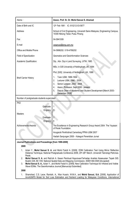
<strong>Name</strong> :Assoc. Pr<strong>of</strong>. Sr. Dr. Mohd Sanusi S. AhamadDate <strong>of</strong> Birth and IC 12 th Feb 1961 IC: 610212-03-5677Address<strong>School</strong> <strong>of</strong> <strong>Civil</strong> <strong>Engineering</strong>, Universiti Sains Malaysia, <strong>Engineering</strong> Campus,14300 Nibong Tebal, Pulau PinangFax 04-5941009E-mailcesanusi@eng.usm.myOffice and Mobile Phone 04-5996202 / 019-4766202Field <strong>of</strong> SpecilizationGeomatics and Geoinformation SciencesAcademic Qualification: Dip., Adv. Dip.in Land Surveying, UiTM, 1985MSc. in GIS University <strong>of</strong> Nottingham, UK, 1994Phd. [GIS] University <strong>of</strong> Nottingham, UK, 1998Brief Carrier History 1. Tutor <strong>USM</strong>, 1986-19942. Lecturer <strong>USM</strong>, 1998 – 2004Number <strong>of</strong> postgraduate students supervised3. Senior Lecturer, 2004 - 20064. Assoc. Pr<strong>of</strong>essor, Sept 2006 - present5. Deputy Dean <strong>of</strong> Academic and Student Development [March 2003-December 2009]PhDMastersAchievements/AwardsGraduate 1Ongoing 5Graduate 3Ongoing 6The Excellence in <strong>Engineering</strong> Research Group Award 2004. The Yayasan<strong>of</strong> Perak Foundation.Journal Publications and Proceedings [from 1999-2009]2009Anugerah Perkhidmat Cemerlang PPKA <strong>USM</strong> 2007Hadiah Sanjungan 2008 – Kategori Penerbitan Jurnal1. Azlan Y., Mohd Sanusi S. A. and Mohd Fadzil A. [2009]. EDM Calibration Test Using Mirror ReflectionDistance Technique. National Postgraduate Conference 2009, 25 th -26 th March. Universiti Teknologi Petronas.Perak.2. Mohd Sanusi S. A. and Rabi‟ah A. Kesan Pembuat KeputusanTerhadap Analisis Kesesuaian Tapak GIS.Buletin GIS, Bil 1/09. National Spatial Data and Mapping Commission, ISSN1394-5505 [Accepted]3. Mohd Sanusi S. A., Azlan Y., and Mohd Fadzil A. [2009]. New Calibration Technique for Infrared and VisibleWave EDMs. The Geoinformatica Journal [Manuscript Submitted]20081. Shamshad, C.S. Leow, Ramlah, A., Wan Hussin, W.M.A., and Mohd Sanusi, S.A. [2008]. Application <strong>of</strong>AnnAGNPS Model for Soil Loss Estimation and Nutrient Loading for Malaysian Conditions. International
Journal <strong>of</strong> Applied Earth Observation and Geoinformation. Volume 10, Issue 3 [Sept], pp239-252.2. Mohd Sanusi S.A., Rabiah A. [2008]. Improved Hierarchical Criterion Weighting For GIS-Multiple CriteriaSite Suitability Model. The 1st ASEAN <strong>Civil</strong> <strong>Engineering</strong> Conference: <strong>Civil</strong> <strong>Engineering</strong> Innovations forRegional Development, 3-5 December, Pataya, Thailand.3. Saeed M., Mohd Sanusi S.A., & Hamidi A. [2008] Geographic Information System (GIS) Components forDeriving Sanitary Landfill Site Weighting Criteria. International Conference on Environment (ICENV 08) 15-17December, Penang.20071. Shamshad A., Leow, C.S., Ramlah, A., Mohd Sanusi, S.A., Wan Hussin, W.M.A [2007]. AnnAGNPS asWatershed Non-point Source Pollution Assessment Tool in Malaysia. 7th International River <strong>Engineering</strong>Conference, Shahid Chamran University 13 - 15 Feb 2007 Iran.2. Mohd Sanusi S.A. and W.M.A. Wan Hussin and, [2007], Kajian Kesan Pembuat Keputusan Dalam AnalisisKesesuaian Tapak Bantuan GIS, Prosiding Kebangsaan Awam ‟07, Langkawi, Kedah 29-31 Mei 2007.3. W.M.A. Wan Hussin and Mohd Sanusi S.A, [2007], Engineers and Sunny Stress Management, ProsidingKebangsaan Awam ‟07, Langkawi, Kedah 29-31 Mei 20074. Fauziah A., Shabri L.D and Mohd Sanusi S. A. [2007] Landslide Hazard Zonation For Paya Terubung -Relau Slope Terrains In Penang Island. Proceeding <strong>of</strong> 28th Asian Conference on Remote Sensing (ACRS2007), 12-16 Nov 2007, Kuala Lumpur, Malaysia20061. Sinnakaudan, S.K., Ab. Ghani, A., Mohd Sanusi S.A., & Zakaria, N.A. [2006] Mutilple Linear RegressionModel for Total Bed Material Load Prediction. ASCE Journal <strong>of</strong> Hydraulic <strong>Engineering</strong> , Volume 132 No. 5ISSN 0733-94292. Shamshad A., Leow C. S., Wan Hussin W.M.A., Mohd. Sanusi S.A. (2006). Integrated modelling and GISapproach for surface water quality from non-point sources using AGNPS/AnnAGNPS: A review , Journal <strong>of</strong>Spatial Hydrology. [Submitted on June 22, 2006]3. Shamshad, W.M.A Wan Hussin, Mohd Sanusi S.A, & M.H. Isa [2006] Spatial and Temporal Distributions <strong>of</strong>Rainfall and EI30 Values in Pulau Pinang, Peninsular Malaysia. The Malaysia Surveyor, Vol 41.1 p.p18-23.The Pr<strong>of</strong>essional Journal <strong>of</strong> The Institution <strong>of</strong> Surveyors Malaysia, ISSN0127-49374. Mohd. Sanusi S.A., Shamshad A., Wan Hussin W.M.A.[2006] Layout Error Analysis By ComparingArchitectural Plan With “As Built Map‟ Derived From Satellite Image. International Symposium & Exhibition onGeoinformation ISG06, Shah Alam, 19-21 st Sept.5. Shamshad, M.T. Nizar Alwi, W.H. Wan Ibrahim, W.M.A Wan Hussin, Mohd Sanusi S.A.[2006] Road NetworkMapping and Speed Data Collection for Field Traffic Studies using GPS in Non-Differential Mode. TheMalaysia Surveyor, Vol 41.2 p.p15-20. The Pr<strong>of</strong>essional Journal <strong>of</strong> The Institution <strong>of</strong> Surveyors Malaysia,ISSN0127-49376. Mohd Nordin Adlan, Hamidi Abdul Aziz, Faridah A.H. Asaari, Kamar Shah Ariffin, Mohd Sanusi S. Ahamad,Hasmarini Muhammad and Ramlah Ahmad (2006), „A Study on Water Quality and Sludge Characteristics atHarapan Lake, Universiti Sains Malaysia‟, 2006 Asian-Pacific Regional Conference on PracticalEnvironmental Technologies, August 3, Manila, A1-A10.7. Shamshad A., Wan Hussin W.M.A., Mohd. Sanusi S.A.[2006]. Development Of GUI For Run<strong>of</strong>f EstimationBy SCS Curve Number Method Using MapObjects And Visual Basic. International Symposium & Exhibitionon Geoinformation ISG06, Shah Alam, 19-21 st Sept.8. Ramlah A., Shamshad A. and Mohd Sanusi S.A. [2006]. Effect <strong>of</strong> Pixel Sizes on Slope Length (LS) Factorfor Soil Erosion by RUSLE. International Symposium & Exhibition on Geoinformation, Shah Alam ISG06, 19-21 st Sept.9. Shamshad A., Seiong N.P, Azhari M.N.A, M.H. Isa, M. Sanusi S.A, Wan Hussin W.M.A, „Evaluation <strong>of</strong> therelationship between land use and surface water quality in Seberang Perai Selatan, Penang, Malaysia‟,International Conference on Environment (ICENV 2006), <strong>School</strong> <strong>of</strong> Chemical <strong>Engineering</strong>, <strong>Engineering</strong>Campus, Universiti Sains Malaysia, Nibong Tebal, Penang, Malaysia. (November, 2006).10. Ramlah A, Shamshad A and Mohd Sanusi S.A, Application <strong>of</strong> Annualized Agricultural Non-point Source(AnnAGNPS) Pollution Model to Study the Effect <strong>of</strong> Catchment Characteristics on River Water, Colloquium,Organised by <strong>School</strong> <strong>of</strong> <strong>Civil</strong> <strong>Engineering</strong>, <strong>USM</strong>, 2006.20051. Review <strong>of</strong> Rivers‟ 04 Proceedings <strong>of</strong> the 1st International Conference on Managing Rivers in the 21stCentury: Issues and Challenges. Journal Of Hydraulic <strong>Engineering</strong> © ASCE / November 2005 edited by A. AbGhani, N. A. Zakaria, R. Abdullah, and Mohd Sanusi S.A. REDAC, <strong>Engineering</strong> Campus, Universiti SainsMalaysia, Seri Ampangan, Penang, Malaysia, 2004, ISBN: 983-3067-08-5
2. Mohd Sanusi S. A and Ramlah A. [2005] GIS Smart Mapping Technique For Urban Spatial Pattern AnalysisA Case Study On Nibong Tebal Sub-District. International Symposium and Exhibition on Geoinformation 27-29 September, Batu Feringghi, Penang, Malaysia.3. Mohd. Sanusi S.A., Shamshad A., Wan Hussin W.M.A.[2006] The Sensitivity <strong>of</strong> AHP Weightings As Appliedin GIS/MCE Land Suitability Model. GIS Bulletin, Bil 1/06 p.p. 12-21. National Spatial Data and MappingCommission, ISSN1394-55054. S.R. Nejad, Mohd Sanusi S. A., and N. A. Ramli [2005]. Evaluating Air Quality Using Time SeriesTechnique and Elemental Analysis <strong>of</strong> SPM in Kerman, Iran. International Conference On Natural ResourcesAnd Environmental Management 2005, 28-30 Nov, Kuching, Sarawak.5. Shamshad, A., Megat Johari, M.A., Wan Hussin, W.M.A., Mohd. Sanusi, S.A., Majid, J.A., [2005] DigitalImage Analysis Of Cracks In Concrete Of Different Grades. The International Conference on ConcreteRepair, Rehabilitation and Retr<strong>of</strong>itting, 21–23 Nov. Cape Town, South Africa.6. Saeid Rezaei Nejad, Nor Azam Ramli and Mohd. Sanusi S. A. [2005]. Using GIS As Tool In Air PollutionStudy In Kerman Iran. International Symposium and Exhibition on Geoinformation 27-29 September, BatuFeringghi, Penang, Malaysia.7. Shamshad, M. N. Azhari, M.H. Isa, W.M.A Wan Hussin and Mohd Sanusi S.A. [2005]. Rainfall ErosivityMapping From Limited Pluviographic Data In A Part Of Peninsular Malaysia. International Symposium andExhibition on Geoinformation 27-29 September, Batu Feringghi, Penang, Malaysia.20041. Ahmad Shamshad, W.M.A., Wan Hussin, Mohd Sanusi S.A. [2004]. First and Second Order Markov ChainModels for Synthetic Generation <strong>of</strong> Wind Speed Time Series. ENERGY- The International Journal, ElsevierScience Vol 30 No.5 pp 693 [On line at www.sciencedirect.com]2. Shamshad Ahmad, Azinabiha Halip, Mohd Sanusi S.A., and W.M.A., Wan Hussin [2004]. Role <strong>of</strong>Geographic Information System (GIS) for Selecting The Residential Site-A case Study, Proceedings <strong>of</strong> ThirdGlobal Conference on Flexible Systems Management, 13-15 March, New Delhi.3. W.M.A., Wan Hussin Shamshad Ahmad, and Mohd Sanusi S.A [2004]. Stress Management and itsRelevance to the Performance <strong>of</strong> Site Engineers and Land Surveyors, Proceedings <strong>of</strong> Third GlobalConference on Flexible Systems Management, 13-15 March, New Delhi.4. Shamshad Ahmad, W.M.A., Wan Hussin and Mohd Sanusi S.A. [2004] Incineration Site Selection usingMulti-Criteria Evaluation in GIS: A case study in Penang Island Malaysia. International Conference on SpatialPlanning and Decision Support System 2004, 7-8 Sept, UIA Malaysia5. Shamshad Ahmad, W.M.A., Wan Hussin and Mohd Sanusi S.A. [2004] Comparison <strong>of</strong> Different Data FusionApproaches for Surface Feature Extraction using QuickBird Images. Geoinformatics for Spatial InfrastructureDevelopment in Earth and Sciences: GIS-IDEAS 2004, 16-18 Sept., Vietnam.6. Mohd Sanusi S.A., Ahmad Safuan M.G, W.M.A., Wan Hussin and Shamshad A. (2004) Integrated GIS-Based MCE/Fuzzy Approach to Site Selection <strong>of</strong> New LandFill. Proceedings, Third National <strong>Civil</strong> <strong>Engineering</strong>Conference –AWAM‟ 2004. Penang July 20-22.7. Shamshad A., Mohd Sanusi S.A.,and W.M.A., Wan Hussin and. (2004) Urban Feature Extraction UsingQuickBird High Resolution Satellite Image. Proceedings, Third National <strong>Civil</strong> <strong>Engineering</strong> Conference –AWAM‟ 2004. Penang July 20-22.8. Mohd Sanusi S.A., Wan Selama W.I., and Meor Othman H. (2004) GIS Application in Road ManagementSystem Monitoring for Local Authorithy. Proceedings, Third National <strong>Civil</strong> <strong>Engineering</strong> Conference –AWAM‟2004. Penang July 20-22.9. W.M.A. Wan Hussin, Mohd Sanusi S.A, Shamshad A. and S.A. Syed Zakaria (2004) Flying Engineers andthe Need to Cope with Jet Stress. Proceedings, Third National <strong>Civil</strong> <strong>Engineering</strong> Conference – AWAM‟ 2004.Penang July 20-22.20031. Sinnakaudan, S.K., Ab. Ghani, A., Mohd Sanusi S.A., & Zakaria, N.A. [2003]. Flood Risk Mapping for PariRiver Incorporating Sediment Transport. Journal <strong>of</strong> Environmental Modelling & S<strong>of</strong>tware, Elsevier Science.Vol 18, pp 119-130.2. Ahmad Shamshad, W.M.A., Wan Hussin, & Mohd Sanusi S.A. [2003]. First–order Markov Chain Approachfor Synthetic Generation <strong>of</strong> Wind Speed Time Series at Kuala Terengganu, Malaysia. South Asia RegionalConference on Transition Towards Sustainable Development, 10 –11 Febuary 2003, New Delhi, India.3. Ahmad Shamshad, W.M.A., Wan Hussin, Bawadi M.A.& Mohd Sanusi S.A. [2003]. Simulating Wind SpeedData by Stochastic Markov Chain Model. 2003 International Conference on Energy and The Environment,May 22-24, Shanghai, China.4. Mohd Sanusi S.A.,. W.M.A., Wan Hussin and Shamshad Ahmad [2003]. Comparison <strong>of</strong> Normal AHP andMulatiplicative AHP for Criterion Weighting in GIS Based Suitability Analysis. International Symposium and
Exhibition on Geoinformation 2003. Shah Alam, October 13-14.5. W.M.A., Wan Hussin, Mohd Sanusi S.A., and S. Akman S. Z., [2003]. Jet Stress and the Flying LandSurveyors. International Symposium and Exhibition on Geoinformation 2003. Shah Alam, October 13-14.6. Shamshad Ahmad, Bawadi M. A. and Mohd. Sanusi S. A., [2003] Modelling <strong>of</strong> Wind Speed Data atMersing for Forecasting: Box-Jenkins Approach, Proceedings <strong>of</strong> 2 nd Annual Seminar on SustainabilityScience and Management, Kuala Terengganu, Malaysia,.7. Shamshad Ahmad, Bawadi M. A. and Mohd. Sanusi S. A., [2003]. Stochastic Generation <strong>of</strong> Hourly WindSpeed Time Series, Proceedings <strong>of</strong> International Symposium & Exhibition In Renewable EnergyEnvironment Protection & Energy Solution For Sustainable Development, 14 - 17 September, Malaysia.8. Shamshad Ahmad, Mohd. Sanusi S. A., and Faridah A. H. Asaari; [2003]. The Need for Up-to-dateGeospatial Information in the Effective Management <strong>of</strong> Solid Waste, Proceedings <strong>of</strong> EnvironmentalManagement and Sustainable Development for better Future Growth,18-19 Feb , Penang, Malaysia.9. Shamshad Ahmad, Bawadi M. A. and Mohd. Sanusi S. A., [2003]. Analysis <strong>of</strong> wind speed variations andEstimation <strong>of</strong> Weibull Parameters for Wind Power Generation in Malaysia, Proceedings <strong>of</strong> The 2 ndDubrovnik Conference on Sustainable Development <strong>of</strong> Energy, Water and Environment Systems,Dubrovnik, Croatia,.10. Shamshad Ahmad, Bawadi M. A. and Mohd. Sanusi S. A., [2003]. Autoregressive Integrated MovingAverage Model (ARIMA) For Forecasting Wind Speed. Proceedings <strong>of</strong> the 3 rd International Conference onAdvances in Strategic Technologies (ICAST) Kuala Lumpur, August 12-14.20021. Sinnakaudan, S., Ab Ghani, A., Chang, C.K., Mohd Sanusi, S.A., & Zakaria, N, A. [2002]. IntegratedTriangular Irregular Network (ITIN) Model for Flood Risk Analysis. Case Study: Pari River, Ipoh, Malaysia.Thirteenth Asia and Pacific Division Congress <strong>of</strong> International Association <strong>of</strong> Hydraulic <strong>Engineering</strong> Researchon Hydraulic and Water Resource <strong>Engineering</strong> in early 21st Century. Singapore, August 6-8.2. Ahmad Shamshad, W.M.A., Wan Hussin, & Mohd Sanusi S.A. [2002]. A Holistic Approach Towards ClusterResearch in Solid Waste Management Using GPS and GIS. International Symposium and Exhibition onGeoinformation 2002. Kuala Lumpur, October 22-24.3. Mohd Sanusi S.A., & W.M.A., Wan Hussin. [2002]. Solving Region Contiguity and Compactness Problem inGIS Based Suitability Analysis. International Symposium and Exhibition on Geoinformation 2002. KualaLumpur, October 22-24.4. Sinnakaudan, S., Ab Ghani, A., Mohd Sanusi, S.A.,and Zakaria, N, A. (2002). Accurate Flood PlainDefinition for sustainable flood risk analysis. Proceedings, Second National <strong>Civil</strong> <strong>Engineering</strong> Conference –AWAM‟ 2001. Star Cruses Superstar Gemini – Penang-Phi-Phi Island- Phuket. 5-8 February.5. Mohd Sanusi, S.A., Ahmad Farhan, M.S., and Wan Aminuddin, W.H. (2002). Development <strong>of</strong> Geo-SpatialDatabase for Transportation Infrastructure. Proceedings, Second National <strong>Civil</strong> <strong>Engineering</strong> Conference –AWAM‟ 2001. Star Cruses Superstar Gemini – Penang-Phi-Phi Island- Phuket. 5-8 February.20011. Sinnakaudan, S., Ab Ghani, A., Mohd Sanusi, S.A., and Zakaria, N, A., Rozi, A., & Ismail, A. [2001] Design<strong>of</strong> Flood Risk Mapping, Global Practice and Issues. The MalaysiaGIS.com, 24 Jan 2001.http://www.malaysiagis.com/gis_in_malaysia/articles/index.cfm2. Sinnakaudan, S., Mohd Sanusi, S.A., and Mohamad, G. [2001] Development <strong>of</strong> GIS Aided Water UtilityManagement System,. The MalaysiaGIS.com, 12 Nov 2001http://www.malaysiagis.com/gis_in_malaysia/articles/index.cfm3. Sinnakaudan, S., Ab Ghani, A., Mohd Sanusi, S.A., and Zakaria, N, A. [2001] Accurate Flood PlainDefinition for sustainable flood risk analysis. The MalaysiaGIS.com, 12 Dec 2001.http://www.malaysiagis.com/gis_in_malaysia/articles/index.cfm4. Sinnakaudan, S, Ab Ghani, A, Mohd Sanusi, S.A., and Zakaria, N. (2001). Integrating GIS with Hydraulic andSediment Transport Model for Flood Risk Analysis. R & D Colloqium on River <strong>Engineering</strong> and UrbanDrainage, Universiti Sains Malaysia, Penang, 14-15 August5. Mohd Sanusi, S.A., Sinnakaudan, S., and Mohamad, G. (2001). Development Of Water Utility ManagementSystem Using Geographic Information System (GIS). Proceedings <strong>of</strong> 2001 Annual Seminar onGeoinformation, Penang,12 –13 Nov.6. Mohd Salleh, K, Mohd Sanusi S.A, and Wan Aminuddin, W.H., (2001). Study <strong>of</strong> the Land Use and LandCover Changes in Ipoh Using Remote Sensing Technique. Proceedings <strong>of</strong> 2001 Annual Seminar onGeoinformation <strong>Engineering</strong>, Penang, 12 –13 Nov.7. Abdullah, H., Wan Aminuddin, W.H., and Mohd Sanusi S.A., (2001). The Concept <strong>of</strong> Automatic Extraction <strong>of</strong>Building Height form Digital Surface Model (DSM) and Digital Elevation Model (DEM). Proceedings <strong>of</strong> 2001Annual Seminar on Geoinformation <strong>Engineering</strong>, Penang, 12 – 13 Nov.
8. Wan Aminuddin, W.H., Mohd Sanusi, S.A., and Nor Azazi, Z., (2001). Young Land Surveyor and The holisticApproach Towards Stress Management. Proceedings <strong>of</strong> 2001 Annual Seminar on Geoinformation<strong>Engineering</strong>, Penang, 12 – 13 Nov.9. Sinnakaudan, S., Ab Ghani, A, Mohd Sanusi, S.A., and Zakaria, N, A. (2001). Development Of AnEmbedded Hydraulic Model In Geographic Information Systems For Flood Risk Assessment. In Proceedings,MANCID Annual Conference - 9th MANCO. Cameron Highlands, Pahang, 12 –13 Nov.20001. Aminuddin, A. G., Shanker, K.S., Mohd Sanusi, S.A., Nor Azazi, Z., Rozi, A., and Ismail, A., (2000). Issuesand Practices in Flood Risk Mapping. National <strong>Civil</strong> <strong>Engineering</strong> Conference ‟99, <strong>USM</strong>, 24 –26 January.2. Mohd Salleh, K, Mohd Sanusi S. A, and Wan Aminuddin, W.H., (2000). Application <strong>of</strong> Time Series Analysis inthe Land Use and Land Cover Changes in Ipoh, 4 th Annual Seminar on Geoinformation <strong>Engineering</strong>, UPM, 6–7 Nov.3. Mohd Sanusi, S.A., and Wan Aminuddin, W.H., (2000). Optimal Decision Model for Spatial Land UseAllocation. 4 th Annual Seminar on Geoinformation <strong>Engineering</strong>, UPM, 6 –7 Nov.4. Abdullah, H., Wan Aminuddin, W.H., and Mohd Sanusi S.A., (2000), Automatic Extraction <strong>of</strong> BuildingStructures from Digital Surface Model. 4 th Annual Seminar on Geoinformation <strong>Engineering</strong>, UPM ,6 –7 Nov.5. Mohd Sanusi, S.A., and Hasania A.R., (2000). GIS based Multiple Criteria Evaluation for Site SuitabilityAnalysis. National <strong>Civil</strong> <strong>Engineering</strong> Conference ‟99, <strong>USM</strong>, 24 –26 January6. Azida, A., and Mohd Sanusi, S.A.,. (2000). Land Slides Risk Analysis Using GIS. National <strong>Civil</strong> <strong>Engineering</strong>Conference ‟99, <strong>USM</strong>, 24 –26 January7. Wan Aminuddin, W.H., and Mohd Sanusi, S.A., (2000). Geomatic Education and its Relation to the <strong>Civil</strong>Engineers in the New Millennium. National <strong>Civil</strong> <strong>Engineering</strong> Conference ‟99, <strong>USM</strong>, 24 –26 January8. Mohd Salleh, K, Mohd Sanusi S. A, and Wan Aminuddin, W.H., (2000). Application <strong>of</strong> Time Series Analysisin the Land Use and Land Cover Changes in Ipoh, 4 th Annual Seminar on Geoinformation <strong>Engineering</strong>, UPM,6 –7 Nov.9. Mohd Sanusi, S.A., and Wan Aminuddin, W.H., (2000). Optimal Decision Model for Spatial Land UseAllocation. 4 th Annual Seminar on Geoinformation <strong>Engineering</strong>, UPM, 6 –7 Nov.19991. Mohd Razip, S. and Mohd Sanusi, S.A., (1989). River Bank Stability Problems Associated With River SandMining. Advance Seminar on Economic Mineral Deposits, <strong>USM</strong>, 21 Jan.2. Mohd Sanusi, S.A., (1999). Multiple Criteria and Multiple Objective Decision Making Using GIS For LandSelection Process. Buletin Tahunan Institut Jurutera Malaysia Perak. PP 46-50.3. Mohd Sanusi, S.A., (1999). SMART weighting process for GIS based land suitability analysis. 3 rd AnnualSeminar on Geoinformation <strong>Engineering</strong> , ITM, Shah Alam, 17 –18 Nov.Assessor/ExaminerExternal Examiner For:-1. MSc. in Town and Regional Planning, 1999. Enhancement <strong>of</strong> GIS as a Decision Support for Town andRegional Planning Management, Faculty <strong>of</strong> Built Environment, University <strong>of</strong> Technology Malaysia (UTM),Skudai.2. MSc. in Land Survey, 2000, GIS Application in the Management <strong>of</strong> Mosque. Faculty <strong>of</strong> GeoinformationScience and <strong>Engineering</strong>, University <strong>of</strong> Technology Malaysia, (UTM) Skudai.3. MSc. in Geomatic <strong>Engineering</strong>, 2001. Redefinition <strong>of</strong> State and Parlimentary Electorate Boundaries using GISTechniques. Faculty <strong>of</strong> Geoinformation Science and <strong>Engineering</strong>, University <strong>of</strong> Technology Malaysia, (UTM)Skudai.4. MSc. in Geomatic <strong>Engineering</strong>, 2002. View Shade Analysis: The Study <strong>of</strong> the Uncertainty <strong>of</strong> the Visible Area.Faculty <strong>of</strong> Geoinformation Science and <strong>Engineering</strong>, University <strong>of</strong> Technology Malaysia, (UTM) Skudai.5. MSc. In Geomatic Science, 2004. Studying the Effect <strong>of</strong> Squaters towards the River Pollution in SungaiTebrau using GIS. Faculty <strong>of</strong> <strong>Engineering</strong> and Geomatic Science, University <strong>of</strong> Technology (UTM). SKudai.6. Msc. In Geomatic <strong>Engineering</strong>, 2005. Development <strong>of</strong> Tourist Travel Information System using GIS. Faculty<strong>of</strong> <strong>Engineering</strong> and Geomatic Science, University <strong>of</strong> Technology (UTM).7. MSc. June 2007. Developing Spatial Web Services to Interact Real Estate Users with GIS Technology.Faculty <strong>of</strong> Enigneering, Universiti Putra Malaysia.
8. MSc. July 2007. Pengujian Performance Aplikasi Sistem Maklumat Geografi Berasaskan Web: Kes kajianPengunaan Pelayan Peta MAPGUIDE. Faculty <strong>of</strong> <strong>Engineering</strong> and Geomatic Science, University <strong>of</strong>Technology (UTM).9. Msc. Feb. 2009. Digital Elevation Modelling <strong>of</strong> Slope Area by using Close Range Photogrammetric Data.Department <strong>of</strong> <strong>Civil</strong> <strong>Engineering</strong>, University Technology Petronas (UTP).Internal Examiner For:-1. MSc. in <strong>Civil</strong> <strong>Engineering</strong>, 2001. Prediction <strong>of</strong> Slope Stability Failure in Meru Heights, Perak Using GISTechnique. <strong>School</strong> Of <strong>Civil</strong> <strong>Engineering</strong>, <strong>USM</strong>.2. MSc. in <strong>Civil</strong> <strong>Engineering</strong>, 2002. The Optimal Path Analysis for Network Systems in the Intelligent TransportSystem. <strong>School</strong> Of <strong>Civil</strong> <strong>Engineering</strong>, <strong>USM</strong>.3. Phd. 2003. The Development <strong>of</strong> Spatial Land Value Model for Assessment <strong>of</strong> Property Tax. <strong>School</strong> <strong>of</strong>Humanities, <strong>USM</strong>.4. MSc. October 2003 Integrated Remote Sensing and GIS for Sustainable Development <strong>of</strong> Mining Land inKinta District, Perak.. <strong>School</strong> <strong>of</strong> Material and Mineral Resources <strong>Engineering</strong>. <strong>USM</strong>5. MSc. December 2003. Integrating Remote Sensing and Geographic Information System Techniques for LandUse Change Monitoring. <strong>School</strong> <strong>of</strong> Aerospace <strong>Engineering</strong>. <strong>USM</strong>6. Phd. May 2004. Integrated Assessment for Flood Management in Urban Area-Sungai Rambai CatchmentCase Study. <strong>School</strong> <strong>of</strong> <strong>Civil</strong> <strong>Engineering</strong>. <strong>USM</strong>7. Phd. Mac 2005. The Application <strong>of</strong> remote Sensing And GIS Techniques for Modelling Land Use Change andIts Effect on Soil Erosion in Ulu Kinta Catchment. <strong>School</strong> <strong>of</strong> Aerospace <strong>Engineering</strong>. <strong>USM</strong>8. Phd. Sept. 2005. Development <strong>of</strong> Slope Failure Spatial Model for Upper Sub-Basin <strong>of</strong> Langat River. <strong>School</strong> <strong>of</strong>Humanities, <strong>USM</strong>.9. Phd. July 2007. Aplikasi GIS dalam Pengurusan dan Pencegahan Penyakit Berjangkit di Kawasan Bandar:Satu kajian Kes Penyakit Deman Denggi dan Deman Denggi Berdarah di George Town, Pulau Pinang.<strong>School</strong> <strong>of</strong> Humanities, <strong>USM</strong>.Grant and Research ProjectProject leader Short title <strong>of</strong> project Status Amount Year completed1. Dr. Mohd Sanusi Formulating Optimisation Process ActiveRM50,000 2007-2009in Spatial Site Selection[FRGS]2. Dr. Mohd Sanusi GIS Campus Wide InformationSystem3. Dr. Mohd Sanusi GIS-Based Watershed[Co-researcher] Management System for Non PointSource Pollution Modelling4. Dr. Mohd Sanusi Development <strong>of</strong> Geo-SpatialDatabase for Intelligent TransportSystem for Ipoh Urban Areas.CompletedCompletedCompletedRM20,000[Short term]RM194,000[IRPA]RM20,000[Short term]200620032002Pr<strong>of</strong>essional/Academic Association1. Member <strong>of</strong> Surveying and Mapping Graduates Society, Malaysia (1989 - Present).2. Member <strong>of</strong> International Research Group on Geographic Information and Multiple Criteria Decision Analysis(GIMDA) (1997- Present)3. Member <strong>of</strong> National Committee <strong>of</strong> Geomatic Academicians (NCGA) (2001-Present)4. Member <strong>of</strong> the International Technical Committee for “Geographical Information Systems ISO/TC 211” SIRIMBerhad (2003 - Present)5. Member <strong>of</strong> the National Remote Sensing Committee (2003 - Present)6. Member <strong>of</strong> the University <strong>of</strong> Nottingham Alumni (1998 – Present)7. Full Member <strong>of</strong> The Institution <strong>of</strong> Surveyors, Malaysia MISM. (Sept. 2003- present)
8. <strong>USM</strong> Representative for Land Surveyor Section, National Board <strong>of</strong> Land Surveyor Malaysia (2003- Present)9. Steering Committee for International Symposium and Exhibition on Geoinformation (2004 - Present).10. Member <strong>of</strong> the GIS and Remote Sensing Research Cluster Group, <strong>USM</strong> (2004 - present).Intenational Experience1. Visiting Tutor, South Australia Institute <strong>of</strong> Technology and Olympic DAM Project. Sponsorship <strong>of</strong> AustraliaInternational Development Program (IDP), April 1989 (15 weeks).2. Visiting Tutor, Australia Remote Sensing Technology Centers. Sponsorship <strong>of</strong> Australia InternationalDevelopment Program (IDP), Feb 1993 (6 weeks).Consultancy1. Development <strong>of</strong> <strong>Civil</strong> <strong>Engineering</strong> Program and Curriculum for Universiti Teknologi Petronas, 1999(Geomatics Curriculum) (RM 320,000.00)2. Development <strong>of</strong> <strong>Civil</strong> <strong>Engineering</strong> Laboratory for Universiti Teknologi Petronas, 1999/2000 (GeomaticsLaboratory) (RM1.6 million)3. Feasibility Study and Detail Design <strong>of</strong> Flood Mitigation and Drainage Improvement in Valdor, SeberangPerai P. Pinang, (1/7/99 – 31/12/99). (RM220,969.00).4. Usage <strong>of</strong> Bio-Ecological Drainage System in Malaysia, (Sept 2000 – Feb. 2003). (RM886,151.76)5. Study On The Sediment Load From River Kinta Catchment and Its Implication on The Proposed SungaiKinta Dam (Proposal Submitted to Perak Water Board in August 2003). (RM230,00.00).6. Kajian Pengumpulan Data dan Analisis Endapan Sungai (Co-Member for REDAC. Final report submitted inOct. 2003)7. Investigation <strong>of</strong> the stability <strong>of</strong> the Clock Tower Building Teluk Intan, Perak for Perak Hilir District Council(1991 - 1992). (RM 10,000.00)8. Soil investigation for the siting <strong>of</strong> Electric Power Station (Phase I and Phase II), Yan, Kedah for TenagaNasional Berhad. (1992). (RM 10,000.00)9. Setting out Building and Topographic Survey <strong>of</strong> <strong>USM</strong> Archeological Research Center, Lenggong Perak.(2002/2003).10. Proposed Improvement On Water Quality for Lake <strong>of</strong> Desa Harapan <strong>USM</strong>. (2003 - Present).11. Slope Stability and Mitigation Study on Desa RST (Restu, Saujana dan Tekun) <strong>USM</strong> (2004 – Present)Academic Journal/ Article/Conference Assessor1. Editor, 1989. Surveying and Mapping Journal. Surveying and Mapping Graduates Society Malaysia.2. Editor (Geomatics), 1999. National <strong>Civil</strong> <strong>Engineering</strong> Conference ‟99, <strong>School</strong> Of <strong>Civil</strong> <strong>Engineering</strong> <strong>USM</strong>.3. Editor, 2004. International Conference on Managing Rivers In The 21 St Century: Issues and Challenges.REDAC <strong>USM</strong>.4. Editor, 2004. Third National <strong>Civil</strong> <strong>Engineering</strong> Conference –AWAM‟ 2004. (Geomatic <strong>Engineering</strong> Papers)5. Conference Manager/Editor, 2005 4 th International Symposium on Geo-Spatial Information, Penang6. Reviewer for International Journal <strong>of</strong> Environment and Waste Management (IJEWM) – “Integrated SolidWaste Management using Geographical Information Systems (GIS) for Alandur Municipality in SouthChennai, India”. Inderscience Publishers Ltd. Jan 20087. Associate Editor - IST Press for IST Journals (www.istpress.com) – Appointed on the 22 July 2008.8. Reviewer for PERTANIKA Journal <strong>of</strong> Tropical Agricultural Science UPM– “Apicultural Site Zonation UsingGIS and MCDA”. Ref: JTAS/33/20079. Referee for Journal <strong>of</strong> Information and Communication Technology (JICT) UUM-“Non-Taylor Series BasedPositioning Method for Location Based Services, Ref: 155_2008_SSA 2008


