the knowledge arc light rail - Curtin University Sustainability Policy ...
the knowledge arc light rail - Curtin University Sustainability Policy ...
the knowledge arc light rail - Curtin University Sustainability Policy ...

You also want an ePaper? Increase the reach of your titles
YUMPU automatically turns print PDFs into web optimized ePapers that Google loves.
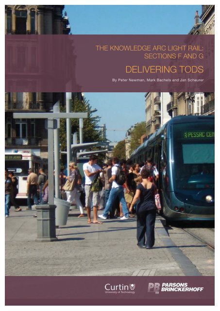
THE KNOWLEDGE ARC LIGHT RAIL:<br />
SECTIONS F AND G<br />
DELIVERING TODS<br />
By Peter Newman, Mark Bachels and Jan Scheurer
PB-CUSP | PARSONS BRINCKERHOFF THE KNOWLEDGE ARC LIGHT RAIL:<br />
i
PB-CUSP | PARSONS BRINCKERHOFF THE KNOWLEDGE ARC LIGHT RAIL: SECTION F<br />
THE KNOWLEDGE ARC LIGHT RAIL: SECTION F<br />
TOD ZONING, COMMUNITY<br />
ENGAGEMENT AND GOVERNANCE<br />
Transit-oriented developments (TODs) are happening across <strong>the</strong><br />
world, especially in highly car-dependent cities like Australian<br />
and US cities (Curtis, Renne and Bertolini 2009). The household<br />
economics of this approach have been assessed by Parsons<br />
Brinckerhoff’s PlaceMaking group, which has found around<br />
50% less car use per household by those who live in a TOD and<br />
<strong>the</strong> residents save around 20% on household income as <strong>the</strong>y<br />
need one less car per household (data collated and presented<br />
by Center for Transit Oriented Development 2004). In Australia<br />
a similar calculation showed this would save some $750,000 in<br />
superannuation over a lifetime for an average household with<br />
one less car.<br />
The value of TODs is that <strong>the</strong>y save governments substantial money through infrastructure and transport<br />
costs, as well as providing greenhouse and health benefits (Trubka, Newman & Bilsborough 2008).<br />
Fundamentally, TODs are able to overcome car dependence, an issue that confronts every city in <strong>the</strong><br />
world (Newman & Kenworthy 1989, 1999). Despite <strong>the</strong> promise of New Urbanism to modify greenfield<br />
developments into less car dependence, <strong>the</strong> evidence for success is not good (Falconer, Newman & Giles<br />
Corti 2009). However, <strong>the</strong> evidence about TODs is much better (Curtis, Renne & Bertolini, 2009).<br />
In all Australian cities <strong>the</strong>re is a strategic plan that sets out why <strong>the</strong> city would like to build centres around<br />
transit stations, where <strong>the</strong> city would like <strong>the</strong>se to be and, in most cases, when <strong>the</strong>y would like to see<br />
increased numbers of residents and jobs in those centres. In addition <strong>the</strong>re are numerous recent Australian<br />
Government initiatives regarding <strong>the</strong> importance of planning in our cities to meet future population growth<br />
and improving integrated infrastructure delivery, including development of centres and transit investment. 1<br />
But so often proposed TOD projects strike trouble in delivery.<br />
By Peter Newman, Mark Bachels and Jan Scheurer<br />
1 Refer Prime Minister Rudd’s recent speeches on population growth and <strong>the</strong> need for improved infrastructure (e.g. http://www.<br />
pm.gov.au/node/6282), and a report from Infrastructure Australia on <strong>the</strong> State of Australian Cities 2010 (Major Cities Unit).<br />
1
PB-CUSP | PARSONS BRINCKERHOFF THE KNOWLEDGE ARC LIGHT RAIL: SECTION F<br />
Why TODs fail to be delivered<br />
The TOD delivery process fails for many reasons:<br />
(1) Town planning schemes are not adequately adapted to reduce car dependence. GB Arrington from<br />
PB PlaceMaking has found this a problem in nearly every single TOD he has worked on across<br />
<strong>the</strong> USA and Australia. He says, ‘Every TOD is illegal.’ This is because <strong>the</strong>y are not consistent with<br />
town planning scheme codes and traffic engineering standards. These codes have been devised to<br />
adequately build suburbs and shopping areas on <strong>the</strong> assumption of car dependence — that is, that<br />
each dwelling or building will be serviced by car use alone. This assumption means that buildings and<br />
road spaces are required to accommodate <strong>the</strong> car ra<strong>the</strong>r than being designed around a transit station<br />
and walkable linkages across <strong>the</strong> centre.<br />
(2) Contracting arrangements are not able to provide <strong>the</strong> land use – transport link between government<br />
agencies and through <strong>the</strong> private sector. The power of TODs is that <strong>the</strong>y can be built in close<br />
cooperation with <strong>the</strong> private sector so that transit systems can not only be made to work better but<br />
indeed help to pay for <strong>the</strong> transit system. This close synergy is being demonstrated today in most US<br />
cities, and it is a requirement of Infrastructure Australia to create public–private partnerships (PPPs)<br />
around <strong>the</strong> urban <strong>rail</strong> projects <strong>the</strong>y have funded ($4.6 billion in 2009). These projects require equity<br />
arrangements to enable funding. Thus, contracts are needed that enable transit systems to be built<br />
using close links between operators, land developers, financiers and <strong>the</strong> three levels of government.<br />
This is a challenge for everyone as it is new territory.<br />
(3) Community processes are inadequate. The community is not happy about car dependence and likes<br />
<strong>the</strong> idea of TODs, but it is usually not so keen when it comes to having a TOD nearby. Ideas about<br />
density, traffic congestion and intense urban activity generate fear of reduced real estate values and<br />
amenity, and increased crime and noise, ra<strong>the</strong>r than <strong>the</strong> opportunity to be part of an exciting and<br />
visually appealing city-building process. In Melbourne this led to a reaction that stopped most of <strong>the</strong><br />
state government’s TOD plans, and finally this meant that local government’s powers in <strong>the</strong>se areas<br />
were stripped away.<br />
(4) Land assembly in station precincts is too difficult. A major challenge for private-sector development<br />
in assuring commercial viability, particularly in existing urban areas, is assembly of disparate p<strong>arc</strong>els<br />
of land to ensure adequate size and scale for development around transit. Aside from inconsistent<br />
and somewhat random government intervention, at present <strong>the</strong>re is a lack of incentives or consistent<br />
mechanisms for land assembly.<br />
(5) Governance for delivering TODS is haphazard. Lastly, without vehicles for integrated planning<br />
and delivery, TODs are currently left ‘to fend for <strong>the</strong>mselves’, in often discrete and haphazard<br />
governance processes. A more holistic governance approach is required between councils, state<br />
government agencies and funding authorities to ensure more accountable and responsive governance<br />
arrangements are established that ensure TODs receive greater priority in planning, delivery and<br />
approval. Without a concerted and integrated effort across all urban areas of Australia, <strong>the</strong> same<br />
random and inefficient process will continue, making greenfield suburban sprawl <strong>the</strong> undesirable but<br />
default ‘winner’ in meeting our future population growth targets.<br />
Is <strong>the</strong>re not a better way? Can we not create TODs without <strong>the</strong>se problems?<br />
2
PB-CUSP | PARSONS BRINCKERHOFF THE KNOWLEDGE ARC LIGHT RAIL: SECTION F<br />
Delivering TODs<br />
TOD zoning<br />
The first step in creating a TOD is getting it through a town planning scheme (TPS). Most TPSs have<br />
been set up to deliver car-dependent suburbs and shopping centres. Across Australia, <strong>the</strong> USA, Canada<br />
and New Zealand, <strong>the</strong> suburbs we build look almost identical. This is not by chance; it is due to <strong>the</strong><br />
requirements that are set in TPSs that have been copied by planners across <strong>the</strong> English-speaking world.<br />
To deliver a TOD requires a new, separate and distinct zoning. This will enable any new TOD to be<br />
immediately recognised. With improved TOD zoning, any group of developers attempting to formulate a<br />
TOD will not have to go to <strong>the</strong> local council and seek a political decision to over-ride <strong>the</strong> ‘normal’ TPS; it<br />
will be normal to have a TOD. For state and federal governments seeking to develop cities by using TODs,<br />
<strong>the</strong> provision of TODs in a TPS and within <strong>the</strong> development and zoning codes will enable decision makers<br />
to see whe<strong>the</strong>r <strong>the</strong>y are being serious at <strong>the</strong> local level. Too often <strong>the</strong> local authority agrees in <strong>the</strong>ory but in<br />
practice does not allow TODs.<br />
Improving <strong>the</strong> process<br />
How do you enable a cumbersome and ill-fitting statutory planning framework to include TODs? In some<br />
cases local TPSs will not allow mixed-use developments or will require high car-parking rates that would<br />
undermine <strong>the</strong> principles of a good TOD. Mostly <strong>the</strong>y would not accept <strong>the</strong> densities which are seen as<br />
necessary. Thus, often TODs are, strictly, illegal but can be accepted by political intervention; <strong>the</strong>y are not<br />
able to be accepted ‘as of right’. Improving our planning schemes by introducing TOD zoning is <strong>the</strong>refore<br />
critical.<br />
While state-sponsored regional planning frameworks are generally supportive of TODs, <strong>the</strong>re is no example<br />
of an explicit TOD zoning district set forth in Australia in <strong>the</strong> state model codes.<br />
In Denver, Colorado, a Transit Oriented Development Strategic Plan was adopted in 2006 to guide land<br />
use planning, development and delivery, to better support Denver’s massive investment in a new transit<br />
system — a new metro system of 119 miles (190 km) and 70 new stations. The FastTracks metro system<br />
will aim to fundamentally reshape growth patterns in <strong>the</strong> region and <strong>the</strong> Denver TOD Strategic Plan is a key<br />
tool in that process. The TOD Strategic Plan is being used by city council, <strong>the</strong> Planning Board, <strong>the</strong> Mayor’s<br />
administration, management, staff and o<strong>the</strong>rs to:<br />
• define priorities for choosing where city resources should be directed in <strong>the</strong> short and long term<br />
• identify effective implementation tools and strategies for TOD<br />
• ensure close coordination among city departments, staff and o<strong>the</strong>rs as <strong>the</strong>y undertake planning and<br />
implementation activities related to transit and transit-oriented development.<br />
A visionary zoning reform in Australia is required to have a lasting impact on <strong>the</strong> delivery of TODs. The lack<br />
of TOD-friendly zoning is not a new problem but one which continues to undermine <strong>the</strong> ability to transform<br />
our urban areas into more sustainable cities. Even in <strong>the</strong> USA, Jeer (1994) identified over a decade ago that<br />
alternative zoning techniques are required to achieve TOD. TOD-supportive planning schemes can serve as<br />
a blueprint for sustainable development if a new, separate zoning approach and distinct zoning codes are<br />
implemented.<br />
Implementation of TODs is often <strong>the</strong> responsibility of local government but based on model TPSs<br />
established by state governments. In areas where TODs are desirable as a state-level policy objective,<br />
such as those mapped by <strong>the</strong> Western Australia Planning Commission (WAPC 2006) and South Australia<br />
Department of Planning and Local Government (DPLG 2009), <strong>the</strong> responsibility for zoning currently remains<br />
3
PB-CUSP | PARSONS BRINCKERHOFF THE KNOWLEDGE ARC LIGHT RAIL: SECTION F<br />
with <strong>the</strong> local government. Queensland refers both <strong>the</strong> mapping and adoption of supportive zoning to <strong>the</strong><br />
local governments.<br />
Placing responsibility for delivery of TODs on local councils is counterproductive. Many councils face<br />
financial and technical resource limitations (Bajraccharya 2009). Negative community perceptions about<br />
density and mixed use lead to tremendous political pressure against TODs, placing local councils at<br />
odds with <strong>the</strong> desired state policies (Quality Growth Alliance 2009). Bajraccharya (2005) also noted <strong>the</strong><br />
impediment created by <strong>the</strong> amalgamation of councils requiring a state review of planning legislation created<br />
by <strong>the</strong> combined super-councils in Queensland.<br />
Planning legislation in Western Australia (WA) requires local governments to prepare a TPS for <strong>the</strong> entire<br />
council based on <strong>the</strong> Western Australia Planning CommissionWAPC’s model scheme text (MST). The TPS<br />
establishes <strong>the</strong> policies to determine planning approvals, identifies and maps <strong>the</strong> suite of zoning districts,<br />
and includes a table of land uses and densities by zoning district. The MST is accompanied by <strong>the</strong><br />
Planning Schemes Manual which identifies <strong>the</strong> potential zoning districts for possible inclusion in <strong>the</strong> TPS<br />
based on <strong>the</strong> MST. While <strong>the</strong> MST does not require standardised zones, <strong>the</strong> suggested categories of zones<br />
do not explicitly include a TOD zone.<br />
Existing model districts, such as <strong>the</strong> activity centres and mixed-use zones, could be <strong>the</strong>oretically adapted<br />
via <strong>the</strong> scheme requirements (e.g. setbacks), but few councils have explicitly sought to create TODfocused<br />
scheme requirements in <strong>the</strong>ir zones. Carey and Low (2009) noted a significant ‘implementation<br />
gap’ in <strong>the</strong>ir systematic review of <strong>the</strong> policies and outcomes for <strong>the</strong> integration of land use and transport in<br />
69 local councils in WA.<br />
In some locations in WA, TODs have been <strong>the</strong> result of an alternative governance model of a development<br />
authority (e.g. Subiaco Redevelopment Authority and East Perth Redevelopment Authority — see ‘Case<br />
study: East Perth and Subiaco TODs’ and Figure F-2) in lieu of <strong>the</strong> conventional town planning process.<br />
However, <strong>the</strong> burden clearly falls to <strong>the</strong> individual local governments to craft TOD-supportive zoning.<br />
The South East Queensland Regional Plan 2009 (SEQRP) expresses a number of TOD principles and<br />
outlines high-level TOD typologies, yet defers to local councils to identify appropriate locations for TOD<br />
when preparing <strong>the</strong>ir local plans. Under this approach, <strong>the</strong> SEQRP identifies activity centres (where<br />
prospective TODs could go) but does not provide specific guidance about scale, intensity or mix of uses,<br />
and instead relies upon <strong>the</strong> local councils to develop <strong>the</strong>se details in <strong>the</strong> local plans.<br />
The WA and SEQ approaches utilise <strong>the</strong> statutory regional planning framework combined with local<br />
planning schemes to provide policy support for TODs. The resultant approval framework and multiple levels<br />
of assessment inadvertently discourage <strong>the</strong> creation of TODs. An alternative approach, currently under<br />
development by <strong>the</strong> South Australia Department of Planning and Local Government may prove more useful<br />
(see ‘Case study: South Australia’).<br />
4
PB-CUSP | PARSONS BRINCKERHOFF THE KNOWLEDGE ARC LIGHT RAIL: SECTION F<br />
Case study: South Australia<br />
The Plan for Greater Adelaide (Draft 2009)<br />
supports <strong>the</strong> creation of TODs and transit<br />
corridors aimed at promoting greater infill<br />
development. As important as <strong>the</strong>se objectives is<br />
<strong>the</strong> proposal to ease <strong>the</strong> creation of TODs and infill<br />
by altering <strong>the</strong> conventional development approval<br />
process. Under this approach, in designated<br />
areas of state significance, structure plans will be<br />
prepared by <strong>the</strong> state to set <strong>the</strong> land use priorities<br />
and directions for large areas such as <strong>the</strong> transit<br />
corridors. The large-area plans will establish <strong>the</strong><br />
key land use objective, permissible uses, and<br />
design principles and guidelines. The desired<br />
locations for TODs within <strong>the</strong> corridors will also be<br />
identified. The structure plans will be a precursor<br />
to changing local council development plans to<br />
facilitate <strong>the</strong> development of TODs.<br />
In designated areas of state significance, precinct<br />
requirements for areas such as TODs will also<br />
be created by <strong>the</strong> state government. These will<br />
be <strong>the</strong> provisions that developers are required to<br />
address in development applications. Precinct<br />
requirements might include detailed design<br />
parameters of <strong>the</strong> area, numbers of dwellings and<br />
densities, urban design requirements, detailed<br />
designs and elevations for large buildings and<br />
transport linkages. The development application<br />
Case study: Expedited development approvals<br />
for affordable TODs in Austin, Texas<br />
Expedited permitting is akin to a zoning incentive<br />
that accelerates a development through <strong>the</strong><br />
development application process in return for<br />
meeting certain use or design considerations. In<br />
Austin, Texas, <strong>the</strong> city created a special program<br />
to promote affordable TOD, called <strong>the</strong> SMART<br />
(safe, mixed-income, accessible, reasonably<br />
priced, transit-oriented) Housing program, which<br />
provides projects incorporating at least 10%<br />
affordable homes with development fee waivers<br />
and expedited development reviews. In this case,<br />
affordability is defined as affordable to households<br />
earning 80% or less of average monthly income.<br />
Between 2000 and 2006 <strong>the</strong> program produced<br />
over 4,000 single-family and multi-family units,<br />
5<br />
will include a precinct plan which responds to<br />
<strong>the</strong> required outcomes of <strong>the</strong> structure plan and<br />
precinct requirements. Compliant projects will be<br />
eligible for approval, avoiding <strong>the</strong> need to amend<br />
local council development plans.<br />
While <strong>the</strong> actual provisions of this approach are<br />
in formation at this time, <strong>the</strong> intent is to resolve<br />
<strong>the</strong> major policy and zoning issues and main<br />
objectives and outcomes for an area early in<br />
<strong>the</strong> planning process, and thus facilitate greater<br />
use of complying development provisions in<br />
<strong>the</strong> development plan. This approach aims to<br />
speed up <strong>the</strong> land development process and give<br />
certainty to investors about <strong>the</strong> types of activities<br />
that are allowed in an area.<br />
The process for fostering TODs may also be<br />
improved through <strong>the</strong> Department of Planning<br />
and Local Government’s Better Planning Library,<br />
which provides <strong>the</strong> template for local council<br />
development plans and zoning schemes. While <strong>the</strong><br />
details have not yet been set forth, <strong>the</strong> possibility<br />
exists to create and incorporate an explicit<br />
zone for TODs ra<strong>the</strong>r than relying on <strong>the</strong> ad hoc<br />
adaption of activity centre and mixed-use zones.<br />
In turn, this would enable proactive local councils<br />
to more easily set forth development plans that<br />
support <strong>the</strong> desired state policies.<br />
including nearly 3,000 reasonably priced units,<br />
with an average assessment completion time<br />
approximately half <strong>the</strong> time of conventional<br />
reviews. The city has brought toge<strong>the</strong>r many city<br />
departments to both fund <strong>the</strong> fee waivers and<br />
consider <strong>the</strong> impact of zoning and o<strong>the</strong>r regulatory<br />
processes on affordability. Among <strong>the</strong> fees waived<br />
are zoning, site plan, subdivision, building permit,<br />
construction inspection and capital recovery fees.<br />
During <strong>the</strong> first three fiscal years of <strong>the</strong> program,<br />
<strong>the</strong> City of Austin waived over $3.5 million in fees<br />
for SMART Housing developments, with waivers<br />
done on a sliding scale – from 25% fee waivers<br />
for 10% reasonably priced units up to 100% fee<br />
waivers for 40% reasonably priced units. For more<br />
information, see http://www.ci.austin.tx.us/ahfc/<br />
smart.htm
PB-CUSP | PARSONS BRINCKERHOFF THE KNOWLEDGE ARC LIGHT RAIL: SECTION F<br />
Principles for TOD<br />
Necessary components or general principles of TOD zoning are:<br />
(1) No density or height limits. The goal of this is to enable as much activity as possible in <strong>the</strong> centre.<br />
Developers should be able to determine appropriate heights in discussion with councils and financiers, but<br />
<strong>the</strong> standards need not be set before <strong>the</strong> economics is done, which is <strong>the</strong> problem with most TODs now.<br />
Heights may need control in most residential areas but in TODs <strong>the</strong>y need to be able to respond to market<br />
demands as <strong>the</strong>se sites are only a small part of any city’s available land.<br />
Many conventional TPSs specify maximum densities and/or height limits, and this principle has been<br />
transferred to some early TOD examples, such as in Perth. While maximum allowable densities were<br />
increased over conventional practice to enable TOD outcomes, it was found that <strong>the</strong> sites in question were<br />
not always developed to <strong>the</strong>se densities. In Clarkson, <strong>the</strong> terminus of Perth’s nor<strong>the</strong>rn <strong>rail</strong> line, a yield of<br />
only around 40–45 dwelling units per hectare was achieved in <strong>the</strong> TOD precinct despite a planning scheme<br />
that permitted up to 80 dwelling units per hectare (Johnson 2008).<br />
Such shortfalls have motivated a call to include minimum ra<strong>the</strong>r than maximum density requirements in<br />
future TOD planning schemes (Johnson 2008), especially in suburban greenfield locations such as Clarkson<br />
where <strong>the</strong> dominant subregional development pattern is low-density housing.<br />
The removal of height limits from planning schemes fur<strong>the</strong>r contributes to facilitating increased density, but<br />
it also poses additional challenges. Firstly, high-rise building proposals, particularly in established areas<br />
o<strong>the</strong>rwise characterised by relatively uniform, low-rise development, tend to raise residents’ concerns<br />
about ‘inappropriate redevelopment’ (Lewis 1999) and thus have <strong>the</strong> potential to delay or unravel TOD<br />
projects in <strong>the</strong> political arena (Dovey, Woodcock & Wood 2009a). While such concerns and <strong>the</strong> associated<br />
political resistance sometimes bear an element of outright hostility to any physical or social change (Dovey,<br />
Woodcock & Wood 2009b), it is frequently also driven by real and tangible threats to urban amenity, such<br />
as overshadowing and microclimatic effects, and <strong>the</strong> impacts of increased traffic and parking where <strong>the</strong>se<br />
are not sufficiently addressed as part of <strong>the</strong> densification agenda (Woodcock et al., 2009).<br />
Secondly, a lack of prescription in building height has been identified as an encouraging factor for property<br />
speculation, to <strong>the</strong> detriment of actual construction (Woodcock et al., 2009a). In Melbourne’s performancebased<br />
system of planning control where density or height limits are no longer mandated (Buxton & Tieman<br />
2005; Dovey, Woodcock & Wood 2009b), an open height limit prompts some developers to submit<br />
ambit claims for out-of-scale development which, even after some subsequent trimming by <strong>the</strong> planning<br />
tribunal, provide <strong>the</strong> proponents with higher capital gains for selling <strong>the</strong> property, including its favourable<br />
planning approval, ra<strong>the</strong>r than developing it. As a somewhat paradoxical result of this trend, <strong>the</strong> take-up<br />
of densification projects in Melbourne’s established, transit-oriented suburbs such as Brunswick t<strong>rail</strong>s<br />
significantly behind <strong>the</strong> policy intention (Woodcock et al. 2009).<br />
Thirdly, open height limits and consequently a relative lack of constraints to <strong>the</strong> number of high-density<br />
apartments subject to planning approval may contribute to a real or perceived oversupply of a specific<br />
housing product in a given area, thus reducing investor confidence in its commercial viability. As a result,<br />
<strong>the</strong> take-up rate for actual construction of densification projects may drop below <strong>the</strong> level that would have<br />
been likely if greater planning constraints, including height limits, had been in place (Woodcock et al. 2009).<br />
To overcome <strong>the</strong>se shortfalls, Adams et al. (2009) recommend that planning schemes in TODs should<br />
identify an appropriate height limit (four to eight storeys are considered suitable for Melbourne’s activity<br />
corridors) as an as-of-right development standard. Woodcock et al. (2009) fur<strong>the</strong>r suggest that planning<br />
permits in TODs should be non-transferable in order to discourage speculation in densification precincts<br />
and instead encourage <strong>the</strong>ir speedy implementation.<br />
In order for a city to increase <strong>the</strong> proportion of its population having easy access to public transport — a<br />
policy goal that few would dispute — <strong>the</strong>re will probably need to be a lot more TODs, with considerably<br />
6
PB-CUSP | PARSONS BRINCKERHOFF THE KNOWLEDGE ARC LIGHT RAIL: SECTION F<br />
more density than four to eight storeys in some of <strong>the</strong>m. Thus if good designs can be developed <strong>the</strong><br />
problems in Melbourne that have led to this kind of suggested restriction would probably be avoided and<br />
attempts to improve designs and community concerns would be addressed ra<strong>the</strong>r than restricting densities<br />
and heights unnecessarily.<br />
(2) Mixed use. The best TODs have plenty of activities for locals to walk to, as well as having a good transit<br />
service. Both are achievable when density and mix are enabled.<br />
Mixed use can be achieved in a vertical or horizontal fashion. A vertical mix means that different functions<br />
(residential, offices, retail, services etc.) are accommodated within <strong>the</strong> same building. A horizontal mix<br />
means that <strong>the</strong>se functions each occupy separate buildings, which are in turn mixed into a finely grained<br />
built pattern at a neighbourhood scale. Both forms of mixed use have a place in TODs, but <strong>the</strong>y are not<br />
necessarily equally attractive to <strong>the</strong> regional development industry. Some developers are accustomed to<br />
realising economies of scale by erecting large monofunctional structures on consolidated sites, a trend<br />
that should be resisted in TODs. Conversely, a critical mass of small-scale developers capable of delivering<br />
a variety of building types and uses across small sites within a reasonable timeframe may not exist or be<br />
sufficiently capitalised everywhere. These circumstances are likely to vary from one TOD project to <strong>the</strong> next,<br />
high<strong>light</strong>ing that <strong>the</strong>re is no one-size-fits-all regulatory approach to encouraging <strong>the</strong> best mix of uses.<br />
However, one over<strong>arc</strong>hing regulatory element of encouraging mixed use in a TOD, as well as a pedestrianfriendly<br />
public realm, is a requirement for active street frontages throughout <strong>the</strong> precinct (Whyte 1988; Gehl<br />
2001; Carmona et al. 2003). In vertically mixed buildings, this means that ground floors are retail capable<br />
— that is, offering an active interface with <strong>the</strong> public realm. In residential or office buildings, this requires<br />
an uninterrupted sightline from <strong>the</strong> buildings into <strong>the</strong> streets to provide passive surveillance. Adams et<br />
al. (2009) recommend that a minimum of 80% of <strong>the</strong> street frontage of any building in a TOD should fit<br />
this definition.<br />
Fur<strong>the</strong>r regulation may be required to encourage particular land uses in a TOD, depending on <strong>the</strong> market<br />
environment in <strong>the</strong> region and at <strong>the</strong> time of implementation. Where <strong>the</strong> office market is slower than<br />
<strong>the</strong> residential market, as was <strong>the</strong> case in Perth’s Subiaco (Howe, Glass & Curtis 2009), a mandatory<br />
minimum proportion of non-residential space can help provide functional diversity, which was <strong>the</strong> approach<br />
taken in that example. A sluggish residential market could be supported by a reverse requirement, and/<br />
or government investment in affordable housing schemes (see item 3 below). It is essential, however,<br />
that <strong>the</strong> regulating authority has <strong>the</strong> capacity to target and continuously revise its approach to such<br />
market fluctuations, as well as to changing community expectations. The Redevelopment Authority in<br />
charge of Subiaco’s transformation appeared to be well placed to engage in such a process and facilitate<br />
good outcomes.<br />
(3) An affordable housing component. This could be 15% based on housing association and/or state<br />
housing that guarantees affordability in perpetuity.<br />
Affordable housing in TODs is regarded as a contribution to counteracting <strong>the</strong> social-spatial polarisation<br />
occurring in cities (Randolph 2004), and to allow a greater proportion of low-income earners to live in areas<br />
with high accessibility, which is often critical to social and labour market participation. It also represents<br />
a form of value capture in <strong>the</strong> context of above-average property price gains often associated with <strong>the</strong><br />
implementation of TODs. The most common mechanism for <strong>the</strong> inclusion of affordable (or special-needs)<br />
housing in English-speaking developed countries is mandatory developer contributions for a specified<br />
proportion of affordable dwelling units, also known as inclusionary zoning regimes (Gurran et al. 2008).<br />
In continental Europe, outright social housing programs in <strong>the</strong> rental sector and <strong>the</strong> dominance of<br />
owner-developers in <strong>the</strong> homeowner sector play a greater role (Lawson & Milligan 2008; Massot 2007).<br />
In Freiburg’s most well-known TOD of Vauban, such owner-developers formed numerous cooperatives<br />
to construct apartment buildings and thus save on most costs o<strong>the</strong>rwise associated with profits to<br />
commercial developers (Scheurer & Newman 2009).<br />
7
PB-CUSP | PARSONS BRINCKERHOFF THE KNOWLEDGE ARC LIGHT RAIL: SECTION F<br />
(4) Permeability and pedestrian design. Creating a village precinct necessary for successful TODs requires<br />
designing for <strong>the</strong> pedestrian. Walkable catchments, slower traffic, more permeable and better connected<br />
streets are critical toward making centres active, community friendly places. Integrated transport networks<br />
to civic spaces, retail, office and housing makes for reducing car dependence, activating streets with more<br />
walking and cycling, and thus increasing both foot traffic for retail and civic spaces.<br />
Streets can be designed to favour pedestrians and cyclists and wherever this is done, centres and cities<br />
invariably become surprised at how much more attractive and business-friendly <strong>the</strong>y become (Gehl and<br />
Gemzoe, 2000; Gehl et al., 2006).<br />
Sustainable mobility management is about ‘streets not roads’; <strong>the</strong> streets are used for a multiplicity of<br />
purposes, not just maximising vehicle flow. The emphasis is on achieving efficiency by maximising people<br />
movement, not car movement, and on achieving a high level of amenity and safety for all street users. This<br />
policy also picks up on <strong>the</strong> concept of integration of transport facilities as public space. One of <strong>the</strong> ways<br />
that United States and European cities are approaching this is through what are called ‘complete streets’<br />
or, in <strong>the</strong> United Kingdom, ‘naked streets’. This new movement aims to create streets where mobility is<br />
managed to favour public transport, walking and cycling, as well as lower speed traffic. The policy often<br />
includes removing all large signs for drivers which means <strong>the</strong>y automatically slow down: in Kensington High<br />
Road in London <strong>the</strong> traffic accident rate has halved because of this.<br />
Copenhagen, Portland, Toronto, Vancouver and Zurich all have built much more in recent times with<br />
cycleways, pedestrian facilities and traffic calming. As a result <strong>the</strong> associated urban development land<br />
usage has begun to emerge that reflects <strong>the</strong>se more human qualities. All <strong>the</strong>se cities had citizen groups<br />
that pushed for a different, less car-oriented city and a political process was worked through to achieve<br />
<strong>the</strong>ir innovations. They usually did not foresee this outcome but it has now made <strong>the</strong>se cities much more<br />
aware of <strong>the</strong> need to build integrated development incuding <strong>knowledge</strong> economy strategies around<br />
sustainable transport (Newman and Kenworthy, 1999).<br />
Freeways have b<strong>light</strong>ed <strong>the</strong> centres of many cities and today <strong>the</strong>re are cities that are trying to remove<br />
<strong>the</strong>m. San Francisco removed <strong>the</strong> Emb<strong>arc</strong>adero Freeway from its waterfront district in <strong>the</strong> 1990s after<br />
<strong>the</strong> Loma Prieta earthquake. It took three ballots before consensus was reached, but <strong>the</strong> freeway has<br />
been rebuilt as a friendlier tree-lined boulevard involving pedestrian and cycle spaces. As in all cases<br />
where traffic capacity is reduced, <strong>the</strong> city has not found it difficult to ensure adequate transport, because<br />
most of <strong>the</strong> traffic just disappears. Regeneration of <strong>the</strong> land uses in <strong>the</strong> area has followed this change of<br />
transportation philosophy including a number of successful TODs built along <strong>the</strong> new LRT line (Gordon,<br />
2005). Ano<strong>the</strong>r great example is in Seoul which removed from its centre a large freeway that had been<br />
built over a major river. A five-year programme entailed dismantling <strong>the</strong> freeway, rehabilitating <strong>the</strong> river,<br />
restoring a historical bridge, restoring and rehabilitating <strong>the</strong> river foreshores as a public park, restoring<br />
adjacent buildings and extending <strong>the</strong> underground <strong>rail</strong> system to help replace <strong>the</strong> traffic. The project has<br />
been very symbolic, as <strong>the</strong> river is a spiritual source of life for <strong>the</strong> city. Now o<strong>the</strong>r car-saturated Asian cities<br />
are planning to replace <strong>the</strong>ir central city freeways (http://www.metro.seoul.kr/kor2000/chungaehome/en/<br />
seoul/2sub.htm/).<br />
What <strong>the</strong>se projects have shown and encouraged is to ‘think of transportation as public space’ (Burwell,<br />
2005). With this changed approach to city planning, <strong>the</strong> small-scale systems of pedestrian movement and<br />
cycling become much more important. Pedestrian strategies enable each centre in a city to give priority to<br />
<strong>the</strong> most fundamental of human interactions: <strong>the</strong> walking-based face-to-face contact that gives human life<br />
to a city and, in <strong>the</strong> process, reduces its ecological footprint.<br />
Cycle-oriented strategies can be combined with <strong>the</strong> development of greenways that improve <strong>the</strong> green<br />
agenda and lower ecological footprint. Enough demonstrations now exist to show that pedestrian and<br />
bicycle strategies work dramatically to improve city economies and to integrate <strong>the</strong> green and brown<br />
agendas. Pedestrian and bicycle strategies in Copenhagen, most Australian cities, London, New York,<br />
8
PB-CUSP | PARSONS BRINCKERHOFF THE KNOWLEDGE ARC LIGHT RAIL: SECTION F<br />
San Francisco and Bogota, as well as <strong>the</strong> dramatic changes in Paris with <strong>the</strong> Velib bicycle scheme and <strong>the</strong><br />
growing awareness that it works in developing country cities as well, are all testament to this new approach<br />
to cities including successful centre and Transit Oriented Developments (Newman and Kenworthy, 2007)..<br />
(5) Reduced parking. One space per unit is <strong>the</strong> growing standard in <strong>the</strong> USA (Shoup 2005). TOD dwellers<br />
and users, on average, are characterised by lower car use and ownership than <strong>the</strong>ir counterparts in<br />
conventional urban areas (Friedman, Gordon & Peers 1995). However, translating this finding into lower<br />
car-parking requirements has been a slow process, as exemplified by Perth’s Subiaco (see ‘Case study:<br />
East Perth and Subiaco TODs’) where after much deliberation, a conventional standard for car-parking<br />
provision was adopted (Howe, Glass & Curtis 2009). Such practice, however, leads to spatial and<br />
functional conflicts where large amounts of car parking as well as entry/exit points to multistorey garages<br />
need to be accommodated in a high-density environment, and where <strong>the</strong> associated volume of vehicle<br />
traffic impacts on <strong>the</strong> amenity of <strong>the</strong> streetscape for pedestrians and stationary users.<br />
As with zoning standards for maximum density (elaborated above), it is arguable that <strong>the</strong> conventional<br />
practice of mandating a minimum of parking spaces per dwelling, or proportional to floor area of office<br />
space, is not a suitable approach for TODs (Shoup 2005). Instead, maximum levels of parking provision<br />
should be stipulated, coupled with incentives to compensate for <strong>the</strong> shortfall, such as <strong>the</strong> provision of<br />
car-sharing vehicles, quality improvements to <strong>the</strong> public realm and boosts to public transport service<br />
standards. Since lower parking provision reduces construction costs, such measures could be funded as<br />
part of a value capture package through developer contributions. They will also contribute to enhancing<br />
housing affordability (Scheurer 2001).<br />
Woodcock, Dovey & Wollan (2009) strongly advise that parking standards in transit-oriented<br />
neighbourhoods be reduced, for all <strong>the</strong> abovementioned reasons and in order to discourage <strong>the</strong> take-up<br />
of ‘drive in, drive out’ lifestyles by new residents, who are o<strong>the</strong>rwise able to accommodate and access<br />
<strong>the</strong>ir (multiple) vehicle(s) with such ease and at no specific cost that <strong>the</strong>y forego <strong>the</strong> opportunity to adapt<br />
<strong>the</strong>ir mobility behaviour to <strong>the</strong> superior conditions for walking, cycling and public transport. In Melbourne’s<br />
Brunswick, this group has been found to engage least with local community networks, contributing to<br />
resistance against densification projects among more established residents (ibid.).<br />
In Freiburg-Vauban, a market-based approach to parking management has been taken. The sale or lease<br />
of housing units and parking spaces has been completely separated, with <strong>the</strong> physical provision of offstreet<br />
parking as part of residential structures actually banned in about half <strong>the</strong> development. Instead,<br />
car-owning residents are obliged to purchase or rent a parking space in one of two multistorey garages<br />
at <strong>the</strong> edge of <strong>the</strong> precinct, at a greater distance on foot from most houses than <strong>the</strong> nearest tram stop.<br />
The explicit cost of <strong>the</strong>se facilities works as a powerful disincentive to car ownership, with nearly half of all<br />
households not owning a vehicle at all and <strong>the</strong> number of multiple-car-owning families having dropped to<br />
zero (Scheurer & Newman 2009). It also improves housing affordability for non-car owners.<br />
Case study: Using TOD typologies to<br />
guide TOD and station planning<br />
As applied in <strong>the</strong> Denver TOD Plan (2006), a<br />
TOD typology serves two important functions.<br />
First, <strong>the</strong> place types provide enough detail so<br />
that if development proposals are submitted to<br />
<strong>the</strong> city prior to completion of a detailed station<br />
area plan, <strong>the</strong>re is some basis for evaluating<br />
9<br />
<strong>the</strong> proposal to determine its appropriateness,<br />
given <strong>the</strong> general vision. Second, <strong>the</strong> place types<br />
provide <strong>the</strong> starting point for <strong>the</strong> station area<br />
planning process so that all of <strong>the</strong> participants in<br />
<strong>the</strong> planning process have a shared global vision<br />
from which <strong>the</strong>y can work on developing <strong>the</strong><br />
specifics of <strong>the</strong> plan itself, including an appropriate<br />
implementation strategy.
PB-CUSP | PARSONS BRINCKERHOFF THE KNOWLEDGE ARC LIGHT RAIL: SECTION F<br />
(6) Green TODs. TODs need to provide incentives and development patterns which achieve far greater<br />
sustainability outcomes including reductions in energy and water use, and greenhouse gas emissions.<br />
This could be five or six green-star-rated buildings, though increasingly <strong>the</strong>re will be a carbon standard<br />
for <strong>the</strong> whole development to meet. Some TODs should have smart grids with electric plug-ins and<br />
renewables associated with <strong>the</strong> development (Went, James & Newman 2008). Water-sensitive urban design<br />
(WSUD) and water cycle management should be elements of any future development. This is expanded in<br />
Section G.<br />
These Green Centres need to be walkable, dense, and mixed as outline in o<strong>the</strong>r sections of this report –<br />
providing <strong>the</strong> human basis of an interactive, centre of innovation. They need to be smart with a smart grid<br />
and smart metering to enable <strong>the</strong> latest in feed-back and control systems for clever digital management.<br />
And most of all <strong>the</strong>y need to be models of renewable developments with green buildings and green<br />
infrastructure as <strong>the</strong>se will enable <strong>the</strong>m to display <strong>the</strong> 21st century technologies that can enable <strong>the</strong>m to<br />
set <strong>the</strong> model for urban development in <strong>the</strong> next 50 years. As set out below this can also save money as<br />
has been shown across <strong>the</strong> world.<br />
Most power and water systems for cities over <strong>the</strong> past 100 years have become bigger and more<br />
centralized. While newer forms of power and water are increasingly smaller scale, <strong>the</strong>y are often still fitted<br />
into cities as though <strong>the</strong>y were large. The movement that tries to see how <strong>the</strong>se new technologies can be<br />
fitted into cities and decentralized across grids is called ‘distributed power and distributed water systems’<br />
(Droege, 2006).<br />
‘Water sensitive urban design’ should be incorporated in TODs to more efficiently use <strong>the</strong> complete water<br />
cycle, i.e., using rain and local water sources like groundwater to feed into <strong>the</strong> system and <strong>the</strong>n to recycle<br />
‘grey’ water locally and ‘black’ water regionally, thus ensuring that <strong>the</strong>re are significant reductions in water<br />
used. This system can enable <strong>the</strong> green agenda to become central to <strong>the</strong> infrastructure management of a<br />
city; stormwater recycling can involve swales and artificial wetlands that can become important habitats<br />
in <strong>the</strong> city. Grey water can similarly be recycled to irrigate green parks and gardens, and regional black<br />
water recycling can be tied into regional ecosystems. All <strong>the</strong>se initiatives require ‘smart’ control systems<br />
to fit <strong>the</strong>m into a city grid and also require new skills among town planners and engineers, who are so far<br />
used to water and energy management being a centralized function ra<strong>the</strong>r than being a local planning issue<br />
(Benedict and McMahon, 2006).<br />
Renewable low-carbon TODs should aim to develop more decentralized energy production systems,<br />
where production is more on a neighbourhood scale and both line losses and power shedding can be<br />
avoided. Whe<strong>the</strong>r from a wind turbine, small biomass combined heat and power plant (as in London’s<br />
new distributed energy model), or a rooftop photovoltaic system, renewable energy is produced closer<br />
to where it is consumed and, indeed, often directly by those who consume it. This distributed generation<br />
offers a number of benefits, including energy savings, given <strong>the</strong> ability to better control power production,<br />
lower vulnerability and greater resilience in <strong>the</strong> face of natural and human-made disaster (including terrorist<br />
attacks). A number of such small-scale energy systems are being developed to make centres and cities<br />
more resilient in <strong>the</strong> future (Sawin and Hughes, 2007).<br />
There are now many cities that are able to demonstrate small-scale local water systems that are very<br />
effective. The new Armstrong Creek project in Melbourne has been studied in detail by <strong>Sustainability</strong><br />
Victoria as a model for doing this distributed, green infrastructure. It was shown to save $500 million net<br />
present value over 10 years compared to a business-as-usual approach to infrastructure (<strong>Sustainability</strong><br />
Victoria, 2009).<br />
Biophilic centres also need to be explored which use landscaping to enhance every building using green<br />
roofs, green walls and water sensitive urban design to ‘air condition’ <strong>the</strong> whole urban area. This concept<br />
developed from cities that were already finding that <strong>the</strong> urban heat island effect and global warming was<br />
10
PB-CUSP | PARSONS BRINCKERHOFF THE KNOWLEDGE ARC LIGHT RAIL: SECTION F<br />
impacting on <strong>the</strong>ir citizens, so <strong>the</strong>y decided to use natural systems to help cool <strong>the</strong>ir cities including in<br />
Chicago, Toronto and Singapore.<br />
Green TODs in Toronto and Malmo<br />
In Toronto, communities have formed ‘buyingcooperatives’<br />
to pool buying power to negotiate<br />
special reduced prices from local photovoltaic<br />
companies that had offered an incentive to buy<br />
solar photovoltaic panels. The first cooperative<br />
was <strong>the</strong> Riverdale Initiative for Solar Energy. In<br />
this initiative, 75 residents joined toge<strong>the</strong>r to<br />
purchase rooftop photovoltaic systems, resulting<br />
in savings of about 15% in <strong>the</strong>ir purchase cost.<br />
This <strong>the</strong>n spread across <strong>the</strong> city. The Toronto<br />
example suggests <strong>the</strong> merits of combining<br />
bottom-up neighbourhood approaches with<br />
top-down incentives and encouragement. This<br />
support for small-scale distributed production<br />
— offered through what are commonly referred<br />
to as standard offer contracts (often referred<br />
to as ‘feed-in tariffs’ in Europe), has been<br />
extremely successful in Europe, where <strong>the</strong>y are<br />
now common. The same can be done with new<br />
technologies for water and waste, such as rain<br />
water tanks and grey water recycling.<br />
11<br />
Ano<strong>the</strong>r model example is <strong>the</strong> redevelopment of<br />
<strong>the</strong> Western Harbour in Malmö, Sweden. Here<br />
<strong>the</strong> goal was to achieve distributed power and<br />
water systems from local sources. This urban<br />
district now has 100% renewable power from<br />
rooftop solar panels and an innovative storm water<br />
management system that recycles water into<br />
green courtyards and green rooftops. The project<br />
involves local government in <strong>the</strong> management<br />
and demonstrates that a clear plan helps to<br />
drive innovations in distributed systems (City of<br />
Malmo, 2005).<br />
Distributed infrastructure is beginning to be<br />
demonstrated in cities across <strong>the</strong> globe. Utilities<br />
are beginning to develop models with city planners<br />
of how <strong>the</strong>y can carry out local energy and water<br />
planning through community-based approaches<br />
and local management – such models need<br />
to be thought through and applied along <strong>the</strong><br />
Knowledge Arc.<br />
With <strong>the</strong>se codes it is possible to enable a TOD to have special accelerated development rights (e.g. as<br />
applied in Austin — see ‘Case study: Expedited development approvals for affordable TODs in Austin,<br />
Texas); <strong>the</strong>se are what <strong>the</strong> TPS and strategic planners are most hoping to enable.<br />
Some of <strong>the</strong>se principles were used in developing TOD typologies for planning <strong>the</strong> new FastTracks <strong>rail</strong> and<br />
stations in Denver (see ‘Case study: Using TOD typologies to guide TOD and station planning’, Table F-1<br />
and Figure F-1).<br />
Case Study: Using TOD Typologies to Guide<br />
TOD and Station Planning in Denver<br />
As applied in <strong>the</strong> Denver TOD Plan, (2006), a<br />
TOD typology serves two important functions<br />
(refer Table 1). First, <strong>the</strong> place types provide<br />
enough detail so that if development proposals<br />
are submitted to <strong>the</strong> City prior to completion<br />
of a detailed station area plan, <strong>the</strong>re is some<br />
basis for evaluating <strong>the</strong> proposal to determine its<br />
appropriateness given <strong>the</strong> general vision. Second,<br />
<strong>the</strong> place types provide <strong>the</strong> starting point for<br />
<strong>the</strong> station area planning process so that all of<br />
<strong>the</strong> participants in <strong>the</strong> planning process have a<br />
shared global vision from which <strong>the</strong>y can work on<br />
developing <strong>the</strong> specifics of <strong>the</strong> plan itself, including<br />
an appropriate implementation strategy.
PB-CUSP | PARSONS BRINCKERHOFF THE KNOWLEDGE ARC LIGHT RAIL: SECTION F<br />
Table F-1: TOD typologies for <strong>the</strong> Denver TOD plan<br />
TOD typology<br />
Desired land<br />
use mix<br />
Downtown Office retail,<br />
residential,<br />
entertainment<br />
and civic uses<br />
Major urban<br />
centre<br />
Office, retail,<br />
residential,<br />
entertainment<br />
Urban centre Office, retail,<br />
residential<br />
Urban<br />
neighbourhood<br />
Residential,<br />
neighbourhood<br />
retail<br />
Desired<br />
housing types<br />
Multi-family<br />
and loft<br />
Multi-family<br />
and townhouse<br />
Multi-family<br />
and townhouse<br />
Multi-family<br />
townhouse,<br />
small-lot singlefamily<br />
12<br />
Commercial/<br />
employment<br />
types<br />
Prime office<br />
and shopping<br />
location<br />
Employment<br />
emphasis with<br />
more than<br />
250,000 office<br />
& 50,000 sq ft<br />
retail<br />
Limited office.<br />
Less than<br />
25,000 sf<br />
office. More<br />
than 50,000 sf<br />
retail.<br />
Local serving<br />
retail. No more<br />
than 50,000 sf<br />
Proposed<br />
scale<br />
5 stories and<br />
above<br />
5 stories and<br />
above<br />
3 stories and<br />
above<br />
Transit system<br />
function<br />
Intermodal<br />
facility/transit<br />
hub. Major<br />
regional<br />
destination<br />
with highquality<br />
feeder<br />
bus/streetcar<br />
connections<br />
Subregional<br />
destination.<br />
Some parkand-ride.<br />
Linked<br />
with district<br />
circulator<br />
transit and<br />
express feeder<br />
bus.<br />
Subregional<br />
destination.<br />
Some parkand-ride.<br />
Linked<br />
with district<br />
circulator<br />
transit and<br />
express feeder<br />
bus.<br />
2-7 stories Neighbourhood<br />
walk-up<br />
station. Very<br />
small parkand-ride,<br />
if<br />
any. Local bus<br />
connections.
PB-CUSP | PARSONS BRINCKERHOFF THE KNOWLEDGE ARC LIGHT RAIL: SECTION F<br />
TOD typology<br />
Commuter<br />
town centre<br />
Desired land<br />
use mix<br />
Office, retail,<br />
residential<br />
Main street Residential,<br />
neighbourhood<br />
retail<br />
Campus/<br />
special events<br />
station<br />
<strong>University</strong><br />
campus,<br />
sporting<br />
facilities<br />
Desired<br />
housing types<br />
Multi-family<br />
townhouse,<br />
small-lot singlefamily<br />
13<br />
Commercial/<br />
employment<br />
types<br />
Local and<br />
commuter<br />
serving no<br />
more than<br />
25,000 sf<br />
Multi-family Main street<br />
retail infill<br />
Limited multifamily<br />
Limited office/<br />
retail<br />
Proposed<br />
scale<br />
Transit system<br />
function<br />
2-7 stories Capture station<br />
for in-bound<br />
commuters.<br />
Large parkand-ride<br />
with<br />
local and<br />
express bus<br />
connections.<br />
2-7 stories Bus or street<br />
car corridors.<br />
District<br />
circulator or<br />
feeder transit<br />
service. Walkup<br />
stops. No<br />
transit parking.<br />
Varies Large<br />
commuter<br />
destination.<br />
Large parking<br />
reservoirs but<br />
not necessarily<br />
for transit.
PB-CUSP | PARSONS BRINCKERHOFF THE KNOWLEDGE ARC LIGHT RAIL: SECTION F<br />
The TOD typologies were used in corridor planning and TOD station area planning as shown in<br />
Figure F-1.<br />
Figure F-1: Denver Station area typologies<br />
14
PB-CUSP | PARSONS BRINCKERHOFF THE KNOWLEDGE ARC LIGHT RAIL: SECTION F<br />
Case study: Vancouver TODs<br />
The City of Vancouver has around 20 TODs<br />
that have all been built in association with <strong>the</strong>ir<br />
Skytrain <strong>light</strong>-<strong>rail</strong> service. These have been done<br />
in partnership with <strong>the</strong> strategic planning agency<br />
(Greater Vancouver Regional Planning District),<br />
<strong>the</strong> City of Vancouver, private developers and <strong>the</strong><br />
local community. The zoning of <strong>the</strong> areas around<br />
stations is highly contained so that high density<br />
is kept to <strong>the</strong> walking distance radius around<br />
stations (see photo of Joyce Collingwood station<br />
in Figure F-3 and <strong>the</strong> clear distinction between<br />
high-rise areas and surrounding low-rise suburbs).<br />
The process of building a TOD began well before<br />
<strong>the</strong> sky train came to most areas and a clear set of<br />
guidelines was given to developers, including <strong>the</strong><br />
need to provide affordable housing in up to 15%<br />
of <strong>the</strong> development and that 5% of <strong>the</strong> value of<br />
<strong>the</strong> development would need to be used for social<br />
infrastructure. This money was directed into <strong>the</strong><br />
projects that <strong>the</strong> local community saw as being<br />
its highest priority, including street landscaping,<br />
cycleways, child care centres and even an art<br />
house cinema (see Figure F-4). The success of <strong>the</strong><br />
Vancouver zoning system is also a reflection on its<br />
success in being able to deliver good contracts<br />
and to engage <strong>the</strong> community in a positive way.<br />
Figure F-5: The public’s frequent perception of a TOD<br />
15<br />
Figure F-3: Joyce Collingwood TOD, Vancouver<br />
Figure F-4: Social infrastructure at Coal Harbour<br />
TOD, Vancouver, delivered through <strong>the</strong> 5% social<br />
infrastructure requirement (community centre at<br />
<strong>the</strong> left and landscaped boardwalk were built with<br />
<strong>the</strong>se funds).
PB-CUSP | PARSONS BRINCKERHOFF THE KNOWLEDGE ARC LIGHT RAIL: SECTION F<br />
Case study: Christchurch Bus Xchange TOD<br />
In <strong>the</strong> late 1990s <strong>the</strong> Canterbury Regional Council<br />
and Christchurch City Council established a<br />
Public Transport (PT) Advisory Group, made<br />
up of approximately 20 members representing<br />
key agencies, interest groups, users and nonusers.<br />
The PT Advisory Group met over <strong>the</strong><br />
course of one year to establish an overall<br />
public transport strategy for Christchurch. It<br />
identified a number of strategic improvements<br />
<strong>the</strong> councils and community needed to make to<br />
significantly improve public transport, including<br />
better integrated land uses, increasing frequency,<br />
improving transit priority, better ticketing and new<br />
bus interchanges.<br />
After <strong>the</strong> adoption of <strong>the</strong> PT strategy by both<br />
councils and agreement to significantly increase<br />
investment in <strong>the</strong> PT system, <strong>the</strong>re was an<br />
immediate increase in patronage and hence<br />
pressure to expand <strong>the</strong> system. As part of<br />
<strong>the</strong> redevelopment of a major city centre retail<br />
development (known as The Crossing), an<br />
opportunity arose for <strong>the</strong> integration of a new<br />
city centre bus interchange within <strong>the</strong> mixed-use<br />
CBD shopping centre. The developer came to<br />
council during construction and indicated <strong>the</strong>re<br />
was a limited time window to explore options for<br />
integrated public transport into <strong>the</strong> development.<br />
The Christchurch Bus Xchange involved successful<br />
public engagement and governance between<br />
multiple agencies and <strong>the</strong> developer to produce<br />
a modern bus station, integrated with two floors<br />
of retail; a new primary school was located on<br />
<strong>the</strong> levels three and four of <strong>the</strong> development; an<br />
over-street bridge was built to better integrate with<br />
a major department store across <strong>the</strong> main street;<br />
and short-term car parking was built to better<br />
support <strong>the</strong> enhanced retail activity. The entire<br />
development and Bus Xchange was encased<br />
behind and within a heritage building. The project<br />
also required significant investment in smart-<br />
16<br />
card ticketing and real-time information systems,<br />
which galvanised system-wide major investments.<br />
Patronage since <strong>the</strong> Bus Xchange development<br />
(and a number of o<strong>the</strong>r projects) has more than<br />
doubled throughout <strong>the</strong> system.<br />
The Bus Xchange set new standards for <strong>the</strong> quality<br />
of public transport passenger facilities, particularly<br />
in <strong>the</strong> off-street component, with carpeted,<br />
airconditioned waiting lounges separated from<br />
buses by sliding glass doors and supported by<br />
real-time passenger information; <strong>the</strong> Bus Xchange<br />
also directly connects at numerous points to <strong>the</strong><br />
surrounding retail. As a result of <strong>the</strong>se qualities,<br />
<strong>the</strong> Bus Xchange has been <strong>the</strong> subject of<br />
international interest since its opening.<br />
The public engagement side was critical to<br />
success of <strong>the</strong> project as <strong>the</strong> long-standing<br />
public transport advisory group (of users and<br />
non-users) was used in both leveraging approval<br />
for <strong>the</strong> project, identifying and designing into<br />
<strong>the</strong> project social/community benefits (e.g. <strong>the</strong><br />
schools — see below in this case study) and with<br />
achieving significant additional council funding and<br />
regulatory approval. In addition, <strong>the</strong> group was<br />
used in detailed design review of <strong>the</strong> actual facility<br />
during <strong>the</strong> design process, to ensure legibility<br />
throughout <strong>the</strong> mixed-use development, as well as<br />
design safety.<br />
So, what made <strong>the</strong> Bus Xchange work, and what<br />
lessons does <strong>the</strong> project have for o<strong>the</strong>r cities?<br />
The first reason is that it is a rare example of a<br />
successful public-private partnership and this,<br />
in our view, is because all <strong>the</strong> players could see<br />
<strong>the</strong> benefits of integrating public transport with<br />
a major city centre revitalisation project. In this<br />
case, <strong>the</strong> developer was an active champion of <strong>the</strong><br />
bus interchange and an initiator of its integration<br />
with <strong>the</strong> retail development, ra<strong>the</strong>r than having a<br />
public transport facility imposed on <strong>the</strong> project. In<br />
competing with <strong>the</strong> growth of suburban shopping
PB-CUSP | PARSONS BRINCKERHOFF THE KNOWLEDGE ARC LIGHT RAIL: SECTION F<br />
malls, improving public transport access to city<br />
centre retail developments was recognised as<br />
an important contributor to success, particularly<br />
where car-parking provision is constrained.<br />
Integration with <strong>the</strong> primary central city retail<br />
contributed to high-quality passenger facilities. In<br />
most transport interchange projects, <strong>the</strong> quality<br />
of passenger facilities is often compromised<br />
when budgets are under pressure. Because <strong>the</strong><br />
Bus Xchange was seen as part of The Crossing<br />
development, <strong>the</strong> quality of fittings and finishes in<br />
<strong>the</strong> public spaces had <strong>the</strong> potential to influence<br />
perceptions of <strong>the</strong> whole development. This<br />
encouraged <strong>the</strong> use of high-quality passenger<br />
seating and fit-out in <strong>the</strong> Bus Xchange. The<br />
airport-quality look and feel of <strong>the</strong> passenger<br />
lounges is one of <strong>the</strong> immediate positive public<br />
impressions, and consistent finishes and signage<br />
between public spaces also contribute to a sense<br />
of integration (see Figure F-7).<br />
The Bus Xchange, although primarily designed as<br />
a bus passenger facility, applied TOD principles to<br />
ensure integration with <strong>the</strong> retail redevelopment<br />
(see Figure F-8). The successful integrated<br />
planning directly catalysed additional mixed uses<br />
in <strong>the</strong> development. A new primary school was<br />
established on <strong>the</strong> top two floors of <strong>the</strong> building,<br />
partially due to <strong>the</strong> excellent bus facility and<br />
opportunities for children to travel directly to <strong>the</strong><br />
school; in addition, <strong>the</strong> same school established<br />
a new high school within a block of <strong>the</strong> Bus<br />
Xchange, again partially because of <strong>the</strong> success<br />
of <strong>the</strong> Bus Xchange. Finally, in <strong>the</strong> adjoining block<br />
across <strong>the</strong> street, <strong>the</strong> council was able to facilitate<br />
a major retail redevelopment as a direct result of<br />
<strong>the</strong> success of <strong>the</strong> Bus Xchange and successfully<br />
integrated <strong>the</strong> retail redevelopment with adjoining<br />
car parking. Thus <strong>the</strong> synergies of a TOD were<br />
enabled through this whole process.<br />
17<br />
Figure F-7: Interior of Christchurch Bus Xchange<br />
passenger lounge<br />
Figure F-8: Christchurch Bus Xchange, Lichfield<br />
Street
PB-CUSP | PARSONS BRINCKERHOFF THE KNOWLEDGE ARC LIGHT RAIL: SECTION F<br />
Case study: Vauban — a PPCP<br />
In Freiburg, Germany, a TOD has been built in<br />
a redeveloped military base called Vauban. The<br />
TOD is home to 5,000 residents and features<br />
perhaps <strong>the</strong> best example of green technologies,<br />
such as solar housing, 100% renewable energy<br />
for electricity, water-sensitive design, and a carfree<br />
approach based on <strong>light</strong> <strong>rail</strong> and bicycles<br />
being allowed into <strong>the</strong> development whilst cars<br />
are discouraged through a variety of means. The<br />
result has been a highly popular development,<br />
as families have been attracted to <strong>the</strong> site due to<br />
its car-free safety. Children can be seen running<br />
through <strong>the</strong> area with a freedom rarely seen in a<br />
car-dependent suburb (see Figures F-9 and F-10).<br />
The significance in terms of community<br />
engagement and governance is that it was a<br />
PPCP — a public–private community partnership.<br />
The local government was keen to see <strong>the</strong> site<br />
redeveloped using community values associated<br />
with green technologies and design but did not<br />
know how best to do it. The Forum Vauban, a<br />
community association, was contracted by <strong>the</strong><br />
city to lead resident participation, <strong>the</strong> elaboration<br />
of sustainability goals and public relations work.<br />
They were able to establish a range of funds that<br />
<strong>the</strong> local government alone could not have done in<br />
order to establish <strong>the</strong> project as a demonstration.<br />
Private-sector involvement followed as each<br />
phase was put out to tender. The real benefit<br />
was that <strong>the</strong> community drove <strong>the</strong> development,<br />
as <strong>the</strong>y had such a large stake in <strong>the</strong> outcome.<br />
Similar projects are beginning to happen through<br />
community housing associations that are able to<br />
tap local community values and enable affordable<br />
housing to be part of <strong>the</strong> TOD.<br />
18<br />
Figure F-9: Vauban TOD in Freiburg, built as a<br />
public-–private community partnership<br />
Figure F-10: TOD freedom for children in Vauban
PB-CUSP | PARSONS BRINCKERHOFF THE KNOWLEDGE ARC LIGHT RAIL: SECTION F<br />
Case study: East Perth and Subiaco TODs<br />
The two best TODs in Perth were both developed<br />
through a statutory authority (<strong>the</strong> East Perth<br />
Redevelopment Authority) that was given full<br />
planning powers over <strong>the</strong> sites and <strong>the</strong> ability to fund<br />
<strong>the</strong> preliminary infrastructure. They were not given<br />
a TOD zoning as such, but instead a structure plan<br />
was produced for each area with clear guidelines<br />
that set out what developers were required to<br />
achieve. These had strong design guidelines to<br />
ensure a quality and coherent design. The result is<br />
two TODs that have changed <strong>the</strong> perceptions of<br />
<strong>the</strong> development industry and <strong>the</strong> general public<br />
about <strong>the</strong> value of mixed-use, medium-density<br />
development in Perth. The WA Government was able<br />
to collect hundreds of millions of dollars in return for<br />
<strong>the</strong> development; <strong>the</strong> land at Subiaco, for example,<br />
increased in value five times in a few years and<br />
changed <strong>the</strong> nature of Subiaco. The patronage at<br />
<strong>the</strong> Subiaco station increased by 100% in <strong>the</strong> year<br />
that <strong>the</strong> TOD was opened, with its new station built<br />
TOD engagement<br />
19<br />
as part of <strong>the</strong> development. The guidelines could<br />
have been adapted for any o<strong>the</strong>r TOD in Perth but<br />
that has not happened, as <strong>the</strong> statutory planning<br />
system is shaped by a model town planning scheme<br />
that has no TOD zoning category. This will need to<br />
change if TODs are to become mainstream, not just<br />
on government projects on government land as in<br />
East Perth and Subiaco.<br />
Figure F-2: East Perth TOD<br />
A necessary step in delivering a TOD is to bring <strong>the</strong> public along on <strong>the</strong> journey. This must be enabled<br />
through a public engagement process as most of <strong>the</strong> public still believe that a TOD is likely to be a highdensity<br />
block of flats, such as in Figure F-5 below.<br />
Birrell et al. (2005) were strongly opposed to <strong>the</strong> Melbourne 2030 Plan with its Transit Cities around <strong>rail</strong><br />
stations. However, <strong>the</strong> public opposition that developed was mostly based on ignorance and fear (see<br />
Newman 2005 for a response to <strong>the</strong> Melbourne anti-TOD campaign).<br />
In order to break this kind of log-jam that can sweep away even <strong>the</strong> best urban policy, it is necessary to engage<br />
<strong>the</strong> public from <strong>the</strong> beginning, to enable <strong>the</strong>m to sit in <strong>the</strong> seat of <strong>the</strong> planners and understand all <strong>the</strong> trade-offs,<br />
benefits and opportunities. This will inevitably involve deliberative processes (see Hartz-Karp & Newman 2006).<br />
As shown in Table F-3, <strong>the</strong>re is a spectrum of public participation.<br />
Table F-3: IPA2 Spectrum of public participation<br />
Inform Consult Involve Collaborate Empower<br />
Example tools Fact sheets Public<br />
Workshops Citizen<br />
Citizen juries<br />
Websites<br />
comment<br />
Deliberate<br />
advisory<br />
Ballots<br />
Open houses<br />
Focus groups polling<br />
committees<br />
Delegated<br />
Surveys<br />
Census<br />
decisions<br />
Public<br />
building<br />
meetings<br />
Participatory<br />
decision<br />
making
PB-CUSP | PARSONS BRINCKERHOFF THE KNOWLEDGE ARC LIGHT RAIL: SECTION F<br />
As with most projects which involve change, TODs often involve a degree of perceived threat unless <strong>the</strong>re<br />
are clear, identified community benefits. Achieving greater public participation will usually deter a NIMBY<br />
(not in my backyard) response and instead enable projects to contribute significantly to <strong>the</strong> long term<br />
welfare of <strong>the</strong> local community.<br />
It is best if <strong>the</strong> public are integrated into <strong>the</strong> o<strong>the</strong>r planning processes, as occurs in Vancouver (see ‘Case<br />
study: Vancouver TODs’ and Figures F-3 and F-4). In Vancouver <strong>the</strong> town-planning process requires, for<br />
TODs, a 5% contribution from <strong>the</strong> developer for social infrastructure (e.g. child care centres, open-space<br />
landscaping, cycleways) that is decided by <strong>the</strong> local community in consultation with <strong>the</strong> council. Such<br />
“developer” contributions need to be tied to <strong>the</strong> development to ensure monies collected are spent on <strong>the</strong><br />
development and not absorbed in to a larger government fund, thus ensuring local needs are met.<br />
In Christchurch, New Zealand, <strong>the</strong>re was significant ’collaboration and empowerment with <strong>the</strong> creation of<br />
an advisory group in <strong>the</strong> design and delivery of a new public transport system, including a new central-city<br />
TOD and bus interchange. Such developer contributions need to be tied to <strong>the</strong> development to ensure<br />
monies collected are spent on <strong>the</strong> development and not absorbed in to a larger government fund, thus<br />
ensuring local needs are met.<br />
Most TODs can easily stand up to public scrutiny, but <strong>the</strong>y are best enabled through processes that can<br />
visualise <strong>the</strong>ir <strong>arc</strong>hitecture and <strong>the</strong>ir design at ground level and which can clearly show a local benefit.<br />
Case study: Varsity Station Village<br />
The Varsity Station Village project illustrates<br />
some of <strong>the</strong> best practices in engaging and<br />
communicating to <strong>the</strong> public about a TOD. The<br />
Gold Coast project will transform an old tip site<br />
previously earmarked for industrial development,<br />
next to a freeway. With <strong>the</strong> extension of <strong>the</strong> <strong>rail</strong>way<br />
<strong>the</strong> project will delivery a vibrant and attractive<br />
urban village (Queensland Transport 2009) (see<br />
Figure F-6).<br />
20<br />
Figure F-6: Varsity Station Village Master Plan<br />
(Source: Queensland Transport 2009)<br />
Both <strong>the</strong> public and <strong>the</strong> development industry were involved in <strong>the</strong> design plan, which was based on <strong>the</strong><br />
principles of TOD, from <strong>the</strong> very beginning. The Varsity Station Village project team undertook a range<br />
of consultation activities that generated community interest, with large volumes of responses, enquiries,<br />
attendance at community displays and visitors to <strong>the</strong> project website. As a result, <strong>the</strong> Varsity Station Village<br />
Master Plan collated submissions and took into consideration <strong>the</strong> feedback from <strong>the</strong> community mainly on<br />
access for pedestrians; parks and public space; traffic flow; parking; and <strong>the</strong> mix and types of activities.<br />
The process was started well before <strong>the</strong> trainline extension, thus enabling <strong>the</strong> ideas to be fed into <strong>the</strong><br />
design process and community ownership to be achieved.<br />
Land assembly in station precincts<br />
A major challenge for private-sector development in assuring commercial viability, particularly in existing<br />
urban areas, is assembly of disparate p<strong>arc</strong>els of land to ensure adequate size and scale for viable<br />
development around transit. Aside from what is generally inconsistent government intervention across
PB-CUSP | PARSONS BRINCKERHOFF THE KNOWLEDGE ARC LIGHT RAIL: SECTION G<br />
Australia, at present <strong>the</strong>re is a lack of incentives or consistent mechanisms for private-sector land assembly<br />
in TOD precincts.<br />
There are numerous site-specific examples of government intervention, where redevelopment authorities<br />
established both land assembly and government agency integration to ensure greater commercial viability<br />
to redevelopment areas around public transport (e.g. Subiaco and East Perth). However, without a more<br />
consistent mechanism and incentives for land assembly, to amalgamate sites as well as reduce <strong>the</strong><br />
uncertainty of long-term holding costs, <strong>the</strong> private sector is often reluctant to take on <strong>the</strong> challenges of<br />
major TOD area redevelopment. From our experience, it tends to be <strong>the</strong> ‘boutique’ developer who is willing,<br />
passionate and sufficiently persevering to take on such challenges in <strong>the</strong> face of numerous obstacles.<br />
Instead, most ‘traditional’ developers are attracted to <strong>the</strong> concept of transit-oriented development, but in<br />
inner-city areas <strong>the</strong>y often shy away from <strong>the</strong> prospective land amalgamation and development risks. To<br />
truly galvanise <strong>the</strong> significant opportunities around transit stations and along transit corridors in Australia,<br />
an improved land amalgamation incentive and process needs to be developed.<br />
Although not explored in detail in this paper, land assembly incentives could occur through a combination<br />
of such measures as:<br />
• zoning policies which encourage site amalgamation (e.g. bonus development incentives, increasing<br />
plot ratios), also known as progressive zoning in <strong>the</strong> USA<br />
• facilitating site amalgamation via a convenor or facilitator for an area (this is sometimes led by<br />
government agencies in lieu of private sector integration)<br />
• faster development approvals for amalgamated, good-quality TOD projects<br />
• infrastructure delivery programs, including transit investment that is integrated (and funded and<br />
committed) to delivery with increasing density in TOD locations<br />
• financing incentives, where developer financing arrangements could be more amenable to<br />
amalgamated sites in TODs<br />
• improving home loans for residential developments in TODs that have lower transportation costs and<br />
can <strong>the</strong>refore pay more (and borrow more) toward housing costs; in <strong>the</strong> USA, <strong>the</strong>se are known as<br />
location efficient mortgages.<br />
Governance for delivering TODs<br />
The obvious conclusion from <strong>the</strong> above TOD challenges of delivery is <strong>the</strong> need for a governance system<br />
to enable <strong>the</strong>se to happen. Most governance systems at local government and state government level are<br />
not suited to enable <strong>the</strong> strategic and statutory land use planning, <strong>the</strong> transit operations, <strong>the</strong> public-private<br />
contracting and <strong>the</strong> community engagement processes to be integrated. Thus a separate body needs to<br />
be created that has a built-in process to enable this integration.<br />
Without improved governance vehicles for integrated planning and delivery, TODs are currently left “to<br />
fend for <strong>the</strong>mselves” in often discrete and haphazard governance processes. A more holistic governance<br />
approach is required between councils, state government agencies and funding authorities to ensure more<br />
accountable and responsive governance arrangements are established which ensure TODs receive greater<br />
priority in planning, delivery and approval. Without a concerted and integrated effort across all urban areas<br />
of Australia, <strong>the</strong> same random and inefficient process will continue – making greenfield suburban sprawl <strong>the</strong><br />
undesirable but default “winner” in meeting our future population growth targets..<br />
State governments can create a separate organisation with statutory powers, like a Redevelopment<br />
Authority, which was used to create Subiaco and East Perth in Western Australia. Planning authorities<br />
can also set up special powers around a TOD that can enable <strong>the</strong>m to be subject to state powers alone,<br />
such as in Melbourne’s Transit Cities projects. This allows teams of people to focus on <strong>the</strong> TOD and <strong>the</strong>n<br />
hand back to <strong>the</strong> local area after <strong>the</strong> TODs are completed. Partnerships can be established through <strong>the</strong><br />
21
PB-CUSP | PARSONS BRINCKERHOFF THE KNOWLEDGE ARC LIGHT RAIL: SECTION G<br />
contract-alliancing process that can provide a public-private partnership group with <strong>the</strong> powers to do all<br />
<strong>the</strong> necessary work, including <strong>the</strong> design, community engagement and delivery. The next phase of <strong>the</strong><br />
Gold Coast Light Rail project includes elements of all <strong>the</strong>se governance processes, as it has a Queensland<br />
Government team that has been working toge<strong>the</strong>r with <strong>the</strong> Gold Coast City Council on all <strong>the</strong> design and<br />
planning, including its major financing; this group will now enable an alliance contract to be created, with an<br />
operator, engineer and developer consortium to take <strong>the</strong> project to <strong>the</strong> next stage.<br />
However, setting up a separate organisation for each individual area or project would defeat <strong>the</strong> purpose<br />
of making TOD delivery easier. A more holistic approach would be to have an agency which is in charge of<br />
integrated agency collaboration for TODs across <strong>the</strong> city – lending its authority and ability to pull disparate<br />
state and local agencies into a more integrated platform for supporting delivery of TODs.<br />
The key issue is that of integration and if this is not happening <strong>the</strong>n TODs are not going to be delivered.<br />
Improving governance is a precursor to successful delivery of TODs, as a good governance model will<br />
directly assist in improving town planning, contracting, community engagement and land amalgamation<br />
challenges facing most TODs.<br />
The key issue is that of integration, and if this is not happening, <strong>the</strong>n TODs are not going to be delivered.<br />
Conclusions<br />
TOD’s are an important part of urban policy. They are however not being delivered at anything like <strong>the</strong><br />
rate at which city and state governments and strategic planners had hoped. The resultant threat is that<br />
continued suburban sprawl with its commensurate impacts and costs will continue to dominate our cities.<br />
Conversely, improvements in integrated TOD delivery can significantly improve <strong>the</strong> performance of our cities<br />
to meet <strong>the</strong> challenges of <strong>the</strong> 21st century.<br />
Although improving delivery of TODs should not be considered a panacea or saviour for city development,<br />
making it easier for successful TODs throughout Australia can meet a significant proportion of future<br />
development in both existing urban areas and new greenfield developments. Reducing car dependence,<br />
improving quality of life, delivering more sustainable communities, and making more efficient infrastructure<br />
investments can all be part of successful transit oriented development.<br />
There are a number of actions required which this paper explores including improvements in:<br />
• TOD Zoning and Planning<br />
• TOD Contracting<br />
• TOD Engagement<br />
• TOD Land amalgamation and<br />
• TOD Governance<br />
The process of delivery now needs some clear demonstrations based on this new approach. Importantly,<br />
a governance system that enables improvement in <strong>the</strong>se processes to be integrated seems to be<br />
a precursor.<br />
22
PB-CUSP | PARSONS BRINCKERHOFF THE KNOWLEDGE ARC LIGHT RAIL: SECTION G<br />
References<br />
Adams R, Eagleson S et al (2009) Transforming Australian Cities for a more Financially Viable and<br />
Sustainable Future. Transportation and Urban Design. City of Melbourne, Melbourne (VIC).<br />
Bachels M, Smith B et al (2006) Christchurch — applying world’s best practice in sustainable public<br />
transport in our backyard, Australian Institute of Traffic Planning and Management National Conference,<br />
Melbourne, 3–4 August.<br />
Birrell B, O’Connor, Rapson V and Healy P (2005) Melbourne 2030: Planning Rhetoric vs Urban Reality,<br />
Monash <strong>University</strong> Press, Melbourne.<br />
Blake Dawson (2008) ‘The new world of Value Transfer PPPs’, Infrastructure: <strong>Policy</strong>, Finance and<br />
Investment, May, pp 12-13.<br />
Buxton M, Tieman G (2005) Patterns of Urban Consolidation in Melbourne: Planning <strong>Policy</strong> and <strong>the</strong> Growth<br />
of Medium-Density Housing. Urban <strong>Policy</strong> and Rese<strong>arc</strong>h, Vol 23, No 2.<br />
Carmona M, Heath T, Oc T, Tiesdell S (2003) Public Places, Urban Spaces. The Dimensions of Urban<br />
Design. Architectural Press, Oxford, UK<br />
Center for Transit Oriented Development, (2004) Hidden in Plain Sight: Capturing <strong>the</strong> Demand for Housing<br />
Near Transit, Report for Federal Government, Center for TOD, Oakland CA.<br />
Curtis C and Low N (2009) Barriers to Sustainable Transport in Australia; in Making Transport Sustainable,<br />
Palgrave, Macmillan.<br />
Curtis C, Renne J and Bertolini J (eds) Transit Oriented Development: Making it Happen, Ashgate<br />
Publishers, London.<br />
Falconer, R, Newman P, and Giles-Corti B (2009) Does New Urbanism Reduce Car Dependence?<br />
Dovey K, Woodcock I, Wood S (2009a) Understanding Neighbourhood Character: The Case of<br />
Camberwell. Australian Planner, Vol 46, No 3.<br />
Dovey K, Woodcock I, Wood S (2009b) A Test of Character: Regulating Place-Identity in Inner-City<br />
Melbourne. Urban Studies, Vol 46, No 12.<br />
Falconer R, Newman P and Giles-Corti B (2010) “Is practice aligned with <strong>the</strong> principles? Implementing New<br />
Urbanism in Perth, Western Australia”, Transport <strong>Policy</strong>, in press.<br />
Friedman B, Gordon S, Peers J (1995) Effect of Neotraditional Neighbourhood Design on Travel<br />
Characteristics. Transportation Rese<strong>arc</strong>h Record, No 1466.<br />
Gehl J (2001) Life Between Buildings. Using Public Space. Fifth Edition, Danish Architectural Press,<br />
Copenhagen, Denmark.<br />
Gurran N, Ruming K, Randolph B, Quintal D (2008) Planning, Government Charges, and <strong>the</strong> Cost of Land<br />
and Housing. Positioning Paper No 109, Australian Housing and Urban Rese<strong>arc</strong>h Institute (AHURI), UNSW-<br />
UWS Rese<strong>arc</strong>h Centre, Sydney (NSW).<br />
Hartz-Karp, J., Newman, PWG. (2006) The Participative Route to <strong>Sustainability</strong>, in Paulin, S. (ed)<br />
Communities Doing it for Themselves: Creating Space for <strong>Sustainability</strong>, <strong>University</strong> of Western Australia<br />
Press, Perth.<br />
Howe A, Glass G, Curtis C (2009) Retrofitting TOD and Managing <strong>the</strong> Impacts: The Case of Subi Centro.<br />
Chapter 6 in Curtis C, Renne J, Bertolini J (2009,eds) Transit Oriented Development: Making it Happen.<br />
Ashgate, London, UK.<br />
Jeer, Sanjay. (1994). Zoning for Transit: A New Orientation. Zoning News. September 1994.<br />
23
PB-CUSP | PARSONS BRINCKERHOFF THE KNOWLEDGE ARC LIGHT RAIL: SECTION G<br />
Jenkins M, Fleming D and Garling R (2009) Transit Value and Funding, PB Discussion Paper, Sydney.<br />
Johnson C (2008) Greenfield Transit-Oriented Development in Clarkson. Guided Field Trip, Urban Design<br />
for <strong>Sustainability</strong> Short Course, <strong>Curtin</strong> <strong>University</strong> <strong>Sustainability</strong> <strong>Policy</strong> Institute (CUSP) and Urban Design<br />
Centre of Western Australia, Perth (WA), 21-24 April.<br />
Lawson J, Milligan V (2008) International Trends in Housing and <strong>Policy</strong> Response. Australian Housing and<br />
Urban Rese<strong>arc</strong>h Institute (AHURI), Sydney Rese<strong>arc</strong>h Centre (NSW).<br />
Lewis M (1999) Suburban Backlash. The Battle for <strong>the</strong> World’s Most Liveable City. Bloomings, Hawthorn<br />
(VIC).<br />
Massot A (2007) La situation du logement dans six pays d’Europe. Allemagne, Espagne, France, Italie,<br />
Pays-Bas, Royaume-Uni. Institut d’Aménage et d’Urbanisme de la Région d’Île-de-France, Paris, France.<br />
Newman PWG and Kenworthy JR (1999) <strong>Sustainability</strong> and Cities, Island Press, Washington, DC.<br />
Newman, PWG and Kenworthy, JR (1989) Cities and Automobile Dependence,: an International<br />
Sourcebook, Gower, Aldershot.<br />
Newman P (2005) “Pipe Dreams and Idealogues: Values and Planning” People and Place, 13 (3): 41-53.<br />
Newman P (2009) Planning for Transit Oriented Development: Strategic Principles, in Curtis C, Renne J and<br />
Bertolini J (eds) Transit Oriented Development: Making it Happen, Ashgate Publishers, London.<br />
Randolph B (2004) The Changing Australian City: New Patterns, New Policies and New Rese<strong>arc</strong>h Needs.<br />
Urban <strong>Policy</strong> and Rese<strong>arc</strong>h, Vol 22, No 4.<br />
Scheurer J (2001) Urban Ecology, Innovations in Housing <strong>Policy</strong> and <strong>the</strong> Future of Cities: Towards<br />
<strong>Sustainability</strong> in Neighbourhood Communities. PhD Thesis, Murdoch <strong>University</strong>, Perth (WA).<br />
Scheurer J, Newman P (2009) Vauban: A European Model Bridging <strong>the</strong> Green and Brown Agendas. Global<br />
Report on Human Settlements, UN-Habitat.<br />
Shoup D (2005) The High Cost of Free Parking. Planners Press, Chicago (IL), USA.<br />
Trubka R, Newman P and Bilsborough D (2008) Assessing <strong>the</strong> Costs of Urban Development in Australian<br />
Cities, PB-CUSP Discussion Paper, www.sustainability.curtin.edu.au/publication.<br />
Went A, James W and Newman P (2008) Renewable Transport: How Renewable Energy and Electric<br />
Vehicles using Vehicle to Grid technology can make Carbon Free Urban Development, CUSP discussion<br />
paper 2008/1, Fremantle.<br />
Whyte W (H (1988) City. Rediscovering <strong>the</strong> Centre. Doubleday, New York USA.<br />
Woodcock I, Dovey K, Wollan S, Robertson I (2009a) Speculation or Resistance? The Limits to Compact<br />
City <strong>Policy</strong>. 4th State of Australian Cities Conference, Perth (WA), 24-27 November.<br />
Woodcock I, Dovey K, Wollan S (2009b) Not in my Republic: Resident Opposition to Intensification in<br />
Inner-–City Melbourne. 4th State of Australian Cities Conference, Perth (WA), 24-27 November.<br />
24
PB-CUSP | PARSONS BRINCKERHOFF THE KNOWLEDGE ARC LIGHT RAIL: SECTION G<br />
THE KNOWLEDGE ARC LIGHT RAIL: SECTION G<br />
ENABLING THE GREEN<br />
KNOWLEDGE ECONOMY THROUGH<br />
THE LRT-TOD CONCEPT<br />
The rationale for building <strong>the</strong> Knowledge Arc Light Rail is to<br />
help link toge<strong>the</strong>r a series of <strong>knowledge</strong> economy precincts to<br />
enable <strong>the</strong>m to function better. In <strong>the</strong> process <strong>the</strong>re will be a lot<br />
of development that will be built around <strong>the</strong> LRT in and around<br />
stations — <strong>the</strong> so-called TOD sites. These sites can also play<br />
an important role in helping Perth to play an even bigger role in<br />
<strong>the</strong> developing green <strong>knowledge</strong> economy. Thus <strong>the</strong> Knowledge<br />
Arc Light Rail is a both way of solving a transport problem with<br />
LRT — something we could probably have suggested anytime<br />
in <strong>the</strong> past 20 years — and equally a way of creating a Green<br />
Knowledge Economy Centre as <strong>the</strong> basis of <strong>the</strong> new economy.<br />
Green Knowledge Economy Centres<br />
These Green Centres need to be walkable, dense, and mixed as outline in o<strong>the</strong>r sections of this report –<br />
providing <strong>the</strong> human basis of an interactive, centre of innovation. They need to be smart with a smart grid<br />
and smart metering to enable <strong>the</strong> latest in feed-back and control systems for clever digital management.<br />
And most of all <strong>the</strong>y need to be models of renewables, green buildings, and green infrastructure as <strong>the</strong>se<br />
will enable <strong>the</strong>m to display <strong>the</strong> 21st century technologies that can enable <strong>the</strong>m to set <strong>the</strong> model for urban<br />
development in <strong>the</strong> next 50 years. As set out below this can also save money as has been shown across<br />
<strong>the</strong> world.<br />
The concept is for a design to be drawn up for each of <strong>the</strong> key station precincts as part of <strong>the</strong> planning<br />
for each site – this is planning that has in some instances been well advanced but with <strong>the</strong> LRT a new<br />
opportunity presents itself for each development site to be part of <strong>the</strong> green <strong>knowledge</strong> economy as well.<br />
<strong>Curtin</strong> <strong>University</strong> and UWA need to be leaders in how this is done. But so too should <strong>the</strong> State Government<br />
through Technology Park, through Landcorp’s Riverside development and through EPRA’s Northbridge<br />
Hub, not to mention <strong>the</strong> three hospital sites at RPH, PMH and <strong>the</strong> new redeveloped Sir Charles Gardiner<br />
site where a hospital will be built to last at least 100 years. All <strong>the</strong>se sites are building deep into <strong>the</strong> century<br />
25<br />
By Peter Newman
PB-CUSP | PARSONS BRINCKERHOFF THE KNOWLEDGE ARC LIGHT RAIL: SECTION G<br />
where all fossil fuels will be phased out and green technologies will be a matter of everyday use. As shown<br />
below <strong>the</strong> time to be part of this economy is now o<strong>the</strong>rwise we will not make <strong>the</strong> most of this growth<br />
opportunity. If we do we could attract so much more in <strong>the</strong> way of expertise and thus export services from<br />
<strong>the</strong>se essential professional activities that must become part of every city throughout <strong>the</strong> dynamic areas of<br />
China and India.<br />
This brings toge<strong>the</strong>r a much more coherent vision for doing <strong>the</strong> LRT.<br />
It brings leadership and opportunity to <strong>the</strong> Knowledge Arc as <strong>the</strong> facilitator of a city-building vision that is a<br />
model for 21st century city-building (Newman, Beatley and Boyer, 2009).<br />
Green development features of <strong>the</strong> Knowledge ARC centres:<br />
1. Distributed, green infrastructure centres.<br />
Most power and water systems for cities over <strong>the</strong> past 100 years have become bigger and more<br />
centralized. While newer forms of power and water are increasingly smaller scale, <strong>the</strong>y are often still fitted<br />
into cities as though <strong>the</strong>y were large. The movement that tries to see how <strong>the</strong>se new technologies can be<br />
fitted into cities and decentralized across grids is called ‘distributed power and distributed water systems’<br />
(Droege, 2006).<br />
The distributed water system approach is often called ‘water sensitive urban design’. It includes using <strong>the</strong><br />
complete water cycle, i.e., using rain and local water sources like groundwater to feed into <strong>the</strong> system<br />
and <strong>the</strong>n to recycle ‘grey’ water locally and ‘black’ water regionally, thus ensuring that <strong>the</strong>re are significant<br />
reductions in water used. This system can enable <strong>the</strong> green agenda to become central to <strong>the</strong> infrastructure<br />
management of a city; stormwater recycling can involve swales and artificial wetlands that can become<br />
important habitats in <strong>the</strong> city. Grey water can similarly be recycled to irrigate green parks and gardens,<br />
and regional black water recycling can be tied into regional ecosystems. All <strong>the</strong>se initiatives require ‘smart’<br />
control systems to fit <strong>the</strong>m into a city grid and also require new skills among town planners and engineers,<br />
who are so far used to water and energy management being a centralized function ra<strong>the</strong>r than being a local<br />
planning issue (Benedict and McMahon, 2006).<br />
In large cities, <strong>the</strong> traditional engineering approach to providing energy has been through large centralized<br />
production facilities and extensive distribution systems that transport power relatively long distances. This<br />
is wasteful because of line losses; also, because large base-load power systems cannot be turned on and<br />
off easily, <strong>the</strong>re is considerable power shedding when <strong>the</strong> load does not meet <strong>the</strong> need. Renewable, lowcarbon<br />
cities aim at developing more decentralized energy production systems, where production is more<br />
on a neighbourhood scale and both line losses and power shedding can be avoided. Whe<strong>the</strong>r from a wind<br />
turbine, small biomass combined heat and power plant (as in London’s new distributed energy model),<br />
or a rooftop photovoltaic system, renewable energy is produced closer to where it is consumed and,<br />
indeed, often directly by those who consume it. This distributed generation offers a number of benefits,<br />
including energy savings, given <strong>the</strong> ability to better control power production, lower vulnerability and greater<br />
resilience in <strong>the</strong> face of natural and human-made disaster (including terrorist attacks). Clever integration<br />
of <strong>the</strong>se small systems into a grid can be achieved with new technology control systems that balance <strong>the</strong><br />
whole system in its demand and supply from a range of sources as <strong>the</strong>y rise and fall and link it to storage,<br />
especially vehicle batteries through vehicle-to-grid, or ‘V2G’, technology. A number of such small-scale<br />
energy systems are being developed to make cities more resilient in <strong>the</strong> future (Sawin and Hughes, 2007).<br />
There are now many cities that are able to demonstrate small-scale local water systems that are very<br />
effective. The new Armstrong Creek project in Melbourne has been studied in detail by <strong>Sustainability</strong><br />
Victoria as a model for doing this distributed, green infrastructure. It was shown to save $500<br />
million net present value over 10 years compared to a business-as-usual approach to infrastructure<br />
(<strong>Sustainability</strong> Victoria, 2009).<br />
26
PB-CUSP | PARSONS BRINCKERHOFF THE KNOWLEDGE ARC LIGHT RAIL: SECTION G<br />
Distributed power and water provision in cities needs community support. In Toronto, a possible model<br />
similar to those outlined above in developing cities has been created. Communities began forming<br />
‘buying-cooperatives’ in which <strong>the</strong>y pooled <strong>the</strong>ir buying power to negotiate special reduced prices from<br />
local photovoltaic companies that had offered an incentive to buy solar photovoltaic panels. The first<br />
cooperative was <strong>the</strong> Riverdale Initiative for Solar Energy. In this initiative, 75 residents joined toge<strong>the</strong>r to<br />
purchase rooftop photovoltaic systems, resulting in savings of about 15% in <strong>the</strong>ir purchase cost. This <strong>the</strong>n<br />
spread across <strong>the</strong> city. The Toronto example suggests <strong>the</strong> merits of combining bottom-up neighbourhood<br />
approaches with top-down incentives and encouragement. This support for small-scale distributed<br />
production — offered through what are commonly referred to as standard offer contracts (often referred to<br />
as ‘feed-in tariffs’ in Europe), has been extremely successful in Europe, where <strong>the</strong>y are now common. The<br />
same can be done with new technologies for water and waste, such as rain water tanks and grey water<br />
recycling.<br />
Ano<strong>the</strong>r model example is <strong>the</strong> redevelopment of <strong>the</strong> Western Harbour in Malmö, Sweden. Here <strong>the</strong> goal<br />
was to achieve distributed power and water systems from local sources. This urban district now has<br />
100% renewable power from rooftop solar panels and an innovative storm water management system<br />
that recycles water into green courtyards and green rooftops. The project involves local government in <strong>the</strong><br />
management and demonstrates that a clear plan helps to drive innovations in distributed systems (City of<br />
Malmo, 2005).<br />
Distributed infrastructure is beginning to be demonstrated in cities across <strong>the</strong> globe. Utilities are beginning<br />
to develop models with city planners of how <strong>the</strong>y can carry out local energy and water planning through<br />
community-based approaches and local management – such models need to be thought through and<br />
applied along <strong>the</strong> Knowledge Arc.<br />
In Perth <strong>the</strong>re are two examples where small cities are being planned using <strong>the</strong> distributed, green<br />
infrastructure model: Stirling City Centre and North Port Quay. Stirling City Centre is examining how it<br />
could build a city centre around <strong>the</strong> Stirling Station for 30,000 residents and 30,000 jobs. It wants to<br />
completely regenerate an area that is very run down and do it with 21st century technology. It is looking<br />
at zero carbon, zero scheme water and zero waste concepts. North Port Quay is a city planned off<br />
Fremantle Harbour for 20,000 dwellings which would be zero carbon, zero scheme water and zero waste<br />
with a house, land and electric vehicle package. Although not yet at a project stage this development, and<br />
Stirling’s concept, shows that Perth’s development community is preparing for <strong>the</strong> next stage in urban<br />
development using distributed, green infrastructure.<br />
2. Biophilic centres<br />
Biophilic centres use landscaping to enhance every building using green roofs, green walls and water<br />
sensitive urban design to ‘air condition’ <strong>the</strong> whole urban area. This concept developed from cities that were<br />
already finding that <strong>the</strong> urban heat island effect and global warming was impacting on <strong>the</strong>ir citizens, so <strong>the</strong>y<br />
decided to use natural systems to help cool <strong>the</strong>ir cities (Beatley, 2010).<br />
Chicago was <strong>the</strong> first city to pioneer <strong>the</strong> technology of green roofs when <strong>the</strong> city lost many citizens during<br />
a heat wave. Mayor Daly has created special funds to facilitate green roofs in new buildings. As a result<br />
<strong>the</strong>re are now over 400 green roofs that are cooling <strong>the</strong> city in summer and slowing down <strong>the</strong> release of<br />
stormwater in winter. Toronto has now mandated that all new buildings will have green roofs.<br />
Singapore has made a strong commitment to being a biophillic city. Every space that does not contain<br />
buildings is being landscaped with trees and all kinds of subsidies are given to enable green roofs, green<br />
walls and even sky gardens that link between buildings. The vision of <strong>the</strong> city for <strong>the</strong> future is a city draped<br />
in green; it wants to move from being <strong>the</strong> garden city to being <strong>the</strong> city in a garden.<br />
Providing amenity in a city is essential for its economic health and community well being; biophillic city<br />
elements are going to help create this amenity. In Perth <strong>the</strong> denser suburbs like South Perth, Crawley<br />
and Subiaco are also <strong>the</strong> most extensively landscaped with trees. If <strong>the</strong> city develops more centres that<br />
27
PB-CUSP | PARSONS BRINCKERHOFF THE KNOWLEDGE ARC LIGHT RAIL: SECTION G<br />
are higher in density <strong>the</strong>n it will be essential to make <strong>the</strong>se places where biophillic elements are also<br />
very obvious.<br />
3. Sustainable transport centres<br />
Not only should <strong>the</strong> Knowledge Arc be a model for <strong>light</strong> <strong>rail</strong> connecting <strong>the</strong>m toge<strong>the</strong>r, it should also be a<br />
model for how each green <strong>knowledge</strong> economy centre can be a model for o<strong>the</strong>r green modes of transport:<br />
walking, biking and electric vehicles.<br />
a. Street planning for walking and biking<br />
Streets in each of <strong>the</strong> <strong>knowledge</strong> centres need to become an important part of <strong>the</strong> sustainable transport<br />
system. Streets can be designed to favour pedestrians and cyclists and wherever this is done, cities<br />
invariably become surprised at how much more attractive and business-friendly <strong>the</strong>y become (Gehl and<br />
Gemzoe, 2000; Gehl et al., 2006).<br />
Sustainable mobility management is about ‘streets not roads’; <strong>the</strong> streets are used for a multiplicity of<br />
purposes, not just maximising vehicle flow. The emphasis is on achieving efficiency by maximising people<br />
movement, not car movement, and on achieving a high level of amenity and safety for all street users. This<br />
policy also picks up on <strong>the</strong> concept of integration of transport facilities as public space. One of <strong>the</strong> ways<br />
that United States and European cities are approaching this is through what are called ‘complete streets’<br />
or, in <strong>the</strong> United Kingdom, ‘naked streets’. This new movement aims to create streets where mobility is<br />
managed to favour public transport, walking and cycling, as well as lower speed traffic. The policy often<br />
includes removing all large signs for drivers which means <strong>the</strong>y automatically slow down: in Kensington High<br />
Road in London <strong>the</strong> traffic accident rate has halved because of this.<br />
Copenhagen, Portland, Toronto, Vancouver and Zurich all have built much more in recent times with<br />
cycleways, pedestrian facilities and traffic calming. As a result <strong>the</strong> associated urban development<br />
land usage has begun to emerge that reflects <strong>the</strong>se more human qualities. All are far more <strong>knowledge</strong><br />
economy-oriented as a result as people like to meet where it is busy with people not cars. All <strong>the</strong>se cities<br />
had citizen groups that pushed for a different, less car-oriented city and a political process was worked<br />
through to achieve <strong>the</strong>ir innovations. They usually did not foresee this outcome but it has now made <strong>the</strong>se<br />
cities much more aware of <strong>the</strong> need to build <strong>knowledge</strong> economy strategies around sustainable transport<br />
(Newman and Kenworthy, 1999).<br />
Freeways have b<strong>light</strong>ed <strong>the</strong> centres of many cities and today <strong>the</strong>re are cities that are trying to remove <strong>the</strong>m.<br />
San Francisco removed <strong>the</strong> Emb<strong>arc</strong>adero Freeway from its waterfront district in <strong>the</strong> 1990s after <strong>the</strong> Loma<br />
Prieta earthquake. It took three ballots before consensus was reached, but <strong>the</strong> freeway has been rebuilt<br />
as a friendlier tree-lined boulevard involving pedestrian and cycle spaces. As in all cases where traffic<br />
capacity is reduced, <strong>the</strong> city has not found it difficult to ensure adequate transport, because most of <strong>the</strong><br />
traffic just disappears. Regeneration of <strong>the</strong> land uses in <strong>the</strong> area has followed this change of transportation<br />
philosophy (Gordon, 2005).<br />
Seoul has removed from its centre a large freeway that had been built over a major river. The freeway<br />
had become controversial because of its b<strong>light</strong>ing impacts on <strong>the</strong> built environment as well as <strong>the</strong> river.<br />
After a mayoral contest where <strong>the</strong> vision for a different kind of city was tested politically, <strong>the</strong> newly elected<br />
mayor began a five-year programme that entailed dismantling <strong>the</strong> freeway, rehabilitating <strong>the</strong> river, restoring<br />
a historical bridge, restoring and rehabilitating <strong>the</strong> river foreshores as a public park, restoring adjacent<br />
buildings and extending <strong>the</strong> underground <strong>rail</strong> system to help replace <strong>the</strong> traffic. The project has been<br />
very symbolic, as <strong>the</strong> river is a spiritual source of life for <strong>the</strong> city. Now o<strong>the</strong>r car-saturated Asian cities are<br />
planning to replace <strong>the</strong>ir central city freeways (http://www.metro.seoul.kr/kor2000/chungaehome/en/<br />
seoul/2sub.htm/).<br />
What <strong>the</strong>se projects have shown and encouraged is to ‘think of transportation as public space’ (Burwell,<br />
2005). With this changed approach to city planning, <strong>the</strong> small-scale systems of pedestrian movement and<br />
28
PB-CUSP | PARSONS BRINCKERHOFF THE KNOWLEDGE ARC LIGHT RAIL: SECTION G<br />
cycling become much more important. Pedestrian strategies enable each centre in a city to give priority to<br />
<strong>the</strong> most fundamental of human interactions: <strong>the</strong> walking-based face-to-face contact that gives human life<br />
to a city and, in <strong>the</strong> process, reduces its ecological footprint.<br />
Cycle-oriented strategies can be combined with <strong>the</strong> development of greenways that improve <strong>the</strong> green<br />
agenda and lower ecological footprint. Enough demonstrations now exist to show that pedestrian and<br />
bicycle strategies work dramatically to improve city economies and to integrate <strong>the</strong> green and brown<br />
agendas. Pedestrian and bicycle strategies in Copenhagen, most Australian cities, London, New York,<br />
San Francisco and Bogota, as well as <strong>the</strong> dramatic changes in Paris with <strong>the</strong> Velib bicycle scheme and <strong>the</strong><br />
growing awareness that it works in developing country cities as well, are all testament to this new approach<br />
to cities (Newman and Kenworthy, 2007).<br />
b. Electric vehicle strategies<br />
An LRT-TOD strategy can reduce <strong>the</strong> need for cars by 50% in <strong>the</strong> area that it runs. But, even if we manage<br />
to reduce car use by 50%, we still have to reduce <strong>the</strong> oil and carbon in <strong>the</strong> o<strong>the</strong>r 50% of vehicles being<br />
used. The question should <strong>the</strong>refore be asked: what is <strong>the</strong> next best transport technology for motor<br />
vehicles? The growing consensus seems to be plug-in electric vehicles (PEV). Plug-in electric vehicles<br />
are now viable alternatives due to <strong>the</strong> new batteries such as lithium ion which are much <strong>light</strong>er, longer<br />
lasting and cheaper as well as not having <strong>the</strong> pollution issues of Lead Acid batteries. Thus PEVs <strong>the</strong>y are<br />
likely to be attractive to <strong>the</strong> market. The key issue here is that plug-in electric vehicles not only reduce oil<br />
vulnerability but may become a critical component in how renewable energy is incorporated into a city’s<br />
electricity grid. The PEVs will do this by enabling renewables to have a storage function.<br />
After electric vehicles are recharged at night, <strong>the</strong>y can be a part of <strong>the</strong> peak power provision next day when<br />
<strong>the</strong>y are not being used but are plugged in. Peak power is <strong>the</strong> expensive part of an electricity system and<br />
suddenly renewables are offering <strong>the</strong> best and most reliable option. Hence <strong>the</strong> resilient city of <strong>the</strong> future is<br />
likely to have a significant integration between renewables and electric vehicles through a Smart Grid. Thus<br />
electric buses, electric scooters and gophers, and electric cars have an important role in <strong>the</strong> future city,<br />
both in helping to make its buildings renewably powered and in removing <strong>the</strong> need for oil in transport (Went<br />
et al. 2008).<br />
Electric <strong>rail</strong> can also be powered from <strong>the</strong> sun ei<strong>the</strong>r through <strong>the</strong> grid powering <strong>the</strong> overhead wires or in <strong>the</strong><br />
form of new <strong>light</strong> <strong>rail</strong> (with <strong>the</strong>se new Li-Ion batteries) that could be built down highways into new suburbs<br />
without requiring overhead wires. Signs that this transition to electric transport is underway are appearing<br />
in USA-based demonstration projects such as those in Boulder and Austin, in Google’s 1.6 megawatt<br />
(MW) solar campus in California (with 100 PEVs) and by <strong>the</strong> fact that oil companies are acquiring electric<br />
utilities. The Obama and Rudd stimulus packages contained support for this technology. The real test of a<br />
city will be how it can simultaneously be reducing its global greenhouse and oil impact through <strong>the</strong>se new<br />
technologies whilst reducing <strong>the</strong> need to travel by car through <strong>the</strong> policies outlined on LRT and TODs.<br />
By investing in <strong>the</strong> Knowledge Arc Light Rail <strong>the</strong> community of Perth will be helping to create a<br />
greener future, a better future for local communities and a smarter economy with long term jobs in <strong>the</strong><br />
<strong>knowledge</strong> economy.<br />
29
PB-CUSP | PARSONS BRINCKERHOFF THE KNOWLEDGE ARC LIGHT RAIL: SECTION G<br />
References<br />
Benedict M and MacMahon E (2006) Green Infrastructure: Linking Landscapes and Communities. Island<br />
Press, Washington, DC.<br />
Beatley T (2010) Biophilic Urbanism: Inviting nature back to our communities and into our lives,<br />
Environmental Law and <strong>Policy</strong> Review, 34(1): 209-238.<br />
Burwell, D (2005) Way to Go! Three Simple Rules to Make Transportation a Positive Force in <strong>the</strong> Public<br />
Realm, Making Places, June, available at www.pps.org<br />
City of Malmö (2005) ‘Sustainable city of tomorrow: Experiences of a Swedish housing exposition’.<br />
Swedish Rese<strong>arc</strong>h Council for Environment, Agricultural Sciences and Spatial Planning, Stockholm.<br />
Droege P (2006) The Renewable City. Wiley, Chichester.<br />
Gehl, J and L Gemzoe L (2000) New City Spaces, Copenhagen: Danish Architectural Press.<br />
Gehl, J, L Gemzoe L et al. (2006) New City Life, Copenhagen: Danish Architectural Press.<br />
Gordon, R (2005) Boulevard of Dreams, SFGate, 8 September, available at www.sfgate.com<br />
Newman P and Kenworthy J (2007) Greening Urban Transport, In State of <strong>the</strong> World, 2007. (Worldwatch<br />
Institute), Worldwatch Institute, Washington, DC.<br />
Newman P, Beatley T and Boyer H (2009) Resilient Cities: Responding to Peak Oil and Climate Change.<br />
Island Press, Washington, DC.<br />
Newman P and Kenworthy J (1999) <strong>Sustainability</strong> and Cities: Overcoming Automobile Dependence. Island<br />
Press, Washington, DC.<br />
Sawin JL and Hughes K (2007) Energizing cities. In State of <strong>the</strong> World, 2007. (Worldwatch Institute), pp.<br />
90–107. Worldwatch Institute, Washington, DC.<br />
<strong>Sustainability</strong> Victoria (2010) <strong>Sustainability</strong> Envelope for Armstrong Creek, Victoria: Business Case<br />
Development and Planning Issues (Dr. R. R. Noakes and Mr. J. Collins, August 2009) http://www.<br />
sustainability.vic.gov.au/www/html/2844-armstrong-creek.asp<br />
Went A, James W and Newman P (2008) ‘Renewable transport: How renewable energy and electric<br />
vehicles using vehicle to grid technology can make carbon free urban development’. CUSP discussion<br />
paper 2008/1, Fremantle Western Australia.<br />
30