FORESTS ON THE EDGE - USDA Forest Service
FORESTS ON THE EDGE - USDA Forest Service
FORESTS ON THE EDGE - USDA Forest Service
- No tags were found...
You also want an ePaper? Increase the reach of your titles
YUMPU automatically turns print PDFs into web optimized ePapers that Google loves.
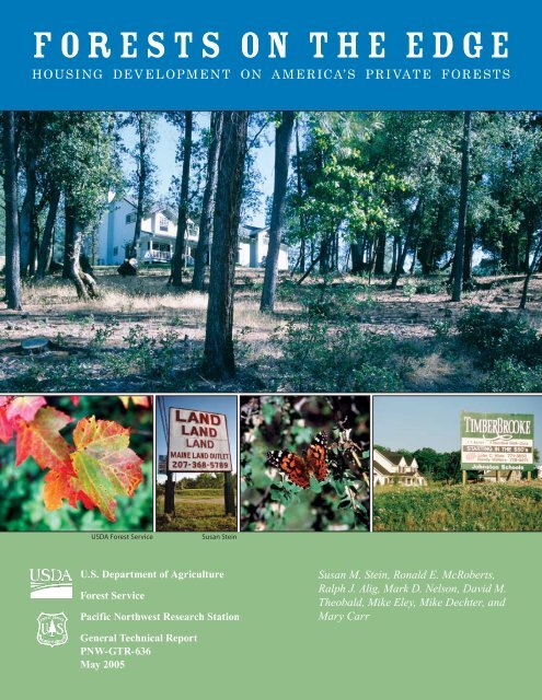
F O R E S T S O N T H E E D G EHOUSI NG DE V E L OP M E N T <strong>ON</strong> A M E R ICA’ S PR I VAT E F ORE STS<strong>USDA</strong> <strong>Forest</strong> <strong>Service</strong>Susan SteinU.S. Department of Agriculture<strong>Forest</strong> <strong>Service</strong>Pacific Northwest Research StationSusan M. Stein, Ronald E. McRoberts,Ralph J. Alig, Mark D. Nelson, David M.Theobald, Mike Eley, Mike Dechter, andMary CarrGeneral Technical ReportPNW-GTR-636May 2005
Figure 1—Location of private and public forest, nonforest, and urban areas. About three-quarters of America’s private forests are inthe East.Results from this phase of the project indicate that many privateforests—particularly in the East, where most private forestsoccur (fig. 1)—are likely to see dramatic increases in housingdevelopment in the next three decades, with consequent impactson ecological, economic, and social services. Sustaining ourforests and their benefits in the face of continuing populationgrowth is and will be a key challenge.What Is A “Private” <strong>Forest</strong>?A private forest is forest land owned byindividuals, families, corporations, organizations,tribes, or the forest industry.Private <strong>Forest</strong>s Play a Key Role inProtecting Water Quality<strong>Forest</strong>s are critical to providing and protectingwater. Covering nearly one-third of the Nation’sland, forests supply over 50 percent of freshwaterflow in the lower 48 States. <strong>Forest</strong>s protect waterquality by slowing runoff, stabilizing soils, preventingerosion and floods, and filtering pollutants. Accordingto <strong>Forest</strong> <strong>Service</strong> estimates, some 180 million peopledepend on forests for their drinking water 1 (Stein andButler 2004).1Sedell, J. 2005. Personal communication. Station Director,Pacific Southwest Research Station, P.O. Box 245, Berkeley, CA94701-0245.
Private forests constitute nearly 60 percent (about 430 millionacres) of America’s total forest land (Smith et al. 2004) andthereby provide nearly 60 percent of all waterflow originatingon U.S. forests (and nearly 30 percent of all waterflow originatingon land in the lower 48) in a typical year. 22Brown, T. 2005. Personal communication. Hydrologist, Rocky MountainResearch Station, 2150 Centre Ave., Bldg. A, Suite 376, Fort Collins, CO80526-1891.Private forests provide many other benefits to the Americanpublic. They furnish diverse habitats for fish and wildlife,providing the key to the conservation of many species. In someregions, such as the Pacific Northwest, private forests provide asignificant amount of habitat for threatened or endangered species,such as the threatened spotted owl (Holthausen et al. 1995).These habitats are important considerations for public landmanagers in the development and monitoring of recovery plansfor such species (USDI FWS 1992). Private forests also provideWhat Is A <strong>Forest</strong>?The term “forest” has different meanings, depending onwhere you live or your interest in forests. For this project,we used “land that is at least 1 acre and at least 10 percentstocked by trees of any size” (Smith et al. 2004). Thisis the definition most commonly used by <strong>Forest</strong> <strong>Service</strong><strong>Forest</strong> Inventory and Analysis scientists, who monitorthe status of our Nation’s forests each year. The sourceof our data for forest cover was the National LandCover Data compiled by the U.S. Geological Survey,which divides the country into small units (or pixels)of 323 square feet and assigns each unit to 1 of 21vegetation categories. We selected categories thatcontained vegetation that was closest to our definitionof forest.Tom Iraci, <strong>USDA</strong> <strong>Forest</strong> <strong>Service</strong> A. Price, Utah Division of <strong>Forest</strong>ry<strong>Forest</strong>s cover 749 million acres of the Nation’slandscape. Hardwoods, conifers, and mixedspecies paint a diverse forest palette thatranges from sparse dry forest in the arid,interior West to lush rain forests in the PacificNorthwest, and highly productive moistforests in the South.
the foundation for timber and other forest products businessesand accounted for 92 percent of all timber harvested in the UnitedStates in 2001 (Smith et al. 2004). Private forests in the SouthernUnited States alone produce more timber than both private andpublic forests in any other country (Wear and Greis 2002a).Long-Term Trends in <strong>Forest</strong> ChangesAlthough the amount of private forest land is increasingin some places in the country, the total area of privateforest land has been gradually declining since the mid20 th century. From 1953 to 1997, 26 states have had a net loss inforest area. In 15 years alone (1982 to 1997), 10.3 million acresof nonfederal forest land, most of which is private, were convertedto developed uses and urban areas. This is the equivalent of680,000 acres per year. The rate of conversion jumped to 1 millionacres per year during the last 5 years of this period (1992 to 1997),when 5 million acres of nonfederal forest land were permanentlyconverted (Alig et al. 2003). Although such statistics may seeminconsequential at a national scale, we are learningthat, in certain localities, housing density is increasingdramatically. <strong>Forest</strong>s on the Edge is helping to identifythose areas where housing development is most likelyto affect our private forests.Assessing housing development on privateforests, 2000 to 2030An interdisciplinary team of specialists usedgeographic information system (GIS) techniquesto identify watersheds across theconterminous United States containing private foreststhat are projected to experience increased housingdensity by 2030.Watershed selection criteria—We selected only those watersheds that had 10 percentor more forest cover and that had 50 percent or moreof their forests in private ownership. A total of 1,026of the Nation’s 2,149 fourth-level watersheds met theselection criteria. These criteria resulted in a focus onthe Eastern United States, where private forest cover ismore extensive than in other parts of the country andwhere most forest land is in private ownership. Onlythe conterminous 48 States were included becausedata for Alaska, Hawaii, and the island territories arenot adequate at this time.density and population, road density, past growth patterns,and locations of urban areas. A more detailed description ofthis and other aspects of this study can be found in Stein et al.(in press).Information sources—The following data layers were used in this analysis:• Fourth-level watershed boundaries (defined by eight-digithydrologic unit codes) (Steeves and Nebert 1994).• <strong>Forest</strong> cover (DellaSala et al. 2001).• Land ownership (DellaSala et al. 2001, Vogelmannet al. 2001).• Housing density for 2000 (U.S. Census Bureau 2001).Housing density projections for 2030. 33Theobald, D.M. [N.d.]. Sprawling in the USA? Landscape effects ofurban and exurban development. Manuscript in preparation.Watersheds Come In Different SizesTo highlight the important connection between privateforests and water, <strong>Forest</strong>s on the Edge studied projectedincreases in housing density in private forests across watersheds.A watershed is an area of land that drains into a river,stream, or other body of water (see diagram below). Tofacilitate the study of watersheds of different sizes, the U.S.Geological Survey devised a system that organizes the countryinto watershed units. There are 2,108 watersheds in theconterminous United States at the size used for this project(referred to as “fourth-level”), which have an average of amillion acres (ranging from 21,760 to about 13 million acres).Housing density projections—Housing density projections were based on many factors,including past and current statistics on housingU.S. Geological Survey
Figure 2—Watersheds in which housing density is projected to increase on private forests by 2030.
11Three of the fastest growing states—Utah, Nevada, and Idaho—contain only about 1.5 percent of our Nation’s private forests.The predominance of public forest land in the West may overshadowthe smaller but vital parcels of private forest whose losscould be critical at the local level and should not be discounted(see sidebar below).The next phases of <strong>Forest</strong>s on the Edge will focus more ondevelopment impacts on public and private forest in the West.Important parcels of private forest in the urbanized East andin the West have already been identified by state governmentsthrough forest-land protection programs such as the <strong>Forest</strong><strong>Service</strong>’s <strong>Forest</strong> Legacy Program and in coordination withnongovernmental land trusts.ImplicationsThe changes in housing density documented by <strong>Forest</strong>son the Edge have implications for the condition andmanagement of affected private forests and the watershedsin which they occur. Increased housing density in forestedareas and decreased parcel sizes can be associated with:g Decreases in native wildlife populations owingto decreased wildlife habitat quantity and quality,increased predation and mortality, and otherconsequences of human activity that change therelationships many wildlife species have withtheir environments (Engels and Sexton 1994;Harris 1984; Theobald et al. 1997; Vogel 1989;Wear and Greis 2002a, 2002b).g Alterations in forest structure and functionthat can derail ecological processes on whichforests and forest dwellers depend, resultingin less biodiversity and more opportunitiesfor invasions of nonnative species, insects, anddiseases (Ferreira and Laurance 1997, Meekinsand McCarthy 2002) (fig. 5).g Long-term modifications to and reductions inwater quality and aquatic diversity when forestscan no longer regulate the movement of stormwater across the landscape, leading to changesin streamflows, increases in sediment, reshapedstream bottoms and banks, and impacts on waterquality and aquatic species such as fish andmussels (Booth and Henshaw 2001, Bryan 1972,Fisher et al. 2000, Jones and Holmes 1985, Pauland Meyer 2001).g Decreases in timber production and activeforest management when population densitiesincrease (Gobster and Rickenbach 2004, Klineet al. 2004, Wear et al. 1999) (fig. 6).Vulnerable <strong>Forest</strong>s in the West: A Mapping ChallengePinyon-junipershrubland.Photos by A. Price, Utah Division of <strong>Forest</strong>ry,Fire and State LandsPinyon-juniper vegetation in the Southwest is an exampleof vegetation cover that is vulnerable to development insome areas but is not always considered forest. The landcoverlayer we used for this study classified tall and densepinyon-juniper vegetation as forest land, whereas sparseand stunted pinyon-juniper was classified as shrubland.Inclusion of shrubland would have resulted in a map portrayingmore pinyon-juniper lands as forest but would havealso classified all Eastern shrublands as forest, thus portrayinga substantially larger area of forest land than has beenreported in national inventories of forest resources. Thus,shrubland areas are not highlighted on the current map.
12<strong>USDA</strong> <strong>Forest</strong> <strong>Service</strong>Figure 5—Private forest landowners in Georgia’s metropolitan counties are less likely to participate in government incentiveprograms for protecting soils and tree planting than are landowners in more rural counties (Harris and De<strong>Forest</strong> 1993).g Increases in fire risk because increased housingdensities in forested landscapes generate morepotential for ignitions; make firefighting andfire preparedness in such areas more difficult,dangerous, and expensive; and restrict availablemanagement options for mitigating threats toforest lands (Grace and Wade 2000, Podur et al.2002, Russel and McBride 2003).<strong>USDA</strong> <strong>Forest</strong> <strong>Service</strong>Figure 6—In western Virginia, increasing human populationdensities have affected long-term timber managementcapabilities by reducing area of timberland and commercialvolume of growing stock by some 40 percent from their measuredvalues. Researchers found that the probability of forestmanagement approaches zero at population densities ofabout 150 people per square mile (Wear et al. 1999).g Greater loss of life and property owing towildfire because houses located in forestedlandscapes are more likely to experiencethreats from wildfire (Beringer 2000).g Changes in scenic quality and recreationalopportunities owing to loss of open space, decreasedparcel size, and fragmentation, all ofwhich can degrade the recreational experiencefor hikers, campers, and mountain bikers andlead to increased likelihood of land use conflicts(Gobster and Rickenbach 2004, Patterson et al.2003).
15Patterson, M.E.; Montag, J.M.; Williams, D.R. 2003.The urbanization of wildlife management: social science,conflict, and decision-making. Urban <strong>Forest</strong>ry and UrbanGreening. 1(3): 71–183.Paul, M.J.; Meyer, J.L. 2001. Streams in the urban landscape.Annual Review of Ecological Systems. 32: 333–365.Podur, J.; Martell, D.L.; Knight, K. 2002. Statistical qualitycontrol analysis of forest fire activity in Canada. CanadianJournal of <strong>Forest</strong> Research. 32(2): 195–205.Russel, W.H.; McBride, J.R. 2003. Landscape scalevegetation-type conversion and fire hazard in the SanFrancisco Bay area open spaces. Landscape and UrbanPlanning. 64: 201–208.Smith, W.B.; Miles, P.D.; Vissage, J.S.; Pugh, S.A. 2004.<strong>Forest</strong> resources of the United States, 2002. Gen. Tech. Rep.NC-241. St. Paul, MN: U.S. Department of Agriculture,<strong>Forest</strong> <strong>Service</strong>, North Central Research Station. 137 p.http://www.ncrs.fs.fed.us/pubs/gtr/gtr_nc241.pdf.(28 February 2005).Steeves, P.A.; Nebert, D.D. 1994. Hydrologic unit maps ofthe conterminous United States [Database]. U.S. GeologicalSurvey, open-file dataset “huc250k,” ed. 1. Reston, VA: U.S.Geological Survey. http://water.usgs.gov/GIS/metadata/usgswrd/XML/huc250k.xml. (1 March 2005).Stein, S.; Butler, B. 2004. On the frontline: private forestsand water resources. Wildland Waters. Summer. FS 790.Washington, DC: U.S. Department of Agriculture, <strong>Forest</strong><strong>Service</strong>. 24 p. http://www.fs.fed.us/wildlandwaters/.(1 February 2005).Stein, S.; McRoberts, R.E.; Nelson, M.D.; Theobald, D.M.;Eley, M.; Dechter, M. [In press]. <strong>Forest</strong>s on the edge: aGIS-based approach to projecting housing development onprivate forests. In: Aguirre-Bravo, C., ed., Proceedings:monitoring science and technology symposium: unifyingknowledge for sustainability in the western hemisphere.Ogden, UT: U.S. Department of Agriculture, <strong>Forest</strong> <strong>Service</strong>,Rocky Mountain Research Station.Theobald, D.M.; Miller, J.R.; Hobbs, N.T. 1997. Estimatingthe cumulative effects of development on wildlife habitat.Landscape and Urban Planning. 39: 25–36.Tyrväinen, L. 1997. The amenity value of the urban forest: anapplication of the hedonic pricing method. Landscape andUrban Planning. 37(3–4): 211–222.Tyrväinen, L.; Väänänen, H. 1998. The economic value ofurban forest amenities: an application of the contingentvaluation method. Landscape and Urban Planning. 43(1–3):108–115.U.S. Census Bureau. 2001. Census 2000 summary file 1technical documentation. Washington, DC. http://www.census.gov/prod/cen2000/doc/sf1.pdf. 634 pp. (1 March2005).U.S. Department of the Interior, Fish and Wildlife <strong>Service</strong>[USDI FWS]. 1992. Final draft recovery plan for thenorthern spotted owl. Portland, OR. 322 p. Vol. 1.Vogel, W.O. 1989. Response of deer to density anddistribution of housing in Montana. Wildlife SocietyBulletin. 17: 406–413.Vogelmann, J.E.; Howard, S.M.; Yang, L.; Larson, C.R.;Wylie, B.K.; VanDriel, J.N. 2001. Completion of the 1990snational land cover data set [NLCD] for the conterminousUnited States. Photogrammetric Engineering and RemoteSensing. 67: 650–662.Wear, D.N.; Greis, J.G., eds. 2002a. Southern forest resourceassessment. Gen. Tech. Rep. SRS-53. Asheville, NC: U.S.Department of Agriculture, <strong>Forest</strong> <strong>Service</strong>, SouthernResearch Station. 635 p.Wear, D.N.; Greis, J.G. 2002b. Southern forest resourceassessment: summary of findings. Journal of <strong>Forest</strong>ry.100(7): 6–15.Wear, D.N.; Liu, R.; Foreman, J.M.; Sheffield, R.M. 1999.The effects of population growth on timber management andinventories in Virginia. <strong>Forest</strong> Ecology and Management.118: 107–115.Weeks, E.C. 1990. Mill closures in the Pacific Northwest:the consequences of economic decline in rural industrialcommunities. In: Lee, R.G.; Field, D.R.; Burch, W.R., Jr.,eds. Community and forestry: continuities in the sociology ofnatural resources. Boulder, CO: Westview Press: 125–140.
Mark Godfrey © 2004 The Nature Conservancy<strong>Forest</strong>s on the Edge: Pressures and Opportunities on America’s Private <strong>Forest</strong>sPhase 1 of <strong>Forest</strong>s on the Edge, documentedin this report, identifies forested watershedsmost likely to experience housing development.Future phases will explore:g Private forest opportunities and threats in moredetail—presenting additional data related towater quality, timberland, and wildlife values, aswell as maps showing where private forests aremost susceptible to development, fire, insectsand diseases, and deterioration of air quality.g Housing density projections in the vicinity ofpublic forests.g Detailed descriptions of the “top 10” watershedsof concern and of promise in the conterminousUnited States.For further information on <strong>Forest</strong>s on the Edge,contact:Susan SteinPrivate <strong>Forest</strong> Land Studies Coordinator<strong>USDA</strong> <strong>Forest</strong> <strong>Service</strong>Cooperative <strong>Forest</strong>ry StaffMail Stop 1123Washington, DC 20250-1123Phone: (202) 205-0837Fax: (202) 205-1271sstein@fs.fed.ushttp://www.fs.fed.us/projects/foteThe <strong>Forest</strong> <strong>Service</strong> of the U.S. Department of Agriculture is dedicated to the principle of multiple use management of the Nation’s forestresources for sustained yields of wood, water, forage, wildlife, and recreation. Through forestry research, cooperation with the States andprivate forest owners, and management of the National <strong>Forest</strong>s and National Grasslands, it strives—as directed by Congress—to provideincreasingly greater service to a growing Nation.The U.S. Department of Agriculture (<strong>USDA</strong>) prohibits discrimination in all its programs and activities on the basis of race, color, national origin,gender, religion, age, disability, political beliefs, sexual orientation, or marital or family status. (Not all prohibited bases apply to all programs.)Persons with disabilities who require alternative means for communication of program information (Braille, large print, audiotape, etc.) shouldcontact <strong>USDA</strong>’s TARGET Center at (202) 720-2600 (voice and TDD).To file a complaint of discrimination, write <strong>USDA</strong>, Director, Office of Civil Rights, Room 326-W, Whitten Building, 14th and IndependenceAvenue, SW, Washington, DC 20250-9410 or call (202) 720-5964 (voice and TDD). <strong>USDA</strong> is an equal opportunity provider and employer.<strong>USDA</strong> is committed to making its information materials accessible to all <strong>USDA</strong> customers and employees.


