FORESTS ON THE EDGE - USDA Forest Service
FORESTS ON THE EDGE - USDA Forest Service
FORESTS ON THE EDGE - USDA Forest Service
- No tags were found...

Create successful ePaper yourself
Turn your PDF publications into a flip-book with our unique Google optimized e-Paper software.
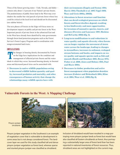
11Three of the fastest growing states—Utah, Nevada, and Idaho—contain only about 1.5 percent of our Nation’s private forests.The predominance of public forest land in the West may overshadowthe smaller but vital parcels of private forest whose losscould be critical at the local level and should not be discounted(see sidebar below).The next phases of <strong>Forest</strong>s on the Edge will focus more ondevelopment impacts on public and private forest in the West.Important parcels of private forest in the urbanized East andin the West have already been identified by state governmentsthrough forest-land protection programs such as the <strong>Forest</strong><strong>Service</strong>’s <strong>Forest</strong> Legacy Program and in coordination withnongovernmental land trusts.ImplicationsThe changes in housing density documented by <strong>Forest</strong>son the Edge have implications for the condition andmanagement of affected private forests and the watershedsin which they occur. Increased housing density in forestedareas and decreased parcel sizes can be associated with:g Decreases in native wildlife populations owingto decreased wildlife habitat quantity and quality,increased predation and mortality, and otherconsequences of human activity that change therelationships many wildlife species have withtheir environments (Engels and Sexton 1994;Harris 1984; Theobald et al. 1997; Vogel 1989;Wear and Greis 2002a, 2002b).g Alterations in forest structure and functionthat can derail ecological processes on whichforests and forest dwellers depend, resultingin less biodiversity and more opportunitiesfor invasions of nonnative species, insects, anddiseases (Ferreira and Laurance 1997, Meekinsand McCarthy 2002) (fig. 5).g Long-term modifications to and reductions inwater quality and aquatic diversity when forestscan no longer regulate the movement of stormwater across the landscape, leading to changesin streamflows, increases in sediment, reshapedstream bottoms and banks, and impacts on waterquality and aquatic species such as fish andmussels (Booth and Henshaw 2001, Bryan 1972,Fisher et al. 2000, Jones and Holmes 1985, Pauland Meyer 2001).g Decreases in timber production and activeforest management when population densitiesincrease (Gobster and Rickenbach 2004, Klineet al. 2004, Wear et al. 1999) (fig. 6).Vulnerable <strong>Forest</strong>s in the West: A Mapping ChallengePinyon-junipershrubland.Photos by A. Price, Utah Division of <strong>Forest</strong>ry,Fire and State LandsPinyon-juniper vegetation in the Southwest is an exampleof vegetation cover that is vulnerable to development insome areas but is not always considered forest. The landcoverlayer we used for this study classified tall and densepinyon-juniper vegetation as forest land, whereas sparseand stunted pinyon-juniper was classified as shrubland.Inclusion of shrubland would have resulted in a map portrayingmore pinyon-juniper lands as forest but would havealso classified all Eastern shrublands as forest, thus portrayinga substantially larger area of forest land than has beenreported in national inventories of forest resources. Thus,shrubland areas are not highlighted on the current map.