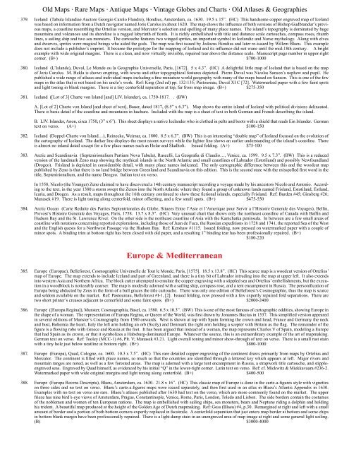
<strong>Old</strong> Maps · Rare Maps · Antique Maps · Vintage Globes and Charts · <strong>Old</strong> Atlases & Geographies379. Iceland (Tabula Islandiae Auctore Georgio Carolo Flandro), Hondius, Amsterdam, ca. 1630. 19.5 x 15”. (HC) This handsome copper engraved map of Icelandwas based on information from a Dutch navigator named Joris Carolus in about 1620. The map shows the influence of both versions of Bishop Gudbrandur’s previousmaps, a coastline resembling the Ortelius version, and Mercator’s selection and spelling of many place names. The island’s topography is dominated by hugemountains and volcanoes and its shoreline is a rugged labyrinth of fiords. It is richly embellished with title and distance scale cartouches, compass roses, rhumblines, a sailing ship and two sea monsters. The cartouche features two winged sprites, an important symbol in Icelandic and Norse mythology. Along with elvesand dwarves, sprites were magical beings who aided the gods. The map was first issued by Jodocus Hondius and later re-issued by Willem Blaeu. This exampledoes not include a publisher’s imprint. It became the prototype for the mapping of Iceland and its influence did not wane until the mid-18th century. A brightexample with wide original margins. There is a clean, and now virtually invisible, repaired tear above the distance scale. Manuscript page number in upper-rightcorner. (B+) $700-1000380. Iceland (L’Islande), Duval, Le Monde ou la Geographie Universelle, Paris, [1672]. 5 x 4.3”. (HC) A delightful little map of Iceland that is based on the mapof Joris Carolus. M. Hekla is shown erupting, with towns and other topographical features depicted. Pierre Duval was Nicolas Sanson’s nephew and pupil. Hepublished a wide range of atlases and individual maps including a fine miniature world geography with many of the maps based on Sanson. This is one of the fewmaps in the atlas that is not based on his uncle’s work. Ref: King (2nd ed) pp. 132-135; Pastoureau, Duval XI C [72]. Watermarked paper with a few faint spotsand light toning in blank margins. There is a tiny centerfold separation at top, far from map image. (B+) $275-350381. Iceland ([Lot of 3] Charte von Island [and] LIV. Islander), ca. 1750-1817. . (BW)A. [Lot of 2] Charte von Island [and sheet of text], Bauer, dated 1817, (8.5” x 6.3”). Map shows the entire island of Iceland with political divisions delineated.There is basic detail of the coastline and mountains in hachure. Included with the map is a sheet of text in both German and French describing the island.B. LIV. Islander, Anon, circa 1750, (3” x 6”). This sheet displays a native Icelander who is clothed in pelts and boots with a shield that reads Ein Islander. Germantext on verso. (A+) $100-150382. Iceland (Doppel-Charte von Island…), Reinecke, Weimar, ca. 1800. 8.5 x 6.3”. (BW) This is an interesting “double map” of Iceland focused on the evolution ofthe cartography of Iceland. The darker line displays the most recent surveys while the lighter line shows an earlier understanding of the island’s coastline. Thereis almost no inland detail except for a few place names such as Holar and Skalholt. Issued folding. (A+) $75-100383. Arctic and Scandinavia (Septenirionalium Partium Nova Tabula), Ruscelli, La Geografia di Claudio…, Venice, ca. 1599. 9.5 x 7.3”. (BW) This is a reducedversion of the landmark Zeno map showing the mythical islands in the North Atlantic and small coastlines of Labrador (Estotiland) and possibly Newfoundland(Drogeo). Frisland is depicted in considerable detail, with many place names indicated. The only cartographic difference between this and the woodcut mappublished by Zeno is that there is no land bridge between Greenland and Scandinavia on this edition. This is the second state with the misspelled first word in thetitle, Septenirionalium, and the name Deogeo. Italian text on verso.In 1558, Nicolo (the Younger) Zeno claimed to have discovered a 14th century manuscript recording a voyage made by his ancestors Nicolo and Antonio. Accordingto the text, in the year 1380 a storm swept the Zenos into the North Atlantic where they found a group of unknown lands named Frisland, Estotiland, Estland,Icaria, and Drogeo. As a result, maps throughout the 16th century continued to show these fictional islands, especially Frisland. Ref: Burden #45; Ginsberg #26;Manasek #19. There is light toning along centerfold, minor offsetting, and a few small spots. (B+) $475-550384. Arctic Ocean (Carte Reduite des Parties Septentrionales du Globe, Situees Entre l’Asie et l’Amerique pour Servir a l’Histoire Generale des Voyages), Bellin,Prevost’s Histoire Generale des Voyages, Paris, 1758. 13.7 x 8.3”. (HC) Very unusual chart that shows only the northeast coastline of Canada with Baffin andHudson Bay and the St. Lawrence River. On the other side is the northeast coastline of Asia with the Kamchatka peninsula. In between are a few small areas ofcoastline with notations concerning reported explorations, including those of Juan de Fuca, the Russian expeditions in 1728 and 1741, the reported Sea of the Westand the English quests for a Northwest Passage via the Hudson Bay. Ref: Kershaw #1115. Issued folding, now pressed on watermarked paper with a couple ofminor spots. A binding trim at bottom right has been closed with old paper, and a resulting 1” binding tear has been professionally repaired. (B+)$180-220Europe & Mediterranean385. Europe (Europae), Belleforest, Cosmographie Universelle de Tout le Monde, Paris, [1575]. 18.5 x 13.8”. (HC) This scarce map is a woodcut version of Ortelius’map of Europe. The map extends to include Iceland and part of Greenland, and there is a tiny bit of Labrador intruding into the map at upper left. It also extendsinto western Asia and Northern Africa. The block cutter attempted to emulate the copper engraving with a stippled sea and Ortelius’ embellishments, but the executionin a woodblock is noticeably coarser. The map is modestly adorned with a sailing ship, compass rose, and a tent encampment in Russia. The personification ofEuropa being abducted by Zeus in the form of a bull graces the title cartouche. There was only one edition of Belleforest’s Cosmographie, thus the map is scarceand seldom available on the market. Ref: Pastoureau, Belleforest #I-1, [2]. Issued folding, now pressed with a few expertly repaired fold separations. There aretwo short printer’s creases adjacent to centerfold and some faint spots. (B+) $2000-2400386. Europe ([Europa Regina]), Munster, Cosmographia, Basel, ca. 1580. 6.5 x 10.3”. (BW) This is one of the most famous of cartographic oddities, showing Europe inthe shape of a woman. The representation of Europa Regina, or Queen of the <strong>World</strong>, was first drawn by Jonannes Bucius in 1537. This simplified version appearedin several editions of Munster’s Cosmography from 1580 onwards. West is shown at top with Spain forming the crown and head, France and Germany the neckand bust, Bohemia the heart, Italy the left arm holding an orb (Sicily) and Denmark the right arm holding a scepter with Britain as the flag. The remainder of thefigure is a flowing robe with Greece and Russia at the feet. It has been argued that instead of a woman, the map represents Charles V of Spain, modeling a Europethat had Spain as its crown, or that it symbolizes a Habsburg-dominated Europe. Whatever the source, this is an extraordinary example of the art of mapmaking.German text on verso. Ref: Tooley (MCC-1) #6, Plt. V; Manasek #3.21. Light overall toning and minor show-through of text on verso. There is a small rust stainwith a tiny hole just below neatline at bottom right. (B+) $800-1000387. Europe (Europa), Quad, Cologne, ca. 1600. 10.3 x 7.5”. (HC) This rare detailed copper engraving of the continent draws primarily from maps by Ortelius andMercator. The continent is filled with place names, so much so that the countries are identified through a lettered key which appears at left. Major rivers andmountain ranges are noted, as well as a few forested areas. The map is adorned with a large tent encampment in Russia, a strapwork title cartouche, and stippleengravedseas. Engraved by Quad himself, as evidenced by his initial “Q” in the lower-right corner. Latin text on verso. Ref: cf. Mickwitz & Miekkavaara #236-2.Watermarked paper with wide original margins and light toning along centerfold. (B+) $400-500388. Europe (Europa Recens Descripta), Blaeu, Amsterdam, ca. 1630. 21.8 x 16”. (HC) This classic map of Europe is done in the carte-a-figures style with vignetteson three sides and no text on verso. Blaeu’s carte-a-figures maps were issued separately, and then first used in an atlas in Blaeu’s Atlantis Appendix in 1630.Examples with no text on verso are rare. Blaeu’s atlases published after 1630 had text on the verso, which are more commonly found on the market. The upperfrieze has nine bird’s-eye views of Amsterdam, Prague, Constantinople, Venice, Rome, Paris, London, Toledo and Lisbon. The side borders contain the costumesof the noblemen and women of ten European nations. The map is embellished with sailing ships, sea monsters, bears and Neptune riding a dolphin and holdinghis trident. A beautiful map produced at the height of the Golden Age of Dutch mapmaking. Ref: Goss (Blaeu) #4, p.30. Remargined at right and left with a smallamount of border and a portion of both bottom corners expertly replaced in facsimile. A centerfold separation that just enters map border at bottom and some chipsin bottom blank margin have been professionally repaired. There is a light damp stain in an unengraved area of map image at right and some general light soiling.(B) $3000-4000
<strong>Old</strong> Maps · Rare Maps · Antique Maps · Vintage Globes and Charts · <strong>Old</strong> Atlases & Geographies389. Europe (Europa Nova Delineatio), Merian, Frankfurt, ca. 1640. 14.3 x 11.3”. (BW) This lovely map is based on one of the most famous 17th Century maps ofthe continent of Europe - Blaeu’s Europa recens descripta. The map extends to include Iceland, the mythical island of Frisland, and the coast of Greenland. It isadorned with a decorative title cartouche, sailing ships and a sea monster. A slightly uneven impression on watermarked paper with a few printer’s creases andtwo stains that just enter map at right and left. (B+) $275-350390. Europe (Carte Chronologique des Etats & Empires du Monde qui se Sont Formez de la Chute de l’Empire Romain Depuis le Commencement de Lere VulgaireJusqu’a Present), Chatelain, Atlas Historique et Methodique, Amsterdam, ca. 1720. 23.2 x 19.5”. (HC) This interesting sheet has a small map of Europe at thecenter surrounded by chronological tables tracing the ancestry of the royal houses of the known world from the time of Julius Caesar to the early eighteenth century.The royal lines include the kings of Peru, Japan, Morocco and the Moguls, as well as the European royalty. The map, titled “Carte Pour Indiquer la Situation desEtats & Empires des Empereurs Rois & Princes Mentionnez dans cette Carte” measures 6.6 x 3.7”. Issued folding with light toning along one fold. (B+)$350-425391. Europe (L’Europe Dressee sur les Observations de Mrs. de l’Academie Royale des Sciences…), Delisle/Covens & Mortier, Amsterdam, ca. 1733. 23 x 19.3”. (HC)Large, attractive map of Europe, including Iceland and the Mediterranean, based on the geography of Guillaume Delisle. The German Empire dominates all ofcentral Europe, Poland takes in all of northeastern Europe, and the Turkish Empire occupies all of southeastern Europe. Fine decorative title cartouche. Alternativetitle above neatline at top: “Nova Europe Descriptio in Regna & Regiones Praecipuas Divisae, ad Usum Serenissimi Burgundiae Ducis.” Original outline colorwith an archivally repaired centerfold separation that enters 4” into map at bottom. There is a small hole above the Black Sea that has also been repaired, as wellas a couple of tiny unrepaired holes. There are numerous abrasions throughout England and Wales, Spain, France, and Germany, with part of image in facsimile.There are blank pen marks in bottom right corner of map. (C+) $275-350392. Europe (Europa Volgens de Nieuwste Verdeeling), Bohn, ca. 1794. 6.5 x 9.2”. (HC) This is a very uncommon cartographic curiosity showing Europe in a femaleshape. This map follows a tradition of depicting Europe as a regal queen but with an interesting twist and political commentary. This anti-Napoleonic imagedemotes Europa from a queen to a homely middle-aged housewife. The figure is superimposed over a map that includes a fair amount of detail. The IberianPeninsula forms the head with a matronly cap. Italy is her left arm that holds a cup (Sicily) that she is stirring with a pair of sheers held in her right hand (Corsicaand Sardinia). Her scarf forms Britain, and the rest of the continent is encompassed in her flowing dress. Engraved by Hendrik Klockhoff.Bohn also made a companion map of the same size depicting Europe in its typical geographical format (see adjacent lot). Ref: Lewes (Mercator’s <strong>World</strong> Vol. 4,No. 1) pp. 34-41. Original color with minor soiling. (B+) $1100-1400393. Europe (Europa, Volgens de Nieuwste Verdeeling), Bohn, ca. 1794. 9.1 x 6.4”. (HC) This small map of Europe is a companion map to Bohn’s map of Europein the shape of a woman (see adjacent lot). The map depicts political boundaries, towns, and rivers, and extends to include Iceland, with a smoking Mt. Hekla.Engraved by G. van Baarsel. Original color with minor soiling. (B+) $110-140394. Europe (Europe), Lucas, A General Atlas…, Baltimore, [1823]. 8.8 x 10.5”. (HC) A detailed map of Europe depicting cities, political boundaries, mountains,and rivers. Lucas’ General Atlas is known as one of the finest general atlases produced in the U.S. at the time, due to the high quality paper, superior engravingquality, and attractive coloring style. Original color on watermarked paper with minor soiling in wide margins and a chip in bottom right corner, far from map.(A) $180-210395. Europe ([Lot of 2] Ethnographic Map of Europe [and] Ethnographic Map of Great Britain and Ireland), Johnston, ca. 1854. 24 x 20”. (PC) Nice lot of thematicmaps from the English version of Heinrich Berghaus’ Physikalischer Atlas, the first truly comprehensive thematic atlas. These are very early examples of printedcolor, the development of which made a huge impact on cartography in general and specifically on the graphic portrayal of geographical data on thematic maps.These two maps show detailed views of the ethnology of the region by Dr. Gustaf Kombst. The map of Europe shows 22 different ethnic groups covering thearea from Scandinavia to Russia. The map of Great Britain displays 20 different ethnic groups and includes an inset of the Shetland and Orkney Islands at top.Both maps are surrounded in a keyboard style border. The map of Europe has centerfold separations that extends 2” into the image at top and 1/8” into imageat bottom, as well as a few unobtrusive spots. The map of Great Britain has centerfold separations that extend 1” into the image at right and 2” into image at left,although the left-hand separation has been partially closed on verso. Both maps have faint offsetting and a hint of toning along sheet edges. (B+)$160-200396. Europe (Europa im Zeitalter Napoleons), Perthes, Spruner’s Historische Schul-Atlas, Gotha, ca. 1868. 10.4 x 8.1”. (HC) This map depicts Europe during Napoleon’sprominence, from about 1796-1815. Key cities, political boundaries, and rivers are shown, along with hachure marks depicting the topography of the land.A small inset at bottom right shows Egypt and the Nile River valley. Engraved by C.W. Hensgen and W. Weiler. Enclosed in a delicately engraved keyboard styleborder. Lovely original color with a couple of tiny, unobtrusive spots. There are a small chip and stains in right blank margin, far from map. (A)$80-100397. Europe (Gedrangte Fruhjahrsubersicht von Europa im Jahre 1915), 1915. 26.2 x 20.2”. (PC) This fascinating German propaganda map depicts a “CondensedOverview of Europe in the Spring of 1915.” Published by Lucas Grafe, this map depicts the Germans’ view of the alliance situation and territorial issues towardsthe end of the first year of the war. The key countries involved in the war are represented by caricatures of political leaders and the military. Each country isaccompanied by a short rhyme describing (and typically making fun of) the country’s position. Only the German and Austro-Hungarian Empires are shown ina positive light, with their majestic queens at the helm surrounded by abundant weaponry and superior armies, accompanied by the verse ”Deutschland Ostreichuber alles - alles andre hat den Dalles” (Germany and Austria above all - all others are “on the rocks”). Paul von Hindenburg, a commanding officer who led theGerman army to several key early victories against the Russians, appears chopping off the hand of a giant Russian, armed only with a bottle of Vodka. The French-Revolutionary heroine, Marianne, is depicted atop a mechanical horse with Raymond Poincare (President) and Theophile Delcasse (Minister of War and ForeignAffairs) attempting to turn the gears and move the horse forward without any success. Britain is personified as John Bull, holding the flags of his allies and sittingon a large sack of money that is being rapidly emptied due to a hole in its side. There is a “For Sale” sign posted in Albania, and in Africa appears the verse ”Imgrossen heissen Afrika - weiss man nicht recht - was da geschah” (In big hot Africa, no one quite knows what happened). Printed title pastedown on verso.Although the human personification of continents and countries can be seen as early as the 14th century (on maps by Opicinus de Canestris), human and animalmetaphors on maps reached a new level in Europe between 1845 and 1945 with political cartoon maps. The rise of these satirical maps reflected the momentouspolitical and cultural changes that occurred during the time. Political leaders were caricaturized and European nations were given symbolic identities that lenthumor and accessibility to the geographical map. Based on popular stereotypes, these visual representations even found their way into the classroom to help bringgeography and politics to life. Original serio-comic maps are very scarce due to their ephemeral nature, although they have been reproduced as posters. Issuedfolding with minor creasing in bottom blank margin. (A) $2750-3750398. Britain (Novissima prae caeteris aliis Accuratissima Regnorum Angliae, Scotiae Hiberniae…), Wit, Amsterdam, ca. 1690. 19.6 x 23.2”. (HC) Fine decorativemap of Britain that includes an inset of the Faro, Shetland and Orkney Islands. The cartography of Ireland follows Petty’s surveys and the map is fully engravedwith political information. The title cartouche is surrounded by clouds in which putti display the coats of arms of England, Scotland and Ireland. The scale ofmiles is further embellished with the royal coat of arms during the reign of William and Mary (1689-94) and several figures. This is the second state with the additionof four compass roses. Ref: Shirley (BI to 1750) De Wit 6. Superb original color with light toning. Backed in tissue to repair numerous cracks caused bythe oxidation of the green pigment. (B) $400-500399. Britain ([Lot of 2] Geological & Paleontological Map of the British Islands [and] Paleontological Map Sheet No. 2), Johnston, The Physical Atlas of Natural Phenomena,Edinburgh, 1854. 24.4 x 20”. (PC) These are actually matching maps that together describe the geology of Great Britain. The first map is the northernsheet which carries the full title in a panel with engraved vignettes of skeletons, fossils, and the head of a Saber-toothed Tiger. The lower sheet contains the legend


