Stream Transport: From Mountains to Oceans
Stream Transport: From Mountains to Oceans
Stream Transport: From Mountains to Oceans
- No tags were found...

Create successful ePaper yourself
Turn your PDF publications into a flip-book with our unique Google optimized e-Paper software.
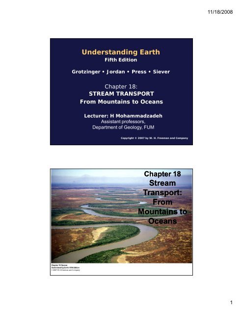
11/18/2008Understanding EarthFifth EditionGrotzinger • Jordan • Press • SieverChapter 18:STREAM TRANSPORT<strong>From</strong> <strong>Mountains</strong> <strong>to</strong> <strong>Oceans</strong>Lecturer: H MohammadzadehAssistant professors,Department of Geology, FUMCopyright © 2007 by W. H. Freeman and CompanyChapter 18<strong>Stream</strong><strong>Transport</strong>:<strong>From</strong><strong>Mountains</strong> <strong>to</strong><strong>Oceans</strong>1
11/18/2008About <strong>Stream</strong> <strong>Transport</strong>• <strong>Stream</strong>s and rivers are major geologicalagents of change in landscapes.• <strong>Stream</strong>s are any flowing body of water,but rivers are major branches of a streamsystem.• <strong>Stream</strong> flow is related <strong>to</strong> the interactionof plate tec<strong>to</strong>nic and climate systems.Lecture Outline1. <strong>Stream</strong> valley, channels, and floodplains2. Drainage networks3. How running water erodes solid rock4. How stream waters flow and transportsediment5. Deltas: the mouths of rivers6. <strong>Stream</strong>s as geosystems2
11/18/20081. <strong>Stream</strong> valleys, channels, andfloodplainsThe three basic parts of a stream● valley (sloping area around thestream)● channel (bot<strong>to</strong>m of valley)● floodplain (flat area in valleylevel with <strong>to</strong>p of channel)<strong>Stream</strong>valleys,channels,andfloodplains:incisedmeandersof theSan JuanRiver, Utah3
11/18/20081. <strong>Stream</strong> valleys, channels, and floodplains● Channel patterns● meanders (low sediment load,low velocity)● oxbow lakes● point bars and cut banks● braided streams (high sedimentload, high velocity)<strong>Stream</strong>valleys,channels,andfloodplains:meanderingstreamsPoint barLow-velocity, low-sedimentstreams form meanders.Meanders shift from side <strong>to</strong>side in a snaking motion.The current is faster at outsidebanks, which are eroded.Sediments get deposited ininside banks forming pointbars.The bends grow closer andthe point bars bigger.During a major flood, theriver cuts across the loop.The abandoned loop remainsas an oxbow lake.4
11/18/2008<strong>Stream</strong> valleys, channels, and floodplains:a meandering river in Alaskapoint bar<strong>Stream</strong> valleys, channels, and floodplains:meanders of the Mississippi River5
11/18/2008<strong>Stream</strong> valleys, channels, and floodplains:braided streamslow-water water period(e.g., summer)Where high-velocity,high-sedimentstreams flowover easilyerodedterrain…<strong>Stream</strong> valleys, channels, and floodplains:braided streams…the water does notform oxbow bends…High-water period(e.g., spring snowmelt)…but cuts across theedges of existingchannels, creatingbraided channels.6
11/18/2008<strong>Stream</strong> valleys, channels, and floodplains:braided stream of the Chitina River, Alaskabraided channels1. <strong>Stream</strong> valleys, channels, andfloodplains● The stream floodplain● fine-grained sediment layers● agricultural resource● natural levees7
11/18/2008<strong>Stream</strong> floodplains<strong>Stream</strong>valleys,channels,andfloodplains:naturalleveesof theMississippidelta8
11/18/20082. Drainage networksThe drainagedivides andbasins2. Drainage networks: drainage networks9
11/18/20082. Drainage networks● Drainage patterns and geologichis<strong>to</strong>ry● antecedent streams● superposed streams2. Drainage networks:drainage patterns and geologic his<strong>to</strong>ryExample of an antecedent stream– the Delaware Water Gap,Pennsylvania-New Jersey10
11/18/20083. How running water erodes solid rockGullies and headward erosionPotholes11
11/18/20084. How stream waters flow and transportsediment: laminar and turbulent flow● Fac<strong>to</strong>rs affecting laminar/turbulent● velocity, depth, and viscosity4. How stream waters flow and transportsediment: laminar and turbulent flow12
11/18/20084. How stream waters flow and transport sediment● Erosion and sediment transport● suspended load, ● bed load● Competence and capacity● velocity and volume of flow13
11/18/20084. How stream waters flow and transportsediment: settling of sediments14
11/18/20084. How stream waters flow and transportsediment: ripples and dunes4. How stream waters flow and transportsediment: ripples and dunes15
11/18/20085. Deltas: the mouths of rivers –delta sedimentation and bedding5. Deltas: the mouths of riversThe growthof deltas:theMississippiRiverdeltasedimentation16
11/18/20086. <strong>Stream</strong>s as geosystemsGlaciersDendriticdrainageLakeWaterfallRapidsBraidedchannelMidstreamsandbarPoint barTerracedfloodplainMeanderingchannelCut bankOxbowlakeSwampand marshSubsidence occursin deltas.DistributarychannelWaterfallsdevelop whererocks resisterosion or wherefaulting offsetsthe streambed.Fine-grainedsedimentsof silt and clayGlaciersLakeAs the slopedecreases,rivers formbraided channels.NaturalleveeRapidsOlder sediments6. <strong>Stream</strong>s as geosystemsRainfall and snowmelt gather<strong>to</strong> create streams and rivers.DendriticdrainageIncisedbedrockWaterfallBraidedchannelMidstreamsandbarPoint barTerracedfloodplainMeanderingchannelSediments may be eroded<strong>to</strong> produce terraces.CoarsegrainedsedimentsSlopes are steep andonly the coarsest sedimentsare deposited.Cut bankMeandering channels form.Coarse-grained sedimentsare deposited.OxbowlakeFine-grainedsedimentsSubsidence occursin deltas.CoarsesedimentsCoarse depositsfrom older riversNatural levees maintainthe flow of water. Whenrivers flood, sedimentsare able <strong>to</strong> fillsurrounding areas.Swampand marshDistributarychannelThe current slows and depositsits fine sediments as a delta.17
11/18/20086. <strong>Stream</strong>s as geosystems:Q = A x V1 m/s10 m3 mA river with lower cross-sectional sectional areaand velocity has a lower discharge…2 m/s9 m10 m…than a river with higher cross-sectional sectionalarea and velocity.18
11/18/2008Probability of occurrence (in any given year)Annual maximum discharge(m 3 /s)A large flood of 1800 m 3 /shas a probability of 10percent and a recurrenceinterval of about 12 years.Recurrence interval (years)Longitudinal <strong>Stream</strong> profileRivers are steepnear the head…● equilibrium of stream flow● <strong>to</strong>pography (slope)● climate● streamflow (Q and V)● resistance of rock● sediment loadAltitude abovesea level (m)…and almost flatat the mouth.Distance from headwaters of river (km)SourceMouth19
11/18/2008● changes in base level (the quest for equilibrium)TIME 1A mature stream has developeda classic stream profile.TIME 3Sediment is now deposited in the lake.base levelTIME 2A change in base levels changesthe profile.TIME 4Eventually, the original stream profileis res<strong>to</strong>red.newbase leveloldbase level6. <strong>Stream</strong>s as geosystems● Places where streams adjust<strong>to</strong> changing conditions rapidly● alluvial fans● terraces20
11/18/2008Thelake -6. <strong>Stream</strong>s as geosystemsin thisinstanceman-made,and itseffectKey terms and conceptsAlluvial fanAntecedent streamBase levelBed loadBot<strong>to</strong>mset bedBraided streamCapacityChannelDeltaDendritic drainageDischargeDivideDrainage networkDuneFloodplainLaminar flowLongitudinal profileMeanderNatural leveeOxbow lakePoint barPotholeRippleRiverSaltation<strong>Stream</strong>Superposed streamSuspended loadTerraceTopset bedTributaryTurbulent flowValley21