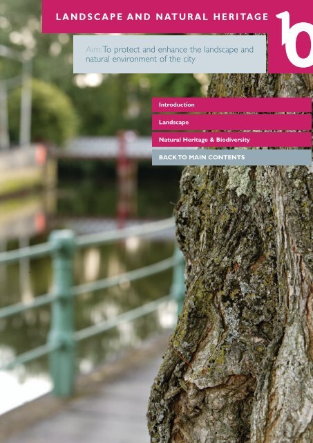
LANDSCAPE AND NATURAL HERITAGE - Cork City Council
LANDSCAPE AND NATURAL HERITAGE - Cork City Council
LANDSCAPE AND NATURAL HERITAGE - Cork City Council
- No tags were found...

You also want an ePaper? Increase the reach of your titles
YUMPU automatically turns print PDFs into web optimized ePapers that Google loves.
10<strong>L<strong>AND</strong>SCAPE</strong> <strong>AND</strong> <strong>NATURAL</strong> <strong>HERITAGE</strong><strong>Cork</strong> <strong>City</strong>’s Landscape Character and Key Landscape Assets10.14 <strong>Cork</strong> has a unique and distinctive landscape that forms a key aspect of the city’s character.Within citiessuch as <strong>Cork</strong>, landscape character involves the combination and interplay of many elements, including:the landscape; built environment; riverscape and natural heritage. Landscape is largely a non-renewableresource and therefore it is in the city’s interest to ensure that the city’s landscape assets that remainare protected for future generations for their visual, functional, natural heritage and other values. Manyof <strong>Cork</strong>’s landscape assets, and particularly those that have an open “greenfield” character, have beenlost over a period of time. Given the diminishing supply of non-renewable landscape assets the <strong>City</strong><strong>Council</strong> has sought to review the existing landscape policy and to provide a clear policy basis forprotecting those remaining assets.10.15 <strong>Cork</strong> <strong>City</strong> falls within the <strong>Cork</strong> <strong>City</strong> and Harbour landscape character type identified in the LandscapeCharacter Assessment (LCA) of <strong>Cork</strong> County (Mosart, 2003).The west of the city is abutted directlyby the Broad Fertile Lowland Valley landscape character type of the River Lee Valley (and tributaries).The overall characteristics of the <strong>City</strong> Harbour and Estuary Character Type are determined by theinterplay of the city and its urban, industrial and commercial developments, the extensive naturalharbour, estuaries and the River Lee.10.16 The <strong>Cork</strong> <strong>City</strong> Landscape Character Assessment in the Study defines the following LandscapeCharacter Areas, which are illustrated in Figure 10.1 below and defined as follows:• Estuarine/Riverine• Natural Harbour• Historic Urban Core• Fine-grained Inner <strong>City</strong> Residential• Sub-urban residential• Urban Sylvan Character• Urban Industrial/Commercial• Rural AgriculturalFigure 10.1Landscape Character Areas112
10<strong>L<strong>AND</strong>SCAPE</strong> <strong>AND</strong> <strong>NATURAL</strong> <strong>HERITAGE</strong>Figure 10.2 Conceptual Landscape Structure PlanFigure 10.3 Functional Landscape Structure Plan114
• • • • • • • • • • • • • • • • •Enhancing <strong>Cork</strong>’s landscape: Landmark Landscape Projects10.21 The <strong>City</strong> <strong>Council</strong> will take into account recommendations from the <strong>Cork</strong> <strong>City</strong> Landscape Study 2008when prioritising proposals for the enhancement of <strong>Cork</strong>’s landscape through the developmentmanagement process and through its own activities. In particular, this will involve developing:• The Primary Green links - The River Lee Corridor (north and south channels), extending from theLee Fields to Douglas Estuary, the objective being to develop and enhance this area as <strong>Cork</strong>’s “<strong>City</strong>Park” with a series of public parks and accessible spaces linked by a continual linear park and walkway(see Chapter 11: Sports and Recreation);• The Secondary Green Links - These green links extend along <strong>Cork</strong>’s secondary river tributaries toprovide the focus for the development of new parks and upgraded landscapes with improved publicaccess. In some cases the link will form an organising element for major new development (e.g. theBlackpool Valley);• The Key Landscape Areas - Landscape and Urban Design Frameworks are needed for the followingkey landscape areas to provide a vision for their development and improvement: KnocknaheenyReservoir; The Glen Valley; Tivoli; Custom House Point; the proposed <strong>City</strong> Park at the Landfill Site;Elizabeth Fort; and Saint Anne’s Hospital and ridge. The <strong>City</strong> <strong>Council</strong> will prepare frameworks asresources allow.• New urban woodlands - Seven areas of the city have been identified as having very low tree canopydensities and they require significant tree planting to improve their landscape quality andattractiveness:- <strong>Cork</strong> <strong>City</strong> Centre/Docklands- Gurranabraher- Knocknaheeny/Fair Hill- Blackpool/Ballyvolane- Tivoli Docks and Industrial Estate- Ballinure/Mahon- South Ring West Business Park and the Municipal Landfill Site• The <strong>City</strong> Gateways are of major landscape and urban design value to the <strong>City</strong> <strong>Council</strong> and County<strong>Council</strong>, and will require joint approaches to their preservation and enhancement. These gatewaysare considered in Chapter 14: Suburban Areas and Chapter 16: Urban Design.POLICY 10.2Enhancing <strong>Cork</strong>’s Landscape: Landmark Landscape ProjectsTo develop projects to enhance <strong>Cork</strong> <strong>City</strong>’s Landscape as outlined in paragraph 10.21, andillustrated in the Structure Plan.POLICY 10.3<strong>Cork</strong> <strong>City</strong> LandscapeTo preserve and enhance <strong>Cork</strong>’s unique and distinctive landscape character and assets, as setout in Table 10.1.POLICY 10.4<strong>Cork</strong> <strong>City</strong> Landscape Structure PlanTo apply the Landscape Structure Plan set out in Figure 10.2 and 10.3, in landscape protectionand in developing proposals for landscape projects.Landscape Protection10.22 The <strong>Council</strong> will take a proactive approach to the landscape with policies that seek to conserve andenhance the strongly distinctive landscape character of the city by protecting landscape elements ofsignificance that are either intrinsically important or contribute to the general amenity of <strong>Cork</strong> <strong>City</strong>.Landscape assets are a non-renewable resource that the <strong>City</strong> <strong>Council</strong> will seek to protect. Policies for115
10<strong>L<strong>AND</strong>SCAPE</strong> <strong>AND</strong> <strong>NATURAL</strong> <strong>HERITAGE</strong>the protection of significant landscape assets are outlined below. The Planning Authority will progressproposals to protect significant tree groups in these landscape assets by means of Tree PreservationOrders (TPOs), as resources allow (see section on Trees and Urban Woodlands).10.23 Planning applications within areas benefiting from landscape protection must meet specific standardsand in particular demonstrate by means of a design statement that includes a landscape assessment andvisual impact assessment (see Chapter 17: Development Management) the impact on the landscape ofthe proposals. The <strong>City</strong> <strong>Council</strong> will seek discretionary Environmental Impact Assessments on alldevelopments that it considers would be likely to have a negative impact on the landscape.Areas of High Landscape Value10.24 The <strong>City</strong> <strong>Council</strong> will seek to protect Areas of High Landscape Value (AHLV) within the city.These areascomprise one, or more, landscape assets identified in the <strong>Cork</strong> Landscape Study 2008 and typicallycombine one of the primary landscape assets (Topography, River Corridor and Tree Cover) with otherlandscape assets. They all display special intrinsic landscape character and are usually also of specialamenity value.10.25 These areas of the city have high landscape character and visual amenity that it is important to conserveand enhance by landscape structure that responds appropriately to its context and the site’s landscapeassets. New development will be appropriate in these areas providing it has a neutral or positive impacton the landscape by adopting design responses that are both sensitive and imaginative. Many of theareas combine strong built form with a strong landscape character (e.g. on the ridges) but typically builtform is secondary to landscape form and character. All development in these areas must be designedto be landscape-dominated and incidental to the landscape character and appearance of the area in themedium-to-long-term as the landscape matures. Many areas of the city have steep slopes that are notappropriate for development due to the impact of excavation to provide for construction and accesswhich can have a negative impact on the intrinsic landscape character.10.26 The key Areas of Special Landscape Value, illustrated in Suburban Maps 4-10, are shown by means ofan overlay. Development complying with the landscape objective may take place according to theunderlying zoning objective.The areas are:• Montenotte/Tivoli Ridge;• Shanakiel Ridge/Sunday's Well Ridge;• Blackpool Valley;• The River Lee Corridor (west);• Lough Mahon/Douglas Estuary;• River Lee/Curragheen River.116
• • • • • • • • • • • • • • • • •Landscape Preservation Zones10.27 These areas are landscape sites and assets which have limited or no development potential, typicallybecause their landscape character combines distinctive topography/slope, tree cover, setting to historicstructures/other types of open spaces and other landscape assets. The objective is to preserve andenhance the landscape character and assets of the sites. Development in these sites is limited in scopeand character to the Specific Objectives outlined in this chapter. Exceptionally, limited scope fordevelopment potential exists to enable existing occupiers to adapt their existing buildings to evolvingrequirements, providing development is compatible with the landscape character of the area.This limitedscope might include changes of use and minor extensions.Landscape Conservation Areas10.28 The Planning Authority will explore the potential and benefits of designating one, or more, LandscapeConservation Areas under Section 204 of the Planning and Development Acts 2000 - 2006 for thepurposes of preserving <strong>Cork</strong>’s unique and distinctive landscape character.POLICY 10.5Areas of High Landscape ValueTo conserve and enhance the special landscape character and visual amenity of the Areas ofHigh Landscape Value through the control of development to ensure that all development islandscape dominated and in keeping with the character and appearance of the area.Development will be permitted providing it does not cause unacceptable harm to the area.Proposals will not be permitted if they:- Cause significant harm to the intrinsic character of the Areas of High Landscape Value andits important landscape assets, sites and features;- Cause undue visual intrusion in the landscape;- Harm local and strategic views of significance;- Break the existing ridge silhouette;- Are inconsistent with the local character of built form;- Harm the setting of buildings, structures or other landmark features;- Harm the historic value of the landscape;- Harm the ecological value of the landscape and wildlife habitats;- Cause harm to the landscape and tree structure of a site and its landscape assets.POLICY 10.6Landscape Preservation ZonesTo preserve and enhance the special landscape character and visual amenity of LandscapePreservation Zones there will be a presumption against development within them.Development will be considered only where it achieves the Specific Objectives set out inTable 10.2.POLICY 10.7Landscape Conservation AreasTo consider the potential for the designation of one or more Landscape Conservation Areasin <strong>Cork</strong> to provide a statutory designation to landscapes within the city of national, regionaland local significance.Specific Objectives Relating to Landscape Preservation Zones10.29 Areas in need of special protection due to their sensitive character have been identified as LandscapePreservation Zones (LPZ). Table 10.2 (overleaf) provides a schedule of the Landscape PreservationZones and the Landscape Assets that each is trying to protect, and includes Specific Objectives wherethey apply.The Landscape Assets that each LPZ is seeking to preserve are identified and alphabetisedin Table 10.1.Where preservation is not the sole objective, specific objectives are also identified for eachsite in Table 10.2.117
10<strong>L<strong>AND</strong>SCAPE</strong> <strong>AND</strong> <strong>NATURAL</strong> <strong>HERITAGE</strong>Table 10.2 (Part 1) Schedule of Objectives applying to Landscape Preservation ZonesMapZoneNWRefNORTH-WEST1Landscape PreservationZone (general name)Shanakiel Ridge (1)Landscape Assetsto be protected(see table 10.1)G,A,ESite Specific Objectives• To provide public open space aspart of new neighbourhood park;• To allow a small amount ofresidential development tooverlook this public open space(fronting westwards behind theexisting houses) minimising theimpact on the setting of OurLady’s Hospital;• To retain limestone field boundarywall as landscape element andrepair/reinstate where necessary;• To ensure landscape structuremaximises the potential of thestream and other assets.NW2Shanakiel Ridge (2)/OurLady’s Hospital/SaintAnne’s HospitalG,A,C,ENW3Shanakiel Ridge (3)/Hyde Park/ShanakielHouseC,E,ANW4Sunday’s Well (1)/Old JailGNW5Sunday’s Well (2)/Lee RiversideA,B,C,E,FNW6Sunday’s Well (3)/North Mall DistilleryB,C,D,E,G,I,Q• To create a publicly accessibleriverside open space withsignificant ecological value as partof campus development;• To provide an additional publicpedestrian bridge to access thedevelopment site at the easternend of the distillery site from theLee Maltings site;• To provide an additional publicroute along through the centre ofthe site along the Mill Stream.NW7Gurranabraher Ridge (1)/Mount Saint Joseph’sE,G,C,ANW8Gurranabraher Ridge (1)/Saint Mary’sOrthopaedic HospitalC,A,E,I• To increase tree coverage on thelower slopes of the hospital siteand to protect and enhance theexisting tree coverage at theboundary of the site;• To explore potential for publiclyaccessible vantage point.118
• • • • • • • • • • • • • • • • •MapZoneRefLandscape PreservationZone (general name)Landscape Assetsto be protected(see table 10.1)Site Specific ObjectivesNORTH-WESTNW9Knocknaheeny WaterTowerGNW10Farranferris RidgeC,A,J,G• Local Area Plan to define sitespecific objectives.NW11Commons Road/Lover’s Walk RidgeC,G,F• To connect between CommonsRoad and Seminary Walk/Lover’sWalk;NW12Blackpool Valley (west)Ridge Commons RoadK,A,C,E,O• To develop a woodland park onthe southern valley slope toprovide an attractive landscapefeature at the gateway and toconnect the rural landscape withthe city;• To provide pedestrian linkagesbetween residential areas at thetop of the slope and Fitz's Boreenand Sunbeam development area.• The development potential of thissite will be reviewed through theproposed North Blackpool LocalArea Plan process.NW13New Mallow Road/Blackpool Ridge (West)K,A,C,E,O• To develop a woodland park onthe southern valley slope toprovide an attractive landscapefeature at the gateway and toconnect the rural landscape withthe city;NW14Lower Killeen's RoadA,B,C,E,K,O• To conserve and enhance thelower portion of the ridge,including the existing hedgerow, byadditional tree planting;• To conserve and enhance thelandscape value of the upperportion of the ridge as an urbanwoodland;• To provide limited development inthe middle portion of the ridge toprovide long-term management ofthe whole ridge. Developmentshould be in small-scale pavilionstyle inset in a strong landscapestructure.NW15(Former) GoodShepherd ConventC,G,H• To provide landscape structureand open space in anyredevelopment.119
10<strong>L<strong>AND</strong>SCAPE</strong> <strong>AND</strong> <strong>NATURAL</strong> <strong>HERITAGE</strong>MapZoneNERefNORTH-EAST1Landscape PreservationZone (general name)Bride Valley (1)Landscape Assetsto be protected(see table 10.1)A,B,C,D,E(from train)Site Specific Objectives• To re-establish the River as a keyelement of the valley floor byproviding a linear park withpublicly accessible riversidetreed walk.NE2Bride Valley (2)A,B,C,D,E(from train)• To re-establish the River as a keyelement of the valley floor byproviding as linear park withpublicly accessible riversidetreed walk.NE3Bride Valley (3)A,B,C,D,E(from train)• To re-establish the River as a keyelement of the valley floor byproviding a linear park withpublicly accessible riverside walkwith new tree coverage andlinked spaces.NE4Blackpool Valley EastA,E,H• To provide tree coverage toimprove the appearance of thisvisually prominent land.NE5Saint Patrick’s HillA,C,E,G• To allow for the futuredevelopment of the ChristianBrothers College providing itresults in the overall enhancementof the landscape value andappearance of the site;• To allow for the futuredevelopment of Connemarawithin landscape/built heritagestructure.NE6Grattan HillC,GNE7Middle Glanmire Road(1) (Vosterburg)C,GNE8Middle Glanmire Road(2) (ConvalescentHome)C,GNE9Middle Glanmire Road(3) (Hyde Park House)C,GNE10Former Quarry, LowerGlanmire RoadA,C,D,E,H• To provide a pocket park to serveneeds of Lower Glanmire Roadarea providing development ofbrownfield site can be achieved toprovide supervision of space.NE11Tivoli RidgeA,B,C,D,E,O120
• • • • • • • • • • • • • • • • •MapZoneRefLandscape PreservationZone (general name)Landscape Assetsto be protected(see table 10.1)Site Specific ObjectivesNORTH-EASTNE 12 COPE SchoolA,E,G,INE13EnnismoreA,B,C,E,G,J• To reinstate the historic landscapesetting of Ennismore House;• To seek development of newNeighbourhood Park (with publicvantage point) to serve the needsof the North-East of the city;• To allow for a small amount ofdevelopment at the northernedge of the proposedNeighbourhood Park in the eventthat the <strong>City</strong> <strong>Council</strong> considersthis an essential part of anylandscape masterplan to providenatural supervision.NE14Lota RidgeA,B,C,E,G,JNE15The Glen RidgeA,C,D,ETable 10.2 (Part 2)Schedule of Objectives applying to Landscape Preservation ZonesSectorRefLandscape PreservationZone (general name)Landscape Assetsto be protectedSite Specific ObjectivesNORTH-EASTSW1CurragheenRiver/Inchigaggin LaneB,C,D,E (LeeValley/Model FarmRoad), G(CarrigrohaneRoad andInchigagginHouse)H,J,K,OQ• To preserve and enhance thesetting of protected structures;• To prepare a Curragheen RiverLandscape Masterplan to providea framework for the improvementof the public realm and creation ofriverside park and related spacesand woodlands;SW2Glasheen River (3)/siteB,C,E• To provide riverside walkway/cycleway.SW3Sacred HeartA,B,C,E,GSW4South Channel (1)/Bon SecoursA,B,C,E,G• To provide riverside walkway/cycleway.SW5South Channel (2)/Bon Secours Hospitalcar parkB,C• To provide riverside walkway/cycleway.SW6South Channel (3)Perrott’s InchA,B,C,E,G,Q121
10<strong>L<strong>AND</strong>SCAPE</strong> <strong>AND</strong> <strong>NATURAL</strong> <strong>HERITAGE</strong>SectorRefLandscape PreservationZone (general name)Landscape Assetsto be protectedSite Specific ObjectivesNORTH-EASTSW7South Channel (4)/UCCA,B,C,E,GSW8Bishop’s PalaceA,B,C,E,G,JSW9MardykeB,E,H,J,M,P,QSW10Model Farm Road/Wilton AFCCSWSE11SOUTH-EAST1High Street/Convalescent Home(former ReparationConvent)/VillaSouth Douglas RoadFarmhouseC,FC• To protect the tree group bymeans of a TPO;• Consider inclusion of farmhouseon RPS.SE2Douglas EstuaryB,D,E,HSE3Ravenscourt HouseA,C,E,GSE4Bessboro HouseJ,G,C,B,I• To reinstate Historic Landscape;• Use of grounds either as privatesetting to the principle use ofBessboro House or as a publicpark (H);• To allow development within theimmediate environs to the northof Bessboro House consistentwith the landscape and protectedstructure significance of the site.SE5Pond, Douglas EstuaryB,D,S• To provide tree planting on thisvisually prominent area of land toscreen the Retail Park.SE6RTE Mast, BallinureRoad/Douglas EstuaryB,D,E• To provide significant tree plantingon its northern boundary, toscreen Retail Park.SE7Castle Road Bank/escarpmentA,B,C,D,G• To introduce walkway/cyclewayabove waterline whilst protectingtrees along escarpment.SE8Tir-na-nOg, ChurchAvenue (former familyhome of Frank Murphyarchitect)A,B,C,G122
• • • • • • • • • • • • • • • • •SectorRefLandscape PreservationZone (general name)Landscape Assetsto be protectedSite Specific ObjectivesNORTH-EASTSE9Dundanion House andCastleA,B,C,GSE10Convent Lawn (north)and small area east ofBarrington’s AvenueA,B,C,E,G• To explore potential of integrationof this space into Marina Park/Atlantic Park as part of overallproject.SE11Convent Lawn (south)GSE12Blackrock Roadescarpment (1)/Franciscan Ministry ofSaint Joseph’s ConventA,C,ESE13SMA, Blackrock RoadGSE14Temple Lawn House,Blackrock Road/Crab LaneC,GSE15Houses at top ofChurchyard LaneC,ETable 10.2 (Part 3)Schedule of Objectives applying to Landscape Preservation ZonesSectorRefLandscape PreservationZone (general name)Landscape Assetsto be protectedSite Specific ObjectivesCITY CENTRECC 1 Blackpool Valley RidgeA,CE,J (OldYoughal Road -historic cityapproach)• To provide a pocket park (as partof Bell’s Field/Lady’s Well Park)on these lands benefiting fromdevelopment at the edge of thespace to provide supervision,whilst maintaining east-west viewsacross the site (between Bell’sField and Shandon/western sideof valley).• Upgrade Old Youghal Road andLady’s Well steps/Fever HospitalSteps areaCC2Blackpool Valley Ridge(East)/Richmond HillA,C,E,FCC3Westboro HouseA,C• Development of 2 housesbetween protected trees onMiddle Glanmire Road isconsidered appropriate.CC4Saint Patrick’s HospitalgroundsC,D,H123
10<strong>L<strong>AND</strong>SCAPE</strong> <strong>AND</strong> <strong>NATURAL</strong> <strong>HERITAGE</strong>Views and Prospects10.30 The city at large is appreciated by most people along important viewpoints such as the River Lee orpanoramic views. The amenity views indicate the outer visual border of the city, the main characterareas, and principle elements of the city skyline.Amenity views and prospects are defined as those viewswhich significantly contribute to the character and amenity of:The visual envelope of the city:• The visual envelope of the city is defined by the north (Gurranabraher/Fairhill andMontenotte/Mayfield) ridges and the south ridge (Frankfield Douglas/Rochestown). These ridgesprovide the backdrop to the city and are visible from viewpoints within the city.The city skyline:• The city skyline is a combination of elements: the general scale of buildings, streets and spaces fromarea to area, major landmarks on the skyline, other individual higher buildings, higher building groupsand landscape elements. Significantly, the city skyline does not break the silhouette provided by thecity ridges.Built Heritage:• Near and distant views to and from buildings that have special, historical or architectural value e.g.protected structures, institutional buildings and grounds etc. In suburban areas amenity views andprospects can enhance or create local amenities and focal points and therefore strengthen the localcharacter and “sense of place” of these areas.Natural Heritage:• Outside the <strong>City</strong> Centre, in suburban areas, views are generally dominated by landscape elementssuch as the urban forests and tree groups, rivers, waterways, loughs, estuaries and gardens etc.10.31 <strong>Cork</strong> <strong>City</strong> <strong>Council</strong> has identified a number of existing views and prospects of special amenity value tothe city.These special views are of strategic significance to <strong>Cork</strong> <strong>City</strong> and the <strong>City</strong> <strong>Council</strong> will seek toprotect and enhance them, where appropriate. In order to fully appreciate and legislate for the uniquesize, scale and distinctive topography of <strong>Cork</strong> <strong>City</strong>, five different view types (below) were identified. <strong>Cork</strong><strong>City</strong> <strong>Council</strong> will have a presumption against development that threatens to obstruct strategic views orcompromise the quality or setting of these views. In addition to these strategic views and prospects ofspecial amenity value which are enjoyed by large numbers of people, local views of significance are alsovery important to the character and legibility of areas within <strong>Cork</strong>. Local views will be identified on acase-by-case basis through the planning process.There will also be a presumption against proposals thatwould cause unacceptable harm to local views of significance and their settings.10.32 The lists of protected views are listed in Volume 3 and shown in Volume 2.The list of protected viewsis neither exhaustive nor fully comprehensive as there are many other views of strategic and localsignificance. Additional views will be identified on a case-by-case basis through the planning controlprocess, through the preparation of local area plans and other forward planning documents, and throughfuture reviews of the list.View Types1) Linear Views of Landmark BuildingsLinear Views occur when a single landmark building (e.g. St. Fin Barre's Cathedral) is the main point offocus within the view path.Views tend to be framed within relatively narrow viewing corridors.Viewsof fourteen landmark buildings identified in the <strong>Cork</strong> <strong>City</strong> Development Plan 2004 have been chosenas having views of strategic importance and special amenity value that necessitate protection measures.The majority of these views are taken from <strong>City</strong> Centre or inner city viewing locations.124
• • • • • • • • • • • • • • • • •2) <strong>Cork</strong> Panoramas<strong>Cork</strong> Panoramas provide elevated views of <strong>Cork</strong> <strong>City</strong> and its suburbs from viewing spaces withinimportant open spaces. Viewing corridors of panoramas are wider than any other view type. Withinthese panoramas, a number of the city’s landmarks often appear as part of a wider view of a substantialpart of <strong>Cork</strong>. Some of these viewing locations have been classified as Panoramic Assessment Points inorder to enable the Planning Authority to determine the full visual impact of large developmentproposals in and around the <strong>City</strong> Centre.3) River ProspectsRiver prospects are usually (though not exclusively so) experienced while crossing a bridge.While manybridge crossings allow opportunities to pause and appreciate views, many of these views can also beenjoyed in motion as a viewer moves across a bridge. River prospects in this instance refer to the abilityto see landmark building(s) from bridges. Other views involving the river as an important element occurin the other view types e.g. in Landscape/ Townscape views.4) Views of significant Townscape and Landscape FeaturesA number of views of areas that have outstanding townscape or landscape features within the cityboundary have been identified.This type includes views towards the city ridges and/or areas that havedistinctive townscape character (e.g. Sunday’s Well, Shandon or St. Luke’s).Views are often from longestablishedpublic open spaces such as the Lee Fields, Bell’s Field and the Mardyke or from importantresidential areas around the city such as Bishopstown, South Parish and Ballintemple.5) Approach Road ViewsApproach Road prospects often give the visitor the vital ‘first impressions’ of a city.The approach roadsinto <strong>Cork</strong> <strong>City</strong> give the viewer an instant appreciation of the unique topography and character of <strong>Cork</strong>.Many of these views reflect the relationship between the city and its landmarks, the River Lee and itssurrounding ridges and tend to be framed by natural resources such as steep slopes, water and maturevegetation. New developments in these areas will be required to take due cognisance of these qualitiesand clearly demonstrate how they will preserve and enhance their visual appearance and amenity.Twoapproach road view types are identified (Old <strong>City</strong> and National Primary Approach Roads) todifferentiate between the views from long established routes to the <strong>City</strong> Centre which tend to be fromhigh vantage points and relatively modern roads which tend to be flatter and have wider viewingcorridors.125
10<strong>L<strong>AND</strong>SCAPE</strong> <strong>AND</strong> <strong>NATURAL</strong> <strong>HERITAGE</strong>POLICY 10.8Views and ProspectsProposals that would cause unacceptable harm to the visual impact of landmark buildings,historic buildings, key views and prospects will not be permitted.<strong>Cork</strong> <strong>City</strong> <strong>Council</strong> will have a presumption against development that threatens to obstructor compromise the quality or setting of views and prospects of special amenity valueincluding strategic linear views, panoramic views, rivers prospects, townscape and landscapeviews and approach road views. <strong>Cork</strong> <strong>City</strong> <strong>Council</strong> will seek:- To protect the intrinsic character and scale of the city and the city skyline;- To protect key views and vistas and the visual prominence of important city landscape andtownscape features such as areas of woodland, important tree groupings and areas of specialarchitectural or heritage value;- To direct high building development to areas which have been identified as having potentialfor high buildings and that would not seriously injure the visual amenities of the city (seePolicies 16.8 and 16.9, Chapter 16 Urban Design);- To promote enhancement of key views and vistas through improved landscaping, lighting andencourage improvement of unsightly and obstructive building design;- To engage with <strong>Cork</strong> County <strong>Council</strong> on issues that could negatively impact on the visualquality of the city generally and on the setting of St. Fin Barre's Cathedral specifically (theRidge from Doughcloyne to Bandon Road);- To identify and protect views of local significance through the preparation of Local AreaPlans, site development briefs and the assessment of development proposals on a case-bycasebasis;- To assess all major development proposals in accordance with the detailed schedule ofassessment criteria outlined in Chapter 17 Development Management.Natural Heritage and BiodiversityIntroduction10.33 <strong>Cork</strong> <strong>City</strong>’s natural heritage includes flora, fauna, geology and landscape. This variety of life is oftenreferred to as biological diversity or biodiversity. Wildlife habitats occur throughout the city with manymammals, birds, invertebrates, and wild plants having adapted to live alongside humans in the urbanenvironment.10.34 The River Lee and its associated waterways support an immense variety of wildlife while also providinga corridor for the movement of species between the surrounding countryside and urban areas.10.35 The built environment provides habitats for a variety of species of flowering plants, mosses, and lichensand various species of invertebrates, birds and bats. Other important wildlife areas in the urbanenvironment include trees, parks, institutional green spaces, gardens, and graveyards, all of which play asignificant role in supporting the local biodiversity.Overall Natural Heritage and Biodiversity Objectives:• To maintain the conservation value of all designated areas of natural heritage, biodiversity andprotected species;• To ensure that sites and species of natural heritage and biodiversity importance are identified,conserved and managed appropriately;• To raise awareness and encourage best practice in the area of conservation of natural heritage andbiodiversity.126
• • • • • • • • • • • • • • • • •Designated Areas and Protected Species10.36 There are a number of habitats, flora and fauna within <strong>Cork</strong> <strong>City</strong>’s boundary which are protected undernational and international legislation.These include the national and EU designations of Natural HeritageAreas (NHAs) and Special Protection Areas (SPAs).Natural Heritage Areas (NHAs)10.37 Under the Wildlife (Amendment) Act 2000 provision was made for the designation of Natural HeritageAreas (NHAs).These areas include nationally important semi-natural and natural habitats, landforms andgeomorphological features, plant and animal species, or a diversity of these natural heritage attributes.The Deptartment of the Environment, Heritage Local Government, National Parks and Wildlife Service,has the responsibility of designating protected nature conservation sites. These NHAs overlap withother nature conservation designations to form a national framework for protected areas in Ireland.10.38 In <strong>Cork</strong> <strong>City</strong> a number of areas have been designated as Proposed Natural Heritage Areas (pNHA).These include:Western part of Lough Mahon and Douglas Estuary10.39 Douglas Estuary is a proposed Natural Heritage Area(pNHA 1046). This is a large area that includes theDouglas River Estuary together with the westernintertidal area of Lough Mahon as far as BlackrockCastle. In addition to intertidal mudflats the designatedarea contains several habitats that are rare andimportant on a local and national level. These includereed and large sedge swap and saltmarsh. Thesehabitats all support a diversity of birds, mammals andinvertebrates. For example the protected and raremoth Twin-spotted Wainscot is found in a reedbed inthe Douglas Estuary.<strong>Cork</strong> Lough10.40 This is a shallow freshwater lake of around 6 hectaressurrounded by amenity grassland and trees. Thesouthern section of the Lough is dominated by anisland covered by willow trees. The Lough provides animportant habitat to a variety of species of birds, batsand fish.Special Protection Areas (SPAs)10.41 Special Protection Areas (SPAs) are areas of European importance designated under the Birds DirectiveEU Directive 79/409/EEC by reason of the bird species and populations that they support. Under theBird Directive each EU member state is required to designate SPAs for natural areas that supportpopulations of particular bird species that are rare or threatened in Europe and that require measuresincluding the designation of protected areas to conserve them.Western part of Lough Mahon and Douglas Estuary10.42 The Douglas Estuary and the western part of Loughmahon are designated as a Special Protection Area(SPA). The importance of these areas is based on the presence of significant salt marshes, reed beds,intertidal mudflats and nationally important numbers of wading birds.10.43 This designated area provides a wintering ground for many species of internationally importantwaterbirds, many of which having migrated long distances from Arctic breeding grounds and withnumbers exceeding 25,000 each winter.These birds include Golden Plover, Bar-tailed Godwit as well asShelduck, Black-tailed Godwit and Lapwing.127
10<strong>L<strong>AND</strong>SCAPE</strong> <strong>AND</strong> <strong>NATURAL</strong> <strong>HERITAGE</strong>Figure 10.4 Designated Natural Heritage Areas with statutory protectionWildfowl Sanctuary10.44 In addition to <strong>Cork</strong> Lough’s designation as a pNHA it has an existing status under the Wildlife Act 1976as a Wildfowl Sanctuary. In total 82 species of birds have been recorded from the Lough, with numbersof regular and resident birds enhanced by occasional records of rare and unusual species.Salmonoid River10.45 Under the EU Freshwater Fish Directive the River Lee is designated as a Salmonoid river from its sourceto <strong>Cork</strong> <strong>City</strong> Waterworks.This imposes an obligation to maintain specific water quality standards andto control pollution. Species of fish found along its length include Brook, Sea Lamprey and Salmon.In addition the River Lee and its banks providehabitats, feeding and resting grounds for a variety ofprotected species of birds, bats and mammals suchas the otter.Protected Species10.46 Certain plant, animal and bird species are protectedby law.This includes plant species listed in the FloraProtection Order 1999 and animals and birds listedin the Wildlife Act, the Habitats Directive and theBirds Directive. The planning process seeks toprotect and enhance species protected by law andtheir habitats. Very often this can be done byminimising adverse impacts (for example, byrequiring that development takes place outside thebreeding season). In other cases it may beappropriate to seek to ensure that individualmembers of a species survive by providingalternative roosts in the case of bats for example. Itmay also be appropriate to seek to have analternative area of habitat provided.128
• • • • • • • • • • • • • • • • •POLICY 10.9Designated Areas and Protected Species- To protect plant, animal species and habitats which have been identified by the HabitatsDirective, Birds Directive,Wildlife Act and the Flora Protection Order.- To avoid any significant adverse impact to the features for which the site is designated.- To apply the precautionary principle in relation to proposed development inenvironmentally sensitive areas and to carry out and implement the mitigation measuresfrom an EIS in order to ensure that development does not undermine the conservationobjectives of these sites.- No projects giving rise to significant adverse direct, indirect or secondary impacts onNatura 2000 sites arising from their size or scale, land take, proximity, resourcerequirements, emissions (disposal to land, water or air), transportation requirements,duration of construction, operation, decommissioning or from any other effects shall bepermitted on the basis of this Plan (either individually or in combination with other plansor projects) except as provided for in Section 6(4) of the Habitats Directive.- Where required all land use plans and projects arising from this plan will be screened forthe need to undertake Appropriate Assessment under Article 6 of the Habitats Directive.Rivers and Waterways10.47 Rivers and waterways are very important assets of <strong>Cork</strong> and the urban environment. Waterwaycorridors, defined as those areas that are physically or visually linked to the waterway, are multifunctionalin nature.They:• Provide important visual amenity for the city as a whole;• Allow for the provision and enhancement of open space, public amenities and linkages;• Provide for the preservation ad enhancement of wildlife habitats and natural corridors;• Provide opportunities for waterfront developments, new recreational facilities and leisure activities;• Provide opportunities for tourist related development;• Provide for drainage and flood water storage.10.48 Rivers and waterways play an important role in the layout and structure of the city and are an integralelement of the city’s landscape character.The River Lee runs west to east through the city splitting intothe North and the South Channels as it does so.These channels enclose the Mardyke area and the <strong>City</strong>Centre itself, giving it a distinct “island” character. The landscape character of the southside is definedthrough a network of waterways that enclose the area on all sides i.e. River Lee, Lough Mahon, DouglasRiver, Douglas Estuary, Tramore River and Curragheen/Twopot River. The northside of the city ischaracterised by ridges and valleys, traversed by the River Bride and the Glenamought River.10.49 Rivers and waterways add greatly to the biodiversity value of the city, from the River Lee to the smallerCurragheen, Bride, Twopot, Glasheen, Glenamought and Tramore rivers. Some of these watercourseshave been modified over the years yet still provide the freshwater environment that is essential for manyspecies to live or feed. In addition they provide a unique corridor for the movement and migration ofspecies on which the survival of some depends. Important species include the Dipper, Grey Wagtail,Grey Heron, salmon, lamprey, otters and bats. Freshwater marsh habitats occur in waterlogged placesand is found close to the Curragheen river and within the Lee fields and the Glen.They often supportwater loving plants and species which feed on them.Alien or introduced species can also gain a footholdin these environments and if successful can out-compete local and native species. In this way speciessuch as Japanese Knotweed, Himalyan Balsam and others have become part of the city flora and aredifficult to control.10.50 River corridors in the <strong>City</strong> Centre/Docklands/Tivoli Docks have been identified as both Waterfront andQuayside Amenity Areas (see Policies 13.29, Zoning Objective ZO 19 and Maps 1 and 2 in Volume 2).The Marina has also been identified as a Quayside Amenity Area (see Map 1).These areas will functionas public spaces whose primary purpose is for amenity and enjoyment of the riverside location.129
10<strong>L<strong>AND</strong>SCAPE</strong> <strong>AND</strong> <strong>NATURAL</strong> <strong>HERITAGE</strong>10.51 Within the Suburban Areas of the city waterway corridors are generally natural or naturalistic and theirconservation as landscape, natural heritage and recreational assets is a key priority for <strong>Cork</strong>, particularlyas the rivers provide opportunity for the creation of real Linear Parks extending along the River Leeand all of its tributaries.10.52 It is a policy of the <strong>Council</strong> that proposals for development in waterside locations dedicate a minimumof 10 metres from the top of the riverbank, apart from in exceptional circumstances, to provide:• Visual amenity of the river;• Public space and access;• Public walkway/cycleways;• Spaces to allow for the conservation and enhancement of landscape features, such as tree coverage;• Spaces to conserve and enhance biodiversity capacity.POLICY 10.10River and waterway CorridorsTo achieve attractive, accessible and safe waterway corridors which conserve and enhancetheir value as landscape and natural heritage assets.Development proposals in river corridors will be considered favourably providing they:- Dedicate a minimum of 10m from the waters edge for amenity, biodiversity and walkwaypurposes where practical;- Preserve the biodiversity value of the site;- Do not involve landfilling, diverting, culverting or realignment of river and stream corridors;- Do not have a negative effect on the distinctive character and appearance of the waterwaycorridor and the specific characteristics and landscape elements of the individual site andits context.To implement measures to control and prevent the introduction and establishment ofecologically damaging alien invasive species (e.g. Japanese Knotweed and Himalayan Balsam).130
• • • • • • • • • • • • • • • • •10.53 Exceptional circumstances that would justify a reduction in the required 10 m corridor are limited tothose lengths of river frontage where protected structures/buildings of significance would physicallyrestrict access. In such a case a pedestrian boardwalk will be provided to ensure continuous walkways.10.54 In new major development locations the preference will generally be to provide parks in watersidelocations to maximise the potential for linkages between landscape, natural heritage and recreationalopportunity.10.55 A number of waterways in the city region traverse the city and county administrative boundaries.Thecity and county councils will work together in order to ensure the ecological value of these waterwaysare protected and enhanced in a co-ordinated manner.Trees and Urban Woodlands10.56 Trees make a valuable contribution to the landscape, local visual amenity and biodiversity of <strong>Cork</strong> <strong>City</strong>.They also have an educational and scientific value.Trees can help to absorb pollutants, filter dust, reducenoise, produce oxygen and reduce carbon dioxide as well as enhancing the aesthetics of the builtenvironment and public realm thus benefiting <strong>Cork</strong> <strong>City</strong>’s environmental and economic wellbeing.10.57 The term ‘Urban Forest’ embraces trees grown in and close to urban areas, including trees in streets,parks, gardens, on undeveloped land and those in urban woodlands. It is important to protect andmaintain existing trees or groups of trees in the city. In addition it is also important that new planting ispromoted to ensure continued regeneration of tree cover and to replace trees in key tree groupingsthat are becoming increasingly old, over sized and unhealthy or are lost due to development.10.58 <strong>Cork</strong> <strong>City</strong> <strong>Council</strong> carries out an extensive tree planting programme with approximately 3,000 treesand whips planted annually.The impact of the trees planted over the last 20 years is now being felt.10.59 The Planning and Development Acts 2000 - 2006 sets out the legal framework and procedures to makea Tree Preservation Order.The <strong>City</strong> <strong>Council</strong> has made a number of Tree Preservation Orders which arelisted in Table 10.3 and mapped on the <strong>City</strong> <strong>Council</strong>’s website. Figure 10.5 (overleaf) illustrates treecoverage in <strong>Cork</strong>. The <strong>City</strong> <strong>Council</strong> will extend this list as resources allow. The <strong>Cork</strong> Landscape Study2008 identifies priorities for tree protection and these are summarised in Table 10.4.Table 10.3 Schedule of Tree Preservation Orders:• Irish Distilleries, North Mall• Westboro, Middle Glanmire Road• Lakeview, Castle Road• Belgrave Square, Wellington Road• Ringmahon Road• Roseville, Old Youghal Road• Springmount• Rockmahon, Castle Road• Brookfield House(Village), College Road• Deerpark, Greenmount• Ardnalee, Middle Glanmire RoadTable 10.4 Key Priorities for Tree ProtectionKey groups (North side)Key groups (South side)All Landscape Preservation Zones and Areas of High Landscape ValueSunday’s WellCastle Road, BlackrockMayfield Road, LowerThe MarinaMontenotteUniversity College <strong>Cork</strong>TivoliMardykeLota and Lotabeg131
10<strong>L<strong>AND</strong>SCAPE</strong> <strong>AND</strong> <strong>NATURAL</strong> <strong>HERITAGE</strong>Figure 10.5 Tree Coverage and Urban Forestry Strategy10.60 The Tree Coverage and Urban Forest Strategy diagram (Figure 10.5 above) identifies important treesand tree groups within the city which are worthy of protection under local and/or national legislation.Their value is generally based on their contribution to the broader landscape but may also be due totheir ecological and cultural significance.A number of key tree groups are identified within zones alreadydesignated as Areas of High Landscape Value or Landscape Preservation Zones, and the trees withinthe seven key sites identified within the <strong>Cork</strong> <strong>City</strong> Landscape Study 2008 are also included here. Inaddition twenty-three trees or tree groups are proposed for TPO status. Robust and appropriate levelsof protection should be provided for trees and tree groups identified with a long term aim of linkinggroups together to provide more robust tree assemblages.10.61 The trees in the Tivoli and Montenotte Ridges are linked visually to those at Glanmire Wood, Lota andLotabeg and all lie adjacent to the Lee. As a whole they form a unique sylvan setting on entering thecity.These areas also form a magnificent backdrop when viewed from the south side of the River Lee.132
• • • • • • • • • • • • • • • • •It is recognised that the Glanmire wood and Lota areas fall outside the city boundaries but they areintrinsically linked to those trees within the city boundary and included here on this basis. There isundoubted developmental pressure in these areas with a number of developments creating gaps in thetree canopy.10.62 Important individual mature trees and small tree groups are present in the Blackrock area and aregenerally associated with large period houses and estates. Many of the trees have strong cultural andaesthetic value and although the trees are somewhat scattered and isolated they have a strong visualpresence. There is considerable developmental pressure in this area with the recent completion of asmall number of housing developments. In addition to the general issue of health and safetymanagement of trees in this urbanised area should be a reflection of their landscape and culturalimportance.10.63 A number of large areas of the city suffer from low tree canopy densities (see Figure 10.5 and para.10.21), including: Knocknaheeny, Blackpool Valley, Gurranabraher; <strong>City</strong> Centre; Docklands;Tramore Roadarea; South Mahon and Tivoli.The areas outside the <strong>City</strong> Centre are either industrial or early municipalhousing landscapes that now have the opportunity to benefit from new and enhanced landscapestructures through development or <strong>City</strong> <strong>Council</strong> initiatives.There are many smaller areas of the city thathave low tree canopy densities also and would benefit from carefully designed landscape structure inany new development (see para. 16.27).Table 10.5 Priorities for Tree Protection: Individual sitesKey groups (North side)• Cathedral WalkKey groups (South side)• South Presentation Conven• Nicholas Street• Victoria Road/Bord Gais• Greenmount National School• Lough Church Grounds• Quaker Burial Ground• Evergreen Road/Telephone Exchange Group• High Street/Windmill Road• Southern Road• Deerpark Mews• Gerald Griffin Street• Belle Air Group• Marble Hill• Crab Lane• O’Donovan’s Road• Model Farm Road• Ashton School, Borreenmanna Road• Convent, Evergreen Road• La Retraite• Curragh RoadPOLICY 10.11Trees and Urban Woodland- To strengthen the protection of trees in the city and specifically in the areas identified inTable 10.4 and the Urban Forestry Strategy Diagram, and to provide additional tree planting;- To preserve, maintain and increase the general tree cover in the city by extending plantingat identified locations and identifying new sites suitable for the creation of small woodlandareas;- To protect and maintain existing important individual and groups of trees;- To make use of tree preservation orders to protect important trees or groups of treeswhich may be at risk;- To ensure that new development benefits from adequate landscape structure/treecoverage, particularly in areas of the city with inadequate tree coverage;- To promote the planting of native deciduous trees and mixed forestry in order to benefitbiodiversity.133
10<strong>L<strong>AND</strong>SCAPE</strong> <strong>AND</strong> <strong>NATURAL</strong> <strong>HERITAGE</strong>POLICY 10.12Urban forestry strategyTo develop an urban forestry strategy and to provide a resource to protect trees and treegroups of significance, to manage existing treed areas and to plant new urban woodlands inareas deficient in tree coverage.Non Designated Areas of Natural Heritage ImportanceBiodiversity10.64 It is important to realise that the biodiversity of <strong>Cork</strong> <strong>City</strong> is not just contained within designated areasalone but is found throughout the city. Many areas which do not have formal protection under legislationhave a level of natural heritage value in terms of the plant and animal life that they support and thebiodiversity that lies within them.There is a need to conserve wildlife species and habitats that are notdesignated also. Non-designated areas of natural heritage include hedgerows, tree lines, rivers, streams,private gardens, parks and urban greenspaces. Other areas which serve asareas of biodiversity importance in thecity include graveyards, cemeteries andthe green spaces of institutional landse.g. convents, monasteries, hospitals,schools and universities.10.65 Protecting areas in isolation from eachother is neither appropriate noreffective. It is important that significantwildlife habitat areas and corridorsshould be respected to protect andconserve the flora and fauna of the city.It is through the conservation ofecological infrastructure such ashedgerows and riparian corridors thatwe can develop a network of sites.These areas include features which arelinear and continuous in nature e.g.rivers and their banks or ecologicalstepping stones e.g. ponds or smallwoodlands. These areas are veryimportant for migration of flora andfauna between conservation areas andare essential for the dispersal andgenetic exchange of wild species.POLICY 10.13Non Designated Areas of Biodiversity ImportanceTo protect and promote the conservation of biodiversity in areas of natural heritageimportance outside of designated areas.To encourage the management of features which are important for wild flora and fauna. Suchfeatures are those which by virtue of their linear or continuous nature e.g. rivers, tree groupsor hedgerows are essential for the migration dispersal and genetic exchange of wild species.134
• • • • • • • • • • • • • • • • •Geology10.66 To date sites of geological interest have not been comprehensively covered by the existing natureconservation designations. It is understood that the Department of the Environment, Heritage and LocalGovernment (DoEHLG) and the Geological Survey of Ireland are currently drawing up a list of sites ofnational geological interest. However there are a few areas within the city which are considered to beareas of geological importance. <strong>Cork</strong> <strong>City</strong> <strong>Council</strong> recognises the need to maintain and preserveimportant features of geological interest in the city.The Geological Survey of Ireland is in the process ofidentifying and selecting geological and geomorphological sites for inclusion as nationally importantNatural Heritage Areas (NHAs) or as a second tier of County Geological Sites (CGS).When this workis completed the <strong>City</strong> <strong>Council</strong> will seek to conserve the sites identified as being of geological interest.POLICY 10.14Non Designated Areas of Geological ImportanceTo seek the conservation of important features of geological interest in the city.Biodiversity Plan10.67 The National Bio-diversity Plan (2002) underlines the principle that environmental concerns should beintegrated into all relevant sectors, stating that “Environmental policy is now based on the internationallyrecognised principle of sustainability, ‘the precautionary principle’, the integration of environmentalconsiderations into all areas, ‘the polluter pays principle’ and the principle of shared responsibility forenvironmental protection by public bodies, private enterprise and the general public”. This implies basingpolicies and decisions on ecological principles, which recognise the conservation, enhancement andsustainable use of biological diversity in Ireland and contribute to conservation and sustainable use ofbio-diversity globally.10.68 The National Biodiversity Plan sets out the strategy for conserving and enhancing Ireland’s biodiversitythrough a series of actions. At a local level the plan highlights the key role that local Authorities can playin promoting local natural heritage and requires each Local Authority to prepare a Biodiversity Plan inconsultation with relevant stakeholders.135
10<strong>L<strong>AND</strong>SCAPE</strong> <strong>AND</strong> <strong>NATURAL</strong> <strong>HERITAGE</strong>10.69 The <strong>Cork</strong> <strong>City</strong> Biodiversity Action Plan:• Provides a framework for the conservation of biodiversity and co-ordinates new and existingconservation initiatives;• Translates international and national biodiversity obligations into effective local actions;• Assists sustainable planning and development and provides a framework that is complementary tothe Local Development Plan and Local Heritage Plan;• Aims to raise public awareness and stimulate involvement in the conservation of biodiversity;• Collects and collates information on local biodiversity.POLICY 10.15Biodiversity PlanTo adopt and implement the <strong>Cork</strong> <strong>City</strong> Biodiversity Plan and any relevant additional actionsrelating to natural heritage in the Heritage Plan.136