

Untitled - Council for British Archaeology
Untitled - Council for British Archaeology
Untitled - Council for British Archaeology
- No tags were found...

Create successful ePaper yourself
Turn your PDF publications into a flip-book with our unique Google optimized e-Paper software.
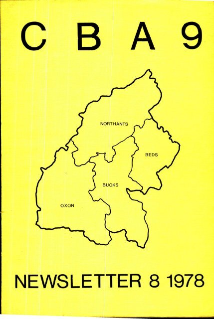
fce&A.J.COUNCIL FOR BRITISH ARCHAEOLOGYREGIONAL GROUP 9(Bed<strong>for</strong>dshire, Buckinghamshire, Northamptonshire, Ox<strong>for</strong>dshire)NEWSLETTER No. 8 1978Editor: D.N. Hall Chairman: John Williams,Northampton DevelopmentCorporationHon. Sec.: D.C. Mynard, Acting Hon. W.J. Fowler,Bradwell Abbey Treas.: 25 High Street, Watlington,Field CentreOx<strong>for</strong>d, 0X9 5PZTel. Watlington 2734CONTENTSPageEDITORIAL 1PREHISTORIC 2ROMANO-BRITISH 5ANGLO-SAXON 12MEDIEVAL 14SURVEYS 18COUNTIES and UNITS 27PUBLICATIONS 122MEMBERSHIP CBA9 124Book No.: ISBN: 0 903736 06 3Ox<strong>for</strong>d University Department <strong>for</strong>External Studies, Rewley House,3-7 Wellington Square,Ox<strong>for</strong>d, 0X1 2JA
- ological. IfEDITORIALThe arrangement of this Newsletter is in chronological sequence'exceptthat most of the units require separate offprints which necessitates keepingtheir reports together. This year.the entries of the units are very muchlonger than the sum of the contribution by part-timers so the overall..chronsequenceis quite disturbed:- In spite of this societies and otherbodies are invited-to consider taking offprints in future years.the number of part-time contributions, and the worries about thelack of support expressed by the Chess Valley Society, represent the truepicture, then we are witnessing a fil-off in mirk by part-timers. This ismost worrying, perhaps an inquiry into the causes and possible remedies couldbe 4 topic <strong>for</strong> discussion at the Annual Conference. Have the prnfessionalswarned off amateur groups too much? Many of the small-scale excavations onunthreatened sites carried out 10-15 yeara ago, although then contributingto archaeological knowledge,- would not now do so. However, this does notmean that there is now rio place <strong>for</strong> small-scale excavations. Some threatenedsites have had to be abandoned by the DoE and units because of lack of resources.Many apparently less important sites, such as village earthworks,never even come to the attention of the professionalâ. Small-scale Work onsuch sites be<strong>for</strong>e destruction would be most useful to confirm that they wereindeed not important. Sometimes of course there are surprises. The Saxonsite at Raunds, Northants, was discovered by an excavation of two weeks bysix part-timers. The expected Cl3th buildings were found but overlaid anAnglo-Saxon graveyard'. The site has now become a full scale professiénal ex- -navation under the auspices of the DoE and the Manpower Services Commission(p.14).If excavation is not a society's choice then there are such invaluableactivities as grave-yard recording and fieldwork. Many would claim thatfieldwork was more important than excavation. Any group feeling it does notknow what to do usefully should contact their.local Unit, County Authorityor Museum. In all the regions advice will readily be given on what wantsinvestigating most urgently.On a more cheerful note it is good to see the contributions on buildings- the new group based at Dunstable is doing excellent work. Perhapsone daY we will even have some in<strong>for</strong>mation from an industrial archaeologist.This Newsletter has been collected together even more rapidly thanusual and I have not had time to follow up contributors <strong>for</strong> the projectedlonger articles and regional reviews of various topics. This will be pursuednext year.I would like to thank Trevor Rowley and the secretarial staff atBewley House <strong>for</strong> the actual production of the Newsletter and seeing itthrough the press in time <strong>for</strong> the Annual Report Conference. I would alsolike to thank Pill Fowler <strong>for</strong> all his work with many previous Newslettereditions.David Hall
2PREHISTORICMARSWORTH,Buckinghamshire (SP 932145) - Pitstone Local History SocietyStripping of topsoil by quarry excavators in the summer of 1976 revealedquantities of large Pleistocene mammal bones. These were lifted as an urgentrescue operation and sent to the Palaeontology Department of the <strong>British</strong>Museum (Nat. Hist.) <strong>for</strong> identification. An en<strong>for</strong>ced halt in quarrying meantthat work could proceed in .1977 under more orderly conditions with the al)»proval of the County Museum at Aylesbury, and, more recently, under the personaldirection of Andrew Currant of the <strong>British</strong> Museum (Nat. Hist.) manymore specimens have been recovered. The species including HippopotamusAmphibius, Megaloceros, Gigantius, Cervos Elaphus, Bos Primigenius andElephas Antiquus. These are all thoughtto date from the last interglacialperiod at an estimated age of 120,000 years. Finds extend over a linear distanceof 4 mile and the width of the deposit is not yet apparent: the idealconditions <strong>for</strong> studying the stratigraphy make the site of unusual value.BRIXWORTH, Northamptonshire - Paul MartinWork continues to be carried out on the distribution and settlementpattern of prehistoric sites in Northamptonshire. More Neolithic and Bronzeage sites are being located by flint scatters in the county and an interestingsettlement pattern is gradually emerging. Earlier sites dating to theMesolithic period are also being located in similar fashion. This season'swork has so far located four sites dating to this period.Scatters of flint characteristic to the period have been found in fourparishes and all seem to favour heath land or river sands: Maxey TF 124089;Southorpe TF 077022; Wittering TF 047015; Wollaston SP 896646.Two of the larger scatters of flints dating to the Mesolithic periodwere identified at Brixworth (Kidway SP 751698; 2nd and 3rd Whaddon SP 734681).Both sites seem to represent the later Mesolithic period and were locatedagain on light soils.Analysis of the flints from these two sites gave emphasis to the patinatedmaterial rather than the non-patinated.On acid soils heavier patination on flints indicates an early dating.In this assemblage the early implements (scalene triangles, blunted pointsetc.) are patinated and that non-patinated material indicated Secondary Neolithicoccupation in <strong>for</strong>ms of polished axe fragments and transverse arrowheads.It was interesting to note that on all six sites Secondary Neolithicmaterial was obtained.Analysis of the artefacts from the two sites in the parish indicatedlater Mesolithic occupation by the standard types associated with the period.Scalene triangles and rod-<strong>for</strong>ms were found, but an abundance of wasteflakematerial dominated the assemblage which was in association with bladecores. The flint-scatter in Whaddon field covered around 3 acres whereas theKidway field covered only i acre. It was interesting to find that both sitesoccupied positions close to water sources.Illustrations of the artefacts are given from the two sites in Fig. 1.
31 2 3 4 56 7 8 9 1011 12 1314 1516 17 18 19 202122 23 24 25 26gFigure 1Mesolithic flints from Brixworth, NorthantsNo. 1-10 (1/3); 11-26 (2/3)
L'The number of flints illustrated represents 1.7% of the two assemblages puttogether.Key to figure:1 5 Blade cores, Whaddon field6 - 10 Blade cores, Kidway field11 - 12 Blunted points, Kidway field1317- 141516- 1819202122 - 2324 - 2526Blunted points,Scalene triangle,Scalene triangle,Blunted points,Hollow based,Rod <strong>for</strong>m,Blunted point,Rod <strong>for</strong>ms,Rod <strong>for</strong>ms,Rod <strong>for</strong>m,WhaddonWhaddonKidwayWhaddonWhaddonWhaddonKidwayKidwayWhaddonWhaddonfieldfieldfieldfieldfieldfieldfieldfieldfieldfieldGRENDON, Northamptonshire (SP 878023) - Glen Foard <strong>for</strong> DoE and NorthamptonshireCounty <strong>Council</strong>.Watching brief maintained on an extensive area of cropmarks during topsoilstripping prior to gravel extraction. Cropmarks revealed a number ofring ditches, including one large barrow with stone kerb, with later orearlier linear ditches.Observation began in 1976 and has continued intermittently.At least one linear ditch was shown to pre-date one ring ditch. Severalcollared urns containing cremation burials were recovered from within thering ditches, in addition to one crouched inhumation. Extensive evidenceof Saxon occupation was also recovered, including several griibenhauser, threeof which were fully excavated, and which contained pottery with boss andstamp decoration. Several linear ditches and pits were also shown to be ofSaxon date, one containing an inhumation. Traces of several ironsmeltingfurnaces were also recovered but these are of uncertain date.Observation will continue as gravel extraction proceeds.NORTHAMPTONSHIRE, Quarries - Denis Jackson <strong>for</strong> DoE and NorthamptonshireCounty <strong>Council</strong>.Rescue work ahead of gravel quarrying has been carried out on pit alignments'at Ringstead (SP 979750) and at Grendon (SP 878620). The pits in bothalignments were typically of even depth and spacing and each had squaredcorners. A small complete vessel dating to the Late Bronze Age/Early IronAge period was found in one of the pits at Ringstead and the pit alignmentat Grendon was found to pre-date a presumed late Iron Age enclosure.The work at Ringstead and Grendon raises interesting questions as to thedate of pit alignments. It is hoped that further work will help to throwmore light on this problem.Rescue work ahead of ironstone quarrying has continued in 1977 on theextensive Iron Age and Romano-<strong>British</strong> settlement at Weekley (SP 884818).Early Iron Age round-houses have been investigated at Geddington (SP 875826)and at Oakley (SP 880868).It is hoped that further work will be possible at Weekley and Oakley.
5ROMMO-3RITISHDORCHESTER, Ox<strong>for</strong>dshire - G.H. Hargreaves, R.P.F. Parker and A.W.F. BoarderThis note gives the results of a field survey carried out with theobject of locating the Roman road directed SE out of Dorchester (Fig.2 ).In 1903 Codrington suggested a Roman road from Dorchester on the line of theA 423 to Benson, which has Roman settlement. Margary designated it Road160e and indicated a route continuing via Nettlebed (see Fig. 3) to Henley,but no direct evidence of this road has been reported W of Henley. Road160e from Silchester has been considered to connect with it over Old StreetFord, and Road 168 (Lower Icknield Way) must also connect to Dorchester fromthe SE. In the few literature references to the Roman crossing of the Thameinto Dorchester this is assumed to be at the site of the medieval bridge,but this location is unlikely because it is not closely dominated either bythe C2nd ramparts or by any <strong>for</strong>t represented by the C1st military buildingswithin them reported by Frere and by M. Hassall.In Overy Field N of A 423 is an 800 yd. long broad, raised line visiblefrom as far as the top of the Sinodun Hills and having a <strong>for</strong>m, location anddirection consistent with the agger of a Roman road leading from a Thamecrossing directly out of the walled town. Careful measurement showed it -would accord with an alignment sighted by a Roman surveyor directly betweena high point adjacent to Hassall's military buildings and the edge of a highplateau at Ewelme Park in the Chilterns some 8 miles away. Study of the topographyon this alignment indicated that a Roman surveyor setting out a roadbased on it would diverge N from it at a small angle to ascend the RabbitsHill spur E of Benson, and the location of a hypothetical secondary alignmentwas deduced accordingly.An opportunity to testithis hypothesis was provided by the widening ofa N-S drainage channel close to the boundary between Warborough and Benson,which left a W bank with a clean sloping face uninterrupted <strong>for</strong> more than amile northwards from Elm Bridge. On this face, at Gallows teaze, exactly onthe postulated secondary alignment and 150 yd. N of the direct line betweenthe sighting points, was found 18 in. below the modern surface a 6 in. thick30 ft. long layer of flat limestone pieces surfaced with sandy gravel and ona thin foundation layer of debris laid directly on loam. This accords withthe section of a 28 ft. Roman road. It was the only thing of its kind onthe whole length of the face.Apart from a low agger showing a few limestone pieces in the arable justW of the section, there is no surface sign of the road between Oatlands ,and.Potters Lane, but alongside the secondary alignment are a burial long suspectedto be Roman, a field suggestively called Blacklands, and a Roman coinfind. By Potters Lane the course of the road in an area of old gravelpits isuncertain, but what appears to be its continuation has been found by a gaspipeline trench at the foot of the escarpment as packed flint-and-pebblelaid on the chalk and buried under 3 ft. of loam. It lies beyond the 14 endof a terrace agger from which an ancient track leads straight up to theplateau sighting-point. The identification of this as the continuation issupported by the absence of any road in section in the gas pipeline trenchon the ridge leading up to Harcourt Hill. It is expected that the road continuesthrough Nettlebed down the spur with the Eix villa to Henley.Assuming the agger in Overy Field has been correctly identified, it'pointsto a Roman crossing of the Thame just below the N end of the modern bridge,
.DORt$1FiTER.:577S(144.50Otel Street Fec,Si.,cocy 0RS'Sitchestervt°-`19erÎ ALchesterRoca160 br.Waib;h:ou.shS908441;f:: .4OatLertels 'Pne3seet6107. ,IiSridlet 6.s aWeiItrA4 G a.Llo Las Leazeela..::,Sesasen .'200ROMAN ROAD SOUTH EAST FRoM DORCHESTERCif.A.efae.ftels25035.Ewel.me4/MoppArlie route <strong>for</strong> Road 160 etRoute ARA/eloped u.si"9 Rotrielh.Sitrve/ors' kei.oteitaesMO)" a_Liriertepit bet/Jeer'. Siskt4.3 potsoGaspipe ti.neUpper T.e.KhZe4 4eoALineMta nsLe45050.KmCohteurhcchts h feetfro 500 65e 700Mile112DORCHESTERIL_Figure 3,7ooiSo 600SSoRomaisItoozgrtsCooPossible fatbCo catio nskSItiPS5 poihtI st C militarytictaikysOtn eftRomanrotate.mLlL3SoitoobooROMA*, st.eets450SOSSo65e200 Yel200 M50 m contourSitemediaev. A.423badgealger. in Ovary Reld.63 °V./GHH 31./2..77boo65065eSSONettlebeit."Soo
7which is thus indicated to be the site of the E gate of the Roman town (seeFig. 3). The last Alchester road alignment is not directed on the highpoint in Dorchester, but to some other objective, consistent with it postdatingthe initial Roman settlement. It is suggested that the Ewelme Parkroad is a military road contemporary with an early <strong>for</strong>t at Dorchester towhose E gate it leads, with the Alchester road directed to the <strong>for</strong>t N gate,and the N gate in the C3rd town walls located on it. Such an arrangementplaces constraints on the location of the <strong>for</strong>t, and one possibility <strong>for</strong> thisis shown in Fig. 3 .DUNSTABLE, Bed<strong>for</strong>dshire - C.L. Matthews, manshead Archaeological SocietyThe Manshead Society have continued rescue excavations in the SW. quadrantof modern Dunstable, confirMing that here was the cemetery of C3rd -C4th Roman Dunstable (Durocobrivae) and during the year 53 graves have beenexcavated bringing the total to 96 burials.Some surprising burial customs are being discovered. Nine of the 53had been beheaded but this need not mean that they were outcasts as some hadbeen buried in substantial wooden coffins. At least one other man had dieda violent death. He had been hit with a heavy sharp tool on the bridge ofhis nose, taking off the nose, the points of his cheek bones, and his upperlip. The body had been buried in the already existing grave'of a youngwoman, probably from an influential family as she had been buried with alittle box containing her personal jewellery. Was this a Roman murder andhad the body been concealed in the existing grave?Several graves contained 'goodies'. A child (age /6) had her jewelleryburied with her, probably in a bag or box as it was found_in a small heap.These were of bracelets in shale, jet and gilded bronze, necklaces of beads(two of small glass beads on bronze wire), a fine woven bronze chain and pins.of bronze and jet.Several complete pots have been found, one being a small 'parchment ware'vessel probably from the Ox<strong>for</strong>d kilns (Fig.4 No. 4). Perhaps the most interestinghas an inscription scratched around the base which reads "OLLADINDROECRORVMVERECILLI NVSDONVIT" (Fig.4 No. 1). (Translations will be welcome.)Other finds include a fine glass goblet and an unusual ceramic bottle.It is fired black and is highly burnished similar to the common 'pie-dish'(Fig. 4 No. 2 and 3). This was found with the colour-coated vessel No. 3;Some of the bodies had apparently been quick-limed, causing the completedecay of parts of the skeleton. Fortunately the amount of lime used had inmany cases been nominal, perhaps just a little scattered on the torso, enablingidentification of all of the skeletons as male or female, young orold.The cemetery appears to have been bounded by a shallow ditch and thishad been used <strong>for</strong> some of the burials which are certainly no earlier thanthe last quarter of the C4th. The ditch had been destroyed in areas by evenlater activity, such as round hollows, probably used <strong>for</strong> winnowing grainand <strong>for</strong> corn drying kilns, suggesting that Roman life was still continuingin Dunstable well into the C5th. Another activity in this area was ironsmelting. Slag is found in quantity scattered all over the area but nodefinite iron-smelting hearth has yet been identified.Excavations continue.
8Key <strong>for</strong> Figure 4No. 1 Beaker with brown slip on red paste. Inscription scratchedinto the fabric of the pot after firing. (Found in the graveof a young man aged approximately 20 years.)Nos.2 and 3(Grave group found with a beheaded male buried in a coffin.)2 Ceramic bottle in coarse grey ware, burnished and fired blaék.Tooling marks on body of vessel.Beaker in orange paste with light grey metallic slip.No. 4 Cream vessel with red painted bands. (Found in the grave ofa beheaded male.)HARRINGWORTH, Northamptonshire (SP 934980) - Denis Jackson <strong>for</strong> DcE andNorthamptonshire County <strong>Council</strong>.Rescue work ahead of ironstone quarrying revealed further Roman stonefoundations, ditches and evidence of iron working in 1977 (see Northants.Archaeol. 9 (1974) 89). The date range of the site has been extended fromthe 1st to the C4th.
9ODELL, Bed<strong>for</strong>dshire - Brian Dix <strong>for</strong> DoE and Bed<strong>for</strong>dshire County <strong>Council</strong>.THE LATER IRON AGE AND ROMAN FARMS:AN INTERPRETATIONA further year's work at Harrold Gravel Pit, Odell, has continued toreveal much evidence of land-use and farming practice in the area during'Belgic' and Roman times (cf. CBA Group 9 Newsletter, 7, 1977, 9-10 which,in offering a chronological summary not radically altered by recent work,has this note as its natural corollary).The 'Belgic' farm established at the turn of themillennium was based ona sub-rectangular compound containing several circular post-built huts. Toone side several large contiguous enclosures <strong>for</strong>med an area of arable fields.Other groups of smaller enclosures or paddocks had their ditches interruptedin a way more suited to controlling and penning livestock.The provision and maintenance of permanent ditched boundaries impliesthat at least some aspects of the system of land-use were also permanent inthe sense that similar requirements arose each year and it is likely thatsome variant of the infield-outfield system was used. Ditched drovewayspermitted the movement of livestock through areas of arable fields whichmight themselves have been grazed on occasion as subdivisions within themperhaps suggest.Such evidence shows the processes of rural organisation to be alreadywell advanced in the area at the eve of the Roman Conquest and industrialdevelopment might reasonably be expected to have reached a similar level.Certainly in the ceramic record at the site there is no clear Conquest horizonand <strong>for</strong>ms continue into the second half of the C1st A.D. in the 'native'fine and coarse ware traditions. Indeed, the eventual ascendancy of thegrey wares and the subsequent developments of the C2nd A.D. would seem toowe more to earlier tBelgic'/Catuvellaunian influence than to Roman innovation.The 'Romanisation' of the local countryside was there<strong>for</strong>e merelyhastened not engendered by the Roman Conquest, which, even then, probablydid not stimulate commercial activity in the area to any great extent untila generation or so after its beginning.It was presumably as a response to such economic improvement that changesbegan to occur in the farm layout towards the end of the Gist. The homestead,although now transferred to a more open situation, continued as an integralpart of the surrounding field system. A succession of circular andrectilinear timber-framed buildings evidence the longevity of occupation atthe new site which culminated in the C4th with the construction of a fairlysubstantial 'cottage-house'. Lying to one side of the living area was ayard containing two stone-lined wells and a covered drying-kiln in additionto other ancillary structures such as a circular hut.The associated field system continued in use with its main boundaryditches being frequently re-cut. During its long period of use changes weremade to the size of individual fields and entrances were often modified.However, it would appear that the farming system which followed continuedthe practices of earlier times. Live hedges probably perpetuated some ofthe field boundaries after the ditches themselves had finally filled, therebyexplaining the limited evidence from the latest phases <strong>for</strong> linearfeatures when compared to such other landscape features as quarry pits,wells and structures.With the close of the Roman period there is a break in the settlementhistory of the site until the Middle Saxon period.
10EXCAVATIONS AT MIDDLETON STONEY, Ox<strong>for</strong>dshire (SP 534233)- Trevor RowleY,Ox<strong>for</strong>d University Department <strong>for</strong> External StudiesThe eighth and final season of excavation during the current programmeof work at Middleton Stoney took place in July and August 1977. Work continuedto be concentrated in the eastern enclosure in order to define theextent of Romano-<strong>British</strong> and Iron Age occupation and to date the enclosureboundary (see Fig. 5 ).A section across the eastern ditch revealed it to be rather deeper(c. 2.50 m.) than its equivalent on the southern side (c.1.5 m.). Considerablequantities of worn Romano-<strong>British</strong> and Iron Age pottery were found in theprimary silt and in lesser quantities throughOut the rest of the ditch-fill.Only a scatter of medieval sherds were found in the upper layers. Extensiveinvestigation under the rampart revealed considerable Romano-<strong>British</strong> stratifiedlevels, including the remains of some considerable stone based structureswhich in turn lay on top of post-hole buildings of indeterminate date.Two o;ther finds were of particular importance, a large stone wall withdistinctive coursing which lay on top of the Roman layer, and fragments ofan early Saxon pot. On the basis of this evidence and the absence of medievalsherds from the make-up of the rampart it is possible to date thebank and ditch to somewhere during the late Anglo-Saxon period. The evidenceis insufficient to indicate the nature of the structure, but it is temptingto link it with the late Saxon site at Sulgrave and tentatively identify itas a burgwerk.Of the interior structures identified the largest was a curious structuremeasuring 5 m. by 4 m. consisting of pieces of slate/limestone set atan angle within shallow gullies. The <strong>for</strong>m and function of the structure isnot clear although it would appear to have been a fairly flimsy timber buildingalmost certainly associated with the Romano-<strong>British</strong> farmstead.The evidence from Middleton Stoney would now suggest the followingchronology: 1) an Iron Age settlement, probably a farmstead of indeterminatesize dating from c.200 BC to the Roman occupation; 2) a Romano-<strong>British</strong> farmsteaddating from the late C1st through to c.200 AD; 3) the replacement ofthis structure by a villa/farmstead to the E, so far unlocated but identifiedthrough the sealed layers beneath the rampart; 4) possible post-Roman occupation,so far identified by a single pottery find; 5) a late Saxon <strong>for</strong>tification/enclosure,traces of which have now been found beneath the rampartand the make-up <strong>for</strong> the base of the Norman keep; 6) the Norman stone keep;7) the C13th manor house, built in the eastern and western enclosure of thedismantled castle.While it is not possible to talk confidently of continuous occupation onthe site, it now seems reasonably clear that the site at Middleton Stoney hasbeen the focus of occupation <strong>for</strong> over 2 millenia. This pattern of repeatedoccupation of a site or area over a considerable time-span is now apparentat a number of sites in the region.
0 10 15 20 25MetresCutting IExcavated area showing RomanRoman featuresfarmstead and enclosure and the post-Figure 5
12ANGLO-SAXONNORTHAMPTONSHIRE CEMETERIES - David H. KennettIn CBA Group 9 Newsletter, 6, 1976, 19-20, a preliminary note appearedon work done towards the long-terni republication of the material from Anglo-Saxon cemeteries found in Northamptonshire be<strong>for</strong>e 1914. This note reportswork done in the period August 1975 to November 1977.BrixworthTwo cemeteries are known in this parish; neither is exactly located,and the material from both, now in Northampton Museum, is kept as a singlegroup. Selected items have been drawn <strong>for</strong> use in general surveys of objectsor aspects of the period. These include cruci<strong>for</strong>m brooches and some ofthe pottery which is a valuable collection containing both cremation urnsand accessory vessels from inhumation graves.Cruci<strong>for</strong>m BroochesAll cruci<strong>for</strong>m brooches found in the county be<strong>for</strong>e 1914 have been drawn<strong>for</strong> a short survey. Only one from Holdenby is reliably associated.NewobamThe material from this cemetery was drawn in 1975 as part of the pre-.liminary work <strong>for</strong> a survey of the problems of Northamptonshire cemeteries.Kettering, Stam<strong>for</strong>d RoadThis is the major task of the project to examine the Anglo-Saxon materialof Northamptonshire. All material in Northampton Museum (mostly 1903discoveries) has been drawn, as has much, but not quite all, of that inKettering Museum (1929 discoveries). The Kettering long-boss potter withelaborate panel-style decorations has been shown to have products also atThorpe Malsor and at Newton-in-the-Willows.PotteryIn addition to the cremation urns from Kettering a corpus of the Anglo-Saxon pottery of Northamptonshire is being made; this has been drawn uponin Anglo-Saxon Pottery (Shire <strong>Archaeology</strong>, 1978).PublicationThe following papers have been accepted by the Journal of NorthamptonMuseums and Art Gallery:'The lost Anglo-Saxon finds from Cransley: a <strong>for</strong>gotten site';'Burton Latimer: a group of Anglo-Saxon finds made in the late C19th';'Bronze Age Urns and Saxon Finds from Rothwell, with an illustratedcatalogue of the Bronze Age urns of Northamptonshire'.In active preparation is:'The cruci<strong>for</strong>m brooches of Northamptonshire:the C6th'.cultural connections in
13EAST SHEFFORD, Berkshire - David H. KennettFinds were first made from the Anglo-Saxon cemetery at East Shef<strong>for</strong>d,Berkshire in 1890; subsequent discoveries were reported in 1893 and someexcavation was carried out in 1912. The material is in four museums: the<strong>British</strong> Museum, London, with the bulk of the 1890 material; Reading Museum,and the Ashmolean Museum, Ox<strong>for</strong>d which have small groups of the C19th discoveries;and Newbury Museum <strong>for</strong> whom the 1912 excavations were conducted.The material was examined and drawn by D.H. Kennett in 1968-72, when Berkshireremained part of CBA Group 9. It is reported here as it raises importantquestions of the siting of cemeteries and their contents. Un<strong>for</strong>tunately,except <strong>for</strong> the 1912 finds, few grave associations have been preserved.The range of finds is wide and rich. The pottery indicates the timespancovered by the site. From the C5th there are two small Buckelurnen ofMyres' Group III, so similar as to suggest the same potter, and a smallglobular urn with an everted rim. From the second half of the C6th panelledornament on an accessory vessel is one representative and the long-boss stylestylised as vertical grooves is another.Roman material is not uncommon: two disc brooches, not a pair, a bronzespoon shank, and a variety of coins (originally one assumes part of beadnecklaces). One example of a bronze tubular object, comparable with thewell-known one in grave 13 at Reading, can be matched by a buckle whose circularplate recalls the disc attachments of the military metalwork studiedby Mrs. S.C. Hawkes and Dr. G.C. Dunning. An associated grave group fromthe 1912 excavations included two early cruci<strong>for</strong>m brooches.The site clearly has an early beginning, yet its position is curious.There are few other finds from the Lambourn Valley: a late C6th greatsquare-headed brooch known from its bowl only was given to the AshmoleanMuseum, Ox<strong>for</strong>d in 1955; a grave with weapons - sword, axe, spearheads - wasfound at Ash Grove, Lambourn, be<strong>for</strong>e 1856. The site at East Shef<strong>for</strong>d isaway from the Roman road which runs along the top of the downs rather thanthe valley bottom. There is a fragment of Hug Ditch in the vicinity. Itis tempting to suggest that the cemetery at East Shef<strong>for</strong>d represents agroup of people placed on the fringe of the Silchester region early in theC5th which then continued to prosper.Prosperity is difficult to gauge from a mass of three hundred unassociatedobjects but five glass vessels at any site in England beyond Kent isunusual. Islip, Northants. with three pieces is a ready parallel from acomparable quantity of objects. There is a bowl and a cone beaker, bothprobably late Roman in origin, and two Kempston type cone-beakers and a C6thclaw beaker in a distinctive amber metal. Perhaps the Silchester connectionis relevant <strong>for</strong> the two late Roman pieces. Perhaps glass vessels were usedin richer graves where buckets sufficed in other cemeteries. Only onebucket is known. Here to have the associations would be a great advantage.Due to the lack of recorded associations, more is missing at EastShef<strong>for</strong>d than is always missing in the archaeological mosaic. For distributionalstudies a catalogue of objects is being prepared, with graveassociation where known; the 1912 material is to be republished as integralto the whole site.The most useful question that can be asked remains the reason why itis there. The postulations here made may prove on reflection to be lessthan the complete answer.
14RAUNDS, Northamptonshire (SP 998734) - Andrew Boddingtonshire County <strong>Council</strong> and Manpower Services Commission<strong>for</strong> DoE, NorthamptonTwo trial trenches by David Hall in 1975 revealed substantial stonewalls and several burials, two of which had carved stone covers thought tobe Saxon in date. From the trenches the relationship between the burials andthe stone walls was not clear. The site was considered suitable <strong>for</strong> alargerscale excavation because of its apparent continuity from the Saxon toMedieval periods and because of the possibility of an Anglo-Saxon churchassociated with the burials.An area of some 1300 sq.m. has been stripped of topsoil by machine andseveral outlying trial trenches dug. Beneath an extensive spread of demolitionrubble the walls of a manor house have been revealed, this buildingissome29 m. long and 7 m. wide at its latest phase. Fragments of potterydate the demolition of the building to the late C13th or early C14th. Atthe W. end of the building, adjacent to what is apparently the service wingis a large circular stone building with walls some 1.1 m. thick, apparentlya dovecote. The walls of this survive to a height of 0.6 m. and show adefinite taper. Three more burials have been found to the SE of the manorand there is the possibility of several more.Work is currently concentrating on the area of burials and the E. endof the manor in an attempt to solve the question of a church. As yet itis not certain whether there are a few burials associated with a manorialchapel or a number associated with a pre-manor church.MED I EVALBEDFORD, Peacocks Yard and Salvation Army Sites (TL 048496) - Jane Hassalland Peter Woodward <strong>for</strong> North Bed<strong>for</strong>dshire Borough <strong>Council</strong> and the Bed<strong>for</strong>dshireCounty <strong>Council</strong>.Redevelopment of the area between River Street and Horne Lane presenteda threat of total destruction of the archaeology of the area. Middle Saxonpottery had been recovered from the Midland Road to the N and the brewerysite to the S, so that a possible early settlement was suspected. The sitealso lies across the suspected line of the later Saxon town-boundary andthe Saffron Ditch, featured on Speed's map of 1610. The relationships betweenthese features was of prime importance in tracing the urban originsand development of Bed<strong>for</strong>d N and W.of the river. Consequently rescue excavationswere planned and undertaken in the <strong>for</strong>m of trial trenching. Thisproved to be the most productive and economical way of testing a large area,and machine trials were backed up by several small hand-dug trenches toprovide more detailed contextual in<strong>for</strong>mation.No traces of a Middle Saxon settlement were uncovered, but many laterfeatures were found. Saxo-Norman to Early Medieval rubbish pits occurredright across the area, but tailed off westwards, stopping altogether alittle short of River Street. Several large stone wells with the remainsof stone steps attached to them were uncovered, reminiscent of that foundat St. Johns Street, Bed<strong>for</strong>d in 1976.
15The Saffron Ditch was discovered below 1.5 m. or so of overburden.It was a wet ditch still, some 10 m. wide with sloping sides. Material ofchiefly C17th date was recovered from it. A small boundary ditch was uncoveredto the W on the Salvation Army site. This was 2.40 m. wide withflat base and steep sides and running NNW-SSE. No dating evidence was recovered,but the feature was sealed by C12th rubbish pits.There is no chance of any further work because of redevelopment of theentire site. The results of excavation will be published as part of theBed<strong>for</strong>d Monograph volume of the Bed<strong>for</strong>dshire Archaeological Journal vol.13.1978. The finds are deposited at Bed<strong>for</strong>d Museum.GROVE PRIORY, Bed<strong>for</strong>dshire (SP 923226) - Evelyn Baker <strong>for</strong> Bed<strong>for</strong>dshireCounty <strong>Council</strong>.Work has continued almost without break since September 1976 on thisalien priory of the order of Fontrevrault in advance of sand extractionunder the direction of Evelyn Baker. This is a rare opportunity to stripmost of a small complete priory site with possibly an unusual plan. Theillustration (Fig.6 ) is from a drawn survey by Peter Woodward assisted byMark Gregson, and shows areas examined since 1973.David Devereux supervised excavation during the autumn and winter of1976 on area C, to determine the function of one of the closes in the SW ofthis well-preserved earthwork site, and to determine the chronology of theditches relating to it. The earliest activity here took the <strong>for</strong>m of agully containing pottery of the mid C2nd, but there were a few sherds whichmay be Iron Age. A gri.lbenhaus of the two-post type, with early middleSaxon pottery was found, giving the first structural evidence <strong>for</strong> Saxonoccupation. Saxon pottery and indeterminate features had been found elsewhereon the site in areas A and B. A sequence of ploughing activity fromthe Saxon period through to medieval ridge-and-furrow was demonstrated.The latest features were flimsy timber structures, possibly animal sheds,but more probably associated with cattle penning; they were functioning inthe C13th to C14th. Thereafter, the close seems to have been used <strong>for</strong>grazing.Richard Thomas supervised the examination of area D in the summer of1977, to establish the sequence of boundary ditches and examine close function.The boulder clay which overlies the sand proved to be particularlydifficult here, but the indistinct linear features cut into it were probablythe result of ploughing activity. The stripping of the close just tothe N'of the area by quarry scrapers revealed a cobbled trackway and tracesof buildings. These were fragmentary and almost certainly post-medieval.ruring the summer the redundant Grove Church, across the county boundaryin Buckinghamshire, underwent conversion to a dwelling house. Thechurch is only a few hundred yards from the main site, and is probably constructedat least partially from priory material. Robert White supervisedthe excavation of service trenches in and around the church with the agreementof Buckinghamshire County Museum. Two medieval burials were found, onein a stone coffin; they were subsequently re-interred. Re-used architecturalfragments built into the walls of the church were recorded by DavidWilkinson.Since June 1977 work has been concentrated on the claustral area,The trench unfinished in 1976 has been extended, and an area totalling1500 sq.m. is being examined. Turf was removed mechanically, revealing
GROVE PRIORYf,,,,,,,,,,,,,Figure 6
17dense areas of collapsed and robbed buildings. Three ranges of post-medievalbuildings were recognized, together with many modifications and extensions.They probably represent the farm which replaced the priory. They haveflimsy carstone footings laid directly onto the previous ground surface, andwould have carried timber superstructures. The large quantities of ceramicroof-tiles overlying them indicate the roofing material. Two of the rangesappear to have been domestic, and contained hearths. The third may havebeen a stable block or dairy. Pottery ranging from the C15th to C17th wasassociated with them, together with a great many iron objects. These latebuildings are partly re-using the more substantial footings of earlierstructures, and even the terraced cobbled yards incorporate levelled walls.The medieval pattern of walls appearing beneath the post-medievalsequences is becoming extremely complex. At present there is no discernibleconventional monastic plan. Even the position of the church is not certain,though a possible monastic graveyard, bounded by a stone wall on its westernlimit, is situated to the S of a large rectangular building discoveredin 1975. Already it is clear that there are several periods of major stonebuildings, with re-building and modification. One broad foundation mayhave been turned 'inside out', with its external face providing an internalone at a later date.Work will continue on this important and productive area until spring.OXFORD, Paradise Street -Ox<strong>for</strong>d University Archaeological SocietyExcavation of two trial trenches to discover if there were any occupationlayers or waterfronts between the castle and the Isis was carriedout by the Ox<strong>for</strong>d University Archaeological Society.The first trench exposed some evidence of C11th occupation as a thickclay daub spread. This had been flooded and covered by river silts untilthe C14th when a building of sleeper wall construction was erected andoccupied. This structure was then covered by soil deposits and finally bybuildings and rubbish of the C19th brewery.The second trench exposed a number of river walls. The first consistingof a line of posts (c15cm. diameter) of C14th date. In the C15th astone wall with facing stones on the riverside, superceded the wooden postsand probably lasted until it was robbed to provide stones <strong>for</strong> an C18th walland towpath. This wall <strong>for</strong>med the footing <strong>for</strong> the present river wall, whichalso shows several re-builds up to the C19th.The field survey group of the Society has discovered an Iron Age siteand investigated the extent of plough damage to the Roman Villa in CumnorParish.The Ox<strong>for</strong>d University Archaeological Society hopes to continue excavatingin and around Ox<strong>for</strong>d and also hopes to complete the field survey ofthe Parish of Cumnor.SEGENHOE CHURCH, RIDGEMONT, Bed<strong>for</strong>dshire - John BaileyRegular visits have been made during 1977, following the completemeasure5dsurvey of this derelict church made by the group in 1975, to noteadditional details that are revealed as plaster falls from the walls as aresult of weathering.
18The decay of this church was inevitable following the building ofthe fine Bed<strong>for</strong>d church to Sir Gilbert Scott's design in the 1850s, whichtook over as the parish church. Segenhoe was left lost among the remainsof the deserted village from which the church was named, and is now partof Ridgemont.The church was much modified in the Georgian period with the additionof a new E window in the chancel and in the nave and with the addition ofa new tower at the W end.There is, however, considerable evidence of the details of the C11thNorman chancel with the complete chancel arch and two complete N windows,one of which has a remarkable lintel decorated with primitive design ofsaltire crosses and circles which has the 'feel' of Saxon work.The nave is C14th/13th work with only the N of the two original aislesremaining. Details of the medieval windows blocked in the C18th can nowbe seen in the gaps in the plaster.A repositioned Norman door in the S wall of the nave with billet decorationsurvives complete.A set of scale plans, elevations, and sections has been made of thechurch in its present state, so that there is a basis <strong>for</strong> further surveywork if it is finally demolished, falls into complete decay, or is subjectto an archaeological excavation.THRAPSTON, Northamptonshire (SP 996788) - David Hall and Denis Jackson <strong>for</strong>the Northamptonshire Field GroupAt Thrapston there is a low motte-like plat<strong>for</strong>m raised only a few feetabove the surrounding level. It has been much mutilated over the centuriesand has several houses cutting into it. A section revealed by a sewagetrench a few years ago suggested the plat<strong>for</strong>m was more complex than expected.A short distance in from the mound edge the strata began to tipdownwards again (Fig. 7). The structure would there<strong>for</strong>e appear to be aringwork subsequently built up in the interior at a later period, similarto Sulgrave. Pieces of pre-Conquest St. Neots wares were recovered.Further work is required to investigate the true nature of this mound.SURVEYCHESS VALLEY, Buckinghamshire - J.S. Mid<strong>for</strong>d, chess Valley Archaeologicaland Historical SocietyA survey of the Chess Valley to identify archaeological sites andfeatures has produced the following results.In 1976 a field on Latimer Park Farm yielded over 1000 flints of amesolithic industry but only 10 with identifiable retouch. In 1977 thenext field downstream was cultivated and yielded over 100 flints of a similarindustry. The flints are found associated with calcined flint pieces
Thrapston 1973modern!wall JBrownsoilsFeetFigure 7
20in an otherwise unflinty very dark soil, containing many small mollusca andnormally stratified beneath topsoil with clayey lenses and over limey silton top of coarse gravel. Similar flints were found along the bottom of asloping field on the opposite side of a small lake from the original site.On various previous occasions such flints have been found on bare patches inother uncultivated fields throughout the length of the valley covered sofar, suggesting the possibility of a mesolithic horizon rather than individualsites.The group of woods in an arc to the N of Valley Farm, Sarratt, Herts,were surveyed, except the enclosed conifer plantation areas. A bewilderingnumber of features, mostly bank and ditch, included a regularly terracedprojection and a suspected walled rectangular enclosure in Limeshill Wood,a bluebell wood. In Hanging Lane Wood is a deep narrow hollow way leadingdown to a well built terraced trackway to Valley Farm.Interest in the survey, particularly by more experienced members, haswained. Finds processing is lagging considerably and research work is nonexistent.Unless current attempts at revitalisation are successful, thesurvey will have to be suspended. The main problem is lack of directionand organisation.KEYSOE FIELD SURVEY, Bed<strong>for</strong>dshire - John BaileyExtensive field work is being carried out in the parish and this isbeing supplemented by documentary research.The parish was enclosed in 1806 and an elementary map with documentsexists but un<strong>for</strong>tunately a pre-enclosure map has not survived. A helpfuldocument of 1625 has survived, the Evans Mouse Survey, which gives a fairlydetailed written description of the land use and ownership within the parish.The Group is in the process of preparing a detailed reconstructed map <strong>for</strong>1625 based on the Evans Mouse Survey, various later documents and the evidenceof Medieval earthworks and C16th/17th enclosures that still survive onthe ground or can be identified from air photographs.MILTON KEYNES, BuckinghamshireWhilst fieldwalking in the parish of Leckhampstead, members of theMilton Keynes and District Archaeological Society located the site of aRoman building, evidenced by stone scatter and numerous pot sherds, atSP 723389. The pottery has been dated b Y Charmian Woodfield to the lateC2nd, through to C3rd and C4th. The finds have been deposited with BradwellAbbey Field Centre.We have also assisted Milton Keynes Development Corporation archaeologistsin excavations at Walton Church and Great Lin<strong>for</strong>d Shrunken MedievalVillage.In addition, members have carried out surveying at Chicheley in NorthBucks, and gravestone recording at Hardmead Church (now redundant).Together with other local societies we have taken part in an excavationat Downs Barn, SP 860400 within the New City area. This was an attempt tosection a presumed Roman road, and to discover an associated building, suspecteddue to pottery scatter. So far the results have proved to be disappointing,but excavations are continuing.
21NORTHAMPTONSHIRE PARISH SURVEYS - David Hall and Paul Martin, Higham FerrersHundred Society and Northamptonshire Field GroupThe field by field parish surveys continued using the techniques desscribedpreviously (Newsletter 4, 1974). Eight parishes comprising 16,000acres were completed, including Eye in the Soke of Peterborough (now administeredas part of the new Cambridgeshire).The rate of progress was slower this season, partly because of the wetconditions and partly because of work undertaken in other counties.The general pattern of settlement distribution described in Newsletter7 (1977) continues to be established. Pre-Iron Age sites only occur onlight soils 'whereas Iron Age and later sites occur on any soil type. NorthwestNorthamptonshire is sparsely settled compared with the central NeneValley.A summary of the fieldwork findings is given below. Generally no crossreferencing with the County Sites and Monuments Record has yet been made norany historical back-up undertaken.Castle AshbyNeolithic flints and part of a Langdale polished axe were found at SP856609 and a tanged arrowhead at SP 85836108. An area of dark soil containingIron Age pottery is centred at SP 857604. Romano-<strong>British</strong> siteswere represented by pottery and building stone scatters at SP 859607 andSP 808585. A few Saxon sherds were recovered from SP 858602.Some of the medieval village has been lost under the gardens of thegreat house which was built in 1574 onwards on the site of an earlier 'castle'(<strong>for</strong>tified manor?). Formal gardens were originally laid out and four avenuesof trees added in 1695. The area was landscaped by Capability Brown in1761-7; many apparently isolated trees and other features line up to givethe outline of the earlier geometric design.Ridge-and-furrow is well preserved in the park and represented byploughed-over headland-earthworks elsewhere.EyeMany pre-medieval sites occur in this fen-edge parish, especially onthe gravel terraces at the N and SE. Bronze Age barrows (surviving asmounds or cropmarks) lie at TF 233012, TF 248062, TF 249059. A Bronze Agedomestic site with an abundance of hard sherds lies in <strong>for</strong>mer fen at TF217015. A single Iron Age site was found at TF 218016, also in <strong>for</strong>merfen. Romano-<strong>British</strong> occupation debris laid at TF 241022, TF 242042, TF251051, TF 252053 and TF 213030. A Saxon cemetery was located at TF 229035in the C19th.Four separate monastic sites lie on peninsulas of the parish, thechief being Fyebury; Northolm still has some moats and vague earthworks.The ridge-and-furrow pattern was very difficult to establish except inthe small area that remained open field until 1819. The remainder was inclosedat an early date by the monastic sites.Long BuckbyThis NW Northants clay parish contained several areas of gravel andhigh ground with outcrops of ironstone; as usual these light soils producedearly sites.
22s Neolithic flints and parts of polished axes were found at SP 650679;Bronze Age flint concentrations also occurred on the high ground at SP 646688, SP 647684 and SP 633695. Lesser concentrations of flint occurred onglacial gravel deposits at the southern part of the parish. Romano-<strong>British</strong>occupation remains laid on the clay at SP 625685 and sherds are reportedfrom SP 646678.The medieval village area is interesting. Fine earthworks and sunkenroads survive at the W end (including a motte and bailey). They continuewithout a break into the DMV of Murcott in Wat<strong>for</strong>d parish.Cotton End to the E (SP 640679) P roduced some medieval sherds but thereis no evidenpe that there is anything medieval between the Market Square andCotton End.A rabbit warren lies at the E parish extremity centred at SP 650682.It may have been a <strong>for</strong>mer deer park according to the.ramparts evident.The open field pattern was satisfactorily recovered, and the names arebeing worked out by a Local History Group evening class.Murcott (SP 620678)The DMV of Murcott is now split between Long Buckbyand Wat<strong>for</strong>d, butfrom C18th maps seem to have been part of Wat<strong>for</strong>d parish. The earthworksare well preserved and lie next to Long Buckby, separated by a stream.The associated <strong>for</strong>mer open fields are fairly typical.RothersthorpeIs a clay parish with some areas of gravel and sand. Some possibleBronze Age flints were found on glacial gravel outcrops, especially atSP 713562. Iron Age sherds were recovered at SP 715764 and Romano-<strong>British</strong>occurred at SP 713562. Not far from the village an area of Saxon sherdslaid on gravel.The medieval village is centred on the Bury, a motte-like structurewith an accompanying ditched area. To the S are extensive earthworks andsunken roads of part of the village, still in use in the early C19th.The open fields were easily plotted from the large furlong boundariessurviving. Several fields of undamaged ridge-and-furrow survive.SulgraveA SW clay parish with a single outcrop of ironstone that yielded a fewworked flints at SP 574474. A Romano-<strong>British</strong> site was discovered on clayat SP 579450.The medieval village is famous <strong>for</strong> its Norman ringwork which has burieda late Saxon stone-built manor. At the NE part of the village earthworksare ploughed out and yielded C13th/14th pottery.The open-field pattern is well preserved with extensive areas of unploughedgrass ridge-and-furrow.TitchmarshThe soils of this parish vary from river gravels to limestone and clay.Extensive cropmarks occur at TL 020810 and include eight ring ditches.Iron Age sites occur at TL 016803, TL 03107707, TL 005794 and TL 037775 andRomano-<strong>British</strong> at TL 005794, TL 016803, TL 032788, TL 037775, TL 033798, TL023802, TL 03107707, TL 036788 and TL 014803.
23The medieval village has many surviving earthworks including a moatedmanorial site, fishponds and hollow ways. Saxon pottery has been found atthe!,! end of the village at Islington.The open fields covered the whole area as well as the Warren at thefar E of the parish. There are a few interesting discontinuities that mayreflect earlier land-use. Near the village a furlong was partly inclosedin the C13th leaving the remainder to be ploughed until the C18th; thusaf<strong>for</strong>ding a glimpse of the same furlong at two stages of cultivation 500years apart.The C16th and C17th furlong names have been worked out.E of the parish the land had been inclosed be<strong>for</strong>e 1560.WhistonAt the N andA Nene Valley parish with soils varying from river gravel to limestone,ironstone and boulder clay.A few worked flints were discovered on ironstone soils.occurred at SP 840599 and SP 844593.Iron Age sherdsConsiderable quantities of Saxon pottery were found in a field calledSaucott at SP 850601.The medieval village is very shrunken and many ploughed earthworksexist. To the SW is the warren, a partly walled ancient inclosure.The medieval fields covered the whole parish. The tongue of land to theSE has been acquired (from Castle Ashby?); the original parish boundary waseasily established.We are grateful to the Department of the Environment <strong>for</strong> a travel grant<strong>for</strong> this work.DUNSTABLE, Bed<strong>for</strong>dshire - John Bailey, Dunstable Historic Building Study GroupDuring 1977 the majority of the groups major historic building recordingwork has been in the N of Bed<strong>for</strong>dshire.The surveys have been in five categories:Detailed surveys during restorations of groups of buildings and of individualbuildings.Recording of buildings of high architectural interest that are notthreatened.Recording of stone buildings that are subject to decay by weather action.The detailed measured survey of timber-framed buildings to be rebt44ton another site or rebuilt at an open air museum.The surveying of buildings threatened with destruction or in ruinouscondition.The following are the main buildings which have had a complete measuredsurvey carried out on them.A. Range of timber-framed buildings at High Street, ElstowWork is nearly finalised on the detailedmeasured survey that has beencarried out over a period of two years during restoration work to the importantrange of 15 buildings running along the E side of High Street Elstow.These timber-framed buildings date from the C14th to C18th and have pr6videdvaluable evidence of the various <strong>for</strong>ms of buildings that were constructed
214in a single village. It also gave an ideal opportunity to establish thechronological sequence of the majority of the buildings. A series of lateC16th wall paintings were uncovered during restoration. It was possible torecord every detail of the buildings including the carpentry details.Sun Street Potton, Sun HouseA fairly substantial timber-framed hall with jettied cross-wing wassurveyed in detail during restoration.Keysoe, Hardwick End (TL 062623)A further building surveyed during restoration. This was supplementedby an extensive survey of the remaining medieval earthworks, includingridge-and-furrow, in the fields surrounding the building.Hillersdon Manor, ElstowA very detailed survey was carried out of the remains of the JacobeanPorch. Precise measured drawings were prepared showing the elaborate mouldingsand strap work.This building is of soft clunch and subject to weathering and it wasimportant that a precise record was made.Rowe's Cottage, Little Bar<strong>for</strong>dA total survey had to be made of this 'Wealden' house which was dismantledand re-erected at Glatton in Cambridgeshire. Drawings of everytimber and detail were made voluntarily by the Group and reconstructionsmade and detailed plans and sections prepared. These were used by thebuilding team, who moved the building, <strong>for</strong>labelling the timbers, and thedrawings will also be used <strong>for</strong> the basis of the reconstruction.A reconstructed isometric drawing is illustrated in Fig. 8.7 West Street DunstableThis was another major total recording exercise that had to be carriedout with great care, as the building was dismantled by the Chiltern Society<strong>for</strong> re-erection at their open air museum. The building is a jettied shopwith a hall at the rear.Chapel Farm, MeppershallA detailed measured survey was made of this Norman/medieval chapel thatwas once associated with Chicksands Priory. It is now used as a farm buildingbut has recently been carefully restored by the DoE.Other work carried out by the group was the general investigation ofbuildings in several villages to confirm their date and establish if thereis any early work hidden behind later facades.Members of the group are amateurs and they survey,buildings anywhere inBed<strong>for</strong>dshire and, on some occasions, in adjacent Counties. All work isvoluntary and the most important buildings are published. It is anticipatedthat a similar variety of work will bd carried out by the Group during 1978;but some time wili also be given to limited surveys of a larger number ofbuildings.
* V.I1P/Ng°472,4 %al /1-4,1 AlFf 41101111.1W'wf'Mk.=/41441,416,:NA"""",
AERIAL SURVEYS - Jim PickeringA number of flights were made in 1977 from the Market Harborough areato the W of Northampton, Stowe Nine Churches, and Daventry en route toother areas of survey. Weather permutations were not ideal <strong>for</strong> the extensivedevelopment of crop marks in this area and although most known sitesremained invisible, some new sites were recorded. The cumulative evidenceof several years, cover of Stowe Nine Churches suggests that this is animportant area with extensive prehistoric, Iron Age and Romano-<strong>British</strong>occupation.Areas where similar evidence is accumulating are being found in manyparts of the Midlands and in widely different soil and geological contexts.It cannot now be assumed that by the late Iron Age, or early Romano-<strong>British</strong>period at the latest, most of the Midlands may have had a man-made landscape(except <strong>for</strong> those substantial woodlands that until recent times have beenan essential element of a rural economy), but rather that the cultivationof this landscape destroyed an extensive prehistoric landscape in much thesame way that the Saxon and medieval ploughing destroyed the Romano-<strong>British</strong>landscape.In considering the prehistoric landscape a length of triple parallelditches extends over several fields on a roughly NNE-SSW orientation to theW of Northampton. A number of similar monuments have been recorded atmany places throughout the Midlands, and what appear to be variations ofthis construction such as four ditches, four pit alignments of similar spacingand two ditches plus a pit alignment. Re-assessment of some doubleditches suggest that these are not necessarily trackways and some might besubstantial banks between two ditches.When considered singly, these features make no sense, but When plottedonto maps, some appear to line up onto a roughly single orientation thatwould logically connect up over many miles and adjacent exceptions tosingle orientations are at 900 to it. As an example, the Northampton lengthpoints directly southwards to another length of the same orientation atStowe Nine Churches. Northwards it lines up approximately with lengths tothe W of Uppingham, to the E of Oakham, to the W of Grantham and to theS of Newark, where this is a junction of four such features in a most complexarea of archaeological sites. Extending the same line northwards itlinks up with interrupted lengths over two miles to the E of Lincoln recordedby Paul Everson and this in turn is orientated to several lengthsbetween Lincoln and the Humber.There are other disarticulated lengths in the Trent Valley, the NeneValley and the Fens, and Derek Edwards reports one near the Norfolk Suffolkborder. There is a known extensive system of such boundaries on the YorkshireWolds.There is enough evidence to suggest the possibility that there is apreviously unknown system of prehistoric boundaries in the Midlands, somelengths of which required the movement of 30,000 tons of soil per mile.The effect of this on present estimates of prehistoric population, societies,and land use must be substantial.
27UNITS AND COUNTY BODIESBEDFORDSHIRE COUNTY COUNCIL ARCHAROLOGICAL PROGRAMME, Retrospect 1972-1977- David BakerIn December 1977, at their request, a report was made to the Committee<strong>for</strong> Rescue <strong>Archaeology</strong> of the Ancient Monuments Board (England), on theorganisation and-work of the Bed<strong>for</strong>dshire County <strong>Council</strong> in rescue archaeology.The opportunity was there<strong>for</strong>e taken to prepare a slightly expanded report,mainly covering organisational matters. Much of the material in thereport, particularly on individual sites, has already appeared in thisNewsletter, so selected extracts are offered by way of a retrospective viewafter five years.The report does not cover directly the work of local societies and individuals,since this was outside its terms of reference. Nonetheless thecontribution of the constituent members of the Bed<strong>for</strong>dshire Archaeological<strong>Council</strong> over this period to Bed<strong>for</strong>dshire archaeology in general should beunderlined here.Copies of the original Report are available from the ConservationSection, Planning Department, County Hall, Bed<strong>for</strong>d MK42 9AP.1. The Development of the Rescue <strong>Archaeology</strong> and Historical ConservationProvision in Bed<strong>for</strong>dshire County <strong>Council</strong>Be<strong>for</strong>e 1972 the County <strong>Council</strong> had no direct involvement in rescue archaeology:work was undertaken on a small scale by local societies or by outsiderscoming into the County <strong>for</strong> specific projects. On 1st January 1972 thepresent writer took up duties in the new post of Archaeological LiaisonOfficer in the County Planning Department, having been responsible <strong>for</strong> excavationsat Elstow Abbey (1965-72) and Bed<strong>for</strong>d Castle (1969-72), <strong>for</strong> theBed<strong>for</strong>d Archaeological Society and others.The job description of the new post included: advising the Authorityon archaeological matters; maintaining a register of sites; liaising asnecessary with public and private bodies. Excavation was not envisaged asa primary function of the post holder.Temporary assistance was provided <strong>for</strong> the early stages of compiling theSites and Monuments Record, with several short-term employees in the periodup to mid 1974.In response to continuing development pressures in the County town ofBed<strong>for</strong>d, the then Bed<strong>for</strong>d Borough <strong>Council</strong> in July 1972 appointed Miss JaneHassall to the new post of Archaeological Assistant, with responsibilitiesdivided evenly between Bed<strong>for</strong>d field duties and curatorial responsibilitiesindoorsA programme of rescue excavations developed largely on an ad hoc basisas threats to sites from existing planning permissions became apparent inthe early days of data collection. Early in 1972, Professor J.K. St. Josephalerted the Planning Department to the imminent destruction of five BronzeAge ring ditches at Roxton. By autumn of that year, Miss Alison Taylor,joined later by Mr. Peter Woodward, had commenced work on four of the five,the other being examined by Mr. G.T. Rudd of Longsands School in St. Neots.Miss Angela Simco had conducted a trial excavation on another gravel ex-
28traction site at Newnham near Bed<strong>for</strong>d in summer 1972: on graduation in July1973 she was appointed on a temporary basis to excavate this mainly Romanvilla/farmstead site.1973 saw all these individuals working in the field, mainly in an extendedsummer session, when four large excavations were run simultaneouslyfrom one large volunteer camp in Bed<strong>for</strong>d (Bed<strong>for</strong>d, Willington, Roxton andNewnham). Additionally, Mrs. Evelyn Baker, who had been responsible <strong>for</strong>sites at Bed<strong>for</strong>d Castle and Elstow Abbey, excavated a site in CauldwellStreet, Bed<strong>for</strong>d and had commenced work at Grove Priory, near Leighton Buzzardwith a session in March to May.In the period up to local government reorganisation the organisationalstructure <strong>for</strong> rescue archaeology was evolving. Cash grants were being madeby the DoE, Beds CC and Bed<strong>for</strong>d Borough. Staff were held on an anomalousmixture of temporary employment and fee payments. Facilities were generallylimited, with site management having to operate from a desk in an open planoffice, and some restricted facilities being generously made available inBed<strong>for</strong>d Museum by the then Director, F.W. Kuhlicke, including some storageand working space.At local government reorganisation, the framework <strong>for</strong> rescue archaeologywas regularised and improved. The new County Planning Departmentgained a Conservation Section in its Implementation Group, covering historicbuildings, conservation areas and design, and field archaeology: 'natural'conservation was the responsibility of a parallel Forestry and LandscapeSection.The duties of the new Section included the provision of a direct officerleveladvice service on conservation matters to District Planning Officersthus reflecting the shift of detailed planning responsibilities from Countyto District level. The Sites and Monuments Record became even more centralto the work of the new Section. Duties of advising the County <strong>Council</strong> onan expanded range of matters and of liaising as necessary with local andnational, public and private bodies continued.The present writer was appointed Principal Conservation Officer and MissSimco, Senior Conservation Officer (Field <strong>Archaeology</strong>), with Mrs. ElizabethMarten joining as her equivalent <strong>for</strong> Historic Buildings. Mr. Alan Cox wasappointed as Assistant Conservation Officer in charge of the Sites and MonumentsRecord and with responsibility <strong>for</strong> industrial archaeology and generalpublication matters; Mr. Stewart Cuff in a similar post was to have responsibility<strong>for</strong> Conservation Areas and Design work. A Field ArchaeologicalTeam was <strong>for</strong>malised and permanent contracts issued to two Field Officers(Miss Taylor and Mr. Woodward) and four Field Technicians, the County <strong>Council</strong>taking the view that an open-ended work programme required open-ended contractsin fairness to employees, even if grant support was not guaranteed inthe same way. Zalary scales were established <strong>for</strong> the Field Team as AP3 <strong>for</strong>Field Officer, AP2 <strong>for</strong> Field Supervisor, and Ti <strong>for</strong> Field Technician.Both Conservation Section and Field Team have subsequently undertakena wide range of work, assisted at various times by volunteers, part-timefee-paid helpers, temporary contract workers and the Job Creation Programmeof the Manpower Services Commission (from April 1976). The title FieldTeam was adopted in preference to the more usual Unit to reflect the viewthat rescue archaeology fitted naturally in with other local government activities,rather than being so esoteric that independence and self-sufficiencyneeded underlining. Close contact has been maintained throughout with theBed<strong>for</strong>dshire Archaeological <strong>Council</strong>, which is the federal County <strong>for</strong>um <strong>for</strong>local archaeological interests, and with the Bed<strong>for</strong>dshire PreservationSociety, its equivalent on historic buildings and conservation planning
29matters. The partnership with the (now) North Bed<strong>for</strong>dshire Borough<strong>Council</strong> developed further from 1974 with the appointment of a full-timeCurator in Mr. H.J. Turner, following the retirement of Mr. Kuhlicke. Theentire County field programme is administrated from County Hall, and thecash budget is handled in one unit by the County Treasurer: the Museum,with expanded premises ironically becoming available due to the lack ofresources <strong>for</strong> developing the projected new Museum, provides the base <strong>for</strong>materials, equipment and finds. Though North Bed<strong>for</strong>dshire is only oneof four County Districts, Luton Borough also having a museum, it has constructivelyand realistically been prepared to provide temporary space <strong>for</strong>material from all the County pending its final deposit elsewhere.Like most of the new rescue archaeological units, the Bed<strong>for</strong>dshireField Archaeological Team grew on the need to excavate, and upon the grantsthis could attract <strong>for</strong> staff and services. By 1974/75 this was leading toa serious backlog of post-excavation work and a relative neglect of theintelligence-gathering survey side of work: yet the pressure to excavatethreatened sites was not conspicuously lessening.This situation was greatly eased by the introduction of Job CreationProgrammes by the Manpower Services Commission, enabling the undertakingof work which could not otherwise have been done. Over 30 posts have beenprovided between April 1976 and March 1978, and care has been taken to employa judicious mixture of unemployed school leavers (<strong>for</strong> whom the scheme wasprimarily intended) with maturer employed and unemployed graduates inorder to achieve a practicable mix in the project labour <strong>for</strong>ce.The Job Creation Programme has enabled two long-term field projects, atOdell and Grove Priory to be continued rather than abandoned: continuousall-the-year-round work has been in <strong>for</strong>ce since September 1974 and October1976 respectively. It has also been possible to devote sufficient resourcesto a rapid parish field survey programme which has now covered over a thirdof the County, involving students on the Ox<strong>for</strong>d University/DoE In-ServiceTraining Course. The Job Creation Programme has also provided valuableassistance with post-excavation work, enabling a determined assault uponcompleted but unpublished sites, notably through the monograph on 32Bed<strong>for</strong>d sites now in preparation.Recent developments include a travelling exhibition on results of workfrom 1972 to 1976, which was seen throughout the County and at the CBA <strong>Council</strong>meeting in January 1977. With a tendency <strong>for</strong> the flow of grant-aidable projectsto decrease, advantage has been taken of 'natural wastage' to reducethe size of the Permanent Field Team from 6 in January 1977 to 3 in October1977. The gap is made up with temporary contract posts which are now feltto be a more realistic and fairer provision <strong>for</strong> additional staff in thesetimes of uncertainty.Discussions are currently being held about the publication of surveyresults, relating to all aspects of the historic environment, in a <strong>for</strong>matdesigned to serve all major local interests as well as the requirement <strong>for</strong>some kind of academic inventory.2. Rescue <strong>Archaeology</strong> and Historical ConservationThe diagram below gives an indication of the relationships between thevarious activities in historical conservation, as seen from the Local Authorityviewpoint. It does not necessarily mean that all these functions arecarried out in Bed<strong>for</strong>dshire.
.INFORMATIONINHERITEDSURVIVALSsitesbuildingslandscapefeaturessettlementpatternsportableartefacts-4SURVEYS byBeds CCDoERCHM(Eng)OSLocalsNationalMonumentsRecordOrdnanceSurveySITES ANDMONUMENTSRECORDDoE---- Scheduling& ListingDevelopmentPlanDevelopmentControlPreservationof Monumentsand BuildingsHeritageasSurvivalsOutdoorInterpretationIndoor MuseumStorage &InterpretationRescue Recordingof Sites and1111/..1AcademicBuildingsExcavationReports<strong>for</strong>researcheducationplanninggeneral interestOther sourcesof in<strong>for</strong>mationindexed in SMRPopularaccountsSurveyPublicationsRecording ofin<strong>for</strong>mationon sites and --INHERITED buildings Heritageas -i0In<strong>for</strong>mation
3. Survey ProgrammesLevel 1:Statutory ProtectionLevel 2:Rapid Systematic SurveyLevel 3:Detailed RecordingField <strong>Archaeology</strong>Assistance to DoE Inspectors onExamination of monuments to beconsidered <strong>for</strong> scheduling orextension of scheduled area; alsoassistance with casework.Potential use of Section 52agreements (TCPA 1971) <strong>for</strong>protection of unscheduled fieldmonuments.Rapid parish survey programmes:commencing with existing state ofknowledge in Sites and MonumentsRecord, checking standard list ofdocumentary sources, checking infield, and finally, revising SMR.Some detailed earthwork recording.RescUe (and other less urgent)excavation would presumably alsofall into this categoryDetailed field surveys such as workby D.N. Hall and J. Hutchings coveringnorth-west Beds parishes with specificbut detailed survey objectives:see Beds Arch J (passim)Historic BuildingsAssistance to DoE Investigatorsin revision of statutory liststhrough execution of local surveysand making of recommendations.Recommendations <strong>for</strong> spot-listing.Service of Building PreservationNotices, or advice to DistrictPlanning Officers on same.Preliminary investigation of basiccharacteristics of vernacular andother buildings in conjunction withprogramme of survey <strong>for</strong> list revision.Accession of details to SMR.Voluntary detailed recording executedby local workers, mainly by J.M.Bailey,usually in advance of renovation ordemolition.This table analyses the survey programmes carried out, by or coordinated by, the Planning Department ConservationSection. The distinction between three levels of activity has emerged naturally in the process of developmentchiefly in response to the need <strong>for</strong> some system of priorities in the use of limited resources.Fig. 9 shows the progress of level 1/2 building and parish survey programmes in Bed<strong>for</strong>dshire to October 1977
32HISTORIC ENVIRONMENTPARISH SURVEYList Revision Survey[z1172Detailed Building SurveyArchaeological Rapid SurveyArchaeological Detailed SurveyUrban AreasSituation AtJanuary 1976Janutry 1977January 1978Scale 11000000 1 2 3Based upon the Ordnance Survey Mapwith the sanction of the Controller ofStationery Office by Bed<strong>for</strong>dshireCounty <strong>Council</strong>. Crovm Copyrightreserved1 0 n 2 3 6 5 6 7 6 9 ILFigure 9
33Procedures <strong>for</strong> Rapid Parish SurveyIn a County with 124 parishes, many surveyors will be involved in thework programme. It is essential to ensure a uni<strong>for</strong>m level and standard ofsearch, so that the survey of a given parish may be used or revised ata future date against a background knowledge of what sources have been consultedand what procedures followed. Accordingly, the following check-listhas been evolved: it is normally laid out so that each item must be tickedas it is completed. The check-list has a particular training value in thatparish survey is the main activity of students from the Ox<strong>for</strong>d University/DoE In-Service Archaeological Training Course seconded to the Bed<strong>for</strong>dshireCC Field Archaeological Team.Pre-FieldPreparation of Working Maps: dyeline relevant maps from SMR transparentmaster copies; add material from office master paper copy, from paper copymaps held in Luton/Bed<strong>for</strong>d Museums; dyeline blank 6"/1:10,000 maps to recorddocumentary in<strong>for</strong>mation.Primary Record Cards: itemise on separate sheet all PRC numbers relating tochosen parish as check list of items to pursue in pre-field or field searches;check small-items boxes <strong>for</strong> extra in<strong>for</strong>mation; check planning departmentparish admin file <strong>for</strong> extra in<strong>for</strong>mation; note separately historic buildingsand dates as a guide to development of settlement.Maps: (CRO) pre-enclosure and estate maps; Enclosure Award and field names;Tithe Award and field names; County Maps - Jeffreys, Bryant etc.early editions of OS 25", 6" and 1" maps <strong>for</strong> marked sites andOS Map check:unmarked features; current OS maps <strong>for</strong> same; 1937 Land Utilisation Survey.Aerial Photographs: SMR photographs, ordered by parish; 1940s RAF coverage;Hunting Surveys 1968, 1974, 1976.Printed Sources: (mainly CRO & Local History Library): Bed<strong>for</strong>dshire Bibliography3 Vols; VCH (1900s); County History (Godber); Place-names of Beds;Beds Hist Rec Soc publns (esp. Coroners Rolls); Beds Notes & Queries; ParishRegisters (CRO publn series) <strong>for</strong> references to occupations/industries.County Record Office (CRO): CFO Transcripts series; pamphlets and publnsseries; main CRO parish index.Local Contacts: Local Archaeological or Historical Soc.; local historians,worthies, vicar etc.Collation: Prepare lists <strong>for</strong> field checking with sites already on SMR, sitessuggested by pre-field documentary search.FieldKnown or suspected sites: ascertain ownership and/or tenancy; check conditionand record by sketch/photograph/description as needed; note landscapeand settlement context; note adjacent land-use; note any local traditions.Check sensitive areasCheck historic boundaries, noting nature and conditionCheck any other possibilitiesPost-FieldRevise SMR, following accessioning check list: enter documentary referenceson Primary Record Card and Secondary Record Sheet as appropriate; add details
34of owner and condition of site; file detailed notes, field sketches etc. insmall items boxes.Written report: including topography, geology, historic summary, developmentof landscape, settlement and communications; current situation, trends ofland-use; list briefly all documentary references from CRO parish index; listof all sources consulted, including those which provided no in<strong>for</strong>mation; listof landowners/local contacts.Parish Map: to cover in<strong>for</strong>mation from CRO maps, with colour code <strong>for</strong> differentdates; include all field names, show areas of old enclosure/open field,if known; show destroyed boundaries with dotted line; show new developmentand modern land-use changes since publn of 6"/1:10,000 map.4. The Bed<strong>for</strong>dshire Sites Monuments and Buildings RecordThe following is the text of a general introductory leaflet prepared <strong>for</strong>users of the Record. (adapted)The Bed<strong>for</strong>dshire Sites Monuments and Buildings Record was begun in 1971and is modelled upon a system pioneered in Ox<strong>for</strong>dshire City and County Museum.Its aim is to provide a record of all features appertaining to Bed<strong>for</strong>dshire'shistoric environment, including archaeological sites, historic architecture,industrial archaeology, and historie landscape features.The Record has five main components:Primary Record CardEach feature in the Record is given a unique accession number and thistogether with some basic details is entered on a record card. These cardsare filed in numerical order. A new type of Record card has recently beenintroduced, capable of being used <strong>for</strong> archaeological features or historicbuildings, which previously had to be entered on two different types ofcard. The opportunity was taken to convert to a metric size and redesignthe card so that the in<strong>for</strong>mation is more tightly organised and capable ofbeing photocopied or transferred into another in<strong>for</strong>mation system.Senondary Record SheetFurther details such as quotations from references not considered essential<strong>for</strong> the Primary Record Card are entered on specially printed A4 SecondaryRecord Sheets which are stored by numerical order with the additionalmaterial (see 4 below).MapsHistoric features identified by their accession number are plotted ona series of maps at different scales, the basic ones being 6" or 1/10,000and 1/2500.4 Additional MaterialAny additional material relating to a particular site in the <strong>for</strong>m ofphotographs, notes, correspondence, plans, drawings, etcetera, is identifiedby the accession number and filed in numerical order.5. In<strong>for</strong>mation Retrieval SystemThe use of optical coincidence punch cards allows a complex range ofin<strong>for</strong>mation to be obtained from the basic record. The main categories ofthis system are: Period, Parish, Subject, Status, Condition and Record Type.
35All in<strong>for</strong>mation in the Record includes its source so that its reliabilitycan be assessed. At the present time the Record contains about 8,500 items,and is growing rapidly as the parish and buildings survey programmes proceedacross the County.The purpose of the Record is to make its collected in<strong>for</strong>mation available<strong>for</strong> a number of different uses. These include:a basic core of material on the Bed<strong>for</strong>dshire heritage, together withlocal Libraries, Museums and the County Record Office, with which interchangeof in<strong>for</strong>mation takes place;a local detailed record source <strong>for</strong> national bodies and records, suchas the Ordnance Survey, the National Monuments Record and the DoE;in<strong>for</strong>mation <strong>for</strong> planning purposes, in the making of local plans and inroutine development control;14. in<strong>for</strong>mation and references <strong>for</strong> local and national research. Occasionallythere may be limitations on certain material due to requirements of confidentiality;5. the provision of material <strong>for</strong> various booklets, charts, maps, illustrationsand exhibitions available to the general public, teachers andstudents.Excavation, Post-Excavation and Publication: 1969 - 1977. See page 36.Publication OutletsThe main vehicle <strong>for</strong> the publication of academic archaeological reportsis the Bed<strong>for</strong>dshire Archaeological Journal, edited by D.H. Kennett <strong>for</strong> theBed<strong>for</strong>dshire Archaeological <strong>Council</strong>. This appears annually, and shows everysign of continuing to flourish at a time when other County journals are oftenin difficulties. Major articles are being offered to national journals. Noplans exist <strong>for</strong> publication of primary reports by the County <strong>Council</strong>, whichprefers to grant-aid the County journal, thus benefiting from its circulation.At this time, consideration is being given to the publication of a'Survey of Bed<strong>for</strong>dshire', in order to broadcast the results of various surveyprogrammes contained in the Sites and Monuments Record. Covering historicbuildings, archaeological sites, monuments, landscape features and settlementpatterns, this would attempt to provide simultaneously a preliminary researchindex, educational resource material, and in<strong>for</strong>mation <strong>for</strong> the generally interestedlayman. This would be achieved through the issue, over perhaps aten year period, of a serial publication in about 200 parts, covering subjects,periods and location by parishes. Implicit in the scheme is thatsections could be published when they have been prepared without any delaythat would make them obsolete, and that sections could be revised and reissuedwhen they do become outmoded by new material or a new interpretation.Building RecordingDetailed recording of threatened buildings is arranged in conjunctionwith voluntary bodies and individuals, notably through the work of JohnBailey, who has produced a meticulous series of records covering many timberframedbuildings throughout the County.Other Historical Conservation WorkThis leaflet is primarily concerned with rescue archaeology, but thatactivity is only one responsibility of the Planning Department's ConservationSection.
5. Excavation, Post-Excavation and Publication: 1969-1977Size Site Field Officer 1969 1970 1971 1972 1973 1974 1975 1976 1977 P/EX CompletionL1 Elstow Abbey DB & EM Baker (1965) xxxxxxxxxxxxxx 19792 Bed<strong>for</strong>d St Johns DB Baker (1967)--PUB2 do Mill Street DB Baker xxx PUB3 do Rays Close JM Hassall xxx PUB1 do Castle and Town DB & EM Bakerremaining JM Hassall xxxxxxxxxxxxxxxxxxxxxxxxxxxxxxx xxxxxxxxxx 197826 sites AH Simco et al1 Newnham Marina AH Simco xxxxxxxxxxxxxxxxxxx (part PUB) 19781 Roxton R/Ditches AS Taylor, PJ Woodward, GT Rudd xxxxxxxxxxxxxxx 19772 Dunstable Friary A Havercroft xxxxxxxxxxx 1977/782 Willington Docks JM Hassall xxxx PUB3 Cainhoe Castle AS Taylor, PJ Woodward xxxx PUBLi Clapham Manor Hs PG Tilson & Bed<strong>for</strong>d Arch Soc xxxxxxxxxxxxxxxxxxxxx 19781 Grove Priory EM Baker et al xxxxxxxxxxxxxxxxxxxxxxxxxxx 1980 +2 Warden Abbey EM Baker xxxx 19781 Odell Quarry BF Dix xxxxxxxxxxxxxxxxxxxxx 19793 Radwell Quarry PJ Woodward (D Hall) xxxx 1977pL3 Stotfold School AH Simco xxxx---PUB2 Thurleigh Castle EM Baker, AH Simco xxxx 1978/792 Elstow Pear T Fm PJ Woodward xxxx 1977p2 Flints/Fldwlking PJ Woodward xxxx 1977PL = Locally financed only. Project Size: 1 = large. 2 = medium, 3 = small/trialxxxxxxxx = excavation in progress.- excavation completed, site unpublishedPUB = site in print.1977p = post-excavation work completed but site not yet inprint.
37Historic Buildings Grants under the Local Authorities (Historic Buildings)Act 1962 have been given by the County <strong>Council</strong> <strong>for</strong> a number of years.Since 1974, the following grants have been made:1974-75: 28 1975-76: 30 1976-77: 37 1977-78: (21)Building Preservation Notices have also been served regularly since thecreation of the Conservation Section, usually by the County <strong>Council</strong>, but onoccasions by a District <strong>Council</strong> with County officer advice. The figures<strong>for</strong> this are:1974-75: 6 1975-76: 12 1976-77: 12 1977-78: (6)Grants have been given and grant-aid arranged in conjunction with theAncient Monuments Inspectorate, to deal with various major monuments in theCounty. In some cases the County <strong>Council</strong> has arranged <strong>for</strong> the execution ofnecessary works on behalf of the owner.Recent projects include:St. Thomas Chapel, Meppershall: collapse of a late Norman door was avertedand major repairs to walls and roof carried out;Warden Abbey:works;a grant was given to the Landmark Trust <strong>for</strong> their restorationClophill Old Church: a late medieval ruined church on a prominent hill-topsite was consolidated as a monument in County <strong>Council</strong> ownership following adeclaration of redundancy.Someries Castle, Hyde:Elstow Abbey and Mansion ruins:general repairs to late C15th gatehouse and chapel;emergency and general repairs in progress.Grants have recently been given and restoration arranged <strong>for</strong> three largelate C16th and early C17th wall paintings in Ampthill, Kempston and Dunstable.BUCKINGHAMSHIRE COUNTY MUSEUM - Mike FarleyThe presence of a DoE funded post to improve the County Sites and MonumentsRecord has meant that major advances have been made in this field andthe completion of a good basic index now becomes a possibility in the <strong>for</strong>eseeablefuture. Effective use of the Record in the planning process, whichshould be one of its major roles, would require that such a post become permanent.Nevertheless in the course of the year it has been possible to makesome progress in the planning field and to contribute to both Structure andLocal plans, as well as vetting mineral applications and certain other works.A reappraisal of categories of sites scheduled within the county has alsotaken place and new proposals are being put <strong>for</strong>ward.The long-planned A5 diversion around Magiovinium becoming imminent, theCounty Archaeological Advisory Committee eventually decided to invite theDoE's Central Excavation Unit to handle the excavation in view of the scaleof work required and the critical timing. Work commenced in October underthe directorship of David Neal and is planned to continue until January orFebruary 1978. Despite the welcome bonus <strong>for</strong> the county that this largescale excavation provides, the continuing loss of smaller sites without excavationshows that the situation remains unsatisfactory.The assistance of the County Museum Archaeological Group enabled verygood cover to be provided <strong>for</strong> the natural gas pipeline crossing the countyduring the year. A number of flint scatters were located, four Iron Age
38sites and five sites at which Romano-<strong>British</strong> occupation was indicated bythe presence of both features and pottery. Two Iron Age sites are of morethan local importance, one a 'Welwyn-type' burial was fully excavated, theother, a sealed ground surface will shortly be re-examined <strong>for</strong> environmentaldata. The latter site at Woodham is Of particular significance as it liesin the flat clay Vale of Aylesbury. The County Museum Archaeological Groupcontinued to contribute substantially to the total of Buckinghamshire sitesby systematic fieldwalking and aerial photography within the county revealedmore. Electronic survey was carried out on two sites, successfully in thecase of a recently discovered Anglo-Saxon cemetery, but less so on a Romano-<strong>British</strong> site.A number of talks were given in the course of the year to outside bodies;particularly successful was an 'archaeology day' in conjunction with theBuckinghamshire Federation of Women's Institutes. The year has also seenthe <strong>for</strong>mation of an Industrial <strong>Archaeology</strong> Group which is associated withthe Bucks Archaeological Society. The Museum continues to benefit from themany hours freely given by members of its Archaeological Group, whose activitiesare reported elsewhere. Very welcome also was the presence oftwo OUDES In-Service trainees during the course of the year.BUCKINGHAMSHIRE COUNTY MUSEUM ARCHAEOLOGICAL GROUP - Mike FarleyDuring 1977 the County Museum Archaeological Group has continued toprovide active support to the Museum in a number of ways. The most significantexternal activity of the year was the extremely full cover given bythe Group to the natural gas main as it was laid across the county from Wto E, a distance of some 23 miles. The line was first walked well in advanceof pipe-laying which served to locate a few previously unknown sites,then immediately after the topsoil had been stripped, which located a fewmore, and finally as the trench was being cut. The latter process exposedtwo Iron Age sites of far more than local significance. Some 25 membersof the Group were involved with the whole pipeline operation, and whilstthe pipe was being cut it was found possible to give good cover three timesa week over several months with volunteers on each occasion. Once agreementhad been reached on the nature of the access, the personnel involvedand certain obvious safety requirements satisfied, the <strong>British</strong> Gas Corporationgave their full support to the project and some of the resultshave since featured in the Corporation's house magazine HQ News <strong>for</strong> October1977.Other outside activities have included a continuing programme of parishsurvey, attention being focused on Haddenham, a large parish with mucharable and of which virtually nothing was previously known archaeologically.Fieldwalking has already produced a number of new flint sites and severalscatters of Romano-<strong>British</strong>material. Members of the Group have also assistedwith excavations at Dorton and Magiovinium as well as undertaking their own-fieldwork.Work continued weekly at the Museum in both day and evening sessionsprocessing incoming material, researching specific themes relevant to thecounty and improving various aspects of the Sites and Monuments Record.Much attention has recently been paid to integrating contemporary fieldnames acquired as a result of appeals to Women's Institutes and other bodies.It is likely that the Group's work on windmills in the county willshortly be ready <strong>for</strong> publication and will appear in a similar <strong>for</strong>mat totheir earlier work on moated sites.
39NORTHAMPTON DEVELOPMENT CORPORATION _ John H. WilliamsAlthough the pace of development has <strong>for</strong> the time being slowed down,the pressure <strong>for</strong> archaeological work has been unabated. Watching briefshave been maintained on various sites in and around Northampton. Excavationhas been continuous apart from July - September and interim statements arepublished below. A considerable ef<strong>for</strong>t has been devoted to post-excavationand publication. Most of the site records have been microfilmed as a securityarchive. Work is in hand in linking the documentary evidence <strong>for</strong>Northampton with the archaeology. Thorplands Roman site and a post-medievalpottery group, as well as a survey of Little Billing by David Hall, werepublished in Northamptonshire <strong>Archaeology</strong> VolJ2. Articles on 'The EarlyDevelopment of Northampton' and 'Planning and the Environment in a New Town'were contributed to 'Mercian Studies' (ed. Dornier) and 'Planning and theHistoric Environment Vol.21 (ed. Rowley and Breakell). The Greyfriars excavationwill be appearing in the next volume of Northamptonshire <strong>Archaeology</strong>(Vol.13) and 'Excavations in St. Peters St' will be published in 1978as NDC Archaeological Monograph No.2.During the year the unit lost M. McCarthy who left to become Directorof the new Carlisle Archaeological Unit and Richard Hunter who departed <strong>for</strong>America. Mary Gryspeerdt has joined the staff as Pottery Researcher andMichael Shaw as an Assistant Field Archaeologist.BRIAR HILL, Northampton - Neolithic Causewayed Enclosure (Site Code P76)Grid Ref. 735594 - Helen Bam<strong>for</strong>dDuring the past 12 months a further 3,400 sq.m. of the interior of thesite have been excavated, completing the investigation of the inner enclosure<strong>for</strong>med by the inward spiral of the inner ditch in the eastern halfof the site.The Neolithic DitchThe 'ditch' which <strong>for</strong>ms the western side of the inner enclosure wasproved to consist of closely spaced pits, considerably smaller and shalloweron average than the segments of the main ditch circuits so far excavated tothe N and E but, like the latter, showing evidence of extensive recutting.On the NW side of the inner enclosure these pits are no more than 1.00m. to2.50m. long and between 0.30m. and 0.60m. deep and flank a possible entrance.They contained numerous sherds of undecorated Neolithic bowls, fragmentsof rubbing stones and saddle querns and flints.The InteriorIn the middle of the southern half of the inner enclosure are thefoundations of a rectangular timber structure measuring 5m. by 2.50m. andapparently of Neolithic date. Immediately W of this are 3 post-holes anda slot which may represent a second structure. Finds from the post-holesincluded sherds of late Neolithic grooved ware. In the same area are severalsmall pits which may also be Neolithic.The remainder of the current season of excavation will be devoted toan examination of parts of the outer enclosure and of the inner and outerditch on the W side of the site. Work is expected to finish in June 1978.
40NORTHAMPTON CASTLE (Site Code M139) SP 47492605 - J.H. Williams, R. Hunterand M. ShawWork is continuing on an area 40 by 20m. on the line of the inner baileybank of Northampton Castle to the S of the area excavated by Dr. J. Alexander(Medieval Archaeol 6-7 (1962-3), 322f; 8 (1964), 275f; 9 (1965), 191. Seealso CBA 9 Newsletter 7 (1970, 16). The main objective is to examine theSaxon levels sealed below the bailey bank of the castle.The site is still imperfectly understood because of the complex stratigraphyin a difficult soil but a fairly long sequence is being defined withup to lm. of pre-Conquest deposits.There is a considerable scatter of work flints of mesolithic and laterdate.No Early or Middle Saxon structures have so far been securely identifiedbut there is a substantial collection of pottery of the period.In the Late Saxon period mini-sequences can be seen in two areas:a post-built structure is cut by a simple 2-post grubenhause andoverlaid by cultivated soila 6-post timber structure c.10 by 5m. with a cellar at one end hasan attached grubenhause at the other end and is dated to the earlyClOth; this is overlaid by a timber hall with close set posts associatedwith a yard area, pits and cultivated ground.There is clearly a long sequence of Saxon occupation on the site, thedetailed interpretation of which awaits completion of excavation.MAREFAIR, Northampton (Site Code M178) SP 47502604 - Frances WilliamsFrom January to July 1977 excavations were carried out on a site on theN side of Marefair, Northampton, opposite St. Peter's Church and adjacentto Barclaycard House. An area c.16 by 12m. was opened (divided into twotrenches).Trench AA single house property fronting on to Marefair was excavated fromVictorian levels down to itsmedieval origin. To the rear of the house asequence of metalled yards and various outbuildings including a Cl5th-16thmalt-roasting oven, and rubbish/cess pits were found.Trench BNo late-medieval buildings survived in this area. The Saxon/earlymedieval levels produced traces of a variety of timber structures althoughthe exact <strong>for</strong>m of the buildings or fences in most cases was not apparent.Nevertheless perhaps the most interesting evidence on the site was thecorner of a substantial rectangular timber building, apparently aligned onMarefair. Part of a similar structure also aligned on Marefair was foundbelow the house in Trench A.The results of the excavation are clearly important in adding to theevidence already gained from the St. Peters Street excavation (M115) andthe castle site (M139), filling out our picture of Saxon and medieval Northhampton.The report will probably be published in Northamptonshire <strong>Archaeology</strong>.
41The NDC wishes to thank the Manpower Services Commission <strong>for</strong> providing funds<strong>for</strong> the excavation and Centros Ltd. and Northampton Borough <strong>Council</strong> <strong>for</strong>allowing access to the site ahead of development.NORTHAMPTONSHIRE ARCHAEOLOGICAL SOCIETYIt is now several years since the MAS was <strong>for</strong>med (having developed outof the Federation of Northamptonshire Archaeological Societies) with theobject of making more people aware of, and involving more people in, thelocal archaeology, through lectures, exhibitions and publications. The an-.nual journal 'Northamptonshire <strong>Archaeology</strong>' has proved a most valuablemedium <strong>for</strong> the rapid publication of archaeological work in the area includinga number of substantial excavation reports. It has now been decideddue to the ever increasing cost of publication and the rather specialistappeal of the journal, to develop a two-tier publication system with majorarticles still going in the journal but with an expanded <strong>for</strong>m of the cheaplyproduced twice-yearly Newsletter/Calendar now to include short articlesof general interest.Membership is increasing steadily but new members are of course, alwayswelcome. Further details from: The Secretary, 41 Stannard Way, Brixworth,Northants.
142MILTON KEYNES,DEVELOPMENT CORPORATIONANNUAL REPORT ON ARCHAEOLOGY 1977 - D.C. MynardINTRODUCTION:The emphasis on excavation dictated by the large-scale development ofMilton Keynes continued throughout the year. However, the reorganisation ofthe Unit into one team and the replacement of two staff vacancies will allow<strong>for</strong> considerable emphasis to be placed on Post-Excavation work from now on.The staff structure from January 1978 will be as follows:D.C. Mynard, Senior ArchaeologistMartin Petchey, Asst. Senior Archaeologistand four Assistant Archaeologists, each supervising work in the followingareas:Roy Adkins - Fieldwork and Sites & Monuments RecordsJohn Barnbrook - Prehistoric and Roman sitesBob Croft- Medieval Village Survey, Exhibitions andSchools liaisonBob Zeepvat - Saxon-Medieval and Post Medieval sitesIn addition, two Archaeological Assistants, Ros Tyrrell and Anne Kluzhelp with finds, excavation, and post-excavation records.FIELDWORKDuring the early months of the year Paul Smith and Julia Bradley (JobCreation staff) carried out an extensive programme of fieldwork. In particularthey walked the line of the A5 and other areas threatened with development.They also visited all Scheduled Sites and all known sites and find-spots,reporting on their present condition. Their activities produced a considerableamount of finds, several from new sites. The most interesting discovery wasthat of a spread of Early-Saxon pottery in an area of the Ouzel Valley on theopposite bank to Caldecotte, suggesting extensive Saxon occupation of thevalley just north of the Romano-<strong>British</strong> posting station of Magiovinium. Theyalso located areas of Saxon occupation at Great and Little Woolstone, again inthe Ouzel Valley. Both Paul and Julia have now left Milton Keynes, having beenoffered places at University in September.The Unit's Fieldworker, Jill Paterson, resigned early in the year andsince her departure responsibility <strong>for</strong> fieldwork has been delegated to RoyAdkins. Roy's main activity, apart from excavation and subsequent reports,has been to watch all current developments and to respond to threats as theyarise. During October the construction of the new grid road, Dansteed Way,revealed several features at a point where previous fieldwalking had producedBelgic and Romano-<strong>British</strong> sherds. Roy spent three days on site recording.Finds from the site included a quantity of Belgic and early Romano-<strong>British</strong>pottery, several burnt stones, (?pot-boilers), and some flint waste-flakes.The physical survey of all medieval earthwork sites in the city is nowalmost complete and the work of interpretation and preparation <strong>for</strong> finalpublication is in the hands of Bob Croft.
43The Sites & Monuments record has been brought up to date and copies ofrecord cards have been given to the County Museum at Aylesbury.In addition, all the pre-excavation, excavation, and post-excavationrecords have been assimilated into a logical records system.Arrangements are in hand <strong>for</strong> all the Unit's records to be microfilmed bythe N.M.R.EXCAVATIONA further area of the Iron Age/Romano-<strong>British</strong> site at Woughton wasexcavated from June to December by John Barnbrook.At the Bradwell Roman Villa several problems were solved by a monthswork carried out in May prior to an Open Weekend at the site. The future ofthe site is still uncertain, at the time of writing the Development Corporationhas just allocated additional funds <strong>for</strong> further work to be carried outin the current financial year. The objective is to recover the total extentof the site and to complete the plan of the main building. As a result ofthese further excavations the Corporation will decide whether to cover andpreserve the site or to consider its conservation and display.At Wood Corner, one mile to the west of the Bradwell Villa, a minorRoman site, thought to be that of an outlying farm on the Villa estate, wasexcavated by Roy Adkins from February to May. The site was found to be of afarmyard flanked by three circular buildings and a pond. Occupation of thesite commenced during the C2nd and it was probably the successor of the smallBelgic/Roman site reported above (see Fieldwork section), situated only200 yds. away. The site flourished during the C3rd and C4th and perhapslater; one of the best finds being a large sherd of the so-called Romano-Saxon pottery.The Secklow Mound, on the site of the Meeting Place of the SecklowHundred, came under the threat of landscaping and in June-July Roy Adkinscarried out a limited rescue excavation. This having confirmed the existenceof the mound, it is now no longer threatened but is to be re-instated andwill once more assume its rightful position, although now at the centre of acity not a Saxon Hundred.The final season's work at the Great Lin<strong>for</strong>d Village site was againcarried out by Bob Zeepvat. This year another medieval farm complex andadjacent buildings were uncovered. Beneath the yards and buildings was muchmore evidence of Saxo-Norman occupation in the <strong>for</strong>m of numerous features,gullies and postholes. Final analysis has not been completed but it isunlikely that we will be able to reconstruct the plan of a Saxo-Norman buildingsince the later medieval occupation created so much disturbance.The excavation of the Windmill mound was extremely successful.Other minor work and watching briefs included Walton Church, where thearea of the floor in the tower became available after the removal of paving.Several burials were noted and the original W wall of the church, breached whenthe tower was added, was found to survive intact just below the floor level.WOUGHTONThe area along the N embankment of the V7 and H7 grid-roads roundaboutexcavated in 1974-75 (reported in CBA9, Newsletter 6), was re-examined andextended as far as the line of a high pressure water main (Area A), and a
small area beyond the water main was also investigated (Area B), (Fig. 10).In addition, a large area was stripped by machine on the S embankment of theroundabout following the provisional results of a magnetometer survey undertakenby the Ancient Monuments Laboratory of the DoE (Area C).Several new features were found in Areas A and B, and this, togetherwith re-interpretation of those already discovered, has necessitated renumberingof some of the features described in the earlier report. Laterdisturbance of the site resulted from ridge-and-furrow ploughing, a hedgerowgully, and the insertion of land drains. Nearly all of the features foundwere of Late Iron Age (Belgic) date, probably Clst AD. Only feature 25, ashallow gully, failed to provide any dating evidence whatsoever.Feature 1, 2.5m. wide and lm. deep was exposed <strong>for</strong> a length of 13m. fromits butt. It ran in a SW direction and may have been part of the same enclosureditch (also of Belgic date), a length of which was exposed and plannedduring construction of the roundabout.Features 2 and 3 (gully and ditch found in the 1974-75 excavations) werefound to continue, Feature 2 <strong>for</strong> a total length of 16.0m., when it merged with3, and Feature 3 <strong>for</strong> a total excavated length of 37.0m. Feature 2 probablycontained a palisade fence around the house site represented by circulargullies 5 and 6. Ditch 3 post-dated these features and may have <strong>for</strong>med, withDitch 24, another smaller enclosure.Features 4 and 8 and 26 were only visible in a fragmented state owing tolater disturbance. Gullies 7 and 9 were probably dug <strong>for</strong> drainage, 9possibly being contemporary with circular gullies 5 and 6, while 7 post-datedthese features and gully 10. This feature, which may have contained apalisade fence probably <strong>for</strong>med part of an enclosure system with similargullies 11 and 12. Gullies 15, 16 and 17, probably <strong>for</strong> drainage, seem to havepre-dated these features.Slightly later than these enclosures was one <strong>for</strong>med by a more substantialfeature Ditch 13, which contained concentrations of stone packing, presumably<strong>for</strong> quite large posts. This butted at its N end and may have continued asFeature 14. Within this enclosure was a small, shallow pit (19) and acomplex of features 18, 20, 21, 22 and 23.Feature 18, a long, narrow post pit, may have been associated with thebanana-shaped gully 21, roughly at right angles toit, together <strong>for</strong>ming partof a small structure.Feature 20 was a continuous, roughly circular gully, with a diameter of2.5m. It was later than 21 and may have had a small stone causeway at the E.Within it were two shallow, irregularly shaped pits - 22 and 23. The functionof this small circular structure was not clear; hardly large enough <strong>for</strong> adwelling, it may have been used as a store or workshop.The magnetometer survey of Area C showed several linear features and twovery large anomalies which appeared to be pits. Work is still in progress(December 1977) on the stripped area, which corresponds to a substantial partof the area surveyed, but excavation has already confirmed several of thefeatures shown by the survey, as well as revealing the presence of many more,too small to have registered as anomalies.Features investigated so far include enclosure ditches, a large pit, andseveral gullies, all containing Roman material, and smaller, less distinctfeatures containing Belgic material similar to that from Areas A and B.Work will continue on Area C during the winter, after which the resultsof these excavations and those of 1974-75 will be combined with those of the
1water main\Ns\\)Woughton MK98I\-"aFigure 10
salvage operations which took place during road construction, to provide asdetailed a picture as possible of this complex, multi-period site.Report by J. Barnbrook, Site SupervisorBRADWELL ROMAN VILLAFurther work on this site (reported in CBA IX Newsletter 7, 1977 PP. 79-85) took place in May, with the objects of investigating the possible Saxongrubenhaus and Outbuilding 2 and preparing the site <strong>for</strong> public exhibition onthe last weekend of the month.The "griibenhaus" proved to have been the butt of a Roman ditch, partlystone-filled. The external walls of Outbuilding 2 (18.5m. x 8.5m.) wereconfirmed to have been as they appeared on the previously published plan(Newsletter 7, p.80), though appearing only as robber trenches <strong>for</strong> much oftheir lengths. Buttresses had been built at intervals along the outside ofthe long S wall, which also had a porch situated midway along it. Withinthis was a narrow area of limestone paving which gave way to pitched foundationsat the E end. The remainder of the interior was bisected longitudinallyby a narrow drain. The building, a barn, was probably used <strong>for</strong> housinganimals.Work preparatory to opening the site to the public provided a littlemore in<strong>for</strong>mation about the main building. A portion of the W wall of Room 1was discovered, of sufficient dimensions to suggest that it was external. Afurther portion of the corrider was uncovered at its S end, the additionaldesign and easterly projecting wall of which suggested a central vestibule.The stoke hole (Room 3) probably serviced a small bath suite adjoining themain building on its N side and continuing as far as the W side of thecorridor. The presence or otherwise of a hypocaust has not yet been confirmed.The success of the open weekend, when between three and four thousandlocal people visited the site, and its importance locally as a cultural amenityin the New City, have prompted the Development Corporation to provide sufficientfunds <strong>for</strong> further excavation commencing next February.Report by J. Barnbrook, Site Supervisor.WOOD CORNER, BRADWELL, ROMAN OCCUPATION SITEThe site, situated at National Grid Reference SP 84503974, to the SW ofStanton Wood, was first noticed in 1961 when D.C. Mynard found a scatter ofRoman material after ploughing.In 1975 the site was accurately located by trial trenches, but since, atthat time the site was not threatened, no further work was done.In October 1976, after receiving in<strong>for</strong>mation that the destruction of thesite by the construction of a new road (Dansteed Way (H4)) was imminent, asmall resuce excavation was started, but in the face of worsening weatherconditions work had to be postponed until the following spring when the sitewas excavated during the period February to May 1977. In all, an area of some2,300 sq.m. was stripped of topsoil, but throughout the excavation poorweather conditions and bad flooding proved a constant hindrance. Consequentlyonly the central area (some 1,500 sq.m.: the most important part of thesite) was investigated in any detail. The most modern features (see planFig. 11) were two patterns of field drains, probably dating to the latter halfof the nineteenth or early twentieth century. Many of which were laid withinthe remains of the furrows of a medieval ridge-and-furrow system. Thesedrains and furrows and the ravages of modern ploughing had caused considerabledamage to the Roman levels.
Wood Corner (MK64)V0--Limit of Esc aaaaa d..Postholes0sPits and Dullest.DitchesYard SurfaceHearthField DrainFurrowAreaArea of Pitched StonesFigure 11
THE ROMAN FEATURESIn its earliest phase, the site consisted of an enclosure. The size ofthis enclosure is unknown, the remaining part of the ditch consisted of a25m. run, aligned NW to SE, with a right angled corner at the SE end turningto the SW and continuing <strong>for</strong> a least 8m., where it was confirmed by a trialtrench. Beyond this point it was not visible in the excavated surface nor wasit located by mechanically cut trial trenches. The enclosure appears to bealigned NE to SW, on which axis the yard surface of the later occupation phaseon the site also lay.The dating evidence <strong>for</strong> the enclosure ditch consists of C3rd and C4thpottery from its fill and the fact that it was covered by the later yard surfacewhich also contained C3rd-4th pottery. The early focus of site is withinthe enclosure around Structure 1, here late C2nd to early C3rd fpottery may wellbe associated with a timber structure underlying Structure 1, suggested by thegullies and post-holes at this point. At the W end of the site two otherditches which may belong to this early phase were observed.The later and most evident phase of occupation dates to the C3rd and C4thby which time the enclosure was overlaid by a roughly rectangular yard surfacewith three circular buildings on the NW side, and two large pits on the SE,each 2m. deep, possibly originating as clay pits <strong>for</strong> cob <strong>for</strong> the buildings,and later serving as watering places <strong>for</strong> stock. The yard surface had a buildupof black clayey soil with an average depth of 20 ems. There were clearlyseveral phases of make up defined by patches and layers of hard core. At theNE end an entrance to the yard is defined by an area of pitched stones set inthe top fill of the earlier enclosure ditch.THE sT070EsStructure 1Here probably two phases of circular buildings, one superimposed on theother were observed, but the presence of gullies and post-holes, the sequenceof which has not been finally considered, may alter this interpretation. Thefirst phase'consisted of a hearth and traces of a circular gully to the SW andthe N. The second phase was the best preserved and consisted of a circulargully approximately 8m. in diameter with a central hearth. The W side of thegully was destroyed by medieval ploughing, the remaining parts were on average20-30 pms. wide and contained footings(?) consisting of a single line of largestones and pebbles. A right angle turn on the S side may be the site of theentrance. Pottery from this structure was of C3rd date with C4th sherds comingfrom a post-hole within the building.Structure 2Here traces of a circular gully, 10-11m, in diameter defined the site ofanother building. On the N side two gullies were present suggesting twophases of building. It was noted that the yard make-up partially covered thisstructure suggesting that it went out of use at an early stage.Structure 3Two fragments of circular gully were thought to be part of anotherbuilding.
49CONCLUSIONSThe importance of this excavation lies in the fact that it is the firstattempt, in the Milton Keynes area, to totally excavate a minor Roman site.Admittedly the excavation was not as complete as one would have wished, dueto the necessity to dig in adverse winter conditions, which meant that thebest return was not obtained <strong>for</strong> the amount of money available. However, theresults have shown a minor agricultural site commencing in the Antonine periodand flourishing during the C3rd and C4th. That it was part of an estate runfrom a nearby 'Villa' may be a distinct possibility. The accessibility to goodquality building rubble <strong>for</strong> use as hardcore (even painted wall plaster wasfound in the fill of the gully of Structure 3), suggests contact with a nearbyvilla, such as Bradwell, which is the only known major villa within a mileof this site. The excavation of the site is part of our programmed policy oftotally excavating the Bradwell Villa and all other Roman sites in its immediateneighbourhood.Report by R. Adkins, Site Supervisor.SECKLOW HILL - A HUNDRED MEETING PLACEThe site is situated at NGR SP 85133918, which is the meeting point ofthe ancient Secklow Hundred at the boundaries of the three ancient parishes ofBradwell, Great Lin<strong>for</strong>d and Woolstone. The site has also been suggested asthat of a Roman crossroads, (see Viatores, Roman Roads of South East Midlands,p.324).The surface geology is Boulder clay. The possibility of a mound at thispoint has been known from historical evidence <strong>for</strong> a considerable time and on a1641 estate map <strong>for</strong> the parish of Great Lin<strong>for</strong>d the mound is marked as aprominent hill called "Selly Hill". In the C18th the site was described byBrowne Willis as "An hillock at the top of Lin<strong>for</strong>d Ground leading intoBradwell Field". The place-name evidence suggests that "Secklow" is a corruptionof the Anglo-Saxon "Sigelai" meaning "Victory Mound, or "Warriors' Mound"and points to a Saxon or pre-Saxon date.Early in 1975 when the construction of the City Centre proved a threat tothe site, a contour survey made of the area did not confirm the existence of amound. The site was then trial-trenched by machine and the trenches located acurving ditch. Un<strong>for</strong>tunately the site proved to be severely waterlogged andin the face of worsening weather conditions further work was postponed. Soonafter this it was decided that the trees on the site were to be preserved andsince this suggested a 'safe period' <strong>for</strong> the site, no further work was carriedout until 1977 when proposed landscaping constituted a serious threat.A small rescue excavation was organised, but the presence of the treeswhich were still to be preserved meant that the excavation was not conductedin an orthodox fashion. Instead, trenches were cut wherever possible without- lamaging trees or their noots. It was hoped that their preservation mightprotect any remains immediately surrounding them from the ravages of landscaping..The trenches rapidly established the presence of a roughly circular ditchwith an average diameter of 25m. The ditch was an average of 1m. wide and wascut to a depth of between 30 cms. and 50 ems. into the natural clay. Theexistence of a mound was harder to establish, the ground surface suggestedonly the slightest indication of a mound (not confirmed by the contour survey),and the layers observed in the sections showed no slope suggestive of a mound.Indeed, it was very difficult to distinguish any separate layers between thebottom of topsoil and the surface of the natural clay. Although changes insoil colour and texture could be observed, there were no clear boundaries
DIAGRAM SHOWING THE LIMITATIONS OF THE RECONSTRUCTED SECTIONSecklow Hill (MK 300)Section Lineto which theReconstructionApproximatesIdeal Section Line(Through theCentre of theMound)Reconstruction Of A Section Through The MoundAreas of Concentrated...'..""n'Red-Brown Staining(Old Turf-Lines?)TRENCH 6 . NORTH FACE TRENCH 7 : SOUTH FACETopsoilMound Materiel............................ ---------UNEXCAVATEDTopsoilMound lastriIDitchMound MattiI..... .......................----------------.--------------UNEXCAVATED-111111,..4pwill111111111111ifilllmmmimmin:Mound IlstriIDitchDitch1111111111111 Topsoil (Acidic)11111 AcidicNeutral0MetresAlkalineCPOpH Value of Tested SamplesThe Reconstructed Section Showing The Variation In pH of The Mound MaterialFigure 12
51between them (Fig. 12).This blurring of layer boundaries seems to be a combination of severalfactors. A large amount of disturbance by roots and animals was visible inmost sections, and this would contribute. Similarly, most sections showedevidence of worm-sorting, and some appeared completely stone-free from thetopsoil down almost to the surface of the natural clay. In the E end oftrench 6, red-brown lines resembling old turf lines could be seen in thesections. These became fainter and finally disappeared towards the W end ofthe trench. (see reconstructed section). The hypothesis was put <strong>for</strong>ward thatsince the circular ditch was not of sufficlient size to account <strong>for</strong> the existingdepth of soil within, let alone any mound that had been previously visible,the mound must have been made of turf and soil and the red-brown lines werethe last vestiges of the stacked turf. To test this, soil samples were takenalong the sides of Trench 6 and tested <strong>for</strong> pH value. These tests showed achange from acidity to alkalinity moving from E to W along the trench (seereconstructed section). These results would seem to be consistent with thetheory of a turf mound since the only soil on site that proved to be acidic(other than the highly humified topsoil) was the soil in which the "turf lines"were visible.On balance, it seems most likely that originally the site consisted of alow turf mound surrounded by a shallow circular ditch. The mound thenweathered and/or was deliberately levelled, and any remaining layers weredisturbed by roots, animals and earthworms.Very few finds were made but pottery of Roman and medieval dates and somepossibly Belgic was recovered from the fill of the ditch. Only one featurewas discovered beneath the mound in the area excavated: this was an irregularhollow or shallow pit cut into the natural clay. It varied between 80cm. and2.80m. wide, and was 20cm. deep, and contained a few sherds of Saxon(?)pottery. It is most probable that this was an earlier feature that had alreadysilted up be<strong>for</strong>e the mound was built. Roman sherds were found justabove the natural clay within the ditch in what could be the old soil levelunder the mound. The absence of an observable buried soil and the abundantevidence of the activity of earthworms, however, cast doubt on the possibilityof these finds being in situ.Just outside the circular ditch was a shallow gulley running at an acuteangle to it. This gulley, 50cm. wide and 20cm. deep, did not meet the circularditch within the excavated area, thus the relationship between these twofeatures could not be established. To the S, another shallow gulley was discoveredrunning approximately EW. This gulley, which produced a few Romansherds, was 50cm. wide and 20cm. deep and its course was traced <strong>for</strong> a distanceof 16m. It seems quite likely that this is a drainage gulley running alongsidea medieval or possibly earlier trackway shown on old ordnance maps, perhapseven a Roman road, although this is not on the line of the roads suggested bythe Viatores. Two other features were observed, both under the nearby disusedroad (Common Lane). One of these was a ditch or trench 2m. wide and 60cm. deepthat had been cut along the line of the road. It was traced <strong>for</strong> 23m, and itsfill was heavy blue clay with occasional pieces of limestone. It appeared tohave been cut through one layer of hardcore laid down <strong>for</strong> the road and thesubsidence in the top of its fill had been filled up with large limestonerubble in order to make a good road surface. No pipes or cables were foundwithin it, and although it is probably a modern feature, its date, purpose andexact relationship to the road are unknown.The other feature found under the road was a gravel layer lying on thesurface of the natural clay. This gravel layer was very thin (3-4cm.), but
52did seem to be specifically concentrated beneath the road. Elsewhere on thesite patches of gravel lying on the natural clay were observed and these arenot an unusual natural phenomenon on Boulder clay. On the other hand, it doesseem <strong>for</strong>tuitous that such a natural phenomenon was more concentrated beneaththe road than elsewhere on the site.Report by R. Adkins, Site Supervisor.GREAT LINFORD MEDIEVAL VILLAGE - SP 854421Excavations continued at Great Lin<strong>for</strong>d from May to November on a sitesome 200m. E of the High Street in an area known as Pearson's Close, after itslate C17th owner. The area was shown on a 1641 estate map of the parish asbeing on the E side of a lane running parallel with and to the E of the HighStreet and containing asingle dwelling. Prior to excavation this appearedon the ground as a hollow representing the lane, with two substantial buildingplat<strong>for</strong>ms alongside it.As in previous years, a Massey Ferguson MF5OB was used to trial trenchthe whole field, and topsoil was then stripped from areas showing signs ofoccupation. In all, an area o- about 2200 sq.m. was opened.Early Occupation ( Cllth-C13th, Fig. 111The site appears to have been first occupied in the C11th. This periodwas represented by a number of gullies cut in to the clay subsoil, aligned NS(F20, 25, 27); a silt spread underlying the N end of Building 31, and a postholegroup, also beneath the S end of Building 31. In addition, a ditch1-1.5m. wide (F36) crossing the site on an E/W alignment beneath Buildings 28and 29 appeared to have marked a boundary to the N of the above features. Thisditch connected with a second ditch (F98) running beneath the E side of thelane, marking the W limit of occupation. The group of post-holes of F28suggests the presence of a timber-framed structure about 6 x 4m., though noevidence of hearths or other domestic structures was found. All the featuresdescribed above yielded quantities of St. Neot's type inturned rims, andseveral sherds of Saxon type.The Farmstead (late C13th-mid 017th, Fig.14)This group of buildings, consisting of a house with adjoining kitchen,fronting the lane, and a number of outbuildings and a barn grouped around twocobbled yards, <strong>for</strong>med the main period of occupation on Pearson's Close.Building 26This building, situated beside the lane, appeared to have been the farmhouse,presumably the dwelling shown on the 1641 estate map. The structurehad been badly disturbed by post-medieval stone robbing, but sufficient remainedto show a structure 6 x 14m, divided internally into three rooms - asmall N bay, a large central room probably the living area, and a N baycontaining a hearth set against the W wall, opposite which was a curioussemi-circular stone structure 2.4m. in diameter. It is possible that this baywas a later addition to a smaller structure about 11m, in length, filling thegap between it and Building 27, with which it shared its N wall. Internalfloors were laid on the clay subsoil, except in the N bay where the floor was<strong>for</strong>med by the compacted surface of the silt fill of F36.
-.IGREAT LINFORD 1977CROFT L. PEARSON'S CLOSE11th- late13th centuryf-*panic silt spreadF98 AV -4(V-.çriA.4-
, i"1111!'.LTrsG j4.-+...1';r1* pp...' ----' tt,,z. : .1.-1----1- ,-----------i.-0 1-,; , --; f '..4-4 .1 . /l!... 7: lt-- --; . ' ; I ;.--,11 i --4 ;i-----.i ; . .2 : 1 ; -------.x ,,-H-r-hli& f egur...; .........; .. -..+ : . .. .1., i' , ;4. .I :...E. 'el§k5b. "..J.:PondA v, ..,./4ufeA1,..54 ///:4t ./, - -r- ,.. ...,.) 11-4t...:s 4. 1 ..4.,':,.. r- . r.r. ,-.. -:. ;* ,..;.,...!..:.,,,s. . . . s . .0, 0GREAT LINFORD 1977CROFT L.' Late 13th - mid 17th century'.!..b- ' -. 4 -,'0JY4/ 's.Ay/11...:_k-J....7>Ifke_-r:7-E At 41.".:' A'-.2B.31/..,. ."r 4'. ....-. i -...1-,,:. ,oaç,.., ' sc.,'I/ ,/
55Building 27This also lay alongside the lane at the N end of Building 26. Itmeasured 10.4 x 7.5m., aligned EW, and was divided internally into aElargeroom, 5 x 5.5m., and two smaller rooms, each 2.5m. square, at its WTheend.E room contained three hearths, and a rectangular depression 1.5 x 1.8m.in itsN-E corner, which probably marked the site of an oven. Theearthcompactedfloor was sealed by a layer of charcoal, probably the result ofsiveextenuseof the building, which appears to have been a kitchen. A gap inS walltheof the SW room marked a connecting doorway leading into the house.Building 27 had been badly damaged by stone-robbing, the N, S and E wallsbeing represented by robber trenches about 15-20cm. deep and at least lm. wide.From this depth of foundation and the thickness of surviving parts of the Wwall, it appears that the building may have had an upper storey.Building 28This structure was situated 2m. east of Building 26, beingitseparatedby afromroughly gravelled area suggesting a passageway. It measuredand7.5 x 6m.like the structures described above, had been damaged byonly the SEstone-robbing,corner surviving to its full width. There were no internalthe floorfeatures,being of roughly cobbled clay. A large limestone slab by the Nmay havewallmarked an entrance.Building 29This lay immediately E of Building 28, and the E wall of which itbuttedwason to. Building 29 measured 11 x 6m. and, like the otherbeenbuildings,damagedhadby stone robbing, about all its N wall having been removed.S wall, theThemost substantial surviving wall, was found to have beenF36.built intoInternally, the W half of the floor was of clay, whilst the Esurfacedhalf wasin cobbles and pitched stone. Two stone-lined beamtheslotslineadjacent toof the N wall suggested the presence of an entrance into the N yard.Building 30This was a small structure 2.7 x 3.5m. built onto the SW corner ofBuilding 29, and the E side of the wall <strong>for</strong>ming the E boundary of the STheyard.internal floor of the building was surfaced with limestone cobbles,two smallwithareas of pitched stone. The function of the structurecertainremained un-- one notably absent feature was a doorway!To the S of Building 30 was a stone-lined drain, parallel with the Swall of the structure running through the boundary wall of the yard, which itapparently helped to drain.Building 31This building, measuring 19.5 x 6.5m., aligned NS, lay on the Ethesideyard.ofHere again, stone robbing had taken place and only the Sportionswall andof the E and N walls survived. The only internal featurea dividingnotedwallwas3m. from the N end, and from this and the building'ssizegreatit would appear to have been a barn. Eavesdrip gullies were foundalongside the N and E walls, and a more elaborate stone-lined drainlelranto theparal-S wall, apparently draining the yard into a fieldtheboundaryS ofditch tothe barn.
56Building 32This was a small lean-to built onto the W side of the barn, at it SWcorner. It consisted of a rectangular structure 3 x 4.5m, with an entrancelm. wide in its W wall. The entrance passage was surfaced with closely packedlimestone rubble fragments, though this ended abruptly on reaching theinterior, which had a clay surface.The LaneTo the W of the farmstead was uncovered a section of the village backlane. This was surfaced with closely packed limestone and flint rubble, andvaried in width from 3.5-7m. The surface, which showed signs of general wear,was cambered to the W, on which side was a drainage ditch. In the SW cornerof the site, where the lane turned W away from the farmstead, a second drainagegully appeared in the road surface, running parallel to and 3.5m. from themain drainage ditch.Report by R. Zeepvat, Site Supervisor.GREAT LINFORD WINDMILL MOUND (SP 857)422)Excavations took place on a possible windmill mound at Great Lin<strong>for</strong>d inJuly and August 1977. The site was situated about 400m. E of the village, ata height of about 80m. 0.D. - the highest point in Great Lin<strong>for</strong>d parish. Theearthworks, which were surveyed prior to excavation, consisted of a 'C' shapedditch about 40m. in diameter and 14m. across, facing SE, enclosing a moundabout 9m. across. To the SE of this was a plough headland, alongside which rana trackway, now a public footpath, connecting Great Lin<strong>for</strong>d and NewportPagnell. The site of the mound is shown on the 1641 estate map of GreatLin<strong>for</strong>d as "Windmill Hill", and the adjoining fields have names referring toa windmill, though there is no representation of the mill itself on the map.The excavationInitially, the earthwork was divided into four quadrants, and the topsoilstripped from two of these by machine. An area was also opened on the top ofthe mound (Fig. 15). Sections cut across the ditch showed it to have beenabout 2m. deep on its E and W sides. The N section was taken to a similardepth but not bottomed, owing to a constant inflow of water from the surroundinggravel. An assemblage of pottery from Roman to Victorian was recoveredfrom the sections; this may have been produced as the result of dumping fromgravelling operations in the adjacent field in the Cl9th.The top of the mound was found to contain a cross-shaped feature, about7m. across. When excavated, this was found to be the trenches <strong>for</strong> the basetimbers of a post-mill. The trenches, which were about lm. deep and 1-1.4m.wide, had been cut in the gravel subsoil, which had then been packed tightlyback into the trenches after insertion of the beams. The beams themselveswere marked by stone packing in the bottom of the cross. The EW beam was 30cm.square and 4.9m. long, while the NS beam appeared to have been in two parts,upper and lower, separated by a layer of large stones, each measuring 30 x 15cm.,and about 6m. in length. The beams were presumably jointed together at thecentre, and the centrepost slotted over them. Sufficient amounts of timberremained from both arms to allow the types of wood used to be identified. Nodating evidence was found in the fill of the cross, but the type of constructionpoints to a medieval date <strong>for</strong> the mill.Report by R. Zeepvat, Site Supervisor.
GREAT LINFORD 1977M109 WINDMILL MOUND10 oFigure 15
58POST EXCAVATIONRomanThe Bradwell Villa report has been completed <strong>for</strong> the work so far undertaken.It is intended to publish the site in full after the coming season'sexcavation.A comprehensive archive report <strong>for</strong> the Wood Corner site has been completedby Roy Adkins, who now awaits pottery and other specialist reports.The report on the trial excavation of a Roman site at Walton in 1972 hasbeen completed by D.C. Mynard and will be published in the next issue of theRecords of Bucks.MedievalNow that the Great Lin<strong>for</strong>d excavation is complete, the final report canbe commenced. It is anticipated that processing of all the finds and preparationof specialist reports will take at least a year.General PublicationWork is in hand on the monograph to be entitled 'The <strong>Archaeology</strong> ofMilton Keynes'. A meeting has recently been held with the RCHM and we envisagea joint publication. The work will consist of separate chapters onthe various Prehistoric, Roman and Early Saxon periods. The later periods willbe dealt with as individual parish studies. Bob Croft is currently workingon the medieval section and has supplied the following notes:The aim is to produce a monograph describing each known medieval villagewithin the Milton Keynes new city area. The study will attempt a microtopographicapproach to study each settlement within its total medieval environment,the basic in<strong>for</strong>mation being presented on a parish or hamlet map at 1:5000scale. A detailed plan of each village and its earthworks will also beincluded where appropriate.The following headings briefly outline the main areas of the researchdirectives:-Earthwork SurveyA series of 17 medieval earthwork sites have been surveyed mainly at1:500 scale. These earthwork surveys will be used in the final report tosupplement the in<strong>for</strong>mation shown on the 1:5000 maps. A copy of the earthworksurvey of Caldecotte (SP 891354) (MK18/19/85) is shown in Fig. 16. Thisvillage site is scheduled to be excavated by Milton Keynes DevelopmentCorporation starting in the spring of 1978 due to the threat of gravel extractionand the construction of Caldecotte balancing lake.Air PhotographsBoth vertical and oblique photographs from a number of sources have beenused in the investigation of all the known earthwork sites and have oftenproved useful in the interpretation of village layout within its surroundingfield system.Cartographic InvestigationFollowing on from the work done by Liz Baines on the tracings of some
CALDECOTTEDESERTED VILLAGE EARTHWORKS100METRESCALDECCTTEFARMHOUSEHONEY BUNCOTTAGEFigure 16
60twenty early maps of villages within Milton Keynes, it has been possible tofollow the development and decline of several major village sites. AtShenley Church End (SP 832366) (MK39/40/41) the positions of several housesshown on C17th estate maps can be fairly accurately located as occupyinghouse plat<strong>for</strong>ms shown on the earthwork surveys.A list of all the tracings done by Liz Baines is given in CBA IXNewsletter 7,096.Place and Field Names of Archaeological InterestIn combination with cartographic and documentary research a record cardhas been designed to record any place or field names which may be of archaeologicalinterest. Whenever a name is discovered it is given a possiblegrid reference and meaning and this is then investigated on the air photographsand on the ground.First Edition 1:10560 Ordnance Survey MapAttention is drawn to investigators in other areas of the value of thismap as both a cartographic and documentary record of landscape history.This map proves to be a useful joinder in locating place and field namesand also field boundaries shown on estate maps with features shown on morerecent O.S. maps. The scale of 1:10560 is similar to that of many verticalair photographs and thus facilitates the location of field boundaries, manyof which have been removed with the development of the City.Ecological In<strong>for</strong>mationIn conjunction with the work being done by the Milton Keynes DevelopmentCorporation's Ecology Section details of areas of ecological diversity, inparticular woodlands, are being plotted onto 1:5000 parish maps. From thisin<strong>for</strong>mation it may be possible to locate some areas of ancient woodland andmeadow and thus ascertain a more complete picture of the medieval landscape.A detailed report on the dating of some hedgerows within Milton Keyneshas been prepared by Kate Swabey of the Ecology Section based upon the methodsdeveloped by Hooper.CONSERVATIONThe scope of the Conservation Laboratory has been considerably increasedduring the year with the acquisition of a fume extraction unit, an ultra soniccleaning tank, a drying cabinet, a conductivity bridge, and several smalleritems of equipment.During the year over a thousand items have been treated, these includepainted wall plaster from the Bradwell Roman Villa, ironwork, copper alloy andlead objects from our various Roman and Medieval excavations. Several problemitems have been taken to Northampton Museum <strong>for</strong> advice. The laboratory hasgiven advice to members of the public who brought in finds from Milton Keynesand where possible these have, if necessary, been conserved and added to theMuseum Collection of the Field Centre.PUBLIC RELATIONSAll members of the Unit have been involved in giving talks to localgroups, organisation, and societies. Several parties have also visited theField Centre.
61The major event of the year was the Open Weekend at the Bradwell RomanVilla which was attended by approximately 3500 people. The local societieshave been encouraged to assist with fieldwork and excavation projects, thelatter being on a Roman site in Gt. Lin<strong>for</strong>d parish where the Unit provided ahut and equipment. At the time of writing several trial trenches have beendug and work has been abandoned <strong>for</strong> the winter months.This Annual Report has been compiled by members of the <strong>Archaeology</strong> Unitof Milton Keynes Development Corporation and edited by D.C. Mynard, SeniorArchaeologist to the Corporation.
62OXFORDSHIRE COUATY COUNCIL DEPARTMENT OF MUSEUM SERVICESFIELD SECTION - John Steane and James BondSITES AND MONUMENTS RECORDThe addition of new material to the County Sites and Monuments Recordcontinues, and at the time of writing, the record contains details of some11,200 archaeological sites and buildings in the county.The major event of the year has been the transfer of the Sites and MonumentsRecord, together with the Field Section offices, the AntiquitiesSection, and the Biological Record Centre, into more commodious-accommodationin a new building in the garden of the Ox<strong>for</strong>dshire County Museum at Woodstock.This opened its doors to the public in October 1977. For the first time <strong>for</strong>some years all components of the Record can now be housed within a singleroom, which makes retrieval a much easier process.The most important single bulk accession to the Record this year hasbeen the papers of the late Mr. Peter Spokes, comprising a vast quantity ofphotographs, drawings, notes, and correspondence on Ox<strong>for</strong>dshire buildings.This material is currently being processed <strong>for</strong> inclusion into the Record byElizabeth Leggatt.A further major contribution to the Record has come from Mr. & Mrs. EricEustace of Kirtlington, who have redoubtably continued their county-widesurvey of Non-con<strong>for</strong>mist chapels, and have added no less than thirty to theSites and Monuments Record this year. They have researched into the documentaryhistory, including Bishops' Registers, Directories and 1851 ReligiousCensus, and have described the buildings themselves, their locations, furnishings,memorials and gravestones. Another significant addition has beenthe survey of buildings in Lewknor parish by the Lewknor Historical Society.Further air photographs have been received from the National Monuments Recordand from Professor St. Joseph.PLANNING MATTERSThe work of liaison with the County and District Planning Departmentscontinues to be operated jointly by the Department of Museum Services and theOx<strong>for</strong>dshire Archaeological Unit.Perhaps the greatest success of the year has been the decision of theSecretary of State over the appeal against the refusal of planning permission<strong>for</strong> sand and gravel extraction at Northfield Farm, Long Wittenham. TheInspector accepted the great archaeological importance of the area, the factthat rescue excavation at this stage would be both unsatisfactory and costly,and the need to retain the area as a reserve <strong>for</strong> investigation by future generations.The appeal was dismissed on the grounds that the need <strong>for</strong> mineralsdid not outweigh the archaeological and environmental objections to theproposed development.The development of minerals policies <strong>for</strong> the county continues to carryimportant archaeological implications. Gravel areas in the Windrush valleyare currently the subject of a Local Plan, in which the archaeological factorhas been fully considered from the early stages. In the ironstone areasof north Ox<strong>for</strong>dshire the Museum was requested to carry out a survey and evaluationof the historic landscape of 38 parishes <strong>for</strong> the County MineralsWorking Party.
63Individual planning applications continue to be scanned through themedium of the weekly schedules received from the districts, but an improvedscreening system has been introduced in two of the five Districts, SouthOx<strong>for</strong>dshire and Cherwell, involving the use of revised and overhauled developmentcontrol sheets.The Museum has provided advice on proposed Conservation Areas at Drayton(N. Oxon), Wroxton, Rousham, Stanton St. John, St. Clements (Ox<strong>for</strong>d), HeadingtonHill, Ewelme and Goring and also on the modification of an existingConservation Area at Ock Street, Abingdon.MEDIEVAL POTTERYTwo groups of medieval pottery have been found in the Faringdon area.A group from the River Thames, i mile W of Tadpole Bridge was brought in byMrs. Allen Stevens of Faringdon. Maureen Mellor of Ox<strong>for</strong>dshire ArchaeologicalUnit recognises jugs similar to the Gloucester type 44 and cook potsor large storage jars of Chiltern type fabric of the late C12th to the C14th.The other group from Sudbury House, Faringdon (kindly lent by Dr. Clock) includeda wide range of medieval and post-medieval ware. The medieval potterycould be divided into three groups: 1) Sandy wares of a type similar tothose from kilns at Mounty, Wiltshire or perhaps Gloucestershire (23 sherds).2) Pottery with a flinty/chalky fabric derived from the chalk ridge S ofFaringdon, 12th - C15th (24 sherds). 3) Ox<strong>for</strong>dshire Brill/type wares of theC14th and C15th with red slip applied strips and mottled green glaze on thecharacteristic biconical C14th jugs (90 sherds).Faringdon is about 30 miles from Brill as the crow flies but it wasrecently noted that Brill type wares were made 12 miles S of Brill.EARTHWORKSA previously unknown long barrow (PRN 10,925) on Well Ground, SE ofAscott-under-Wychwood village, was discovered by John Campbell in October1976. It lies across the top of a spur, with its long axis aligned approximatelyNE - SW. There are quarry ditches on either side, and a densescatter of stone along the mound, which is absent from the remainder of thefield. A survey was carried out by Lisa Brown, to be published in Oxoniensia.A previously unrecognised hill-<strong>for</strong>t at Abingdon was located by scanningaerial photographs taken in 1970 by the National Monuments Record (PRN 10,958). It consisted of an oval enclosure, approximately 100 m. E-W and300 m. N-S on a spur above the River Ock, about 200 ft. above sea level,with extensive all-round views, one and a half miles SW of Abingdon. Thesite had been ploughed out (cf. Ram's Hill) but Nancy Stebbing, Lisa Brownand John Steane picked up Iron Age pottery at SU 485959 and Romano-<strong>British</strong>pottery at SU 483958. A mesh of cropmarks of Iron Age and Romano-<strong>British</strong>date is found outside the hill <strong>for</strong>t to the N and W.A survey of the ploughed-out remains of the Iron Age hill <strong>for</strong>t atMadmarston (PRN 1592) was carried out by Ival Hornbrook and John Steanehelped by children of Sib<strong>for</strong>d Gower Primary School. A 20 m. grid was extendedover the whole site and artefact counts made. The exercise pointedto Neolithic and Bronze Age activity on the hill top; 106 worked flintsand flint flakes and cores were found within the ramparts of the Iron AgeFort. Only two sherds of Iron Age pottery were picked up but there were
6)4//TitEARTHWORKSWORKED FLINTS1,,be<strong>for</strong>e plough damageao 100 metres30-100 ROMANO- BRITISH 0-5 ROMANO-BRITISH100-200 SHERD WEIGHT I 1 6-15 SHERD COUNTr I 200-300 [ . I 16-25300-500 MI 26-50MN over 500grmsover50Figure 1717MADMARSTON CAMP OXON. PRN 1592-
65650 Roman sherds. Christopher Young has identified mortaria and colourcoatedvessels from the Churchill kilns and other kilns in the Ox<strong>for</strong>d areaas well as a scatter of Nene Valley wares. The dating of Roman re-occupationof the hill <strong>for</strong>t seems to be late C3rd and C4th A.D. Maps accompanying thisnote compare sherd weight and sherd count and indicate that the Roman settlementwas centred in the eastern and south eastern corners of the hill <strong>for</strong>t(Fig 10. Burned daub was found in this area and may indicate the presenceof ovens under the shelter of the rampart.Two archaeological features of interest in Eynsham have been recordedthis year. Jean Mitchell has picked up over 200 sherds of medieval potteryon the site of the new pavilion which has been built on the recreationground to the E of the site of Eynsham Abbey (PRN 11,255, SP 43580915). Theysuggest that early medieval Eynsham extended farther along High Street towardsthe Swin<strong>for</strong>d crossing of the River Thames than appeared likely whenK. Rodwell produced her map in Historic Towns in Ox<strong>for</strong>dshire, 1975, p.115.Mr. H.C.D. Cooper has noticed that the moated enclosure S of the EynshamAbbey fishponds may well be the land belonging to "Herveus filius Petri"which included "the whole house plot with hall and garden ... across theriver towards Stanton". (H.E. Salter (ed) Eynsham Cartulary, Vol.1, 161)John Steane has followed this up with a survey of the fishpond earthworkswhich seem to have been under construction 1213-28. The plan (Fig 18 ) suggestsan interpretation of the possible sequence of monastic activities inthis area. The line A-A represents the <strong>for</strong>mer course of the Chil Brookdiverted by the abbey by the construction of a weir somewhere near the presentsite of the bridge across which Station Road runs S. A dam was builtat B blocking the stream and creating a water supply <strong>for</strong> the bays of thefishponds (1-6). C is a moated enclosure, very likely the house plot ofHervey, mentioned above. The line D-D is the suggested site of a <strong>for</strong>mer80 met re smcm.m =mAbbeyStreetStationRoadAbbey;Farm 111t,1. t-4 -4-4,--1J- 2 It 3 0.-1%.(1.11111\;11-iii-Llit:41, 3"i b- 4 z-.4-1L' ' '"- At::_.. _ ' 414 5 _';f /-,,. i ., /A I I ./.....((iy t....ir/13Di ,,, 'tr. P;(14 s',4- tg1r7.k v` s''' ' ' 4;61 x,,,,,,,,:#9:: '1.41-''' A .,.: 1,, -:(./ 42 1 :71 Bye1 ' :/ 1RailwayEYNSHAM ABBEY OXONFI SHPONDS PRN 4015Figure 18
67route across the Chil Brook stream connecting the line of Mill Street, LombardStreet, Abbey Street and the road to Stanton. This road was divertedto the W when land belonging to 'Radulfus filius Walteri' was acquired bythe Abbey (Eynsham Cartulary p.165). The plan is based on a study of thepresent earthworks - already partly destroyed by tipping, the splendid airphotograph taken in May 1961 (Fairey Air Surveys 4031) and the 25" to 1 mile0.S.Survey work on other medieval earthworks of Ox<strong>for</strong>dshire continues. JohnSteane and James Bond, helped by members of an Ox<strong>for</strong>d University Department<strong>for</strong> External Studies class at Bicester, carried out a survey of the desertedmedieval village of Wretchwick(PRN 3257), where the enclosure of 200 acresand destruction of 5 houses in 1489 by Bicester Priory is reported in the1517 Depopulation Inquiry. This record probably represents the final stagein the extinction of a community which in 1279 had comprised the holdingsof 25 villeins and 7 cottages. The site occupies two fields to the SW andone field to the NE of the present Middle Wretchwick Farm. The area to theNE is on slightly higher ground, and is perhaps the earlier part of thesettlement. A central hollow-way divides a somewhat irregular series ofcrofts and building plat<strong>for</strong>ms. The earthworks to the SW are more regularand perhaps represent a later, planned extension to the original settlement.There is clear evidence of much post-medieval alteration to the earthworks,including the excavation of deep drainage ditches apparently along the lineof alternate croft boundaries, ditches around the existing fields, andvarious irregular hollows and mounds interpreted as claypits and dumps.Allowing <strong>for</strong> the part of the site obliterated by the existing farmyard andbuildings, over 30 separate crofts can tentatively be identified on theground, which corresponds well with the documentary evidence. Thanks aredue to the farmer, Mr. Keene, who willingly allowed access onto hisfield.The deserted village of Whitehill (PRN 1106) was surveyed by James Bondand Barry Mackay (Fig. 19). The depopulation of this site is less well documented;but several houses and-Open fields still survived in 1605. Ahollow-way follows the contours of the steep western side of the Cherwellvalley. Along its eastern side 6 building plat<strong>for</strong>ms, some of which appearto be long-houses at right-angles to the street, and croft boundaries, occupythe sloping ground down to a boundary ditch parallel with the river.At Sugarswell in Shenington (PRN 983), where there is a reference tohouses being burned down in 1318, field investigation by David Hall and Pauland Sarah Gosling revealed the extensive earthworks of a deserted villagesite, together with a previouslyunknown double-islanded moat (PRN 10,782).A moated site at Standlake (PRN 4127) was surveyed by James Bond andLouise Armstrong with the help of a group of teachers on an In-ServiceTraining Course on <strong>Archaeology</strong> <strong>for</strong> Schools, arranged by the Department'sEducation Section (Fig.20).Following a suggestion to clean out, deepen and establish a fishery atthe Ox<strong>for</strong>dshire County <strong>Council</strong>'s property at Holton Park Moat (PRN 1771), asurvey was made of the archaeological potential of the moat. Its most likelyconstruction date was in the late C13th: a reference exists to the manorhouse and dovecote in 1317. By 1665 a large house with 18 hearths stood onthe island, and this had become ruinous by 1801, when a drawing in theBodleian Library shows it as a rambling, L-shaped building with three storeysand a penthouse, apparently of C15th to C17th date. This house was pulleddown in 1805, but the stone dovecote and C18th stables still survive. Thestone-revetted moat is 65 m. from the NE to NW corners and 106 m. from NEto SE. It is partly cut out of the oolitic limestone on the higher western
Earthworks atStandlake,Oxon.RIGHT: Position of PR.N.'s 4127 4128,plotted from aerial photographsSCALEMIN0 Metres 200BELOW: PRN. 4127, measured groundsurvey, 25.10.77.SCALE0' Metres50
69\ 1 1/it\\\L/Figure 20bside and is retained on the opposite side by a dam, 4 m. high, which carriesthe approach road to Holton House. The width of the moat varies from 10 to25 m. As a scheduled area, the site is protected to some extent by legislation;any dredging operation would have to be carefully supervised tosafeguard the banks.A geophysical survey was undertaken at the Museum's site at CoggesManor Farm (PRN 4601) to locate and identify remains of earlier buildings inthe immediate environs of the house, and to reveal any structures associatedwith the northernmost of the two moats which lie near the Windrush crossingbetween Cogges and Witney. Dr. A Aspinalland R. Walker of Brad<strong>for</strong>d UniversityDepartment of Archaeological Sciences detected a number of buried anomalieswith their resistivity instruments using a two-probe array. Lowresistancereadings, characteristic of ditches, were found to the E of thehouse. High-resistance areas, indicating buried walls and possible rubbleareas were found between the house and the school: several of these linearanomalies seemed related to the present structures. Below the centre ofthe northern moat was the vague circular outline of a large banked structure,possibly a levelled motte. Other structures located indicated possiblelines of post-holes and walling. It is hoped to plan a programme of archaeologicalexcavation integrated with the long-term plans <strong>for</strong> turning thesite into a museum of agricultural history. The western side of the moat,where tree planting to replace dead elms will be necessary is one area whereexcavation will be essential.
70BUILDINGS(i)Domestic BuildingsAn investigation of the roof of the Old Rectory, Ducklington (PRN 11,207)was made by John Rhodes, Ahmed Shishtawi and John Steane, at the invitationof Mrs. Craig the owner. A series of medieval painted beams was found builtinto the roof timbering. They were covered with heraldic insignia which weretraced and photographed by John Steane. Eric Maclagan, Portcullis Pursuivant,identified the insignia as being those of the Deincourt, Poynings, Hollandand Lovell families. This suggests a date of c.1450-1486. The timbers mayhave been brought from Minster Lovell hall on its dismantling by the Cokefamily in the 1740s. They are being carefully preserved.CALTHORPE MANOR, Banbury (PRN 10,957) - John SteaneA site investigation was carried out following a planning applicationto demolish the manor <strong>for</strong> industrial development. This five-bay buildingin the middle of Banbury had substantial remains of a late C15th house embeddedin it. The earliest part is the two bays on the north side and herethe first floor room is lit by a six-light oriel window divided by stonemullions and transoms, and is capped by a castellated parapet. In the C17tha further bay was added to the left of the medieval house and extensivealterations were made in the Gothic revival style in the early C19th. Atthe rear, hidden by Calthorpe Manor, is an interesting late medieval buildingwhich has now been extensively altered <strong>for</strong> industrial uses. It hasironstone walls and was lit at both floor levels by two or three lightsquare headed windows now all blocked to strengthen the walls which carrymachinery. The date seems to be 1520 AD. In the event Cherwell Districtrefused planning permission to demolish this building.ROSE COTTAGE, Horton-cum-Studley (PRN 10,997) - John SteaneRose cottage was listed as the result of an investigation by JohnSteane which found it to be a two-bay, half-timbered, post-and-truss constructionresting on a dwarf stbne base wall. The infill is partly wattleand daub on the N side of the house and brick-nogging on the principal elevation.The basic structure dates from c1650 - 1700 but the windows andfittings were renewed in the C19th. In the late C18th, a third bay wasadded at the S end in brick and an additional chimney wAh a stack base instone.OCK STREET, Abingdon - John Steane and Lisa BrownAn investigation was made of the houses 14, 16, 18 - 20, Ock Streetfollowing a suggestion that this area should be included in a conservationarea.14, Ock Street is a two-bay three-storey building with shops on theground floor, and the rear elevation shows that an earlier timber-framedstructure of two storeys has been incorporated in the later three-storeydevelopment. This timber framing is not visible from the front which iscompletely stucco-covered. The third storey on the street front was probablyadded to the C17th building in the early C18th.
7116, Ock Street similarly began as a C17th half-timbered house with wallsof lath and plaster and in other places, brick infilling between the timbers.The C19th alterations included heightening to the attic storey and rebuildingof the front in orange brick with vitrified headers. Nos. 18 - 20 werebuilt in the mid-C18th but the structure was refronted in the Victorianperiod. The drive leads to a long yard lined on one side by late C18th orearly C19th warehousing. The Conservation Area was extended to includethis range of buildings and it seems that the street frontage is to stayas it is but the shops may well be converted back into houses.8-10 LONDON ROAD, Bicester - Ival Hornbrook and John SteaneA Public Inquiry held in the Summer of 1977 resulted in a decision bythe Secretary of State <strong>for</strong> the Environment to demolish Nos. 8-10 LondonRoad, Bicester. An investigation to record these listed buildings wascarried out by RCHM (England) and by Ival Hornbrook and John Steane. No. 8was a two-bay house of mid-C17th date jettied at first floor level withcarved motifs on the ends of the projecting beam ends. The upper storeywas timber-framed behind modern stucco. The ground floor front room whichhad been adapted in the C19th to enable a shop front to be inserted stillretained the stubs of the bressumer that carried the original jettying.The ground floor rear room, no doubt <strong>for</strong>merly the kitchen, had clear indicationsof two <strong>for</strong>mer fireplaces lying behind the most recent one. Duringthe C18th the upper floor had been converted into an assembly room withtwo free-standing pillars of timber and plaster with Corinthian capitalsand other pieces of plaster decoration. Also, an L-shaped extension witha datestnne KGE 1770, with windows of the sliding casement type, was addedwith a frontage facing onto London Road. A magnificent staircase withmahogany handrail, Ionic fluted columns and carved bannisters had been inserted.This was taken out by the County Highways Department and has beendeposited in the County Museum at Woodstock. During the Victorian periodthe house was divided into two, and a small staircase with servant's roomat the head of it was inserted in the assembly room.OLD VICARAGE, Ardington (PRN 11,146) - Ival Hornbrook and John SteaneExtensive alterations proposed to modernise the listed building calledthe Old Vicarage led to a record being made of the house while the floorsand ceilings were exposed. Three phases of construction were noticed: Inc.1750 a four-bay house in chequered brickwork (now stucco-covered) wasbuilt facing the parish church of Holy Trinity. The fine door with case ofpanelled pilasters and dentilled cornice hood supported on carved scrollbrackets is set assymetrically in the front elevation. The originalstaircase appears to have been immediately behind the door. In phase 2,c.1775, a capacious wing was added to take a splendid staircase with sugarstickbalusters and an arched frame leading to the first floor landing.The partitions between the lower rooms of studding, lath and plaster fixedinto cill beams, perhaps unexpected in what is otherwise a solid brick-builthouse, apart from the gable-ends which are half-timbered and hung with overlappingscaletiles. Phase 3, c.1850, saw an additional bay added to therear. Interesting in<strong>for</strong>mation can be collected about constructional detailsof Ox<strong>for</strong>dshire houses if the Museum is in<strong>for</strong>med about drastic restorationssuch as this house experienced. The best time <strong>for</strong> such survey work to takeplace is while the builders are engaged in the preliminary stages of thereconstruction.
72HIGH STREET, Upper Hey<strong>for</strong>d (PRN 10,991) - John SteaneFollowing planning application to carry out alterations at Rectory Farm,High Street this C17th farmhouse was recorded. It consisted of a three-bayfarmhouse with central cross-passage with a living room/parlour and kitchenon the ground floor. A bake oven is in the lower part of the room adjoiningthe kitchen - all these are in the main range which fronts on to theHigh Street and are dated 1650-1700. A barn to the W of the farmhouse bearsa date stone MCW 1833. A stable block attached to the house under the saniebuild is of two storeys with animal stabling under and a hay loft over.(ii)Industrial and Agricultural BuildingsEAST HENDRED (PRN 7421) - John SteaneA blacksmith's shop at East Hendred has been recorded by John Steane.It consisted of a family concern run <strong>for</strong> three generations by the Harrisonfamily, two brothers, their father and a great-uncle. Shoeing, tyring,farm ironwork (such as the preparation of bands <strong>for</strong> cooper's barrels, andthe repair of harrows, chains and pumps) were carried on. The tools werelisted and photographed; they included tyre stretchers,wheelbarrow andwagon 'travellers', branding irons and mandrills.The buildingsof the water-mill at Charney Bassett (PRN 7078) have beenmeasuredto supplement the drawings of the machinery made by Wilf Foreman in1974.MANOR FARM, Minster Lovell - James BondAt Manor Farm a measure survey has been carried out of the dovecoteand of a large barn nearby. The dovecote (PRN 3175), Fig. 21, is built ofoolitic rubble and has an internal diameter of 6.2 m. with walls 1.2 m.thick and about 5.5 m. high. There are 18 tiers of nestholes, with aperching-ledge to every row. With about 36 nestholes on one complete circuit,allowing <strong>for</strong> the interruption of the doorway, in the lower 5 tiers,and the blocking of every nesthole in the lowest tier, the dovecote there<strong>for</strong>econtains a total of about 600 serviceable nestholes. The conical,stone-slated roof and three-pillared wooden lantern are a modern reconstruction.The plain, flat-lintelled doorway is 0.9 m. wide and 1.5 m.high. The dovecote appears to be of late medieval date, and is associatedeither with Minster Lovell Hall, largely rebuilt in the 1430s by William,Lord Lovell, or with the alien Benedictine priory whose remains are incorporatedwithin the Manor farmhouse. The barn (PRN )4185) is also stone-built,with a relatively modern roof, over 26 m. long by 7.4 m. wide internally,with a cart porch towards the southern end of its western side. Its chieffeature of interest is a row of buttresses along its eastern side, whichseem to be a survival from a C13th barn. There are some indications that thebarn has been shortened on its southern side.DUNS TEW MANOR (PRN 5036) - James BondThe dovecote at Duns Tew Manor has been measured and drawn (Fig.22).This is also circular, of coursed oolitic rubble with 3 evenly-spaced bands
73MINSTER LOVELL , Oxon.DOVECOTE ATMANOR FARMP R.N. 31751. INTERIORELEVATION2 PLAN0 Metres 3mmim aimmiC. J. BOND 1977Figure 21
7)4DOVECOTE AT DUNS TEW MANOROXFORDSHIREP.R.N. 5036Collapsed sector of wallrebuilt without nestholes1. GROUND FLOOR PLAN2. FIRST FLOOR PLANModern roof timbers-not drawn_AlIl u B1111111stool111110 OD o oat-aatt- 080"1-Fn no o nouao o O DOI I IMIN3. EXTERIOR ELEVATION (N.W.) 4. INTERIOR, ELEVATIONo Metres 5C.J.BOND:1977Figure 22
77known within the parish at present lie 1i miles to the SW at Stow<strong>for</strong>d andmile N at Woodperry. No evidence of Roman settlement closer to the presentvillage is known.There is at present no evidence of early Saxon settlement within theparish.The early medieval parish was larger than the present civil parish, partshaving been transferred to Forest Hill on at least two occasions. Apart fromStanton St. John itself, the medieval parish contained two other nucleatedhamlets, both now depopulated. Stow<strong>for</strong>d (PRN 1075), in the SW, was apparentlydeserted by the end of C14th, its site now occupied by a farm of thesame naine near the Crematorium. Woodperry (PRN 1205), to the N, may havebeen partly abandoned in the C15th, but some occupation seems to have con,tinued into the C16th or even C17th. Earthworks mark the site of the villagenear the present Woodperry House. Excavations here in 1838, notable asprobably the first recorded archaeological excavation on a deserted medievalvillage site, uncovered remains of the church. In addition to the nucleatedhamlets, there is also some evidence <strong>for</strong> isolated farmstead sites associatedwith medieval assarting in the parish. Breach Farm, to the SE towards ForestHill, certainly existed by 1778, and is perhaps related to 'le Brech' recordedin the 1279 Hundred Rolls, a name indicating woodland clearance. MenmarshFarm, in the NE of the parish, has a small moated site (PRN 5295), probablyof medieval date, close by. Minchincourt Farm, transferred from Stanton toForest Hill in 1949, was in medieval times the site of a capital messuage ofthe prioress of Littlemore.DOCUMENTARY HISTORYThe place-name is derived from the O.E. stan-tün, interpreted as 'thefarmstead on stony ground'. The St. John family held the manor from the1140s to 1354.The first documentary record of Stanton is in the Domesday Book, whichrecords a population of 8 serfs on the demesne, 16 villeins and 8 bordars.Robert de Lacy held two estates there from Odo, Bishop of Bayeux, one of 10hides, the other of 2 hides.Later medieval tax returns record the following minimum populations:1279 -1306 -, 35 taxpayers at Stanton, of whom 16 were at Woodperry1316 - Recorded in Nomina Villarum, linked with Stow<strong>for</strong>d and Woodperry1327 - 43 taxpayers in Stanton, of whom 17 were at Woodperry1377 - 91 persons over the age of 14; no separate receipts identifiable<strong>for</strong> WoodperryRobert de Lacy <strong>for</strong>feited his Stanton estate in 1100 when he was exiledby Henry I. From the 1140s <strong>for</strong> the next two centuries the manor was heldby the St. John family. During the later Middle Ages the descent of themanor was confused and complicated by a number of disputes; but in 1526 itwas granted to the Warden and Scholars of New College, Ox<strong>for</strong>d, in whose handsit has subsequently remained.During the C16th and C17th the village held associations with severalimportant historical figures. It was the birthplace in 1575 of John White,subsequently Fellow of New College and chief founder of Massachusetts. Italso has connections with the family of John Milton, and with Henry Ireton,an important figure in the Civil War, and the son-in-law of Oliver Cromwell.
78A disastrous fire on June 27th 1793 entirely destroyed 21 dwellinghouses,5 barns and many outbuildings in the village. A broadsheet appealing<strong>for</strong> relief has survived (Bodl. Gough Oxon. 90 (20)). The survival of anumber of buildings earlier than this date shows, however, that destructionwas not total.The Compton Census of 1676 lists 66 con<strong>for</strong>mists in the parish. Therector's return of 1738 stated that there were 70 houses, tenements andcottages. The census returns of C19th indicates a fairly steady rise inpopulation from 349 in 1801 to 555 in 1851, thereafter an overall declineinto the present century.VILLAGE ECONOMY AND FIELD SYSTEMToday a high proportion of the population of Stanton St. John finds itsemployment elsewhere - the outer fringes of Ox<strong>for</strong>d are less than two milesaway. Until the present century, however, the economic base of the villageremained essentially agricultural.The historical development of the agricultural pattern of the parishis of considerable interest and variety. Evidence <strong>for</strong> its reconstructioncan be traced from the Domesday survey onwards, although it is not untilthe early C18th that a reasonably accurate picture of the entire parish'stopography can be drawn. The agricultural topography of the parish cannotbe followed in detail here, except to note the presence of the followingelements:-Open-Field Arable:The Domesday survey records at Stanton land <strong>for</strong> a total of 13i ploughteams,with 10 ploughs actually working - a ratio sometimes taken to indicateunder-cultivation in the C11th. The practices of open-field cultivationcan be traced from various later sources, such as the terrier of1472; but open fields never seem to have covered much more than about athird of the parish area. Evidence <strong>for</strong> it in the landscape is now scanty,the survival of ridge and furrow being very fragmentary - the only smallarea near the village is in the extreme eastern corner of the large fieldeast of the church, beyond the stream. Four common fields survive on thehigher ground in the western part of the parish in 1706. A further field,Woodperry Field, to the N of the village, still retained its furlongs in1766, but by that date comprised a consolidated block of holdings attachedto the Woodperry House estate. The remaining common fields were enclosedby an award dated 1778.Pasture and Meadow:The Domesday survey records 60 acres of meadow and 60 acres of pasture.Much of this appears to have been enclosed already by 1472. Thelargest extent, Madcroft and Broad Meadow, comprises a broad swathe acrossthe parish to E of its centre, but there are also a number of smallerblocks. The total acreage of meadow and permanent pasture is now around600 acres.Assarts and Enclosures:Around Woodperry House, Stow<strong>for</strong>d and Minchincourt there is evidence <strong>for</strong>early enclosures taken out of open field. Manor Farm in the village hadconsolidated its scattered holdings into three large enclosed fields and a
79number of smaller closes by 1620. In addition to early enclosures fromopen field there were assarts along the N fringe of the parish taken out ofthe woods and wastes towards Beckley, and further assarts to the E ofBreach Farm.Commons:The largest common, Menmarsh, comprising some 300 acres of sheep grazingat the eastern extremity of the parish, originally <strong>for</strong>med part of agreat expanse of common extending eastwards as far as Waterperry. It wasmuch reduced by enclosure by the end of the C16th, and totally enclosedby 1780. Smaller blocks of common were scattered through the central andwestern parts of the parish, all enclosed under the 1778 award.Woods:The Domesday survey records woodland 1 league by 4 furlongs in extent.Woodland has always <strong>for</strong>med an important element'in the economy of StantonSt. John, and still <strong>for</strong>ms a discontinuous belt across the centre of theparish from N to S. The southernmost and largest, Stanton Great Wood, stillretains its medieval, roughly oval, shape. In the C17th it was dividedinto a number of coppices. Today it comprises nearly 150 acres. Of thetwo Morley Woods in the centre of the belt, Holly Wood (60 acres) survives,but Gogmire Wood (70 acres) has been cleared since 1856. In the N, StantonLittle Wood represents the remains of the much more extensive medievalPerry Wood.Outside agriculture and timber and woodland management, employment withinthe village has always been restricted to purely local services occupyingindividual families, e.g. in the small stone quarries, the corn mill, theblacksmith's shop and the public houses.PLAN ELEMENTSBoth visually and historically the core of the village is the areaaround the medieval parish church. The plan-<strong>for</strong>m of this area appears tobe of 'organic' character, being centred on the junction of three streets,with the church on the higher ground within the western angle. There is noevidence that the centre of gravity of the settlement has migrated at allfrom its presumed original site.The central part of the main village street SE of the village hall hasa much more regular pattern of property boundaries which could be taken asevidence of more organised development. This area should perhaps be seenas a later planned extension to the S of the original core. The date atwhich this occurred isunknown. From the evidence of existing buildings, itmust have taken place be<strong>for</strong>e the C16th-C17th; a possible clue lies in thefabric of the church, where the addition of aisles suggests a need to accommodatean increased congregation in the C14th.The E end of the village, towards the mill; and the extreme southernend, including the George and Star Inns, are of less regular appearance,and probably represent piecemeal post-medieval expansion along the accessroads at the village periphery. As far as can be ascertained from the exteriorevidence alone, no buildings in either area are of a date earlierthan the C17th.Two small modern estates, 'Silver Birches' leading off the road to themill, and the Courtfield estate off the southward road, represent the only
.soSILVER BIRCHESESTATESTANTONST. JOHN0 St :,e0 7COURTFIELDESTATE/ "° #44,9f4*" 1(#4,,Nr4" . ""''.'PLAN ELEMENTSam 4.1 Central village nucleus4.2 ?Medieval planned extension4.3 Post-medieval unplannedexpansion4.4 Main 20th-century developments(N.B.: This covers only new plan-un.tsIt excludes all modern infilling andexpansion on pre-existing streetfrontages.)Figure 23
810 Metres 100L:C1111:177STANTONHOUSEROSEFREELANB C TTAGERECTORY FARM PAN 5061STARX,nr'e'065NASTANTONST. JOHNSCHOOLPAN 2405EORGEINNPAN 5067m.5996Boundary of proposedConservation Area (1977)Listed BuildingsSupplementary Listed BuildingsOther buildings pre-c.1840Entries in Ox<strong>for</strong>dshireSites 8. Monuments RecordFigure 214
82C2Oth additions to the street-plan. Other modern development has been mostlyin the nature of infilling along pre-existing street alignments.BUILDINGSThe oldest surviving building is the parish church of St. John Baptist(PRN 5996), in the centre of the village. It is of local, probably Headingtonor Wheatley, stone, and consists of nave, chancel, N and S aisles andW tower. The floor area of the nave is 63.5 sq.m., the N aisle 52 sq.m. andthe S aisle 28 sq.m. Documentary evidence suggests that the church was inexistence at least as early as c.1090, and there is every reason to supposethat a Saxon church stood on the site. The oldest surviving part of thestructure, the N arcade, indicates that the church already had at least oneaisle by c.1200. The chancel, rebuilt c.1300, is the most noteworthy partof the church, being regarded as one of the finest examples in Ox<strong>for</strong>dshireof the Early English - Decorated Transitional style. The N aisle was rebuiltand the S aisle added or rebuilt later in the C14th. There is atradition that the N aisle was rebuilt by the inhabitants of Woodperry <strong>for</strong>their own use after Woodperry church was destroyed by fire. The W tower,the latest major part of the structure, was added in the C15th.The churchyard is a little over acre (0.2 ha.) in extent, of rectilinearshape with a re-entrant angle on the SW, which indicates an extensionin the past. Many gravestones remain in situ, mostly C18th and later.It remains unenclosed on the NE side towards the street verge.Te central village nucleus around the church contains the finest individualgroup of buildings, all of local stone rubble or ashlar. Northof the church is a thatched stone barn with large buttresses, which appearsto be medieval (PRN-8060). Behind this is Manor Farmhouse (PRN 8058), whichdespite its mainly C16th-C17th appearance, contains a Medieval core. Themain E-W range comprises a four-bay first-floor hall with an exteriorstack at the W end of the N wall and a blocked C14th window in the W gable.This is joined at the W end by a S wing which includes a first-floor solarof three bays with arch-braced collar-beam roof. Part of the solar wingwas rebuilt and extended westwards, and an attic inserted in the late C16thor C17th, and documentary evidence records extensive repairs by John Whitein 1660. Further alterations took place in the early C18th, commemoratedby a date-stone '1742', while new doors and windows were put in a furthermodernisation around 1800. Another rubble-and-tiled barn W of Manor Farmhouse(PRN 8059), originally of 10bays, has been partly demolished. Thebuildings of Rectory Farm (PRN 8061), to the NW of the church, are less important,but still of some value. Immediately E of the church, John White'sbirthplace (PRN 10,656) is a fine C16th house of squared rubble with anold tiled roof and stone-mullioned windows, a building of great interest.Outside this central nucleus there are several further pre-C19thdomestic buildings, mostly of locally-quarried Corallian limestone rubblewith roofs of thatch or tile. They are scattered through the remainder ofthe settlement, and lack the group value of above, although individuallythey are still of intrinsic interest. Amongst the older examples, probablyC16th-C17th, are No.27 on the road to the mill (PRN 8068) and the firstcottage S of the church on the W side of the road (PRN 8063). Somewhatlater, perhaps C17th-C18th, is the house opposite the Star Inn (PRN 8066).PRN 8064, an C18th stone cottage, bears a fine oval firemark depicting aphoenix and spear, inscribed 'PROTECTION'.
83The two surviving pubs in the village are both at its southern end.The George Inn (PRN 8067), facing onto the B.4027 Islip-Wheatley road,<strong>for</strong>merly part of the main London-Worcester road, is a picturesque twostoreybuilding of colourwashed rubbled with a tiled roof and a singlestoreythatched extension, probably C17th. The Star Inn (PRN 8065), justto the N is dated 1723. A third inn, the Chequers, listed in Gardner's1852 Directory, stood between the Star and the Church; it was demolishedaround 1890.The village school (PRN 2408) is at the southernmost extremity of thesettlement, and is the only important element of the village to lie on theopposite side of the B.4027. It has its origins in a bequest by DameElizabeth Hol<strong>for</strong>d in 1717., but it was not until 1767 that a school andmaster's house was built on a site given by New College. In 1874 £400 whichhad accumulated from the original charity was spent on building a new school.The original schoolhouse of 1767 was, however, allowed to remain: a stonehouse with hipped tiled roof and large brick chimneys at either end still<strong>for</strong>ms the nucleus of the later school buildings, the whole being enclosedby a high stone garden wall running up to the main road.The mill stands at the E end of the village. Two watermills in theparish are documented in 1279 and 1316, but only one survived by the end ofthe Cl5th. A terrier of 1629 lists the water-mill, mill-house, dwellinghouse,cottage, two closes and four acres in the open fields then in thetenure of George Hobbes. The actual corn-mill is now demolished, its siterepresented by low stone walls, but the mill house remains (PRN 1015), atwo-storey building of C16th-C17th date, the ground floor stone, the upperstorey timber-framed, the roof stone-tiled, with a central stone chimney.There are two large detached houses in the village standing in theirown grounds. The Rectory (PRN 8062) stands to the W of the church. Thepresent building is a large two-storey ashlar building with a slate roof,its front of four bays, with a two-storey angular bay to one side. This replacedan earlier parsonage-house described in a terrier of 1685 and illustratedby Skelton - a large, irregular, jettied and gabled house, with orieland bay windows with stone mullions, that survived until c.1842. StantonHouse, on the N side of the village, still retains the remains of watergardens.The house itself dates from the late C19th, and is of no specialinterest.Brick does not appear in Stanton St. John be<strong>for</strong>e the C19th, and thenonly in limited quantity. Rose Cottage, which bears the date 1843, is stillentirely of stone, now whitened. Freelands, the next house to the NW, isalso of stone, but has brick quoins and dressings. The most interestingelement at this N end of the village is, however, the terrace called FreelandCottages. This is a row of six cottages in red brick with a continuous bandof yellow brick running the length of the terrace, and window lintels in thesame contrasting material. The roof is of Welsh slate. A stone plaque inthe centre of the terrace gives the date 1872. The front doors are pairedunder porches with wooden brackets and valencing. Most of the houses retaintheir original windows, but the recent refenestration of the easternmosthouse is an example of the 'improvemnts' which can insidiously lead to aslow erosion of character. Located as it is, in the convex curve of thenorthern approach road, this terrace provides an interesting visual introduction,to the village centre.The only other C19th houses of any particular interest are the pair ofsemi-detached stone estate cottages of two storeys with Welsh slate roofs onthe E side of the southward street, which bear the arms of New College.
84A number of high stone boundary walls make a minor, but significantcontribution to the character of the village centre.OPEN SPACEThere is no green, common or public open space of any historical significancewithin the village perimeter. A small recreation ground to the Eof the church lies within what was originally a small close.Within the curve of the village streets running E to the mill and Stowards the George and Star Inns lies an expanse of grass fields crossed byone of the small streams rising in the village and feeding the mill stream.These fields are visually important in creating an attractive open viewfrom the churchyard. Historically this gap in the present settlement nucleuscould be important: while there is no direct evidence in that partof the field closest to the present village to suggest that it has.been occupiedby buildings in recent times, there is a possibility that the vacantpart of the street frontage could produce archaeological evidence of medievalor Saxon occupation.EARTHWORKSThere are no areas of clear croft earthworks or house plat<strong>for</strong>ms tosuggest that the village has contracted at all within its medieval perimeter.There is some evidence, both from general topography and from slightearthworks on the ground, to suggest that an abandoned road <strong>for</strong>merly crossedthe fields SE of the church, between the dog-leg in the road E of the milland the cul-de-sac near the Courtfield council estate. Its general courseis fossilised by a footpath shown on the O.S. 1:10,000 map, although thisnow appears to be little used. Estate maps suggest that this road hadceased to exist by the C18th.Traces of ride and furrow, which probably represent the remains ofpart of the medieval field system of Stanton St. John, can be identified inpart of one field beyond the stream to the SE of the village. Apart fromthis, no ridge and furrow survives at any point around the immediate villageperimeter.The courses of the two small streams rising in the village both showsigns of modification. That crossing the field to the SE appears to havebeen straightened, and has two sharp angles to the S of the Silver Birchesestate above the mill. The date and purpose of this alteration is notclear - there is no evidence <strong>for</strong> a fishpond or earlier mill site. Theother stream to the N of the village centre has been landscaped througha series of small ponds and waterfalls S of Stanton House.A depression in the close NW of the Star Inn adjacent to the B.4027,now partly infilled, appears to be a <strong>for</strong>mer stonepit.INDUSTRIAL FEATURESWater-mill:see above.Smithy(PRN 11,111) in one of the long closes between the main B.4027and village street S of the church, shown on the 1923 O.S. 1:10,560 ? nowdemolished.
85Stone-quarry (PRN 1021) and limekiln (PRN 1022), both shown on the 1881edition of the O.S. 1:2500, beside the B.4027 just beyond the southern endof the village. A larger stone-quarry immediately S of the village schoolwas, perhaps, the principal source of building material <strong>for</strong> most of the village.A milestone (PRN 11,112) <strong>for</strong>merly stood on the W side of the B.4027,which was turnpiked in 1718. This is shown on the 1923 0.S 1:10,560, butis omitted from the later Provisional Edition, and does not survive.ARCHAEOLOGICAL POTENTIALThere is no evidence at present of any prehistoric, Romano-<strong>British</strong> orearly Saxon occupation in or near the village centre.The modern village appears to lie on top of the medieval settlement,and has not contracted within the medieval bounds. There is, however, noextensive area of abandoned medieval crofts or house sites available <strong>for</strong>study. There may be some archaeological potential within individual gardensand other small open spaces within the village, but (a) such plots are rarelylikely to be available <strong>for</strong> excavation, (b) even when availability occurs,this may be difficult to <strong>for</strong>ecast far enough in advance to organise any action,and (c) all such areas may be expected to contain considerable postmedievaldisturbance.LEGISLATIVE PROTECTIONThere are no Scheduled Ancient Monuments in the parish.All of the most important buildings in the village are now Listed asbeing of Architectural or Historic Importance under Section 54 of the 1971Town and Country Planning Act. The church is Grade A. The important groupof buildings around the church, comprising PRN 8057 to 8061 inclusive andPRN 10,656 are all Grade II buildings, as are the Rectory (PRN 8062), theGeorge Inn (PRN 8067) and the Mill Farmhouse (PRN 1015). In addition severalbuildings are on the Supplementary List - PRN 8063-8066 inclusive andPRN 8068.The village centre was proposed early in 1977 <strong>for</strong> designation as aConservation Area under the 1967 Civic Amenities Act (now incorporated intothe 1971 Town and Country Planning Act). This designation is not finalisedat the time of writing, but is likely to be brought into effect shortly.RECOMMENDATIONSStanton St. John has considerable architectural and historical interest,and is still visually attractive. Its proximity to Ox<strong>for</strong>d must presumablyput it under some pressure, and there has been some modern building bothwithin the village perimeter and beyond its margins. So far this has beenfairly modest in scale and not particularly damaging but the designation ofthe village as a Conservation Area is to be welcomed as a means of ensuringthat any future development is of a sufficiently high quality not to detractfrom the present amenities of the village. The boundary proposed doesnot bisect or exclude any areas of major archaeological or historical significance,and is regarded as generally satisfactory. Of two minor amendmentssuggested on historical grounds, one has been accepted.
86No archaeological sites within the village are considered worthy ofscheduling as Ancient Monuments.The grading of Listed Buildings in the village is thought to be generallysatisfactory. Probably none of the unlisted buildings in the villageare worthy of Grade II status. Several examples in the Supplementary Listmight ultimately warrant upgrading, but this is not regarded as a matterof high priority.From the point of view of archaeological excavation, Stanton St. Johndoes not warrant high priority treatment: as detailed above, the archaeologicalpotential is comparatively limited. However, two problemswould be worth investigation, should opportunity arise at a time when resourcesare available:Any opportunity to examine the central nucleus around the church,e.g. the Rectory grounds to the immediate SW of the churchyard, could beexpected to produce some evidence of the late Saxon and early medievalsettlement.Any opportunity to examine the apparently planned area to the Smight provide some evidence <strong>for</strong> the date of the laying-out of this area.REFERENCESMaps:1778 Enclosure Map (Oxon,C.R.O. Misc.Thom.I/1; Award, 10th December1778, in Oxon, C.R.O. vol.A)1780 Estate Map (New College, Ox<strong>for</strong>d)1832 Oriel College estate at Stanton St. John (Oxon, C.R.O. Acc.309)1856 Estate Map (New College, Ox<strong>for</strong>d)Ordnance Survey 1:2500 and 1:10,560, sundry editions.Air Photographs1947 R.A.F. vertical cover: 0.S.publicn. SP 50 NE1961 Fairey A.S. 4000' vertical cover: 6125: 4.010-4.011Books and Articles:Bell, H.E.Brewer, J.N.Davis, F.N. (ed)Dunkin J.Gelling, M.Gentleman's MagazineGardner, R.Kelly's Oxon DirectoriesMinistry of Housing &Local Government:Parker, J.H.Stanton St. John, VCH Oxon Vol.V (1957) pp.282-293A Topographical and Historical Description of theCounty of Ox<strong>for</strong>d (1819)Parochial Collections made by Anthony â Wood andRichard Rawlinson, 3rd part, Oxon Record Soc. Vol.XI (1929) PP. 283-5Hist. & Antiquities of the Hundreds of Bullingdon& Ploughley (1823)The Place-Names of Oxon. Eng.P.N.Soc. Vol.XXIIIpt.i (1953) pp.187-91838 pt.2 p.651History, Gazetteer & Directory of Oxon (1852)pp. 808-9sundry issuesProvisional List of Buildings of Architectural orHistoric Interest, Bullingdon R.D. (1949)A Guide to the Architectural Antiquities in theNeighbourhood of Ox<strong>for</strong>d (1846) pp.230-238
87Richard, R.L. (ed)The progress notes of warden Woodward round theOx<strong>for</strong>dshire estates of New College, 1659-1675 OxonRecord Soc. Vol. XXVII (1949) pp.71-86Sea<strong>for</strong>d, R.Three chapters on the history of Stanton St. John(n.d., c.1960)Sherwood, J. & The Buildings of England: Ox<strong>for</strong>dshire (1974)Pevsner, N.PP.784-5Skelton, J.Illustrations of Principal Antiquities of Oxon(1823) pp.9-10South Ox<strong>for</strong>dshire Dist- Development Control Guide <strong>for</strong> Stanton St. Johntrict <strong>Council</strong> Planning Dept.(Forthcoming)CHARNEY BASSETT, OXFORDSHIRE:VILLAGE SURVEY - J.M. SteaneDistrict:Former District:Hundred:Vale of the White HorseGanfieldFaringdon Rural DistrictO.S. 1 = 10,000 SU 39 SE, SU 39 NEO.S. 1 = 2,500 SU 36943794SU 38943994PHYSICAL SETTINGGeology: Situated on sands, clays and limestones of Corallian beds in theN half of parish. To the S of the parish are low-lying Kimmeridge clayscovered in places by alluvium of the valley of the River Ock.Soils: Charney itself is on brown calcareous soil, a fine loamy or clayeymaterial over limestone. On the N of the parish are patches of gleyed,brown earths and Cherbury Camp is surrounded by silty alluvium over peat.South in the flood plain of the Ock is clayey alluvium.Water Supply: A number of small streams including the Cern with widemarshy banks flow from the NW to SE towards the River Ock. This bisectsthe parish as it flows in an easterly direction towards the Thames atAbingdon. The parish is in fact surrounded by streams.Relief: The site of the village is low lying about 215ft. above sea leveland only 10 to 15ft. above the banks of the River Ock. The ground dropsslightly to the N on the edge of the built up settlement and this would beenough to explain the place name (island O.E. 'ey'), by the Cern. Thisriverside site is in contrast to the prehistoric focus of settlement in thearea which was a mile to the N on gently rising ground in and around thevalley <strong>for</strong>t of Cherbury.DOCUMENTARY HISTORYThe Place Name. The first element is 'Cern'; probably of pre-Englishorigin and may mean 'rock' or 'stones'. Charney means 'Cern Island'.Bassett probably derives from a family which held land here in the C15th.Charney Wick means 'Dairy farm' and supplied Abingdon abbey during themiddle ages with cheeses.
88There is an early description of the bounds of Charney in a documentpurporting to be a list of lands granted to Abbot Rethune of Abingdon byCoenwulf, King of Mercia in 811 AD. The bounds follow the present parishboundaries and include references to streams, drainage channels and a stonebridge (probably over the Cern in the NW corner of the parish).At the time of the Domesday Survey Charney, assessed at 2 virgates andvalued at £6, <strong>for</strong>med part of the possessions of Abingdon Abbey. There wasalso half a hide held by Warin.Later Manorial history. Charney continued in the possession of themOnks of Abingdon. The manor of Basses, later corrupted into Basset, waSin origin a copyhold tenement of the Abbey's manor of Charney. It belongedin the C15th to a family called Rokys. At the Dissolution of the Monasteriesthe abbey's estate here was worth £54 3s. 2d. per annum. It was heldby the Corfen family of Reading, then successively by the Paulet, Dunch andKeck families. During the early C19th it went through a series of sales butin 1833 became the property of the Pusey family of Pusey. The Berks County<strong>Council</strong> purchased it <strong>for</strong> small holdings in 1909 and in 1974 it became theproperty of the new Ox<strong>for</strong>dshire.PLAN ELEMENTSThere were two focal points of settlement in the early history of thevillage, distinguished by the two place-names Charney Basset and Charney Wick.Of the two the nucleus to the N centred on the village green is likely to bethe earlier. Its plan is 'organic' and the property boundaries shown on the1765 pre-enclosure map (which have now been largely built over) show anuntidy group of irregularly shaped plots with houses on them, sprawling roundthe two lengths of lane which converge on the present High Street at thevillage cross. Those to the N are served by a back-lane which becomes afield path. There is some suggestion of a regular layout of those to the Sof the present White House.-Charney Wick, 'the dairy farm', comprised three elements, St. Peter'sChurch, the manorial grange of Abingdon Abbey (now the Manor House) and theMill; they are all grouped by the crossing of the River Ock shown as a <strong>for</strong>d. on the 1765 map and as a bridge on the 1804 enclosure map. It is apparentthat the course now (1977) followed by the mill leat was the main streamof the River Ock in the C18th.Sometime probably in the C17th or early C18th an increase of populationwas housed by a linear spread of very narrow holdings on the long tongue ofCow Common which spread from the Cern to the village in the N, dividing theN from the E field.The one obviously planned element within the village was the New Roaddriven through earlier property boundaries in the mid-C19th by the Puseyfamily completing the triangle of roads in the village centre. Along thison the N side were laid out pairs of estate cottages and a school was attachedon the.S side.Modern infilling has occurred along the ends of the crofts originally buttingon to the back lane to the N. A second group of modern houses has beenbuilt on the W side in the area between the field path leading westwards toGoosey through the Ock meadows and the New Road. Also a small estate on bothsides of Orchard Close has been inserted in the low lying land between thevillage centre and Charney Wick.
894. Central village nucleusEarthworks of <strong>for</strong>mer built up areaManorial foasLji 'Squatter' ExtensionVictorian estate housingModerndevelopmentCHARNEYBASSET0 Mitres 180moirdoicinP4),"ALFigure 25
90111111 Liste-d buildings -CgiPRNOtherJauildings befcxe 1860Modern developmentEntries in Ox<strong>for</strong>dshireSites and Monuments RecordCHARNEYBASSET0 Metres 100Cros. P N 7076Manor house N 9304..--hurch PRNMill PRN 7076VolkFigure 26
91BUILDINGSThe oldest surviving building is the parish church of St. Peter, <strong>for</strong>merlya chapel of Longworth (PRN 7077). It is of corallian limestone, roughcast,with stone quoins and stone slated roof. It consists of nave, chancel,N aisle and a rectangular, early C17th bellcote turret over the W end. Thenave has portions of Norman work including the S doorway and the tympanumwhich has been re-set in the N Chancel wall. There is an Early Englishstyle window in the S chancel wall, an Early English font; one decoratedwindow in the S nave wall. A short, two-bay arcade and N aisle was addedin the late C15th and the church was reroofed and embattled. The screenand pulpit are also C15th work. The church fits into the narrow sliver ofland between the monastic grange and the course of the River Ock.The abbots of Abingdon had a grange at Charney. The S wing of the presentManor is the late C13th solar wing of their hall-house (PRN 9304). Itis a two-storied rectangular stone structure with a rectangular projectionto the E. The ground floor has small slit windows, a pointed doorway leadingto the <strong>for</strong>mer house and a fireplace with shouldered lintel. The upperfloor contained the solar and chapel and both are lit by two light windows.Roof with tie beams, crown posts and four way struts. A grade 1 listedbuilding.The remains of the village cross consisting of cap, shaft and base areprobably medieval (PRN 7076). Now the War memorial, and the base has beenrenewed (Grade II listed building).Home Farm, four bays and T-shaped in plan; central two bays are halftimberedwork of c.1600-1650 with stone chimney stack and staircase wing.It was extended one bay each way in the late C17th or early C18th. Stonewas used and the windows were mostly renewed.The central village nucleus around the green contains some of the olderand more interesting buildings, most of them built of limestone rubbleand thatch. They include the C17th two-storey, five-bay house (No. 7) withprojecting two-storey gabled central porch. Behind is a single storey andattic, thatched cottage. The cottage adjoining the White House to the Eis C17th/18th, two storeys, stone-tiled roof. That oppposite the ChequersInn is of the same date, two-storeys, rubble stone, thatched roof sweptdown between the upper windows (Grade II listed building). The farmhousenearly opposite No.7 is of the late C18th-early C19th, of two storeys,rubble stone and brick dressings, toothed brick eaves and has a six-bay Wfront. The White House is late C18th/early C19th of two storeys, four-bayfront with upper windows, casements, and ground floor sashes. Next to itis an C18th, three-bay barn, weather boarding on brick base, half-hippedthatch roof and central entrance acting as a foil <strong>for</strong> the cross. ManorFarm has been through many alterations and additions but has basically anearly C19th farmhouse of limestone with a low pitched slate roof. One barnto the S is probably C17th in date. The barn to the N with a steep pitchedroof might have been the original dwelling. Opposite the Chequers Inn is aterrace of cottages in limestone rubble, two-storey with dormer windows cutinto the thatch, C17th in date. The Chequers Inn is c.1850 with coursedlimestone walls and brick quoins, roofed in Welsh slate.The group near the church includes two cottages to the W of the C18th,single-storey and attic, colour washed rubble, thatched roof; and a furtherL-shaped cottage of two storeys, rubble and brick, thatched, about 100 yds.to W of the last. Bridle Cottage along the path to Goosey was probably
92originally a pair of 'one up, one down'; roof of Stonesfield slate, colourwashed limestone rubble.The row of Pusey estate cottages is probably the group with most architecturaldistinction in the village. With their steep pitched gables litby pairs of narrow pointed windows, triple groups in the ground floors, tiledroofs capped by triangular serrated ridge tiles, coursed sandstone rubblewallsand open-work timber porches. The strange little lavatories with crossshapedventilation slits and hipped gables and the charming gothic castellatedand trefoil headed louvres on the outhouses, presumably chimneys <strong>for</strong> boilers,are particularly noteworthy. The school is in similar style, dates fromc.1850 in coursed limestone/sandstone; three-light square-headed mullionedwindows and plate tracery in the S end of the hall. The tiled roof has anidentical gothic louvre to the one already noticed.Chalet styled four-bedroomed houses have been recently built on the Nside but <strong>for</strong>tunately as yet the view stretches unbroken across large fieldsto the wood surrounding Cherbury Camp to the N. Here the village has beenmercifully contained.OPEN SPACEThere is a small triangular-shaped green with the village cross on it.EARTHWORKSThe field on the E side of the green contains 'humps and bumps' indicatingthe remains of <strong>for</strong>mer houses and walls. These are indicated as stillexisting on the 1765 and 1803 maps.There is a major field monument of the pre-Roman Iron Age, CherburyValley <strong>for</strong>t, a mile to the N of the village which the parish boundary makesa remarkable diversion to include. Ancillary earthworks have been noticed onair photographys lying to the E of the <strong>for</strong>t.A linear mound which seems to be the boundary between E field and thelong tongue of Cow Common, can be seen behind the long dribble of squattershouses to the N of the village (see above).The mill leat has two by-pass sluices one above the bridge, and one below,now blocked.INDUSTRIAL FEATURESThere is a walled sheep dip immediately in front of the church.The water mill site, mentioned in Domesday was unoccupied by structuresin 1765 and 1803. The present building (PRN 7078) is timber framed withweather boarded cladding and tiled, hipped roof. The interior has machinerytypical of a small country mill, complete except <strong>for</strong> the breast, shortwater-wheel itself. Mid-C19th in date.Smithy (PRN 7075) is shown on 6" OS Map 1960 at SU 37929460.ARCHAEOLOGICAL POTENTIALCherbury Valley <strong>for</strong>t has had its entrance examined on the E side.The
93interior has suffered badly from ploughing but the monument has recently beenlaid down to grass.No evidence of Roman or early Saxon settlement is known in the parishat present.The modern village appears to lie on top of the medieval settlements.It has only contracted in the triangle-of land to the N of the village green.The earthworks here may well be post-medieval in date since houses show onthe 1765 and 1803 maps.LEGISLATIVE PROTECTIONThe more important buildings in the village are now listed as being ofArchitectural or Historic importance under Section 54 of the 1971 Town andCountry Planning Act.The village centre is at present under discussion <strong>for</strong> designation underthe 1967Civic Amenities Act.Cherbury Fort is a sheduled ancient monument.RECOMMENDATIONSThe village has considerable architectural and historic interest. Itis likely to attract elements of the public interested in visiting the millwhich the O.C.C. D.M.S. plan to open eventually and the Manor House, pleasantlysituated near the River Ock. The <strong>for</strong>t at Cherbury also deserves tobe better known but the footpaths connecting it to the village are largelyovergrown or ploughed. These could perhaps be opened up if sufficient localinterest is shown.The proposed designation of the village as a conservation area is tobe welcomed but it is hoped that future developments will preserve the presentlong and open view to the N where the woods round Cherbury can be seen..REFERENCESMaps:1765 Pre Inclosure Map. Berkshire Record Office1804 Inclosure Map. Ox<strong>for</strong>dshire Record Office1908 Map of Charney Bassett Village showing part of the Pusey estates,Berkshire Record Office1971 Soil Survey of England and Wales, Sheet 253, AbingdonAir Photographs:Fairey Air Surveys 13 May, 1969; 14,528.Books and Articles:Arkell, W.J.Betjeman, J. & Piper,J. (Eds)Brad<strong>for</strong>d, J.S.P.!Place-names and topography - Upper Thames Country'Oxoniensia, VII, 1942, 1-24Berkshire Architectural Guide, London 1949, 3, 1415. 120'The Excavation of Cherbury Camp 1939,, OxoniensiaV, 1940, 13-20
94Department of the EnvironmentGelling, M.Lysons, D. & S.Pevsner Sir N.Thoyts, Emma ElizabethVictoria County HistoryChronicon Monasterii de Abingdon (Rolls Series)passim.List of Buildings of special historical or architecturalnote in Faringdon Rural DistrictThe Place-names of Berkshire, Cambridge,'1976,part 2, 389-90.Magna Britannia, Vol. 1 Bed<strong>for</strong>dshire, Berkshireand Buckinghamshire 1806Buildings of England, Berkshire, London 1975,112-3Pusey Estate papers in Berkshire Record Office,(SC.6, D/EBp E11/5, D/EBp P2)Collection of MS notes and sketches relating toGanfield Hundred, c1890, Reading Public LibraryBerkshire, London 1924, IV, 466-70
95OXFORDSHIRE ARCHAEOLOGICAL UNIT 1977CI-IERWELL00WEST OXFORDSHIREHARDWICK.2 0.SOUTH OXFORDSHIREABINGDON00 BERINSFIELD CHALGROVE050VALE OF THE WHITE HORSEDOWNS SURVEYMain Excavations0 Other SitesDistricts10 0 10 30kmsFigure 27
96THE OXFORDSHIRE ARCHAEOLOGICAL UNIT 1977Tom Hass all, Director.1977 has been a very difficult year <strong>for</strong> the Ox<strong>for</strong>dshire ArchaeologicalUnit, the executive arm of the Ox<strong>for</strong>dshire Archaeological Committee. Whilethe Unit's workload of rescue excavation projects (Fig. 27 ) shows no sign ofabating the financial resources available have been dwindling rapidly, largelythrough the effects of inflation. In 1976 the problem had been partiallysolved by 'contracting out' an excavation in Northamptonshire. However, .in1977 no such opportunities presented themselves. The Unit there<strong>for</strong>e faced amajor financial crisis with an estimated deficitof £13,000 at the start of thefinancial year in April. The Committee there<strong>for</strong>e had to take the unpalatabledecision to be prepared to make up to four members of staff redundant, inaddition to two who left through natui'al wastage, and to cut back severely onexcavation. The Unit's many friends offered what support they could while thepress, both locally and nationally, gave space and commented sympatheticallyon the problems. In the event it was possible to avert the redundancies. Theadditional funds which prevented the disaster came principally from the AmeyRoadstone Corporation which both substantially increased its grant to the Unit<strong>for</strong> the year and also donated a crew bus and provided assistance with plant.The DoE also provided an additional grant <strong>for</strong> pre-1973 post-excavation projects.In addition a grant from the Manpower Services Commission's Job CreationProgramme enabled the Unit to employ 10 unemployed persons from September onwardsand thus continue the excavation programme almost as planned. But thecrisis was only narrowly averted and the Department of the Environment's twopapers on Rescue <strong>Archaeology</strong>: the Next Phase which were published during theyear do not appear to hold out any clear cut solution to the problem, at leastin the short-term. In 1978 the Unit will have to continue to show as muchflexibility and ingenuity as possible if it is to continue to survive at itspresent strength.While the economic difficulties provided a constant backcloth to theUnit's activities during the year, nevertheless the Unit has continued tofunction as smoothly as circumstances would allow. Indeed after four years ofoperation the Unit is operating more effectively than ever be<strong>for</strong>e,-particularlyin the choice of excavation priorities. However, priorities canniA be chosenwithout the necessary in<strong>for</strong>mation on the location of sites and in this respectthe Unit has continued to work closely with the Ox<strong>for</strong>dshire Department ofMuseum Services. The regular <strong>for</strong>tnightly meetings to process the lists ofplanning applications are the main feature of this liaison. About fiftyplanning applications were noted as likely to have an effect on a buried site.The first set of Development Control Sheets has been deposited with SouthOx<strong>for</strong>dshire District <strong>Council</strong>. These sheets were prepared in their final <strong>for</strong>m byJames Bond of the Department. It is hoped that they will provide an earlywarning system <strong>for</strong> planning applications in areas outside the village and towncentres. They should provide a useful tool in the attempt to make the conservationof selected key sites the primary aim of archaeological policies inthe County. In this respect it should be recorded that the Secretary of Statehas not allowed gravel extraction to proceed at the multi-period site atNorthfield Farm, Long Wittenham.The Ox<strong>for</strong>dshire Parish Survey has continued to function through the yearas a joint enterprise bétween the Unit, the Ox<strong>for</strong>dshire Department of MuseumServices and the Ox<strong>for</strong>d University Department <strong>for</strong> External Studies. RichardChambers coordinates the survey <strong>for</strong> the Unit's involvement and his report isgiven below.With the publication of <strong>Archaeology</strong> and Agriculture by George Lambrick,
97the Unit's publication programme of major surveys has come to an end <strong>for</strong> thetime being at least. <strong>Archaeology</strong> and Agriculture was a joint publication withCBA. In future the Unit hopes to contribute to the survey of Ox<strong>for</strong>dshirevillages <strong>for</strong> which the Ox<strong>for</strong>dshire Department of Museum Services has producedtwo pilot studies. Philip Page of the Unit, while on the Ox<strong>for</strong>d UniversityDepartment <strong>for</strong> External Studies in-service training scheme, has produced agazetteer of moated sites in Ox<strong>for</strong>dshire during a secondment to theOx<strong>for</strong>dshire Department of Museum Services. Duplicated copies of this surveyare available from the Department. Two other trainees, Annie Upson and AnneDavis carried out their own survey of Archaeological sites on the BerkshireDowns in Ox<strong>for</strong>dshire. A summary of this survey is printed below. RichardChambers also carried out a detailed survey of Topples, Deserted MedievalVillage in Finstock because of tree felling.The need <strong>for</strong> excavations continues in spite of the national slow down indevelopment projects. Only the major urban sites scheduled <strong>for</strong> renewal in theCounty such as the large sites in Walling<strong>for</strong>d and St. Aldates, Ox<strong>for</strong>d have notshown any appreciable signs of imminent redevelopment. It was hoped to carryout an excavation at the latter site, however the negotiations fell through atthe last moment. In the other towns of the County such as Abingdon andBicester small scale developments continue while in the countryside the demand<strong>for</strong> gravel continues to have an effect on the archaeology of the Dorchesterand Stanton Harcourt areas. Agriculture also continues to take its toll ofsites but in spite of the Unit's interest in plough damaged sites the DoE hasshown itself reluctant to fund excavations of such sites in Ox<strong>for</strong>dshire.The actual excavations fall into two clear categories; main excavations<strong>for</strong> which DoE grants are available because of their regional significance andother projects which are not eligible <strong>for</strong> Department funding. Amongst themain excavations are David Miles' excavation at Barton Court Farm, Abingdon/Radley which has now been completed. The Department's main excavation grantthis year was put into Mark Robinson's excavation at Hardwick, a new sitewhich continues the Unit's examination of Iron Age sites of different types.Further Departmental cash was put into the multi-period site at Mount Farm,Berinsfield. However, this site, examined by Dr. J.N.L. Myres be<strong>for</strong>e the War,could only have been excavated with the substantial financial backing of theAmey Roadstone Corporation and the Manpower Services Commission. A new moatedsite at Chalgrove whose discovery was noted in last year's report has alsobeen partially excavated by Richard Chambers with the use of local resourcesand a small Departmental grant. Richard Chambers has also completed a seriesof trial excavations at Moat Cottage, Kidlington again using local resourcesof money and manpower.Apart from the main excavations the Unit continues to try to provide arescue excavation 'service' to the county. Richard Chambers has the mainresponsibility <strong>for</strong> this service although other members of the Unit staff areconcerned such as Bob Wilson's activities in Abingdon. It is clear that it isin this area of small scale projects of crucial local importance that the manylocal archaeological societies have a vital role to play. It will be seenfrom the description of these projects how many local groups are alreadyinvolved in small excavations and watching briefs either under direct Unitsupervision or on their own. This area of operations is likely to require anincreasing in-put of part-time ef<strong>for</strong>t as the DoE intends to support only thosesites of regional and national importance. Yet unless these small-scaleprojects are undertaken much valuable in<strong>for</strong>mation will be lost. A vital elementis however training and the Unit ran a training weekend during the year on atypical small-scale rescue site at Sutton Courtenay.Although excavations <strong>for</strong>m the most obvious aspect of the Unit's work
98nevertheless, when the financial crisis struck, the Unit took the only possibledecision to concentrate full-time staff on the completion of reports onprevious excavations. Major progress has been made in this area during theyear. Brian Durham's report on 79-80 St. Aldates, Ox<strong>for</strong>d has been submittedto Oxoniensia and this report will be published in 1978 as will MichaelParrington's report on Barrow Hills, Radley. The same volume will also containsmaller reports by Richard Chambers on excavations at Cassington andSummertown, by Maureen Mellor on pottery from Christ Church, Ox<strong>for</strong>d and byMichael Parrington on Iron Age finds from Benson. Michael Parrington hascompleted the report on the Ashville Trading Estate, Abingdon. This report will<strong>for</strong>m the first of a proposed series of joint CBA and Unit excavation reports.The second in the series will be George Lambrick's and Mark Robinson's reporton Farmoor which has also been completed. Both reports should be printed in1978. David Miles is pressing on with the report on Barton Court Farm,Abingdon/Radley. Bob Wilson is working on the skeletal data from the same sitewhile work also continues on the Ox<strong>for</strong>d backlog of sites. Brian Durham hascompiled a report on the Littlegate sites to <strong>for</strong>m part of the report on theGreyfriars, the archive of which has been placed in order by Michael Wilcox.Maureen Mellor is continuing her study of Ox<strong>for</strong>d Medieval pottery. The basicprocessing of the pottery from the Hamel has been completed and work has begunon the massive task of analysing the pottery from 31-34 Church Street. Thegeneral supervision of finds in the Unit is still under the control of DianeHofdahl and Wendy Lee remains the Unit's full-time draughtsperson.The Unit continues to communicate its activities through its monthlyNewsletter, exhibitions and press reports. The opening of the new groundfloorgallery at the Ox<strong>for</strong>dshire Department of Museum Services, Fletcher'sHouse, Woodstock means that material from excavations at Abingdon, Berinsfield,Farmoor and Ox<strong>for</strong>d is now on permanent display. Temporary exhibitions werestaged at Abingdon, Farmoor and Hardwick and a small temporary exhibition areais maintained at 46 Hythe Bridge Street. An excavation open-day was held atHardwick. Members of the Unit staff continue to lecture on the activities ofthe Unit. The Director gave single lectures to 12 local groups, 2 groups outsidethe County, 4 conferences and 3 seminars organised by Ox<strong>for</strong>d UniversityDepartment <strong>for</strong> External Studies, 3 weekend schools organised by other Extra-Mural Departments and a conference on Archaeological priorities.There have been a number of staff changes during the year. MichaelParrington has left the Unit to work in the United States. He hopes to get anarchaeological job there eventually. Michael Wilcox has left to take up anArchivist Course. Neither of these posts can be replaced. Annie Lipson leftin August and her place as the Unit's secretary has been taken by PaolaLawrence. During the year Philip Page took part in the in-service trainingscheme organised by the Ox<strong>for</strong>d University Department <strong>for</strong> External Studies andthe DoE.As always the Unit continues to be grateful to all those who make its workpossible. The Committee under the Chairmanship of Trevor Rowley andSecretaryship of David Brown continue to give the staff every possible supportwhich has been particularly valuable this year. The County Treasurer and hisstaff particularly Lloyd Adams, Peter Gosling and Russell Worsley have providedtheir usual invaluable help. Michael Maclagan as Chairman of the Ox<strong>for</strong>dArchaeological Excavation Committee and Constance Preston as the Hon. Secretaryhave continued to keep control over the Unit's activities in Ox<strong>for</strong>d. The Unitcontinues to rely on the help of its professional and part-time colleagues.In particular the close relationship has been maintained with the AshmoleanMuseum and the Ox<strong>for</strong>dshire Department of Museum Services where regular contactis maintained with John Steane, John Rhodes and Ahmed Shishtawi. Contacts with
99the University continue to grow notably through the Ox<strong>for</strong>d UniversityDepartment <strong>for</strong> External Studies and St. Cross College. In the County itselfthe many local fieldworkers and groups continue to provide essential intelligenceand fieldwork. The Unit is particularly grateful to the AingdonSociety which actually raised funds <strong>for</strong> the Unit.Finally the Unit would like to offer its heart-felt thanks to itsfinancial supporters notably from Central Government: the DoE and the ManpowerServices Commission, from Local Government: Ox<strong>for</strong>dshire County <strong>Council</strong>,Ox<strong>for</strong>d City <strong>Council</strong>, the Vale of White Horse District <strong>Council</strong>, the Ox<strong>for</strong>dshireDistrict <strong>Council</strong> and West Ox<strong>for</strong>dshire District <strong>Council</strong> and from outside localand central government particularly the Amey Roadstone Corporation, whosegenerosity in some senses 'saved' the Unit in 1977, and the <strong>British</strong> Academy.City Motors gave a free service to the ARC.crew bus be<strong>for</strong>e the Unit took deliveryof it.SURVEYSTHE OXFORDSHIRE PARISH SURVEY - Richard ChambersDuring the last year the number of groups and individuals participatingin the parish survey increased again over the previous year's total of 35(Fig.28 ). New interest has arisen mainly in W and N Ox<strong>for</strong>dshire where therehas always been a paucity of fieldworkers. However the maintenance andinstruction of these groups has become a problem reflected in the amount ofbasic in<strong>for</strong>mation that the majority of groups are able to feed into theOx<strong>for</strong>dshire Department of Museum Services Sites and Monuments Record. Atpresent the solution to this problem can only be seen in the longer term asfield workers gain more experience. At the autumn progress meeting held atthe Ox<strong>for</strong>dshire Archaeological Unit on the 27th November 1977 it became clearfrom the reports given by group representatives, from discussion and fromselected examples of material that were brought along, that the ef<strong>for</strong>t putinto the survey by the Ox<strong>for</strong>dshire Archaeological Unit, the Ox<strong>for</strong>dshire County<strong>Council</strong> Department of Museum Services and the Ox<strong>for</strong>d University Department <strong>for</strong>External Studies is being justified in the gradual increase of confidence andactivity of fieldworkers. The majority of the most successful groups remainthose who have been <strong>for</strong>med through archaeological and local history eveningclasses. It is pleasing to see that as well as the basic field-walking, moregroups are tackling graveyards and various building surveys, including farms.A little industrial archaeology continues to be recorded, the largest taskbeing the recording of a deserted-C19th pottery workshop and kiln in a convertedfarm at Fowler. Inspite of all this activity sites are still beinglost, earthworks and ancient pastures being ploughed up without sufficientrecord being made or indeed, any notice being taken in the more remote areasof the county.Three days schools were held to assist those active in the field, two ofwhich, Place Names and Charter Boundaries by Margaret Gelling and Trees andWoodlands by Oliver Rackham were organised by the Ox<strong>for</strong>d University Department<strong>for</strong> External Studies. The third on Oral History Recording was organisedjointly by the Unit and John Rhodes of the Ox<strong>for</strong>dshire County <strong>Council</strong>Department of Museum Services with several contributors. All were extremelysuccessful.
100Figure 28
101NEW ARCHAEOLOGICAL SITES ON THE BERKSHIRE DOWNS IN OXFORDSHIRE - Anne Davisand Annie UpsonThe DoE has commissioned Julian Richard of the Berkshire ArchaeologicalUnit to undertake an archaeological survey of the Downs. However, thissurvey as originally envisaged, was to stop at the 1974 County boundary andwould there<strong>for</strong>e have excluded the parishes situated on the scarp of theDowns. Accordingly the Ox<strong>for</strong>dshire Archaeological Unit offered to carry out arapid survey of the Downs in the new County.The initial identifications of new sites and the compilation of theGazetteer were carried out by Annie Upson, one of the in-service trainees ofthe Ox<strong>for</strong>d University Department <strong>for</strong> External Studies. The work was finallycompleted by Anne Davis, another in-service trainee.The main sources of in<strong>for</strong>mation that were searched, were the collectionsof aerial photographs housed by the bodies described below. Julian Richardskindly advised on the use of these photographs which were made available <strong>for</strong>study by the relevant bodies. The study of the photographs was backed up byfieldwork during which several new sites were revealed.During the survey new in<strong>for</strong>mation was gained on previously known sitesand a total of sixty new sites were identified with varying degrees ofcertainty. The majority of these new sites were examined on the ground.The full survey of the Downs will be published by the BerkshireArchaeological Unit with whom copies of the work in Ox<strong>for</strong>dshire have beendeposited. The notes, record maps and card indexes of the sites inOx<strong>for</strong>dshire have been deposited with the Field Department, Ox<strong>for</strong>dshire County<strong>Council</strong> Department of Museum Services. Primary Record Numbers have beenallocated to all the sites and only the new sites are listed here.Gazetteer of New Sites (Fig. 29)The numbered black circles on the map represent new sites identified byAnnie Upson. The description of each site is followed by the air photographsource where appropriate, abbreviated as shown below. PRN numbers refer to theSites and Monuments Record of the Ox<strong>for</strong>dshire County Department of MuseumServices in Woodstock, from which further in<strong>for</strong>mation can be obtained both onthese sites and on the previously known ones which have not been included here.Sources of aerial photographs are as follows:Allen:CUCAP:NMR:RAF 1967:Ashmolean MuseumCambridge University Committee <strong>for</strong> Aerial PhotographyNational Monuments RecordCover held by Berkshire County <strong>Council</strong> PlanningDepartmentFairey 1963, 1969 and 1976: refers to covers held byBerkshire County <strong>Council</strong> Planning Department, ReadingShrivenham (SU 256897). 3 ring ditches, one with linear feature runningnorthwards. NRM 1935. PRN 11019Shrivenham (SU 252888).Fairey 1963. PRN 11015Rectangular enclosure with large pit-like mark.Ashbury (SU 264833) ? Barrow, plundered or ploughed out. RAF 1967.PRN 11006
25 26 27 28 29 3090I89 .28887 -4*Is31 32 33 34 35 36 37 38 39 40 41 42 43 44 45 46 47 48 49 50 51 52 53 54 55 56 57Uffington22*/WantageAidcot4504,6400441p336 -Ashbury+ 2141085 -84 - `, 8083 -8281see1819280 *31300 3534e/i 39* '280 290 ,250 A.370'----50*5187.-808079Edge of chalk scarp1 0 1 5 10 kmCounty boundaryTowns/ villagesFigure 29
103Shrivenham (SU 263877) ? Field System. Fairey 1963. PRN 11017Ashbury (SU 273846). Linear and pit-like marks. Allen 1933. PRN 11001Ashbury (SU 278839) ? Barrow, badly ploughed. Fairey 1963, 1969.PRN 11003Ashbury (SU 273816).<strong>for</strong>eign stones. PRN 11012Ashbury (SU 275815).work. PRN 11014Iron Age/Romano-<strong>British</strong> pot among scatter of largeLinear scatter of large stones, also slight earth-Ashbury (SU 277816) ? Barrow. Fairey 1963. PRN 11002Ashbury (SU 276809).Small ring ditch in corner of 'celtic' field.CUCAP 1969. PRN 11000Ashbury (SU 277809). Barrow circle. CUCAP 1969. PRN 11004Ashbury (SU 281856). Linear feature. Fairey 1963, 1969. PRN 11022Compton Beauchamp (SU 285854). ? Enclosure. CUCAP 1973. PRN 11023Ashbury (SU 281857) Ring ditch. CUCAP 1965. PRN 11021Uffington (SU 296891). Cropmarks. Fairey 1963. PRN 11016Uffington (SU 300869). Lynchets. CUCAP 1969. PRN 11024Uffington (SU 307841). ? Barrow circle. Fairey 1969. PRN 11072Woolstone (SU 303845). Barrow, slight earthworks visible. Allen 1948,Fairey 1969. PRN 11043Uffington (SU 308845). ? Two barrows. Allen 1948, Fairey 1969PRN 11042Uffington (SU 314869). Strip Lynchets. PRN 11046Woolstone/Kingston Lisle (SU 314851). Enclosure CUCAP 1972. PRN 11044Sparsholt (SU 342868). ? Field System. Fairey 1969. PRN 11045Childrey (SU 351852). ? Barrow. Fairey 1963, NMR 1973. PRN 11034Childrey (SU 352852). Ring ditch. NMR 1973. PRN 11037Letcombe Basset (SU 361823). Barrow mound. Fairey 1963. PRN 11025Letcombe Basset (SU 369825). Ring ditch. Fairey 1969. PRN 11026Childrey (SU 364854). ? Square enclosure. NMR 1973. PRN 11038Letcombe Regis (SU 383846).of linear feature. PRN 11032Letcombe Regis (SU 386825).- PRN 11033Orange clay'soilmark, with 32 may be remainsField system and coppice boundary earthworks.Letcombe Regis (SU 383829). 'Celtic' lynchets. PRN 11009Letcombe Regis (CU 382843).enclosure. NMR 1971. PRN 11027Letcombe Regis (SU 378843). See No. 28? Pit alignment <strong>for</strong>ming rounded corneredWantage (SU 399868). ? Enclosure. CUCAP 1975. PRN 11039Letcombe Regis (SU 395830). Cropmark complex. NMR 1973, 1975. PRN 11030Letcombe Regis (SU 392828). Circular cropmark with internal feature.NMR 1973, 1975. PRN 11028
1014Letcombe Regis (SU 391827). Oval cropmark, ? long barrow. NMR 1973,1975Letcombe Regis (SU 401822). Double ring ditch. Fairey 1963, 1969.PRN 11050Letcombe Regis (SU 404827). Two superimposed field systems. Fairey 1963.PRN 11052Letcombe Regis (SU 404829). Ring ditch, ? ploughed barrow. Fairey 1963.PRN 11051Wantage (SU 401873). ? Field system. Fairey 1963, 1969. PRN 11075Lockinge (SU 428830). Field system. Fairey 1969. PRN 11055Lockinge (SU 425846).Fairey 1963, 1969. PRN 11053Earthwork almost at right angles to Grim's ditch.Lockinge (SU 423847). ? Field system. Fairey 1969. PRN 11054Lockinge (SU 423874). ? Two very small ploughed out barrows. Fairey 1963.PRN 11076Lockinge (SU 425887). ? Enclosure. Allen 1934. PRN 11058Lockinge (SU 427888). Double ring ditch. Allen 1934, Fairey 1963.PRN 1105747, Lockinge/W. Hendred (SU 445835). Field system. Fairey 1963, RAF 1967Ardington/W. Hendred (SU 445835). Extensive field system. PRN 11056West Hendred (SU 453856). ? Mound on course of Grim's ditch. Fairey 1963,1976. PRN 11062West Hendred (SU 454836). Lynchets. Fairey 1963. PRN 11047West Hendred (SU 452836). Field system. PRN 11048West Hendred (SU 452834). Sunken way. PRN 11049West Hagbourne (SU 498868). Cropmarks, ? field system or enclosuregroup. Fairey 1963, 1969. PRN 11061Blewbury (SU 506833). ? Lynchets. Fairey 1963. PRN 11068Blewbury (SU 515831). Ring ditch. NMR 1969. PRN 11071Aston Upthorpe (SU 541824). Ring ditch. CUCAP 1965, RAF 1967. PRN 11070Aston Upthorpe (SU 543824).PRN 11069? Lynchets visible on all photographs.Aston Tirrold (SU 560839). ? Ring ditch with enclosure. Fairey 1963,RAF 1967. PRN 11010Aston Tirrold (SU 554825). Distinct earthworks, ? lynchets. Fairey 1963/1969. PRN 11066Cholsey (SU 563831). Field systems. Fairey 1963, 1969. PRN 11067
105FINSTOCK, Topples - Richard ChambersThe deserted medieval village of Topples (PRN 1208, Centred SP 371165),alias Tapwell, lies in the NW corner of Topples Wood in Finstock parish (Fig.30 ).It was held in the early C14th by Eynsham Abbey and 8 tenants were recordedthere at that time. There were still two houses there in the time ofElizabeth I although nothing remains today. The name survives in Topples Laneand Wood (K.J.A. Allison, M.W. Beres<strong>for</strong>d, J.G. Hurst, The Deserted MedievalVillages of Ox<strong>for</strong>dshire (1965). The village is twice mentioned in Lay taxreturns, in 1306 and again in 1316. The most detailed tax assessment <strong>for</strong>Ox<strong>for</strong>dshire at this period was in 1327 by which time Topples appears to havedeclined beyond mention.Part of the site of this village is clearly shown by a group of wellpronounced earthworks. The earthworks represent tumbled, stone walled buildingswith two clearly defined yard areas A & B, which have yielded surfacefinds of medieval pottery. There are several deep hollows probably smallquarries <strong>for</strong> the underlying limestone. A boundary ditch on the NE side alsoappears to have been used as a quarry.To the E of his complex the woodland floor suggests several low buildingplat<strong>for</strong>ms. These proved impossible to plot in the thick, overgrown coppicewood and woodland clearance machinery preceding re-planting has obliteratedlow plat<strong>for</strong>ms entirely.Topples Lane appears to owe its shape to the village around which itskirts. 0.5km. to the W the lane meets a short section of terraced trackwayleading uphill in the direction of Topples Wood. To the E, Topples Lanebranched NE to the river where it ends as a hollow way under the railway line.At this junction with Topples Lane are the remains of two rectangular enclosures(0.S. 6" map) and a recently demolished building. The lane to the NEhas nowbeen ploughed revealing much C19th and C2Oth domestic refuse.: \ I,NN 1 11- -.. ;...... - .._ q - 111111/ 111-;,/lir t I I.._;:,IilliiiIIPmi."""'firr T:-:.-...m..-B....,...5-* , 5: 7/ , 1 \5-"i I 1.. -
106MAIN EXCAVATIONSABINGDON/RADLEY, Barton Court Farm, 1972-6 - David MilesThe excavations on this site were completed in 1976. Work is nowprogressing on the preparation of the report. The phasing of the site is nowclear (Fig. 31) and the major phases of occupation can be summarised asfollows:Neolithic: Six small pits ran in an arc along the S and Eedge of a tongue of dry, sandy Sutton soil, itself at theedge of the second (Summertown/Radley) terrace. Fresh flintflakes were found in quantity, also animal bone and a reddeer antler (radiocarbon dates awaited). The pottery (studiedby Dr. A. Whittle) is mainly Grooved Ware and probably indicatesa date in the late 3rd mill. - early 2nd mill.B.C. One sherdof Abingdon-type ware, similar to the pottery from the nearbyCausewayed Camp, may be residual.Late Iron Age: In the late C1st BC or early C1st AD a farmsteadappeared on the site. The principal feature was atrapezoid ditched enclosure (c. 64 x 78m.). The NW corner hada subsidiary enclosure within which was a circular post-holestructure (diameter c. 7m.) with a SE entrance and associatedstorage pit. An arc of ditches may indicate a larger circularstructure in the unexcavated extreme NW corner.Within the larger enclosure was a cluster of pits anda rectangular ditched feature (12 x 21m.) with an entrance onthe W side. The only internal feature was a cremation (undated).Outside the larger enclosure on the SE side was a further hutcircle (undated, diameter c. 6m.) and a recut, possibly circularlate Iron Age gulley.Early Romano-<strong>British</strong>: In the second half of the C1st AD anew farmstead was laid out, overlying the first but on aslightly different alignment. Again trapezoid (c. 60 x 90m.)with a S entrance, the ditched enclosure was bounded on its Eside by a trackway. Like its Iron Age predecessor this enclosurewas divided into a smaller 'occupation' area and alarger 'yard' (mostly unexcavated). The S part contained alarge rectangular post hole structure (c. 8 x ?30m.), probablythe main farmhouse. Aligned on the S entrance of the enclosurewere two six-post structures, conventionally interpreted asgranaries. A pit associated with this phase contained largequantities of white wall-plaster and suggested the building hadplastered walls.Mid Romano-<strong>British</strong>: c. AD 270-330 (not illustrated). Stratigraphieand numismatic evidence suggests that the small 'cottagevilla' was constructed in the late C3rd-early C4th, but withoutits later enclosures. A corn-drying oven and water-hole belongedto this phase.Late Romano-<strong>British</strong>: c. AD 330-400. The villa complex wasfurther developed in the mid to late C4th. The farmhouse, containingsix rooms, corridor, paved cellar and a timber annexesat inside anenclosure (probably fenced) c. 35 x 43m., with acentral entrance on the W side (the back of the farmhouse). As
Figure 31ABINGDON/RADLEY, BARTON COURT FARM, 1972-6The major phases of occupation.
108in the two earlier farmsteads there was a division betweenoccupation/storage and working/paddock areas. The villanucleus lay within a ditched enclosure c. 130m. sq.(1.7 hectare) including a chequer-board of subsidiaryenclosures. As in the earlier Romano-<strong>British</strong> farmstead atrackway ran along the E side. The trackway provided accessto the farmyards at the SE and NE corners and at the latterbranched eastward running across the field towards Barrow Hills.The excavated yards and paddocks contained a subsidiarybuilding with two rooms and a nearby well, an area reserved<strong>for</strong> infant burials, a corn-drying oven and a well-house.Latest Romano-<strong>British</strong>/Saxon: In the early C5th moreirregular enclosures were added on the S side of the villacomplex. The largest, to the SE, contained a water-hole withtrampled sides, sheep burials and two sets of wool shears.In the C5th the farmhouse was systematically demolished,the stone removed and the cellar infilled. The upper fill ofseveral of the villa ditches contained Saxon material; asherd of a faceted, carinated vessel occurred well down in one ofthem. The latest Romano-<strong>British</strong> paddock ditch at the SE of thecomplex contained a wicker (hazel) lined Saxon well. There isevidence <strong>for</strong> 3 and possibly 4 rectangular Saxon structures,areas defined by fences and 7 sunken huts. Most of the lastproduced evidence <strong>for</strong> textile manufacture, including a set oflead loom weights on the floor of one of them.Two Saxon burials were inserted into the rubble of thevilla (one adult male, one female with neonatal infant) and twointo the subsidiary Romano-<strong>British</strong> building (2 adult females,one with neonatal infant). The metalwork with these burialspoints to a C6th date.Middle Saxon/Medieval: There is no evidence of occupationfrom the C7th onwards. This land around Barton Court Farm mayhave been part of the demesne of Abingdon Abbey from theearliest period of the Abbey's existence, it certainly wasby 1086.Post-Medieval: The first enclosure ditches on the site,incorporating parcels of ridge and furrow date to about thetime of the Dissolution of Abingdon Abbey.BERINSFIELD, Mount Farm - George LambrickExcavations have begun on a moderately extensive cropmark site (SU 583968)near Dorchester in advance of gravel extraction. It is intended to conduct athorough overall excavation to add to the work conducted by Dr. J.N.L. Myres inthe 1930s (Oxoniensia 1937). The excavation has been financed by the AmeyRoadstone Corporation, The Manpower Services Commission and DoE.One possible neolithic pit has been discovered, but the main periodsrepresented are a Bronze Age or Beaker ring-ditch, and an Iron Age to Romano-<strong>British</strong> rural settlement, which from initial work (confirming the 1930s results)shows a marked degree of continuity in the layout of paddocks etc. This is incontrast to some other sites such as Ashville (Abingdon). It is hoped to'recover another good sequence of Iron Age pottery, and a sampling system isunder way to record the distribution around the site of three important typesof domestic refuse, pottery, animal bone and charred plant remains. The site
1094s...ISiII.II11..0.0 ..... ....... ....-.......... ., . .................. .. . . , ............, . ......de*.464.bee.bk.OUTLINE OF I. A.FEATURES.....4.-.11.-LJJLLIL...... . .....AREAS OF POST I . A. SOILSEALING FEATURESMORE THAN 4 SHERDS I.A . POTTERY3 TO 4 SHERDS I.A . POTTERY1 TO 2 SHERDS I. A. POTTERYO5 10 METRESFigure 32BERINSFIELD, MOUNT FARMThe distribution (per 2m. square) of Iron Age pottery in the modern ploughsoil over an Iron Age house site.
110is being used to try out various sampling methods in order to try to improvethe efficiency of retrieving in<strong>for</strong>mation on gravel sites, and also to recordthe quantity and distribution of finds within the topsoil. For example amarked correlation between the occurrence of pottery in the topsoil and theposition of an Iron Age penanular gully beneath has been shown (Fig. 32 ).Apart from this house site, an Iron Age occupation layer possibly the positionof another house has survived sealing the Bronze Age ring ditch. The strippingof this area by hand has enabled this to be excavated fully and has also shownthe varying destructiveness of ridge-and-furrow and of modern ploughing.In a separate area of the site salvage work has located a large Saxonpit and a timber-lined well constructed of horizontally laid planks bent roundto <strong>for</strong>m a circle and pinned at the overlapping joint. Very vigorous strippingof much of the site by contractor's has clearly led to the loss of many shallowfeatures, and the rate of loss from this method as against careful JCB work orhand stripping is being assessed.CHALGROVE, Hardings Field, Moated Site - Richard Chambers (PRN 4486; SU 63509682)Following the discovery of this moated site from the air in 1976 and themapping of the earthworks followed by some brief trial trenching in the lateautumn, the County <strong>Council</strong> was able to defer earthmoving on the site longenough <strong>for</strong> further excavations to take place in the summer of 1977.Initially work was concentrated on enlarging the existing trial trench(Fig.33 Tr.I.) both to provide firm dating evidence and to provide an understandingof the complex stratigraphy in the section. Labour and machinery wasprovided entirely by local people. The low plat<strong>for</strong>ms through which Tr. I. cutwas shown to cover the remains of a substantial building. This building mustbe one of the three medieval manor-houses of Chalgrove but as yet it has notbeen possible to show which manor this site represents.The building shown in outline in Tr. I belongs to the 1st half of the C14th.Its rubble walls were made of mortared, coursed limestone approximately lm.thick, footed on clay bonded foundations lm. deep and more in places. Therehave been several internal rearrangements and external additions to this housealthough these are not indicated on the plan. Although only earth floors havebeen uncovered so far, quantities of medieval floor tile have been found insurface rubble on the N side of this trench. Metal work, lime washed wallplaster, some still in situ, and fragments of painted window-glass have alsobeen recovered. So far, the earliest kitchen to this house appears to havebeen a separate building at the E end of Tr. I, but in the Cl5th the kitchenappears to have been re-arranged as a timber building butted up against theE wall of the house. At this time the kitchen was equipped with a 2m. sq.pitched red clay roof tile open hearth and a pre-existing oven was rebuilt, theoven floor being raised some 15cm. Beneath this great house-complex lie clayfloors to an earlier building as yet not clearly defined or dated.Later in the summer of 1977 contractors stripped the topsoil and filledin the moats although the Ox<strong>for</strong>dshire County <strong>Council</strong> Agricultural andHistorical Education Department has kindly agreed to allow the total excavationof the building either side of Tr. I in 1978. However topsoil strippingallowed the recovery of a partial plan of the outbuildings in the S half of theisland. These buildings comprised a large aisled barn (A) built on cill walls.The cobble floor of this barn had been laid directly onto clean, apparentlyundisturbed subsoil and the barn was probably one of the first, and thelongest surviving structure on the site.Cill walls to a further, long, narrow out-building (B) also survived, withsome pitched limestone paving on the N side.
,et/11,11MMMU/ f Pitt WU? eimtI:,.,111661,,,,,,,twiLui,,,,iiii44ilitti,""iiiiiIlliiiiiI \-1,PIT111PPI!.."'"N\ \..N.\\ \\\\\\\ \ /1/4 /TN?PM? tcL)1 , ,NN/,N\\\\\s\\N\----_______\ \::t\(1177/Iiiiiiroll;;;I't""e''\ ' 0 N-----.'-'//7/ I I i.,-.. \\'------- ."-- \. 11/Iiii, "//I/11/*.// 4::"..;.-'s'\ \,-..,\ \l// 76"-.. \:---- --..'. 1'1 u i\\ \ \\\\\\\\\\\ / Ill f f I I f [1\ '''.\\\\\\\\\\\\\ï ./ /i 1Prt/r,ettelt/Prre rf UT IT??"11::""t /-'\\-6\ \\..\\\OWillili171),\.r , ii II //111/':=1iiiiiii,,:1._.ei\---:UM\ /,1 ,1111111//:, / -',F1-\11 _ I\ -:-----"\.....'...\ :*e te rtt tj/ '\ I\ \N ,.N\ N.'''\N_..\ 7 / \ \ ,N......_ s.,rN.-.:
112Two yard areas heavily made up with flint and building debris appear tohave developed at C & D.A further building complex, E,is mainly beneath a spoil heap.All traces of any light timber buildings or buildings not founded on cillwalls have been eradicated by the soil stripping machinery.Red clay roof-tile is present over the whole of the site suggesting thatall of the buildings were tile roofed with the exception of a few limestonepeg tiles. In Tr. I. tiles were found in C14th levels.HARDWICK with Yel<strong>for</strong>d, Mingie's Ditch - Mark Robinson and Tim AllenAn eight week excavation was carried out with the Ox<strong>for</strong>d UniversityArchaeological Society on an Iron Age settlement at Mingie's Ditch (SP 391059)on the floodplain between the two courses of the River Windrush. The excavationwas carried out in advance of gravel extraction.The site (Fig.34 ), as shown on aerial photographs, consists of a circulardouble-ditched enclosure with an entrance to the SE and two sides of a rectangularcompound attached to its S side. It straddles two field, of which onlythe S is ever known to have been ploughed. Distinct hollows follow the linesof the enclosure ditches in the N field and traces of the ditches can just bedetected on the surface in the other field.Following trial excavations in April 1977, the entrance way and interiorof the inner enclosure in the S field and a strip from the centre of theenclosure to outside the outer ditch in the N field were excavated between theend of June and mid August. As a control, one quarter of the area in the Nfield was excavated entirely by hand; a machine was used to remove the topsoilfrom the rest of the site.Preservation of remains on the site proved to be extremely good. As aresult of a thin covering of alluvium and little ploughing, occupation spreads,a road surface and gravel banks to the ditches survived. The proximity of thewater table to the surface caused several wooden structural posts to surviveand peat was present in the ditches.In the interior of the inner enclosure four definite and two possible hutswere found. Hut No.1 was an oval structure of small posts with two large postsat its SE facing dobrway. It was surrounded by a v-shaped drainage gully withgaps <strong>for</strong> the doorway and a possible small back entrance opposite. The hut hada gravel floor surviving in places and a hearth offset from the centre.Hut No.2 seems to have been building of similar shape, but with nosurrounding gully. A depth of up to 20cm. of occupation material was presentin this area. The bottom of one of the hut's oak doorposts was preserved inits post hole. The hut had a large central hearth with an ash pit to one side.The hearth had been replaced, suggesting a long period of life <strong>for</strong> this hut.Hut No.4 had a gully surrounding it but its shape is unclear.Hut No.3 was a circular structure surrounded by lengths of gully ofvarying size and depth. It was built of a number of large posts with awattle wall. The wall first showed up as a continuous line no more than 5cm.wide surrounding the post holes which, on excavation, resolved itself into aseries of stake holes. The line possibly represented the lowest of thehorizontal wattles around the stake uprights. The entrance of the hut wasagain to the SE and cobbling had been laid just outside it. At some point acentral post seems to have been replaced by a stone hearth. Perhaps the twolarge internal post-holes represent the new supports <strong>for</strong> the centre of the roof.
113HARDWICK with YELFORDAMMISMVA00MINGE'S DITCH 1977444,1/1101/188asitassessial111°0HFour Post StructureHearthPost or Stake holelammyo1050 rus.810/0///////////////////////////////k/1/Ifiezewoos011/41101/11Figure 34
1 114Two 4-post structures were found in the E half of the site. Both had pits<strong>for</strong> massive posts and one was enclosed by lengths of gully possibly due to theproximity of hut No.3.Also present within the inner enclosure were a number of "bath shapedfeatures" of uncertain use. There were no archaeological features in the areabetween the inner and outer ditches apart from the gravel banks around theditches. Perhaps this space was used <strong>for</strong> keeping animals in overnight.The SE entrance to the enclosure seems originally to have consisted ofa break in the ditches, with the terminals of the inner ditch inturned. Twopost holes near the terminals of the inner ditch may have been <strong>for</strong> a gatewayRunning from the outer entrance were two "antennae ditches" about 17m. long.The rectangular compound to the S was a later addition which replaced the"antennae ditches" and a trackway ran along the outside of this compound. Thetrackway turned to enter the enclosure, and its flanking ditches continuing tothe centre of the enclosure. A ,N entrance to the enclosure was created byfilling in the enclosure ditches with gravel causeways. In the final phase ofthe site a metalled surface was put on the trackway covering the roadside ditchesin some places and a gravel causeway across the compound ditch linked thecompound and the roadway.Running across the entrance through the outer enclosure ditch were twoblocking ditches and the inner entrance had been blocked by a single ditch.After a period of slow silting these ditches had been deliberately filled andthe metalled road surface ran over the top of them. The site can perhaps beseen as a pastoral summer encampment on the floodplain and these blockingditches represent periods when the site was unoccupied. So far there ismolluscan evidence that the site suffered flooding be<strong>for</strong>e the enclosure wasconstructed and after it was abandoned, but there is no evidence yet as towhether it was inundated during the period of use. The enclosure ditches wereonly about a metre deep and the gravel from them had been upcast on both sidesso the site does not seem to have had a defensive function.Examination of a peat sample from one of the ditches <strong>for</strong> seeds and insectshas shown that grassland and mixed scrub were present. The woody speciesincluded field maple (Acer campestre) which normally only occurs in longestablished woodland or scrub. Seeds were also found from purging buckthorn(Rhamus catharticus) guelder rose (Viburnum opulus) hazel (Corylus avellana)blackthorn (Prunus spinosa), elder (Sambucus nigra) and hawthorn (Crataegus sp).There are few seeds of grassland plants but the beetles include manyspecimens of Phyllopertha horticola, which has larvae that live on roots ingrassland, and many dung beetles of the genus Aphodius. Perhaps the site wasin an area of grassland in a woodland clearing. The finding of two beaver'steeth in the ditches adds to the impression that the site was in a wet and woodedareaA pilot study by Bob Wilson of more controlled sampling was undertaken toascertain the distribution of bones over the whole site to compare recoverywith normally collected bone samples. For various reasons it was not possibleto intensively sieve sample the site but the results show that bone densities,while variable, are concentrated in the central occupation area and to someextent around the main trackway entrance to the enclosure.In 1978 it is hoped to finish the excavation of the interior of the innerenclosure and investigate the compound to the S.KIDLINGTON, Moat Cottage - Richard ChambersAt Moat Cottage, Kidlington (PRN 9219; centred on SP 488137) trialexcavationsby the local historical society under the direction of R.A. Chambers
water features filled insince 1810outline of building on1810 Enclosure Awardillthe present buildingFigure 35
116have shed more in<strong>for</strong>mation on the earlier occupation of this moated site.(Moated Sites Research Group Report no.3 (1976), 13-14). The site wasdescribed in last year's report, but a more detailed account is given here(CRA 9 Newsletter No.7 Fig. 10, p.50 and pp 69-70). Nineteen trenches were putdown (Fig.35 ), of which two located walls of the <strong>for</strong>mer house in the positionshown on the 1810 Enclosure Award map. There was no evidence that the mainbody of the house was any earlier than the post-medieval period. Water in theW arm of the moat was shown to have come up to the W wall of the house itselfin <strong>for</strong>mer times (Tr.V).In the S half of the central enclosure, undated post pits, rubble wallfootings (Tr.I) and ah undulating post-medieval cobbled surface was revealed(Tr.II). Immediately S of this the ditch accompanying tfeC19th hedged fieldboundarywas found to have sectioned a stone revetted pond at the head of thetwo parallel fishponds.Trenches along the N edge of the present drive to Moat Cottage showedthat the post-medieval stone wall bounding the N and E sides of the gardenoriginally extended along the S side of this garden asTr.VII revealed a central gravel path leading from the house down thegarden to a large pond apparently an Cl8th encroachment onto the adjacentcommon.The present drive and the garden wall were shown to overlie a range ofearlier stone buildings. Within the garden (Tr.VIII) a building once flooredwith flagstones and associated with later medieval pottery was uncovered lm.below the present ground surface. Trench VI revealed anlother substantial stonewall footing and Tr.XI uncovered a portion of pitched stone pavement buttingagainst a kerb.The results from this trial trenching do not preclude the existence ofeven earlier medieval occupation on this site as the documentary recordsuggests. However, all medieval buildings within the present central enclosurehad been demolished and sealed by up to lm. of soil sometime in the postmedieval period, probably the mid Cl8th, to raise the ground level in this lowlying area E and S of the great house of which Moat Cottage is now all thatremains. It is clear that the Cl9th hedged-and-ditched S boundary to thepresent central enclosure is not a reflection of any earlier boundary at thispoint, and further that the trial excavations have shown that the presentpattern of enclosure and land use bear little relationship to the medievallayout.OTHER SITES RECORDED DURING 1977Unless otherwise stated these sites were recorded by Richard Chambers.ABINGDON, Spring Road, The Vineyard and West St. Helen s StreetBob Wilson recorded part of the corner of a previously unknown cemeterywhich is probably of medieval date in Spring Road (SU 489975) and of 4 largesite in The Vineyard (SU 499974). At the latter salvage work by the AbingdonArchaeological Society uncovered a late medieval kiln, i nearly complete earlyRomano-<strong>British</strong> flagon, as well as a skeleton which is believed to be of Iron Ageor Romano-<strong>British</strong> period.An excavation was carried out with the Abingdon Soéiety at a <strong>for</strong>merfactory site in West St. Helen's Street (SU 496966) in order to obtain someidea of how this land was related to the Roman settlement, the development of
117St. Helen's Church and the adjacent almshouses. A 10 x 31m. trench was dugnext to the cemetery,on its completion a larger excavation was attempted.However concrete and brick levels finally thwarted digging.The site was shown to have a considerable build up of 1.5m. of postmedievaldebris over 0.5m. of medieval and prior accumulation of soil. Ascatter of Romano-<strong>British</strong> pot lay over river alluvium and not first terracegravel. All definite features were post-medieval although a C16th ditch mayhave been redug from medieval times. From the early C17th buildings andgardens occupied the site. In the C19th and C2Oth the property was possiblyenlarged, and certainly reorganised several times to the establishment ofmassive foundations, a fire place and stokehole and a complex of drains of theclothing factory.ABINGDON, Wilsham RoadA small excavation was carried out on the site of two circular cropmarkswhich will be affected by proposed housing developments (PRN 4536 and 8471;SU 49459585). Although no dating evidence was recovered the ditches arethought to belong to two round barrows. The excavation was treated as atraining excavation and students came from Didcot, Thame and Lewknor.BICESTER, Kings End FarmAn extensive Romano-<strong>British</strong> settlement has been located 1-5km. W ofBicester during the construction of part of the Kings End Farm housing estate(PRN 11,204; Centred on SP 573227). Dated features have already shown thata settlement existed here throughout the Romano-<strong>British</strong> period. Apart frompits and ditches cutting into the underlying limestone the remains of a stonecill wall and a scatter of probably later Romano-<strong>British</strong> period inhumations,one accompanied by hobnails, have been recorded. The full extent of this siteis not yet known. The archaeological recording is being undertaken by PeterBiebrach and other local volunteers.BICESTER, 37-39 and 49-57 Sheep StreetThe demolition of buildings nos. 37-39 and 49-57 Sheep Street (SP 584225)allowed mechanical trial trenching in an area of the town known to have beenoccupied during the medieval period. On both sides little stratificationremained beneath the post-medieval buildings that had fronted on to SheepStreet. The natural limestone bedrock, cut by three small undated pits, layclose to the surface. To the rear of these buildings lay deeper, post medievalgarden soils. No recognisable medieval material was found.CHALGROVECropmarks from rectangular enclosures (PRN 4490 SU 629970) and potteryfrom features encountered (PRN 11133) whilst enlarging part of a moat(PRN 1115) <strong>for</strong> a new trout pond, belong to a newly discovered Romano-<strong>British</strong>settlement occupying several acres at the W end of Chalgrove village (PRN4490 and 1133; SU 629970).A large fragment of handmade Saxon pottery and Romano-<strong>British</strong> ware havebeen found on recently disturbed ground just S of the parish church (PRN's11,143, 11,144). This material comes from an area in which until 1976 Romano-<strong>British</strong> settlement was unknown. However, it is now obvious that from theabove and the results of the Southern Feeder Gas pipeline in 1976 that thisarea was as settled in the Romano-<strong>British</strong> period as elsewhere in the UpperThames Valley.
118CHALGROVEFour sides of a moat are shown on the 1882 estate map (Magdalen College)and 1881 Ordnance Survey map (PRN 1115 SU 63009702), this moat is open on thefifth side to Manor Farm (C15th) and its walled side garden. All but one armof this moat has now been filled in with the remaining arm enlarged <strong>for</strong> atrout pond. Silts from dredging this arm of the moat were examined but nodating material was found.DIDCOTPrior to the redevelopment of the Blagrove Caravan Site, three trialtrenches were excavated with assistance from the Didcot Society to test theextent of the Romano-<strong>British</strong> settlement discovered 100m. to the W (PRN 8035;SU 52159051). Two trenches showed gross C2Oth disturbance but the thirdprovided a few stratified pottery sherds indicating that ,the Romano-<strong>British</strong>settlement covers a greater area than was previously thought.FARINGDON, 4 Market PlacePrior to building work a small area at the rear of No.4 has been excavatedrevealing little stratification. The site is on Oolitic timestone and appearsto have been cleared down to the bedrock with each successive stage ofbuilding. A beam slot and a small quantity of C12th-13th pottery wasrecovered.FRINGFORDC12th and C13th pottery from a buried occupation level was discoveredduring the excavation of a swimming pool on the NW edge of the present large,sub-rectangular green 0-4km. SW of the Norman parish church (PRN 10,974;SP 60252889).FULBROOKHoles <strong>for</strong> planting commemorative jubilee trees within the graveyard on theW side of the parish church revealed a stone wall foundation (PRN 8053;SP 25811308). This belonged to a deserted area of the medieval villageabsorbed into the churchyard by a W extension of the burial ground. Substantialearthworks survive to the N of the church.MARSTONFoundation work <strong>for</strong> a new vestry on the N side of the parish church ofSt. Nicholas provided floor tile, a fragment of glazed medieval ridge-tile andmedieval pottery, coming chiefly from a debris layer belonging to the Victorianchurch restoration (PRN 11,211; SP 52720888). The printed, late medievalfloor tile matches several fragments remaining in the chancel. Below theVictorian rubble the subsoil had been disturbed by earlier grave digging.OXFORD, Paradise StreetTrial excavations supervised by Jane Fox of the Ox<strong>for</strong>d UniversityArchaeological Society in advance of the proposed housing development showedthat the occupation of the street frontage may have taken place at the end ofthe C11th or C12th. The excavations also uncovered the medieval revetment tothe Castle Mill Stream.
1surface119OXFORD, St. Mary's College, New Inn Hall StreetExcavations by Kevin Flude and John Blair of the Ox<strong>for</strong>d UniversityArchaeological Society identified the SE corner of the chapel of St. Mary'sCollege whose roof survives in Brasenose (CBA Group 9 Newsletter 6 1977, p21).SALFORDTopsoil stripping in preparation <strong>for</strong> laying a farm road to GreathouseBarn and which passes between the parish church and the remains of the Tudoror Jacobean terraced garden earthworks (<strong>for</strong> plan - CBA Group 9, Newsletter 4(1974 p.18) has revealed enclosure walls, building debris and a cobbled yardsurface accompanied by Cl6th to Cl8th pottery and glass (PRN 5760; SP 285281).SHIPTON UNDER WYCHWOODHouse building is presently destroying house enclosureson the desertedSE edge of the medieval village (PRN 4525; SP 281176). When surveyed in 1973by R.A. Chambers the site was found to contain ridge-and-furrow running upagainst toft boundaries. Partial topsoil stripping has so far revealed onebuilding which from the presence of both medieval and post-medieval pottery,may have been deserted more recently than originally thought. It is hoped tolocate the positions of buildings in the surrounding tofts as building workprogresses.SUTTON COURTENARY, Peep-o-Day LaneMichael Parrington conducted salvage excavations in advance of gravelextraction and located a linear ditch which may be a continuation of theDrayton Cursus. A ring ditch which cut the linear ditch was also recorded(PRN 5382, 8468; SU 491947).SWALCLIFFEExcavation <strong>for</strong> a new fishpond in the valley bottom 200m. SE of LowerLeaFarm and approximately 100m. below known Romano-<strong>British</strong> buildings, thedragline sectioned a timber lined well (PRN 10,986,SP 391383). The well wasexamined by John Steane and John Rhodes of the Ox<strong>for</strong>dshire Department ofMuseum Services and Richard Chambers of the Unit. The well was 2m deep anddrew its water from a band of peat; both the well and the peat stopping atthe underlying hard natural clay. In plan the well was approximately 0.8m. sq.,with a stake driven into the natural clay at each corner to retain sawn plantshuttering. The shuttering had been drilled with a pattern of 20cm. diameterholes to allow a free flow of water. In sectioning the well the dragline hadremoved almost the entire fill of the well and no dating material remained.Several sawn and jointed pieces of building timber and a wooden waterchannel came from the nearby surface of the peat about lm. below the presentof the overlying alluvium. A sample of the timber has been submittedby the Museum to AERE Harwell <strong>for</strong> Carbon 14 dating.Two fragments of Romano-<strong>British</strong> pottery came from the alluvium immediatelyabove the peat.TETSWORTH, AttingtonAttington deserted medieval village lies in the Parish of Tetsworth(PRN 855, centred on SP 701018). The village was first mentioned in Domesday -and was still surviving in the mid Cl5th when a terrier shows the consolidation
120---A excavated spoilFigure 36
121of some arable land (V.C.H. Oxon VII (1962), 188). Attington passed into theownership of the Dormer family of Thame who were wealthy wool merchants andby 1481 Geoffrey Dormer's "Manor at Attington" had three times as much pastureas arable and by the Cl6th was commonly called "Attington Pasture", (V.C.H.Oxon VII (1962), 190). Now only one farm survives, no part of which is earlierthan the second half of the Cl7th.Today the site of the village is clearly indicated by extensive earthworksextending down from the top of the hill to the S of the present farm.Excavations to create modern fishponds along the springline showed buildingremains at A and B (Fig. 36) where, in modern times the ground had becomemarshy with a pond at C. A large amount of mainly Cl5th pottery was retrievedfrom the spoil.WALLINGFORD, 5 Market PlaceA trench dug by the Walling<strong>for</strong>d Historical and Archaeological Societywith R.A. Chambers has provided in<strong>for</strong>mation on the depth of soil build-upinside the town during the medieval and post-medieval periods (PRN 10,976 and10,980; SU 60758935). Beneath approximately lm. of post-medieval soil laydeeper post-medieval pit-bottoms and also several medieval pits inserted intothe natural underlying sands and gravels. One of these pits provided a goodselection of mid-medieval pottery, animal bone and horn cores.WESTCOTE BARTONAt the parish church of St. Edward the Confessor reflooring of thenave and S aisle provided an opportunity <strong>for</strong> limited archaeological investigationof an earlier nave that pre-dated the mid Cl2th Norman aisle arcade(PRN 10,975; SP 43102565). Beneath the present floor of Victorian date amortar floor was discovered belonging to a stone built nave of the same widthas the present nave but 4m. shorter. The W end of this nave, which could notbe precisely dated, was extended at least once by 2-1m. be<strong>for</strong>e attaining itspresent length either be<strong>for</strong>e or during the mid Cl2th Norman rebuilding.WILCOTEPloughing up old pasture in the field known as Butcher's Close hasrevealed another part of the deserted medieval village (PRN 4946; centredSP 371153). These remains lie in the field to the N of the earthworksrecorded and preserved in 1976 (<strong>for</strong> Plan see CBA Group 9, Newsletter no. 6(1976) p.38, Fig. 7). Occupation areas were clearly indicated by darker soil,building rubble and quantities of mainly Cl2th pottery. Maureen Mellor hascommented that the majority of the coarse pottery was badly 1,eached but it wassimilar to Ox<strong>for</strong>d's Early Medieval Ware (fabric AC) and similar pottery hasalso been recovered at Hanwell and from field walking at Tackley. At Wilcotethere were three predominant Cl2th coarse ware rim types (1) clubbed rim,probably from straight sided cooking pots (2) flaring rims (3) expanding anddeveloped "T" shaped rims. In addition to the Cl2th wares a few sherds ofOx<strong>for</strong>d Medieval Ware (fabric Y) and an equally sma],1 number of Ox<strong>for</strong>d LateMedieval Ware (fabric AM) the latter chiefly with a mottled green glaze. Thesewares appear to belong to the Cl3th and Cl4th.
122PUBL I CAT IONSPUBLICATIONS AVAILABLE FROM CBA HEADQUARTERSNewsletter and Calendar of Excavations: March to September, plus Novemberwith summaries in the following January. Available only on annual subscription:UK & Europe £2.50; USA & Canada surface mail $5.00; USA & Canadaair mail $8.00; Other countries surface mail £2.50; Other countries airmail £3.50.Archaeological Bibliography <strong>for</strong> Great Britain and Ireland 1974 £5.00(details and prices of back numbers available on request)<strong>British</strong> Archaeological Abstracts: issues half-yearly on annual subscriptionIndividuals (two issues) £5.50; Institutions (two issues) £11.00. Detailsand prices of back numbers available on request.Current Archaeological Offprints and Reports: an annual catalogue ofcurrent offprints from journals and various archaeological reports £1.25<strong>Archaeology</strong> in Britain 1975-76 (and CBA Annual Report) £2.00(Details and prices of back numbers available on request)Bulletin of the CBA Churches Committee (per copy) £0.30Bulletin of the CBA Schools Committee (per copy) £0.20Romano-<strong>British</strong> coarse pottery: a student's guide ed Graham Webster(Res Rep 6; 3rd ed, 1976) £1.25The Iron Age in the Irish Sea province ed Charles Thomas (Res Rep 91972) £1.50The effect of man on the landscape: the Highland Zone ed J.G. Evans,Susan Limbrey and Henry Cleere (Res Rep 11: 1975) £7.50Aerial reconnaissance <strong>for</strong> archaeology ed D.R. Wilson (Res Rep 12: 1976) £8.00The archaeological study of churches ed P.V. Addyman and R.K. Morris(Res Rep 13: 1976) £4.50The plans and topography of medieval towns in England and Wales edM.W. Barley (Res Rep 14: 1976) £4.50Excavations at St. Mary's Church, Deerhurst, 1971-73 by P.A. Rahtz(Res Rep 15: 1976) £4.00Iron Age sites in central southern England by B.W. Cunliffe (ResRep 16: 1976) £3.50The Saxon Shore ed D.E. Johnston (Res Rep 18: 1977) £6.00Historic churches -a wasting asset by Warwick Rodwell with KirstyRodwell (Res Rep 19: 1977) £5.00How to record graveyards by Jeremy Jones (1976) £0.75<strong>British</strong> <strong>Archaeology</strong>: an introductory booklist (1976) £0.75Signposts to archaeological publication (1976) £1.50<strong>Archaeology</strong> and agriculture by George Lambrick (1977) £1.65
123Opportunities <strong>for</strong> archaeologists (published by RESCUE, 1976)<strong>Archaeology</strong> in schools (in<strong>for</strong>mation folder)Archaeological site index to radiocarbon dates .<strong>for</strong> Great Britain andIreland (1971)First addenda (1972)Second addenda (1973)£1.05£1.00£0.75£0.75£0.75Guide to <strong>British</strong> topographical collections by M.W. Barley (1974) £4.00The erosion of history: archaeology and planning in towns ed C.M.Heighway (1972) £1.25Responsibility and safeguards in archaeological excavation edP.J. Fowler (1972) £0.50After rescue, what next? (The 1st Beatrice de Cardi Lecture) byCharles Thomas (1976) £0.60<strong>Archaeology</strong> and government (1974) £0.50Record CardsStandard record cardsIndus trial record cardsGraveyard memorial record cards(* postage at 50p <strong>for</strong> first 100, reduced postage rateNote: Basic and Consolidated Subscribers are entitledthe above publications at a substantial discount. ForCBA.£2 per 100 +£2 per 100 +£4 per 100 +<strong>for</strong> greater quantities)to purchase many ofdetails apply topostage*postage*postage*PUBLICATION IN THE REGIONBEDFORDSHIREBed<strong>for</strong>dshire Archaeological Journal is published annually by the Bed<strong>for</strong>dshireArchaeological <strong>Council</strong>, price £3.50 plus postage; available from the Hon.Treasurer, 63 Ampthill Road, Maulden, Bed<strong>for</strong>d. Volume 11 appeared in summer1977; Volume 12, 1977,,in February 1978. Volume 13, 1978, the publicationof 'Bed<strong>for</strong>d Excavations, 1965-1977' is in the press and due out in November1978. Editor: David H. Kennett, 497 Hitchin Road, Stopsley, Luton, Bed<strong>for</strong>dshireLU2 7TT (telephone 0582-24654)NORTHAMPTONSHIRENorthampton <strong>Archaeology</strong> 12 (1977) was published in the autumn. Editor:A.E. Brown, Department of Adult Education, The University of Leicester(price to members of Northamptonshire Archaeological Society £3; nonmembers£7.50)Wollaston Portrait of a Village by David Hall. This is a detailed villagehistory attempting to put the historical and archaeological evidence ina countrywide perspective. (Price £5.95)See also under Northampton Development Corporation, P-39 and Bed<strong>for</strong>dshirep.35.This section has been under-subscribed - would contributors please givenotice of their publications - Editor.
1214PUBLICATIONS AVAILABLE FROM OXFORD UNIVERSITY DEPARTMENT FOR EXTERNAL STUDIESCBA Group 9 Newsletters No. 2 £0.40No. 3 £0.45No. 4 £0.50No. 6 £1.20No. 7 £1.20CBA HEADQUARTERSH.F. Cleere, Director,112 Kennington Road, -London, Sign 6RETel. 01 582 0494DEPARTMENT OF THE ENVIRONMENTInspectorate of Ancient Monuments,Fortress House,23 Savile Row,London W1X 2AATel. 01 734 6010CBA 9 MEMBERSHIP 1977-8Societies (archaeological unless otherwise noted), institutions and publicauthoritiesNames and addresses are of hon. secretaries or correspondentsBEDFORDSHIREAmpthill & District A. & Local HistoryK.J. Fadden, 7 Lea Road, AmpthillBed<strong>for</strong>d Arch. Soc.Mrs. Selden, 8 Turnberry Walk, Mowsbury Park, Bed<strong>for</strong>d, MK41 8AZBed<strong>for</strong>dshire Arch. <strong>Council</strong>Miss E.G. Cole, 21 Manor Drive, Kempston, Bed<strong>for</strong>dDunstable Historic Building Study GroupJ. Bailey, 16 Derwent Drive, Dunstable, Bed<strong>for</strong>dshireManshead Arch. Soc.Mrs. F.E. Lavery, Glebe House, Valley Road, Studham, Dunstable, Beds.North Bed<strong>for</strong>dshireMiss E.G. Cole, 21 Manor Drive, Kempston, Bed<strong>for</strong>dBed<strong>for</strong>d MuseumThe Curator, The Embankment, Bed<strong>for</strong>d (0234 53323)
125Luton MuseumThe Curator, Wardown Park, Luton, Beds, (0582 21725)Putteridge Bury College of EducationDyer, 6 Rogate Road, Cassels Park, Luton (0592 24808)South Bed<strong>for</strong>dshire A.D.H. Kennett, 497 Hitchin Road, Stopsley, Luton, Beds. (Luton 24654)Bed<strong>for</strong>dshire County <strong>Council</strong>D. Baker, Conservation Officer, County Hall, Bed<strong>for</strong>d (0234 63222 Ex. 22)BUCKINGHAMSHIREBeaconsfield & Dist. Hist.Miss K. Day, 15 Ronald Road, BeaconsfieldBletchley A. & Hist.C. Hoptroff, 20 Great Brickhill Lane, Little Brickhill, Milton Keynes,ML17 9NQBuckinghamshireElliott Viney, c/o The Museum, Church Street, AylesburyChess Valley A. & Hist.Mrs. T. Stainton, Madeley, Penn Road, BeaconsfieldCholesbury cum St. Leonards Loc. Hist.H.R. Brackley, Ivy House, Chivery, Nr. TringPitstone Local Hist.Saunders, 23 Marsworth Road, Pitstone, Leighton BuzzardWolverton & District Arch. & Hist. Soc.Mrs. M. Hans<strong>for</strong>d, 72 Filgrave, Nr. Newport Pagnell, Bucks (Bed<strong>for</strong>d 711566)County MuseumThe Curator, Church Street, Aylesbury, HP20 2QP (0296 2158)Milton Keynes Development Corp.D.C. Mynard, Bradwell Abbey Field Centre, Bradwell (Milton Keynes 312475)Milton Keynes & Dist. Arch. Soc.M.E. Baines, c/o Bradwell Abbey Field Centre, Bradwell, Milton KeynesMK13 9APNORTHAMPTONSHIRECorby Nat. Hist. & A.W. Mawdsley, 89 Steyning Close, CorbyHigham Ferrers HundredDavid Hall, 322 Newton Road, RushdenMiddle Nene A. GroupJ. Hadman, 25 Church Street, Warmington, PeterboroughNorthamptonshireMrs. F. Williams, 41 Stannard Way, BrixworthNorthants AntiquariansB.A. Bailey, 24 The Hall,Monka Hall Road, Northampton
126Northants Nat. Hist. & Field ClubThe Humfrey Rooms, Castilian Terrace, Northampton NN1 1LDNorthants Society of ArchitectsM. Hickling, 38 Kingsley Road, NorthamptonSouth Nor thantsB.C. Hastings, The Folly, Tiffield, TowcesterUpper NeneMrs. D. Friendship-Taylor, 8 Pinetree Close, Hackleton, Northants NN7 2AQWellingborough & DistrictMrs. M. Traxton, 26 Roberts Street. WellingboroughNorthampton MuseumThe Curator, Guildhall Road, Northampton (0604 34881)Westfield Museum, KetteringThe Curator, West Street, Kettering (0536 2315)Northamptonshire County <strong>Council</strong>A. Hannan, Arch. Officer, County Offices, Wootton House, NorthamptonNorthampton Development CorporationJ. Williams, Arch. Officer, Cliftonville House, Bed<strong>for</strong>d Road, NorthamptonNN4 OAY (0604 34734)OXFORDSHIREAbingdon & Area Arch. & Hist. Soc.Mrs. J.A.M. Moores, 53 West St. Helen Street, AbingdonBanbury Hist.Miss C. Bloxham, Ox<strong>for</strong>dshire County Museum, Fletchers House, WoodstockEnstone Local Hist.Mrs. E. Bendixson, Five Chimneys, Church Enstone, OxonHenley Arch. & Hist.D. Humphries, Burnside, Satwell Close, Rotherfield Greys, Henley on ThamesOx<strong>for</strong>d Architectural & Hist.Mrs. J. Young, c/o Ashmolean Museum, Ox<strong>for</strong>dOx<strong>for</strong>d Universityc/o Ashmolean Museum, Ox<strong>for</strong>dSouth Ox<strong>for</strong>dshire A GroupMrs. M. Fallowfield, 64 Woodcote Way, Caversham, ReadingAshmolean MuseumP.D.C. Brown, Dept. of Antiquities, Beaumont Street, Ox<strong>for</strong>d (0865 57522)Ox<strong>for</strong>dshire Archaeological UnitT.G. Hassall, 46 Hythe Bridge Street, Ox<strong>for</strong>d (0865 43888)Ox<strong>for</strong>dshire County MuseumJ. Steane, Field Dept., Fletchers House, Woodstock (Woodstock 811456)Museum of Ox<strong>for</strong>d.St. Aldate's, Ox<strong>for</strong>dOx<strong>for</strong>dshire Rural Community <strong>Council</strong>L.W. Wood, 20 Beaumont Street, Ox<strong>for</strong>d
127Ox<strong>for</strong>d University Institute of <strong>Archaeology</strong>Prof. B. Cunliffe, 35 Beaumont Street, Ox<strong>for</strong>d, 0X1 2PG (0865 58850)Ox<strong>for</strong>d-University Research Lab. <strong>for</strong> <strong>Archaeology</strong> and History of ArtThe Director, 6 Keble Road, Ox<strong>for</strong>d, (0865 55211)Ox<strong>for</strong>d University Department <strong>for</strong> External StudiesR.T. Rowley, Rewley House, 3-7 Wellington Square, Ox<strong>for</strong>d (0865 52901)Walling<strong>for</strong>d Hist. & Arch.Mrs. J. Dewey, 38 Papist Way, Cholsey, Walling<strong>for</strong>dWantage & Dist. Field ClubP.F. Peck, 76 Charlton Road, WantageEXTRA-REGIONNorth HertsMrs. D. Cadwallader, c/o Museum & Art Gallery, Broadway, Letchworth, Herts.Letchworth MuseumThe Curator, as aboveLeicester University Department of Adult EducationA.E. Brown, University Road, Leicester, LE1 7RH (0535 50000 Ext. 108)INDIVIDUAL MEMBERSMiss C. Baker, New Conkers, 176 Aylesbury Road, Bierton, Aylesbury, BucksMiss J. Easton, Bentley, Perks Lane, Prestwood, Great Missenden, BucksMr. W.J. Fowler, 25 High Street, Watlington, Ox<strong>for</strong>d 0X9 5PZMr. J.W. Press, 193 Cowley Road, Ox<strong>for</strong>d 0X4 lUZMr. B. Pullen, The White House, Marsworth, Nr. Tring, Herts.Mr. R.A. Rutland, 23 Westminster Road, Leicester, LE2 2EH
`.z.:;


