JBA Consulting - Kerry County Council
JBA Consulting - Kerry County Council
JBA Consulting - Kerry County Council

You also want an ePaper? Increase the reach of your titles
YUMPU automatically turns print PDFs into web optimized ePapers that Google loves.
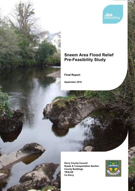
Sneem Area Flood Relief<br />
Pre-Feasibility Study<br />
Final Report<br />
September 2010<br />
<strong>Kerry</strong> <strong>County</strong> <strong>Council</strong><br />
Roads & Transportation Section<br />
<strong>County</strong> Buildings<br />
TRALEE<br />
Co <strong>Kerry</strong>
2010s4114 - Sneem Pre-feasibility study Final Report v1.docx
<strong>JBA</strong> Office<br />
<strong>JBA</strong> <strong>Consulting</strong><br />
24 Grove Island<br />
Corbally<br />
Limerick<br />
Ireland<br />
<strong>JBA</strong> Project Manager<br />
Elizabeth Russell<br />
Revision History<br />
Revision Ref / Date Issued Amendments Issued to<br />
Draft Report v1 / 19 July 2010 Initial Issue<br />
Draft Report v2 / 23 August<br />
2010<br />
Draft Final Report v3 / 24<br />
September 2010<br />
Draft Final Report v4 / 29<br />
September 2010<br />
Final Report v1 / 29<br />
September 2010<br />
Contract<br />
Chapter 7 completed<br />
Minor textual changes<br />
Minor changes to Chapter 8<br />
Final QA check and minor<br />
textual changes<br />
John O'Halloran, <strong>Kerry</strong><br />
<strong>County</strong> <strong>Council</strong><br />
John O'Halloran, <strong>Kerry</strong><br />
<strong>County</strong> <strong>Council</strong><br />
Padraic Teahan, <strong>Kerry</strong> <strong>County</strong><br />
<strong>Council</strong><br />
Padraic Teahan, <strong>Kerry</strong> <strong>County</strong><br />
<strong>Council</strong><br />
Padraic Teahan, <strong>Kerry</strong> <strong>County</strong><br />
<strong>Council</strong><br />
This report describes work commissioned by <strong>Kerry</strong> <strong>County</strong> <strong>Council</strong> by letter dated 29 April<br />
2010. <strong>Kerry</strong> <strong>County</strong> <strong>Council</strong>’s representative for the contract was John O'Halloran. Elizabeth<br />
Russell of <strong>JBA</strong> <strong>Consulting</strong> carried out this work.<br />
Prepared by .................................................. Elizabeth Russell BSc MSc<br />
Project Manager<br />
Reviewed by ................................................. Ross Bryant BSc MSc MBCS CEnv C.WEM<br />
MCIWEM<br />
Senior Analyst<br />
Approved by ................................................... Mark Morris BEng CEng CEnv MEI MCIWEM<br />
MICE MIOD<br />
Purpose<br />
Director<br />
This document has been prepared as a Pre-Feasibility Report for <strong>Kerry</strong> <strong>County</strong> <strong>Council</strong>. <strong>JBA</strong><br />
<strong>Consulting</strong> accepts no responsibility or liability for any use that is made of this document other<br />
than by the Client for the purposes for which it was originally commissioned and prepared.<br />
2010s4114 - Sneem Pre-feasibility study Final Report v1.docx i
Acknowledgments<br />
Thanks to John O'Halloran and Padraic Teahan, and the Kenmare Engineering Area Staff, of<br />
<strong>Kerry</strong> <strong>County</strong> <strong>Council</strong> for their assistance and inputs during the site visit and throughout this<br />
project.<br />
Copyright<br />
© <strong>JBA</strong> <strong>Consulting</strong> Engineers and Scientists Limited 2010<br />
Carbon Footprint<br />
231g<br />
A printed copy of the main text in this document will result in a carbon footprint of 181g if<br />
100% post-consumer recycled paper is used and 231g if primary-source paper is used.<br />
These figures assume the report is printed in black and white on A4 paper and in duplex.<br />
<strong>JBA</strong> is a carbon neutral company and the carbon emissions from our activities are offset.<br />
2010s4114 - Sneem Pre-feasibility study Final Report v1.docx ii
Contents<br />
1. Introduction .......................................................................................................... 1<br />
1.1 Commission ........................................................................................................... 1<br />
1.2 Report Structure .................................................................................................... 1<br />
2. Study Area ............................................................................................................ 3<br />
2.1 Sneem Catchment ................................................................................................. 3<br />
2.2 Flood History .......................................................................................................... 4<br />
3. Data Collection ..................................................................................................... 7<br />
3.1 Available Data ........................................................................................................ 7<br />
3.2 Site Visit ................................................................................................................. 7<br />
3.3 Site Survey ............................................................................................................ 7<br />
3.4 Property Survey ..................................................................................................... 8<br />
4. Flood Risk Mapping ............................................................................................. 9<br />
4.1 Hydrology ............................................................................................................... 9<br />
4.2 Fluvial Hydraulic Modelling .................................................................................... 10<br />
4.3 Tidal Flood Mapping .............................................................................................. 11<br />
5. Flood Risk Assessment ...................................................................................... 13<br />
5.1 Flood Mechanisms ................................................................................................. 13<br />
5.2 Flow Constraints .................................................................................................... 17<br />
5.3 Flood Defence Assets and Maintenance ............................................................... 17<br />
5.4 Flood Extents ......................................................................................................... 18<br />
5.5 Flood Depths and Frequency ................................................................................ 19<br />
5.6 Property at Risk ..................................................................................................... 21<br />
5.7 People at Risk ........................................................................................................ 22<br />
5.8 Infrastructure at Risk .............................................................................................. 22<br />
5.9 Environment at Risk ............................................................................................... 22<br />
6. Flood Mitigation Options .................................................................................... 23<br />
6.1 Introduction ............................................................................................................ 23<br />
6.2 Options Appraisal .................................................................................................. 23<br />
7. Cost Benefit Analysis .......................................................................................... 31<br />
7.1 Option Costs .......................................................................................................... 31<br />
7.2 Flood Damages and Benefits ................................................................................ 31<br />
8. Recommendations ............................................................................................... 35<br />
8.1 Short Term Actions ................................................................................................ 35<br />
8.2 Medium Term Actions ............................................................................................ 35<br />
2010s4114 - Sneem Pre-feasibility study Final Report v1.docx
List of Figures<br />
Figure 2-1 The Sneem and Owreagh catchments - overview ..................................... 3<br />
Figure 2-2 View from Sneem Bridge ............................................................................. 4<br />
Figure 2-3 Flooding of the GAA ground, October 2008 .............................................. 5<br />
Figure 3-1 Survey extents .............................................................................................. 7<br />
Figure 4-1 Typical catchment descriptors ................................................................... 9<br />
Figure 4-2 Inflow Points and Cross Sections .............................................................. 10<br />
Figure 4-3 Cross Sections and “Boxes” in JFLOW® .................................................. 11<br />
Figure 4-4 Virtual Tide Gauge Network ........................................................................ 11<br />
Figure 5-1 Flood mechanisms and flow routes ........................................................... 13<br />
Figure 5-2 Bank levels to the north of the GAA ground ............................................. 18<br />
Figure 5-3 Flood Zones A and B ................................................................................... 19<br />
Figure 5-4 Wrack mark in the Atlantic Gateway .......................................................... 20<br />
Figure 5-5 Depth bands for fluvial Flood Zone A ........................................................ 20<br />
Figure 5-6 Properties within Flood Zone A .................................................................. 21<br />
Figure 6-1 Flood mitigation measures .......................................................................... 24<br />
Figure 6-2 Channel maintenance and the Kenmare SAC ........................................... 25<br />
Figure 6-3 Berm around the Atlantic Gateway development ..................................... 26<br />
Figure 6-4 Reprofiling the river bank ............................................................................ 27<br />
List of Tables<br />
Table 5-1 Properties at flood risk .................................................................................. 21<br />
Table 7-1 Summary of option costs .............................................................................. 31<br />
Table 7-2 OPW Benefit Criteria ...................................................................................... 32<br />
Table 7-3 Summary of Financial Benefits - Options 3, 5 and 8 .................................. 32<br />
Table 7-4 - Summary of Financial Benefits - ................................................................ 32<br />
Options which are applied locally to the Atlantic Development ................................ 32<br />
Table 7-5 Objective Appraisal Matrix ............................................................................ 33<br />
2010s4114 - Sneem Pre-feasibility study Final Report v1.docx
Abbreviations<br />
2D Two Dimensional (modelling)<br />
AMAX Annual Maximum<br />
DTM Digital Terrain Model<br />
FEH Flood Estimation Handbook<br />
FSR Flood Studies Report<br />
FSU Flood Studies Update<br />
GIS Geographical Information System<br />
<strong>JBA</strong> <strong>JBA</strong> <strong>Consulting</strong> – Engineers & Scientists<br />
JFLOW 2-D hydraulic modelling package developed by <strong>JBA</strong><br />
mOD Meters above Ordnance Datum<br />
OD Ordnance Datum<br />
OPW Office of Public Works<br />
QA Quality Assurance<br />
QMED Median Annual Flood (with return period 2 years)<br />
SAAR Standard Average Annual Rainfall (mm)<br />
SAC Special Area of Conservation, protected under the EU Habitats Directive<br />
WWTP Waste Water Treatment Plant<br />
2010s4114 - Sneem Pre-feasibility study Final Report v1.docx
This page is intentionally left blank.<br />
2010s4114 - Sneem Pre-feasibility study Final Report v1.docx
1. Introduction<br />
1.1 Commission<br />
<strong>JBA</strong> <strong>Consulting</strong> was commissioned by <strong>Kerry</strong> <strong>County</strong> <strong>Council</strong> in April 2010 to undertake a<br />
flood relief pre-feasibility study for Sneem.<br />
The aim of the study was to establish the causes, effects and feasibility of solutions to the<br />
recurring flooding in the vicinity of Sneem.<br />
The objective of the study was to identify and assess the likely viability, or otherwise, of<br />
potential flood mitigation measures for the Sneem catchment, incorporating an assessment<br />
of, among others, technical, economic, social and environmental issues.<br />
1.2 Report Structure<br />
This report aims to identify the flood extents within Sneem, assess the potential flood<br />
damages and provide an assessment of potential mitigation options. These aims are fulfilled<br />
through the following stages:<br />
Identification of the flooding sources and mechanisms, through site visits, topographic<br />
survey and analysis of historic flood reports;<br />
Development of flood hazard maps for flood zones A and B, as defined by 'the<br />
Planning System and Flood Risk Management' Guidelines 1 ;<br />
Assessment of the flood damage in terms of impact on property, critical infrastructure<br />
and environment;<br />
Identification and selection of options for mitigating or preventing flooding;<br />
Assessment of the risks associated with the proposed mitigation measures, including<br />
those that may increase the impact of flooding;<br />
Initial assessment of the environmental impact of the proposed measures;<br />
Estimation of the cost of the proposed measures;<br />
Recommendations for a programme of future works.<br />
1 DoEHLG and OPW, 2009, The Planning System and Flood Risk Management: Guidelines for Planning Authorities<br />
2010s4114 - Sneem Pre-feasibility study Final Report v1.docx 1
This page is intentionally left blank.<br />
2010s4114 - Sneem Pre-feasibility study Final Report v1.docx 2
2. Study Area<br />
2.1 Sneem Catchment<br />
The River Sneem has a catchment of approximately 63km 2 to the Sneem Bridge, which<br />
marks the limit of the tidally influenced river (Figure 2-1 and Figure 2-2). This catchment<br />
incorporates over 130km of river including the Sneem itself and its primary tributary, the<br />
Ardsheelhane. The Ardsheelhane joins the Sneem approximately 1km upstream of Sneem<br />
town.<br />
A second river system drains into the tidal limits of the River Sneem, to the south of the<br />
bridge. The main river in this system is the Owreagh, which has a catchment area of 20km 2<br />
and a length of 7.7km, in addition to the numerous tributaries which contribute to its flow.<br />
The topography of the area plays an important role in influencing the speed and pattern of<br />
response to rainfall. The rivers in the Sneem catchment arise in the mountainous interior of<br />
south <strong>Kerry</strong>, at elevations of between 500 and 600 m OD, dropping to 5m OD in the town; this<br />
means water levels in the rivers can rise and fall very quickly, with flood waters receding in a<br />
matter of hours. As a result, water velocities both in channel and overland can be extremely<br />
fast, creating an increased risk to people and vehicles with little or no advanced warning.<br />
Figure 2-1 The Sneem and Owreagh catchments - overview<br />
Sneem<br />
Ordnance Survey Licence No: 2010/07/CCMA/<strong>Kerry</strong><strong>County</strong><strong>Council</strong><br />
© Ordnance Survey Ireland/ Government of Ireland<br />
2010s4114 - Sneem Pre-feasibility study Final Report v1.docx 3
Sneem is on the N70 Ring of <strong>Kerry</strong>, a primary tourist route, and the South East <strong>Kerry</strong><br />
Settlements Local Area Plan (LAP) 2 recognises the importance of maintaining the attractive<br />
views currently experienced from the bridge (Figure 2-2). The LAP also notes that there are a<br />
number of parks throughout the town, which should be preserved. Considerations such as<br />
these, and the classification of the River Sneem as a candidate Special Area of Conservation<br />
(cSAC), will inform and influence the options available for the town.<br />
2.2 Flood History<br />
Figure 2-2 View from Sneem Bridge<br />
Sneem has a documented history of flooding, which has been raised in the Dáil, and in the<br />
<strong>Kerry</strong> <strong>County</strong> <strong>Council</strong> Chambers by the Elected Members on a number of occasions. The<br />
LAP notes that "there is a history of flooding at certain locations along the river", and this is<br />
further evidenced in the Tender Document, which recognises approximately 20 residential<br />
properties as potentially being at risk. The road infrastructure, agricultural and recreational<br />
land, including the GAA ground, is also liable to flood. Flooding is reported to occur at least<br />
annually, and can affect roads and surrounding land to a depth of approximately 300mm.<br />
Particularly severe flash flooding occurred in the area in October 2008, whilst in 2009 the<br />
GAA ground flooded five or six times (Figure 2-3), with water flowing across the road. On one<br />
occasion in 2009, waters reached in excess of 1m depth, and spilled across the wall<br />
surrounding the ground. There are anecdotal accounts of flooding incidents, and it is reported<br />
that the low lying land to the east of Sneem, including the site of the Atlantic Gateway<br />
development, 'have always flooded', and it is suggested the development may have been<br />
inundated a couple of times in the last four or five years. It is reported that the properties<br />
have been constructed approximately 1m higher than pre-development ground levels, which<br />
would remove them from the most frequent of flood events.<br />
It is also reported that there has been flooding of the neighbouring fields as long ago as 1948.<br />
2 South East <strong>Kerry</strong> Settlements Local Area Plan, <strong>Kerry</strong> <strong>County</strong> <strong>Council</strong> Planning Department, adopted February<br />
2008.<br />
2010s4114 - Sneem Pre-feasibility study Final Report v1.docx 4
Figure 2-3 Flooding of the GAA ground, October 2008 3<br />
The flooding of October 2008 resulted in inundation of the Derreenavurrig Road between the<br />
waste water treatment plant and the Owreagh River. Water backed up at the culvert and<br />
flowed down the road towards the treatment works. The flow velocity was such that the road<br />
surface was badly damaged and necessitated emergency road works by <strong>Kerry</strong> <strong>County</strong><br />
<strong>Council</strong>. A local resident reported to the <strong>County</strong> <strong>Council</strong> that all properties beyond this point<br />
(in the region of 30 no.) were unable to travel the route to Sneem town as the road was<br />
"impassable by vehicles and very dangerous by foot due to the undermining of the surface<br />
leaving only an asphalt layer which would not support a vehicle". An incident of this severity<br />
had not previously been reported, but the waste water treatment plant is known to have<br />
flooded on numerous occasions.<br />
3 Photographs supplied by <strong>Kerry</strong> <strong>County</strong> <strong>Council</strong><br />
2010s4114 - Sneem Pre-feasibility study Final Report v1.docx 5
This page is intentionally left blank.<br />
2010s4114 - Sneem Pre-feasibility study Final Report v1.docx 6
3. Data Collection<br />
3.1 Available Data<br />
<strong>Kerry</strong> <strong>County</strong> <strong>Council</strong> made a range of data available for the study, including OSi mapping<br />
and National Height Model. Photographs of a 2008 flood event were also supplied.<br />
Digital catchment characteristic datasets, including the river network and SAAR, were used<br />
for the development of the flood maps.<br />
3.2 Site Visit<br />
Two site visits were undertaken by <strong>JBA</strong> <strong>Consulting</strong> on 26th April and 4 June 2010. John<br />
O'Halloran, KCC project manager was present on the second visit, and arranged a meeting<br />
with the Kenmare Engineering Area Staff.<br />
3.3 Site Survey<br />
As part of the project a threshold and topographic survey was commissioned from EMC<br />
Surveys. The survey extents are shown in Figure 3-1.<br />
Figure 3-1 Survey extents<br />
Ordnance Survey Licence No: 2010/07/CCMA/<strong>Kerry</strong><strong>County</strong><strong>Council</strong><br />
© Ordnance Survey Ireland/ Government of Ireland<br />
2010s4114 - Sneem Pre-feasibility study Final Report v1.docx 7
The survey included:<br />
33 no. threshold levels<br />
Road levels through Sneem<br />
Levels across the field adjacent to Atlantic Gateway development, the field to the<br />
south-west of the GAA ground and across the GAA pitch.<br />
Top of bank levels<br />
Bed levels in selected locations<br />
The survey allowed validation of the digital terrain model and the flood maps.<br />
3.4 Property Survey<br />
The property survey comprised the following stages:<br />
The property type was noted during the walkover survey;<br />
The threshold level of properties within, and immediately adjacent to, the 1000 year<br />
flood outline was surveyed (as detailed above);<br />
The properties were assessed in terms of flood risk vulnerability, based on the<br />
Planning System and Flood Risk Management Guidelines.<br />
2010s4114 - Sneem Pre-feasibility study Final Report v1.docx 8
4. Flood Risk Mapping<br />
The processes involved in the fluvial mapping can be divided into two stages: hydrology and<br />
hydraulic modelling. These are described in detail below.<br />
4.1 Hydrology<br />
The aim of the hydrology stage was to generate inflows for use in the hydraulic modelling. To<br />
generate inflows, catchment boundaries were delineated and catchment descriptors were<br />
calculated from a wide range of national environmental datasets, including:<br />
Digital Terrain Model (DTM);<br />
Vector data of water features (i.e. river centrelines and lakes);<br />
Teagasc General Soils Map of Ireland;<br />
Teagasc/EPA National Subsoils Map;<br />
CORINE Land Cover Data 2000;<br />
Met Éireann Annual Average Rainfall;<br />
OPW Hydrodata Annual Maxima (AMAX) series.<br />
Typical examples of these datasets are shown in Figure 4-1, below.<br />
Figure 4-1 Typical catchment descriptors<br />
Topography Annual Average Rainfall<br />
Ground Elevation<br />
Value<br />
1100mOD<br />
10mOD<br />
<strong>JBA</strong> <strong>Consulting</strong> developed in-house software tools to interpolate catchment descriptors from<br />
the environmental data, and an automated method for calculating design flows. This was a<br />
simplified version of the procedure used to automate the Flood Estimation Handbook (FEH) 4<br />
statistical method for the UK. This methodology is in line with that of the Flood Studies<br />
Update (FSU), which is currently under development by the OPW to replace the 1975 Flood<br />
Studies Report (FSR).<br />
These steps resulted in the creation of geographical information system (GIS) data that could<br />
be used to calculate design flows at most locations in Ireland.<br />
Using the GIS, index flows were generated at 300 m intervals along all watercourses with a<br />
catchment area of greater than 3 km 2 in areas of strategic importance, and greater than 10<br />
km 2 in all other areas. Annual Maximum flow data from the OPW’s Hydrodata website were<br />
used to adjust the index flows generated, by allocating “donor” gauges, whereby local gauges<br />
are used to compare and adjust index flows for a given catchment.<br />
The FEH Statistical Method was used to generate flows for different return periods (i.e. 100<br />
and 1000 year). In this method, growth curves are generated based on pooled gauge data,<br />
rather than using Regional Growth Curves. This provides a more reliable estimation of flows<br />
for different return periods.<br />
4 Flood Estimation Handbook, (Institute of Hydrology), 1999<br />
2010s4114 - Sneem Pre-feasibility study Final Report v1.docx 9<br />
SAAR<br />
Value<br />
3000mm<br />
1700mm
Once inflow points for an area were generated, they were checked manually to ensure that no<br />
river reaches were missing inflow points, and that no inflow points were located at<br />
confluences or within lakes. Flows were regenerated for any inflow points that were created<br />
or moved at this stage.<br />
Figure 4-2 below, shows an example of inflow points through Sneem. Flows were<br />
subsequently generated for these points.<br />
It should be noted that the flows derived are indicative; prior to undertaking works, a more<br />
detailed hydrological analysis, including deriving flows using a number of methods, and<br />
analysing the suitability of the donor sites should be undertaken.<br />
Figure 4-2 Inflow Points and Cross Sections<br />
Ordnance Survey Licence No: 2010/07/CCMA/<strong>Kerry</strong><strong>County</strong><strong>Council</strong><br />
© Ordnance Survey Ireland/ Government of Ireland<br />
4.2 Fluvial Hydraulic Modelling<br />
Cross sections were generated at each inflow point; the cross sections are used by <strong>JBA</strong>’s 2<br />
dimensional hydraulic modelling software, JFLOW® 5 , to define the area of DTM over which to<br />
route the flow. A box is created at each JFLOW® inflow point, the width and orientation of<br />
which are determined by the cross section. Once generated, cross sections were manually<br />
checked, to ensure suitable alignment and extension across the floodplain.<br />
Figure 4-3 below, shows typical cross sections generated along a river reach, and the boxes<br />
generated by JFLOW® to route the inflows across the DTM.<br />
Once the design flows had been developed, the flood maps were generated by simulating<br />
overland flooding, using JFLOW®.<br />
5 JFLOW® is a registered UK trade mark in the name of Jeremy Benn Associates Limited<br />
2010s4114 - Sneem Pre-feasibility study Final Report v1.docx 10
JFLOW® results were subjected to several iterations of manual checking and model rerunning,<br />
to remove anomalous results and irregular flow patterns, ensuring that results were<br />
realistic.<br />
The results were compared to reported flood extents and flow paths from previous events.<br />
4.3 Tidal Flood Mapping<br />
Figure 4-3 Cross Sections and “Boxes” in JFLOW®<br />
To map inundation from tidal flooding, a 10 km resolution numerical model was first<br />
constructed to simulate tide and surge processes for a virtual tide gauge network around the<br />
coast of Ireland for the period September 1957 to August 2003. Where tide gauge records<br />
were available, these were used to validate the simulated records.<br />
Figure 4-4 Virtual Tide Gauge Network<br />
2010s4114 - Sneem Pre-feasibility study Final Report v1.docx 11
Extreme sea levels were then generated for 200 and 1,000 year return periods. This process<br />
included joint probability analysis (tides and surges) and tide-surge interaction analysis.<br />
Using a level projection method, the extreme sea levels were interpolated between the<br />
simulated gauge stations, and outlines were created for the study area.<br />
2010s4114 - Sneem Pre-feasibility study Final Report v1.docx 12
5. Flood Risk Assessment<br />
5.1 Flood Mechanisms<br />
5.1.1 Rivers Sneem and Ardsheelhane<br />
Based on observations made during the site visits, anecdotal reports, the topographic survey,<br />
and the flood maps, the flood mechanisms and flow routes have been identified, and are<br />
shown in Figure 5-1.<br />
Numbers on the drawing and some photograph captions reference the numbers in the text<br />
below. Photographs of key locations are shown overleaf, note that not all numbered<br />
references have an accompanying photograph.<br />
Owreagh River<br />
Figure 5-1 Flood mechanisms and flow routes<br />
River Sneem<br />
Ordnance Survey Licence No: 2010/07/CCMA/<strong>Kerry</strong><strong>County</strong><strong>Council</strong><br />
© Ordnance Survey Ireland/ Government of Ireland<br />
River Ardsheelhane<br />
The River Sneem is joined by its primary tributary, the Ardsheelhane, upstream of the GAA<br />
pitch (1). This junction forms a 90 degree bend in the river, with flow constricted further by<br />
the presence of bed rock protrusions in the channel bed, and extensive vegetation growth on<br />
the banks. Flow was observed to slow considerably at this point in the river. Under flood flow<br />
conditions, water has historically overtopped the right bank to flow across the pitch (2) and<br />
exit through the gateway (3). In extreme events, water is reported to flood over the top of the<br />
2010s4114 - Sneem Pre-feasibility study Final Report v1.docx 13
wall of the GAA ground, at a depth of approximately 1m. The water flows across the road<br />
and inundates the field drain and surrounding floodplain as it follows a route to the north of<br />
the town centre (4). There is a 900mm diameter culvert below the road at the downstream<br />
end of the field drain (5). The water backs up at this culvert and flows across the N70 road<br />
adjacent to the Atlantic Gateway development, where it attempts to re-enter the field drain<br />
again. It is at this location that water of sufficient depth floods properties in the Atlantic<br />
Gateway development.<br />
A second flow route exists from the Owreagh River, to the south-west of the town. Water<br />
leaves the channel to flow across the floodplain on the right bank (6) in the direction of the<br />
Atlantic Gateway. It is reported that this situation is exacerbated during high tides, when<br />
water backs up in the channel and limits outflows from the land drain (7).<br />
Road bridge on the Sneem River upstream of<br />
the confluence with the Ardsheelhane<br />
(1) Constricted channel upstream of GAA ground<br />
Raised embankment and reprofiled field to the north of the GAA ground<br />
Below the confluence of the Sneem and Ardsheelhane - GAA ground on right bank<br />
2010s4114 - Sneem Pre-feasibility study Final Report v1.docx 14
(2) GAA ground (4) Field drain and neighbouring floodplain<br />
(5) 900 dia culvert upstream of the N70 (5) Secondary relief culvert upstream of the<br />
N70<br />
(5) View across the N70, where water would<br />
flow during a flood<br />
(5) 900 dia culvert downstream of the N70<br />
2010s4114 - Sneem Pre-feasibility study Final Report v1.docx 15
Field drain adjacent to the Atlantic Gateway<br />
Development<br />
5.1.2 Owreagh River<br />
Atlantic Gateway development<br />
A further source of flood risk is associated with the Owreagh River; the river is culverted<br />
below the Derreenavurrig Road adjacent to the waste water treatment plant (8). Flooding and<br />
road damage at this location was reported in October 2008. Since that time, a relief culvert<br />
on the right bank has been opened, thus increasing the capacity of the below road culvert.<br />
The relief culvert has 3 no. openings, which measure 800mm high by 1000mm wide (see<br />
photograph below).<br />
The QMED flow on the Owreagh River is estimated to be 32m 3 /s. A culvert with a minimum<br />
opening size of 10.3m 2 would be required to convey this flow without surcharge. In addition<br />
to this conveyance area, when designing a culvert 250-300mm should be allowed for siltation<br />
at the base of culvert, and 250-300mm freeboard above the design water level. In practice<br />
this means that if a culvert is 1.5m high, only 0.9 -1m of this height should actually be counted<br />
for conveying flood flow.<br />
The main culvert was inspected during the site visit and estimated to have an opening of 6-<br />
8m 2 . The combined opening of the main and relief culverts is approximately 8-10m 2 , which<br />
would provide sufficient capacity to convey approximately the QMED flow.<br />
(8) Owreagh River (8) Flood relief culvert at the Derreenavurrig<br />
Road<br />
The individual size of each of the three relief openings is smaller than would normally be<br />
recommended for a culvert, and it is likely that during a flood event these openings would<br />
become blocked by debris and vegetation.<br />
The results of the hand calculations suggest that a minimum of 3 no. 900mm diameter<br />
culverts would be required to provide conveyance for the 10 year, non-surcharged flow (45<br />
2010s4114 - Sneem Pre-feasibility study Final Report v1.docx 16
m 3 /s). A more detailed assessment of the culvert and channel will allow accurate sizing,<br />
based on a specific design and layout to be undertaken.<br />
5.2 Flow Constraints<br />
There are a number of constrictions and constraints to flow through Sneem:<br />
The previously highlighted location to the north of the GAA ground, where there is a<br />
considerable accumulation of sediment and vegetation growth in the channel and<br />
along the banks;<br />
Downstream of the confluence of the Sneem and the Ardsheelhane, and to the south<br />
east of the GAA ground, the river makes a second 90 degree turn. There is currently<br />
no evidence of water leaving the bank here, but care must be taken to ensure works<br />
upstream do not increase water levels at this bend;<br />
The bed of the channel through the centre of Sneem has significant rocky outcrops<br />
which act to constrict flow in several locations, particularly in the vicinity of the bridge;<br />
Downstream of the bridge the river is tidally influenced, which can cause the<br />
tributaries which discharge into this reach to back-up.<br />
Looking upstream through the Sneem Bridge<br />
5.3 Flood Defence Assets and Maintenance<br />
There are no formal flood defences in Sneem. However, informal works were undertaken<br />
following the extreme flooding in November 2009. This involved raising the height of the right<br />
bank to the north of the GAA pitch, where water overtops the banks. Since this work has<br />
been carried out there have been no periods of heavy rainfall, so it is not known if the work<br />
will be fully or partly successful. However, examination of the bank levels in this area<br />
indicates that the crest on the right bank (GAA side) is now higher, by some 0.4m, than the<br />
left bank (Figure 5-2). This indicates that water will either remain in channel or would<br />
preferentially flow over the left bank during future flood events.<br />
A more detailed assessment of the impact of this works should be undertaken to determine:<br />
The reduction in flood risk to the GAA ground, the land surrounding the field drain<br />
and the Atlantic Gateway and neighbouring properties;<br />
Any increase in flood risk downstream arising from flows being contained in channel.<br />
2010s4114 - Sneem Pre-feasibility study Final Report v1.docx 17
Figure 5-2 Bank levels to the north of the GAA ground<br />
Ordnance Survey Licence No: 2010/07/CCMA/<strong>Kerry</strong><strong>County</strong><strong>Council</strong><br />
© Ordnance Survey Ireland/ Government of Ireland<br />
No maintenance work is undertaken on the channel or its bank. It is reported that historically<br />
(30 or 40 years ago) the vegetation was cut, and gravel and silt was cleared from sections of<br />
the bed. Anecdotal reports suggest that incidents of flooding reduced significantly in the<br />
several years following a maintenance period.<br />
<strong>Kerry</strong> <strong>County</strong> <strong>Council</strong> have outlined that the frequency of inspection and maintenance of the<br />
road culverts is intermittent; it is noted that the gullies and road edge were being inspected<br />
and cleaned during <strong>JBA</strong>'s site visit.<br />
5.4 Flood Extents<br />
The flood mapping methods discussed in Section 4 allow maps to be produced showing<br />
Flood Zones A and B (Figure 5-3), as defined by the Planning System and Flood Risk<br />
Management.<br />
Having identified the extents of flood zones A and B an assessment can be made of the<br />
property, environment and infrastructure which may be at flood risk.<br />
2010s4114 - Sneem Pre-feasibility study Final Report v1.docx 18
Figure 5-3 Flood Zones A and B<br />
Ordnance Survey Licence No: 2010/07/CCMA/<strong>Kerry</strong><strong>County</strong><strong>Council</strong><br />
© Ordnance Survey Ireland/ Government of Ireland<br />
5.5 Flood Depths and Frequency<br />
During the site visit, wrack marks were recorded on the internal walls of one of the properties<br />
in the Atlantic Gateway development. The internal flood depth was 0.15m (Figure 5-4, wrack<br />
mark highlighted in blue), which was calculated to correspond to a water level of 8.77 mOD<br />
(Malin head). Due to the lack of gauge record for the River Sneem and its tributaries, it is not<br />
possible to correlate this event with a return period. However, anecdotal evidence suggests<br />
that the properties at the Atlantic Gateway have flooded "a couple of times" since their<br />
construction approximately five years ago. Although the weather over the period has been<br />
particularly wet, this would suggest the development, or properties, are at risk from<br />
reasonably frequent events.<br />
An interrogation of the extent of the flood zones compared with the ground levels in the<br />
vicinity of the Atlantic Gateway indicates that the water level associated with Flood Zone A is<br />
approximately 9.3-9.5 mOD, with Flood Zone B being slightly higher (9.5-9.6 mOD). The<br />
topography in this part of the catchment means there is little difference in the extents of Flood<br />
Zones A and B. The depth of flooding varies depending on the ground height. An indication<br />
of the flood depths is provided in Figure 5-5, but it is noted that this is based on a coarse<br />
digital terrain model, and does not take into account the earthworks associated with the<br />
housing construction.<br />
2010s4114 - Sneem Pre-feasibility study Final Report v1.docx 19
Figure 5-4 Wrack mark in the Atlantic Gateway<br />
Figure 5-5 Depth bands for fluvial Flood Zone A<br />
Ordnance Survey Licence No: 2010/07/CCMA/<strong>Kerry</strong><strong>County</strong><strong>Council</strong><br />
© Ordnance Survey Ireland/ Government of Ireland<br />
2010s4114 - Sneem Pre-feasibility study Final Report v1.docx 20
5.6 Property at Risk<br />
To determine the number of properties at risk of flooding, a matrix was constructed based on<br />
the known depth of the most recent flood event, and the results of the threshold survey. This<br />
quantifies the number of properties which would be affected by a range of flood depths.<br />
The walkover survey confirmed that the lower lying properties (relative to the river channel)<br />
were located to the south-west of Sneem, in the vicinity of the Atlantic Gateway development.<br />
An interrogation of Flood Zone A shows nine properties to be at risk of fluvial flooding, and an<br />
additional four properties lie within Flood Zone B. All the properties within Flood Zone A, and<br />
all except one in Flood Zone B are located in the Atlantic Gateway development.<br />
Figure 5-6 Properties within Flood Zone A<br />
GAA Changing Rooms Atlantic Gateway Development<br />
One of the properties at risk is the GAA changing rooms and ancillary buildings. All the other<br />
properties at risk are residential, which, following the classification laid down in the Planning<br />
System and Flood Risk Management guidelines, makes them highly vulnerable to flooding.<br />
The changing rooms would be considered to be water compatible as they are associated with<br />
a playing field which is also in Flood Zone A.<br />
The flood level associated with the GAA pitch flooding is unknown, but the grounds are<br />
reported to flood several times a year, so inundation is likely to begin at a relatively low level.<br />
Table 5-1 Properties at flood risk<br />
Flood Level (mOD Malin) Number of properties at risk<br />
8.57 0<br />
8.67 2<br />
8.77 (recorded level) 2<br />
8.87 3<br />
8.97 3<br />
9.07 3<br />
9.17 6<br />
9.27 6<br />
9.37 (approx. Flood Zone A) 9<br />
9.47 (approx. Flood Zone B) 12<br />
9.57 13<br />
9.67 15<br />
9.77 20<br />
2010s4114 - Sneem Pre-feasibility study Final Report v1.docx 21
5.7 People at Risk<br />
Flooding of roads can cause an inconvenience to local residents and visitors alike. In Sneem<br />
flooding is generally shallow, and of short duration which reduces the impact and<br />
inconvenience of road blockage and closure for those wishing to travel.<br />
Where flood waters enter properties the impact on people is greatly increased. Even a few<br />
centimetres of flooding can cause damage to the building structure, furniture and other<br />
possessions, and may require new flooring, wall coverings and rewiring. Contamination due<br />
to flood water can have detrimental impacts on health, and the psychological pressure of not<br />
knowing if and when another flood will occur can place considerable strain on residents.<br />
5.8 Infrastructure at Risk<br />
There is a fire station, Garda station and primary school located on the N70 to the west of<br />
Sneem Bridge. None of these critical services are shown to be within the flood zones.<br />
As highlighted through the historic flood records, sections of both the N70 and the<br />
Derreenavurrig Road to the south of the town are at risk of flooding.<br />
The waste water treatment plant has also flooded on a number of occasions in the past.<br />
5.9 Environment at Risk<br />
The lower reach of the Sneem River forms part of the Kenmare River SAC. Flooding below<br />
the Sneem Bridge is tidal, and above the bridge is generally contained within the high,<br />
naturally rocky channel sides. The overland flow route from the GAA pitch is not through an<br />
environmentally designated site.<br />
However, the risks to the wider environment include contamination from the sewer and<br />
surface water systems. Flooding of the waste water treatment plant may cause<br />
contamination of water and the surrounding area.<br />
2010s4114 - Sneem Pre-feasibility study Final Report v1.docx 22
6. Flood Mitigation Options<br />
6.1 Introduction<br />
There are a number of flood mitigation options available to alleviate the risk of flooding in<br />
Sneem. These include one or a combination of the following (see Figure 6-1, below, for<br />
mitigation locations). More detail is provided for each option in the following sections,<br />
including an assessment of cost, environmental, construction and health and safety<br />
implications.<br />
1. Do nothing<br />
2. Install level / flow gauge and establish monitoring programme<br />
3. Periodic maintenance of the channel, including removal of in channel deposits and<br />
bank vegetation clearance<br />
4. Build a bank along the river bank upstream of the GAA ground to direct flows round<br />
the bend in the river<br />
5. Increase the capacity of the field drain which currently flows from the GAA ground<br />
past the Atlantic Gateway<br />
6. Build a berm around the Atlantic Gateway development<br />
7. Increase the capacity of the culverts (a) at the Atlantic Gateway and (b) near the<br />
Waste Water Treatment Works<br />
8. Re-profile the Sneem River<br />
9. Upstream Attenuation<br />
10. Retro-fit flood resistant and resilience measures to the properties at risk<br />
11. Relocate at risk properties<br />
This pre-feasibility study will allow a preferred option/suite of options to be developed. The<br />
detailed design stage of any option should include a more detailed study, including hydraulic<br />
modelling, to determine design capacity / levels, and give a better understanding of the<br />
impact the design may have on flood risk elsewhere.<br />
6.2 Options Appraisal<br />
6.2.1 Do nothing (1)<br />
This option is used to provide a baseline scenario against which the other options can be<br />
measured, and would assume any interventions and maintenance are stopped. In Sneem,<br />
where little or no maintenance is carried out, this option is also assumed to be a reflection of<br />
the current scenario.<br />
Under this option, residential properties, the GAA pitch and surrounding lands would continue<br />
to flood, and it is possible that the frequency and severity of flooding would increase both as a<br />
result of continued channel constriction and the likely impacts of climate change.<br />
There is no direct works cost implication associated with this option.<br />
As there is no requirement for construction or on-going maintenance, there are no health and<br />
safety implications for workers. However, the risks to the public and landowners during flood<br />
events would remain, and could increase over time.<br />
6.2.2 Install level / flow gauge and establish monitoring programme (2)<br />
There is currently no means of monitoring water flow on the River Sneem or its tributaries. In<br />
order to establish a quantitative record of water level or velocity, and the relationship these<br />
have with flow, it is recommended that a programme of monitoring is established at an<br />
appropriate site on the River Sneem, between the Sneem Bridge and the confluence of the<br />
Sneem and the Ardsheelhane.<br />
2010s4114 - Sneem Pre-feasibility study Final Report v1.docx 23
Figure 6-1 Flood mitigation measures<br />
Ordnance Survey Licence No: 2010/07/CCMA/<strong>Kerry</strong><strong>County</strong><strong>Council</strong><br />
© Ordnance Survey Ireland/ Government of Ireland<br />
The relationship between water level and flow rate within a river is complex and depends on<br />
control points. These are points within the river that control the relationship between depth<br />
and flow rate upstream, and for a short stretch downstream, of the point. Typical control<br />
points include weirs, sluice gates, or natural constrictions in the river. In the absence of<br />
structures or natural river constrictions, the control can be produced by a stretch of river. This<br />
applies at most flow measurement stations, and is the most cost-effective method for<br />
establishing a short term flow record on the Sneem. However, these natural points of control<br />
can move with changes in the flow rate and changes in the river cross section, thus changing<br />
the depth-flow rate relationship. A weir in the river causes a fixed control point and is<br />
desirable for this reason. However, the associated cost of weir installation is often prohibitive.<br />
Nationally, only 43 flow stations use weirs.<br />
2010s4114 - Sneem Pre-feasibility study Final Report v1.docx 24
There are a range of options available for the installation of a gauging station. The choice of<br />
option depends on the available budget, and the suitability of the channel for gauging.<br />
A basic level recorder/logger and staff gauge would provide a relatively inexpensive means of<br />
establishing a rated river section (
6.2.4 Build a berm around the Atlantic Gateway development (4)<br />
The majority of the properties at risk of flooding are located within the Atlantic Gateway<br />
development, so would benefit from a localised flood protection scheme. Such a scheme<br />
could comprise an earthen embankment to protect the development from flood waters (Figure<br />
6-3). Water would be routed back towards the field drain and the lower lying field on the right<br />
bank of the drain. Although this will result in the loss of a small quantity of floodplain behind<br />
the berm, the loss is unlikely to have a significant impact on flood frequency or levels<br />
elsewhere; the volume is very small when compared with the total volume of water and the<br />
area of the fields which are currently at flood risk. Full hydraulic modelling would allow the<br />
impact of loss of floodplain to be quantified.<br />
The embankment would tie in with existing higher ground levels, and should be carefully<br />
designed to allow access across the road whilst still providing a sufficient barrier to flow.<br />
Figure 6-3 Berm around the Atlantic Gateway development<br />
Ordnance Survey Licence No: 2010/07/CCMA/<strong>Kerry</strong><strong>County</strong><strong>Council</strong><br />
© Ordnance Survey Ireland/ Government of Ireland<br />
As this is a localised scheme, it would not protect the upstream GAA ground or properties and<br />
land outside the Atlantic Gateway development.<br />
Construction of the embankment would be reasonably straightforward, with the inclusion of<br />
the road and tying into the existing road levels adding an element of complexity. The<br />
maintenance requirements of the embankment would be low, and may include vegetation<br />
removal. Although it is possible that the embankment could be raised in line with climate<br />
change, the passage of the road may make this difficult<br />
2010s4114 - Sneem Pre-feasibility study Final Report v1.docx 26
The health and safety implications associated with construction are low. During operation,<br />
the safety of residents of the Gateway is secured whilst flood waters are lower than the<br />
embankment. However, the risks to the public and landowners during flood events outside<br />
the development, and those requiring access or egress from the Atlantic Gateway<br />
development would remain, and could increase over time.<br />
6.2.5 Build a bank along the river bank upstream of the GAA ground to direct<br />
flows round the bend in the river (5)<br />
This option would entail the construction of an embankment to the north of the GAA ground,<br />
to prevent flows leaving the channel at the bend. As discussed in Section 5.3, informal bank<br />
raising has taken place here in the last number of months.<br />
Prior to any further works being undertaken in this location the impact of the informal<br />
measures should be fully investigated; both through detailed hydraulic modelling and<br />
monitoring flow routes during future flood events. It is also important to ensure that<br />
remodelling the right bank will not increase the risk of flooding downstream as a result of<br />
increased water levels in the channel, or result in a re-direction of flows through the low bank<br />
behind the GAA changing rooms.<br />
This option has the potential to reduce flood risk through Sneem, including to the GAA<br />
ground, the arable land and residential properties, including the Atlantic Gateway.<br />
The health and safety implications associated with construction are low, and the risks for the<br />
population of Sneem are removed whilst flood waters are lower than the embankment.<br />
The cost of modelling the stretch of river will be approximately €20,000 (including survey). If<br />
the findings of the modelling demonstrate sufficient bank raising has been undertaken, then<br />
no further costs will be incurred.<br />
To provide a consistent level of protection along the river bank a small volume of fill may be<br />
required behind the GAA changing rooms; a low spot in the bank was identified in this<br />
location during <strong>JBA</strong>'s site visit.<br />
Figure 6-4 Reprofiling the river bank<br />
Ordnance Survey Licence No: 2010/07/CCMA/<strong>Kerry</strong><strong>County</strong><strong>Council</strong><br />
© Ordnance Survey Ireland/ Government of Ireland<br />
2010s4114 - Sneem Pre-feasibility study Final Report v1.docx 27
6.2.6 Increase the capacity of the field drain which currently flows from the<br />
GAA ground past the Atlantic Gateway (6)<br />
Increasing the capacity of the field drain would provide a greater volume of flood storage, and<br />
thus reduce the depth and frequency of flooding of the adjacent fields. This will reduce the<br />
volume of water overtopping onto the road, and reduce the frequency of flooding of the<br />
Atlantic Gateway development.<br />
However, the reported frequency and depth with which the fields flood indicates that the drain<br />
would have to be enlarged considerably and lowering of the immediate floodplains may be<br />
required.<br />
This option has the potential to reduce flood risk to the Atlantic Gateway and neighbouring<br />
properties, and a proportion of the fields, but would not reduce risk to the GAA ground.<br />
Landscaping on such a large scale would also be highly damaging to the wetland habitat, and<br />
the changed flood regime and water levels could have longer term impacts on the wider<br />
ecology of the area.<br />
6.2.7 Increase the capacity of the culverts at the Atlantic Gateway (7a)<br />
This option could be undertaken as a standalone measure, or in conjunction with the<br />
enlargement of the field drain. The culvert below the N70 road is currently a 900mm pipe, as<br />
is the culvert downstream of the N70.<br />
As a standalone measure, increasing the culvert capacity would allow a greater flow of water<br />
through the culvert, and would decrease the frequency of overtopping of the road. The right<br />
bank of the field drain adjacent to the Atlantic Gateway development is lower than the left<br />
bank, so once the drain reaches capacity, water would preferentially flow onto the fields,<br />
rather than the development. Hydraulic capacity calculations would need to be undertaken to<br />
determine the required culvert dimensions.<br />
If the culvert was enlarged and the drainage channel capacity also increased, flood levels<br />
would be reduced upstream. Water would drain with a greater rapidity from the upstream<br />
fields, and would collect to an increased depth on the downstream fields. It is reported that<br />
the downstream field also floods as a result of water backing up from the Owreagh, so the<br />
interactions between the two events would need to be investigated to ensure water levels<br />
would not rise to flood the road and properties to the west, which are not currently shown to<br />
be at risk.<br />
Either of the variations of this option should reduce the risk of flooding to the Atlantic Gateway<br />
development, but would have no impact on the upstream GAA ground. The benefit to the<br />
fields is variable; those upstream of the road would flood to a lesser depth, but the frequency<br />
of flooding would remain largely unchanged. The speed of drainage from the fields would be<br />
enhanced. The land downstream of the road would flood to a greater depth.<br />
To provide flood relief to both the GAA ground, and the Atlantic Gateway this measure could<br />
be combined with the construction of a berm upstream of the GAA ground (4).<br />
The residual risks associated with reliance on a culvert to route flood waters away from the<br />
development are high; regular maintenance is required to ensure the culvert and its<br />
approaches remain clear. Should the culvert become blocked, flood risk is likely to revert to<br />
the pre-works scenario.<br />
6.2.8 Increase the capacity of the Derreenavurrig Road culvert (7b)<br />
An analysis of the current capacity shows that the culverts are sized to allow flows of<br />
approximately QMED pass through, although there is likely to be some water pooling on the<br />
banks upstream of the road. To increase the capacity of the openings to allow the 10 year<br />
flood pass without surcharging would require the construction of a minimum of 3 no. 900mm<br />
diameter culverts. Routine inspection and maintenance would also need to be undertaken to<br />
ensure the culverts remain clear.<br />
The preliminary site inspection indicated that this option may be constrained by space, or that<br />
clearance works would be required to allow the installation of the additional culverts.<br />
2010s4114 - Sneem Pre-feasibility study Final Report v1.docx 28
A more cost effective solution may be to create an on line attenuation area upstream of the<br />
culvert, which would allow water to discharge gradually through the culvert, rather than<br />
overtopping the road.<br />
6.2.9 Reprofile the Sneem River (8)<br />
To ensure extreme floods are contained in channel, reprofiling of the channel bed could be<br />
undertaken. This is a more invasive option than simply undertaking clearance associated<br />
with regular maintenance, and would involve removing bed rock from the channel floor and<br />
reshaping the channel sides to achieve a smoother and more regular profile. Ongoing<br />
maintenance would be required to retain the artificial profile.<br />
There are two constraints on this option. Firstly the impact of the works on the environment<br />
and ecology of the area; much of the works would take place within the Kenmare SAC. In<br />
addition, it is highly likely that the bridge structure in Sneem would require underpinning as a<br />
result of the removal of upstream bed materials.<br />
6.2.10 Upstream Attenuation (9)<br />
A number of the options detailed above result in the possibility of increasing the risk of<br />
flooding to Sneem town, either by increasing the velocity or volume of water contained in the<br />
channel. This risk may be mitigated by providing an on-line flood storage area upstream of<br />
the town. This may be achieved by lowering the bank levels upstream of the confluence of<br />
the Sneem and Ardsheelhane Rivers to create a flood attenuation area. As water levels in<br />
the river drop, the water on the floodplain will recede, resulting in a lower but more prolonged<br />
peak through the town. At this pre-feasibility stage, a conservative approach to flood<br />
frequency reduction has been adopted. This assumes all flow will be contained in the<br />
attenuation area upstream of Sneem, or in-channel. This would require an area with similar<br />
capacity to the fields which currently flood, estimated to be approximately 0.25km 2 , flooding to<br />
a depth of 0.5-1m. More detailed hydraulic assessment would allow this volume to be<br />
quantified more precisely, and allow a range of intermediate options, whereby some out of<br />
bank flooding is allowed, to be tested.<br />
This option has the advantage of offering flood protection to the whole town, but would result<br />
in inundation of lands which have not traditionally flooded, and which are in private<br />
ownership.<br />
The environmental implications are likely to be two fold; firstly a traditionally 'dry' area would<br />
be subject to periodic inundation, and the wetlands to the west of the town would flood less<br />
frequently.<br />
The creation of an area of standing water could create a risk to people, and also to livestock<br />
in the fields; the rapid catchment response time means there is unlikely to be sufficient time to<br />
warn the landowners of the flood.<br />
6.2.11 Retro-fit flood resistant and resilience measures to the properties at risk<br />
(10)<br />
There are a wide range of flood resilience (minimising the impacts of flooding, and<br />
maximising the speed and efficiency of recovery) and resistance (preventing the inflow of<br />
water to the property) products and design techniques available, but all are most costeffectively<br />
incorporated into the construction phase of developments. However, it is possible<br />
to undertaking retro-fitting to minimise the impact of future flood events.<br />
The cost of the option would depend on the exact nature of measures adopted, but could<br />
range from fairly low cost options, such as laying tiles on the ground floor and refinishing<br />
walls with water resistant concrete or plaster, to rewiring the property to ensure feeds are<br />
from the roof down. Flood gates across door ways are useful for resisting moderate depths of<br />
water (up to 0.6m), but rely on the resident having sufficient warning to operate the system.<br />
Whilst this option minimises flood damage to upgraded buildings, it is unlikely that all 'at risk'<br />
properties will be flood-proofed, particularly where funding is up to the private individual, and<br />
in cases where there is no history of flooding. There will also be no benefits to the GAA<br />
ground, or to the surrounding fields.<br />
2010s4114 - Sneem Pre-feasibility study Final Report v1.docx 29
The wider health and safety risks associated with flood waters are not dealt with, and where<br />
'resilience' has been adopted, there are still costs and risks associated with cleaning up after<br />
the flood waters have receded.<br />
6.2.12 Relocate at risk properties (11)<br />
If the level of risk to properties, particularly in the Atlantic Gateway, is deemed to be<br />
significant and likely to increase over time, the development could be abandoned, and the<br />
occupiers relocated. This option would only benefit those properties which are abandoned,<br />
and would provide no wider reduction in flood risk. Based on the advertised price for the<br />
properties in the Atlantic Gateway, this could amount to a loss to the developer of €200,000 to<br />
€300,000 per property, with nine properties lying within Flood Zone A. Demolition of the<br />
abandoned properties would also be required.<br />
2010s4114 - Sneem Pre-feasibility study Final Report v1.docx 30
7. Cost Benefit Analysis<br />
7.1 Option Costs<br />
The overall cost estimates for the various options contained within this report have been<br />
prepared in association with <strong>Kerry</strong> <strong>County</strong> <strong>Council</strong> staff and by utilising available works<br />
studies and recent drainage works costs. The cost options are summarised in Table 7-1.<br />
Table 7-1 Summary of option costs<br />
Option Cost (€)<br />
Do nothing 0<br />
Install level / flow gauge and establish monitoring programme 2,000 to 10,000<br />
Periodic maintenance of the channel, including removal of in channel 22,000<br />
deposits and bank vegetation clearance (cost is for one maintenance<br />
period)<br />
Build a bank along the river bank upstream of the GAA ground to direct 6,000<br />
flows round the bend in the river<br />
Increase the capacity of the field drain which currently flows from the 20,000<br />
GAA ground past the Atlantic Gateway<br />
Build a berm around the Atlantic Gateway development 9,000<br />
Increase the capacity of the road culvert at the Atlantic Gateway (2no. 17,000<br />
900mm pipes)<br />
Increase the capacity of the Derreenavurrig Road culvert (3no. 900mm 12,000<br />
pipes)<br />
Re-profile the Sneem River 150,000<br />
Upstream Attenuation (based on excavating 250,000m 3 )<br />
> 750,000 plus land<br />
compensation<br />
Retro-fit flood resistant and resilience measures to the properties at risk 10,000 per property<br />
Relocate at risk properties 200,000 to 300,000 per<br />
property<br />
7.2 Flood Damages and Benefits<br />
7.2.1 Tangible Impacts<br />
The methodology used to calculate the benefits for a given flood risk management option is<br />
based on guidance provided by the OPW. If the capital value of proposed works for the<br />
scheme is under €500,000, OPW recommends the following approach:<br />
A standard €25,000 benefit should be applied for each residential property removed<br />
from the 100 year return period flood cell. Alternative cost benefits are provided<br />
based on other criteria;<br />
For each commercial property apply a benefit value equal to the local authority rates<br />
times a defined multiplier, which should be reviewed to ensure the flood benefits do<br />
not exceed the capital value of the property. In Sneem there are no commercial<br />
properties at risk, so a multiplier has not been defined;<br />
The full benefit to properties will be accrued only where the property is removed from<br />
the 100 year return period flood cell. Where the standard of protection to a property<br />
is increased, but it remains in the 100 year return period flood extents then the<br />
benefits will be accrued proportionately using percentages provided by OPW;<br />
The benefit to cost ratio of the scheme must be at least 1.5:1.<br />
2010s4114 - Sneem Pre-feasibility study Final Report v1.docx 31
Table 7-2 OPW Benefit Criteria<br />
Benefit (€) Criteria<br />
25,000 Per existing home flooded<br />
10,000 Per existing home at risk of flooding<br />
30,000 Per commercial premises flooded<br />
400 Per hectare of land continuously flooded for at least one month<br />
20 Per journey where a diversion greater than 30 minutes is caused by the flood<br />
160 Per day each home cut off by the flood<br />
It is assumed that the any works undertaken will have a 100 year standard of protection, so<br />
the full benefit given in Table 7-2 will be accrued. The OPW standard methodology does not<br />
specify benefits to recreational premises, so a benefit of €2,000 has been assumed.<br />
The only option which has no direct financial benefits is the installation of a flow gauge on the<br />
Sneem. However, the long term benefits, and advantages associated with building a local<br />
gauge record should not allow this option to be discounted on a cost-benefit basis.<br />
As all the residential properties are located in the Atlantic Gateway, the benefits would be felt<br />
if any of the remaining options were implemented; all the options are upstream of the Atlantic<br />
Gateway, so all would affect flood risk to the properties. The benefit to the GAA ground<br />
would arise under the implementation of options 3, 5 and 8, which are focused on reducing<br />
flood risk through the whole of Sneem. Although agricultural land and roads are flooded, the<br />
water recedes rapidly, so no significant benefit can be gained through these criteria.<br />
The financial benefits are summarised in Table 7-3 and Table 7-4.<br />
Table 7-3 Summary of Financial Benefits - Options 3, 5 and 8<br />
Criteria Number Benefit (€)<br />
Per existing home flooded 2 25,000<br />
Per existing home at risk of flooding 9 10,000<br />
GAA Changing Rooms 1 2,000<br />
Total Benefit 142,000<br />
Table 7-4 - Summary of Financial Benefits -<br />
Options which are applied locally to the Atlantic Development<br />
Criteria Number Benefit (€)<br />
Per existing home flooded 2 25,000<br />
Per existing home at risk of flooding 9 10,000<br />
Total Benefit 140,000<br />
Applying the OPW's benefit to cost ratio of 1.5:1 caps the cost of a potential scheme at<br />
between €93,000 and €95,000. Upstream attenuation, reprofiling of the river and relocation<br />
of at risk properties fall outside this benefit ratio, but the smaller scale options are justifiable.<br />
7.2.2 Intangible Impacts<br />
In addition to the financial benefits detailed above, it is important to consider the wider<br />
benefits of a scheme, or proposed works to the environment and wider community.<br />
Broad flood risk objectives have been defined, and are recorded in Table 7-5.<br />
2010s4114 - Sneem Pre-feasibility study Final Report v1.docx 32
Objectives<br />
Reduce<br />
frequency of<br />
flooding from<br />
the River<br />
Sneem and<br />
field drain to:<br />
Reduce<br />
frequency of<br />
flooding from<br />
the Owreagh<br />
to:<br />
Ensure no<br />
increase in<br />
flood risk to:<br />
Preserve the<br />
ecology of:<br />
Table 7-5 Objective Appraisal Matrix<br />
1. Do nothing<br />
2. Install level / flow gauge<br />
3. Periodic maintenance<br />
2010s4114 - Sneem Pre-feasibility study Final Report v1.docx 33<br />
4.Berm around the Atlantic<br />
Gateway<br />
5. Bank along upstream of the<br />
GAA ground<br />
6.Increase field drain capacity<br />
7a. Increase the capacity of the<br />
culvert sat the Atlantic Gateway<br />
7b. Increase the capacity of the<br />
Derreenavurrig road culvert<br />
8. Reprofile the Sneem River<br />
9. Upstream Attenuation<br />
10. Retro-fit flood resistant and<br />
resilience measures<br />
The GAA ground -- -- = -- ++ -- -- -- ++ ++ -- --<br />
Agricultural land -- -- = -- ++ - = -- ++ - -- --<br />
Atlantic Gateway -- -- = ++ ++ ++ + -- ++ ++ - ++<br />
N70 -- -- = -- ++ - + -- ++ ++ -- --<br />
Derreenavurrig<br />
Road<br />
-- -- = -- -- -- -- + -- -- -- --<br />
WWTP -- -- = -- -- -- -- + -- -- -- --<br />
Properties along<br />
the N70<br />
-- -- = -- ++ + + -- ++ ++ - --<br />
Sneem town -- -- = -- = + + -- ++ ++ -- --<br />
Kenmare SAC ++ ++ -- ++ - ++ ++ ++ -- - ++ ++<br />
Wider environment<br />
(including wetland<br />
fields)<br />
++ ++ - ++ -- - = ++ -- - ++ ++<br />
Upstream arable<br />
lands<br />
++ ++ ++ ++ ++ ++ ++ ++ = - ++ ++<br />
Overall Assessment -- -- - -- ++ - + - - + -- --<br />
Key<br />
++ Significant reduction in flood risk / considerable environmental benefits<br />
+ Reduction in flood risk / some environmental benefits<br />
= Modest reduction in flood risk / No environmental impact<br />
- Some reduction in flood risk / Negative environmental impact<br />
-- No reduction in flood risk (and risk is likely to increase in the future) / Very negative<br />
environmental impact<br />
11. Relocate at risk properties
This page is intentionally left blank<br />
2010s4114 - Sneem Pre-feasibility study Final Report v1.docx 34
8. Recommendations<br />
8.1 Short Term Actions<br />
Over the immediate / short term it is recommended that a river gauge is installed at a suitable<br />
location on the River Sneem. A monitoring programme of at least two years (and longer<br />
should a suitable range of floods not be experienced in this time) should be undertaken. This<br />
will provide the basis for a local set of flood data to be established. Ideally this will be<br />
telemetered, and could be linked to existing telemetry at the WWTP.<br />
In addition, advice on flood resilience measures for 'at risk' properties, and the cause of action<br />
to be followed during a flood event should be provided to local residents. There is a<br />
significant amount of information available on the subject from the OPW's website,<br />
www.flooding.ie, so a local awareness campaign building on this resource is recommended.<br />
A programme of channel maintenance, including bank top vegetation clearance will increase<br />
channel capacity in the vicinity of the GAA ground. It is unlikely that a moderate level of<br />
maintenance will increase flood risk downstream of the GAA ground.<br />
In addition, increasing the capacity of the field drain may alleviate risks associated with water<br />
backing up in the fields to the west of Sneem village. However, this would require agreement<br />
with affected landowners.<br />
Prior to any further engineering work being commissioned which relates to options 4, 5, 7a<br />
and 7b 6 , it is recommended that further, more detailed, hydraulic analysis and possibly a full<br />
hydraulic study is undertaken.<br />
8.1.1 Detailed Hydraulic Study<br />
A more detailed study would include for topographic survey of the river channels (at frequent<br />
intervals) and would include all structures. It should also include for OSi LiDAR data of the<br />
area, which would supplement the existing topographic and threshold survey data.<br />
The base data described above would allow for a 1D hydraulic model or a 1D - 2D linked<br />
hydraulic model to be constructed. The model would provide accurate estimates of existing<br />
channel and structure capacities and would allow for the investigation of alleviation options<br />
relative to chosen standards of protection.<br />
Depending on the scope of the required study the associated cost could be in the region of<br />
€20,000 to €50,000 including all survey and data costs.<br />
Data from the recommended installation of the river gauge would allow for greater confidence<br />
to be placed in the return period flows that are used to run the hydraulic model and hence the<br />
standard of protection that is afforded under any mitigation works.<br />
The longer the period of gauge data collection, the greater the confidence in the return period<br />
flows.<br />
8.2 Medium Term Actions<br />
Depending on the outcomes of the hydraulic modelling, further engineering works may be<br />
required. Of the options appraised, the most beneficial would be raising the bank heights to<br />
the north of the GAA ground (right bank), potentially combined with lowering of the left bank<br />
to encourage preferential flooding of the agricultural lands. However, this would require<br />
negotiation with, and agreement from, affected landowners under a consultation process.<br />
If none of the above engineering measures proved feasible then option 10 may have to be<br />
considered which would involve retro-fitting flood resistance and resilience measures to the<br />
properties at risk.<br />
6 Options 8 and 9 do not meet the current OPW cost benefit analysis criteria<br />
2010s4114 - Sneem Pre-feasibility study Final Report v1.docx 35
Registered Office<br />
24 Grove Island<br />
Corbally<br />
Limerick<br />
Ireland<br />
T: +353 (0) 61 345463<br />
e: info@jbaconsulting.ie<br />
<strong>JBA</strong> <strong>Consulting</strong> Engineers and<br />
Scientists Limited<br />
Registration number 444752<br />
Visit our website<br />
www.jbaconsulting.ie