Albania - bebaweb.cz
Albania - bebaweb.cz
Albania - bebaweb.cz
- No tags were found...

Create successful ePaper yourself
Turn your PDF publications into a flip-book with our unique Google optimized e-Paper software.
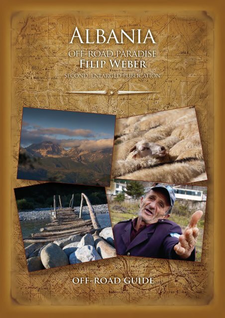
<strong>Albania</strong>off-road paradiseFilip Webersecond, enlarged publicationoff-road guide
International Rally Raidwww.rallyalbania.org
SAMPLEFoto: Marek Vincik
SAMPLEFoto: Filip Weber
<strong>Albania</strong>off-road paradiseFilip WeberSecond, enlarged publicationOFFROAD GUIDEBEERSAMPLEwww.advrider.<strong>cz</strong>
SAMPLEFoto: Albert WeberWritten by Filip Weber, www.advrider.<strong>cz</strong>Photo by Filip Weber, Albert Weber, Michal Benátský, Marek Vincik,Vojta Pihr, Jan Mareš, Edvin Kasimati, Rally <strong>Albania</strong> Org.Published by WEBER system s.r.o., www.webersystem.<strong>cz</strong>.Printed and bound in the Czech Republic by Jan Mareš, www.potisk.com.All map rights reserved by Reise Know How, Germany.Reise Know How maps can be purchased at www.reise-know--how.de.For digital map versions see Touratech QuoVadis, Fugawi, OziExplorerand other map programmes.Second published in May 2012.ISBN: 978-80-260-2136-0
IntroductionDo you know how to say “shovel” in <strong>Albania</strong>n? “Lopata”! Even ifyou don’t know how to say it in <strong>Albania</strong>n, be sure to throw one in thecar when you go, or better yet take two and make sure they’re reallysolid ones.<strong>Albania</strong> has changed dramatically since my irst visit in 1999.The towns have been renovated and new main roads, new bridgesas well as a new highway to the north have been built. You can catcha mobile phone signal almost everywhere and the stores are full ofgoods. Only the mountains have remained the same – or maybe theyhave become even more desolate as time goes by. Young people aremoving to the towns, mountain villages are depopulating and no onemaintains the mountain roads. Illegal lumberjacks use IFA trucks tohaul wood and the condition of the roads is getting worse and worse.Deep ruts, which are impassable with a regular off-road vehicle,are common. Roads are often washed away by water or covered bylandslides. Each year after winter, more and more mountain roadsare impassable. But there are still many beautiful, passable routesthat lead to the most beautiful places in the mountains. The viewpointsof magniicent mountain lakes and majestic rock formations takeyour breath away. I would like this guide to lead you through the mostbeautiful places in <strong>Albania</strong>, places that I have fallen in love with andthat I like to visit again and again. Don’t believe ugly stories that peoplein Central Europe tell to scare each other. Forget the legends aboutbloody vendettas and hold-ups. All the same, you can never be toocareful and you’ll be wise to camp close to residential areas and greetand chat with the locals when you arrive. You might even bring thema small gift, like beer, a knife, an axe or cigarettes for adults and chocolate,coloured pencils, colouring books or English children’s booksfor kids. <strong>Albania</strong>ns are very hospitable; I have always been polite andrespectful to them and they have been very kind in return.I’d like to thank all the friends who helped and supported me. I’despecially like to thank my wife Zdeňka for her patience and EdvinKasimati, director of Rally <strong>Albania</strong>, who was a great inspiration to me.Filip Weber - Beba, ilip@weber.<strong>cz</strong>, www.advrider.<strong>cz</strong>SAMPLE7
RoutesDespite the fact that new roads are being built all over <strong>Albania</strong>and that most of the main roads are new, mountains roads are inbad shape. Expect a very slow travel speed. Mountain roads areunmaintained and damaged by IFA trucks hauling illegally timberedwood.The routes described here are passable only with an all--terrain vehicle or on an Enduro motorcycle. The roads are ancient,evidently built with rocks during the reign of the Turkishempire and originally intended for donkeys and people on foot.The most interesting roads are inland, where detailed mapsare lacking, there have never been any signposts and it is dificultto communicate with locals. The roads are unmaintained and it’snot unusual to encounter collapsed bridges.If you can, bring small gifts for children: coloured pencils, pencils,pads of paper. Adults will be pleased by gifts of local beer, anaxe, or a pocket knife. Life is truly hard in the mountains.GPS and military maps are useful for navigation, but they arenot essential. I recommend the Reise Know How map (www.reise-know-how.de),which is evidently the only readily availableusable map.But it’s best to ask the locals, who are always willing to adviseyou.Road passability changes in relation to the weather and themost recent winter. A road that is passable in dry conditions canchange into a muddy hellhole after rain. Likewise, some roadsthat I drove through one year became completely impassable afterwinter due to landslides.Always travel with a good supply of emergency tools (a spade,pick axe and wench for the vehicle) and allow extra time.Routes marked with the <strong>Albania</strong> Rally logo were part of thisevent, which is the most dificult European cross country rally.SAMPLE8
SAMPLEFoto: Albert WeberEngine driver from Përrenjas.9
Recommended RouteA two-week travelling route across <strong>Albania</strong>. The route starts ata crossing point from Montenegro and terminates by Lake Ohrid.I have chosen routes that are passable for loaded travel Endurosand travel off-road cars. None of the routes requires a winch ormud tyres. But be cautious, the situation can change after rain orafter winter.NameOrderCermit Canyon - Vermosh, north <strong>Albania</strong> 1Bjeshkët e Namuna mountains/ Prokleje, north <strong>Albania</strong> 2Fierzë - Koman ferry, north <strong>Albania</strong> 3Valbonë valey, north <strong>Albania</strong> 4Fierzë – Fushë-Arrëz, central <strong>Albania</strong> 5Forced Labour Camp, central <strong>Albania</strong> 6Drinit të Zi valey, central <strong>Albania</strong> 7Lurë lakes, central <strong>Albania</strong> 9Shupenzë - Selishtë, central <strong>Albania</strong> 12Elbasan - Bulqizë, central <strong>Albania</strong> 14SAMPLEDevolli Canyon, southern <strong>Albania</strong> 26Gjerbës - Devolli, southern <strong>Albania</strong> 27Mali i Tomorrit mountains, southern <strong>Albania</strong> 29Këlcyrë - Poliçan, southern <strong>Albania</strong> 31Frashëri, southern <strong>Albania</strong> 33Ostrovicës mountains, southern <strong>Albania</strong> 24Guri i Capit, southern <strong>Albania</strong> 23Guri i Kamjes, southern <strong>Albania</strong>, only switch from main road 2210
SAMPLE11
North <strong>Albania</strong>1. Cem Canyon – VermoshRoute: Koplik – Hot – Rrapshë-Stare – Brojë – Tamarë – Lëpushë –the border at Vermosh – GusinjeLength: 120 kmDriven: Toyota Hilux, KTM LC4 AdvDescription: A journey through a deserted corner of <strong>Albania</strong>, asplendid way of entering or leaving the countryThe tarmac ends a few kilometres past the turn-off from the mainroad and is replaced by well-passable ine gravel up to the saddle.Wonderful and breathtaking serpentine curves will bring you downinto the Cem River valley.There is a small brewery in Tamarë. Note the trout hatcheries aboveTamarë and an aqueduct cut through a rock on the right above theriver.There used to be a reasonable shortcut to Bogë, but I got word thatit has been blocked by a landslide.The trail climbs through dramatic rocks above the village Selcë,which must have collapsed in some earthquake.You can stop for a snack in Lëpushë before or after crossing theborder to Montenegro. In Vermosh I can recommend the campgroundand basic accommodations. <strong>Albania</strong>n custom oficers are usually friendly;the Montenegrins tend to be rather serious and thorough.Do not miss the strong crystal clear river springs near Gusinje –“Oko Skakavice” and “Alipašini izvory”. Ask the locals how to get there.2Vermosh1 N42 20.314 E19 26.120Tamara N42 27.698 E19 33.674Dobry N42 29.930 E19 35.190Lepushi N42 31.927 E19 43.0712Vermosh N42 34.768 E19 44.551Border N42 35.011 E19 46.488OkoSkakavica N42 30.711 E19 50.15012SAMPLE
SAMPLE© Reise Know-How Verlag Peter Rump GmbH13
2. Bjeshkët e Namuna / Prokletije MountainsRoute: Koplik – Bogë – Theth – Nicaj-Shalë – Lotaj – Kir – Prekal– ShkodërLength: 130 km, two days, but it would be a pity not to stay longerin the mountainsDescription: The <strong>Albania</strong>n Alps – Bjeshkët e Namuna / Prokletije– is the most beautiful mountain range in <strong>Albania</strong> and at the sametime the most deserted and wildest part of the country.Set off on the new tarmac road from Koplik to Bogë. Off-roaddrivers and riders will enjoy the track from Bogë to Theth. The routegoes up over the Tërthorë Pass 2000 m above sea level. You cantake a wild canyon trail following the river downstream to Nderlysaj.There is a nice waterfall on its tributary and another one called Capri5 km upstream. The Rrok and Dede families in the village are verykind and will gladly provide you with accommodations.You can try the newly marked hiking paths through the surroundingsof Theth and Nderlysaj.The onward journey over Nicaj, Lotaj and Kir is quite demandingeven for an off-road vehicle. Be prepared for slow progress and beespecially careful in the canyon below Kir.Points of interest: The Cave of Puci, Bogë. The cave is 1,087 metersabove sea level. It is 5 by 5 and has several loors in a karstic ensemblewhich connects to another cave, that of Husi, located nearby.The central area of the cave consists of 5 loors which are linked toone another through vertical shafts and sloping galleries. The caveis composed of calcite concretions. Both tourists and speleologistswill ind it worth visiting. They can ind accommodation in housescharacteristic of the region in Theth and Bogë.Pass N42 23.448 E19 43.023THETH-BRIDGE N42 23.149 E19 46.809PowerStaon N42 21.488 E19 46.865Ndërhysaj N42 21.242 E19 46.546NICAJ N42 18.255 E19 47.814Cave N42 10.698 E19 43.18514SAMPLE
33. FrashëriRoute: Përmet – Frashëri and backLength: 60 kmRidden: 2007 – 2011 – KTM LC4 Adv, Toyota HiluxDificulty: Easy gravel roadDescription: Easy route through mountains and forestsLeave Përmet in the direction of Tepelenë and continue forabout 9 km till the turn-off to Çorovodë and Frashëri (2Frasheri3).There is another turn-off to the left towards Çorovodë after6 km, but you need to keep going straight on the road to Frashëri(2Frasheri4), which will start winding soon to climb up to the forestbelt. It is a nature preserve where <strong>Albania</strong>ns like to go picnicking.Nevertheless, a 4WD is a must here.I do not recommend continuing from Frashëri to Luarasi – Qafzezi.Next to the underground military hospital above Frashërithere is a mass of fallen rock that can be passed through only on amotorbike and even that is extremely risky.I recommend the hot sulphuric spring (hotspring) behindPërmet.Points of interest: The village is named after the Frashëribrothers, prominent igures of the <strong>Albania</strong>n National Renaissancemovement.There is a museum and a Bektashi monastery in the village.The remains of an underground military hospital can be seen belowa cliff on the opposite bank of the valley. The locals will gladlylet you into the museum and the monastery if you ask them to.Ask for Pandy or his son Ilji, who have the keys.2Frasheri3 N40 16.313 E20 16.8132Frasheri4 N40 19.261 E20 19.508Frasheri N40 21.953 E20 25.613monasr N40 21.652 E20 25.658spring N40 20.709 E20 23.719hotspring N40 14.605 E20 25.926102SAMPLE
SAMPLE© Reise Know-How Verlag Peter Rump GmbH103
34. Hot springs to FrashëriRoute: Përmet – Gostivishi – FrashëriLength: 90 kmRidden: 2007 – BMW 650 Dakar; 2008, 2010, 2011 – YamahaTT600REDificulty: Frequent landslides on the route, only for motorbikes.A lot of mud after rain.Description: The route begins at the hot springs (Hotspring)about 10 km from Përmet towards Leskovik. Watch for a distinctrock marked by a cross (Hotspring) to ind the turn-off.Going upstream along the river on a good tarmac road, youwill reach a Turkish bridge (bridge_otoman) where there arethermal springs. It is a real pleasure to have a bath there.Look for a pillar from a torn-down bridge about 700 m belowthe Turkish bridge. Wade the river above the pillar (rivercross)and take the steep uphill track next to the pillar. It is rather muddyup to Gostivishi and very beaten by trucks.You have to turn left before Gostivishi to the bridge over thegorge (bridge_fras)The way beyond Gostivishi is often blocked by landslides(Landslip) which may be bulldozed through in some summers. Itis about 10 km up to the next village, Ogren. There is a hard-surfaceroad from the saddle to Frashëri.From Frashëri you can take a comfortable hard-surface backto Përmet.Continuing from Frashëri to Luarasi – Qafëzez cannot be recommended.Next to the underground military hospital aboveFrashëri there is a mass of fallen rock that can be passed throughonly on a motorbike and even that is extremely risky .There is a tarmac road going to the hot springs and a newbridge is under construction, so there will most probably soon bea new road to Ersekë.Points of interest: My friends have kayaked through the Lengaticëriver gorge, which ends by the hot springs.SAMPLE104
The monastery custodian in Frashëri.Coat-of-arms at the monastery door in Frashëri.SAMPLE105
SAMPLE© Reise Know-How Verlag Peter Rump GmbH107
36. Nëmerçkë mountain rangeRoute: Dhuvjani – Suhë – Çatistë – Sopik – Poliçan – Topovë– LabovaLength: About 80 km, one dayRidden: 2006 BMW GS650 Dakar, 2011 – Yamaha TT600REAnuchDificulty: A ine-gravel road, only from Zrej to Labova thereis a more dificult stretch across the saddle.Description: Take the main road between the Kakavia border-crossingand Tepelenë and turn right (2Nemerstika) into ariver canyon in the direction of Poliçan. By the big trees at theend of the canyon you will see a road turning right in the directiontowards the Greek border, which will take you over a bridgeafter a while. The track is covered with ine gravel. You will passthrough several villages with churches and beautiful trees. Reachingthe top of the valley, the way goes steeply downhill to a streamwith a ford and goes uphill again on the opposite side of thevalley. A very neat ine-gravel road will take you to Poliçan. Thereis a church and a pub on the square. You will pass a bunker whenleaving Poliçan and a World War II memorial on a saddle goingon to Topovë. The highland plateau past the following saddle resemblesplateaux on Crete. The inal descent will bring you downfrom an unbelievable height to the main valley. Keep to the leftand you will come to Labova and then back to the main road overa bridge. There might be a new border crossing opened betweenSopik in <strong>Albania</strong> and Pogoniani in Greece. However, it might beopen only for local residents.Points of interest: The area is populated by ethnic Greeks.Over the last few years, the majority of houses, which had beenin ruins, have been repaired. The orchards and vineyards havealso been renewed. Heavy battles took place in this area duringWW II.There is a large plain with old trees nearby the village of Libohovë.The trees are 32 m tall, up to 220 cm in diameter and areup to 220 years old.108SAMPLE
Foto: Filip WeberVillagers.Monument commemorang WWII fights.SAMPLEFoto: Filip Weber109
SAMPLE© Reise Know-How Verlag Peter Rump GmbH111
Foto: www. expedioncars.<strong>cz</strong>Sll life with a piggy, mountains in North <strong>Albania</strong>.School break, North <strong>Albania</strong>.SAMPLE112Foto: www. expedioncars.<strong>cz</strong>
SAMPLEAer morning grass mowing, Theth.Foto: www. expedioncars.<strong>cz</strong>113
Wood for the winter, Theth.Beggar, Shkodër.SAMPLEFoto: www. expedioncars.<strong>cz</strong>Foto: www. expedioncars.<strong>cz</strong>115
Foto: www. expedioncars.<strong>cz</strong>Goat herdsman, Koman Lake.Slaughterhouse, Peshkopi.SAMPLE116Foto: www. expedioncars.<strong>cz</strong>
Valbonë valley.On a way from Këlcyrë.SAMPLEFoto: Marek VincikFoto: Marek Vincik117
Foto: Filip WeberIn Dangëllia Mountains.Ford under hot springs close to Përmet.SAMPLE118Foto: Filip Weber
Recovering on the way from the springs to Frashëri.Ilji, Frashëri.SAMPLEFoto: Filip WeberFoto: Filip Weber119
Foto: www. expedioncars.<strong>cz</strong>On a ferry between Fierzë - Koman.Ndërhysaj village.SAMPLEFoto: Filip Weber121
Ploughing in Theth, “Kulla” in the background.Korabit, the highest <strong>Albania</strong>n mountain, 2753 m.SAMPLEFoto: Filip Weber122Foto: Filip Weber
Foto: Filip WeberLurës Lakes.On a way from Ares to Fushë Lurë.SAMPLEFoto: Filip Weber123
Foto: Filip WeberWater Lily Lake.Yellow water lily in the Water Lily Lake.SAMPLE124Foto: Filip Weber
Miçekut Lakes.Saddle at 1984 m above sea level in the Kreshtës mountain range.SAMPLEFoto: Filip WeberFoto: Filip Weber125
In the Ostrovicës mountains.View of Ostrovicës from the saddle opposite from Gjerbës.SAMPLEFoto: Filip WeberFoto: Filip Weber126
Copper mines near Gurth Spaç.SAMPLEFoto: Vojta PihrFoto: Vojta Pihr127
Foot bridge across the Voskopojës River.In the navigaon stage of the <strong>Albania</strong> Rally.SAMPLEFoto: Albert WeberFoto: Jan Mareš128
Dejës mountains.Përrenjas.SAMPLEFoto: Filip WeberFoto: Albert Weber129
Osnat.Guri i Capit.SAMPLEFoto: Albert Weber130Foto: Filip Weber
SAMPLEGuri i Capit.Foto: Filip Weber131
Foto: Albert WeberOn the Voskopojë – Tresovë route.Saddle between Devolli and Gjerbes.SAMPLEFoto: Albert Weber132
A favourite dish – baked sheep brains.Road to Fushë Lurë.SAMPLEFoto: Filip WeberFoto: Filip Weber133
Foto: www.expedioncars.<strong>cz</strong>A village woman on her daily pilgrimage.Sign on the former gate to the Frashëri monastery.SAMPLEFoto: Filip Weber134
Where do the best people live?I was sitting in a German pub in Hechlingen. I happened to getthere thanks to illing in a magazine inquiry form and winning aweekend rider training for saddle-sure bikers at the BMW EnduroPark in Hechlingen.Sitting there after arrival on Friday evening and drinking mybeer, I saw some fellows in HP2 or BMW Fahrer Training sweatshirtscoming to the bar. The instructors, no doubt! I approachedthem and introduced myself politely. They nodded, uttered a fewcivilities and paid no more attention to me.I returned to my beer and dinner. Then four chaps settleddown at the next table and started talking – hard to believe – Russian.I, being an anti-Soviet Russophile, revived and addressedthem. They were pleased to hear my Russian when I told themhow I had ridden to Mongolia via Moscow earlier that year. Butthe conversation died off soon, and there I was sitting alone again.Well, not alone, with my beer and my thoughts. I ponderedabout my travelling and the people I had met on my ways. Simplebut nice in Mongolia. Arrogant in Moscow, great in Siberia. Proudand friendly in Libya, but too conined by Islam. In Turkey, Morocco,Indonesia, Thailand, Malaysia, Rumania, Ukraine, England,Scotland, Norway, in the USA, on Réunion and Sumatra. WhereverSAMPLEI have been to.How were the people? Communicative, hospitable, reserved,unpleasant.And do you know what I came up with after the third beer?Where did the best people live? In <strong>Albania</strong>!135
<strong>Albania</strong> – Mountain lakes“Lakes in the Kreshtës Mountains? I have no idea how to getthere!” says Edvin Kasimati, the director of Rally <strong>Albania</strong> and oneof the best experts on the wild <strong>Albania</strong>n mountains. He spendsmonths wandering around the mountains on his all-terrain motorcycleto prepare new routes for the most dificult Europeancross-country rally. “It’s the remotest part of <strong>Albania</strong>. In the1950s English and Yugoslavian enemy agents sent to ight thecommunist regime were dropped by parachute there,“ continuesEdvin over a Tirana beer and delicious roasted trout, an <strong>Albania</strong>nspeciality. We met about two weeks after the Arras rally at theish-ponds. The lakes have been on my mind for a long time, soI packed satellite images, military maps, KTM EXC 450, a tent, asleeping bag, and we set out to explore with my friend Romansporting the same gear.Kreshtës MountainsThe Kreshtës Mountains are divided into several valleys all ofwhich share a ridgeline with Micekut, the highest mountain in therange at 2,101 m. In each of the mountain valleys there are oneor more lakes just below the crest. The lakes are of glacial origin,but their water level was artiicially raised by the construction ofdams around 1985. Today, we may only guess why this was done.Most probably, the dams were intended as a natural reservoir ofwater for dry years. The water is crystal clear and the lakes arehome to newts, swarms of tadpoles and tiny ish. The lakes aresurrounded by spectacular mountain meadows full of yellow andblue lowers. Shepherds graze their sheep locks there.The purpose of our trip wasn’t only to visit the lakes, but alsoto ind a route for off-road vehicles and to document it. I am notworried cars or motorcycles would cause much damage to thisland. A car or a motorcycle won’t do much damage in places whereall-terrain trucks carrying illegally logged wood have passed.Driving on dificult rocky trails with muddy ruts and climbingrocky patches and breakneck slopes requires a good amount of136SAMPLE
world mapping projectmaps by REISE KNOW-HOW> more than 170 titles> worldwide coverage> accurate high-qualitycartography> printed on rip- andwaterproof material> easy-to-read map layout> frequent updates> digital versions availableSAMPLEwww.reise-know-how.de
NetworkLogin802.1xCOMPUTER NETWORK SECURITYnon-authorized computeris not allowedin your network
<strong>Albania</strong>off-road paradiseFilip Webersecond, enlarged publicationoff-road guide978-80-260-2136-0