Lab 10: Discovering Plate Boundaries
Lab 10: Discovering Plate Boundaries
Lab 10: Discovering Plate Boundaries
- No tags were found...

You also want an ePaper? Increase the reach of your titles
YUMPU automatically turns print PDFs into web optimized ePapers that Google loves.
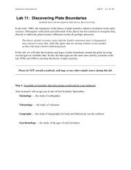
SJSU Geol 4L Planet Earth <strong>Lab</strong> <strong>Lab</strong> <strong>10</strong> p. 1 of 7<strong>Lab</strong> <strong>10</strong>: <strong>Discovering</strong> <strong>Plate</strong> <strong>Boundaries</strong>(modified from a lab developed by Dale Sawyer, Rice University)In the early 1960s, the emergence of the theory of plate tectonics started a revolution in the earthsciences. Subsequent verification and refinement of the theory has led scientists to recognize that,directly or indirectly, plate tectonics influences nearly all geologic processes.The theory of plate tectonics states that the Earth’s outermost layer is fragmentedinto a dozen or more thin, shell-like plates that are moving relative to one anotheras they ride atop a hotter underlying layer.In this lab, we will infer the locations and types of plate boundaries around the globe by usingseveral types of scientific data. In fact, the data types are the same ones used by scientists in thelate 1950s and 1960s to develop the theory of plate tectonics.______________________________________________________________________________Please do NOT consult a textbook, wall map, or any other outside source during this lab.______________________________________________________________________________Step A: Assemble in Scientific Specialty groups as directed by your instructor.Your instructor will assign you to one of four Scientific Specialties:Seismology — the study of earthquakesVolcanology — the study of volcanoesGeography — the study of topography (on land) and bathymetry (on the seafloor)Geochronology — the study of the ages of rock formation
SJSU Geol 4L Planet Earth <strong>Lab</strong> <strong>Lab</strong> <strong>10</strong> p. 2 of 7Step B: Look at your group’s map and talk about what you see.For the point data (seismology, volcanology), look at distribution patterns.For surface data (geography, geochronology), look for variations in values, especially at the highand low ends of the range.Some terms to consider (this isn’t a checklist; some won’t apply to your map): present? absent? narrow? wide? straight? curved? symmetric? asymmetric? variable? constant? deep? shallow?Be especially aware of patterns, variations, etc. that suggest a major boundary is present. Thesewill be candidates for possible plate boundaries.Work as a group. Let everyone talk about what they see.Step C: Use your observations to infer the possible locations of major boundaries.1. Based on your group’s observations in Step B, use a regular lead pencil to show the locationsof possible major boundaries on the map on p. 6.2. List the specific criteria you used to infer the locations of plate boundaries. Include a sketch ifit helps, but be sure your reasoning is clear from the text you write.
SJSU Geol 4L Planet Earth <strong>Lab</strong> <strong>Lab</strong> <strong>10</strong> p. 3 of 73. Now try to divide your boundaries into “types” that share similar characteristics as expressedin your data set. Each specialty should be able to propose at least two types, and some groupsshould be able to propose up to four types. Try not to apply what you knew before coming toclass. Just use your observations as the basis for this classification attempt.Briefly list the key characteristics of each boundary type below (minimum 2, up to 4 maximum).Type 1Type 3Type 2Type 44. On your map on p. 6, label the possible boundaries that you identified in C1 with the possibletypes you proposed in C3.That’s it for the map on p. 6. Leave it as is; no modifications later! You won’t be graded onwhether it’s “right” or not, but instead on wheter your proposed boundaries are reasonablebased on the data in your particular Scientific Specialty.Step D: Reorganize into groups of 4, with one person from each Scientific Specialty per group.
SJSU Geol 4L Planet Earth <strong>Lab</strong> <strong>Lab</strong> <strong>10</strong> p. 4 of 7Step E: Share your observations and interpretations.Briefly explain to one another the following:* how you interpret the patterns and variations in the data of your Scientific Specialty* where you inferred major boundaries on the world map* the boundary types you proposed in C4, and your reasons for your classificationStep F. Develop a second map of inferred plate boundaries.Compare the locations and types of plate boundaries that each of you inferred from your particularscientific specialty. Your interpretations probably differ (which is fine).1. Reconcile the differences and propose a consensus group map of boundaries; show theseboundaries on the world map on p. 7.2. Develop a revised set of boundary types (up to 4) and describe them below.Type 1Type 3Type 2Type 4Step G. Inform your instructor after you have completed Step F.Your instructor will distribute a world map showing the positions of plate boundaries as currentlyunderstood by geoscientists. Compare your group’s map to the “professional” one. If they differin some ways, remember that the scientists have access to much more, and much more detailed,data sets than the ones we used in this lab.
SJSU Geol 4L Planet Earth <strong>Lab</strong> <strong>Lab</strong> <strong>10</strong> p. 6 of 7
SJSU Geol 4L Planet Earth <strong>Lab</strong> <strong>Lab</strong> <strong>10</strong> p. 7 of 7