to 64 - Palmerston North City Council
to 64 - Palmerston North City Council
to 64 - Palmerston North City Council
- No tags were found...

You also want an ePaper? Increase the reach of your titles
YUMPU automatically turns print PDFs into web optimized ePapers that Google loves.
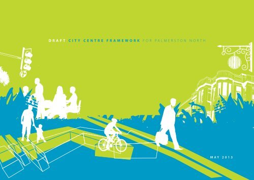
DRAFT <strong>City</strong> Centre Framework FOR PALMERSTON NORTHMAY 2013
Design and Layout:3D Rendering:Pho<strong>to</strong>graphs:Maps:Print Synergy | Palmers<strong>to</strong>n <strong>North</strong> <strong>City</strong> <strong>Council</strong>Boffa MiskellBoffa Miskell; Destination Manawatu; Laura Ridley; Pataka Ipurangi; Print Synergy; Te ManawaBoffa MiskellAvailable <strong>to</strong> download from pncc.govt.nzWell Managed Forest (WMF)FSC® Mixed Sources – From well managed forests and other controlled sourcesForest Stewardship <strong>Council</strong>® – Mixed Sources (FSC®)Elemental Chlorine Free (ECF)
Introduction 3Status of the city centre framework 4Context 7The Sensory Experience 7Building the <strong>City</strong> Centre <strong>to</strong> be a Destination 9Love the <strong>City</strong> 9Delivering on the Urban Design Strategy 10His<strong>to</strong>ry 12Key Directions 14Framework Diagram 14Summary of Action 16KD1 Streets for People 18KD2 Connec<strong>to</strong>rs 22KD3 Nature in <strong>City</strong> 28KD4 Embracing Education 32KD5 Integrating Arts 38KD6 <strong>City</strong> of Culture 44KD7 Play in the <strong>City</strong> 48KD8 Activity for People 52KD9 Entrance Experience 58KD10 Memories, S<strong>to</strong>ries and Heritage <strong>64</strong>Key Elements 68Summary 70Built Form NetworkDesign Principles 72Strategic Development Sites 74Open Space Network 76Hard Open Space 78Soft Open Space 79Private Open Space 80Street Network 82Design Principles | Place Street 1 84Design Principles | Place Street 2 85Design Principles | Place and Movement Street 86Design Principles | Movement Street 87MAKING IT HAPPEN 88
Butterfly pond, The Square
4DRAFT CCF FOR PALMERSTON NORTH [ introduction ]Statusof the<strong>City</strong> CentreFrameworkPalmers<strong>to</strong>n <strong>North</strong> is well placed<strong>to</strong> be a sustainable city, but forthe city <strong>to</strong> be recognised as avibrant, caring, innovative andsustainable city it needs <strong>to</strong> changedramatically.The Sustainable <strong>City</strong> Strategy sets out a framework thatallows this change <strong>to</strong> happen. The purpose of the Sustainable<strong>City</strong> Strategy is <strong>to</strong> ensure linkage between the <strong>Council</strong> goalsin the Long Term Plan, the work of individual units within the<strong>Council</strong> and the <strong>Council</strong>’s aspiration for Palmers<strong>to</strong>n <strong>North</strong> <strong>to</strong>become a sustainable city. The strategy identifies key driversthat impact on environmental, economic and socialdevelopment in the city.Strategy FrameworkIdentify Outcomes& Focus AreasUrban Design Strategy Other StrategiesTranslate Strategy<strong>to</strong> ActionCOUNCIL VISIONvibrant | caring | innovative | sustainable cityUDS Initiatives<strong>City</strong> Centre FrameworkManawatū RiverMaster PlanStreet Design ManualPlacemakingStructure PlansDistrict PlanDesign CriteriaDelivering ChangeUrban Design ToolsSustainable <strong>City</strong> StrategyOther StrategicInitiativesThe Urban Design Strategy is a significant component of theSustainable <strong>City</strong> Strategy. It provides direction <strong>to</strong> much of theactivity in the city, such as the design of public places, newsubdivisions and redevelopment of unused or vacant sites. Inaddition, the Urban Design Strategy supports co-ordinatedaction on public transport, climate change and other multifacetedaction areas.ManagePrioritise & FundAsset Management PlansLong Term Plan
Identify Outcomes& Focus AreasTranslate Strategy<strong>to</strong> ActionUrban Design Strategy<strong>City</strong> Centre FrameworkKey DirectionsKD1 Streets for PeopleKD2 Connec<strong>to</strong>rsKD3 Nature in <strong>City</strong>KD4 Embracing EducationKD5 Integrating ArtsKD6 <strong>City</strong> of CultureKD7 Play in the <strong>City</strong>KD8 Activity for PeopleKD9 Entrance ExperienceKD10 Memories,S<strong>to</strong>ries & HeritageKey ElementsBuilt FormOpen SpaceStreetsCollates thestrategic intent,the key directions,and appliesthem spatiallyInforms designand locationof <strong>City</strong> CentredevelopmentsIllustrates thephysical qualitiesof the <strong>City</strong> CentreWhen the CCFwill be usedPrivateDevelopment<strong>Council</strong> ProjectsResource ConsentsStreet Renewals& UpgradesPlacemakingAssetManagement PlansLong Terms PlansEventsWho shoulduse the CCF?Property DevelopersProperty &Land OwnersConsultant &<strong>Council</strong> Engineers,Designers &PlannersAsset Managers& Cultural StaffRetailers &BusinessesUCOL, MasseyUniversityNz TransportAgencySafetyAdvisory BoardDestinationManawatu &Vision ManawatuPou in Te Marae o HineOther strategies are integrated with the Urban DesignStrategy through the strategic framework. The CCF willdeliver action that is directly related <strong>to</strong> the Safe <strong>City</strong>, Arts,Recreation, Biodiversity, Economic Wellbeing, Social, andParking Strategies.The CCF is one of eight urban design initiatives. The CCFtranslates strategy outcomes in<strong>to</strong> a cohesive vision that will beprioritised and funded through Long Term Plans, andintegrated in<strong>to</strong> asset management.The CCF provides the context and illustrates relationships forcity centre developments based on the built environment, theopen spaces, and streets. These are termed the Key Elements.The CCF also outlines Key Directions for how public investmentis undertaken and describes catalyst actions.5DRAFT CCF FOR PALMERSTON NORTH [ introduction ]
ContextBethesda Lane in Bethesda, USAThree fac<strong>to</strong>rs underlie the approach <strong>to</strong> developing the city centre.These are working with the human dimension, treating the city centreas a destination, and focusing on emotional attachment <strong>to</strong> a place.The SensoryExperienceThe human dimension is the universal starting point <strong>to</strong> buildcities for people. Building a city that caters <strong>to</strong> people is themost efficient and low cost investment a city can make <strong>to</strong>meet four goals – a lively, safe, healthy and sustainable city. Theelements that are consistent starting point for design are thatpeople “have walking, a sensory apparatus, movemen<strong>to</strong>perations, and behavior patterns in common.” 2 These fac<strong>to</strong>rshave often been neglected at the expense of good conditionsfor people <strong>to</strong> engage in city life. With the overwhelmingpressure <strong>to</strong> develop cities <strong>to</strong> accommodate traffic the humandimension has often been of secondary importance. In future,understanding and working with these human elements atthe earliest stages of design will be a pre-requisite for citycentre development.Colourful planting and a dynamic sculpture, Main Street West7DRAFT CCF FOR PALMERSTON NORTH [ Context ]2Jan Gehl – Cities for People p229
What Makes a Great Place?8DRAFT CCF FOR PALMERSTON NORTH [ Context ]©2005 Project for Public Spaces, Inc.
Building the <strong>City</strong> Centre<strong>to</strong> be a DestinationThe second fac<strong>to</strong>r is <strong>to</strong> build the city centre around a series of‘places’. Application of the “Power of Ten” concept from Projectfor Public Spaces 3 provides a simple mental model <strong>to</strong> illustratehow <strong>to</strong> create a vital and engaging city centre. This conceptframes the city centre as a destination. Within a destinationthere needs <strong>to</strong> be 10 or more great places, and at each placethere needs <strong>to</strong> 10 or more things <strong>to</strong> do or reasons <strong>to</strong> be there.The “What makes a great place” diagram is also used as a modelfor holistic thinking about creating places. Project for PublicSpaces provide this definition of placemaking:“Placemaking is a multi-facetedapproach <strong>to</strong> the planning, design andmanagement of public spaces. Putsimply, it involves looking at, listening<strong>to</strong>, and asking questions of the peoplewho live, work and play in a particularspace, <strong>to</strong> discover their needs andaspirations. This information is then used<strong>to</strong> create a common vision for that place.The vision can evolve quickly in<strong>to</strong> animplementation strategy, beginning withsmall-scale, do-able improvements thatcan immediately bring benefits <strong>to</strong> publicspaces and the people who use them.”The Placemaking initiative from the Urban Design Strategyallows <strong>Council</strong> officers <strong>to</strong> engage and work on all scales ofdevelopment in the city centre, <strong>to</strong> simultaneously work on thelong-term and short-term, and most importantly the hardwareand software of a place. This is achieved by face-<strong>to</strong>-face andongoing interactions that build relationships and allow anongoing conversation <strong>to</strong> take place with stakeholders in thecity centre.Recent examples of placemaking in Palmers<strong>to</strong>n <strong>North</strong> arethe creation of Little Cuba 4 , the transformation of car parks<strong>to</strong> parklets for people on George Street, and the chessboard and bistro style chairs and tables by the ButterflyPond in The Square.Giant chess set in The SquareLovethe <strong>City</strong>The final fac<strong>to</strong>r is <strong>to</strong> cultivate emotional attachment <strong>to</strong> the citycentre. Emotional attachment matters because a high level ofcommunity attachment is correlated with stronger localeconomic performance 5 . A city’s most attached residents havepride in their city, a positive outlook for their city’s future, and asense that they fit in the place. These people are less likely <strong>to</strong>leave than less-attached people. The three fac<strong>to</strong>rs which driveemotional attachment <strong>to</strong> place are:• Social offerings – places <strong>to</strong> meet each other and a feelingthat people in the community care about each other.• Aesthetics - the physical beauty of a place, including theavailability of parks and open spaces.• Openness – how welcoming the community is <strong>to</strong>different types of people, including families with youngchildren, minorities, and talented university graduates.The city centre is where all three of these fac<strong>to</strong>rs come <strong>to</strong>getherand where a lack of any of them are most conspicuous andderided, and when they are present are enjoyed andcelebrated. Future investment in the city centre will be valuedand undertaken with a clear knowledge of why qualitydevelopment is critical <strong>to</strong> the future of Palmers<strong>to</strong>n <strong>North</strong>. Inessence, a focus on emotional attachment <strong>to</strong> the city shouldcreate a virtuous cycle where people love the city and in turnmake it an even better place.3 www.pps.org4 The intersection of George Street , Taonui Street, and Cuba Street5 www.soulofthecommunity.org9DRAFT CCF FOR PALMERSTON NORTH [ Context ]
Delivering on theUrban Design Strategy10DRAFT CCF FOR PALMERSTON NORTH [ delivering on the urban design strategy ]The Urban DesignStrategy presents avision for the physicaldevelopment ofPalmers<strong>to</strong>n <strong>North</strong> <strong>to</strong>transform the cityin<strong>to</strong> a vibrant, caring,innovative, andsustainable city.The following Urban Design Strategy drivers and sub-driversare most relevant <strong>to</strong> the CCF. The <strong>City</strong> Centre Frameworkapplies the strategic drivers with spatial mapping <strong>to</strong> create KeyDirections which show how and where <strong>to</strong> undertakedevelopments in the city centre.DriverPublic realmDiversityConnectivityCharacterEnvironmentalSub-driverMaking places people friendly and invitingEnsuring coherency in designActively managing and maintaining the city’s public spacesWelcoming and Memorable entrances <strong>to</strong> the cityCreating a vibrant city centrePromoting a mix of usesVibrancy – lots of things going onVitality – people on the streetsVersatile and adaptable buildings and spacesProviding choices of living spaces and lifestylesWell-connected multipurpose streets and spacesEasy way findingEasy access <strong>to</strong> transport and facilitiesCreative city makingExpression of Rangitāne culture in the cityStrengthening the city’s identity and cultureActive promotion of heritage, key buildings and placesCelebrating iconic architectureInvesting in biodiversity and green infrastructureLow-impact urban drainage systems
The Urban DesignStrategy identifiesthese specific sub-driversfor the city centre.Creating a vibrant <strong>City</strong> CentreWelcoming and memorableentrances <strong>to</strong> the <strong>City</strong>11The city centre is a vibrant, walkable, social,safe, and inviting destination that attractspeople and investment.Coordinated <strong>Council</strong> public and privatedevelopment supports continuousimprovement of the quality of thecity centre.The city centre has:• wider footpaths• human-scale buildings, street trees,and street furniture• slower traffic• more places <strong>to</strong> sit• more pedestrian links• vibrant lanes• public art• attractive lightingThe city centre streets display a clearchange in context from the main entrances<strong>to</strong> the city and the ring road.The four main avenues in<strong>to</strong> the city andthe urban ring-road create a good firstimpression through:• private development contributing highquality frontages <strong>to</strong> the avenues andboulevards• street tree planting and varied shrubplanting• lighting• public art• street furniture• provision for all usersThe airport, bus facilities, and rail stationand routes <strong>to</strong> theseDRAFT CCF FOR PALMERSTON NORTH [ delivering on the urban design strategy ]
1878190912DRAFT CCF FOR PALMERSTON NORTH [ city centre his<strong>to</strong>ry ]His<strong>to</strong>ryPre-1840sRangitāne livedin the Manawatū.19071850s1858 Ownership of the blockof land known as Te Ahu-a-Turanga settled in favour ofRangitāne. Rangitānesubsequently offer sale <strong>to</strong> theNZ Government.1860s18<strong>64</strong> Rangitāne negotiationson land sale <strong>to</strong> NZ Governmentcompleted.1866 Township layed out onnorthern side of Manawatūriver, named Palmers<strong>to</strong>n. Firstroad lines cut through forest.19171870s1879 Borough <strong>Council</strong> takesover the responsibility for theprovision of public libraryservice.1878 Name of Te Marae-o-Hinebes<strong>to</strong>wed upon The Square.Landscaping of The Squarebegins.The <strong>Council</strong> starts raising a loanof £10,000 for necessary publicworks (e.g. street constructionand s<strong>to</strong>rmwater drainage).The <strong>Council</strong> purchases thePublic Hall.1877 Borough of Palmers<strong>to</strong>n<strong>North</strong> incorporated.Population 800.19001905 The Borough <strong>Council</strong>occupies the Municipal Buildingon the corner of The Squareand Church Street West.Opera House opens.1907 Rangitāne iwi gifts TePeeti Te Awe Awe statue in TheSquare <strong>to</strong> the <strong>Council</strong>.1909 Opening of the “lakelet”in The Square.1910s1917 Public swimming bathsopen in Ashley Street.19261920s1921 The <strong>Council</strong> establishes abus service, thus ending theelectric tramway debate.1926 The War Memorialdedicated in The Square.1928 The <strong>Council</strong> donates land<strong>to</strong> Massey Agricultural College<strong>to</strong> ensure that the institution islocated close <strong>to</strong> the <strong>to</strong>wn.1930s1930 <strong>City</strong> of Palmers<strong>to</strong>n <strong>North</strong>incorporated.Population 20,000.1938 “Free” public libraryservice initiated.1940s1945 The <strong>City</strong> <strong>Council</strong>administration moves <strong>to</strong> newMunicipal Building (SquareEdge).1950s1955 Ratepayers support loanfor airport development.1957 Hopwood clock <strong>to</strong>werpresented <strong>to</strong> the city.1957
197919621960s1962 Sam Mihaere, the firstMāori councillor, and JuliaWallace, the first womancouncillor, are elected <strong>to</strong> the<strong>Council</strong>.19<strong>64</strong> Last train passes throughThe Square.1965 Public library moves <strong>to</strong> anew building on The Squareand Main Street.1969 Reynolds Plan <strong>to</strong> developthe railway land and The Squaremade public.1970s19811977 New art gallery opens.1979 First <strong>City</strong> <strong>Council</strong>meeting in the new, five-s<strong>to</strong>reyadministration centre(“Elwood’s battleship”).1980s1980 Convention Centre opens.1981 Manawatū SportsStadium (“Rainbow Stadium”)opened by Prince Charles.Square Edge res<strong>to</strong>red as acommunity arts centre.1982 Globe Theatre complete.1986 New grandstand opens atthe Showgrounds.1990s1990 Celebration 150 yearanniversary of Treaty signing atTe Marae-o-Hine. Commissionand construction of majorRangitāne cultural installation.1994 Te ManawaComplex opens(Science Centre/Museum).Broadway Avenueupgrade completed.1995 George Streetupgrade complete.20001996 Merger between ElectroPower and Central Powerproceeds ($70,000,000).New <strong>City</strong> Library opensin old “Rosco”/DIC building.Coleman Placeupgrade complete.1998 Regent Theatre opensafter extensive renovation.1999 King Street upgradecomplete.2000 -2000 The Squareredevelopmentapproved by <strong>Council</strong>.A two-week festival of s<strong>to</strong>necarving held in The Square withpacific sculp<strong>to</strong>rs <strong>to</strong> creates thePRIME sculptures (Pacific RimMillennium Exhibition)2001 The Squaredevelopment delayed.Skate Park opens onRailway Land.2002 Convention Centreupgrade complete.Arena 4 opens.2005 2011<strong>City</strong> <strong>Council</strong> approved the saleof part of Railway Land <strong>to</strong> TheWarehouse.2004-2007 The Squareredevelopment.PRIME sculptures installedin The Square.PN Sculpture Trust begins10 year programme ofcommissioning ofpublic sculptures2008 South-west side of Squareredevelopment complete2008-2010 Majorredevelopment and expansionof the Plaza shopping mall onSouth-east side of city centre2011 Te Manawaredevelopment and relocationof NZ Rugby MuseumCommunity Housecompleted on King Street13DRAFT CCF FOR PALMERSTON NORTH [ city centre his<strong>to</strong>ry ]
Place StreetsStrategic Development SitesVegetation Frameworkthe frameworkCook Street <strong>North</strong>South Connec<strong>to</strong>rArena Manawatu:Play, heritageopportunitiesTe Manawacultural hubThe Cuba linkPlay opportunitiesRangitikei <strong>North</strong>ernConnec<strong>to</strong>r andentrance experiencePublic art focusReconfigureBroadway <strong>to</strong>Place StreetEmbracingeducation UCOL<strong>City</strong> CampusRing road vegetationPlacemakingopportunitiesActivation ofThe SquareActivation and play,railway referencesMain Street Connec<strong>to</strong>r,Place Streetand placemakingopportunitiesChurch StreetConnec<strong>to</strong>rMid-block linksRangitāne,Papaioeas<strong>to</strong>riesPlace Streetsaround edges ofThe SquarePublic TransportLink <strong>to</strong> MasseyHigher quality builtenvironmentthrough District Plandesign criteria
Key DirectionsThe proposed 10 Key Directions(KDs) provide a strategic, ‘highlevel’ approach <strong>to</strong> guide existingand future initiatives within thecity centre.These KDs help articulate the aspirations and intent of theUrban Design Strategy and help define how the city centrecan contribute <strong>to</strong> create a vibrant, caring, innovative andsustainable city.The KDs play an important role in communicating the contentand actions that fall from the CCF.Each KD provides a vision statement, useful background aboutthe KD and how it relates <strong>to</strong> the Urban Design Strategy andother council strategies, and illustrative diagrams and visualsthat describe the intent.Each KD lists a number of important catalyst actions and waysforward for how <strong>to</strong> deliver the KD.Delivering these 10 KDs will deliver the CCF.KD1 Streets for PeopleKD2 Connec<strong>to</strong>rsKD3 Nature in <strong>City</strong>KD4 Embracing EducationKD5 Integrating ArtsKD6 <strong>City</strong> of CultureKD7 Play in the <strong>City</strong>KD8 Activity for PeopleKD9 Entrance ExperienceKD10 Memories,S<strong>to</strong>ries & Heritage15DRAFT CCF FOR PALMERSTON NORTH [ key directions ]
Place StreetMovement/Place StreetMovement StreetConnec<strong>to</strong>rsRing RoadCUBA LINKMAIN STREET WEST CONNECTOR TRANSPORT HUBCHURCH STREET CONNECTORBryant StBryant Sth Sth StChelwood StMain StFerguson StChelw od StMain StFerguson StChester CresChester CresCuba StWi lis StRing Road TreesCuba Street BoulevardLarge Scale VegetationSmall Scale VegetationInformal VegetationCuba StWi lis StStudent RealmMassey PT linkTransport HubUCOL CampusOakley StOakley StW od StW od StCleland StCleland StSelwyn C tPi t StSelwyn C tPi t StWalding StWalding StAndrew Young StAndrew Young StColeman PlChurch StColeman PlChurch StWalding StWalding StThe SquareThe SquareMaire StMaire StJersey LaneJersey LaneI ner SquareI ner SquareFeathers<strong>to</strong>n StFeathers<strong>to</strong>n StBroadway Service LaneBroadway Service LaneNash StNgata Service LaneQueen StKing StNash StNgata Service LaneQueen StKing StRegent AcdeRegent AcdeCro s StCro s StBe rymans LaneBe rymans LaneElizabeth S tElizabeth S tMo ris StMo ris StCarow StFitche t StDahlia StCarow StFitche t StDahlia StAchi les CtAchi les CtGrey StMarece CtChurch StGrey StMarece CtChurch StBroadway AveBroadway AveMa sey StRawhiti AveFerguson StMain StMa sey StRawhiti AveFerguson StMain StAlan StThe Me wTirauManapAlan StThe Me wTirauManapSummary of Action16KD1 Streets for peopleKD3 Nature in the <strong>City</strong>DRAFT CCF FOR PALMERSTON NORTH [ key directions ]KD2 Connec<strong>to</strong>rsCOOK STREET TO ARENA CONNECTORNORTHERN CONNECTORNORTH / SOUTH VIEWAddress the vehicular/pedestrian balance,putting people first in the city centre• Movement and place approach• Strengthening the city heart byputting people first• Consistency in street designEnhance the East-west and north-Southstreets <strong>to</strong> provide better connections andcharacter <strong>to</strong> the city centre• The Cuba link• Main Street West Connec<strong>to</strong>r• Cook Street north south Connec<strong>to</strong>r• Church Street Connec<strong>to</strong>r• <strong>North</strong>ern Connec<strong>to</strong>r (Rangitikei Street)• <strong>North</strong> South View• The Ring Road±±Moore StMoore StPascal StPascal StC ok StC ok StWorcester StWorcester StMcgi fert StMcgi fert StRakaia PlRakaia PlDomain StDomain StNikau StWaldegrave StHereford StWaldegrave StHereford StSnelson StSnelson StDavid StDavid StBourke StBourke StSouth StSouth StCampbell StCampbell StLombard StLombard StLin<strong>to</strong>n StLin<strong>to</strong>n StGeorge StGeorge StTaonui StTaonui StRangitikei StFitzherbert AveRangitikei StFitzherbert AveRanfurly StRanfurly StMaple LaneMaple LaneAshley StAshley StNgata StAda StNgata StAda StDo ning<strong>to</strong>n StDo ning<strong>to</strong>n St<strong>North</strong>cote CtCa ro l StCa ro l StOxford StOxford StPrince s StKD4 Embracing EducationNikau St<strong>North</strong>cote CtPrince s StOlympic CtOlympic CtJubilee CtAmesbury StPirie StF otes Service LaneJubilee CtAmesbury StMilver<strong>to</strong>n AvePirie StF otes Service LaneMilver<strong>to</strong>n AveRoy StRoy StWard StWard StColombo StColombo StVic<strong>to</strong>ria AveVic<strong>to</strong>ria AveEnhance, create and sustain greeninfrastructure in the city centre• <strong>City</strong> centre vegetation framework• Ring road vegetation• Cuba Street Boulevard• Large scale vegetation• Small scale vegetation• Informal vegetationProvide opportunities for educationalinstitutions <strong>to</strong> play a crucial role in theform and function of the city centre• Student realm• Massey Public Transport link• UCOL’s <strong>City</strong> campus
Bryant StBryant StBryant Sth Sth Sth StChelw od StMain StFerguson StChelwood StMain StFerguson StChelw od StMain StFerguson StChester CresChester CresChester CresCuba StCuba StCuba StWi lis StPublic SculptureTrust CommissionOpportunity forFocus on Public ArtWi lis StCultural TapestryWillis StPlay InterventionOpportunityOakley StOakley StOakley StWood StW od StW od StCleland StCleland StCleland StSelwyn C tPi t StSelwyn C tPi t StSelwyn C tPi t StWalding StWalding StWalding StAndrew Young StAndrew Young StAndrew Young StColeman PlChurch StColeman PlChurch StColeman PlChurch StWalding StWalding StWalding StThe SquareThe SquareThe SquareMaire StMaire StMaire StJersey LaneJersey LaneJersey LaneInner SquareI ner SquareI ner SquareFeathers<strong>to</strong>n StFeathers<strong>to</strong>n StFeathers<strong>to</strong>n StBroadway Service LaneBroadway Service LaneBroadway Service LaneNash StNgata Service LaneQueen StKing StNash StNgata Service LaneQueen StKing StNash StNgata Service LaneQueen StKing StRegent AcdeRegent AcdeRegent AcdeCross StCross StCross StBe rymans LaneBe rymans LaneBe rymans LaneElizabeth S tElizabeth S tElizabeth S tMorris StMo ris StMorris StCarow StFitche t StDahlia StCarow StFitche t StDahlia StCarow StFitche t StDahlia StAchi les CtAchi les CtAchi les CtGrey StMarece CtChurch StGrey StMarece CtChurch StGrey StMarece CtChurch StBroadway AveBroadway AveBroadway AveMa sey StRawhiti AveFerguson StMa sey StRawhiti AveFerguson StMain StMassey StRawhiti AveFerguson StMain StMain StAlan StThe Me wAlan StTirauManapAlan StThe Me wTirauManapThe Me wTirauManapBryant StBryant Sth Sth StBryant Sth StChelw od StMain StFerguson StChelw od StMain StFerguson StChelw od StMain StFerguson StChester CresChester CresCuba StCuba StChester CresWi lis StPlace MakingOpportunityActive EdgeMid Block LinkWi lis StOakley StOakley StCleland StRing RoadEntrance Experience SequenceImportant Views To The SquareAirport LinkDecision Point NodeTransport HubCuba StWi lis StW od StCleland StHeritage TrailRailway ReferencesInformal Native &Non-native VegetationPapaioea ReferencesOakley StW od StW od StCleland StSelwyn C tPi t StSelwyn C tPi t StWalding StWalding StSelwyn C tPi t StWalding StAndrew Young StAndrew Young StAndrew Young StColeman PlChurch StColeman PlChurch StWalding StWalding StColeman PlChurch StThe SquareThe SquareMaire StMaire StWalding StJersey LaneJersey LaneThe SquareMaire StJersey LaneI ner SquareI ner SquareI ner SquareFeathers<strong>to</strong>n StFeathers<strong>to</strong>n StBroadway Service LaneBroadway Service LaneNash StNgata Service LaneQueen StKing StNash StNgata Service LaneFeathers<strong>to</strong>n StBroadway Service LaneQueen StKing StNash StNgata Service LaneQueen StKing StRegent AcdeRegent AcdeCro s StCro s StRegent AcdeBe rymans LaneBe rymans LaneCross StBe rymans LaneElizabeth S tElizabeth S tMo ris StMo ris StElizabeth S tCarow StFitche t StDahlia StFitchett StMo ris StCarow StDahlia StCarow StFitchett StDahlia StAchi les CtAchi les CtGrey StMarece CtChurch StGrey StMarece CtChurch StAchi les CtGrey StMarece CtChurch StBroadway AveBroadway AveMassey StRawhiti AveFerguson StMain StMa sey StRawhiti AveFerguson StBroadway AveMain StMassey StRawhiti AveFerguson StMain StAlan StThe Me wTirauManapAlan StThe Me wTirauManapAlan StThe Me wTirauManapKD5 Integrating ArtsKD8 Activity for PeopleNikau StRoy StNikau StRoy StPascal StWaldegrave St1.Cook StMcgiffert StRakaia PlDomain StDavid StSnelson StBourke StCampbell StLombard StLin<strong>to</strong>n StGeorge St2.Taonui St7.4.1.3.5.Rangitikei StFitzherbert Ave8. 6.9.10.Maple LaneAshley StNgata StDo ning<strong>to</strong>n St<strong>North</strong>cote CtCarro l StPrince s StOlympic CtAmesbury StF otes Service LaneJubilee CtPirie StWard StVic<strong>to</strong>ria AveHarness the wealth of creative talent,building a creative infrastructure in thecity centre• PN Public Sculpture Trust• A focus on public art within the city centrePascal StC ok StMcgi fert StRakaia PlDomain StWaldegrave StSnelson StDavid StBourke StCampbell StLombard StLin<strong>to</strong>n StGeorge StTaonui StRangitikei StFitzherbert AveMaple LaneAshley StNgata StDo ning<strong>to</strong>n St<strong>North</strong>cote CtCa ro l StPrince s StOlympic CtAmesbury StF otes Service LaneJubilee CtPirie StWard StVic<strong>to</strong>ria AveCoordinate placemaking and eventprogramming <strong>to</strong> enable the city centreas a ‘living theatre’• Active edges• Placemaking opportunities• Mid-block links17Moore StWorcester StHereford StSouth StRanfurly StAda StOxford StMilver<strong>to</strong>n AveColombo StMoore StWorcester StHereford StSouth StRanfurly StAda StOxford StMilver<strong>to</strong>n AveColombo St±±KD6 <strong>City</strong> of CultureMoore StMoore StPascal StPascal StC ok StC ok StWorcester StWorcester StMcgi fert StMcgi fert StRakaia PlRakaia PlDomain StDomain StNikau StNikau StWaldegrave StHereford StWaldegrave StHereford StSnelson StSnelson StDavid StDavid StBourke StBourke StSouth StSouth StCampbell StCampbell StLombard StLombard StLin<strong>to</strong>n StLin<strong>to</strong>n StGeorge StGeorge StTaonui StTaonui StRangitikei StFitzherbert AveKD7 Play in the <strong>City</strong>Rangitikei StFitzherbert AveRanfurly StRanfurly StMaple LaneMaple LaneAshley StAshley StNgata StAda StNgata StAda StDo ning<strong>to</strong>n StDo ning<strong>to</strong>n St<strong>North</strong>cote Ct<strong>North</strong>cote CtCa ro l StCa ro l StOxford StOxford StPrince s StPrince s StOlympic CtOlympic CtJubilee CtJubilee CtAmesbury StAmesbury StPirie StFootes Service LaneMilver<strong>to</strong>n AvePirie StF otes Service LaneMilver<strong>to</strong>n AveRoy StRoy StWard StWard StColombo StColombo StVic<strong>to</strong>ria AveVic<strong>to</strong>ria AveCelebrate culture and build onthe wealth of cultural assets thecity has already developed• Cultural tapestry• Te Runanga Toi o Rangitāne• Te Manawa – The cultural hubProvide a fun, welcoming, safe andstimulating environment for all ages• Play Interventions• Arena Manawatu• Railway Land• The Square±±KD9 Entrance ExperienceMoore StMoore StPascal StPascal StC ok StC ok StWorcester StMcgi fert StWorcester StMcgi fert StRakaia PlDomain StNikau StWaldegrave StHereford StRakaia PlSnelson StDomain StNikau StWaldegrave StHereford StSnelson StDavid StDavid StBourke StSouth StBourke StSouth StCampbell StCampbell StLombard StLombard StLin<strong>to</strong>n StGeorge StLin<strong>to</strong>n StTaonui StGeorge StTaonui StRangitikei StFitzherbert AveRangitikei StFitzherbert AveRanfurly StRanfurly StMaple LaneMaple LaneAshley StNgata StAda StAshley StNgata StAda StDo ning<strong>to</strong>n St<strong>North</strong>cote CtDo ning<strong>to</strong>n St<strong>North</strong>cote CtCarro l StOxford StCa ro l StOxford StPrince s StPrince s StOlympic CtJubilee CtAmesbury StPirie StF otes Service LaneOlympic CtMilver<strong>to</strong>n AveJubilee CtAmesbury StRoy StPirie StF otes Service LaneMilver<strong>to</strong>n AveRoy StWard StColombo StWard StColombo StVic<strong>to</strong>ria AveVic<strong>to</strong>ria AveEnsure that entering the citycentre is a memorable anddistinctive experience• Fitzherbert Avenue• Cook Street• Cuba Street• Rangitikei Street• Main Street and Transport Hub• The Airport linkKD10 Memories, S<strong>to</strong>ries & HeritageRecognise and give greaterprominence <strong>to</strong> our shared Rangitāneand European heritage• Rangitāne• Te Marae O Hine• Papaioea references• Heritage Trail• Railway referencesDRAFT CCF FOR PALMERSTON NORTH [ key directions ]±±
KD1Place StreetMovement/Place StreetMovement Street
Streets for PeopleVisionTo provide a balance for all streetusers and aesthetics, puttingpeople first in the city centreBackgroundThe Urban Design Strategy makes reference <strong>to</strong> drivers, changes<strong>to</strong> be made, and urban design initiatives. These highlight theimportance of our street network 1 within the city centre. No<strong>to</strong>nly do streets serve as important movement corridors forvehicles, public transport, cyclists and pedestrians, but alsoplay a crucial role in creating a vibrant, caring, innovative andsustainable city centre.Movement andPlace ApproachThe CCF establishes a street network based on a movement/place approach <strong>to</strong> categorisation.The movement/place categorisation of streets within citycentres is internationally recognised. This approach can shiftthe emphasis of the roading network being solely focused on‘movement’ <strong>to</strong> give greater recognition that streets are a keycomponent of the public realm and a major influence on theeconomic viability of city centre streets.Place Streets• A destination for people dayand night - residential/retail/commerce/entertainment, oractivities such as meeting,resting, people watching.• Pedestrian priority and response<strong>to</strong> the urban context takesclear precedence overvehicular movement.• Vehicular activity largelydestination orientated, notthrough route oriented.• Streets which have highpedestrian use, or connect<strong>to</strong> such streets.• Opportunity <strong>to</strong> increasepedestrian amenity throughprovision of more pedestrianpriority space.• Active edges, multiple buildingdevelopment opportunities andfine grain built form suitablefor a range of activities.• Character, human scale,and human speed.• Low traffic volumes and speeds.Movement/Place Streets• Provide important city centrewidemovement and placefunctions for pedestrians.• Active edges and a rangeof uses, the majority of whichare pedestrian-based(e.g. retail, offices, dining,and entertainment).• Key passenger transport function.• High volumes of pedestrianand/or vehicular movements andconnections <strong>to</strong> other such streets.• Opportunity <strong>to</strong> increasepedestrian amenitythrough provision ofmore pedestrian space.• Connect features/precinctsacross the city centre.Movement Streets• Through-movement forpedestrians, cyclists and vehicles.• Long-term vehicular movementfunction, as outlined in thePNCC District Plan.• Multiple connections <strong>to</strong>other category streetsprovided and enhanced.• Less active edges and a smallerrange of uses, a higher proportionof which are vehicle-based(e.g. car-parking buildingentrances, large format retail).• Limited potential <strong>to</strong> developmore pedestrian space foramenity without compromisingessential pedestrian/cyclist/vehicular movement function.19DRAFT CCF FOR PALMERSTON NORTH key directions [ kd1 streets for people ]
20DRAFT CCF FOR PALMERSTON NORTH key directions [ kd1 streets for people ]Elliot Street, AucklandStrengtheningthe <strong>City</strong> Heartby PuttingPeople FirstThere are 3 priority changes <strong>to</strong> be made <strong>to</strong> the street network<strong>to</strong> ensure we are putting people first within the city centre.These are:1. Creating place based streets around the edges of theSquare2. Reconfiguring Broadway Avenue as a place based street3. Linking Te Manawa <strong>to</strong> George Street <strong>to</strong> the Square bycareful place based streetscape designOther changes <strong>to</strong> the street network, such as reconfiguringCuba Street <strong>to</strong> a movement/place street will help providevibrancy, vitality and versatile streets for people.6 The District Plan section 20 Transportation - Map 20A.4 shows the roadhierarchy classification. The District plan rules show which streets are‘pedestrian streets’. The provisions of the District Plan determine how thebuilt environment on private land relates <strong>to</strong> pedestrian streets.
Consistency inStreet DesignThe CCF has been developed in parallel with the Street DesignManual (SDM) for Palmers<strong>to</strong>n <strong>North</strong>. The SDM sets out thedesign philosophy and vision for Palmers<strong>to</strong>n <strong>North</strong> streets. Aset of standard designs will ensure a consistent and coherentnetwork is designed, and assist in designing streets thatbalance the needs of all street users and aesthetics. The SDMalso introduces the road user hierarchy in<strong>to</strong> street design. TheSDM consists of design principles and techniques for 12 streettypes that are sensitive <strong>to</strong> the land use context. These arecategorised as:<strong>City</strong>environment<strong>City</strong> centreCommercialResidentialIndustrialRuralStreetType 6Movement(Ring Road)Place/MovementPlace(2 Street Types)ArterialCollec<strong>to</strong>rLocalArterialCollec<strong>to</strong>rLocalArterialCollec<strong>to</strong>rLocalRuralThe SDM reinforces the aim <strong>to</strong> deliver Streets for People byensuring that any future enhancement and/or developmentfollows an appropriate design philosophy forPalmers<strong>to</strong>n <strong>North</strong>.Elliot Street, Auckland21DRAFT CCF FOR PALMERSTON NORTH key directions [ kd1 streets for people ]
KD2NORTHERN CONNECTORCUBA LINKCOOK STREET TO ARENA CONNECTORConnec<strong>to</strong>rsRing RoadMAIN STREET WEST CONNECTOR TRANSPORT HUBCHURCH STREET CONNECTORNORTH / SOUTH VIEW
Connec<strong>to</strong>rsVisionEnhance the East-West and<strong>North</strong>-South streets <strong>to</strong> providebetter connections and character<strong>to</strong> the city centreBackgroundThere are a number of existing East-West and <strong>North</strong>-Southconnections that play an important role in the form andfunction of the city centre. These routes tend <strong>to</strong> follow theexisting street network and are dominated by large / widestreets that prioritise vehicles over people.The Urban Design Strategy provides clear direction that weneed <strong>to</strong> be creating a well-connected multipurpose networkof streets and open spaces. Connections across, in and out ofthe city centre need <strong>to</strong> be easy <strong>to</strong> access, visible and vibrant.Creating a series of well-designed <strong>North</strong>-South and East-Westconnec<strong>to</strong>rs will help deliver many of the aspirations set in theUrban Design Strategy.The Cuba LinkThe CCF suggests a linear park along Cuba Street from theArena Manawatu main entrance through <strong>to</strong> the intersectionwith George Street.This potential linear park will directly interrelate with the recentreconfiguration of the intersection of George Street, CubaStreet, and Taonui Street. This new place has been called LittleCuba by local businesses. The new layout allowed people andactivity <strong>to</strong> occupy space along the street edge in addition <strong>to</strong>providing movement of pedestrians and slow movement forvehicles.Little Cuba: the intersection of Cuba, George and Taonui StreetsThe linear park straddles the Ring Road (Pitt Street) givingstrong visual priority <strong>to</strong> this East-West connec<strong>to</strong>r and providinga continuous green corridor between the Arena Manawatuand the <strong>to</strong>p of George Street.The linear park provides an opportunity for shared off roadcycle/walk ways, public seating, public art and heritageinterpretation.Strategic Development Site 7 is positioned on the <strong>North</strong>westerncorner of the Square through <strong>to</strong> Cuba Street andpresents an excellent opportunity <strong>to</strong> link this site with thereconfigured Cuba Street and this East-West Link.23DRAFT CCF FOR PALMERSTON NORTH key directions [ kd 2 connec<strong>to</strong>rs ]
EXISTINGCorner of George and Cuba Street
POTENTIAL
26DRAFT CCF FOR PALMERSTON NORTH key directions [ kd 2 connec<strong>to</strong>rs ]Skate park, Railway LandMain Street West Connec<strong>to</strong>rThere is an opportunity <strong>to</strong> create a clear connection betweenthe Railway Land open space, Te Manawa and the Square.The stretch of Main Street West outside The Globe Theatre, TeManawa, Library and the Convention Centre presents a uniqueopportunity for the ‘‘place’ focussed street enhancingconnections between both sides of the street and linking anumber of open spaces and mid-block links across thisprecinct. Connecting this precinct across the Ring Road (PittStreet) <strong>to</strong> the large area of public open space (Railway Land)will help the city become a more accessible, well connectedand welcoming city centre.Strategic Development Sites 5 and 6 present a number ofopportunities <strong>to</strong> help define this Connec<strong>to</strong>r. Enhancemen<strong>to</strong>pportunities <strong>to</strong> the Railway Land open space, such asextending the skate park facility and recognising the railwayheritage also play an important part in creating this distinctiveConnec<strong>to</strong>r on the Western side of the city centre.The informal arrangement of mature vegetation(predominately trees) will help define the East-West Connec<strong>to</strong>r.Cook Street<strong>North</strong>-South Connec<strong>to</strong>rCook Street has been identified as one of the main connec<strong>to</strong>rs<strong>to</strong> Arena Manawatu destination from the South. This presentsan opportunity <strong>to</strong> enhance the characteristics of Cook Streetso that it feels like it’s part of the city centre and acknowledgesits role in connecting Arena Manawatu with the city centre.Simple measures like street tree enhancements will helpdefine and reinforce the characteristic of this Connec<strong>to</strong>r.Intersections with Church Street, Main Street West and CubaStreet are important areas along Cook Street. Theseintersections help articulate entrances in<strong>to</strong> and out of the citycentre and play an important role on how people navigateacross the city centre.
Church Street Connec<strong>to</strong>rThe connections from Church Street <strong>to</strong> adjoining mid-blocklinks, open spaces and buildings will influence the outcome forthis East-West Connec<strong>to</strong>r.This presents an opportunity <strong>to</strong> create a sequence of differentspaces and places stretching East <strong>to</strong> West across the Southernside of the city centre. For example, the section of ChurchStreet along the edge of The Square can be reconfigured as a‘Place’ focussed street, providing for further connectionsbetween the buildings, footpaths and The Square.The old Railway Land open space also plays an important rolein this East-West connec<strong>to</strong>r. The vegetation, footpath treatmentand street furnishing should also aim connect Church Street <strong>to</strong>this significant area of open space within the city centre.Strategic Development sites 4 and 5 are positioned along theCook Street connec<strong>to</strong>r. Future developments on these sitesplay an important role in this connec<strong>to</strong>r.<strong>North</strong>ern Connec<strong>to</strong>rRangitikei Street plays an important role for people travellingin and out of the city centre from the <strong>North</strong> and from theAirport via JFK Drive and Airport Drive. The street links StateHighway 3 <strong>to</strong> the city centre.Views <strong>to</strong>ward the city centre are dominant along this route asyou approach the city travelling from the <strong>North</strong>. These viewshelp visi<strong>to</strong>rs orientate themselves as they approach the citycentre. The Clock Tower (and lighting at night) in particular is akey signal. View <strong>to</strong>wards the Clock Tower from Rangitikei Streetshould be enhanced and protected <strong>to</strong> ensure that visualconnections <strong>to</strong>ward the city centre remain.The CCF proposes that the section of Rangitikei Street betweenFeathers<strong>to</strong>n Street and the Ring Road will be a ‘Movement’focussed street, allowing for through movement in<strong>to</strong> and ou<strong>to</strong>f the city centre.The section Rangitikei Street between the Ring Road and KingStreet is proposed <strong>to</strong> be focussed on both Movement andPlace, enhancing the sequence of arrival in<strong>to</strong> the city centre.The most significant transformation for this <strong>North</strong>ernConnec<strong>to</strong>r is reconfiguring Rangitikei Street between KingStreet and the Square <strong>to</strong> become a ‘place’ focussed streetdirectly connecting in<strong>to</strong> the King Street, Cuba Street andThe Square.<strong>North</strong>/South ViewFitzherbert Avenue is one of the key Avenues in<strong>to</strong> the citycentre from the South, the bridge over the Manawatū Riverand the Massey University’s Manawatū Campus. Views <strong>to</strong>wardsthe Square (in particular the Clock Tower) from alongFitzherbert Avenue help <strong>to</strong> enhance the experience of arrivingin<strong>to</strong> the city centre and are an important part of how peopleconnect with the city centre travelling in from the South.The <strong>North</strong>ern section of Fitzherbert Avenue is proposed <strong>to</strong>become a ‘place’ focused street, with a reduction of vehiculardominated environment, increase of active frontage andadditional trees and vegetation. This shift in visual characterwill help create a vibrant and distinctive gateway andconnection on this Southern side <strong>to</strong> the city centre.Strategic Development site 3 is positioned along FitzherbertAvenue. Future development of this site plays an importantrole in this connec<strong>to</strong>r.The Ring RoadEnhancing the character and function of the Ring Road willhelp with both <strong>North</strong>-South and East-West connectionsbypassing the need <strong>to</strong> go through the city centre.The Ring Road consists of 3.4 kilometres of movement street,providing vehicles, cyclists and people a clear route around thecity centre travelling East <strong>to</strong> West, West <strong>to</strong> East, <strong>North</strong> <strong>to</strong> Southand South <strong>to</strong> <strong>North</strong>.The general character of the Ring Road consists of 4 lanes oftraffic, cycling facilities and trees planted in a centralmedian strip.Three of the East-West connec<strong>to</strong>rs that straddle the Ring Roadhave a significant influence on how the city centre Street andOpen Network functions. These are Cuba Street, and itspotential linear park, Main Street West, and the link betweenthe railway land and Te Manawa, and Church Street stretchingeast <strong>to</strong> west across the southern side of the city centre.Intersections between these connec<strong>to</strong>rs and the Ring Roadshould give priority (visual and physical) <strong>to</strong> pedestriansover vehicles.27DRAFT CCF FOR PALMERSTON NORTH key directions [ kd 2 connec<strong>to</strong>rs ]Strategic Development site 1 is positioned on the corner ofRangitikei Street and the Ring Road. Future development ofthis corner plays an important role in this <strong>North</strong>ern connec<strong>to</strong>r.Fitzherbert Avenue
Oakley StPitt StAndrew Young StThe SquareInner SquareFeathers<strong>to</strong>n StBroadway Service LaneRegent AcdeBerrymans LaneMorris StRawhiti AveElizabeth S tCarow StKD3Lombard StMaire StNash StNgata StCarroll StPirie StWard StMassey StPascal StWaldegrave StBourke StCampbell StTaonui StRangitikei StNgata Service LaneFitchett StChelwood StWalding StWalding StGrey St<strong>North</strong>cote CtQueen StAmesbury StAchilles CtKing StCuba StWillis StDomain StDavid StSelwyn C tGeorge StColeman PlFootes Service LaneBroadway AveMain StMain StMarece CtMaple LaneTChurch StChurch StCook StRing Road TreesCuba Street BoulevardCleland StSnelson StJersey LaneDahlia StLarge Scale VegetationSmall Scale VegetationInformal VegetationMcgiffert StRakaia PlLin<strong>to</strong>n StFitzherbert AveAshley StCross StDonning<strong>to</strong>n StPrincess StOlympic CtJubilee CtFerguson StFerguson StMoore StWorcester StHereford StSouth StRanfurly StAda StOxford StMilver<strong>to</strong>n AveColombo St
Nature in the <strong>City</strong>VisionTo enhance, create andsustain green infrastructurein the city centreBackgroundIn a city environment trees and vegetation provide animportant visual and ecological resource, moderating climate,creating shade and giving scale <strong>to</strong> mediate between humanand built environments. Palmers<strong>to</strong>n <strong>North</strong>’s city centre benefitsfrom existing vegetation and nature within The Square, thestreets and surrounding open spaces/reserves. Retaining,enhancing and adding <strong>to</strong> this green infrastructure has anumber of benefits.A Biodiversity Strategy is being developed in 2013 that willincrease planting around the city, continue and increase pestcontrol, actively promote biodiversity, and protect and res<strong>to</strong>rethe city’s terrestrial and aquatic biodiversity.The CCF provides a useful vehicle <strong>to</strong> deliver these aims withinthe city centre. It also indicates the need <strong>to</strong> establish a citycentre wide Vegetation Framework 7 that considers appropriatespecies in appropriate places, addressing the debate aroundnative vs. non-native vegetation species within the city centre,maintenance, and how vegetation can help inform peopleabout landscape and environmental issues and heritage.A Biodiversity Strategy initiative will cover the same issues on acitywide scale. The Strategy will engage with Rangitāne <strong>to</strong>confirm previous imperatives and identify new ones,particularly in regards <strong>to</strong> increasing the use of indigenousvegetation. Indigenous species in a central city context relate<strong>to</strong> the recognition of the pre-European landscape and culturalvalues associated with the area, as well as the broader contex<strong>to</strong>f biodiversity enhancement and res<strong>to</strong>ration.7The vegetation framework will be a chapter of the Technical Manualwhich is outlined in more detail in the section ‘Making It Happen’The Square29DRAFT CCF FOR PALMERSTON NORTH key directions [ kd3 nature in the city ]
Large scale vegetation along a linear park, Las Ramblas, Barcelona
VegetationFrameworkA preliminary structure <strong>to</strong> the Vegetation Framework consistsof the following key characteristics:Large Scale VegetationThe majority of the city centre’s streets are wide and generallydominated by asphalt and vehicles. Some of these streets havelittle or no vegetation on them. In addition <strong>to</strong> enhancing thecharacter of a city centre and breaking down the dominanceof asphalt, trees can provide shade, ecological habitats andreduce the heat island effect within a city centre.31The Ring RoadVegetation on the majority of the Ring Road should beconsistent in size, species and position (i.e. spacing) <strong>to</strong> inform ageneral character <strong>to</strong> the Ring Road and thus helping <strong>to</strong> delivera more legible and understandable function/purpose of thering road. The only exception <strong>to</strong> this consistency in charactershould be on Pitt Street in between Church Street and CubaStreet, where the vegetation takes more of an informalcharacter/layout <strong>to</strong> reflect and reinforce the East-WestConnec<strong>to</strong>rs (Cuba Link, Main Street West and Church Street).Cuba Street BoulevardThe Cuba Link provides a great opportunity <strong>to</strong> create a formalcity boulevard of mature trees that visually link the ArenaManawatu through <strong>to</strong> George Street and provide essentialvegetation within the city centre.Tree species, size, and spacing should be consistent and wellthought through <strong>to</strong> ensure this boulevard delivers a strong,dominant visual and ecological link along Cuba Street.Rain gardens, swales and other s<strong>to</strong>rm water managementshould also be considered when planning and designing theCuba Link linear park.In addition <strong>to</strong> the Ring Road, large scale trees planted in aformal arrangement should be considered for the followingstreets: Main Street, Cook Street, Cuba Street, Church Streetand Fitzherbert Avenue.Small Scale VegetationSmall scale trees and vegetation are intended <strong>to</strong> help definethe character and finer grain of some of the Place Streets,Movement/Place Streets and open spaces. They help bring thescale of the urban environment down <strong>to</strong> a human scale andrespond <strong>to</strong> the use of the streets and open spaces.Informal VegetationThe informal vegetation builds on the existing informal patternof mature vegetation on the old Railway Land, by theConvention Centre and in the Square. There is also anopportunity <strong>to</strong> use vegetation <strong>to</strong> inform references <strong>to</strong> thePapaioea clearing.Low impact design and small scale vegetationLondon Quay, Pic<strong>to</strong>nLow Impact Designand HydrologyIn addition <strong>to</strong> vegetation, hydrology (and the way we manageit) plays an important role in the future of the city centre. Thequality and quantity of s<strong>to</strong>rmwater runoff and inundationdirectly affects the function of the city centre and indirectly theManawatū River. Development of the city centre provides anopportunity <strong>to</strong> integrate s<strong>to</strong>rmwater management systemswithin landscape and urban design objectives. S<strong>to</strong>rmwaterdesign should seek <strong>to</strong> reduce and treat s<strong>to</strong>rmwater runoff,while also raising awareness of naturally occurring processes inthe catchment. It is anticipated that low impact designapproaches in the developed landscape will contributesignificantly <strong>to</strong> the amenity of the built environment and helpcreate a unique sense of place.DRAFT CCF FOR PALMERSTON NORTH key directions [ kd3 nature in the city ]
Oakley StPitt StAndrew Young StThe SquareInner SquareFeathers<strong>to</strong>n StBroadway Service LaneRegent AcdeBerrymans LaneMorris StRawhiti AveElizabeth S tCarow StKD4Lombard StMaire StNash StNgata StCarroll StPirie StWard StMassey StPascal StWaldegrave StBourke StCampbell StTaonui StRangitikei StNgata Service LaneFitchett StChelwood StWalding StWalding StGrey St<strong>North</strong>cote CtQueen StAmesbury StAchilles CtKing StCuba StWillis StDomain StDavid StSelwyn C tGeorge StColeman PlFootes Service LaneBroadway AveMain StMain StMarece CtMaple LaneTChurch StChurch StCook StStudent RealmMassey PT linkCleland StSnelson StJersey LaneDahlia StTransport HubUCOL CampusMcgiffert StRakaia PlLin<strong>to</strong>n StFitzherbert AveAshley StCross StDonning<strong>to</strong>n StPrincess StOlympic CtJubilee CtFerguson StFerguson StMoore StWorcester StHereford StSouth StRanfurly StAda StOxford StMilver<strong>to</strong>n AveColombo St
Alan StEmbracing EducationVic<strong>to</strong>ria Avehe Me wTirauVisionTo provide opportunities foreducational institutions <strong>to</strong> playa crucial role in the form andfunction of the city centreBackgroundPalmers<strong>to</strong>n <strong>North</strong> city centre has a number of local educationalinstitutions. UCOL have their campus in the <strong>North</strong>-easterncorner of the city centre. Massey University and theInternational Pacific College have their Manawatū Campusacross the river, and Te Wananga o Aotearoa is relocating <strong>to</strong>Hokowhitu. As well as these larger campuses there are alsomany smaller tertiary providers whose teaching targets sec<strong>to</strong>rssuch as older people and recent migrants. All of theseinstitutions, and their students, have an important role <strong>to</strong> playin the city centre.Student RealmStudents use and occupy the public realm within the citycentre. The CCF acknowledges this and seeks <strong>to</strong> encouragestudents of all ages <strong>to</strong> continue <strong>to</strong> play an important role in thecity’s form and function.Streets, open spaces and public facilities require careful andconsidered planning and design <strong>to</strong> reflect, accommodate andinfluence student behaviour. Access <strong>to</strong> information, Wi-Fi andrecreation facilities will help encourage students <strong>to</strong> dwell,socialise and play within Palmers<strong>to</strong>n <strong>North</strong>, helping <strong>to</strong> create avibrant, caring, innovative and sustainable city.Connecting the city centre’s public facilities such as the Library,the Square, Arena Manawatu and Te Manawa <strong>to</strong> existingeducational institutions will help embed students and studentculture within the city environment.33DRAFT CCF FOR PALMERSTON NORTH key directions [ kd4 embracing education ]
EXISTING34DRAFT CCF FOR PALMERSTON NORTH [ kd4 embracing education ]Broadway Avenue
POTENTIAL35DRAFT CCF FOR PALMERSTON NORTH [ kd4 embracing education ]
36DRAFT CCF FOR PALMERSTON NORTH key directions [ kd4 embracing education ]Main Street East transport hubMassey Public Transport LinkMassey University’s Palmers<strong>to</strong>n <strong>North</strong>’s campus isapproximately 3.7 km from the city centre. Horizons Regional<strong>Council</strong> currently provides a free bus service between MasseyUniversity and the city centre. Massey University and UCOLcontribute funding <strong>to</strong>wards this service. In the year <strong>to</strong> March2011, 572,517 journeys were made by Massey staff andstudents and 84,018 journeys were made by UCOL staff andstudents, accounting for 59 per cent of <strong>to</strong>tal bus journeys inthe city. This public transport link is an important component<strong>to</strong> the city centre function encouraging students <strong>to</strong> interactand engage with the city centre.Transport HubMain Street East has been the hub of urban bus services since2002. In the short term Main Street will remain the focal pointfor public transport services. However, in the long term thefuture form of the service is dependent on decisions made byHorizons which will influence the development of anytransport hub in the city centre.There is potential <strong>to</strong> integrate student facilities andinfrastructure in<strong>to</strong> the current public transport arrangementsand any new transport facility. Opportunities includeintegrating Massey and UCOL promotional material on displaywithin the transport infrastructure and buses up through <strong>to</strong>interactive webcams <strong>to</strong> the Massey Campus across theManawatū River.
UCOL’s <strong>City</strong> Campusand Staff of UCOL. This provides important clues as for thepublic realm.the middle section of the block between King Street andQueen Street.King Street presents the ideal situation <strong>to</strong> enhance as a ‘place’focussed street linking in<strong>to</strong> the wider street and open spacenetwork. King Street’s proximity <strong>to</strong> UCOL’s campus means thatthe majority of uses of this street will be utilised by StudentsIn addition <strong>to</strong> King Street, Broadway Avenue and the midblocklinks from it provide opportunities <strong>to</strong> enhance linksbetween the UCOL Campus and the city centre. The site brieffor Strategic Development Site 2 outlines the opportunities forThe District Plan anticipates residential activity and studentaccommodation as part of mixed use developments that willadd vitality <strong>to</strong> city centre streets with active frontages.UCOL from Princess Street37DRAFT CCF FOR PALMERSTON NORTH key directions [ kd4 embracing education ]
Oakley StPitt StAndrew Young StThe SquareInner SquareBroadway Service LaneRegent AcdeBerrymans LaneMorris StRawhiti AveElizabeth S tCarow StKD5Lombard StMaire StNash StNgata StCarroll StPirie StWard StMassey StPascal StWaldegrave StBourke StCampbell StTaonui StRangitikei StNgata Service LaneFitchett StChelwood St38Walding StWalding StGrey St<strong>North</strong>cote CtMain StDRAFT CCF FOR PALMERSTON NORTH [ kd4 embracing education ]1.Cuba StCook StWillis StPublic SculptureTrust CommissionCleland StDomain StSnelson StDavid StSelwyn C tGeorge St7.1.Coleman Pl2.4. 3.5.Church StJersey Lane8.10.9.Maple LaneQueen StKing St6.Dahlia StAmesbury StAchilles CtFootes Service LaneMarece CtChurch StBroadway AveMain StTMcgiffert StOpportunity forFocus on Public ArtRakaia PlLin<strong>to</strong>n StFitzherbert AveAshley StCross StDonning<strong>to</strong>n StPrincess StOlympic CtFerguson StMoore StJubilee CtFerguson StWorcester StHereford StSouth StRanfurly StAda StOxford StMilver<strong>to</strong>n AveColombo St
Integrating ArtsVisionTo express culture and creativitythroughout the city centreand ensure all public projectsin the city centre includecreative elementsBackgroundThe CCF helps <strong>to</strong> articulate and deliver the Arts Strategy (2010).The initiatives that are in the Arts Strategy are coordinated withthe Urban Design Strategy <strong>to</strong> enhance the look and feel of thecity. The arts and use of public art help <strong>to</strong> build a stimulatingand vibrant urban environment, and <strong>to</strong> develop attractivepublic spaces. The strategy also encourages greater artistic useof public spaces. Seasonal programming of activities in publicspaces is a critical fac<strong>to</strong>r in creating a lively city.Palmers<strong>to</strong>n <strong>North</strong> is already known for its collection of publicsculptures implemented through the Public Sculpture Trust.These permanent public sculptures <strong>to</strong>gether with aprogramme of performance, theatre and exhibitions helpreinforce the city centre as a place for the arts.To ensure this is retained and enhanced, the CCF specificallyidentifies the integration of art in all of its diverse forms as animportant direction for the future.Broadwater Parklands, Gold Coast, Australia39DRAFT CCF FOR PALMERSTON NORTH key directions [ kd5 integrating arts ]
EXISTING40DRAFT CCF FOR PALMERSTON NORTH [ kd5 integrating arts ]Church Street
POTENTIAL41DRAFT CCF FOR PALMERSTON NORTH [ kd5 integrating arts ]
42DRAFT CCF FOR PALMERSTON NORTH key directions [ kd5 integrating arts ]Public Sculpture TrustStarting in 2005, the PN Public Sculpture Trust has beenworking with the <strong>Council</strong> <strong>to</strong> install ten public sculptures overten years. The seven sculptures installed <strong>to</strong> date in addition <strong>to</strong>older sculpture and other public art have added an artisticelement <strong>to</strong> the urban environment. Collectively this hashelped <strong>to</strong> develop the concept of a Palmers<strong>to</strong>n <strong>North</strong> being acreative city. With the exception of one, the majority of thesesculptures tend <strong>to</strong> be installed on the Western side of the citycentre.The CCF provides clear guidance as <strong>to</strong> how the remainingthree public sculptures fit within the wider city fabric. Duringthe development of this framework, the next location for apublic sculpture was chosen. The junction between BroadwayAvenue and the Square provides an opportunity <strong>to</strong> link /connect the series of public sculpture from the Western side ofthe Square <strong>to</strong> the East.The final two sculptures are proposed <strong>to</strong> be installed along theEastern edge of The Square. It is recommended that these finalsculptures are integrated in<strong>to</strong> future streetscape andcoordinated with infrastructure improvements <strong>to</strong> deliver thevision set by the Urban Design Strategy and the CCF.Returning Column by Greg Johns, The SquareUnited-Divided by Phil Price, Main Street West
A focus on Public ArtWithin the <strong>City</strong> CentreIn addition <strong>to</strong> public sculpture, public art can be incorporatedin<strong>to</strong> the furnishings of the street, building frontages and publicopen spaces. Integration of art in<strong>to</strong> these elements should bethought through at the early stages of design. Art may berepresented in things like the form of a park bench, the designof an alleyway gate, or the design of manhole covers across thecity centre.The Urban Design Strategy emphasises that the publicrecognition and expression of the local iwi Rangitāne is a <strong>to</strong>ppriority. Further the broader base of indigenous Māori arts inboth its traditional and more contemporary styles is also apriority. Māori perspectives of the arts is broad andencompassing, which aligns well with the Palmers<strong>to</strong>n <strong>North</strong>’sArts Strategy’s aspiration <strong>to</strong> consider arts in a wider sense. ToiMāori is a term that can be used <strong>to</strong> refer <strong>to</strong> all the diversecontemporary and traditional Māori art forms. Some of themore prominent types of Māori artistic expression that couldbe reflected in the city are kapa haka, whakairo (carving), mahiraranga (weaving), whakaahua (painting) and other visual artforms, waiata (song) and other vocal expression includingwhaikorero (formal ora<strong>to</strong>ry), whiti (poetry) and tuhituhi(writing). Some Māori art forms are associated with ancestralknowledge and are primarily shared and maintained withinwhanau, hapu and iwi.With this in mind, the representation and integration of Māoriarts in<strong>to</strong> the city centre fabric provides an excellent opportunity<strong>to</strong> create a unique sense of place that directly relates back <strong>to</strong>the Rangitāne heritage in the Palmers<strong>to</strong>n <strong>North</strong> and widerManawatū area.Body Language by Terry Stringer, The Square Te Marae o Hine43DRAFT CCF FOR PALMERSTON NORTH key directions [ kd5 integrating arts ]
Oakley StPitt StAndrew Young StThe SquareInner SquareFeathers<strong>to</strong>n StBroadway Service LaneRegent AcdeBerrymans LaneMorris StRawhiti AveElizabeth S tCarow StKD6Lombard StMaire StNash StNgata StCarroll StPirie StWard StMassey StPascal StWaldegrave StBourke StCampbell StTaonui StRangitikei StNgata Service LaneFitchett StChelwood StWalding StWalding StGrey St<strong>North</strong>cote CtQueen StAmesbury StAchilles CtKing StCuba StWillis StDomain StDavid StSelwyn C tGeorge StColeman PlFootes Service LaneBroadway AveMain StMain StMarece CtMaple LaneTChurch StChurch StCook StJersey LaneCleland StSnelson StDahlia StMcgiffert StCultural TapestryRakaia PlLin<strong>to</strong>n StFitzherbert AveAshley StCross StDonning<strong>to</strong>n StPrincess StOlympic CtJubilee CtFerguson StFerguson StMoore StWorcester StHereford StSouth StRanfurly StAda StOxford StMilver<strong>to</strong>n AveColombo St
<strong>City</strong> of CultureVisionTo celebrate culture and build onthe wealth of cultural assets thecity has already developedBackgroundAll the drivers within the Urban Design Strategy point <strong>to</strong>wardscelebrating the culture of Palmers<strong>to</strong>n <strong>North</strong> as an importantway <strong>to</strong> deliver a vibrant, caring, innovative and sustainable city.The intent of this KD is <strong>to</strong> help reinforce this message andprovide a steer as <strong>to</strong> how culture might be celebrated withinthe city centre.This KD also reinforces the messages within the Palmers<strong>to</strong>n<strong>North</strong> Social Strategy (2012).The CCF and the District Plan are <strong>to</strong>ols <strong>to</strong> ensure that thephysical make-up of the city enable community culture,activity and engagement. A sustainable city is laid out <strong>to</strong> makeit easy <strong>to</strong> walk <strong>to</strong> local shops and community facilities. Thisincludes public open spaces, public art and other spaces andplaces that enable and encourage cultural connections.Ensuring the city centre is well connected for pedestrianactivity, has adequate space for local recreation and leisure,and is flexible for future change, all contribute <strong>to</strong> buildingcommunities that people use.Cultural TapestryPalmers<strong>to</strong>n <strong>North</strong> experienced significant change in the ethnicdiversity of its population between 1996 and 2006 and furthersignificant ethnic change is projected by Statistics NewZealand over the period from 2006 <strong>to</strong> 2021. Embracing thisdiversity and providing a city centre that provides spaces andplaces for a variety of residents and visi<strong>to</strong>rs <strong>to</strong> enjoy, play andsocialise in an inclusive way is fundamental <strong>to</strong> the success ofPalmers<strong>to</strong>n <strong>North</strong>.Placing emphasis on celebrating and supporting cultural andcreative diversity benefits the city centre by injecting newideas and inspiration in<strong>to</strong> the city centre fabric. It also lendssupport <strong>to</strong> social sustainability, by providing an opportunityfor new migrants and settlers <strong>to</strong> become more involved in thecommunity, and helping <strong>to</strong> share their ideas and culture.Flexible and adaptable spaces and places across the city centrewill help provide for a variety of cultural events and day <strong>to</strong> dayactivities <strong>to</strong> occur.45DRAFT CCF FOR PALMERSTON NORTH key directions [ kd6 city of culture ]
46DRAFT CCF FOR PALMERSTON NORTH key directions [ kd6 city of culture ]Michelle Gould and Aaron Karamaena enjoying Waitangi Day at Te ManawaRangitāne IwiRangitāne are mana whenua in Palmers<strong>to</strong>n <strong>North</strong> and are akey partner in implementing the Key Directions. The city has astrong cultural and his<strong>to</strong>rical connection <strong>to</strong> this area and arean integral part of the founding s<strong>to</strong>ry as Rangitāne identifiedthe Papaioea clearing as an area having the features thatwould support a <strong>to</strong>wn in a district which was characterised bynatural waterways including many wetlands and swamps.Indigenous cultural perspectives are also an important andunder-represented part of the physical environment ofPalmers<strong>to</strong>n <strong>North</strong> <strong>to</strong>day. Increasingly sophisticated andknowledgeable locals and visi<strong>to</strong>rs will have a growingexpectation that the city will represent this in futuredevelopments. As with KD 5 – Integrating Arts, the Māoriperspective of culture and the arts is broad and encompassing.Expressing Toi Māori within the city centre could take a numberof different physical and non-physical forms.Te Manawa - A Cultural HubTe Manawa is the city’s art gallery, science centre, and museumand is occupies a large part of the block along Main Street fromthe Railway Land <strong>to</strong> The Square. The complex describes itselfas:Te Manawa is new, innovative, different,open, flexible and modern. Te Manawais a place of ideas, exhibitions, and cooperation.Te Manawa is an Art Gallery,Museum and Science Centre, a meetingplace, a party venue, a performancespace. Te Manawa is for you and me, usand them, for strangers and locals, fortravellers and residents, it is a place foreveryone.
The Cultural PrecinctCultural precincts develop in cities through both deliberatecity led interventions and spontaneous private led activitiesand development. These areas typically attract people thatwork and are involved in the creative industries 8 and alsopeople that ‘consume’ that culture. Cultural precincts also havea strong relationship with café culture and the night-timeeconomy. A defining fac<strong>to</strong>r of these places is that they aredistinctive from other places within the city they are located.47Palmers<strong>to</strong>n <strong>North</strong>’s cultural precinct is defined by a strongpresence publicly funded cultural institutions and aconcentration of cafés. Recently, retailers and businesses havebegun referring <strong>to</strong> the area simply as ‘The Quarter’ and definedit as ‘a block or so around George Street and Coleman Place’.Te Manawa, The Globe Theatre, <strong>Council</strong> building andConvention Centre, the Library and their surroundings play animportant role in defining the character of the city centre inthe Western side of The Square. Considering the use andpurpose of these buildings are fundamentally related <strong>to</strong> theculture within the city centre, they play an important role ininforming Palmers<strong>to</strong>n <strong>North</strong> as a cultural city. Yet this brings arisk of reliance on public investment for cultural ‘products’ anda risk of stagnation or perception that culture only occurs inthese locationsTo sustain an evolving cultural precinct The Quarter needs <strong>to</strong>retain and enhance its distinctiveness from other areas in thecity centre, and <strong>to</strong> attract greater numbers of private producersof culture in all its forms.8Arts, design, media, film and so onRangitāne sculpture by Warren Warbrick, Te Marae o HineDRAFT CCF FOR PALMERSTON NORTH key directions [ kd6 city of culture ]
Oakley StPitt StAndrew Young StThe SquareInner SquareFeathers<strong>to</strong>n StBroadway Service LaneRegent AcdeBerrymans LaneMorris StRawhiti AveElizabeth S tCarow StKD7Lombard StMaire StNash StNgata StCarroll StPirie StWard StMassey StPascal StWaldegrave StBourke StCampbell StTaonui StRangitikei StNgata Service LaneFitchett StChelwood StWalding StWalding StGrey St<strong>North</strong>cote CtQueen StAmesbury StAchilles CtKing StCuba StWillis StDomain StDavid StSelwyn C tGeorge StColeman PlFootes Service LaneBroadway AveMain StMain StMarece CtMaple LaneTChurch StChurch StCook StJersey LaneCleland StSnelson StDahlia StMcgiffert StPlay InterventionOpportunityRakaia PlLin<strong>to</strong>n StFitzherbert AveAshley StCross StDonning<strong>to</strong>n StPrincess StOlympic CtJubilee CtFerguson StFerguson StMoore StWorcester StHereford StSouth StRanfurly StAda StOxford StMilver<strong>to</strong>n AveColombo St
Play in the <strong>City</strong>VisionTo provide a fun, welcoming,safe and stimulatingenvironment for all agesBackgroundThe ability for people of all ages <strong>to</strong> ‘play’ within the city centrehas an important role in delivering a vibrant, caring, innovativeand sustainable place <strong>to</strong> live, work and visit.In addition <strong>to</strong> the Urban Design Strategy, the Active RecreationStrategy 2012 is the primary document that addresses theneed for play provision within Palmers<strong>to</strong>n <strong>North</strong>.This KD is aimed at encouraging opportunities for families andindividuals <strong>to</strong> socialise and play within the city centre.Play InterventionsThe Active Recreation Strategy 2012 indicates that there isgrowing international recognition that children play whereverand whenever they can. The traditional response of providingfixed equipment within fenced-off areas is seen by many as aninappropriate response <strong>to</strong> meet children’s play needs. Thefavoured response is <strong>to</strong> make many more environments forchildren fun, interesting and stimulating, particularly utilisingnatural features.Whilst investment in play space needs <strong>to</strong> continue while thechild population grows in the city, there is an opportunity <strong>to</strong>utilise the availability of local parks and reserves, in combinationwith the <strong>Council</strong>’s place-making initiatives, <strong>to</strong> make the citymuch more playful.Play inventions maybe as simple as painting a hopscotch on apublic footpath, replacing car parking spaces with sandpits,through <strong>to</strong> organising large play focussed community events.More permanent play facilities should also be integrated in<strong>to</strong>the city’s infrastructure such as public art, furniture, retainingwalls and the general design of the public realm.49DRAFT CCF FOR PALMERSTON NORTH key directions [ kd7 play in the city ]Touchable water is a big attraction for all ages.
Arena ManawatuThe connection and access between Arena Manawatu and therest of the city centre has an important role in delivering a‘playful’ city centre.50DRAFT CCF FOR PALMERSTON NORTH [ kd7 play in the city ]Arena Manawatu is a unique facility in New Zealand due <strong>to</strong> itssize, location and combination of facilities. It has the ability <strong>to</strong>facilitate and provide for a number of different play experiences,whether these are regular formal recreation related activities orone off events.Railway LandThe area of land known as the Railway Land currently functionsas a large flexible area of open space in close proximity <strong>to</strong> therest of the city centre. The open space generally consists oflarge areas of grass, mature trees, a skate park facility and hascar parking provision on three of its edges.The railway land currently accommodates events such ascircuses, gypsy fairs, and car club meets. Skate boarding,BMXing and other youth focussed activities make the skatepark one of the city’s most used public spaces.There are three key areas <strong>to</strong> focus on for the Railway Land:1. Retain the flexibility of the open space <strong>to</strong> allow for largepublic events <strong>to</strong> happen within the centre outside ofThe Square.2. Ensure that the mature vegetation is retained andenhanced <strong>to</strong> provide shade, character and connectionwith nature within the city centre.3. Celebrate the heritage of the railway land, such asexploring the potential <strong>to</strong> reveal the old railway turntablesand integrate this or other artefacts and representativefeatures in<strong>to</strong> the expansion of the skate park facility.
The SquareThe Square is a significant area of open space right at the hear<strong>to</strong>f the city centre. Its dominance (visual and physical) withinthe city centre provides an excellent opportunity for play <strong>to</strong>happen in a variety of forms. The flexibility and size of thespaces within The Square allows for a programme of differentplay activities <strong>to</strong> occur throughout the year.The Square also provides a destination for informal gatheringsand social interaction such as younger people ‘hanging out’ orinformal ball games. The CCF recognises the importance ofThe Square and its role in providing flexible, yet distinctiveopen space for play, recreation and sports. The concept ands<strong>to</strong>ry of Te Marae o Hine – The Courtyard of the Daughter ofPeace is a strong theme from an iwi perspective and it formsan important part of the Square’s his<strong>to</strong>ry. The Peace Sculptureexhibition within this space is inspired by this korero and anexample of how indigenous culture can be reflected inmodern ways and from multicultural perspectives.Metuanooroa Tapuni of Auckland takes a break. The two-week festival of s<strong>to</strong>ne carving was held in 2000 inThe Square with pacific sculp<strong>to</strong>rs <strong>to</strong> creates the PRIME sculptures (Pacific Rim Millennium Exhibition)51DRAFT CCF FOR PALMERSTON NORTH [ kd7 play in the city ]
Oakley StPitt StAndrew Young StThe SquareInner SquareFeathers<strong>to</strong>n StBroadway Service LaneRegent AcdeBerrymans LaneMorris StRawhiti AveElizabeth S tCarow StKD8Lombard StMaire StNash StNgata StCarroll StPirie StWard StMassey StPascal StWaldegrave StBourke StCampbell StTaonui StRangitikei StNgata Service LaneFitchett StChelwood StWalding StWalding StGrey St<strong>North</strong>cote CtQueen StAmesbury StAchilles CtKing StCuba StWillis StDomain StDavid StSelwyn C tGeorge StColeman PlFootes Service LaneBroadway AveMain StMain StMarece CtMaple LaneTChurch StChurch StCook StPlace MakingOpportunityCleland StSnelson StJersey LaneDahlia StActive EdgeMid Block LinkMcgiffert StRakaia PlLin<strong>to</strong>n StFitzherbert AveAshley StCross StDonning<strong>to</strong>n StPrincess StOlympic CtJubilee CtFerguson StFerguson StMoore StWorcester StHereford StSouth StRanfurly StAda StOxford StMilver<strong>to</strong>n AveColombo St
Alan StActivity for PeopleVic<strong>to</strong>ria Avehe Me wTirauVisionTo co-ordinate place makingand public space programming<strong>to</strong> make the city centre a‘living theatre’ that peoplecan interact withBackgroundA measure of the success of a public space is how well used itis. Cities of all scales have been addressing the issue of vitalityin cities by focussing on the human scale. It is at the humanscale where interactions between people happen, memoriesare created, and places are most intensely experienced. Oftenthe base quality of public spaces depends on whether thehuman scale has been carefully addressed or neglected.The types of activity people engage in in public spaces arenecessary activities, optional activities, and social activities. Asthe quality of a place and reasons <strong>to</strong> be in a place increase theamount of optional activity and social activity increase in turn.Research has also shown that ‘people attract people’, so asuccessful space becomes even more successful as simplybeing around other people and people-watching becomesan attrac<strong>to</strong>r.Placemaking OpportunitiesPlacemaking provides a mental model for addressing activityand the human scale in a city centre in a deliberate andtargeted way. Making a ‘place’ is an intrinsically holisticapproach as it includes all aspects of built environment, openspace, streets, and city life and emotions. A focus on placeforces use of a different design process as opposed <strong>to</strong> atraditional reductionist approach which breaks a cityenvironment in<strong>to</strong> parts that different professions designand manage.The on-going management and activation of a place is also atleast as important as the initial design. Pro<strong>to</strong>typing andexperimenting with features and activities in public spacesbefore finalising designs is a critical method of engaging thepublic in the making of a place.The ‘power of ten’ concept 9 is a simple framework for activatinga city centre. This concept frames the city centre as adestination, within the destination there needs <strong>to</strong> be 10 ormore great places, at each place there needs <strong>to</strong> 10 or morethings <strong>to</strong> do or reasons <strong>to</strong> be in the place. This concept clearlyillustrates why placemaking is a critical component <strong>to</strong> the citycentre, how the reasons for being in the city centre coulddramatically increase, and how enriching people’s experienceof the city centre will attract more people in a virtuous cycle.The ‘places’ within Palmers<strong>to</strong>n <strong>North</strong> often occur at thejunctions between major facilities, busy pedestrian routes, andpublic spaces. However, Palmers<strong>to</strong>n <strong>North</strong> has a great wealthof public space in the city centre which risks placemakingefforts being spread <strong>to</strong>o thinly. The priority will be <strong>to</strong> focus onconcentrating placemaking activity <strong>to</strong> get 10 things <strong>to</strong> do inplaces in the city centre where placemaking efforts havealready begun. These are in The Quarter (cultural precinct),around the Butterfly Pond, and the middle of Broadway andRegent Arcade.Reclaimed carpark on George Street53DRAFT CCF FOR PALMERSTON NORTH key directions [ kd 8 activity for people ]9Project for Public Spaces www.pps.org
EXISTING54DRAFT CCF FOR PALMERSTON NORTH [ kd 8 activity for people ]Main Street
POTENTIAL55DRAFT CCF FOR PALMERSTON NORTH [ kd 8 activity for people ]
56DRAFT CCF FOR PALMERSTON NORTH key directions [ kd 8 activity for people ]A shared street with active frontages and attractive lighting Haarlem, the Netherlands
57Active EdgesActive uses at ground level are required within the city centre.Active edges have been identified where active street leveluses need <strong>to</strong> be consolidated and developed, creating vibrantstreetscape in all areas with pedestrian traffic. Transparencyand opening <strong>to</strong> the street are <strong>to</strong> be maximised; and blankwalls, fire exits and building service elements are <strong>to</strong>be minimised.Mid-Block LinksVery large or very long blocks preclude easy pedestrian accessand encourage people <strong>to</strong> use their cars for what wouldotherwise be simple walking journeys. This is ofteninconvenient and places unnecessary traffic on the streetnetwork. Providing mid-block links assists people <strong>to</strong> movebetween activities and destinations.High-quality small scale actions transform this lane Tossa de Mar, SpainMid-block links also play an important role in the wider openspace and street network, in that they provide an alternativeexperience for people <strong>to</strong> move through and s<strong>to</strong>p across thecity centre. These links, which would typically be relativelynarrow provide a more intimate experience than the streets orThe Square for example.Mid-block links require careful planning and design so thatthey avoid creating crime or fear of crime hotspots within thecity centre. Ensuring and maximising pedestrian use of theselinks will help <strong>to</strong> avoid this.DRAFT CCF FOR PALMERSTON NORTH key directions [ kd 8 activity for people ]
Oakley StPitt StAndrew Young StThe SquareInner SquareFeathers<strong>to</strong>n StBroadway Service LaneRegent AcdeBerrymans LaneMorris StRawhiti AveElizabeth S tCarow StKD9Lombard StMaire StNash StNgata StCarroll StPirie StWard StMassey StPascal StWaldegrave StBourke StCampbell StTaonui StRangitikei StNgata Service LaneFitchett StChelwood StWalding StWalding StGrey St<strong>North</strong>cote CtQueen StAmesbury StAchilles CtKing StCuba StWillis StDomain StDavid StSelwyn C tGeorge StColeman PlFootes Service LaneBroadway AveMain StMain StMarece CtMaple LaneTRing RoadChurch StChurch StCook StEntrance Experience SequenceImportant Views To The SquareAirport LinkCleland StSnelson StJersey LaneDahlia StDecision Point NodeTransport HubMcgiffert StRakaia PlLin<strong>to</strong>n StFitzherbert AveAshley StCross StDonning<strong>to</strong>n StPrincess StOlympic CtJubilee CtFerguson StFerguson StMoore StWorcester StHereford StSouth StRanfurly StAda StOxford StMilver<strong>to</strong>n AveColombo St
Entrance ExperienceVisionTo ensure that entering thecity centre is a memorableand distinctive experienceBackgroundOne of the key Summary of Actions in the Urban DesignStrategy refers <strong>to</strong> creating welcoming and memorableentrances <strong>to</strong> the city. The changes <strong>to</strong> be made suggest that thefour main avenues in<strong>to</strong> the city and the Ring Road create agood first impression through:• Private development contributing high quality frontages<strong>to</strong> the avenues and boulevards• Street tree planting and varied shrub planting• Lighting• Public art• Street furniture• Provision for all users• The airport, bus facilities and rail station and routes <strong>to</strong>these city entrances create a good first impression.The District Plan actively seeks <strong>to</strong> remove car parking fromfrontages on main entrances <strong>to</strong> the city and encouragesbuildings <strong>to</strong> engage with the street frontage. Where parking isprovided high quality landscaping treatment is required.Attractive lighting of small scale trees and vegetation,Rodeo Drive, Los Angeles, USA59DRAFT CCF FOR PALMERSTON NORTH key directions [ kd9 entrance experience ]
EXISTING60DRAFT CCF FOR PALMERSTON NORTH key directions [ kd9 entrance experience ]Fitzherbert Avenue
POTENTIAL61DRAFT CCF FOR PALMERSTON NORTH key directions [ kd9 entrance experience ]
62DRAFT CCF FOR PALMERSTON NORTH key directions [ kd9 entrance experience ]A great street that adds <strong>to</strong> the experience of a city, Las Ramblas, Barcelona
Fitzherbert AvenueSouth of the Ring Road, Fitzherbert Avenue is a Major ArterialRoad linking the city centre <strong>to</strong> the Manawatū River, MasseyUniversity campus and <strong>to</strong> the South of the <strong>North</strong> Island. TheCCF suggests that the section of Fitzherbert Avenue betweenFerguson Street and Church Street is re-configured making asignificant shift in the way people experience and enter thecity centre form this Southern Gateway.This section of Fitzherbert Avenue is proposed <strong>to</strong> become a‘Place’ focused street, with a reduction of vehicular dominatedenvironment, increase of active frontage and additional treesand vegetation. This shift in character will help create a vibrantand distinctive gateway and connection on this Southern side<strong>to</strong> the city centre.Views <strong>to</strong>wards the Square (in particular the Clock Tower) fromalong Fitzherbert Avenue help <strong>to</strong> enhance the experience ofarriving in<strong>to</strong> the city centre and are an important part of howpeople connect with the city centre travelling in from theSouth. The site brief for Strategic Development Site 3 outlinesthe opportunities for properties along this part of Fitzherbert<strong>to</strong> contribute <strong>to</strong> transforming this street <strong>to</strong> a high qualityentrance experience <strong>to</strong> the city centre.Cuba StreetThe CCF suggests a linear park along Cuba Street from theArena Manawatu main entrance through <strong>to</strong> the intersectionwith George Street. From this intersection <strong>to</strong> Rangitikei Street,Cuba Street is intended <strong>to</strong> be a Place street.The potential linear park will directly interrelate with the recentwork implemented at the intersection between George Streetand Cuba Street where people and activity occupy space,already transforming this section of Cuba Street in a Placefocus street.The linear park straddles the Ring Road (Pitt Street) givingstrong visual priority <strong>to</strong> this East-West connec<strong>to</strong>r and providinga continuous green corridor between the Arena and the <strong>to</strong>p ofGeorge Street. This is an important signal <strong>to</strong> visi<strong>to</strong>rs that theyhave entered a city centre.The potential linear park will play an important role in the waypeople experience the city centre as they enter alongthis route.Rangitikei StreetRangitikei Street plays an important role for people travellingin and out of the city centre form the <strong>North</strong>. The street linksState Highway 3 <strong>to</strong> the city centre.Views <strong>to</strong>ward the city centre are dominant along this route asyou approach the city travelling from the <strong>North</strong>. These viewshelp visi<strong>to</strong>rs orientate themselves as they approach the citycentre. The Clock Tower (and lighting at night) in particular is akey signal. View <strong>to</strong>wards the Clock Tower from Rangitikei Streetshould be enhanced and protected <strong>to</strong> ensure that visualconnections <strong>to</strong>ward the city centre remain.Strategic Development site 1 is positioned on the corner ofRangitikei Street and the Ring Road. Future development ofthis corner plays an important role in this entrance experience.The site brief outlines the opportunities for development onthis site.The section Rangitikei Street between the Ring Road and KingStreet is proposed <strong>to</strong> be focussed on both Movement andPlace, enhancing the sequence of arrival in<strong>to</strong> the city centre.The most significant transformation for this <strong>North</strong>ernConnec<strong>to</strong>r is reconfiguring Rangitikei Street between KingStreet and The Square <strong>to</strong> become a ‘Place’ focussed streetdirectly connecting in<strong>to</strong> the King Street, Cuba Street andThe Square.Main Street andTransport HubIn the short-term the long distance (interregional) coachservices are being consolidated <strong>to</strong> a new off street facility onMain Street. For many, this will provide a first impression of thecity centre so the quality of this experience is therefore a highpriority. Connections <strong>to</strong> and from the facility are an importantfac<strong>to</strong>r as is a legible and quality pedestrian environment.The Airport LinkThe Airport is an essential element of the city’s transportinfrastructure and is essential <strong>to</strong> the continued operation ofthe city as a distribution centre. It also represents an increasingimportant mode of transport for the communityEnsuring there is a clear, legible and appropriate transportroute <strong>to</strong> and from the airport has a crucial role in delivering awelcoming experience for visi<strong>to</strong>rs and residents of Palmers<strong>to</strong>n<strong>North</strong>. The Ring Road and Rangitikei Street are the main waysof accessing the airport for the city centre.63DRAFT CCF FOR PALMERSTON NORTH key directions [ kd9 entrance experience ]
Oakley StPitt StAndrew Young StThe SquareInner SquareFeathers<strong>to</strong>n StBroadway Service LaneRegent AcdeBerrymans LaneMorris StRawhiti AveElizabeth S tCarow StKD10Lombard StMaire StNash StNgata StCarroll StPirie StWard StMassey StPascal StWaldegrave StBourke StCampbell StTaonui StRangitikei StNgata Service LaneFitchett StChelwood StWalding StWalding StGrey St<strong>North</strong>cote CtQueen StAmesbury StAchilles CtKing StCuba StWillis StDomain StDavid StSelwyn C tGeorge StColeman PlFootes Service LaneBroadway AveMain StMain StMarece CtMaple LaneTChurch StChurch StCook StHeritage TrailJersey LaneRailway ReferencesInformal Native &Non-native VegetationMcgiffert StPapaioea ReferencesCleland StRakaia PlSnelson StLin<strong>to</strong>n StFitzherbert AveAshley StCross StDonning<strong>to</strong>n StPrincess StDahlia StOlympic CtJubilee CtFerguson StFerguson StMoore StWorcester StHereford StSouth StRanfurly StAda StOxford StMilver<strong>to</strong>n AveColombo St